| Interstate 15 (Escondido Freeway) south |
|
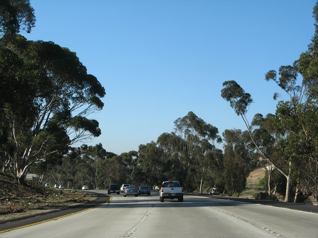
An Interstate 15 south reassurance shield is posted after the split from California 163. Photo taken 06/05/11. |
|
|
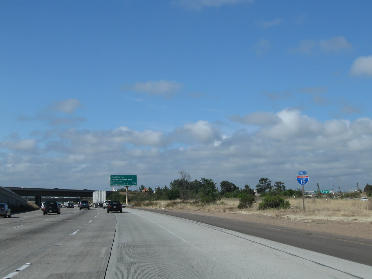
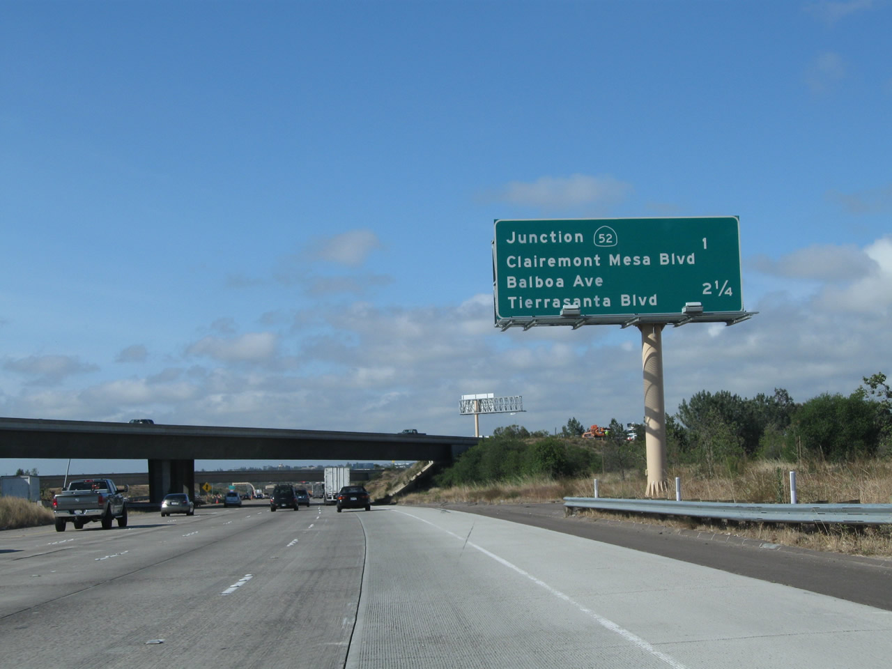
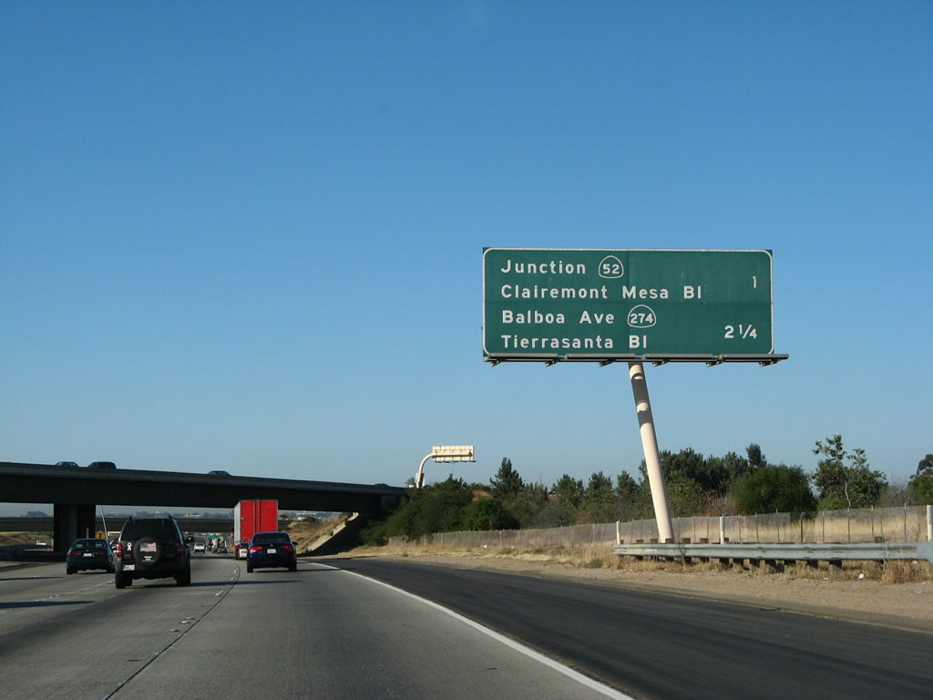
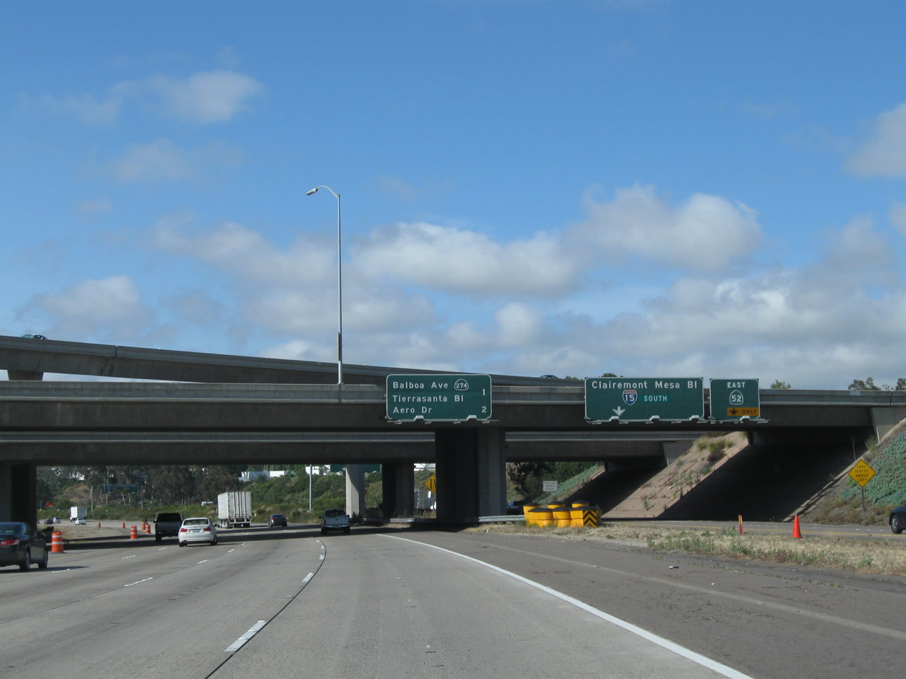
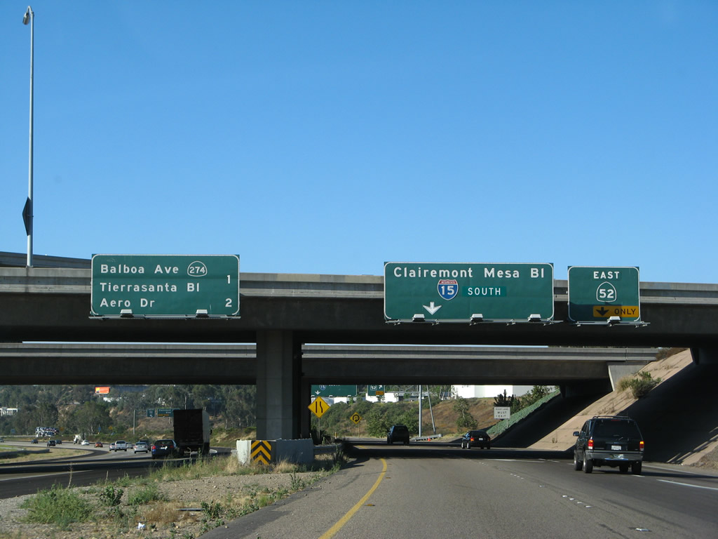
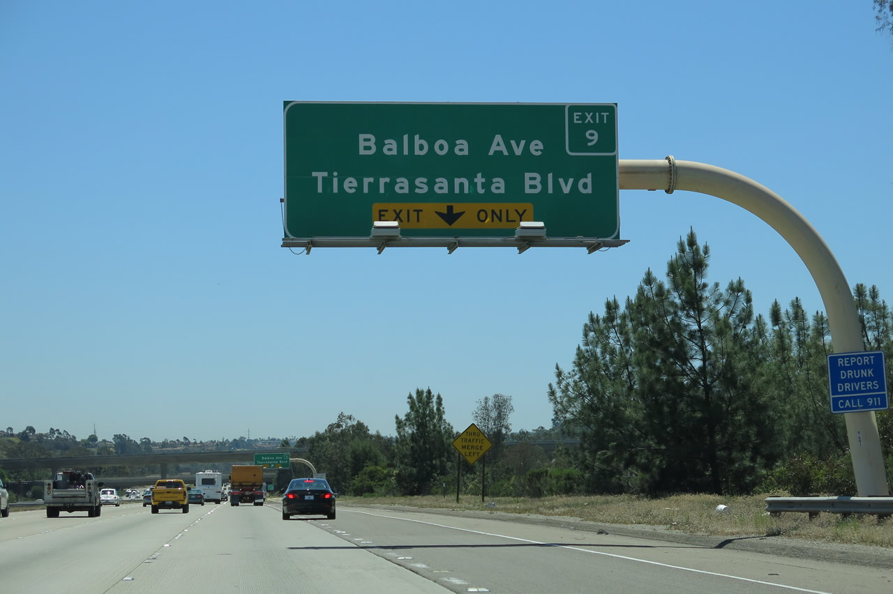
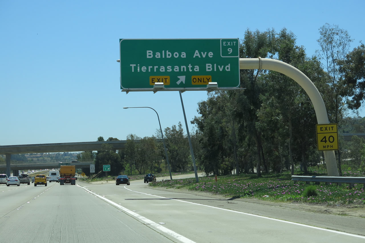
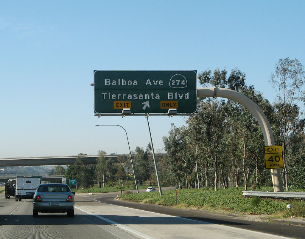
This interchange sequence sign provides the distance to the next two exits along southbound Interstate 15 (Escondido Freeway): Exit 11, California 52 and Clairemont Mesa Boulevard followed by Exit 9, Balboa Avenue/Tierrasanta Boulevard (former California 274). A replacement sign was placed here in 2010. Photos taken 06/05/11 and 06/23/08. |
|
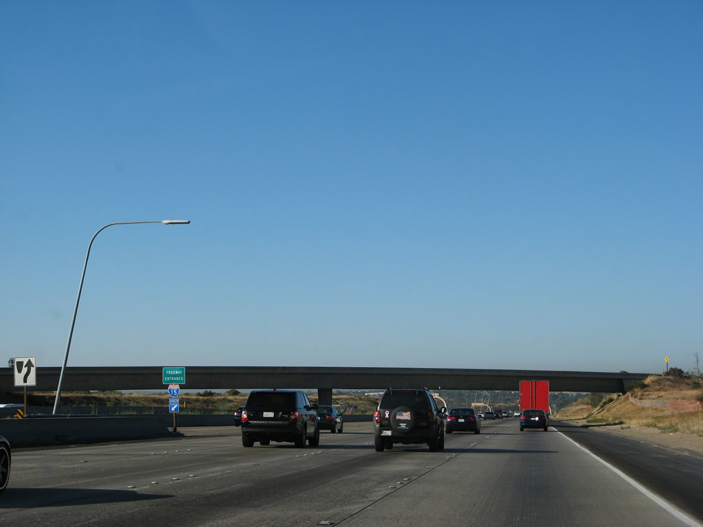
The two-lane HOT (high occupancy vehicle/toll) lanes merge back onto Interstate 15 south. This configuration will change by 2012 with the opening of the expanded Managed Lanes from California 56 south to California 163. Photo taken 06/23/08. |
|
|
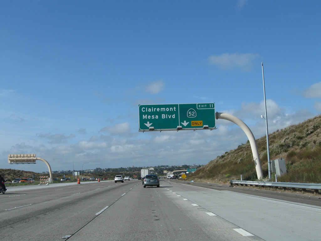
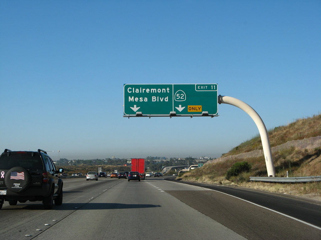
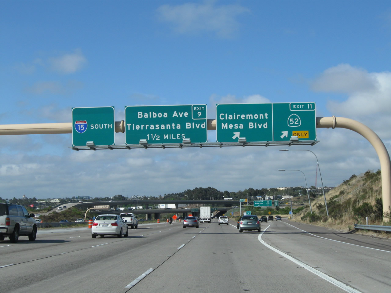
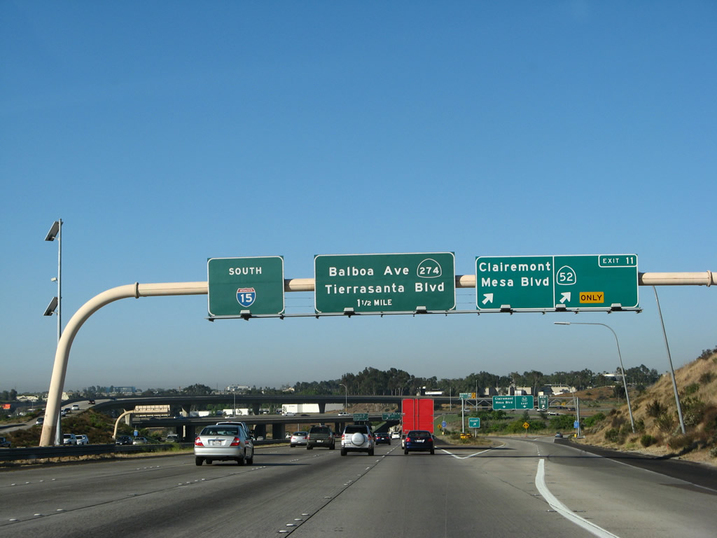
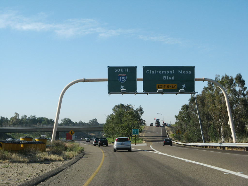
The right two lanes exit onto Exit 11, California 52 and Clairemont Mesa Boulevard, with the far right lane "exit only." Sometime between 2008 and 2011, this sign was modified so that the California 52 route marker was centered on the right panel of the overhead sign. Photos taken 06/05/11 and 06/23/08. |
|
|
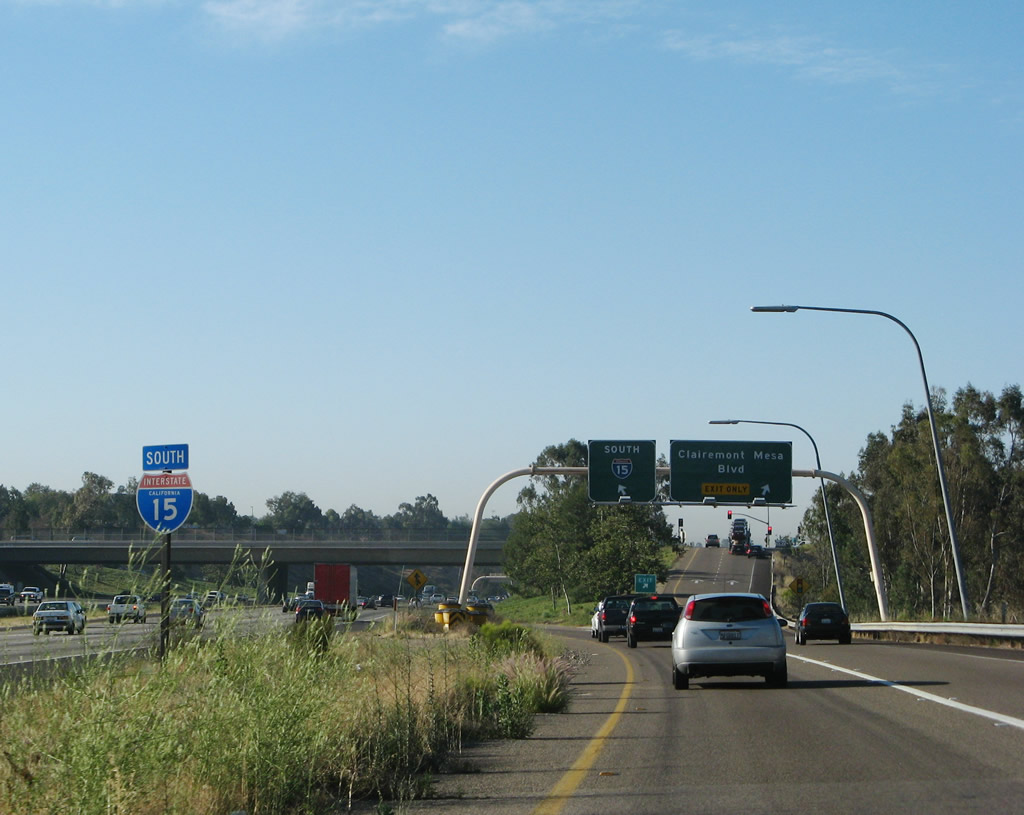
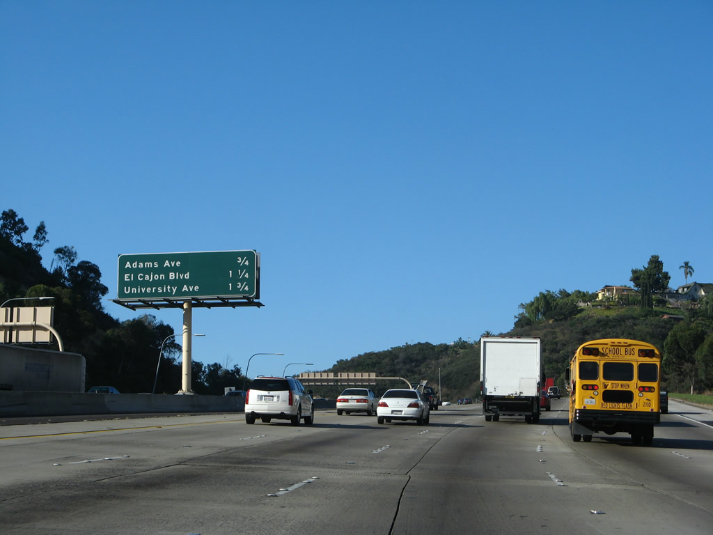
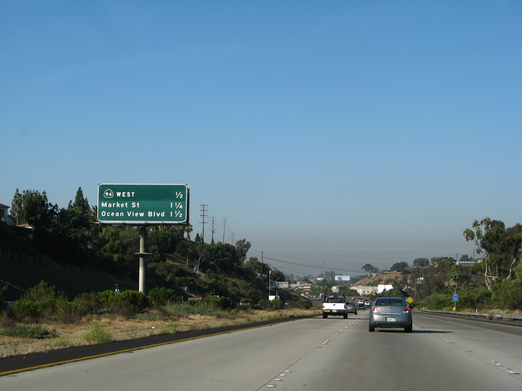
Southbound Interstate 15 meets Exit 11, California 52 (Soledad Freeway) east to Santee and west to La Jolla. In addition, this ramp connects to a collector distributor lane that connects to east-west Clairemont Mesa Boulevard. Clairemont Mesa Boulevard heads east into Tierrasanta and west through Kearny Mesa to Clairemont Mesa. The sign was replaced in 2010; note the removal of the California 274 sign on the Exit 9 overhead. Photos taken 06/05/11 and 06/23/08. |
|
|
Now on the collector distributor lane, motorists first meet the ramp onto westbound California 52, which passes between Kearny Mesa and the Miramar Marine Corps Air Station, past the Miramar Landfill, before entering the San Clemente Canyon en route to La Jolla. Photos taken 06/05/11 and 06/23/08. |
|
|
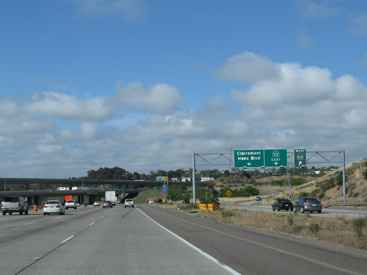
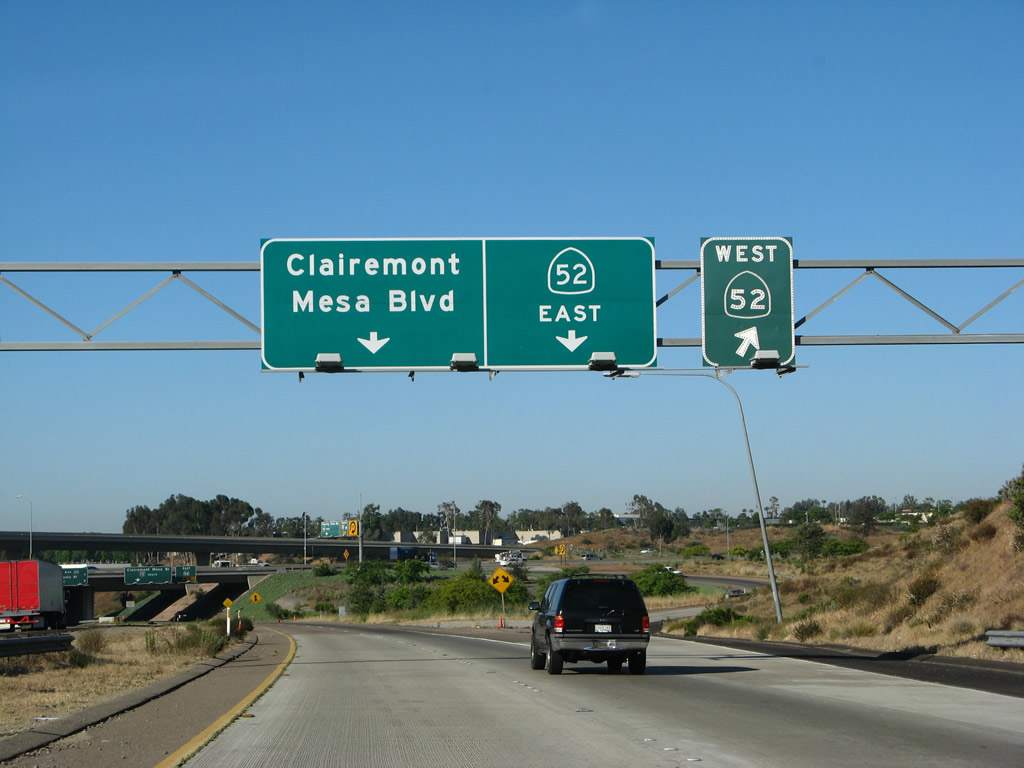
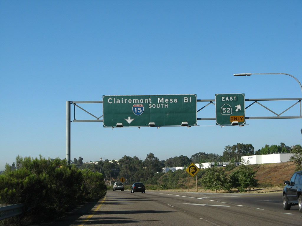
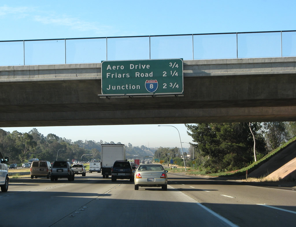
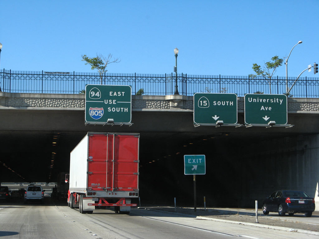
The next off-ramp on the c/d lanes is the transition from southbound Interstate 15 to eastbound California 52 to Tierrasanta Norte, Mission Trails, and the city of Santee. On the mailine, an interchange sequence sign mounted on the overpass for California 52 (Soledad Freeway) provides the distance to the next two exits: Exit 9, Balboa Avenue and Tierrasanta Boulevard and Exit 8, Aero Drive. Photos taken 06/05/11 and 06/23/08. |
|
Still on the collector distributor lane, this sign bridge points to the off-ramp to California 52 east. Continue south on the c/d lanes to return to Interstate 15 south or connect to Clairemont Mesa Boulevard. Photo taken 06/23/08. |
|
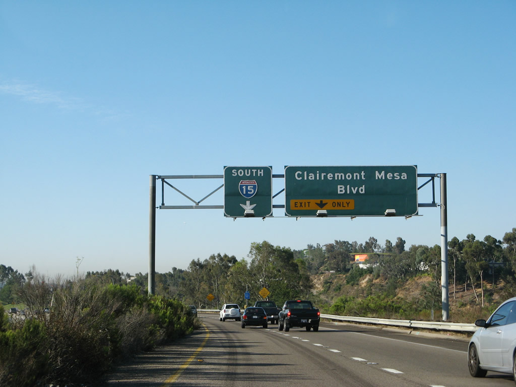
The collector distributor lane widens to two lanes as it approaches the exit to Clairemont Mesa Boulevard. Motorists may also return to Interstate 15 south via the left lane. Photo taken 06/23/08. |
|
An Interstate 15 south reassurance shield is posted after the California 52 overpass; the freeway is still split between main lanes and collector distributor lanes. Photo taken 06/23/08. |
|
On the collector distributor lane is the off-ramp to Clairemont Mesa Boulevard. After this ramp, the c/d lane returns to the Interstate 15 main lanes. Photo taken 06/23/08. |
|
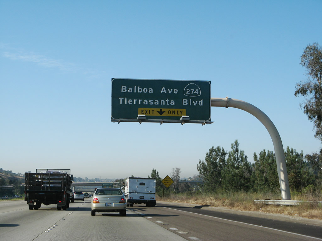
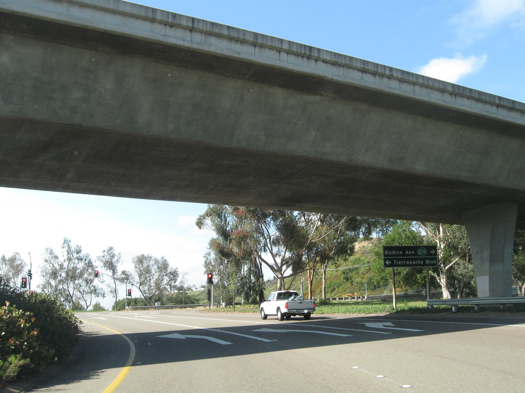
A sign at the end of the off-ramp points the way to Balboa Avenue west and Tierrasanta Boulevard east. The sign includes a California 274, indicating the sign predates the decommissioning of the state highway in 2001. Photo taken 06/05/11. |
|
Returning to the mainline, this flyover ramp connects Interstate 15 north with Balboa Avenue west. This ramp was partially funded by General Dynamics to handle the commuter traffic to their former aerospace facility. With the collapse of that industry in the early 1990s and General Dynamics eventual departure from the area, the ramp still remains. Photo taken 06/23/08. |
|
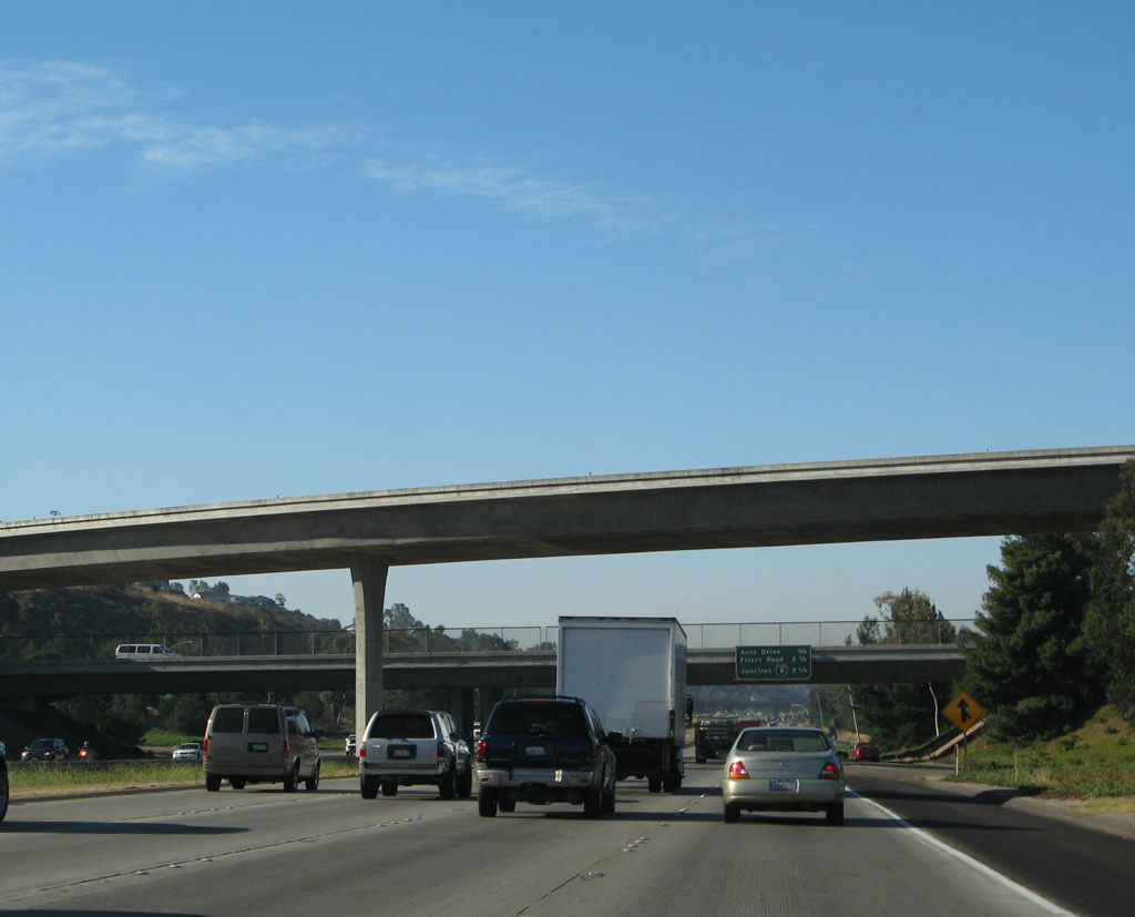
The next three exits along southbound Interstate 15 are Exit 8, Aero Drive; Exit 7, Friars Road; and Exit 6, Interstate 8 (with connections to Camino del Rio South, Fairmount Avenue, and Mission Gorge Road). Photo taken 06/23/08. |
|
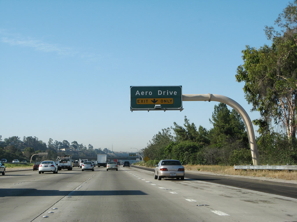
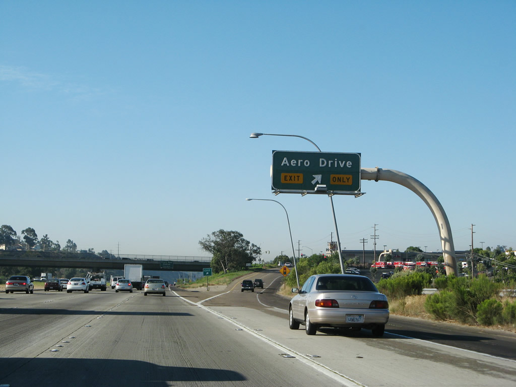
After the on-ramp from Balboa Avenue, the right lane of Interstate 15 south becomes exit only for Exit 8, Aero Drive. This exit leads to the Stonecrest Mall, which features a Wal-Mart and Fry's Electronics Store. Because of this strip mall, as well as a nearby housing development, traffic has become increasingly challenging in this area. Photo taken 06/23/08. |
|
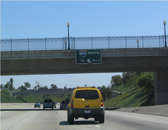
Southbound Interstate 15 reaches Exit 8, Aero Drive to Montgomery Field Municipal Airport. Aero Drive travels east over the hill to Mission Gorge Road and west toward the airport and the community of Serra Mesa. To the west, Aero Drive links to feeder roads to both California 163 and Interstate 805. Use Aero Drive west to Murphy Canyon Road south to reach Stonecrest Mall. Photo taken 06/23/08. |
|
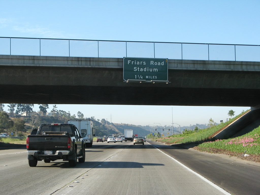
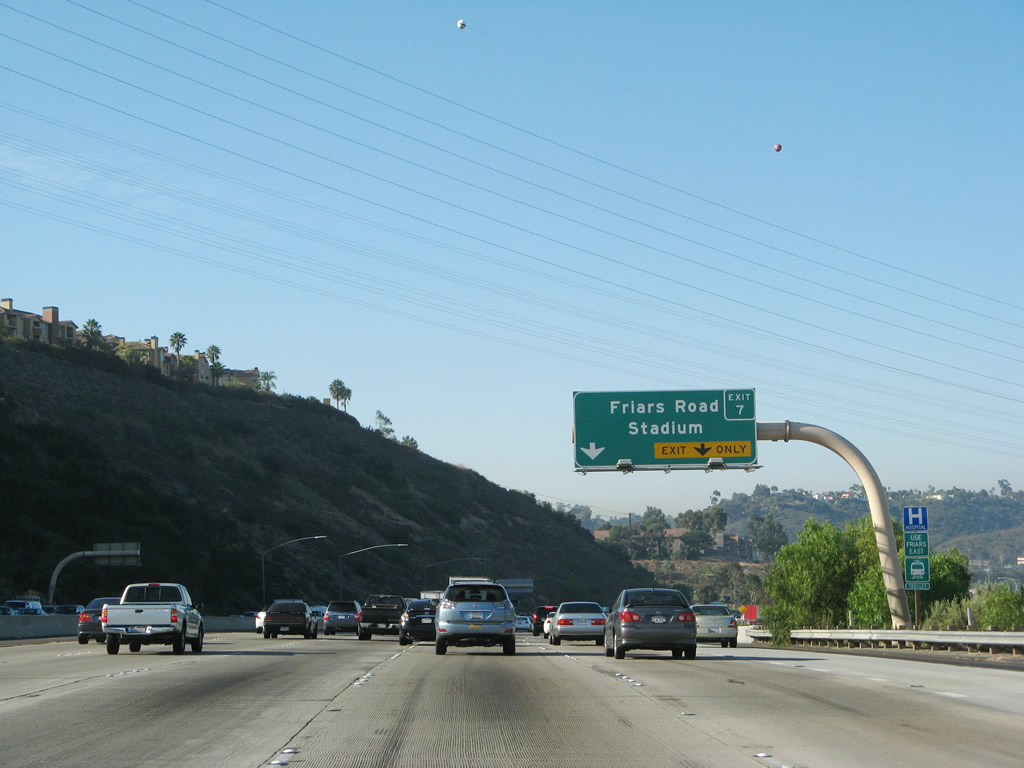
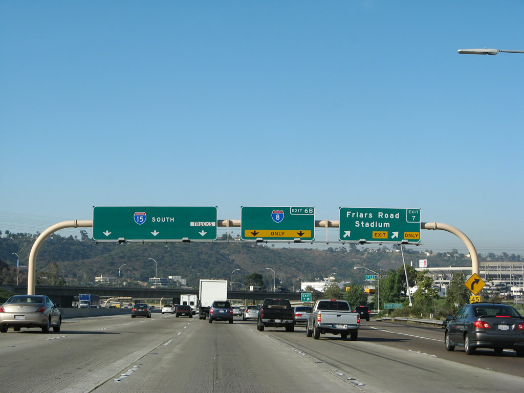
The next exit along southbound Interstate 15 is Exit 7, Friars Road. The auxiliary lane here came from Murphy Canyon Road, which is former California 103. This particular ramp was placed as mitigation for people leaving the shopping areas at Stonecrest (Wal-Mart, Fry's Electronics, Vons Grocery, and several smaller shops). There is no corresponding off-ramp from northbound Interstate 15. Photo taken 06/23/08. |
|
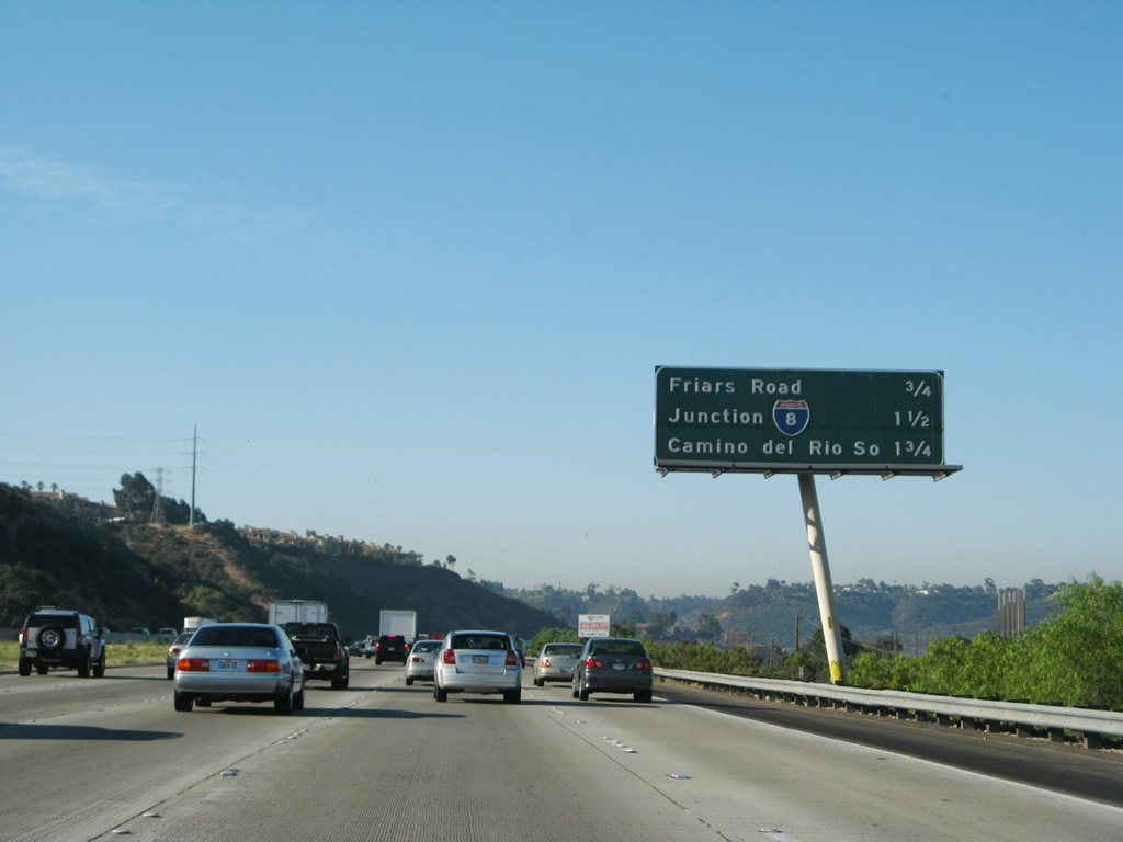
This mileage sign provides the distance to the next two exits along southbound Interstate 15: Exit 7, Friars Road and Exit 6B, Interstate 8 west/Camino del Rio South and Interstate 8 east. Photo taken 06/23/08. |
|
Friars Road is the most direct route from Interstate 15 to Qualcomm Stadium, home of the San Diego Chargers National Football League team and the San Diego State University Aztecs football team. The stadium used to be used for the San Diego Padres Major League Baseball team, but the Padres have since relocated to its own ballpark (Petco Park) in downtown San Diego, and its first game took place in April 2004. Photo taken 06/23/08. |
|
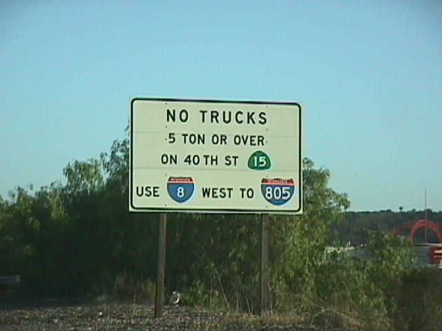
Prior to the completion of the 40th Street Freeway, signs such as this one warned truck traffic to use Interstate 8 and Interstate 805 to avoid the Mid-City area, since it was frequently congested. This sign, located on southbound Interstate 15 approaching Interstate 8, was removed by 2001. Photo taken 06/22/99. |
|
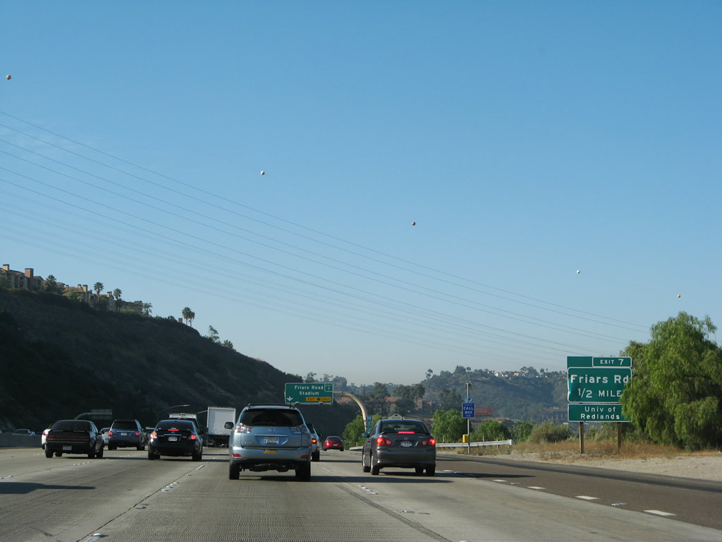
The right two lanes prepare to depart to Friars Road at Exit 7. Watch for heavy traffic during stadium events. To the west, Friars Road travels through Mission Valley and provides direct access to most shopping centers and residential areas. Use Friars Road east to the San Diego Mission and to Mission Gorge Road en route to Mission Trails Regional Park. Photo taken 06/23/08. |
|
Southbound Interstate 15 (Escondido Freeway) reaches Exit 7, Friars Road. The next exit along southbound is Exti 6B, Interstate 8/Mission Valley (Alvarado) Freeway east to El Centro and west through Mission Valley to beach areas. Photo taken 06/23/08. |
|
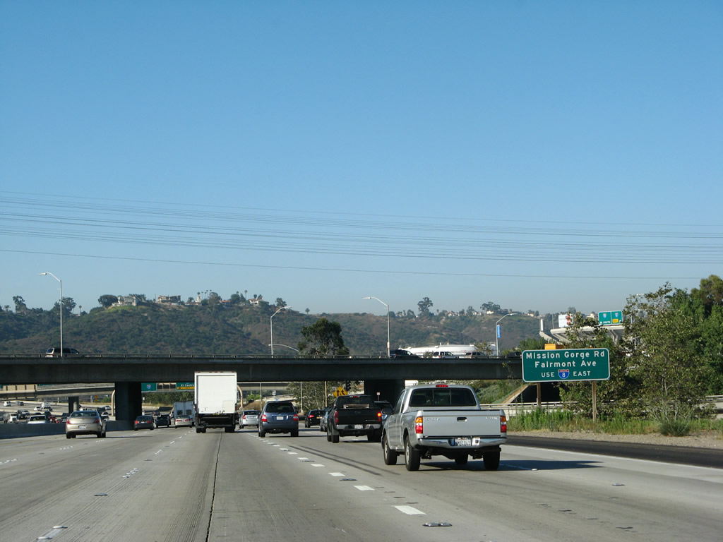
The next exit along southbound Interstate 15 is Exit 6B, Interstate 8. This auxiliary sign indicates that Mission Gorge Road and Fairmount Avenue may be accessed by using the Interstate 8 east transition ramp. Photo taken 06/23/08. |
|
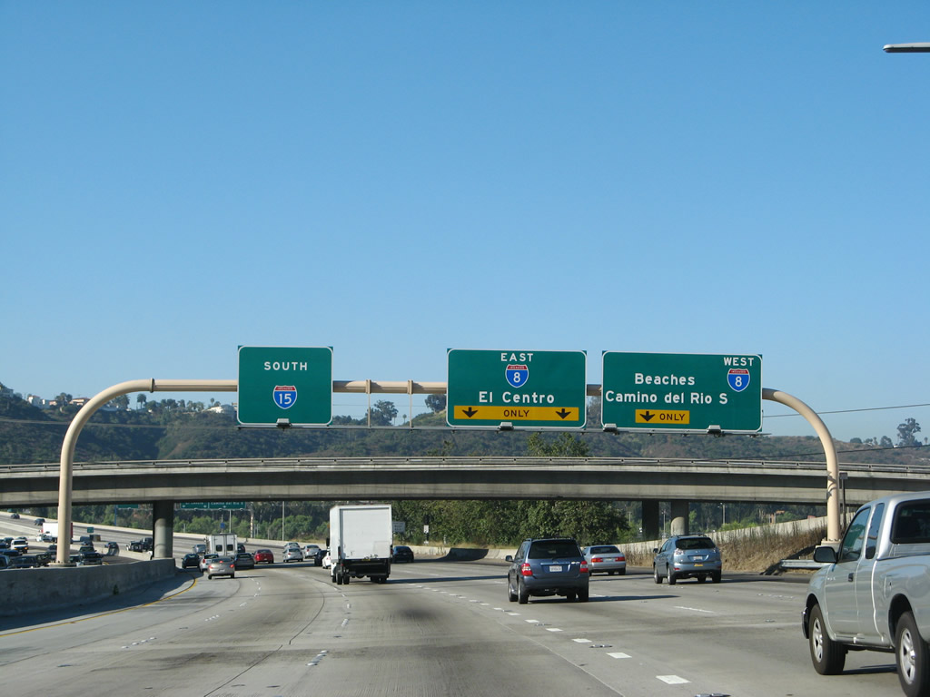
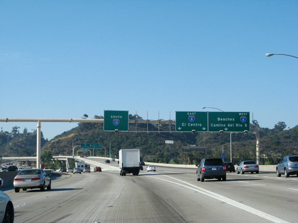
Southbound Interstate 15 approaches Exit 6B, Interstate 8. The right three lanes are all exit only for Interstate 8 (a reconstruction project added an extra lane for the transition to Interstate 8 east in 2006). Note that the pull-through sign refers to this route as Interstate 15, even though it changes to California 15 immediately after the interchange. Photo taken 06/23/08. |
|
Southbound Interstate 15 reaches Exit 6B, Interstate 8/Mission Valley (Alvarado) Freeway. Use Interstate 8 east to reach San Diego State University, La Mesa, El Cajon, and the Laguna Mountains. Use Interstate 8 west to reach Interstate 805, Interstate 5, Mission Bay, and Ocean Beach. Photo taken 06/23/08. |
|
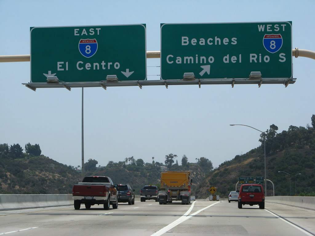
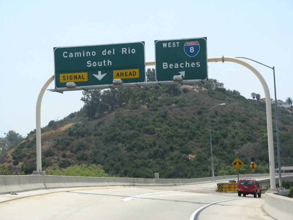
Now on the transition ramp from Interstate 15 south to Interstate 8, the left two lanes carry motorists to Interstate 8 east, while the right lane connects to Interstate 8 west and Camino del Rio South (which is the south frontage road for Interstate 8). Photo taken 06/23/08. |
|
Another sign bridge is posted for the ramp split between Camino del Rio South and Interstate 8/Mission Valley (Alvarado) Freeway west. Photo taken 06/23/08. |
|
Back on the mainline, as southbound Interstate 15 crosses over Interstate 8, the freeway changes into California 15 (even though there are no end shields or any state California 15 reassurance shields). Photo taken 06/23/08. |
| California 15 (Escondido Freeway) south |
|
Two lanes merge onto California 15 south as the freeway passes through the Interstate 8 interchange. Photo taken 06/23/08. |
|
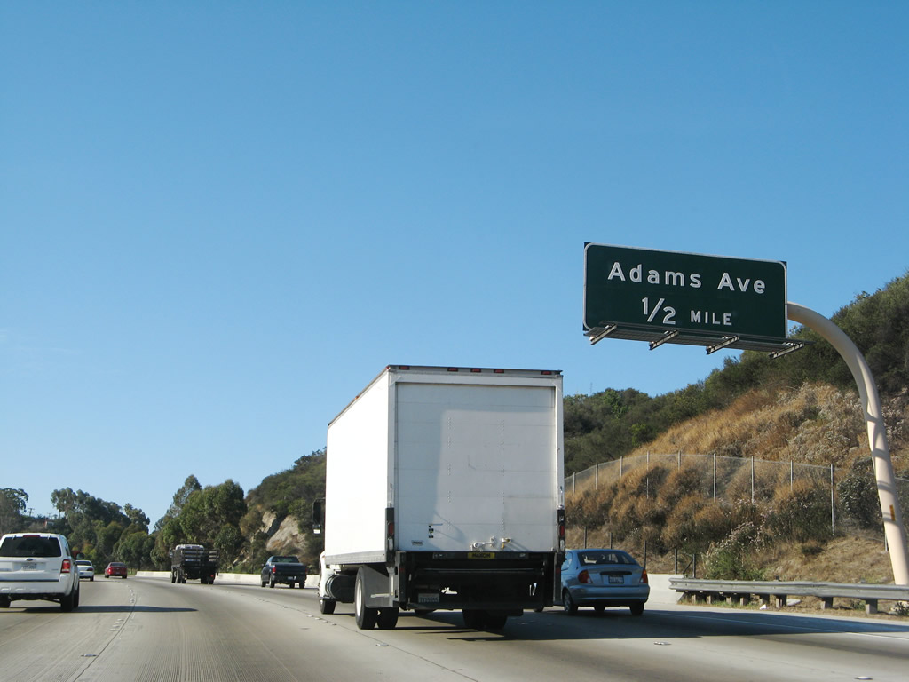
The next three exits along southbound California 15 are Exit 6A, Adams Avenue; Exit 5B, El Cajon Boulevard; and Exit 5A, University Avenue. Photo taken 06/23/08. |
|
As California 15 ascends into the San Diego neighborhood of City Heights, use the right lane to access Exit 6A, Adams Avenue. Photo taken 06/23/08. |
|
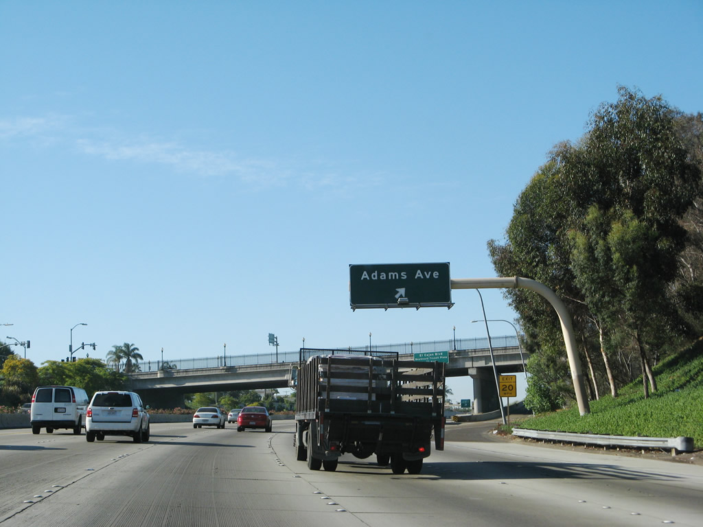
Adams Avenue is an east-west city street that passes through Talmadge, Kensington, North Park, and University Heights. Photo taken 06/23/08. |
|
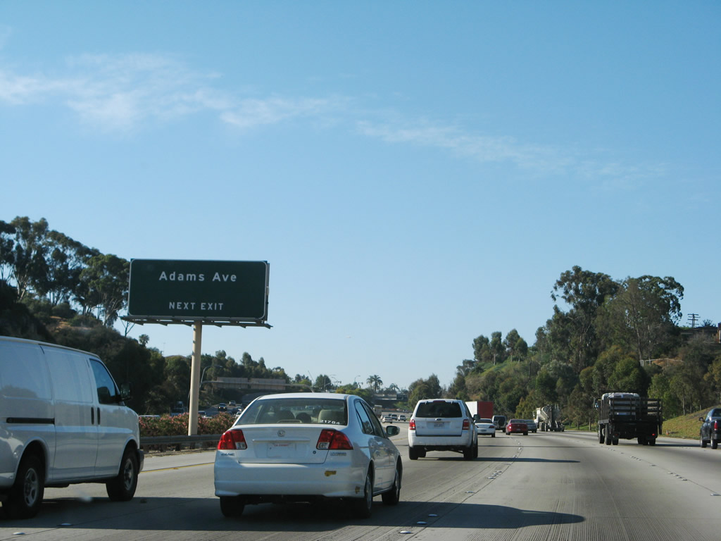
Southbound California 15 reaches Exit 6A, Adams Avenue. This freeway opened in its entirety in December 2001. Photo taken 06/23/08. |
|
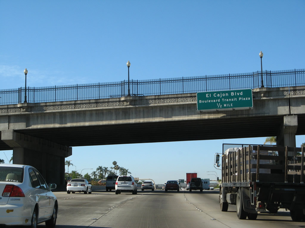
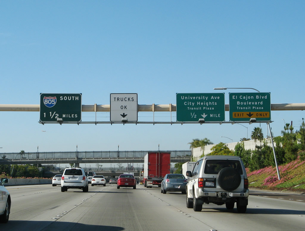
The next exit along southbound is Exit 5B, Business Loop I-8 (El Cajon Boulevard), followed by Exit 5A, University Avenue. The Boulevard Transit Plaza is located near the El Cajon Boulevard bridge deck over California 15. Alternative fuels are available at this interchange at Pearson Ford (just east of the freeway interchange). Photo taken 06/23/08. |
|
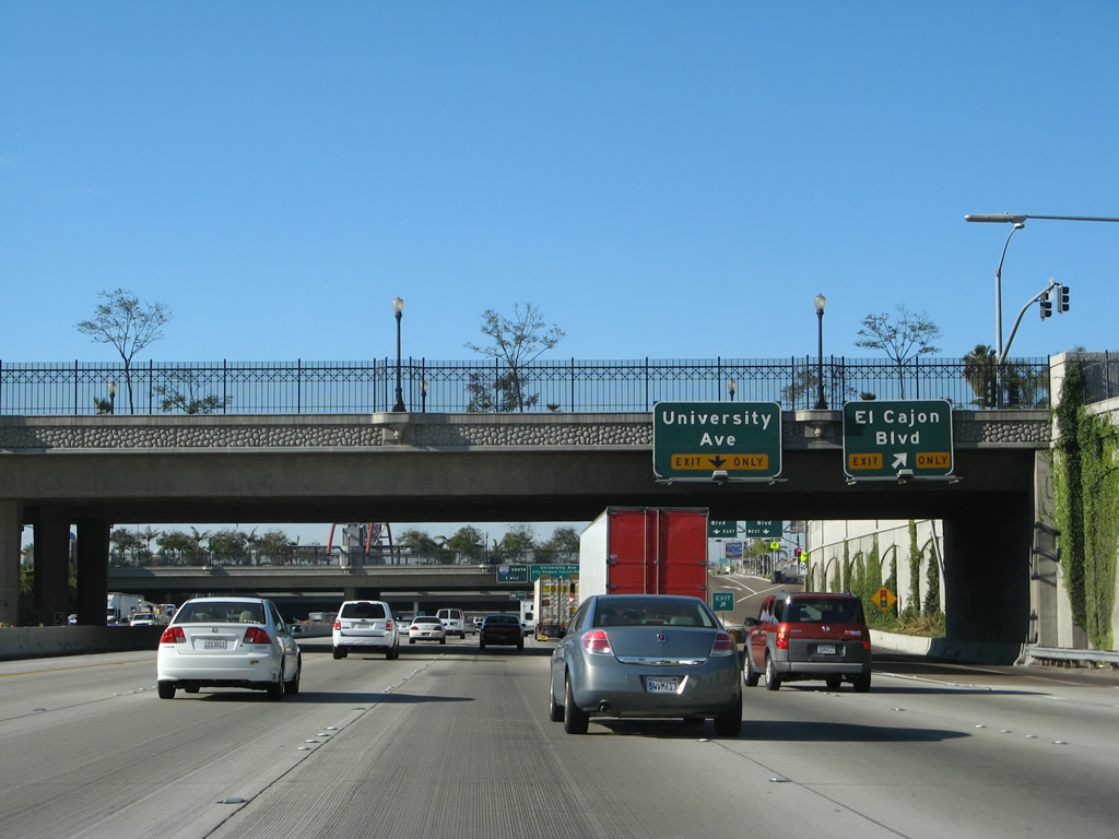
Southbound California 15 approaches Exit 5B, Business Loop I-8 (El Cajon Boulevard) (Historic U.S. 80). Until 2002, Business Loop I-8 was signed sporadically through City Heights and Mid-City. However, the old, faded business loop shields that used to grace El Cajon Boulevard were all removed in most parts of the city of San Diego; the loop is not signed at all in La Mesa. In effect, this business route has been decommissioned, even though maps generally still show it and some freeway signs still mention it. Photo taken 06/23/08. |
|
Pedestrian bridges such as this cross the below-grade section of California 15 to ensure continuity and connection between the neighborhoods of City Heights. Photo taken 06/23/08. |
|
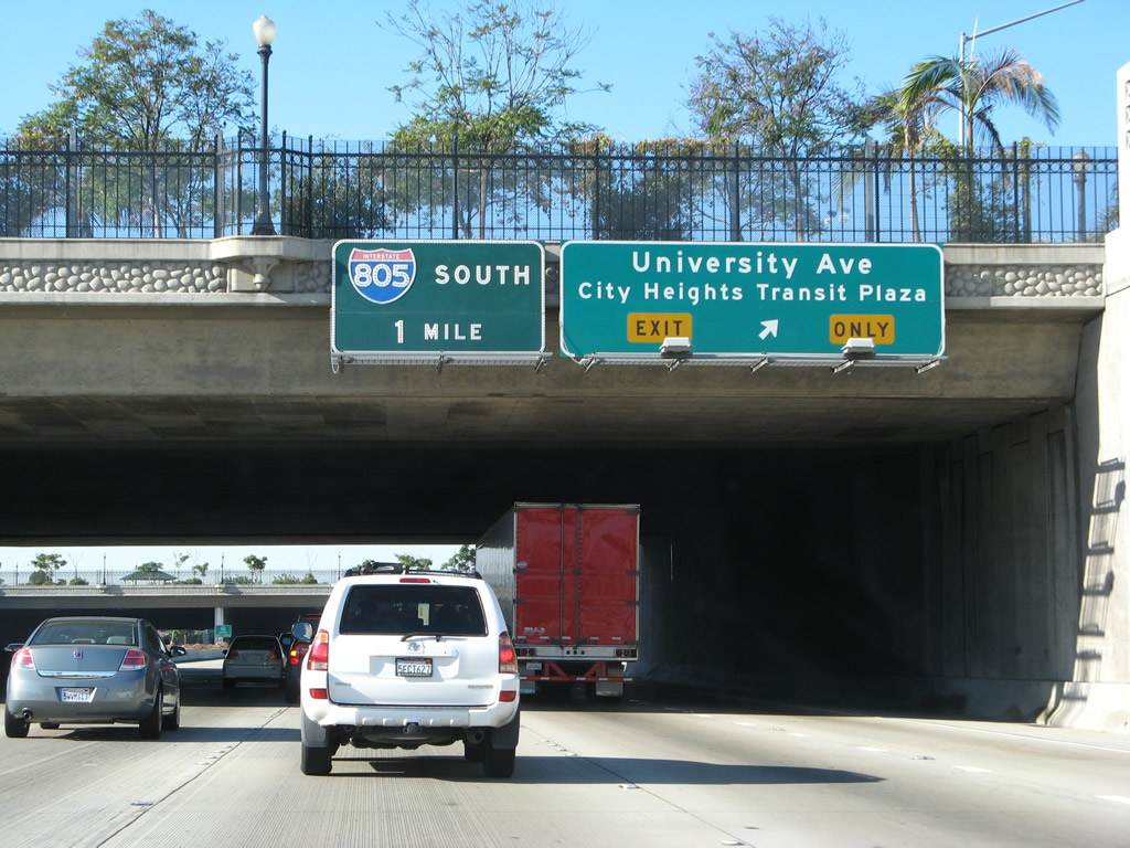
Southbound California 15 (Escondido Freeway) reaches Exit 5B, Business Loop I-8 (El Cajon Boulevard) (Historic U.S. 80). The next exit is Exit 5A, University Avenue. Despite its name, University Avenue does not directly serve any local university, although it does come close to San Diego State University. It was so named because it used to connect with a teaching college that eventually relocated to the site of San Diego State University on Montezuma Mesa (at the junction of Interstate 8 and College Avenue). Photo taken 06/23/08. |
|
Immediately thereafter, southbound California 15 reaches Exit 5A, University Avenue (collector distributor lanes). The City Heights Transit Plaza was added to the California 15 corridor to enhance its multimodal utility for motorists and users of transit. Photo taken 06/23/08. |
|
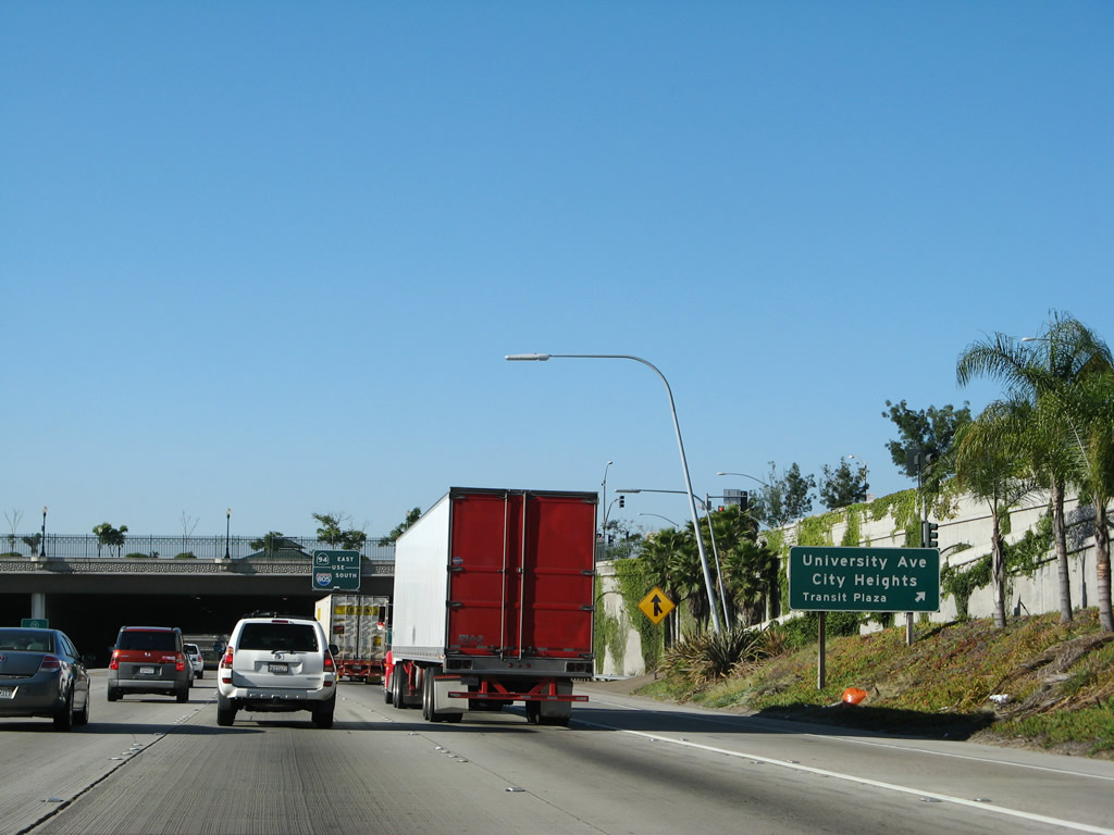
A roadside exit sign for Exit 5A is posted after the El Cajon Boulevard overpass for University Avenue. This exit serves University Avenue, which is a major east-west corridor that connects the city of La Mesa, the neighborhoods of Rolando, Darnall, and City Heights with North Park, Hillcrest, and Mission Hills. Photo taken 06/23/08. |
|
The left four lanes continue as southbound California 15, while the two right lanes are separated into a collector distributor lane as the freeway passes under a cut and cover tunnel. California 15 was intended to have two city blocks of cut and cover tunnel, but there was only funding enough for one city block of tunnel, which is what lies ahead. Photo taken 06/23/08. |
|
California 15 prepares to pass under University Avenue. The transit plaza is visible on top of the bridge. Photo taken 06/23/08. |
|
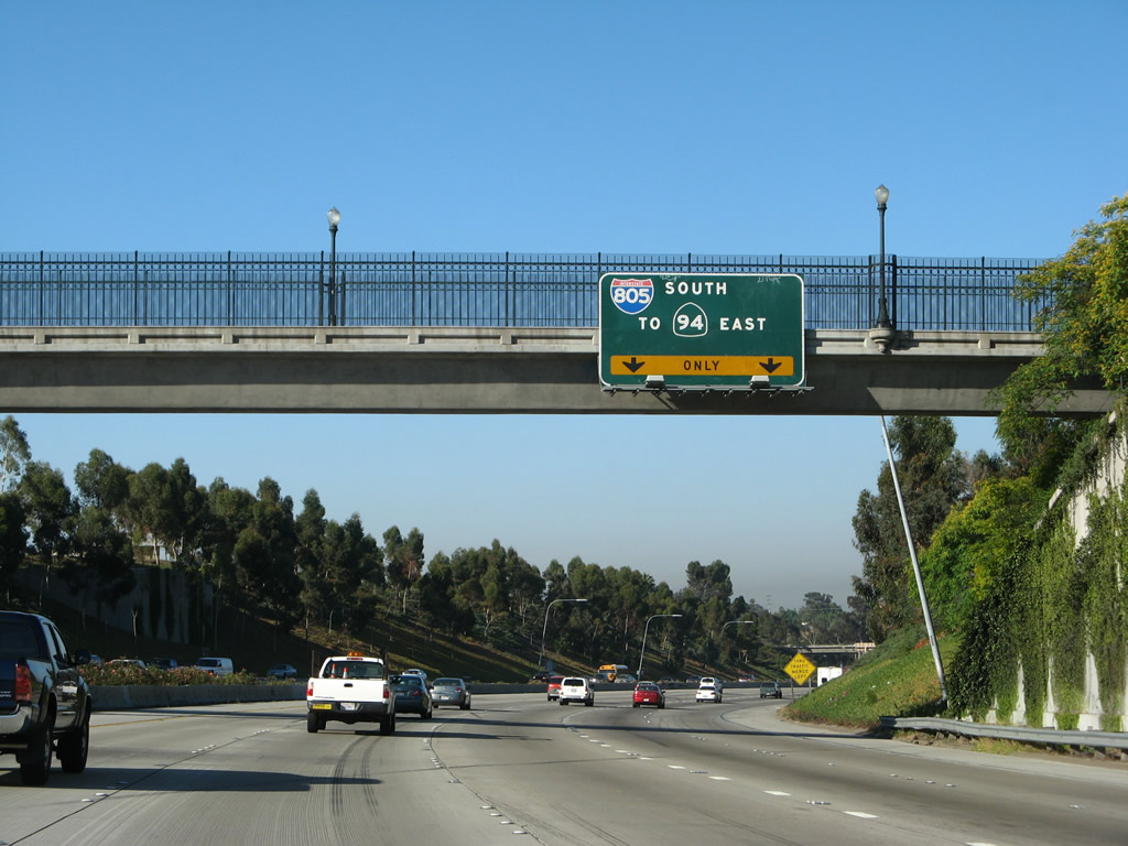
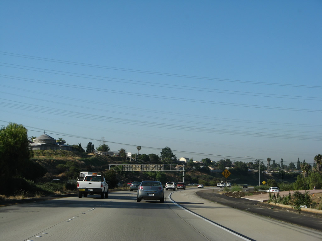
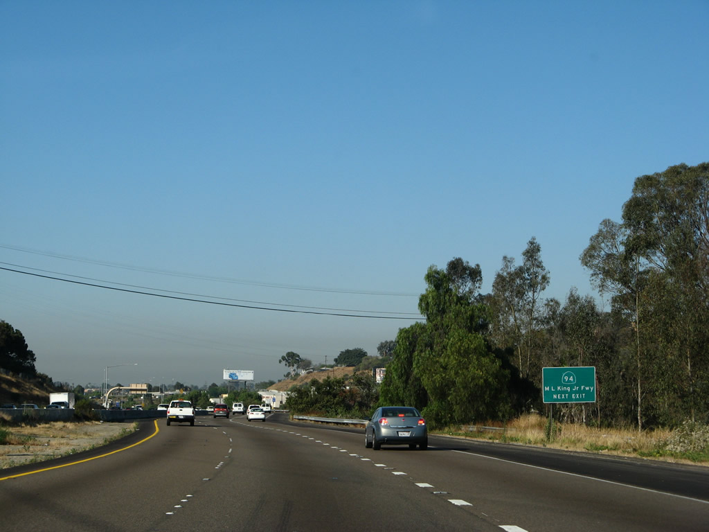
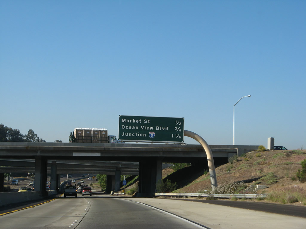
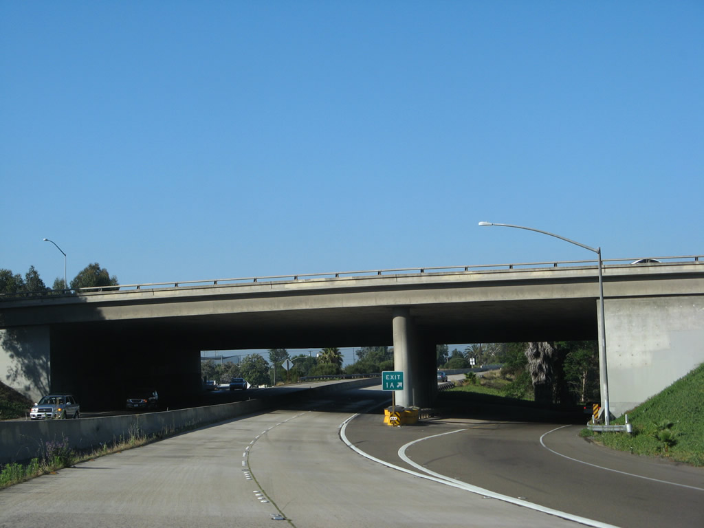
The next exit along California 15 south is Exit 3, Interstate 805 south and California 94 (Martin Luther King Jr. Freeway) east (one-half mile). Photo taken 08/08/04. |
|
Exit 3 only provides for a transition from southbound California 15 to southbound Interstate 805; there is no access to northbound Interstate 805. Additionally, there is no direct exit to eastbound California 94, so traffic looking for eastbound California 94 must taken Interstate 805 south. Photo taken 06/23/08. |
|
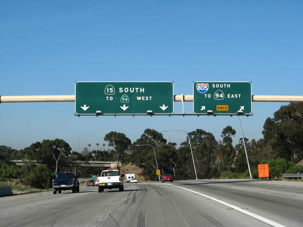
Southbound California 15 reaches Exit 3, Interstate 805 south and California 94 east. Note the use of a regular California 94 shield on the left panel of this sign assembly. Photo taken 06/23/08. |
|
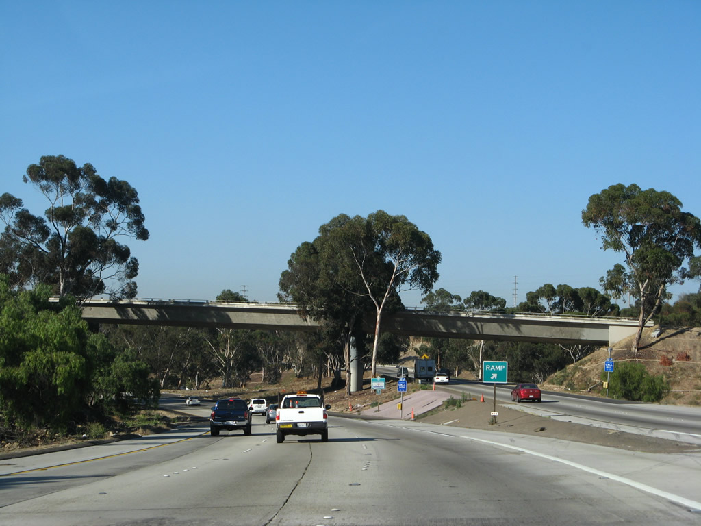
A "ramp" gore point sign is used to split the traffic. At this point, California 15 reduces to three southbound lanes. Photo taken 06/23/08. |
|
After Interstate 805 traffic peels off southbound California 15, the freeway narrows to three lanes along southbound. Although it cannot be seen from this picture, Interstate 805 rides very closely to California 15 for about a quarter of a mile. Photo taken 06/23/08. |
|
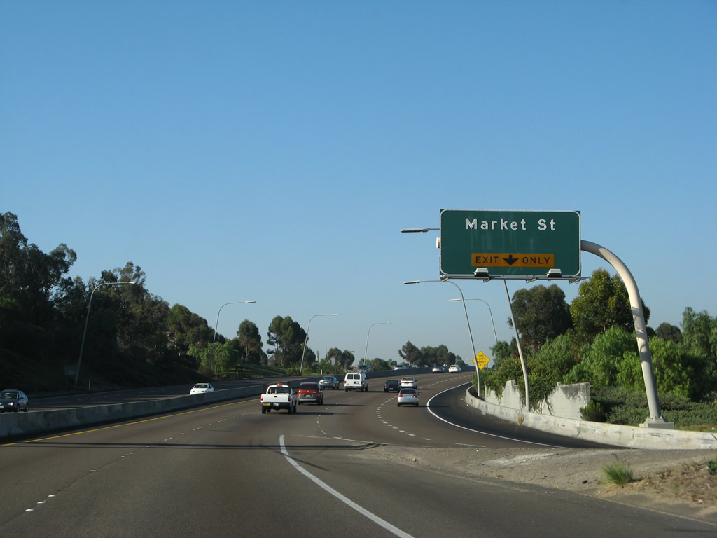
The final four exits along southbound are: Exit 2B, California 94 west; Exit 2A, Market Street; Exit 1B, Ocean View Boulevard; and Exits 1B-A, Interstate 5 (Montgomery Freeway). After Exits 1B-A, mainline traffic is directed to 32nd Street. At this point, California 15 south narrows to only two lanes and passes under the Interstate 805 mainline. Photo taken 06/23/08. |
|
A new lane merges onto California 15 south from oncoming traffic from Interstate 805 south. Photo taken 06/23/08. |
| California 15/Escondido (Archie Moore Memorial) Freeway south |
|
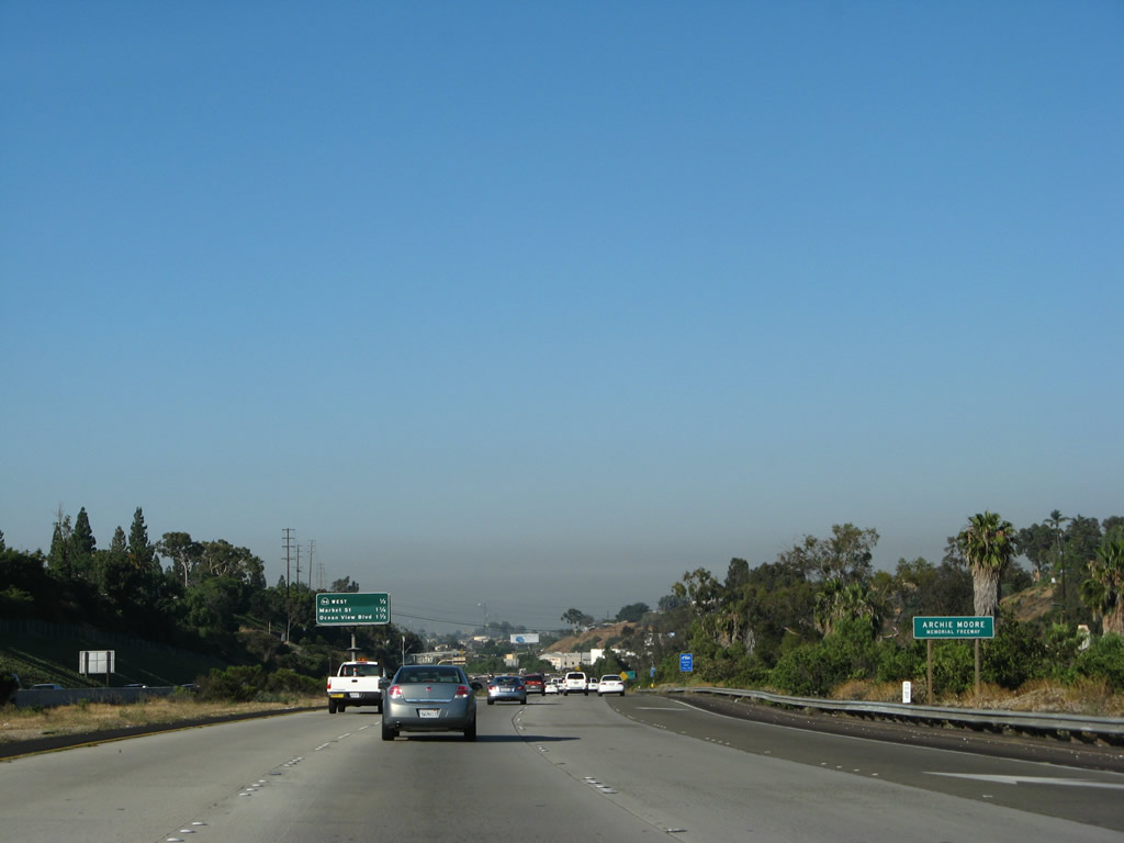
The final two miles of California 15 is designated as the Archie Moore Memorial Freeway in honor of the boxer. Photo taken 06/23/08. |
|
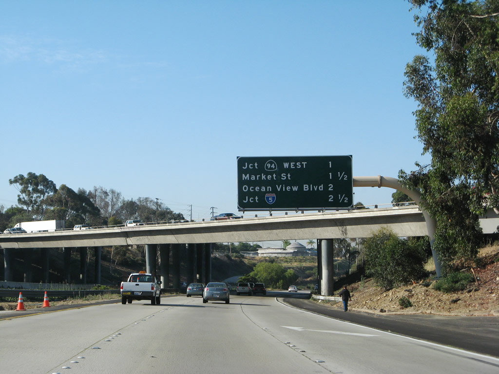
Following the previous exit mileage sign is another one, this time only listing the next three exits: Exit 2B, California 94 west; Exit 2A, Market Street; and Exit 1C, Ocean View Boulevard. Photo taken 06/23/08. |
|
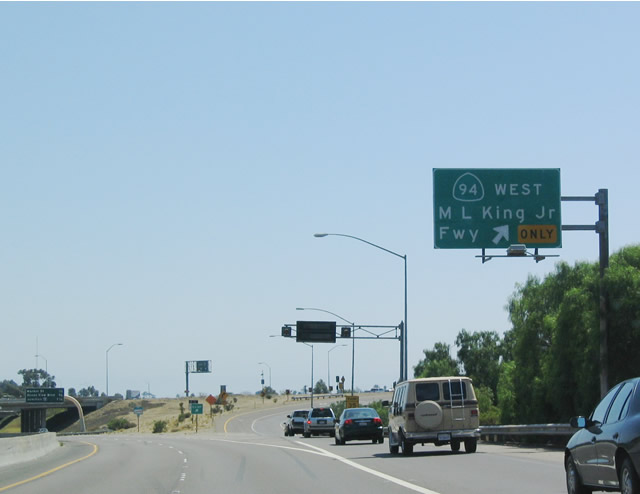
Some of the first reflective signs placed in San Diego County were the advance signs placed for California 94 when the city of San Diego paid to have Caltrans sign the freeway in memory of Dr. Martin Luther King, Jr. This roadside sign in advance of Exit 2B is one such sign. An exit number would be nice, and an EXIT ONLY marker seems appropriate since the right lane exits only to California 94 (Martin Luther King, Jr. Freeway) west. Photo taken 06/23/08. |
|
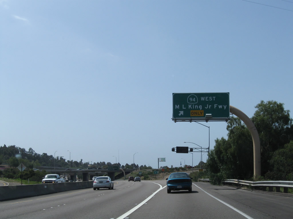
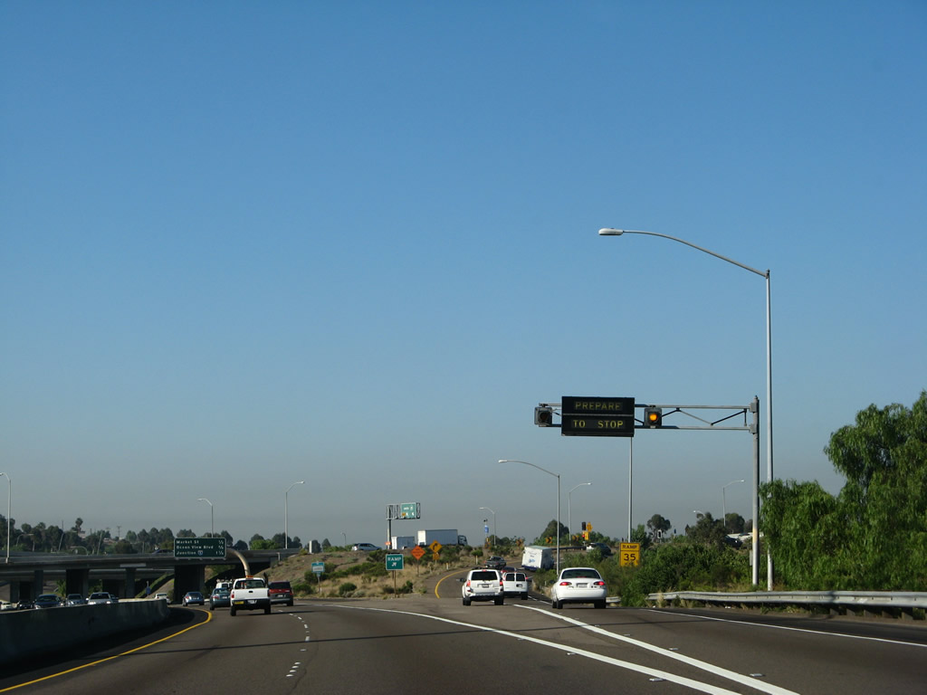
Meter lights were activated for the freeway-to-freeway ramp connecting California 15 south to California 94 west at the time this photo was taken (morning commuting hours). Photo taken 06/23/08. |
|
As the California 15 southbound passes under the substandard California 94 interchange, this mileage sign provides the distance to the final three exits along southbound: Exit 2A, Market Street; Exit 1C, Ocean View Boulevard; and Exits 1B-A, Interstate 5 (Montgomery Freeway). Photo taken 06/23/08. |
|
California 15 only carries two lanes in each direction as the freeway passes through the California 94 interchange. This interchange would need to be upgraded to current Interstate standards. Photo taken 06/23/08. |
|
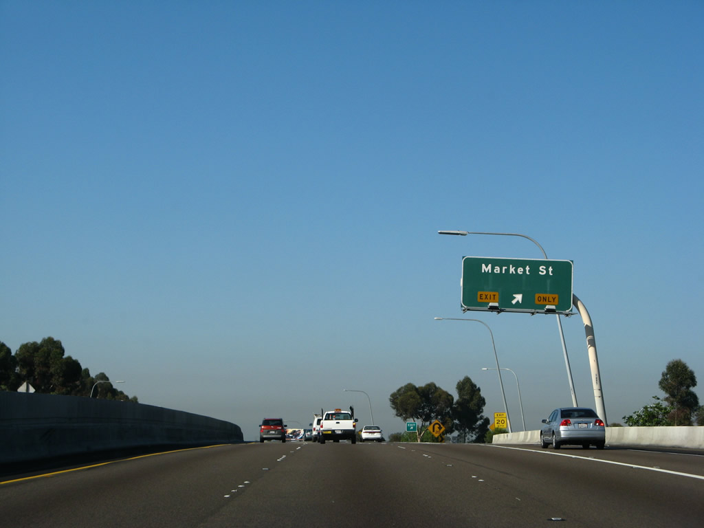
Two new lanes merge onto southbound, and the first exit to found is Exit 2A, Market Street. Through traffic should remain in the left lanes for now. Photo taken 06/23/08. |
|
Southbound California 15 reaches Exit 2A, Market Street. A former exit to Imperial Avenue was removed in the late 1990s and early 2000s to help bring this segment of freeway up to Interstate standards. Photo taken 06/23/08. |
|
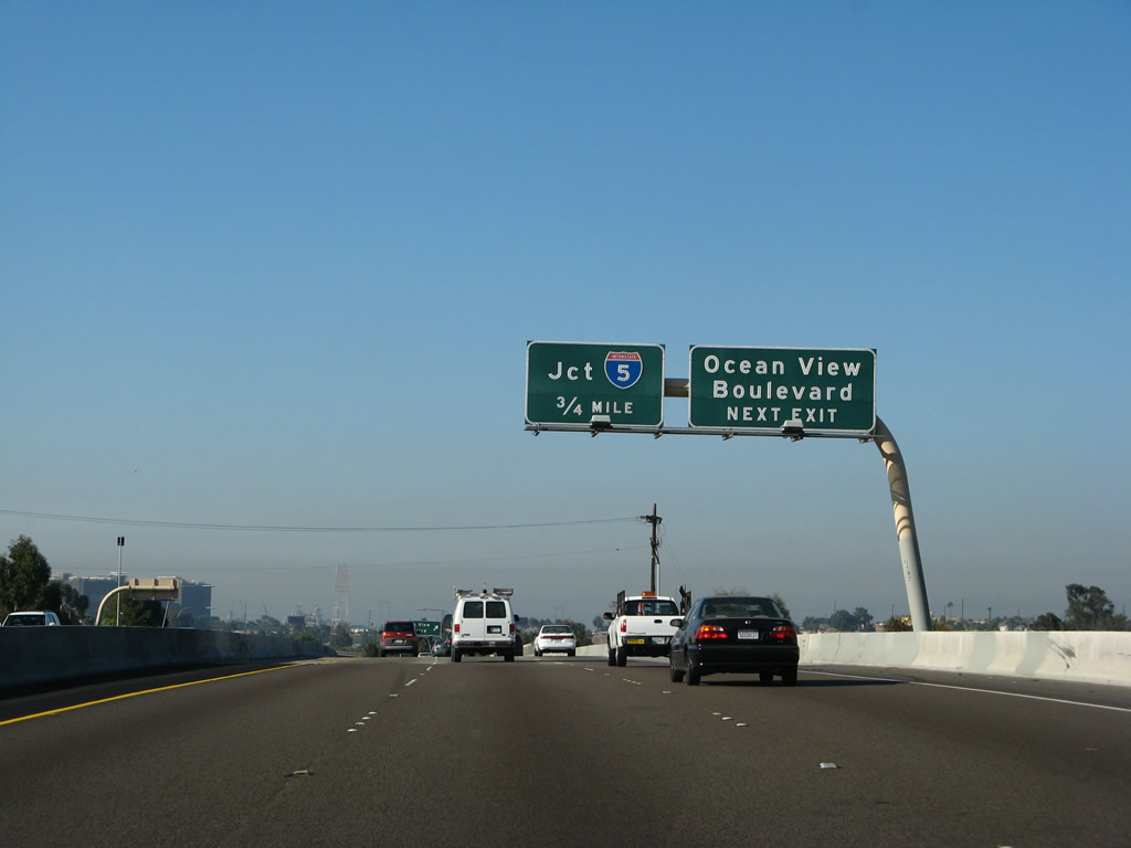
The next exit along southbound is Exit 1C, Ocean View Boulevard. The rest of the freeway prepares for the interchange with Interstate 5 north to downtown and Coronado and south to Mexico. Photo taken 06/23/08. |
|
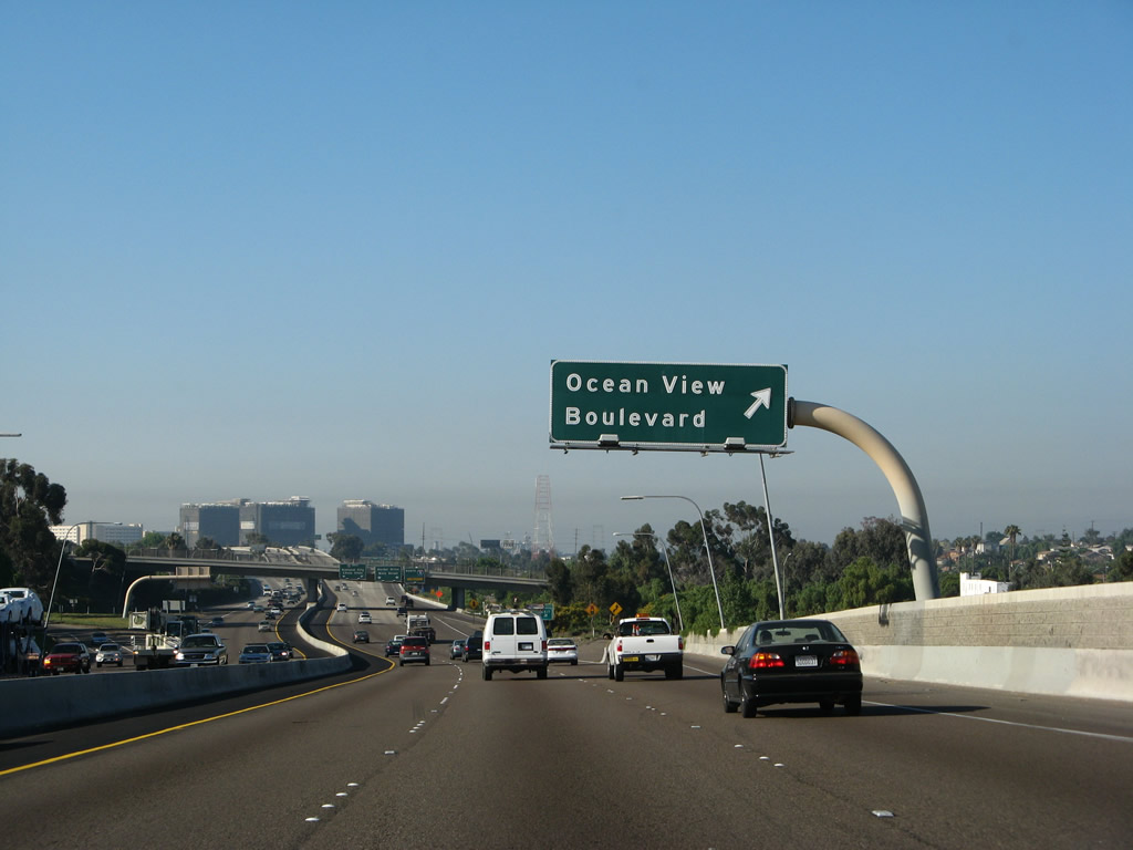
Southbound California 15 reaches Exit 1C, Ocean View Boulevard. Unlike most of Interstate 15 in San Diego, the section south of Interstate 805 is mostly asphalt and varies between two and four lanes in each direction. The end of the freeway is visible in the distance. Photo taken 06/23/08. |
|
After the Ocean View Boulevard interchange, California 15 approaches its final interchange, Exits 1B-A, Interstate 5 (Montgomery Freeway). As part of this interchange, one of the ramps continues south as Wabash Boulevard to meet 32nd Street and Harbor Drive with a direct connection to the 32nd Street Naval Station. Photo taken 06/23/08. |
|
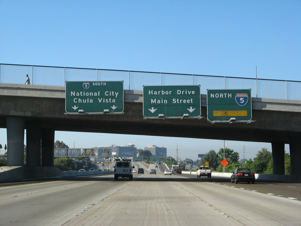
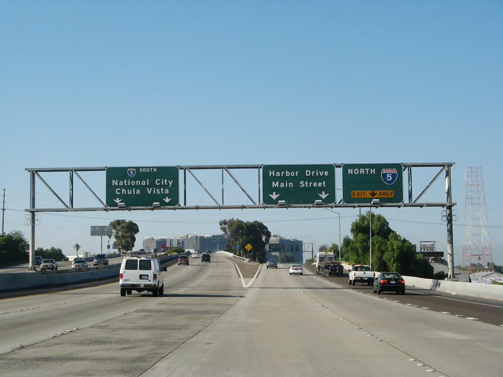
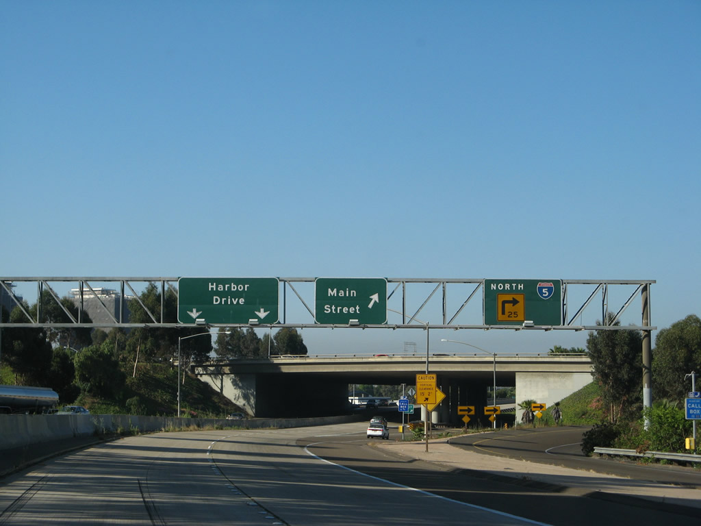
Southbound California 15 approaches Exit 1, Interstate 5 (Montgomery Freeway). The freeway continues south of the Interstate for as city-maintained Wabash Boulevard, which ends at 32nd Street near Harbor Drive. Although there is no end shield present, there used to be a northbound Interstate 15 shield along northbound Wabash Boulevard where the limited access segment begins until early 2004. Use the left lanes for southbound Interstate 5 and right lanes for northbound Interstate 5. The middle lanes continue to the Main Street off-ramp, 32nd Street, and Harbor Drive. Photo taken 06/23/08. |
|
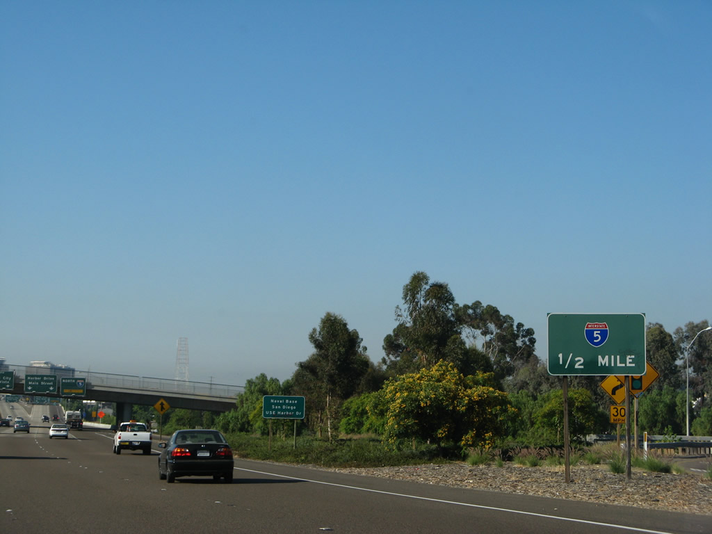
California 15 more or less comes to its end here, as the left lanes angle toward Exit 1B, southbound Interstate 5 to National City, Chula Vista, San Ysidro, and Tijuana (Mexico) and the right lanes exit to Exit 1A for north Interstate 5 to downtown, Main Street, and Harbor Drive. However, a freeway "spur" extends through this interchnge to connect to Harbor Drive. Photo taken 06/23/08. |
|
Now on the transition ramp for Exit 1A, the ramp splits into northbound Interstate 5, a loop ramp to Main Street, and Wabash Boulevard south to 32nd Street and Harbor Drive. Photo taken 06/23/08. |
|
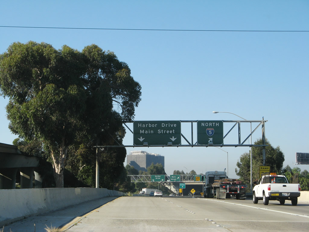
Use the left two lanes for Wabash Boulevard south, the middle lane for Main Street, and the right lane to Exit 1A, Interstate 5 north. The next exit is for Main Street. Photo taken 06/23/08. |
|
The off-ramp to Main Street is also signed as Exit 1A. The left two lanes continue south toward 32nd Street and the naval station. Photo taken 06/23/08. |
|
State-maintained California 15 freeway continues south (as evidenced by the Botts Dots raised lane markers and concrete lanes). Photo taken 06/23/08. |
|
Green painted bridge rail helps identify the age of this section of freeway, which dates back to the 1950s. Photo taken 06/23/08. |
|
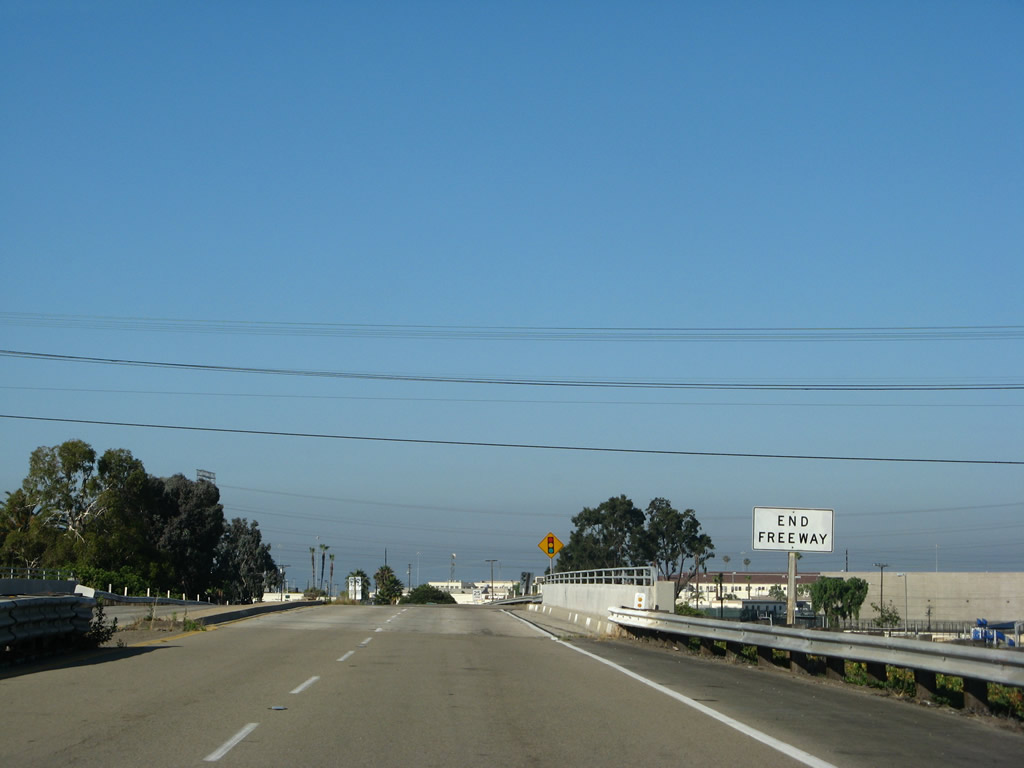
The freeway ends and California 15 officially ends as a state maintained highway. The city of San Diego begins its maintenance of Wabash Boulevard here. Photo taken 06/23/08. |
| Wabash Boulevard south |
|
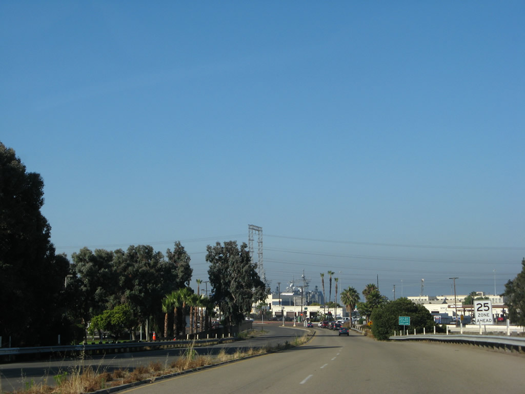
The freeway changes appearances as the state maintenance ends and the city of San Diego takes over maintenance. The freeway is now asphalt with painted lane markers, which is standard for the city but not for Caltrans. The speed limit along southbound soon drops from freeway speeds to 25 miles per hour. A traffic signal ahead marks the end of controlled access. Photo taken 06/23/08. |
|
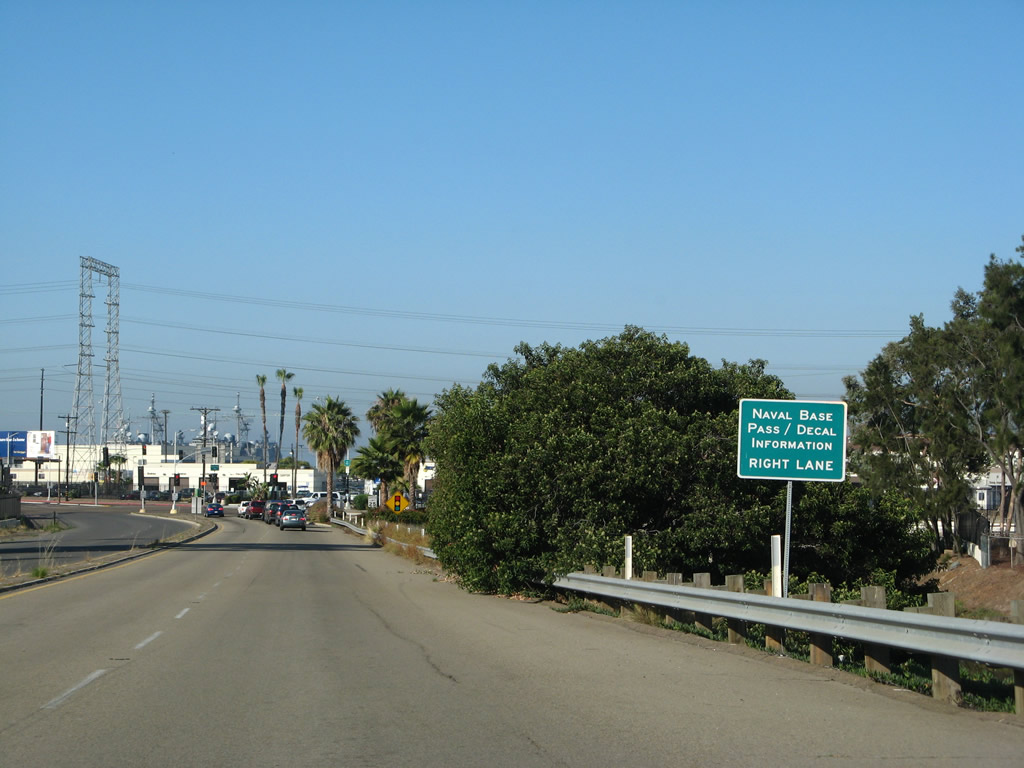
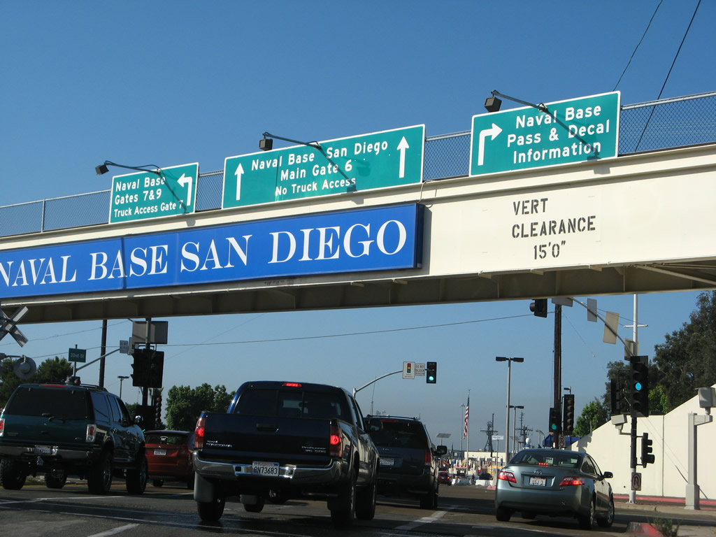
Use the right lane for information on admittance into the 32nd Street Naval Base San Diego. Photo taken 06/23/08. |
|
Now reaching the southern end of the freeway, all remnants of California 15 come to an end, and motorists are afforded several choices at this five-way intersection. To reach Harbor Drive and 32nd Street south, continue straight while trending left at this light. Photo taken 06/23/08. |
|
We now turn left (south) on 32nd Street to cross the trolley line and connect to Harbor Drive. Photo taken 06/23/08. |
| 32nd Street south |
|
After the intersection between Wabash Boulevard and 32nd Street, motorists must cross the trolley and railroad tracks before meeting Harbor Drive. Photo taken 06/23/08. |
|
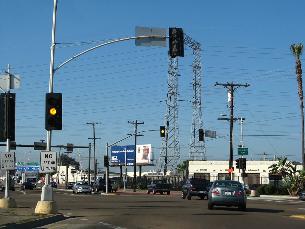
Southbound 32nd Street meets Harbor Drive at this traffic signal. This is Old U.S. 101 and was briefly known as Business Loop I-5. Turn left on Harbor Drive to National City or right to downtown San Diego. Continue straight ahead on 32nd Street into Naval Base San Diego Main Gate 6. All trucks must turn south on Harbor Drive to Gates 7 and 9 for base access due to increased security. Passes to the base and decal station is accessed via Harbor Drive north. Photo taken 06/23/08. |
|
At the traffic signal between 32nd Street and Harbor Drive is a pedestrian bridge that extends across Harbor Drive. In the distance (at the U.S. flag) is the entrance to Gate 6. Photo taken 06/23/08. |
Page Updated June 26, 2013.