
Interstate 40 West - Arizona to Fenner
| Interstate 40 (Needles Freeway) west (and Arizona 95 north) | |
|---|---|
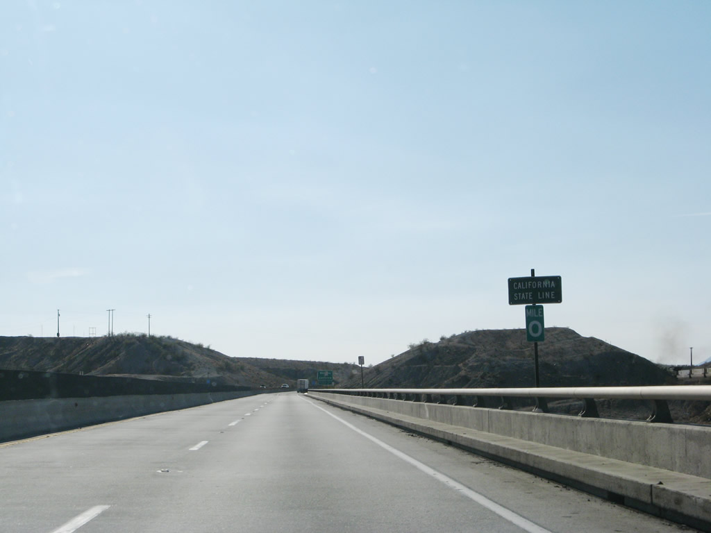 |
Interstate 40 leaves the Grand Canyon State of Arizona and enters the Golden State of California. A zero milepost for Arizona is posted at the midpoint of this 1967 bridge over the Colorado River. This bridge is the only vehicular bridge at Topock; the old U.S. 66 bridge is now in use for a natural gas pipeline. Photo taken 04/01/07. |
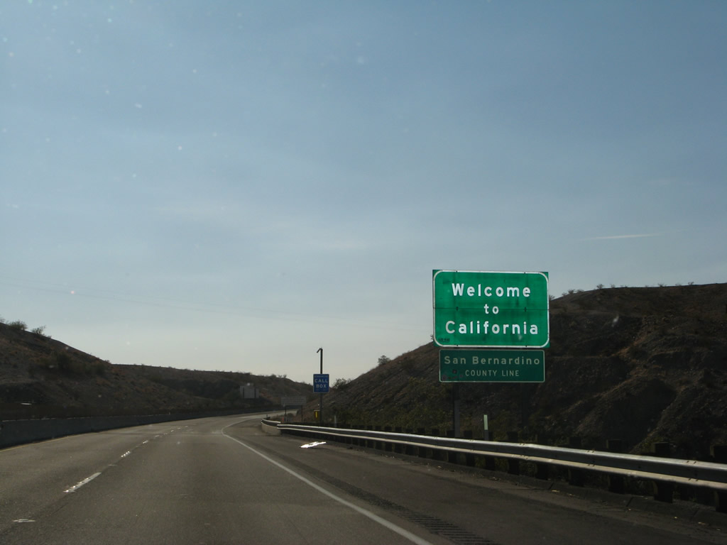 |
A Welcome to California sign is posted along with the county marker for San Bernardino County. Interstate 40 stays within San Bernardino County for its entire westerly journey in California. Photo taken 04/01/07. |
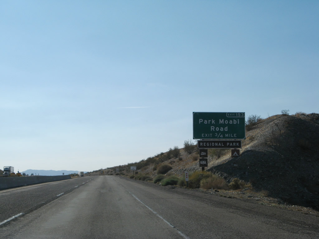 |
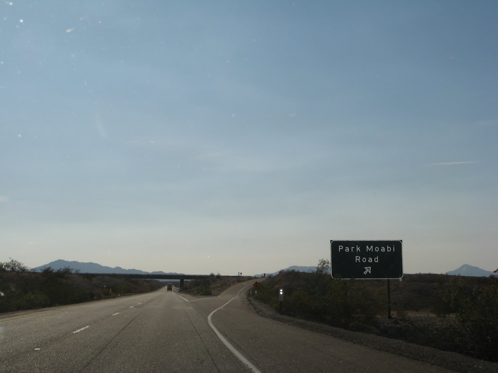
The first exit along Interstate 40 west in California is Exit 153, Park Moabi Road. Use this exit to see two historic alignments of U.S. 66 as well as the bridges that cross the Colorado River near Topock. Photo taken 04/01/07. |
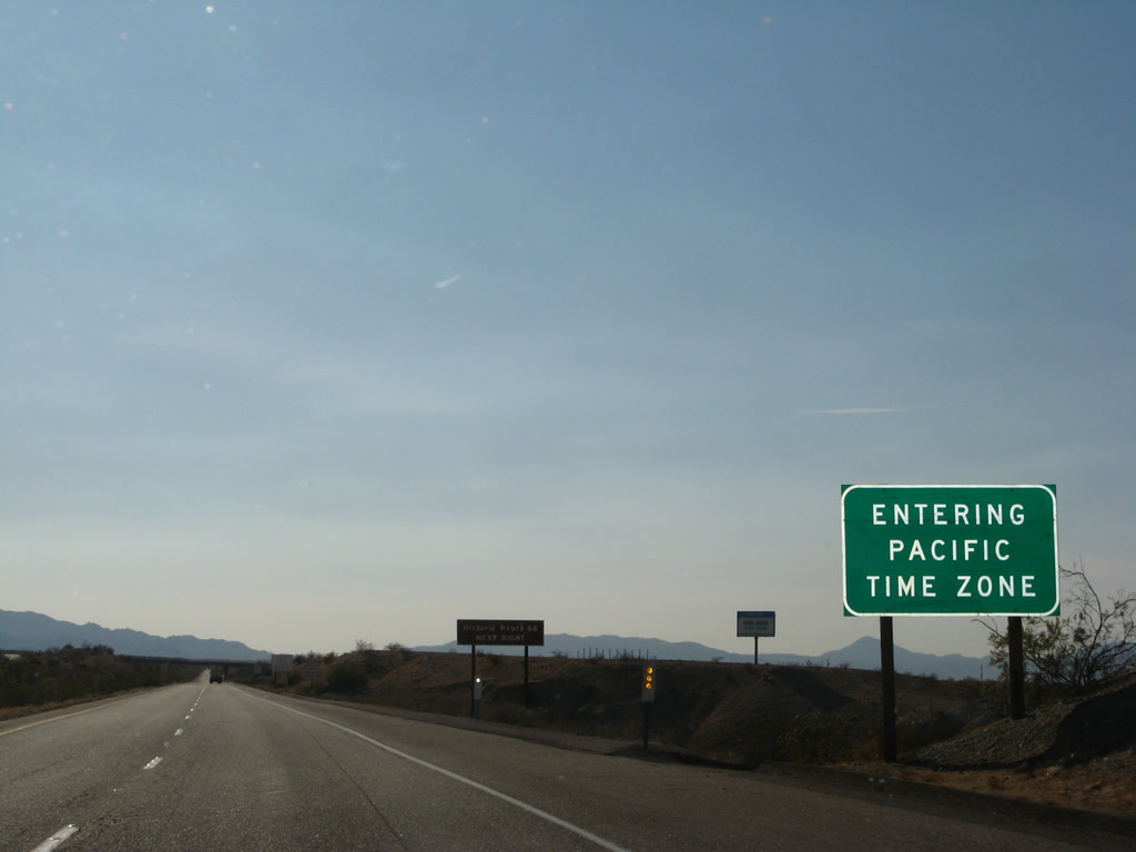 |
Arizona is in the Mountain Time Zone and remains on standard time year round, while California observes Pacific Time. Since California adjusts seasonally for daylight savings time and Arizona does not, California and Arizona share the same time in the summer months and are one hour apart in the winter. Photo taken 04/01/07. |
 |
Westbound Interstate 40 (Needles Freeway) reaches Exit 153, Park Moabi Road to Historic U.S. 66. Photo taken 04/01/07. |
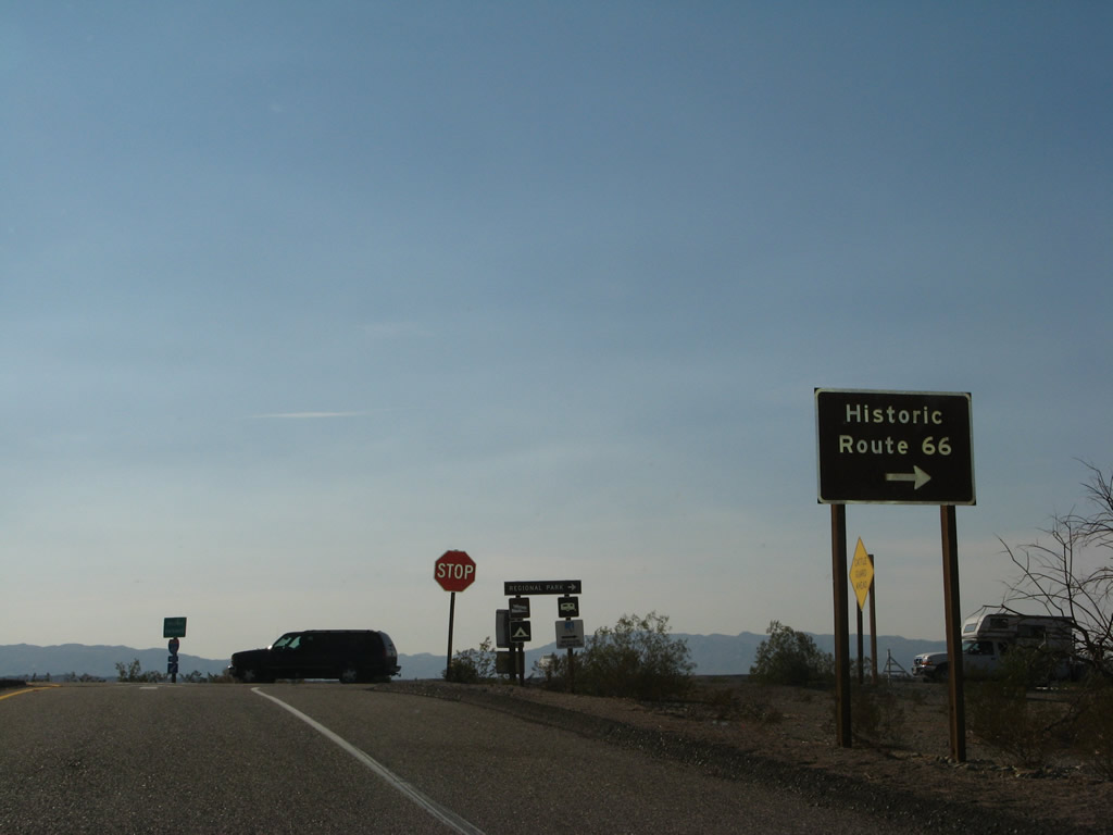 |
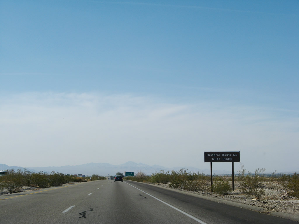
Historic U.S. 66 is well signed along its path through the Mojave Desert, although many of the signs along the National Trails Highway is marked by painted pavement shields rather than standalone signs (to reduce opportunities for theft in the sparsely populated desert). Now on the off-ramp, a trailblazer sign points the way to the old alignment of U.S. 66 through Park Moabi. Photo taken 04/01/07. |
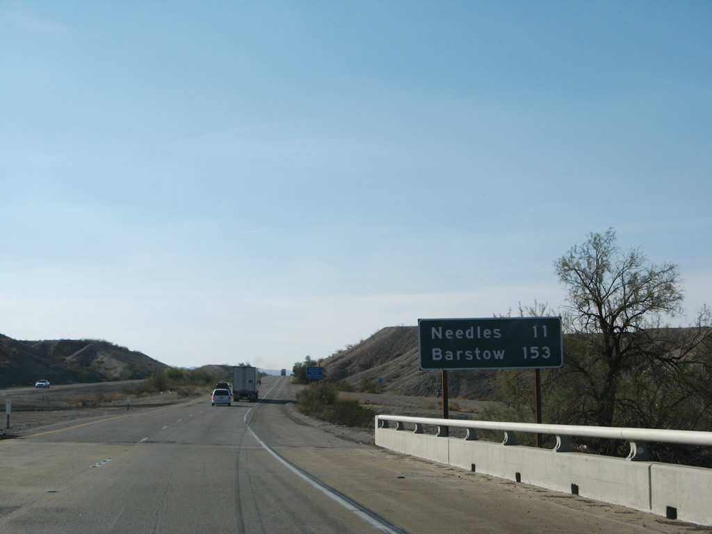 |
This mileage sign provides the distance to Needles (11 miles) and Barstow (153 miles). Los Angeles is generally not mentioned as a control city, unlike the route through Arizona. Photo taken 04/01/07. |
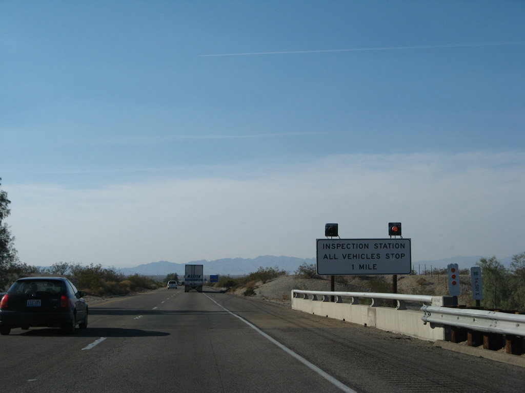 |
A California agricultural inspection station and port of entry is one mile ahead; all vehicles must stop. Photo taken 04/01/07. |
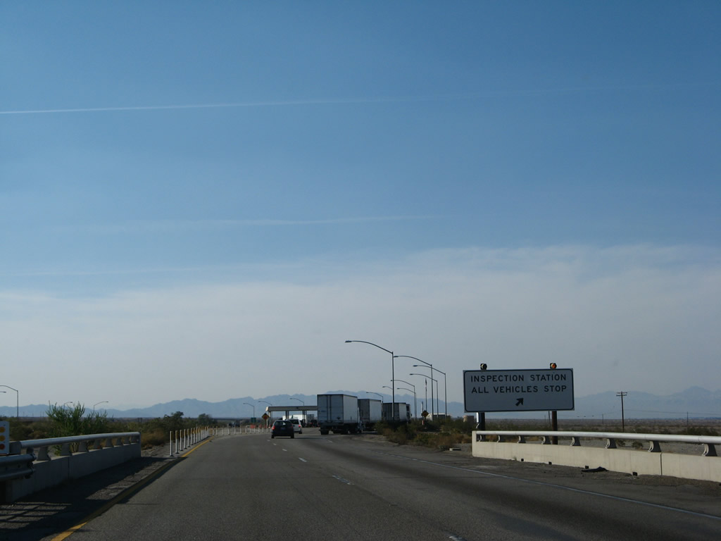 |
All vehicles must stop at the California Inspection Station. Photo taken 04/01/07. |
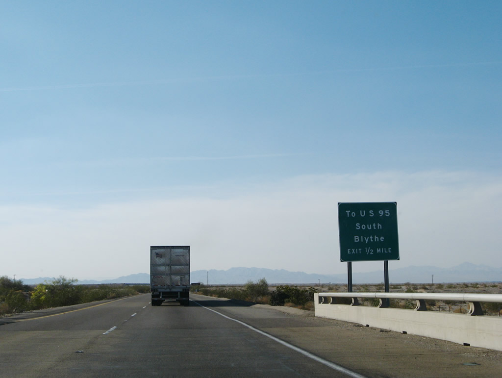 |
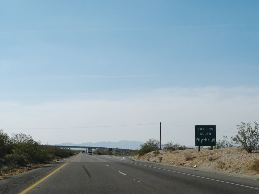
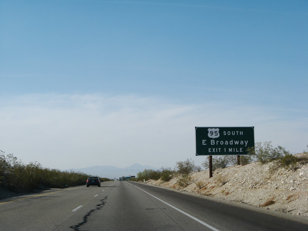
The next exit along Interstate 40 is Exit 148, Historic U.S. 66 (Five Mile Road) west to U.S. 95. To Blythe and points south via U.S. 95, use Exit 148 rather than Exit 144. Photo taken 04/01/07. |
 |
Westbound Interstate 40 reaches Exit 148, Historic U.S. 66 (Five Mile Road) west to U.S. 95. Photo taken 04/01/07. |
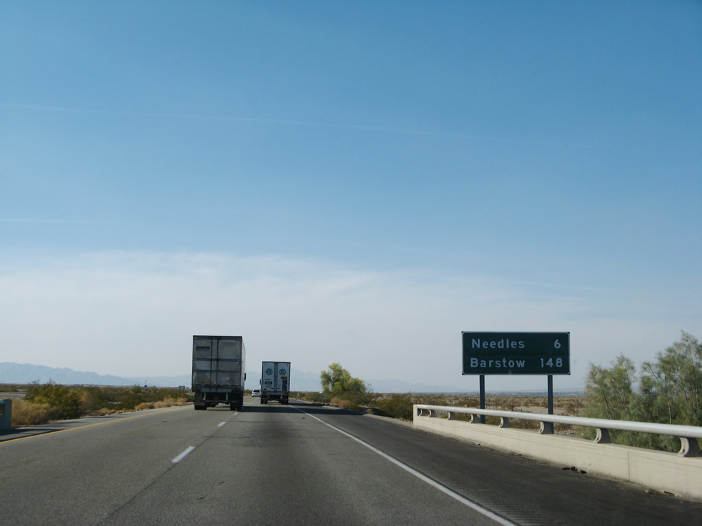 |
This mileage sign provides the distance to Needles (six miles) and Barstow (148 miles). Photo taken 04/01/07. |
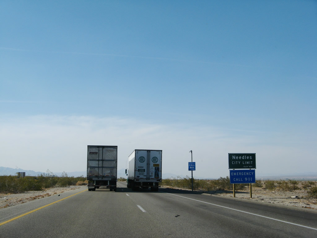 |
Interstate 40 enters the city of Needles, located in the Mojave Valley through which the Colorado River runs. Founded in 1883 with the coming of the railroad, and incorporated October 30, 1913, Needles had a population of 4,830 people as of the 2000 Census. A welcome oasis in the desert, all motorist services are available in Needles. For Interstate 40 travelers, this is the first city since leaving Kingman, Arizona. Needles is known for its extreme summer temperatures, which can climb in excess of 120 degrees. Be mindful of this when traveling through the desert. Photo taken 04/01/07. |
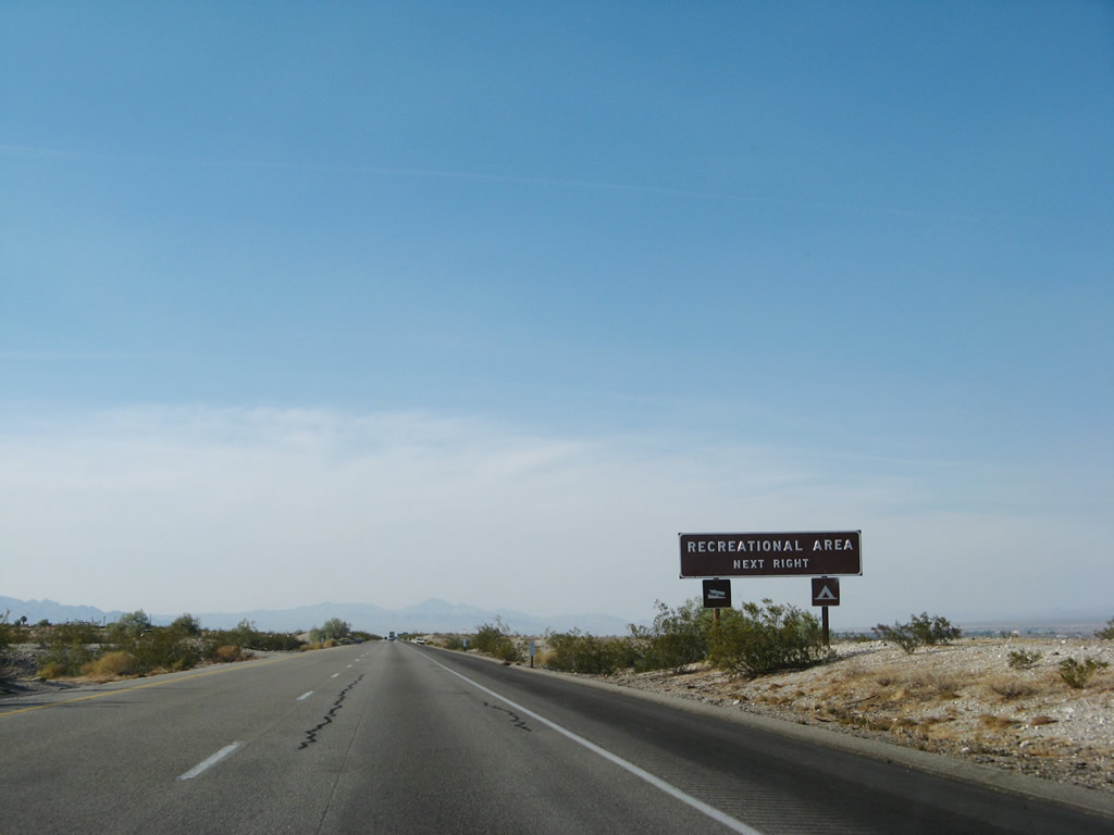 |
A recreational area along the Colorado River is available via Exit 144 (for boat launching and RV hookups). Photo taken 04/01/07. |
 |
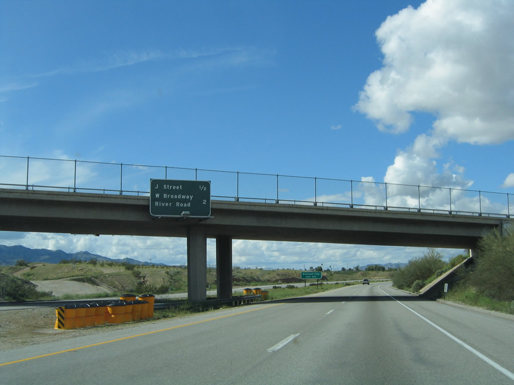
The next three exits along Interstate 40 west serve the city of Needles: Exit 144, Business Loop I-40 and U.S. 66/East Broadway west and U.S. 95 south; Exit 142, J Street; and Exit 141, Business Loop I-40 and U.S. 66/East Broadway east. Motorist services are available at all three exits. Photo taken 04/01/07. |
 |
The next exit along Interstate 40 west is Exit 144, Business Loop I-40 and U.S. 66/East Broadway west and U.S. 95 south. Photo taken 04/01/07. |
 |
Use Exit 144 to U.S. 66 west into downtown Needles. Photo taken 04/01/07. |
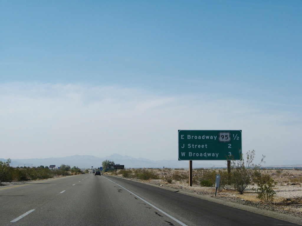 |
The next three exits along Interstate 40 west serve the city of Needles: Exit 144, Business Loop I-40 and U.S. 66/East Broadway west and U.S. 95 south; Exit 142, J Street; and Exit 141, Business Loop I-40 and U.S. 66/East Broadway east. Photo taken 04/01/07. |
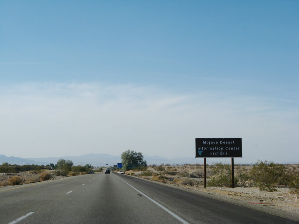 |
Exit here for the Mojave Desert Information Center, which provides information on various desert attractions. Photo taken 04/01/07. |
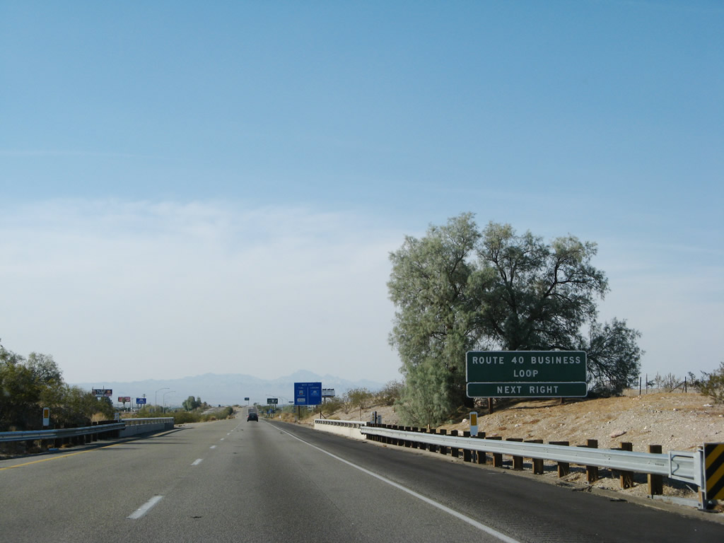 |
Using the California standard, this advance sign for the business route indicates that Business Loop I-40 is at the next exit. Rather than only saying "Route 40 Business Next Right," the sign adds the word "Loop," unlike any other business route signage seen in California. Photo taken 04/01/07. |
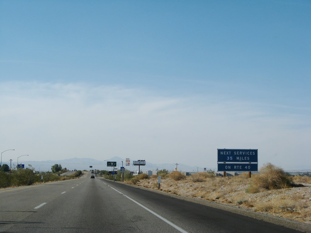 |
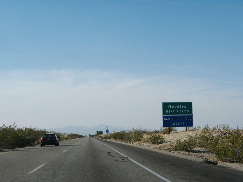
After leaving Needles, the next motorist services along Interstate 40 is 35 miles west of here. Photo taken 04/01/07. |
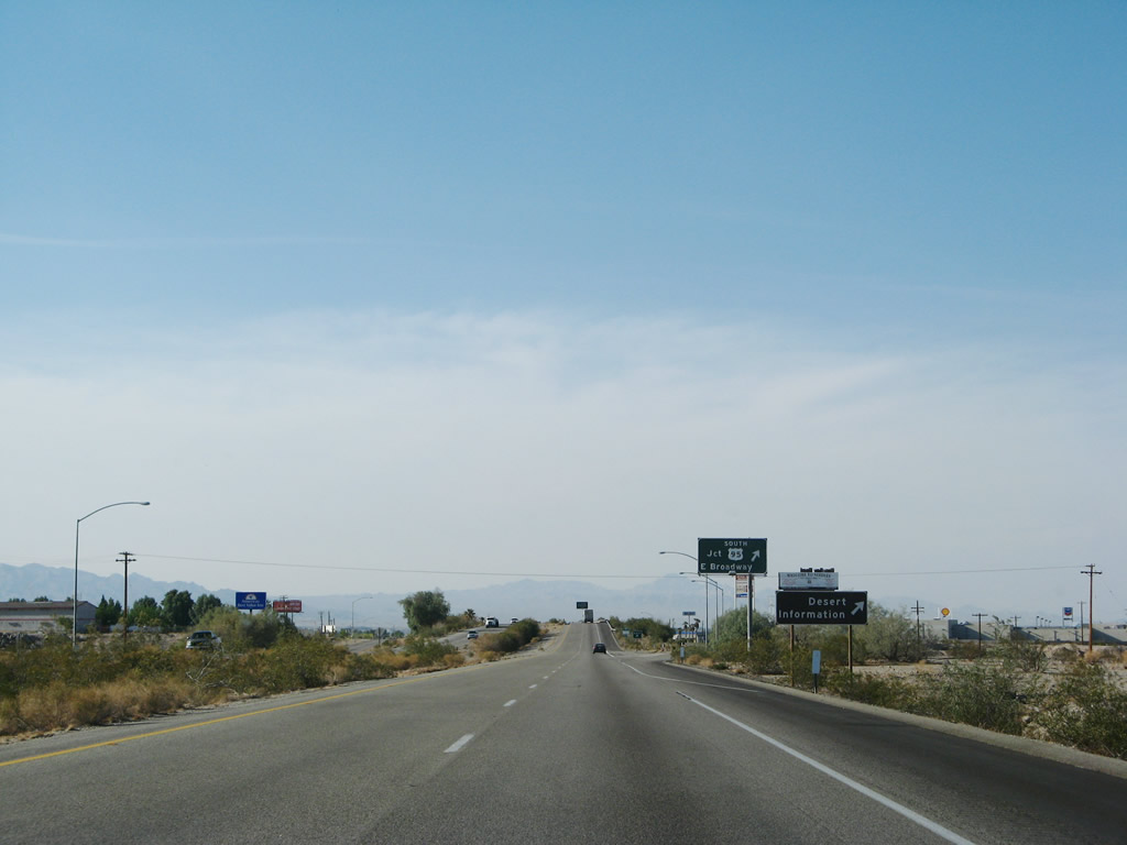 |
Another advance sign for the Mojave Desert Information Center is posted prior to Exit 144. Photo taken 04/01/07. |
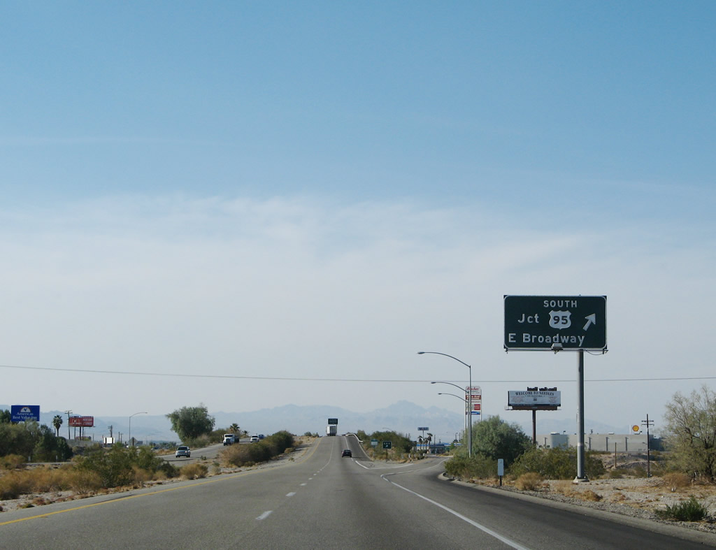 |
Westbound Interstate 40 reaches Exit 140, U.S. 95 south and Business Loop I-40 and U.S. 66 west to Needles. Note the Historic U.S. 66 junction signage in the background. Photo taken 04/01/07. |
| Interstate 40 west & U.S. 95 north | |
|---|---|
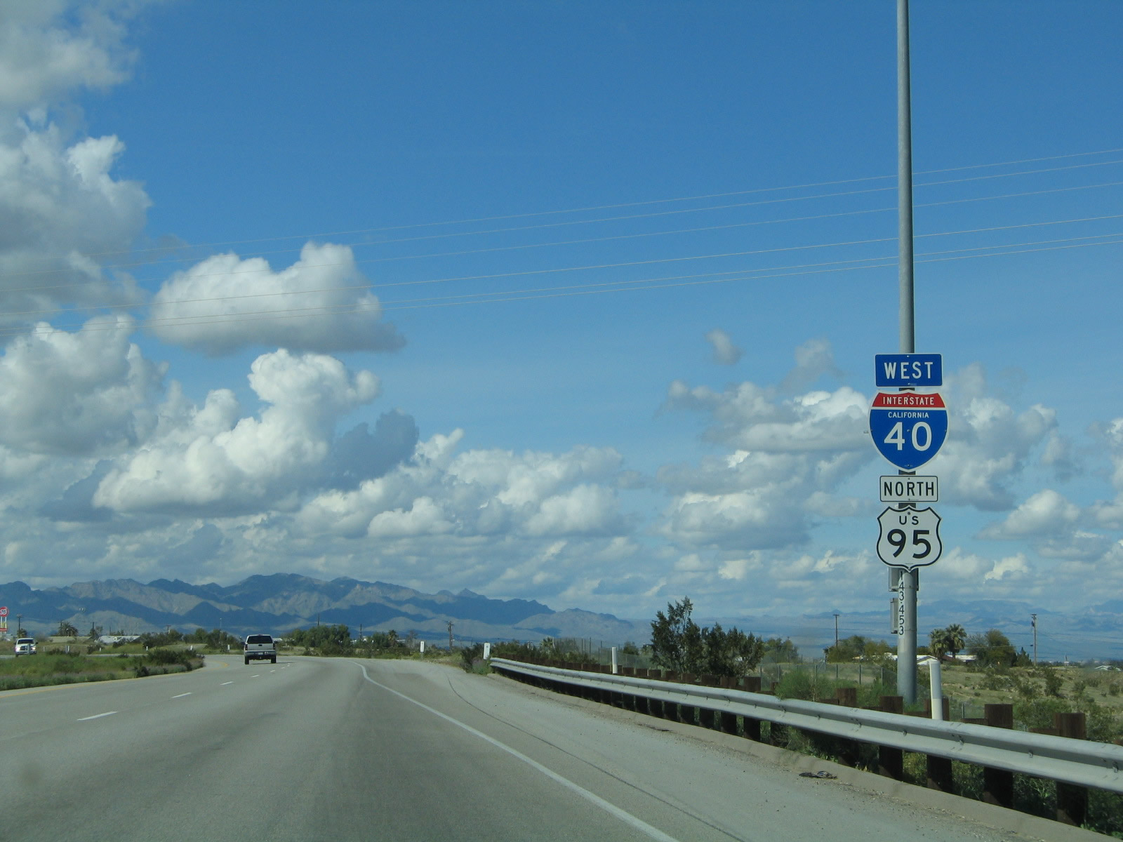 |
The next reassurance shield assembly after the on-ramp from Exit 140 includes both Interstate 40 west and U.S. 95 north cosigned. They remain joined until Exit 133. Photo taken 02/20/05. |
 |
The next two exits along Interstate 40 (Needles Freeway) west are Exit 142, J Street to Arizona 95 north to Bullhead City and Exit 141, Business Loop I-40 and U.S. 66/West Broadway and River Road north to Needles Highway and Laughlin. Photo taken 02/20/05. |
 |
To Arizona 95 north to Bullhead City, follow J Street north to Business Loop I-40 west to Arch Street east to K Street north. Most of the turns are signed with either Arizona 95 trailblazer signs or Bullhead City signs. Photo taken 02/20/05. |
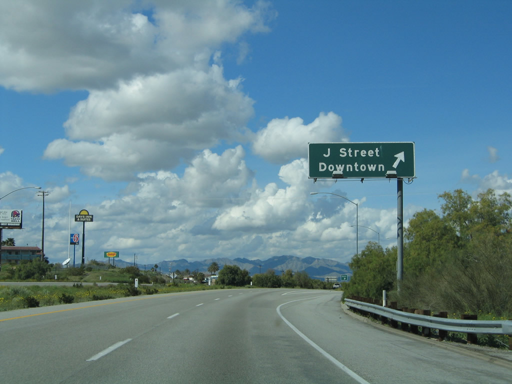 |
Westbound Interstate 40 and northbound U.S. 95 reach Exit 142, J Street north to downtown Needles and Arizona 95 north to Bullhead City. Photo taken 02/20/05. |
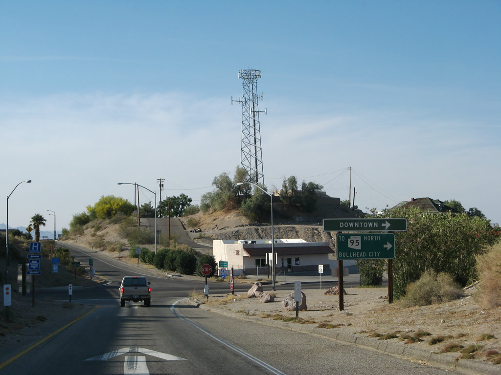 |
Departing the freeway on Exit 142 to J Street, a trailblazer sign for Arizona 95 north to Bullhead City is posted prior to the end of the ramp. Photo taken 04/01/07. |
 |
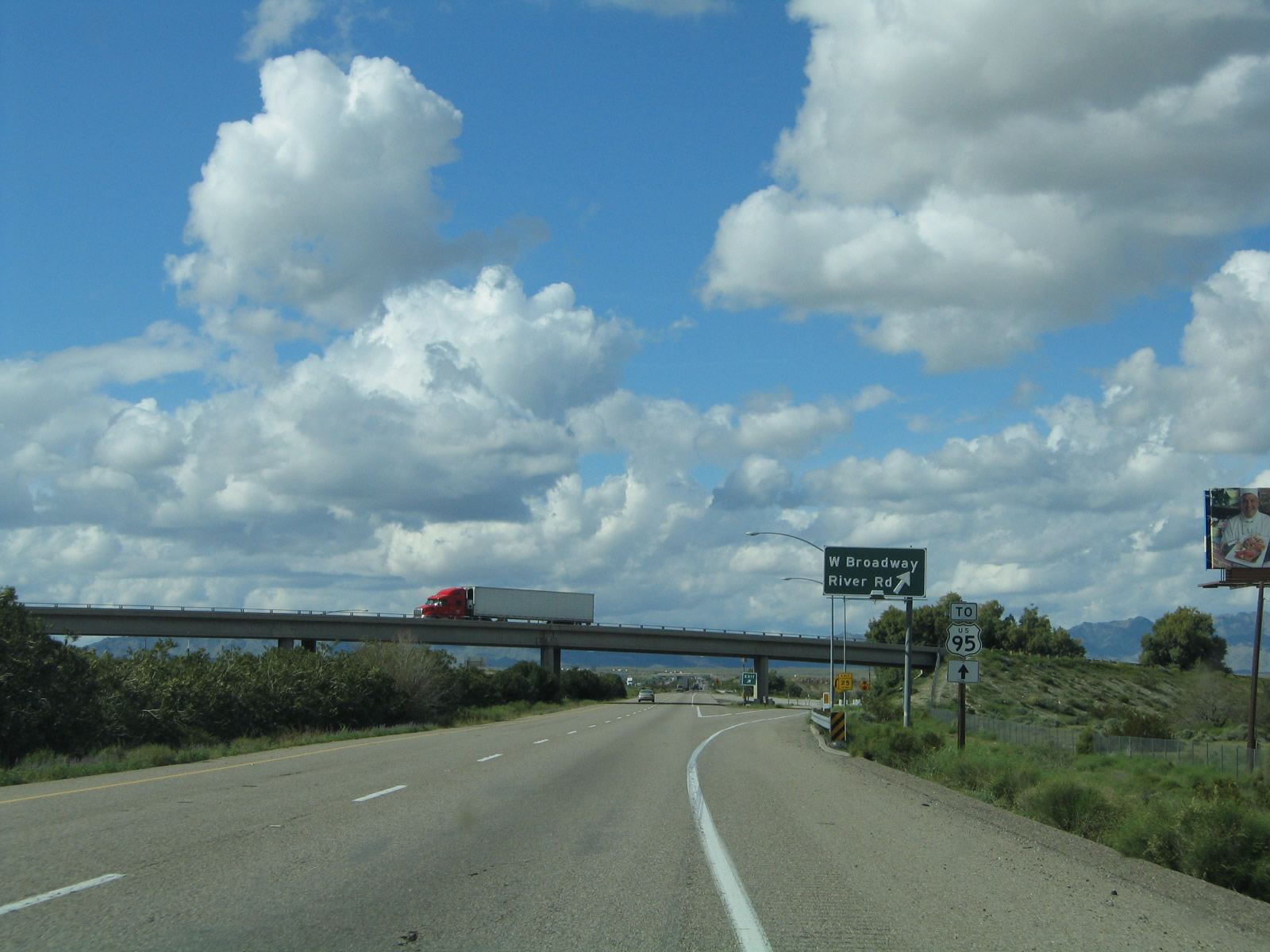
The next exit along Interstate 40 (Needles Freeway) west is Exit 141, Business Loop I-40 and U.S. 66/West Broadway and River Road north to Needles Highway and Laughlin. Photo taken 02/20/05. |
 |
The next exit along Interstate 40 (Needles Freeway) west is Exit 141, Business Loop I-40 and U.S. 66/West Broadway and River Road north to Needles Highway and Laughlin. Photo taken 02/20/05. |
 |
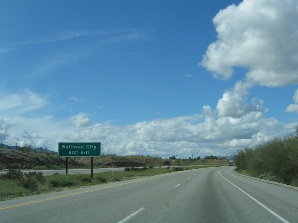
For the continuation of U.S. 95 north to Searchlight and Las Vegas, follow Interstate 40 west to Exit 133. Photo taken 02/20/05. |
 |
Exit 141 is the third and final Needles interchange. In addition to serving as the western terminus of Business Loop I-40 through Needles, it is also the last exit to have comprehensive motorist services. There are few services between Needles and Barstow along Interstate 40, so be sure to check gas, food, and water before proceeding. Photo taken 02/20/05. |
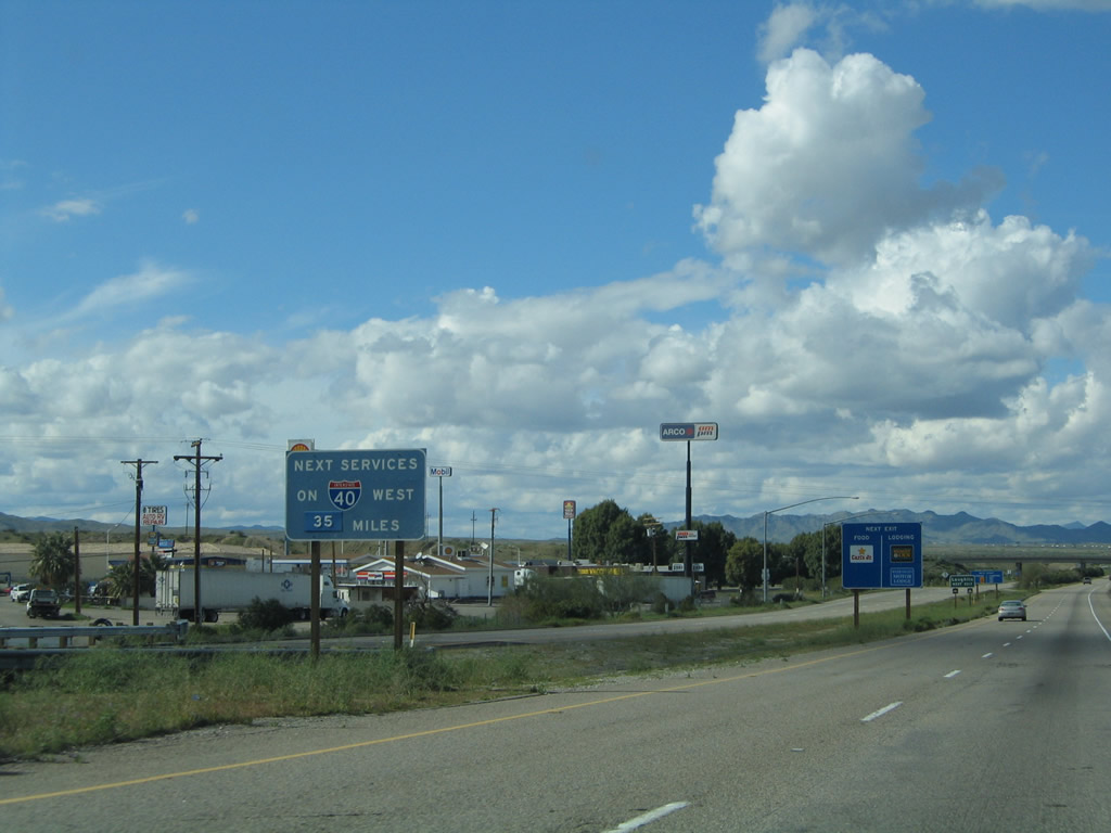 |
The next services along Interstate 40 (Needles Freeway) west are 35 miles after Exit 141. Photo taken 02/20/05. |
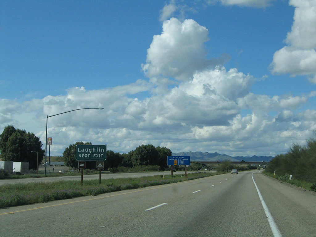 |
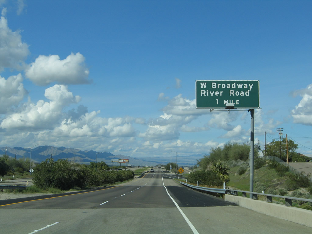
To Laughlin, Nevada, use River Road (Needles Highway) north from Exit 141. Photo taken 02/20/05. |
 |
Another U.S. 95 north trailblazer is posted prior to the off-ramp for Exit 141. Photo taken 02/20/05. |
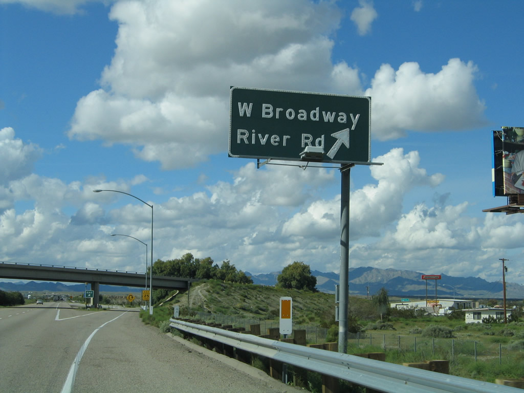 |
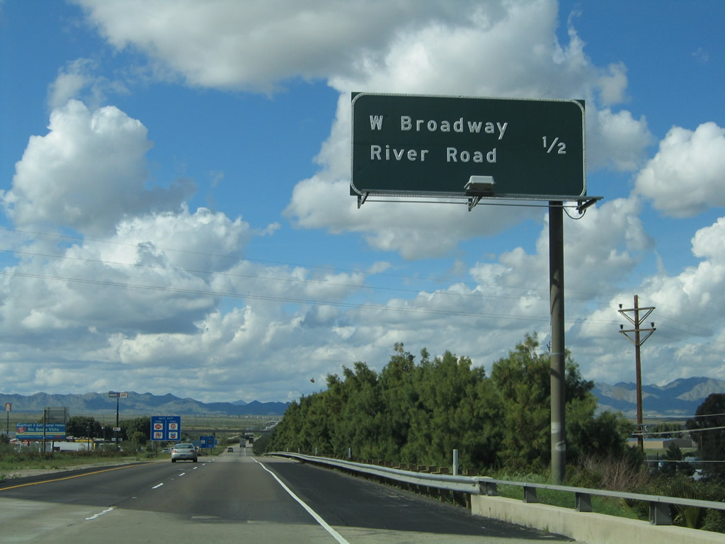
Westbound Interstate 40 (Needles Freeway) reaches Exit 141, Business Loop I-40 and U.S. 66/West Broadway and River Road north to Needles Highway and Laughlin. Photo taken 02/20/05. |
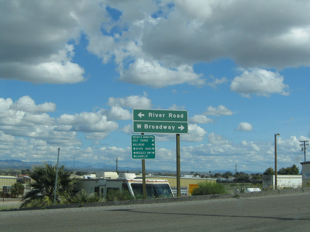 |
At the top of the ramp from Interstate 40 west and U.S. 95 north to Exit 141 is this sign. Turn left to follow River Road and Needles Highway north to Laughlin or turn right to follow Business Loop I-40 and U.S. 66/West Broadway east to Needles. Photo taken 02/20/05. |
 |
Back on the mainline, the next exit along Interstate 40 west is Exit 133, U.S. 95 north (two miles). Photo taken 02/16/04. |
 |
U.S. 95 is a major north-south, cross-country highway that originates at the international border with Mexico at San Luis, Arizona, and extends north through Arizona, California, Nevada, Oregon, and Idaho, ending at the international border with Canada near Eastport. It is the only highway that enters and exits the state of California; all other inbound highways terminate in California. While U.S. 95 originally was designated a short north-south route in Idaho as part of the original U.S. Highway System in 1926, it was extended south from its original southern terminus in Weiser, Idaho, in stages. First it was extended south to Winnemucca, Nevada, by 1937; to Blythe by 1939-1940; and finally to San Luis, Arizona, by 1960-1961 (by replacing Arizona 95 south of Quartzsite). Prior to 1939, today's U.S. 95 route was designated as California 195, perhaps in anticipation of its ultimate numerical designation. (today's California 195 is a short route between California 86 and California 111 in the Coachella Valley). Photo taken 02/16/04. |
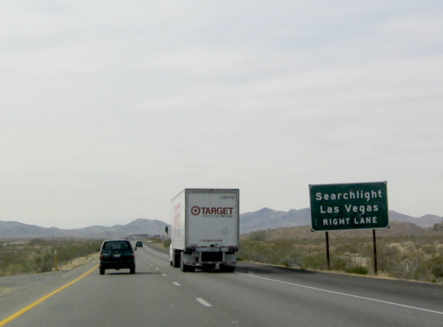 |
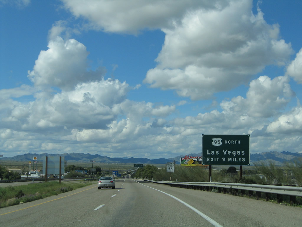
U.S. 95 leads north into Nevada, where it connects to Nevada 163 (which leads east to Laughlin), then continues north to Cal-Nev-Ari and Searchlight before reaching U.S. 93 northwest of Boulder City. U.S. 93-95 merge for the final miles into Las Vegas. Photo taken 02/16/04. |
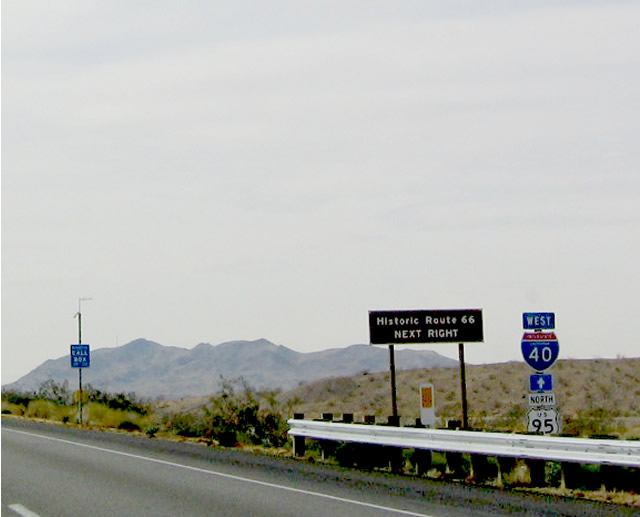 |
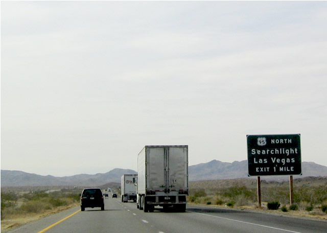
Exit 133 also provides access to Historic U.S. 66, which follows U.S. 95 north for a distance before turning west en route to Goffs. Photo taken 02/16/04. |
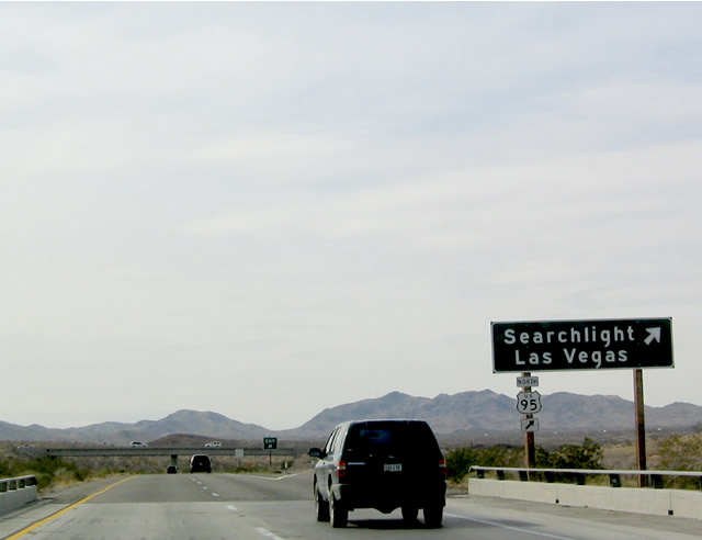 |
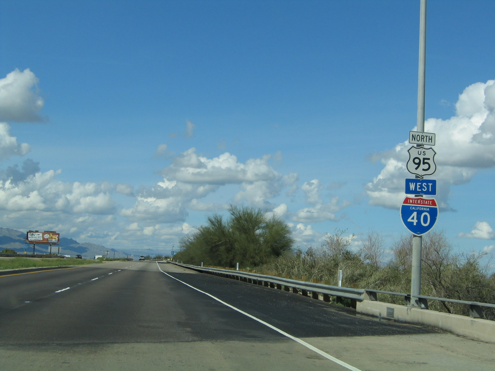
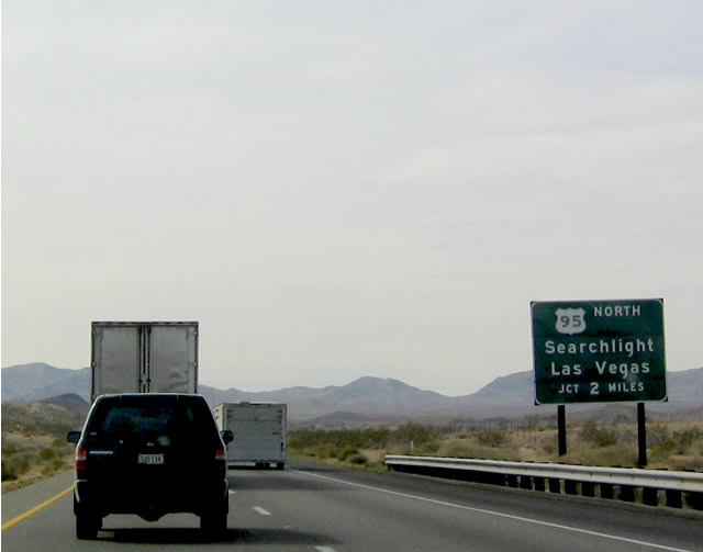
Westbound Interstate 40 (Needles Freeway) reaches Exit 133, U.S. 95 north to Searchlight and Las Vegas. Note the use of a standalone U.S. 95 shield attached to the green guide sign. Photo taken 02/16/04. |
| Interstate 40 west | |
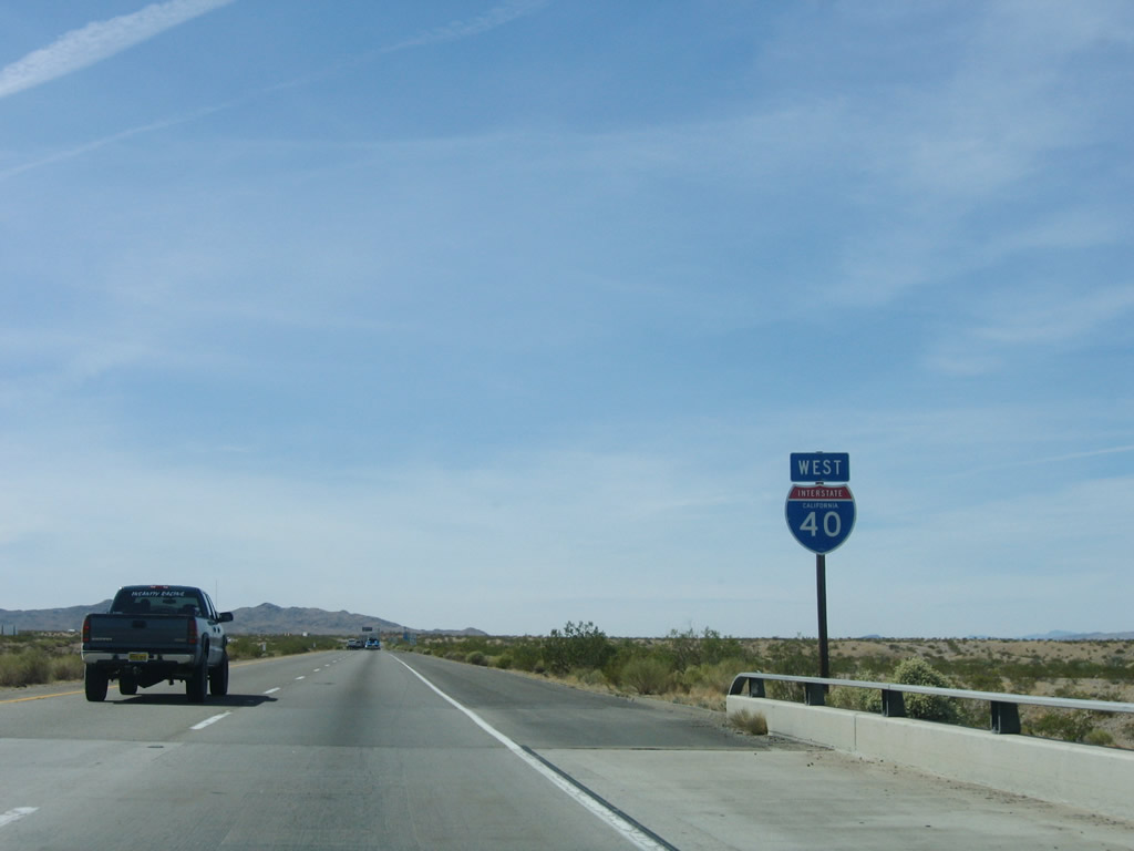 |
Leaving the U.S. 95 interchange, this Interstate 40 west reassurance shield is posted after the on-ramp. Photo taken 04/02/06. |
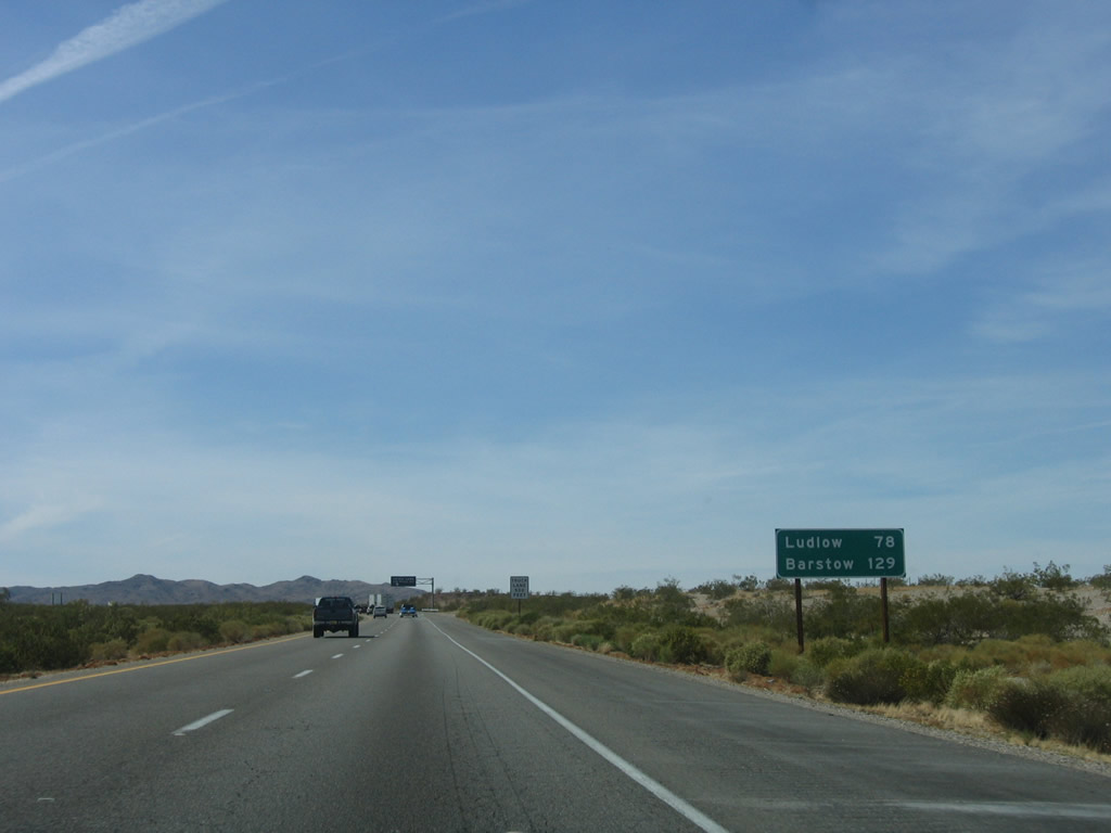 |
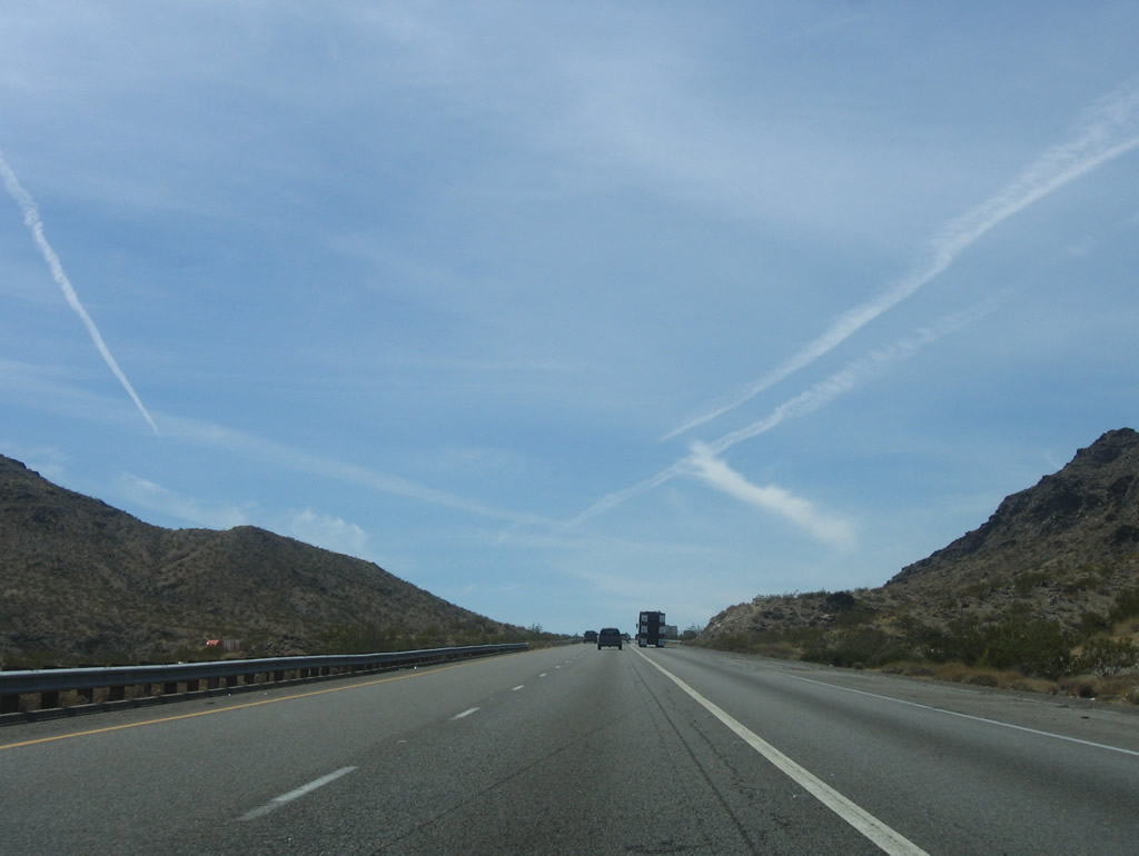
This mileage sign along westbound Interstate 40 provides the distance to Ludlow (78 miles) and Barstow (129 miles). Photo taken 04/02/06. |
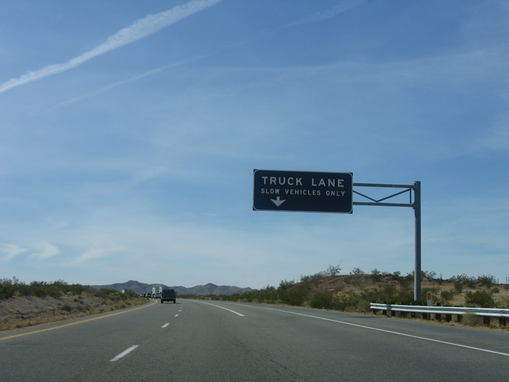 |
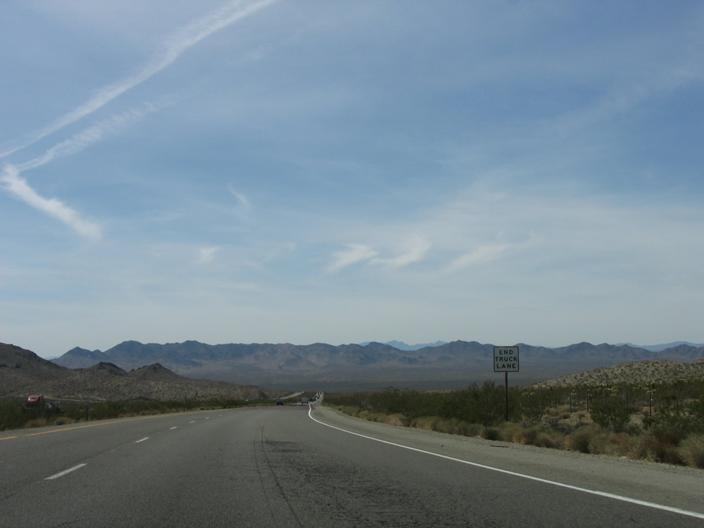
A truck lane begins as the freeway prepares to go up the slope to South Pass. With the heavy truck traffic seen along Interstate 40, a third lane for climbing is necessary for even traffic flow uphill. Photo taken 04/02/06. |
 |
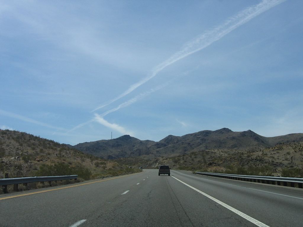
Between Needles and Barstow, Interstate 40 ascends to South Pass (el. 2,630 feet), descends to Ward Valley (where the freeway meets Water Road at Exit 120), rises to Mountain Springs Summit (el. 2,770 feet), and again descends into Fenner Valley. Photo taken 04/02/06. |
 |
 |
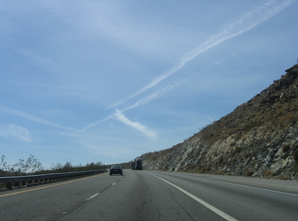 |
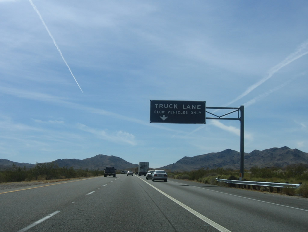
Continuing uphill to South Pass, the truck lane will eventually end at the point where Interstate 40 reaches the summit and prepares to head down the grade into Ward Valley. Photos taken 04/02/06. |
 |
 |
 |
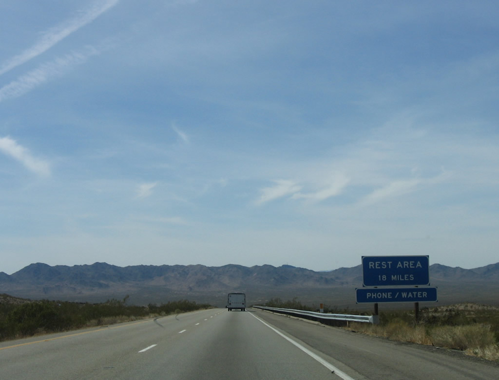 |
A rest area with restrooms, water, and phone is available 18 miles ahead after the Fenner interchange (Exit 107, U.S. 66). Photo taken 04/02/06. |
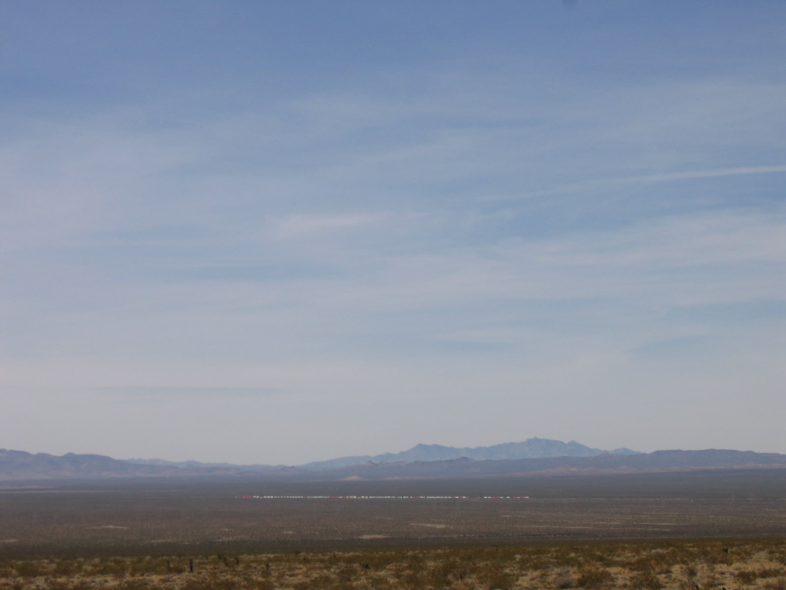 |
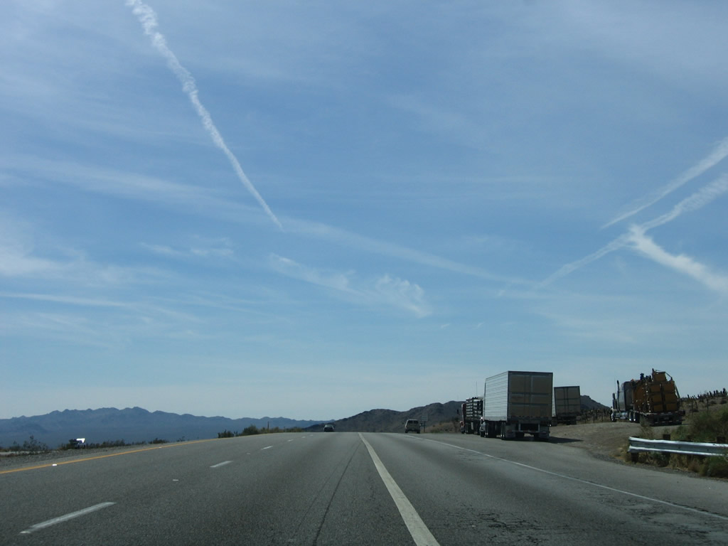
Both U.S. 66 and the railroad parallel Interstate 40 to the north, avoiding South Pass and its steep grades. As is common in the desert, the entire train can be seen from locomotive to last car. Photo taken 04/02/06. |
 |
Entering Ward Valley, the only interchange is Exit 120, Water Road. The diamond interchange is visible along westbound as we descend to the bottom of Ward Valley. Photo taken 04/02/06. |
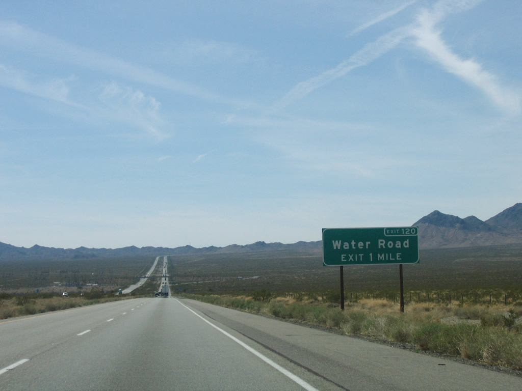 |
The next exit along westbound Interstate 40 is Exit 120, Water Road in Ward Valley. Photo taken 04/02/06. |
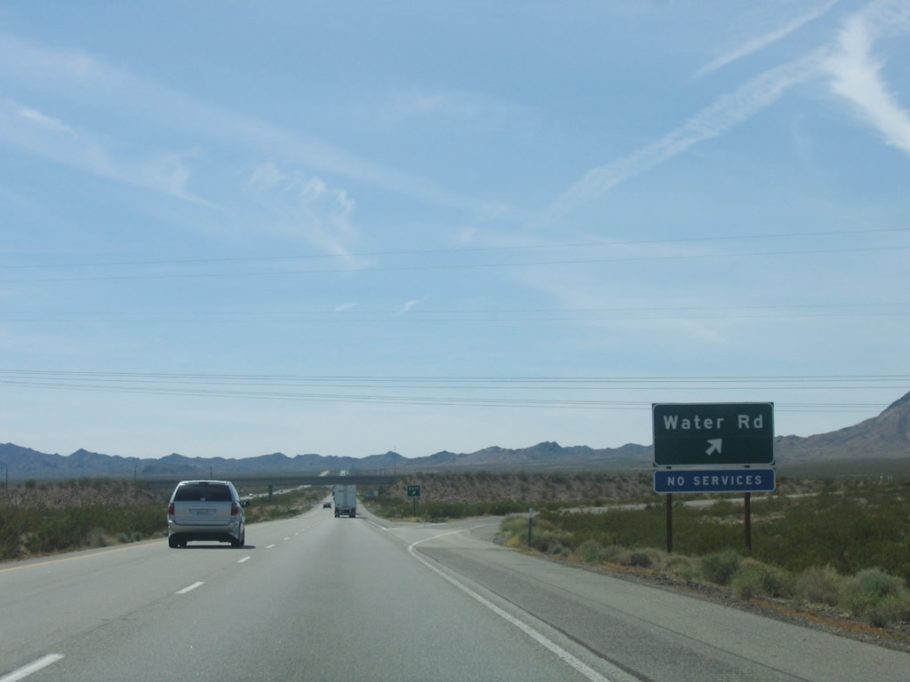 |
Westbound Interstate 40 (Needles Freeway) reaches Exit 120, Water Road. A set of Los Angeles Department of Water and Power lines pass over the freeway at this interchange. Photo taken 04/02/06. |
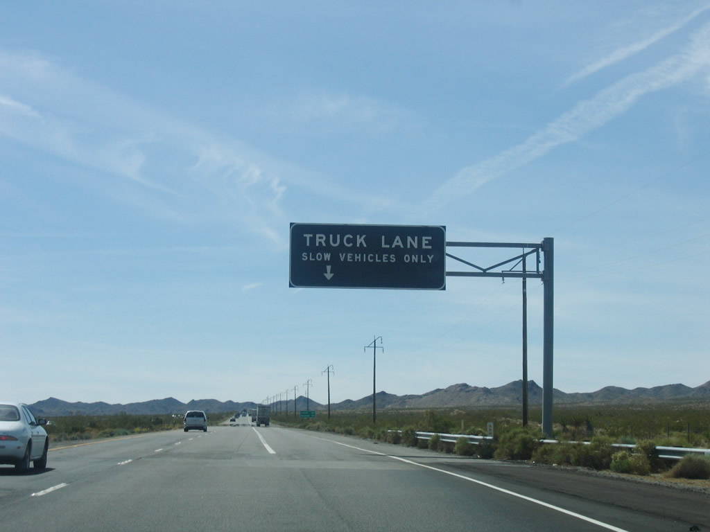 |
Interstate 40 prepares to ascend to Mountain Springs Summit, and once again a truck lane (third right lane) is added to accommodate the slower traffic. Photo taken 04/02/06. |
 |
This mileage sign along Interstate 40 west provides the distance to Ludlow (68 miles) and Barstow (119 miles). Photo taken 04/02/06. |
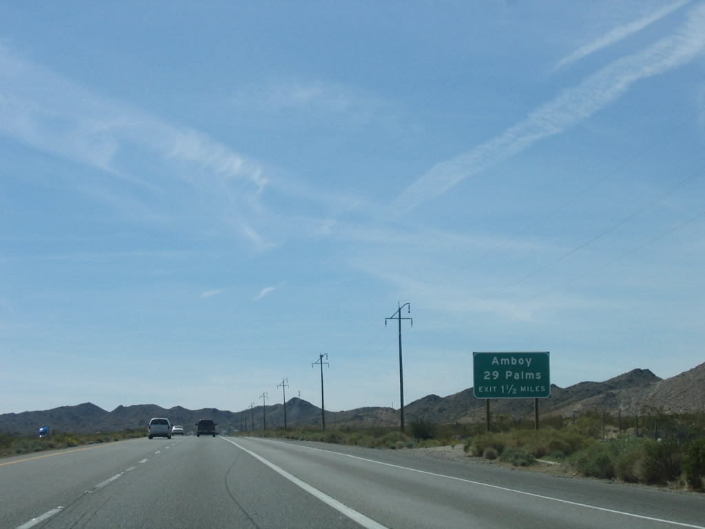 |
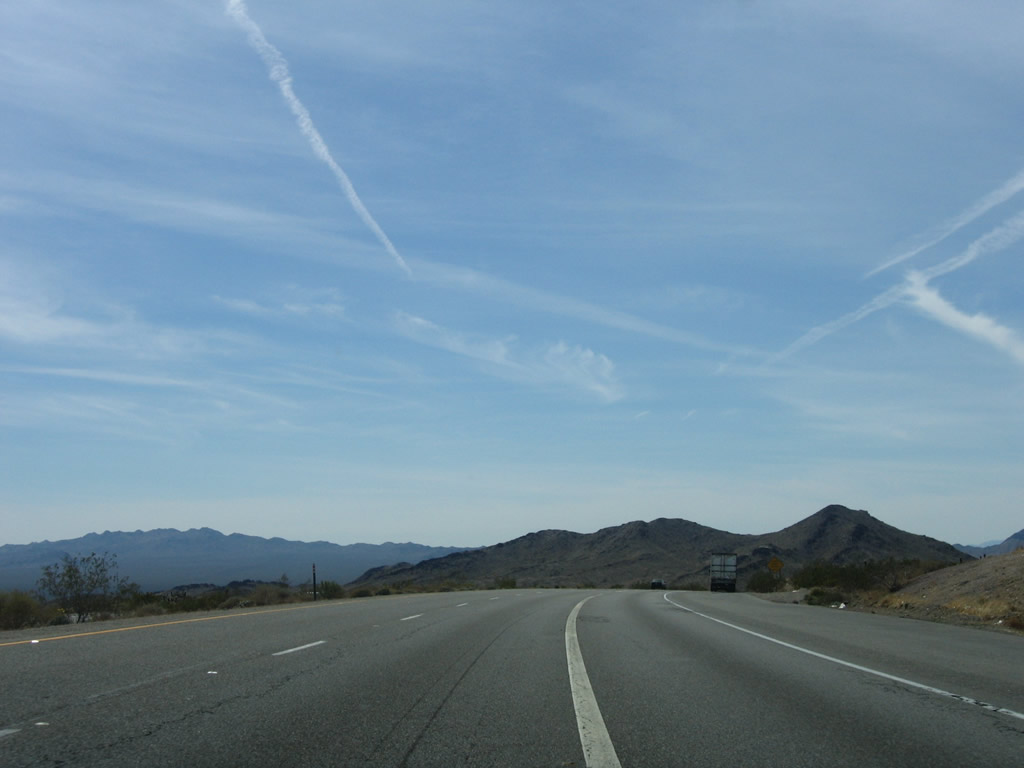
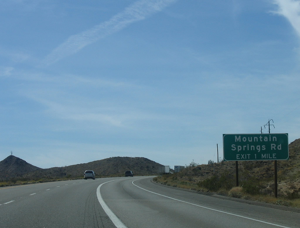
The next exit along westbound Interstate 40 is Exit 115, Mountain Springs Road and Historic U.S. 66 (National Trails Highway), 1.50 miles. Mountain Springs Road travels north from this interchange to Goffs, while Historic U.S. 66 (National Trails Highway) travels southesat to Essex and Amboy. Exit 115 connects to the second generation of U.S. 66; we meet the original U.S. 66 at Exit 107 at Fenner. Photo taken 04/02/06. |
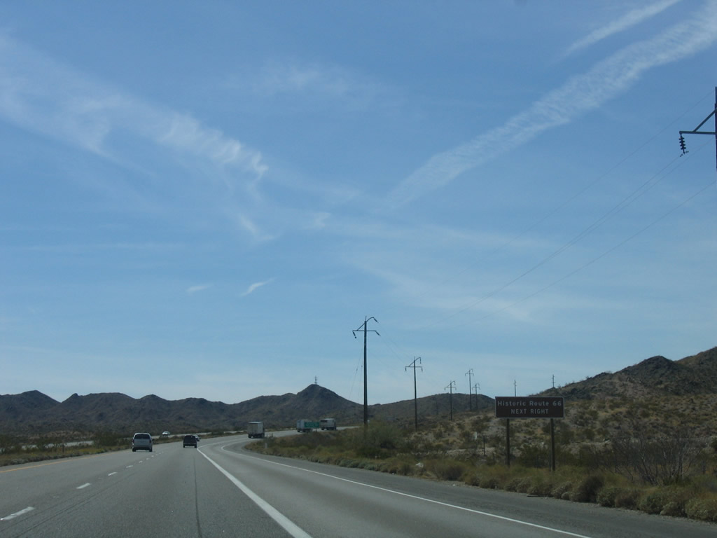 |
For those seeking an adventure along one of the best preserved and highly visited historic highways in California, a trip along U.S. 66 through Essex and Amboy is a must. The drive takes motorists through some beautiful desert vistas while avoiding busy Interstate 40. Stops at Roy's Cafe in Amboy and Amboy Crater are a must. Photo taken 04/02/06. |
 |
Eastbound Interstate 40 (Needles Freeway) approaches Exit 115, Historic U.S. 66 (National Trails Highway) west to Amboy (one mile). Photo taken 04/02/06. |
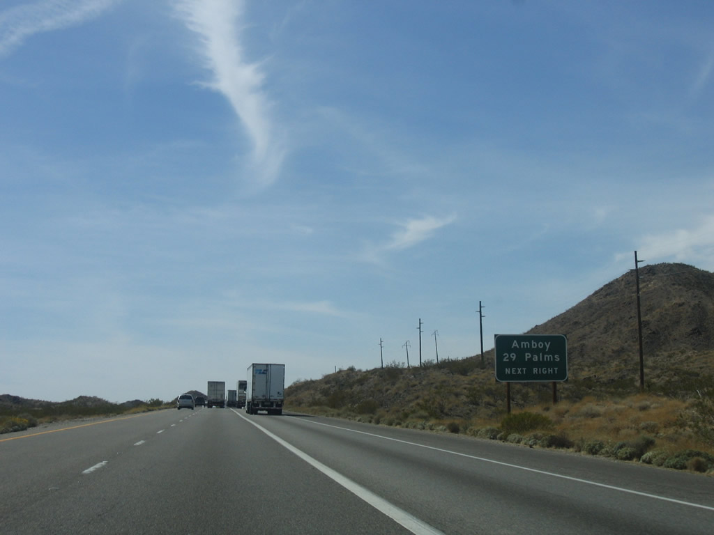 |
Historic U.S. 66 (National Trails Highway) travels southwest to Amboy via old U.S. 66. From Amboy, motorists may take Amboy Road south from Amboy to Twenty-Nine Palms and California 62. Photo taken 04/02/06. |
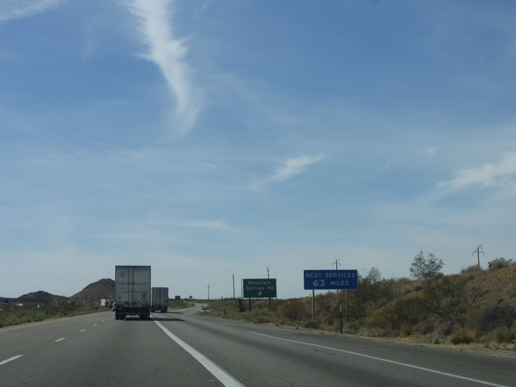 |
There are no motorist services at this interchange ... gas and food are not available for another 63 miles on the freeway. Some services are available in Amboy. Photo taken 04/02/06. |
 |
Westbound Interstate 40 reaches Exit 115, Mountain Springs Road/National Trails Highway, which leads north to meet Old U.S. 66 and south toward Essex. This is an older alignment of U.S. 66 between Essex and Goffs that was replaced by Goffs Road (Exit 107). Photo taken 04/02/06. |
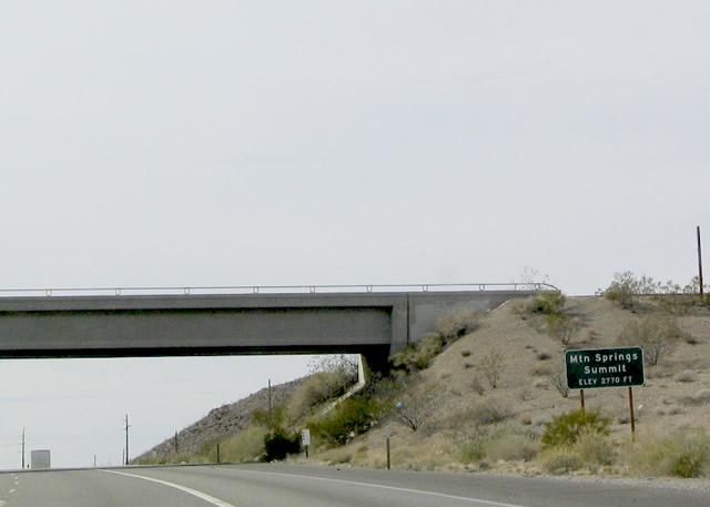 |
Interstate 40 reaches the Mountain Springs Summit of the Piute Mountains, elevation 2,770 feet. Photo taken 02/16/04. |

Page Updated March 6, 2010.
|
About Contact Glossary |
In The News Interstate Guide |
Social Media:
 |
|
© 2000-25 AARoads.com | All Rights Reserved | Privacy Policy / Terms of Use
|
||