| Interstate 80/Roseville (Alan S. Hart) Freeway east |
|
|
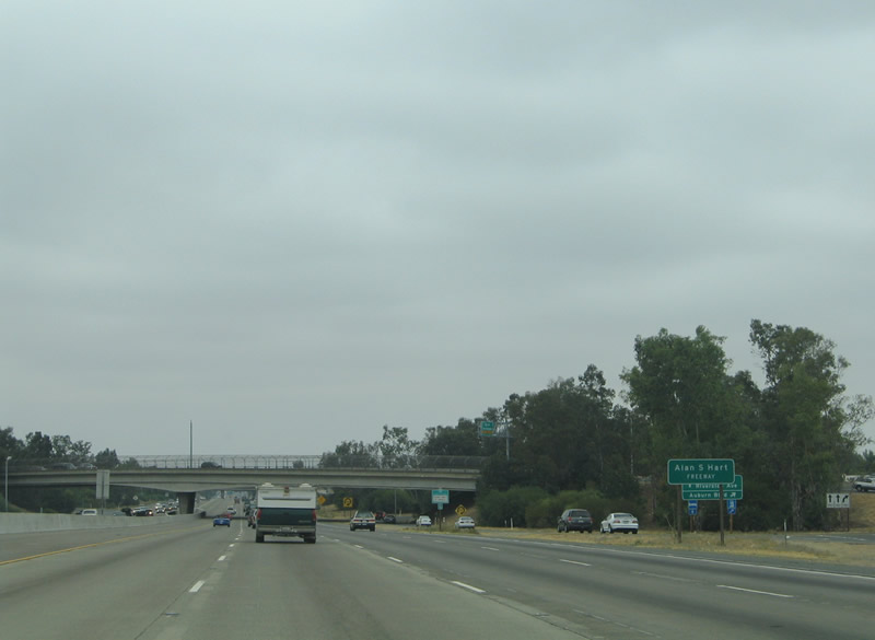
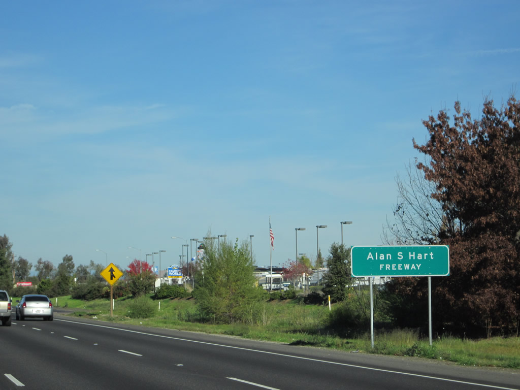
Interstate 80 is designated the Alan S. Hart Freeway east of Sacramento. Hart was a former Caltrans district head and worked for the department for over 40 years. His resume includes the overseeing of both the construction of Interstate 280 in San Francisco and Interstate 80 from Sacramento to the Nevada state line. This sign moved between 2005 and 2012. Photos taken 09/10/05 and 11/23/12. |
|
|
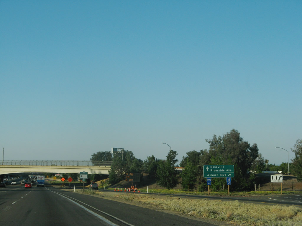
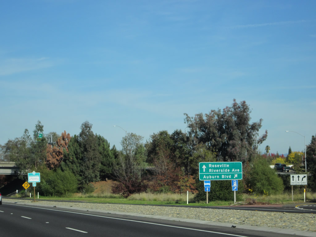
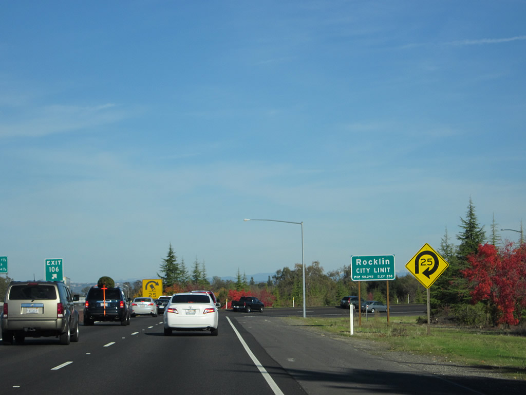
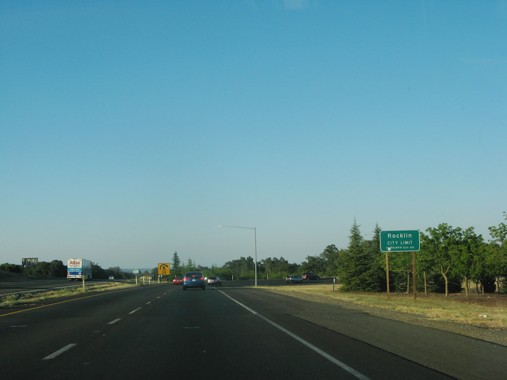
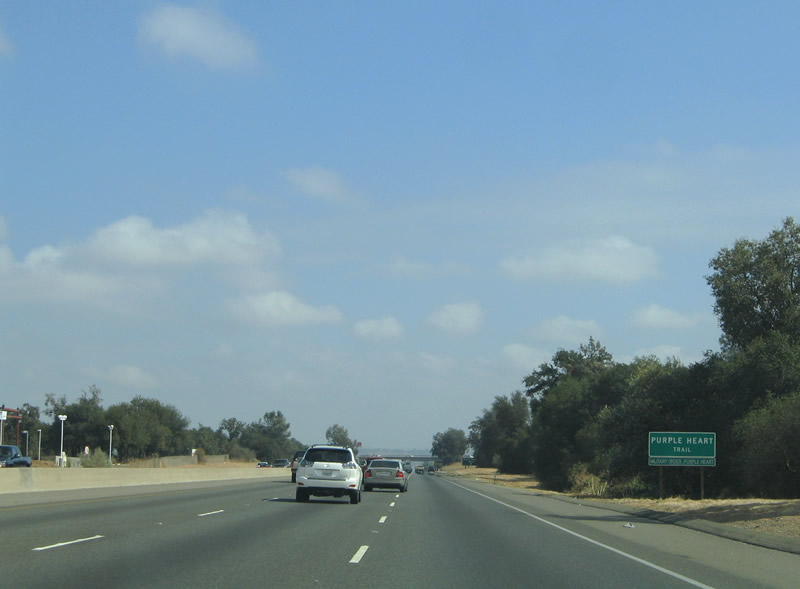
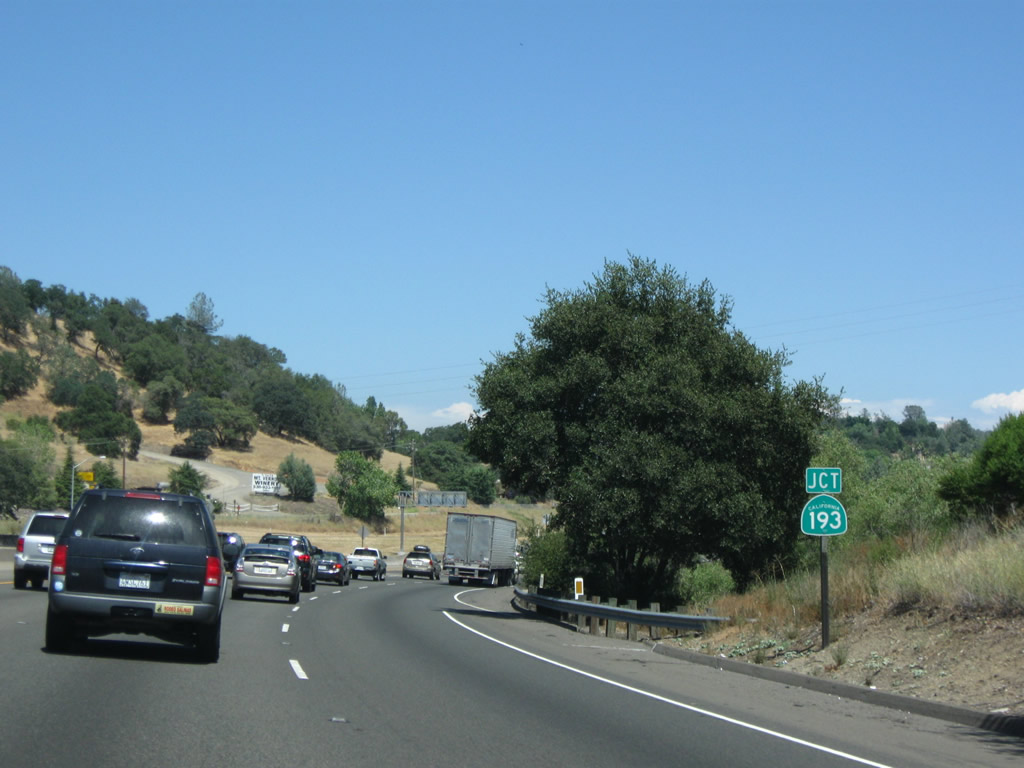
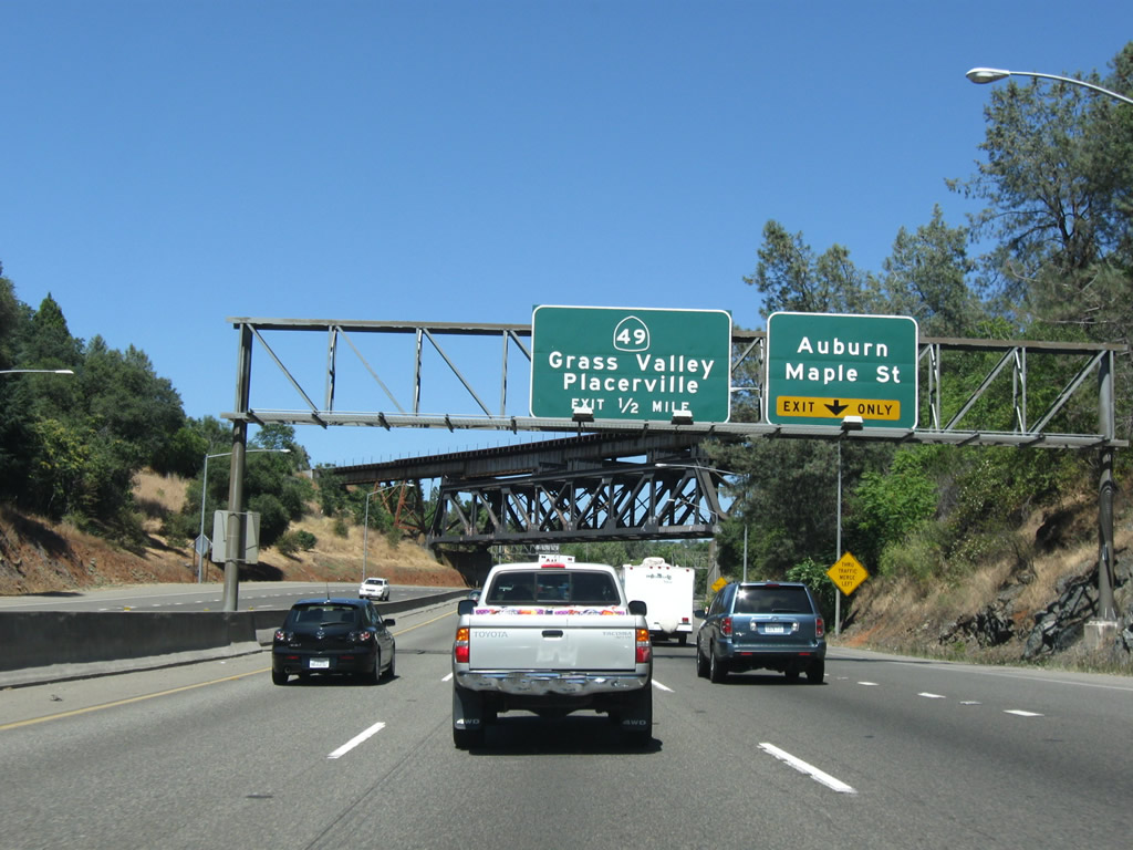
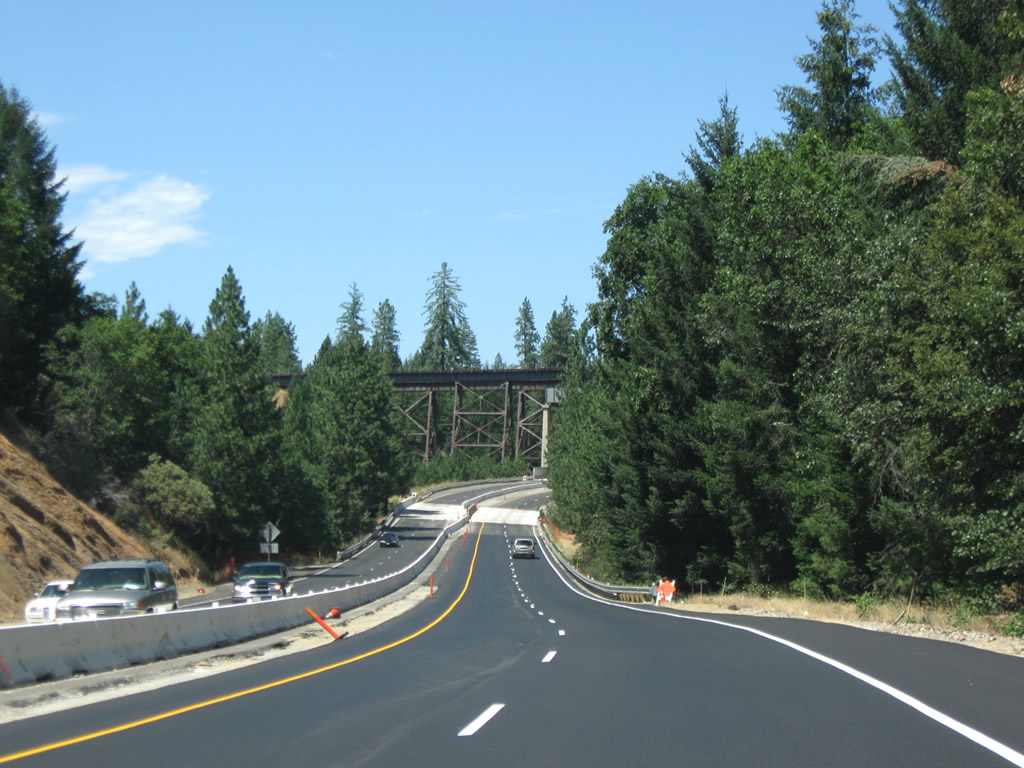
After the county line, this view again looks at the collector distributor lanes for Exit 102, U.S. 40 east and U.S. 99E/Riverside Avenue north and U.S. 40 west and U.S. 99E/Auburn Boulevard south. This first ramp connects to Auburn Boulevard south, and the second ramp leads to Riverside Avenue north into Roseville. Once in downtown Roseville, U.S. 40 and U.S. 99E split: U.S. 40 proceeds northeast along Atlantic Street parallel to the Union Pacific Railroad, while U.S. 99E turns north along Washington Boulevard toward Lincoln. U.S. 99E eventually parallels California 65 north toward Marysville-Yuba City. Photos taken 07/07/07 and 11/23/12. |
|
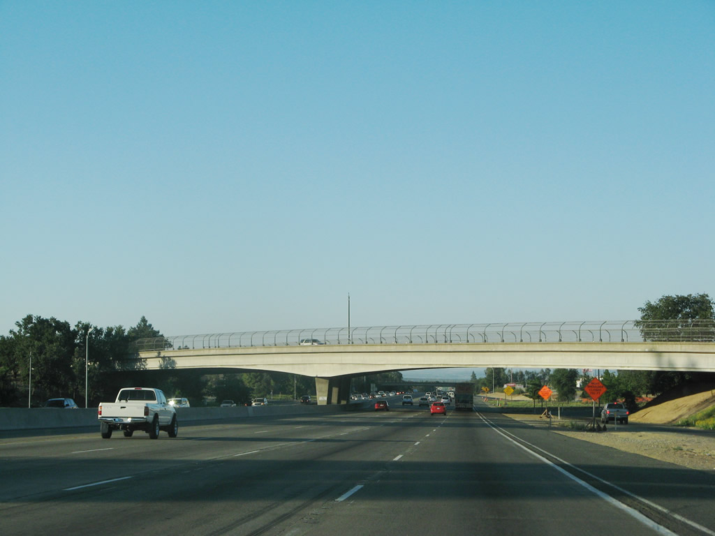
Just prior to crossing the Auburn Boulevard-Riverside Avenue overpass, Interstate 80 leaves Citrus Heights and enters the city of Roseville in Placer. Incorporated on April 10, 1909, Roseville had a population of 79,921 as of the 2000 Census; more recent Census estimates place the population at 112,660 in 2008. Photo taken 07/07/07. |
|
This Interstate 80 reassurance shield is posted after the Riverside Avenue interchange. Photo taken 11/23/12. |
|
|
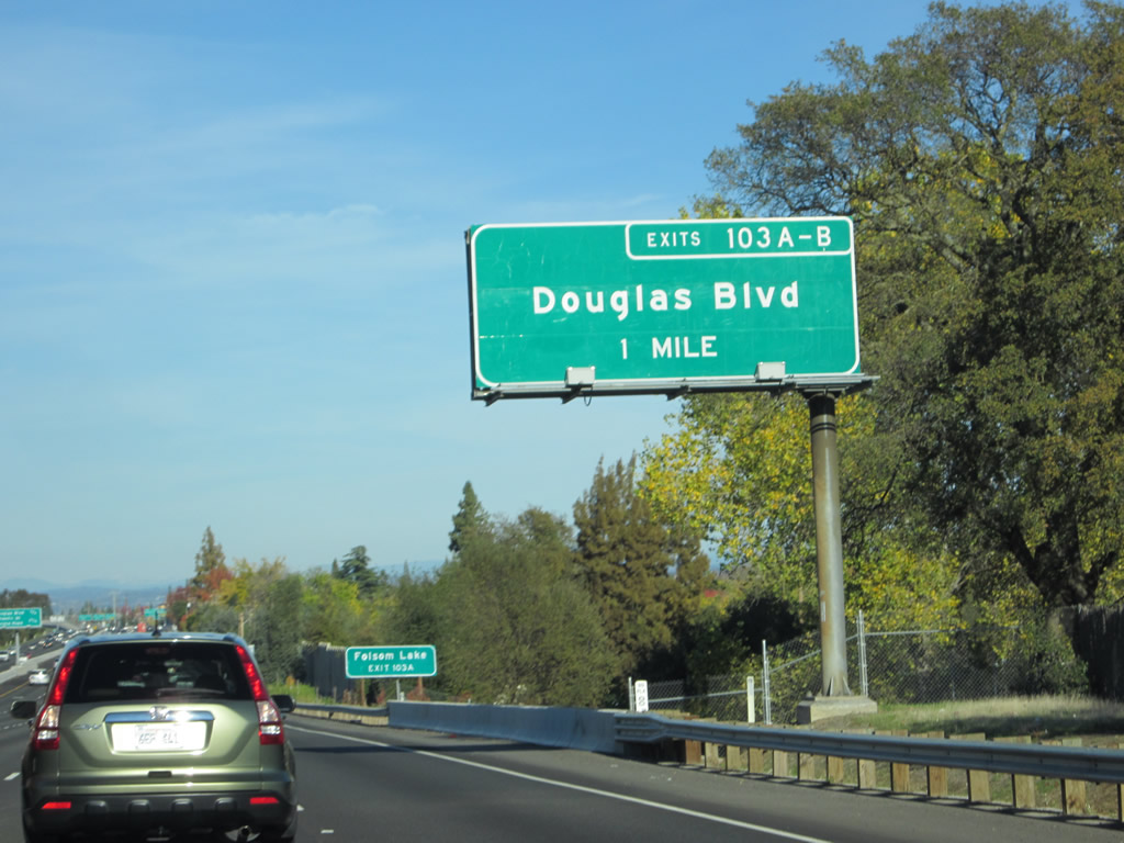
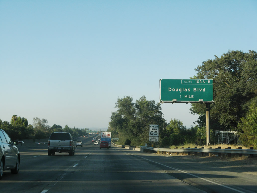
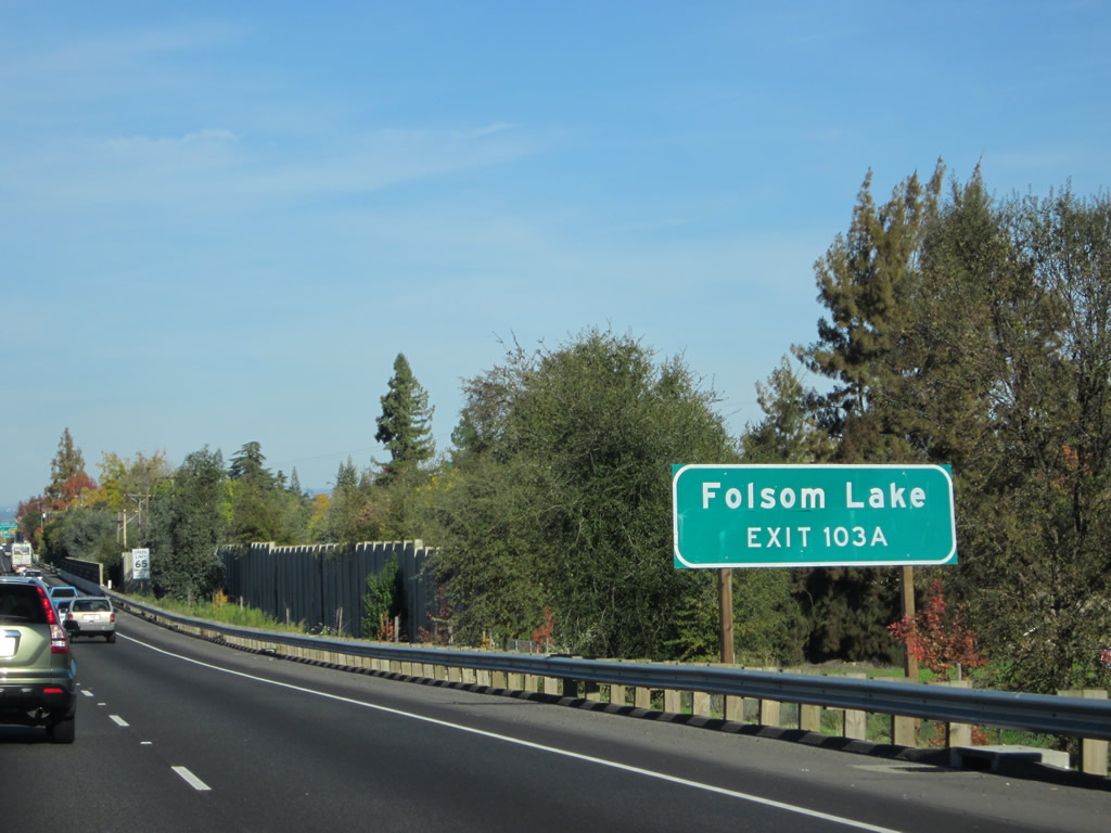
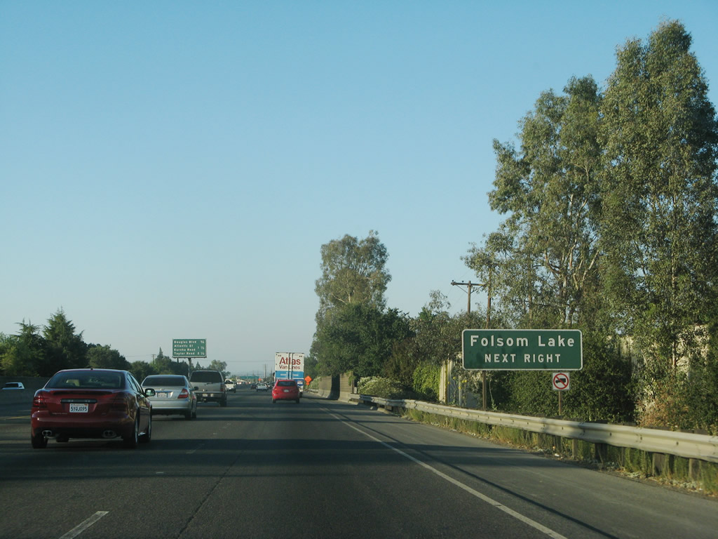
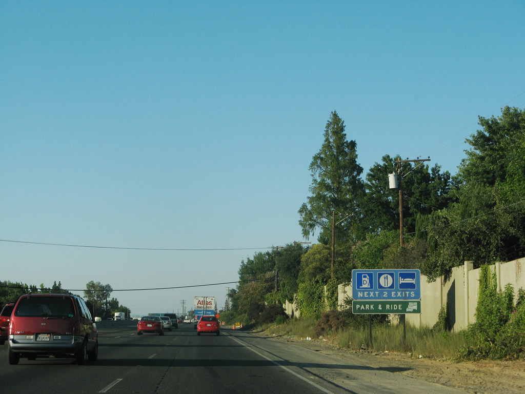
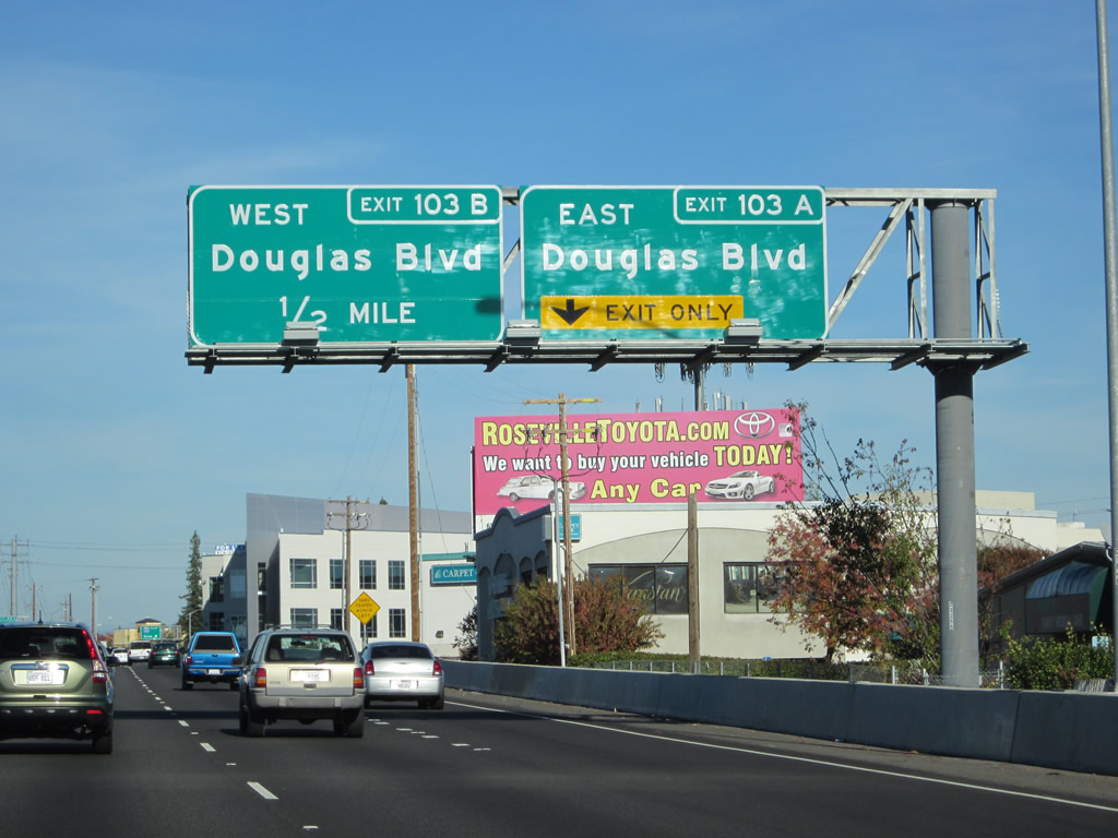
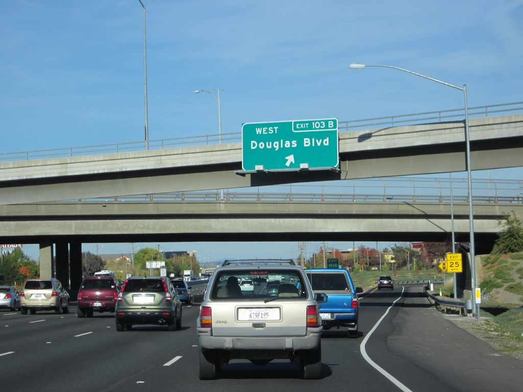
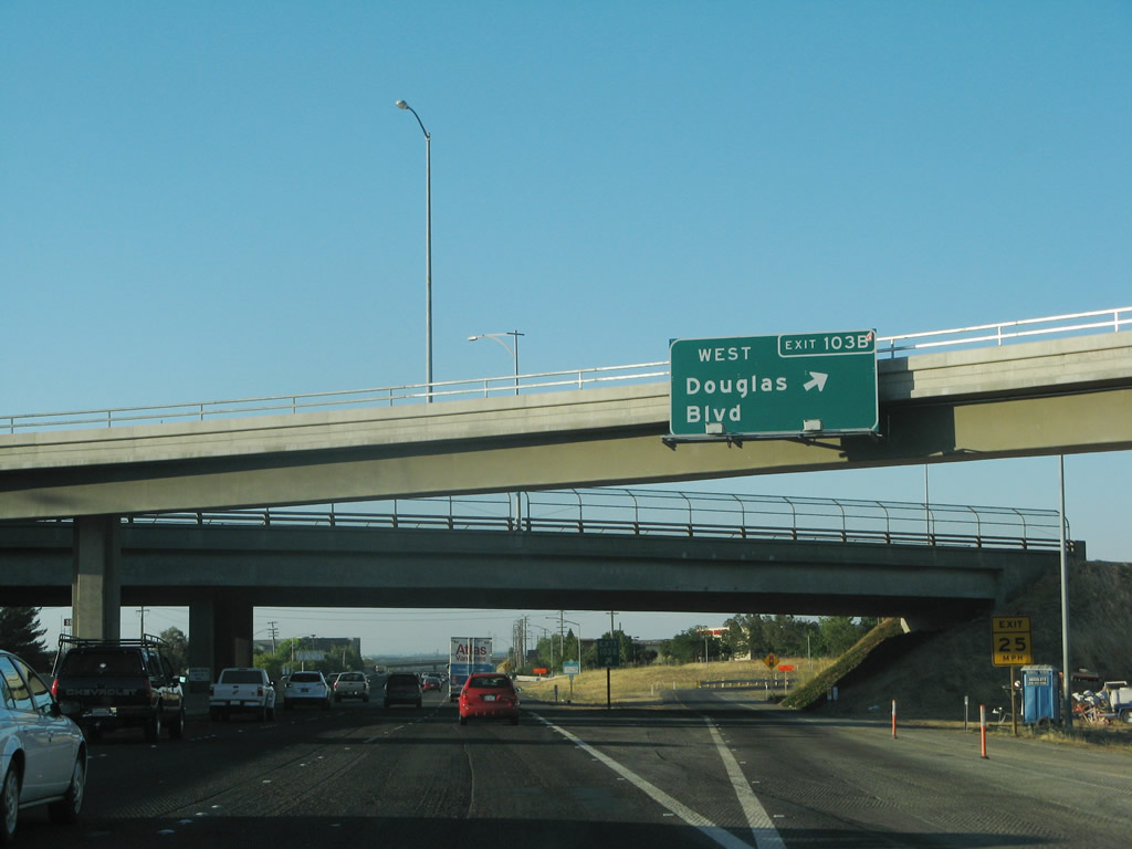
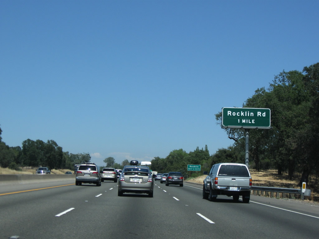
The next exit along Interstate 80/Alan S. Hart (Roseville) Freeway east is Exits 103A-B, Douglas Boulevard east and west. This major thoroughfare bisects the city of Roseville, which connections to Folsom Lake at Granite Bay east of town. Since Interstate 80 has a northeasterly trajectory through the foothills, it intersects both north-south and east-west major arterials through Roseville, Rocklin, and Loomis. Construction in 2009 added a lane here. Photos taken 11/23/12 and 07/07/07. |
|
|
Douglas Boulevard travels 6.3 miles east of Interstate 80 (via Exit 103A) to Folsom Lake and Folsom Lake State Recreation Area. Photos taken 11/23/12 and 07/07/07. |
|
|
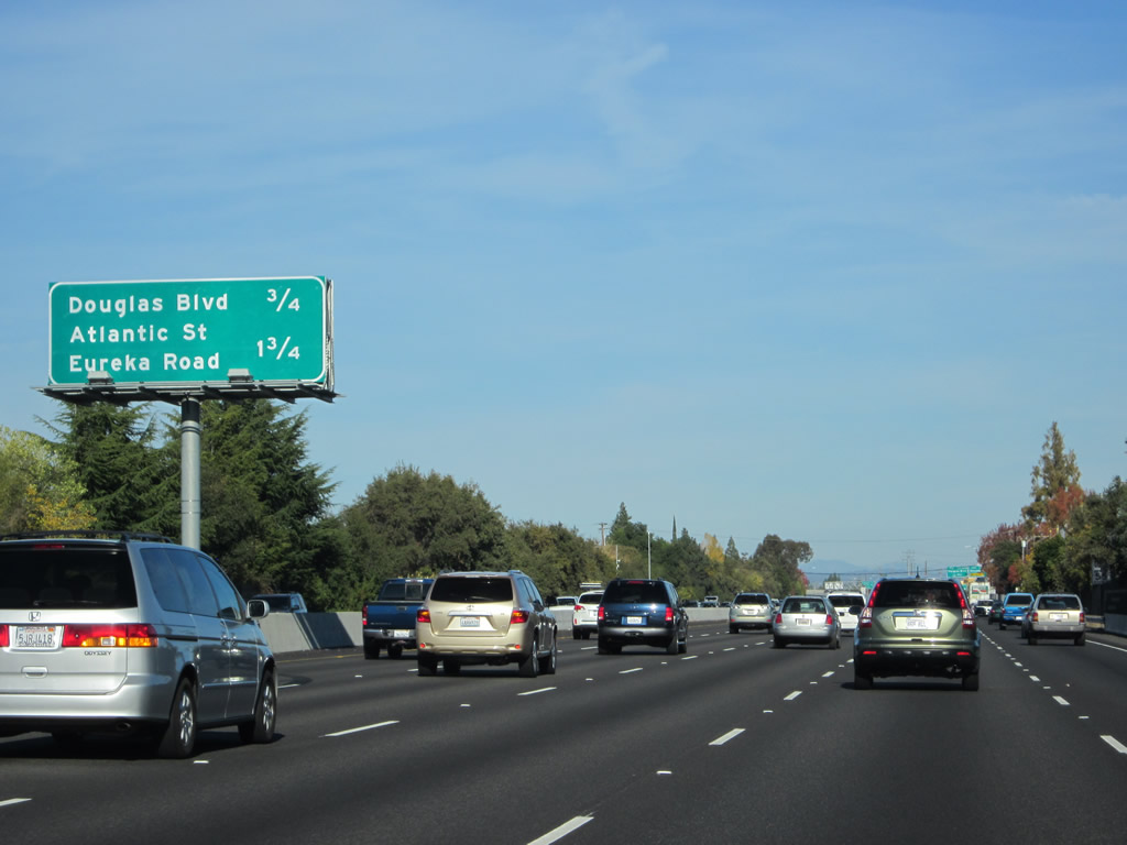
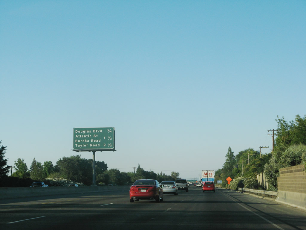
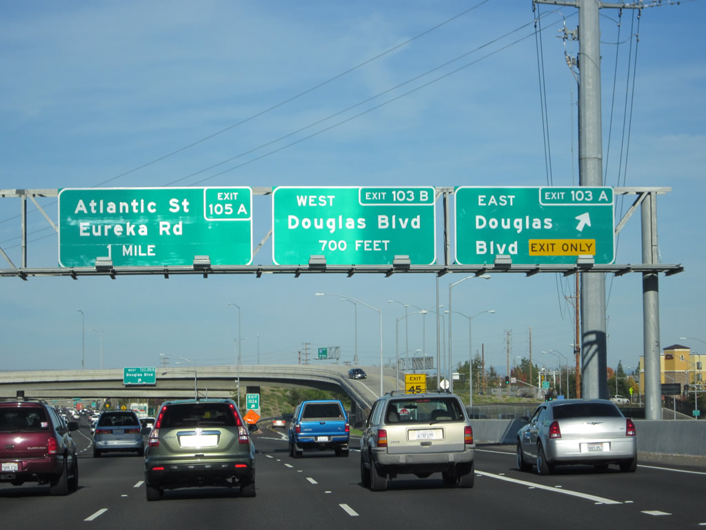
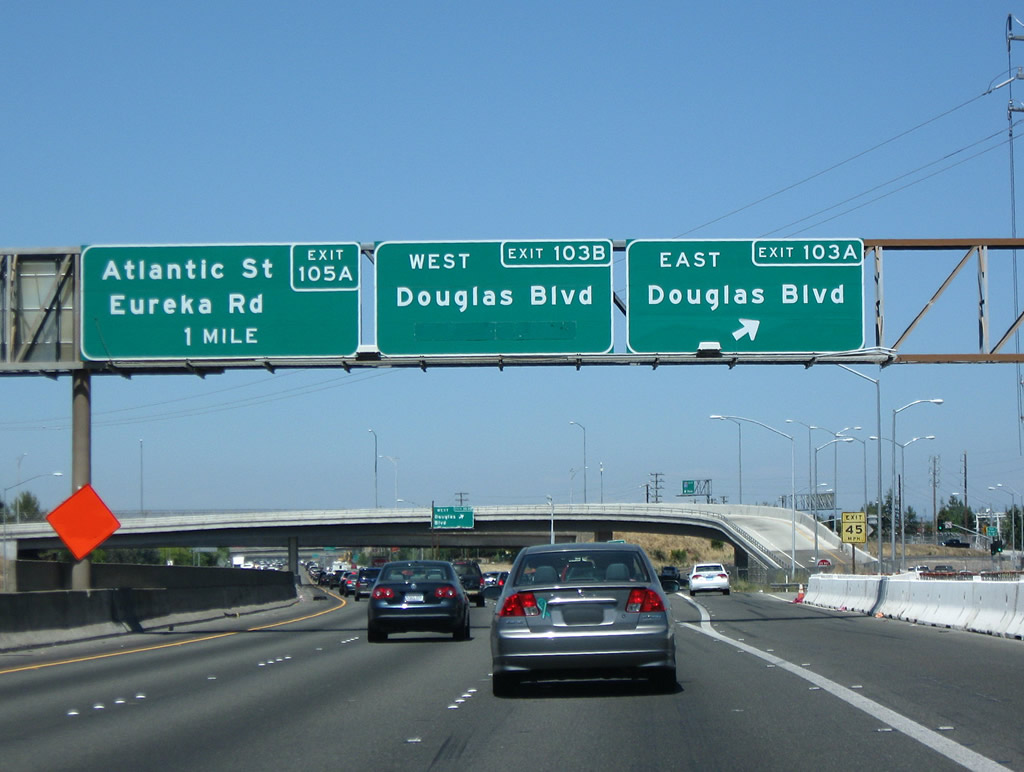
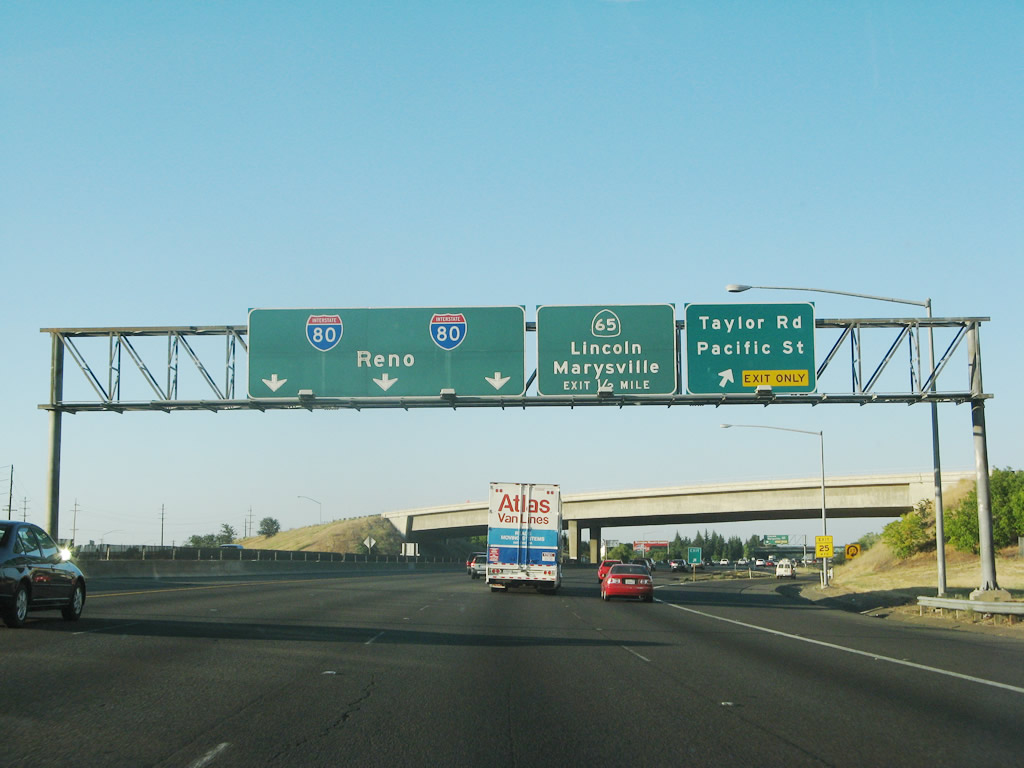
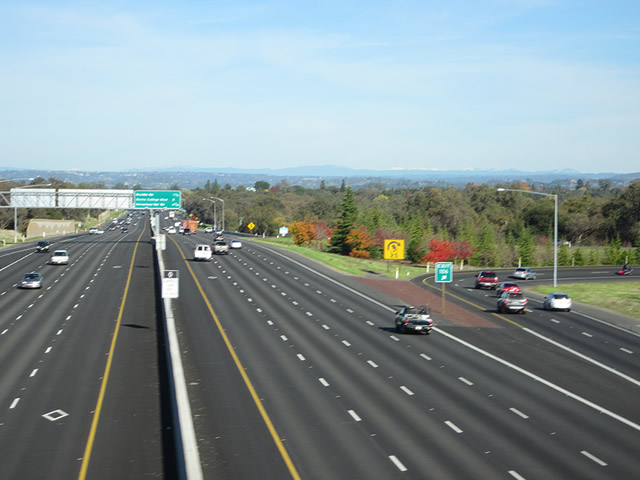
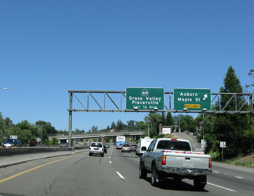
This mileage sign provides the distance to the next three exits from Interstate 80/Roseville Freeway east: Exit 103A-B, Douglas Boulevard and Exit 105A, Atlantic Street/Eureka Road (Exit 105B, Taylor Road was also on the sign until 2009). In 2007, only three lanes carried through traffic onward through the foothills along eastbound Interstate 80; this was widened to five eastbound lanes in 2009. Use the Douglas Boulevard exit to connect to southbound Placer Route E-2/Sunrise Avenue. Sunrise Avenue travels south from Douglas Boulevard through Roseville into Citrus Heights. At the county line, Placer Route E-2/Sunrise Avenue changes names to Sacramento County E-2 (Sunrise Boulevard). This mileage sign was replaced when the freeway was widened from three to five eastbound lanes; it also eliminated reference to the Taylor Road interchange. Photos taken 11/23/12 and 07/07/07. |
|
Continuing northeast, the next two exits (Exits 103A-B) have all motorist services. Photo taken 07/07/07. |
|
Late afternoon glare caused quite a bit of distortion on this set of signs, which was posted on Interstate 80 east before reaching the Douglas Boulevard interchange. These signs were added in 2009. Photo taken 11/23/12. |
|
|
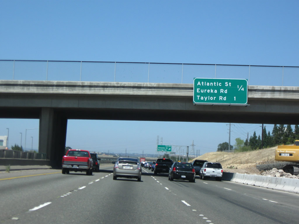
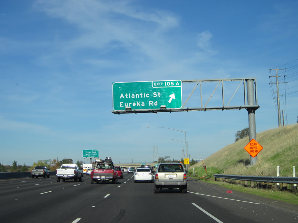
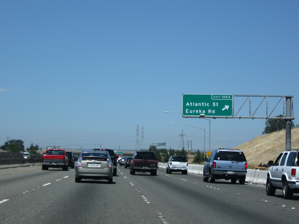
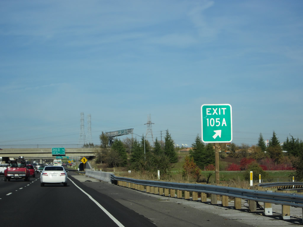
Arriving at the exit, eastbound Interstate 80/Roseville Freeway reaches Exit 105A, Historic U.S. 40/Atlantic Street west to Roseville and Eureka Road east to Granite Bay. From here, Interstate 80 continues northeast toward Auburn, Truckee, and Reno, while this exit connects to the growing city of Roseville via Atlantic Street and Eureka Road. Eureka Road follows a somewhat convoluted path from here, winding southeast from the Interstate, crossing Douglas Boulevard, then leading to Auburn-Folsom Road near Folsom Lake. Photos taken 11/23/12 and 07/18/09. |
|
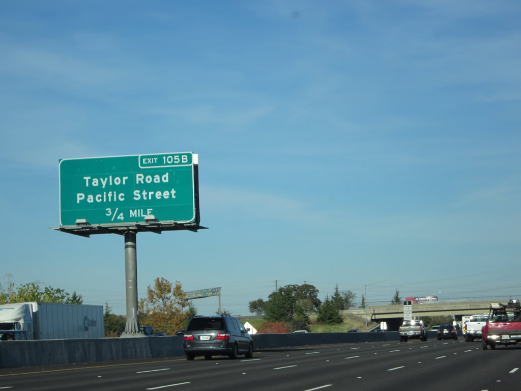
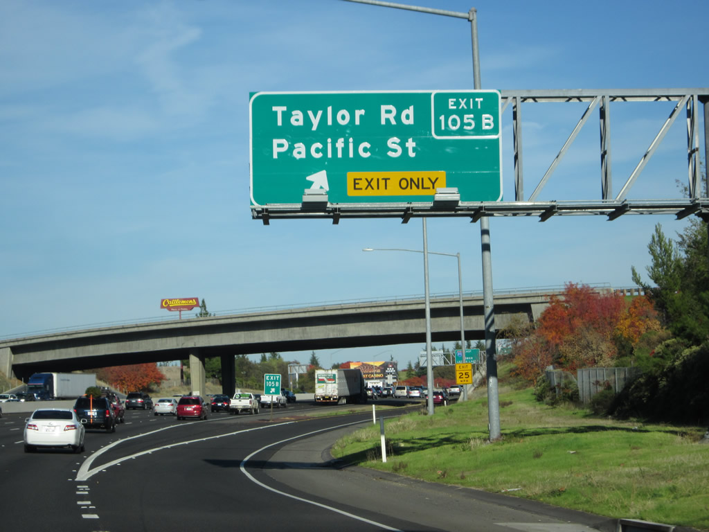
The next exit along Interstate 80 east is Exit 105B, Taylor Road (0.75 mile). Photo taken 11/23/12. |
|
The gore point for Exit 105A is fully signed with exit number. Photo taken 11/23/12. |
|
|
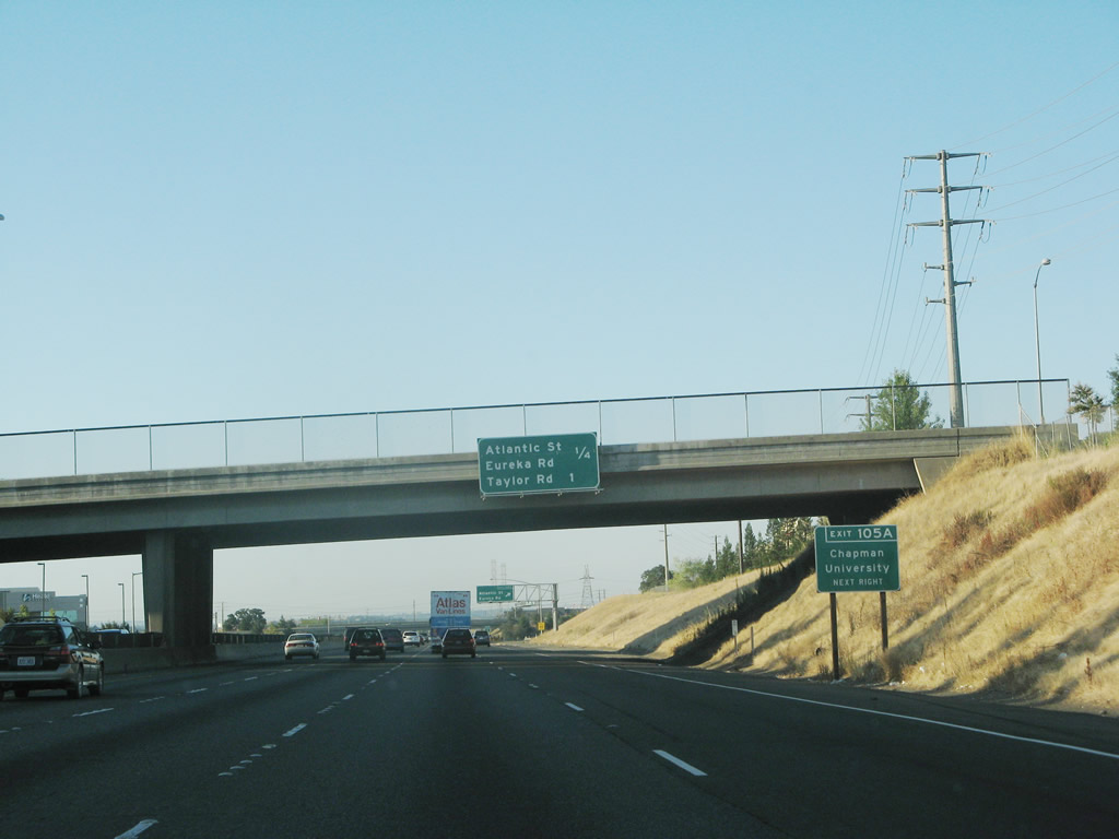
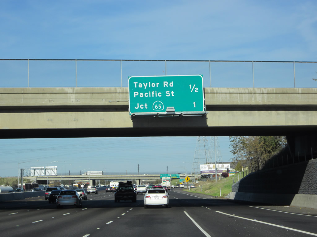
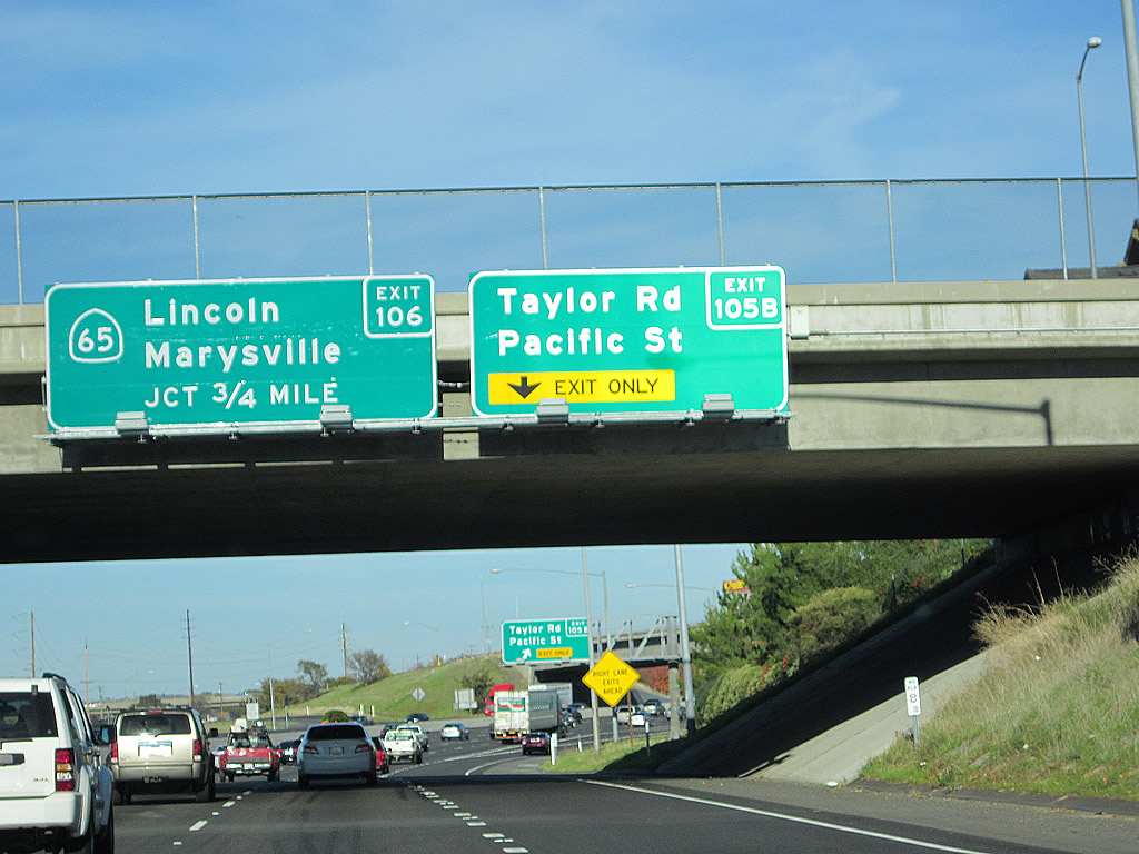
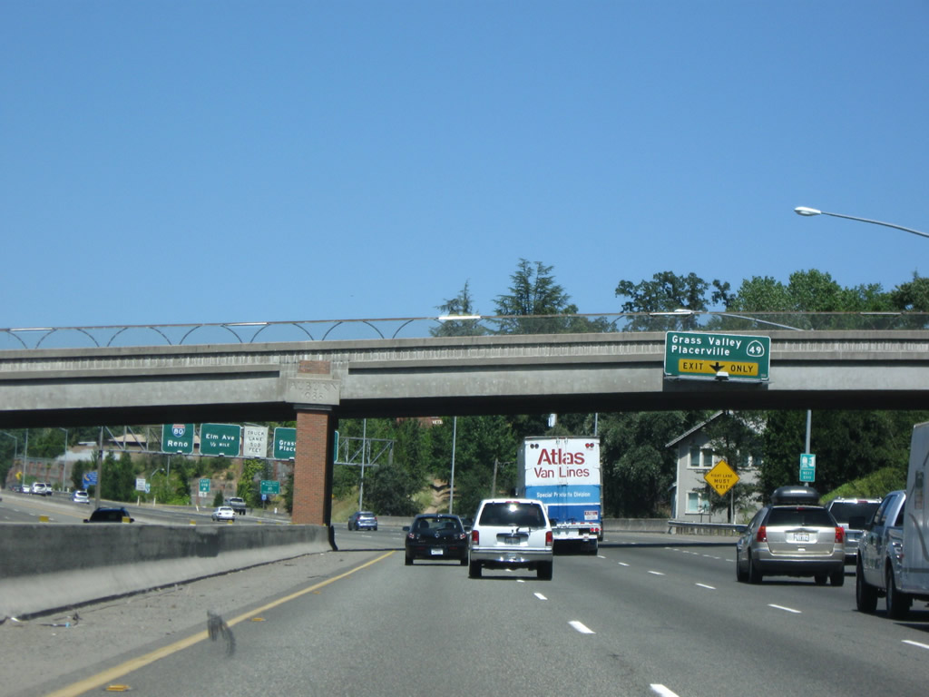
This mileage sign provides the distance to the next two exits from Interstate 80 east: Exit 105B, Taylor Road (Historic U.S. 40 east) and Pacific Street and Exit 106, California 65 north to Lincoln and Marysville-Yuba City. Exit 105B consists of a loop ramp onto Taylor Road (Historic U.S. 40) northbound from Interstate 80. Roseville Parkway passes over the freeway ahead of the ramp departure. Taylor Road otherwise heads northeast and parallels the Union Pacific Railroad line to Rocklin. Once in Rocklin, Historic U.S. 40 continues northeast as Pacific Street. Photos taken 11/23/12 and 07/18/09. |
|
|
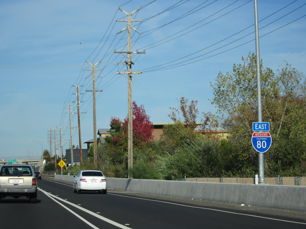
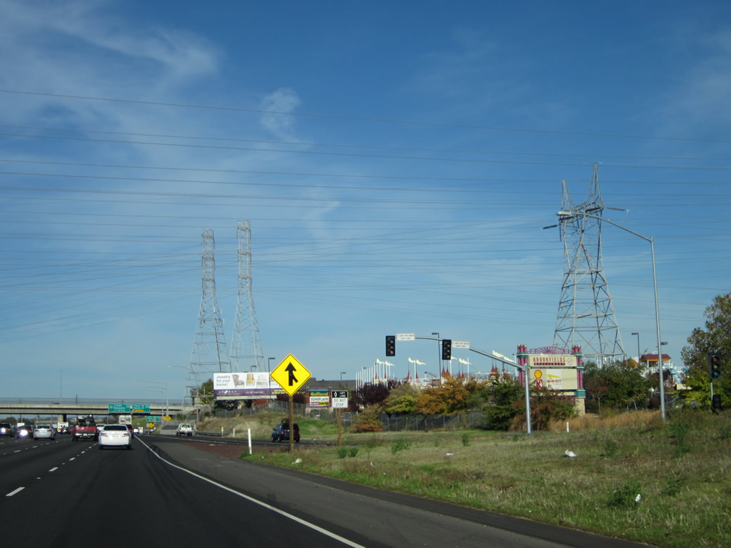
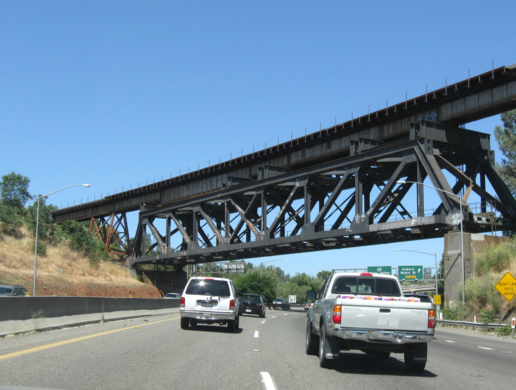
Several power lines fly over Interstate 80 between Exits 105A and 105B due to a nearby power substation. Most of these lines are owned by Pacific Gas & Electric (PG&E) and Sacramento Municipal Utility District (SMUD). Photos taken 07/07/07 and 11/23/12. |
|
|
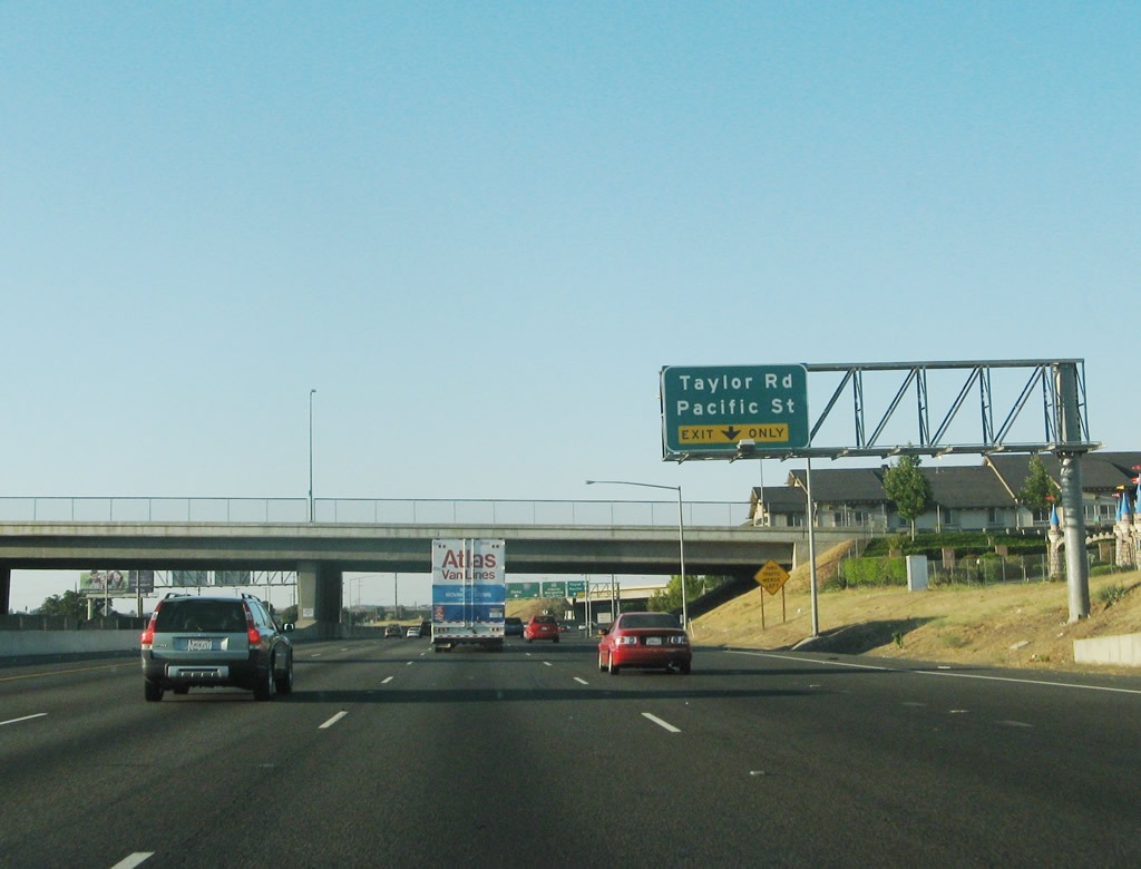
The right lane becomes exit only for Exit 105B, U.S. 40/Taylor Road northeast to Rocklin. Once in the city limits of Rocklin, U.S. 40/Taylor Road changes names to U.S. 40/Pacific Street. Traffic merging onto Interstate 80 east from Atlantic Street east forms this exit-only lane for Taylor Road. Two ramps join Taylor Road with the freeway just north of its intersection with Roseville Parkway. Roseville Parkway comprises an arterial between Barton Road and Pleasant Grove Road. The overhead sign was moved in 2009 as part of the freeway widening project. Photos taken 07/07/07 and 11/23/12. |
|
|
|
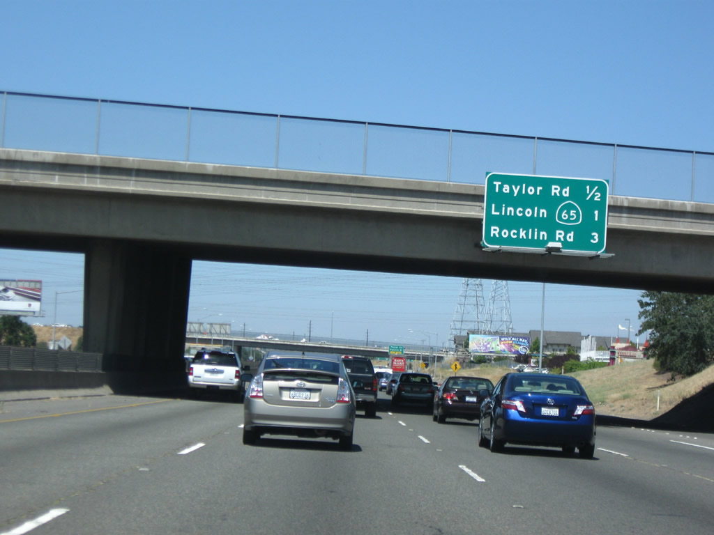
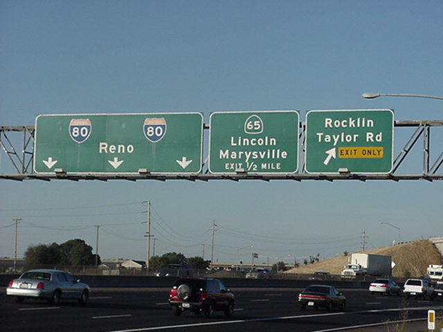
Eastbound Interstate 80 reaches Exit 105B, Taylor Road (Historic U.S. 40) one-half mile north of the Atlantic Street over crossing. Taylor Road parallels Interstate 80 northward from Atlantic Street to Pacific Street in Rocklin. The 2000 photo features the original guide sign for Exit 105B (Taylor Road north) and button copy shields for the Interstate 80 pull-through sign. Meeting the freeway in one half mile is California 65, a short freeway spur from Interstate 80 northwest to Sunset Boulevard west of Rocklin. This sign bridge saw several changes between 2000 and 2009. The current sign only includes the exit, while the earlier sign bridges announced the upcoming exits and pull-through sign for Interstate 80 east to reassure through traffic. Photos taken 11/23/12, 07/07/07, and by Joe Rouse (09/16/00). |
|
Exit 105B to Taylor Road includes a sharp curve; all exiting traffic should slow down accordingly. Photo taken 11/23/12. |
|
|
|
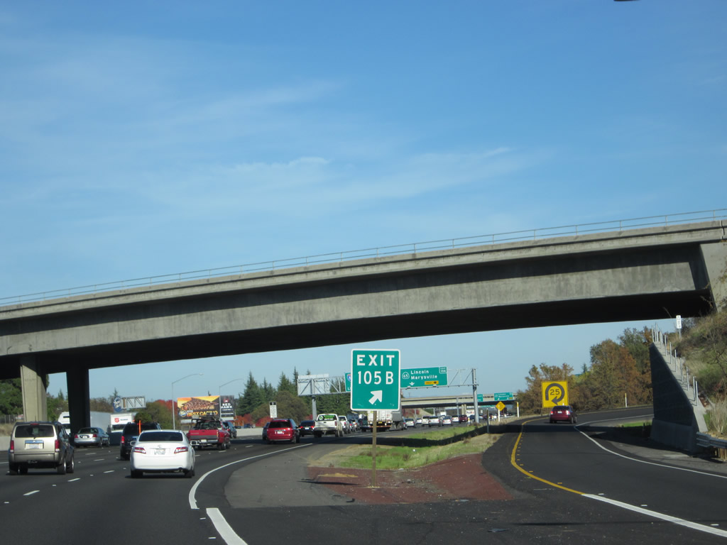
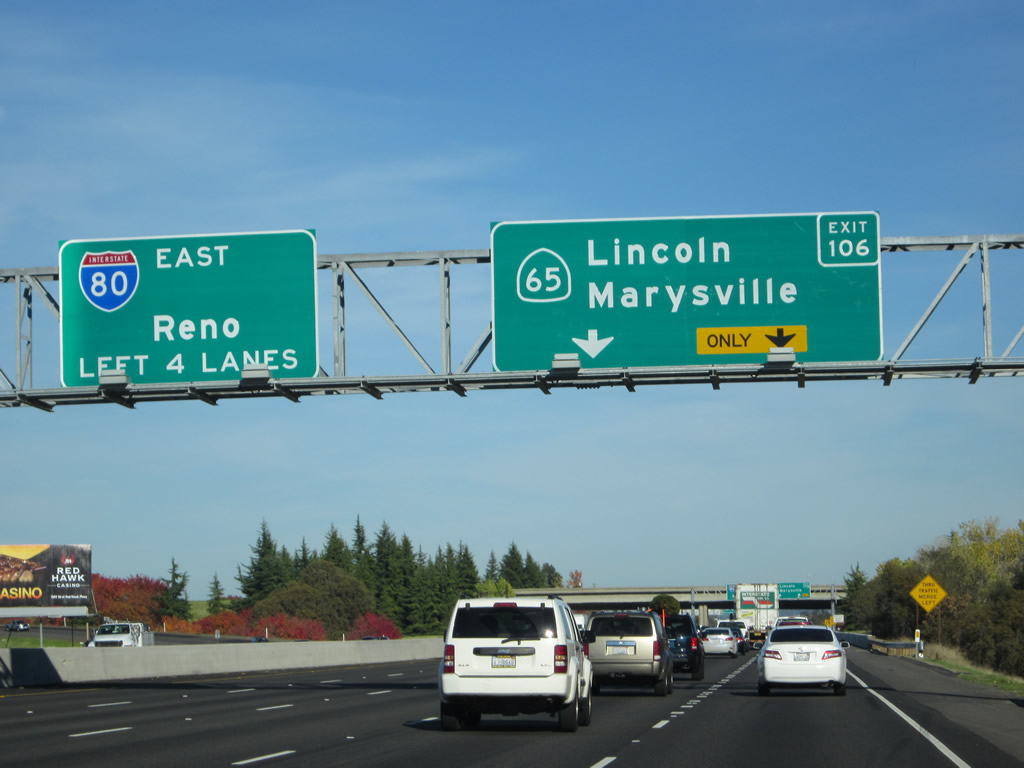
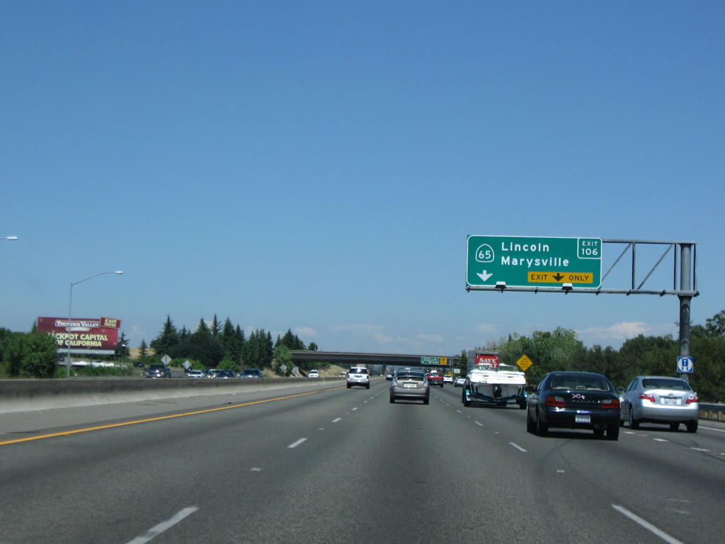
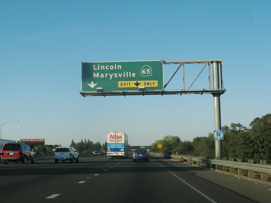
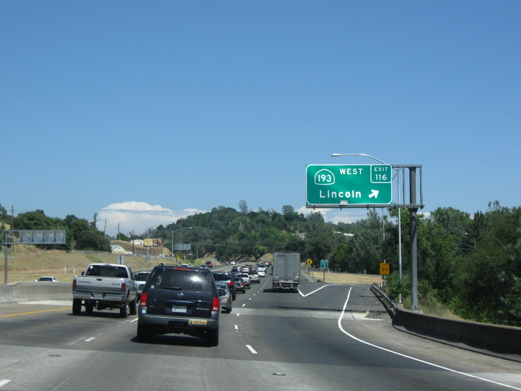
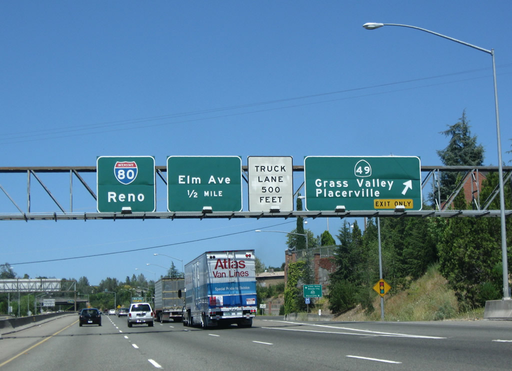
The next exit along Interstate 80/Roseville (Hart) Freeway east is Exit 106, California 65. This trumpet interchange includes a fairly tight loop ramp from Interstate 80 east to California 65 north. This state highway starts as a freeway and travels northwest from Roseville to Lincoln and Olivehurst between Interstate 80 and California 70. Parts of California 65 are expressway or conventional two-lane highway. A bypass around Lincoln allows through traffic to avoid downtown Lincoln. California 65 is planned as part of a much larger and more significant regional state route. To the south, California 65 was originally planned to continue south along a planned freeway between Interstate 80 and U.S. 50 at Rancho Cordova, with the Sunrise Boulevard interchange with U.S. 50 as the intended southern terminus. That freeway proposal was eliminated, although other plans to connect the northern section of California 65 with the extant segment in the San Joaquin Valley near Bakersfield is still under consideration/study. Note the addition of a new pull-through sign ("Left 4 Lanes") by 2012. Photos taken 11/23/12, 07/18/09, and 07/07/07. |
|
|
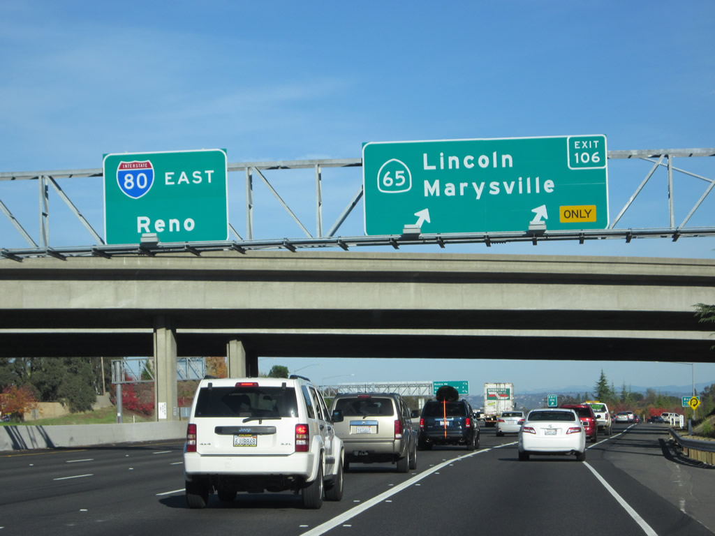
Eastbound Interstate 80 reaches Exit 106, California 65 north. Traveling northwest roughly along the path of Historic U.S. 99E, California 65 travels north to meet California 193 in Lincoln (approximately ten miles from here) and joins with California 70 at Olivehurst (29 miles north of here). California 70 continues the California 65 freeway at Olivehurst four more miles into the city of Marysville. Photos taken 11/23/12 and 07/18/09. |
|
|
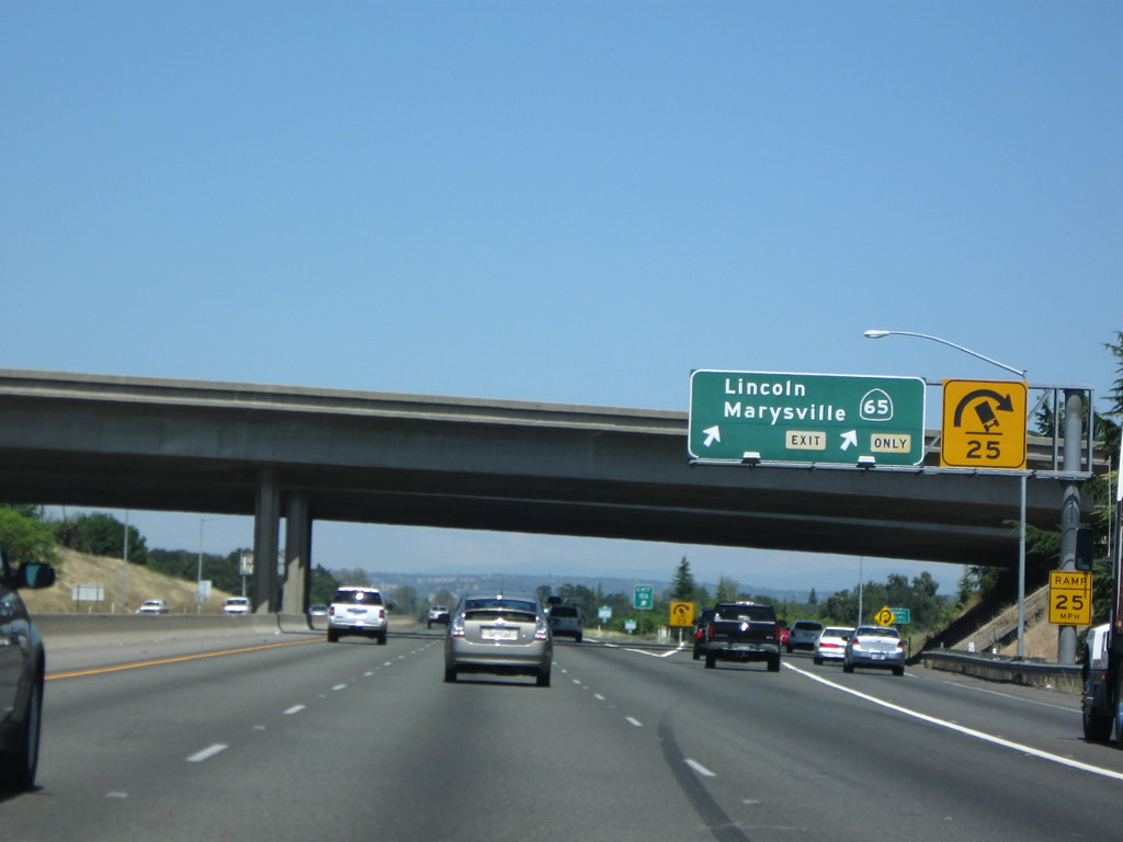
Now on the two-lane transition ramp from Interstate 80 east to California 65 north, the recommended speed for the loop ramp is only 25 miles per hour (not a typical speed for a freeway-to-freeway interchange). At this point, Interstate 80 leaves the city of Roseville and enters the city of Rocklin in Placer. Rocklin was home to 36,330 people as of the 2000 Census and was incorporated on February 24, 1893. Photos taken 11/23/12 and 07/07/07. |
|
This view looks east on Interstate 80 as seen from the California 65 overpass. Photo taken 11/23/12. |
|
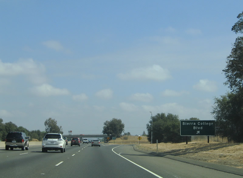
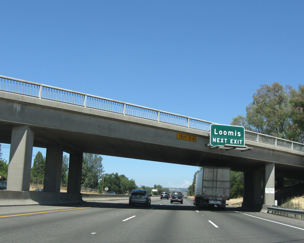
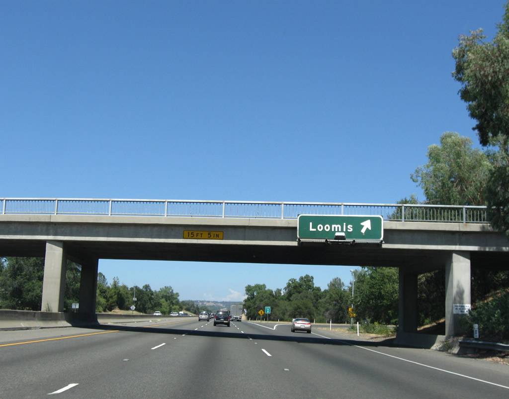
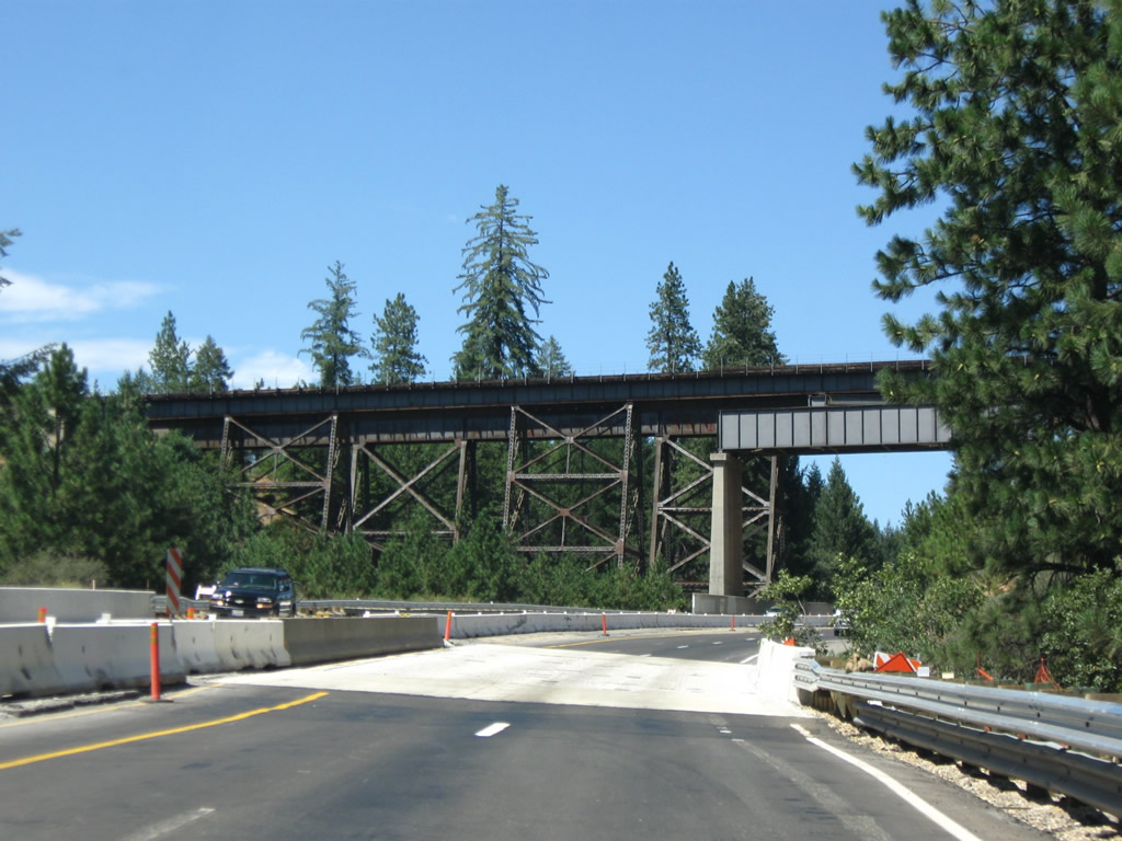
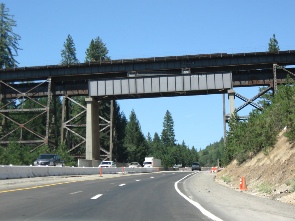
Brace Road passes over Interstate 80 one half mile north of the Exit 110 half-cloverleaf interchange. Around this point, Interstate 80 leaves Rocklin and enters the town of Loomis (population 6,260 as of 2000 Census; elevation 404 feet; date of incorporation December 17, 1984). Downtown Loomis lies just west of the freeway along Historic U.S. 40 (Taylor Road) between Rocklin and Penryn. U.S. 40 is called Pacific Street in Rocklin yet is called Taylor Road in Loomis. Photo taken 07/18/09. |
|
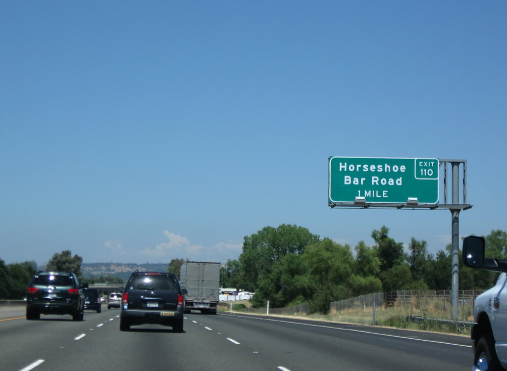
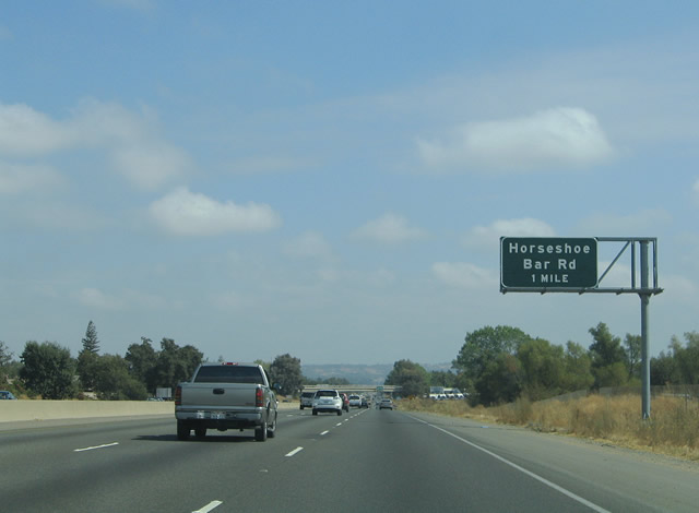
Eastbound Interstate 80 reaches Exit 110, Horseshoe Bar Road to downtown Loomis. Horseshoe Bar Road provides connections to the Folsom Lake area and Folsom itself via Laird and Barton Roads to the south. Horseshoe Bar Road itself travels east from Brace and Laird Roads to Auburn Folsom Road. Brace Road heads west across Interstate 80 to Sierra College and Taylor Roads. Photo taken 07/18/09. |
|
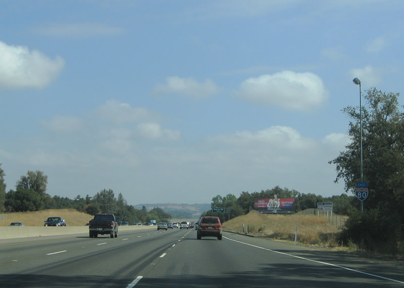
An angular, neutered reassurance marker posted for Interstate 80 eastbound after Exit 110. This is one of several examples of this irregular shield posted along Interstate 80 between the Sacramento metro area and Nevada state line. There are plenty of these neutered, angular shields all along Interstate 80 in both directions through the Sierra Nevada. Photo taken 09/10/05. |
|
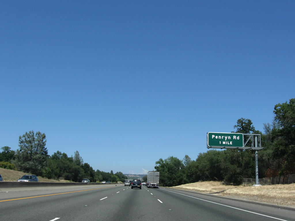
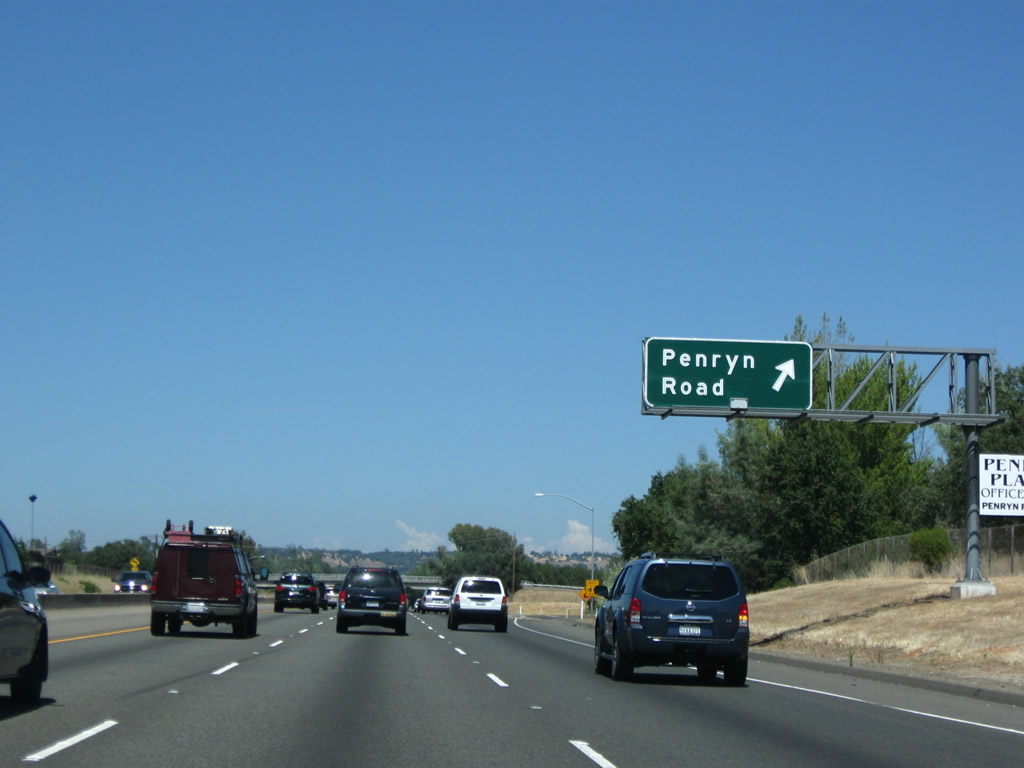
Interstate 80 leaves the town of Loomis and enters unincorporated Penryn in Placer. The next interchange along Interstate 80 east is Exit 112, Penryn Road (one mile). Penryn Road travels north-south 1.4 miles between King Road and Historic U.S. 40 (Taylor Road). Photo taken 07/18/09. |
|
Eastbound Interstate 80/Alan S. Hart Freeway reaches Exit 112, Penryn Road. The unincorporated community of Penryn lies north of Interstate 80 via Penryn and Taylor Roads. Penryn is perhaps best known for its granite quarry, and its history is provided at Griffith Quarry Museum at the intersection of U.S. 40/Taylor Road and Rock Springs Road in Penryn. The museum is the former headquarters of the Penryn Granite Works, which used to mine granite in the small foothill community starting in 1864. In 1976, the mining area and polishing facility were transferred to the existing museum and county park that commemorates the heritage of the Penryn Granite Works. Photo taken 07/18/09. |
|
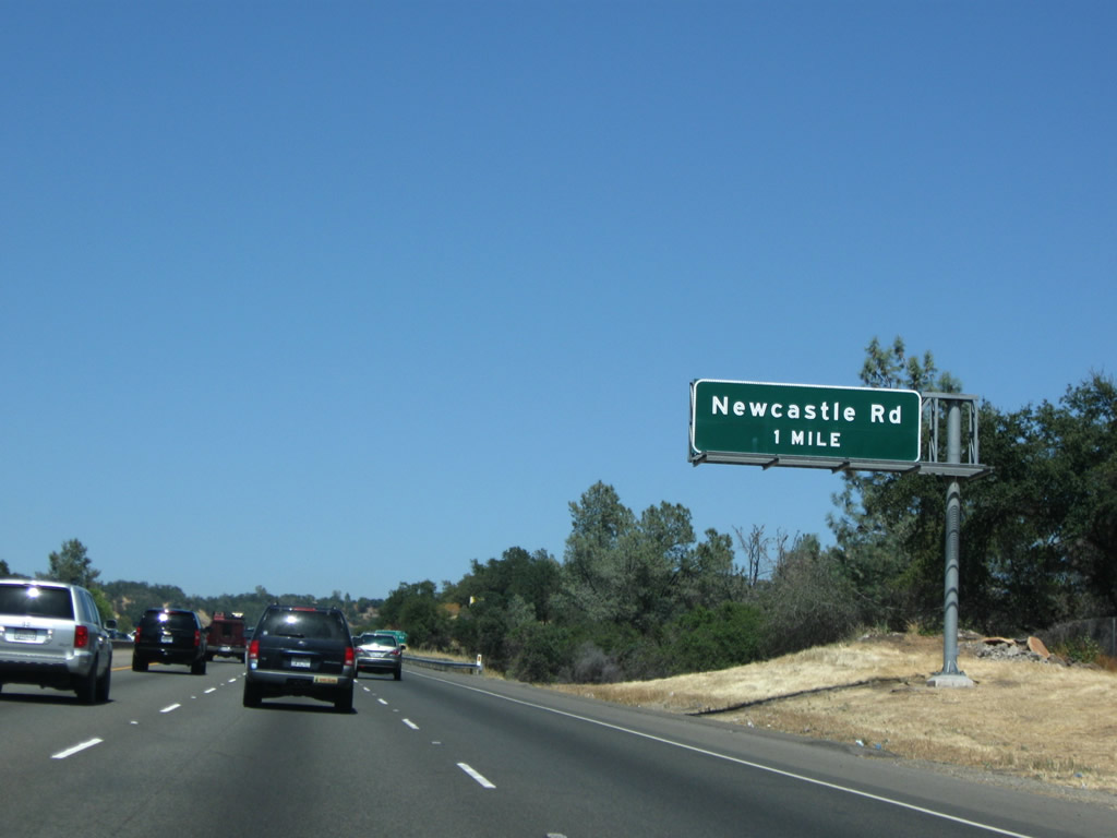
The next interchange along Interstate 80 east is Exit 115, Newcastle Road and Indian Hill Road (one mile). Photo taken 07/18/09. |
|
Newcastle Road travels southeast to Auburn-Folsom Road and west to U.S. 40/Taylor Road in the unincorporated community of Newcastle. Indian Hill Road travels east to Auburn-Folsom Road in southwestern Auburn, the seat of Placer. Photo taken 07/18/09. |
|
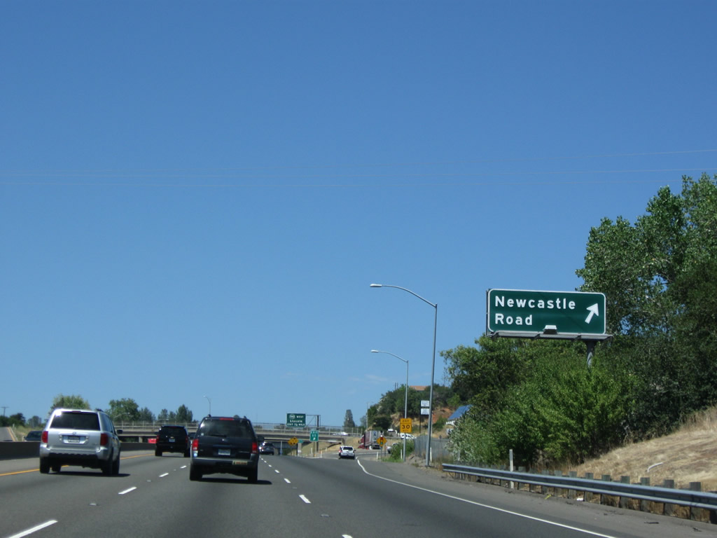
Eastbound Interstate 80 reaches Exit 115, Newcastle Road and Indian Hill Road in the unincorporated community of Newcastle (el. 945 feet). As we enter the Gold Country of California, many of the small communities and towns owe their founding to the Gold Rush of 1848. While Newcastle was founded during this era, no major gold mines opened in this area. Instead, the area is noted for its location along the Central Pacific (now Union Pacific) Railroad and Interstate 80/U.S. 40 (Lincoln Highway - Northern Sierra Nevada Alternate) corridors. Photo taken 07/18/09. |
|
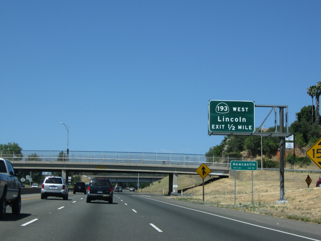
The next interchange along Interstate 80 east is Exit 116, California 193 west to Lincoln. Upon exiting, California 193 meets U.S. 40/Ophir Road, which travels east to Auburn. After entering Newcastle, California 193 turns south and then east toward Lincoln, while U.S. 40/Taylor Road continues west through the Newcastle Tunnel toward Penryn and Rocklin. Photo taken 07/18/09. |
|
California 193 is an east-west state route that is divided into two segments. The western segment begins at California 65 in Lincoln and extends east to Interstate 80 Exit 116 just west of Auburn. The eastern segment begins at California 49 in Cool and travels east to Georgetown, then turns south to end at California 49 in Placerville. The gap between the two segments is connected via Interstate 80 east and California 49 south, but the overlap is not signed. Photo taken 07/18/09. |
|
Eastbound Interstate 80 reaches Exit 116, California 193 west to Lincoln to Historic U.S. 40 (Ophir Road and Taylor Road), including the historic Newcastle Tunnel. The section of Interstate 80 from California 193 to California 49 was built in 1957. Photo taken 07/18/09. |
|
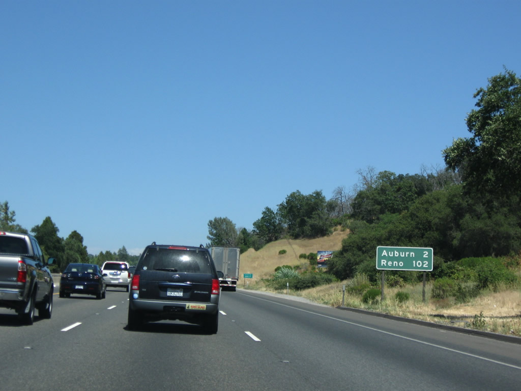
This mileage sign provides the distance to Auburn (two miles) and the control city of Reno (102 miles). Photo taken 07/18/09. |
|
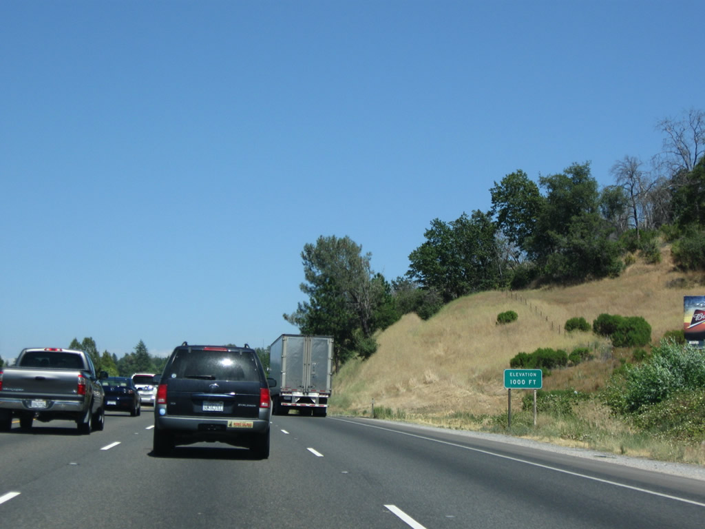
Interstate 80 reaches 1,000 feet. Signs like these will marks the elevation in 1,000-foot increments from here northeast to Donner Summit and then down to Truckee on the other side of the summit. Photo taken 07/18/09. |
|
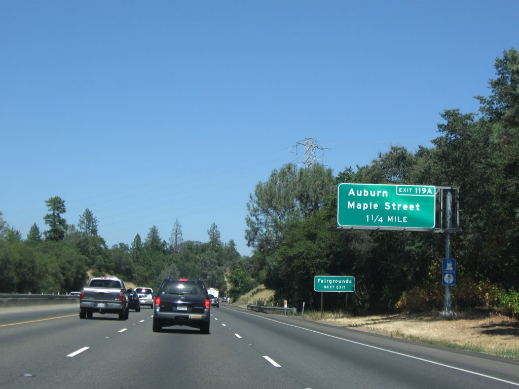
The next exit along Interstate 80 east is Exit 119A, Maple Street and Lincoln Way to downtown Auburn. There is no access from eastbound Interstate 80 to U.S. 40/Ophir Road west. Between Exits 118 and 119A, old U.S. 40 is beneath the freeway. However, at Exit 119A, U.S. 40 again departs east via Lincoln Way to serve downtown Auburn, the seat of Placer. Photo taken 07/18/09. |
|
California 49 (Exit 119B) is a major north-south corridor that serves the Gold Country. Known as the Gold Country Highway or Mother Lode Highway, California 49 was designated based on the Gold Rush of 1849 and the 49ers, the fortune seekers who swarmed the foothills of the Sierra Nevada looking for treasure in the form of gold. Gold mines opened up and down the Sierra Nevada foothills in the initial 49er craze, and some mining operations continued through the 20th Century. Use California 49 north to Grass Valley, Nevada City, and Downieville. To the south, California 49 leads to Placerville, Jackson, Angels Camp, Sonora, and Yosemite National Park. Photo taken 07/18/09. |
|
Parts of California 49 south of here have sharp turns, switchbacks, and curves. The section of California 49 that leads to the bottom of the American River Canyon east of Auburn was to be bypassed onto the Foresthill Bridge (see Exit 121) had a reservoir been built within the canyon, but today motorists must still pass through the canyon and drive carefully into and through the steep valley. Because of this, California 49 is not recommended for through trucks and large trucks. Photo taken 07/18/09. |
|
This view looks northeast along Interstate 80 east as it approaches the city of Auburn. Sitting at an elevation of 1,227 feet, Auburn is the seat of Placer. Home to 12,462 people as of the 2000 Census, Auburn is a city steeped in the Gold Rush of 1849. Auburn incorporated on May 2, 1888. Historic Old Town Auburn features the 1898 Placer Courthouse, Gold Country Museum, and a variety of buildings that date back to the earliest days of Auburn. (Placer High School is located south of downtown via Lewis Street and Orange Street. It is worth seeing the exterior of the historic high school building.) The off-ramp to Exit 119A (to Maple Street and U.S. 40/Lincoln Way) is visible below the Union Pacific overpass (which was built as part of the Central Pacific Railroad in 1909). Auburn serves as the eastern terminus of the Amtrak Capitol Corridor train, which travels southwest to Sacramento from here. The section of Interstate 80 through Auburn was built in the late 1950s but reconstructed in 1989 to increase the capacity and modernize the freeway to current standards. Photo taken 07/18/09. |
|
The right lane of Interstate 80 east becomes exit only for Exit 119A, U.S. 40/Maple Street east to U.S. 40/Lincoln Way east to downtown Auburn. Historic U.S. 40 will follow Lincoln Way through downtown Auburn, then north toward Bowman. Photo taken 07/18/09. |
|
Interstate 80 passes under the 1909 Union Pacific Railroad overpass; the overpass was modified to its current capacity in 1959 (as part of the original Interstate 80 freeway construction). Photo taken 07/18/09. |
|
Eastbound Interstate 80 reaches Exit 119A, U.S. 40/Maple Street to downtown Auburn. Use this exit to Lincoln Way and to Nevada Street north. As suggested by the name Lincoln Way, the historic Lincoln Highway passes through town via Old U.S. 40, and that designation remains in use to this day. Through traffic north to Grass Valley-Nevada City should use Exit 119B, California 49 north rather than Nevada Street north. Photo taken 07/18/09. |
|
Passing through downtown Auburn, the next exit along Interstate 80 east is Exit 119B, California 49/Gold Country (Mother Lode) Highway north to Grass Valley-Nevada City or south to Placerville and Jackson. Photo taken 07/18/09. |
|
Exit 119B leaves I-80 east for SR 49 / Gold Country (Mother Lode) Highway north to Grass Valley-Nevada City and south to Placerville and Jackson. A truck lane allows slower traffic to stay right on this fairly steep segment of Interstate 80. Photo taken 07/18/09. |
|
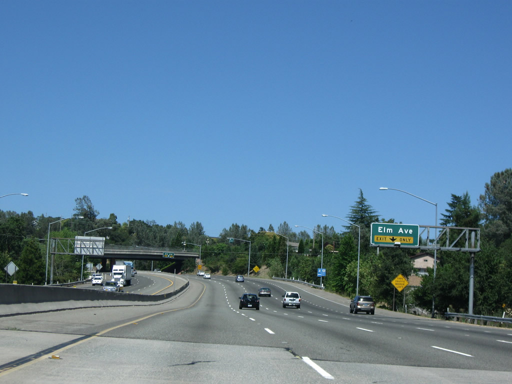
The next exit along Interstate 80 east is Exit 119C, Elm Avenue (right lane exit only with a loop ramp). This east-west arterial links Interstate 80 with California 49. Photo taken 07/18/09. |
|
Eastbound Interstate 80 reaches Exit 119C, Elm Avenue. The loop ramp departs the freeway after passing under the Elm Avenue overpass. Photo taken 07/18/09. |
|
The next exit along Interstate 80 east is Exit 120, U.S. 40/Lincoln Way. This is the fourth and final interchange to serve the city of Auburn. After this off-ramp, Interstate 80 leaves Auburn and enters unincorporated Bowman, a community of Placer. Photo taken 07/18/09. |
|
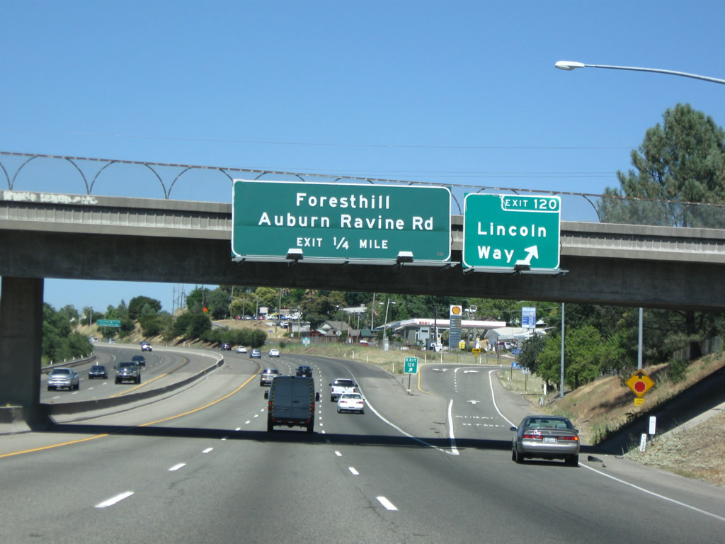
Passing under the Russell Road overpass, eastbound Interstate 80 reaches Exit 120, U.S. 40/Lincoln Way to northeastern Auburn. The next exit ahead is Exit 121, Foresthill Road east to the unincorporated community of Foresthill. A massive deck truss bridge carries Foresthill Road over the American River and the Auburn State Recreation Area below. The bridge was intended to be part of the Photo taken 07/18/09. |
|
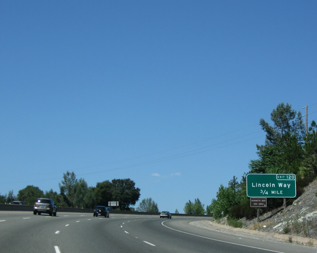
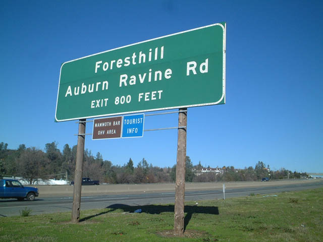
The next exit along Interstate 80 east is Exit 121, Auburn Ravine Road to Foresthill (800 feet). This sign was gone by 2009. This exit leads to the Foresthill Bridge, which was a planned but unaccepted component of a proposed rerouting of California 49 had a reservoir been constructed along the American River within the Auburn State Recreation Area. Photo taken 01/19/03. |
|
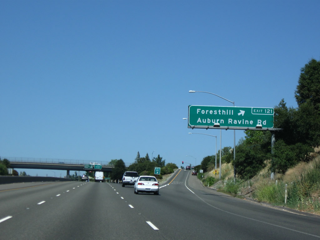
Eastbound Interstate 80 reaches Exit 121, Auburn Ravine Road southwest to north-central Auburn and Foresthill Road east to Foresthill. The section of Interstate 80 northeast of Auburn through Applegate and Weimar was built in 1973. Photo taken 07/18/09. |
|
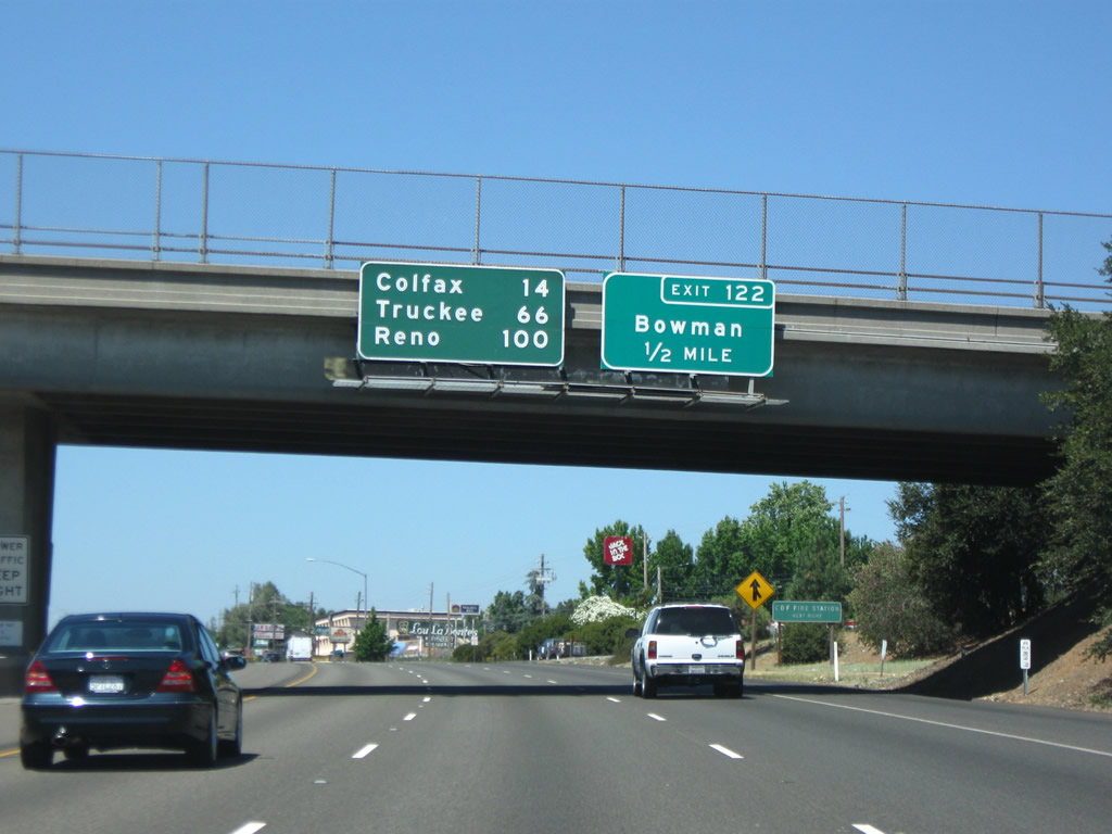
The next exit along Interstate 80/Alan S. Hart Freeway east is Exit 122, Bowman Road to the unincorporated community of Bowman. A mileage sign is mounted on the Foresthill Road overpass for the distance to Colfax (14 miles), Truckee (66 miles), and Reno (100 miles). Photo taken 07/18/09. |
|
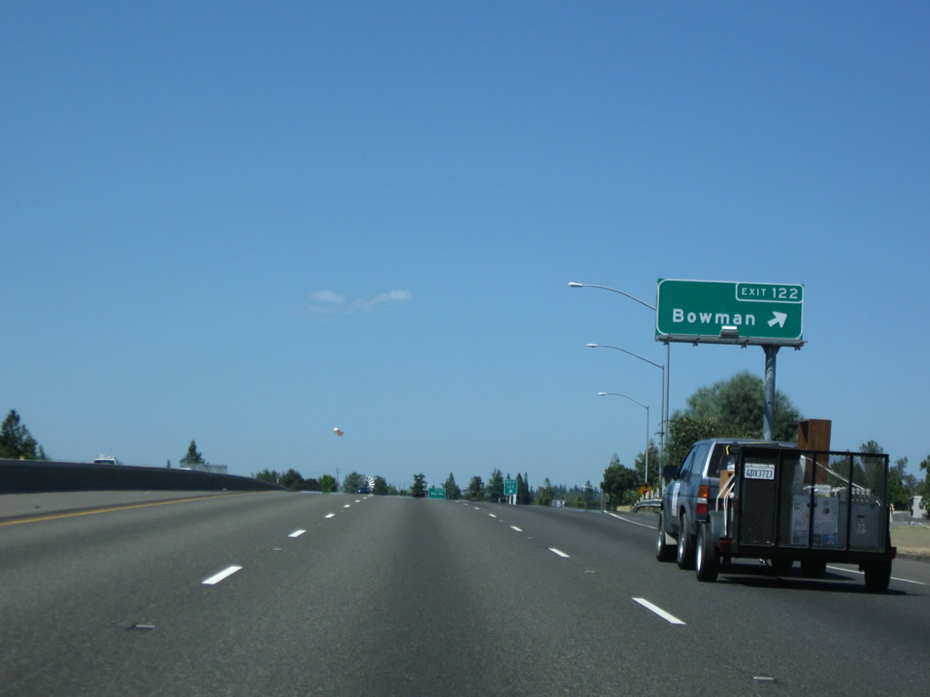
Eastbound Interstate 80 reaches Exit 122, Bowman Road to the unincorporated community of Bowman. Photo taken 07/18/09. |
|
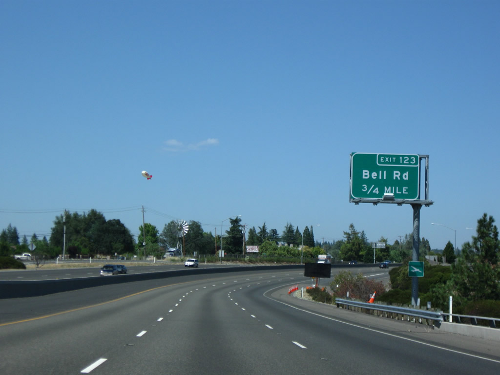
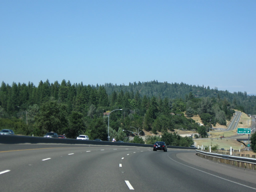
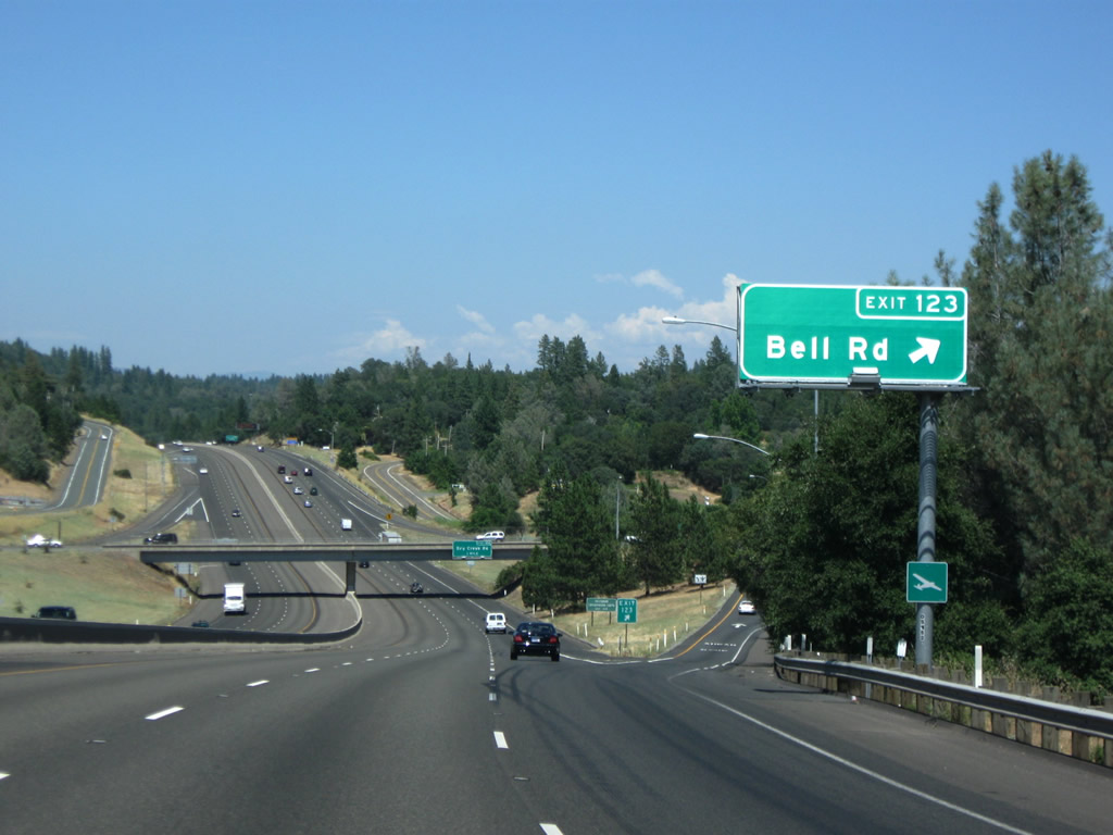
The next exit along Interstate 80/Alan S. Hart Freeway east is Exit 123, Bell Road (0.75 mile). Photo taken 07/18/09. |
|
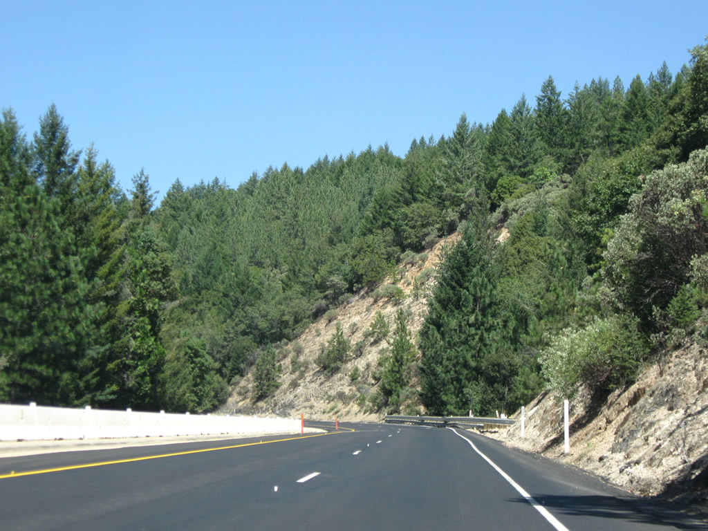
The freeway gains and loses elevation as it rolls through the Sierra Nevada foothills. Trees become more prevalent as seasonal rainfall totals increase. Photo taken 07/18/09. |
|
Eastbound Interstate 80/Alan S. Hart Freeway east is Exit 123, Bell Road. Perhaps by now you've wondered why Interstate 80 is named for Alan S. Hart. According to Hart, Alan S.; ASCE Fellow (1907-1994) - Transactions of the American Society of Civil Engineers 1994, pp. 554-555, Alan S. Hart was a California Division of Highways and Caltrans engineer who was instrumental in getting both Interstate 80 through the Sierra Nevada and Interstate 280 in the San Francisco Bay Area constructed. According to the ASCE webpage, "Construction in harmony with nature and the society seem to have been important design criteria for Alan Hart. In addition to overseeing the design and construction of two striking highways, Alan reportedly was the individual that conceived the idea of painting a rainbow over the Waldo Tunnel in Sausalito." Photo taken 07/18/09. |
|
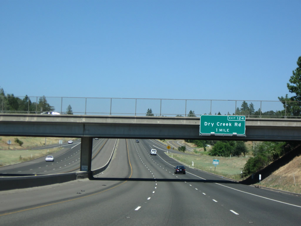
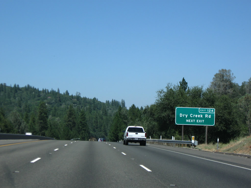
The next exit along Interstate 80/Alan S. Hart Freeway east is Exit 124, Dry Creek Road (one mile). Dry Creek Road travels west to the Auburn Municipal Airport and a junction with California 49 north of Auburn. Photo taken 07/18/09. |
|
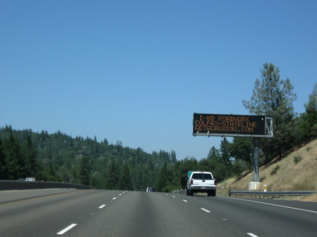
A dynamic message sign advises of a construction project underway on Interstate 80 over the Sierra Nevada. The webpage shown on the sign is Get Across 80 is arranged to provide motorist information on several ongoing projects. As of 2009, the webpage shows projects scheduled from 2009 to Fall 2011. Photo taken 07/18/09. |
|
A second approach guide sign is posted for Exit 124, Dry Creek Road. Photo taken 07/18/09. |
|
Eastbound Interstate 80/Alan S. Hart Freeway reaches Exit 124, Dry Creek Road. Photo taken 07/18/09. |
|
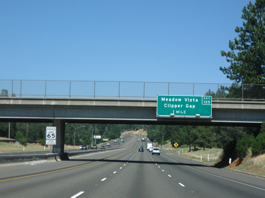
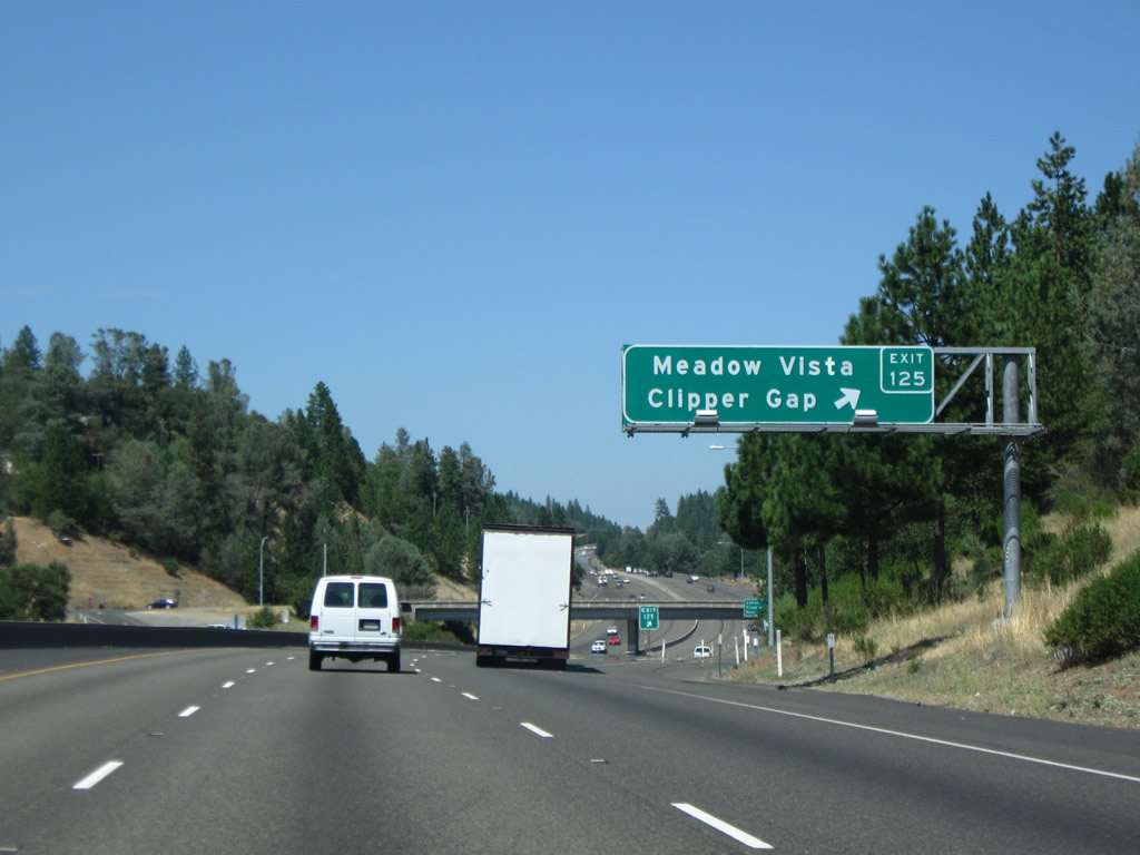
The next exit along Interstate 80/Alan S. Hart Freeway east is Exit 125, Placer Hills Road to the unincorporated communities of Clipper Gap and Meadow Vista (one mile). Placer Hills Road is one possible old alignment of U.S. 40, along with Applegate Road. Photo taken 07/18/09. |
|
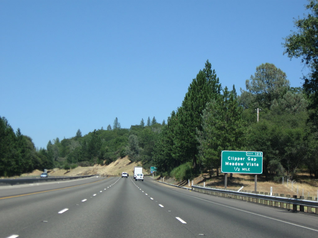
Placer Hills Road follows a possible old alignment of U.S. 40 northeast through Clipper Gap and Meadow Vista, then turns back to meet Interstate 80 and California 174 in Colfax. For the next several miles (between Clipper Gap and Colfax, Exits 125 to 135), "eastbound" Interstate 80 and parallel U.S. 40/Placer Hills Road travel almost due north. Photo taken 07/18/09. |
|
Eastbound Interstate 80/Alan S. Hart Freeway reaches Exit 125, (possible) U.S. 40/Placer Hills Road to Clipper Gap and Meadow Vista. Photo taken 07/18/09. |
|
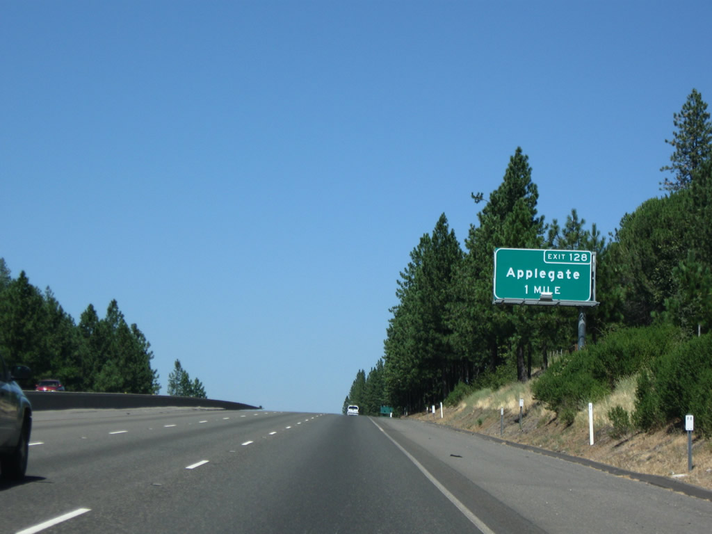
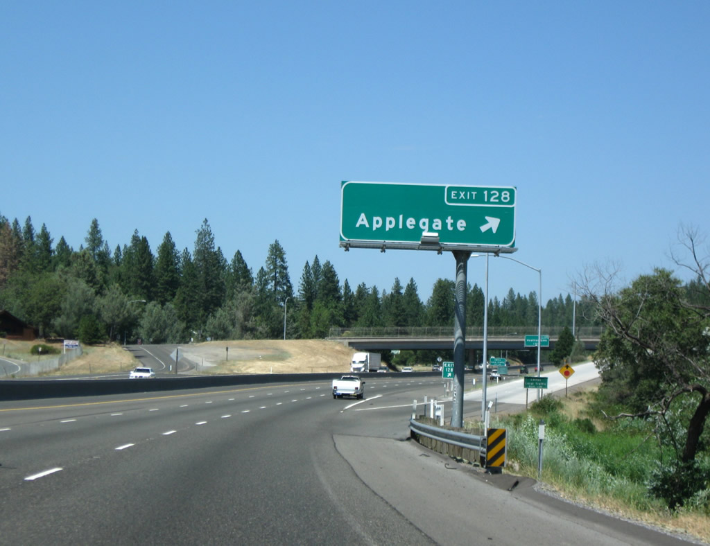
The next exit along Interstate 80/Alan S. Hart Freeway east is Exit 128, Crother Road to Applegate (one mile). Another unincorporated community, Applegate is located right off Interstate 80 at Exit 128. Photo taken 07/18/09. |
|
As we ascend the Sierra Nevada, winter snows and harsh storms become more of a threat. Snow chains for tires might be required during those winter storms, and in those cases, the California Highway Patrol will set up snow chain checks for motorists planning to cross the mountains. Occasionally chain controls or checks will be found on Interstate 80 at the Applegate interchange. Photo taken 07/18/09. |
|
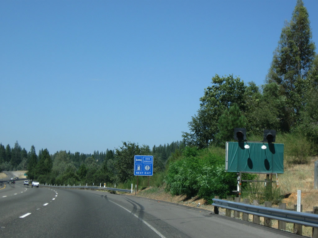
A second seasonal closure or warning sign is posted shortly thereafter. On the blue motorist services sign, note that chain installation services is listed along with gas, food, and lodging at Exit 128. Photo taken 07/18/09. |
|
Eastbound Interstate 80/Alan S. Hart Freeway reaches Exit 128, Crother Road to Applegate. Photo taken 07/18/09. |
|
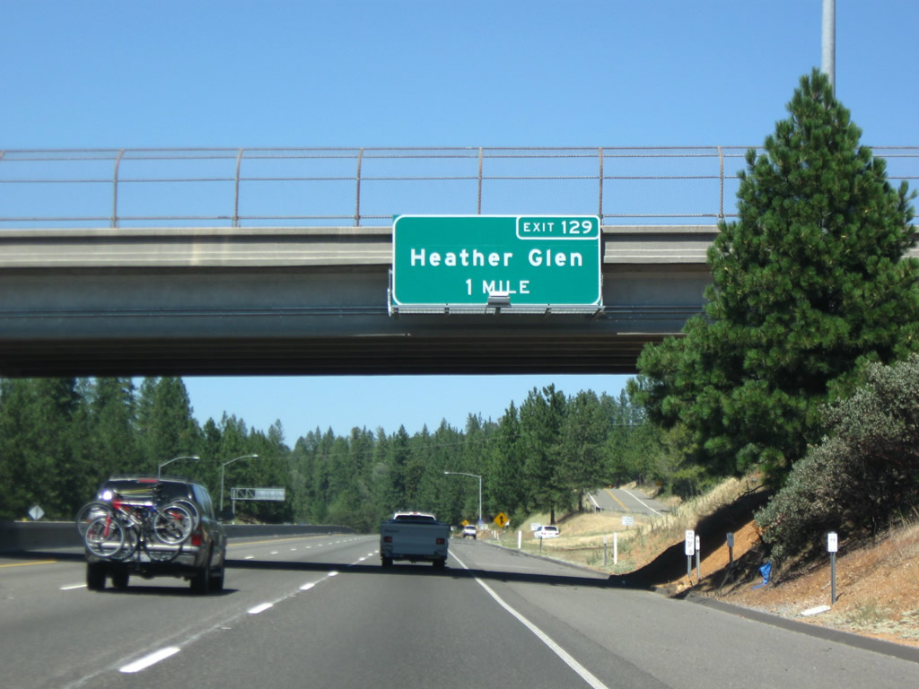
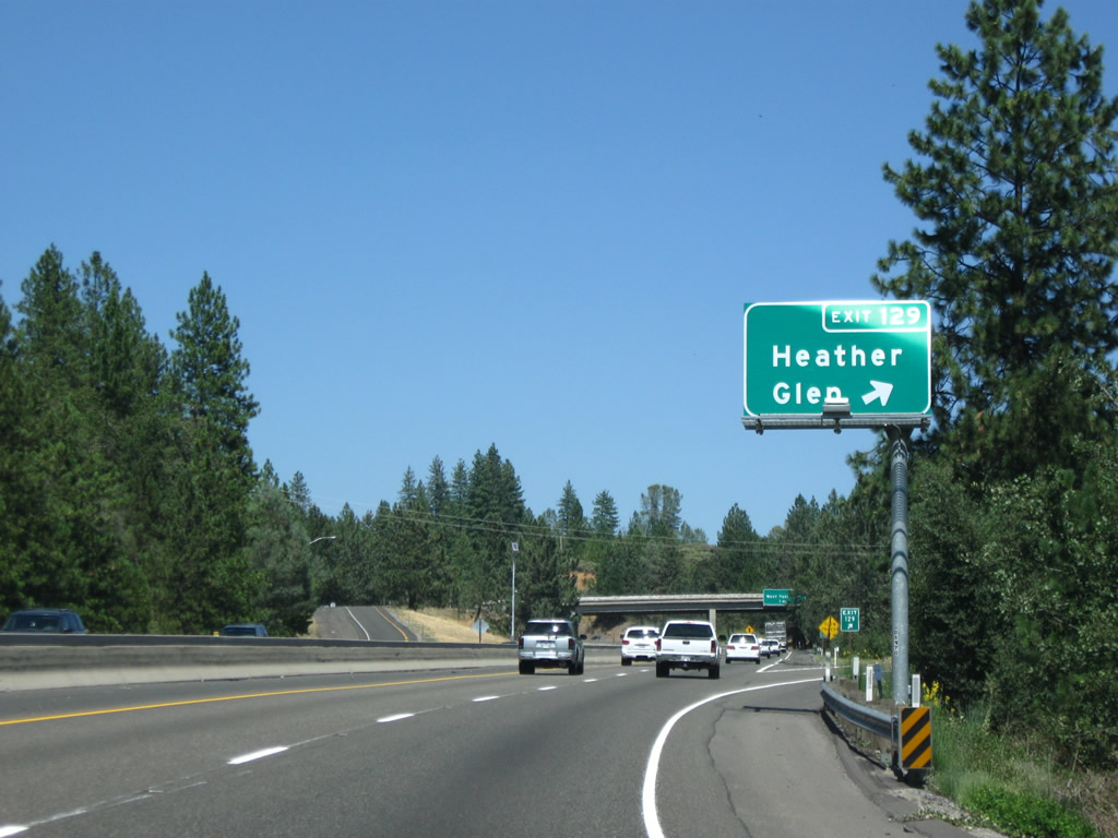
The next exit along Interstate 80/Alan S. Hart Freeway east is Exit 129, U.S. 40/Applegate Road and Giesendorfer Road to Heather Glen (one mile). Photo taken 07/18/09. |
|
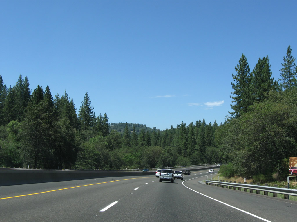
Two lanes carry Interstate 80 northeast toward Colfax, Emigrant Gap, and Donner Summit. Photo taken 07/18/09. |
|
Eastbound Interstate 80/Alan S. Hart Freeway reaches Exit 129, U.S. 40/Applegate Road and Giesendorfer Road to Heather Glen. It is most likely that U.S. 40 had two historic alignments through here: one via Placer Hills Road and the other via Applegate Road. Photo taken 07/18/09. |
|
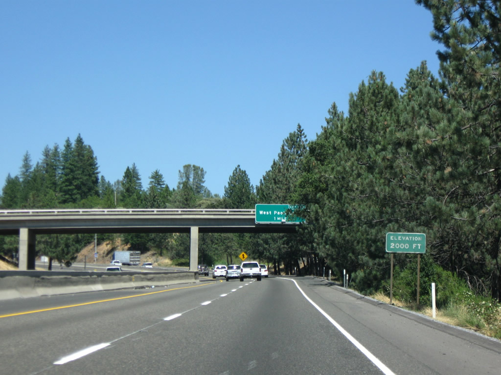
Interstate 80 reaches the elevation of 2,000 feet. Photo taken 07/18/09. |
|
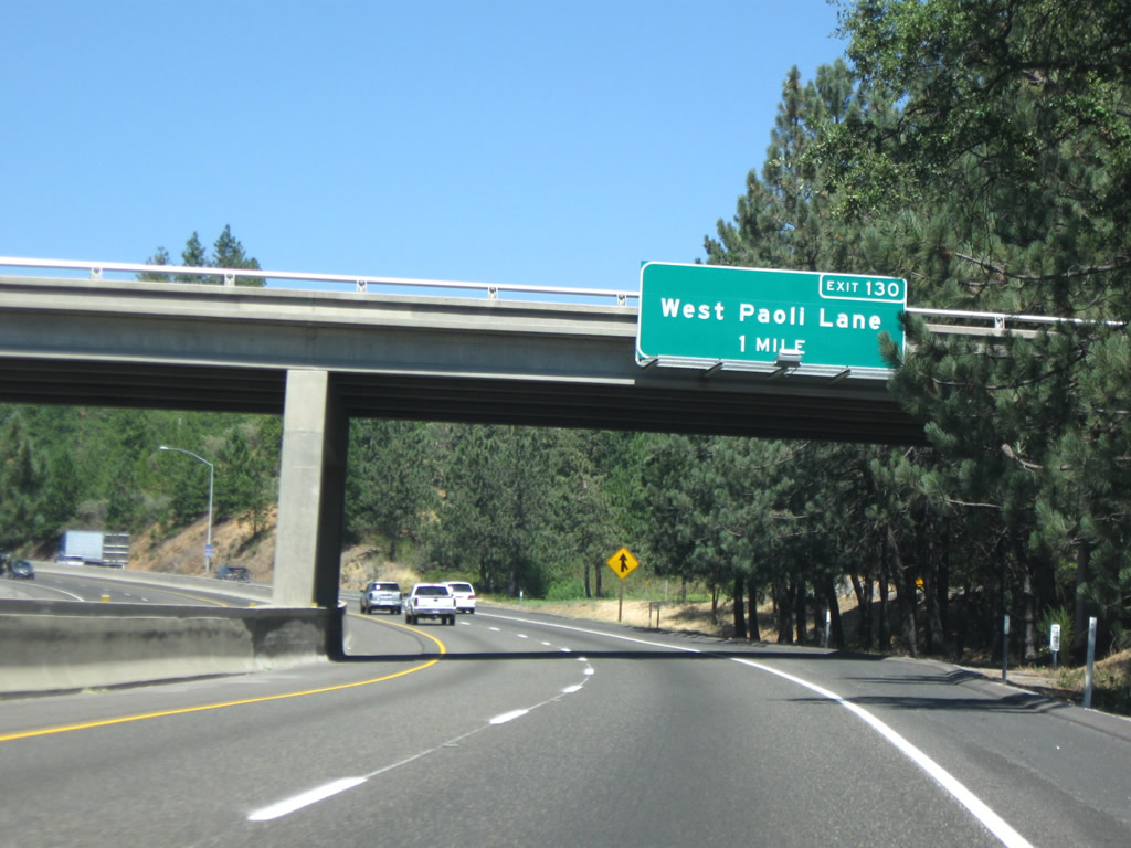
The next exit along Interstate 80/Alan S. Hart Freeway east is Exit 130, West Paoli Lane (one mile). This sign is posted on the Applegate Road overpass. Photo taken 07/18/09. |
|
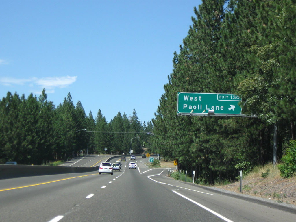
Eastbound Interstate 80/Alan S. Hart Freeway reaches Exit 130, West Paoli Lane. Photo taken 07/18/09. |
|
An Interstate 80 east reassurance shield is posted shortly thereafter. Photo taken 07/18/09. |
|
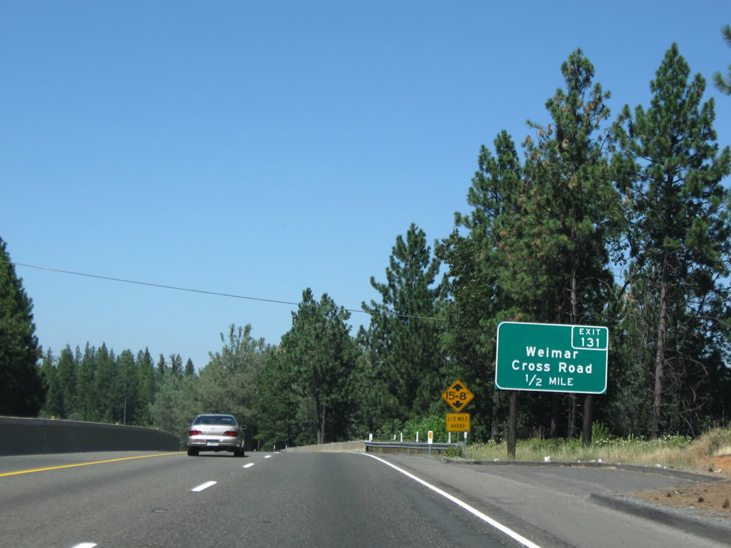
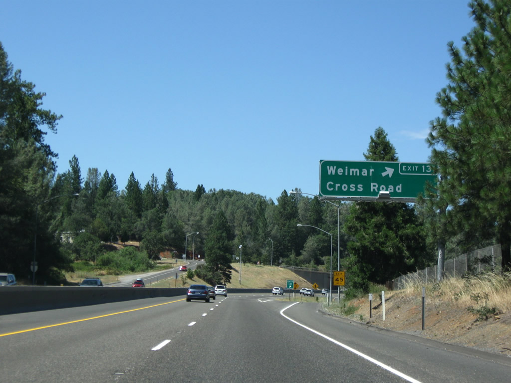
The next exit along Interstate 80/Alan S. Hart Freeway east is Exit 131, Weimar Cross Road west to Placer Hills Road and Canyon Way north. Photo taken 07/18/09. |
|
Eastbound Interstate 80/Alan S. Hart Freeway reaches Exit 131, Weimar Cross Road west to Placer Hills Road and Canyon Way north. Use this exit to the unincorporated community of Weimar, located on the east side of the freeway. Photo taken 07/18/09. |
|
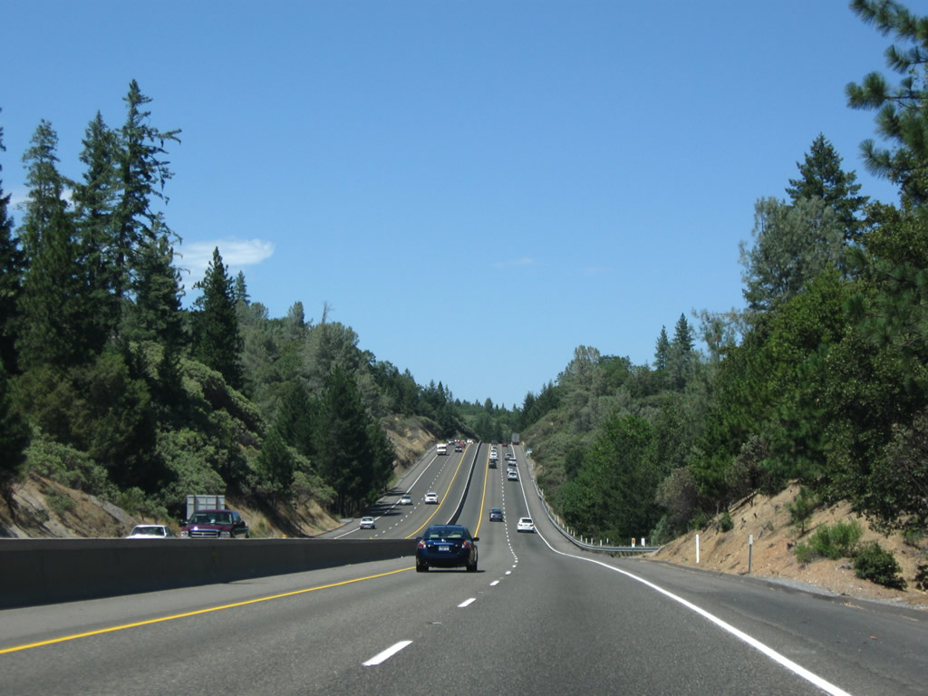
Still traveling nearly due north, the impact of the Interstate 80 freeway is minimized with only a jersey curb median barrier rather than a wide, landscaped median. Photo taken 07/18/09. |
|
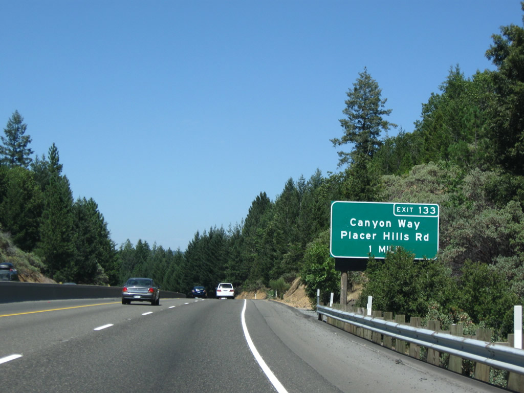
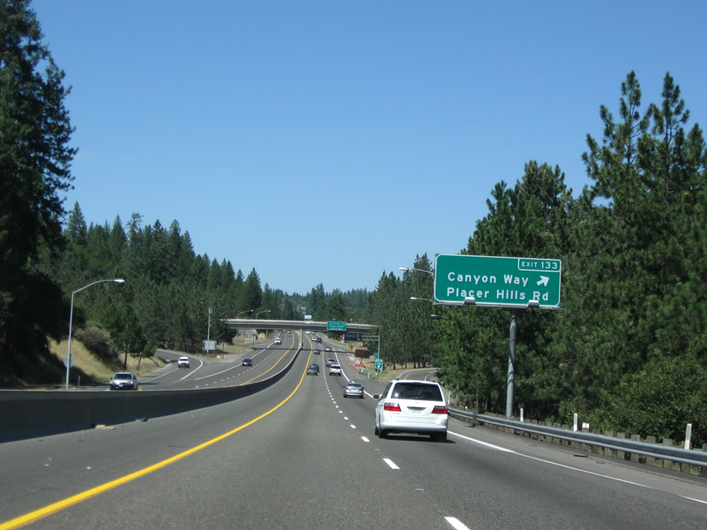
The next exit along Interstate 80/Alan S. Hart Freeway east is Exit 133, U.S. 40/Placer Hills Road and Canyon Way. Photo taken 07/18/09. |
|
Cresting over another hill, the Placer Hills Road and Canyon Way interchange (Exit 133) comes into view along eastbound. Photo taken 07/18/09. |
|
Eastbound Interstate 80/Alan S. Hart Freeway reaches Exit 133, U.S. 40/Placer Hills Road and Canyon Way. Photo taken 07/18/09. |
|
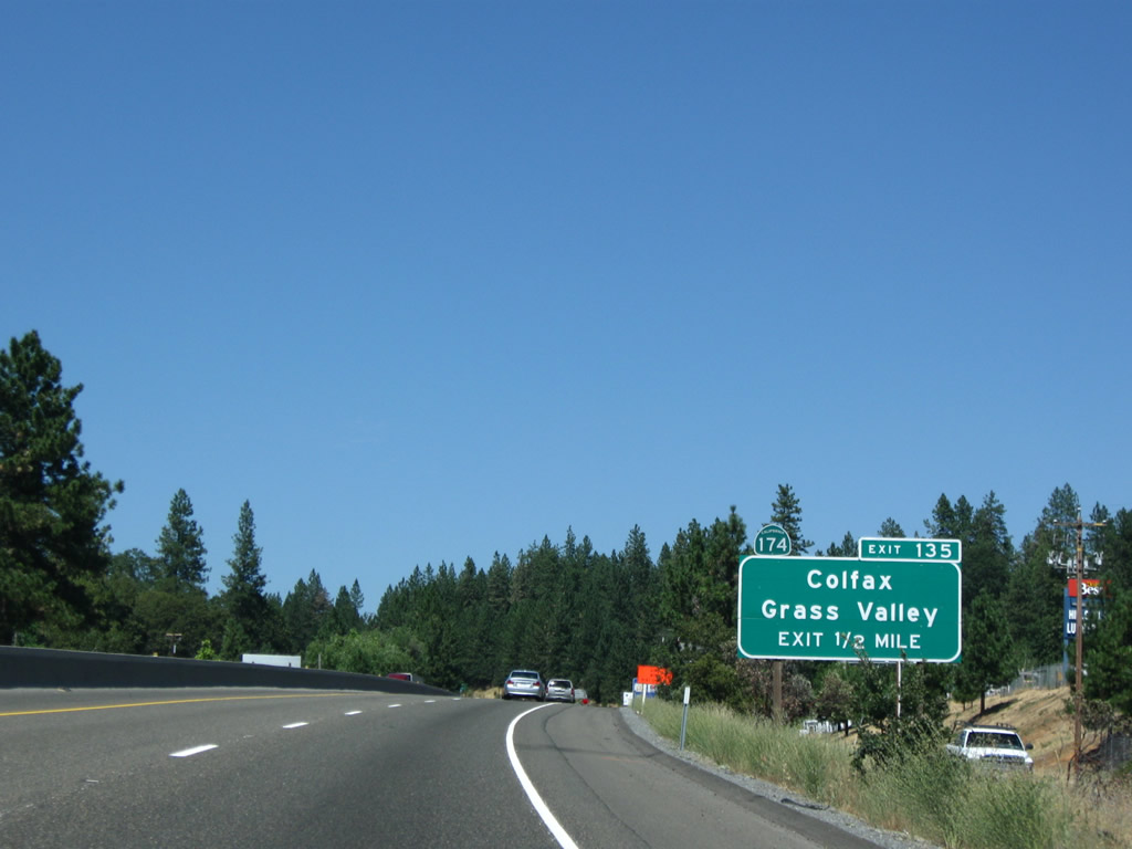
The next exit along Interstate 80/Alan S. Hart Freeway east is Exit 135, California 174/Colfax Highway north to Colfax and Grass Valley-Nevada City in Nevada County. Photo taken 07/18/09. |
|
The neutered-shield circus begins as we spot more and more Interstate 80 reassurance shields with no state name. Photo taken 07/18/09. |
|
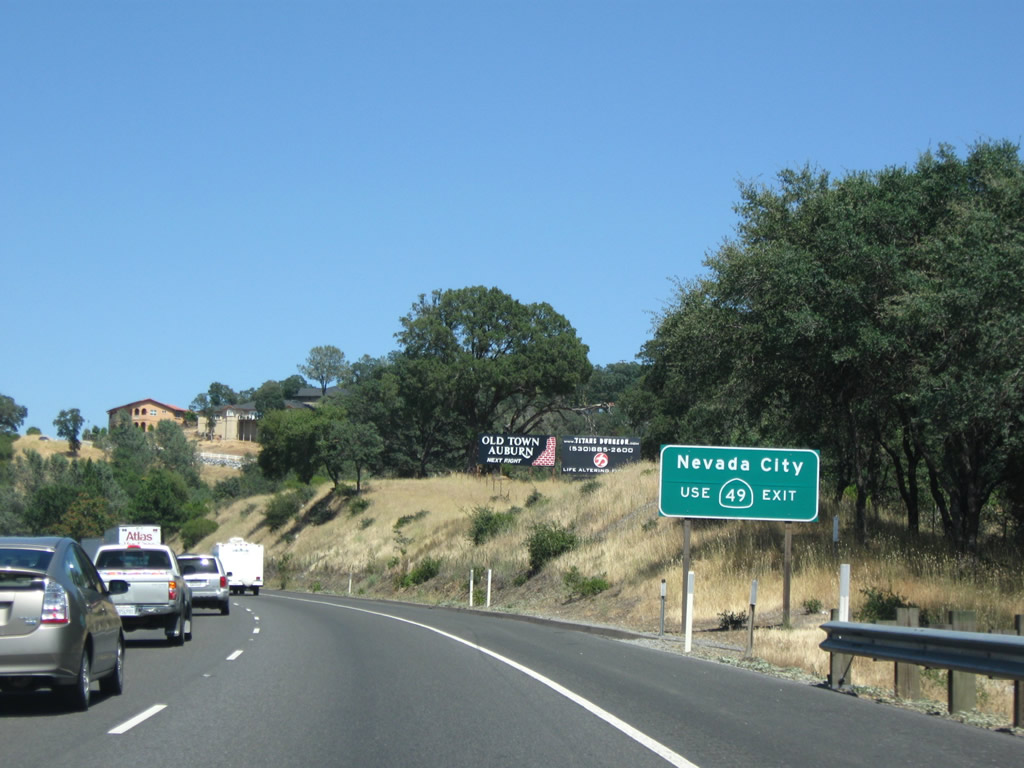
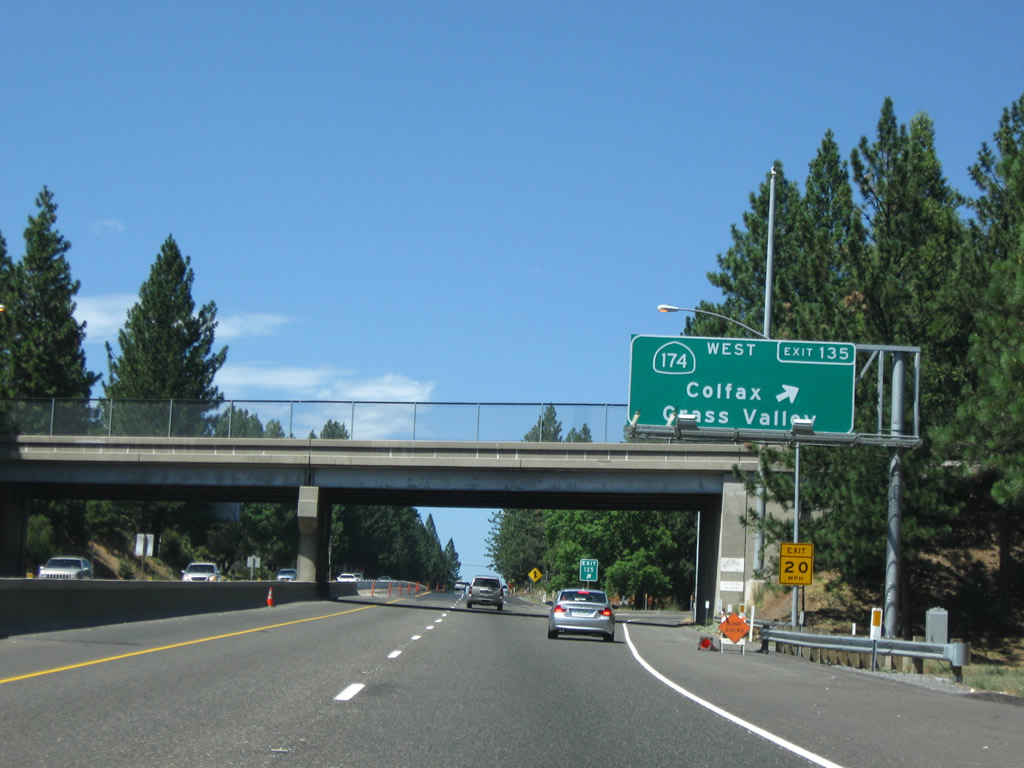
California 174/Colfax Highway travels north from Interstate 80 at Colfax to California 20-49/Gold Center Freeway in Grass Valley, just southwest of Nevada City (Nevada County seat). The state route is mostly a two-lane conventional highway. This exit number sign is indicative of how this interchange used to be signed prior to the installation of the newer exit number signs. California 174 was an afterthought, with trailblazers located alongside the freeway rather than posted on overhead or roadside guide signs. Photo taken 07/18/09. |
|
Eastbound Interstate 80/Alan S. Hart Freeway reaches Exit 135, California 174/Colfax Highway north to Colfax and Grass Valley. California 174 leaves Placer and enters Nevada County upon crossing the Bear River. Photo taken 07/18/09. |
|
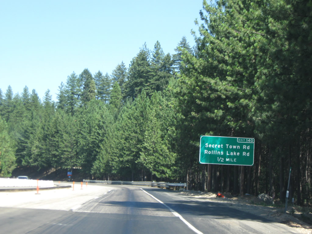
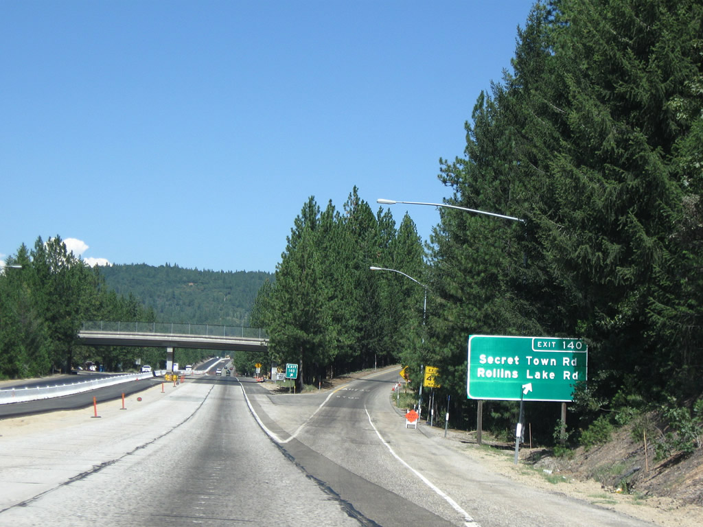
The next exit along Interstate 80/Alan S. Hart Freeway east is Exit 140, Secret Town Road and Rollins Lake Road (0.50 mile). Note that Exit 140 substitutes for both Exits 140 and 139 found on westbound Interstate 80. Photo taken 07/18/09. |
|
Eastbound Interstate 80/Alan S. Hart Freeway reaches Exit 140, Secret Town Road and Rollins Lake Road. The original concrete road surface, which has gradually deteriorated under the weight of trucks and trashing by tire snow chains, is being covered by asphalt as part of a long-term project to rehabilitate the heavily used Interstate 80 corridor through the Sierra Nevada. This photo shows some of the last visible concrete before it is covered permanently by black asphalt. Photo taken 07/18/09. |
|
This Interstate 80 east reassurance shield is posted after the on-ramp from Exit 140, Secret Town Road and Rollins Lake Road near Magra. Photo taken 07/18/09. |
|
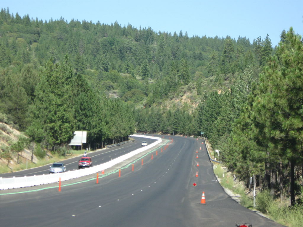
Repaving operations continue east along Interstate 80. The freeway is again traveling northeast at this point. Photo taken 07/18/09. |
|
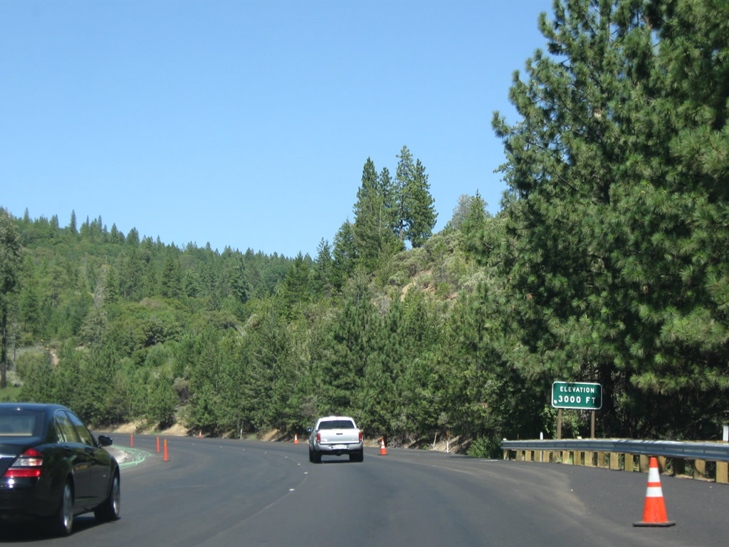
Interstate 80 reaches 3,000 feet. Photo taken 07/18/09. |
|
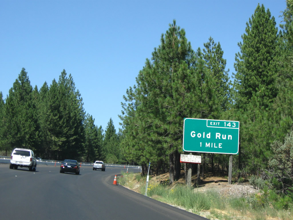
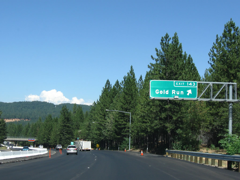
The next exit along Interstate 80/Alan S. Hart Freeway east is Exit 143, Gold Run Road and Magra Road (one mile). Photo taken 07/18/09. |
|
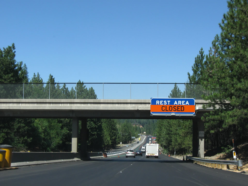
A rest area (Exit 143B) is located along Interstate 80/Alan S. Hart Freeway east after the off-ramp to Gold Run Road and Magra Road. Photo taken 07/18/09. |
|
Eastbound Interstate 80/Alan S. Hart Freeway reaches Exit 143, Gold Run Road and Magra Road. Photo taken 07/18/09. |
|
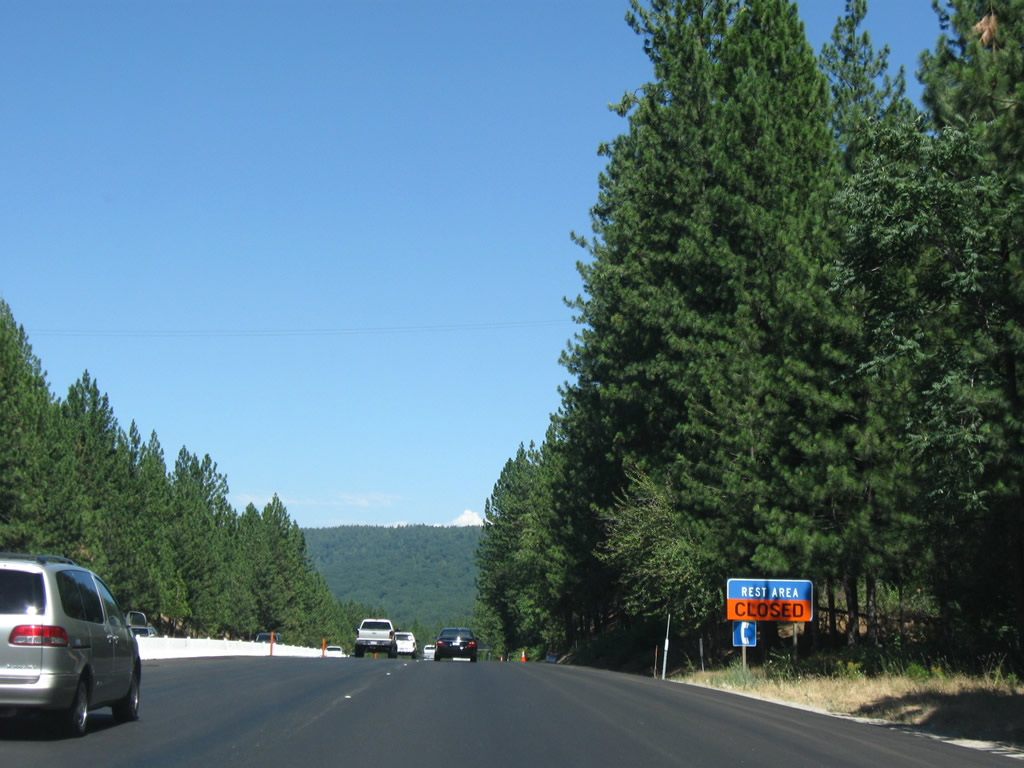
The next exit along Interstate 80/Alan S. Hart Freeway east is Exit 143B, Rest Area (next right). The next rest is at Donner Summit. Photo taken 07/18/09. |
|
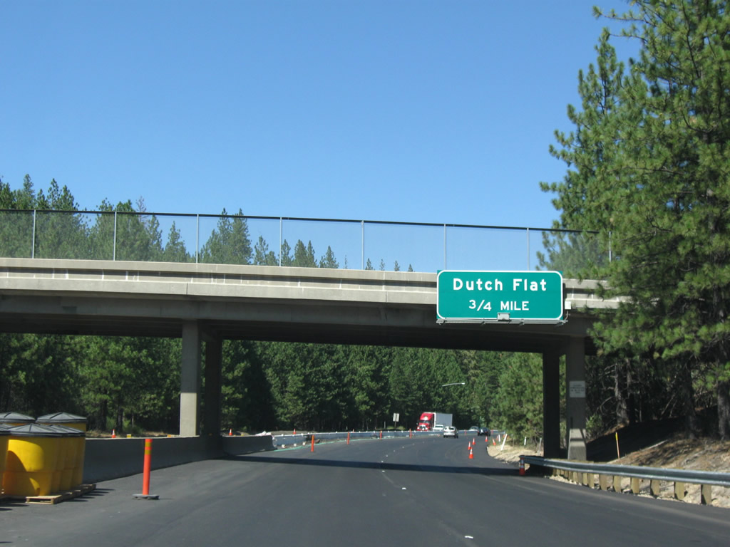
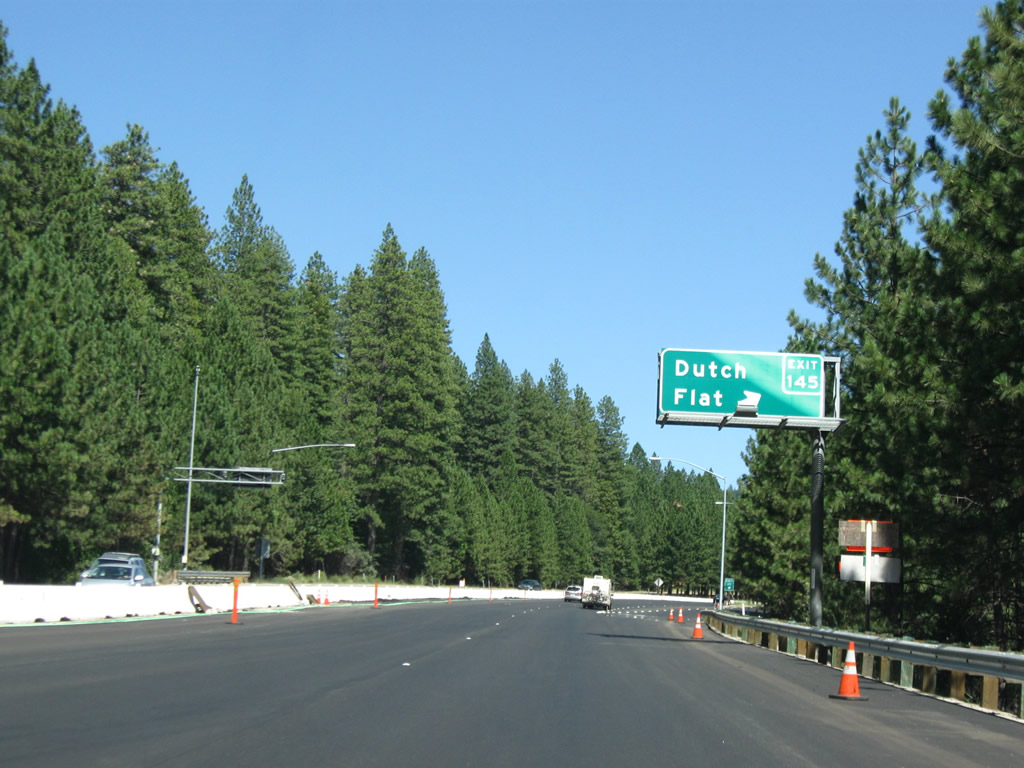
The next exit along Interstate 80/Alan S. Hart Freeway east is Exit 145, Ridge Road and Canyon Creek Road to Dutch Flat. There is no direct access to Exit 144 (Gold Run Drive) from Interstate 80 east; use Exit 143 instead. Photo taken 07/18/09. |
|
Eastbound Interstate 80/Alan S. Hart Freeway reaches Exit 145, Ridge Road and Canyon Creek Road to Dutch Flat. Another gold mining town, Dutch Flat today is a small unincorporated community founded in 1851 with a rich Gold Rush history. Photo taken 07/18/09. |
|
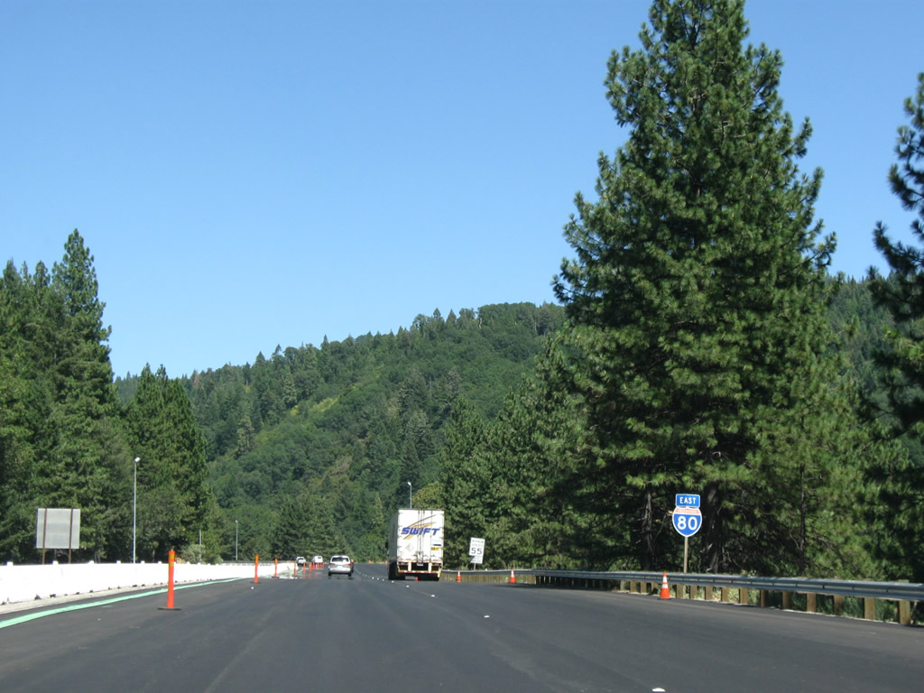
An Interstate 80 east reassurance shield (neutered) is posted after the on-ramp from Exit 145 (Dutch Flat). Photo taken 07/18/09. |
|
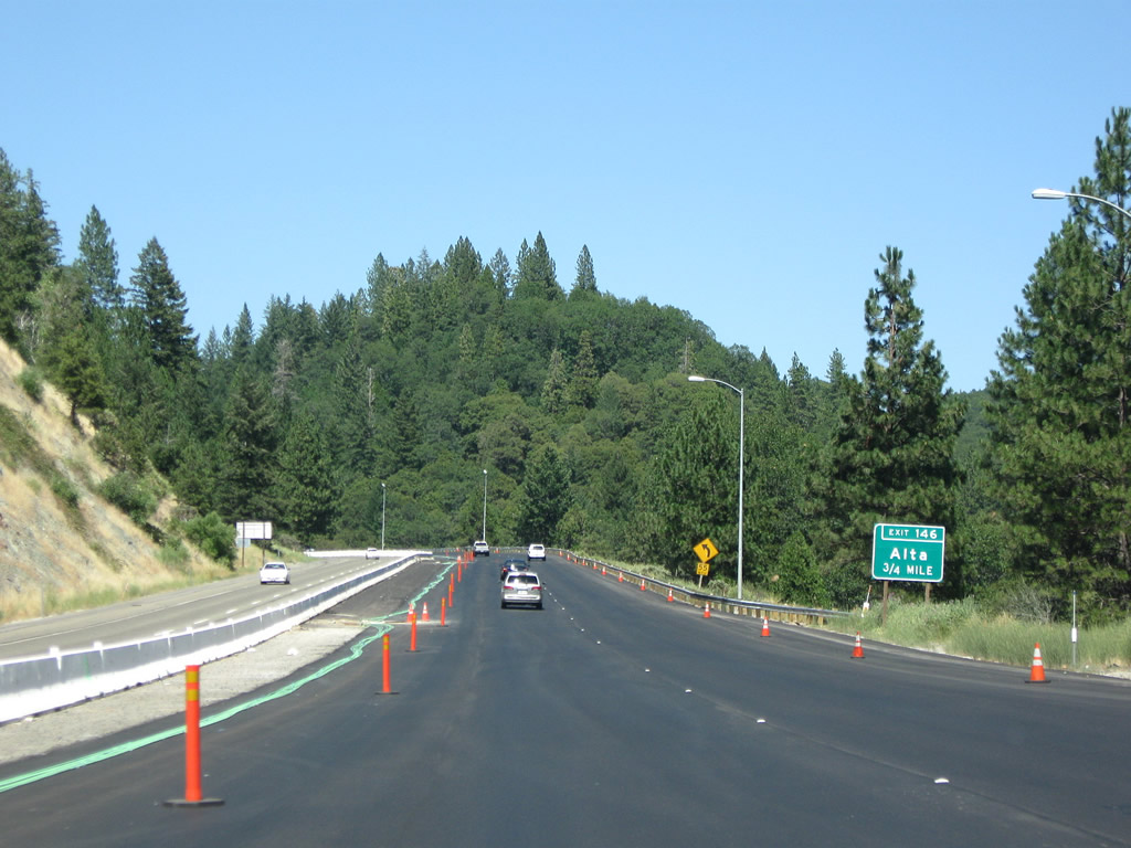
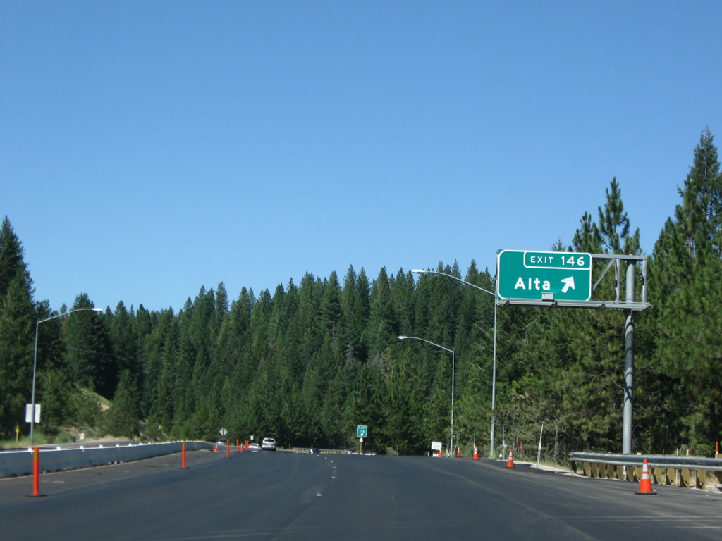
The next exit along Interstate 80 east is Exit 146, Alta Bonnymook Road and Alta Road (three-quarters mile). Photo taken 07/18/09. |
|
Eastbound Interstate 80 reaches Exit 146, Alta Bonnymook Road and Alta Road to Alta. The unincorporated community of Alta was founded in 1866 primarily to serve as a stop along the Central Pacific Railroad to provide service to nearby Dutch Flat, which was prosperous during this time period due to the discovery of gold. (For more on Alta and Dutch Flat, see the Sierra Nevada Virtual Museum webpage.) Photo taken 07/18/09. |
|
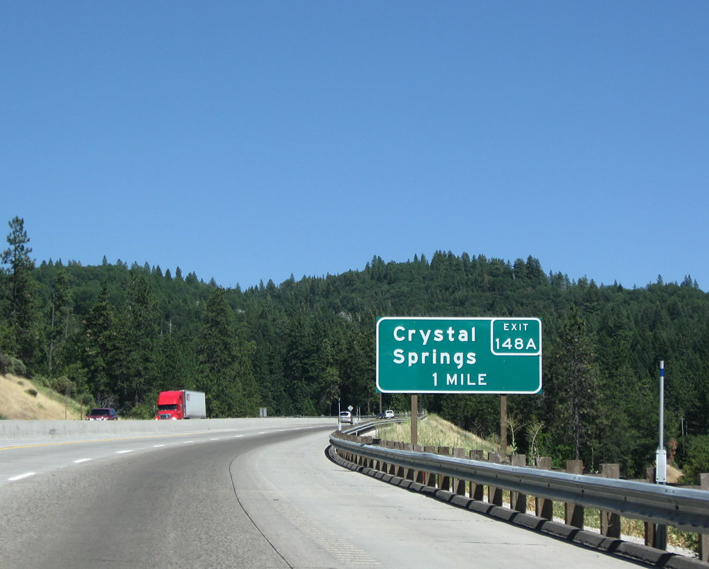
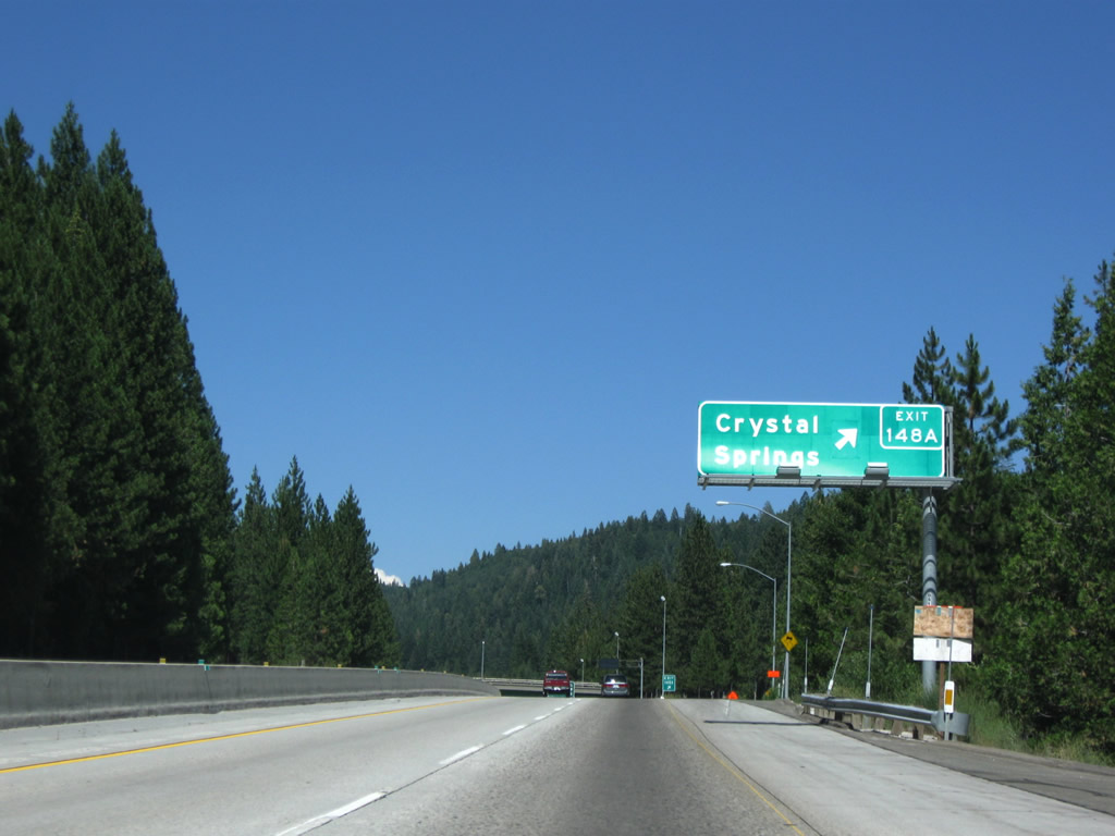
The next exit along Interstate 80/Alan S. Hart Freeway east is Exit 148A, Crystal Springs Road (one mile). Photo taken 07/18/09. |
|
Eastbound Interstate 80/Alan S. Hart Freeway reaches Exit 148A, Crystal Springs Road. Photo taken 07/18/09. |
|
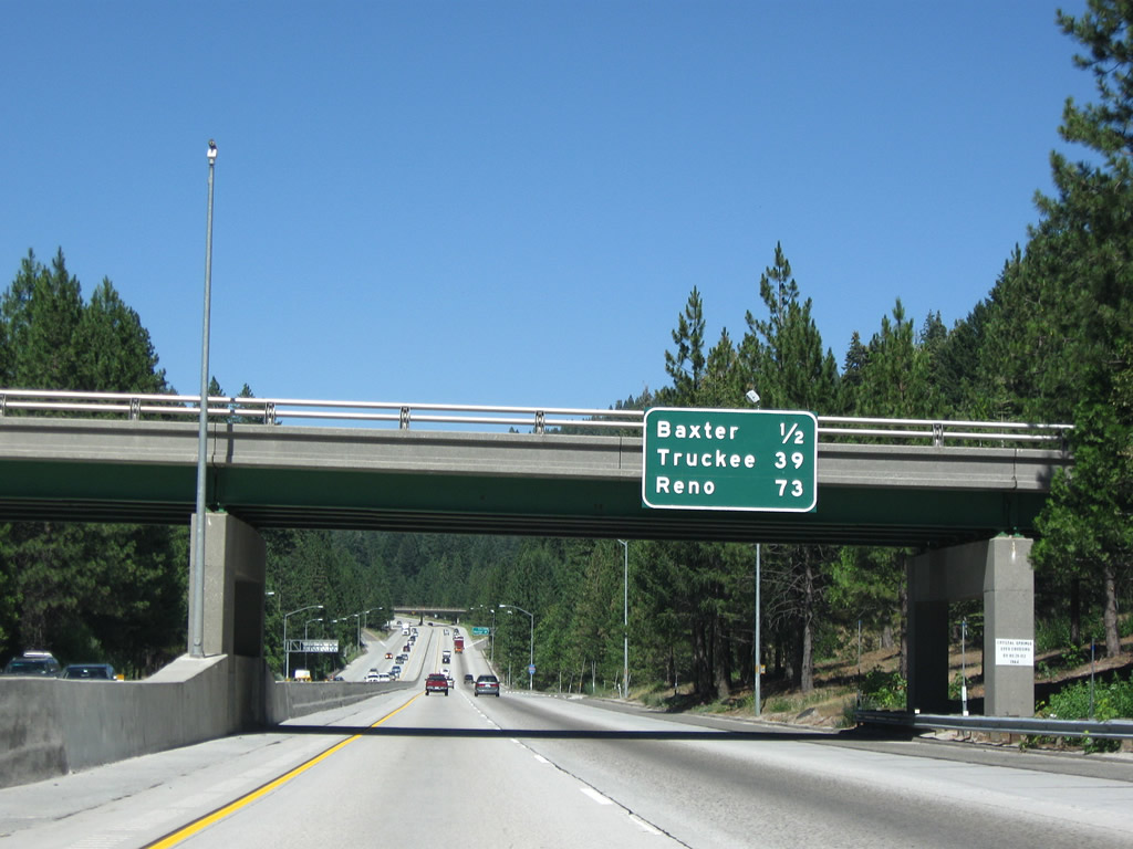
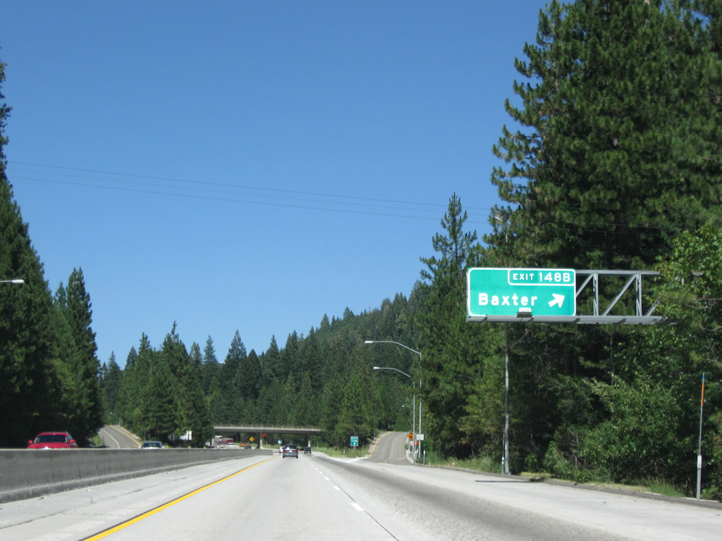
The next exit along Interstate 80/Alan S. Hart Freeway east is Exit 148B, Baxter Road (one-half mile). Incorporated into this sign are the distances to Truckee (39 miles) and Reno (73 miles). Photo taken 07/18/09. |
|
Eastbound Interstate 80/Alan S. Hart Freeway reaches Exit 148B, Baxter Road. Photo taken 07/18/09. |
|
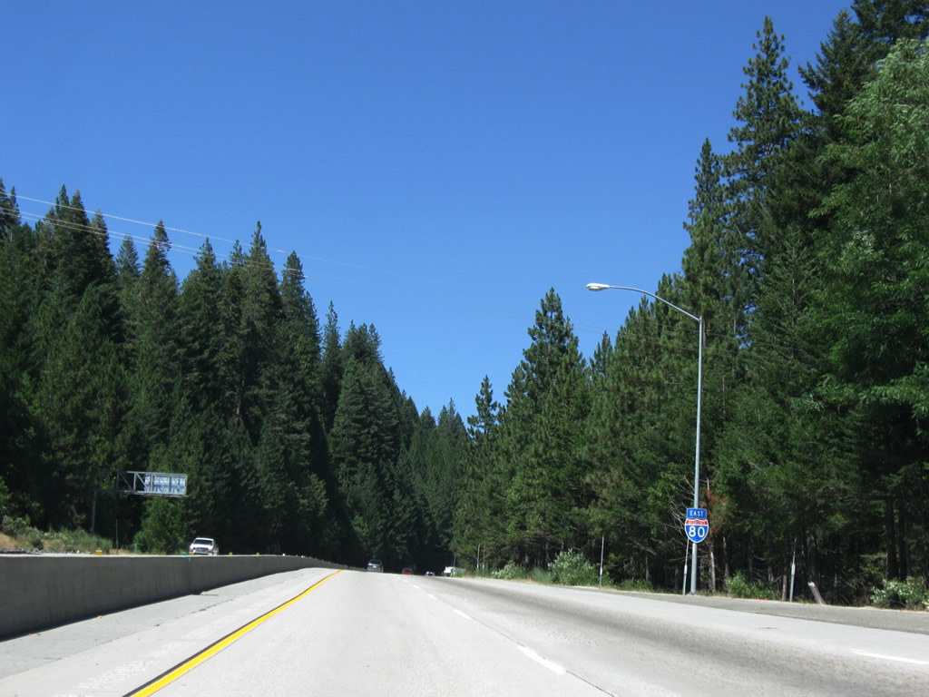
This Interstate 80 east reassurance shield is posted after the on-ramp from Baxter Road. Once again, no state name is posted. Photo taken 07/18/09. |
|
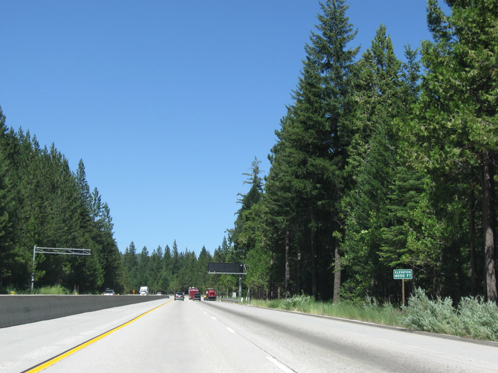
Interstate 80 ascends to 4,000 feet. Photo taken 07/18/09. |
|
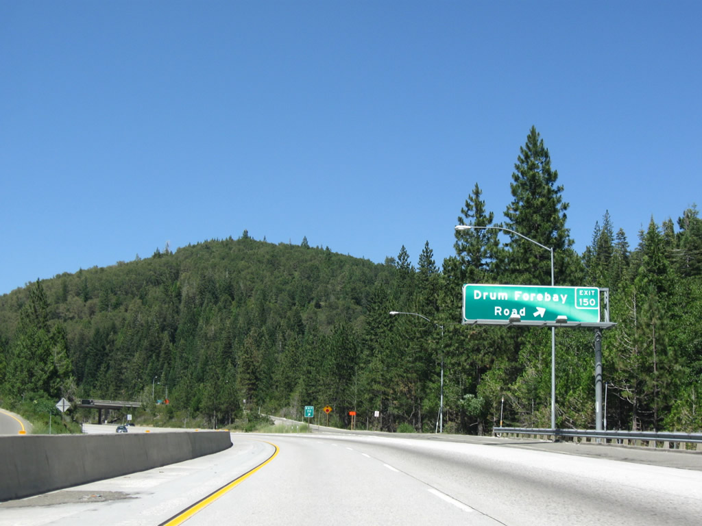
The next exit along Interstate 80/Alan S. Hart Freeway east is Exit 150, Drum Forebay Road north and Kearsarge Mill Road east (one-half mile). Photo taken 07/18/09. |
|
Eastbound Interstate 80/Alan S. Hart Freeway reaches Exit 150, Drum Forebay Road and Kearsarge Mill Road. Between Exits 150 and 155, the two carriageways of Interstate 80 (eastbound and westbound) separate, with several hundred feet separating the two directions at certain spots. Photo taken 07/18/09. |
|
Continuing east, another Interstate 80 reassurance shield is posted (with the state name in an angular shield). Photo taken 07/18/09. |
|
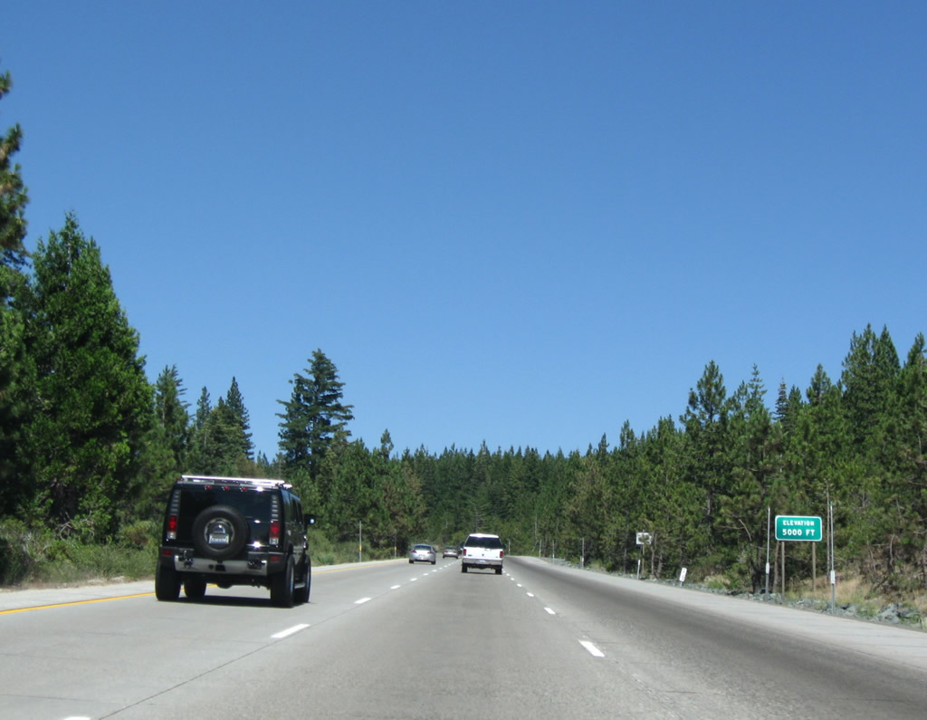
Interstate 80 ascends to 5,000 feet. Winter snows and the resultant chain law may in effect ... watch for warning signs especially the dynamic message signs. The two carriageways of Interstate 80 stay separated. A truck lane allows slower traffic to travel up the steep grade. Photo taken 07/18/09. |
|
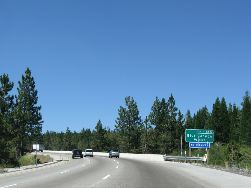
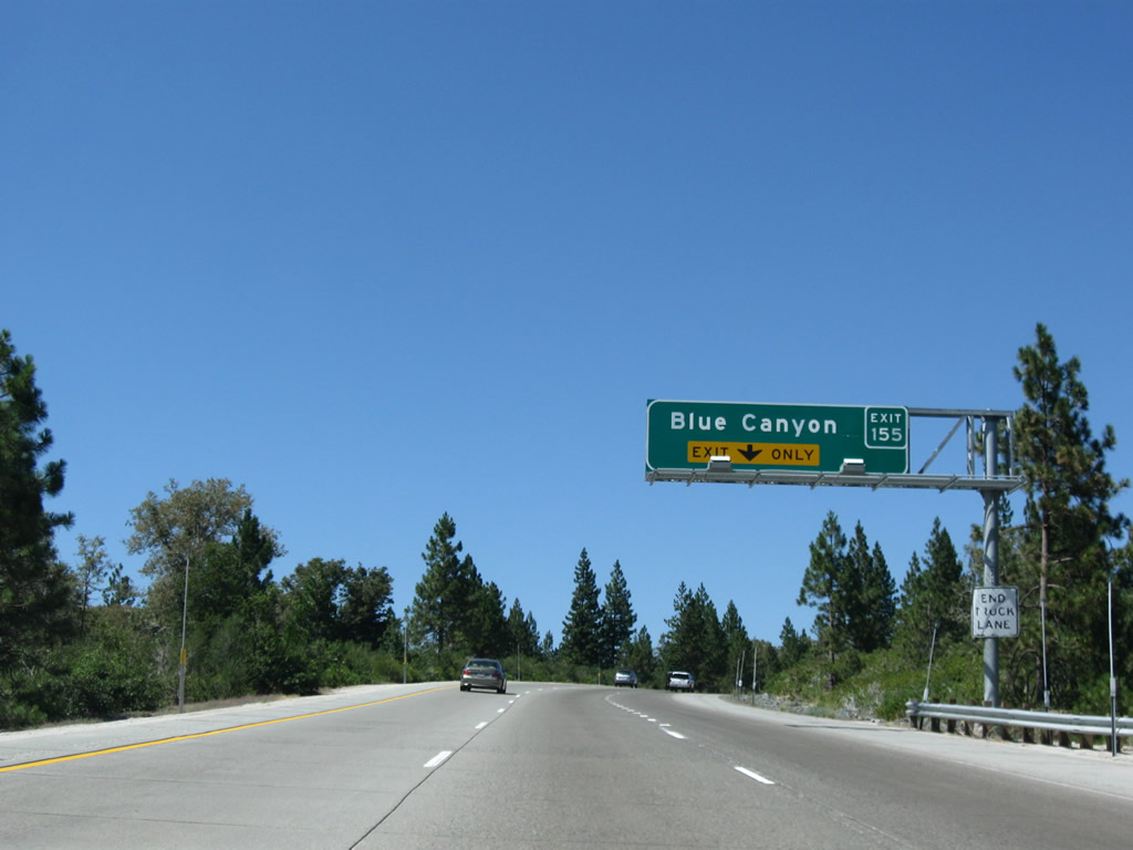
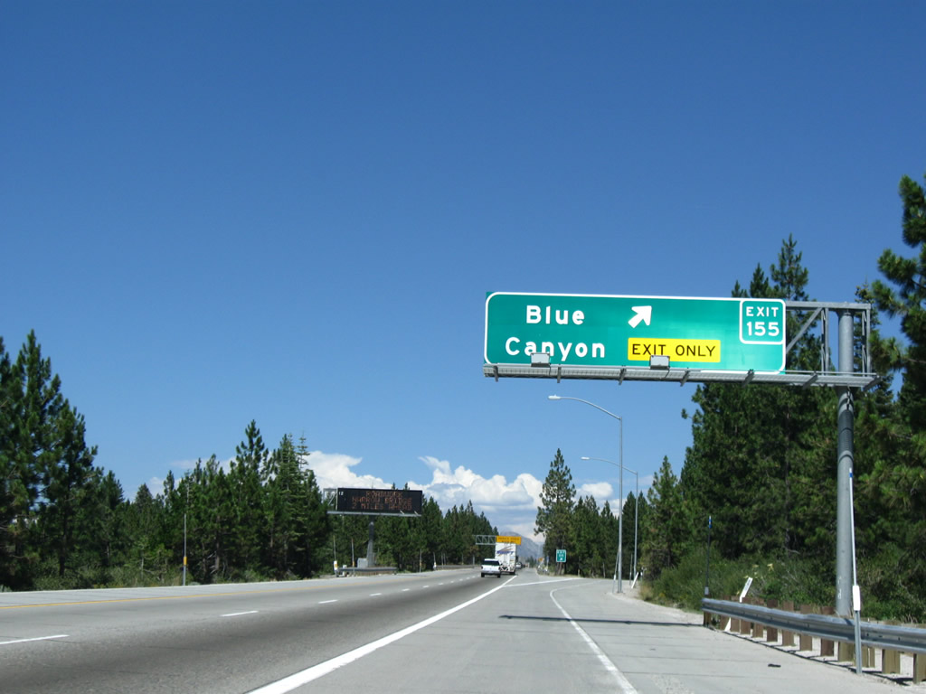
The next exit along Interstate 80 east is Exit 155, Blue Canyon Road (one-half mile). Typically, when a storm threatens the Sierra Nevada, the television stations in Sacramento like to send a reporter up to Blue Canyon to show the snow live to audiences in Sacramento, where the weather may be rainy or devoid of precipitation. Photo taken 07/18/09. |
|
The truck lane becomes the exit-only lane for traffic to depart Interstate 80 at Exit 155, Blue Canyon Road. Photo taken 07/18/09. |
|
Eastbound Interstate 80/Alan S. Hart Freeway reaches Exit 155, Blue Canyon Road. Photo taken 07/18/09. |
|
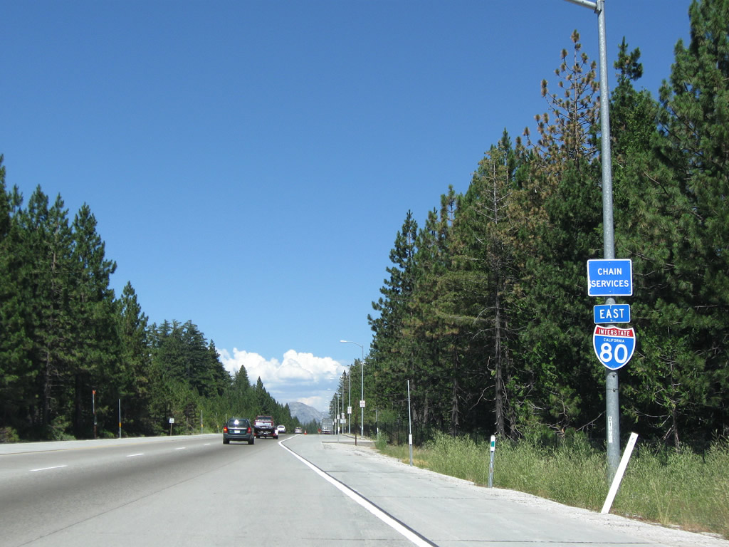
This Interstate 80 reassurance shield is posted after the Blue Canyon Road on-ramp. A chain installation area is located on the right shoulder of the freeway; at night, the installation area is illuminated to increase safety. Photo taken 07/18/09. |
|
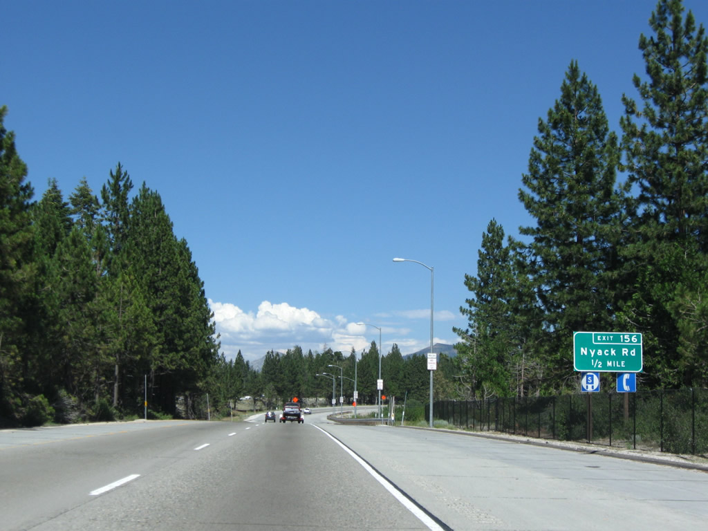
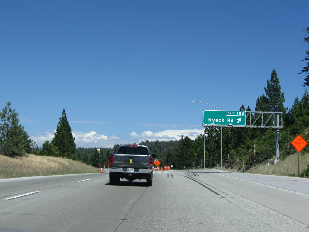
The next exit along Interstate 80 east is Exit 156, Nyack Road (one-half mile). Photo taken 07/18/09. |
|
Eastbound Interstate 80/Alan S. Hart Freeway reaches Exit 156, Nyack Road. Photo taken 07/18/09. |
|
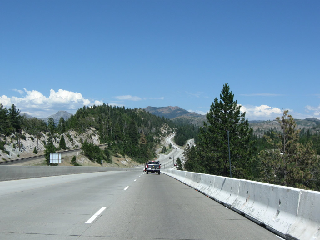
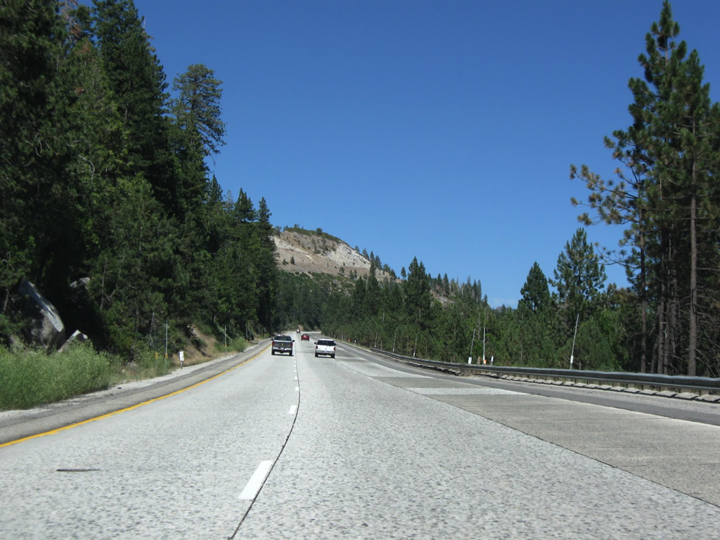
This view looks east from Interstate 80 between Nyack Road and Emigrant Gap. Photo taken 07/18/09. |
|
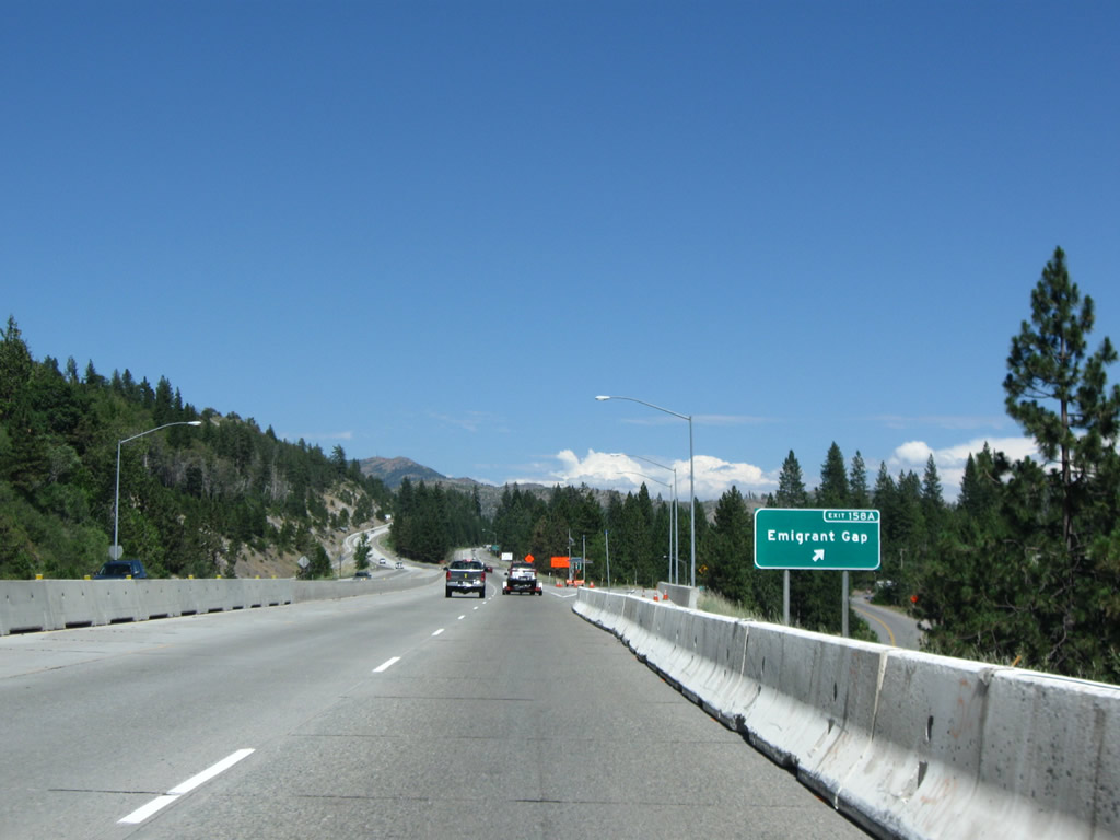
The next exit along Interstate 80 east is Exit 158A, Emigrant Gap Road and Bear Valley Road. Photo taken 07/18/09. |
|
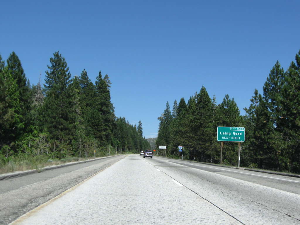
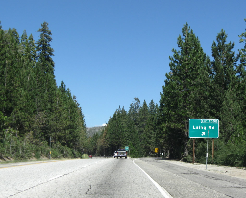
The next exit along Interstate 80 east is Exit 158B, Laing Road. Photo taken 07/18/09. |
|
Eastbound Interstate 80 reaches Exit 158B, Laing Road. Photo taken 07/18/09. |
|
Interstate 80 again widens to three eastbound lanes to accommodate slower traffic on another uphill grade. Photo taken 07/18/09. |
|
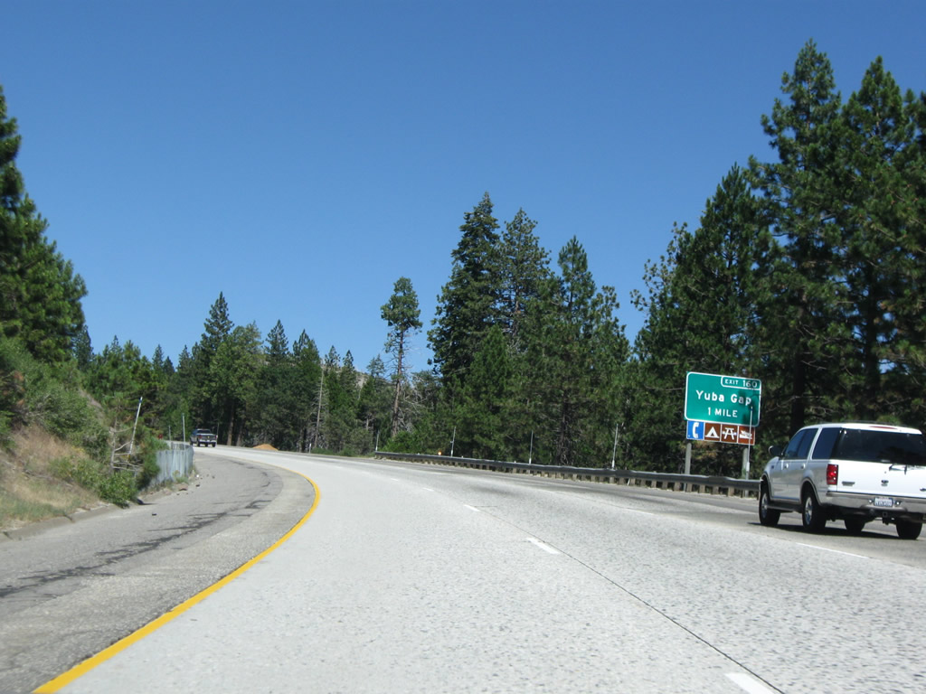
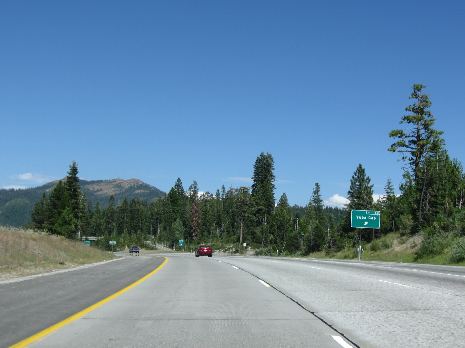
The next exit along Interstate 80 east is Exit 160, Lake Valley Road and Crystal Lake Road to Yuba Gap (one mile). Photo taken 07/18/09. |
|
Eastbound Interstate 80 reaches Exit 160, Lake Valley Road and Crystal Lake Road to Yuba Gap. Photo taken 07/18/09. |
|
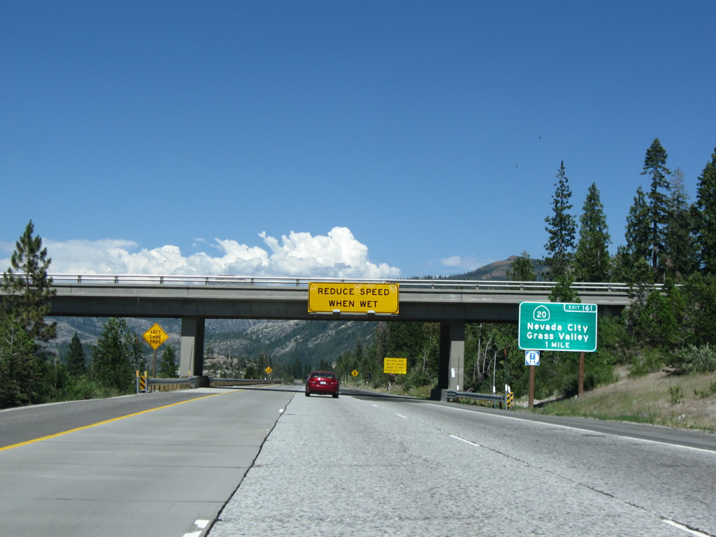
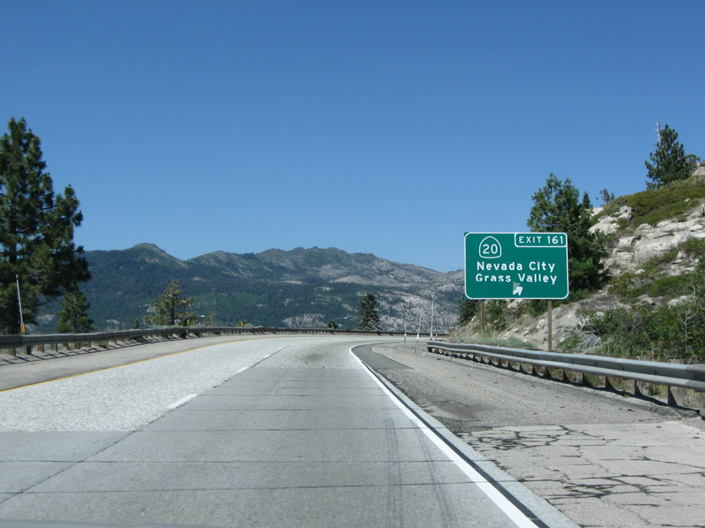
The next exit along Interstate 80/Alan S. Hart Freeway east is Exit 161, California 20 west to Nevada City (one mile). Photo taken 07/18/09. |
|
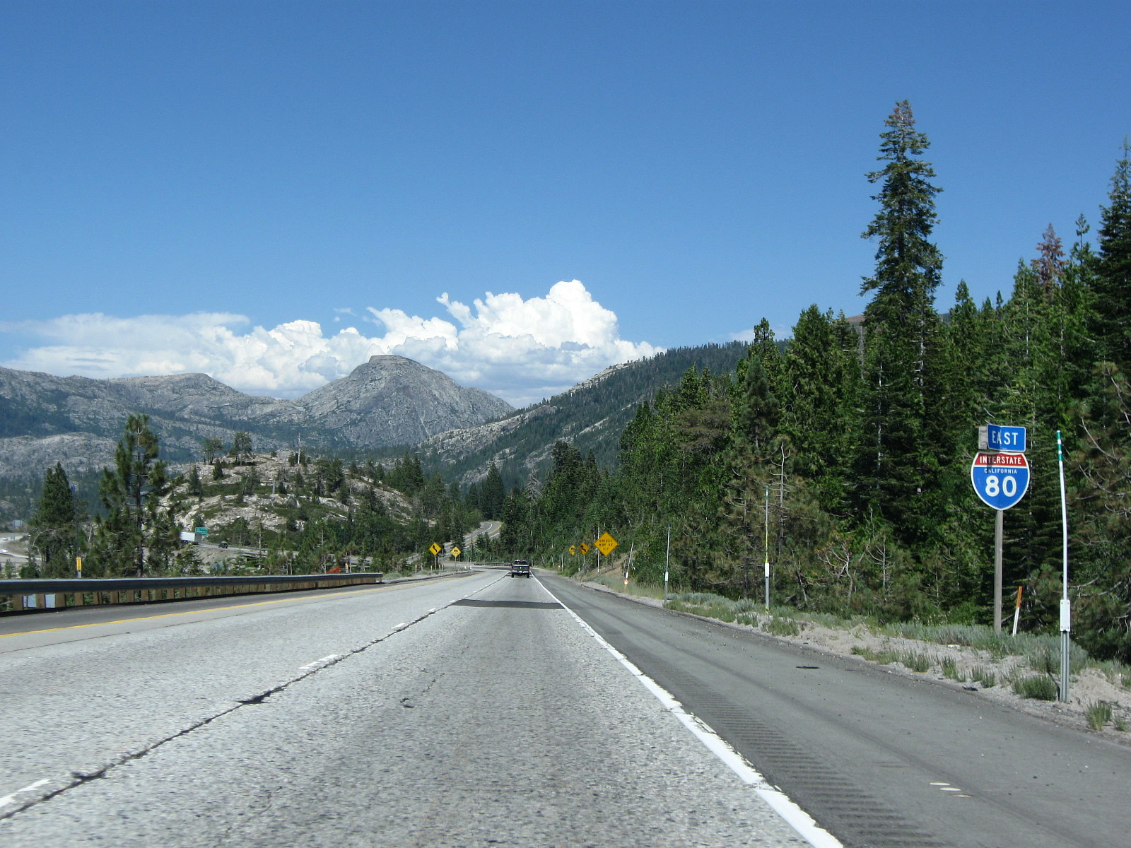
A stunning view of the surrounding mountains along Interstate 80 east is afforded to motorists prior to the California 20 interchange. Photo taken 07/18/09. |
|
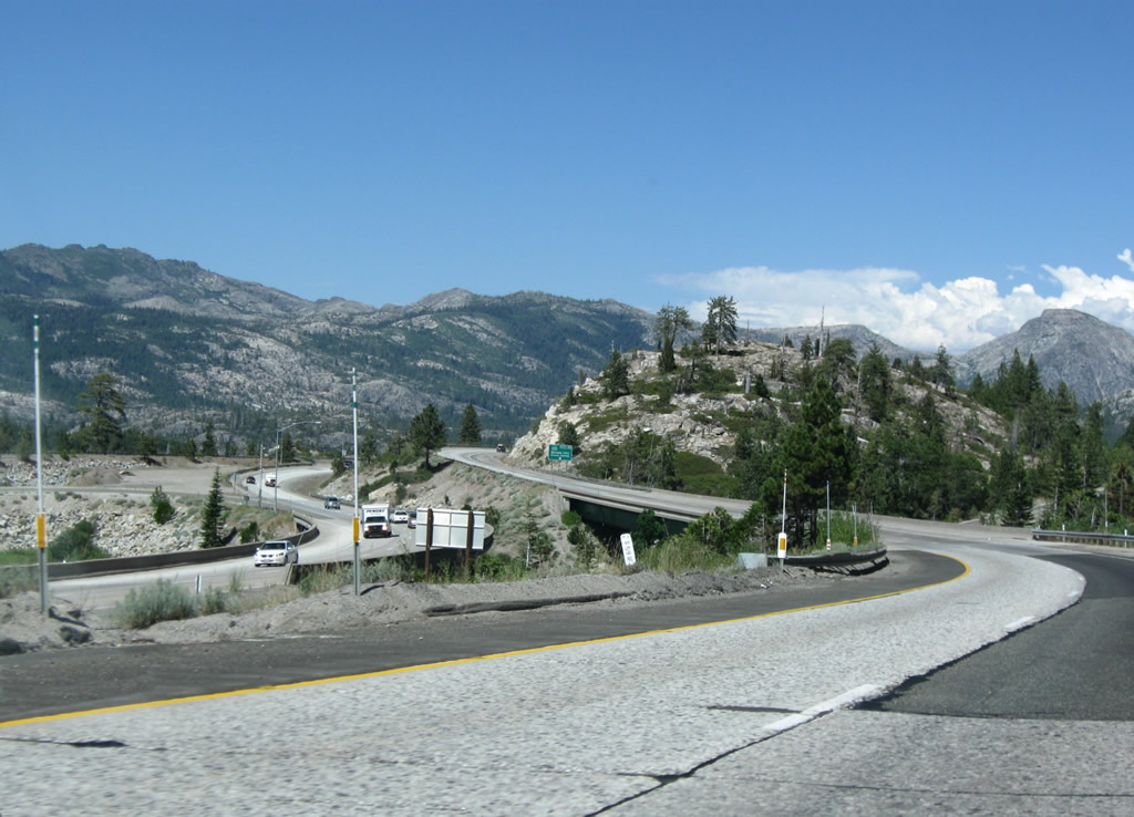
This view looks down on the Exit 161 interchange complex. From here, California 20 travels west to Nevada City, Grass Valley, Marysville, Yuba City, Sutter Buttes, Colusa, Williams, Clearlake, Upper Lake, Ukiah, Willits, and Fort Bragg. A major east-west state route, California 20 sees mostly conventional two-lane highway standards, although some segments are at freeway standards. Photo taken 07/18/09. |
|
Eastbound Interstate 80/Alan S. Hart Freeway reaches Exit 161, California 20 west to Nevada City and Grass Valley. Interstate 80 continues east from here to cross the high Sierra Nevada and descend into Truckee. Photo taken 07/18/09. |
Page Updated December 1, 2012.