
Interstate 80 West - Contra Costa County
| Interstate 80 (Eastshore Freeway) west | |||
|---|---|---|---|
 |
 |
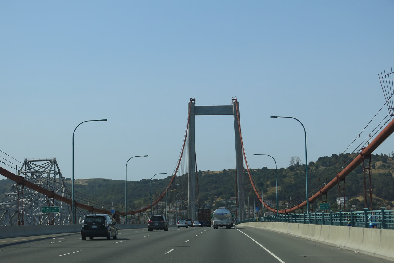
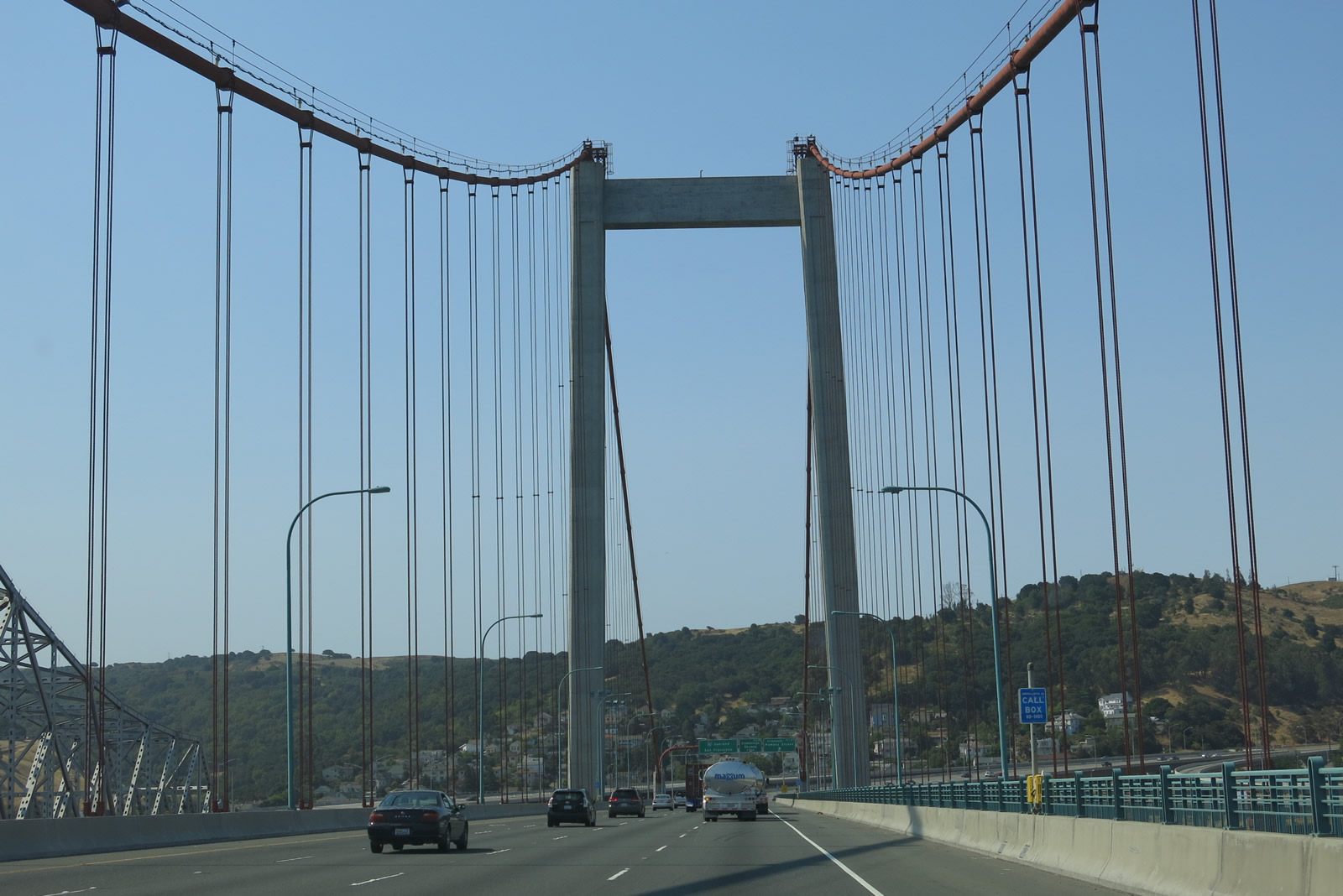
Interstate 80 enters Contra Costa County in the middle of the Carquinez Straits as it heads south from Solano County over the Alfred Zampa Bridge. The county line is situated almost at the midpoint between the two suspension bridge towers. Photos taken 07/02/13 and 11/28/04. | |
 |
 |
 |
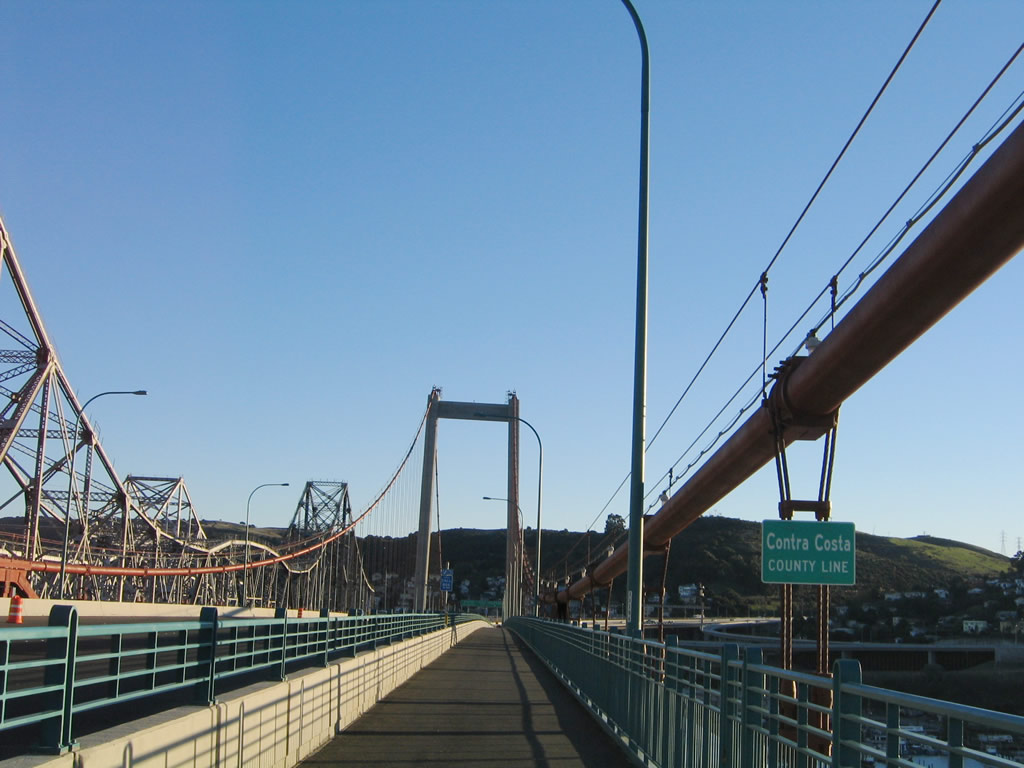
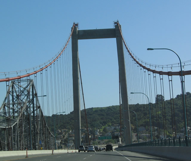
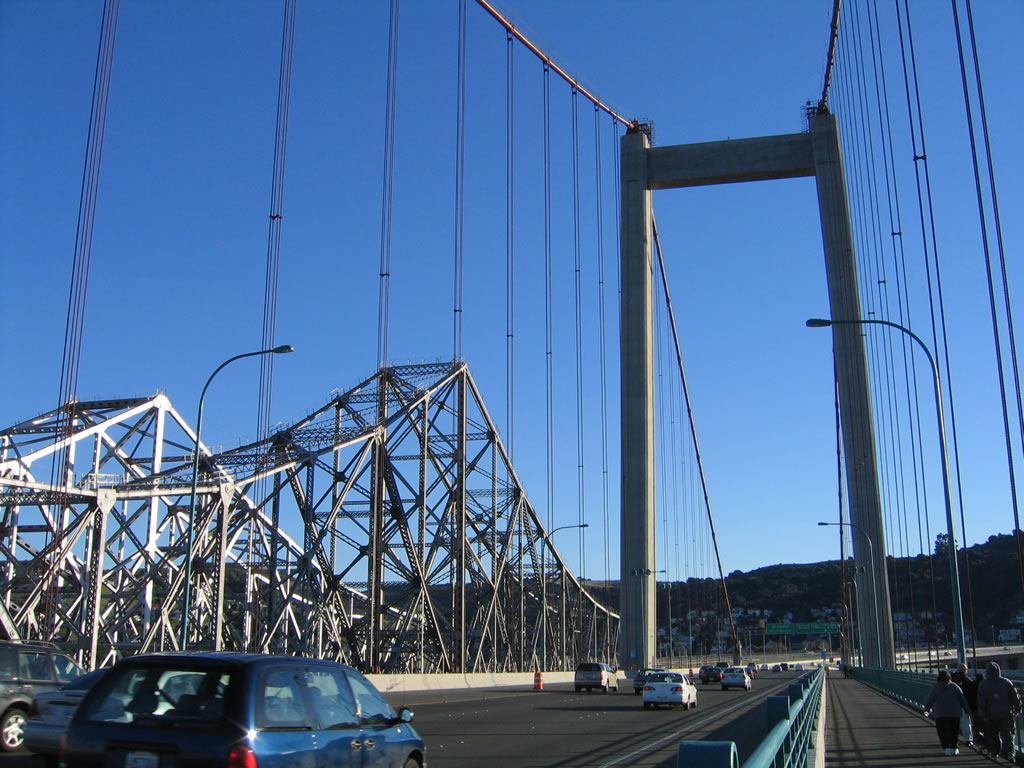
Now in Contra Costa County, we see the southern tower of the Alfred Zampa Memorial Bridge (Carquinez Bridge) along westbound Interstate 80. The freeway is traveling almost due south as it crosses the 0.7-mile bridge over the Carquinez Straits, which empty the Sacramento-San Joaquin Delta into San Pablo Bay and San Francisco Bay. In November 2004, we walked along the bridge on the dedicated walkway. While it was bitterly cold and windy, the perspectives from the bridge offered stunning views all around Carquinez Straits and San Pablo Bay. Photos taken 04/02/04, 11/28/04, and 07/02/13. |
 |
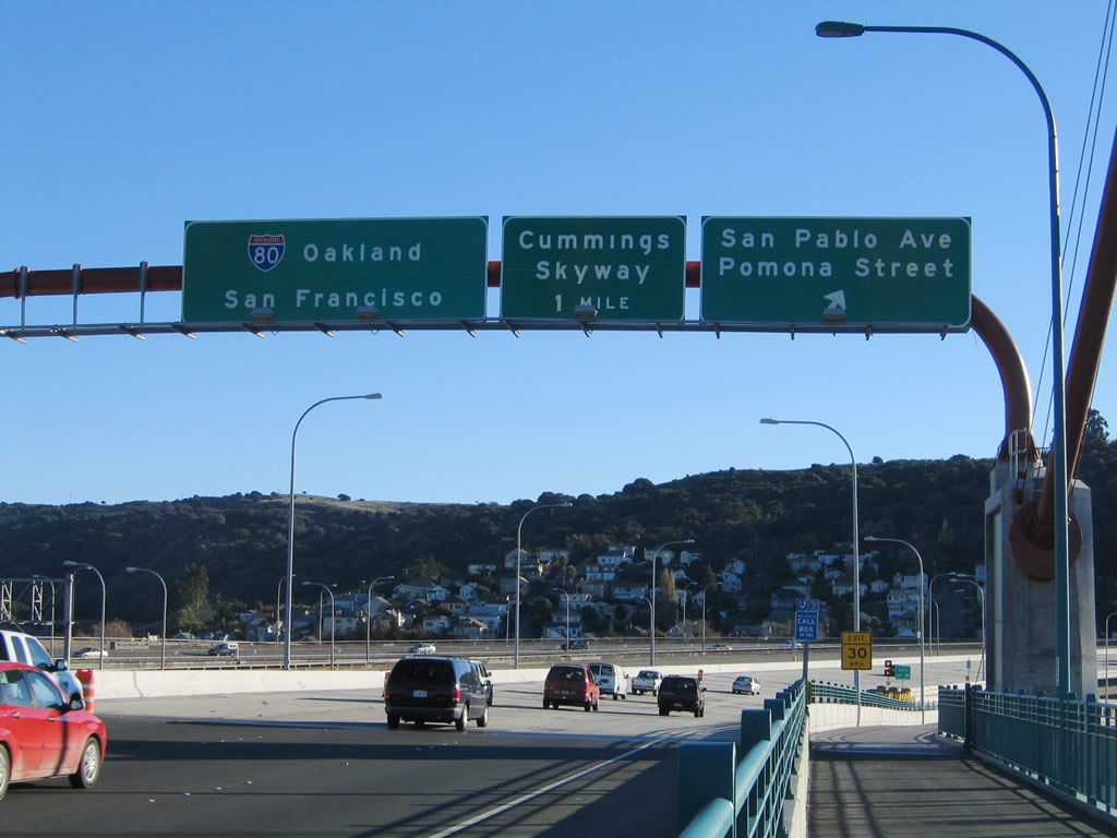 |
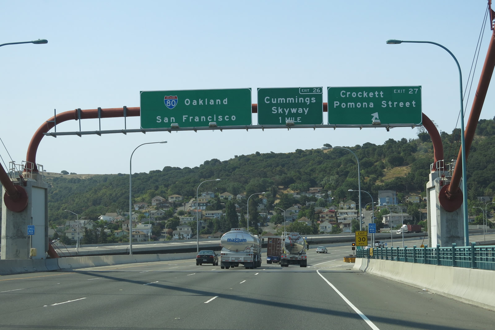
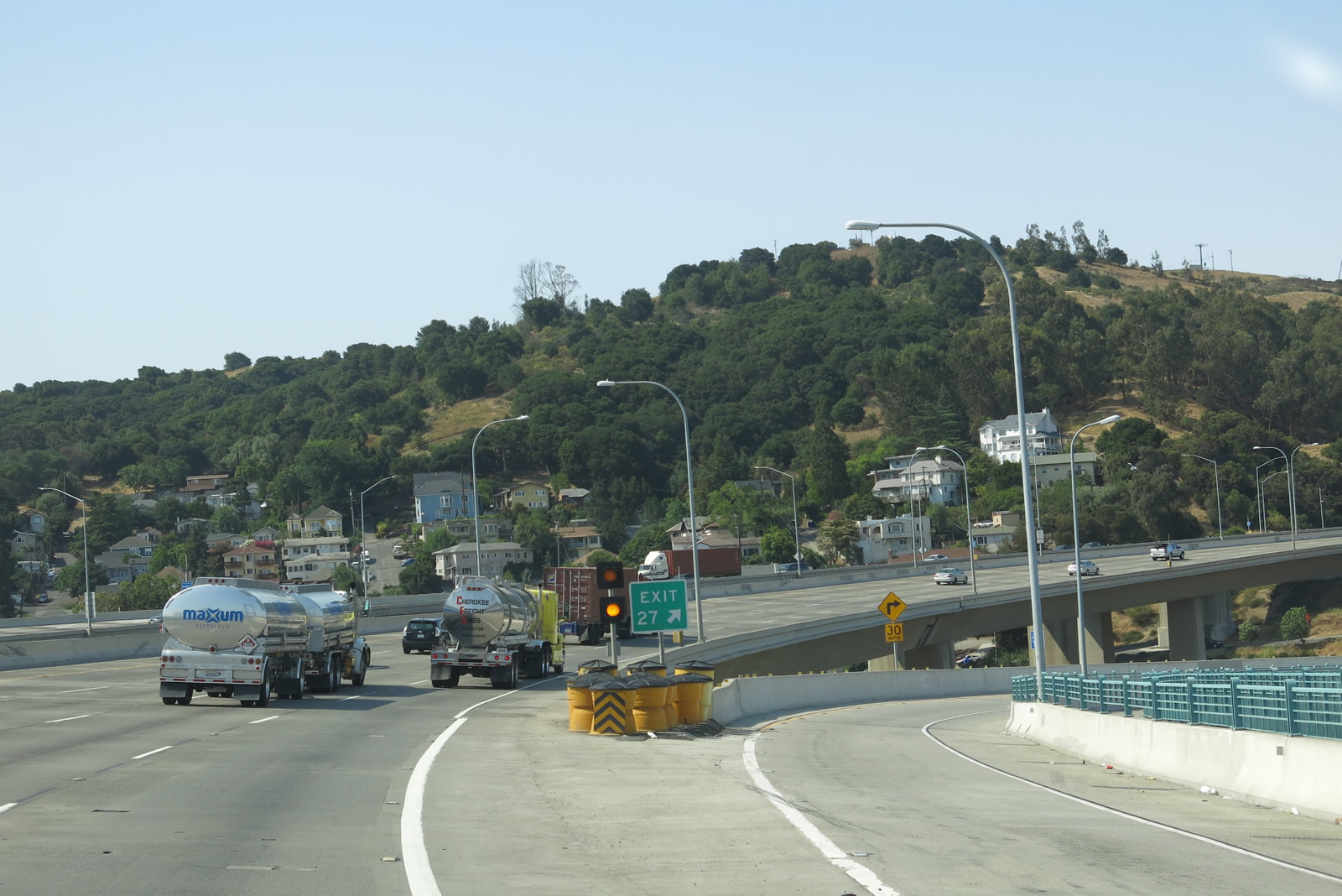
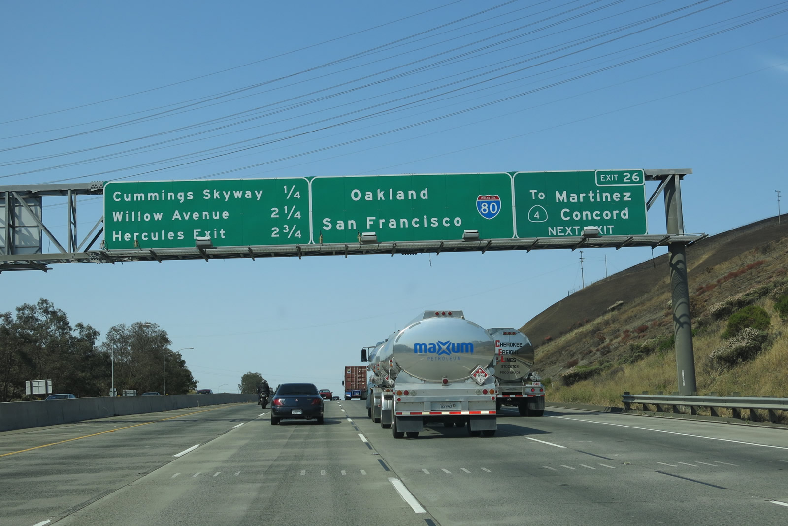
Now at the southern end of the Alfred Zampa Memorial Bridge, westbound Interstate 80 reaches Exit 27, Pomona Street to San Pablo Avenue and Historic U.S. 40. A new ramp connecting the freeway to the old route was constructed as part of the bridge project. The next exit is Exit 26, Cummings Skyway to California 4 east. In 2004, there were no exit numbers present on these signs, but adjustments to the signs resulted in the exit numbers' inclusion by 2013. Note that Exit 27 was renamed from San Pablo Avenue to Pomona Street. Photos taken 07/02/13 and 11/28/04. | |
 |
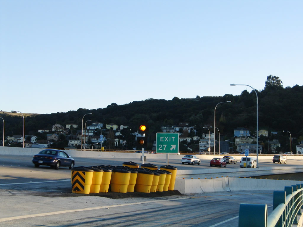 |
The gore point for Exit 27 has flashing beacons since the exit comes immediately upon reaching the southern end of the bridge in Crockett near the anchorage of the 2003 suspension bridge. Photos taken 07/02/13 and 11/28/04. | |
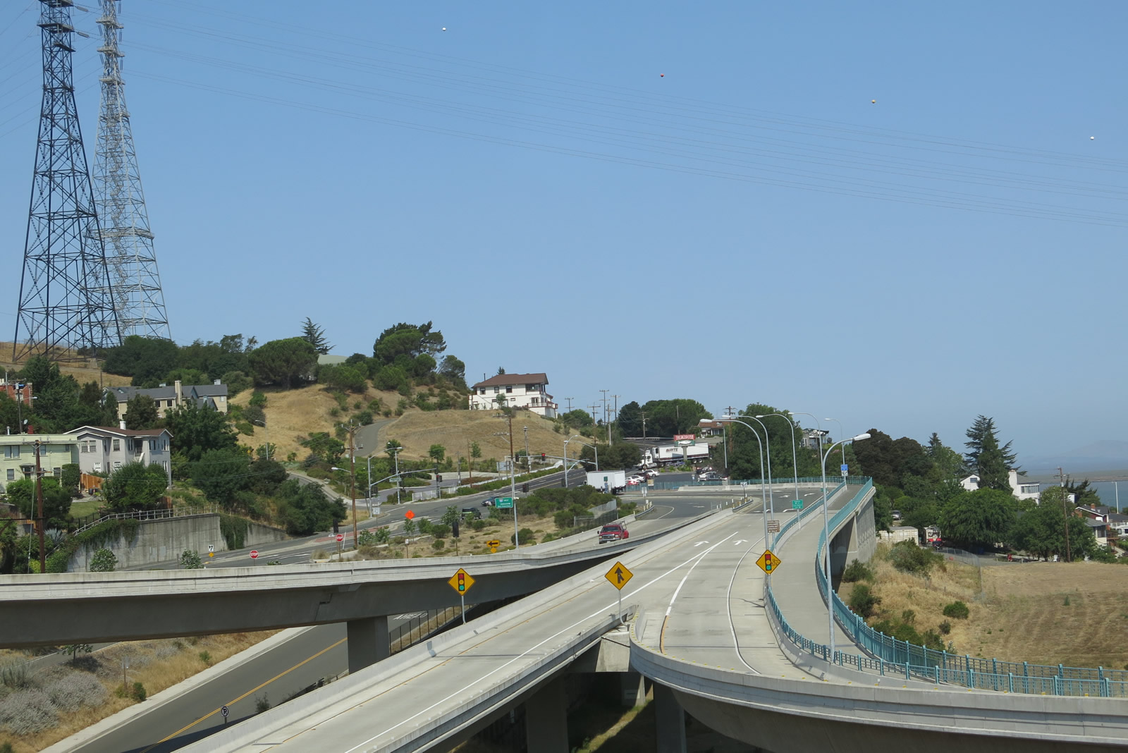 |
This view looks west toward the exit ramps leading down to Pomona Street and San Pablo Avenue, both of which are far below the elevation of the Alfred Zampa Memorial Bridge. The aforementioned Pacific Gas and Electric power lines also return to land after crossing the Carquinez Straits. Photo taken 07/02/13. |
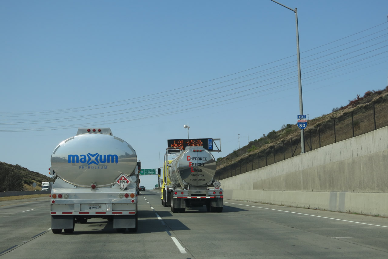 |
Climbing away from the Carquinez Straits, watch for slow moving traffic in the right lanes. An Interstate 80 shield is posted on the ascent. The freeway will pass through some hills to avoid the shoreline area while passing through Crockett and Hercules. Photo taken 07/02/13. |
 |
This interchange sequence sign along Interstate 80 west provides the distance to the next three exits: Exit 26, Cummings Skyway east to California 4; Exit 24, Willow Avenue; and Exit 23, California 4 west to San Pablo Avenue. Photo taken 07/02/13. |
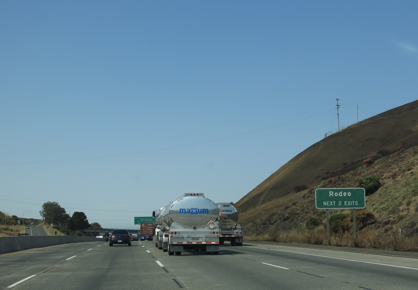 |
The next two exits (Exit 26, Cummings Skyway and Exit 24, Willow Avenue) serve the unincorporated community of Rodeo, which had a population of 8,679 as of the 2010 Census. Photo taken 07/02/13. |
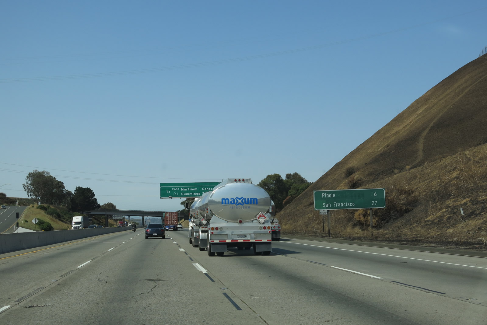 |
This mileage sign provides the distance to Pinole (six miles) and San Francisco (27 miles). It appears that this sign has been repurposed from some other use given the appearance that other letters were once on this sign. Photo taken 07/02/13. |
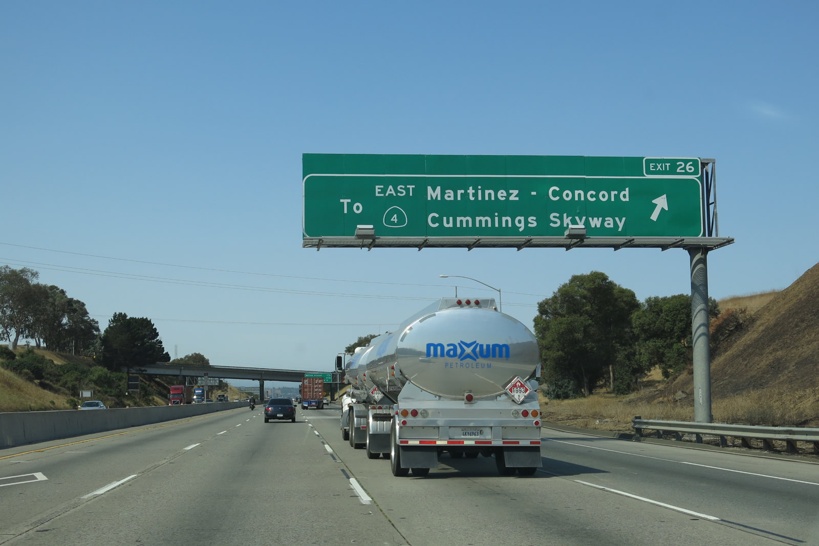 |
Westbound Interstate 80 meets Exit 26, Cummings Skyway. There is no direct connection from westbound Interstate 80 to eastbound California 4, so traffic to Martinez, Concord, Walnut Creek, and Antioch must use Cummings Skyway for the most direct connection. Photo taken 04/02/04. |
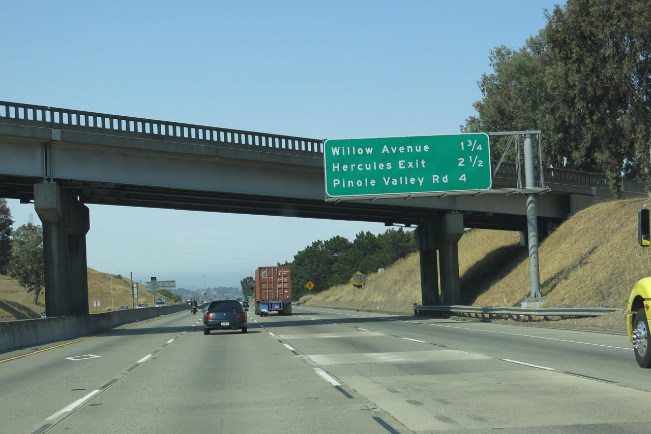 |
This interchange sequence sign provides the distance to Exit 24, Willow Avenue; Exit 23, California 4 (John Muir Parkway); and Exit 22, Pinole Valley Road. Photo taken 07/02/13. |
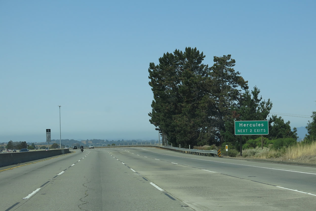 |
A rare view of a clear section (no traffic) along Interstate 80. The next two exits serve the city of Hercules, which had a population of 24,060 as of the 2010 Census and was incorporated on December 15, 1900. Photo taken 07/02/13. |
 |
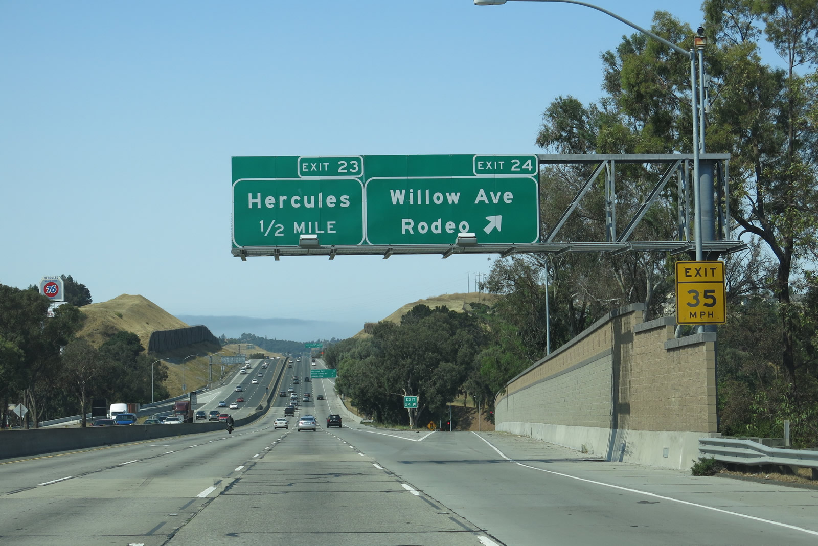
Willow Avenue travels to community of Rodeo and the city of Hercules. Photo taken 07/02/13. |
 |
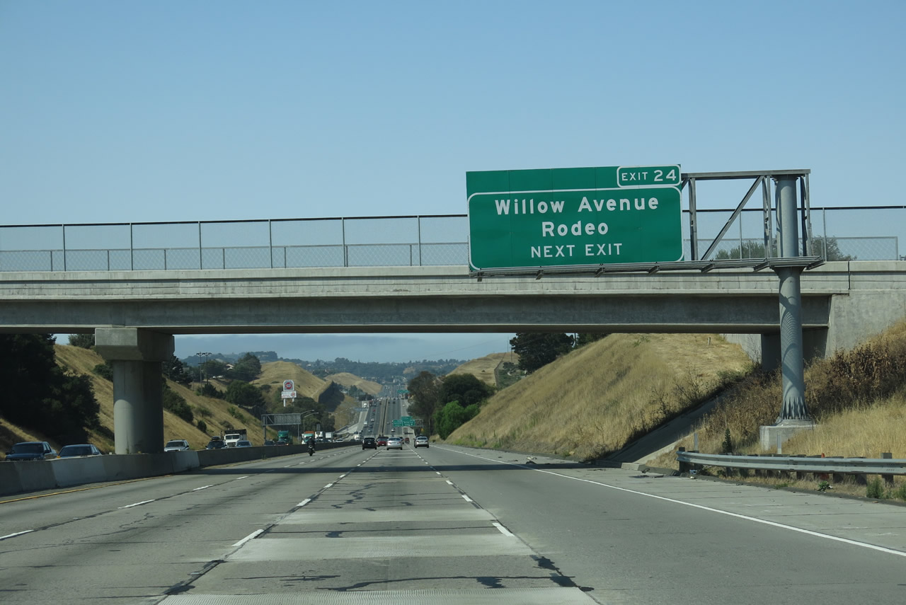
Westbound Interstate 80 (Eastshore Freeway) meets Exit 24, Willow Avenue, which serves the community of Rodeo. Photo taken 07/02/13. |
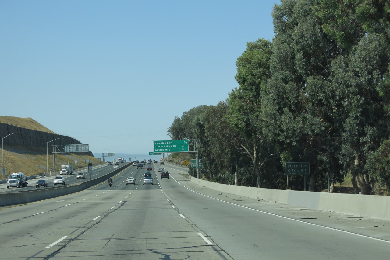 |
Interstate 80 enters the city of Hercules. A company town founded around the old California Powder Works in 1881, Hercules became one of the largest producers of the black powder used to make TNT in the country in the first half of the 20th century. When the plant shifted production from TNT to fertilizer in the 1960s, many acres of land that were previously not developable due to proximity to the TNT production facility were made available. The city adopted a general plan two years after the conversion, and it has been growing and redeveloping ever since. Photo taken 07/02/13. |
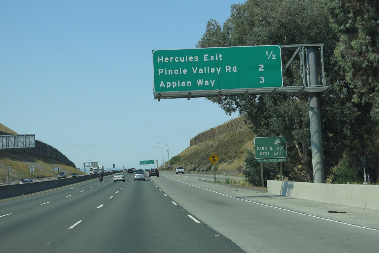 |
This interchange sequence sign along Interstate 80 west provides the distance to Exit 23, California 4 (John Muir Parkway); Exit 22, Pinole Valley Road; and Exit 21, Appian Way. Photo taken 07/02/13. |
 |
An Interstate 80 west reassurance shield is posted after the on-ramp from Willow Avenue. Photo taken 07/02/13. |
 |
Westbound Interstate 80 meets Exit 23, California 4 (John Muir Parkway) west to San Pablo Avenue/Historic U.S. 40. The overhead sign ignores that this is the California 4 interchange and instead refers to it solely as "Hercules." Photo taken 07/02/13. |
 |
This view looks south along westbound Interstate 80 as we pass through the California 4 stack interchange. Photo taken 07/02/13. |
 |
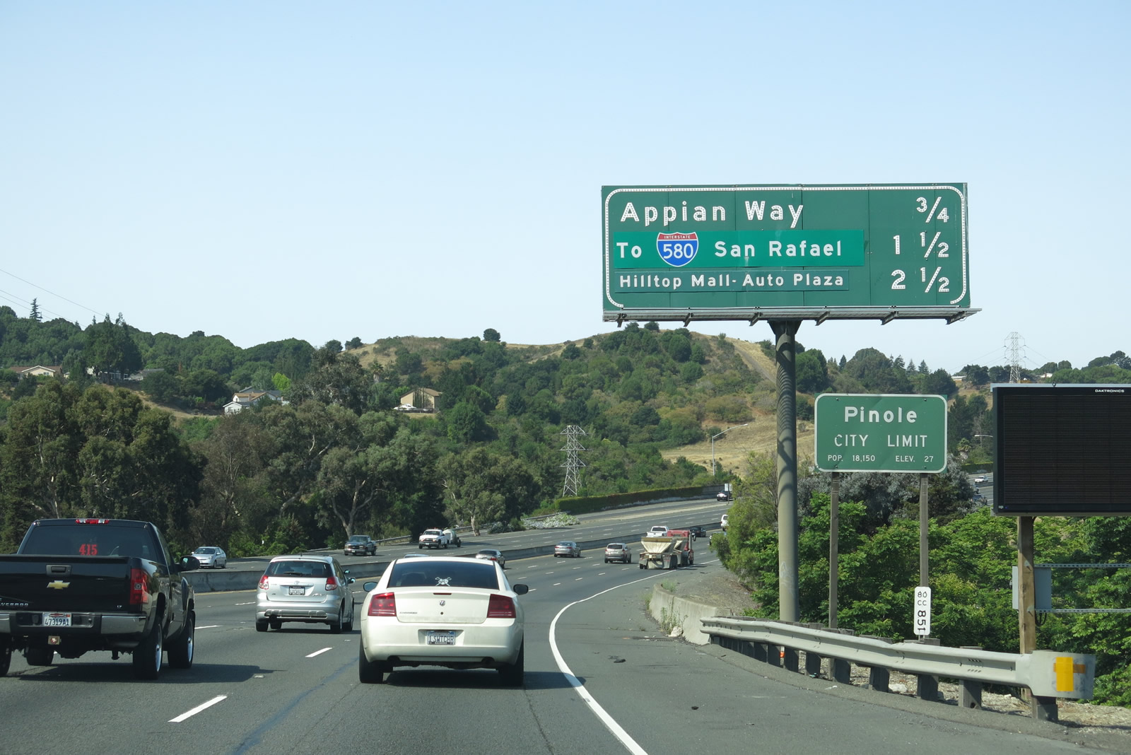
This mileage sign along Interstate 80 west provides the distance to the next three exits: Exit 22, Pinole Valley Road; Exit 21, Appian Way; and Exit 20, Richmond Parkway (Proposed California 93). The green overlay at the bottom placed an Interstate 580 sign and San Rafael text over the original "Richmond Parkway" moniker. Prior to the construction of the Richmond Parkway in the mid-1990s, that interchange was known as the Atlas Road interchange. Photo taken 07/02/13. |
 |
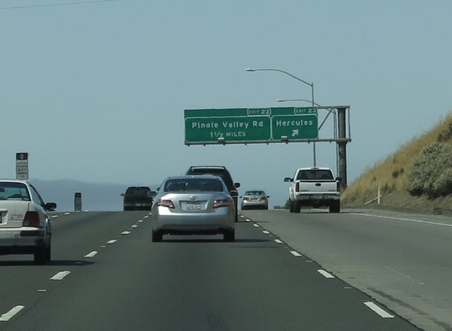
The right lane of Interstate 80 drops at Exit 22 for Pinole Valley Road. The freeway enters the city of Pinole, home to 18,390 residents as of the 2010 Census, a reduction from 19,039 residents in 2000. Averaging about 23 inches of precipitation per year, the city sees a temperate climate, with temperatures rarely leaving the range between mid-40s and mid-70s. According to the official webpage, Interstate 80 (also known as the U.S. 40/Eastshore Freeway until its decommissioning in 1964) entered the city in 1958, an early year for freeway construction. Photo taken 07/02/13. |
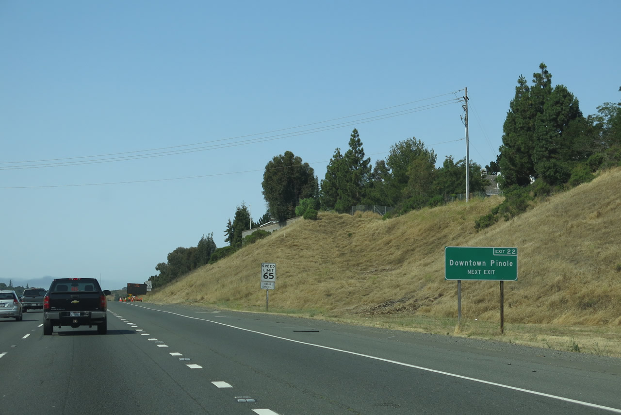 |
Use Exit 23 to downtown Pinole. Heading north on Pinole Valley Road, the road changes into Tennent Avenue, which serves downtown Pinole and connects with Old U.S. 40/San Pablo Avenue. Photo taken 07/02/13. |
 |
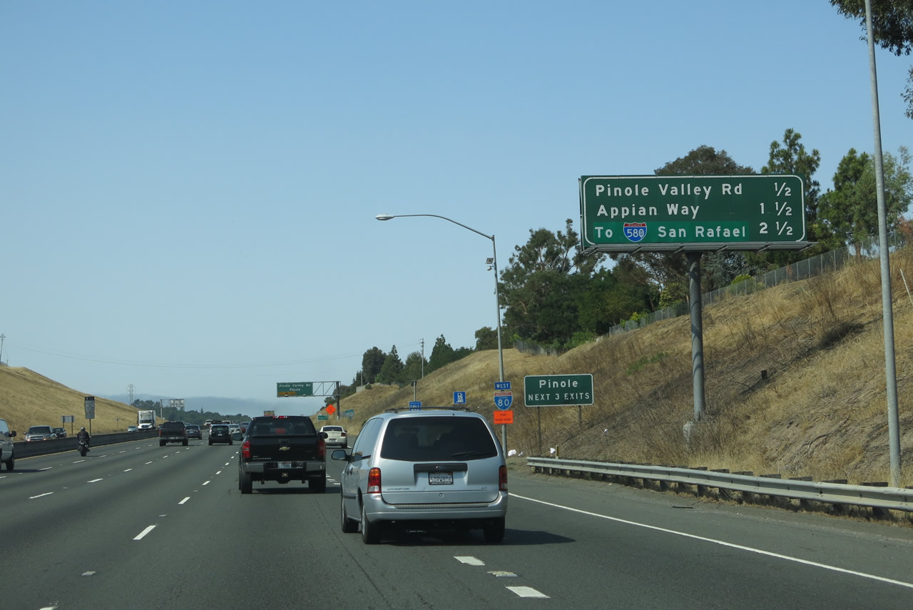
Westbound Interstate 80 meets Exit 22, Pinole Valley Road. At this point, Interstate 80 briefly turns west again, but will head south by the time it reaches Richmond Parkway (Exit 20). To the south of this interchange, Pinole Valley Road goes to Pinole Park, then changes into Alhambra Valley Road, which heads east and then north to Martinez's Alhambra Avenue and California 4 (John Muir Parkway). Photo taken 07/02/13. |
 |
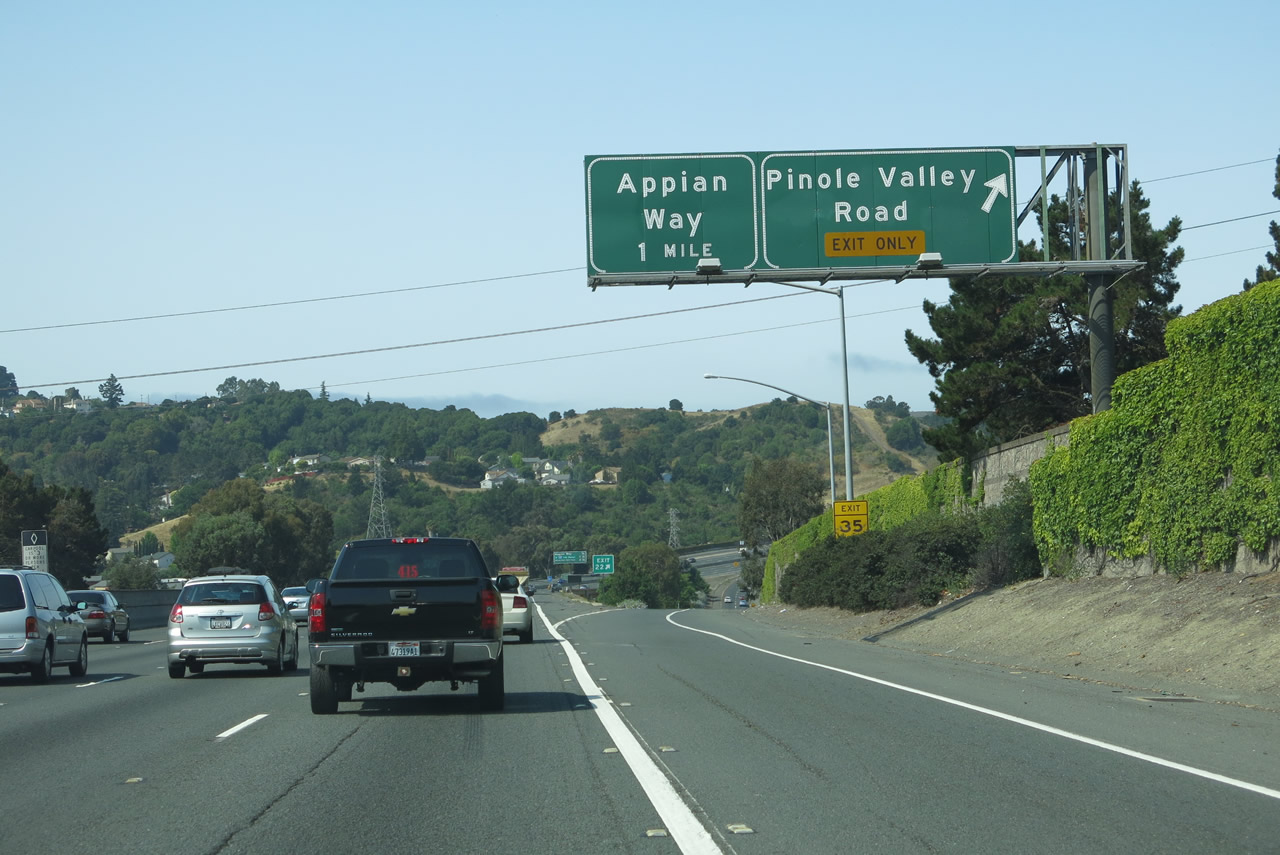
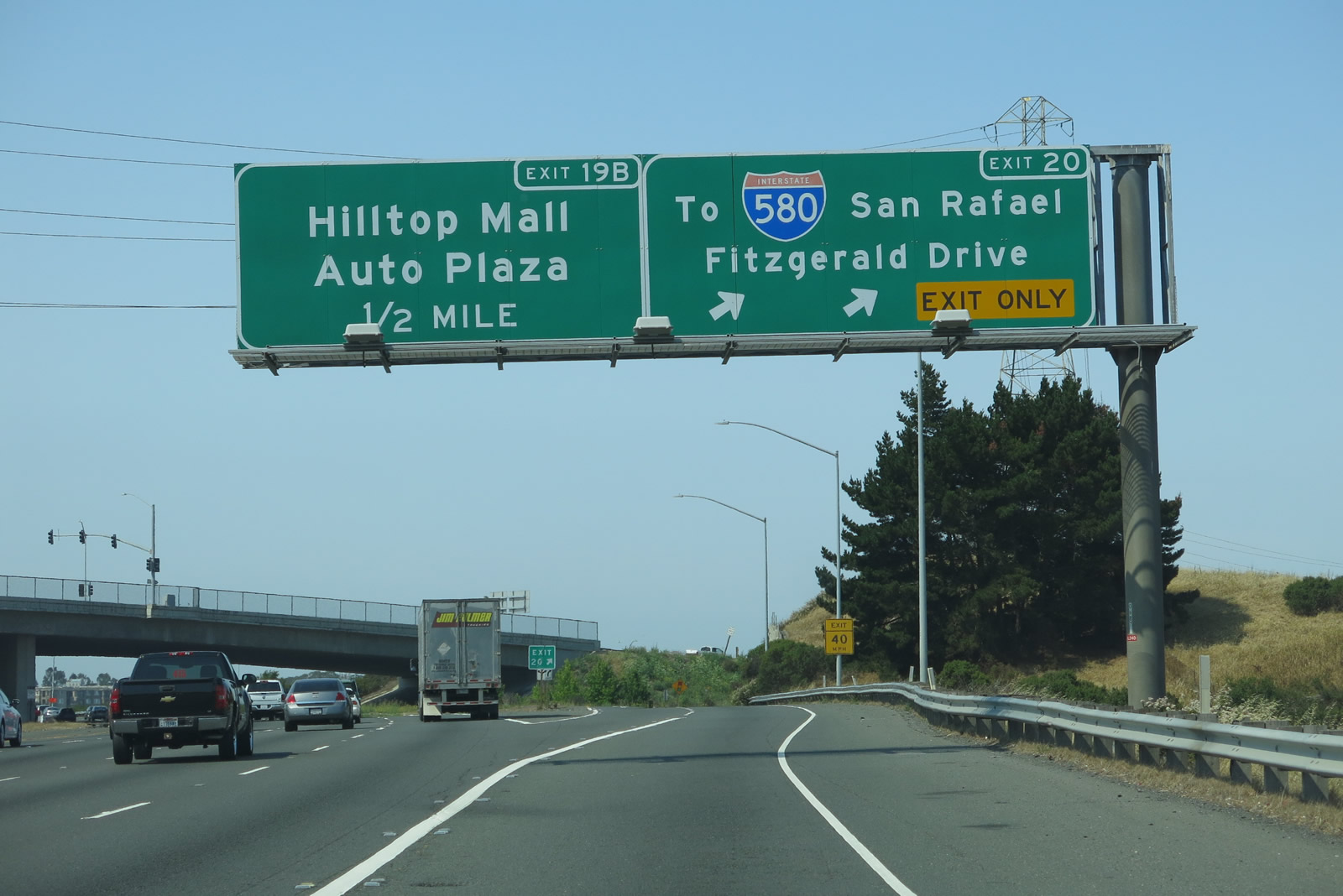
This mileage sign along Interstate 80 west provides the distance to the next three exits: Exit 21, Appian Way; Exit 20, Richmond Parkway to Interstate 580 west (Future California 93); and Exit 19B, Hilltop Mall and Auto Plaza. Photo taken 07/02/13. |
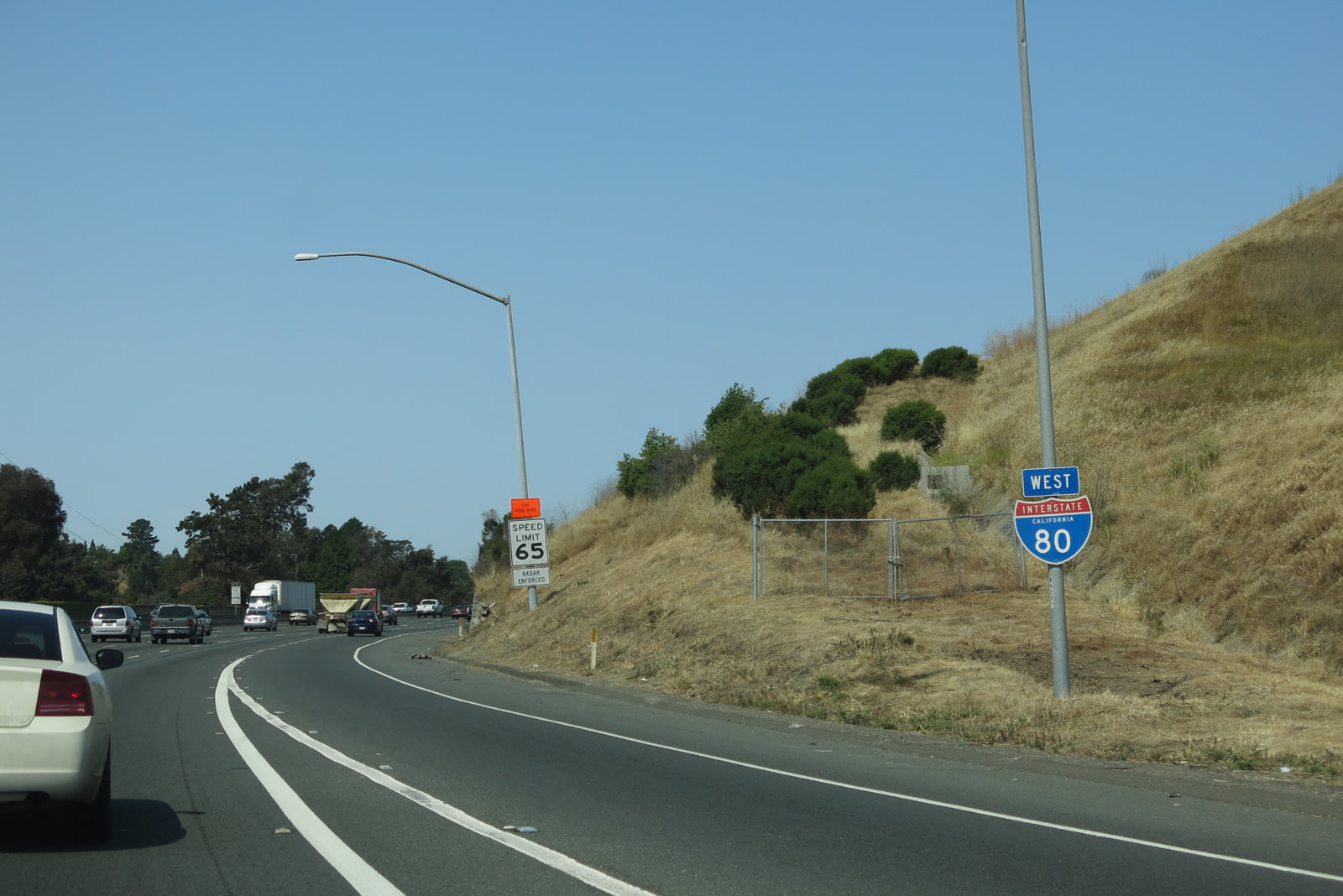 |
An Interstate 80 reassurance shield is posted shortly thereafter. Photo taken 07/02/13. |
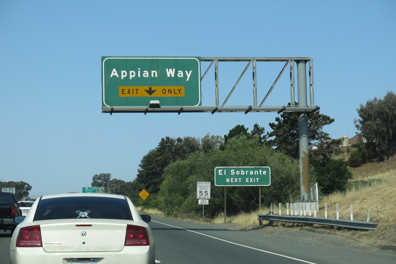 |
The right lane of Interstate 80 west becomes exit only for Exit 21, Appian Way. Use Exit 21 to El Sobrante, an unincorporated community with a population of 12,669 as of the 2010 Census. Photo taken 07/02/13. |
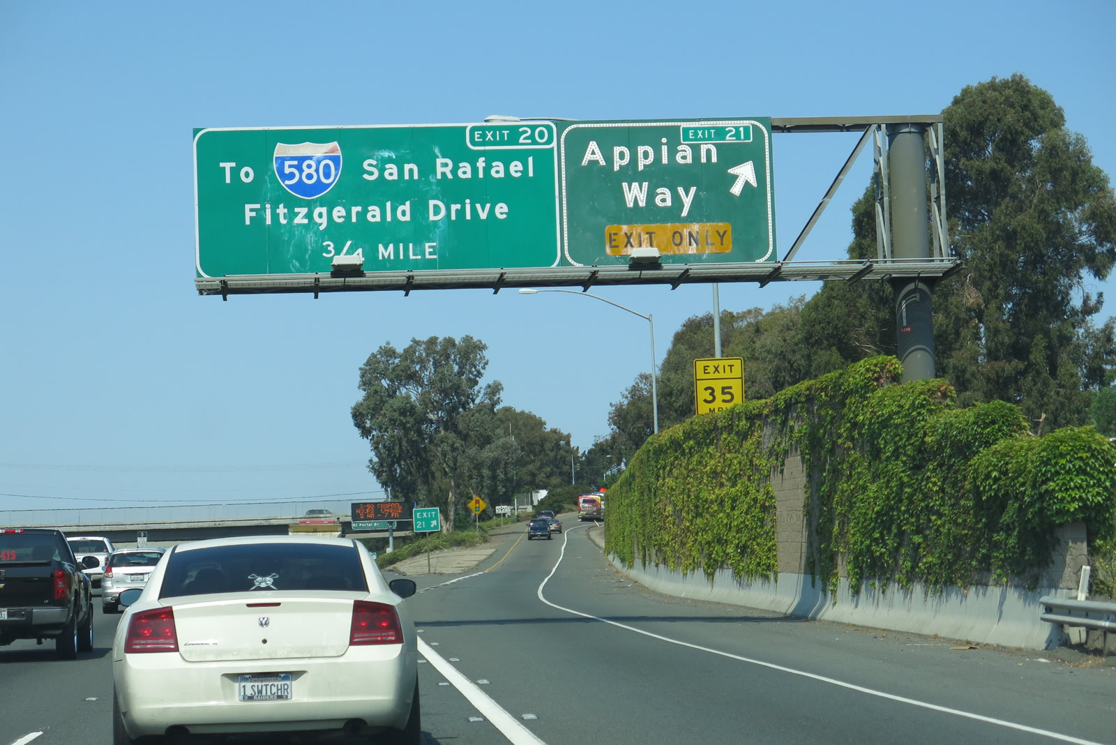 |
Westbound Interstate 80 meets Exit 21, Appian Way; the next exit is Exit 20, Richmond Parkway. Oddly, none of the advance signs want to refer to Richmond Parkway by that name, instead prefer to reference its ultimate connection to Interstate 580. Photo taken 07/02/13. |
 |
Passing under the Appian Way overpass, this mileage sign along Interstate 80 west provides the distance to the next three exits: Exit 20, Richmond Parkway (California 93) to Interstate 580 west and Fitzgerald Drive east; Exit 19B, Hilltop Mall/Auto Plaza; and Exit 19A, El Portal Drive. Photo taken 07/02/13. |
 |
Another Interstate 80 west reassurance shield is posted after the on-ramp from Appian Way. Use Exit 20, Richmond Parkway (California 93) to Interstate 580 west, Point Pinole Regional Shoreline (part of East Bay Regional Park District), and the Richmond-San Rafael Bridge. Photo taken 07/02/13. |
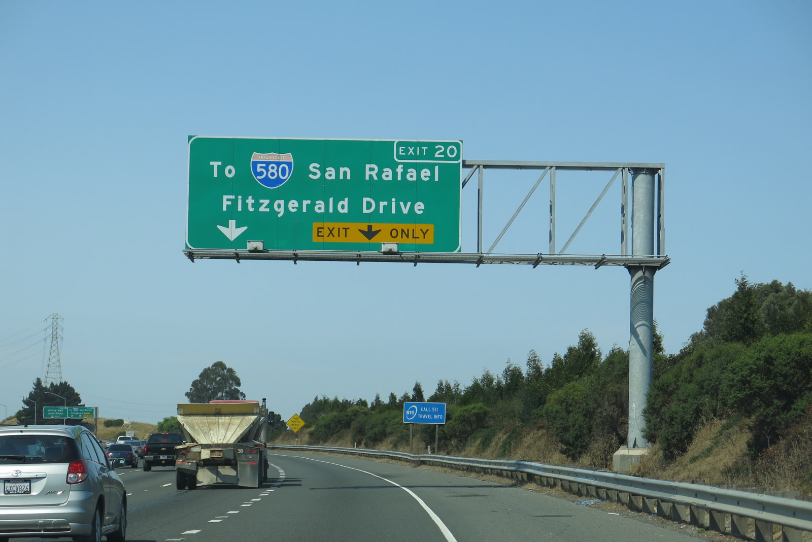 |
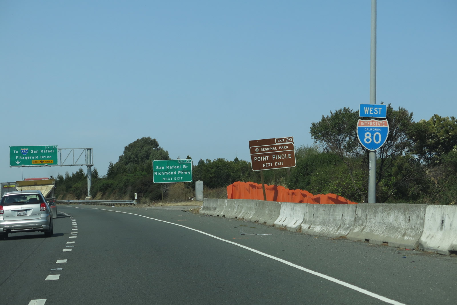
The right lane of Interstate 80 west becomes exit only for Exit 20, Richmond Parkway (California 93) to Interstate 580/Richmond-San Rafael Bridge en route to San Rafael in Marin County; Exit 20 also connects to Fitzgerald Drive. Richmond Parkway was built in the 1990s to local arterial and expressway standards, but it does not meet state standards. Until necessary upgrades to bring the parkway to state standards are complete, Richmond Parkway will remain a locally maintained route despite its role in providing the primary connection between Interstate 80 north and Interstate 580 west. Photo taken 07/02/13. |
 |
Westbound Interstate 80 meets Exit 20, Richmond Parkway (possible future California 93). Some would say that the recently completed Richmond Parkway, which arcs from Interstate 80 west and then south to Interstate 580 at the foot of the Richmond-San Rafael Bridge should be added to the state highway system as California 93. The state has not taken the road over, even though call boxes refer to the Richmond Parkway as California 93 and the parkway rests on the long-proposed alignment of California 93. The following exit is Exit 19B, Hilltop Mall/Auto Plaza. Photo taken 07/02/13. |
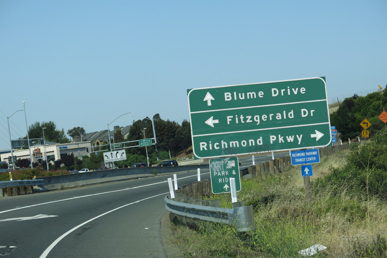 |
Now on the off-ramp to Exit 20, this sign advises of connections to Fitzgerald Drive east, Richmond Parkway west, and Blume Drive south. Use Richmond Parkway west to Interstate 580 west. Use Blume Drive south to Hilltop Mall. Photo taken 07/02/13. |
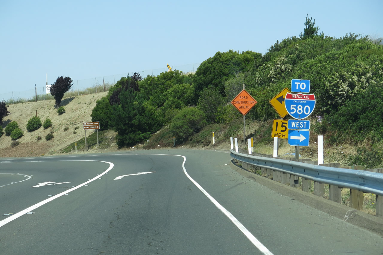 |
An Interstate 580 west trailblazer is posted shortly thereafter on the off-ramp to Richmond Parkway. A traffic signal ahead governs the flow of traffic between Interstate 80 west and Richmond Parkway/Fitzgerald Drive. Photo taken 07/02/13. |
 |
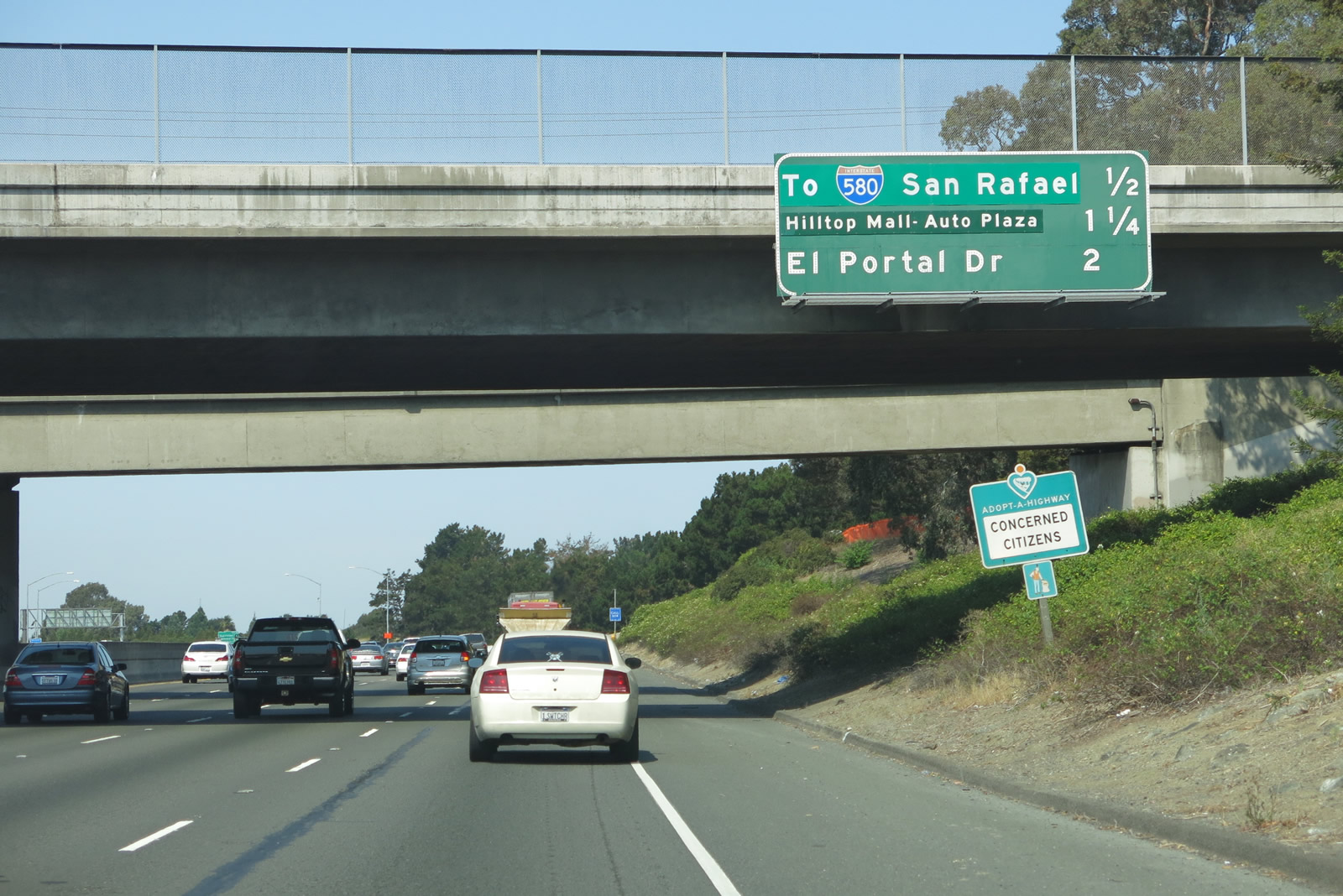
Back on the mainline, this mileage sign along Interstate 80 west provides the distance to the next three exits: Exit 19B, Hilltop Mall/Auto Plaza; Exit 19A, El Portal Drive; and Exit 18, San Pablo Dam Road. Photo taken 04/04/04. |
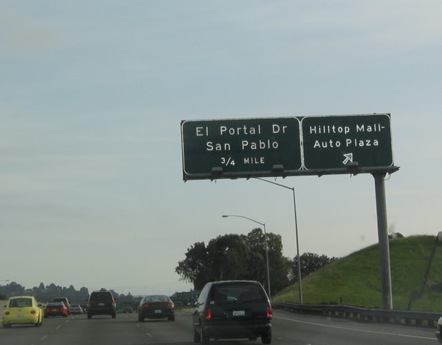 |
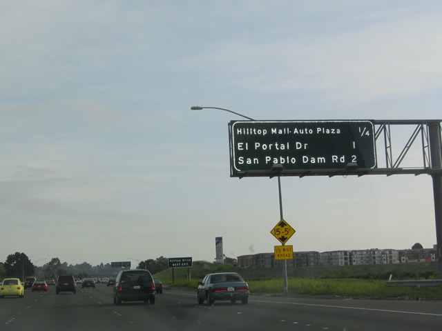
Westbound Interstate 80 meets Exit 19B, Hilltop Mall/Auto Plaza. The next exit is El Portal Drive (Exit 19A). Photo taken 04/04/04. |
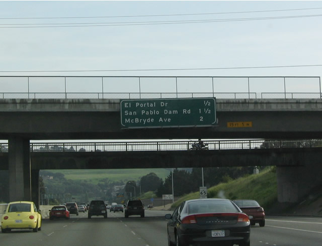 |
This mileage sign along Interstate 80 west provides the distance to the next three exits: Exit 19A, El Portal Drive; Exit 18, San Pablo Dam Road; and Exit 17, McBryde Avenue. El Portal Drive is the first exit to serve the city of San Pablo, the "City of New Directions." San Pablo is home to 30,215 residents as of 2000. Photo taken 04/04/04. |
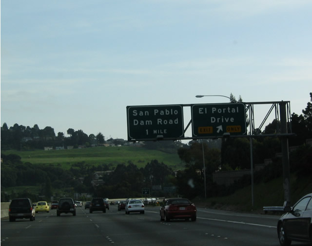 |
Westbound Interstate 80 meets Exit 19A, El Portal Drive, which leads south to San Pablo Dam Road. Use this route to head east toward eastern sections of Richmond and the San Pablo Reservoir recreational area. Photo taken 04/04/04. |
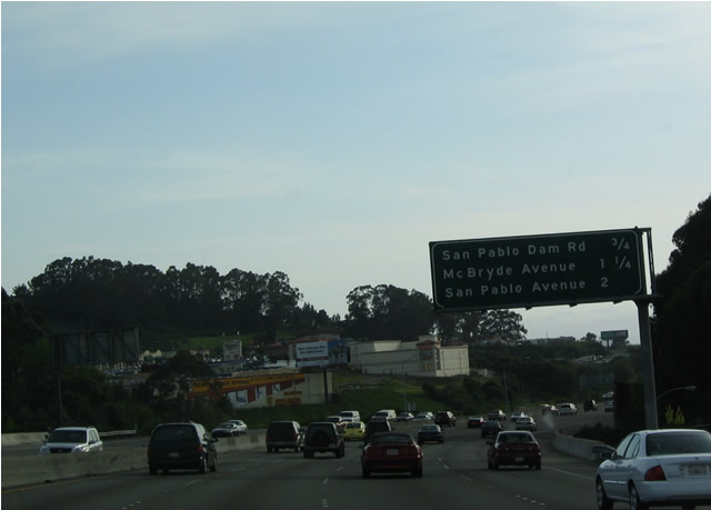 |
This mileage sign along westbound Interstate 80 provides the distance to the next three exits: Exit 18, San Pablo Dam Road; Exit 17, McBryde Avenue; and Exit 16, California 123 South/San Pablo Avenue/Barrett Avenue. Photo taken 04/04/04. |
 |
Westbound Interstate 80 (Eastshore Freeway) meets Exit 18, San Pablo Dam Road. Photo taken 04/04/04. |
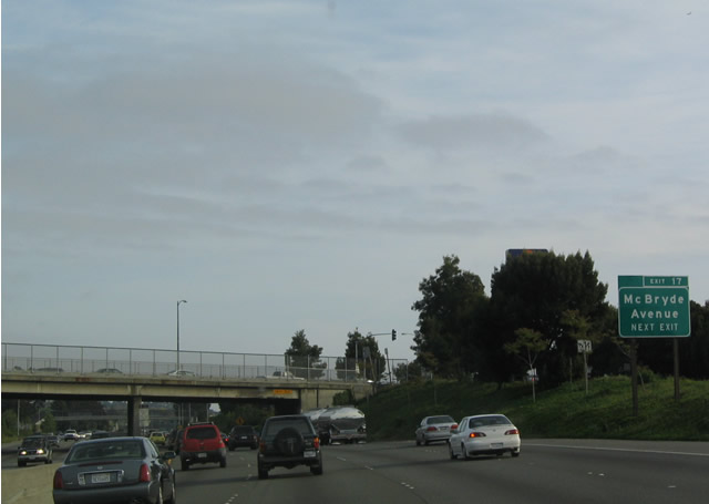 |
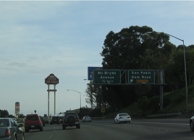
The next interchange along Interstate 80 west is Exit 17, McBryde Avenue. Interstate 80 now enters the city of Richmond, which had a population of 99,216 as of the 2000 U.S. Census. The city celebrated its centennial in 2005. Photo taken 04/04/04. |
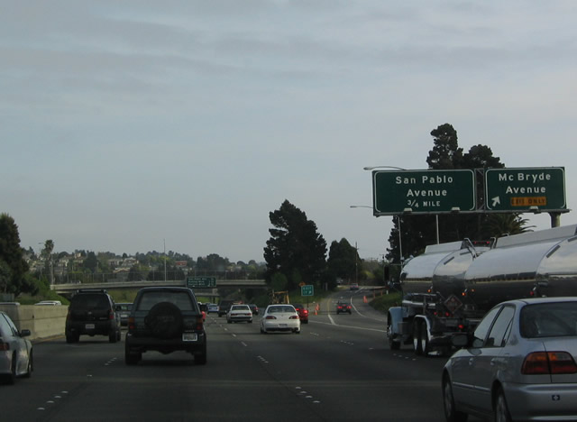 |
Westbound Interstate 80 meets Exit 17, McBryde Avenue. The next exit is Exit 16, California 123 south/San Pablo Avenue/Barrett Avenue. Photo taken 04/04/04. |
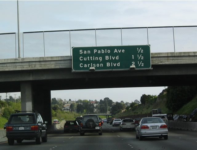 |
This mileage sign along Interstate 80 west provides the distance to the next three exits: Exit 16, California 123 South/San Pablo Avenue/Barrett Avenue; Exit 15, Cutting Boulevard; Exit 14B, Carlson Boulevard; and Exit 14A, Central Avenue. Photo taken 04/04/04. |
 |
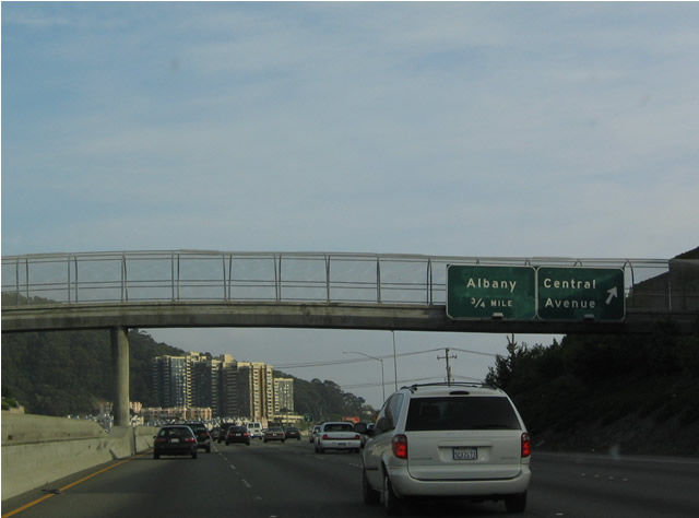
As is the case for several non-freeway state routes in the Bay Area (such as California 61, California 262, and others), California 123 is not signed on the approach guide signs along the freeway. San Pablo Avenue follows Historic U.S. 40 from Interstate 80 in Richmond south through El Cerrito, Berkeley, and Emeryville before entering Oakland. The state route culminates at a point where San Pablo Avenue crosses Interstate 580 just west of Market Street and the California 24 stack interchange. Photo taken 04/04/04. |
 |
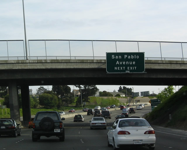
Westbound Interstate 80 approaches Exit 16, California 123/San Pablo Avenue south and Barrett Avenue. Barrett Avenue heads west into Richmond and east into El Cerrito, culminating at Arlington Boulevard near the Mira Vista Country Club and Golf Course. Photo taken 04/04/04. |
 |
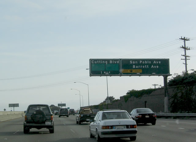
This mileage sign along westbound Interstate 80 provides the distance to the next three exits: Exit 15, Cutting Boulevard; Exit 14B, Carlson Boulevard; and Exit 14A, Central Avenue. Photo taken 04/04/04. |
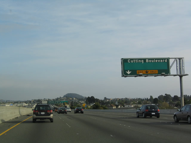 |
Cutting Boulevard, which heads west into Richmond, intersects Interstate 580 just east of the Richmond-San Rafael Bridge. Heading east, Cutting Boulevard connects to California 123/San Pablo Avenue/Old U.S. 40 in El Cerrito. Photo taken 04/04/04. |
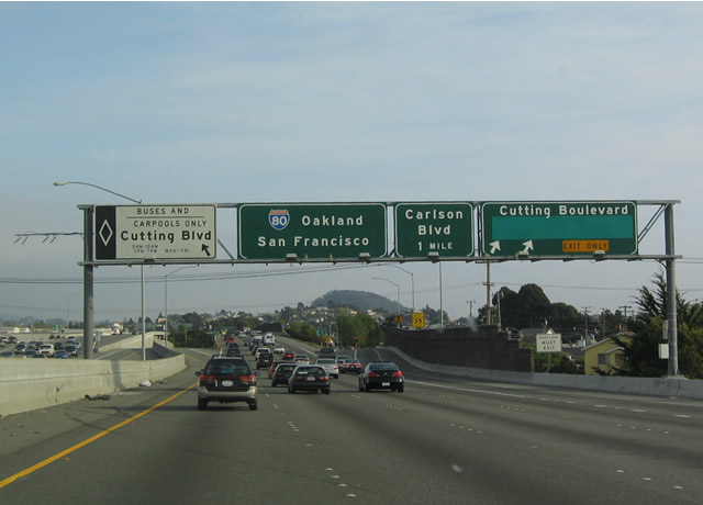 |
Westbound Interstate 80 meets Exit 15, Cutting Boulevard. Note the special left exit for high occupancy vehicles. Between here and the Potrero Avenue crossing, Interstate 80 briefly enters the city of El Cerrito, with an estimated 23,596 population. Photo taken 04/04/04. |
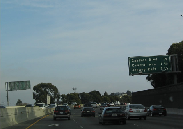 |
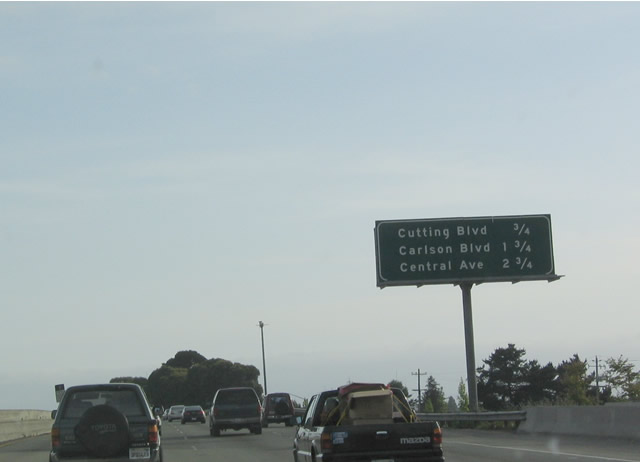
This mileage sign along Interstate 80 west provides the distance to the next three exits: Exit 14B, Carlson Boulevard; Exit 14A, Central Avenue; and Exit 13, Cleveland Avenue/Buchanan Street. Photo taken 04/04/04. |
 |
Westbound Interstate 80 reaches Exit 14B, Carlson Boulevard. Carlson Boulevard heads northwest into downtown Richmond and southeast into El Cerrito. Photo taken 04/04/04. |
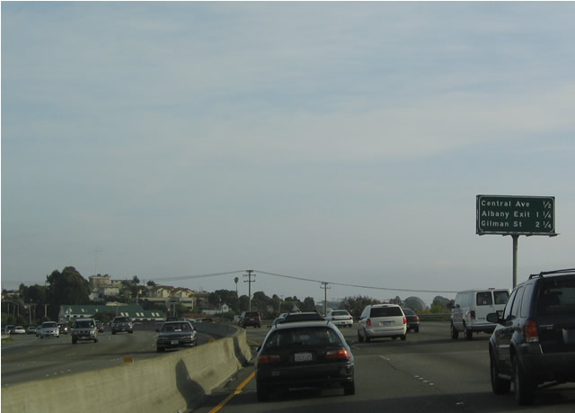 |
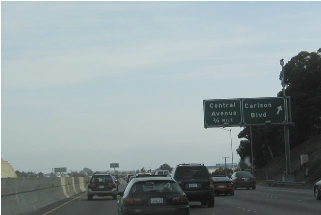
This mileage sign along Interstate 80 west provides the distance to the next three exits: Exit 14A, Central Avenue; Exit 13, Cleveland Avenue and Buchanan Street; and Exit 12, Gilman Street. Photo taken 04/04/04. |
 |
Westbound Interstate 80 (Eastshore Freeway) reaches Exit 14A, Central Avenue. Central Avenue is the final exit along westbound in Contra Costa County and city of Richmond; we will enter Alameda County just beyond this point. After this exit, Interstate 80 merges with eastbound Interstate 580, even though both routes are now headed due south. The next exit is Exit 13, Cleveland Avenue/Buchanan Street in Alameda County. Exit 13 is situated on top of the merge point between Interstate 80 and Interstate 580. Photo taken 04/04/04. |

Page Updated July 20, 2013.
|
About Contact Glossary |
In The News Interstate Guide |
Social Media:
 |
|
© 2000-25 AARoads.com | All Rights Reserved | Privacy Policy / Terms of Use
|
||