| Interstate 210 (Foothill Freeway) east |
|
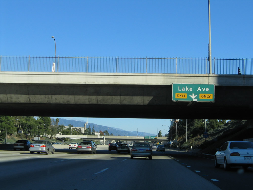
The right lane of Interstate 210 east becomes exit only for Exit 26, Lake Avenue in the city of Pasadena. Photo taken 11/14/04. |
|
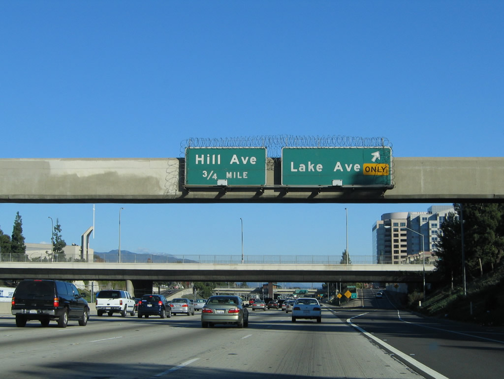
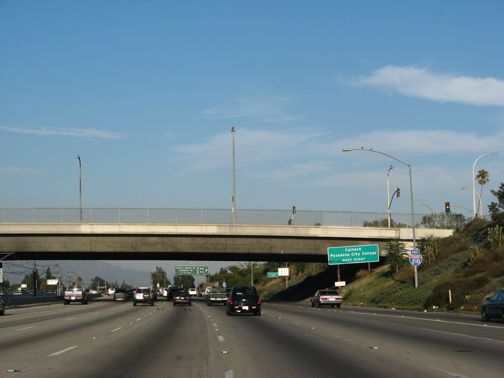
Eastbound Interstate 210 (Foothill Freeway) reaches Exit 26, Lake Avenue. The next exit along Interstate 210 east is Exit 27, Hill Avenue. Photo taken 11/14/04. |
|
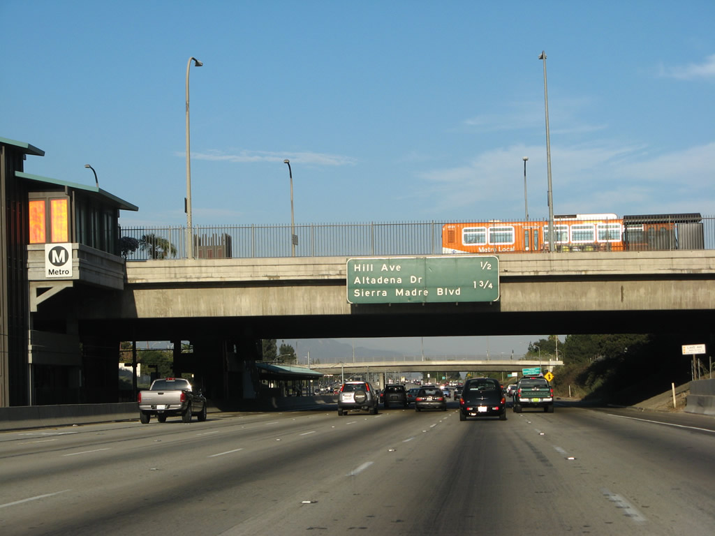
Passing under Lake Avenue, this mileage sign provides the distance to the next two exits on Interstate 210 east: Exit 27, Hill Avenue and Exit 28, Altadena Drive and Sierra Madre Boulevard. The Metro Gold Line emerges in the median of Interstate 210; the light rail line follows the freeway from here east to the Madre Street/Sierra Madre Villa Avenue interchange (Exit 29B). Photo taken 08/26/07. |
|
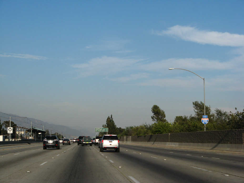
An Interstate 210 east reassurance shield is posted soon thereafter. Photo taken 08/26/07. |
|
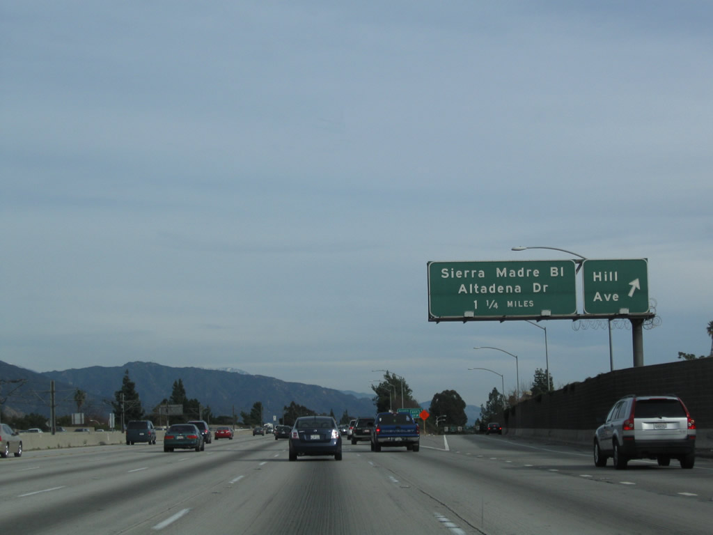
Eastbound Interstate 210 (Foothill Freeway) reaches Exit 27, Hill Avenue. The next exit along eastbound is Exit 28, Altadena Drive and Sierra Madre Boulevard. Photo taken 12/20/09. |
|
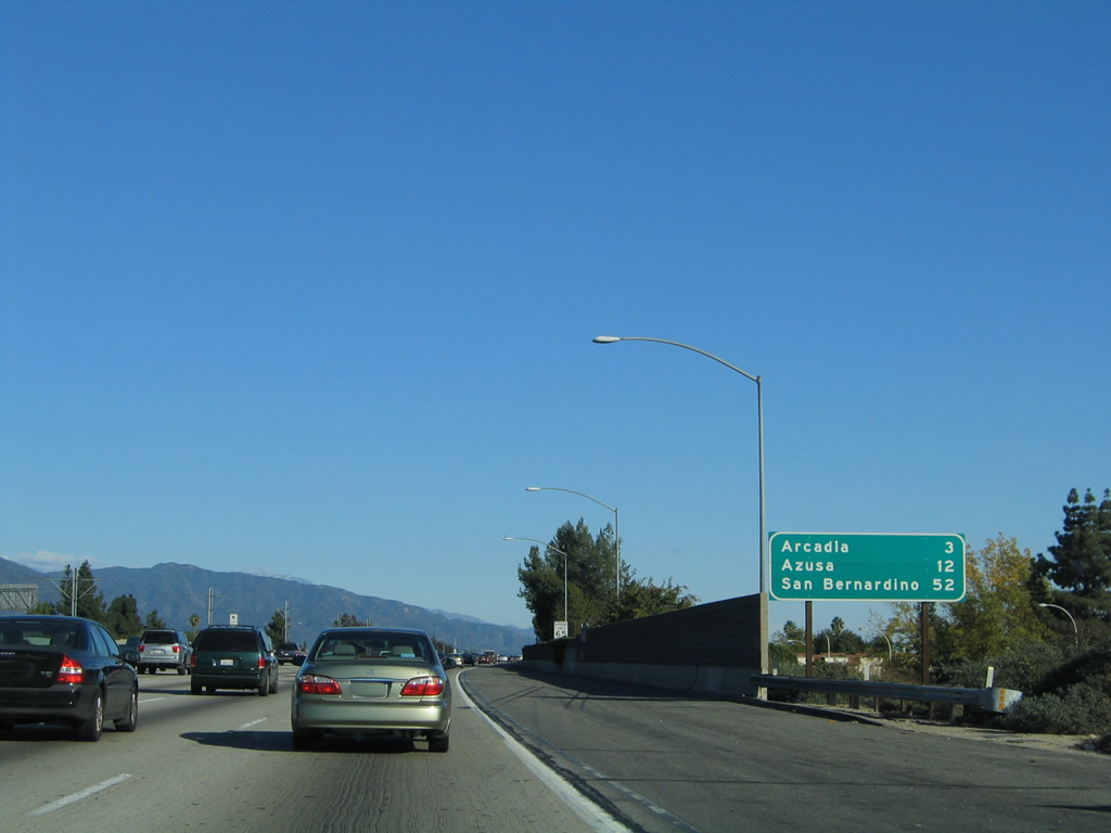
This mileage sign provides the distance to Arcadia (three miles), Azusa (12 miles), and San Bernardino (52 miles). Photo taken 11/14/04. |
|
An Interstate 210 east reassurance shield is posted soon thereafter. Photo taken 08/26/07. |
|
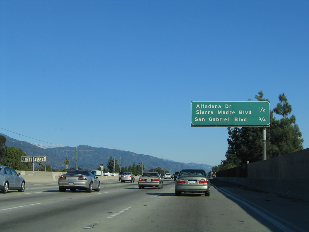
A second mileage sign provides the distance to the next two exits on Interstate 210 east: Exit 28, Altadena Drive and Sierra Madre Boulevard and Exit 29A, San Gabriel Boulevard. Photo taken 11/14/04. |
|
Eastbound Interstate 210 reaches Exit 28, Altadena Drive and Sierra Madre Boulevard. Photo taken 08/26/07. |
|
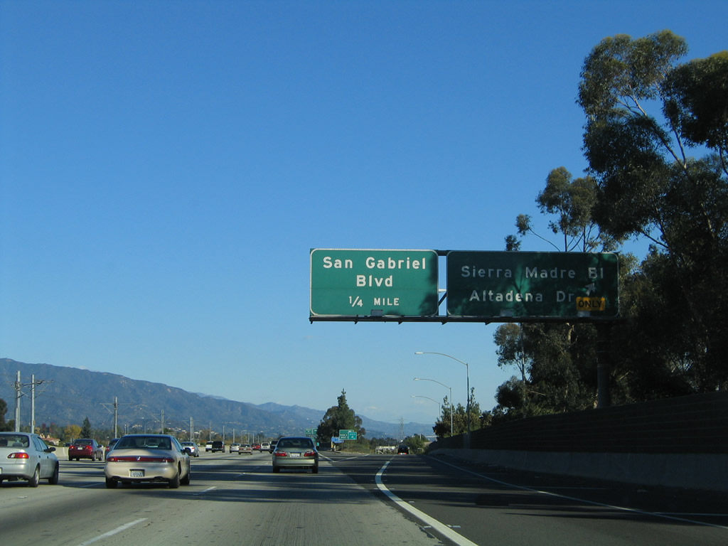
Immediately thereafter, eastbound Interstate 210 reaches Exit 29A, San Gabriel Boulevard. The next exit along eastbound is Exit 29B, Madre Street and Sierra Madre Villa Avenue. Photo taken 08/26/07. |
|
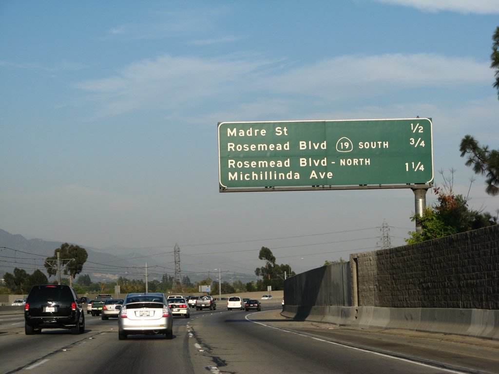
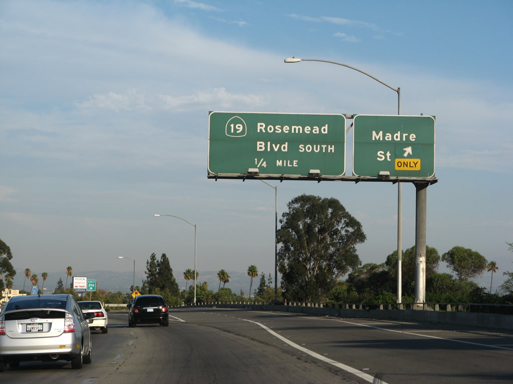
This mileage sign provides the distance to the next three exits on Interstate 210 east: Exit 29B, Madre Street and Sierra Madre Villa Avenue; Exit 30, California 19 (California 164)/Rosemead Boulevard south; and Exit 30B, Historic U.S. 66 (Colorado Boulevard) to Rosemead Boulevard north and Michillinda Avenue. Photo taken 08/26/07. |
|
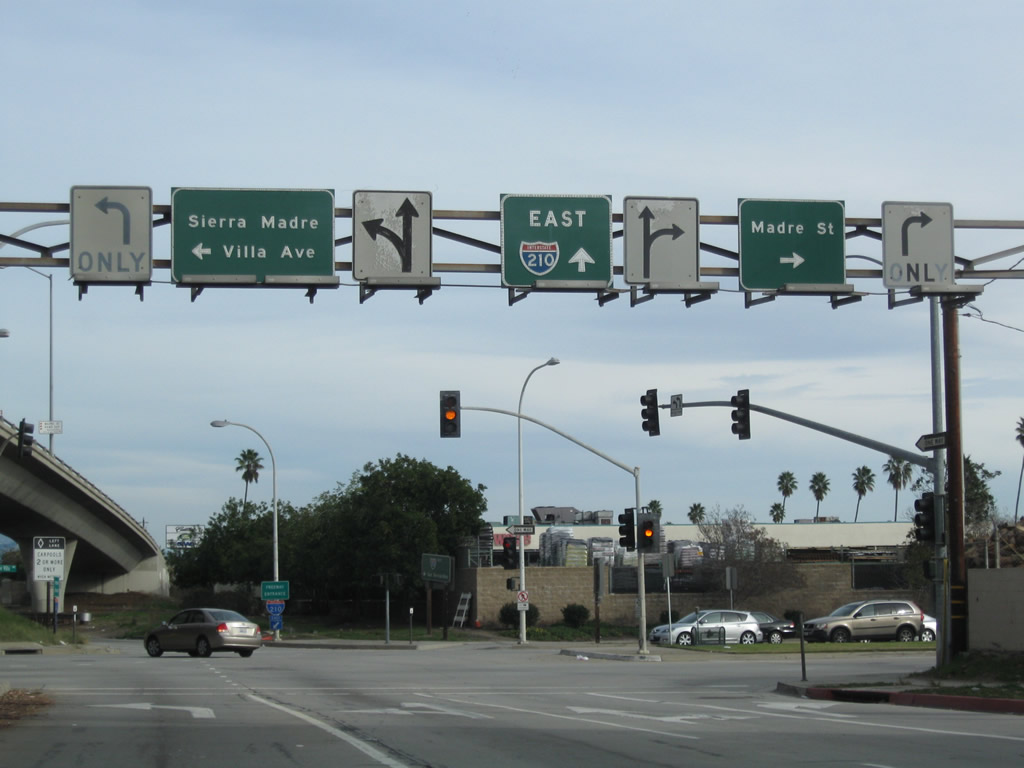
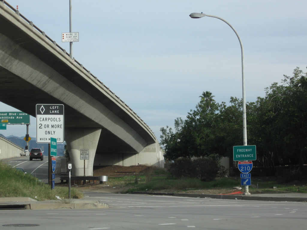
The right two lanes of Interstate 210 east become exit only for Exit 29B, Madre Street and Sierra Madre Villa Avenue. Follow Sierra Madre Villa Avenue north to the Gold Line Metro station, which includes a parking garage for light rail users. The Gold Line rail travels west to downtown Pasadena then southwest to downtown Los Angeles and then east into East Los Angeles. Photo taken 08/26/07. |
|
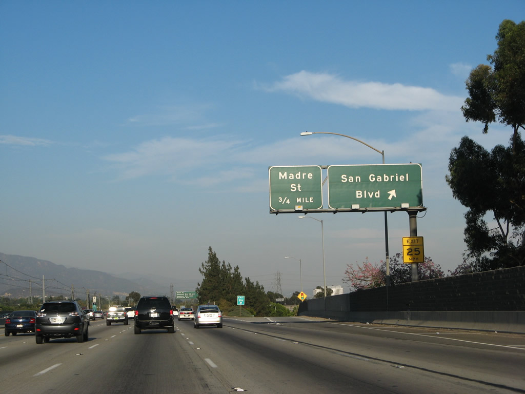
Eastbound Interstate 210 (Foothill Freeway) reaches Exit 29B, Madre Street and Sierra Madre Villa Avenue. The next exit is Exit 30A, California 19 (Rosemead Boulevard) south. Photo taken 08/26/07. |
|
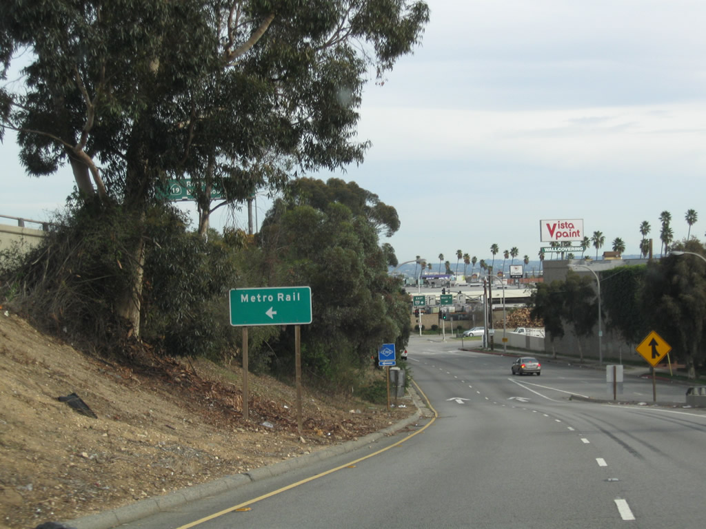
Now on the exit ramp to Exit 29A, stay left for the Gold Line Metro Rail parking garage and terminal. Photo taken 12/20/09. |
|
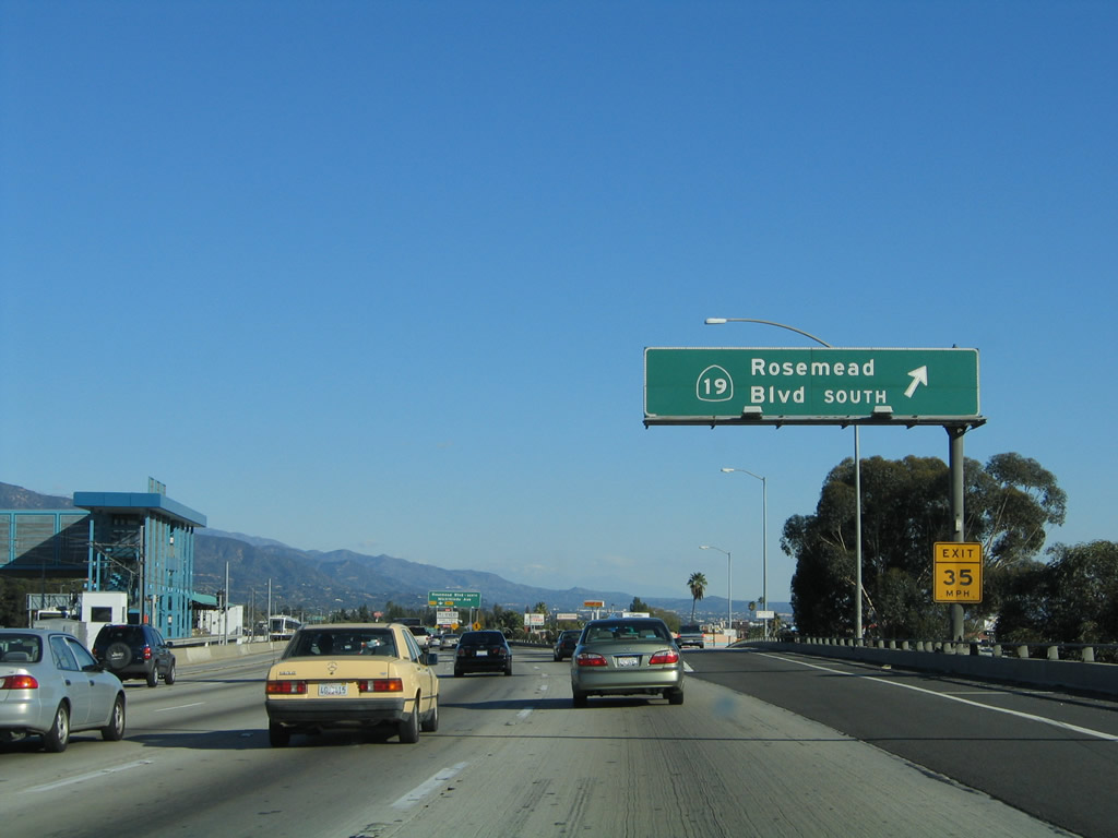
Back on the mainline, eastbound Interstate 210 next meets Exit 30A, California 19 (Rosemead Boulevard). The northern segment of California 19 is legislatively part of California 164, but it is signed as California 19 for route continuity. California 19 as a signed route extends from this interchange south to the Los Alamitos Traffic Circle in Long Beach via Rosemead Boulevard and Lakewood Boulevard. Most of the route is arterial, with an expressway segment through Whittier Narrows. Through several cities along its path, California 19 is gradually being decommissioned to local city street, with signage posted to maintain route continuity. Photo taken 11/14/04. |
|
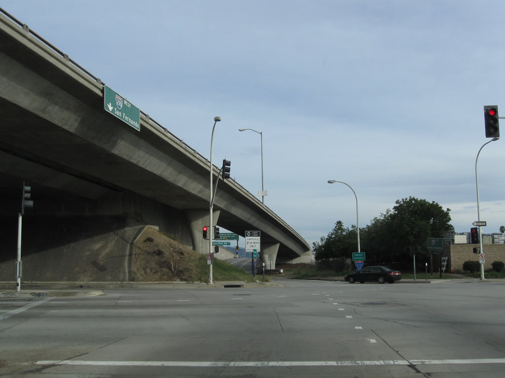
Now on the off-ramp from Interstate 210 east to California 19 south, the off-ramp flies over the on-ramp from Madre Street on a bridge, then becomes one-way eastbound Frontage Road. Around the interchange complex for Exits 30A-B, Interstate 210 leaves the city of Pasadena and enters unincorporated Los Angeles County. After crossing Michillinda Avenue, Interstate 210 enters the city of Arcadia. Photo taken 08/26/07. |
|
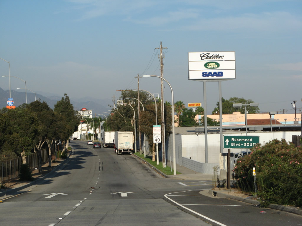
A trailblazer sign for Rosemead Boulevard south is posted along eastbound Frontage Road at the base of the off-ramp bridge. Photo taken 08/26/07. |
|
Eastbound Frontage Road abruptly turns south onto California 19 (Rosemead Boulevard) at this point. Photo taken 08/26/07. |
|
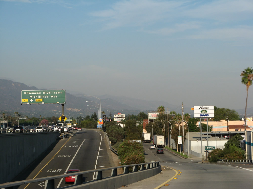
Back on the mainline, the next exit along Interstate 210 east is Exit 30B, Historic U.S. 66 (Colorado Boulevard) to Rosemead Boulevard north and Michillinda Avenue (right lane becomes exit only). Photo taken 11/14/04. |
|
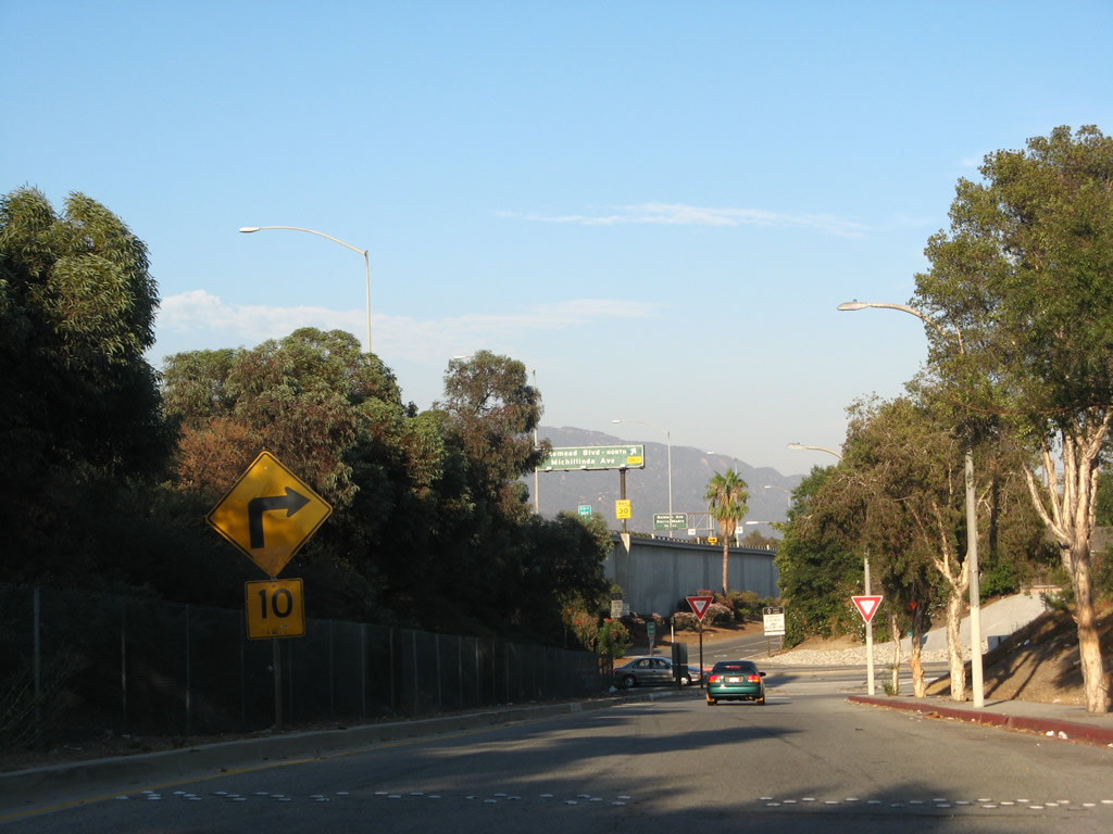
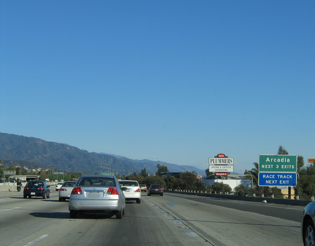
The next three exits along Interstate 210 (Foothill Freeway) east serve the city of Arcadia: Exit 30B, Historic U.S. 66 (Colorado Boulevard) to Rosemead Boulevard north and Michillinda Avenue; Exit 31, Baldwin Avenue; and Exit 32, Santa Anita Avenue. Exit 30B is the preferred and most direct route to the Santa Anita Park race track, but any of the next three exits can be used to get there. Photo taken 11/14/04. |
|
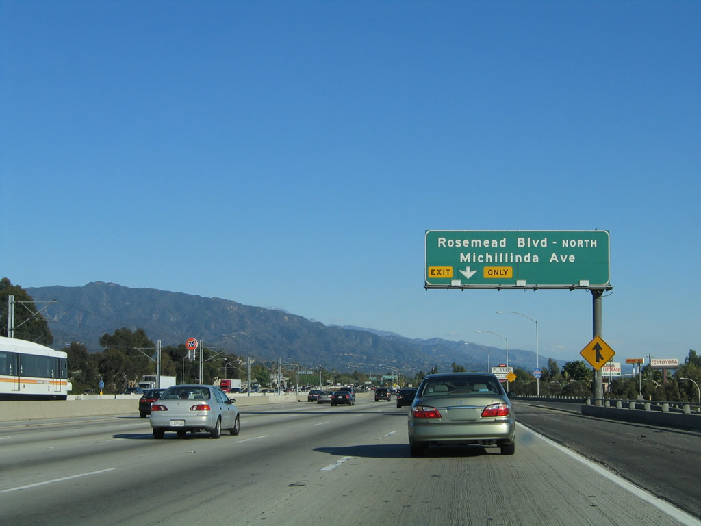
Eastbound Interstate 210 (Foothill Freeway) meets Exit 30B, Historic U.S. 66 (Colorado Boulevard) to Rosemead Boulevard north and Michillinda Avenue. The off-ramp turns south to intersection Colorado Boulevard (Historic U.S. 66). Turn left (east) on Colorado Boulevard to Michillinda Avenue north/south or right (west) to Rosemead Boulevard north. U.S. 66 closely parallels Interstate 210 from Pasadena east to San Bernardino and is usually not far from the freeway between these cities. Through Arcadia, U.S. 66 will follow Colorado Street and shift onto Huntington Drive. Huntington Drive continues into Monrovia and Duarte, then changes into Foothill Boulevard in Irwindale and Azusa. Old U.S. 66 then follows Foothill Boulevard into San Bernardino County, including the California 66 segment. Photo taken 11/14/04. |
|
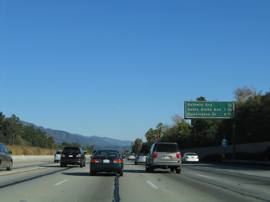
The next exit along Interstate 210 (Foothill Freeway) east is Exit 31, Baldwin Avenue to Arcadia and Sierra Madre. Ahead, Interstate 210 crosses over Michillinda Avenue and enters the city of Arcadia (population 53,054 as of 2000 Census). Arcadia was incorporated on August 5, 1903, and is home to the Santa Anita Park race track, popular for horse racing. Photo taken 11/14/04. |
|
This mileage sign provides the distance to the next three exits along Interstate 210 (Foothill Freeway) east: Exit 31, Baldwin Avenue; Exit 32, Santa Anita Avenue; and Exit 33, U.S. 66/Huntington Drive. Photo taken 11/14/04. |
|
Eastbound Interstate 210 (Foothill Freeway) reaches Exit 31, Baldwin Avenue. Photo taken 11/14/04. |
|
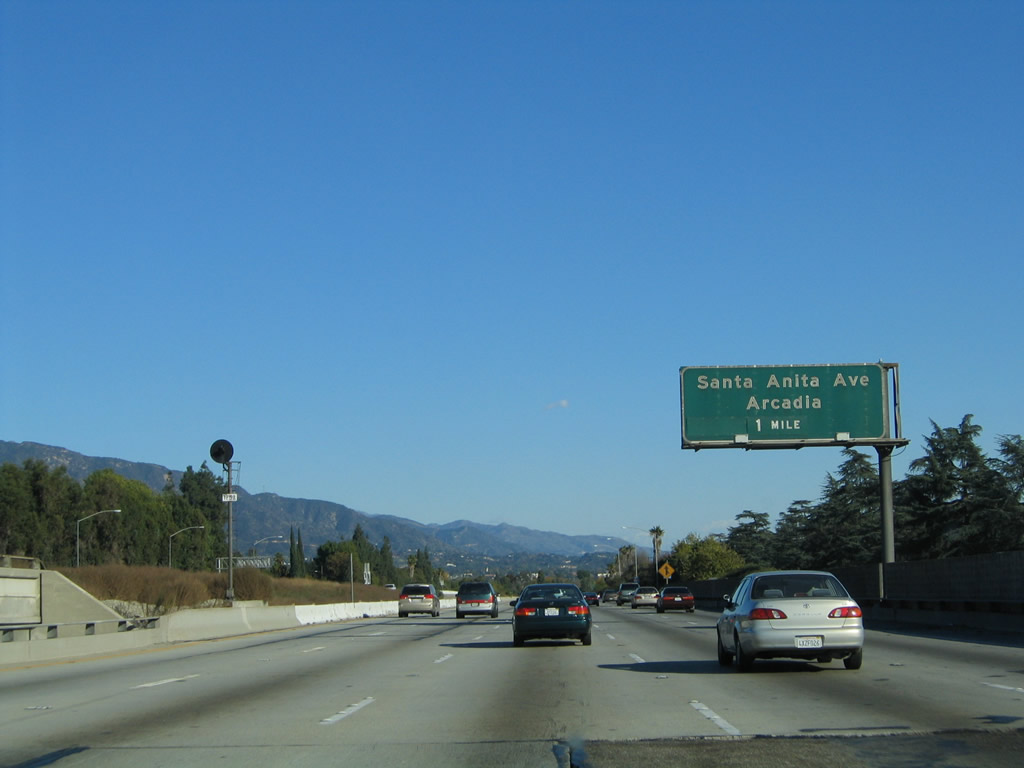
The next exit along Interstate 210 (Foothill Freeway) east is Exit 32, Santa Anita Avenue (one mile). Photo taken 11/14/04. |
|
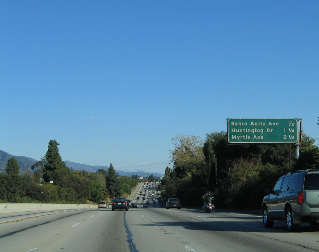
This mileage sign provides the distance to the next three exits along Interstate 210 (Foothill Freeway) east: Exit 32, Santa Anita Avenue; Exit 33, U.S. 66/Huntington Drive; and Exit 34, Myrtle Avenue. Photo taken 11/14/04. |
|
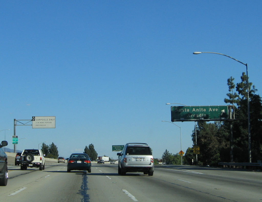
Eastbound Interstate 210 (Foothill Freeway) reaches Exit 32, Santa Anita Avenue. Photo taken 11/14/04. |
|
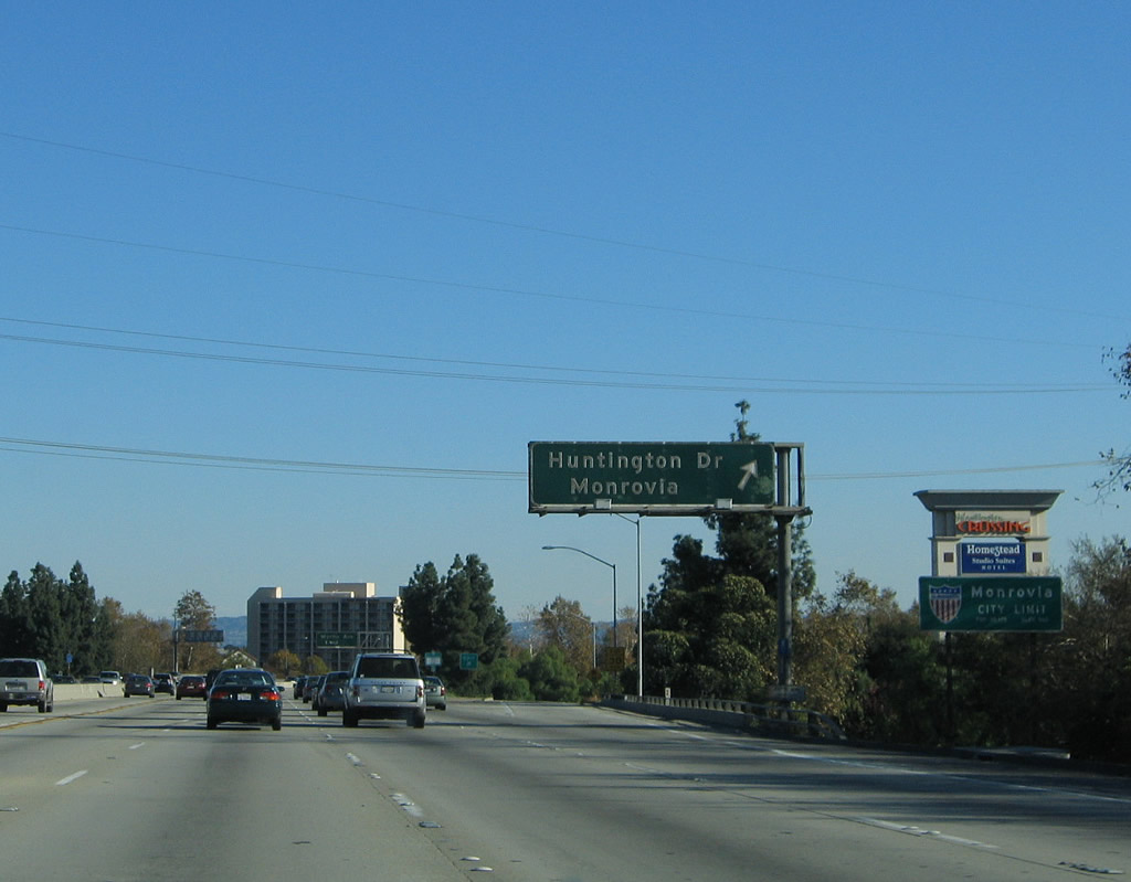
The next exit along Interstate 210 (Foothill Freeway) east is Exit 33, U.S. 66/Huntington Drive. At this interchange, U.S. 66 shifts from being on the south side of Interstate 210 to the north side of Interstate 210. Interstate 210 travels southeast between Exits 32 and 34, while U.S. 66 travels due east-west through here. Photo taken 11/14/04. |
|
This mileage sign provides the distance to the next three exits along Interstate 210 (Foothill Freeway) east: Exit 33, U.S. 66/Huntington Drive; Exit 34, Myrtle Avenue; and Exit 35A, Mountain Avenue. Photo taken 11/14/04. |
|
Eastbound Interstate 210 (Foothill Freeway) reaches Exit 33, U.S. 66/Huntington Drive. At this point, Interstate 210 leaves the city of Arcadia and enters the city of Monrovia (population 36,929 as of 2000 Census, incorporated on December 15, 1887). Photo taken 11/14/04. |
|
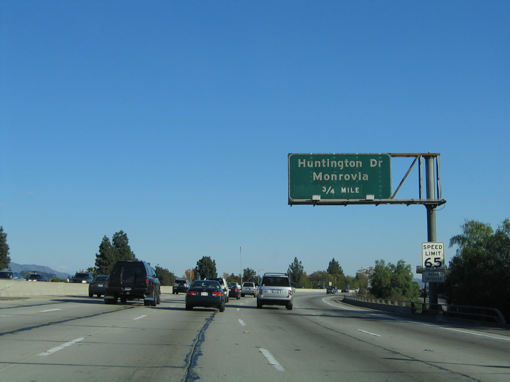
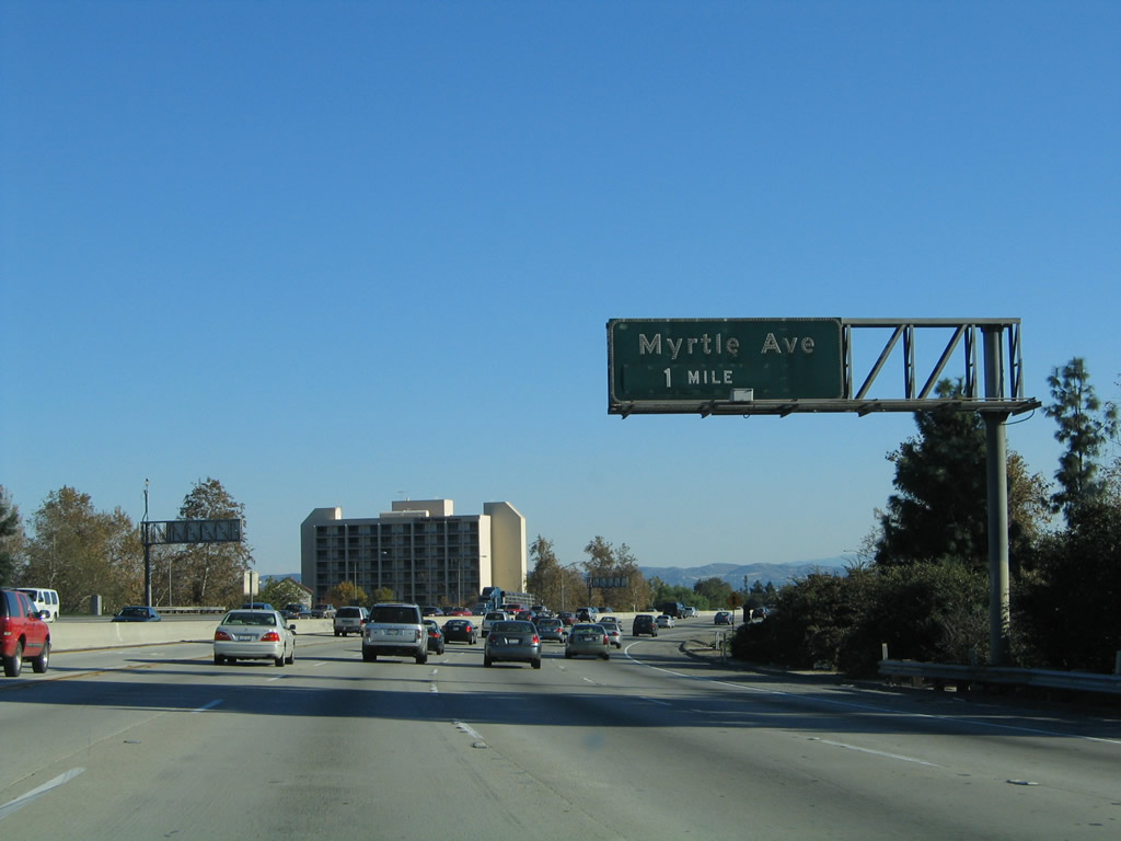
The next exit along Interstate 210 (Foothill Freeway) east is Exit 34, Myrtle Avenue (one mile). Photo taken 11/14/04. |
|
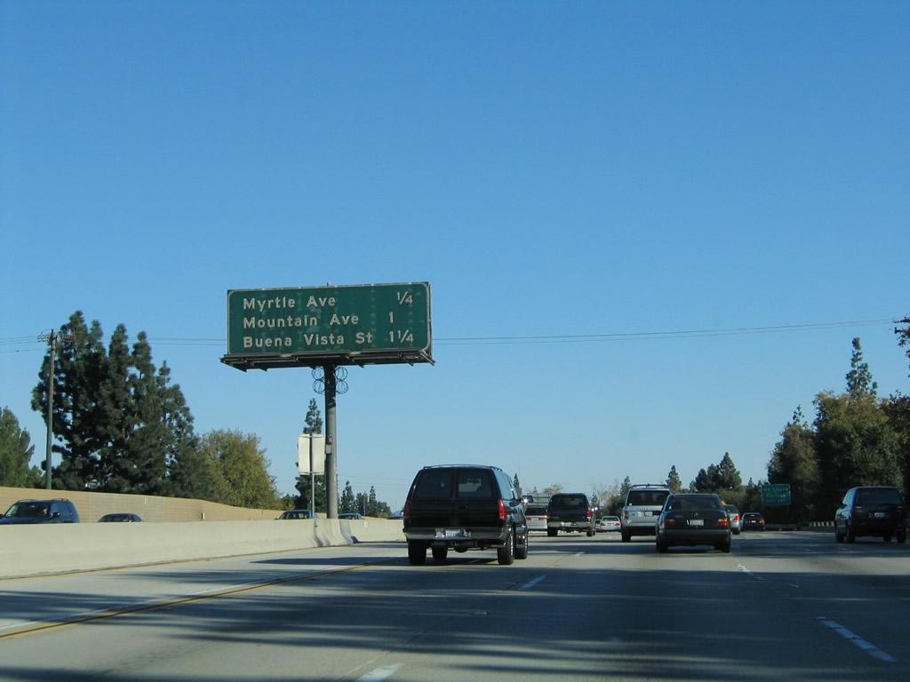
This mileage sign provides the distance to the next three exits along Interstate 210 (Foothill Freeway) east: Exit 34, Myrtle Avenue; Exit 35A, Mountain Avenue; and Exit 35B, Buena Vista Street. Photo taken 11/14/04. |
|
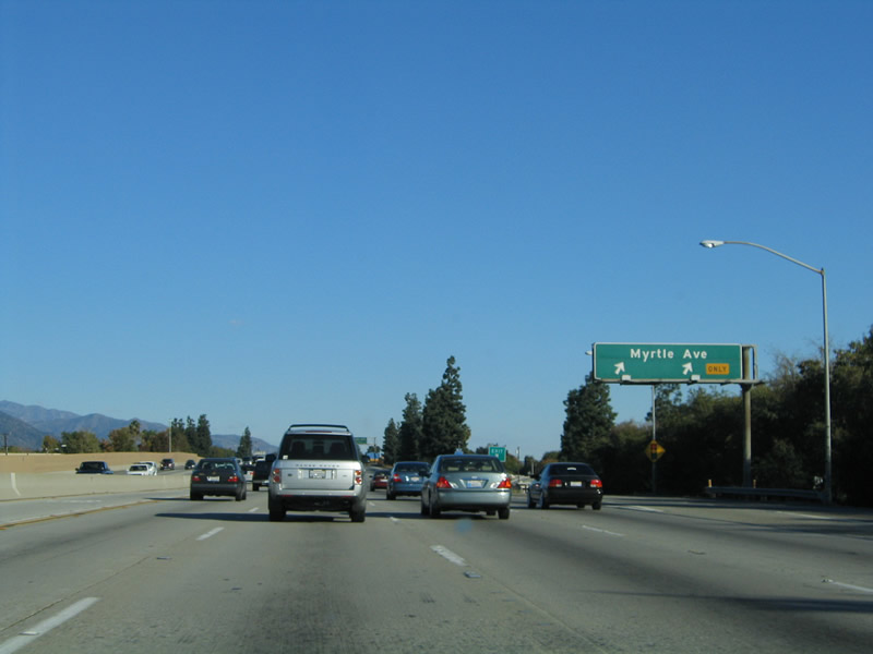
Eastbound Interstate 210 (Foothill Freeway) reaches Exit 34, Myrtle Avenue. Photo taken 11/14/04. |
|
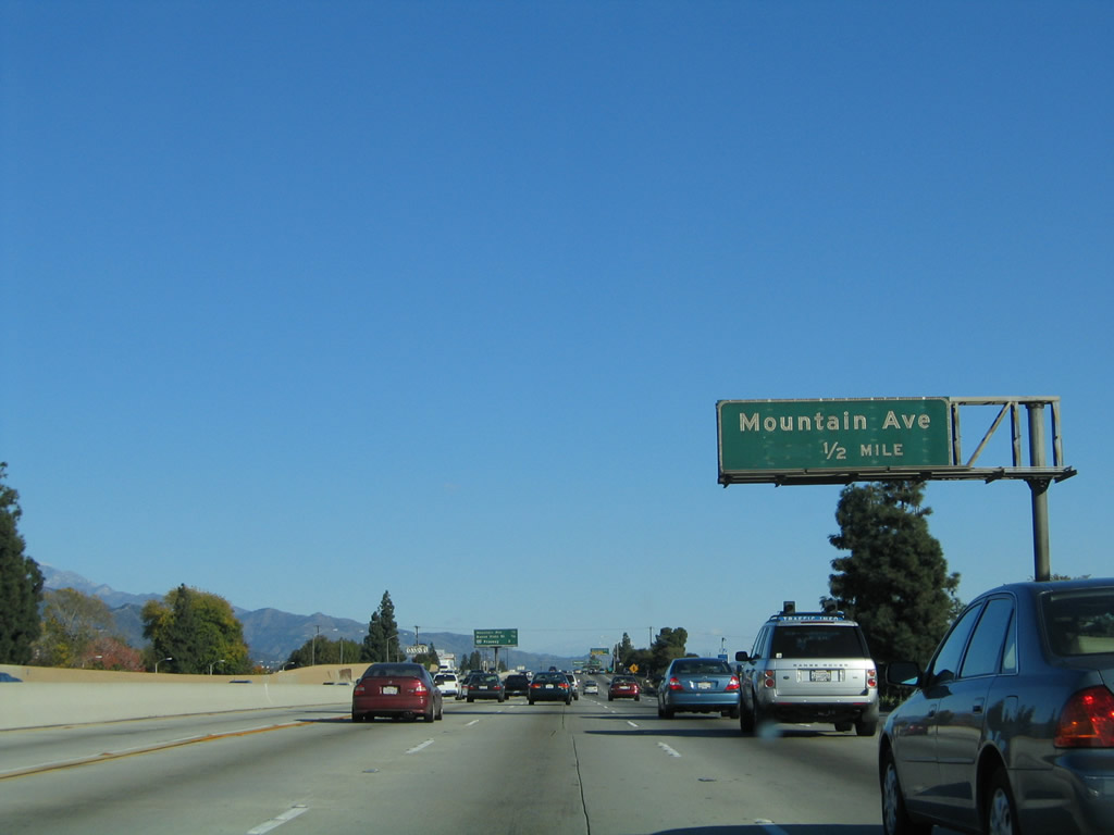
The next exit along Interstate 210 (Foothill Freeway) east is Exit 35A, Mountain Avenue (0.50 mile). Photo taken 11/14/04. |
|
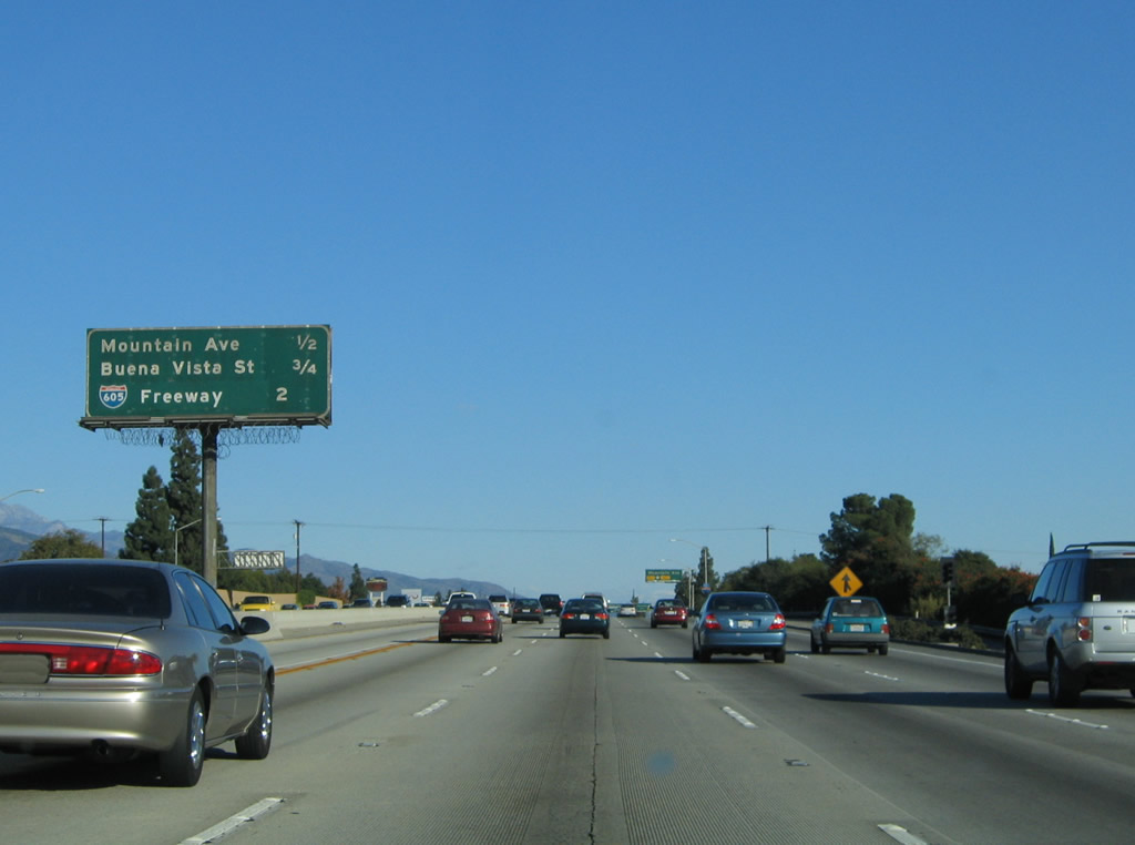
This mileage sign provides the distance to the next three exits along Interstate 210 (Foothill Freeway) east: Exit 35A, Mountain Avenue; Exit 35B, Buena Vista Street; and Exit 36A, Interstate 605 (San Gabriel River Freeway) south to Long Beach. Photo taken 11/14/04. |
|
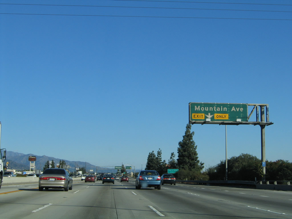
The right lane of Interstate 210 (Foothill Freeway) east becomes exit only for Exit 35A, Mountain Avenue. Photo taken 11/14/04. |
|
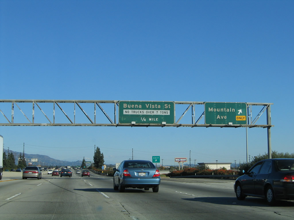
Eastbound Interstate 210 (Foothill Freeway) reaches Exit 35A, Mountain Avenue. The next exit along eastbound is Exit 35B, Buena Vista Street. Shortly after this off-ramp, Interstate 210 leaves Monrovia and enters the city of Duarte (population 21,486 as of 2000 Census, elevation 512 feet, incorporated August 22, 1957). Photo taken 11/14/04. |
|
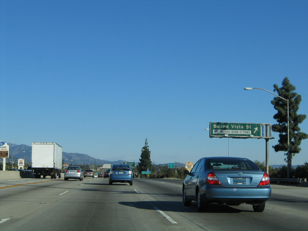
Immediately thereafter, eastbound Interstate 210 (Foothill Freeway) meets Exit 35B, Buena Vista Street to Duarte. Photo taken 11/14/04. |
|
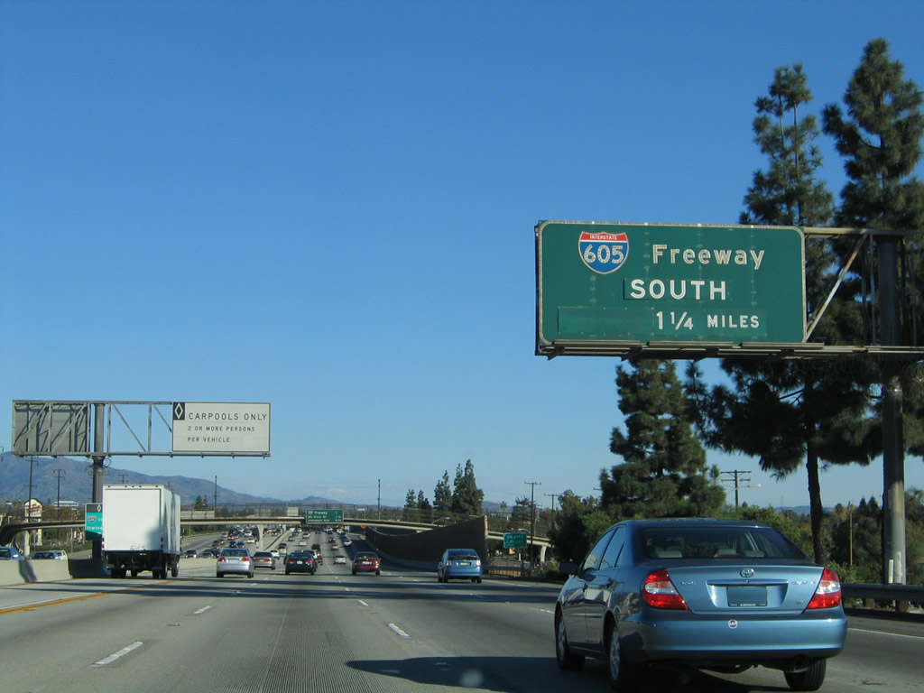
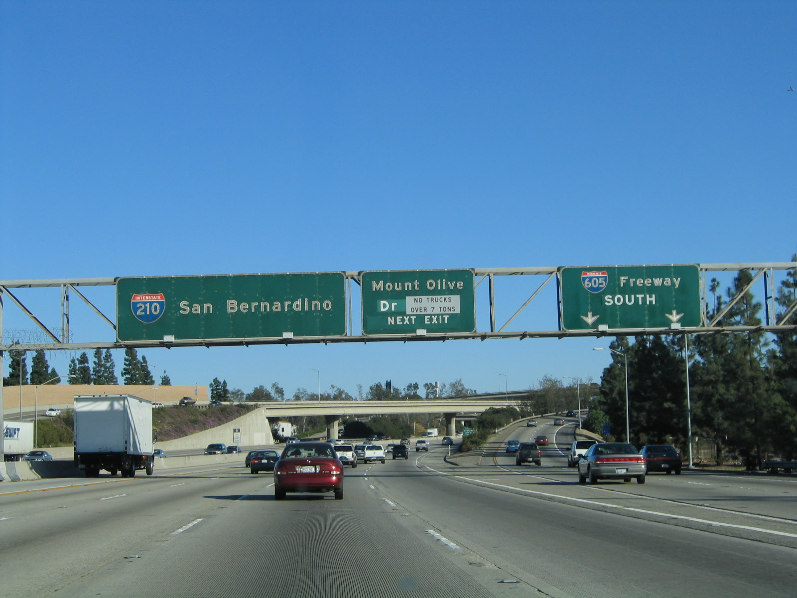
The next exit along Interstate 210 (Foothill Freeway) east is Exit 36A, Interstate 605 (San Gabriel River Freeway) south to Long Beach (1.25 mile). Photo taken 11/14/04. |
|
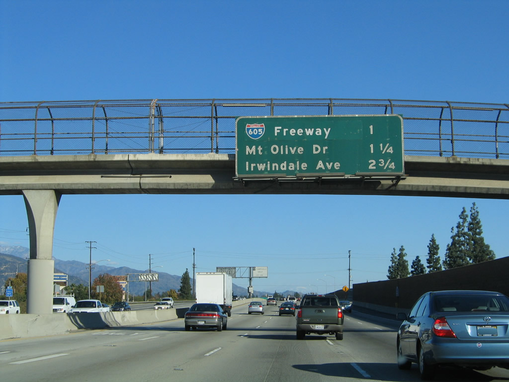
This mileage sign provides the distance to the next three exits along Interstate 210 (Foothill Freeway) east: Exit 36A, Interstate 605 (San Gabriel River Freeway) south to Long Beach; Exit 36B, Mount Olive Drive north to U.S. 66/Huntington Drive; and Exit 38, Irwindale Avenue. Photo taken 11/14/04. |
|
The right lane of Interstate 210 (Foothill Freeway) east becomes exit only for Exit 36A, Interstate 605 south. This reflective sign is among the first to be placed along Interstate 210 in the early 2000s. Interstate 605 travels south from this interchange (which is partially located in Duarte and partially within Irwindale) past Interstate 10, California 60, Interstate 5, Interstate 105, and California 91 before ending at Interstate 405 (San Diego Freeway) and California 22 near Long Beach and Seal Beach at the Los Angeles-Orange County line. Photo taken 11/14/04. |
|
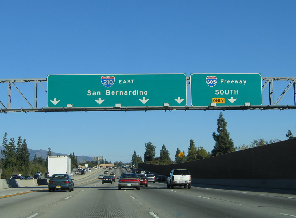
Eastbound Interstate 210 (Foothill Freeway) reaches Exit 36A, Interstate 605 (San Gabriel River Freeway) south to Long Beach. Photo taken 11/14/04. |
|
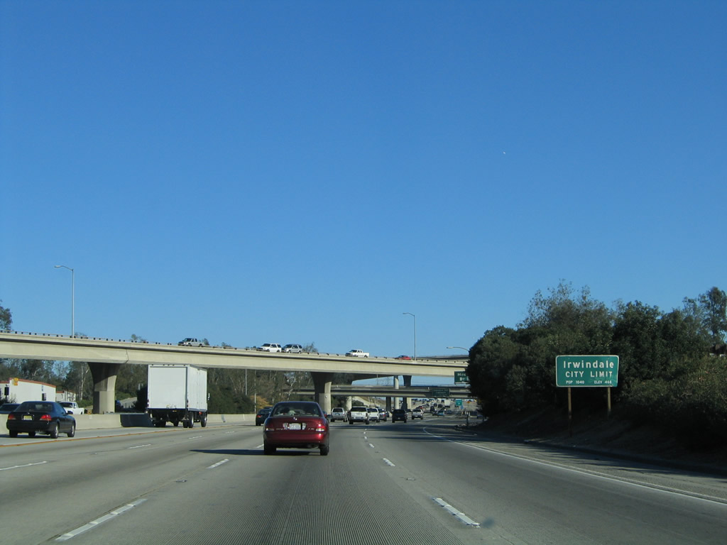
Interstate 210 (Foothill Freeway) leaves the city of Duarte and enters the city of Irwindale (population 1,446 as the 2000 Census, elevation 468 feet, incorporated August 6, 1957). This industrial city includes the Irwindale Speedway and the Santa Fe Dam Recreation Area. Industrial facilities include the Miller Brewing Company, railroads, and ample power transmission facilities. Photo taken 11/14/04. |
|
Now within the Interstate 210 (Foothill Freeway) and Interstate 605 (San Gabriel River Freeway) interchange complex, Interstate 210 east reaches Exit 36B, Mount Olive Drive north to Duarte. The ramp connects with traffic from Interstate 605 north, and the stub freeway ends about a quarter mile north of this point at the U.S. 66/Huntington Drive intersection. Photo taken 11/14/04. |
|
The ramp to Exit 36B becomes a collector distributor lane. Once on the ramp, stay right for Exit 36B or stay left for the return to Interstate 210 east. Photo taken 11/14/04. |
|
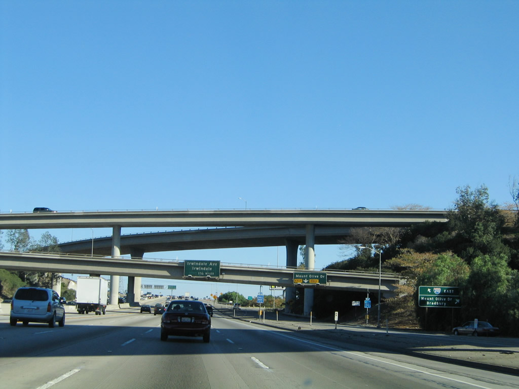
This view looks at the c/d lane for eastbound Interstate 210 (Foothill Freeway) at Exit 36B within the Interstate 605 stack interchange complex. The next exit along eastbound is Exit 38, Irwindale Avenue (1.25 miles). Photo taken 11/14/04. |
|
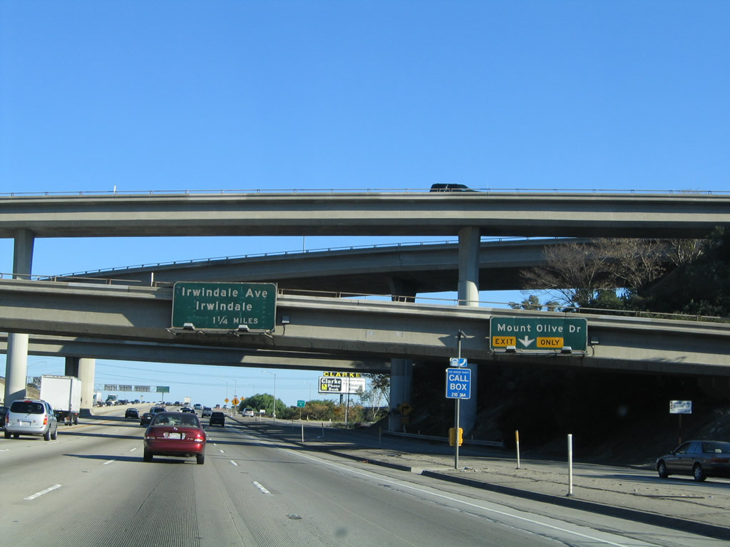
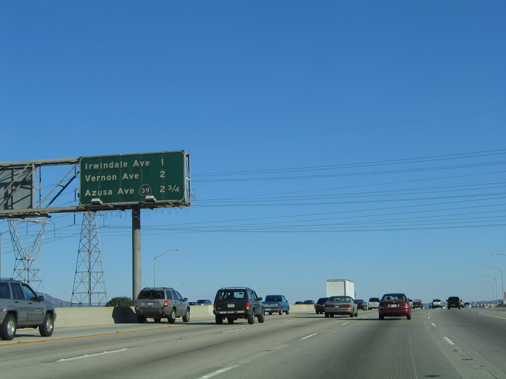
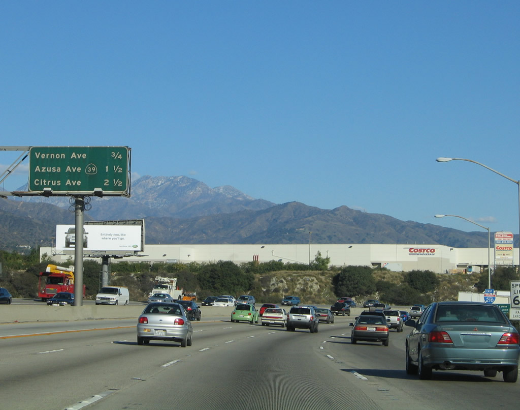
This mileage sign provides the distance to the next three exits along Interstate 210 (Foothill Freeway) east: Exit 38, Irwindale Avenue; Exit 39, Vernon Avenue; and Exit 40, California 39/Azusa Avenue. A set of Southern California Edison power lines cross over the freeway here as well. Photo taken 11/14/04. |
|
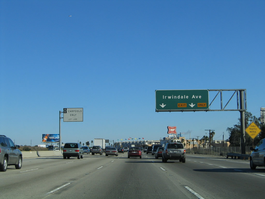
The right two lanes of Interstate 210 (Foothill Freeway) east connect to Exit 38, Irwindale Avenue. This is the primary exit to the city of Irwindale; the aforementioned Miller Brewing Company plant is located on the south side of the freeway here. Photo taken 11/14/04. |
|
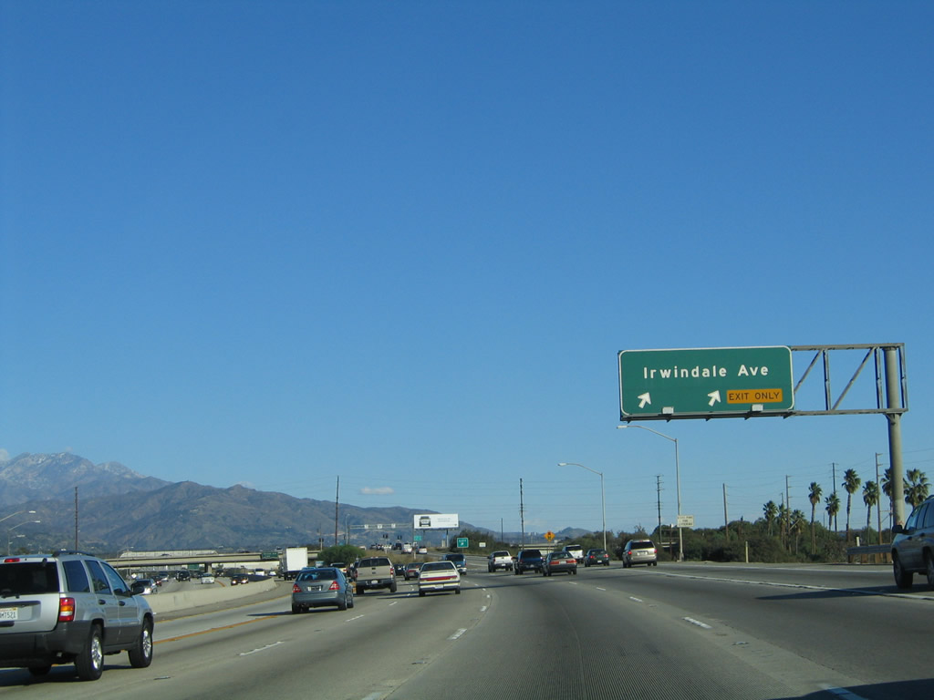
Eastbound Interstate 210 (Foothill Freeway) reaches Exit 38, Irwindale Avenue. Photo taken 11/14/04. |
|
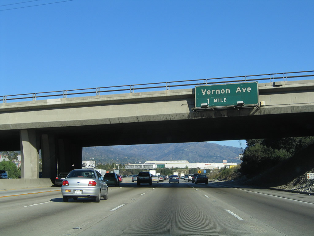
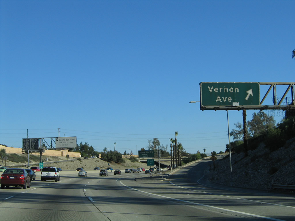
The next exit along Interstate 210 (Foothill Freeway) east is Exit 39, Vernon Avenue to Azusa. Photo taken 11/14/04. |
|
This mileage sign provides the distance to the next three exits along Interstate 210 (Foothill Freeway) east: Exit 39, Vernon Avenue; Exit 40, California 39/Azusa Avenue; and Exit 41, Citrus Avenue. Around this point, Interstate 210 leaves Irwindale and enters the city of Azusa (population 44,712 as of the 2000 Census, incorporated December 29, 1898). Photo taken 11/14/04. |
|
Eastbound Interstate 210 (Foothill Freeway) reaches Exit 39, Vernon Avenue. Photo taken 11/14/04. |
|
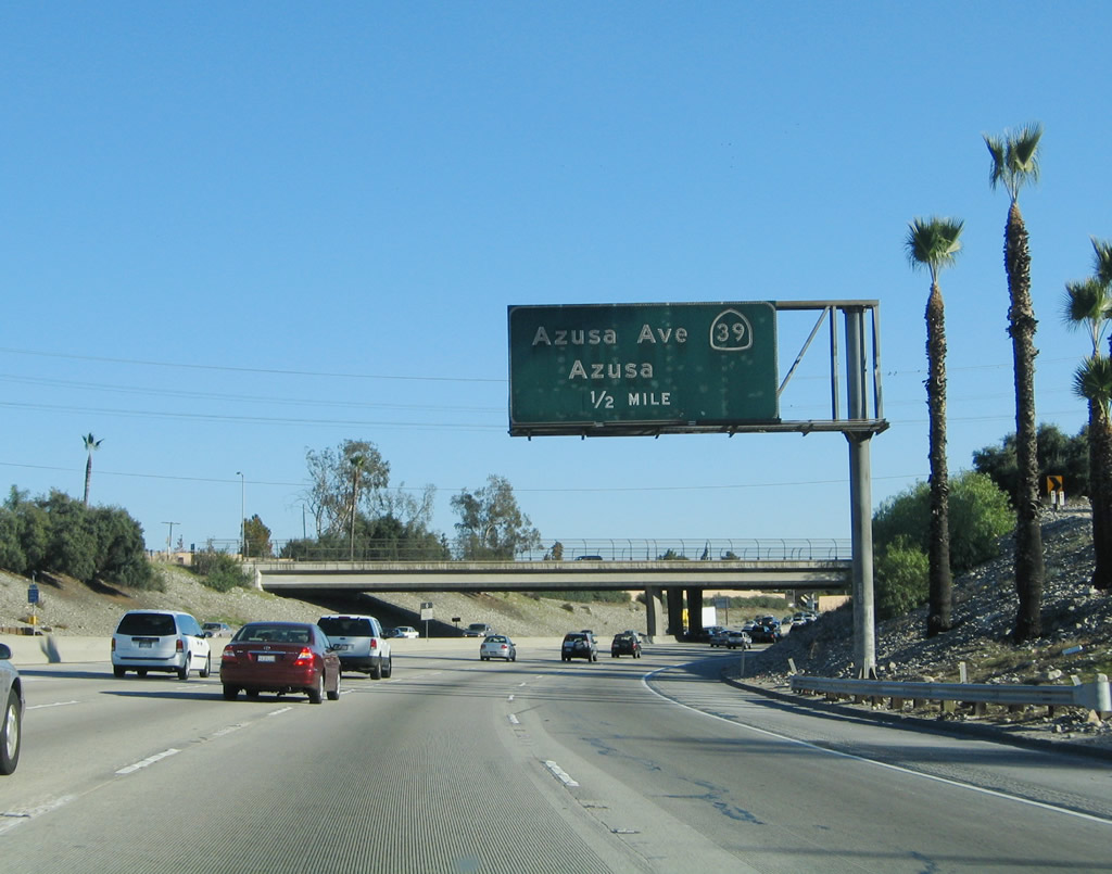
The next exit along Interstate 210 (Foothill Freeway) east is Exit 40, California 39/Azusa Avenue. Photo taken 11/14/04. |
|
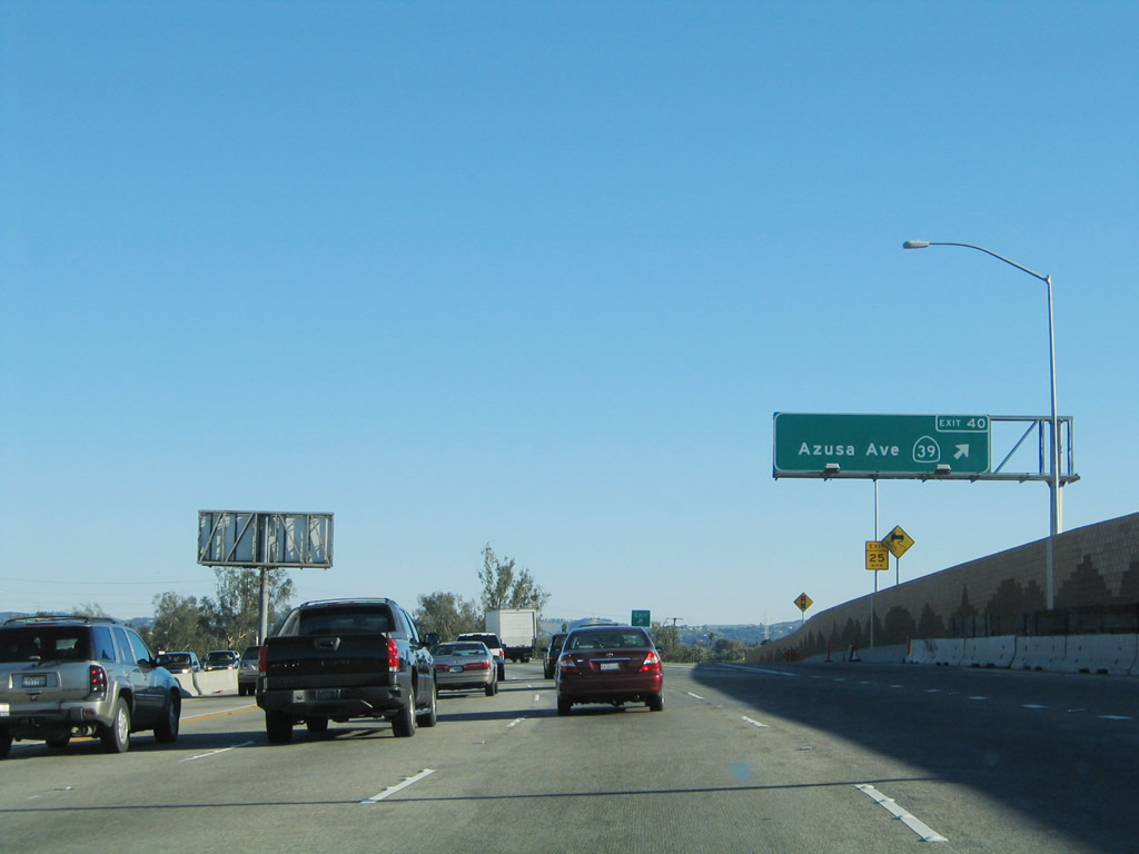
This mileage sign provides the distance to the next three exits along Interstate 210 (Foothill Freeway) east: Exit 40, California 39/Azusa Avenue; Exit 41, Citrus Avenue; and Exit 42, Grand Avenue. Photo taken 11/14/04. |
|
Eastbound Interstate 210 (Foothill Freeway) reaches Exit 40, California 39/Azusa Avenue. California 39 is a north-south state route that follows Azusa Avneue and San Gabriel Canyon Avenue (one-way couplet) north through Azusa. North of Azusa, California 39 travels into the San Gabriel Canyon and Angeles National Forest. The highway dead ends in the mountains, although there are plans to restore the connection to California 2/Angeles Crest Higwhay at some unknown point in the future. Due to the natural instability of the San Gabriel Mountains, any such connection would be a potentially costly endeavor. Photo taken 11/14/04. |
|
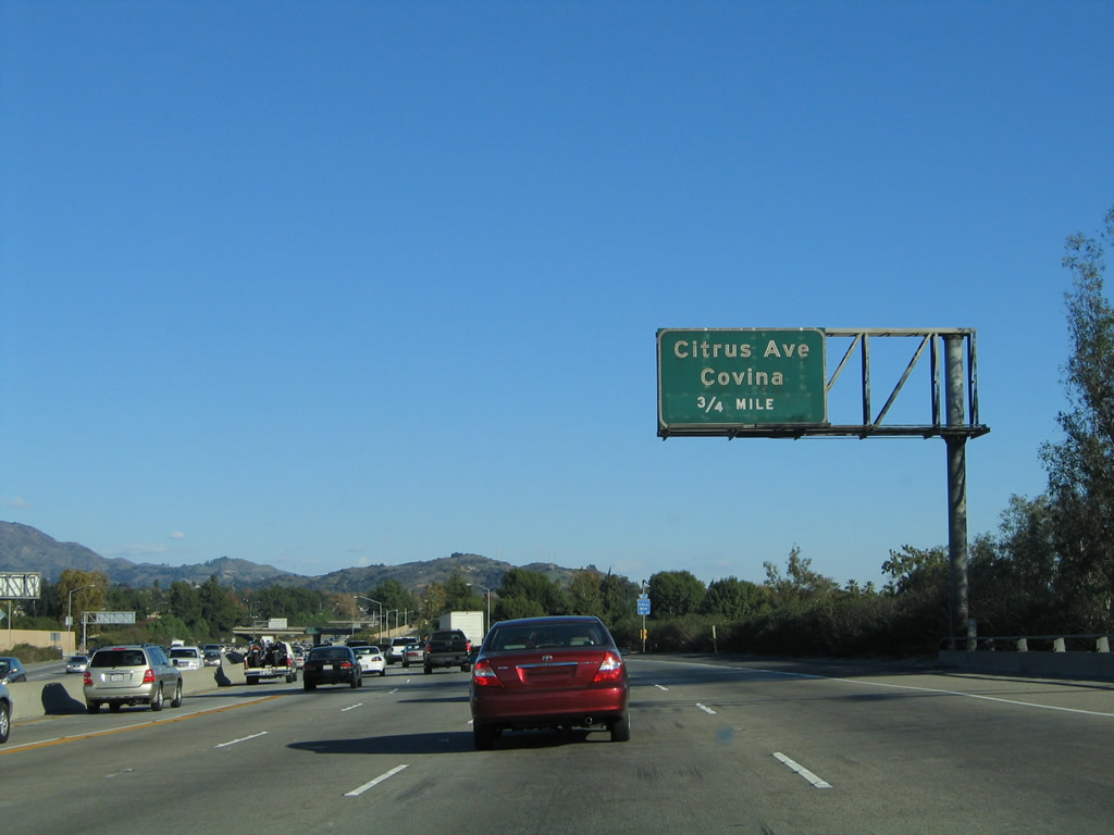
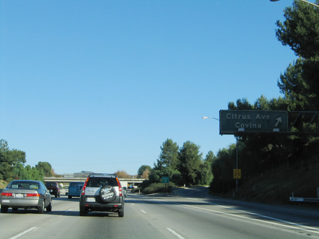
The next exit along Interstate 210 (Foothill Freeway) east is Exit 41, Citrus Avenue north to Azusa and south to Covina. Photo taken 11/14/04. |
|
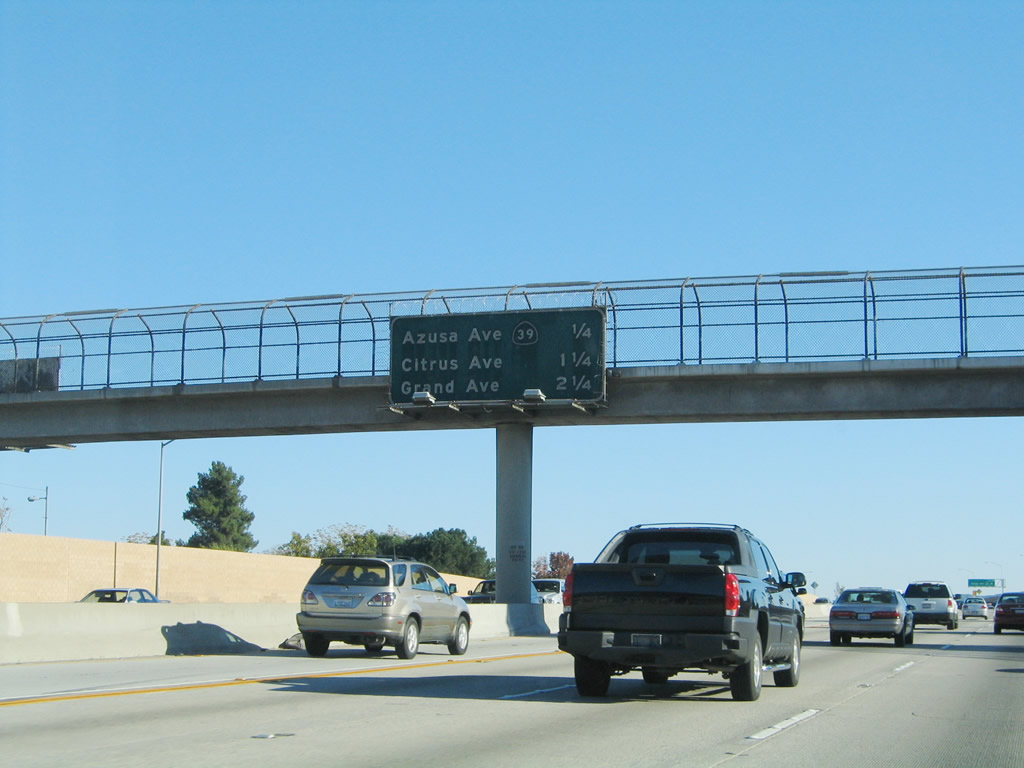
This mileage sign provides the distance to the next three exits along Interstate 210 (Foothill Freeway) east: Exit 41, Citrus Avenue; Exit 42, Grand Avenue; and Exit 43, Sunflower Avenue. Photo taken 11/14/04. |
|
Eastbound Interstate 210 (Foothill Freeway) reaches Exit 41, Citrus Avenue. Photo taken 11/14/04. |
|
The next exit along Interstate 210 (Foothill Freeway) east is Exit 42, Grand Avenue. Photo taken 11/14/04. |
|
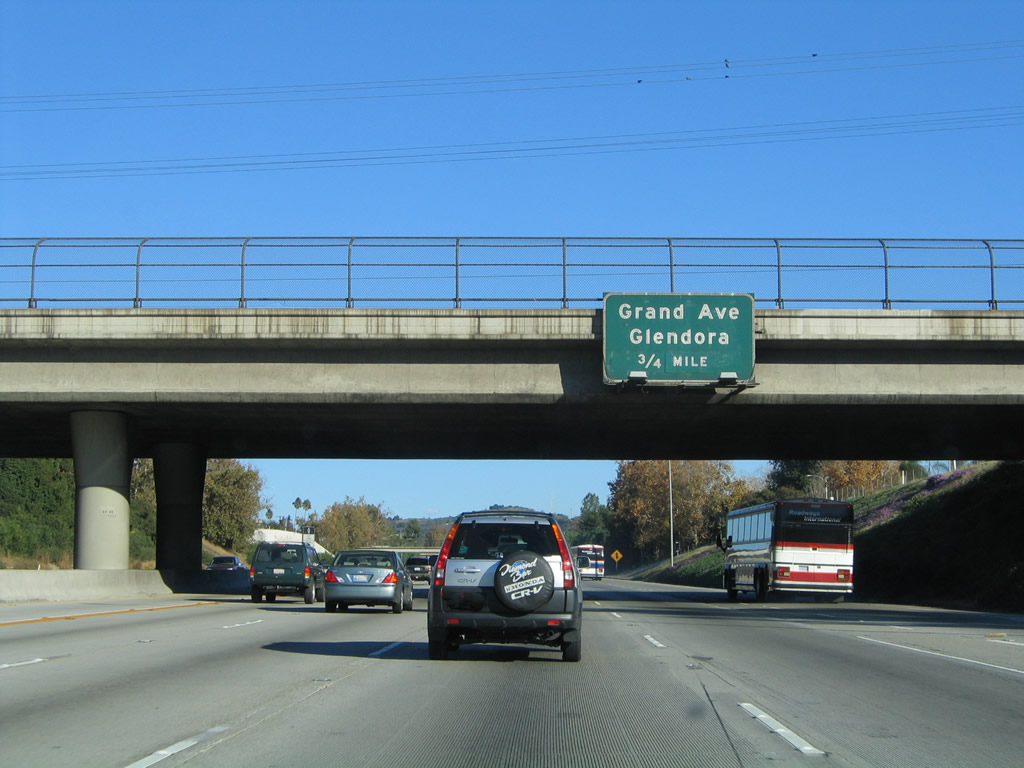
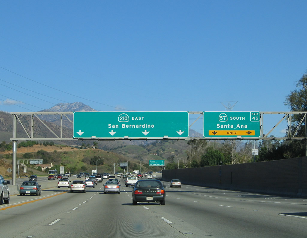
This mileage sign provides the distance to the next three exits along Interstate 210 (Foothill Freeway) east: Exit 42, Grand Avenue; Exit 43, Sunflower Avenue; and Exit 45, California 57 (Orange Freeway) south to Santa Ana. Note that due to the position of the California 57 interchange and the off-ramp to California 57 south, Exit 45 serves California 57 south while Exit 44 comes after (east of) the California 57 off-ramp. Photo taken 11/14/04. |
|
Eastbound Interstate 210 (Foothill Freeway) reaches Exit 42, Grand Avenue. Interstate 210 leaves Azusa and enters the city of Glendora upon crossing Barranca Avenue. Glendora had a population of 49,415 as of the 2000 Census and was incorporated on November 13, 1911. Photo taken 11/14/04. |
|
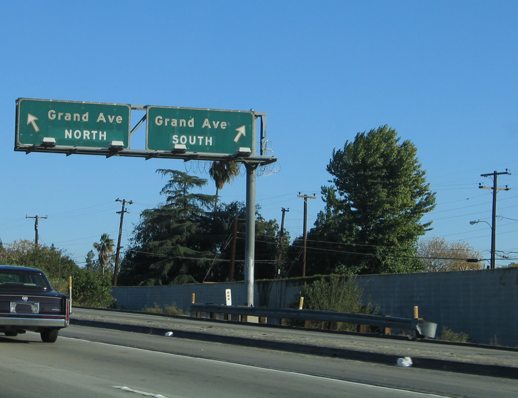
This view looks at the off-ramp to Grand Avenue, which splits into a north and south ramp. Photo taken 11/14/04. |
|
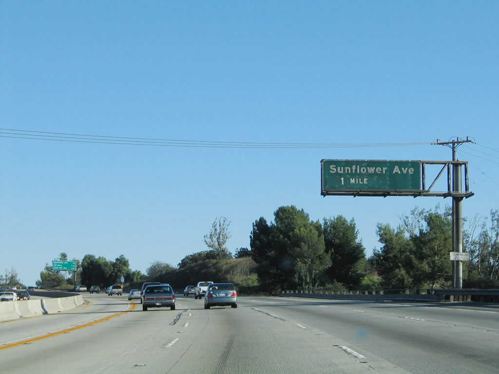
The next exit along Interstate 210 (Foothill Freeway) east is Exit 43, Sunflower Avenue. Photo taken 11/14/04. |
|
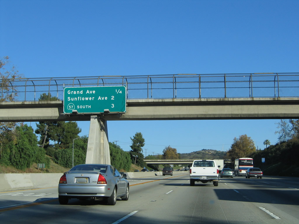
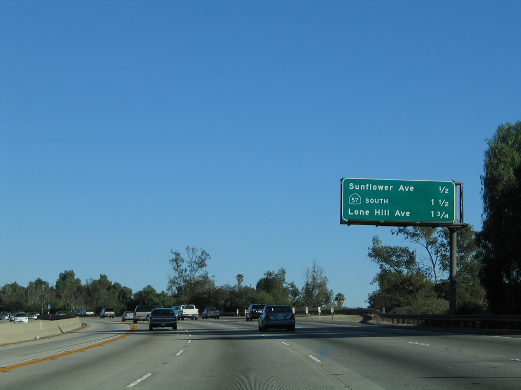
This mileage sign provides the distance to the next three exits along Interstate 210 (Foothill Freeway) east: Exit 43, Sunflower Avenue; Exit 45, California 57 (Orange Freeway) south to Santa Ana; and Exit 44, Lone Hill Avenue. Photo taken 11/14/04. |
|
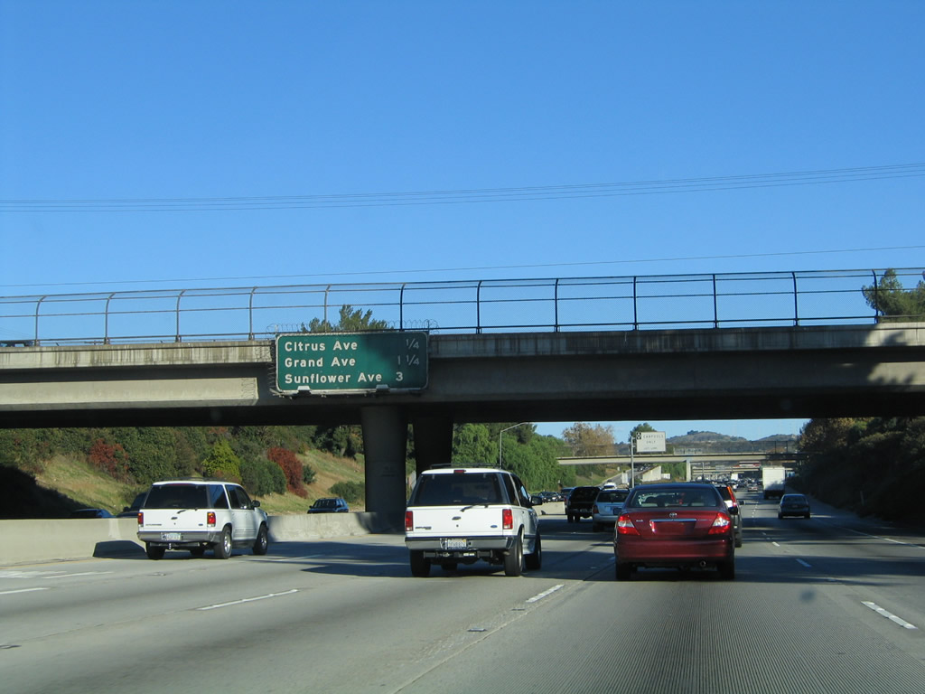
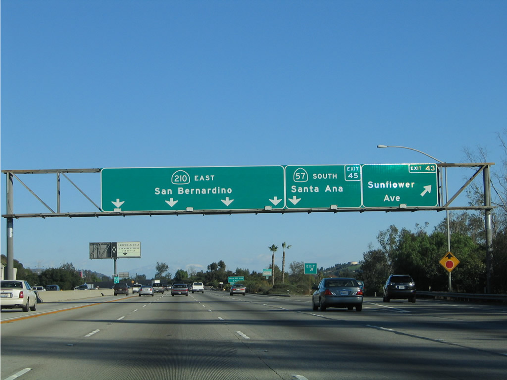
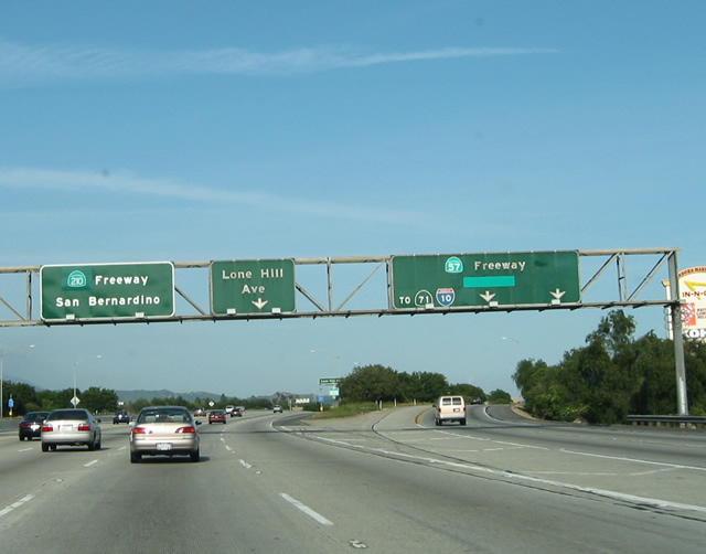
Eastbound Interstate 210 (Foothill Freeway) reaches Exit 43, Sunflower Avenue within the city of Glendora. The next exit along Interstate 210 east is Exit 45, California 57 (Orange Freeway) south. The pull-through sign shows California 210 beginning at the California 57 interchange. This sign assembly was placed in 2003. Photo taken 11/14/04. |
|
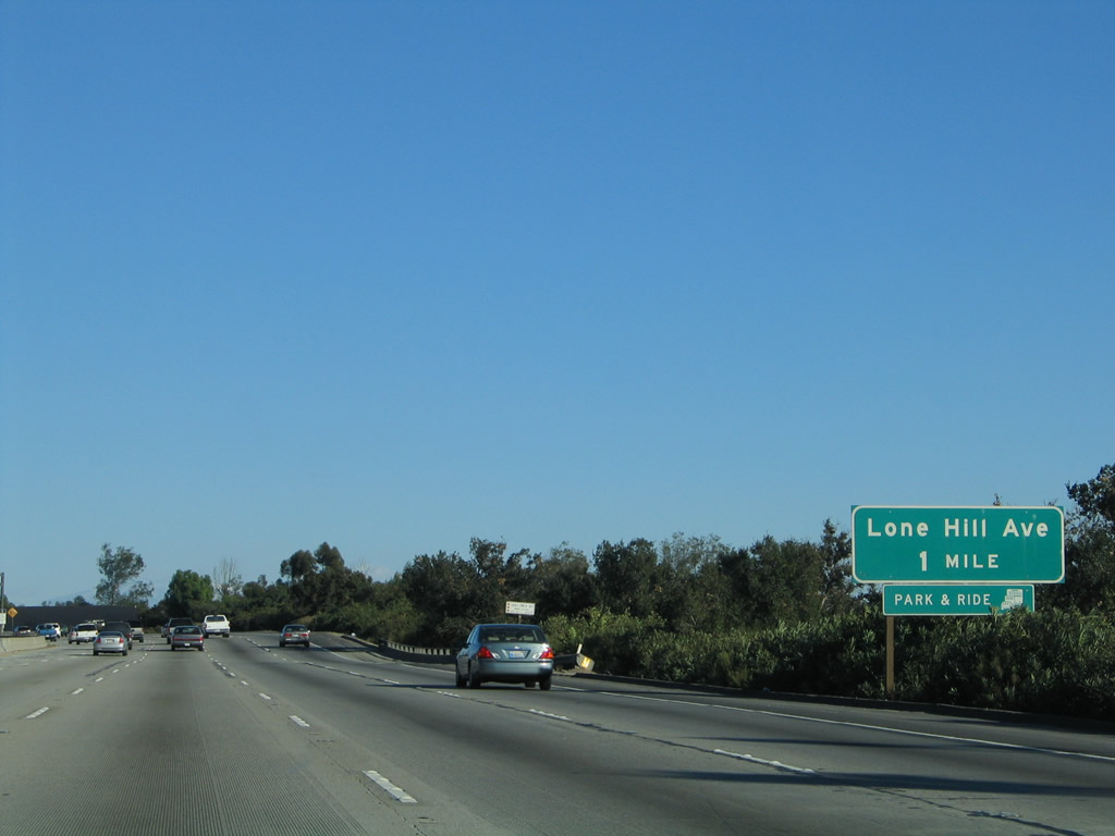
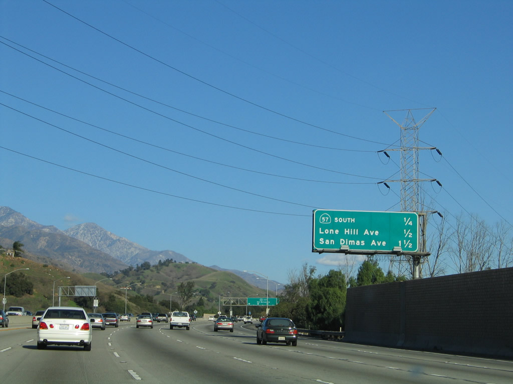
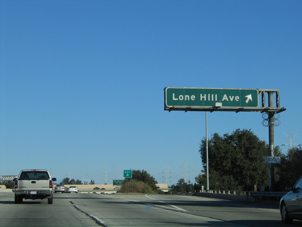
The next two exits along Interstate 210 (Foothill Freeway) east are Exit 45, California 57 south (0.50 mile) followed by Exit 44, Lone Hill Avenue (one mile). Photo taken 11/14/04. |
Page Updated January 9, 2010.