
California 210 East - Interstate 15 to Interstate 10
| California 210 (Foothill Freeway) east | |
|---|---|
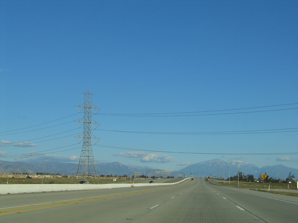 |
A massive Southern California Edison dual-circuit power line carries two 500kV circuits as part of the West of Colorado River power transmission system considered part of Path 46. These lines originate at the Lugo substation southeast of Hesperia, where they interconnect with lines coming from Vincent (junction of California 14 and Angeles Forest Highway) and Northern California. These lines also carry incoming power from power plants located in places as disparate as Lake Mead/Hoover Dam; Laughlin, Nevada; Delta, Utah; and near Shiprock, New Mexico, in the Four Corners region. Photo taken 11/14/04. |
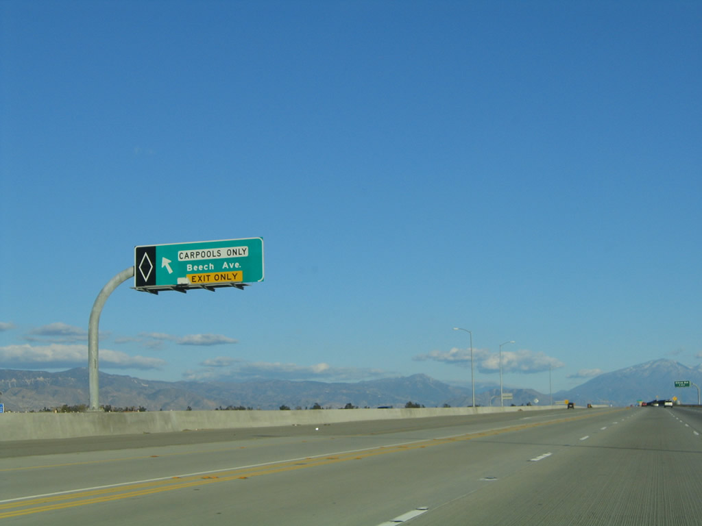 |
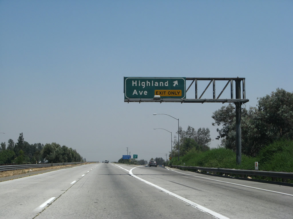
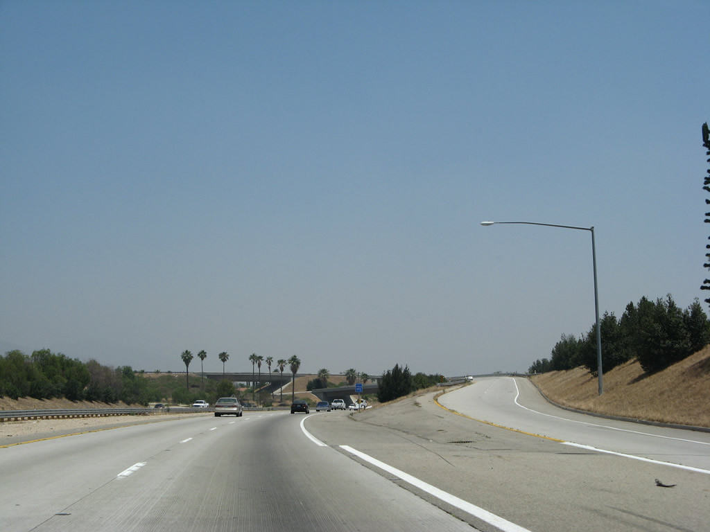
The next exit is Exit 65, Beech Avenue. This left exit is only available for carpool (HOV) lane users. Photo taken 11/14/04. |
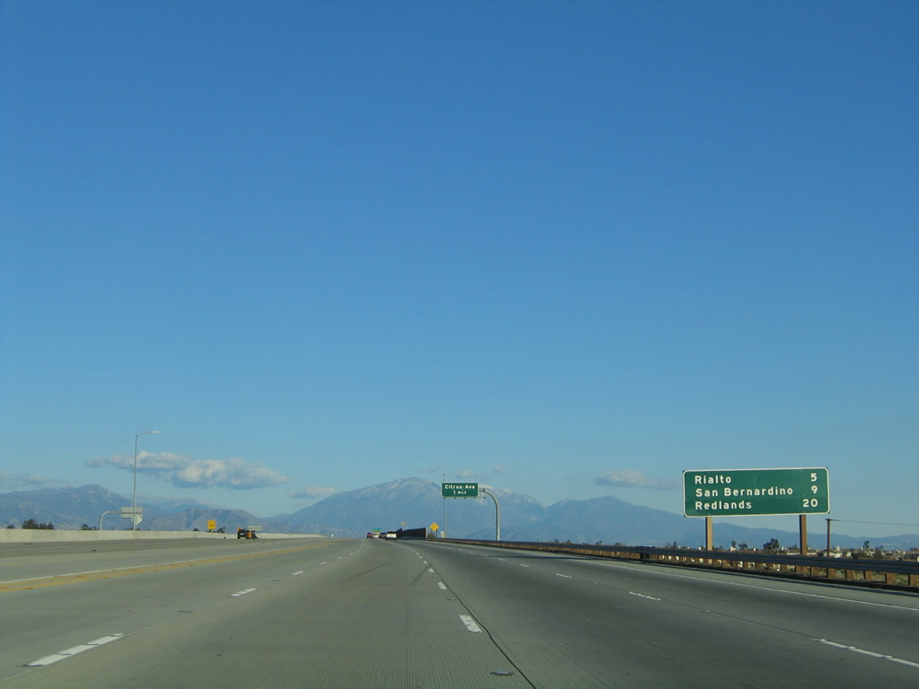 |
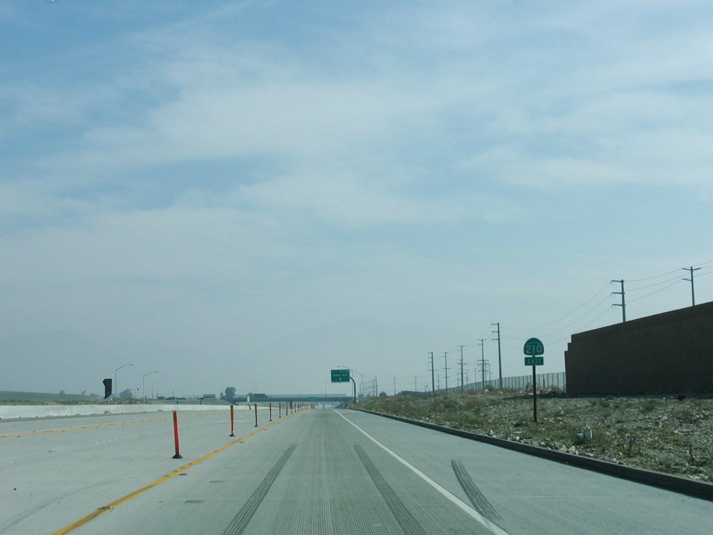
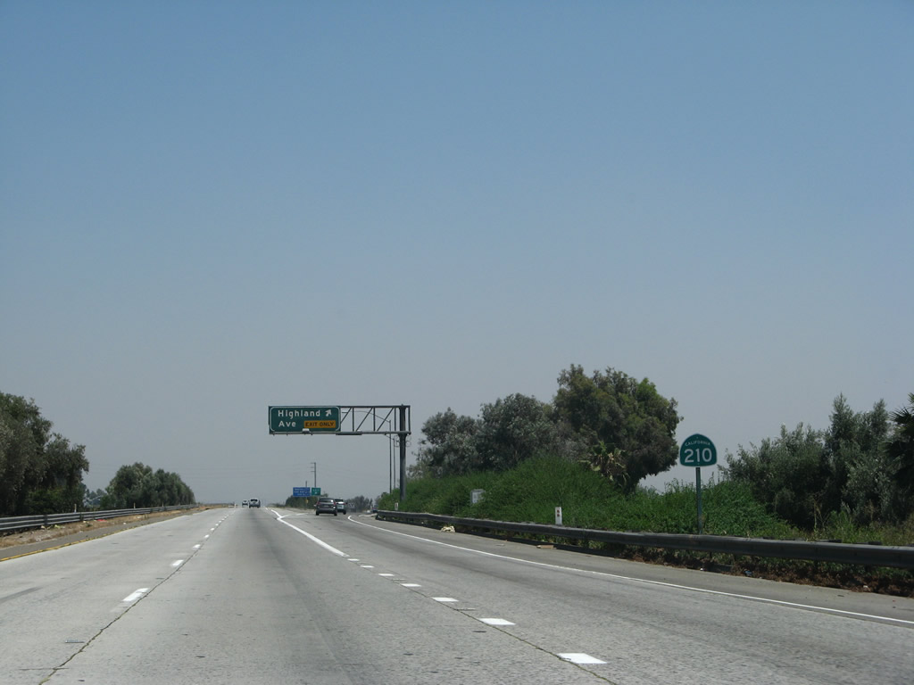
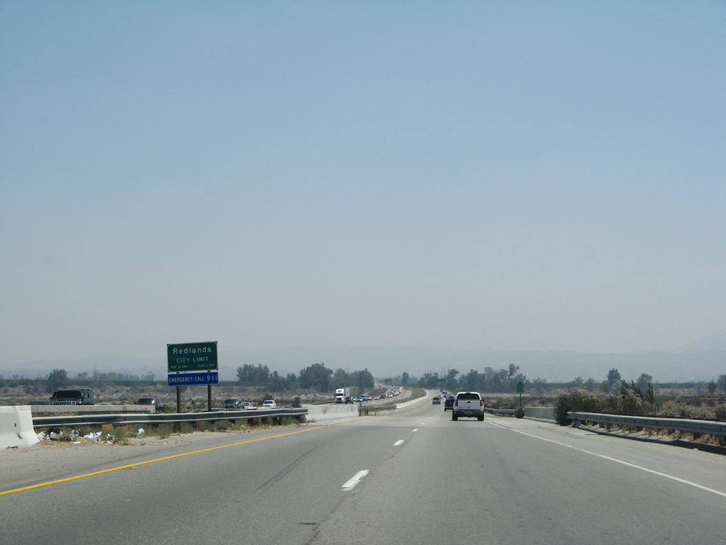
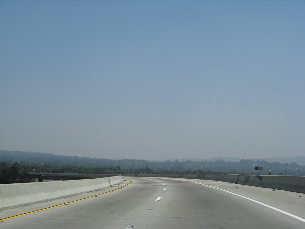
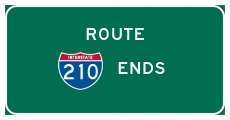
A mileage sign provides the distance to Rialto (five miles), San Bernardino (nine miles), and Redlands (20 miles). California 210 ends at Interstate 10 in Redlands. Photo taken 11/14/04. |
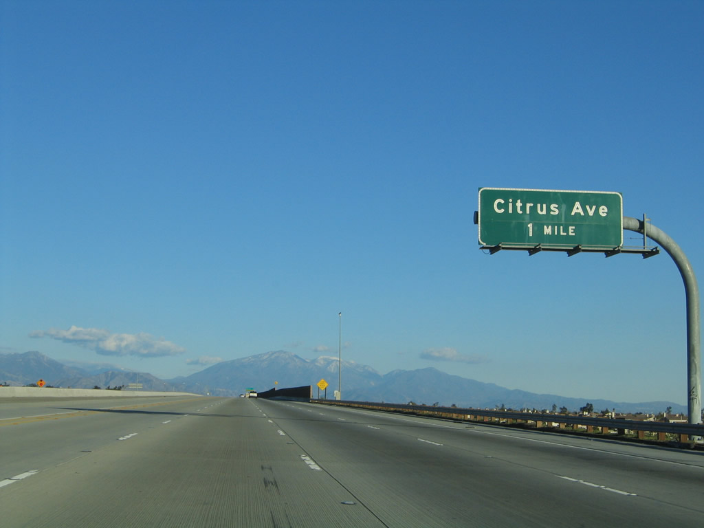 |
The next exit along California 210 (Foothill Freeway) east is Exit 66, Citrus Avenue. Photo taken 11/14/04. |
 |
This mileage sign along California 210 (Foothill Freeway) east provides the distance to the next three exits: Exit 66, Citrus Avenue; Exit 67, Sierra Avenue; and Exit 68, Alder Avenue. The end freeway appellation was removed once the freeway was completed in 2007. Photo taken 11/14/04. |
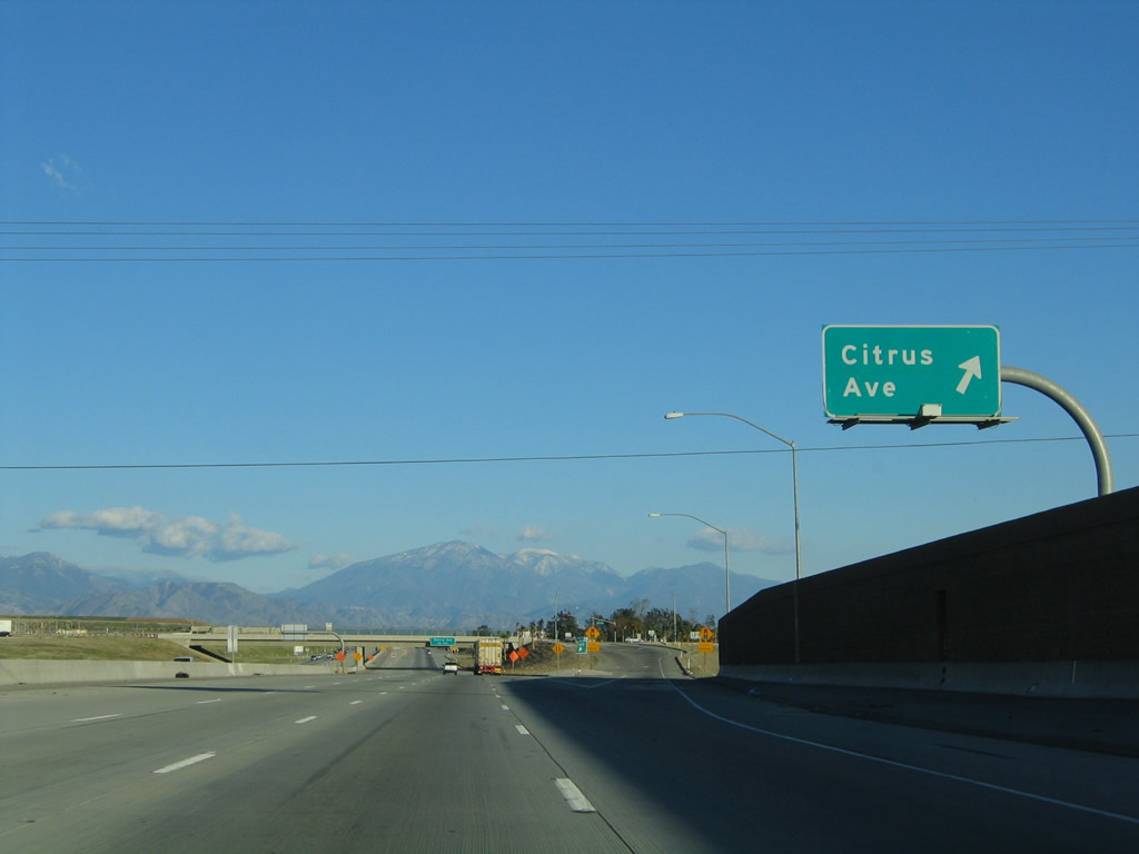 |
Eastbound California 210 (Foothill Freeway) reaches Exit 66, Citrus Avenue. Photo taken 11/14/04. |
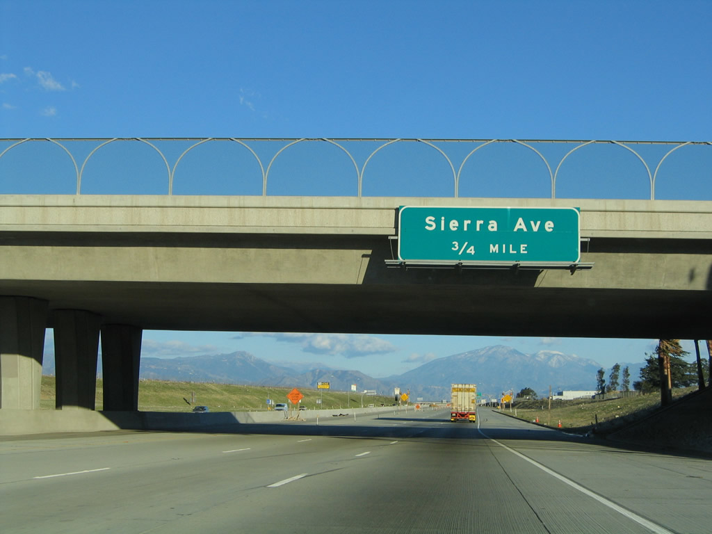 |
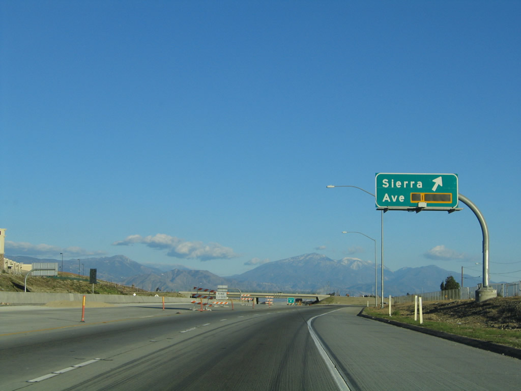
The next exit along California 210 (Foothill Freeway) east is Exit 67, Sierra Avenue (0.75 mile). Photo taken 11/14/04. |
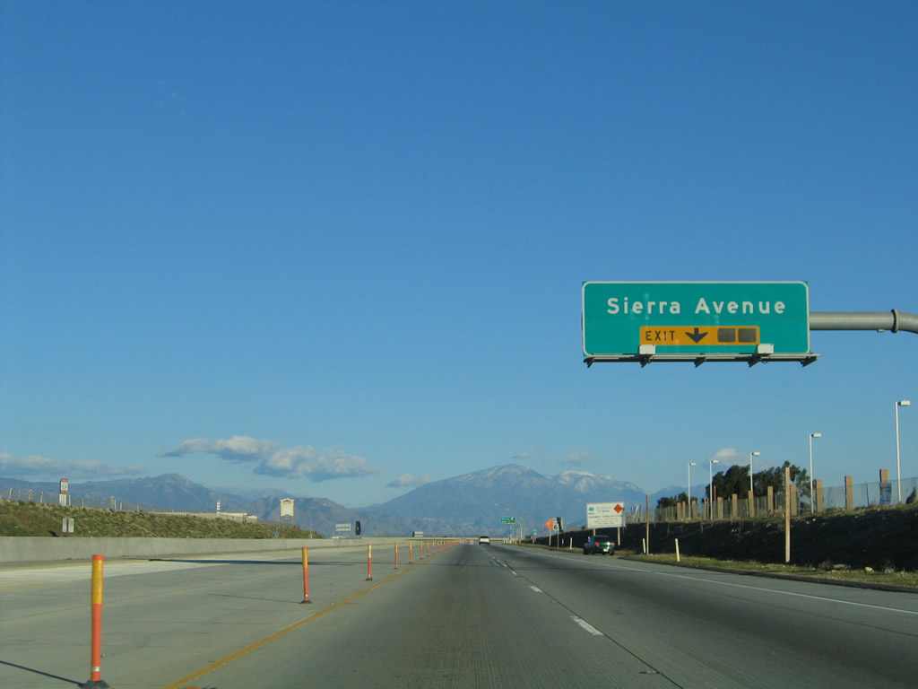 |
The right lane of California 210 (Foothill Freeway) east becomes exit only for Exit 67, Sierra Avenue. Photo taken 11/14/04. |
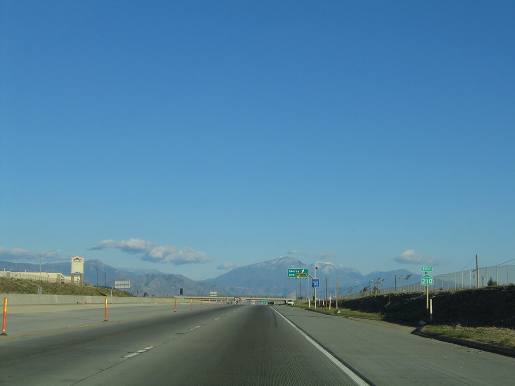 |
A California 210 east reassurance shield is posted prior to Exit 67, Sierra Avenue in Fontana. Photo taken 11/14/04. |
 |
Eastbound California 210 (Foothill Freeway) reaches Exit 67, Sierra Avenue in Fontana. This stretch of California 210 was the first east of San Dimas to open (it opened in 2001), and at the time the 2004 photo was taken, California 210 reverted back to Highland Avenue after this interchange. The last segment of California 210 between Sierra Avenue and Interstate 215 opened in July 2007, and now the freeway passes freely through this interchange. Photo taken 11/14/04. |
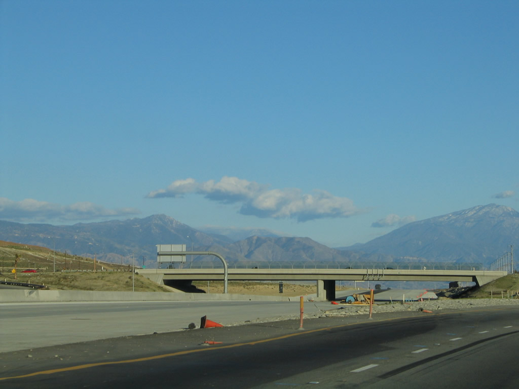 |
This view shows California 210 under construction in 2004. The segment between Sierra Avenue and Alder Avenue unofficially opened to traffic by early 2006, but the entire segment from Sierra Avenue to Interstate 215 officially opened in July 2007. Photo taken 11/14/04. |
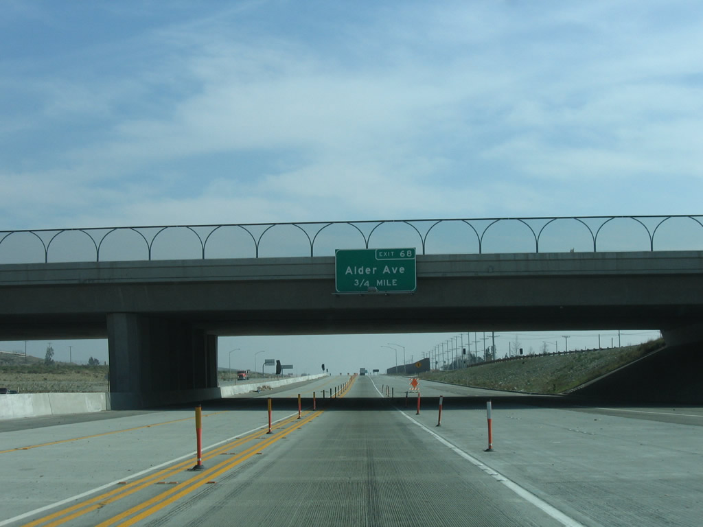 |
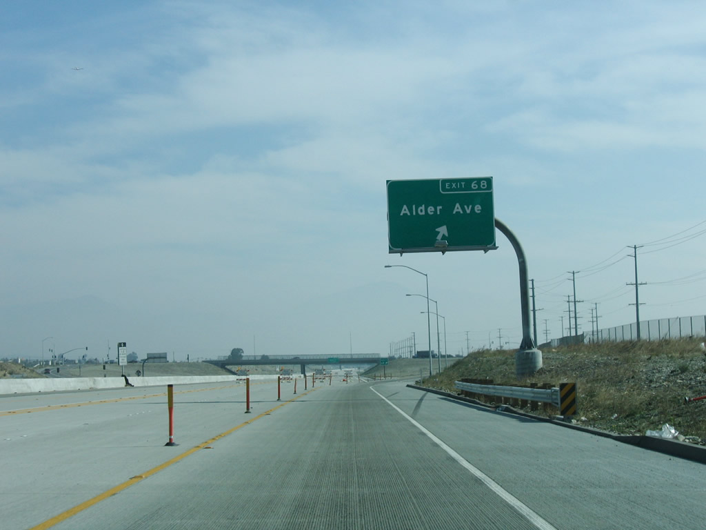
The next exit along California 210 (Foothill Freeway) east is Exit 68, Alder Avenue (0.75 mile). At the time this photo was taken, the freeway functioned as a Super Two pending full completion of the freeway in 2007. Photo taken 01/28/06. |
 |
A California 210 east reassurance shield is posted prior to Alder Avenue. Photo taken 01/28/06. |
 |
Eastbound California 210 (Foothill Freeway) reaches Exit 68, Alder Avenue. Now California 210 leaves Fontana and enters the city of Rialto, the "Bridge to Progress." As of the 2000 Census, Rialto had a population of 91,873 people and incorporated in November 17, 1911. Photo taken 01/28/06. |
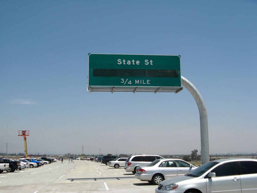 |
The next exit along eastbound is Exit 73, State Street south and University Parkway north to California 30 Business (Highland Avenue). California 30 Business follows Highland Avenue from this interchange east through San Bernardino, and it returns to the freeway at Exit 79. Photo taken 06/24/07. |
 |
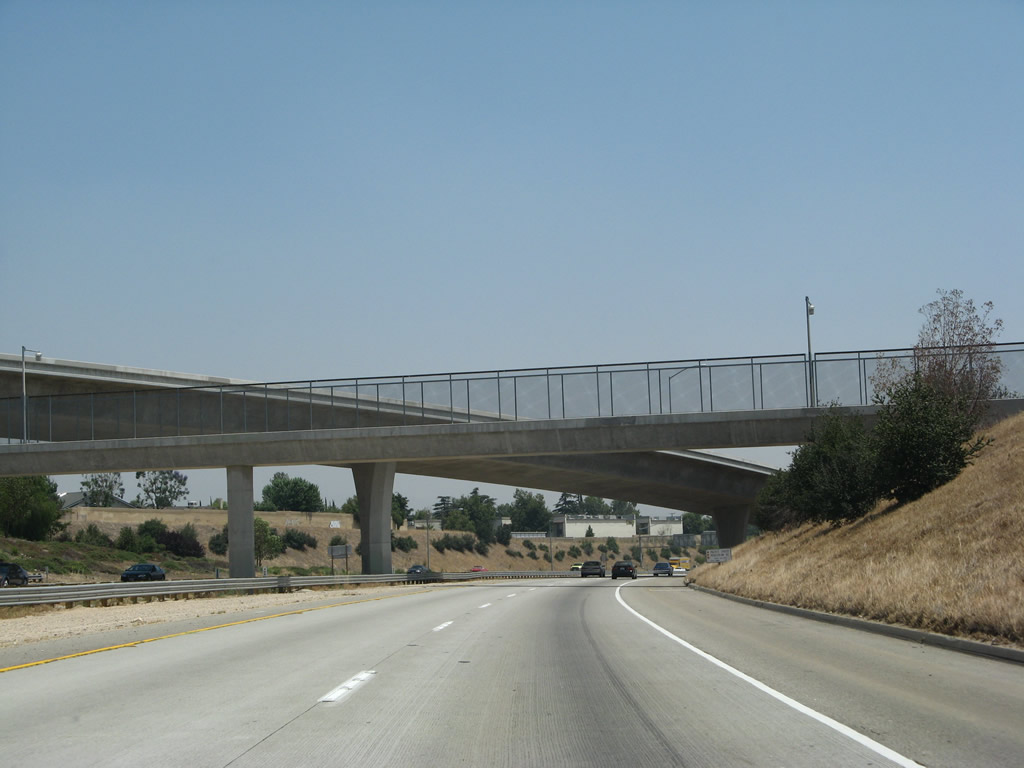
A 1965-built bridge carries the Union Pacific Railroad over California 210 (Foothill Freeway) beside the crossing of Lytle Creek Wash. Photo taken 11/10/08. |
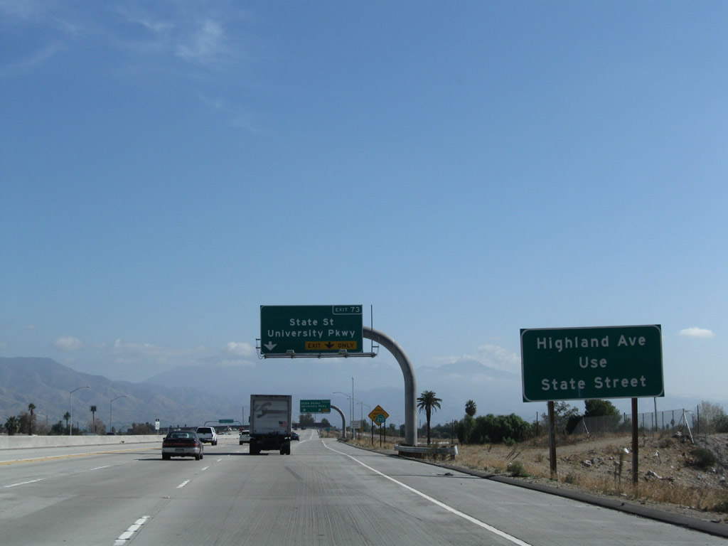 |
After passing under the bridge, the right lane becomes exit only for Exit 73, State Street south and University Parkway north to California 30 Business (Highland Avenue). Use Exit 73 to Highland Avenue (former California 30) and to California 30 Business east to San Bernardino. Photo taken 11/10/08. |
 |
University Parkway travels north past former California 30 and California 30 Business (Highland Avenue) to the California State University at San Bernardino main campus. The portion of University Parkway between California 210 and Interstate 215 was formerly named as Strate Street, but that designation changed in 2007 with the opening of the California 210 freeway. Photo taken 06/24/07. |
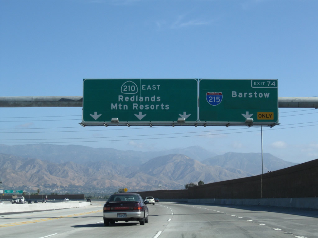 |
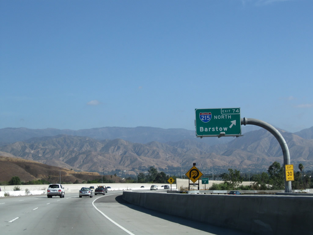
The next exit along California 210 east is Exit 74, Interstate 215 north to Barstow and south to downtown San Bernardino and Riverside. The latter connection was constructed during a project started in 2009. The freeway connection from California 210 east to Interstate 215 south opened to traffic on July 23, 2012.1 Photo taken 11/10/08. |
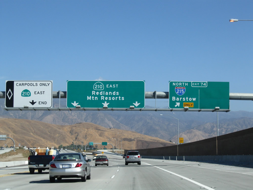 |
Eastbound California 210 (Foothill Freeway) reaches Exit 74, Interstate 215 north to Barstow and south to Downtown San Bernardino and Riverside. The carpool lane comes to an end at this point. Photo taken 11/10/08. |
 |
A collector distributor roadway connects SR 210 east with both directions of Interstate 215. Photo taken 11/10/08. |
 |
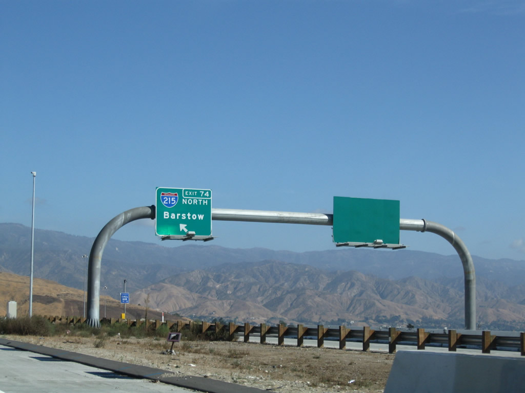
Exit 74 loops away from SR 210 east onto I-215 north toward Cajon Pass and Barstow. The newest section of SR 210 concludes as the route extends east from I-215 onto the 1989-built freeway between I-215 and SR 259..Photo taken 11/10/08. |
 |
Continuing east through San Bernardino toward the off-ramp with H Street along California 210 (Foothill Freeway). Photo taken 06/24/07. |
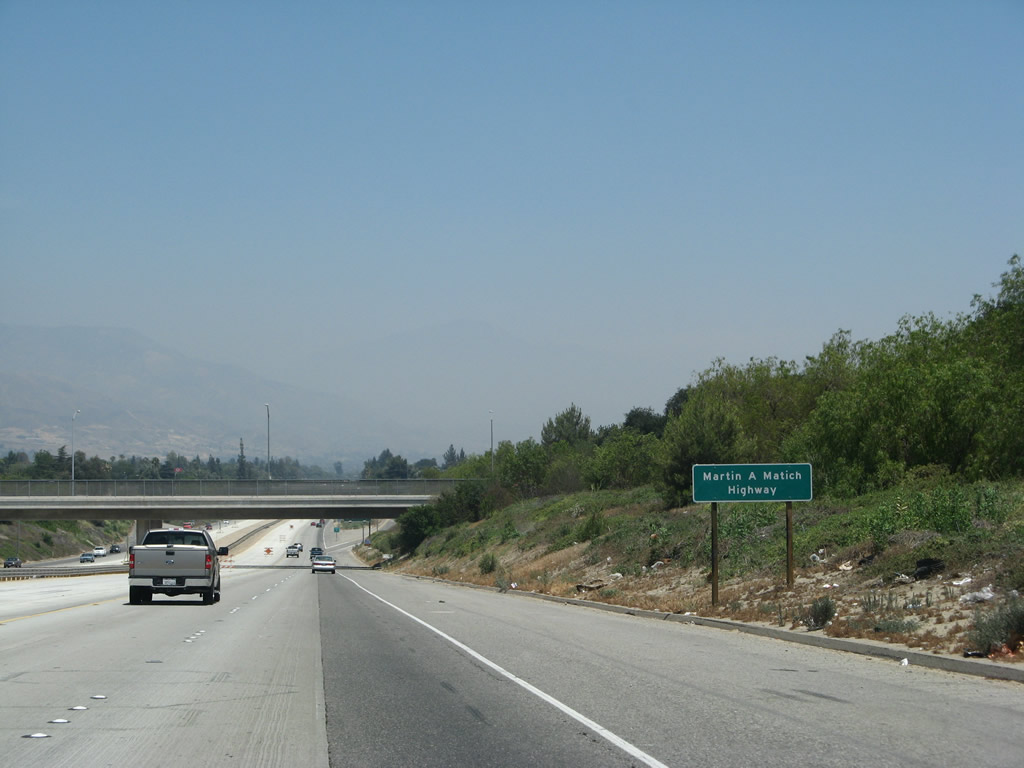 |
Interstate 210 becomes the Martin A. Matich Freeway. This section of freeway was originally signed as California 30 when it was built in 1971. Photo taken 06/24/07. |
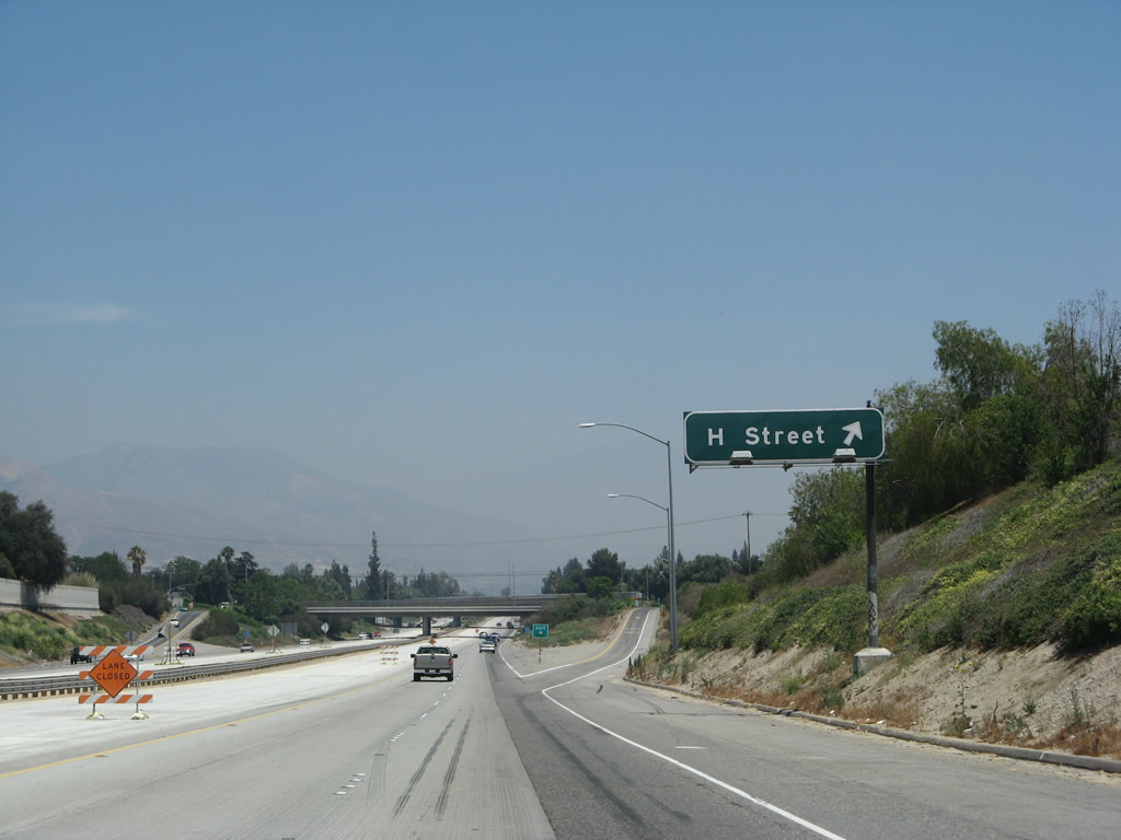 |
Exit 75 leaves California 210 (Foothill Freeway) for H Street. Photo taken 06/24/07. |
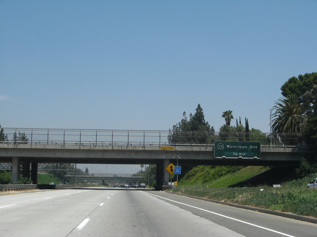 |
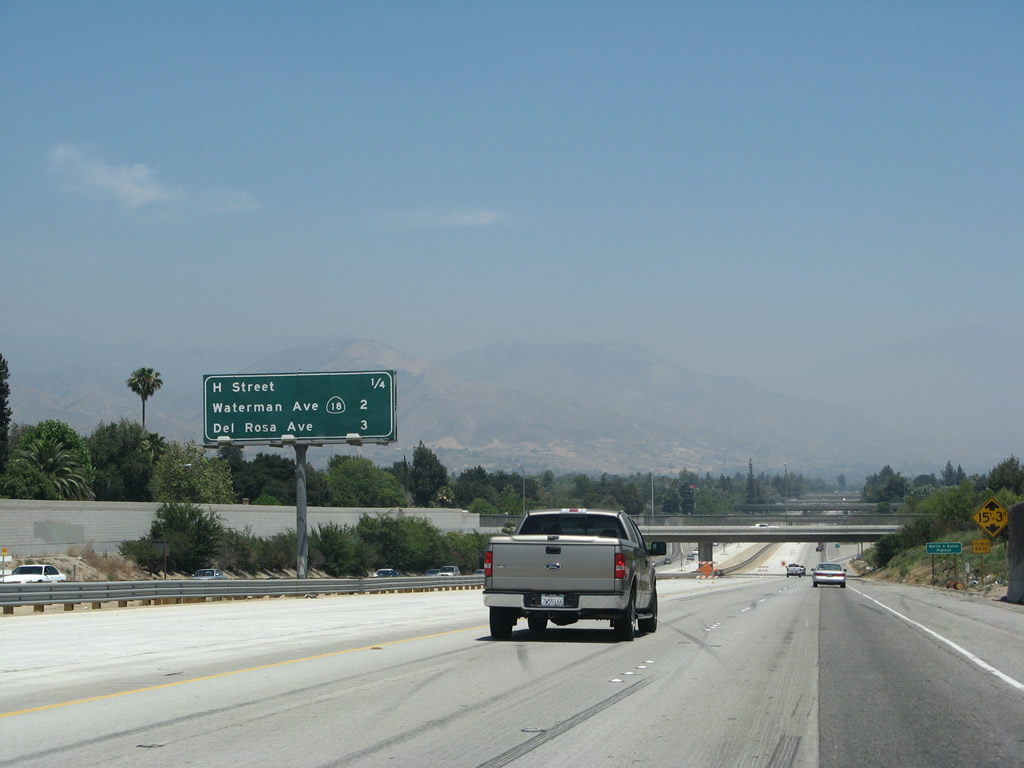
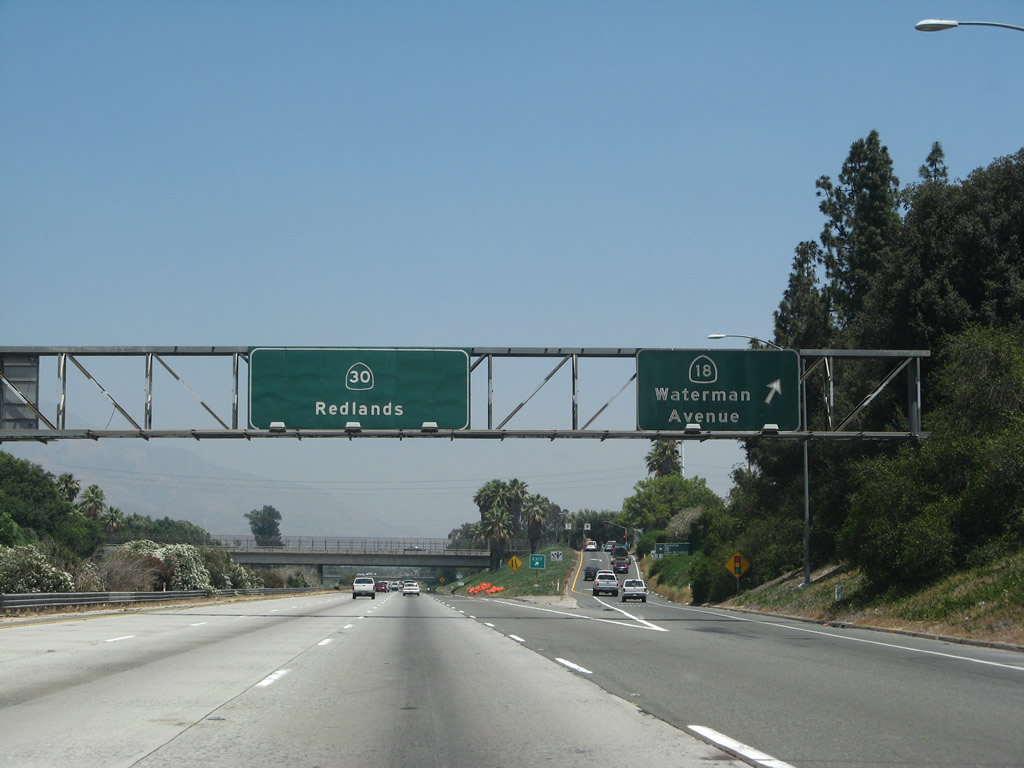
California 18 (Waterman Avenue) meets the Foothill Freeway at the succeeding exit in 0.75 miles. California 18 travels north from here, connecting San Bernardino with the national forest, including Lake Arrowhead and Big Bear Lake. Photo taken 06/24/07. |
 |
With the advent of traffic from California 259, California 210 widens east ahead of Exit 76 with Waterman Avenue. Photo taken 06/24/07. |
 |
SR 210 transitions onto a 1968-built freeway on the approach to SR 18. SR 18, which used to begin near Long Beach, and incorporated portions of SR 91, I-215, SR 259, and SR 210, was truncated to begin at forthcoming Exit 76. Almost all of the former route is freeway, and signage for its old bannered route (SR 18 Business) still remains along portions of Highland Avenue (between SR 259 and Sierra Way) and Sierra Way (from Highland Avenue to SR 18). The former route of SR 18 was eliminated in the 1960s as part of a larger plan to simplify route numbering in Southern California. Photo taken 06/24/07. |
 |
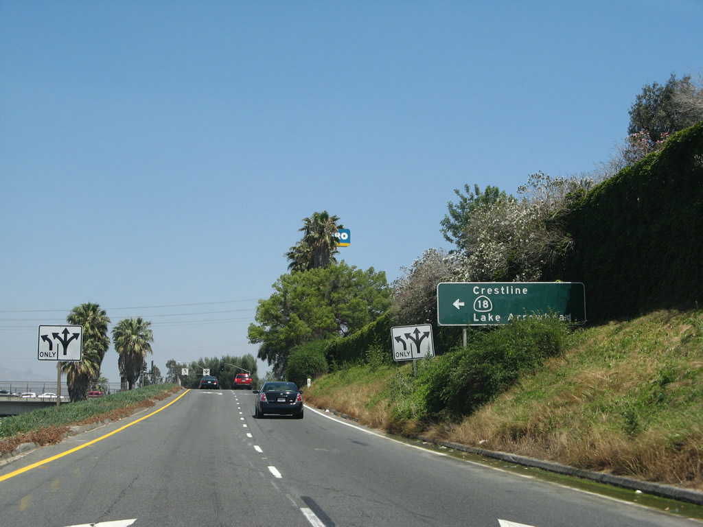
SR 18 follows Waterman Avenue north as a four-lane expressway into the San Bernardino Mountains. While I-210 and SR 210 have generally followed the foothills of the San Gabriel Mountains, the mountain name changes after passing Cajon Wash and Cajon Pass/Summit. Now the foothills to the north are for the San Bernardino Mountains, which include Lake Arrowhead and Big Bear Lake. Photo taken 06/24/07. |
 |
Entering the modified diamond interchange (Exit 76) with Waterman Avenue on SR 210 east. Several ski resorts are found in the high-reaching mountains to the north, and the highest state route mountain pass in Southern California (along SR 38) is located within the San Bernardino Mountains. Upon reaching the top of the mountains, SR18's expressway meets SR 138 at a trumpet interchange near Crestline, then follows the Rim of the World Highway east toward Lake Arrowhead and Big Bear Lake. SR 18 eventually emerges from the mountains at Victorville, where it meets Historic U.S. 66 and I-15. Photo taken 06/24/07. |
 |
Taking the off-ramp from SR 210 east to SR 18 (Waterman Avenue) north in Sen Bernardino. A proposal to build an extension of SR 18 as a north-south freeway (parallel to I-215 roughly along Sierra Way) between SR 210 and I-10 remained on the books as a legislative route. Photo taken 06/24/07. |
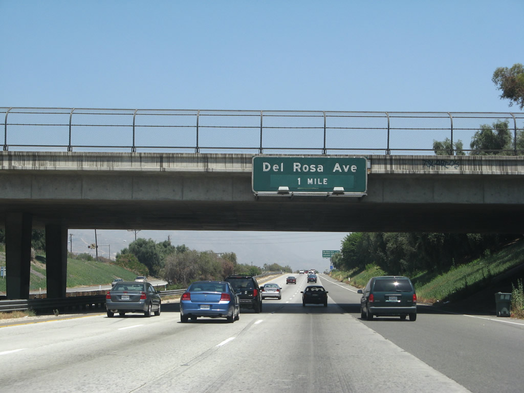 |
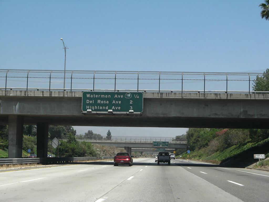
The Foothill Freeway advances one mile east to a diamond interchange (Exit 78) with Del Rosa Avenue. Photo taken 06/24/07. |
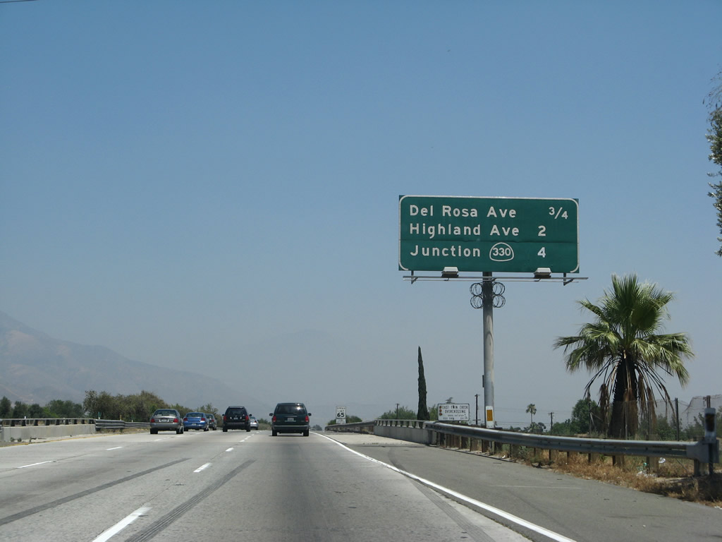 |
California 210 spans at East Twin Creek this interchange sequence sign posted four miles ahead of California 330 (City Creek Road). Photo taken 06/24/07. |
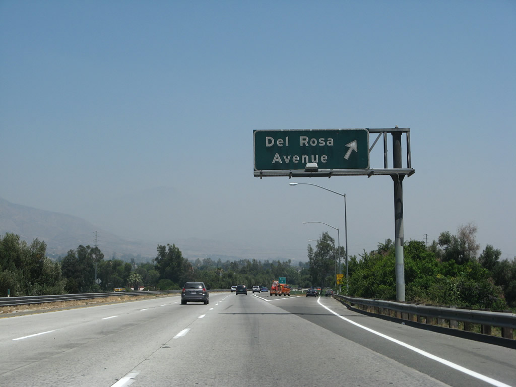 |
Exit 78 departs California 210 (Foothill Freeway) east for Del Rosa Avenue, a five-lane commercial boulevard. Photo taken 06/24/07. |
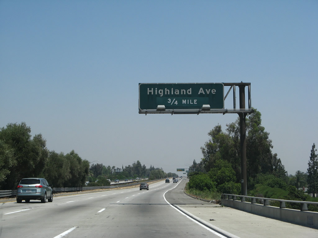 |
Angling southeast, the Foothill Freeway progresses 0.75 miles to Exit 79 with Highland Avenue (old California 30 Business). Photo taken 06/24/07. |
 |
A lane drop occurs eastbound at Exit 79 for Highland Avenue. The SR 30 business route extended from this exchange west to SR 259 at Exit 1 and SR 210 at Exit 73. Photo taken 06/24/07. |
 |
California 210 makes a gradual southward arc between Highland Avenue and Base Line Road (Exit 82). Photo taken 06/24/07. |
 |
A SR 210 reassurance shield precedes the split diamond interchange with Highland Avenue and Arden Avenue along the Foothill Freeway eastbound. Posted in spring 2007, this assembly was the first for SR 210 erected east between SR 259 and Interstate 10. Photo taken 06/24/07. |
 |
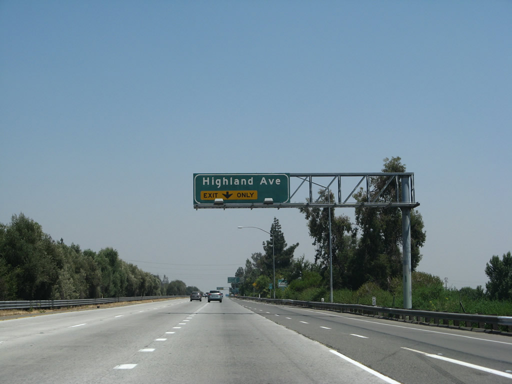
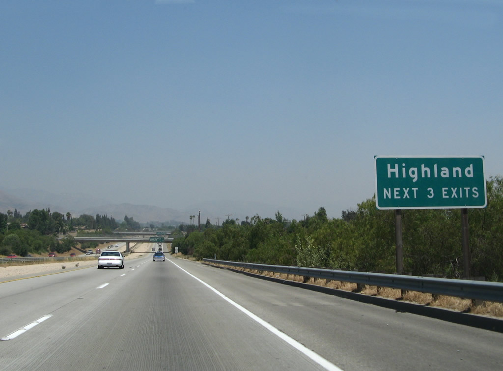
Eastbound California 210 (Foothill Freeway) reaches Exit 79, California 30 Business (Highland Avenue). Use Highland Avenue east to Patton State Hospital and then into the city of Highland. Photo taken 06/24/07. |
 |
Only two eastbound lanes continue across the Highland Avenue bridge. Photo taken 06/24/07. |
 |
Room for eventual expansion of California 210 is available in the median. Photo taken 06/24/07. |
 |
A California 30 east reassurance shield was posted after the on-ramp from Highland Avenue, but it has since been replaced with a California 210 route marker. Photo taken 06/24/07. |
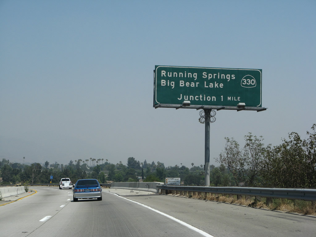 |
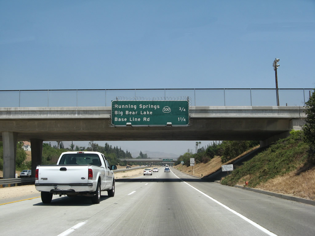
The next exit along California 210 (Foothill Freeway) east is Exit 81, California 330/City Creek Road north to Running Springs, Lake Arrowhead, and Big Bear Lake. California 330 serves as another four-lane expressway alternative to California 18 for access to the mountain resorts in the San Bernardino Mountains. It connects California 210 in Highland with California 18 in Running Springs. Photo taken 06/24/07. |
 |
The next three exits from California 210 (Foothill Freeway) east all serve the city of Highland: Exit 81, California 330/City Creek Road; Exit 82, Baseline Street; and Exit 83, Fifth Street. Photo taken 06/24/07. |
 |
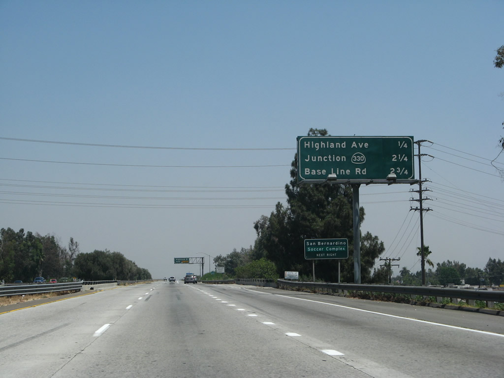
This mileage sign provides the distance to the next two exits along California 210 (Foothill Freeway) east: Exit 81, California 330/City Creek Road and Exit 82, Baseline Street. Photo taken 06/24/07. |
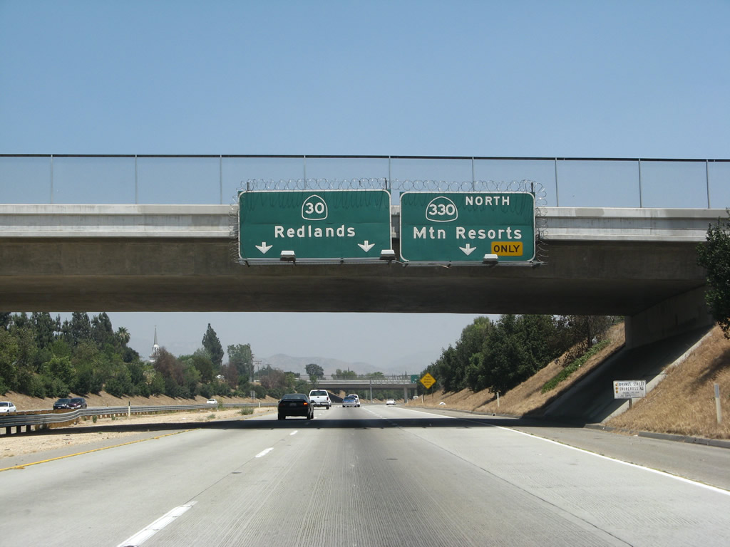 |
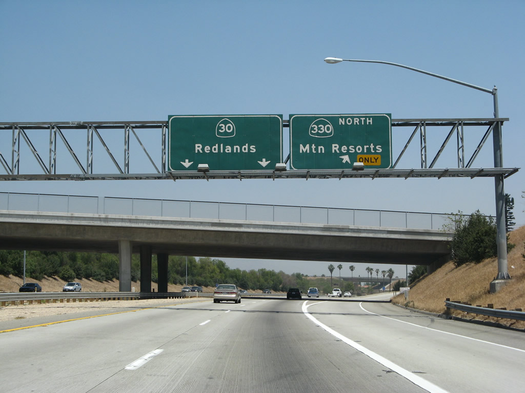
The right lane of California 210 (Foothill Freeway) east becomes exit only for Exit 81, California 330/City Creek Road north to Running Springs. The left two lanes continue east on California 210 (former California 30) to Redlands. Photo taken 06/24/07. |
 |
Eastbound California 210 (Foothill Freeway) reaches Exit 81, California 330/City Creek Road. At this interchange, California 210 primary direction turns from east to due south. Before California 30's freeway between California 330 and Interstate 10 was completed, California 30 used to continue along today's California 330 north to Running Springs. The freeway extension resulted in a route renumbering that occurred in 1972; the segment of north-south freeway was completed in 1993. The interim route prior to freeway construction was Orange Street, which was signed as California 106 from 1964 to 1972 and as California 30 from 1972 until 1993. Photo taken 06/24/07. |
 |
No gore point signage is posted for Exit 81, California 330/City Creek Road. The interchange between California 210 and California 330 is a tri-level stack. Photo taken 06/24/07. |
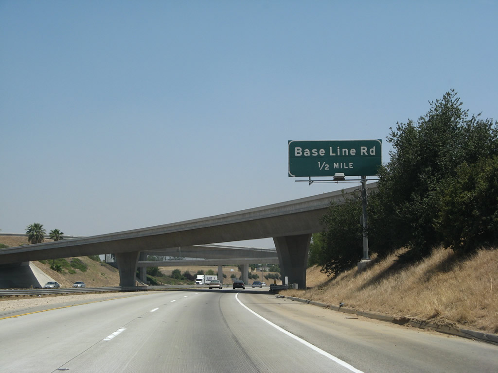 |
Within the California 210-330 interchange, a sign is posted for the next exit along California 210 (Foothill Freeway) east: Exit 82, Base Line Road in Highland. Photo taken 06/24/07. |
 |
This view shows the heart of the California 210-330 interchange. The freeway begins to turn south at this point. Around this point, California 210 enters the city of Highland. Located at an elevation of 1,350 feet, Highland had a population of 44,605 as the 2000 Census and was incorporated on November 24, 1987. Photo taken 06/24/07. |
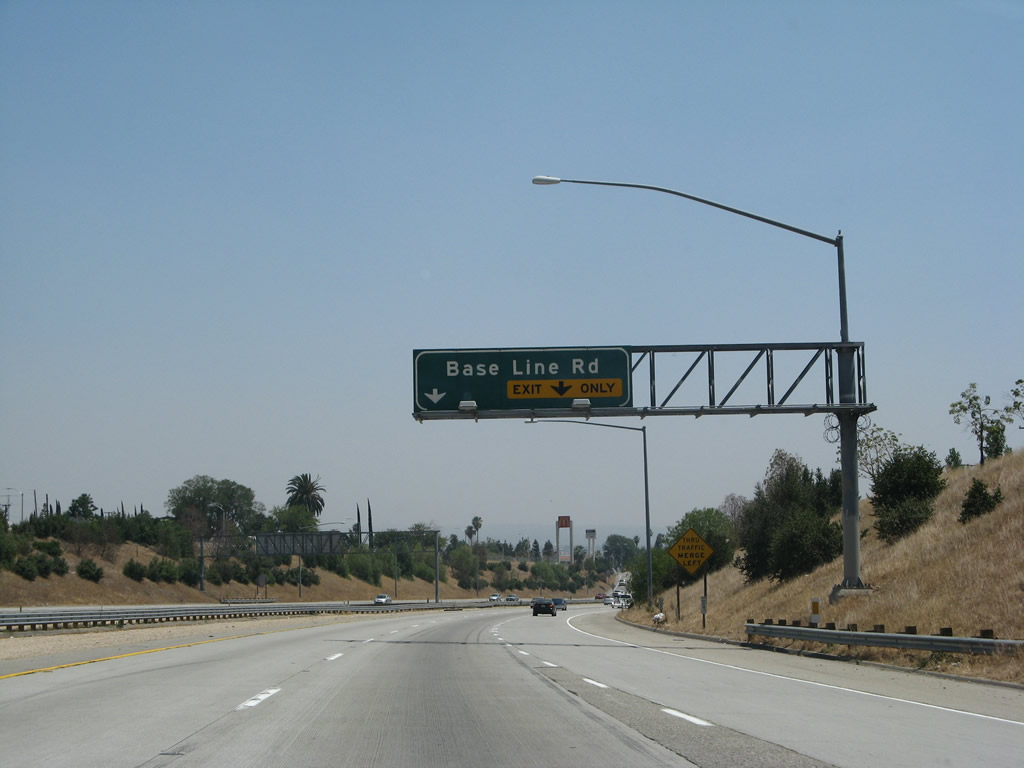 |
A new right lane joins eastbound California 210 (Foothill Freeway); that lane becomes exit only for Exit 82, Base Line Road. Photo taken 06/24/07. |
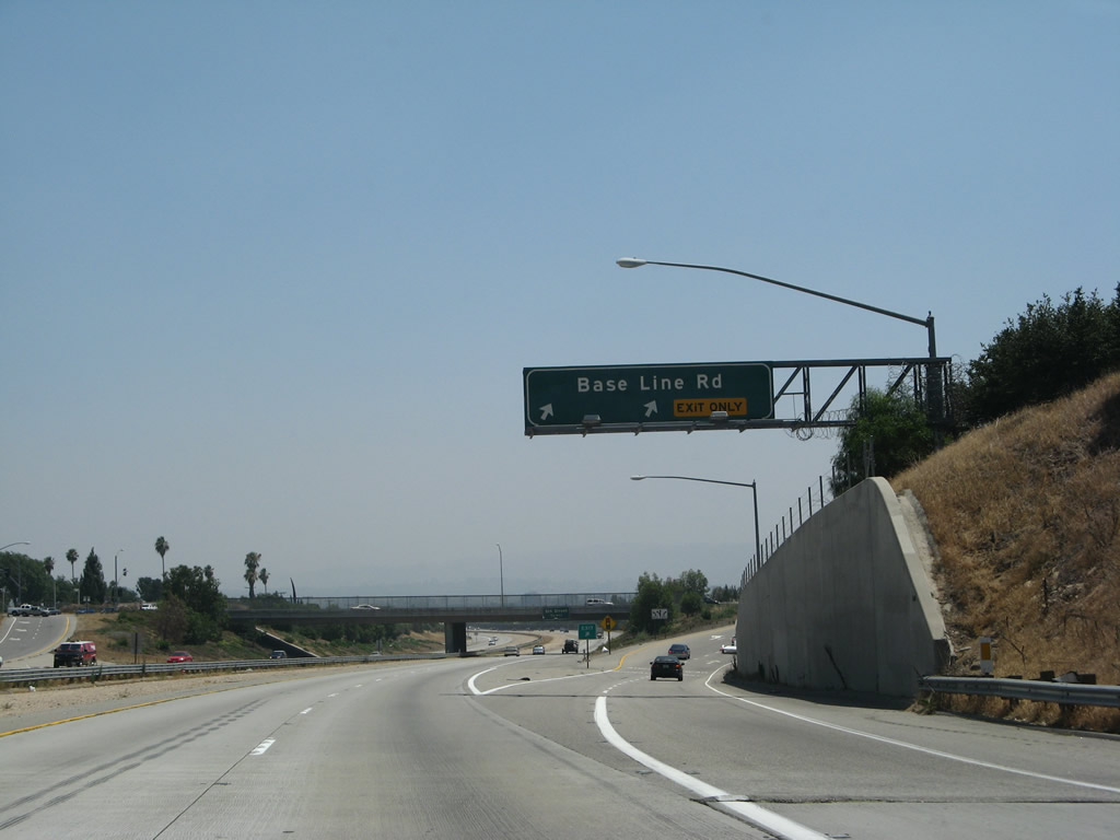 |
Eastbound California 210 (Foothill Freeway) reaches Exit 82, Base Line Road (two-lane exit). Photo taken 06/24/07. |
 |
The next exit along eastbound California 210 is Exit 83, Fifth Street (to Greenspot Road) in Highland. Use Fifth Street east to Greenspot Road; Greenspot Road provides a back route to California 38 (Mill Creek Road) northwest of Yucaipa. Photo taken 06/24/07. |
 |
This mileage sign along eastbound California 210 (Foothill Freeway) provides the distance to the final four exits: Exit 83, 5th Street (to Greenspot Road); Exit 84, San Bernardino Avenue; and Exits 85A-B, Interstate 10. Photo taken 06/24/07. |
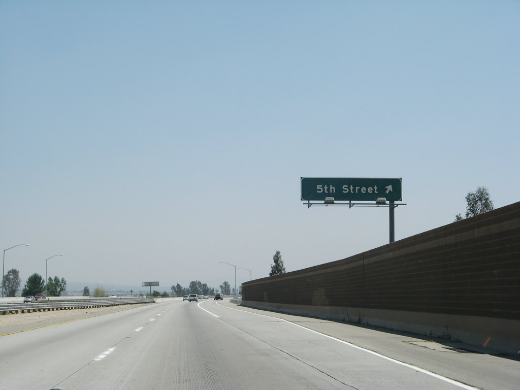 |
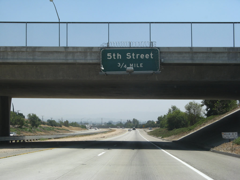
After crossing City Creek, eastbound California 210 reaches Exit 83, Fifth Street (to Greenspot Road) in Highland. The freeway ends at Interstate 10 a few miles ahead. Photo taken 06/24/07. |
 |
Upon crossing Fifth Street, California 210 leaves Highland and enters the city of Redlands (population 63,591, incorporated December 3, 1888). Photo taken 06/24/07. |
 |
A California 30 east reassurance shield and postmile are posted after the on-ramp from Fifth Street. Now this has been replaced with a California 210 shield. Photo taken 06/24/07. |
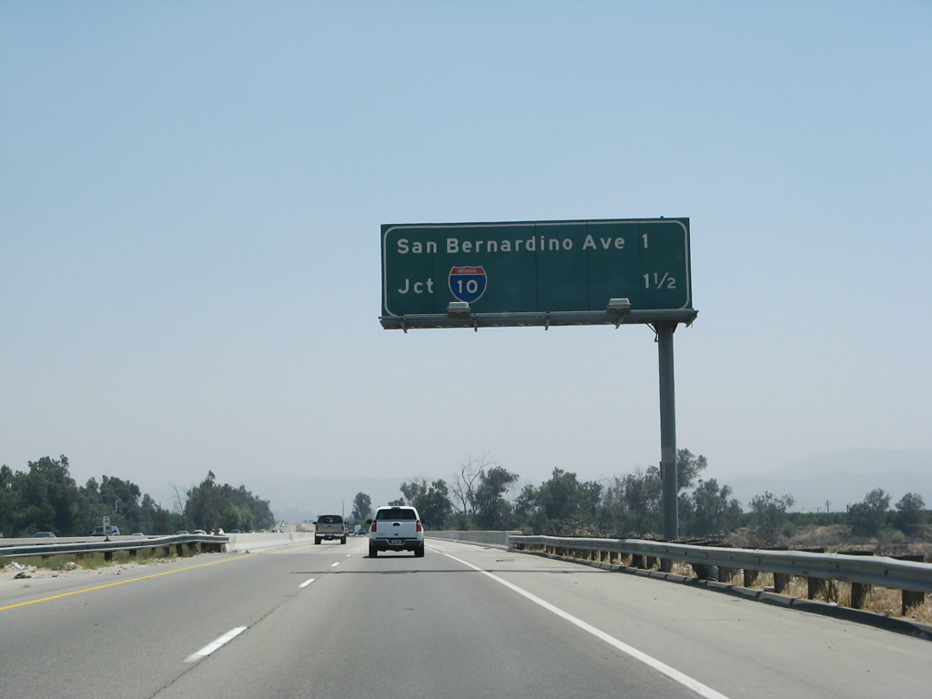 |
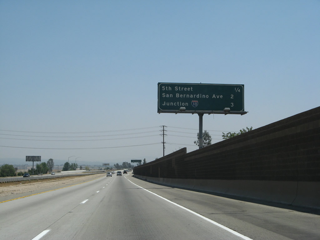
This mileage sign provides the distance to the final three exits from California 210 east: Exit 84, San Bernardino Avenue and Exits 85A-B, Interstate 10 east/west. Photo taken 06/24/07. |
 |
California 210 crosses over the Santa Ana River on this pair of bridges. Photo taken 06/24/07. |
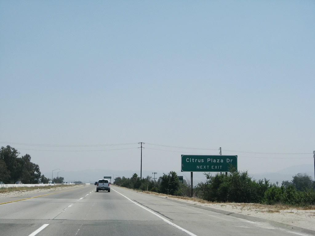 |
Use Exit 84 to Citrus Plaza Drive. Upon exiting, turn left/right for San Bernardino Avenue or continue straight for Citrus Plaza Drive. Photo taken 06/24/07. |
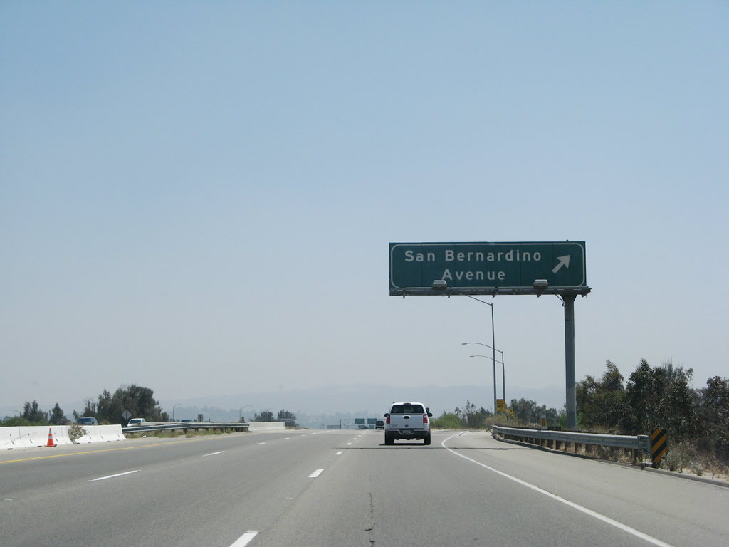 |
Eastbound (southbound) California 210 reaches Exit 84, San Bernardino Avenue and Citrus Plaza Drive. Photo taken 06/24/07. |
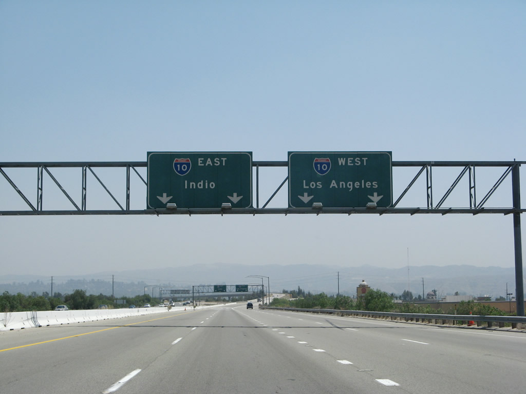 |
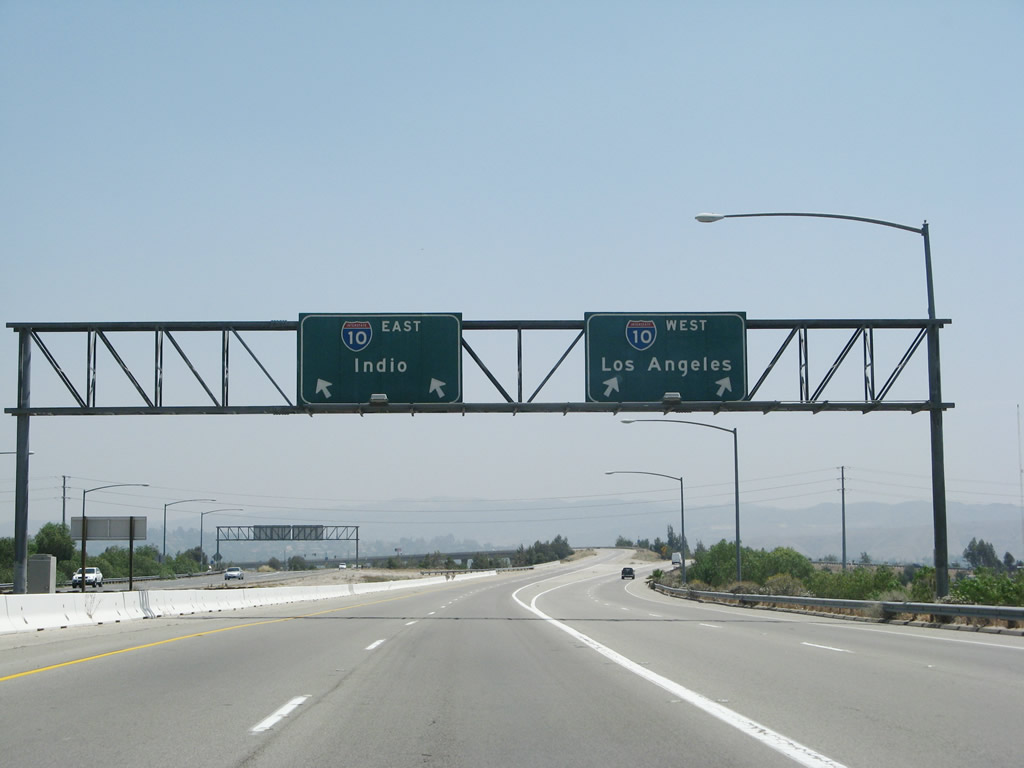
California 210 widens out to four eastbound lanes for the final distance to the route's end at Exits 85A-B, Interstate 10 east/west. Stay left for Interstate 10 east to Palm Springs, Indio, and Phoenix. Stay right for Interstate 10 west to San Bernardino, Pomona, and Los Angeles. Photo taken 06/24/07. |
 |
 |
Eastbound California 210 ends as the route splits. The left two lanes connect to Exit 85B for Interstate 10 east. The right two lanes connect to Exit 85A, Interstate 10 west to San Bernardino, Pomona, and Los Angeles. Photos taken 06/24/07. |
 |
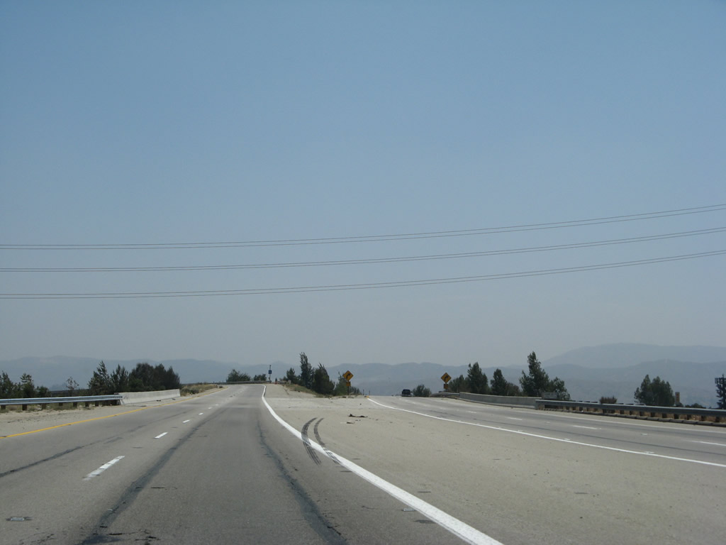
Following the transition ramp from eastbound California 210 to Interstate 10 east to Palm Springs, Indio, and Phoenix. Photo taken 06/24/07. |
Sources:
- "Ramp opens as more I-215 closures planned." The Press Enterprise, July 25, 2012.

Page Updated July 27, 2012.
|
About Contact Glossary |
In The News Interstate Guide |
Social Media:
 |
|
© 2000-25 AARoads.com | All Rights Reserved | Privacy Policy / Terms of Use
|
||