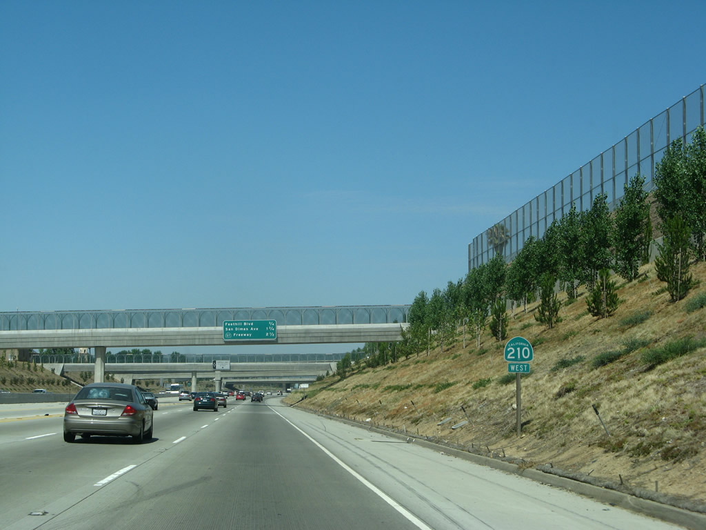
| California 210 (Foothill Freeway) west |
|
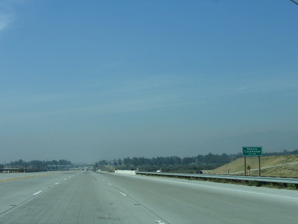
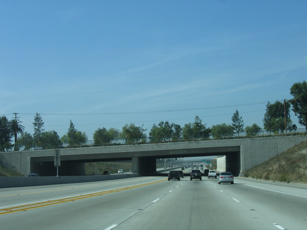
Interstate 210 (Foothill Freeway) enters the city of Rancho Cucamonga, which had a population of 127,743 as of the 2000 Census. Rancho Cucamonga incorporated on November 30, 1977, and it represents the merger of three previously unincorporated areas: Etiwanda, Cucamonga, and Alta Loma. Like other cities in the Inland Empire, Rancho Cucamonga continues to grow as a fast pace as evidenced by the construction of new housing tracts in and around the city, especially along the California 210 freeway corridor. Photo taken 01/28/06. |
|
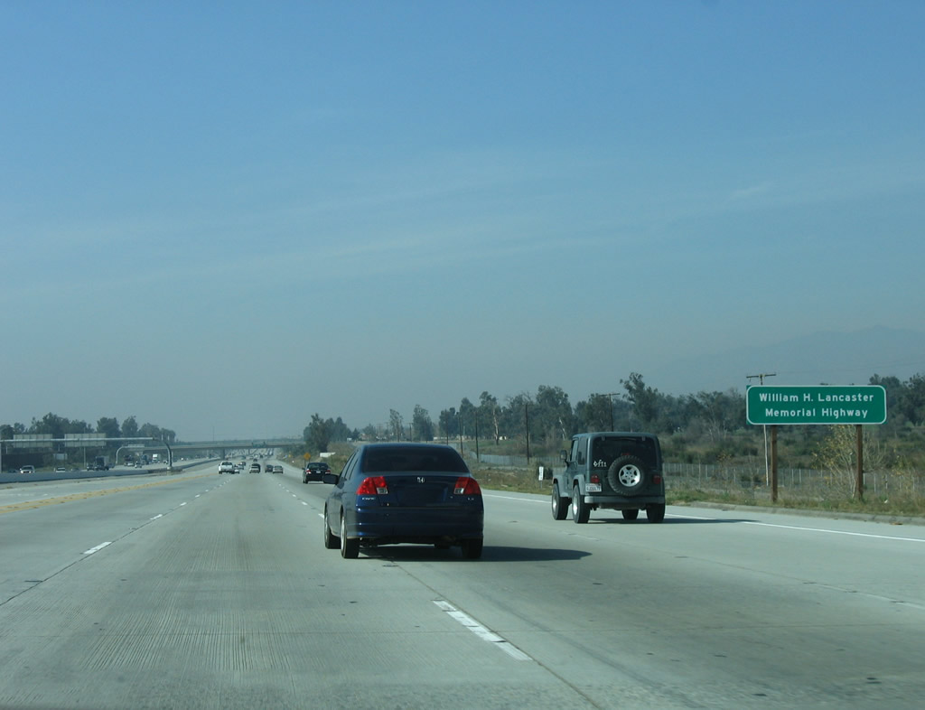
This section of Interstate 210 (Foothill Freeway) in the city of Rancho Cucamonga is also known as the William H. Lancaster Memorial Highway. Photo taken 01/28/06. |
|
|
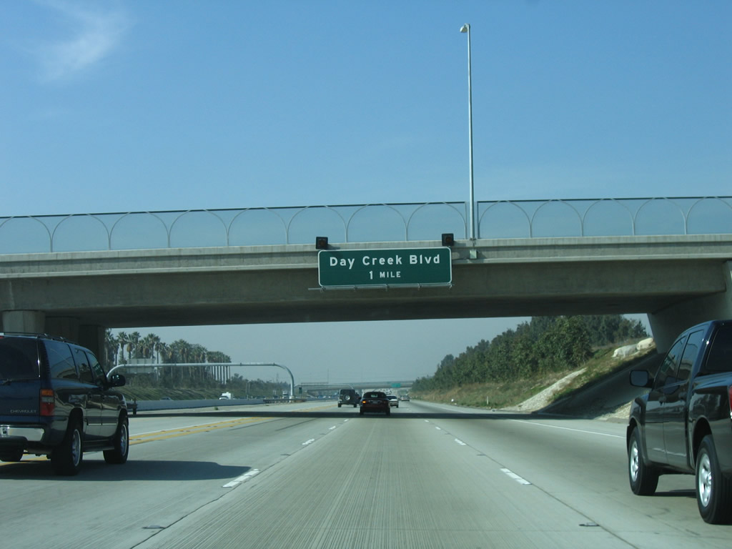
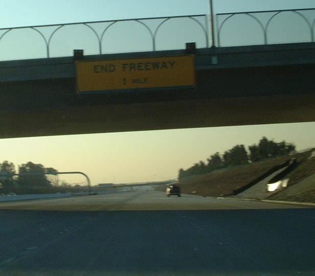
The next exit along Interstate 210 (Foothill Freeway) west is Exit 61, Day Creek Boulevard. A pair of retired flashing beacon lights still remain in place above the sign; these lights date back to when Day Creek Boulevard served as the temporary end of what was then known as the California 30 freeway (this segment of freeway opened in 2001 and was renumbered as California 210 thereafter). This sign used to say "end freeway" in large black letters against a yellow background (legend). Photo taken 01/28/06 and 01/21/02. |
|
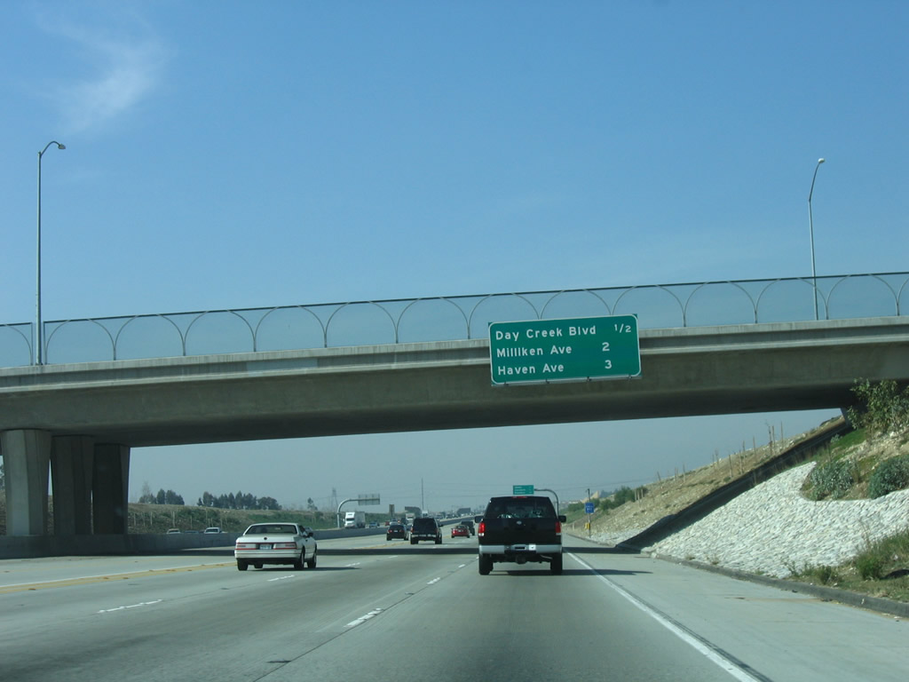
This mileage sign along Interstate 210 (Foothill Freeway) west provides the distance to the next three exits: Exit 61, Day Creek Boulevard; Exit 60, Milliken Avenue; and Exit 59, Haven Avenue. Photo taken 01/28/06. |
|
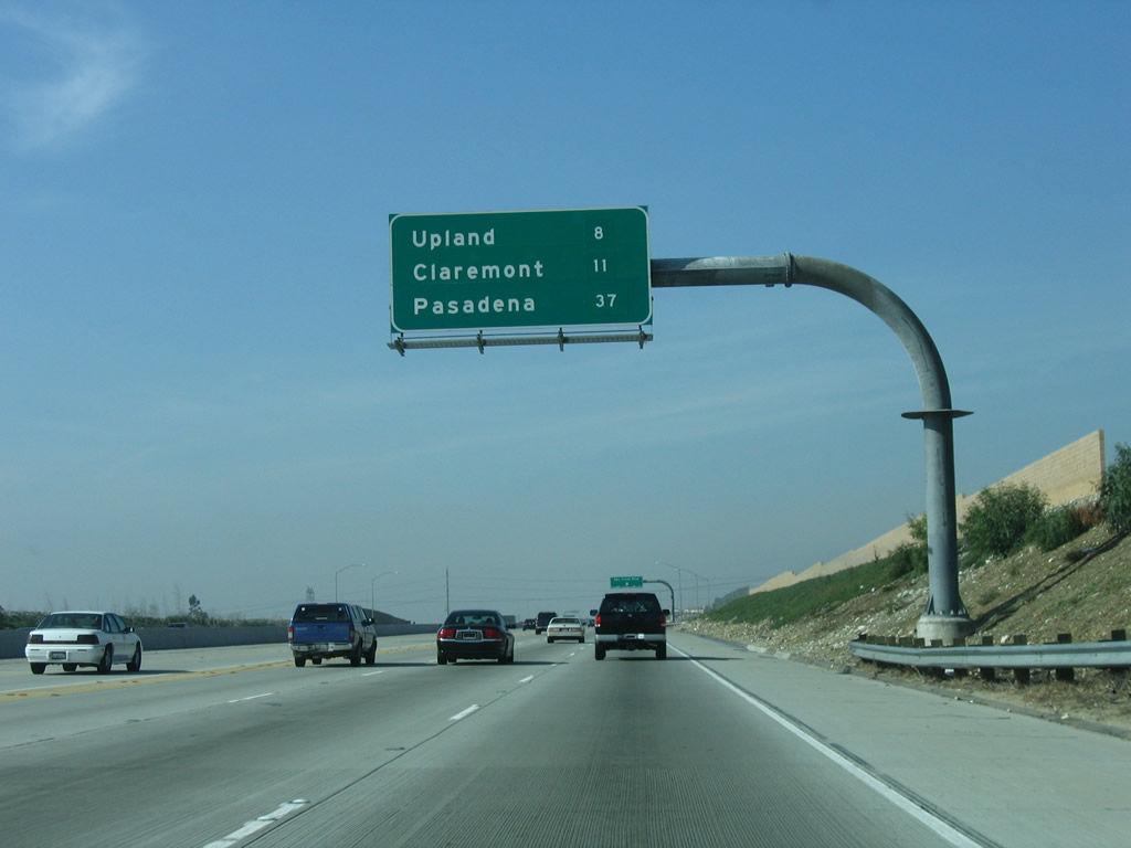
A second mileage sign along Interstate 210 (Foothill Freeway) west provides the distance to the cities of Upland, Claremont, and the control city of Pasadena. Photo taken 01/28/06. |
|
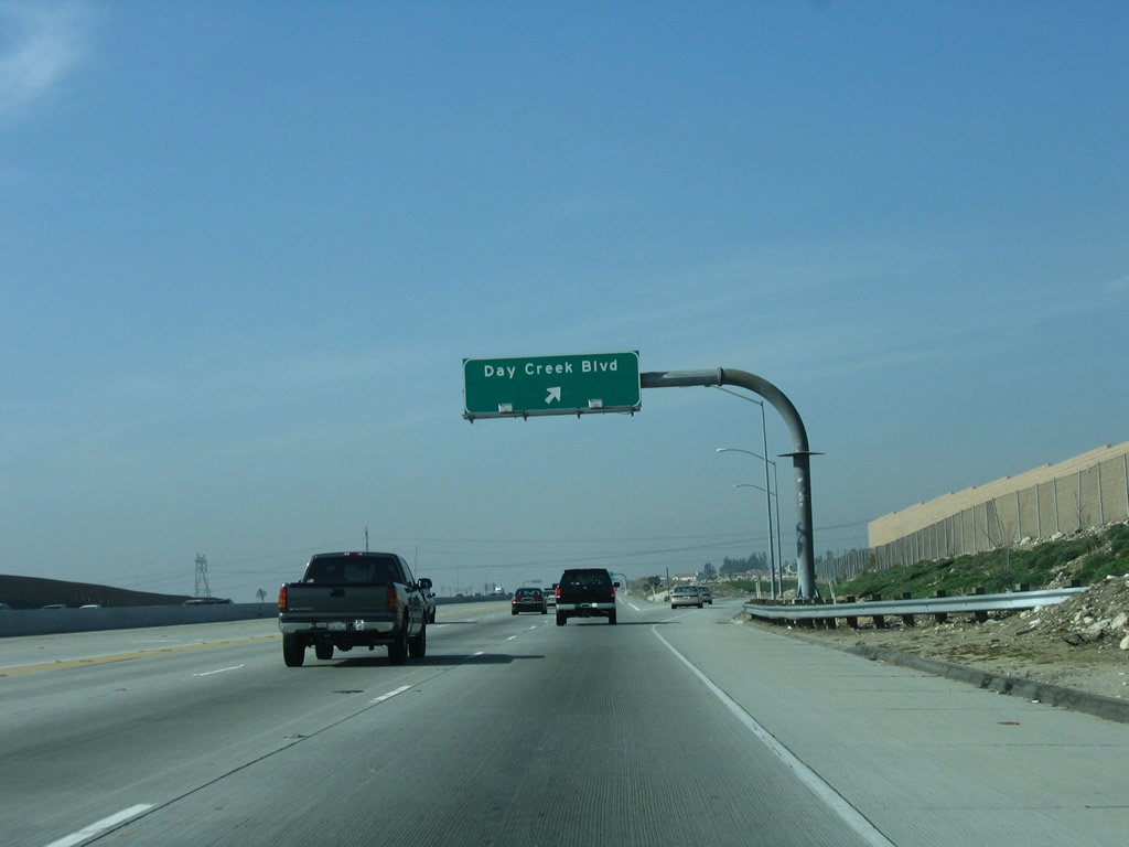
Westbound Interstate 210 (Foothill Freeway) reaches Exit 61, Day Creek Boulevard. The freeway returns to level grade after several miles below grade between Interstate 15 and here. Photo taken 01/28/06. |
|
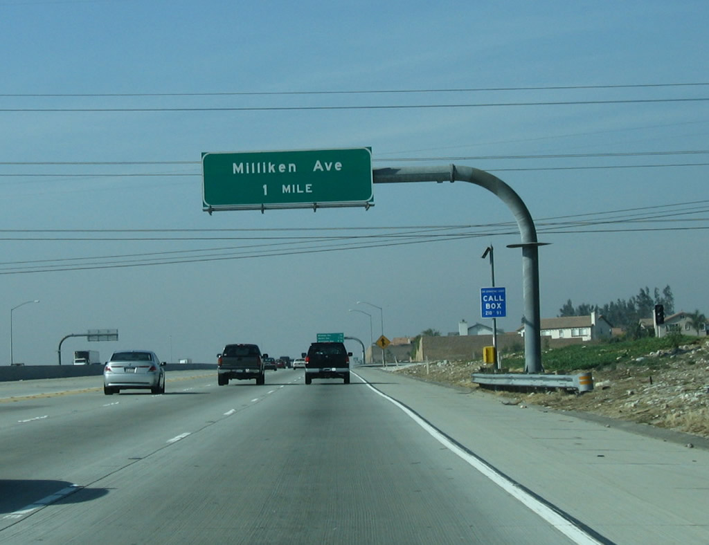
The next exit along Interstate 210 (Foothill Freeway) west is Exit 60, Milliken Avenue. A set of 500kV power lines (Southern California Edison) cross over Interstate 210 at this point. These lines also originate from the Lugo substation in Hesperia near Cajon Pass. Photo taken 01/28/06. |
|
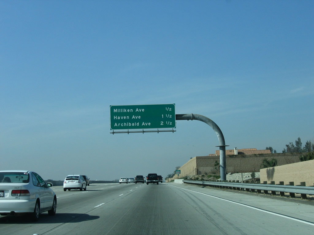
This mileage sign along Interstate 210 (Foothill Freeway) west provides the distance to the next three exits: Exit 60, Milliken Avenue; Exit 59, Haven Avenue; and Exit 58, Archibald Avenue. Photo taken 01/28/06. |
|
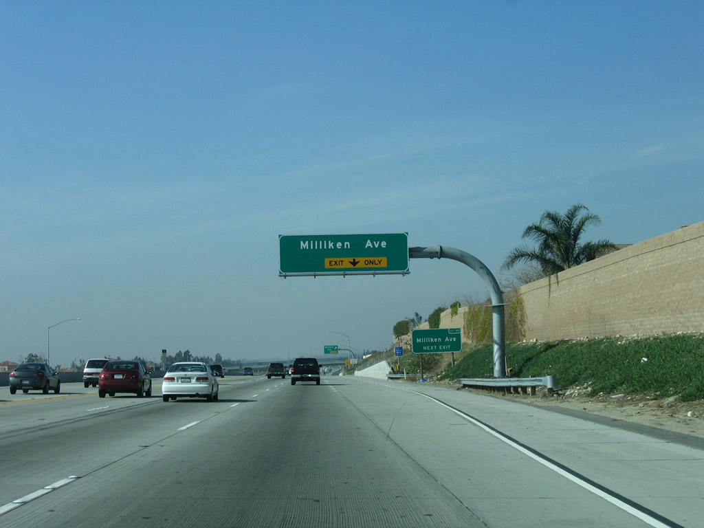
The right lane of Interstate 210 (Foothill Freeway) west becomes exit only for Exit 60, Milliken Avenue. A small roadside sign is the only one that contains the exit number. Photo taken 01/28/06. |
|
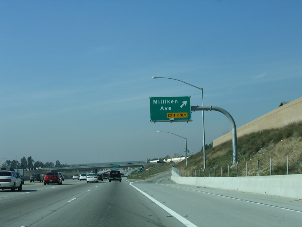
Westbound Interstate 210 (Foothill Freeway) reaches Exit 60, Milliken Avenue. Photo taken 01/28/06. |
|
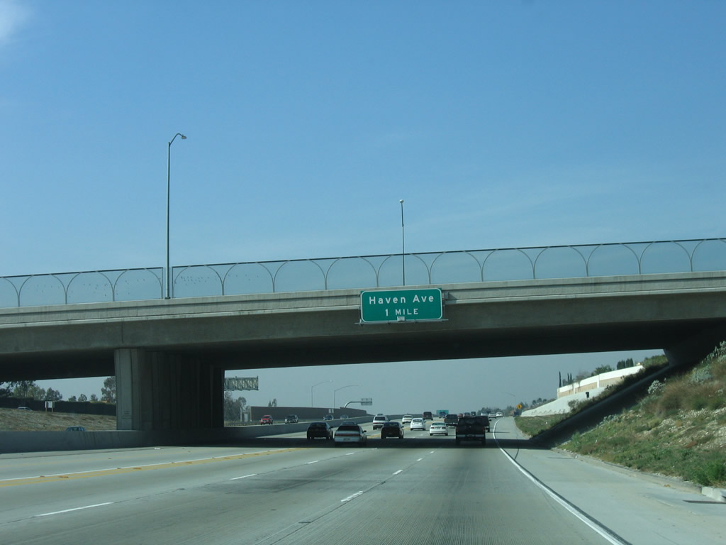
The next exit along Interstate 210 (Foothill Freeway) west is Exit 59, Haven Avenue (one mile). Photo taken 01/28/06. |
|
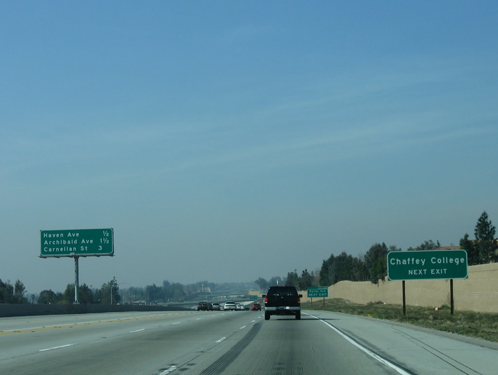
This mileage sign along Interstate 210 (Foothill Freeway) west provides the distance to the next three exits: Exit 59, Haven Avenue; Exit 58, Archibald Avenue; and Exit 57, Carnelian Street. Photo taken 01/28/06. |
|
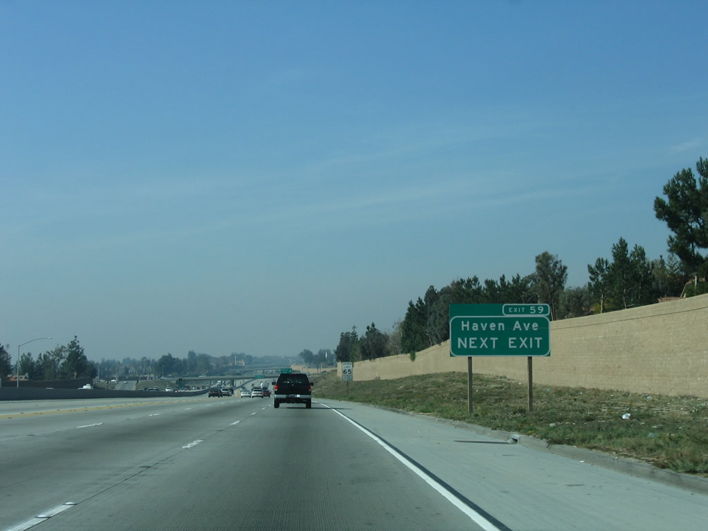
An advance guide sign with exit number for Exit 59, Haven Avenue is posted shortly thereafter. Photo taken 01/28/06. |
|
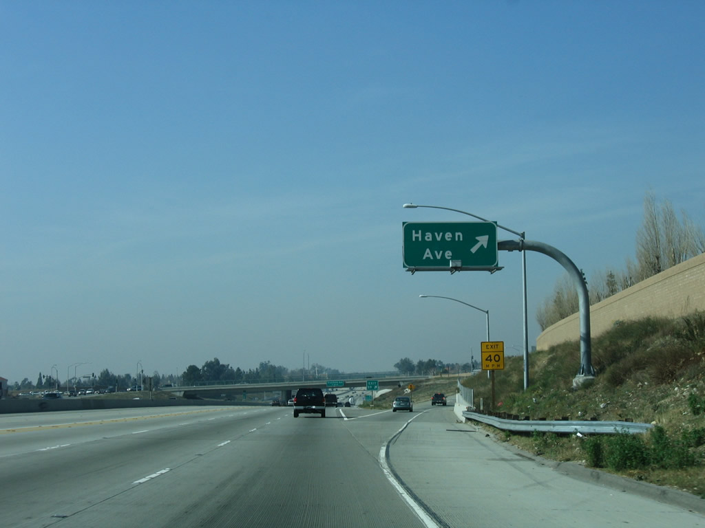
Westbound Interstate 210 (Foothill Freeway) reaches Exit 59, Haven Avenue. Photo taken 01/28/06. |
|
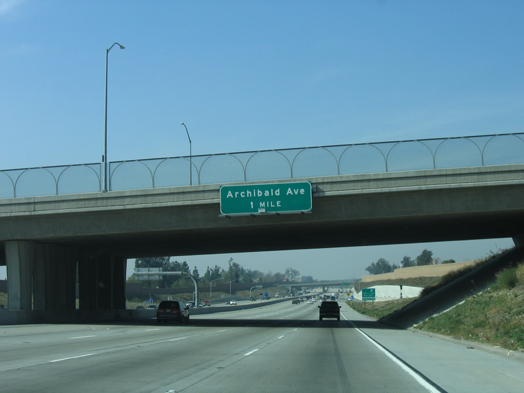
The next exit along Interstate 210 (Foothill Freeway) west is Exit 58, Archibald Avenue (one mile). Photo taken 01/28/06. |
|
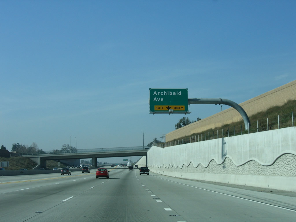
The right lane of Interstate 210 (Foothill Freeway) west becomes exit only for Exit 58, Archibald Avenue. Photo taken 01/28/06. |
|
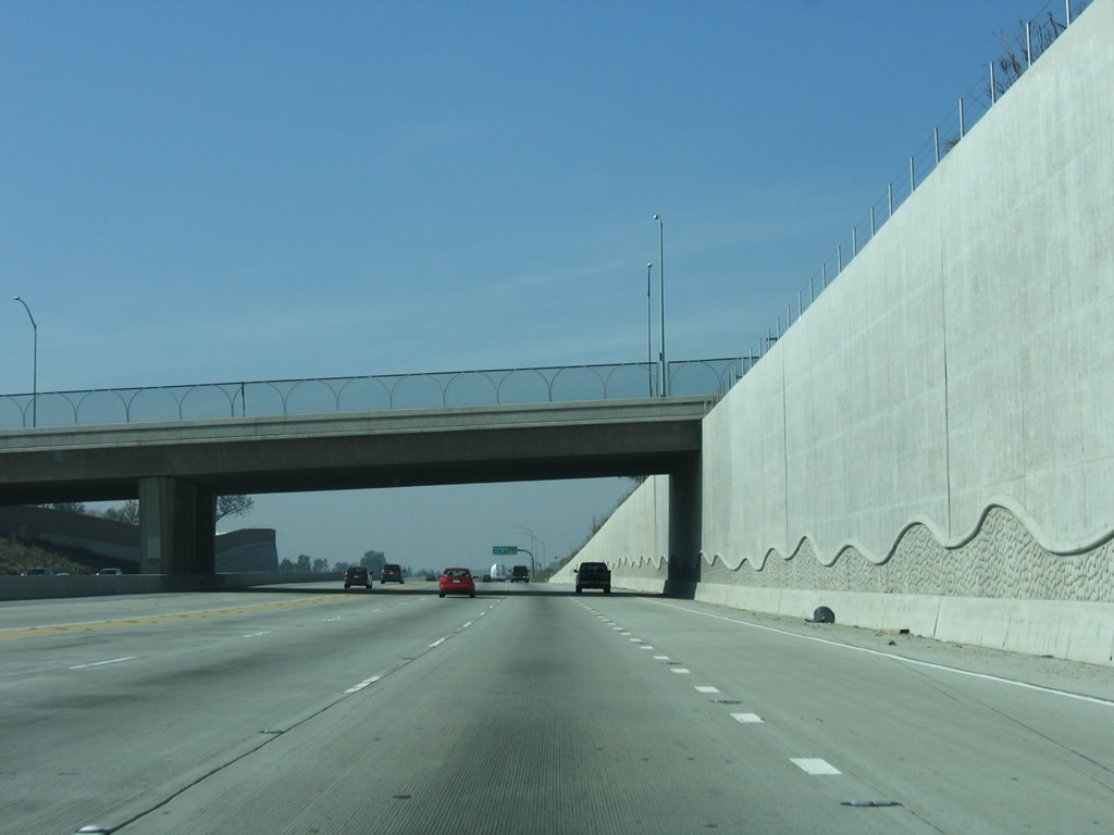
A towering retaining wall dominates the view as westbound Interstate 210 (Foothill Freeway) approaches Exit 58, Archibald Avenue. Photo taken 01/28/06. |
|
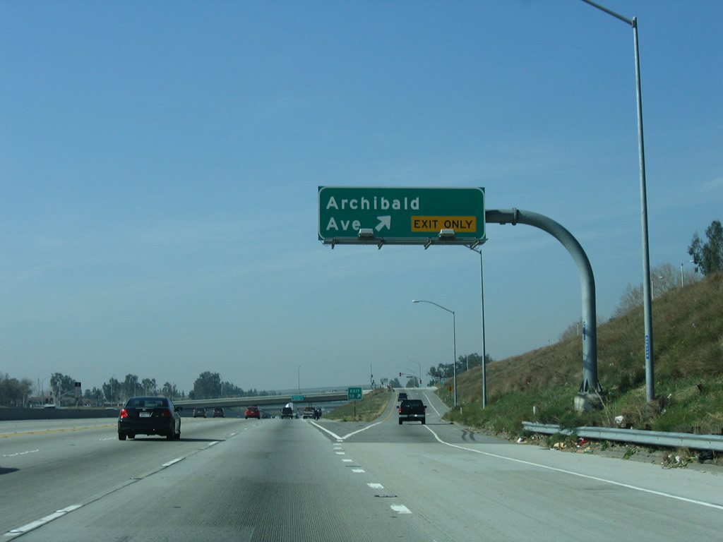
Westbound Interstate 210 (Foothill Freeway) reaches Exit 58, Archibald Avenue. Photo taken 01/28/06. |
|
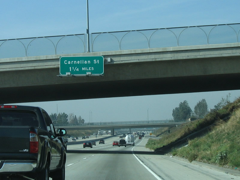
The next exit along Interstate 210 (Foothill Freeway) west is Exit 57, Carnelian Street (1.25 miles). Photo taken 01/28/06. |
|
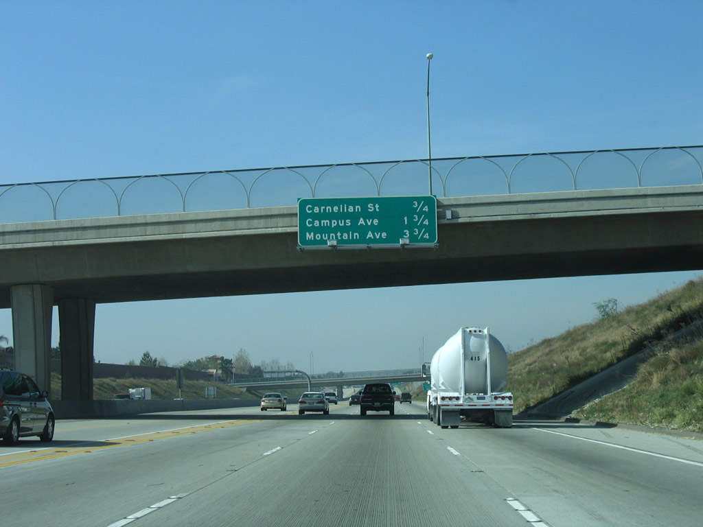
This mileage sign along Interstate 210 (Foothill Freeway) west provides the distance to the next three exits: Exit 57, Carnelian Street; Exit 56, Campus Avenue; and Exit 54, Mountain Avenue. Photo taken 01/28/06. |
|
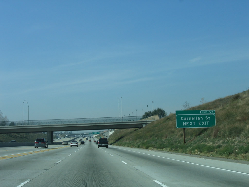
A roadside guide sign for Exit 57, Carnelian Street is posted shortly thereafter, complete with exit number. Photo taken 01/28/06. |
|
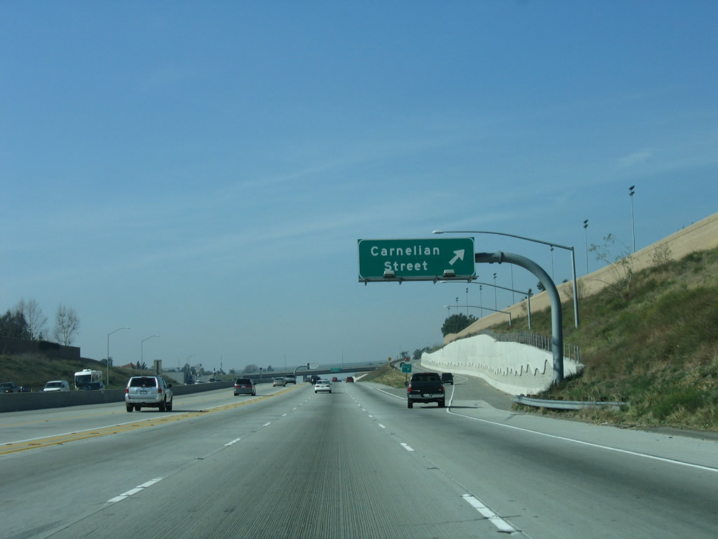
Westbound Interstate 210 (Foothill Freeway) reaches Exit 57, Carnelian Street. Photo taken 01/28/06. |
|
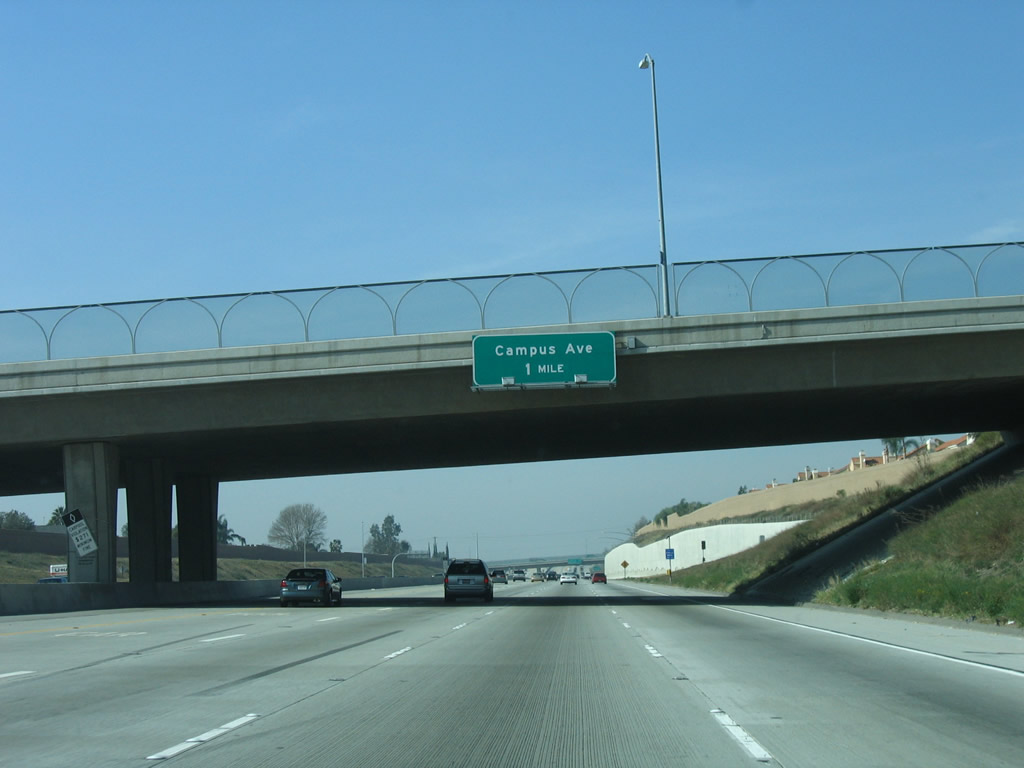
The next exit along Interstate 210 (Foothill Freeway) west is Exit 56, Campus Avenue. Photo taken 01/28/06. |
|
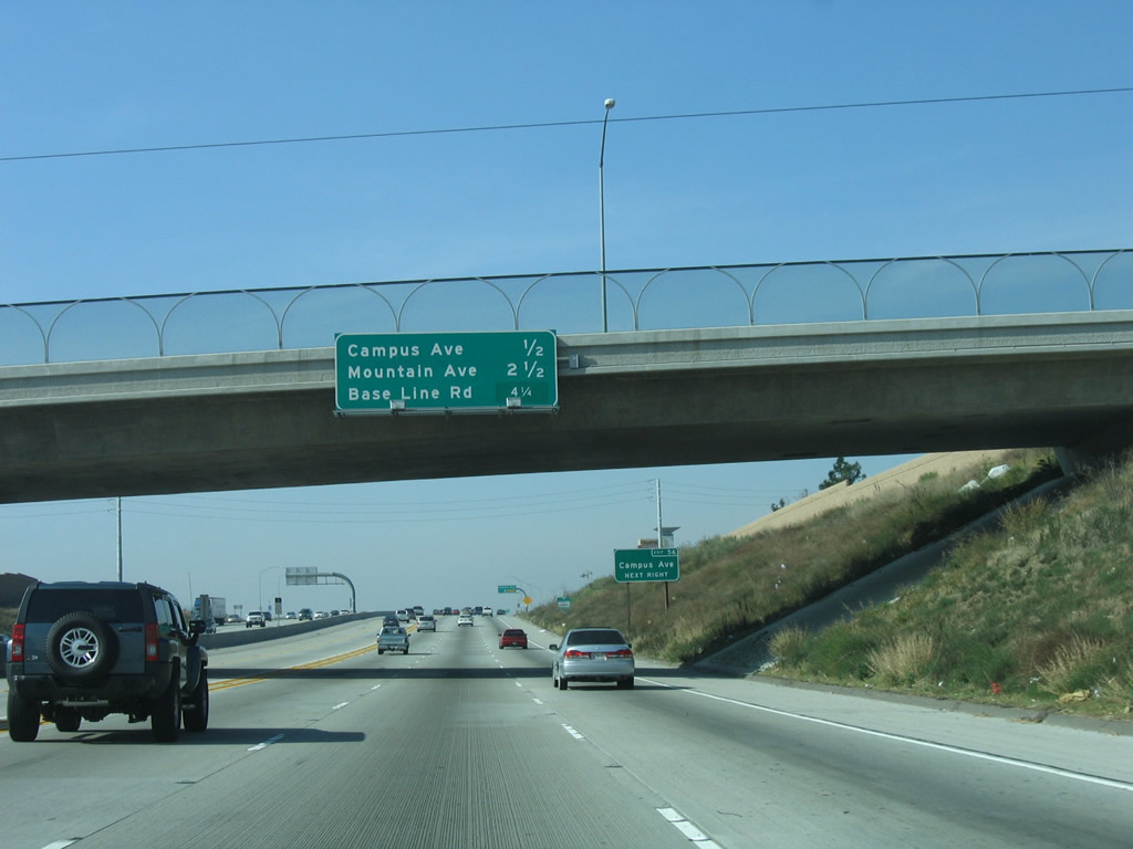
This mileage sign along Interstate 210 (Foothill Freeway) west provides the distance to the next three exits: Exit 56, Campus Avenue; Exit 54, Mountain Avenue; and Exit 52, Baseline Road. Photo taken 01/28/06. |
|
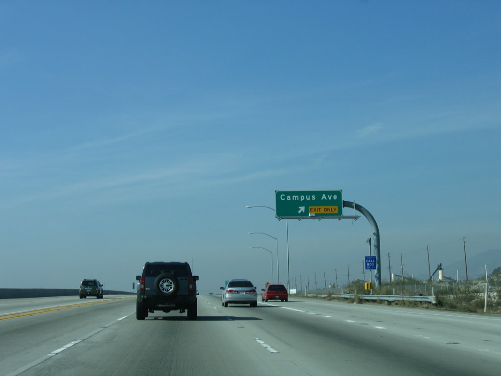
Westbound Interstate 210 (Foothill Freeway) reaches Exit 56, Campus Avenue. Photo taken 01/28/06. |
|
The next exit along Interstate 210 (Foothill Freeway) west is Exit 54, Mountain Avenue. Photo taken 01/28/06. |
|
There is no direct access from California 210 to California 83 (Euclid Avenue). Ahead, the freeway passes under the ornate Euclid Avenue overcrossing, which is landscaped with trees. Photo taken 01/28/06. |
|
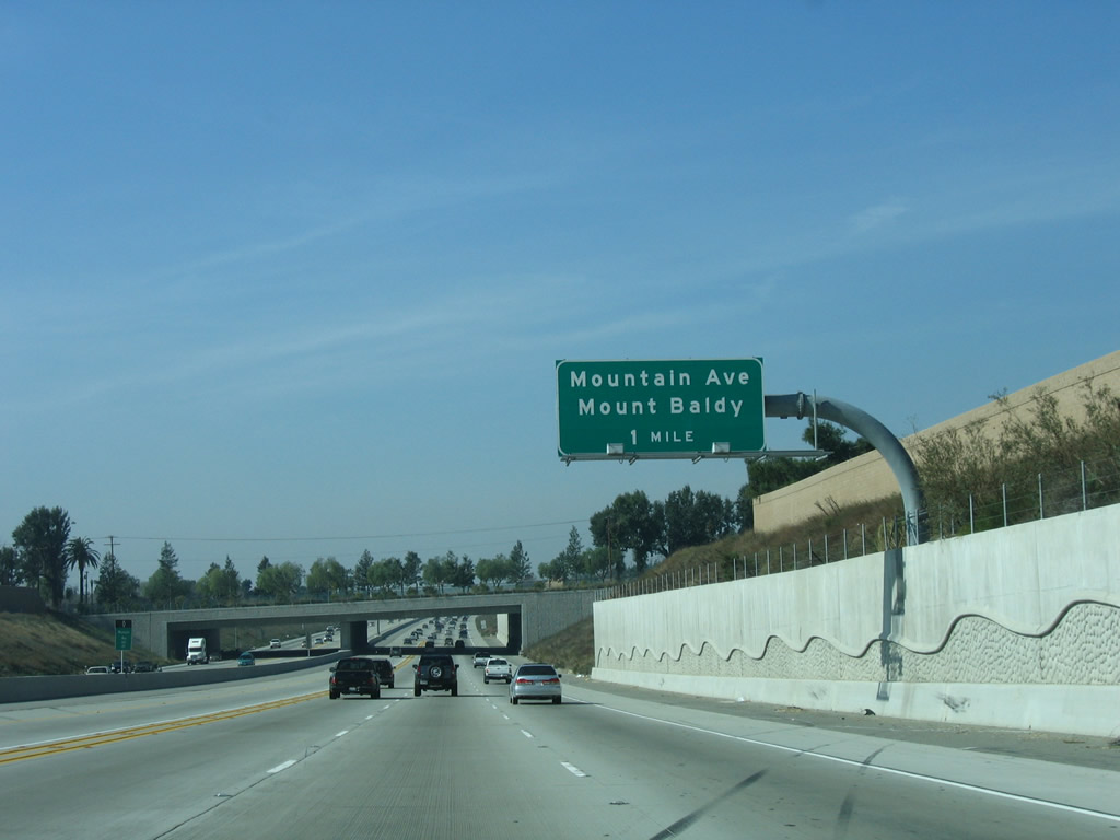
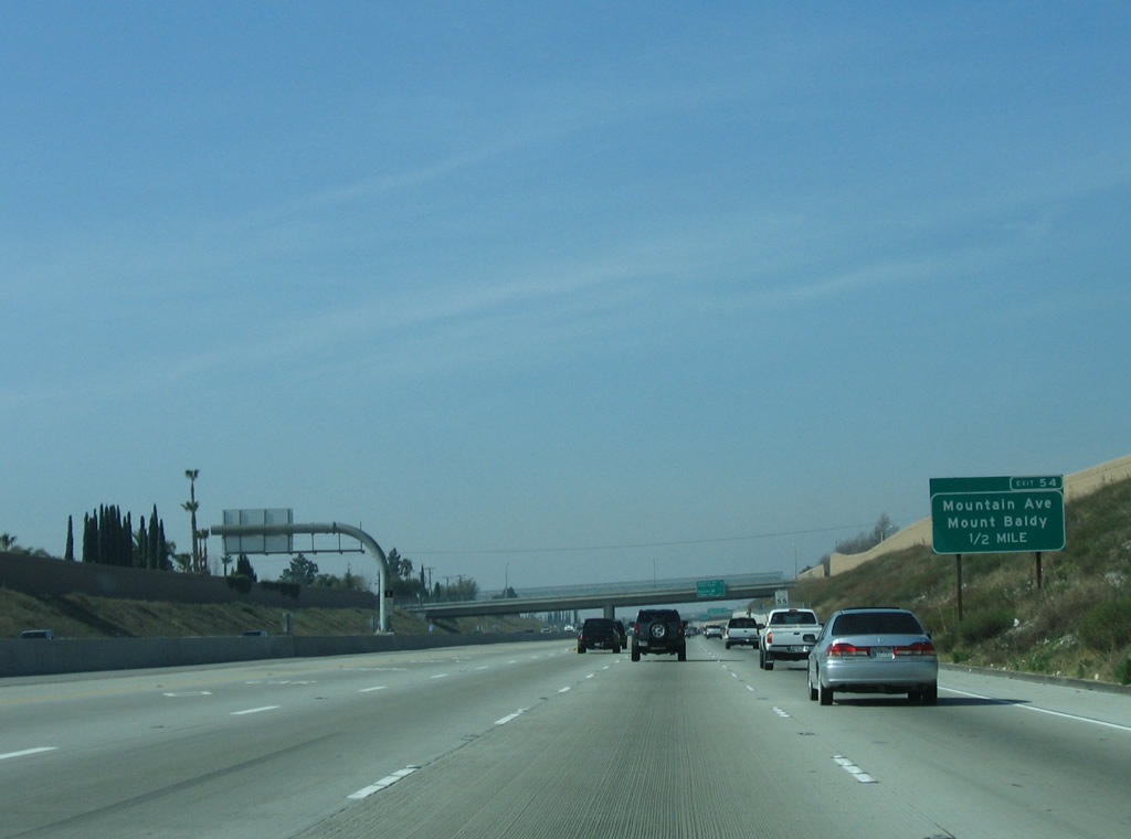
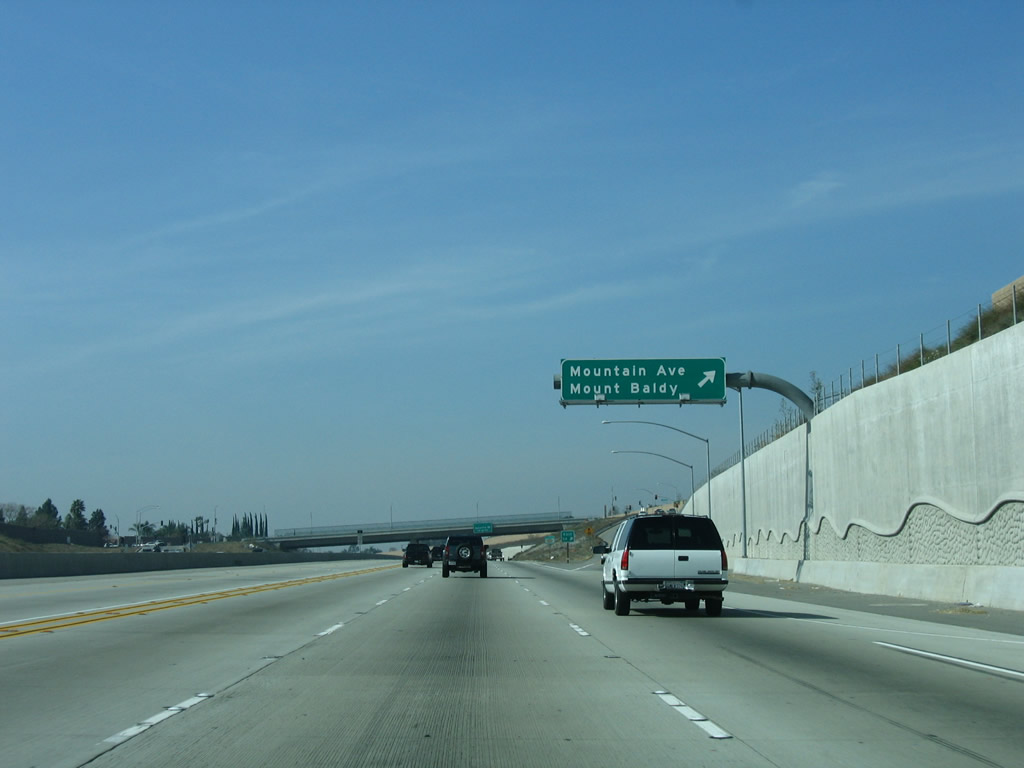
A roadside sign is posted shortly thereafter for Exit 54, Mountain Avenue. Use Mountain Avenue north to Mount Baldy, which is located within the San Gabriel Mountains. Photo taken 01/28/06. |
|
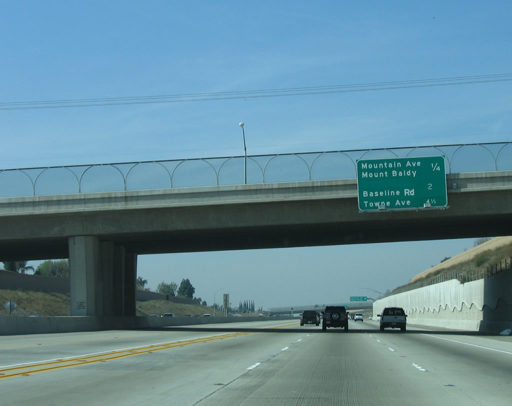
This mileage sign provides the distance to the next three exits along California 210 (Foothill Freeway) west: Exit 54, Mountain Avenue; Exit 52, Baseline Road; and Exit 50, Towne Avenue. Photo taken 01/28/06. |
|
Westbound California 210 (Foothill Freeway) reaches Exit 54, Mountain Avenue. Photo taken 01/28/06. |
|
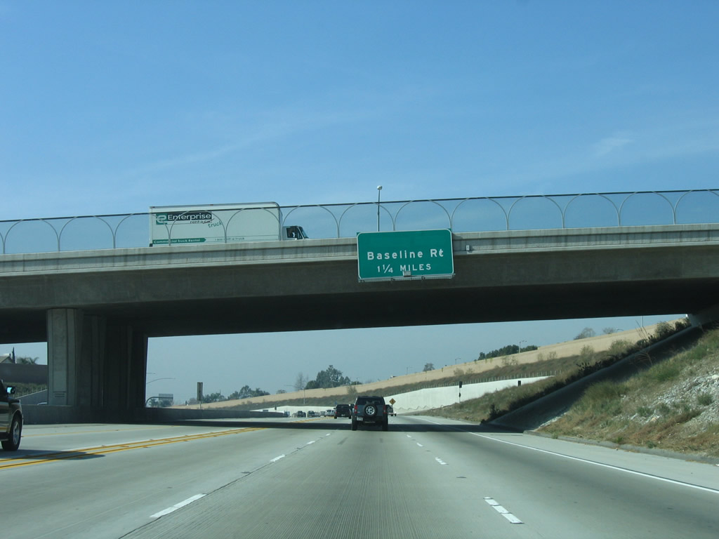
The next exit along California 210 (Foothill Freeway) west is Exit 52, Junction Old California 30/Baseline Road (1.25 miles). Photo taken 01/28/06. |
|
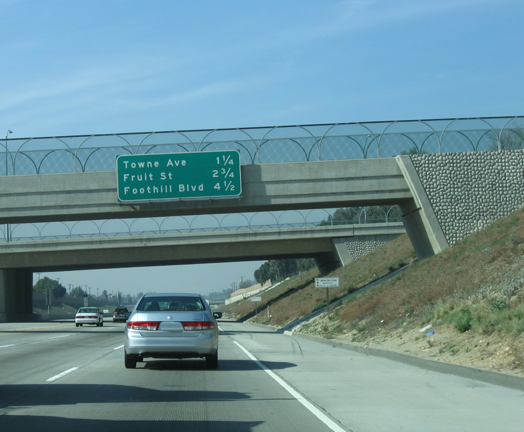
This mileage sign provides the distance to the next three exits along California 210 (Foothill Freeway) west: Exit 52, Junction Old California 30/Baseline Road; Exit 50, Towne Avenue; and Exit 48, Fruit Street. Photo taken 01/28/06. |
|
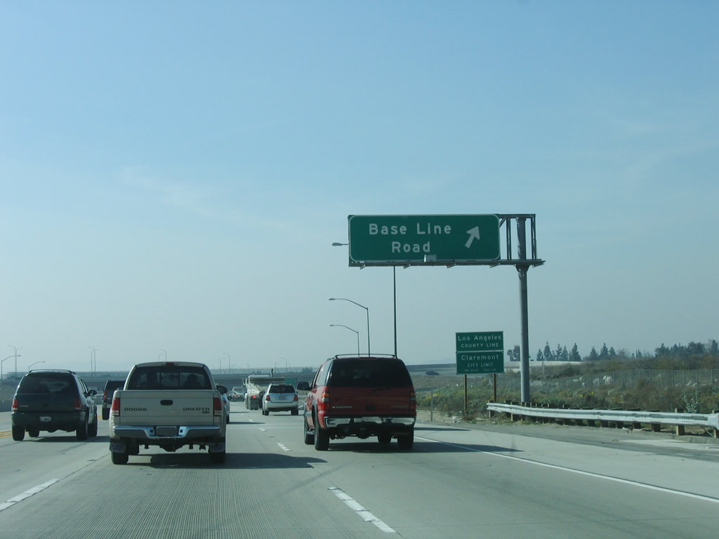
Westbound California 210 (Foothill Freeway) reaches Exit 52, Baseline Road (former California 30). At this point, California 210 leaves the city of Upland and San Bernardino County and enters the city of Claremont in Los Angeles County. Home to 33,998 people as of the 2000 Census, the city of Claremont is perhaps best known for its myriad undergraduate and post-graduate colleges housed under the Claremont Colleges banner. Photo taken 01/28/06. |
|
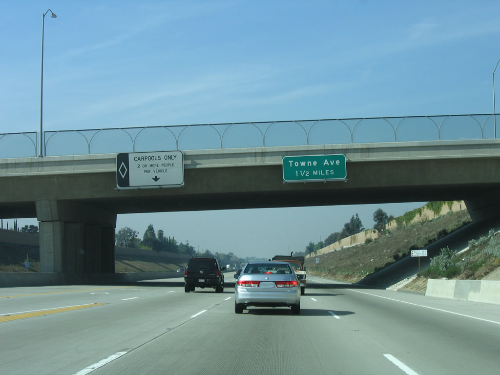
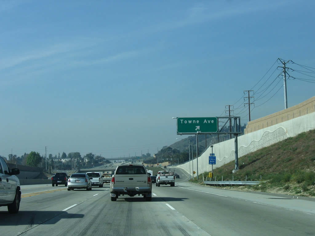
The next exit along California 210 (Foothill Freeway) west is Exit 50, Towne Avenue (1.50 miles). Photo taken 01/28/06. |
|
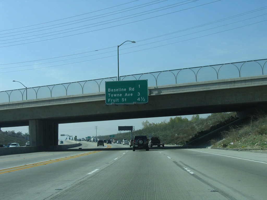
This mileage sign provides the distance to the next three exits along California 210 (Foothill Freeway) west: Exit 50, Towne Avenue; Exit 48, Fruit Street; and Exit 47, U.S. 66/Foothill Boulevard. This sign in mounted on the Indian Hill Flume overcrossing, which carries water over the freeway as part of the Claremont storm water drainage system. Photo taken 01/28/06. |
|
Westbound California 210 (Foothill Freeway) reaches Exit 50, Towne Avenue. Photo taken 01/28/06. |
|
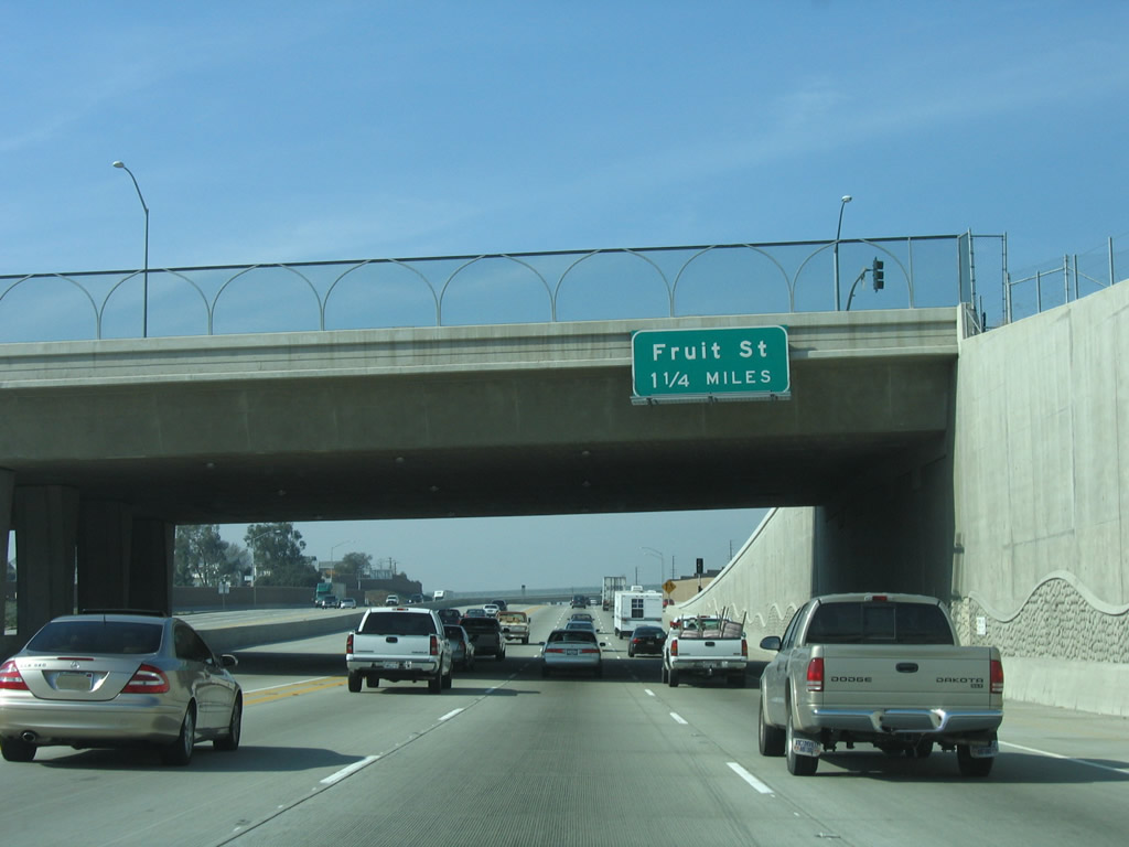
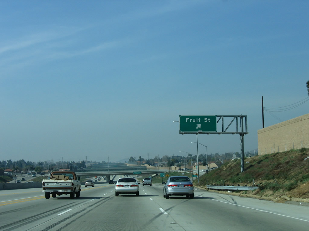
The next exit along California 210 (Foothill Freeway) west is Exit 48, Fruit Street (1.50 miles). Photo taken 01/28/06. |
|
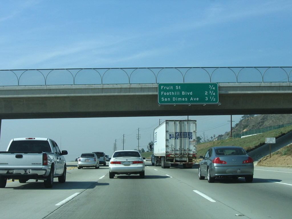
This mileage sign provides the distance to the next three exits along California 210 (Foothill Freeway) west: Exit 48, Fruit Street; Exit 47, U.S. 66/Foothill Boulevard; and Exit 46, San Dimas Avenue. Photo taken 01/28/06. |
|
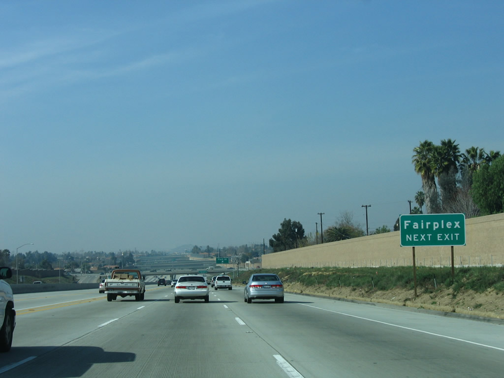
Use Exit 48, Fruit Street to the Los Angeles County Fairplex. Around this point, California 210 leaves the city of Claremont and enters the city of La Verne (population 31,638 as of the 2000 Census; incorporated August 20, 1906). Photo taken 01/28/06. |
|
Westbound California 210 (Foothill Freeway) reaches Exit 48, Fruit Street. Photo taken 01/28/06. |
|
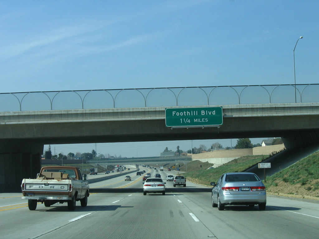
The next exit along California 210 (Foothill Freeway) west is Exit 47, U.S. 66 (California 66)/Foothill Boulevard (1.25 miles). Photo taken 01/28/06. |
|
This view shows the on-ramp from Fruit Street as it transitions onto westbound California 210 (Foothill Freeway) in La Verne. Photo taken 07/15/07. |
|
This California 210 west reassurance shield is posted after the Fruit Street on-ramp. The freeway was not yet open when the 2002 photos were taken. Photo taken 07/15/07. |
|
A series of overpasses including the Emerald Wash Flume cross over California 210 (Foothill Freeway) west of Fruit Street. Photo taken 01/28/06. |
|
This mileage sign provides the distance to the next three exits along California 210 (Foothill Freeway) west: Exit 47, U.S. 66/Foothill Boulevard; Exit 46, San Dimas Avenue; and Exit 45, California 57 (Orange Freeway) south to Anaheim. Photo taken 07/15/07. |
|
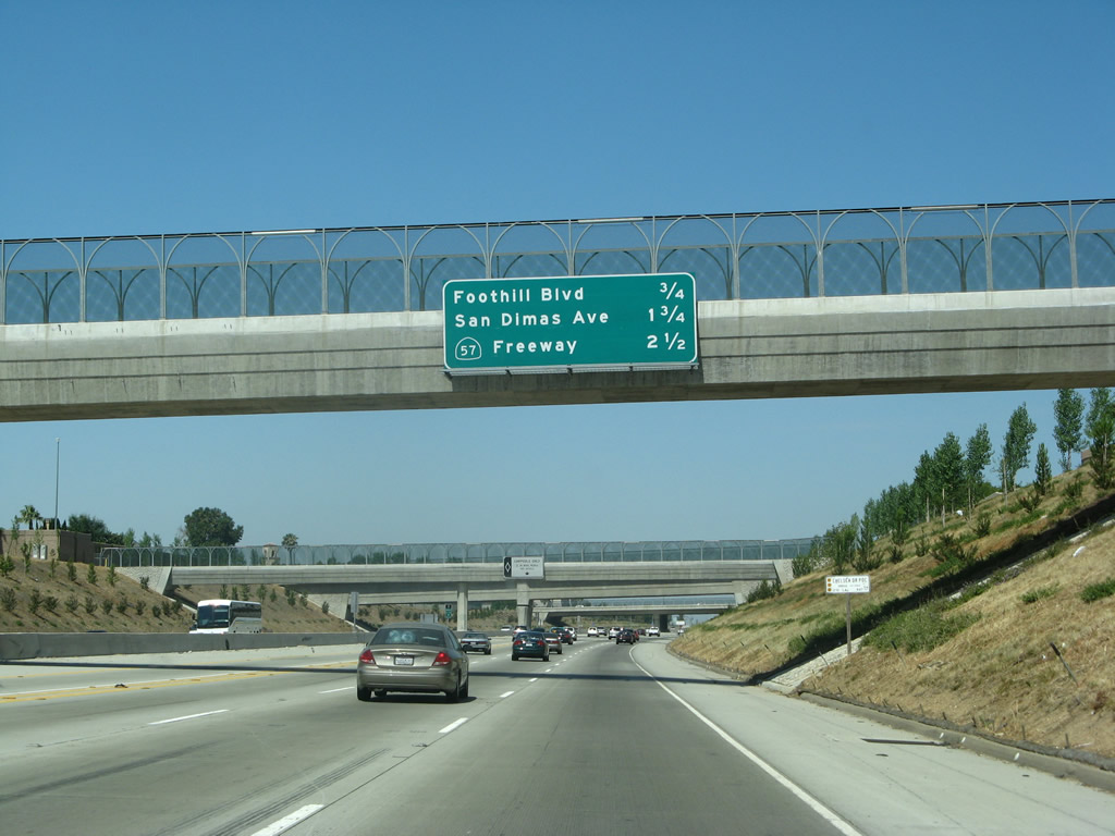
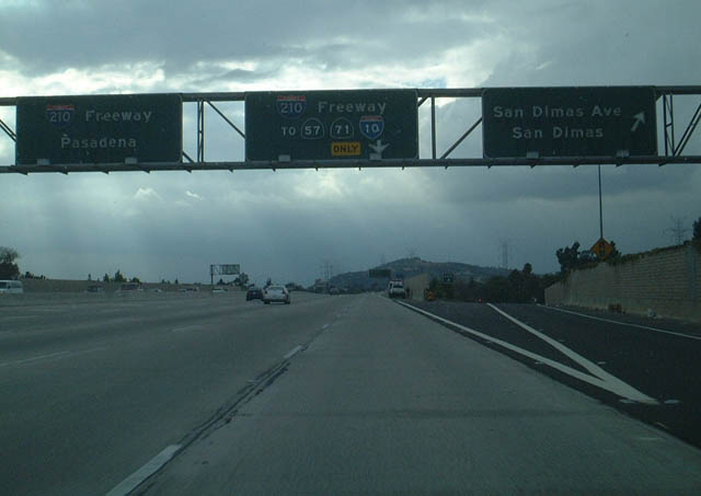
Westbound California 210 (Foothill Freeway) reaches Exit 47, California 66 (Historic U.S. 66 / Foothill Boulevard) east to La Verne and west to San Dimas. No "Historic Route 66" brown sign is posted at this interchange. The next exit along California 210 (Foothill Freeway) west is Exit 46, San Dimas Avenue (1.25 miles). Photo taken 07/15/07. |
|
A California 210 west reassurance shield is posted after the on-ramp from Foothill Boulevard. Photo taken 07/15/07. |
|
|
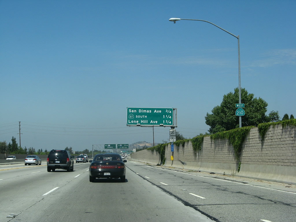
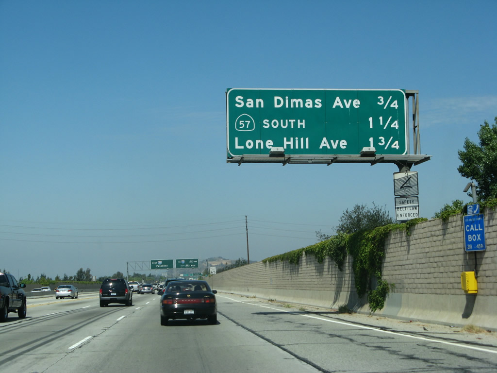
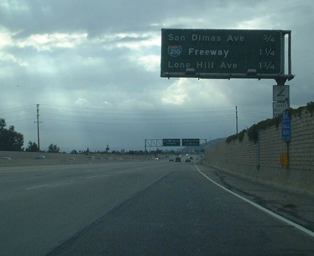
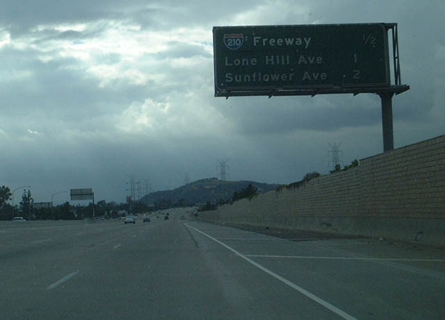
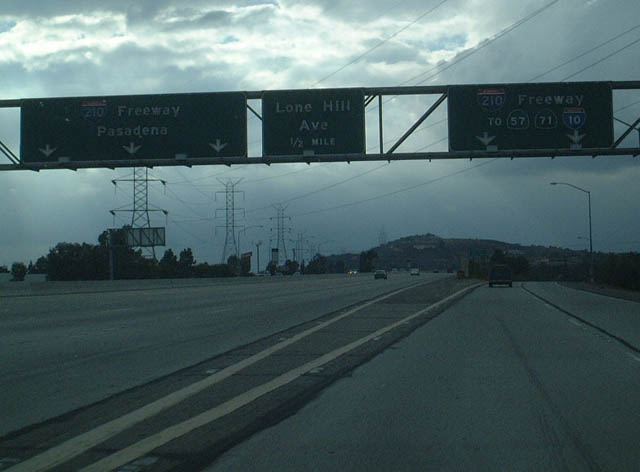
This mileage sign provides the distance to the next three exits along California 210 (Foothill Freeway) west: Exit 46, San Dimas Avenue; Exit 45, California 57 (Orange Freeway) south to Anaheim; and Exit 44, Lone Hill Avenue. Photos taken 07/15/07 and 09/28/02. |
|
|
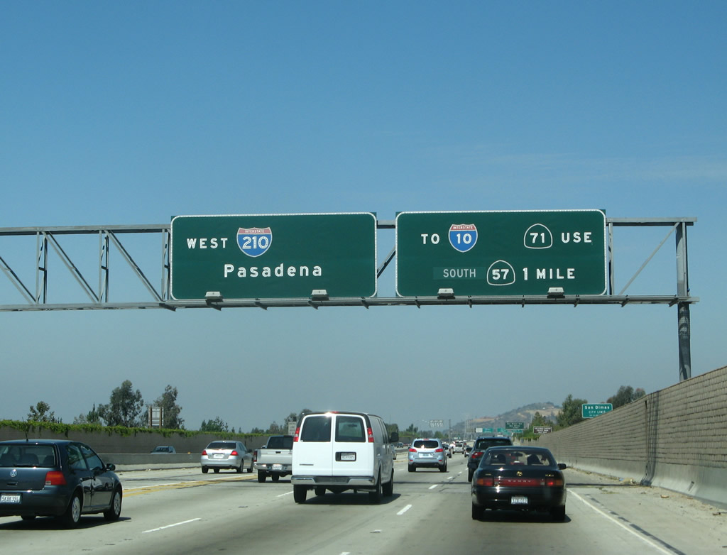
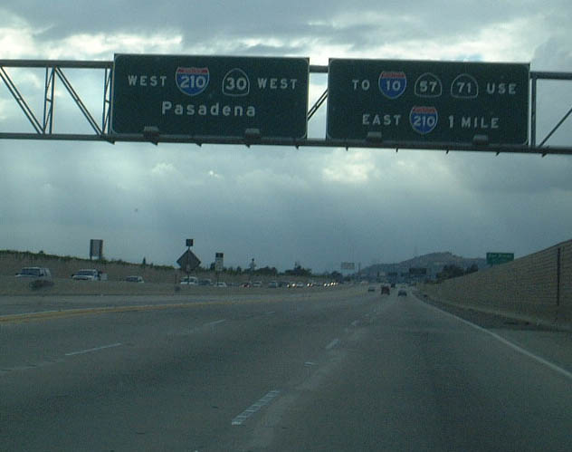
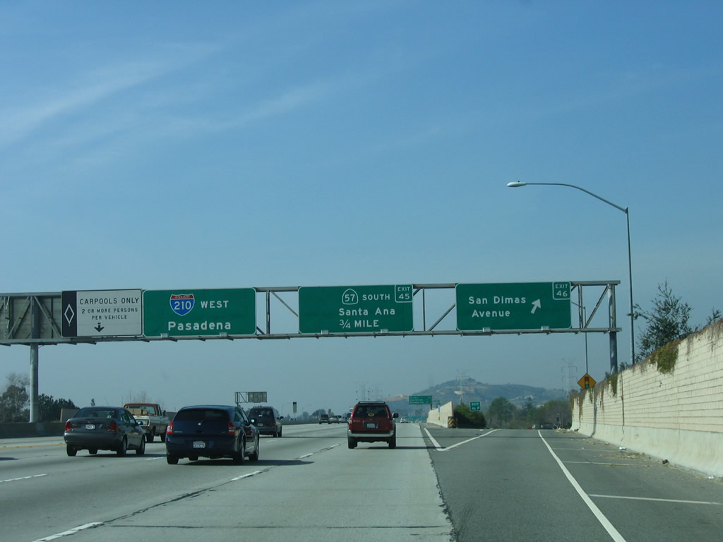
The first appearance of Interstate 210 occurs on this overhead sign along westbound California 210 (Foothill Freeway) prior to Exit 46, San Dimas Avenue. Exit 45, which is a major freeway-to-freeway interchange, used to be the point where Interstate 210 turned south to meet Interstate 10 at the Kellogg Interchange in Pomona. With the designation of California 210 east to Redlands, the section of Interstate 210 between California 210 and Interstate 10 was renumbered as a northern extension of California 57 (Orange Freeway) to alleviate confusion. Photos taken 07/15/07 and 09/28/02. |
|
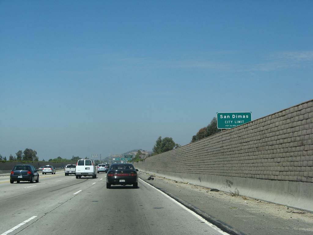
California 210 (Foothill Freeway) leaves the city of La Verne and enters the city of San Dimas (population 34,980 as of 2000 Census; incorporated August 4, 1960). Photo taken 07/15/07. |
|
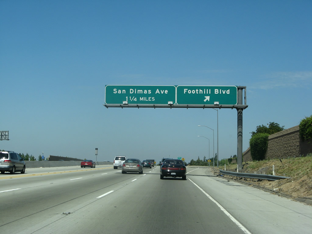
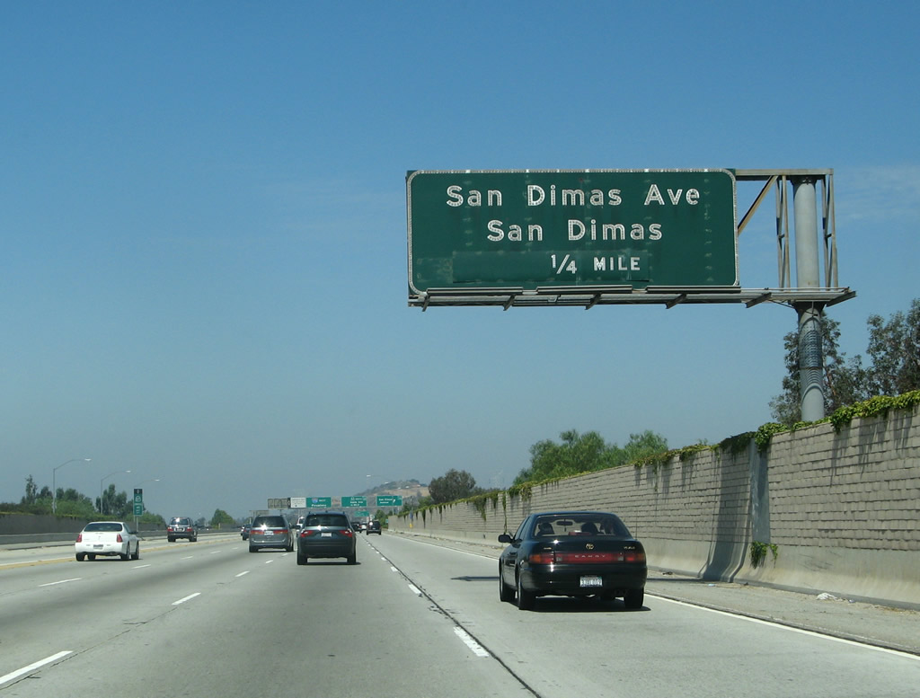
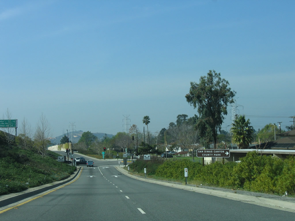
Use San Dimas Avenue north to San Dimas Canyon Road north to San Dimas Canyon County Park, San Dimas Reservoir, and Angeles National Forest (San Gabriel Mountains). Photo taken 07/15/07. |
|
An older porcelain-enamel overhead sign for Exit 46 is posted shortly thereafter. Photo taken 07/15/07. |
|
|
Westbound California 210 (Foothill Freeway) reaches Exit 46, San Dimas Avenue. The next interchange along westbound is Exit 45, California 57 (Orange Freeway) south to Santa Ana and Anaheim. Another Interstate 210 west pull-through sign is posted, along with a carpool lane access point. Photos taken 07/15/07 and 09/28/02. |
|
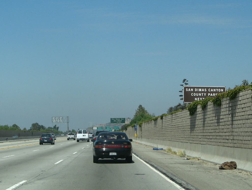
Now on the off-ramp from California 210 (Foothill Freeway) west to Exit 46, San Dimas Avenue is a sign for San Dimas Canyon County Park. Photo taken 07/15/07. |
|
|
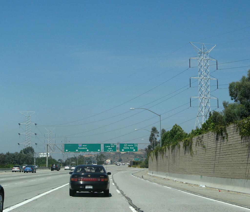
Back on the mainline, the next exit along California 210 (Foothill Freeway) west is Exit 45, California 57 (Orange Freeway) south to Anaheim and Santa Ana; Exit 44, Lone Hill Avenue; and Exit 43, Sunflower Avenue. Photos taken 07/15/07 and 09/28/02. |
|
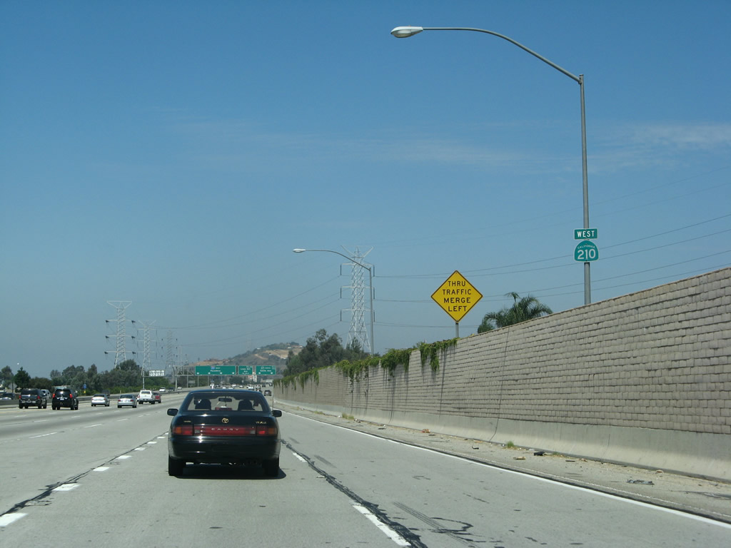
The final California 210 west reassurance shield is posted shortly thereafter. After Exit 45, the rest of the route is Interstate 210. Photo taken 07/15/07. |
|
Massive Los Angeles Department of Water and Power transmission lines cross over California 210 at this point. Photo taken 07/15/07. |
|
|
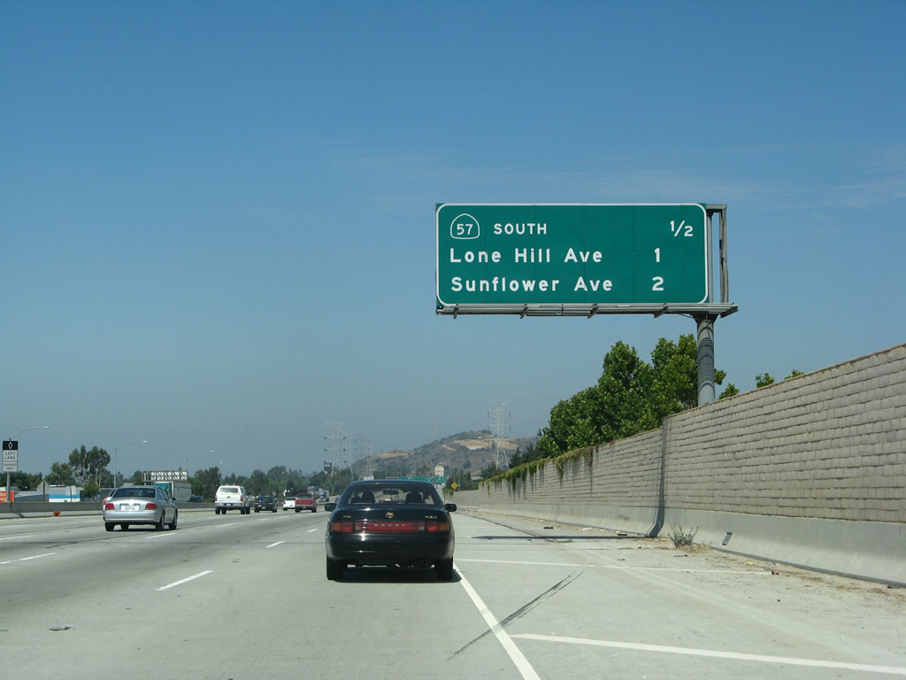
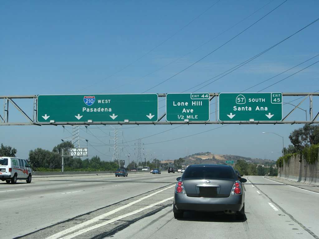
Westbound California 210 (Foothill Freeway) reaches Exit 45, California 57 (Orange Freeway) south to Santa Ana. The next exit along westbound Interstate 210 is Exit 44, Lone Hill Avenue (0.50 mile). Photo taken 07/15/07. |
Page Updated October 1, 2009.