
Interstate 280 North - Santa Clara County
| Interstate 280 (Sinclair Freeway) north | |
|---|---|
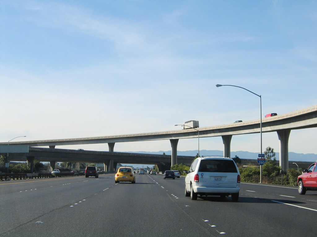 |
The first reassurance shield for Interstate 280 north appears after the off-ramp to U.S. 101 north and south, which marks the southern terminus of Interstate 680. For the next several miles, Interstate 280 will travel due west despite being labeled as "north." The Sinclair Freeway is named in honor of Joseph Sinclair, who was in charge of California State Division of Highways (now Caltrans) District 4 from 1959 to 1964. Sinclair was involved in the development of the freeway that now bears his name, and the Sinclair Freeway was added into the Interstate Highway System in 1962.1 Photo taken 11/29/04. |
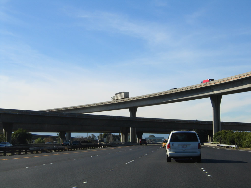 |
If not for the loop ramp connecting Interstate 280 south with U.S. 101 north, this interchange would be a symmetrical stack. Interstate 280 begins in the city of San Jose, home to 894,943 people as of the 2000 Census. Founded on November 29, 1777, and incorporated on March 27, 1850, San Jose is the third largest city in California (behind Los Angeles and San Diego). San Jose consists of 178.2 square miles and sits at an elevation of 85 feet. Rainfall in San Jose is much less than San Francisco due to its location at the south end of the San Francisco Bay and enclosure within mountains. The average annual precipitation is 14.4 inches. Photo taken 11/29/04. |
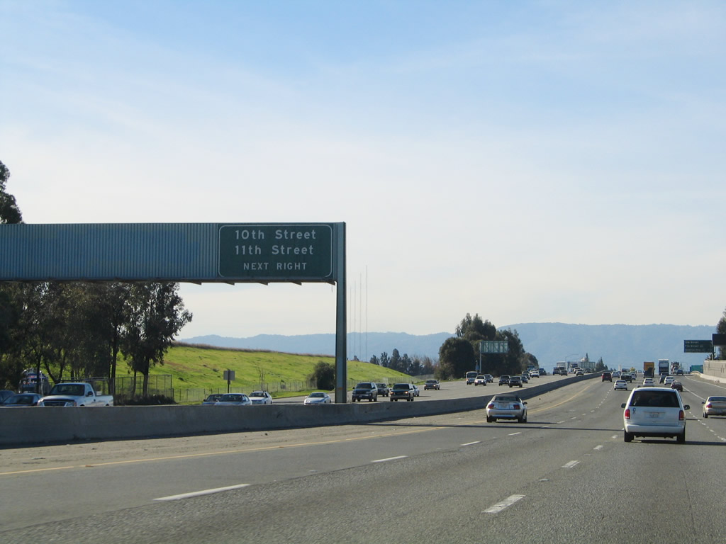 |
The first exit along Interstate 280 (Sinclair Freeway) north is Exit 1, 10th Street south and 11th Street north. The next two exits both serve San Jose State University, which is located north of Interstate 280 and is bounded by Fourth Street on the west, San Salvador Street on the south, Tenth Street on the east, and San Fernando Street on the north. From Interstate 280, use Exit 2A, Seventh Street north or Exit 1B, 11th Street north to the university campus. Photo taken 11/29/04. |
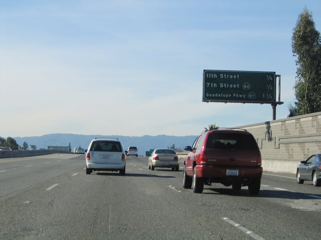 |
This mileage sign provides the distance to the first three exits along Interstate 280 (Sinclair Freeway) north: Exit 1, 10th Street south and 11th Street north; Exit 2, Seventh Street to California 82 (Monterey Highway); and Exit 3A, California 87 (Guadalupe Parkway). Photo taken 11/29/04. |
 |
Use Exit 3A, California 87 (Guadalupe Parkway) north to downtown San Jose and the Norman Y. Mineta San Jose International Airport. Photo taken 11/29/04. |
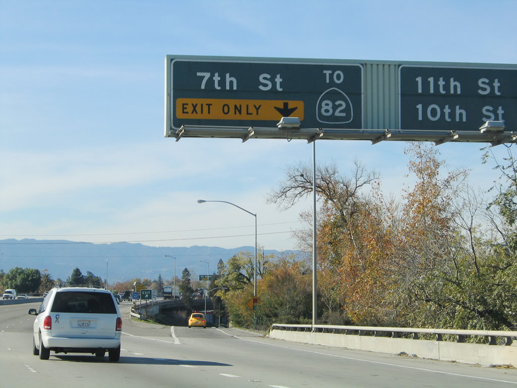 |
Northbound Interstate 280 (Sinclair Freeway) reaches Exit 1, 10th Street south and 11th Street north. The right lane then becomes exit only for Exit 2, Seventh Street to California 82 (Monterey Highway). Photo taken 11/29/04. |
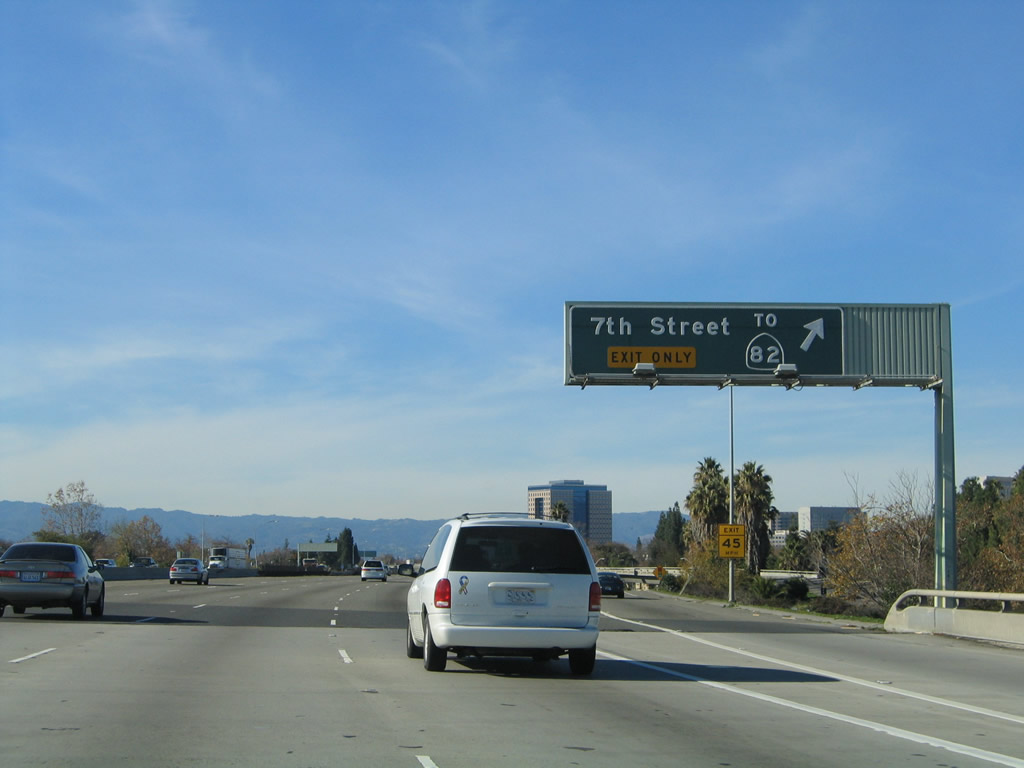 |
Immediately thereafter, Interstate 280 (Sinclair Freeway) north reaches Exit 2, Seventh Street to California 82 (Monterey Highway). Photo taken 11/29/04. |
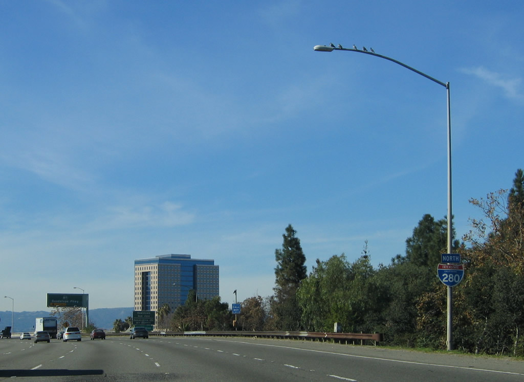 |
This Interstate 280 north reassurance shield is posted after the Seventh Street off-ramp. Photo taken 11/29/04. |
 |
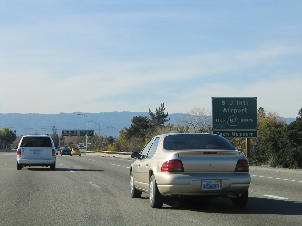
California 87 (Guadalupe Parkway) serves as the main north-south cross-town freeway in San Jose. Use California 87 north to the Norman Y. Mineta San Jose International Airport, downtown San Jose, and HP Pavilion at San Jose (home of the National Hockey League San Jose Sharks). To the south, California 87 connects with Spartan Stadium and Santa Clara County Fairgrounds. Photo taken 11/29/04. |
 |
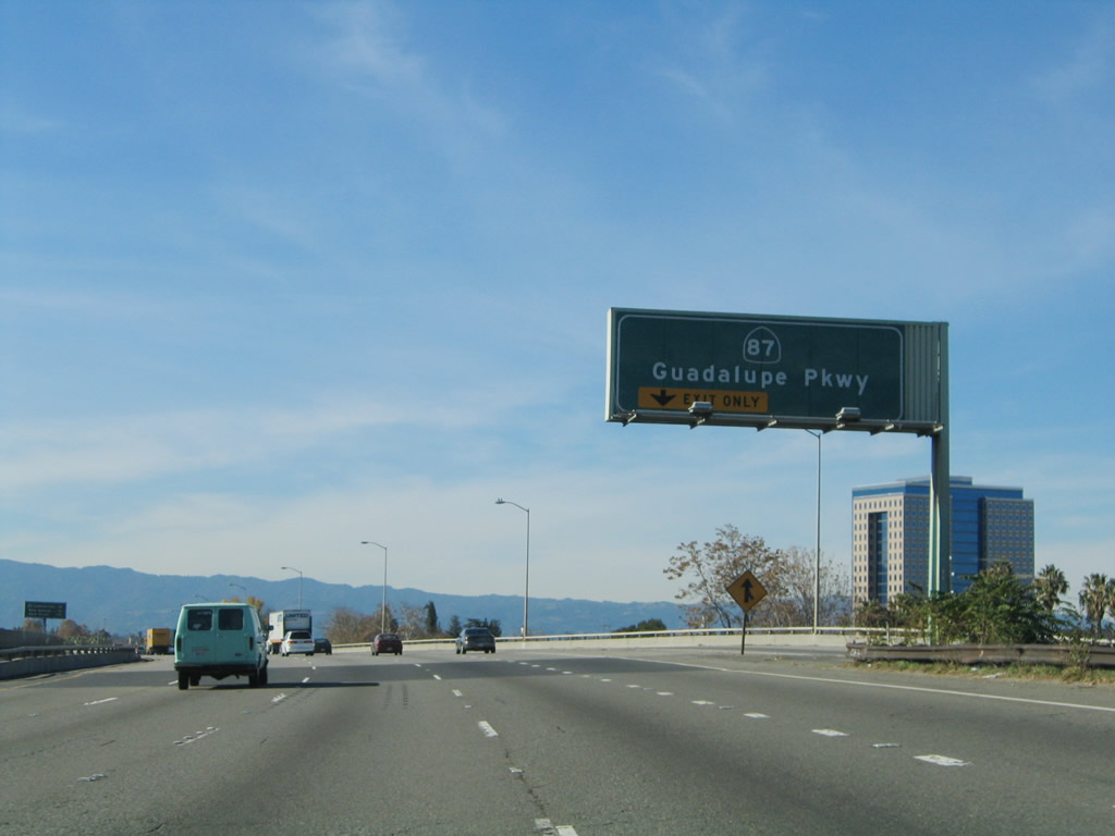
The next three exits along Interstate 280 (Sinclair Freeway) north are Exit 3A, California 87 (Guadalupe Parkway); Exit 3B, Bird Avenue; and Exit 4, Race Street and Southwest Expressway. Photo taken 11/29/04. |
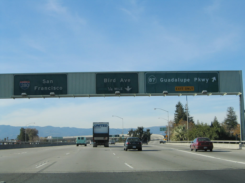 |
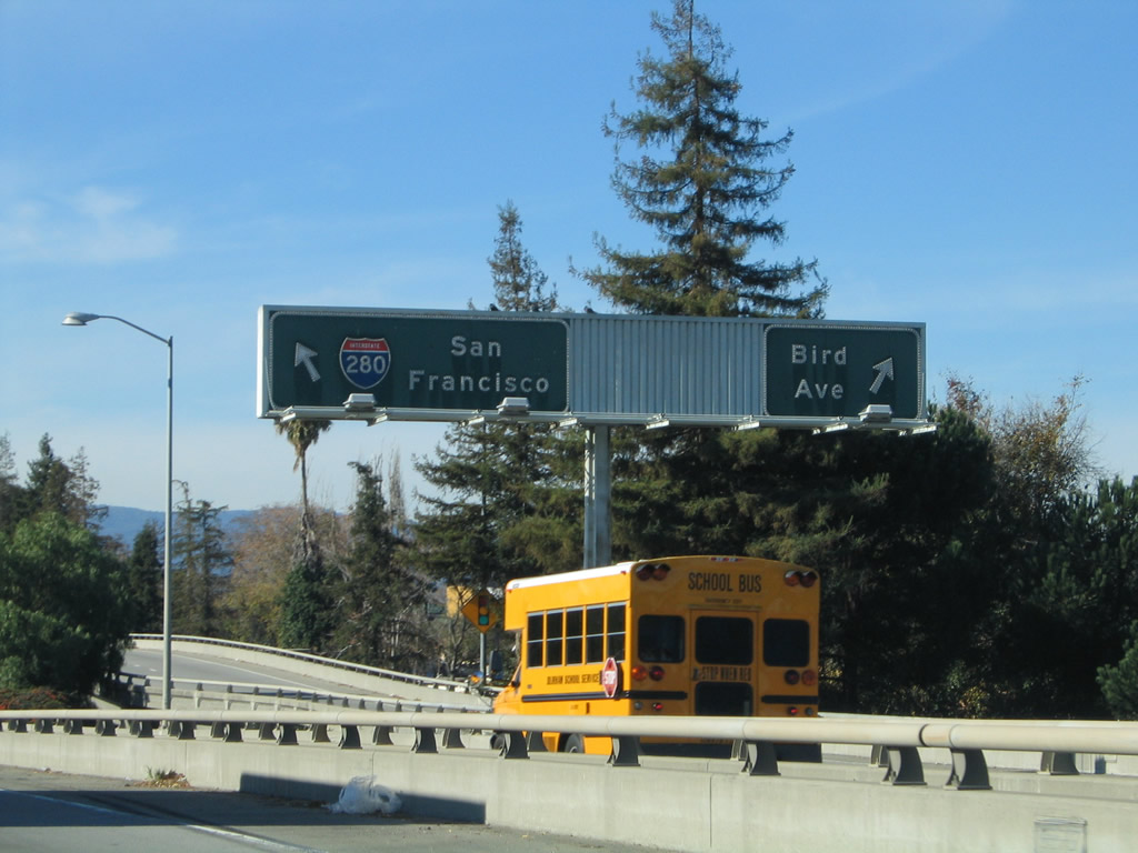
Northbound Interstate 280 (Sinclair Freeway) reaches Exit 3A, California 87 (Guadalupe Parkway). The next exit along northbound is Exit 3B, Bird Avenue. The control city for Interstate 280 north becomes San Francisco now that the freeway is passing the main downtown San Jose interchange (California 87). Photo taken 11/29/04. |
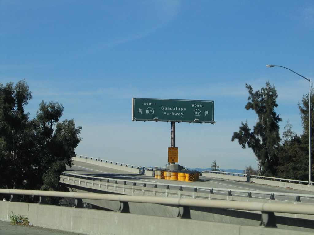 |
View of the transition ramp from Interstate 280 north (west) onto California 87 (Guadalupe Parkway) north/south. Photo taken 11/29/04. |
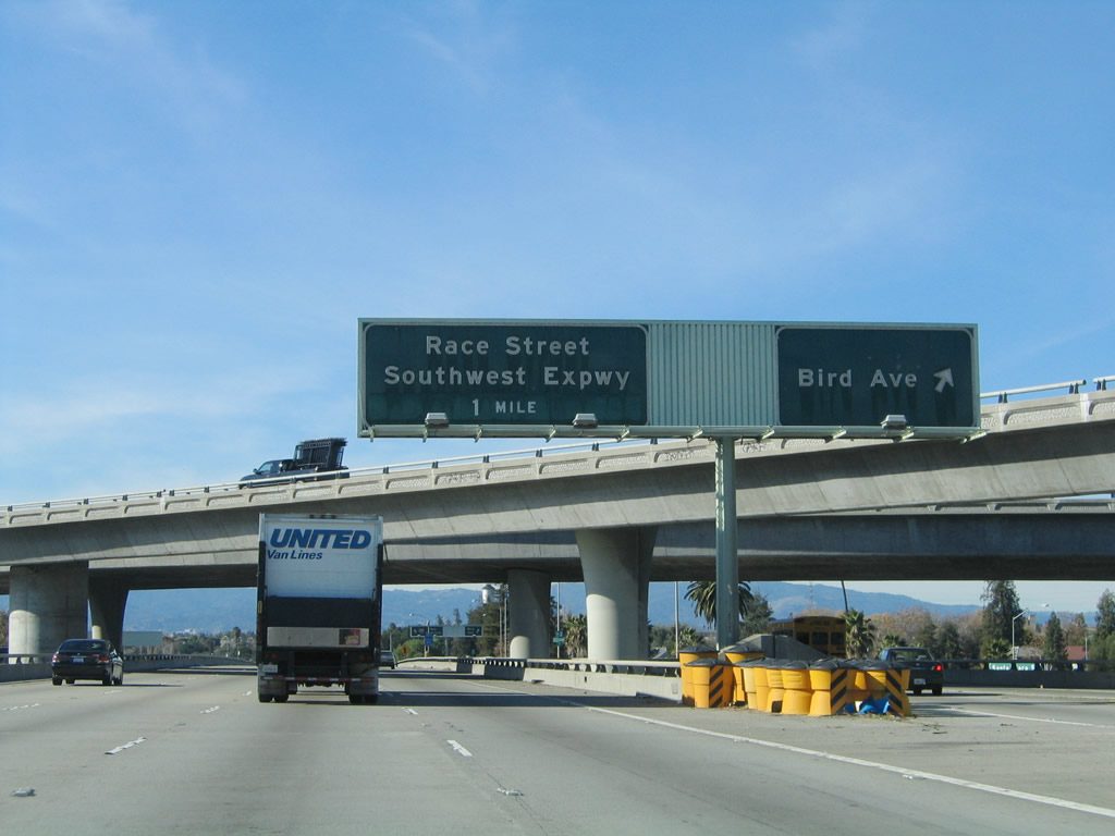 |
While passing under the transition ramp from Interstate 280 north to California 87 south, northbound Interstate 280 (Sinclair Freeway) meets Exit 3B, Bird Avenue. The next exit is Exit 4, Race Street and Southwest Expressway. Photo taken 11/29/04. |
 |
View of the collector distributor lanes for Exit 3B, Bird Avenue as seen from the mainline of Interstate 280 north. Photo taken 11/29/04. |
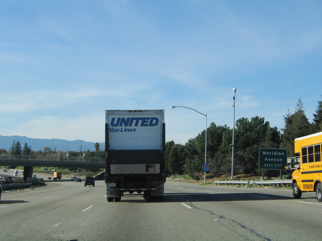 |
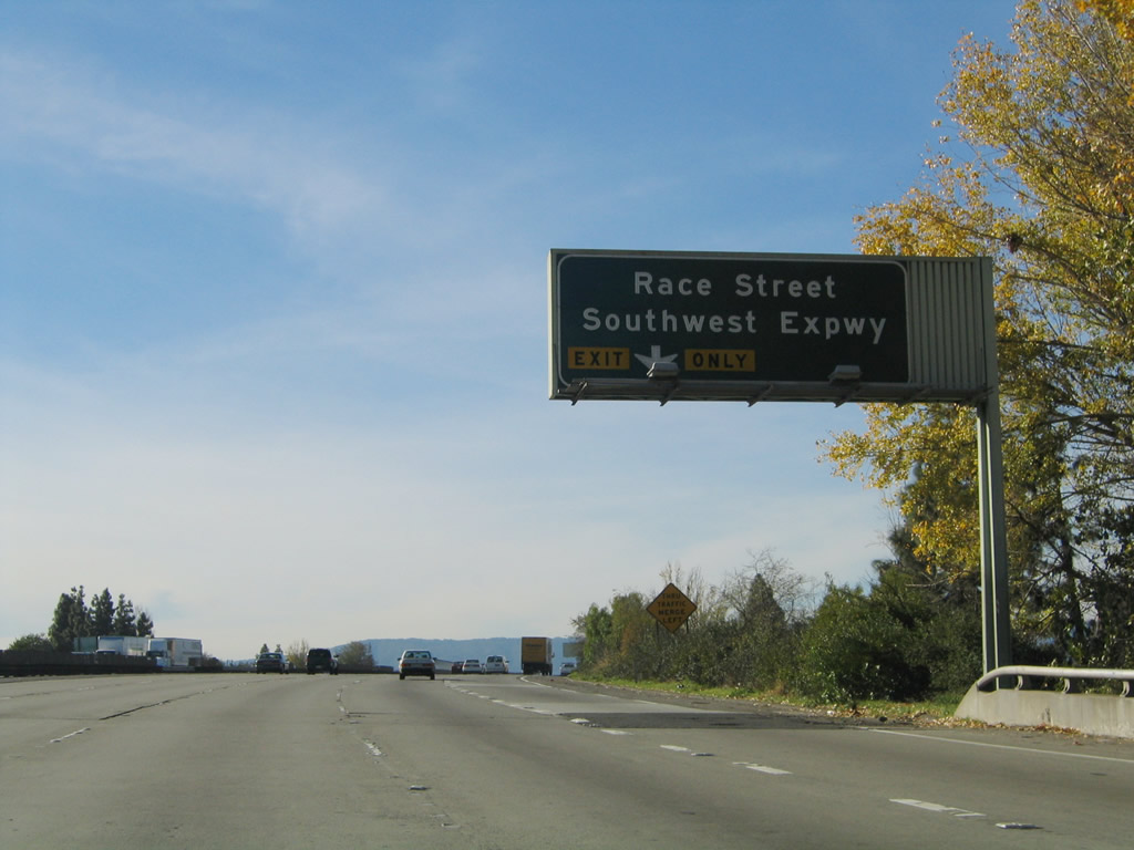
Use Exit 4 to Race Street, Southwest Expressway, and Meridian Avenue. Southwest Expressway travels southwest toward the city of Campbell, while Race Street and Meridian Avenue both travel north-south along separate alignments. Photo taken 11/29/04. |
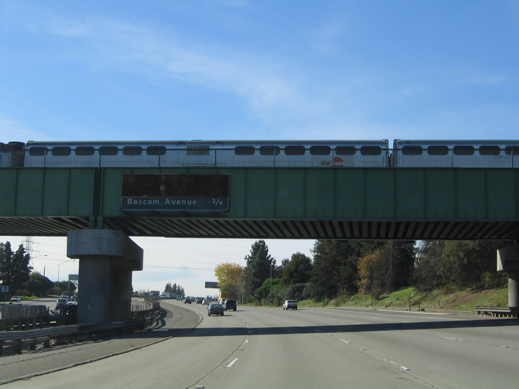 |
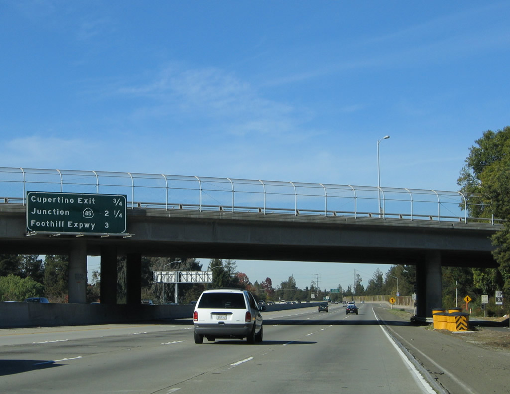
This mileage sign is supposed to provide the distance to Exit 4 to Race Street, Southwest Expressway, and Meridian Avenue as well as Exit 5A to Leigh Avenue and Bascom Avenue. A CalTrain crosses over the freeway on this green railroad bridge. Photo taken 11/29/04. |
 |
The right lane becomes exit only for Exit 4 to Race Street, Southwest Expressway, and Meridian Avenue as well as Exit 5A to Leigh Avenue and Bascom Avenue. Photo taken 11/29/04. |
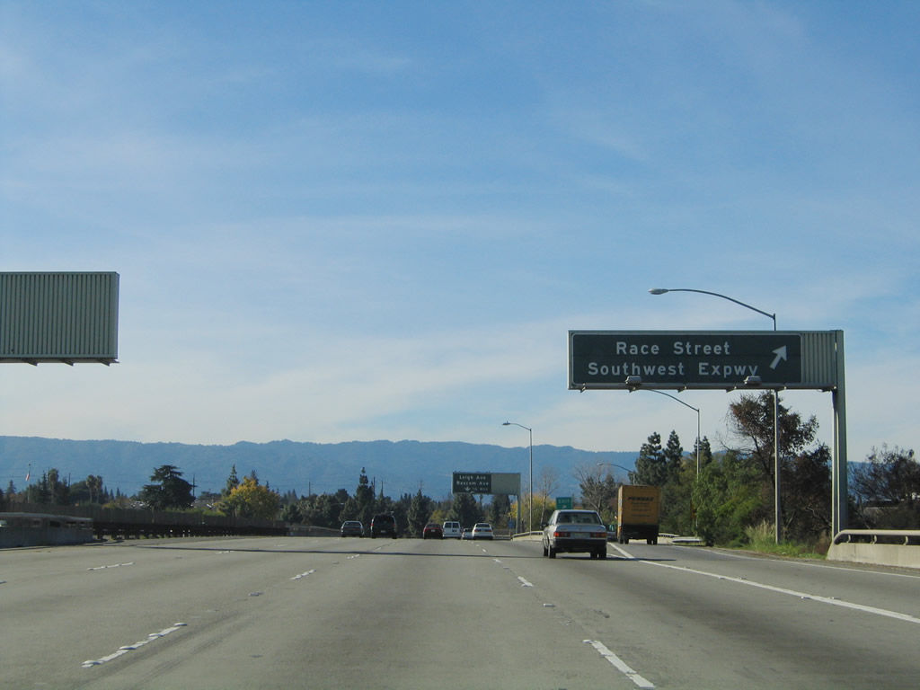 |
Northbound Interstate 280 (Sinclair Freeway) reaches Exit 4, Race Street, Southwest Expressway, and Meridian Avenue. Photo taken 11/29/04. |
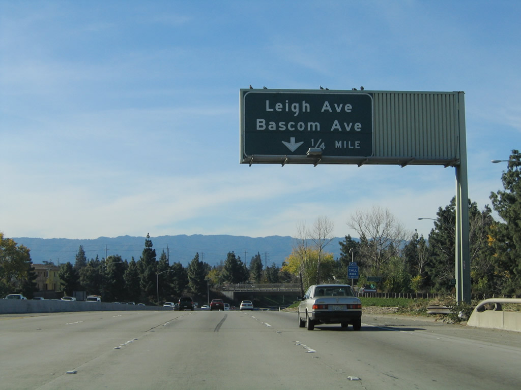 |
The next exit along Interstate 280 north is Exit 5A, Bascom Avenue and Leigh Avenue (via a slip ramp to Parkmoor Avenue, which serves as the northern frontage road). At this point, northbound Interstate 280 is traveling almost due west. Photo taken 11/29/04. |
 |
Northbound Interstate 280 (Sinclair Freeway) reaches Exit 5A, Bascom Avenue and Leigh Avenue. Photo taken 11/29/04. |
 |
The ramp from Interstate 280 north to Southwest Expressway south flies over the freeway. Photo taken 11/29/04. |
 |
The next interchange along Interstate 280 north is Exits 5B-C, Interstate 880 north to Oakland and California 17 south to Santa Cruz. Photo taken 11/29/04. |
 |
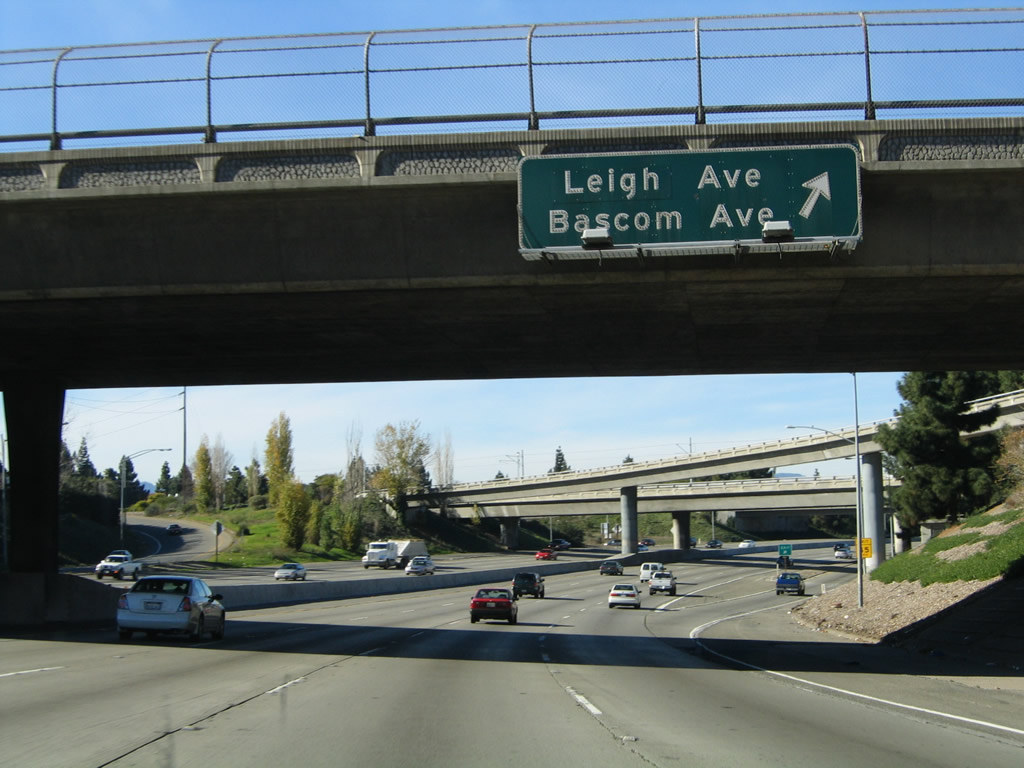
View of the collector distributor lane signage for the ramp to Bascom Avenue and Leigh Avenue (Exit 5A). Photo taken 11/29/04. |
 |
This reassurance shield for Interstate 280 north is posted after the collector distributor lanes rejoin the mainline freeway after the Exit 5A off-ramp. Photo taken 11/29/04. |
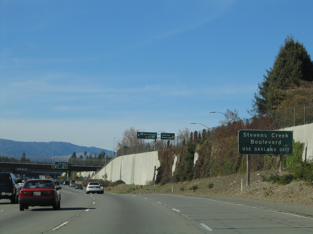 |
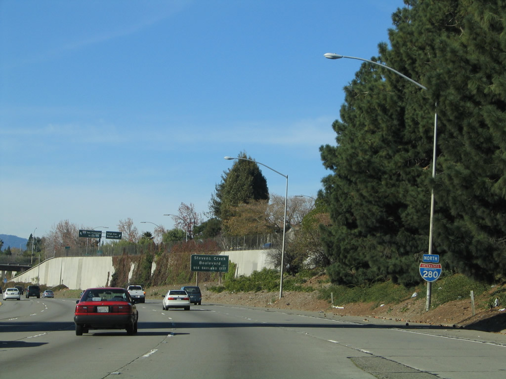
To Stevens Creek Boulevard, use the Interstate 880 north ramp. Stevens Creek Boulevard (and San Carlos Street) travels east-west and separates the city of Santa Clara from the city of San Jose. Photo taken 11/29/04. |
 |
The next four exits along Interstate 280 north are: Exit 5B, California 17 south to Santa Cruz; Exit 5C, Interstate 880 north to Oakland; Exit 7, Saratoga Avenue; and Exit 9, Santa Clara County G-2 (Lawrence Expressway). There is no direct access to Santa Clara County G-4 (San Tomas Expressway) except via Moorpark Avenue, which is the southern frontage road along Interstate 280. Photo taken 11/29/04. |
 |
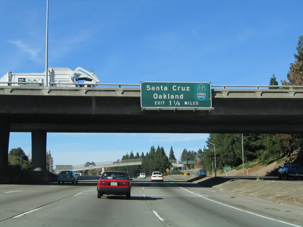
The right two lanes of Interstate 280 north become exit only for Exit 5B, California 17 south to Santa Cruz. California 17 begins as a freeway but quickly downgrades to a four-lane expressway for its journey over Patchen Pass (el. 1,800 feet) and thence south into Santa Cruz. The next exit is Exit 5C, Interstate 880 north to Oakland. Photo taken 11/29/04. |
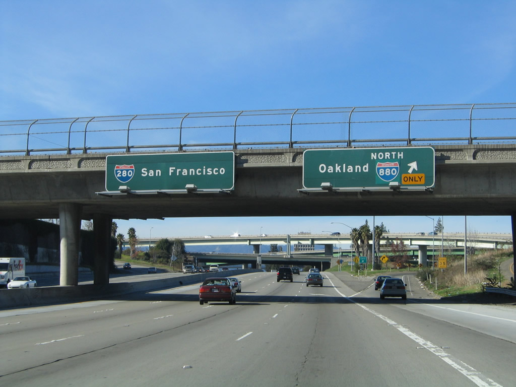 |
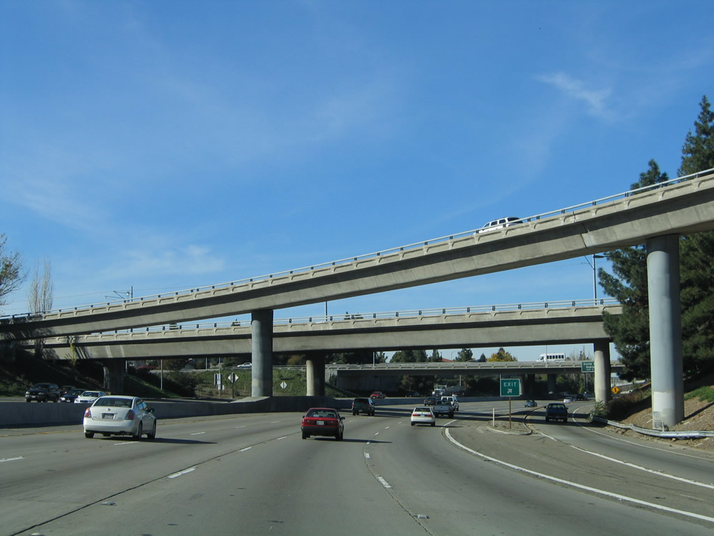
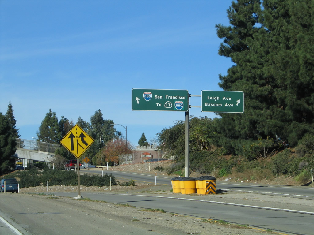
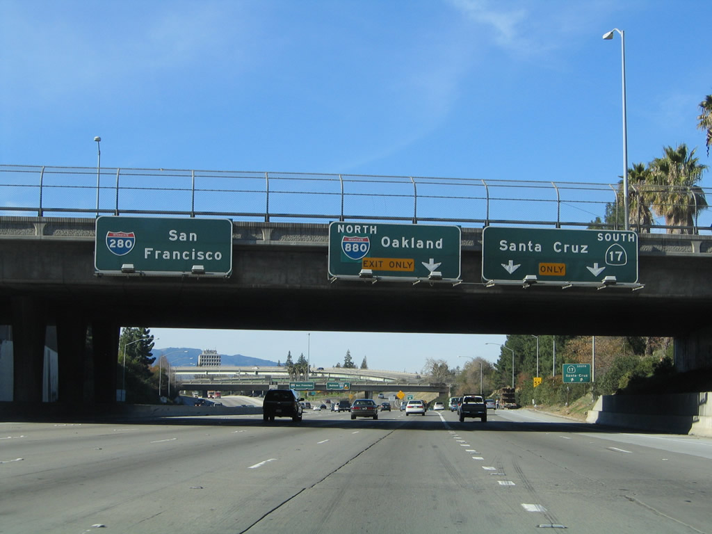
Immediately thereafter, Interstate 280 north reaches Exit 5C, Interstate 880 north to Oakland. From here, Interstate 280 continues west and then north through the remainder of the Silicon Valley, then skirts the most populated areas along the bayshore as it provides a bypass to San Francisco. Photo taken 11/29/04. |
 |
Interstate 280 passes through the California 17 and Interstate 880 interchange on the lowest level. A flyover ramp connects Interstate 280 north with California 17 south and Interstate 280 north with Interstate 880 north. Photo taken 11/29/04. |
| Interstate 280/Serra Freeway north | |
|---|---|
 |
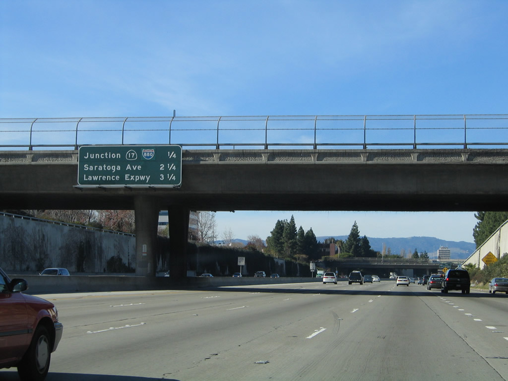
This mileage sign provides the distance to the next three exits along Interstate 280 (Father Junipero Serra Freeway) north: Exit 7, Saratoga Avenue; Exit 9, Santa Clara County G-2 (Lawrence Expressway); and Exit 10, Wolfe Road. After the California 17 interchange, Interstate 280 shifts from the Sinclair Freeway to the Serra Freeway, which is named for the famous friar who established many of California's historic missions along El Camino Real. Photo taken 11/29/04. |
 |
The next exit along Interstate 280 (Father Junipero Serra Freeway) north is Exit 7, Saratoga Avenue. Photo taken 11/29/04. |
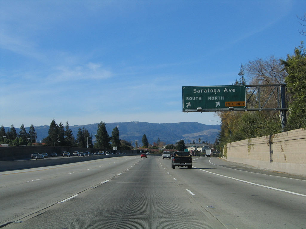 |
The off-ramp to Exit 7, Saratoga Avenue is a two-lane exit, with the right lane connecting to Saratoga Avenue north and the left lane connecting to Saratoga Avenue south. Photo taken 11/29/04. |
 |
This mileage sign provides the distance to the next three exits along Interstate 280 (Father Junipero Serra Freeway) north: Exit 9, Santa Clara County G-2 (Lawrence Expressway); Exit 10, Wolfe Road; and Exit 11, De Anza Boulevard south and Sunnyvale-Saratoga Road north. Photo taken 11/29/04. |
 |
The next exit along Interstate 280 (Father Junipero Serra Freeway) north is Exit 9, Santa Clara County G-2 (Lawrence Expressway). The right lane becomes exit only for this county route. Like most other signed county routes in Santa Clara County, G-2 follows an expressway alignment. G-2 begins at California 237 (South Bay Freeway) and extends south to the city of Saratoga, ending at California 9. Photo taken 11/29/04. |
 |
Northbound Interstate 280 (Father Junipero Serra Freeway) reaches Exit 9, Santa Clara County G-2 (Lawrence Expressway). At this point, Interstate 280 turns a bit to the northwest, and the freeway will continue to aim west and northwest for the next several miles. Photo taken 11/29/04. |
 |
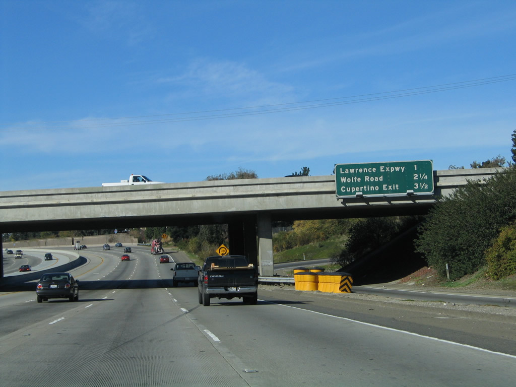
This mileage sign provides the distance to the next four exits along Interstate 280 (Father Junipero Serra Freeway) north: Exit 10, Wolfe Road; Exit 11, De Anza Boulevard to Cupertino and Sunnyvale-Saratoga Road to Sunnyvale; and Exits 12A-B, California 85 Freeway. Around this point, Interstate 280 leaves the city of San Jose for the first time and clips the city of Santa Clara before entering the city of Cupertino. Photo taken 11/29/04. |
 |
Use Wolfe Road north to Sunnyvale and south to city of Cupertino and Cupertino Square (formerly Vallco Fashion Park). Cupertino was home to 50,546 people as of the 2000 Census and consists of 10.9 square miles. The city sits at an elevation of 236 feet and was incorporated on October 10, 1955. Photo taken 11/29/04. |
 |
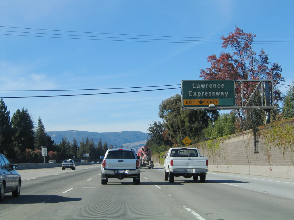
An Interstate 280 reassurance shield is posted after the on-ramp from the Lawrence Expressway and Stevens Creek Boulevard. The next exit is Exit 10, Wolfe Road; this interchange is followed by Exit 11, which serves De Anza Boulevard south into Cupertino and Sunnyvale-Saratoga Road north into Sunnyvale. Photo taken 11/29/04. |
 |
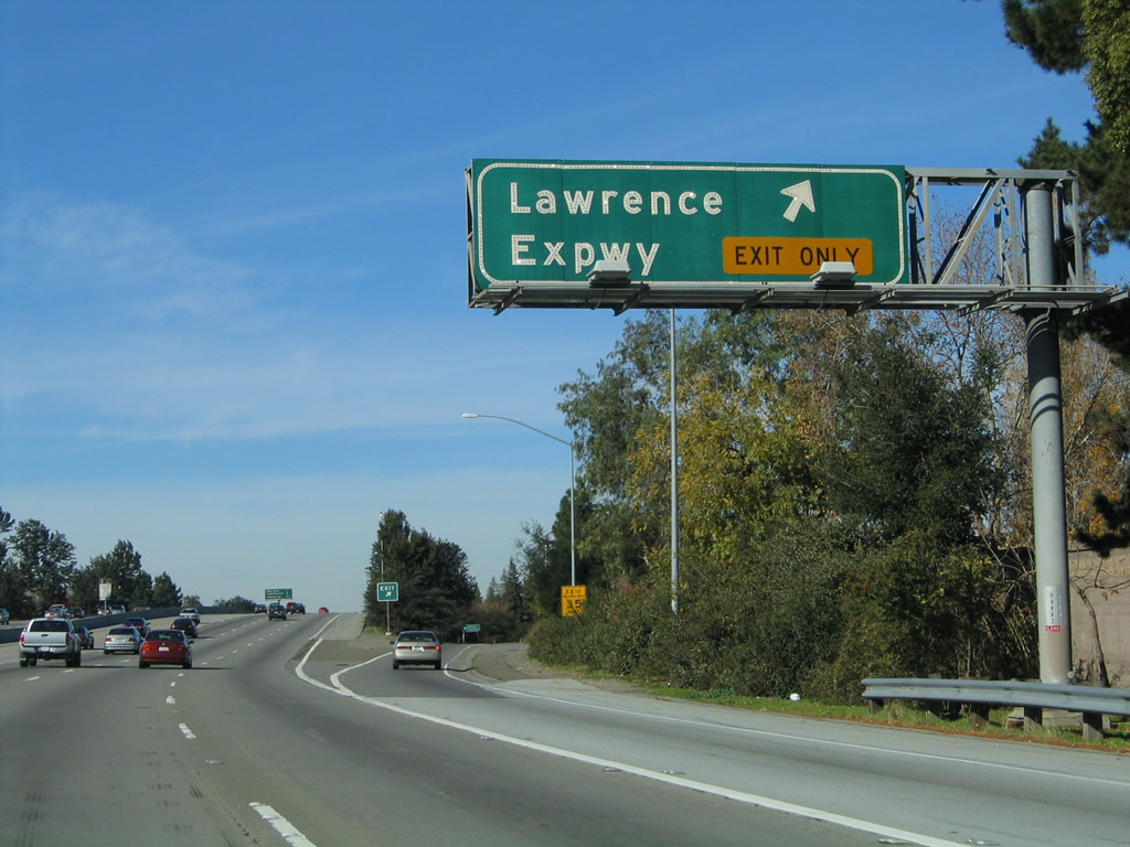
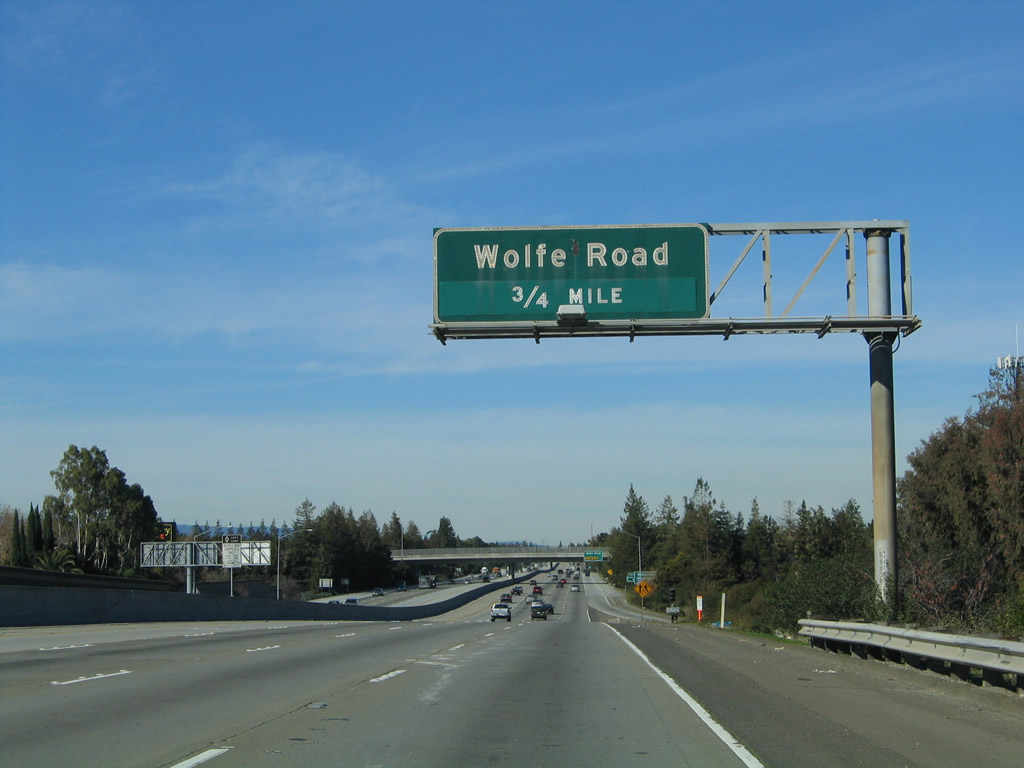
The right lane of Interstate 280 north becomes exit only for Exit 10, Wolfe Road. Photo taken 11/29/04. |
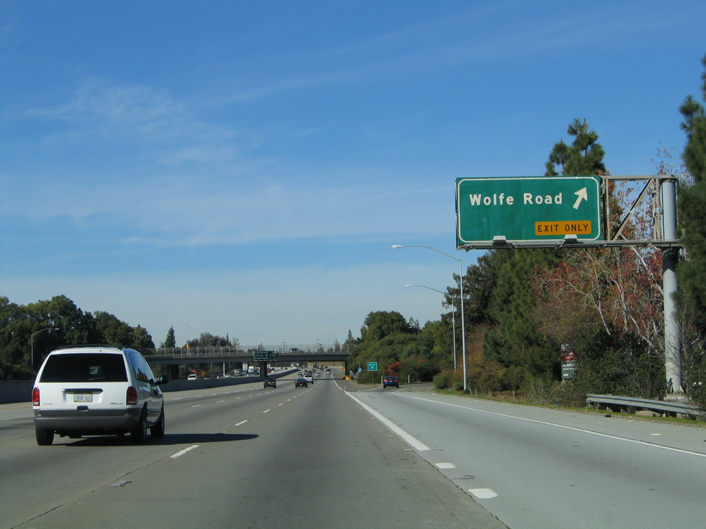 |
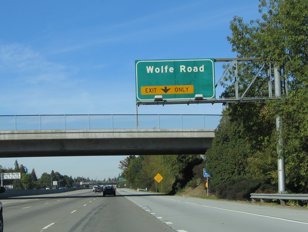
Northbound Interstate 280/Serra Freeway reaches Exit 10, Wolfe Road. Photo taken 11/29/04. |
 |
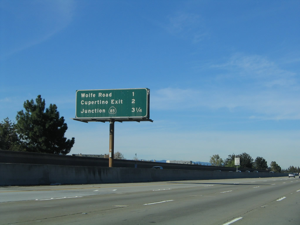
This mileage sign provides the distance to the next four exits along Interstate 280 (Father Junipero Serra Freeway) north: Exit 11, De Anza Boulevard to Cupertino and Sunnyvale-Saratoga Road to Sunnyvale; Exits 12A-B, California 85 Freeway north to Mountain View and south to San Jose; and Exit 13, Santa Clara County G-5/Foothill Expressway to Los Altos. Photo taken 11/29/04. |
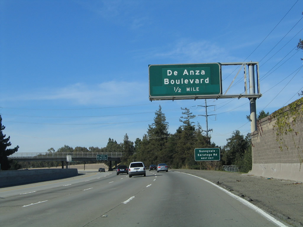 |
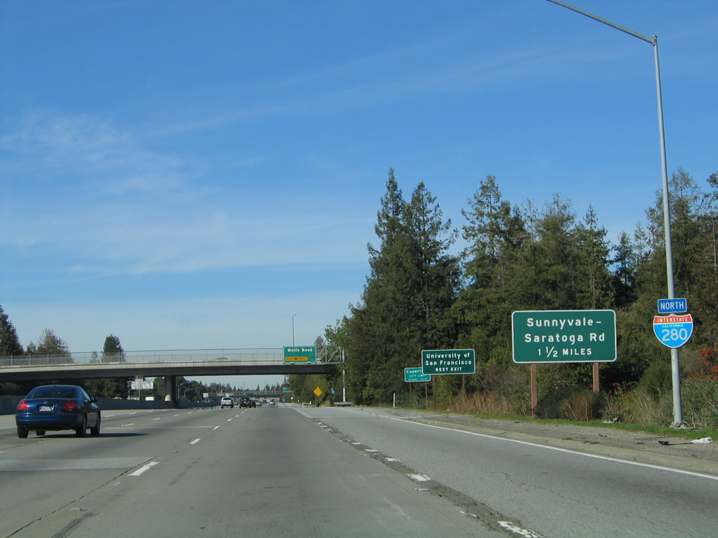
The next exit along Interstate 280 (Father Junipero Serra Freeway) north is Exit 11, De Anza Boulevard to Cupertino and Sunnyvale-Saratoga Road to Sunnyvale. This road travels north-south and has a different name in the city of Cupertino as compared to the city of Sunnyvale. Photo taken 11/29/04. |
 |
After the De Anza Boulevard and Sunnyvale-Saratoga Road interchange, the next exit along Interstate 280 (Father Junipero Serra Freeway) north will be Exits 12A-B, California 85. Photo taken 11/29/04. |
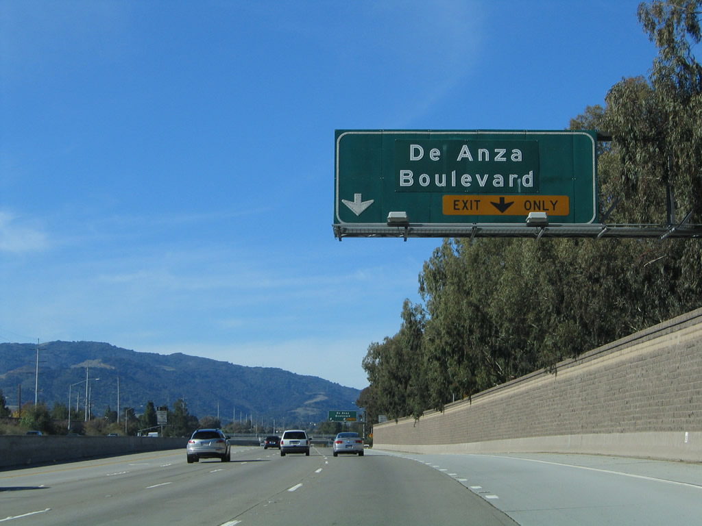 |
The right lane becomes exit only for Exit 11, De Anza Boulevard and Sunnyvale-Saratoga Road. The property bordering the Interstate 280/De Anza Boulevard interchange (Exit 11) to the southeast is the headquarters of Apple, Inc. in Cupertino. Photo taken 11/29/04. |
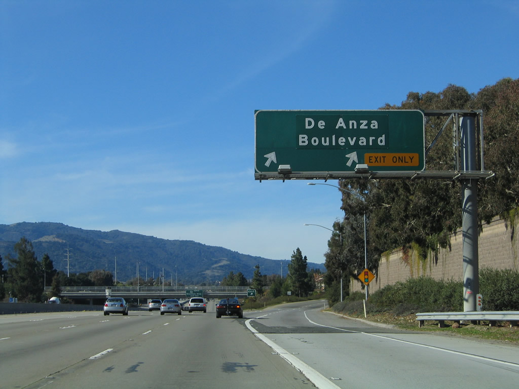 |
Northbound Interstate 280/Serra Freeway reaches Exit 11, De Anza Boulevard and Sunnyvale-Saratoga Road. Photo taken 11/29/04. |
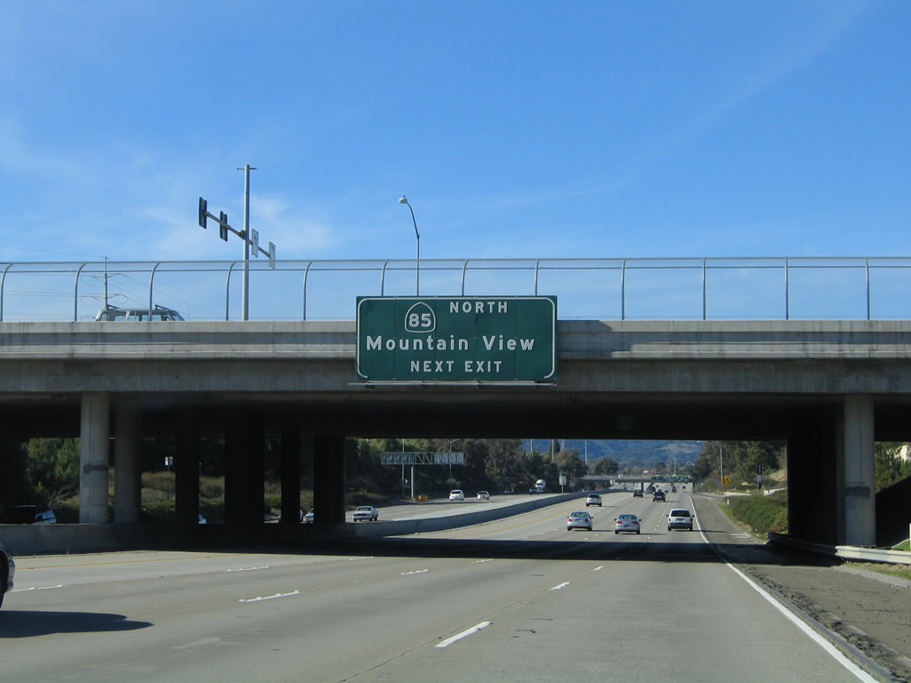 |
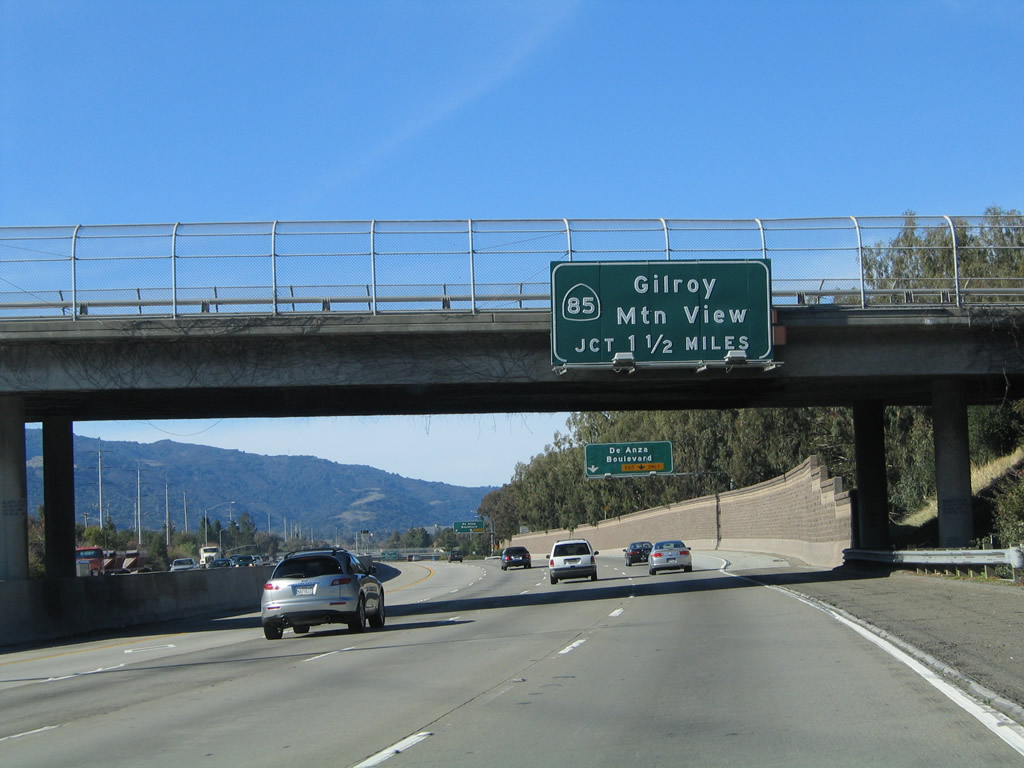
The next exit along Interstate 280 north is Exit 12A, California 85 (Stevens Creek Freeway) north to Mountain View and U.S. 101 north. Photo taken 11/29/04. |
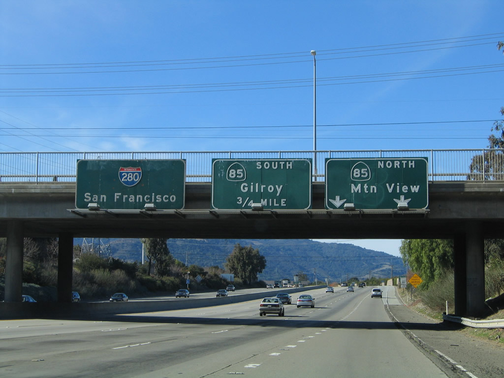 |
The right lane of Interstate 280 north becomes exit only for Exit 12A, California 85 (Stevens Creek Freeway) north to Mountain View and U.S. 101 north. The second ramp connects to Exit 12B, California 85 (West Valley Freeway) south to San Jose and Gilroy via U.S. 101 south. Photo taken 11/29/04. |
 |
Use Exit 12B, California 85 (West Valley Freeway) south to Exit 18, Stevens Creek Boulevard to De Anza College. Photo taken 11/29/04. |
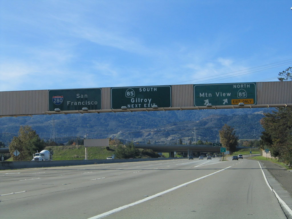 |
Northbound Interstate 280 reaches Exit 12A, California 85 (Stevens Creek Freeway) north to Mountain View and U.S. 101 north. The next exit along northbound is Exit 12B, California 85 (West Valley Freeway) south to San Jose and Gilroy via U.S. 101 south. Photo taken 11/29/04. |

Sources:
- Joseph Pierce Sinclair (1910-1964) by Mike Sinclair - "By a special act of the California State Legislature, [Assembly Concurrent Resolution 104, Chapter 168 in 1967.] the portions of Interstate Route 280 between Route 17 and Route 101 in San Jose, and of Interstate Route 680 from Route 101 north to the Alameda County line were officially named the Sinclair Freeway."
Page Updated February 24, 2008.
|
About Contact Glossary |
In The News Interstate Guide |
Social Media:
 |
|
© 2000-25 AARoads.com | All Rights Reserved | Privacy Policy / Terms of Use
|
||