

Interstate 405 South - Los Angeles County #2
| Interstate 405 (San Diego Freeway) south | |
|---|---|
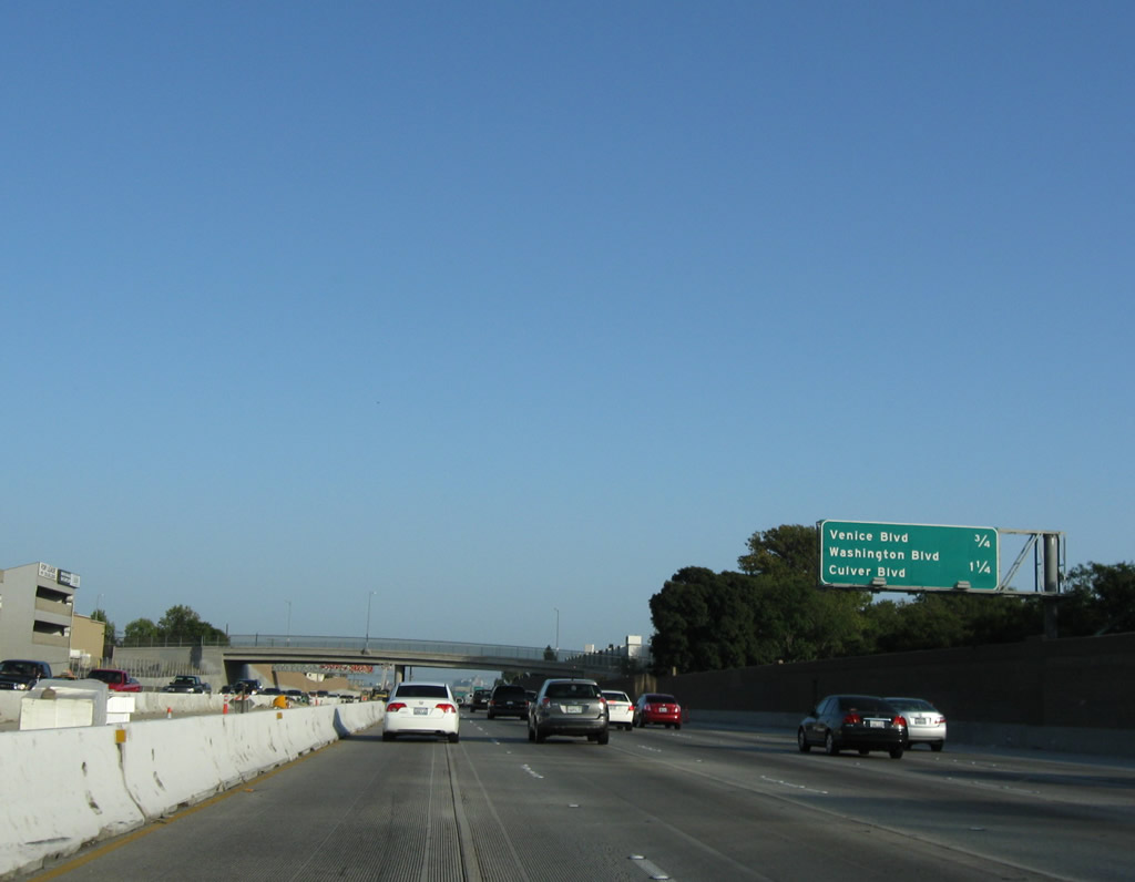 |
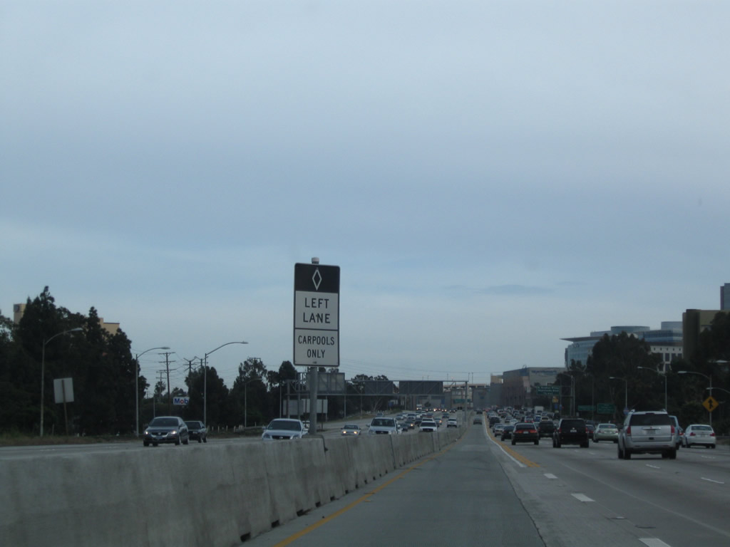
This mileage sign along Interstate 405 (San Diego Freeway) south provides the distance to the next two exits: Exit 52, California 187 (Venice Boulevard) and Exit 51, Sawtelle Boulevard to Washington Boulevard and Culver Boulevard. Photo taken 07/19/09. |
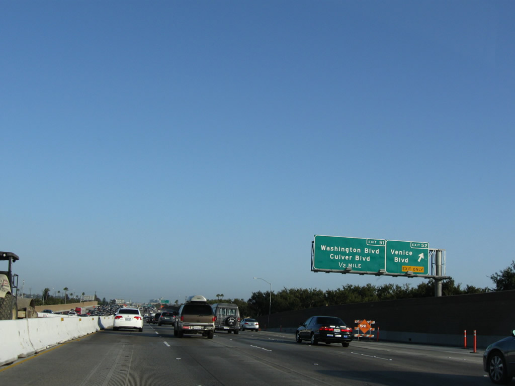 |
Southbound Interstate 405 (San Diego Freeway) reaches Exit 52, California 187 (Venice Boulevard). California 187 extends west along Venice Boulevard to California 1 (Lincoln Boulevard) and east to Interstate 10 (Santa Monica Freeway). Although a state highway, it is largely unsigned. This exit requires a connection via Sawtelle Boulevard (west frontage road) north. At this point, Interstate 405 leaves Los Angeles and enters Culver City, "The Heart of Screen Land." Culver City had a population of 38,816 as of the 2000 Census and sits at an elevation of 95 feet. Culver City was incorporated on September 7, 1917. Photo taken 07/19/09. |
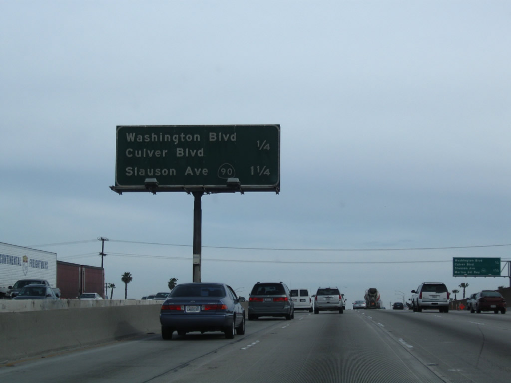 |
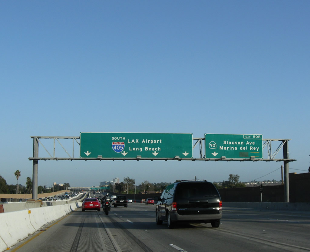
This mileage sign along Interstate 405 (San Diego Freeway) south provides the distance to the next two exits: Exit 51, Sawtelle Boulevard to Washington Boulevard and Culver Boulevard and Exit 50B, California 90 (Marina Freeway) west to Marina Del Rey (and California 1 (Lincoln Boulevard)) and east to Slauson Avenue and Fox Hills in Culver City. This sign was gone by July 2009. Photo taken 04/13/09. |
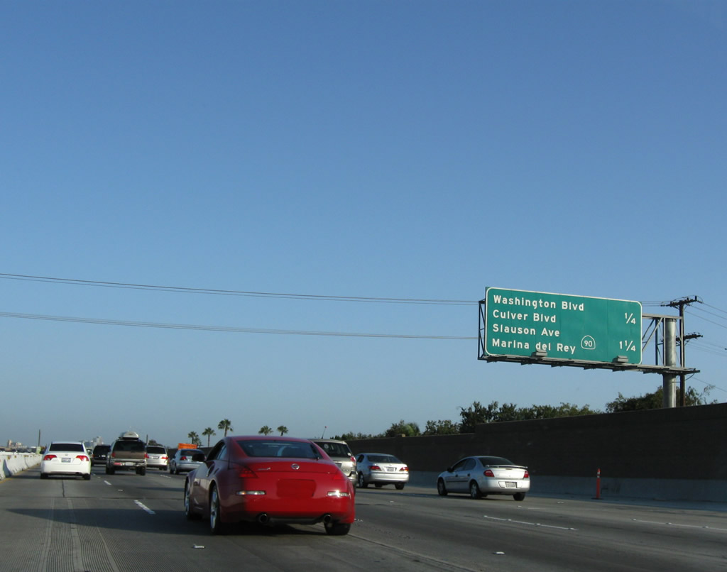 |
A replacement mileage sign is now posted south of the older sign on the right side of the freeway rather than in the median barrier. At the time this picture was taken, a permanent exit sign for the off-ramp to Sawtelle Boulevard (to Culver Boulevard and Washington Boulevard at Exit 51) was not in place. Photo taken 07/19/09. |
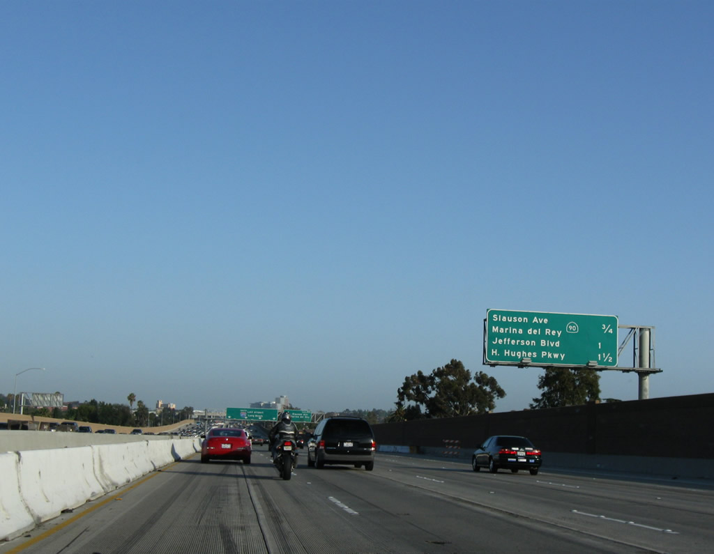 |
After the off-ramp to Sawtelle Boulevard (Exit 51), this mileage sign along Interstate 405 (San Diego Freeway) south provides the distance to the next three exits: Exit 50B, California 90 (Marina Freeway) west to Marina del Rey (ending at California 1 (Lincoln Boulevard)) and east to Slauson Avenue and Fox Hills in Culver City; Exit 50A, Jefferson Boulevard; and Exit 49, Howard Hughes Parkway. Photo taken 07/19/09. |
 |
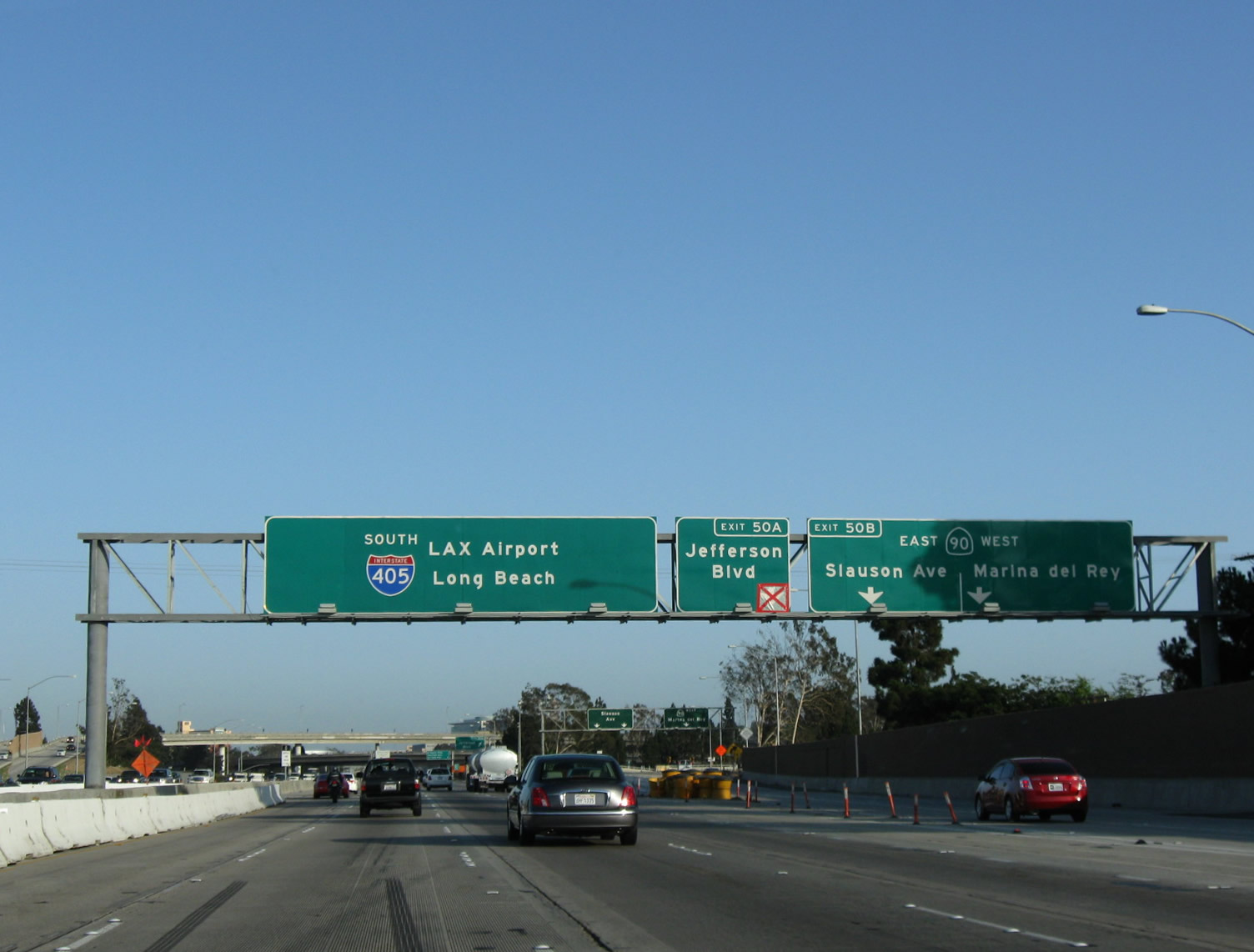
The right two lanes of Interstate 405 (San Diego Freeway) connect to Exit 50B, California 90 (Marina Freeway). California 90 consists of two segments: an eastern segment in Orange County, and this western segment located between Slauson Avenue in Culver City and California 1 (Lincoln Boulevard) in Marina del Rey. A much more grandiose plan called for California 90 to extend as a freeway roughly parallel to Slauson Avenue between Culver City and California 39 (Beach Boulevard) in La Habra. No current plans call for the connection of these two segments of California 90, although the freeway remains in the legislative designation for California 90. Photo taken 07/19/09. |
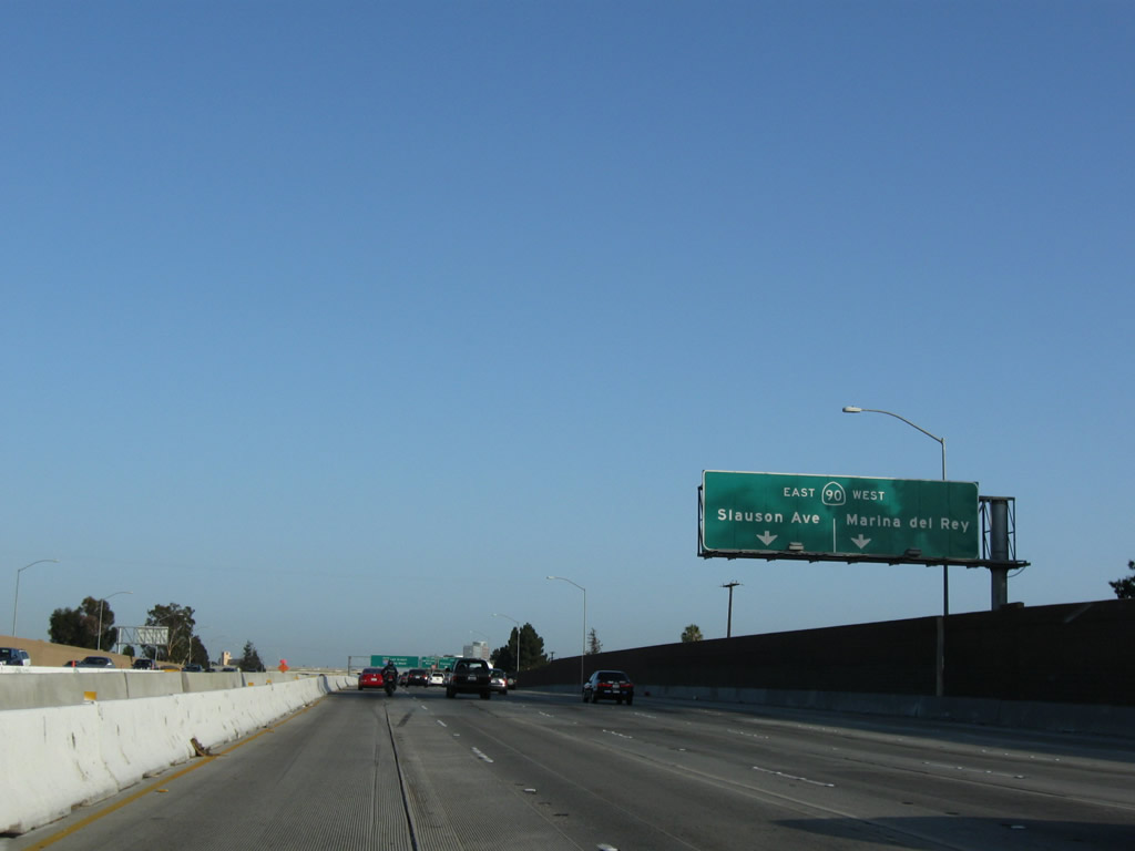 |
As traffic to California 90 departs, use the left lane of the off-ramp to California 90 east to Slauson Avenue in Culver City or the right lane for California 90 west to Marina del Rey. Photo taken 07/19/09. |
 |
Southbound Interstate 405 (San Diego Freeway) reaches Exit 50B, California 90 (Marina Freeway) west to Marina Del Rey (ending at California 1 (Lincoln Boulevard)) and east to Slauson Avenue and Fox Hills in Culver City. Photo taken 07/19/09. |
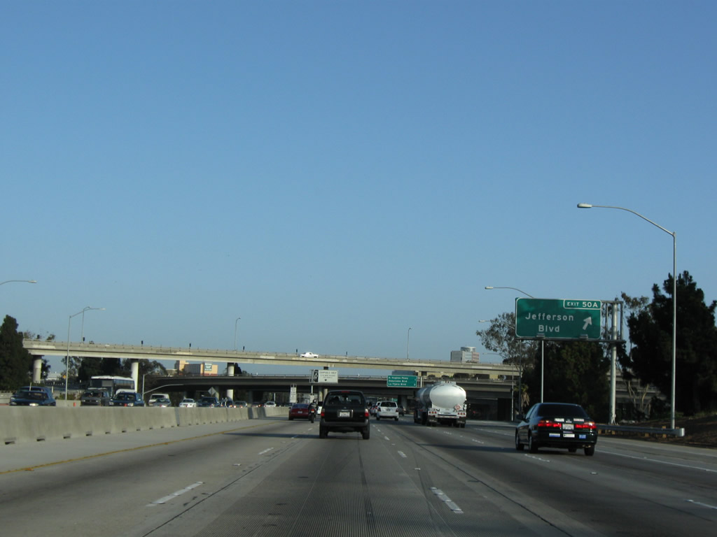 |
Immediately thereafter, southbound Interstate 405 (San Diego Freeway) reaches Exit 50A, Jefferson Boulevard. Use Jefferson Boulevard southwest to Centinela Boulevard (Former California 107) east. Interstate 405 continues south toward Los Angeles International Airport, Long Beach, Irvine, and San Diego. Photo taken 07/19/09. |
 |
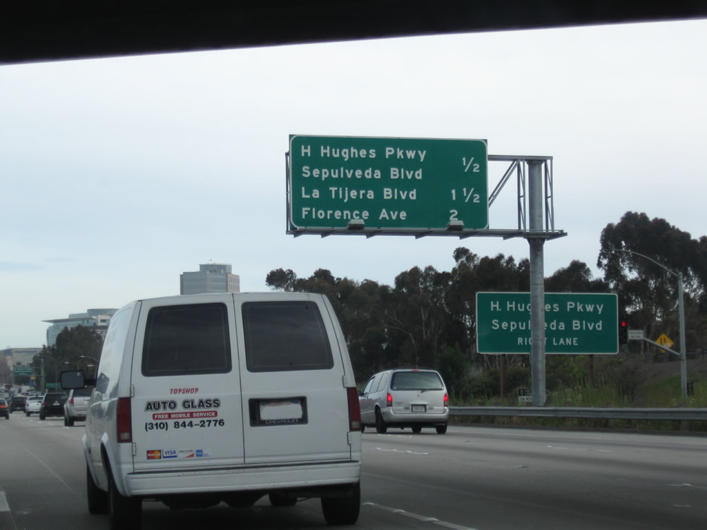
This mileage sign along Interstate 405 (San Diego Freeway) south provides the distance to the next two exits: Exit 49, Howard Hughes Parkway to Sepulveda Boulevard and Exit 48, La Tijera Boulevard. Omitted is Exit 47, Florence Avenue and Manchester Boulevard (Former California 42/10). Photo taken 07/19/09. |
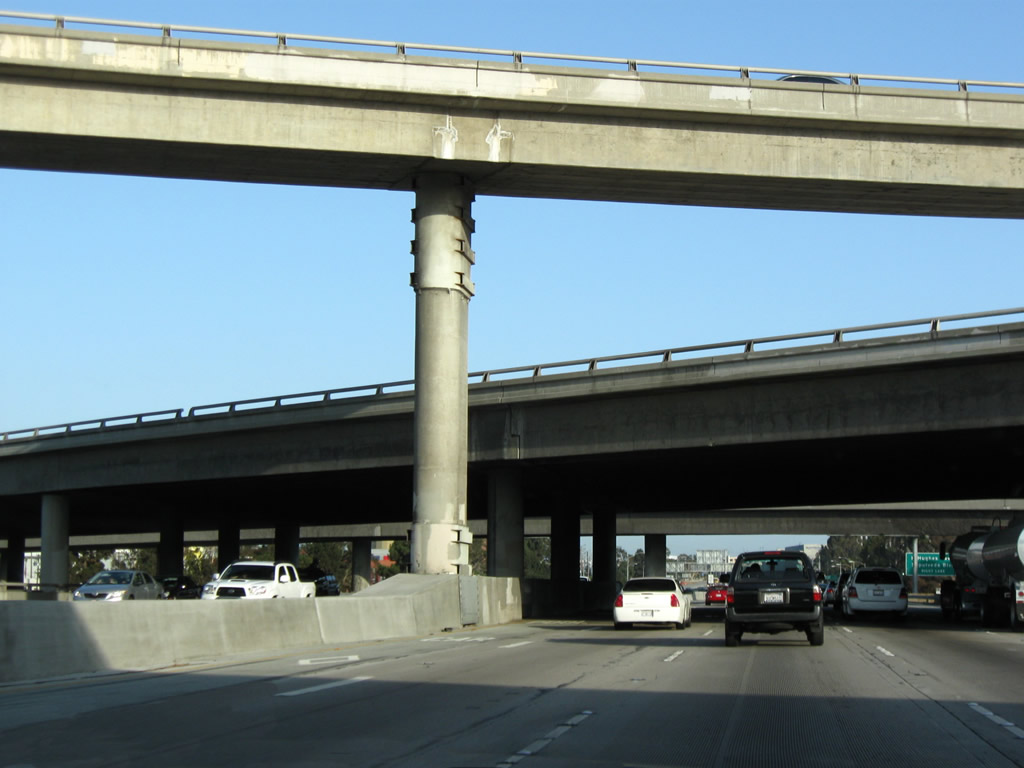 |
Interstate 405 passes through the interchange with California 90 (Marina Freeway). Photo taken 07/19/09. |
 |
After passing under California 90, another mileage sign along Interstate 405 (San Diego Freeway) south provides the distance to the next three exits: Exit 49, Howard Hughes Parkway to Sepulveda Boulevard; Exit 48, La Tijera Boulevard; and Exit 47, Florence Avenue and Manchester Boulevard (Former California 42/10). Photo taken 04/13/09. |
 |
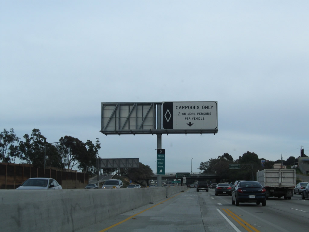
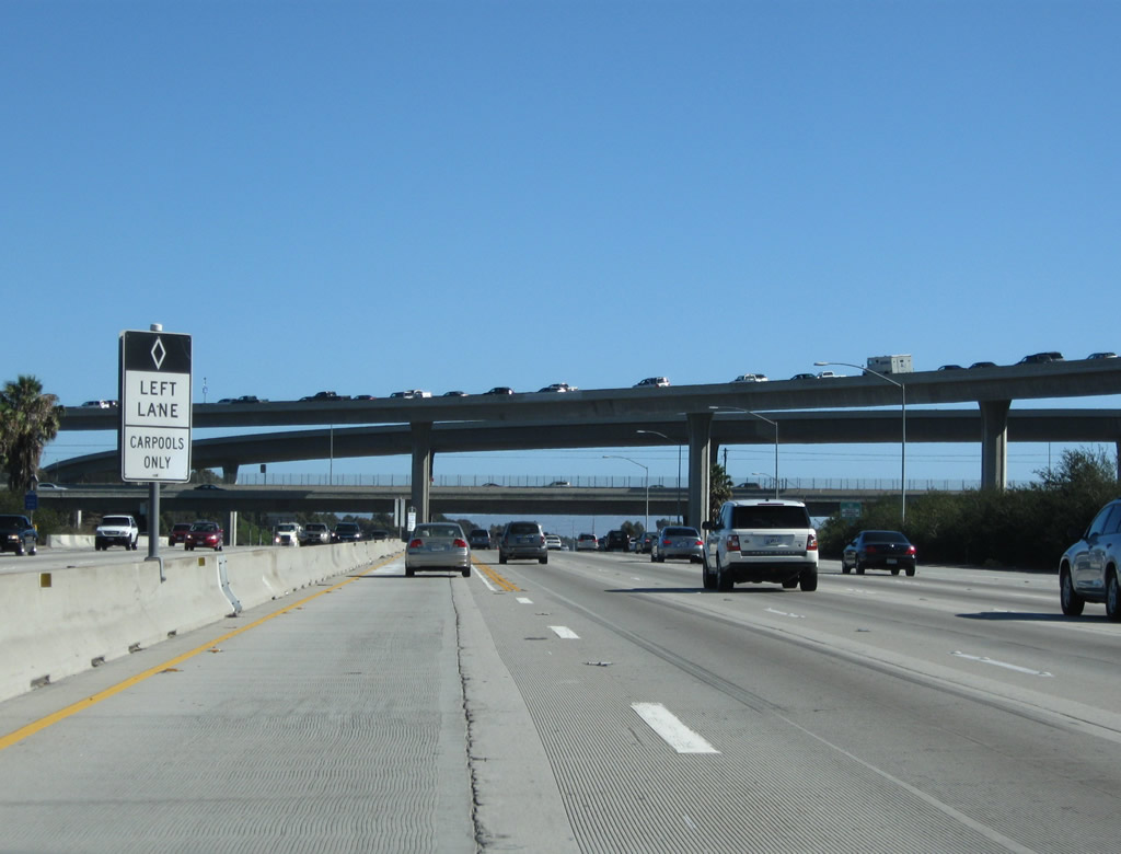
The carpool lane resumed shortly thereafter in 2009; with the completion of the carpool lanes between California 2 and California 90, a consistent high occupancy vehicle lane connects through West Los Angeles and Culver City. Photo taken 04/13/09. |
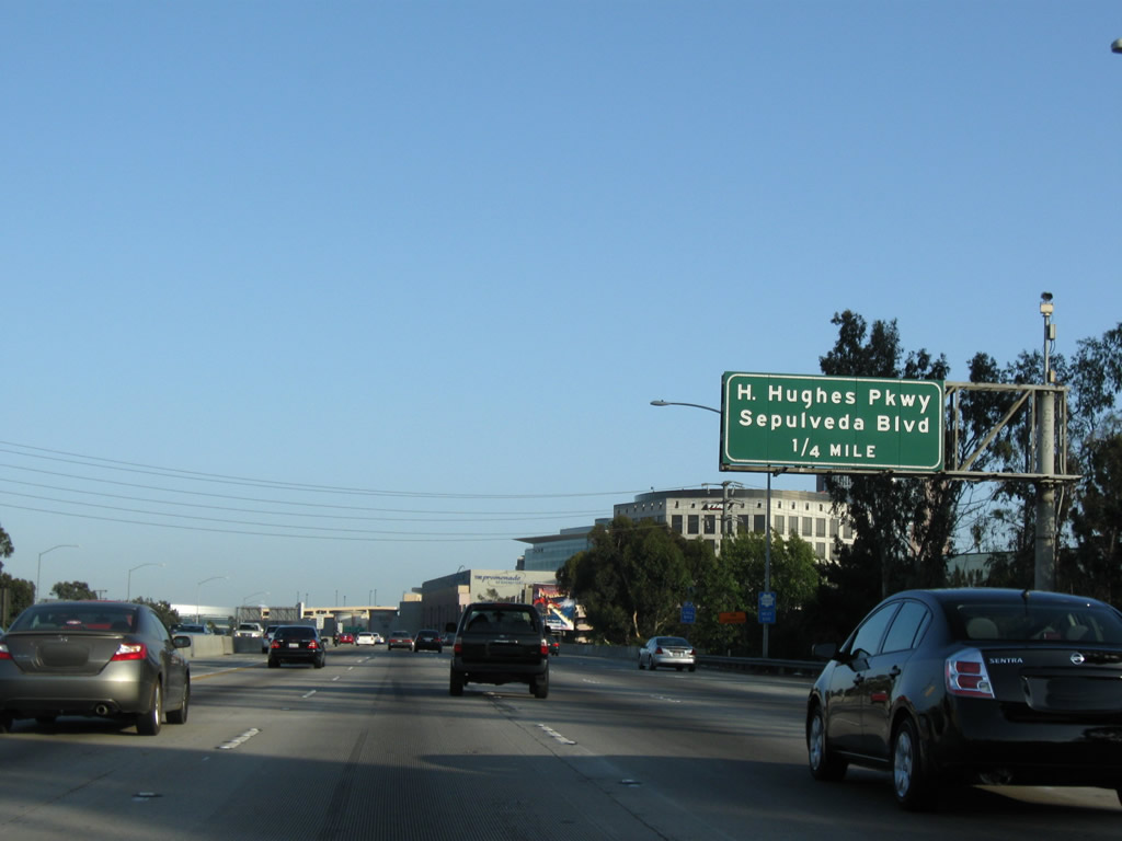 |
The next exit along Interstate 405 (San Diego Freeway) south is Exit 49, Howard Hughes Parkway to Sepulveda Boulevard (former California 7). Photo taken 07/19/09. |
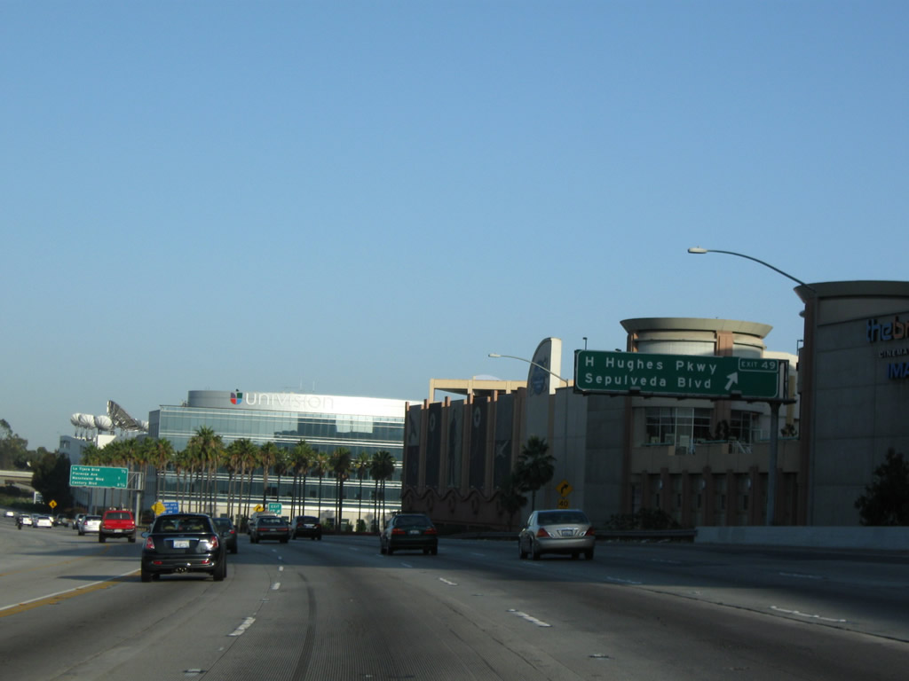 |
Amid office buildings, television studios, and shopping areas, southbound Interstate 405 (San Diego Freeway) meets Exit 49, Howard Hughes Parkway to Sepulveda Boulevard. Around this point, Interstate 405 leaves Culver City and reenters the city of Los Angeles. Howard Hughes Parkway travels west a short distance to connect to Sepulveda Boulevard, which travels south toward Los Angeles International Airport. Former California 7 followed Sepulveda Boulevard until the California 1 (Lincoln Boulevard) intersection, where California 7 used to end. Just south of the California 1-7 intersection, California 1/Sepulveda Boulevard leads into the Sepulveda Tunnels under Los Angeles International Airport. Photo taken 07/19/09. |
 |
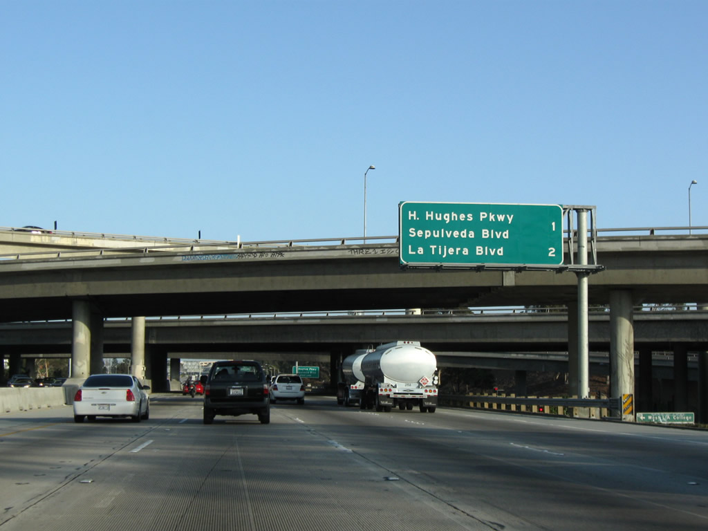
This mileage sign along Interstate 405 (San Diego Freeway) south provides the distance to the next three exits: Exit 48, La Tijera Boulevard; Exit 47, Florence Avenue and Manchester Boulevard (Former California 42/10); and Exit 46, Century Boulevard. Photo taken 07/19/09. |
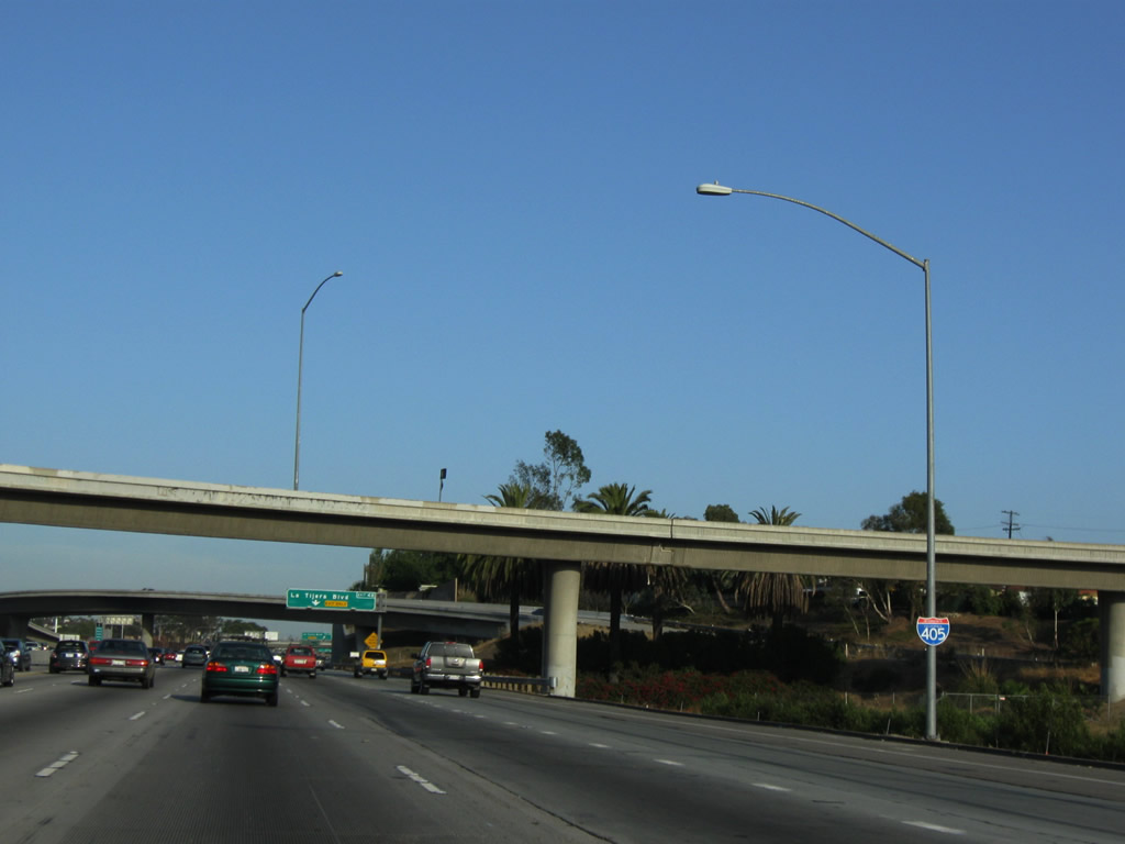 |
An Interstate 405 south reassurance shield is posted after the on-ramp from Howard Hughes Parkway and prior to La Tijera Boulevard. Photo taken 07/19/09. |
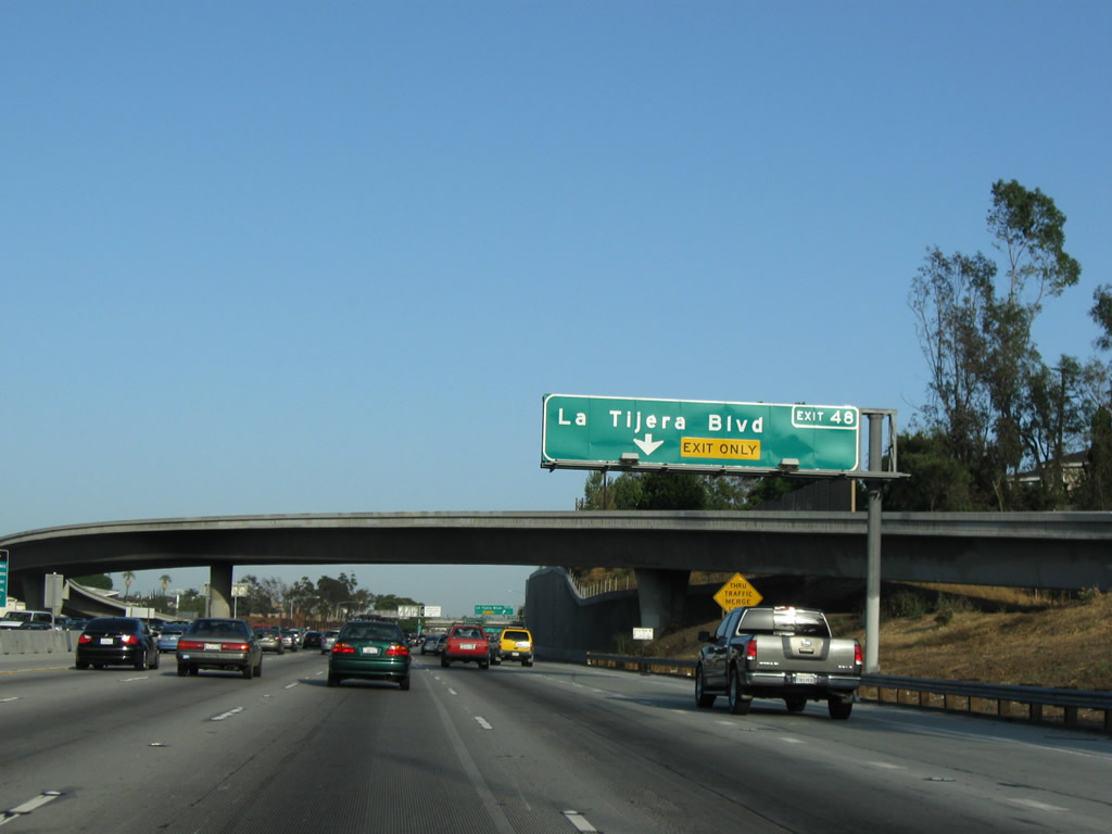 |
The right lane of Interstate 405 (San Diego Freeway) south becomes exit only for Exit 48, La Tijera Boulevard (a diagonal surface arterial route), which travels southwest to Westchester (a community of Los Angeles) and northeast toward unincorporated Baldwin Hills. Photo taken 07/19/09. |
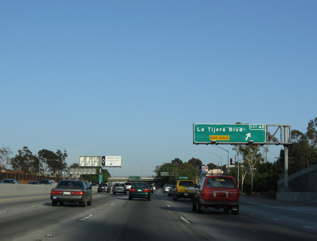 |
Southbound Interstate 405 (San Diego Freeway) reaches Exit 48, La Tijera Boulevard. Photo taken 07/19/09. |
 |
Meanwhile, over in the high occupancy vehicle (carpool) lane, traffic is afforded the opportunity to leave the HOV lane and connect to Florence Avenue, Manchester Avenue (California 42), Century Boulevard, and Imperial Highway. Through traffic in the carpool lane should continue in the designated lane. Photo taken 04/13/09. |
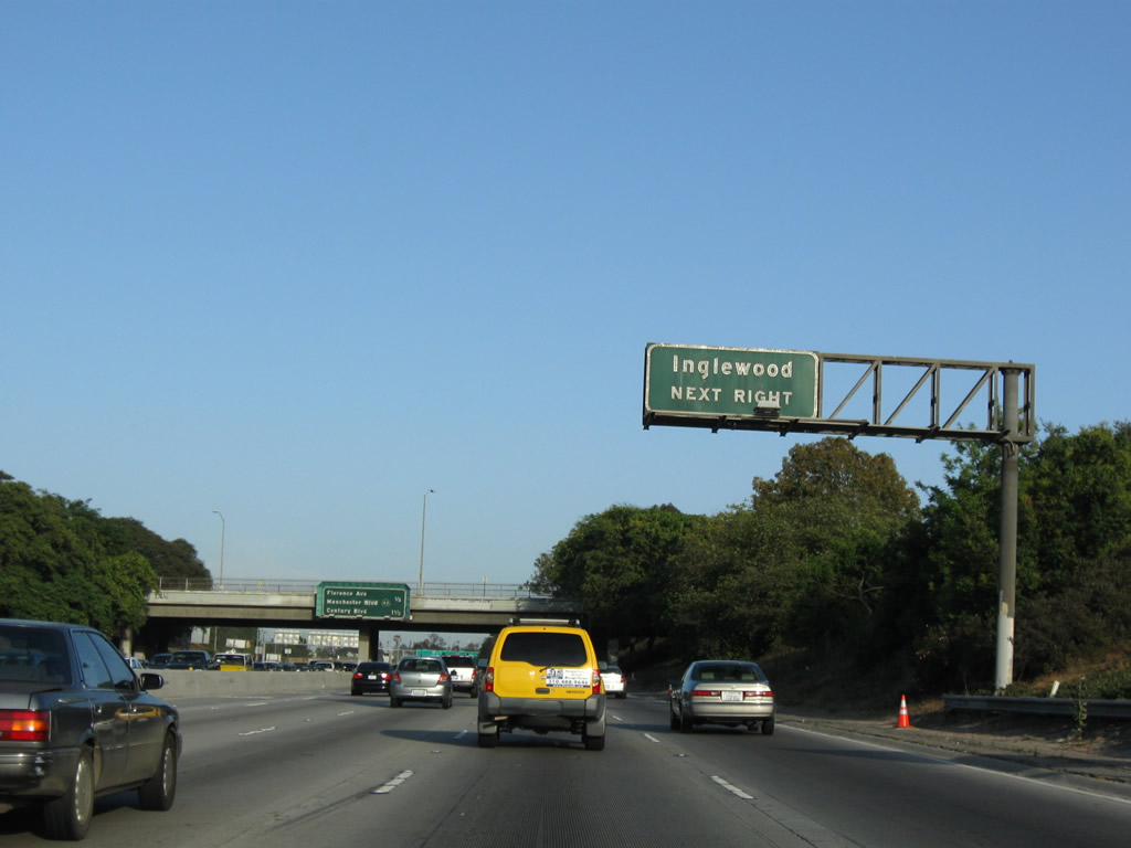 |
The next exit along Interstate 405 (San Diego Freeway) south is Exit 47, Florence Avenue and Manchester Boulevard. Manchester Boulevard was formerly designated as California 42, which was fully decommissioned as a state highway around 2000 and was known as California 10 prior to 1964 (the renumbering occurred to prevent confusion with nearby Interstate 10). Exit 47 serves the city of Inglewood, which Interstate 405 will skirt between Exits 47 and 46. Photo taken 07/19/09. |
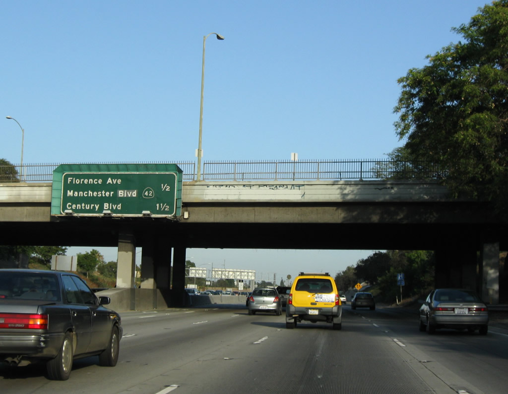 |
The next two exits along Interstate 405 (San Diego Freeway) south are Exit 47, Florence Avenue and Manchester Boulevard and Exit 46, Century Boulevard and Imperial Highway. Photo taken 07/19/09. |
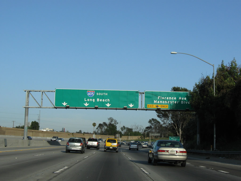 |
The right lane of Interstate 405 (San Diego Freeway) south becomes exit only for Exit 47, Florence Avenue and Manchester Boulevard. Interstate 405 continues south toward Long Beach and San Diego. Photo taken 07/19/09. |
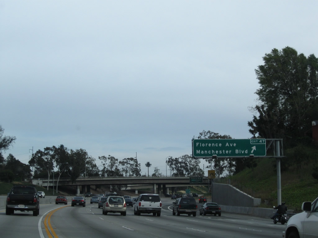 |
Southbound Interstate 405 (San Diego Freeway) reaches Exit 47, Florence Avenue and Manchester Boulevard. Photo taken 04/13/09. |
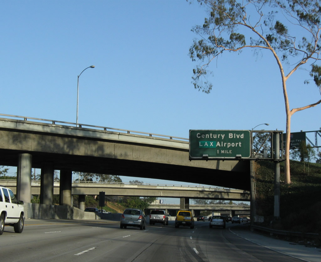 |
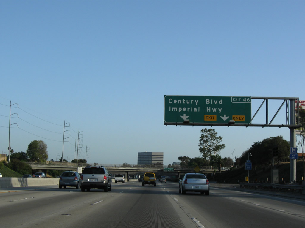
The next exit along Interstate 405 (San Diego Freeway) south is Exit 46, Century Boulevard to Los Angeles International (LAX) Airport and Imperial Highway. Photo taken 07/19/09. |
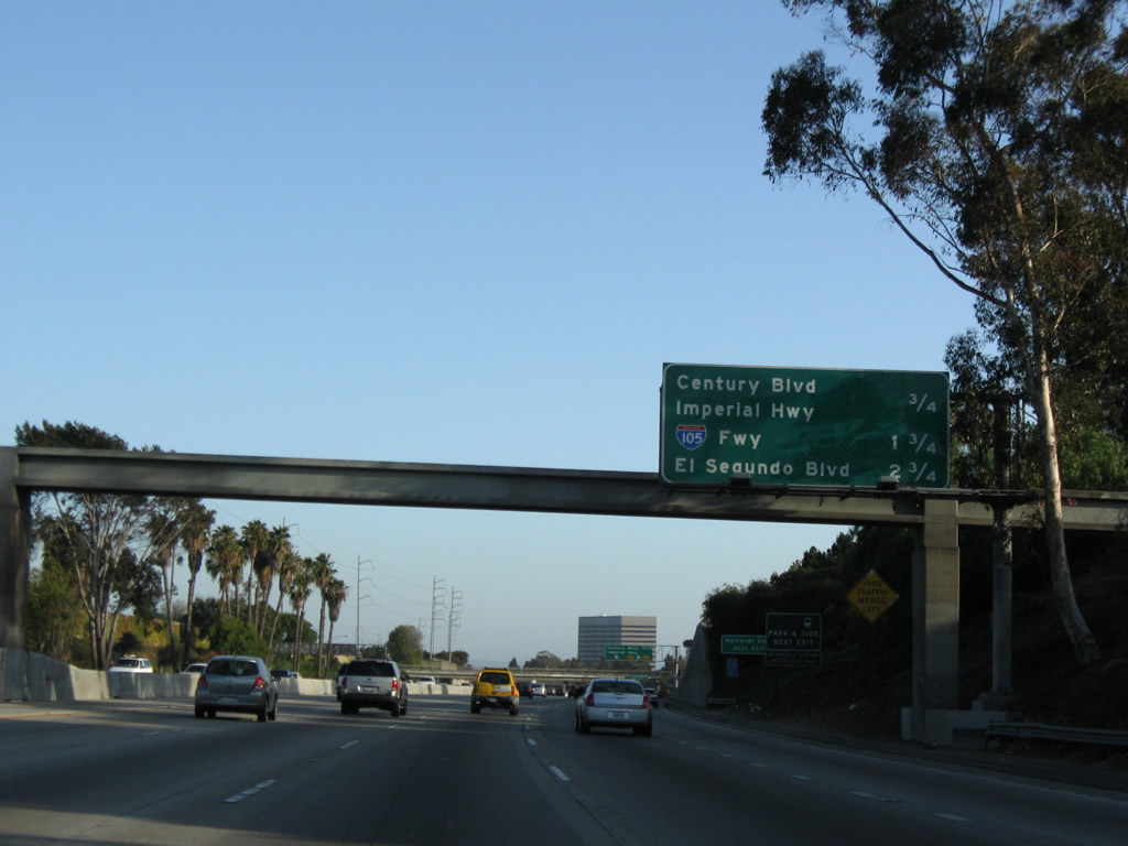 |
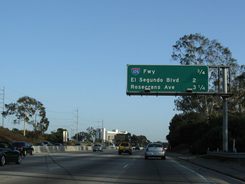
This mileage sign along Interstate 405 (San Diego Freeway) south provides the distance to Exit 46, Century Boulevard to Los Angeles International (LAX) Airport and Imperial Highway; Exit 45, Interstate 105/Glenn Anderson (Century) Freeway; and Exit 44, El Segundo Boulevard. Photo taken 07/19/09. |
 |
The right two lanes of Interstate 405 (San Diego Freeway) will connect to Exit 46, Century Boulevard to Los Angeles International (LAX) Airport and Imperial Highway. Photo taken 07/19/09. |
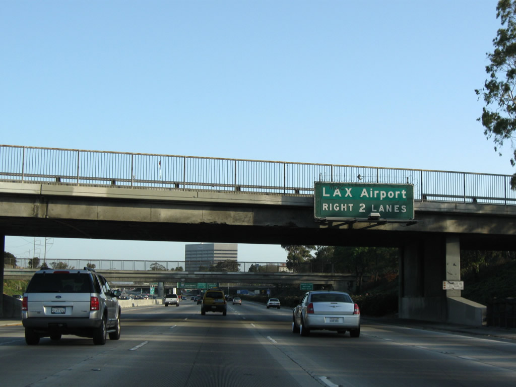 |
For Los Angeles International (LAX) Airport, use Exit 46 (Century Boulevard and Imperial Highway). While the airport is in the city of Los Angeles, the freeway mostly stays within the city of Inglewood (incorporated February 14, 1908; population 112,580 as of 2000 Census; elevation 131 feet) or in Lennox north of Interstate 105. Photo taken 07/19/09. |
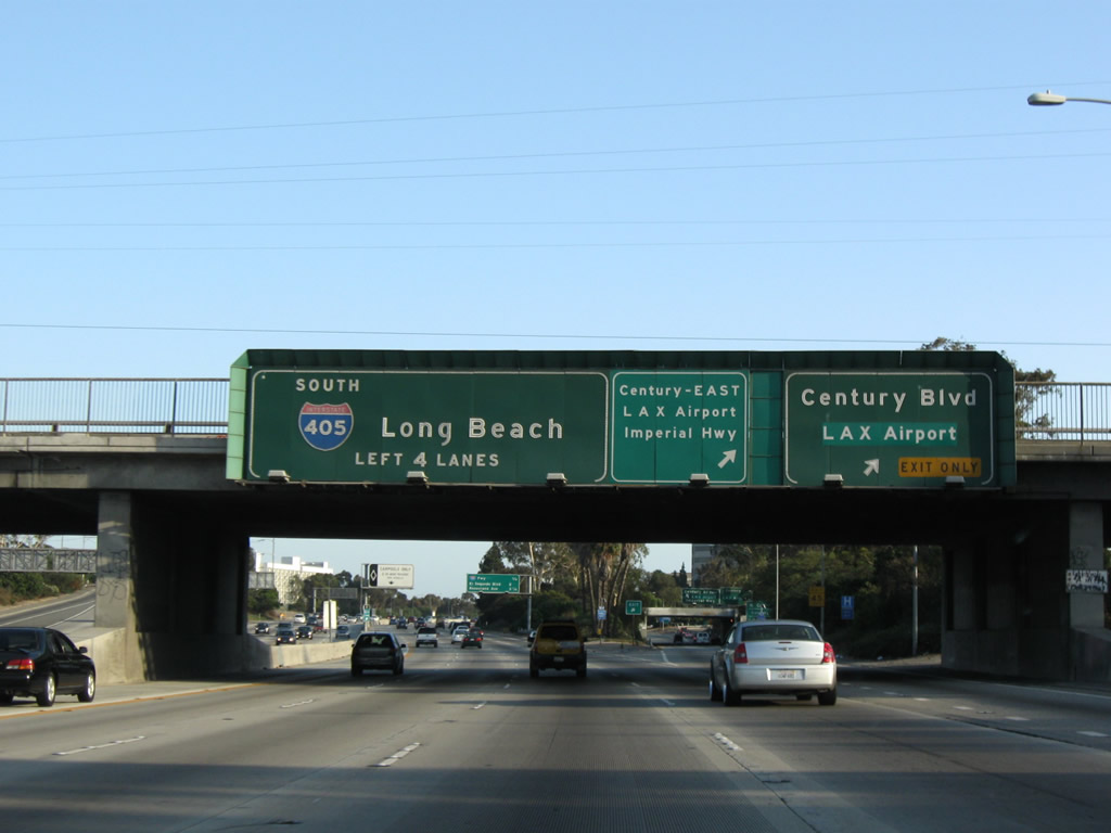 |
Southbound Interstate 405 reaches Exit 46, Century Boulevard and Imperial Highway. Note the lane allocations for Century Boulevard west to the airport and east to Imperial Highway and La Cienega Boulevard south to the airport. Use this exit to unincorporated Lennox on the east side of the freeway. Photo taken 07/19/09. |
 |
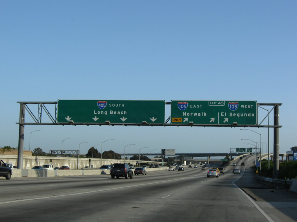
This mileage sign along Interstate 405 (San Diego Freeway) south provides the distance to the next four off-ramps: Exit 45, Interstate 105/Glenn Anderson (Century) Freeway; Exit 44, El Segundo Boulevard; and Exits 43B-A, Rosecrans Avenue. Photo taken 07/19/09. |
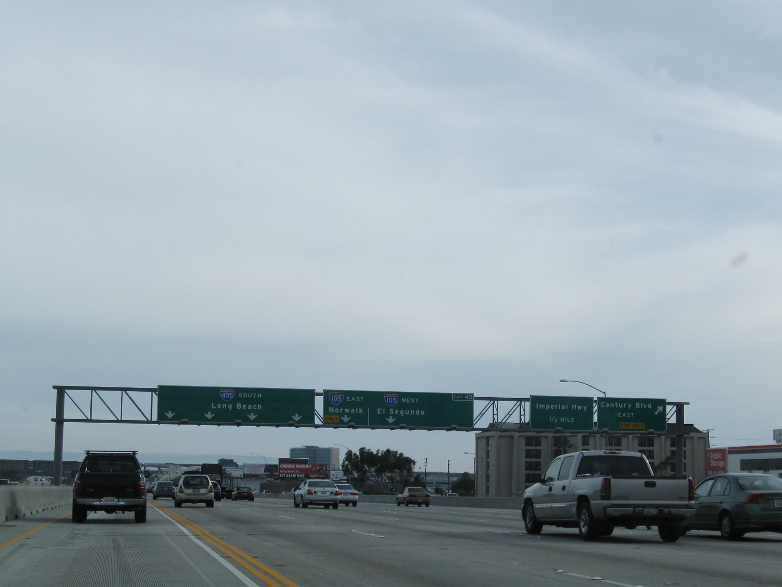 |
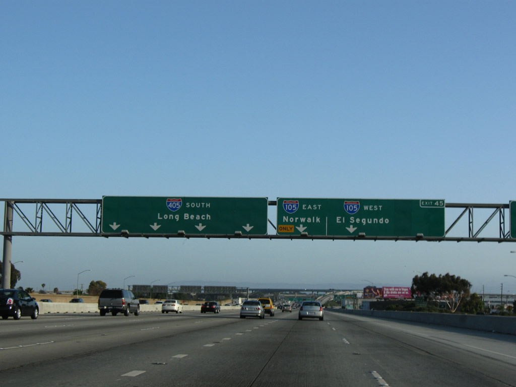
Prior to the junction with Interstate 105 is this incredibly wide sign. The panels on the right serve the collector distributor lanes associated with the off-ramp for Exit 46 (Century Boulevard and Imperial Highway). The signs to the left are for the main lanes of Interstate 405 (San Diego Freeway) south. Stay right for the connection to Exit 45, Interstate 105/Glenn Anderson (Century) Freeway. Stay left for continuing south on Interstate 405 south to Long Beach and San Diego. Photos taken 04/13/09 and 07/19/09. |
 |
|
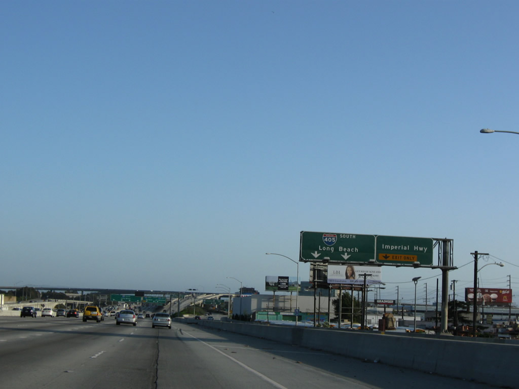 |
Another view of the collector distributor lanes show the off-ramp to Imperial Highway. These lanes will return to Interstate 405 after the Interstate 105 interchange. Photo taken 07/19/09. |
 |
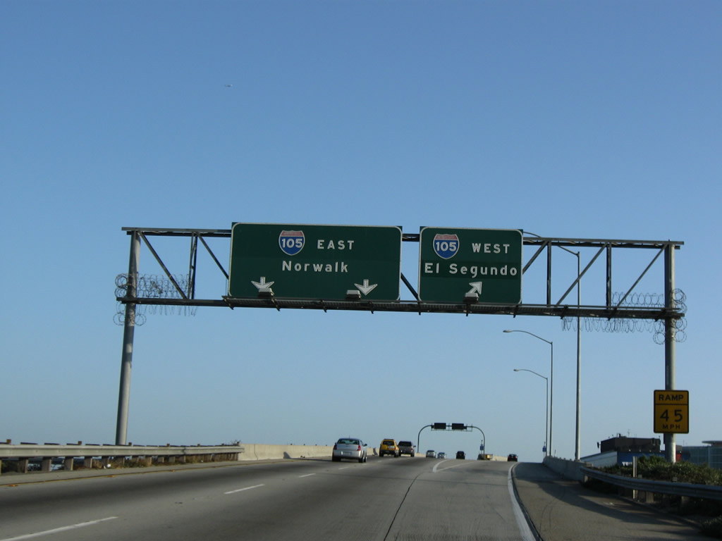
Southbound Interstate 405 (San Diego Freeway) reaches Exit 45, Interstate 105/Glenn Anderson (Century) Freeway. Interstate 105 travels east from the airport to Norwalk. Around this point, Interstate 405 enters the city of Hawthorne; however, it briefly enters unincorporated Del Aire before reentering Hawthorne at the El Segundo Boulevard interchange. Photo taken 07/19/09. |
 |
Now on the off-ramp from Interstate 405 (San Diego Freeway) to Exit 45, Interstate 105/Glenn Anderson (Century) Freeway, the right lane connects to Interstate 105 west to Imperial Highway, while the left lanes connect to Interstate 105 east to Norwalk. Photo taken 07/19/09. |
 |
Back on the mainline, southbound Interstate 405 (San Diego Freeway) passes through the Interstate 105 interchange. A carpool (HOV) lane continues through this interchange on the left, while four general purpose lanes proceed south. Photo taken 07/13/09. |
 |
The next exit along Interstate 405 (San Diego Freeway) south is Exit 44, El Segundo Boulevard. Take El Segundo Boulevard east to the city of Hawthorne or west to the city of El Segundo. Interstate 405 never actually enters the city of El Segundo despite coming within a quarter mile of it at the El Segundo Boulevard interchange. Photo taken 04/13/09. |
 |
Southbound Interstate 405 (San Diego Freeway) reaches Exit 44, El Segundo Boulevard. The next exit along southbound is Exits 43B-A, Rosecrans Avenue. Photo taken 07/13/09. |
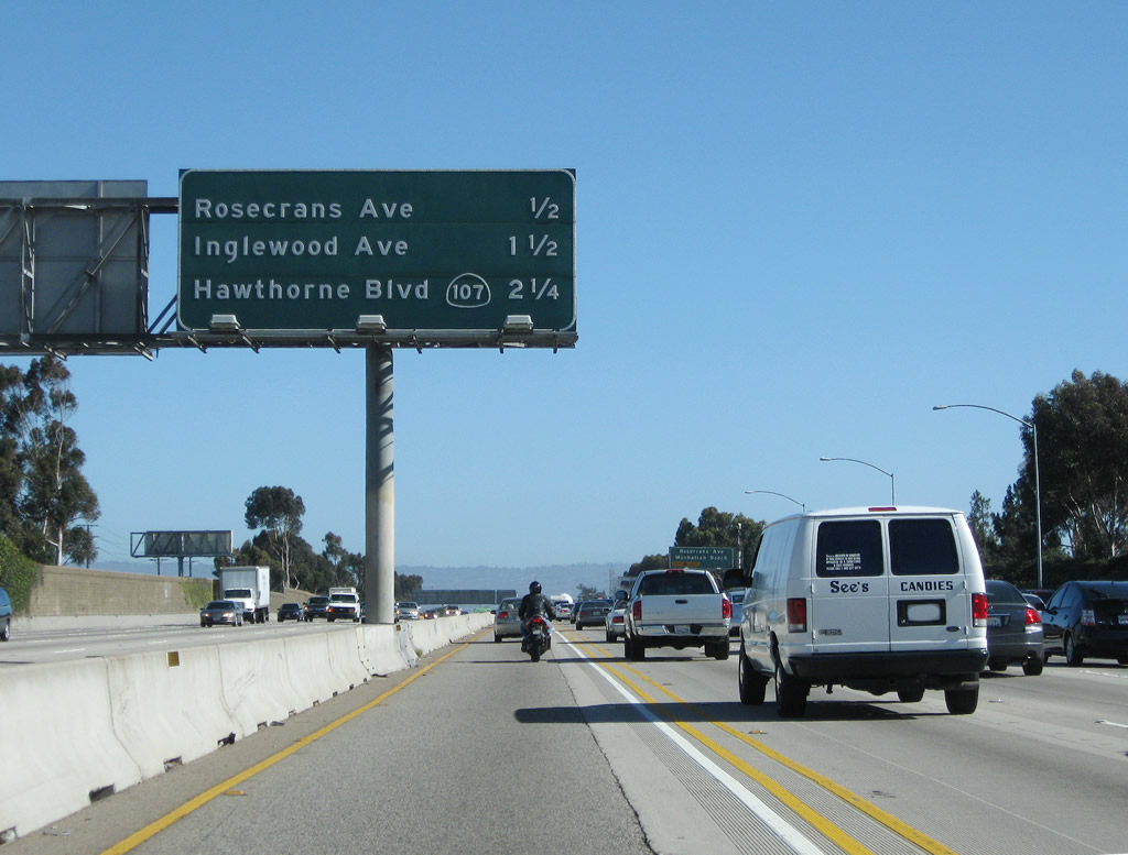 |
This interchange sequence sign along Interstate 405 (San Diego Freeway) south provides the distance to the next four exits: Exit 43B, Rosecrans Avenue west; Exit 43A, Rosecrans Avenue east; Exit 42B, Inglewood Avenue; and Exit 42A, California 107 (Hawthorne Boulevard). Photo taken 07/13/09. |
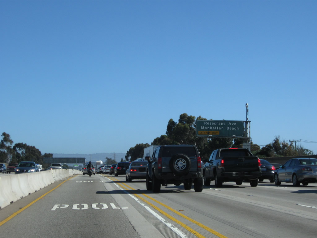 |
The next two exits along Interstate 405 (San Diego Freeway) south are Exit 43B, Rosecrans Avenue west and Exit 43A, Rosecrans Avenue east. The right lane becomes exit only for Exit 43B, Rosecrans Avenue west to Manhattan Beach. Photo taken 07/13/09. |
 |
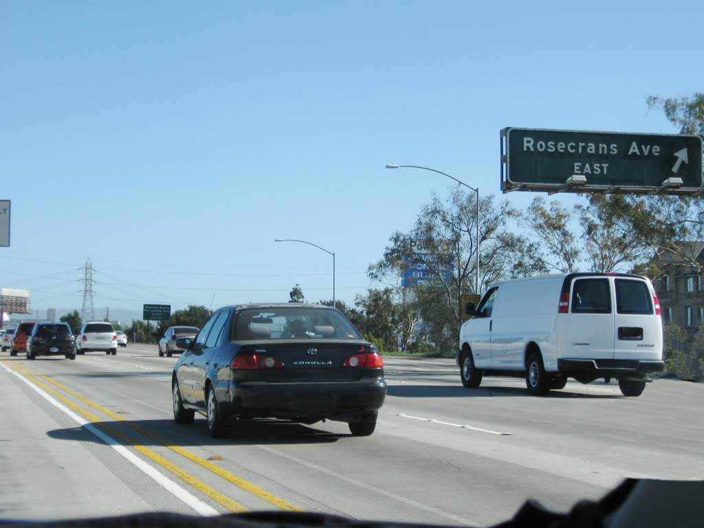
Southbound Interstate 405 (San Diego Freeway) reaches Exit 43B, Rosecrans Avenue west to Manhattan Beach. The second right connects to Rosecrans Avenue east to Hawthorne and Gardena. Photo taken 07/13/09. |
 |
Shortly thereafter, southbound Interstate 405 (San Diego Freeway) meets Exit 43A, Rosecrans Avenue east to Hawthorne and Gardena. Photo taken 07/13/09. |
 |
Interstate 405 begins to curve southeast as we pass through the Rosecrans Avenue interchange. Photo taken 07/13/09. |
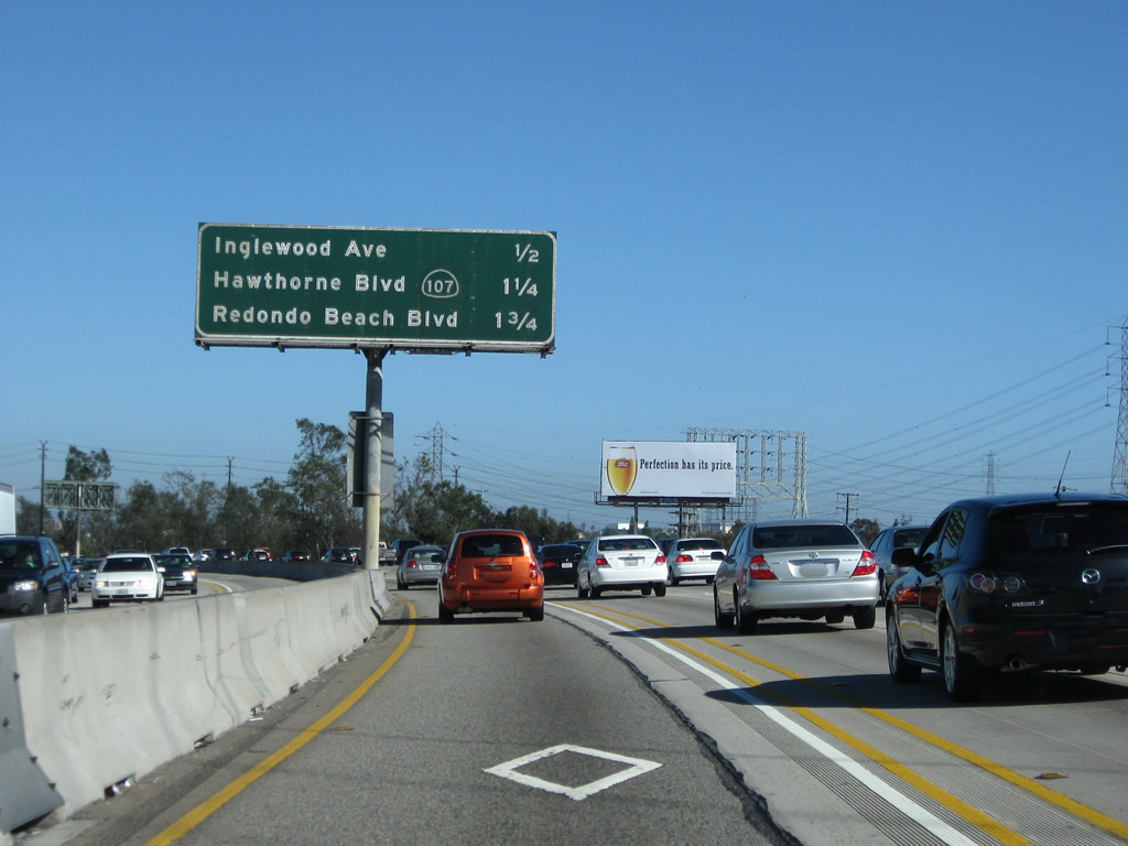 |
This interchange sequence sign along Interstate 405 (San Diego Freeway) south provides the distance to the next three exits: Exit 42B, Inglewood Avenue; Exit 42A, California 107 (Hawthorne Boulevard); and Exit 40B, Redondo Beach Boulevard. Photo taken 07/13/09. |
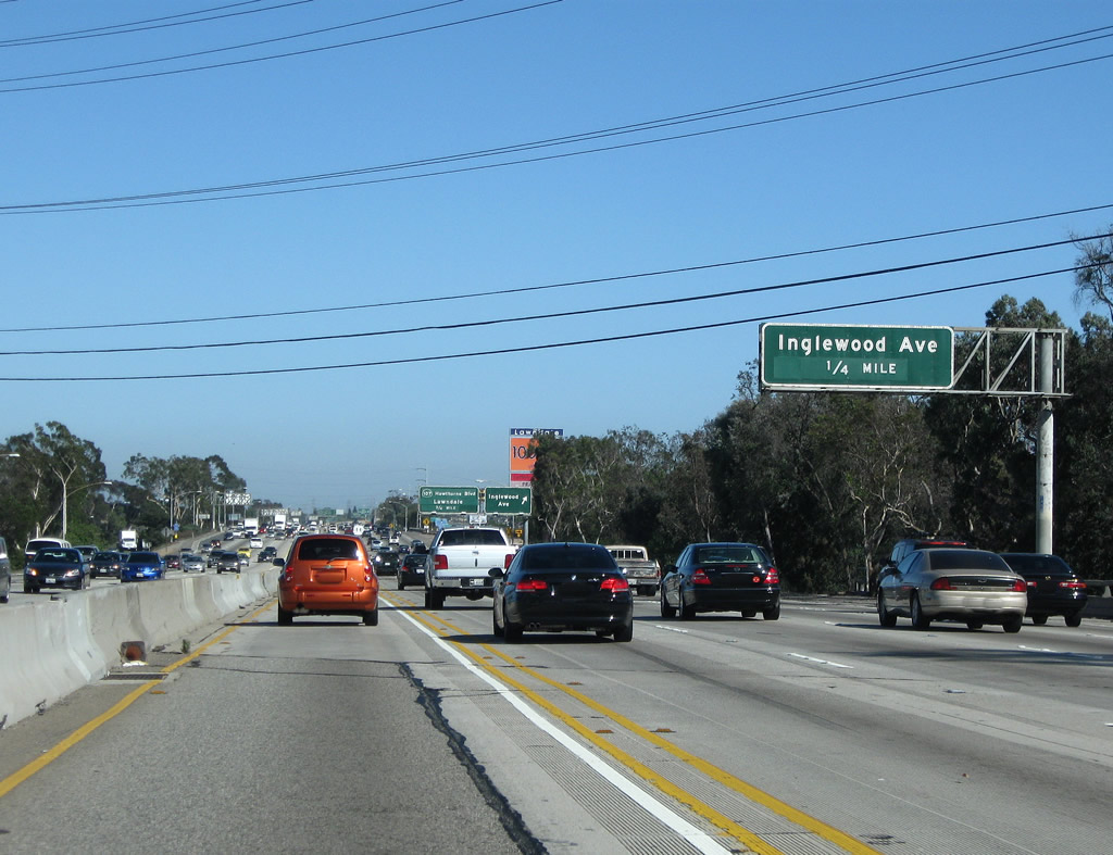 |
The next exit along Interstate 405 (San Diego Freeway) south is Exit 42B, Inglewood Avenue, which travels north to Hawthorne and south to Redondo Beach and Lawndale. Interstate 405 curves out of Hawthorne and cuts into the northeastern corner of the city of Redondo Beach (incorporated April 29, 1892, population 63,261 as of the 2000 Census). After the interchange, Interstate 405 promptly enters the city of Lawndale ("The Heart of the South Bay," incorporated December 28, 1959, population 31,711 as of the 2000 Census). Photo taken 07/13/09. |
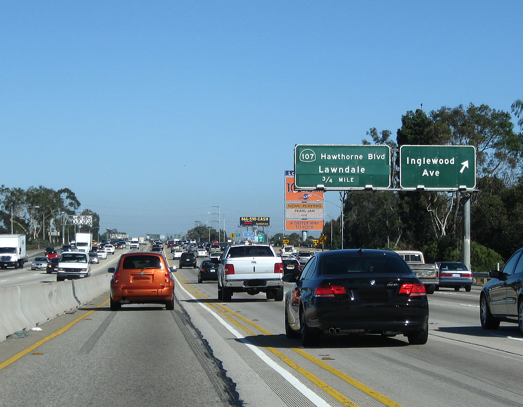 |
Southbound Interstate 405 (San Diego Freeway) reaches Exit 42B, Inglewood Avenue, which travels north to Hawthorne and south to Redondo Beach and Lawndale. Photo taken 07/13/09. |
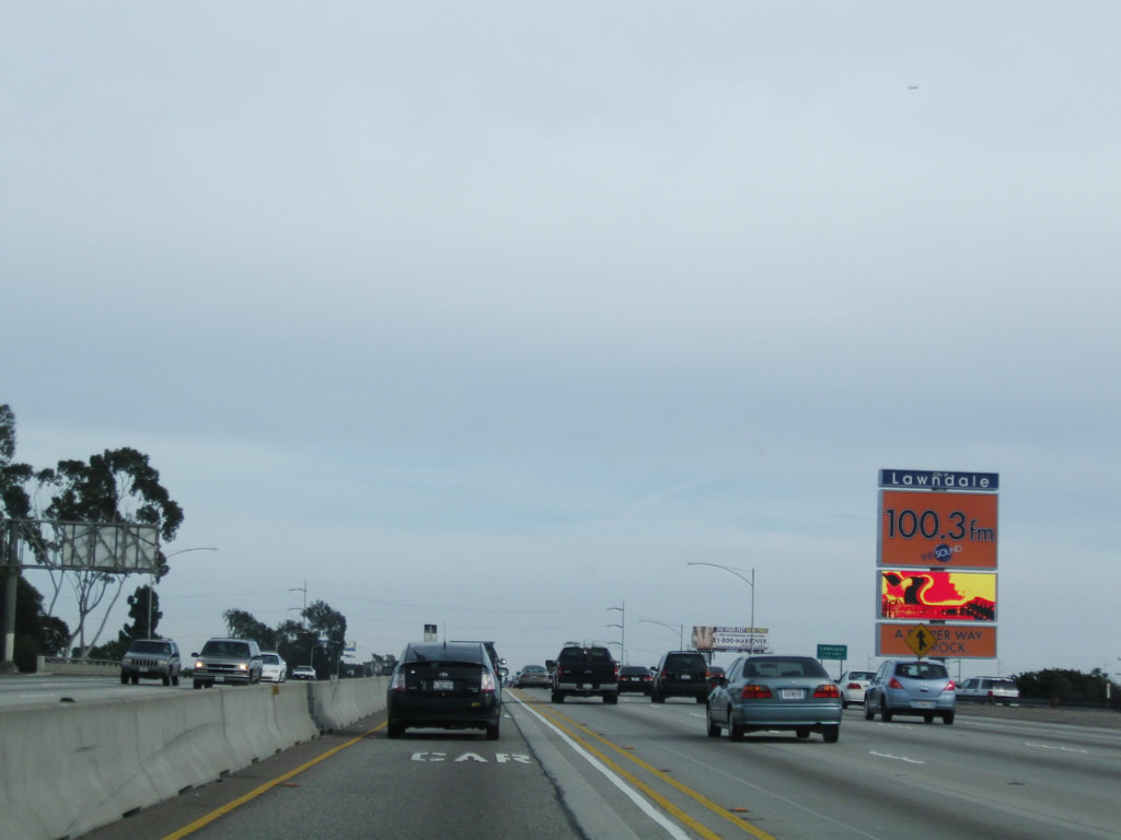 |
A towering electronic marquee greets visitors to the city of Lawndale. Photo taken 04/13/09. |
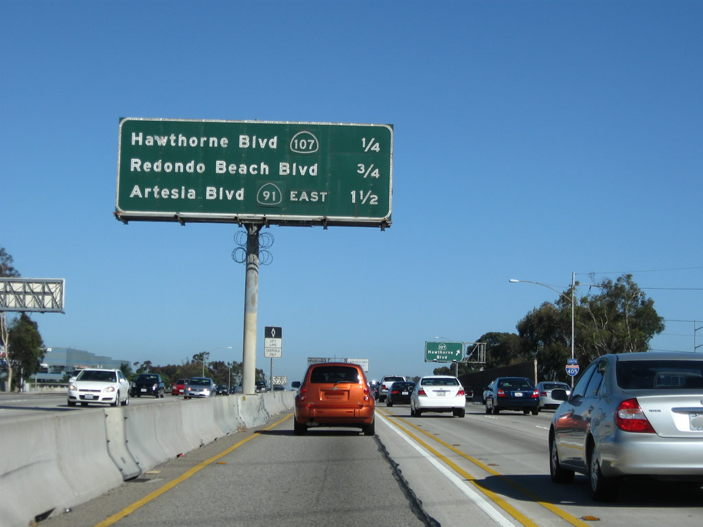 |
This interchange sequence sign along Interstate 405 (San Diego Freeway) south provides the distance to the next three exits: Exit 42A, California 107 (Hawthorne Boulevard); Exit 40B, Redondo Beach Boulevard; and Exit 40A, California 91 (Artesia Boulevard). Photo taken 07/13/09. |
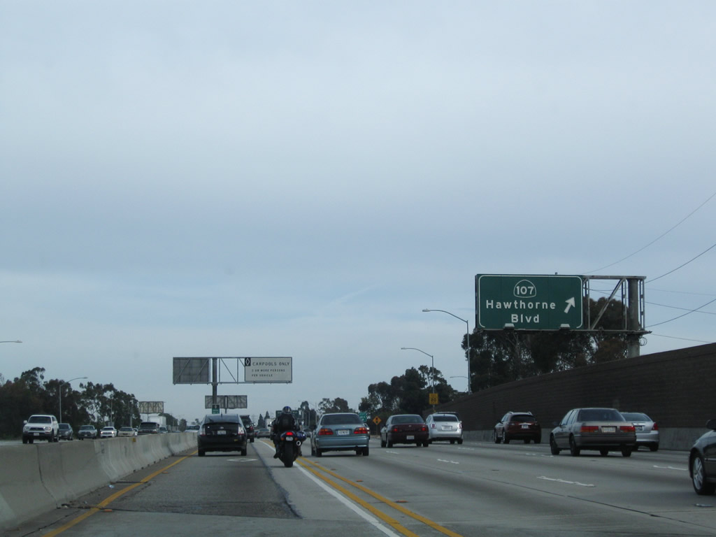 |
Southbound Interstate 405 (San Diego Freeway) reaches Exit 42A, California 107 (Hawthorne Boulevard). California 107 travels south from this interchange through Lawndale into the city of Torrance, ending at California 1 (Pacific Coast Highway) in southern Torrance. Photo taken 04/13/09. |

Page Updated August 22, 2010.
|
About Contact Glossary |
In The News Interstate Guide |
Social Media:
 |
|
© 2000-25 AARoads.com | All Rights Reserved | Privacy Policy / Terms of Use
|
||