
Interstate 880 South - Interstate 238 to Santa Clara County Line
| Interstate 880 (Nimitz Freeway) south | |
|---|---|
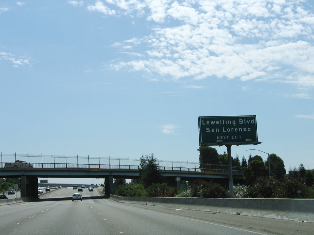 |
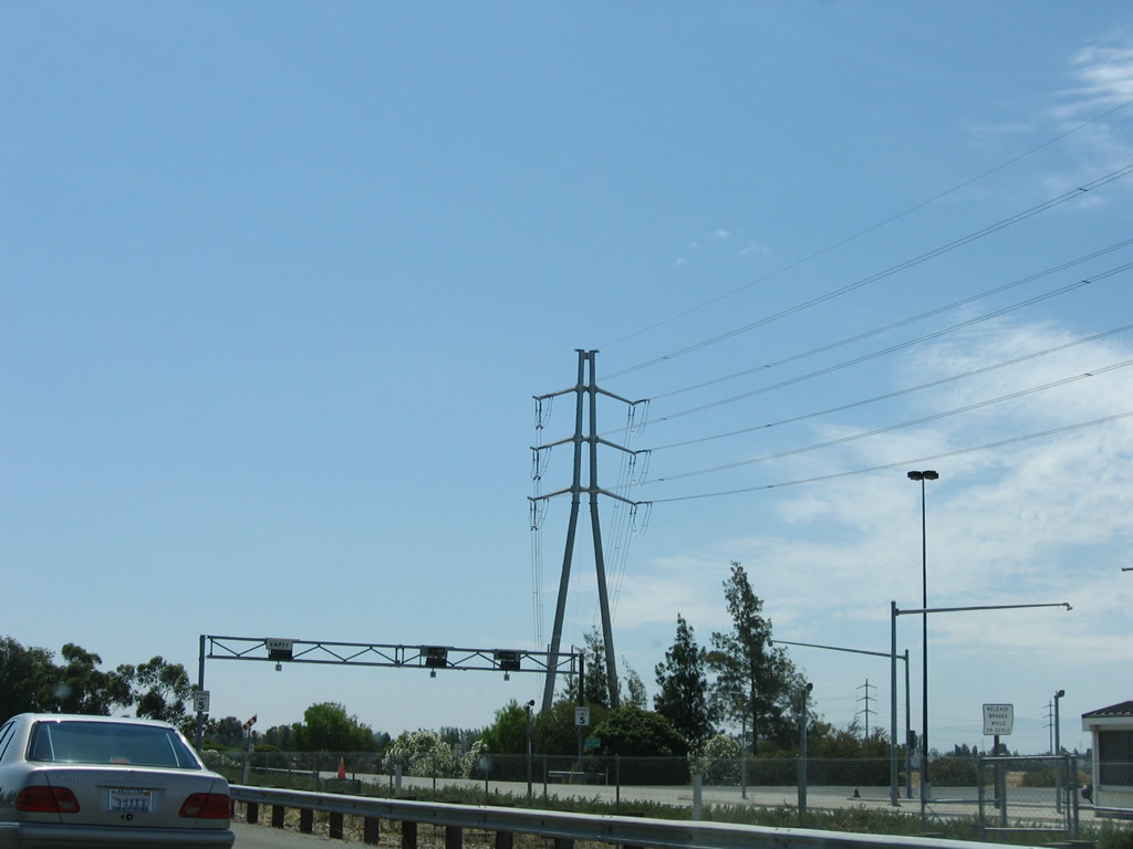
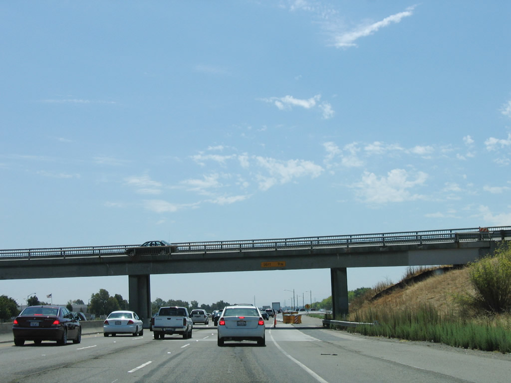
After the split with Interstate 238 east (south), the next exit along Interstate 880 (Nimitz Freeway) south is Exit 30, Lewelling Boulevard to the unincorporated community of San Lorenzo. Photo taken 08/05/05. |
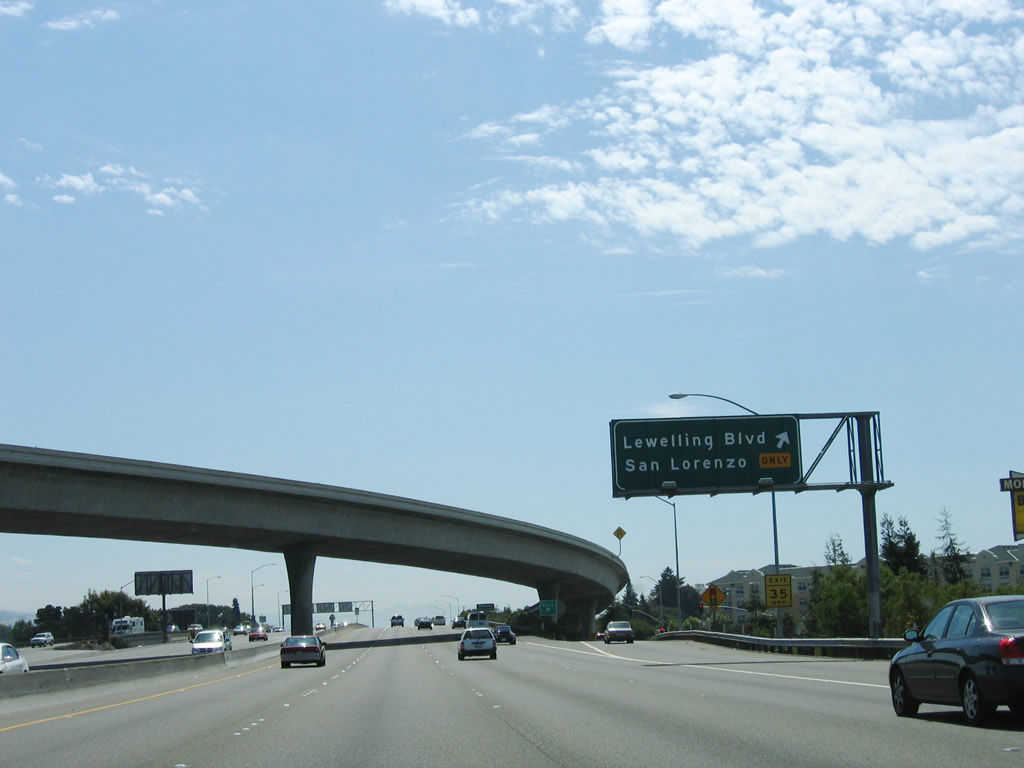 |
The flyover ramp carries traffic from Interstate 238 west onto Interstate 880 south as southbound Interstate 880 (Nimitz Freeway) reaches Exit 30, Lewelling Boulevard. Photo taken 08/05/05. |
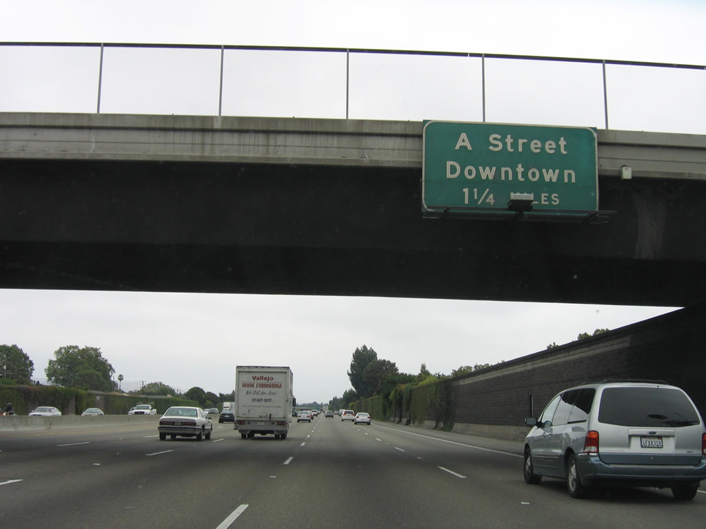 |
After the on-ramp from Interstate 238 west to Interstate 880 south merges onto the mainline, the next exit along Interstate 880 (Nimitz Freeway) south is Exit 29, A Street. Photo taken 07/04/06. |
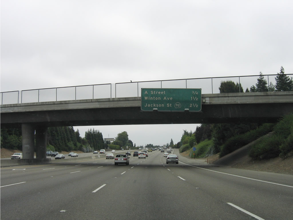 |
The next three exits along Interstate 880 (Nimitz Freeway) south are Exit 29, A Street to downtown Hayward; Exit 28, Winton Avenue; and Exit 27, California 92/Hayward-San Mateo Bridge west to San Mateo and California 92/Jackson Street northeast to downtown Hayward. Photo taken 07/04/06. |
 |
Southbound Interstate 880 (Nimitz Freeway) reaches Exit 29, A Street to downtown Hayward. At this interchange, Interstate 880 leaves unincorporated San Lorenzo and enters the city of Hayward, which is known as the "Heart of the Bay." Encompassing 62.55 square miles, Hayward is the third largest city in the East Bay (only after Oakland and Fremont). Total population as of the 2000 Census was 140,030. Hayward was incorporated as a town in 1876 and as a city on September 18, 1928. Photo taken 07/04/06. |
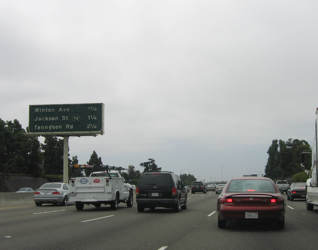 |
The next three exits along Interstate 880 (Nimitz Freeway) south are Exit 28, Winton Avenue; Exit 27, California 92/Hayward-San Mateo Bridge west to San Mateo and California 92/Jackson Street northeast to downtown Hayward; and Exit 26, Tennyson Road. Photo taken 07/04/06. |
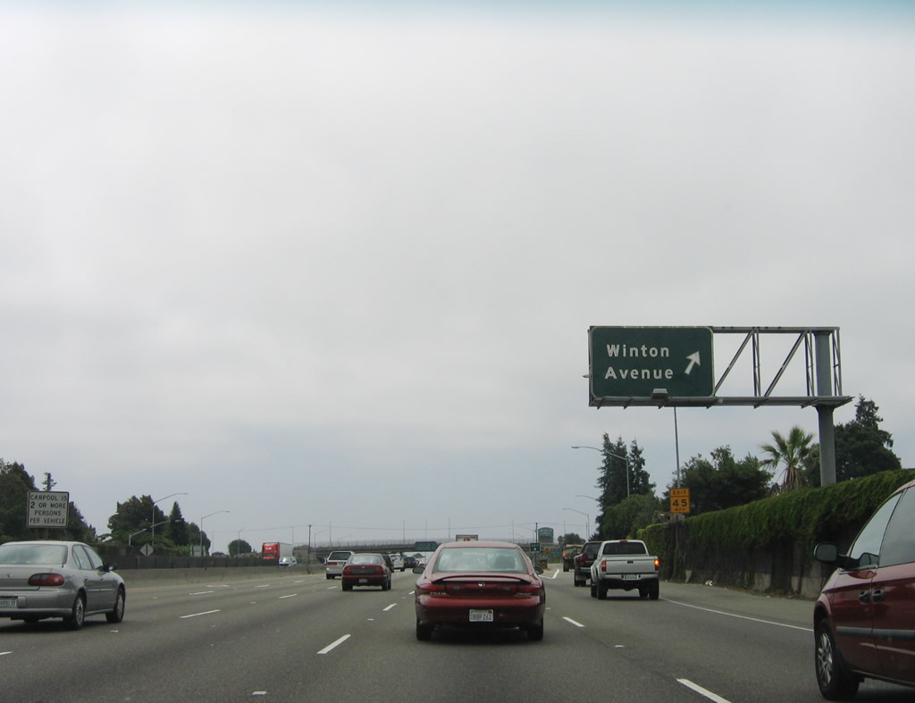 |
Southbound Interstate 880 (Nimitz Freeway) reaches Exit 28, Winton Avenue. This modified cloverleaf interchange provides access to downtown Hayward via eastbound Winton Avenue and the Hayward Air Terminal via westbound Winton Avenue. Photo taken 07/04/06. |
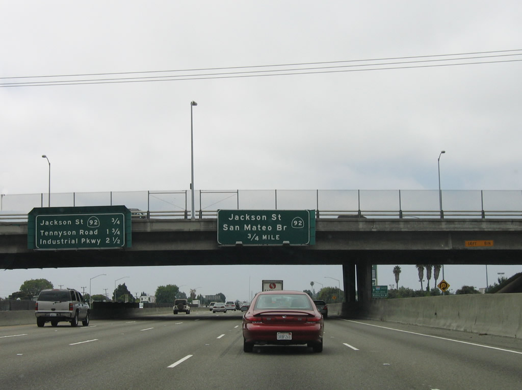 |
The next three exits along Interstate 880 (Nimitz Freeway) south are Exit 27, California 92/Hayward-San Mateo Bridge west to San Mateo and California 92/Jackson Street northeast to downtown Hayward; Exit 26, Tennyson Road; and Exit 25, Industrial Parkway. These signs are mounted on the Winton Avenue overpass; the collector distributor lanes for the modified cloverleaf interchange can be seen to the right. Photo taken 07/04/06. |
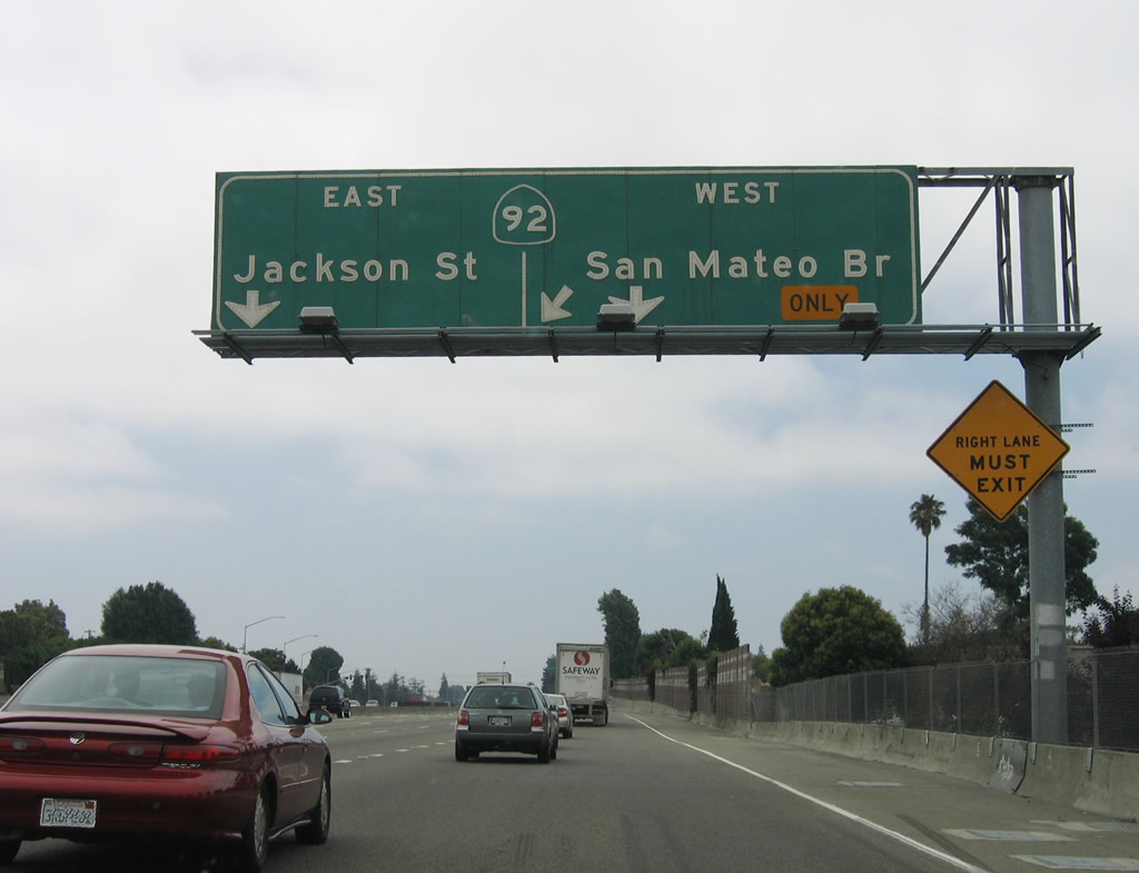 |
After the on-ramp from Winton Avenue, the right lanes prepare to exit from Interstate 880 (Nimitz Freeway) south to Exit 27, California 92/Hayward-San Mateo Bridge west to San Mateo and California 92/Jackson Street northeast to downtown Hayward. This modified cloverleaf interchange is a major freeway connector, as the bridge carries traffic across San Francisco Bay to San Mateo County. Connections to U.S. 101 (Bayshore Freeway), Interstate 280/Serra Freeway, and California 92 west to Half Moon Bay are provided at the west end of the bridge. Plans call for this interchange to be upgraded, since daily traffic back-ups occur due to the sheer volume of traffic and unconstructed freeway connections through the city of Hayward. Photo taken 07/04/06. |
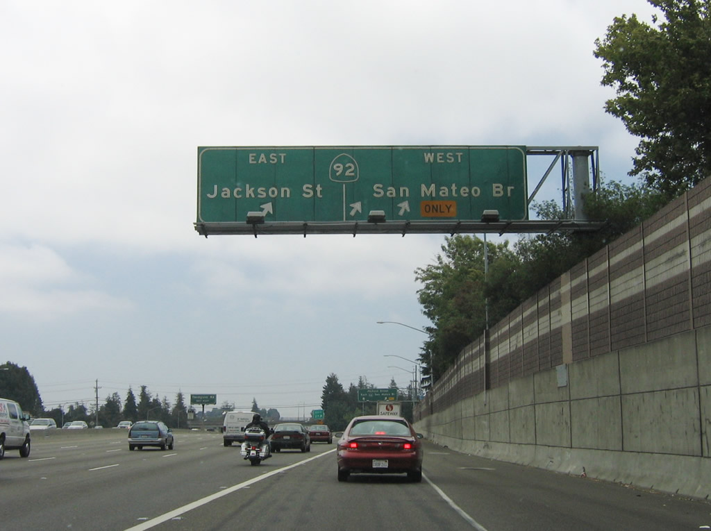 |
Southbound Interstate 880 (Nimitz Freeway) reaches Exit 27, California 92/Hayward-San Mateo Bridge west to San Mateo and California 92/Jackson Street northeast to downtown Hayward. The Jackson Street corridor leading northeast into downtown Hayward was to be a freeway, connecting to the unconstructed Mission Freeway (California 238). However, neither the Jackson Street freeway nor Mission Freeway were built, and they are not likely to ever be constructed. Instead, capacity improvements to the California 92 and Interstate 880 interchange and widening of Interstate 238 will provide the high-speed connection around downtown Hayward for through traffic. Photo taken 07/04/06. |
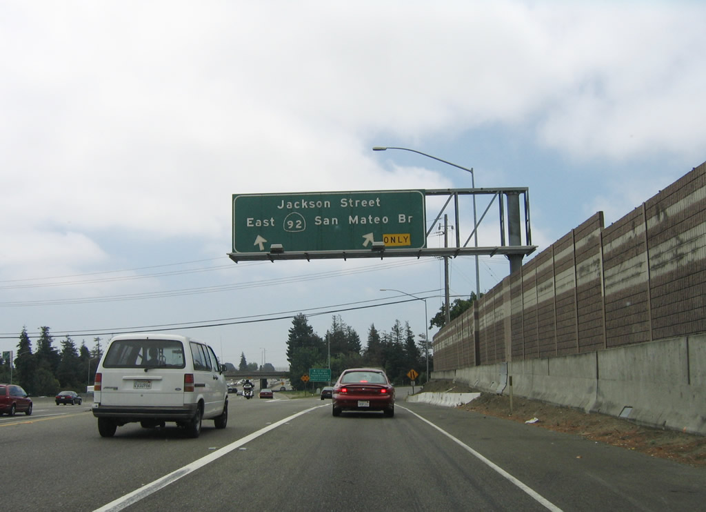 |
Now on the collector distributor lanes for Exit 27, the first ramp connects to California 92/Hayward-San Mateo Bridge west to San Mateo County. The second ramp is a loop ramp to California 92/Jackson Street northeast to downtown Hayward. California 92 west of here is a freeway, but it is not a freeway to the northeast. Photo taken 07/04/06. |
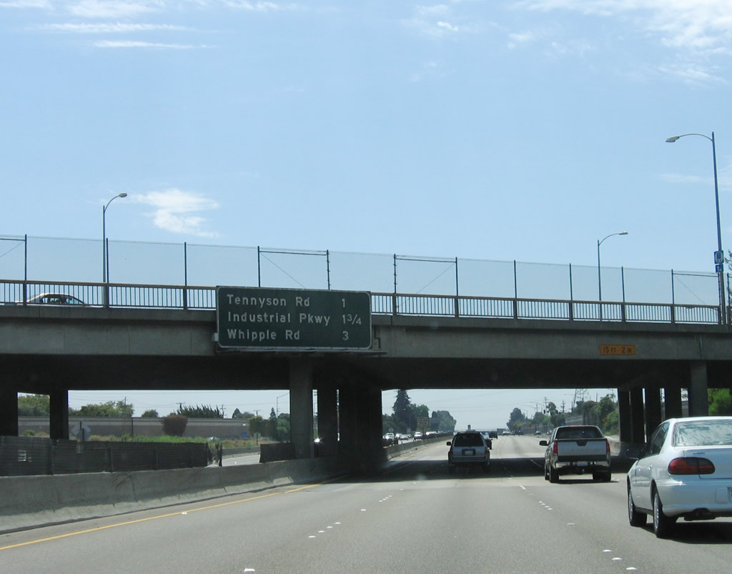 |
This mileage sign provides the distance to the next three exits along Interstate 880 (Nimitz Freeway) south: Exit 26, Tennyson Road; Exit 25, Industrial Parkway; Exit 24, Whipple Road and Dyer Street. Photo taken 08/05/05. |
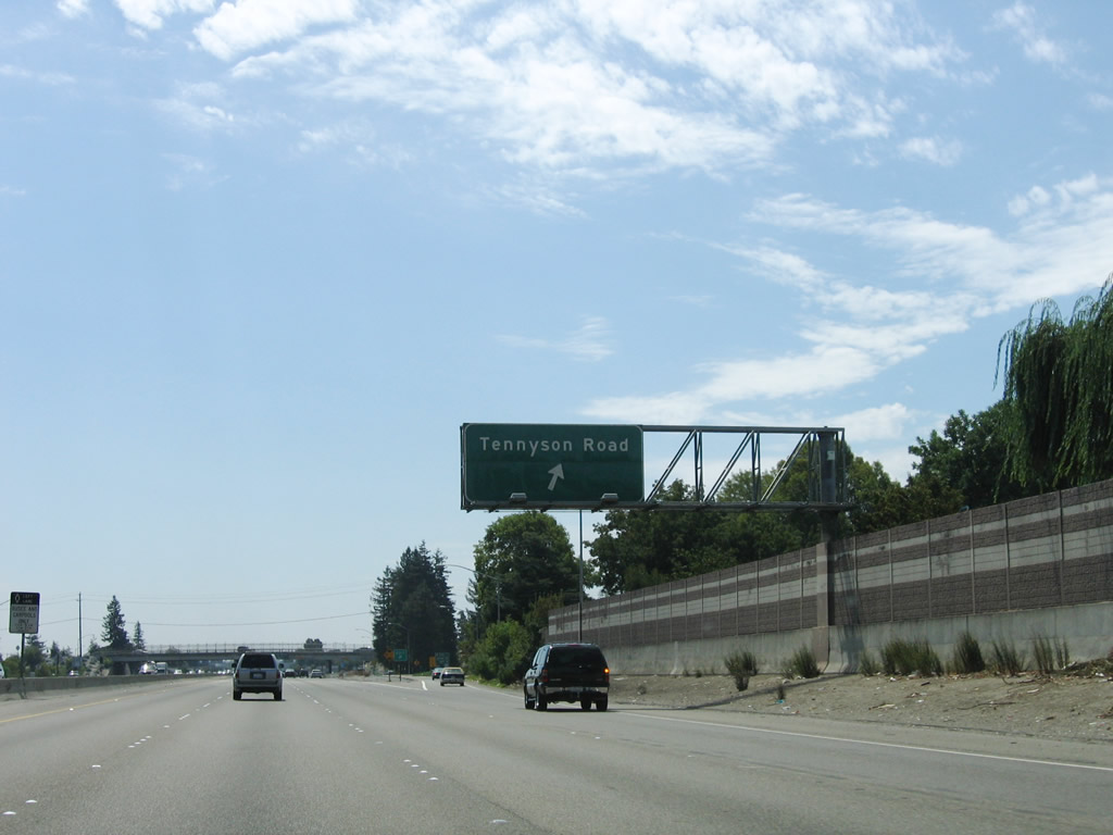 |
Southbound Interstate 880 (Nimitz Freeway) reaches Exit 26, Tennyson Road, which is another modified cloverleaf interchange with collector distributor lanes. Photo taken 08/05/05. |
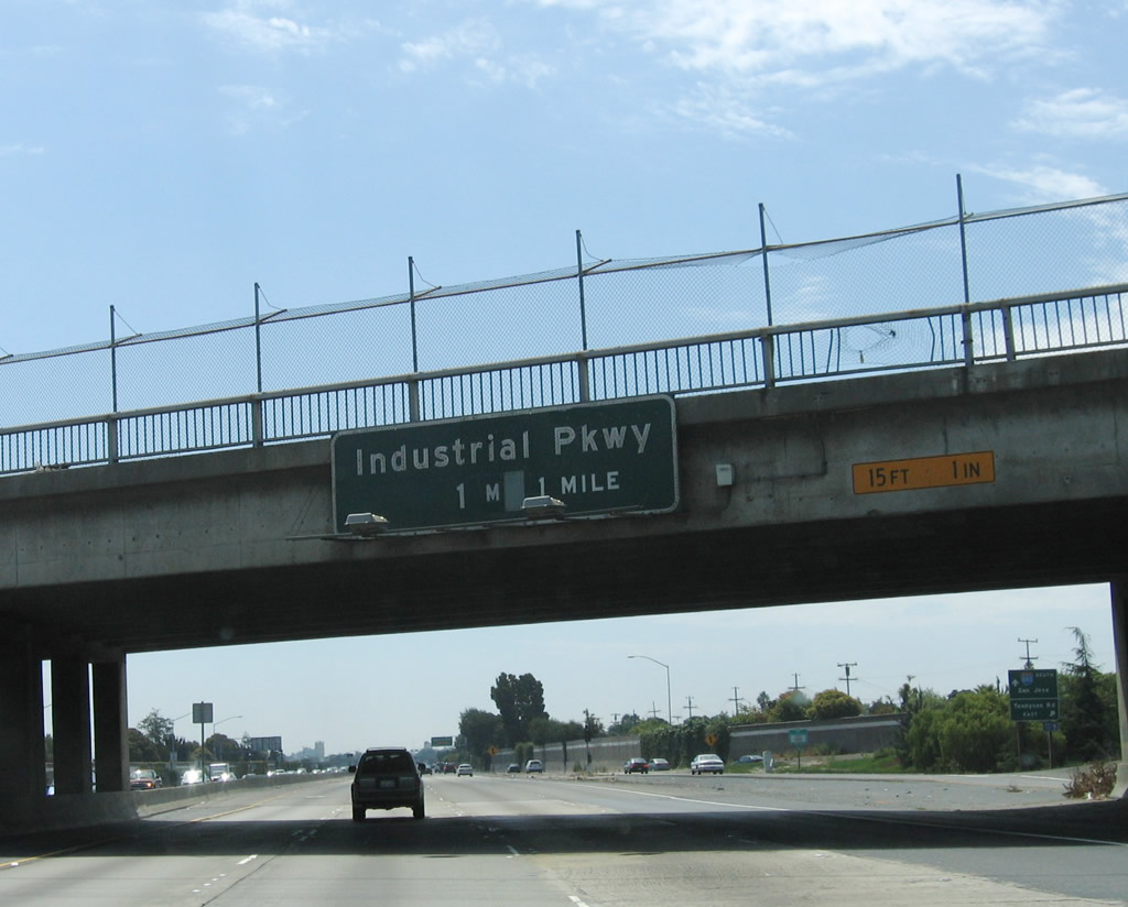 |
The next exit along Interstate 880 (Nimitz Freeway) south is Exit 25, Industrial Parkway. Photo taken 08/05/05. |
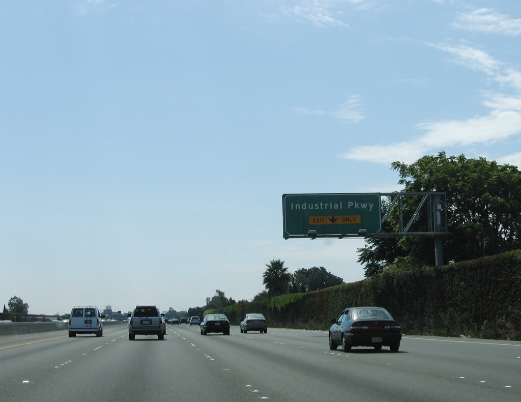 |
The right lane of Interstate 880 (Nimitz Freeway) south becomes exit only for Exit 25, Industrial Parkway, while the left four lanes continue south. This interchange only offers a connection from southbound Interstate 880; there is no access to Industrial Parkway via Interstate 880 north. Photo taken 08/05/05. |
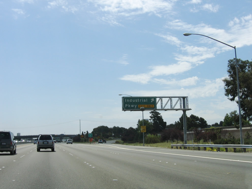 |
Southbound Interstate 880 (Nimitz Freeway) reaches Exit 25, Industrial Parkway. This is the final Hayward interchange. Photo taken 08/05/05. |
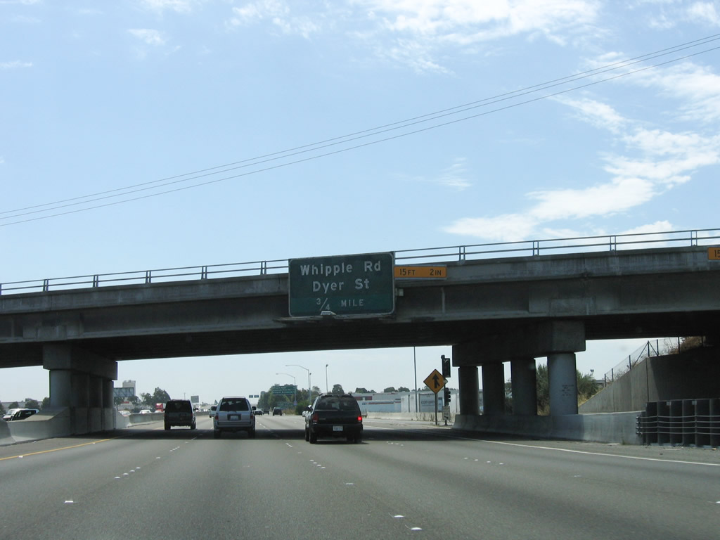 |
The next exit along Interstate 880 (Nimitz Freeway) south is Exit 24, Whipple Road and Dyer Street. Photo taken 08/05/05. |
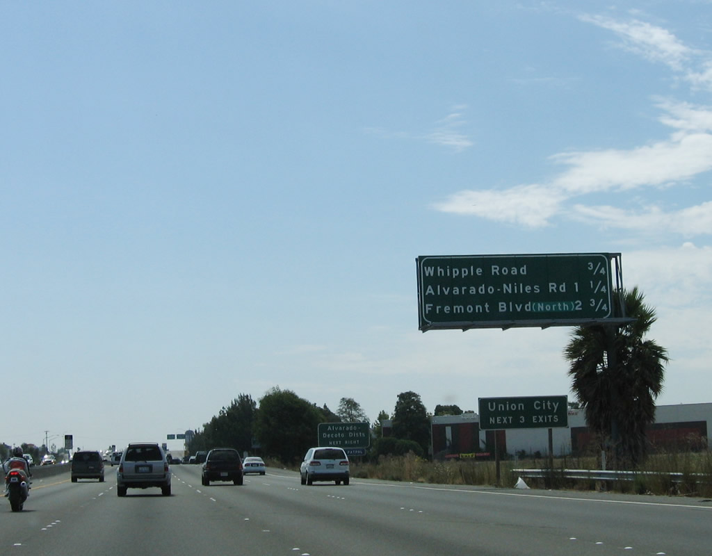 |
This mileage sign provides the distance to the next three exits along Interstate 880 (Nimitz Freeway) south: Exit 24, Whipple Road and Dyer Street; Exit 23, Alvarado-Niles Road; and Exit 22, Alvarado Boulevard and Fremont Boulevard. Each of these interchanges serve the city of Union City, which was incorporated as a general law city on January 13, 1959, and is home to 70,300 people as of the 2000 Census. The actual Hayward-Union City limits are located at the Exit 24 on-ramp. Photo taken 08/05/05. |
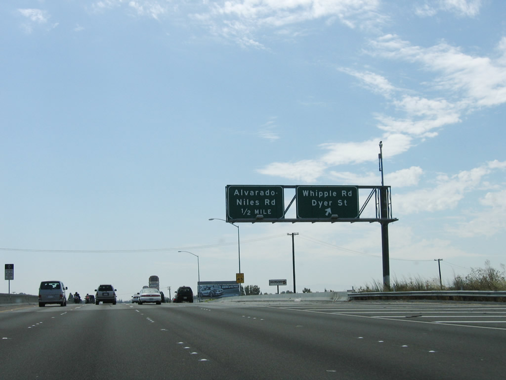 |
Southbound Interstate 880 (Nimitz Freeway) reaches Exit 24, Whipple Road and Dyer Street. The next interchange along southbound is Exit 23, Alvarado-Niles Road. Photo taken 08/05/05. |
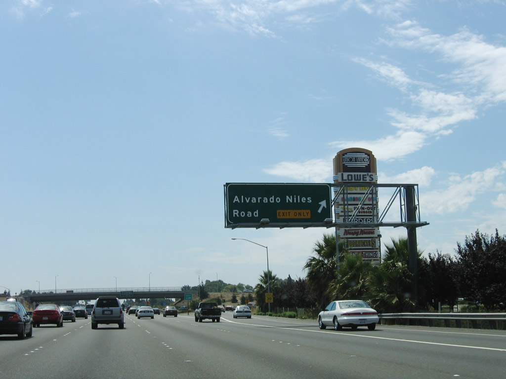 |
Immediately thereafter, southbound Interstate 880 (Nimitz Freeway) reaches Exit 23, Alvarado-Niles Road. Photo taken 08/05/05. |
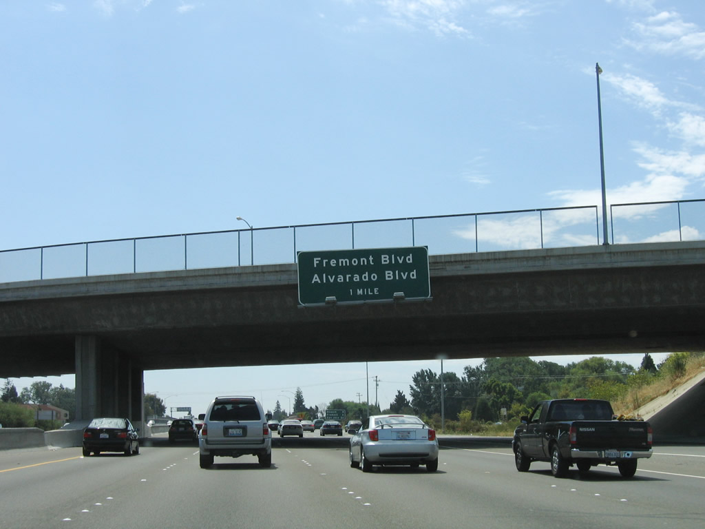 |
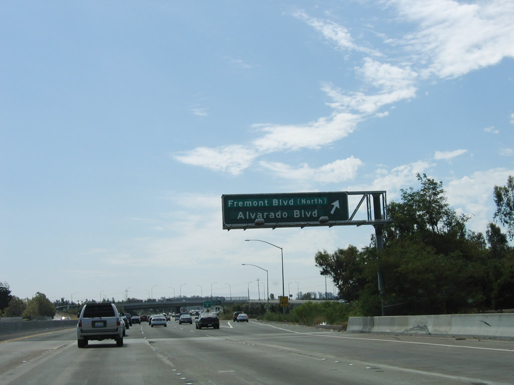
The next exit along Interstate 880 (Nimitz Freeway) south is Exit 22, Alvarado Boulevard and Fremont Boulevard. Photo taken 08/05/05. |
 |
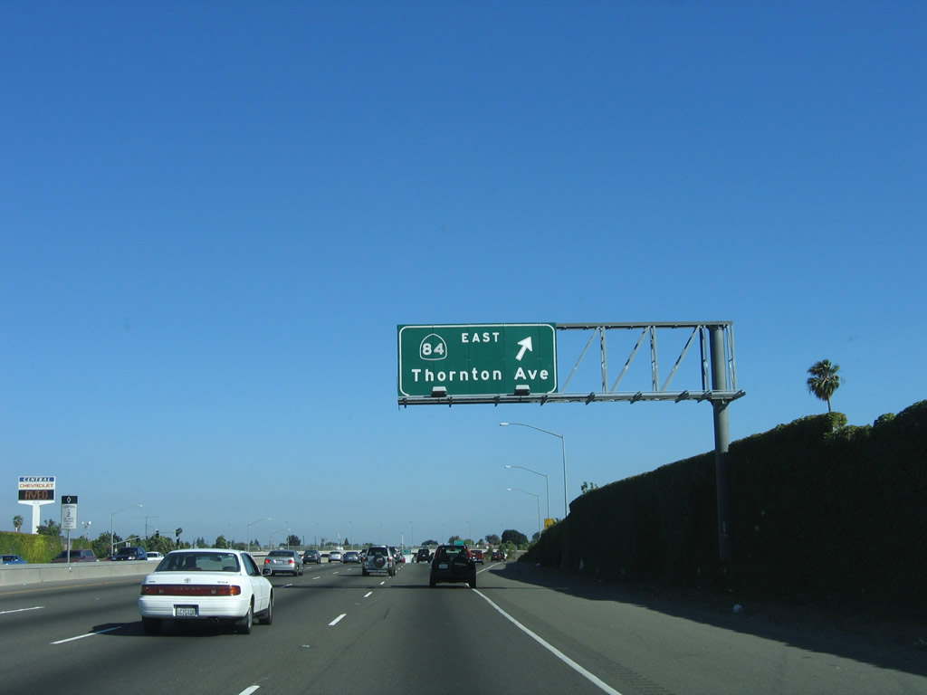
This mileage sign provides the distance to the next three exits along Interstate 880 (Nimitz Freeway) south: Exit 22, Alvarado Boulevard and Fremont Boulevard; Exit 21, California 84/Dumbarton Bridge west and Decoto Road northeast; and Exit 19, California 84/Thornton Avenue east and Thornton Avenue southwest. Photo taken 08/05/05. |
 |
Southbound Interstate 880 (Nimitz Freeway) reaches Exit 22, Alvarado Boulevard and Fremont Boulevard. Interstate 880 enters the city of Fremont. Incorporated on January 23, 1956, the city of Fremont is home to 203,413 people as of the 2000 Census and was formed from the merger of five smaller communities: Centerville, Irvington, Mission San Jose, Niles, and Warm Springs. The city consists of 87.1 square miles and is named for John C. Fremont, the Great Pathfinder. Photo taken 08/05/05. |
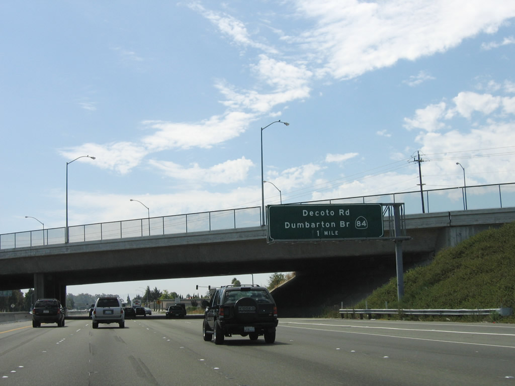 |
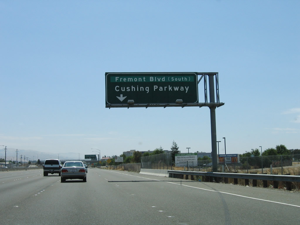
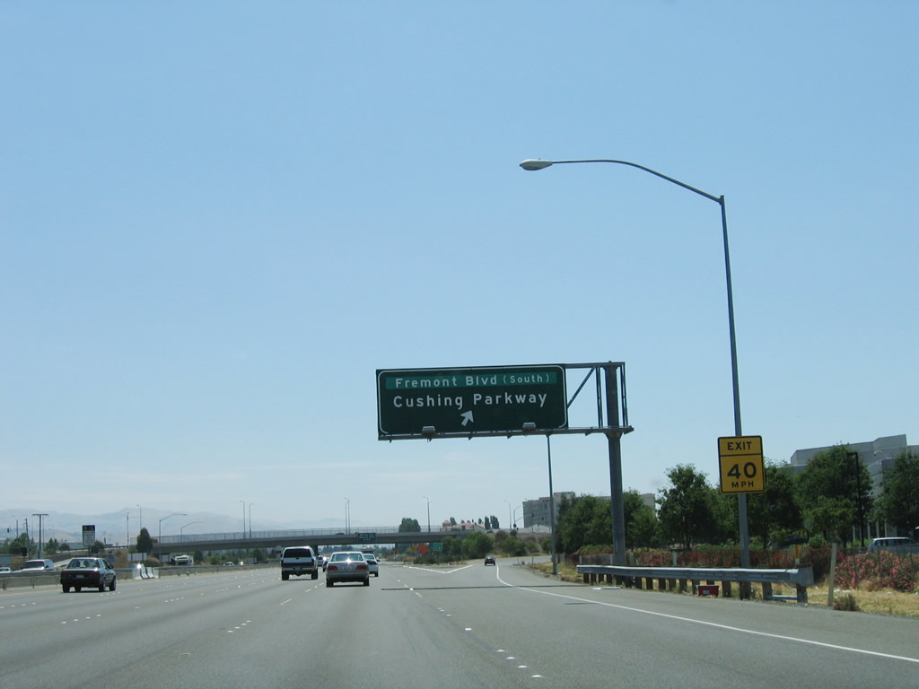
The next exit along Interstate 880 (Nimitz Freeway) south is Exit 21, California 84/Dumbarton Bridge west to Menlo Park and Redwood City in San Mateo County and Decoto Road northeast into the city of Fremont. Photo taken 08/05/05. |
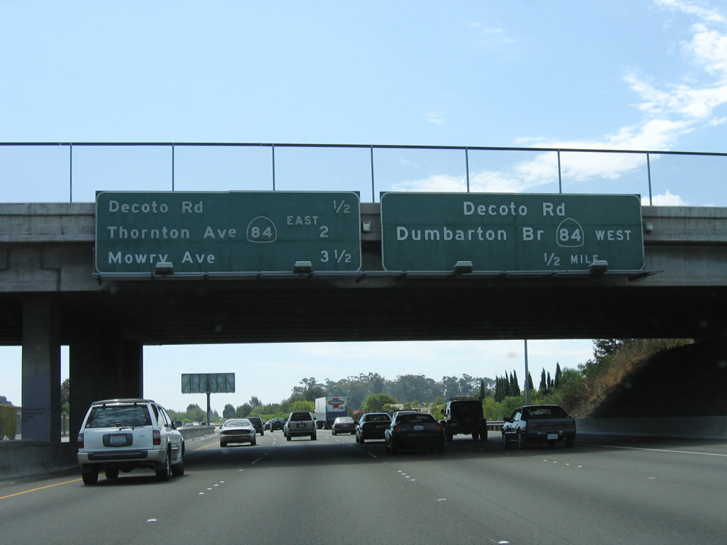 |
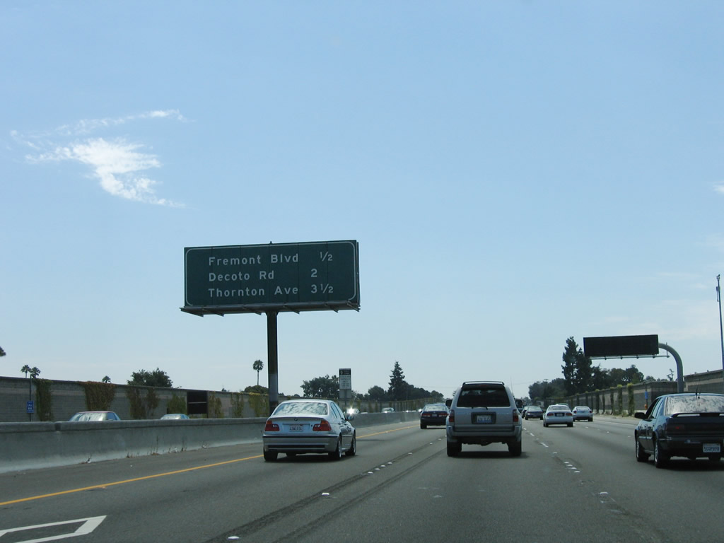
This mileage sign along Interstate 880 (Nimitz Freeway) south provides the distance to the next three exits: Exit 21, California 84/Dumbarton Bridge west and Decoto Road northeast; Exit 19, California 84/Thornton Avenue; and Exit 17, Mowry Avenue to Central Fremont. The Interstate 880 to Route 238 East-West Connector Project, which is part of the Alameda County Transportation Authority program to improve county highways, could result in a realignment of California 84 through Fremont and Union City if constructed, but that is not certain. This proposed east-west expressway (not freeway) corridor has been mired in controversy and funding issues for several years. Photo taken 08/05/05. |
 |
Southbound Interstate 880 (Nimitz Freeway) reaches Exit 21, California 84/Dumbarton Bridge west and Decoto Road northeast. Photo taken 08/05/05. |
 |
Passing under the Decoto Road overpass, the next exit along southbound is Exit 19, California 84/Thornton Avenue. Between Exits 21 and 16, Interstate 880 serves as the city limits between Fremont on the east and Newark on the west side of the freeway. The city of Newark is surrounded by Fremont on all sides (the city was incorporated in September 1955, thus avoiding incorporation with the much larger Fremont, which incorporated in January 1956). Newark incorporated separately in order to avoid becoming an industrial zone, which was discussed during the initial discussions to create the city of Fremont. As of the 2000 Census, Newark is home to 42,471 people. Photo taken 08/05/05. |
| Interstate 880 (Nimitz Freeway) south and California 84 east | |
|---|---|
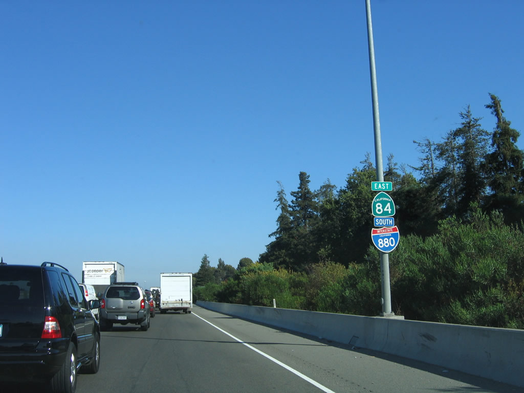 |
After the Interstate 880/California 84 interchange, this reassurance shield assembly for Interstate 880 south and California 84 east is posted. The two routes share an alignment for only two miles; they split at the next interchange (Exit 21, Thornton Avenue). Photo taken 06/29/06. |
 |
This mileage sign along Interstate 880 (Nimitz Freeway) south provides the distance to the next three exits: Exit 19, California 84/Thornton Avenue; Exit 17, Mowry Avenue to Central Fremont; and Exit 16, Stevenson Boulevard. Photo taken 08/05/05. |
 |
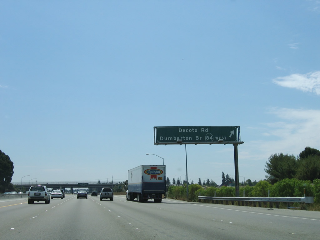
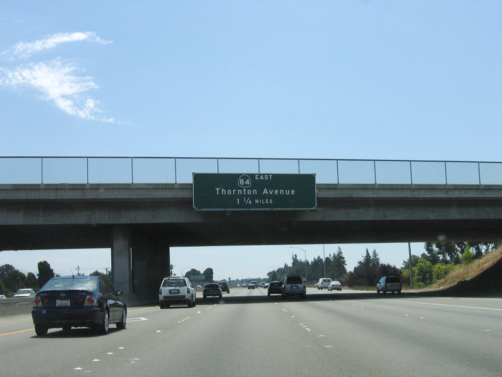
Southbound Interstate 880 and eastbound California 84 split at Exit 19, Thornton Avenue after their brief, nearly two-mile overlap. From here, California 84 will navigate central Fremont via Thornton Avenue northeast, then turn southeast on Fremont Boulevard, then turn east on Peralta Boulevard to Mowry Avenue. To the west, Thornton Avenue is a local street that serves the city of Newark. Between Exit 21 (California 84 west) and Exit 16 (Stevenson Boulevard), Interstate 880 forms the city limits boundary between Newark and Fremont. Photo taken 06/29/06. |
| Interstate 880 (Nimitz Freeway) south | |
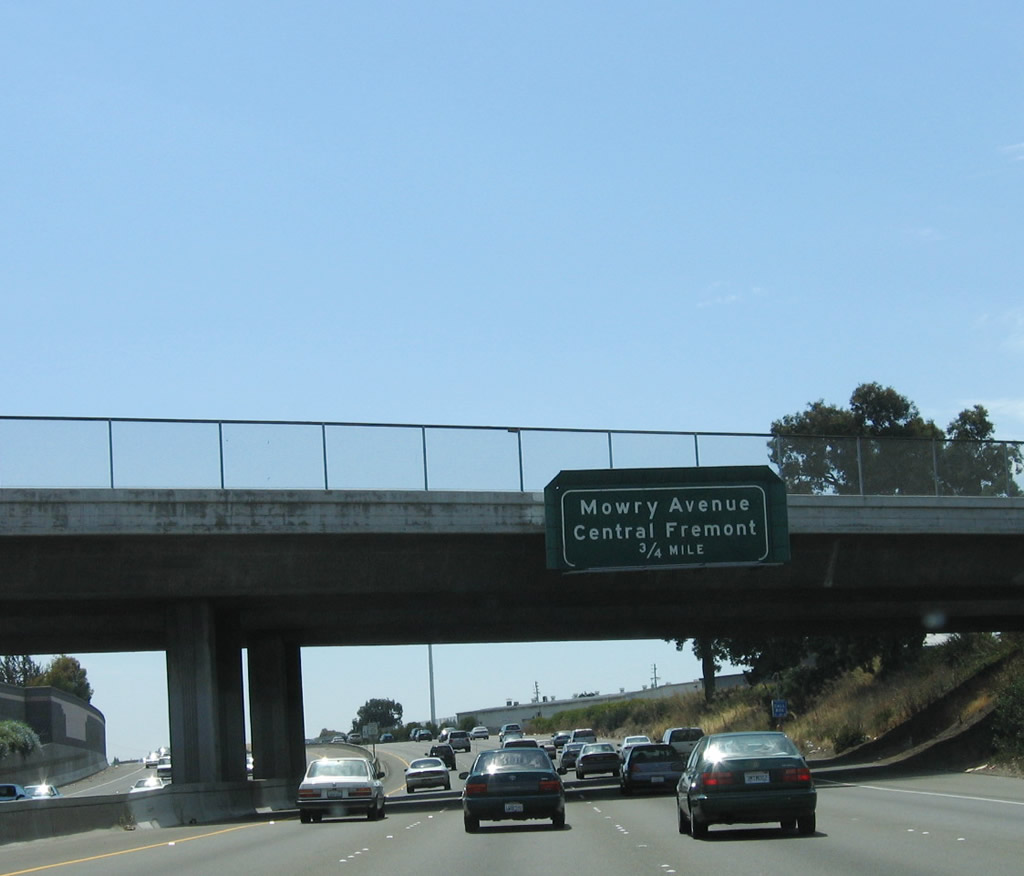 |
The next exit along Interstate 880 (Nimitz Freeway) south is Exit 17, Mowry Avenue northeast to Central Fremont and southwest to the Newpark Mall George M. Sillman Recreation Complex in Newark. Photo taken 08/05/05. |
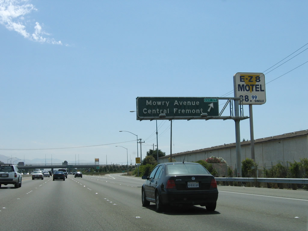 |
Southbound Interstate 880 (Nimitz Freeway) reaches Exit 17, Mowry Avenue. Note the add-on panel that provides the exit number. Photo taken 08/05/05. |
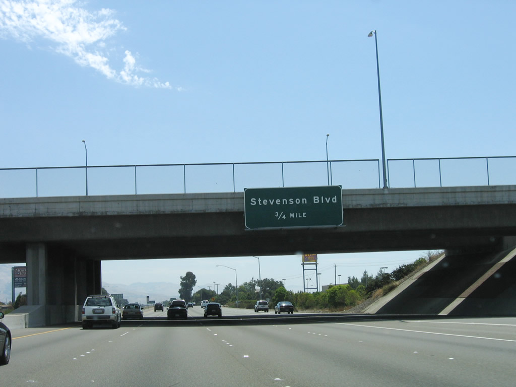 |
The next exit along Interstate 880 (Nimitz Freeway) south is Exit 16, Stevenson Boulevard, three-quarters of a mile. Stevenson Boulevard leads northeast to Fremont Central Park. Photo taken 08/05/05. |
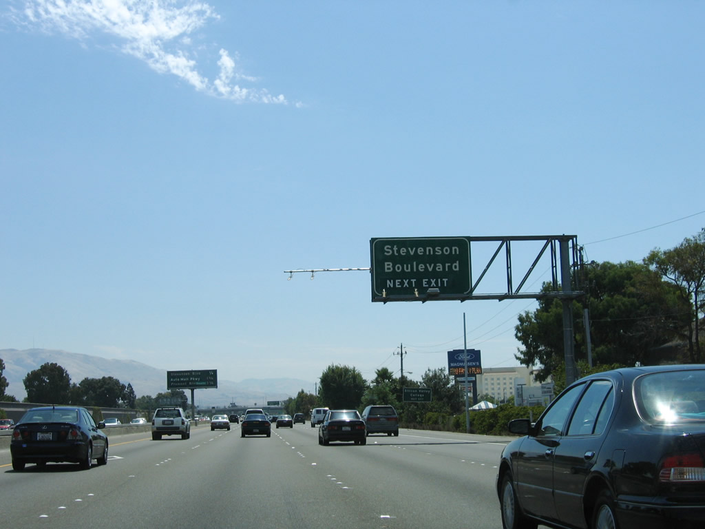 |
Stevenson Boulevard is the last exit to serve the city of Newark. From here, Interstate 880 reenters the city of Fremont. Photo taken 08/05/05. |
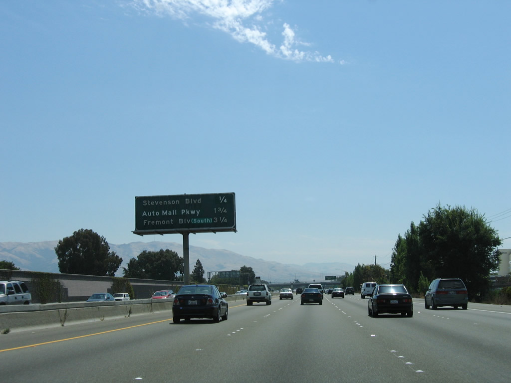 |
This mileage sign along southbound Interstate 880 provides the distance to the next three exits: Exit 16, Stevenson Boulevard; Exit 15, Durham Road and Auto Mall Parkway; and Exit 13, Landing Road and Fremont Boulevard. Photo taken 08/05/05. |
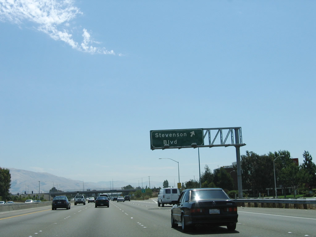 |
Southbound Interstate 880 reaches Exit 16, Stevenson Boulevard. Photo taken 08/05/05. |
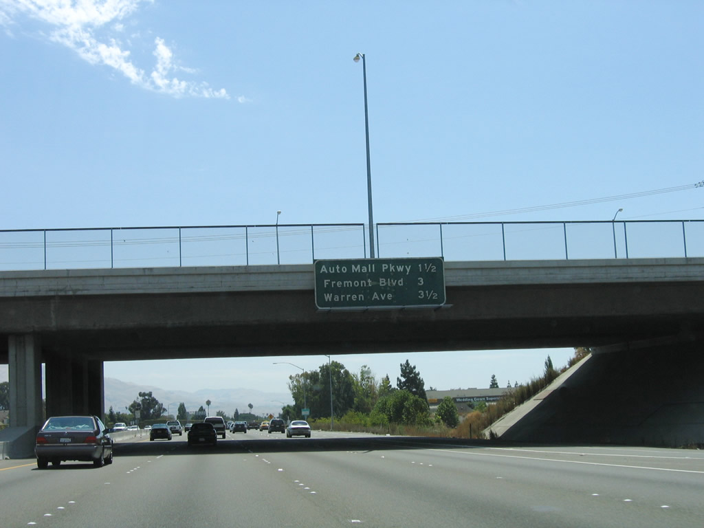 |
This mileage sign along southbound Interstate 880 provides the distance to the next three exits: Exit 15, Durham Road and Auto Mall Parkway; Exit 13, Landing Road and Fremont Boulevard; and Exit 12, California 262 (Mission Boulevard) and Warren Avenue. Photo taken 08/05/05. |
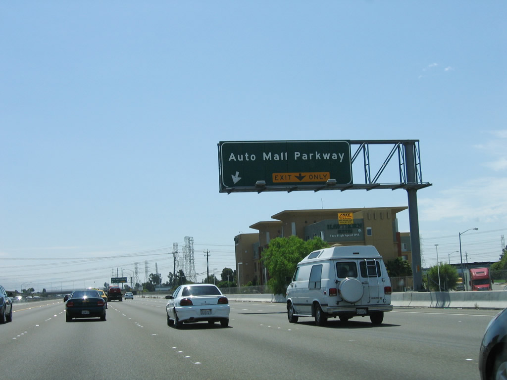 |
Use Auto Mall Parkway (Durham Road) east through the Irvington District of the city of Fremont to Interstate 680 Exit 14. Photo taken 08/05/05. |
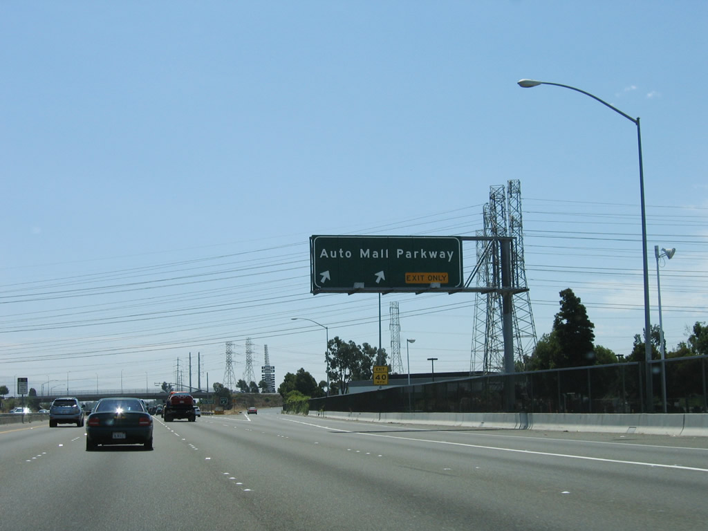 |
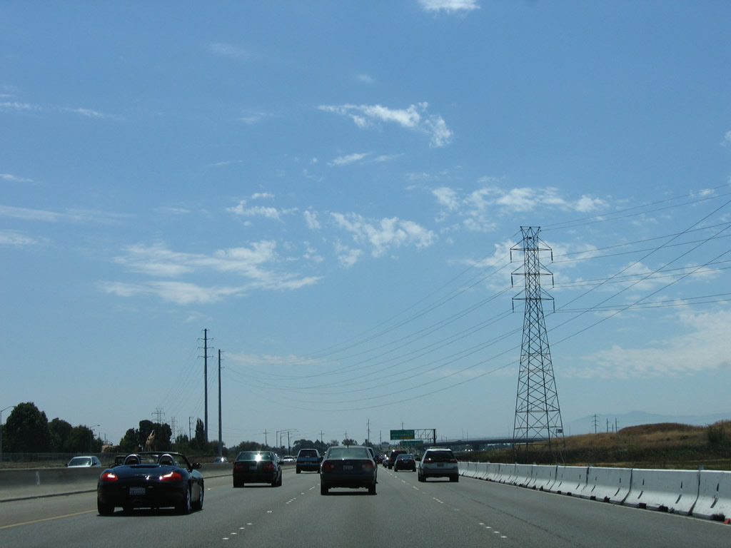
Southbound Interstate 880/Admiral Chester Nimitz Freeway reaches Exit 15, Durham Road and Auto Mall Parkway. A series of Pacific Gas and Electric (PG&E) power lines cross the freeway at this point; a substation is located west of the freeway. Photo taken 08/05/05. |
 |
 |
 |
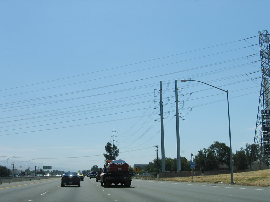
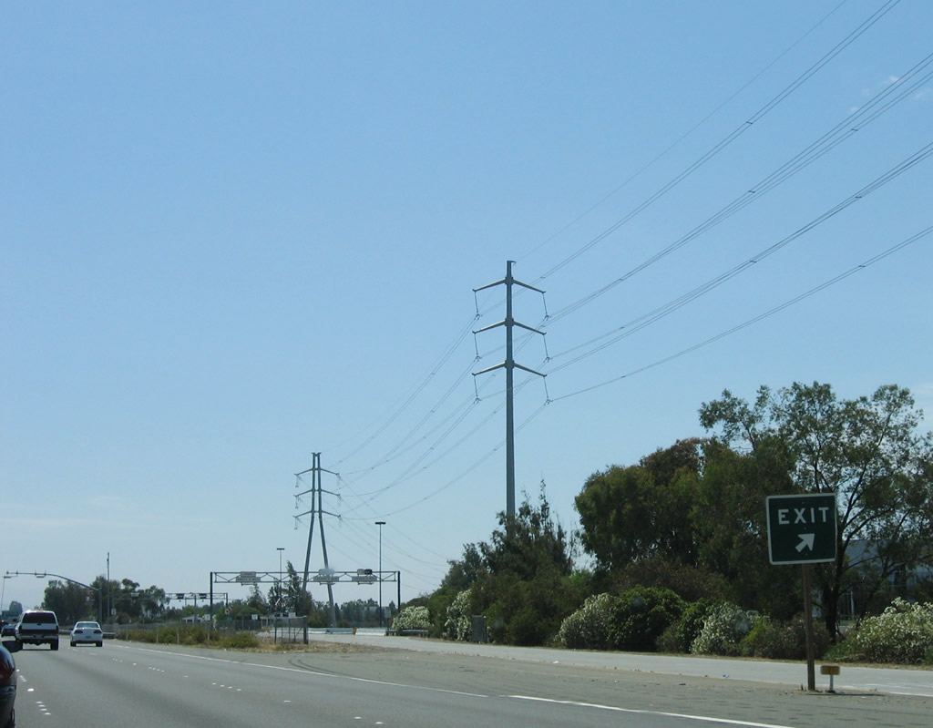
This suite of photos shows Interstate 880 (Nimitz Freeway) south after the Durham Road and Auto Mall Parkway off-ramp. A Pacific Gas and Electric (PG&E) power line follows the freeway, then turns southwest at the weigh station. Photo taken 08/05/05. |
 |
The next exit along Interstate 880 south is Exit 13, Landing Road and Fremont Boulevard. Photo taken 08/05/05. |
 |
Southbound Interstate 880 (Nimitz Freeway) reaches Exit 13, Landing Road and Fremont Boulevard. Photo taken 08/05/05. |
 |
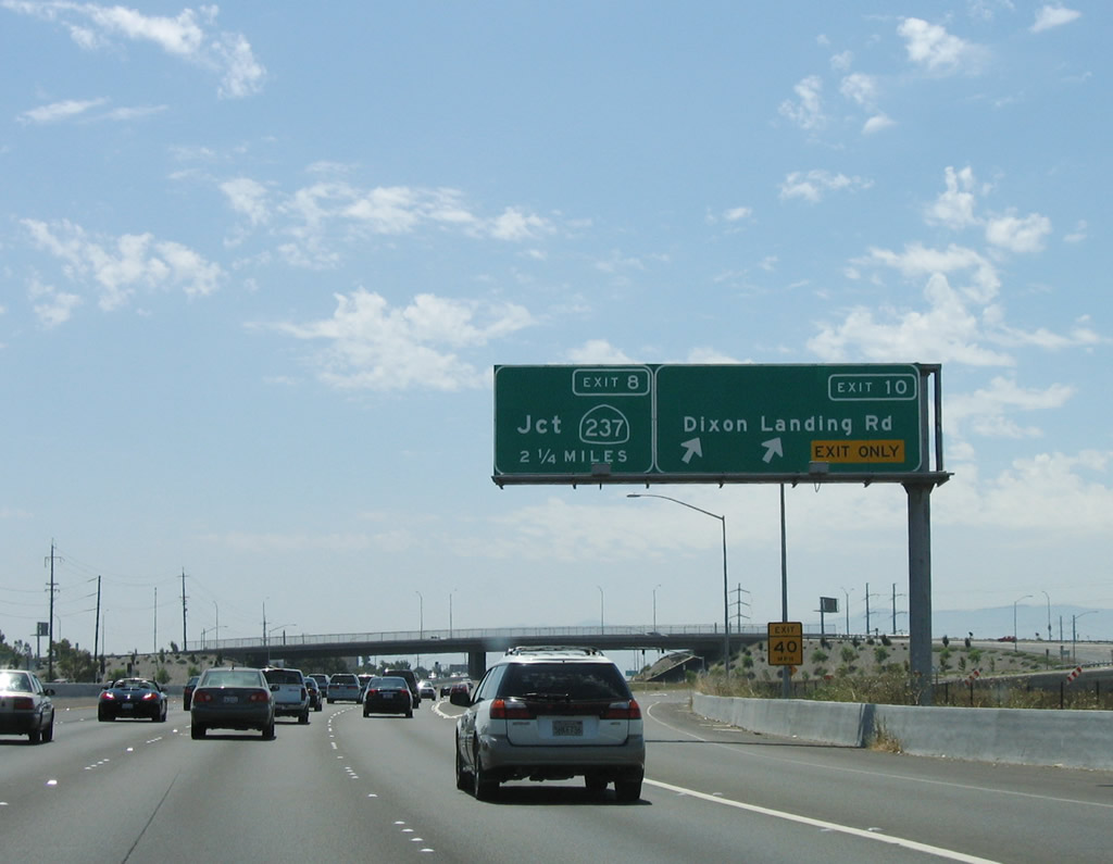
This mileage sign along southbound Interstate 880 provides the distance to the next three exits: Exit 12, California 262 (Mission Boulevard) and Warren Avenue; Exit 10, Dixon Landing Road; and Exit 8C, Junction 237/South Bay Freeway west. Photo taken 08/05/05. |
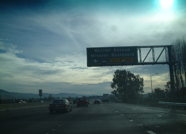 |
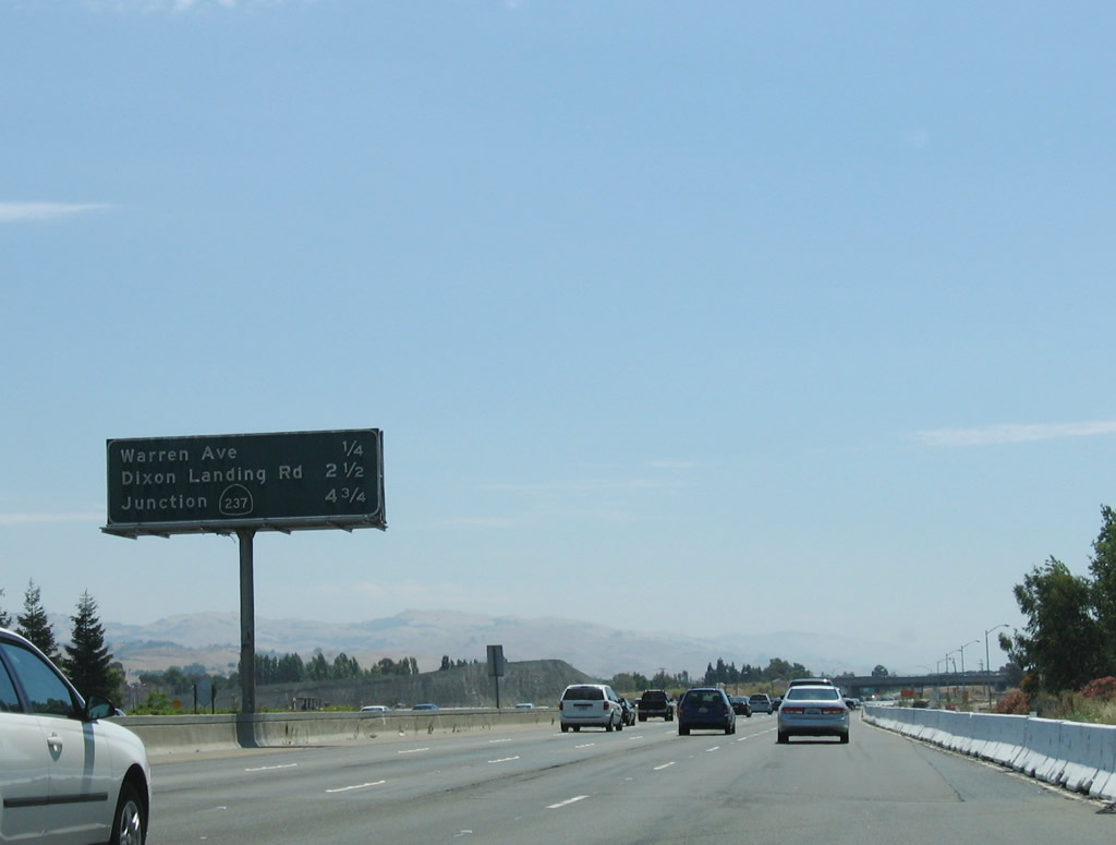
The next exit along Interstate 880 (Nimitz Freeway) south is Exit 12, California 262 (Mission Boulevard) and Warren Avenue. California 262 is a key route to reach Interstate 680, which parallels Interstate 880 closely through Milpitas, but Interstate 680 turns northeast toward Sunol while Interstate 880 continues north toward Oakland. California 262 is in Fremont and remains a divided highway for its entire short length. Plans call for upgrading it to a full freeway. This configuration has changed due to ongoing construction in the area. Photo taken 12/27/01. |
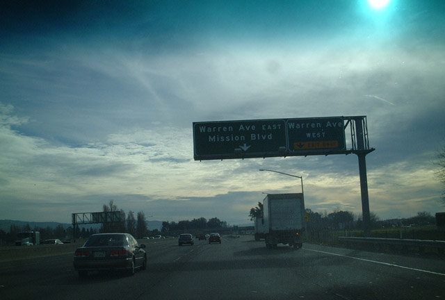 |
Approaching Exit 12, the off-ramp has two connections: the first ramp connects to Warren Avenue west, and the second ramp connects to California 262 (Mission Boulevard) and Warren Avenue east. This configuration has likely changed due to construction. Again notice the absence of California 262 shields here. Photo taken 12/27/01. |
 |
This view shows the off ramp lanes to Warren Avenue and Mission Boulevard. Photo taken 08/05/05. |
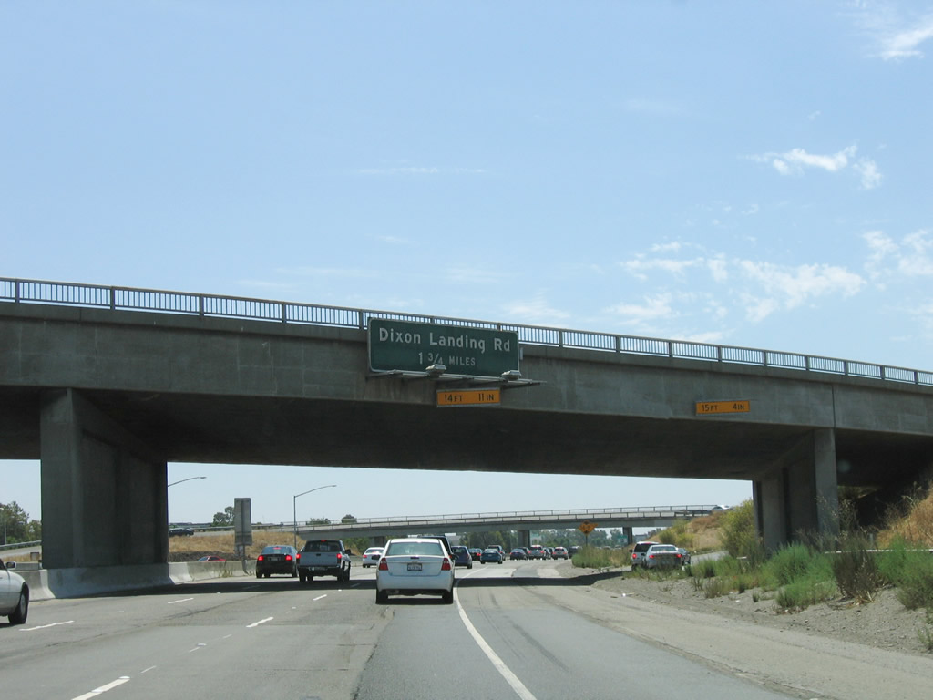 |
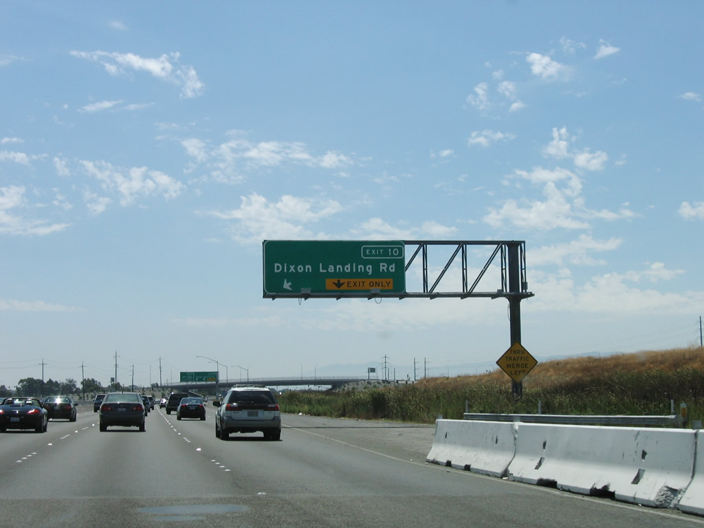
The next exit along southbound Interstate 880 is Exit 10, Dixon Landing Road. Dixon Landing Road is the first exit for the city of Milpitas in Santa Clara County, and it leads west to the San Francisco Bay National Wildlife Refuge. This configuration has changed due to ongoing construction in the area. Photo taken 08/05/05. |
 |
This ramp carries traffic from Interstate 880 south to California 262 (Mission Boulevard) east. Due to the reconstruction of this interchange, this configuration has changed. Photo taken 08/05/05. |
 |
A Pacific Gas and Electric 138kV power line crosses over Interstate 880 after the on-ramp from California 262. Photo taken 08/05/05. |
 |
The right lane of Interstate 880 south becomes exit only for Exit 10, Dixon Landing Road. Photo taken 08/05/05. |
 |
Southbound Interstate 880 reaches Exit 10, Dixon Landing Road. The next interchange is Exits 8C-B, California 237 freeway. Photo taken 08/05/05. |
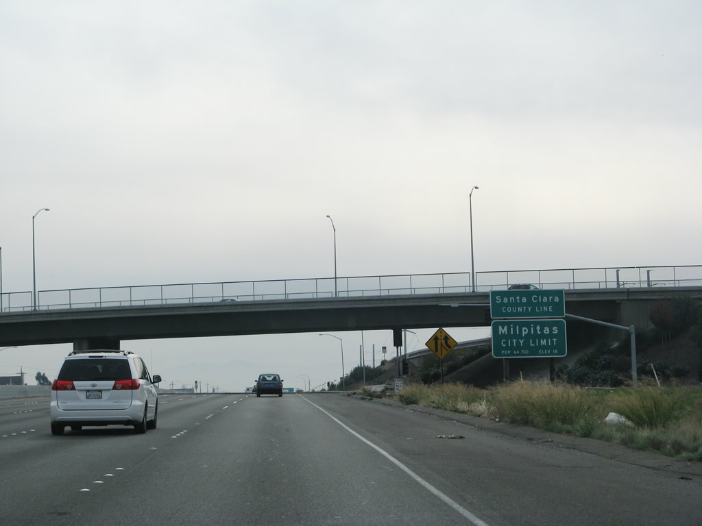 |
Southbound Interstate 880 enters Santa Clara County after the Exit 10 off-ramp and prior to Exit 8B, California 237 (South Bay Freeway). This interchange was upgraded to its current configuration between 2000 and 2006. This has allowed for a freeway-to-freeway connection between Interstate 880 and California 237 as California 237 has slowly evolved into a freeway for its east-west route through Sunnyvale, Santa Clara, and Milpitas. Photo taken 11/25/07. |

Page Updated February 22, 2008.
|
About Contact Glossary |
In The News Interstate Guide |
Social Media:
 |
|
© 2000-25 AARoads.com | All Rights Reserved | Privacy Policy / Terms of Use
|
||