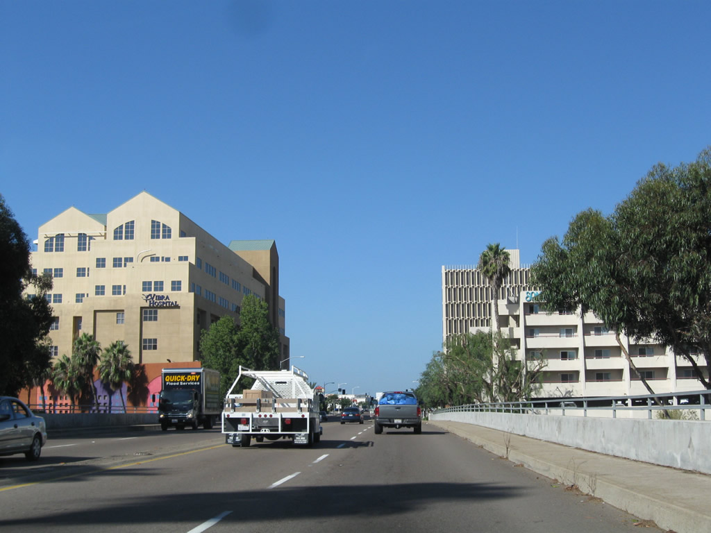
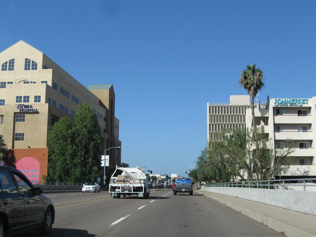
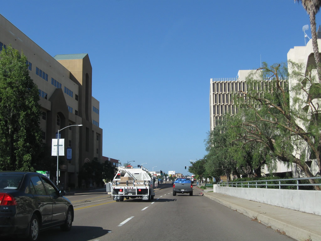
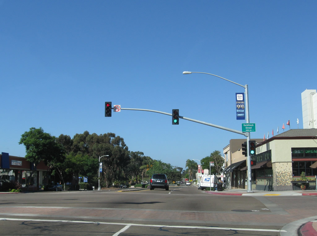
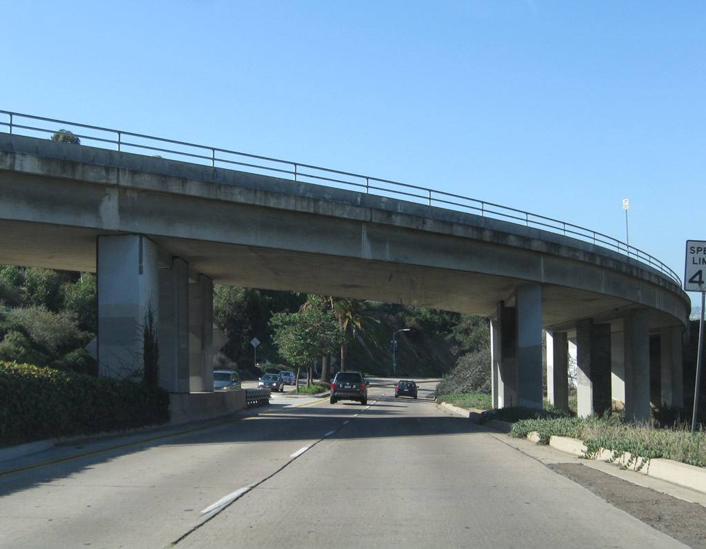
| Sabre Springs Parkway north |
|
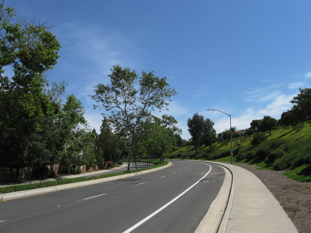
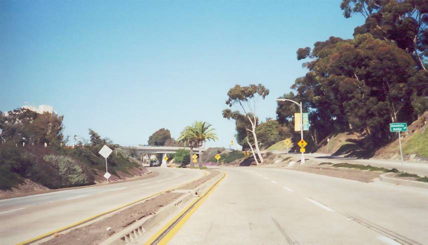
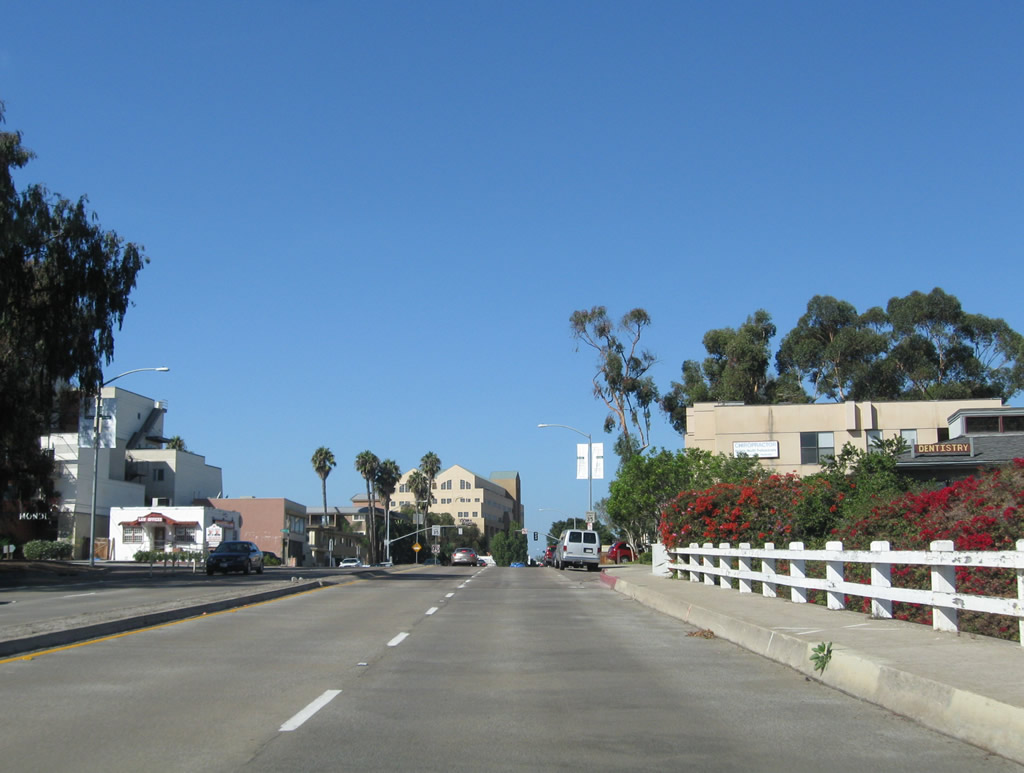
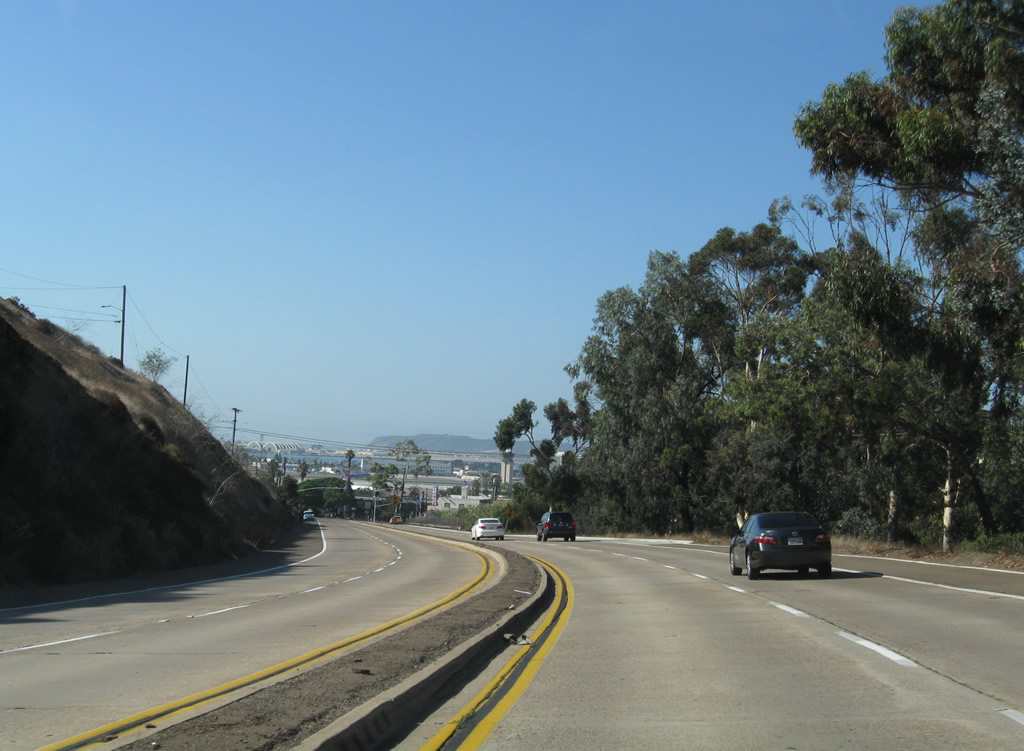
Sabre Springs Parkway travels north through the Sabre Springs community parallel to Interstate 15 and Chicarita Creek. Intersecting streets include Evening Creek Drive and Morning Creek Drive. At Ted Williams Parkway (which connects to California 56), Sabre Springs Parkway transitions directly onto Rancho Carmel Drive. Photo taken 06/05/11. |
|
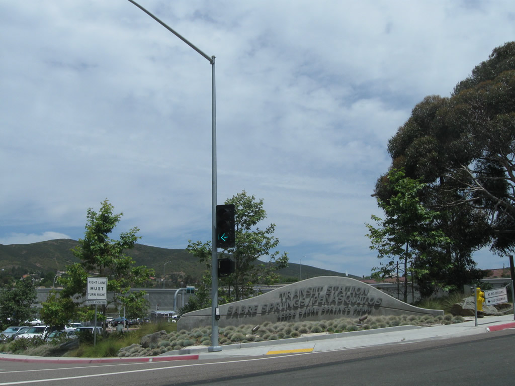
To the Sabre Springs Penasquitos Transit Center, turn left off Sabre Springs Parkway north just before the Ted Williams Parkway interchange. Photo taken 06/05/11. |
|
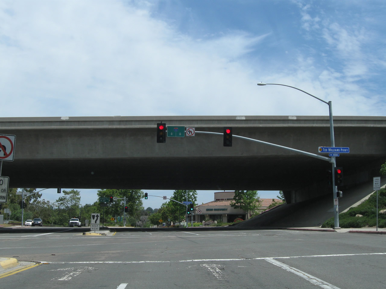
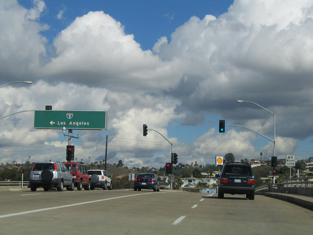
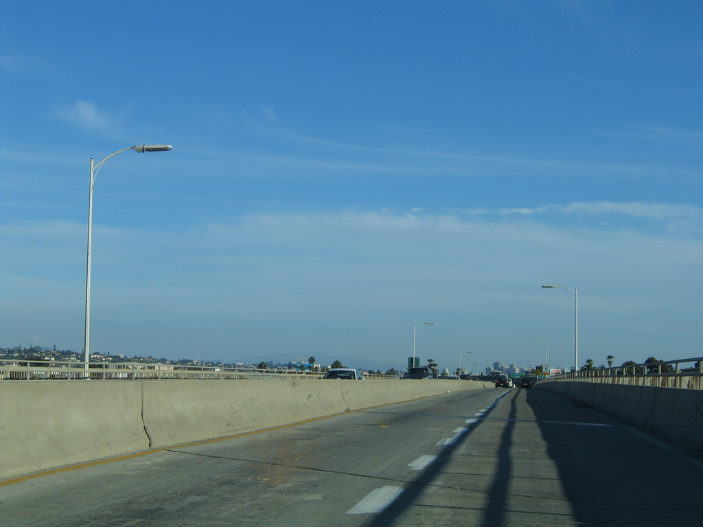
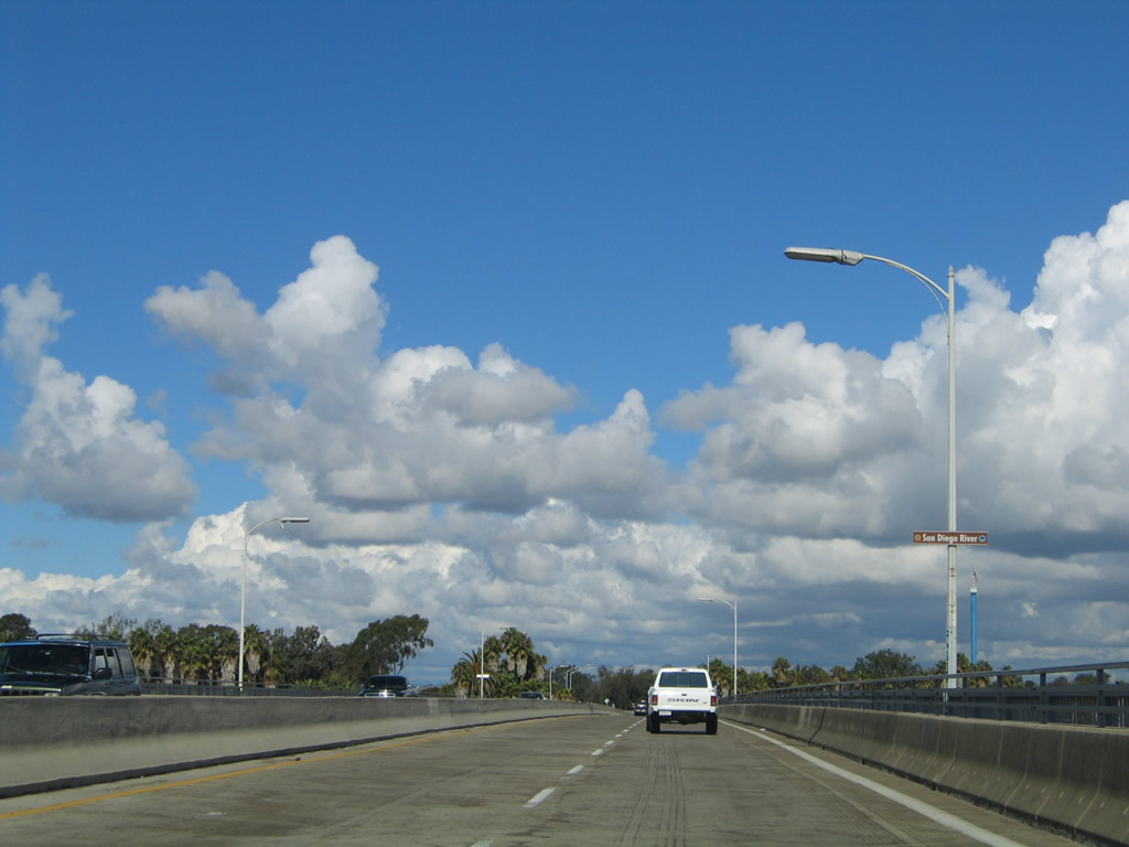
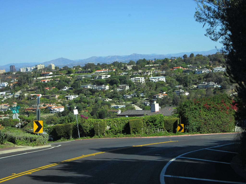
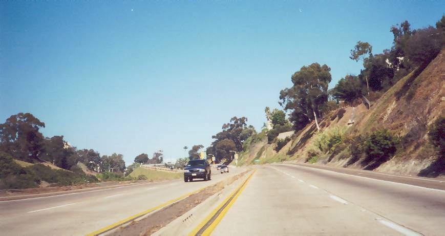
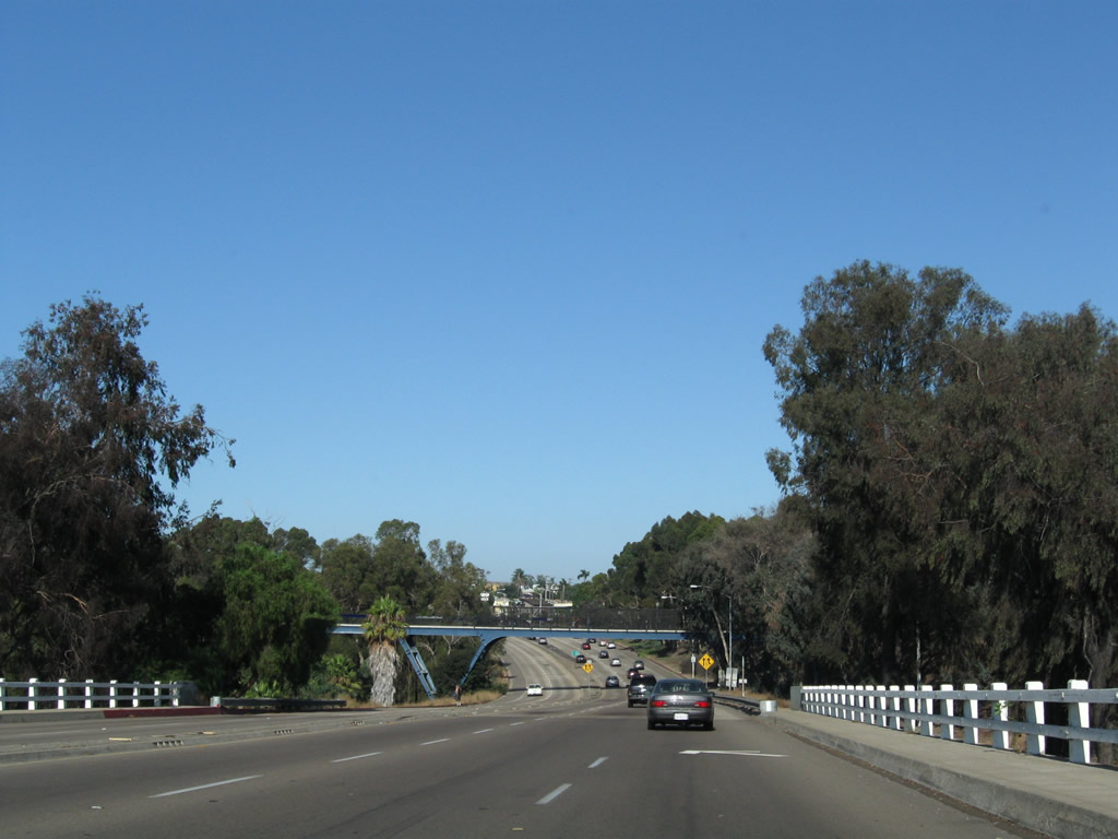
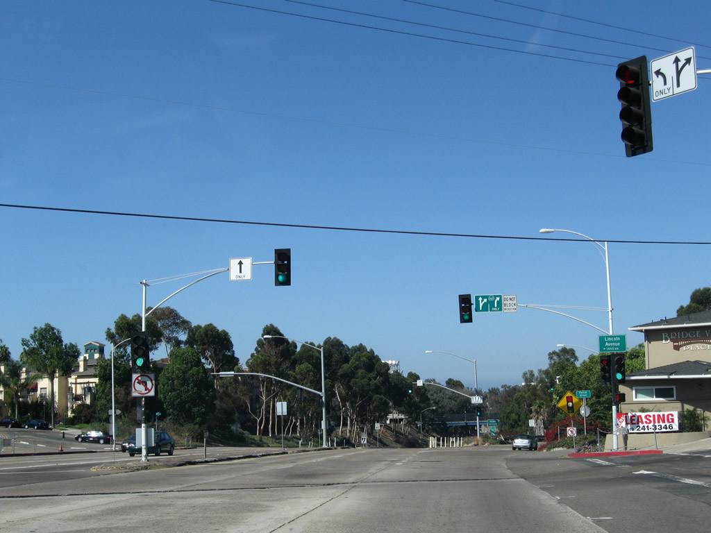
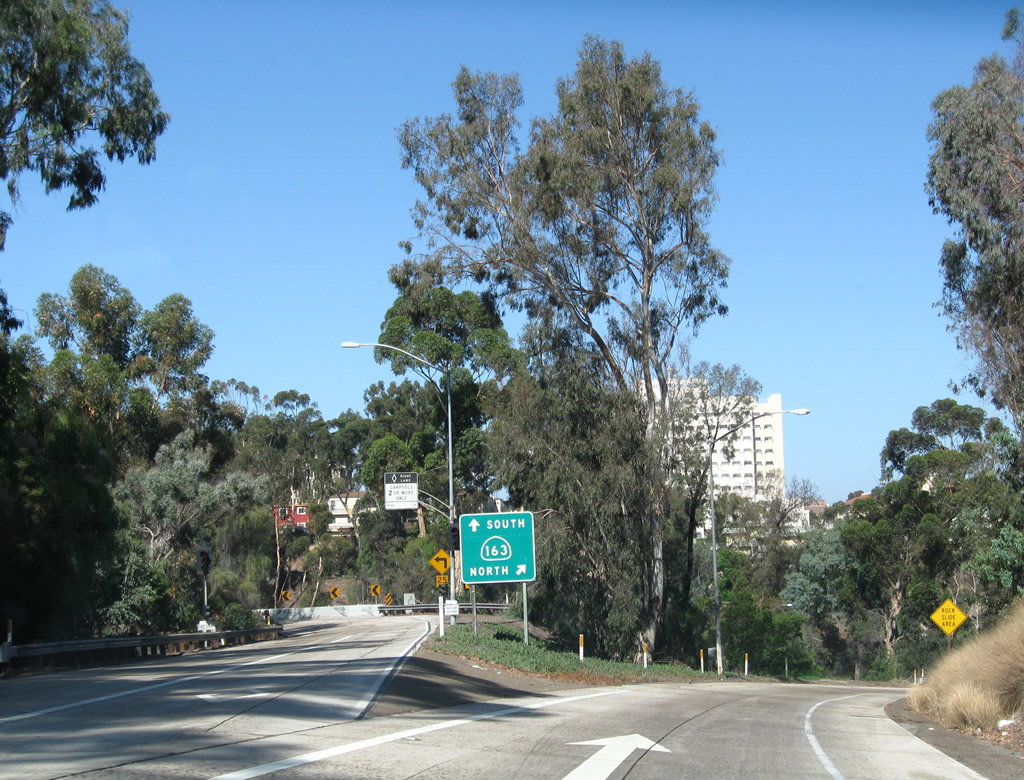
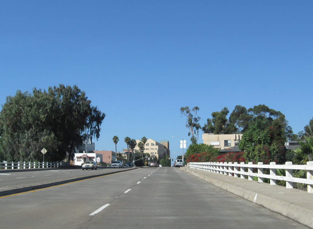
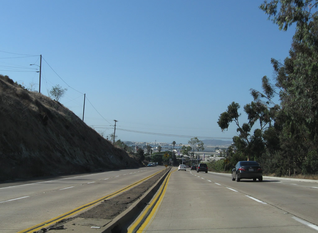
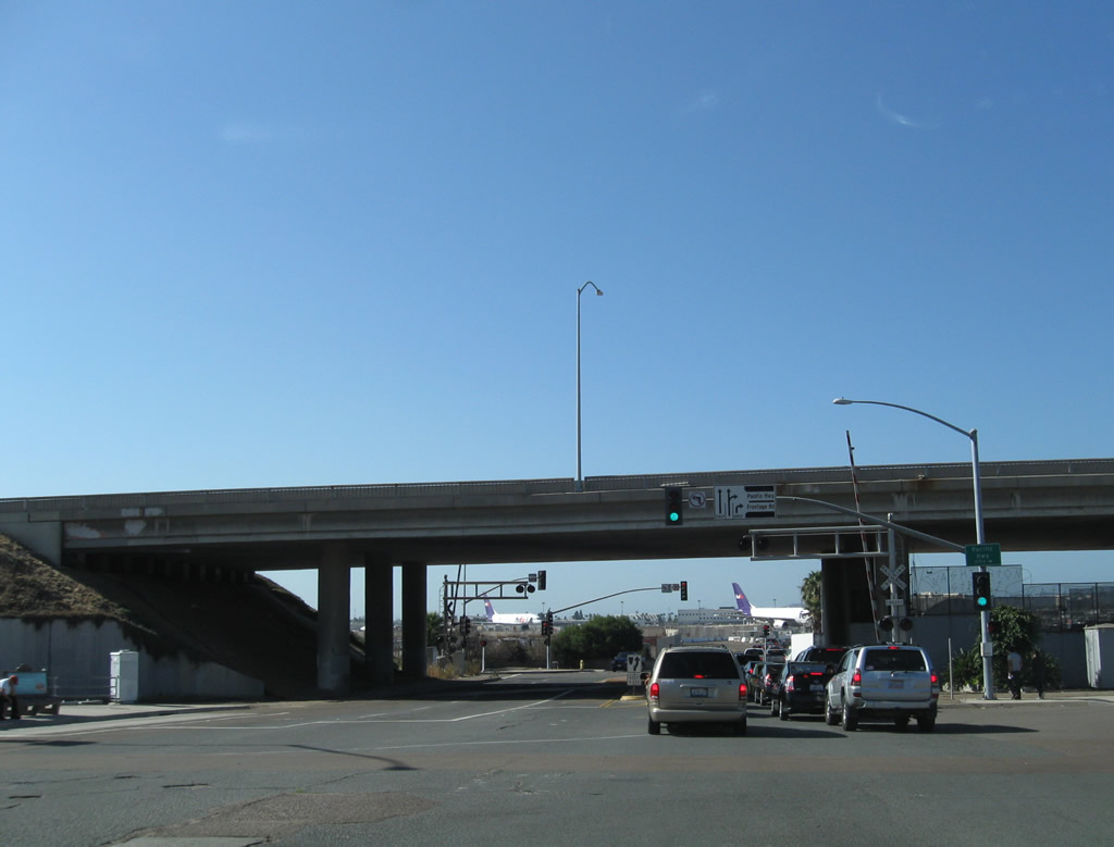
Northbound Sabre Springs Parkway approaches Ted Williams Parkway. Turn left ahead for California 56 west to Carmel Valley and Del Mar or right for Ted Williams Parkway east to Poway. Photo taken 06/05/11. |
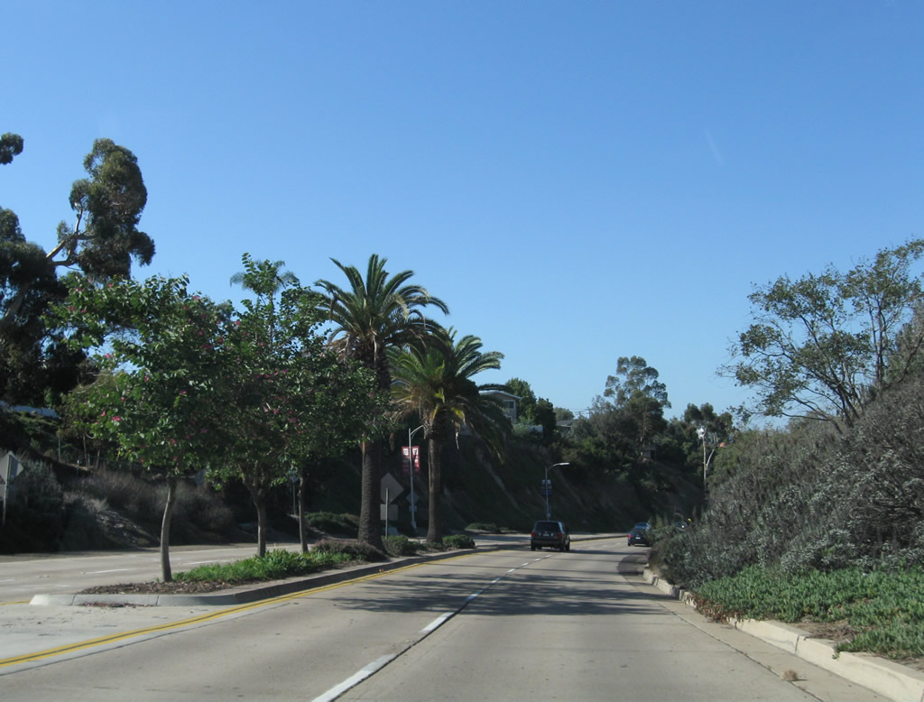
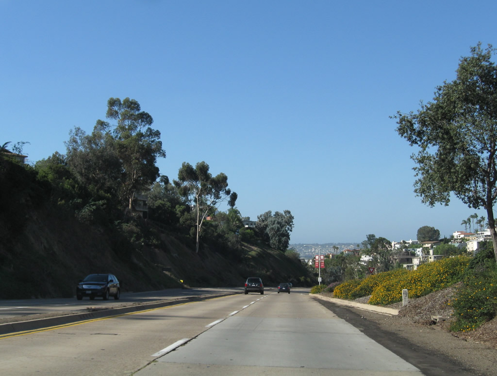
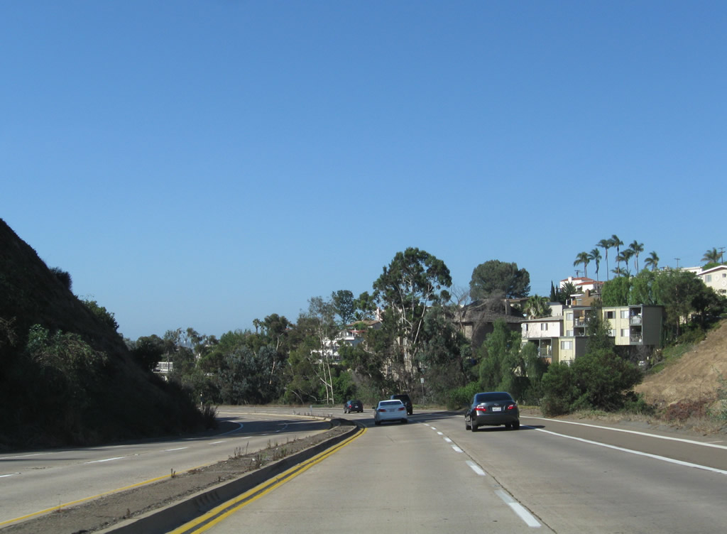
| Sabre Springs Parkway scenes |
|---|
|
|
|
|
|
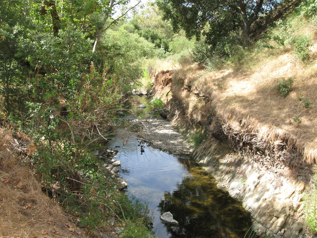
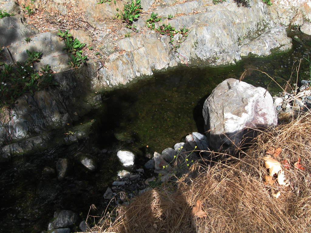
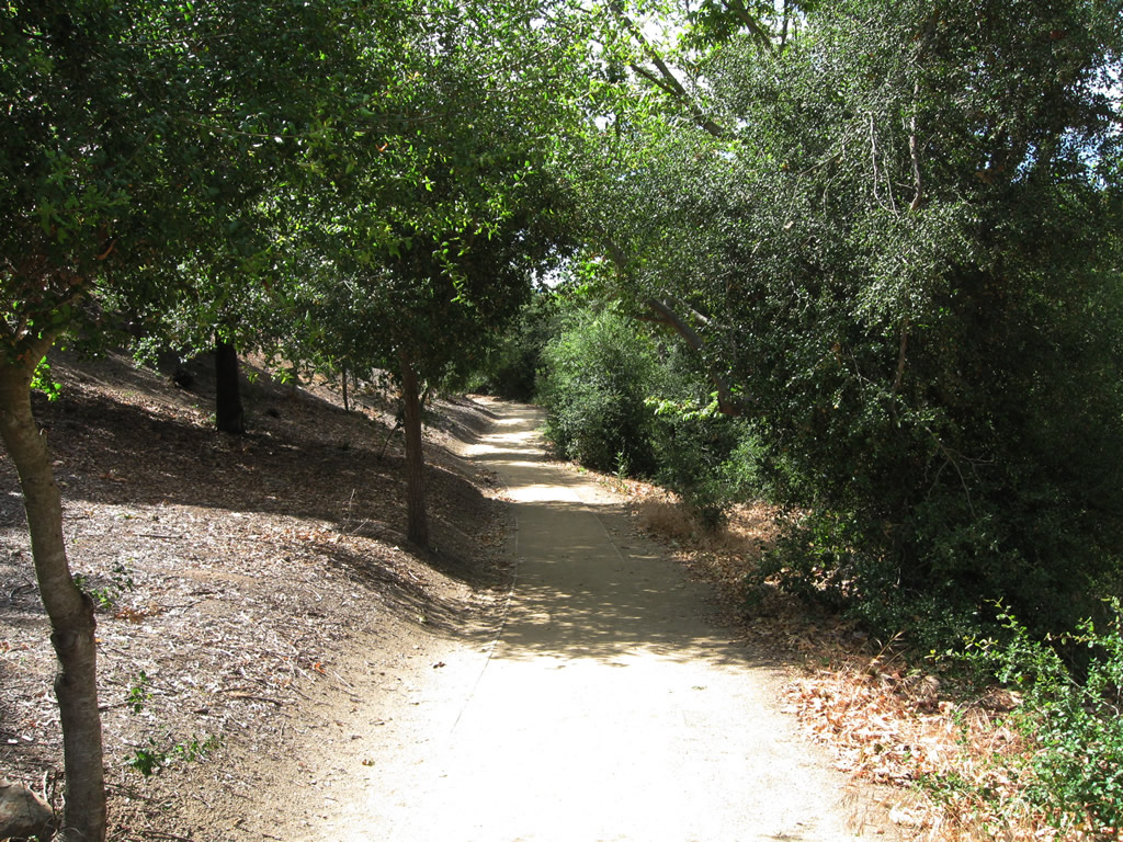
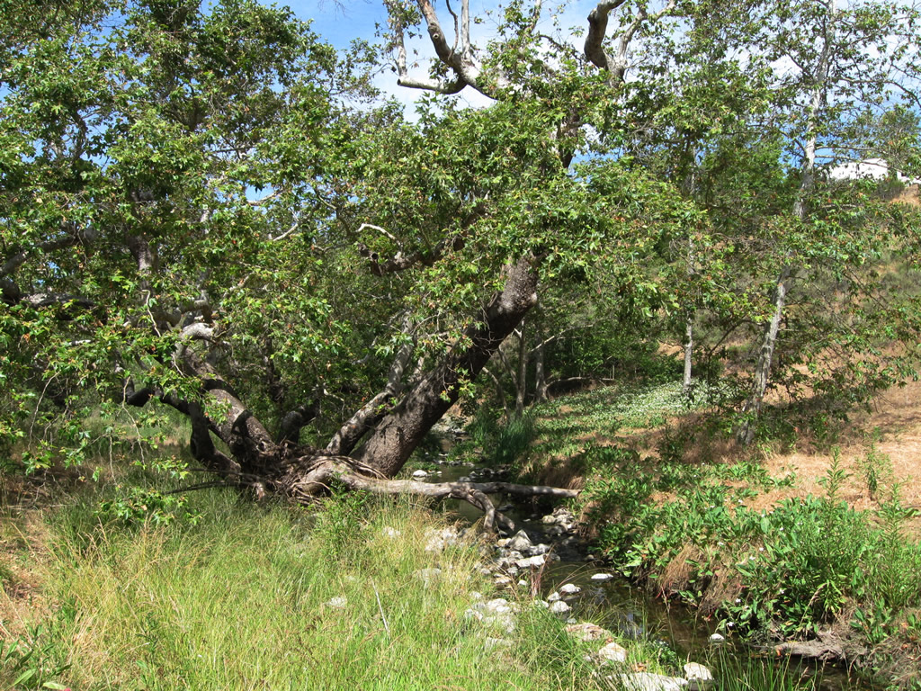
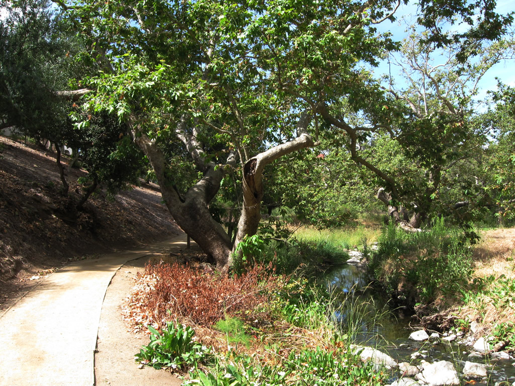
| In the community of Sabre Springs, Chicarita Creek is a stream that flows parallel to Sabre Springs Parkway. A walking path parallels the creek between Morning Creek Drive South and Evening Creek Drive behind the Wimberly Square development. Some of the nearby sycamore trees are quite large being next to bustling stream. To the south, Chicarita Creek flows into Penasquitos Creek. Photos taken 06/05/11. |
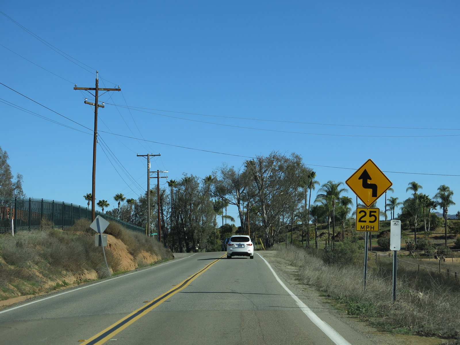
| San Pasqual Road east |
|
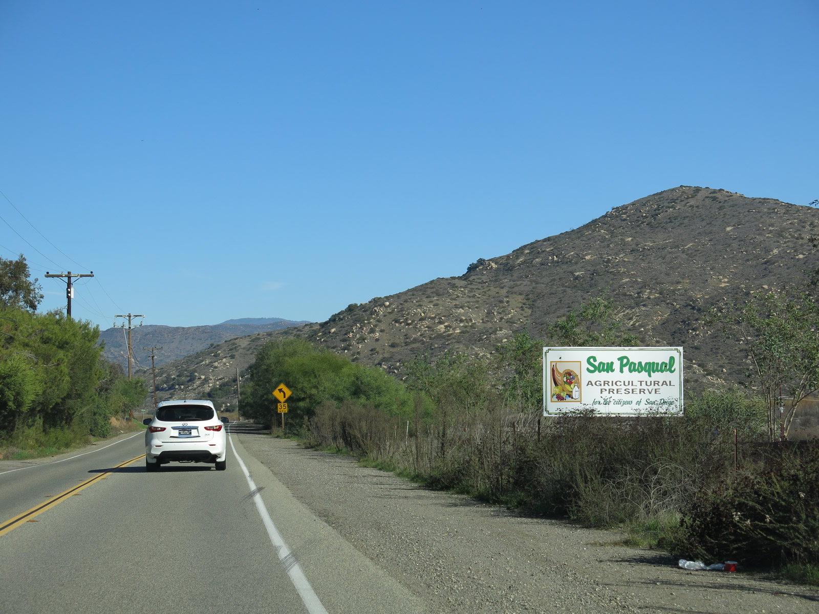
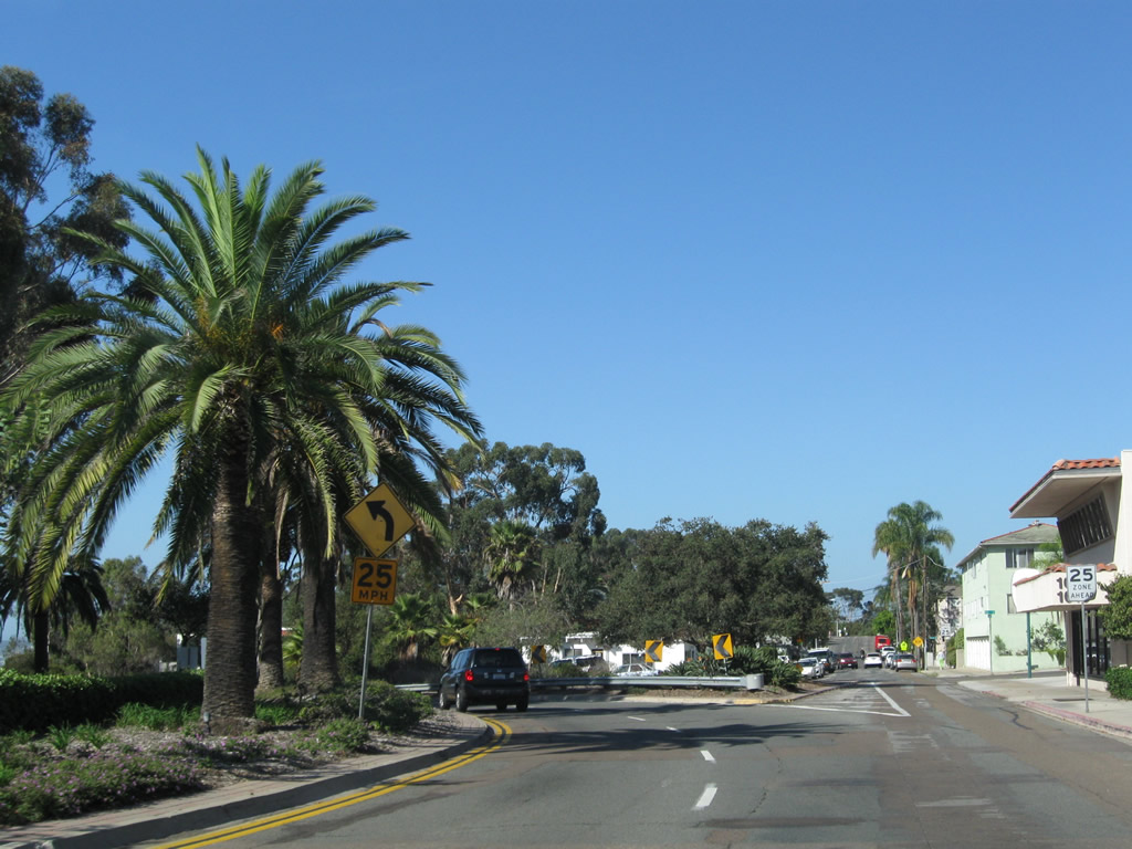
San Pasqual Road connects Bear Valley Parkway with California 78, part of a short-cut connector between Interstate 15 and California 78. It is also part of the principal route from San Diego to the San Diego Zoo Safari Park (formerly Wild Animal Park). Here, eastbound San Pasqual Road proceeds into the San Pasqual Valley agricultural preserve. This sign is near Orfila Winery. Photo taken 01/05/13. |
|
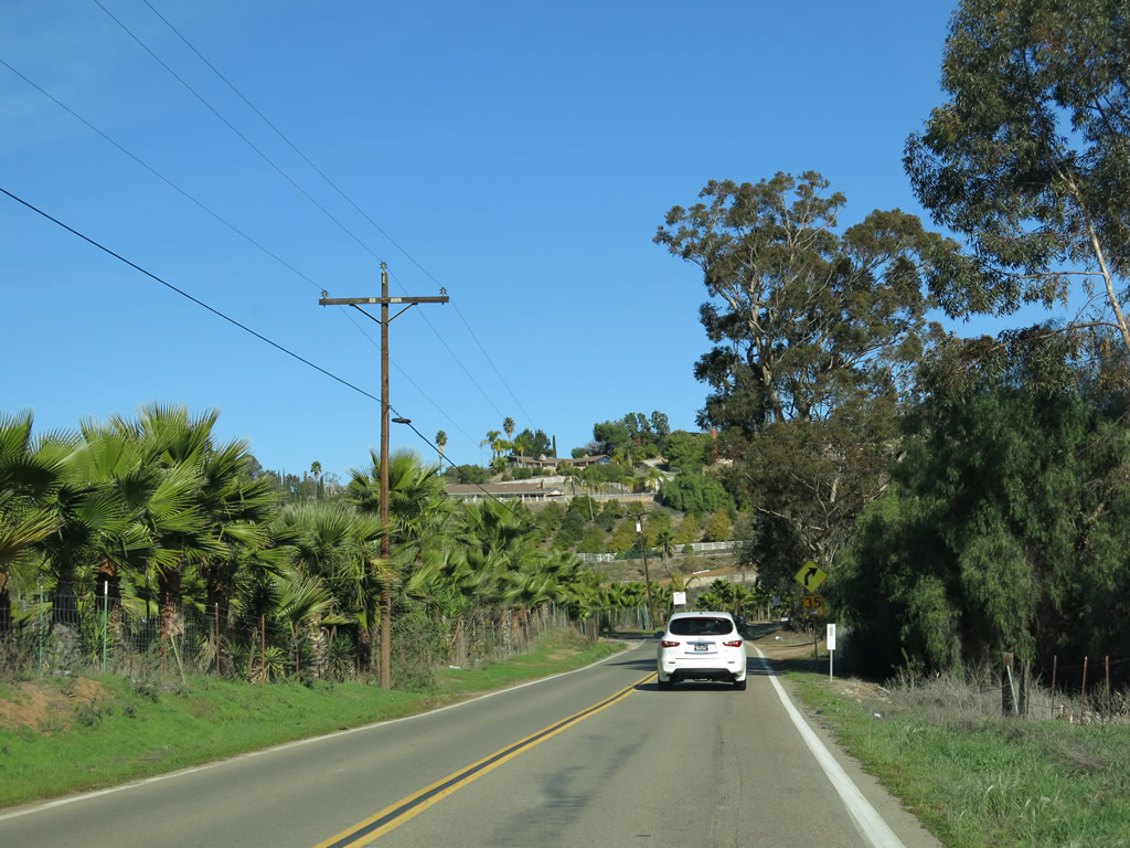
Eastbound San Pasqual Road narrows as it enters the city of San Diego. Photo taken 01/05/13. |
|
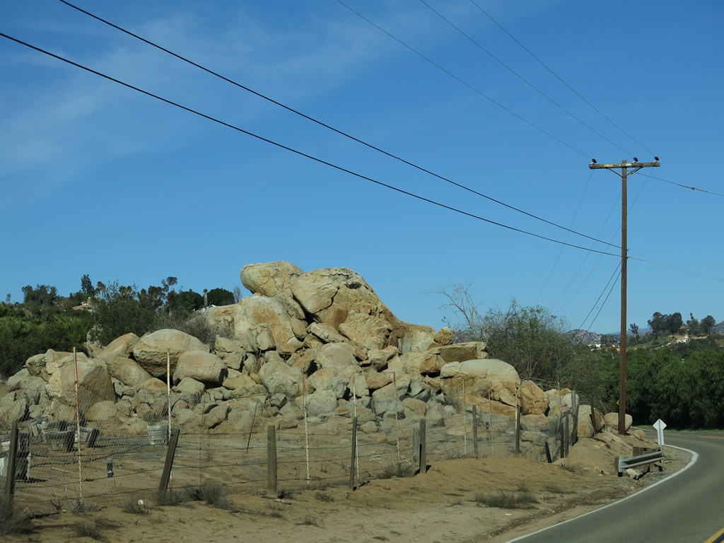
A large pile of boulders lies on the north side of San Pasqual Road after the intersection with Sunset Hills. Photo taken 01/05/13. |
|
Orchards and farms line both sides of San Pasqual Road as it travels through the San Pasqual Valley agricultural preserve. Photo taken 01/05/13. |
|
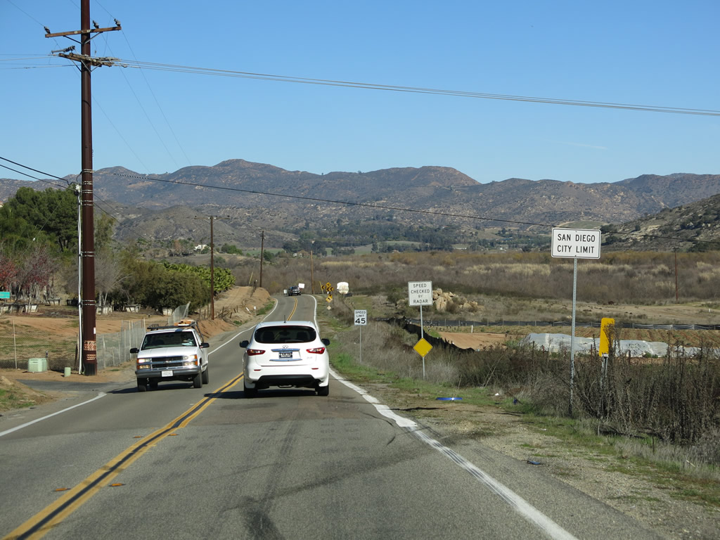
San Pasqual Road crosses the city limits of San Diego and enters unincorporated San Diego County. Photo taken 01/05/13. |
|
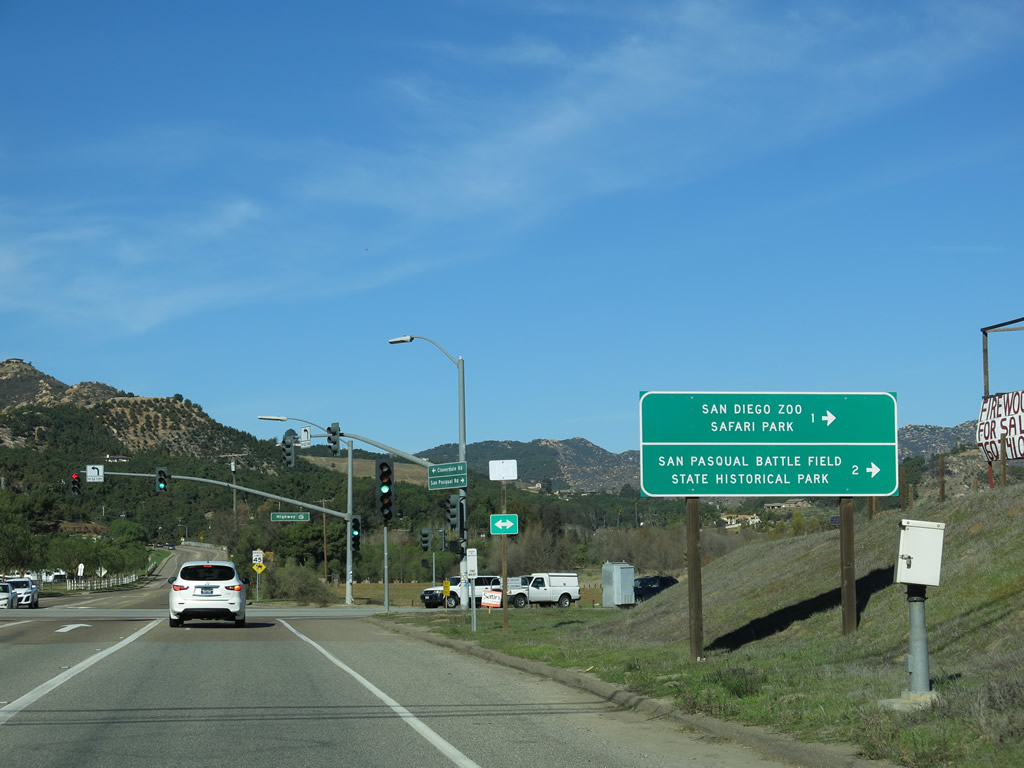
Eastbound San Pasqual Road approaches California 78, which serves as the northeastern terminus of San Pasqual Valley. Turn left here for California 78 west to downtown Escondido, or turn right here for California 78 east to San Diego Zoo Safari Park (formerly Wild Animal Park) and San Pasqual Battlefield State Historic Park. Also use California 78 east to Julian, Borrego Springs, and Brawley. Photo taken 01/05/13. |
|
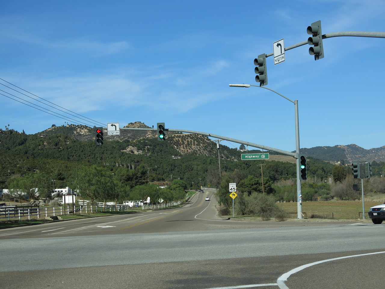
San Pasqual Road meets California 78 in San Pasqual Valley. Cloverdale Road continues straight ahead to provide local and ranch access. Photo taken 01/05/13. |
| Santo Road north |
|
|
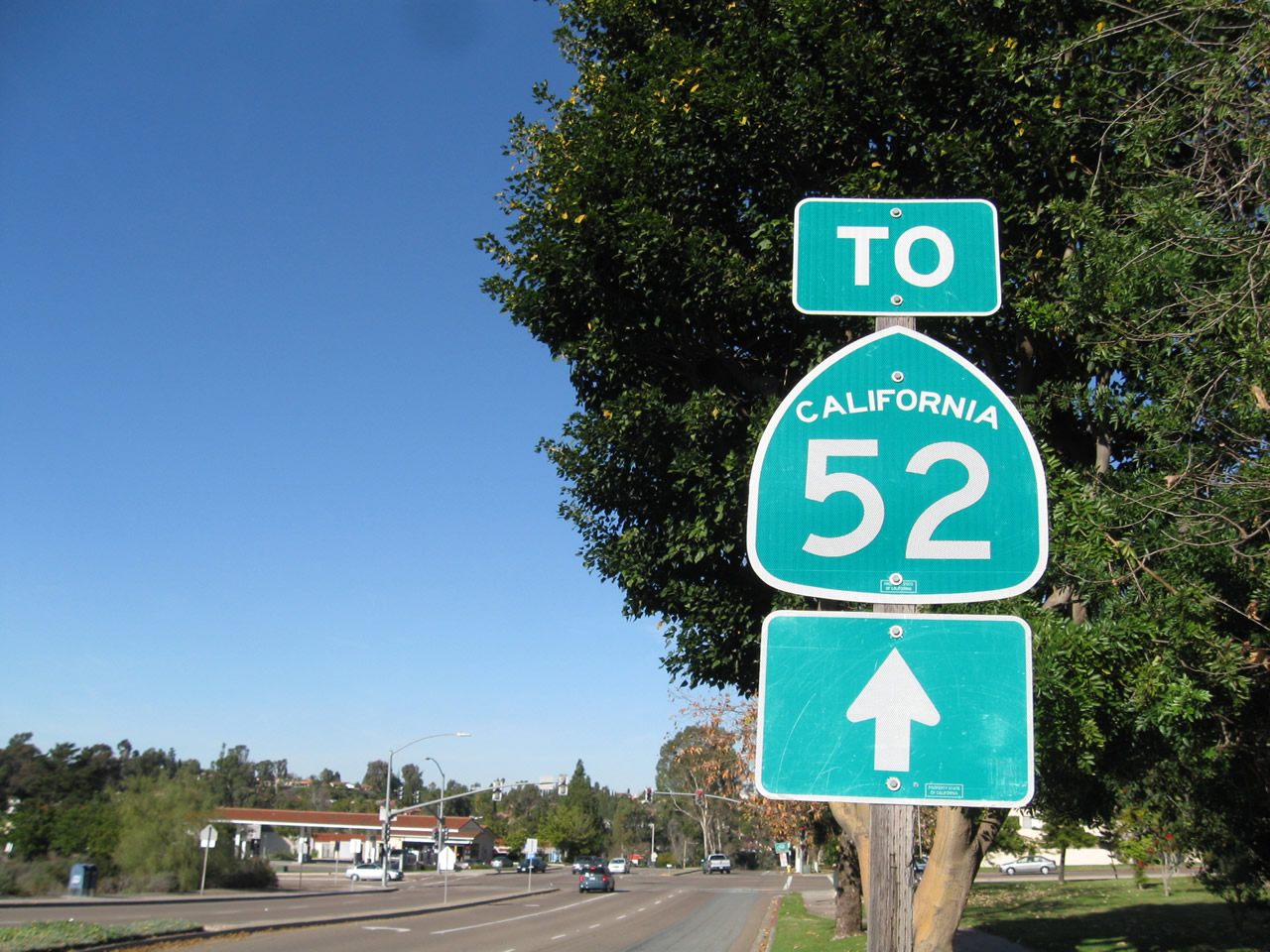
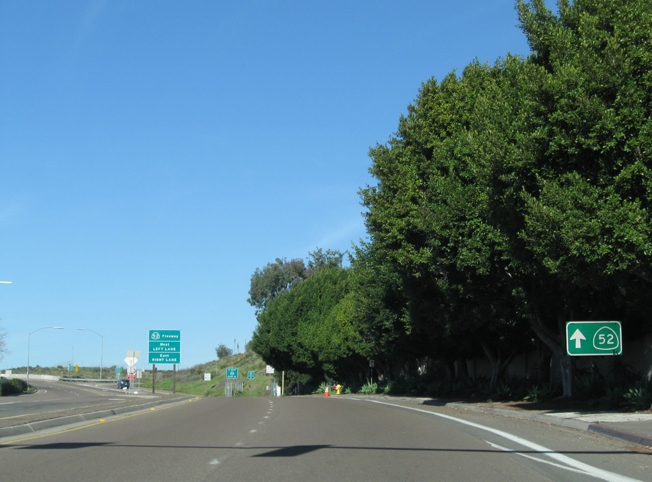
Proceeding north on Santo Road between Tierrasanta Boulevard and Clairemont Mesa Boulevard in the community of Tierrasanta, motorists find a California 52 trailblazer. Photos taken 01/14/11. |
|
After the Portobello Drive intersection, northbound Santo Road approaches California 52. Photo taken 01/14/11. |
|
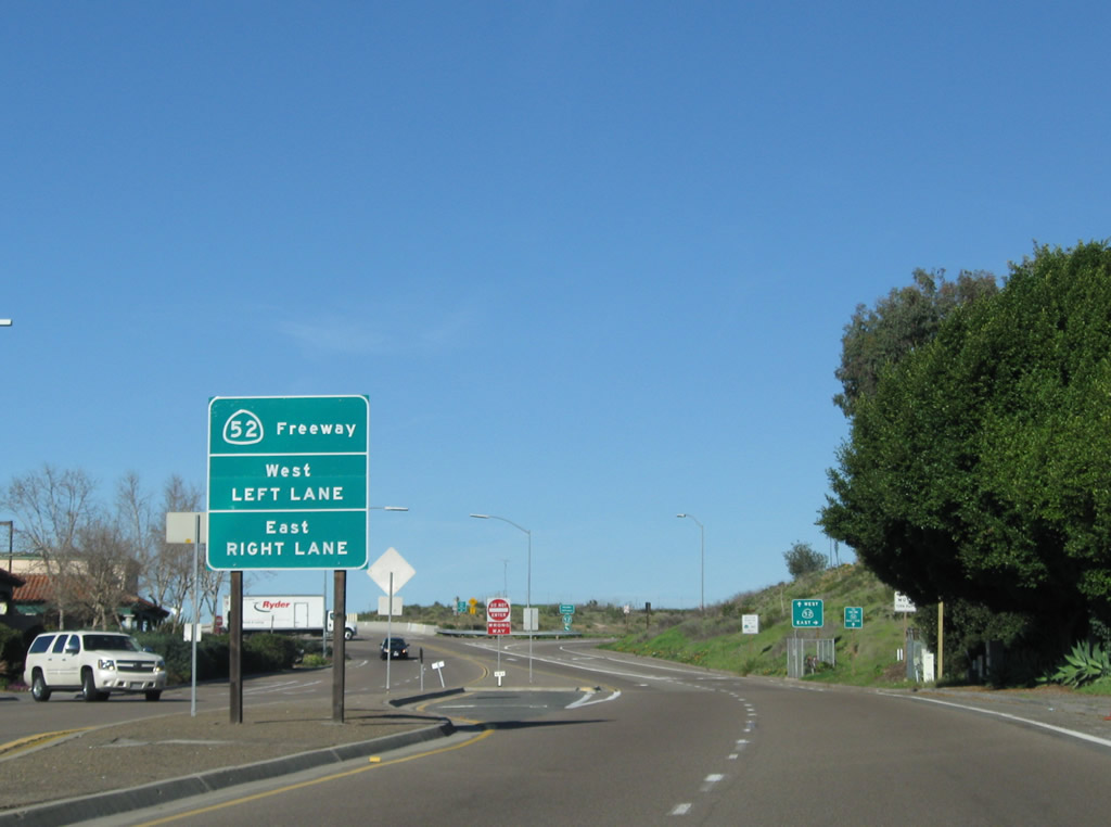
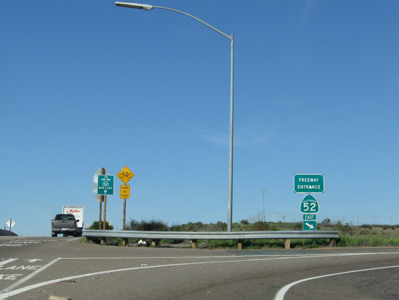
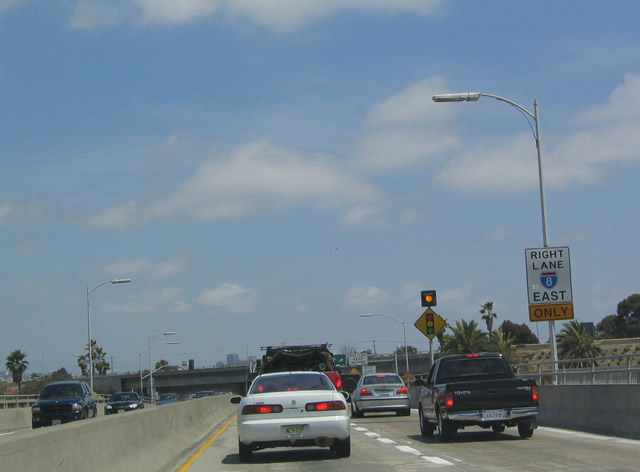
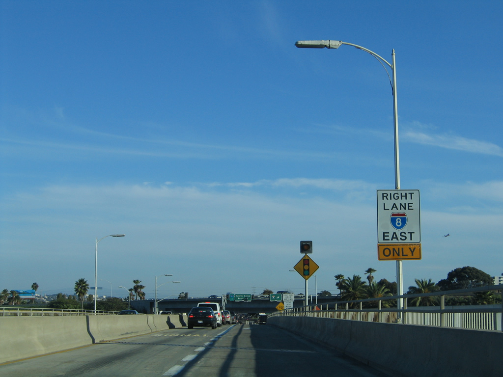
To California 52 east to Santee, use the right lane. To California 52 west to La Jolla, use the left lane. To Interstate 15, use California 52 west. Photo taken 01/14/11. |
|
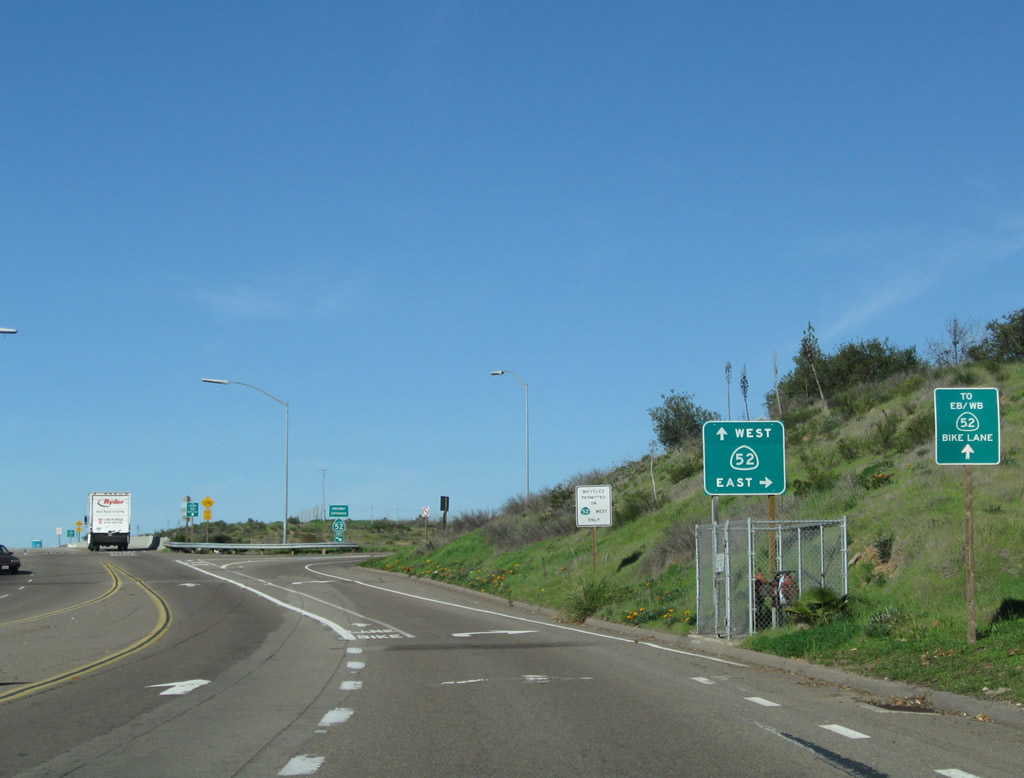
Stay right for the connection from Santo Road north to California 52 east. Photo taken 01/14/11. |
|
California 52 east travels between Marine Corps Air Station - Miramar and Mission Trails Regional Park before meeting California 125 in Santee near Mission Gorge Road. From there, California 52 extends east through Santee, ending at California 67 north of El Cajon. Use California 52 east to California 67 south to Interstate 8 east. Photo taken 01/14/11. |
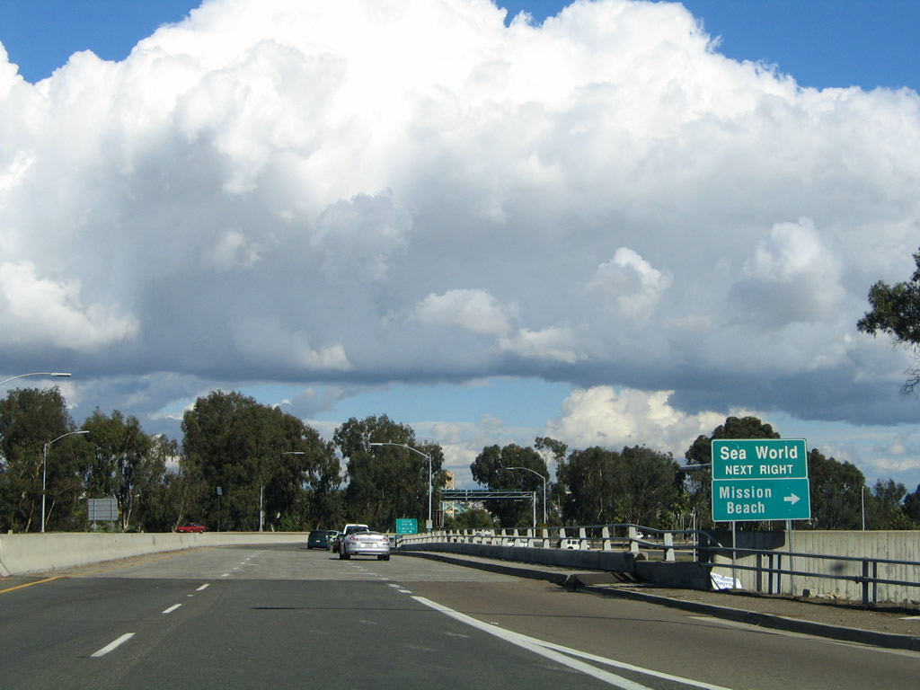
| Sea World Drive east |
|
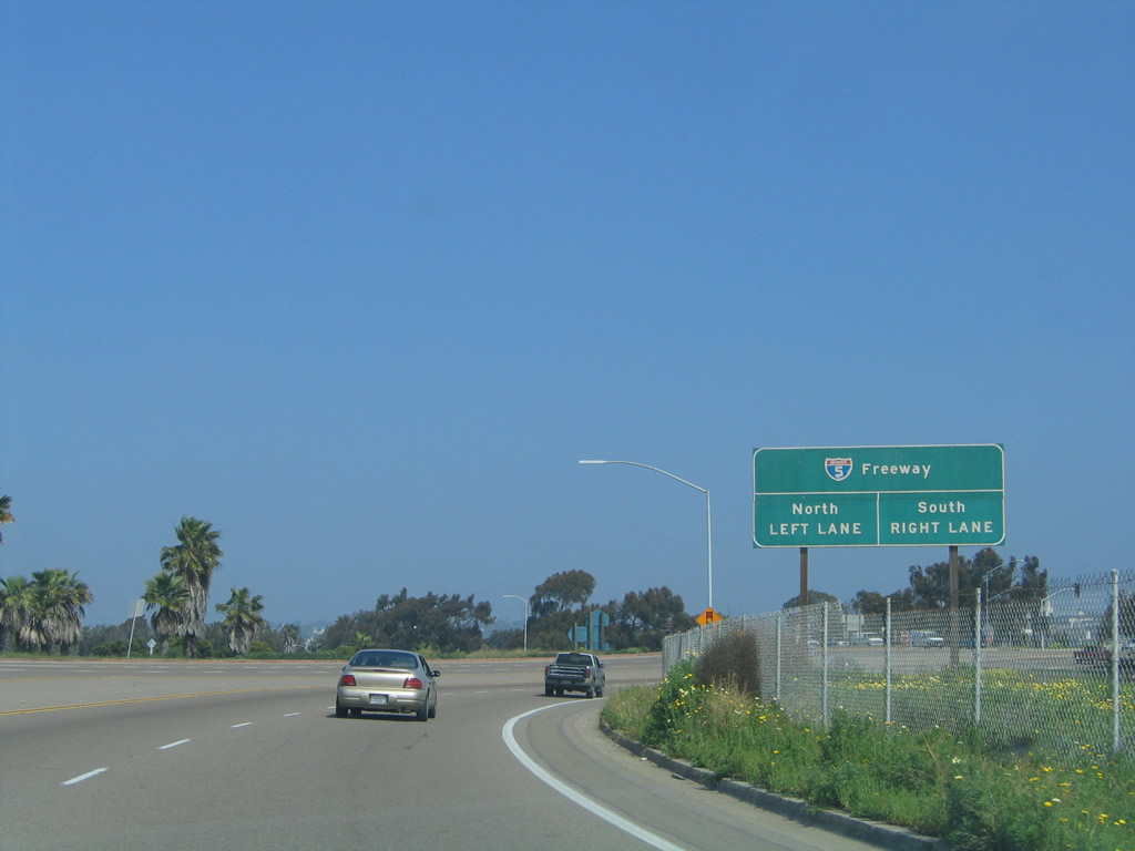
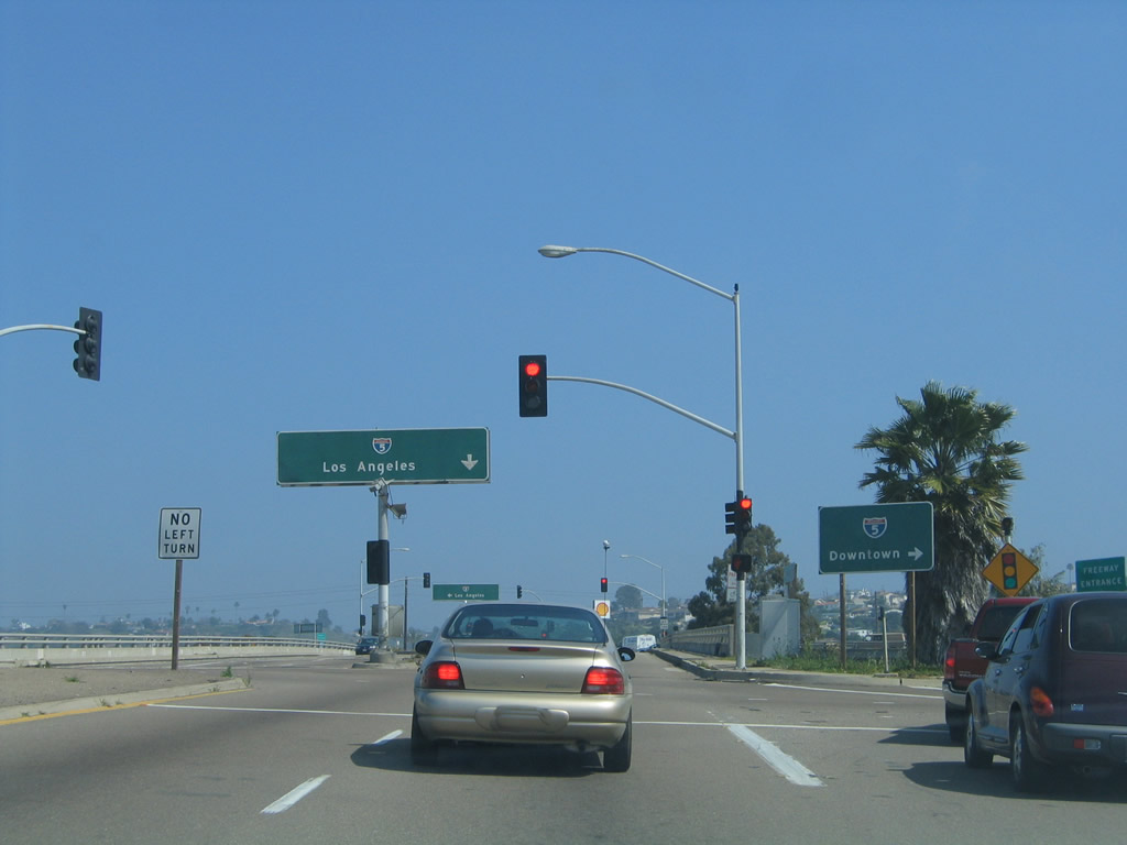
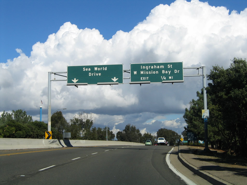
Leaving Mission Bay Park, eastbound Sea World Drive approaches Interstate 5 at a diamond interchange. Follow Sea World Drive east to the Morena District; use Interstate 5 north to La Jolla and south to downtown San Diego. Photo taken 03/10/05. |
|
The first ramp from eastbound Sea World Drive connects to Interstate 5 south; the left lane connects to Interstate 5 north. Photo taken 03/10/05. |
|
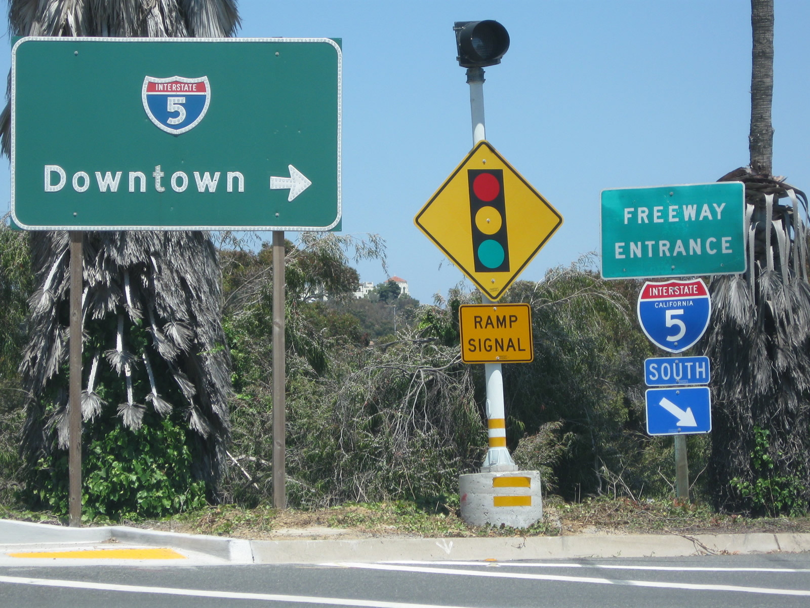
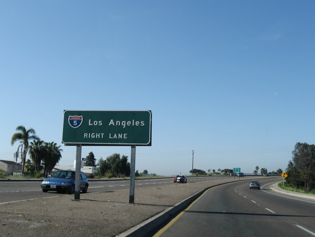
A guide sign and freeway entrance shield assembly point the way to Interstate 5 south to downtown San Diego. Photo taken 06/06/11. |
|
Eastbound Sea World Drive connects to the ramp to Interstate 5 north at this intersection. Photo taken 10/28/04. |
|
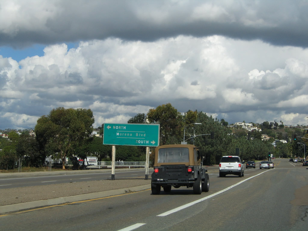
After descending from the Interstate 5 and railroad bridge, eastbound Sea World Drive approaches Morena Boulevard (Old U.S. 101) in the Morena District of San Diego. Photo taken 10/28/04. |
| Sea World Drive west |
|
|
|
|
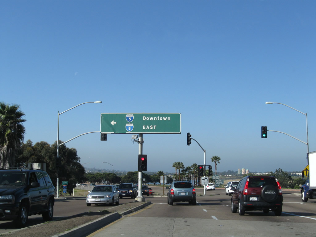
Now traveling west on Sea World Drive in San Diego's Morena District, this series of signs leads to the connection to Interstate 5. Note the state-named button copy Interstate 5 shield still in use at the interchange; the sign also includes Interstate 8 shields since that freeway is less than a mile south of this interchange. Photos taken 03/17/09. |
|
|
|
|
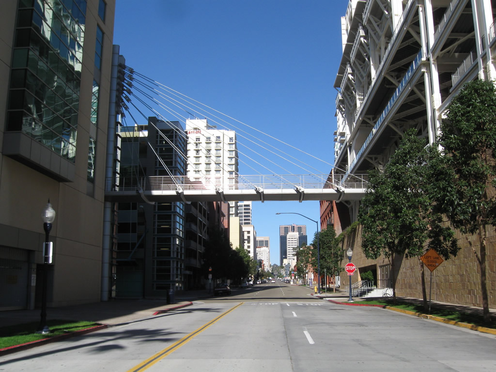
| Seventh Avenue north |
|
A cable stay pedestrian bridge connects the Omni Hotel with Petco Park. The bridge crosses over northbound Seventh Avenue in downtown San Diego. Photo taken 12/27/10. |
| Sixth Avenue south |
|
This view looks south from the Washington Street bridge down on Sixth Avenue as it travels toward University Avenue in Hillcrest. Photo taken 05/08/09. |
|
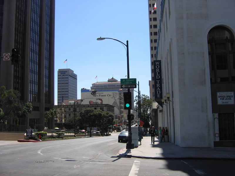
South of Ash Street, southbound 6th Avenue travels south to the Ballpark District, ending at the Omni Hotel adjacent to Petco Park. Prior to A Street, southbound 6th Avenue approaches the World Trade Center and Union Bank and 600 B Street . Photo taken 10/06/05. |
|
Southbound Sixth Avenue meets A Street. On the southwest corner of this intersection is the World Trade Center, which is the former Harcourt Brace Jovanich building. This building is one of the older high rises downtown, and it is now shadowed by the much taller Union Bank Building behind it. Photo taken 10/06/05. |
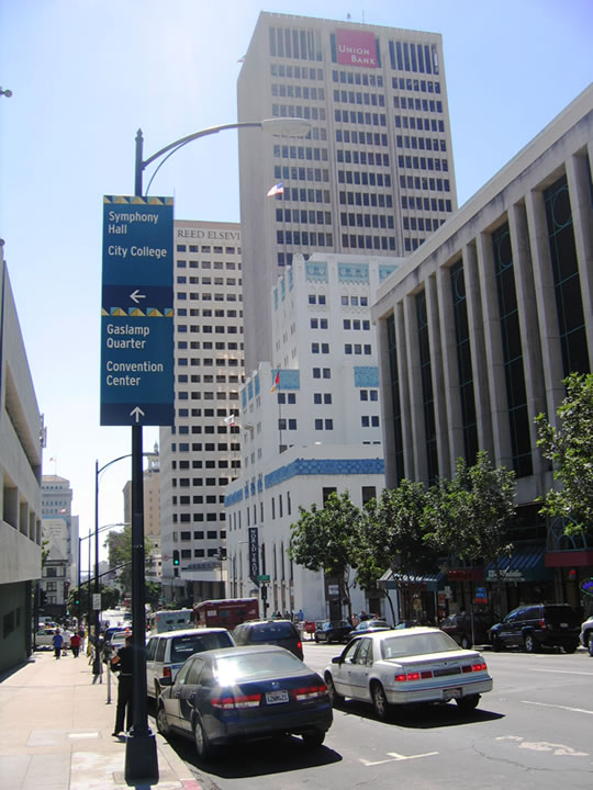
| Smart Corner |
|---|
|
The College Station trolley stop is located within the Smart Corner development, which is a high-rise building with ground-level commercial space. This view looks northwest at the College Station trolley stop, which cuts diagonally on the block between Broadway, Park Boulevard, C Street, and 11th Avenue. The San Diego Trolley comes north via Park Boulevard, uses this block to shift northwest, and then curves west onto C Street toward the Financial District and City Hall. Photo taken 06/05/11. |
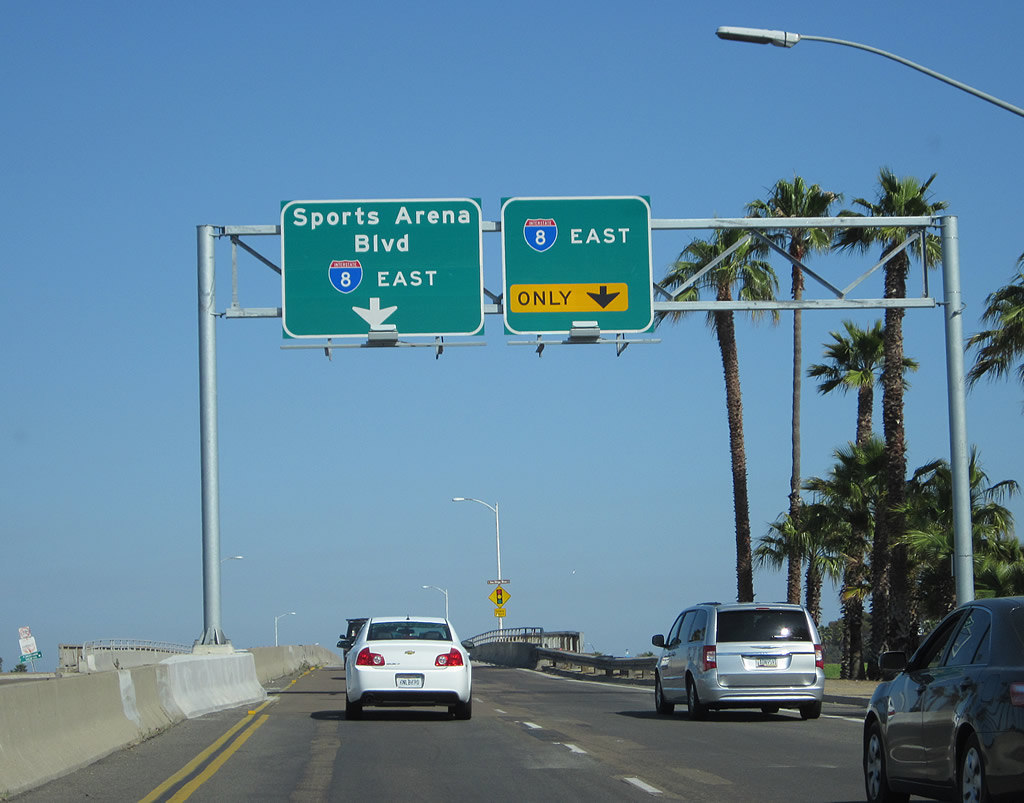
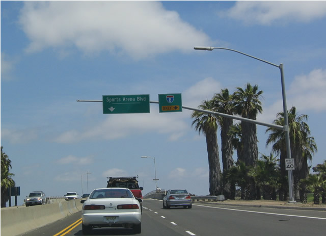
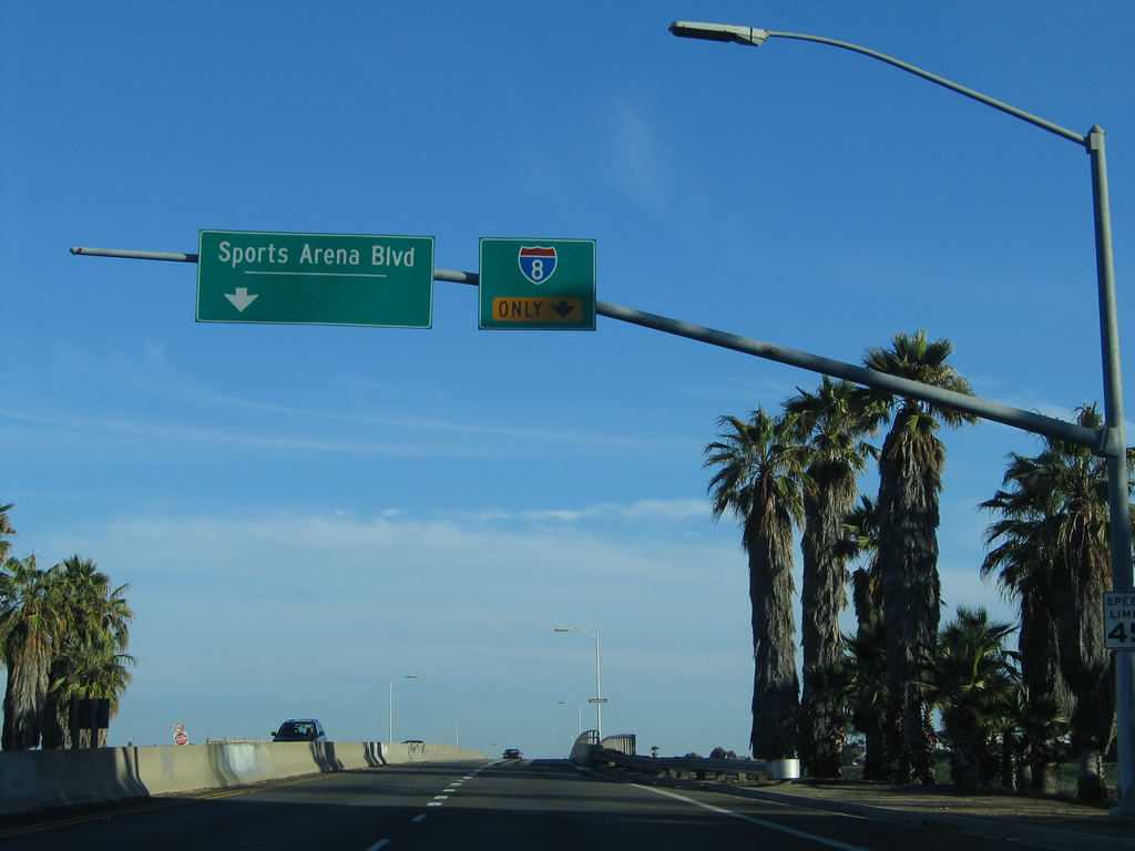
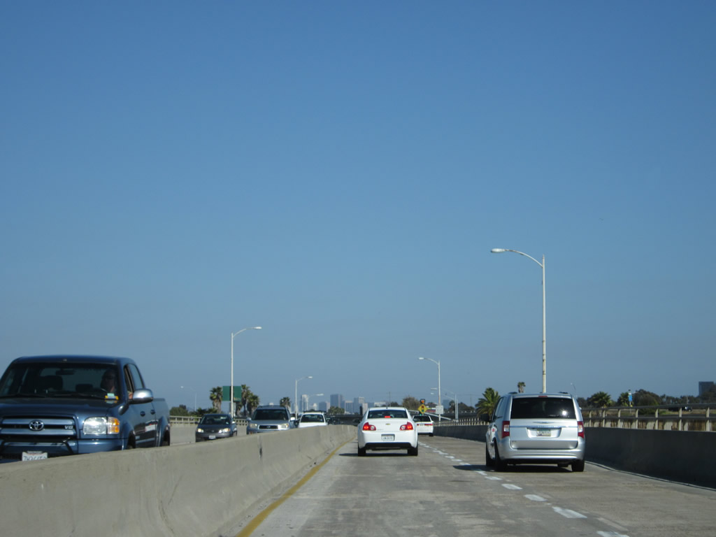
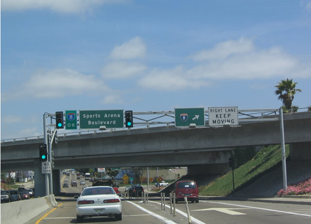
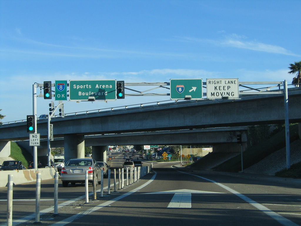
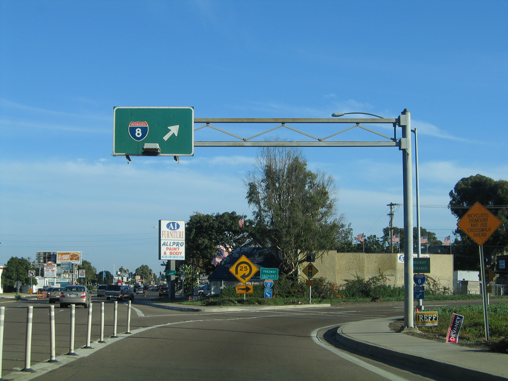
| Sports Arena Boulevard south |
|---|
|
|
|
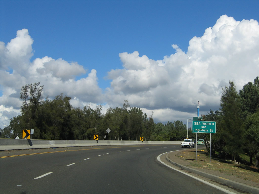
After the ramp to Sea World Drive east, Ingraham Street ends and Sports Arena Boulevard begins. Stay left for Sports Arena Boulevard and right for Interstate 8 east. This sign bridge was completely changed in 2011 as part of interchange improvements between Sports Arena Boulevard and Interstate 8. Photos taken 05/21/12, 05/22/04, and 10/29/04. |
|
|
Upon leaving the Mission Bay Park Interchange, southbound Sports Arena Boulevard crosses the San Diego River. Plans call for this bridge to be replaced with a wider span. Photos taken 05/21/12, 05/22/04, and 10/29/04. |
|
|
While crossing the San Diego River, the right lane becomes exit only for Interstate 8 east. The left lane continues south along Sports Arena Boulevard into the Midway District. Photos taken 05/22/04 and 10/29/04. |
|
|
|
All traffic in the right (exit only) lane of Sports Arena Boulevard can continue past this traffic signal without stopping. Through traffic on Sports Arena Boulevard in the left lane must obey the traffic signal, which brings traffic from Interstate 8 west onto Sports Arena Boulevard. The overhead sign bridge shown in 2004 was removed in 2011. Photos taken 05/21/12, 05/22/04, and 10/29/04. |
|
|
After passing under Interstate 8, the right lane of Sports Arena Boulevard south transitions onto Interstate 8 east. Photos taken 05/22/04 and 10/29/04. |
|
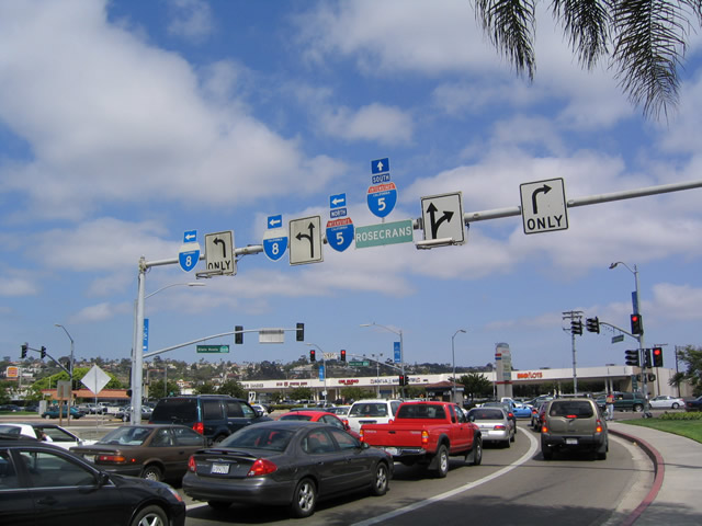
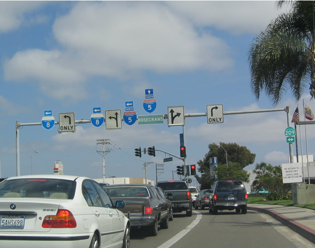
A bit further south, Sports Arena Drive approaches former California 209/Rosecrans Street. Note the placement of the Interstate 5 and Interstate 8 shields. Photo taken 05/22/04. |
|
|
This overhead points the way from Sports Arena Drive to the two freeways via former California 209/Rosecrans Street. Photos taken 05/22/04. |
|
Close-up of the California 209 shield as seen from southbound Sports Arena Drive just north of Rosecrans Street. Photo taken 05/22/04. |
|
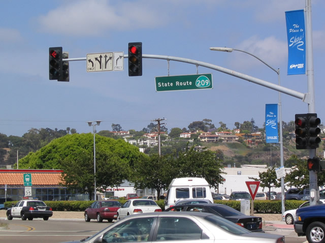
Even after being decommissioned in 2001, the street signs still refer to this as California 209. Photo taken 05/22/04. |
| State Street north |
|
This view shows State Street traveling north between G Street and F Street near the Hall of Justice. This view has changed due to recent courthouse construction. Photo taken 03/24/08. |
| Sunset Cliffs Boulevard northeast |
|
After the intersection with Interstate 8 and Nimitz Boulevard, Sunset Cliffs Boulevard immediately passes over the San Diego River. The Sunset Cliffs Boulevard bridge has a separated two-way bike lane and a sidewalk for pedestrians. Photo taken 10/28/04. |
|
The Sunset Cliffs Boulevard bridge over the San Diego River was probably built in the 1950s, probably in conjunction with the construction of Mission Bay Park. The opening of this bridge probably occurred around the same time that the old wooden bridge that used to connect Ocean Beach with Mission Beach was demolished. This bridge was built in 1914 and demolished in January 1951; no replacement link between those two communities was built. Instead, most roads were redirected to pass through the newly created Mission Bay (formerly known as False Bay). With the dredging and shaping of Mission Bay by engineers in the late 1940s, the bridges and roads leading into and passing through Mission Bay Park were realigned. Mission Bay Park today is considered to be the largest man-made aquatic park (at 4,235 acres). Photo taken 10/28/04. |
|
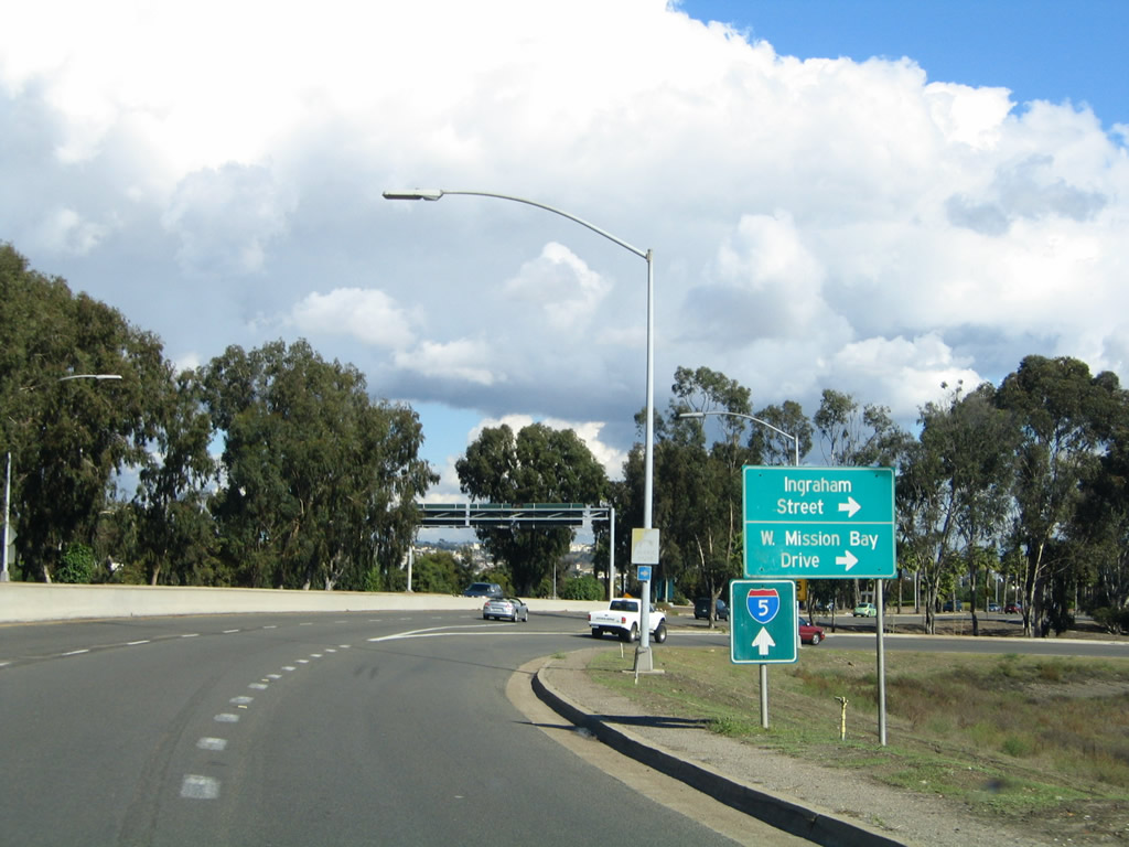
Upon crossing the San Diego River, Sunset Cliffs Boulevard turns east and enters the sprawling, somewhat confusing Mission Bay Park interchange. The next exit will connect eastbound Sunset Cliffs Boulevard with Ingraham Street north into the park and toward Pacific Beach. To Sea World, use Ingraham Street north. Photo taken 10/28/04. |
|
The left two lanes of Sunset Cliffs Boulevard will transition directly onto eastbound Sea World Drive. The right lane connects to Ingraham Street north to Pacific Beach and West Mission Bay Drive northwest to Mission Beach. Follow Ingraham Street north for the continuation of the city's scenic drive. Photo taken 10/28/04. |
|
The right turn from eastbound Sunset Cliffs Boulevard to Ingraham Street and West Mission Bay Drive is a loop ramp with a sharp right turn. Photo taken 10/28/04. |
|
Eastbound Sunset Cliffs Boulevard meets the transition ramp to Ingraham Street and West Mission Bay Drive. To Interstate 5, continue east on Sea World Drive. Photo taken 10/28/04. |
| Sunset Cliffs Boulevard southwest |
|
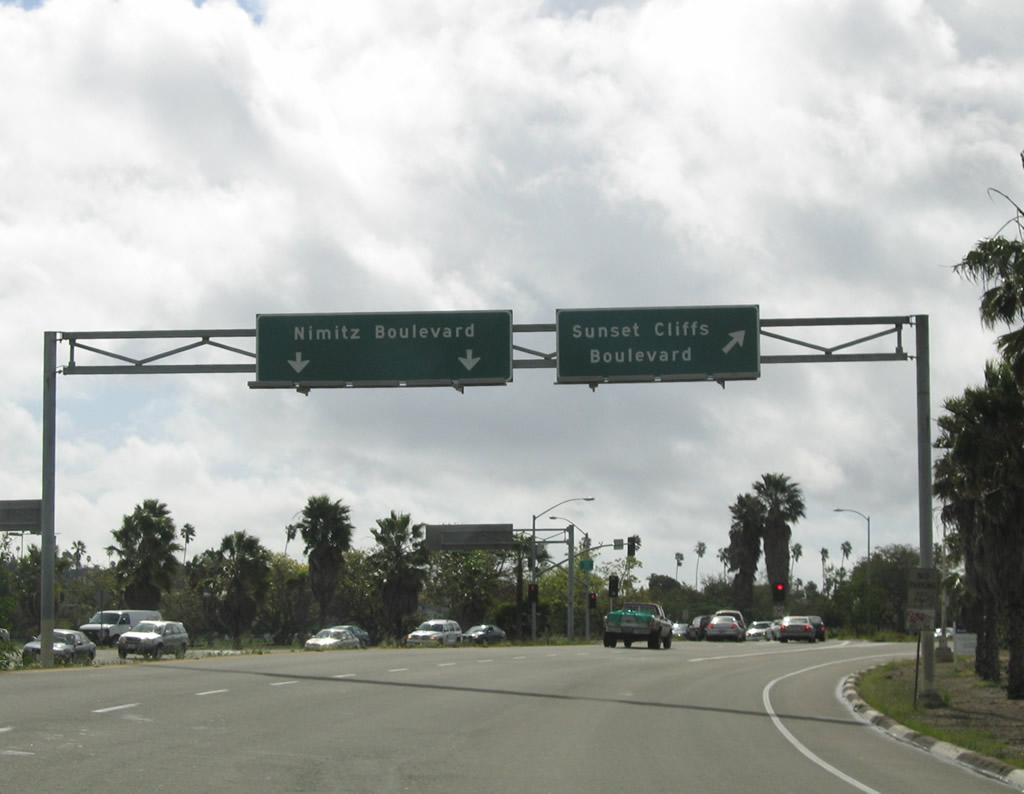
After crossing the San Diego River and passing by the traffic signal intersection with the westbound lanes of Interstate 8, westbound Sunset Cliffs Boulevard approaches the split with Nimitz Boulevard. Turn left to follow Nimitz Boulevard south to the airport or stay right to follow Sunset Cliffs Boulevard toward Ocean Beach. Photo taken 02/19/05. |
| Taylor Street - Eastbound |
|
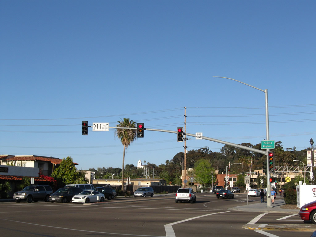
At the intersection with Pacific Highway (Old U.S. 101 and Former Business Loop I-5), Rosecrans Street becomes Taylor Street, which travels east to Old Town San Diego and thence to Interstate 8 in western Mission Valley. Photo taken 03/18/09. |
|
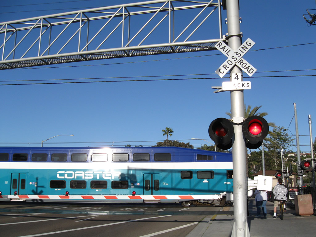
The Old Town Transit Center sits on the southeast corner of Taylor Street and Pacific Highway. Ahead, a San Diego Trolley crosses Taylor Street near the trolley stop. Photo taken 03/18/09. |
|
A Coaster train passes over the same tracks shortly thereafter on this late afternoon in March. Photo taken 03/18/09. |
|
Upon crossing the trolley and Coaster tracks, eastbound Taylor Street meets Congress Avenue at this traffic signal. Photo taken 03/18/09. |
|
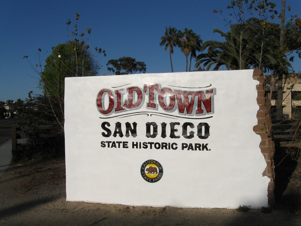
Turn right (south) on Congress Avenue to Old Town State Historic Park. Photo taken 03/18/09. |
|
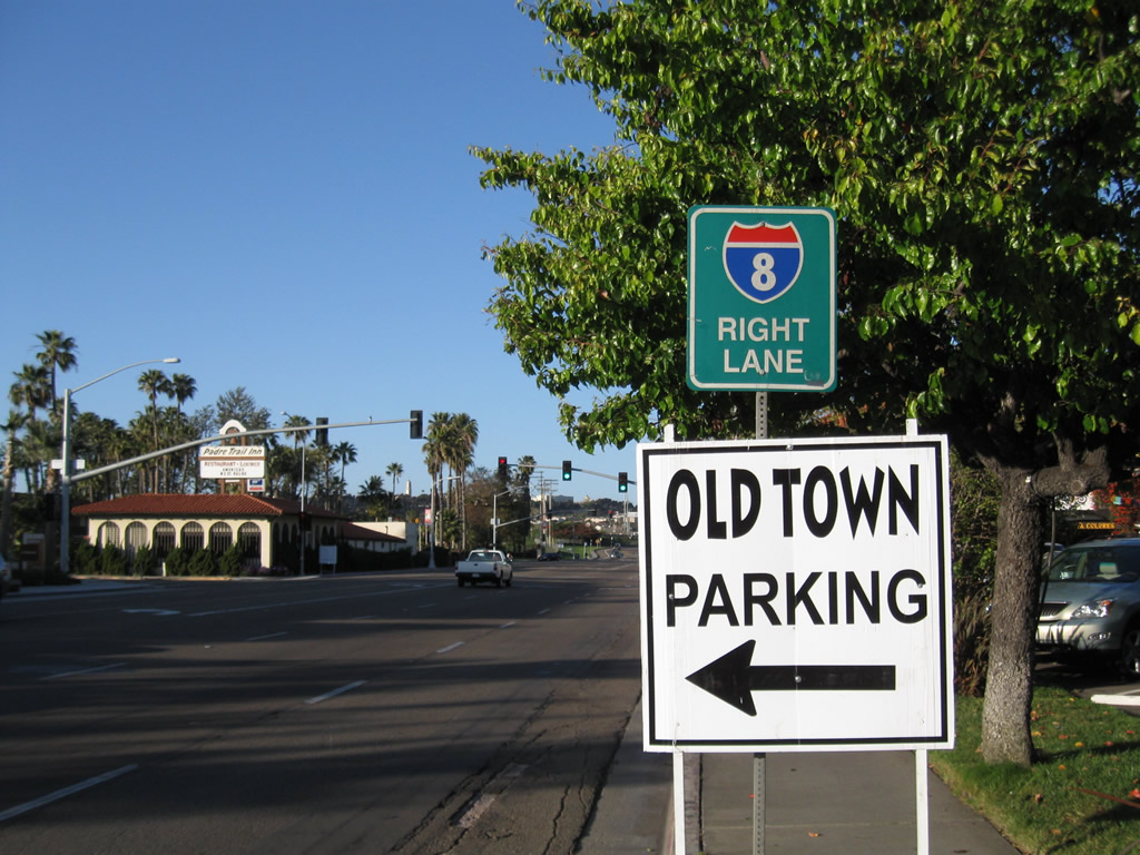
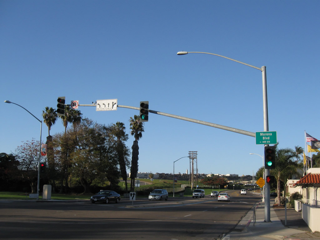
For through traffic to Interstate 8, use the right lane of eastbound Taylor Street. Old Town Parking is available via the next left. Ahead is the traffic signal for Morena Boulevard north to the Morena District and Linda Vista. Photo taken 03/18/09. |
|
Eastbound Taylor Street meets Morena Boulevard north at this traffic signal. There is no access to Interstate 8 from Morena Boulevard northbound. Photo taken 03/18/09. |
|
|
|
Skipping ahead and traveling between Old Town and Mission Valley, these Interstate 8 and Interstate 5 route markers are posted on eastbound Taylor Street and the Hotel Circle bridge connecting Taylor Street with Hotel Circle North. Photos taken 05/21/12. |
| Tenth Avenue south |
|
After California 163 south ends and transitions directly onto Tenth Avenue, this view looks south on Tenth Avenue after the A Street intersection. Photo taken 06/05/11. |
| Texas Street - Southbound |
|
In Mission Valley, southbound Qualcomm Way (known as Stadium Way until 1999) transitions directly onto southbound Texas Street upon crossing over Interstate 8. The next ramp connects Texas Street with Interstate 8 east to La Mesa, El Cajon, Alpine, El Centro, and Yuma. Photo taken 06/24/07. |
|
Southbound Texas Street connects with Interstate 8 east at this on-ramp. Texas Street continues with two southbound lanes as it approaches Camino del Rio South, then ascends out of Mission Valley and into North Park. Photo taken 06/24/07. |
|
Texas Street becomes a divided highway (separated by concrete barrier or K-Rail) as it leaves Mission Valley and travels toward North Park. Photo taken 06/24/07. |
|
Prior to entering North Park, southbound Texas Street passes under Adams Avenue then approaches Mission Avenue. Photo taken 06/24/07. |
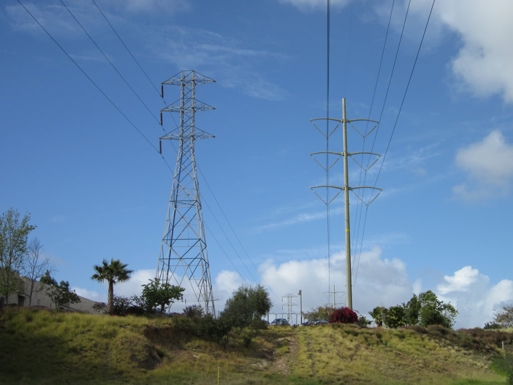
| Via Bello (Clairemont) |
|
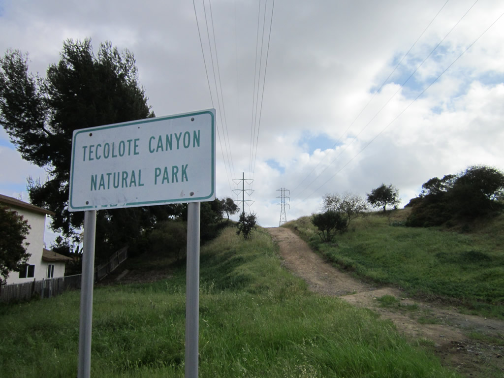
|
These power lines cross over Via Bello in the San Diego community Clairemont near Tecolote Natural Park. The power line connects a substation in western Mission Valley with another substation in Torrey Hills. They cut a direct north-south line through Clairemont. The first picture looks south, and the second one looks north. Photos taken 03/18/12. |
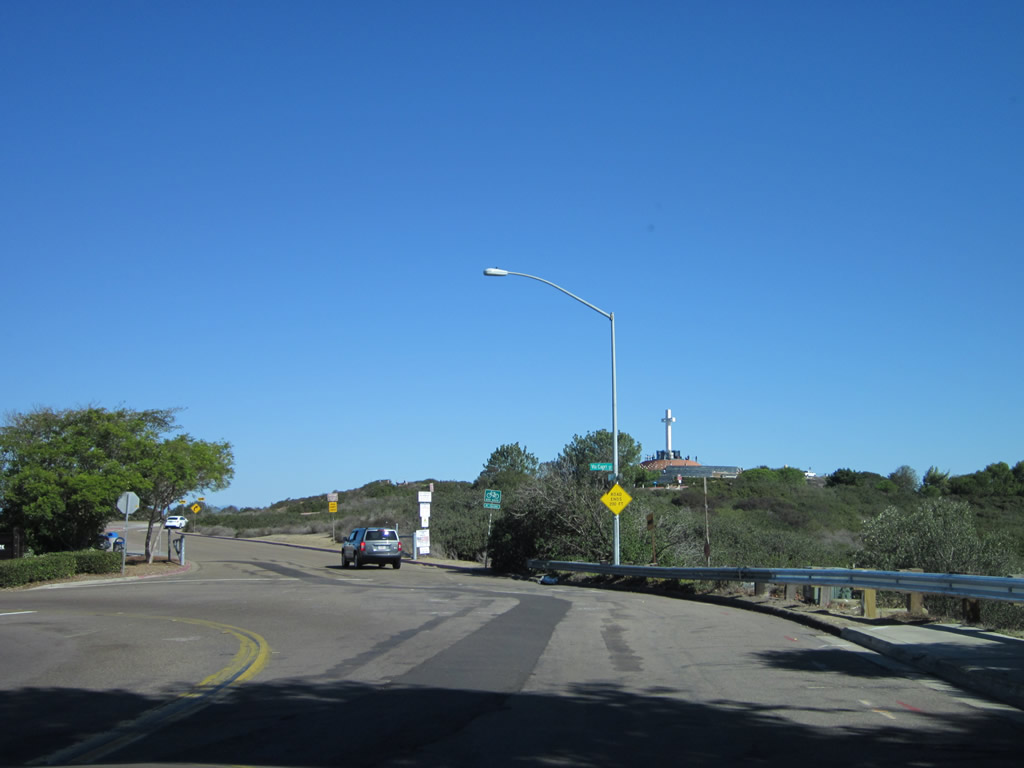
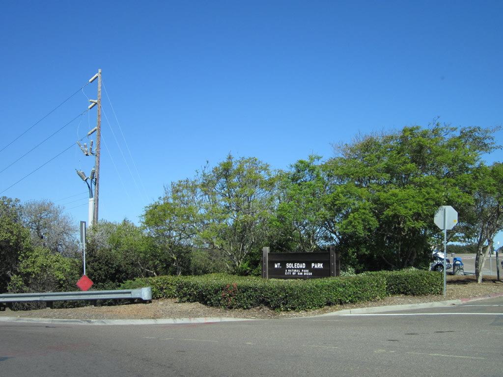
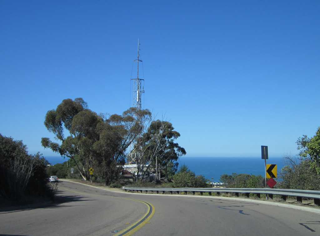
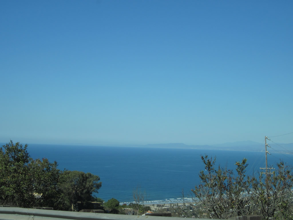
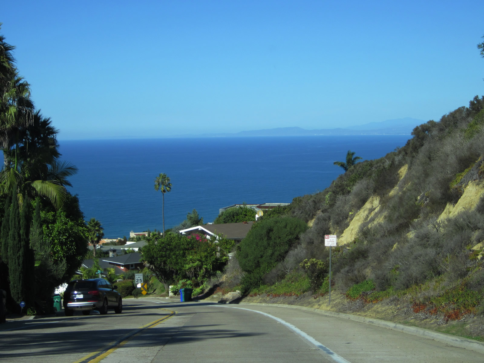
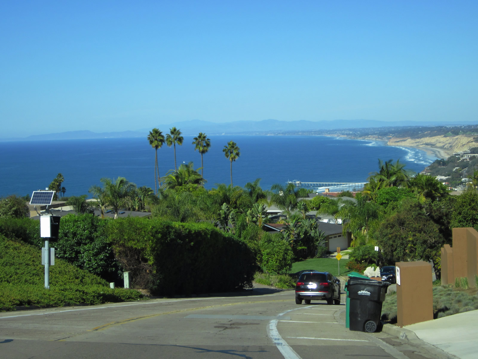
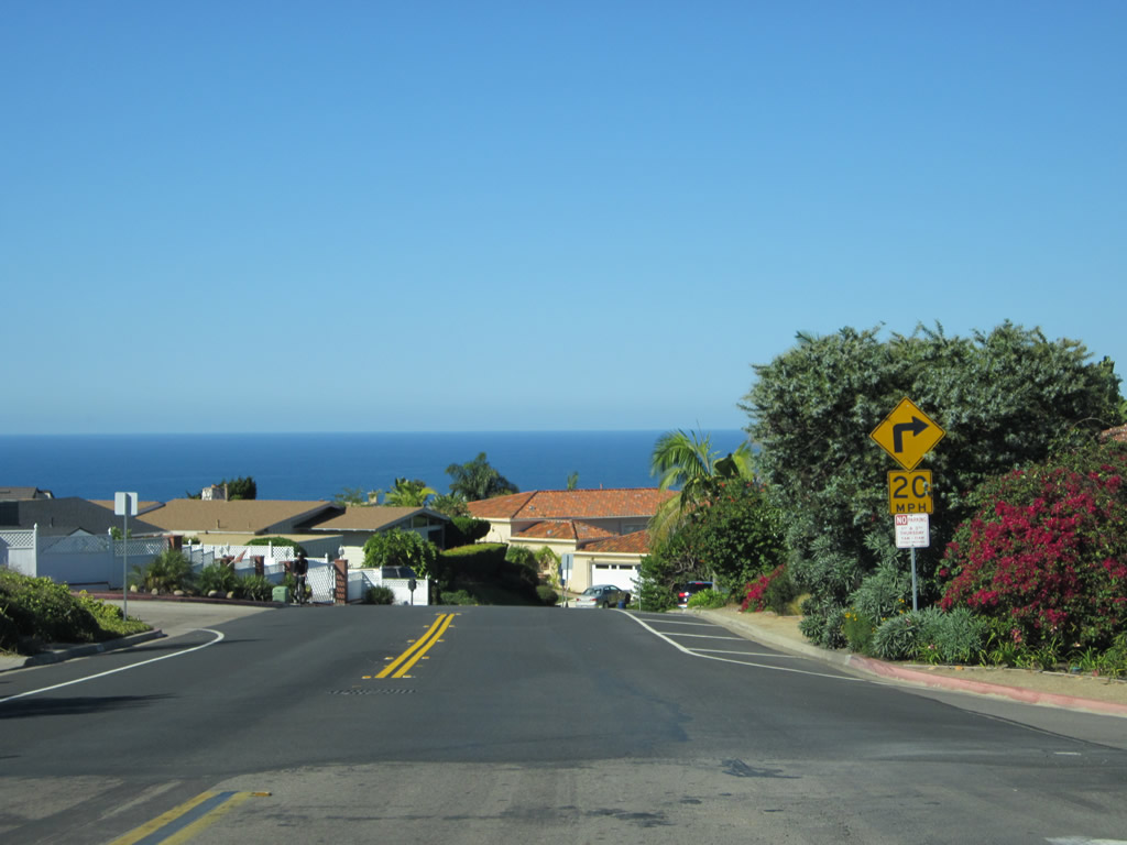
| Via Capri (Mt. Soledad) |
|---|
|
|
|
|
|
| Via Capri is a C-shaped city street that originates at Mt. Soledad Natural Park and travels down the north face of Mt. Soledad. Initially, Via Capri travels northwest, offering terrific view of La Jolla Shores, Torrey Pines, and points north along the Pacific Ocean coastline. Passing through residential enclaves along the north face of the mountain, it turns north and then northeast into the Hidden Valley neighborhood of the La Jolla community. Then Via Capri proceeds due east before connecting to La Jolla Scenic Drive and La Jolla Parkway en route to California 52 east and Interstate 5 south. This series of pictures documents the descent along Via Capri from Mt. Soledad Natural Park downhill to Hidden Valley. On a clear day, the ocean beckons as Via Capri descends. Photos taken 11/11/12. |
|
|
|
|
|
|
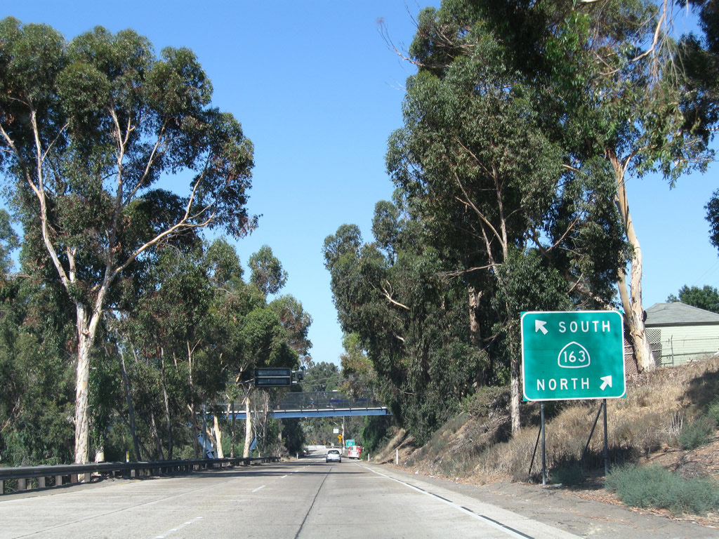
Via Capri proceeds east and essentially ends at La Jolla Scenic Drive South, which turns north to a narrow on-ramp that connects to California 52 east and Interstate 5 south. Photo taken 01/14/07. |
| Washington Street east |
|
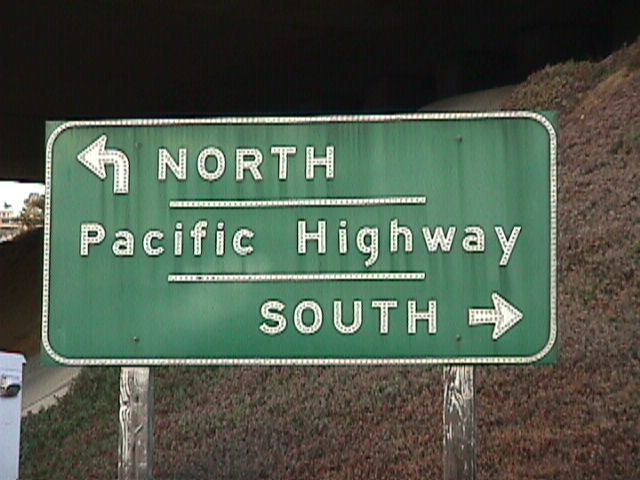
This older directional signage for Pacific Highway was posted along eastbound Washington Street at the roads inception at the Historic U.S. 101 (Pacific Highway) interchange near Five Points in San Diego. Photo taken 06/99. |
|
Continuing east of Historic U.S. 101 (Pacific Highway) and Interstate 5, Washington Street travels east and uphill to enter the Mission Hills community. Photo taken in 2000. |
|
Eastbound Washington Street ascends into Mission Hills. Note the concrete roadway with divoted median divider, which both date back to the street's original construction. Photo taken in 2000. |
|
Eastbound Washington Street meets University Avenue at this interchange in Mission Hills. Photo taken in 2000. |
|
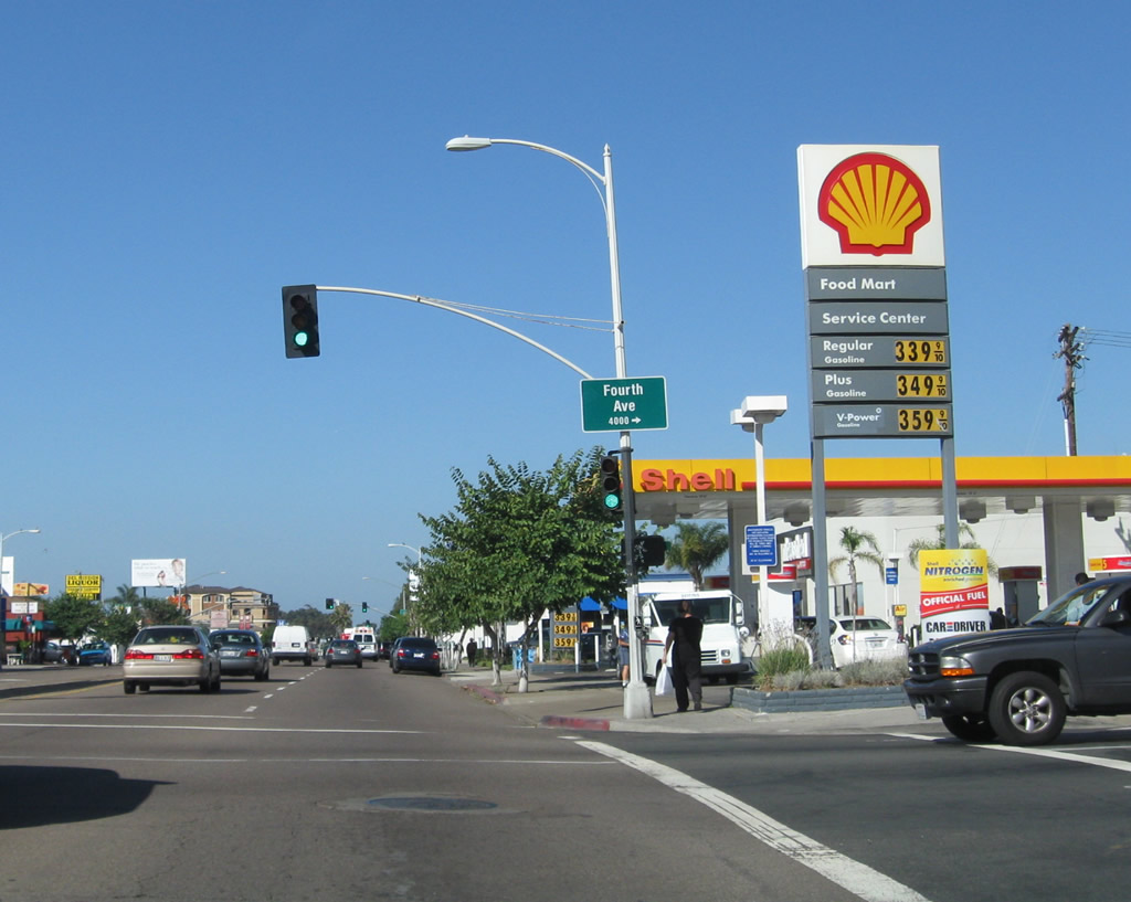
Fifth Avenue is a major north-south route through Hillcrest. Since Fifth Avenue is one-way northbound, use Fourth Avenue to travel south into Hillcrest's downtown area. Photo taken 10/29/05. |
|
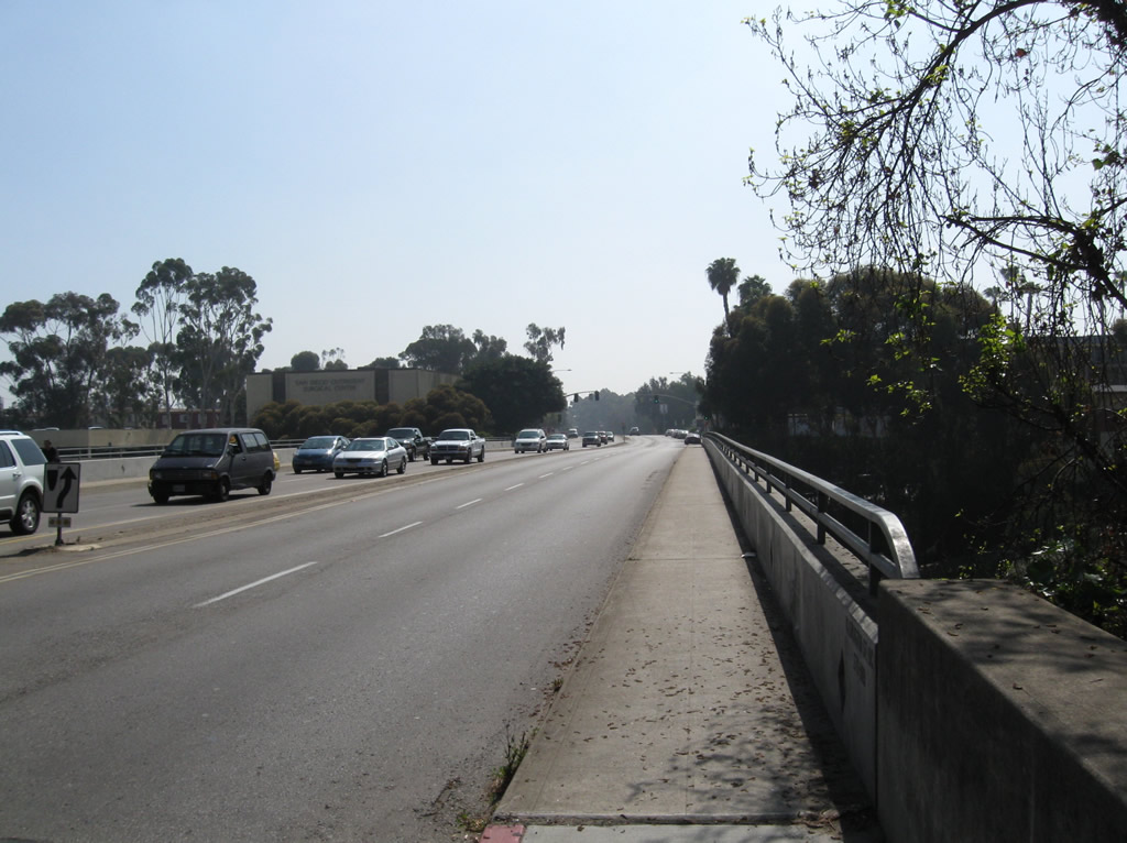
After passing through Mission Hills, Washington Street enters Hillcrest. There is a grade separation between Washington Street and Sixth Avenue, with Washington Street crossing over Sixth Avenue as seen in this picture (heading eastbound). Photo taken 10/29/05. |
|
|
|
|
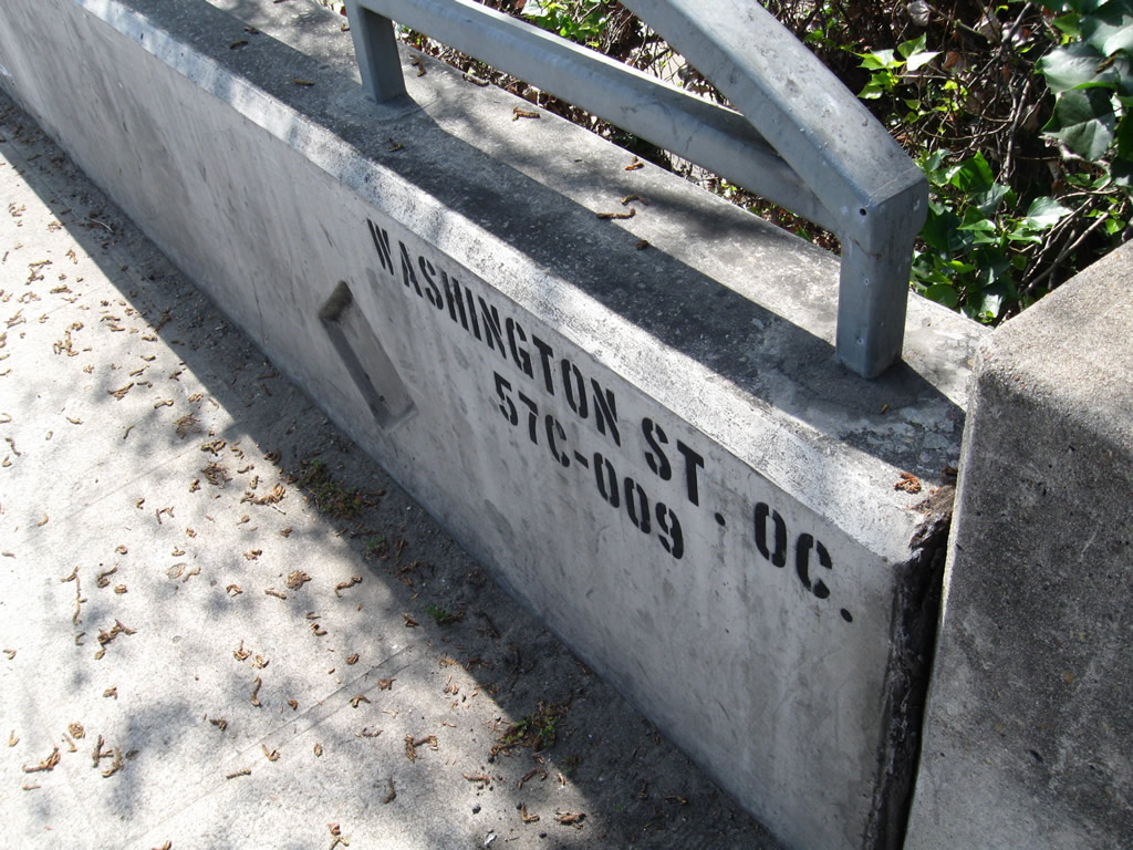
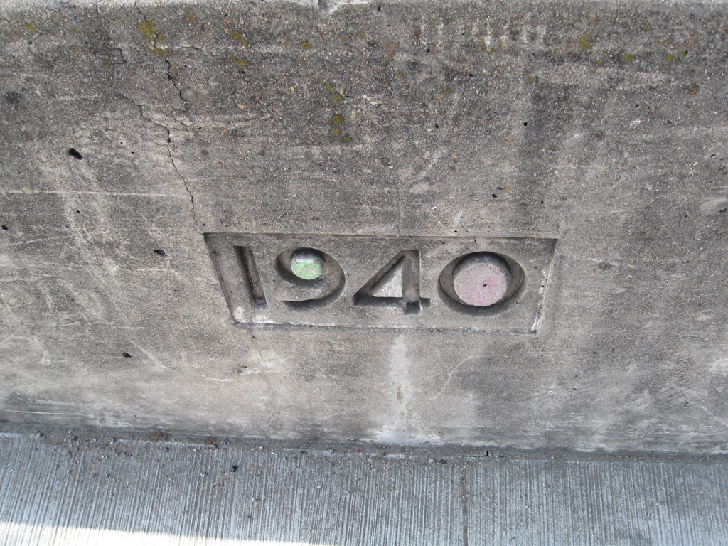
The grade separation between Washington Street and Sixth Avenue was constructed in 1940 (see date stamp). Photos taken 05/08/09. |
|
Eastbound Washington Street approaches Eighth Avenue in Hillcrest. Washington Street used to have a numerical designation east of Ninth Avenue: Business Loop I-8. Photo taken 10/29/05. |
|
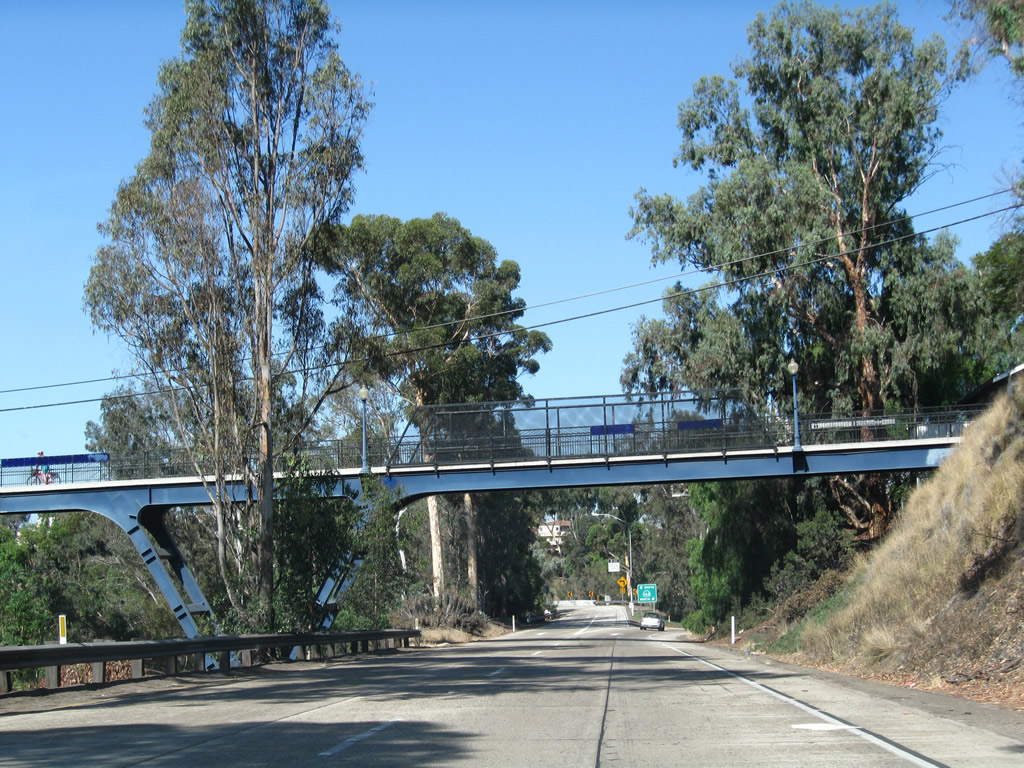
Continuing east, Washington Street leaves Hillcrest and enters University Heights. Here, Washington Street crosses over California 163 (Cabrillo Freeway); note the original white wooden railing used on the bridge. The Vermont Street pedestrian bridge is visible in the distance. Photo taken 08/25/08. |
|
The next signalized intersection along Washington Street east is the connection to California 163; a right turn ahead connects to Richmond Street south. Photo taken 08/25/08. |
|
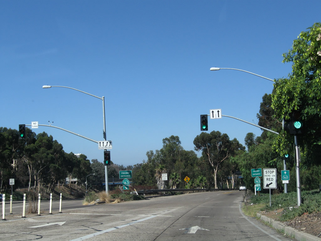
Eastbound Washington Street meets the on-ramp to California 163 north and south. Photo taken 08/25/08. |
| Washington Street west |
|
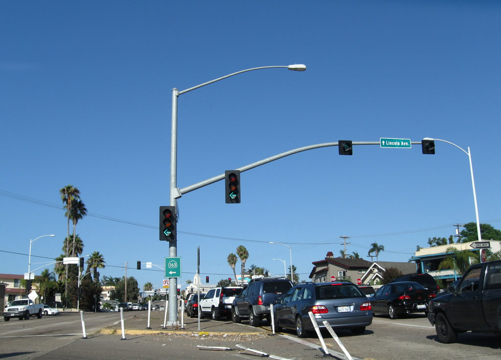
Passing south of University Heights and north of Hillcrest, westbound Washington Street (Business Loop I-8 and briefly historic U.S. 80) meets Cleveland Avenue at this traffic signal. Ahead is the junction with California 163 (Cabrillo Freeway) (former U.S. 395); use the right lanes to transition onto either direction of the freeway. Photo taken 08/17/08. |
|
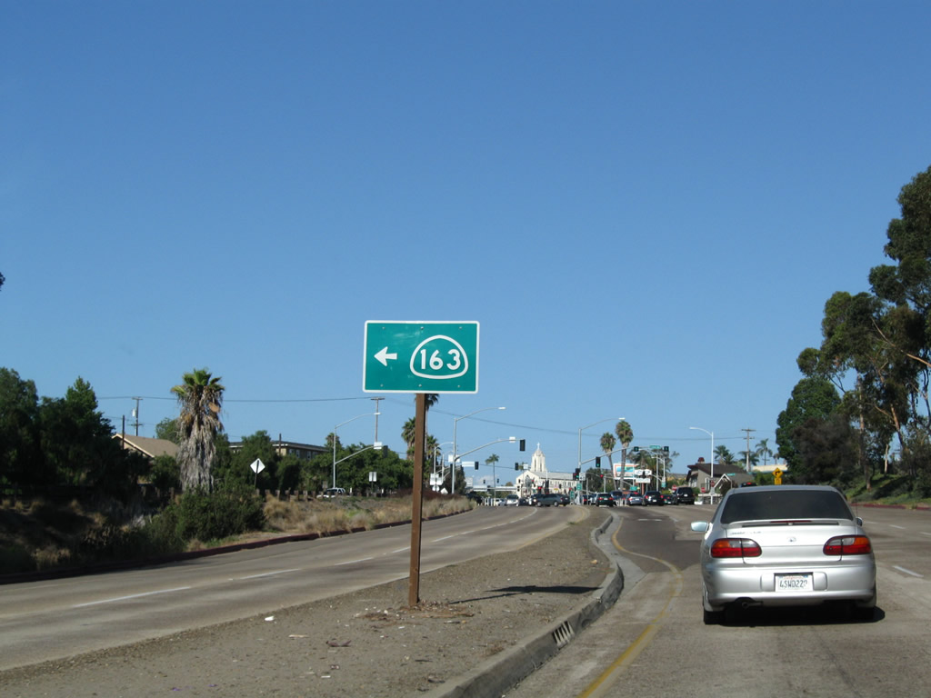
Westbound Washington Street (Business Loop I-8 and briefly historic U.S. 80) meets Lincoln Avenue at this traffic signal. Use the right two lanes to connect to California 163. Photo taken 08/17/08. |
|
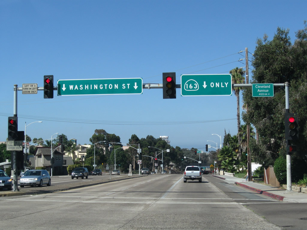
As the right two lanes split from Washington Street to California 163, the left lanes continue west toward Hillcrest. Photo taken 08/17/08. |
|
The left lane of the transition ramp connects to California 163 (Cabrillo Freeway) south to downtown San Diego, while the right lane connects to California 163 (Cabrillo Freeway) north to Mission Valley, Linda Vista, Clairemont, and Kearny Mesa before merging with Interstate 15 near Miramar. Photo taken 08/17/08. |
|
The Vermont Street pedestrian bridge crosses over Washington Street and the transition ramp to California 163. Built in 1995, the Vermont Street Bridge replaced an earlier wooden trestle bridge that was in service from 1916 until 1978 (demolished in 1979 due to rotting conditions). The pedestrian bridge links the neighborhoods of University Heights with Hillcrest. Photo taken 08/17/08. |
|
The two directions of California 163 split at this gore point. While U.S. 80 was still routed along El Cajon Boulevard in the late 1940s and the Cabrillo Freeway was complete, this transition ramp served as part of transcontinental U.S. 80 before the U.S. highway turned south toward downtown via the freeway. Once U.S. 80 was relocated to the Mission Valley Freeway (now Interstate 8), old U.S. 80 became U.S. 80 Business, and that eventually became Business Loop I-8. The business loop remained signed until the early 2000s; signs for the business loop along most of Washington Street and El Cajon Boulevard were removed by 2003. The California 163 interchange with Washington Street marks the western terminus of Business Loop I-8. Photo taken 08/17/08. |
|
|
|
Back to the gore point, two lanes carry Washington Street west toward Hillcrest and Mission Hills, while two lanes depart toward California 163 (Cabrillo Freeway). This series of pictures follows Washington Street between the California 163 off-ramp and the Vermont Street pedestrian overpass. Photos taken 10/09/10. |
|
|
|
Washington Street crosses over California 163 (Cabrillo Freeway). Photos taken 10/09/10. |
|
|
|
The Eighth Street signalized intersection is the only one on Washington Street between the California 163 (Cabrillo Freeway) underpass and the Sixth Avenue underpass. Photos taken 10/09/10. |
|
|
|
A 1940 bridge carries Washington Street over Sixth Avenue. To Sixth Avenue, use Fourth Avenue south to University Avenue west or Robinson Street west. Photos taken 10/09/10. |
|
|
|
Passing through the neighborhood of Hillcrest, Washington Street quickly intersects Fifth Avenue, Fourth Avenue, and Third Avenue. To the north of Washington Street is Scripps Mercy Hospital, along with UCSD Medical Center. Photos taken 10/09/10. |
|
|
|
Washington Street leaves Hillcrest and enters Mission Hills near Front Street. The intersecting streets are no longer numbered once in Mission Hills; the north-south intersecting streets are named for birds in ascending alphabetical order. Photos taken 10/09/10. |
|
|
|
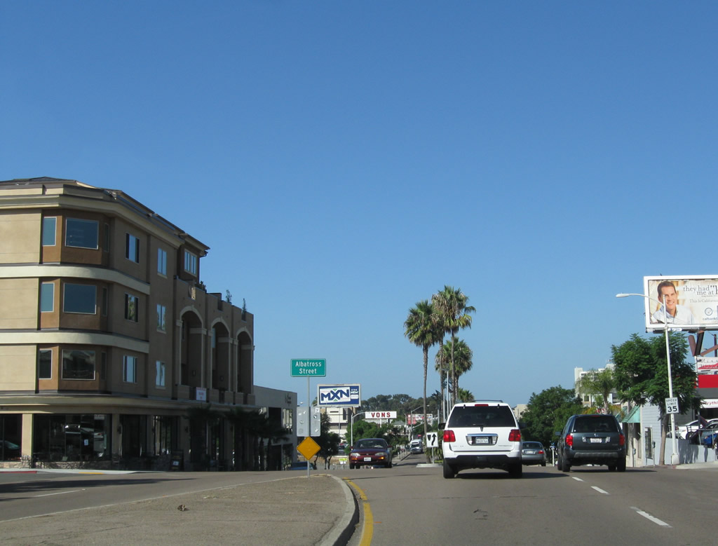
The first two intersections in Mission Hills are with Albatross Street and Brant Street. A landscaped median begins. Photos taken 10/09/10. |
|
|
|
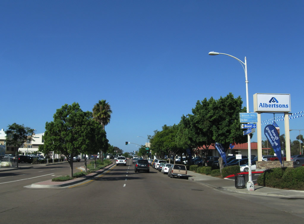
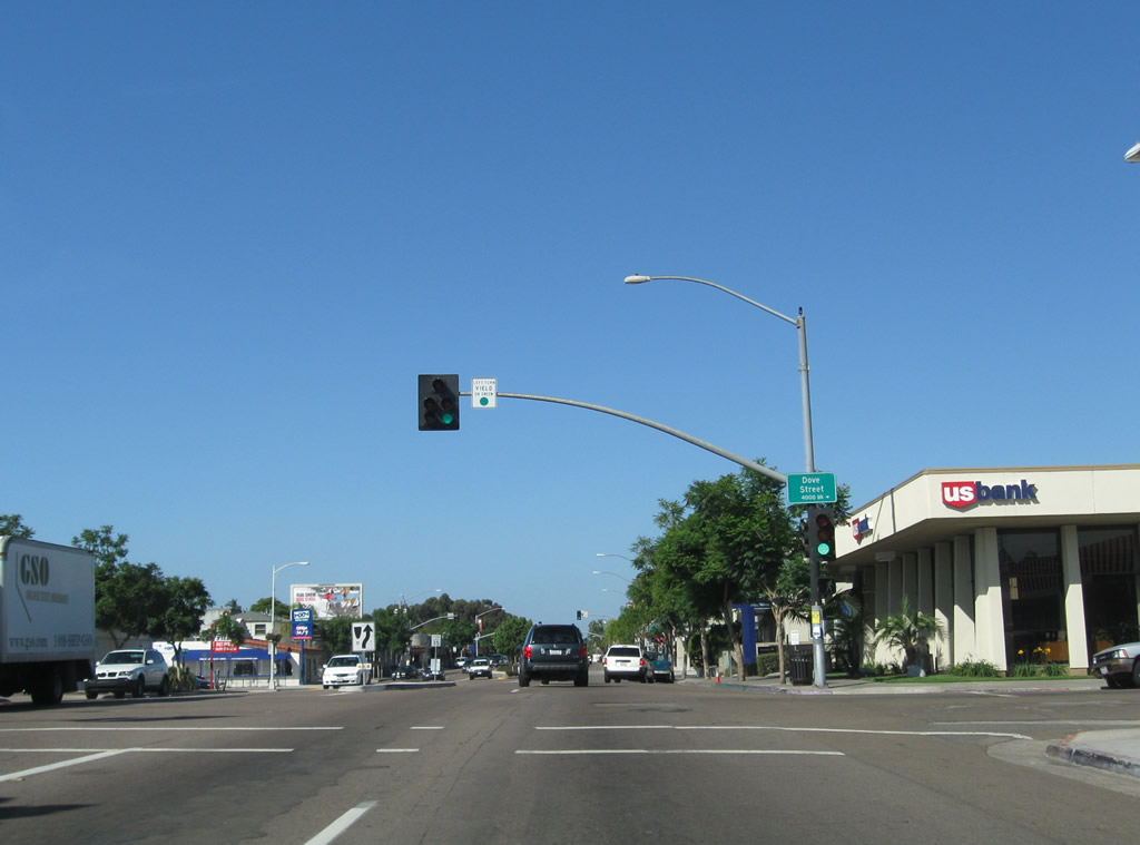
Washington Street enters the business district of Mission Hills and intersects Dove Street, Eagle Street, and Falcon Street. Photos taken 10/09/10. |
|
|
|
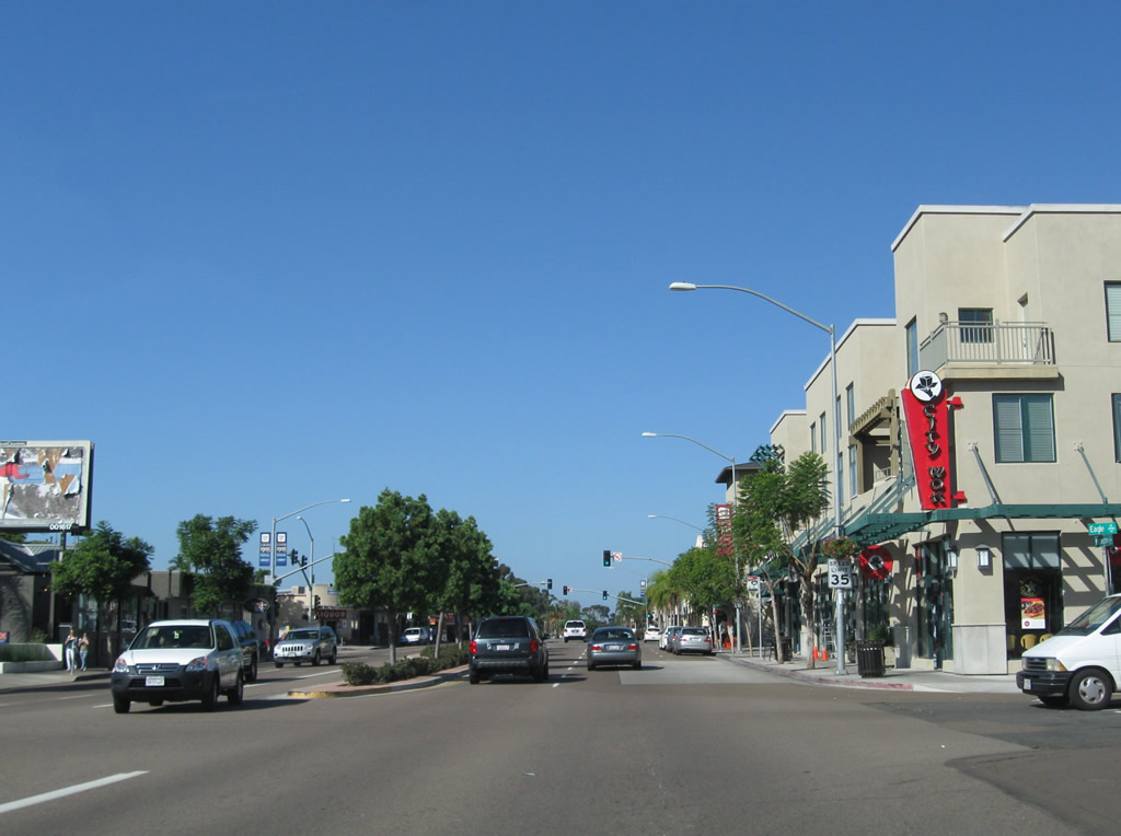
Westbound Washington Street meets Goldfinch Street at the center of Mission Hills, then curves southwest a bit for its descent to Five Points and Middletown. Photos taken 10/09/10. |
|
|
|
Washington Street passes under a bridge that connects University Avenue west to Washington Street west. Traffic merges onto westbound Washington Street from the right. Photos taken 10/09/10. |
|
|
As Washington Street travels downhill toward Five Points and San Diego Bay, old expressway features remain. The four-lane highway is made of concrete with a narrow raised median. Photos taken 10/09/10. |
|
|
|
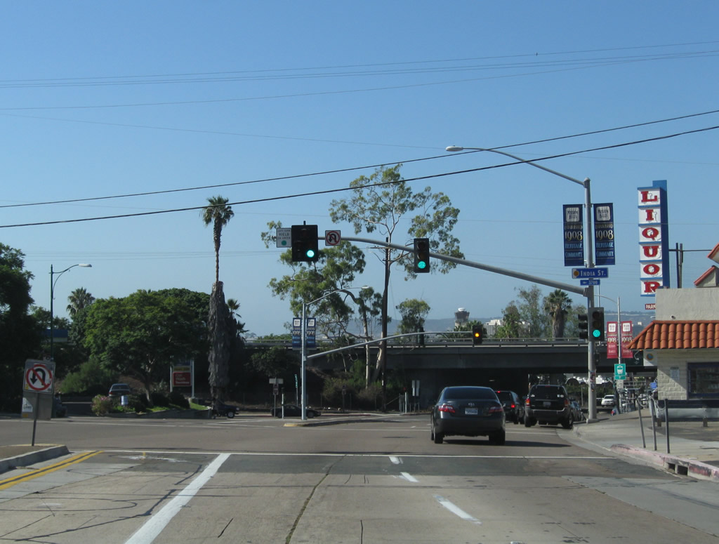
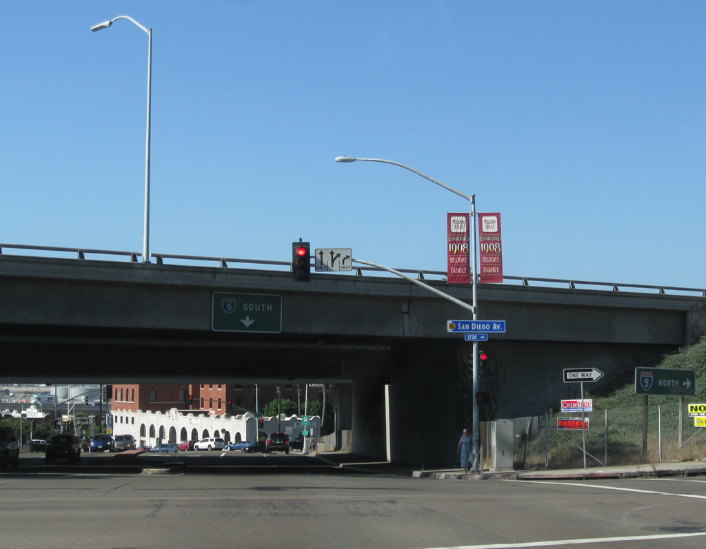
Point Loma comes into view as Washington Street continues its rapid descent from Mission Hills. At the bottom of the hill is Five Points, which includes intersections with India Street and San Diego Avenue. A commercial district (including restaurants and bars) is located in Five Points, just prior to the Interstate 5 overpass. Photos taken 10/09/10. |
|
|
|
Westbound Washington Street meets India Street followed by San Diego Avenue. The original alignment of U.S. 101 follows San Diego Avenue north from here into Old Town; a slip ramp connects San Diego Avenue with Interstate 5 (San Diego Freeway) north. To downtown San Diego, pass under Interstate 5 and turn left at Hancock Street, which offers a ramp onto Interstate 5 south and turns into Kettner Boulevard. Photos taken 10/09/10. |
|
|
|
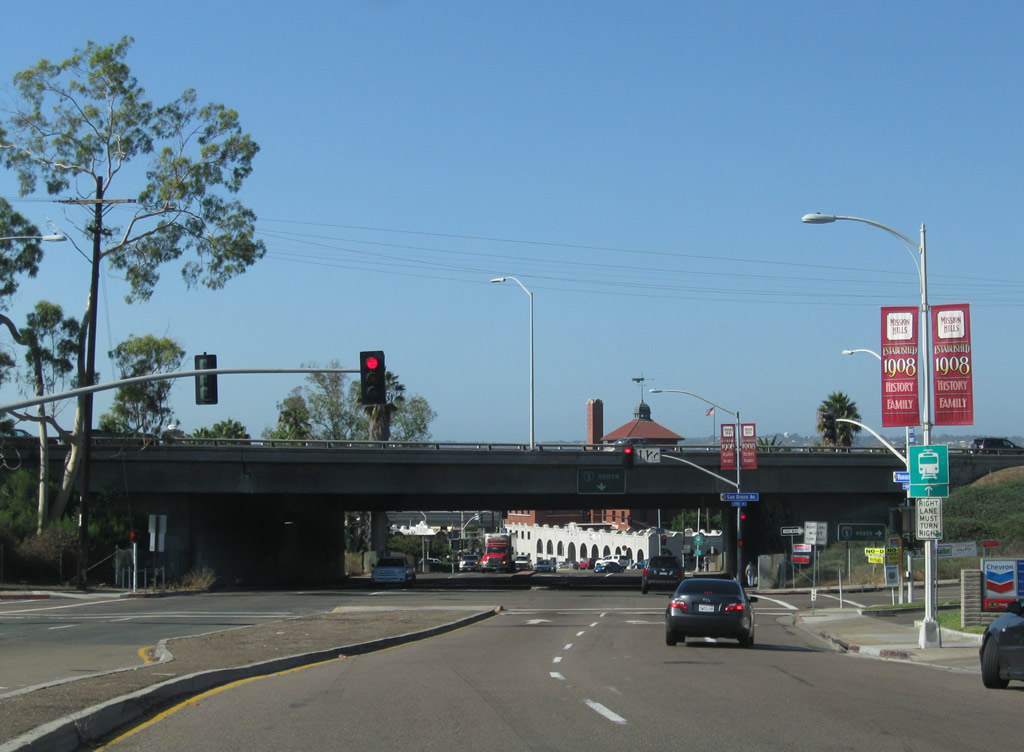
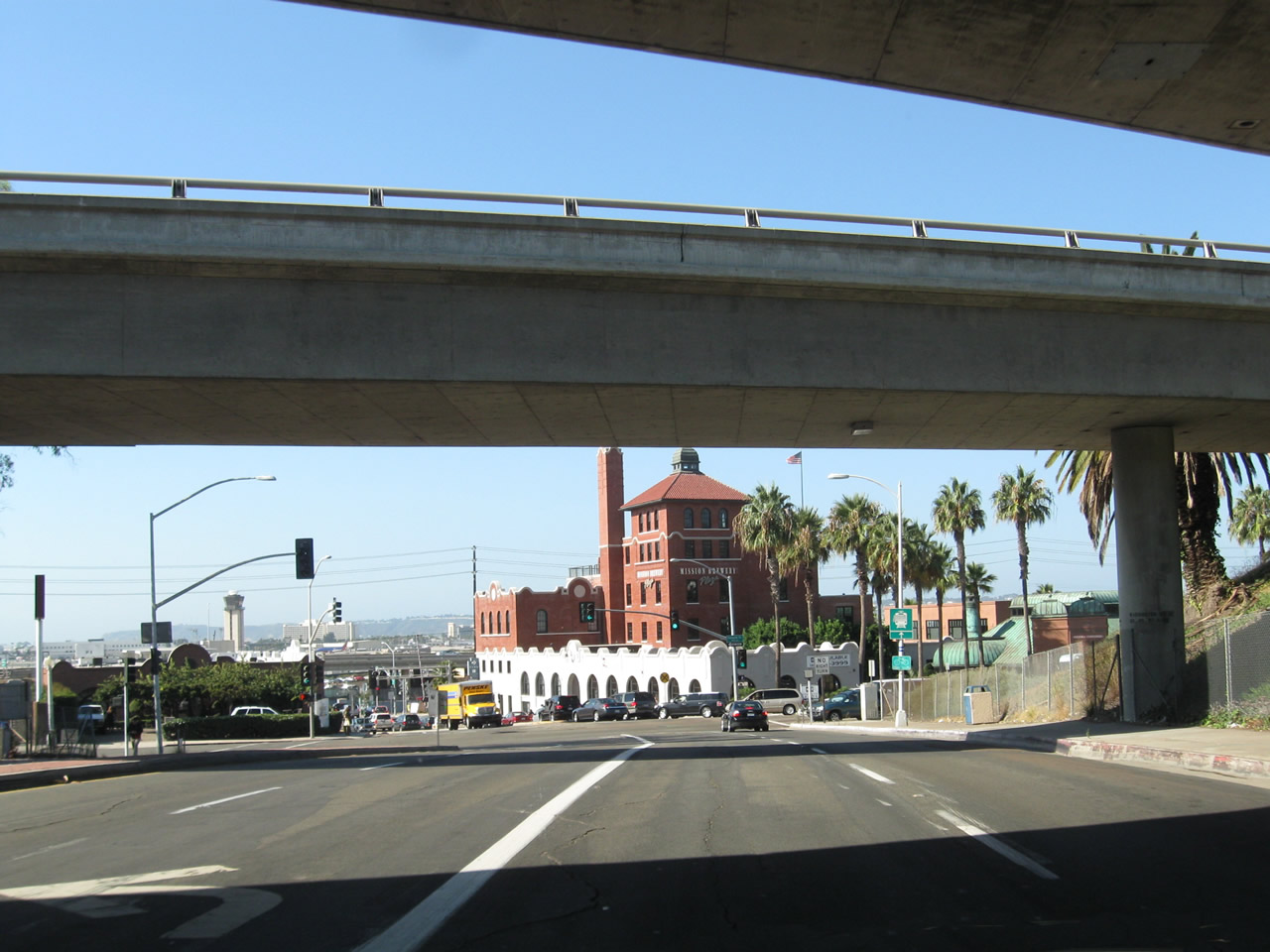
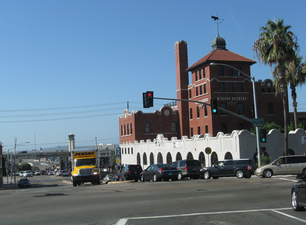
After the Interstate 5 overpass, Washington Street meets Hancock Street (one-way southbound) near the Mission Brewery. Upon crossing the railroad tracks (which includes freight, San Diego Trolley, Coaster, and Amtrak), Washington Street meets Pacific Highway, which is later-generation U.S. 101 and now is a city-maintained freeway. A traffic signal allows access to the Pacific Highway frontage road and access to Pacific Highway north. Continue straight to a left turn onto Pacific Highway south. A skate park operates under the Pacific Highway overpass. Photos taken 10/09/10. |
Page Updated February 24, 2013.