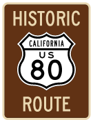
This page showcases extant segments of westbound Historic U.S. 80 through Viejas, Alpine, Crest, Lakeside, Bostonia, El Cajon, La Mesa, and eastern San Diego.
| Business Loop I-8 & Historic U.S. 80 west |
|
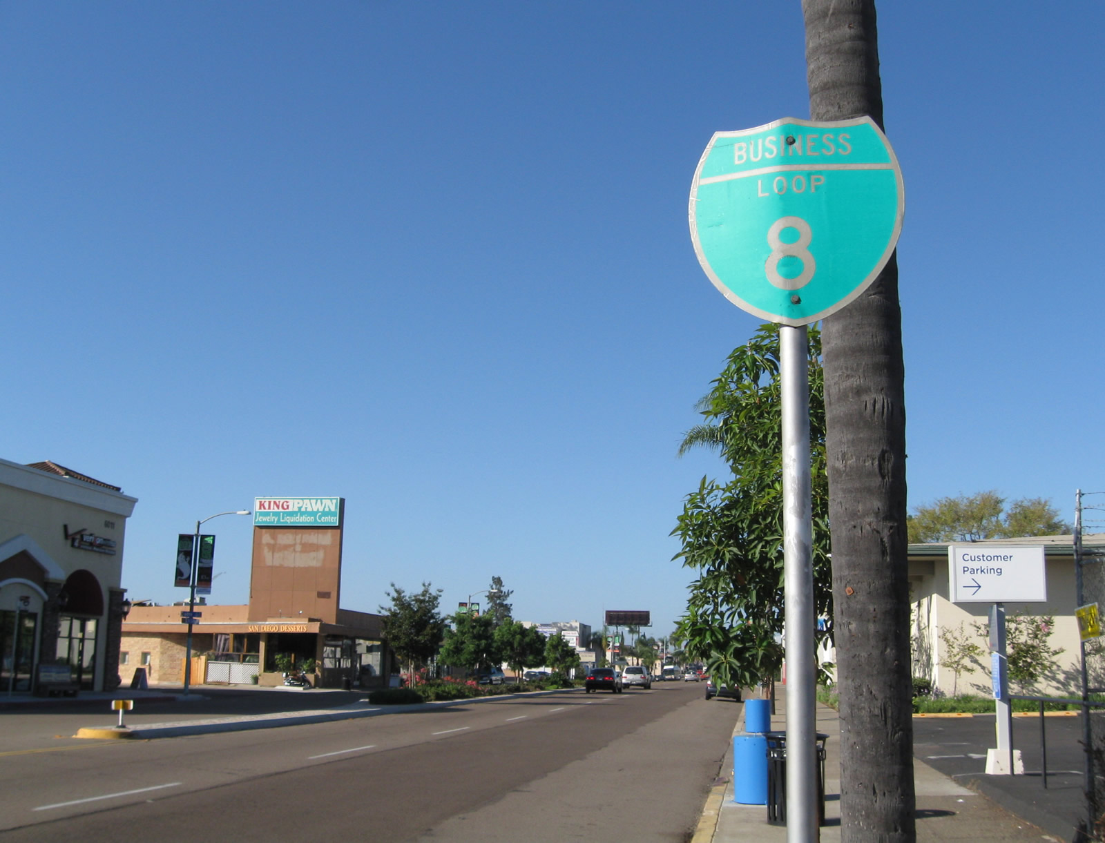
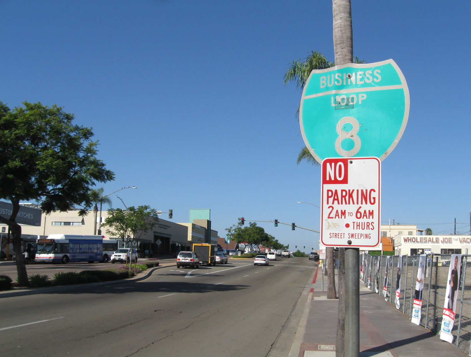
This reassurance shield for Business Loop I-8 west is posted on Main Street west of Greenfield Drive and prior to the Interstate 8 bridge northeast of downtown El Cajon. Photo taken 02/07/05. |
| Historic U.S. 80 Business west |
|
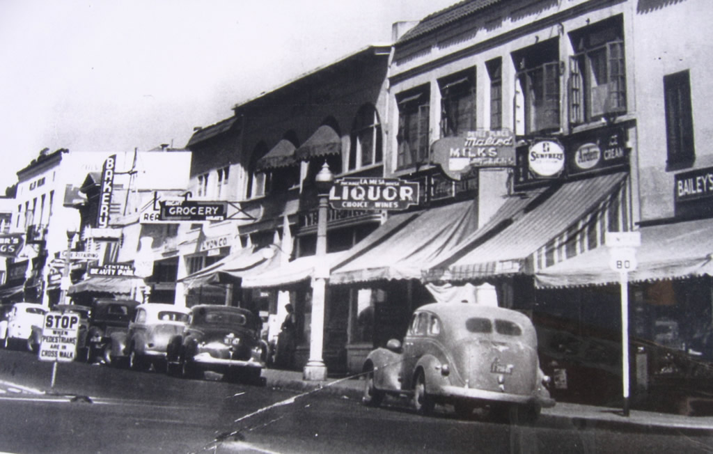
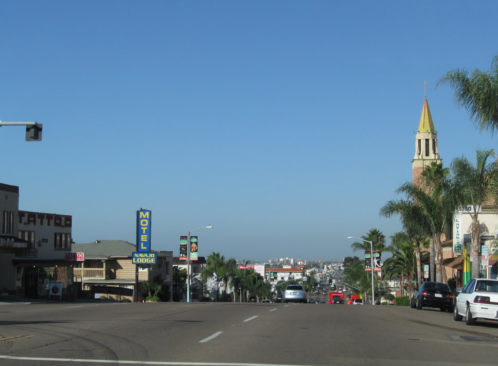
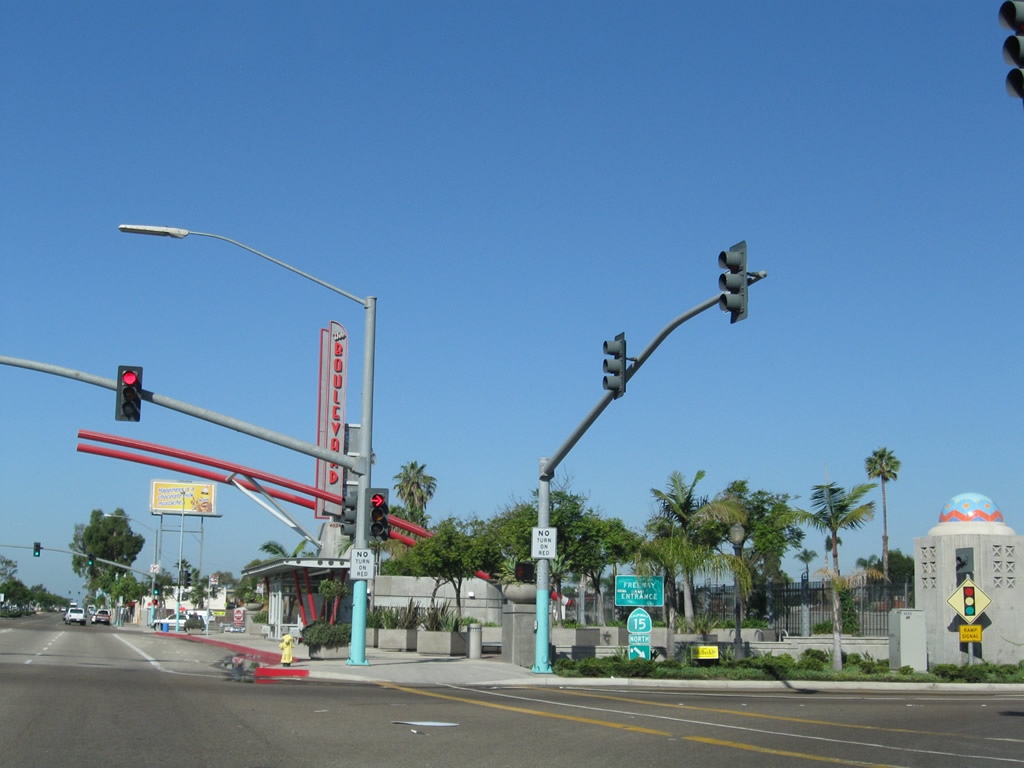
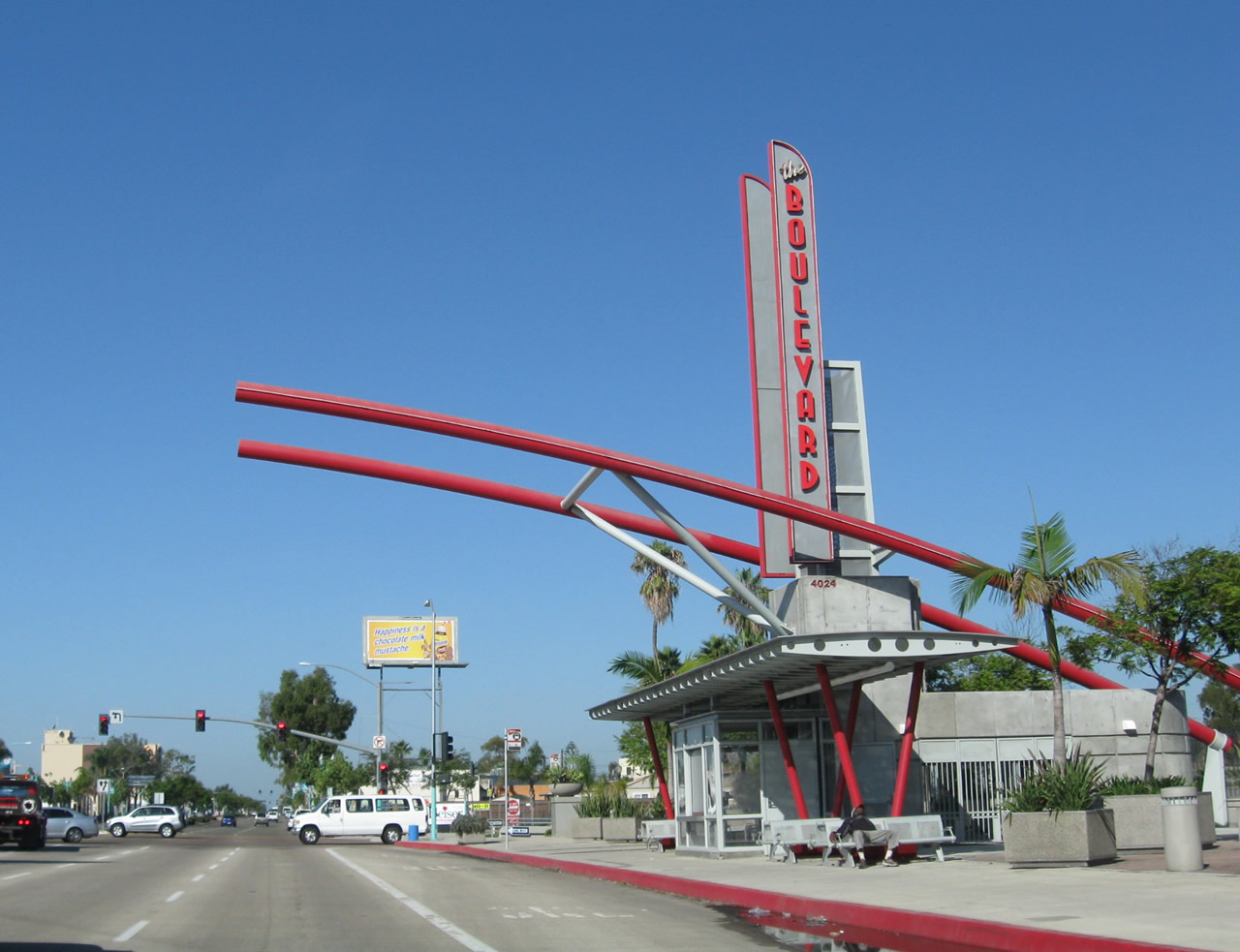
Historically, La Mesa Boulevard passed through a very busy commercial district in downtown La Mesa. This view shows the south side of the business district as well as a "U.S. 80 Business" route marker assembly. Photo taken 1940s; attribution unknown. |
|
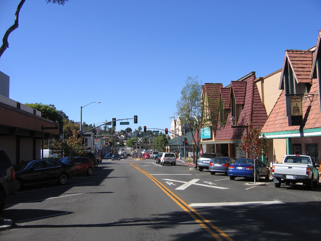
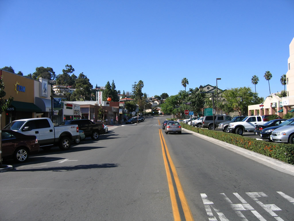
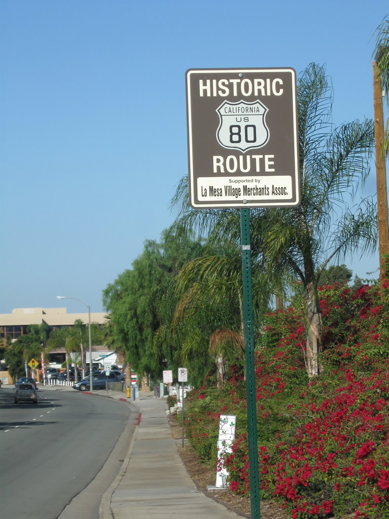
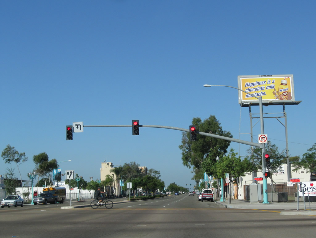
Westbound La Mesa Boulevard passes through the downtown La Mesa village between Palm Avenue and Spring Street. Photo taken 10/21/06. |
|
|
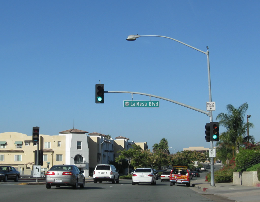
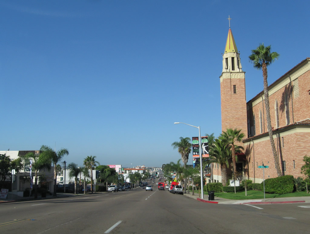
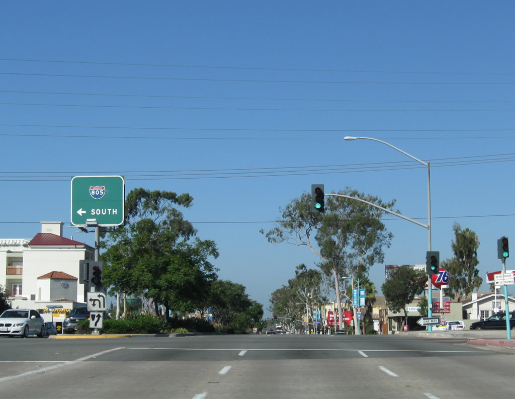
Originally, U.S. 80 followed La Mesa Boulevard through the village center of La Mesa, leaving the Interstate 8 alignment near Grossmont Summit (today's junction between Interstate 8 (Kumeyaay Highway) and California 125). The original highway stayed south of later alignment along Interstate 8 and El Cajon Boulevard by following La Mesa Boulevard. Photos taken 10/21/06. |
|
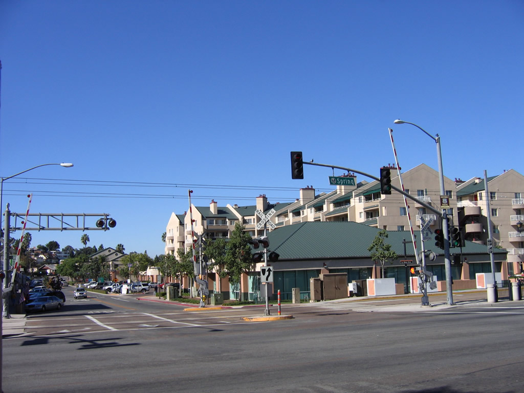
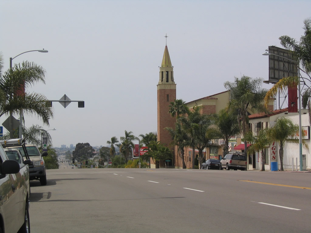
This view looks north from La Mesa Boulevard along the San Diego Trolley tracks near Spring Street. Photo taken 10/21/06. |
|
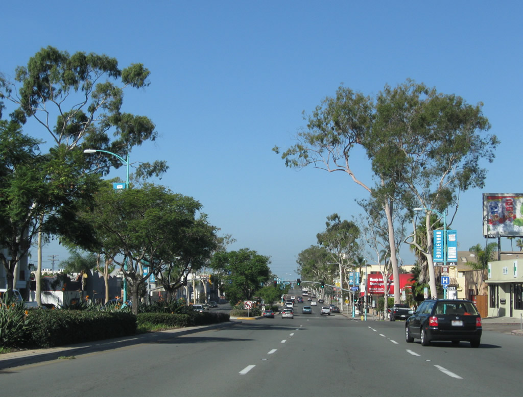
La Mesa Boulevard continues west between Spring Street and Acacia Avenue in the city of La Mesa. Businesses line La Mesa Boulevard throughout the downtown village center. Photo taken 10/21/06. |
| Business Loop I-8 & Historic U.S. 80 west |
|
The old alignment of U.S. 80 departs from Interstate 8 at the El Cajon Boulevard off-ramp in La Mesa. Also known as Business Loop I-8, El Cajon Boulevard mostly follows the original routing of U.S. 80 through La Mesa and San Diego, although the initial section of El Cajon Boulevard was built to bypass downtown La Mesa (La Mesa Boulevard follows Old U.S. 80's original route through downtown; it later became U.S. 80 Business and now is designated with Historic U.S. 80 route markers). Photo taken 10/09/10. |
|
A single lane off-ramp connects Interstate 8 west with El Cajon Boulevard west. Photo taken 10/09/10. |
|
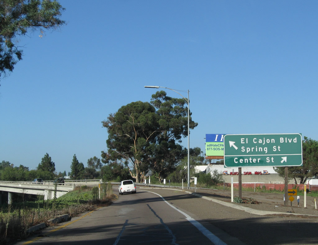
|
It is implied that Historic U.S. 80 and Business Loop I-8 split left along El Cajon Boulevard. Exit right here for Center Street. Photos taken 10/09/10. |
|
|
A flyover ramp carries westbound El Cajon Boulevard traffic over Interstate 8. Photos taken 10/09/10. |
|
|
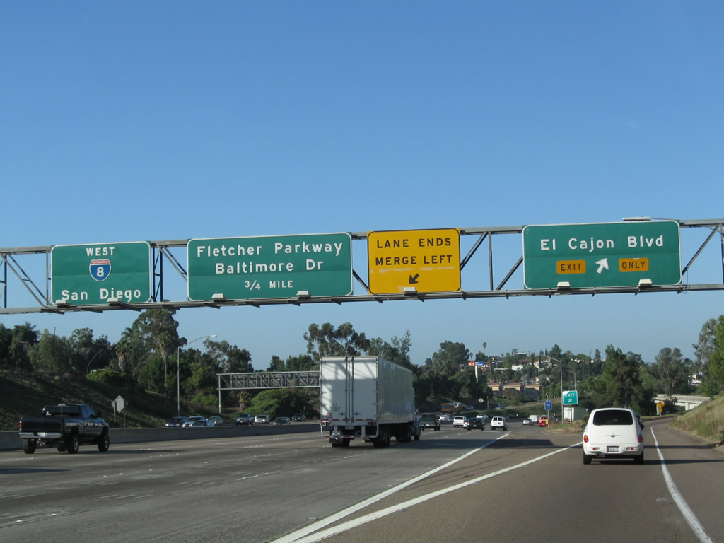
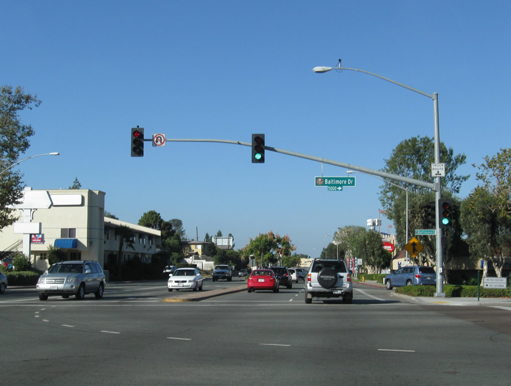
The ramp continues with two lanes westbound, culminating at the Baltimore Drive traffic signal in La Mesa. Turn left here for Spring Street and downtown La Mesa. Baltimore Drive also eventually connects with University Avenue westbound. Photos taken 10/09/10. |
|
Westbound El Cajon Boulevard meets Baltimore Drive. Photo taken 10/09/10. |
|
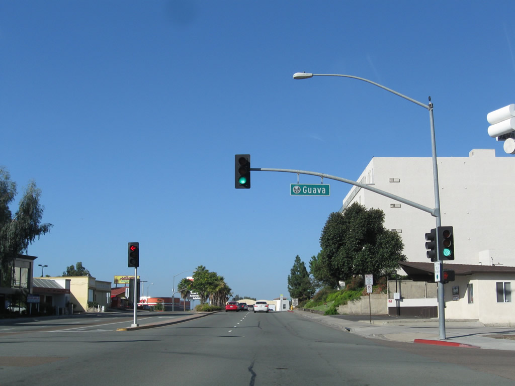
After passing by a shopping mall, Historic U.S. 80 (El Cajon Boulevard) approaches Guava Avenue. Photo taken 10/09/10. |
|
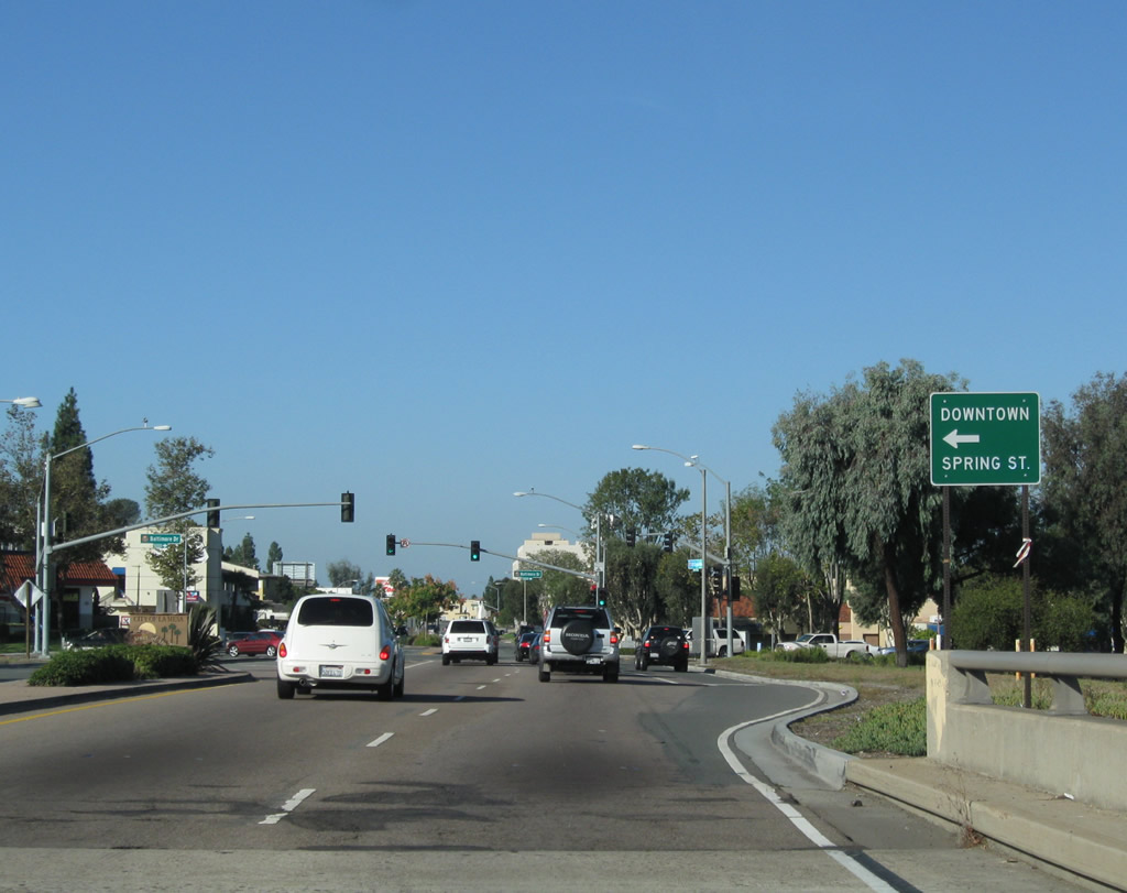
Turn left here for former U.S. 80 Business/La Mesa Boulevard east to downtown La Mesa. Continue west on Historic U.S. 80 (El Cajon Boulevard) ahead for the College Area community of San Diego. At La Mesa Boulevard, the original alignment of U.S. 80 merges onto El Cajon Boulevard west. Once El Cajon Boulevard was constructed as a bypass route toward Grossmont Summit, U.S. 80 was transferred onto El Cajon Boulevard east of here, and La Mesa Boulevard became U.S. 80 Business. Photo taken 10/09/10. |
|
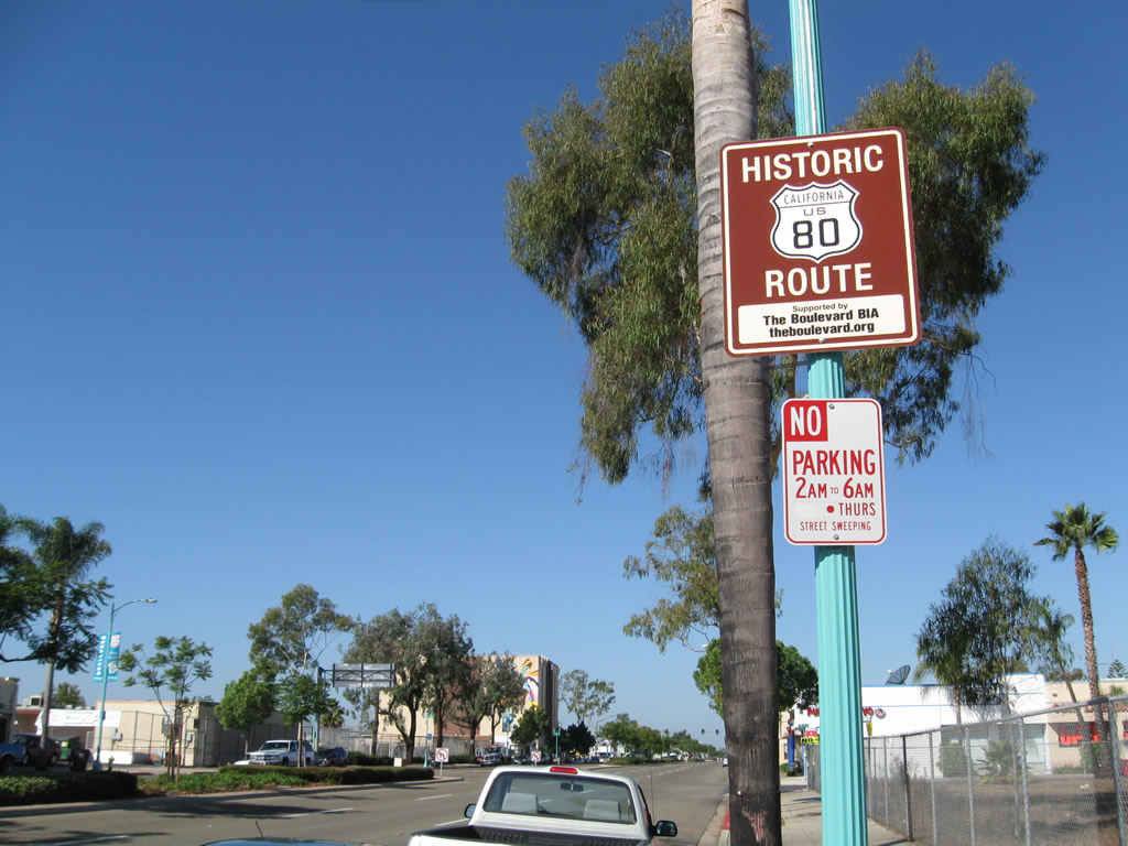
The first Historic U.S. 80 sign is posted on westbound El Cajon Boulevard after the La Mesa Boulevard intersection in La Mesa. Historic U.S. 80 is also signed along La Mesa Boulevard through downtown La Mesa. Photo taken 10/09/10. |
|
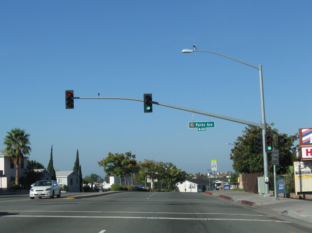
A landscape median lines El Cajon Boulevard between La Mesa Boulevard and Parks Avenue. An effort was made in the 1990s and 2000s to add landscaping to many sections of El Cajon Boulevard median that previously had none. Photo taken 10/09/10. |
|
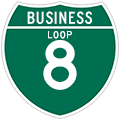
Westbound Historic U.S. 80 (El Cajon Boulevard) (Business Loop I-8) meets Parks Avenue. No business loop shields are present anywhere along El Cajon Boulevard within the city limits of La Mesa, and only a few remain in San Diego as of 2010. Photo taken 10/09/10. |
|
Historic U.S. 80 and Business Loop I-8 proceed west on El Cajon Boulevard in La Mesa. Photo taken 10/09/10. |
|
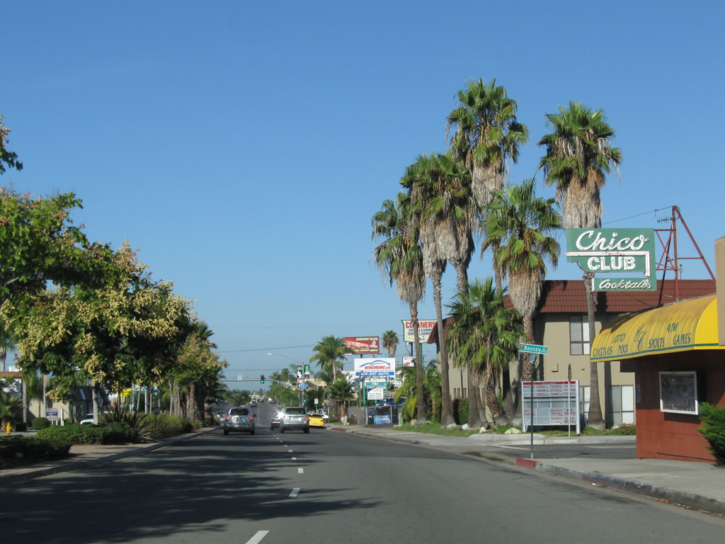
Westbound Historic U.S. 80 (El Cajon Boulevard) meets Keeney Street. Photo taken 10/09/10. |
|
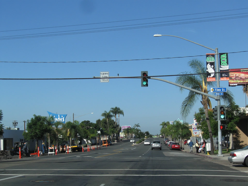
Entering San Diego, Historic U.S. 80 (El Cajon Boulevard) approaches 73rd Street. Street names from here west through College Area, City Heights, North Park, and Hillcrest (via Washington Street) will descend numerically (with First Avenue in Hillcrest). Photo taken 10/09/10. |
|
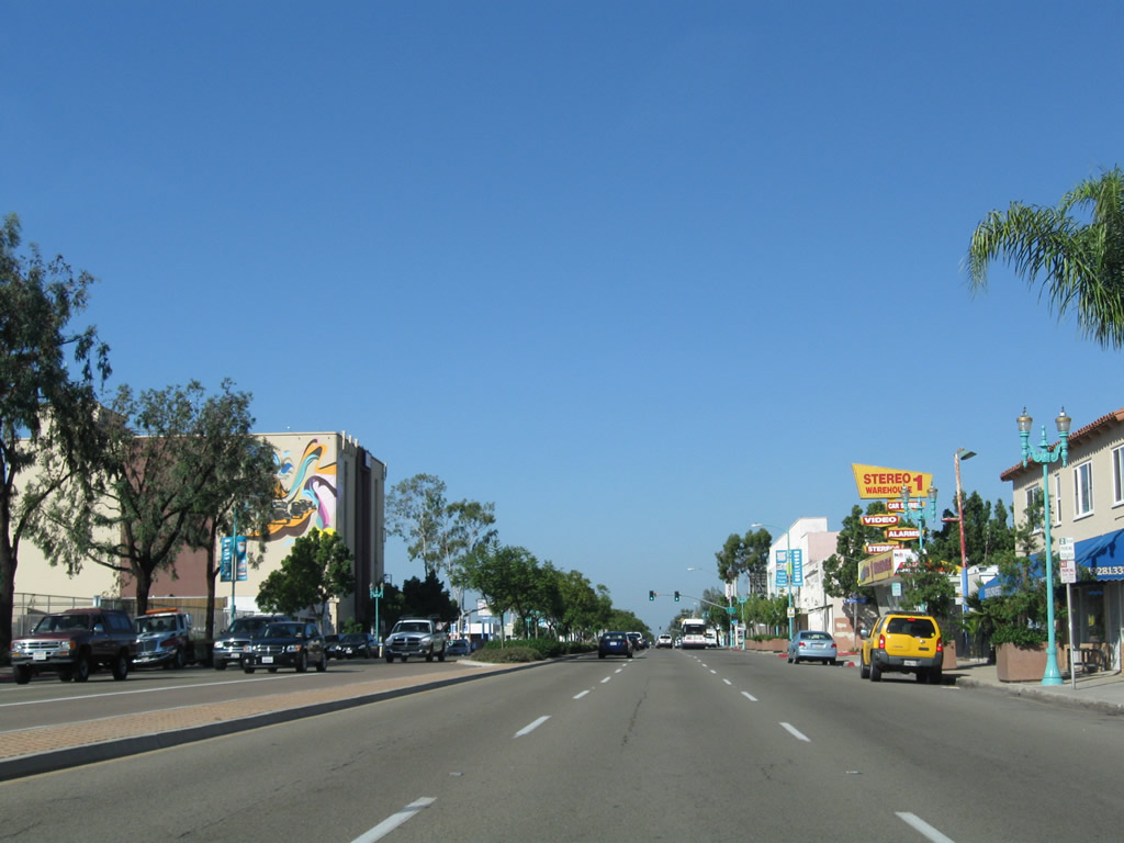
El Cajon Boulevard serves a variety of communities and neighborhoods on its route west. Initially it enters College Area, which is named for its proximity to San Diego State University (via Montezuma Road west). Photo taken 10/09/10. |
|
Westbound El Cajon Boulevard meets 71st Street. Photo taken 10/09/10. |
|
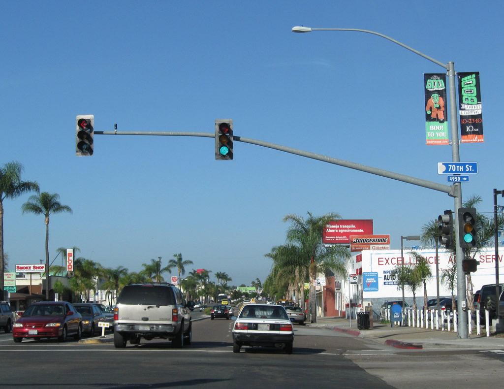
At this traffic signal, westbound El Cajon Boulevard meets 70th Street. Turn right (north) on 70th Street to the San Diego Trolley, Interstate 8, and Lake Murray Boulevard. Turn left (south) on 70th Street to University Avenue and Massachusetts Avenue south to Lemon Grove and California 94. Photo taken 10/09/10. |
|
A few blocks west (after 67th Street), El Cajon Boulevard west meets Montezuma Road. Turn right (west) on Montezuma Road to San Diego State University and Interstate 8 (via the Fairmount Avenue-Mission Gorge Road interchange). Continue west on El Cajon Boulevard toward the College Area Business District, El Cerrito, Talmadge, and City Heights. Photo taken 10/09/10. |
|
Westbound Business Loop I-8 and Historic U.S. 80 (El Cajon Boulevard) enters the College Area Business District. Photo taken 10/09/10. |
|
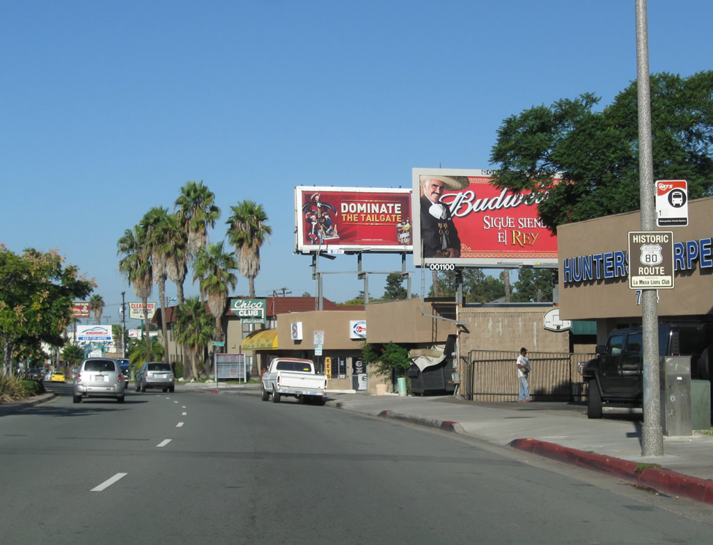
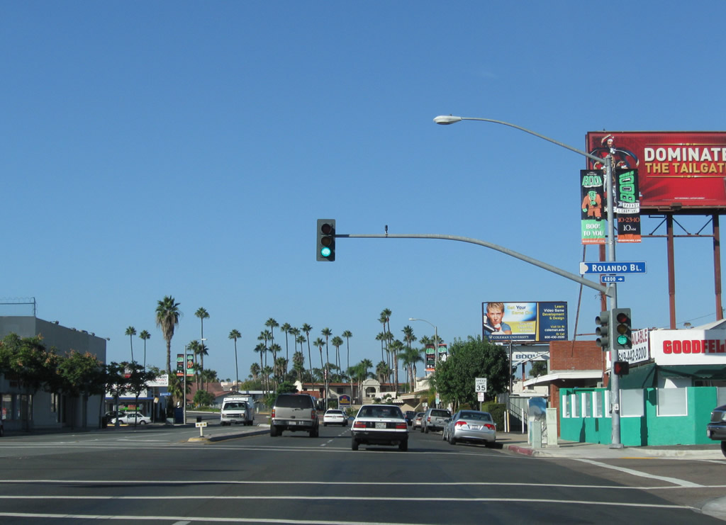
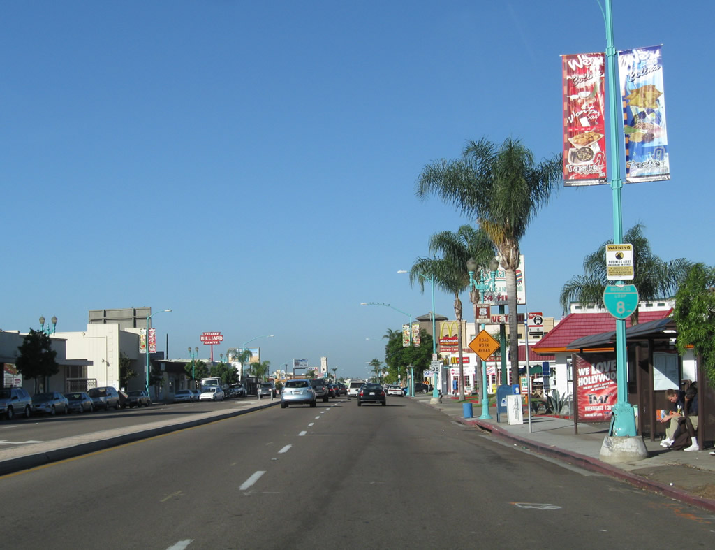
A short distance later, westbound Business Loop I-8 and Historic U.S. 80 (El Cajon Boulevard) approaches Rolando Boulevard. Very few city streets in San Diego have as many billboards as El Cajon Boulevard. While new billboards are very rare in San Diego due to restrictive ordinances, older billboards remain in use and may owe their presence to the age of the boulevard as a major route into San Diego from the east. Photo taken 10/09/10. |
|
This view looks west along Business Loop I-8 and Historic U.S. 80 (El Cajon Boulevard) between Art Street and 63rd Street. Photo taken 10/09/10. |
|
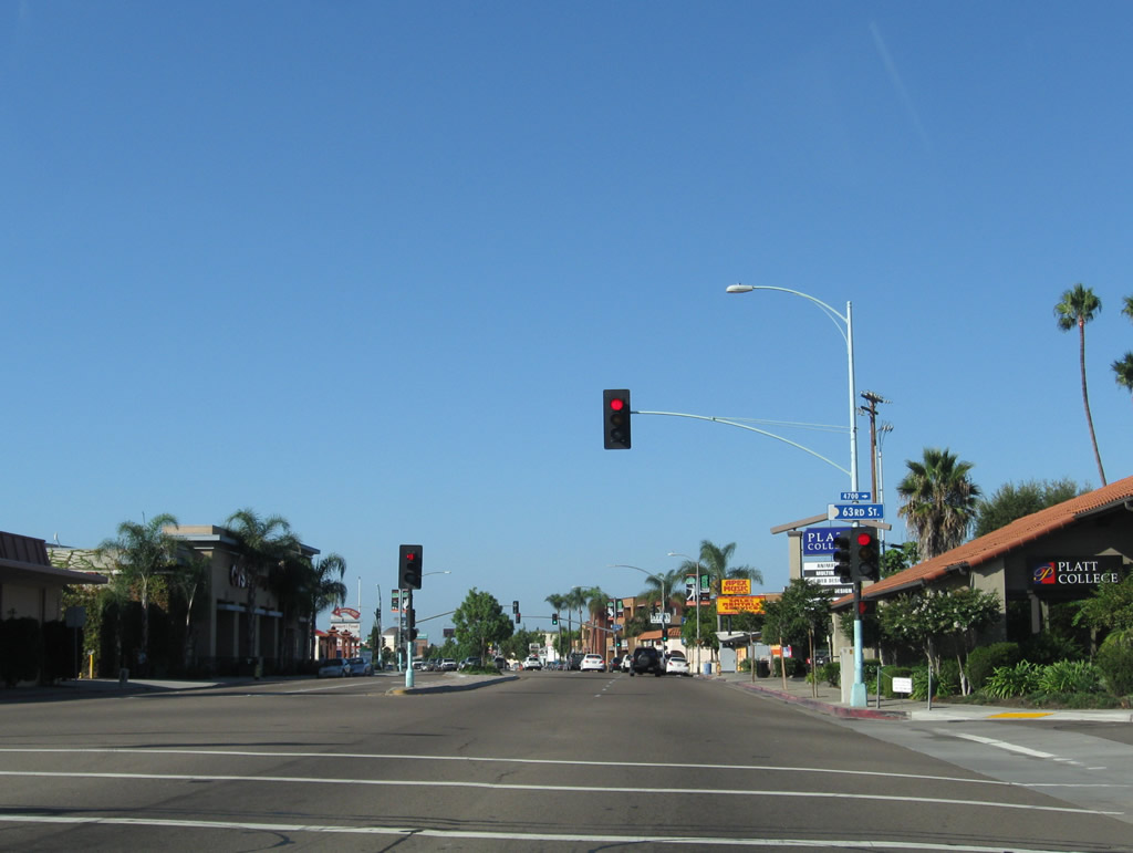
Westbound Business Loop I-8 and Historic U.S. 80 (El Cajon Boulevard) meets 63rd Street. Photo taken 10/09/10. |
|
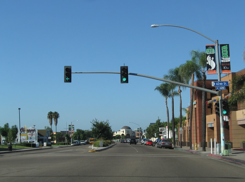
One block west, Business Loop I-8 and Historic U.S. 80 (El Cajon Boulevard) reaches 62nd Street. Photo taken 10/09/10. |
|
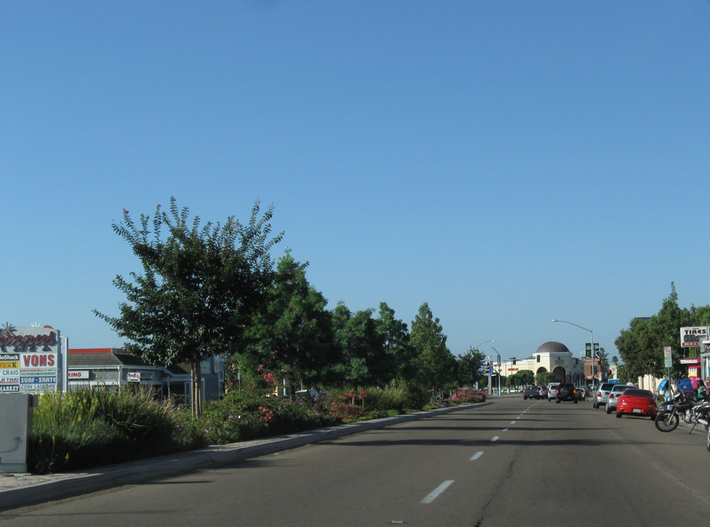
A relatively new landscaped median lines El Cajon Boulevard between 62nd Street and College Avenue. Photo taken 10/09/10. |
|
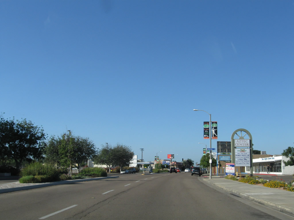
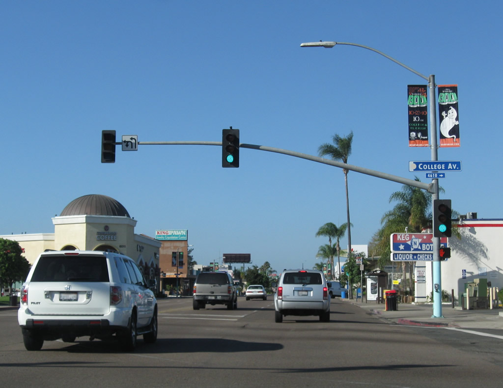
Westbound El Cajon Boulevard meets College Avenue. Turn left (south) to College Grove and California 94. Turn right (north) to San Diego State University, Interstate 8, and Del Cerro. Photo taken 10/09/10. |
|
|
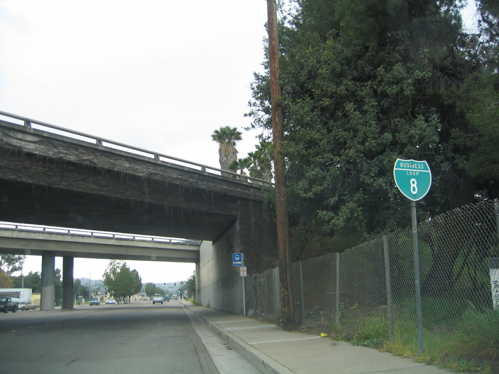
As of 2010, the first westbound Business Loop I-8 route marker is posted along westbound El Cajon Boulevard after College Avenue. Most of the shields on El Cajon Boulevard between 73rd Street and College Avenue that were in place in the mid-1990s were gone by 2007. It is likely that this sign will be gone in the coming years and not replaced. Photos taken 10/09/10 and 03/27/05. |
|
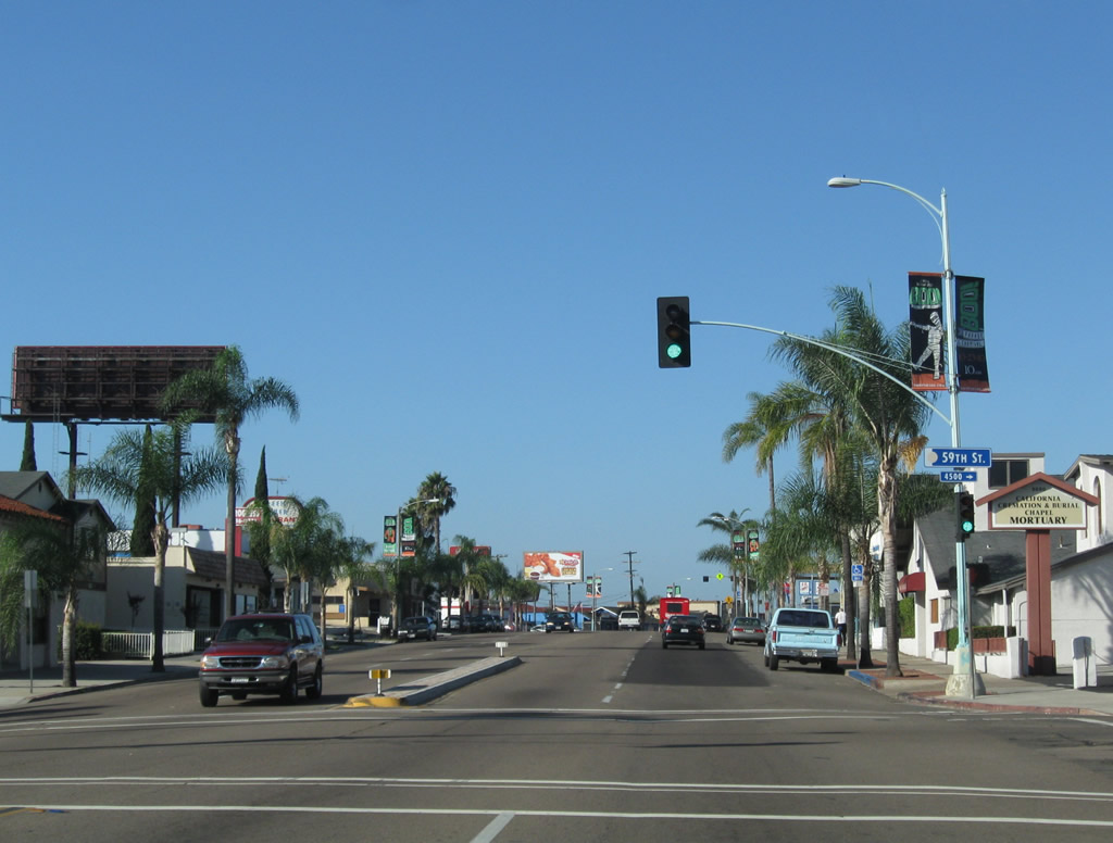
Westbound Business Loop I-8 and Historic U.S. 80 (El Cajon Boulevard) meets 59th Street and enters the neighborhood of El Cerrito. Photo taken 10/09/10. |
|
Cresting after Alice Street, Business Loop I-8 and Historic U.S. 80 (El Cajon Boulevard) has a nice view looking west. Photo taken 10/09/10. |
|
|
Westbound Business Loop I-8 and Historic U.S. 80 (El Cajon Boulevard) meets El Cerrito Drive. Photos taken 03/27/05 and 10/09/10. |
|
Continuing west, Business Loop I-8 and Historic U.S. 80 (El Cajon Boulevard) meets 56th Street. Photo taken 10/09/10. |
|
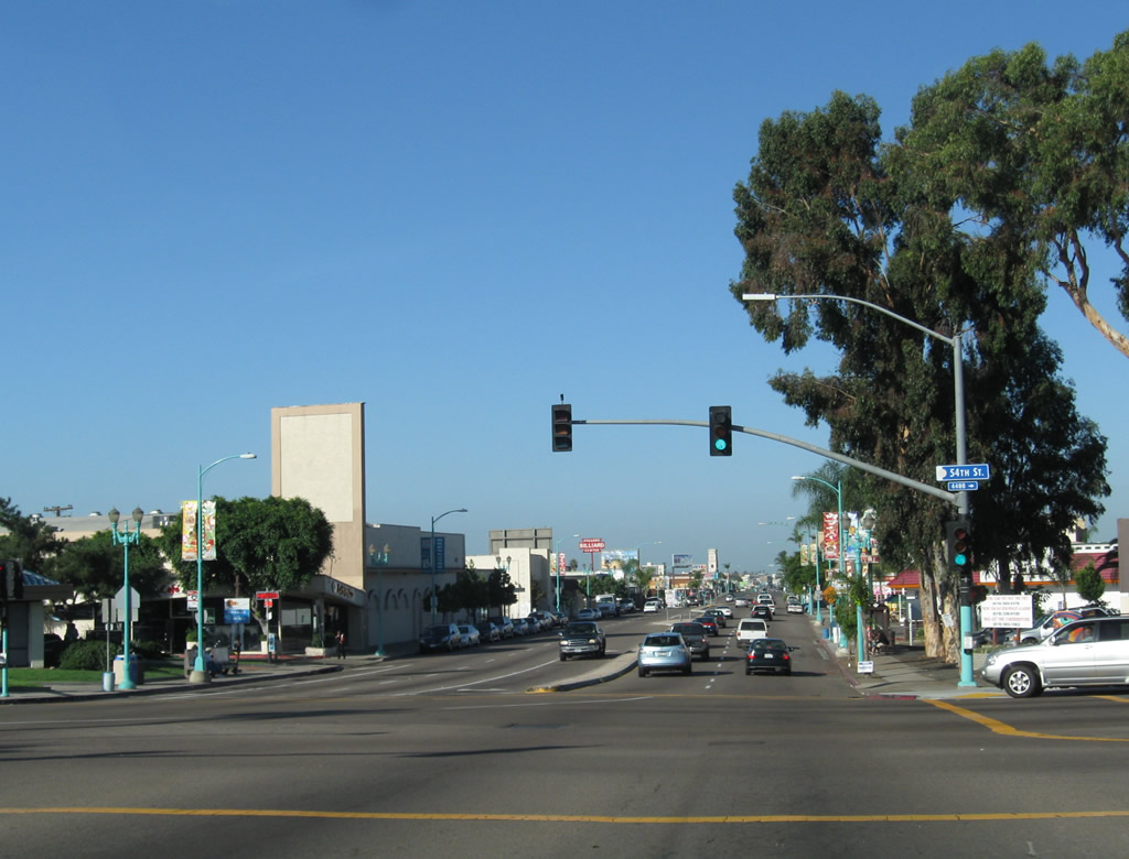
Westbound Business Loop I-8 and Historic U.S. 80 (El Cajon Boulevard) then meets 54th Street. Turn left on 54th Street south to Webster or turn right for 54th Street north to Collwood Boulevard to Montezuma Road and Interstate 8. Photo taken 10/09/10. |
|
Another Business Loop I-8 shield is posted after 54th Street. Photo taken 10/09/10. |
|
And right after the Business Loop I-8 shield is the first Historic U.S. 80 sign to be seen after leaving La Mesa. Photo taken 10/09/10. |
|
Between 54th Street and Park Boulevard, El Cajon Boulevard has a teal (turquoise) color theme for its street lights and streetscape fixtures. From 54th Street and California 15, El Cajon Boulevard separates Colina Park and City Heights on the south from Talmadge and Kensington to the north. Photo taken 10/09/10. |
|
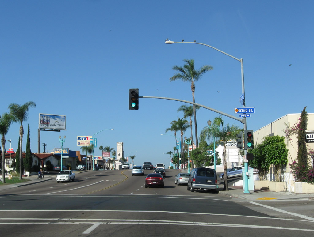
Westbound Business Loop I-8 and Historic U.S. 80 (El Cajon Boulevard) meets 52nd Street. Photo taken 10/09/10. |
|
This view looks west along El Cajon Boulevard at Altadena Avenue. Photo taken 10/09/10. |
|
Continuing west on Historic U.S. 80 (El Cajon Boulevard), we approach 48th Street. Photo taken 10/09/10. |
|
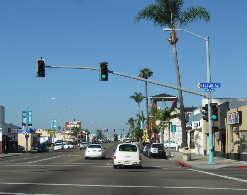
Westbound Historic U.S. 80 (El Cajon Boulevard) meets Euclid Avenue. Photo taken 10/09/10. |
|
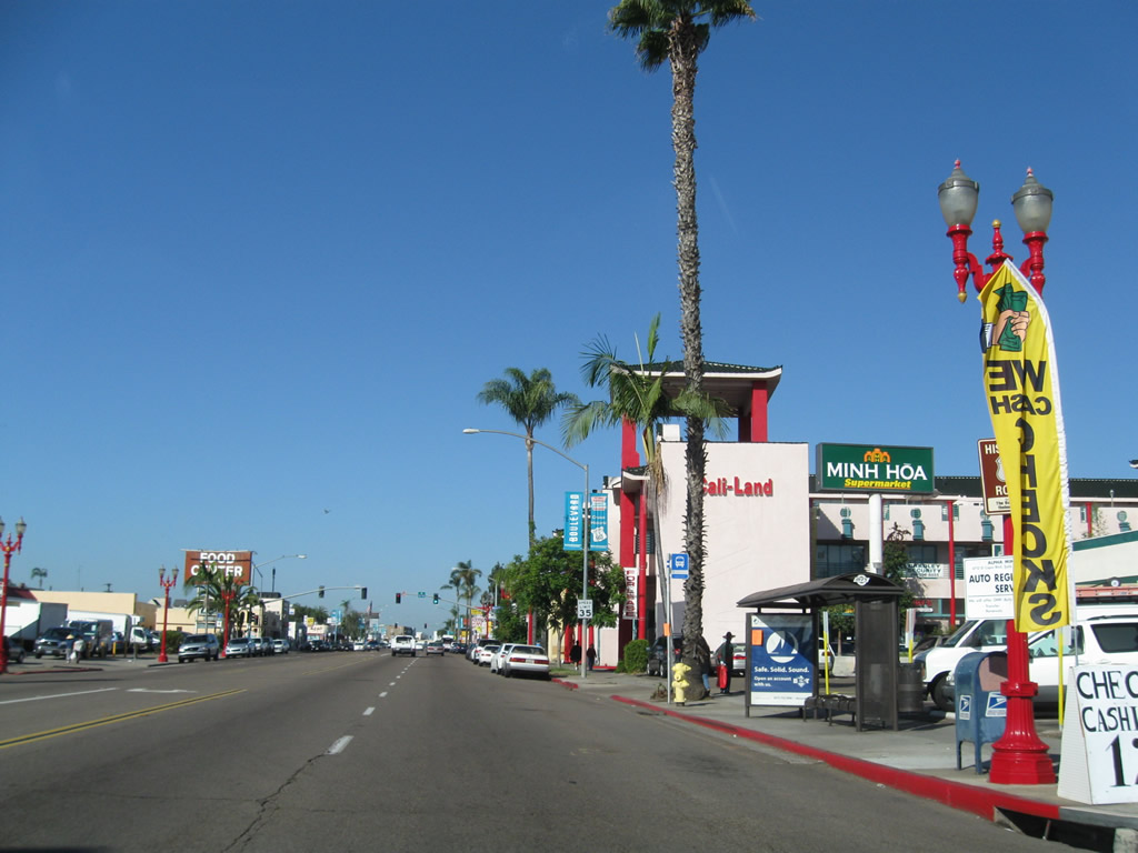
El Cajon Boulevard enters the Little Saigon district. Photo taken 10/09/10. |
|
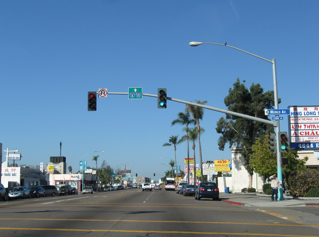
Westbound El Cajon Boulevard meets Menlo Avenue. A trailblazer sign for Interstate 8 and Interstate 15 is posted on the traffic signal mast arm. Photo taken 10/09/10. |
|
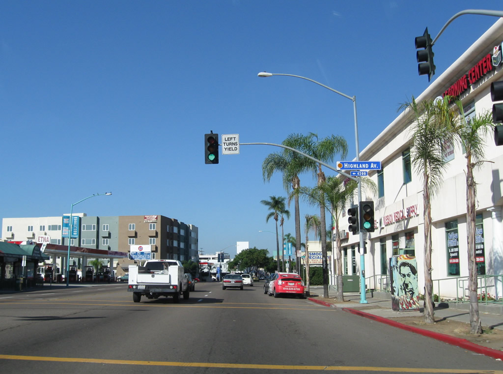
Reaching Highland Avenue, westbound El Cajon Boulevard enters City Heights. North of the boulevard are Kensington (from here west to California 15) and Normal Heights (from there west to Interstate 805). To the south is City Heights. Photo taken 10/09/10. |
|
|
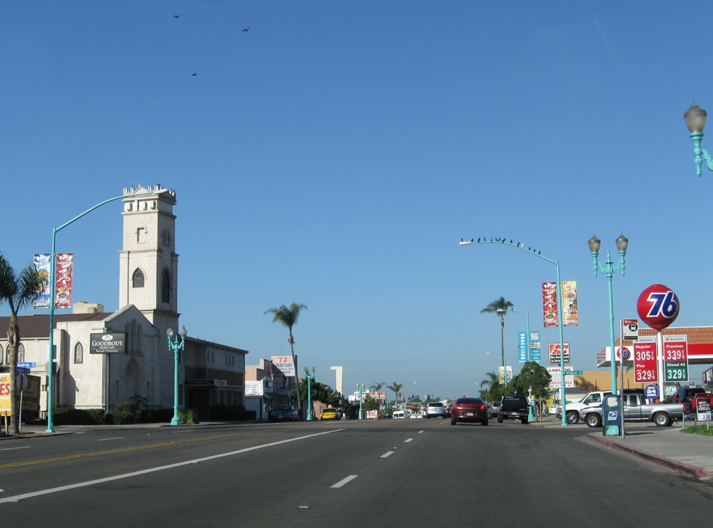
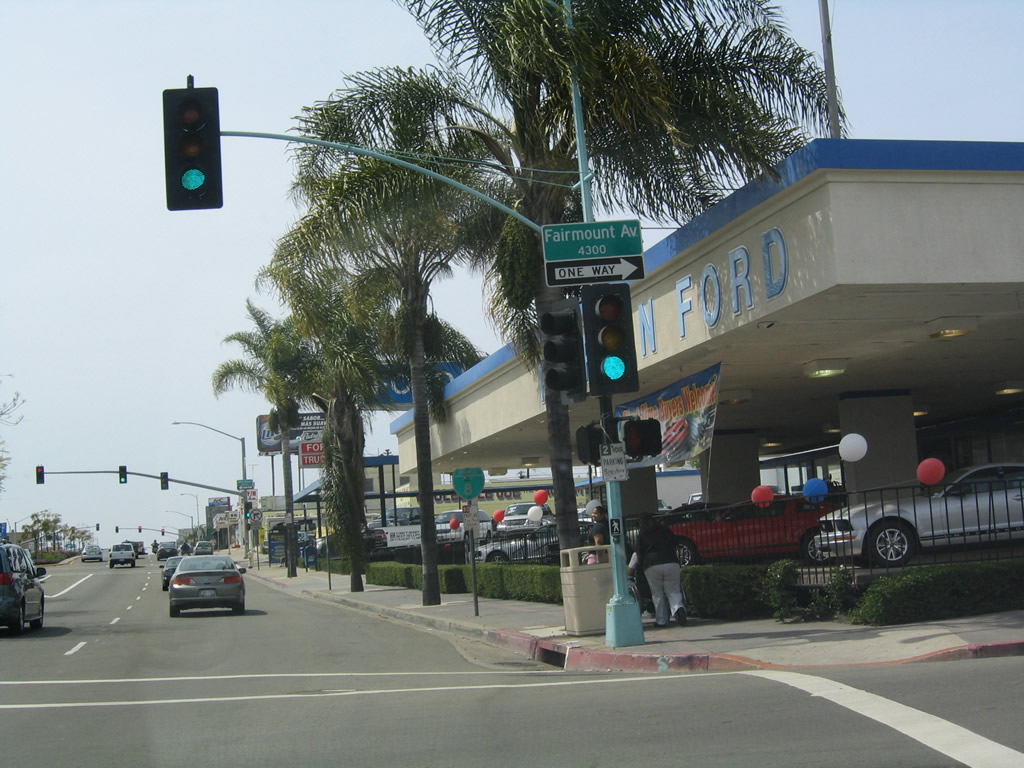
Shortly thereafter, westbound El Cajon Boulevard meets Fairmount Avenue. This is a pivotal intersection, as Fairmount Avenue to the north of here used to carry U.S. 395 north toward the San Diego Mission and points north via Murphy Canyon. U.S. 395 has had three north-south alignments south of Miramar: originally, U.S. 395 paralleled today's Kearny Villa Road and Linda Vista Road southwest to end at U.S. 101 in the Morena District; later, U.S. 395 traveled south roughly along the Interstate 15 corridor via Murphy Canyon Road, Ward Road, and Fairmount Avenue to El Cajon Boulevard, then turned west on El Cajon Boulevard, south on Park Boulevard, and west on Market Street to end at Harbor Drive (Historic U.S. 101) in downtown San Diego; and finally along the Cabrillo Freeway (today's California 163) in its entirety, 10th/11th Avenue couplet, and Market Street. Note Pearson Ford still existed in 2005, but it has since closed and was demolished. Photos taken 10/09/10 and 03/27/05. |
|
|
A Business Loop I-8 west reassurance shield is posted on westbound El Cajon Boulevard after the Fairmount Avenue intersection near the site of Pearson Ford, which has since relocated to Kearny Mesa. Since this section of Fairmount Avenue is one-way northbound, Historic U.S. 395 south will join El Cajon Boulevard at the next intersection (43rd Street). This sign was replaced in summer 2012. Photos taken 08/29/12 and 10/08/10. |
|
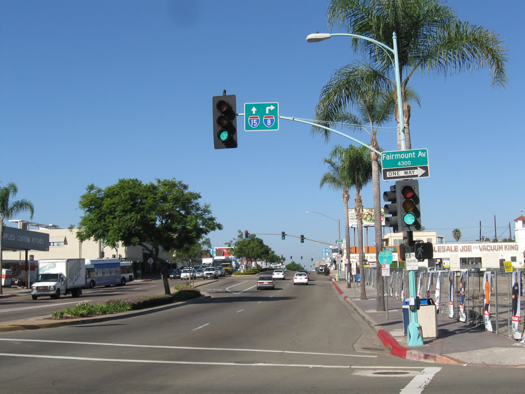
Westbound El Cajon Boulevard reaches 43rd Street, which is one-way southbound. Ahead, U.S. 80 west and U.S. 395 south proceed toward North Park and Balboa Park. El Cajon Boulevard widens to six lanes (three in each direction) from here west to Park Boulevard in University Heights. Photo taken 10/09/10. |
| Business Loop I-8-Historic U.S. 80 west & Historic U.S. 395 south |
|
Another historic U.S. 80 route marker is posted shortly after 43rd Street next to Van Dyke Avenue. Unfortunately, Historic U.S. 395 is not jointly signed here (especially since El Cajon Boulevard is seen as synonymous with U.S. 80 but is not readily recognized as partially Historic U.S. 395). Photo taken 10/09/10. |
|
The Boulevard Association placed many of the Historic U.S. 80 signs along El Cajon Boulevard, including this one at Van Dyke Avenue. Photo taken 10/09/10. |
|
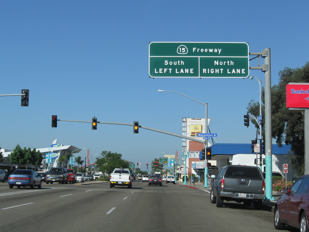
After passing by Copeland Avenue, westbound El Cajon Boulevard approaches California 15 (Future Interstate 15). The Boulevard Transit Plaza is situated on the El Cajon Boulevard bridge deck that spans over California 15. Adorned with decorative red arches and benches, the transit plaza will connect to future planned transit along California 15. Photo taken 10/09/10. |
|
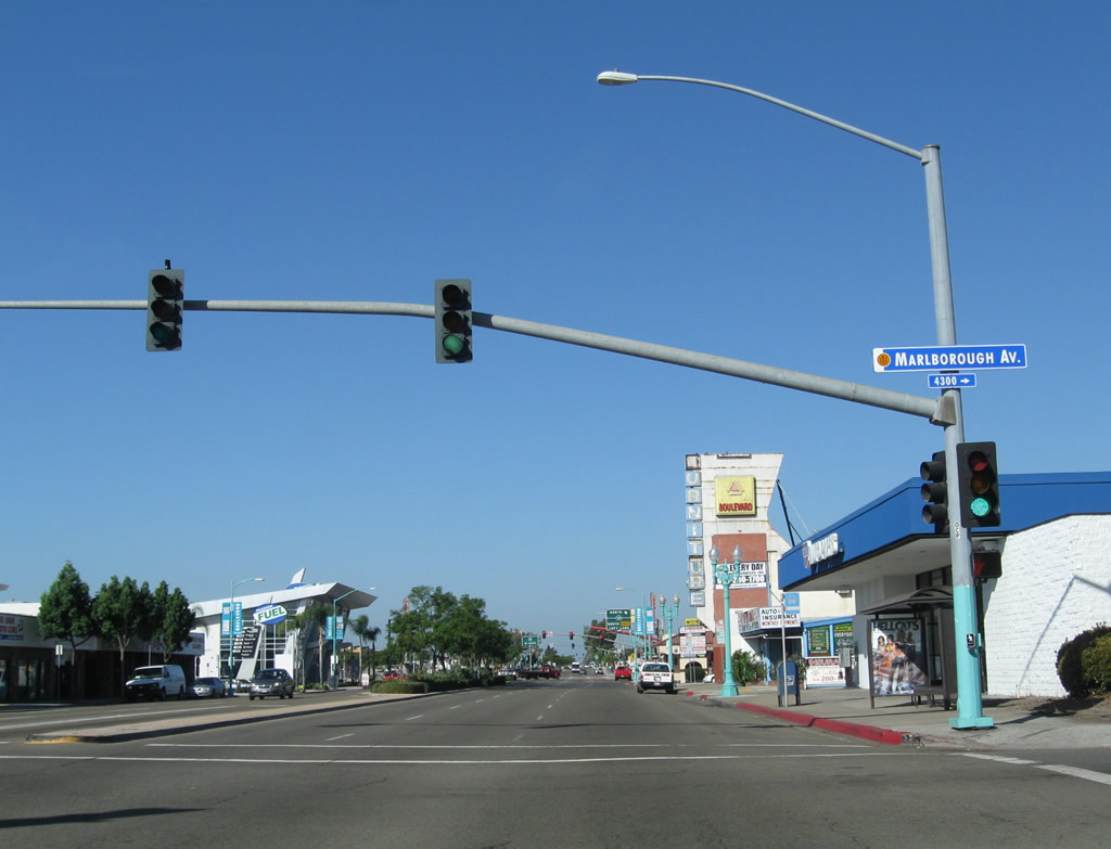
The next intersection is with Marlborough Avenue; follow Marlborough Avenue north to Kensington. Photo taken 10/09/10. |
|
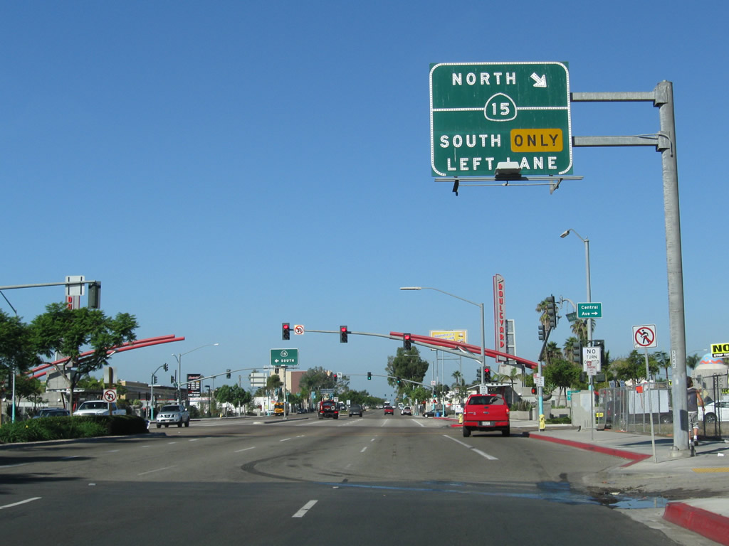
The interchange between El Cajon Boulevard and California 15 (Escondido Freeway) is a diamond interchange. The next right connects to Central Avenue and California 15 north, while the first left after crossing the bridge deck connects to California 15 south. Photo taken 10/09/10. |
|
|
|
Red arches span on both sides of the bridge deck as we cross California 15. These arches were added to create the distinct transit plaza along El Cajon Boulevard. Stay left for the on-ramp to California 15 south. Photos taken 10/09/10. |
|
Westbound U.S. 80-395/El Cajon Boulevard meets the on-ramp to California 15 (Escondido Freeway) south to Fairmount Park, Mount Hope, and 32nd Street Naval Station San Diego. Photo taken 10/09/10. |
|
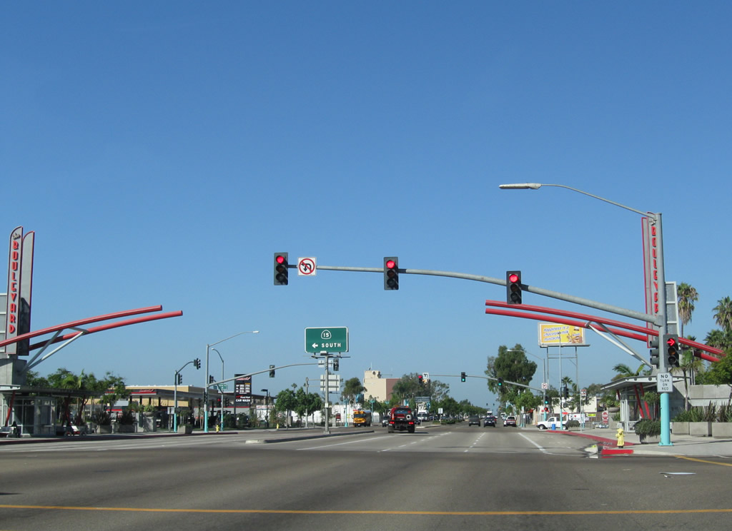
Leaving the California 15 interchange, another Historic U.S. 80 route marker appears. Photo taken 10/09/10. |
|
Westbound Business Loop I-8 (El Cajon Boulevard) continues past 38th Street toward 37th Street (traffic signal in distance). Photo taken 10/09/10. |
|
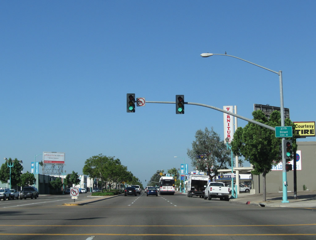
El Cajon Boulevard west meets 37th Street. Photo taken 10/09/10. |
|
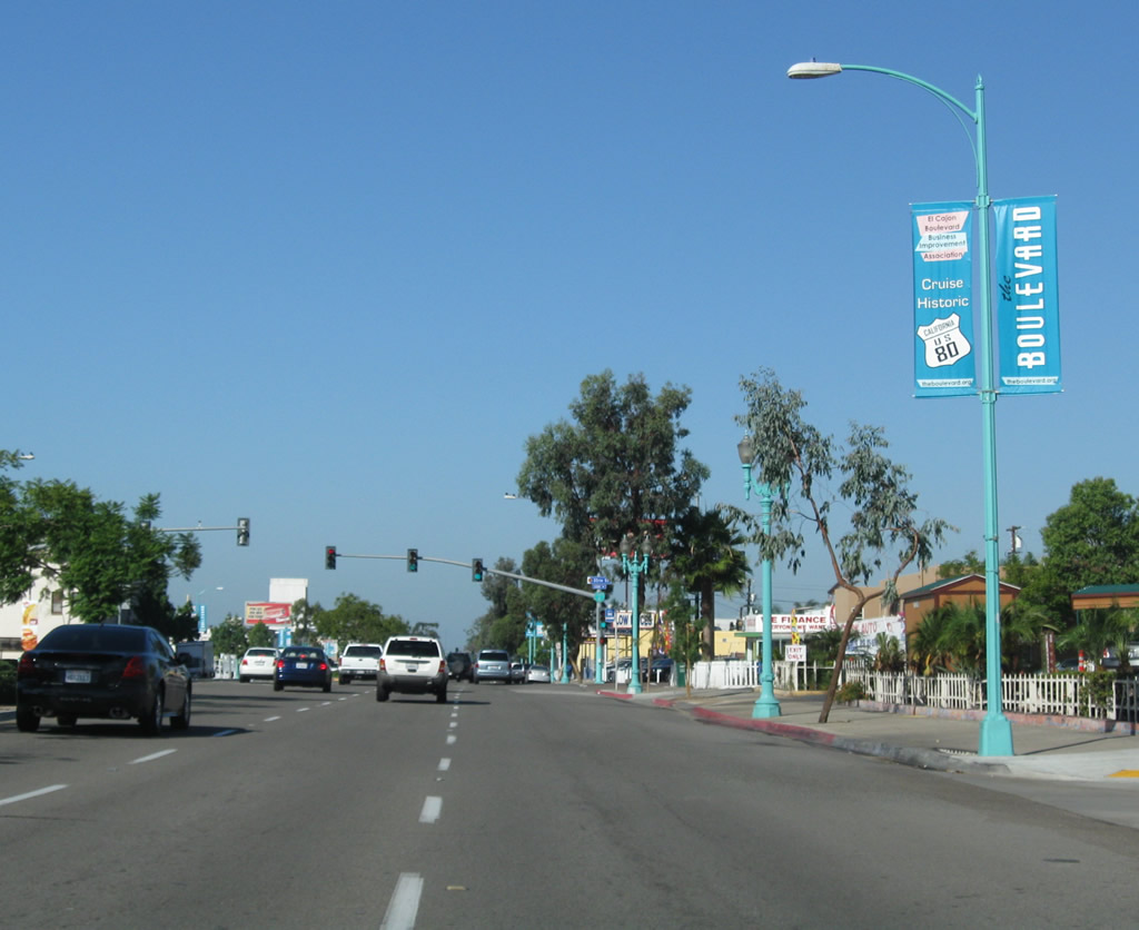
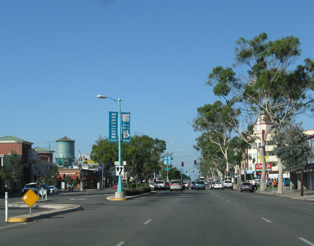
The Boulevard Business Association also posted teal banners advertising El Cajon Boulevard and welcoming people to "Cruise Historic Highway 80." Photo taken 10/09/10. |
|
At 35th Street is the final westbound reassurance shield for Business Loop I-8, even though the route extends all the way to the California 163 and Washington Street interchange in Hillcrest. It is likely that remaining signs will be removed as they weather and fade without being replaced. Photo taken 10/09/10. |
|
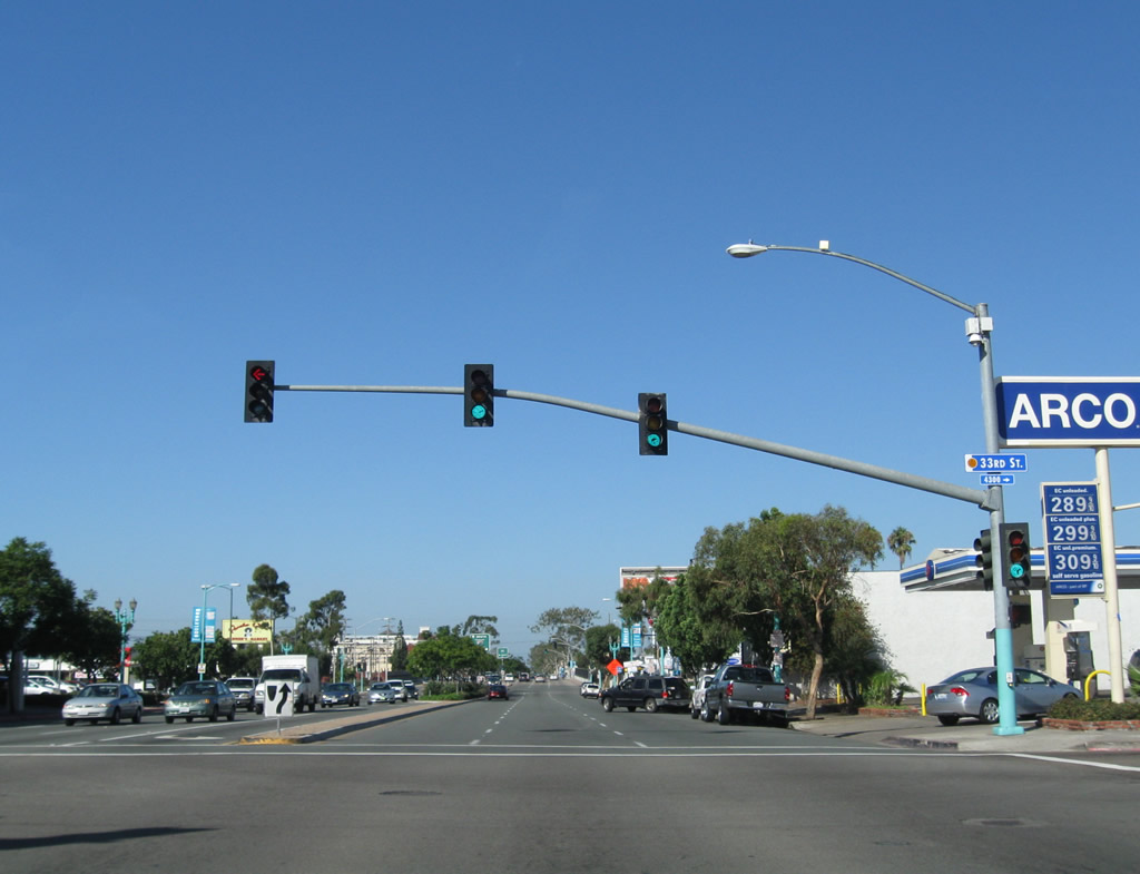
Westbound El Cajon Boulevard (Historic U.S. 80-395) meets 33rd Street. Photo taken 10/09/10. |
|
At Interstate 805 (Dekema Freeway), El Cajon Boulevard west leaves City Heights and Normal Heights and enters North Park. Turn right here for Interstate 805 north to Mission Valley, University City, Sorrento Valley, and points north via Interstate 5. Stay left for the left turn to Interstate 805 south. Photo taken 10/09/10. |
|
Entering North Park, westbound El Cajon Boulevard meets the on-ramp to Interstate 805 south to Southcrest, National City, Chula Vista, Otay Mesa, and San Ysidro. Photo taken 10/09/10. |
|
Tall eucalyptus line both sides of El Cajon Boulevard in North Park. Ahead is the intersection with Illinois Street. Photo taken 10/09/10. |
|
Crossing Ohio Street, the next traffic signal along El Cajon Boulevard westbound is with 30th Street, a major north-south corridor in North Park. The commercial core of North Park is a few blocks south along 30th Street, at its intersection with University Avenue. Photo taken 10/09/10. |
|
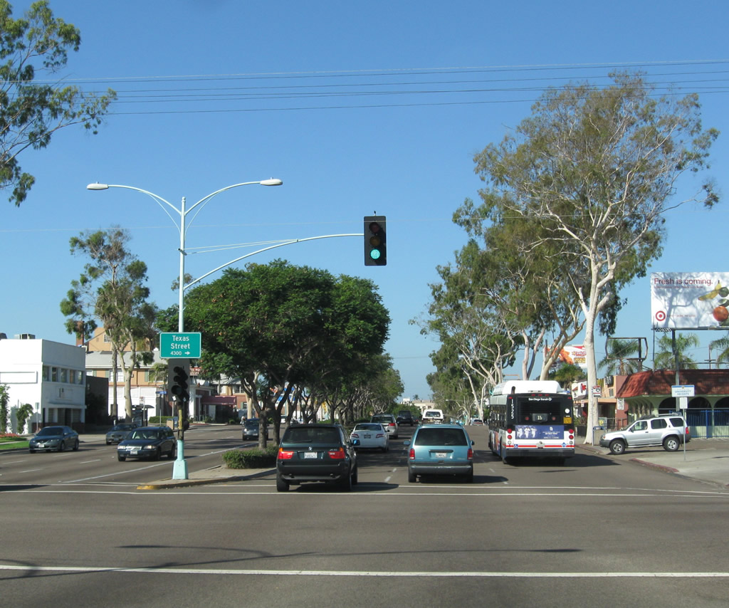
After traffic signalized intersections with Utah Street and Oregon Street, El Cajon Boulevard proceeds downhill toward Texas Street, then uphill to Park Boulevard, which is the western terminus of El Cajon Boulevard. Photo taken 10/09/10. |
|
Westbound El Cajon Boulevard meets Texas Street. Turn left for the municipal pool and Morley Field in Balboa Park. Turn right for Texas Street north into Mission Valley, meeting Interstate 8 and Qualcomm Way (Stadium Way). Photo taken 10/09/10. |
|
After the Florida Street signalized intersection, El Cajon Boulevard passes under the Boulevard sign, which was erected in 1989 and welcomes eastbound travelers to the shopping and arts district along El Cajon Boulevard. Photo taken 10/09/10. |
|
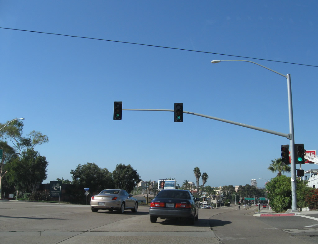
At Park Boulevard, El Cajon Boulevard ends. Turn left to follow U.S. 80 west and U.S. 395 south along Park Boulevard to Balboa Park and downtown San Diego. Continue straight ahead to follow Business Loop I-8/Normal Street southwest to Washington Street west to Uptown, which includes Hillcrest and Mission Hills. For a time, U.S. 80 continued west on Normal Street and Washington Street (1947-1953) to California 163, then followed the Cabrillo Freeway south through Balboa Park to reach downtown (until 1953, when the U.S. 80 was relocated to the Mission Valley Freeway, which is now Interstate 8). Turn right to follow Park Boulevard north into the University Heights business district. Photo taken 10/09/10. |
| Business Loop I-8 & Historic U.S. 80 (1947-1953) west |
|
Now we return to the intersection of El Cajon Boulevard, Park Boulevard, and Normal Street. After the Park Boulevard intersection, Business Loop I-8 and the 1947-1953 alignment of U.S. 80 continue southwest along Normal Street en route to the Cabrillo Freeway. U.S. 80 and Business Loop I-8 remain on Normal Street for only a few blocks; at Lincoln Avenue, it will turn west onto Washington Street. Photo taken 10/09/10. |
|
A California 163 trailblazer is posted on southbound Normal Street as we approach the transition to westbound Washington Street. A Business Loop I-8 trailblazer was mounted above this California 163 until 2003, when many such route markers were removed along El Cajon Boulevard, Normal Street, and Washington Street. In fact, this was the placement for the final westbound route marker for the business route, with the implication that traffic wishing to "loop" back to Interstate 8 would take California 163 (Cabrillo Freeway) north. Photo taken 10/09/10. |
|
U.S. 80 and Business Loop I-8 curve from Normal Street onto Washington Street at this traffic signal. Washington Street cuts between the neighborhoods of Hillcrest and University Heights. Photo taken 10/09/10. |
|
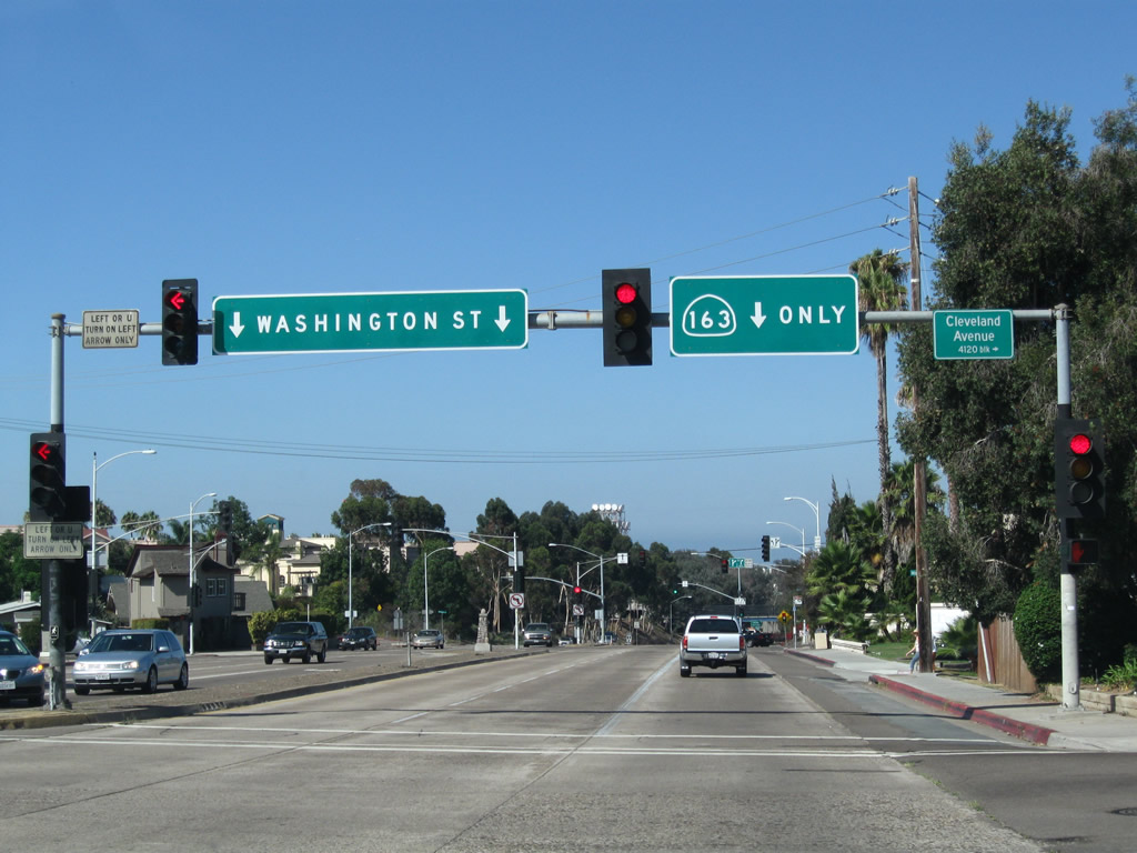
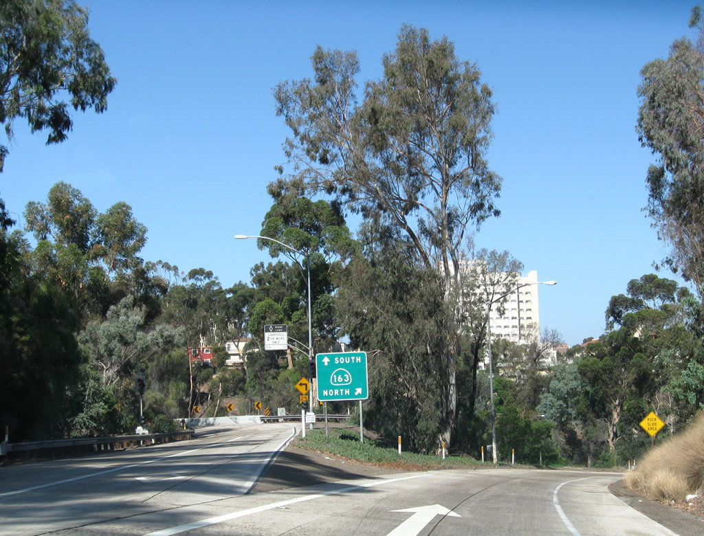
Passing south of University Heights and north of Hillcrest, westbound Washington Street (Former Business Loop I-8 and briefly historic U.S. 80) meets Cleveland Avenue at this traffic signal. Ahead is the junction with California 163 (Cabrillo Freeway) (former U.S. 395); use the right lanes to transition onto either direction of the freeway. Photo taken 08/17/08. |
|
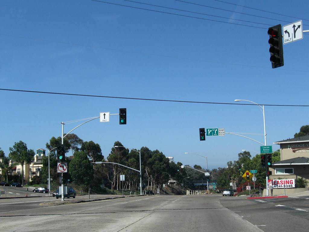
Westbound Washington Street (Former Business Loop I-8 and briefly historic U.S. 80) meets Lincoln Avenue at this traffic signal. Use the right two lanes to connect to California 163. Photo taken 08/17/08. |
|
As the right two lanes split from Washington Street to California 163, the left lanes continue west toward Hillcrest. Photo taken 08/17/08. |
|
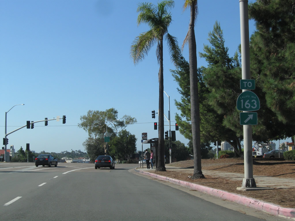
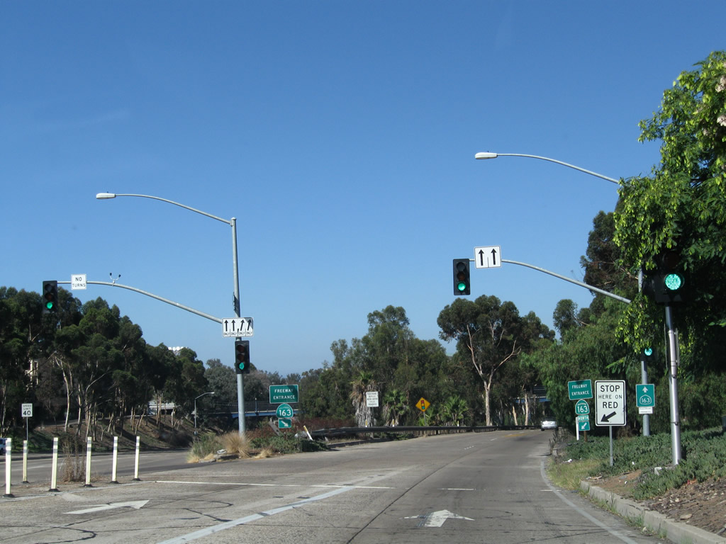
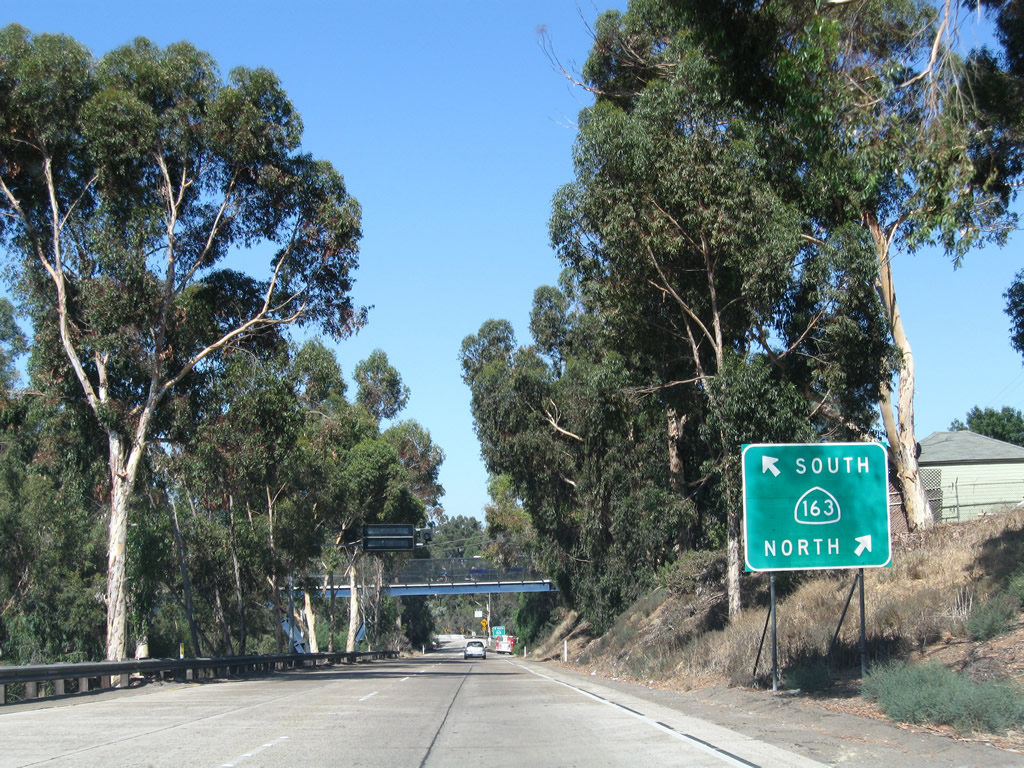
The left lane of the transition ramp connects to California 163 (Cabrillo Freeway) south to downtown San Diego, while the right lane connects to California 163 (Cabrillo Freeway) north to Mission Valley, Linda Vista, Clairemont, and Kearny Mesa before merging with Interstate 15 near Miramar. Photo taken 08/17/08. |
|
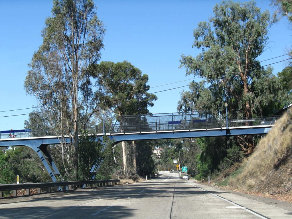
The Vermont Street pedestrian bridge crosses over Washington Street and the transition ramp to California 163. Built in 1995, the Vermont Street Bridge replaced an earlier wooden trestle bridge that was in service from 1916 until 1978 (demolished in 1979 due to rotting conditions). The pedestrian bridge links the neighborhoods of University Heights with Hillcrest. Photo taken 08/17/08. |
|
The two directions of California 163 split at this gore point. While U.S. 80 was still routed along El Cajon Boulevard in the late 1940s and the Cabrillo Freeway was complete, this transition ramp served as part of U.S. 80 before the U.S. highway turned south toward Downtown via the freeway. Once U.S. 80 was relocated to the Mission Valley Freeway (now Interstate 8), old U.S. 80 became U.S. 80 Business, and that eventually became Business Loop I-8. The business loop remained signed until the early 2000s; signs for the business loop along most of Washington Street and El Cajon Boulevard were removed by 2003. The California 163 interchange with Washington Street marks the western terminus of Business Loop I-8. Photo taken 08/17/08. |
Page Updated February 13, 2013.