| Del Norte County D-8 (Klamath Beach Road) west
|
|
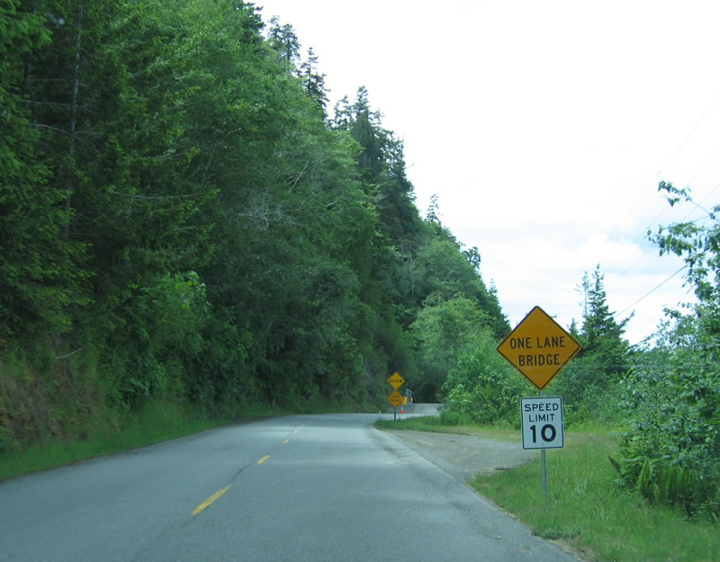
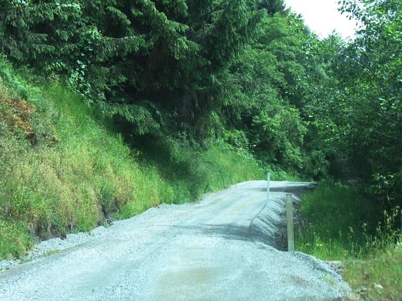
Traveling west on Del Norte County D-8/Klamath Beach Road (unsigned), this view shows the connection from U.S. 101 freeway to Old U.S. 101. A portion of the county roadway washed out, and a temporary bridge provides the connection across the washed out section. Photo taken 05/28/06.
|
|
|
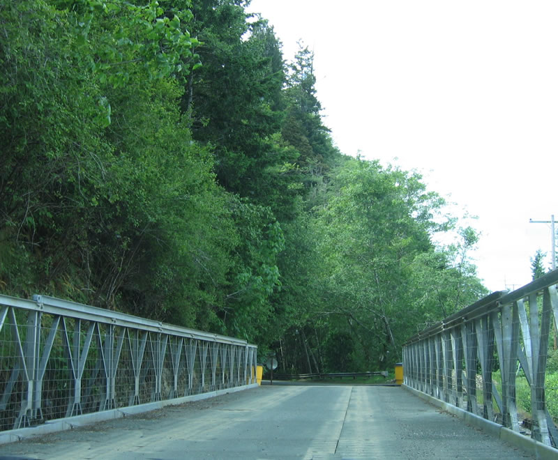
This one-lane bridge is a temporary fix until a permanent bridge or viaduct can be erected in its place. Continue west on Klamath Beach Road to the southern approach to the destroyed Alder Camp Road bridge over the Klamath River, which used to be U.S. 101 before the 1964 Flood destroyed it. Photo taken 05/28/06.
|
|
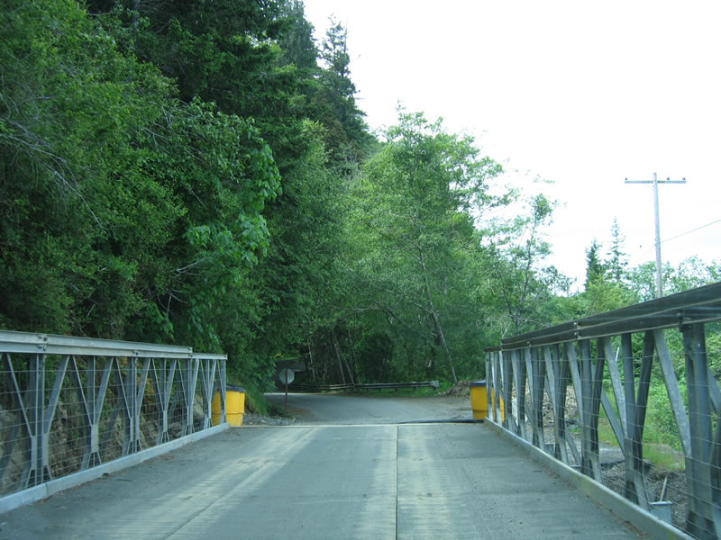
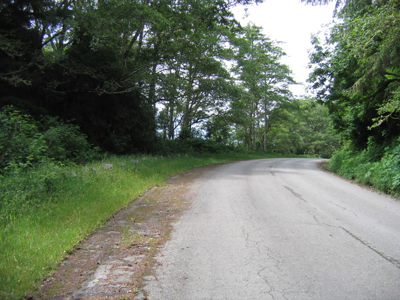
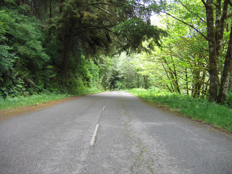
To the left of Klamath Beach Road is a hillside, while the Klamath River flows to the right of the highway. Klamath Beach Road enters Redwood National Park. Photo taken 05/28/06.
|
|
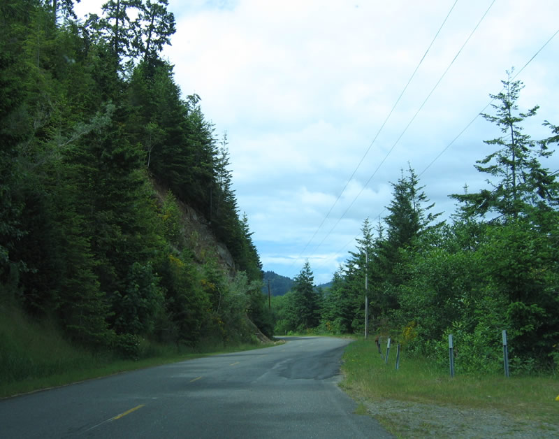
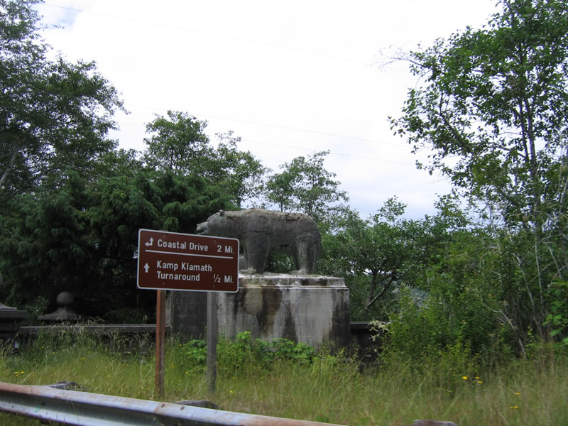
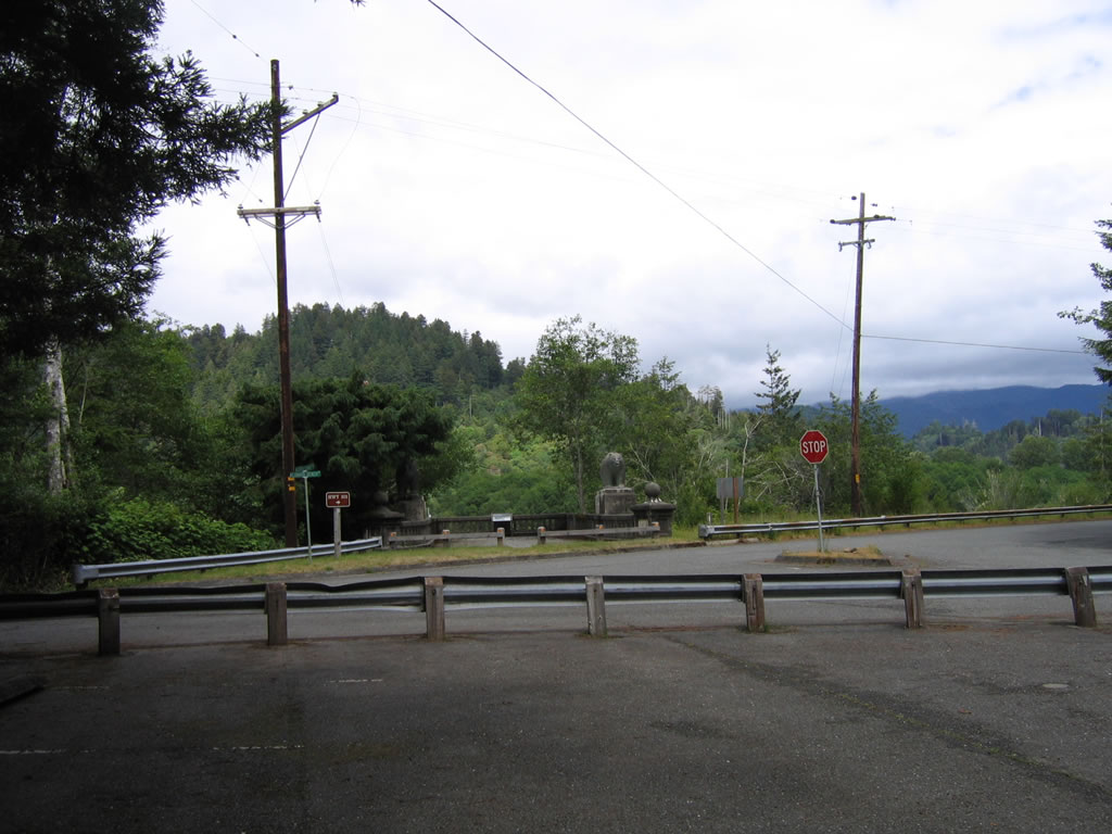
Westbound Del Norte County D-8/Klamath Beach Road meets Historic U.S. 101/Coastal Drive. Continue straight ahead to follow Coastal Drive to Kamp Klamath. Turn left to follow Historic U.S. 101 along Coastal Drive through Redwood National Park into Humboldt County (and to Newton B. Drury Scenic Byway); to the right is the southern approach to the former U.S. 101 bridge over the Klamath River. Destroyed in 1964, the new bridge over the river was placed in 1965 along the current U.S. 101 freeway alignment. Photo taken 05/28/06.
|
| Historic U.S. 101/Newton B. Drury Parkway north
|
|
After the Coastal Drive turnoff and after departing from Prairie Creek Redwoods State Park, Newton B. Drury Parkway turns northeast to rejoin U.S. 101. The final distance is downhill to U.S. 101, with two southbound lanes (uphill) and one northbound lane (downhill). Photo taken 05/28/06.
|
|
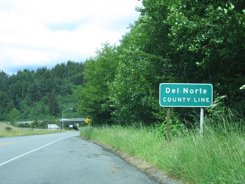
Northbound Newton B. Drury Parkway leaves Humboldt County and enters Del Norte County just before meeting U.S. 101 freeway. Photo taken 05/28/06.
|
|
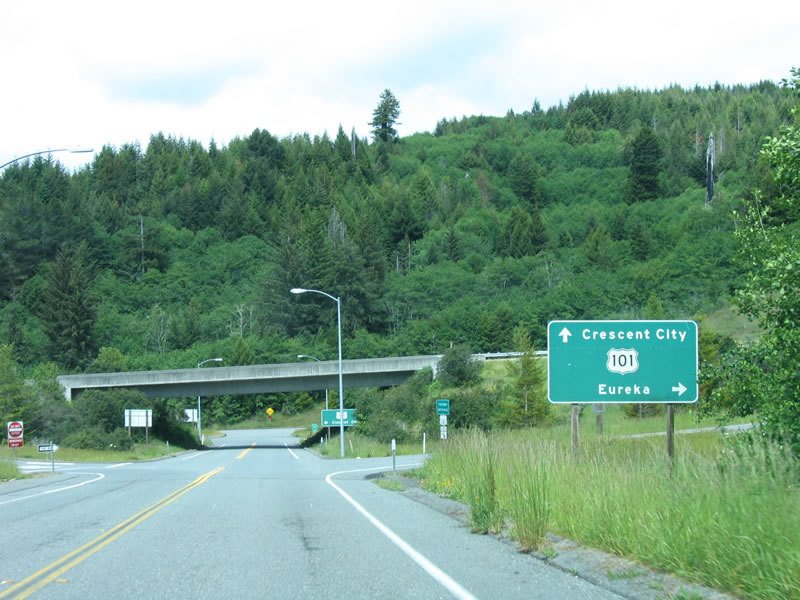
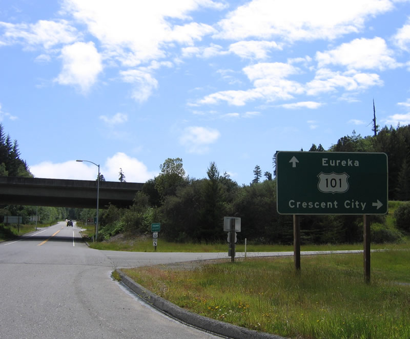
Soon thereafter, Newton B. Drury Parkway approaches U.S. 101. Use U.S. 101 north to Klamath and Crescent City; use U.S. 101 south to Eureka and San Francisco. Photo taken 05/28/06.
|
|
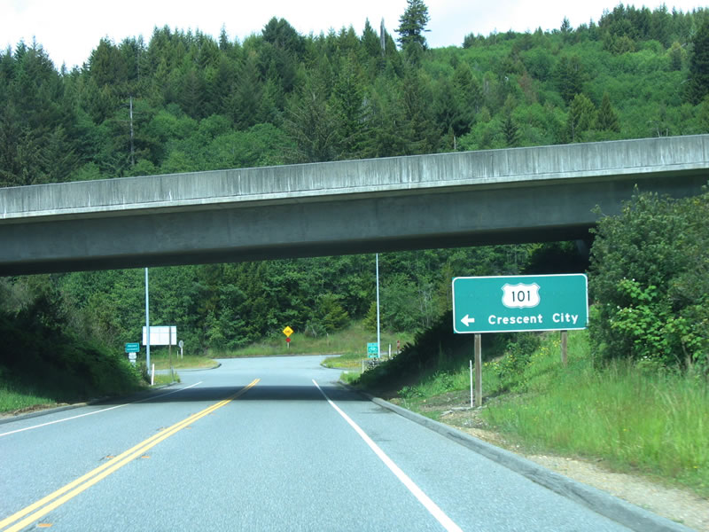
Newton B. Drury Parkway ends at U.S. 101. The scenic byway passes under U.S. 101, and the road ends shortly thereafter (after the ramp to U.S. 101 north to Crescent City). Photo taken 05/28/06.
|
| Historic U.S. 101/Coastal Drive north
|
|
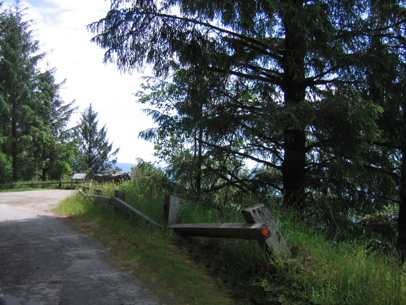
Along this stretch of Coastal Drive, remnants of old guardrail are partially obscured by the tall grass on this spring afternoon. The Pacific Ocean laps against the foot of the coastal bluff located far below the old road. Photo taken 05/28/06.
|
|
|
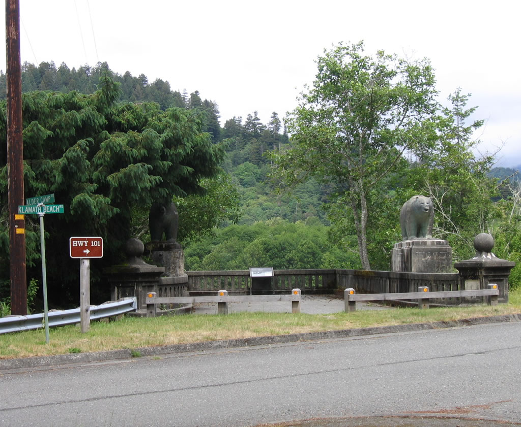
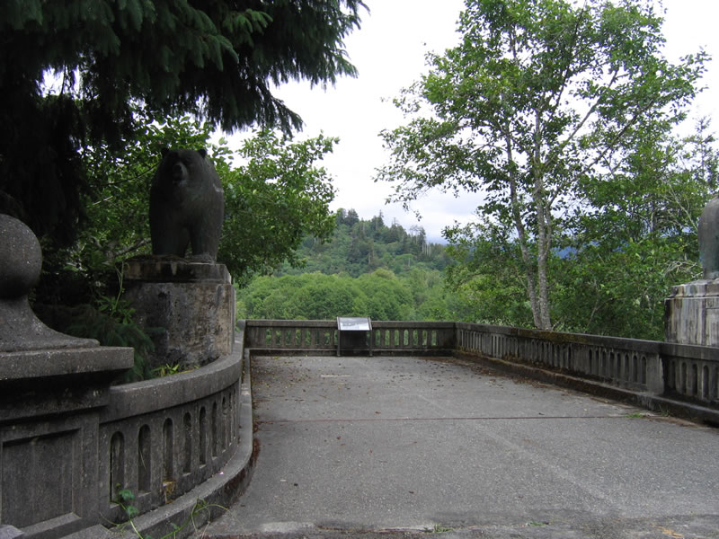
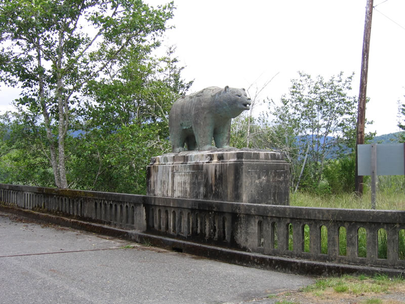
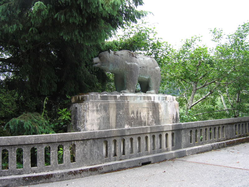
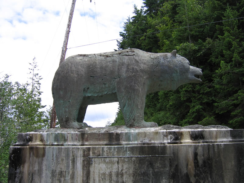
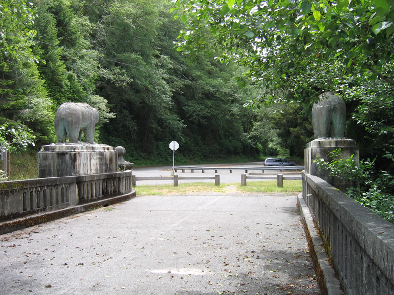
A guardrail separates the wide approach to the former U.S. 101 bridge over the Klamath River. A set of concrete bears sit on the north side of Klamath Beach Road, guarding the approach to the former bridge. A plaque commemorating the old bridge is located on the approach. Photos taken 05/28/06.
|
|
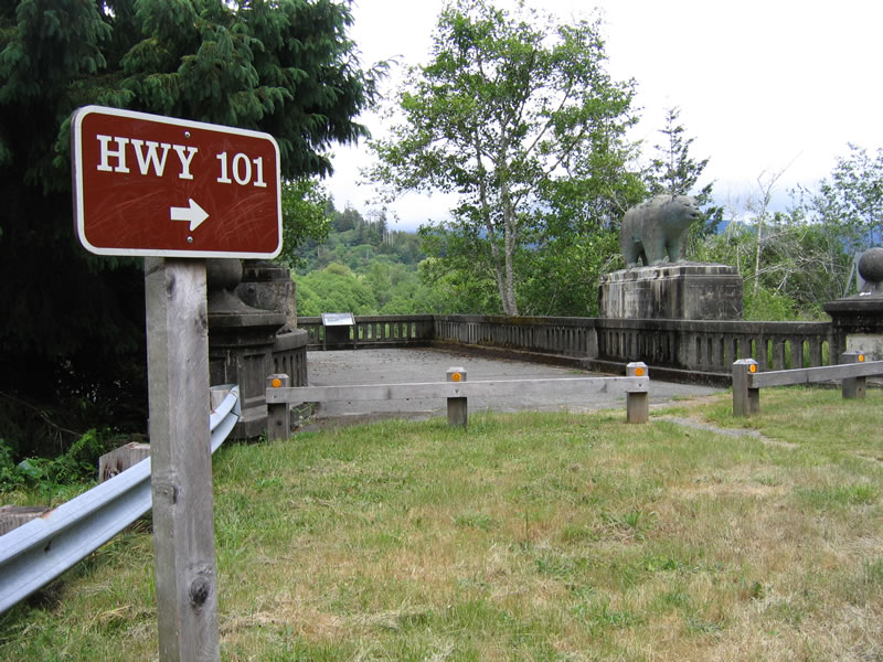
At Klamath Beach Road, this trailblazer advises that the connection to U.S. 101 is afforded via a right turn. The old highway ends here. Behind this sign is the former south approach to the former Douglas Memorial Bridge. Photo taken 05/28/06.
|
|
|
|
|
Two stone bears guard the southern approach to the old U.S. 101 bridge. Newer bears can be found on the modern U.S. 101 bridge, which have been painted gold over the years. Also note the remnant old-style guard rail that still remains here at the southern approach. Photos taken 05/28/06.
|
|
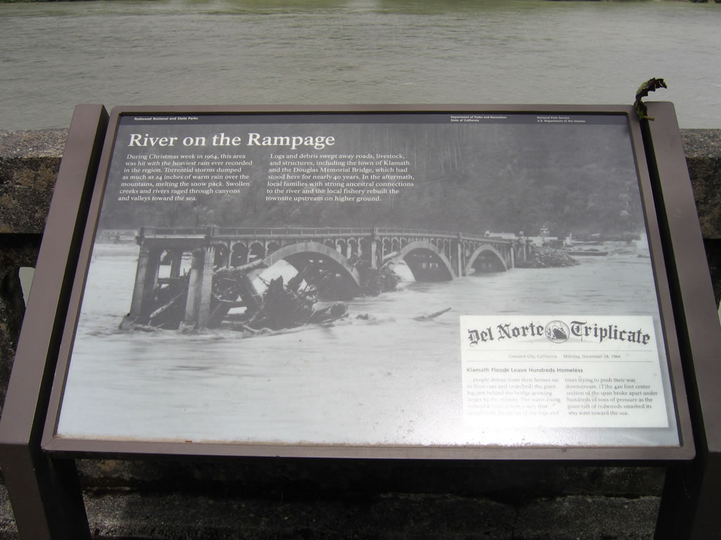
The 1964 Christmas week flood destroyed the Douglas Memorial Bridge, and the remnants of the bridge are located here at the north end of Coastal Drive. The multiple stone arch bridge was erected in 1935. Both the bridge and the entire town of Klamath were relocated to higher ground after the floodwaters receded. Photo taken 05/28/06.
|
|
|
The memorial plaque reads, "... people driven from their homes sat in their cars and (watched) the giant log jam behind the bridge growing larger by the minute. The water rising behind it roared with a fury that mixed with the groan of the logs and trees trying to push their way downstream. (T)he 420 foot center section of the span broke apart under hundreds of tons of pressure as the giant raft of redwoods smashed its way west toward the sea."1 Photos taken 05/28/06.
|
|
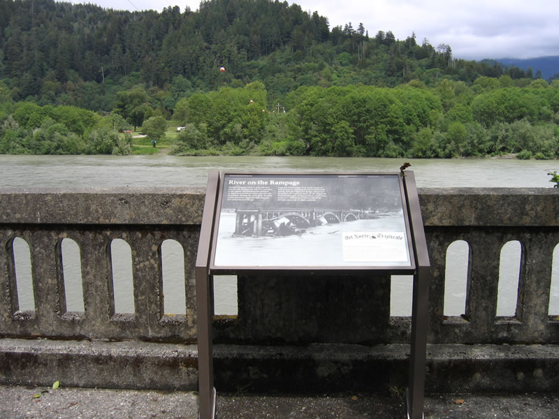
Looking north across the Klamath River, the Douglas Memorial Bridge used to cross here. The bridge roughly followed along the path currently tread by the power lines (note red balls attached to the wires as they span the massive river). The northern approach is mostly obscured by riparian trees and is not easily visible from the southern approach. Photo taken 05/28/06.
|
| Historic U.S. 101/Coastal Drive south
|
|
Looking south from the south abutment of the Douglas Memorial Bridge, old U.S. 101 begins its journey south into Redwood National Park from the Klamath River. The back of the two California bears sit motionlessly at the end of the largely destroyed bridge. Photo taken 05/28/06.
|
|
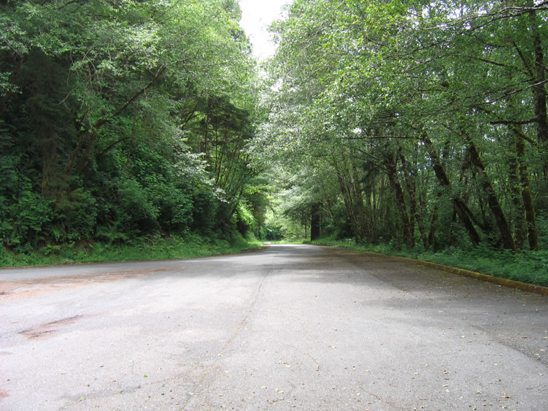
After passing by Klamath Beach Road (Del Norte County D-8), a remnant section of U.S. 101 shows the widened section of roadway after the south approach to the Klamath River bridge. Photo taken 05/28/06.
|
|
|
|
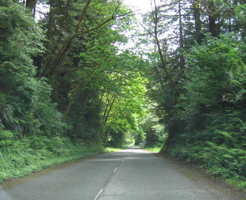
Old white centerline striping remains on this old section of U.S. 101/Coastal Drive. Evidence of the old road abounds on Coastal Drive as we continue south through Redwood National Park. Photos taken 05/28/06.
|
|
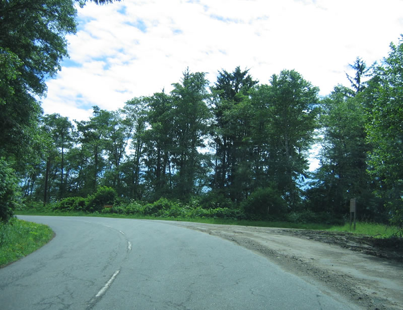
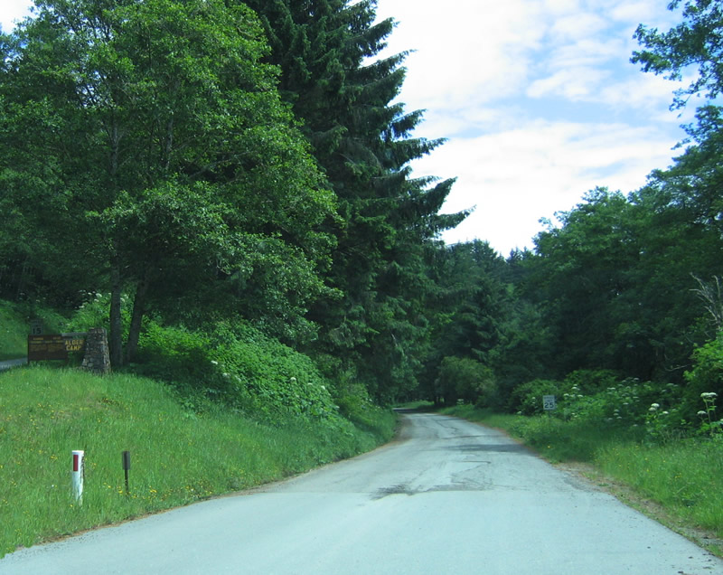
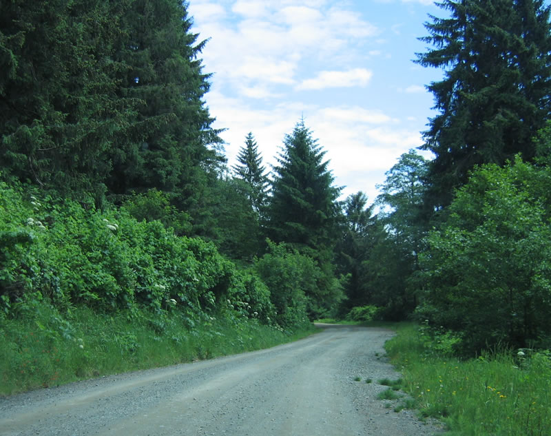
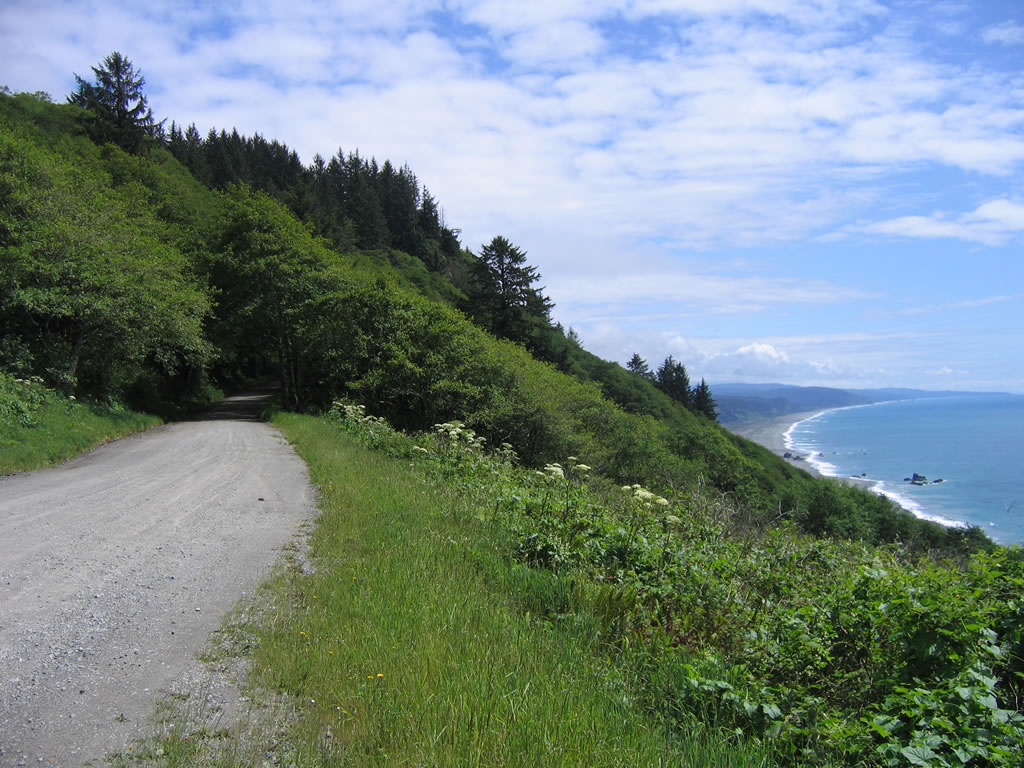
Continuing south along Coastal Drive, the old alignment of U.S. 101 is located on a bluff above the Pacific Ocean. At the fork in the road at Alder Camp, stay right to continue south on Coastal Drive. Photo taken 05/28/06.
|
|
After the Alder Camp turn off, Coastal Drive becomes a gravel road. There are some sections of old U.S. 101 that are more exposed to the elements, including this stretch. Photo taken 05/28/06.
|
|
|
|
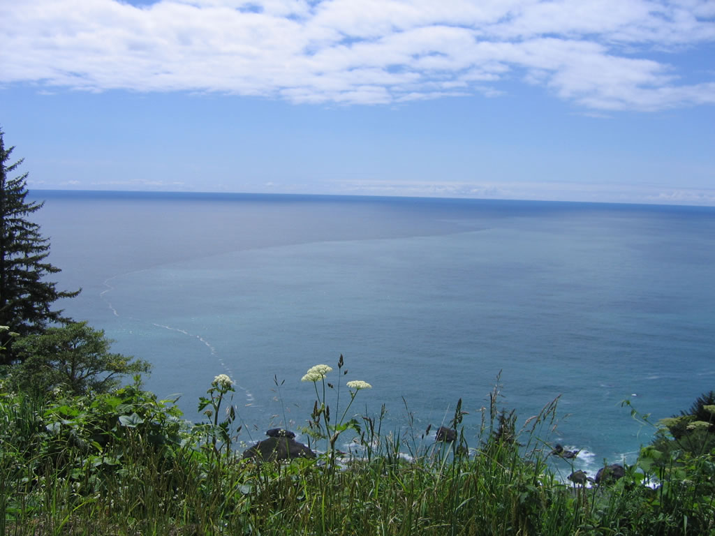
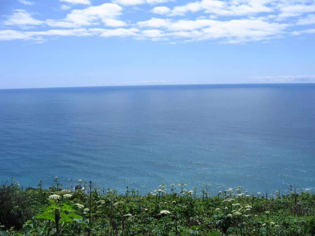
Resuming the paved section of old U.S. 101, the views of the Pacific Ocean are stunning. A sandy beach sits at the bottom of the coastal bluff. Photos taken 05/28/06.
|
|
|
|
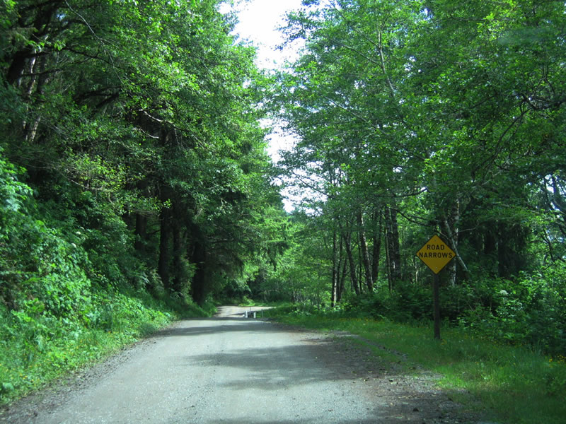
Continuing south along old U.S. 101, a section of Coastal Drive has suffered slope failure, and the road narrows to one lane again with no paving. This is the worst section of road on Coastal Drive. Photos taken 05/28/06.
|
|
|
|
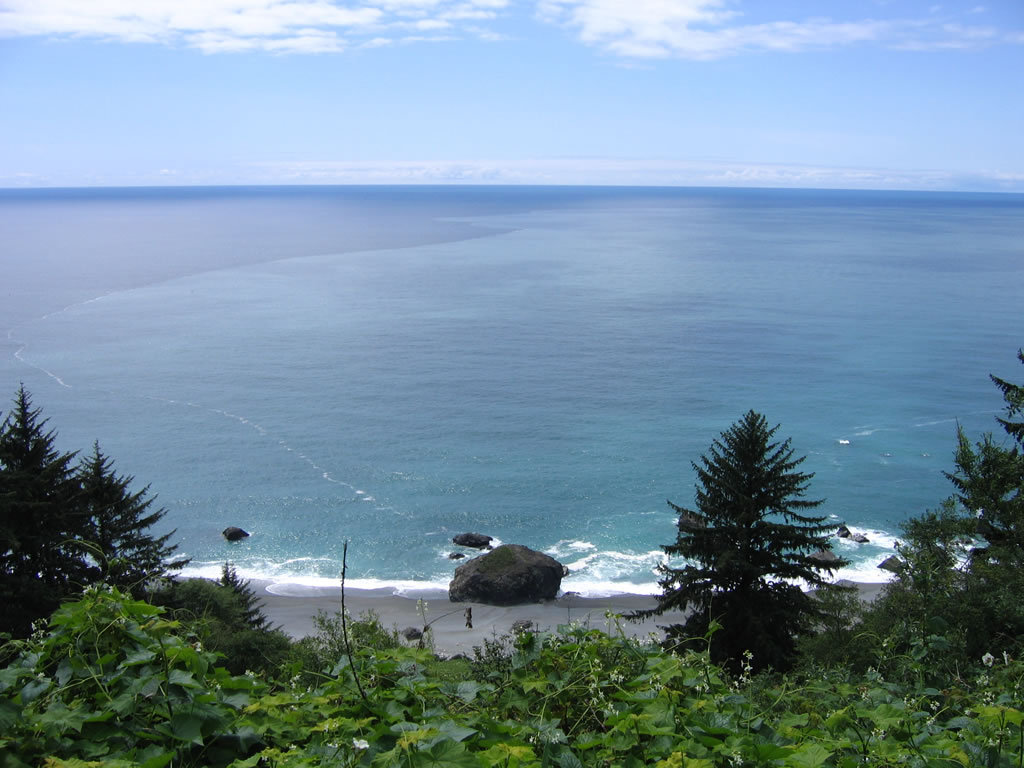
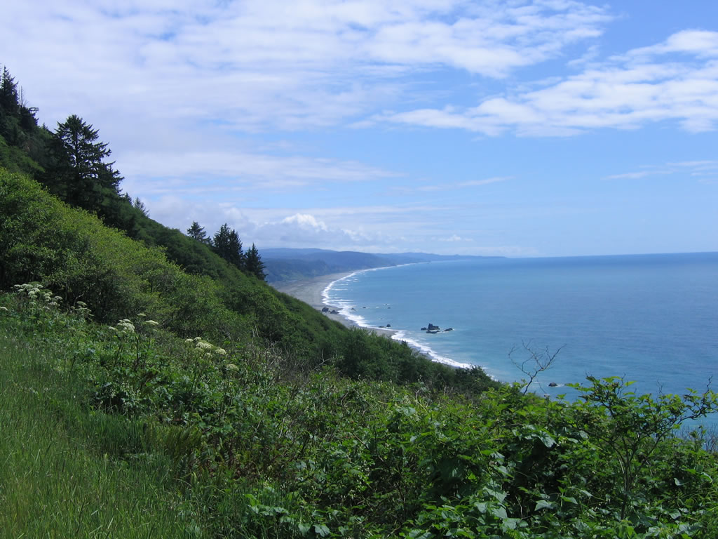
Rounding a bend on the unpaved section of Coastal Drive, motorists are afforded this incredible view of the Pacific Ocean and of the former route of U.S. 101. Photos taken 05/28/06.
|
|
An extant section of old guardrail comes into view on the west side of Coastal Drive as we approach the Golden Sands overlook. At the bottom of this coastal bluff is a large sandy beach. Photo taken 05/28/06.
|
|
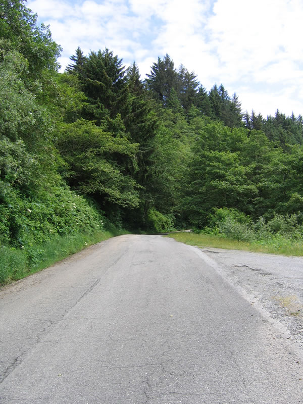
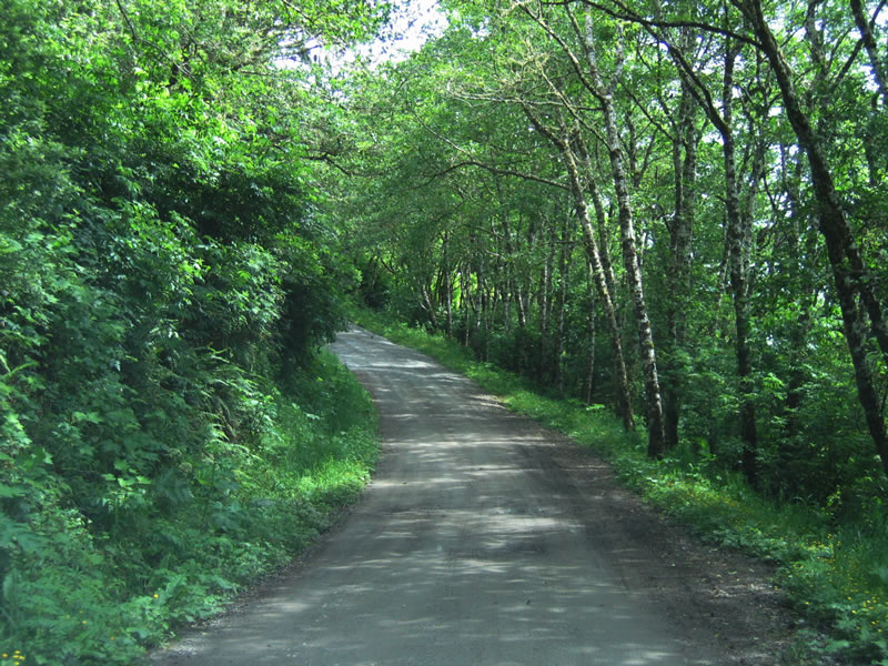
Shortly thereafter, old U.S. 101 resumes its paved section, including old white striping. Coastal Drive moves away from the edge of the coastal bluff, which plays a role on why this section of roadway still has old paving, while the sections closer to the edge of the bluff are now gravel road. Photo taken 05/28/06.
|
|
Coastal Drive moves inland for its connection back to U.S. 101 and to the Newton B. Drury Scenic Byway. Photo taken 05/28/06.
|
|
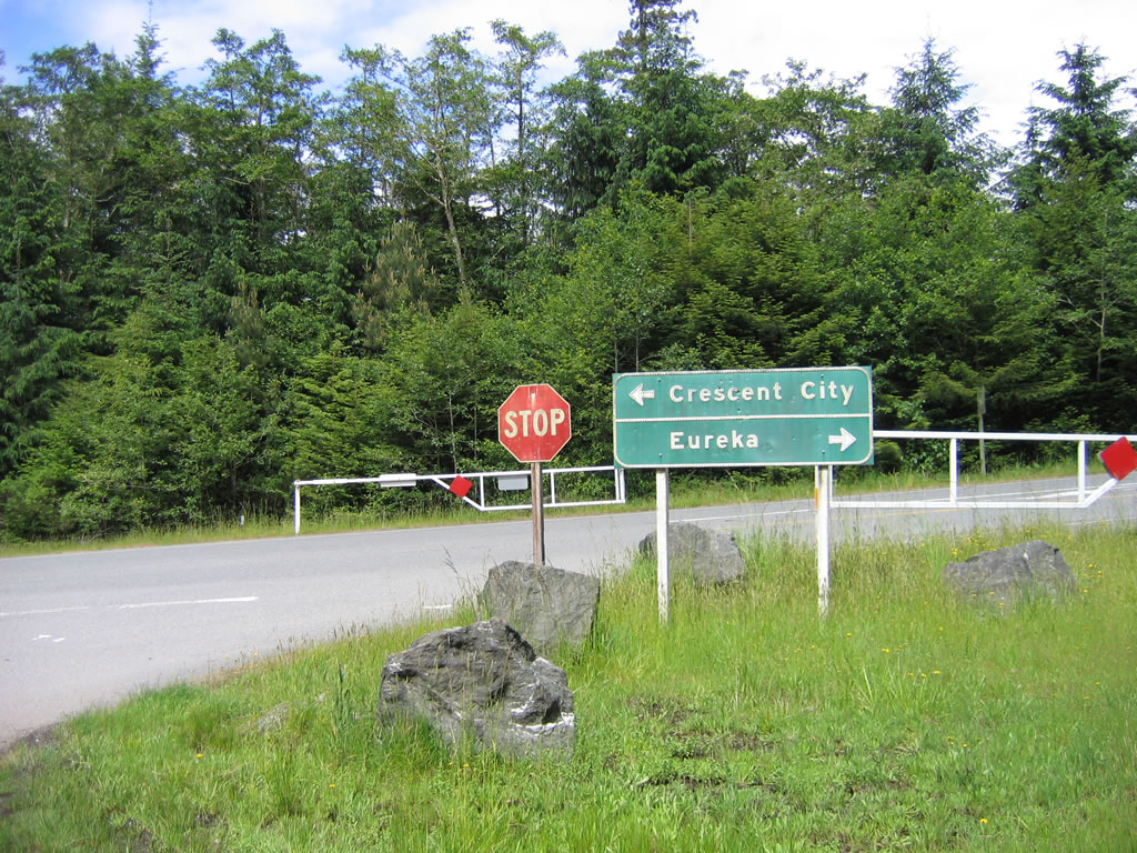
A pair of old signs await southbound travelers on Coastal Drive at the junction with the Newton B. Drury Scenic Byway. The "Eureka/Crescent City" button copy sign dates back to the 1960s, as does the old stop sign. These signs date back to when U.S. 101 followed the Newton B. Drury Parkway, which it no longer does. Photo taken 05/28/06.
|
| Historic U.S. 101/Newton B. Drury Parkway south
|
|
Newton B. Drury Parkway begins its southbound journey at U.S. 101, Exit 753. The first right turn is for U.S. 101 north to Crescent City, followed by the connection to U.S. 101 south to Eureka. Photo taken 05/28/06.
|
|
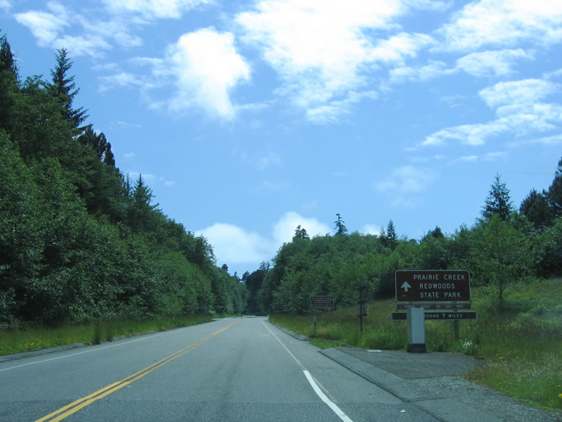
After the junction with U.S. 101 (Redwood Highway), southbound Newton B. Drury Parkway ascends toward Prairie Creek Redwoods State Park. Photo taken 05/28/06.
|
|
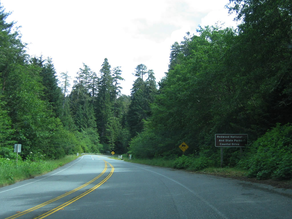
Southbound Newton B. Drury Parkway meets Coastal Drive at this intersection, just before entering Prairie Creek Redwoods State Park. Coastal Drive is another old alignment of U.S. 101. Photo taken 05/28/06.
|
|
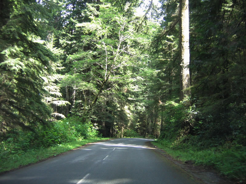
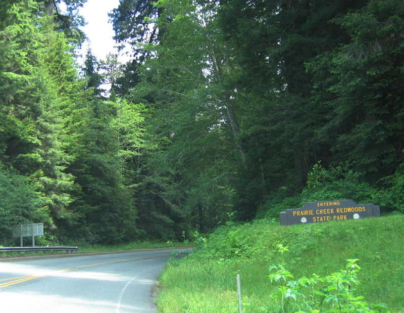
After the Coastal Drive turnoff, southbound Newton B. Drury Parkway enters Prairie Creek Redwoods State Park. This old alignment of U.S. 101 is named for Newton B. Drury. Between August 20, 1940, and March 31, 1951, Mr. Drury was a director of the National Park Service and is known for helping to establish the California State Parks Commission in 1928 and for working with the Save the Redwoods League of California. Between 1951 and 1959, Mr. Drury served as director of the California State Division of Beaches and Parks, then worked with the league during his retirement. Creating Redwood National Park was one of his goals. Today the scenic route of U.S. 101 is named for him; ironically, other bypasses like the one that lies ahead were opposed by Mr. Drury, as the state parks division and highway department routinely fought over highway alignments within state parkland. Photo taken 05/28/06.
|
|
|
|
|
|
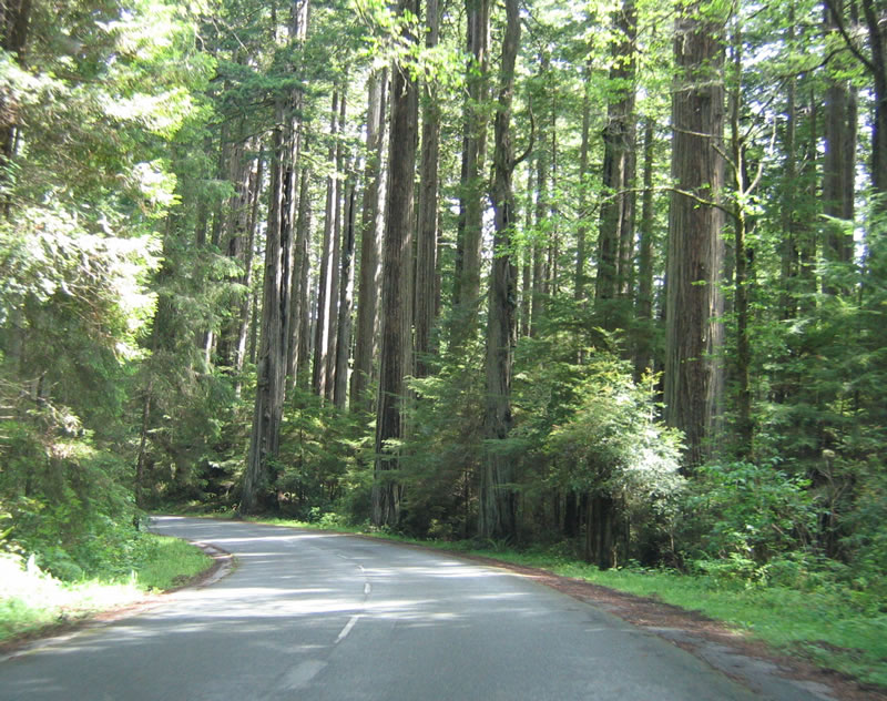
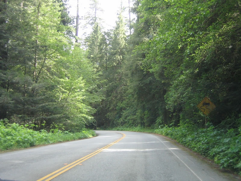
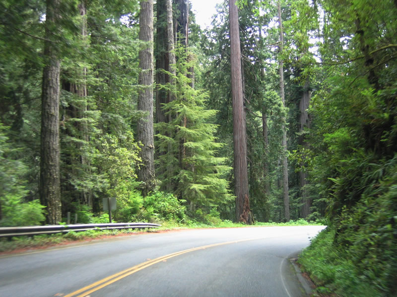
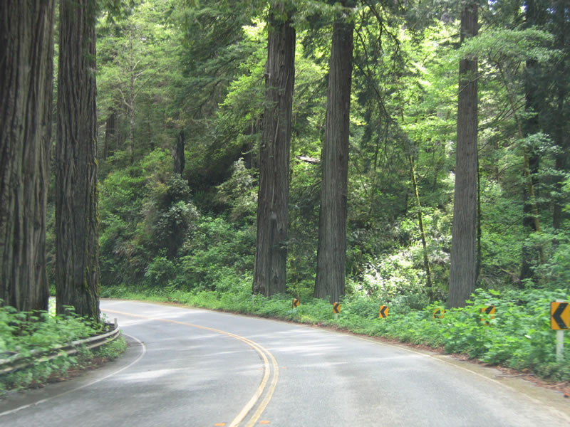
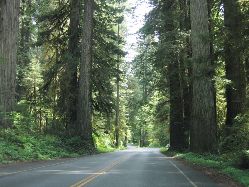
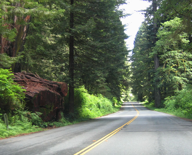
| Southbound Newton B. Drury Parkway passes through Prairie Creek Redwoods State Park. This suite of photos shows the historic route of U.S. 101 as it passes through the redwood groves. Photos taken 05/28/06. |
|
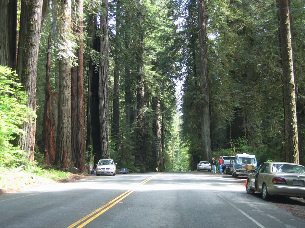
California Coastal Redwoods line both sides of Newton B. Drury Drive at this turnout. The cars and people looking at the trees give context to the sheer magnitude of the trees' size. Photo taken 05/28/06.
|
|
A small "big tree" sign points to a rather large redwood tree on the east side of Historic U.S. 101/Newton B. Drury Drive. Photo taken 05/28/06.
|
|
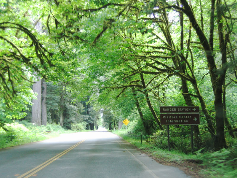
Shortly before rejoining U.S. 101 (Redwood Highway), southbound Historic U.S. 101/Newton B. Drury Drive approaches a visitors center and ranger station on the west side of the road. Photo taken 05/28/06.
|
|
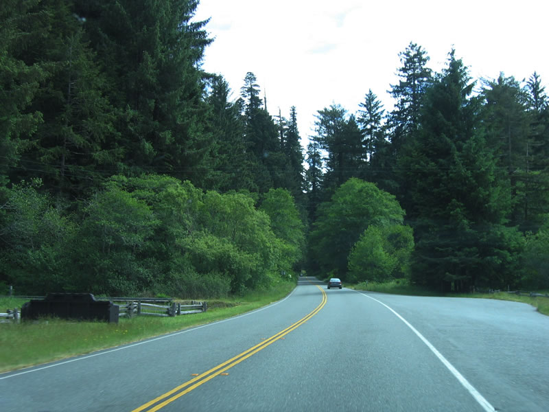
After the visitors center intersection, southbound Historic U.S. 101/Newton B. Drury Drive leaves Prairie Creek Redwoods State Park; the junction with U.S. 101 is just ahead. Photo taken 05/28/06.
|
|
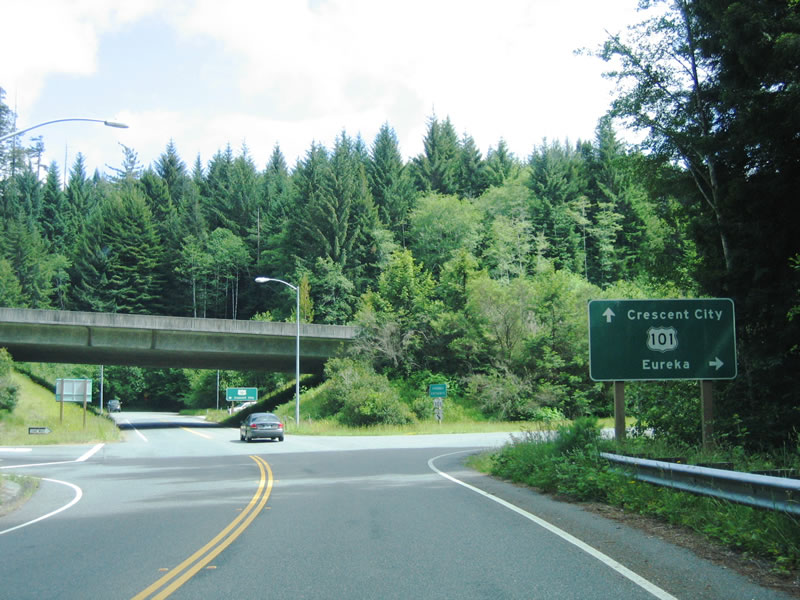
The diamond interchange between U.S. 101 and Newton B. Drury Drive comes into view as the old alignment merges back onto the modern Redwood Highway. Photo taken 05/28/06.
|
Page Updated May 9, 2007.