U.S. 101 is the longest route in the state of California, starting amidst the chaos of the Los Angeles freeway system, then heading almost due west to leave the metropolitan area, reaching open space west of Thousand Oaks. Coming within sight of the Pacific Ocean, U.S. 101 hugs the coast as it serves Ventura, Santa Barbara, and Goleta. At Gaviota, U.S. 101 leaves the coast, turning due north toward Santa Maria and San Luis Obispo, two major Central California cities.
Beginning its northerly journey officially in downtown Los Angeles, Historic U.S. 101 enters the county via California 72 (Whittier Boulevard), then somehow ended up connecting to Ventura Boulevard (Former U.S. 101 Business) northwest of downtown. Now that U.S. 101 is on a freeway, it begins right at Interstate 5 just south of downtown, and U.S. 101 is born as a major freeway. In Los Angeles, the routes get confusing. The following map shows not only the routing of U.S. 101 and its exits (Exits 1A-E) but also the former routings of the original Interstates 105 and 110, which were decommissioned several years prior. Interstate 110 used to connect U.S. 101 and eastbound Interstate 10 (San Bernardino Freeway) via a glorified exit ramp, and Interstate 105 was U.S. 101 between Interstate 5 (Santa Ana Freeway) and Interstate 110 (San Bernardino Freeway). Today, Interstate 110 is part of state route 110, and Interstate 105 is part of U.S. 101.
Leaving downtown, U.S. 101 follows the Santa Ana Freeway north, then turns west along the Ventura Freeway near Universal Studio and Studio City. The Santa Ana Freeway terminates at the Four-Level Interchange; U.S. 101 continues from that point as the Hollywood Freeway. U.S. 101 parallels the coast, leaving the county just before Thousand Oaks.
| Interstate 5 north |
|
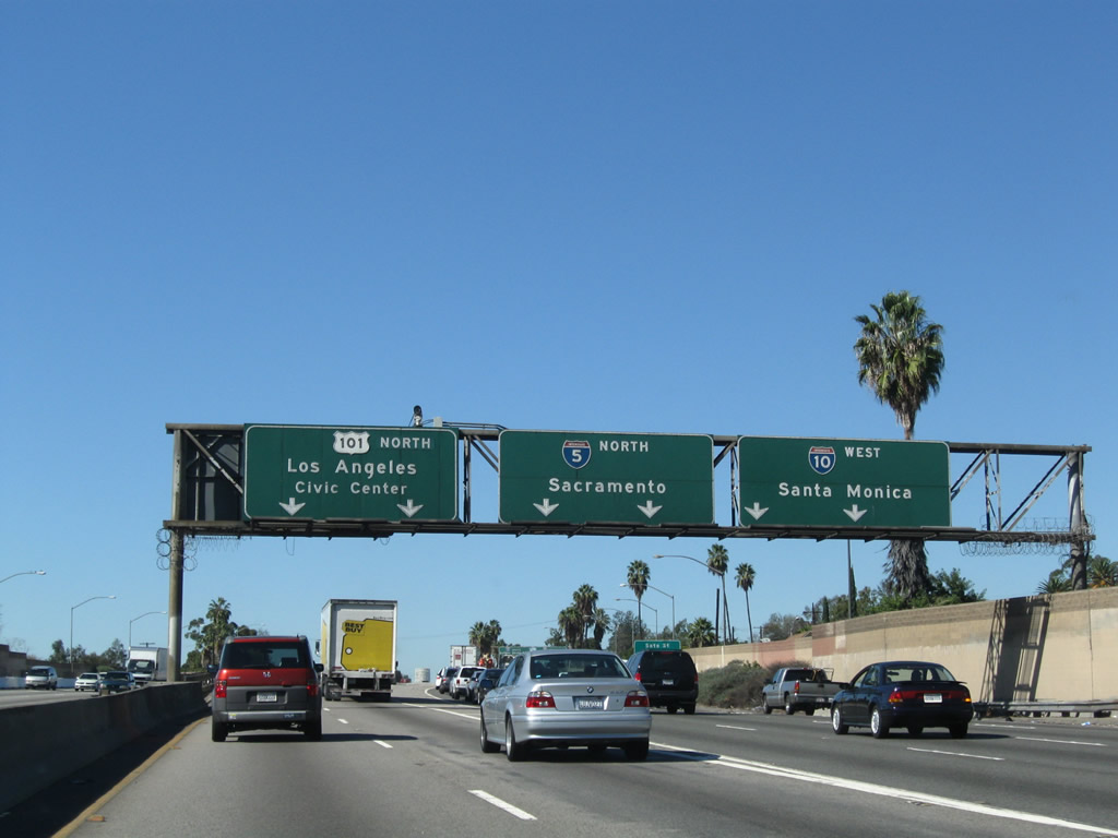
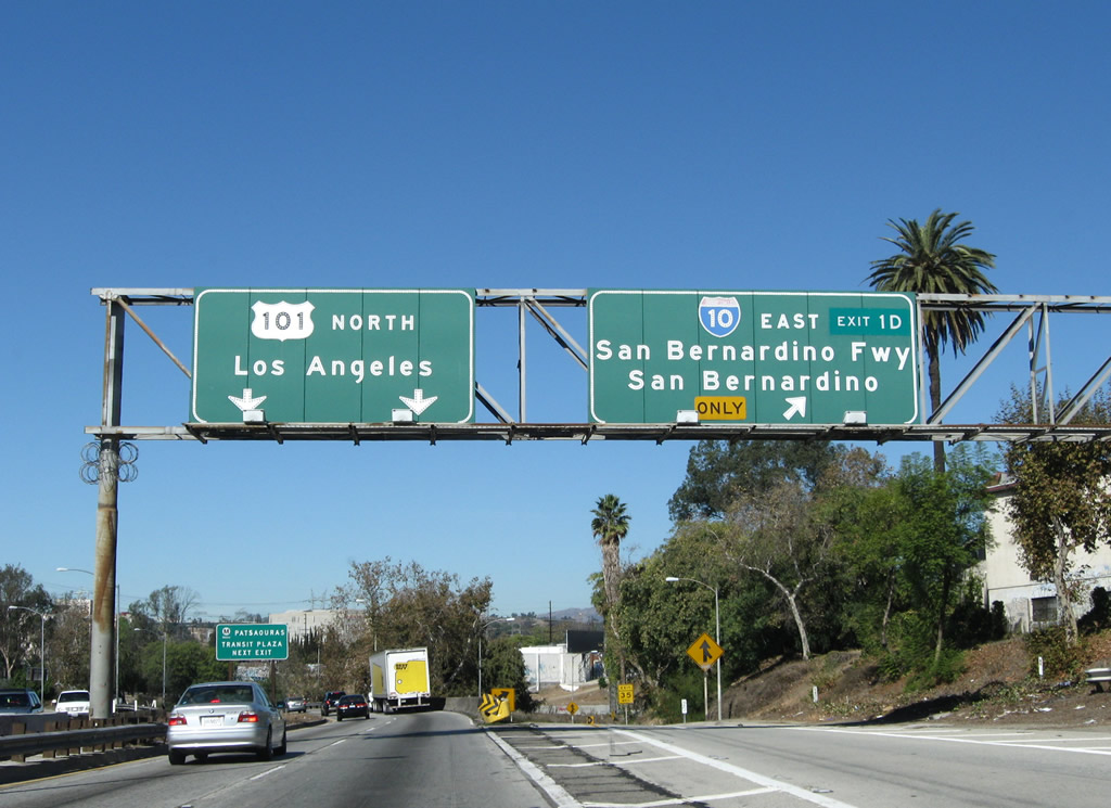
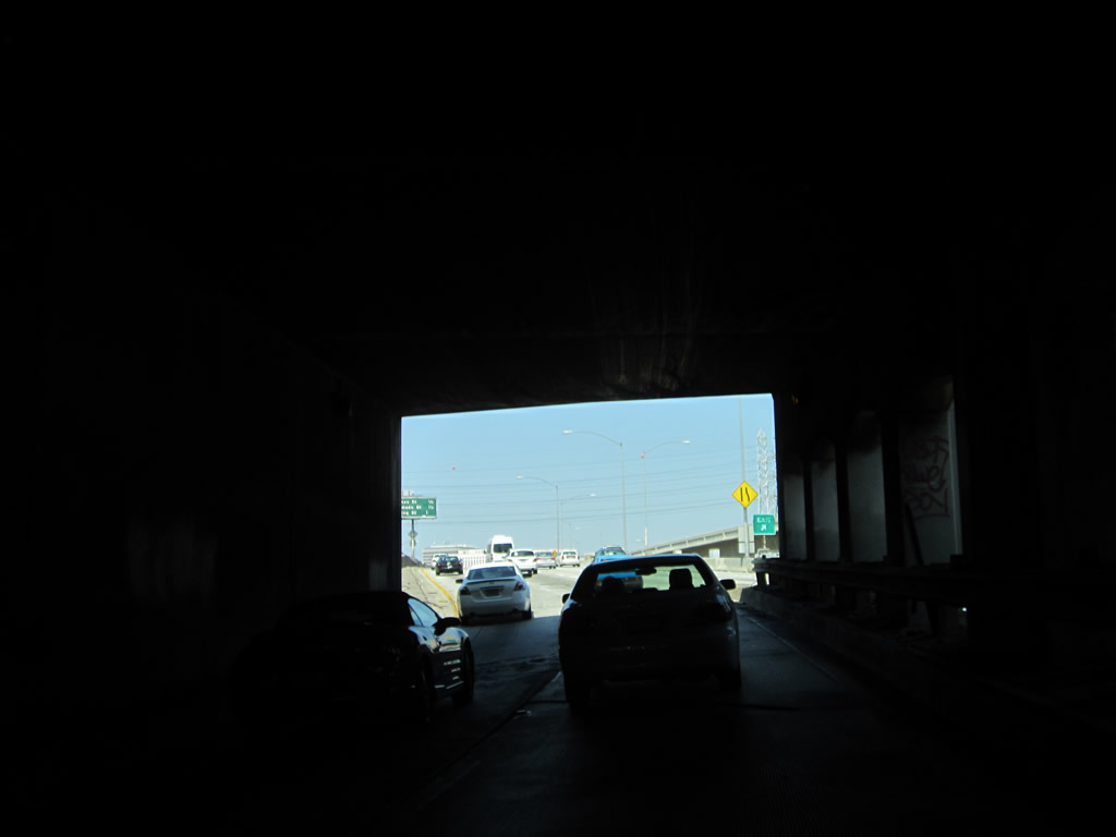
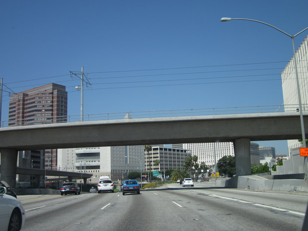
U.S. 101 begins here at the split between U.S. 101 and Interstate 5 at the East Los Angeles Interchange. This massive, sprawling interchange represents the confluence of several major freeways: Interstate 5 (Golden State Freeway) from the north, Interstate 10 (San Bernardino Freeway) from the north, U.S. 101 (Santa Ana Freeway) from the northwest, Interstate 10 (Santa Monica Freeway) from the west, and California 60 (Pomona Freeway) from the east. Looking at Interstate 5 north, the left two lanes of Interstate 5 (Santa Ana Freeway) transition directly onto U.S. 101 (Santa Ana Freeway) north. The right four lanes connect to Interstate 5 (Golden State Freeway) north and Interstate 10 (Santa Monica Freeway) west. There is no access from Interstate 5 north to California 60 (Pomona Freeway) east. Photo taken 11/08/08. |
| U.S. 101 (Santa Ana Freeway) north |
|
Crossing over Euclid Avenue, the two lanes of U.S. 101 north separate from Interstate 5. Signage for the Interstate 5 ramp split with Interstate 10 west to Santa Monica is visible from the U.S. 101 main lanes. Photo taken 11/08/08. |
|
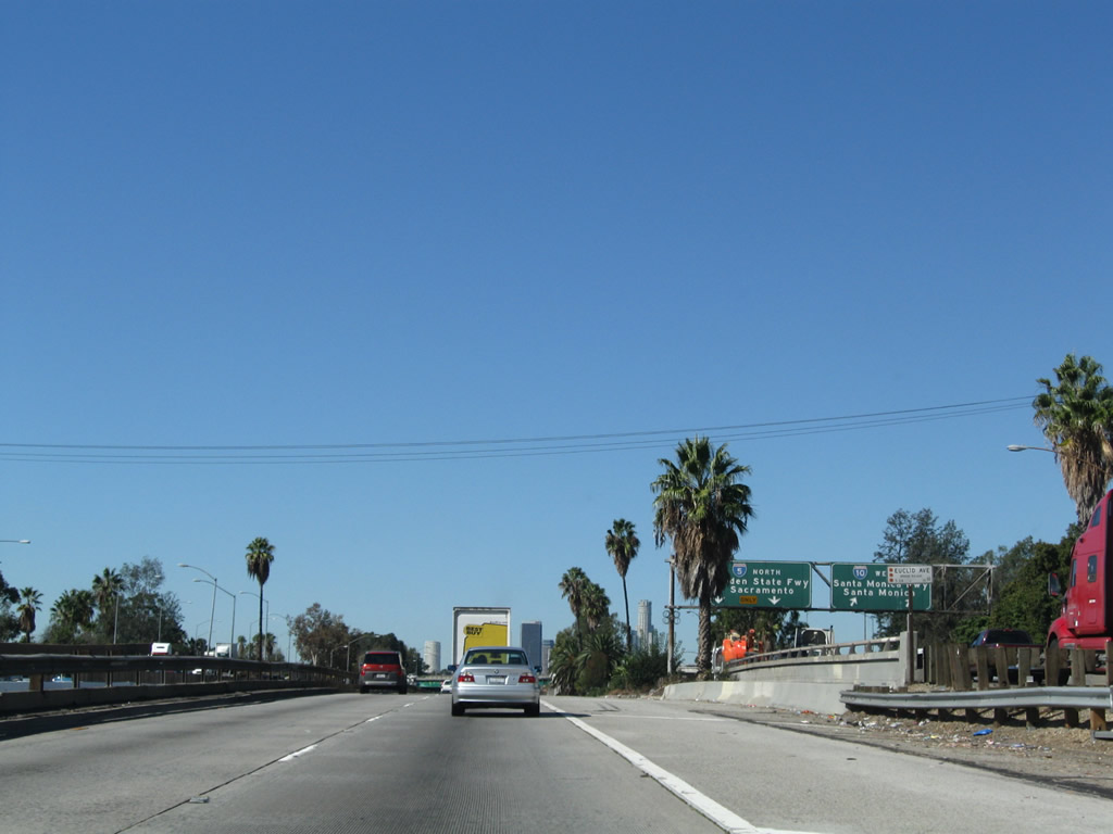
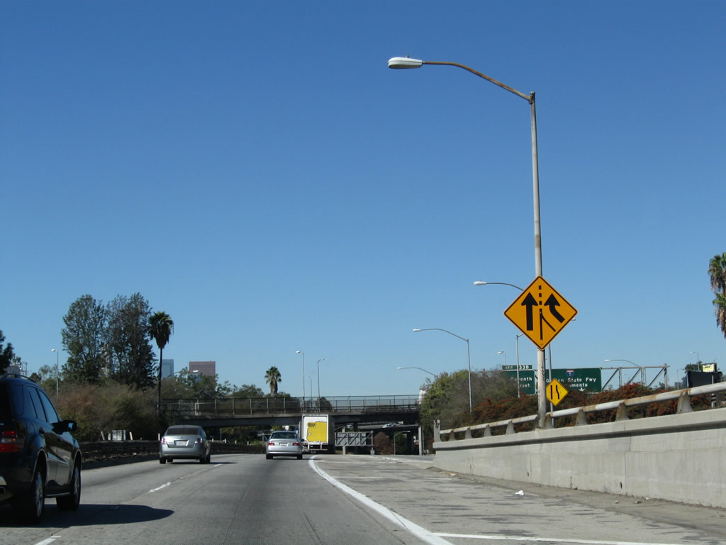
An extra-wide shoulder may indicate provisions for a possible third northbound lane for U.S. 101. The only federal U.S. route to enter Los Angeles, U.S. 101 carries a great deal of traffic west from the city toward Santa Barbara and the Central Coast. Photo taken 11/08/08. |
|
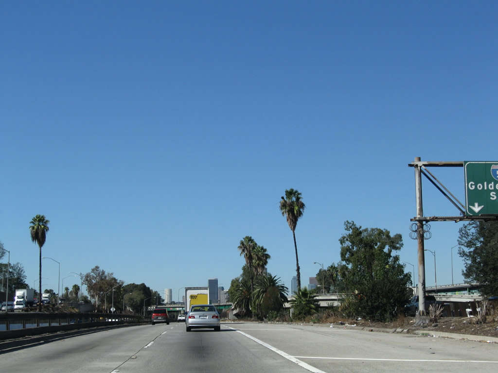
Soon thereafter, the first of many El Camino Real historic markers and replica bell is posted on the shoulder of U.S. 101 north within the East Los Angeles Interchange. Photo taken 11/08/08. |
|
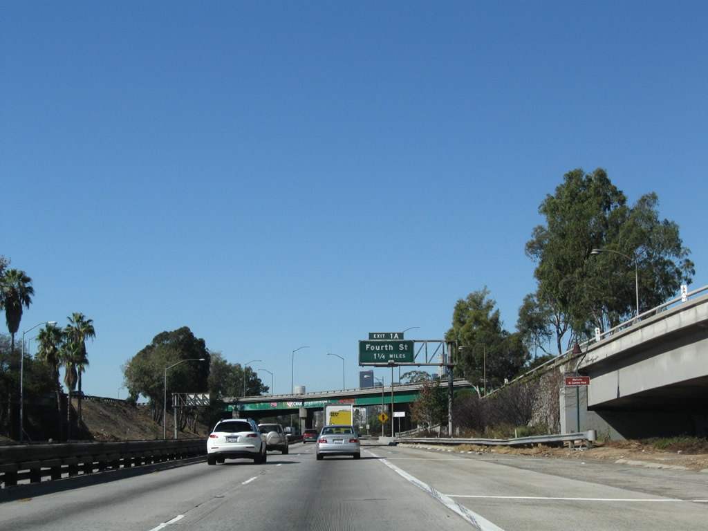
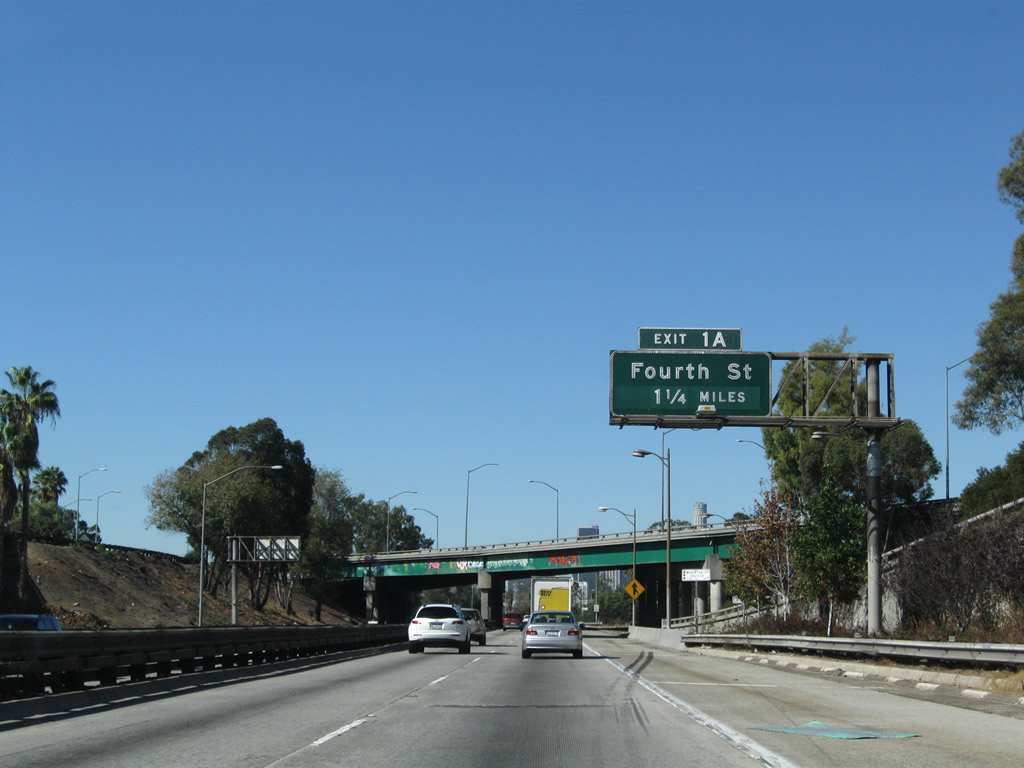
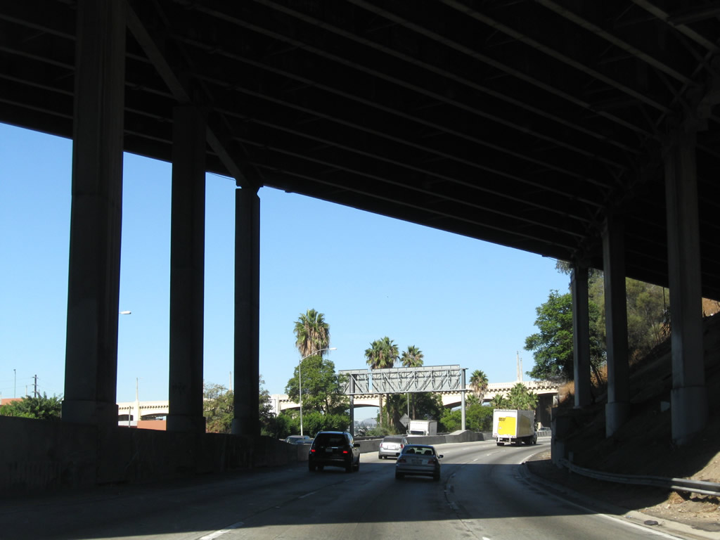
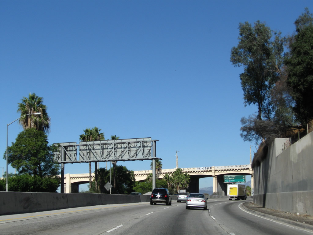
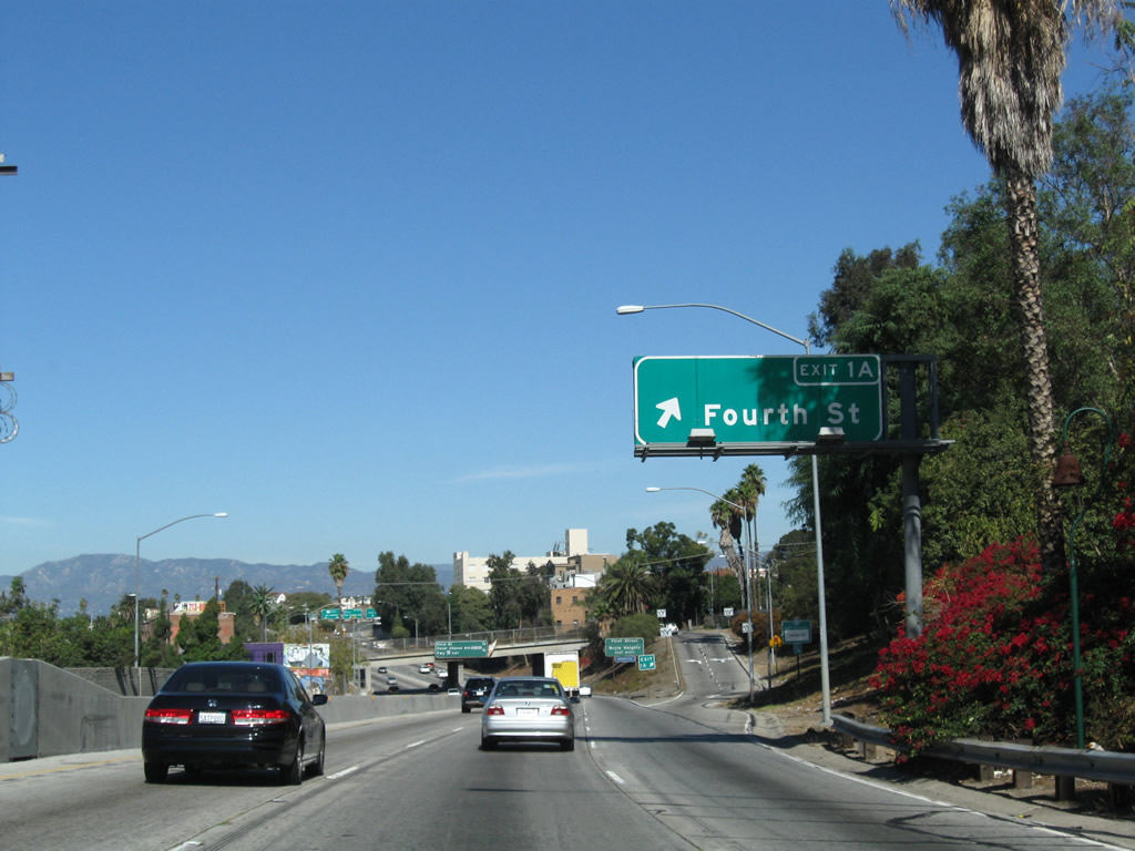
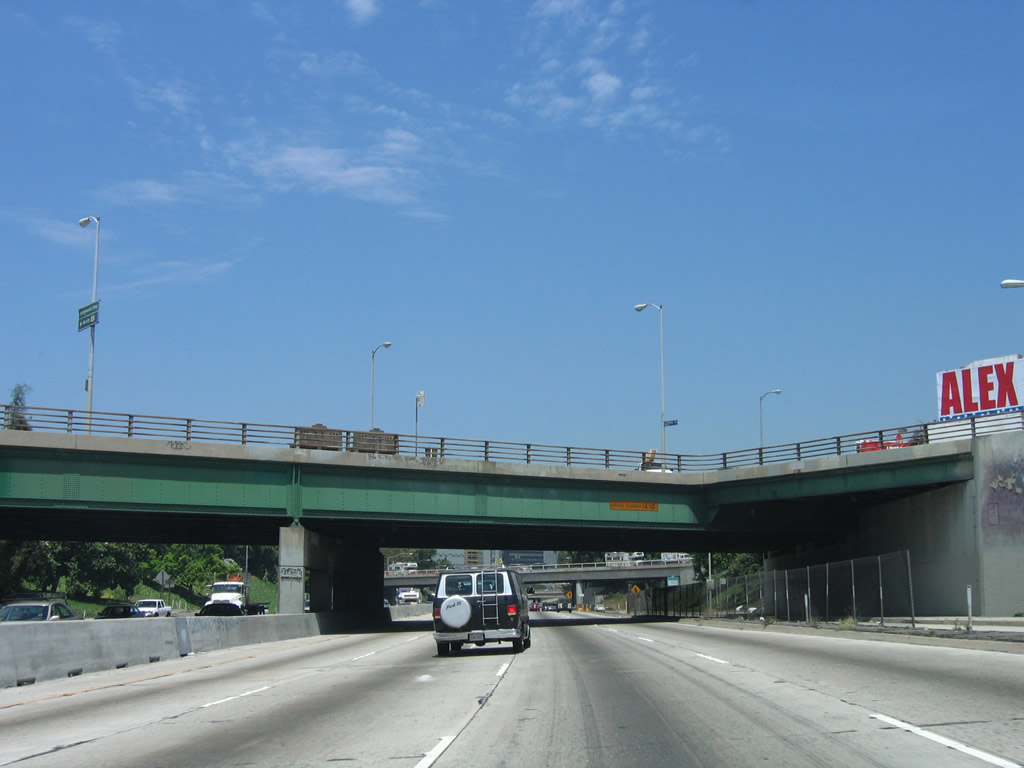
The first exit along U.S. 101 (Santa Ana Freeway) north is Exit 1A, Fourth Street (one and one-quarter miles). Photo taken 11/08/08. |
|
U.S. 101 (Santa Ana Freeway) passes under the California 60 (Pomona Freeway) eastbound lanes. Downtown Los Angeles looms large ahead. Photo taken 11/08/08. |
|
Due to grade separation differences between the two carriageways for eastbound and westbound California 60, U.S. 101 (Santa Ana Freeway) next passes over the California 60 (Pomona Freeway) westbound lanes. A white bridge sign advises that this is the Route 101-60 separation. Photo taken 11/08/08. |
|
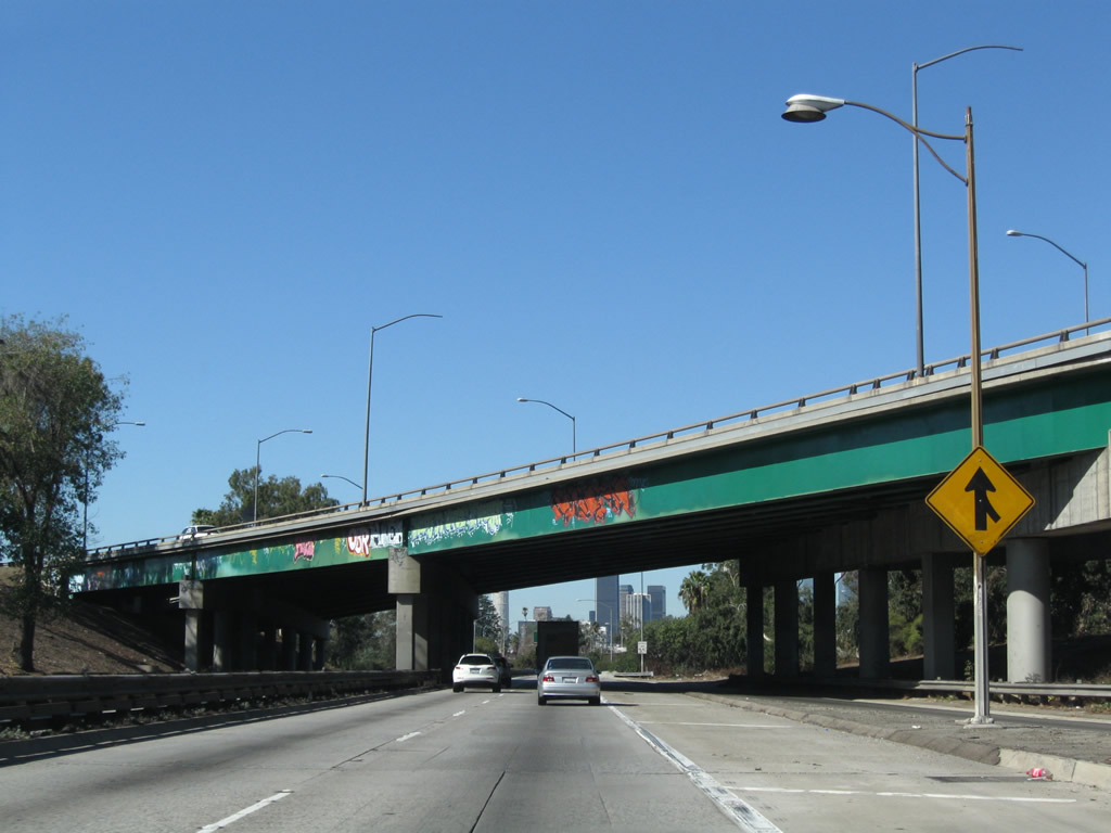
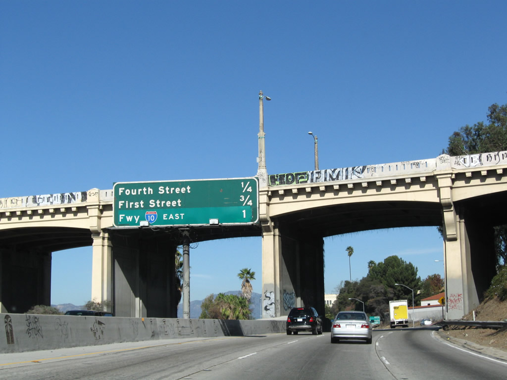
Fourth Street is the most direct route into downtown Los Angeles from the east, crossing the Los Angeles River on its way. Between the Interstate 10 and U.S. 101 bridges over the river, Fourth Street is one of four city streets to cross the Los Angeles River (the other three are Seventh Street, Sixth Street, and First Street). Most of these bridges date back almost a century and are built to historic bridge standards. To see some of these bridges, follow Fourth Street west toward downtown. Photo taken 11/08/08. |
|
A third lane joins U.S. 101 north from the right; this transition ramp comes from California 60 (Pomona Freeway) west. Traffic from Soto Street to U.S. 101 north also joins the northbound freeway at this point. Photo taken 11/08/08. |
|
U.S. 101 passes under Boyle Avenue, a north-south city street that connects the industrial area to the south with the Boyle Heights neighborhood to the north. Photo taken 11/08/08. |
|
|
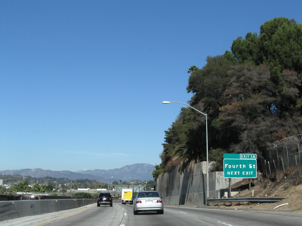
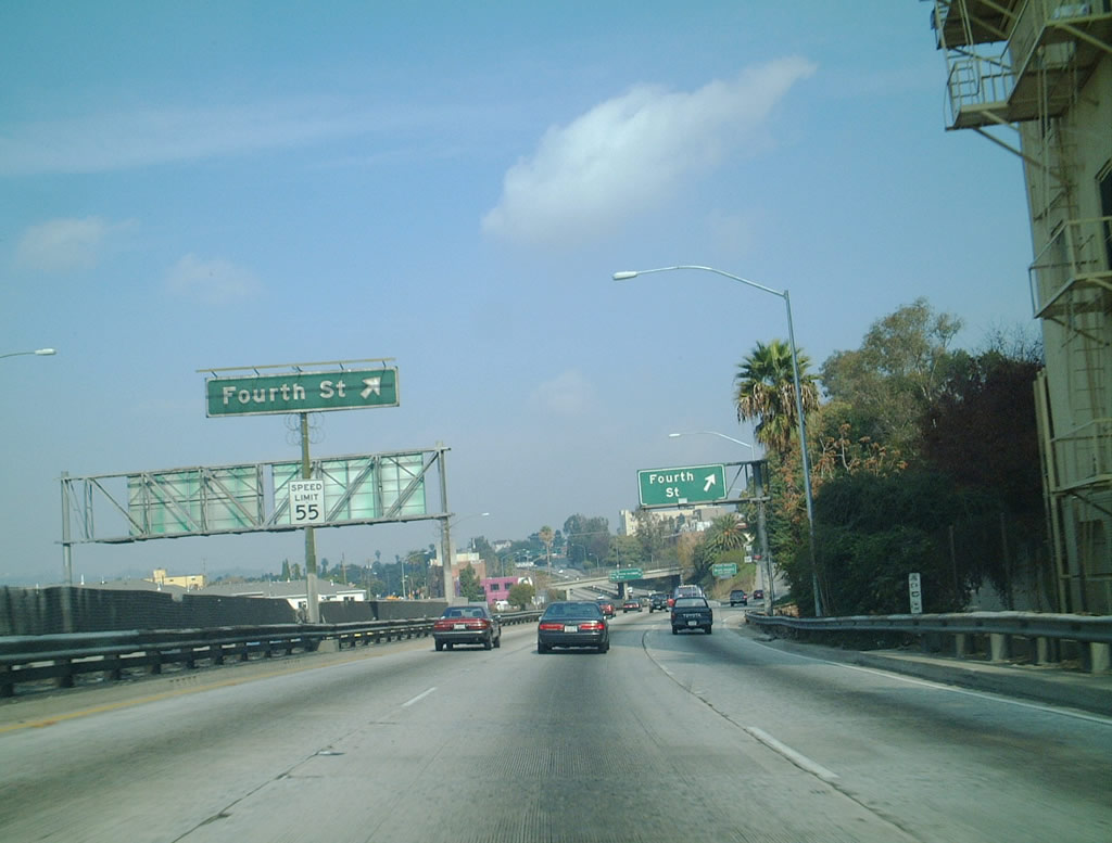
Northbound U.S. 101 (Santa Ana Freeway) reaches Exit 1A, Fourth Street. While today an exit number is posted for this off-ramp, previously there was a median exit sign as well as another sign at the gore point. Photos taken 11/08/08 and 12/23/01. |
|
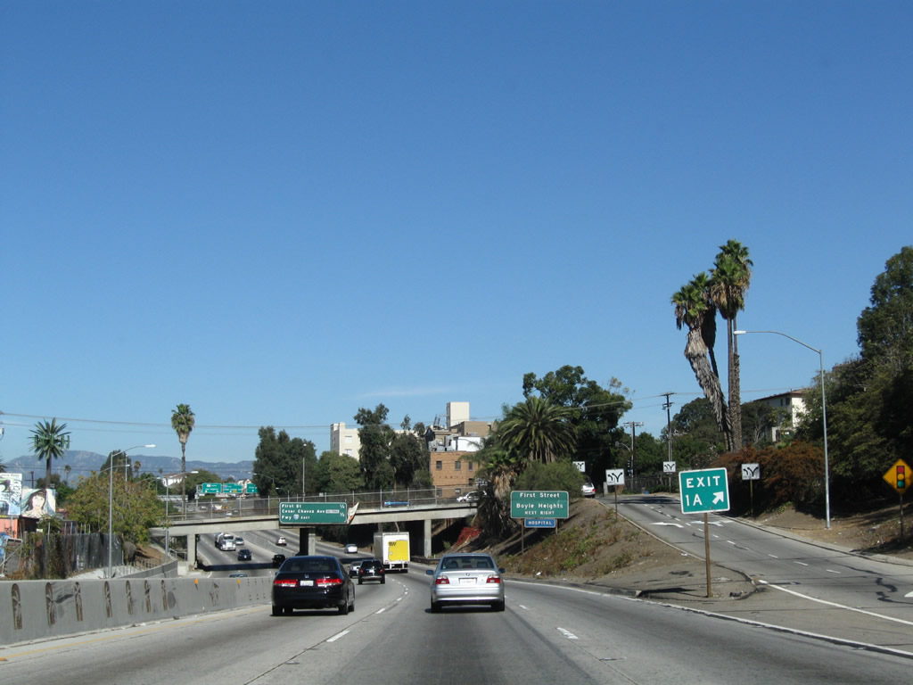
At Exit 1A, this view shows the exit to Fourth Street and the upcoming signage for the First Street exit. During this stretch, U.S. 101 closely parallels the Los Angeles River. Photo taken 11/08/08. |
|
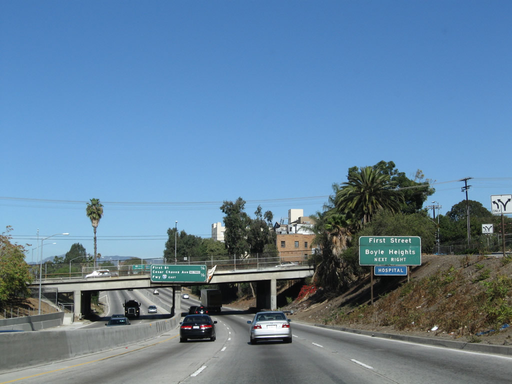
The next exit along northbound U.S. 101 (Santa Ana Freeway) is Exit 1B, First Street to the neighborhood of Boyle Heights in the city of Los Angeles. Photo taken 11/08/08. |
|
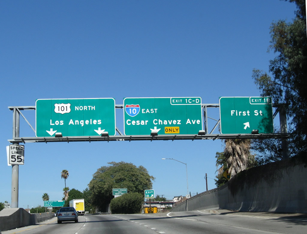
This mileage sign provides the distance to the next three exits along U.S. 101 north: Exit 1B, First Street; Exit 1C, Cesar Chavez Avenue; and Exit 1D, Spur I-10 (California 10) east to Interstate 10 (San Bernardino Freeway) east to San Bernardino and Phoenix. Don't look for Phoenix to be listed on any of these guide signs as a control city; San Bernardino is considered the eastbound control city, even though the Interstate 10 west signs in Phoenix point to Los Angeles as the westbound control city. Photo taken 11/08/08. |
|
|
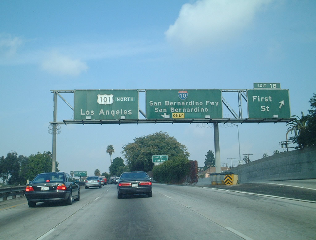
Northbound U.S. 101 (Santa Ana Freeway) reaches Exit 1B, First Street. The next two exits are Exit 1C, Cesar Chavez Avenue and Exit 1D, Spur I-10 east to Interstate 10 (San Bernardino Freeway) east. Photos taken 11/08/08 and 12/23/01. |
|
The next exit along northbound U.S. 101 (Santa Ana Freeway) is Exit 1C, Cesar Chavez Avenue. Photo taken 11/08/08. |
|
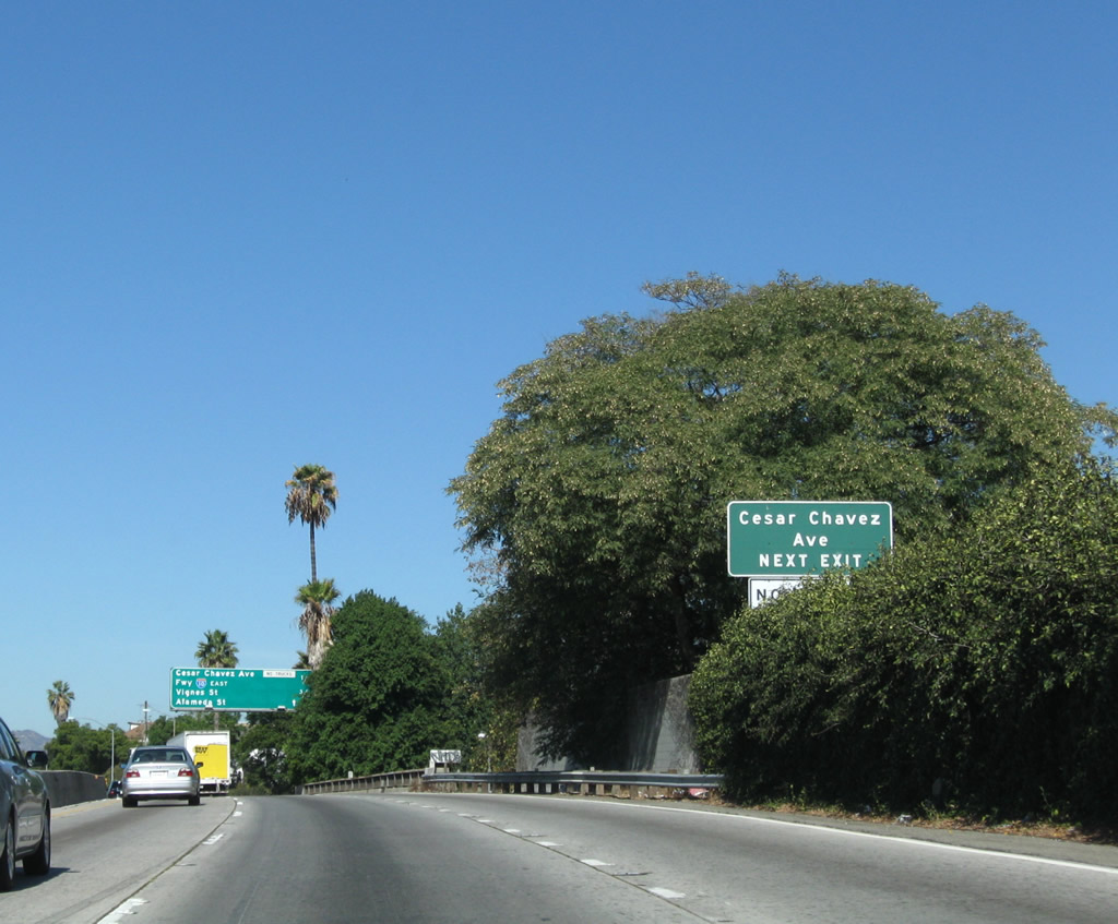
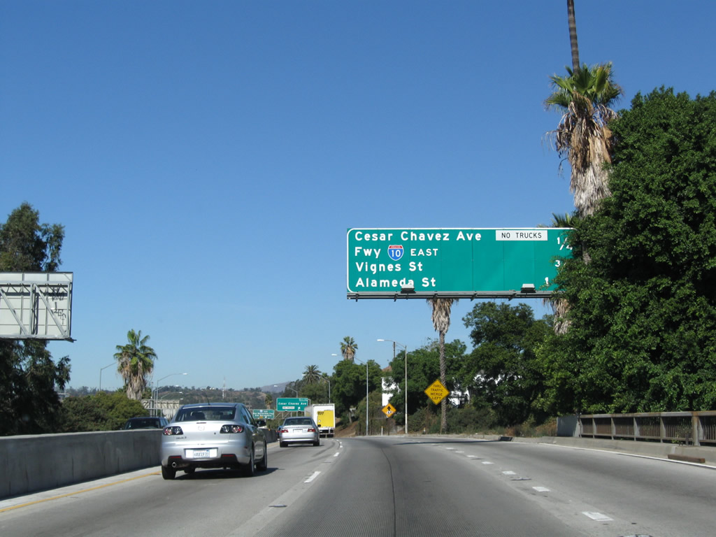
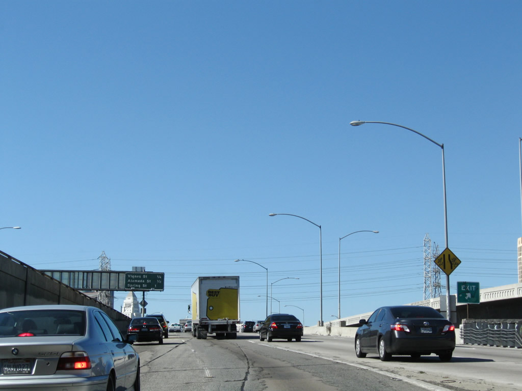
This mileage sign provides the distance to the next four exits along U.S. 101 (Santa Ana Freeway) north: Exit 1C, Cesar Chavez Avenue; Exit 1D, Spur I-10 (California 10) east to Interstate 10 (San Bernardino Freeway) east to San Bernardino and Phoenix; Exit 2A, Vignes Street; and Exit 2B, Alameda Street. Photo taken 11/08/08. |
|
|
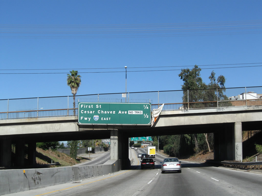
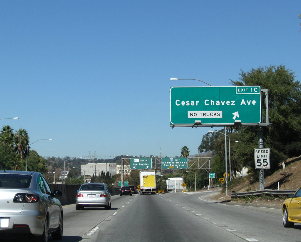
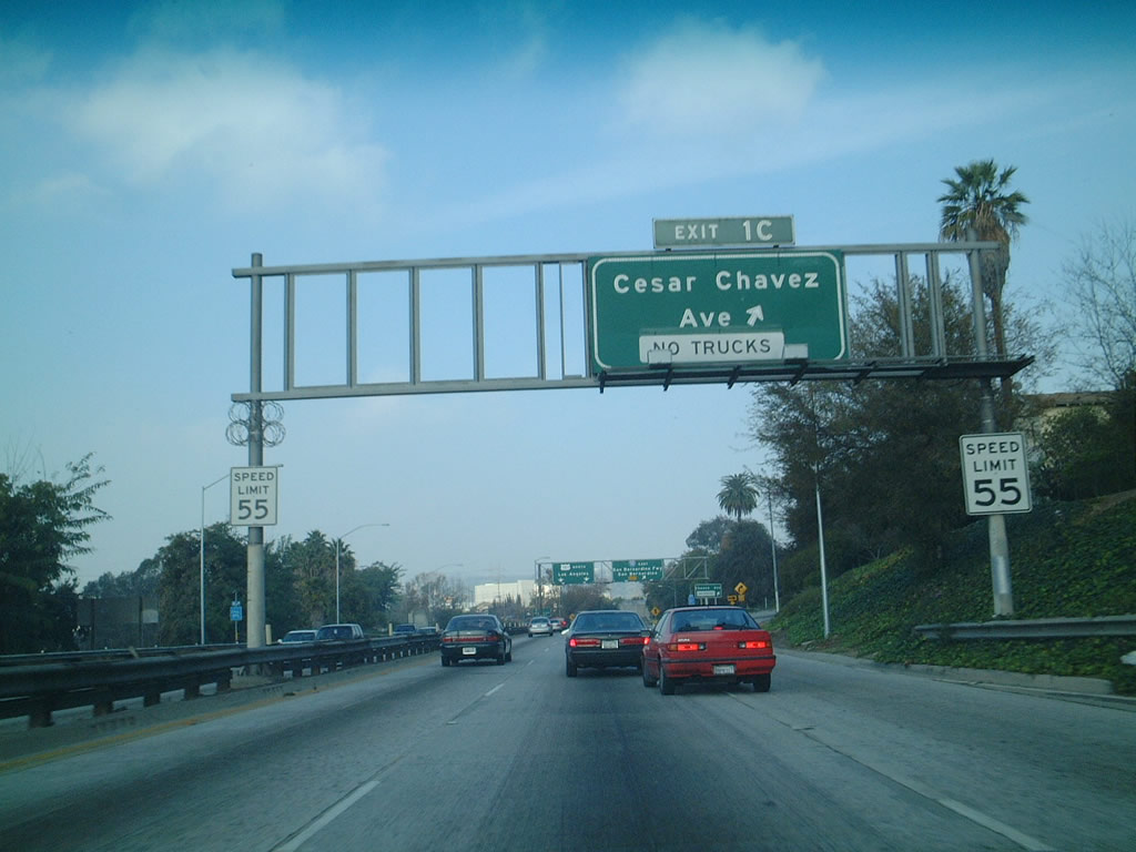
Northbound U.S. 101 (Santa Ana Freeway) reaches Exit 1C, Cesar Chavez Avenue (formerly known as Macy Street west of the Los Angeles River and Brooklyn Avenue east of the Los Angeles River). This exit does not actually directly connect with Cesar Chavez Avenue; motorists must take a connector route to reach east-west Cesar Chavez Avenue. This city street is one of several roads named posthumously for famed farm labor leader Cesar E. Chavez in California; others include Cesar E. Chavez Parkway (former Crosby Street) in the San Diego and Cesar Chavez Street (former Army Street) in San Francisco. March 31st is celebrated as a holiday for some public offices in the state of California in honor of Cesar E. Chavez's birthday. Photos taken 11/08/08 and 12/23/01. |
|
Northbound U.S. 101 (Santa Ana Freeway) reaches Exit 2A, Vignes Street. The next exit along northbound U.S. 101 is Exit 2B, Alameda Street to Union Station. Note the control city for northbound U.S. 101 is now "Hollywood," even though Hollywood is technically part of the city of Los Angeles. Photo taken 11/08/08. |
|
The next exit along U.S. 101 (Santa Ana Freeway) north is Exit 2B, Alameda Street to Union Station. Use Exit 2B to Olvera Street and Little Tokyo. Coming back to grade from the Los Angeles River bridge, U.S. 101 enters the notorious Downtown Slot. Watch for traffic congestion and slowing through this busy stretch of freeway. Photo taken 11/08/08. |
|
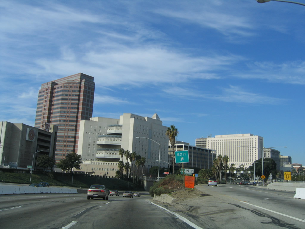
Use Exit 2B to the Museum of Contemporary Art, Los Angeles (MOCA) (founded in 1979), the Geffen Contemporary at MOCA (formerly the Temporary Contemporary, which opened in 1983), and the Walt Disney Concert Hall (home of the Los Angeles Philharmonic Orchestra; opened on October 23, 2003). The Los Angeles Civic Center and El Pueblo de Los Angeles State Historic Park are also located adjacent to U.S. 101 (found on the south side and north side of the freeway, respectively). Photo taken 06/28/06. |
|
Northbound U.S. 101 (Santa Ana Freeway) reaches Exit 2B, Alameda Street to Union Station and Olvera Street. Photo taken 05/05/12. |
|
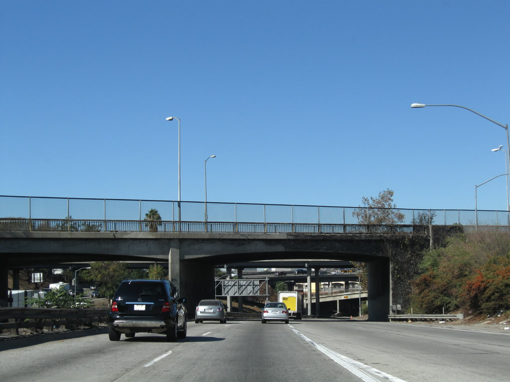
The Gold Line light rail extension crosses U.S. 101 at this point; construction has been underway for several years and opened in November 2009. The Metro Gold Line connects eastern Los Angeles with Pasadena; the extension would connect East Los Angeles via Little Tokyo and Boyle Heights. A separate Gold Line extension is planned from Pasadena east to Montclair by 2014 and possibly to Ontario International Airport at some later time. Photo taken 05/05/12. |
|
The gore point for Exit 2B to Alameda Street is posted shortly thereafter (this exit gore point sign now includes the exit number as of 2008, and this photo was taken before the Gold Line bridge was completed across the freeway). Note the lack of shoulders along this section of U.S. 101. The freeway goes below grade to enter the Downtown Slot. Photo taken 11/25/04. |
|
|
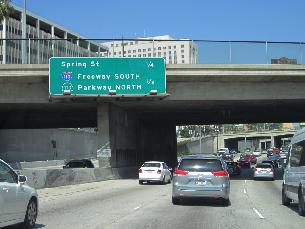
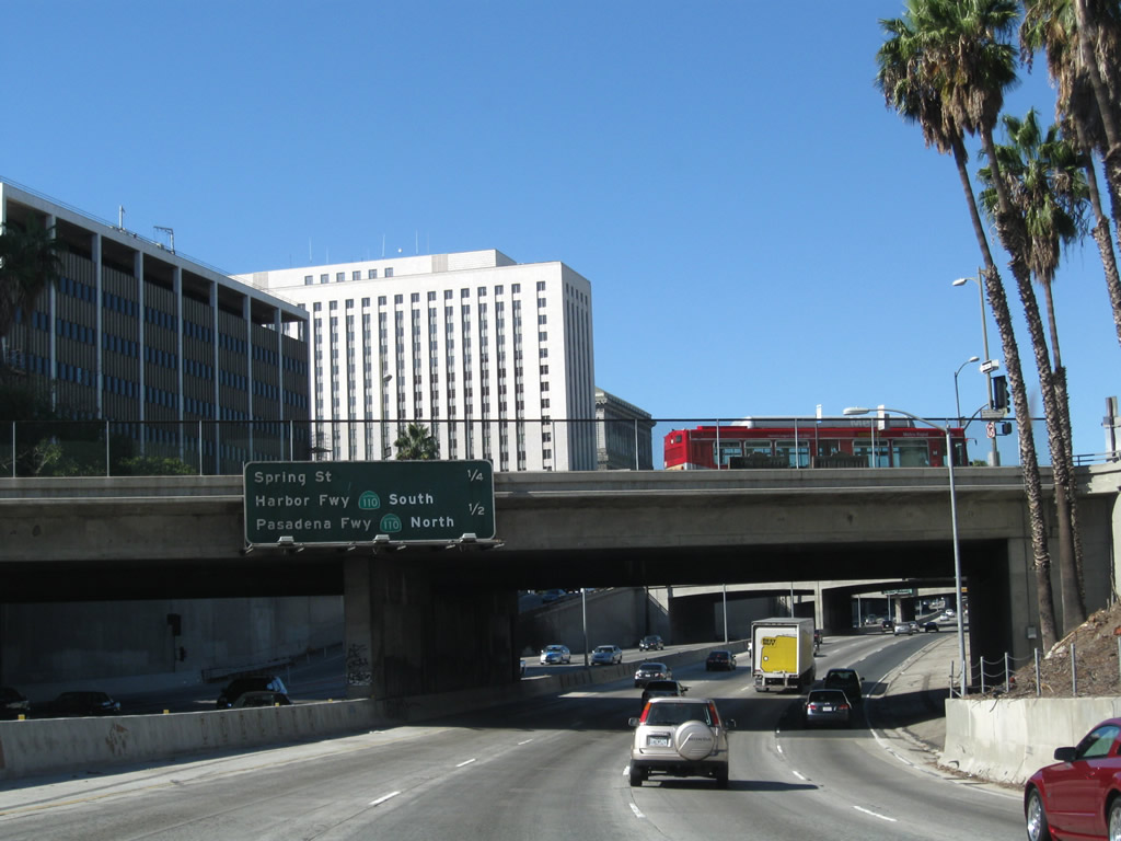
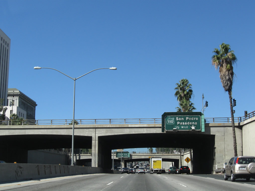
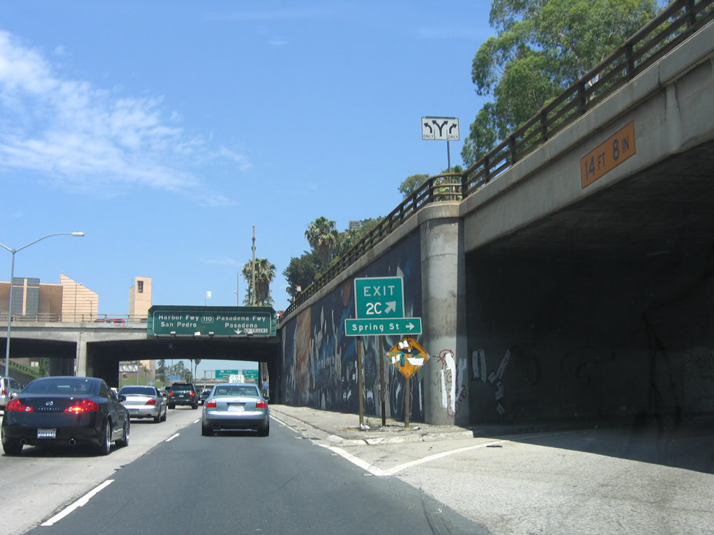
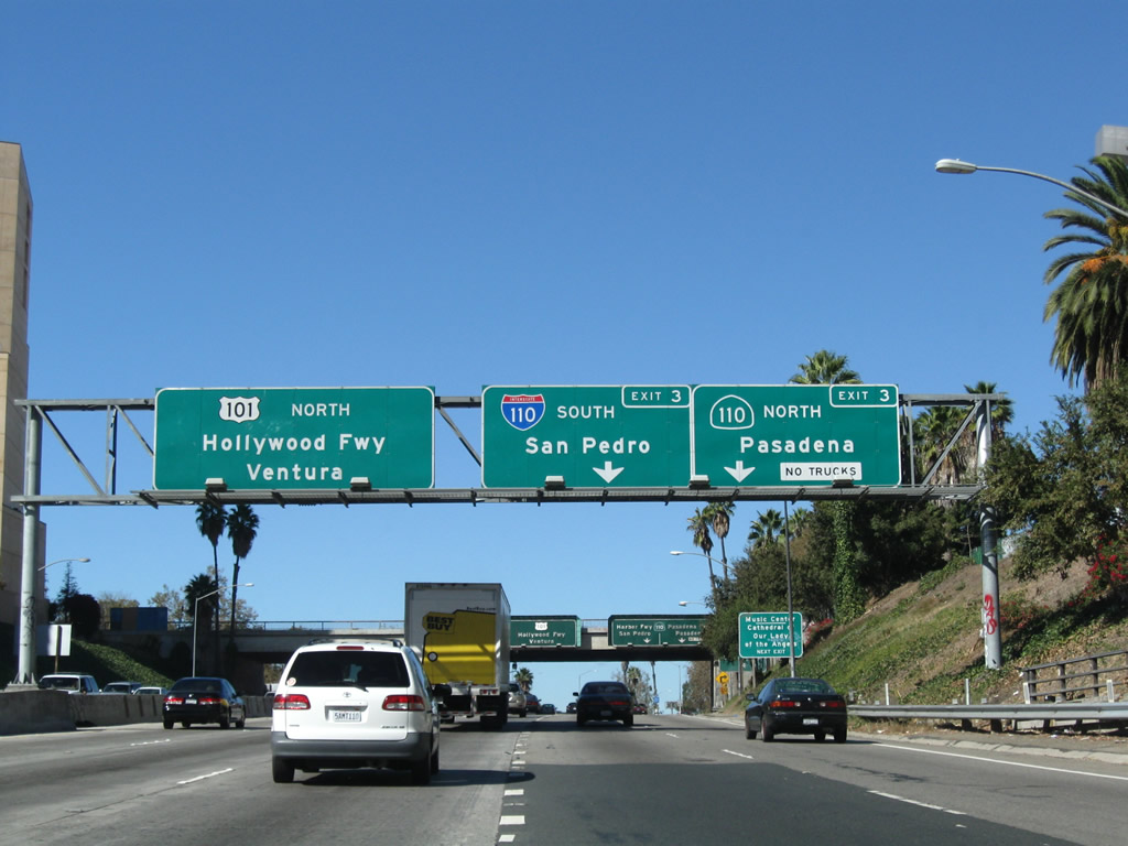
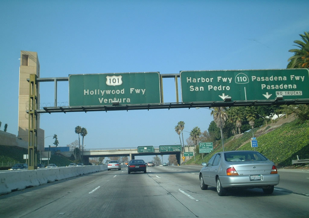
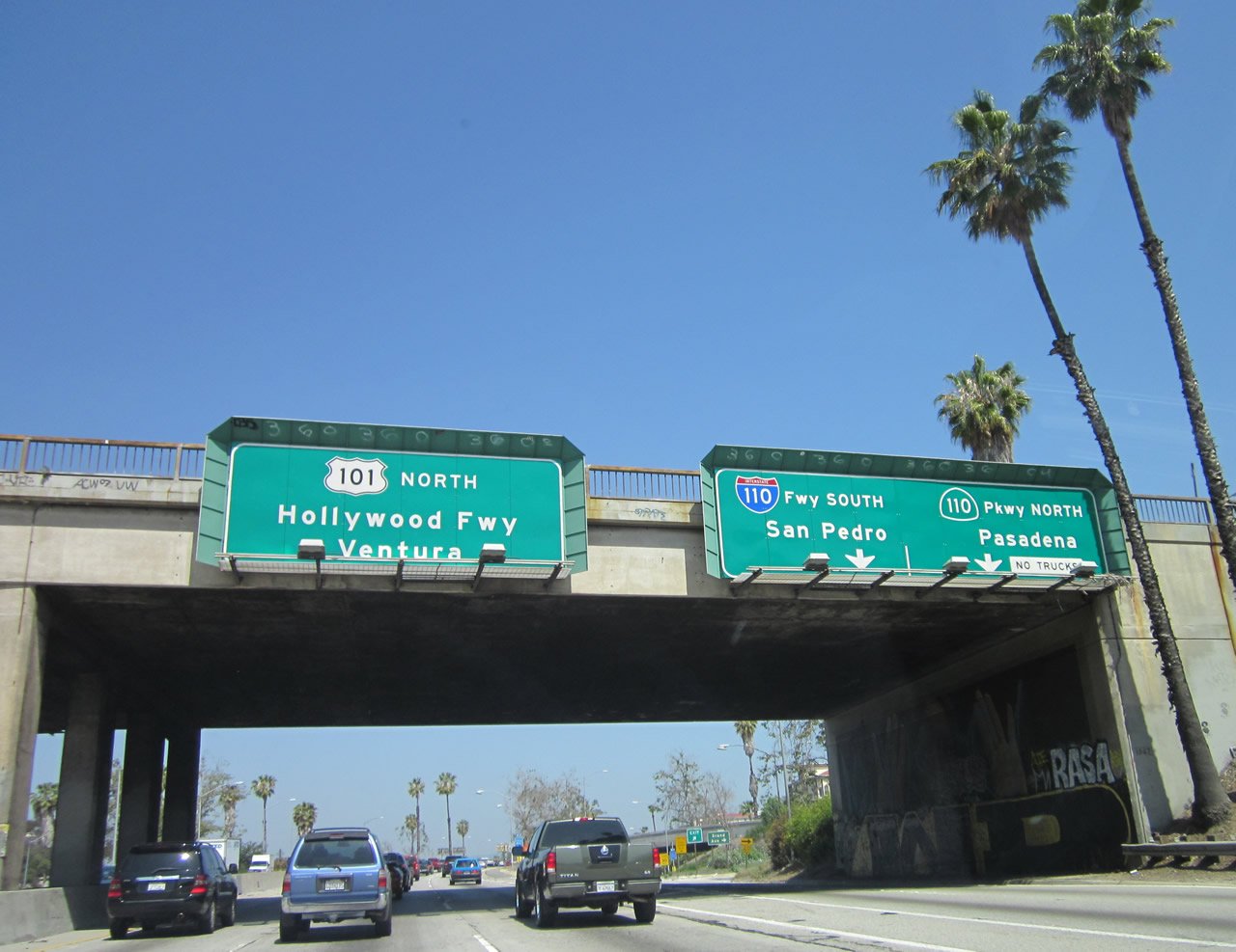
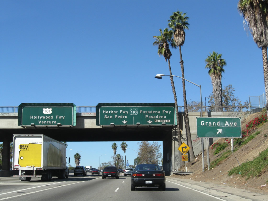
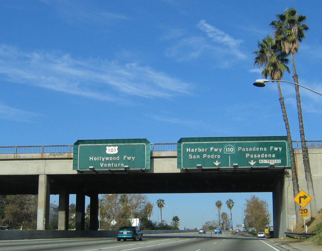
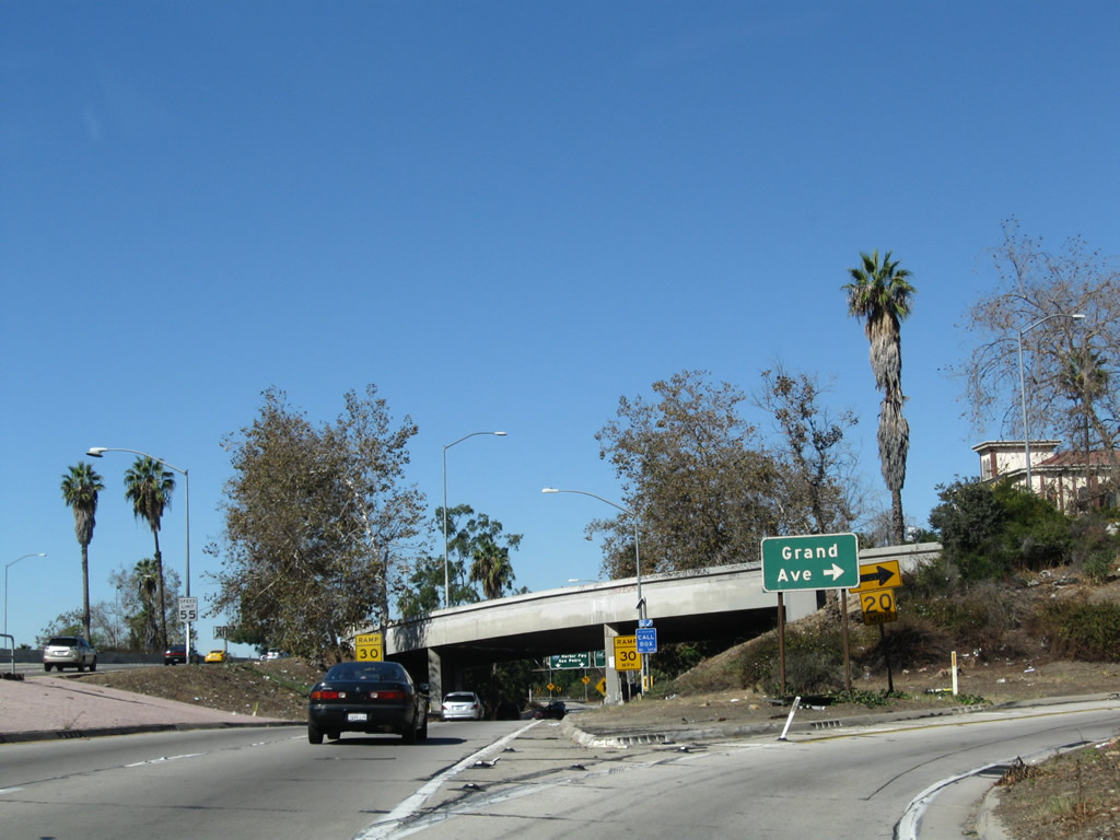
The next exit along northbound U.S. 101 (and the final exit of the Santa Ana Freeway) is Exit 3, California 110 (Harbor Freeway south and Pasadena Freeway north) at the famous four-level interchange, with a supplemental ramp to Grand Avenue. Photos taken 05/05/12 and 11/08/08. |
|
|
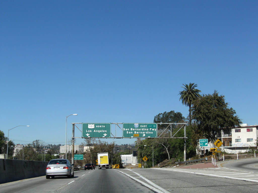
The right two lanes of U.S. 101 become exit only for Exit 3, Interstate 110 south and California 110 north. California 110 is a major north-south corridor connecting the Port of Los Angeles and San Pedro with the city of Pasadena. The route follows the Harbor Freeway from the port area north to the Four Level Interchange, then transitions directly onto the Pasadena Freeway on its way to Pasadena. The portion northeast of Interstate 5 is part of the historic Arroyo Seco Parkway, which was one of the first freeways built in Los Angeles. Originally designated as part of U.S. 66, the parkway was known as California 11 until it designation was changed to California 110 for consistency with the setion of the Harbor Freeway south of Interstate 10 designated as Interstate 110; these signs indicate that the Harbor Freeway between U.S. 101 and Interstate 10 are also part of Interstate 110. Photos taken 11/08/08 and 12/23/01. |
|
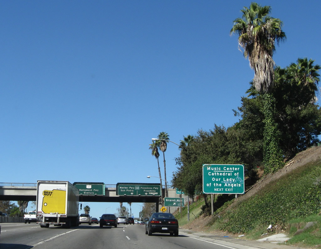
To Grand Avenue, take Exit 3 (Interstate 110 south/California 110 north) and look for a quick off-ramp. Use Grand Avenue southwest to the Cathedral of Our Lady of Angels. This sign is somewhat confusing, since it is implied that "next exit" refers to Grand Avenue and not California 110 north or Interstate 110 south. Photo taken 11/08/08. |
|
|
|
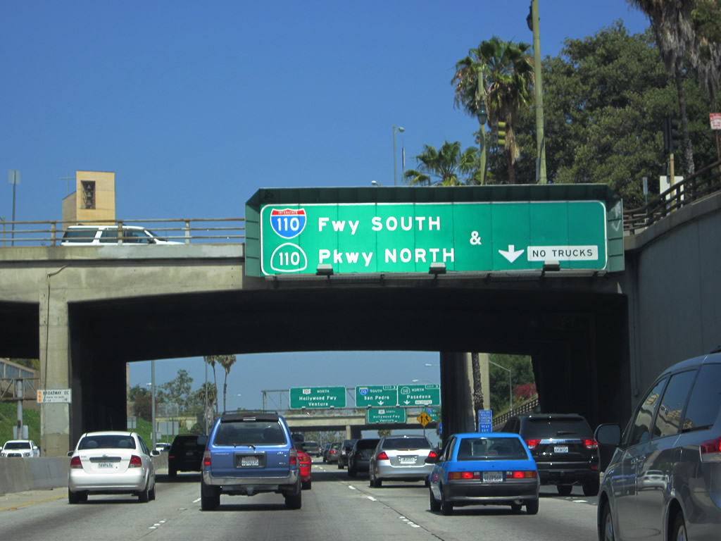
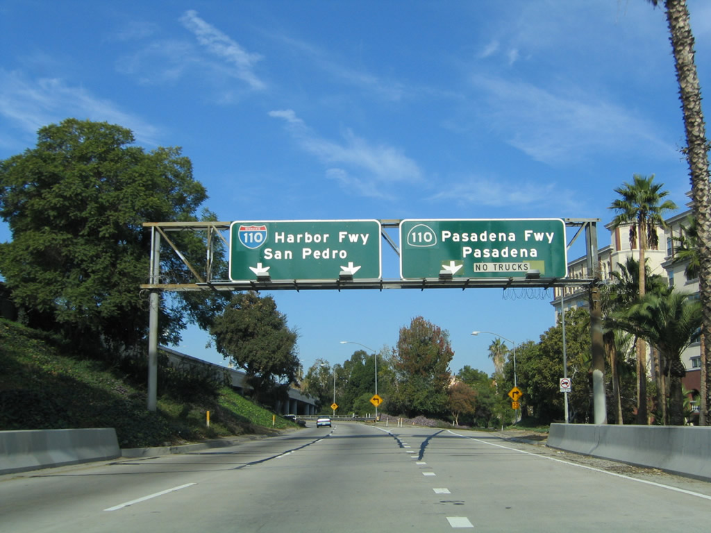
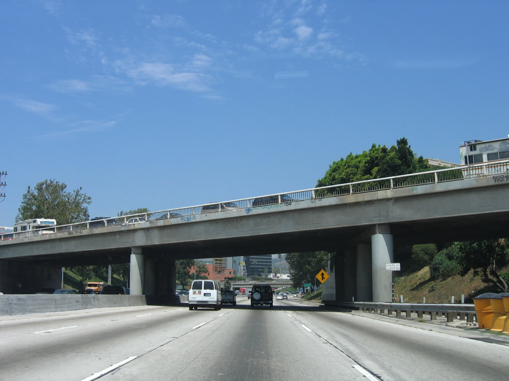
Northbound U.S. 101 (Santa Ana Freeway) reaches Exit 3, California 110 (Pasadena Freeway) north and Interstate 110 (Harbor Freeway) south. This exit is the famous Four-Level interchange, which was the first symmetrical stack interchange constructed in Southern California (opened in 1954; under construction for a few years prior to then). Even with its advanced design, the Four Level Interchange has frequent congestion. This major interchange connects the Santa Ana Freeway with the Hollywood, Pasadena, and Harbor Freeways. The Santa Ana Freeway ends here; northbound U.S. 101 continues north along the Hollywood Freeway. Photos taken 05/05/12, 11/08/08, and 11/25/04. |
|
Now on the transition ramp from U.S. 101 north to California 110 north and Interstate 110 is this off-ramp to Grand Avenue to downtown Los Angeles. The two left lanes continue to connect to California 110 and Interstate 110. Photo taken 11/08/08. |
|
After the Grand Avenue off-ramp, the transition ramp itself splits. The left two lanes connect to Interstate (California) 110/Harbor Freeway south, while the right lane connects to California 110 (Pasadena Freeway) (to Historic U.S. 66/Arroyo Seco Parkway) northeast. Photo taken 11/25/04. |
|
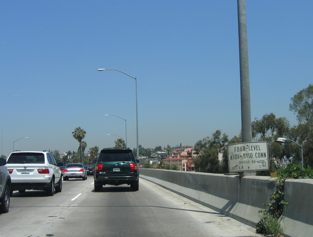
Returning to the mainline, U.S. 101 forms the top level of the storied Four-Level Interchange. A small bridge identification sign is posted on top of the symmetrical stack interchange. At this point (upon crossing over Interstate 110 and California 110), U.S. 101 shifts from the Santa Ana Freeway to the Hollywood Freeway. Photo taken 06/28/06. |
|
Traffic from Interstate 110 and California 110 merges onto U.S. 101, which now becomes the Hollywood Freeway (the Santa Ana Freeway ends at this point). This seldom seen merge sign indicates that the right lane and the on-ramp will merge together, and on a busy segment of freeway such as the Four Level, this can mean congestion due to high traffic volumes on all intersecting freeways. This sign may also be found at certain merge points at the East Los Angeles Interchange. Photo taken 06/28/06. |
| U.S. 101 - Hollywood Freeway north |
|
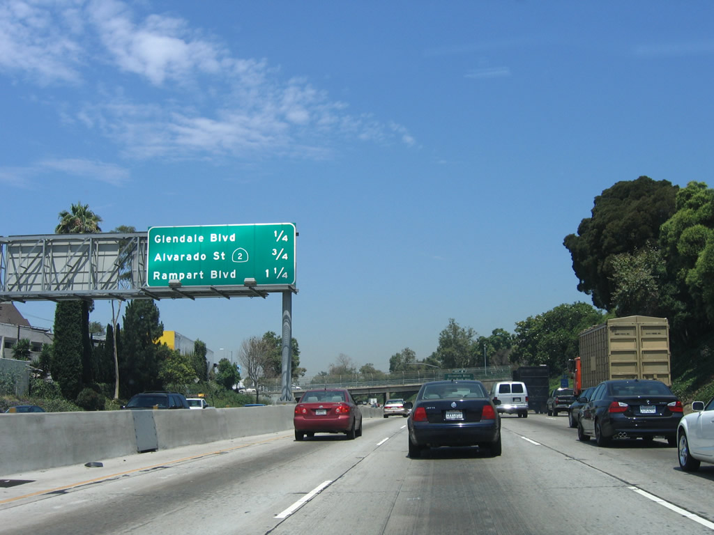
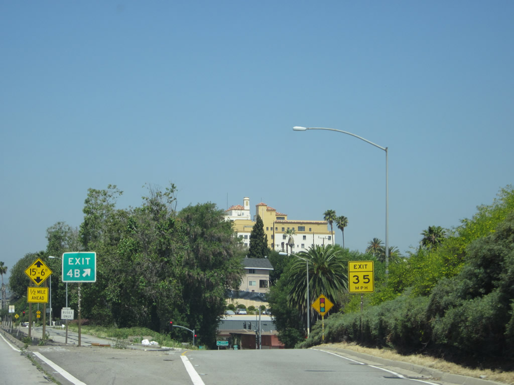
Now past the Four-Level Interchange, U.S. 101 continues toward Hollywood along the Hollywood Freeway. This mileage sign located along northbound U.S. 101 indicates the next three exits: Exit 4A, Glendale Avenue; Exit 4B, California 2 East; and Exit 5A, Rampart Boulevard. Photo taken 06/28/06. |
|
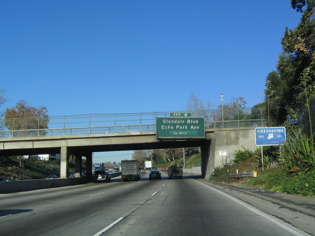
In spite of the exit number posted on this sign, Glendale Avenue / Echo Park Avenue is Exit 4A. Echo Park, a community northwest of downtown Los Angeles, features its namesake park and Echo Lake. The park is a patch of green space amidst the urban surroundings. Photo taken 12/23/04. |
|
Northbound U.S. 101 (Hollywood Freeway) reaches Exit 4A, Glendale Avenue / Echo Park Avenue. Photo taken 12/23/04. |
|
This mileage sign along northbound U.S. 101 provides the distance to the next three exits: Exit 4B, California 2 (Alvarado Avenue) east; Exit 5A, Rampart Boulevard; and Exit 5B, Silver Lake Boulevard. Photo taken 06/28/06. |
|
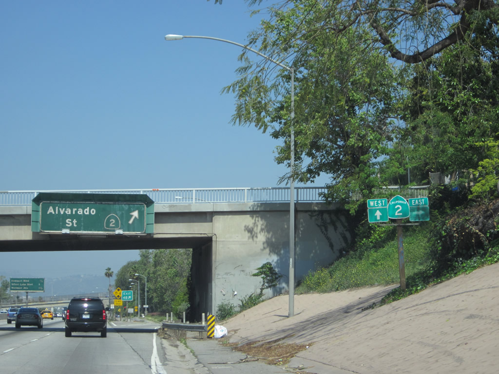
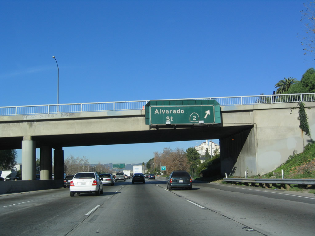
The next exit along northbound U.S. 101 (Hollywood Freeway) is Exit 4B, California 2 (Alvarado Avenue). The state route proceeds northeast from this interchange into the Echo Park community of Los Angeles. California 2 is a significant east-west state route that begins in Santa Monica, travels through western and central Los Angeles (with brief passages through Beverly Hills and West Hollywood), merges briefly with U.S. 101, then proceeds northeast toward Glendale. North of Interstate 210, California 2 becomes the Angeles Crest Highway for the trip through Angeles National Forest before ending at California 138. Check for local conditions before making the trip along the Angeles Crest Highway segment due to weather and rockslide concerns. Photo taken 06/28/06. |
|
A SR 2 trailblazer stands along U.S. 101 just ahead of the off-ramp to Exit 4B. Alvarado Avenue leads motorists to SR 2 east. Photo taken 05/05/12. |
|
This view shows the off-ramp for Exit 4B, California 2 east. Photo taken 05/05/12. |
|
Northbound U.S. 101 (Hollywood Freeway) reaches Exit 4B, California 2 east and Alvarado Avenue. California 2 west now merges onto the U.S. 101 freeway for a couple miles, then resumes its westerly course via Santa Monica Boulevard. There were plans at one time to extend California 2 through Echo Park as a freeway, but those plans have been shelved indefinitely and likely dead. Photo taken 12/23/04. |
| U.S. 101 (Hollywood Freeway) north and California 2 west |
|
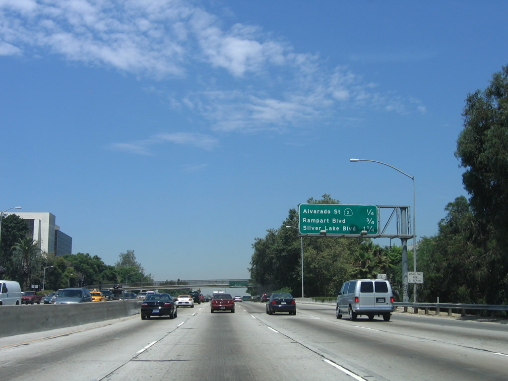
This mileage sign along U.S. 101 (Hollywood Freeway) north and California 2 west provides the distance to the next three exits: Exit 5a, Rampart Boulevard; Exit 5B, Silver Lake Boulevard; and Exit 6A, Vermont Avenue. Photo taken 06/28/06. |
|
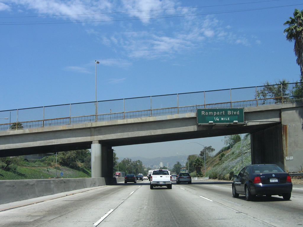
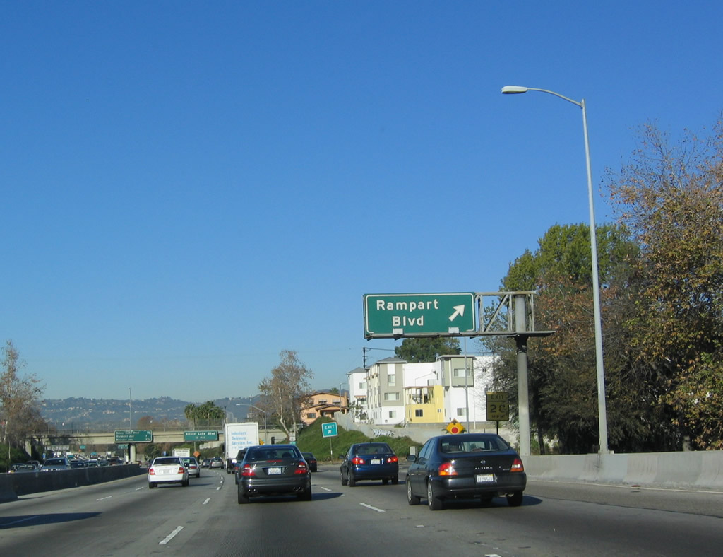
The next exit along U.S. 101 (Hollywood Freeway) north and California 2 west is Exit 5A, Rampart Boulevard. Photo taken 06/28/06. |
|
Northbound U.S. 101 (Hollywood Freeway) and westbound California 2 reaches Exit 5A, Rampart Boulevard. Photo taken 12/23/04. |
|
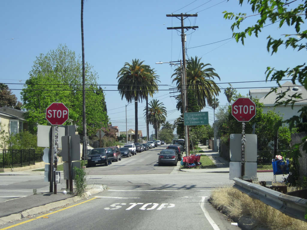
A pair of stop sign awaits at the end of the off-ramp for Exit 5A, Rampart Boulevard. A green guide sign points the way not only to Rampart Boulevard but also Coronado Street and Benton Way. Photo taken 05/05/12. |
|
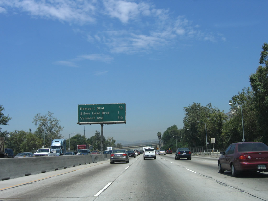
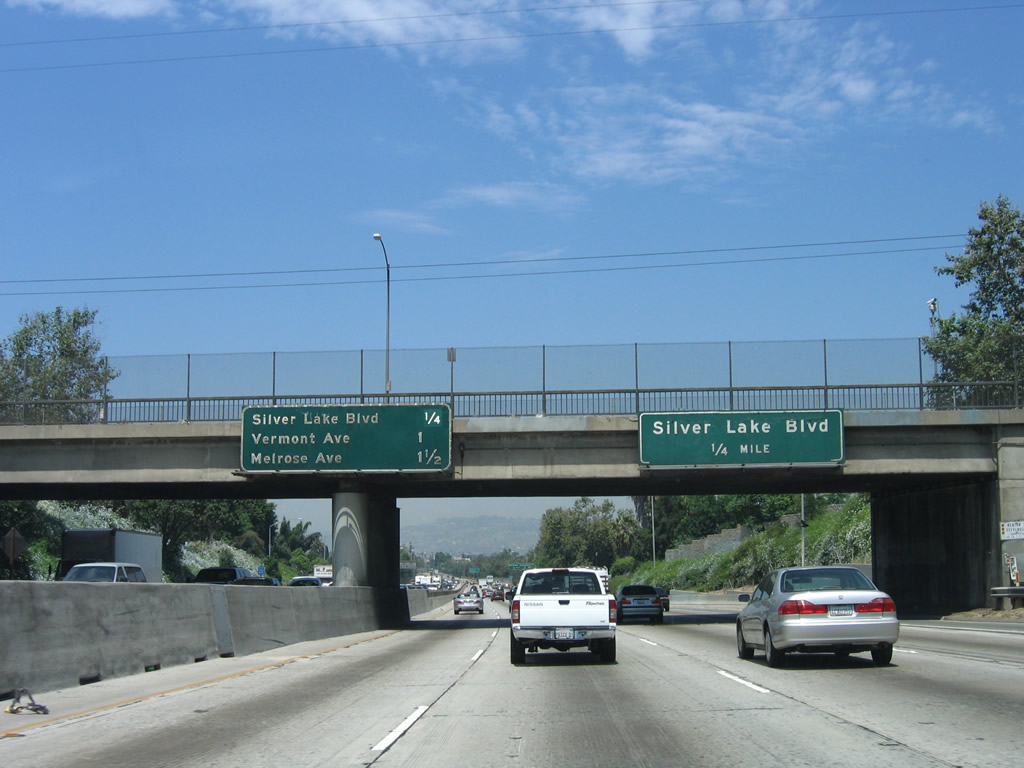
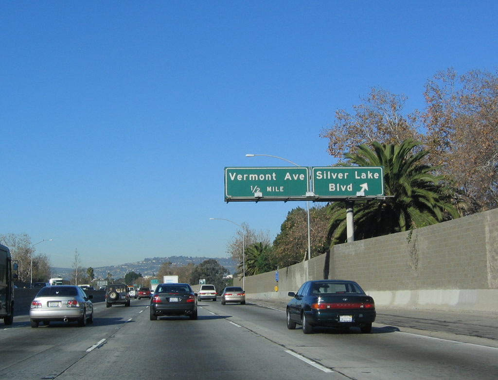
The next exit along northbound U.S. 101 and westbound California 2 is Exit 5B, Silver Lake Boulevard. The main sign on the right indicates the distance to Silver Lake Boulevard, while the sign on the left indicates the distance to the two following exits. Photo taken 06/28/06. |
|
Northbound U.S. 101 and westbound California 2 reach Exit 5B, Silver Lake Boulevard. The next exit along U.S. 101 north is Exit 6A, Vermont Avenue (one-half mile). Photo taken 12/23/04. |
|
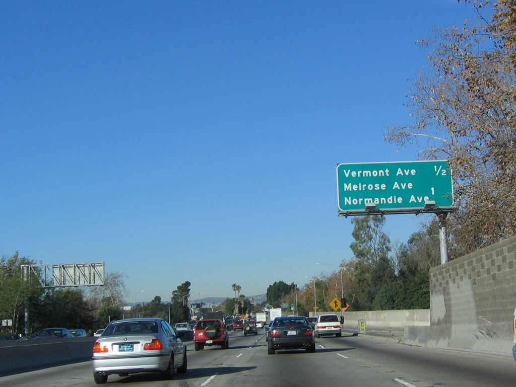
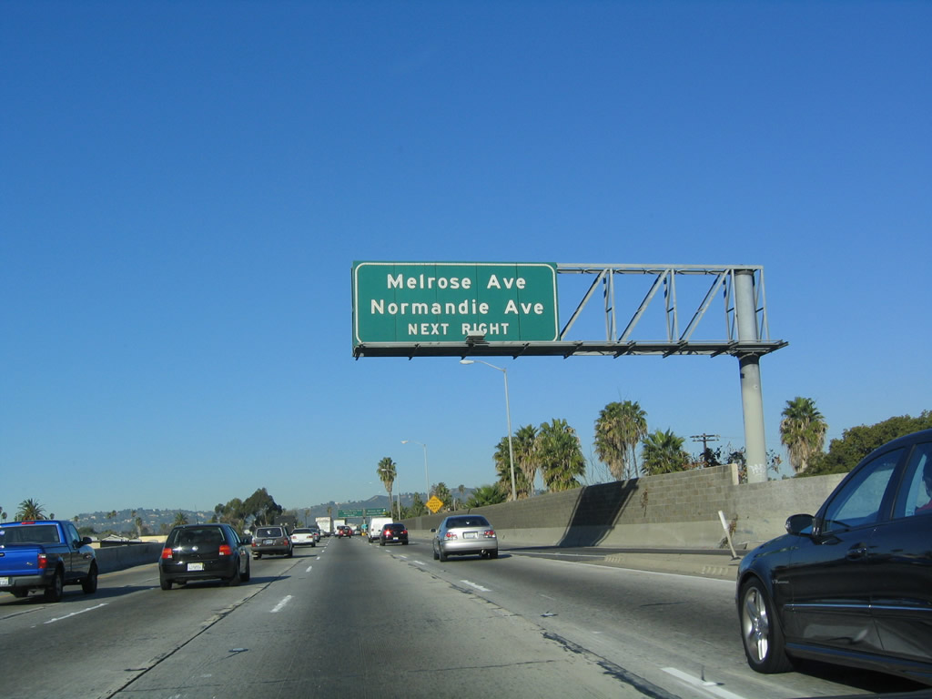
This mileage sign along northbound U.S. 101/westbound California 2 provides the distance to the next two exits: Exit 6A, Vermont Avenue and Exit 6B, Melrose Avenue/Normandie Avenue. Photo taken 12/23/04. |
|
A roadside sign for Exit 6A, Vermont Avenue is posted shortly thereafter. Photo taken 06/28/06. |
|
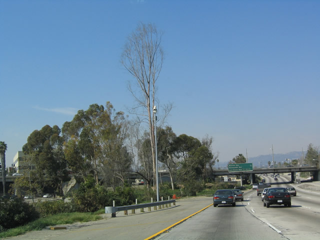
U.S. 101 widens out to have a much larger median; this median is in place for the once-proposed but never constructed California 2/Beverly Hills Freeway. As noted earlier, that freeway is very unlikely to ever be constructed. Photo taken 12/23/04. |
|
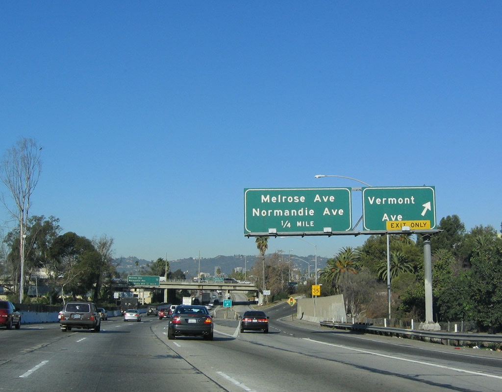
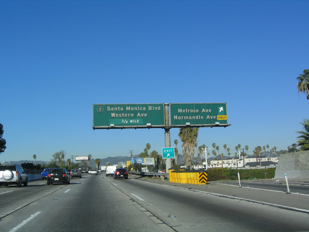
Northbound U.S. 101/Westbound California 2 reaches Exit 6A, Vermont Avenue. Vermont Avenue is a major north-south street leading north to Los Feliz and Griffith Park. Heading south, Vermont Avenue bisects Wilshire Center from Westlake, then passes Interstate 10 and the University of Southern California before entering South-Central Los Angeles. The next exit is Exit 6B, Melrose Avenue/Normandie Avenue, 0.25 mile. Photo taken 12/23/04. |
|
Another view of the extra-wide median that was left in place to accommodate a freeway-to-freeway interchange between U.S. 101 and California 2. Photo taken 02/15/04. |
|
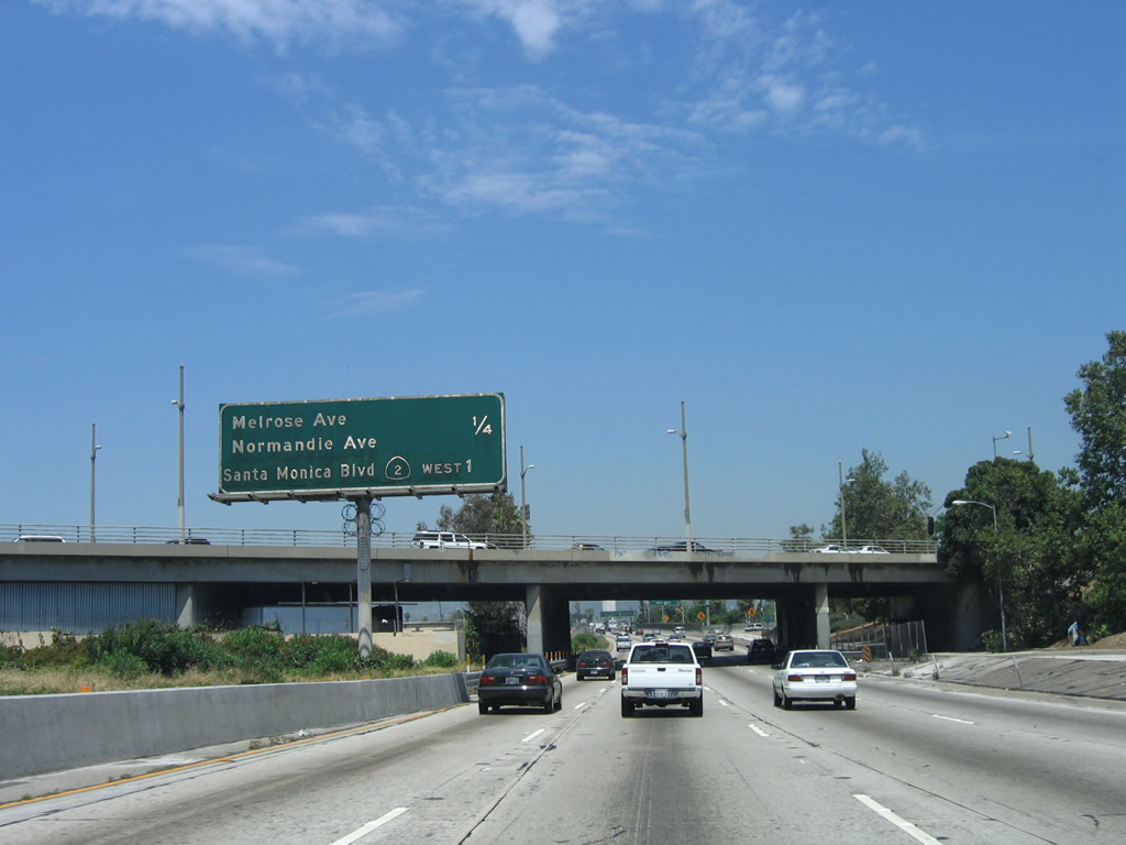
This mileage sign along U.S. 101 north and California 2 west (Hollywood Freeway) provides the distance to the next two interchanges: Exit 6B, Melrose Avenue and Normandie Avenue and Exit 7, California 2 (Santa Monica Boulevard) west (Historic U.S. 66). Note the unusual font used on the last entry on this sign. It is certainly showing its age. Photo taken 06/28/06. |
|
Normandie Avenue leads south to Wilshire Center, then south into Koreatown. Melrose Avenue leads east to Hoover Street and west into Hollywood, passing by Paramount Studios en route toward Santa Monica. Misha Schutt writes that Melrose Avenue "ends as it runs into the southwest-angled Santa Monica Boulevard in West Hollywood, between Robertson and Doheny, just east of the Beverly Hills city line." Photo taken 12/23/04. |
|
Northbound U.S. 101 (Hollywood Freeway) and westbound California 2 reach Exit 6B, Melrose Avenue/Normandie Avenue. The next exit is for westbound California 2. Again, these are some old signs! Photo taken 12/23/04. |
|
A U.S. 101 north and California 2 west reassurance shield assembly is posted after the on-ramp from Melrose Avenue and Normandie Avenue. Photo taken 06/28/06. |
|
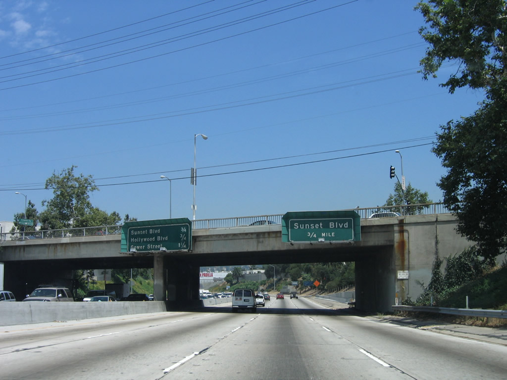
This mileage sign along northbound U.S. 101 and westbound California 2 provides the distance to the next three exits: Exit 7, California 2 west/Santa Monica Boulevard (Historic U.S. 66); Exit 8A, Sunset Boulevard; and Exit 8B, Hollywood Boulevard. Photo taken 06/28/06. |
|
Use Santa Monica Boulevard west to the cities of West Hollywood and Beverly Hills. California 2 was proposed as a freeway corridor through these cities and western Los Angeles, but that plan has since been scuttled. Photo taken 06/28/06. |
|
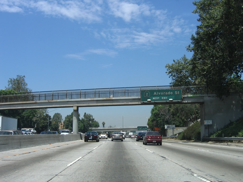
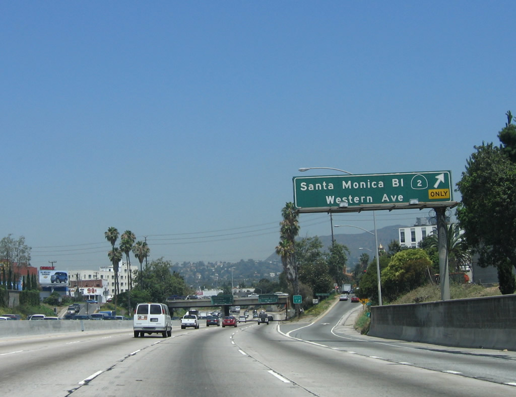
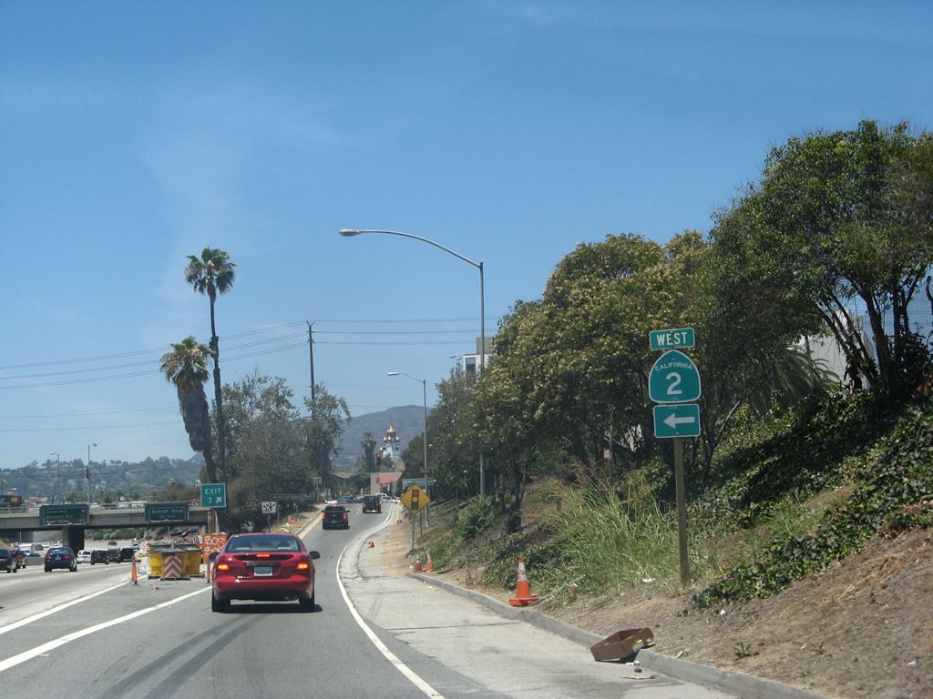
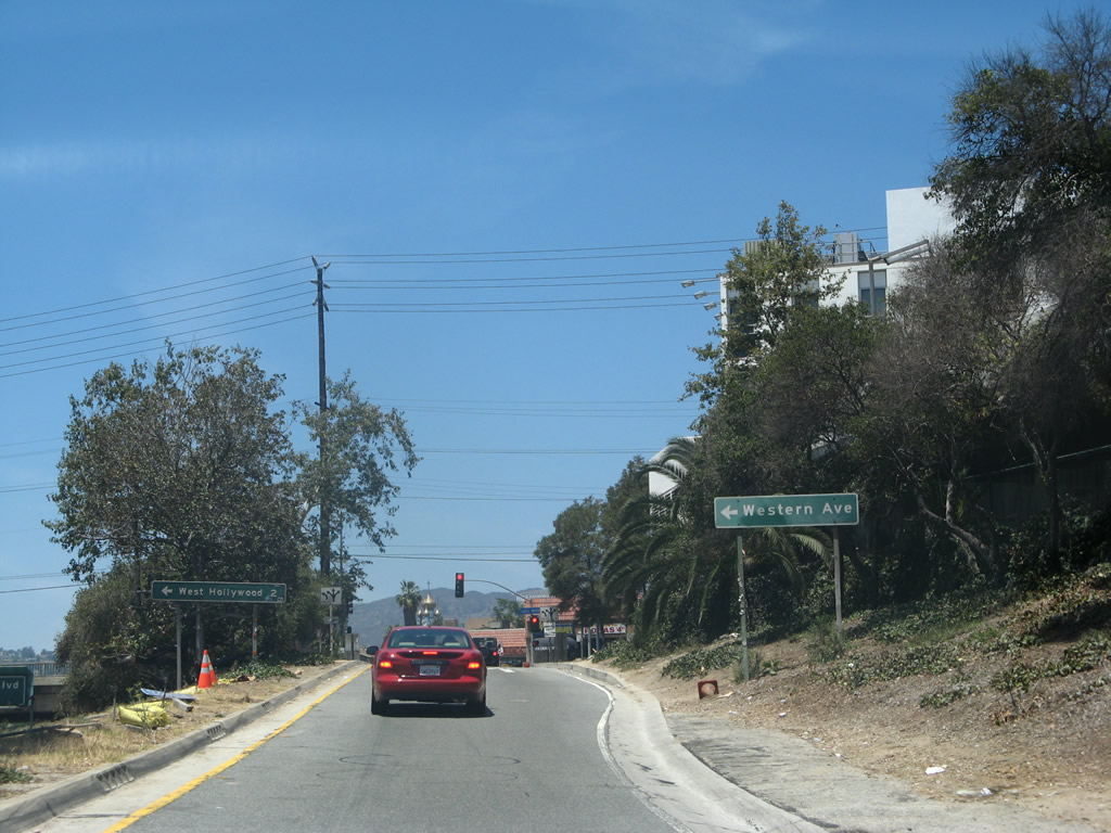
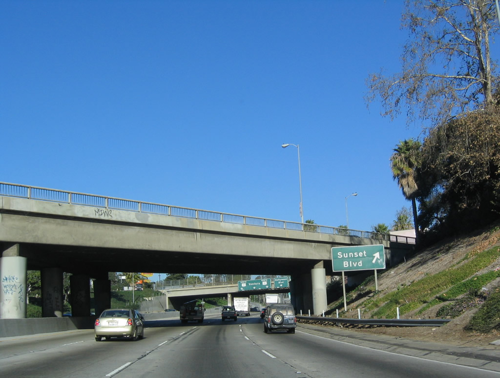
Northbound U.S. 101 splits from westbound California 2 here at Exit 7; California 2 meanders west toward the coast, following old U.S. 66/Santa Monica Boulevard. In addition, Santa Monica Boulevard west leads to Western Avenue, which heads north to Los Feliz Boulevard and south along the western edges of Wilshire Center and Koreatown. Prior to the construction of freeways in Los Angeles, U.S. 66 followed Figueroa Street south into downtown (along with then-California 11), turned northwest on Sunset Boulevard along with U.S. 101, then turned west along Santa Monica Boulevard toward West Hollywood, Beverly Hills, West Los Angeles, and Santa Monica. Photo taken 06/28/06. |
|
Now on the off-ramp to Exit 7, a California 2 trailblazer is posted prior to the intersection with Santa Monica Boulevard. Photo taken 07/01/07. |
|
Turn left (west) on California 2 (Santa Monica Boulevard) to Western Avenue and the city of West Hollywood. Photo taken 07/01/07. |
| U.S. 101 (Hollywood Freeway) north |
|
Back on the mainline, the next exit along northbound is Exit 8A, Sunset Boulevard, 0.75 mile. A mileage sign provides the distance to the next three exits. Photo taken 06/28/06. |
|
U.S. 101 passes under Western Avenue, and La Mirada Avenue intersects Western Avenue at this point, thus forming an intersection above the freeway. Photo taken 06/28/06. |
|
The next overpass carries Fountain Avenue across the U.S. 101 freeway. Photo taken 06/28/06. |
|
The off-ramp to Exit 8A (Sunset Boulevard) is located after the Wilton Place overpass. Photo taken 06/28/06. |
|
Northbound U.S. 101 (Hollywood Freeway) reaches Exit 8A, Sunset Boulevard; after passing under Sunset Boulevard (bridge in background), the off-ramp loops back to Sunset Boulevard. The next exit is Exit 8B, Hollywood Boulevard. Photo taken 06/28/06. |
|
Immediately thereafter, northbound U.S. 101 reaches Exit 8B, Hollywood Boulevard. Prior to the construction of the U.S. 101 freeway, U.S. 101 used to follow east-west Hollywood Boulevard. Between downtown Los Angeles and Cahuenga Pass, U.S. 101 used to follow Cesar Chavez Street (former Macy Street) northwest, Sunset Boulevard northwest, Hollywood Boulevard west, and Highland Avenue north. Photo taken 06/28/06. |
|
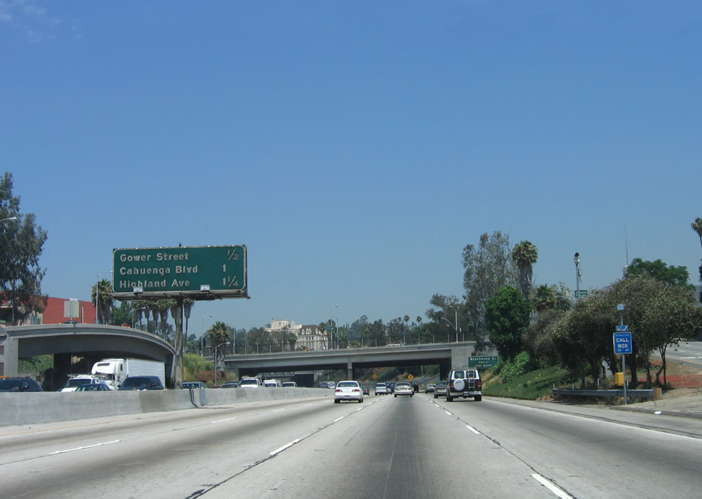
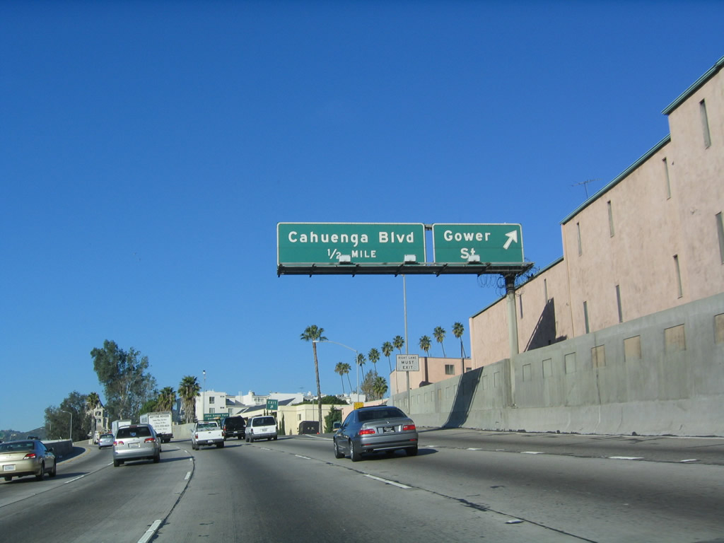
This mileage sign along northbound U.S. 101 provides the distance to the next three exits: Exit 8C, Gower Street; Exit 9A, Cahuenga Boulevard; and Exit 9B, Highland Avenue/Hollywood Bowl. Welcome to Hollywood, a community of the city of Los Angeles. With a population of 167,664 as of the 2000 Census, Hollywood is defined as the section of Los Angeles east of the cities of Beverly Hills and West Hollywood; south of Mulholland Drive, Laurel Canyon, Cahuenga Boulevard, and Barham Boulevard, and the cities of Burbank and Glendale; north of Melrose Avenue; and west of Interstate 5 (Golden State Freeway) and Hyperion Avenue (which includes Griffith Park). Photo taken 06/28/06. |
|
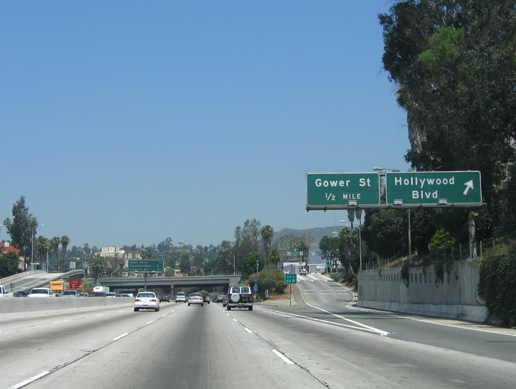
Use Exit 8C to Gower Street and Beechwood Drive. Photo taken 06/28/06. |
|
Four lanes of U.S. 101 continue northwest through Hollywood and passes under Bronson Avenue. The southbound lanes on this day were backed up with traffic. Photo taken 06/28/06. |
|
Northbound U.S. 101 (Hollywood Freeway) reaches Exit 8C to Gower Street and Beechwood Drive. The next exit along northbound is Exit 9A, Cahuenga Boulevard. Photo taken 12/23/04. |
|
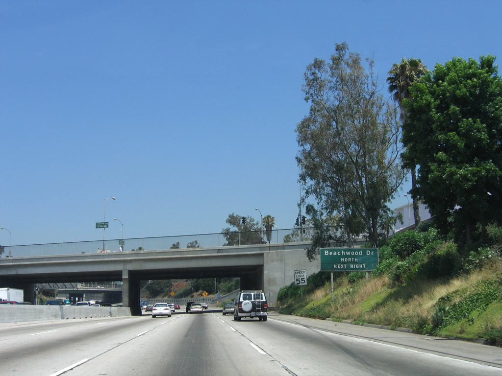
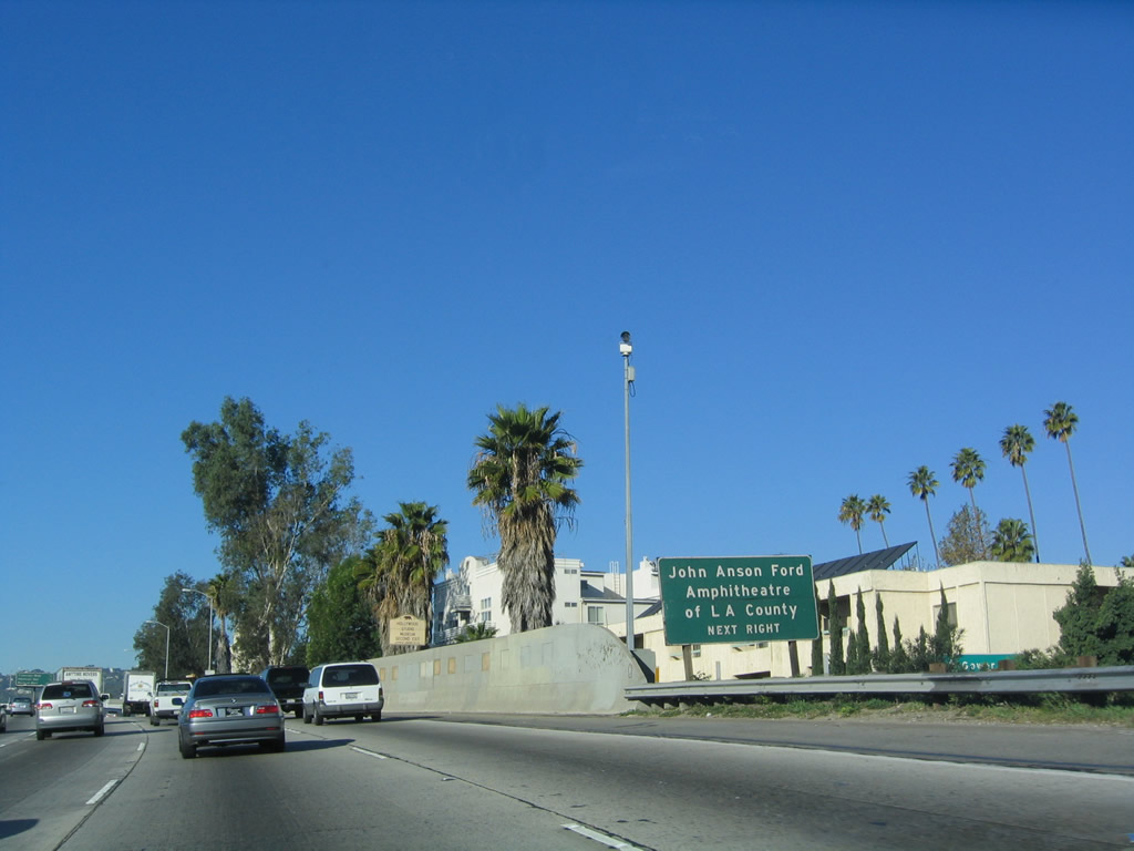
Use Exit 9A to the John Anson Ford Amphitheatre of Los Angeles County. Photo taken 12/23/04. |
|
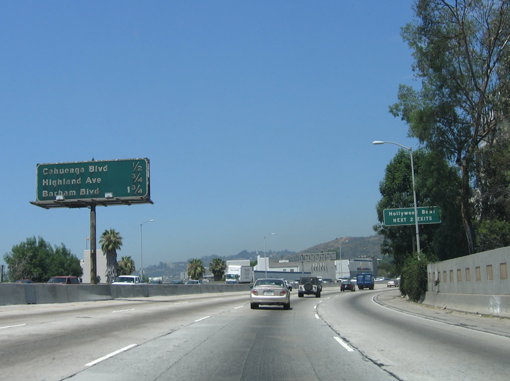
The next three exits along U.S. 101 north are Exit 9A, Cahuenga Boulevard; Exit 9B, Highland Avenue; and Exit 11A, Barham Boulevard. The next two exits serve Hollywood Bowl, home of the Los Angeles Philharmonic since its opening on July 11, 1922. Photo taken 12/23/04. |
|
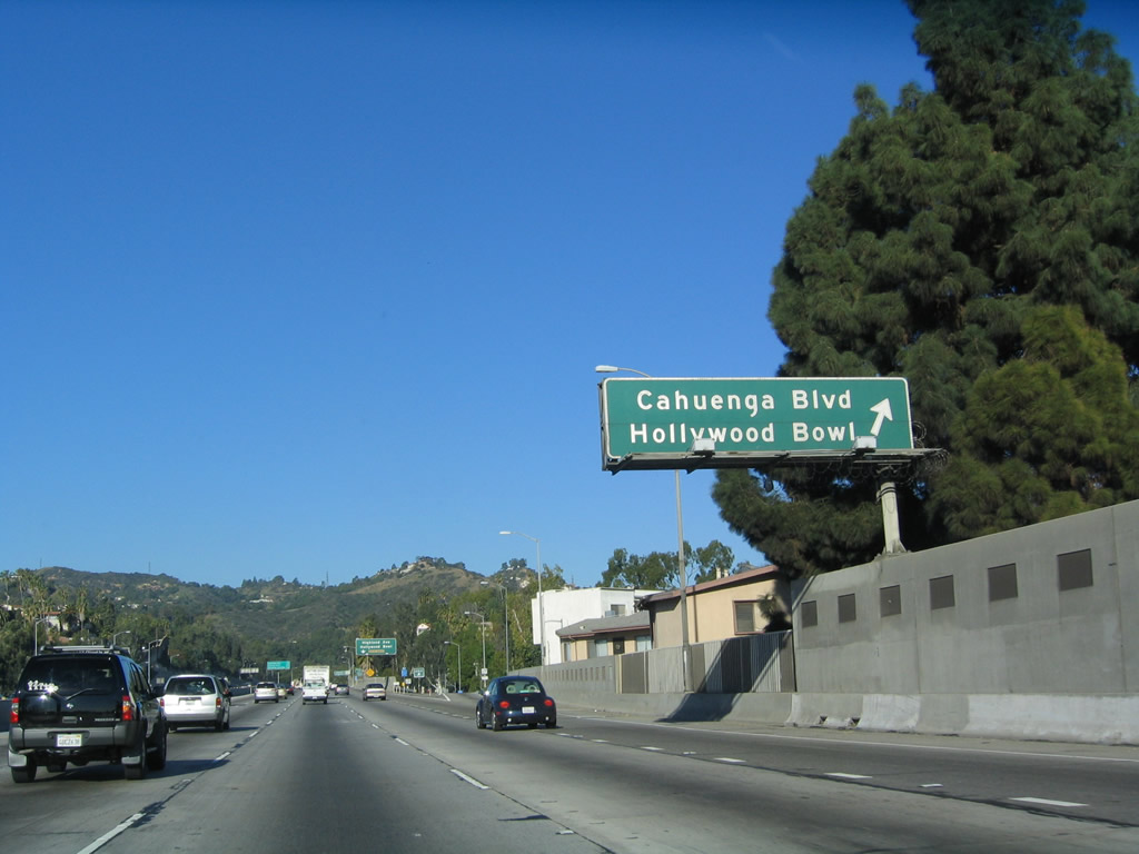
Northbound U.S. 101 (Hollywood Freeway) reaches Exit 9A, Cahuenga Boulevard. Look northeast from here to see the famous Hollywood Sign, which is located within the western edge of Griffith Park in Hollywood Hills (not visible in this picture). The best place to see the Hollywood sign is in Lake Hollywood Park (exit at Barham Boulevard east, then turn right on Lake Hollywood Drive). Photo taken 12/23/04. |
|
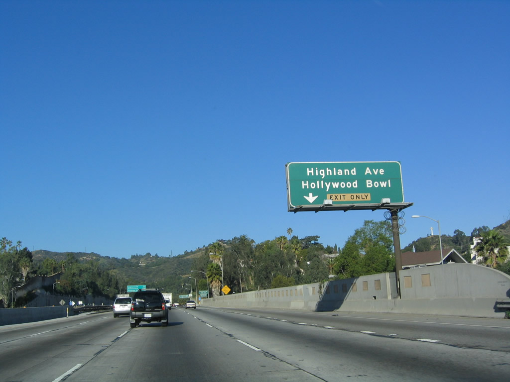
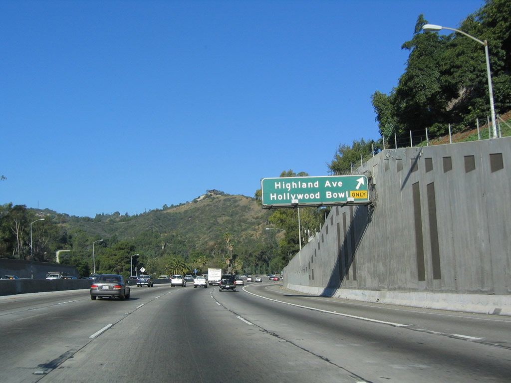
The next exit along northbound U.S. 101 is Exit 9B, Highland Avenue, which also leads to Hollywood Bowl. The bowl is situated just west of the freeway off Highland Avenue (which is unsigned California 170). This exit actually connects to Cahuenga Boulevard, which in turn links to Highland Avenue. Photo taken 12/23/04. |
|
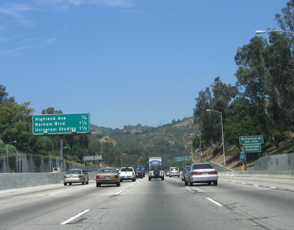
This mileage sign along U.S. 101 (Hollywood Freeway) north provides the distance to the next three exits: Exit 9B, Highland Avenue/Hollywood Bowl; Exit 11A, Barham Boulevard; and Exit 11B, Universal Studios. Photo taken 12/23/04. |
|
Northbound U.S. 101 (Hollywood Freeway) reaches Exit 9B, California 170 (Highland Avenue) south to Hollywood Bowl. U.S. 101 will now enter Cahuenga Pass; this area of open space is the far eastern tip of the Santa Monica Mountains National Recreation Area. Photo taken 12/23/04. |
|
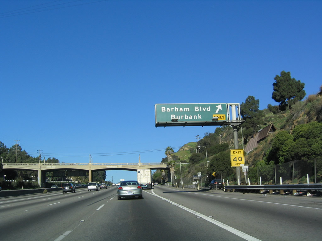
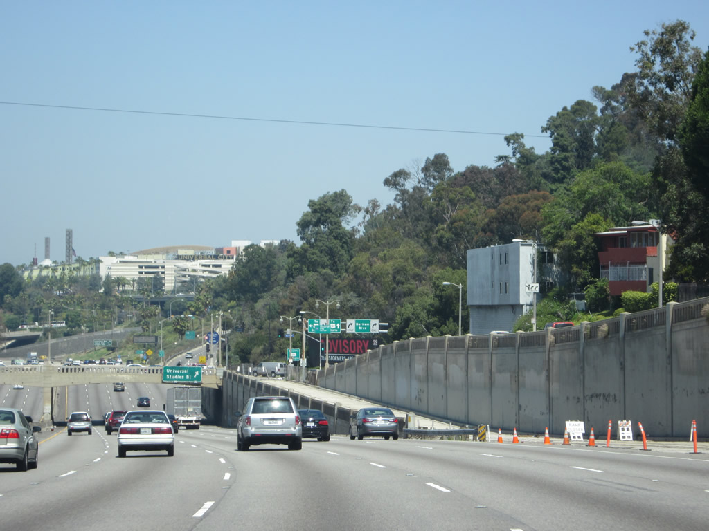
With its old bridges and unique design, U.S. 101 plies through Cahuenga Pass between Hollywood Hills and Mount Olympus. The freeway is en route to Universal City, home to Universal Studios (via Exit 11B or Exit 12A). The next exit is Exit 11A, Barham Boulevard (which travels northeast toward the city of Burbank). Photo taken 12/23/04. |
|
This mileage sign along northbound U.S. 101 provides the distance to the next three exits: Exit 11A, Barham Boulevard; Exit 11B, Universal Studios Boulevard; and Exit 12A, Lankershim Boulevard. Photo taken 12/23/04. |
|
The right lane of northbound U.S. 101 (Hollywood Freeway) becomes exit only for Exit 11A, Barham Boulevard northeast to Burbank; the left five lanes continue north on U.S. 101. Photo taken 12/23/04. |
|
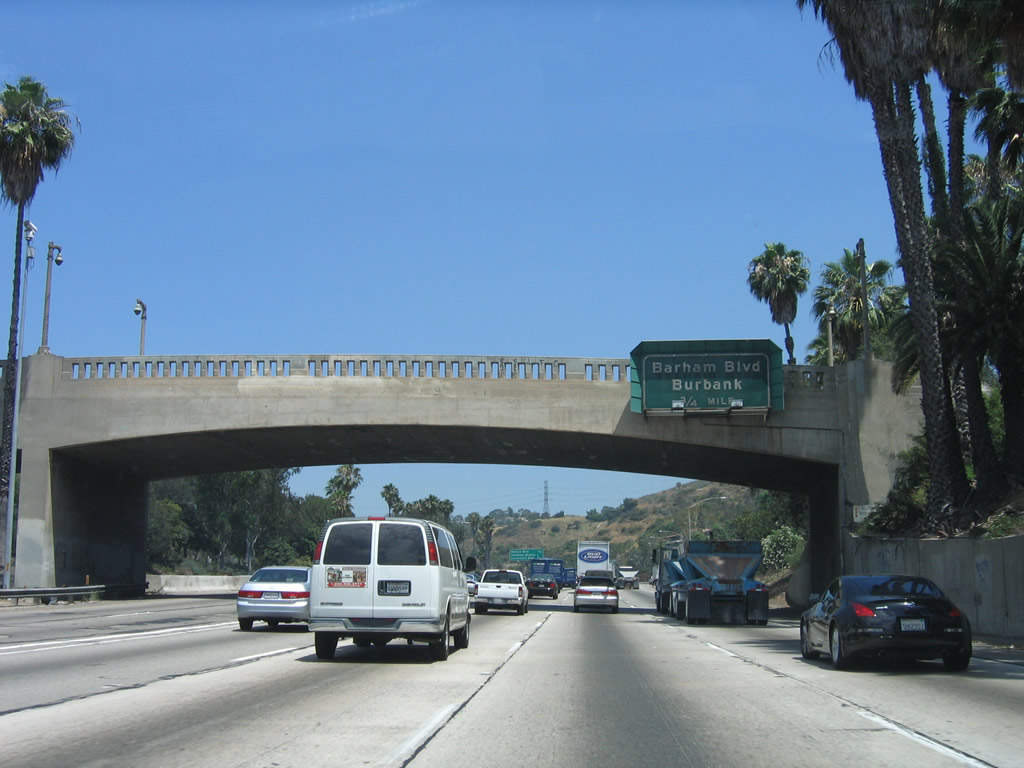
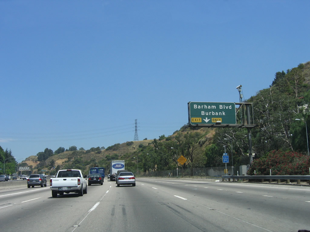
Northbound U.S. 101 (Hollywood Freeway) reaches Exit 11A, Barham Boulevard northeast to Lake Hollywood Park and the city of Burbank. Upon exiting, traffic merges onto the Cahuenga Bouelvard East frontage road and then parallels the freeway. Turn right at the intersection with Barham Boulevard (ahead) to travel northeast toward Burbank. Photo taken 12/23/04. |
|
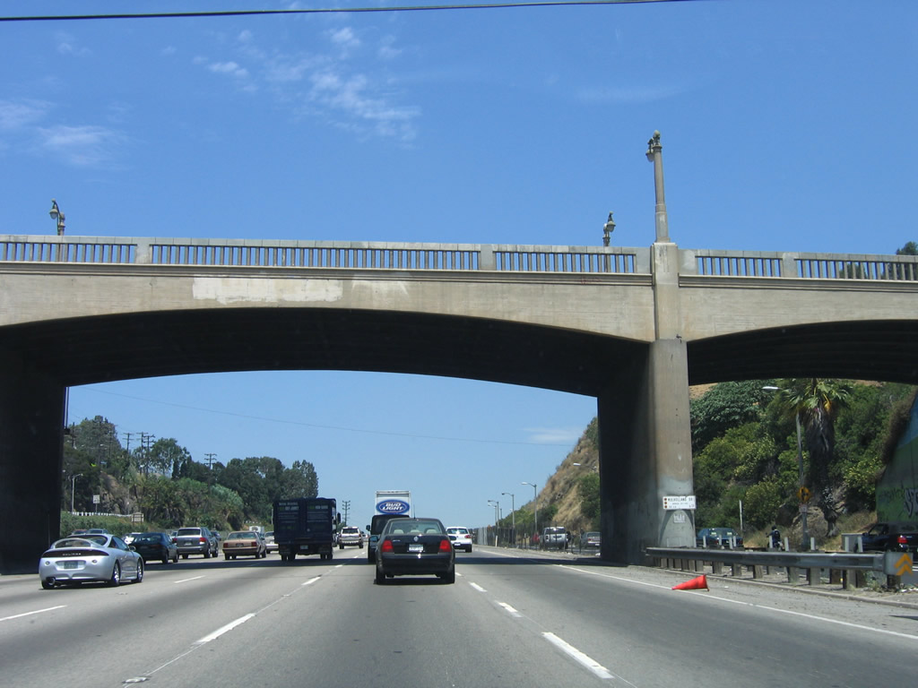
U.S. 101 (Hollywood Freeway), which was originally constructed as Cahuenga Parkway, used to have a Pacific Electric passenger rail accompany the highway through Cahuenga Pass. The older bridges, such as the one that carries Barham Boulevard (see below) over the Hollywood Freeway, were originally designed to cross both the parkway and railway. Now the entire right of way is dedicated to the freeway, with no allocation for rail. Instead, the Metro Red Line subway carries passengers between North Hollywood, Hollywood, and downtown Los Angeles at Union Station. Photo taken 06/28/06. |
|
After the Barham Boulevard off-ramp (Exit 11A), U.S. 101 begins to descend from Cahuenga Pass toward the Los Angeles River and the sprawling San Fernando Valley. Photo taken 06/28/06. |
|
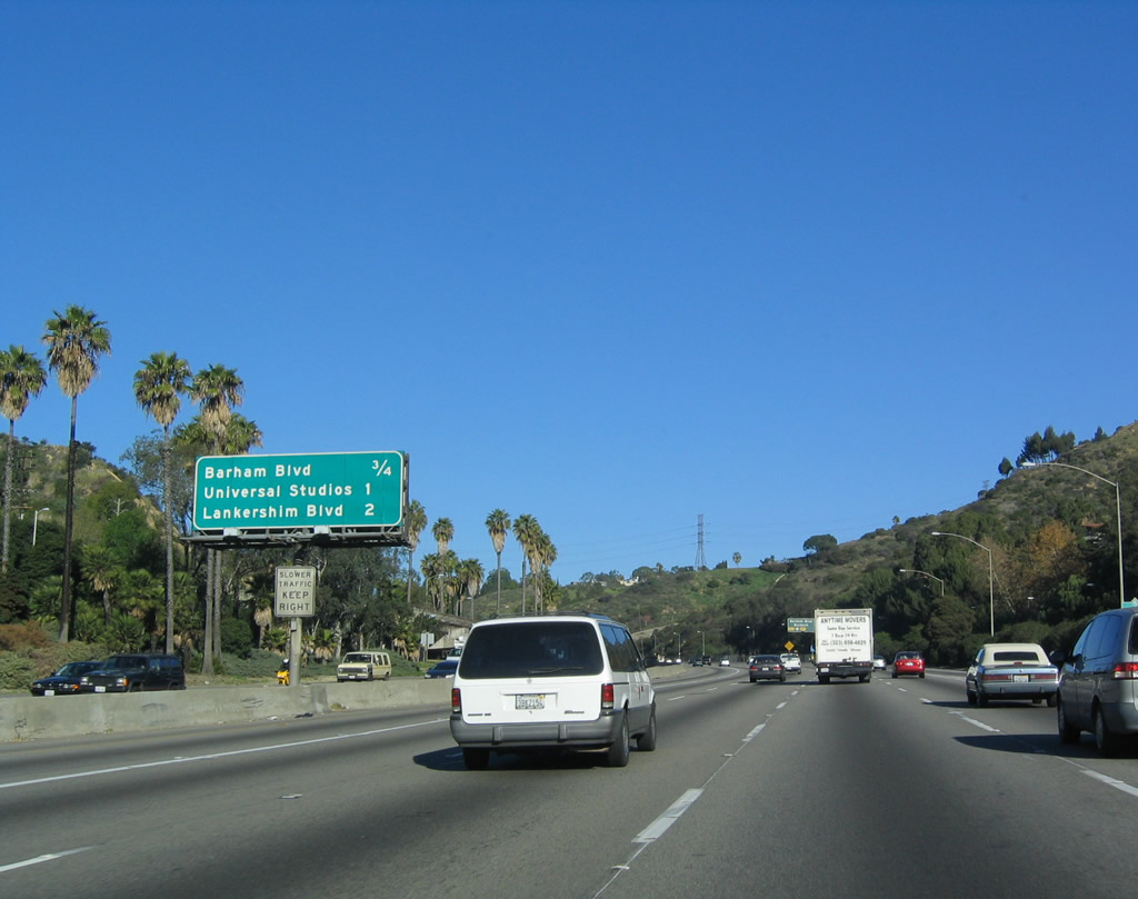
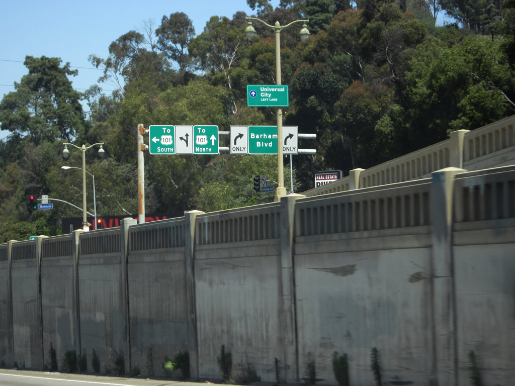
This mileage sign along northbound U.S. 101 (Hollywood Freeway) provides the distance to the next three exits: Exit 11B, Universal Studios Boulevard; Exit 12A, Lankershim Boulevard; and Exit 12B, Ventura Boulevard/former U.S. 101 Business. Photo taken 05/05/12. |
|
Northbound U.S. 101 (Hollywood Freeway) meets Exit 11B, Universal Center Boulevard. This sign is posted on the Barham Boulevard overpass. Its unique design, which dates back to the original parkway construction, is part of what makes the Hollywood Freeway through Cahuenga Pass unique. Photo taken 12/23/04. |
|
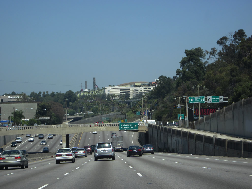
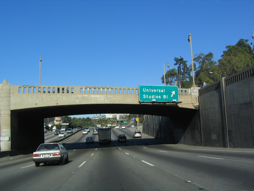
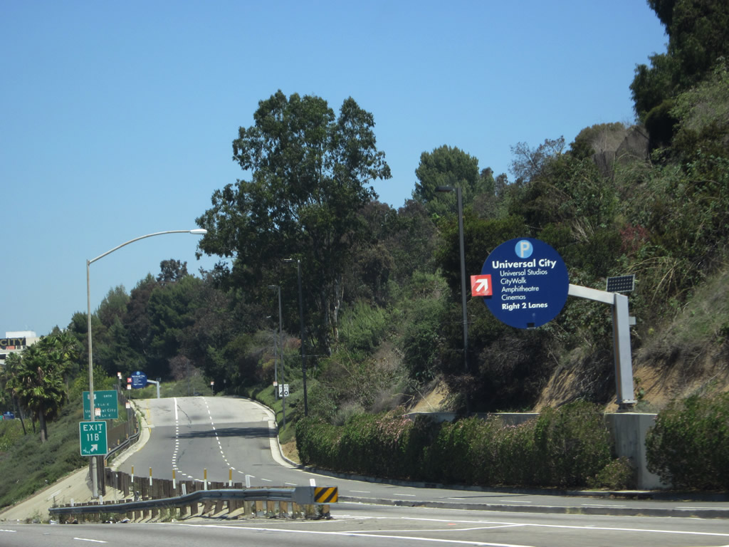
A sign pointing motorists toward Universal City is posted just after the gore point for the off-ramp to Exit 11B, Universal Studios Boulevard. More Information on attractions can be found on the Universal Studios-Hollywood official webpage. Photo taken 05/05/12. |
|
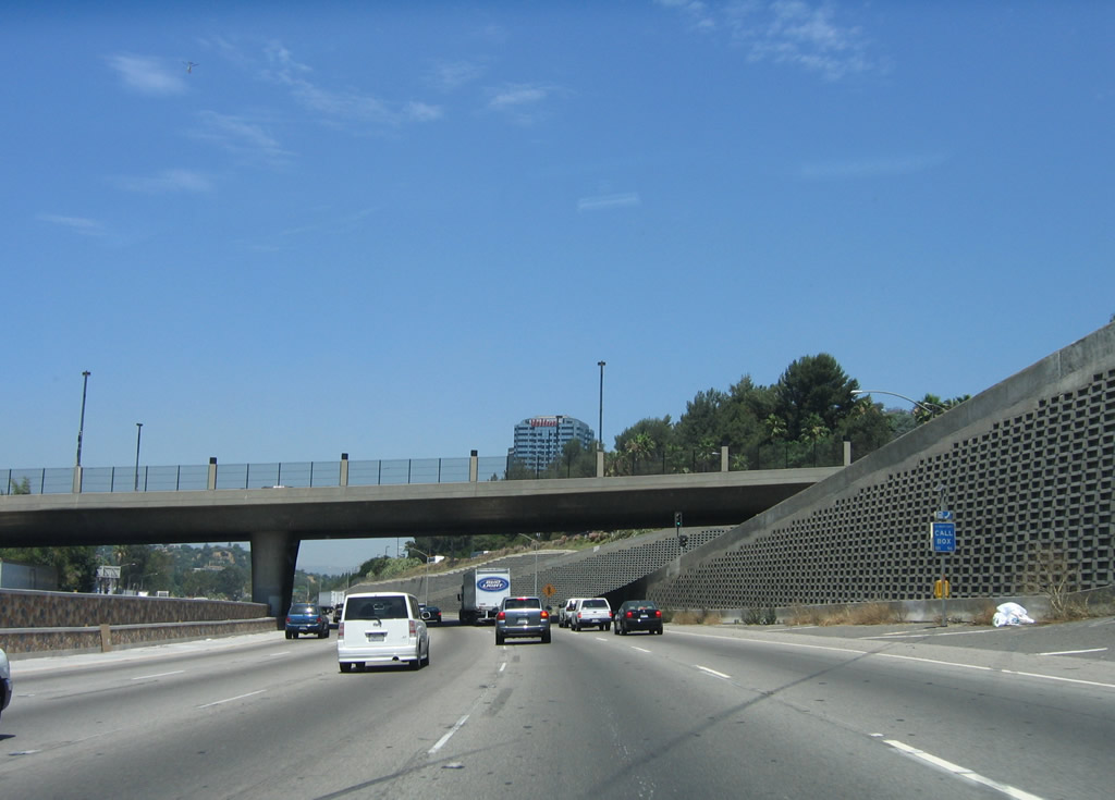
U.S. 101 carries a great deal of traffic through Cahuenga Pass between Hollywood and North Hollywood. This view is taken from the west side of the freeway near Barham Boulevard looking northeast toward the off-ramp to Universal Center Boulevard. Photo taken 02/26/11. |
|
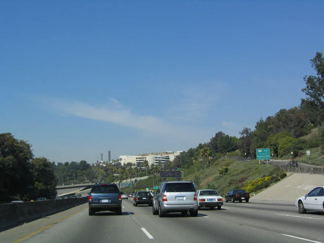
This view shows northbound U.S. 101 (Hollywood Freeway) after Exit 11B in Los Angeles. Universal City is visible on the bluff to the right and behind the freeway. Photo taken 02/15/04. |
|
After the Universal Center interchange, U.S. 101 retains five northbound lanes. Photo taken 06/28/06. |
|
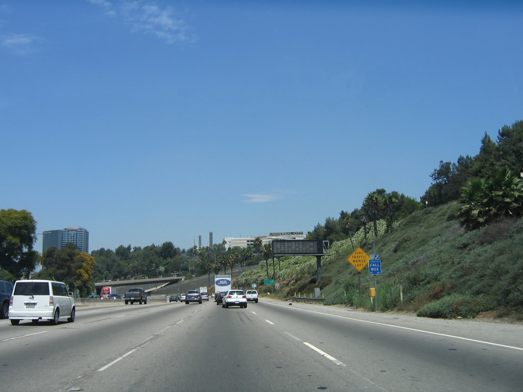
This mileage sign provides the distance to the next three exits along northbound U.S. 101 (Hollywood Freeway): Exit 12A, Lankershim Boulevard; Exit 12B, Ventura Boulevard (former U.S. 101 Business); and Exit 12C, Vineland Avenue. Photo taken 06/28/06. |
|
U.S. 101 (Hollywood Freeway) passes under Universal Studios Boulevard. Photo taken 06/28/06. |
|
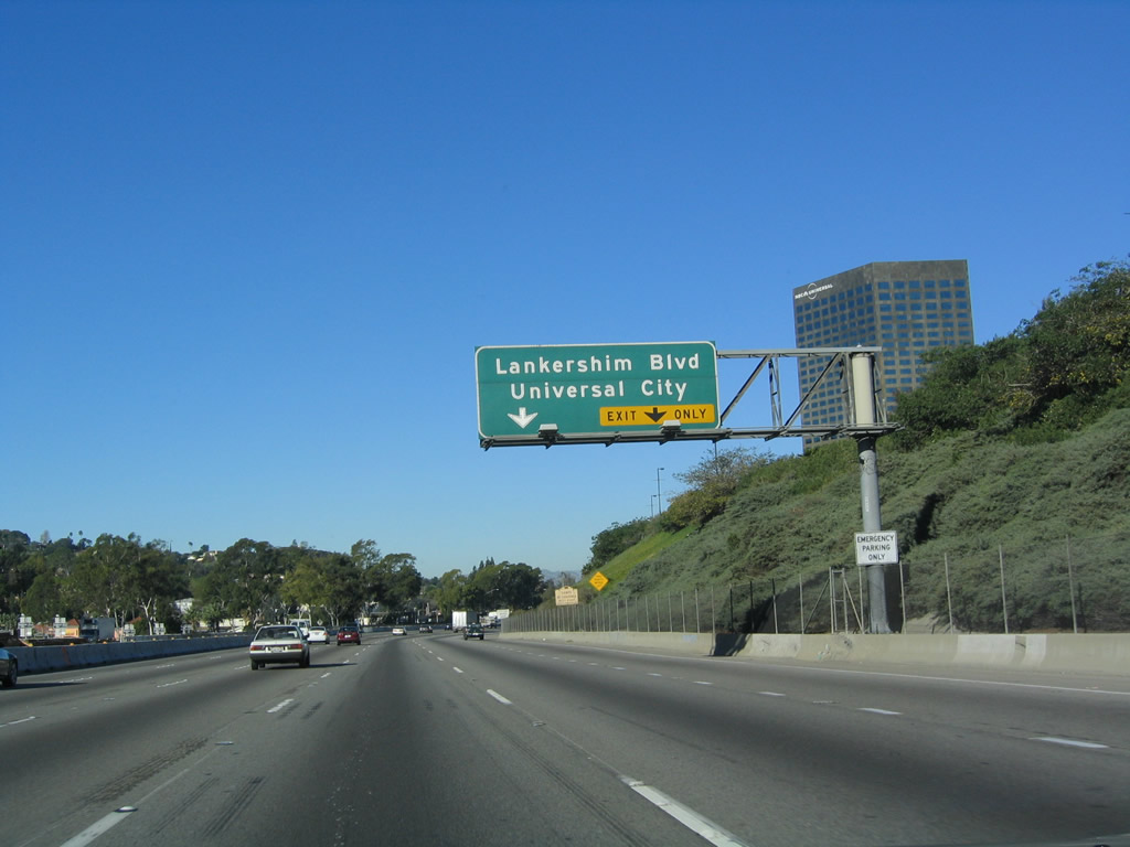
The next exit along northbound U.S. 101 (Hollywood Freeway) is Exit 12A, Lankershim Boulevard. The right lane becomes exit only for Exit 12A. Photo taken 12/23/04. |
|
Northbound U.S. 101 (Hollywood Freeway) reaches Exit 12A, Lankershim Boulevard to the Universal City, West Toluca Lake, and North Hollywood communities of the city of Los Angeles. Photo taken 12/23/04. |
|
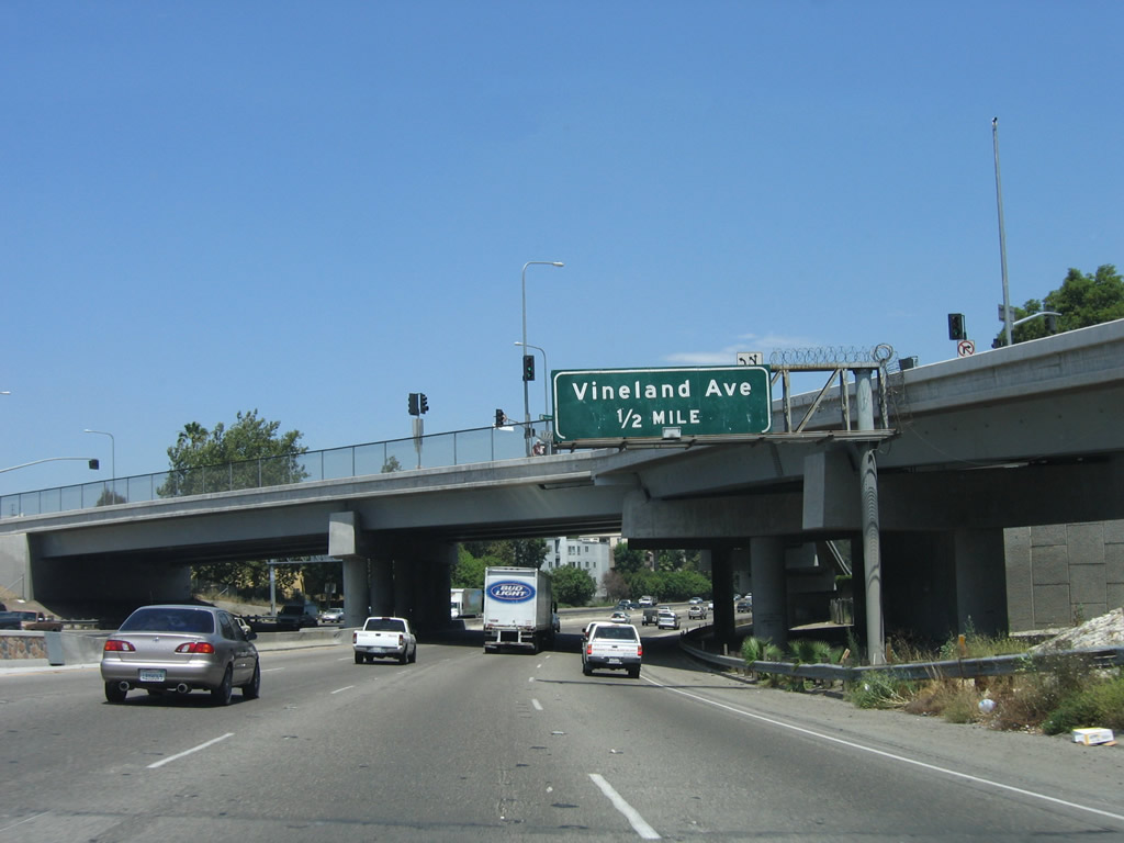
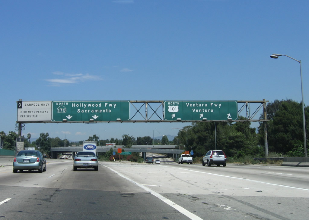
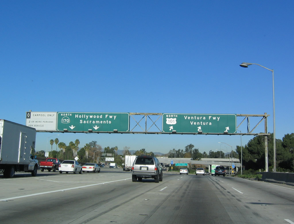
Immediately thereafter, northbound U.S. 101 (Hollywood Freeway) reaches Exit 12B, Ventura Boulevard. At one time, Ventura Boulevard was U.S. 101 Business, but no signage remains on the freeway for this designation. The business route is not signed along Ventura Boulevard either (maps showed the business route as active until the mid-1990s). The next exit is for Vineland Avenue (Exit 12C) and for U.S. 101 to split from the Hollywood Freeway and to turn due west along the Ventura Freeway (Exit 13). Northbound California 170 continues as the Hollywood Freeway. There is no direct access to eastbound California 134 (Ventura Freeway) - one must use Vineland Avenue. Photo taken 12/23/04. |
|
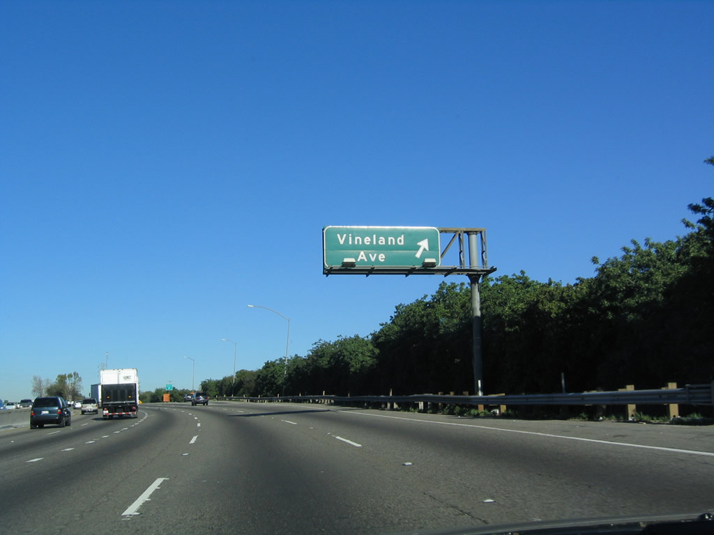
The next exit along U.S. 101 (Hollywood Freeway) north is Exit 12C, Vineland Avenue to California 134 east (one-half mile). Photo taken 12/23/04. |
|
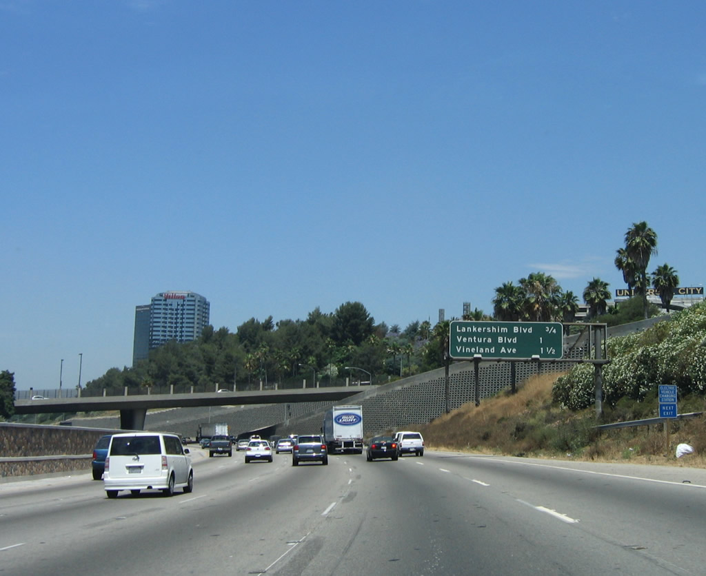
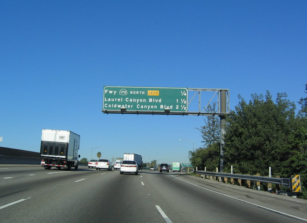
This mileage sign provides the distance to the next three exits along U.S. 101 (Hollywood Freeway) north: Exit 12C, Vineland Avenue to California 134 east; Exit 13, California 170 (Hollywood Freeway) north to Interstate 5 (Golden State Freeway); and Exit 14, Laurel Canyon Road. Photo taken 12/23/04. |
|
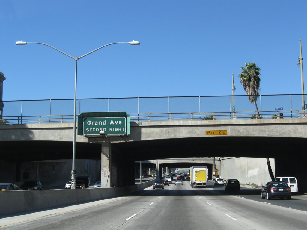
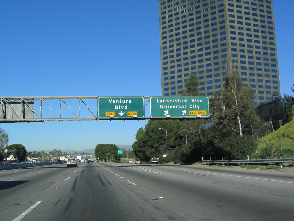
After Vineland Avenue, the second exit along northbound U.S. 101 (Hollywood Freeway) will be Exit 13, California 170 (Hollywood Freeway) north to Interstate 5 (Golden State Freeway). The next exit is Exit 12C, Vineland Avenue/To California 134 (Ventura Freeway) east. The right three lanes are for through traffic along northbound U.S. 101 (Ventura Freeway); watch for congestion and slowed traffic through this interchange. Photo taken 12/23/04. |
|
Northbound U.S. 101 (Hollywood Freeway) reaches Exit 12C, Vineland Avenue to California 134 east. Photo taken 12/23/04. |
|
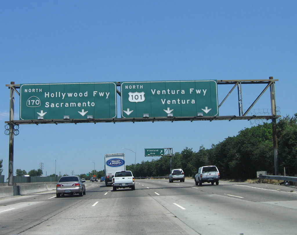
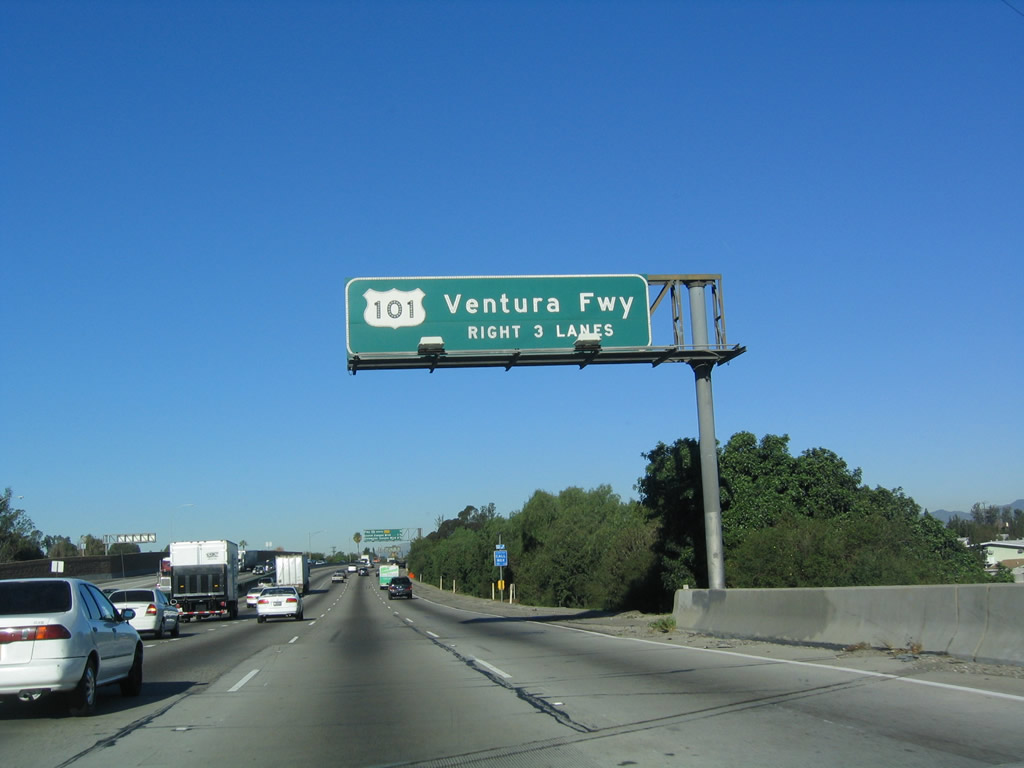
Use the right three lanes to follow northbound U.S. 101 (Ventura Freeway) west to Ventura. California 170 (Hollywood Freeway) continues north from this point. Photo taken 12/23/04. |
|
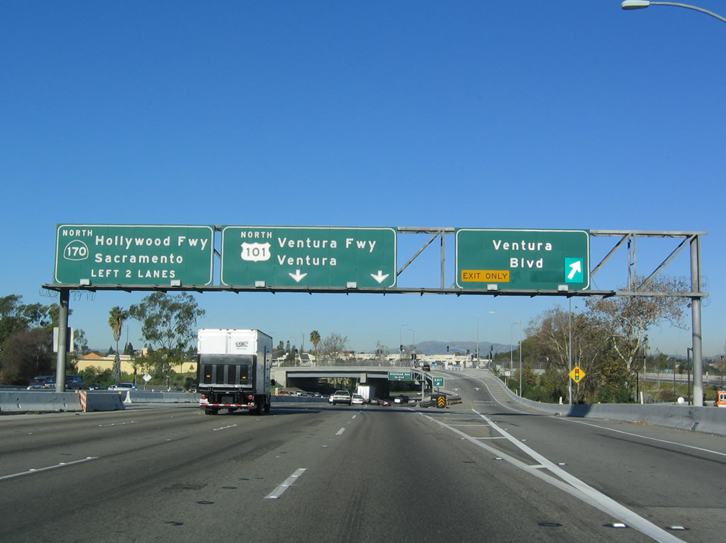
This mileage sign provides the distance to the next three exits along U.S. 101 (Hollywood Freeway) north: Exit 13, California 170 (Hollywood Freeway) north to Interstate 5 (Golden State Freeway); Exit 14, Laurel Canyon Road; and Exit 15, Coldwater Canyon Road. Photo taken 12/23/04. |
Page Updated October 6, 2012.