| U.S. 101 (Ventura Freeway) and California 1 north |
|
The next exit along U.S. 101 (Ventura Freeway) and California 1 north is Exit 63, Johnson Drive to Montalvo. This is the first exit along northbound for the city of Ventura. At this point, U.S. 101 and California 1 cross the Santa Clara River via a recently widened bridge. Construction was still underway in 2004 and 2006 but done by 2007. Photo taken 09/29/07. |
|
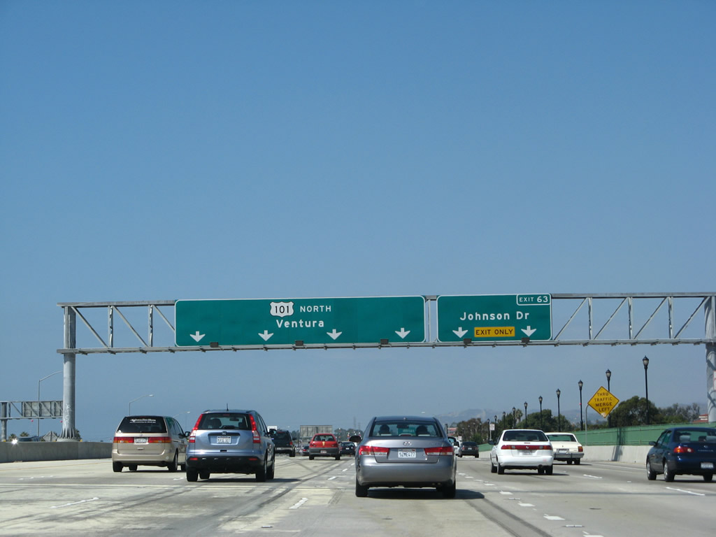
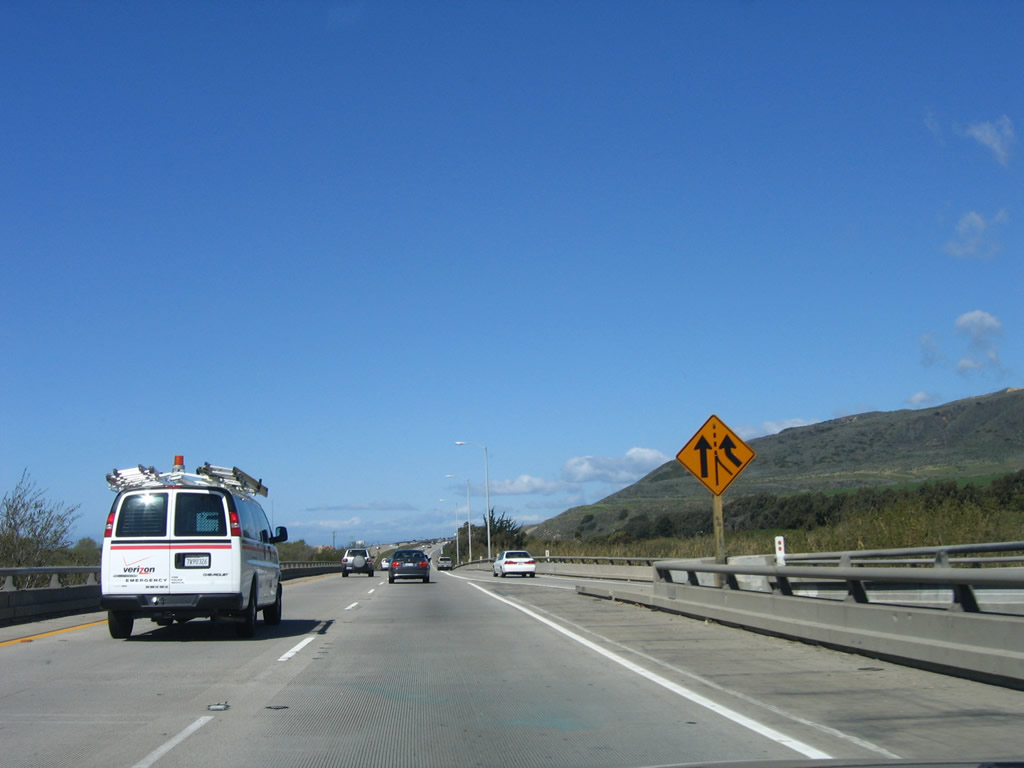
The right two lanes of U.S. 101 (Ventura Freeway) and California 1 (Pacific Coast Highway) north become exit only for Exit 63, Johnson Drive. Stay in the left four lanes to continue north (west) on U.S. 101 and California 1. Photo taken 09/29/07. |
|
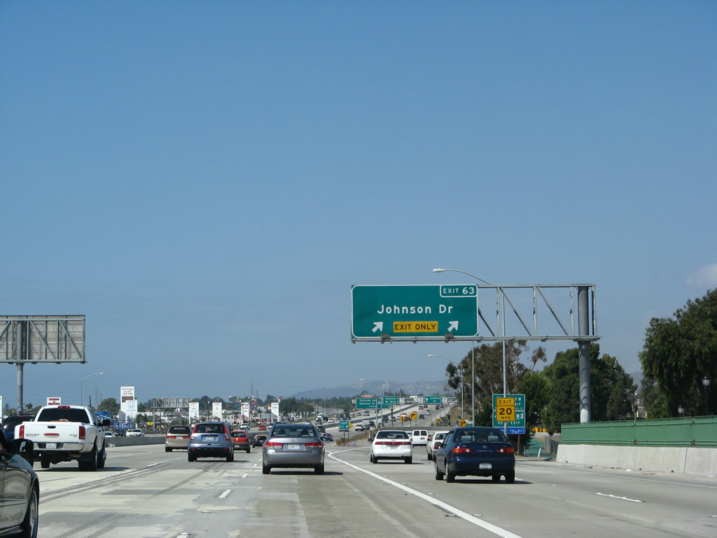
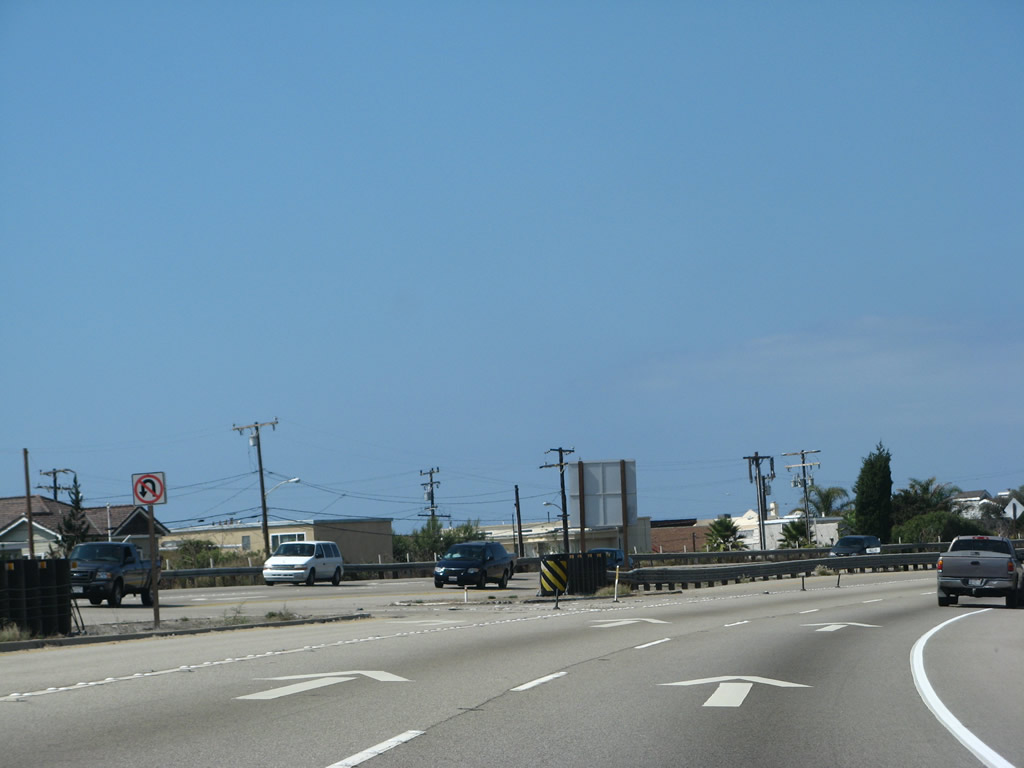
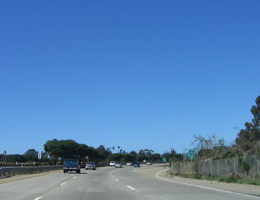
Northbound U.S. 101 (Ventura Freeway) and California 1 (Pacific Coast Highway) reach Exit 63, Johnson Drive. Photo taken 09/29/07. |
|
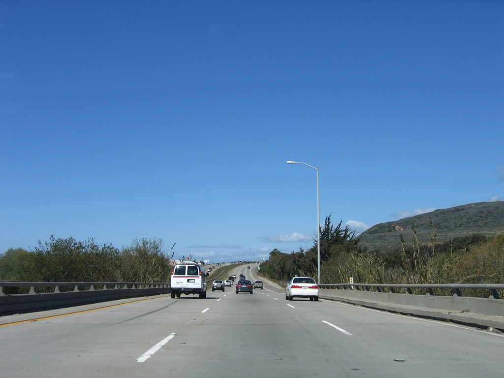
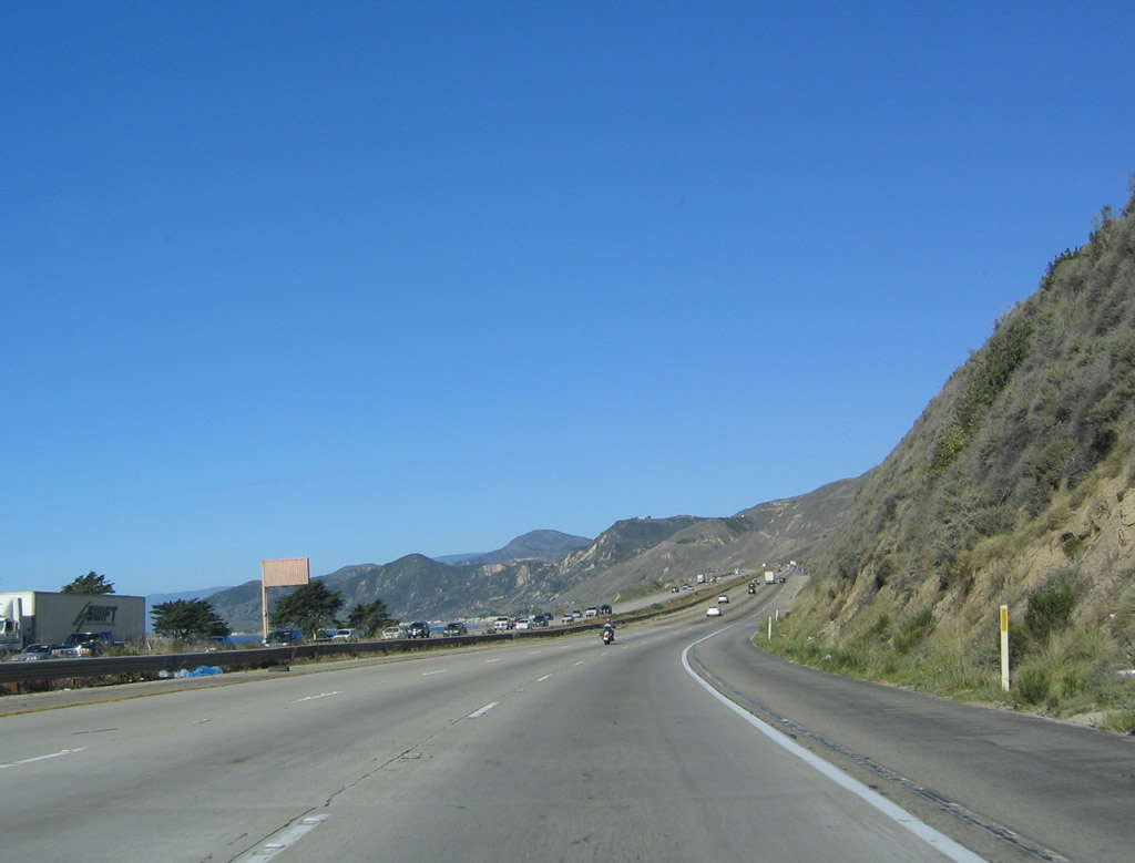
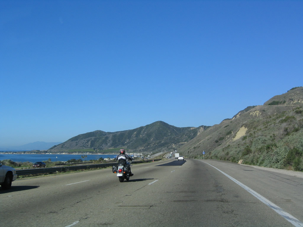
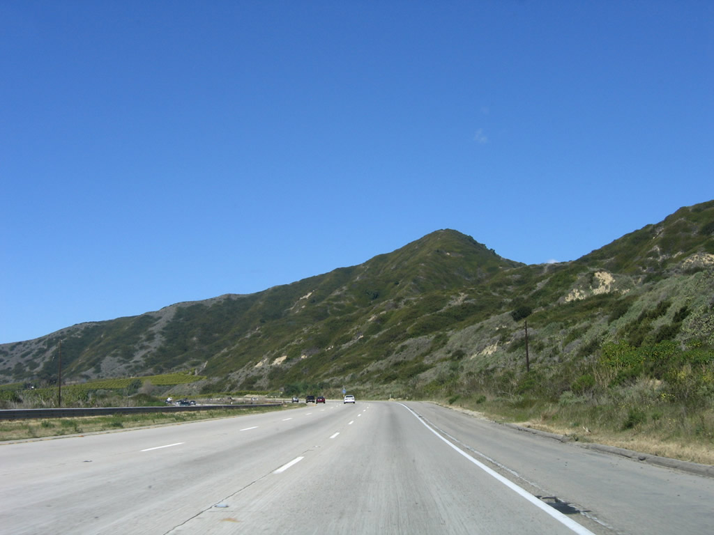
Leaving Oxnard upon crossing the Santa Clara River, U.S. 101 and California 1 enter the city of San Buenaventura (commonly abbreviated as the city of Ventura) prior to the off-ramp for Exit 63. The city of San Buenaventura (Ventura) is the seat of Ventura County and home to 100,916 as of the 2000 Census. Although the city is officially San Buenaventura, it is commonly known as Ventura. Father Junipero Serra founded Mission San Buenaventura in 1782, and the city was incorporated in 1866. Oil played a major role in the early development of this area, and exploration reached out from Ventura inland and toward the sea. The city has a downtown dominated by the mission and Grant Park, and a harbor accessible at Exit 68. The Ventura Freeway section around the city of Ventura was constructed between 1961 and 1963. Photo taken 09/29/07. |
|
Signage for Ventura Boulevard and Johnson Drive is posted on the off-ramp to Exit 63. Photo taken 09/29/07. |
|
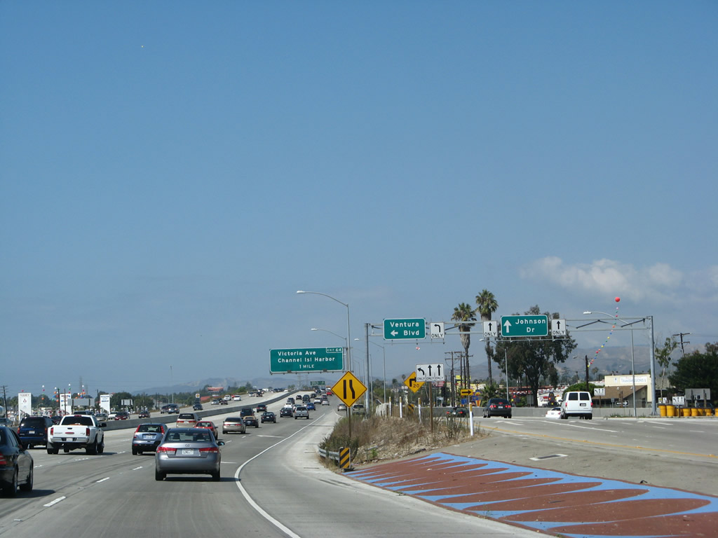
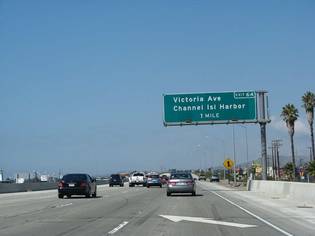
The next exit along U.S. 101 and California 1 north is Exit 64, Victoria Avenue (one mile). Photo taken 09/29/07. |
|
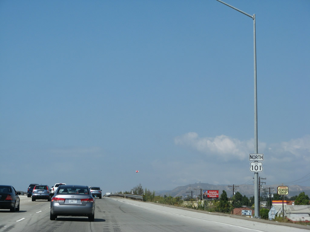
A U.S. 101 north reassurance shield is posted after the off-ramp to Exit 63. This shield assembly features a larger "N" in the word NORTH. While common outside California, this kind of cardinal direction banner with an initial capital letter is still rare in California (for now). Photo taken 09/29/07. |
|
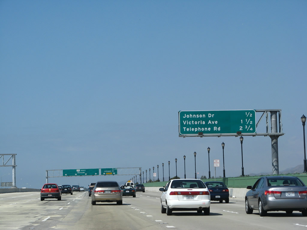
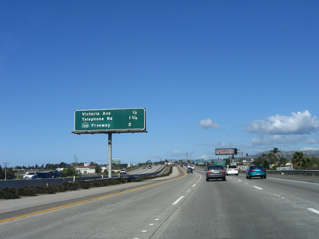
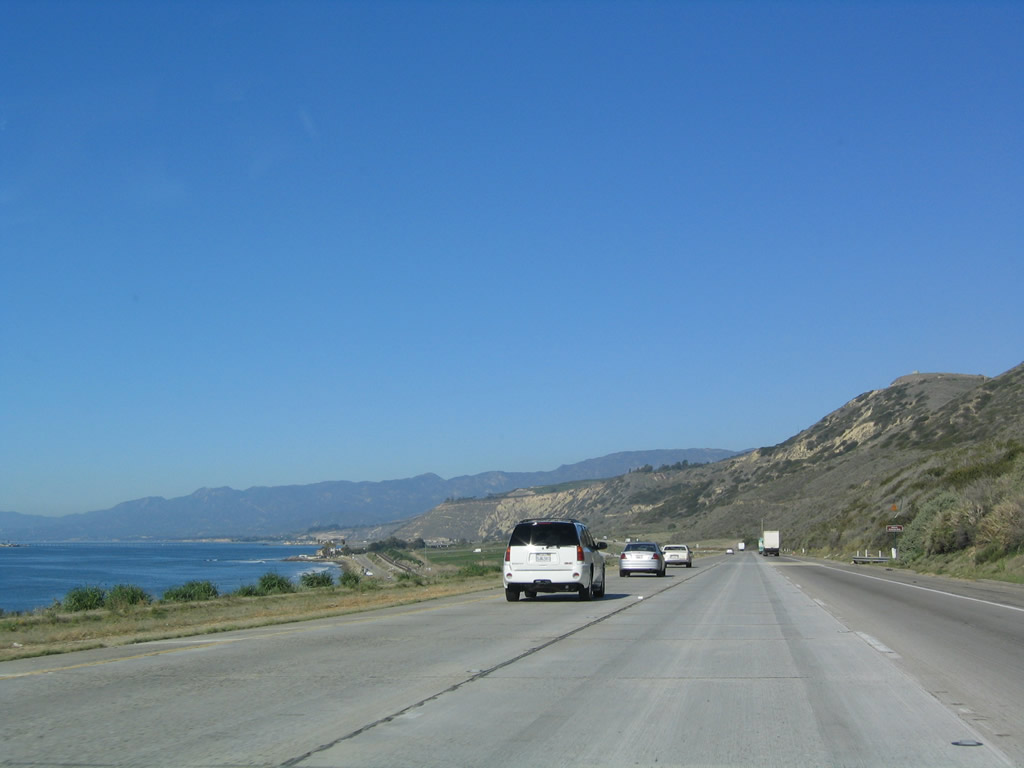
This mileage sign provides the distance to the next three exits along U.S. 101 (Ventura Freeway) and California 1 (Pacific Coast Highway) north: Exit 64, Victoria Avenue; Exit 65, Telephone Road; and Exit 66A, California 126 (Santa Paula Freeway) east to Santa Paula and Santa Clarita. Photo taken 12/23/04. |
|
|
|
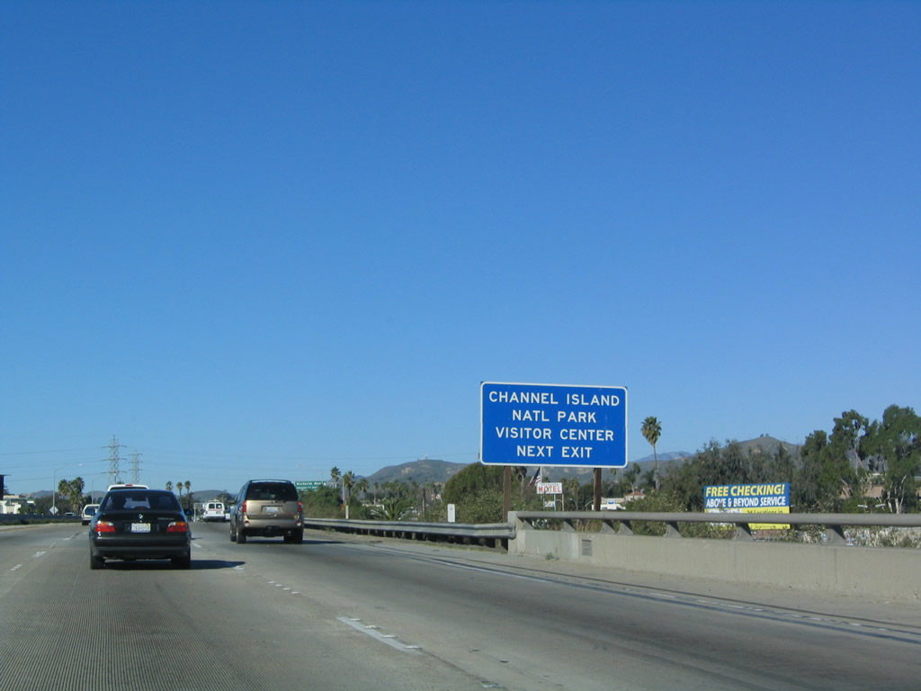
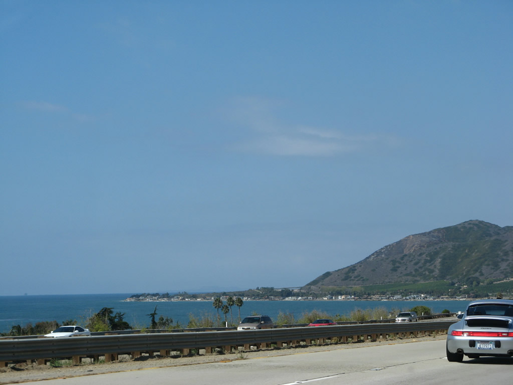
Victoria Avenue travels south to Port Hueneme, which has a ferry terminal that provides ferry access to Channel Islands National Park. The park consists of five largely undeveloped and pristine islands (Anacapa, Santa Cruz, Santa Rosa, San Miguel, and Santa Barbara) located in the Pacific Ocean south of Ventura. Boats leave Ventura Harbor and Channel Islands Harbor on a regular basis to the islands. Photos taken 09/29/07 and 12/23/04. |
|
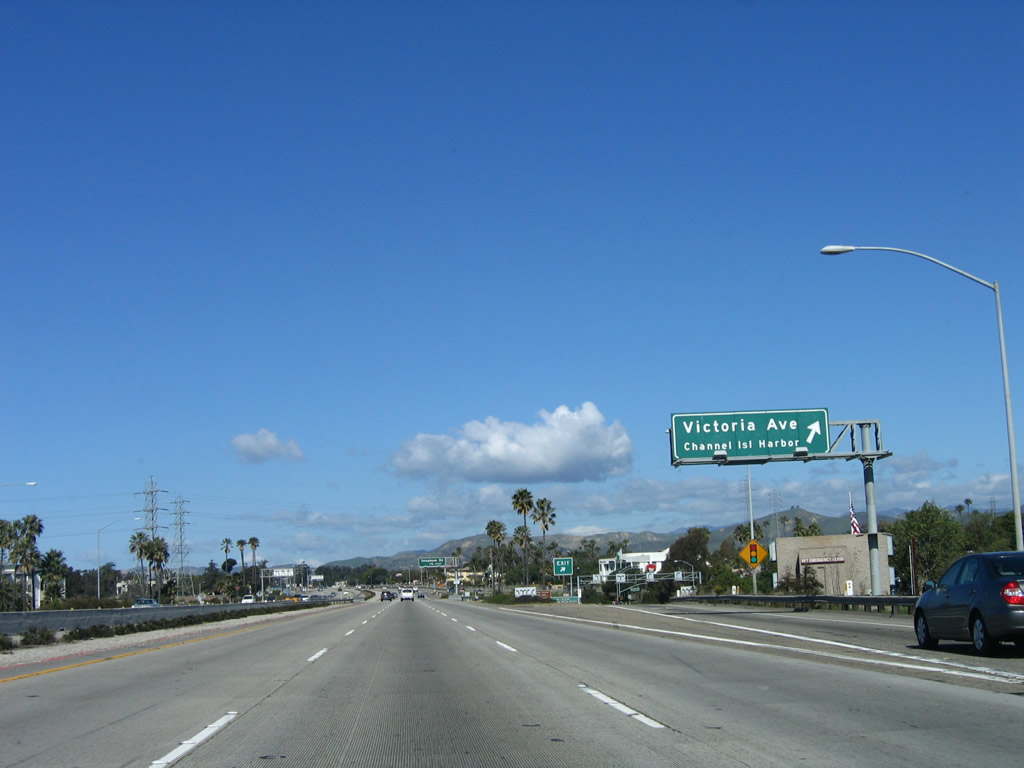
Northbound U.S. 101 and California 1 reach Exit 64, Victoria Avenue. Photo taken 03/18/06. |
|
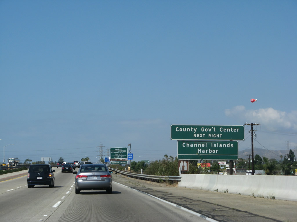
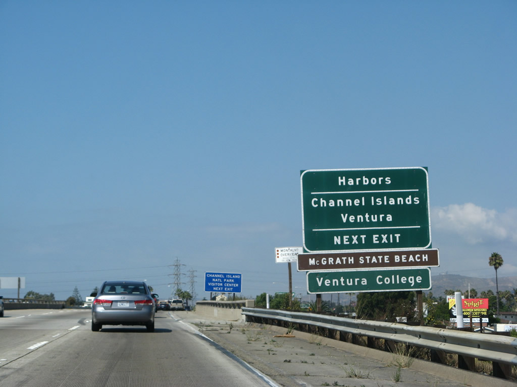
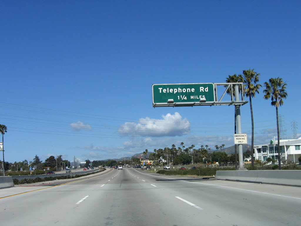
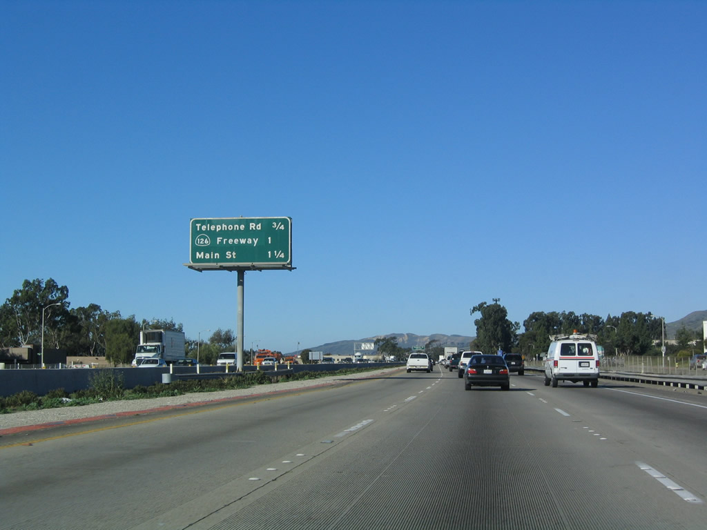
The next exit along U.S. 101 (Ventura Freeway) and California 1 (Pacific Coast Highway) north is Exit 65, Telephone Road. This exit leads to the city of Ventura's harbors and ferry terminals as well as McGrath State Beach. Photo taken 03/18/06. |
|
This mileage sign provides the distance to the next three exits along U.S. 101 (Ventura Freeway) and California 1 (Pacific Coast Highway) north: Exit 65, Telephone Road; Exit 66A, California 126 (Santa Paula Freeway) east to Santa Paula and Santa Clarita; and Exit 66B, U.S. 101 Business (Main Street). Photo taken 12/23/04. |
|
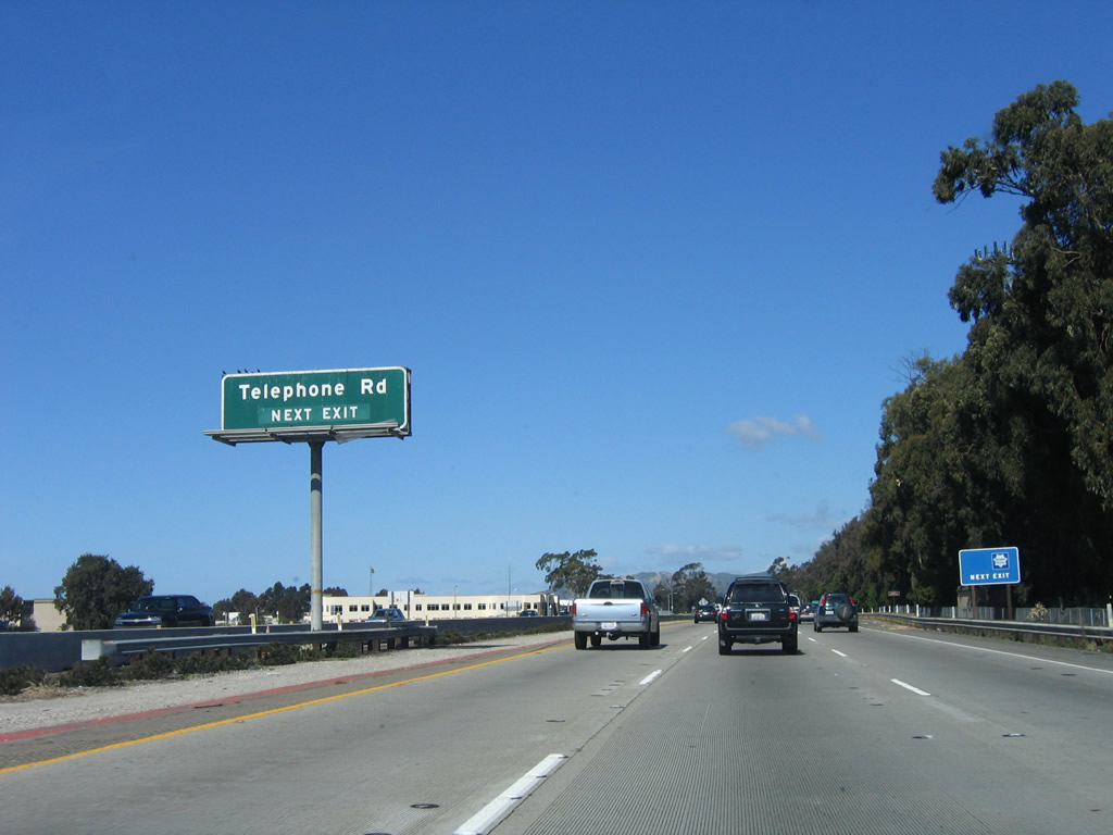
Northbound U.S. 101 (Ventura Freeway) and California 1 (Pacific Coast Highway) approaches Exit 65, Telephone Road in Ventura. Photo taken 03/18/06. |
|
Use Exit 66A, California 126 (Santa Paula Freeway) east to Santa Paula and Santa Clarita. Photo taken 03/18/06. |
|
|
Northbound U.S. 101 (Ventura Freeway) and California 1 (Pacific Coast Highway) reach Exit 65, Telephone Road, in Ventura. The next exit along U.S. 101 north is Exit 66A, California 126 east. Photos taken 09/29/07 and 12/23/04. |
|
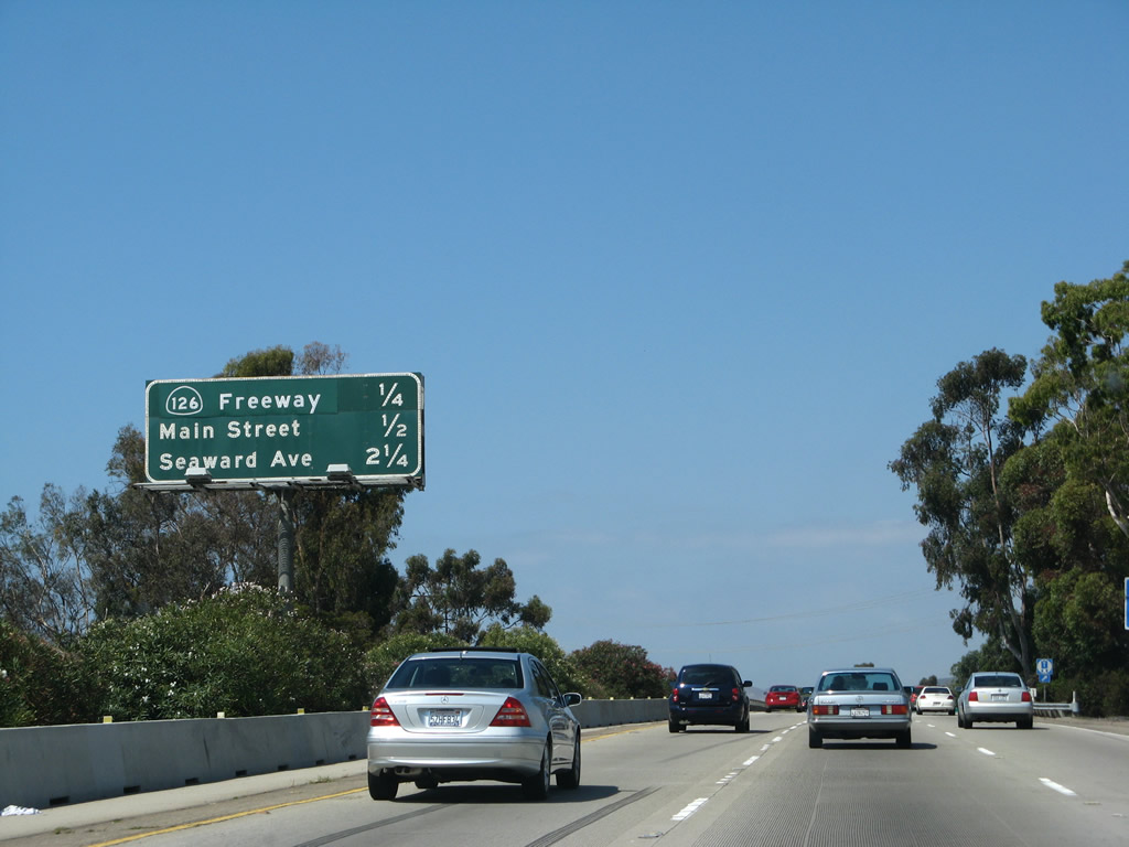
This mileage sign provides the distance to the next three exits along U.S. 101 (Ventura Freeway) and California 1 (Pacific Coast Highway) north: Exit 66A, California 126 (Santa Paula Freeway) east; Exit 66B, U.S. 101 Business (Main Street); and Exit 68, Seaward Avenue. Photo taken 12/23/04. |
|
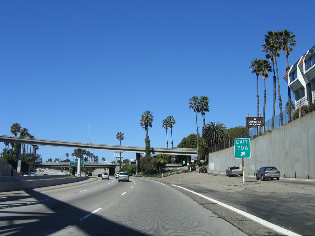
Use Exit 70A (California Street) to downtown Ventura. Photo taken 12/23/04. |
|
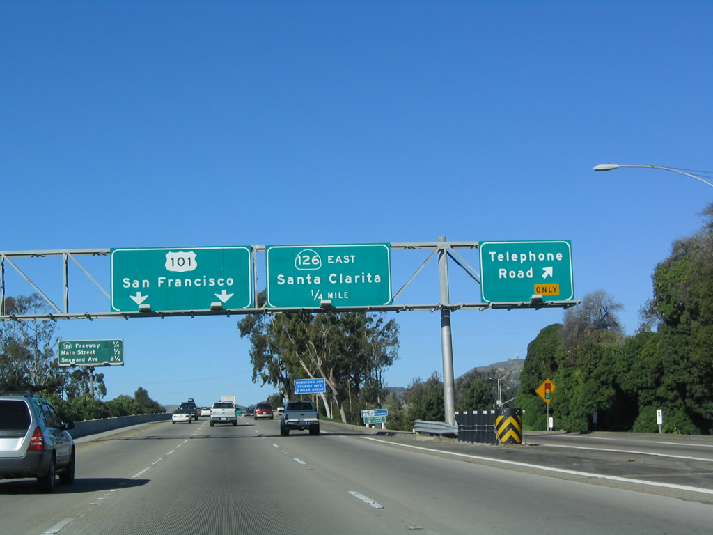
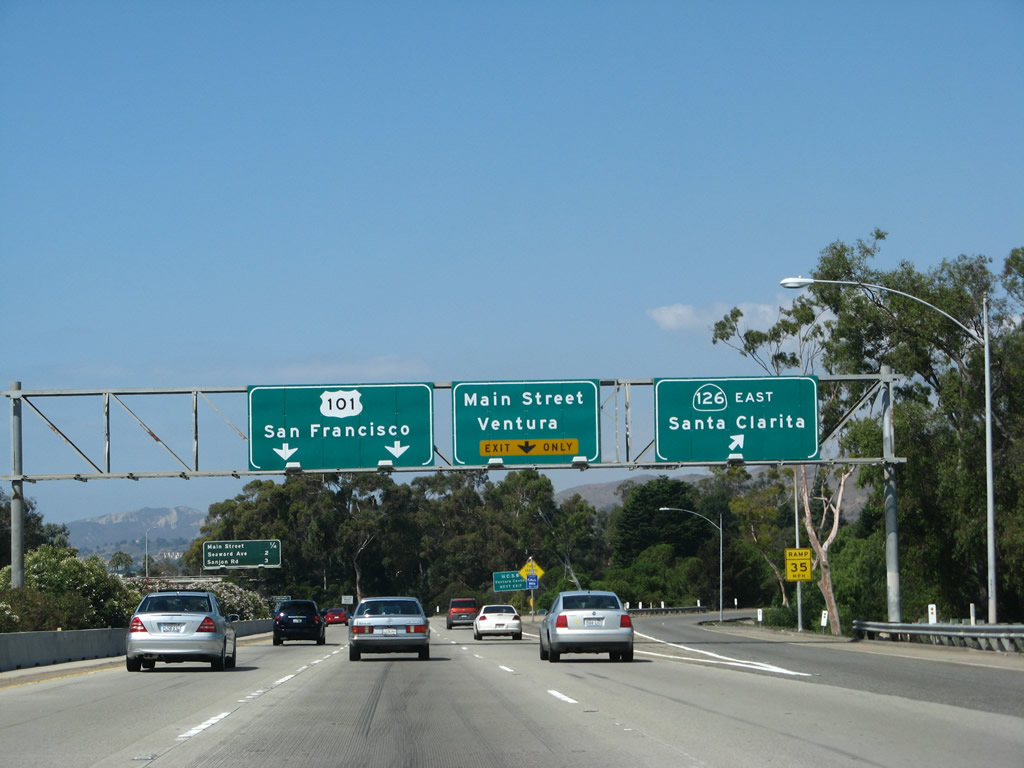
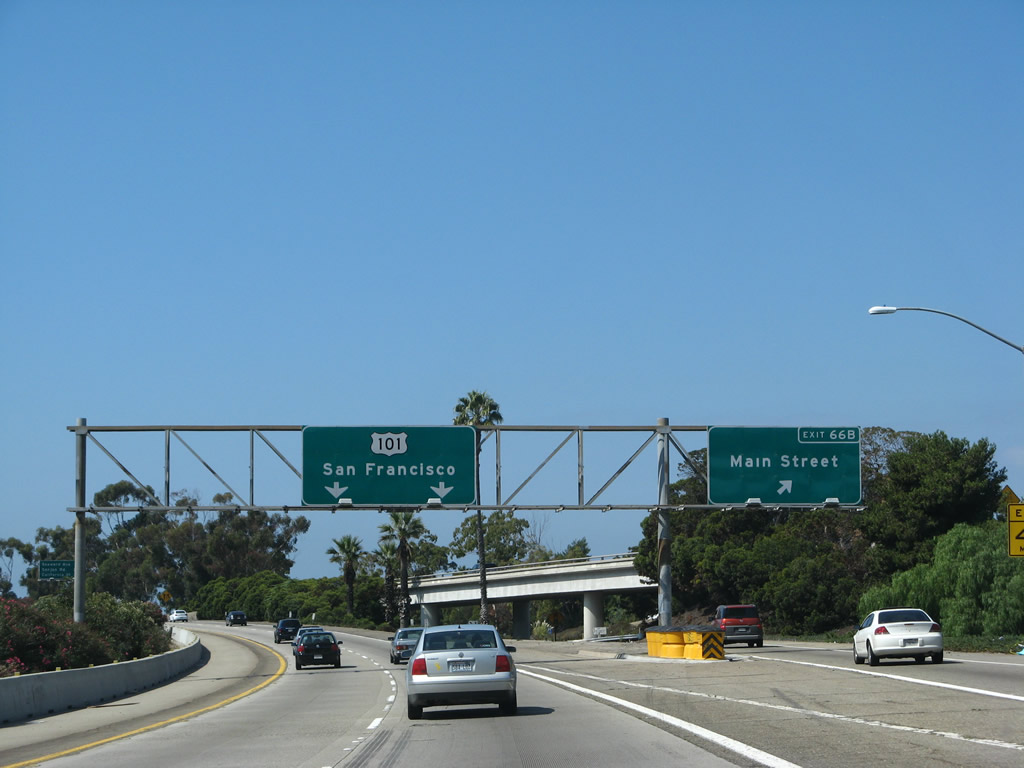
Northbound U.S. 101 (Ventura Freeway) and California 1 (Pacific Coast Highway) reach Exit 66A, California 126 (Santa Paula Freeway) east to Santa Paula and Santa Clarita. The next exit along northbound (westbound) is Exit 66B, U.S. 101 Business (Main Street). Photo taken 09/29/07. |
|
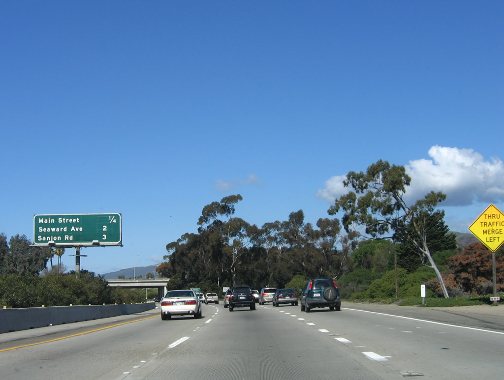
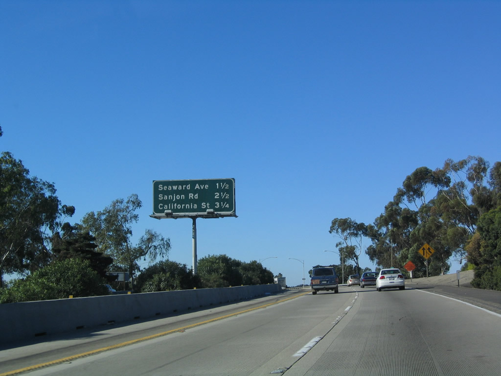
This mileage sign provides the distance to the next three exits along U.S. 101 (Ventura Freeway) and California 1 (Pacific Coast Highway) north: Exit 66B, U.S. 101 Business (Main Street); Exit 68, Seaward Avenue; and Exit 69, Sanjon Road and Alessandro Drive. Photo taken 03/18/06. |
|
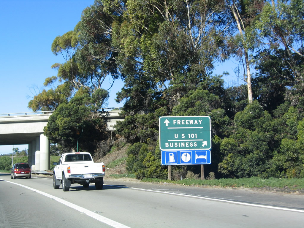
The next exit along U.S. 101 (Ventura Freeway) and California 1 (Pacific Coast Highway) north is Exit 66B, U.S. 101 Business (Main Street), in Ventura. This is one of the few remaining U.S. 101 Freeway/Business signs remaining in California. Photo taken 12/23/04. |
|
|
Northbound U.S. 101 (Ventura Freeway) (California 1) reaches Exit 66B, U.S. 101 Business (Main Street), in Ventura. Note the white-on-green U.S. 101 overhead sign. Photos taken 09/29/07 and 12/23/04. |
|
This mileage sign provides the distance to the next three exits along U.S. 101 (Ventura Freeway) and California 1 (Pacific Coast Highway) north: Exit 68, Seaward Avenue; Exit 69, Sanjon Road and Alessandro Drive; and Exit 70A, California Street to downtown Ventura. Photo taken 03/18/06. |
|
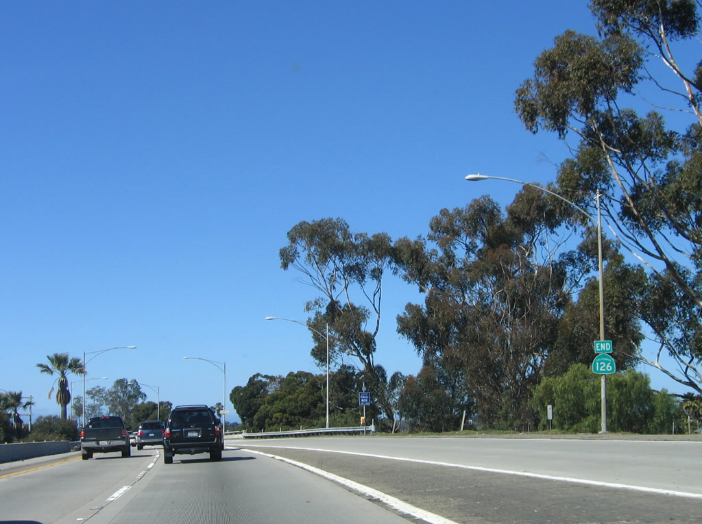
California 126 (Santa Paula Freeway) merges onto northbound U.S. 101 and California 1 at this point; an end shield is posted on the right shoulder for California 126. Photo taken 12/23/04. |
|
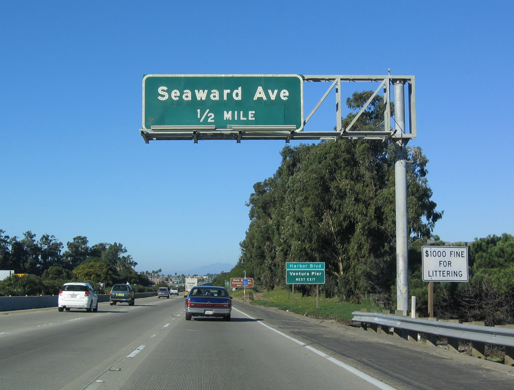
The next exit along U.S. 101 (Ventura Freeway) (California 1) north is Exit 68, Seaward Avenue (one-half mile). Photo taken 12/23/04. |
|
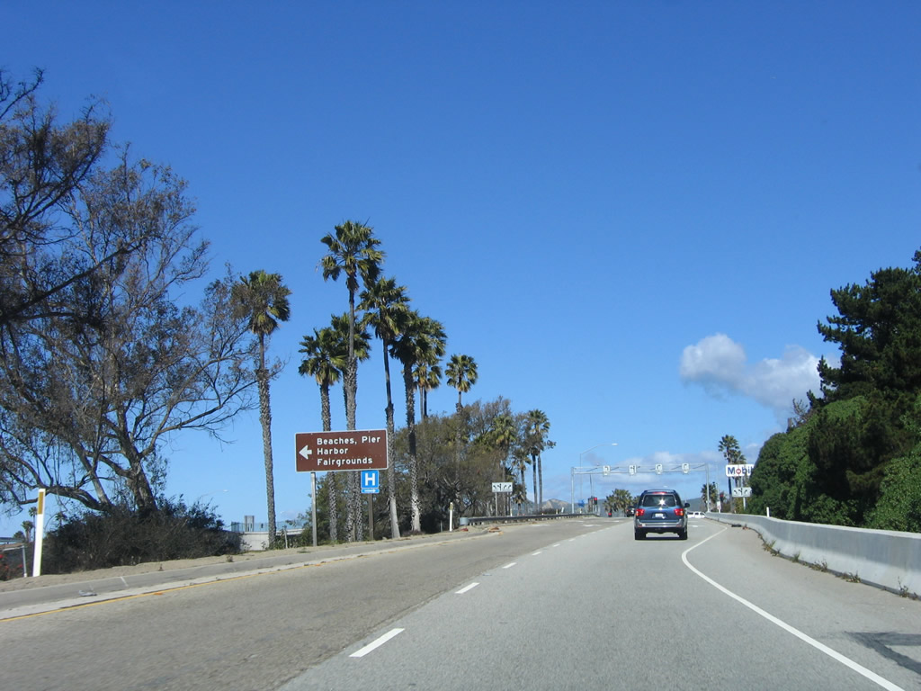
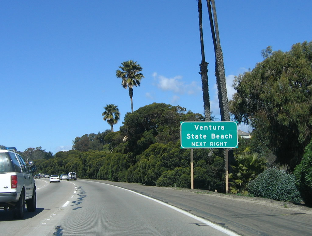
Use Seaward Avenue south to San Buenaventura State Beach. Photo taken 12/23/04. |
|
The next two exits along U.S. 101 (Ventura Freeway) north (Exit 68, Seaward Avenue and Exit 69, Sanjon Road and Alessandro Drive) serve the Ventura County Fairgrounds. Photo taken 03/18/06. |
|
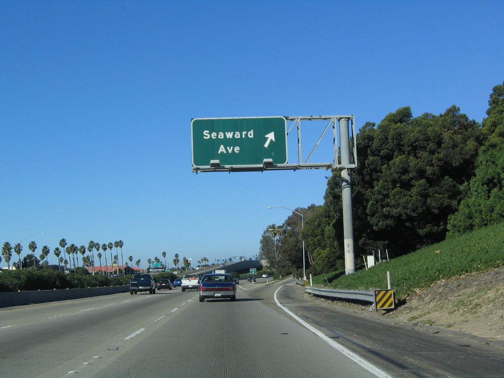
Northbound U.S. 101 (Ventura Freeway) reaches Exit 68, Seaward Avenue. Photo taken 12/23/04. |
|
Now on the off-ramp to Exit 68, turn left (south) on Seaward Avenue to the state beach, pier, fairgrounds, and harbor. Photo taken 12/23/04. |
|
Back on the mainline, this mileage sign provides the distance to the next three exits along U.S. 101 (Ventura Freeway) and California 1 (Pacific Coast Highway) north: Exit 69, Sanjon Road and Alessandro Drive; Exit 70A, California Street to downtown Ventura; and Exit 70B, California 33/Ojai Freeway. Photo taken 09/29/07. |
|
A U.S. 101 reassurance shield is posted after the on-ramp from Seaward Avenue. Photo taken 03/18/06. |
|
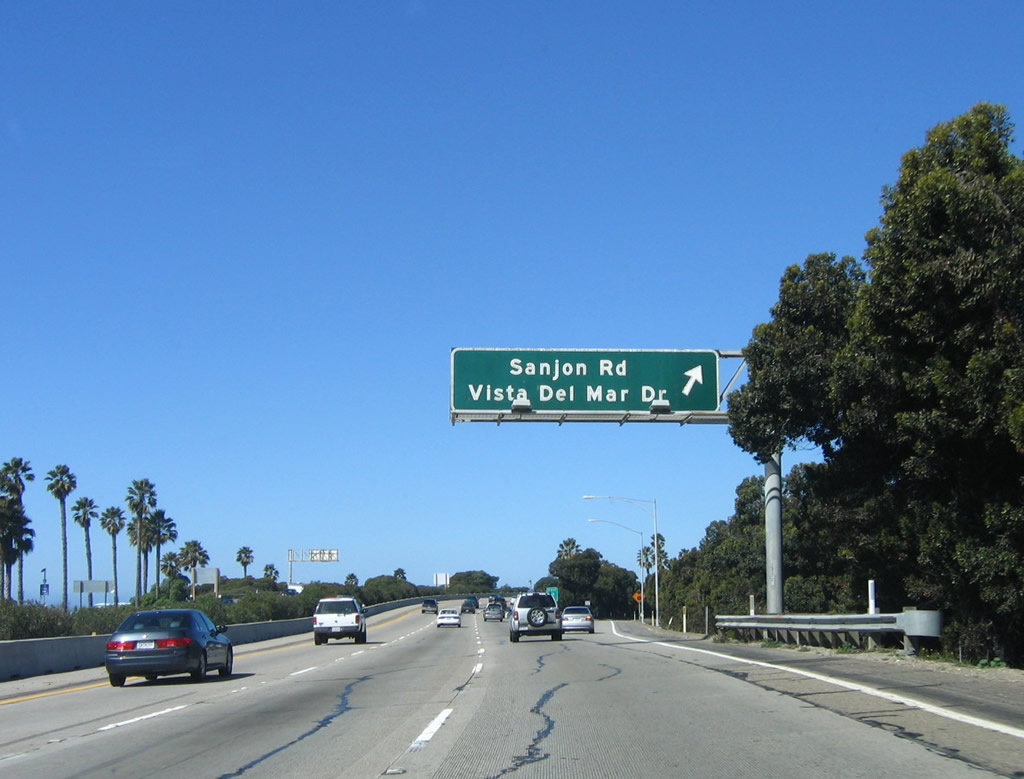
The next exit along U.S. 101 (Ventura Freeway) (California 1) north is Exit 69, Sanjon Road (0.75 mile). Photo taken 03/18/06. |
|
Use Sanjon Road to San Buenaventura State Beach. Photo taken 03/18/06. |
|
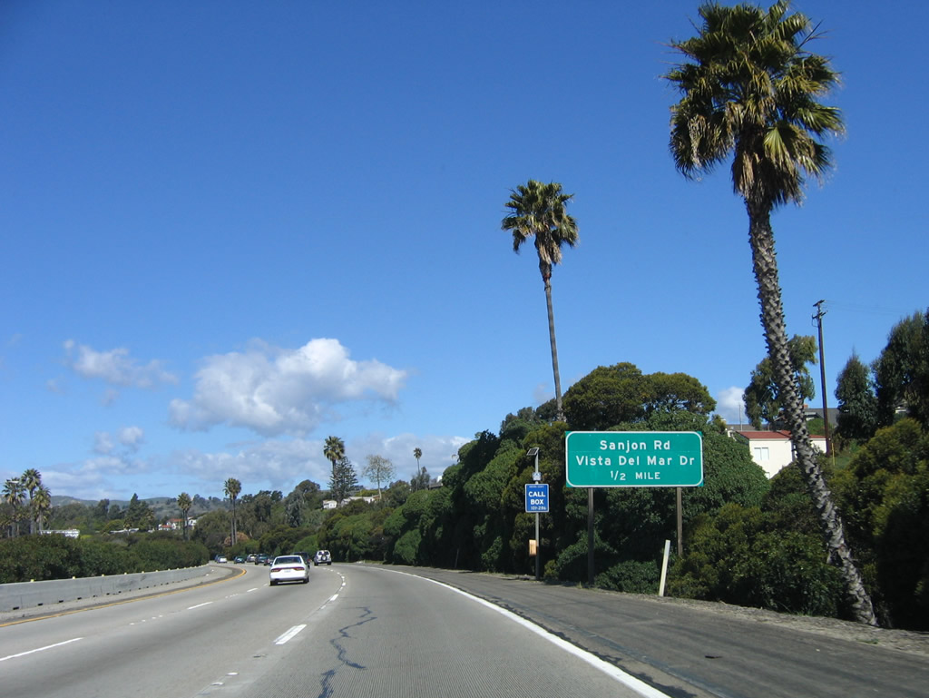
Northbound (westbound) U.S. 101 (Ventura Freeway) and California 1 (Pacific Coast Highway) reach Exit 69, Sanjon Road, Vista del Mar Drive, and Alessandro Drive. Photo taken 03/18/06. |
|
The next exit along U.S. 101 (Ventura Freeway) and California 1 (Pacific Coast Highway) north (west) is Exit 70A, California Street (0.50 mile). Photo taken 03/18/06. |
|
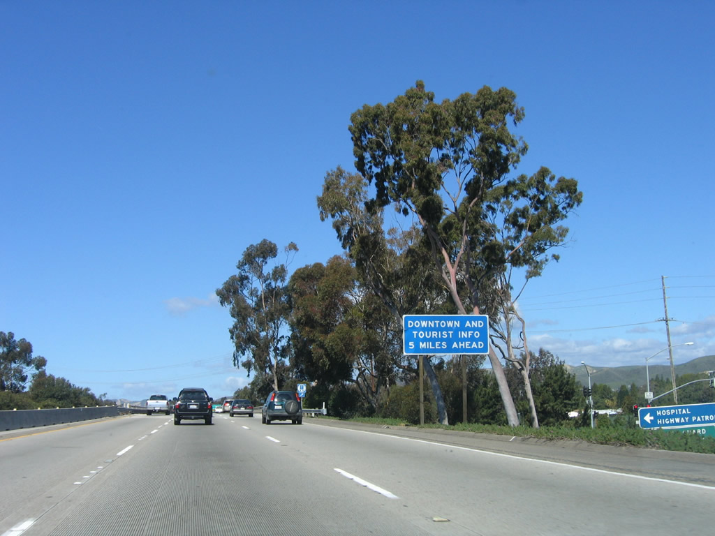
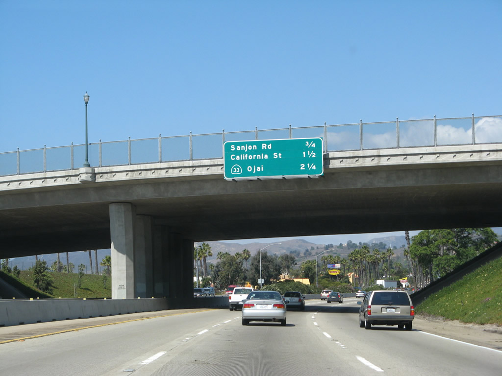
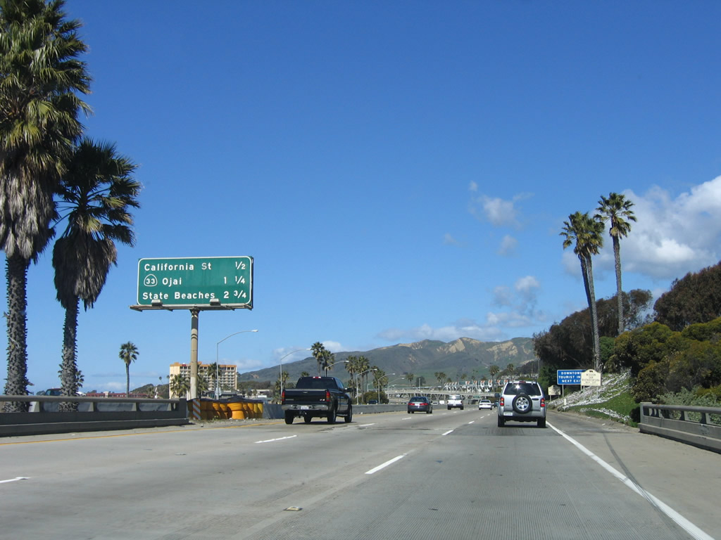
This mileage sign provides the distance to the next three exits along U.S. 101 (Ventura Freeway) and California 1 (Pacific Coast Highway) north: Exit 70A, California Street to downtown Ventura; Exit 70B, California 33/Ojai Freeway north to Ojai and Taft; and Exit 72, California 1 (Pacific Coast Highway) west to State Beaches. Photo taken 09/29/07. |
|
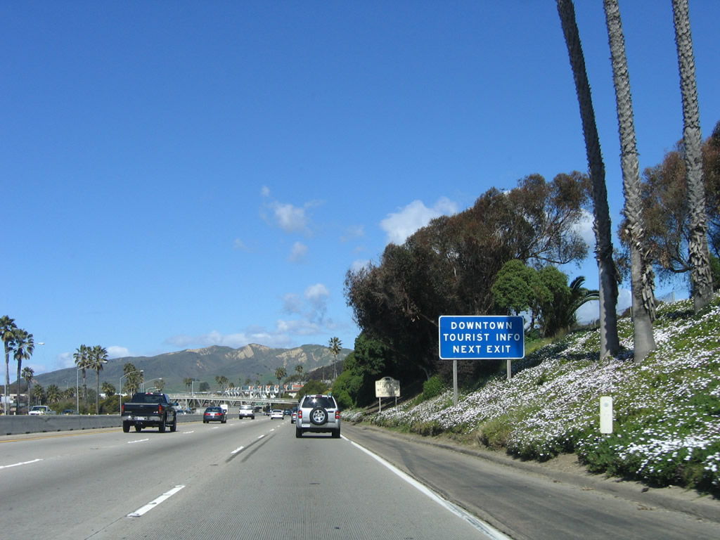
Use California Street north to downtown Ventura. Photo taken 09/29/07. |
|
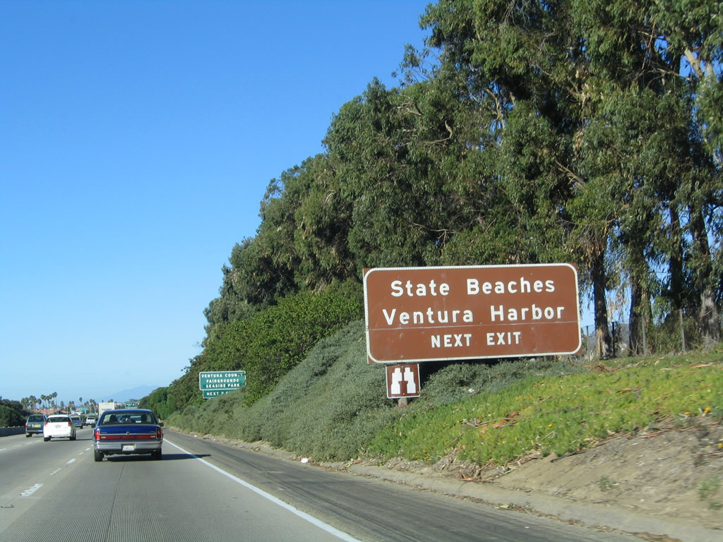
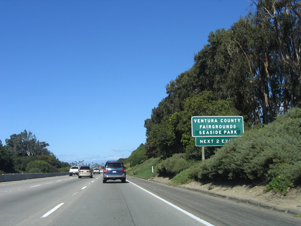
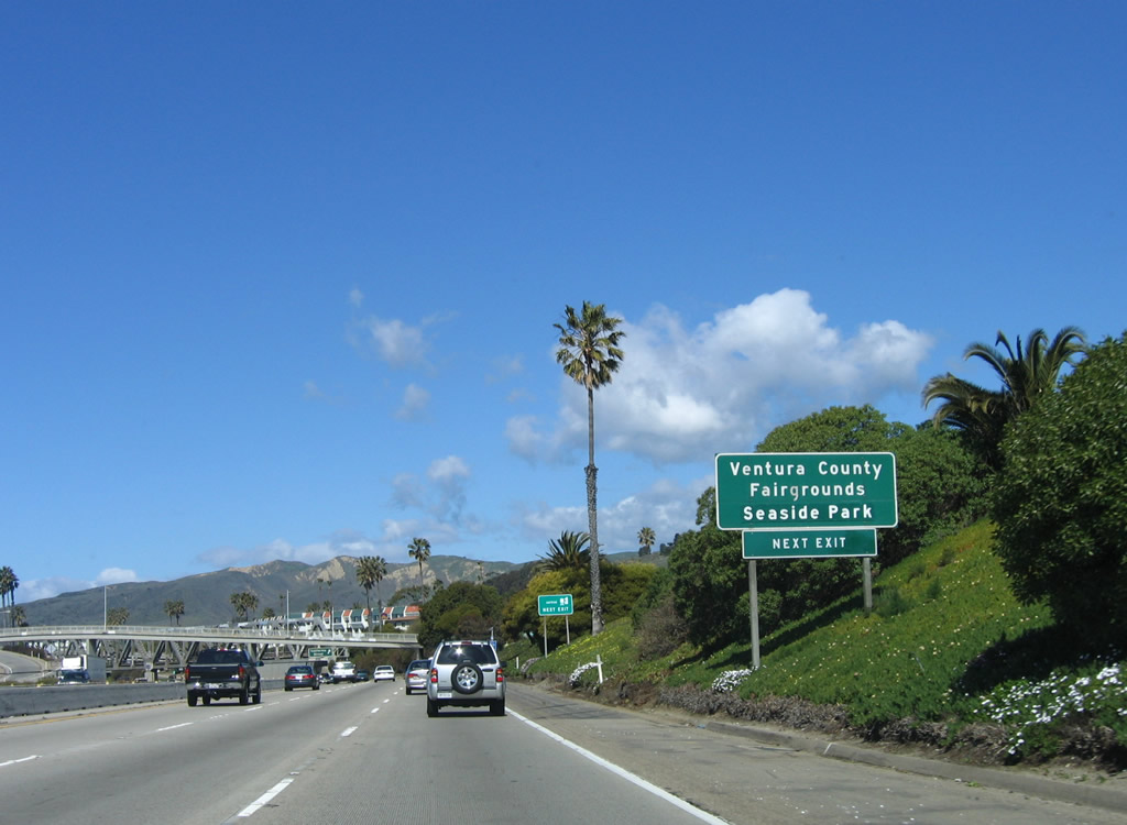
California Street also serves the San Buenaventura State Beach, Seaside Park, and Ventura County Fairgrounds. Photo taken 09/29/07. |
|
|
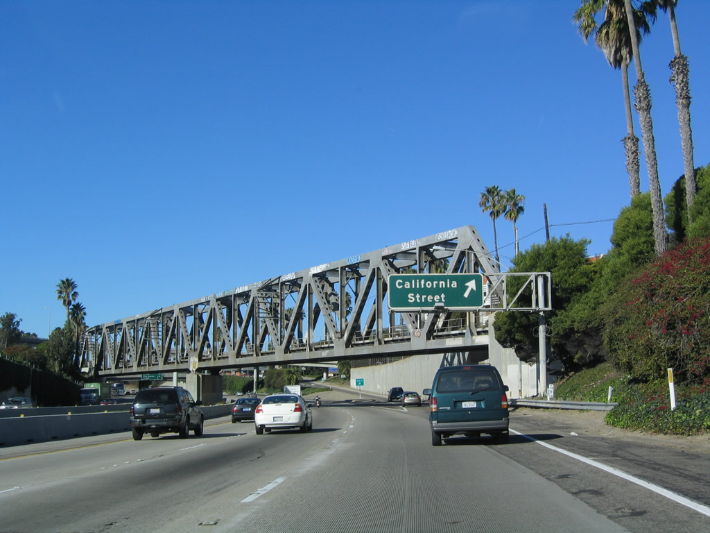
Northbound U.S. 101 (Ventura Freeway) and California 1 (Pacific Coast Highway) reach Exit 70A, California Street to downtown Ventura. Note the truss railroad bridge crossing the freeway at this point. Photo taken 12/23/04 and 09/29/07. |
|
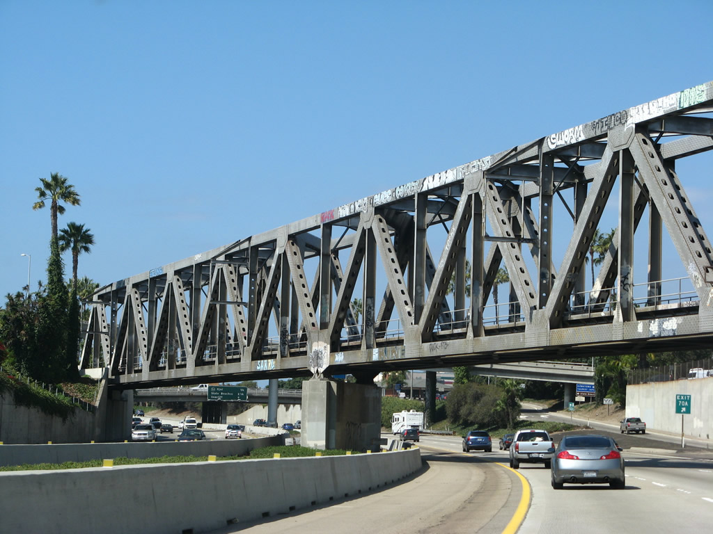
The gore point for Exit 70A features an exit number. Note the flyover ramp from Chestnut Street to U.S. 101 south (east). Photo taken 10/18/06. |
|
This mileage sign provides the distance to the next three exits along U.S. 101 (Ventura Freeway) and California 1 (Pacific Coast Highway) north: Exit 70B, California 33/Ojai Freeway north to Ojai and Taft; Exit 72, California 1 (Pacific Coast Highway) west to State Beaches; and Exit 78, California 1 (Pacific Coast Highway) east to Seacliff. Note the distance between Exits 72 and 78. Photo taken 09/29/07. |
|
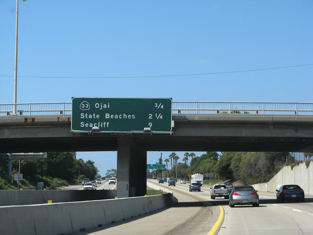
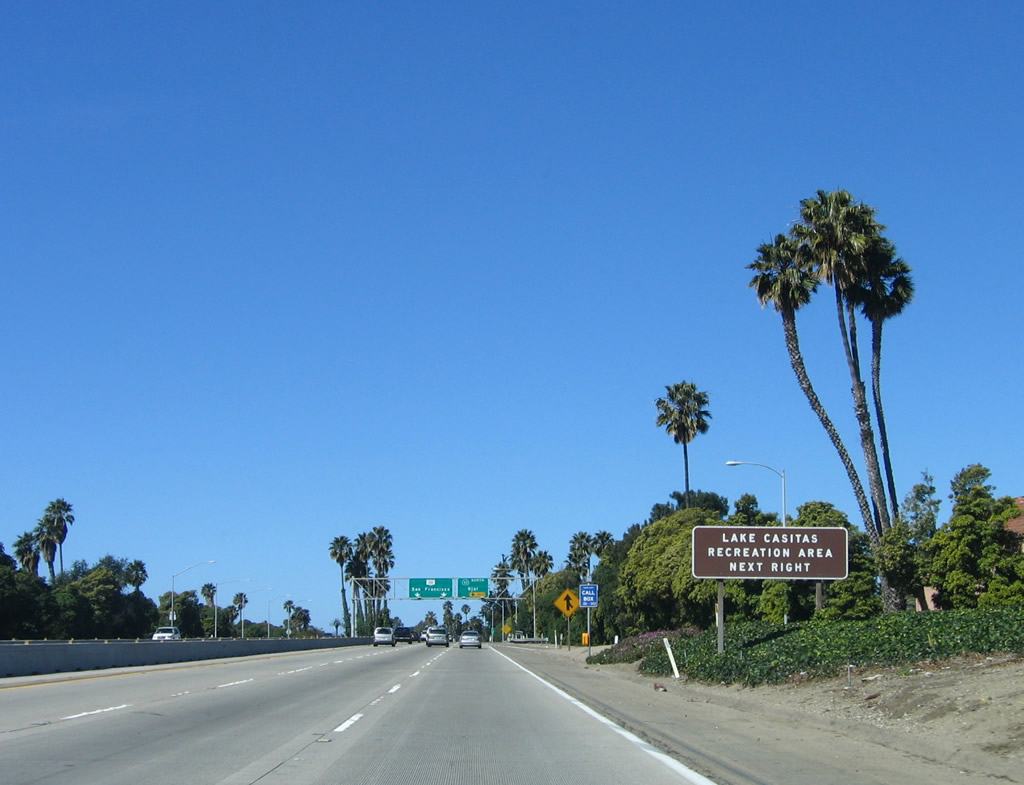
Use California 33 north to Las Casitas Recreation Area. Photo taken 09/29/07. |
|
|
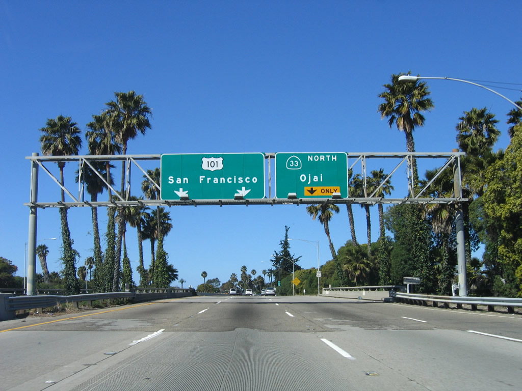
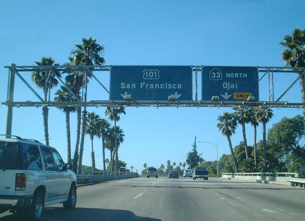
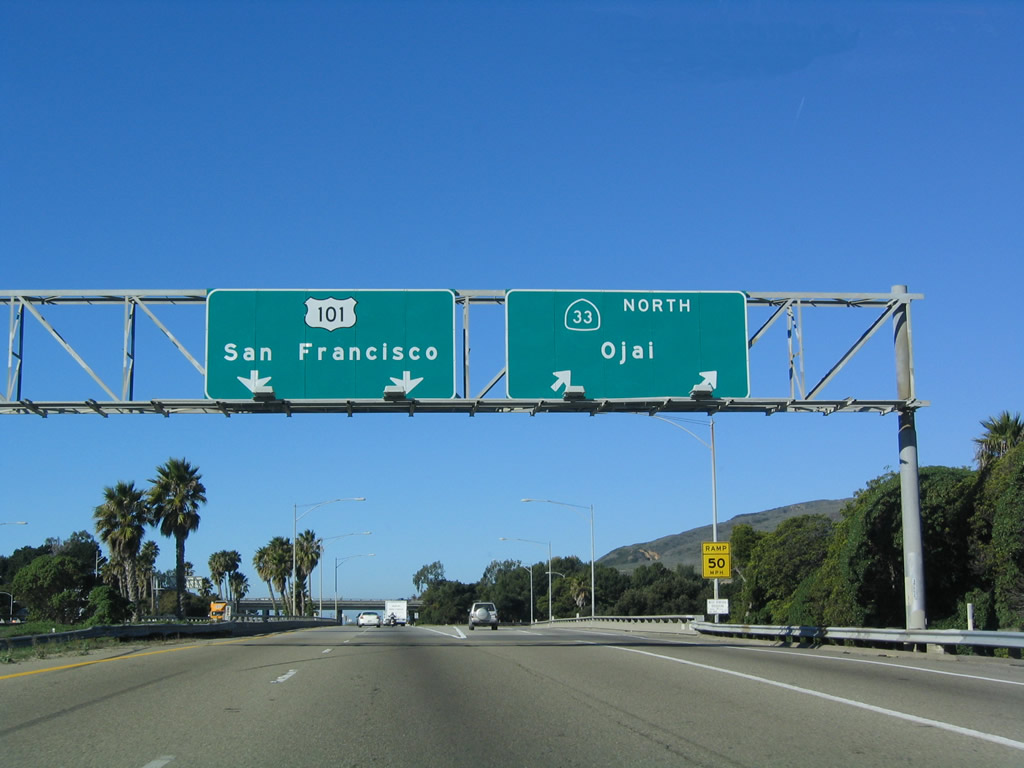
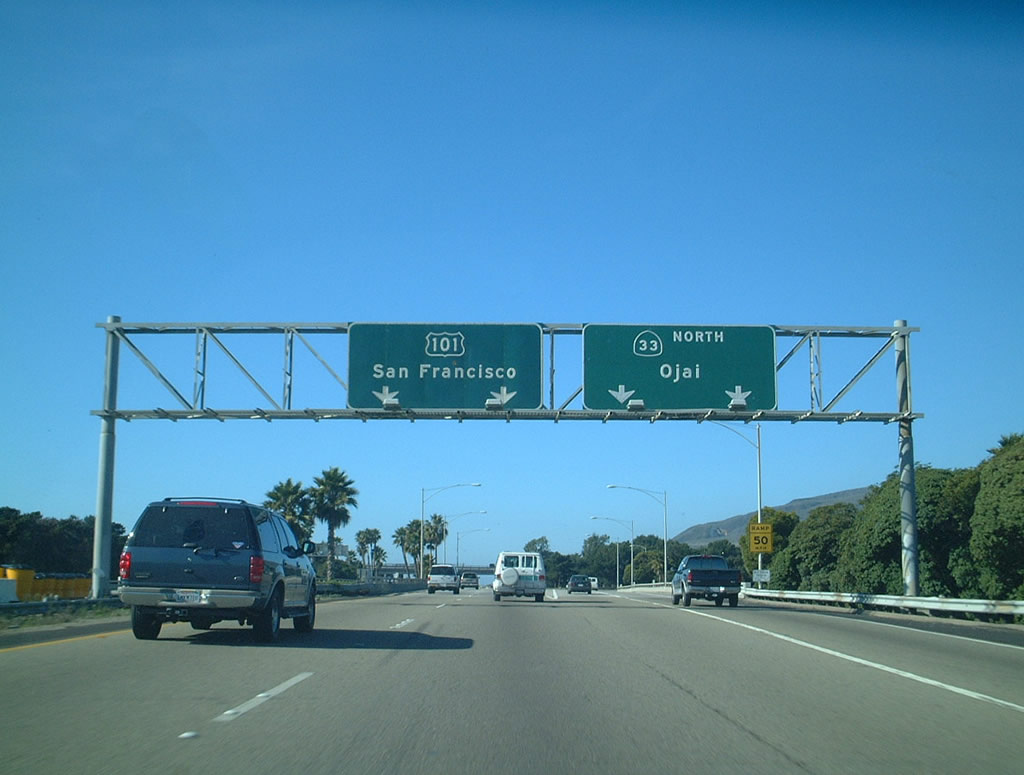
The next exit along U.S. 101 (Ventura Freeway) (and California 1) north is Exit 70B, California 33/Ojai Freeway north to Ojai and Taft. These overhead signs were replaced in 2002; the 2001 photo shows the original outline U.S. 101 shields that are almost extinct today. Photos taken 12/23/04 and 12/23/01. |
|
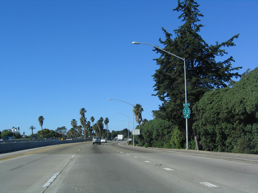
A California 33 trailblazer is located next to the exit only lane for Exit 70B, California 33 north to Ojai, Taft, Avenal, Coalinga, and Tracy. Photo taken 12/23/04. |
|
|
Northbound U.S. 101 (Ventura Freeway) and California 1 (Pacific Coast Highway) reach Exit 70B, California 33/Ojai Freeway north to Ojai and Taft. California 33 leads north from here to Ojai, then crosses the coastal ranges to enter the Central Valley, roughly paralleling Interstate 5 all the way north to Tracy (near Interstate 205). From Ventura north to Taft, California 33 follows Historic U.S. 399 (at Taft, U.S. 399 used to turn northeast to Bakersfield via California 119). U.S. 399 was decommissioned in 1964 along with many other U.S. routes in California. It was eliminated primarily because it was an intra-state U.S. route, not because it was supplanted by an Interstate route. Again note that the signs have been replaced; the new signs are shown in the second picture. Photos taken 03/18/06 and 12/23/01. |
|
A flyover ramp connects California 33 south with U.S. 101 south (east). Photo taken 12/23/04. |
|
Traffic from California 33 south merges onto U.S. 101 north (west). Photo taken 12/23/04. |
|
U.S. 101 crosses over the Ventura River. Photo taken 12/23/04. |
|
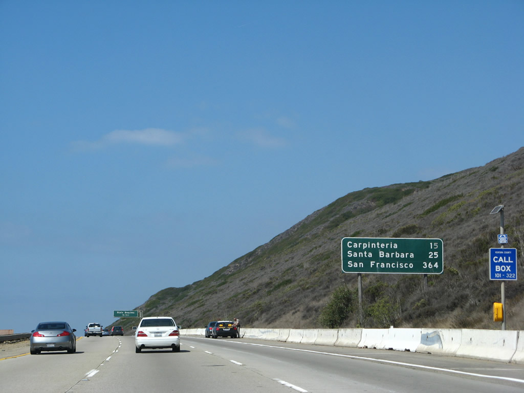
This mileage sign provides the distance to Carpinteria, Santa Barbara, and San Francisco. Photo taken 09/29/07. |
|
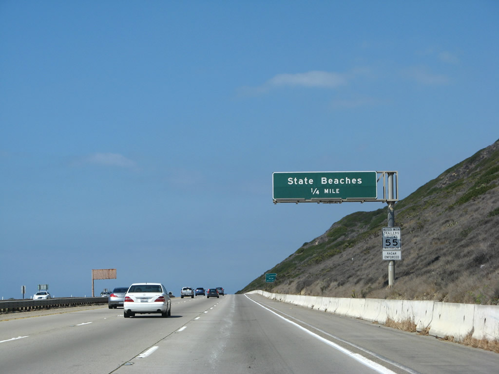
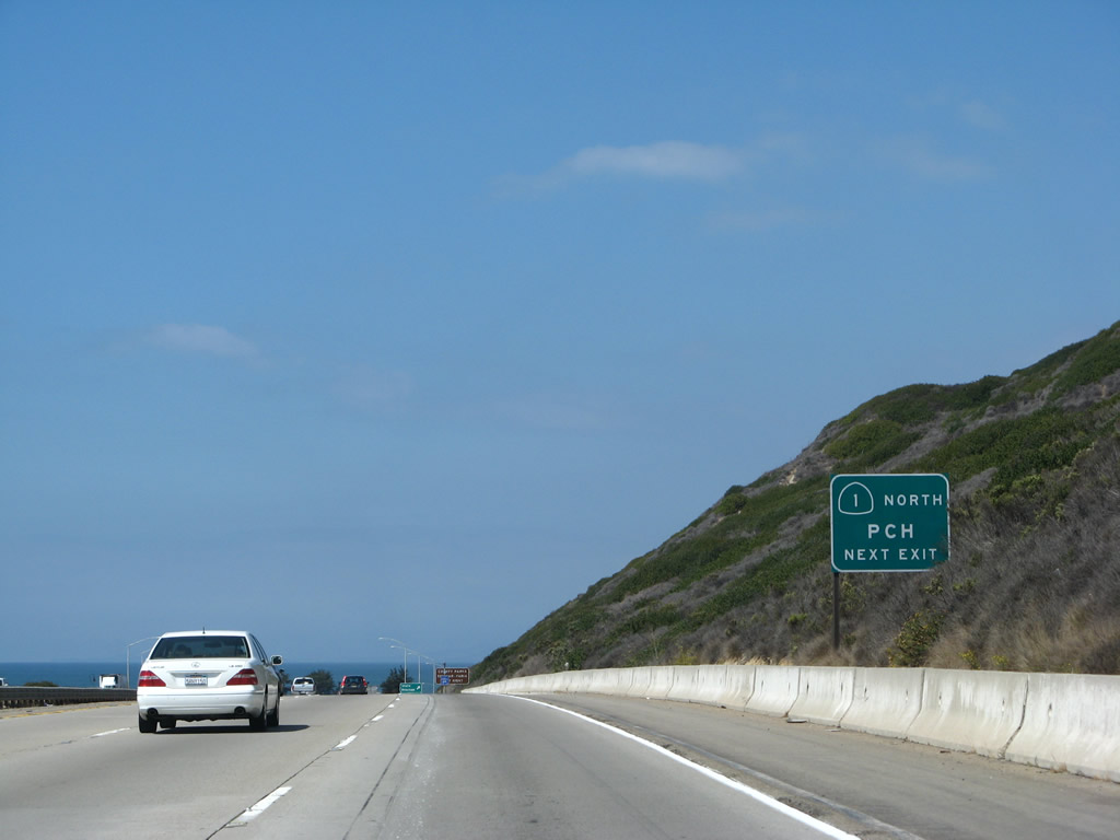
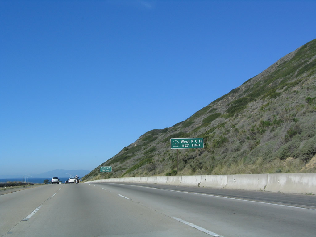
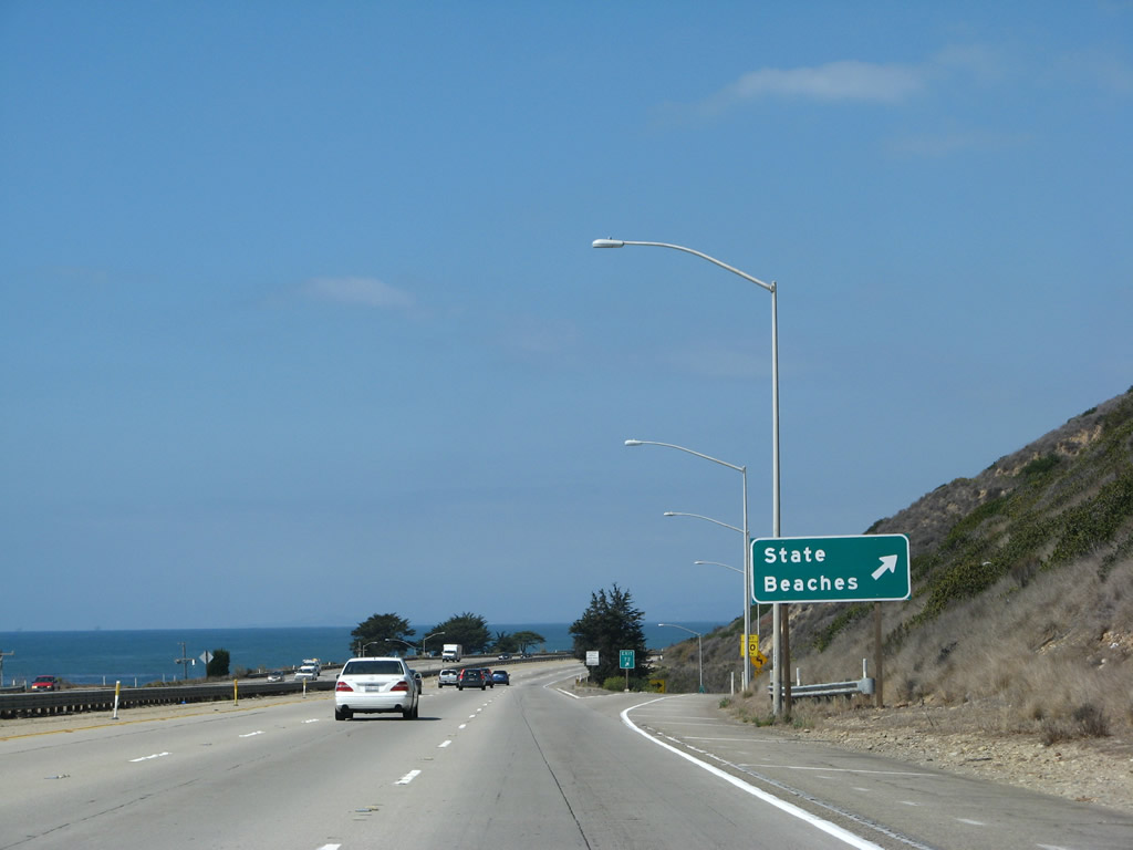
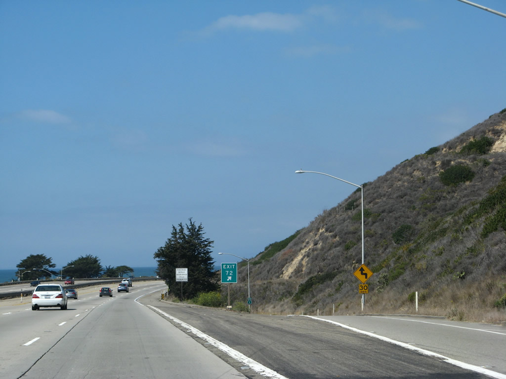
The next exit along U.S. 101 north is Exit 72, where California 1 (Pacific Coast Highway) splits from the freeway to provide local access to Emma Wood State Beach and other local destinations along the beach. California 1 follows an older alignment of U.S. 101 and returns to U.S. 101 freeway at the Seacliff interchange. For the next several miles, U.S. 101 will closely follow the coast of the Pacific Ocean. Photo taken 09/29/07. |
|
|
A single roadside sign advises that Exit 72 connects to an isolated extant segment of California 1. The coastal route, which is unsigned between Oxnard and here, follows a two-lane route through residential and business areas along the coastline. U.S. 101 bypasses this area on its freeway alignment. Photos taken 09/29/07 and 12/23/04. |
|
|
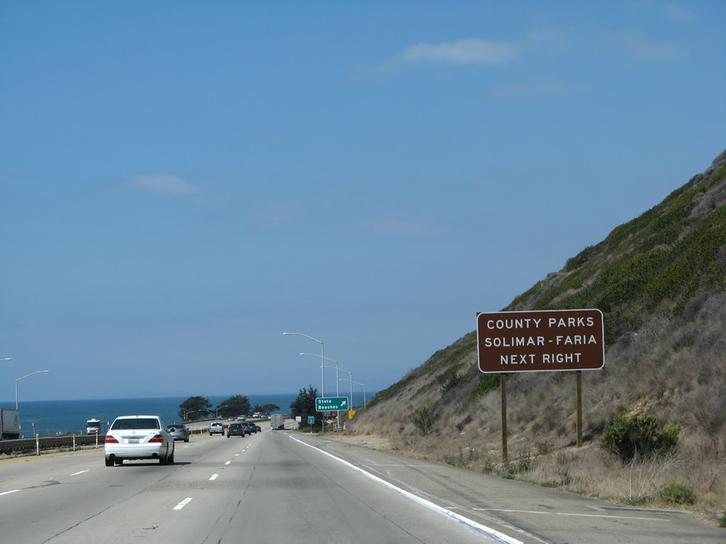
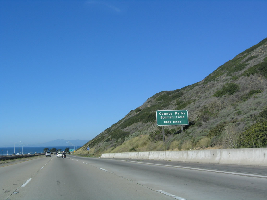
Use Exit 72 to Solimar and Faria County Parks. Photos taken 09/29/07 and 12/23/04. |
|
Northbound U.S. 101 (Ventura Freeway) and California 1 reach Exit 72, California 1 (Pacific Coast Highway) north (west) to Emma Wood State Beach. Photo taken 09/29/07. |
|
An exit number is posted at the gore point for Exit 72, California 1 (Pacific Coast Highway) north (west) to Emma Wood State Beach, Solimar Beach, Faria County Park, Faria Beach, and Hobson County Park (Rincon Beach). Photo taken 09/29/07. |
|
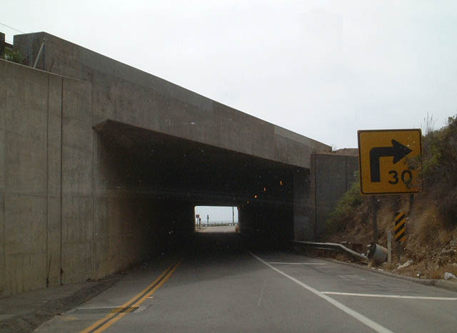
Now on the off-ramp to California 1 at Exit 72, a direct ramp passes under U.S. 101 via this subway. There is no access to Exit 72 from southbound (eastbound) U.S. 101. Photo taken 06/02/02. |
| U.S. 101 (Ventura Freeway / El Camino Real) north |
|
|
|
|
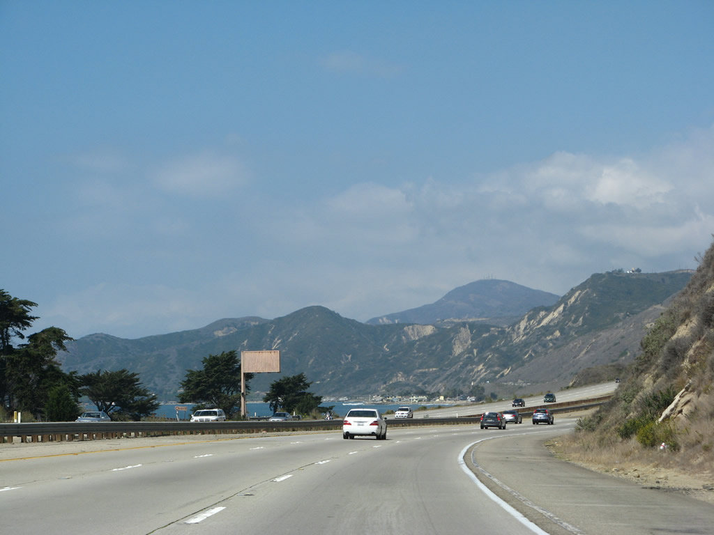
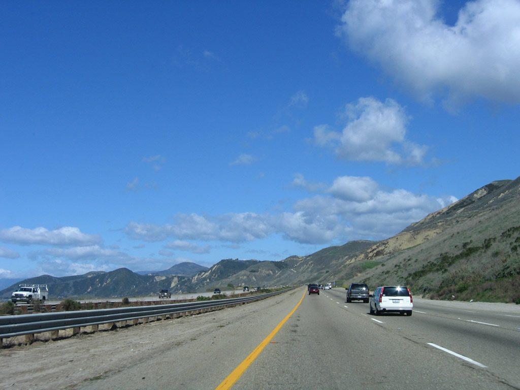
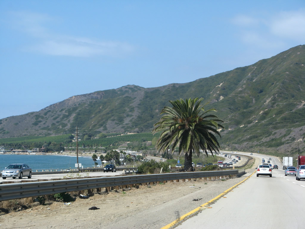
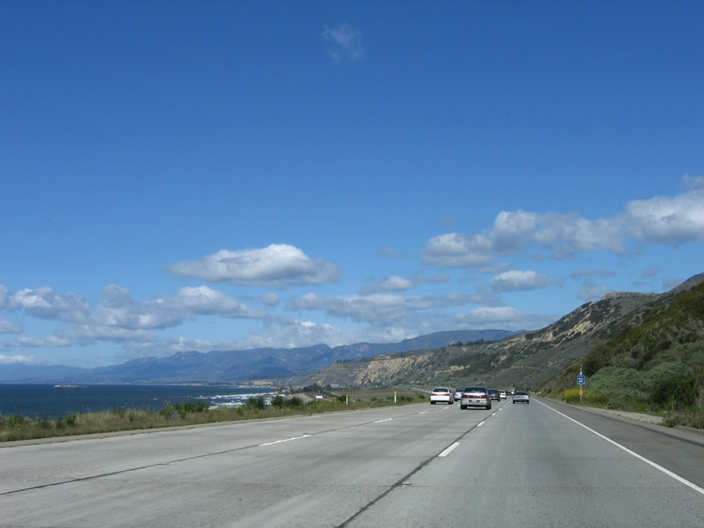
This suite of photos shows scenic northbound (westbound) U.S. 101 between Exits 72 and 78. The freeway travels on high ground staying away from the beaches, while California 1 provides local beach and residential access. Tiny Richfield Island (connected to the mainland by a pier) can be seen in some of the ocean views. Photos taken 12/23/04, 03/18/06, and 09/29/07. |
|
|
|
|
|
|
|
|
|
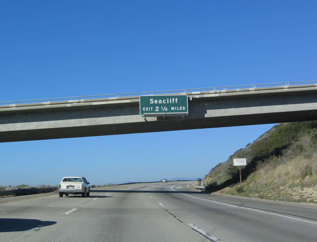
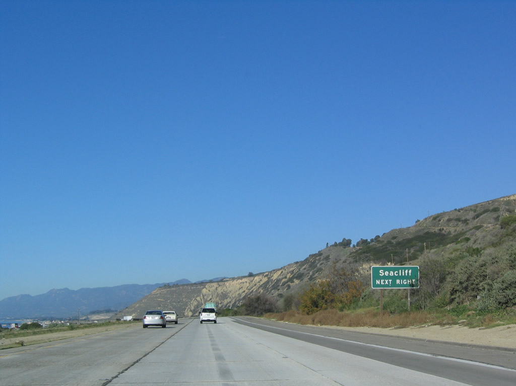
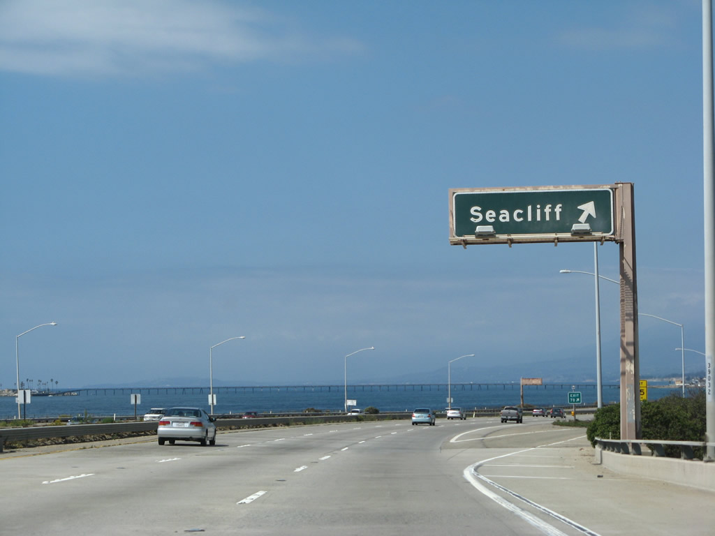
The next exit along U.S. 101 (Ventura Freeway) north (west) is Exit 78, California 1 south (east) to Seacliff. This is the other end of the beach access local loop that began at Exit 72. Photo taken 12/23/04. |
|
|
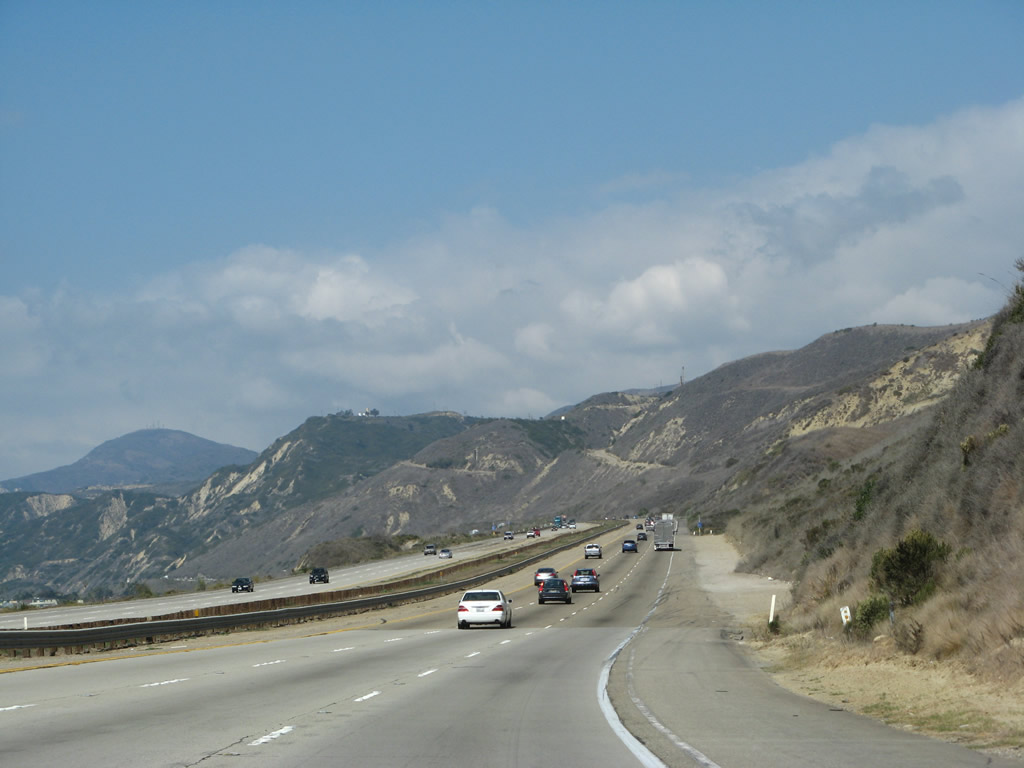
More scenic views of the Pacific Ocean are visible from U.S. 101 as the freeway proceeds west (north). Photos taken 12/23/04 and 03/18/06. |
|
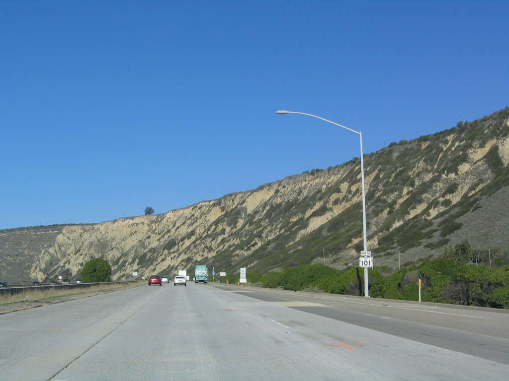
Seacliff, the towering cliff that descends toward the ocean, comes into view as U.S. 101 approaches Exit 78. The freeway will skirt the base of this tall, unstable slope, proceeding northwest toward the community of La Conchita. Photo taken 12/23/04. |
|
|
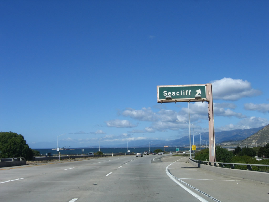
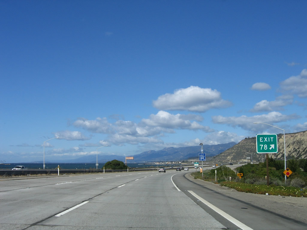
Northbound U.S. 101 reaches Exit 78, California 1 (Pacific Coast Highway) east to Seacliff. The private causeway from the mainland to Richfield Island is visible in the distance as the freeway turns toward the northwest. Photos taken 03/18/06 and 09/29/07. |
|
An Exit 78 gore point sign is posted at the off-ramp. Photo taken 03/18/06. |
| U.S. 101 (Ventura Freeway / El Camino Real) and California 1 north |
|
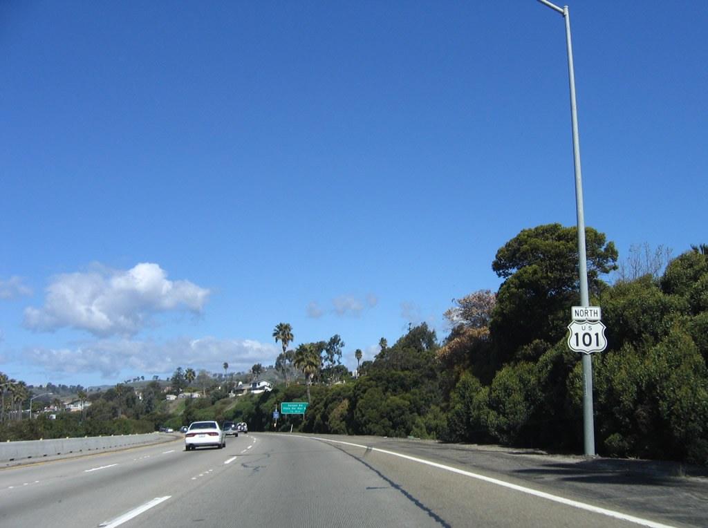
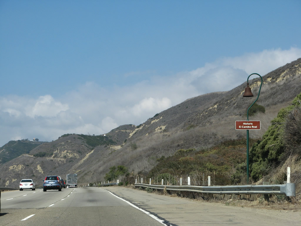
A U.S. 101 reassurance shield is posted after the on-ramp from Exit 79. Once again, California 1 will remain unsigned alongside U.S. 101 until they split north of Gaviota. Photo taken 12/23/04. |
|
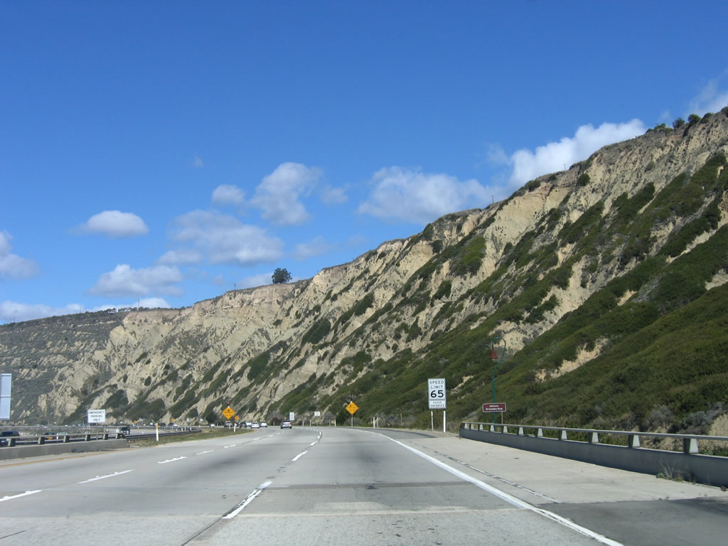
The cliffs along the sea are volatile and unstable. Landslides, some catastrophic, have made this area dangerous during severe winter storms that drop copious amounts of rain here. Photo taken 03/18/06. |
|
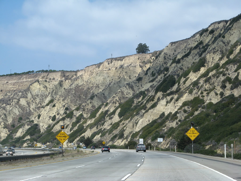
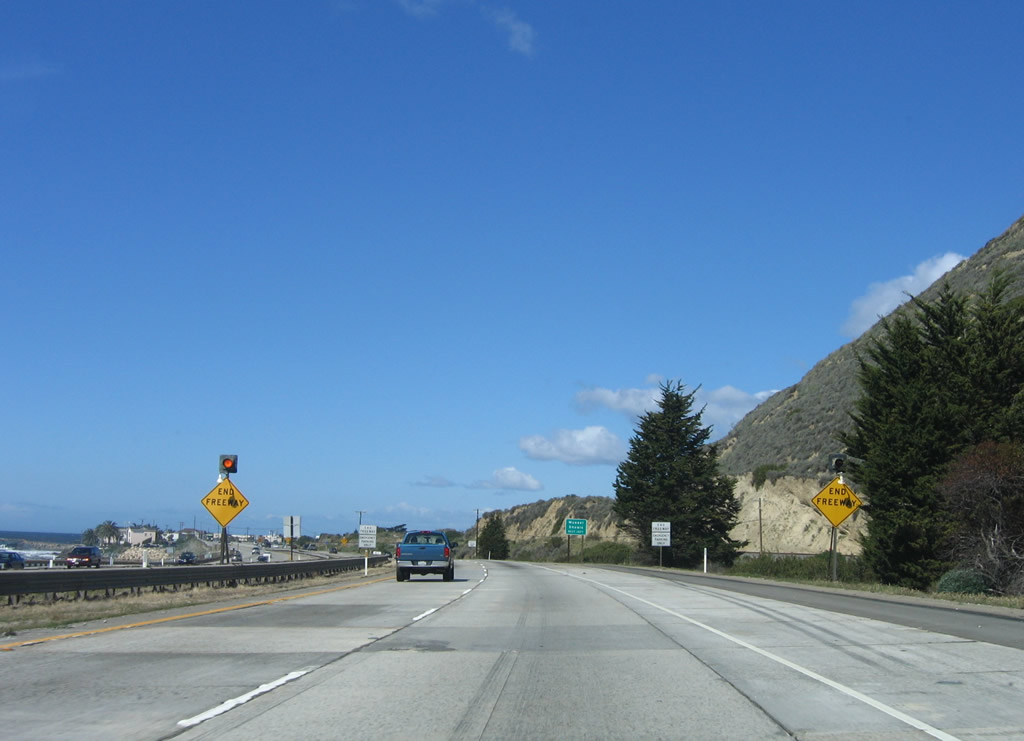
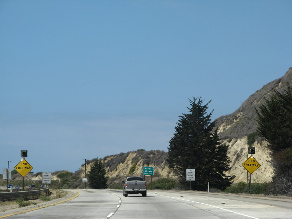
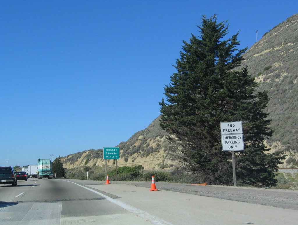
For the first time since its inception, U.S. 101 will soon cease to be a freeway near Milepost 79. Since leaving Los Angeles, this is the first time along northbound that U.S. 101 reverts to an expressway. There are only a few crossroads ahead before U.S. 101 will again resume freeway characteristics again. U.S. 101 motorists are greeted by these kinds of signs somewhat frequently between Ventura and San Jose, although U.S. 101 is slated for eventual conversion to freeway standards for the entire route (pending funding availability). Photo taken 09/29/07. |
|
The right lane ends as the freeway shifts to an expressway configuration. Photo taken 03/18/06. |
|
|
|
|
A flashing yellow sign warns of the end of the freeway ... and the final end of the Ventura Freeway. A pair of white "end freeway" signs are posted after the yellow warning signs. Watch for cross traffic ahead. Photos taken 12/23/04, 03/18/06, and 09/29/07. |
| U.S. 101 (El Camino Real) and California 1 (Pacific Coast Highway) north |
|
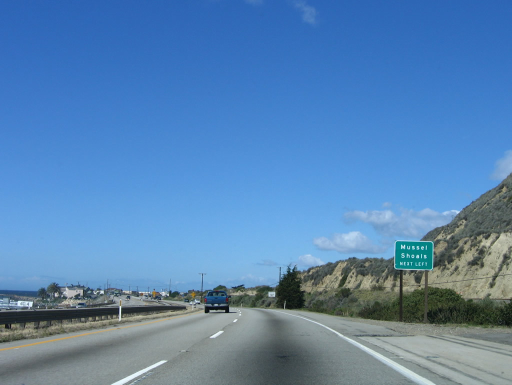
The next exit along U.S. 101 north is actually a crossroads: a left turn into Musell Shoals, which is the terminus of the Richfield Pier that connects the mainland to Richfield Island. This island is artificial and was created in conjunction with the offshore oil drilling program. Plenty of oil is available under the ocean floor, and some oil platforms are visible from U.S. 101 looking south and west. However, expansion of the oil drilling is unlikely given a moratorium on any expansion. Photo taken 03/18/06. |
|
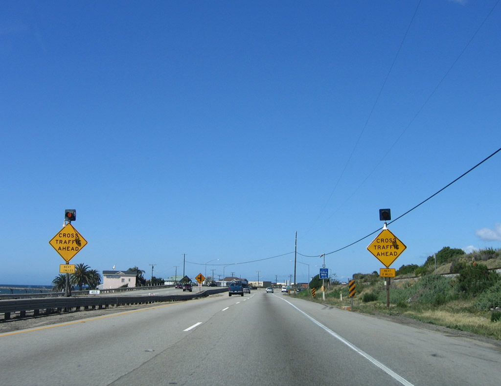
For the next four miles, watch for cross traffic associated with "Exit 79" to Mussel Shoals and "Exit 80" to La Conchita. Photo taken 03/18/06. |
|
A left turn pocket for "Exit 79" to Old Pacific Coast Highway west to Mussel Shoals forms ahead. Photo taken 03/18/06. |
|
Northbound U.S. 101 reaches Exit 79 to Mussel Shoals. If exiting here, watch carefully for fast-moving southbound U.S. 101 traffic! Also be wary of traffic entering the highway. Photo taken 09/29/07. |
|
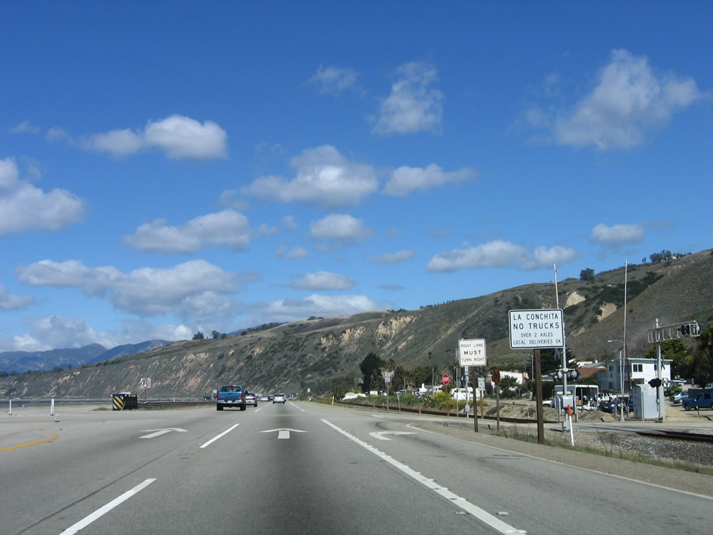
The next exit along U.S. 101 and California 1 north is Exit 80, Santa Barbara Avenue to La Conchita. Fuel and food are available at this exit. Photo taken 03/18/06. |
|
La Conchita, an unincorporated community of Ventura County, was the site of devastating landslide that destroyed homes and killed ten people in January 2005. The slide resulted in a ten-day closure of U.S. 101 and a longer closure of the parallel railroad corridor (which carries the north-south Amtrak service through California). The community has a population of 338 people as of the 2000 Census. Photo taken 03/18/06. |
|
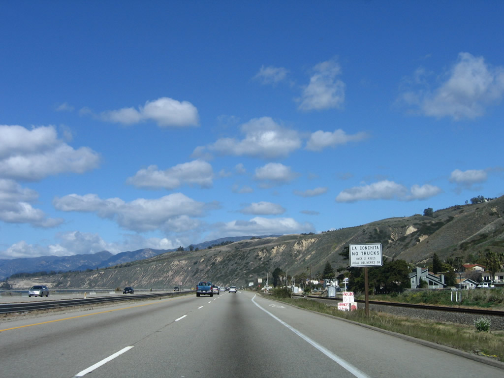
No trucks over two axles are permitted in La Conchita except for local deliveries. Photo taken 03/18/06. |
|
Northbound U.S. 101 and California 1 reach Exit 80, Santa Barbara Avenue northeast to La Conchita. Watch for trains; the railroad crossing is located immediately after the right turn from the highway. Photo taken 03/18/06. |
|
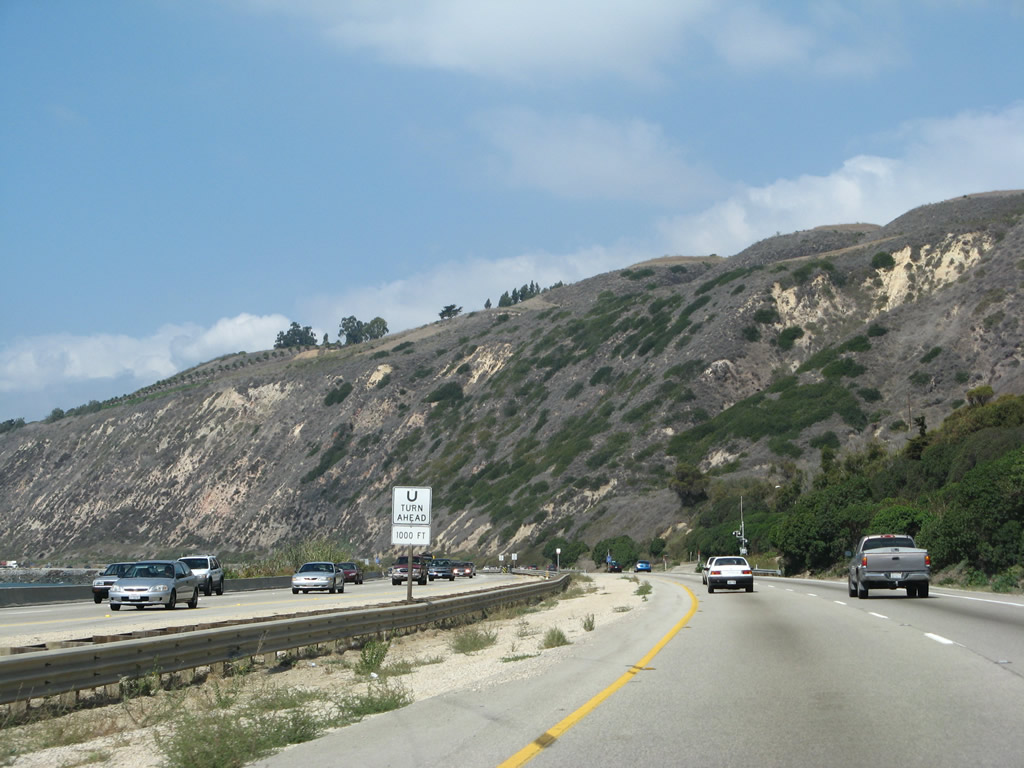
Continuing northwest past La Conchita, U.S. 101 continues as an expressway with two lanes in each direction. Photo taken 03/18/06. |
|
A U-Turn is permitted ahead to allow motorists leaving La Conchita to access U.S. 101 south. Photo taken 09/29/07. |
|
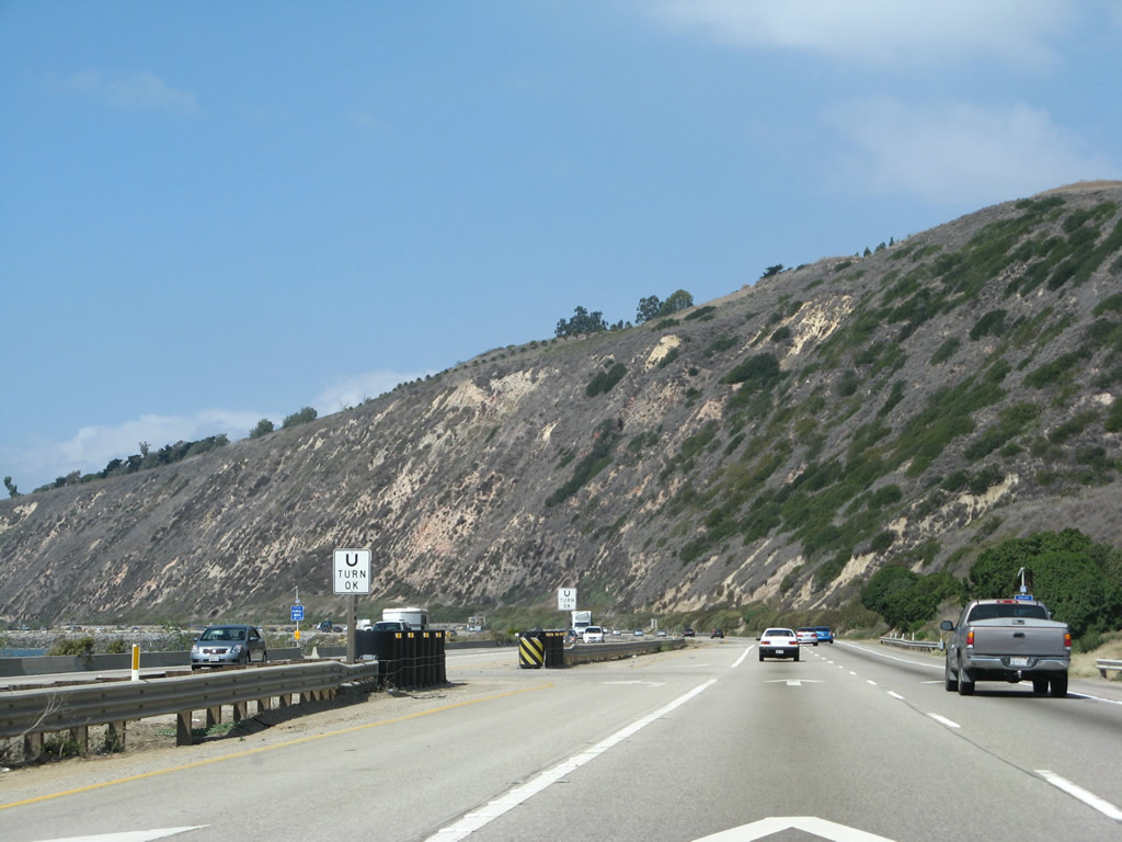
Prior to the U-Turn, a dirt off-ramp crosses the railroad tracks and provides local and ranch access. Photo taken 03/18/06. |
|
Looking again at the left lane, the U-Turn comes immediately after the dirt off-ramp. Watch for slow traffic near the U-Turn. Photo taken 09/29/07. |
|
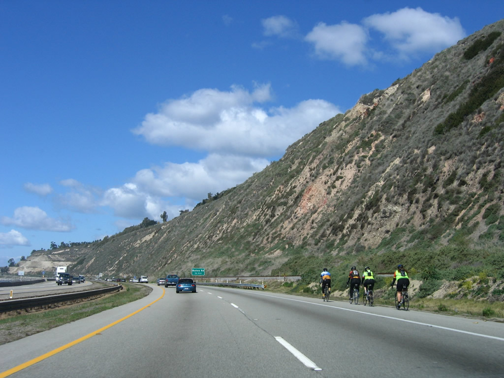
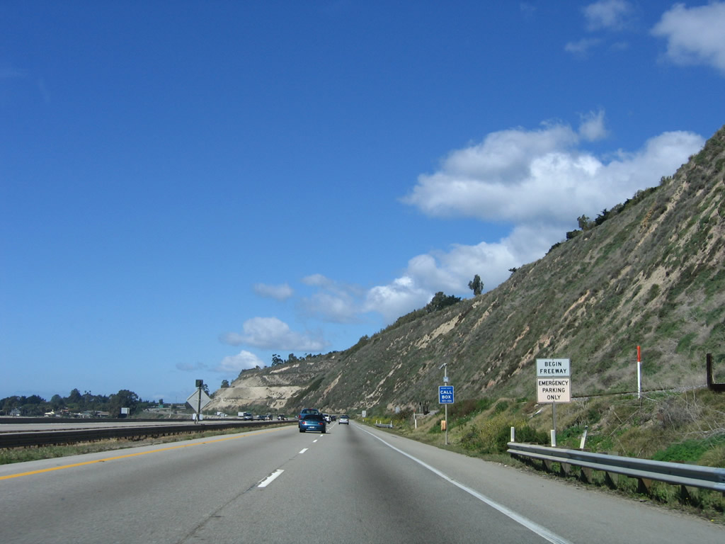
Bicyclists are allowed on this section of U.S. 101 due to the lack of a suitable alternate route. Photo taken 03/18/06. |
|
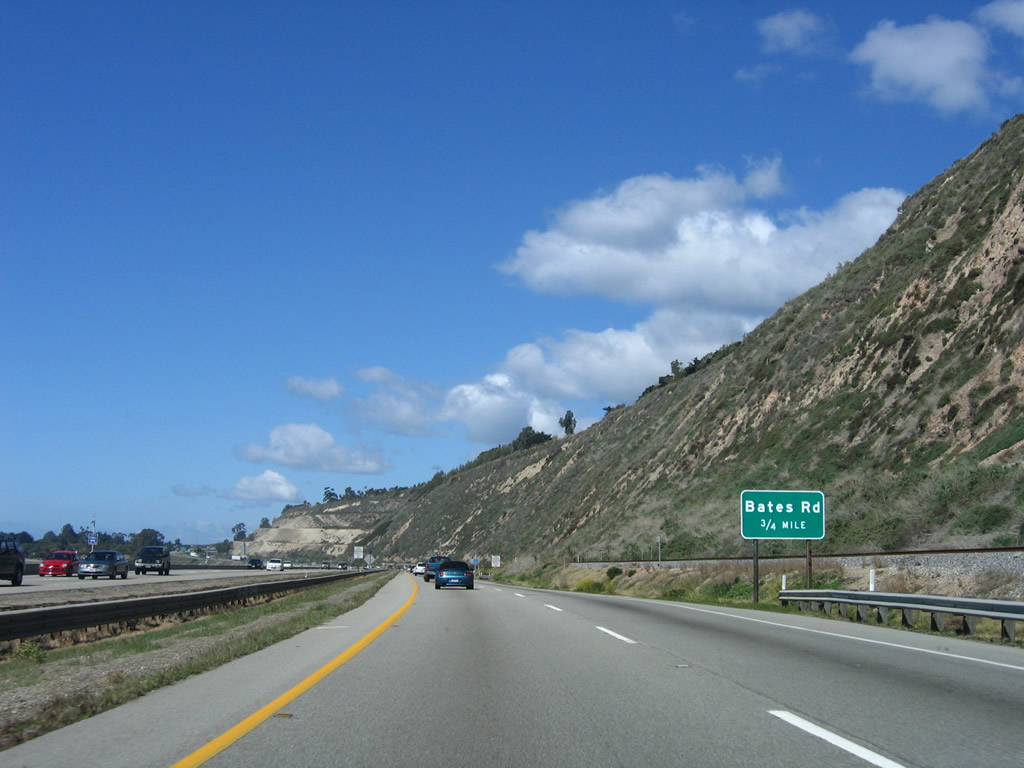
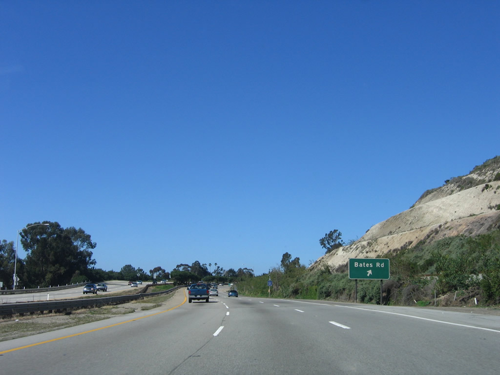
The next exit along U.S. 101 (El Camino Real) and California 1 (Pacific Coast Highway) is Exit 83, Bates Road (0.75 mile). This will be the final interchange to serve Ventura County on U.S. 101 north (west). Photo taken 03/18/06. |
|
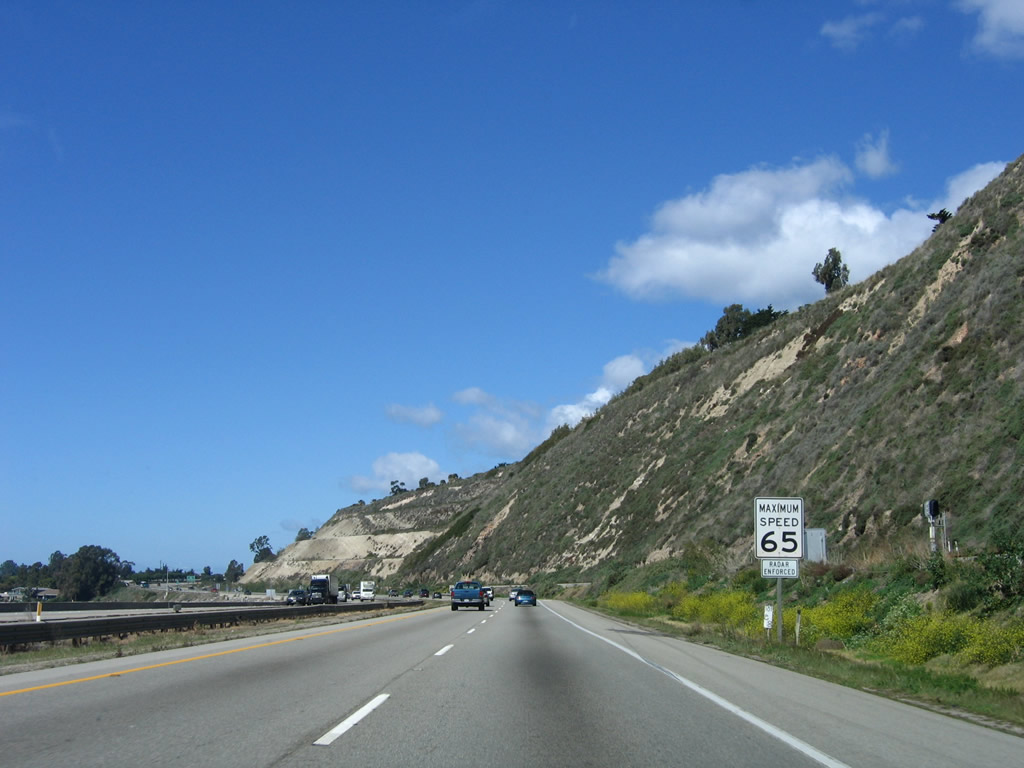
U.S. 101 again assumes a freeway configuration prior to Exit 83. Photo taken 03/18/06. |
|
The speed limit remains 65 miles per hour. Photo taken 03/18/06. |
|
A third lane is added to U.S. 101 north as the freeway meets Exit 83, Bates Road. Use Bates Road south to Rincon Point and north to Bates Ranch. Photo taken 03/18/06. |
|
Northbound U.S. 101 (El Camino Real) and California 1 (Pacific Coast Highway) reaches Exit 83, Bates Road. All bicyclists must exit here. Photo taken 03/18/06. |
|
|
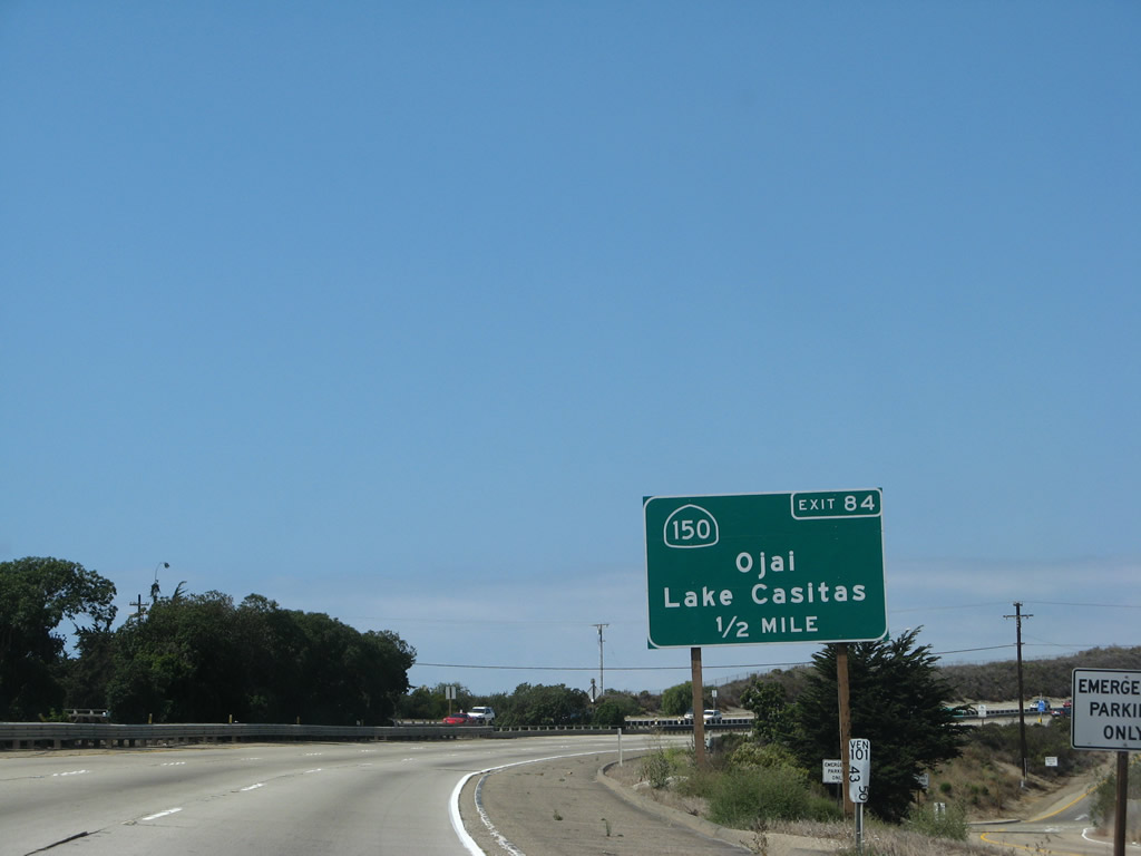
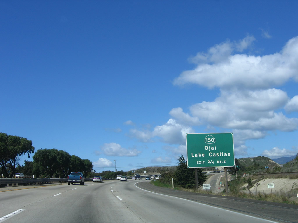
The next exit along U.S. 101 and California 1 north is Exit 84, California 150 east to Ojai and Lake Casitas (one mile). The sign was replaced between 2006 and 2007 to include an exit number. California 150 is a state route that travels east to Lake Casitas, Ojai, and Santa Paula, where it ends at its interchange with California 126 (Santa Paula Freeway). None of the state route is built to freeway standards. Photos taken 09/29/07 and 03/18/06. |
|
|
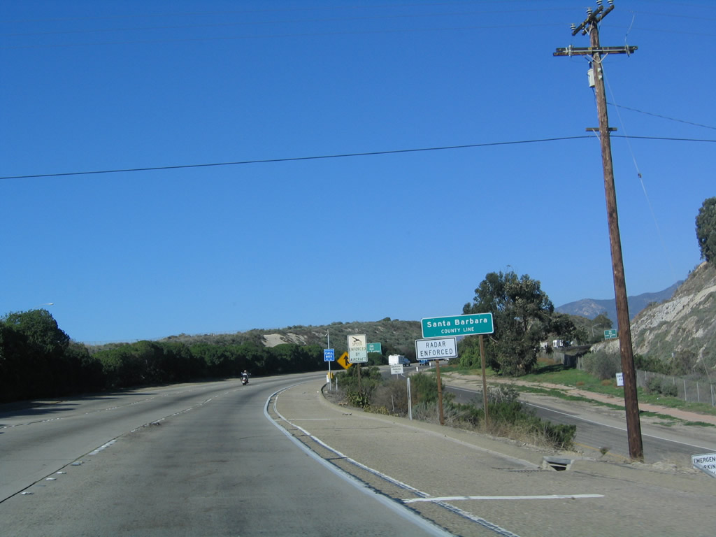
Upon crossing Bates Road, U.S. 101 and California 1 leave Ventura County and enters Santa Barbara County. Photos taken 03/18/06 and 12/23/04. |
| U.S. 101 scenes |
|
This relatively new freeway entrance signage for U.S. 101/hidden California 1 is located in Ventura along Seaward Avenue (Exit 68). Photo taken 06/01/02. |
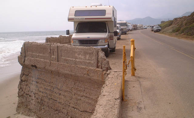
| Emma Wood State Beach Abandoned Section of U.S. 101 |
|
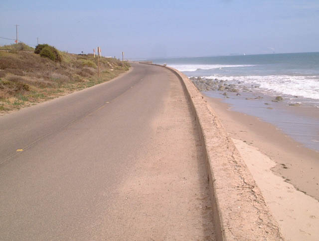
Former Southbound U.S. 101 near the entrance to Emma Wood State Beach, which is located just west (north) of the California 33 interchange. Photo taken 06/01/02. |
|
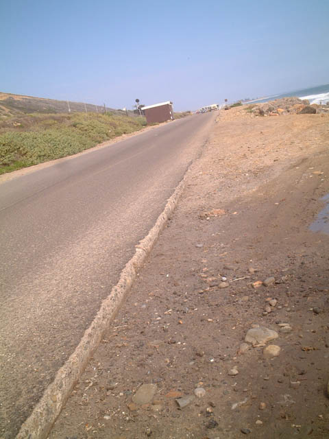
This picture shows the original U.S. 101 in Emma Wood State Beach, which rode on top of a retaining wall in the 1930s. Although portions of the wall have corroded and crumbled, it is still in use today as a parking/camping area for users of the state beach. This view is looking north/west. Photo taken 06/01/02. |
|
The original concrete is visible under the asphalt in this view of the former southbound U.S. 101 in Emma Wood State Beach. Photo taken 06/01/02. |
|
Another view of the seawall and original highway, now in use as a parking lot along northbound U.S. 101 in Emma Wood State Beach. Photo taken 06/01/02. |
Page Updated March 8, 2009.