| U.S. 101 (Bayshore Freeway) north |
|
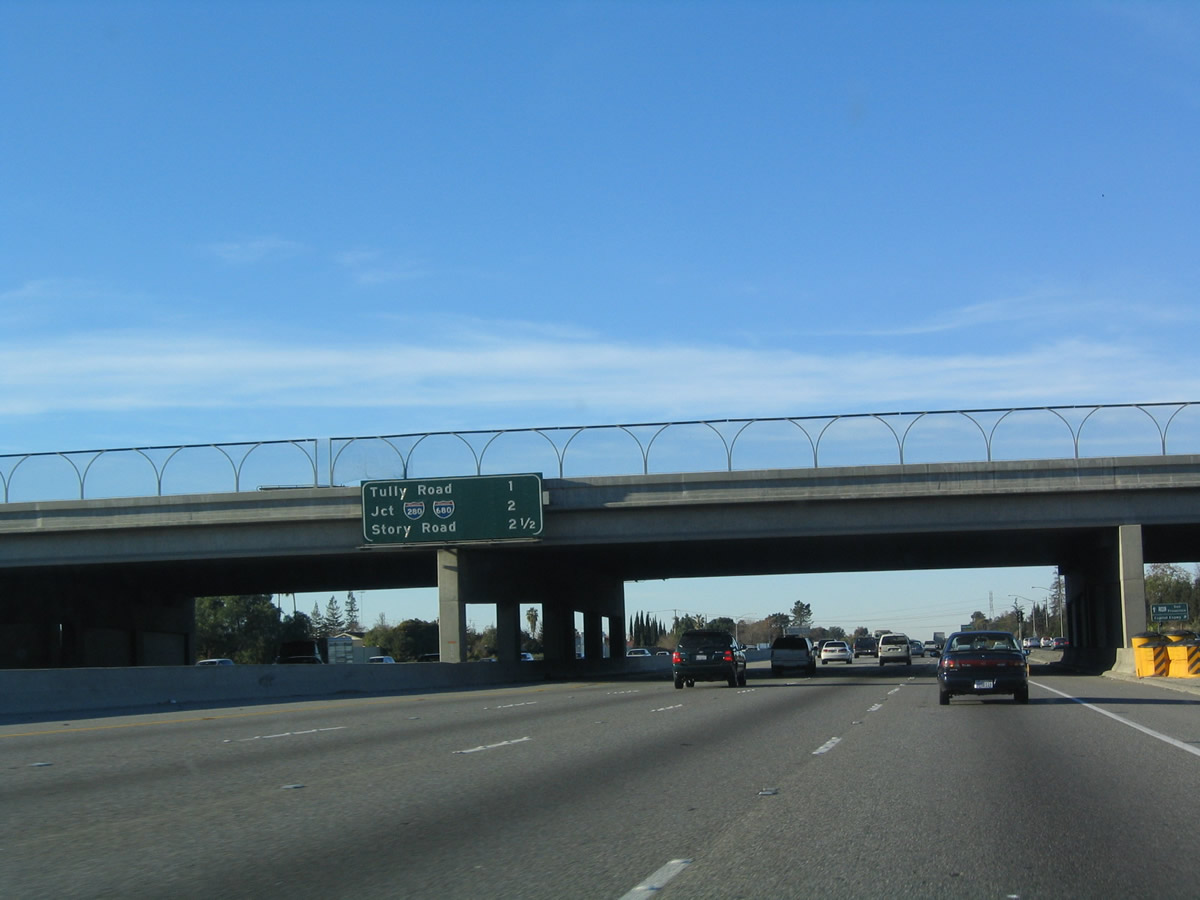
The next three exits along U.S. 101 (Bayshore Freeway) north (shown on this interchange sequence sign) are Exit 383, Tully Road; Exit 384, Interstate 280 north (west) and Interstate 680 north; and Exit 385, Story Road. All of these exits serve the city of San Jose. Photo taken 12/23/04. |
|
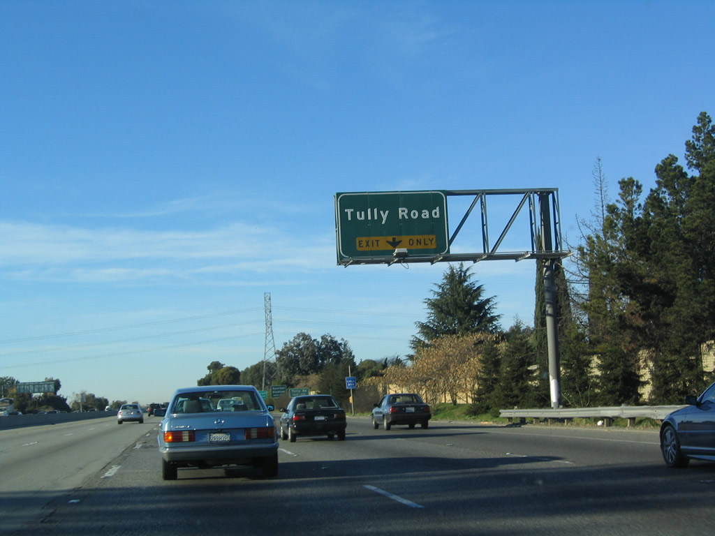
The right lane of U.S. 101 (Bayshore Freeway) north becomes exit only for Exit 383, Tully Road. Photo taken 12/23/04. |
|
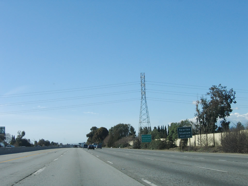
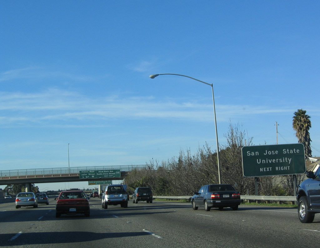
Use Tully Road west to Spartan Stadium (San Jose State University football) and the Santa Clara County Fairgrounds. Photo taken 03/18/06. |
|
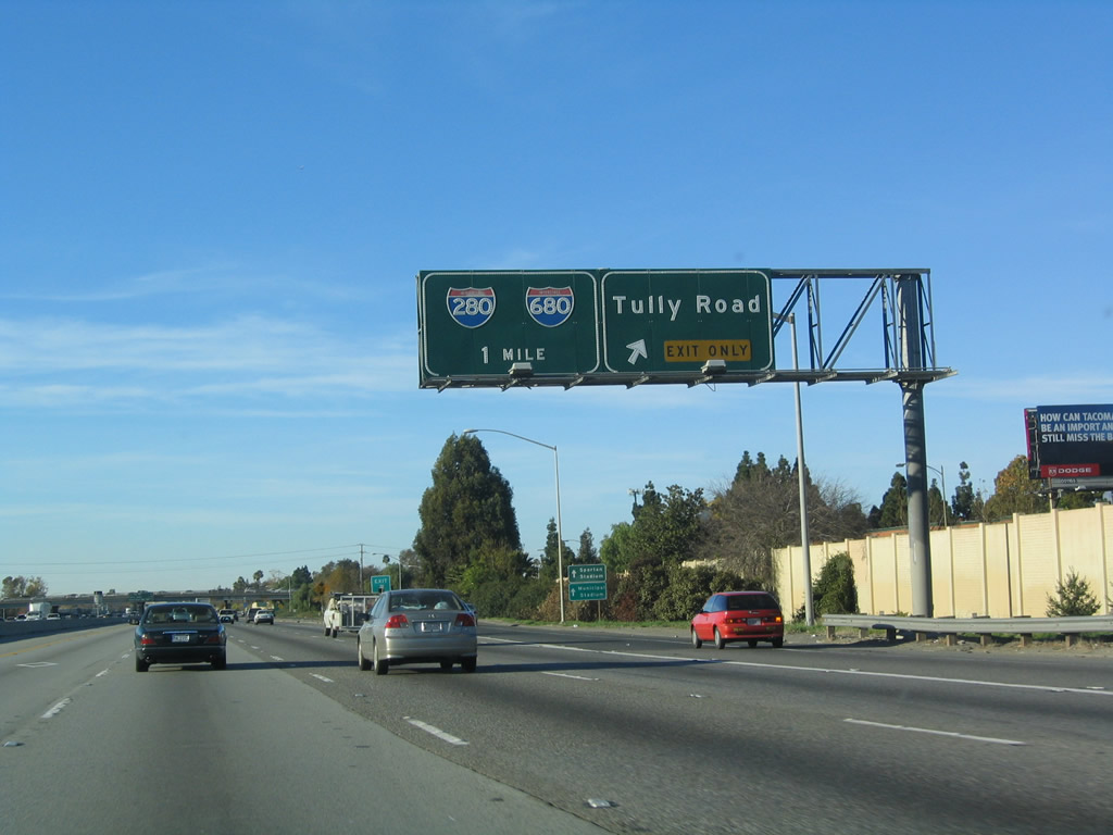
Northbound U.S. 101 (Bayshore Freeway) reaches Exit 383, Tully Road. The next interchange is Exit 384, Interstate 280 and Interstate 680. Photo taken 12/23/04. |
|
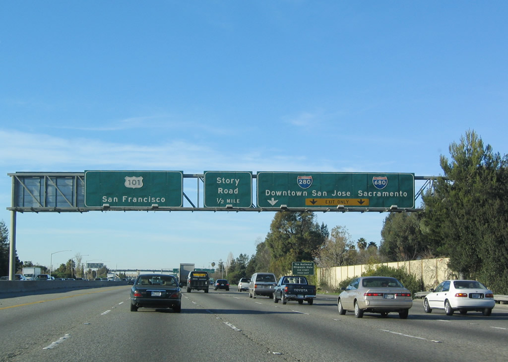
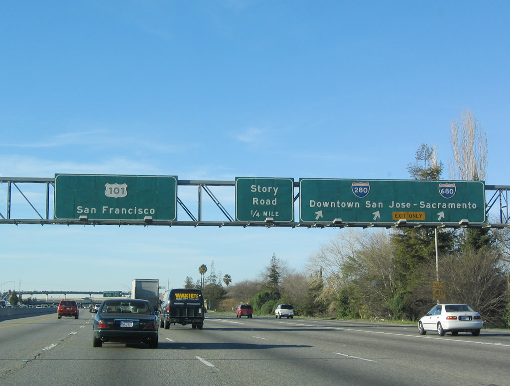
The next three exits along U.S. 101 (Bayshore Freeway) north are Exit 384, Interstate 280 and Interstate 680; Exit 385, Story Road; and Exit 386A, California 130 (Alum Rock Avenue) east to Mount Hamilton and Santa Clara Street west to downtown San Jose. Photo taken 12/23/04. |
|
The right three lanes connect to Interstate 280 north (west) to downtown San Jose and Interstate 680 north to Walnut Creek, Concord, Fairfield, and Sacramento. The left four lanes of U.S. 101 (Bayshore Freeway) continue north toward San Francisco. Photo taken 12/23/04. |
|
Northbound U.S. 101 (Bayshore Freeway) reaches Exit 384, Interstate 280 and Interstate 680. The next exit along northbound is Exit 385, Story Road. Photo taken 12/23/04. |
|
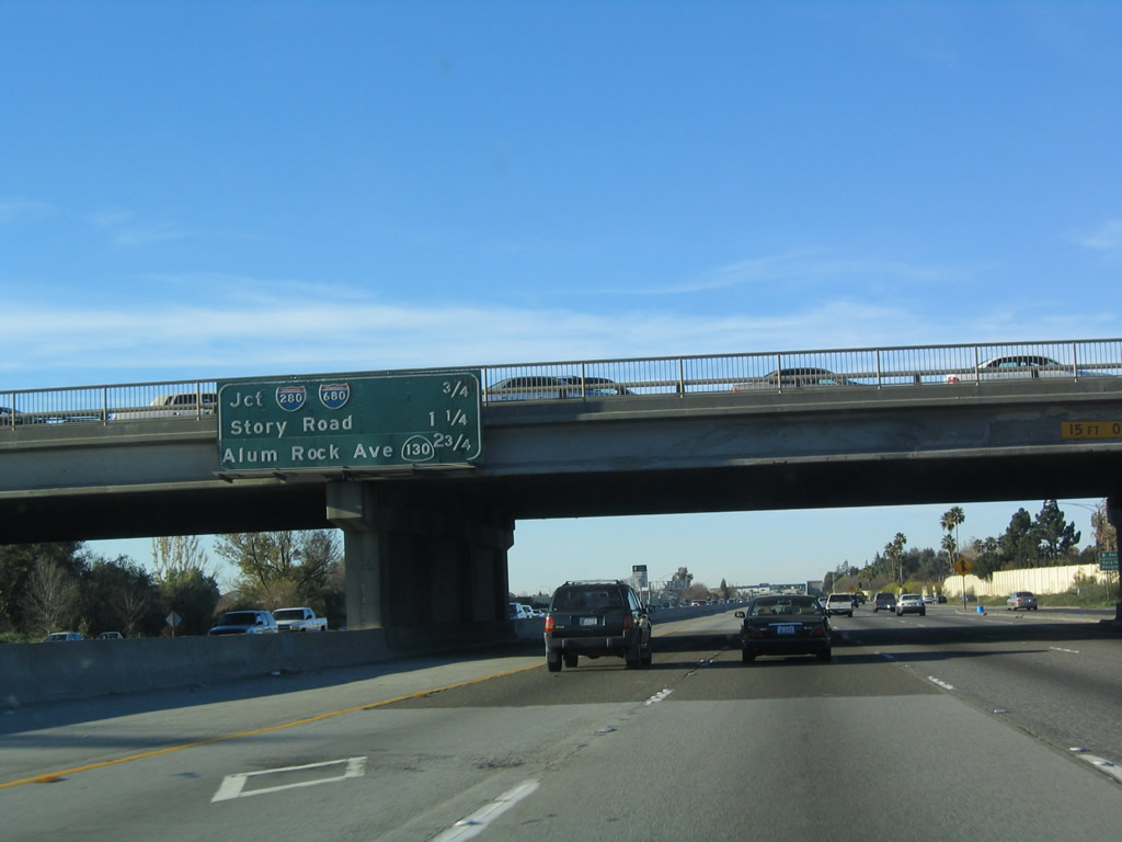
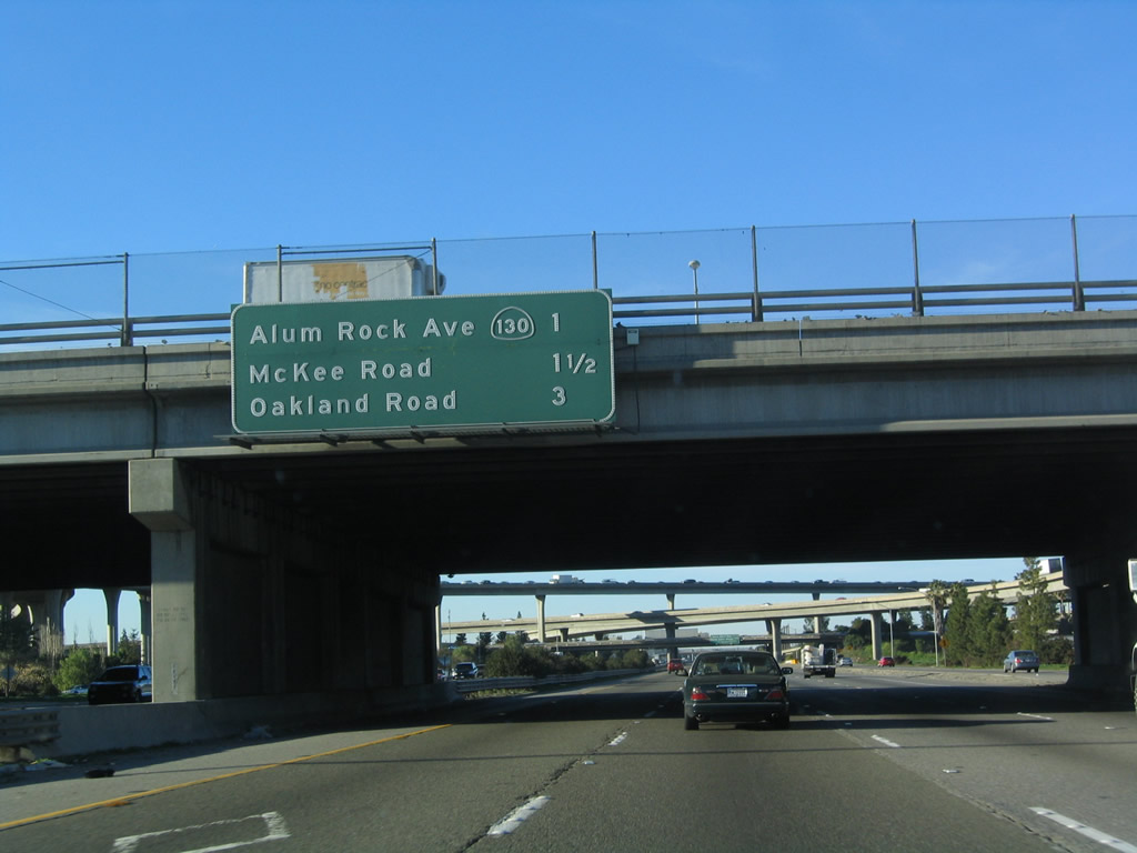
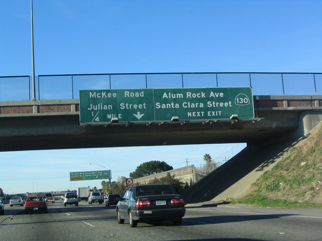
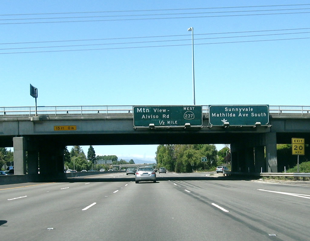
Immediately thereafter, U.S. 101 (Bayshore Freeway) north reaches Exit 385, Story Road. This is a modified cloverleaf interchange situated under the tall flyover ramps that funnel traffic between U.S. 101 and Interstate 280 and Interstate 680. The next off-ramp is Exit 386A, California 130 (Alum Rock Avenue) east to Mount Hamilton and Santa Clara Street west to downtown San Jose. Photo taken 12/23/04. |
|
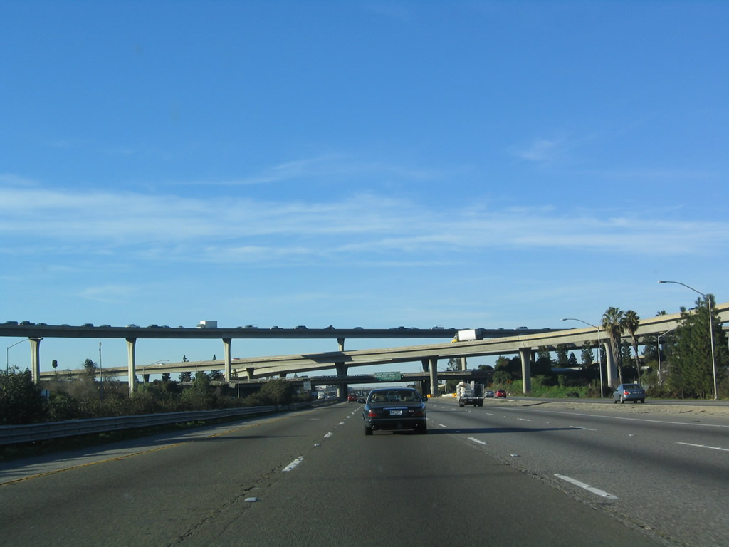
As U.S. 101 (Bayshore Freeway) passes under Story Road, the massive flyover ramps for the almost symmetrical stack interchange with Interstate 280 and Interstate 680 come into view. The next three exits along the Bayshore Freeway are Exit 386A, California 130 (Alum Rock Avenue) east to Mount Hamilton and Santa Clara Street west to downtown San Jose; Exit 386B, McKee Road and Julian Street; and Exit 388A, Oakland Road and 13th Street (old California 17). Photo taken 12/23/04. |
|
The nearly symmetrical stack interchange with Interstate 280 and Interstate 680 comes into view. U.S. 101 will form the bottom level of this interchange, and Interstates 280 and 680 form the second level. The third level includes ramps from U.S. 101 north to Interstate 280 west and U.S. 101 south to Interstate 680 north. At the top level is the ramp from Interstate 680 south to U.S. 101 south. A loop ramp connects Interstate 280 south (east) with U.S. 101 north, which is among the less traveled ramps. Photo taken 12/23/04. |
|
California 130 is an east-west state route that originates at this interchange and follows Alum Rock Avenue east to the Alum Rock and East San Jose communities. California 130 turns onto Mount Hamilton Road east and proceeds to climb toward the observatory at Mount Hamilton. The observatory marks the eastern terminus of California 130. A pair of county roads (San Antonio Valley Road and Del Puerto Canyon Road) connects California 130's eastern end with Interstate 5 in Stanislaus County at Exit 434 near Patterson. The Streets and Highways Code indicates that California 130 is proposed to extend to Interstate 5, but no plans are currently contemplated for extending the state route. With a narrow footprint and sharp turns for much of its route, California 130 is unlikely to serve as a freeway corridor. Photo taken 12/23/04. |
|
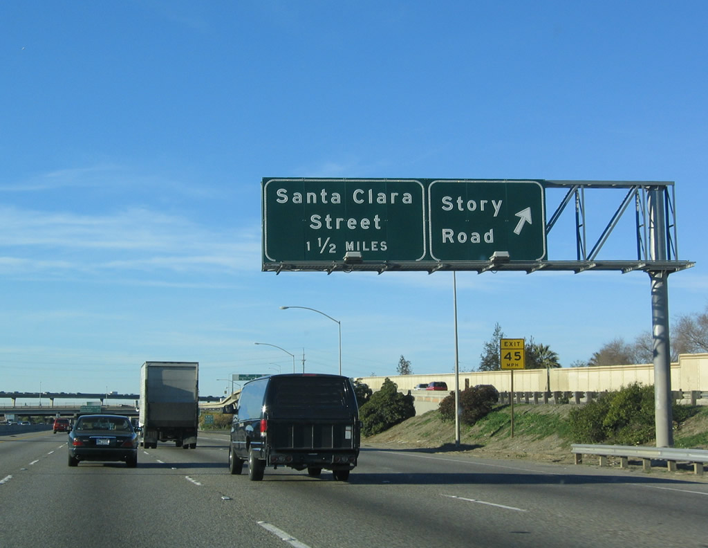
To the west, Santa Clara Street passes by Roosevelt Park, San Jose Medical Center, and San Jose State University (via 10th Street southbound). Santa Clara Street enters downtown and connects with all attractions and facilities in this area including the convention center, HP Pavilion at San Jose, and the Civic Center (via First Street northbound). Photo taken 12/23/04. |
|
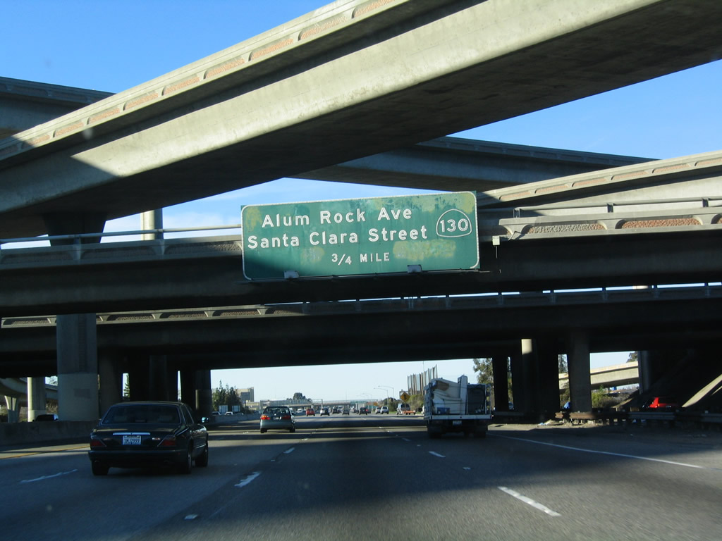
U.S. 101 passes under East San Antonio Street before meeting California 130. The next exit along northbound is Exit 386B, McKee Road and Julian Street. Photo taken 12/23/04. |
|
Northbound U.S. 101 reaches Exit 386A, California 130 (Alum Rock Avenue) east and Santa Clara Street west. The next exit along northbound is Exit 386B, McKee Road and Julian Street. Photo taken 03/18/06. |
|
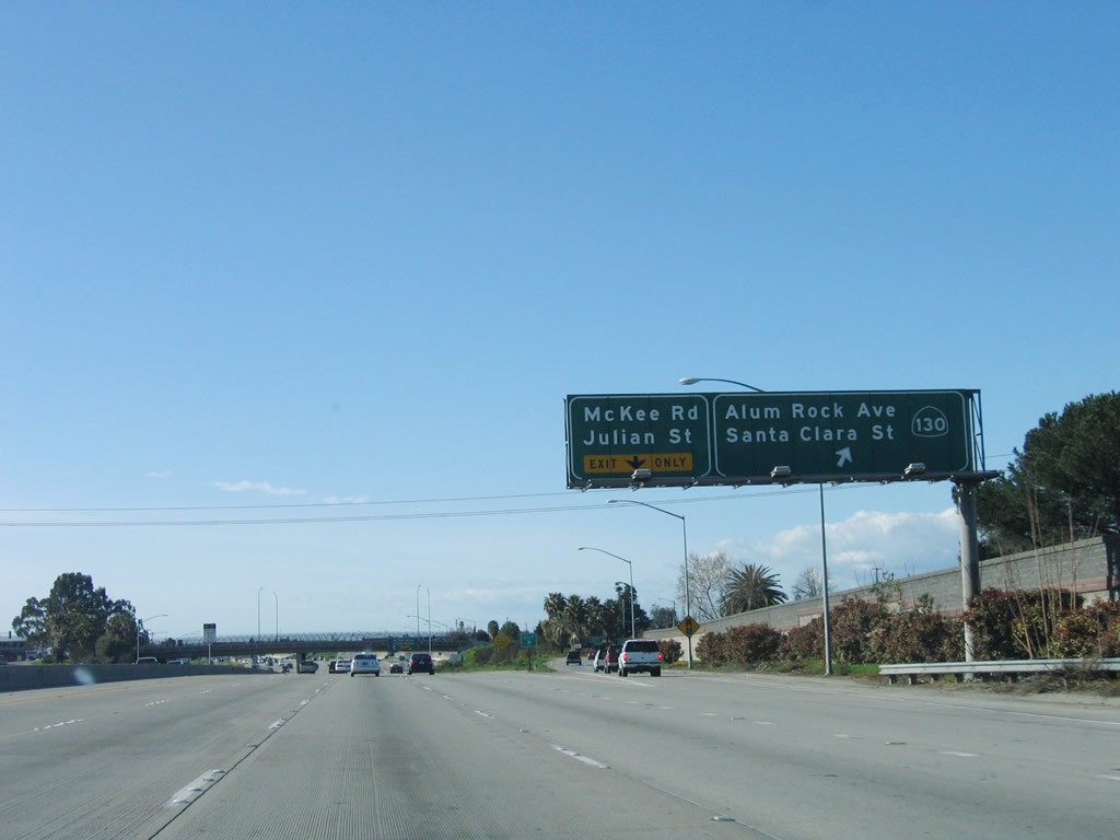
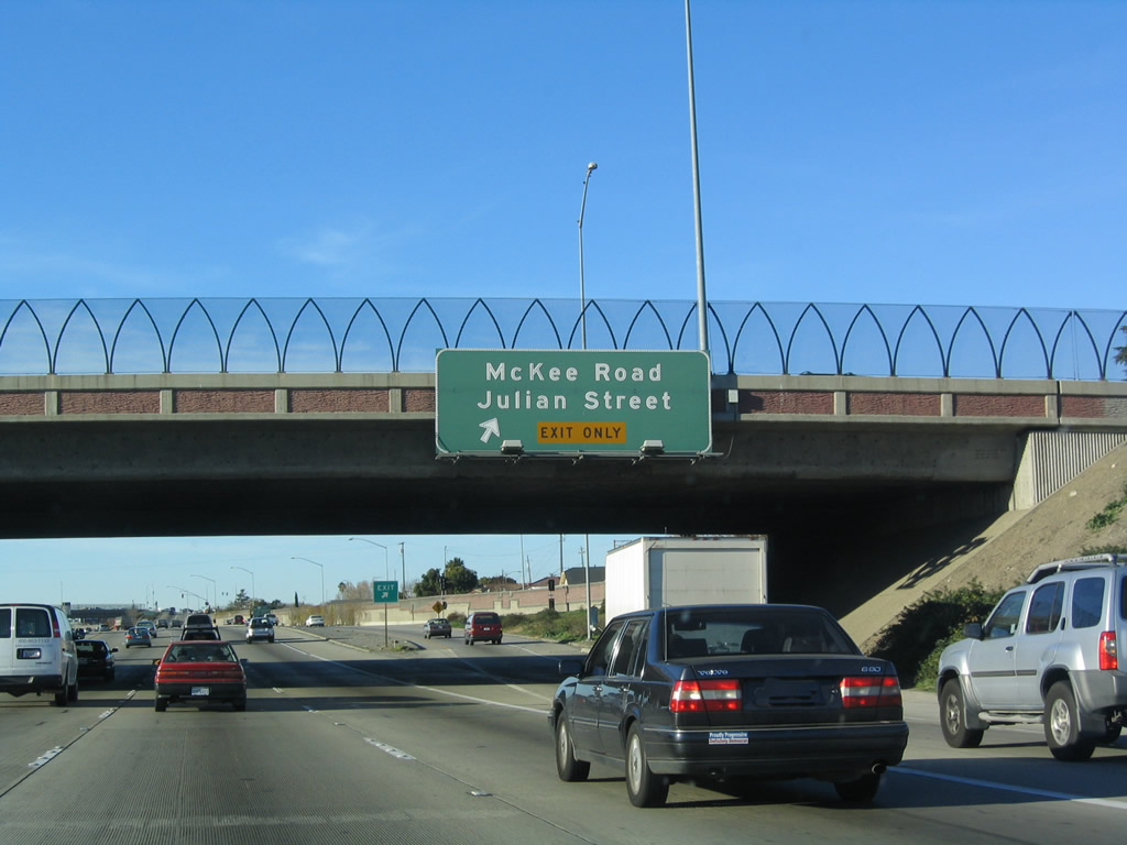
Immediately thereafter, the Bayshore Freeway northbound meets Exit 386B, McKee Road and Julian Street. This exit also serves neighborhoods east of downtown San Jose. Photo taken 12/23/04. |
|
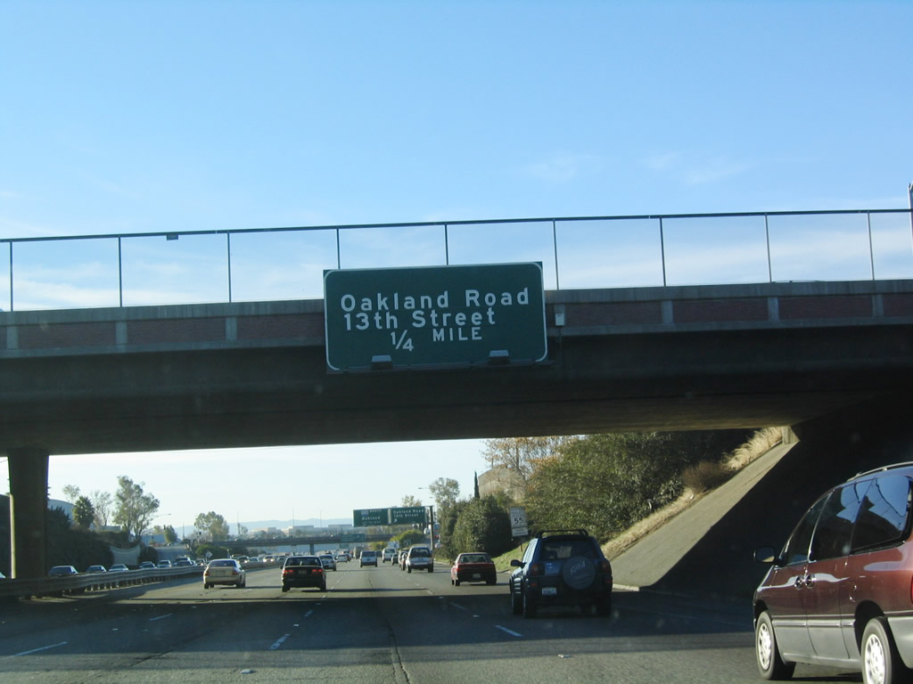
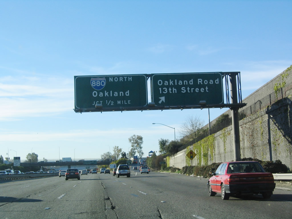
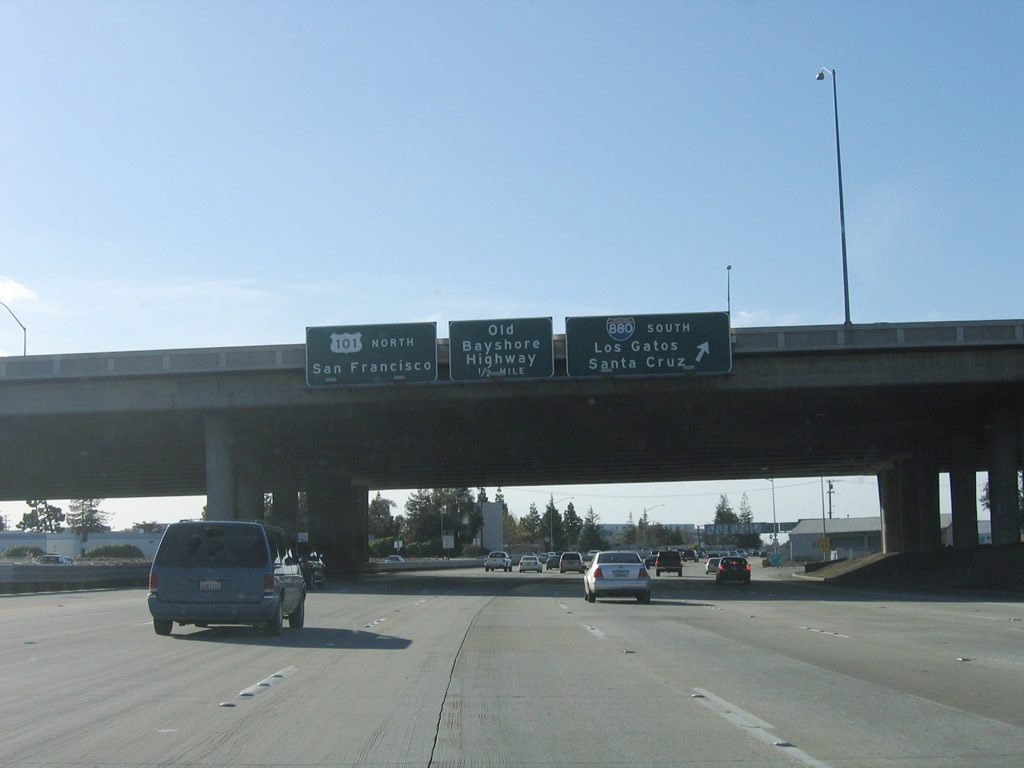
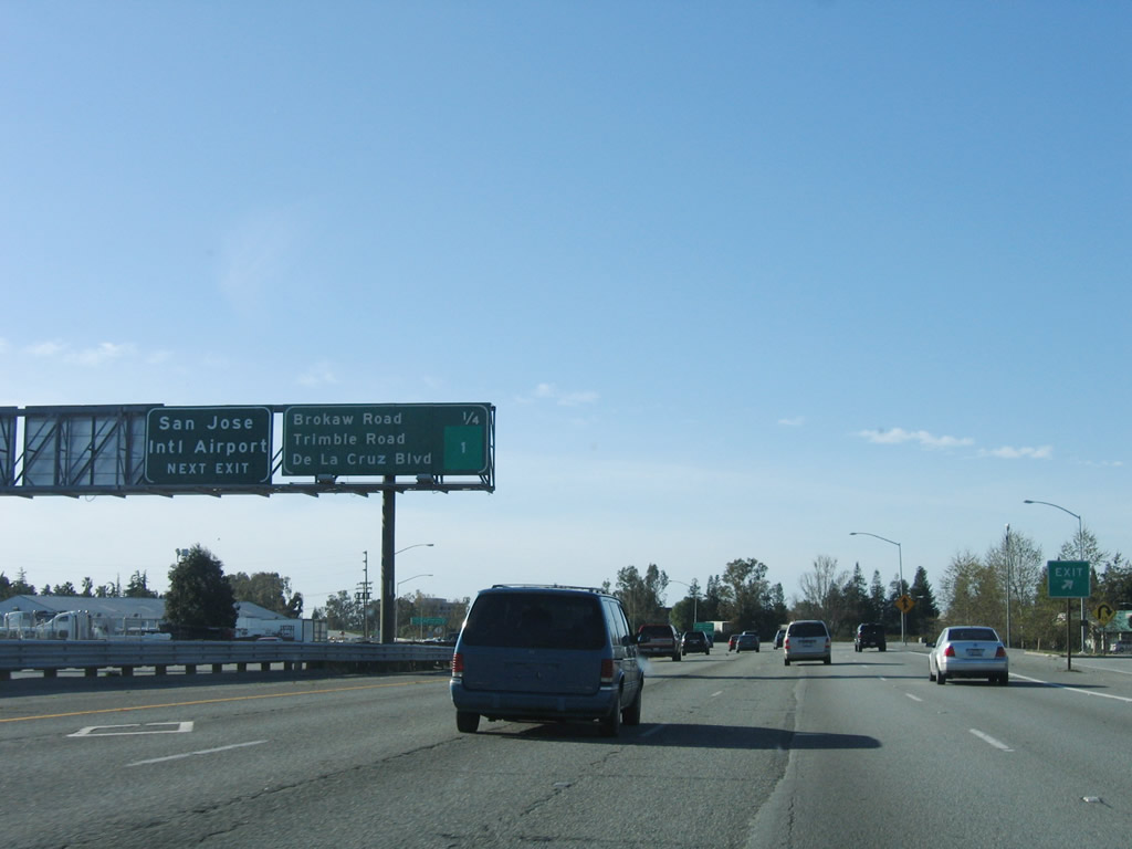
The next five exits along U.S. 101 (Bayshore Freeway) north are Exit 388A, Oakland Road and 13th Street; Exit 388B, Interstate 880 (Nimitz Freeway) north to Oakland; Exit 388C, Interstate 880 south to Santa Cruz; Exit 389A, Old Bayshore Highway; and Exit 389B, Brokaw Road and First Street. Around this point, U.S. 101 begins to turn toward the northwest as it positions itself for a straight shot toward San Francisco. Photo taken 12/23/04. |
|
As the name implies, Oakland Road is the old alignment of California 17 before the freeway alignment (now Interstate 880) was constructed. Photo taken 12/23/04. |
|
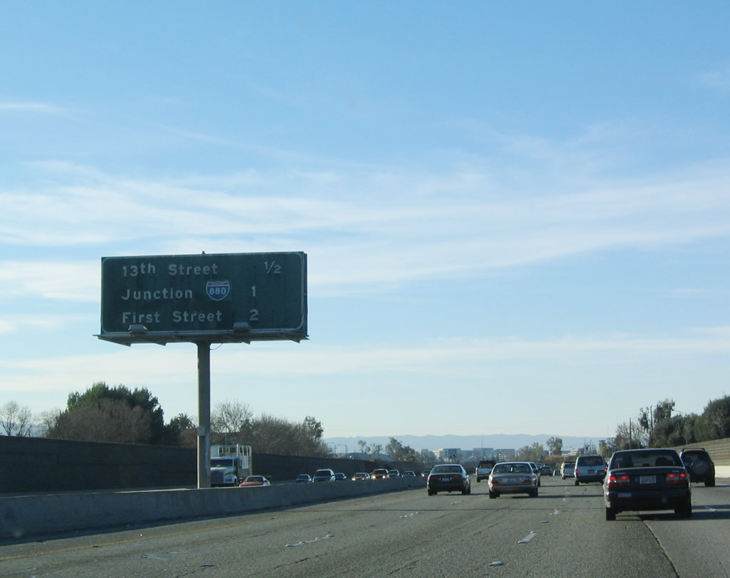
Northbound U.S. 101 (Bayshore Freeway) reaches Exit 388A, Oakland Road and 13th Street. The next interchange along U.S. 101 north is Exits 388B-C, Interstate 880 (Nimitz Freeway) north to Oakland and Exit 388C, Interstate 880 south to Santa Cruz. Photo taken 12/23/04. |
|
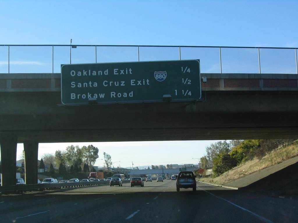
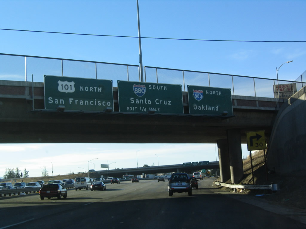
The next four exits along U.S. 101 (Bayshore Freeway) north are Exit 388B, Interstate 880 (Nimitz Freeway) north to Oakland; Exit 388C, Interstate 880 south to Santa Cruz; Exit 389A, Old Bayshore Highway; and Exit 389B, Brokaw Road and First Street. Photo taken 12/23/04. |
|
Interstate 880 (Nimitz Freeway) is a major north-south freeway corridor connecting San Jose with Oakland along the eastern shore of San Francisco Bay. The freeway follows the alignment of former California 17 for its entire route, excluding the replacement section between Interstate 980 and Interstate 80 that collapsed in the 1989 Loma Prieta Earthquake. Photo taken 12/23/04. |
|
Northbound U.S. 101 reaches Exit 388B, Interstate 880/Admiral Chester W. Nimitz Freeway north to Oakland. Photo taken 12/23/04. |
|
A loop ramp connects U.S. 101 north with Interstate 880 south at Exit 388C. To the south, Interstate 880 travels about four miles until it intersects Interstate 280. At that point, the Interstate ends and California 17 continues from that point south to Santa Cruz. Photo taken 03/18/06. |
|
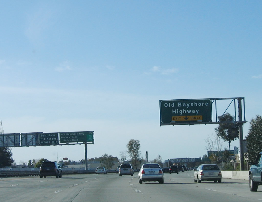
The next exit along U.S. 101 (Bayshore Freeway) north is Exit 389A, Old Bayshore Highway. Photo taken 03/18/06. |
|
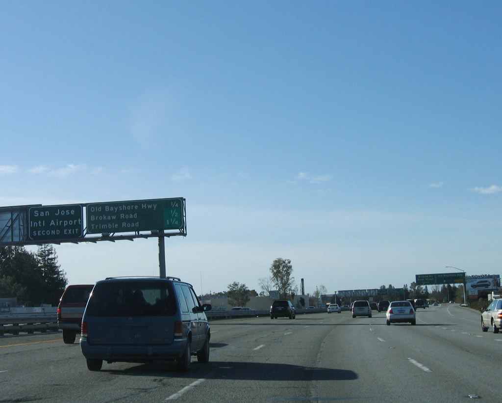
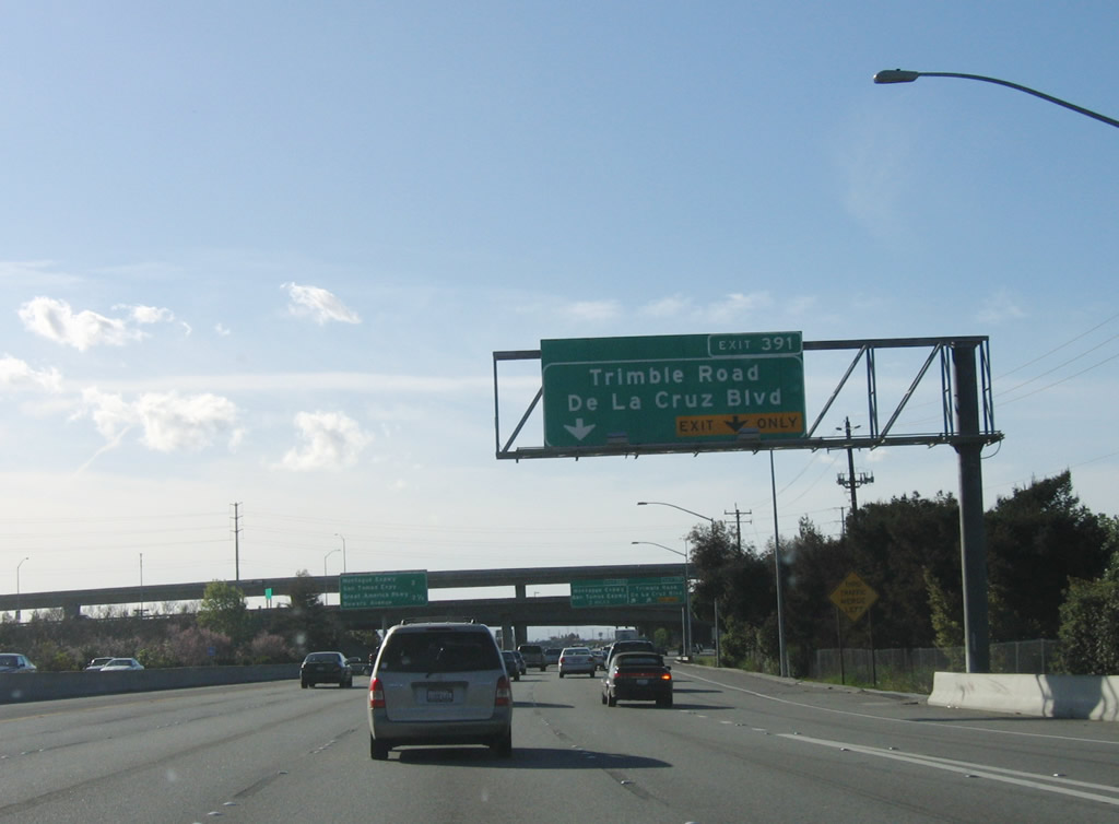
The next three exits along U.S. 101 (Bayshore Freeway) north are Exit 389A, Old Bayshore Highway; Exit 389B, Brokaw Road west to Norman Y. Mineta San Jose International Airport and First Street south to downtown San Jose; and Exit 391, Trimble Road and De La Cruz Boulevard. Photo taken 03/18/06. |
|
Northbound U.S. 101 (Bayshore Freeway) reaches Exit 389A, Old Bayshore Highway. Photo taken 03/18/06. |
|
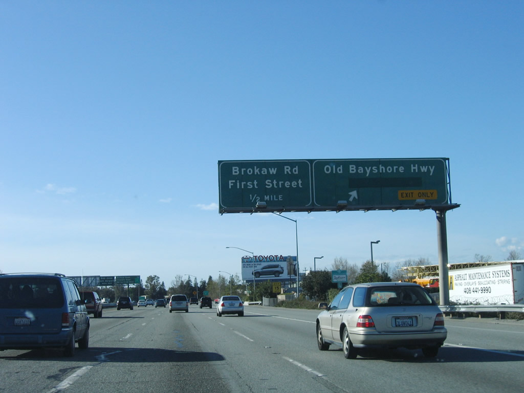
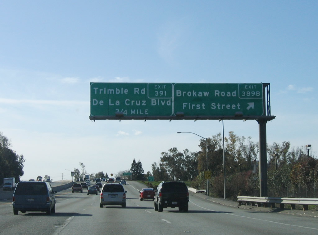
The next two exits along U.S. 101 (Bayshore Freeway) north are Exit 389B, Brokaw Road west to Norman Y. Mineta San Jose International Airport and First Street south to downtown San Jose and Exit 391, Trimble Road and De La Cruz Boulevard. Photo taken 03/18/06. |
|
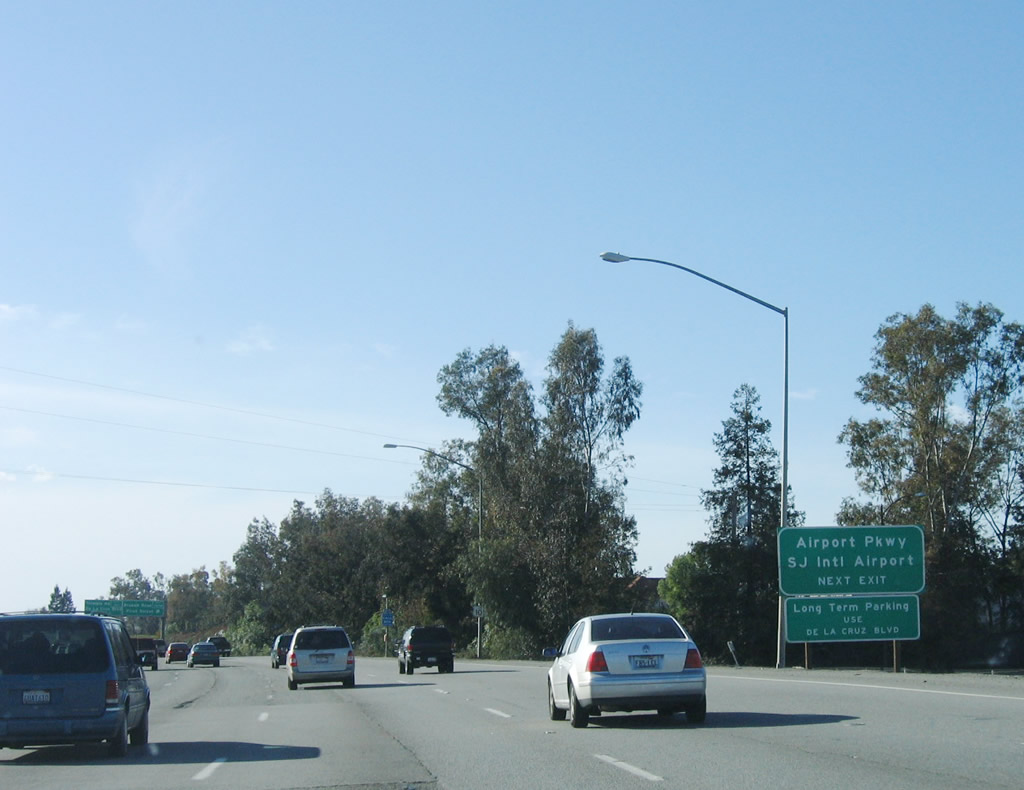
Use Exit 389B, Brokaw Road west to Norman Y. Mineta San Jose International Airport. The airport is situated west of the Guadalupe River and California 87 (Guadalupe Parkway). De La Cruz Boulevard and Coleman Avenue form the western edge of the airport. Use Exit 389B to California 87 south, as there is no direct connection from U.S. 101 north. Photo taken 03/18/06. |
|
Northbound U.S. 101 (Bayshore Freeway) reaches Exit 389B, Brokaw Road west to Norman Y. Mineta San Jose International Airport and First Street south to downtown San Jose. This interchange, along with Exit 391, is the last to serve the city of San Jose. Photo taken 03/18/06. |
|
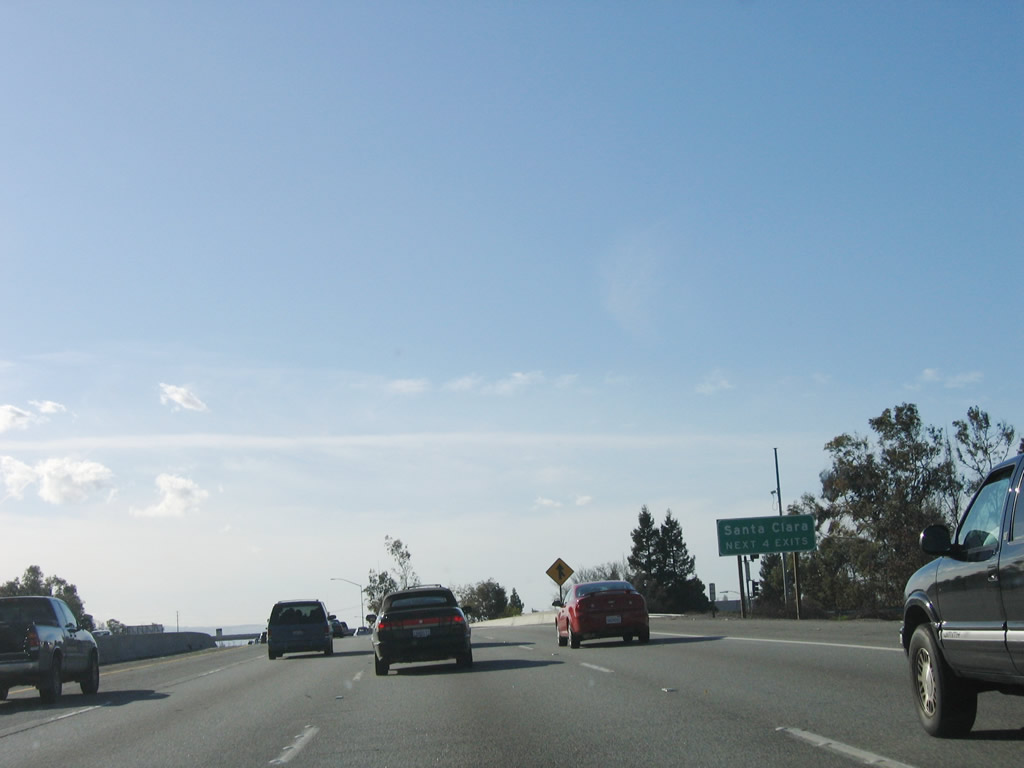
The next four interchanges along U.S. 101 north serve the city of Santa Clara (population 102,361 and 18.38 square miles in area). The city was incorporated in 1852. The city has its own electric utility (Silicon Valley Power) and is the location of the Mission Santa Clara de Asis, which was founded in 1777 and marks the first settlement of this area. Photo taken 03/18/06. |
|
Use Exit 391 (De La Cruz Boulevard south) to Santa Clara University. Photo taken 03/18/06. |
|
The right two lanes connect to Exit 391, De La Cruz Boulevard and Trimble Road. The flyover ramps in the distance connect California 87 (Guadalupe Parkway) with U.S. 101; there is no access from U.S. 101 north to California 87 south. Photo taken 03/18/06. |
|
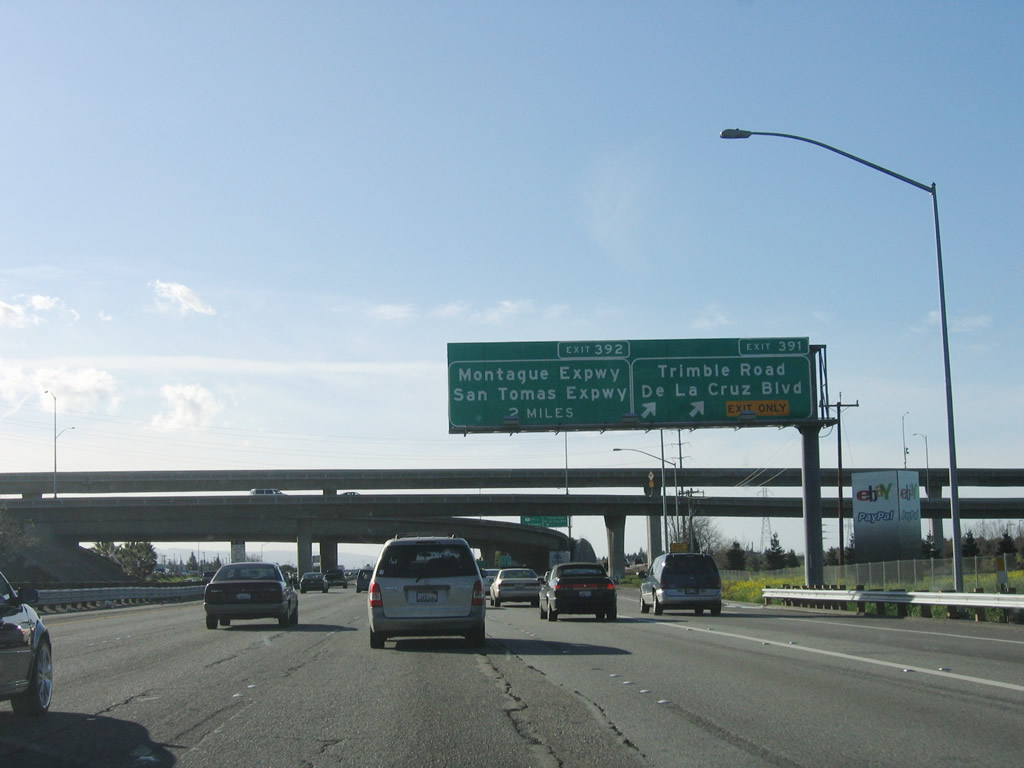
Northbound U.S. 101 reaches Exit 391, De La Cruz Boulevard and Trimble Road. The ramp to this exit is located prior to passing under California 87; this enables a direct connection from California 87 north and U.S. 101 north to De La Cruz Boulevard and Trimble Road. Photo taken 03/18/06. |
|
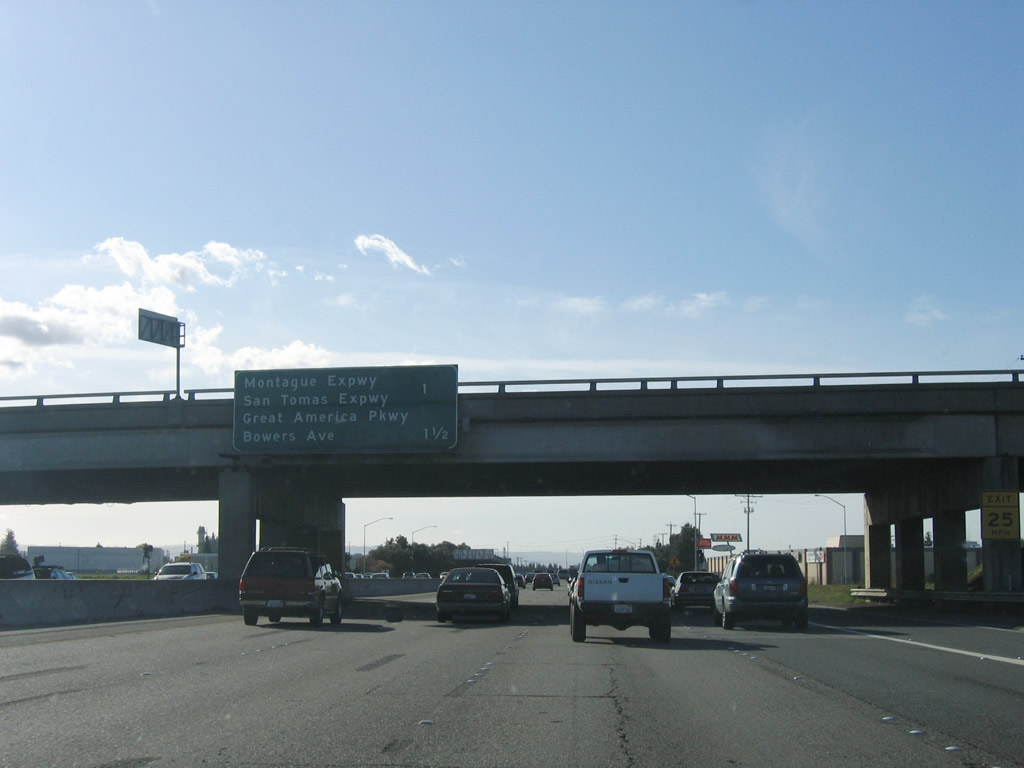
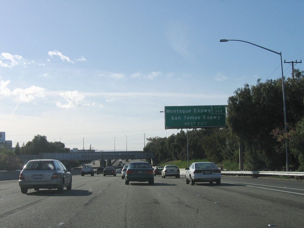
The next three interchanges along U.S. 101 (Bayshore Freeway) north are Exit 392, Santa Clara County G-4 (Montague Expressway and San Tomas
Expressway); Exit 393, Great America Parkway and Bowers Avenue; and Exit 394, Santa Clara County G-2 (Lawrence Expressway). Each of these exits serve the city of Santa Clara, although Exit 394 is actually situated in the city of Sunnyvale. Photo taken 03/18/06. |
|
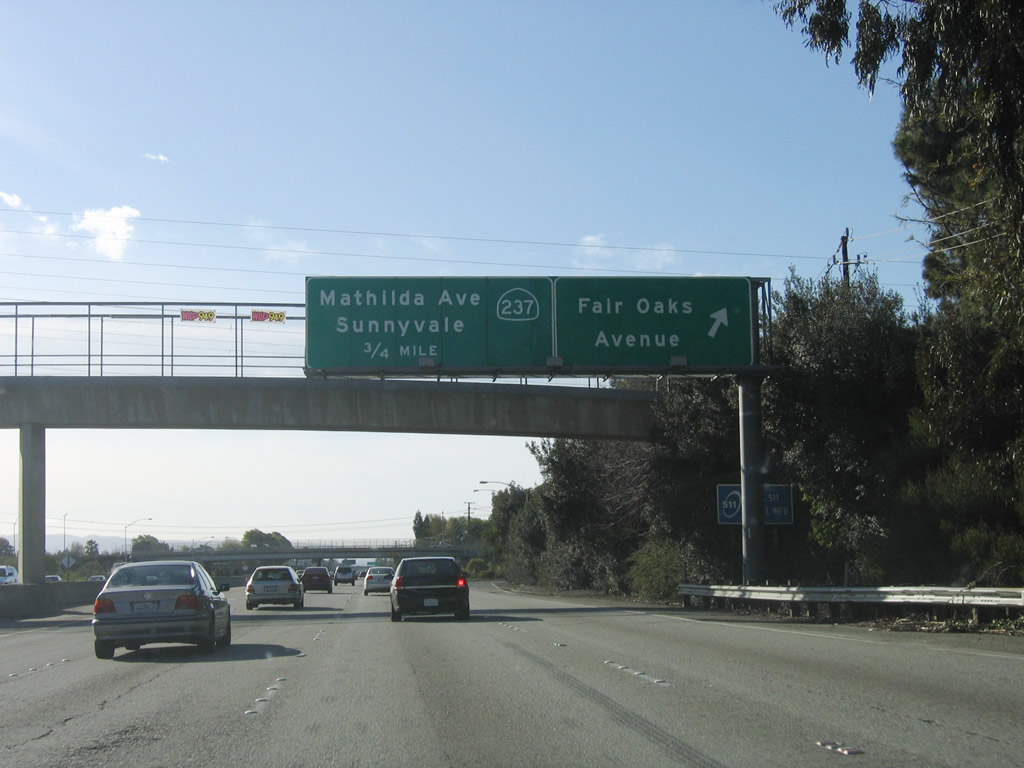
Santa Clara County G-4 travels south from this interchange to California 17 Exit 23 through Santa Clara, western San Jose, and Campbell. At this interchange, the expressway turns east as the Montague Expressway, and may or may not retain its signed county route status. The Montague Expressway (County Route G-4) then travels east toward Interstate 680 Exit 6 in Milpitas. Much of the combined San Tomas Expressway and Montague Expressway corridor has a high occupancy vehicle lane for commuting hours. Photo taken 03/18/06. |
|
Northbound U.S. 101 (Bayshore Freeway) reaches Santa Clara County G-4 (San Tomas Expressway) south and G-4/Montague Expressway east. Photo taken 03/18/06. |
|
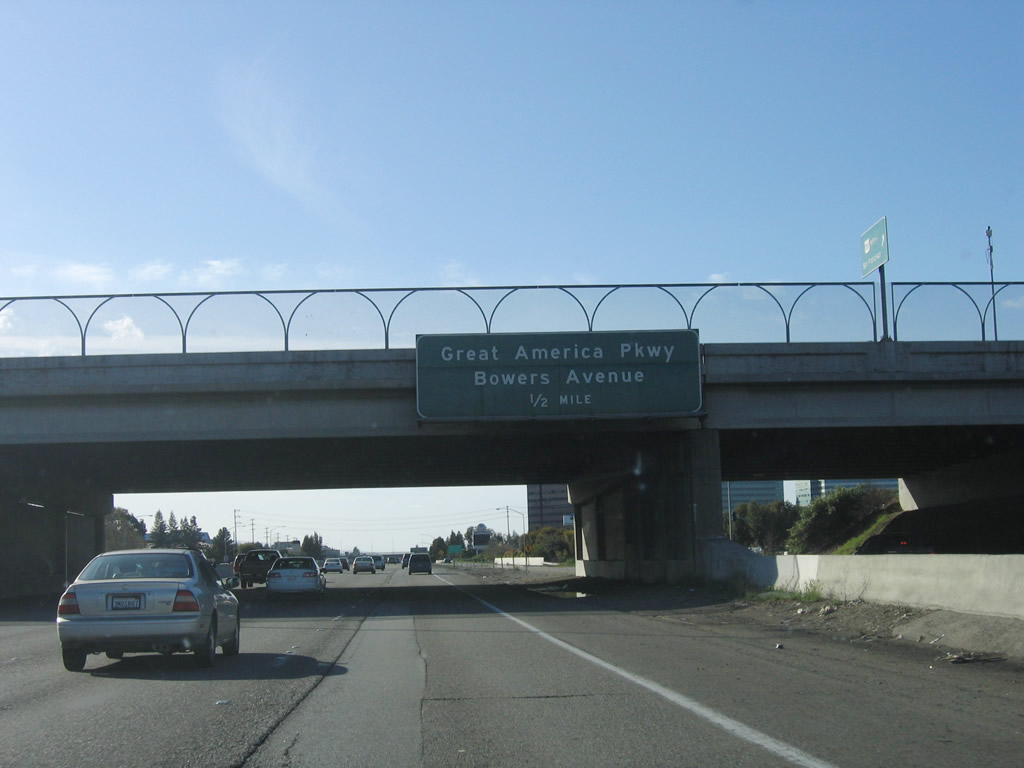
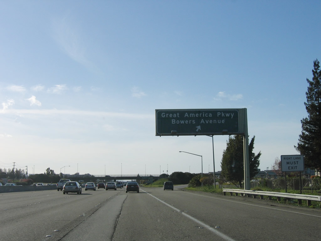
Passing under the G-4 overpass (San Tomas Expressway and Montague Expressway), the next exit along U.S. 101 north is Exit 393, Great America Parkway and Bowers Avenue. This exit connects U.S. 101 with Paramount's Great America and to Intel's corporate headquarters. Photo taken 03/18/06. |
|
Northbound Bayshore Freeway (U.S. 101) north reaches Exit 393, Great America Parkway and Bowers Avenue. Follow Great America Parkway north to Mission College, Paramount's Great America, Santa Clara Convention Center, and California 237 (South Bay Freeway) at Exit 6. Photo taken 03/18/06. |
|
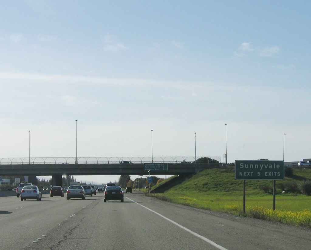
The next five interchanges along U.S. 101 (Bayshore Freeway) north serve the city of Sunnyvale. Known as the "Heart of Silicon Valley," Sunnyvale is situated between Santa Clara and Los Altos in Santa Clara County. The city is home to 131,760 people as of the 2000 Census and consists of 22.6 square miles. Sunnyvale incorporated in 1912 after being settled in the late 1800s. Photo taken 03/18/06. |
|
The next four exits along U.S. 101 (Bayshore Freeway) north are Exit 394, Santa Clara County G-2 (Lawrence Expressway); Exit 395, Fair Oaks Avenue; Exit 396A, Mathilda Avenue north to California 237 east; and Exit 396B, Mathilda Avenue south. Photo taken 03/18/06. |
|
Santa Clara County G-2 (Lawrence Expressway) travels north to California 237 Exit 5 and south back to the city of Santa Clara and eventually into western San Jose. G-2 continues south along Quito Road, and ends at California 9/Saratoga-Los Gatos Road. Photo taken 03/18/06. |
|
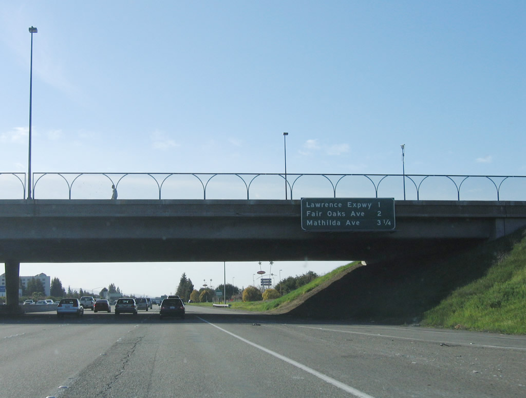
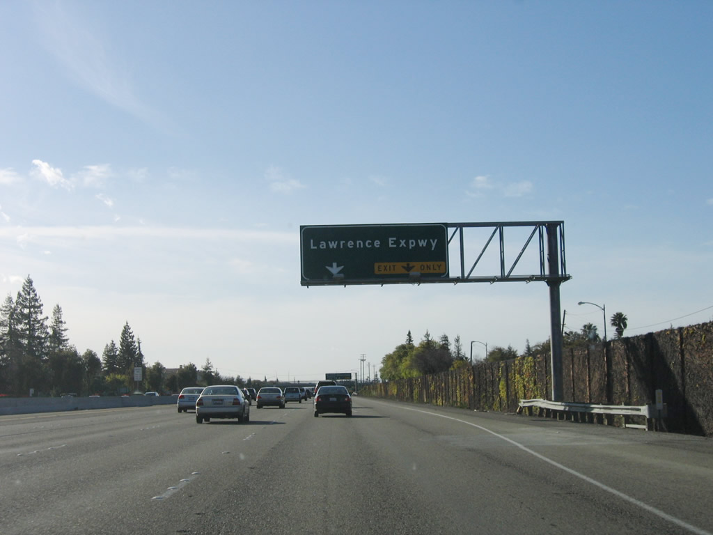
Northbound U.S. 101 (Bayshore Freeway) reaches Exit 394, Santa Clara County G-2 (Lawrence Expressway). Use this exit to AMD's corporate headquarters. The next interchange along northbound is Exit 395, Fair Oaks Avenue. Photo taken by Jeff Waller (08/11/07). |
|
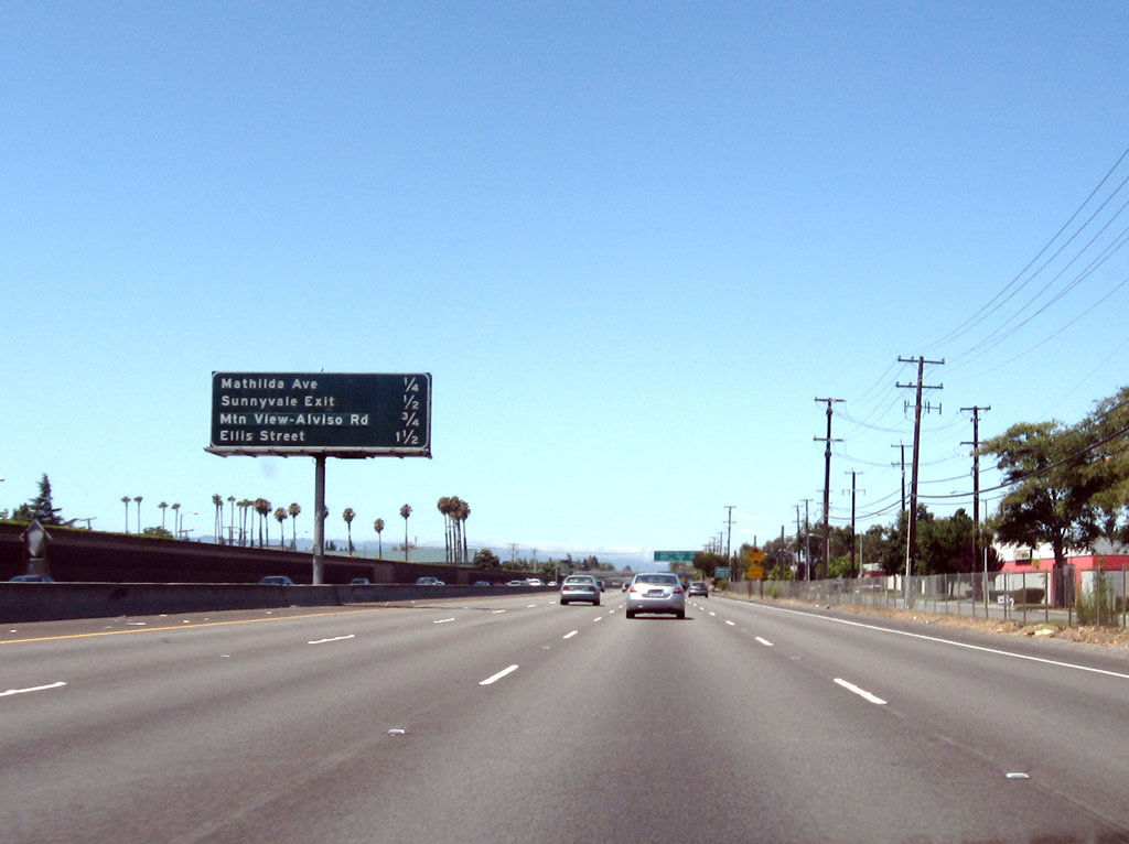
The next three exits along U.S. 101 (Bayshore Freeway) north are Exit 395, Fair Oaks Avenue; Exit 396A, Mathilda Avenue north to California 237 east; and Exit 396B, Mathilda Avenue south ("Sunnyvale Exit"). Photo taken by Jeff Waller (08/11/07). |
|
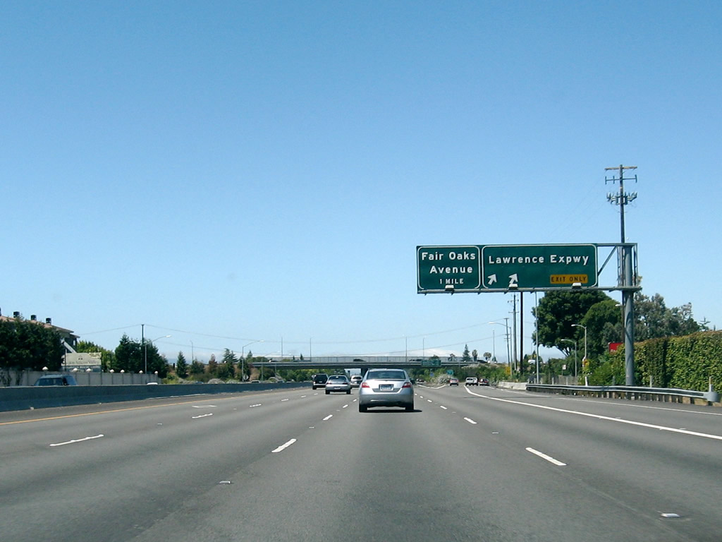
Northbound U.S. 101 (Bayshore Freeway) reaches Exit 395, Fair Oaks Avenue. The next three exits are: Exit 396A, Mathilda Avenue north to California 237 east; Exit 396B, Mathilda Avenue south; and Exit 396C, California 237 west to Mountain View. Photo taken 03/18/06. |
|
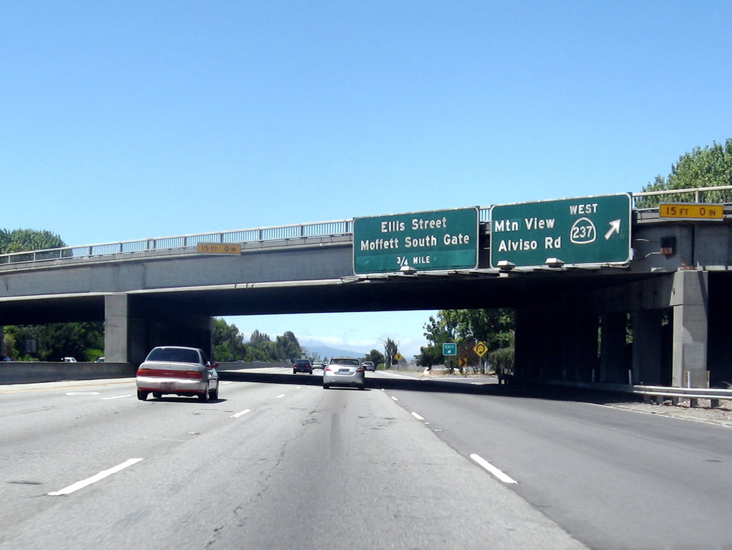
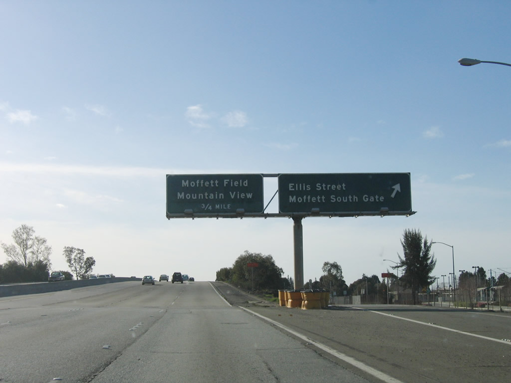
The next four exits along U.S. 101 (Bayshore Freeway) north are Exit 396A, Mathilda Avenue north to California 237 east; Exit 396B, Mathilda Avenue south; Exit 396C, California 237 west; and Exit 397, Ellis Street and Moffett South Gate. Photo taken by Jeff Waller (08/11/07). |
|
Use Exit 396B, Mathilda Avenue south to downtown Sunnyvale. Photo taken 03/18/06. |
|
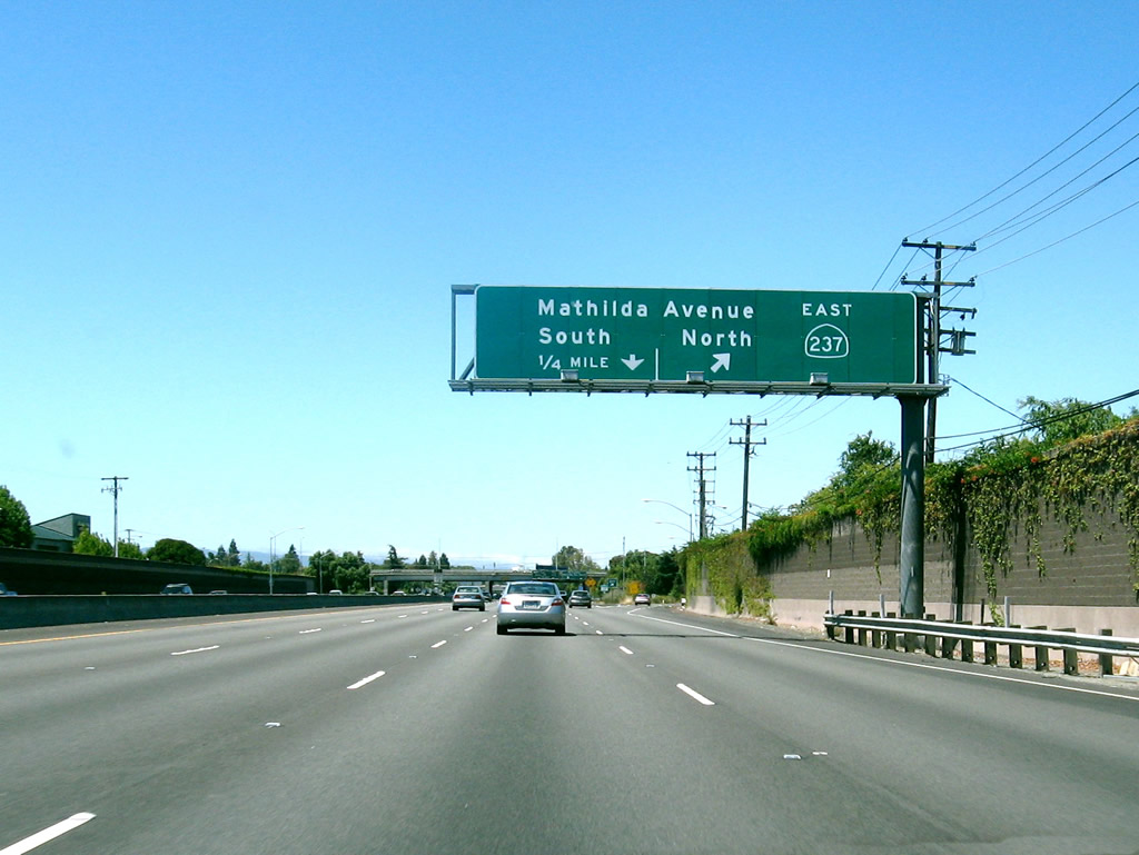
Northbound U.S. 101 (Bayshore Freeway) reaches Exit 396A, Mathilda Avenue north to California 237 east. Since there is no direct connection from U.S. 101 north to California 237 (South Bay Freeway) west, motorists must use Mathilda Avenue north. The second off-ramp is Exit 396B, Mathilda Avenue south to downtown Sunnyvale. Photo taken by Jeff Waller (08/11/07). |
|
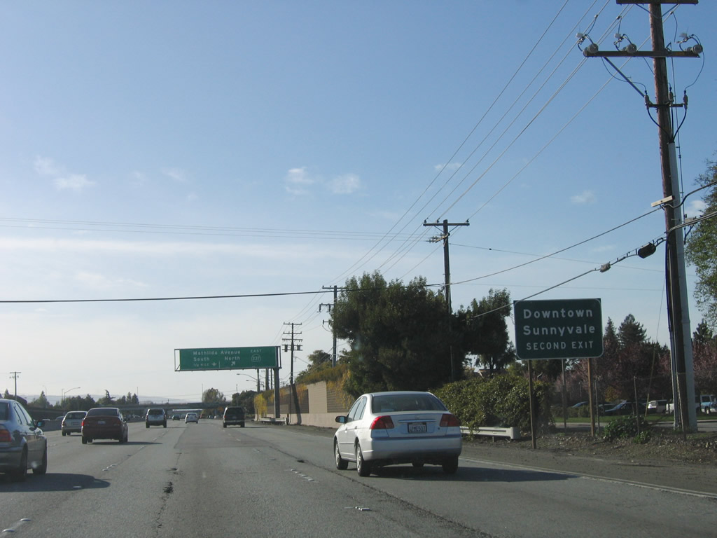
Immediately thereafter, northbound U.S. 101 (Bayshore Freeway) reaches Exit 396B, Mathilda Avenue south. The next off-ramp is Exit 396C, California 237/Mountain View-Alviso Road west to Mountain View. Note the original porcelain enamel guide sign still in use here. Photo taken by Jeff Waller (08/11/07). |
|
Passing under the California 237 freeway, northbound U.S. 101 (Bayshore Freeway) reaches Exit 396C, California 237 west to Mountain View. The next exit is Exit 397, Ellis Street and Moffett South Gate. Photo taken by Jeff Waller (08/11/07). |
|
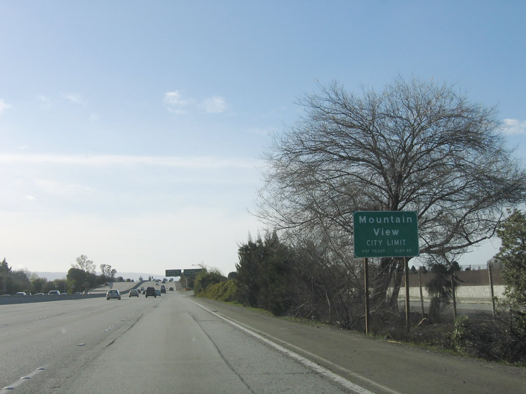
Soon thereafter, U.S. 101 (Bayshore Freeway) north enters the city of Mountain View, which is home to 70,708 people as of the 2000 Census, sits at an elevation of 105 feet, and consists of 12.2 square miles. Photo taken by Jeff Waller (08/11/07). |
|
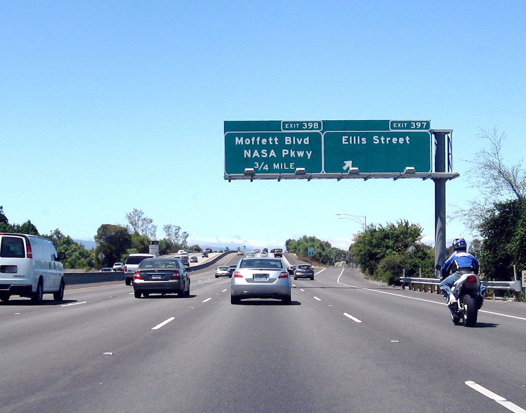
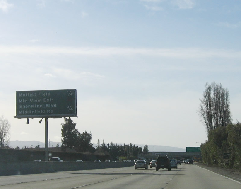
This interchange sequence sign provides the distance to the next three exits along U.S. 101 (Bayshore Freeway) north: Exit 398, Moffett Boulevard and NASA Parkway; Exit 399A, Shoreline Boulevard; Exit 399B, Old Middlefield Way. Photo taken 03/18/06. |
|
Northbound U.S. 101 reaches Exit 398, Moffett Boulevard and NASA Parkway. Photo taken 03/18/06. |
|
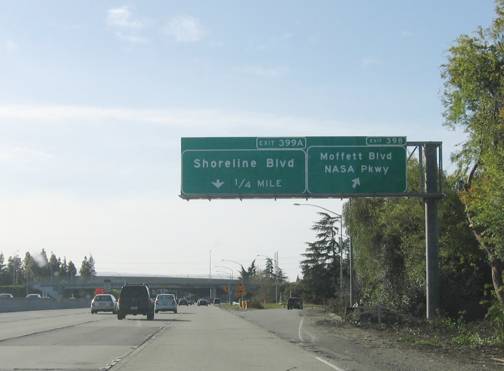
Northbound U.S. 101 (Bayshore Freeway) reaches Exit 399A, Shoreline Boulevard. Use Shoreline Boulevard north to the Shoreline Amphitheatre, an outdoor performing arts venue. Ramps connecting U.S. 101 south with California 85 south and connecting California 85 north with U.S. 101 north fly over U.S. 101; however, there is no access from U.S. 101 north to California 85. Photo taken 03/18/06. |
|
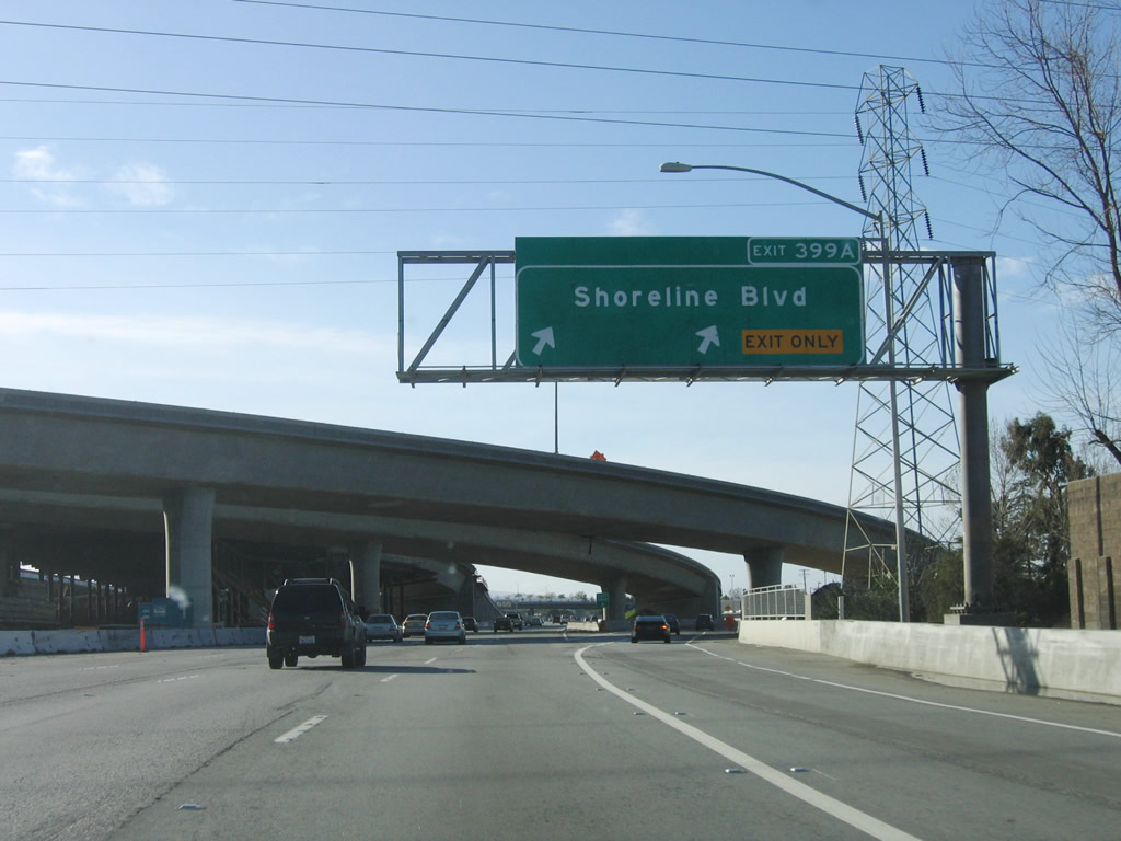
At the gore point for Exit 399A, Shoreline Boulevard, the general-purpose connecting ramp from California 85 north to U.S. 101 north passes over the freeway. In addition, a high occupancy vehicle lane ramp directly connects from California 85 north with U.S. 101 north (see ramp in middle of freeway). Photo taken by Jeff Waller (08/11/07). |
|
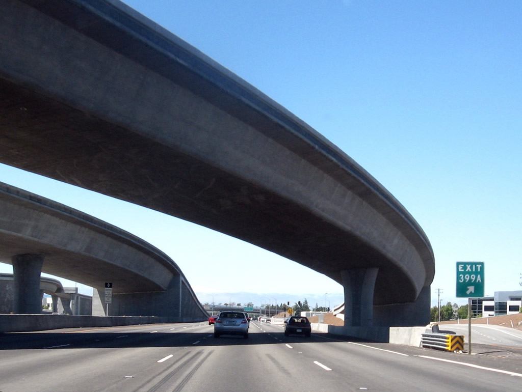
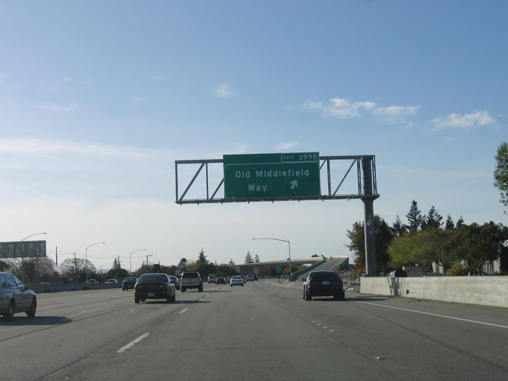
As California 85 traffic merges into U.S. 101 (Bayshore Freeway) north, the freeway then meets Exit 399B, Old Middlefield Way. Photo taken 03/18/06. |
|
At the time this picture was taken, the gore point signage incorrectly showed Exit 399B for Old Middlefield Way as Exit 399. Photo taken 03/18/06. |
|
Northbound U.S. 101 (Bayshore Freeway) next reaches Exit 400A, Amphitheater Parkway. This interchange connects to Shoreline Amphitheatre and Google's corporate headquarters. Photo taken 03/18/06. |
|
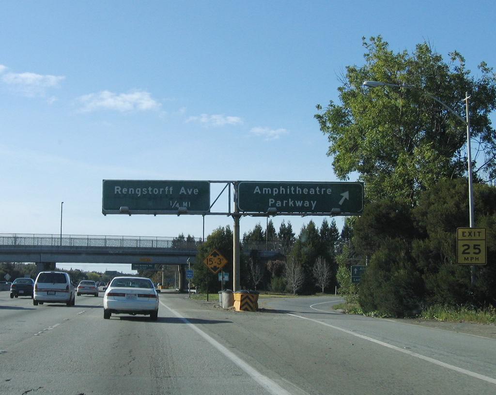
The next exit along U.S. 101 (Bayshore Freeway) north is Exit 400B, Rengstorff Avenue. This sign bridge and signs replaces signs that were removed in the next photobox at the gore point. Photo taken by Jeff Waller (08/11/07). |
|
Northbound U.S. 101 (Bayshore Freeway) reaches Exit 400B, Rengstorff Avenue. This sign bridge and signs were removed in favor of the newer signs seen in the previous photobox. Photo taken 03/18/06. |
|
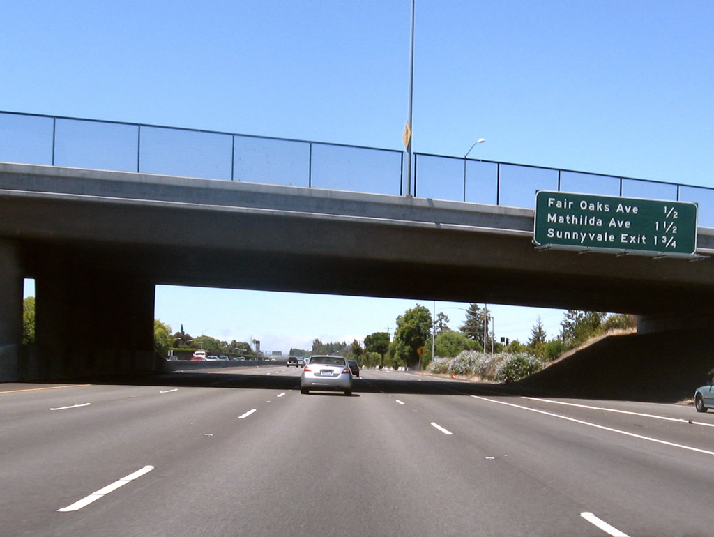
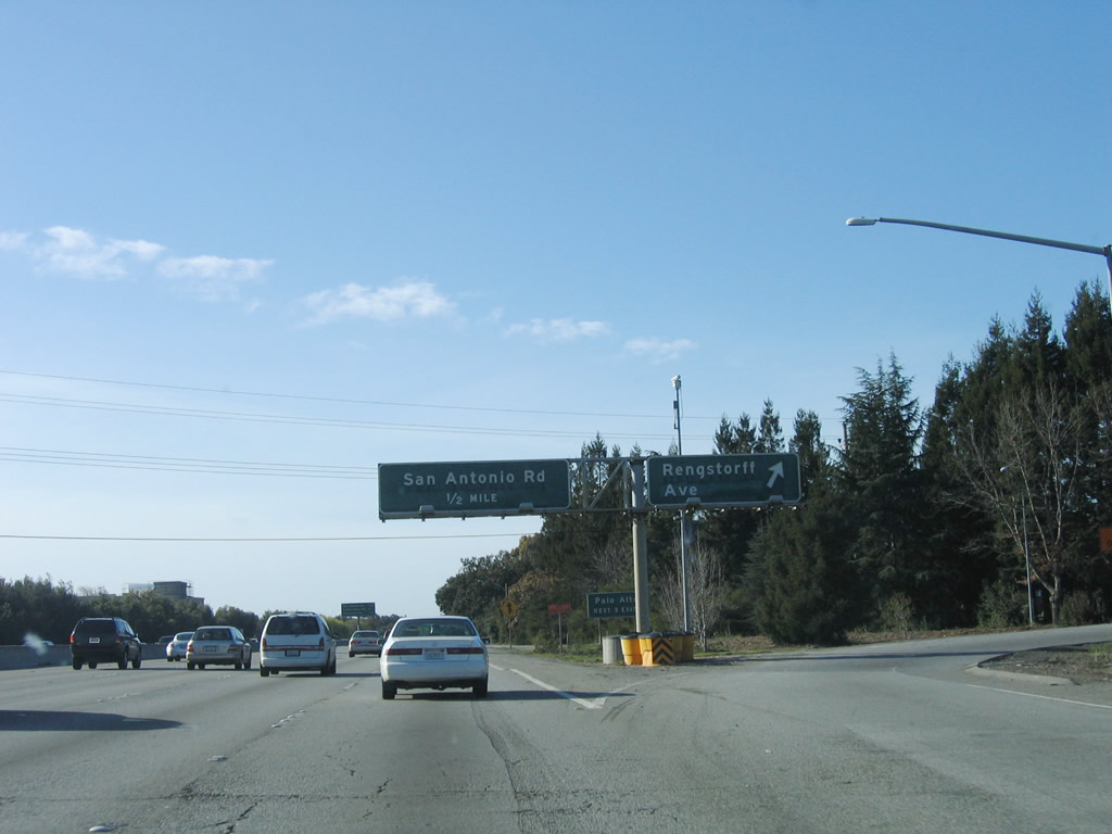
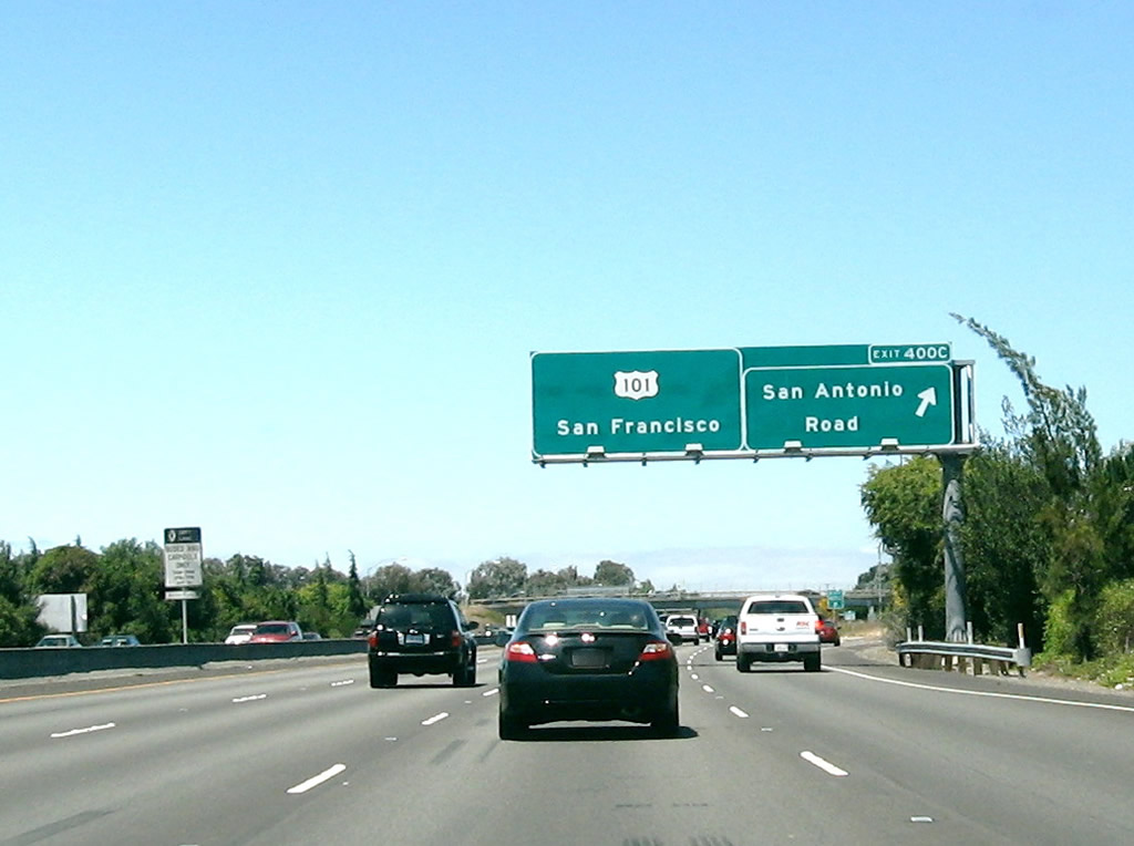
The next three exits along U.S. 101 (Bayshore Freeway) north are Exit 400C, San Antonio Road; Exit 402, Embarcadero Road and Santa Clara County G-3/Oregon Expressway; and Exit 403, California 109 (University Avenue). Photo taken by Jeff Waller (08/11/07). |
|
At Exit 400C, U.S. 101 leaves Mountain View and enters the city of Palo Alto. Home to 58,598 people of the 2000 Census, Palo Alto consists of 25.6 square miles. Internationally recognized Stanford University is partially located within city limits. Palo Alto operates its own public utility for power, and its system interconnects with the Pacific Gas and Electric network. Palo Alto was founded in 1887 and was consolidated with adjacent Mayfield in July 1925. The two "downtown" areas are located along University Avenue and California Avenue. The next three exits along U.S. 101 (Bayshore Freeway) north are Exit 402, Embarcadero Road and Santa Clara County G-3/Oregon Expressway; Exit 403, California 109 (University Avenue); and Exit 404, California 114 (Willow Road). Photo taken 03/18/06. |
|
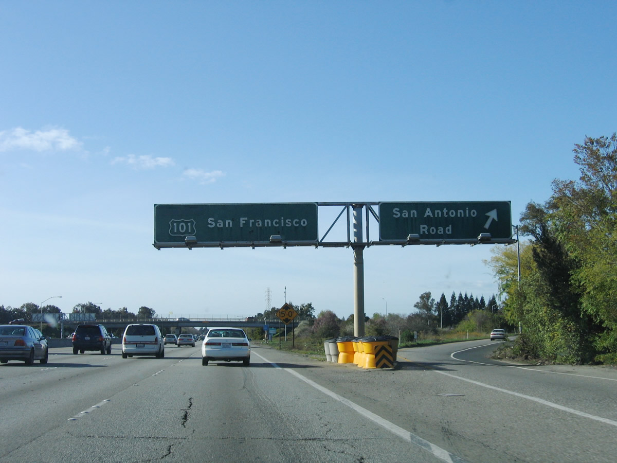
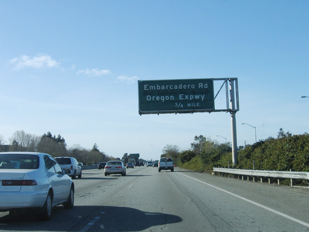
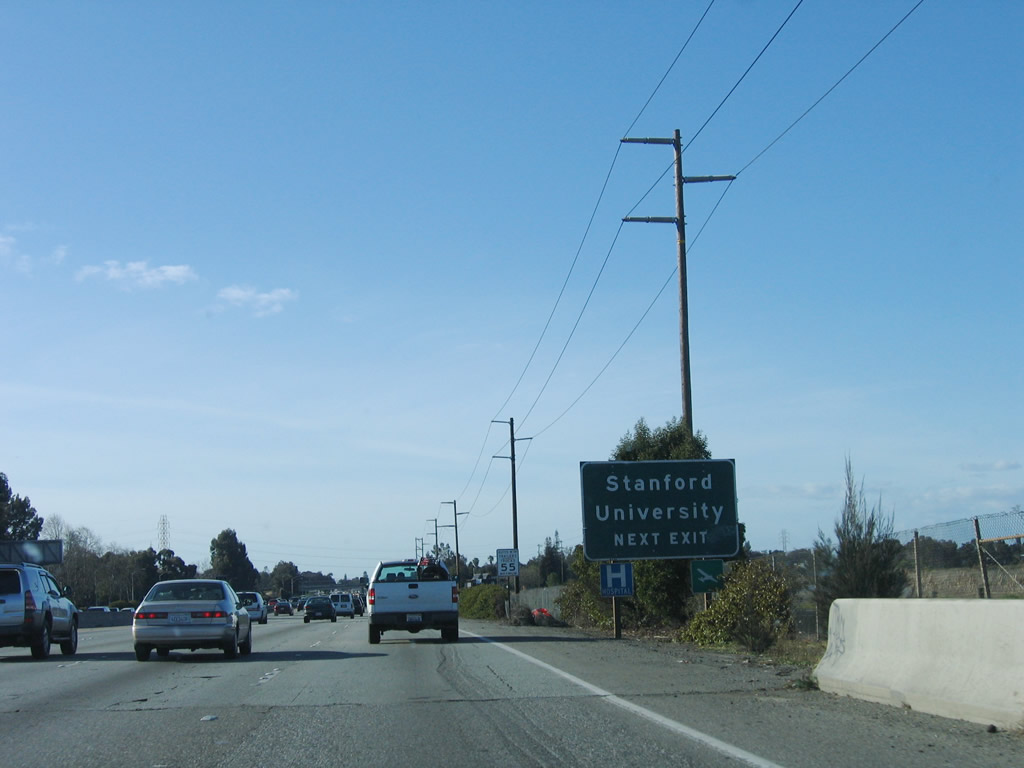
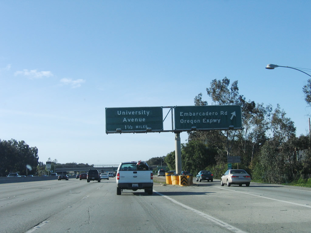
Exit 402 is the only interchange on U.S. 101 wholly within the city limits of Palo Alto. The interchange consists of a trumpet interchange with Oregon Expressway and a modified cloverleaf with Embarcadero Road. The ramps to both parts of the interchange are served by the same collector distributor lanes. Use Embarcadero Road west to Stanford University. From Exit 402, Santa Clara County G-3/Oregon Expressway travels southwest through Palo Alto, changing into Page Mill Road before connecting to Interstate 280 Exit 20 in Los Altos Hills. Photo taken 03/18/06. |
Page Updated March 5, 2008.