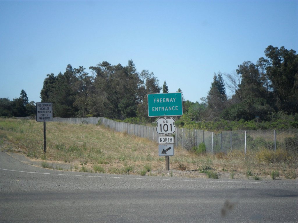
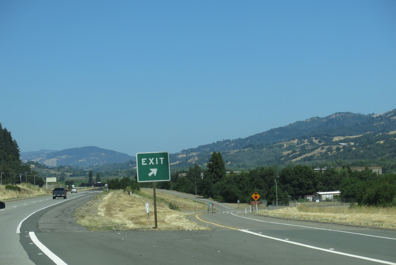
Leaving Marin County through the Marin-Sonoma Narrows, U.S. 101 returns to a four-lane freeway configuration, but the freeway is often overwhelmed due to a high traffic volume. A third lane in each direction is currently under construction, and it is expected to result in a reduction of traffic delays that plague the U.S. 101 corridor at all hours of the day. U.S. 101 serves the Sonoma County cities of Petaluma, Cotati, Rohnert Park, Santa Rosa, Windsor, Healdsburg, and Cloverdale. North of Cloverdale, plans call for expansion of U.S. 101 into a freeway as it leads into Mendocino County.
Sonoma County is well-known for its wines, and it is compared frequently to its better-known neighbor to the east, Napa County. While Napa Valley is recognized internationally for its wines and grapes, many Bay Area residents patronize the Sonoma County wine country. While traveling north on U.S. 101, vineyards are increasingly common as farmers find more value in this lucrative crop.
| U.S. 101 (Redwood Highway) north |
|
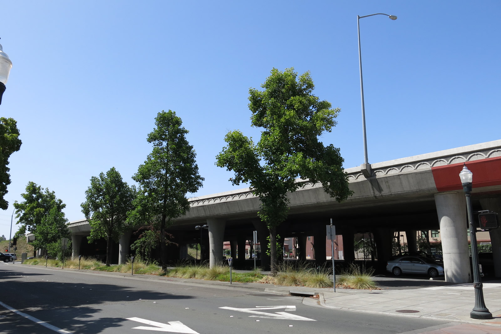
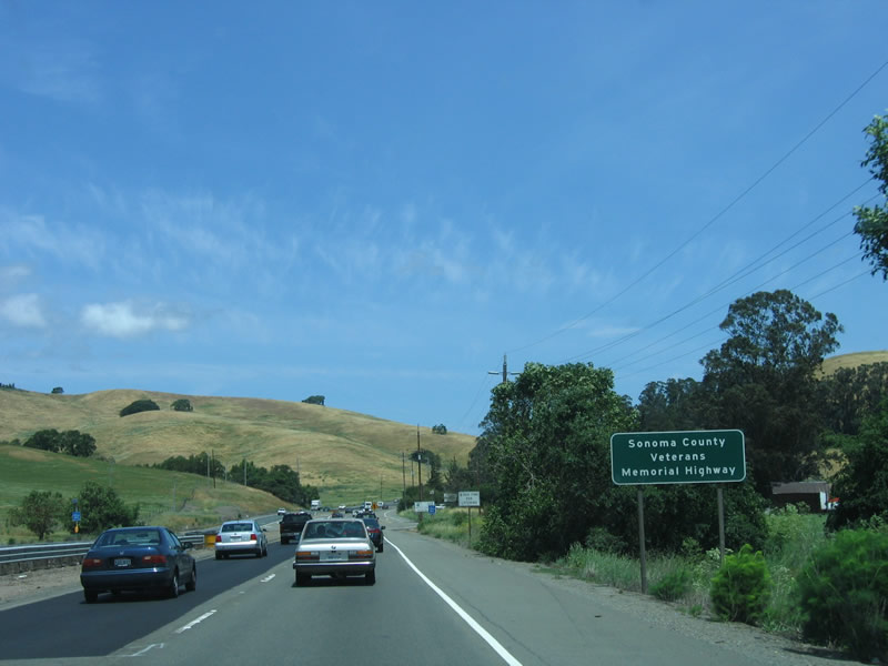
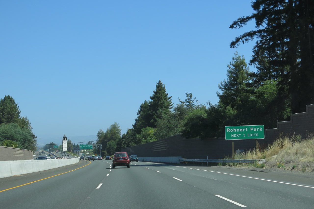
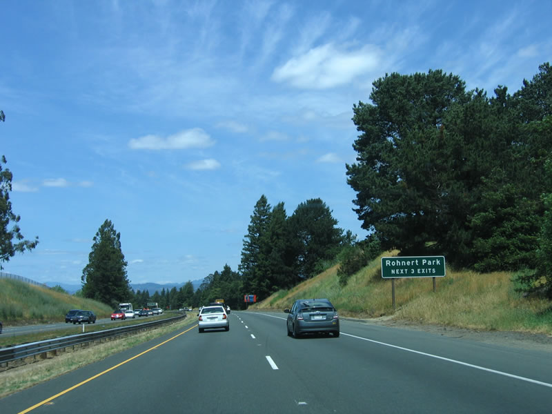
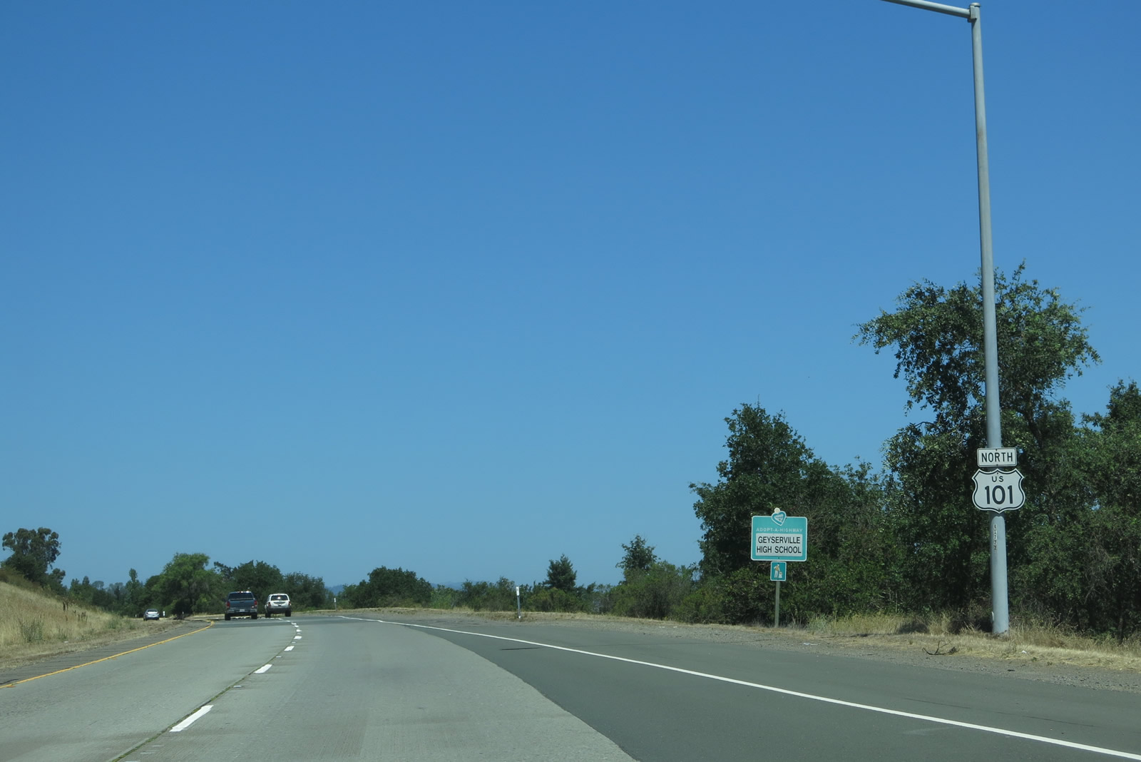
Through Sonoma County, U.S. 101 is designated as the "Sonoma County Veterans Memorial Highway." This designation follows the north-south freeway all the way north to the Mendocino County Line. Sonoma County is home to 478,440 people (2005 estimate); the largest city and county seat is Santa Rosa (population 156,268). Of 1580 square miles in the county, only 80.05 are within the incorporated cities of Sonoma County, which are: Cloverdale, Cotati, Healdsburg, Petaluma, Rohnert Park, Santa Rosa, Sebastopol, Sonoma, and Windsor. Approximately 68% of the total population lives in these cities; much of the rest of the land is rural, including seemingly endless wineries and orchards. The Russian River flows through a significant portion of the county, traveling south from Mendocino County toward the Pacific Ocean. Photo taken 05/26/06. |
|
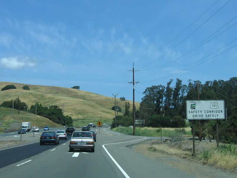
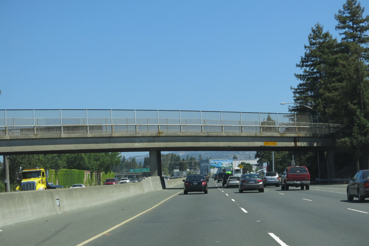
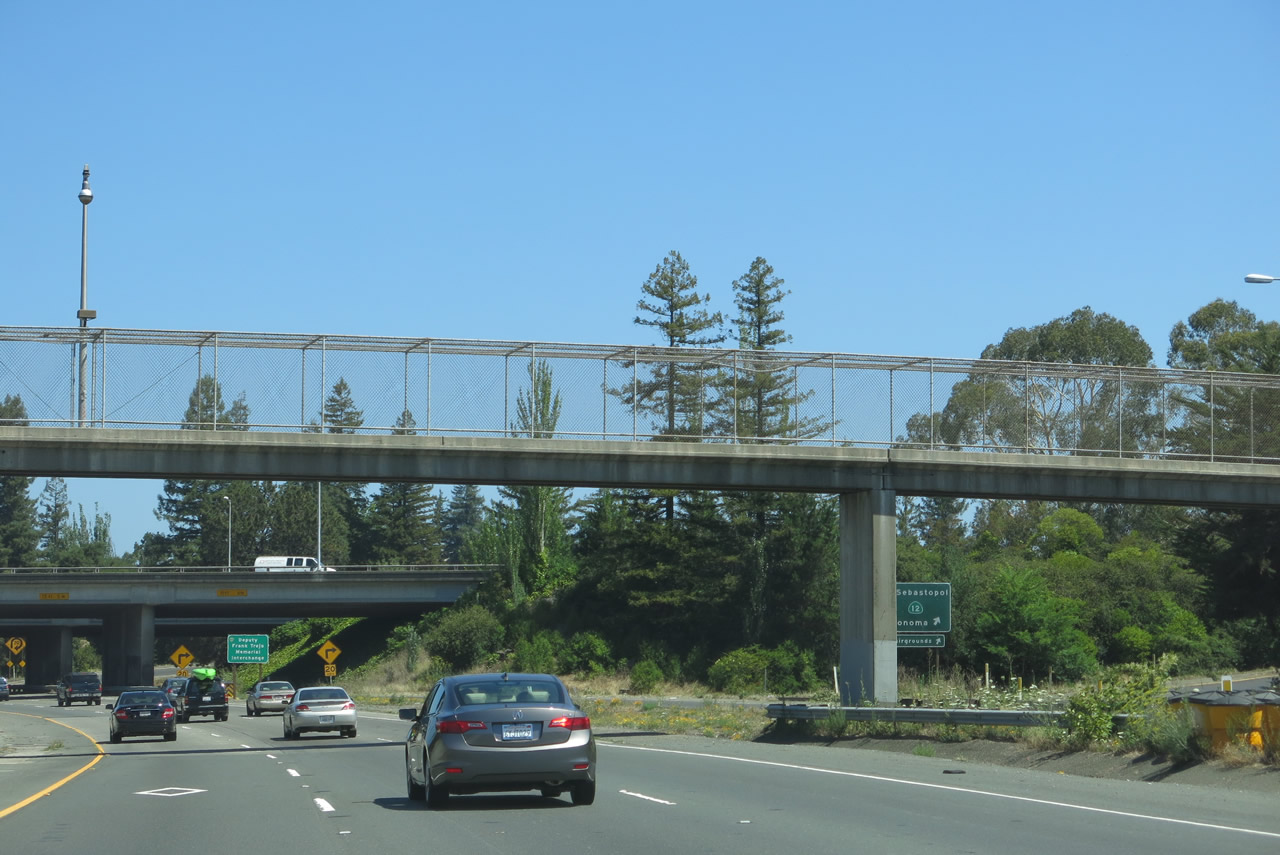
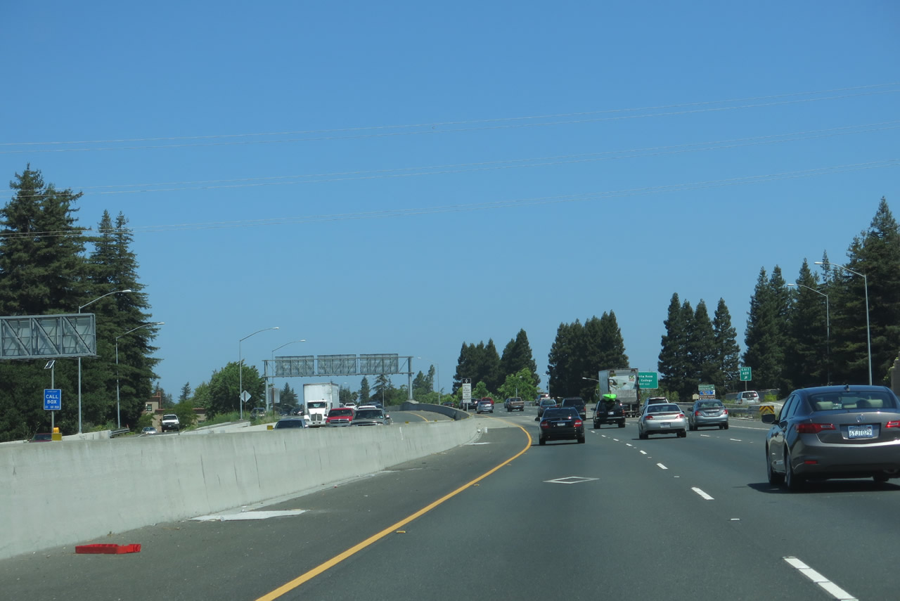
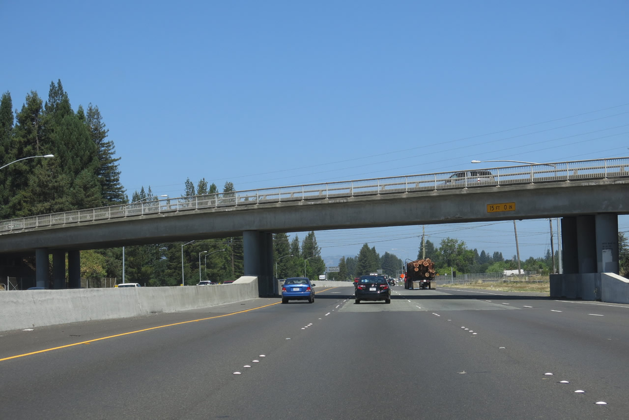
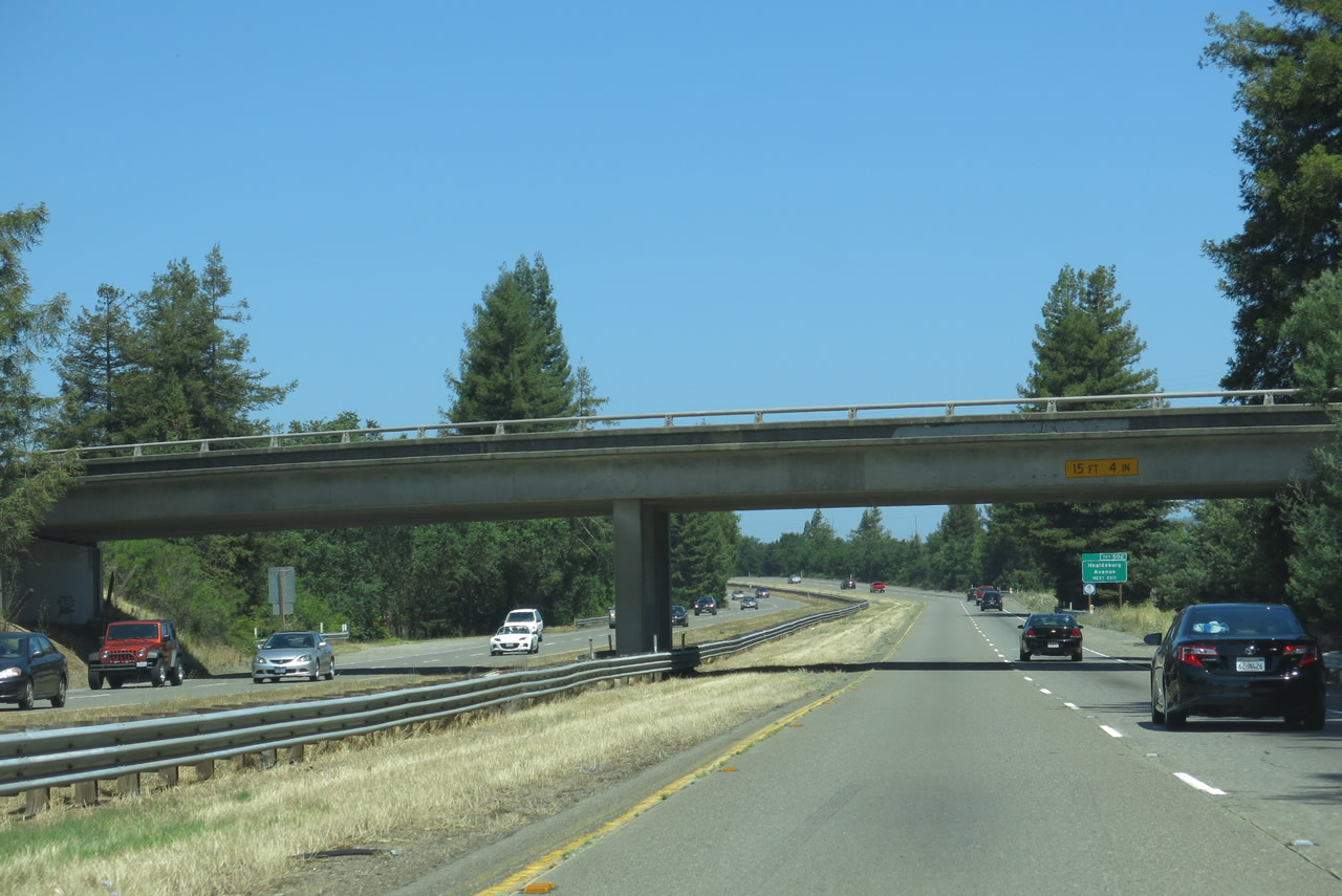
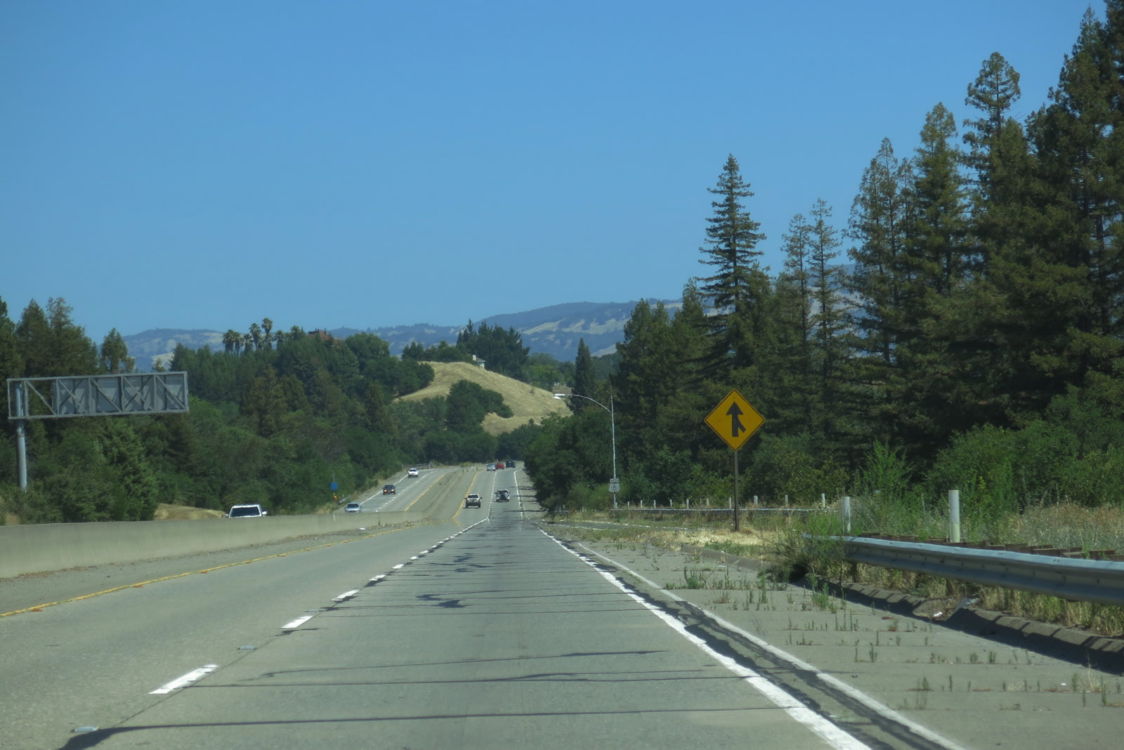
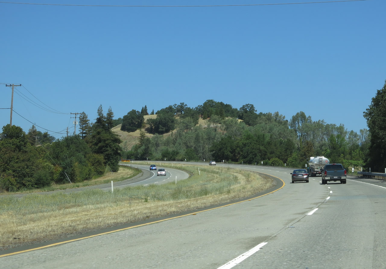
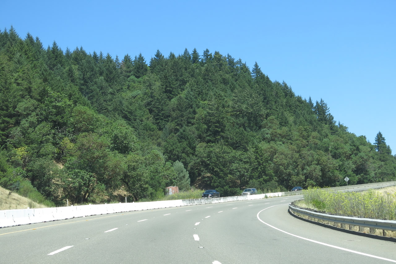
U.S. 101 continues as a four-lane expressway (known as the "Novato Narrows" or the "Marin-Sonoma Narrows" due to its heavy traffic and four-lane configuration), with a few at-grade intersections and driveways that remain as of 2013. The Marin-Sonoma Narrows Project is underway and will result in conversion of the four-lane expressway into six-lane freeway. The three largest of the intersections within the Narrows are at Redwood Landfill, San Antonio Road, and Kastania Road; these are at-grade intersections are planned to be eliminated and given access control. In May 2006, the Redwood Landfill intersection was being converted into a grade-separated interchange and was thus the first intersection to be converted; the interchange was made freeway-standard by 2012. Driveways are mostly found on the southbound lanes; Caltrans estimates 80 at-grade intersections along the narrows. Frontage roads would supply access to these areas, hence why the freeway would partially be on a new alignment. Designated as a safety corridor due to high traffic volume and substandard segments, U.S. 101 is planned for widening and upgrades including additional lanes south of Santa Rosa. Realignment and freeway conversion of U.S. 101 near San Antonio Road is planned to begin construction in 2015. The freeway is still nothing like the U.S. 101 corridor in Marin County. Here, northbound U.S. 101 reaches the second intersection with San Antonio Road. There is no left turn permitted here, which assumes traffic en route to San Antonio Road would have made the left turn in Marin County. Photo taken 05/26/06. |
|
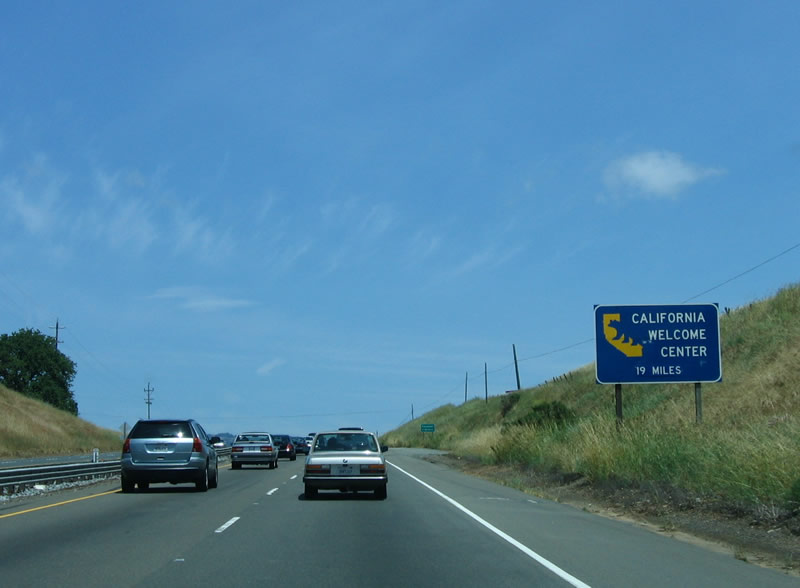
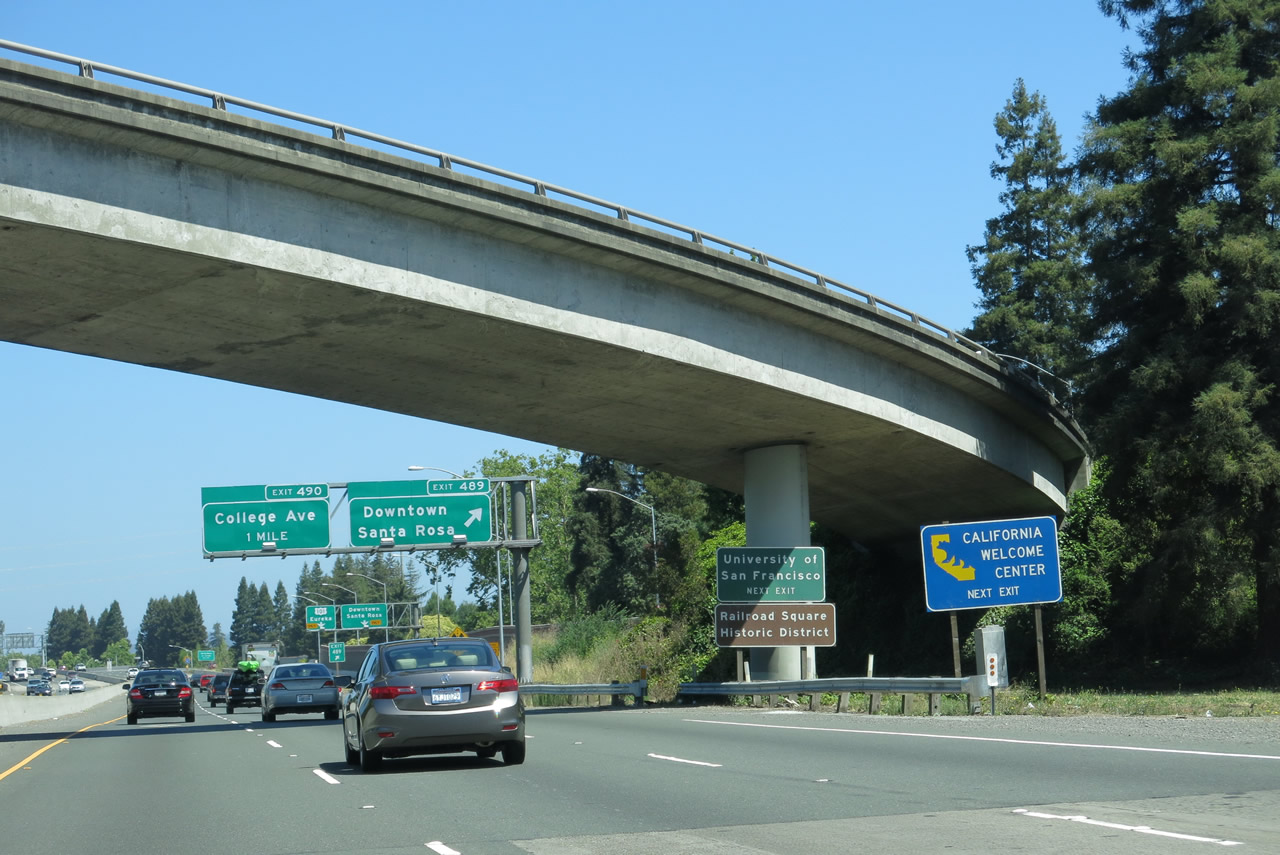
An official California Welcome Center is located at Railroad Square in downtown Santa Rosa along Fourth Street. Use the downtown exit (19 miles) to reach the welcome center, which features visitor information, traveler services, and related materials. Photo taken 05/26/06. |
|
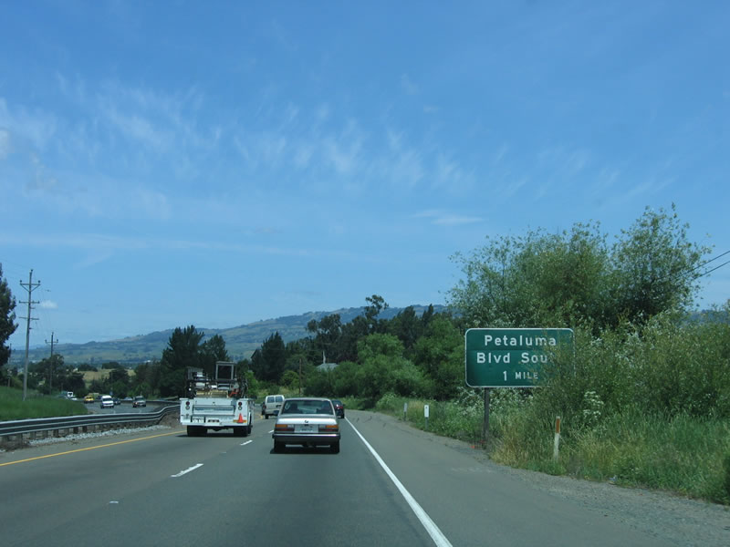
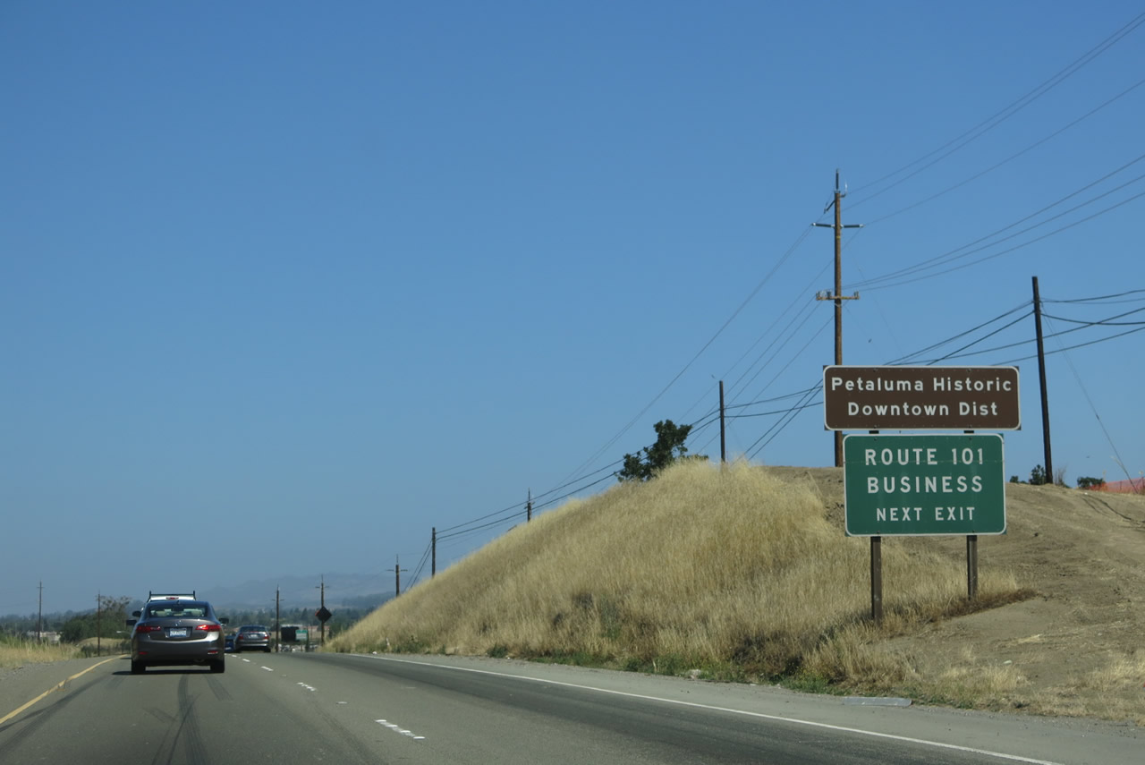
The at-grade expressway section comes to an end as U.S. 101 approaches the Petaluma Bypass. However, there is one more intersection (Kastania Road). The first exit on is the freeway/business split at Exit 472A. U.S. 101 Business follows Petaluma Boulevard north through downtown Petaluma, while U.S. 101 freeway stays to the east of downtown Petaluma. Photo taken 05/26/06. |
|
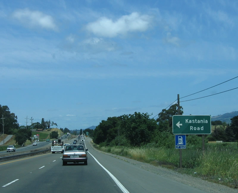
The next left turn from northbound U.S. 101 is for Kastania Road. In 2006, the Dry Creek Rancheria Band of Pomo Indians considered developing the land east of U.S. 101 at this intersection for a possible casino/gambling venture. However, voters advised the city not to approve the casino by defeating Measure H during the November 2006 election. Photo taken 05/26/06. |
|
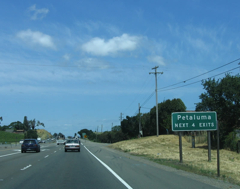
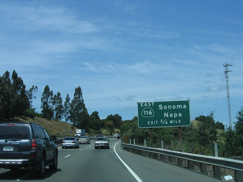
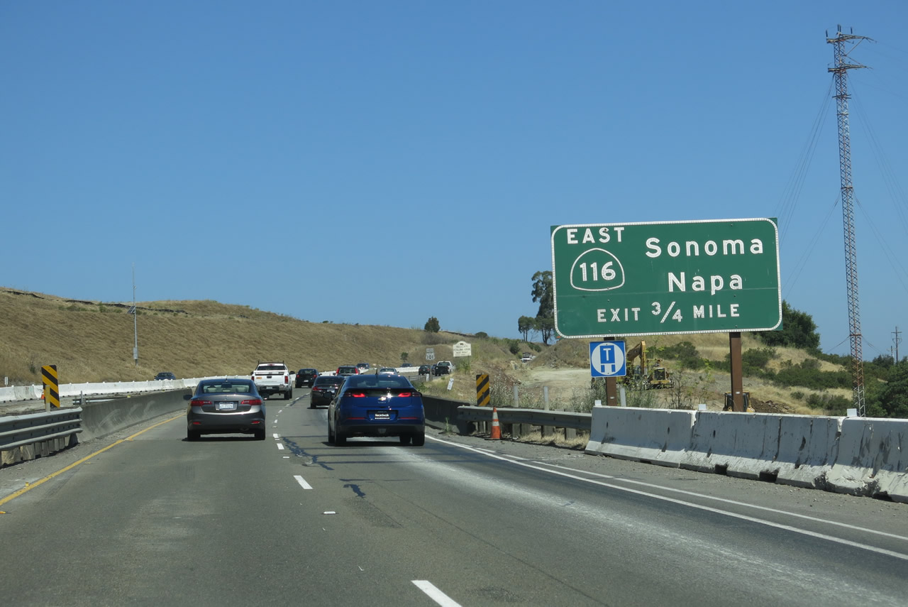
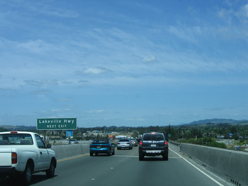
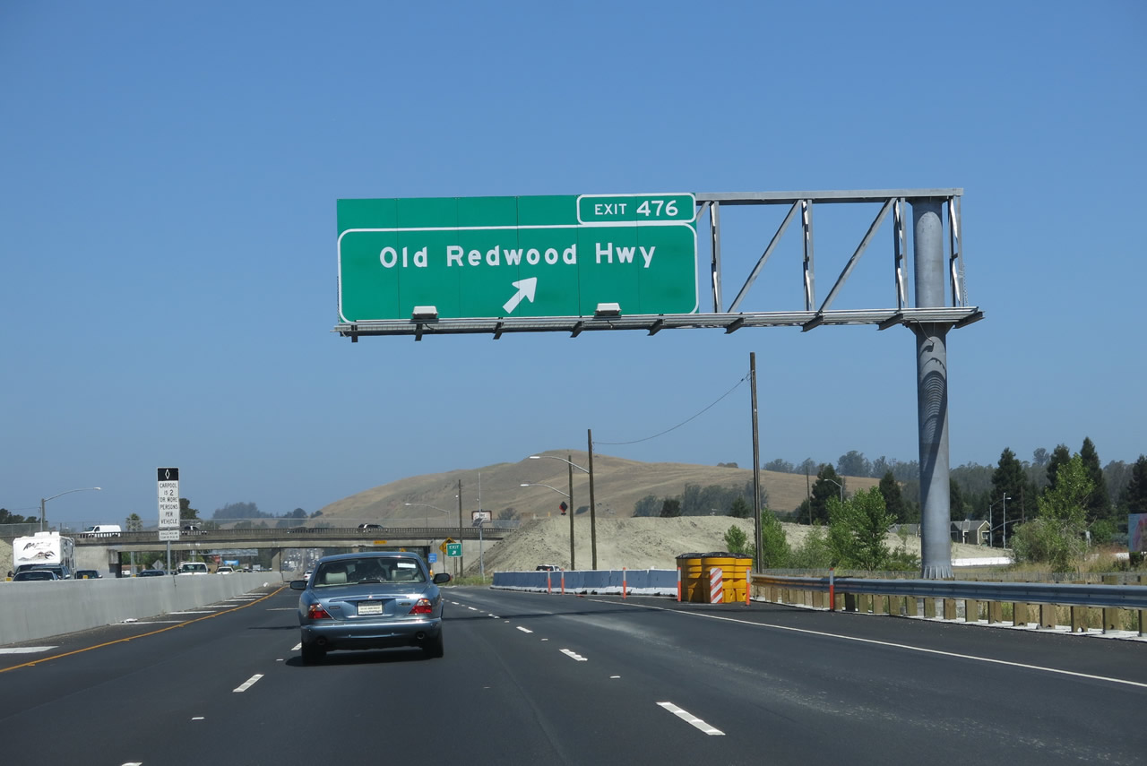
After Kastania Road, the next four exits all serve the city of Petaluma: Exit 472A, U.S. 101 Business/Petaluma Boulevard; Exit 472B, California 116/Lakeville Highway; Exit 474, East Washington Street; and Exit 476, U.S. 101 Business/Old Redwood Highway. Photo taken 05/26/06. |
|
U.S. 101 Business follows the old alignment of U.S. 101 through downtown Petaluma. The bypass of Petaluma was constructed and opened to traffic in 1956; the old route was signed as a business route in the 1990s. Petaluma was founded in 1852 (incorporated on April 12, 1858) primarily due to its proximity to the navigable Petaluma River and San Francisco Bay. Known as the "World's Egg Basket," Petaluma is known for its dairies. As of the 2010 Census, 57,941 people live in Petaluma. Photo taken 05/26/06. |
|
Use U.S. 101 Business/Petaluma Boulevard to historic downtown Petaluma. Located along the Petaluma River, downtown Petaluma features historical buildings that date back to the 1800s. Restaurants, shops, Victorian homes, and the Great Petaluma Mill all sit downtown, and some are located along the river. The name "Petaluma" refers to a Coastal Miwok Indian phrase for -valley of the little hills." Photo taken 05/26/06. |
|
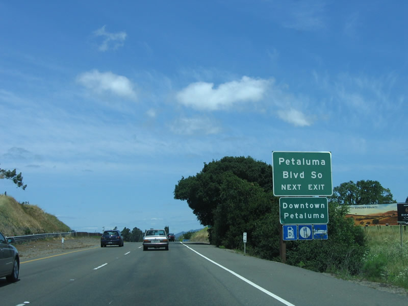
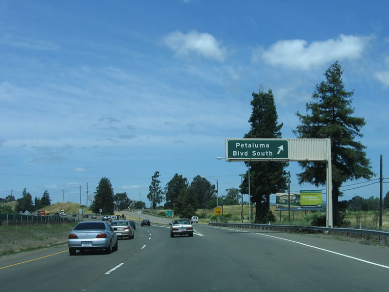
Northbound U.S. 101 (Redwood Highway) reaches Exit 472A, U.S. 101 Business/Petaluma Boulevard northwest to downtown Petaluma. Photo taken 05/26/06. |
|
|
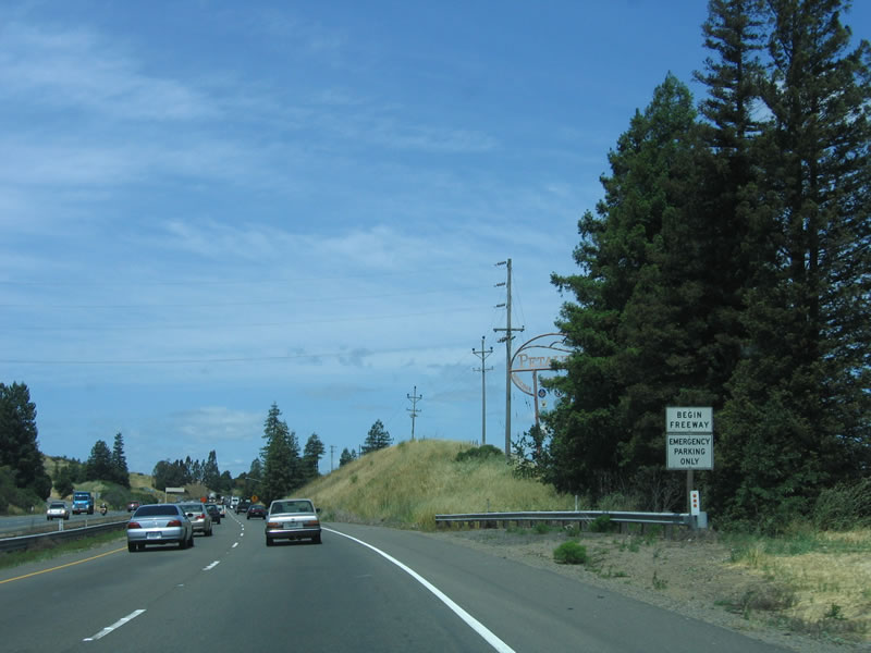
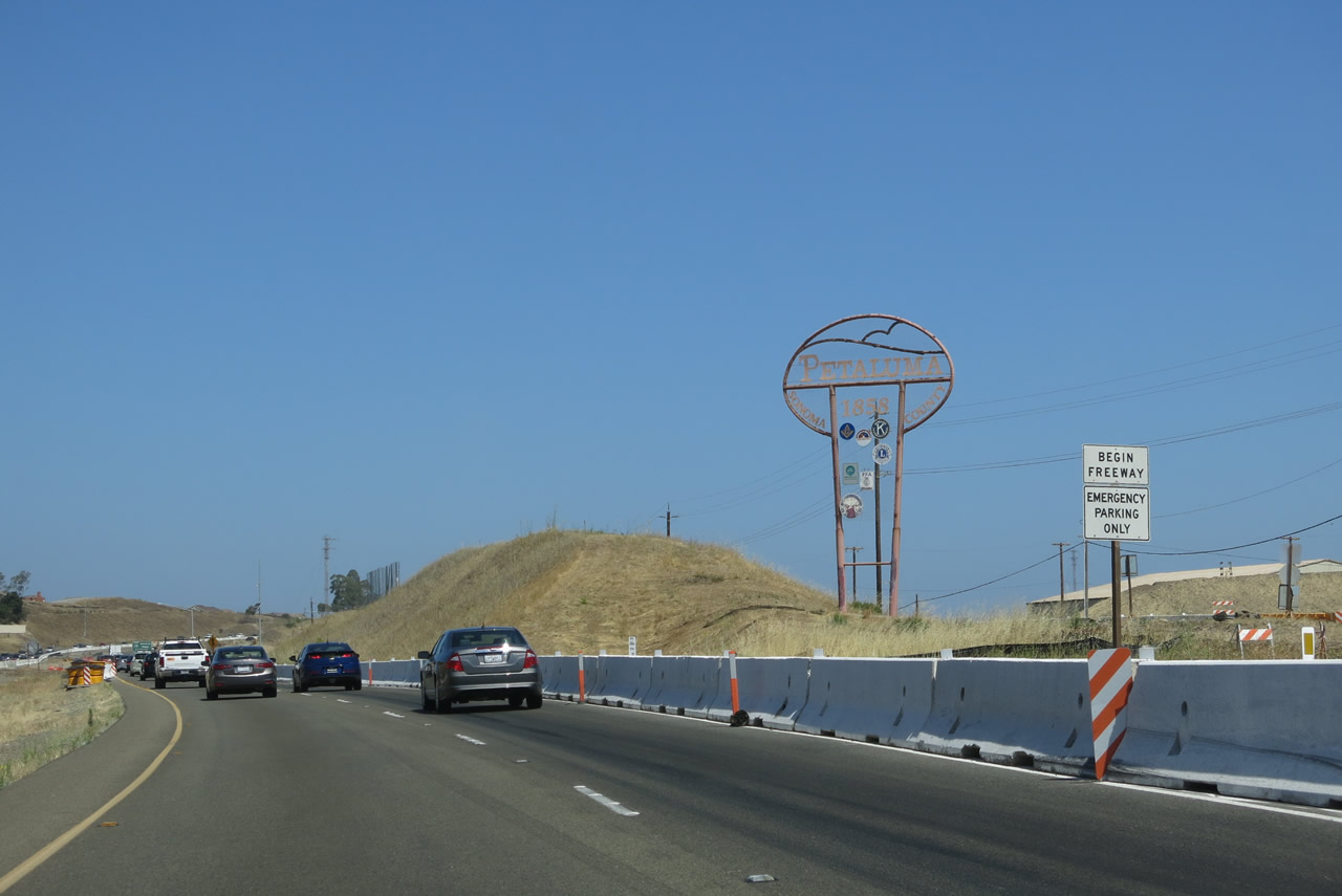
Immediately after Exit 472A, a "Begin Freeway" sign is posted immediately prior to a "Petaluma" entry monument sign. This sign is partially obscured by trees. These trees were removed by 2013 due to the freeway expansion project underway at that time. Photos taken 05/26/06 and 07/05/13. |
|
|
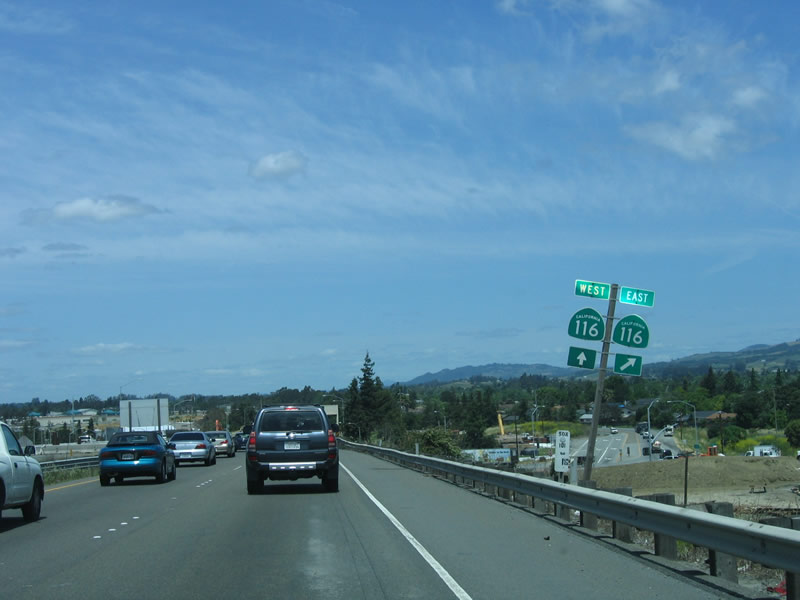
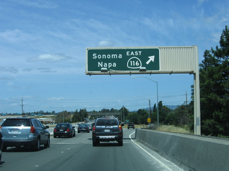
The next exit along northbound U.S. 101 is Exit 472B, California 116/Lakeville Highway. Use California 116 east to California 12 and California 121; California 12 east and California 121 north connect to Napa, while California 12 west leads to Sonoma and the Valley of the Moon. Photos taken 05/26/06 and 07/05/13. |
s
|
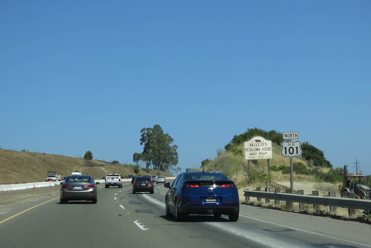
A U.S. 101 north route marker is posted immediately thereafter, along with an advance sign for General Mariano Guadalupe Vallejo's Petaluma Adobe at Petaluma Adobe State Historic Park via Exit 472B. Photo taken 07/05/13. |
|
U.S. 101 crosses the Petaluma River between the U.S. 101 Business interchange and the California 116 east interchange. This high-level bridge was built in the mid-1950s along with the rest of the U.S. 101 freeway bypass; expanding it to three lanes in each direction is under consideration but is expensive. Photo taken 05/26/06. |
|
Lakeville Highway follows California 116 east to Stage Gulch Road, then continues southeast to its end at California 37. Only the section from U.S. 101 to Stage Gulch Road is a state highway, while the rest is a county route. California 116 follows Stage Gulch Road east to Arnold Drive, then ends at California 121 (Carneros Highway) at "Big Bend." Photo taken 05/26/06. |
|
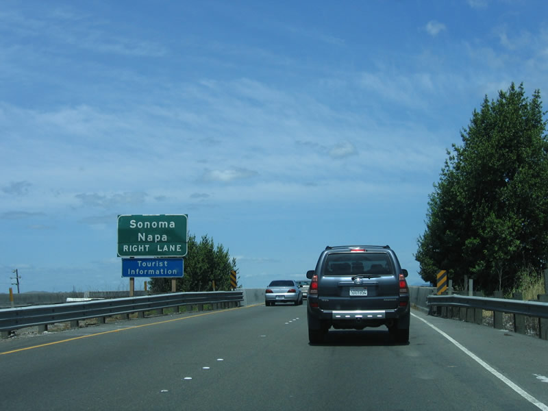
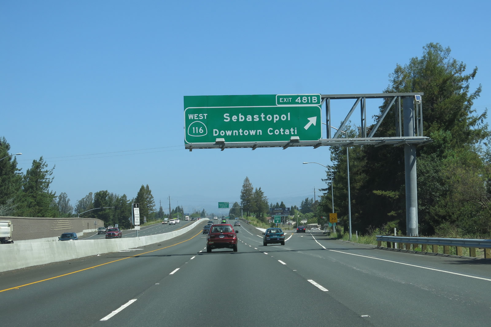
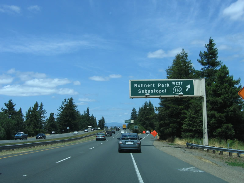
California 116 west merges onto northbound U.S. 101 for the remainder of the Petaluma Bypass, and they will remain merged until near Rohnert Park. The routes divide at Exit 481B. Photo taken 05/26/06. |
|
Northbound U.S. 101 reaches Exit 472B, California 116/Lakeville Highway. U.S. 101 north and California 116 west continue north on the Petaluma Bypass. Photo taken 05/26/06. |
| U.S. 101 (Redwood Highway) north and California 116 west |
|
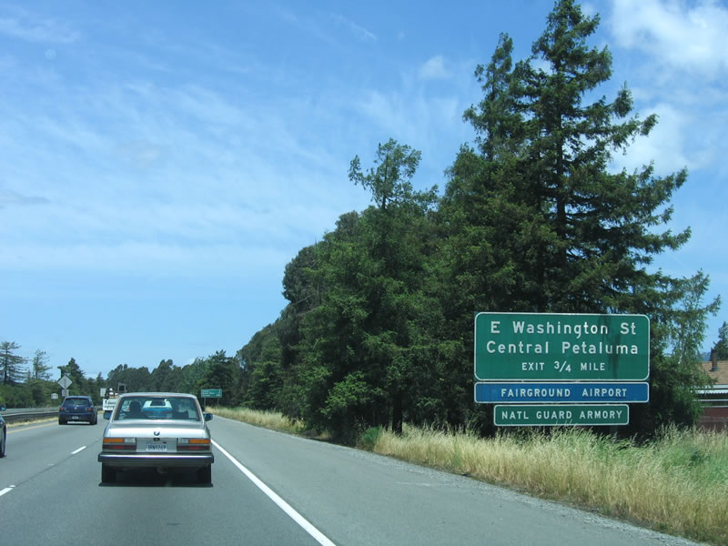
The next exit along northbound U.S. 101 (Redwood Highway) and westbound California 116 is Exit 474, East Washington Street to downtown Petaluma. Use East Washington Street west to U.S. 101 Business/Petaluma Boulevard in downtown. This exit also serves the airport, National Guard Armory, and fairground. Photo taken 05/26/06. |
|
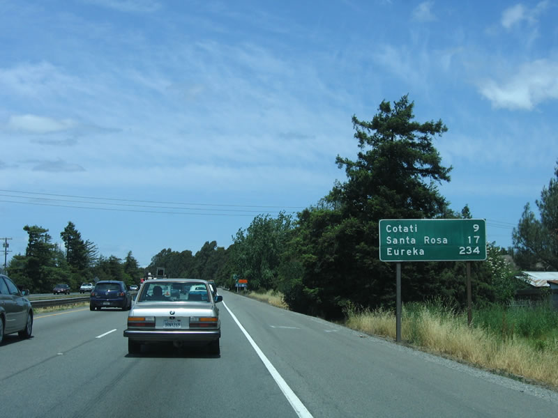
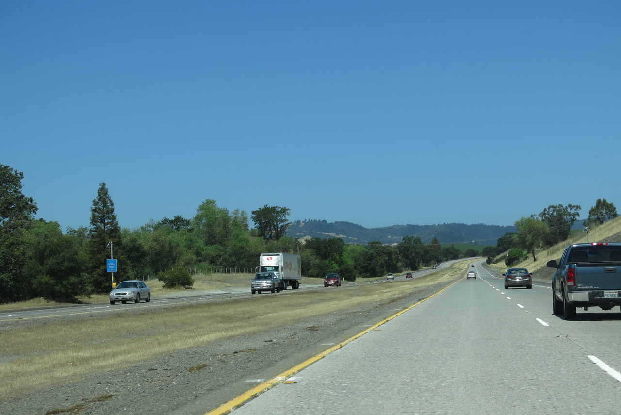
A mileage sign is posted between Exits 472B and 474 for the distance to Cotati (9 miles), Santa Rosa (17 miles), and Eureka (234 miles). Ukiah in Mendocino County is omitted. It is still a long way to the North Coast cities of Eureka and Crescent City. Photo taken 05/26/06. |
|
West of Petaluma, Washington Street defaults onto Bodega Avenue. Follow Bodega Avenue to Valley Ford Road, which connects to northbound California 1 into Bodega Bay and Sonoma Coast State Beach on the Pacific Coast. Westbound Bodega Avenue also connects to the Tomales-Petaluma Highway, which connects to southbound California 1 en route to Tomales Bay State Park, Point Reyes National Seashore, and Seahaven. Photo taken 05/26/06. |
|
Northbound U.S. 101 (Redwood Highway) and westbound California 116 reach Exit 474, East Washington Street/Central Petaluma. The freeway continues to bypass the downtown area to the northeast. Photo taken 05/26/06. |
|
A reassurance shield assembly for U.S. 101 north and California 116 west features Series E Highway Gothic font for "116" and Series D Highway Gothic font for "101." Photo taken 05/26/06. |
|
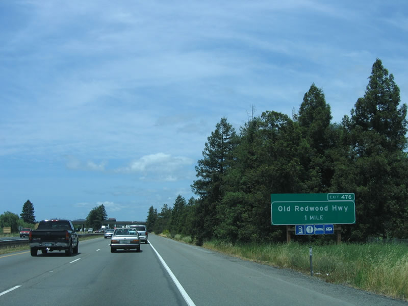
The next exit along northbound U.S. 101 is Exit 476, Old Redwood Highway north and U.S. 101 Business/Petaluma Boulevard south. Old Redwood Highway follows the original alignment of U.S. 101 north prior to the completion of the freeway. The old alignment continues due north to Penngrove, then turns northwest to rejoin U.S. 101 in Cotati. This alignment also connects to Petaluma Hill Road, which offers an alternate route north to downtown Santa Rosa via Sonoma State University (at the intersection with Cotati Avenue). Photo taken 05/26/06. |
|
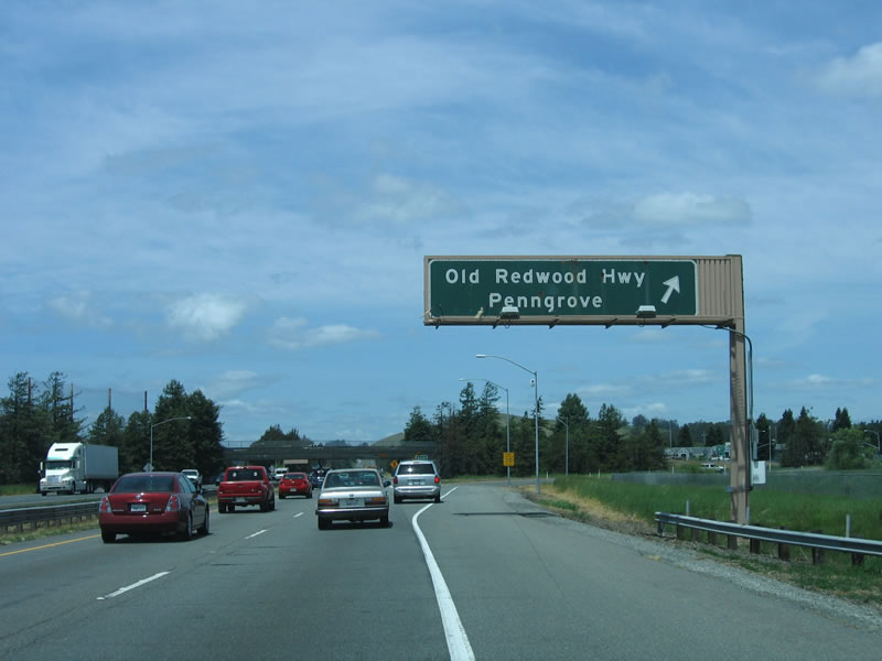
Now on the off-ramp from northbound U.S. 101/westbound California 116, this roadside sign acknowledges that a right turn will connect to Penngrove and Cotati. Omitted is that a left turn will connect to U.S. 101 Business/Petaluma Boulevard south. Photo taken 05/26/06. |
|
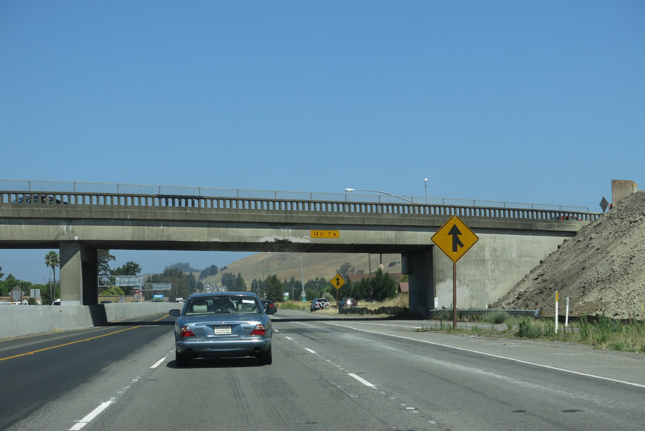
Back on the mainline, U.S. 101 passes under Old Redwood Highway (Historic U.S. 101). Photo taken 07/05/13. |
|
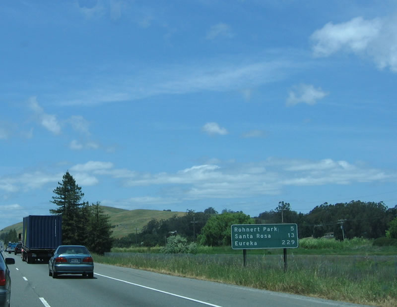
This mileage sign provides the distance to Rohnert Park (five miles), Santa Rosa (13 miles), and Eureka (229 miles). Photo taken 05/26/06. |
|
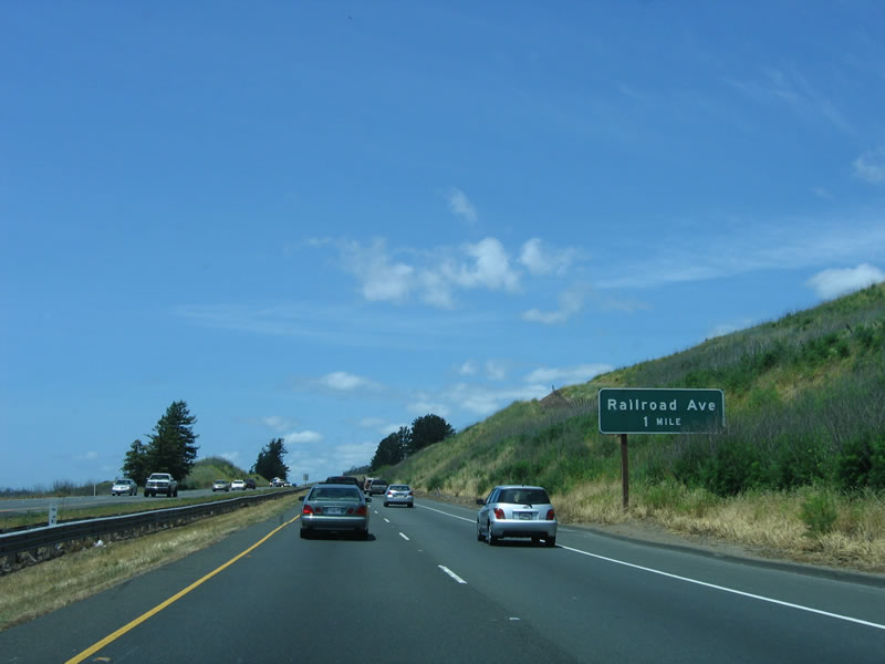
After traveling about two miles, the first advance sign appears for the next exit, which is Exit 479, Railroad Avenue. Photo taken 05/26/06. |
|
|
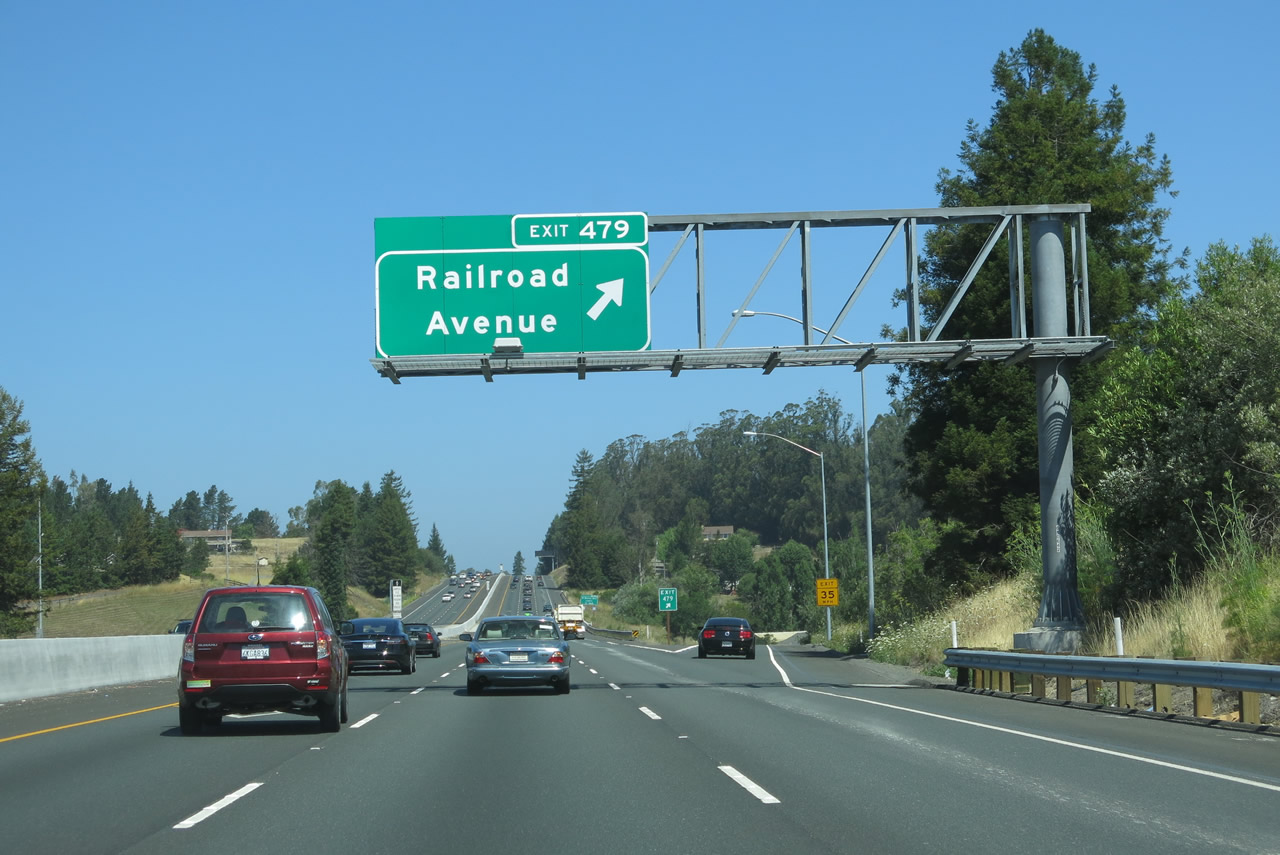
Northbound U.S. 101 (Redwood Highway) and westbound California 116 reach Exit 479, Railroad Avenue. Use Railroad Avenue east to Petaluma Hill Road north to Sonoma State University. Founded in 1966, the college became a university in 1978. Photos taken 07/05/13 and 05/26/06. |
|
|
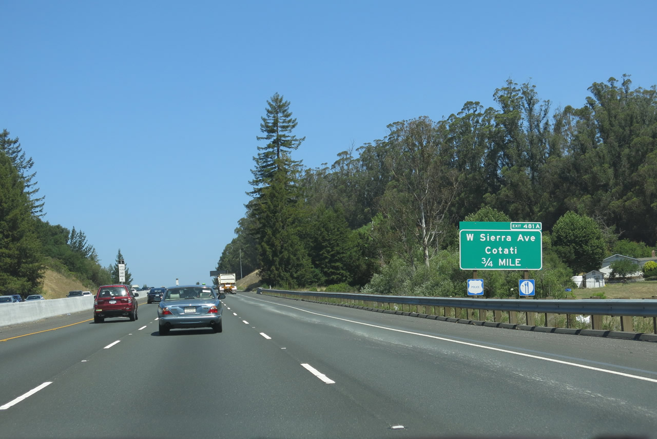
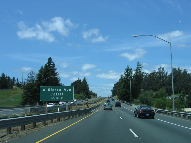
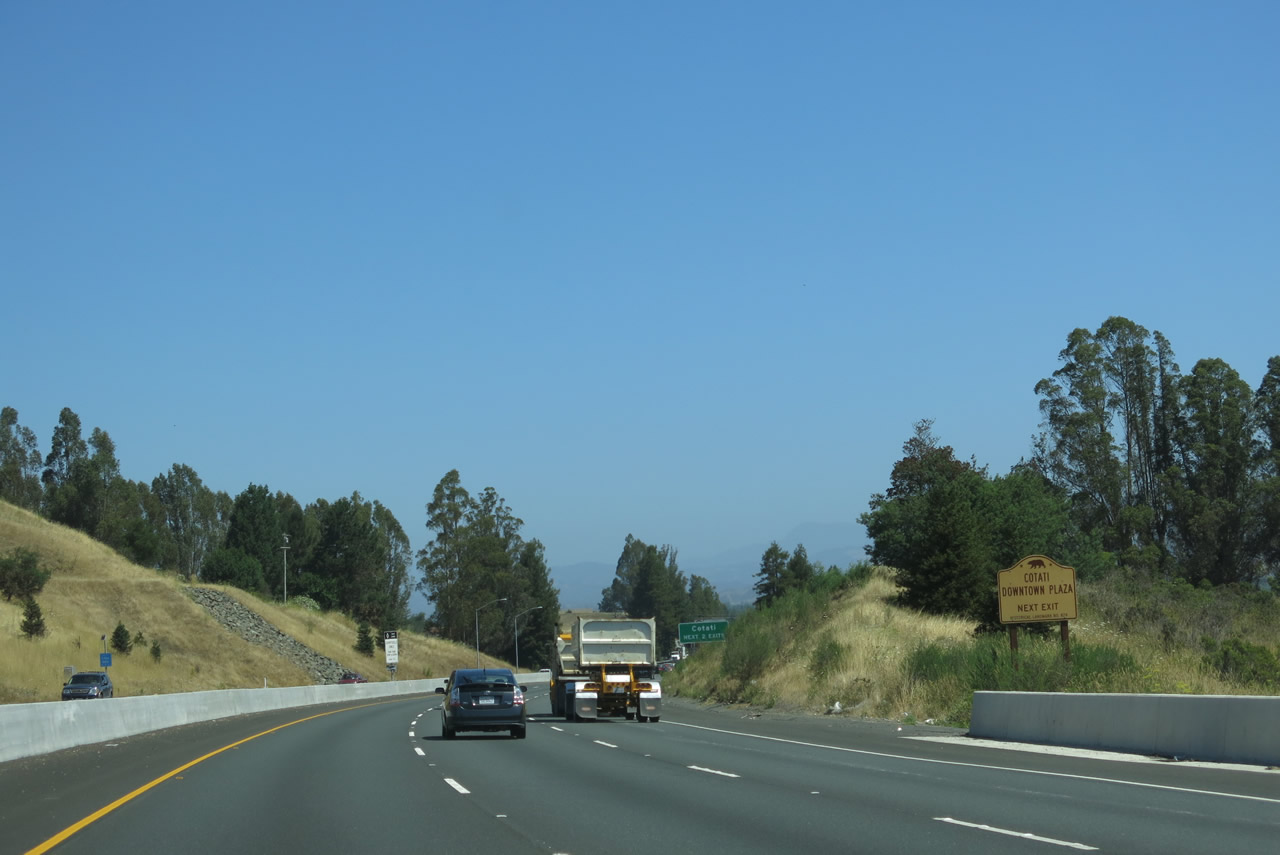
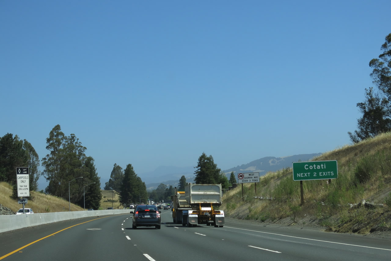
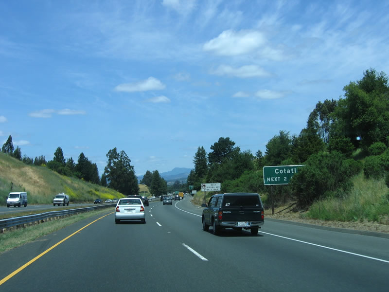
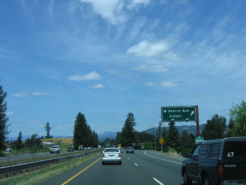
The next exit along northbound U.S. 101 (Redwood Highway) and westbound California 116 is Exit 481A, West Sierra Avenue into Cotati, the "Hub of Sonoma County." This nickname is given due to the centrality of the city within Sonoma County and also because of the unique hexagonal layout of the downtown plaza (centered by La Plaza Park). The city incorporated on July 16, 1963, and had a population of 7,265 as of the 2010 Census. Use West Sierra Avenue northeast to the plaza and downtown Cotati. Photos taken 07/05/13 and 05/26/06. |
|
A third lane was added to the northbound side of U.S. 101 between 2006 and 2013. Photo taken 07/05/13. |
|
Use Exit 481A to the unusual Cotati Downtown Plaza, which is notable for its hexagonal design rather than a traditional grid pattern. A commemorative plaque is posted in Laplaza Park at the center of the plaza, at the intersection of Sierra Avenue and Old Redwood Highway (Historic U.S. 101). Photo taken 07/05/13. |
|
|
The next two exits (Exit 481A, West Sierra Avenue and Exit 481B, California 116/Gravenstein Highway, serve the city of Cotati ("The Hub of Sonoma County"). Cotati had a population of 7,265 as of the 2010 Census. The second exit also serves the city of Rohnert Park, which abuts Cotati to the north. Cotati and Rohnert Park have a linked history, as they both incorporated around the same time in the 1960s. In Fall 1960, residents and officials explored creating one combined city for both Cotati and Rohnert Park, but that was discarded as an option in Winter 1961. Rohnert Park incorporated on August 21, 1962, while Cotati followed on July 2, 1963. During the intervening year between Rohnert Park's incorporation and Cotati's incorporation, some Cotatians were concerned that newly formed Rohnert Park would subsume portions of Cotati into the then-new city of Rohnert Park. This created momentum among Cotatians to create their own city. Once Cotati incorporated, City Council members denied themselves pay and tried to keep Cotati staffed with volunteers rather than paid staff in order to reduce the cost of incorporation and management of the then-new city. Photos taken 07/05/13 and 05/26/06. |
|
|
Northbound U.S. 101 (Redwood Highway) and westbound California 116 meet Exit 481A, West Sierra Avenue. This is the main route into Cotati from the south. Annual events in Cotati include the Cotati Jazz Festival in June and the Cotati Accordion Festival in August. Photos taken 07/05/13 and 05/26/06. |
|
|
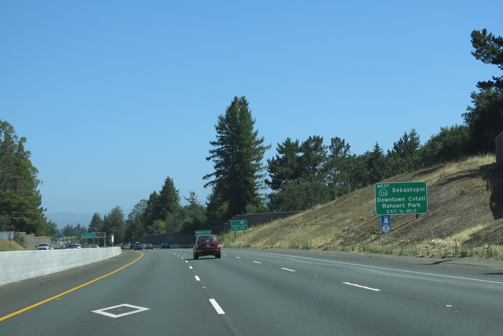
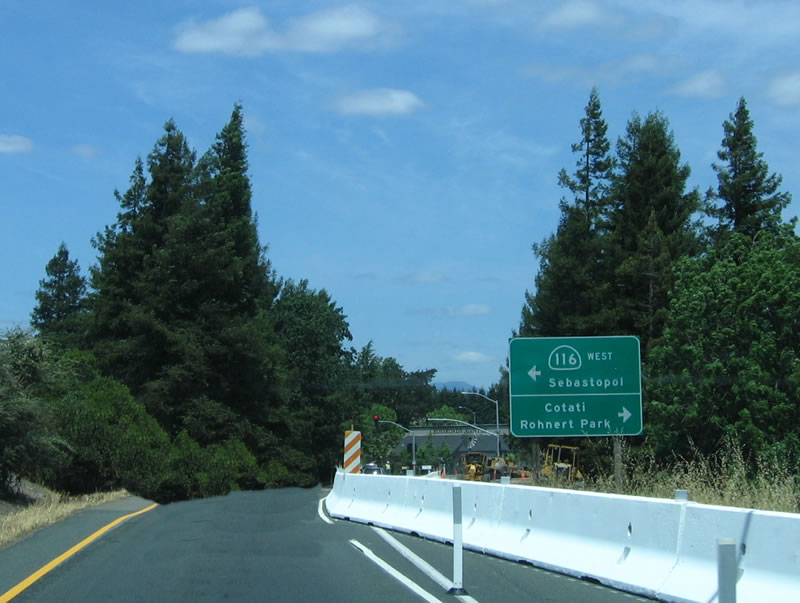
California 116 and U.S. 101 (Redwood Highway) split at Exit 481B. This is the point where Old Redwood Highway comes back to U.S. 101 after connecting to Penngrove (see Exit 476, above). California 116 will turn northwest along the Gravenstein Highway to connect to Sebastopol, then follow the Russian River toward the Pacific Ocean. Along this scenic stretch of highway, California 116 passes through the communities of Forestville, Guerneville, Monte Rio, and Duncans Mills. Known for flooding during the rainy season, the Russian River drains a large area through the narrows along California 116. Annual threats to communities along the Russian River make the area volatile during the winter months, with connections to the coastal areas difficult. However, the scenery along this section of California 116 is incredible, and coastal route along California 1 is unparalleled. Use California 116 northwest to the coast. Photos taken 07/05/13 and 05/26/06. |
|
|
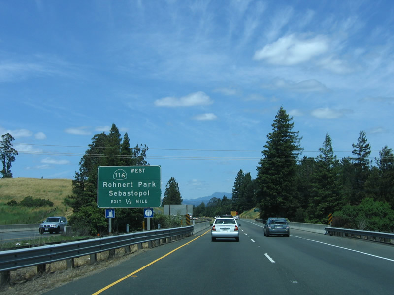
As noted earlier, Exit 481B serves the city of Rohnert Park, along with Exit 483, Rohnert Park Expressway; and Exit 484A, Wilfred Avenue/Golf Course Drive. Use Gravenstein Highway east to both Cotati and Rohnert Park. Incorporated shortly prior to Cotati, Rohnert Park was home to 42,236 people (as of 2000 Census). A master planned community, Rohnert Park was built on the former Rohnert Seed Farm starting in 1954. The community was intended to have eight neighborhood units, each of which would contain approximately 200 to 250 homes, a 10-acre school, and a five-acre park. Infrastructure for the development was installed after a community facilities district was formed in 1956, and homes started being built a year later. Incorporation came on August 28, 1962. While most of the city of Rohnert Park is built out, certain parcels are potential locations for future development. Photos taken 07/05/13 and 05/26/06. |
|
|
Northbound U.S. 101 (Redwood Highway) and California 116/Gravenstein Highway split at Exit 481B. Use California 116 northwest to Sebastopol, Forestville, Guerneville, and Jenner (California 1). U.S. 101 continues north toward Santa Rosa, Windsor, and Healdsburg. Photos taken 07/05/13 and 05/26/06. |
|
Now on the exit ramp to California 116, turn left to follow California 116/Gravenstein Highway or turn right to connect to Old Redwood Highway to Cotati and Rohnert Park. Photo taken 05/26/06. |
| U.S. 101 (Redwood Highway) north |
|
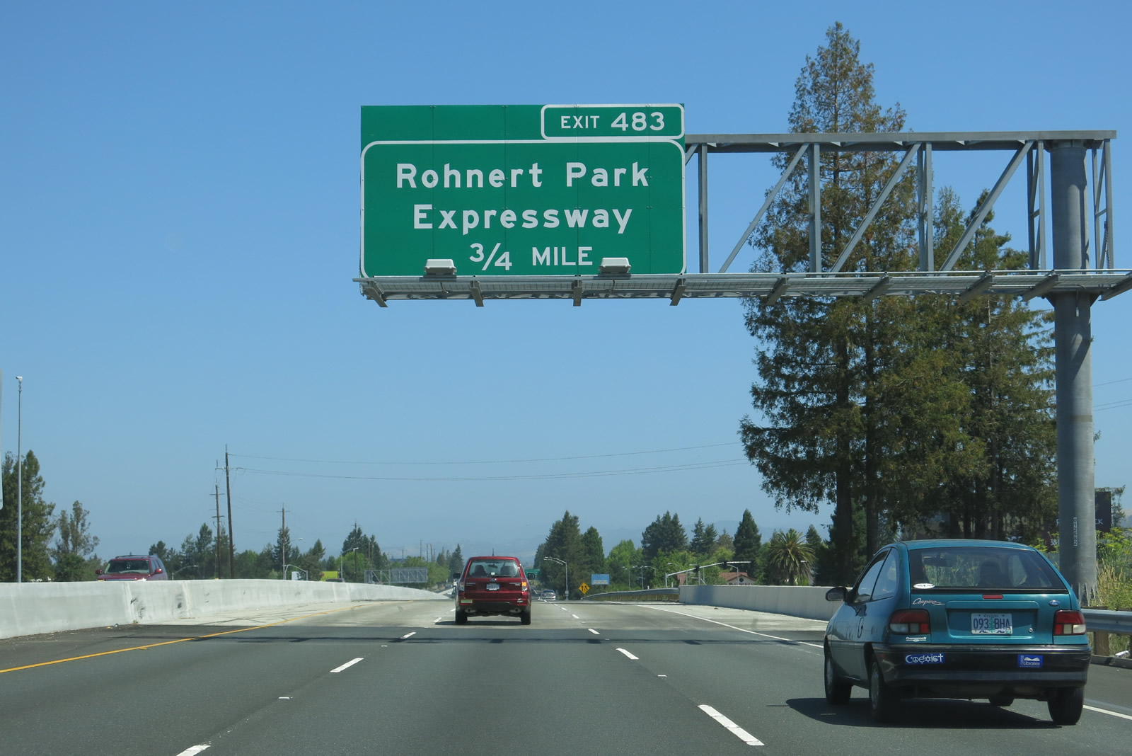
Returning to the mainline, the next exit along U.S. 101 (Redwood Highway) north is Exit 483, Rohnert Park Expressway (0.75 mile). Photo taken 07/05/13. |
|
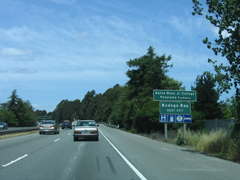
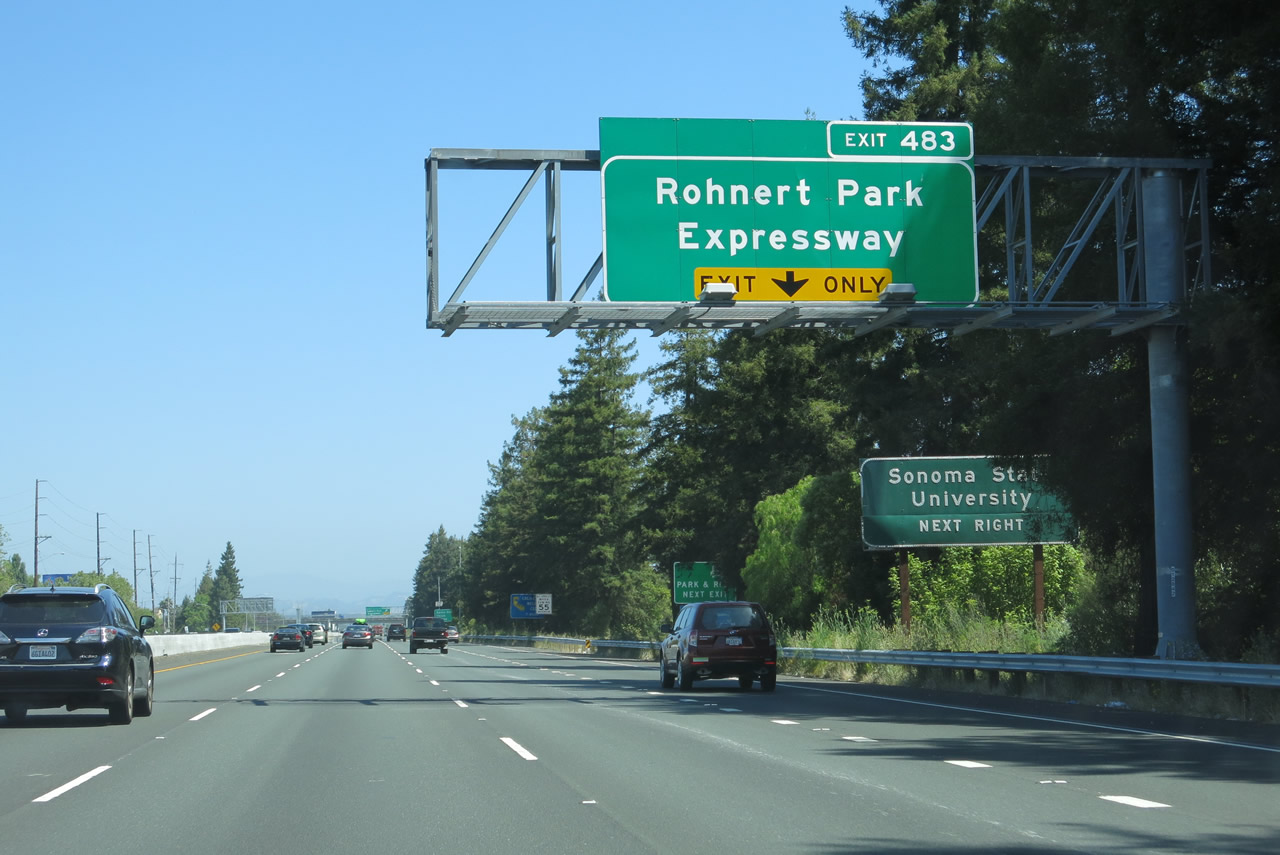
The right lane of U.S. 101 (Redwood Highway) north becomes exit only for Exit 483, Rohnert Park Expressway. Use Rohnert Park Expressway east to Sonoma State University. A second auxiliary sign notes that a California Welcome Center is located seven miles ahead at Exit 489 (Morgan Street north to Fourth Street west). The welcome center, which offers tourist information, museum, and restrooms, is located in Depot Park in the Railroad Square area of downtown Santa Rosa. Photo taken 07/05/13. |
|
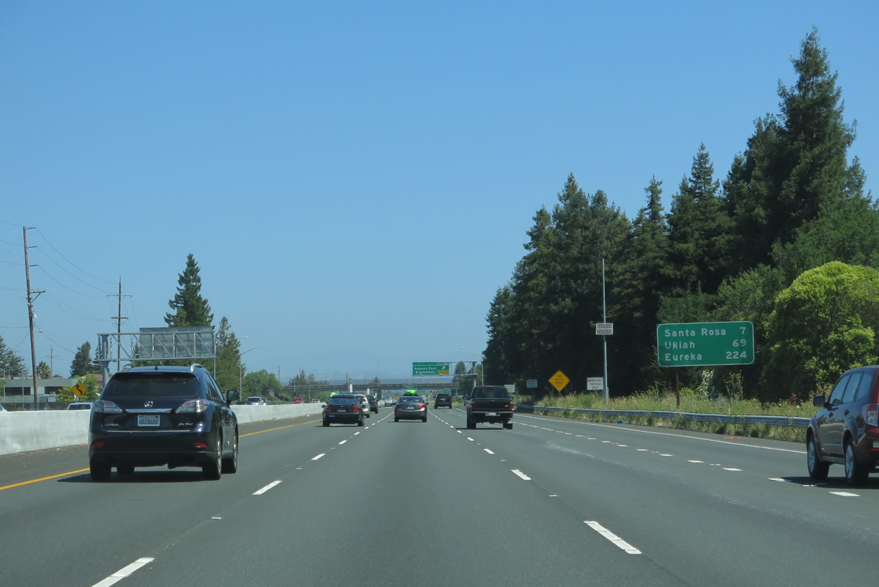
A mileage sign along U.S. 101 north provides the distance to Santa Rosa (seven miles), Ukiah (69 miles), and Eureka (224 miles). Photo taken 07/05/13. |
|
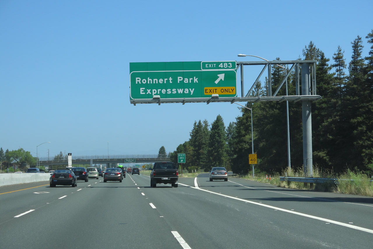
Northbound U.S. 101 (Redwood Highway) meets Exit 483, Rohnert Park Expressway. The Rohnert Park Expressway is an east-west city arterial that extends west to Stony Point Road and east to Petaluma Hill Road. Its name implies it is a fast road, but it more like a busy suburban arterial with regularly spaced traffic signals and limited driveways. Photo taken 07/05/13. |
|
The next exit along northbound U.S. 101 (Redwood Highway) is Exit 483, Rohnert Park Expressway. This diamond interchange connects to the major east-west corridor through Rohnert Park, and the right of way is large enough to accommodate future interchange improvements if desired. Continuing north past the Rohnert Park Expressway interchange, the next exit along northbound U.S. 101 is Exit 484A, Wilfred Avenue and Golf Course Drive. Photo taken 07/05/13. |
|
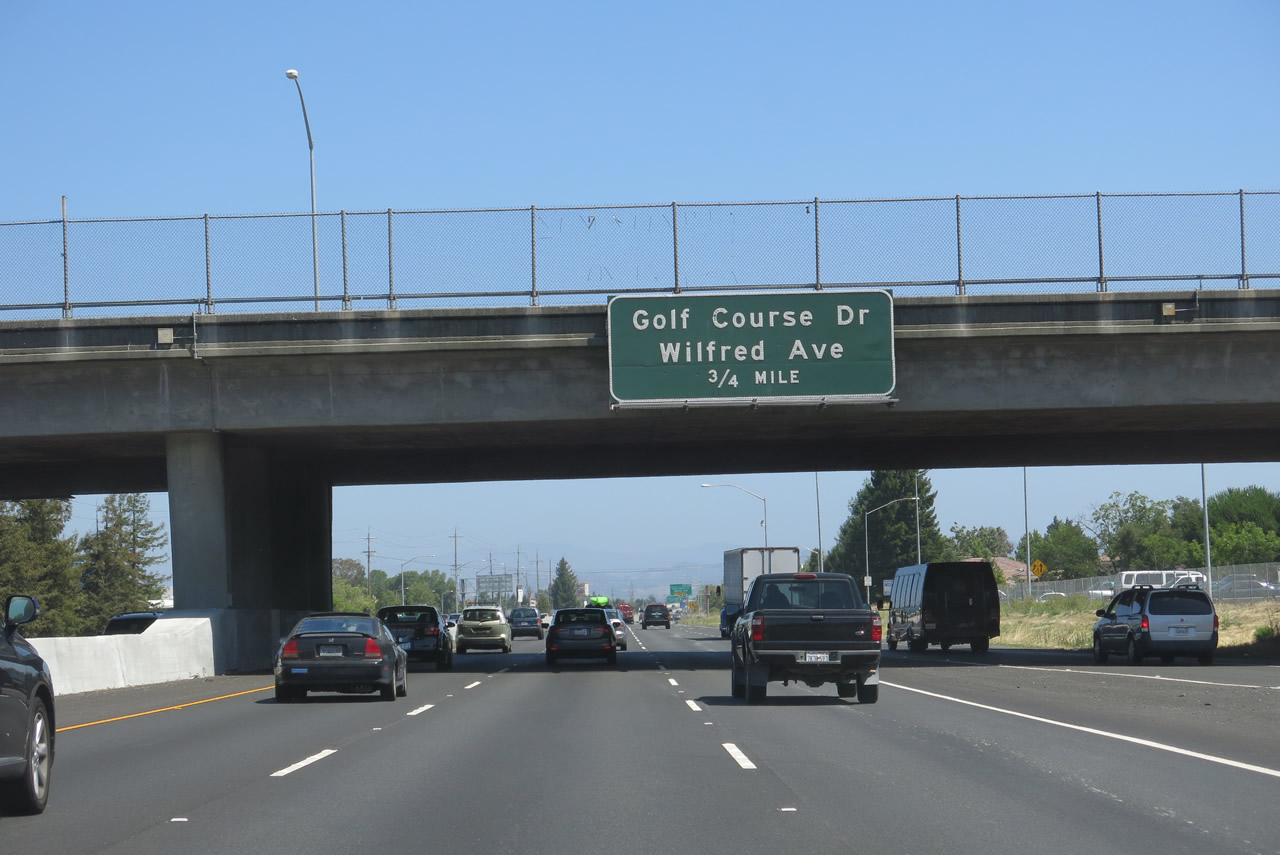
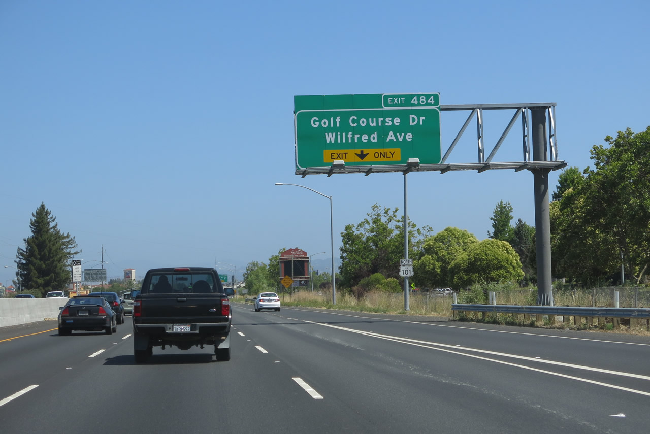
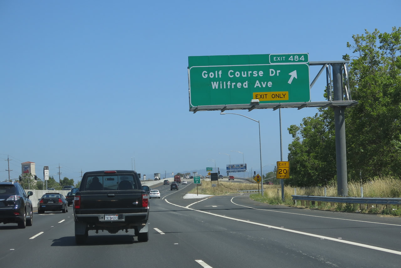
The right lane of northbound U.S. 101 (Redwood Highway) becomes exit only for Exit 484A, Wilfred Avenue and Golf Course Drive. The left three lanes continue north on U.S. 101. Note that the freeway expanded by a lane between 2006 and 2013. Photo taken 07/05/13. |
|
|
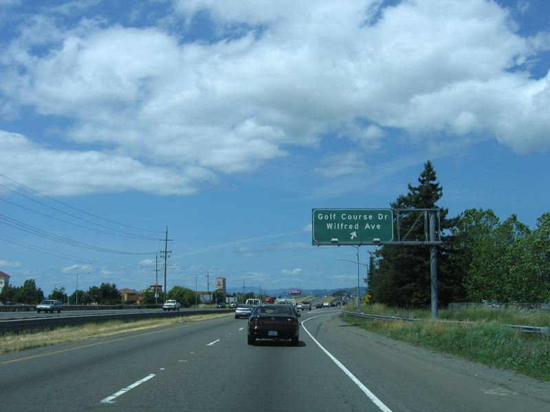
Northbound U.S. 101 (Redwood Highway) reaches Exit 484A, Wilfred Avenue and Golf Course Drive. Use Golf Course Drive east to the Foxtail Golf Club. Golf Course Drive connects to north-south Snyder Lane. A large shopping center sits to the west of U.S. 101 at this interchange. The sign shows Exit 484, but it is supposed to show Exit 484A. Photos taken 07/05/13 and 05/26/06. |
|
|
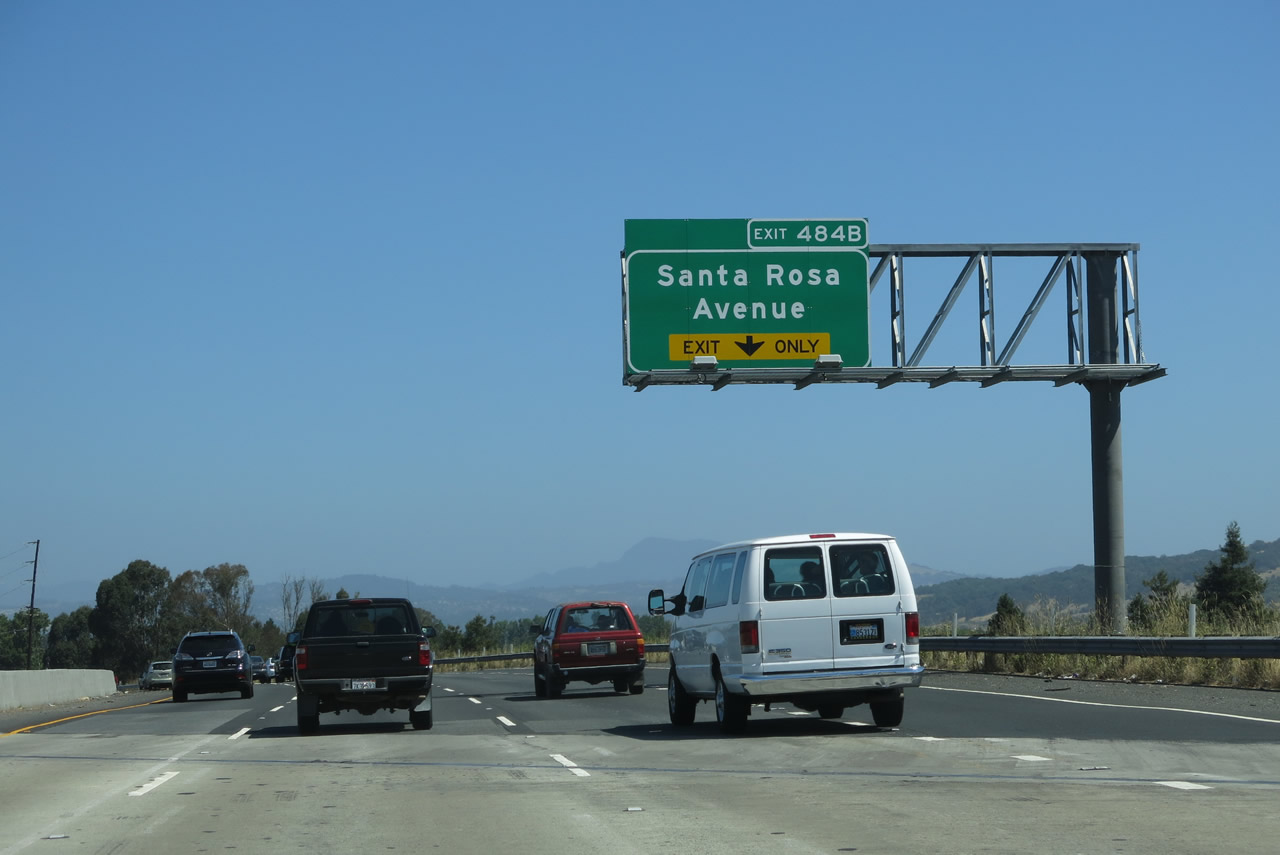
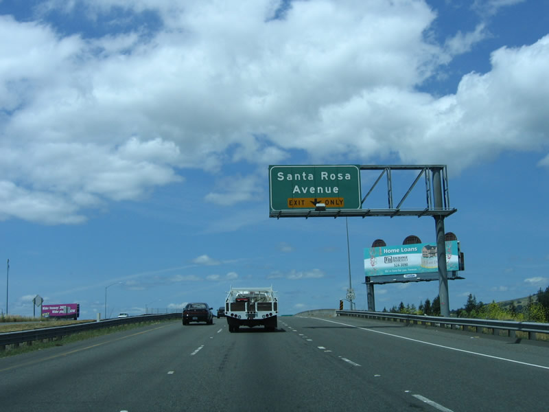
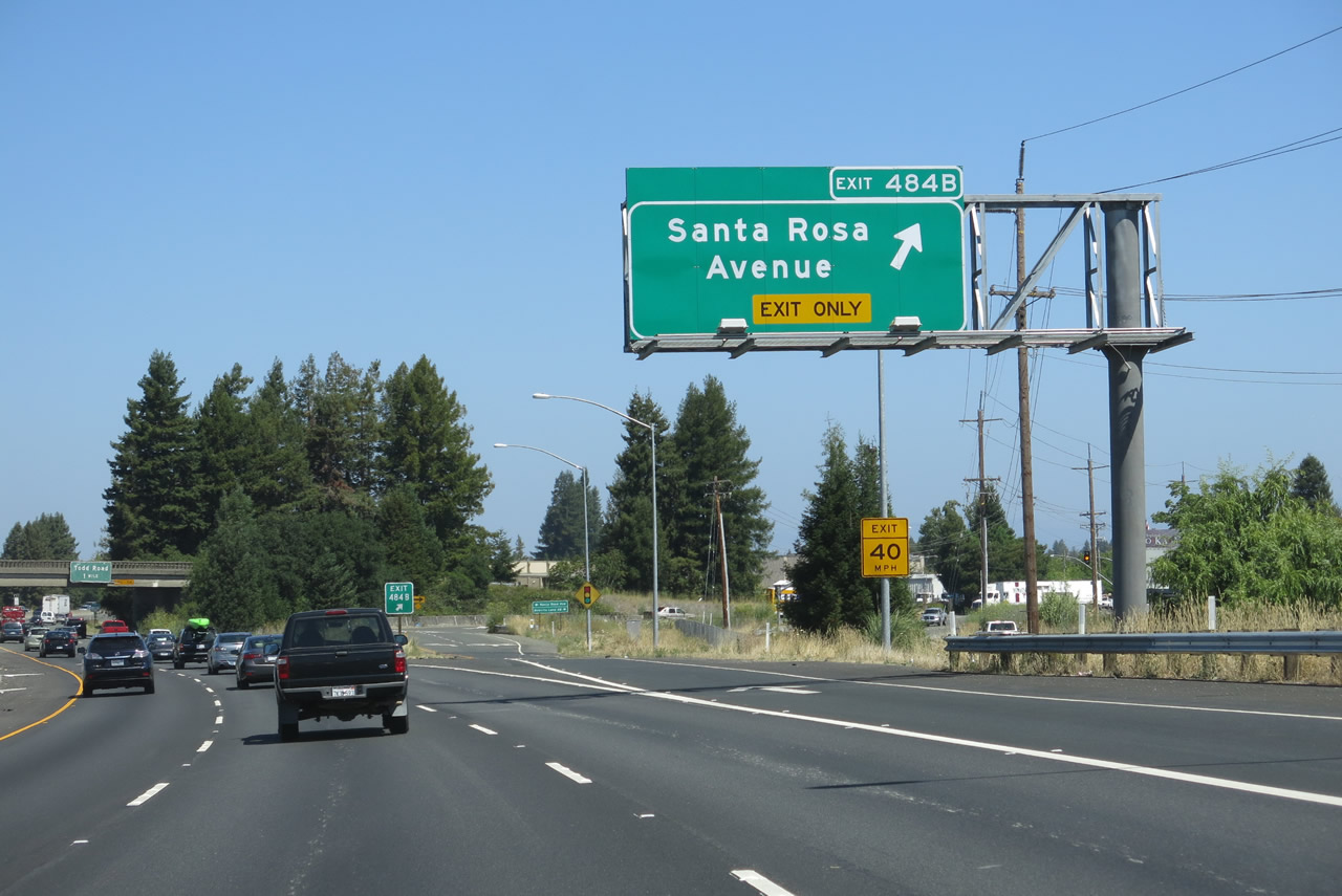
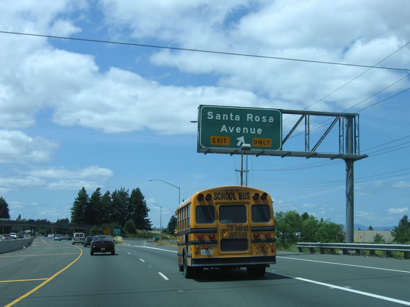
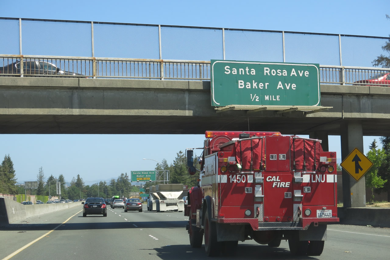
The next exit along northbound U.S. 101 (Redwood Highway) is Exit 484B, U.S. 101 Business/Santa Rosa Avenue. The Santa Rosa business route is not signed from the northbound U.S. 101 freeway, so it is unclear if it begins at Exit 484B (Santa Rosa Avenue) or at Exit 488A (Baker Avenue and Santa Rosa Avenue). Photos taken 07/05/13 and 05/26/06. |
|
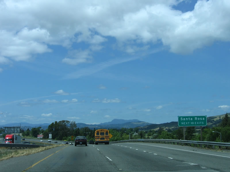
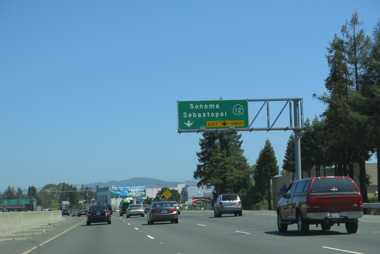
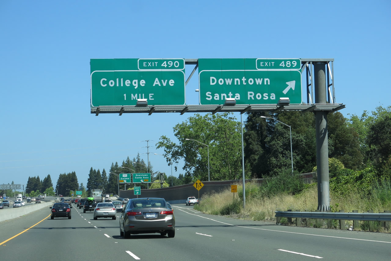
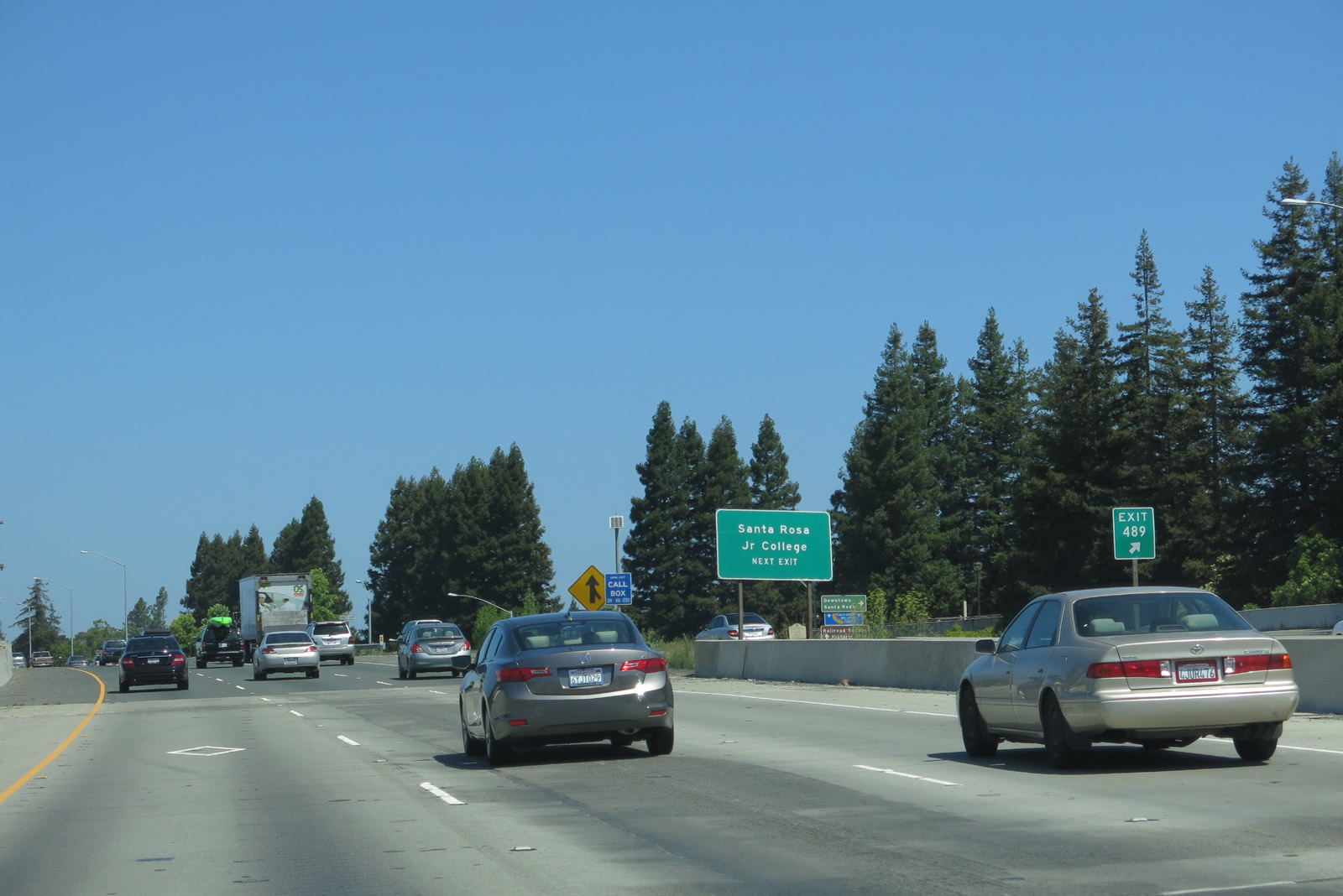
The next ten exits all serve the city of Santa Rosa: Exit 484B, U.S. 101 Business north, Santa Rosa Avenue; Exit 485, Todd Road; Exit 487, Yolanda Avenue/Hearn Avenue; Exit 488A Baker Avenue to U.S. 101 Business Santa Rosa Avenue; Exit 488B, California 12 to Sebastopol and Sonoma; Exit 489, Downtown Santa Rosa (Third Street and Morgan Street); Exit 490, College Avenue (to Santa Rosa Junior College); Exit 491A, Steele Lane/Guerneville Road; Exit 491B, Bicentennial Way; and Exit 492, Mendocino Avenue/Old Redwood Highway (to U.S. 101 Business south and old U.S. 101 north). The section of U.S. 101 north to Baker Avenue was built in 1957; the California 12 interchange complex was built in 1964; the section from there north to College Avenue was built in 1968; and the section from Mendocino Avenue north to Healdsburg via Windsor was built in 1962. Photo taken 05/26/06. |
|
|
Northbound U.S. 101 (Redwood Highway) reaches Exit 484B, U.S. 101 Business/Santa Rosa Avenue. The city of Santa Rosa is the seat of Sonoma County. Incorporated on March 26, 1868, Santa Rosa was home to Luther Burbank, a world-renowned horticulturist. Burbank introduced hundreds of plants in the region during his 50-year stay in Santa Rosa, until his death in 1926. Luther Burbank's home and gardens are preserved near downtown Santa Rosa, and are a national historic landmark. Photos taken 07/05/13 and 05/26/06. |
|
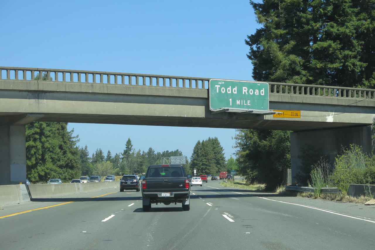
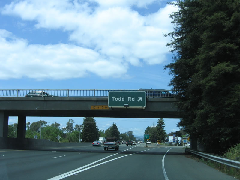
The next exit along northbound U.S. 101 (Redwood Highway) is Exit 485, Todd Road. This overhead guide sign for Todd Road is posted on the Santa Rosa Avenue overpass. Santa Rosa was home to Peanuts creator Charles M. Schulz from 1958 through 2002. The Peanuts comic strip still runs in newspapers today; a museum dedicated to Mr. Schulz's life work is found at Charles M. Schulz Museum and Research Center. The museum is located near the Redwood Empire Ice Arena and Snoopy's Gallery and Gift Shop at the intersection of West Steele Lane and Hardies Lane west of U.S. 101. Use Exit 491A to reach the museum. Photo taken 07/05/13. |
|
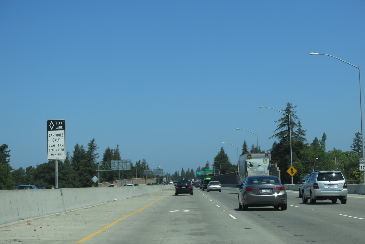
U.S. 101 through Santa Rosa used to have four lanes as recently as the late 1990s; a third lane in each direction was installed for carpools and high occupancy vehicles south of downtown Santa Rosa. Ongoing construction along the U.S. 101 corridor will result in additional capacity improvements. Photo taken 05/26/06. |
|
Northbound U.S. 101 (Redwood Highway) reaches Exit 485, Todd Road in Santa Rosa. As of the 2000 Census, 147,595 lived in Santa Rosa; by 2005, the population had estimated to increase to 153,158 residents. By the 2010 Census, Santa Rosa had a population of 167,815. Photo taken 05/26/06. |
|
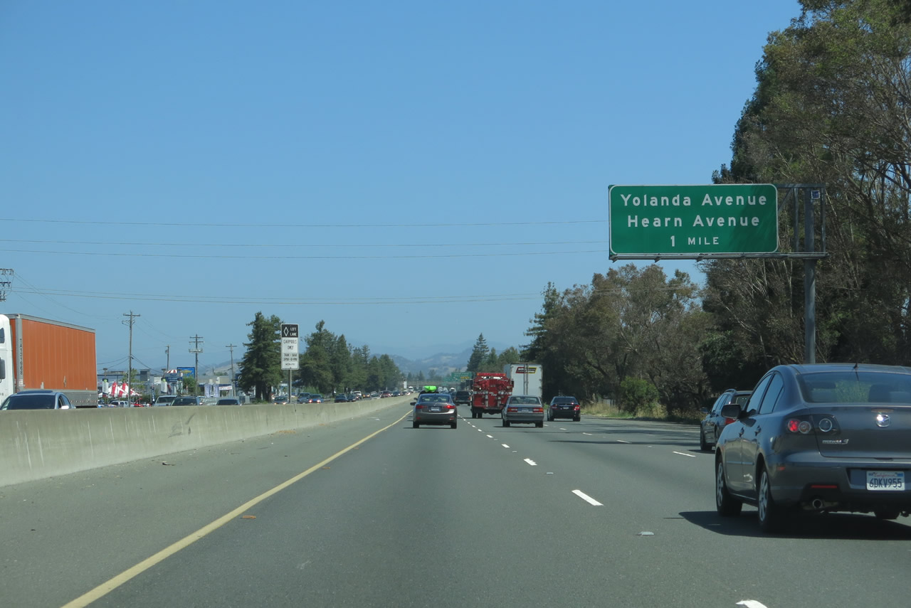
The next exit along northbound U.S. 101 (Redwood Highway) is Exit 487, Yolanda Avenue and Hearn Avenue (one mile). Photo taken 07/05/13. |
|
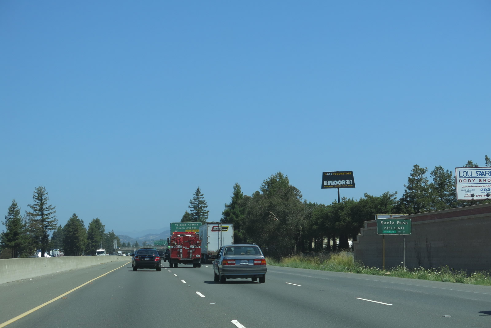
U.S. 101 formally enters the city of Santa Rosa, the seat of Sonoma County. Roadside plantings along the highway change as it advances north, with tree coverage increasing, including the redwoods that give U.S. 101 its secondary name of Redwood Highway. Caltrans also planted redwoods alongside the U.S. 101 freeway. Photo taken 07/05/13. |
|
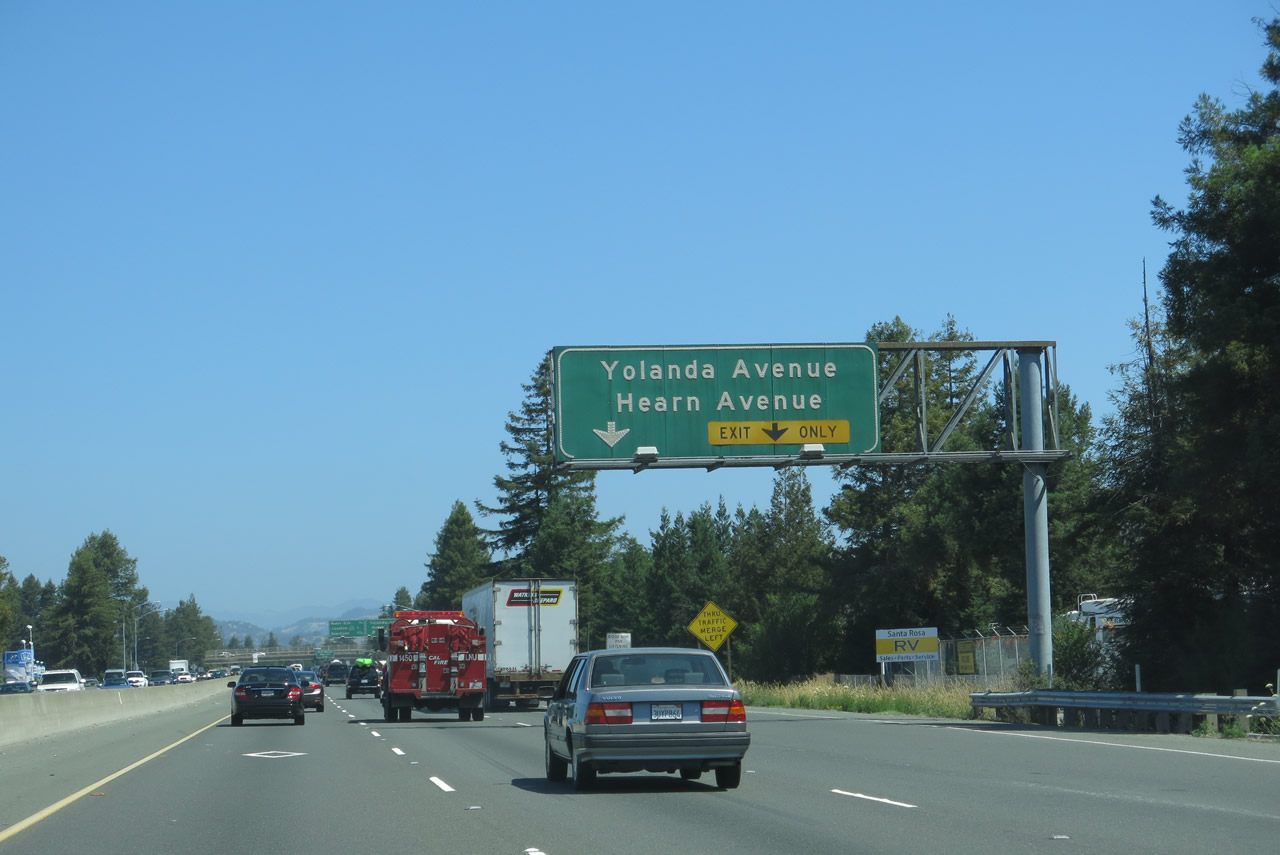
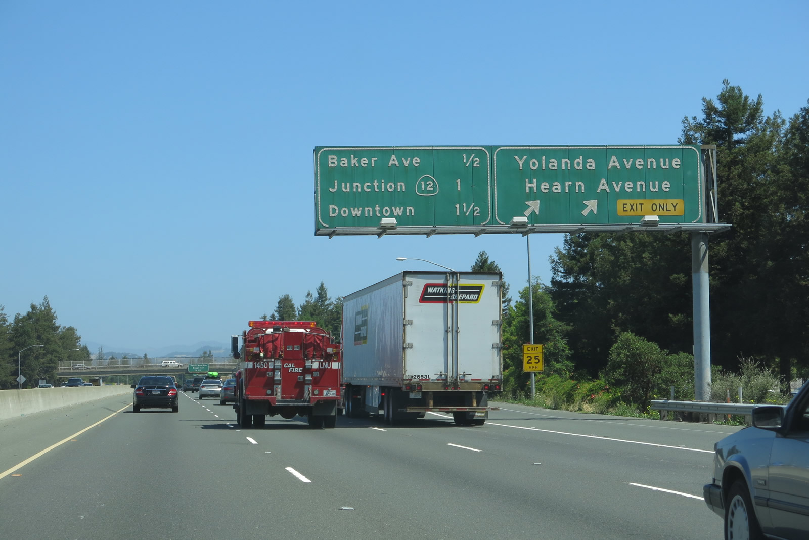
Forthcoming Exit 487 departs next from northbound U.S. 101 (Redwood Highway) to Exit 487, Yolanda Avenue and Hearn Avenue. Photo taken 07/05/13. |
|
Northbound U.S. 101 (Redwood Highway) meets Exit 487, Yolanda Avenue and Hearn Avenue. The following three exits along U.S. 101 north are Exit 488A, Baker Avenue to U.S. 101 Business Santa Rosa Avenue; Exit 488B, California 12 to Sebastopol and Sonoma; and Exit 489, Downtown Santa Rosa (Third Street and Morgan Street). Photo taken 07/05/13. |
|
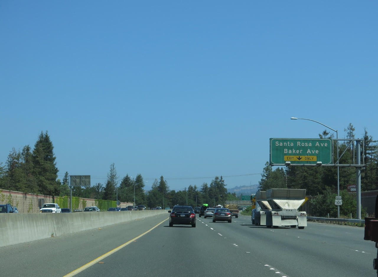
The next exit along U.S. 101 (Redwood Highway) north is Exit 488A, Baker Avenue to U.S. 101 Business/Santa Rosa Avenue. Photo taken 07/05/13. |
|
The right lane of U.S. 101 (Redwood Highway) north becomes exit only for Exit 488A, Baker Avenue to U.S. 101 Business/Santa Rosa Avenue. Photo taken 07/05/13. |
|
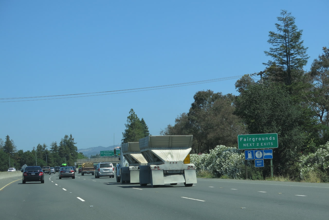
Use either of the next two exits to the Sonoma County Fairgrounds. All motorist services are available at these exits. Photo taken 07/05/13. |
|
Northbound U.S. 101 (Redwood Highway) reaches Exit 488A, Baker Avenue to U.S. 101 Business/Santa Rosa Avenue. The second exit is Exit 488B, California 12. Photo taken 07/05/13. |
|
U.S. 101 (Redwood Highway) passes under Baker Avenue. Photo taken 07/05/13. |
|
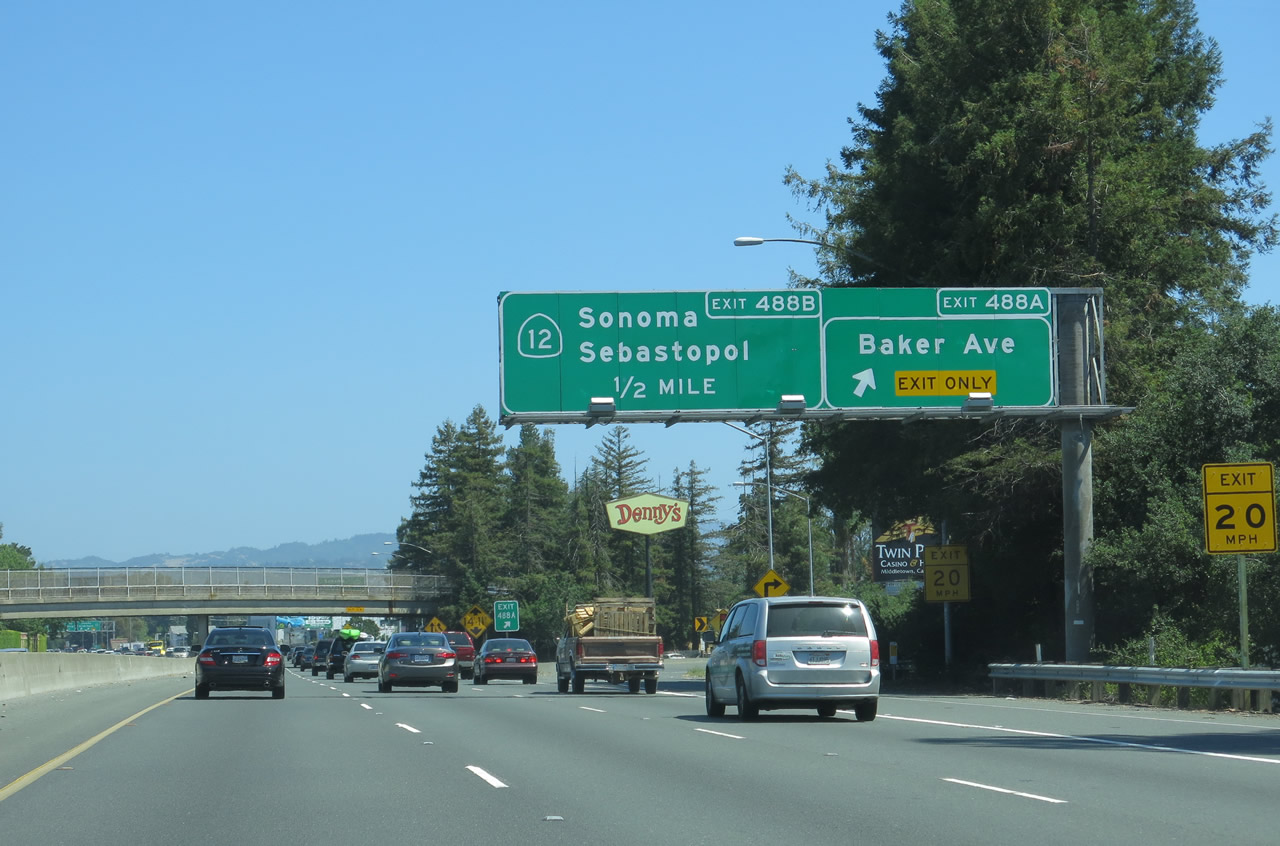
The right lane of U.S. 101 (Redwood Highway) becomes exit only for the California 12 freeway, a major east-west highway that serves central Sonoma County. The left three lanes of U.S. 101 continue north. Photo taken 07/05/13. |
|
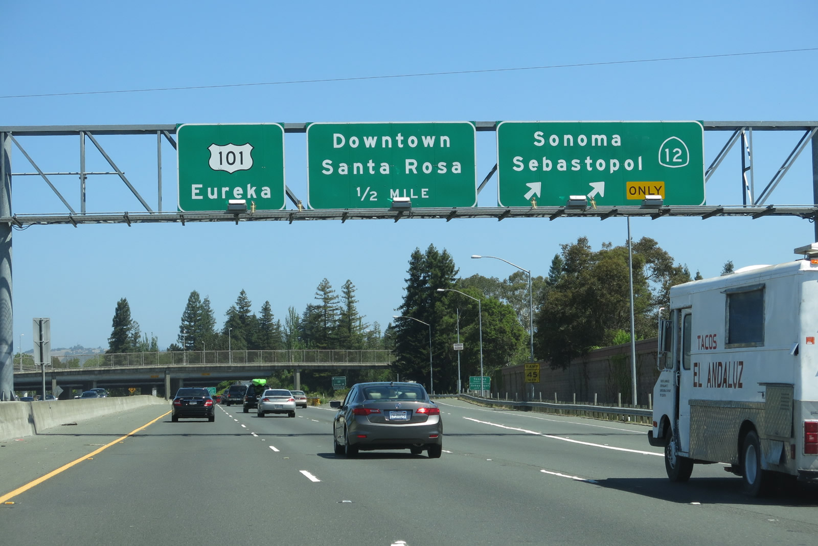
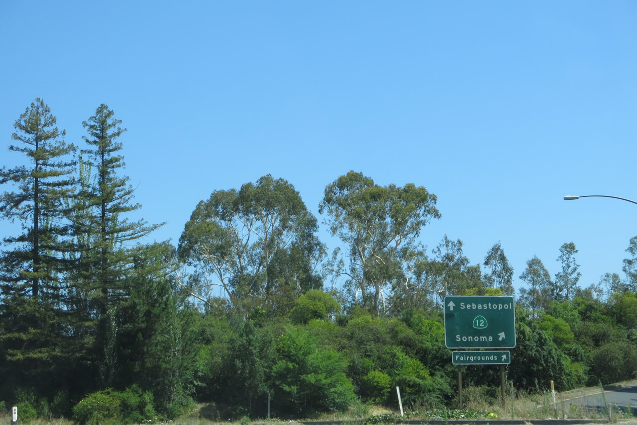
Northbound U.S. 101 (Redwood Highway) meets Exit 488B, California 12 east to Sonoma and Napa and west to Sebastopol and Bodega Bay. California 12 is a major east-west route extending from Sebastopol east to Santa Rosa and Sonoma, then southeast to Napa and Fairfield. After passing through the California Delta, California 12 emerges in Lodi, then proceeds to meet California 49 near Jackson. Photo taken 07/05/13. |
|
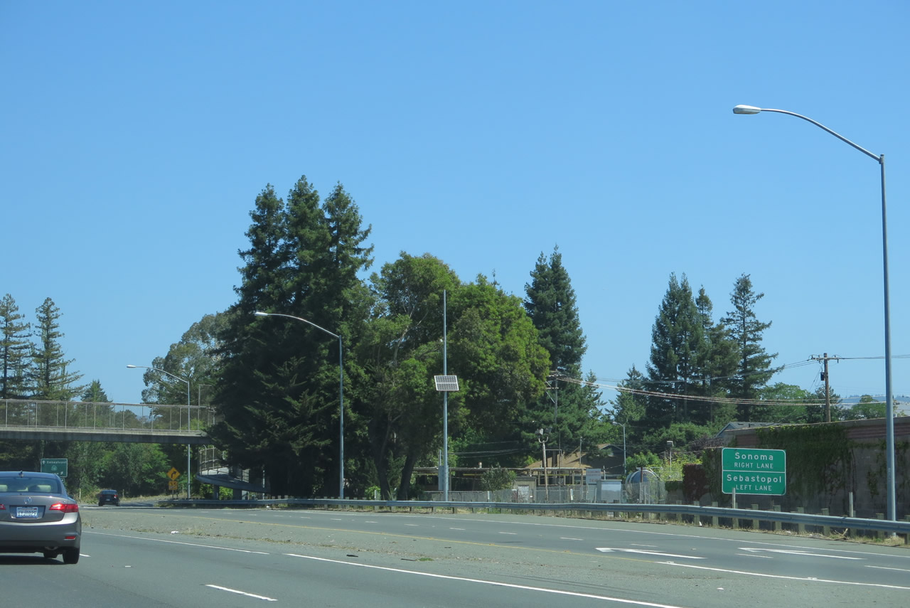
Looking at the exiting lanes, the right lane connects to California 12 east to Sonoma, and the left lane connects to California 12 west to Sebastopol. Photo taken 07/05/13. |
|
A pedestrian bridge crosses over the U.S. 101 freeway. Photo taken 07/05/13. |
|
Back in the exiting lanes, traffic must choose between California 12 east to Sonoma or California 12 west to Sebastopol. This is not a collector distributor lane, so there is no return back to U.S. 101 north from these lanes. Photo taken 07/05/13. |
|
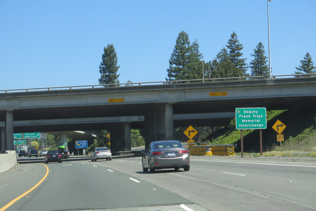
U.S. 101 passes under California 12 at the Deputy Frank Trejo Memorial Interchange. Look ahead for the off-ramp to downtown Santa Rosa via Morgan Street (Exit 489). Photo taken 07/05/13. |
|
Three lanes carry U.S. 101 north under California 12; the freeway curves slightly toward the northwest for the next mile or so. Photo taken 07/05/13. |
|
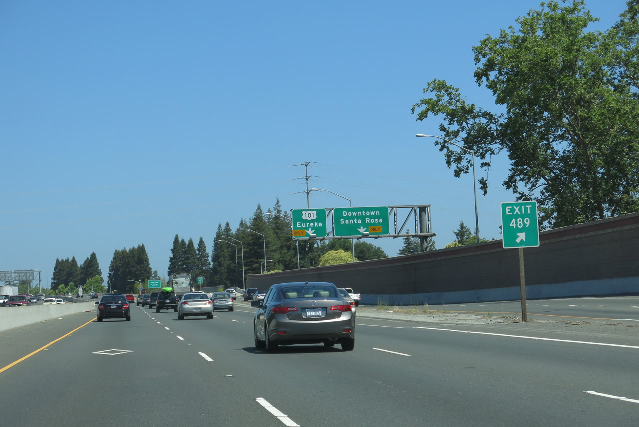
The next exit along U.S. 101 north is Morgan Street north to Third Street east to Old Courthouse Square and Fourth Street west to Railroad Square Historic District. Use Fourth Street west to the California Welcome Center at Depot Park within Railroad Square Historic District. Photo taken 07/05/13. |
|
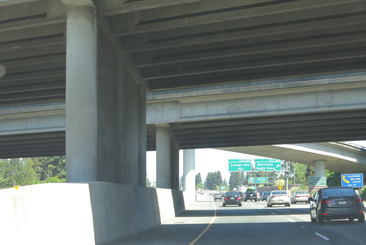
Northbound U.S. 101 (Redwood Highway) reaches Exit 489, Morgan Street north to Third Street east to Old Courthouse Square and Fourth Street west to Railroad Square Historic District. This exit is a collector distributor lane, so through traffic may exit here and return to U.S. 101 north, either by using a slip ramp or by following Morgan Street north for several blocks. The upcoming section of U.S. 101 is an elevated viaduct that was expanded to three lanes in each direction. Photo taken 07/05/13. |
|
Exit 489 departs the freeway and immediately merges with incoming traffic from California 12. Traffic will weave and merge for a brief distance, then split between U.S. 101 north and Downtown Santa Rosa via Morgan Street north. Photo taken 07/05/13. |
|
The collector distributor lanes split between U.S. 101 north and Morgan Street. Photo taken 07/05/13. |
|
U.S. 101 proceeds north (aiming slightly northwest in fact) through downtown Santa Rosa. Railroad Square lies to the west, and Old Courthouse Square lies to the east of the freeway. The downtown viaduct was and is controversial due to the split it has made through downtown Santa Rosa. Photo taken 07/05/13. |
|
The collector distributor lane splits between U.S. 101 north and Morgan Street north (Exit 489). An auxiliary sign advises that Exit 490 connects U.S. 101 to Santa Rosa Junior College. Photo taken 07/05/13. |
|
U.S. 101 travels above the downtown Santa Rosa street grid while it travels on this viaduct, which was expanded in 2007 to accommodate a third main lane in each direction. This third lane is the left lane of U.S. 101 north, and it operates as a high occupancy vehicle (carpool) lane during commuting hours. Photo taken 07/05/13. |
|
The Downtown Viaduct comes to an end as indicated by the change in pavement from concrete to asphalt. Photo taken 07/05/13. |
|
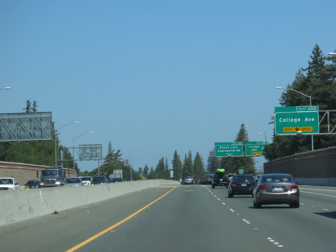
As traffic from Morgan Street returns onto U.S. 101 north, the new right lane becomes exit only for Exit 490, College Avenue to Santa Rosa Junior College. Photo taken 07/05/13. |
|
Northbound U.S. 101 (Redwood Highway) reaches Exit 490, College Avenue to Santa Rosa Junior College. Photo taken 07/05/13. |
|
U.S. 101 (Redwood Highway) passes through the College Avenue interchange and curves a bit toward the north again. Photo taken 07/05/13. |
|
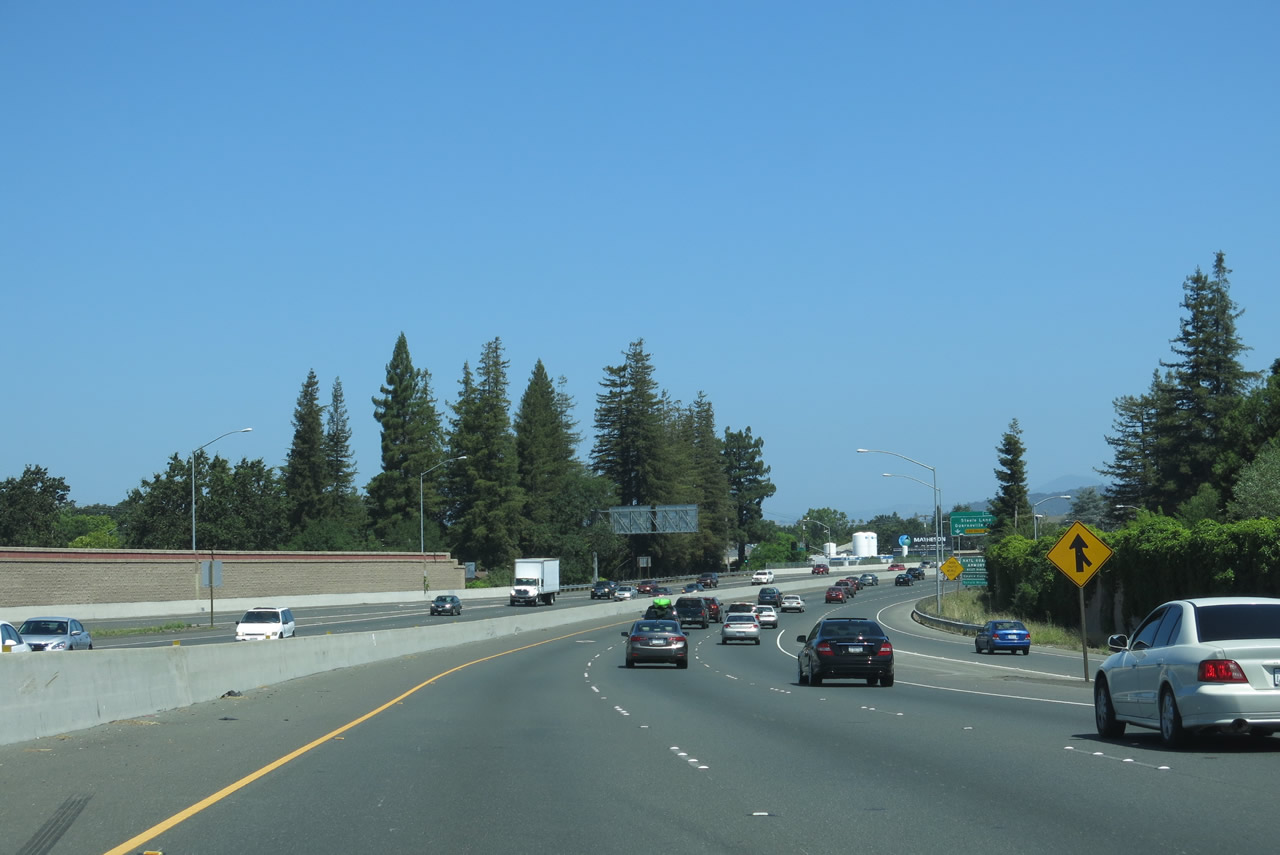
A U.S. 101 north reassurance shield is posted after the on-ramp from College Avenue. The next interchange will be Exit 491A, Steele Lane (east/west) and Guerneville Road west. Use this exit for the Charles M. Schulz Museum and Research Center (follow Steele Lane west; the museum complex is on the north side of Steele Lane after the intersection with Hardies Lane). Photo taken 07/05/13. |
|
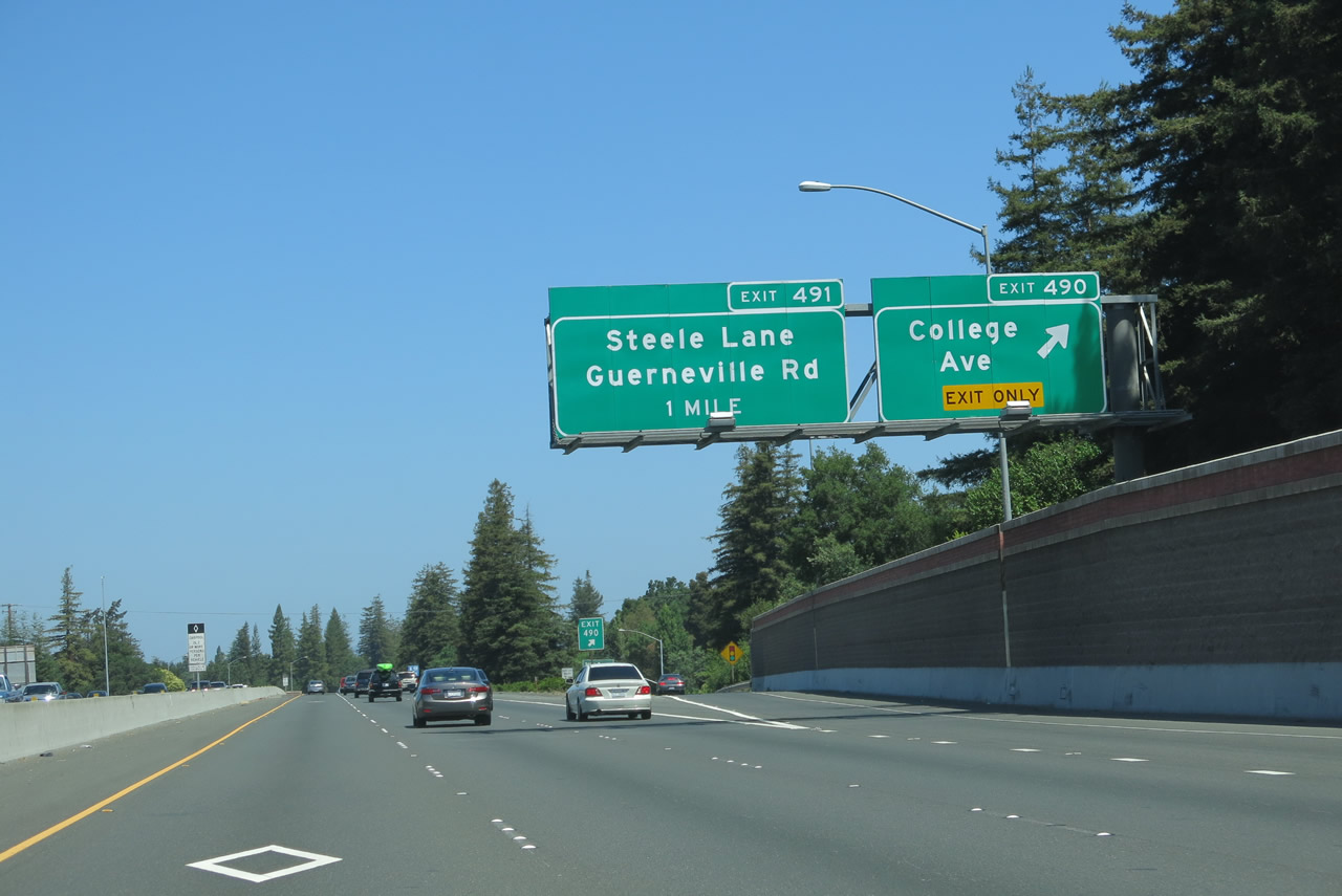
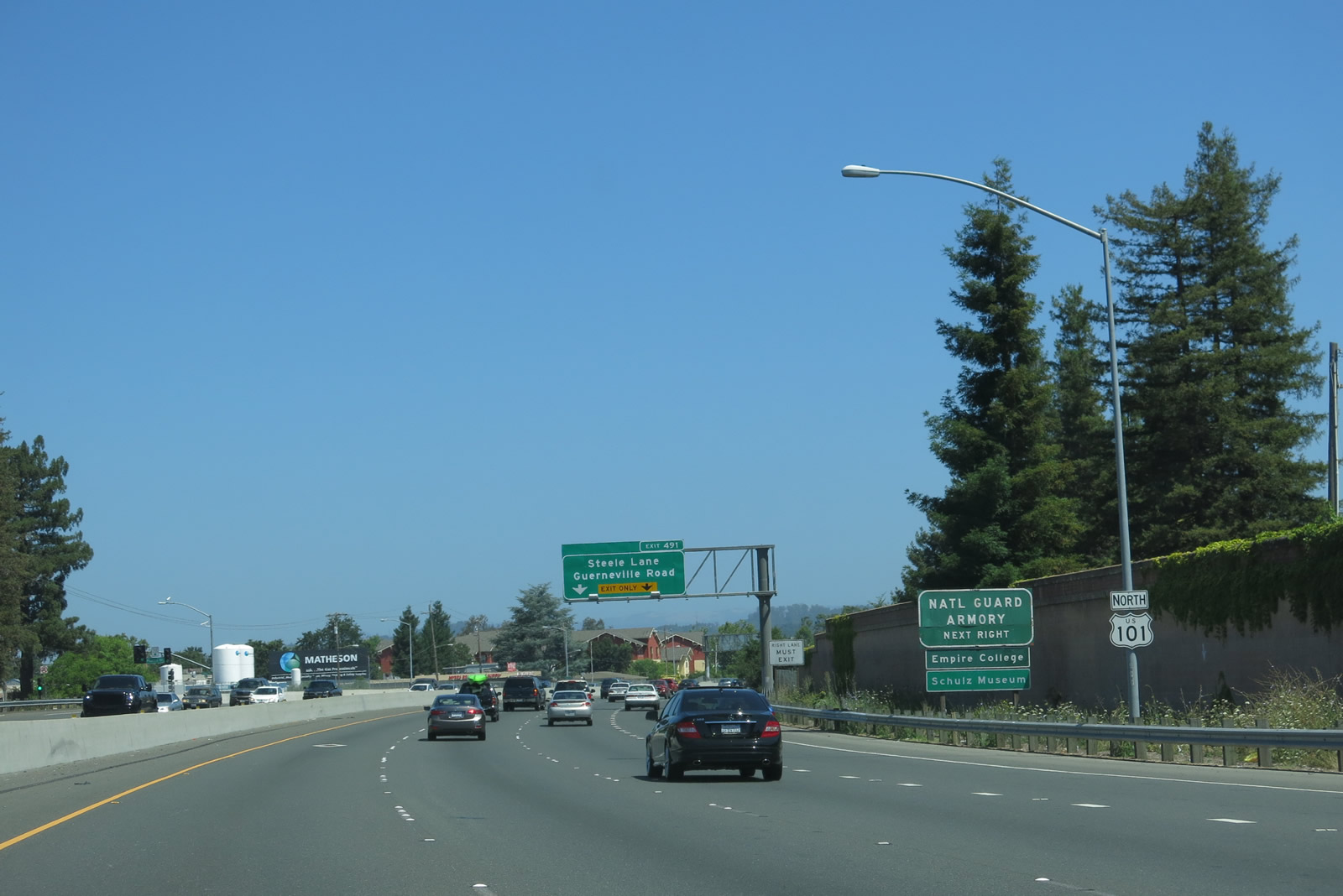
The right two lanes of U.S. 101 north connect to Exit 491A, Steele Lane and Guerneville Road. Steele Lane extends west to Marlow Road and east to U.S. 101 Business/Mendocino Avenue. Guerneville Road travels southeast from this interchange to a point southwest of its intersection with Dutton Avenue, then it turns due west to travel all the way to California 116/Gravenstein Highway north of Sebastopol. Guerneville Road doesn't make it all the way to Guerneville, but California 116 travels the remaining distance northwest to Guerneville. Photo taken 07/05/13. |
|
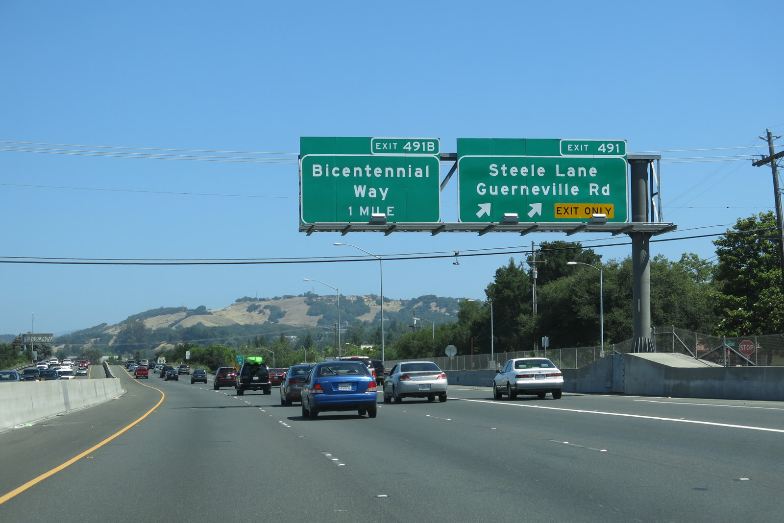
Northbound U.S. 101 (Redwood Highway) meets Exit 491A, Steele Lane and Guerneville Road. The overhead sign erroneously refers to this as Exit 491. The next interchange along U.S. 101 north will be Exit 491B, Bicentennial Way. Photo taken 07/05/13. |
|
The right two lanes of U.S. 101 north connect to Exit 491B, Bicentennial Way. Use Bicentennial Way east to a Kaiser Hospital. Bicentennial Way is a fairly short connector that begins at Range Avenue on the west side of the freeway and extends east and then northeast to join with Fountaingrove Parkway at a small directional interchange. Photo taken 07/05/13. |
|
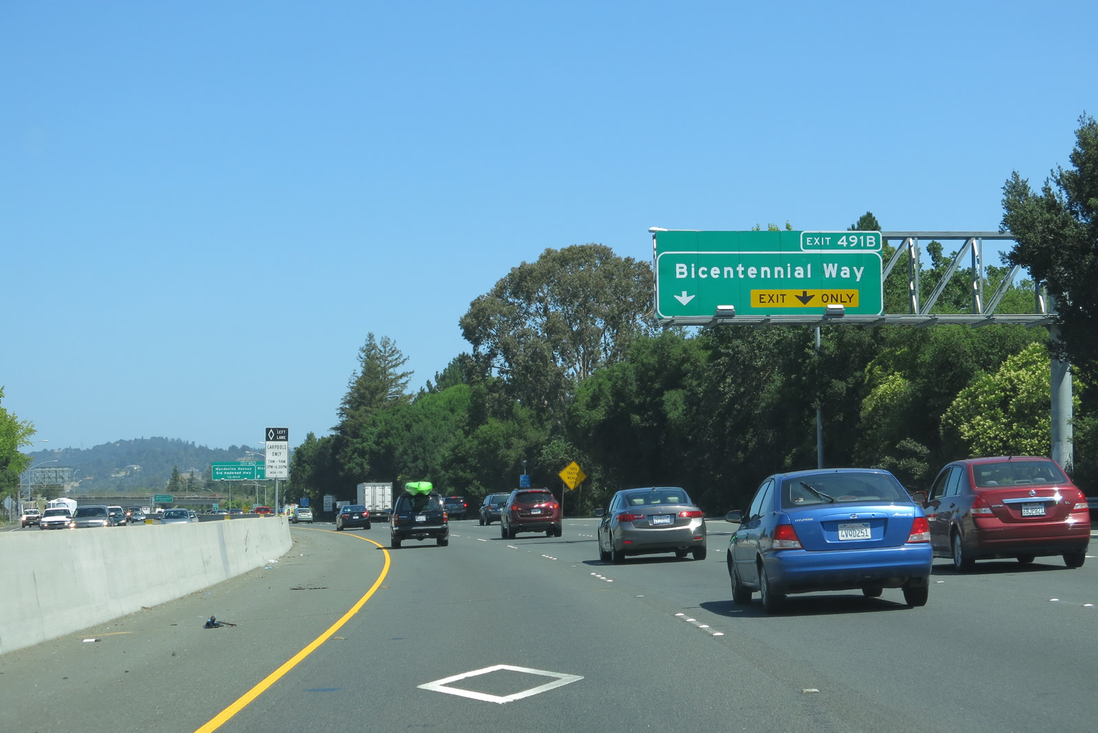
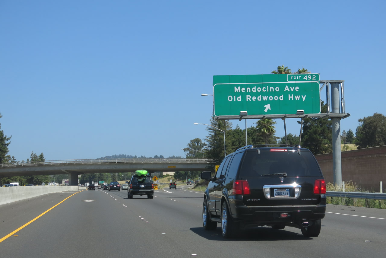
Northbound U.S. 101 (Redwood Highway) meets Exit 491B, Bicentennial Way. The off-ramp splits into Bicentennial Way east (bear right upon exiting) and west (bear left onto a loop ramp). The following interchange will be Exit 492, U.S. 101 Business/Mendocino Avenue south and Historic U.S. 101/Old Redwood Highway north. Photo taken 07/05/13. |
|
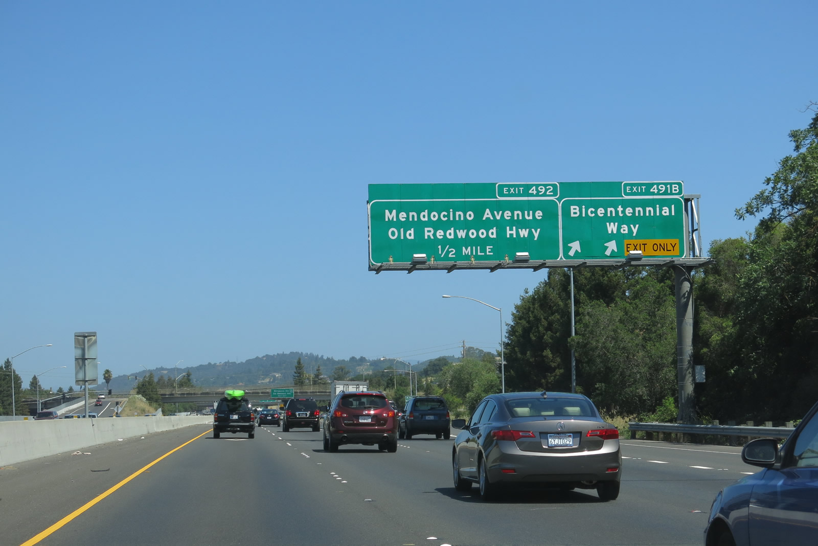
Passing under Bicentennial Way, the next exit along U.S. 101 (Redwood Highway) north is Exit 492, U.S. 101 Business/Mendocino Avenue south and Historic U.S. 101/Old Redwood Highway north. Photo taken 07/05/13. |
|
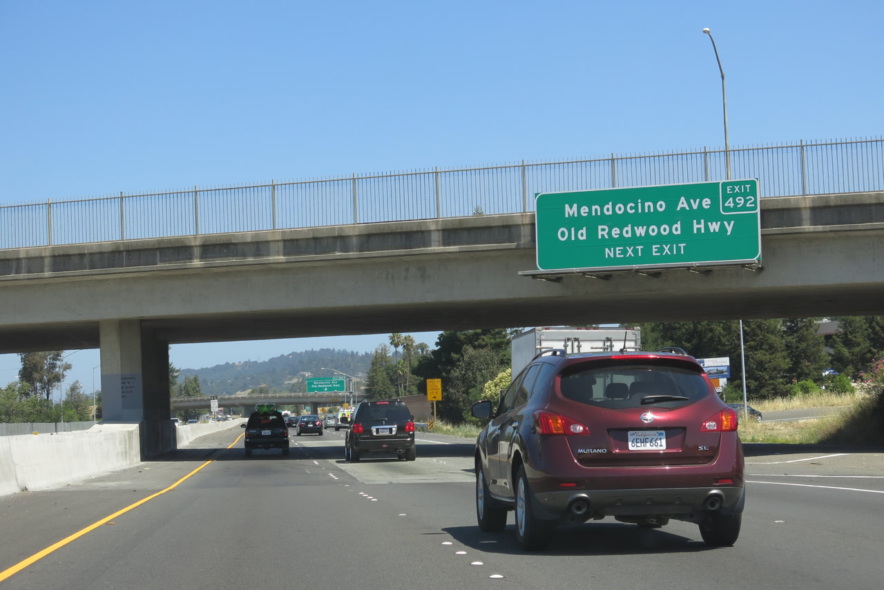
Northbound U.S. 101 reaches Exit 492, U.S. 101 Business/Mendocino Avenue south and Historic U.S. 101/Old Redwood Highway north. Prior to construction of the freeway route through Santa Rosa, U.S. 101 followed a combination of what is now Santa Rosa Avenue (south of downtown), Mendocino Avenue (north of downtown), and Old Redwood Highway (north of Exit 492). The old alignment stays to the west of the U.S. 101 freeway. Photo taken 07/05/13. |
|
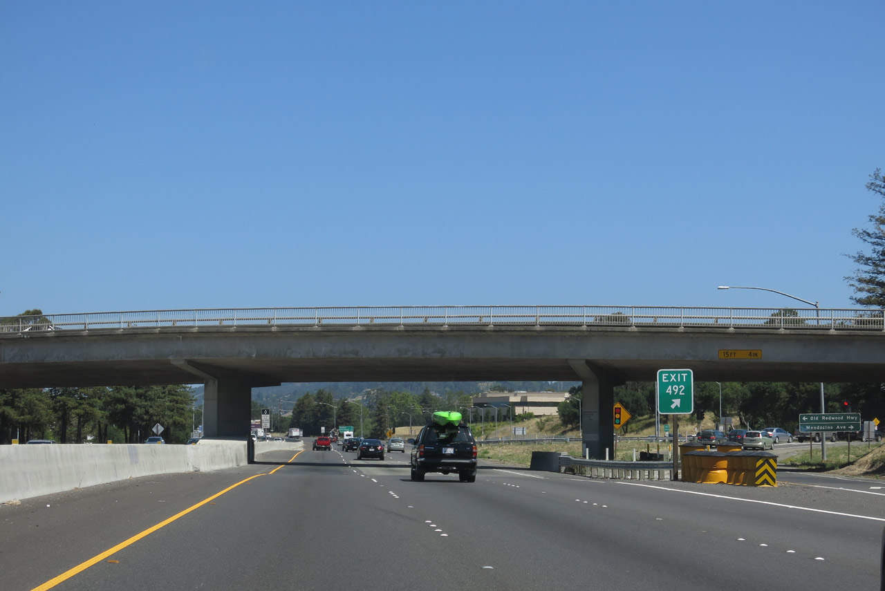
U.S. 101 retains three northbound lanes as it passes through the Exit 492 interchange. Photo taken 07/05/13. |
|
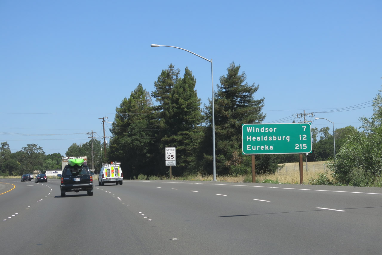
After the on-ramp from Mendocino Avenue, this mileage sign provides the distance to the town of Windsor (7 miles) and cities of Healdsburg (12 miles) and Eureka (215 miles). Photo taken 07/05/13. |
|
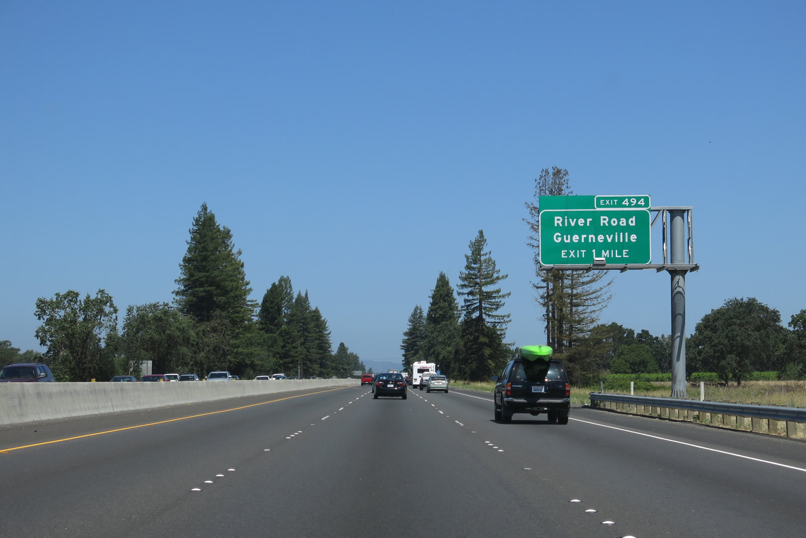
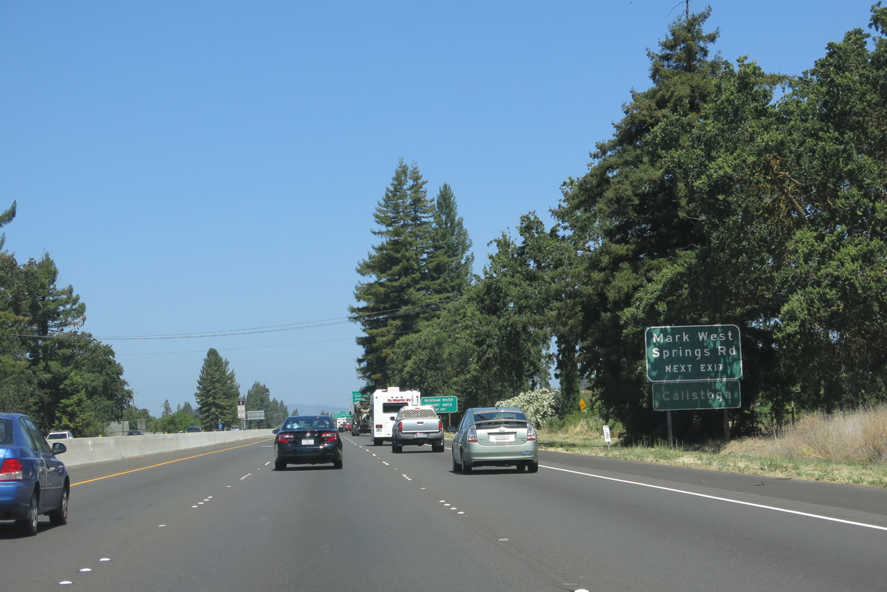
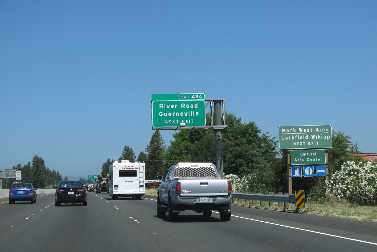
The next exit along U.S. 101 (Redwood Highway) north is Exit 494, River Road west to Fulton and Guerneville and east to Mark West and Calistoga. Photo taken 07/05/13. |
|
Mark West Springs Road travels east toward Larkfield-Wikiup, Mark West, and the city of Calistoga, which is located at the confluence of California 128 and California 29 at the northern end of Napa Valley. Mark West Springs Road changes names into Porter Creek Road, and a left turn onto Petrified Forest Road east is necessary to connect to Calistoga. Other communities in Lake County (including Middletown and Clearlake) and Napa Valley (such as St. Helena and Yountville) can be reached via Mark West Springs Road east (as opposed to using California 128 east or California 175 east). Photo taken 07/05/13. |
|
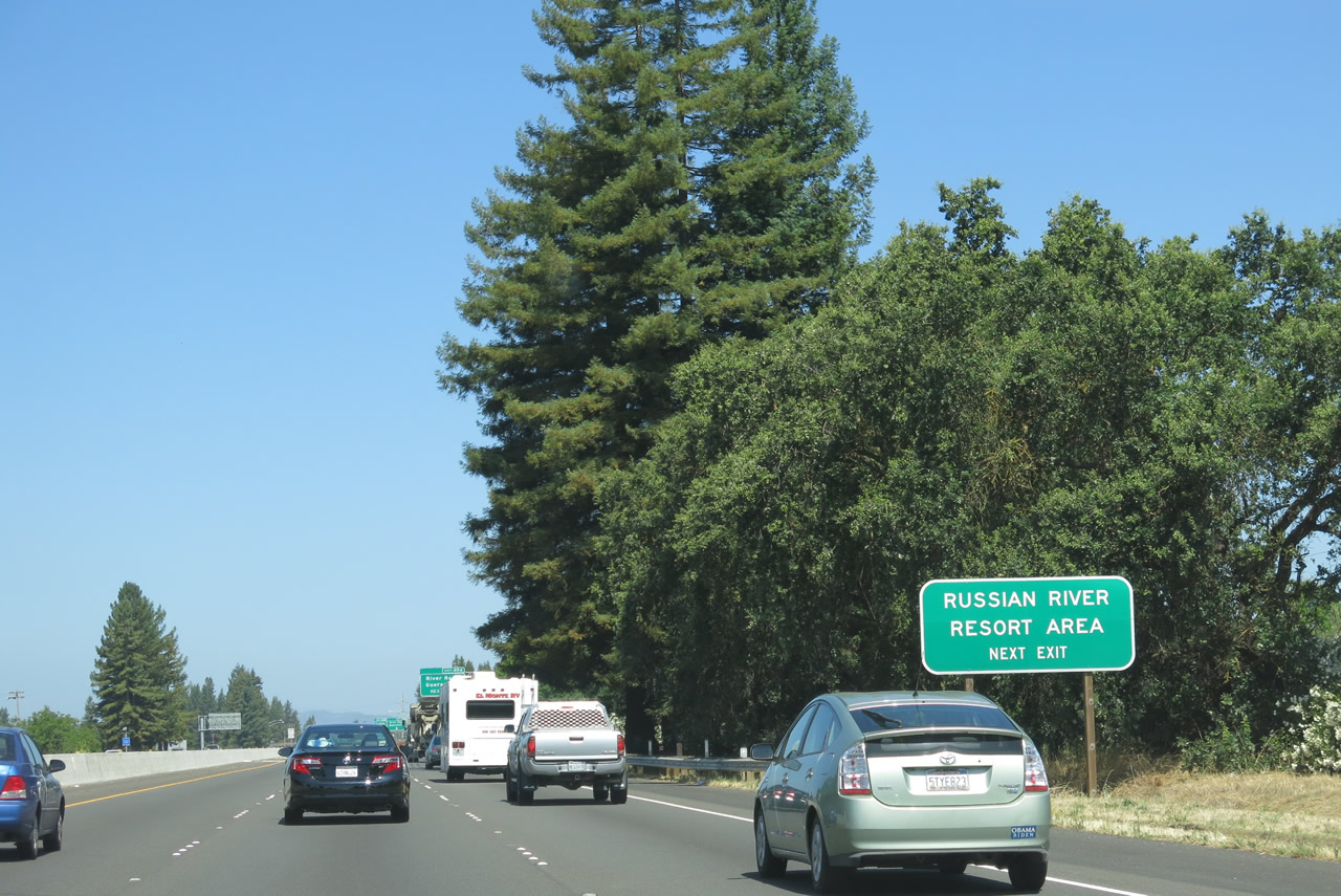
Use River Road west to the Russian River resort areas and Guerneville. A large electrical substation is located at the northwestern quadrant of this interchange. According to the California Streets and Highways Code, River Road follows the approximate alignment of proposed California 181, which would travel from U.S. 101 near Fulton to California 116 near Forestville (via Maribel Road) or Guerneville (via River Road). Photo taken 07/05/13. |
|
River Road is the most direct route from northern Santa Rosa to Guerneville. Initially, River Road will follow the southern bank of the Russian River, but it switches to the north side before reaching Guerneville. West of Guerneville, River Road becomes part of California 116, and the state highway continues to follow the Russian River all the way to the coast, where California 116 ends at California 1 (Shoreline Highway) in the small community of Jenner. Photo taken 07/05/13. |
|
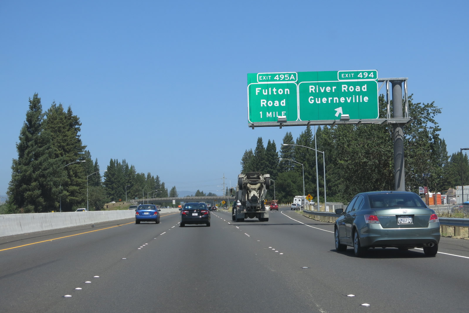
Northbound U.S. 101 reaches Exit 494, River Road west to Fulton, Guerneville, and Jenner and Mark West Springs Road east to Mark West, Calistoga, and northern Napa Valley. The next interchange along U.S. 101 (Redwood Highway) north is Exit 495A, Fulton Road. Photo taken 07/05/13. |
|
U.S. 101 passes under the bridge that connects River Road to Mark West Springs Road. Photo taken 07/05/13. |
|
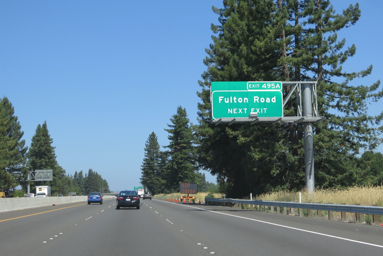
The next exit along U.S. 101 north is Exit 495A, Fulton Road. This north-south roadway travels north to Old Redwood Highway (Historic U.S. 101) and south to California 12 west of Santa Rosa. It is a major regional connector between these two points and can be used to bypass most of Santa Rosa during times of heavy traffic within the city. However, Fulton Road is not a freeway. Photo taken 07/05/13. |
|
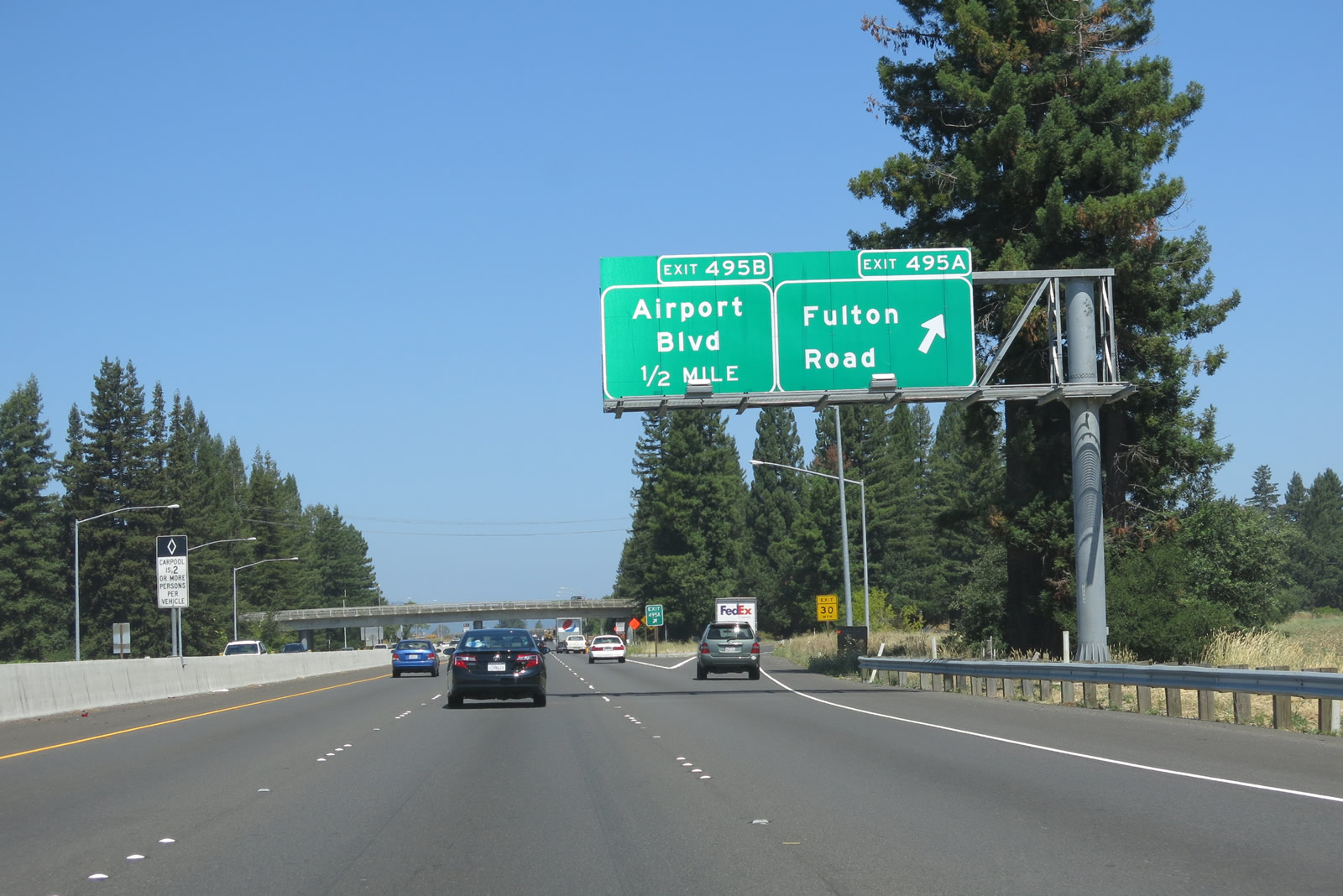
Soon thereafter, northbound U.S. 101 meets Exit 495A, Fulton Road. A project is underway as of July 2013 to eliminate the Fulton Road interchange, which would be accommodated by a revision of the Airport Boulevard interchange. The U.S. 101/Airport Boulevard project page1 states that "this project will convert the two existing partial interchanges on U.S. 101 at Fulton Road and at Airport Boulevard into a single complete interchange at Airport Boulevard, eliminating the on- and off- ramps at Fulton Road." The project should be fully completed by the end of 2014. Photo taken 07/05/13. |
|
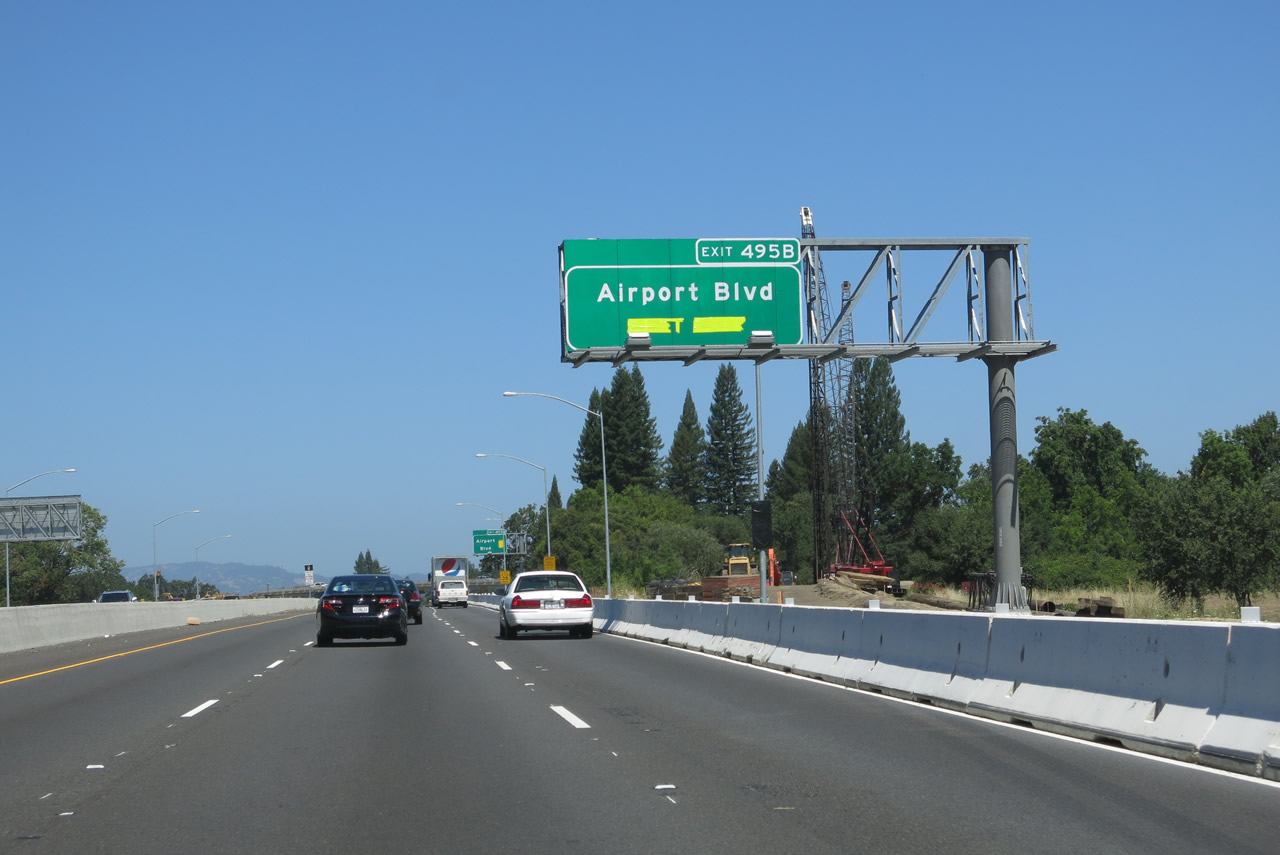
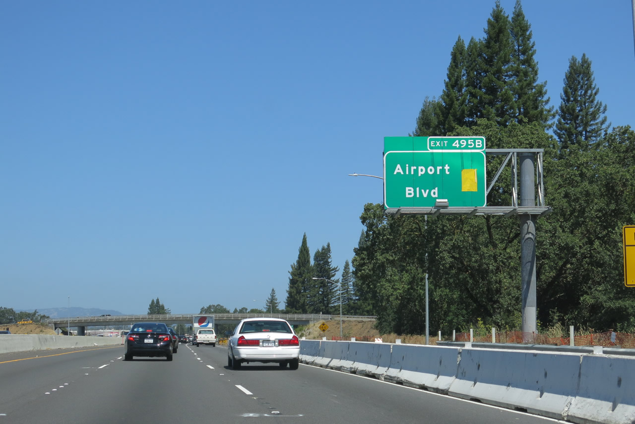
The next exit along U.S. 101 north is Exit 495B, Airport Boulevard. This interchange off-ramp was closed at the time this picture was taken due to the aforementioned interchange realignment and consolidation project. It is likely that this interchange will be renumbered as Exit 495 once the project is complete. Photo taken 07/05/13. |
|
Northbound U.S. 101 reaches Exit 495B, Airport Boulevard. Photo taken 07/05/13. |
|
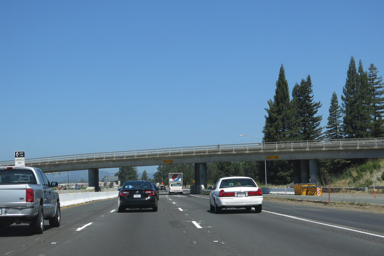
U.S. 101 passes through the Airport Boulevard interchange. Airport Boulevard takes its name from nearby Charles M. Schulz Sonoma County Airport, which is located a little more than a mile west of U.S. 101 and offers commercial and general aviation service. Photo taken 07/05/13. |
|
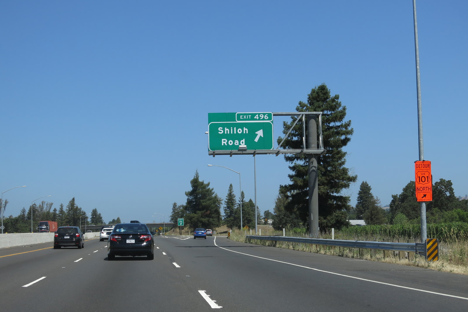
The next exit along U.S. 101 (Redwood Highway) north is Exit 496, Shiloh Road. Photo taken 07/05/13. |
|
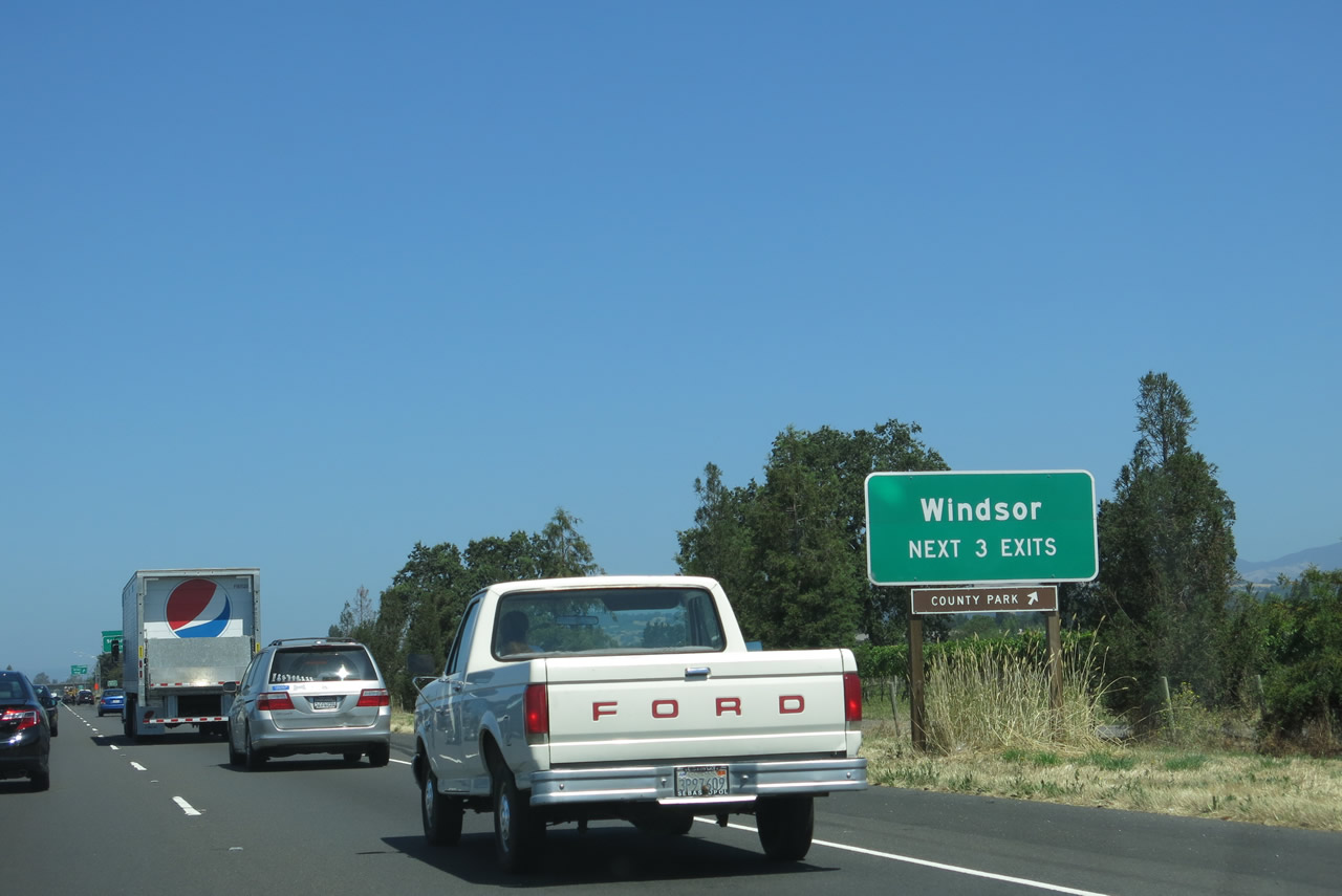
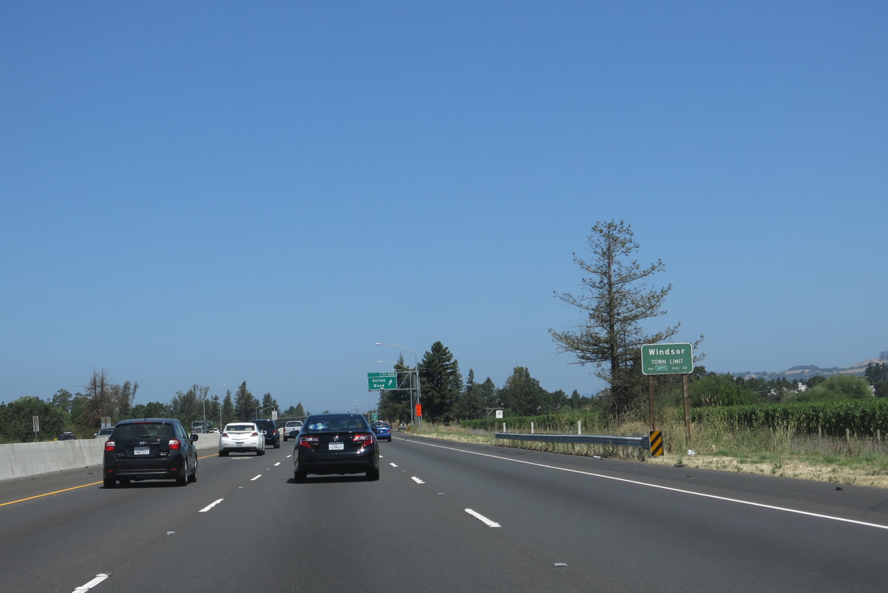
The next three exits from U.S. 101 serve the town of Windsor, which had a population of 26,801 as of the 2010 census and was incorporated on July 1, 1992. Photo taken 07/05/13. |
|
A Windsor town limits sign is posted shortly thereafter. Photo taken 07/05/13. |
|
Northbound U.S. 101 reaches Exit 496, Shiloh Road. Photo taken 07/05/13. |
|
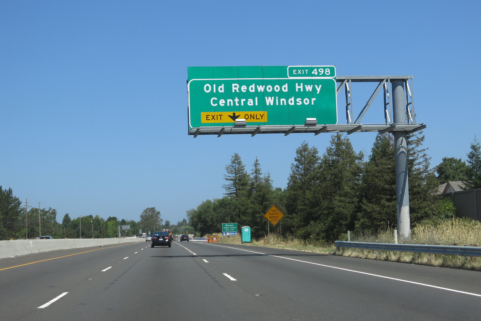
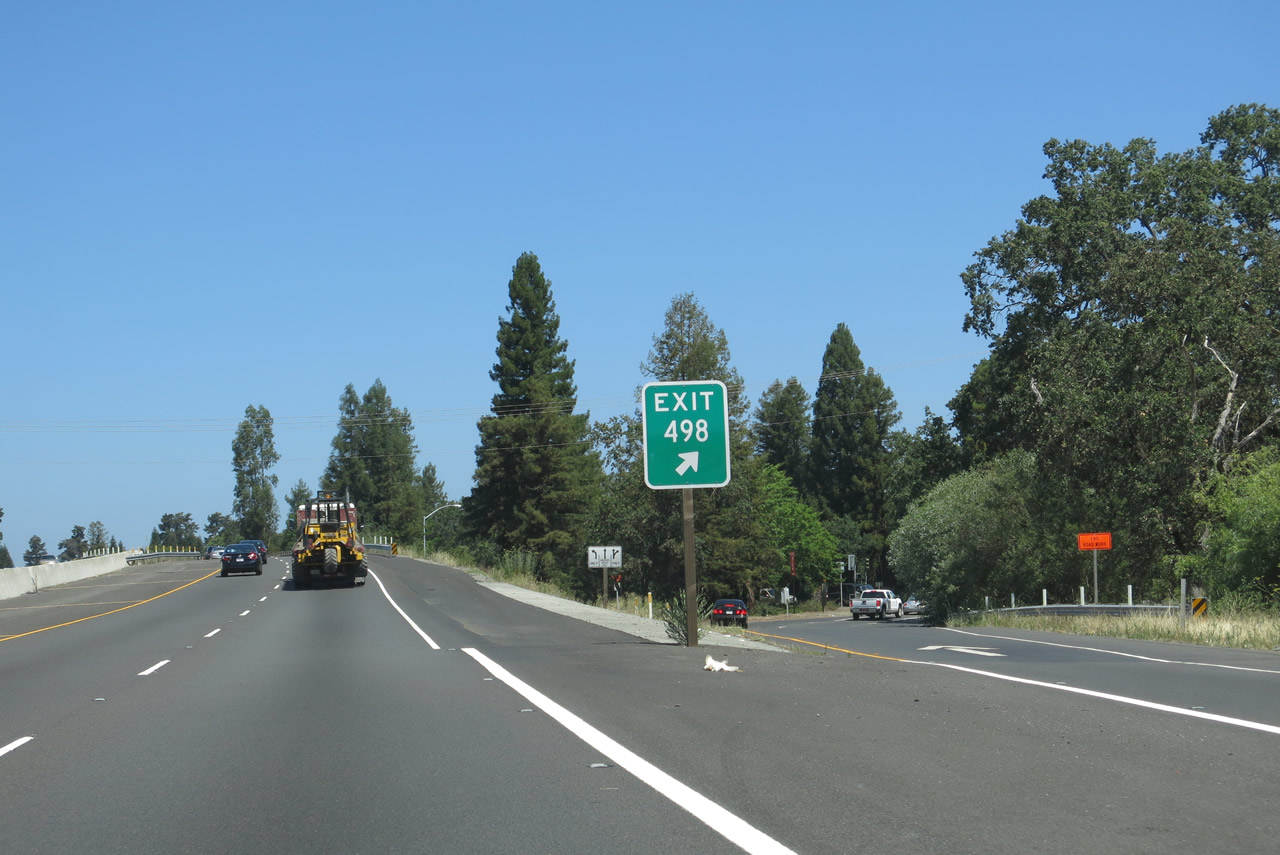
The next exit along U.S. 101 north is Exit 498, Historic U.S. 101/Old Redwood Highway in Windsor. The right lane becomes exit only for Exit 498, meaning that the three-lane configuration of U.S. 101 north comes to an end (for now) at this interchange. Photo taken 07/05/13. |
|
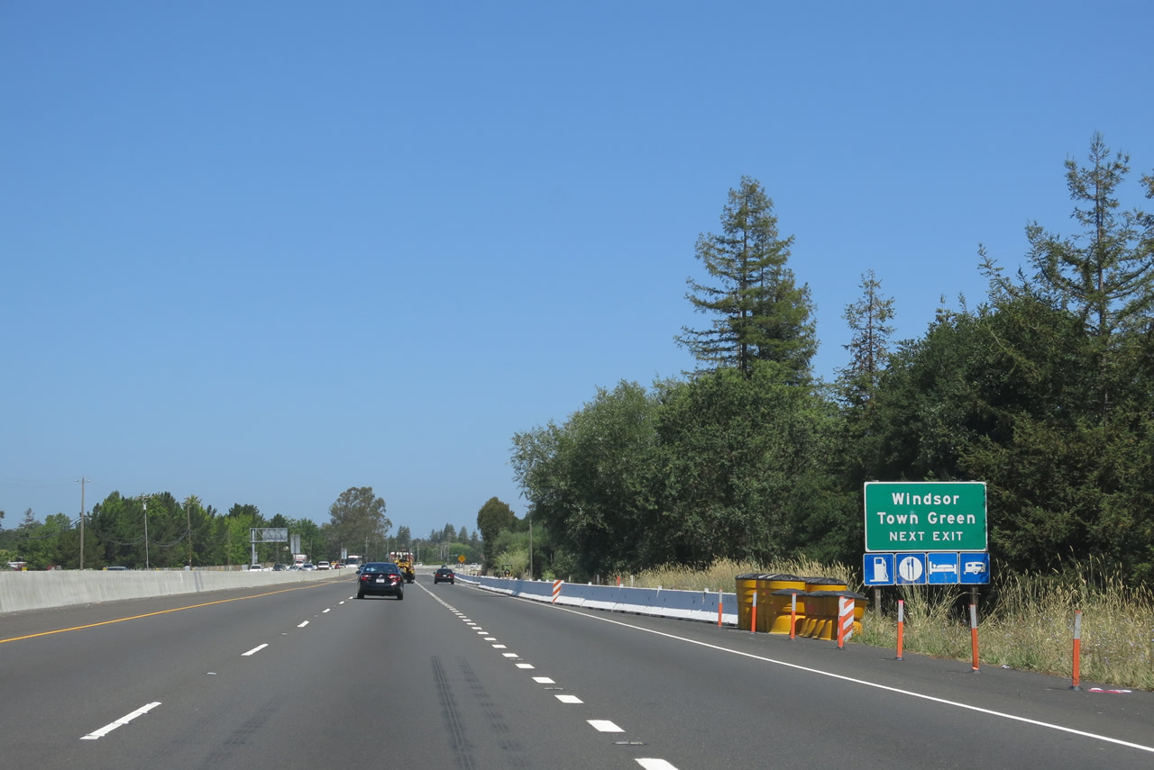
Use Old Redwood Highway northwest to downtown Windsor, the Windsor Town Green, and Windsor Library. To the southeast, Old Redwood Highway travels back toward Larkfield-Wikiup and Santa Rosa. Photo taken 07/05/13. |
|
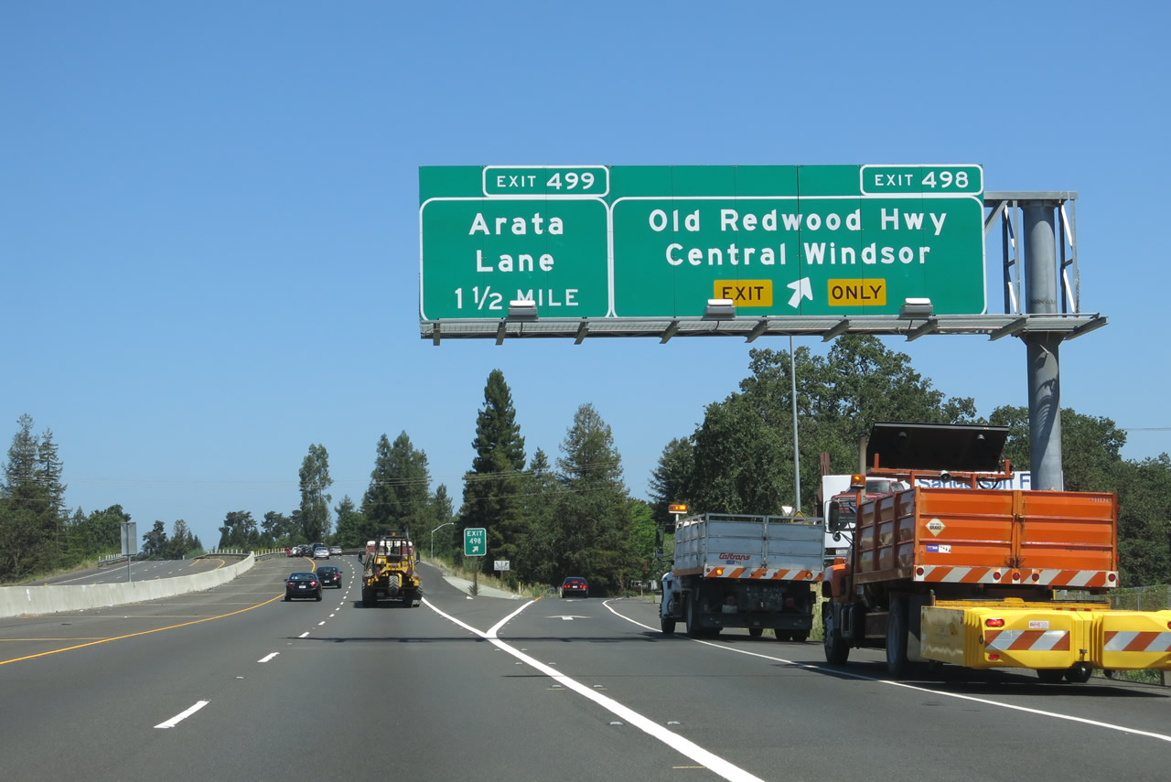
Northbound U.S. 101 meets Exit 498, Historic U.S. 101/Old Redwood Highway. The following interchange is Exit 499, Arata Lane (1.5 miles). Photo taken 07/05/13. |
|
U.S. 101 continues with only two northbound lanes after Exit 498 departs the freeway. Photo taken 07/05/13. |
|
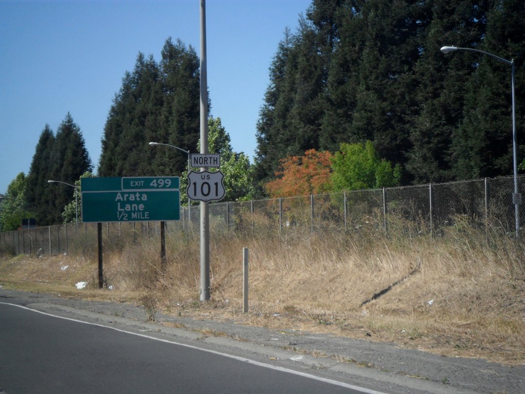
A U.S. 101 north reassurance shield is posted between the on-ramp from Exit 498 and the next sequence of signs for the following interchange (Exit 499, Arata Lane). Photo taken 08/27/11 by Leland Bailey. |
|
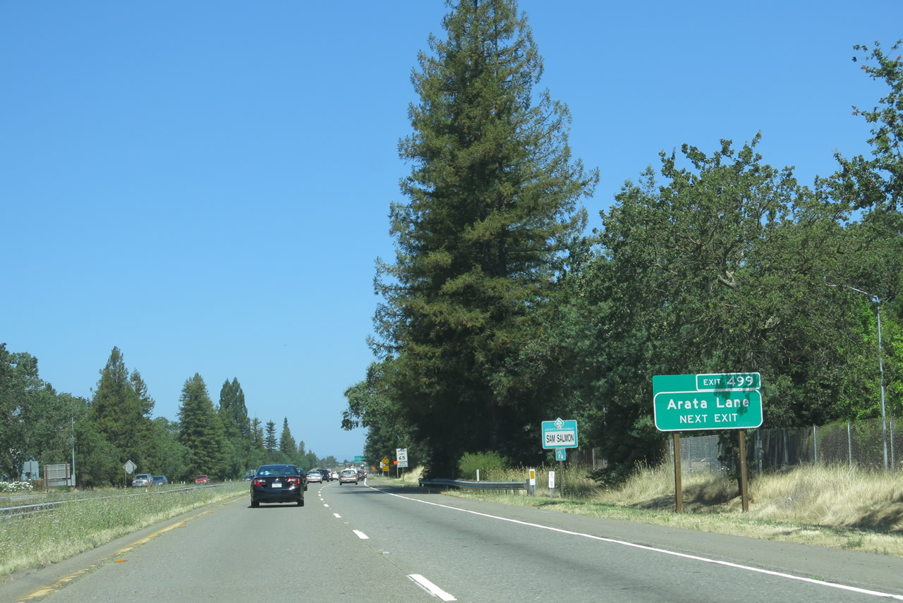
The next exit along U.S. 101 north is Exit 499, Arata Lane. Use Arata Lane west to Old Redwood Highway (Historic U.S. 101) or east to Hembree Lane in Windsor. Photo taken 07/05/13. |
|
Northbound U.S. 101 (Redwood Highway) meets Exit 499, Arata Lane. Photo taken 07/05/13. |
|
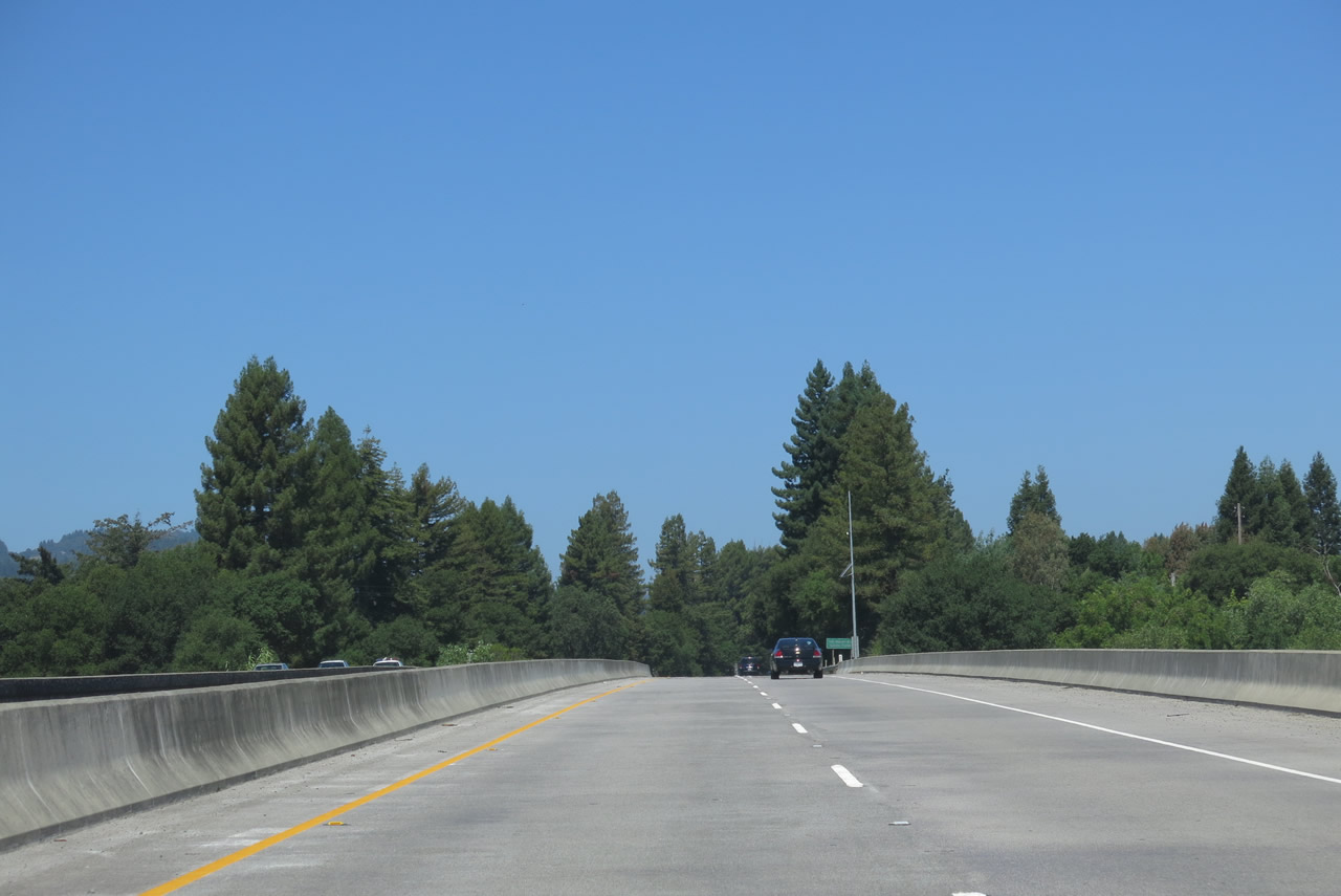
Redwood trees become increasingly visible along U.S. 101 (Redwood Highway) northward between the town of Windsor and city of Healdsburg. Photo taken 07/05/13. |
|
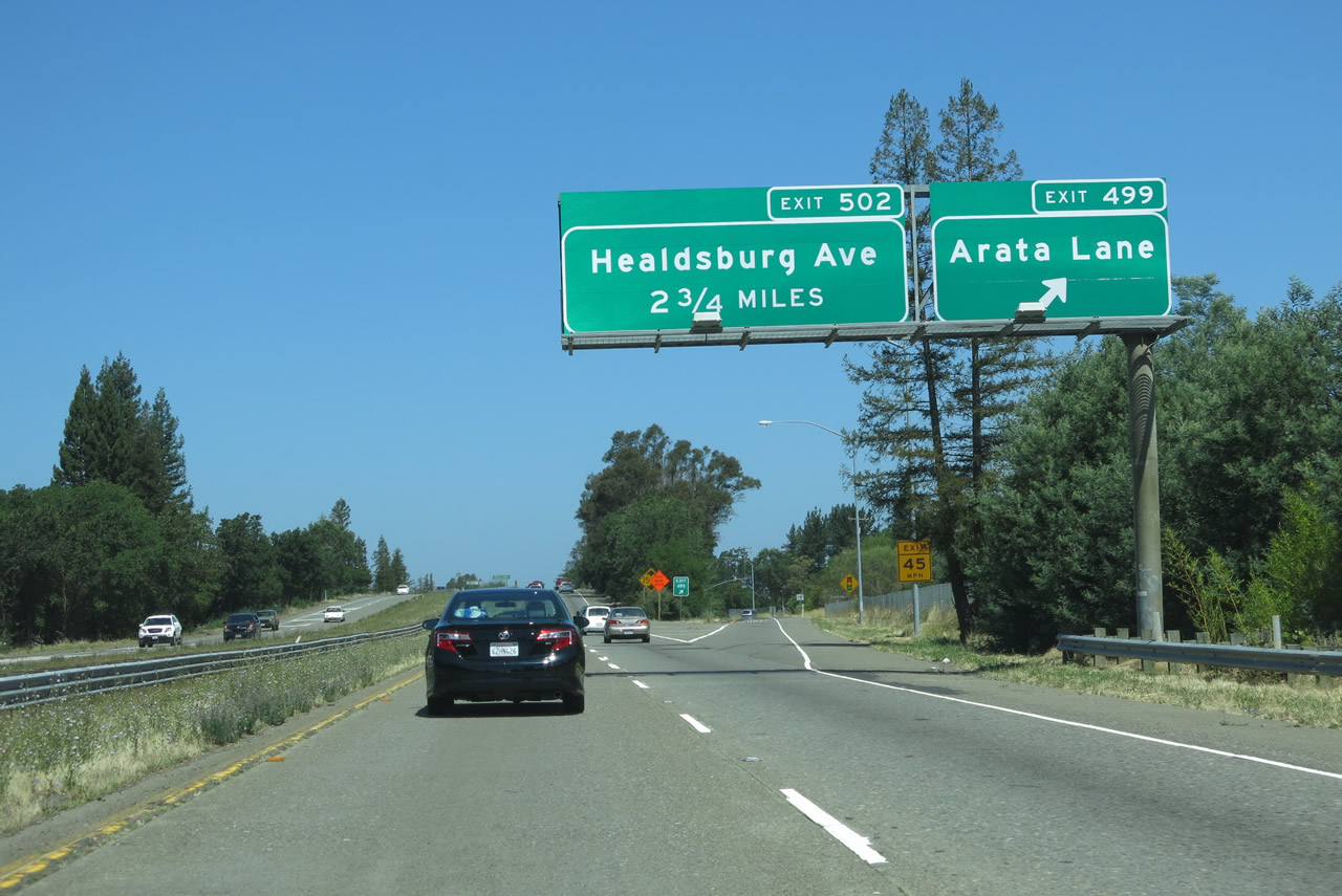
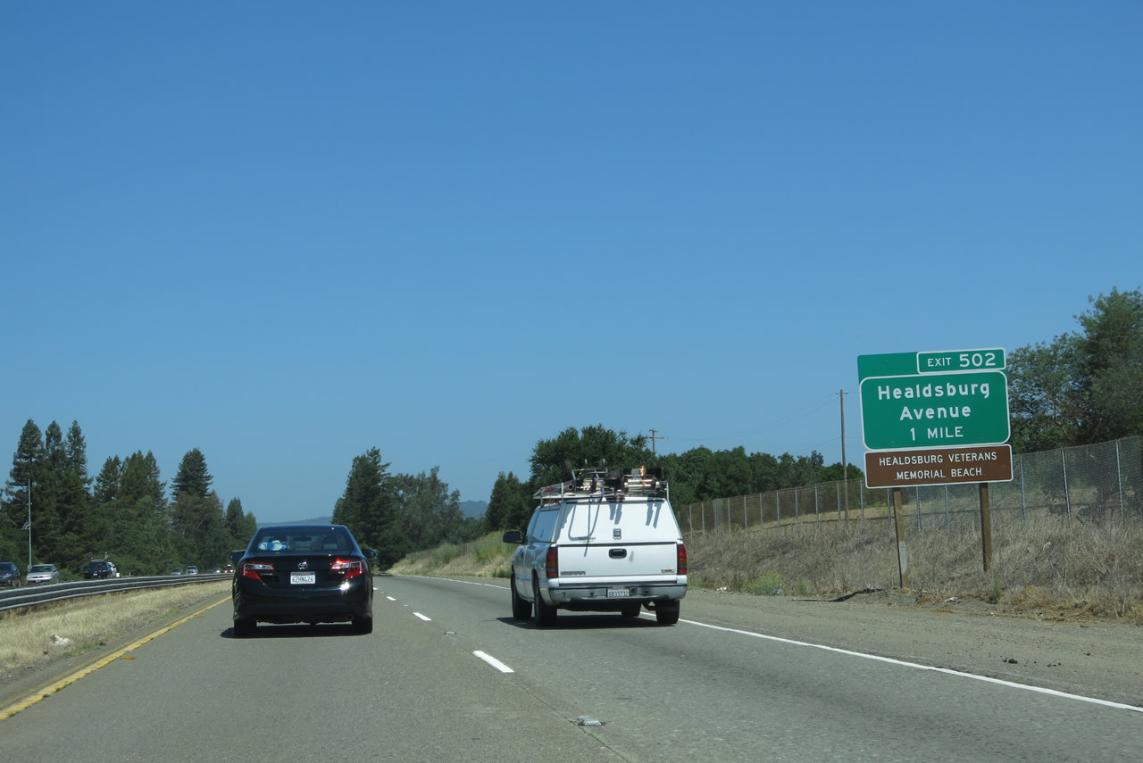
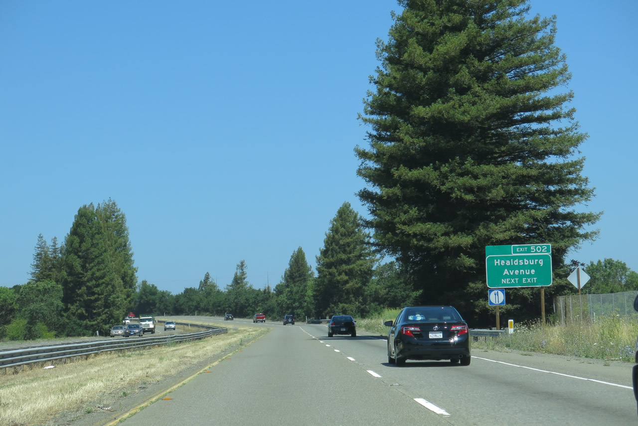
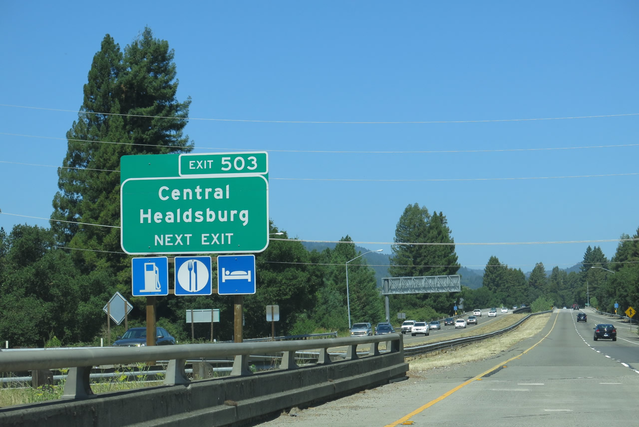
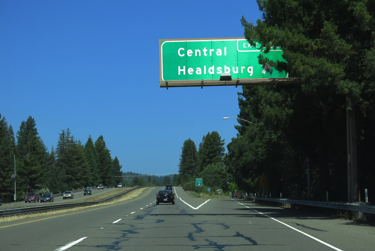
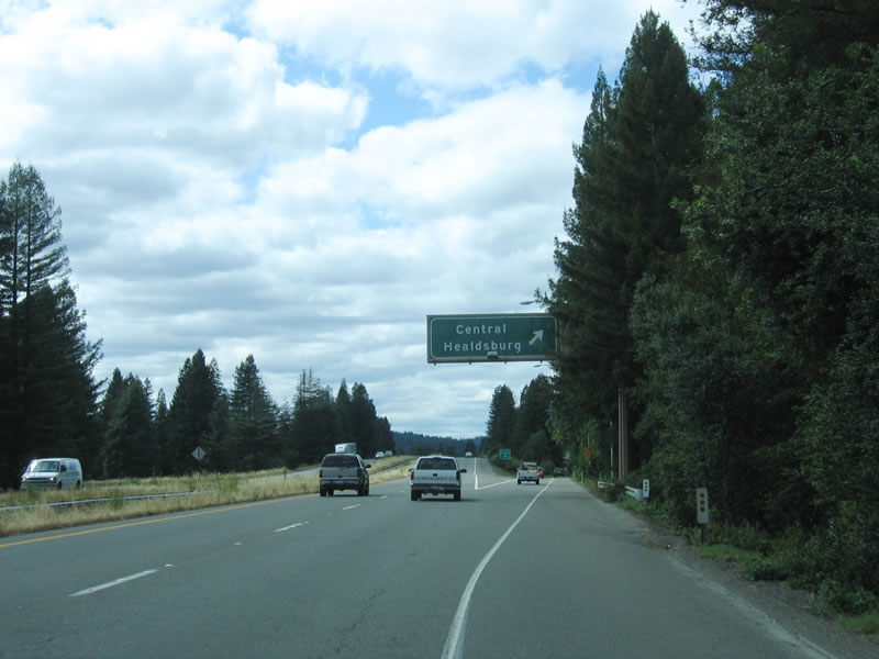
The next exit along U.S. 101 (Redwood Highway) north is Exit 502, Healdsburg Avenue north and Old Redwood Highway south. Once again, U.S. 101 intersects its historic alignment. Take Healdsburg Avenue north via either Exit 502 or Exit 503 to enter its vibrant downtown, including redwood-lined Healdsburg Plaza at the center of town. To see the historic Healdsburg Memorial Bridge (a 1921 steel truss bridge that crosses the Russian River), be sure to use Exit 502. Photo taken 07/05/13. |
|
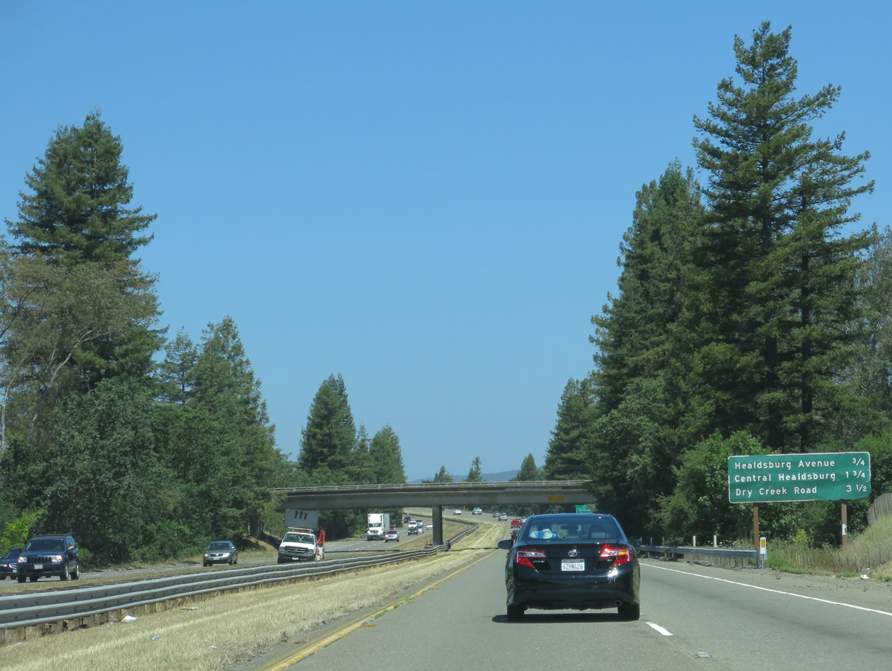
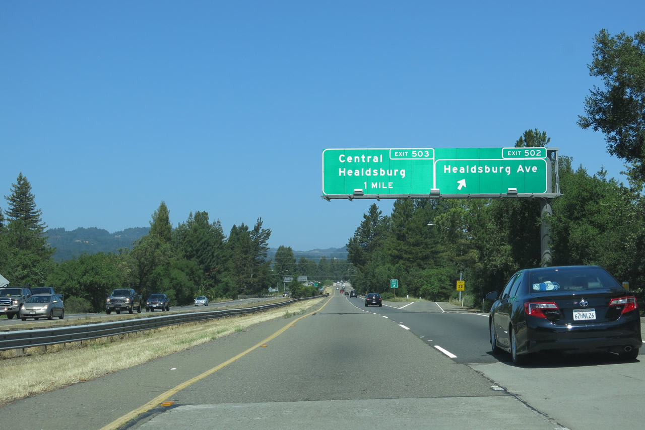
The next three exits along U.S. 101 north all serve the city of Healdsburg: Exit 502, Healdsburg Avenue; Exit 503, Central Healdsburg; and Exit 505, Dry Creek Road. Photo taken 07/05/13. |
|
U.S. 101 passes under Limerick Lane. Photo taken 07/05/13. |
|
Healdsburg Avenue carries Old U.S. 101 across the Russian River into downtown Healdsburg, reconnecting with U.S. 101 freeway at Exit 507 (Lytton Springs Road). This is a worthwhile business route to follow due to the many businesses, restaurants, and scenery in downtown Healdsburg. However, there is no officially signed U.S. 101 Business route through Healdsburg. Photo taken 07/05/13. |
|
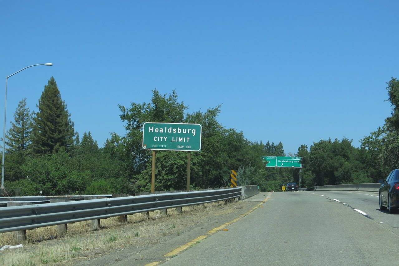
U.S. 101 (Redwood Highway) enters the city of Healdsburg. Home to 11,254 people as of the 2010 Census, the city of Healdsburg was founded in 1857 by entrepreneur Harmon Heald and incorporated as a city on February 20, 1867. The Northwestern Pacific Railroad was extended to Healdsburg in 1871, shortly after it became a city. Photo taken 07/05/13. |
|
Northbound U.S. 101 (Redwood Highway) reaches Exit 502, Healdsburg Avenue. The next exit along northbound is Exit 503, Central Healdsburg. Photo taken 07/05/13. |
|
The next exit along U.S. 101 (Redwood Highway) north is Exit 503, Healdsburg Avenue to Central Healdsburg. This sign is posted in the middle of the Exit 502 interchange complex. Photo taken 07/05/13. |
|
U.S. 101 (Redwood Highway) crosses over the Russian River. One of the major river systems along the Redwood Highway, the Russian River travels 110 miles, draining portions of Mendocino and Sonoma Counties with its headwaters originating near Willits and traveling south parallel to U.S. 101, River Road (unconstructed California 181), and California 116. Photo taken 07/05/13. |
|
At the base of the off-ramp from U.S. 101 north at Exit 503 is this freeway entrance shield assembly. Photo taken 08/27/11 by Leland Bailey. |
|
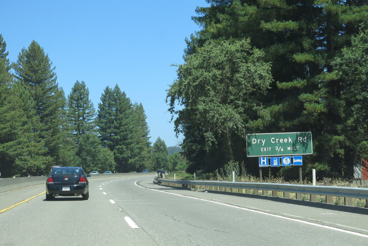
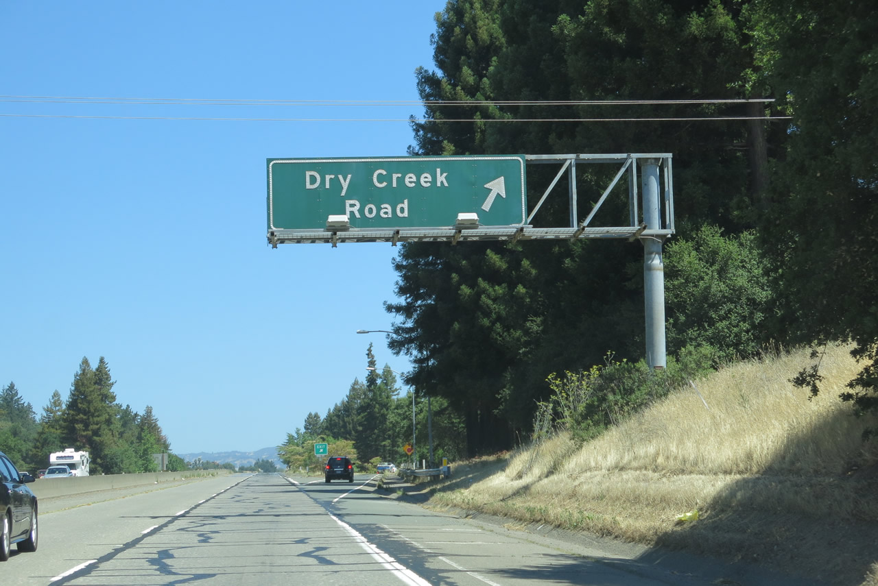
Back on the mainline, the next exit along northbound U.S. 101 (Redwood Highway) is Exit 505, Dry Creek Road. This interchange also serves the city of Healdsburg. Dry Creek Road travels northwest toward Lake Sonoma, the large reservoir in the coastal range between U.S. 101 and the ocean. To the east, Dry Creek Road enters Healdsburg, connects with Old Redwood Highway (Historic U.S. 101), and changes into March Avenue. Photo taken 07/05/13. |
|
U.S. 101 (Redwood Highway) proceeds through pastoral areas as it skirts the western edge of downtown Healdsburg and northern Healdsburg between Exit 503, Healdsburg Avenue and Exit 505, Dry Creek Road. Photo taken 07/05/13. |
|
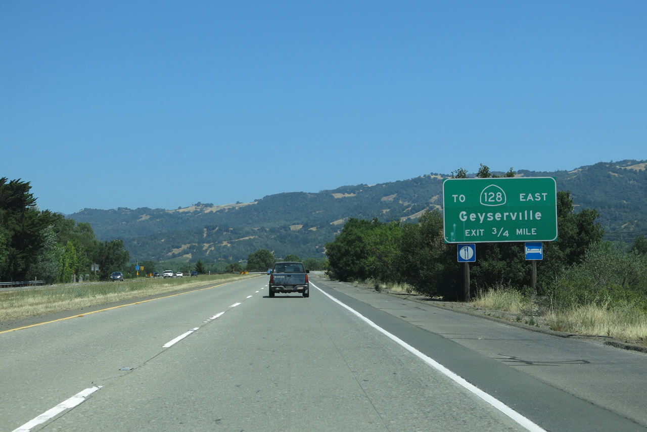
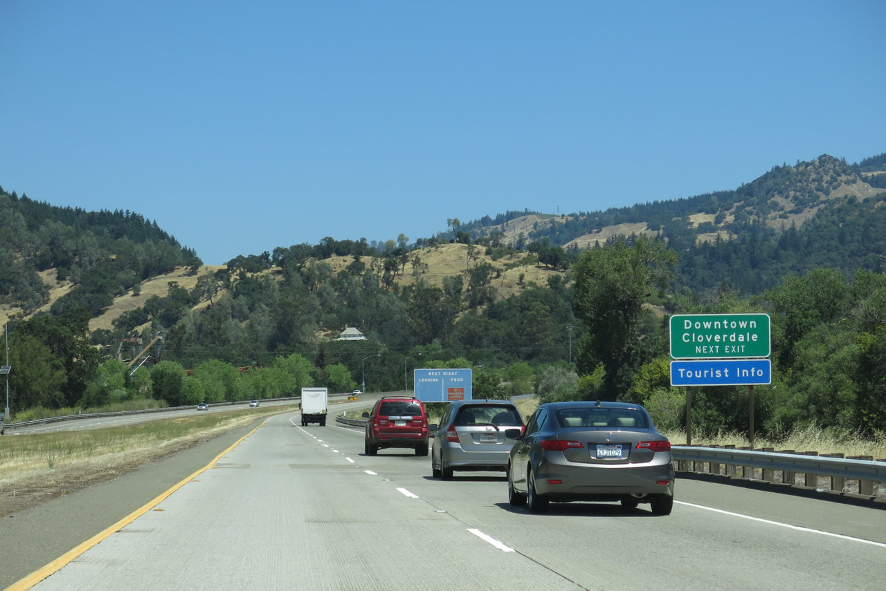
Northbound U.S. 101 (Redwood Highway) reaches Exit 505, Dry Creek Road (so named after Dry Creek Valley through which the road traverses). From here, U.S. 101 passes through rural Sonoma County and will not serve another city until reaching Cloverdale near the Mendocino County Line. Photo taken 07/05/13. |
|
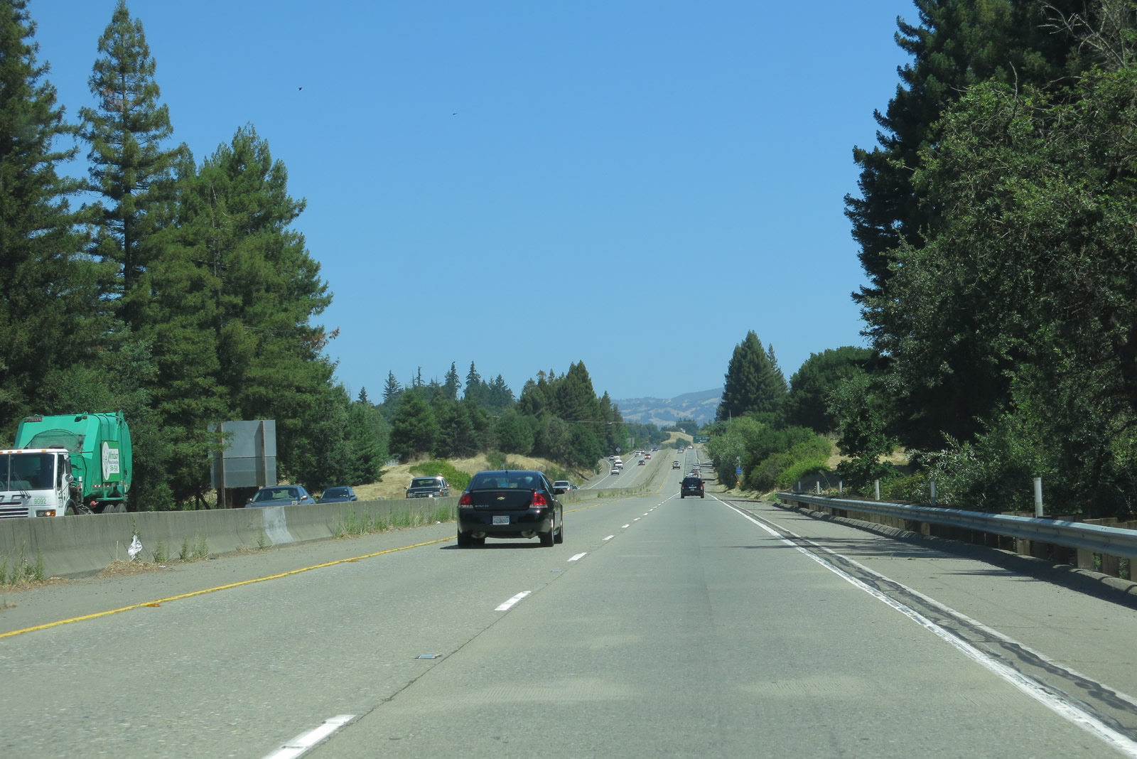
An impressive view results as U.S. 101 (Redwood Highway) passes through the Dry Creek Road interchange. Photo taken 07/05/13. |
|
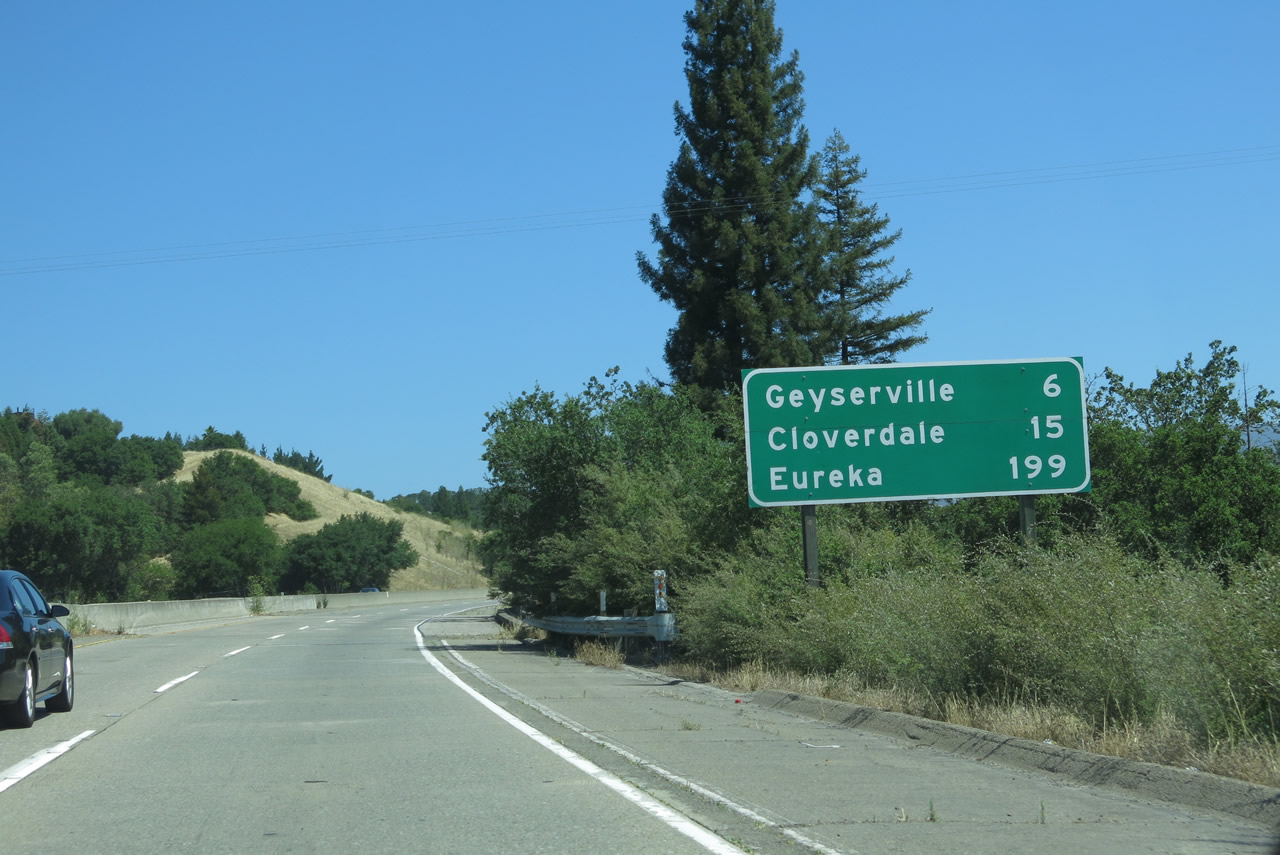
This mileage sign along northbound U.S. 101 (Redwood Highway) provides the distance to Geyserville (six miles), Cloverdale (15 miles), and Eureka (199 miles). Photo taken 07/05/13. |
|
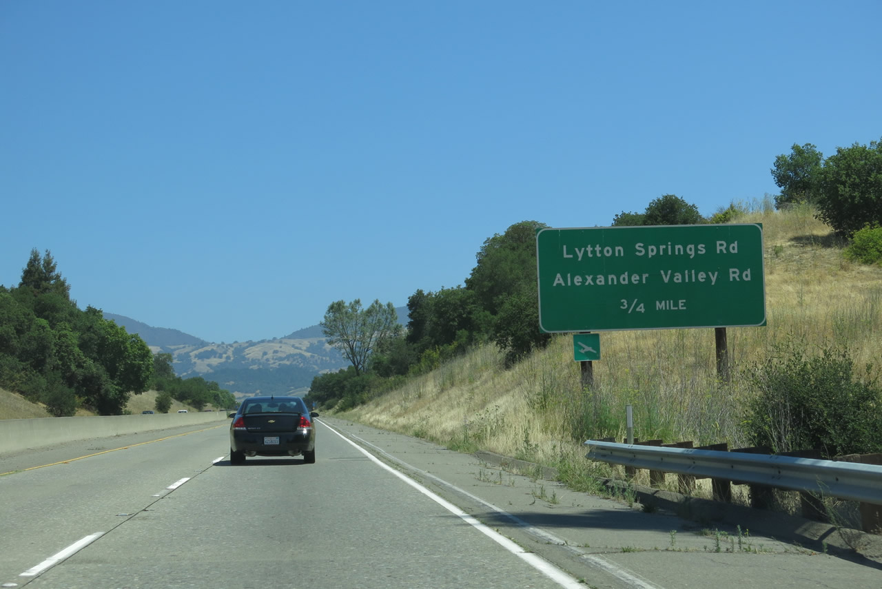
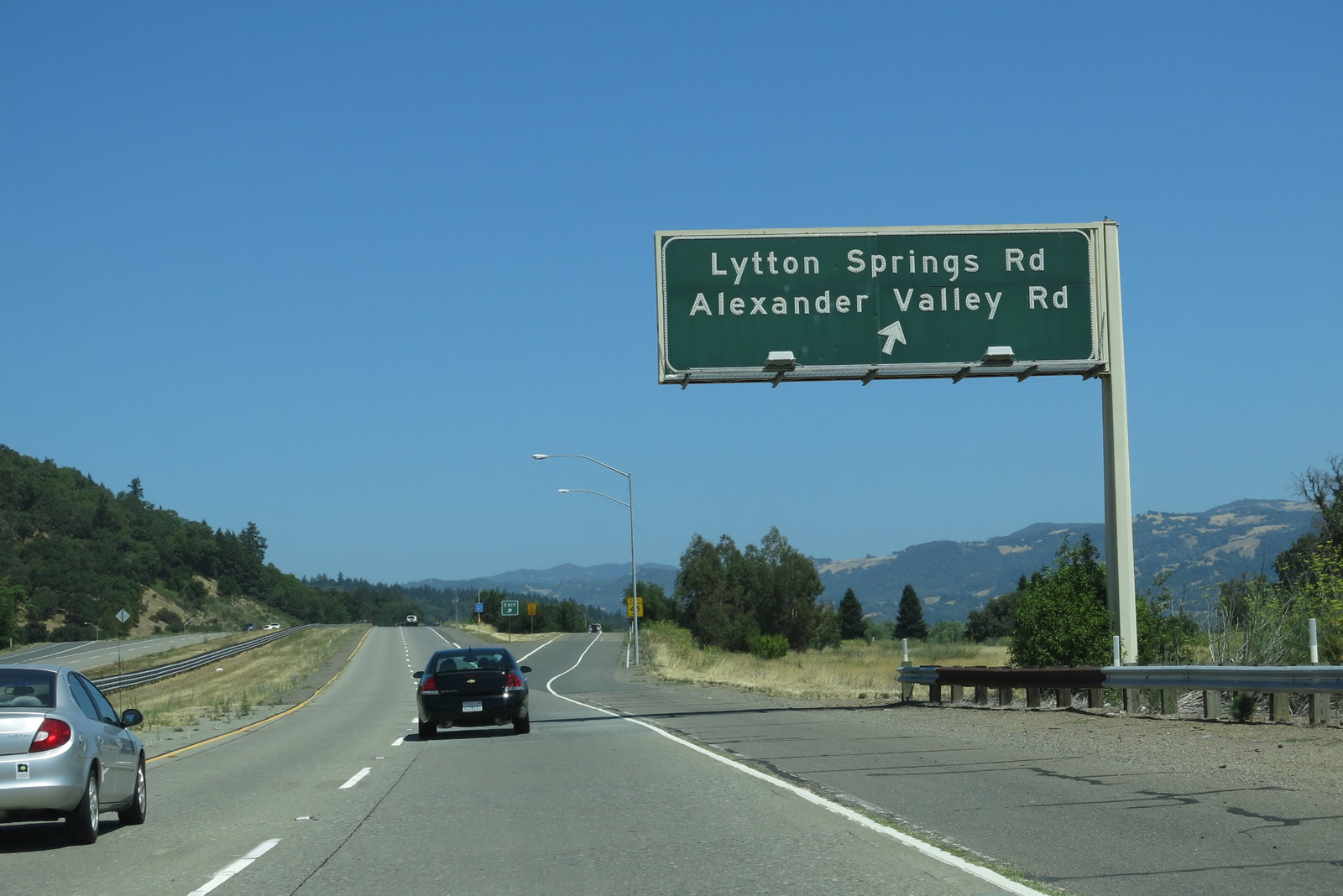
The next exit along northbound U.S. 101 (Redwood Highway) is Exit 507, Lytton Springs Road and Alexander Valley Road. Use this exit to connect to the north end of Old Redwood Highway, which travels south into Healdsburg. Lytton Springs Road travels west to the Healdsburg Airport before connecting with Dry Creek Road. Alexander Valley Road travels east to Jimtown, where it connects with California 128. Photo taken 07/05/13. |
|
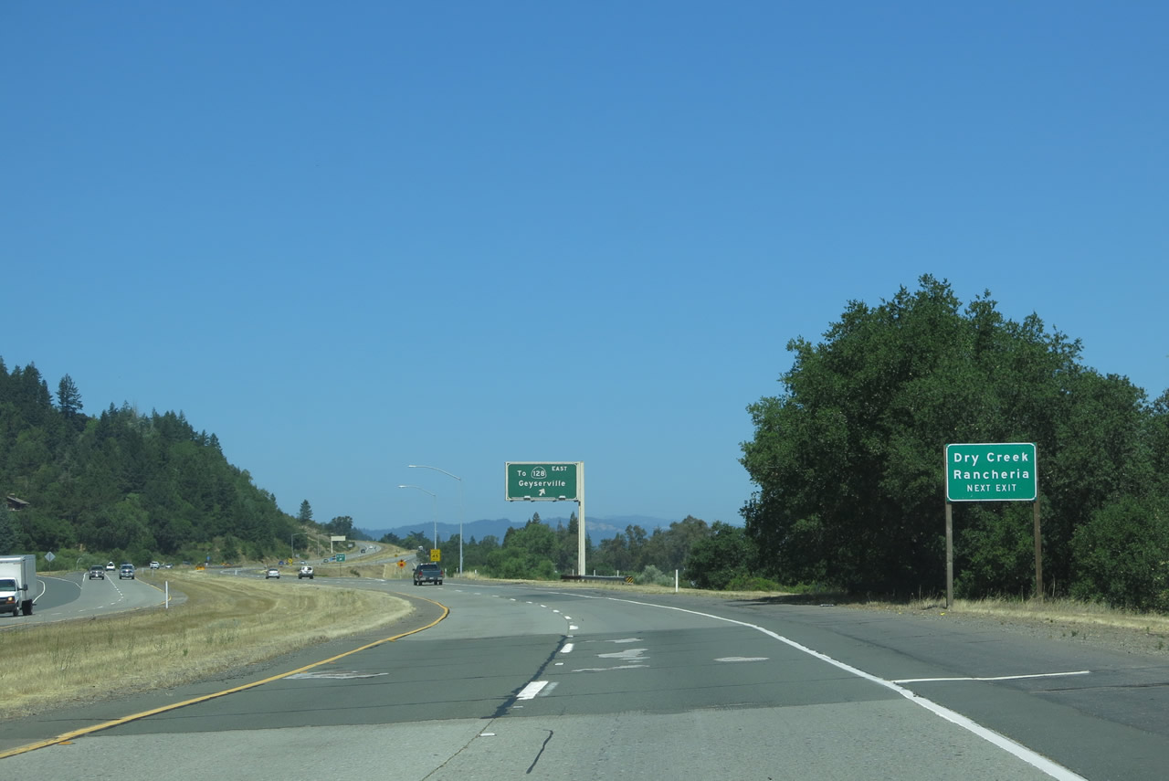
Back in 2006, this sign advised motorists use Lytton Springs Road west to the Dry Creek Rancheria; this sign was removed once construction on the California 128 Russian River bridge was completed. The best route to Dry Creek Rancheria is via Exit 510. A California Department of Forestry Fire Station is also accessed from this exit. Photo taken 05/26/06. |
|
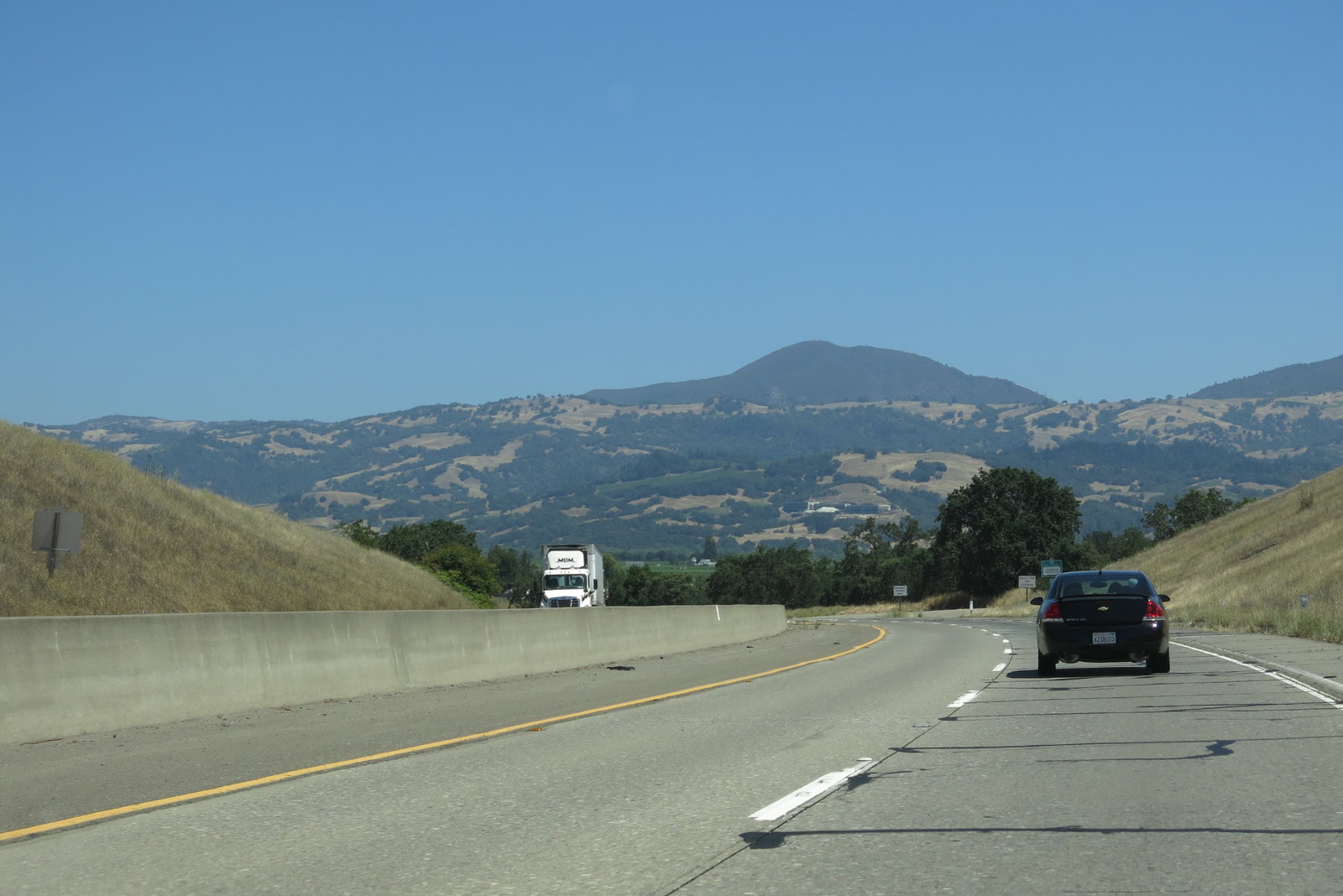
Rolling hills and mountains become the norm as the Russian River valley narrows considerably in northern Sonoma County. Photo taken 07/05/13. |
|
Northbound U.S. 101 (Redwood Highway) meets Exit 507, Lytton Springs Road and Alexander Valley Road. Use Lytton Springs Road west to Dry Creek Road, which in turn travels northwest to Warm Springs Dam and Lake Sonoma. Use Lytton Springs Road east to Healdsburg Avenue south to Alexander Valley Road northeast to California 128 southeast to Calistoga. Photo taken 07/05/13. |
|
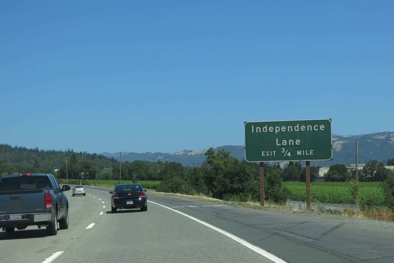
The next exit along U.S. 101 north is Exit 509, Independence Lane. Wineries line the countryside as U.S. 101 continues north alongside the Russian River. Photo taken 07/05/13. |
|
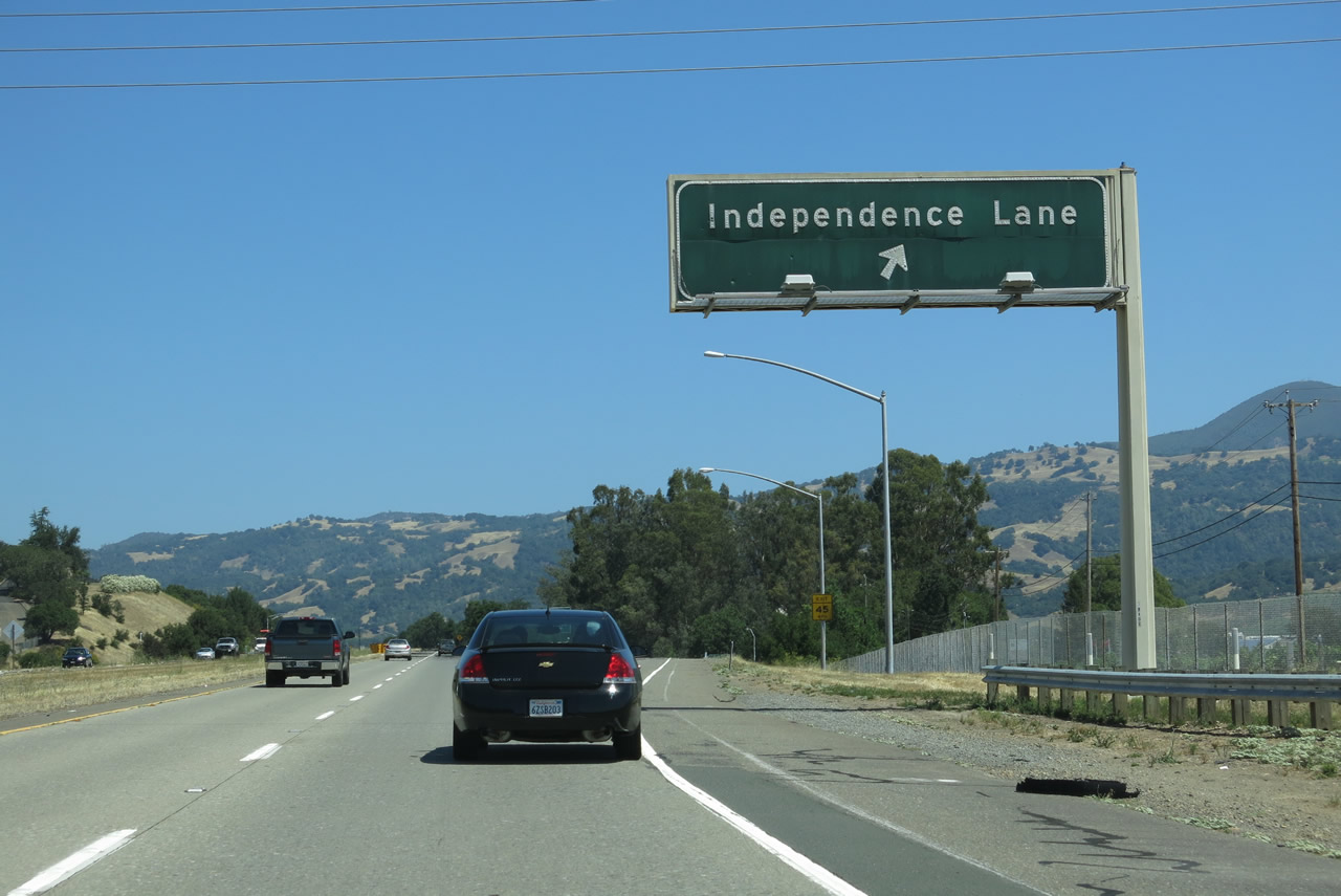
Northbound U.S. 101 (Redwood Highway) meets Exit 509, Independence Lane. Photo taken 07/05/13. |
|
U.S. 101 (Redwood Highway) crosses over Independence Lane. Photo taken 07/05/13. |
|
The next two exits serve Geyserville, an unincorporated community of Sonoma County. An official Chamber of Commerce web site2 mentions that this site was named due to its proximity to The Geysers, a geothermal feature seen on the Mayacmas Mountains between the Russian River Valley and Clear Lake. The Geysers provide a substantial amount of electricity for the regional power grid. Photo taken 05/26/06. |
|
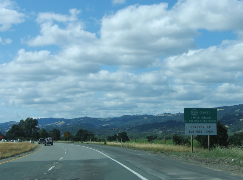
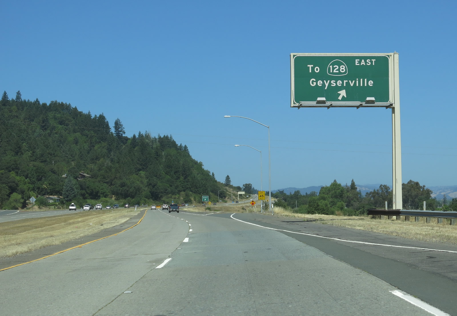
The next exit along northbound U.S. 101 is Exit 510, Geyserville Avenue. This off-ramp provides a connection to California 128 (closed on this day because the Russian River bridge was washed out during the 2005-2006 rainy season). The south end of Geyserville Boulevard is not part of California 128. Photo taken 07/05/13. |
|
This advisory sign indicates that access to California 128 is not available due to the loss of the Russian River bridge; an alternate route is via Alexander Valley Road at Jimtown (Exit 507). Photo taken 05/26/06. |
|
Use Exit 510 for Geyserville Boulevard north to California 128 east to the Dry Creek Rancheria. Photo taken 07/05/13. |
|
Northbound U.S. 101 (Redwood Highway) reaches Exit 510, Geyserville Avenue (Old U.S. 101). A quaint wine country town, Geyserville is a favorite destination for weekend drivers and wine tasters. This gateway to The Geysers was very popular between the 1860s and 1880s, and today it is a much quieter town with a strong tourist base. Nearly a dozen wineries are within easy driving distance of Geyserville. Geyserville Boulevard is an old alignment of U.S. 101. Photo taken 07/05/13. |
|
U.S. 101 proceeds north after the Geyserville Avenue interchange. Photo taken 07/05/13. |
|
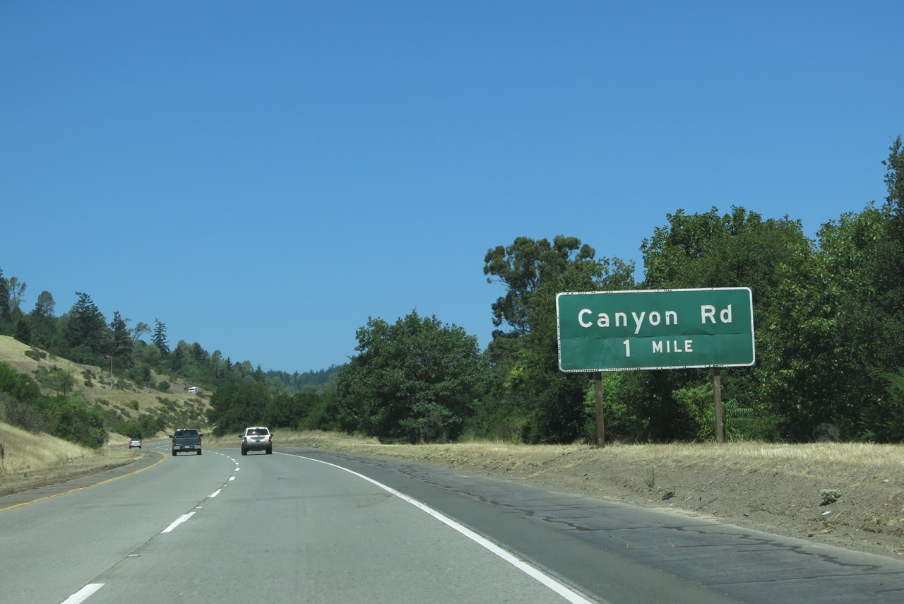
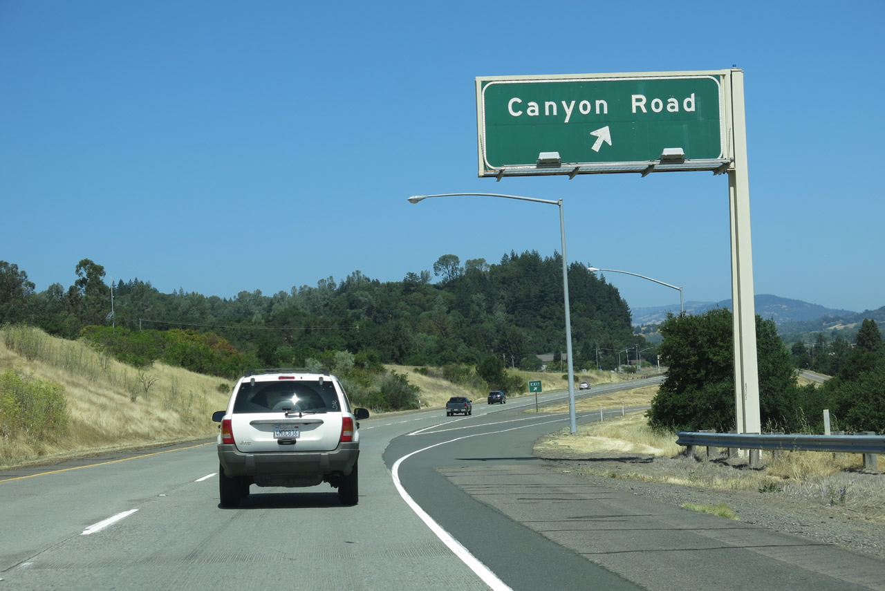
The next exit along U.S. 101 north is Exit 512, California 128 east to Geyserville and Sonoma County C-1/Canyon Road west to Lake Sonoma. This interchange also connects to the northern end of Geyserville Avenue. Photo taken 07/05/13. |
|
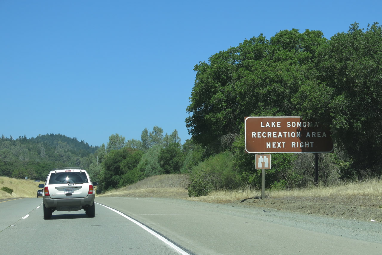
Use Canyon Road (unsigned Sonoma County C-1) west to Dry Creek Road northwest to Warm Springs Dam and Lake Sonoma, a large reservoir located along Dry Creek. The reservoir began filling when the Warm Springs Dam (a rolled-earth embankment dam) was completed in 1982. Also notable is the Rockpile Road Bridge, which is a deck truss bridge built in 1978 to span an arm of the reservoir and accessible near Warm Springs Dam. Photo taken 07/05/13. |
|
The next exit along northbound U.S. 101 is Exit 512, California 128 east to Geyserville and Sonoma County C-1/Canyon Road west to Lake Sonoma. Shields for Sonoma County C-1 were removed from the U.S. 101 mainline at some point between 1995 and 2006. No signs for the county route remain on Canyon Road. From here, westbound California 128 merges onto northbound U.S. 101. Photo taken 07/05/13. |
|
No exit number was posted at the gore point for Exit 512. Photo taken 07/05/13. |
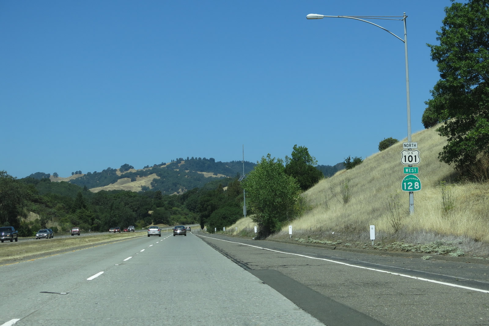
| U.S. 101 (Redwood Highway) north and California 128 west |
|
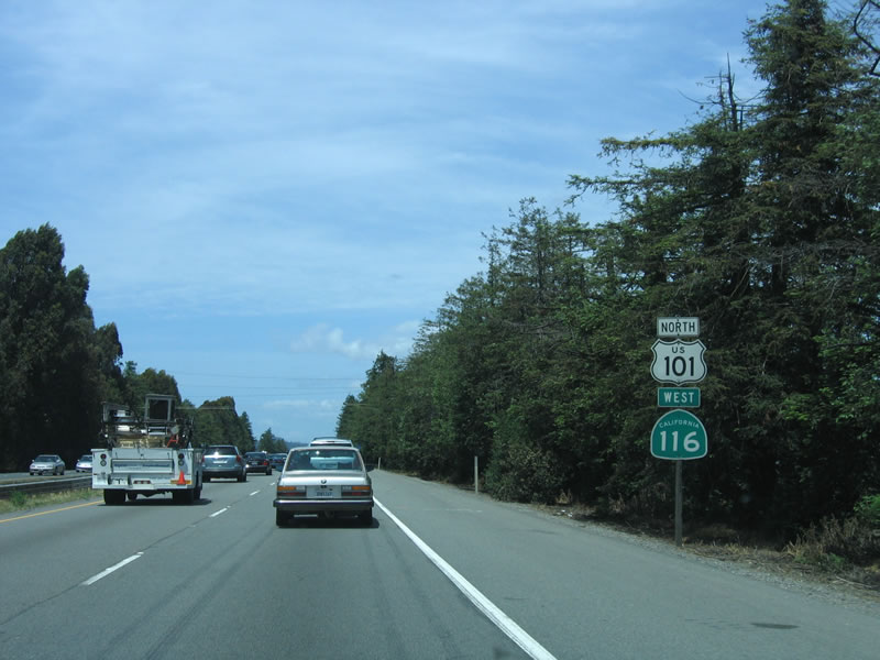
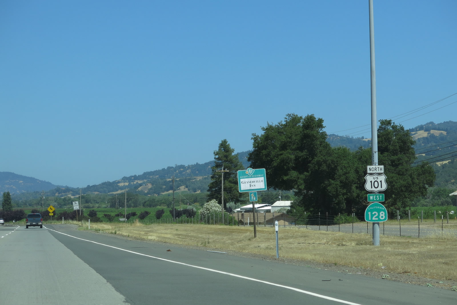
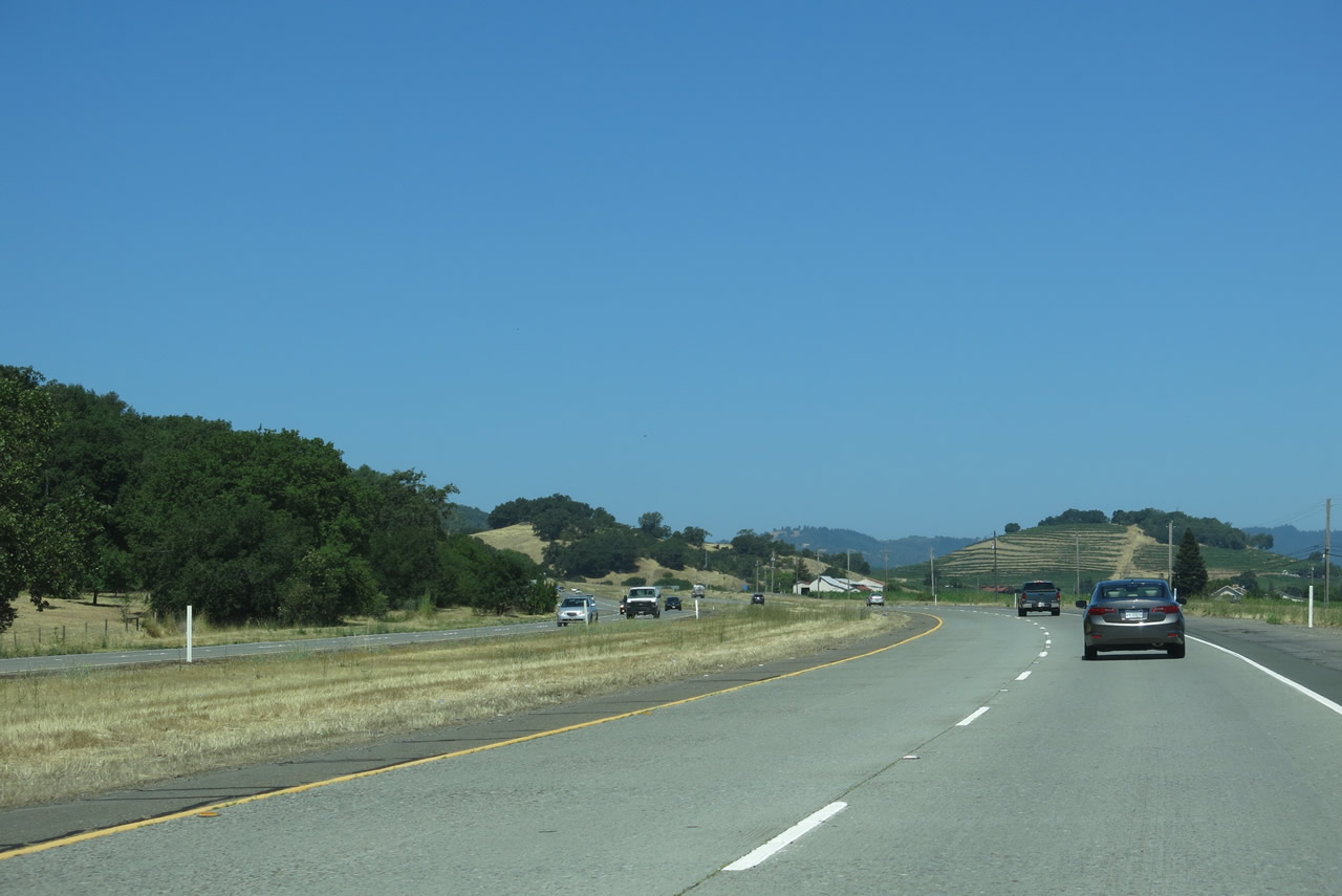
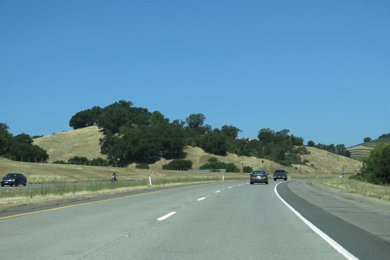
Leaving Geyserville, we find both U.S. 101 north and California 128 west to be signed together on the northbound Redwood Highway. These two routes will share pavement all the way until the north end of Cloverdale. Photo taken 07/05/13. |
|
|
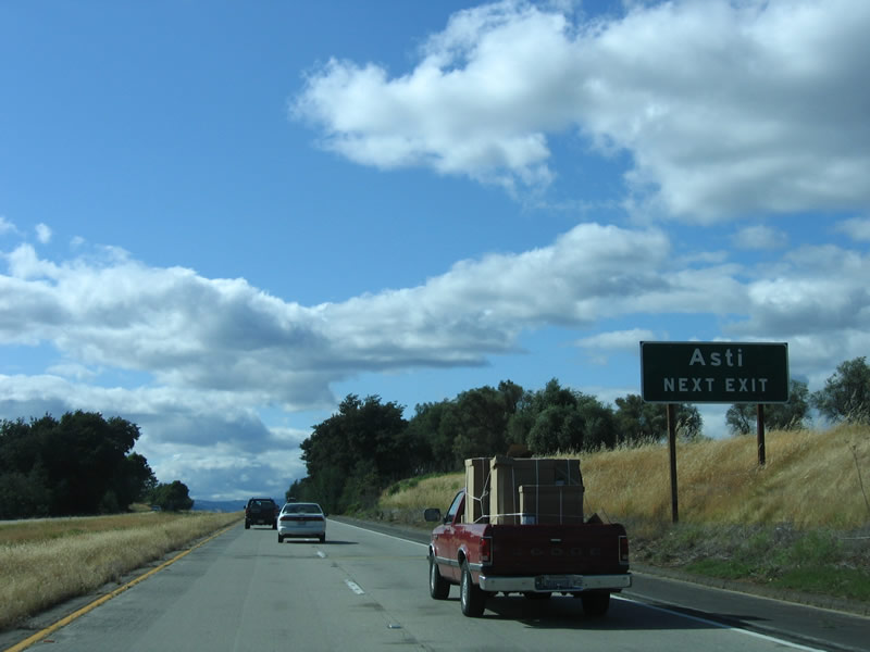
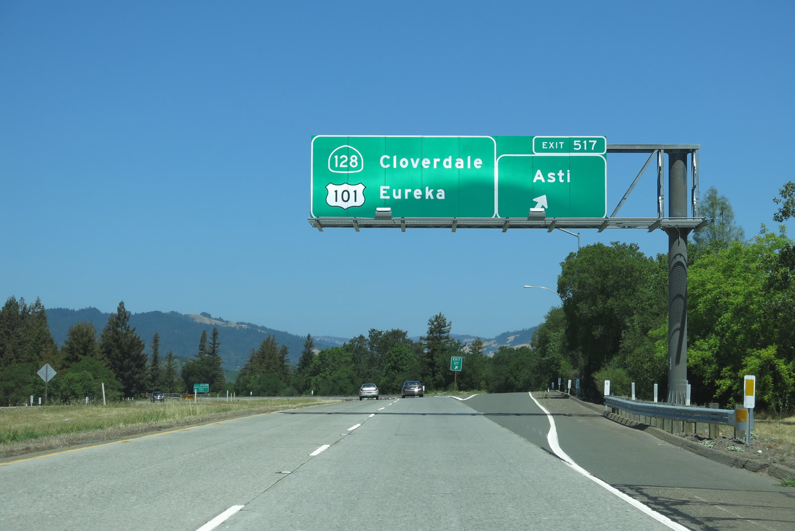
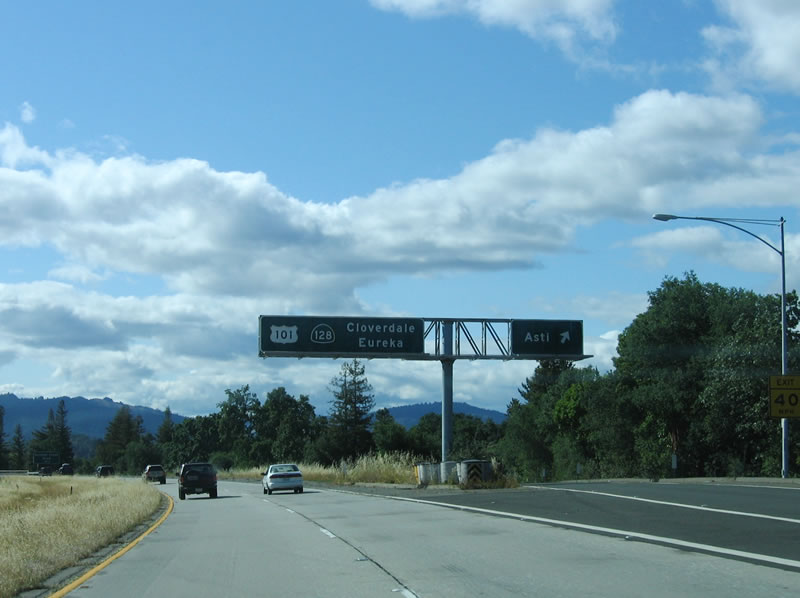
After a fair distance, the next exit along northbound U.S. 101 (Redwood Highway) and westbound California 128 is Exit 517, Asti Post Office Road. Signed simply as "Asti," this interchange serves the small community of Asti. Wineries abound all around Asti. Photos taken 07/05/13 and 05/26/06. |
|
|
Northbound U.S. 101 and westbound California 128 meet Exit 517, Asti Post Office Road. The pull-through sign advises of the next city along northbound, Cloverdale, as well as the control city of Eureka in Humboldt County. Photo taken 07/05/13 and 05/26/06. |
|
|
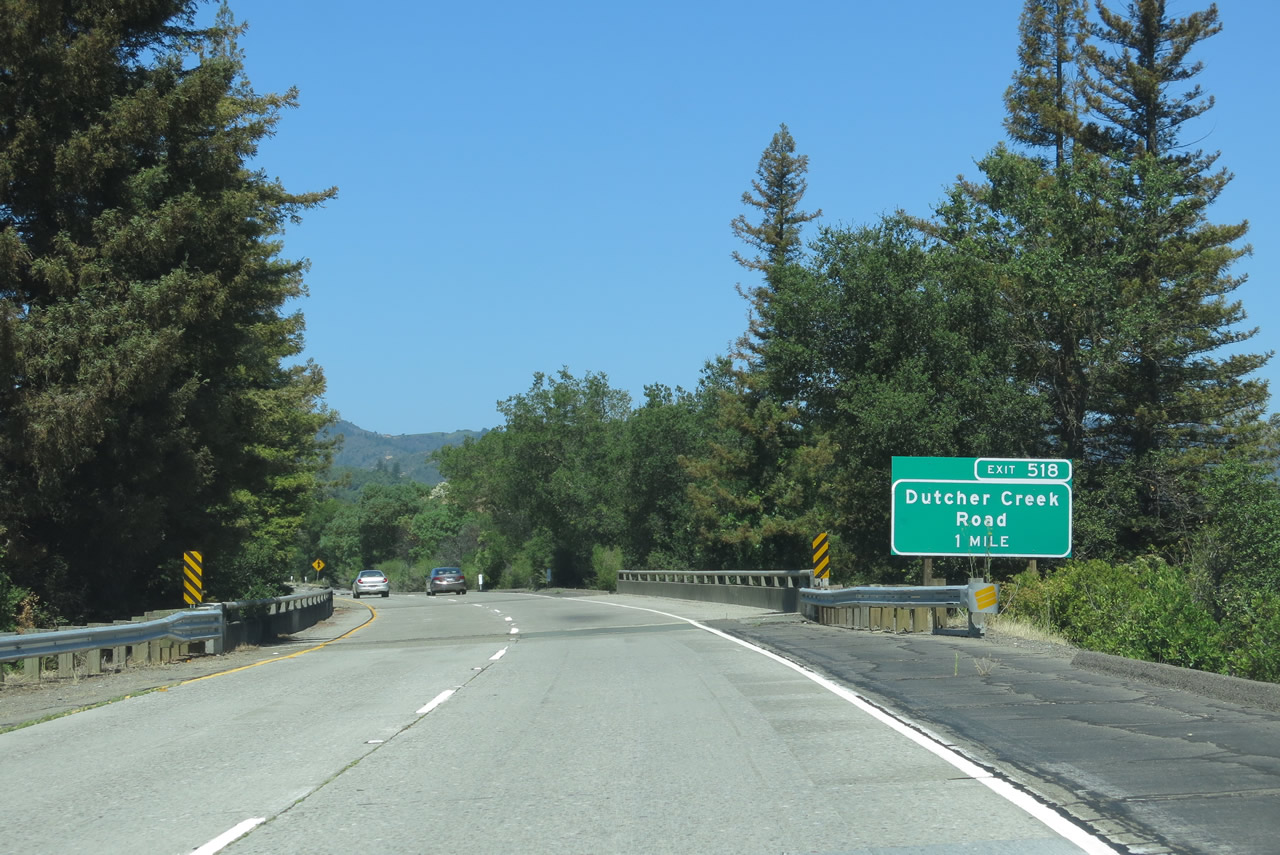
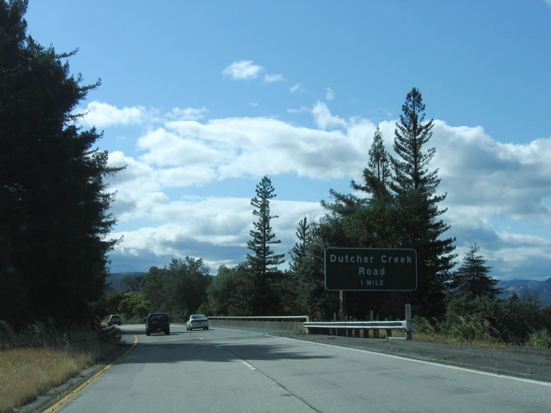
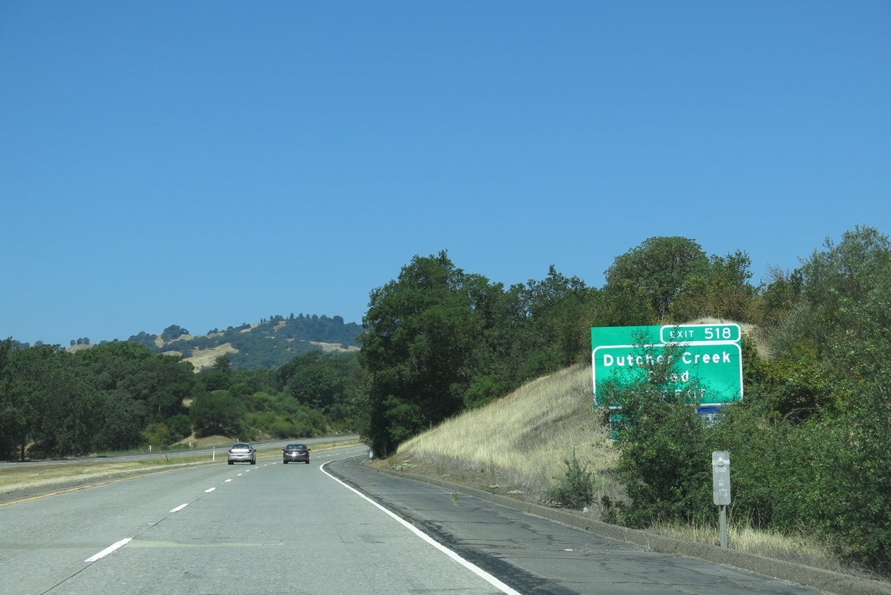
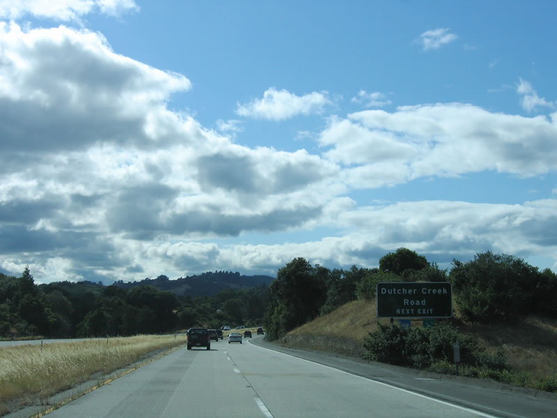
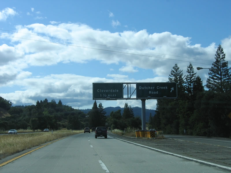
The next exit along northbound U.S. 101 (Redwood Highway) and westbound California 128 is Exit 518, Dutcher Creek Road. Photos taken 07/05/13 and 05/26/06. |
|
A set of U.S. 101 and California 128 reassurance shields is posted on northbound Redwood Highway after the Asti interchange (Exit 517). Photos taken 07/05/13 and 05/26/06. |
|
|
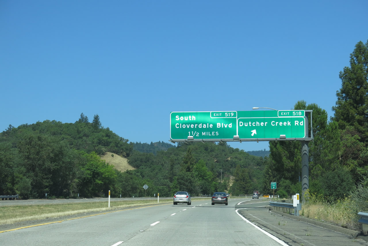
Use Dutcher Creek Road south to Dry Creek Road, which departed from U.S. 101 at Exit 505. Photos taken 07/05/13 and 05/26/06. |
|
|
Northbound U.S. 101 (Redwood Highway) and westbound California 128 meet Exit 518, Dutcher Creek Road. The next exit along northbound is Exit 519, U.S. 101 Business and California 128 Business, South Cloverdale Boulevard. Photos taken 07/05/13 and 05/26/06. |
|
|
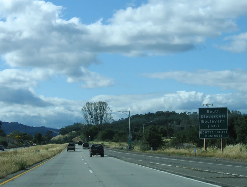
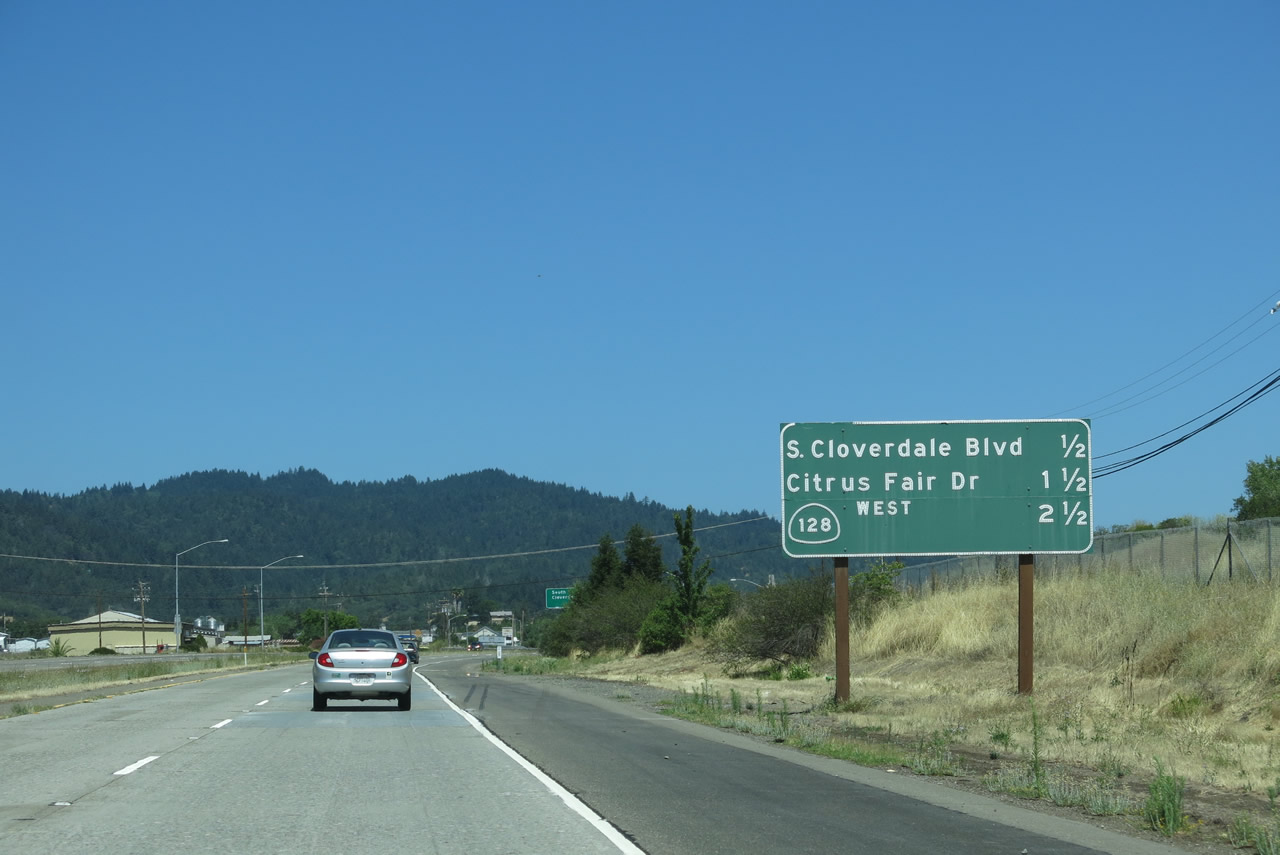
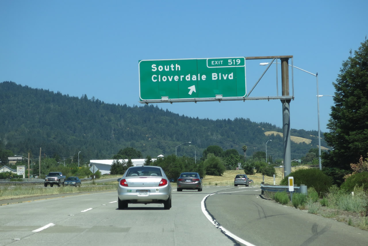
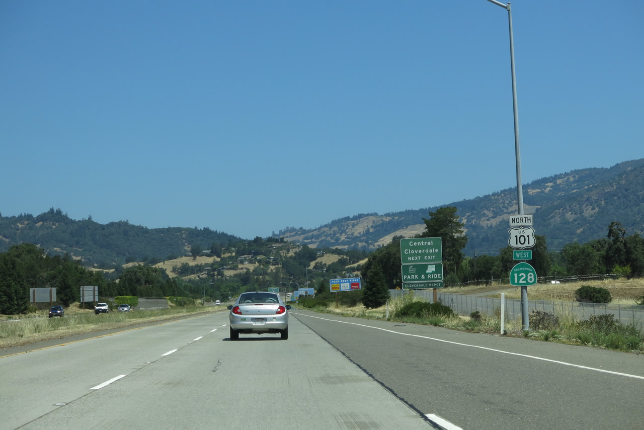
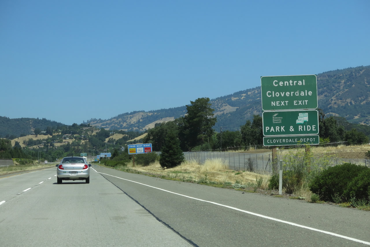
The next exit along U.S. 101 north and California 128 west is Exit 519, U.S. 101 Business and California 128 Business/South Cloverdale Boulevard. U.S. 101 from Healdsburg to Cloverdale was constructed and opened to traffic in 1964. However, the Cloverdale Bypass, which passes to the east of downtown Cloverdale, was constructed in 1994. The first interchange that serves Cloverdale, Exit 519, carries old U.S. 101 and California 128 into town as a business route. Both U.S. 101 and California 128 are signed on the business route because the two routes diverge at the north end of the city of Cloverdale. Photos taken 07/05/13 and 05/26/06. |
|
Another reassurance shield assembly for U.S. 101 and California 128 is posted after the on-ramp from Dutcher Creek Road. Photo taken 07/05/13. |
|
The next three exits serve the city of Cloverdale: Exit 519, U.S. 101 Business and California 128 Business, South Cloverdale Boulevard; Exit 520, Citrus Fair Drive; and Exit 522, California 128 west and U.S. 101 Business south (North Cloverdale Boulevard). Photo taken 07/05/13. |
|
This view looks north on U.S. 101 and California 128 toward the southern Cloverdale interchange. Photo taken 07/05/13. |
|
A mileage sign provides the distance to the next three exits: Exit 519, U.S. 101 Business and California 128 Business, South Cloverdale Boulevard; Exit 520, Citrus Fair Drive; and Exit 522, California 128 west to Fort Bragg and Mendocino. Photo taken 07/05/13. |
|
Northbound U.S. 101 (Redwood Highway) and westbound California 128 reach Exit 519, U.S. 101 Business and California 128 Business/South Cloverdale Boulevard. Photo taken 05/26/06. |
|
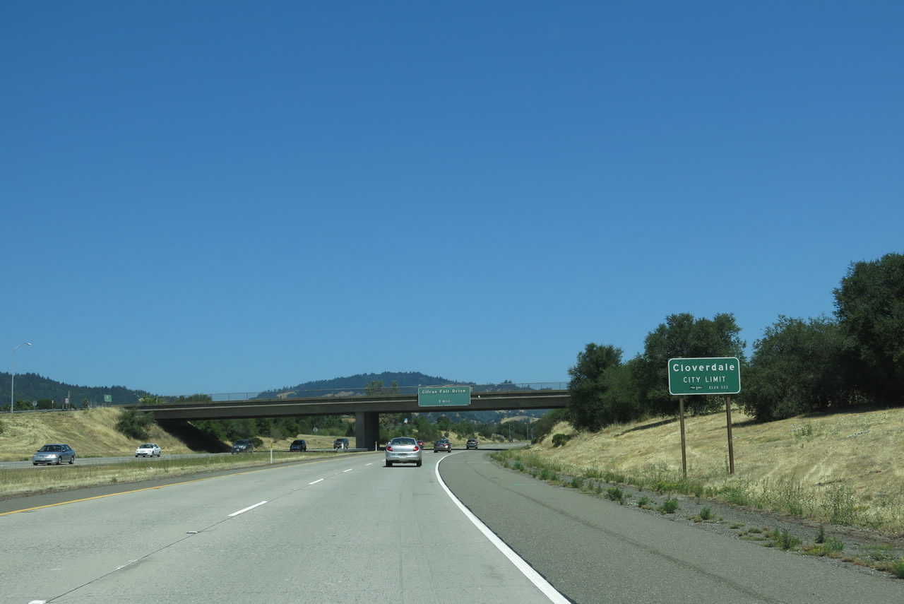
U.S. 101 (Redwood Highway) and California 128 enter the city of Cloverdale, which is the northernmost city in Sonoma County. Cloverdale was incorporated on February 28, 1872, and is approximately 2.7 square miles in size. As of the 2000 Census the Cloverdale population was 6,831; the population had reached 8,618 by the 2010 Census. By comparison, the 1990 Census population was a mere 4,924! . Photo taken 07/05/13. |
|
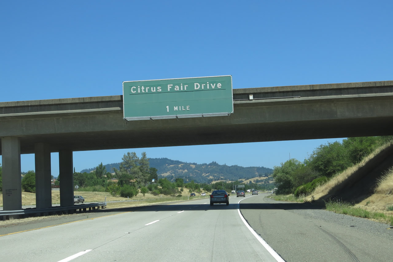
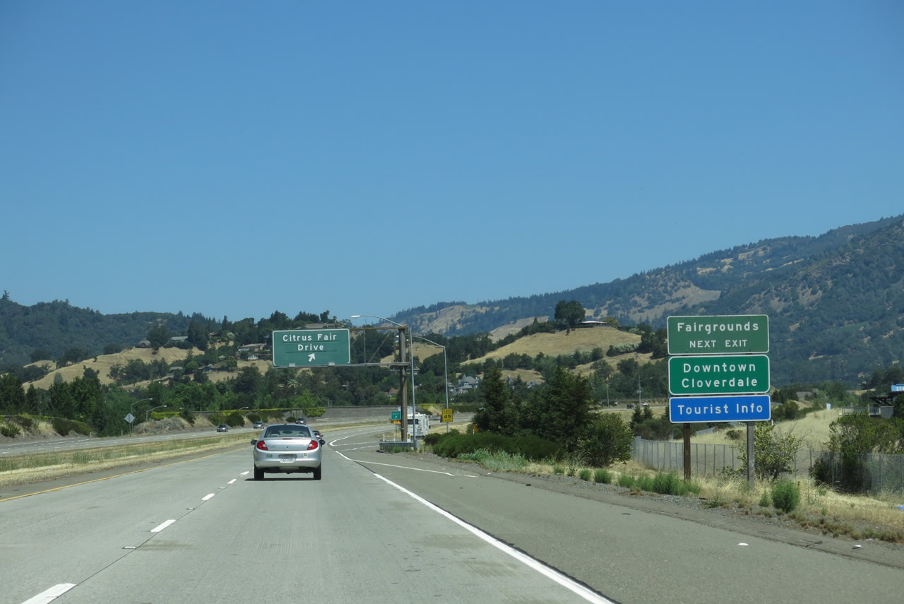
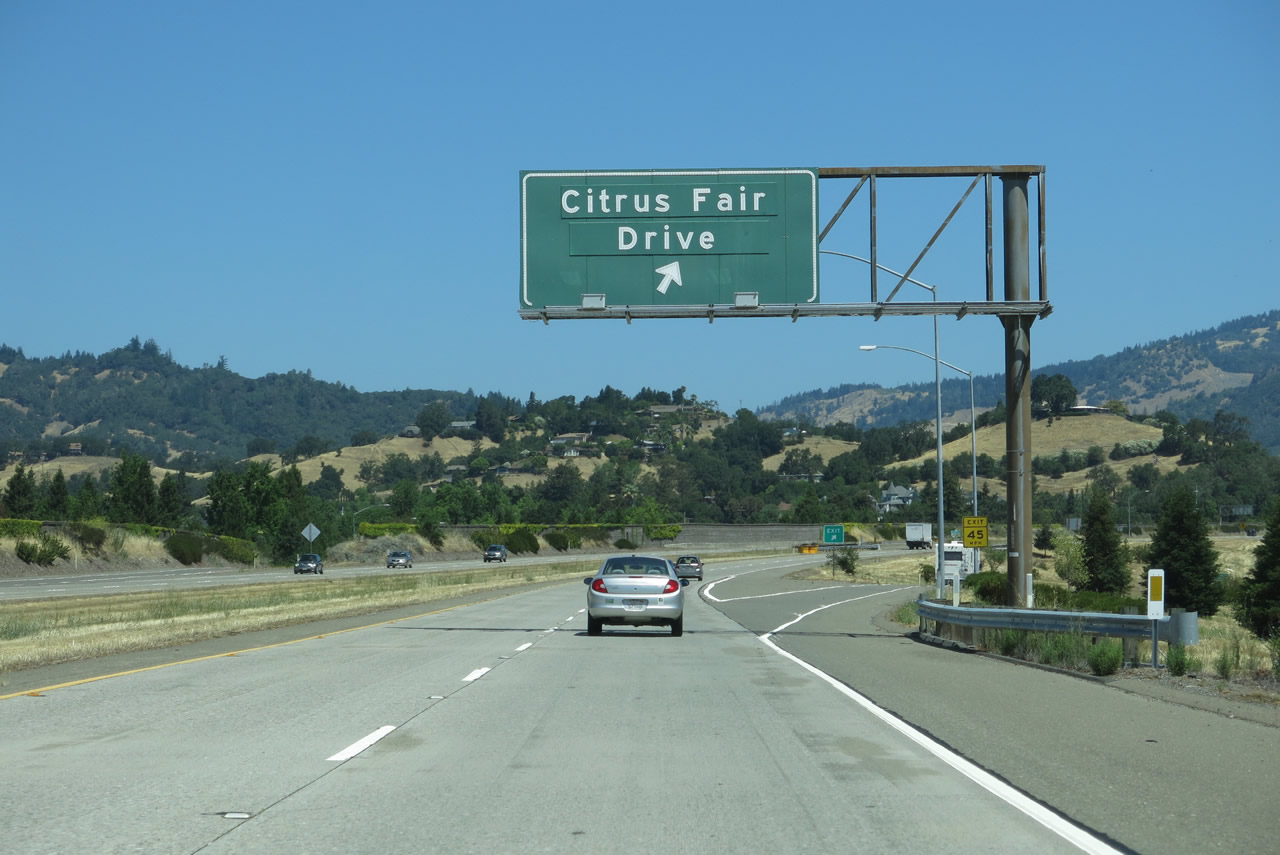
The next exit along northbound U.S. 101 (Redwood Highway) and westbound California 128 is Exit 520, Citrus Fair Drive. Photo taken 07/05/13. |
|
Another reassurance shield assembly for U.S. 101 and California 128 is posted after the on-ramp from South Cloverdale Boulevard. Photo taken 07/05/13. |
|
Use Exit 520 to downtown Cloverdale via Citrus Fair Drive north to South Cloverdale Boulevard (U.S. 101 Business and California 128 Business). The railroad parallels the freeway to the east; a railroad depot is nearby. Photo taken 07/05/13. |
|
Also available at Exit 520 is downtown Cloverdale, a visitors center, and fairgrounds. Photo taken 07/05/13. |
|
Northbound U.S. 101 (Redwood Highway) and westbound California 128 meets Exit 520, Citrus Fair Drive. Photo taken 07/05/13. |
|
This reassurance shield assembly is the last to feature both U.S. 101 north and California 128 west. The Mayacmas Mountains rise tall in the background. Photo taken 07/05/13. |
|
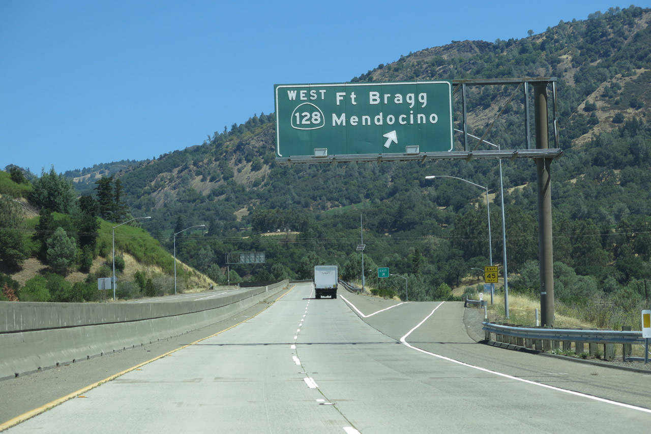
The next exit along northbound U.S. 101 (Redwood Highway) is Exit 522, California 128 west to Fort Bragg and Mendocino via Yorkville, Boonville, Anderson Valley, and Navarro Point. This interchange is also the northern terminus of U.S. 101 Business/North Cloverdale Boulevard. Photo taken 07/05/13. |
|
Use U.S. 101 Business south to downtown Cloverdale (via Exit 522). Photo taken 07/05/13. |
|
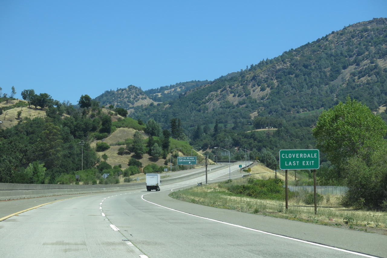
Exit 522 is also signed as the "Last Cloverdale Exit." Photo taken 07/05/13. |
|
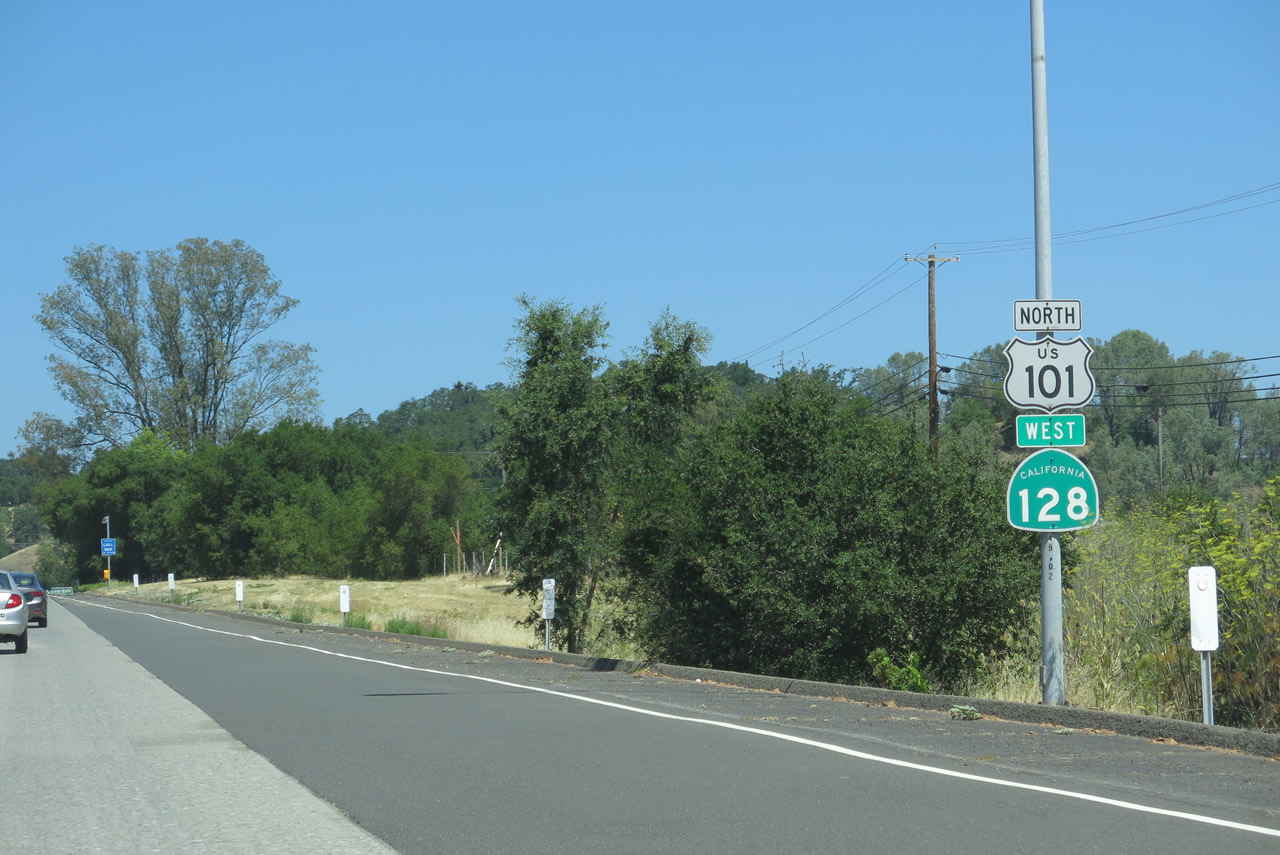
Northbound U.S. 101 (Redwood Highway) and westbound California 128 split at Exit 522, California 128 west and U.S. 101 Business south. Use California 128 west to Fort Bragg and Mendocino via Oat Valley, Yorkville, Boonville, Anderson Valley, and the Navarro River corridor. This is another beautiful Northern California drive. To connect with the oldest U.S. 101 alignment, follow California 128 northwest to Mountain House Road, then follow Mountain House Road north Mendocino County 111 and Hopland. Mountain House Road is a very old alignment of U.S. 101 and features a very old bridge. Photo taken 07/05/13. |
| U.S. 101 (Redwood Highway) north |
|
|
|
|
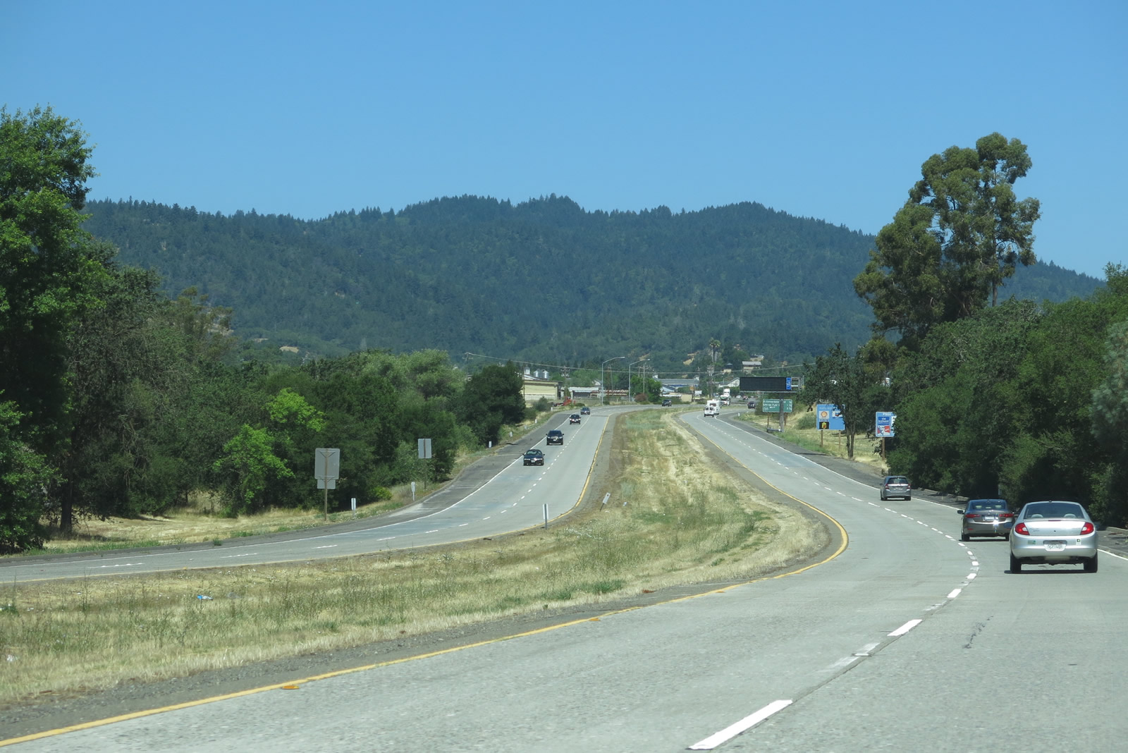
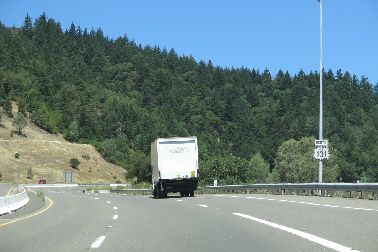
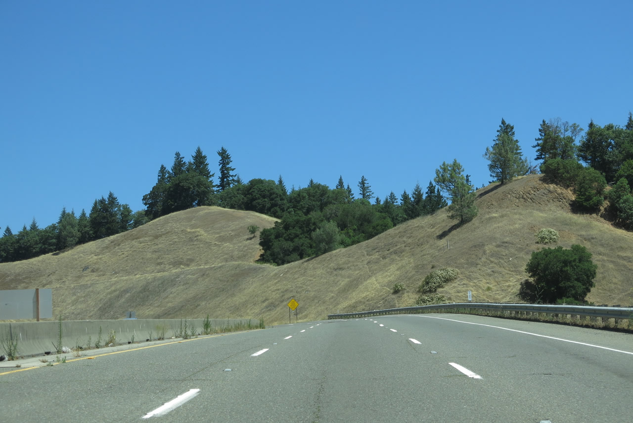
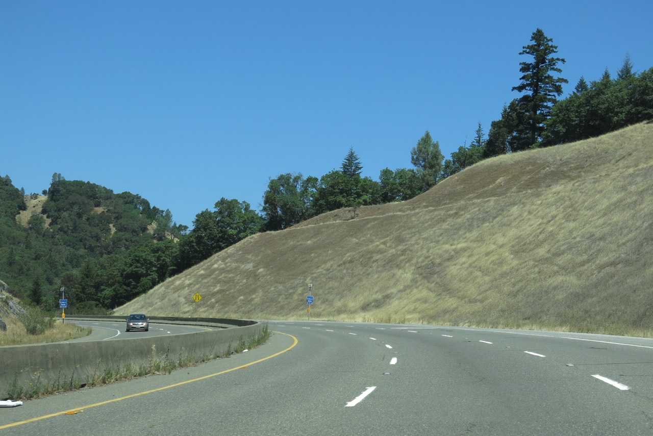
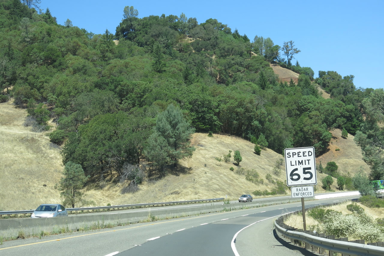
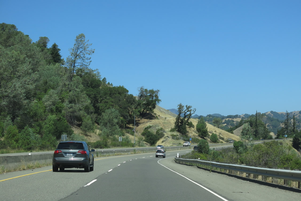
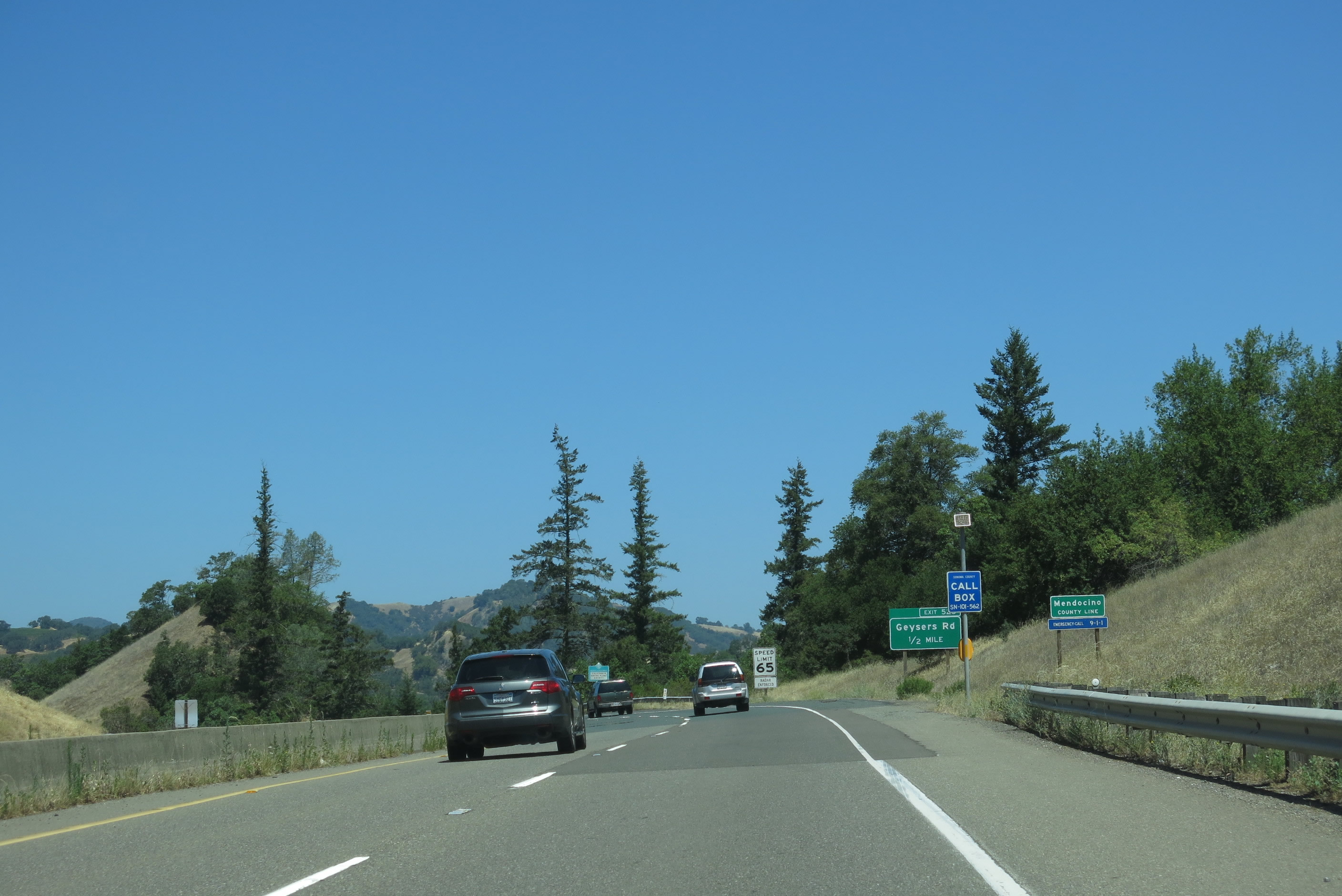
| Leaving Cloverdale, northbound U.S. 101 (Redwood Highway) ascends a cliff alongside the Russian River, which roars in the canyon to the east of the freeway. Portions of Old Redwood Highway can be seen below U.S. 101, but the bridge that used to cross the Russian River into Mendocino County was washed out. A truck climbing lane (third lane) assists slow moving vehicles up this steep grade. Photos taken 07/05/13. |
|
|
|
|
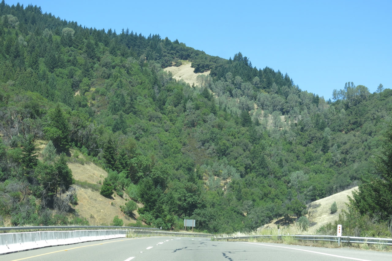
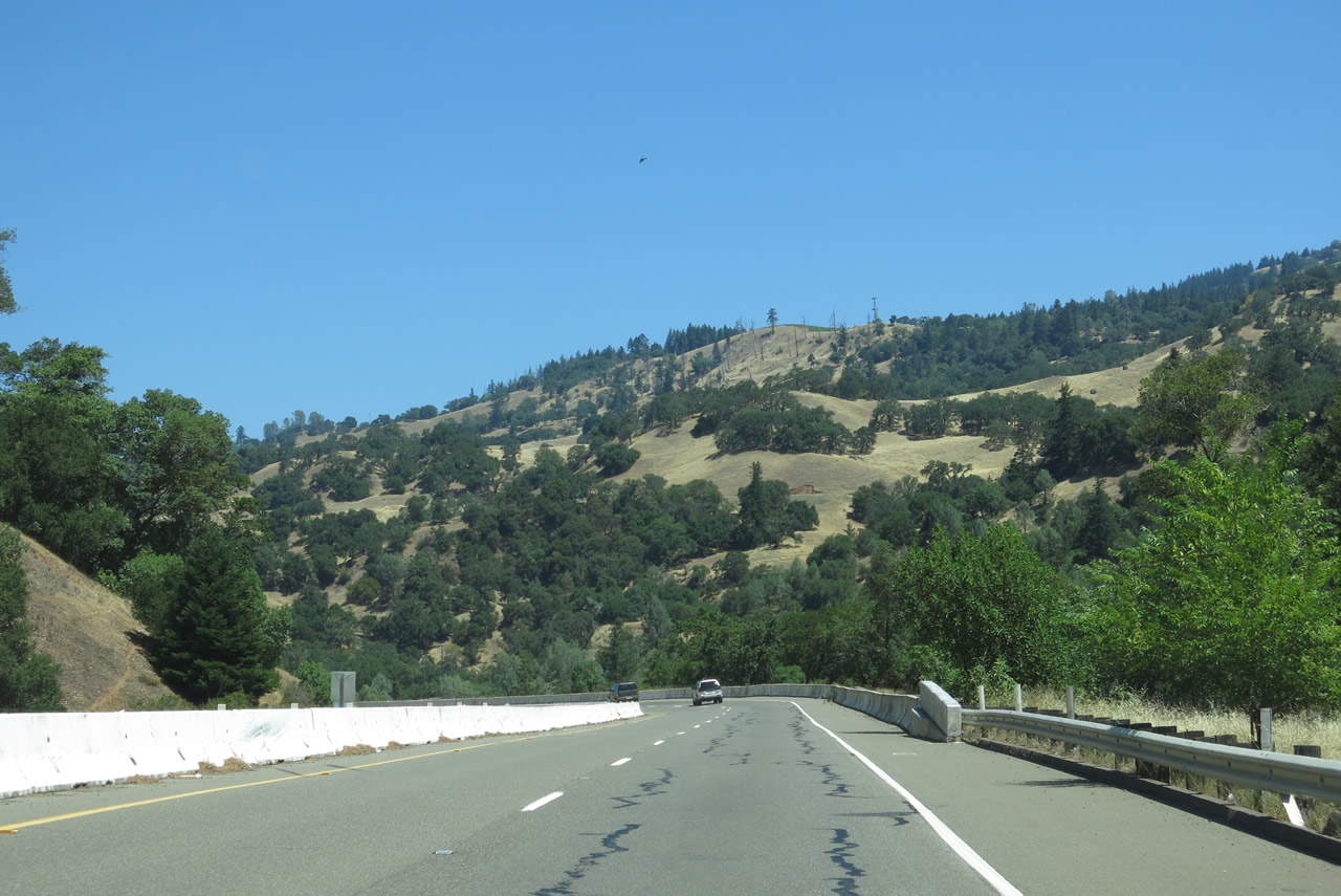
| Coming to the top of the grade, northbound U.S. 101 reduces to two lanes. Note that the median is now a concrete barrier, underscoring the narrow nature of this section of U.S. 101 (Redwood Highway). Photos taken 07/05/13. |
Page Updated August 31, 2013.