

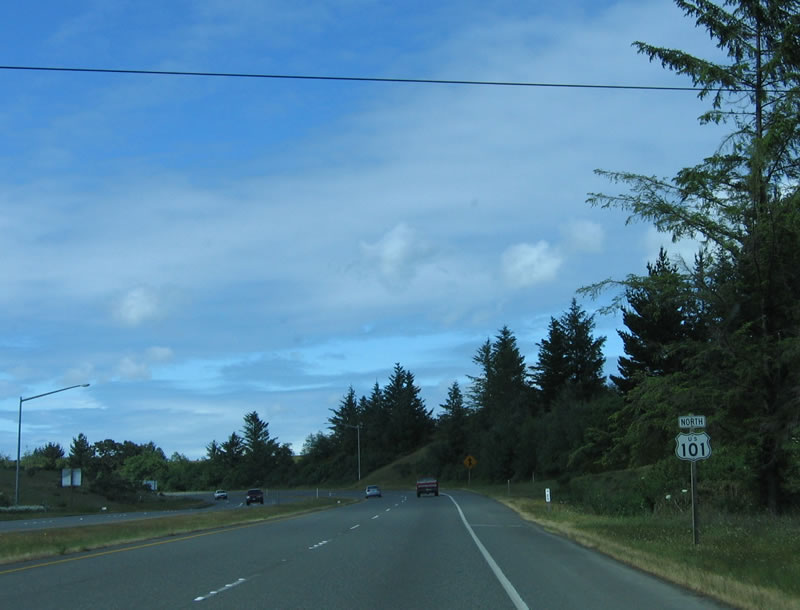
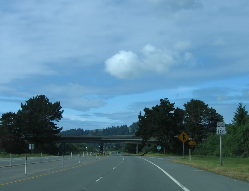
U.S. 101 North - Humboldt County #1
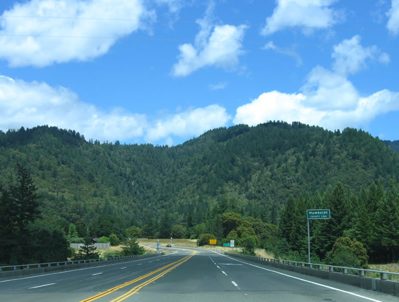 |
Leaving Mendocino County, northbound U.S. 101 (Redwood Highway) enters Humboldt County upon crossing the South Fork of the Eel River via this 1970 bridge. Photo taken 05/27/06. |
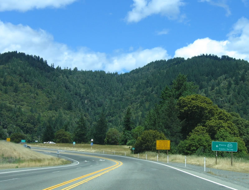 |
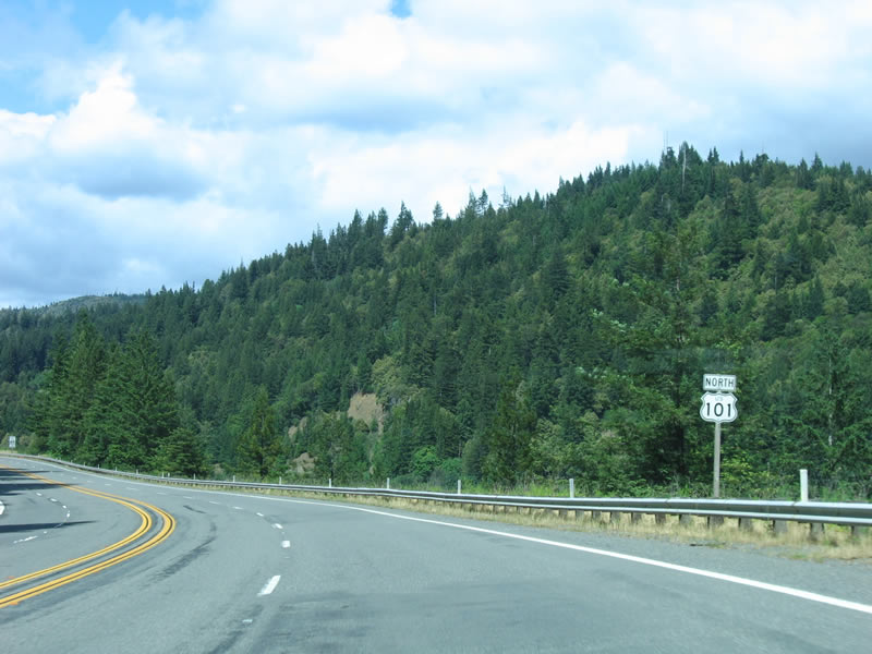
Rolling hills and thick forests dominate the landscape as northbound U.S. 101 (Redwood Highway) approaches the northern junction with California 271. The old alignment of U.S. 101 again merges onto the mainline for the route through Richardson Grove State Park. Photo taken 05/27/06. |
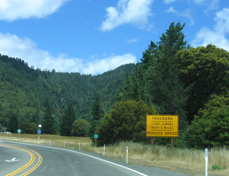 |
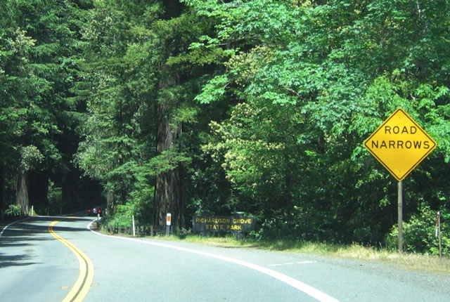
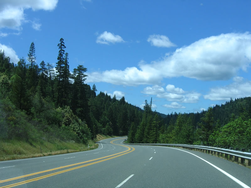
For the next three miles, all vehicles should slow down in anticipation of Richardson Grove State Park and the extremely narrow and twisting roadway. Photo taken 05/26/06. |
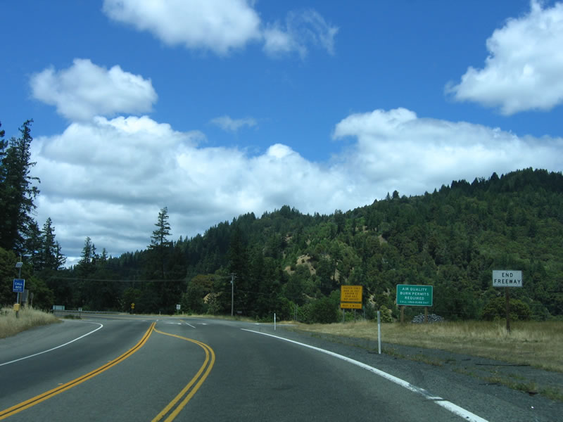 |
The freeway segment for U.S. 101 again comes to an end. Plans in the Surface Transportation Program call for U.S. 101 to have additional expressway and freeway bypasses of several two-lane segments, including bypasses of Hopland, Willits, Confusion Hill (bridges), and Richardson Grove State Park. Turn left here for the connection to California 271 (Old U.S. 101). Photo taken 05/26/06. |
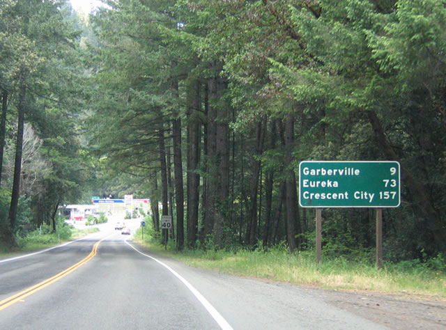 |
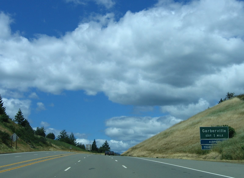
This mileage sign provides the distance to Garberville (nine miles), Eureka (73 miles), and Crescent City (157 miles). Photo taken 05/26/06. |
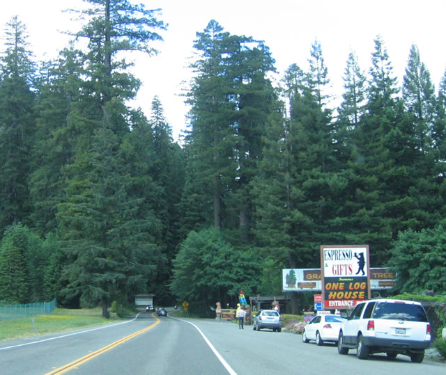 |
A roadside attraction is found on U.S. 101 north shortly after the California 271 intersection. This area is known as Cooks Valley. From here, the highway enters the state park. Photo taken 05/26/06. |
 |
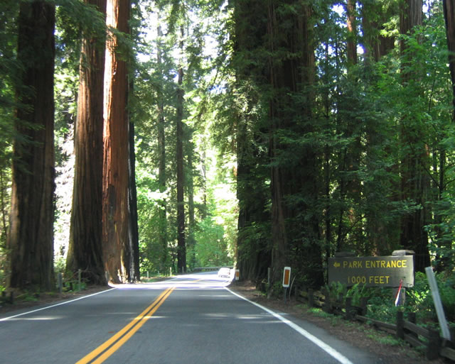
Northbound U.S. 101 enters Richardson Grove State Park, which is named for Friend Richardson, the 25th governor of California. Highway improvements to U.S. 101 in Humboldt County are slow in forthcoming, and the need for a bypass of the Richardson Grove State Park is one such needed area. The truck restriction at the north end of California 1 in Leggett is due to the sharp turns in Richardson Grove State Park. The North Coast Journal in its article When Disaster Strikes, Don't Count on U.S. 101, states: "Even when the highways are open, shipping is expensive. The state won't allow tandem trucks with a combined length longer than 65 feet or single trucks longer than 40 feet from the kingpin to the rear axle in Humboldt or Trinity Counties, except for transporting livestock, because of fears that they will offtrack - the tendency for rear tires to follow a shorter path than the front tires - and careen off the tight curves at Richardson's Grove on 101 and at Buckhorn Summit along 299."1 Photo taken 05/26/06. |
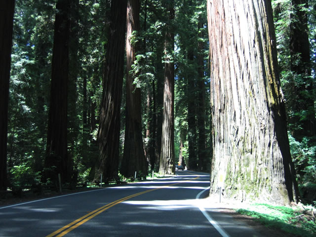 |
Despite shipping, economic, and safety concerns, U.S. 101 is a beautiful drive through this redwood grove. Earning its name as "Redwood Highway," tall trees dominate the view as U.S. 101 carefully meanders through groves and avoids the widest of the redwoods, such as this one. Photo taken 05/26/06. | |||||||||||||||||||||||||||||||||||||||||||||||||||||||||||||||||||||||||||
 |
A left turn provides the entrance to the camping and day-use area of the Richardson Grove State Park. Photo taken 05/26/06. | |||||||||||||||||||||||||||||||||||||||||||||||||||||||||||||||||||||||||||
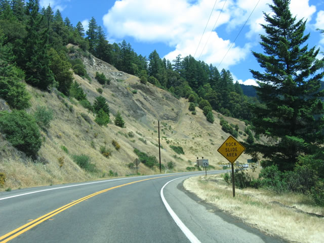 |
Emerging from Richardson Grove, U.S. 101 skirts along the edge of another ridge that is prone to landslides and rockfall. Photo taken 05/26/06. | |||||||||||||||||||||||||||||||||||||||||||||||||||||||||||||||||||||||||||
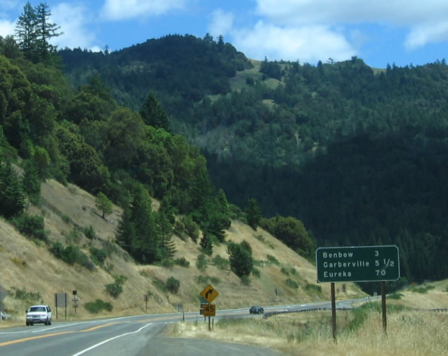 |
This mileage sign provides the distance to Benbow (three miles), Garberville (5.5 miles), and Eureka (70 miles). Photo taken 05/26/06. | |||||||||||||||||||||||||||||||||||||||||||||||||||||||||||||||||||||||||||
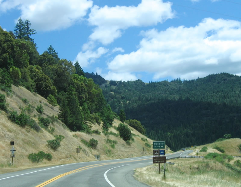 |
The next turnoff from northbound U.S. 101 is Benbow Drive (roughly where Exit 635 would be). Benbow Drive connects to the old alignment of U.S. 101 over the South Fork of the Eel River (1934 Smith Point Bridge). The next exit after this turnoff is the main Benbow interchange (Exit 636), which is not photographed. Photo taken 05/26/06. | |||||||||||||||||||||||||||||||||||||||||||||||||||||||||||||||||||||||||||
 |
After the Benbow interchange (Exit 636), the next exit is Exit 639A, Redwood Drive north to Garberville (Old U.S. 101). The freeway briefly expands to five lanes through here, with three lanes on the northbound climb. There is no center divide, which is a common feature along U.S. 101's increasingly rare freeway sections. By the time U.S. 101 reaches the Oregon state line, it only rarely reverts to freeway; much of the route in Oregon is two-lane conventional highway. Photo taken 05/26/06. | |||||||||||||||||||||||||||||||||||||||||||||||||||||||||||||||||||||||||||
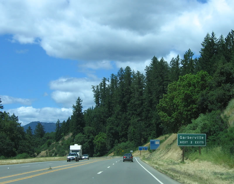 |
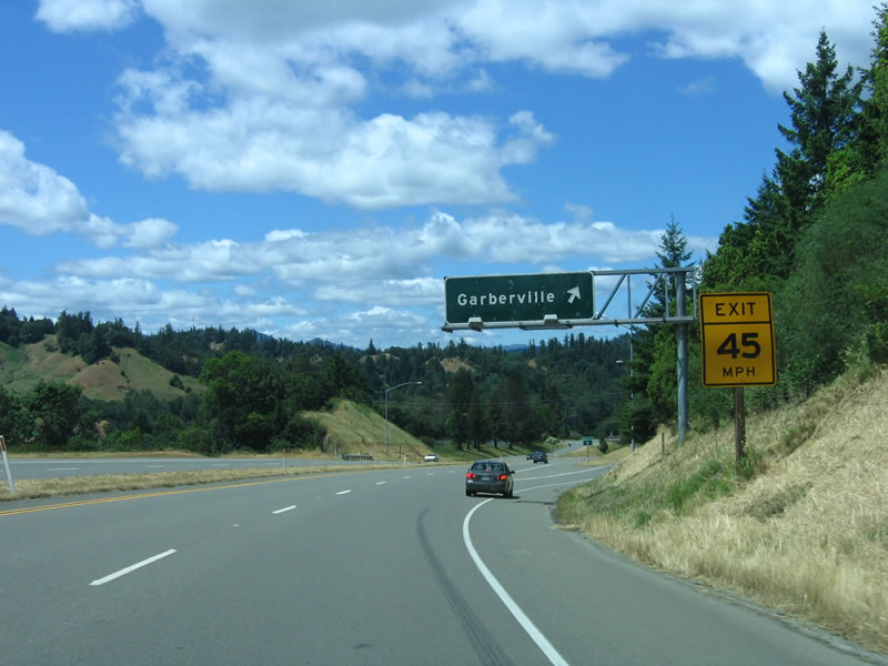
Unincorporated Garberville and Redway are served by the next two exits along northbound U.S. 101 (Exit 639A, Redwood Drive to Garberville and Exit 639B, Redwood Drive to Redway and Shelter Cove). Shelter Cove, an unincorporated area on the coast, is a 24-mile drive west of Garberville and is a popular fishing destination. Photo taken 05/26/06. | |||||||||||||||||||||||||||||||||||||||||||||||||||||||||||||||||||||||||||
 |
The old alignment of U.S. 101 acts as a business loop for Garberville between Exits 639A and 639B, but it follows the path of the South Fork of the Eel River to Redway (while the new freeway crosses a 680-foot summit and cuts a straighter path). Photo taken 05/26/06. | |||||||||||||||||||||||||||||||||||||||||||||||||||||||||||||||||||||||||||
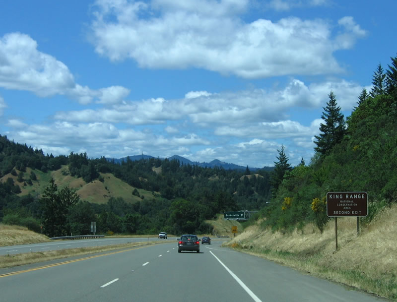 |
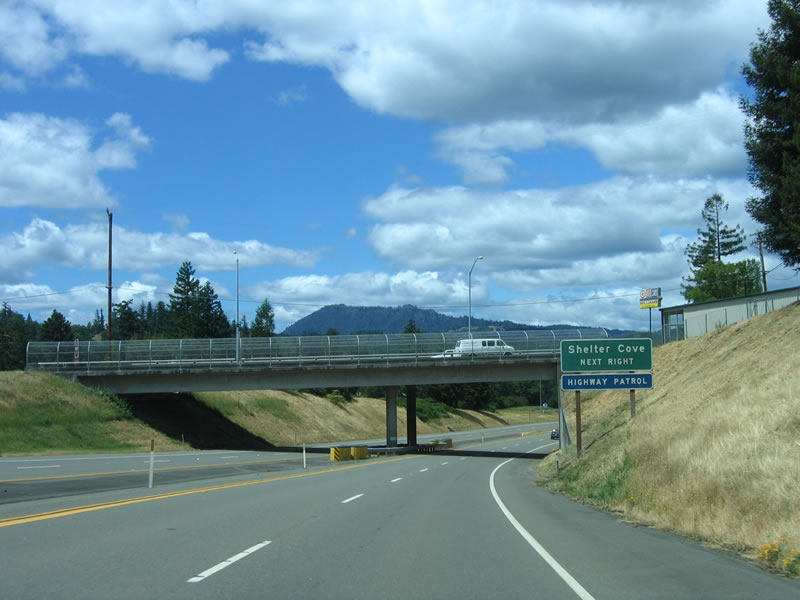
Use Exit 639B, Old U.S. 101/Redwood Drive north to Redway for the connection to King Range National Conservation Area. This 60,000-acre conservation area is managed by the Bureau of Land Management and is located on the Lost Coast north of Shelter Cove. King Range National Conservation Area was established in 1970 and is accessible via Redwood Drive north to Briceland-Thorn Road west to Shelter Cove Road. Shelter Cove is a tiny town located on the coast. Photo taken 05/26/06. | |||||||||||||||||||||||||||||||||||||||||||||||||||||||||||||||||||||||||||
 |
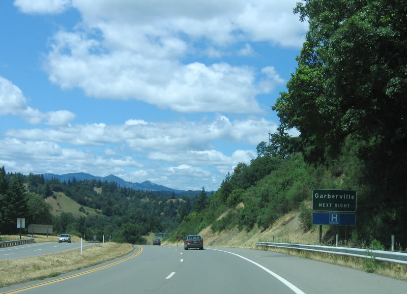
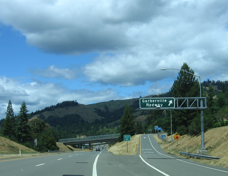
Northbound U.S. 101 (Redwood Highway) reaches Exit 639A, Redwood Drive north to Garberville (Old U.S. 101). Photo taken 05/26/06. | |||||||||||||||||||||||||||||||||||||||||||||||||||||||||||||||||||||||||||
 |
The next interchange along northbound U.S. 101 (Redwood Highway) is Exit 639B, Redwood Drive. Photo taken 05/26/06. | |||||||||||||||||||||||||||||||||||||||||||||||||||||||||||||||||||||||||||
 |
Use Exit 639B (Redwood Drive) northwest to Redway and Shelter Cove. Note the paved median on the Garberville Bypass, which was built between 1966 and 1969. Photo taken 05/26/06. | |||||||||||||||||||||||||||||||||||||||||||||||||||||||||||||||||||||||||||
 |
Northbound U.S. 101 (Redwood Highway) reaches Exit 639B, Redwood Drive to Redway and Shelter Cove. Photo taken 05/26/06. | |||||||||||||||||||||||||||||||||||||||||||||||||||||||||||||||||||||||||||
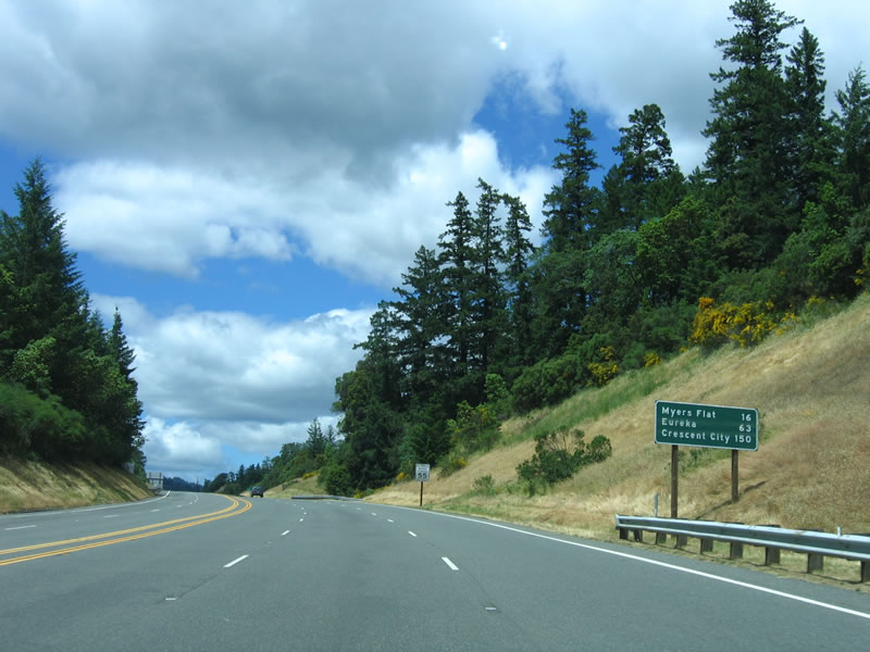 |
Now leaving the vicinity of Garberville and Redway, this mileage sign provides the distance to Myers Flat, Eureka, and Crescent City via northbound U.S. 101 (Redwood Highway). Photo taken 05/26/06. | |||||||||||||||||||||||||||||||||||||||||||||||||||||||||||||||||||||||||||
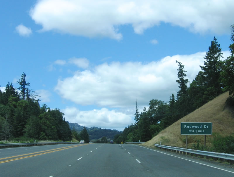 |
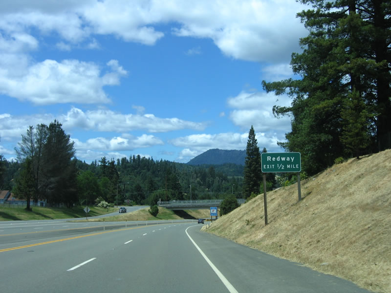
Redwood Drive, which carries Old U.S. 101 from Exit 639A to Exit 642 returns to U.S. 101 at the next exit. Use Redwood Drive south to Redway. Photo taken 05/26/06. | |||||||||||||||||||||||||||||||||||||||||||||||||||||||||||||||||||||||||||
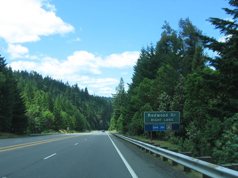 |
Lodging, camping, and recreational vehicle parking is available at Exit 642, Redwood Drive. Photo taken 05/26/06. | |||||||||||||||||||||||||||||||||||||||||||||||||||||||||||||||||||||||||||
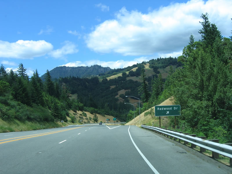 |
Northbound U.S. 101 (Redwood Highway) reaches Exit 642, Redwood Drive (Old U.S. 101) south. Photo taken 05/26/06. | |||||||||||||||||||||||||||||||||||||||||||||||||||||||||||||||||||||||||||
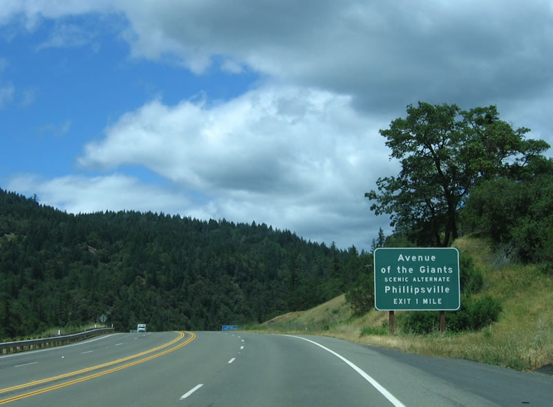 |
The next exit along northbound U.S. 101 (Redwood Highway) is Exit 645, California 254 (Avenue of the Giants) north to Phillipsville, Miranda, and Humboldt Redwoods State Park. The bypass of the Avenue of the Giants was built in three stages: from Exit 645 north to Exit 656, 1962-1964; from Exit 656 north to Exit 667, 1961; and from Exit 667 north to Exit 674, 1958-1967. Photo taken 05/26/06. | |||||||||||||||||||||||||||||||||||||||||||||||||||||||||||||||||||||||||||
 |
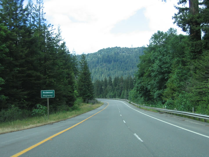
The Avenue of the Giants is the old alignment of U.S. 101 as the U.S. route bypasses the scenic alignment through several stands of redwoods. The highway bypasses the groves by only a few miles, but even with its proximity to the redwoods, highway noise from the U.S. 101 freeway is nearly non-existent along California 254. Photo taken 05/26/06. | |||||||||||||||||||||||||||||||||||||||||||||||||||||||||||||||||||||||||||
 |
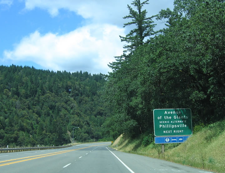
Northbound U.S. 101 (Redwood Highway) reaches Exit 645, California 254 (Avenue of the Giants). The tiny town of Phillipsville, home to about 100 people, is the southern gateway to the main Avenue of the Giants. Photo taken 05/26/06. | |||||||||||||||||||||||||||||||||||||||||||||||||||||||||||||||||||||||||||
 |
A long ramp carries traffic off of U.S. 101 to California 254. Photo taken 05/26/06. | |||||||||||||||||||||||||||||||||||||||||||||||||||||||||||||||||||||||||||
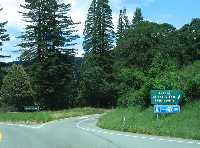 |
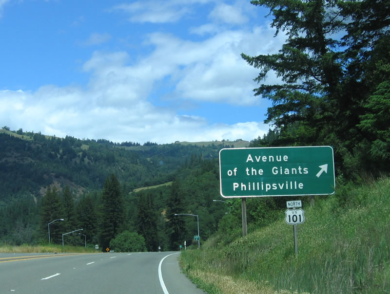
At the bottom of the ramp is this guide sign, which shows the Avenue of the Giants beginning to the east of U.S. 101. Note that there are no trailblazer California 254 shields, perhaps because U.S. 101 travelers know this road by its name, Avenue of the Giants. Photo taken 05/26/06. | |||||||||||||||||||||||||||||||||||||||||||||||||||||||||||||||||||||||||||
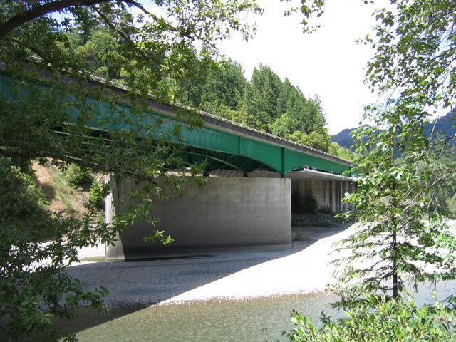 |
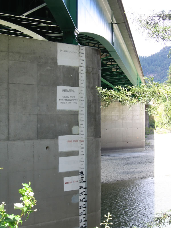
Mainline U.S. 101 crosses the South Fork of the Eel River via the Barnum Bridge. Built in 1964, a set of hatch marks show the extent of the 1964 flood. During that infamous year which saw a massive flood along the Eel River as well as the tsunami that devastated Crescent City to the north, the Eel River overflowed its banks in December 1964. This flood destroyed bridges, roads, and entire towns (Pepperwood). Heavy rains fell on top of an unusually large snowpack. Coupled with snowmelt, the rains brought unprecedented floods into the Eel River watershed. These waters crested around the Eel River watershed near Christmas Day 1964. Nineteen people were killed, and total damages reached $100 million.2 A prior flood in 1955 and a more recent flood in 1996 have caused similar concerns along both the Eel River and Mad River watersheds. Destruction to roadways was common, and part of the reason why sections of the U.S. 101 bypass around the Avenue of the Giants was not "completed" until the late 1960s was due to the replacement and upgrade of certain bridges that were destroyed or damaged by the 1964 floods. A depth chart that shows exactly how high the 1964 flood went is depicted on one of the pillars that support the Barnum Bridge that carries U.S. 101 over the South Fork of the Eel River. Photos taken 05/26/06. | |||||||||||||||||||||||||||||||||||||||||||||||||||||||||||||||||||||||||||
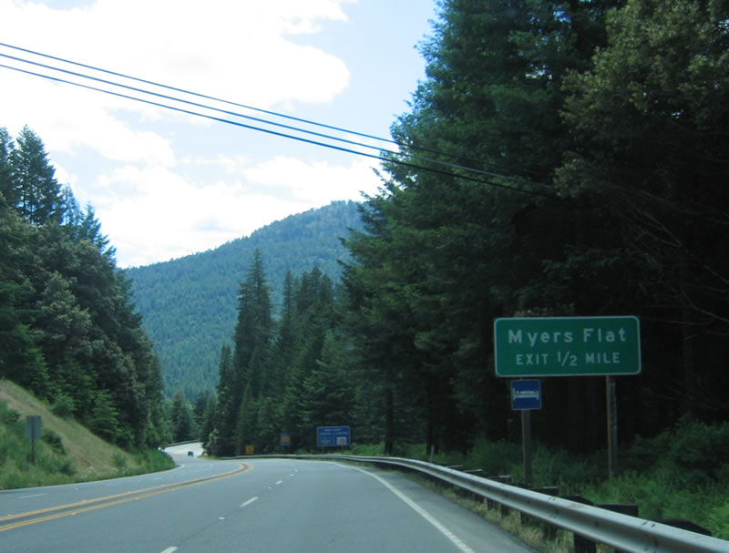
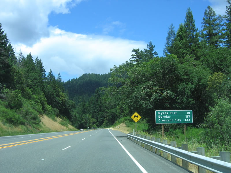 This mileage sign provides the distance to Myers Flat (10 miles), Eureka (57 miles), and Crescent City (141 miles). Photo taken 05/26/06. |
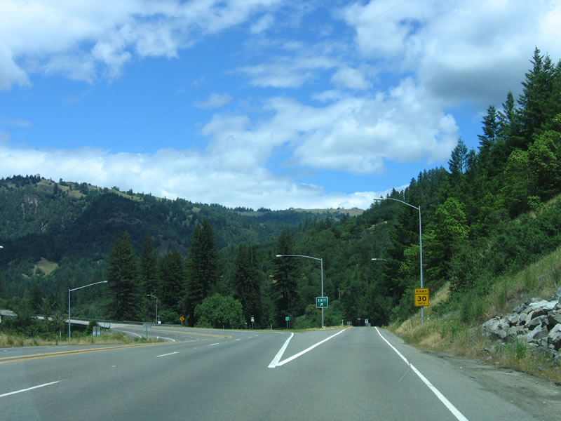
 The U.S. 101 bypass of the Avenue of the Giants is four lanes but undivided. The highway is built into the hillside, enabling it to be above the 100-year flood stage. Photo taken 05/26/06. |
 An undeveloped weigh station and scale house is located after the southern Avenue of the Giants interchange. Photo taken 05/26/06. |
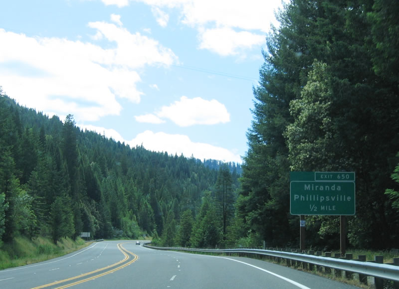 The next exit along northbound U.S. 101 (Redwood Highway) is Exit 650, Maple Hills Road east to California 254 (Avenue of the Giants) (including the towns of Miranda and Phillipsville). An older steel girder bridge carries Maple Hills Road from U.S. 101 to California 254. Photo taken 05/26/06. |
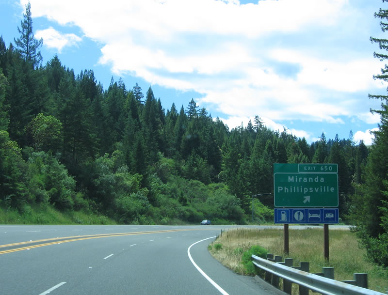 Northbound U.S. 101//Redwood Highway reaches Exit 650, Maple Hills Road. This is the second of several connections to the Avenue of the Giants (see also Exits 645, 656, 661, 663, 667, 671, and 674). Photo taken 05/26/06. |
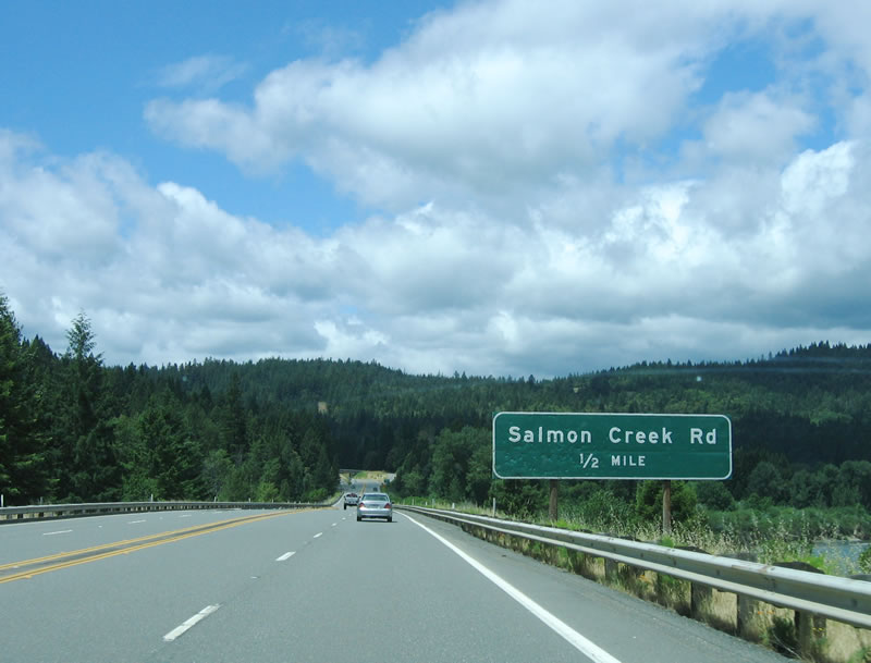 The next exit along northbound U.S. 101 (Redwood Highway) is Exit 653, Salmon Creek Road. This local access road connects to destinations west of U.S. 101 but not the Avenue of the Giants. Photo taken 05/26/06. |
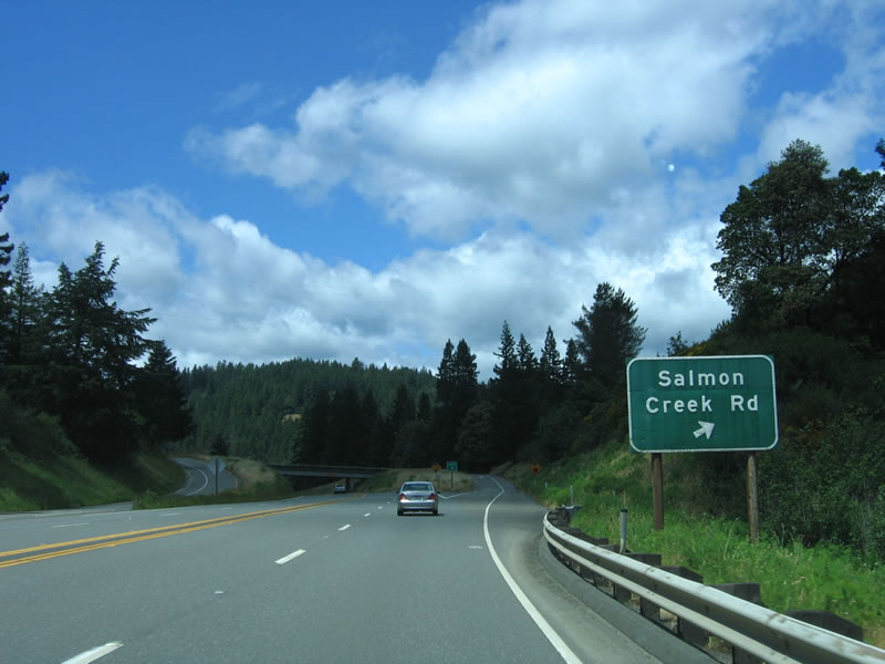 Northbound U.S. 101 (Redwood Highway) reaches Exit 653, Salmon Creek Road. Photo taken 05/26/06. |
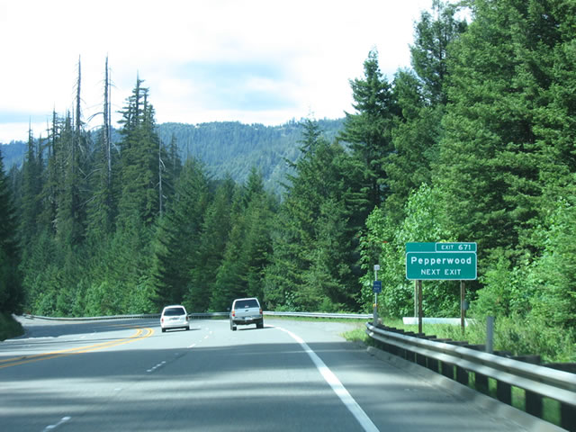
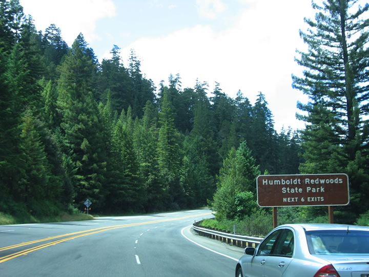 The next six exits all serve Humboldt Redwoods State Park: Exit 656, California 254 (Avenue of the Giants) (Myers Flat interchange); Exit 661, Newton Road (Weott interchange); Exit 663, Dyerville Loop Road east to California 254 (Avenue of the Giants) (Southfork/Honeydew); Exit 667, Englewood Ranch Road (Redcrest/Holmes); Exit 671, Barkdull Road east to California 254 (Avenue of the Giants) (Pepperwood); and Exit 674, California 254 (Avenue of the Giants) and Jordan Road. Photo taken 05/26/06. |
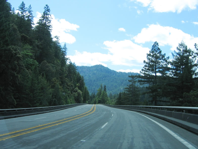 Portions of U.S. 101 follow elevated viaducts where it parallels the South Fork of the Eel River. The freeway is generally undivided for the entire route alongside the Avenue of the Giants. Photo taken 05/26/06. |
 The next exit along northbound U.S. 101 (Redwood Highway) is Exit 656, California 254 (Avenue of the Giants) (Myers Flat interchange). Photo taken 05/26/06. |
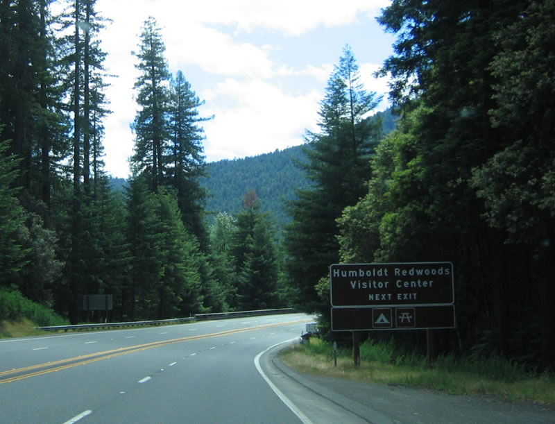 Use Exit 656 to the Humboldt Redwoods State Park, which includes 17,000 acres of old growth redwoods (such as the Rockefeller Forest, which is the largest such old growth stand left in the world). Humboldt Redwoods State Park features a large and very informative visitors center (use this exit) and includes hiking, camping, and other outdoor activities. The third largest state park in California, the park contains about 53,000 acres total, including the old growth redwood forests as well as the Bull Creek watershed. Photo taken 05/26/06. |
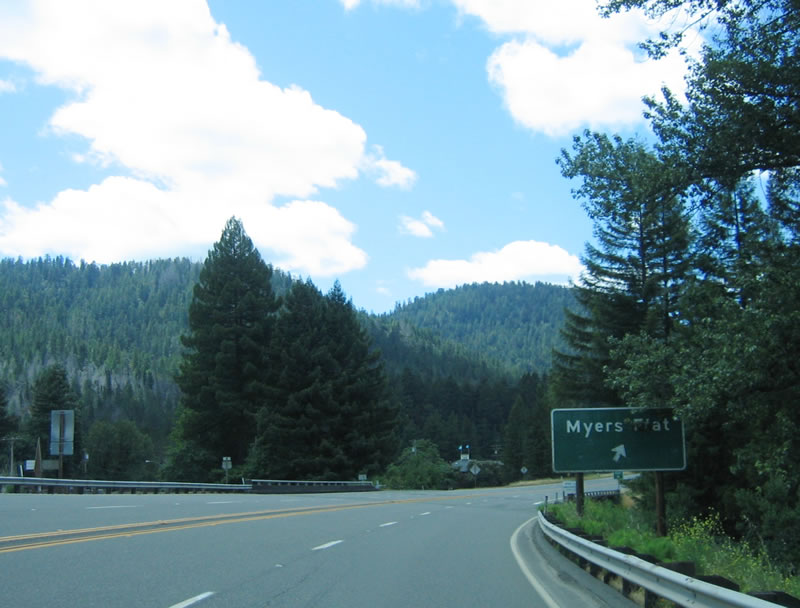 Northbound U.S. 101 (Redwood Highway) reaches Exit 656, California 254 (Avenue of the Giants) (Myers Flat interchange). Photo taken 05/26/06. |
 This section of U.S. 101 is known as the Sam Helwer Memorial Freeway. This reassurance shield is posted after the Myers Flat interchange (Exit 656). Photo taken 05/26/06. |
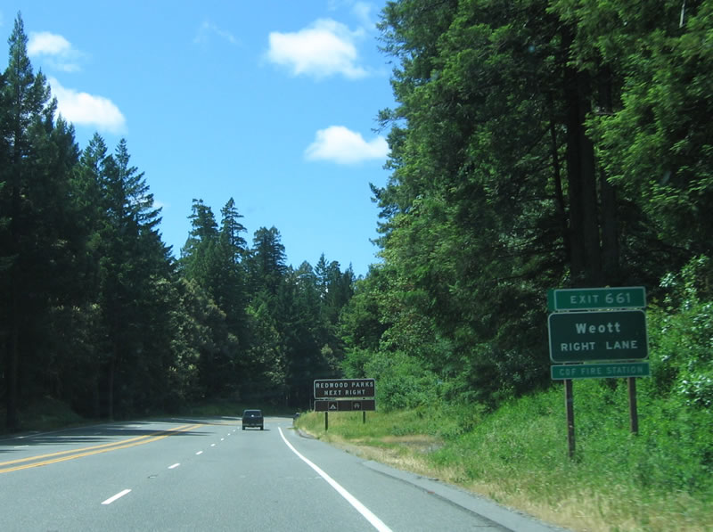 The next exit along northbound U.S. 101 (Redwood Highway) is Exit 661, Newton Road (Weott interchange). Photo taken 05/26/06. |
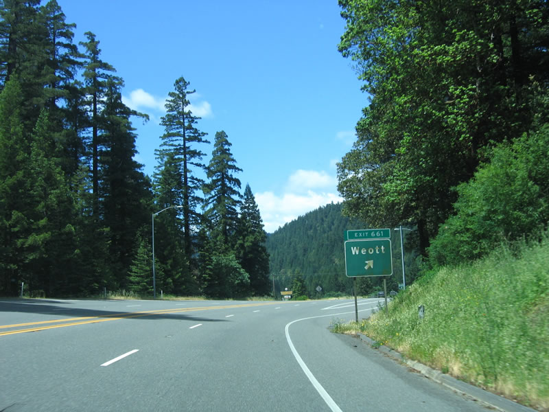 Northbound U.S. 101 (Redwood Highway) reaches Exit 661, Newton Road (Weott interchange). Photo taken 05/26/06. |
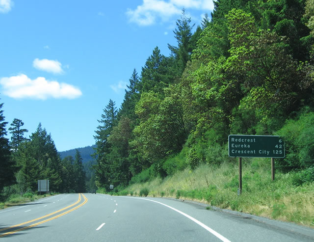 This mileage sign provides the distance to Redcrest (six miles), Eureka (42 miles), and Crescent City (125 miles). Photo taken 05/26/06. |
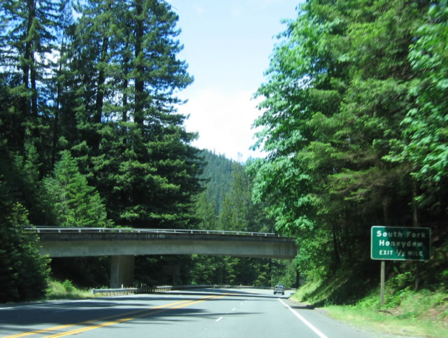 The next exit along northbound U.S. 101 (Redwood Highway) is Exit 663, Dyerville Loop Road east to California 254 (Avenue of the Giants) (Southfork/Honeydew). Photo taken 05/26/06. |
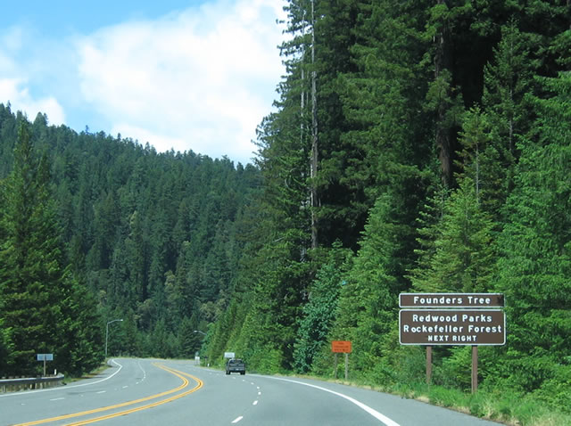 Use Dyerville Loop Road (Exit 663) east to Humboldt Redwoods State Park, including Founders Grove and Rockefeller Forest. This is one of the most popular stops for visitors to the Avenue of the Giants. Photo taken 05/26/06. |
 Northbound U.S. 101 (Redwood Highway) reaches Exit 663, Dyerville Loop Road east to California 254 (Avenue of the Giants) (Southfork/Honeydew). Photo taken 05/26/06. |
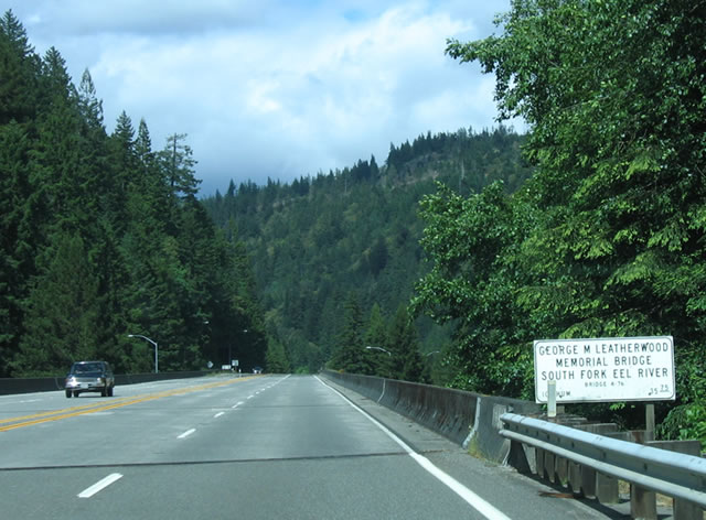 The George M. Leatherwood Memorial Bridge carries U.S. 101 over the South Fork of the Eel River for a final time, just before the south fork merges onto the main Eel River. The main river also brings the return of the Pacific Northwest Railroad, which has a bridge visible to the east from this bridge. The railroad closely follows U.S. 101 from here north to Eureka. Photo taken 05/26/06. |
 A U.S. 101 shield is posted on the northbound undivided four-lane freeway after the Leatherwood Bridge. Photo taken 05/26/06. |
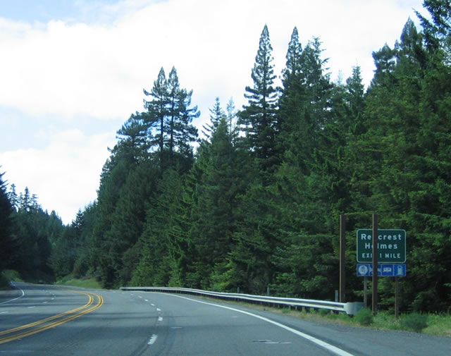 The next exit along northbound U.S. 101 is Exit 667, Englewood Ranch Road (Redcrest/Holmes). Photo taken 05/26/06. |
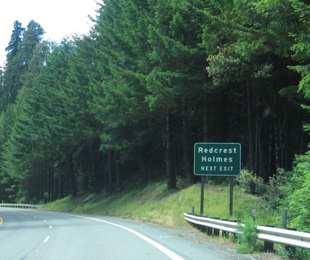 Redcrest and Holmes are two small riverside communities adjacent to U.S. 101 and the Avenue of the Giants. Photo taken 05/26/06. |
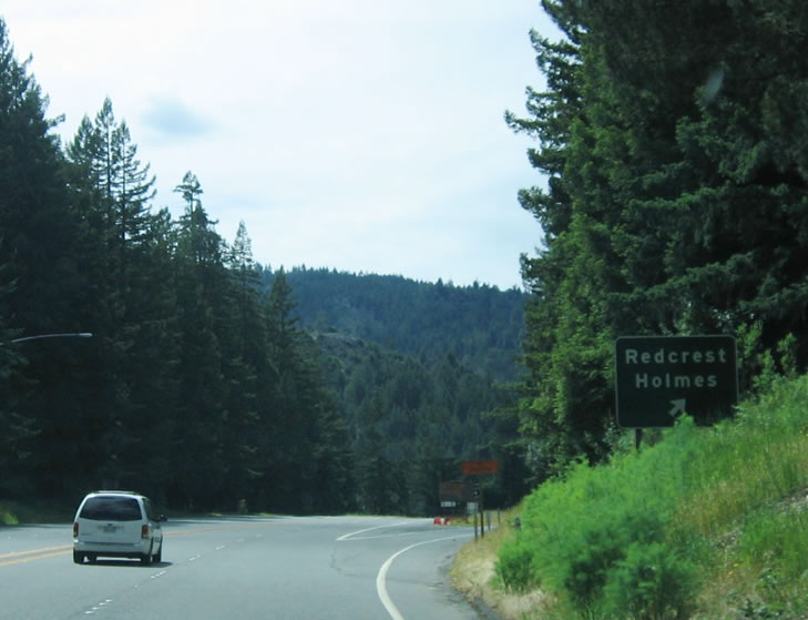 Northbound U.S. 101 reaches Exit 667, Englewood Ranch Road (Redcrest/Holmes). Photo taken 05/26/06. |
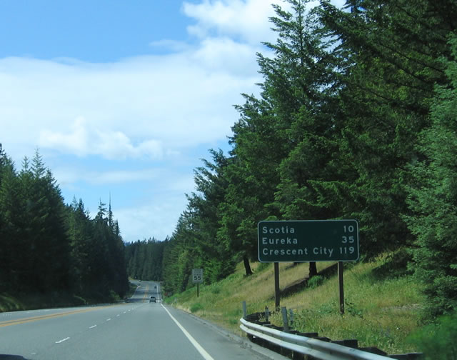 This mileage sign provides the distance to Scotia (ten miles), Eureka (35 miles), and Crescent City (119 miles). Photo taken 05/26/06. |
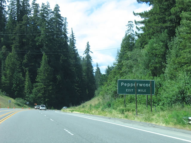 The next exit along northbound U.S. 101 (Redwood Highway) is Exit 671, Barkdull Road east to California 254 (Avenue of the Giants) (Pepperwood). Photo taken 05/26/06. |
 Most of the exits in Humboldt County have at least one exit number guide sign in place as of 2006, which is earlier than most other areas in the state. Minimal compliance statewide with exit numbering at every interchange is optimistically expected in 2008. Northbound U.S. 101 approaches Exit 671, Barkdull Road. Photo taken 05/26/06. |
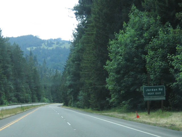 The next exit along northbound U.S. 101 is Exit 674, California 254 (Avenue of the Giants) and Jordan Road. This is the northern terminus of California 254 (Avenue of the Giants). An old alignment that can be hiked continues north of the Avenue of the Giants to an old concrete 1938 bridge. The bridge serves today as a trail connection in the northern part of the state park. Photo taken 05/26/06. |
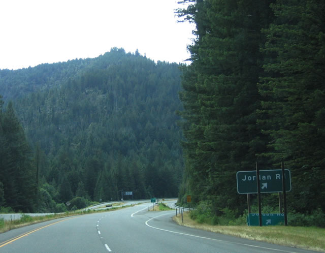 Northbound U.S. 101 reaches Exit 674, California 254 (Avenue of the Giants) and Jordan Road. Photo taken 05/26/06. |
 The two directions of U.S. 101 split into two carriageways, and a small Redwood Highway reassurance marker is posted just north of the Jordan Road/California 254 interchange. Photo taken 05/26/06. |
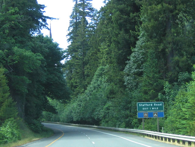 The next exit along northbound U.S. 101 (Redwood Highway) is Exit 676, Stafford Road. Photo taken 05/26/06. |
 Northbound U.S. 101 (Redwood Highway) reaches Exit 676, Stafford Road. Photo taken 05/26/06. |
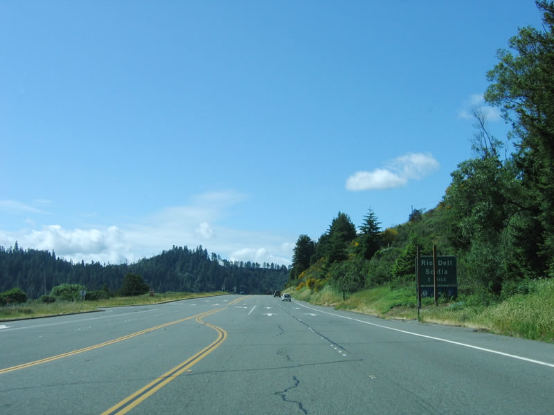 Reverting again to an expressway alignment, a few at-grade crossings are found along U.S. 101 between Exits 676 and 679, including one at Shively Road and this left turn at Mill Street. Use Mill Street to enter Scotia, a Pacific Lumber mill town built for the workers of the lumber mill. The future of this town is in question as the company may put parts of the town up for sale. The next exit is Exit 679, U.S. 101 Business/California 283, Main Street, one mile. Photo taken 05/26/06. |
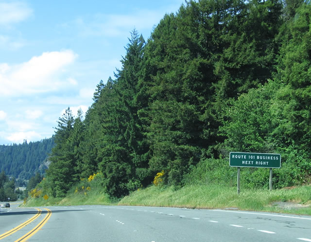 U.S. 101 Business follows Main Street through Scotia and Wildwood Avenue through Rio Dell from Exit 679 to Exit 681. The business route is not well-signed, but the main route through Rio Dell is very easy to follow even without much signage. The section of U.S. 101 Business between Exit 679 and the north end of the Scotia Bridge is also designated as California 283, but there are no California 283 shields (only reference numbers for the bridge). Photo taken 05/26/06. |
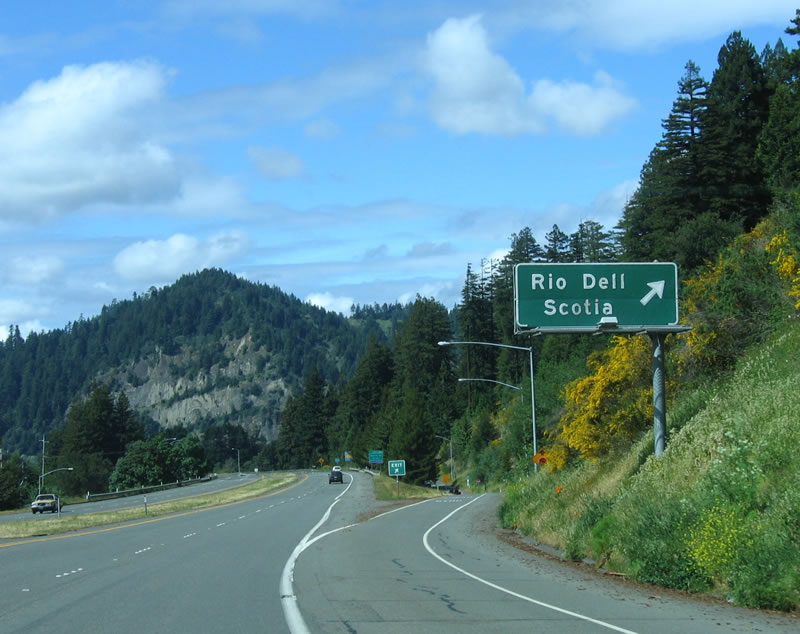 Northbound U.S. 101 (Redwood Highway) reaches Exit 679, U.S. 101 Business/California 283, Main Street. The city of Rio Dell, known as the "Warm Hearted City," sits on a bend of the Eel River adjacent to the Scotia Bluffs. The estimated 2005 population of Rio Dell is 3,174 people. First settled by Lorenzo Painter in the 1870s, the city of Rio Dell was incorporated in 1965. Photo taken 05/26/06. |
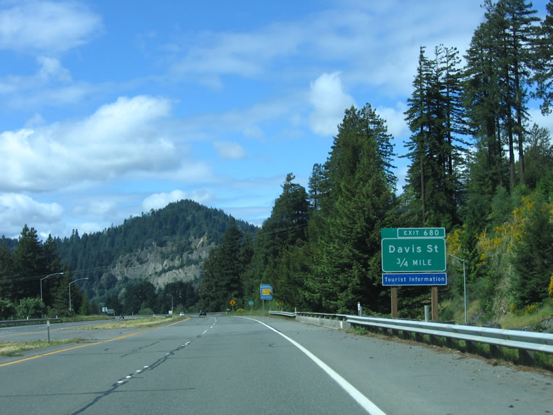 The second Rio Dell interchange is Exit 680, Davis Street. Use Davis Street west to downtown Rio Dell and U.S. 101 Business/Wildwood Avenue. Photo taken 05/26/06. |
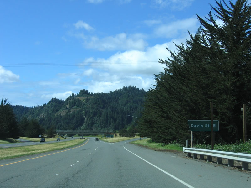 Northbound U.S. 101 reaches Exit 680, Davis Street. Photo taken 05/26/06. |
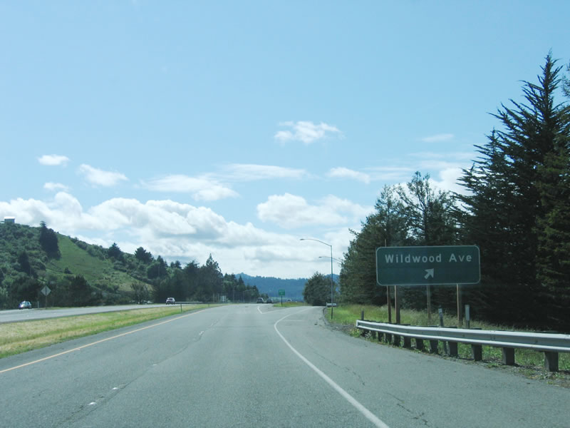 The next exit along northbound U.S. 101 (Redwood Highway) is Exit 681, U.S. 101 Business/Wildwood Avenue south to downtown Rio Dell. This is the third and final Rio Dell exit. Photo taken 05/26/06. |
|
 |
 |
 |
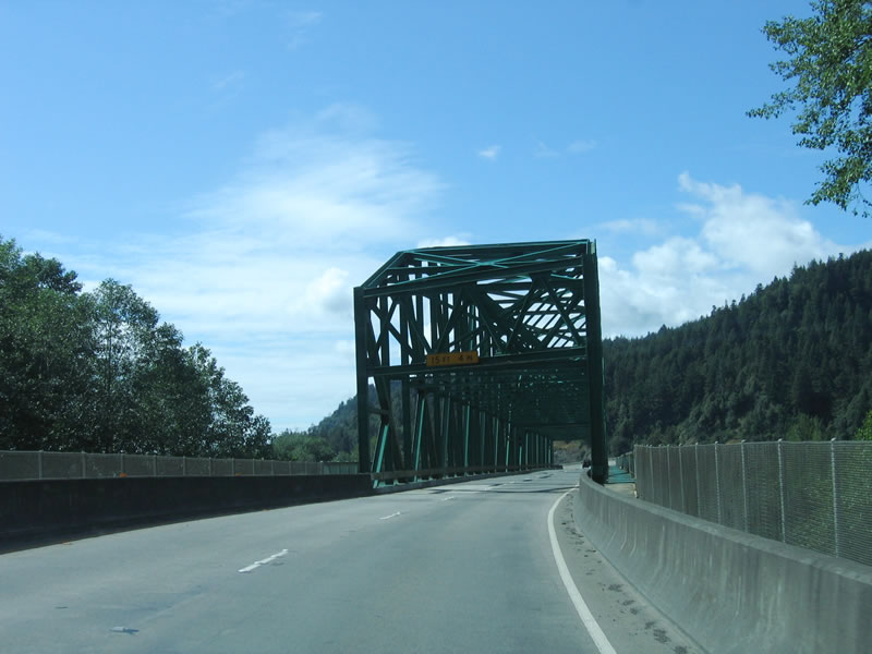
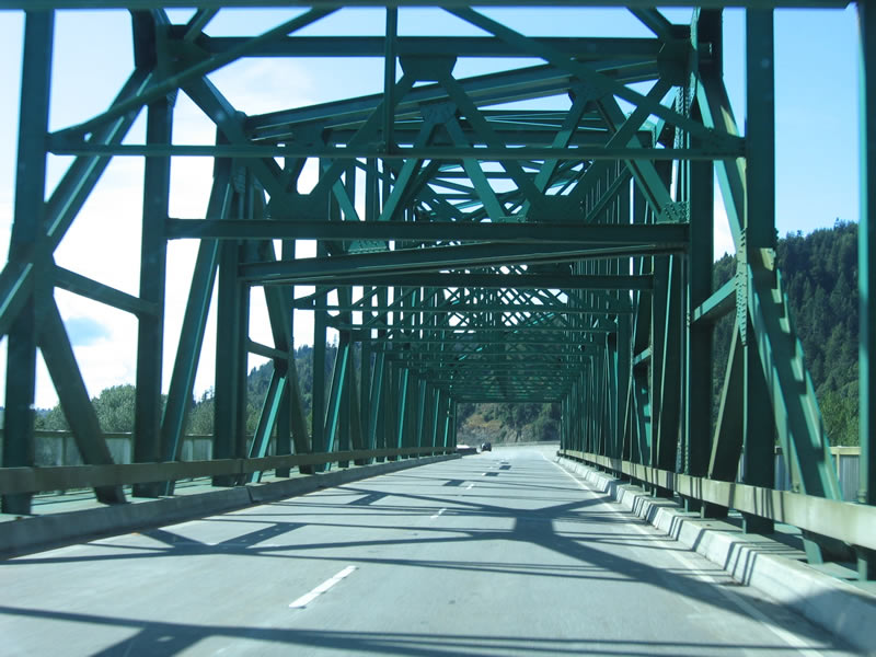
Leaving Rio Dell, northbound U.S. 101 (Redwood Highway) crosses the Eel River on this 1941 span. The southbound lanes use a newer 1974 bridge that parallels the original bridge but lacks the steel through truss superstructure of the 1941 bridge. Photos taken 05/26/06. |
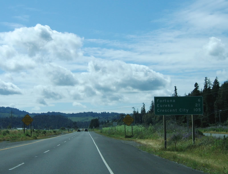 |
This mileage sign provides the distance to Ferndale (six miles), Eureka (21 miles), and Crescent City (105 miles). Photo taken 05/26/06. |
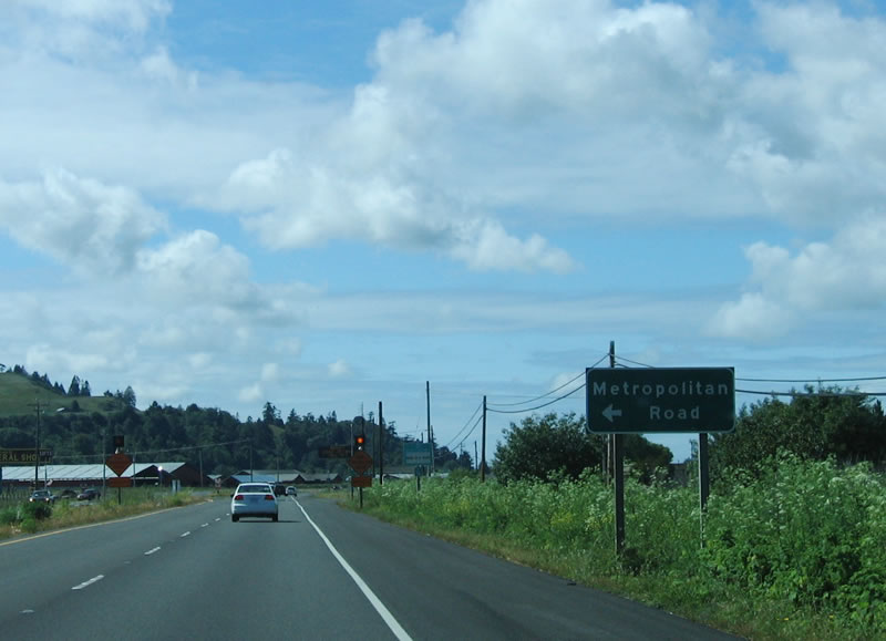 |
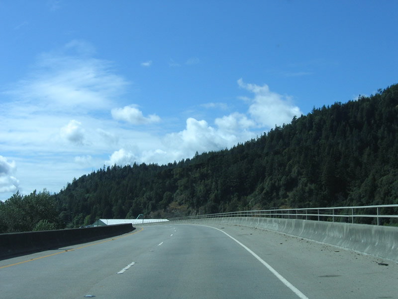
The freeway ends again, and U.S. 101 reverts to an expressway. After crossing the Eel River, the next intersection is with Metropolitan Road. This county maintained road provides local access. Photo taken 05/26/06. |
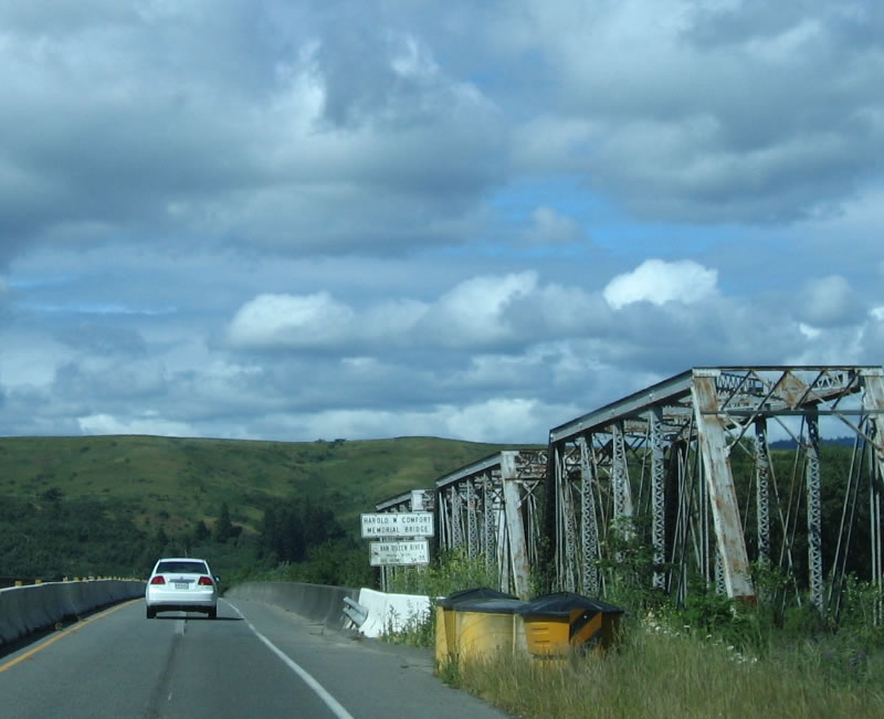 |
Continuing north, U.S. 101 crosses the Van Duzen River via a 1996 span. The southbound lanes use an older, 1952 span. A steel through truss bridge sits to the east of the highway for the railroad. Photo taken 05/26/06. |
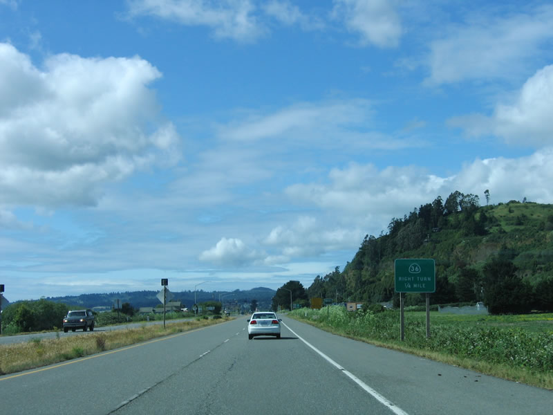 |
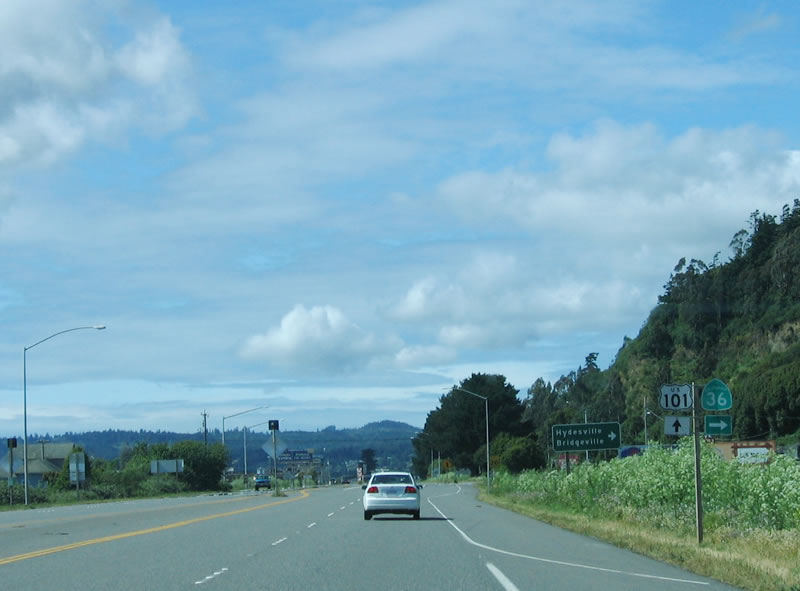
The next interchange along northbound U.S. 101 (Redwood Highway) is Exit 685, California 36 east to Bridgeville. California 36 is an east-west highway that connects U.S. 101 at Alton with Interstate 5 at Red Bluff and U.S. 395 near Susanville. This long road twists across the Coast Range via Bridgeville, Mad River, Forest Glen, Shasta-Trinity National Forest, and Platina. It is the first east-west crossing to the Central Valley since the California 20 junction near Ukiah in Mendocino County (not counting unconstructed California 162 across Mendocino County). Trucks and through traffic are recommended to use California 299 for the preferred route east to Interstate 5. Photo taken 05/26/06. |
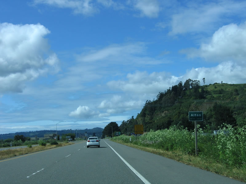 |
Tiny Alton is situated along U.S. 101 at the California 36 interchange (Exit 685). Since the time this picture was taken, a new interchange has been constructed and opened at California 36, labeled as Exit 685. Groundbreaking for the project to construct Exit 685 occurred on April 28, 2009.3 The interchange opened to traffic around August 8, 2010, and is dedicated in the memory of Roger Rodoni, a former Second District Humboldt County Supervisor.4 A total of seven at-grade intersections were eliminated as part of this project.5 Next time we're in the area, we'll update this series of pictures. Photo taken 05/26/06. |
 |
A set of U.S. 101 and California 36 trailblazers are posted along northbound in Alton. This has since been replaced due to interchange construction. Continue north on U.S. 101 to follow the Redwood Highway to Rohnerville, Fortuna, Loleta, Fields Landing, and Eureka. Turn east on California 36 to Hydesville and Bridgeville. Photo taken 05/26/06. |
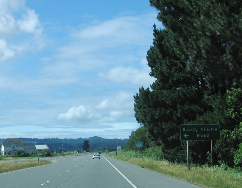 |
Back when this was an expressway rather than freeway, U.S. 101 next approached an at-grade turnoff to Sandy Prairie Road; this access was eliminated when the new freeway interchange for California 36 opened. Photo taken 05/26/06. |
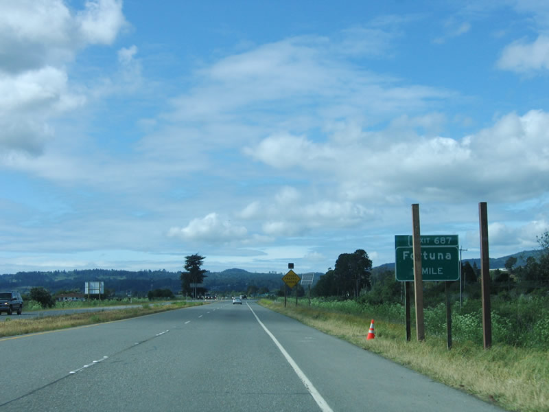 |
The next interchange along U.S. 101 north is Exit 687, U.S. 101 Business/South Fortuna Boulevard, Kenmar Road, and Ross Hill Boulevard. Photo taken 05/26/06. |
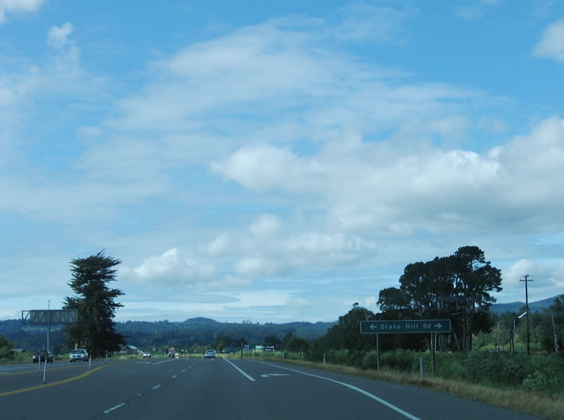 |
There used to be a cross road intersection with Drake Hill Road in 2006; access was eliminated on August 17, 2010, as part of the Alton Interchange project. Motorists used to be able to turn right on Drake Hill Road to connect to Eel River Road, which parallels U.S. 101 to the east and may be an old alignment. Use Drake Hill Road east to Rohnerville and west to Sandy Prairie Road. The best access to Drake Hill Road and Sandy Prairie Road is via new Exit 685. Photo taken 05/26/06. |
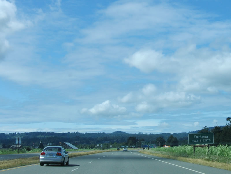 |
As of the 2000 Census, the city of Fortuna was home to 10,497 people. Located on 4.8 square miles of land, Fortuna (the "Friendly City") is growing along with its neighbor Eureka to the north. Fortuna was founded as a company town named Springville, and a post office was added in the 1870s. By 1884, the town was renamed Fortuna; it was incorporated as a city on February 20, 1906. Photo taken 05/26/06. |
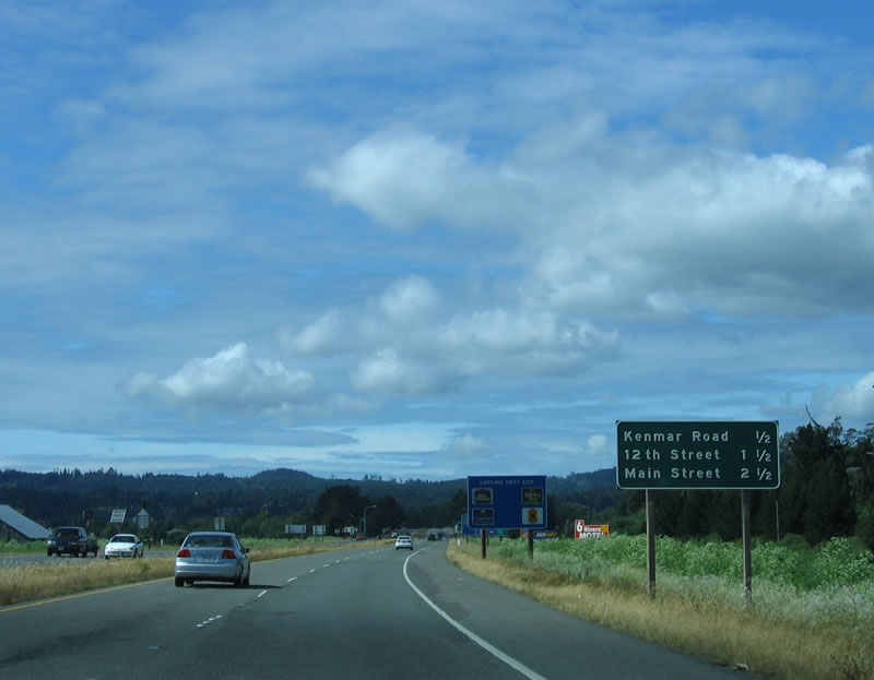 |
This mileage sign provides the distance to the next three exits: Exit 687, U.S. 101 Business/South Fortuna Boulevard/Kenmar Road/Ross Hill Boulevard; Exit 688, 12th Street; and Exit 689, U.S. 101 Business (Main Street). Photo taken 05/26/06. |
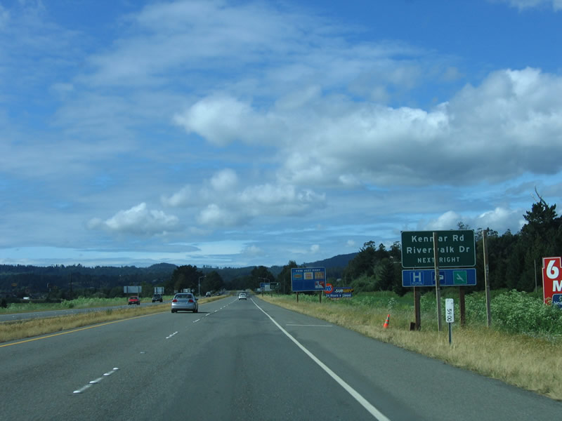 |
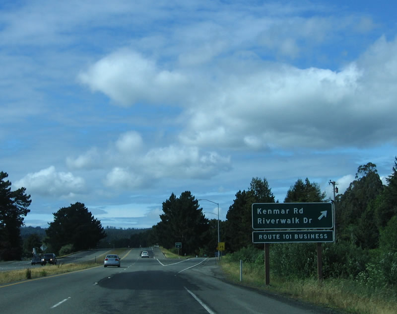
Northbound U.S. 101/Redwood Drive approaches Exit 687, U.S. 101 Business/South Fortuna Boulevard north. This interchange also provides connections to Ross Hill Road southbound and Kenmar Road eastbound. Photo taken 05/26/06. |
 |
Reaching Exit 687, the U.S. 101 freeway bypass of Fortuna and U.S. 101 Business/South Fortuna Boulevard split. Photo taken 05/26/06. |
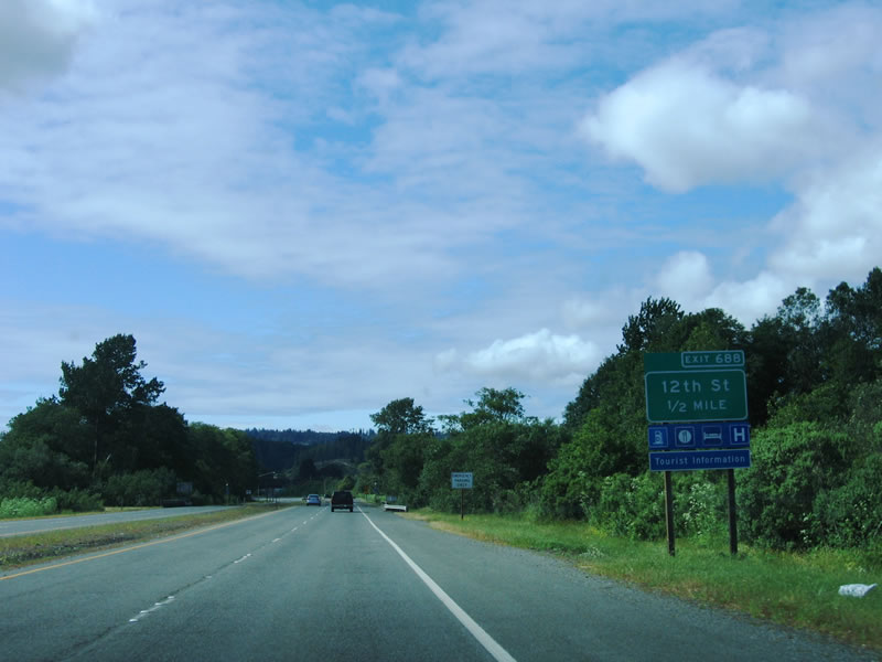 |
The next exit along northbound U.S. 101 (Redwood Highway) is Exit 688, 12th Street. Photo taken 05/26/06. |
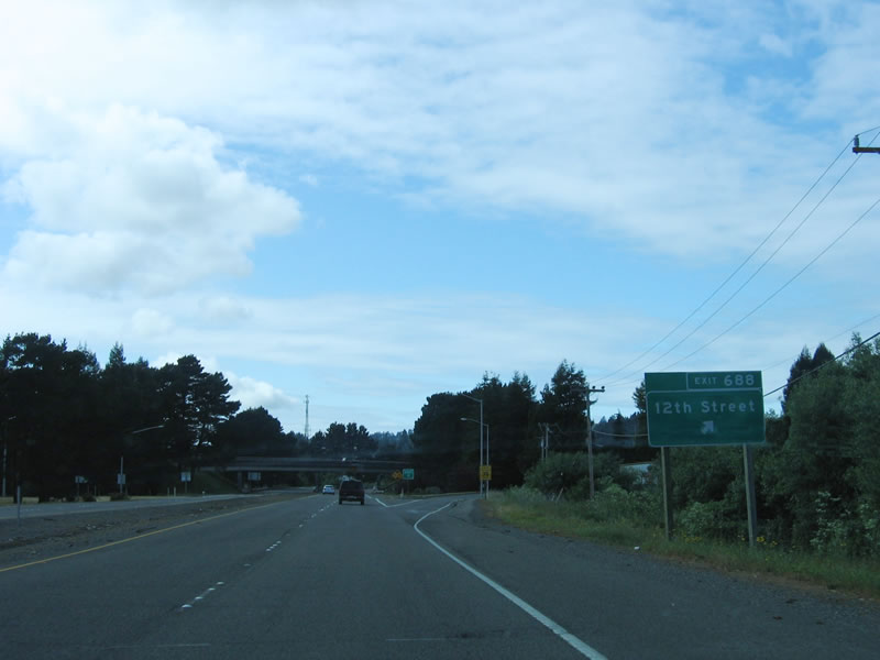 |
Northbound U.S. 101 (Redwood Highway) reaches Exit 688, 12th Street into downtown Fortuna. Photo taken 05/26/06. |
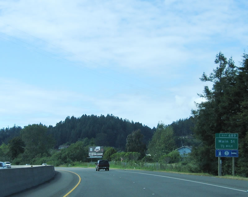 |
The next exit along northbound U.S. 101 (Redwood Highway) is Exit 689, U.S. 101 Business (Main Street) south back to Fortuna. Photo taken 05/26/06. |
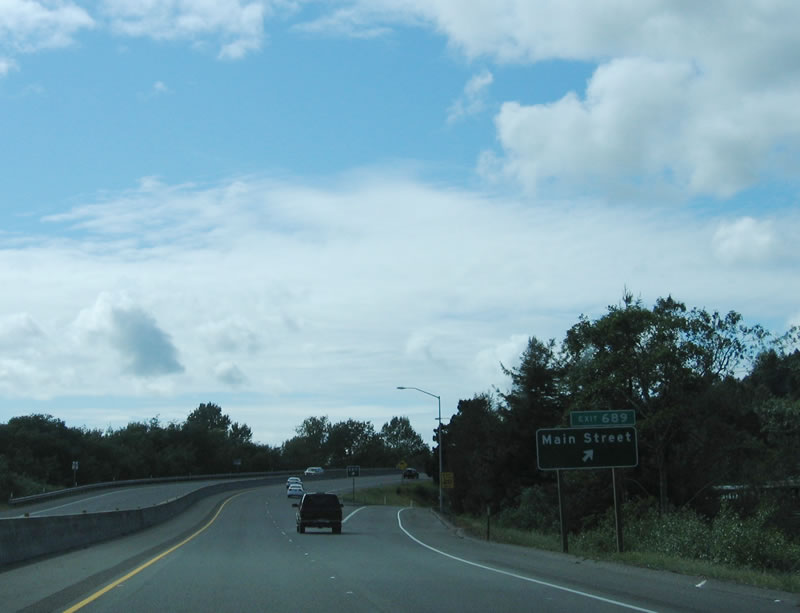 |
Northbound U.S. 101 (Redwood Highway) reaches Exit 689, U.S. 101 Business (Main Street) south. Photo taken 05/26/06. |
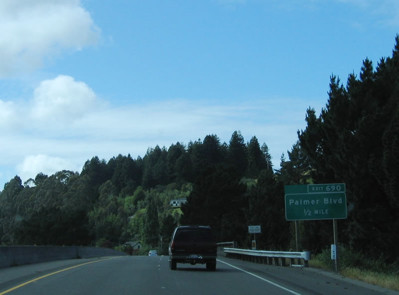 |
The next exit along northbound U.S. 101 (Redwood Highway) is Exit 690, Palmer Boulevard. Photo taken 05/26/06. |
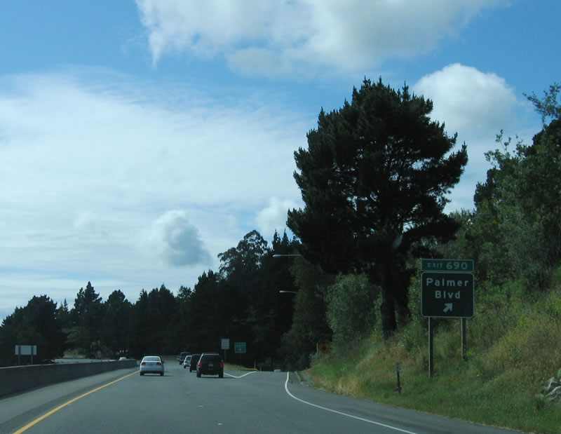 |
Northbound U.S. 101 (Redwood Highway) reaches Exit 690, Palmer Boulevard. This exit primarily serves local and residential access. Photo taken 05/26/06. |
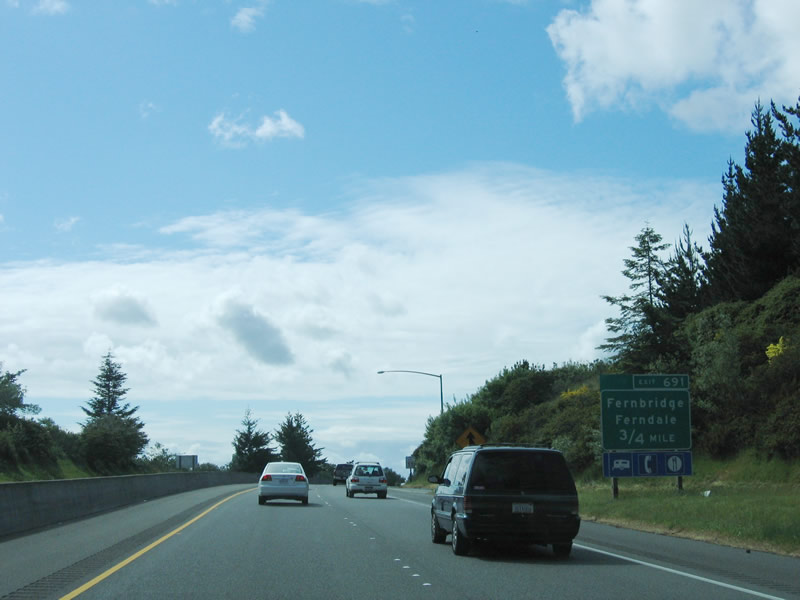 |
The next exit along northbound U.S. 101 (Redwood Highway) is Exit 691, Old U.S. 101/Fernbridge Drive north to Fernbridge and historic Ferndale via California 211 west. Photo taken 05/26/06. |
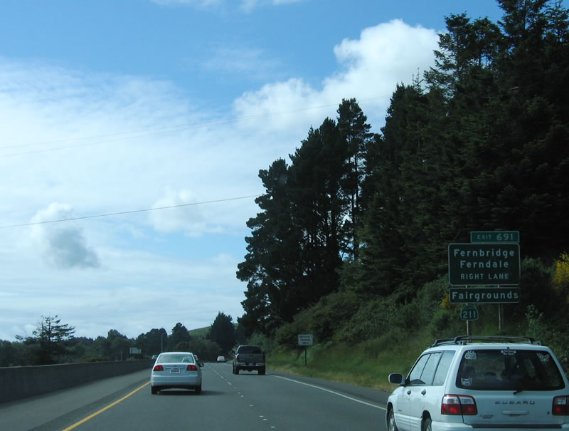 |
Use Exit 691 to follow Old U.S. 101 north to Fernbridge and California 211 west to Ferndale. The old road rejoins U.S. 101 at Exit 692 (Fernbridge Drive/Singley Hill Road). Photo taken 05/26/06. |
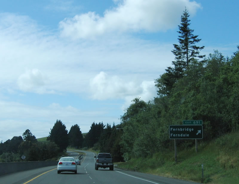 |
Northbound U.S. 101 (Redwood Highway) reaches Exit 691, Old U.S. 101/Fernbridge Drive north to Fernbridge and historic Ferndale via California 211 west. Photo taken 05/26/06. |
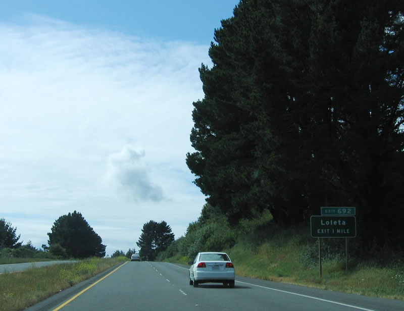 |
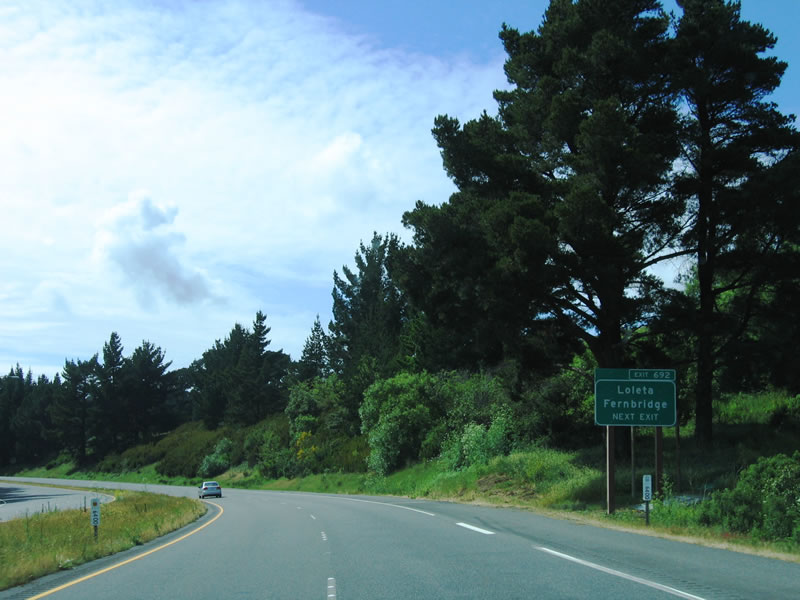
The next exit along northbound U.S. 101 (Redwood Highway) is Exit 692, California 211 (Fernbridge Drive/Singley Hill Road) to Fernbridge and Loleta. Photo taken 05/26/06. |
 |
California 211 begins at Exit 692, turns south on Fernbridge Drive (old U.S. 101) to Fernbridge, turns west onto the Fernbridge over the Eel River, and travels southwest to Ferndale, where it ends. California 211 is an orphaned section of California 1, which was originally planned to travel through the Lost Coast and Shelter Cove past Cape Mendocino (the furthest west point in the continental United States) north to Ferndale, then end at U.S. 101 near Fernbridge. When plans to build the state highway through the Lost Coast were shelved, California 1 was rerouted to end at Leggett, and California 211 was signed and designated from Fernbridge to Ferndale. California 211 was designated as a future/unconstructed facility from Ferndale south to California 1 near Rockport via Petrolia, Honeydew, and Whitethorn. Due to the treacherous terrain of this route, it is not clear if the extension of California 211 will ever be built, even though it is listed as an official state highway in the state Streets and Highways Code. Photo taken 05/26/06. |
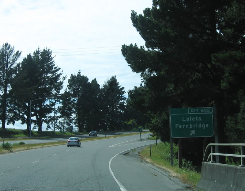 |
Northbound U.S. 101 (Redwood Highway) reaches Exit 692, California 211 (Fernbridge Drive/Singley Hill Road) to Fernbridge and Loleta. Photo taken 05/26/06. |
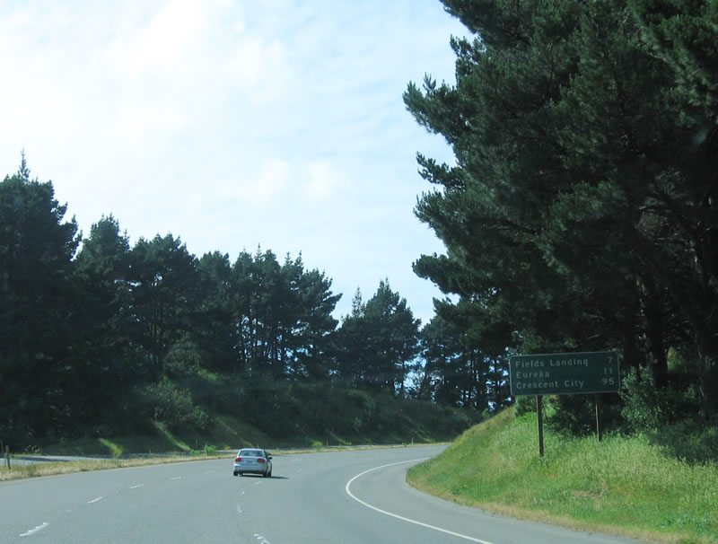 |
This mileage sign provides the distance to Fields Landing (seven miles), Eureka (11 miles), and Crescent City (95 miles). Photo taken 05/26/06. |
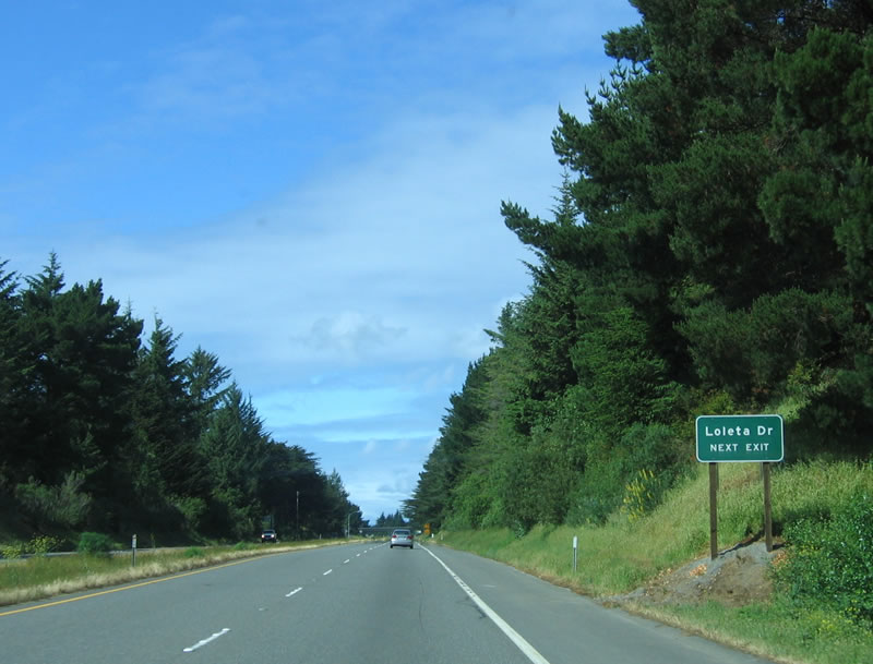 |
The next exit along northbound U.S. 101/Redwood Drive is Exit 694, Loleta Drive. Photo taken 05/26/06. |
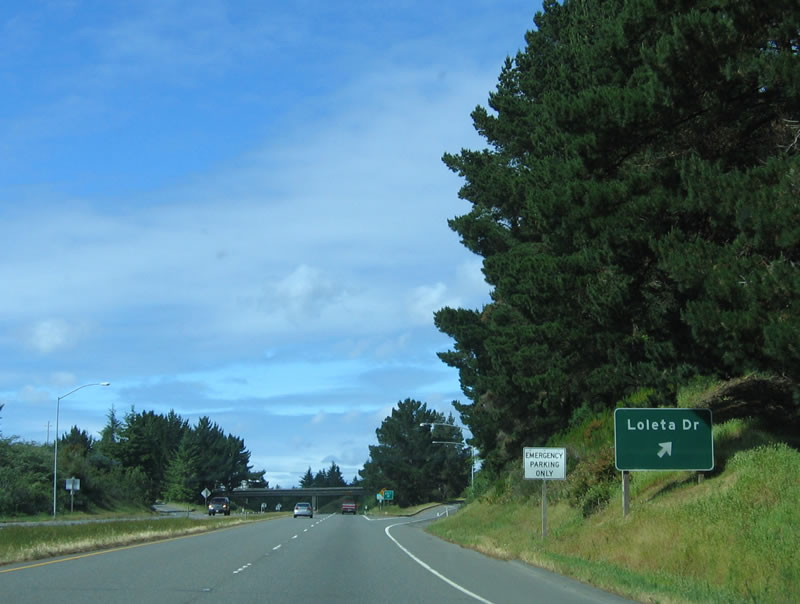 |
Northbound U.S. 101/Redwood Drive reaches Exit 694, Loleta Drive. Photo taken 05/26/06. |
 |
This reassurance shield is posted after the Loleta Drive interchange. Photo taken 05/26/06. |
 |
For the next mile, gusty winds are common, affecting larger trucks, campers, and cars with trailers. Photo taken 05/26/06. |
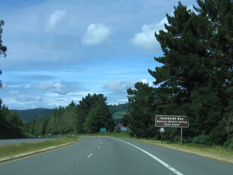 |
A key stop on the migratory bird corridor known as the Pacific Flyway, the Humboldt Bay National Wildlife Refuge is served by the next exit, Exit 696, Hookton Road. This national wildlife refuge offers hiking, observation, boating, and related activities. Use Hookton Road west to the Richard J. Guadagno Visitor Center at the Salmon Creek Unit. Photo taken 05/26/06. |
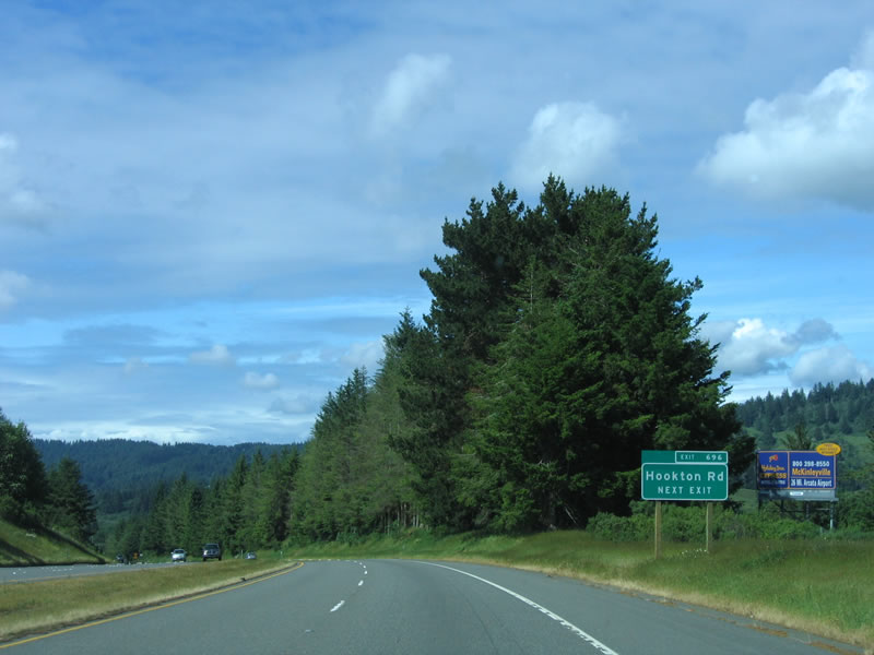 |
This is the first advance guide sign for Exit 696, Hookton Road. Note the small numbers on the exit sign. It is likely that this was among the very first exit number signs to appear on California roadways; it was probably placed in February 2002 along with other inaugural signs. Photo taken 05/26/06. |
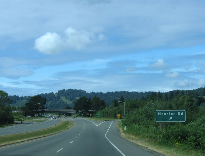 |
Northbound U.S. 101 (Redwood Highway) reaches Exit 696, Hookton Road. This section of U.S. 101 (from Exit 696, Hookton Road to Exit 702, Elk River Road) was built in 1963, all the way to the planned (but as yet unconstructed) bypass of the city of Eureka. Currently, U.S. 101 travels directly through Eureka rather than bypass the city. Photo taken 05/26/06. |
 |
A reassurance shield is posted immediately after the off-ramp for Exit 696 and before the on-ramp from Hookton Road. The overpass in the distance carries Hookton Road over U.S. 101. Photo taken 05/26/06. |
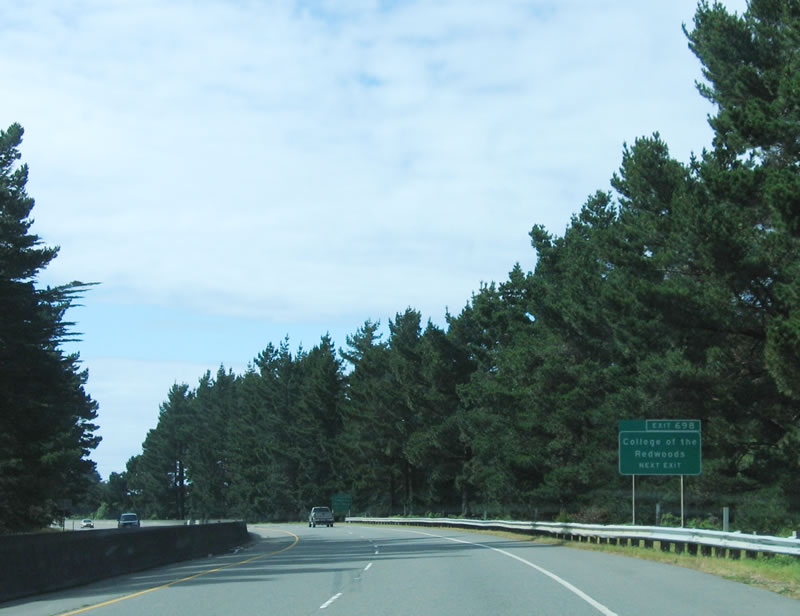 |
The next exit along northbound U.S. 101 (Redwood Highway) is Exit 698, College of the Redwoods (Tompkins Hill Road). The College of the Redwoods consists of three campuses: Mendocino Coast (in Fort Bragg), Eureka, and Del Norte (in Crescent City). Part of the Redwoods Community College District, the Humboldt County campus was founded in 1964, followed by annexations to the district in coastal Mendocino County in 1975 and Del Norte County in 1978. The district also serves portions of Trinity County to the east (along California 299). Photo taken 05/26/06. |
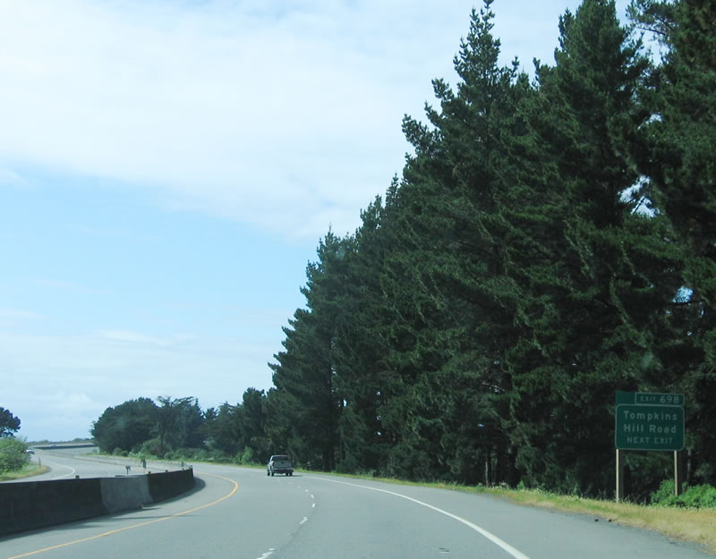 |
The next exit sign indicates that Exit 698 is Tompkins Hill Road as well as College of the Redwoods. It would be more appropriate if all of the advance signs contained "Tompkins Hill Road" as well as "College of the Redwoods." Photo taken 05/26/06. |
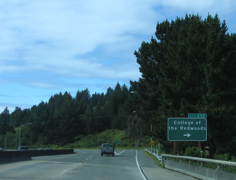 |
A reflective exit number tab is placed on top of an older, non-reflective button copy guide sign for Exit 698, Tompkins Hill Road/College of the Redwoods. Photo taken 05/26/06. |
 |
To the west of U.S. 101 is Humboldt Bay, opening up for the first time after the freeway passes Exit 698. The next exit is Exit 699, Fields Landing (Orchard Avenue/Railroad Avenue). Photo taken 05/26/06. |
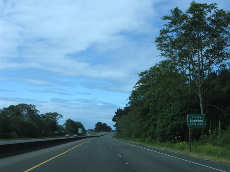 |
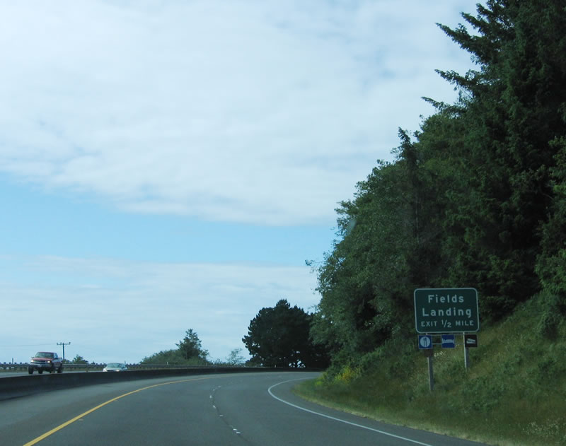
Fields Landing is a small community along the shore of Humboldt Bay south of Eureka. Photo taken 05/26/06. |
 |
Northbound U.S. 101 (Redwood Highway) reaches Exit 699, Fields Landing (Orchard Avenue/Railroad Avenue). Photo taken 05/26/06. |
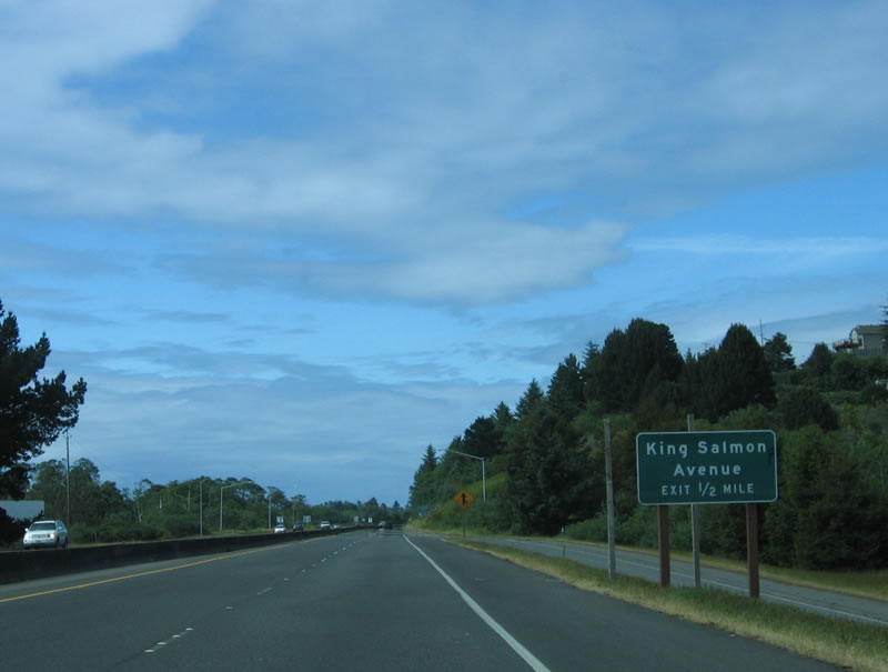 |
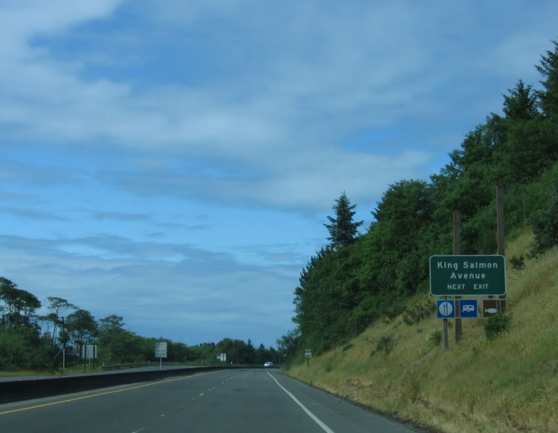
The next exit along northbound U.S. 101 is Exit 700, King Salmon Avenue. Photo taken 05/26/06. |
 |
To the west of U.S. 101 sits the site of the decommissioned Humboldt Bay Nuclear Power Plant. This electricity generating facility began operating in 1963 and ceased nuclear operations in 1976. As one of four facilities to generate nuclear power in the state of California (the others include San Onofre and Diablo Canyon, both of which are still active, and Rancho Seco, which has also been decommissioned), Humboldt Bay Nuclear Power Plant is today reduced to a small fossil fuel power plant facility. The old nuclear power smokestack has since been removed, but radioactive materials remain at the plant's cooling pond.7 Photo taken 05/26/06. |
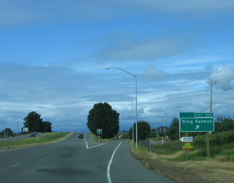 |
Northbound U.S. 101 (Redwood Highway) reaches Exit 700, King Salmon Avenue. Photo taken 05/26/06. |
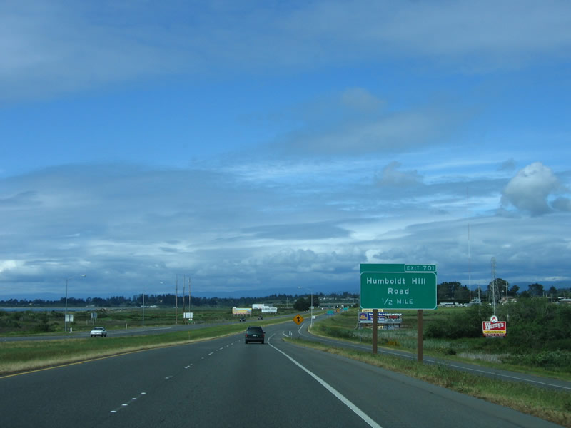 |
The next exit along northbound U.S. 101 (Redwood Highway) is Exit 701, Humboldt Hill Road. Photo taken 05/26/06. |
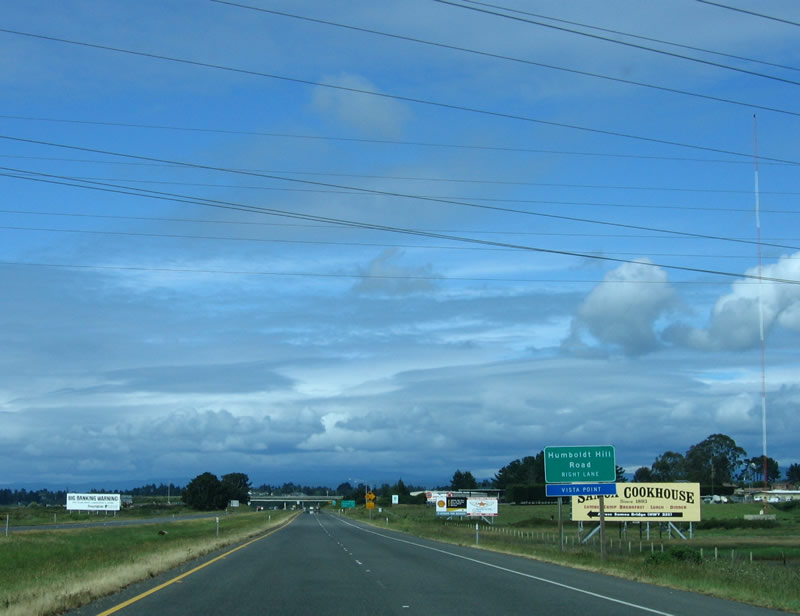 |
The overhead power lines carry electricity generated by the fossil fuel plant located at King Salmon (formerly Humboldt Bay Nuclear Generating Station) over U.S. 101. The next exit is Exit 701, Humboldt Hill Road. Photo taken 05/26/06. |
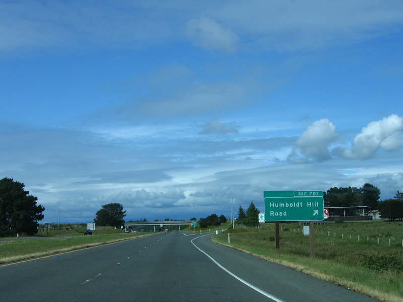 |
Northbound U.S. 101 (Redwood Highway) reaches Exit 701, Humboldt Hill Road. Use Humboldt Hill Road south to the Spruce Point and Humboldt Hill communities. Photo taken 05/26/06. |
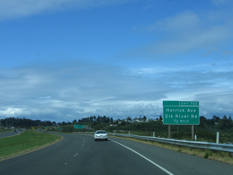 |
The next exit along northbound U.S. 101 (Redwood Highway) is Exit 702, Herrick Avenue and Elk River Road. Photo taken 05/26/06. |
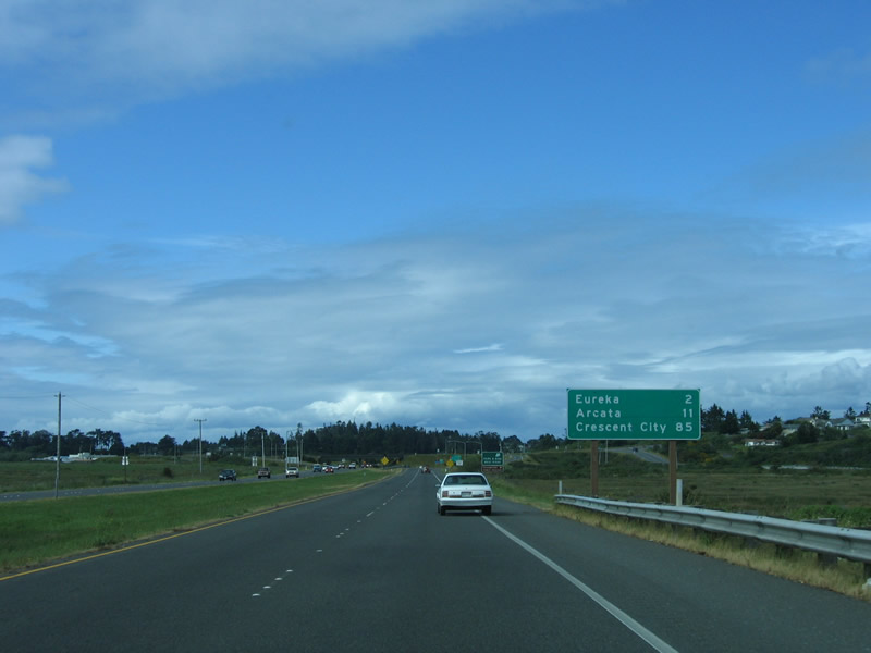 |
This mileage sign provides the distance to Eureka (only two miles!), Arcata (11 miles), and Crescent City (85 miles). It is somewhat surprising to note that Crescent City is 83 miles north of Eureka. California is a very long state. Photo taken 05/26/06. |
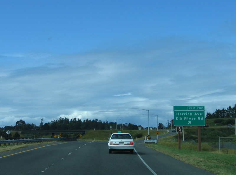 |
Northbound U.S. 101 (Redwood Highway) reaches Exit 702, Herrick Avenue and Elk River Road. Turn right to follow Herrick Road east toward Eureka Golf Course. Turn right onto Herrick Road, then turn right again to follow Elk River Road southeast to Ridgewood Drive. Photo taken 05/26/06. |
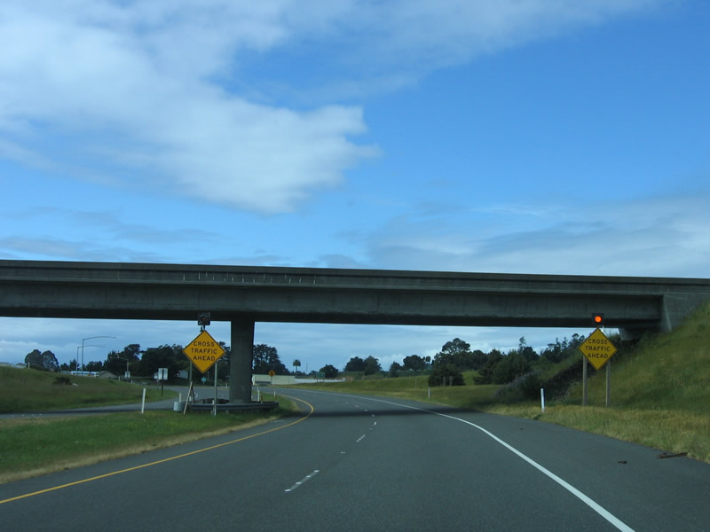 |
After passing through the Herrick Avenue/Elk River Road interchange, signs warn that the freeway ends. In this general area, a planned bypass of Eureka would begin, carrying U.S. 101 to the south and east of the city. However, this bypass is unfunded, and no funds are likely for this project in the near future. So instead, U.S. 101 approaches its first urban environment since leaving Willits. Photo taken 05/26/06. |
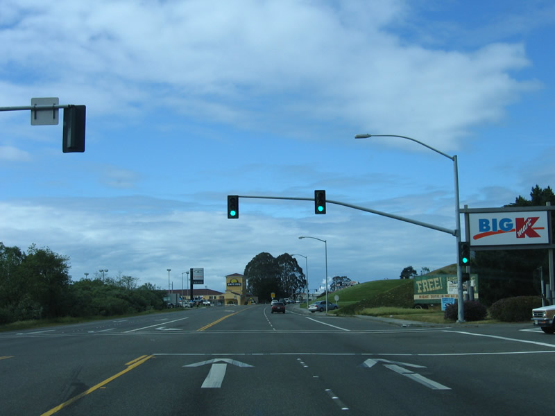 |
The first traffic signal on northbound U.S. 101 (Redwood Highway) is for a shopping center (featuring a K-Mart). From here, U.S. 101 enters the city of Eureka. Founded on April 18, 1856, Eureka is the largest city on the North Coast and is the seat of Humboldt County. The city is home to 25,579 people as of 2005 Census estimate, which is a decrease from the population of 26,128 people at the 2000 Census. Photo taken 05/26/06. |
Sources:
- Rough Road: When Disaster Strikes, Don't Count Highway 101 from the North Coast Journal May 4, 2006, by students from Humboldt State University (class taught by Marcy Burstiner; the students who wrote and contributed to this story are: John Anderson Jr., Lindsay Brokaw, Elise Castle, Jessica Cejnar: Joseph Clerici, Donald Forrest, Amy Gaber, Karina Gianola, Brooke Gibson, Cynthia Gilmer, Thadeus Greenson, Elizabeth Hilbig, Melody Hogan, Jill Koelling, Ashley Mackin, Bryan Radzin, Allison Sampite, Dietrich Seney and Joshua Tobin based on interviews with locals impacted by the current condition of U.S. 101 in Humboldt County
- Humboldt 21st Century: Natural Resources and Hazards Report - Chapter 11, Flooding - October 2002 by Humboldt County.
http://co.humboldt.ca.us/planning /gp/meetings/natl_res/14chapte.pdf - "Caltrans breaks ground on Alton project. The Eureka Times-Standard, April 29, 2009. Notable quote regarding the safety of the former at-grade intersection between U.S. 101 and California 36: "California Highway Patrol Officer Paul Dahlen said his department responded to a total of 17 car crashes at the (Alton) intersection between August 1999 and November 2008, including five that caused injuries and one that resulted in a fatality."
- "It-s done: Alton highway junction now officially -Roger Rodoni Memorial interchange- Full Legislature approves Chesbro resolution less than a month after introduction." by Andrew Bird on official Assemblymember Wesley Chesbro web page dated August 31, 2010. The dedication ceremony took place on September 10, 2010. According to the article, "ACR 182 will designate the interchange, plus a mile-long stretch of Highway 101 a half mile on either side of the interchange (from milepost 57.19 to milepost 58.19), and a half mile section of Highway 36 (from milepost 0.0 to milepost 0.5) as the 'Roger M. Rodoni Memorial Interchange.' This resolution also will allow the placement of three memorial signs at the approaches to the interchange; two on Highway 101 in each direction and one on Highway 36 approaching the interchange from the east."
- Humboldt County Resource Conservation District Environmental Impact Report, which states "At the time this EIR was prepared, the Alton Interchange project was under construction on a segment of SR 101 southeast of the proposed project area. The Alton Interchange project will convert the segment of State Route (SR) 101 from just north of the Van Duzen River Bridge to just north of the intersection of SR 101/Drake Hill Road from four-lane expressway to four-lane freeway. The interchange project includes a grade separated interchange to replace the existing atgrade intersection of SRs 36 and 101, and local road extensions on the west side of SR 101 eliminating seven existing at-grade road approaches to SR 101."
http://humboldtrcd.org/ yahoo_site_admin/assets/docs/ 312_Transportation.102133739.pdf - "Empire Falters: Old Charlie Hansen-s truck stop might close as the future zooms past." by Heidi Walters dated December 2, 2010. For an interesting story on the impact of the 101-36 interchange on a local business (Hansen-s Truck Stop), this story is worth a read. Excerpt: "For 60 years, Hansen had warred with the state highway department over access between Highway 101 and his property just north of the highway-s intersection with State Route 36. The latest court case was still plodding along as Hansen drifted away in the hospital: a suit filed by Caltrans on Dec. 5, 2007, to seize by eminent domain nearly two acres of Hansen-s land to build the new Alton overpass."
- Fact Sheet: Humboldt Bay Nuclear Power Plant. http://www.oes.ca.gov/Operational/OESHome.nsf/PDF/Nuclear Plan Fact Sheets/$file/HumboldtBayFactSht.pdf


Page Updated January 15, 2012.
|
About Contact Glossary |
In The News Interstate Guide |
Social Media:
 |
|
© 2000-25 AARoads.com | All Rights Reserved | Privacy Policy / Terms of Use
|
||