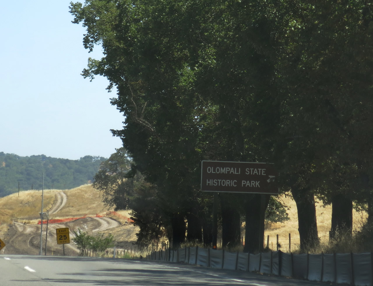
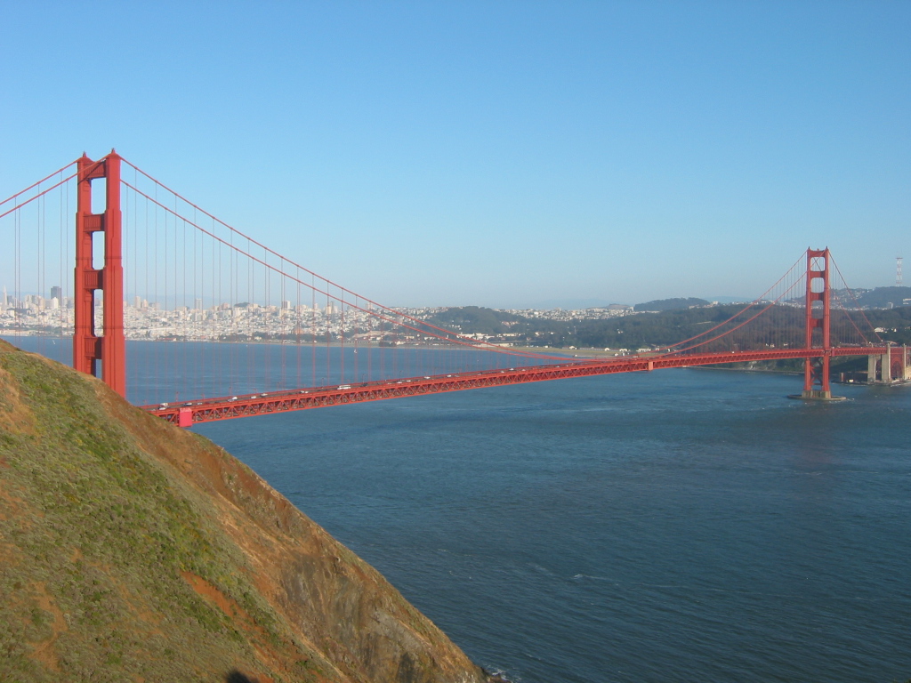
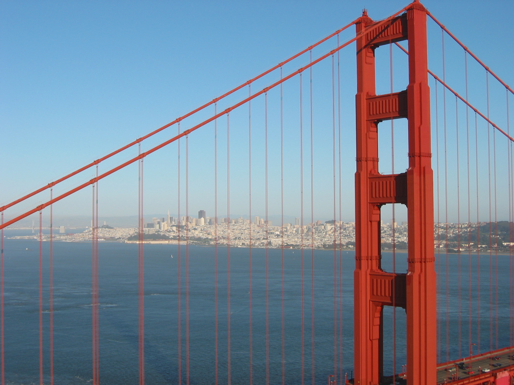
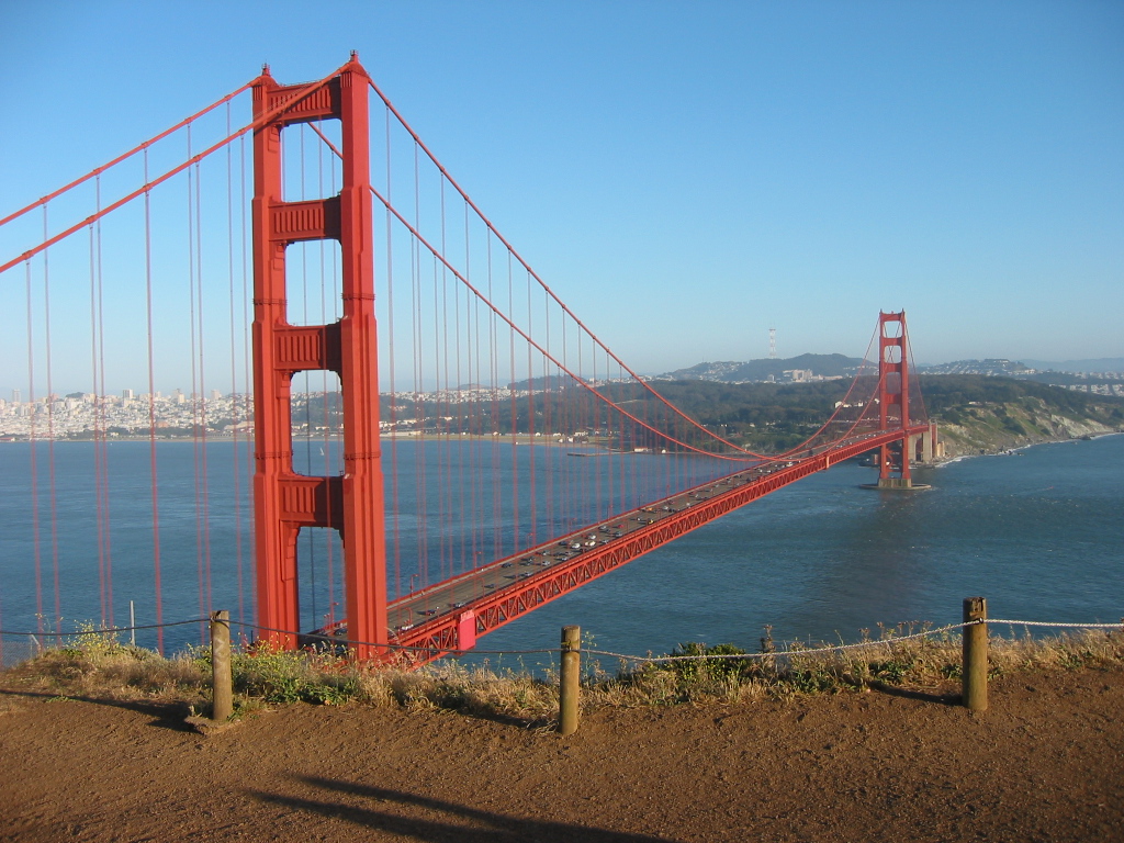
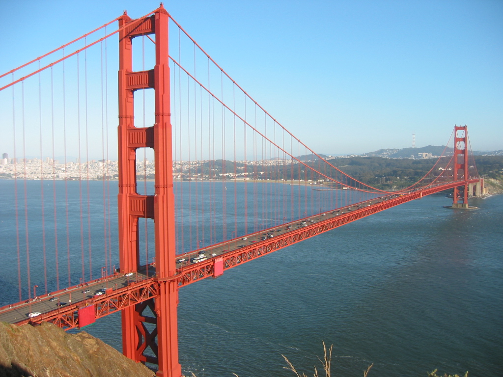
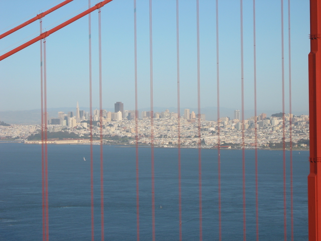
Entering Marin County, U.S. 101 (Redwood Highway) enters some of the highest-priced real estate in a very expensive state for property. Land use restrictions prevent much growth outside established urban areas, and the largest ranches are owned by the rich and famous. Included in this is Skywalker Ranch, home to Star Wars director and creator George Lucas. U.S. 101 passes by much of this as a four to eight-lane freeway, but it does not hint at the value of the land it passes. The freeway passes through Novato (California 37), San Rafael (Interstate 580), and Sausalito before it crosses the Golden Gate Bridge to enter San Francisco.
| U.S. 101 south |
|
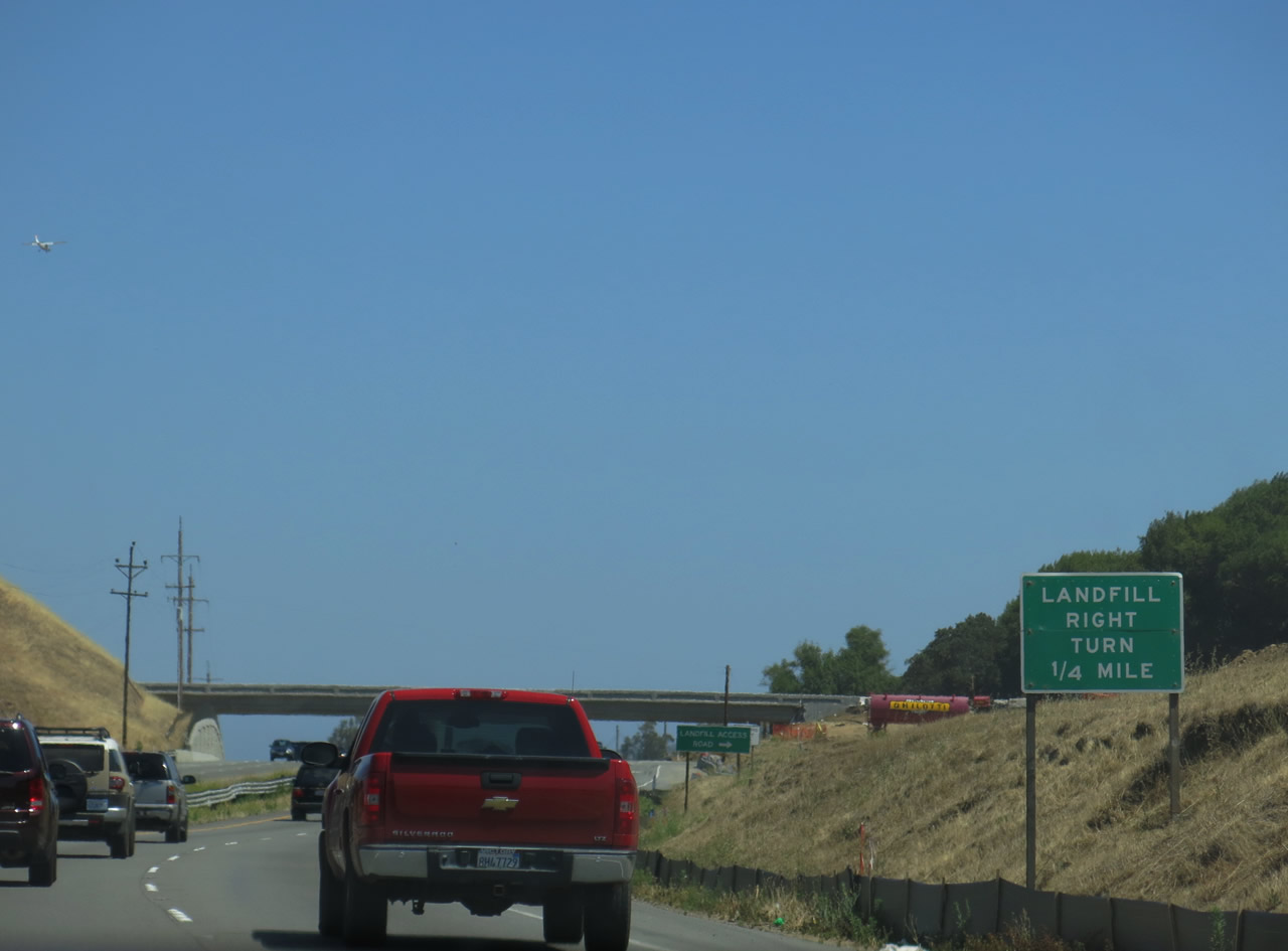
U.S. 101 enters Marin County at the San Antonio Creek bridge crossing (not shown). U.S. 101 continues as an expressway through the Marin-Sonoma Narrows. A grade separation, but not a true freeway interchange, is found at the Landfill Access Road junction along U.S. 101 just north of Novato. It was being upgraded to a full interchange in 2013. Photo taken 07/06/13. |
|
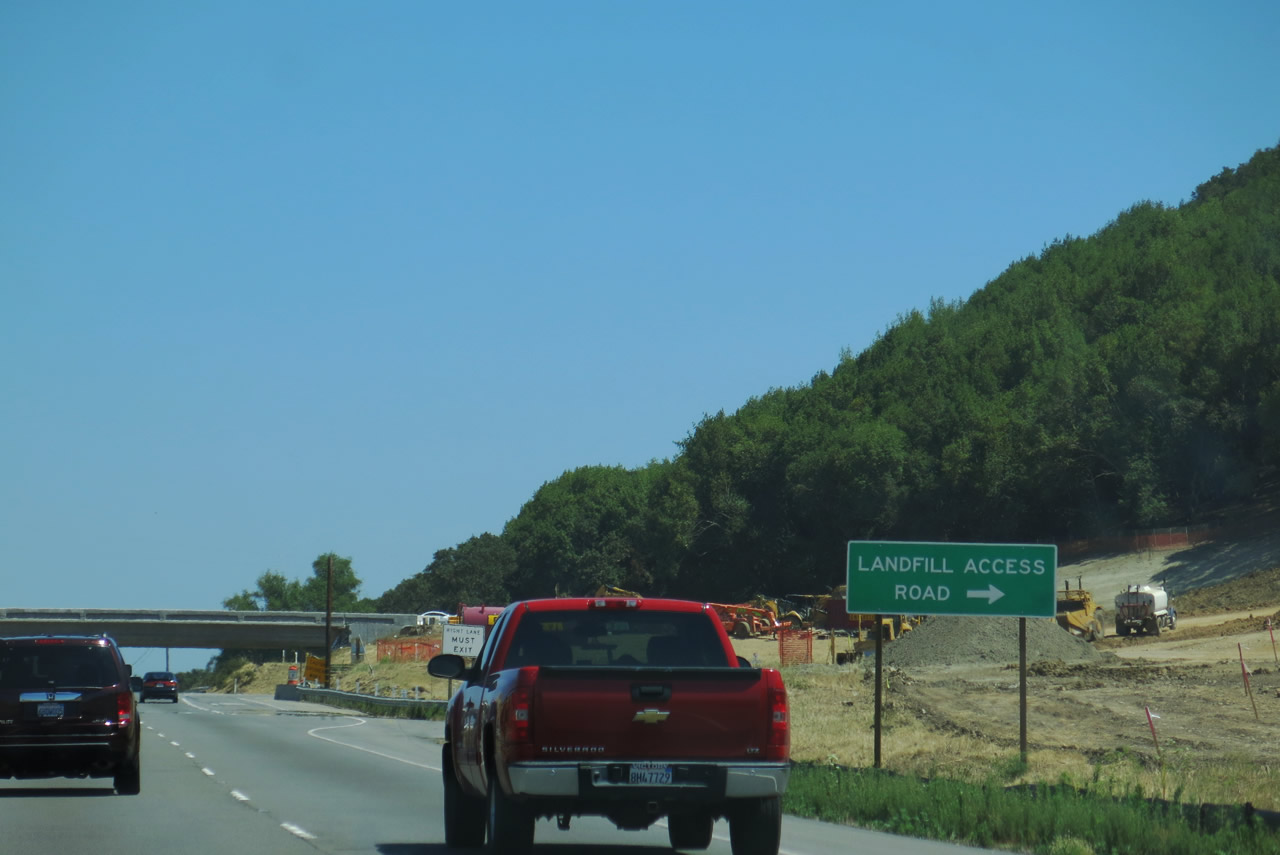
Southbound U.S. 101 meets the connecting ramp to Redwood Sanitary Landfill Access Road. Note the roadway widening underway on the overpass. Photo taken 07/06/13. |
|
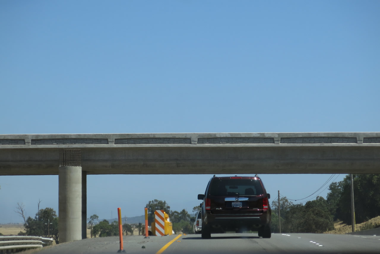
U.S. 101 passes under the Landfill Access Road bridge. Photo taken 07/06/13. |
|
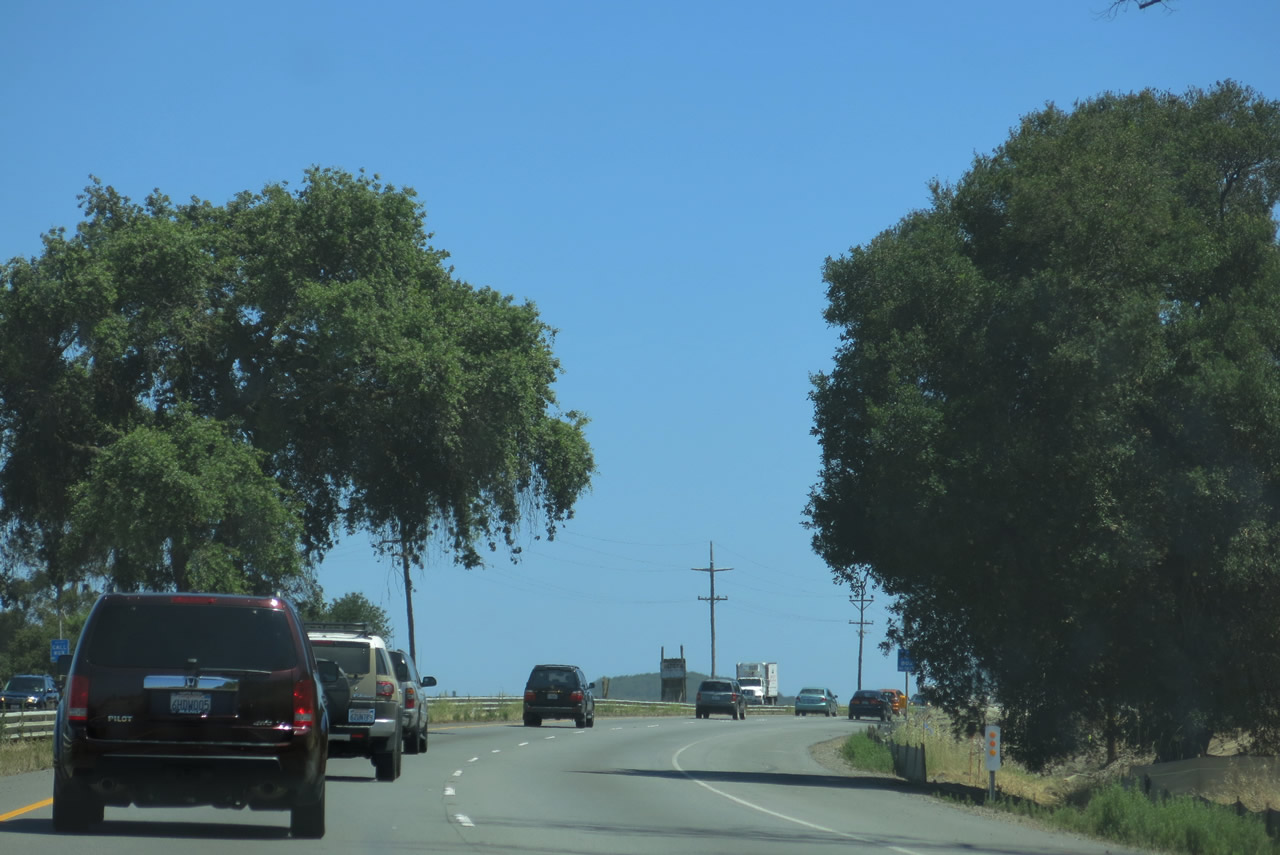
Traveling between Petaluma and Novato, U.S. 101 passes through a pastoral setting with golden grass and oak trees during the summer. Photo taken 07/06/13. |
|
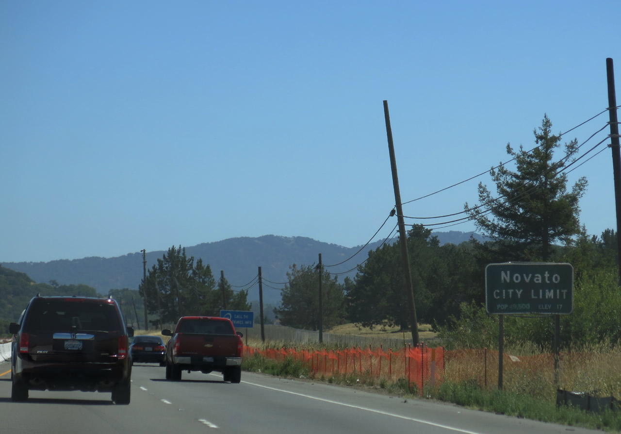
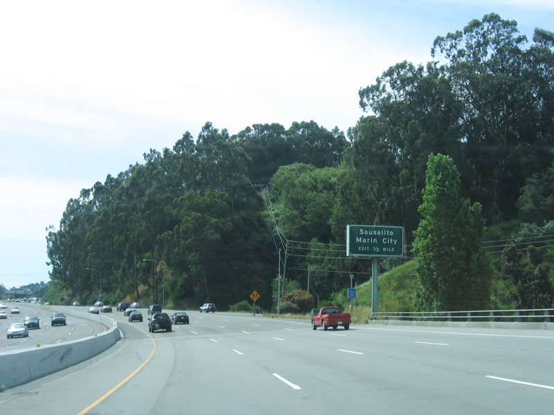
Southbound U.S. 101 (Redwood Highway) enters the city of Novato, which had a population of 51,904 as of the 2010 Census and was incorporated on January 20, 1960. Photo taken 07/06/13. |
|
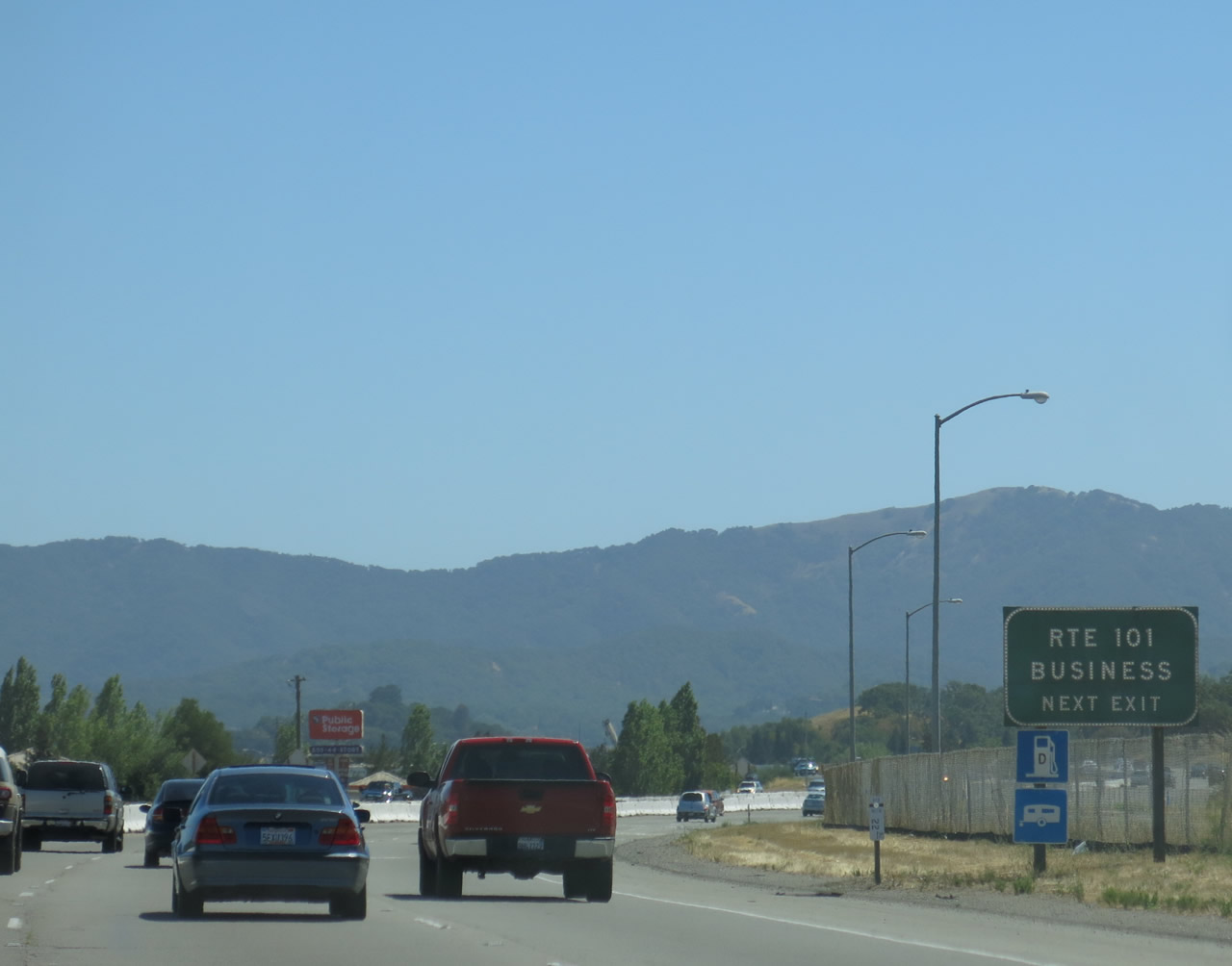
Resuming a freeway configuration, the next exit along southbound U.S. 101 (Redwood Highway) is Exit 463, U.S. 101 Business/Redwood Boulevard south to Novato, Atherton Avenue east, and San Marin Drive west. Photo taken 07/06/13. |
|
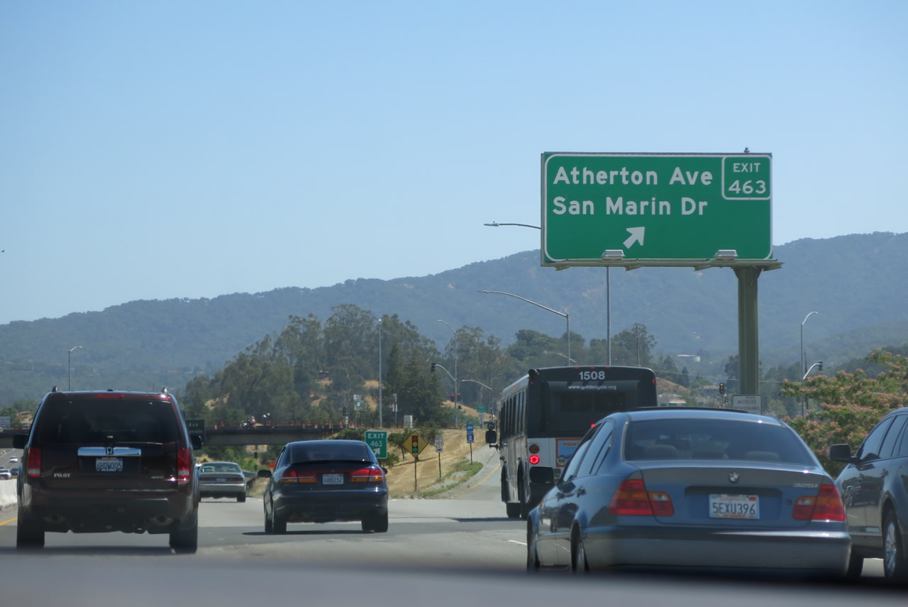
Southbound U.S. 101 (Redwood Highway) reaches Exit 463, U.S. 101 Business/Redwood Boulevard south to Novato, Atherton Avenue east, and San Marin Drive west. Photo taken 07/06/13. |
|
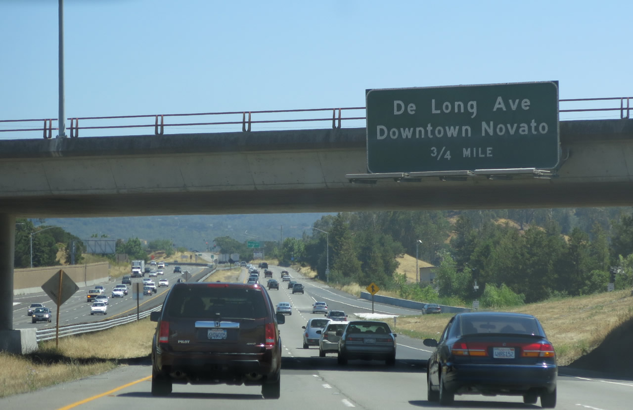
The next exit along U.S. 101 (Redwood Highway) south is Exit 462B, DeLong Avenue to downtown Novato (0.75 mile). Photo taken 07/06/13. |
|
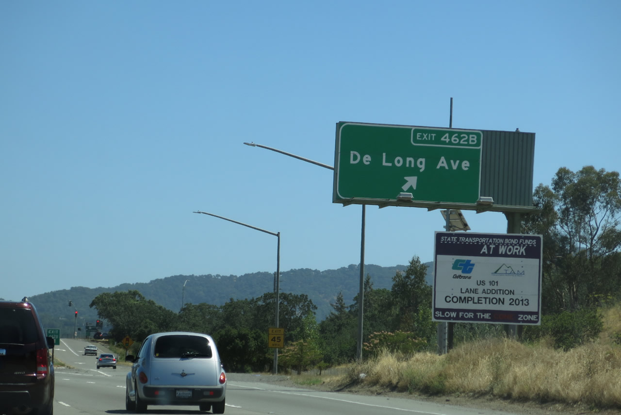
Southbound U.S. 101 (Redwood Highway) meets Exit 462B, DeLong Avenue to downtown Novato. Photo taken 07/06/13. |
|
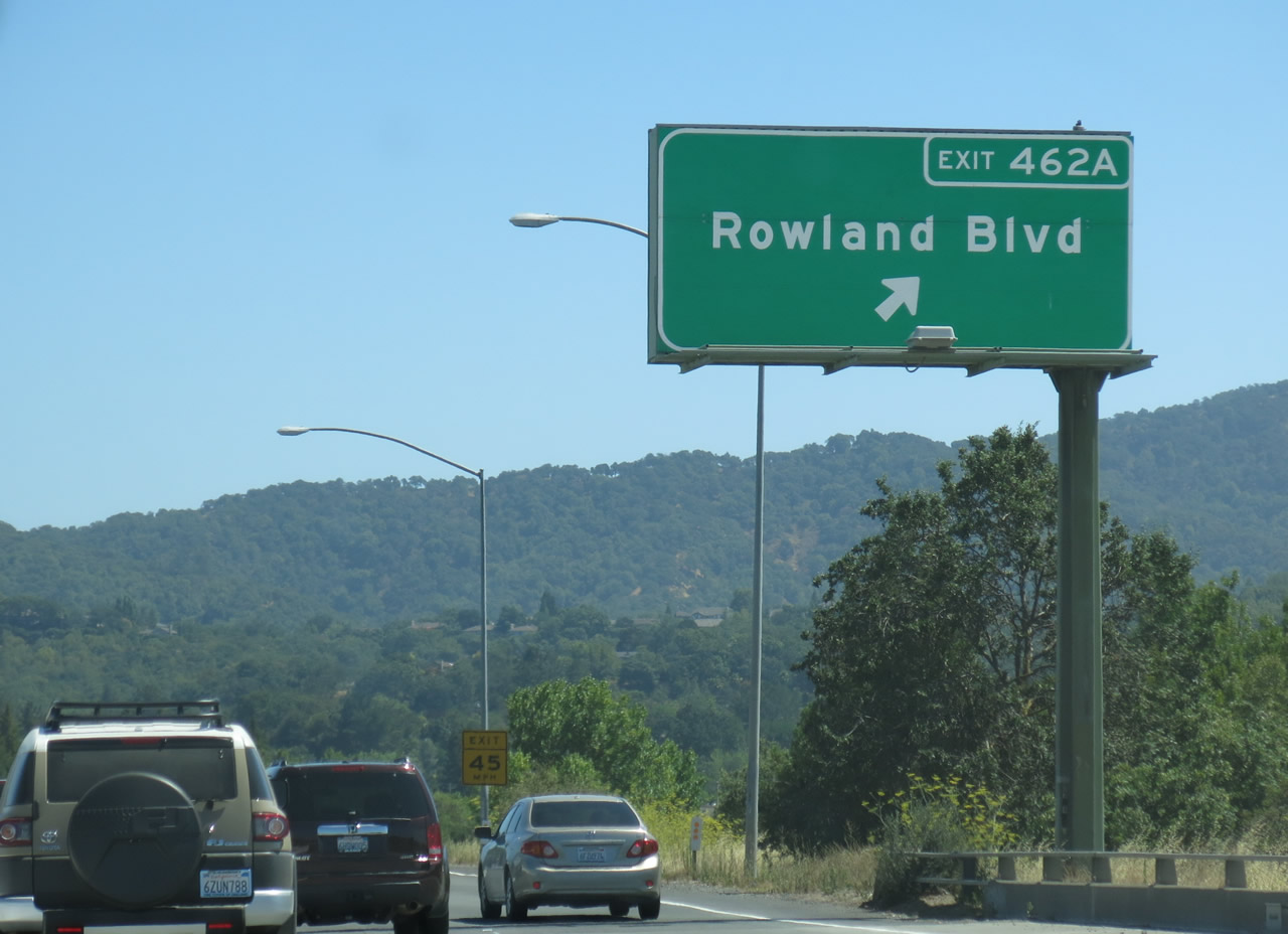
Soon thereafter, U.S. 101 (Redwood Highway) south approaches and meets Exit 462A, U.S. 101 Business/Rowland Boulevard. This is the third and final Novato interchange. Photo taken 07/06/13. |
|
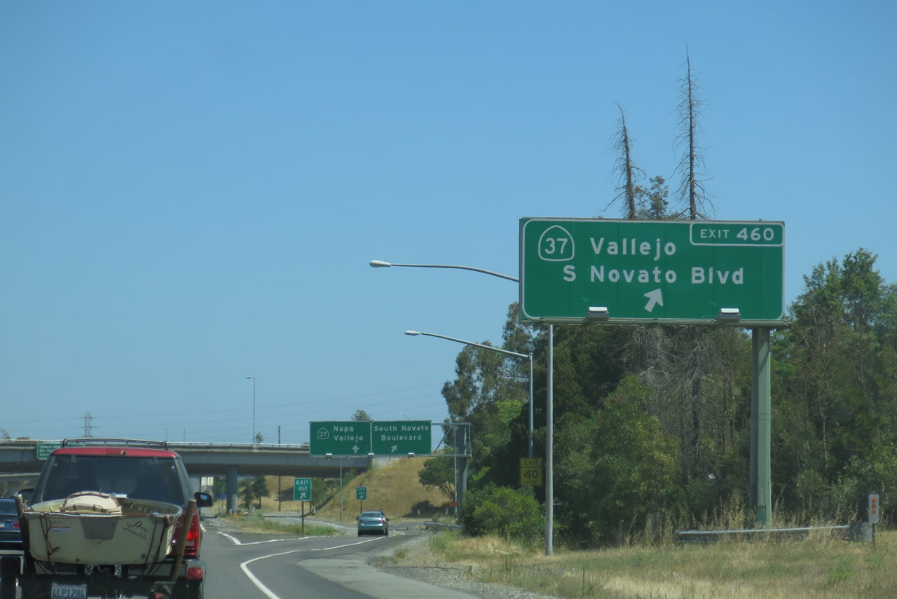
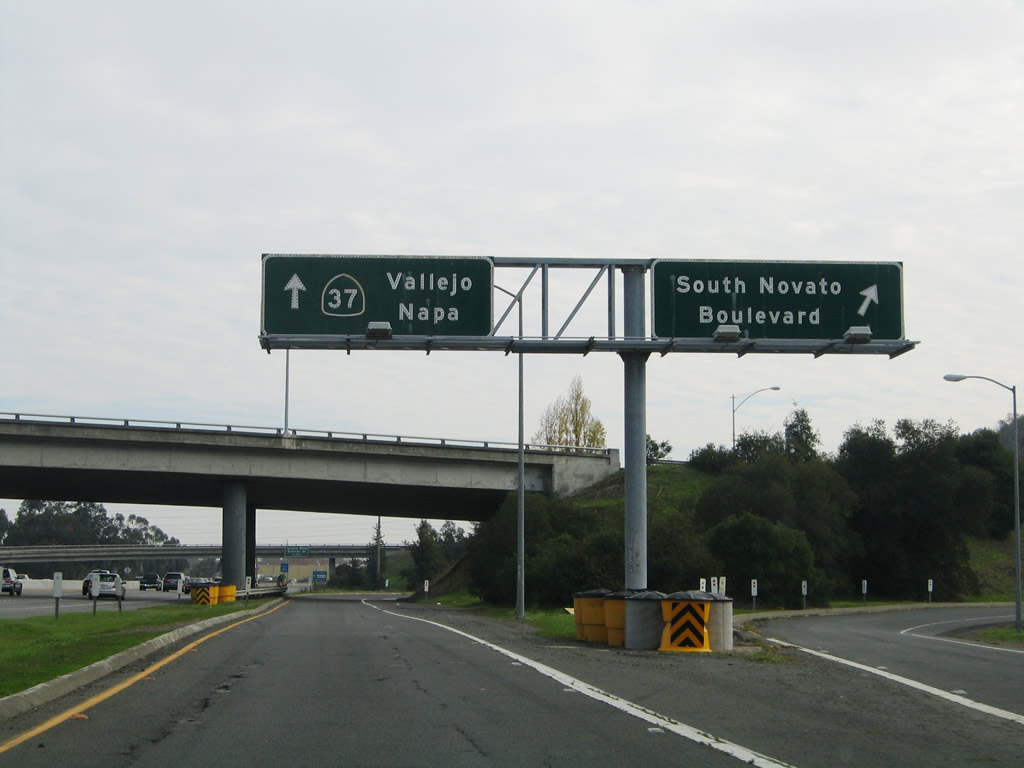
The next exit along U.S. 101 (Redwood Highway) south is Exit 460, California 37 (0.75 mile). California 37 is well-traveled as the most direct and best route between U.S. 101 and Interstate 80 in Vallejo. Photo taken 07/06/13. |
|
|
Southbound U.S. 101 (Redwood Highway) meets Exit 460, California 37, a major east-west corridor across the north end of the San Francisco Bay. Prior to installation of a median barrier along its two-lane segment, California 37 was well known for the bloody outcomes of passing attempts that have gone awry. Nearly daily accidents between speeding cars on this flat stretch of narrow, two to four-lane highway help bolstered its nickname as "Blood Alley." Someday this highway may be upgraded to multi-lane freeway, but such an endeavor would be expensive and controversial due to the numerous acres of wetlands it passes on its way across the top of San Pablo Bay. Photos taken 07/06/13 and 11/26/04. |
|
|
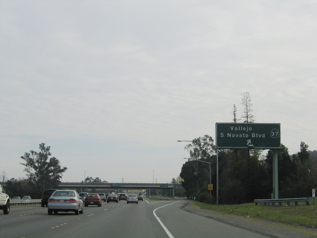
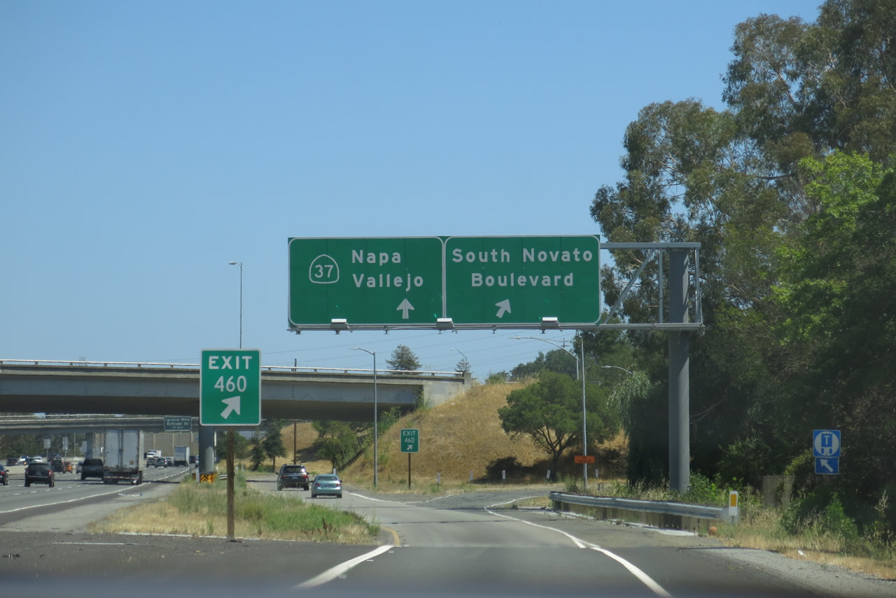
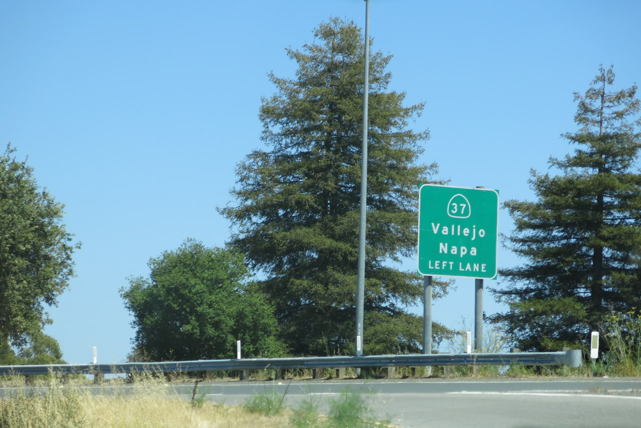
Now on the off-ramp for Exit 460, this ramp carries southbound traffic to the exit for eastbound California 37 and northbound South Novato Boulevard. Signs were replaced between 2004 and 2013, and in the process, another set of original porcelain-enamel overhead signs was removed. Photos taken 07/06/13 and 11/26/04. |
|
|
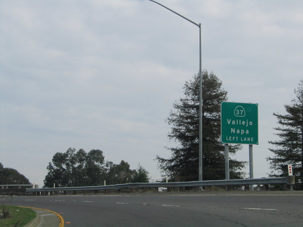
Use California 37 east to Vallejo (Interstate 80) and Napa (via California 29 north). The ramp widens to two lanes. Photos taken 07/06/13 and 11/26/04. |
|
|
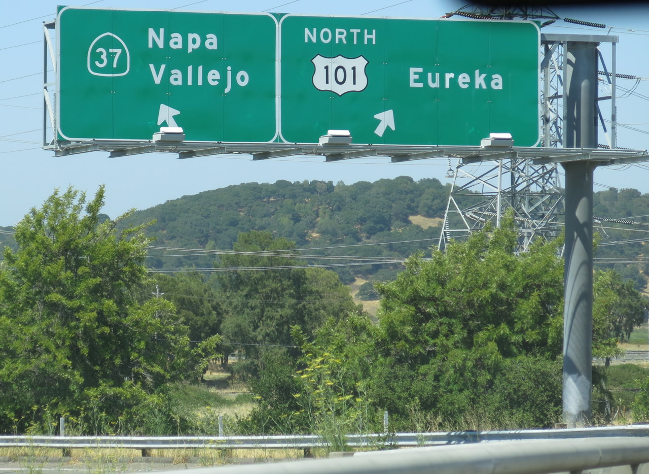
The off-ramp again splits here, with the left lane connecting to California 37 east and the right lane connecting to U.S. 101 north to Santa Rosa and Eureka. Photos taken 07/06/13 and 11/26/04. |
|
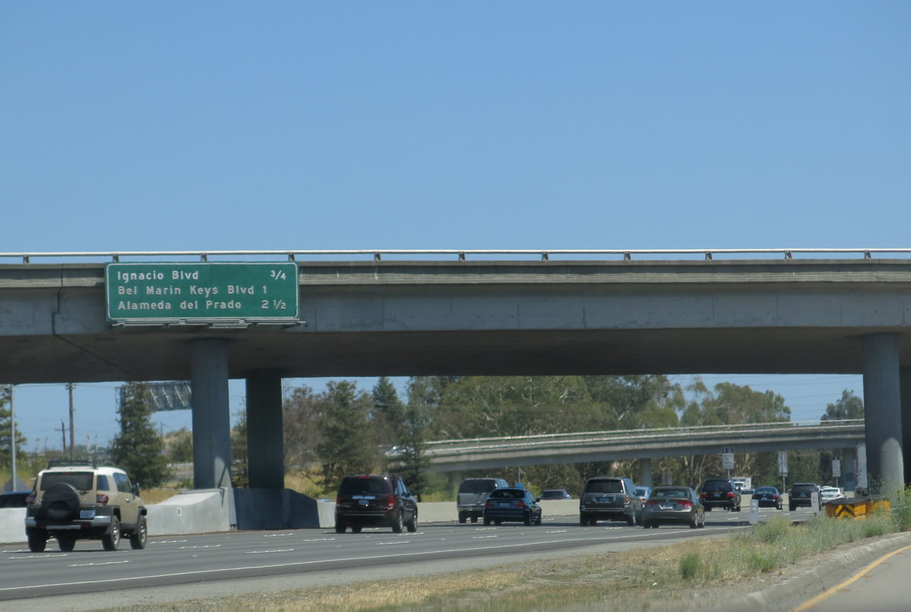
Back on the mainline, this mileage sign provides the distance to the next three exits along southbound U.S. 101: Exit 459B, Ignacio Boulevard and Entrada Drive; Exit 459A, Bel Martin Keys Boulevard and Hamilton Field; and Exit 458, Alameda del Prado. Photo taken 07/06/13. |
|
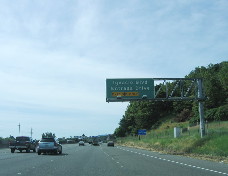
The next exit along southbound is Exit 459, Ignacio Boulevard and Entrada Drive, one-half mile. Ignacio Boulevard travels west toward Marin Country Club. U.S. 101 (Redwood Highway) leaves Novato and approaches San Rafael after passing through unincorporated Marinwood. Photo taken 05/25/06. |
|
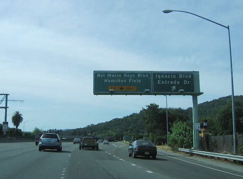
Southbound U.S. 101 (Redwood Highway) reaches Exit 459B, Ignacio Boulevard and Entrada Drive and approaches Exit 459A, Bel Martin Keys Boulevard and Hamilton Field. Exit 459A is a loop ramp onto northbound Bel Martin Keys Boulevard. The single ramp serves both connections. Photo taken 05/25/06. |
|
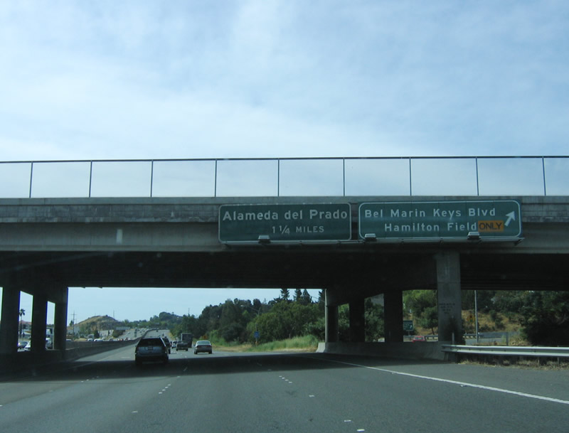
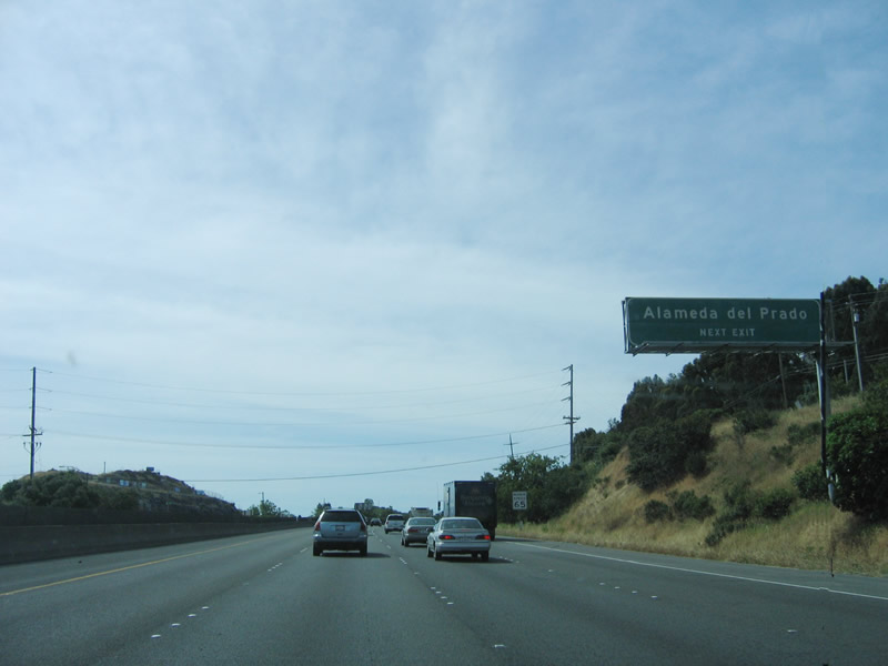
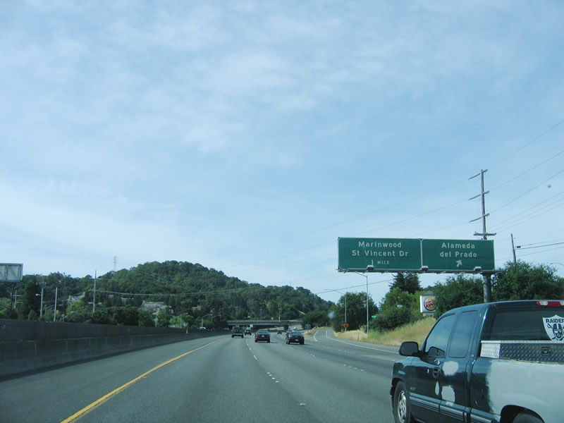
The next exit along southbound U.S. 101 (Redwood Highway) is Exit 458, Alameda del Prado (the right lane is exit only). The next exit is Exit 457, St. Vincent Drive and Marinwood. Photo taken 05/25/06. |
|
Alameda del Prado is a frontage road that parallels U.S. 101 to the west of the freeway. Photo taken 05/25/06. |
|
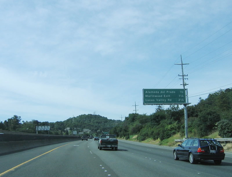
This mileage sign provides the distance to Exit 458, Alameda del Prado; Exit 457, St. Vincent Drive and Miller Creek Road to Marinwood; and Exit 456, Lucas Valley Road. Photo taken 05/25/06. |
|
Southbound U.S. 101 (Redwood Highway) reaches Exit 458, Alameda del Prado. Photo taken 05/25/06. |
|
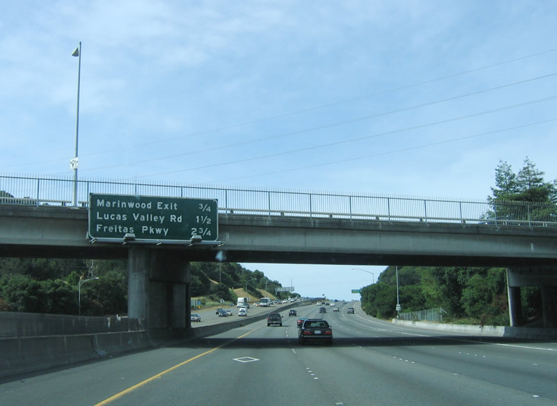
This porcelain-enamel mileage sign provides the distance to the next three exits: Exit 457, St. Vincent Drive and Miller Creek Road; Exit 456, Lucas Valley Road; and Exit 455, Freitas Parkway. Photo taken 05/25/06. |
|
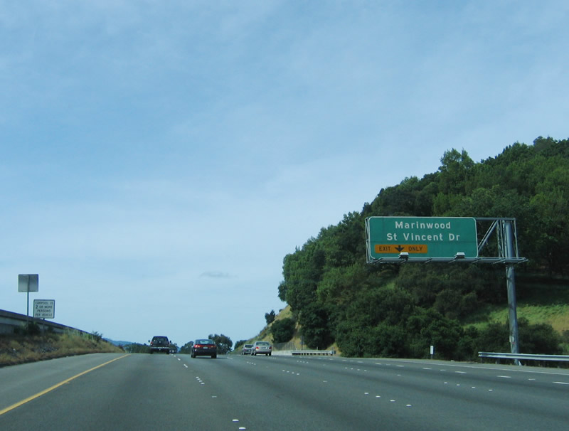
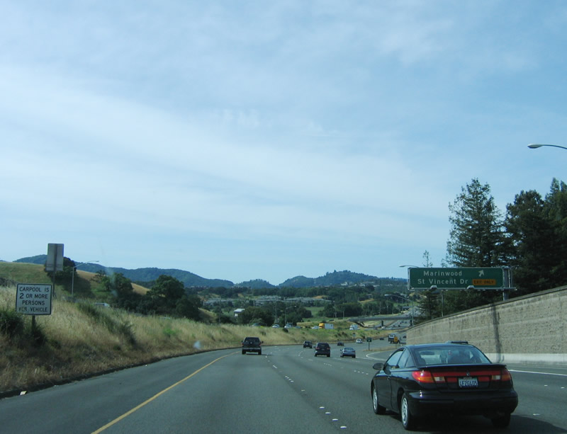
The next exit along southbound is Exit 457, St. Vincent Drive, Miller Creek Road, and Marinwood. Like most of Marin County, Marinwood is home to variety of homes that are among the most expensive in the country. The following interchange will be Exit 456, Lucas Valley Road. Photo taken 11/28/03. |
|
Southbound U.S. 101 (Redwood Highway) reaches Exit 457, Miller Creek Road and St. Vincent Drive (exit only right lane). Photo taken 05/25/06. |
|
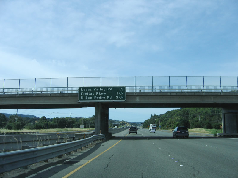
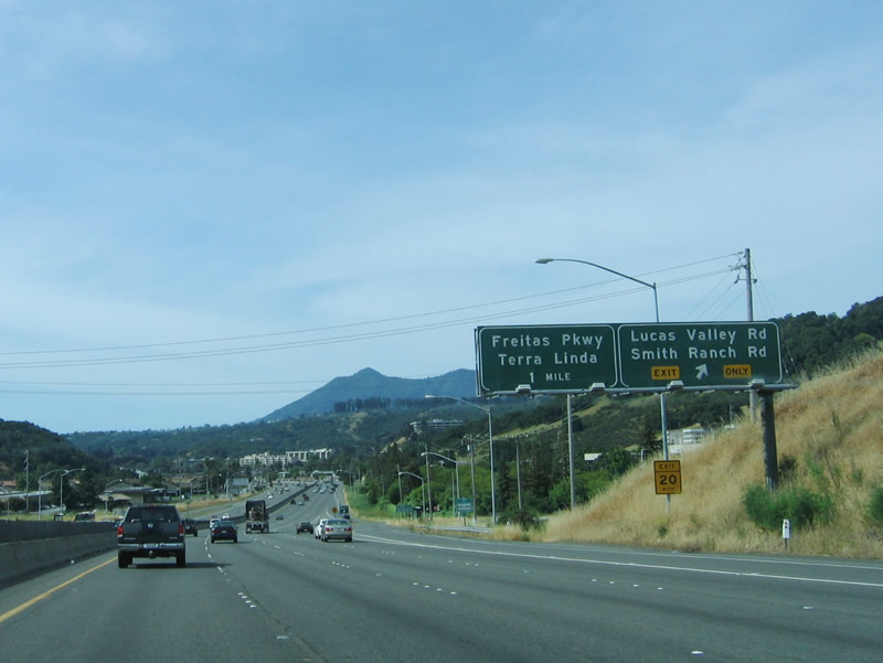
The next three exits along southbound U.S. 101 are: Exit 456, Lucas Valley Road; Exit 455, Freitas Parkway; and Exit 454B, North San Pedro Road. Photo taken 05/25/06. |
|
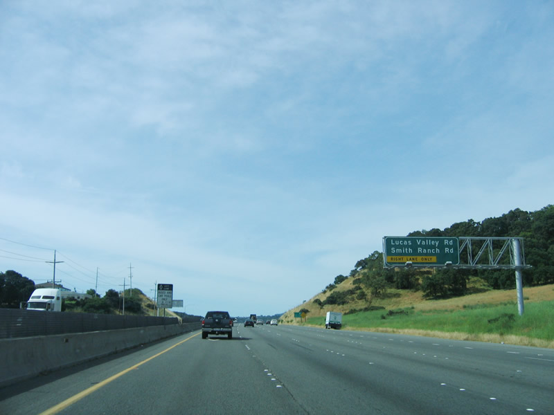
Only the right lane can be used for the connection to Lucas Valley Road and Smith Valley Road (Exit 456). Photo taken 05/25/06. |
|
Southbound U.S. 101 (Redwood Highway) meets Exit 456, Lucas Valley Road. Notably, Lucas Valley Road marks the city limits with San Rafael, the seat of Marin County. San Rafael was incorporated on February 18, 1874, and is home to 57,713 people as of the 2010 Census. Lucas Valley Road travels west into Lucas Valley, which lives up to its name as one of its most notable residents is the creator of Star Wars, George Lucas. His home, known as Skywalker Ranch, is located on the north side of Lucas Valley Road several miles west of this interchange. Photo taken 05/25/06. |
|
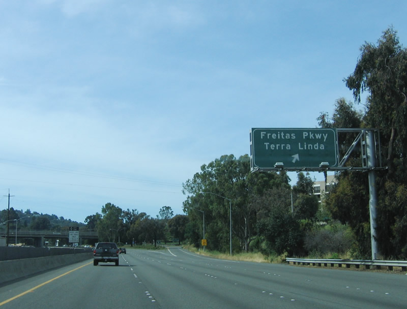
Leaving the Lucas Valley Road interchange, southbound U.S. 101 next meets Exit 455, Freitas Parkway, in the north San Rafael community of Terra Linda. Photo taken 05/25/06. |
|
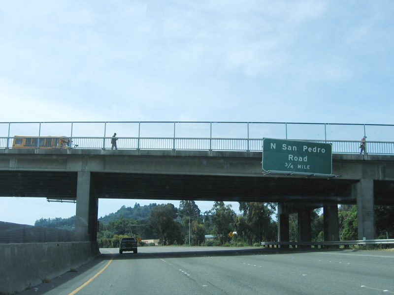
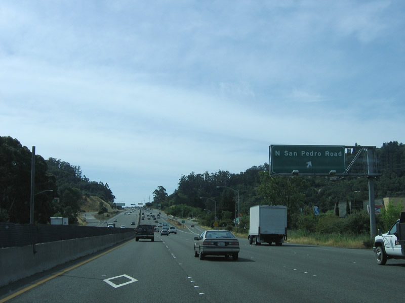
The next exit along southbound U.S. 101 is Exit 454B, North San Pedro Road. Photo taken 05/25/06. |
|
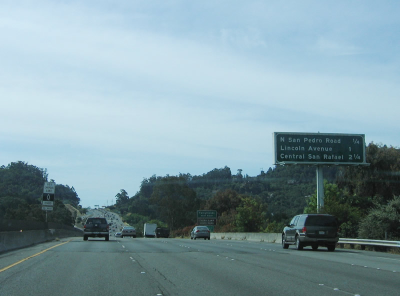
This mileage sign provides the distance to the next three exits: Exit 454B, North San Pedro Road; Exit 454A, Lincoln Avenue; and Exit 452, Mission Avenue/Central San Rafael. Photo taken 05/25/06. |
|
Southbound U.S. 101 reaches Exit 454B, North San Pedro Road. The left lane is a high occupancy vehicle (diamond) lane, and there is little or no left shoulder along this stretch of U.S. 101. Photo taken 05/25/06. |
|
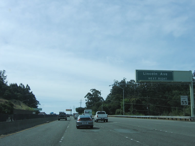
The next exit along southbound is Exit 454A, Lincoln Avenue. Photo taken 05/25/06. |
|
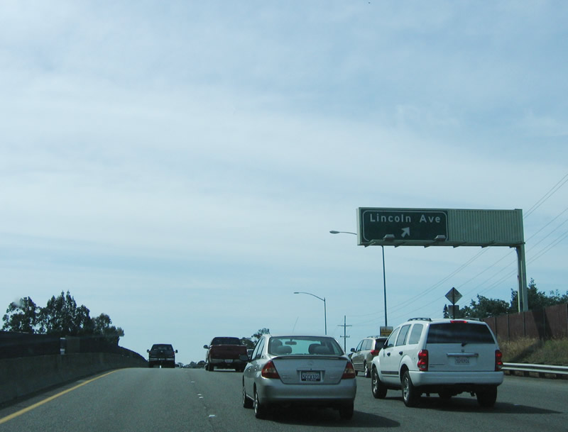
Southbound U.S. 101 meets Exit 454A, Lincoln Avenue. Photo taken 05/25/06. |
|
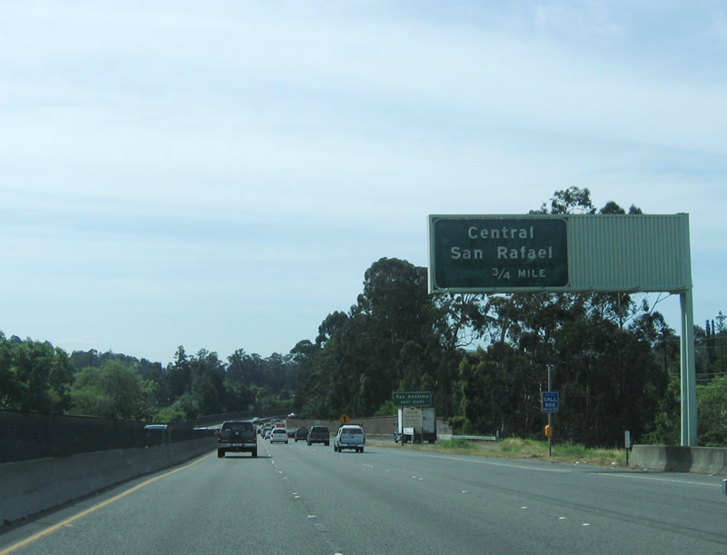
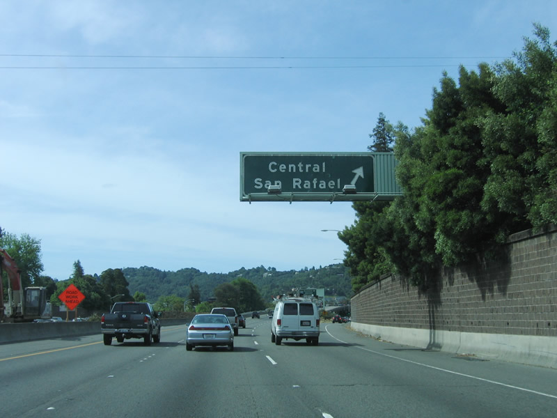
The next exit is Exit 452, Mission Avenue to central San Rafael. Photo taken 05/25/06. |
|
Mileage sign approaching Exit 452, Mission Avenue to central San Rafael; Exit 451B, Interstate 580 east; and Exit 451A, Anderson Drive. Photo taken 05/25/06. |
|
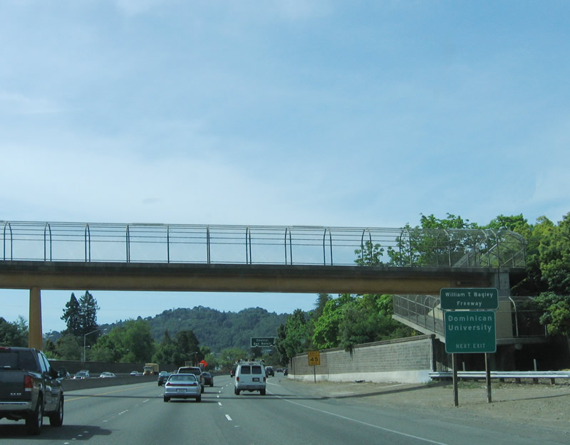
This section of U.S. 101 (Redwood Highway) is known as the William T. Bagley Freeway. Use Exit 452 to Dominion University. Photo taken 05/25/06. |
|
Southbound U.S. 101 reaches Exit 452, Mission Avenue to central San Rafael. Photo taken 05/25/06. |
|
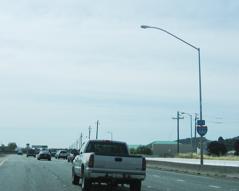
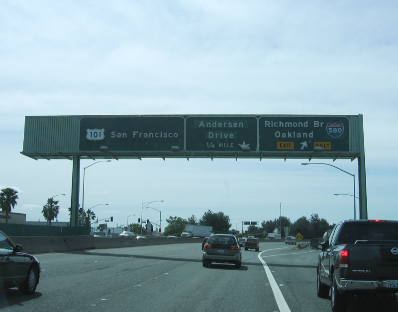
Southbound U.S. 101 approaches Exit 451B, Interstate 580 east. In the many miles since its northern terminus, this is the first meeting of U.S. 101 with an Interstate route since its inception at the Washington state capital of Olympia near the top of Interstate 5. Photo taken 05/25/06. |
|
On some older sections of freeway in California, standalone shields announcing impending junctions (such as this one on southbound) are common in addition to overhead and roadside guide signs. What's curious about this assembly is that it can't be older than the mid-1980s, since Interstate 580 has not been in Marin County all that long! It is possible that highway crews merely replaced the California 17 shields with Interstate 580 shields. Photo taken 05/25/06. |
|
The only Interstate highway in Marin County, Interstate 580 comes to its northwesterly terminus at the coming interchange, Exit 451B. Interstate 580 was part of California 17 until 1984, was briefly considered to be Interstate 180 for a year or two thereafter, and today is part of Interstate 580, a lengthy freeway that ties the North Bay and the North Coast with the East Bay and Central Valley. Photo taken 05/25/06. |
|
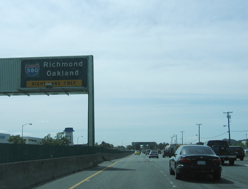
Southbound U.S. 101 (Redwood Highway) reaches Exit 451B, Interstate 580 east to Richmond, Oakland, Hayward, and Pleasanton-Dublin, with connections to Tracy, Stockton, Sonora, Fresno, and Los Angeles. Yes, it is faster to take Interstate 580 and Interstate 5 rather than U.S. 101 to Los Angeles. This interchange has been reconstructed since 2006, and guide signs have been replaced, but we currently have no pictures of the updated signs and widened (two-lane) exit ramp that is now in place. The next exit is Exit 451A, Anderson Drive. Photo taken 05/25/06. |
|
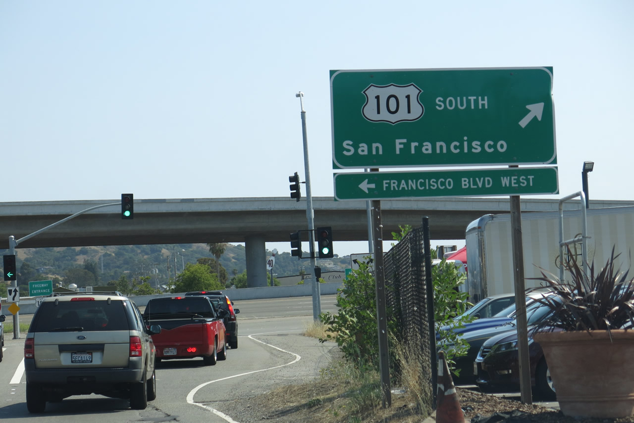
After the Interstate 580 split, southbound U.S. 101 immediately connects to Exit 451A, Anderson Drive and Francisco Drive West (not shown in this series of pictures). Shortly after the Exit 451A off-ramp, we see this view after the on-ramp from Francisco Drive West to U.S. 101 south. Photo taken 07/02/13. |
|
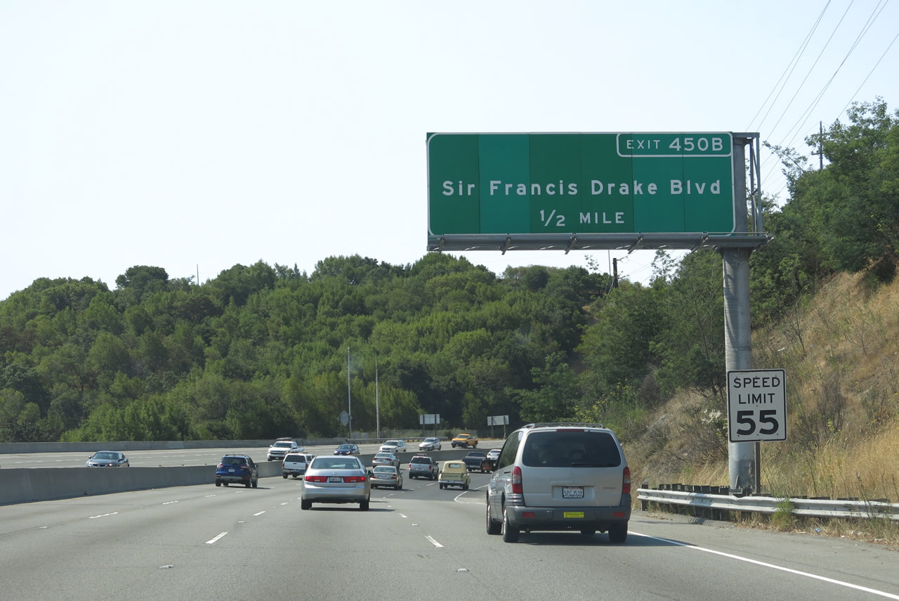
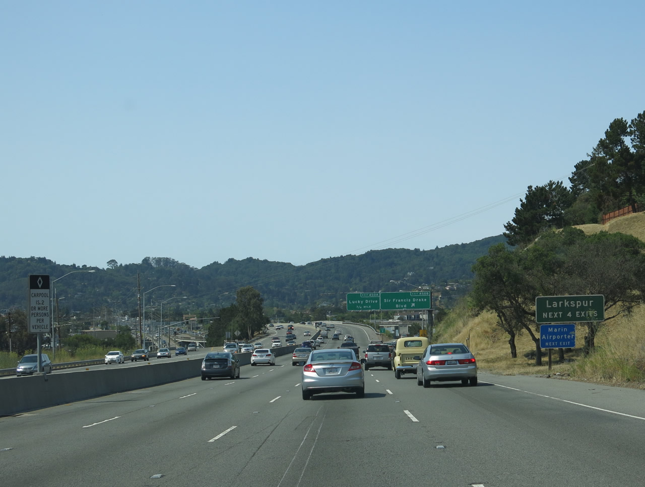
The following exit along southbound U.S. 101 is Exit 450B, Sir Francis Drake Boulevard, which travels northwest to Kentfield, San Anselmo, Fairfax, and Point Reyes. Kentfield is an unincorporated community with a population of 6,485 as of the 2010 census. Much of Marin County has small towns and cities, along with unincorporated areas such as Kentfield. Photo taken 07/02/13. |
|
Use Sir Francis Drake Boulevard west to Kentfield, the town of San Anselmo (population 12,336 as of the 2010 Census and incorporated on April 9, 1907), and the town of Fairfax (population 7,441 as of the 2010 Census and incorporated on March 2, 1931). Sir Francis Drake Boulevard roughly follows the proposed state route 251 alignment northwest to the vicinity of Point Reyes; however, California 251 has not been adopted by the state. Photo taken 07/02/13. |
|
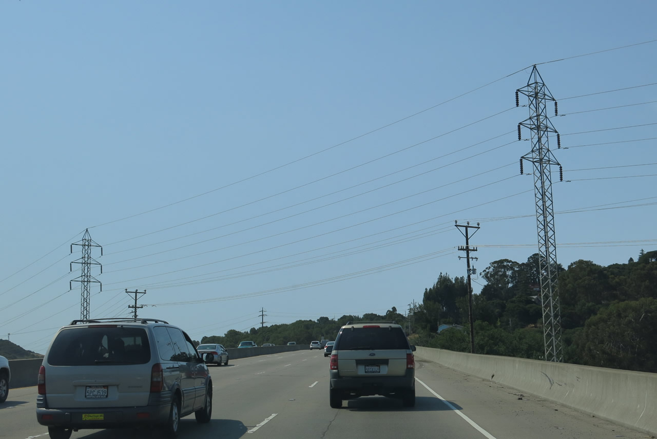
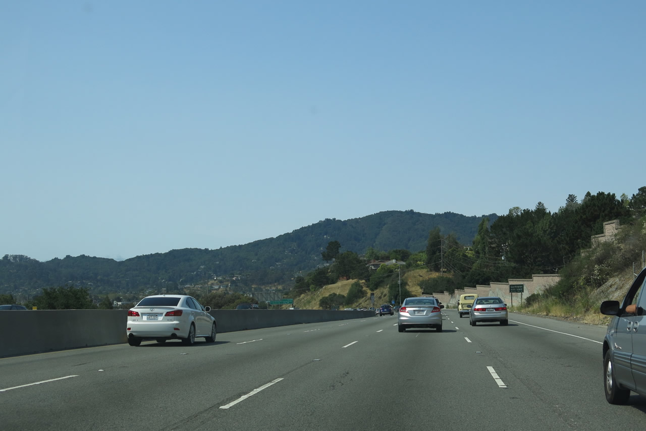
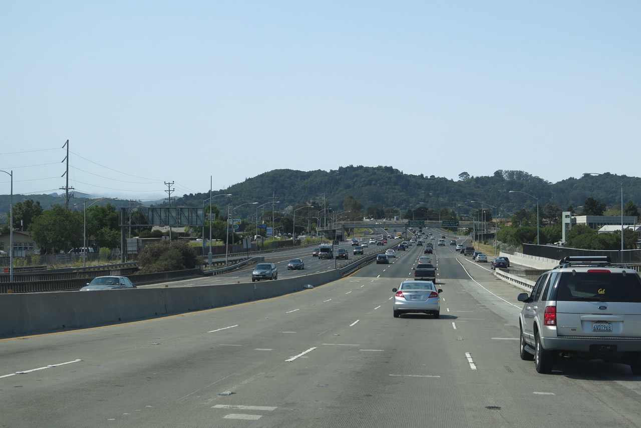
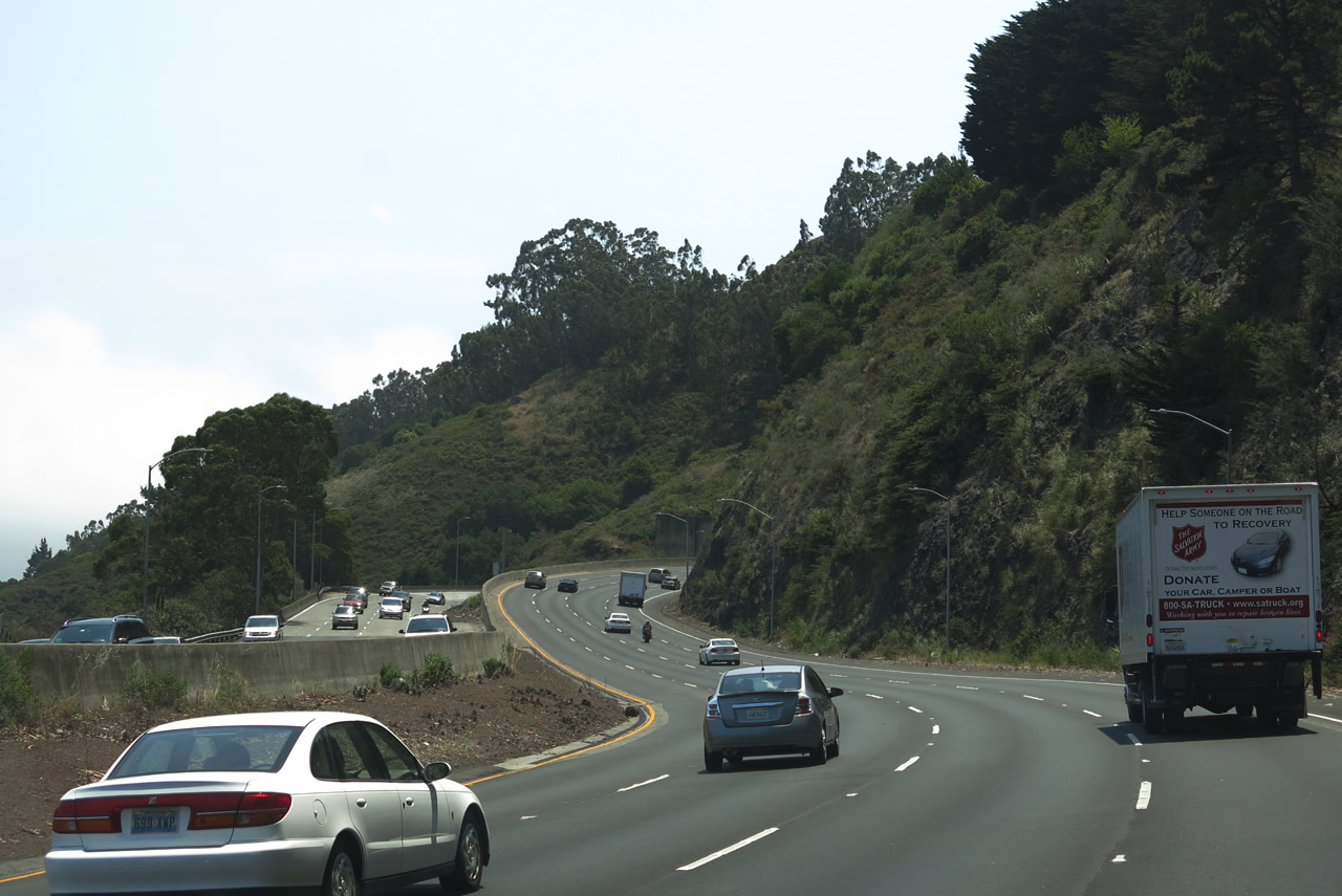
U.S. 101 has four southbound lanes as it passes through the built areas of eastern Marin County. Photo taken 07/02/13. |
|
Nearing the Sir Francis Drake Boulevard interchange, U.S. 101 enters the city of Larkspur (population 11,926 as of the 2010 Census and incorporated on March 1, 1908). The next four exits serve Larkspur. Photo taken 07/02/13. |
|
Southbound U.S. 101 (Redwood Highway) meets Exit 450B, Sir Francis Drake Boulevard west to Larkspur, Kentfield, San Anselmo, Fairfax, and Point Reyes. To the east is Larkspur Landing, a ferry terminal operated by Golden Gate Transit for trans-bay access to downtown San Francisco. Sir Francis Drake Boulevard continues east past the ferry terminal and connects to San Quentin and Interstate 580 near the western end of the Richmond-San Rafael Bridge. Photo taken 07/02/13. |
|
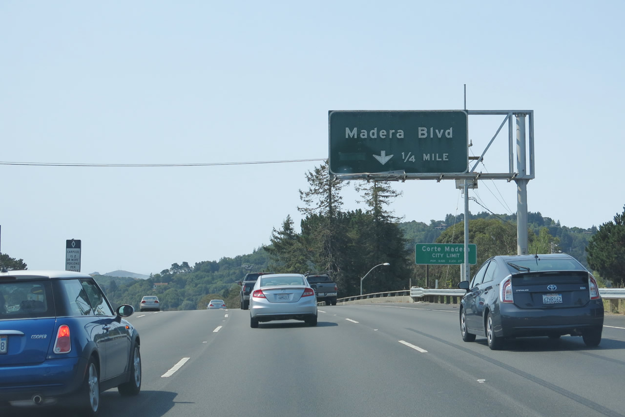
Southbound U.S. 101 reaches Exit 450A, Lucky Drive and Doherty Drive and enters the town of Corte Madera (population 9,253 as of the 2010 Census and incorporated on June 10, 1916). A mileage sign is also posted here, providing the distance to Exit 449B, Madera Boulevard and Exit 449A, Paradise Drive and Tamalpais Drive. Photo taken 07/02/13. |
|
The next exit along southbound U.S. 101 is Exit 449B, Madera Boulevard. Photo taken 07/02/13. |
|
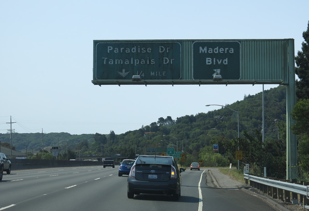
Southbound U.S. 101 reaches Exit 449B, Madera Boulevard. The next exit is Exit 449A, Paradise Drive and Tamalpais Drive. Photo taken 07/02/13. |
|
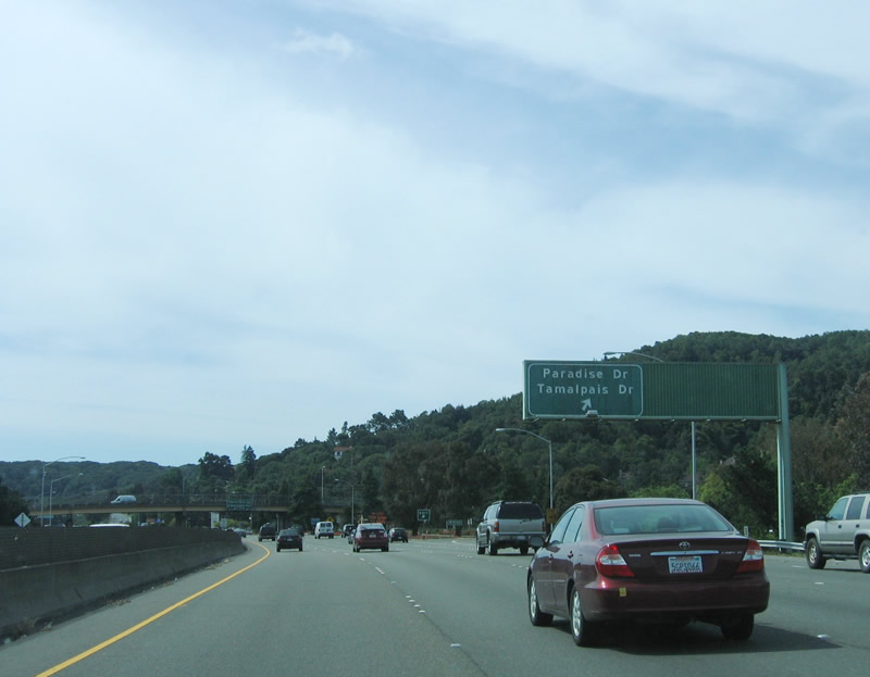
Immediately thereafter, southbound U.S. 101 meets Exit 449A, Paradise Drive and Tamalpais Drive. Photo taken 05/25/06. |
|
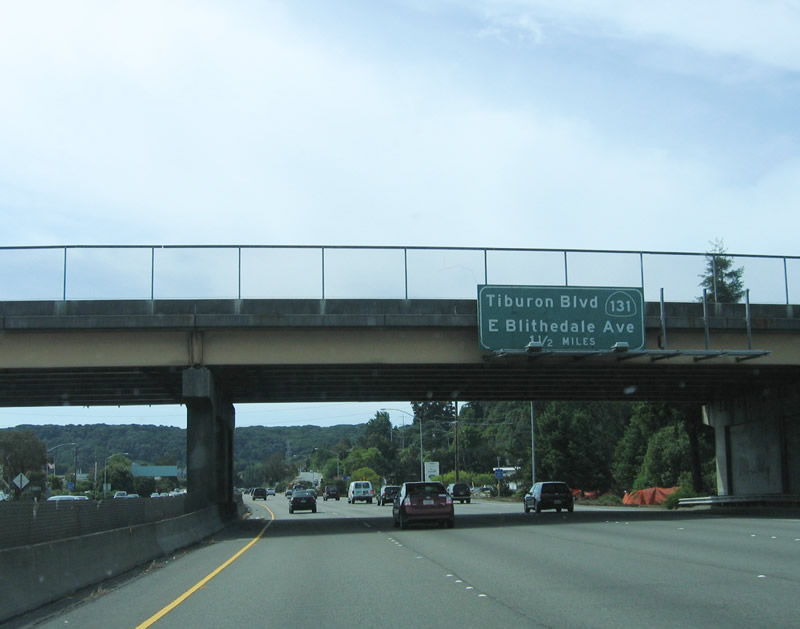
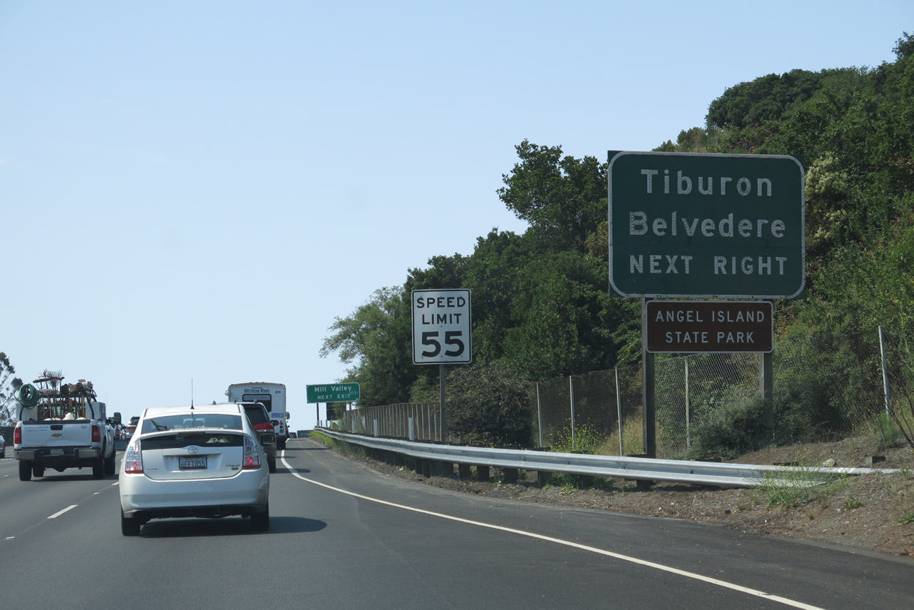
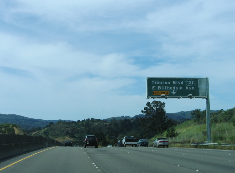
The next exit along southbound U.S. 101 is Exit 447, California 131/Tiburon Boulevard east to Tiburon and Belvedere and Blithedale Avenue west to Mill Valley. Photo taken 05/25/06. |
|
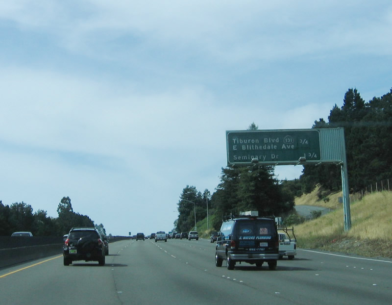
This mileage sign provides the distance to the next two exits: Exit 447, California 131/Tiburon Boulevard east and Blithedale Avenue west and Exit 446, Seminary Drive. Photo taken 05/25/06. |
|
A U.S. 101 south reassurance shield is posted shortly thereafter. Photo taken 07/02/13. |
|
Exit 447 (California 131/Tiburon Boulevard) serves the town of Tiburon (population 8,962 as of the 2010 Census and incorporated on June 23, 1964), city of Belvedere (population 2,068 of the 2010 Census and incorporated on December 24, 1896), and city of Mill Valley (population 13,903 as of the 2010 Census and incorporated on September 1, 1900). Photo taken 07/02/13. |
|
The right lane of southbound U.S. 101 becomes exit only for Exit 447, California 131/Tiburon Boulevard east and Blithedale Avenue west. Photo taken 05/25/06. |
|
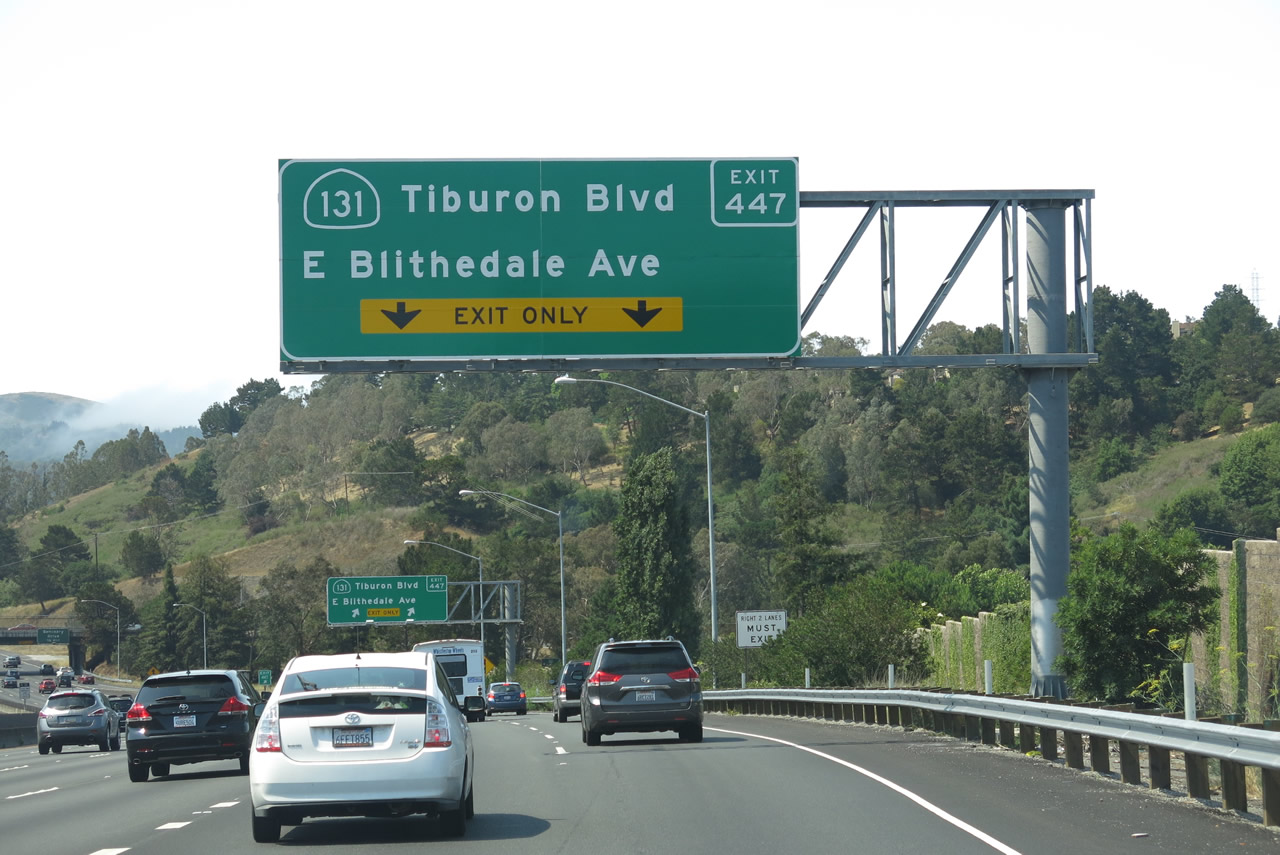
The right two lanes of U.S. 101 south connect to Exit 447 to California 131. Photo taken 07/02/13. |
|
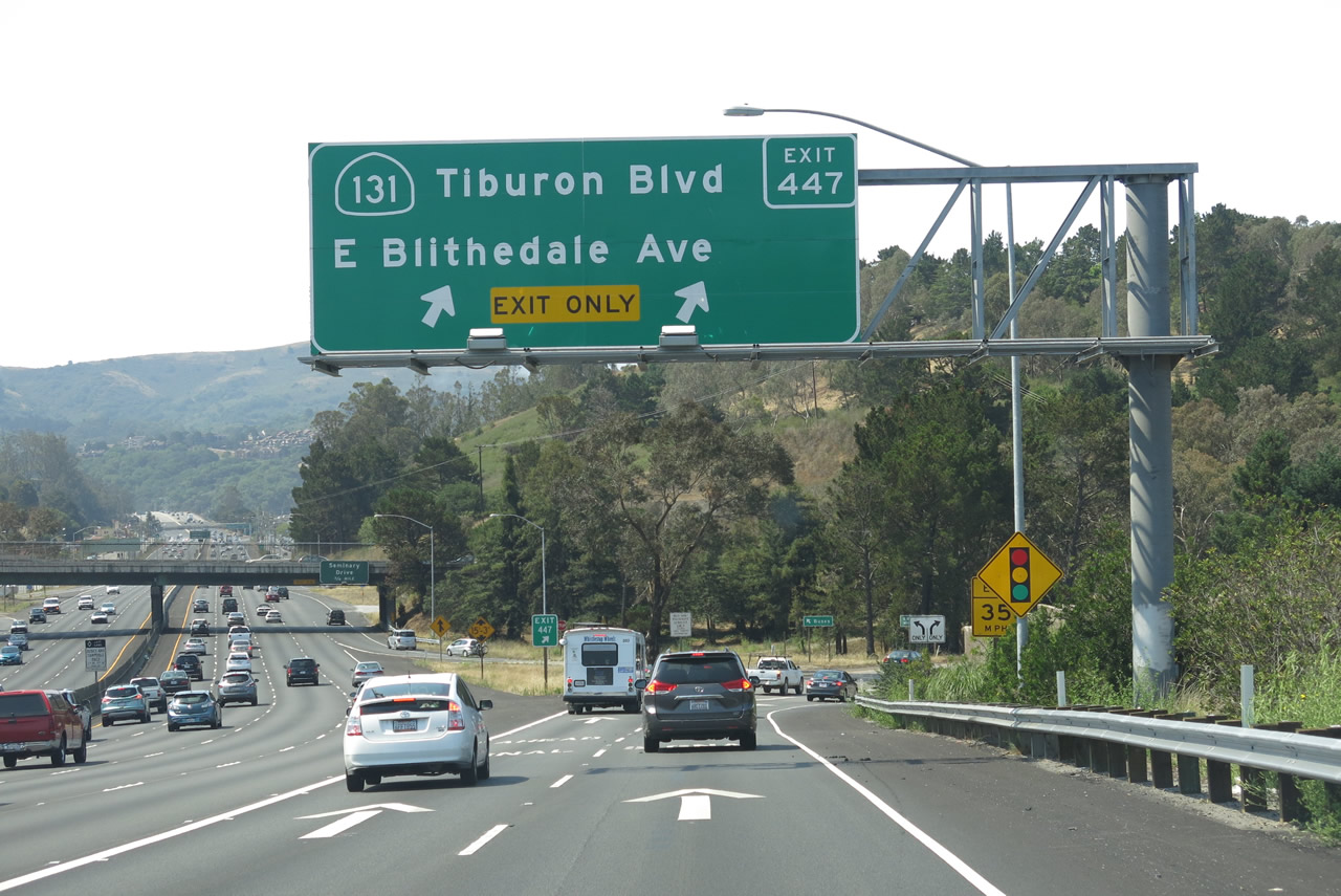
Southbound U.S. 101 (Redwood Highway) meets Exit 447, California 131/Tiburon Boulevard east to Tiburon and Belvedere and E. Blithedale Avenue west to the city of Mill Valley (population 13,903 as of the 2010 Census and incorporated on September 1, 1900). Photo taken 07/02/13. |
|
Upon exiting from U.S. 101 south, turn left onto California 131 east to Tiburon and Belvedere. Turn right onto East Blithedale Avenue for Mill Valley. Photo taken 07/02/13. |
|
Back on the mainline, the next two exits along southbound U.S. 101 are Exit 446B, Redwood Highway and Roadside Business and Exit 446A, Seminary Drive and Hamilton Drive. This overhead sign only advises of the Seminary Drive interchange. Photo taken 05/25/06. |
|
After the on-ramp from California 131, southbound U.S. 101 next approaches Exit 446B, Redwood Highway and Roadside Business. The right lane becomes exit only for Redwood Highway, which oddly is unsigned. This off-ramp connects to a frontage road that lines the western edge of the freeway. Photo taken 07/02/11. |
|
Southbound U.S. 101 meets Exit 446B, Redwood Highway (frontage road) to Roadside Business. Photo taken 07/02/11. |
|
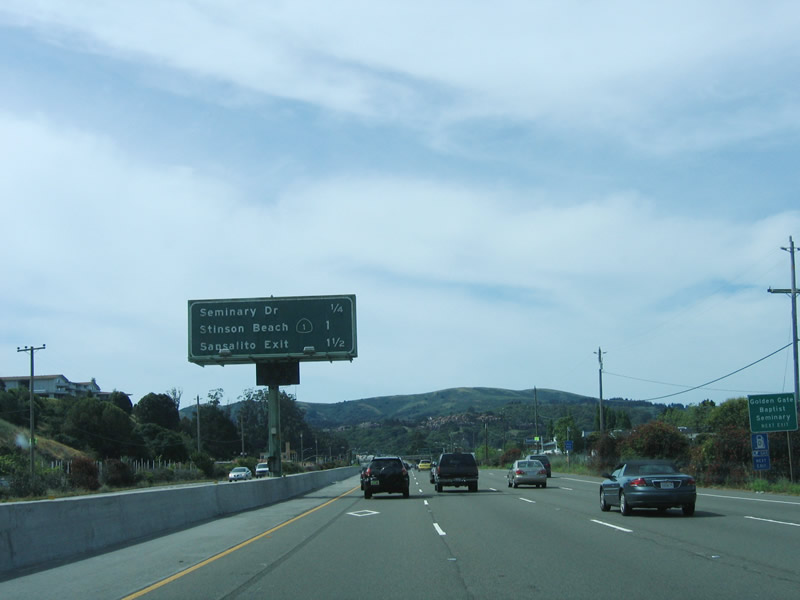
This mileage sign provides the distance to the next three exits: Exit 446A, Seminary Drive and Hamilton Drive; Exit 445B, California 1 north to Stinson Beach; and Exit 445A, Marin City and Sausalito. Photo taken 05/25/06. |
|
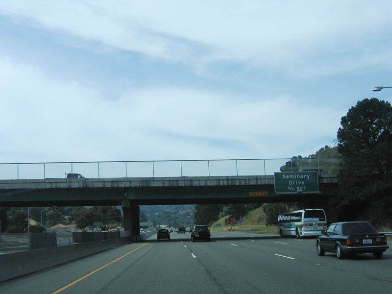
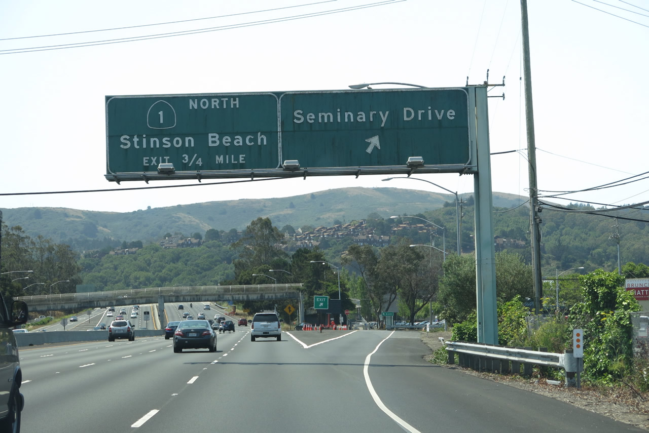
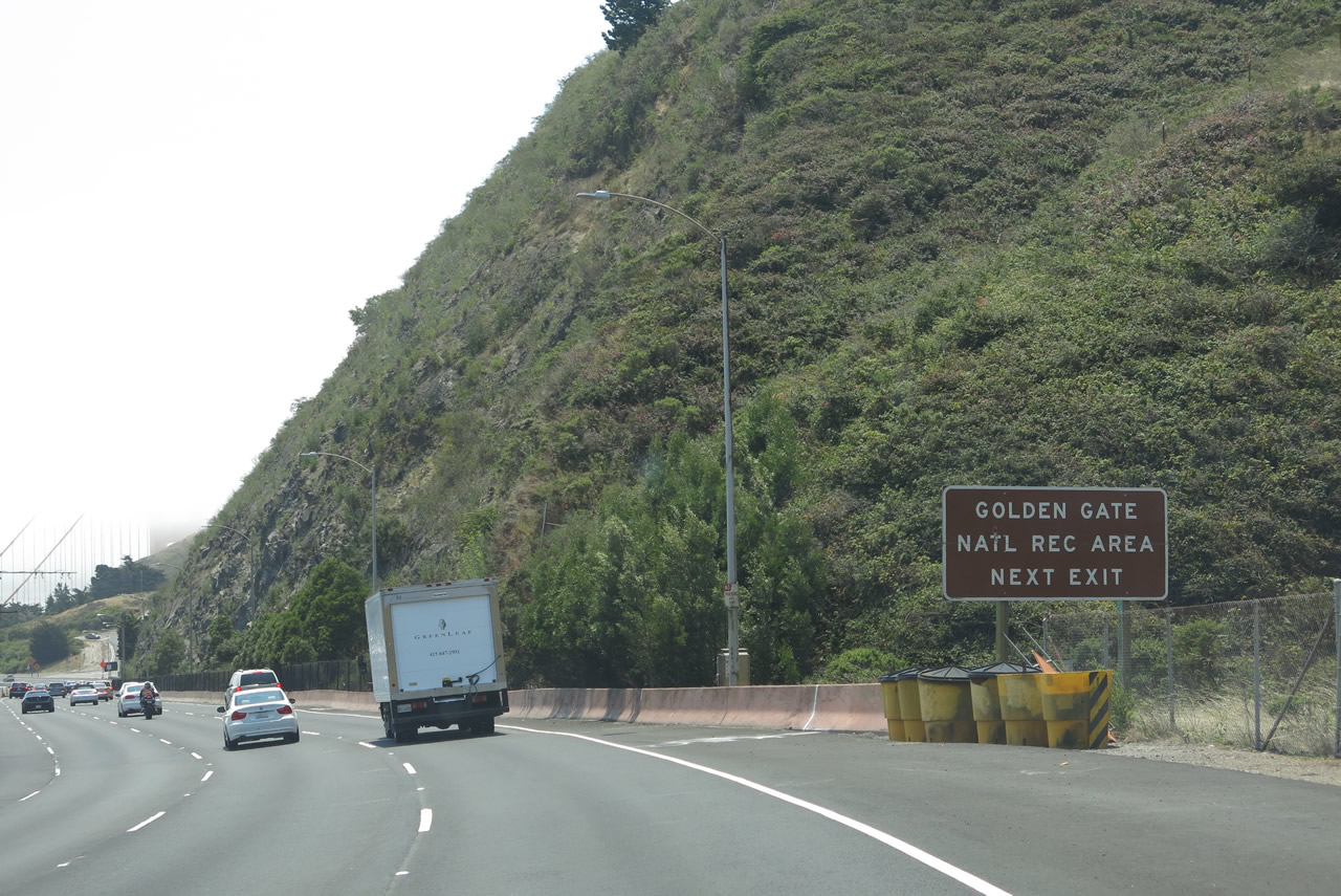
Southbound U.S. 101 reaches Exit 446A, Seminary Drive and Hamilton Drive. Use Seminary Drive east to the Golden Gate Baptist Theological Seminary. Hamilton Drive travels northwest into residential areas. The next exit is Exit 445B, California 1 north to Stinson Beach, Golden Gate National Recreation Area and Point Reyes National Seashore. Photo taken 07/02/13. |
|
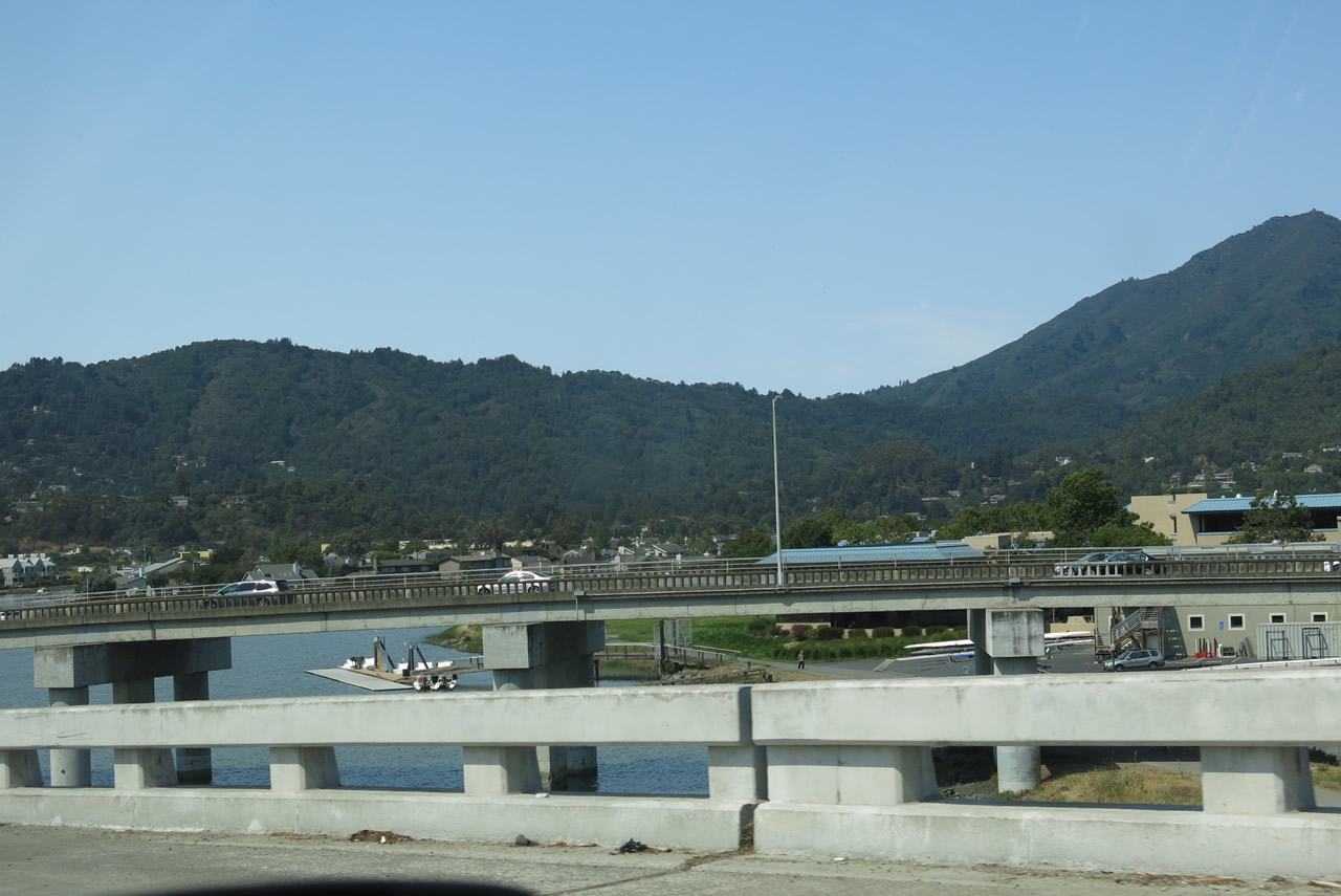
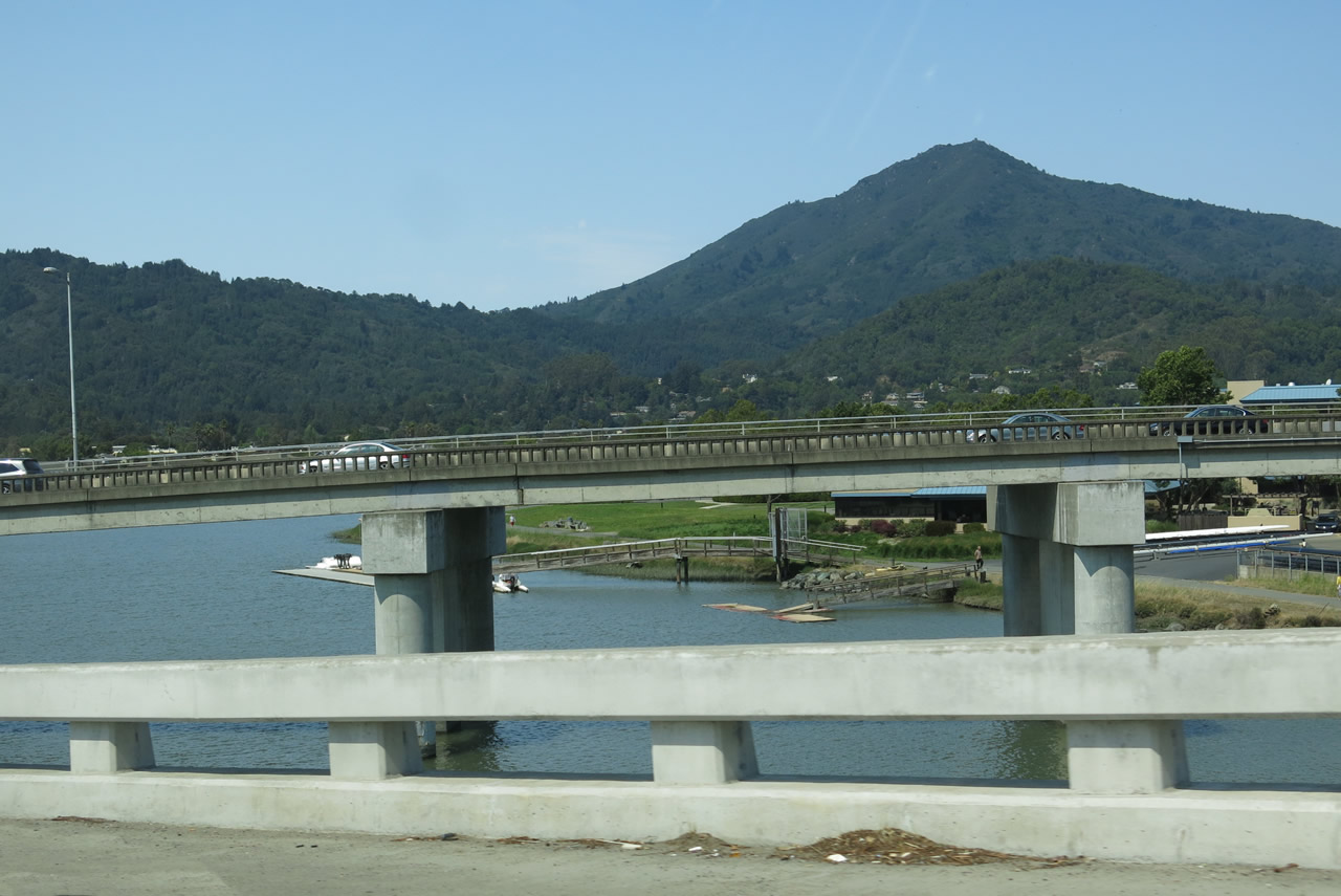
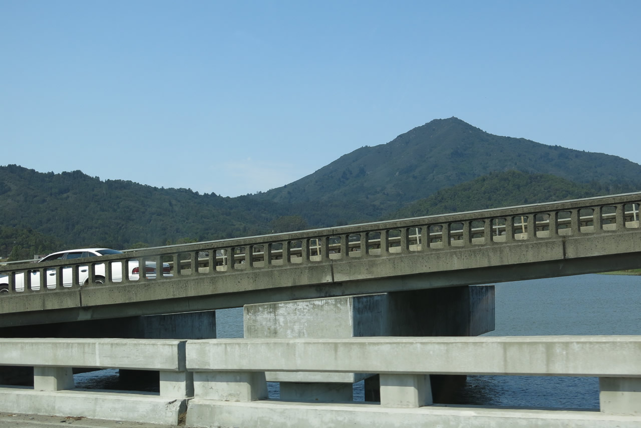
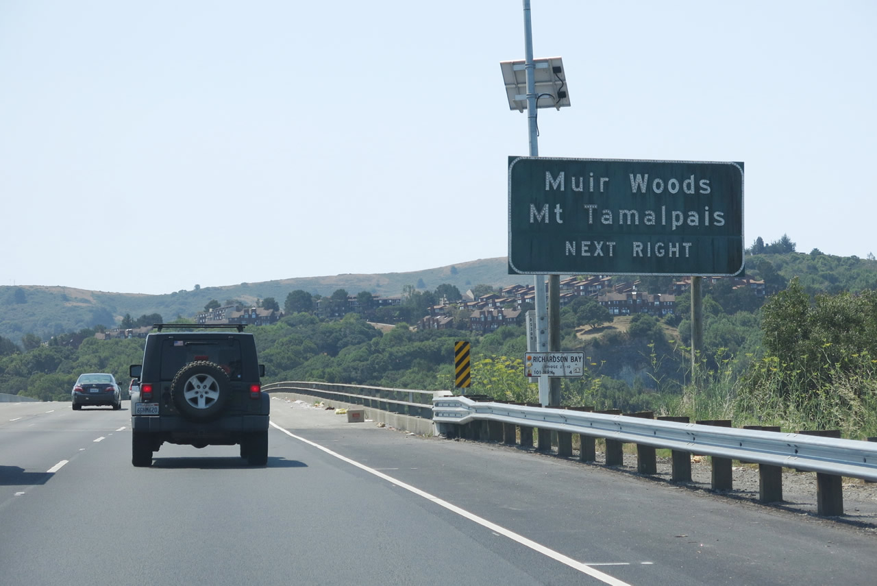
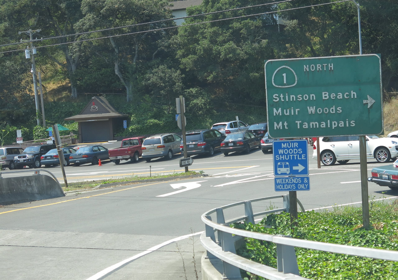
U.S. 101 crosses Richardson Bay between the Seminary Drive and California 1 interchanges. Use California 1 north to Stinson Beach, Muir Woods National Monument, and Mount Tamalpais State Park. On a clear day, all of the San Francisco Bay Area can be seen from the top of Mount Tamalpais. Photo taken 07/02/13. |
|
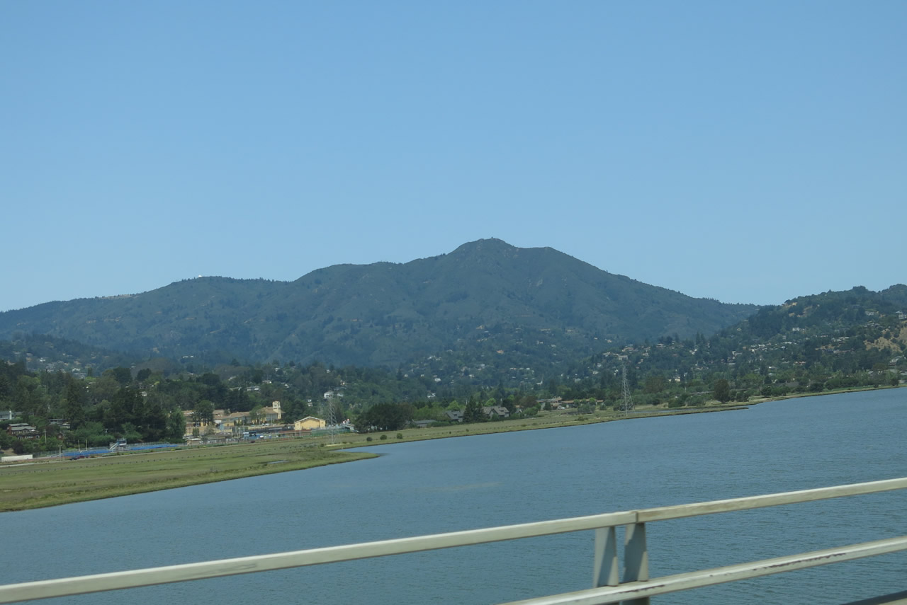
Mount Tamalpais rises above Richardson Bay as U.S. 101 proceeds south toward Sausalito. Photo taken 07/02/13. |
|
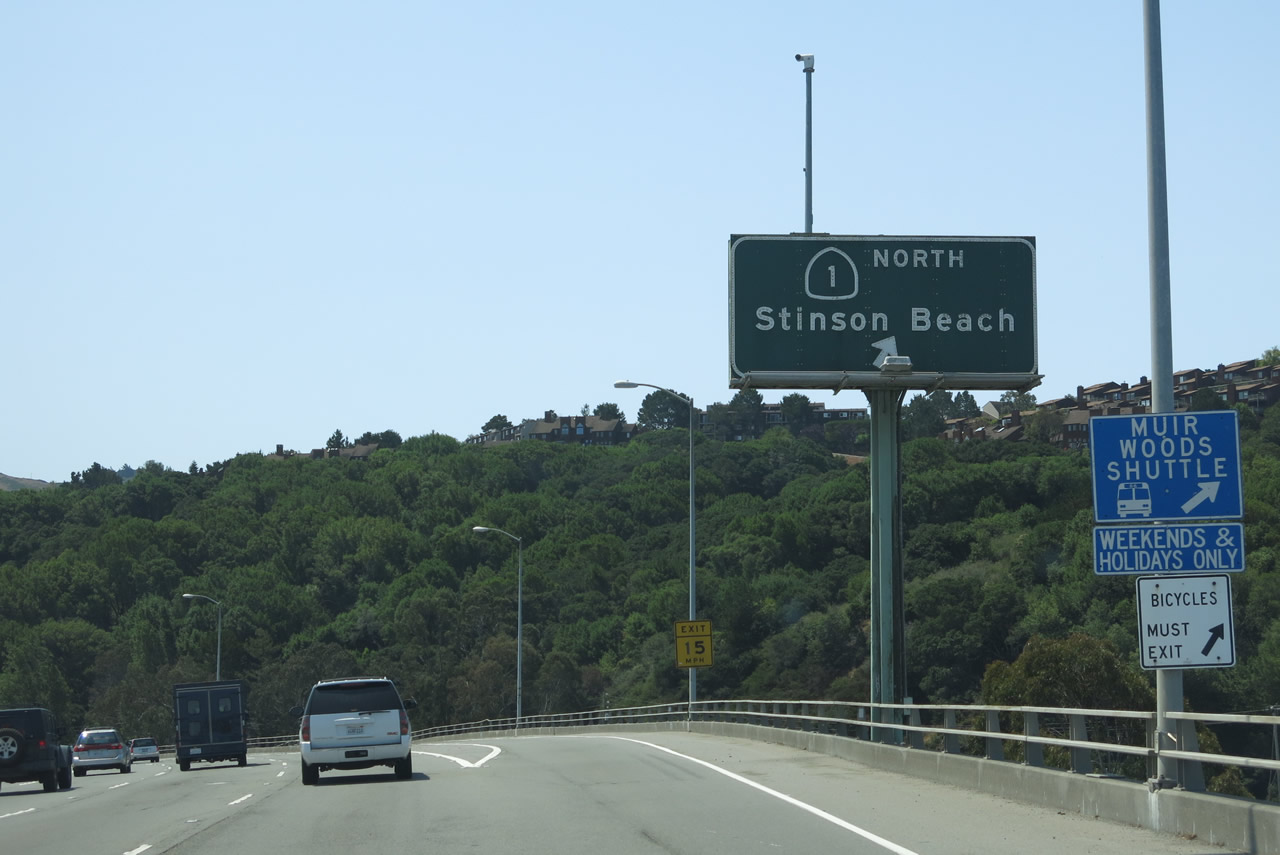
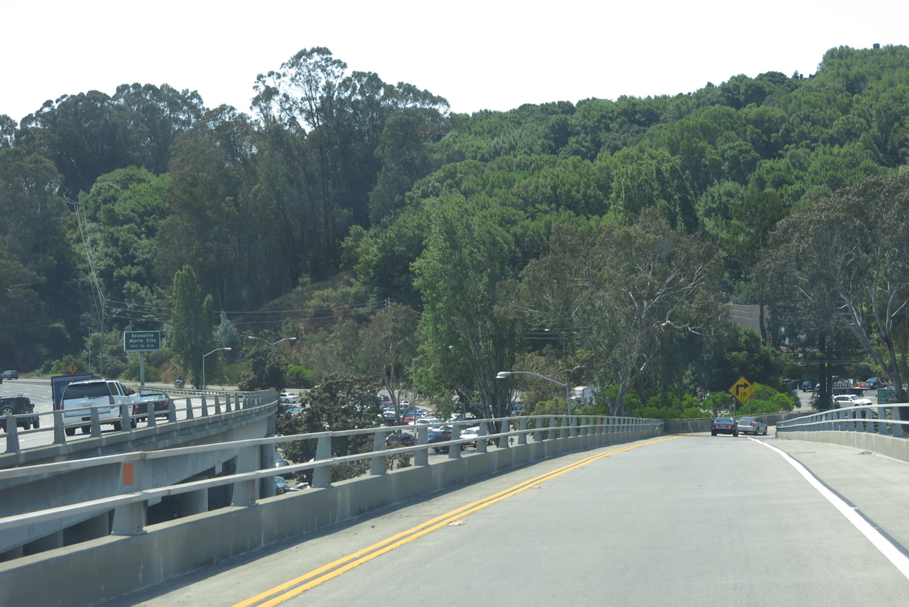
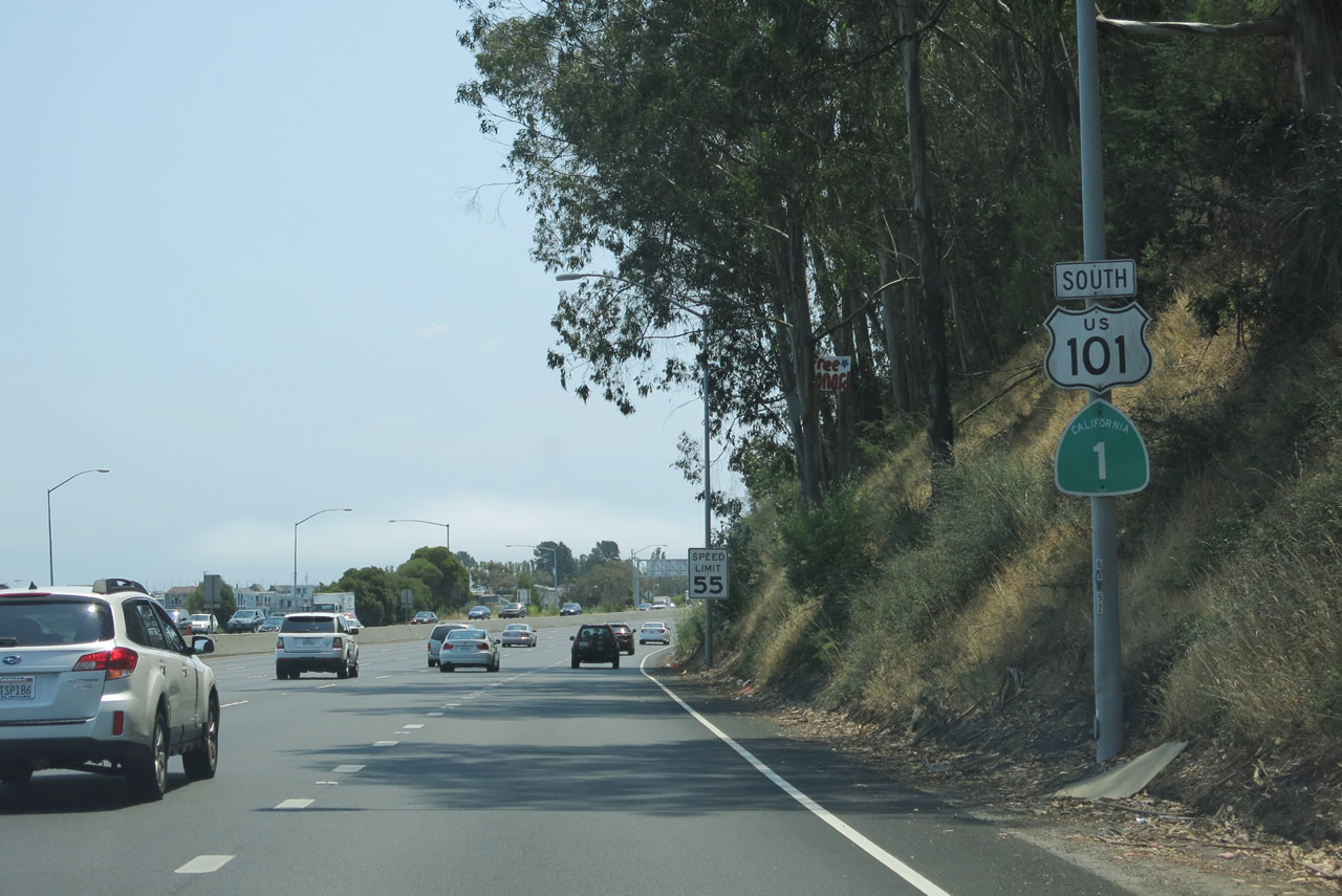
Southbound U.S. 101 reaches Exit 445B, California 1 north to Stinson Beach and Mount Tamalpais. From here, U.S. 101 and California 1 follow a shared alignment as they prepare to cross the Golden Gate Bridge into San Francisco. Photo taken 07/02/13. |
|
U.S. 101 and California 1 separate at Exit 445B. Photo taken 07/02/13. |
|
At the bottom of the ramp, turn right onto the frontage road for California 1 (Shoreline Highway) north to Stinson Beach, Muir Woods, Mount Tamalpais, and Point Reyes. Photo taken 07/02/13. |
|
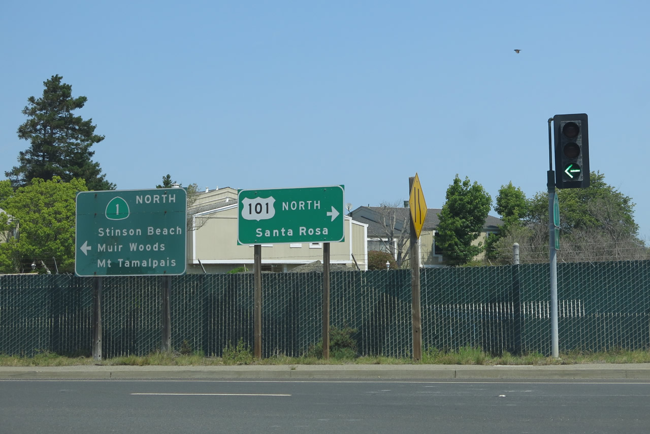
Upon reaching California 1 (Shoreline Highway), turn left for California 1 north to Muir Woods or turn right for U.S. 101 north to Santa Rosa. Photo taken 07/02/13. |
|
Returning to the freeway mainline, the next exit along U.S. 101 (Redwood Highway) south is Exit 445A, Bridge Boulevard to Sausalito and Marin City. Just beyond this sign is the point where U.S. 101 and California 1 merge together. Photo taken 05/25/06. |
| U.S. 101 (Redwood Highway) and California 1 south |
|
A reassurance shield shield assembly posts both U.S. 101 and California 1 just after they merge onto the freeway mainline. Note the speed along much of U.S. 101 in southern Marin County is kept at 55 miles per hour, not the more common 65 miles per hour found on other Bay Area freeways. Watch for slowed or stopped traffic anywhere between here and the Golden Gate Bridge. Photo taken 07/02/13. |
|
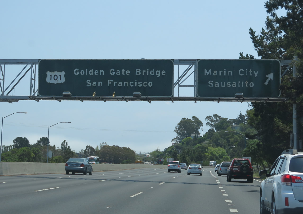
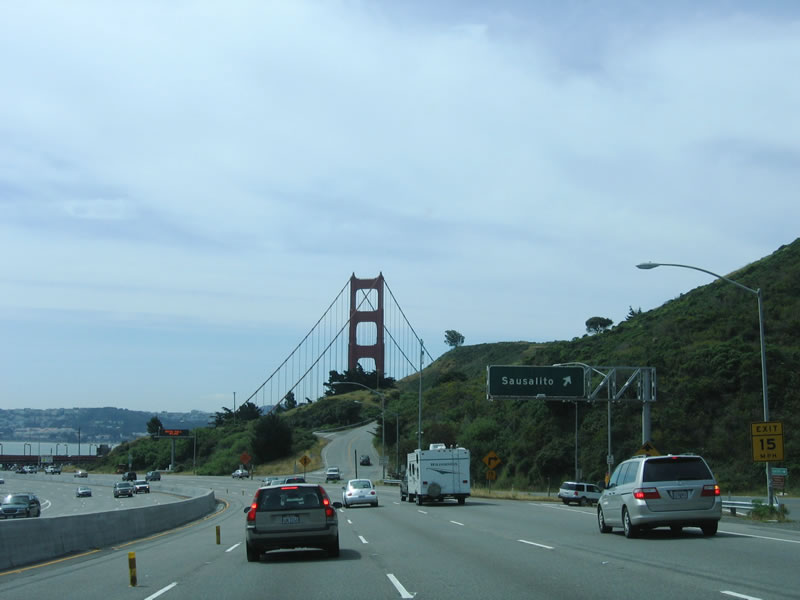
Southbound U.S. 101 and California 1 meet Exit 445A, Bridge Boulevard to Sausalito and Marin City. In the pull-through sign, a new control point of "Golden Gate Bridge" is posted along with the control city of San Francisco. Use Exit 445A to the city of Sausalito. This beautiful city is situated on the bay near the Golden Gate. Sausalito was incorporated on September 4, 1893, and it had a population of 7,061 as of the 2010 Census. Photo taken 07/02/13. |
|
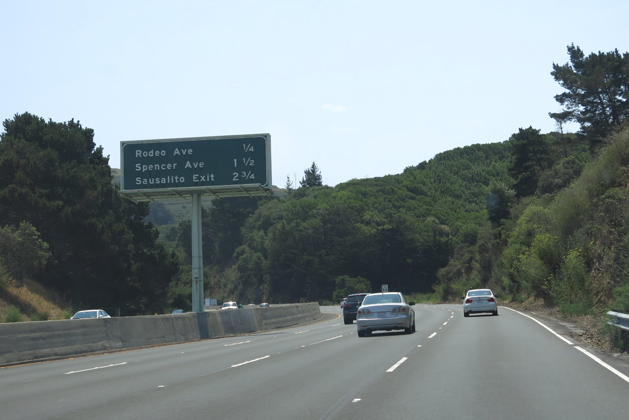
The next three exits on southbound U.S. 101 and California 1 (Redwood Highway) are: Exit 444, Rodeo Avenue; Exit 443, Spencer Avenue/Mar Monte Drive; and Exit 442, Alexander Avenue (Sausalito Lateral Road). Photo taken 07/02/13. |
|
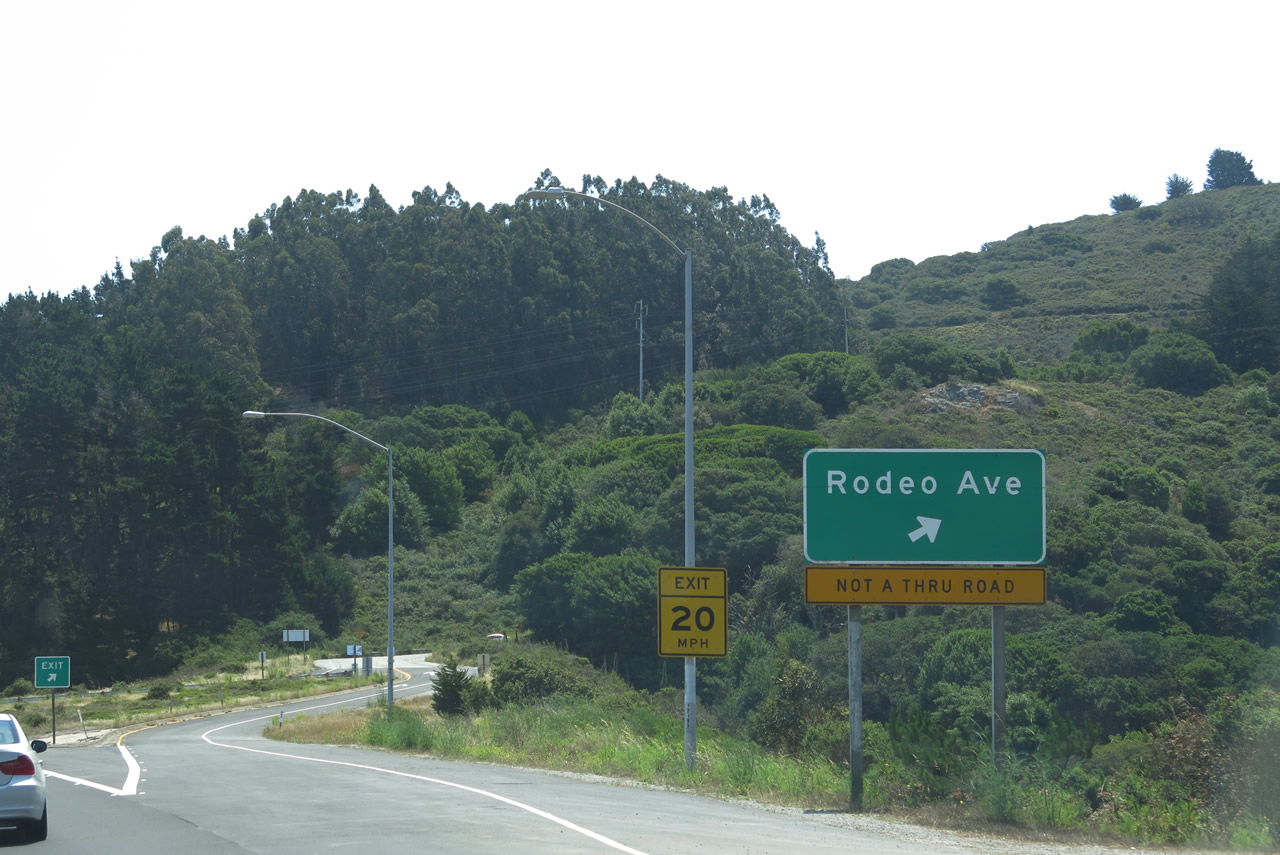
Southbound U.S. 101 and California 1 (Redwood Highway) reaches Exit 444, Rodeo Avenue. It appears that this exit is to "nowhere," as it does not connect to Rodeo Avenue on the east side of the freeway. Perhaps an overpass is missing here? Rodeo Avenue dead ends right after the interchange. Perhaps this could have been a proposed extension of Rodeo Avenue that was never built? Photo taken 07/02/13. |
|
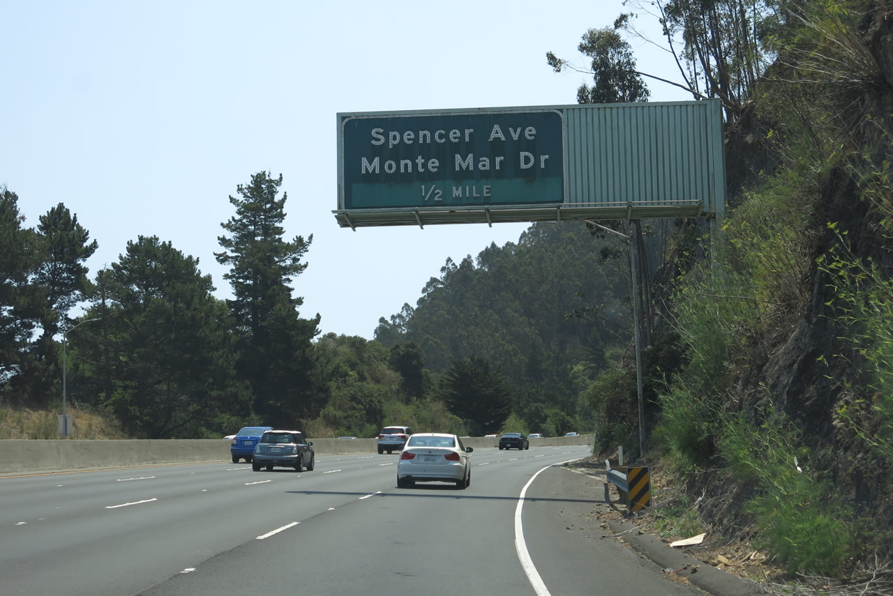
The next exit on southbound U.S. 101 and California 1 (Redwood Highway) is Exit 443, Spencer Avenue and Mar Monte Drive. This interchange also serves the city of Sausalito. Photo taken 07/02/13. |
|
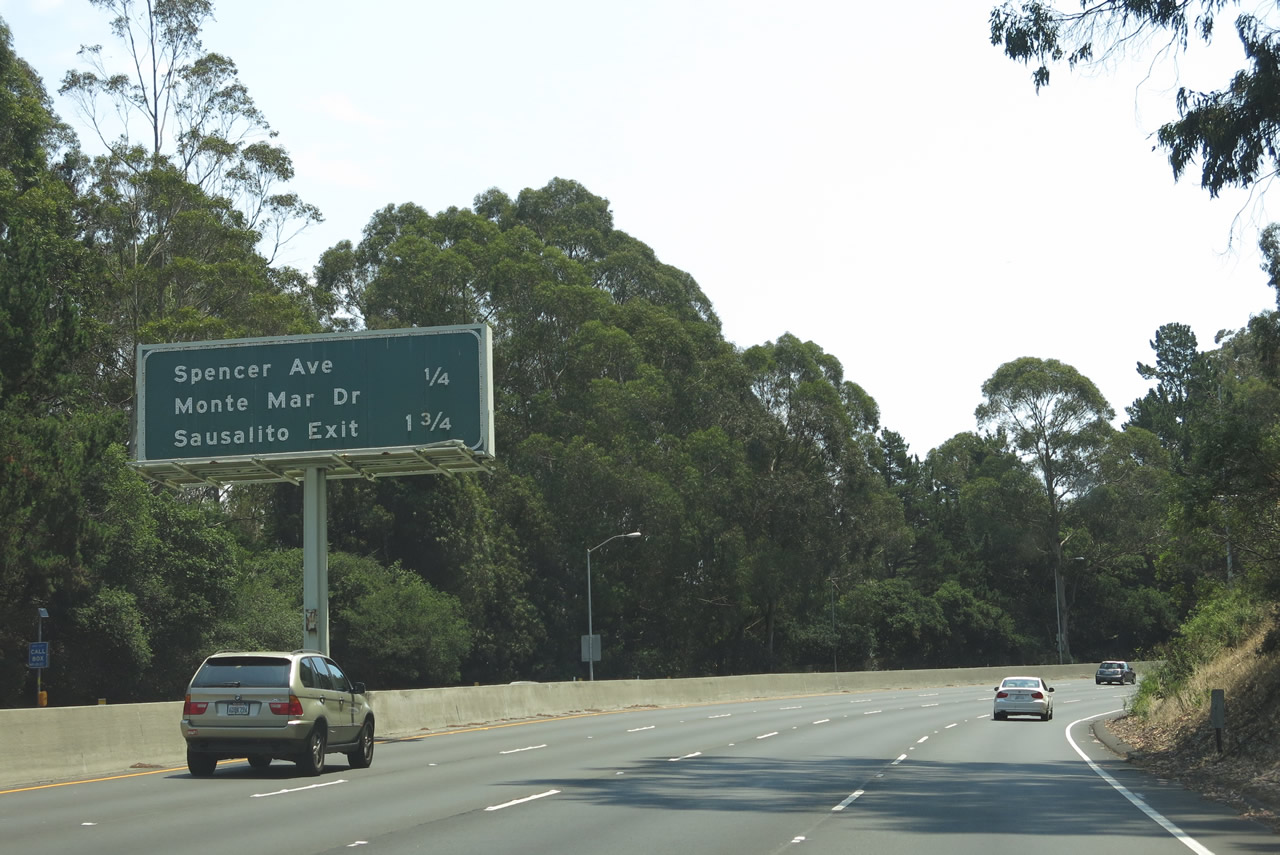
Only two exits remain in Marin County (prior to the toll Golden Gate Bridge) for southbound U.S. 101 and California 1 (Redwood Highway): Exit 443, Spencer Avenue and Mar Monte Drive and Exit 442, Alexander Avenue. Photo taken 07/02/13. |
|
Southbound U.S. 101 and California 1 (Redwood Highway) meet Exit 443, Spencer Avenue and Mar Monte Drive. Photo taken 07/02/13. |
|
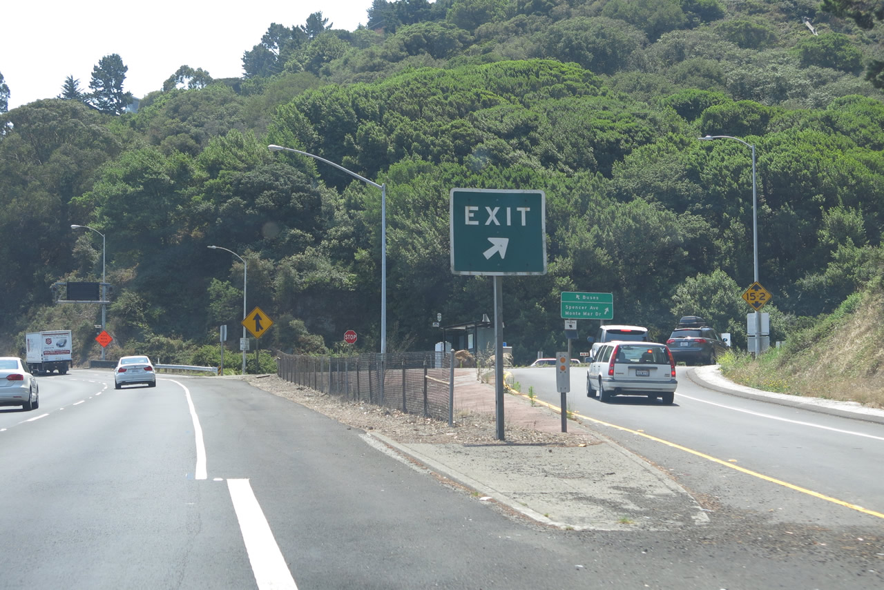
Upon exiting, watch for a bus-only area. Exit 443 connects to Spencer Avenue and Mar Monte Drive. Photo taken 07/02/13. |
|
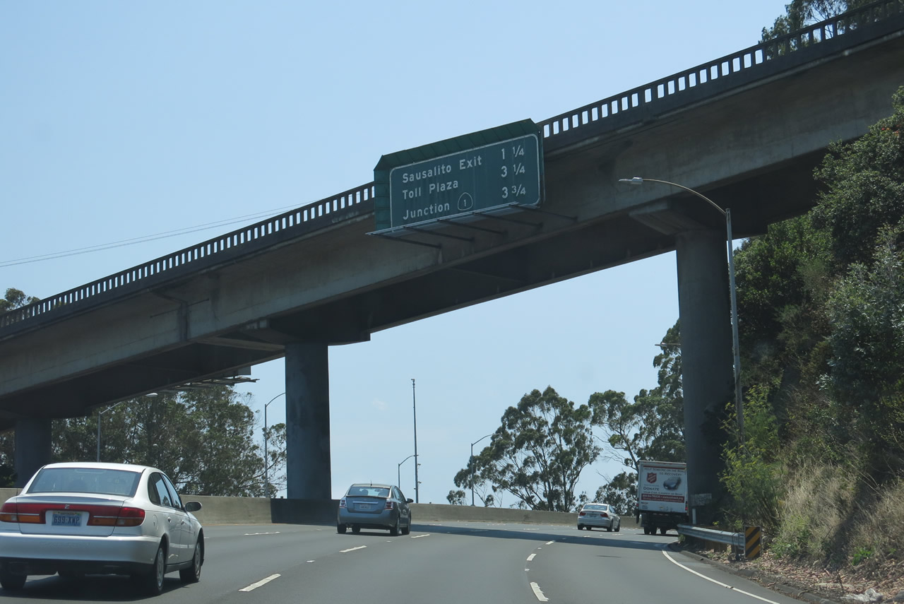
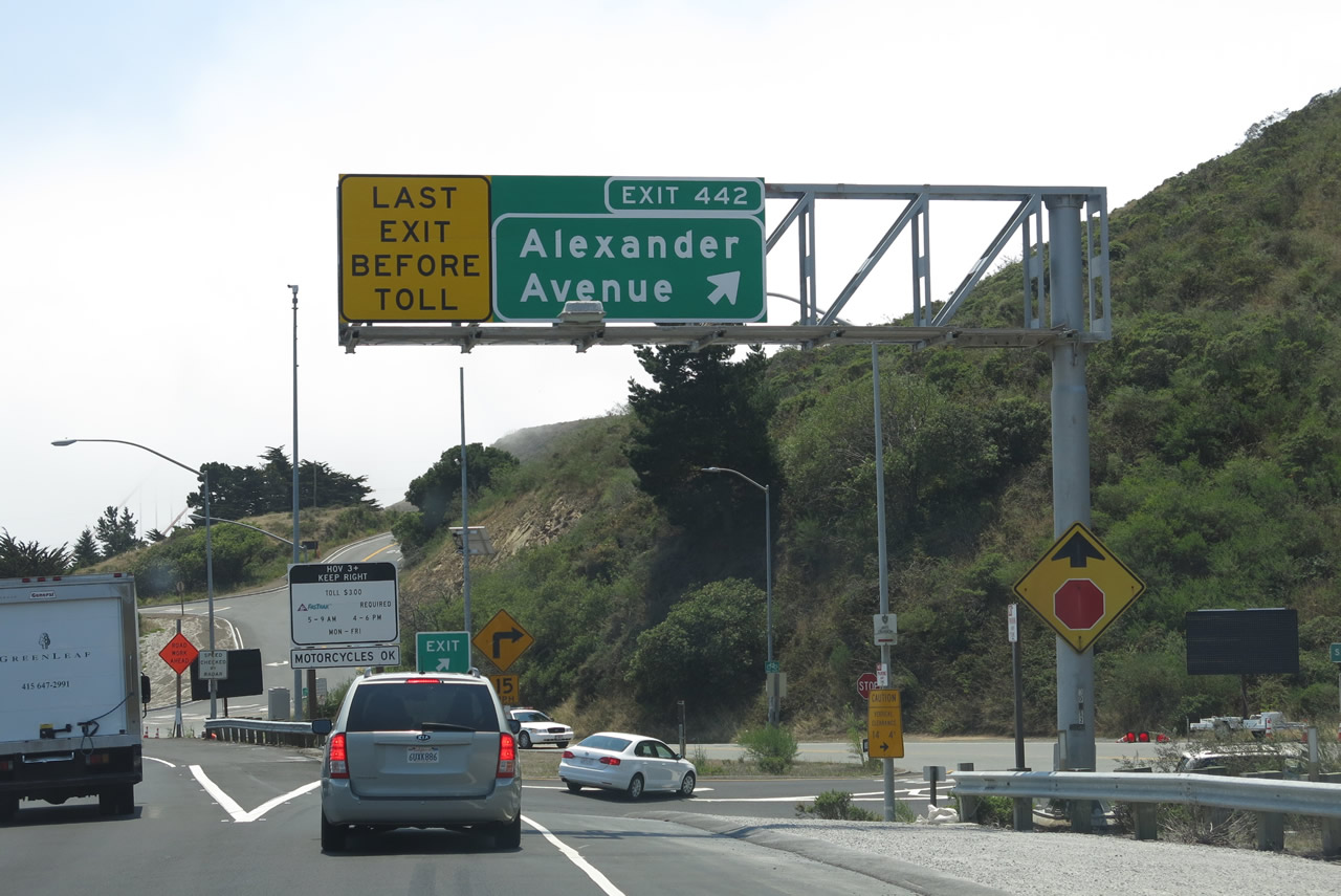
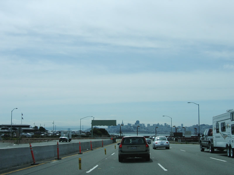
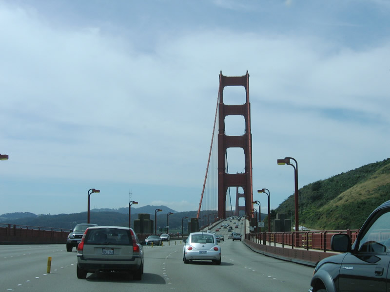
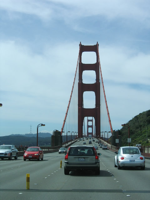
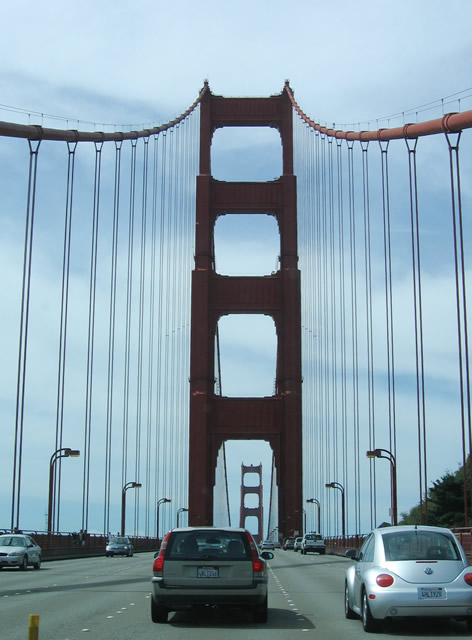
The next exit on southbound U.S. 101 and California 1 (Redwood Highway) is Exit 442, Alexander Avenue (also known as Sausalito Lateral Road) and the Marin Headlands. All through traffic crosses the Golden Gate Bridge (toll) to the city and county of San Francisco. Photo taken 07/02/13. |
|
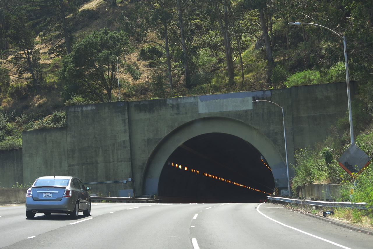
U.S. 101 and California 1 ascend toward the Waldo Tunnel (Rainbow Tunnel), which bores through a hill before descending to the northern approach to the Golden Gate Bridge. The final Marin County exit is located just south of the tunnel and prior to the bridge. Photo taken 07/02/13. |
|
At the top of the grade, southbound U.S. 101 (Redwood Highway) and California 1 approach and enter the Waldo Tunnel (Rainbow Tunnel), which carries the freeway through a hill prior to the first views of the San Francisco skyline and the majestic Golden Gate Bridge. Waldo Tunnel, also known as Rainbow Tunnel due to the rainbows painted over the northbound and southbound bores at the southern end of the tunnel, was built in 1954 to bypass the original Redwood Highway alignment through downtown Sausalito. Although no official business route is posted for U.S. 101 through Sausalito, one can be made by following Historic U.S. 101 along Bridge Boulevard, Bridgeway, and Alexander Avenue. Photo taken 07/02/13. |
|
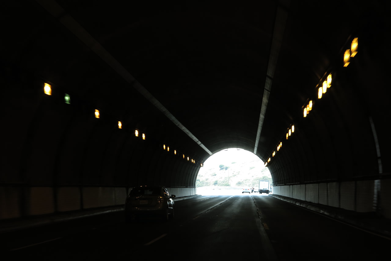
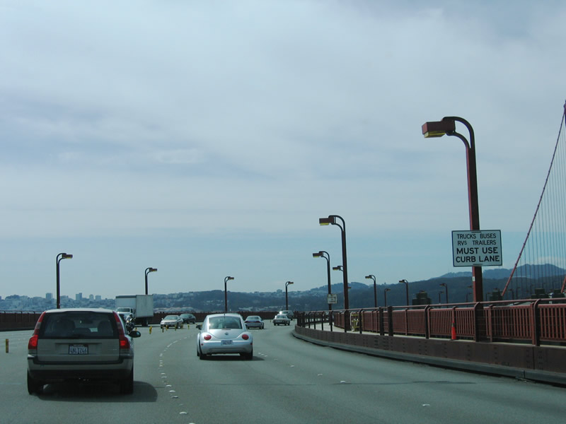
Four lanes carry southbound U.S. 101 (Redwood Highway) and California 1 through the Waldo Tunnel (Rainbow Tunnel). Note that there is no emergency shoulder within the tunnel. The tunnel represents the top of the grade; upon exiting at the south end of the tunnel, U.S. 101 will descend to the Golden Gate Bridge northern approach. Photo taken 07/02/13. |
|
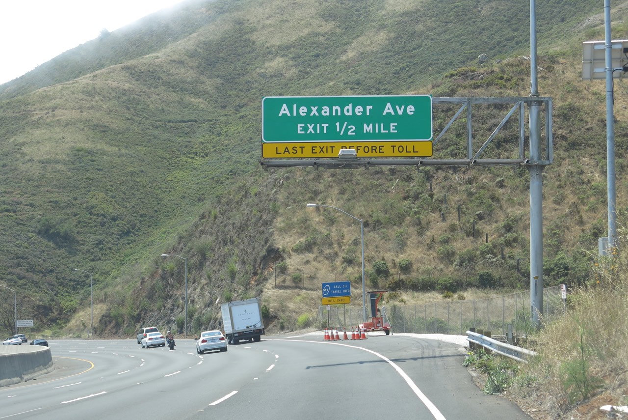
Southbound U.S. 101 (Redwood Highway) and California 1 approach the final Marin County interchange, which is Exit 442, Alexander Avenue. This sign was replaced between 2006 and 2012. Photo taken 07/02/13. |
|
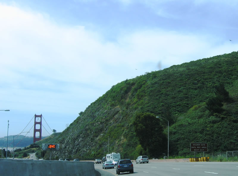
Scenic views of the San Francisco skyline, Golden Gate, Marin Headlands, and Pacific Ocean can be seen from Golden Gate National Recreation Area. Use Exit 442 to park and experience these beautiful views. A rest area on the east side of the freeway provides a parking lot for walkers to cross the Golden Gate Bridge free of tolls. Photo taken 05/25/06. |
|
Use Exit 442 to the Golden Gate National Recreation Area, which includes Marin Headlands. When we visited in 2013, fog covered the towers of the bridge, making it difficult to see on the descent to Alexander Avenue and the northern approach to the Golden Gate Bridge. Photo taken 07/02/13. |
|
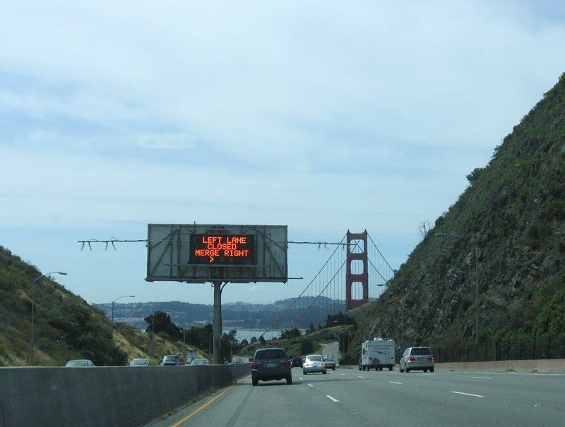
On this day, lane restrictions for the bridge were in effect, as indicated by the variable message sign. Photo taken 05/25/06. |
|
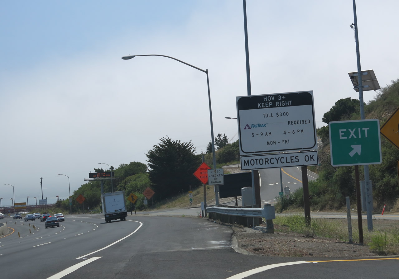
At the gore point for Exit 442, bridge users are advised that carpools (high occupancy vehicles) may use the Golden Gate Bridge at a reduced rate during commuting hours (reduced to $3 per carpool vehicle as compared to the varying toll rates for non-high occupancy vehicles as of July 2013). Note that tolls are collected electronically and not by a traditional toll collector in cash. Photo taken 07/02/13. |
|
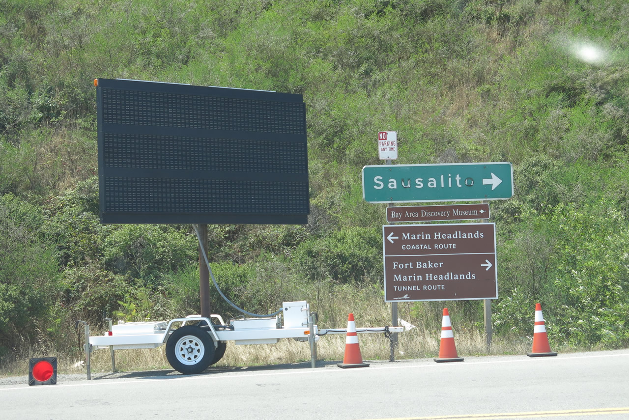
Upon exiting the freeway, this set of signs points the way to the city of Sausalito (via Historic U.S. 101/Alexander Avenue north) and various points of interest within the Golden Gate National Recreation Area, including Marin Headlands and Fort Baker. Two routes traverse the headlands; the coastal route follows the bluff that overlooks the Golden Gate and Pacific Ocean (on clear days). The inland route passes through a narrow, single-lane tunnel that connects to Fort Baker and offers a connecting route back to the coastal route. Photo taken 07/02/13. |
|
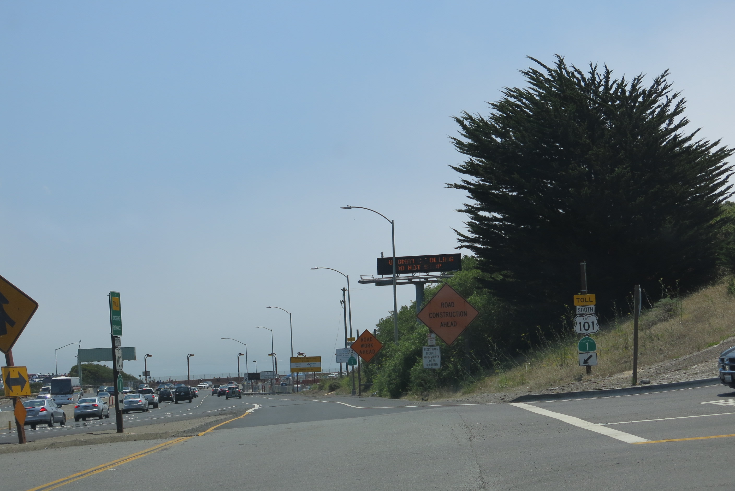
A toll crossing entrance sign is posted from Alexander Avenue onto U.S. 101 and California 1 south. Note the yellow TOLL banner over the route markers. Photo taken 07/02/13. |
|
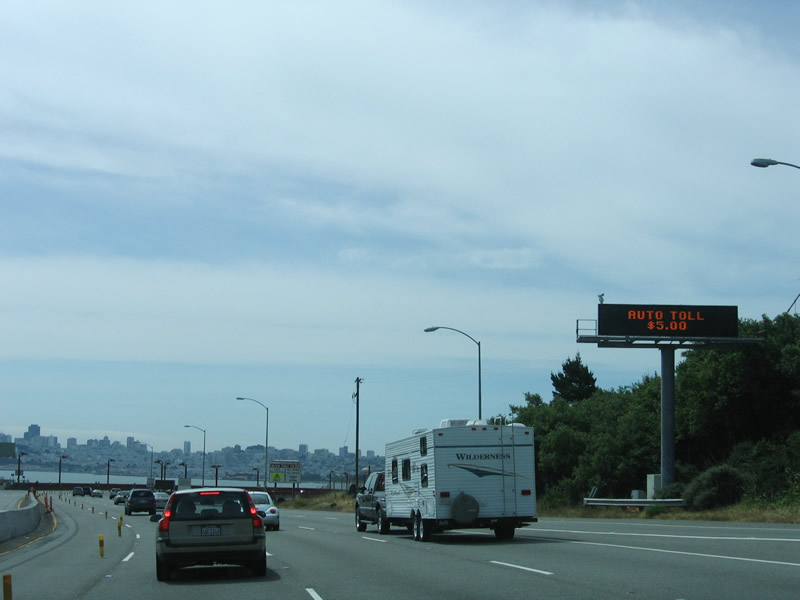
Returning to the mainline and looking at a picture from 2006, the automobile toll rate for the Golden Gate Bridge was $5 per southbound trip; there is no toll northbound. The toll rate has since changed, and in March 2013, tolls became all electronic, with no toll collectors. Check the webpage for current toll rates and methods of payment of the tolls, including California's official electronic tolling system (Fastrak). Fastrak is also used for the other Bay Area toll bridges as well as the toll roads in Southern California and high occupancy vehicle/toll lanes located throughout the state (including the 91 Express Lanes in Orange County near Anaheim, Interstate 10 El Monte Busway in Los Angeles, Interstate 680 Express Lane near Sunol, Interstate 15 Express Lanes in San Diego, and Interstate 110 Harbor Transitway in Los Angeles). Photo taken 05/25/06. |
|
Maintenance responsibilities shift from Caltrans to the Golden Gate Bridge Authority, which manages and maintains the signature span. The legislative defintion of U.S. 101 contains a route break at the Golden Gate Bridge (as contained in the California Street and Highway Code). Caltrans maintenance will resume after the southern approach to the bridge. Photo taken 05/25/06. |
|
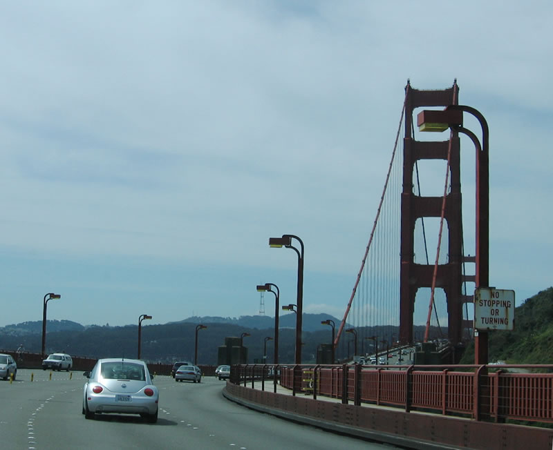
Traveling south on U.S. 101 and California 1 over the Golden Gate Bridge, an older no stopping or turning sign is posted. This sign probably dates back to when the bridge opened is posted. Photo taken 05/25/06. |
Page Updated August 23, 2013.