

U.S. 101 South - San Mateo County
| U.S. 101 (Bayshore Freeway) south | |
|---|---|
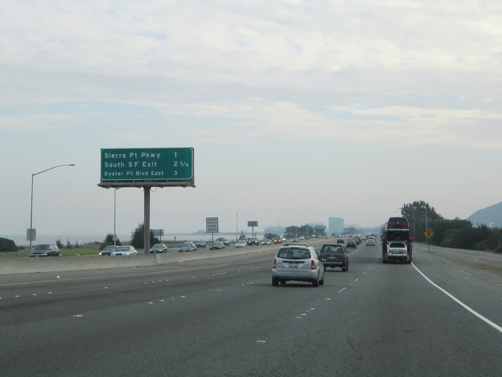 |
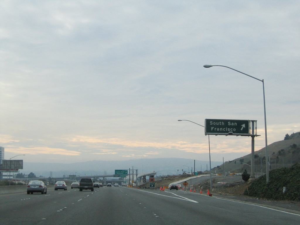
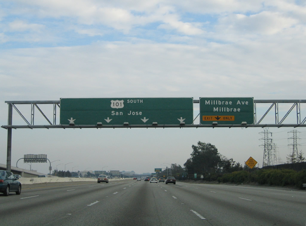
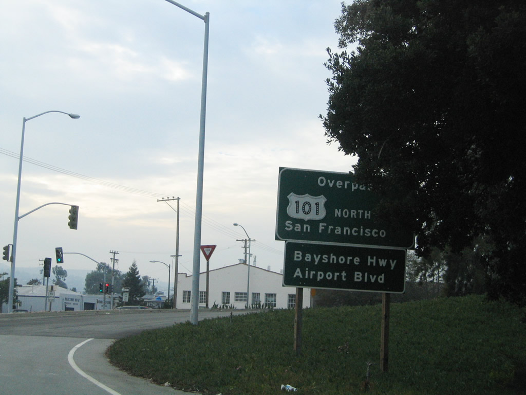
U.S. 101 leaves San Francisco and enters the city of Brisbane and San Mateo County. Much of this section of U.S. 101 (Bayshore Freeway) was constructed on fill; the original shoreline used to follow Bayshore Boulevard, which is located west of the freeway. A danger to this technique of highway construction is the threat of liquefaction, which can cause the earth fill to give way during an earthquake. The next three exits along U.S. 101 south are Exit 426, Sierra Point Parkway to Brisbane; Exit 425C, Bayshore Boulevard to South San Francisco; and Exit 425B, Oyster Point Boulevard East. Photo taken 11/26/04. |
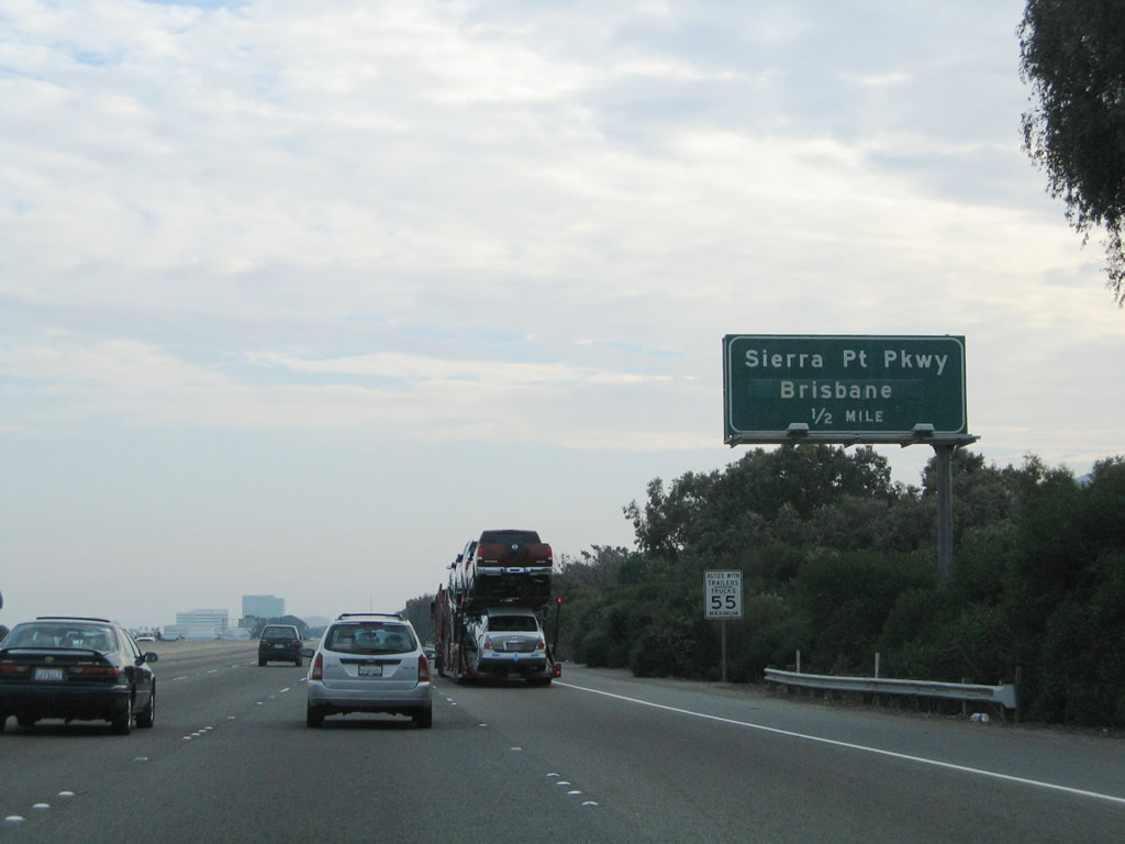 |
The city of Brisbane, known as the City of Stars, was incorporated as a general law city on November 27, 1961, although the town existed for several years prior to that. As of the 2000 Census, 3,597 people resided in Brisbane. The city consists of a total of 20.44 square miles, of which 3.44 square miles are land and the remaining 17 square miles are water. The next exit (Exit 426, Sierra Point Parkway) offers a connection to downtown Brisbane via westbound Lagoon Way. Most of the populated sections of the city are located along Bayshore Boulevard. Photo taken 11/26/04. |
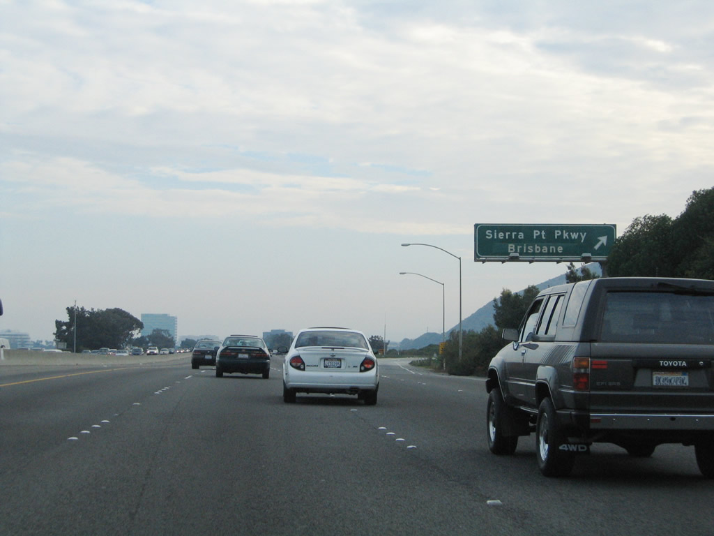 |
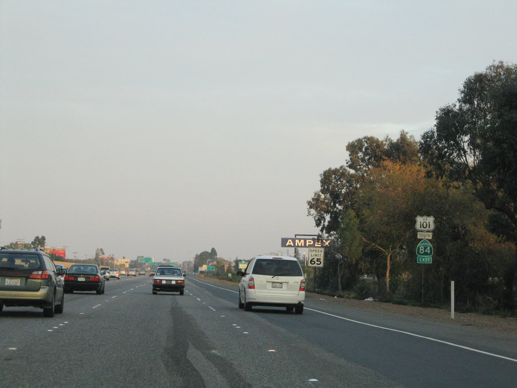
Southbound U.S. 101 (Bayshore Freeway) reaches Exit 426, Sierra Point Parkway to Brisbane. Through San Mateo County, U.S. 101 is closely paralleled by its old alignment, California 82 (El Camino Real). For a period of time, U.S. 101 was still signed on El Camino Real after Bayshore Boulevard and the eventual Bayshore Freeway were built. During that time, the boulevard and the eventual freeway were known as Bypass U.S. 101 (until 1964, when several highways were renumbered as a result of the new Interstate Highway System). Some of the older signs (from the 1960s) along the freeway used to have "Bypass" banners; these were covered up by green overlay once the designation changed. Photo taken 11/26/04. |
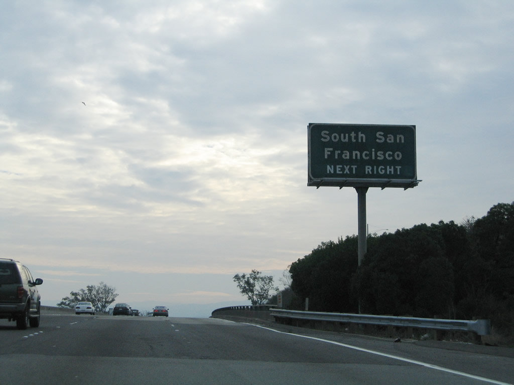 |
The next exit along southbound U.S. 101 (Bayshore Freeway) is Exit 425C, Bayshore Boulevard to the city of South San Francisco, "The Industrial City." Home to 61,824 people in 2006 (estimate), South San Francisco has grown as more people have moved out of the city of San Francisco. Photo taken 11/26/04. |
 |
Southbound U.S. 101 (Bayshore Freeway) reaches Exit 425C, Bayshore Boulevard to South San Francisco. Photo taken 11/26/04. |
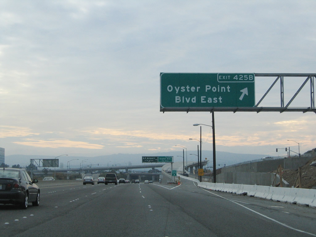 |
Shortly thereafter, southbound U.S. 101 (Bayshore Freeway) reaches Exit 425B, Oyster Point Boulevard east to the Oyster Point Marina and Sister Cities Boulevard west to Hillside Boulevard. The marina includes ship slips and a fishing pier. Photo taken 11/26/04. |
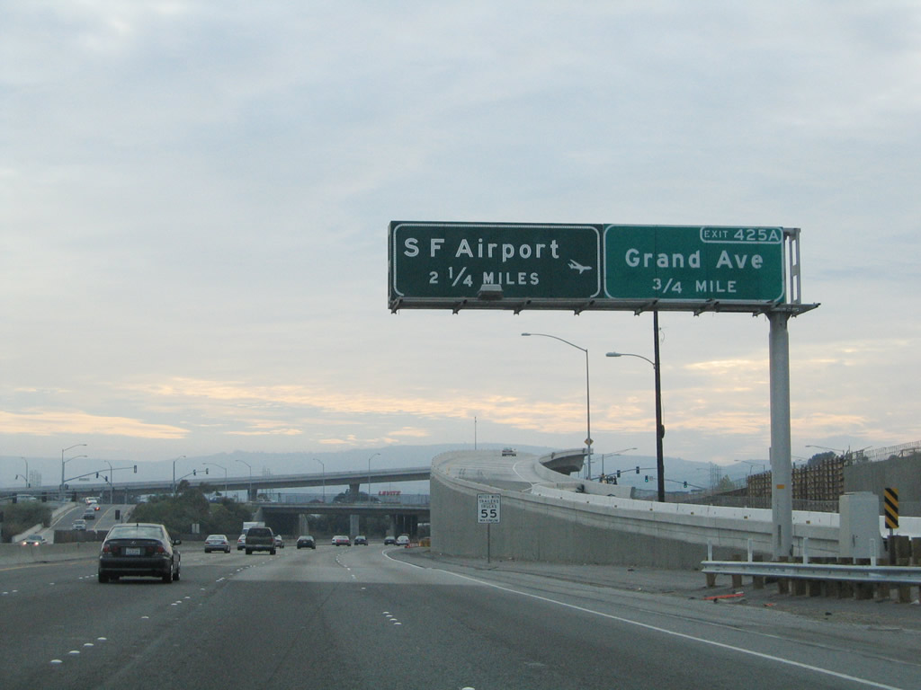 |
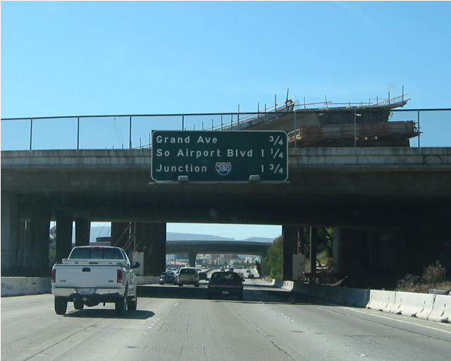
The next exit along southbound U.S. 101 (Bayshore Freeway) is Exit 425A, Grand Avenue to South San Francisco. Photo taken 11/26/04. |
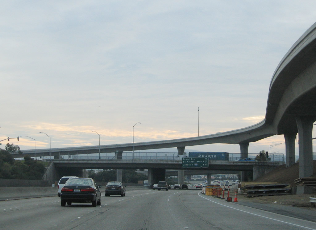 |
The flyover ramp to Oyster Point Boulevard east (Exit 425B) dominates the view on southbound U.S. 101 as the freeway approaches Exit 425A, Grand Avenue. Photo taken 11/26/04. |
 |
This mileage sign along southbound U.S. 101 provides the distance to the next three exits: Exit 425A, Grand Avenue; Exit 424, South Airport Avenue; and Exit 423B, Interstate 380/Kopp Freeway west. Photo taken 05/23/03. |
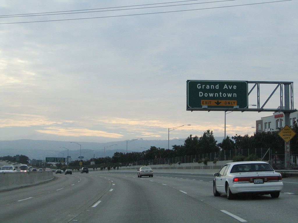 |
The right lane of southbound U.S. 101 (Bayshore Freeway) becomes exit only for is Exit 425A, Grand Avenue to downtown South San Francisco. The civic center is located west of the freeway along Grand Avenue between Maple Avenue, Miller Avenue, and Walnut Avenue. Photo taken 11/26/04. |
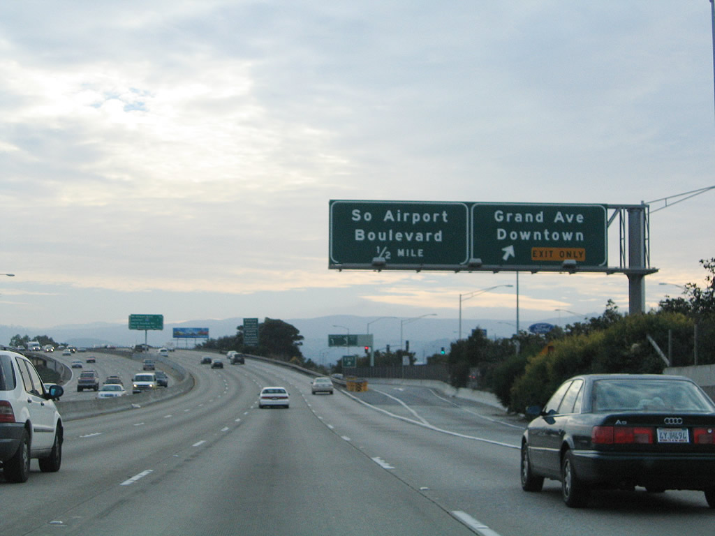 |
Southbound U.S. 101 (Bayshore Freeway) reaches Exit 425A, Grand Avenue to downtown South San Francisco. The next exit is Exit 424, Produce Avenue/South Airport Boulevard. Photo taken 11/26/04. |
 |
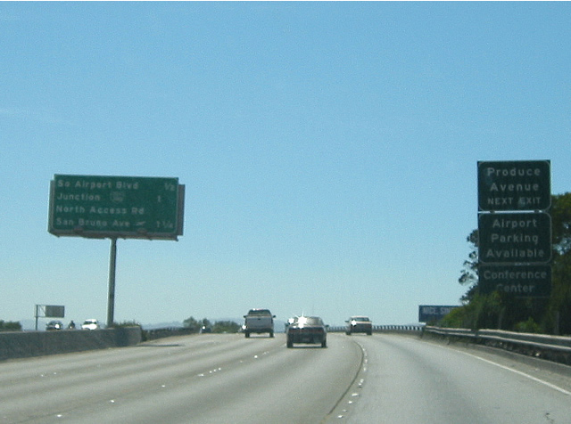 |
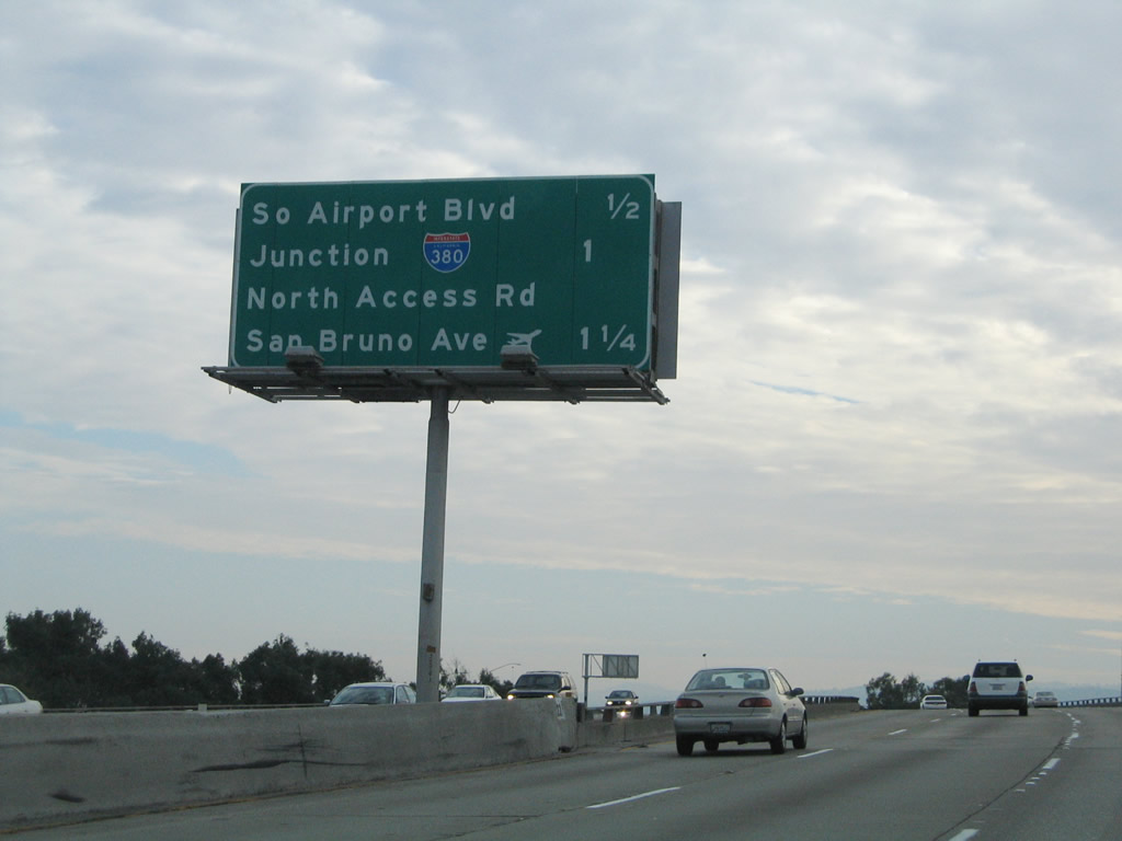
The next exit (Exit 424) connects to Produce Avenue. Also, the mileage sign provides the distance to the next three exits along southbound: Exit 424, South Airport Avenue; Exit 423B, Interstate 380 west; and Exit 423A, San Francisco International Airport and San Bruno Avenue. Although barely visible in this blurry photo, the 2003 mileage sign features an error: The Interstate 380 shield was erroneously replaced with a green Business Spur I-380 shield instead! It was fixed by November 2004. Photos taken 11/26/04 and 05/23/03. |
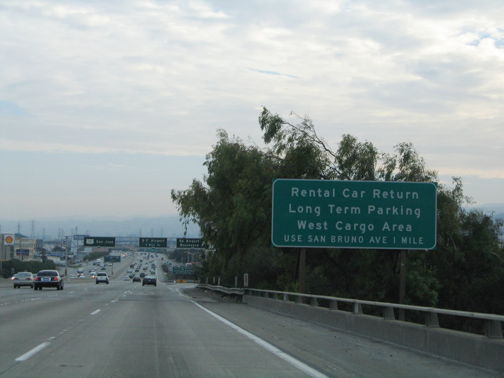 |
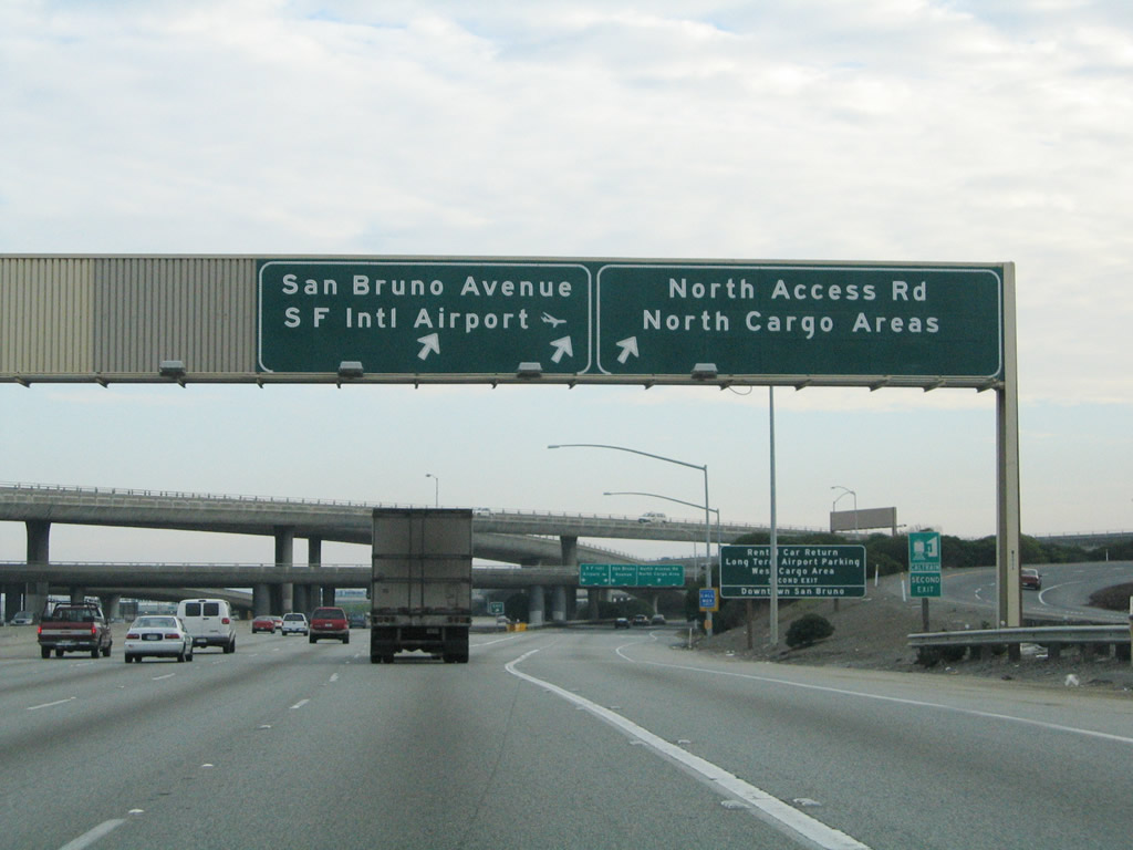
Use Exit 423A (San Bruno Avenue) to the San Francisco International Airport (SFO) rental car return, long-term parking, and west cargo area. An exit number would be helpful on this sign. Photo taken 11/26/04. |
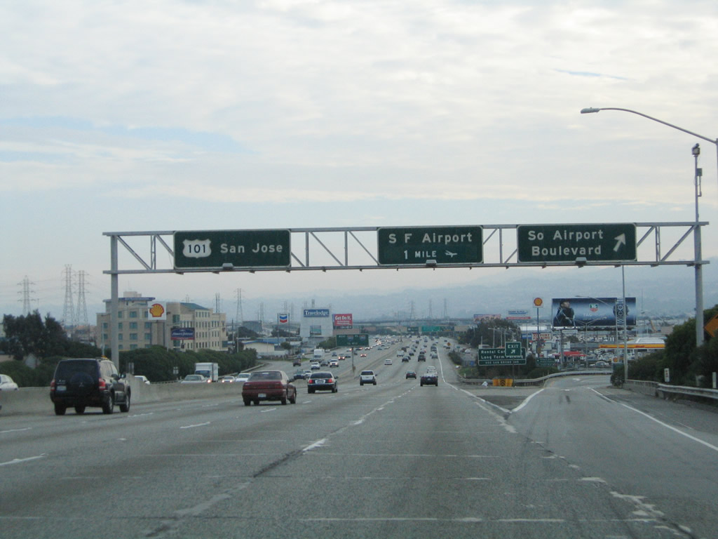 |
Southbound U.S. 101 (Bayshore Freeway) reaches Exit 424, South Airport Avenue; the next exits are Exit 423B, Interstate 380 west and Exit 423A, San Francisco International Airport and San Bruno Avenue. Photo taken 11/26/04. |
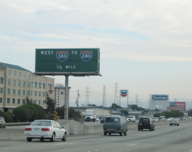 |
Southbound U.S. 101 approaches Exit 423B, Interstate 380 west to Interstate 280 (one-half mile). This interchange to San Francisco International Airport was reconfigured as a result of a variety of improvements to the airport. Photo taken 11/26/04. |
 |
The left four lanes continue south on U.S. 101, while the right two lanes connect to Interstate 380/Kopp Freeway (Exit 423B). Interstate 380 is a short, east-west freeway that connects U.S. 101 with Interstate 280, providing direct connection from the airport to both U.S. 101 and Interstate 280. The following off-ramp connects to Exit 423A, San Francisco International Airport. Photo taken 11/26/04. |
 |
Southbound U.S. 101 reaches Exit 423B, Interstate 380 west to Interstate 280. The next exit is Exit 423A, San Francisco International Airport/North Access Road/San Bruno Avenue. Photo taken 11/26/04. |
 |
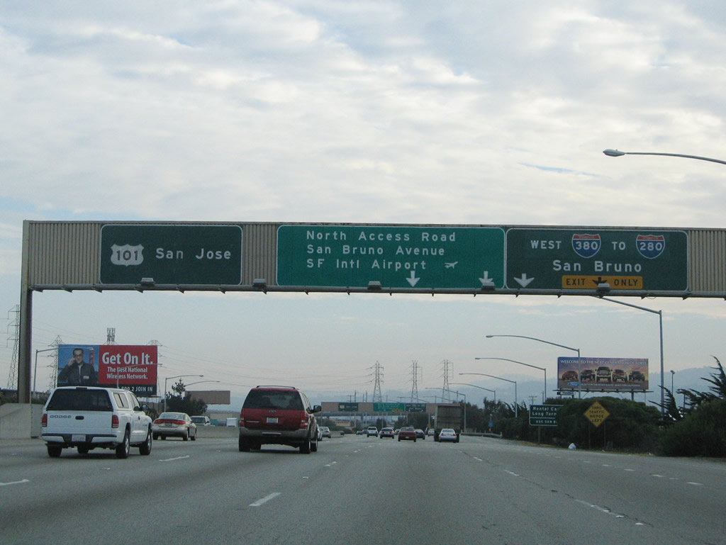
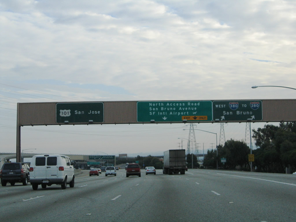
Immediately after the Interstate 380 off-ramp, southbound U.S. 101 (Bayshore Freeway) reaches Exit 423A, San Francisco International Airport, San Bruno Avenue, and North Access Road. This exit connects to a collector distributor lane, so through traffic may exit here and still return to the freeway. Photo taken 11/26/04. |
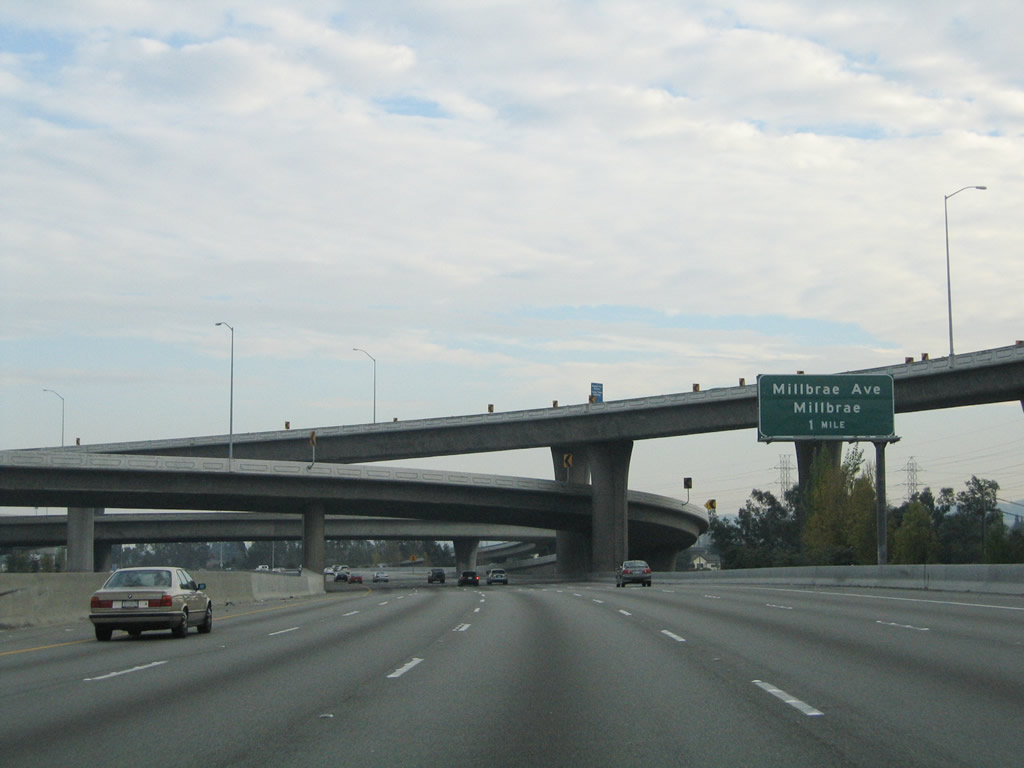 |
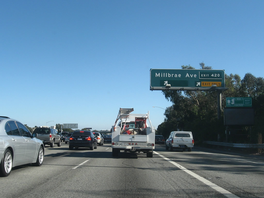
After the airport exit, the next interchange is Exit 420, Millbrae Avenue. Around this point, U.S. 101 leaves San Francisco International Airport property and enters the city of Millbrae. The city was incorporated as a charter city on January 14, 1948, and is home to 20,718 people as of the 2000 Census. Photo taken 11/26/04. |
 |
The left four lanes continue south on U.S. 101 (Bayshore Freeway), while the right lane will exit only to Exit 420, Millbrae Avenue. This interchange is a modified cloverleaf, and it provides the only connection from U.S. 101 to the city of Millbrae. Photo taken 11/26/04. |
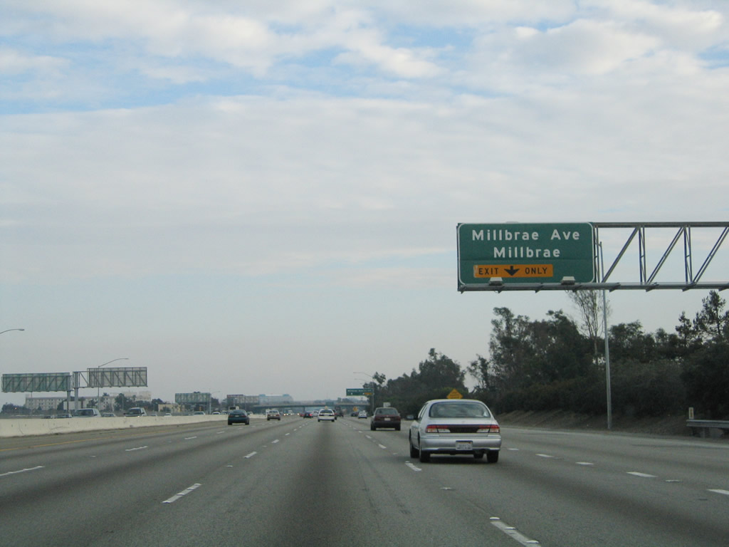 |
Use Millbrae Avenue west to the Bay Area Rapid Transit system, the southernmost terminal on the extension to San Francisco International Airport. Downtown Millbrae (situated along California 82 (El Camino Real)) is also located west of the freeway. Photo taken 11/26/04. |
 |
Southbound U.S. 101 reaches Exit 420, Millbrae Avenue. This exit-number sign was the first to be placed in San Francisco (in 2002), and it is the only known current-generation, button-copy exit number sign to exist in California (all the button copy exit number signs placed in greater Los Angeles were from the 1960s pilot program, not from the 2002 program). Note the unusual way this exit number sign is displayed. Photo taken by Jeff Waller (10/14/07). |
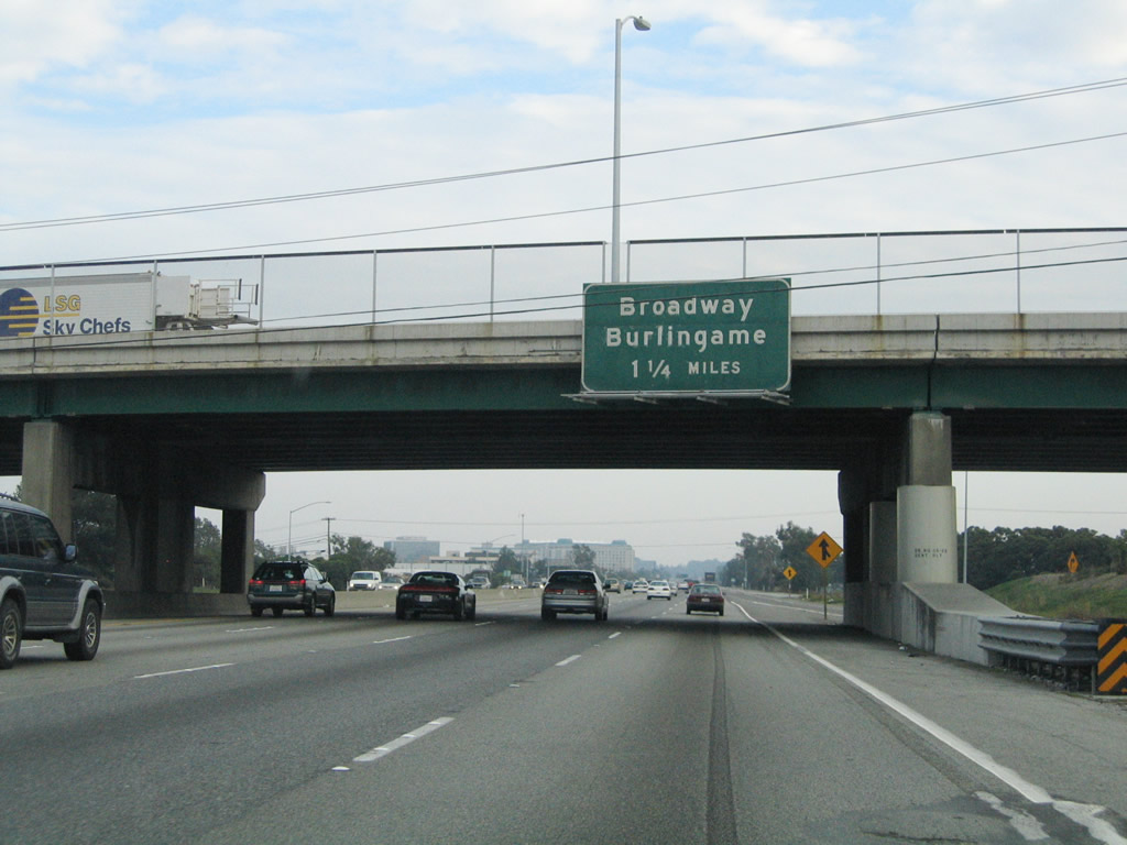 |
The next interchange along southbound U.S. 101 (Bayshore Freeway) serves Exit 419B, Broadway west and Exit 419A, Bayshore Highway north/Airport Boulevard east. This interchange is the only one on southbound to serve the city of Burlingame. Photo taken 11/26/04. |
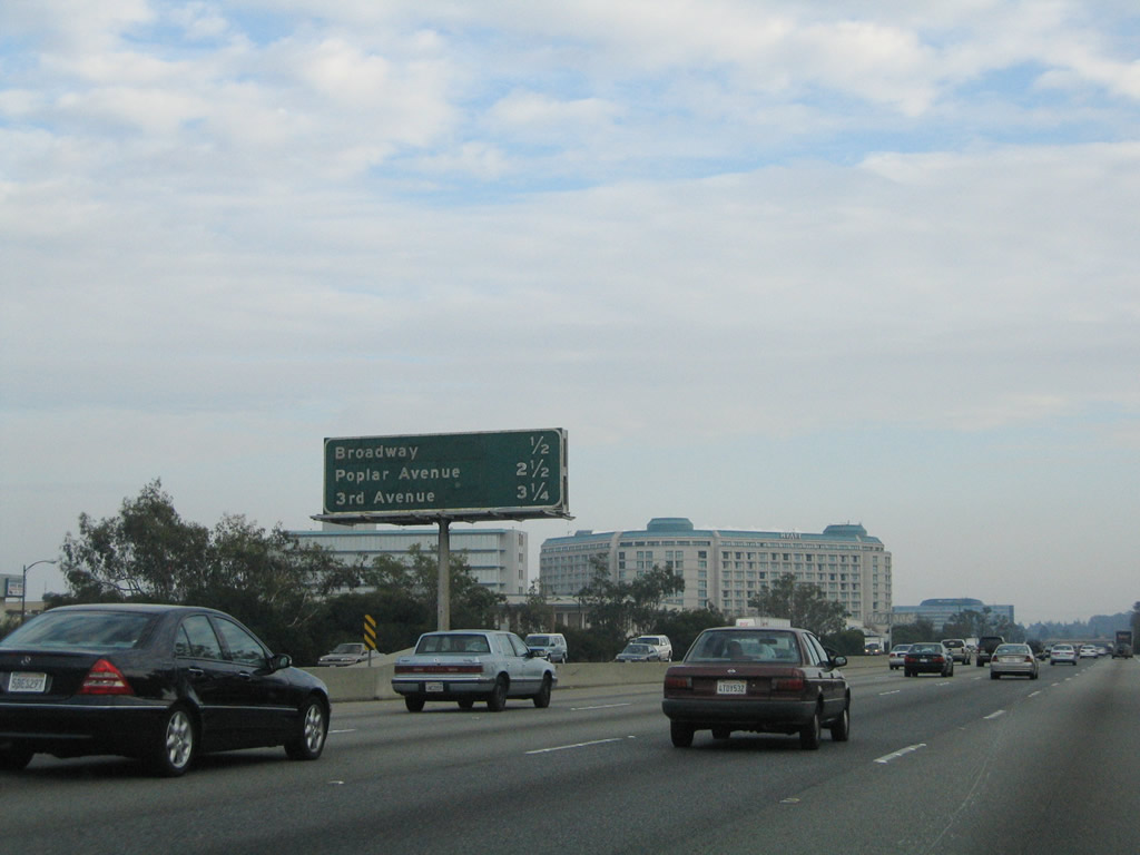 |
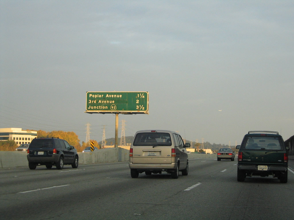
This mileage sign provides the distance to the next four exits along southbound U.S. 101 (Bayshore Freeway): Exit 419B, Broadway west; Exit 419A, Bayshore Highway north/Airport Boulevard east; Exit 417, Poplar Avenue; and Exit 416, Third and Fourth Avenue (modified cloverleaf). Photo taken 11/26/04. |
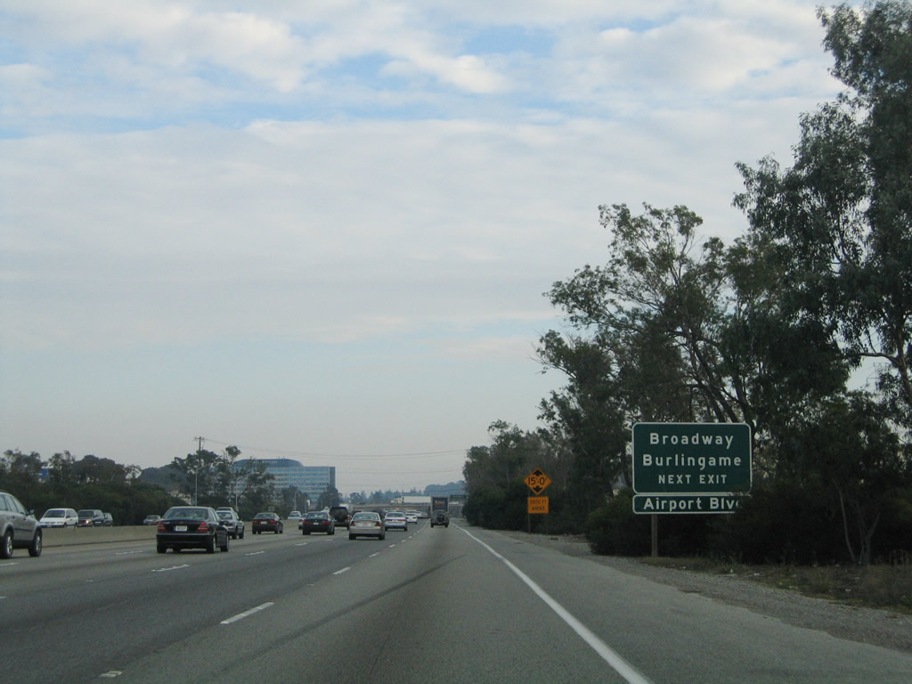 |
A roadside sign advises of the pending interchange with Exit 419B, Broadway and Exit 419A, Bayshore Highway north/Airport Boulevard east. U.S. 101 enters the city of Burlingame, home to 28,158 people as of the 2000 Census. Photo taken 11/26/04. |
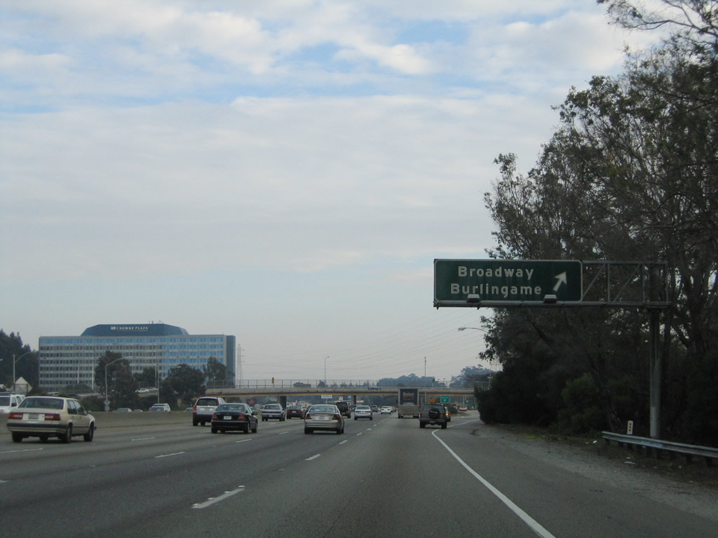 |
Southbound U.S. 101 (Bayshore Freeway) reaches Exit 419B, Broadway to the city of Burlingame. Photo taken 11/26/04. |
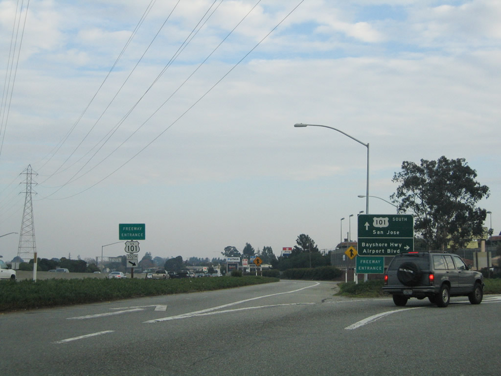 |
On the collector distributor lanes for Exit 419B is the off-ramp for Exit 419A, Anza Boulevard to Bayshore Highway north/Airport Boulevard east. This loop ramps also allows a connection onto U.S. 101 north. Photo taken 11/26/04. |
 |
At the end of the ramp for Exit 419A is this sign for the connection to Bayshore Highway north and Airport Boulevard east, as well as the return to U.S. 101 north. Photo taken 11/26/04. |
 |
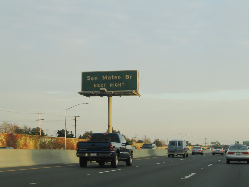
Back on the mainline, the next three exits along U.S. 101 south are Exit 417, Poplar Avenue; Exit 416, Third Avenue; and Exit 414B, California 92 west to Half Moon Bay, California 92 east to the Hayward-San Mateo Bridge, and Fashion Island Boulevard. Photo taken 11/26/04. |
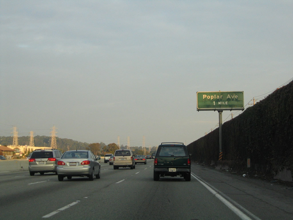 |
The next exit along U.S. 101 south is Exit 417, Poplar Avenue, which serves the city of San Mateo. Home to 92,482 people as of the 2000 Census, San Mateo was incorporated on September 4, 1894, and is affluent like many of its neighboring cities along the Peninsula. Photo taken 11/26/04. |
 |
Southbound U.S. 101 (Bayshore Freeway) reaches Exit 417, Poplar Avenue in the city of San Mateo. Despite its name, San Mateo is not the seat of San Mateo County; that role goes to Redwood City, which is further south along the U.S. 101 corridor. Photo taken 11/26/04. |
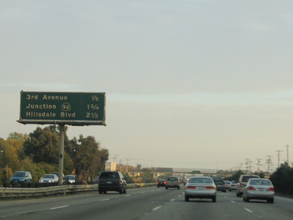 |
This mileage sign provides the distance to the next three exits along U.S. 101 south: Exit 416, Third Avenue; Exit 414B, California 92 west to Half Moon Bay, California 92 east to the Hayward-San Mateo Bridge, and Fashion Island Boulevard; and Exit 414A, Hillsdale Boulevard. Photo taken 11/26/04. |
 |
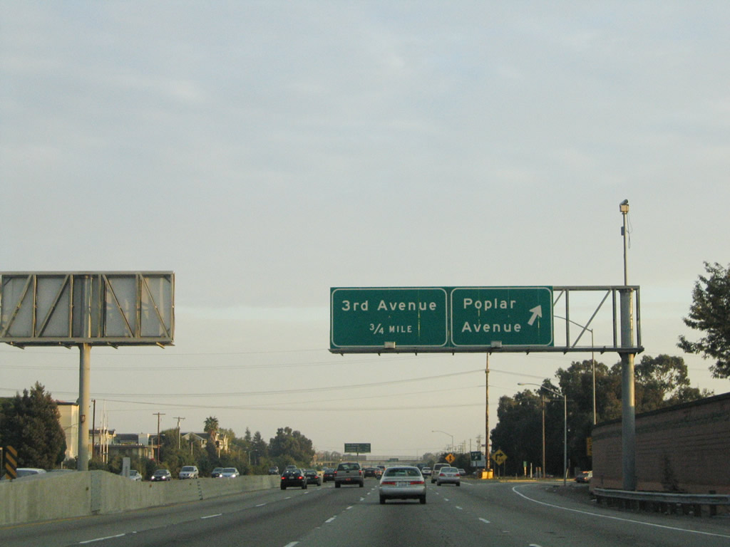
Use Third Avenue west to downtown San Mateo, Central Park, the Caltrain station, and chamber of commerce (via California 82 (El Camino Real)). Since Third Avenue is one-way westbound, an eastbound companion is provided by Fourth Avenue. Photo taken 11/26/04. |
 |
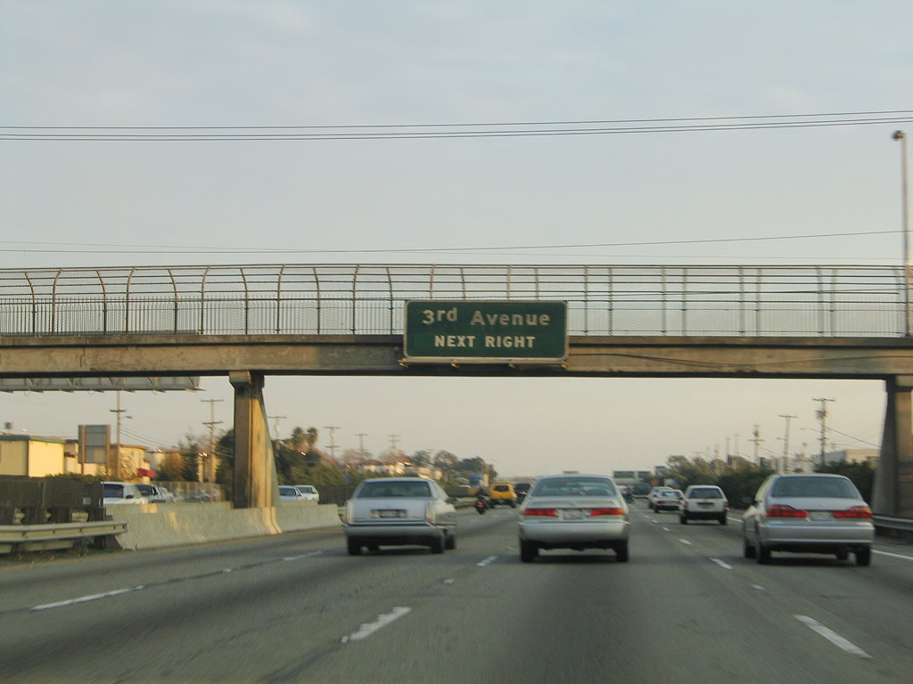
Southbound U.S. 101 (Bayshore Freeway) reaches Exit 416, Third Avenue to downtown San Mateo. The next interchange is Exit 414B, California 92 freeway. Photo taken 11/26/04. |
 |
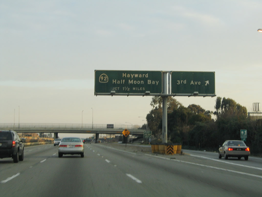
California 92 is a major east-west freeway corridor that connects Interstate 880 (Nimitz Freeway) in Hayward with U.S. 101 (Bayshore Freeway) and Interstate 280 (Father Junipero Serra Freeway) in San Mateo via the Hayward-San Mateo Bridge. A toll is required to use the bridge westbound. Photo taken 11/26/04. |
 |
Use California 92 east to the Hayward-San Mateo Bridge, which is the longest crossing of the San Francisco Bay. Photo taken 11/26/04. |
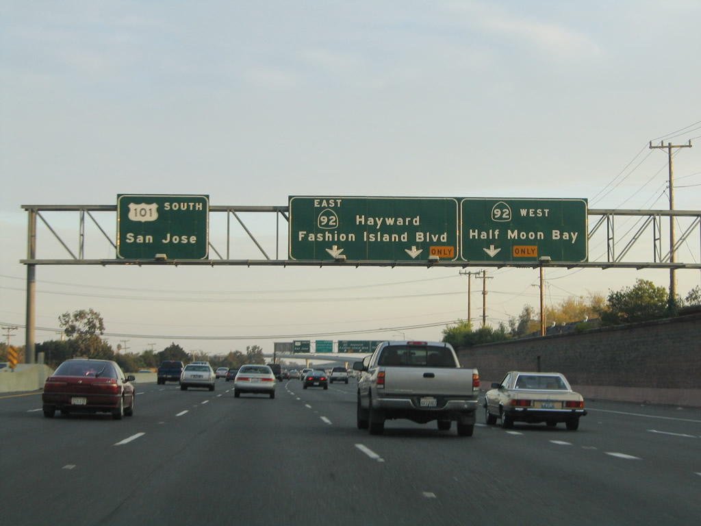 |
The right lane becomes exit only for California 92 west to Half Moon Bay, while the number four and five lanes connect to California 92 east to Hayward. Photo taken 11/26/04. |
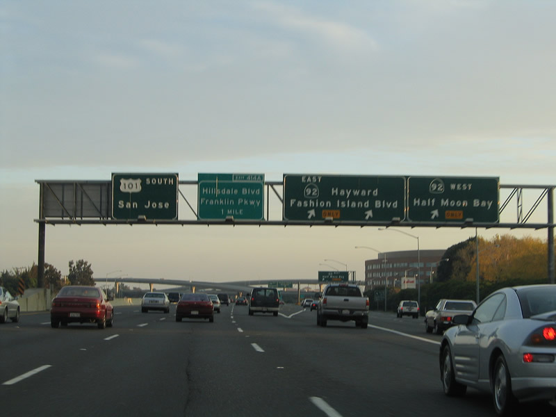 |
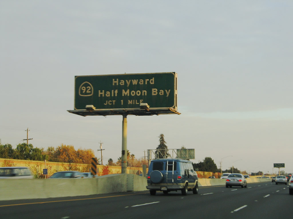
Southbound U.S. 101 reaches Exit 414B, California 92 east to Hayward and west to Half Moon Bay. Follow the ramp to California 92 east to connect to Fashion Island Boulevard. Photo taken 11/26/04. |
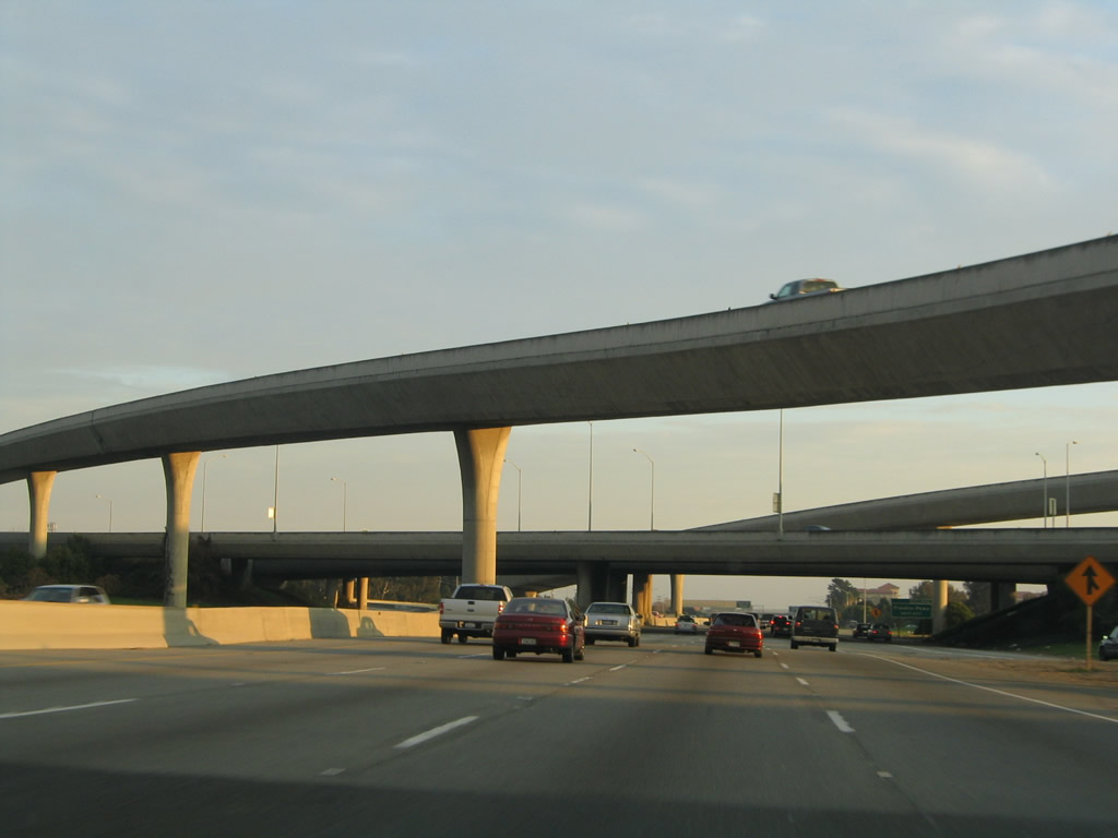 |
Some high level flyover ramps characterize the interchange between U.S. 101 and California 92. Photo taken 11/26/04. |
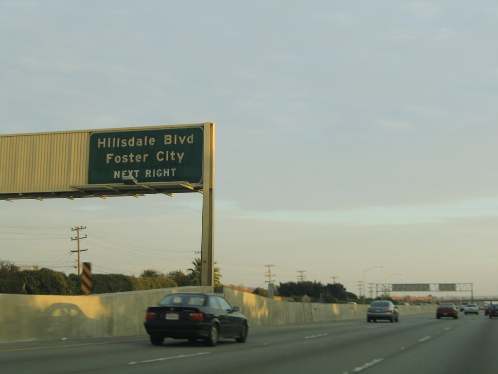 |
After the major California 92 interchange, the next exit is Exit 414A, Hillsdale Boulevard east to Foster City and west to Hillsdale Center and San Mateo County Fairgrounds. Hillsdale Avenue connects with parallel California 82 (El Camino Real) via an older-style interchange. In the 1960s, California 82 was designated as U.S. 101 and today's U.S. 101 (Bayshore Freeway) was known as Bypass U.S. 101. Photo taken 11/26/04. |
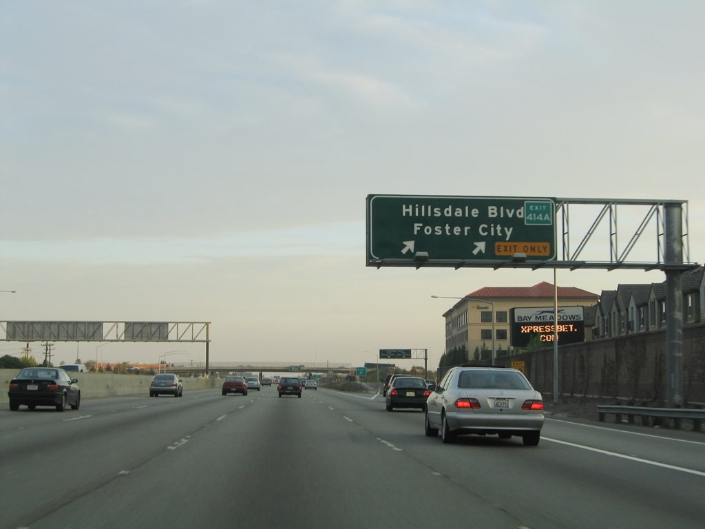 |
Southbound U.S. 101 (Bayshore Freeway) reaches Exit 414A, Hillsdale Boulevard. This is the last interchange to serve the city of San Mateo. Photo taken 11/26/04. |
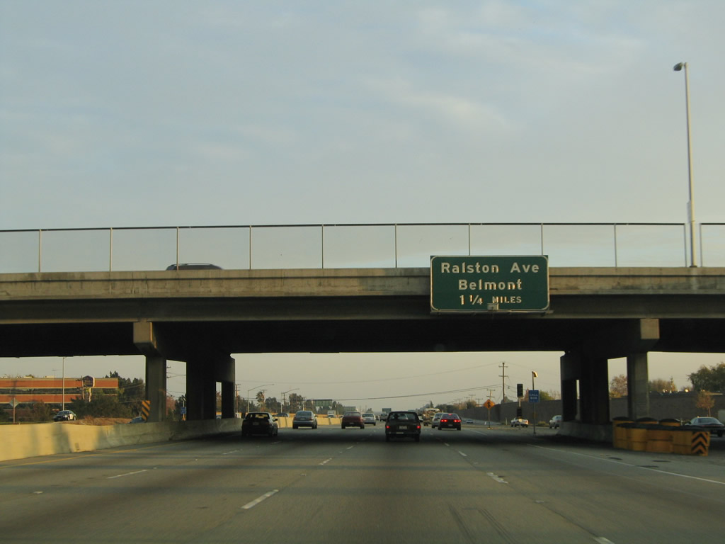 |
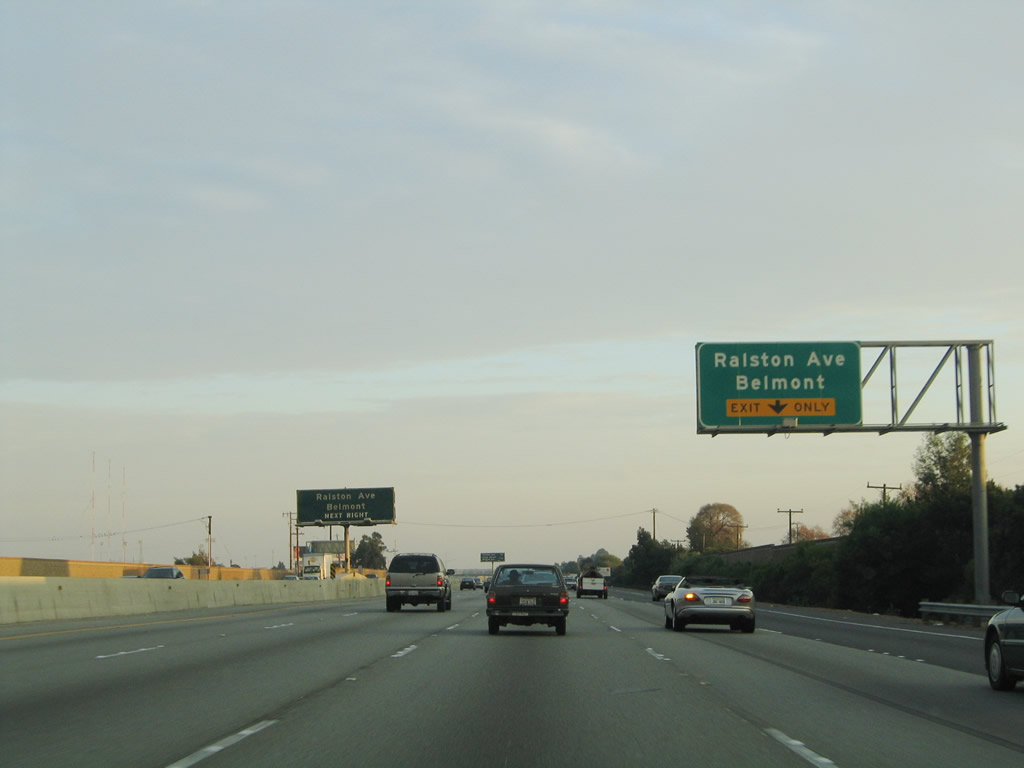
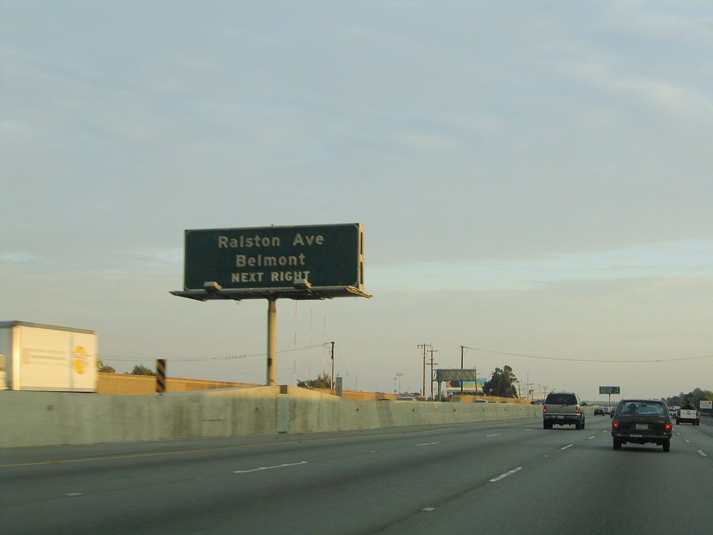
The next exit on U.S. 101 south is Exit 412, Ralston Avenue into the city of Belmont and Redwood City. This interchange is a modified cloverleaf. Photo taken 11/26/04. |
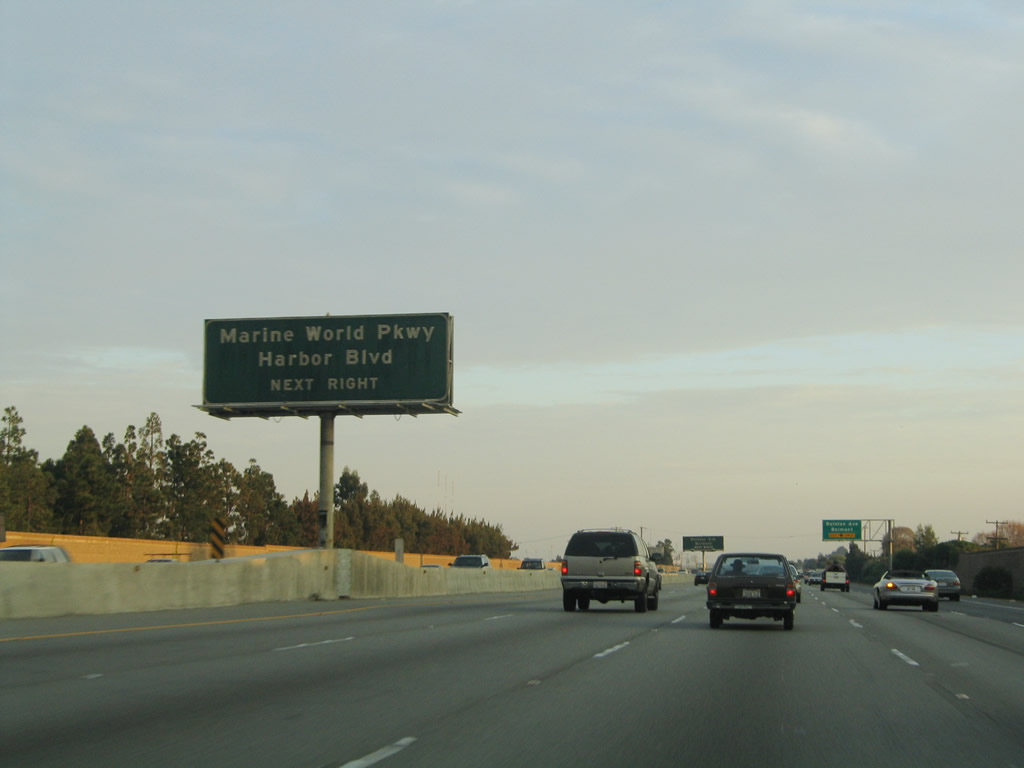 |
Use Exit 412 to Marine World Parkway east into Redwood City and Harbor Boulevard. Photo taken 11/26/04. |
 |
The right lane becomes exit only for Exit 412, Ralston Avenue, Marine World Parkway, and Harbor Boulevard. This interchange consists of three exit ramps. The first ramp will connect to Ralston Avenue west to Belmont, the second loop ramp connects to Marine World Parkway east into Redwood City (Redwood Shores neighborhood), and the third ramp connects to Harbor Boulevard west. The first two ramps are part of a cloverleaf interchange, while the last ramp is actually located about quarter mile south of the cloverleaf. All of these exits are separated from the main freeway lanes. Photo taken 11/26/04. |
 |
The city of Belmont is home to 25,123 people as of the 2000 Census. Belmont made national news recently by banning smoking in indoor condominiums and apartments in October 2007 as well as in parks. At the time, this was considered to be among the nation's strictest anti-smoking ordinances. Photo taken 11/26/04. |
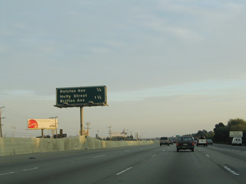 |
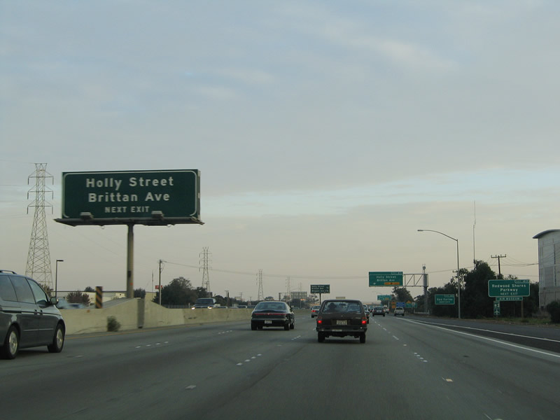
This mileage sign provides the distance to Exit 412, Ralston Avenue and Exit 411, Redwood Shores Parkway/Holly Street and Brittan Avenue. Photo taken 11/26/04. |
 |
Southbound U.S. 101 (Bayshore Freeway) reaches Exit 412, Ralston Avenue/Marine World Parkway and Harbor Boulevard. This exit is a collector distributor, so through traffic may exit. Photo taken 11/26/04. |
 |
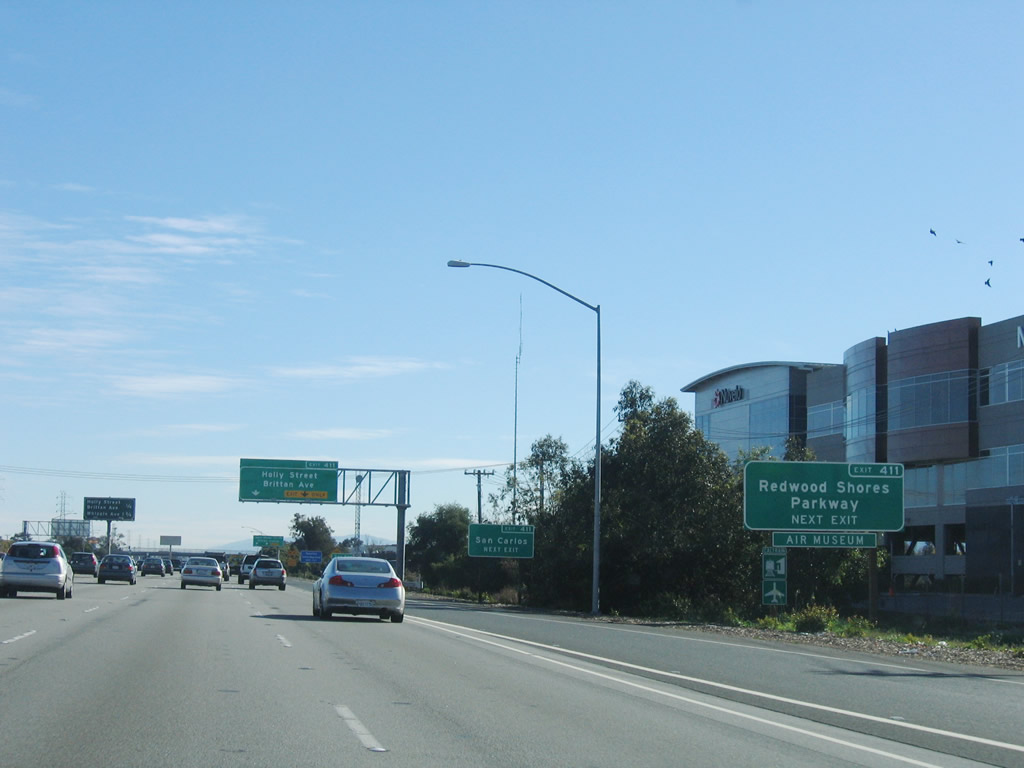
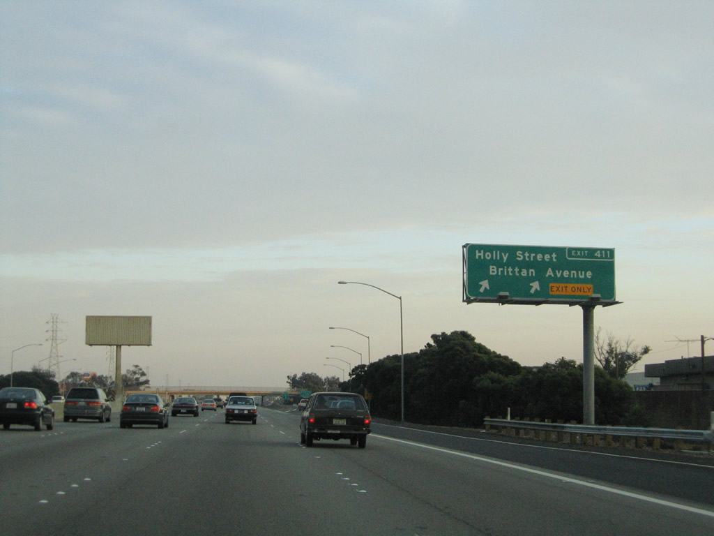
The next exit along southbound U.S. 101 (Bayshore Freeway) is Exit 411, Holly Street and Brittan Avenue. This interchange consists of three exit ramps. The first ramp will connect to Holly Street west, the second loop ramp connects to Redwood Shores Parkway northeast, and the third ramp connects to Brittan Avenue west. The first and third ramps serve the city of San Carlos, while the second ramp leaves San Carlos to enter the Redwood Shores neighborhood of Redwood City. Photo taken 11/26/04. |
|
The next exit along southbound U.S. 101 (Bayshore Freeway) is Exit 411, Holly Street and Brittan Avenue. This interchange consists of three exit ramps. The first ramp will connect to Holly Street west, the second loop ramp connects to Redwood Shores Parkway northeast, and the third ramp connects to Brittan Avenue west. The first and third ramps serve the city of San Car lose, while the second ramp leaves San Carlos to enter the Redwood Shores neighborhood of Redwood City. Photo taken 11/26/04. |
 |
As traffic from the Ralston Avenue and Harbor Boulevard collector distributor lane returns to the mainline, southbound U.S. 101 enters the city of San Carlos, the next suburb along the heavily populated Peninsula corridor. Situated between Belmont and Redwood City, San Carlos (the "City of Good Living") was home to 27,718 as of the 2000 Census. San Carlos was incorporated in 1925. Downtown San Mateo is located along Elm Street. Use Exit 411/Holly Street west to California 82 (El Camino Real) south, then turn west on San Carlos Avenue and south on Elm Street. Photo taken 11/26/04. |
 |
Two roadside exit number signs are posted soon thereafter. The first advises that Exit 411 connects to Redwood Shores Parkway, while the second indicates that Exit 411 serves the city of San Carlos. Photo taken 11/27/05. |
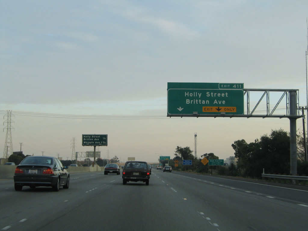 |
The right lane of U.S. 101 becomes exit only for Exit 411, Holly Street, Redwood Shores Parkway, and Brittan Avenue. Use Exit 411 to the San Carlos Airport, which is located on the southeastern quadrant of this interchange. Photo taken 11/26/04. |
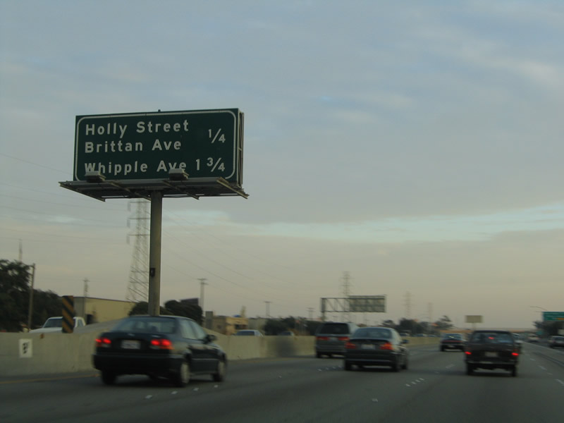 |
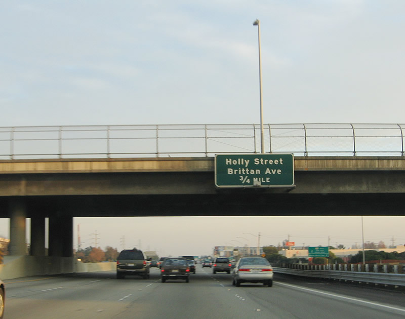
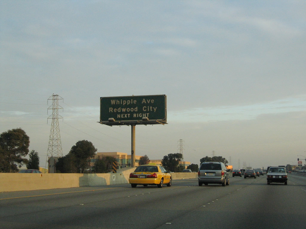
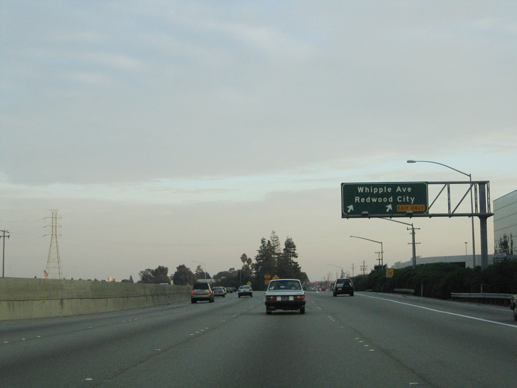
A mileage sign for southbound U.S. 101 (Bayshore Freeway) points the way to Exit 411 (Holly Street/Redwood Shores Parkway and Brittan Avenue) and Exit 409, Whipple Avenue in Redwood City. Photo taken 11/26/04. |
 |
Southbound U.S. 101 (Bayshore Freeway) reaches Exit 411, Holly Street/Redwood Shores Parkway (initial cloverleaf interchange) and Brittan Avenue (ramp located about a half mile south of Holly Street). This ramp is a collector distributor, so through traffic may exit here and return to the mainline. Photo taken 11/26/04. |
 |
View of the ramp to Redwood Shores Parkway north as seen on the collector distributor lanes from the main lanes. The ramp to Brittan Avenue can be seen in a couple of photoboxes. Photo taken 11/27/05. |
 |
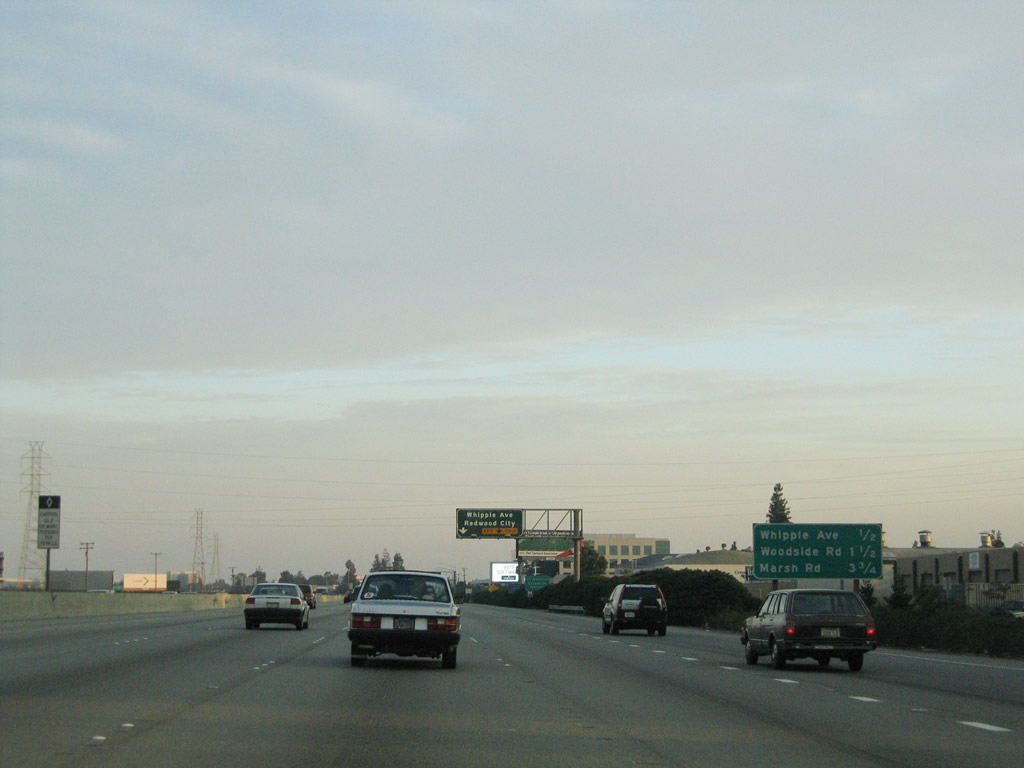
The next exit along U.S. 101 south is Exit 409, Whipple Avenue/Veterans Boulevard. This is the first of two interchanges that serves the city of Redwood City. Photo taken 11/26/04. |
 |
Traveling south on the main lanes of U.S. 101, the split in the adjacent collector distributor lanes for westbound Brittan Avenue can be seen. Photo taken 11/26/04. |
 |
The next three exits along southbound U.S. 101 are: Exit 409, Whipple Avenue/Veterans Boulevard; Exit 408, California 84 (Woodside Expressway) west; and Exit 406, California 84 (Bayfront Expressway) east to the Dumbarton Bridge and Marsh Road south to Atherton. Photo taken 11/26/04. |
 |
The right lane of U.S. 101 south becomes exit only for Exit 409, Whipple Avenue/Veterans Boulevard. Photo taken 11/26/04. |
 |
Southbound U.S. 101 (Bayshore Freeway) reaches Exit 409, Whipple Avenue/Veterans Boulevard. This exit defaults onto Veterans Boulevard, and the intersection with Whipple Avenue is the first intersection south of the off-ramp. A park and ride is located on the northeast corner of the intersection between Veterans Boulevard and Whipple Avenue. At this point, U.S. 101 enters Redwood City. Redwood City incorporated in 1867, and voters adopted the Redwood City charter on April 9, 1929. As of the 2000 Census, Redwood City had a population of 75,400 and encompassed approximately 19 square miles. The city is also the seat of San Mateo County. Photo taken 11/26/04. |
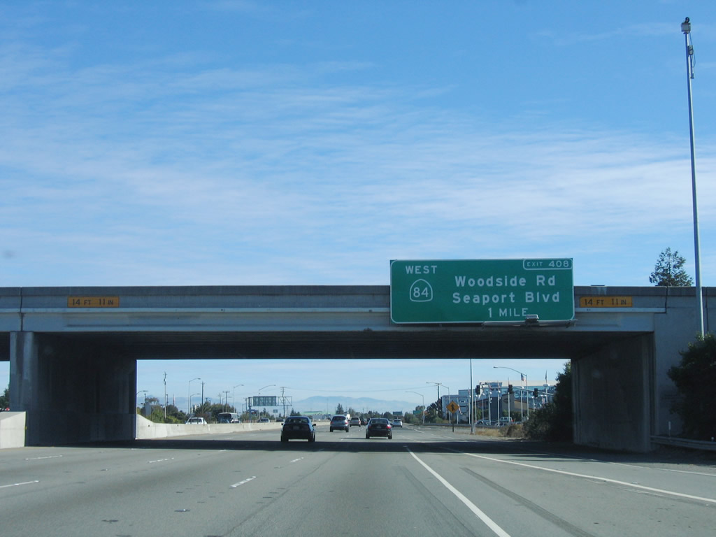 |
U.S. 101 turns almost due east for the next three miles or so as it passes through Redwood City. The next exit along U.S. 101 south is Exit 408, California 84 (Woodside Expressway) west and Seaport Boulevard north. Woodside Expressway is also known as Woodside Road; the expressway designation is for the initial section leaving U.S. 101, which is a multi-lane divided expressway and features an interchange with California 82 (El Camino Real) (Old U.S. 101). Between Exits 408 and 406, California 84 east will merge onto U.S. 101 south. Photo taken 11/27/05. |
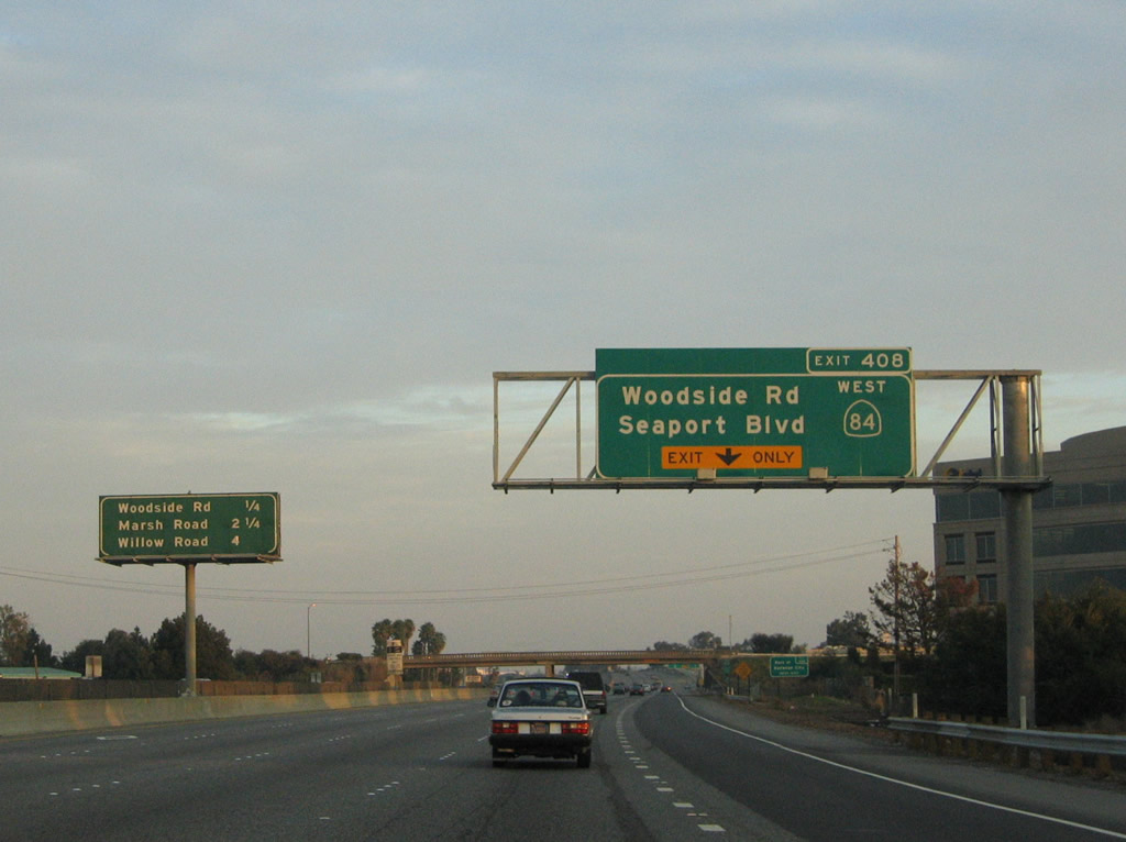 |
The right lane of U.S. 101 (Bayshore Freeway) south becomes exit only for Exit 408, California 84 (Woodside Expressway) east to Redwood City. Since U.S. 101 is traveling almost due east at this point, California 84 east actually travels due south from this interchange through Redwood City. Photo taken 11/26/04. |
 |
North of the U.S. 101-California 84 interchange is the Port of Redwood City, which is accessible via Seaport Boulevard. The port sits on a peninsula that follows Redwood Creek and includes a municipal marina. Photo taken 11/26/04. |
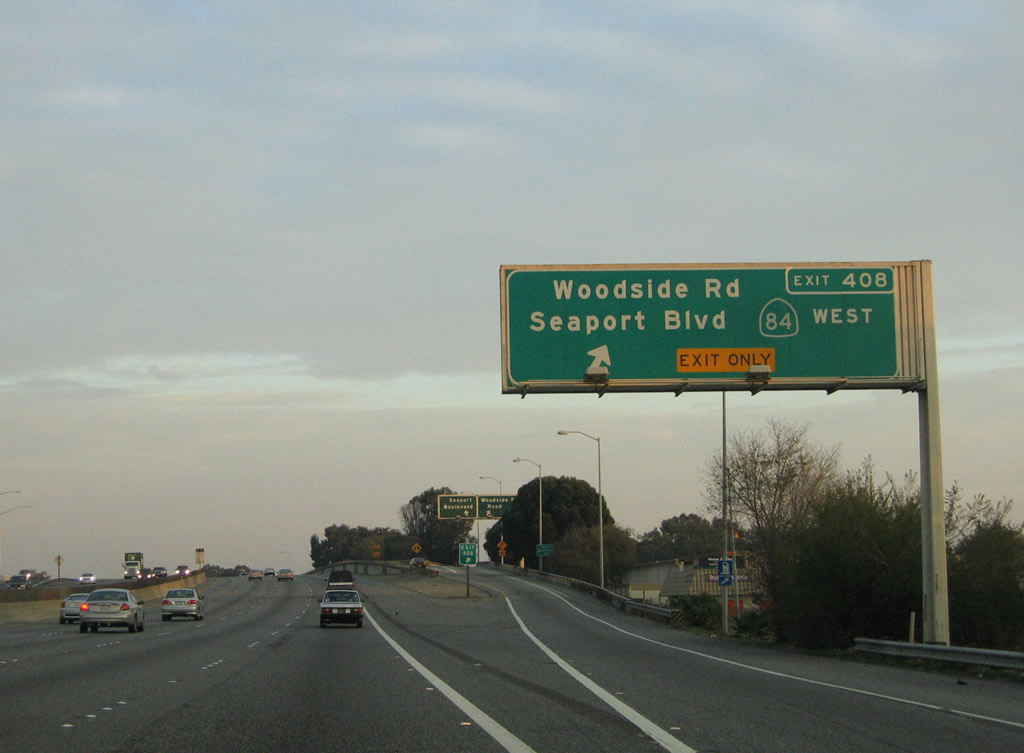 |
Southbound U.S. 101 reaches Exit 408, California 84 (Woodside Expressway) west (south) to Redwood City and Seaport Boulevard north to the Port of Redwood City. California 84 eventually finds its way to the coast, ending at California 1 near San Gregorio. Photo taken 11/26/04. |
 |
Looking at the exit ramp for California 84 west, the ramp divides into two lanes, one for California 84 west and the other for Seaport Boulevard north. Photo taken 11/27/05. |
 |
After Exit 408, this reassurance shield assembly contains both U.S. 101 south and California 84 east shields. Photo taken 11/26/04. |
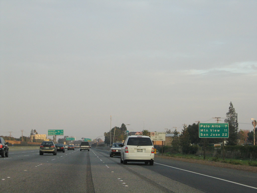 |
This mileage sign provides the distance to Palo Alto (seven miles), Mountain View (11 miles), and San Jose (22 miles). All of these are U.S. 101 south destinations (none are for California 84). Photo taken 11/26/04. |
 |
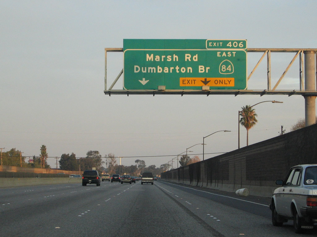
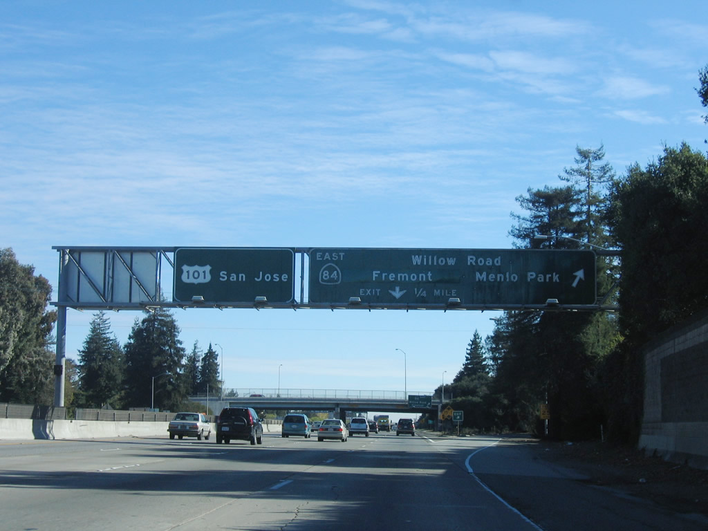
The next two exits along southbound U.S. 101 are Exit 406, California 84 (Bayfront Expressway) east and Marsh Road south (trucks are restricted on Marsh Road) and Exits 404B-A, California 114 (Willow Road). Photo taken 11/26/04. |
 |
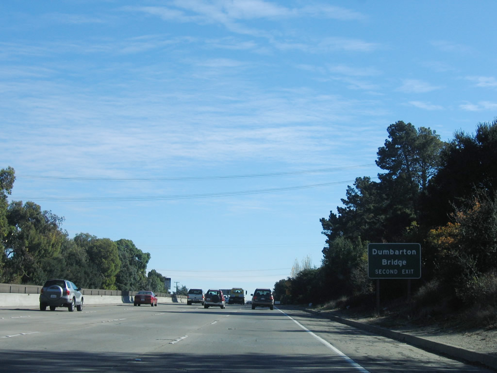
Use California 84 east via the Bayfront Expressway to the Dumbarton Bridge, the southernmost San Francisco Bay crossing. The expressway is a six-lane divided highway with signalized intersections allowing the only access onto the expressway. There are three major approaches to the Dumbarton Bridge: California 84 (Bayfront Expressway), California 114 (Willow Road), and California 109, University Avenue. Somewhat confusingly, all three of these approaches are signed as California 84 or To California 84. Photo taken 11/26/04. |
 |
The right two lanes of U.S. 101 south connect to California 84 (Bayfront Expressway) east and Marsh Road south. Photo taken 11/26/04. |
 |
U.S. 101 south and California 84 east split at Exit 406. After this interchange, U.S. 101 turns a bit to the southeast, and California 84 continues almost due east toward the Dumbarton Bridge. Photo taken 11/26/04. |
 |
After the California 84 east exit, an errant reassurance shield assembly still shows California 84 east. However, this is not that bad, since motorists may use the next exit, California 114 (Willow Road) north to rejoin California 84 (Bayfront Expressway) east to the Dumbarton Bridge. Photo taken 11/27/05. |
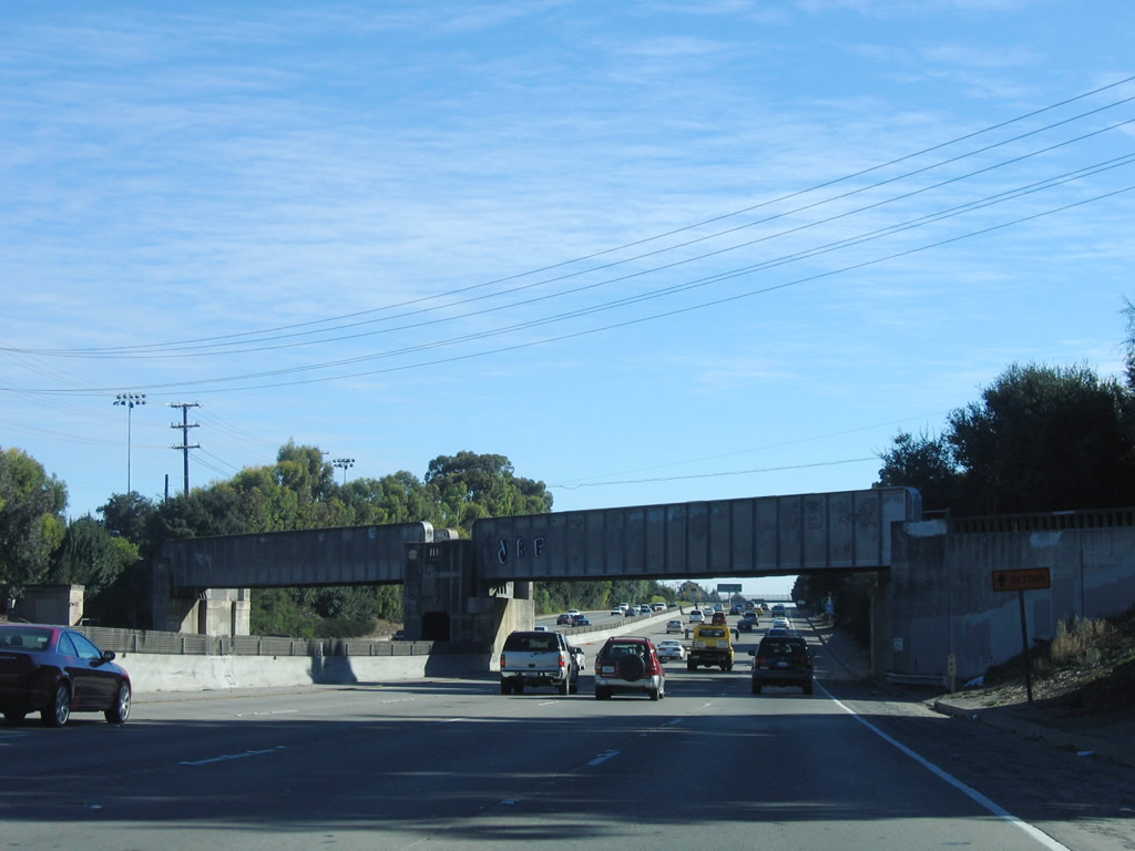 |
U.S. 101 passes under this 1930s-era Union Pacific Railroad bridge. After the Exit 406 interchange, U.S. 101 leaves Redwood City and enters the city of Menlo Park. Incorporated in November 1927, Menlo Park is home to 30,648 people (2000 Census) and is situated between San Francisco and San Jose. Photo taken 11/27/05. |
 |
The interchange between U.S. 101 and Willow Road is a cloverleaf. To California 84/Dumbarton Bridge east, use Exit 404A, California 114 (Willow Road) north. Photo taken 11/27/05. |
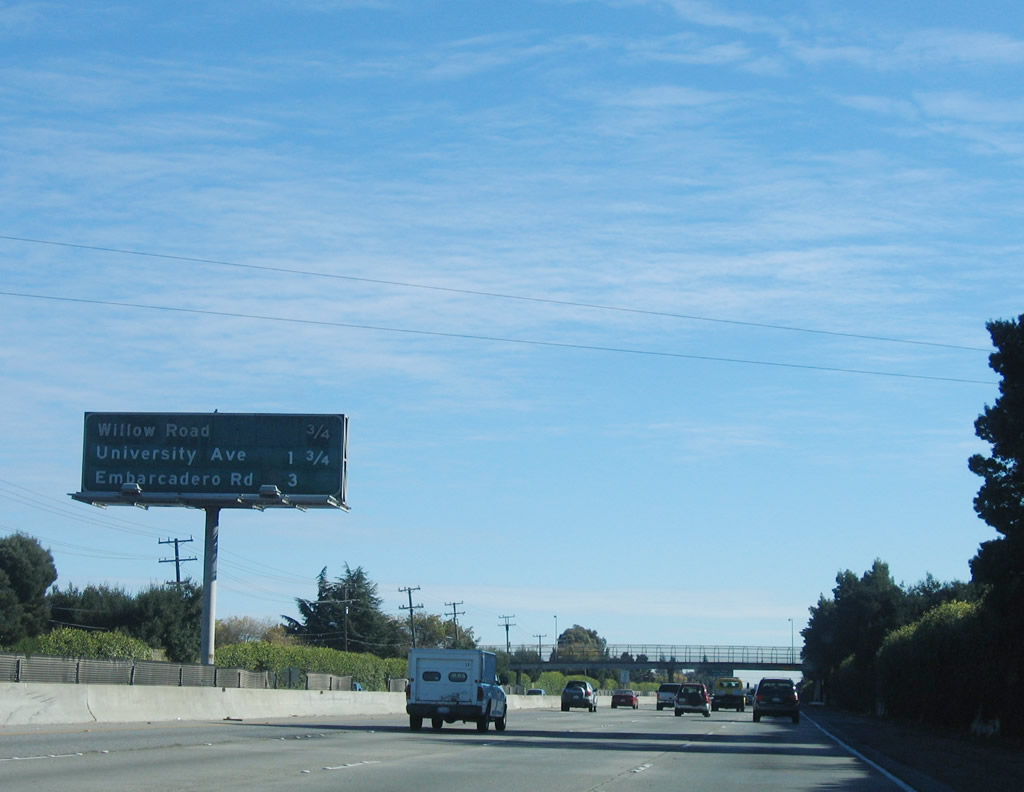 |
The next four exits along U.S. 101 south are: Exit 404B, Willow Road west (south); Exit 404A, California 114 (Willow Road) east (north); Exit 403, University Avenue; and Exit 402, Embarcadero Road and Oregon Expressway. Photo taken 11/27/05. |
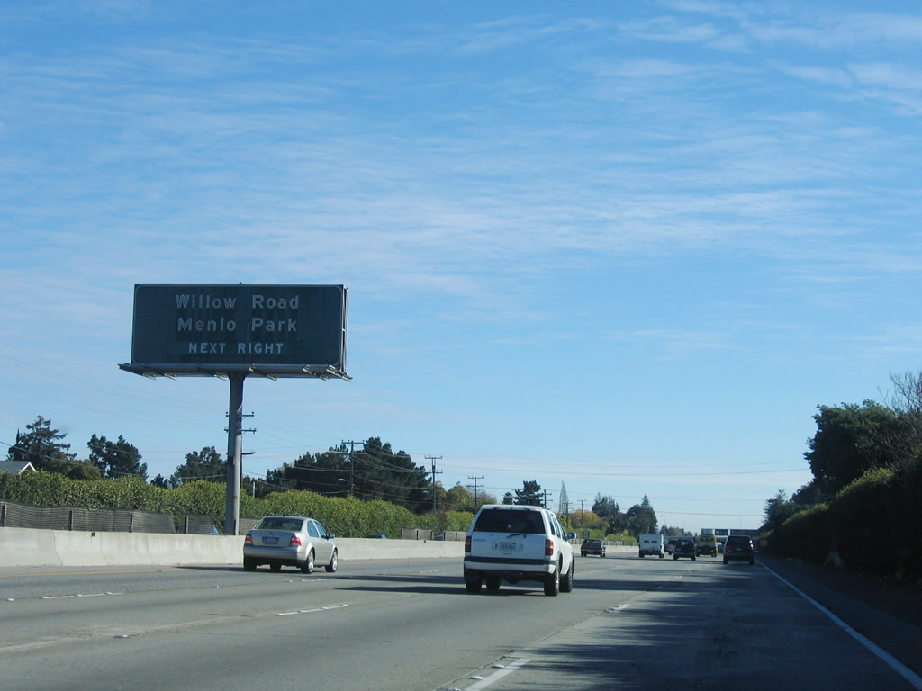 |
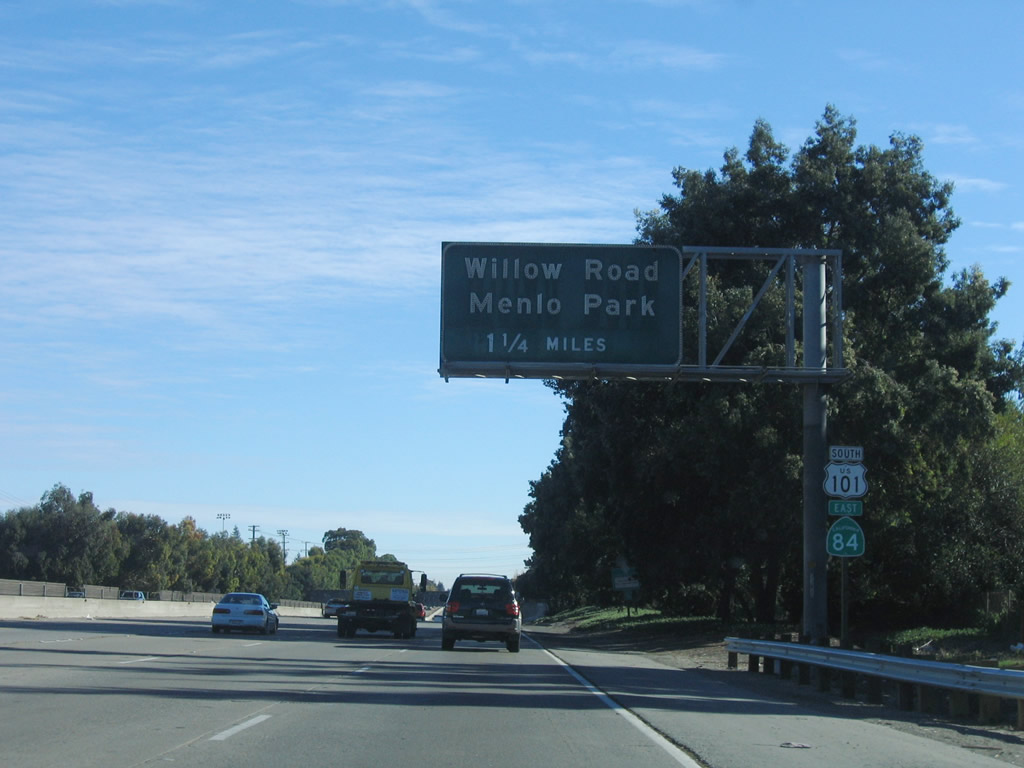
Use Exit 404B, Willow Road west (south) to downtown Menlo Park, which is primarily located along Laurel Street. A Caltrain and SamTrans station is located near Laurel Street and Oak Glen Avenue. At the southwestern quadrant of this interchange is the Menlo Park VA Hospital. Photo taken 11/27/05. |
 |
This is one of the few remaining standard cloverleaf interchanges left on U.S. 101 (Bayshore Freeway). The first ramp connects to Exit 404B, Willow Road west, and the loop ramp connects to Exit 404A, California 114 (Willow Road) north. Note that California 84 is signed rather than California 114 for Exit 404A; this is because California 114 is merely a connector from U.S. 101 to California 84; California 84 is the longer through route. Photo taken 11/27/05. |
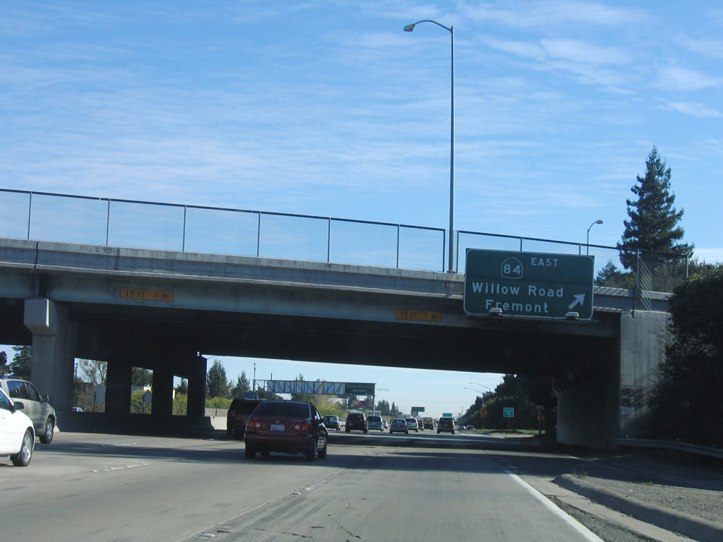 |
Southbound U.S. 101 (Bayshore Freeway) reaches Exit 404A, California 114 (Willow Road) north to California 84 (Bayfront Expressway) east to Dumbarton Bridge (no toll traveling eastbound) and the city of Fremont in the East Bay. Photo taken 11/27/05. |
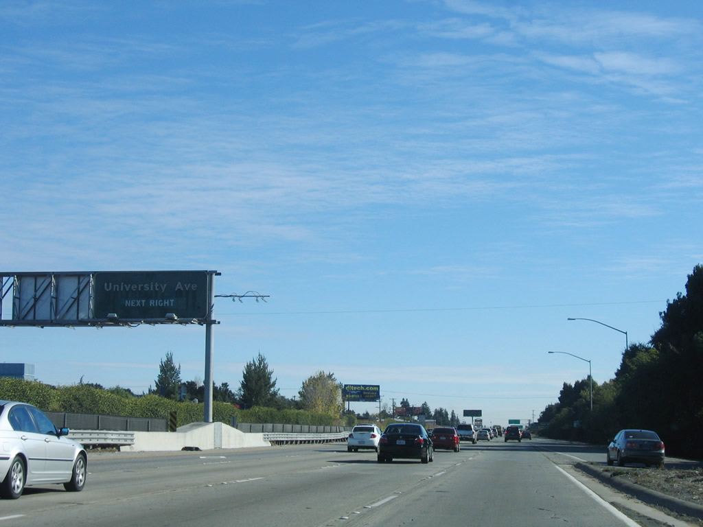 |
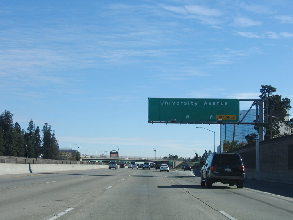
The next exit along U.S. 101 (Bayshore Freeway) south is Exit 403, University Avenue. This exit is the only one to serve the city of East Palo Alto, which is located between the city of Menlo Park and the city of Palo Alto in Santa Clara County. Photo taken 11/27/05. |
 |
The next four exits along U.S. 101 (Bayshore Freeway) south are Exit 403, University Avenue to East Palo Alto; Exit 402, Embarcadero Road and Oregon Expressway; Exit 400C, San Antonio Road south to Los Altos; and Exit 400B, San Antonio Road north. Photo taken 11/27/05. |
 |
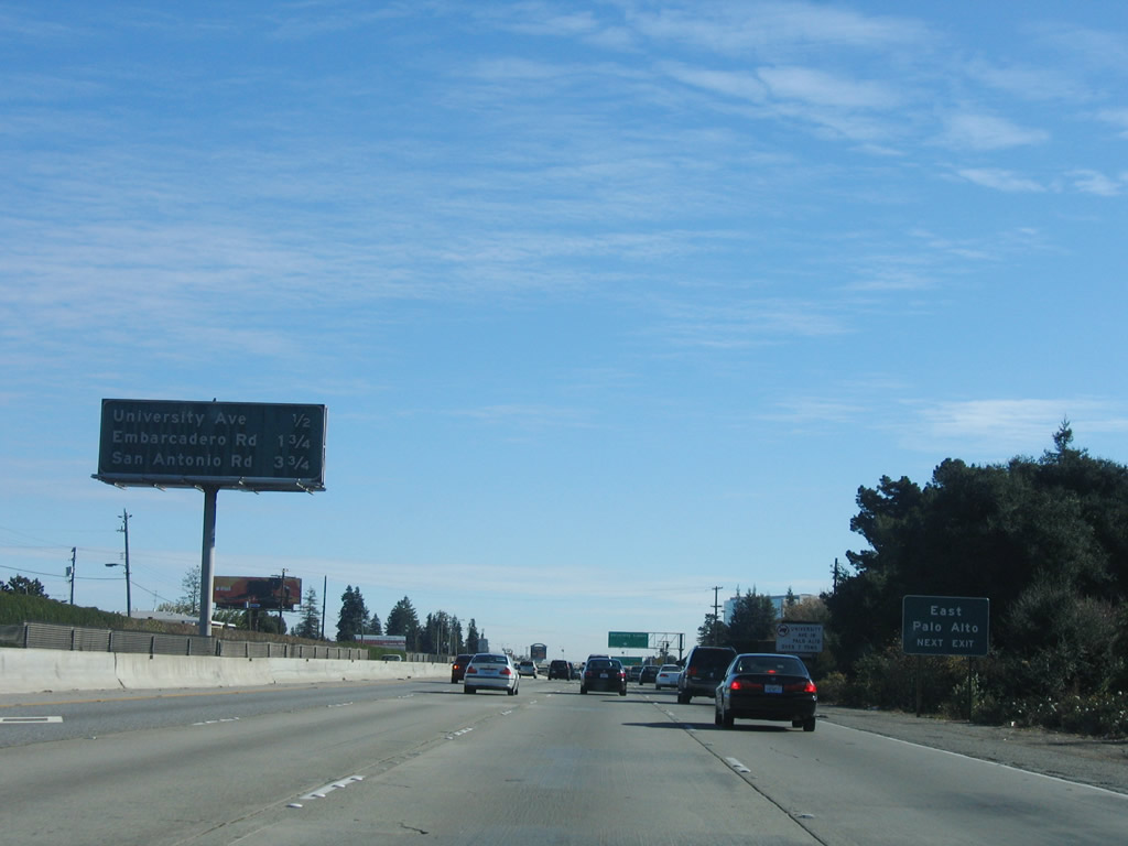
University Avenue (Exit 403) serves the city of East Palo Alto. Home to 29,506 people as of the 2000 Census, East Palo Alto was incorporated rather recently (in June 1983) and was previously an unincorporated area within San Mateo County. The San Francisquito Creek separates East Palo Alto from Palo Alto. Photo taken 11/27/05. |
 |
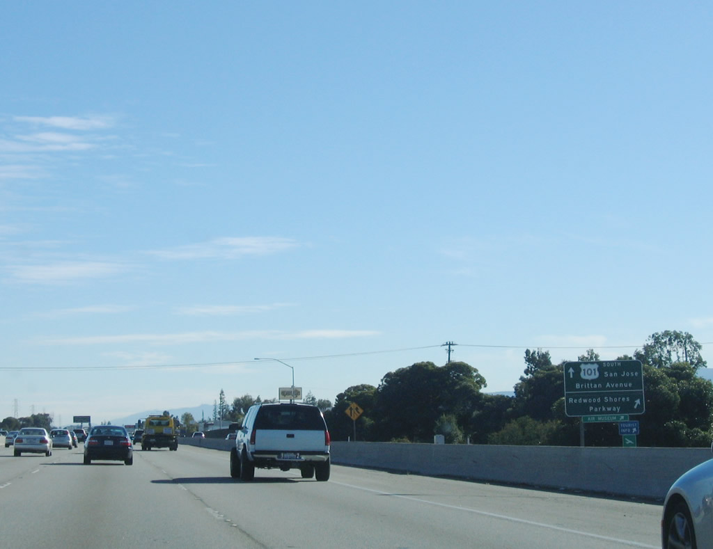
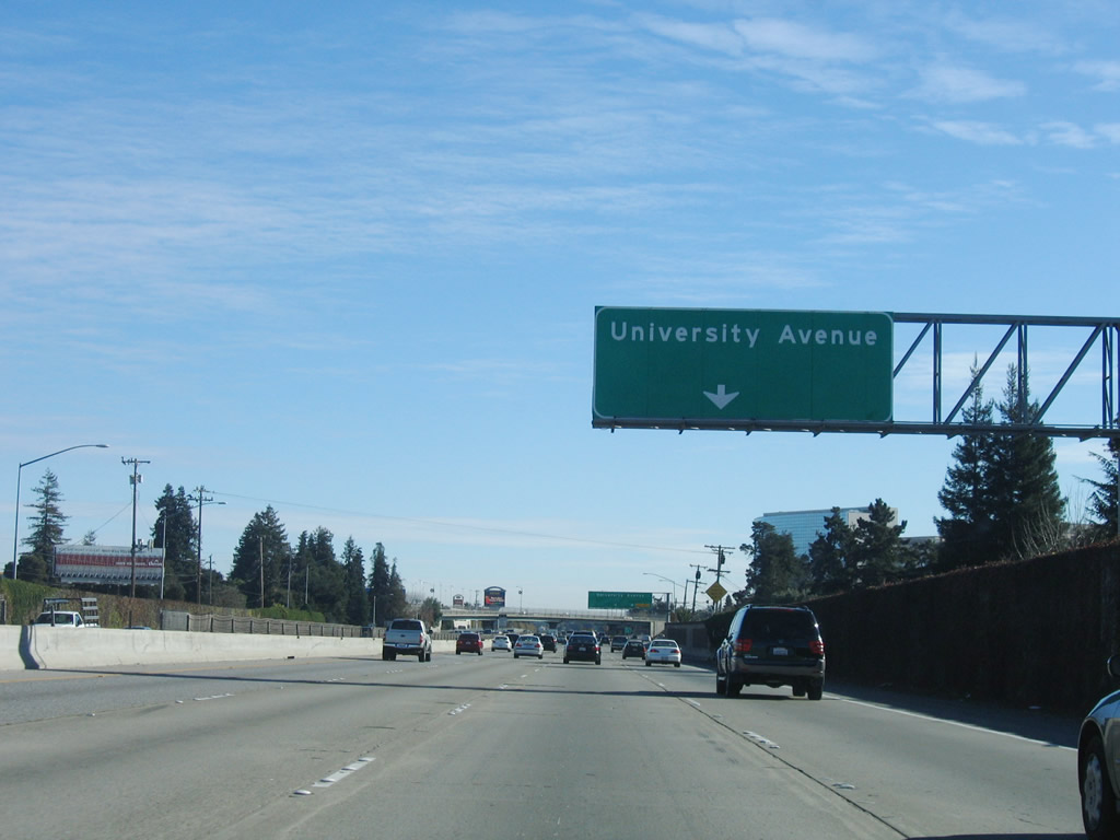
Southbound U.S. 101 reaches Exit 403, California 109 (University Avenue) north to the Dumbarton Bridge via East Palo Alto and University Avenue southwest into Palo Alto. This is the last interchange in San Mateo County. Photo taken 11/27/05. |
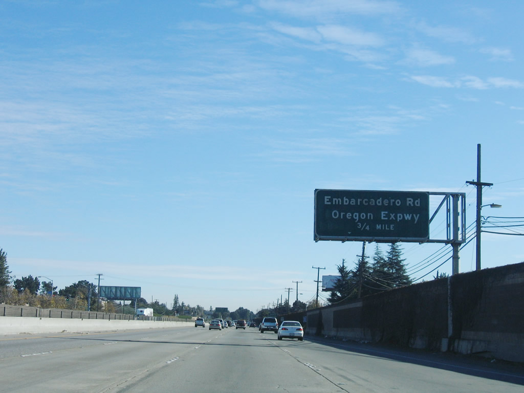 |
The next exit along southbound U.S. 101 is Exit 402, Embarcadero Road and Santa Clara County G-3/Oregon Expressway. This interchange is fairly unique, as it combines a modified cloverleaf interchange with Embarcadero Road with a trumpet interchange with Santa Clara County G-3/Oregon Expressway. A collector distributor lane provides access to all three exits: Embarcadero Road west, Embarcadero Road east, and Santa Clara County G-3/Oregon Expressway southwest. Photo taken 11/27/05. |
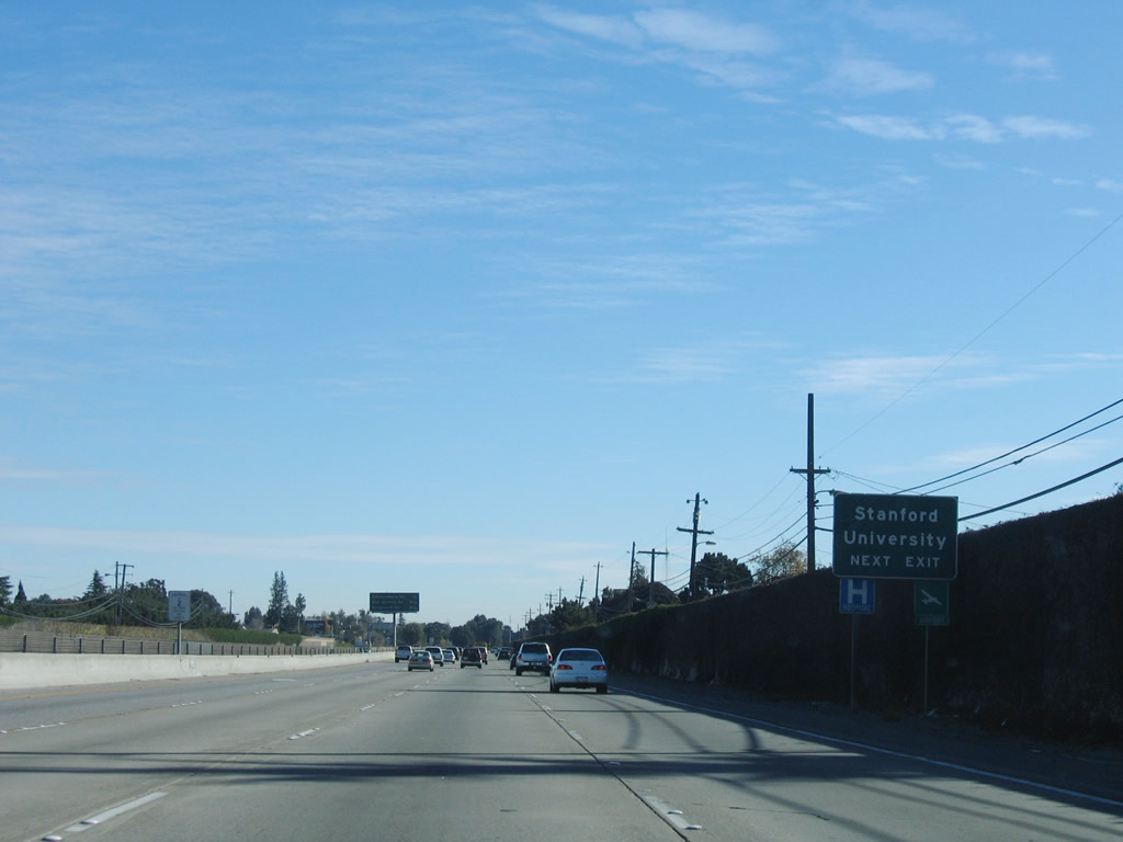 |
Use Embarcadero Road west to Stanford University, one of the largest universities in the Bay Area. Home to the Cardinal since 1892, Stanford and the University of California at Berkeley rival each other in college football each fall season. To the west of U.S. 101 along Embarcadero Road is the Palo Alto Airport, which is situated alongside the bay. Photo taken 11/27/05. |
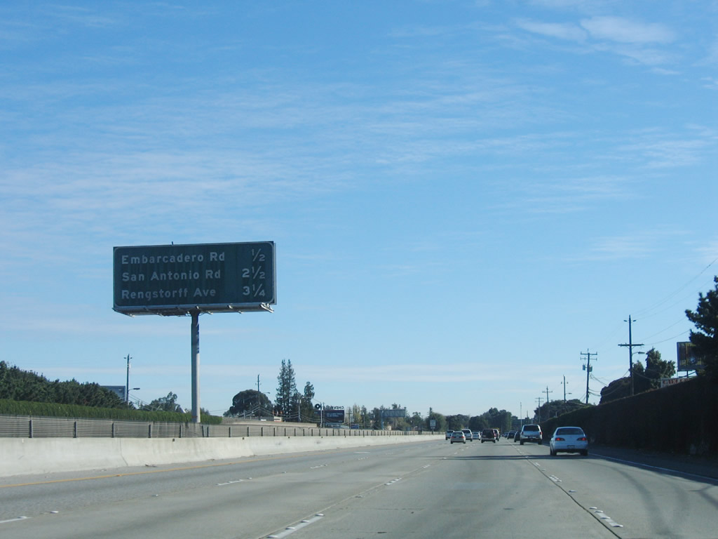 |
The next four exits along U.S. 101 (Bayshore Freeway) south are Exit 402, Embarcadero Road and Santa Clara County G-3/Oregon Expressway; Exit 400C, San Antonio Road south to Los Altos; Exit 400B, San Antonio Road north; and Exit 400A, Rengstorff Avenue/Amphitheatre Parkway to the Shoreline Amphitheatre. After this sign, U.S. 101 leaves San Mateo County and enters Santa Clara County. Photo taken 11/27/05. |
 |
U.S. 101 leaves San Mateo County and the city of East Palo Alto and enters Santa Clara County and the city of Palo Alto. Photo taken 11/27/05. |


Page Updated February 9, 2008.
|
About Contact Glossary |
In The News Interstate Guide |
Social Media:
 |
|
© 2000-25 AARoads.com | All Rights Reserved | Privacy Policy / Terms of Use
|
||