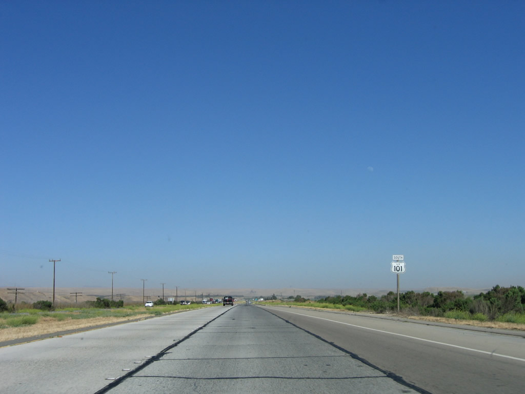
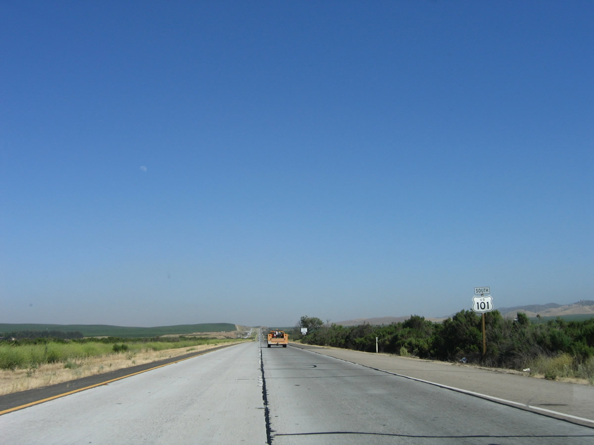
| U.S. 101 south |
|
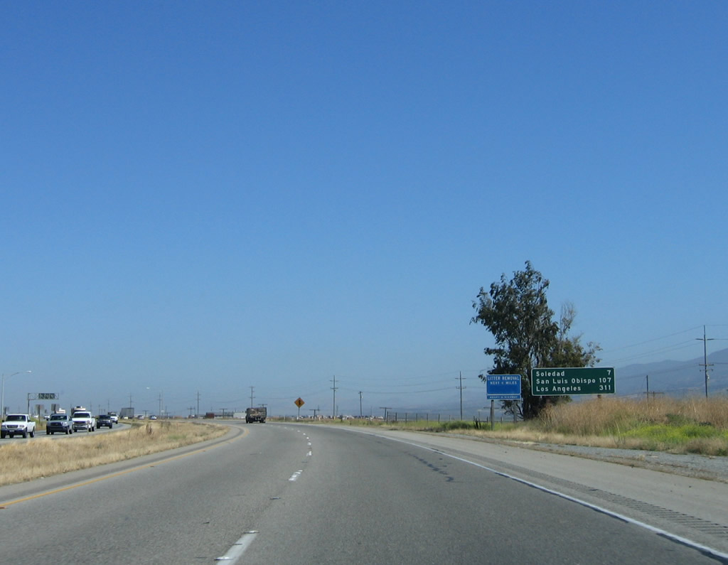
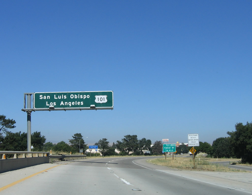
This mileage sign along U.S. 101 (El Camino Real) provides the distance to Soledad (seven miles), San Luis Obispo (107 miles), and Los Angeles (311 miles). Photo taken 07/05/06. |
|
After the on-ramp from Alta Street (U.S. 101 Business) in Gonzales, this U.S. 101 south reassurance shield assembly is posted. Photo taken 07/05/06. |
|
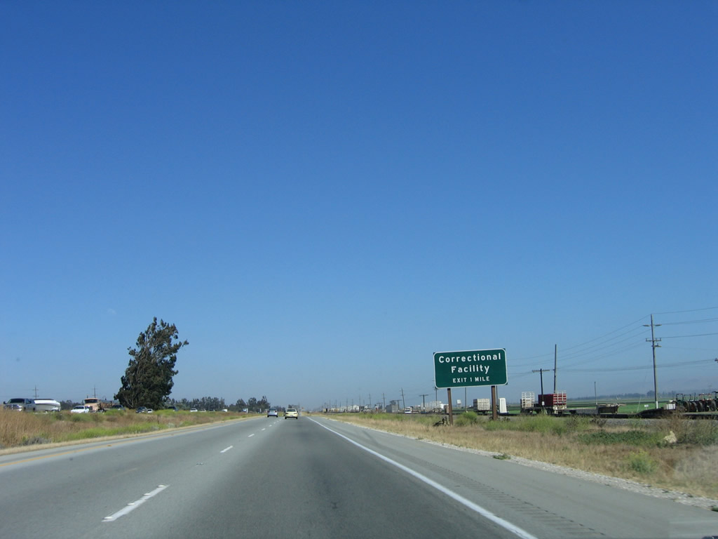
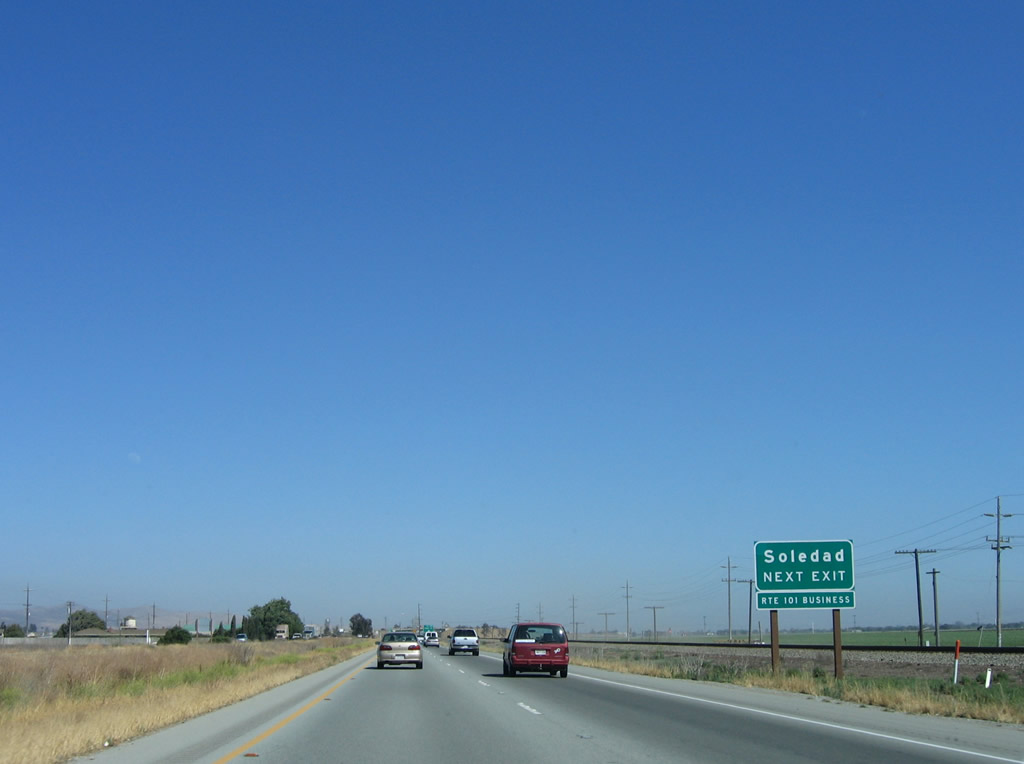
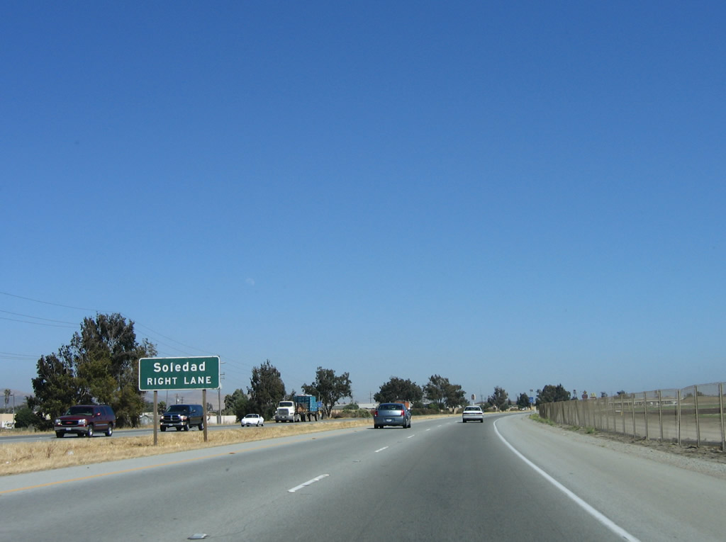
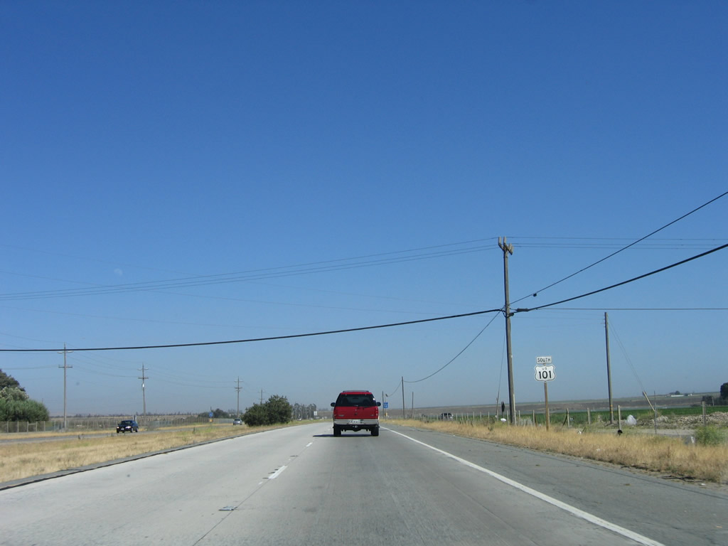
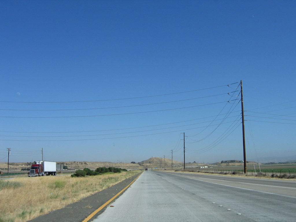
The next exit along U.S. 101 (El Camino Real) south is Exit 307, Soledad Prison Road to Soledad State Prison (signed as "Correctional Facility"). Photo taken 07/05/06. |
|
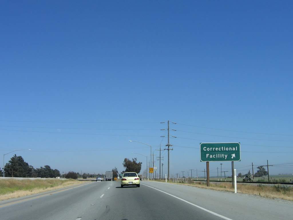
Southbound U.S. 101 (El Camino Real) reaches Exit 307, Soledad Prison Road to Soledad State Prison (signed as "Correctional Facility"). Photo taken 07/05/06. |
|
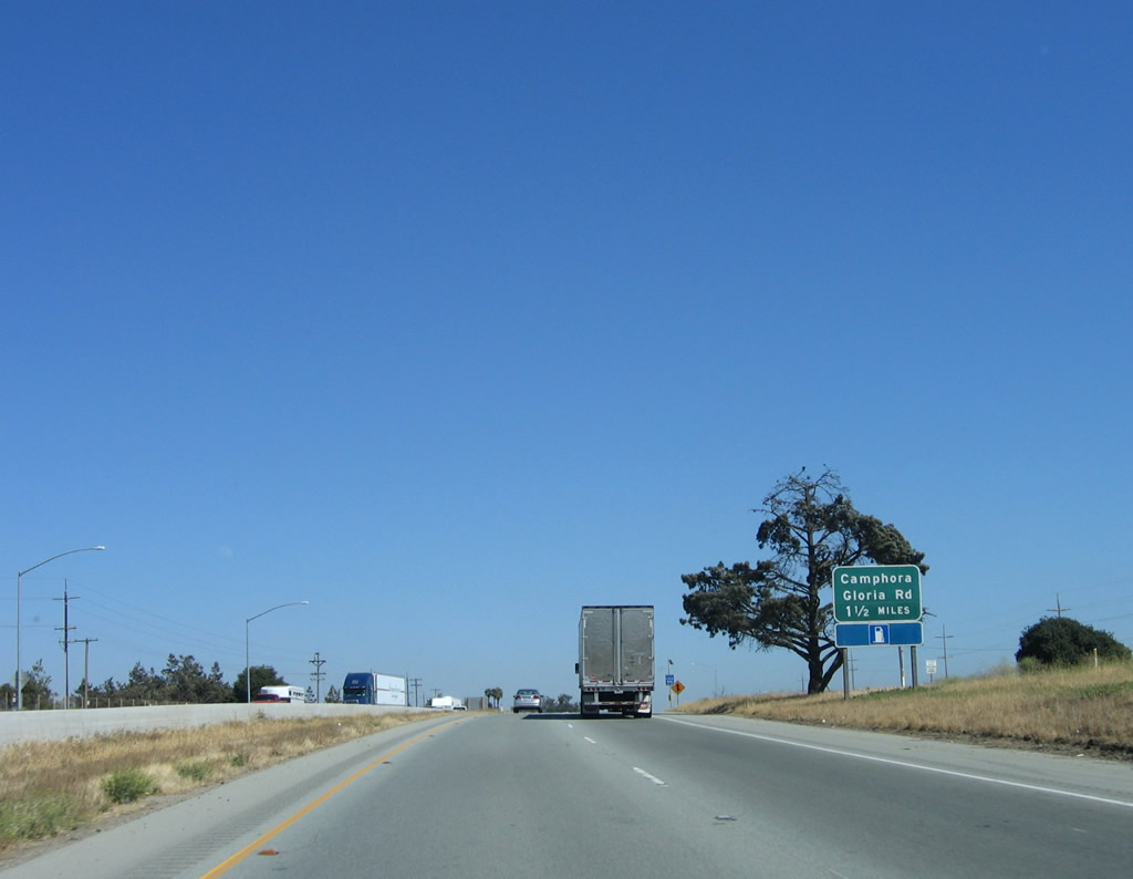
The next exit along U.S. 101 (El Camino Real) south is Exit 304, Camphora Gloria Road. This exit also serves the agricultural and grape-growing areas of the Salinas River Valley. Photo taken 07/05/06. |
|
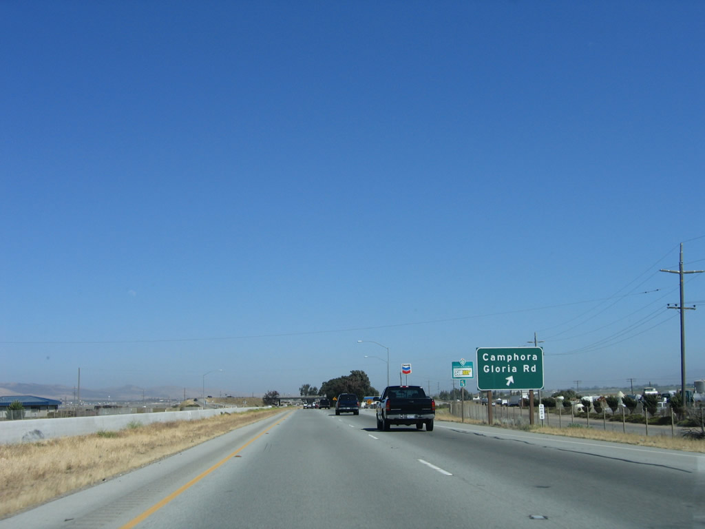
Southbound U.S. 101 (El Camino Real) reaches Exit 304, Camphora Gloria Road. Photo taken 07/05/06. |
|
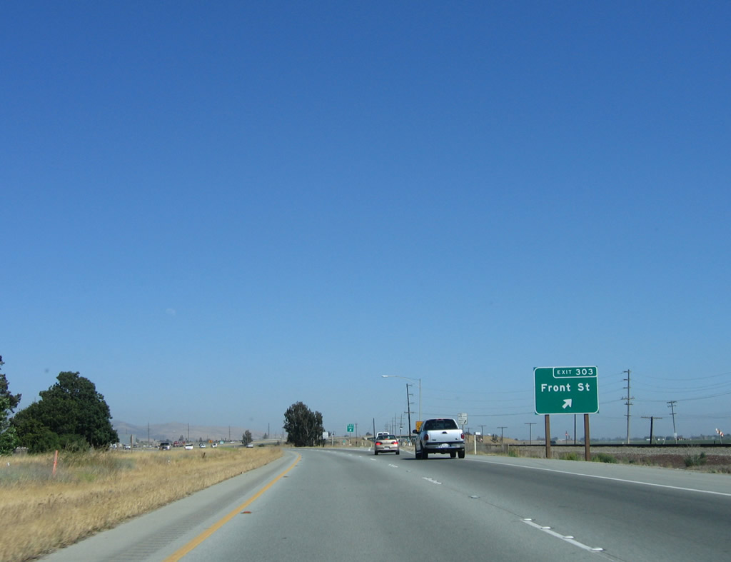
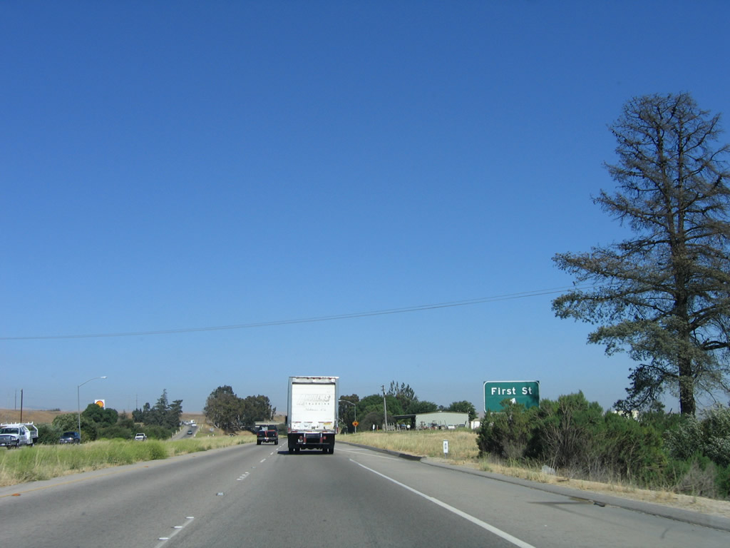
The next exit along U.S. 101 (El Camino Real) south is Exit 303, U.S. 101 Business (Front Street) south to Soledad. Photo taken 07/05/06. |
|
U.S. 101 Business follows Front Street through downtown Soledad between Exits 303 and 302. Most of the business route is located on the east side of the U.S. 101 freeway bypass, which stays much closer to downtown than the bypass of Gonzales did. The city of Soledad is considered the "fastest growing city within California" due to the population increasing at an average annual rate of 8% over five years. The population increased from 11,263 people as of the 2000 Census to 27,701 people as of the 2006 Census estimate. Photo taken 07/05/06. |
|
Southbound U.S. 101 reaches Exit 303, U.S. 101 Business (Front Street) south to downtown Soledad. In addition to the nearby prison, Soledad is also part of the Salinas Valley wine country. The Soledad Energy Partnership is located here; the plant generates power by burning wood and other organic wastes. Soledad is also the western gateway to Pinnacles National Monument, located at the end of California 146. Use Exit 302 to California 146 east to the national monument. Finally, Soledad consists of 4.2 square miles. Photo taken 07/05/06. |
|
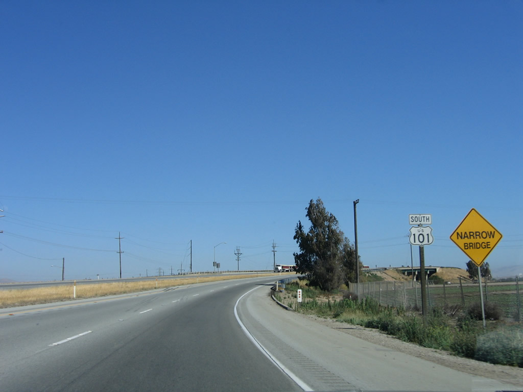
The ramp for the business route will pass under U.S. 101 at the narrow bridge visible in the distance ahead. A reassurance shield is also posted after the freeway/business split. Photo taken 07/05/06. |
|
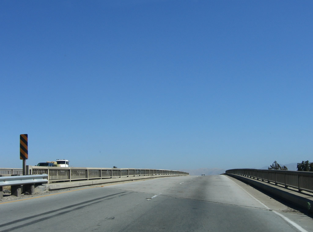
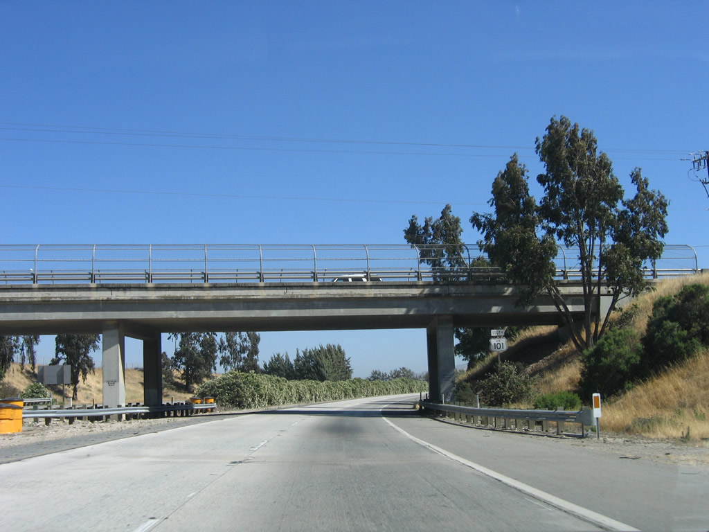
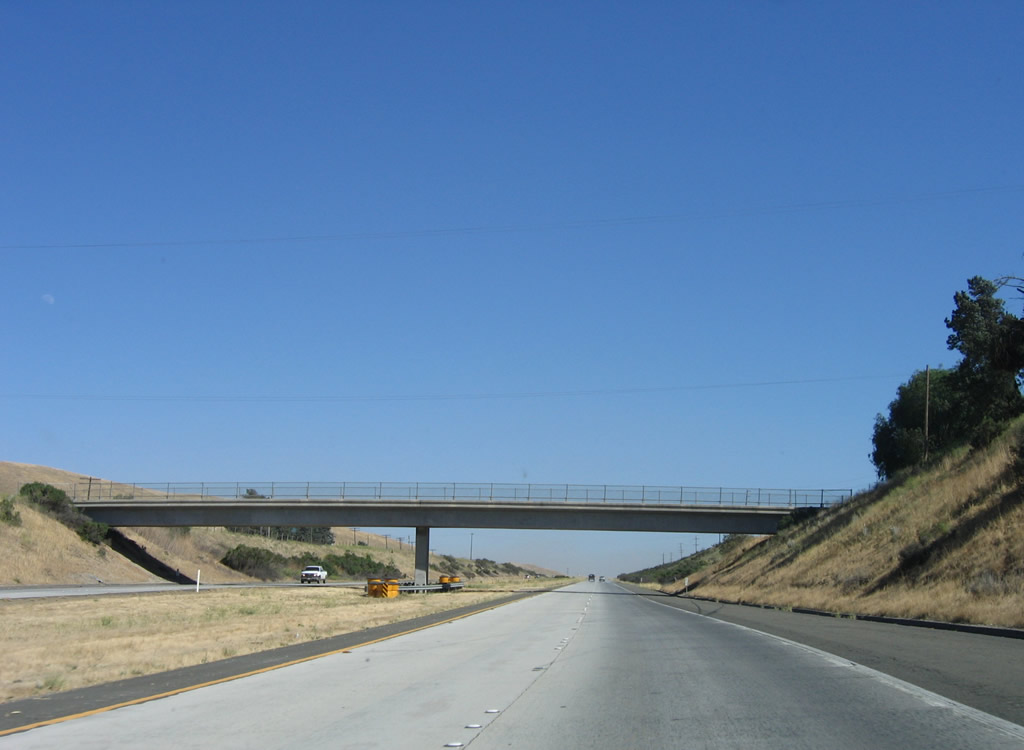
This pair of bridges carries U.S. 101 over the business route and railroad in Soledad. Note the limited shoulders on this viaduct. Photo taken 07/05/06. |
|
The four-lane freeway passes over the bridge shown previously, and development for the city of Soledad appears on the east side of the freeway. The west side of the freeway is mostly agricultural. Photo taken 07/05/06. |
|
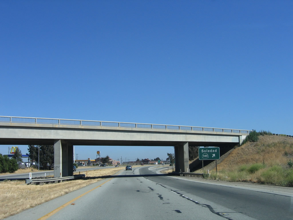
The next exit along U.S. 101 (El Camino Real) south is Exit 302, California 146 east to West Pinnacles and U.S. 101 Business (Front Street) north to Soledad. Photo taken 07/05/06. |
|
Exit 302 connects to the south end of the Soledad business route via Front Street. All motorist services are available at this interchange. Photo taken 07/05/06. |
|
Southbound U.S. 101 (El Camino Real) reaches Exit 302, California 146 east to West Pinnacles and U.S. 101 Business (Front Street) north to Soledad. California 146 is not a through route; it leads east from Soledad along Metz Road, then shifts onto Shirttail Canyon Road before entering Pinnacles National Monument. This section of California 146 does not connect with the eastern California 146, which connects to the national monument from California 25 on the east. Perhaps there was an intent to connect these two separate sections of California 146 at one time, but that looks unlikely today. Photo taken 07/05/06. |
|
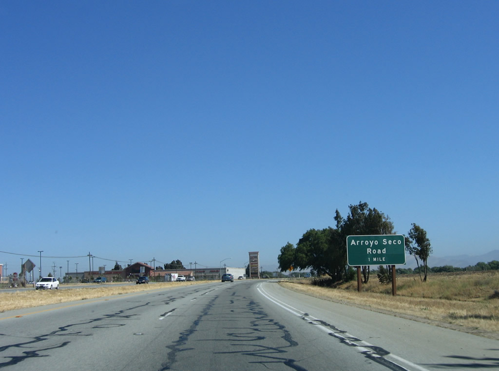
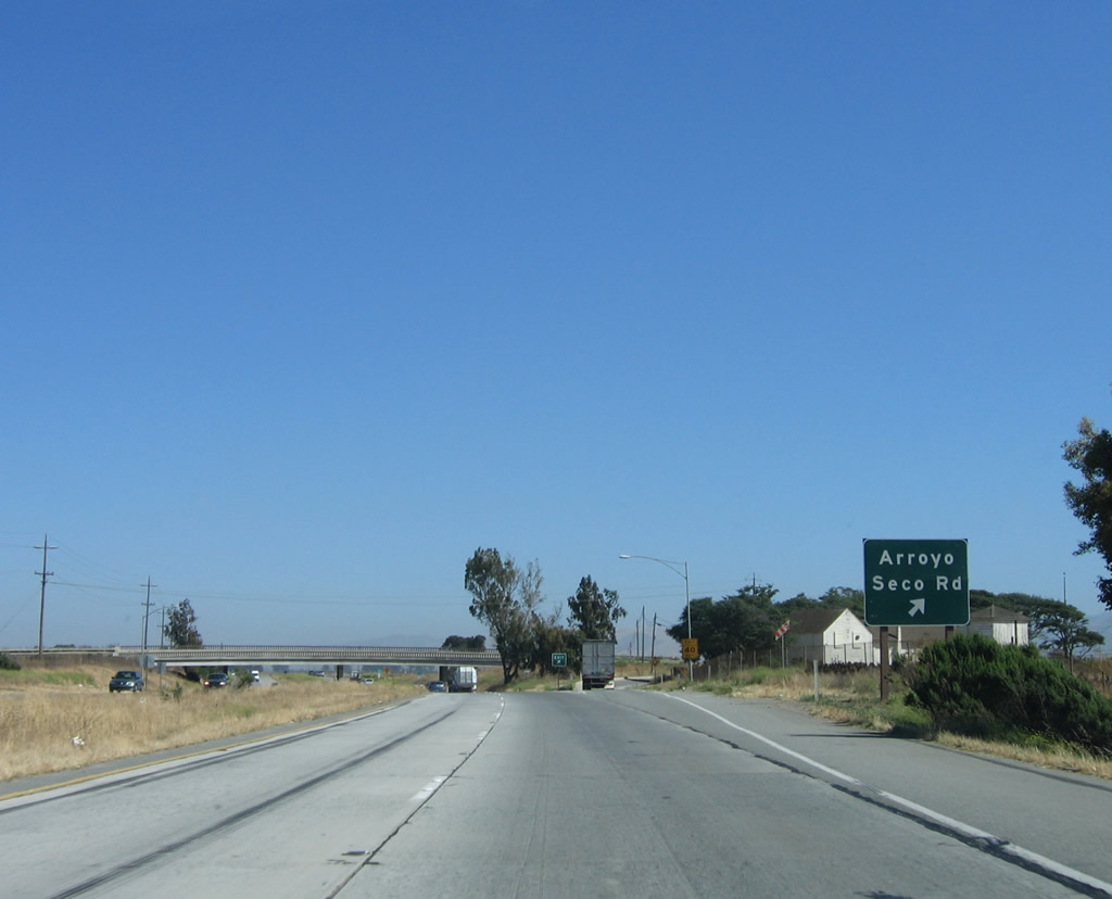
The next exit along U.S. 101 (El Camino Real) south is Exit 301, Arroyo Seco Road west to Monterey County G-17, which follows the Salinas Valley northwest toward Marina on the coast and southwest to Arroyo Seco. Photo taken 07/05/06. |
|
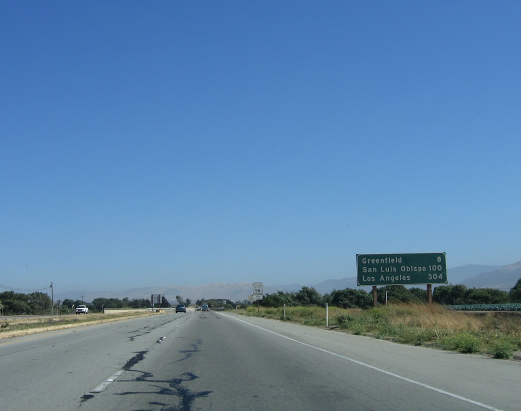
Leaving downtown Soledad, this mileage sign along U.S. 101 (El Camino Real) provides the distance to Greenfield (eight miles), San Luis Obispo (100 miles), and Los Angeles (304 miles). Photo taken 07/05/06. |
|
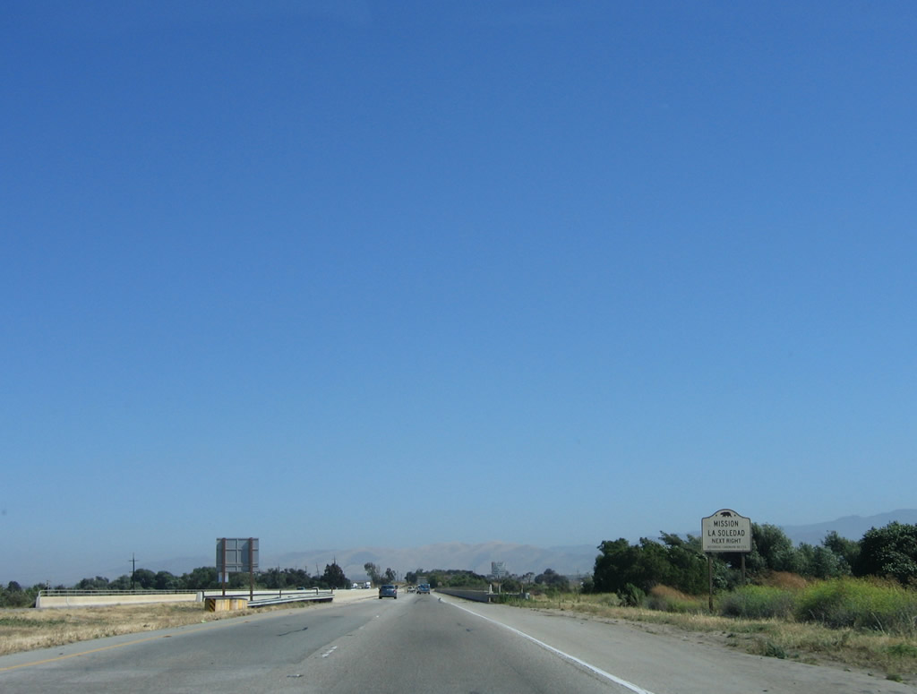
Soledad was founded on October 9, 1791, when the Mission Nuestra Se-ora de la Soledad was founded along the Salinas River, which parallels the historic El Camino Real. Use Arroyo Seco Road west to Monterey County G-17 north to Mission Nuestra Se-ora de la Soledad. The mission is located away from downtown Soledad. Photo taken 07/05/06. |
|
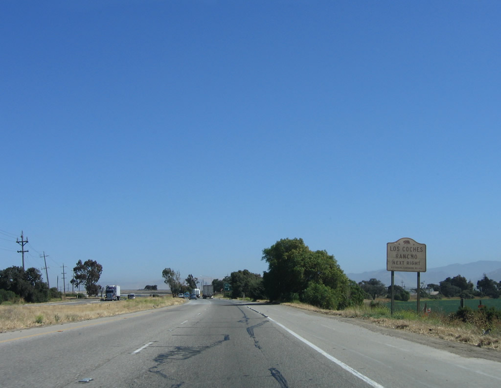
Use Arroyo Seco Road west to Monterey County G-17 south to Los Coches Rancho. Photo taken 07/05/06. |
|
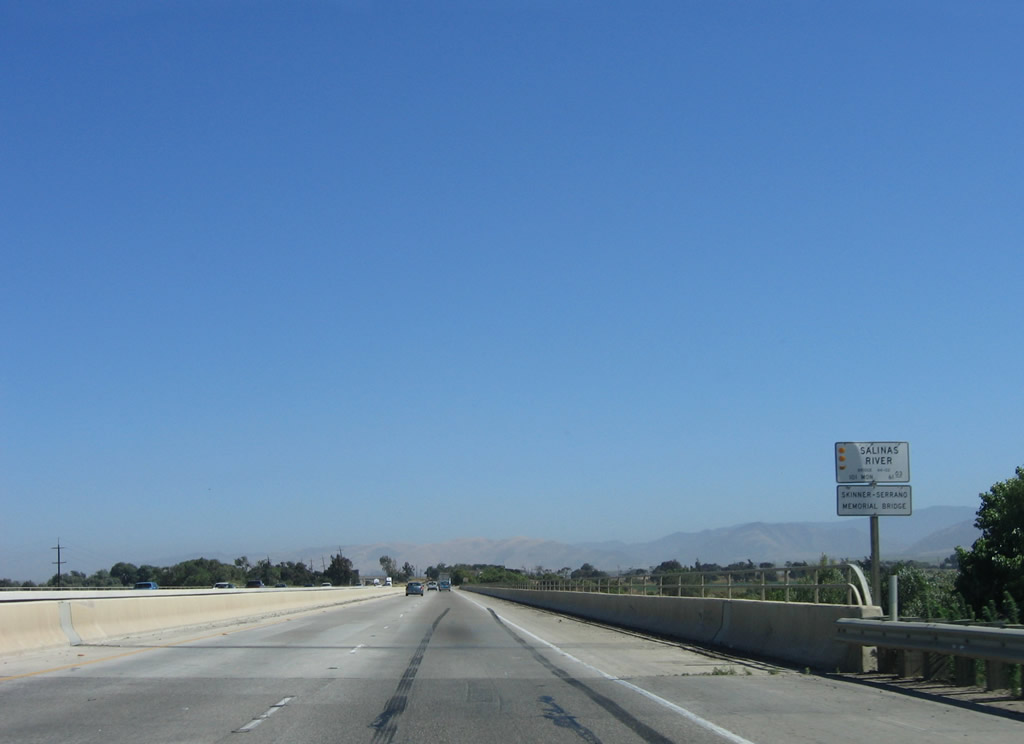
Southbound U.S. 101 (El Camino Real) reaches Exit 301, Arroyo Seco Road west to Monterey County G-17. The county route follows Fort Romie Road and River Road northwest toward Marina and uses Arroyo Seco Road south to Arroyo Seco. An intersection with Monterey County G-16 (Elm Avenue) is located west of Reitz Canyon at the Arroyo Seco bridge. Photo taken 07/05/06. |
|
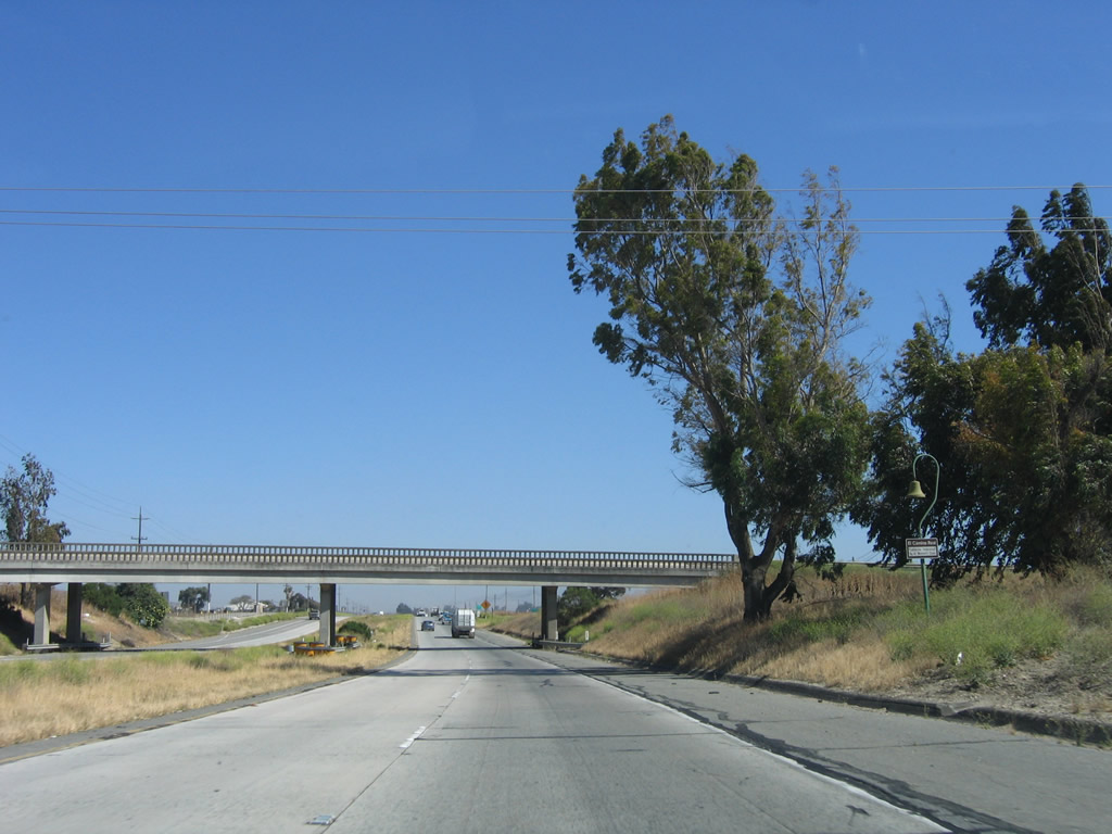
An El Camino Real mission bell and old-style bridge railing can be seen on U.S. 101 south after the off-ramp to Arroyo Seco Road. Photo taken 07/05/06. |
|
The southbound freeway entrance shield assembly for U.S. 101 from Arroyo Seco Road can be seen from the southbound main lanes. Photo taken 07/05/06. |
|
U.S. 101 south reverts to an expressway alignment for the next three miles between the cities of Soledad and Greenfield. Photo taken 07/05/06. |
|
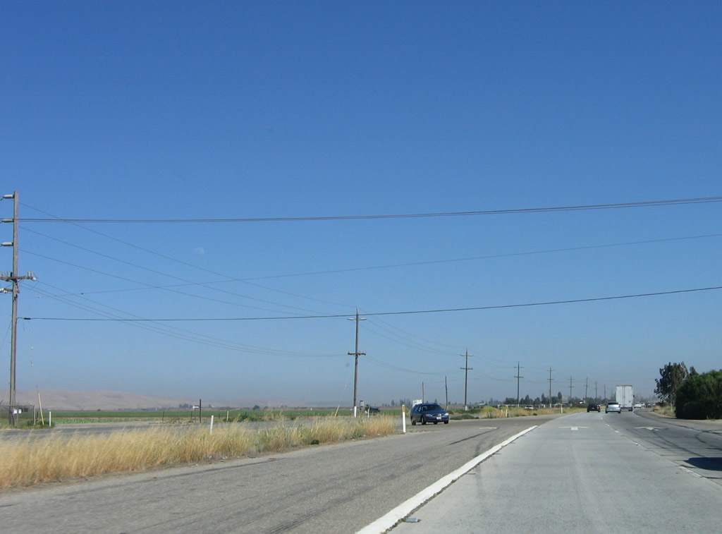
The next left turn along southbound U.S. 101 provides local ranch and farm access. This intersection also connects to the eastern frontage road (Vida Road) with Doud Road, the western frontage road. Photo taken 07/05/06. |
|
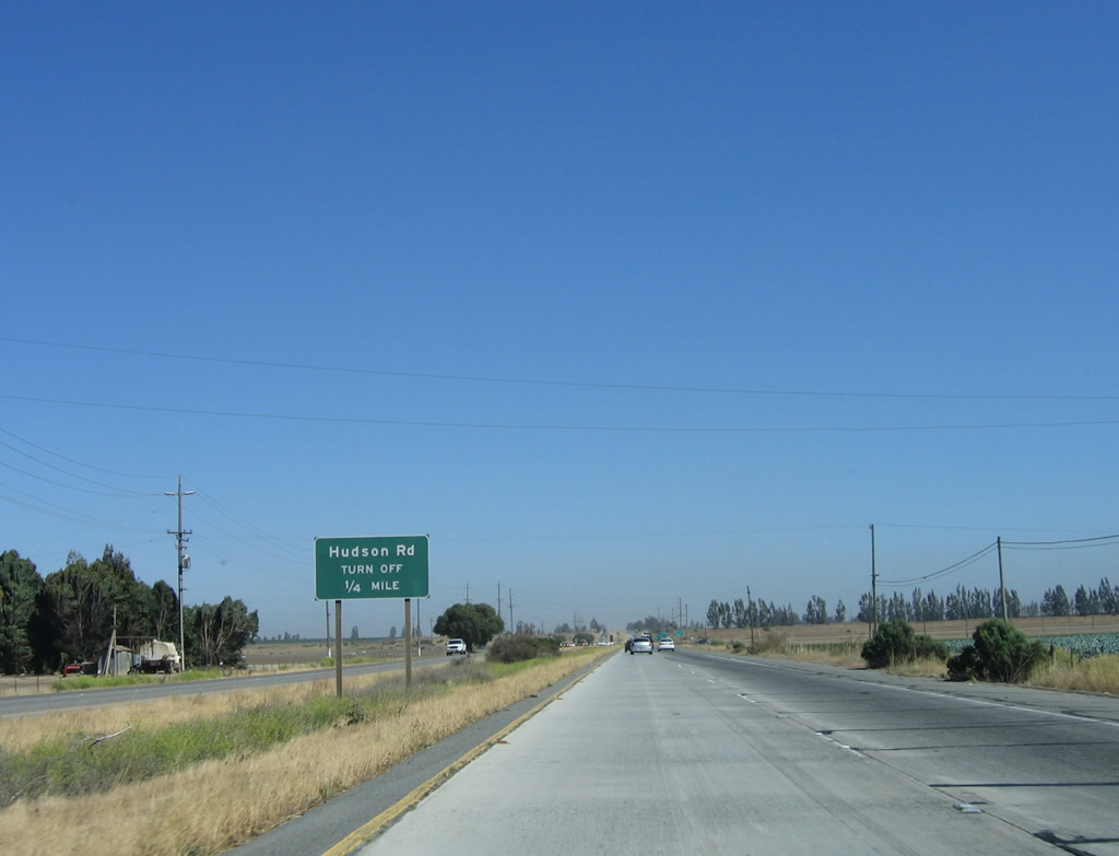
The next interchange along southbound U.S. 101 is with Hudson Road (0.25 mile). Hudson Road provides local access to farms and ranches, but it is not a through road in either direction. Photo taken 07/05/06. |
|
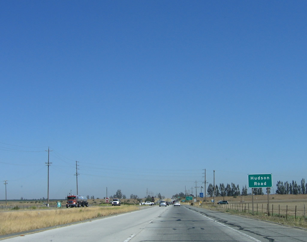
Southbound U.S. 101 reaches Exit 296, Hudson Road (actually an interchange). After this intersection, U.S. 101 will revert back into a freeway. Photo taken 07/05/06. |
|
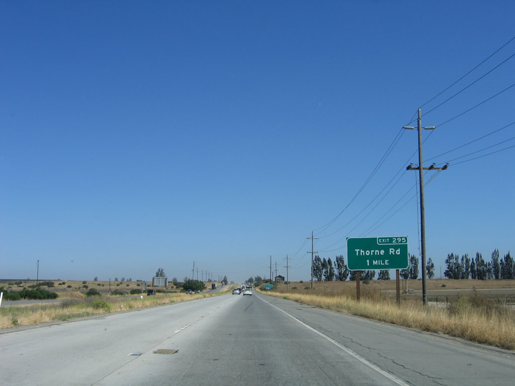
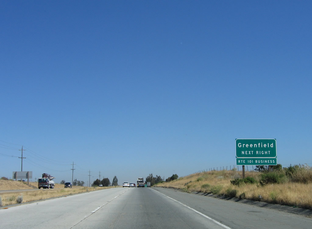
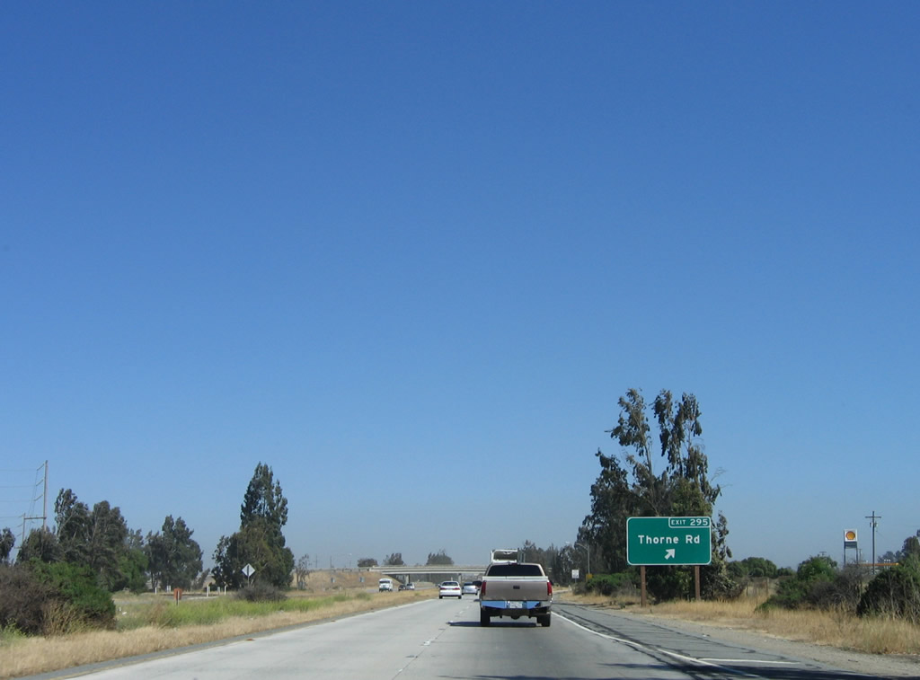
The next exit along U.S. 101 south is Exit 295, Thorne Road and U.S. 101 Business/El Camino Real south into Greenfield. Photo taken 07/05/06. |
|
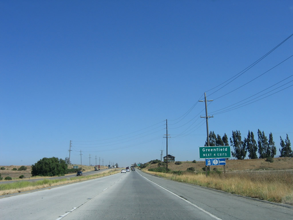
U.S. 101 approaches the city of Greenfield, "Where Historic El Camino Real meets Monterey Wine Country." Wineries and large farms abound all around Greenfield, which is located in the fertile Salinas Valley. The city consists of 1.7 square miles and has a population of 12,583 as of the 2000 Census. Photo taken 07/05/06. |
|
U.S. 101 Business follows the original route of U.S. 101 through downtown Greenfield along El Camino Real between Exits 295 and 293. Photo taken 07/05/06. |
|
Southbound U.S. 101 reaches Exit 295, U.S. 101 Business/El Camino Real south to Greenfield and Thorne Road west to Arroyo Seco Road (Monterey County G-17). Photo taken 07/05/06. |
|
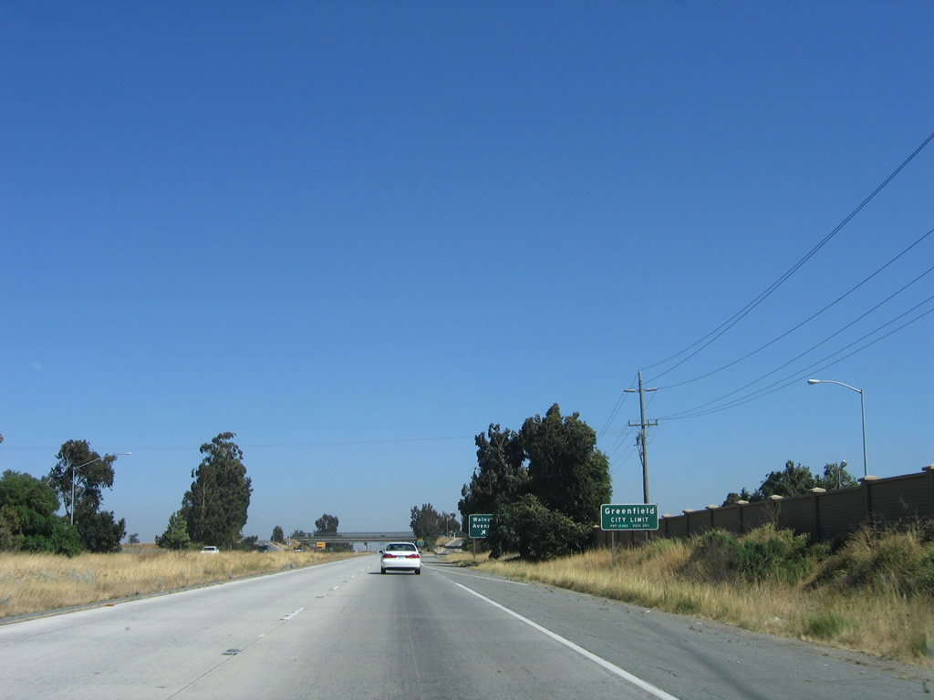
After the business loop exit, U.S. 101 south enters the city of Greenfield. Photo taken 07/05/06. |
|
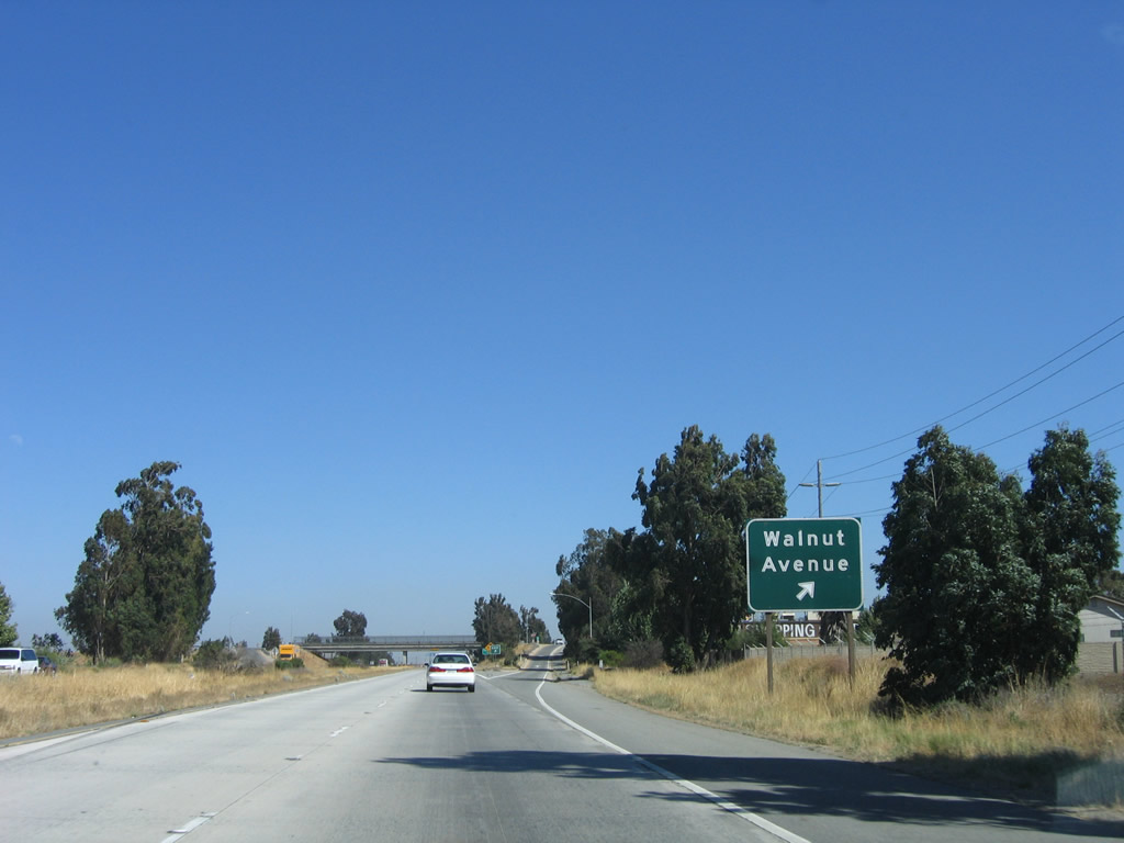
Southbound U.S. 101 reaches Exit 294B, Walnut Avenue. Photo taken 07/05/06. |
|
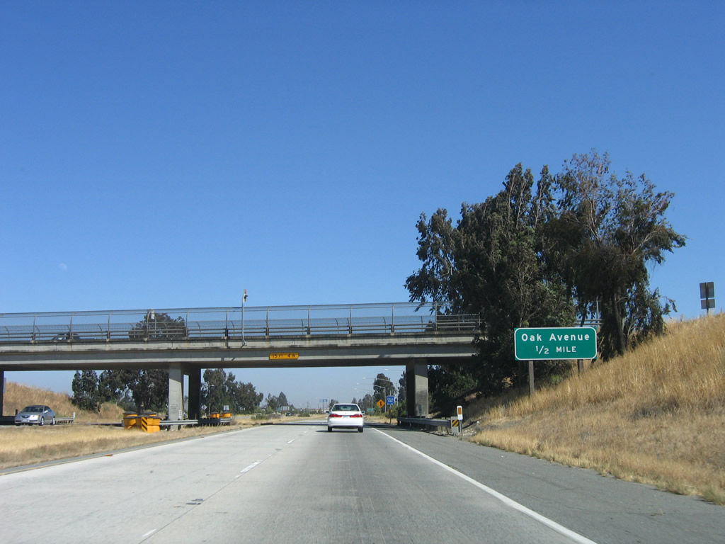
The next exit along U.S. 101 south is Exit 294A, Oak Avenue. Photo taken 07/05/06. |
|
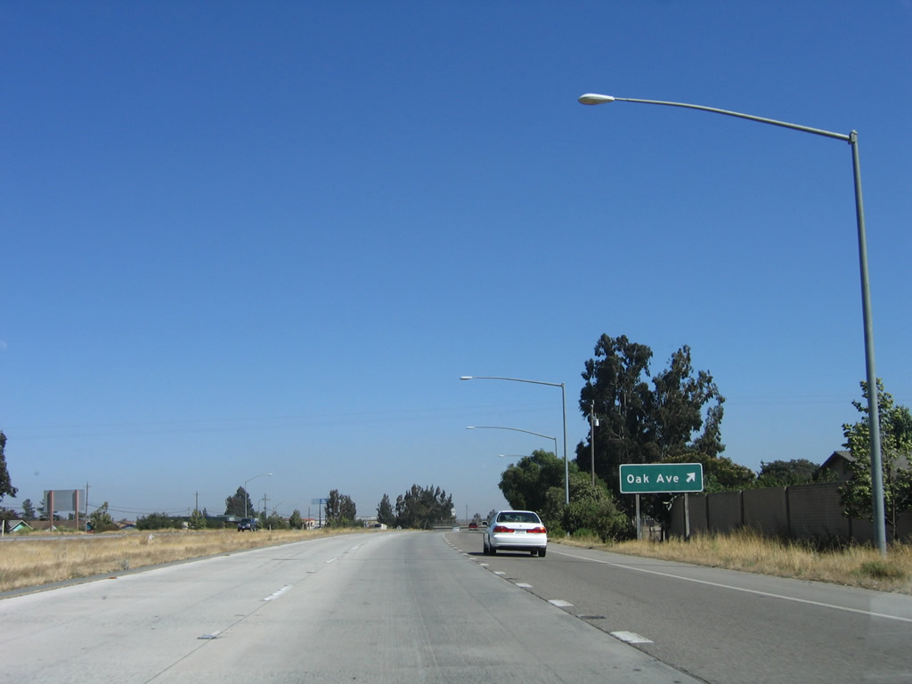
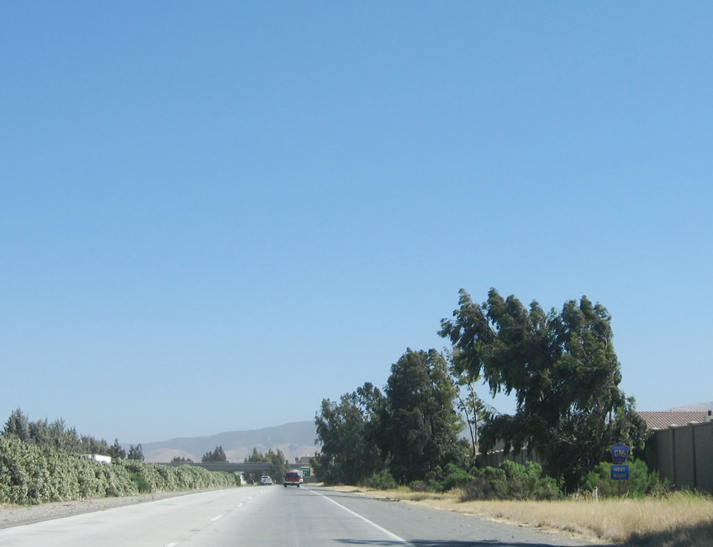
Southbound U.S. 101 reaches Exit 294A, Oak Avenue. Use Oak Avenue west to U.S. 101 Business/El Camino Real south to Monterey County G-16 (Elm Avenue). The signed county route leads west to Monterey County G-17/Arroyo Seco Road and east to Monterey County G-15 (Metz Road). Photo taken 07/05/06. |
|
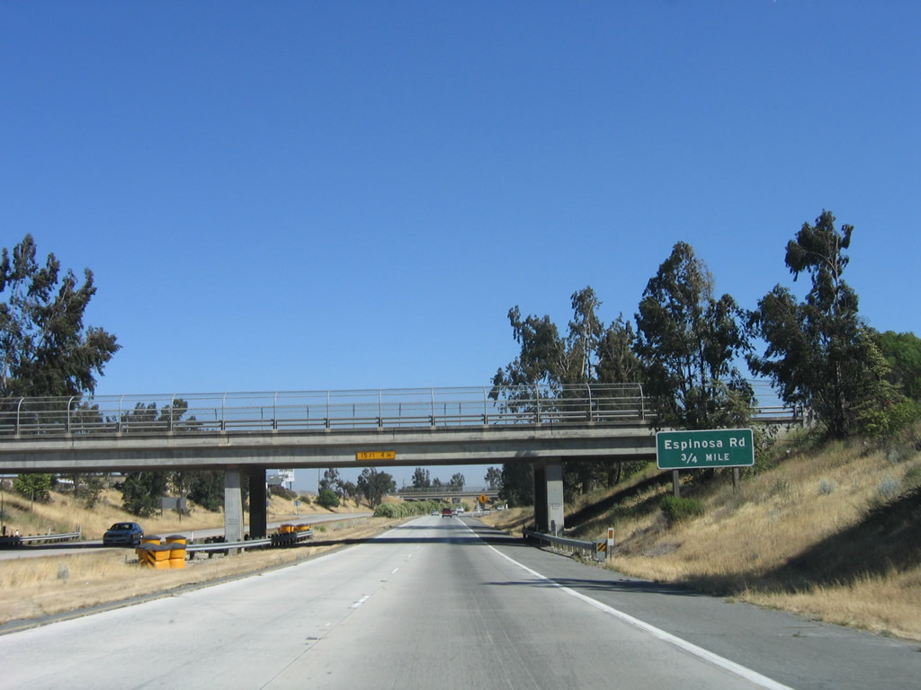
The next exit along U.S. 101 south is Exit 293, Espinosa Road and U.S. 101 Business/El Camino Real north to Greenfield. Photo taken 07/05/06. |
|
After the on-ramp from Oak Avenue, this U.S. 101 south reassurance shield is posted as the freeway passes under Monterey County G-16 (Elm Avenue). There is no direct access to County Route G-16. Photo taken 07/05/06. |
|
Use El Camino Real north to Monterey County G-16 (Elm Avenue). Photo taken 07/05/06. |
|
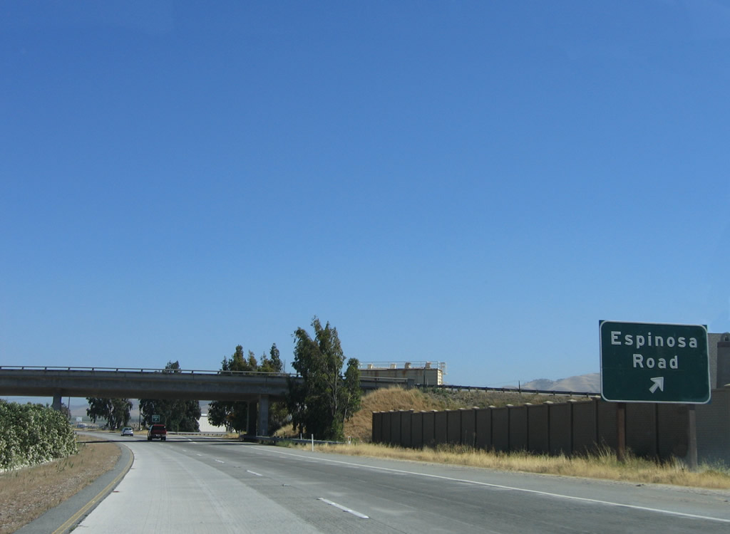
U.S. 101 south reaches Exit 293, Espinosa Road and U.S. 101 Business/El Camino Real north to Greenfield. Use El Camino Real north to Monterey County G-16 (Elm Avenue). Photo taken 07/05/06. |
|
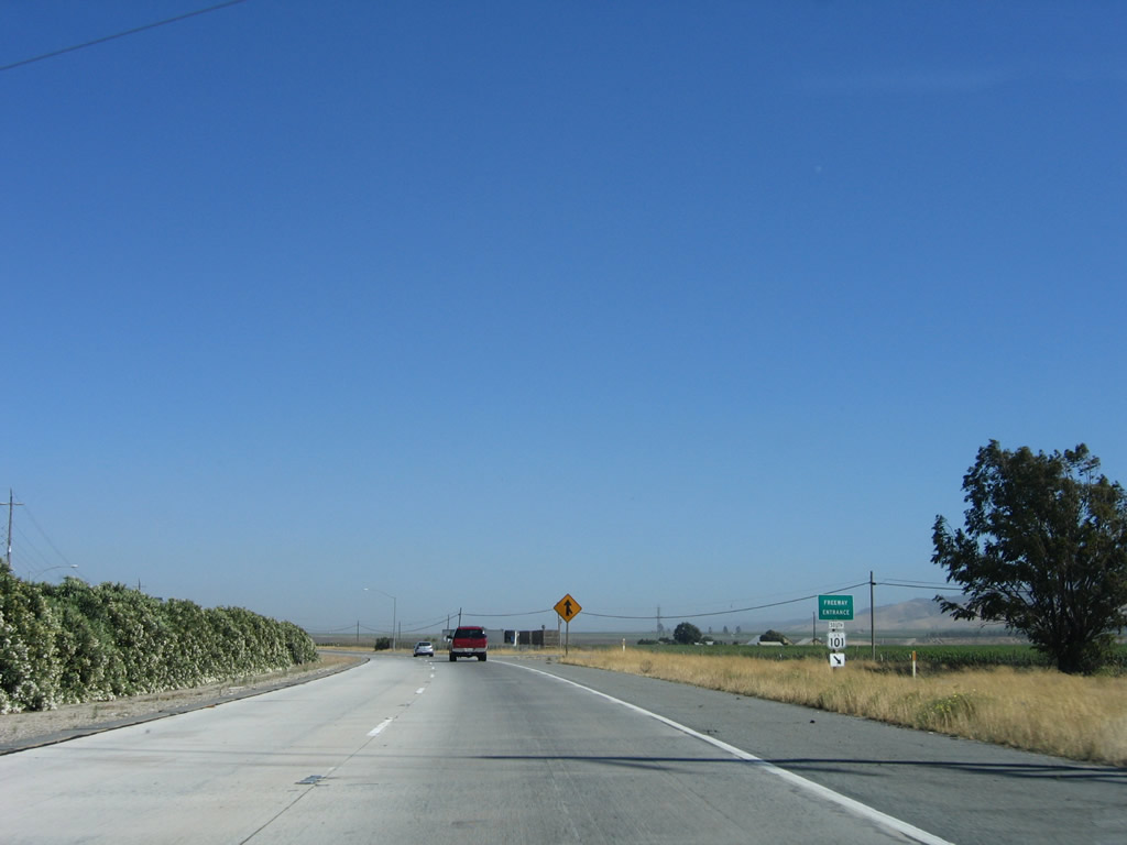
Traffic from U.S. 101 Business/El Camino Real merges back onto U.S. 101 south. Photo taken 07/05/06. |
|
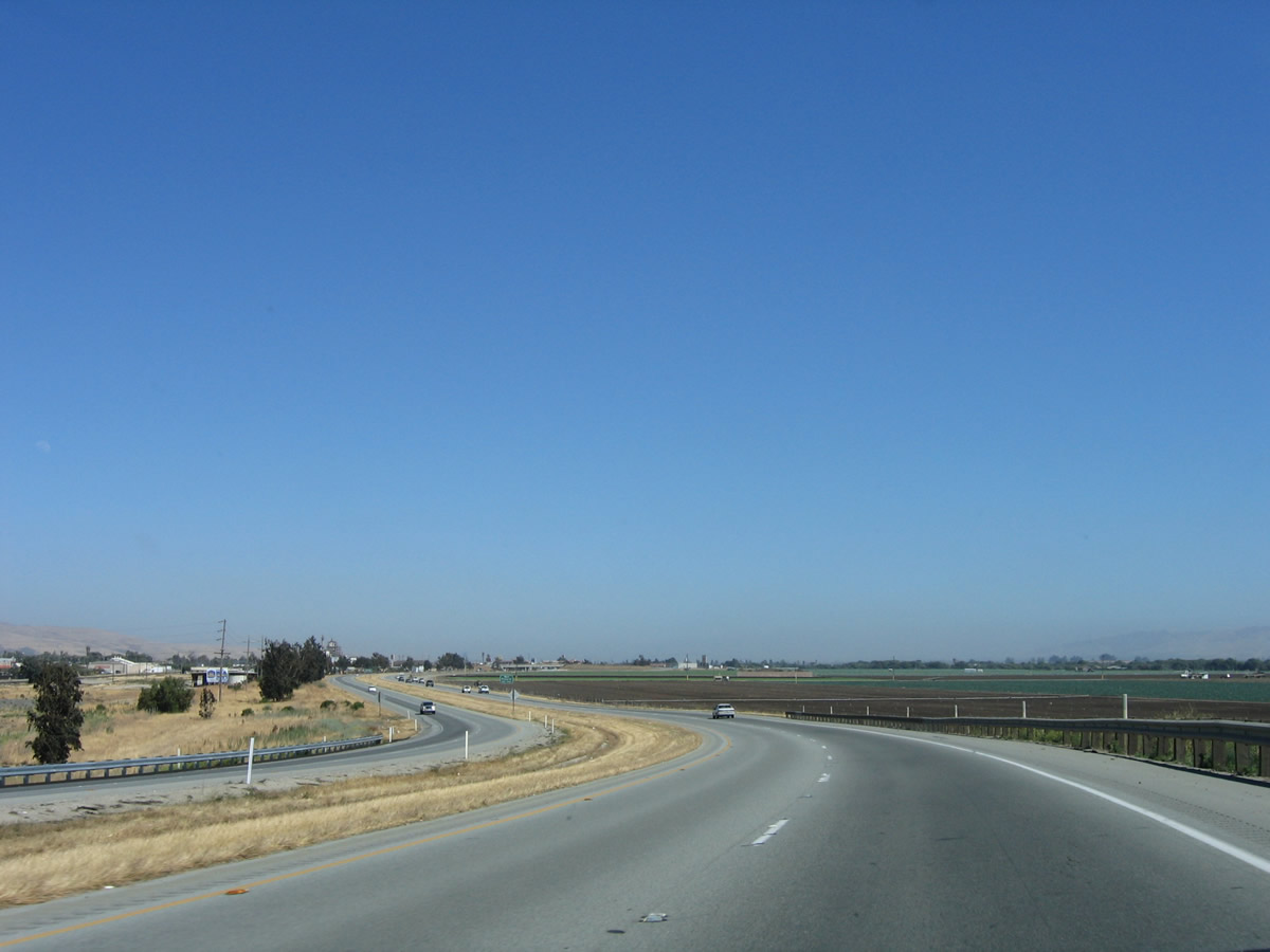
U.S. 101 south passes through more agricultural and ranch lands. The freeway again ends, and U.S. 101 reverts to an expressway with at-grade intersections. Photo taken 07/05/06. |
|
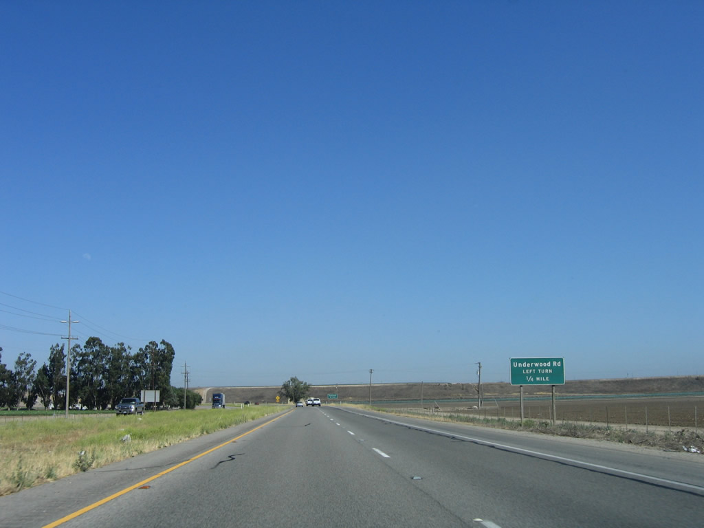
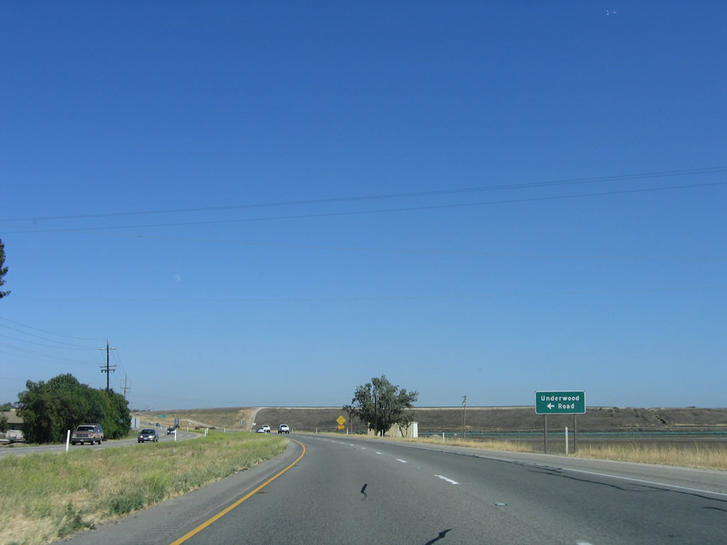
The first intersection along U.S. 101 south is with Underwood Road, which leads east and then north to provide local farm and ranch access. Photo taken 07/05/06. |
|
Southbound U.S. 101 meets Underwood Road at this intersection. Photo taken 07/05/06. |
|
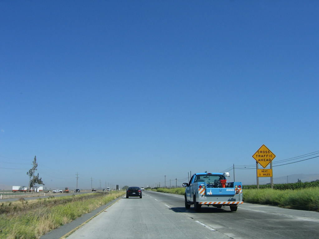
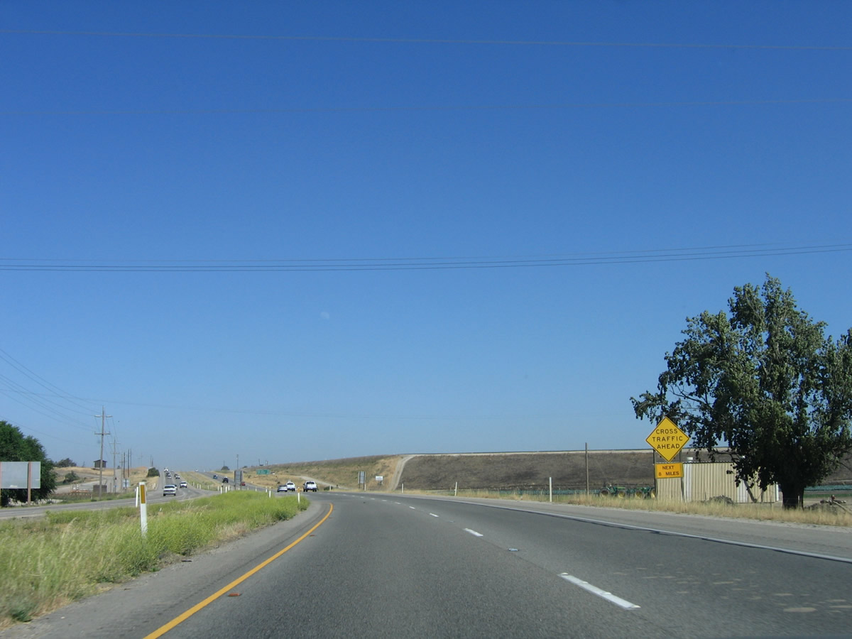
After the Underwood Road intersection, a "Cross Traffic Ahead Next Eight Miles" sign is posted. The expressway section of U.S. 101 will continue until near King City. Photo taken 07/05/06. |
|
This mileage sign provides the distance to King City (10 miles), Paso Robles (61 miles), and Los Angeles (294 miles). Photo taken 07/05/06. |
|
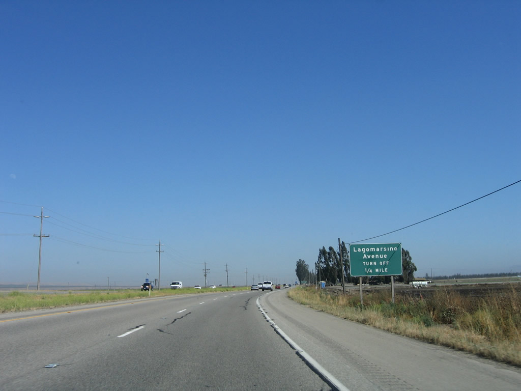
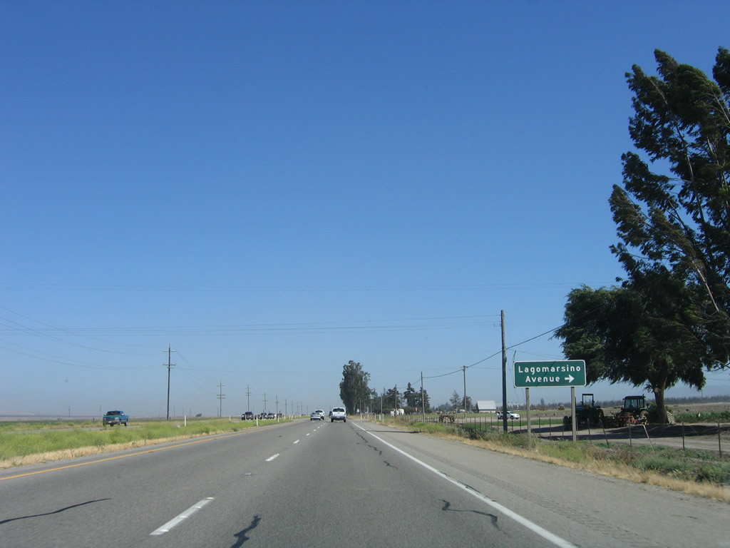
The next intersection along U.S. 101 (El Camino Real) is with Lagomarsino Avenue, which travels west to Central Avenue. Photo taken 07/05/06. |
|
Southbound U.S. 101 (El Camino Real) meets Lagomarsino Avenue at this intersection. Unlike Underwood Road, westbound Lagomarsino Avenue is a through road to Central Avenue. Photo taken 07/05/06. |
|
A U.S. 101 reassurance shield is posted after the intersection with Lagomarsino Avenue. Photo taken 07/05/06. |
|
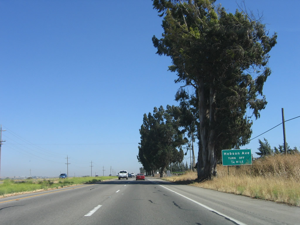
The next intersection along U.S. 101 (El Camino Real) is with Hobson Avenue, which travels west to Central Avenue and Monroe Canyon Road. Photo taken 07/05/06. |
|
Southbound U.S. 101 (El Camino Real) meets Hobson Avenue at this intersection. Towering eucalyptus trees provide the only shade along U.S. 101 as we continue into the upper Salinas Valley. The Salinas River remains east of the freeway at this point. Photo taken 07/05/06. |
|
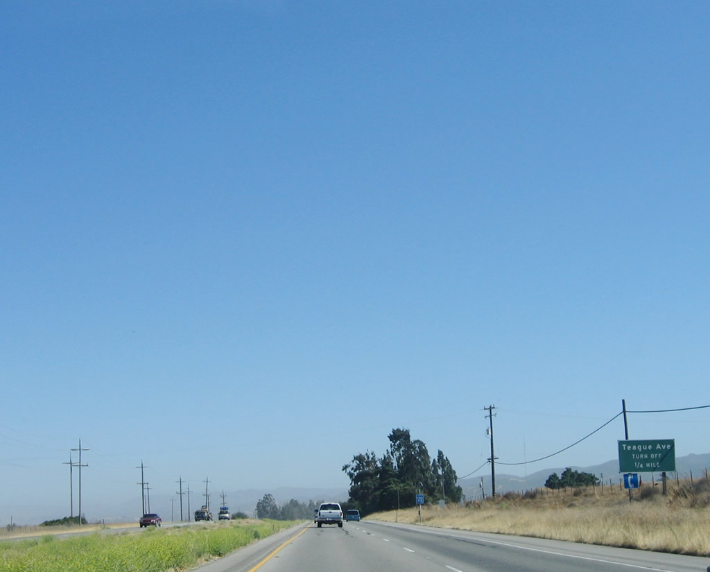
The next intersection along U.S. 101 (El Camino Real) is with Teague Avenue, which also travels west to Central Avenue. Photo taken 07/05/06. |
|
The next intersection along U.S. 101 (El Camino Real) is with Hobson Avenue, which travels west to Central Avenue and Monroe Canyon Road. Photo taken 07/05/06. |
|
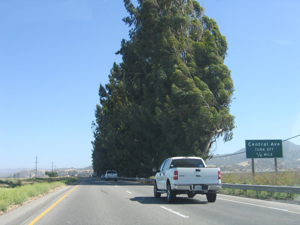
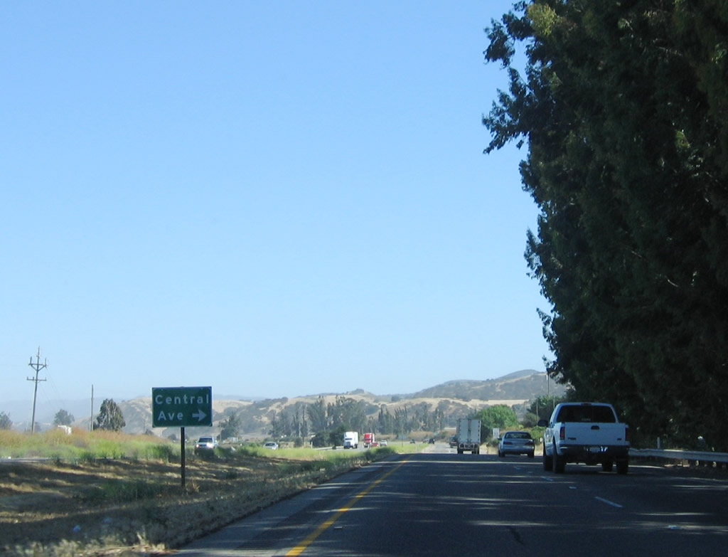
The next intersection along U.S. 101 (El Camino Real) is with Central Avenue, which travels north from this intersection to Monterey County G-16 (Elm Avenue) west of Greenfield. Photo taken 07/05/06. |
|
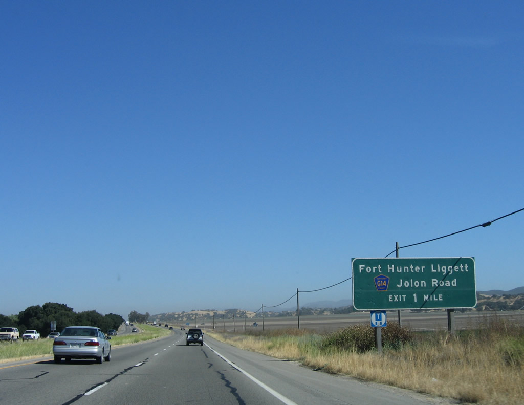
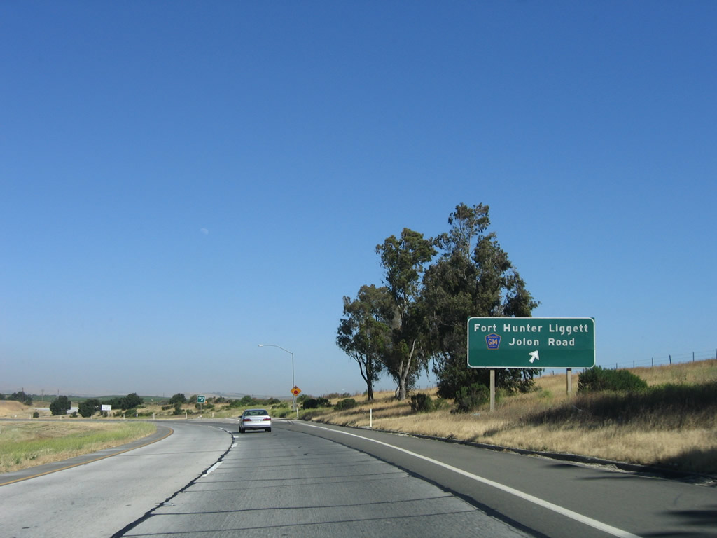
U.S. 101 again becomes a freeway as the next interchange approaches for Exit 283, Monterey County G-14/Jolon Road south to Jolon and Lockwood. This exit also connects to Pine Canyon Road west and is the last exit before U.S. 101 again crosses the Salinas River. Photo taken 07/05/06. |
|
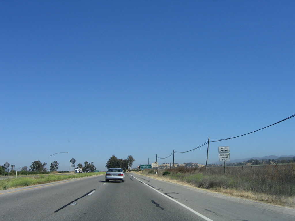
A begin freeway sign is posted prior to Exit 283. With the end of this eight-mile long expressway section, U.S. 101 will remain a freeway for the majority of the remaining route from here to Los Angeles, although the few remaining expressway segments are all shorter than eight miles long. Photo taken 07/05/06. |
|
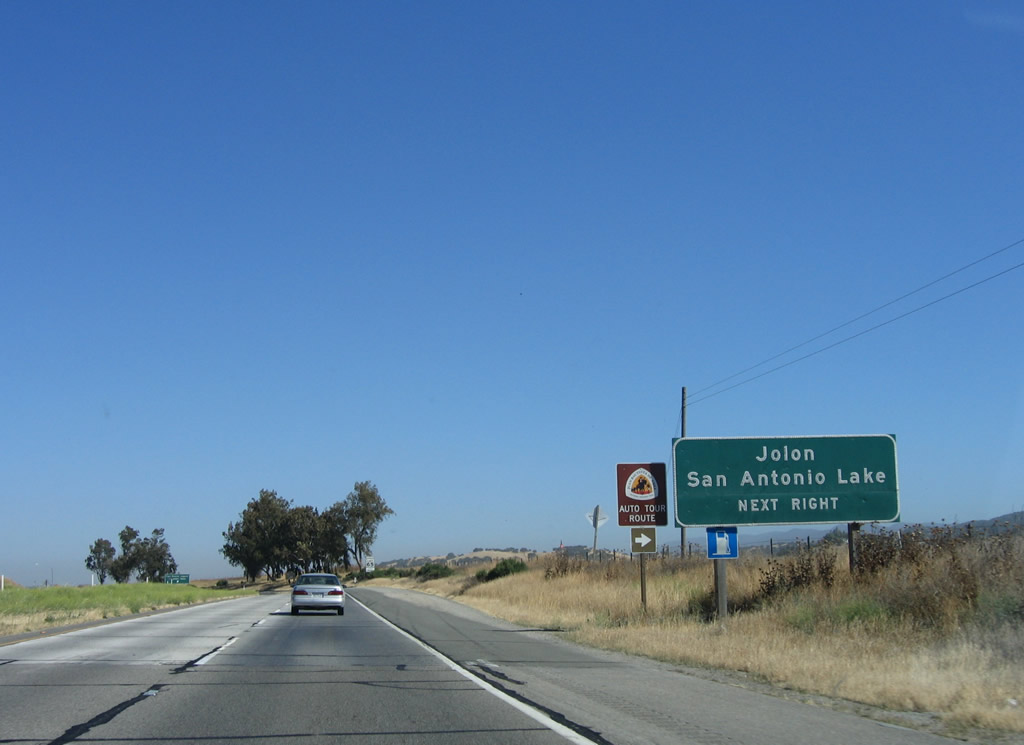
Use Monterey County G-14/Jolon Road south to Jolon, Lockwood, and San Antonio Lake. The auto tour historic route also follows G-14 south. The county route rejoins U.S. 101 at Exit 231B in Paso Robles, and another connection to U.S. 101 at Exit 252 is afforded via Monterey County G-18 south. Photo taken 07/05/06. |
|
Southbound U.S. 101 reaches Exit 283, Monterey County G-14/Jolon Road south to Jolon and Lockwood. Photo taken 07/05/06. |
|
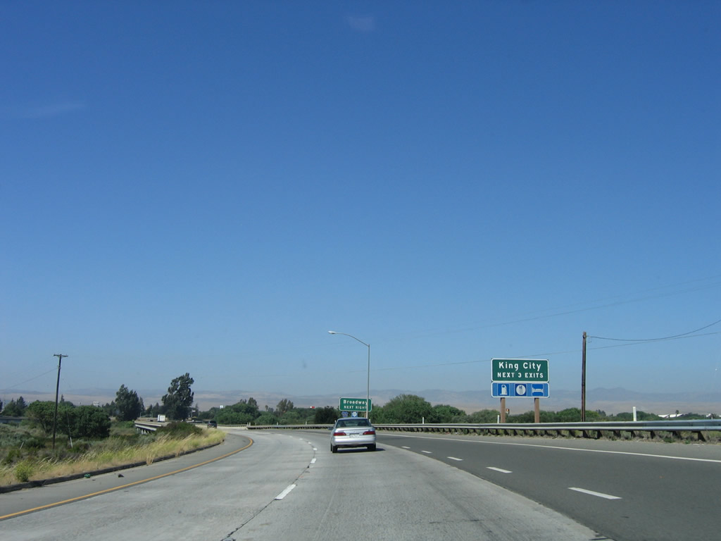
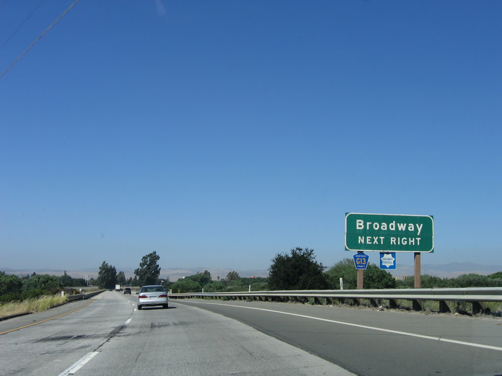
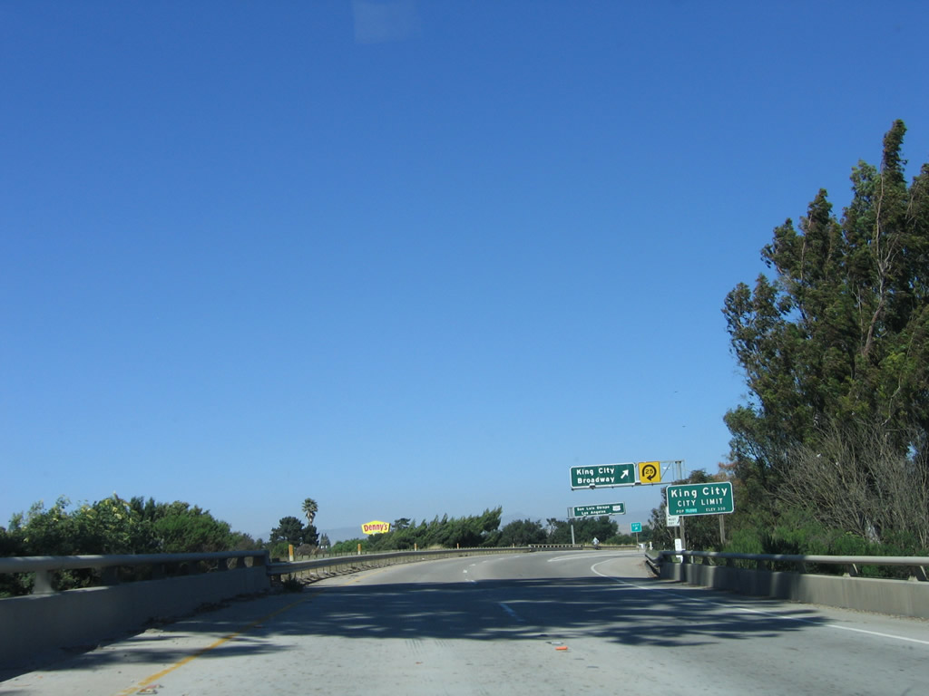
The next exit along U.S. 101 south is Exit 282B, U.S. 101 Business (Broadway) south (east) to King City. The Business route passes through downtown King City between Exit 282B and Exit 281 via Broadway and South First Street. The Broadway segment is cosigned with Monterey County G-13, and the South First Street segment is cosigned with Monterey County G-15. Photo taken 07/05/06. |
|
After crossing the Salinas River, U.S. 101 will enter the city of King City, which had a population of 11,094 as of the 2000 Census and consists of 2.8 square miles. The city was incorporated in 1911 and is primarily an agricultural community. Food packing plants and farms dominate the economy here. All motorist services are available here. Photo taken 07/05/06. |
|
Use U.S. 101 Business to Monterey County G-13/Bitterwater Road northeast to California 25 in San Benito County and San Lorenzo Regional Park and to Monterey County G-15 (Metz Road) north to Soledad. Photo taken 07/05/06. |
|
Southbound U.S. 101 crosses the Salinas River between the Jolon Road interchange and Broadway interchange. Photo taken 07/05/06. |
|
U.S. 101 enters King City after crossing the Salinas River. Photo taken 07/05/06. |
|
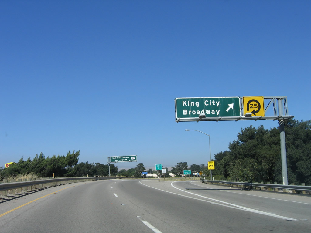
Southbound U.S. 101 reaches Exit 282B, U.S. 101 Business (Broadway) south (east) to King City. Use U.S. 101 Business to Monterey County G-13/Bitterwater Road and Monterey County G-15 (Metz Road). Photo taken 07/05/06. |
|
A pull through sign for U.S. 101 south to San Luis Obispo and Los Angeles is posted immediately after the exit for Broadway and King City. Photo taken 07/05/06. |
|
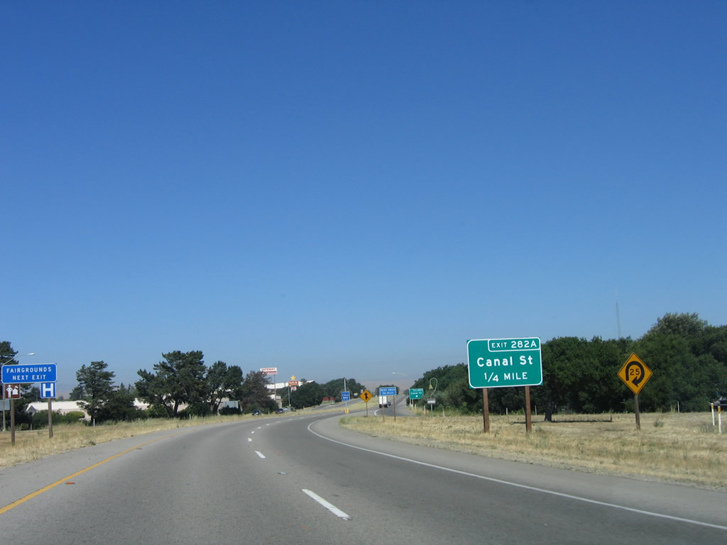
The next exit along U.S. 101 south is Exit 282A, Canal Street. Photo taken 07/05/06. |
|
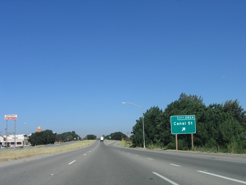
Southbound U.S. 101 reaches Exit 282A, Canal Street. Photo taken 07/05/06. |
|
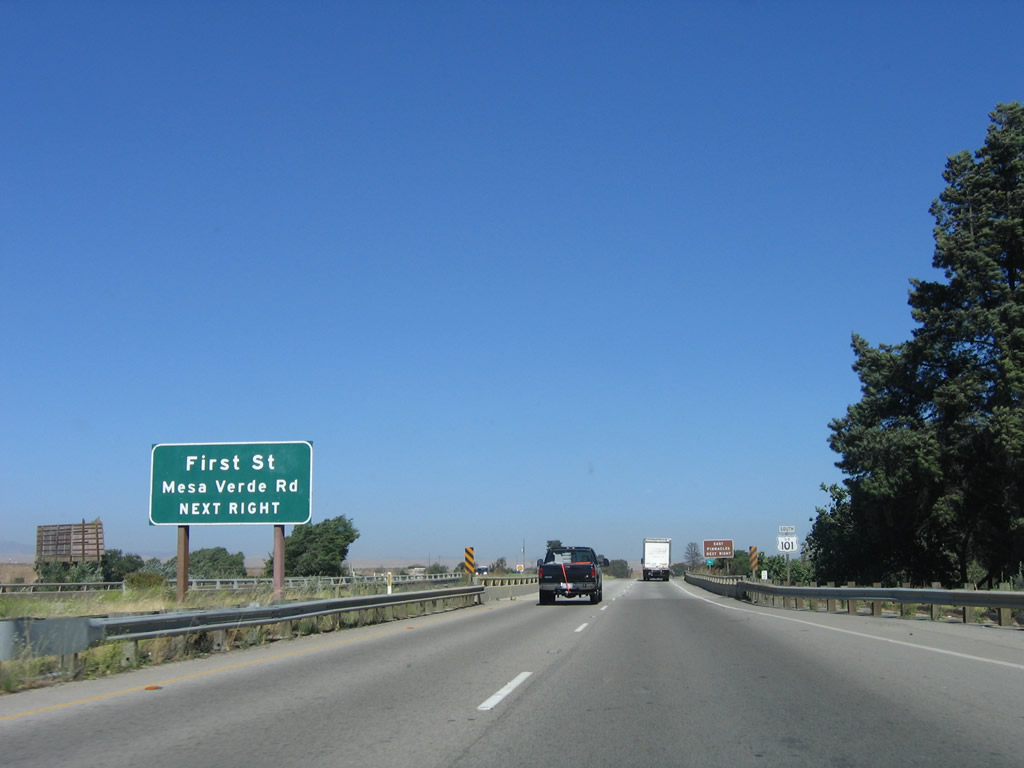
The next exit along U.S. 101 south is Exit 281, U.S. 101 Business and Monterey County G-15/South First Street north and Mesa Verde Road (frontage road) south. Photo taken 07/05/06. |
|
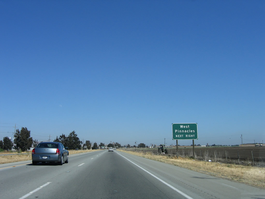
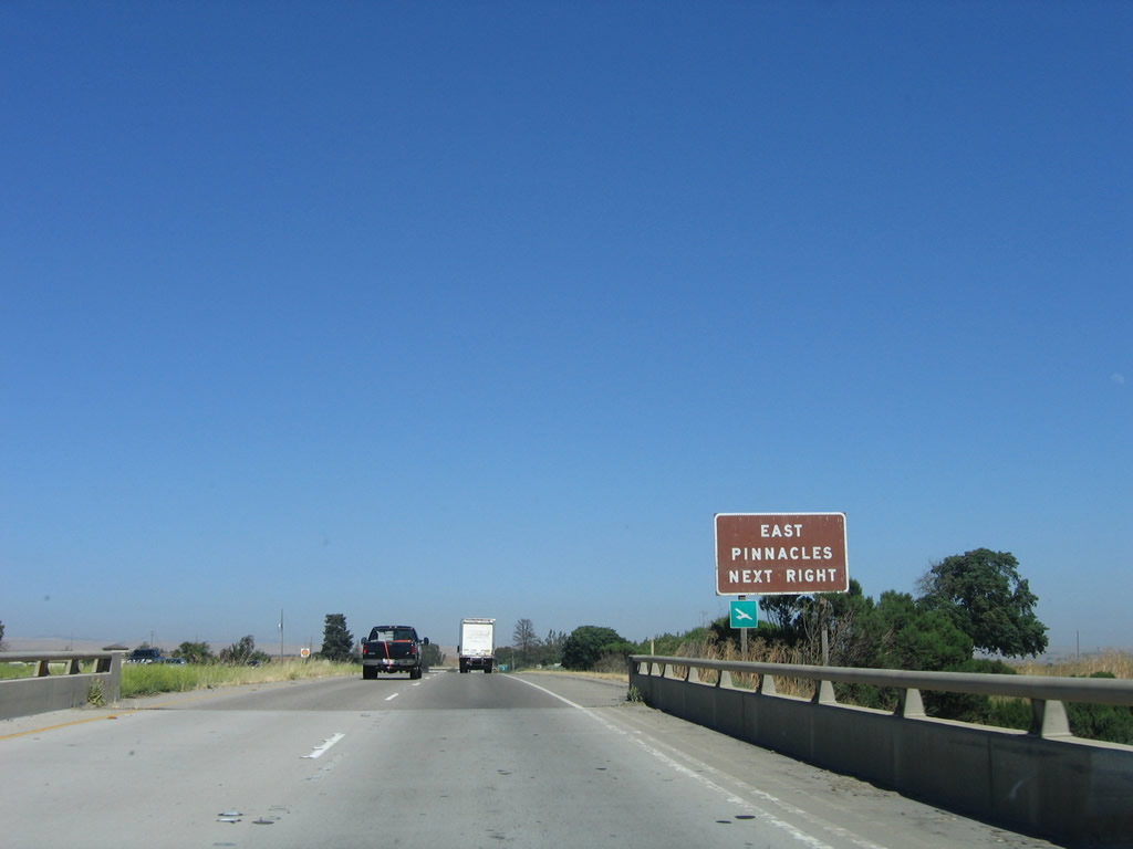
Use U.S. 101 Business and Monterey County G-15/South First Street north to Monterey County G-13/Bitterwater Road northeast to the eastern entrance to Pinnacles National Monument. California 146 in Soledad provides the route to the western entrance to the national monument. Photo taken 07/05/06. |
|
Southbound U.S. 101 reaches Exit 281, U.S. 101 Business and Monterey County G-15/South First Street north and Mesa Verde Road (frontage road) south. This is the last King City interchange. While services can be found at several interchanges between King City and Paso Robles (which is some 50 miles south of this point), they will not be as commonly found as they were north of here. Photo taken 07/05/06. |
|
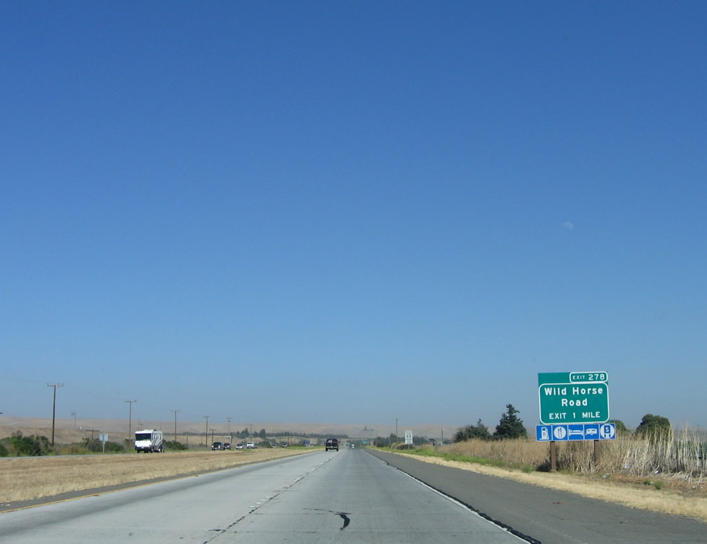
The next exit along U.S. 101 is Exit 278, Wild Horse Road. Photo taken 07/05/06. |
|
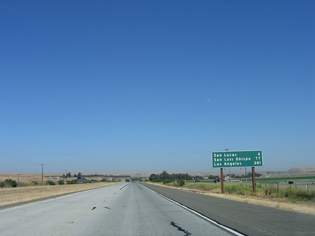
This mileage sign along U.S. 101 (El Camino Real) south provides the distance to San Lucas (six miles, California 198), San Luis Obispo (77 miles), and Los Angeles (281 miles). Photo taken 07/05/06. |
|
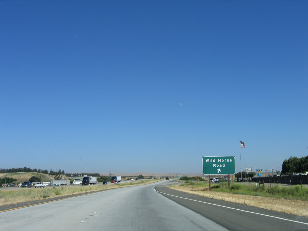
Southbound U.S. 101 reaches Exit 278, Wild Horse Road. A gas station is located at this interchange. Use this exit to Cattlemen Road south, which is a frontage road along the east side of U.S. 101 from here south to San Lucas. Photo taken 07/05/06. |
|
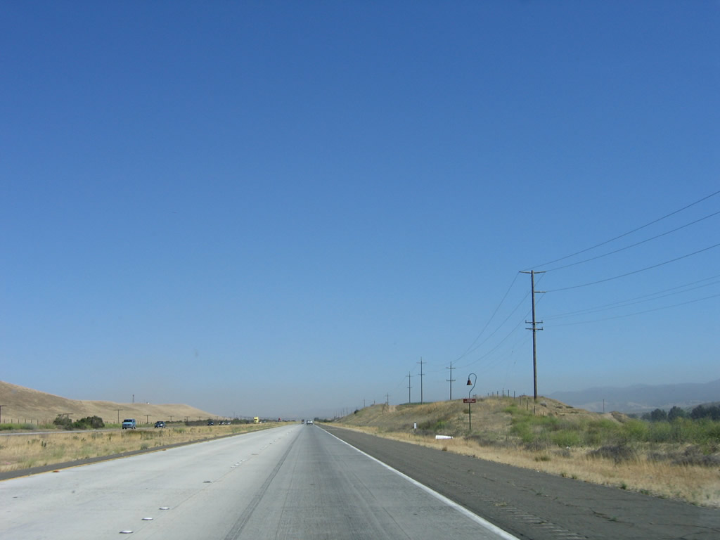
As the terrain of the Upper Salinas Valley dries out, agriculture yields to ranching. Power lines briefly follow U.S. 101 south of the Wild Horse Road interchange. Photo taken 07/05/06. |
|
An overpass connects Cattlemen Road (eastern frontage road) with a ranch on the west side of the freeway. Photo taken 07/05/06. |
|
An El Camino Real mission bell is posted along the west side of the freeway. The land is not nearly as fertile nor irrigated as the Lower Salinas Valley. Photo taken 07/05/06. |
|
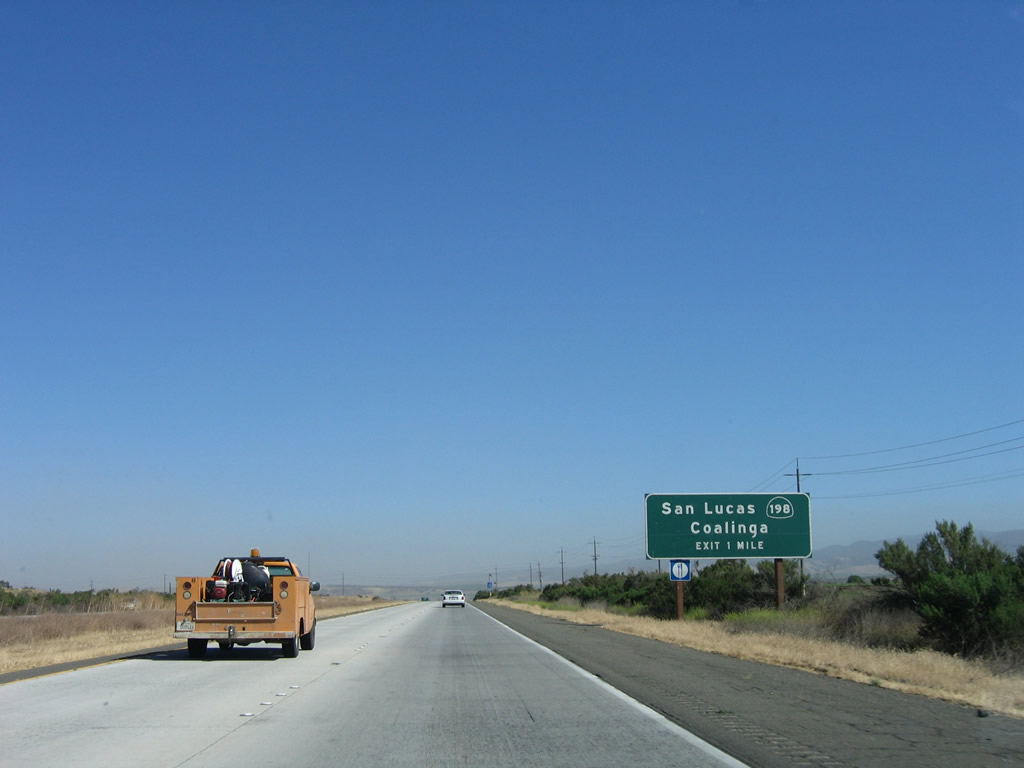
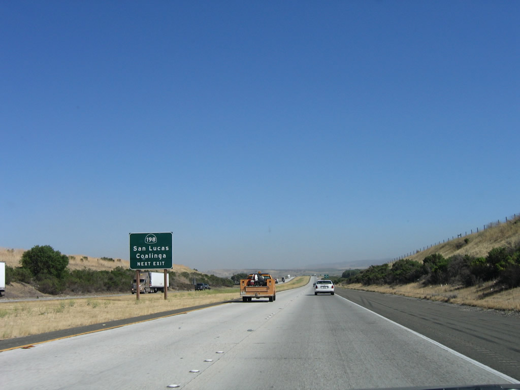
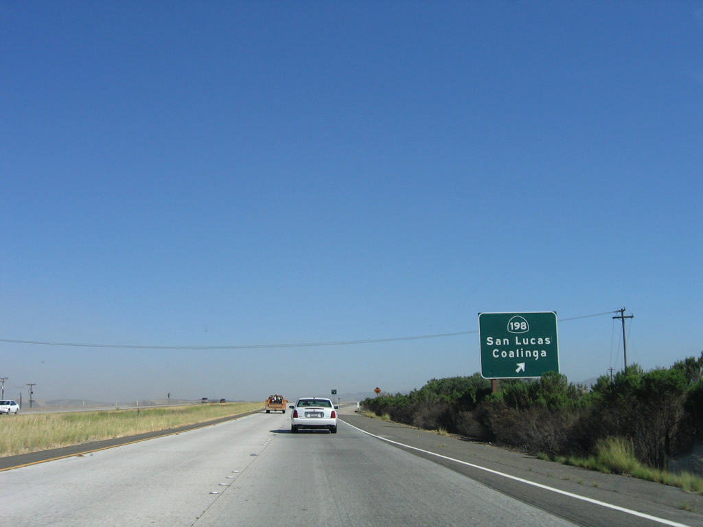
The next exit along U.S. 101 south is Exit 273, California 198 east to Coalinga and Visalia. This interchange also serves the unincorporated community of San Lucas, which is located on the east side of U.S. 101 and serves as the western terminus of California 198. Use California 198 east to California 25 and Interstate 5 near Coalinga. California 198 is the second major east-west highway to cross the hills to the Central Valley (after California 152). Other roads to make the trek east to Interstate 5 are California 46, California 58, and California 166. Of these, California 46 east to Lost Hills at Interstate 5 is perhaps the most direct and fastest route to the Interstate Highway. Photo taken 07/05/06. |
|
Unincorporated San Lucas has a population of 419 people as of the 2000 Census. The elevation of San Lucas is 410 feet, which represents a gradual increase in elevation as U.S. 101 continues south through the upper Salinas Valley. Photo taken 07/05/06. |
|
Southbound U.S. 101 reaches Exit 273, California 198 east to San Lucas, Coalinga, and Visalia. For old highway lovers, exit here and turn right (west) onto Lockwood-San Lucas Road. An old green through steel truss bridge carries former U.S. 101 over the Salinas River. Photo taken 07/05/06. |
|
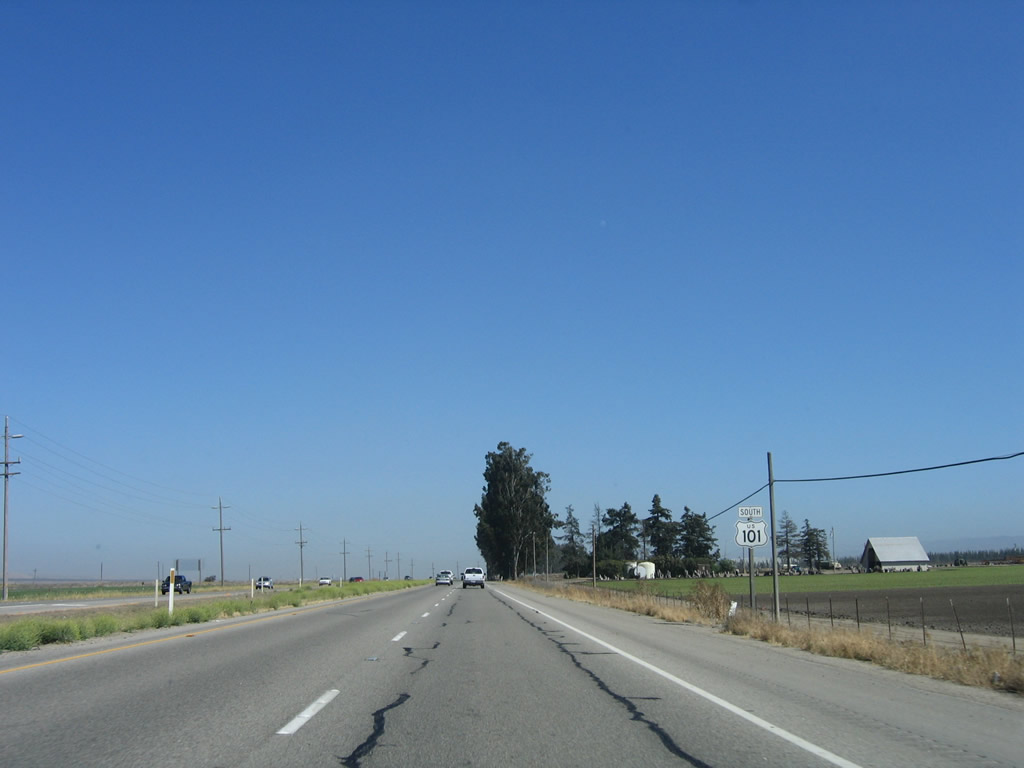
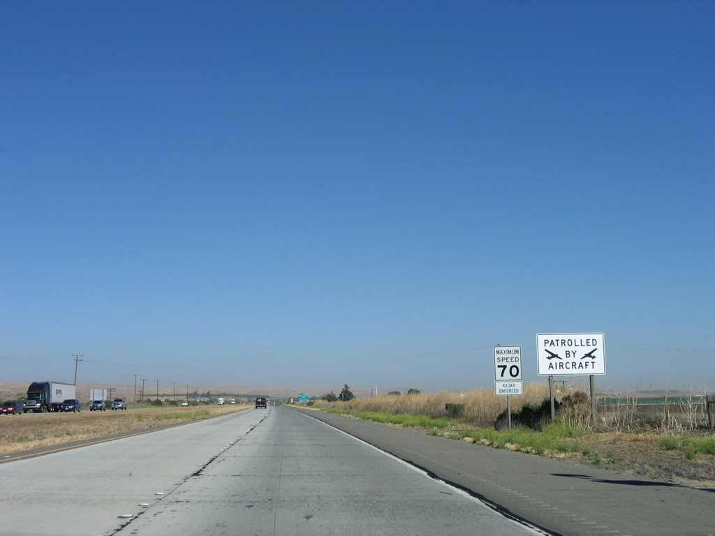
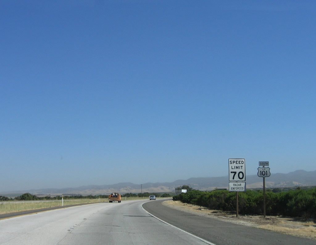
After the California 198 interchange, a U.S. 101 south reassurance shield and speed limit 70 miles per hour sign are posted side-by-side. Photo taken 07/05/06. |
|
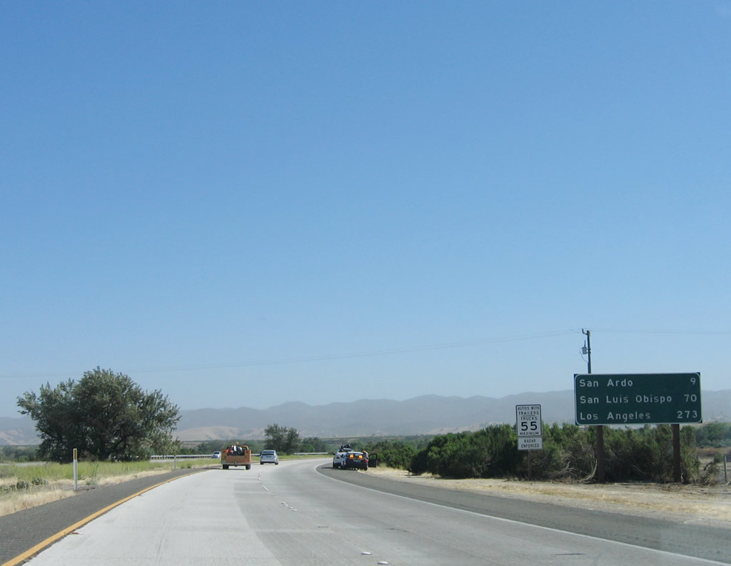
Rounding the bend, a mileage sign provides the distance to San Ardo (nine miles), San Luis Obispo (70 miles), and Los Angeles (273 miles). Photo taken 07/05/06. |
|
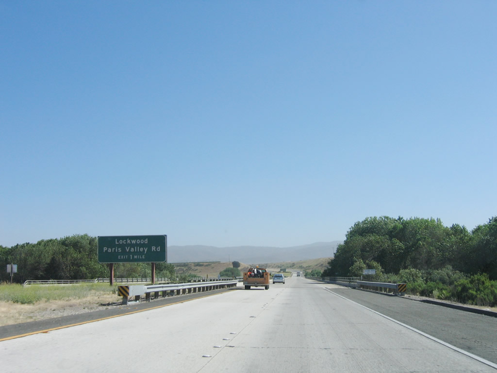
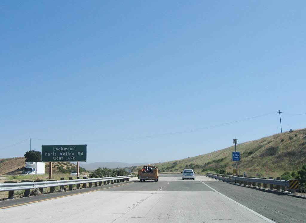
Southbound U.S. 101 approaches Exit 271, Paris Valley Road (Old U.S. 101) south and Lockwood-San Lucas Road south to Monterey County G-14 in Lockwood near San Antonio Lake. The freeway again crosses the Salinas River at this point. Photo taken 07/05/06. |
|
After crossing the Salinas River, a second advance sign for Exit 271, Paris Valley Road (Old U.S. 101) south and Lockwood-San Lucas Road south to Lockwood is posted. Photo taken 07/05/06. |
|
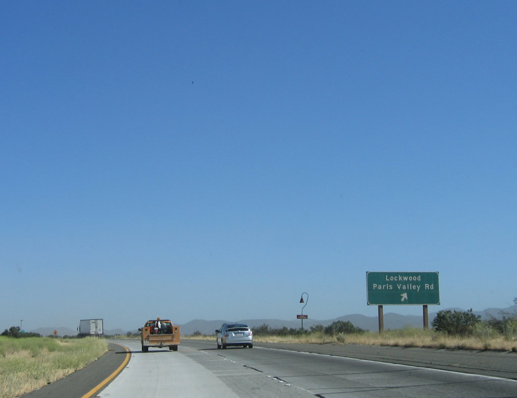
Southbound U.S. 101 (El Camino Real) reaches Exit 271, Paris Valley Road (Old U.S. 101) south and Lockwood-San Lucas Road south to Monterey County G-14 in Lockwood near San Antonio Lake. The old alignment will follow Paris Valley Road and remain parallel to the freeway from here south to San Ardo, the next settlement along U.S. 101. Photo taken 07/05/06. |
|
U.S. 101 takes straight course south toward San Ardo. Note that a concrete roadway surface is in use along this section of freeway. Photo taken 07/05/06. |
|
At this point, old U.S. 101 (Paris Valley Road) crosses the U.S. 101 freeway. Photo taken 07/05/06. |
|
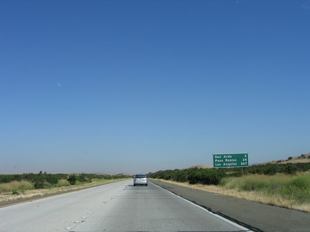
This mileage sign provides the distance to San Ardo (three miles), Paso Robles (34 miles), and Los Angeles (267 miles). Photo taken 07/05/06. |
|
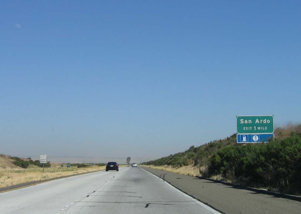
The next exit along U.S. 101 south is Exit 263, Paris Valley Road north, Cattlemen Road north, and Bernardo Road (frontage road) south. Food and gas are available at this interchange in San Ardo, which is an unincorporated community with a population of 501 as of the 2000 Census. Photo taken 07/05/06. |
|
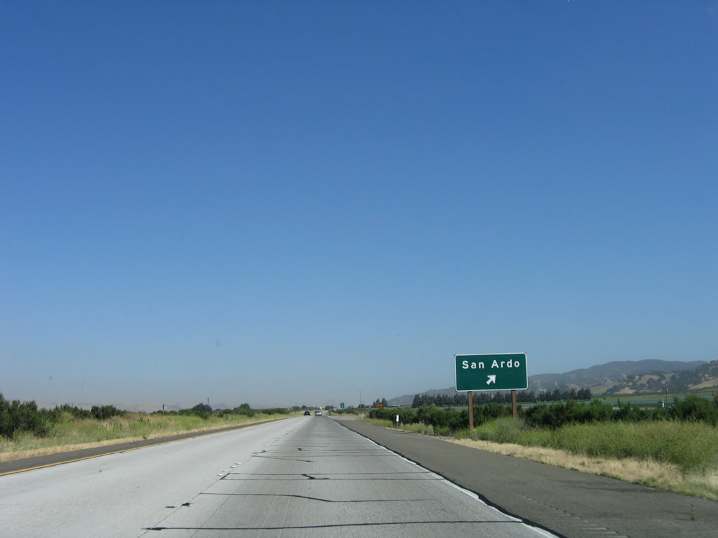
Southbound U.S. 101 reaches Exit 263, Paris Valley Road north, Cattlemen Road north, and Bernardo Road (frontage road) south. Use Cattlemen Road northeast to San Ardo. Photo taken 07/05/06. |
|
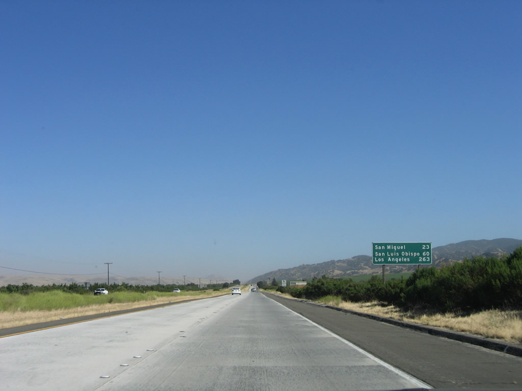
Another mileage sign provides the distance to San Miguel (23 miles), San Luis Obispo (60 miles), and Los Angeles (263 miles). Photo taken 07/05/06. |
|
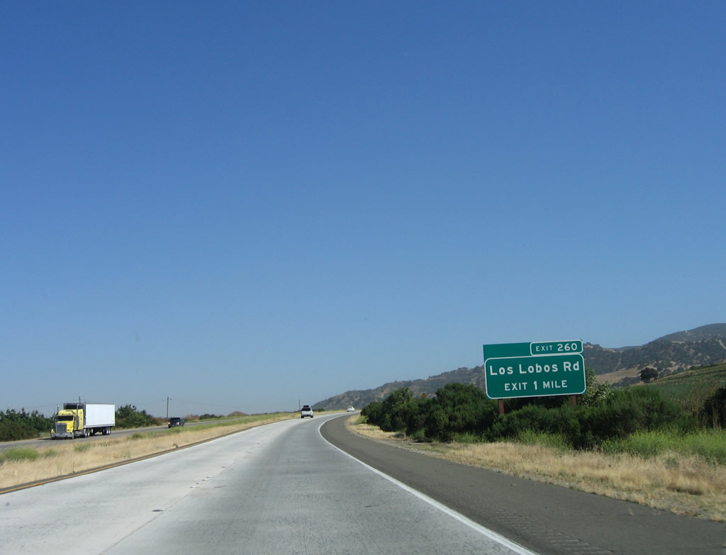
The next exit along U.S. 101 south is Exit 260, Los Lobos Road. Photo taken 07/05/06. |
|
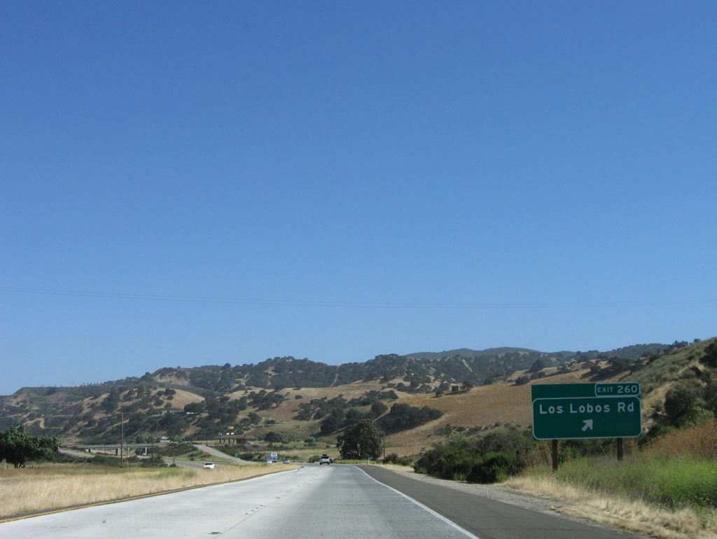
Southbound U.S. 101 reaches Exit 260, Los Lobos Road. Photo taken 07/05/06. |
|
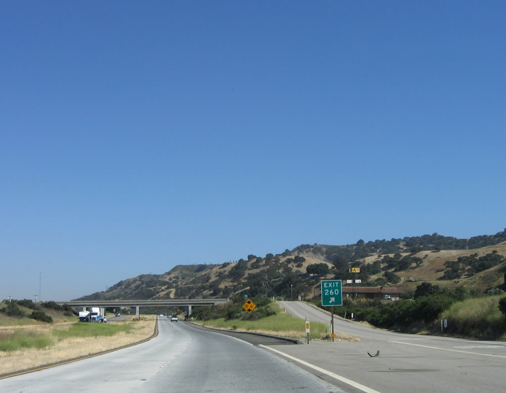
At the top of the off-ramp to Exit 260, Los Lobos Road, is an old gas station. Photo taken 07/05/06. |
|
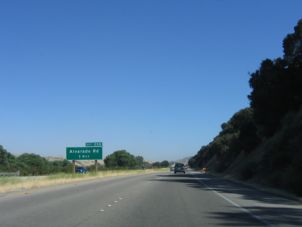
The next exit along U.S. 101 south is Exit 258, Alvarado Road. Photo taken 07/05/06. |
|
Southbound U.S. 101 (El Camino Real) reaches Exit 258, Alvarado Road. Use this exit to the San Ardo Oil Field, which is located on the east side of the freeway. Photo taken 07/05/06. |
|
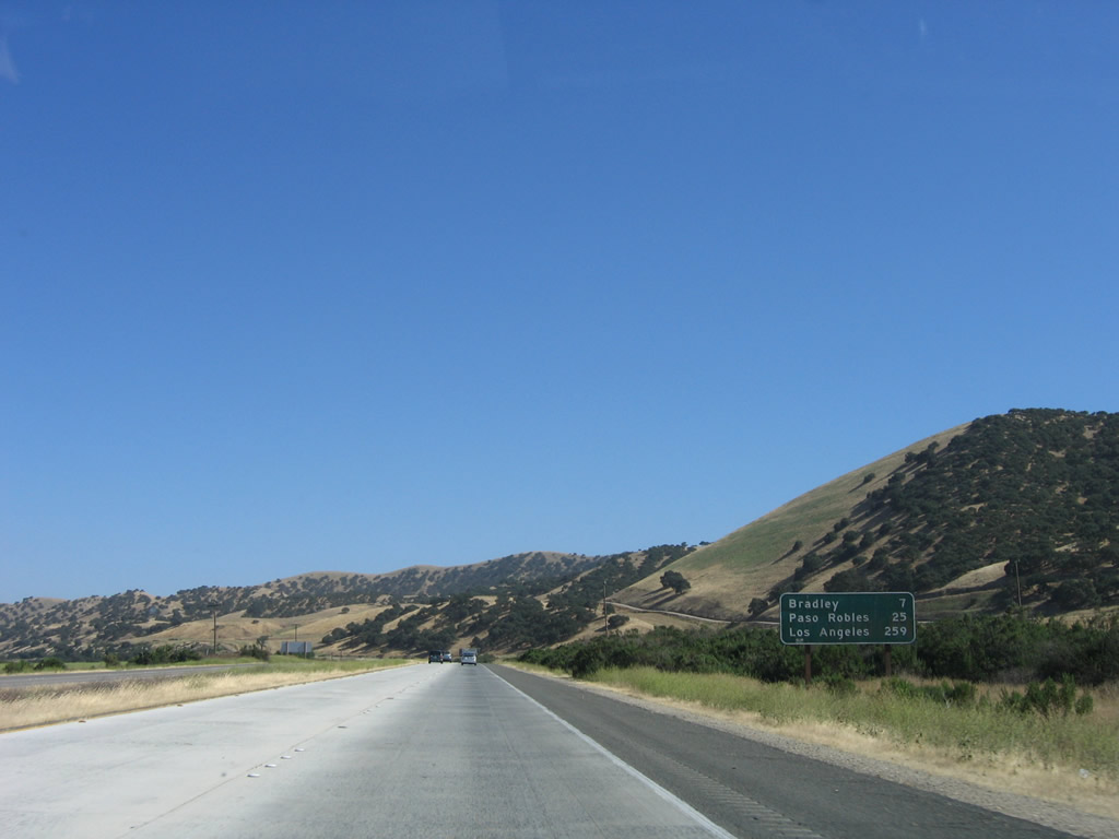
This mileage sign provides the distance to Bradley (seven miles), Paso Robles (25 miles), and Los Angeles (259 miles). Photo taken 07/05/06. |
|
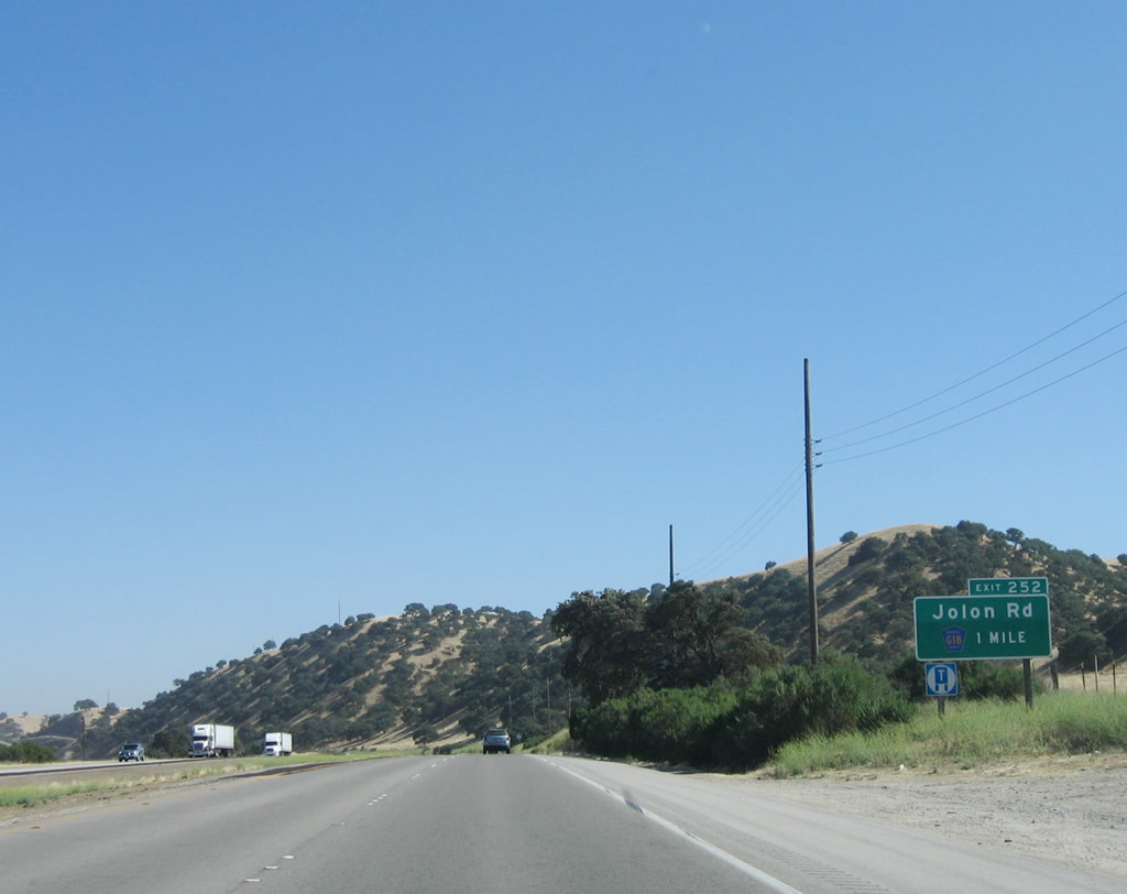
The next exit along U.S. 101 south is Exit 252, Monterey County G-18/Jolon Road west to Lockwood and San Antonio Lake. This exit also connects to Monterey County G-19/Lake Nacimiento Drive south to Nacimiento Lake. Photo taken 07/05/06. |
|
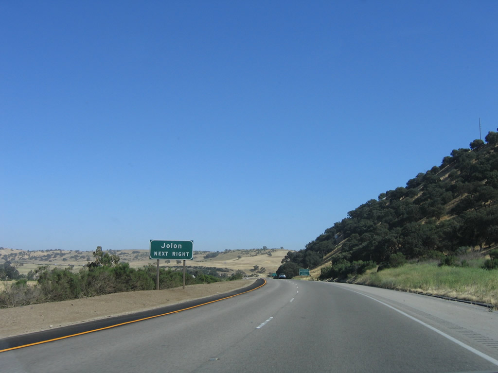
Use Monterey County G-18/Jolon Road west to Lockwood and Jolon. Photo taken 07/05/06. |
|
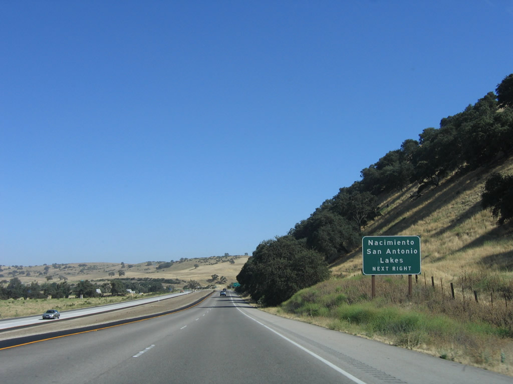
This exit also connects U.S. 101 to San Antonio Lake via Monterey County G-18 west and Nacimiento Lake via Monterey County G-19 south. Photo taken 07/05/06. |
|
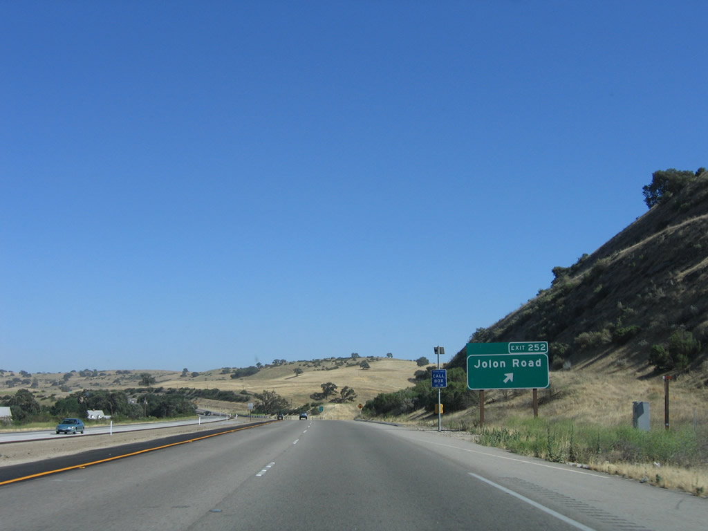
Southbound U.S. 101 (El Camino Real) reaches Exit 252, Monterey County G-18/Jolon Road west to Lockwood and San Antonio Lake. This exit also connects to Monterey County G-19/Lake Nacimiento Drive south to Nacimiento Lake. Photo taken 07/05/06. |
|
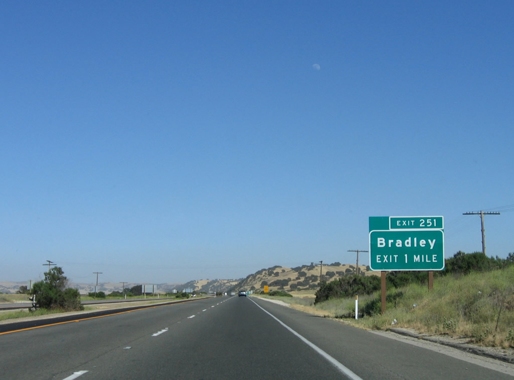
The next exit along U.S. 101 south is Exit 251, Bradley Road east to unincorporated Bradley (population 120 as of the 2000 Census). Photo taken 07/05/06. |
|
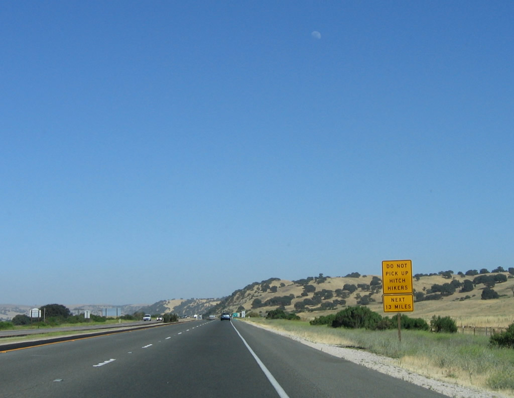
As U.S. 101 (El Camino Real) approaches Bradley, travelers along the freeway are warned not to pick up hitch hikers for the next 13 miles due to the presence of Camp Roberts Military Reservation. By this point, U.S. 101 has left the wide Salinas Valley and is now following the Salinas River closely through hills toward Paso Robles and Atascadero. Photo taken 07/05/06. |
|
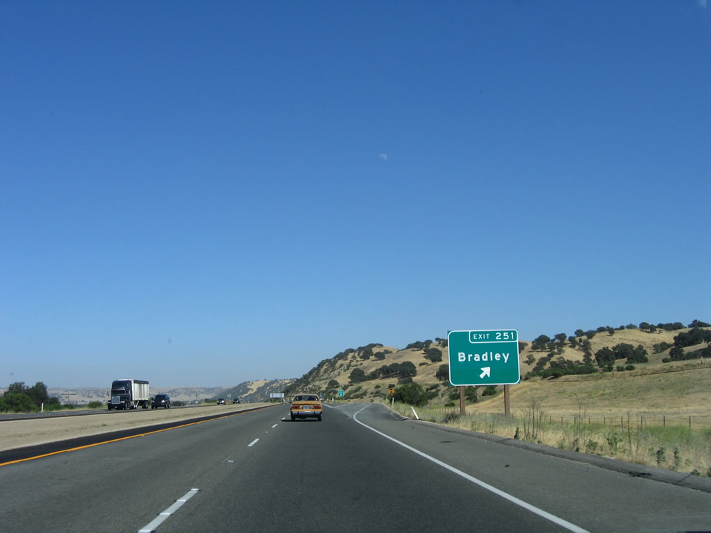
Southbound U.S. 101 reaches Exit 251, Bradley Road east to unincorporated Bradley. Photo taken 07/05/06. |
|
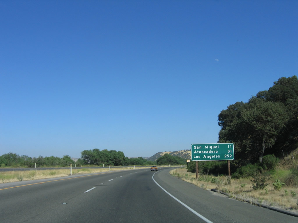
Another mileage sign provides the distance to San Miguel (11 miles), Atascadero (31 miles), and Los Angeles (252 miles). Photo taken 07/05/06. |
|
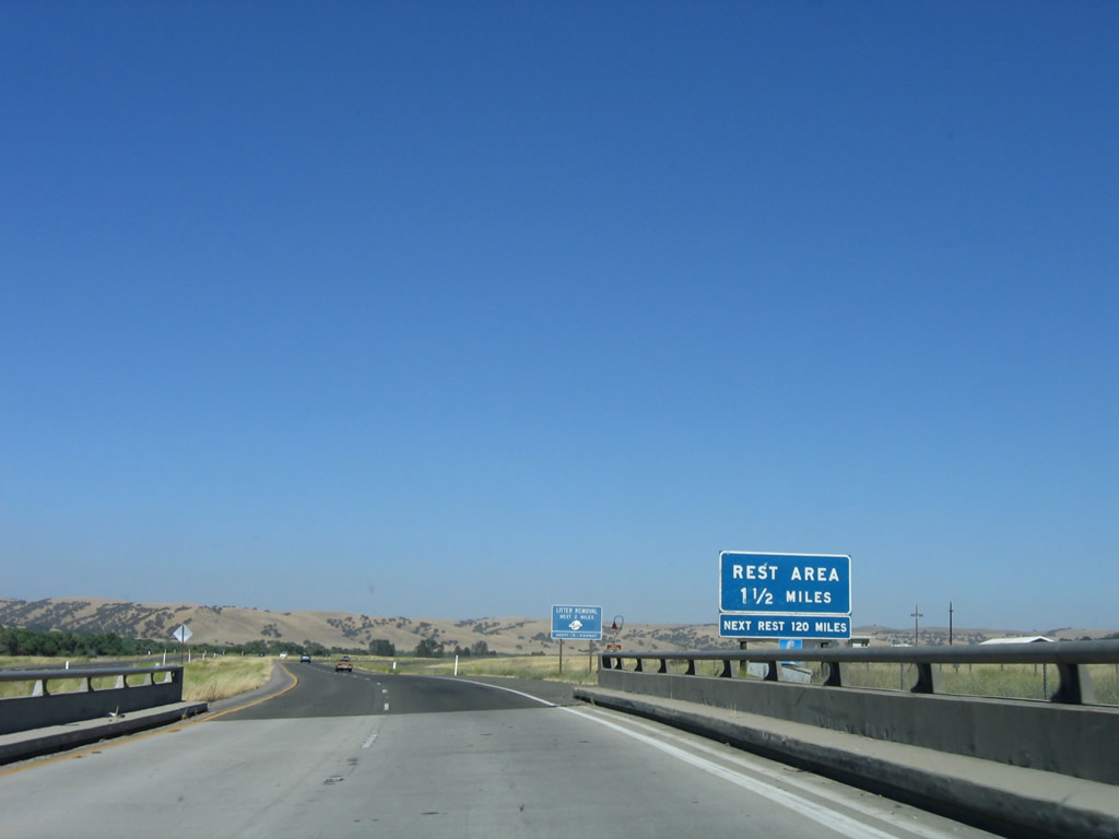
The next exit from U.S. 101 south is for the Camp Roberts Rest Area located at Milepost 248. Another rest area along U.S. 101 south is not seen until the Gaviota Rest Area 120 miles south in Santa Barbara County. Photo taken 07/05/06. |
|
Southbound U.S. 101 reaches Exit 248, Camp Roberts Rest Area. Photo taken 07/05/06. |
|
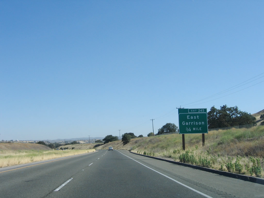
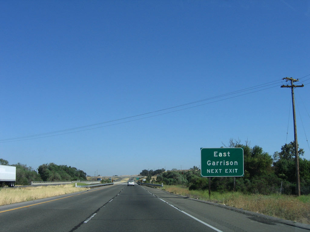
The next exit along U.S. 101 south is Exit 245, Camp Roberts East Garrison. Photo taken 07/05/06. |
|
Southbound U.S. 101 approaches Exit 245, East Garrison (next right). Photo taken 07/05/06. |
|
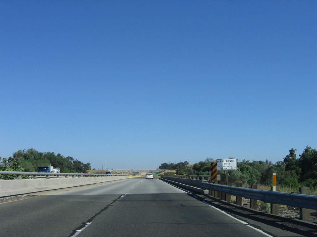
U.S. 101 crosses the Nacimiento River on this bridge. The Nacimiento River drains from Nacimiento Lake into the Salinas River. Photo taken 07/05/06. |
|
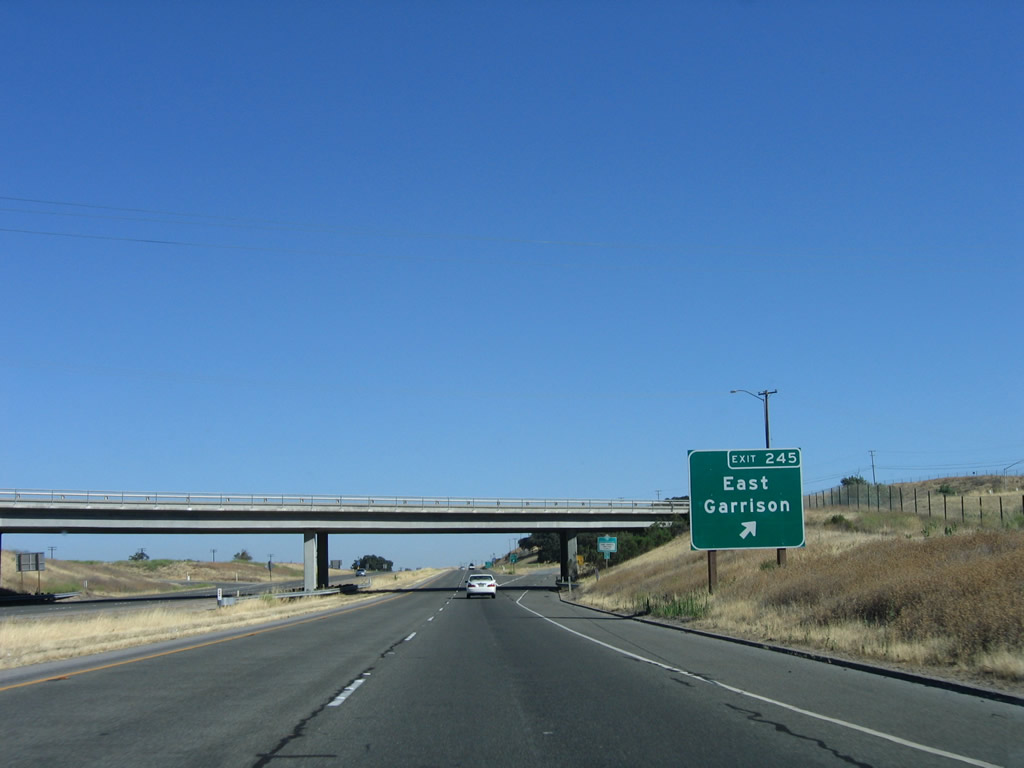
Southbound U.S. 101 reaches Exit 245, East Garrison. Photo taken 07/05/06. |
|
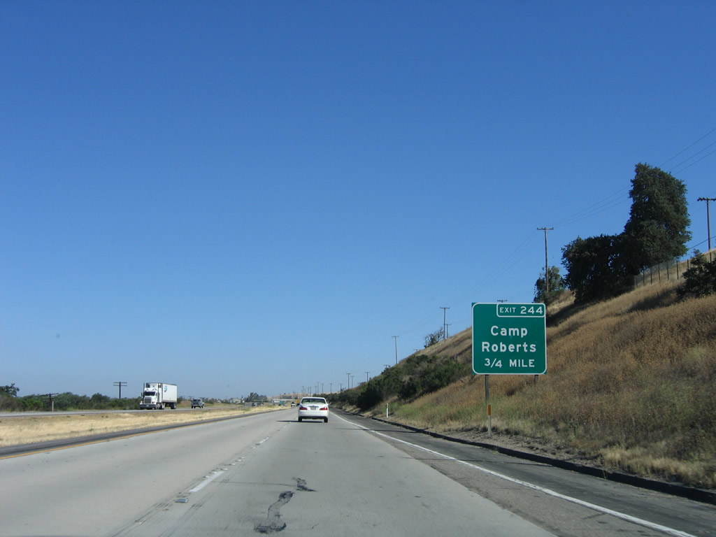
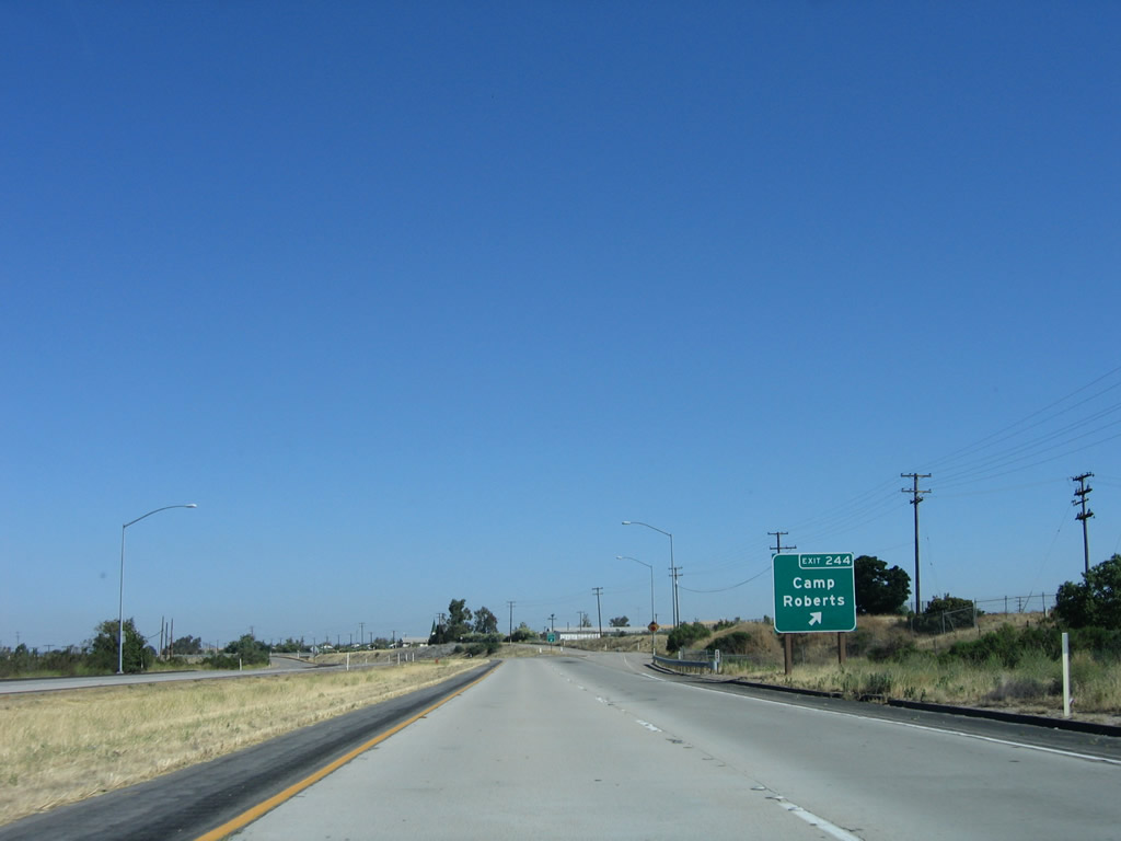
The next exit along U.S. 101 (El Camino Real) south is Exit 244, Camp Roberts. Photo taken 07/05/06. |
|
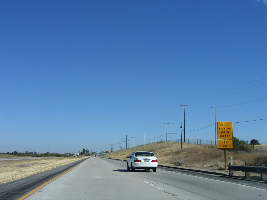
Another hitch hiker sign is posted between Exits 245 and 244. Photo taken 07/05/06. |
|
Southbound U.S. 101 reaches Exit 244, Camp Roberts. Photo taken 07/05/06. |
|
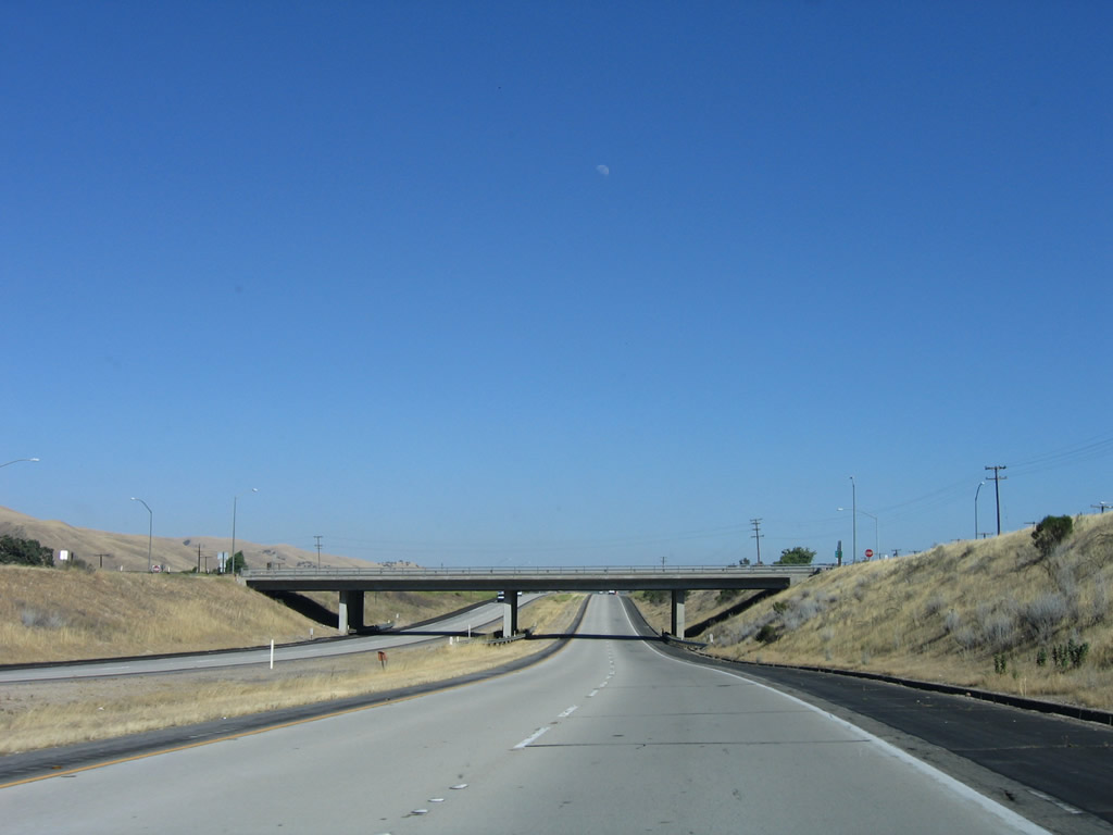
The U.S. 101 freeway goes below grade to pass under the Camp Roberts access road. Photo taken 07/05/06. |
|
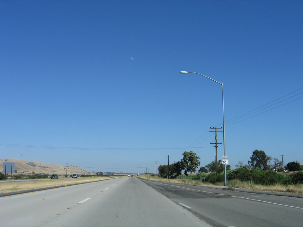
A final reassurance shield for U.S. 101 is posted prior to leaving Monterey County and entering San Luis Obispo County. Photo taken 07/05/06. |
|
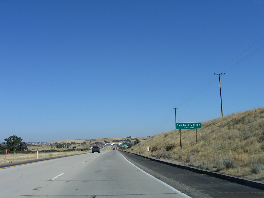
U.S. 101 (El Camino Real) leaves Monterey County and enters San Luis Obispo County. Photo taken 07/05/06. |
Page Updated March 8, 2008.