| U.S. 101 (El Camino Real) south and California 166 west |
|---|
|
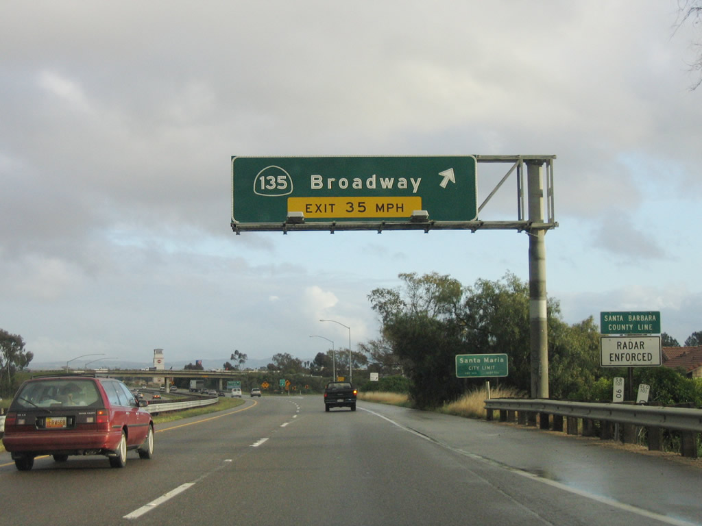
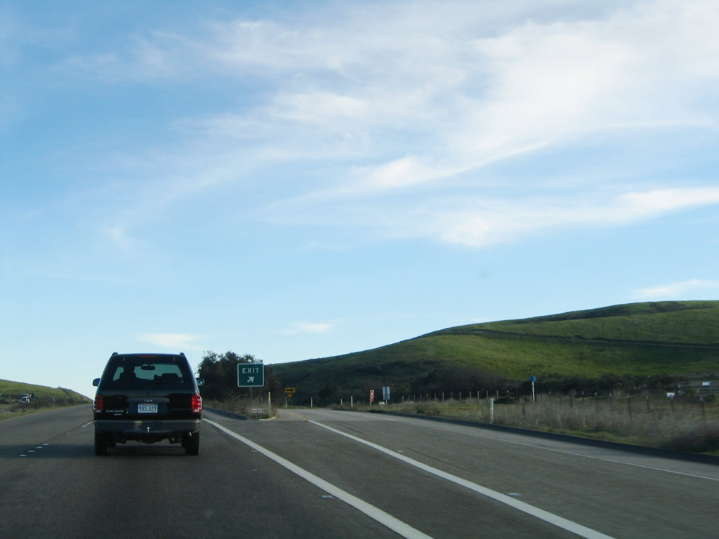
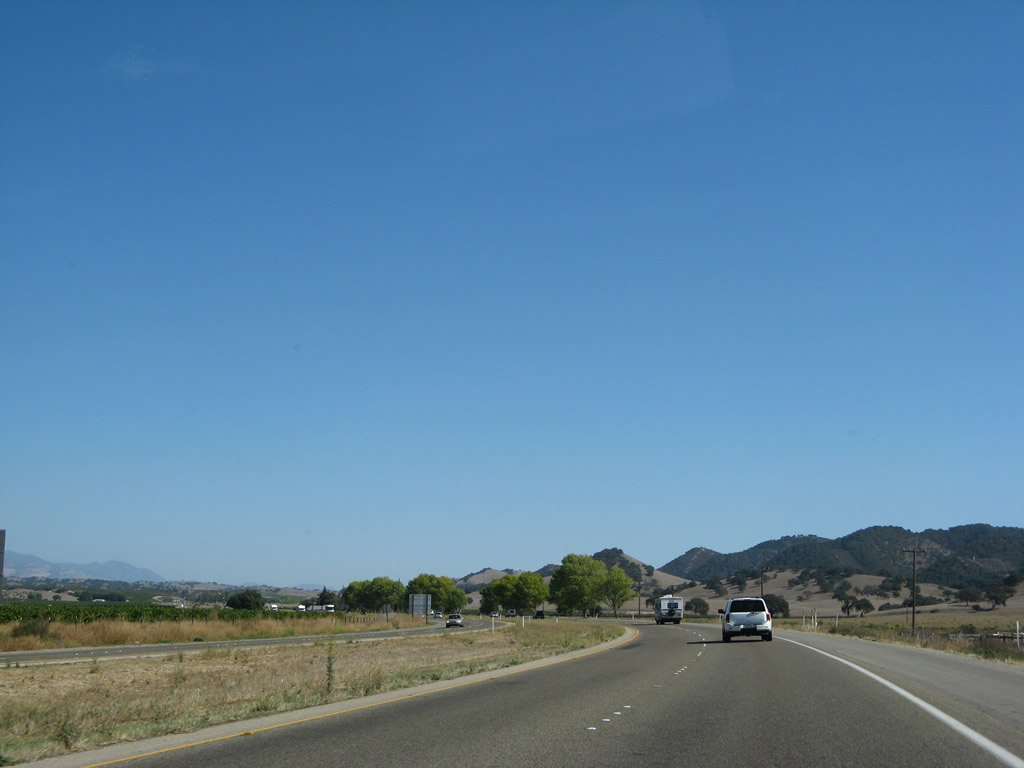
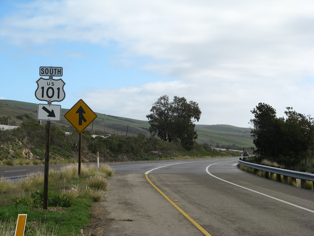
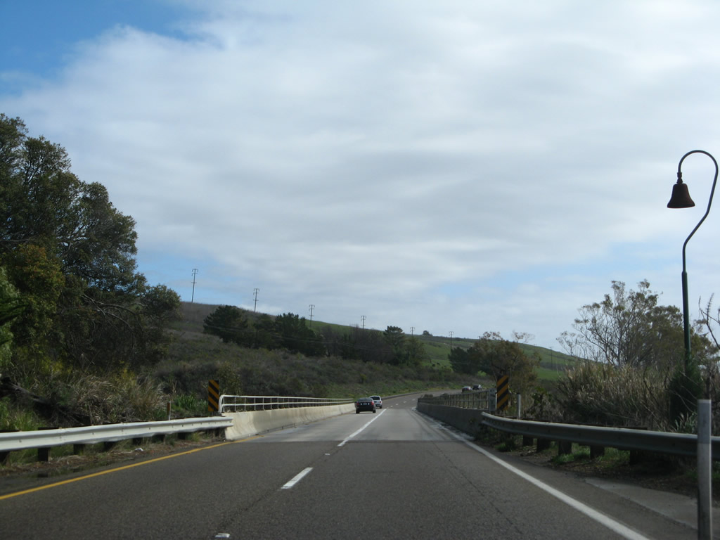
Southbound U.S. 101 (El Camino Real) and westbound California 166 reach Exit 173, California 135 and U.S. 101 Business (Broadway) south through downtown Santa Maria. This interchange is a trumpet. U.S. 101 Business will follow California 135 through Santa Maria, then split southeast to return to U.S. 101 at Exit 167. Just prior to this exit, U.S. 101 leaves San Luis Obispo County and enters Santa Barbara County. Photo taken 03/20/06. |
|
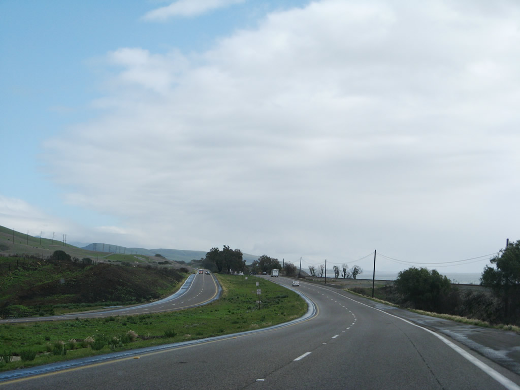
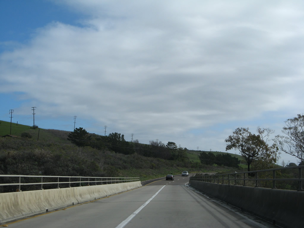
At Exit 173, U.S. 101 (El Camino Real) south and California 166 west enter the city of Santa Maria. With a population of 77,423, Santa Maria is the largest city in Santa Barbara County and is known for its wine country, agriculture, proximity to Vandenburg Air Force Base, and barbecue. Santa Maria consists of 19.7 square miles, and nearby Orcutt, Lompoc, and Guadalupe expand along with the city of Santa Maria. Photo taken 03/20/06. |
|
The next exit along southbound U.S. 101 is Exit 172, Donovan Road, which serves northern Santa Maria. The overpass connects northbound California 135/U.S. 101 Business with U.S. 101 and northbound U.S. 101 with southbound California 135 and U.S. 101 Business. Photo taken 11/29/04. |
|
A reassurance shield assembly is posted for U.S. 101 south and California 166 west after the on-ramp from California 135. Photo taken 11/29/04. |
|
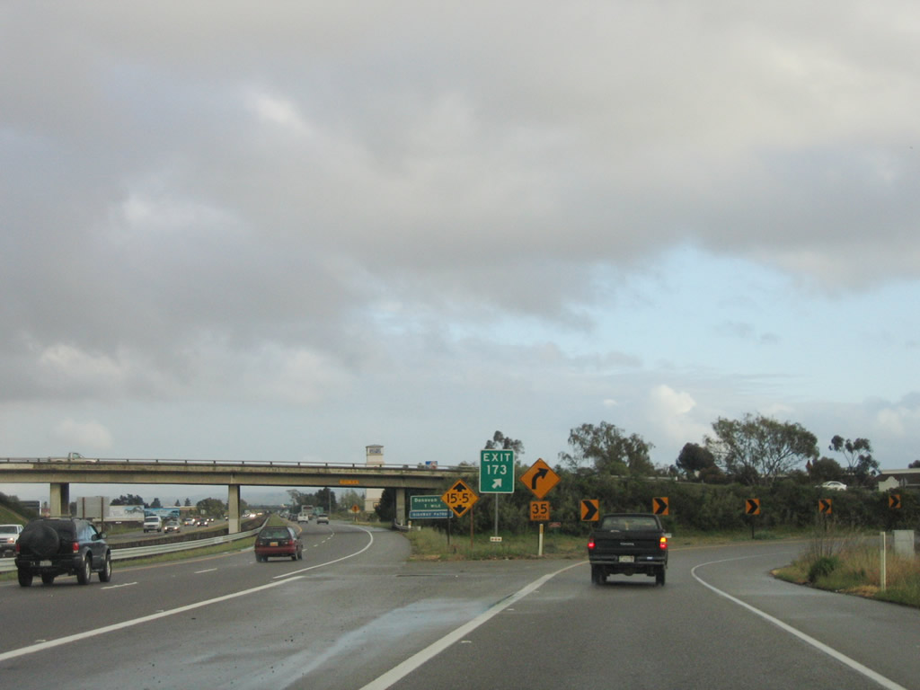
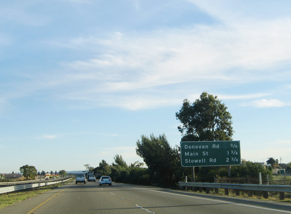
This interchange sequence sign provides the distance to the next three exits along U.S. 101 south: Exit 172, Donovan Road; Exit 171, California 166 (Main Street) west to downtown; and Exit 170, Stowell Road. Each exit serves the city of Santa Maria. Photo taken 11/29/04. |
|
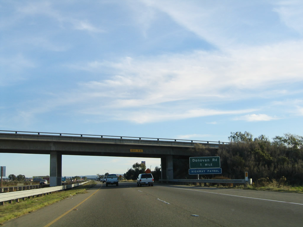
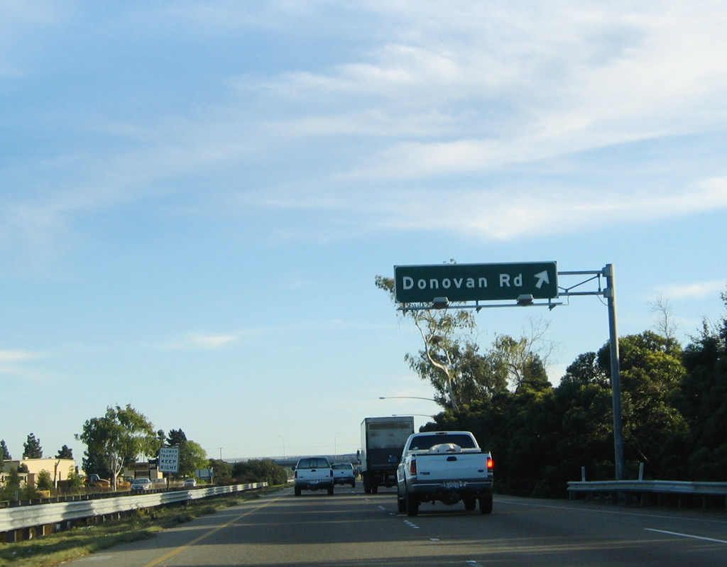
Southbound U.S. 101 reaches Exit 172, Donovan Road. Photo taken 11/29/04. |
|
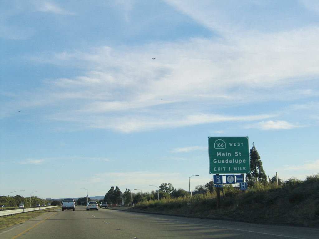
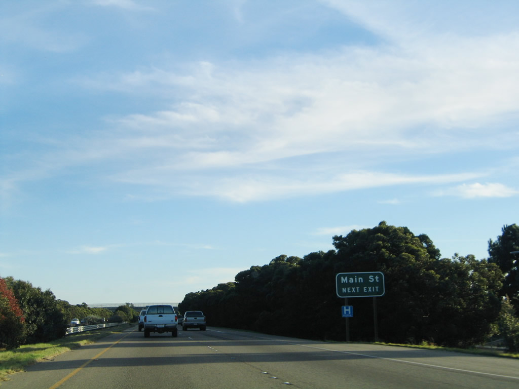
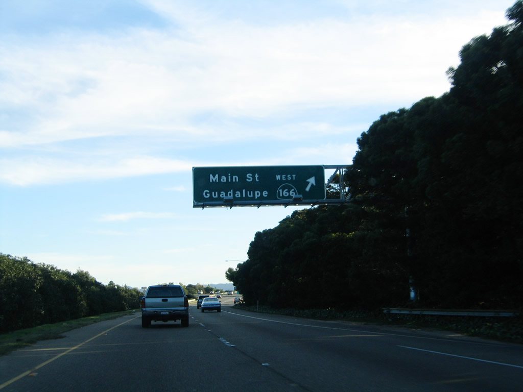
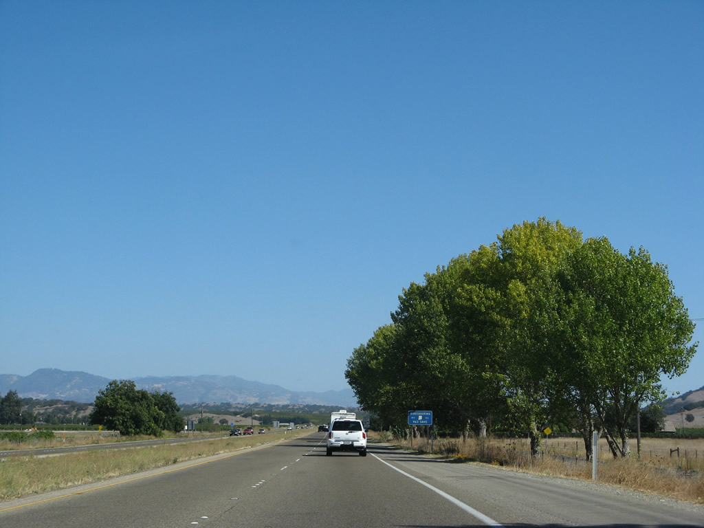
The next exit along southbound U.S. 101 is Exit 171, California 166 (Main Street) west to downtown Santa Maria and the city of Guadalupe. Photo taken 11/29/04. |
|
California 166 follows Main Street west through Santa Maria into Guadalupe, where the state route ends at the intersection with California 1 (Cabrillo Highway) (Pacific Coast Highway). Photo taken 11/29/04. |
|
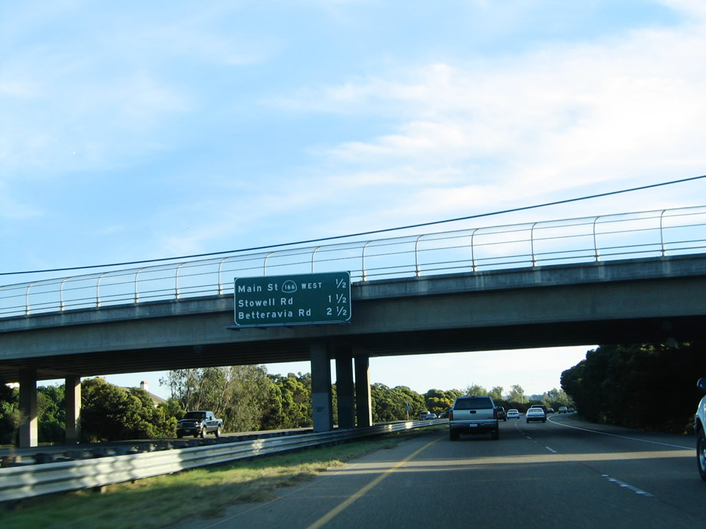
This interchange sequence sign provides the distance to the next three exits along U.S. 101 south: Exit 171, California 166 (Main Street) west to downtown; Exit 170, Stowell Road; and Exit 169, Betteravia Road. Photo taken 11/29/04. |
|
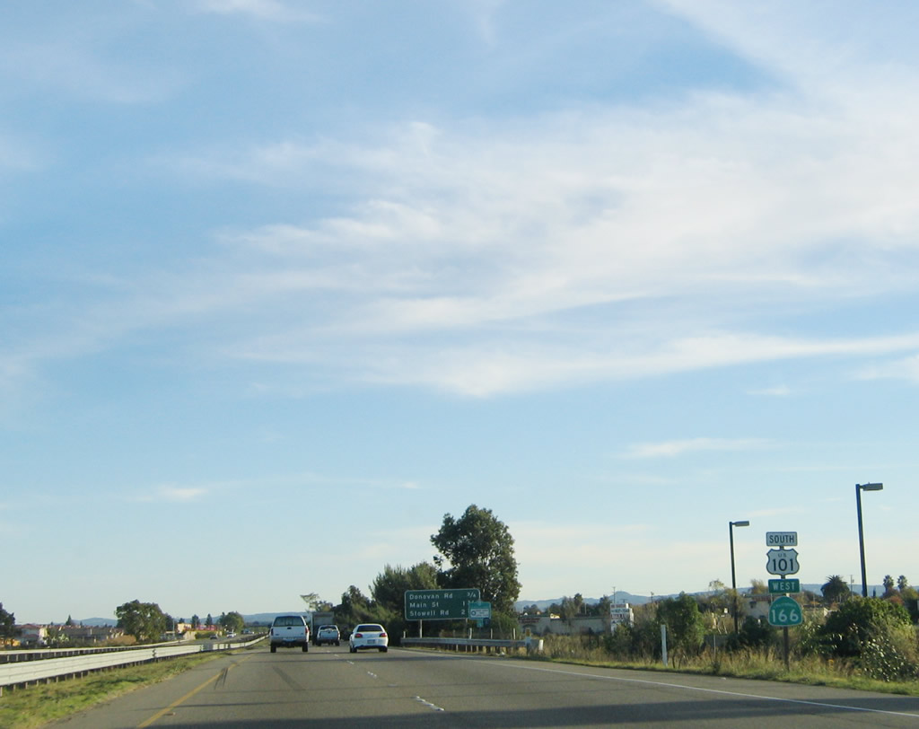
Southbound U.S. 101 reaches Exit 171, California 166 (Main Street) west to downtown Santa Maria and the city of Guadalupe. Main Street also travels east to Philbric Road south. Photo taken 11/29/04. |
| U.S. 101 south |
|---|
|
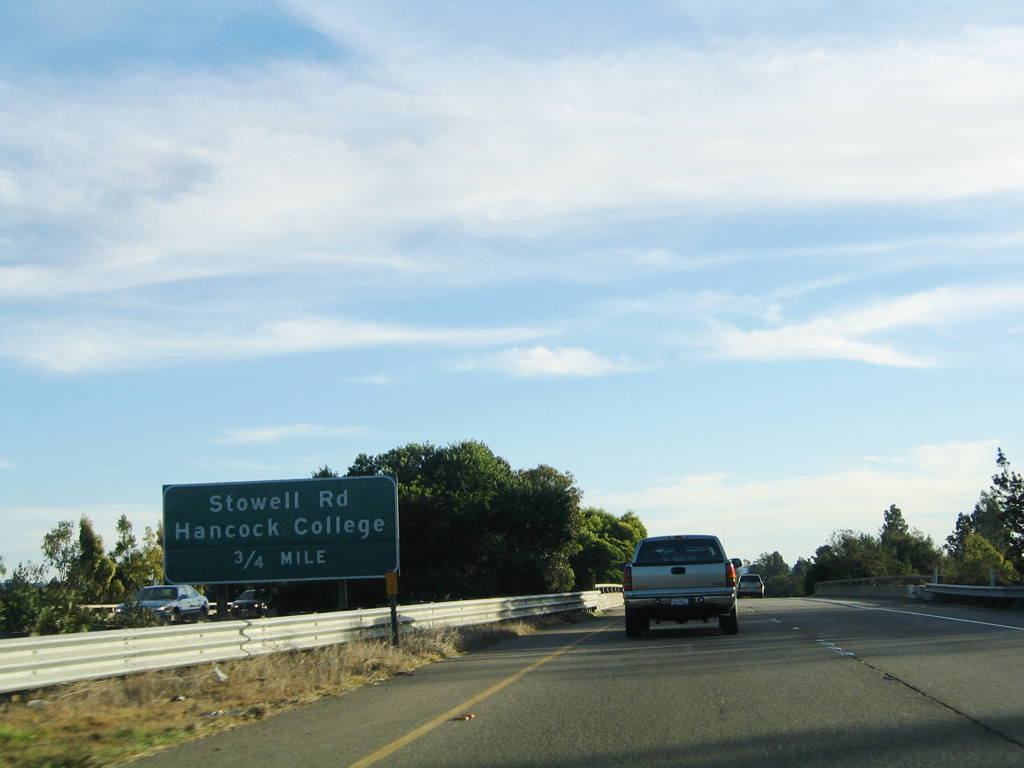
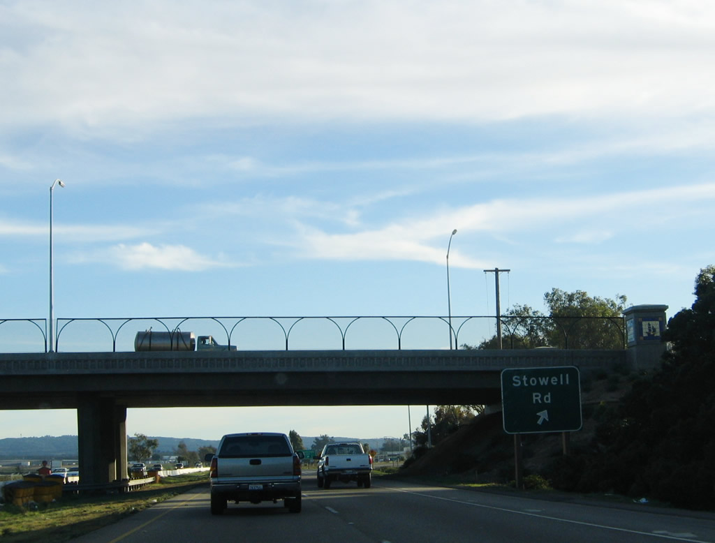
The next exit along southbound U.S. 101 is Exit 170, Stowell Road. Use Stowell Road west to Allan Hancock College and Santa Barbara County Fairgrounds. Photo taken 11/29/04. |
|
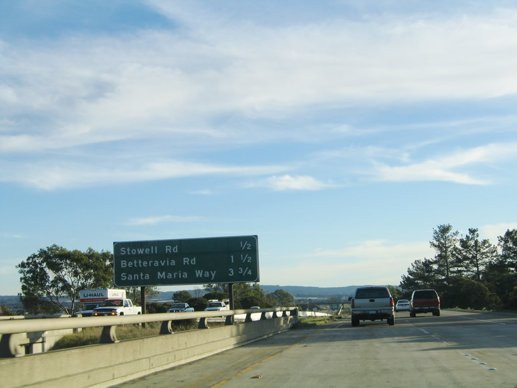
This interchange sequence sign provides the distance to the next three exits along U.S. 101 south: Exit 170, Stowell Road; Exit 169, Betteravia Road; and Exit 168, U.S. 101 Business/Santa Maria Way. Photo taken 11/29/04. |
|
Southbound U.S. 101 reaches Exit 170, Stowell Road. Photo taken 11/29/04. |
|
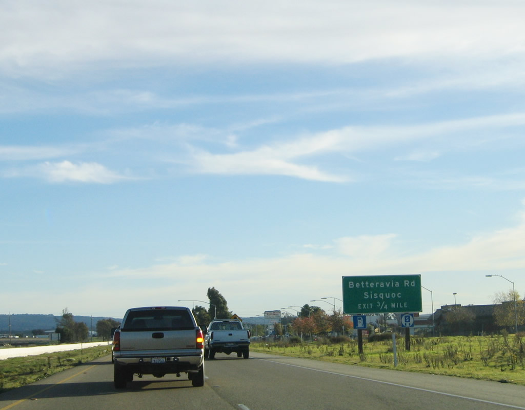
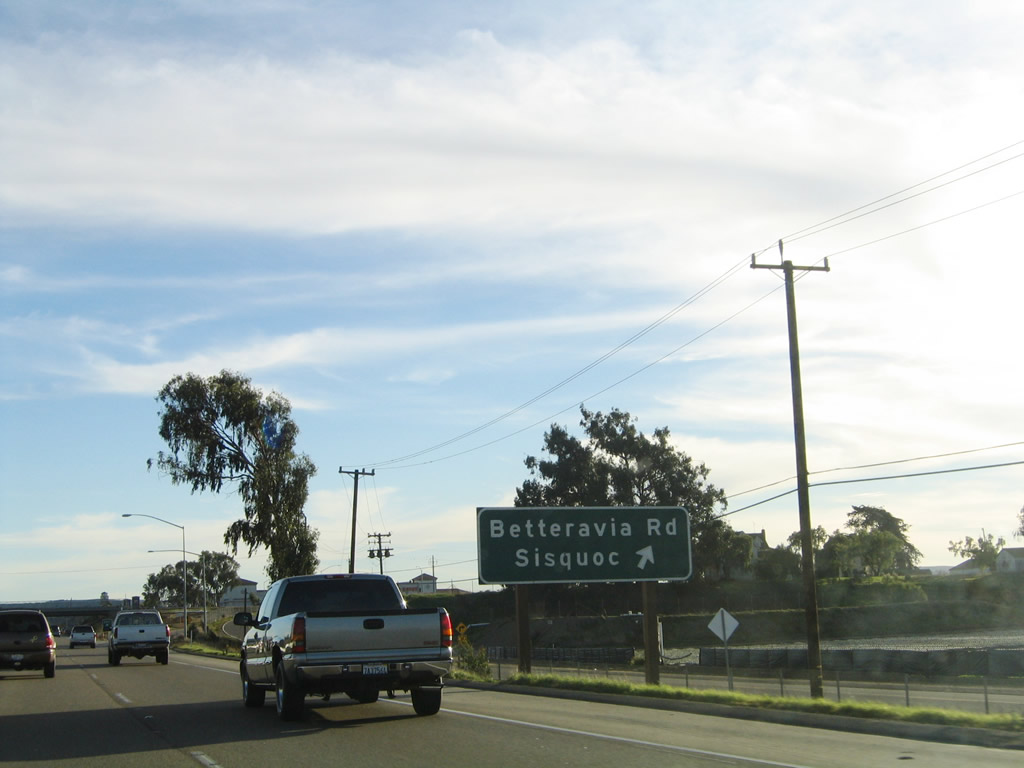
The next exit along U.S. 101 south is Exit 169, Betteravia Road. Use Betteravia Road west to the Santa Maria Airport via Skyway Drive. To the east, Betteravia Road travels to the unincorporated community of Sisquoc. Photo taken 11/29/04. |
|
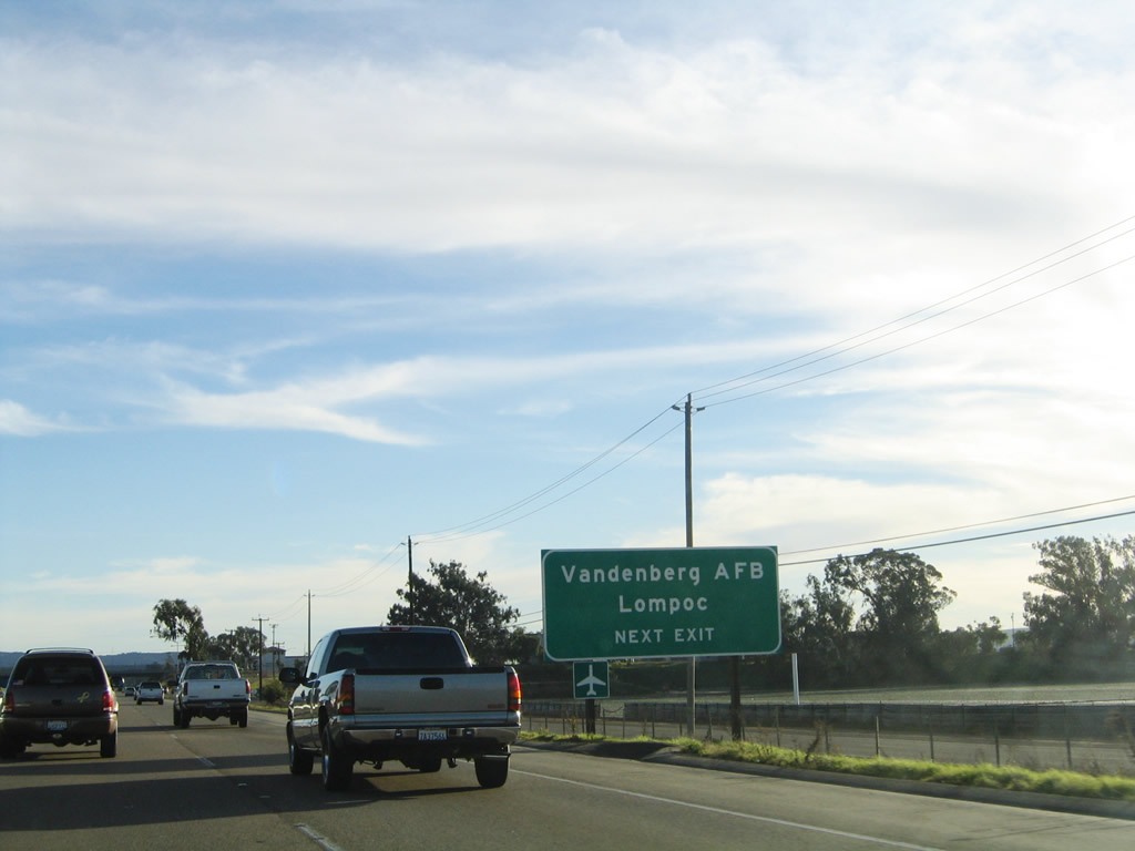
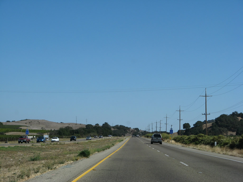
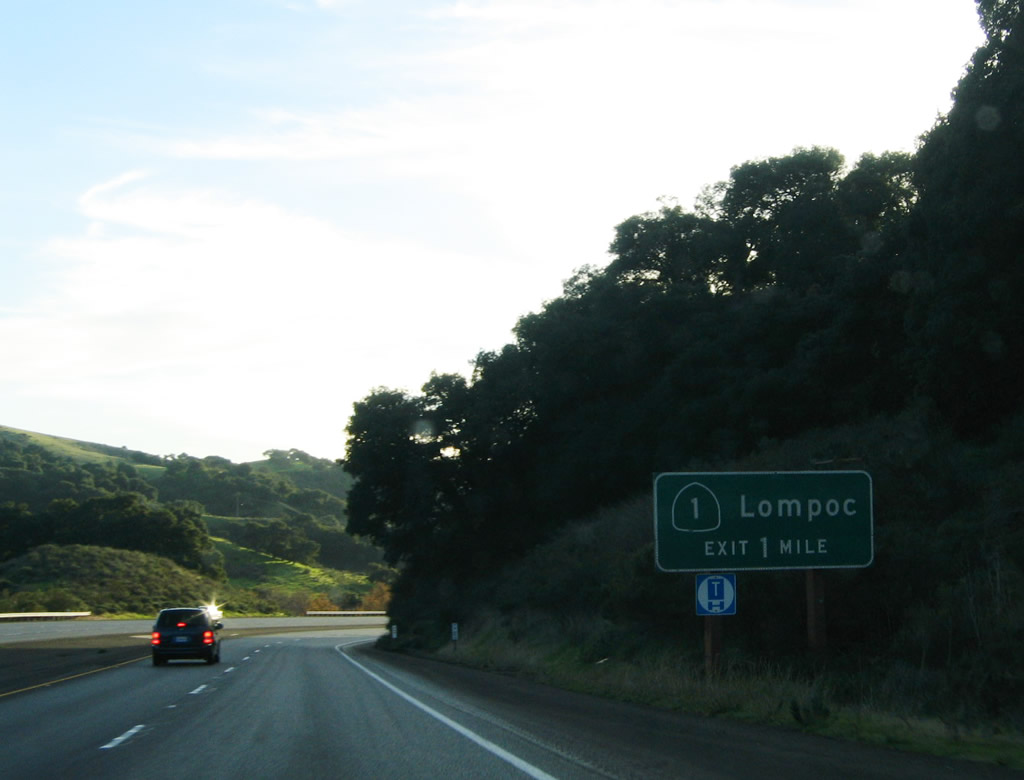
Use Betteravia Road west to California 135 south to California 1 south to Vandenburg Air Force and the city of Lompoc, which is located southeast of the main entrance to the Air Force Base. Photo taken 11/29/04. |
|
Southbound U.S. 101 (El Camino Real) reaches Exit 169, Betteravia Road. Photo taken 11/29/04. |
|
The next exit along U.S. 101 south is Exit 167, U.S. 101 Business/Santa Maria Way northwest to southern Santa Maria. Photo taken 11/29/04. |
|
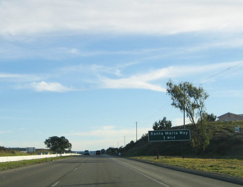
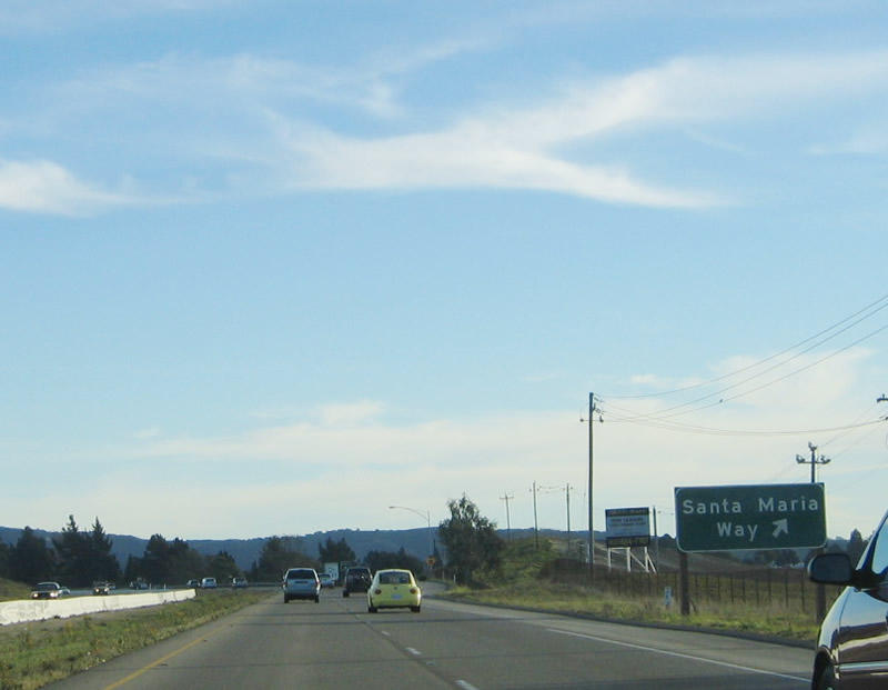
Southbound U.S. 101 reaches Exit 167, U.S. 101 Business/Santa Maria Way. This is the penultimate Santa Maria interchange. From here, U.S. 101 turns southeast toward Los Alamos and Los Olivos (via California 154 east at Exit 146). Photo taken 11/29/04. |
|
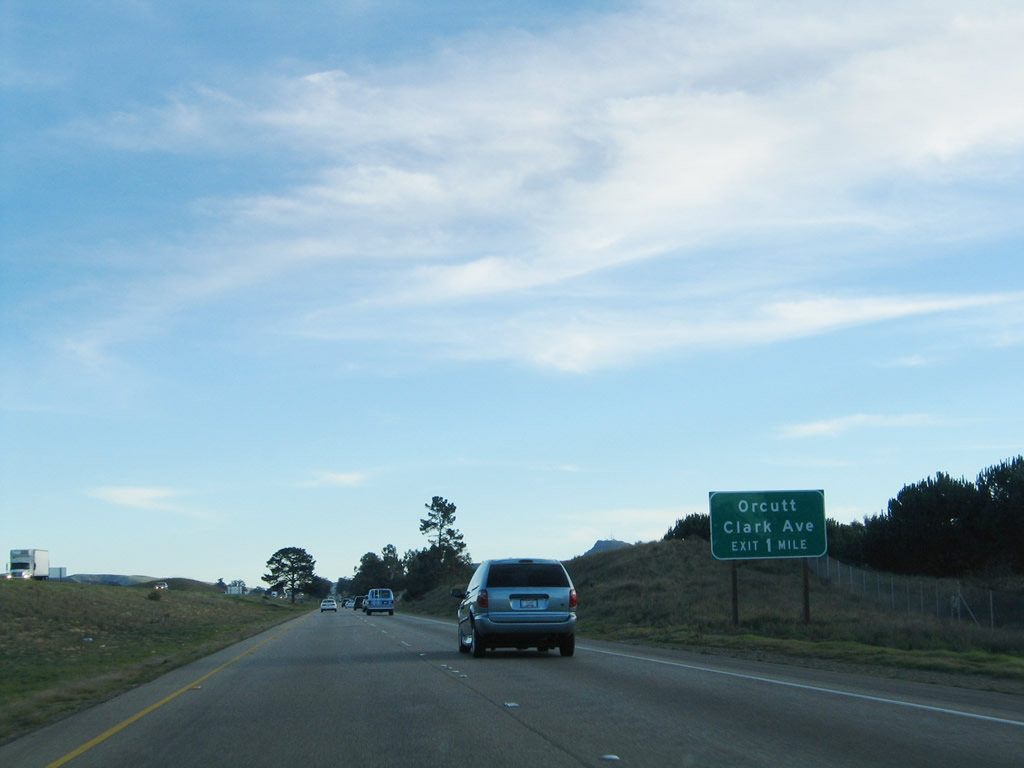
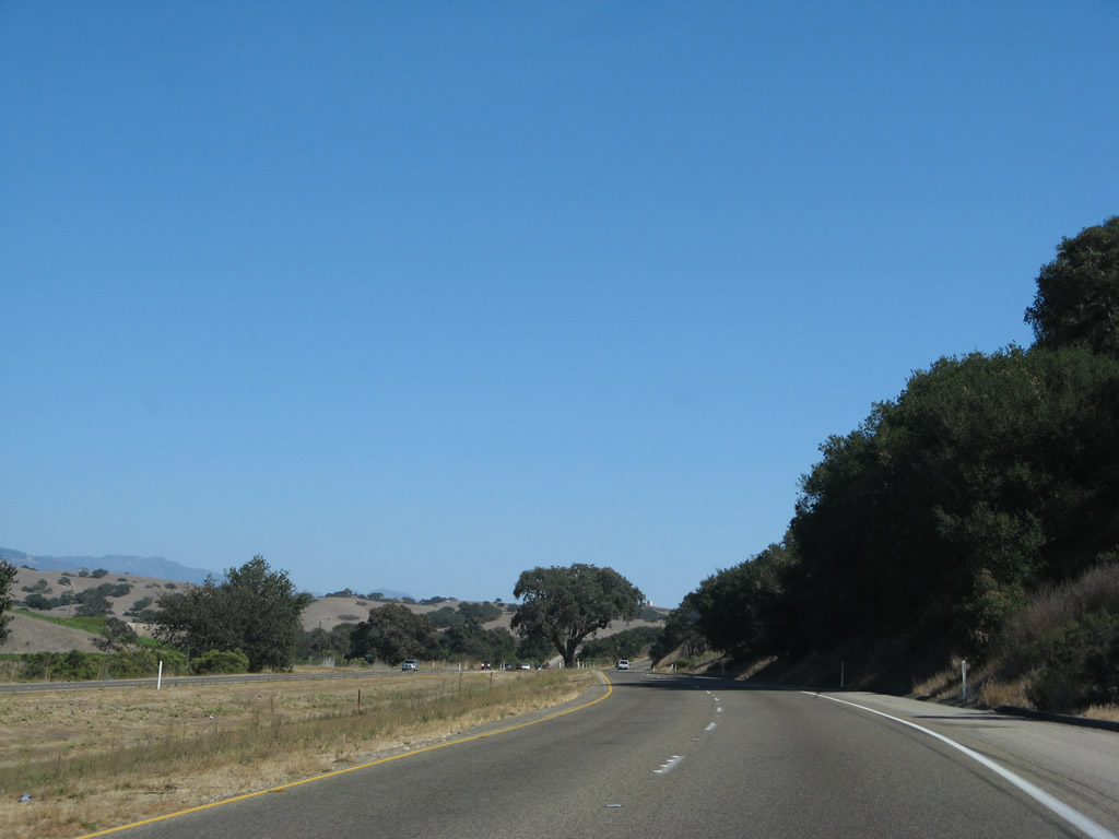
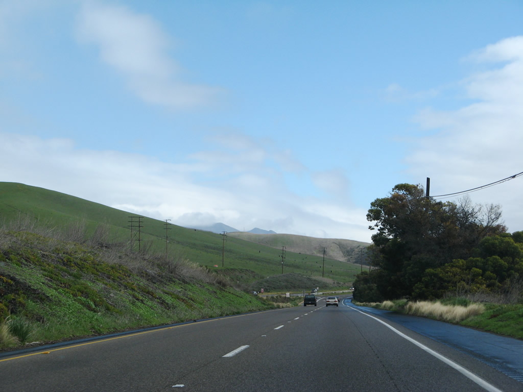
The next exit along U.S. 101 south is Exit 164, Clark Avenue west to the unincorporated community of Orcutt. Clark Avenue interchanges with California 135 (Orcutt Expressway) at Exit 17, then continues west to its end at California 1/Cabrillo (Pacific Coast) Highway. This is the last interchange to serve the Santa Maria metropolitan area. Photo taken 11/29/04. |
|
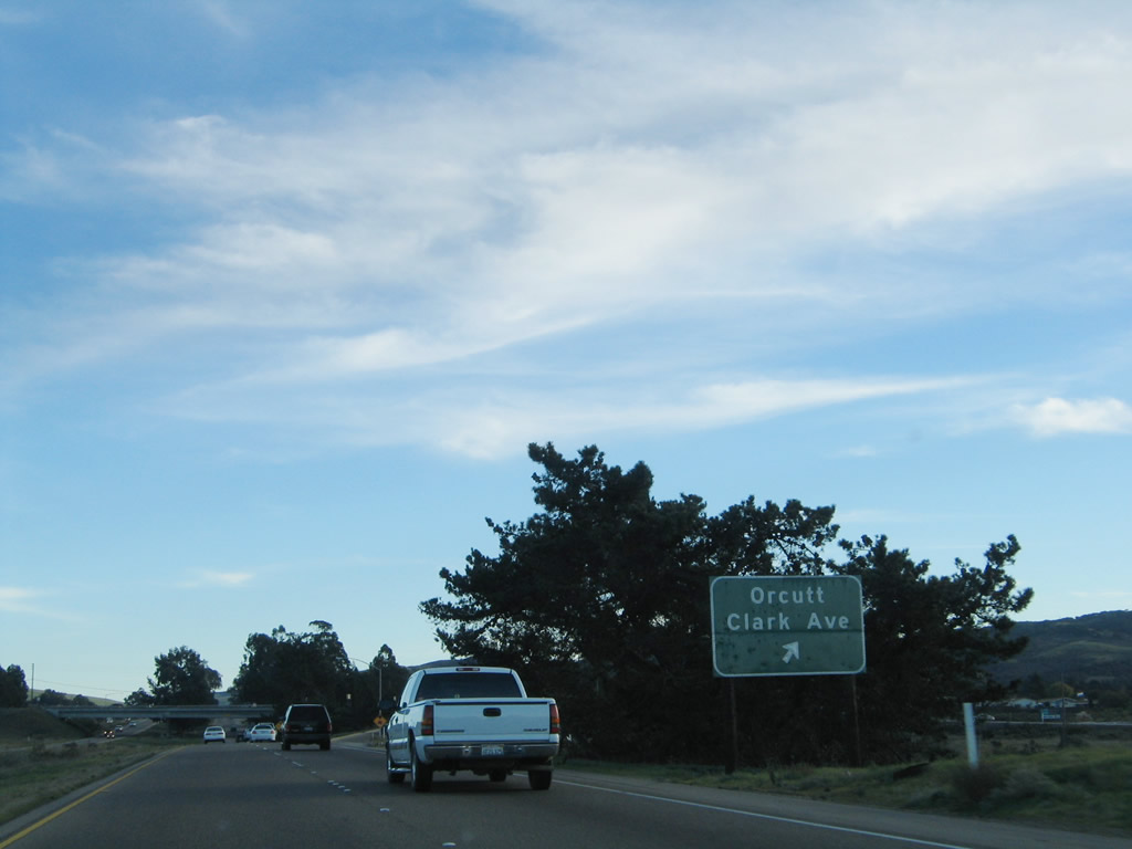
Southbound U.S. 101 reaches Exit 164, Clark Avenue west to Orcutt. After this interchange, U.S. 101 enters the rolling Solomon Hills. Photo taken 11/29/04. |
|
The next exit along U.S. 101 south is Exit 161, which serves Solomon Summit undercrossing. There are no advance signs for this interchange, which is intended to serve local traffic and act as a turnaround. Photo taken 11/29/04. |
|
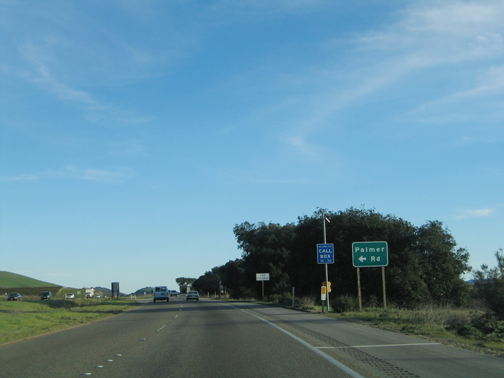
The next exit along U.S. 101 south is Exit 159, a left turn onto Palmer Road en route to Sisquoc. For the next several miles, U.S. 101 again downgrades to expressway standards with at-grade intersections. Photo taken 11/29/04. |
|
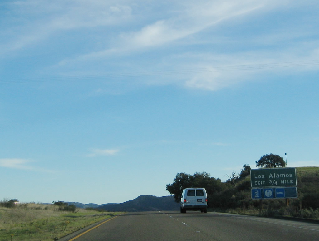
The next intersection along U.S. 101 south is Exit 156, which connects to old U.S. 101 south to the unincorporated community of Los Alamos. While the signage would lead you to believe this is a true exit, that is not the case. Watch for cross traffic. Photo taken 11/29/04. |
|
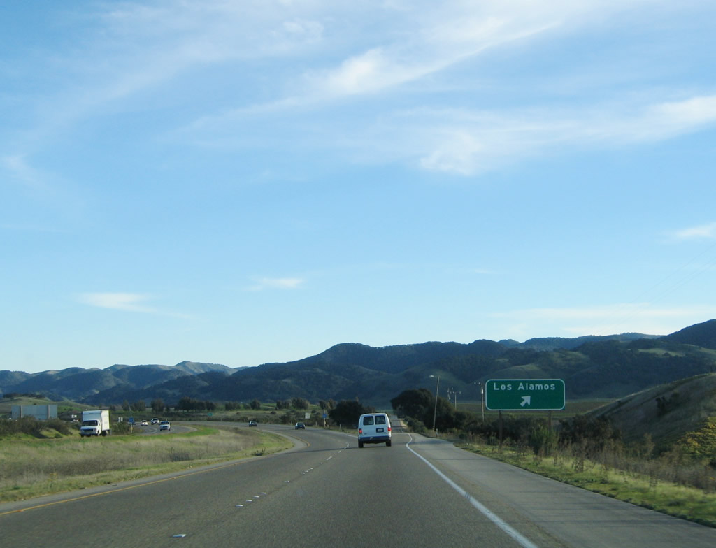
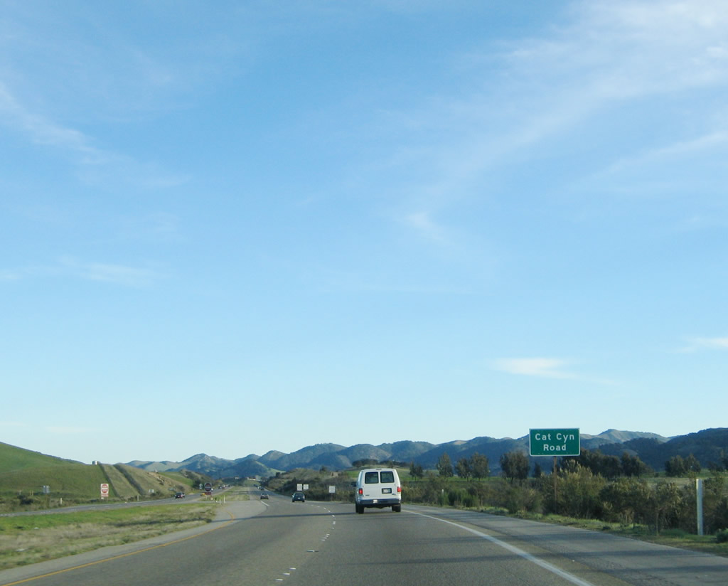
Southbound U.S. 101 (El Camino Real) reaches Exit 156, Bell Street south to Cat Canyon Road. Watch for cross traffic. Photo taken 11/29/04. |
|
Immediately after the off-ramp to Bell Street south, U.S. 101 crosses Cat Canyon Road. Use Cat Canyon Road north through the Solomon Hills to Sisquoc, and to the south, Cat Canyon Road leads to Bell Street en route to Los Alamos (population 1,372 as of 2000 Census). Photo taken 11/29/04. |
|
The freeway resumes after crossing the Cat Canyon Road intersection. Photo taken 11/29/04. |
|
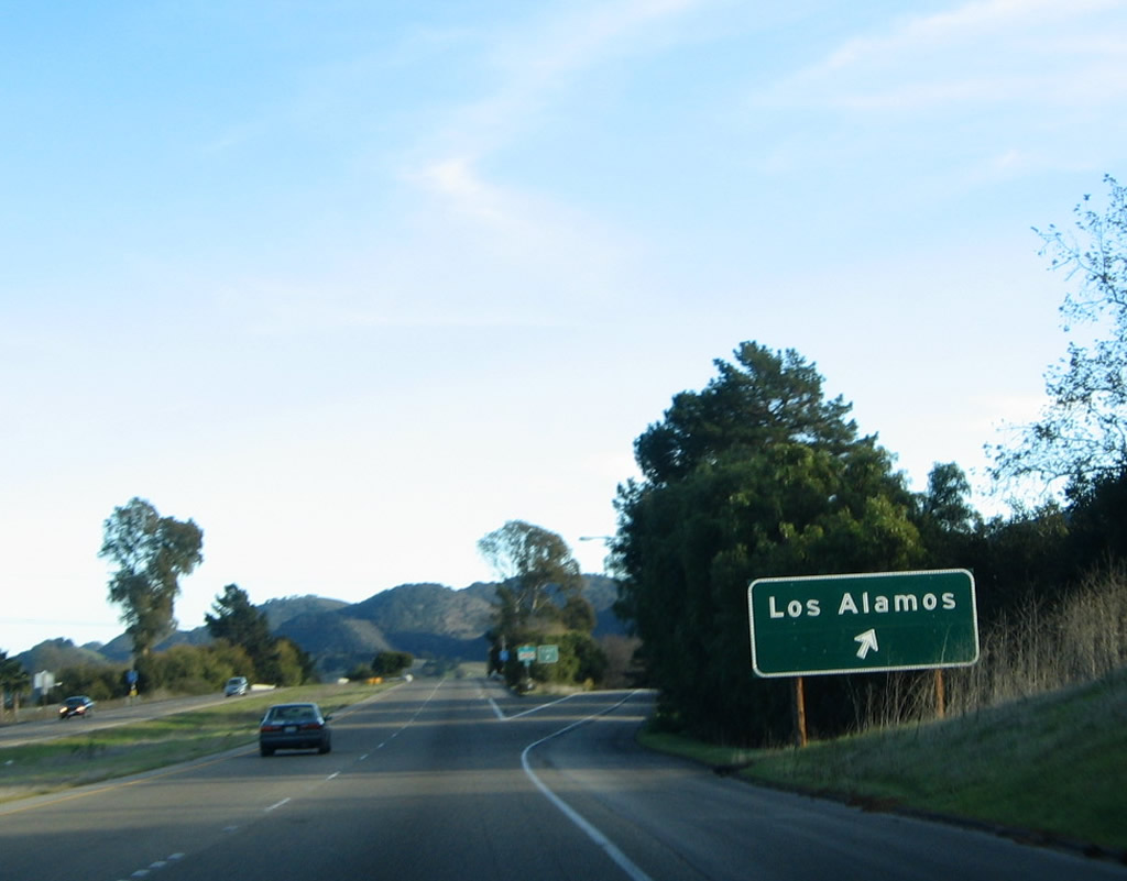
The next exit along U.S. 101 south is Exit 154, California 135/Bell Street northwest to Los Alamos and Vandenburg Air Force Base via the San Antonio Creek valley. This exit also connects to the southern end of the brief section of Old U.S. 101 that travels through Los Alamos. Photo taken 11/29/04. |
|
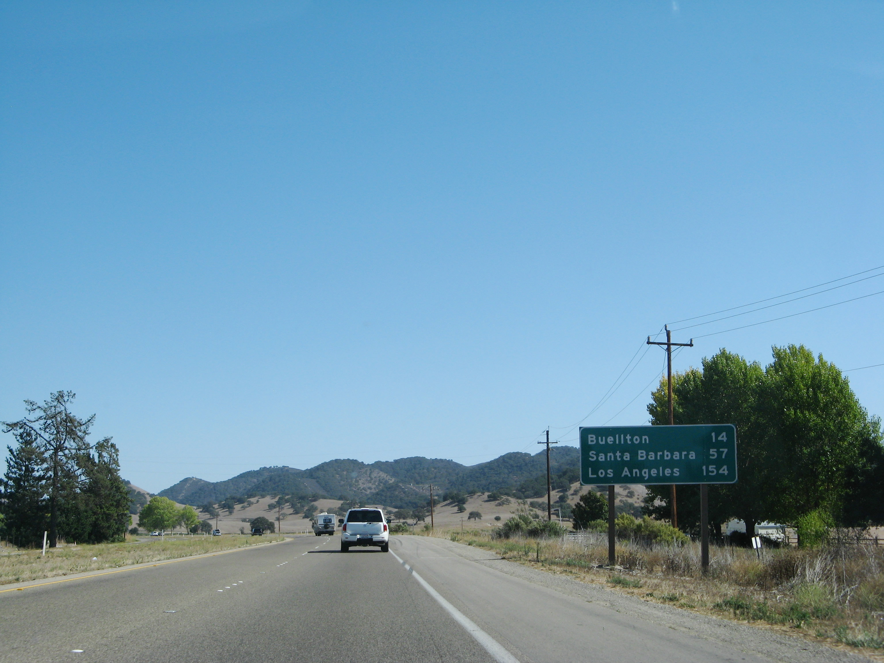
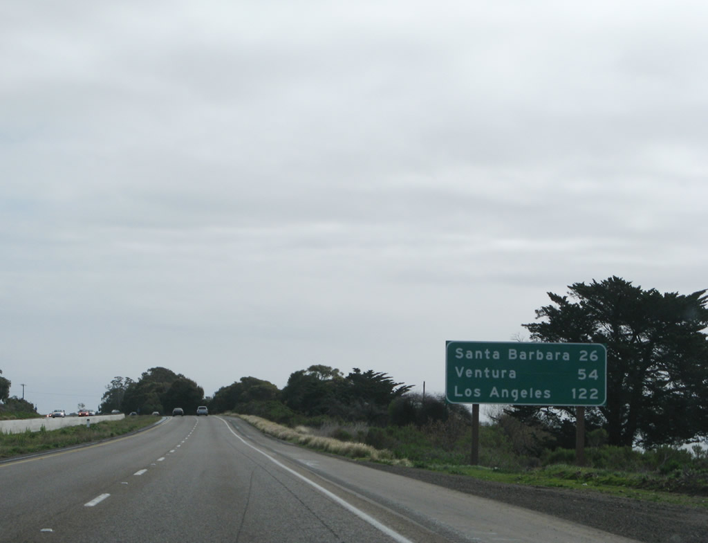
After the Bell Street interchange, this mileage sign provides the distance to Buellton (14 miles), Santa Barbara (57 miles), and Los Angeles (154 miles). Photo taken 09/29/07. |
|
Between California 135 and California 154, southbound U.S. 101 aims southeast to avoid the Purisima Hills seen to the right of the highway. Photo taken 09/29/07. |
|
The taller Santa Ynez Mountains come into view as U.S. 101 continues southeast. Photo taken 09/29/07. |
|
U.S. 101 downgrades from a freeway to an at-grade expressway alignment again (second time since entering Santa Barbara County). The next intersection is with Alisos Canyon Road east to Foxen Canyon and Zaca Lake. Photo taken 09/29/07. |
|
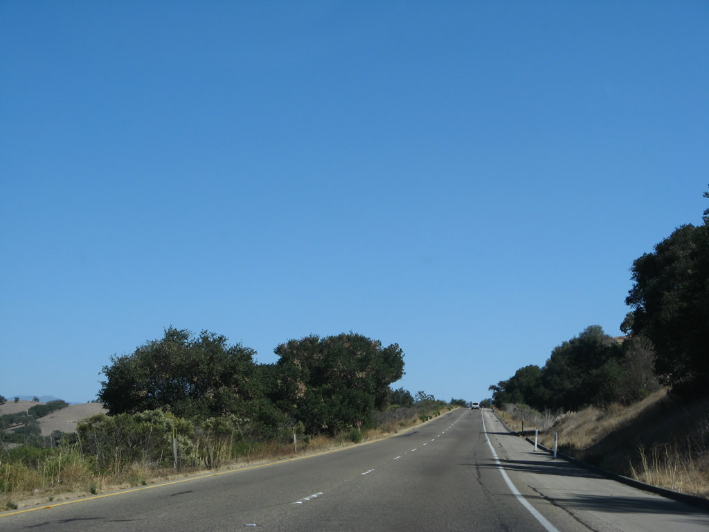
Southeast of Alisos Canyon Road, U.S. 101 continues through a rural stretch that features vineyards on either side of the highway for a brief time. Photo taken 09/29/07. |
|
|
The expressway then continues through undeveloped open space areas and passes over a few hills before reaching the California 154 interchange. Photos taken 09/29/07. |
|
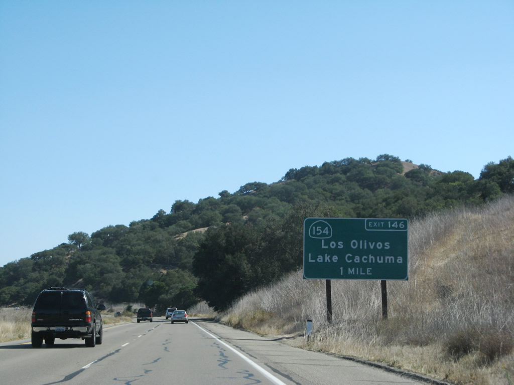
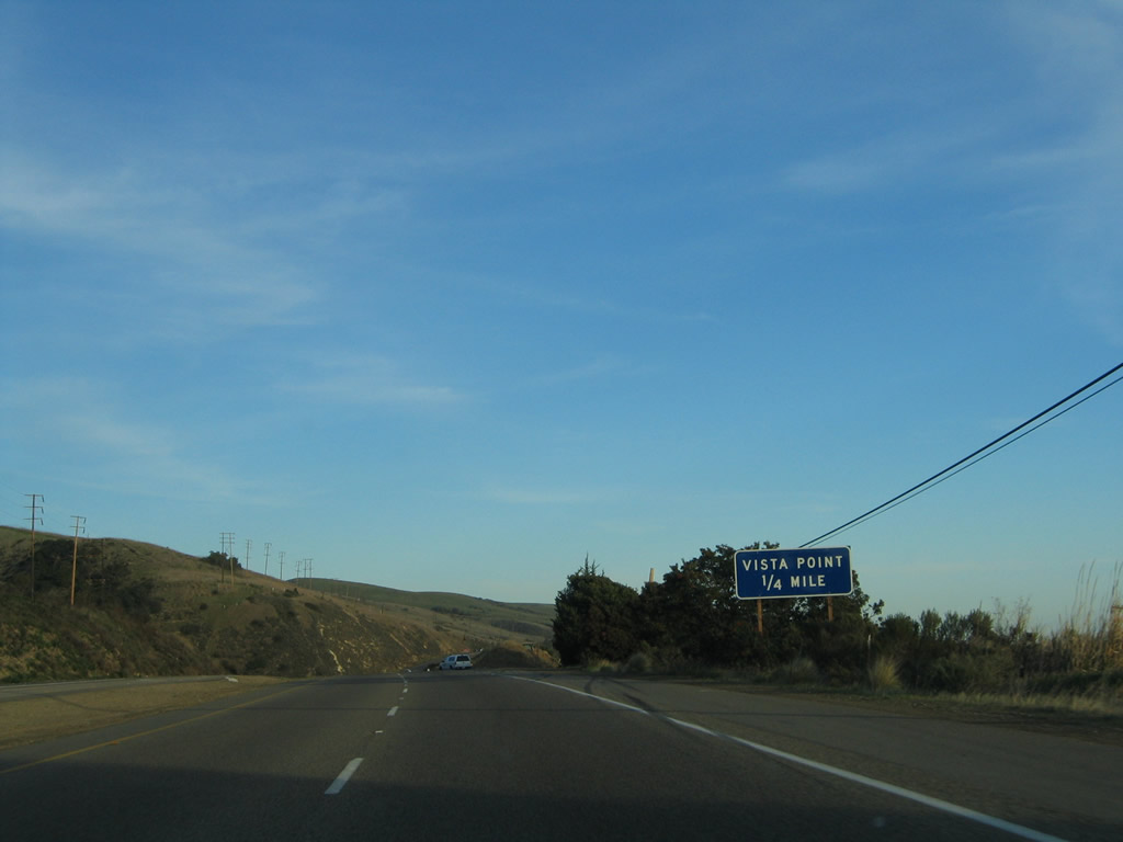
U.S. 101 next approaches Exit 146 for California 154 east to Los Olivos, Santa Ynez, Cachuma Lake, and San Marcos Pass over the Santa Ynez Mountains. The two-lane highway traverses the mountains and offers a scenic alternative to busy U.S. 101, including the impressive Cold Spring Arch Bridge. California 154 reconnects with U.S. 101 at Exit 101B near Santa Barbara. Photo taken 09/29/07. |
|
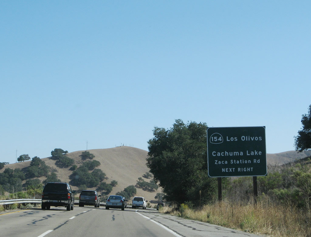
California 154 is a very popular weekend drive for residents and visitors to the scenic wine country near Solvang. The two-lane highway offers stunning views of Cachuma Lake and of the Pacific Ocean after cresting over San Marcos Pass (el. 2,224 feet). During inclement weather, watch for warning signs regarding the condition of the highway over the summit. Photo taken 09/29/07. |
|
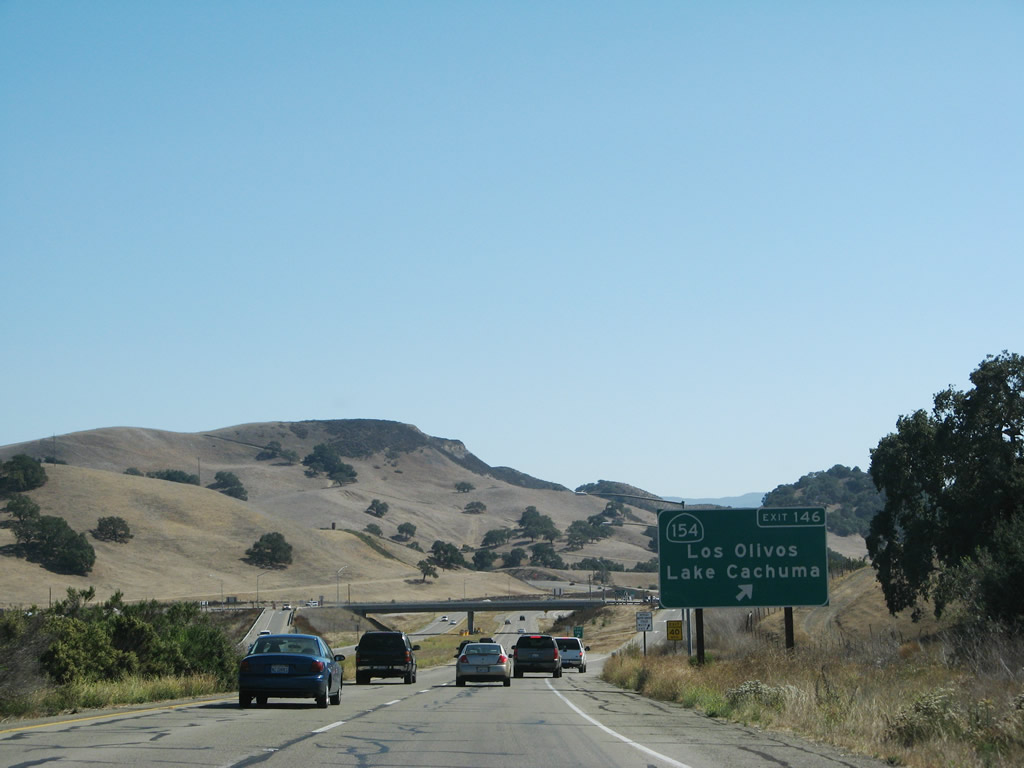
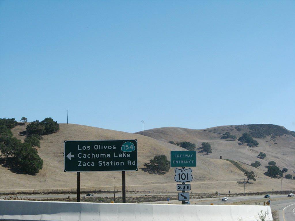
Southbound U.S. 101 (El Camino Real) reaches Exit 146, California 154 east to Los Olivos, Santa Ynez, Lake Cachuma, and San Marcos Pass over the Santa Ynez Mountains. Through traffic to Santa Barbara should use U.S. 101 through Gaviota Pass. Photo taken 09/29/07. |
|
At the top of the ramp to Exit 146 (California 154) is this trailblazer sign, along with a freeway entrance shield assembly for U.S. 101 south. This interchange marks the western terminus of California 154. Photo taken 09/29/07. |
|
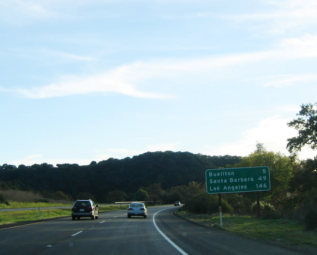
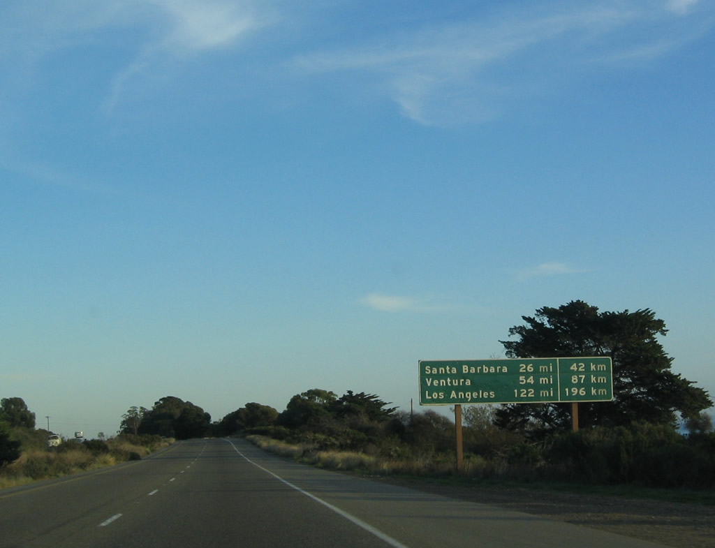
After the California 154 interchange, this mileage sign provides the distance to Buellton (five miles), Santa Barbara (49 miles), and Los Angeles (146 miles). U.S. 101 will turn south toward Buellton through the Purisima Hills, then descend into the Santa Ynez Valley. Photo taken 11/29/04. |
|
U.S. 101 again becomes an at-grade expressway between Exits 146 and 140B. After that brief section with intersections, the freeway again resumes. The next interchange on the U.S. 101 freeway is Exit 140B, U.S. 101 Business/Avenue of Flags south to Buellton. Photo taken 11/29/04. |
|
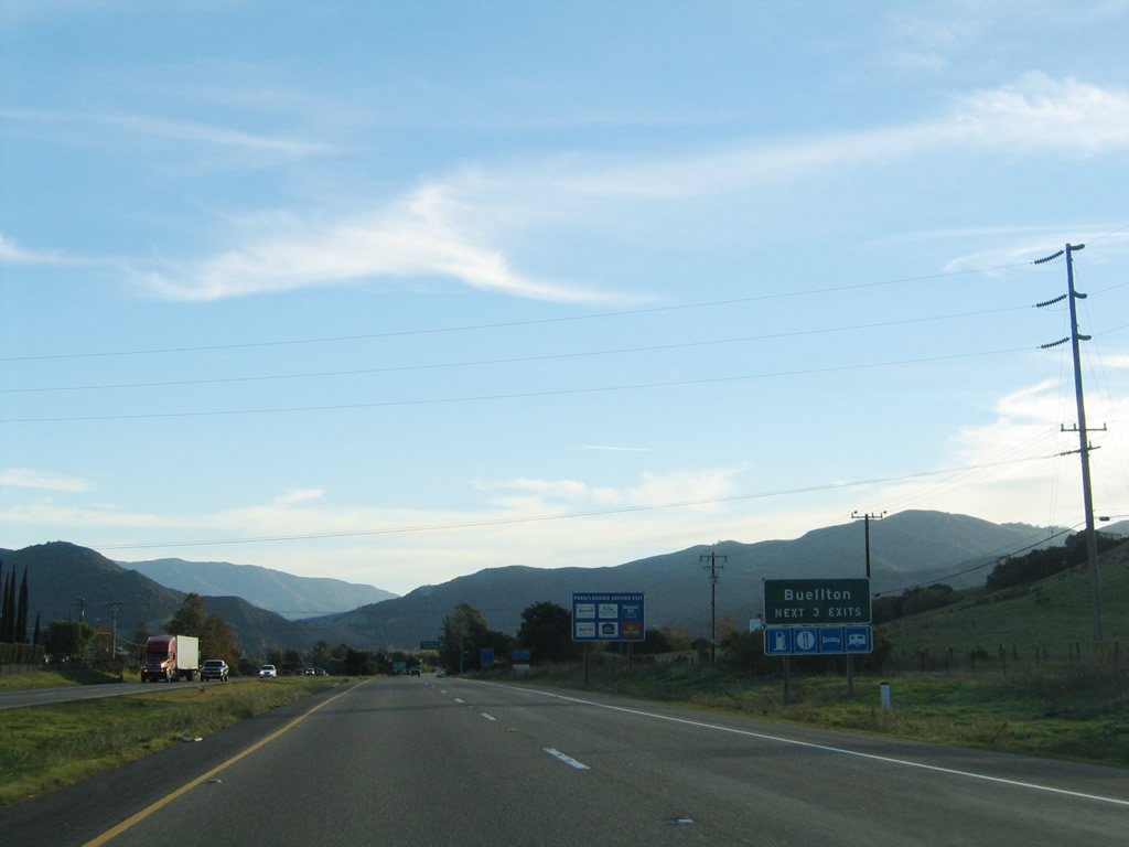
The next three exits along U.S. 101 south serve the city of Buellton, which is located along U.S. 101 within the Santa Ynez Valley. The Santa Ynez River flows east-west through here, leading from Lake Cachuma in the Santa Ynez Mountains west toward Surf on the coast west of Lompoc. The fertile valley offers vineyards, farms, and ranching along its route toward the sea. As for Buellton, the city has a population of 3,828 people as the 2000 Census and was featured in the 2004 movie Sideways (a great road movie due to the shots of the 101 freeway and various stops along the way to Solvang). Photo taken 11/29/04. |
|
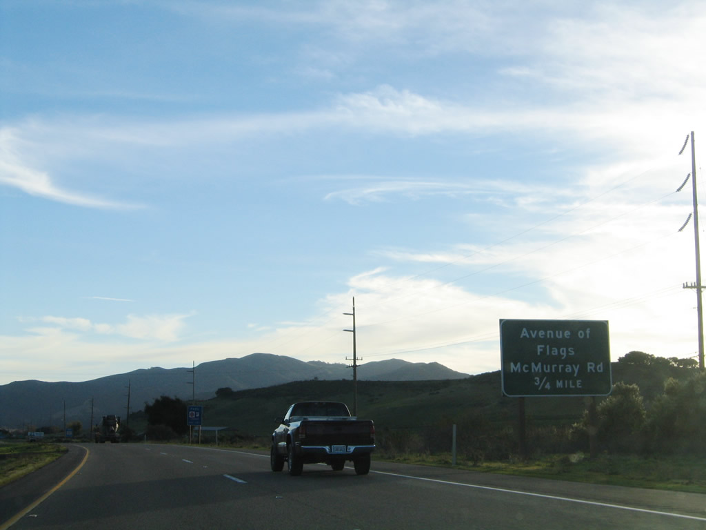
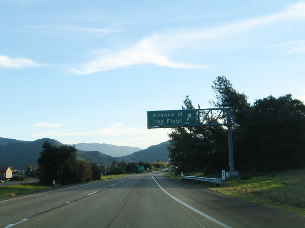
The first exit to serve Buellton is Exit 140B, U.S. 101 Business/Avenue of the Flags. As the name implies, flags line both sides of the avenue. This is the principal business route through the city; for Solvang, continue south on U.S. 101 to to Exit 140A, which is the interchange with California 246. Photo taken 11/29/04. |
|
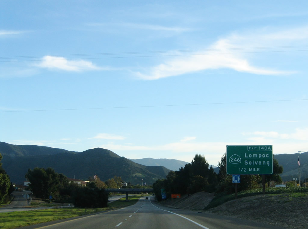
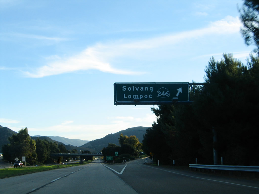
The next exit along U.S. 101 south is Exit 140A, California 246 east to Solvang and west to Lompoc. The state route begins at the western city limits of Lompoc and extends east through Lompoc along the Santa Ynez River valley toward U.S. 101 at Buellton. East of Buellton, California 246 passes through Solvang, then ends at California 154 east of Santa Ynez. Photo taken 11/29/04. |
|
Southbound U.S. 101 reaches Exit 140A, California 246 east to Solvang and west to Lompoc. Photo taken 11/29/04. |
|
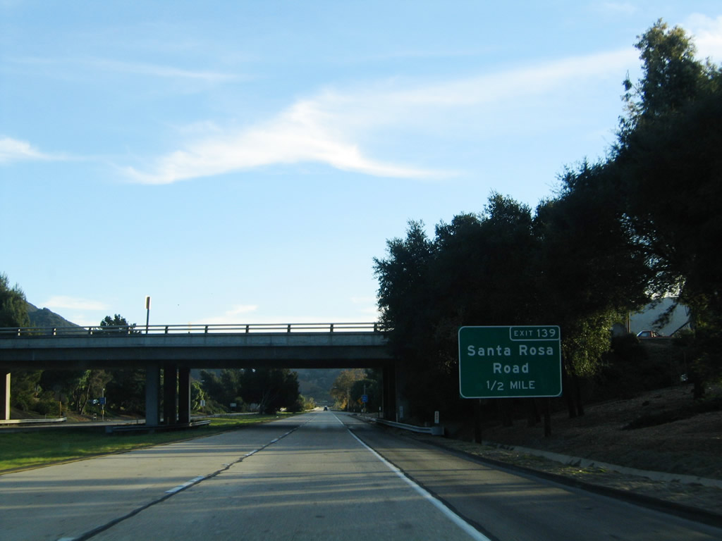
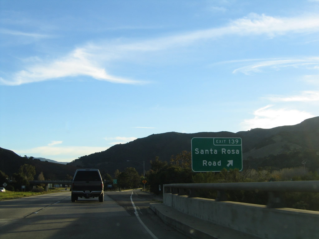
The next exit along U.S. 101 south is Exit 139, Santa Rosa Road. Santa Rosa Road travels west along the south bank of the Santa Ynez River to California 1 southeast of Lompoc. This interchange is also the southern terminus of Buellton's U.S. 101 Business. Photo taken 11/29/04. |
|
Southbound U.S. 101 reaches Exit 139, Santa Rosa Road to U.S. 101 Business/Avenue of the Flags north. Photo taken 11/29/04. |
|
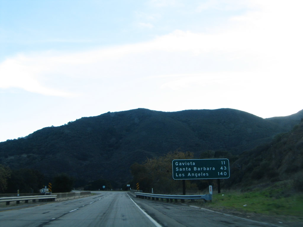
After the Santa Rosa Road interchange, U.S. 101 again reverts to an expressway (the fourth time since entering Santa Barbara County). Now the expressway ascends Nojoqui Summit (el. 920 feet). During this ascent, U.S. 101 has several minor at-grade intersections, but there are no major interchanges. This mileage sign provides the distance to Gaviota, Santa Barbara, and Los Angeles. Photo taken 11/29/04. |
|
Southbound U.S. 101 approaches Nojoqui Summit (el. 920 feet). U.S. 101 passes over Nojoqui Creek several times on its ascent, hence the old-style concrete bridge railing seen in this photo. Photo taken 11/29/04. |
|
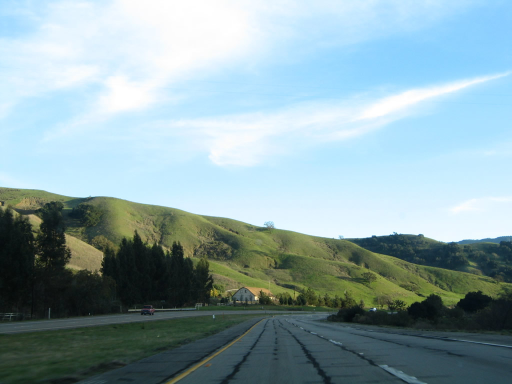
Green hills greet southbound travelers after Nojoqui Summit. The U.S. 101 expressway again shifts into a freeway. Photo taken 11/29/04. |
|
The next two exits along U.S. 101 south are Exit 132, California 1/Pacific Coast (Cabrillo) Highway and Exit 130, Gaviota Rest Area. Photo taken 11/29/04. |
|
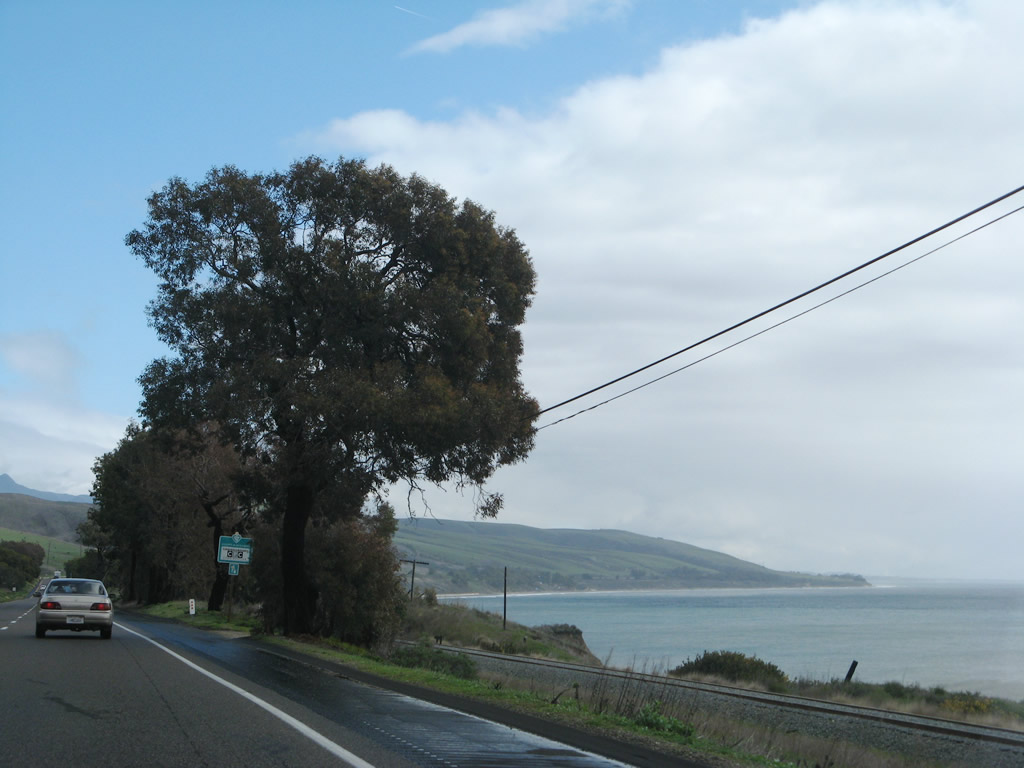
After a truck parking area, the next exit along U.S. 101 south is Exit 132, California 1 (Pacific Coast Highway) north to Lompoc and Guadalupe. After this interchange, California 1 will silently merge onto U.S. 101 south. The two routes will travel together on a shared alignment until Seacliff (Exit 79). Due to the distance merge between these two points (53 miles), southbound California 1 has an end shield at this interchange, and California 1 will not appear on any signs until the approach to Exit 79 on U.S. 101 south. Photo taken 11/29/04. |
|
After the off-ramp to California 1 at Exit 132, this overpass carries California 1 over U.S. 101. South of here, U.S. 101 enters Gaviota Pass and will see the ocean for the first time since near Pismo Beach. Photo taken 11/29/04. |
| U.S. 101 (El Camino Real) (and California 1 (Pacific Coast Highway)-Cabrillo Highway) south |
|---|
|
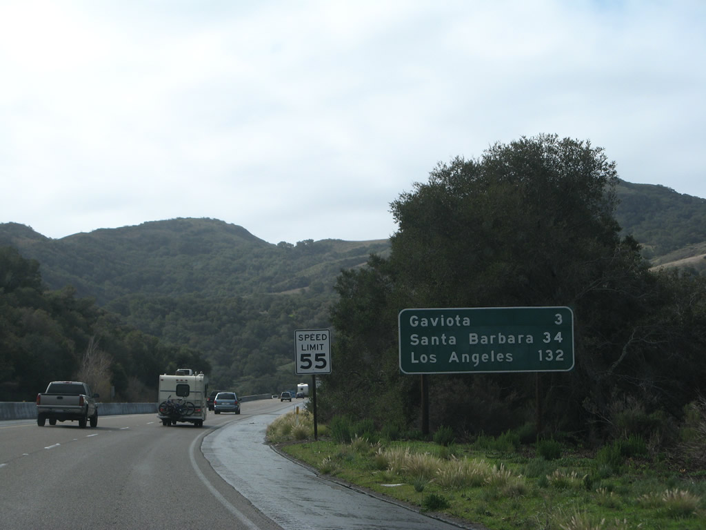
After the California 1 interchange, this mileage sign provides the distance to Gaviota (three miles), Santa Barbara (34 miles), and Los Angeles (132 miles). Photo taken 02/03/08. |
|
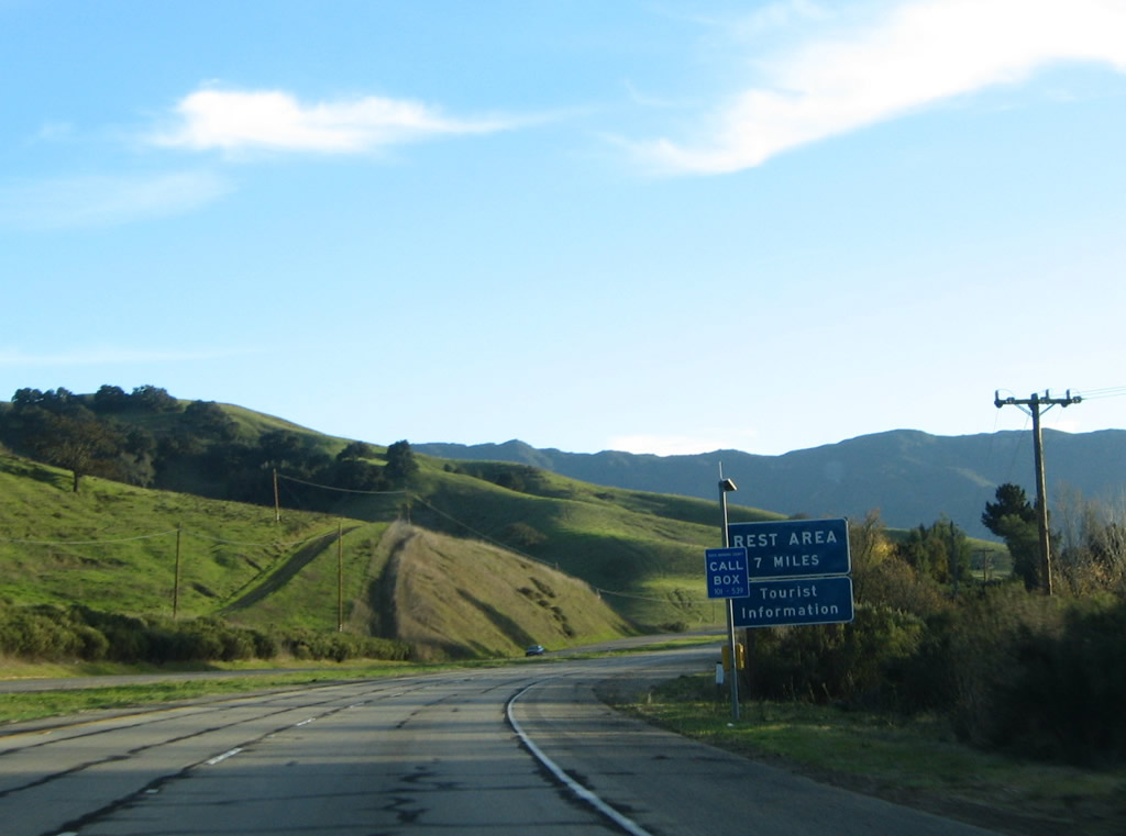
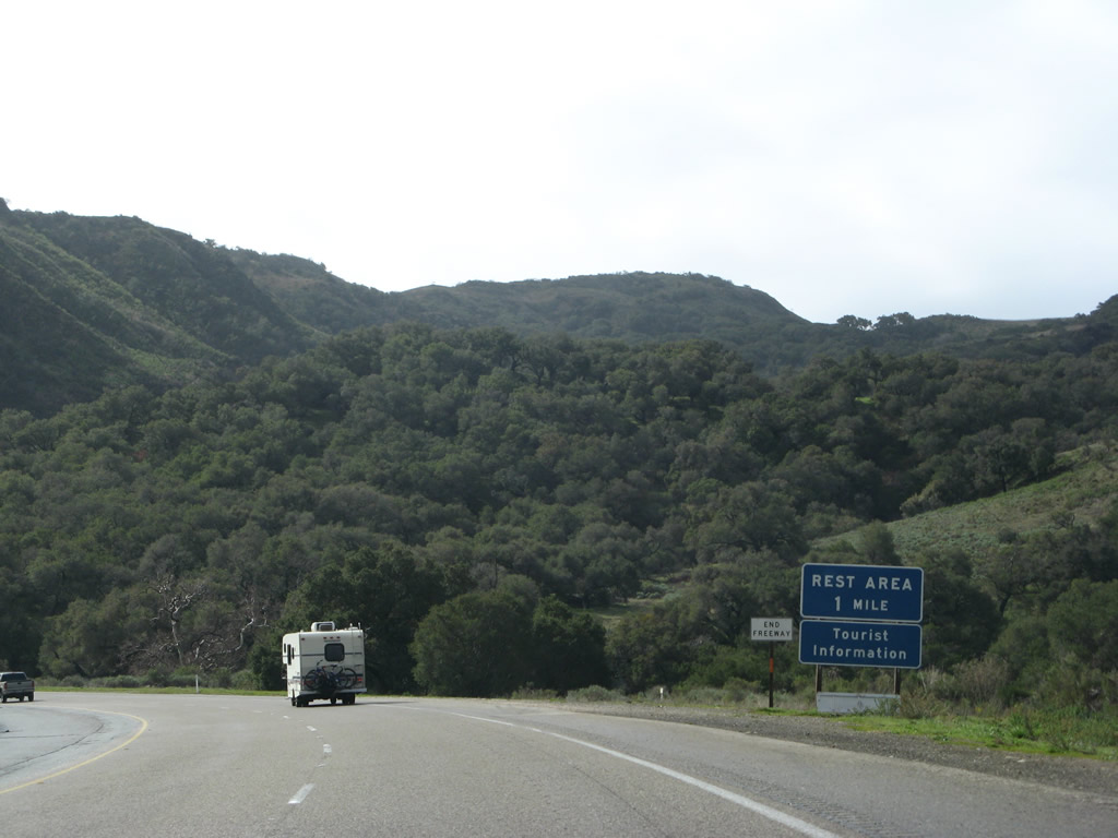
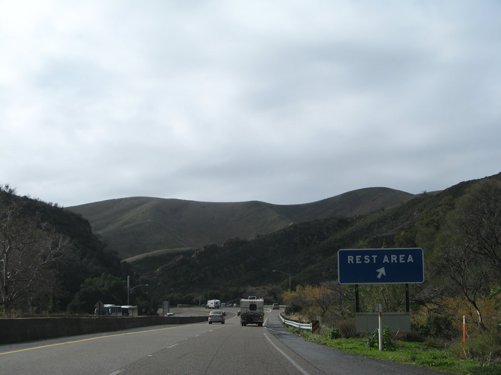
The next exit along U.S. 101 south is Exit 130, Gaviota Rest Area. This rest area features restrooms, drinking water, a parking area, and a walking area. This is the final rest area on U.S. 101 south. Prior to the rest area, U.S. 101 will wander through the Gaviota Pass, which brings U.S. 101 and California 1 back to the coast. Photo taken 02/03/08. |
|
|
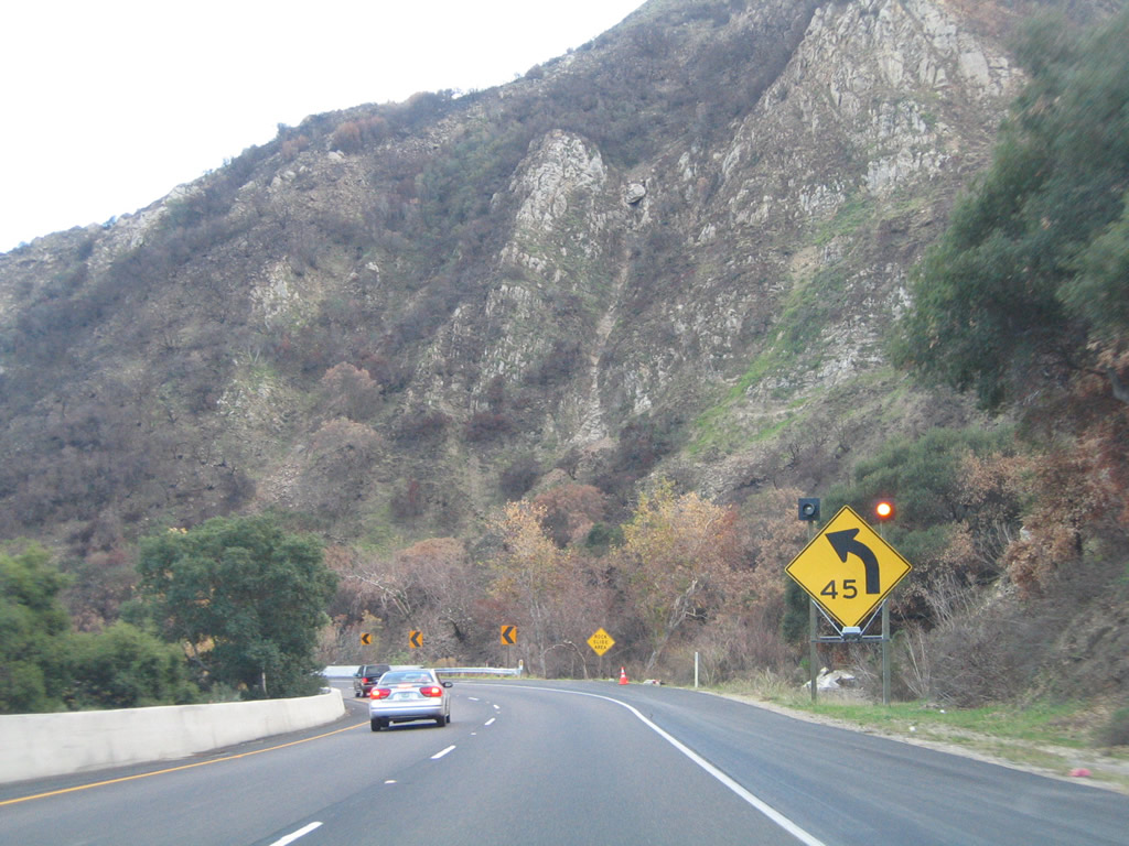
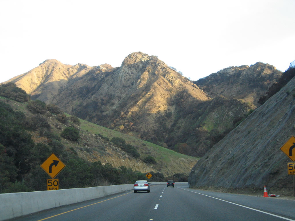
The curves through Gaviota Pass warrant a reduced speed of 45 miles an hour for the first major curve and 50 miles per hour on the second curve. As we pass through the Gaviota Gorge, U.S. 101 leaves Pacific Gas and Electric (PG&E) territory and enters Southern California Edison (SCE) territory. Photos taken 11/29/04. |
|
|
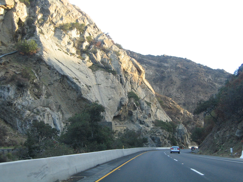
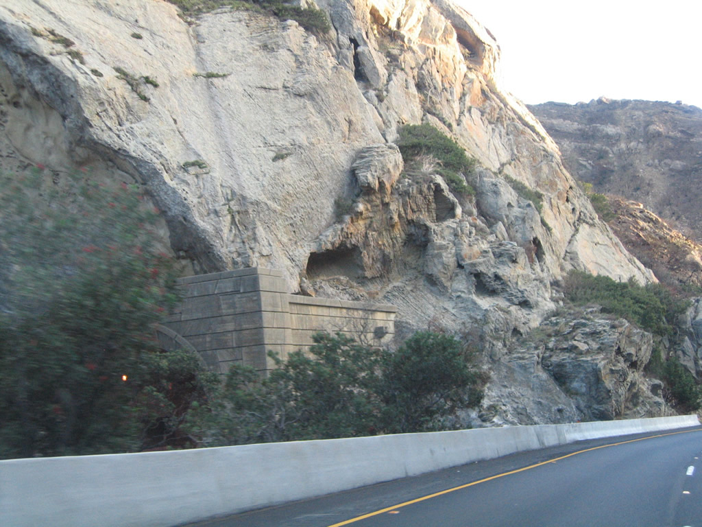
While U.S. 101's southbound lanes pass through the narrow gap of the Santa Ynez Mountains, the northbound lanes use a tunnel to pass through Gaviota Pass. The tunnel is barely visible to southbound motorists. Photos taken 11/29/04. |
|
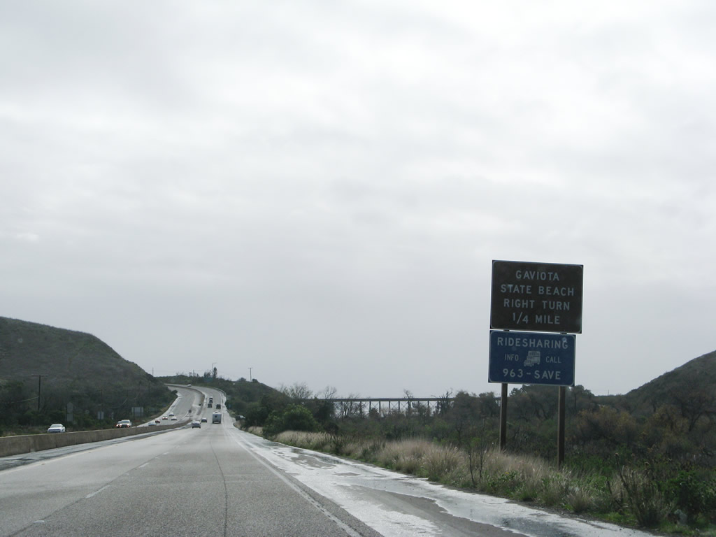
Southbound U.S. 101 and California 1 reach Exit 130, Gaviota Rest Area. The next exit is Exit 129, an at-grade intersection to Gaviota State Beach. Photo taken 02/03/08. |
|
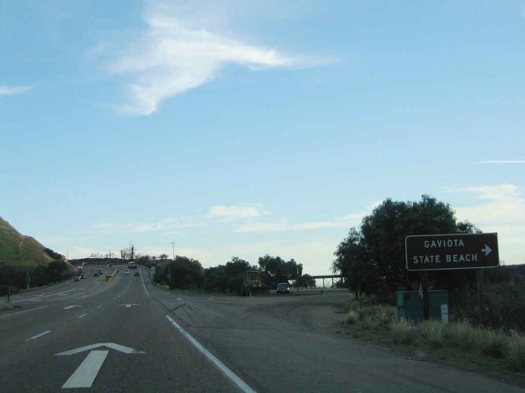
The next exit along U.S. 101 south is Exit 129, Gaviota State Park and Beach. The bridge in the distance is for the railroad, which follows the coastline around Point Conception and Point Arguello through Vandenburg Air Force Base to Guadalupe and points north. From this point east to Los Angeles, the railroad will generally parallel U.S. 101. Photo taken 02/03/08. |
|
Southbound U.S. 101 reaches Exit 129, Gaviota State Park. This expressway segment (#5) is fairly short, and will end with the interchange to Mariposa Reina and the community of Gaviota. Photo taken 11/29/04. |
|
|
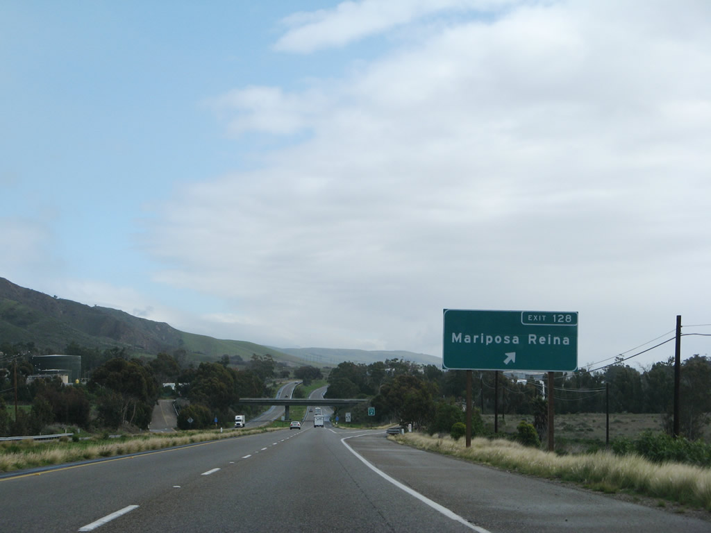
The next exit along U.S. 101 south is Exit 128, Mariposa Reina and Gaviota. With the Pacific Ocean back in view, U.S. 101 turns almost due east for its remaining distance through Santa Barbara County. In fact, U.S. 101 will travel much further east than it travels south for the rest of its journey to Los Angeles. Photos taken 02/03/08 and 11/29/04. |
|
|
|
This series of photos follows U.S. 101 between Exit 128 (Mariposa Reina) and the Arroyo Hondo Vista Point prior to Exit 120 (Refugio State Beach). A recent rain made the hills green. Despite its appearance, this section of U.S. 101 is considered an expressway due to some substandard segments and a few minor intersections. Photos taken 02/03/08. |
|
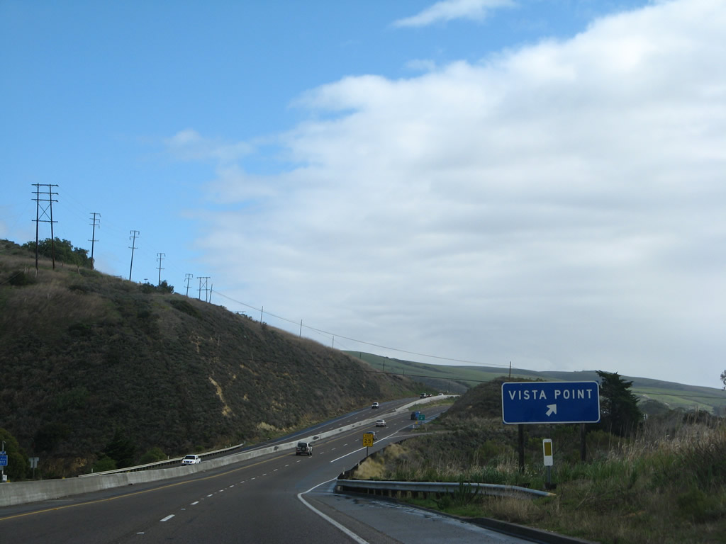
The next exit along U.S. 101 south is Exit 124, Arroyo Hondo Vista Point. This parking area allows visitors to look south at the Pacific Ocean and also offers a walk along a piece of old U.S. 101: the Arroyo Hondo Arch Bridge. Photo taken 11/29/04. |
|
Southbound U.S. 101 reaches Exit 124, Arroyo Hondo Vista Point. There are no facilities at this location. Photo taken 02/03/08. |
|
|
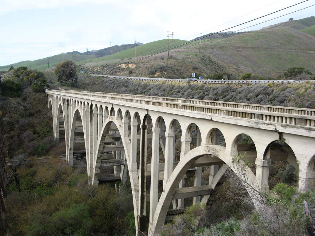
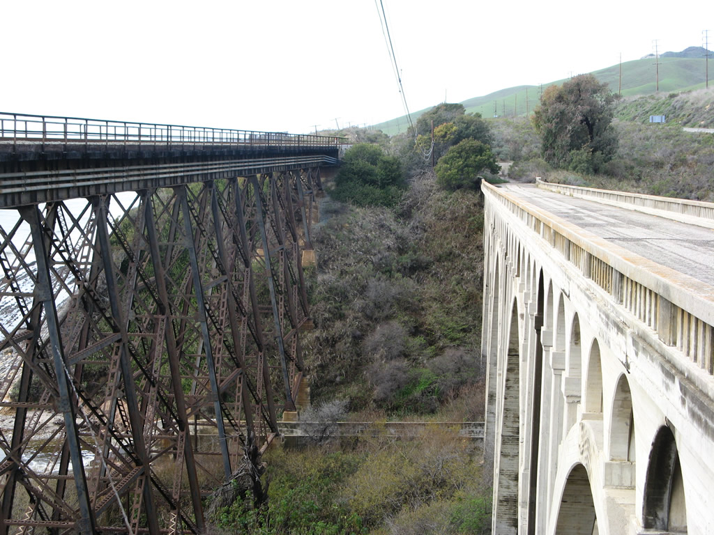
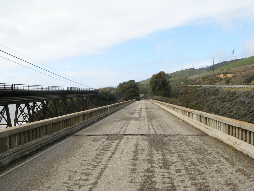
The 1918 Arroyo Hondo Arch Bridge can be reached by walking west from the vista point; this bridge used to carry U.S. 101 traffic across the Arroyo Hondo. Now a fill carries both directions of U.S. 101 past this point. The railroad bridge trestle is located just south of the Arroyo Hondo Bridge (second photo). Pedestrians may cross the bridge or walk to the bluff to look down on its arches (third photo looks west, fourth photo looks east). Photos taken 02/03/08. |
|
|
|
Returning to the expressway after the Vista Point near the historic Arroyo Hondo Bridge, a U.S. 101 south trailblazer points the way. Note that there is no "freeway entrance" shield assembly, since this section of U.S. 101 is an expressway, not a freeway. Photo taken 02/03/08. |
|
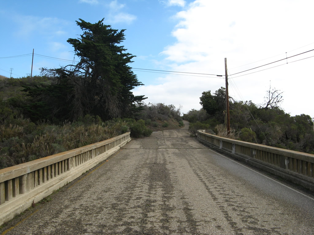
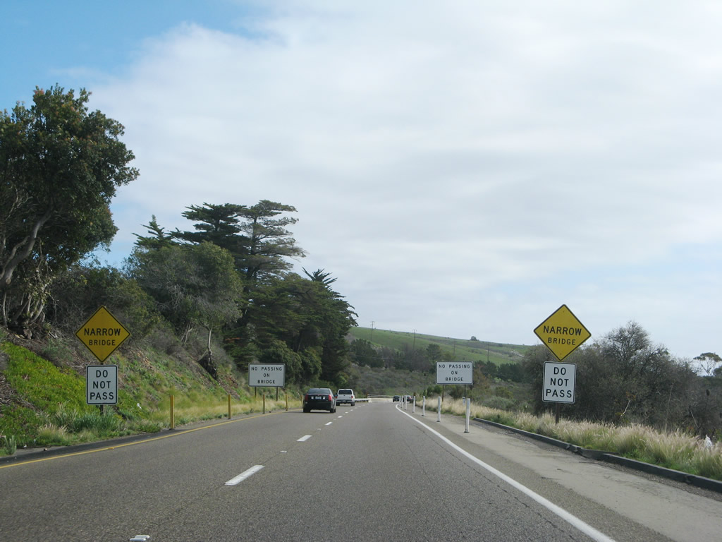
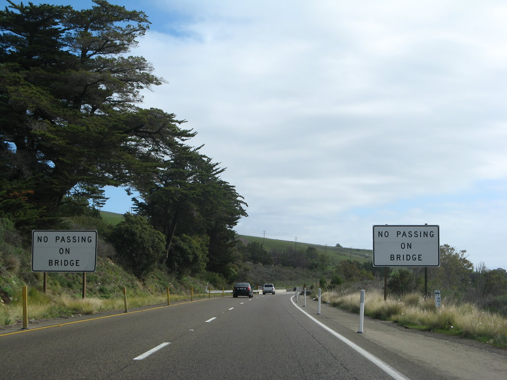
Speaking of old bridges, southbound U.S. 101 prepares to cross the Arroyo Quemado on a narrow, 1917 concrete arch bridge after the Arroyo Hondo Vista Point. Due to the lack of shoulders on either side of the bridge, traffic is required to remain in their lane while crossing the bridge. Photo taken 02/03/08. |
|
Since bicyclists use this section of U.S. 101 (since there are no old alignments or alternate routes), the Arroyo Quemado Bridge can be dangerous. Watch for bicyclists on this narrow bridge. Photo taken 02/03/08. |
|
|
The Arroyo Quemado Bridge is 410 feet long (including approaches) and has two arches supporting the bridge (each 109 feet long). Built in 1917, the bridge was retrofitted for earthquake safety in 1997 and remains in use today. The bridge is considered functionally obsolete due to the lack of safety shoulders and a width of only 24 feet, which allows for two 12-foot travel lanes and no shoulders. Perhaps this bridge was even more harrowing when it carried both directions of U.S. 101 rather than just southbound. Photos taken 02/03/08. |
|
|
After the Arroyo Quemado Bridge, this mileage sign is posted with distances to Santa Barbara, Ventura, and Los Angeles. The older sign used to show both English and metric distances, but the newer sign only shows distances in miles. Photos taken 02/03/08 and 11/29/04. |
|
After the expressway section ends, southbound U.S. 101 (and California 1) approaches Exit 120, Refugio Road south to Refugio State Beach and north to Refugio Pass. Photo taken 11/29/04. |
|
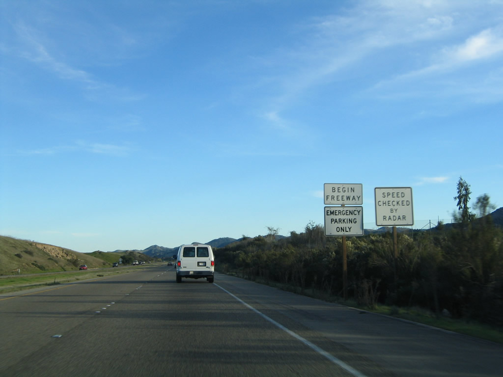
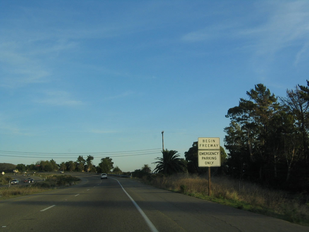
A begin freeway sign is posted on U.S. 101 south prior to Exit 120. Photo taken 11/29/04. |
|
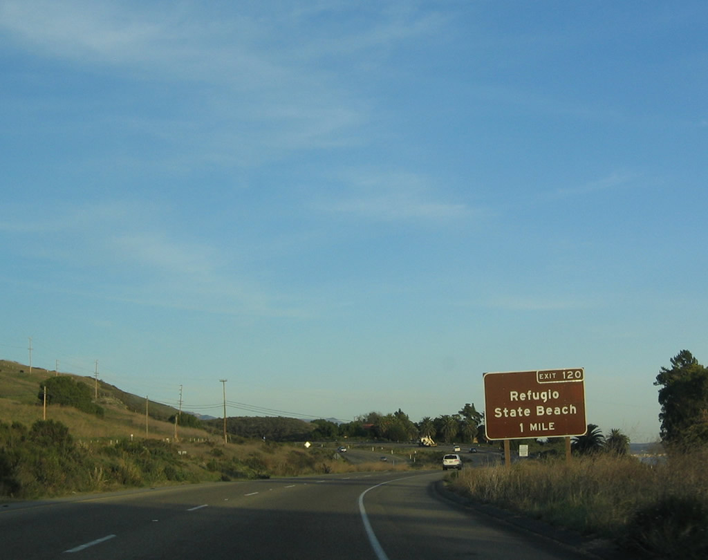
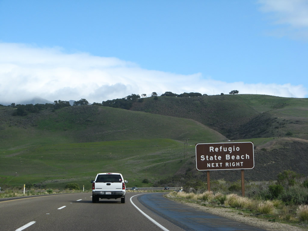
Use Exit 120 south to Refugio State Beach. U.S. 101 continues east (south) toward Santa Barbara. Photo taken 02/03/08. |
|
The green hills of the southern slope of the Santa Ynez Mountains makes for scenic views in the rainy winter months along U.S. 101 prior to the Refugio Road interchange. Photo taken 02/03/08. |
|
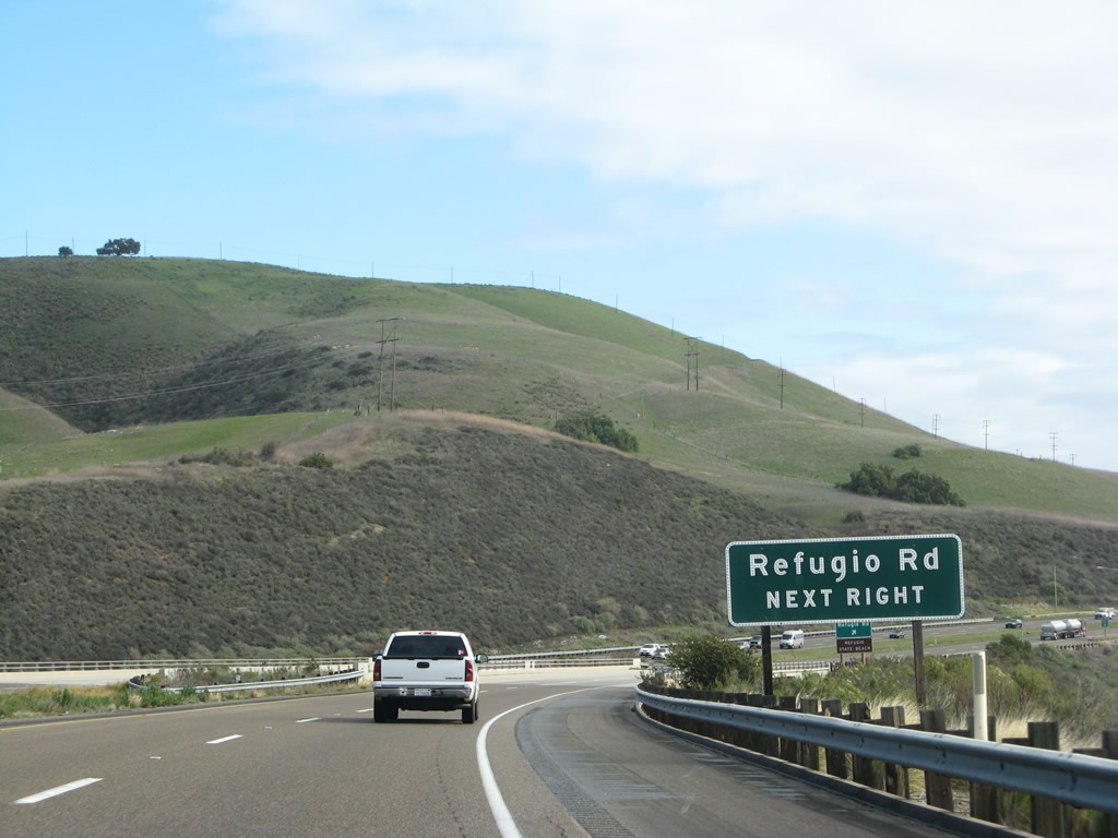
Southbound U.S. 101 reaches Exit 120, Refugio Road to Refugio State Beach. Photo taken 02/03/08. |
Page Updated March 19, 2008.