

U.S. 101 South - Ventura County #2
| U.S. 101 (Ventura Freeway / El Camino Real) south | |||||
|---|---|---|---|---|---|
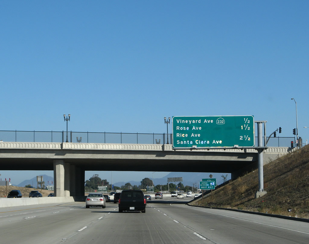 |
Passing under the Oxnard Boulevard overpass (U.S. 101 & California 1 separation), this mileage sign provides the distance to the next three exits along southbound (eastbound) U.S. 101 (Ventura Freeway): Exit 62A, California 232/Vineyard Boulevard; Exit 61, Rose Avenue; and Exit 60, Rice Avenue (future California 1 bypass). Most of this section of U.S. 101 (around Oxnard toward Camarillo) was built in the mid-1950s (1955 and 1956) and has been expanded and improved at multiple locations in the years since then. Photo taken 09/29/07. | ||||
 |
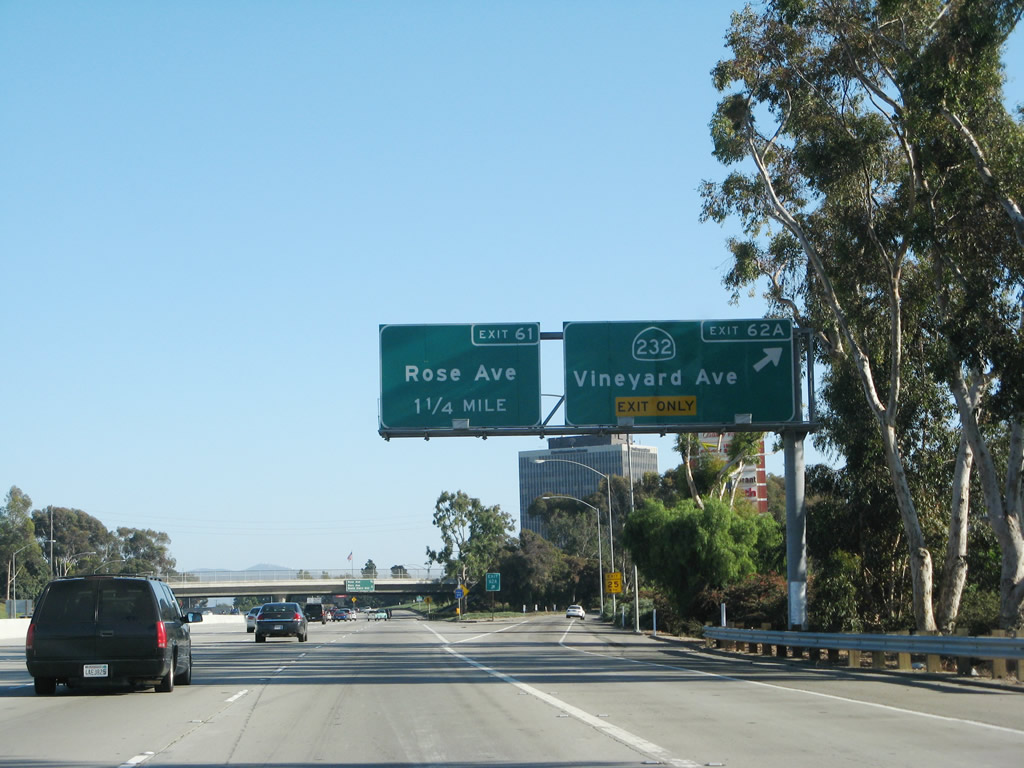
California 232 is a short state route that originates at the intersection of Oxnard Boulevard and Vineyard Avenue in Oxnard, then travels northeast to California 118 (Los Angeles Avenue) on the east bank of the Santa Clara River near Saticoy. Photo taken 09/29/07. | ||||
 |
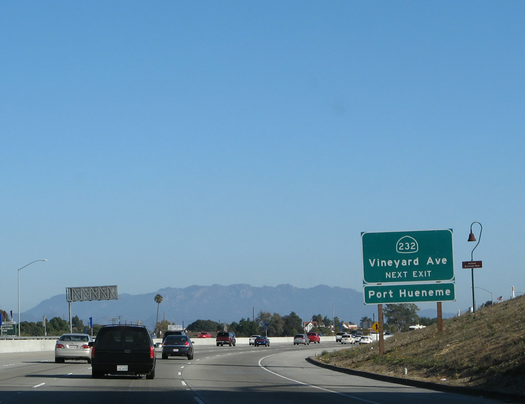
Southbound U.S. 101 (Ventura Freeway) reaches Exit 62A, California 232/Vineyard Boulevard. The next exit along southbound is Exit 61, Rose Avenue, which also serves the city of Oxnard. Photo taken 09/29/07. | ||||
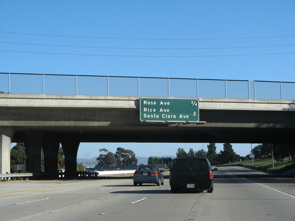 |
This mileage sign provides the distance to the next two exits along southbound U.S. 101 (Ventura Freeway): Exit 61, Rose Avenue and Exit 60, Rice Avenue (future California 1 bypass) and Santa Clara Avenue. Photo taken 09/29/07. | ||||
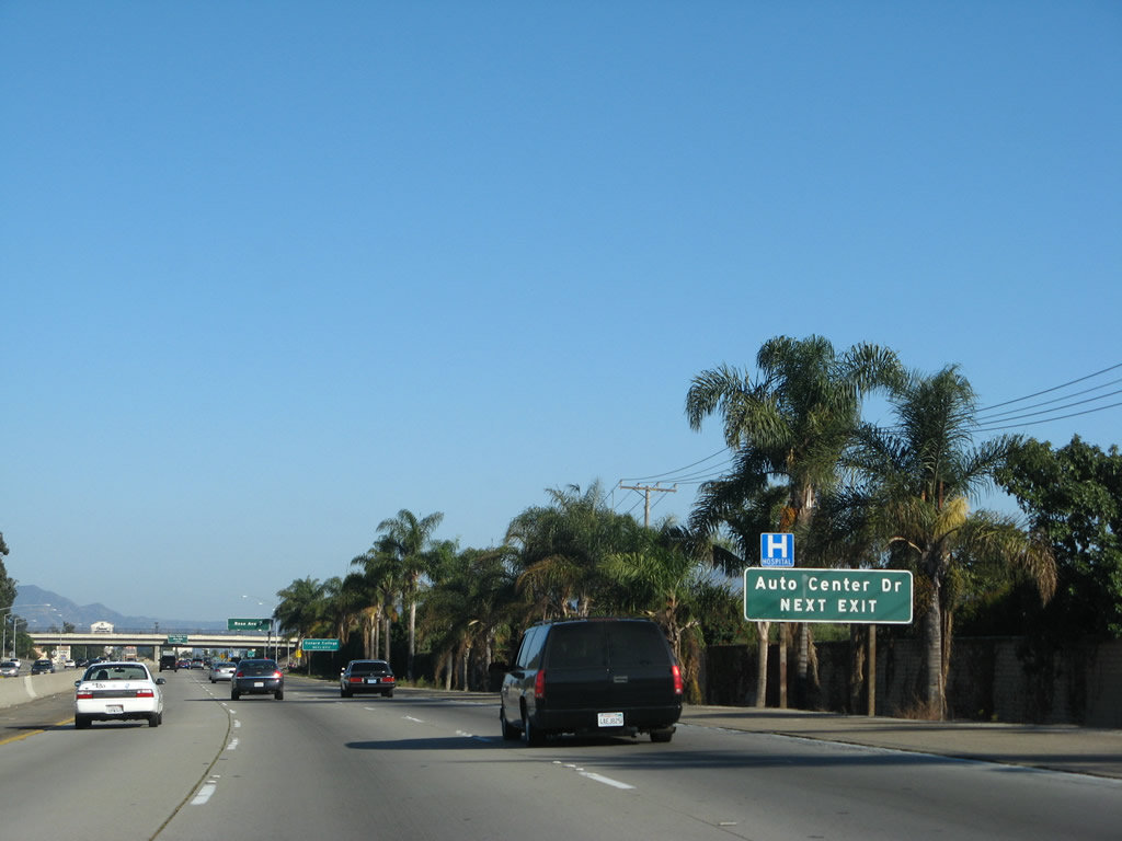 |
Use Exit 61 (Rose Avenue) to Auto Center Drive and shopping. Photo taken 09/29/07. | ||||
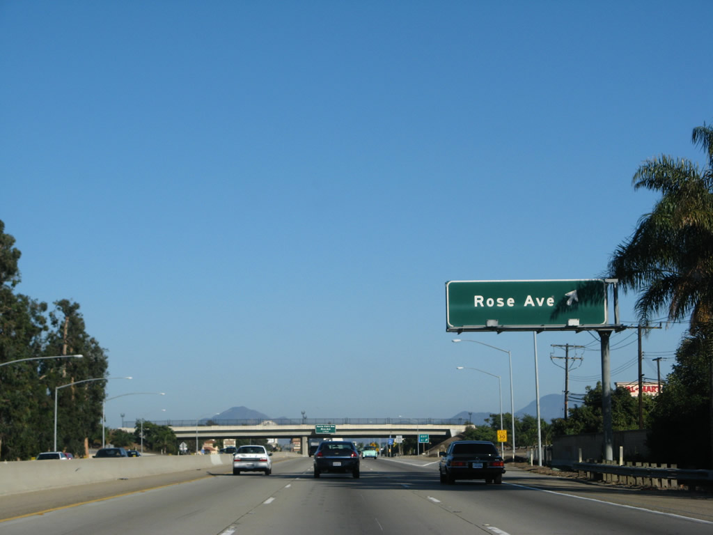 |
Southbound U.S. 101 (Ventura Freeway) reaches Exit 61, Rose Avenue. The next exit along southbound is Exit 60, Rice Avenue (future California 1 bypass) and Santa Clara Avenue. Photo taken 09/29/07. | ||||
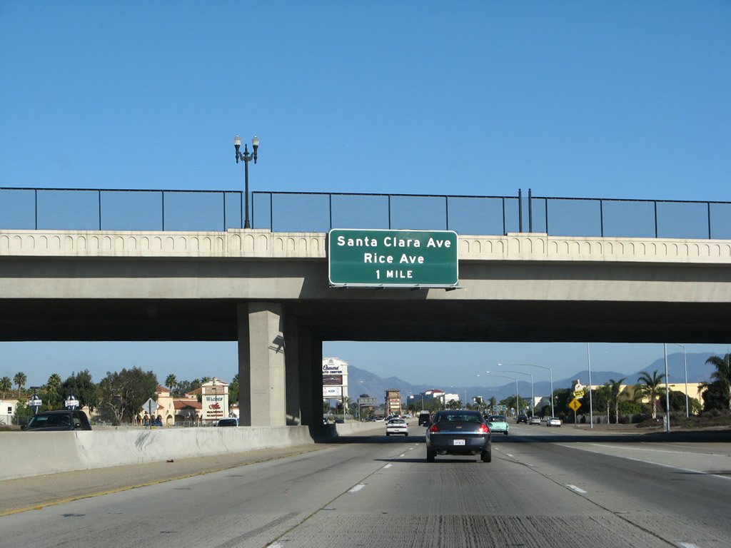 |
The next exit along southbound (eastbound) U.S. 101 (Ventura Freeway) is Exit 60, Rice Avenue (future California 1 bypass) and Santa Clara Avenue. Photo taken 09/29/07. | ||||
 |
From Exit 60, Rice Avenue travels south toward California 1 and is the best route from U.S. 101 to Point Mugu. To the northeast, Santa Clara Avenue passes through unincorporated Nyeland Acres, then connects directly to California 118 (Los Angeles Avenue). Photo taken 09/29/07. | ||||
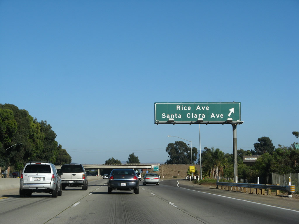 |
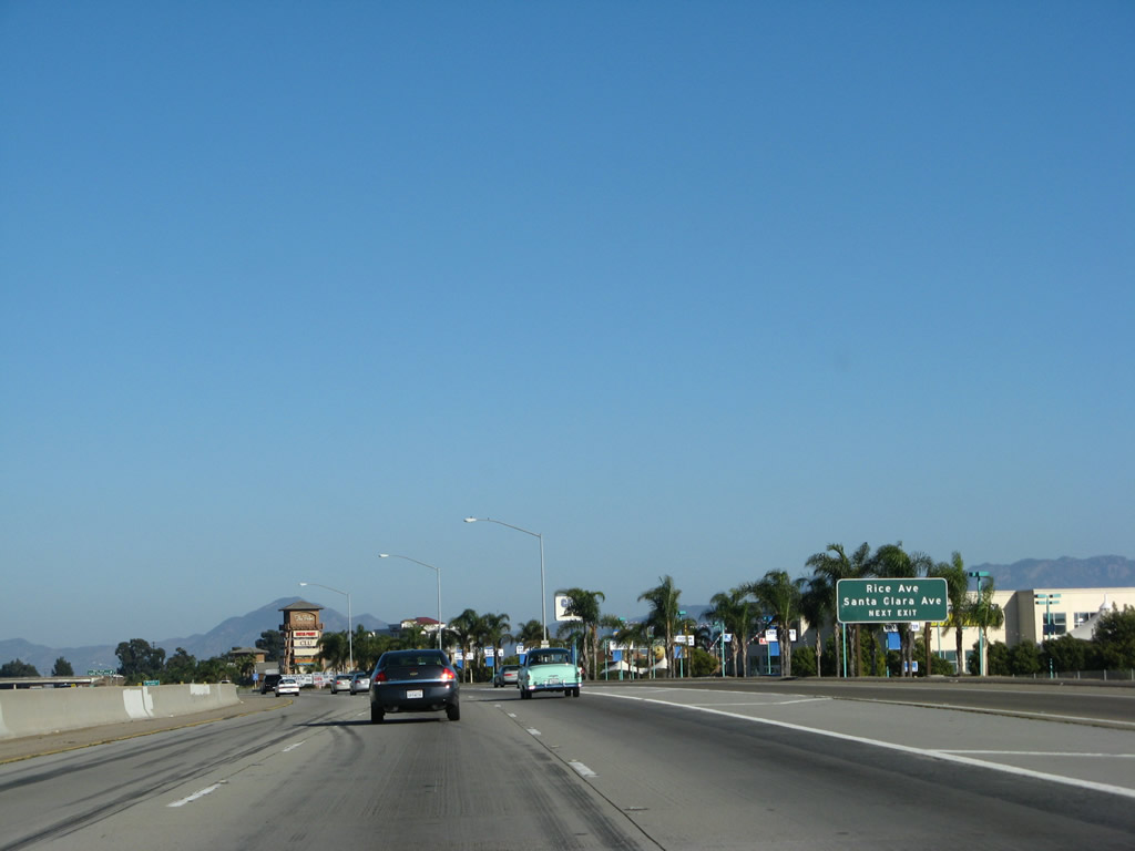
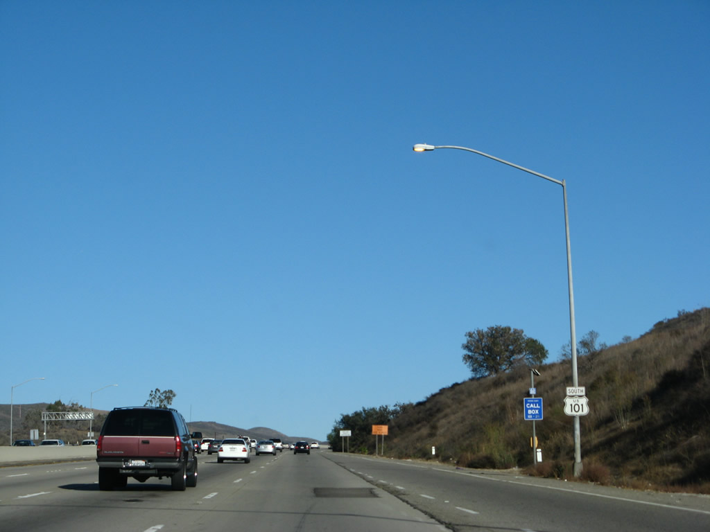
Southbound U.S. 101 (Ventura Freeway) reaches Exit 60, Rice Avenue south to California 1 and Santa Clara Avenue northeast to California 118. Photo taken 09/29/07. | ||||
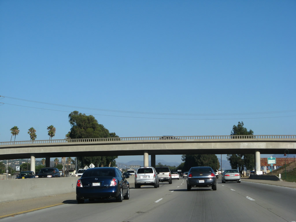 |
The Rice Avenue and Santa Clara Avenue separation was built in 1956 back when U.S. 101 was first built as an expressway between Oxnard and Camarillo. Note the old-style bridge railing. Photo taken 09/29/07. | ||||
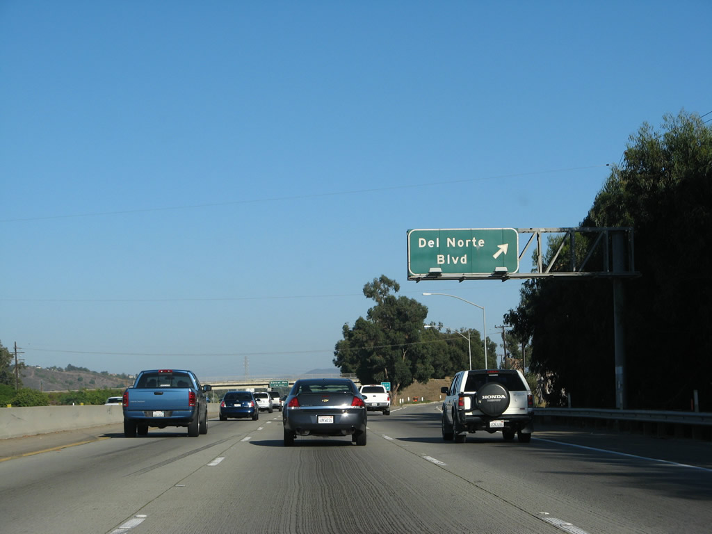 |
Soon thereafter, southbound U.S. 101 (Ventura Freeway) reaches Exit 59, Del Norte Boulevard south to California 34/Fifth Street. At this point, U.S. 101 (Ventura Freeway) leaves the city of Oxnard and briefly enters unincorporated Ventura County. Photo taken 09/29/07. | ||||
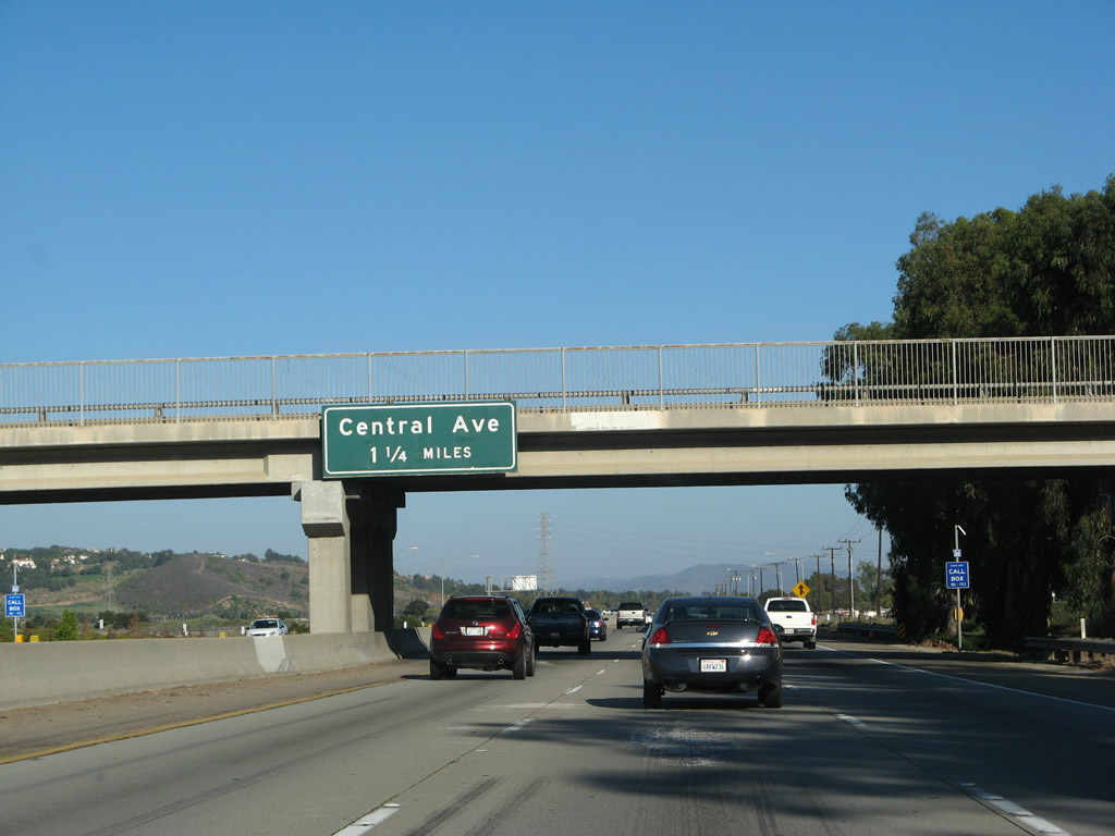 |
The next exit along southbound (eastbound) U.S. 101 (Ventura Freeway) is Exit 57, Central Avenue northwest to the community of Springville within the city of Camarillo. Photo taken 09/29/07. | ||||
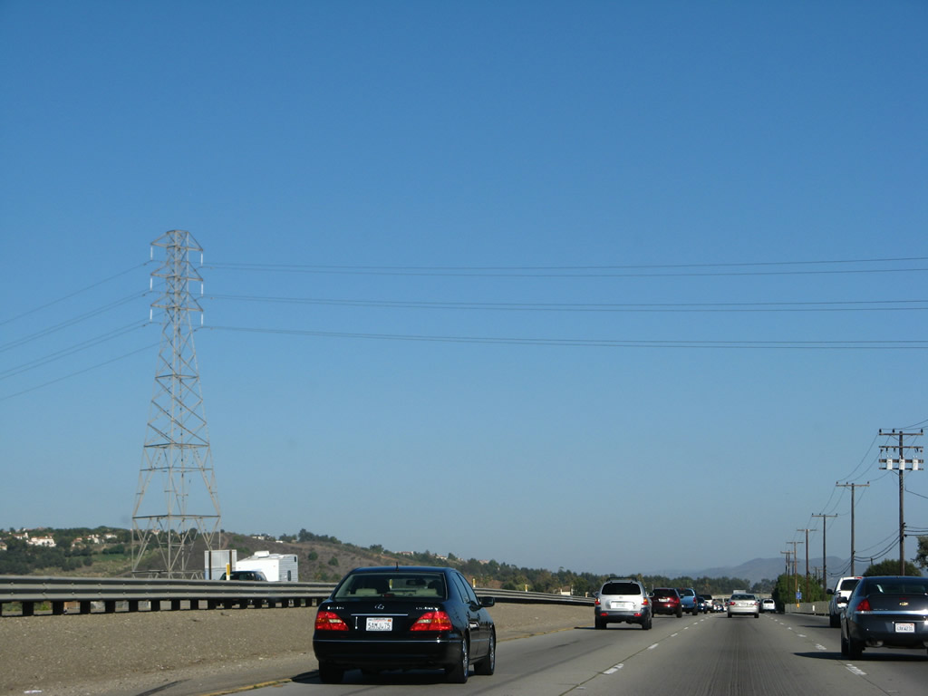 |
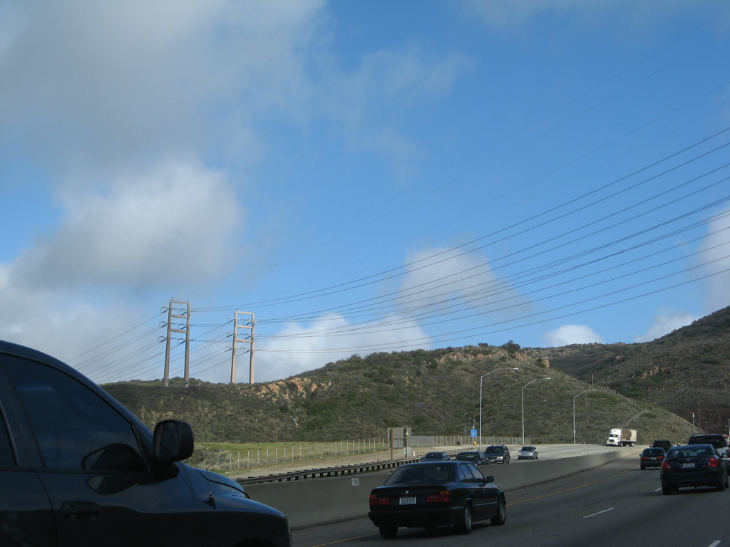
A 138kV Southern California Edison power transmission line passes over U.S. 101 between Exits 59 and 57. Photo taken 09/29/07. | ||||
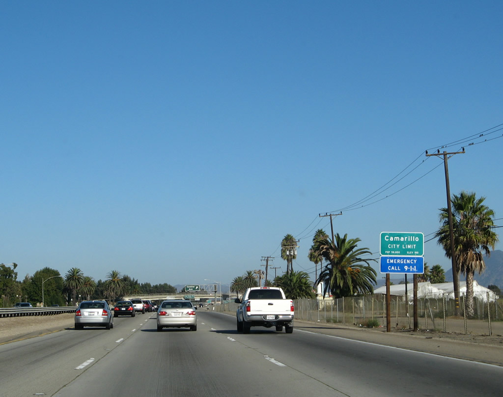 |
U.S. 101 (Ventura Freeway) south (east) enters the city of Camarillo, home to 57,077 people as of the 2000 Census. Consisting of 19 square miles, the city was incorporated in 1964. The economy of Camarillo has historically been dependent on agriculture due to its location on the fertile Oxnard Plain, and the city has seen growth as a bedroom community to nearby job centers. The largest local employer is 3M. The former Camarillo State Mental Hospital is now part of the new California State University - Channel Islands campus (via Exit 55/Las Posas Road south to Hueneme Road east to the university). The Camarillo Airport comes into view on the south side of the east-west Ventura Freeway. Photo taken 09/29/07. | ||||
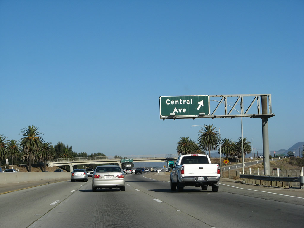 |
Southbound (eastbound) U.S. 101 (Ventura Freeway) reaches Exit 57, Central Avenue northwest to the community of Springville within the city of Camarillo. This old porcelain enamel sign has a unique feature about it: button copy was not retrofitted onto this overhead sign the way it was largely retrofitted onto most porcelain enamel signs of the same vintage. Photo taken 09/29/07. | ||||
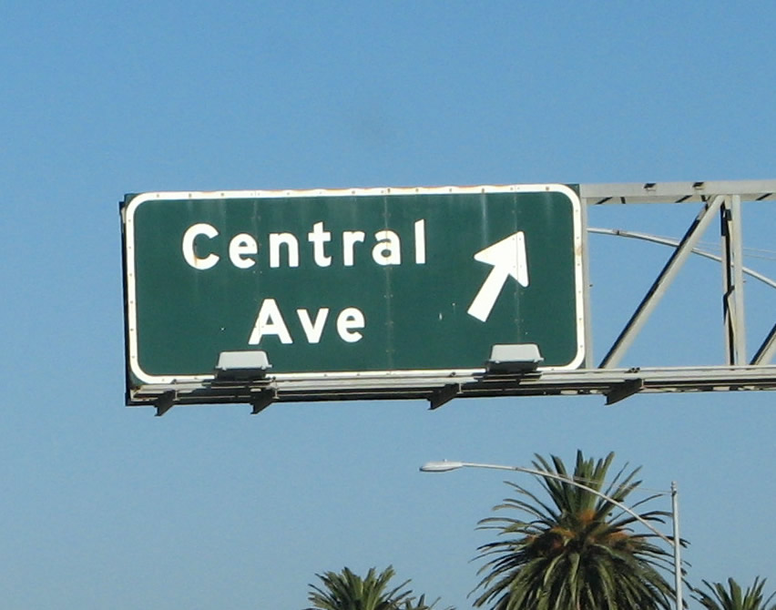 |
This is a close-up of the porcelain enamel sign for Exit 57, Central Avenue. No button copy was retrofitted onto this old sign. Photo taken 09/29/07. | ||||
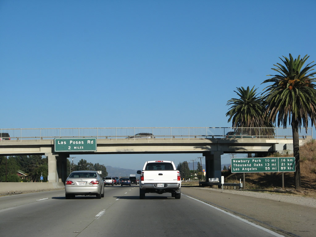 |
The next exit along southbound (eastbound) U.S. 101 (Ventura Freeway) is Exit 55, Las Posas Road north to Camarillo and south to Camarillo Airport. A mileage sign provides the distance to Newbury Park (which is part of Thousand Oaks and is 10 miles ahead), Thousand Oaks (13 miles to downtown), and the control city of Los Angeles (55 miles). Photo taken 09/29/07. | ||||
 |
This reassurance shield for U.S. 101 south is posted after the on-ramp from Exit 57, Central Avenue. Photo taken 09/29/07. | ||||
 |
Use Exit 55, Las Posas Road south to Camarillo Center Drive, which serves the Camarillo Premium Outlet Center. Photo taken 09/29/07. | ||||
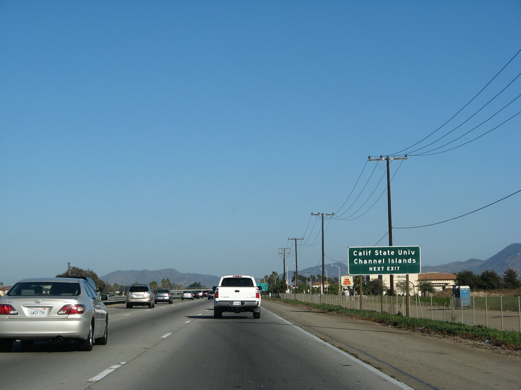 |
To the California State University - Channel Islands campus, exit U.S. 101 at Exit 55 and follow Las Posas Road south to Hueneme Road, then follow Hueneme Road east to the university. Photo taken 09/29/07. | ||||
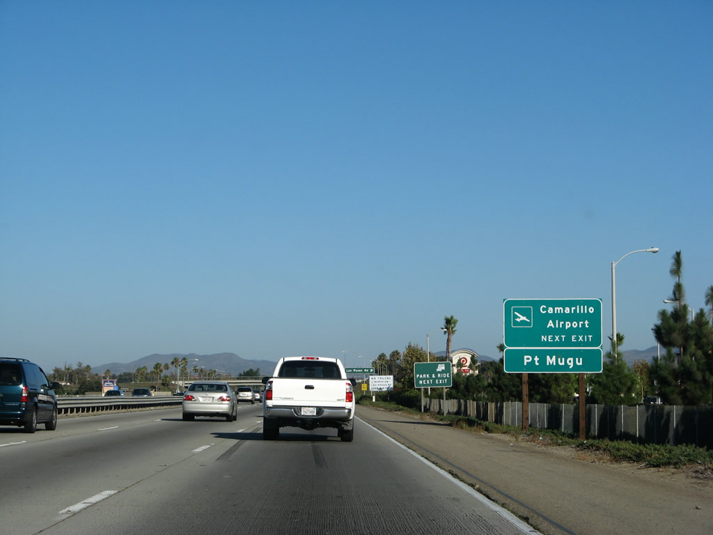 |
Use Exit 55, Las Posas Road south to Camarillo Airport. Las Posas Road ends at the Point Mugu Naval Base Ventura County (California 1 (Pacific Coast Highway) Exit 107). Photo taken 09/29/07. | ||||
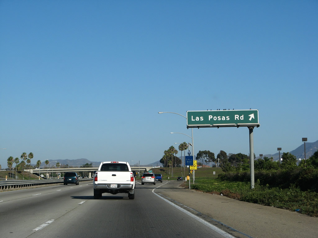 |
Southbound (eastbound) U.S. 101 (Ventura Freeway) reaches Exit 55, Las Posas Road north to Camarillo and south to Camarillo Airport. There is a truck restriction on Las Posas Road north into Camarillo. Photo taken 09/29/07. | ||||
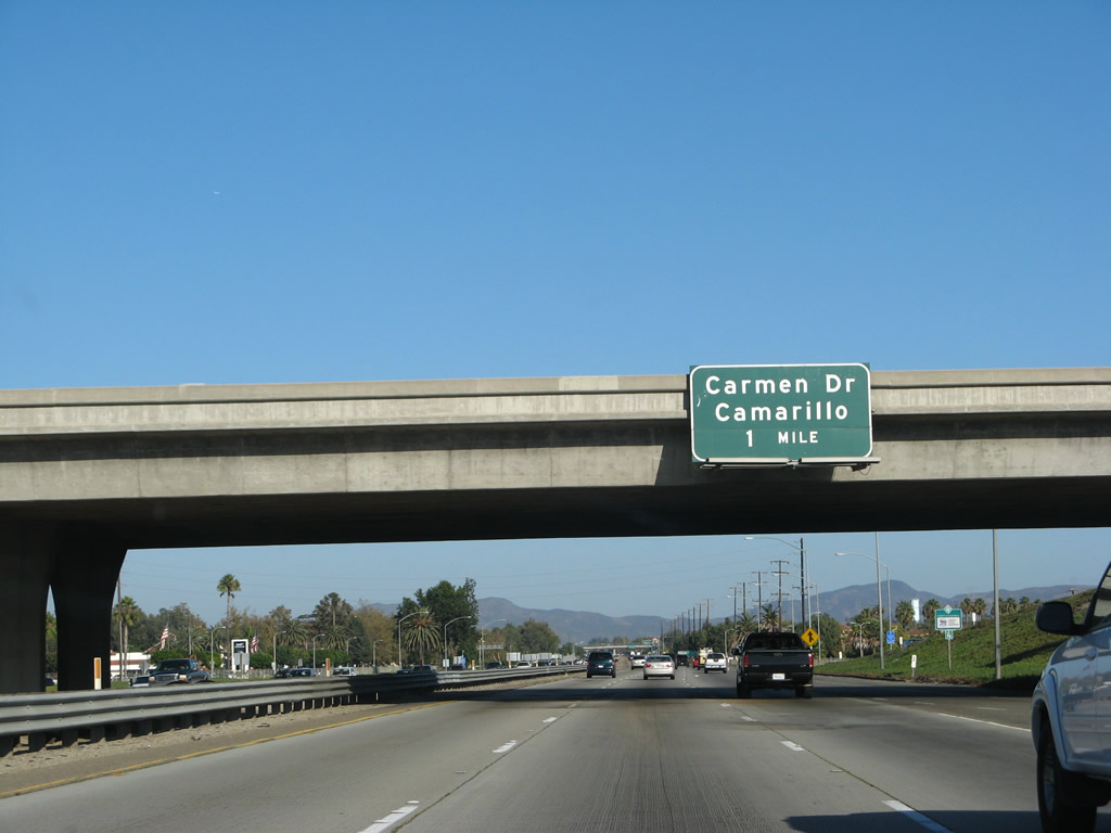 |
The next exit along southbound (eastbound) U.S. 101 (Ventura Freeway) is Exit 54, Carmen Drive. Photo taken 09/29/07. | ||||
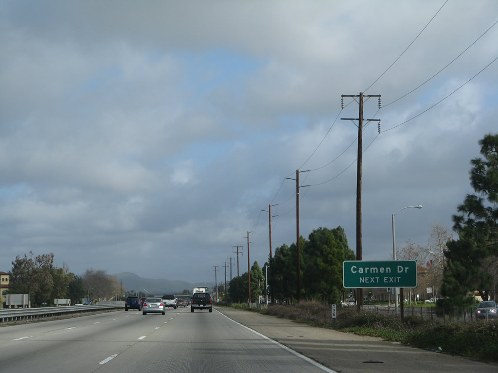 |
A roadside sign for Exit 54, Carmen Drive is posted shortly thereafter. Photo taken 02/02/08. | ||||
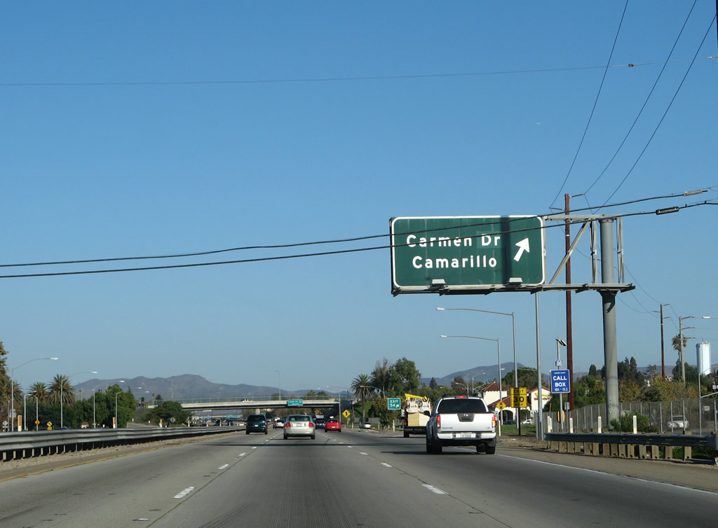 |
Southbound (eastbound) U.S. 101 (Ventura Freeway) reaches Exit 54, Carmen Drive. Photo taken 09/29/07. | ||||
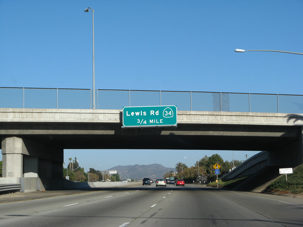 |
The next exit along southbound (eastbound) U.S. 101 (Ventura Freeway) is Exit 53B, California 34/Lewis Road. Photo taken 09/29/07. | ||||
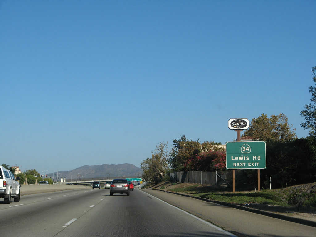 |
California 34 is a fairly short two-digit state route. Originating in the city of Oxnard at the intersection of Oxnard Boulevard (California 1) and 5th Street, California 34 travels east along 5th Street through Oxnard, then turns briefly onto Pleasant Valley Road east, then turns north along Lewis Road to meet U.S. 101. From this interchange, California 34 continues northeast along Lewis Road through Camarillo, then changes into Somis Road before ending at California 118 (Los Angeles Avenue) in Somis. The Union Pacific Railroad also crosses U.S. 101 at this interchange. Photo taken 09/29/07. | ||||
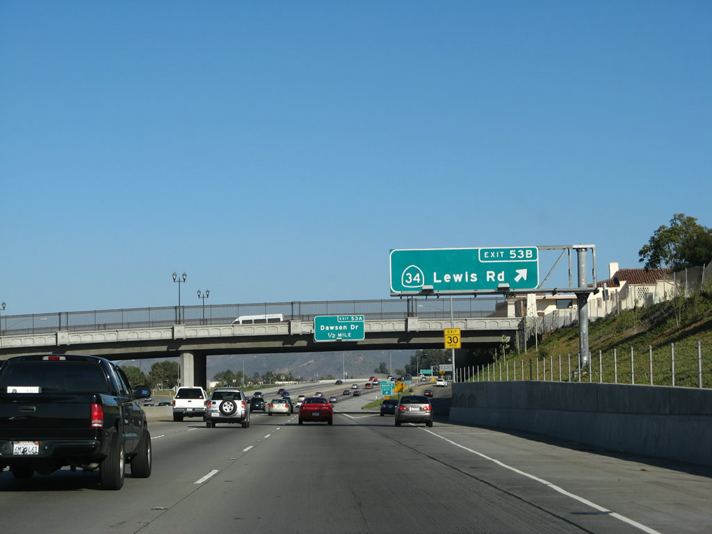 |
Southbound (eastbound) U.S. 101 (Ventura Freeway) reaches Exit 53B, California 34/Lewis Road. The connection to California 34 is made via a brief journey on Ventura Boulevard, which is the south frontage road. Photo taken 09/29/07. | ||||
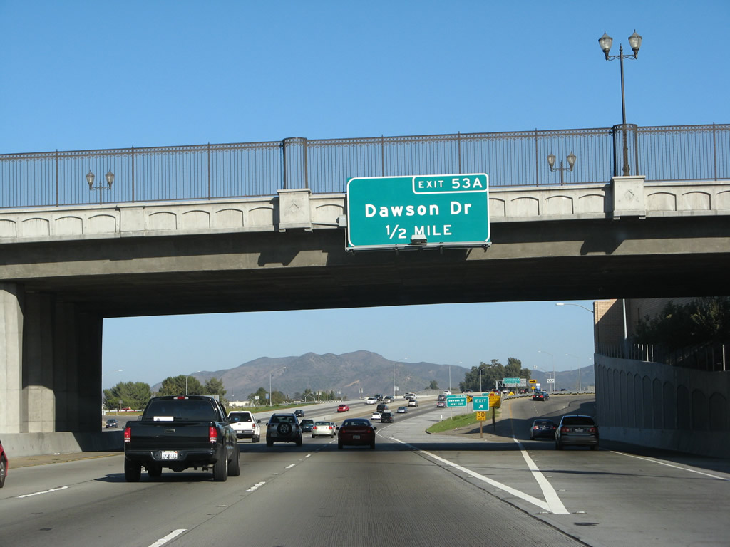 |
The Glenn Drive overcrossing was added in the mid-2000s prior to the off-ramp to Exit 53B, California 34/Lewis Road. The next exit along U.S. 101 south is Exit 53A, Dawson Drive. Photo taken 09/29/07. | ||||
 |
U.S. 101 (Ventura Freeway) rises to pass over California 34/Lewis Road and the Union Pacific Railroad. The next exit along U.S. 101 south is Exit 53A, Dawson Drive. Photo taken 09/29/07. | ||||
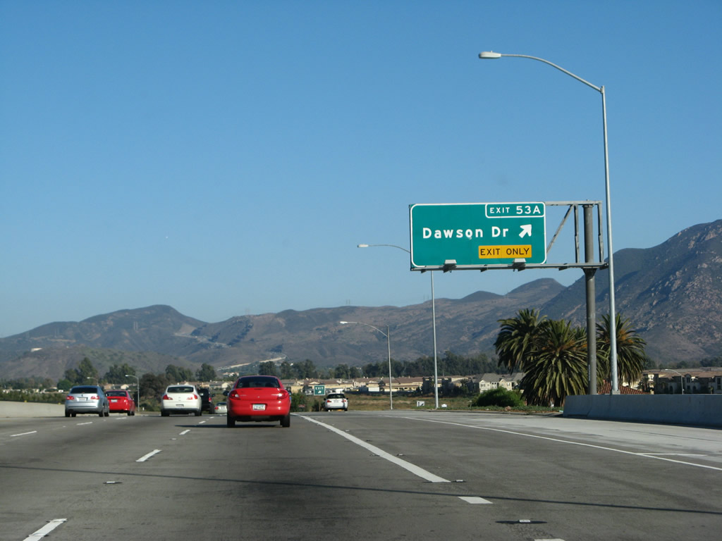 |
Southbound (eastbound) U.S. 101 (Ventura Freeway) reaches Exit 53A, Dawson Drive and Petit Street. The Santa Monica Mountains and the massive Conejo Grade come into view; soon U.S. 101 will climb up the Conejo Grade toward Thousand Oaks. Photo taken 09/29/07. | ||||
 |
A reassurance shield for U.S. 101 south is posted after the on-ramp from Dawson Drive (and Petit Street). Photo taken 09/29/07. | ||||
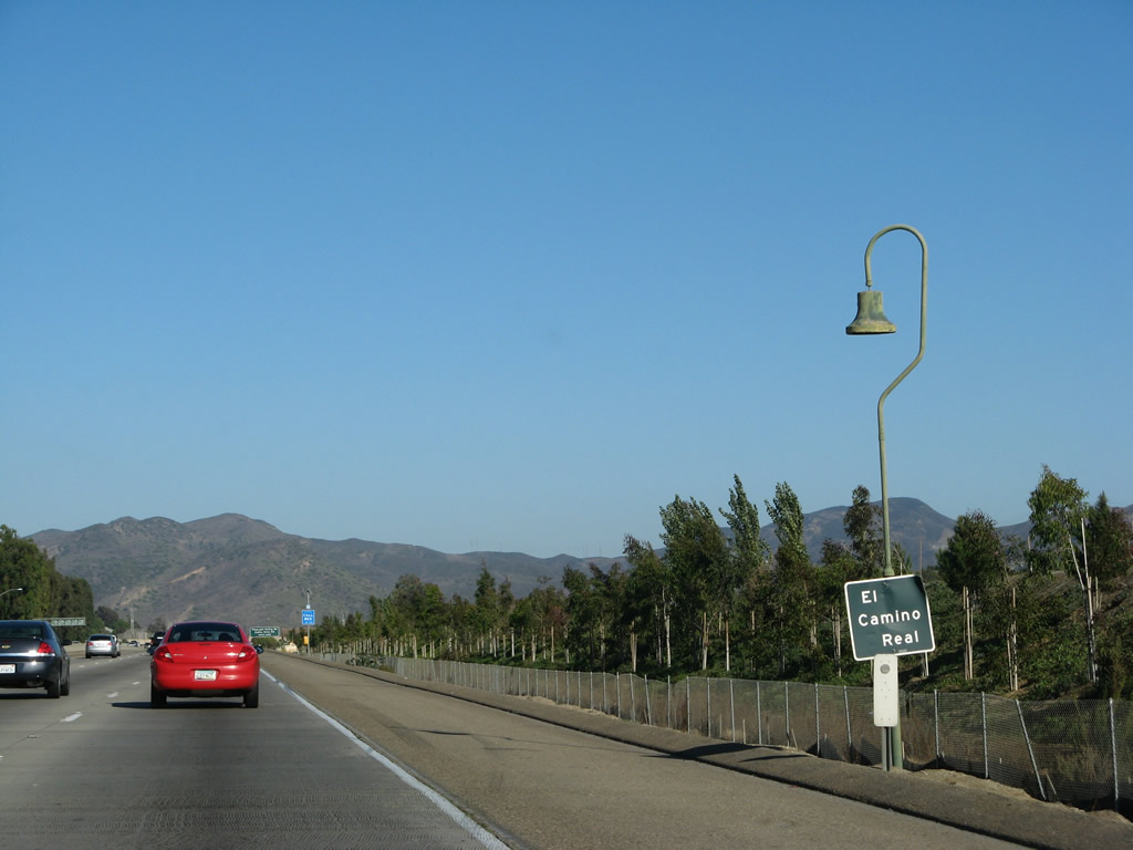 |
Replica mission bells and markers for El Camino Real still appear on U.S. 101 as it continues southeast toward Los Angeles. Despite the common name of Ventura Freeway, U.S. 101 is still El Camino Real as well. Photo taken 09/29/07. | ||||
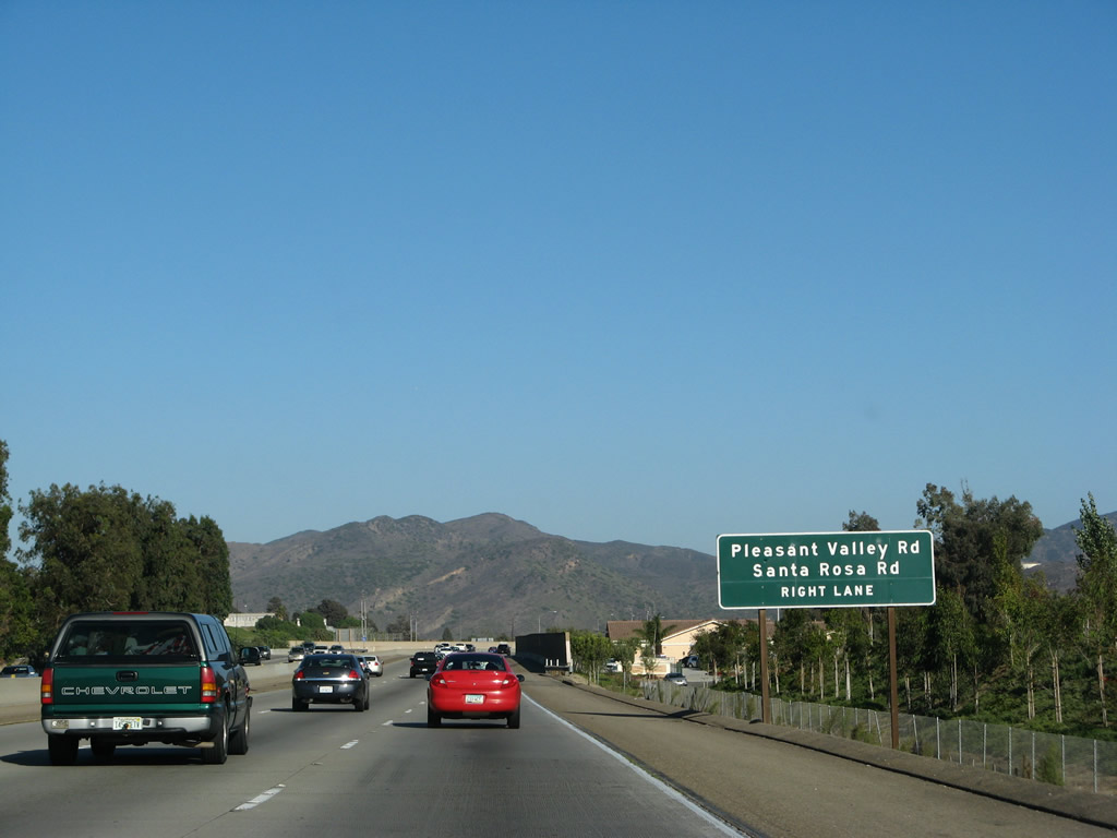 |
The next exit along U.S. 101 (Ventura Freeway) south is Exit 52, Pleasant Valley Road southwest and Santa Rosa Road north. Photo taken 09/29/07. | ||||
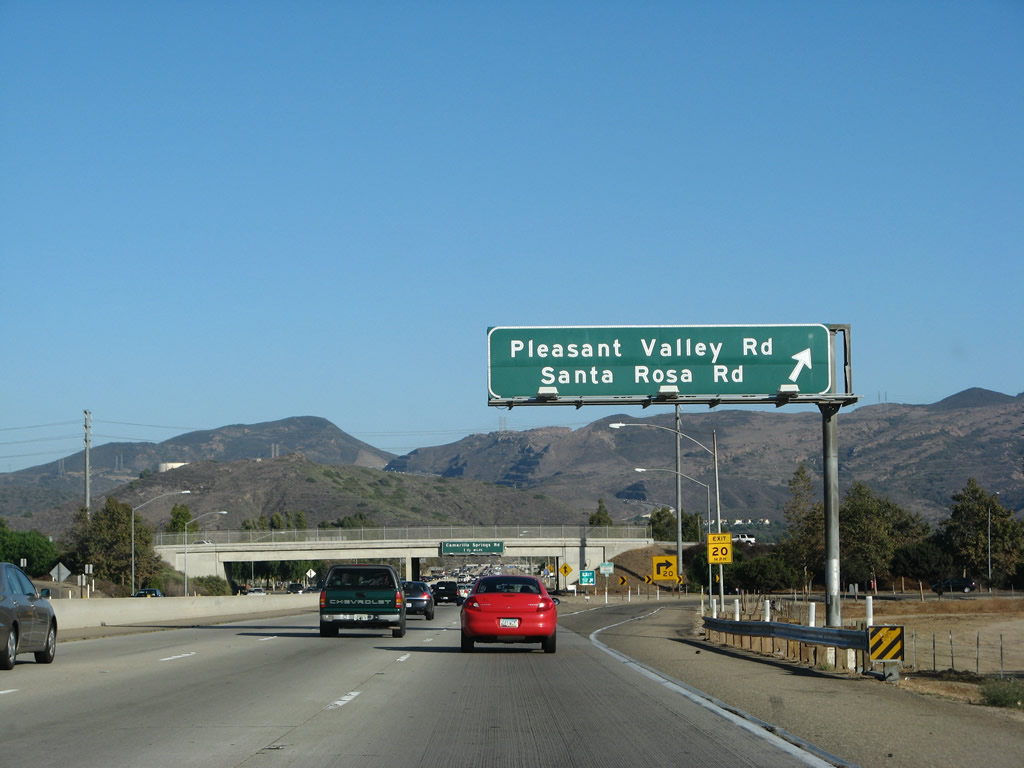 |
Southbound U.S. 101 (Ventura Freeway) reaches Exit 52, Pleasant Valley Road southwest and Santa Rosa Road north. This exit is located in eastern Camarillo. Photo taken 09/29/07. | ||||
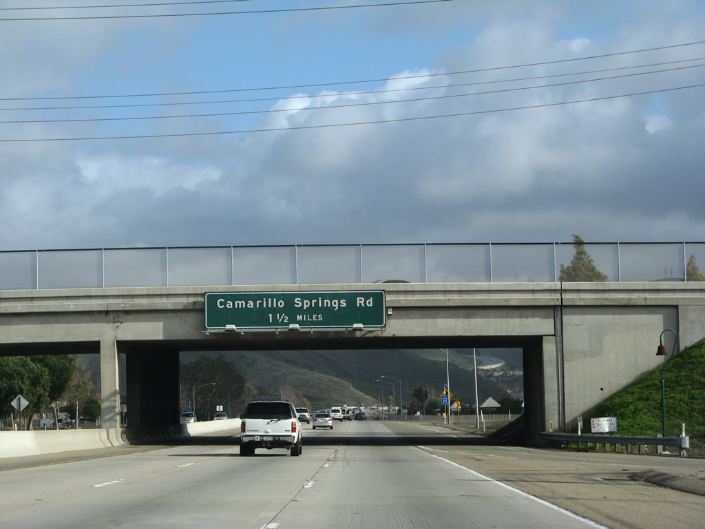 |
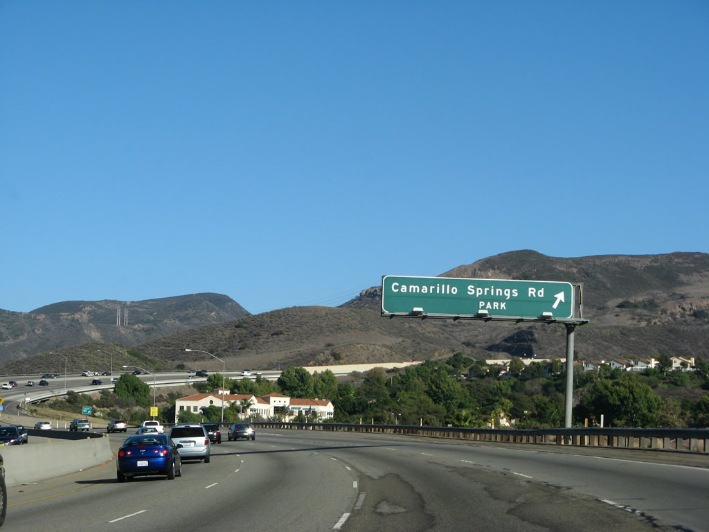
The next exit along U.S. 101 (Ventura Freeway) south (east) is Exit 50, Camarillo Springs Road. This is the final U.S. 101 interchange in Camarillo. Photo taken 02/02/08. | ||||
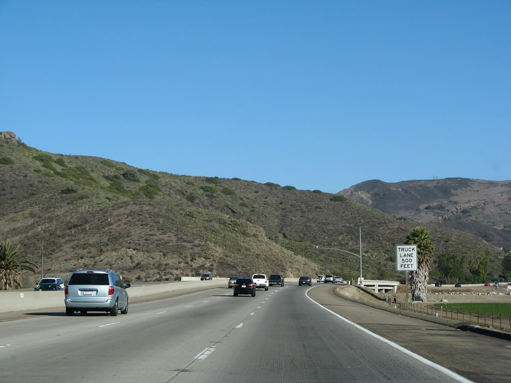 |
U.S. 101 begins its journey up Conejo Grade ("conejo" is Spanish for "rabbit"). A truck climbing lane will allow for four eastbound lanes on the Ventura Freeway. Photo taken 09/29/07. | ||||
 |
After crossing Conejo Creek, the climbing lane (number four lane) begins. Photo taken 02/02/08. | ||||
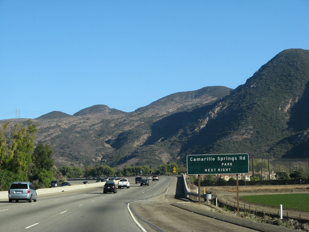 |
Southbound (eastbound) U.S. 101 (Ventura Freeway) approaches Exit 50, Camarillo Springs Road. Photo taken 09/29/07. | ||||
 |
Southbound U.S. 101 (Ventura Freeway) reaches Exit 50, Camarillo Springs Road. This is the final U.S. 101 interchange in Camarillo; the Conejo Grade carries the freeway toward Thousand Oaks. Photo taken 09/29/07. | ||||
 |
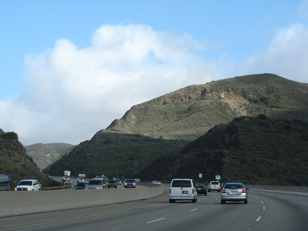 |
This pair of photos follows U.S. 101 southeast as it travels up Conejo Grade. Photos taken 09/29/07 and 02/02/08. |
 |
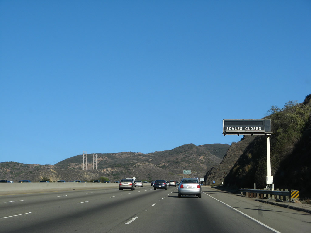 |
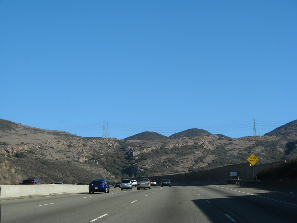
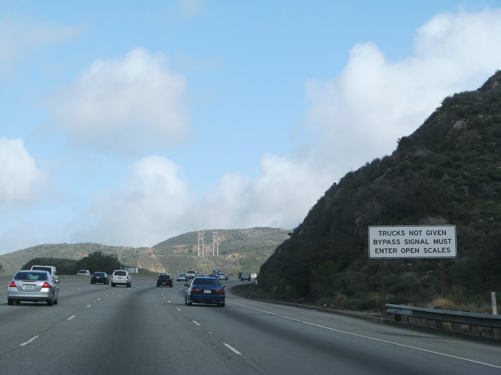
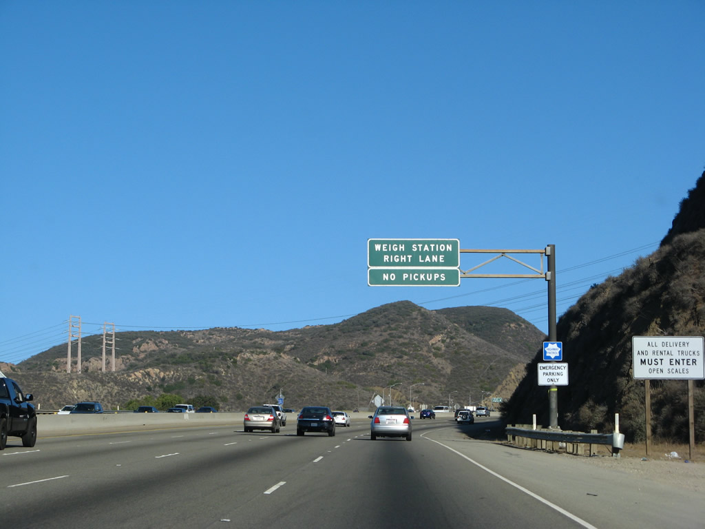
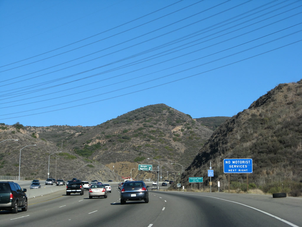
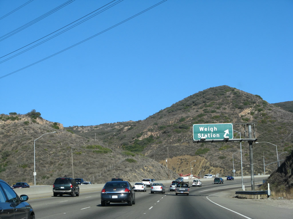
At the top of Conejo Grade is a truck weigh station. This series of signs shows the approach to the weigh station, including regulations and requirements for vehicles entering the scales. Photos taken 09/29/07 and 02/02/08. |
 |
 |
 |
A set of high strung Southern California Edison 230kV power lines cross over U.S. 101 on the Conejo Grade. These lines travel southwest toward the Ormand Beach Generating Station located northwest of Point Mugu and interconnect with other power lines in Santa Clarita. Photo taken 02/02/08. | ||||
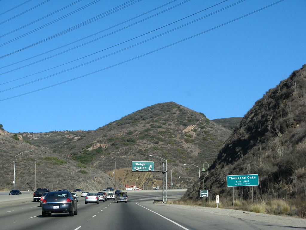 |
U.S. 101 enters the city of Thousand Oaks, which is the easternmost city in Ventura County and is located in the Conejo Valley. An entirely master planned community, Thousand Oaks incorporated as a city on September 29, 1964, and consists of several smaller planned communities. The California 23 freeway bisects the city, while U.S. 101 stays close to the southern edge of the city. Photo taken 09/29/07. | ||||
 |
Southbound U.S. 101 meets the off-ramp to the Conejo Weigh Station in Thousand Oaks near the top of Conejo Grade. Photo taken 09/29/07. | ||||
 |
U.S. 101 reaches the top of Conejo Grade and will soon crest into Conejo Valley and Thousand Oaks. Photo taken 09/29/07. | ||||
 |
The U.S. 101 truck lane ends at the top of Conejo Grade, but the right lane will remain long enough to allow traffic to exit directly onto Exit 47B in Thousand Oaks. Photo taken 09/29/07. | ||||
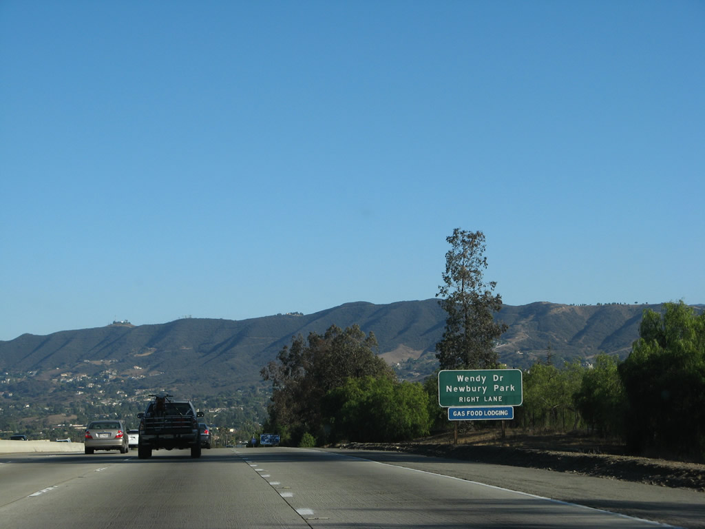 |
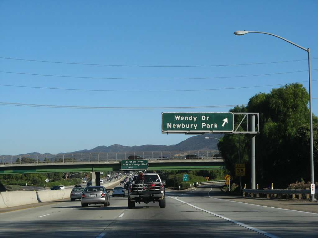
The next exit along U.S. 101 south is Exit 47B, Wendy Drive to Newbury Park (which is part of the city of Thousand Oaks). Photo taken 09/29/07. | ||||
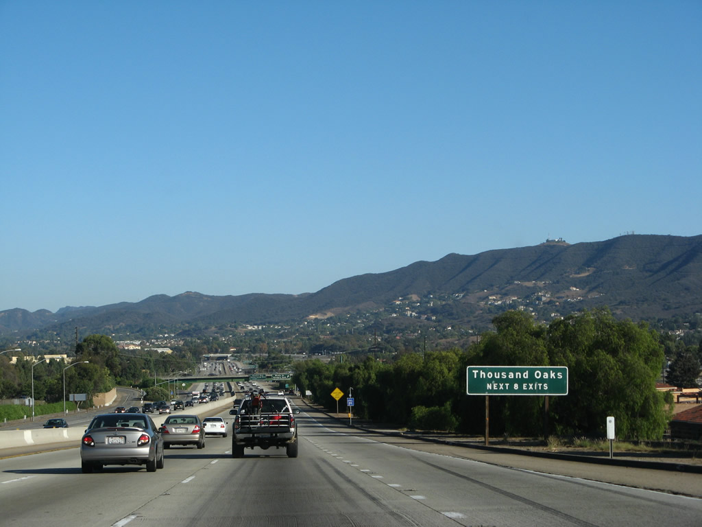 |
The next eight exits all serve the city of Thousand Oaks. Expansive Conejo Valley comes into view; the Santa Monica Mountains block the valley from the Pacific Ocean. Photo taken 09/29/07. | ||||
 |
Southbound U.S. 101 reaches Exit 47B, Wendy Drive to the Newbury Park community of Thousand Oaks. Photo taken 09/29/07. | ||||
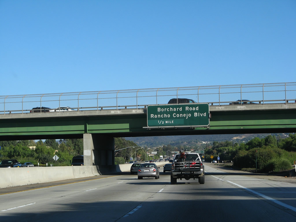 |
The next exit along U.S. 101 south is Exit 47A, Borchard Road southwest and Rancho Conejo Boulevard north. Photo taken 09/29/07. | ||||
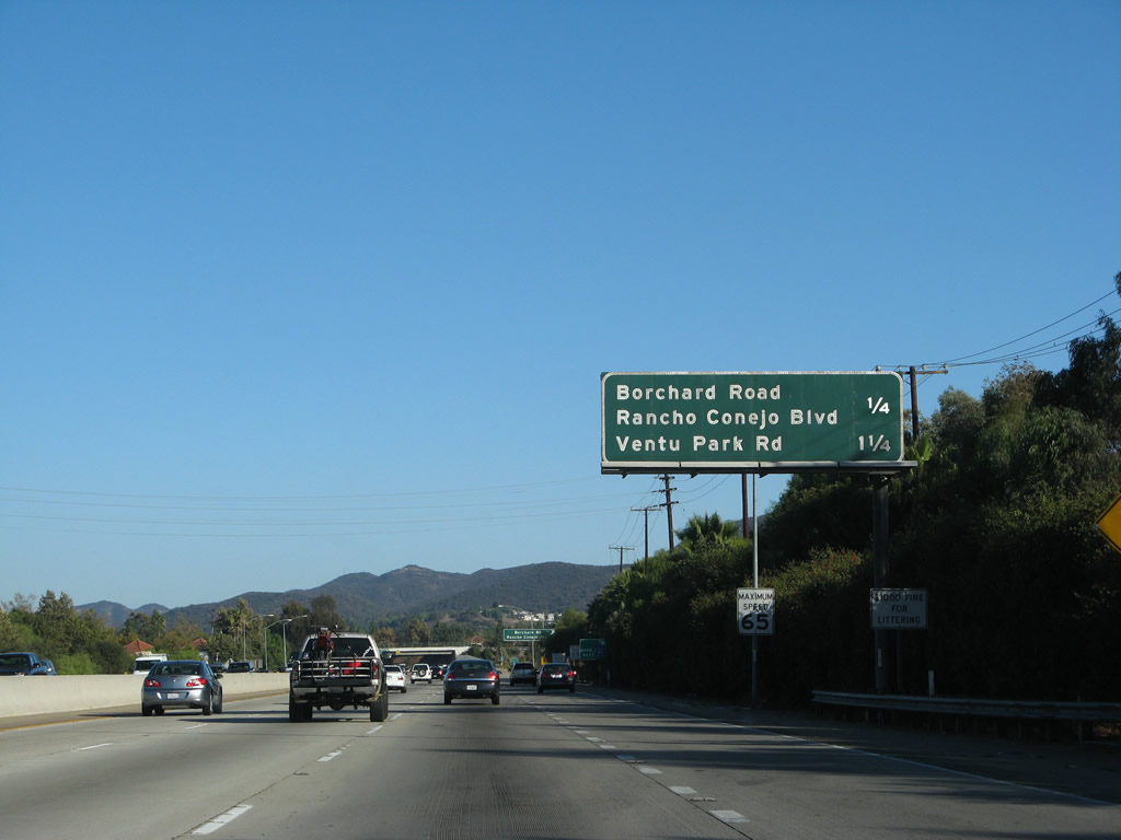 |
This mileage sign provides the distance to the next two exits along U.S. 101 south: Exit 47A, Borchard Road and Rancho Conejo Boulevard and Exit 46, Ventu Park Road. Photo taken 09/29/07. | ||||
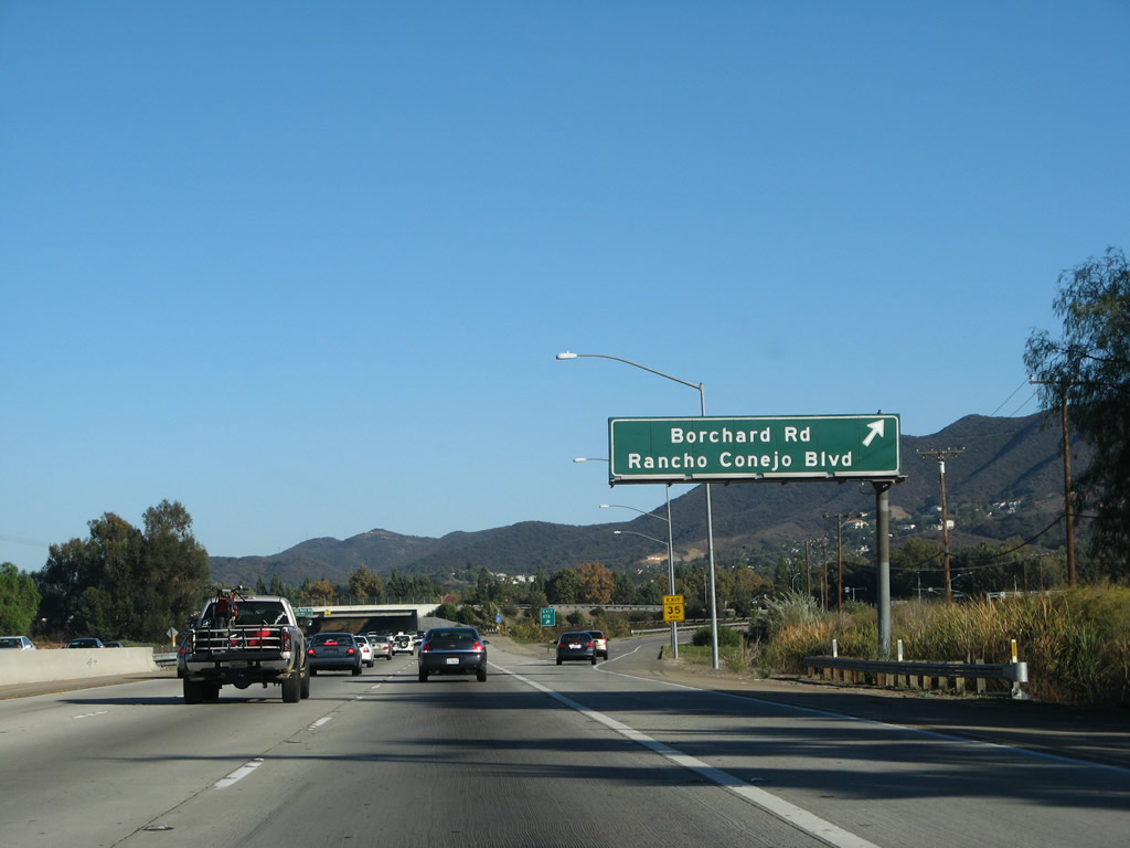 |
Southbound U.S. 101 (Ventura Freeway / El Camino Real) reaches Exit 47A, Borchard Road and Rancho Conejo Boulevard. Photo taken 09/29/07. | ||||
 |
The next exit along U.S. 101 south is Exit 46, Ventu Park Road to the Stagecoach Inn and local residential and commercial access. Photo taken 09/29/07. | ||||
 |
Use Ventu Park Road south to the Stagecoach Inn, which was built in 1876 as the Grand Union Hotel. Photo taken 09/29/07. | ||||
 |
Southbound U.S. 101 (Ventura Freeway) reaches Exit 46, Ventu Park Road. Photo taken 02/02/08. | ||||
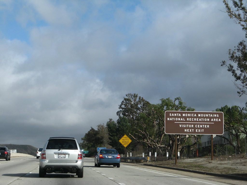 |
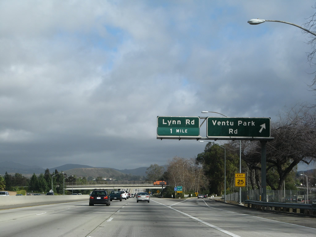
The next exit along U.S. 101 south is Exit 45, Lynn Road. Use Exit 45 to the Santa Monica Mountains National Recreation Area visitors center. Photo taken 09/29/07. | ||||
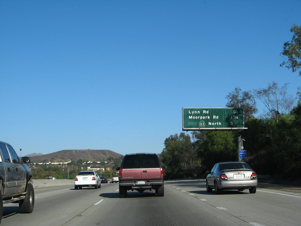 |
This interchange sequence sign provides the distance to the next three exits along U.S. 101 south: Exit 45, Lynn Road; Exit 44, Moorpark Road (Old California 23); and Exit 43B, California 23 freeway north. Photo taken 09/29/07. | ||||
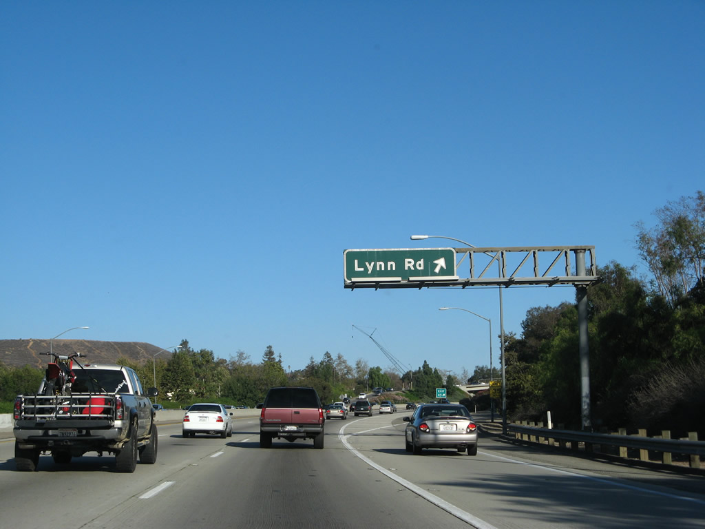 |
Southbound U.S. 101 (Ventura Freeway) reaches Exit 45, Lynn Road. Photo taken 09/29/07. | ||||
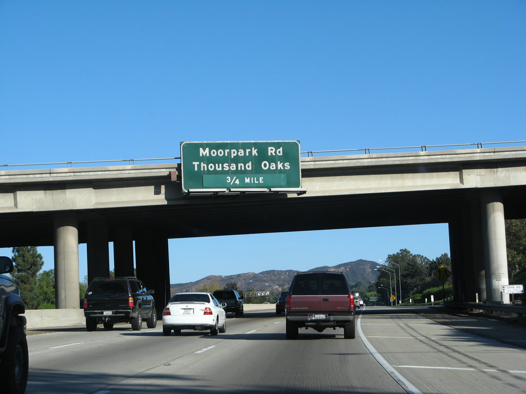 |
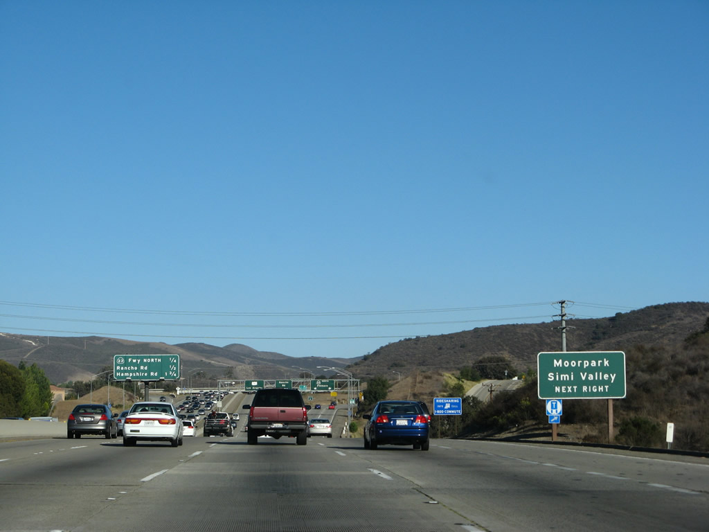
The next exit along U.S. 101 south is Exit 44, Moorpark Road. Moorpark Road generally parallels the California 23 freeway north through Thousand Oaks into the city of Moorpark. Photo taken 09/29/07. | ||||
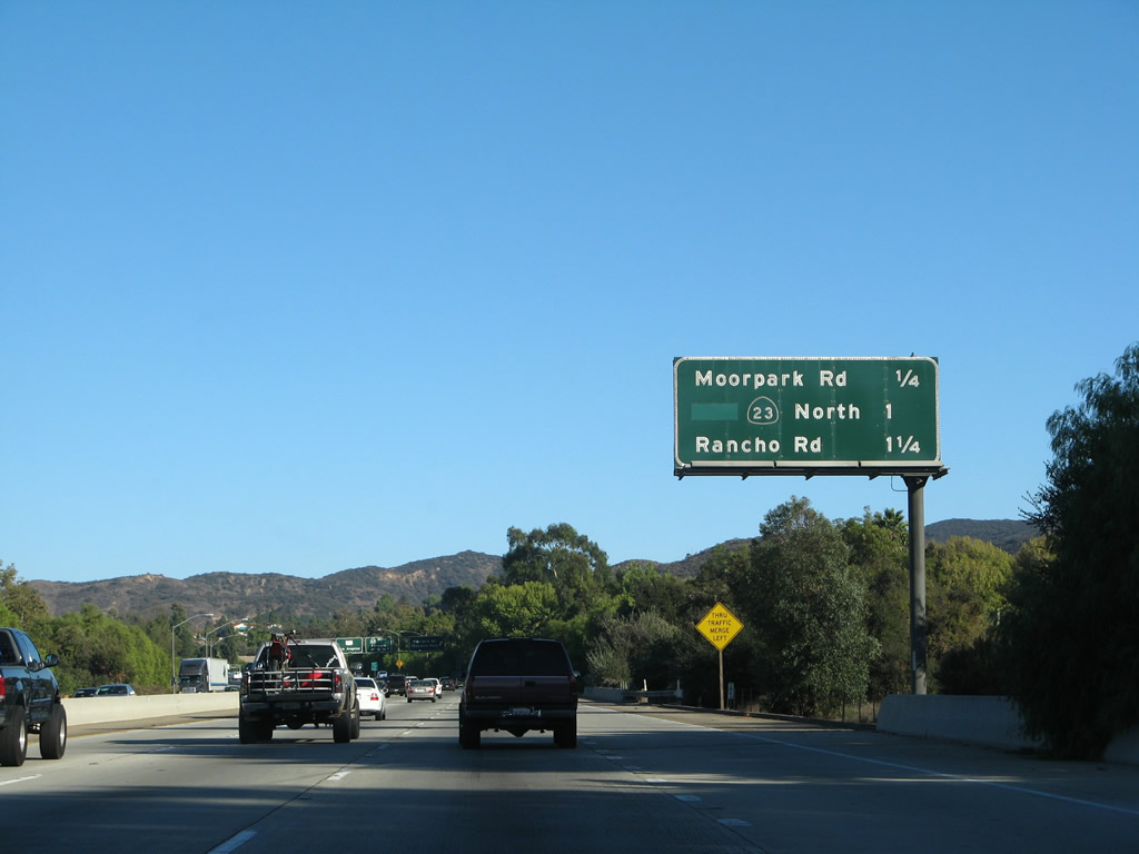 |
This interchange sequence sign provides the distance to the next three exits along U.S. 101 south: Exit 44, Moorpark Road (Old California 23); Exit 43B, California 23 freeway north; and Exit 43A, Rancho Road. Photo taken 09/29/07. | ||||
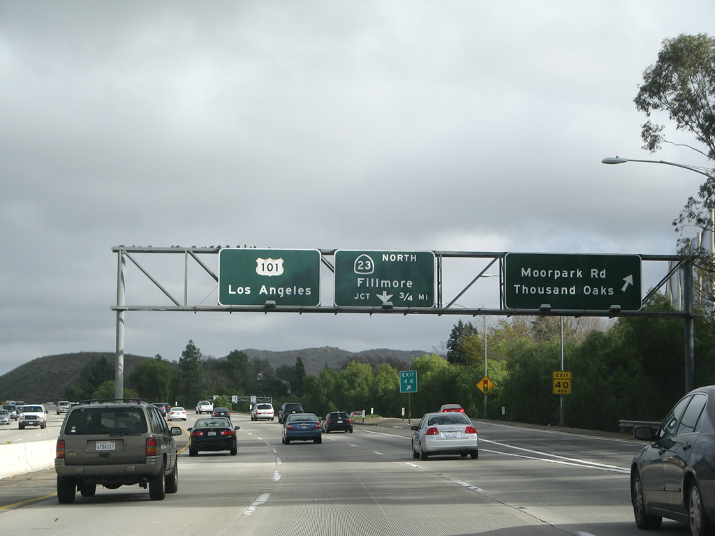 |
Southbound (eastbound) U.S. 101 reaches Exit 44, Moorpark Road. The next exit from U.S. 101 east is Exit 43B, California 23 freeway north and Exit 43A, Rancho Road. This porcelain enamel overhead sign assembly is similar to a few seen in Camarillo: There are no buttons on this old overhead sign for U.S. 101 and California 23. Photos taken 02/02/08 and 09/29/07. | ||||
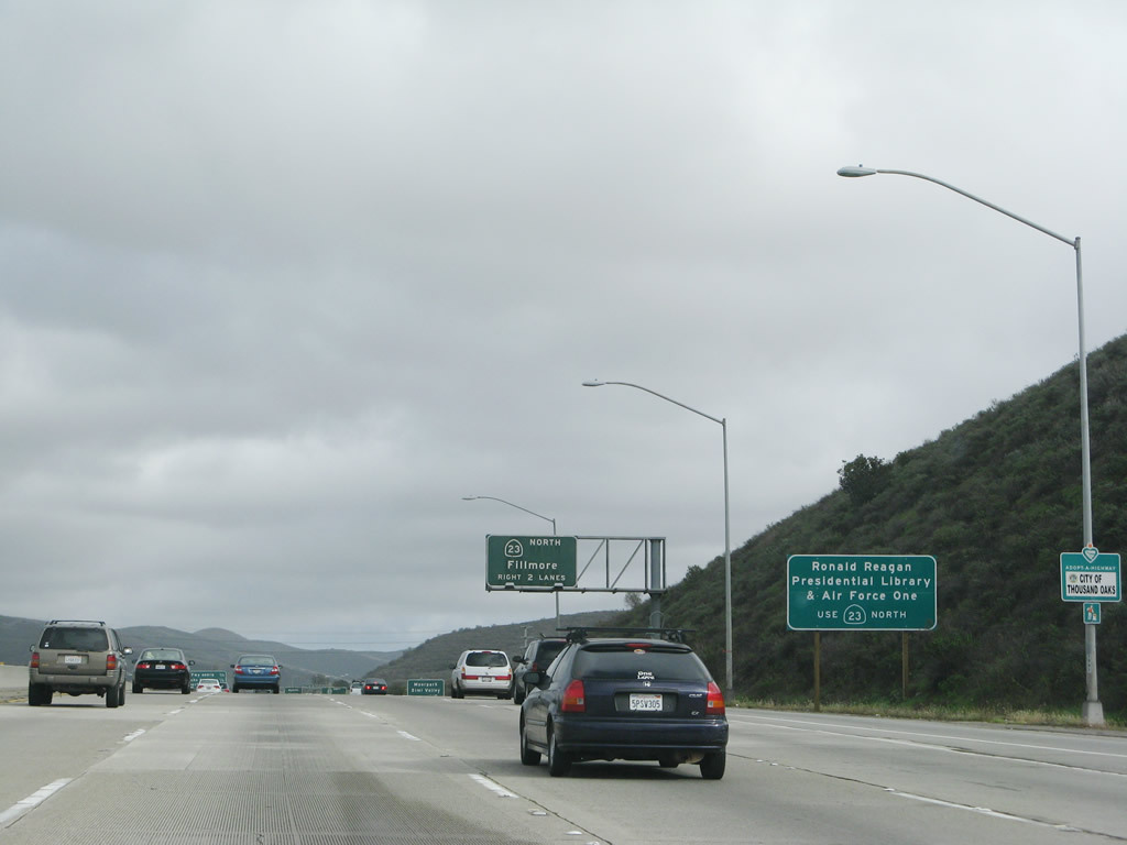 |
Use California 23 north to the Ronald Reagan Presidential Library in Simi Valley. In October 2005, President Reagan's Air Force One was permanently opened for the public to see at the library. Photo taken 02/02/08. | ||||
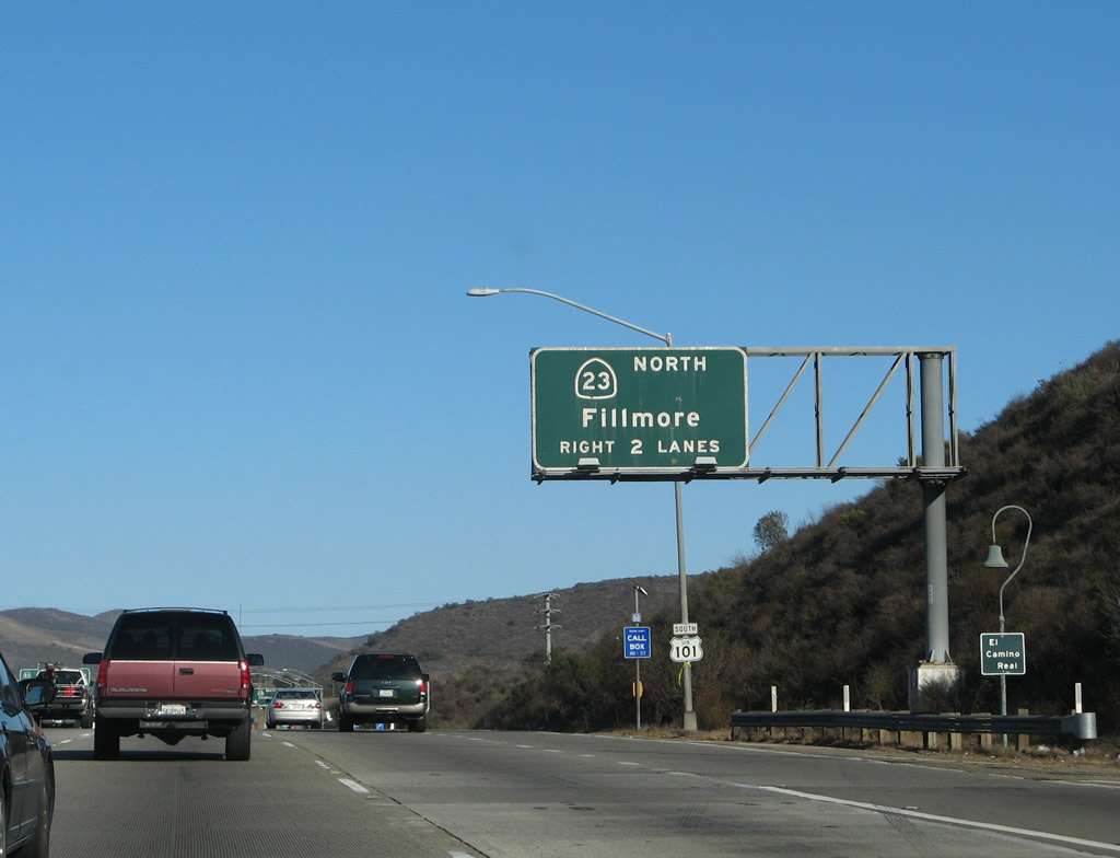 |
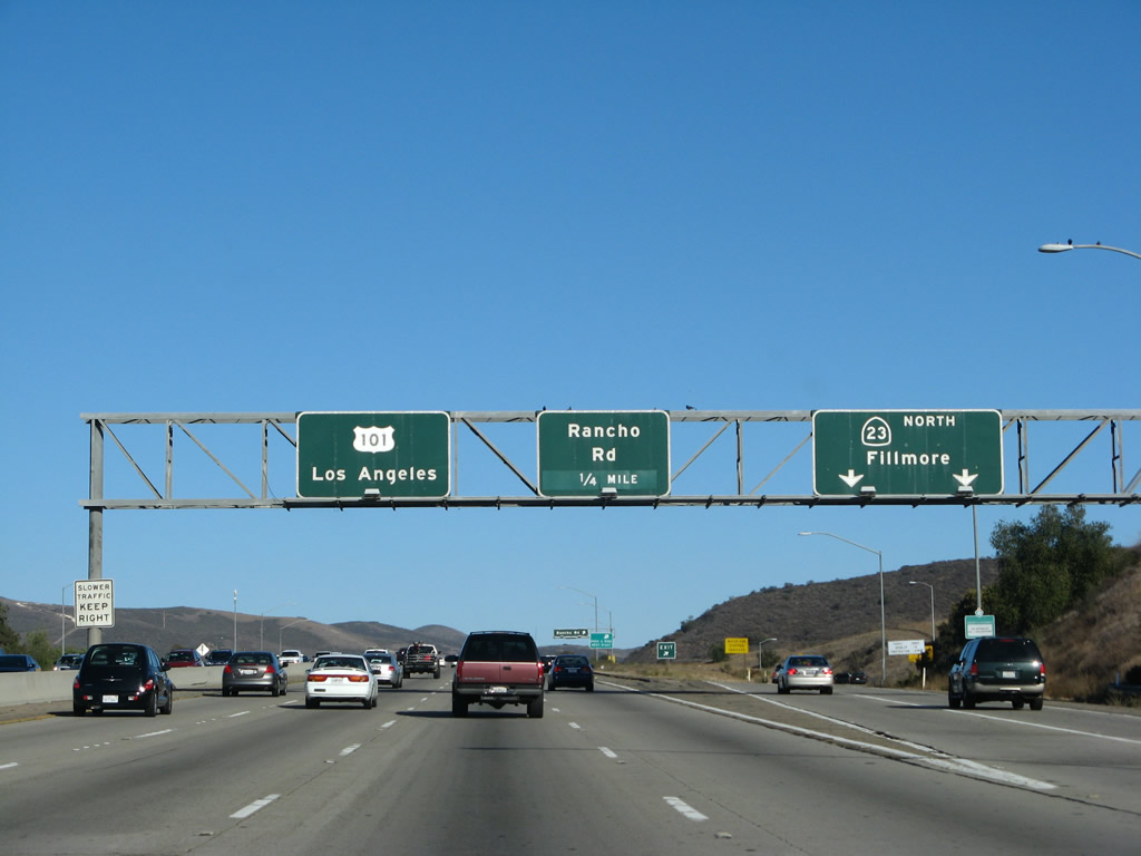
The next exit along U.S. 101 (Ventura Freeway) south is Exit 43B, California 23 north to Moorpark and Fillmore. Use the right two lanes to California 23 north. Photo taken 09/29/07. | ||||
 |
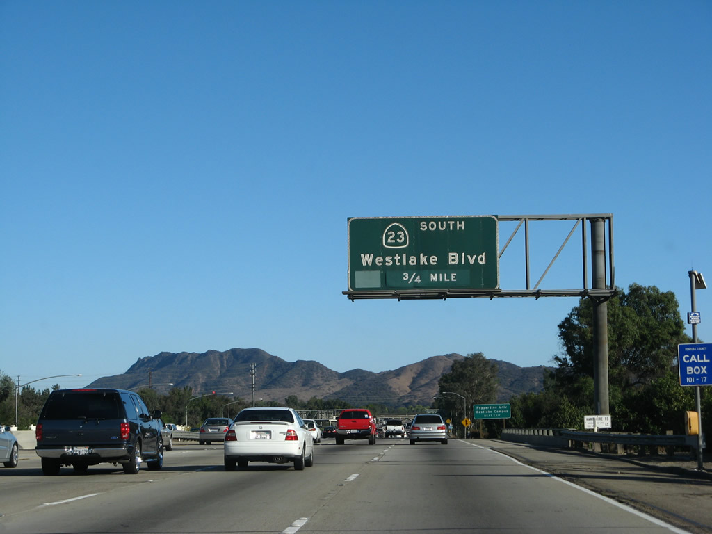
California 23 travels from El Pescador State Beach (intersection of Decker Road and California 1 (Pacific Coast Highway)) north to Thousand Oaks, then connects to Moorpark and Fillmore. At Moorpark, the California 23 freeway shifts directly onto California 118 (Simi Valley / Ronald Reagan Freeway) east to Simi Valley. California 23 then follows a two-lane route north into Fillmore. Photo taken 09/29/07. | ||||
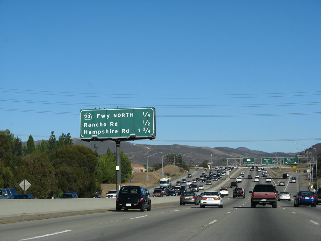 |
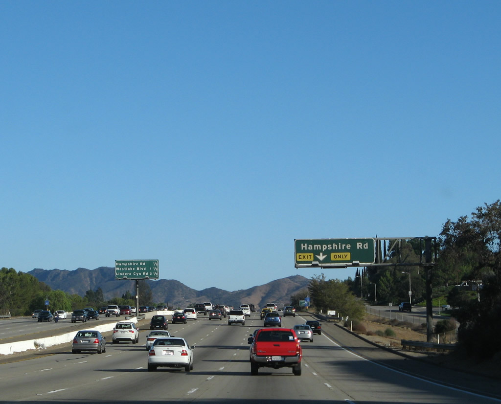
This interchange sequence sign provides the distance to the next three exits along U.S. 101 south: Exit 43B, California 23 freeway north; Exit 43A, Rancho Road; and Exit 41, Hampshire Road. Note that California 23 south merges onto U.S. 101 south between Exits 43A and 40. Photo taken 09/29/07. | ||||
 |
Southbound U.S. 101 (Ventura Freeway) reaches Exit 43B, California 23 north to Moorpark and Fillmore. The left four lanes continue south (east) on U.S. 101 and California 23 to Westlake Village, Agoura Hills, and Los Angeles. Photo taken 09/29/07. | ||||
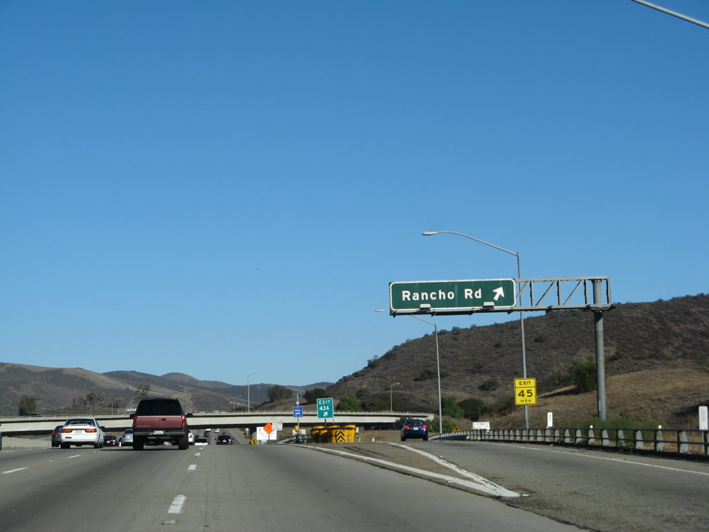 |
In the middle of the California 23 interchange with U.S. 101 is the off-ramp to Exit 43A, Rancho Road. Photo taken 09/29/07. | ||||
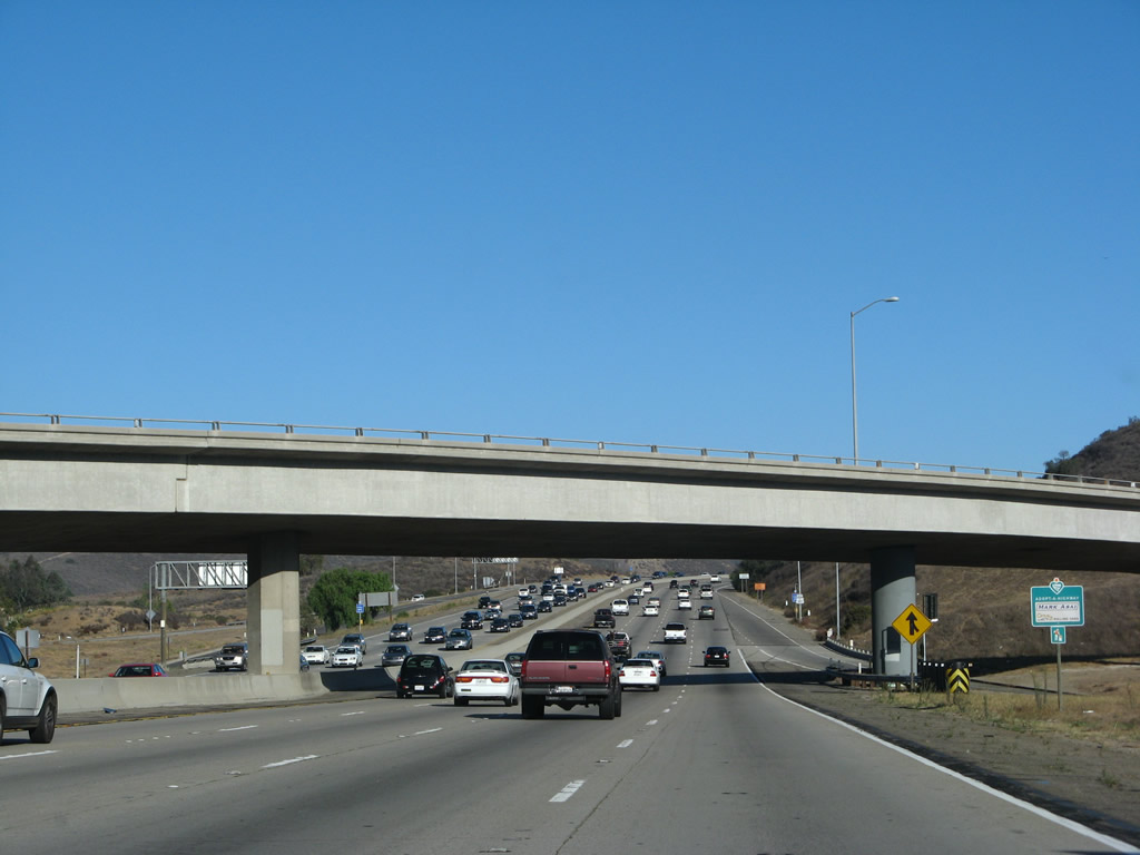 |
U.S. 101 (Ventura Freeway) passes under the transition ramp from California 23 south to U.S. 101 south. Photo taken 09/29/07. | ||||
| U.S. 101 (Ventura Freeway / El Camino Real) and California 23 south | |||||
|---|---|---|---|---|---|
 |
A reassurance shield assembly includes U.S. 101 south but omits California 23 south. Through traffic to California 23 should follow U.S. 101 south until Exit 40, Westlake Boulevard. Photo taken 09/29/07. | ||||
 |
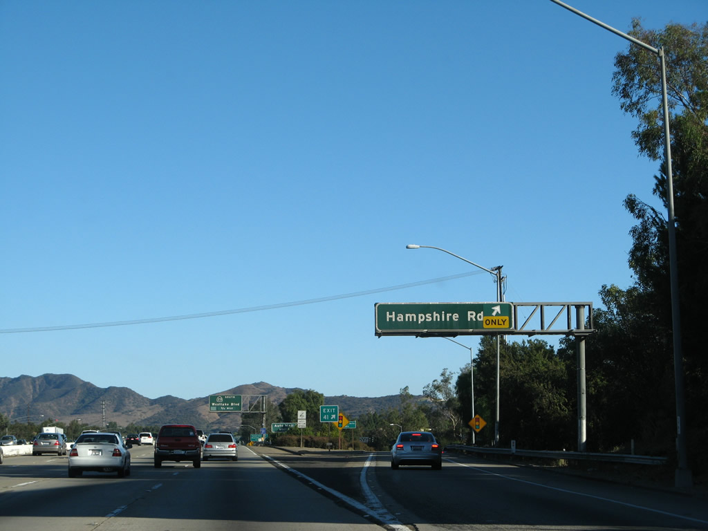
The right lane of U.S. 101 (Ventura Freeway) and California 23 south becomes exit only for Exit 41, Hampshire Road. Photo taken 09/29/07. | ||||
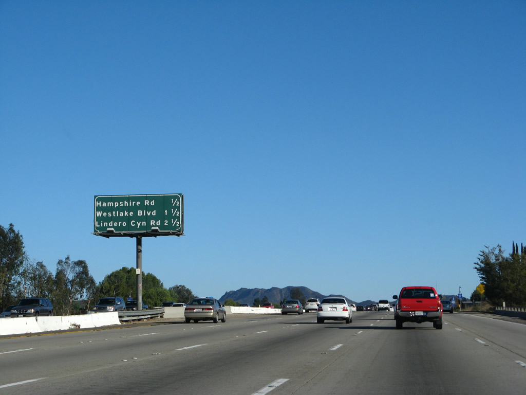 |
This mileage sign provides the distance to the next three exits on U.S. 101 (Ventura Freeway) south: Exit 41, Hampshire Road; Exit 40, California 23 south and Westlake Boulevard; and Exit 39, Lindero Canyon Road. Photo taken 09/29/07. | ||||
 |
Southbound U.S. 101 (Ventura Freeway) reaches Exit 41, Hampshire Road. This is the second to last exit in Thousand Oaks. Photo taken 09/29/07. | ||||
 |
The next exit along southbound is Exit 40, California 23/Westlake Boulevard south and Westlake Boulevard north. Photo taken 09/29/07. | ||||
 |
Both U.S. 101 and California 23 south are signed after the on-ramp from Hampshire Road. Photo taken 09/29/07. | ||||
 |
This mileage sign provides the distance to the next three exits on U.S. 101 (Ventura Freeway) south: Exit 40, California 23 south and Westlake Boulevard; Exit 39, Lindero Canyon Road; and Exit 38, Adobe Road to Agoura Road. Photo taken 02/02/08. | ||||
 |
Use California 23/Westlake Boulevard south to Lake Sherwood (via Potrero Road) and the city of Westlake Village (via Triunfo Canyon Road). Photo taken 02/02/08. | ||||
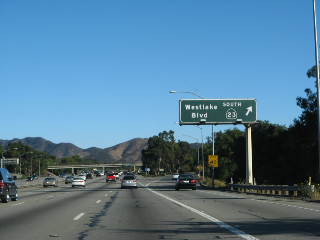 |
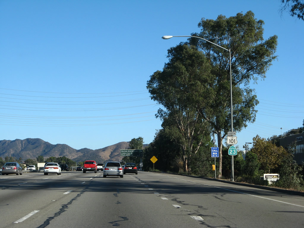
Southbound U.S. 101 reaches Exit 40, California 23/Westlake Boulevard south and Westlake Boulevard north. The routes divide at this point after their brief shared alignment. Photo taken 09/29/07. | ||||
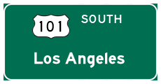
| U.S. 101 (Ventura Freeway / El Camino Real) south | |||||
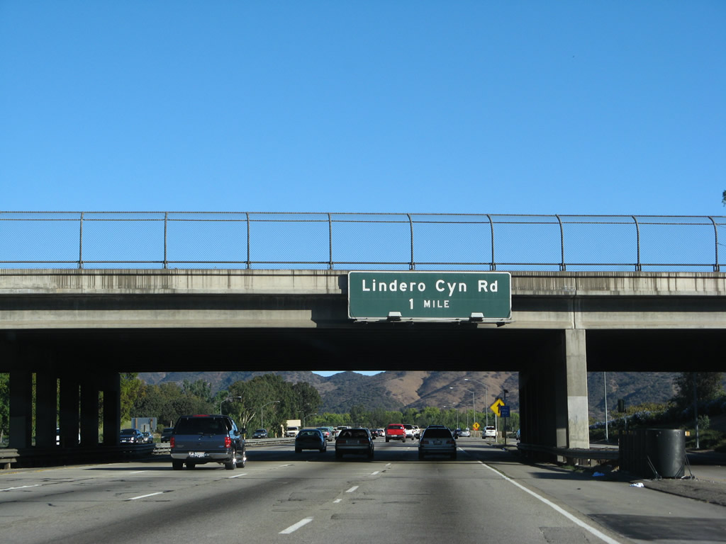 |
The next exit along southbound is Exit 39, Lindero Canyon Road in Los Angeles County, city of Westlake Village. Photo taken 09/29/07. | ||||
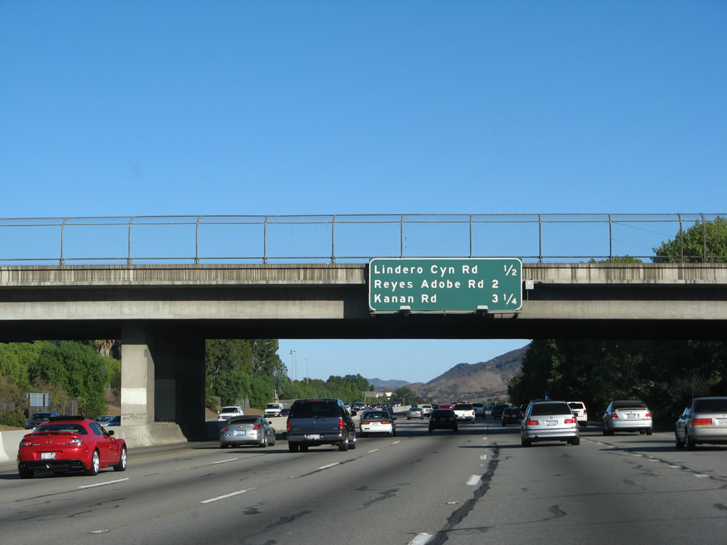 |
This mileage sign provides the distance to the next three exits on U.S. 101 (Ventura Freeway) south: Exit 39, Lindero Canyon Road; Exit 38, Adobe Road to Agoura Road; and Exit 37, Los Angeles County N-9/Kanan Road. Photo taken 09/29/07. | ||||
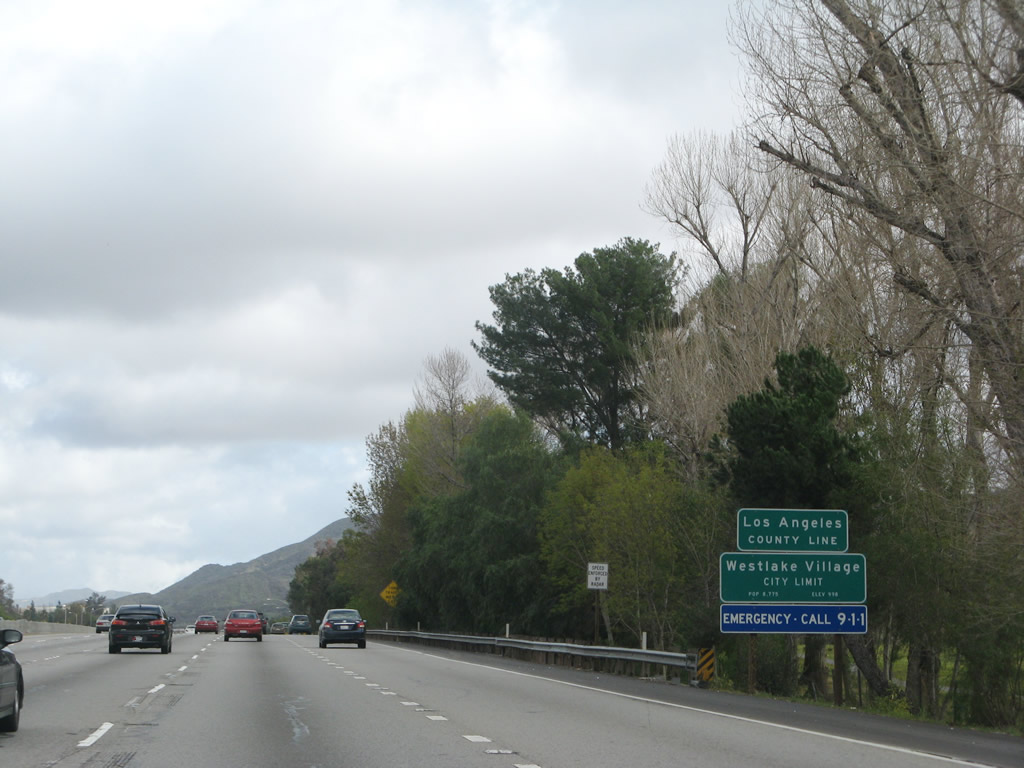 |
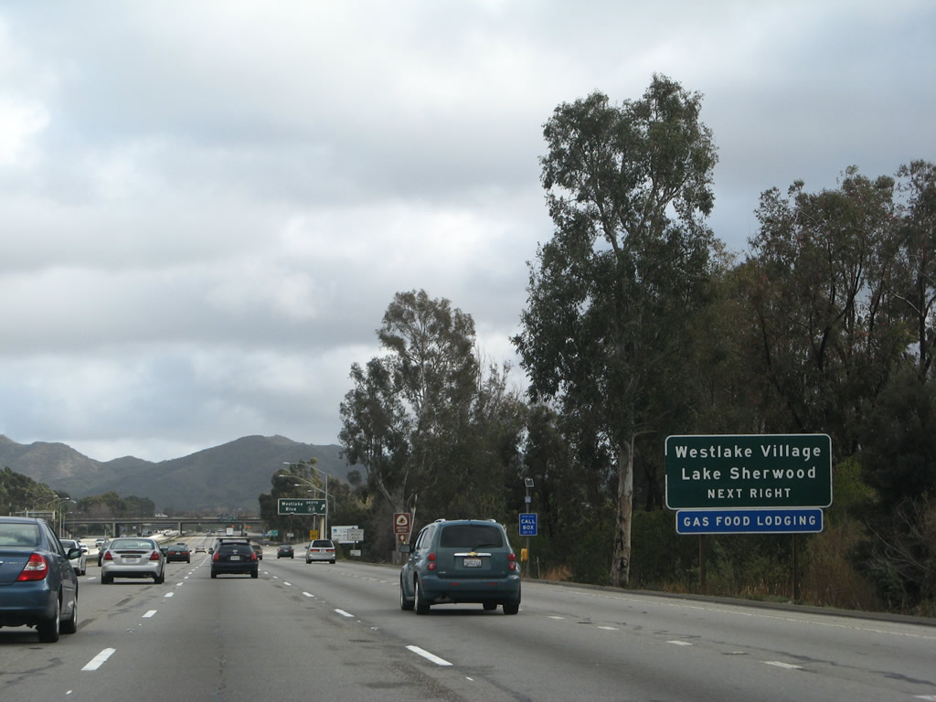
Soon thereafter, U.S. 101 leaves Ventura County and the city of Thousand Oaks and enters Los Angeles County and the city of Westlake Village. Photo taken 02/02/08. | ||||


Page Updated March 23, 2008.
|
About Contact Glossary |
In The News Interstate Guide |
Social Media:
 |
|
© 2000-25 AARoads.com | All Rights Reserved | Privacy Policy / Terms of Use
|
||