
State Route 49 South - Cool to Oakhurst
 South
South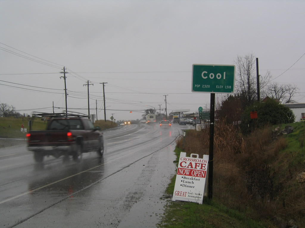
SR 49 heads south from Auburn State Recreation Area to the unincorporated community of Cool.
12/28/04
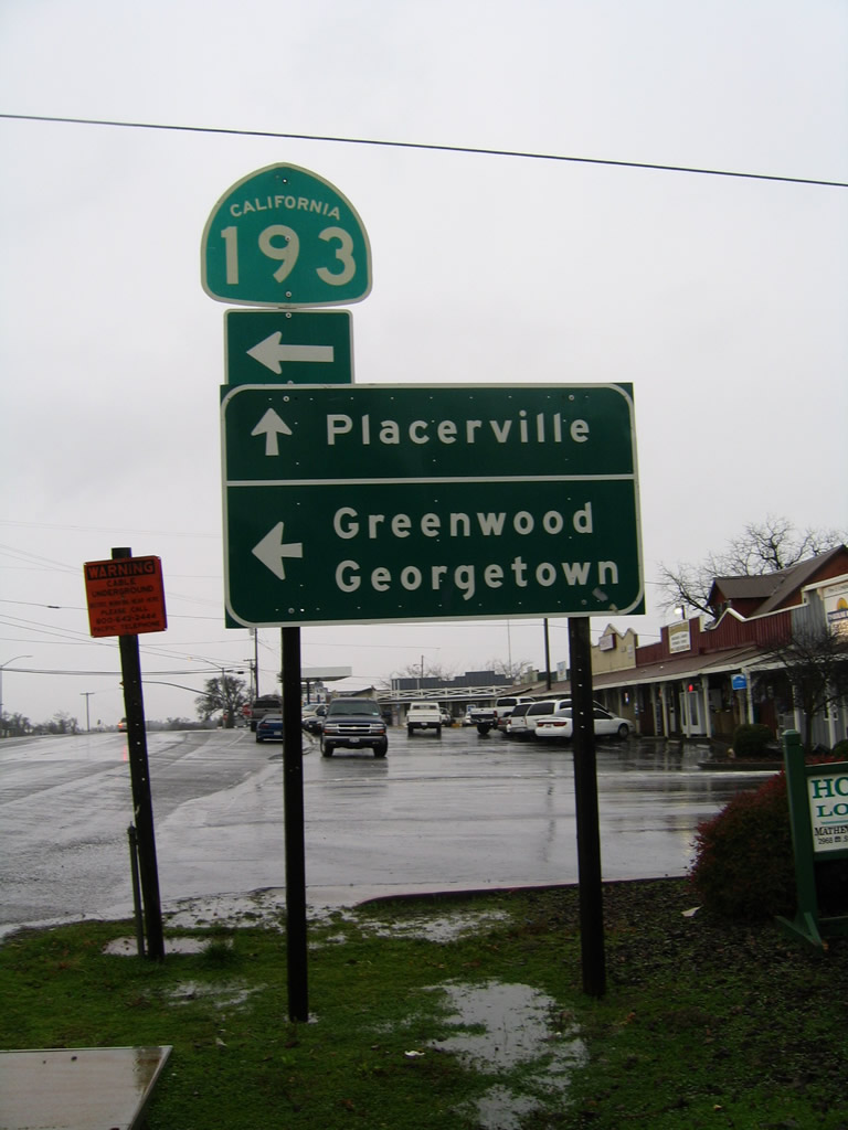
California State Route 193 (Georgetown Road) loops east from SR 49 at Cool to Georgetown and south back to SR 49 at Placerville.
12/28/04
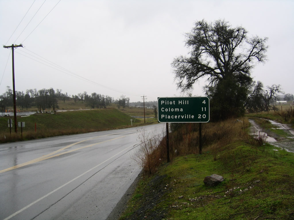
Continuing south from SR 193 (Georgetown Road), SR 49 travels four miles to unincorporated Pilot Hill and 20 miles to the El Dorado County seat of Placerville.
12/28/04
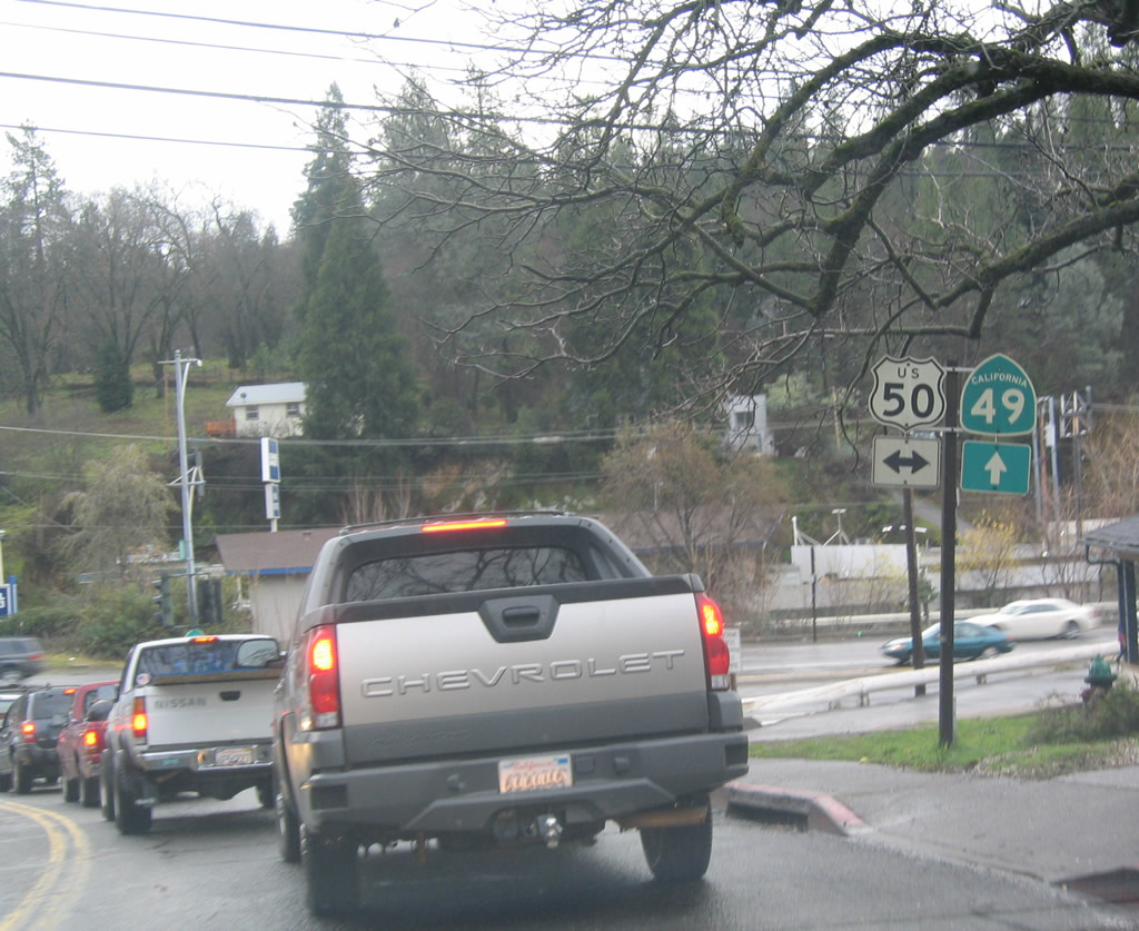
Following Coloma Road, SR 49 lowers into Placerville, where it meets U.S. 50 at an at-grade intersection.
12/28/04
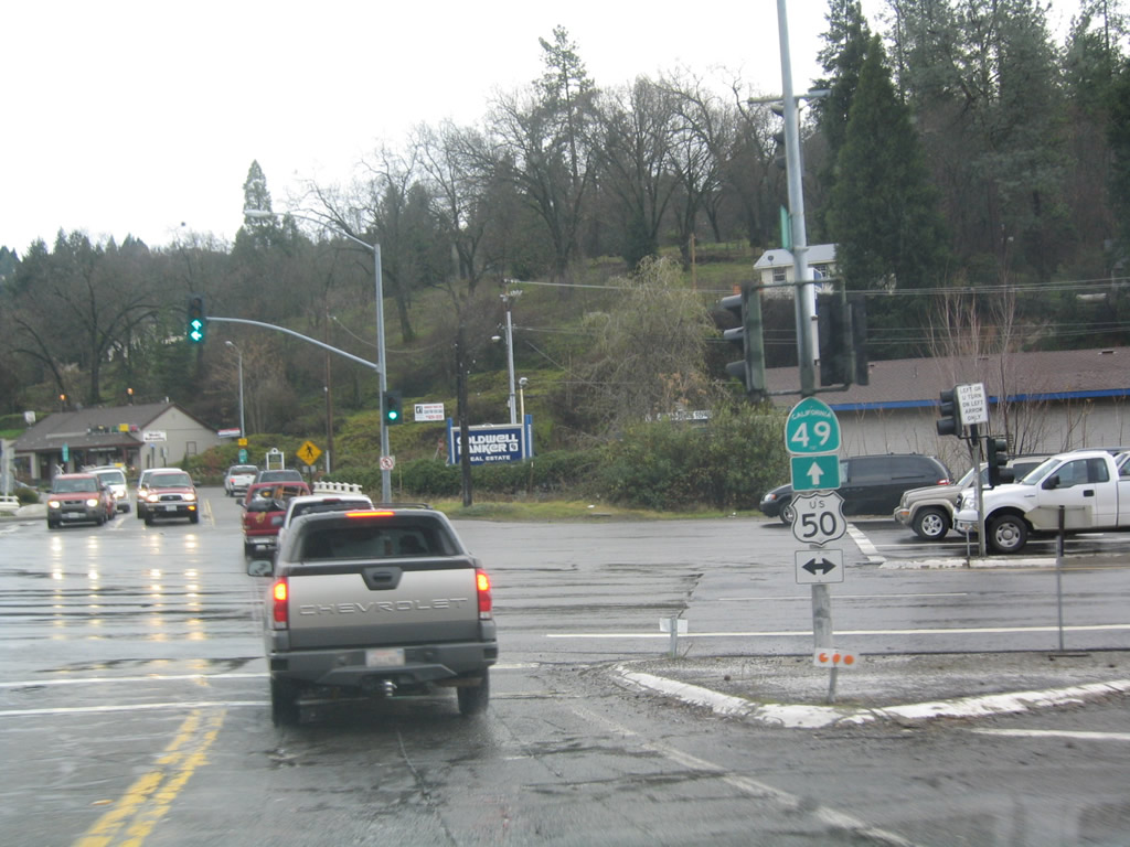
U.S. 50 travels east from Placerville to South Lake Tahoe and west along a freeway to Folsom and Sacramento.
12/28/04
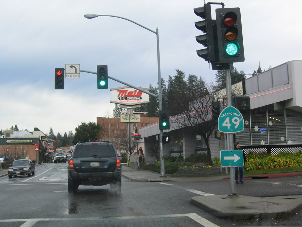
Continuing beyond U.S. 50, SR 49 takes a stair stepped route along Spring, Main and Pacific Streets through Downtown Placerville. Pictured here is the turn onto Pacific Street, which leads the state route south to Sacramento Street.
12/28/04
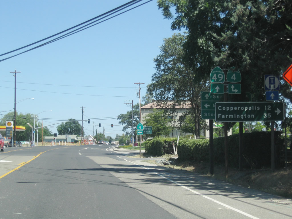
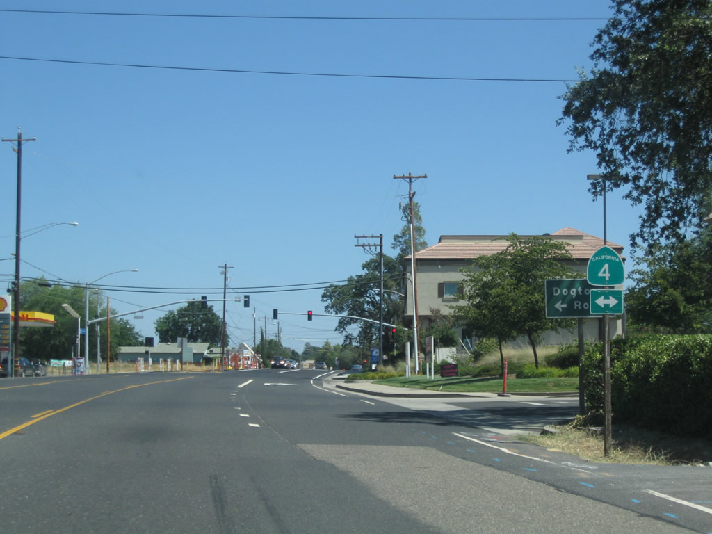
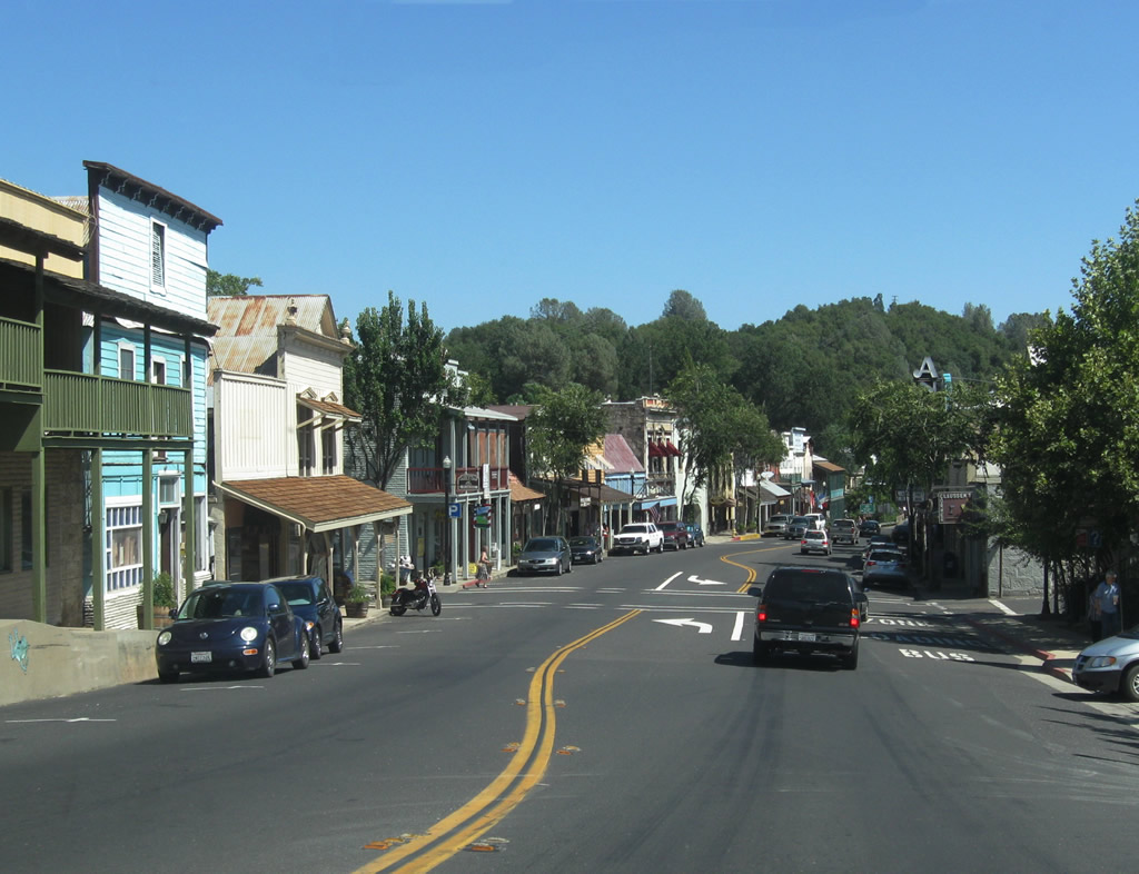
Southbound SR 49 (Main Street) approaches SR 4 in the city of Angels Camp. SR 4 travels west to Copperopolis, Farmington and Stockton in the Central Valley.
07/18/09
SR 4 shifted north from an overlap with SR 49 in Summer 2009, when the Angels Camp Bypass opened to traffic. The state route ventures east from Angels Camp to Arnold, Big Trees State Park, Alpine Lake and Ebbetts Pass.
07/18/09

A historical marker stands along SR 49 (Main Street) ahead of Stockton Road. Due to its historical role in the California Gold Rush of 1849, several buildings and structures in Angels Camp date to the 19th century.
07/18/09
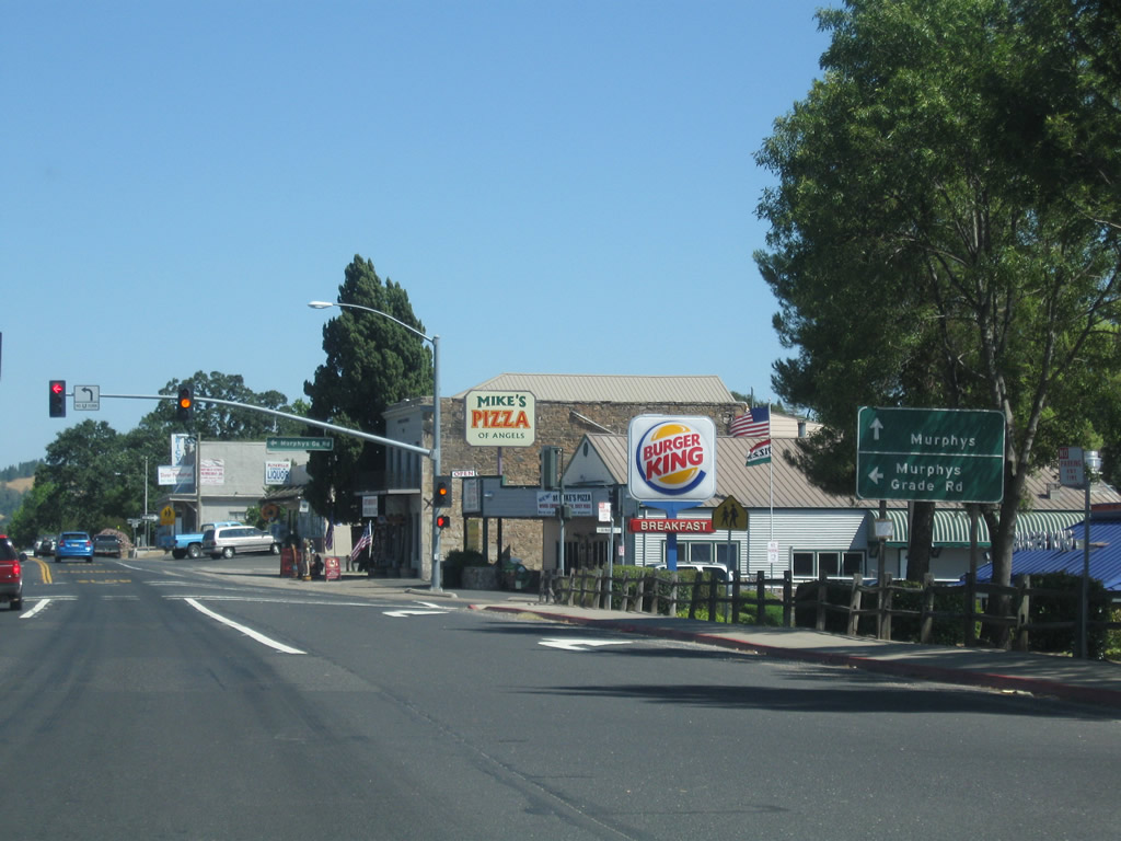
Murphys Grade Road intersects SR 49 (Main Street) at Demarest Street. While guide signs direct motorists to SR 4 east from Angels Camp to Murphys, Murphys Grade Road also leads to the community.
07/18/09
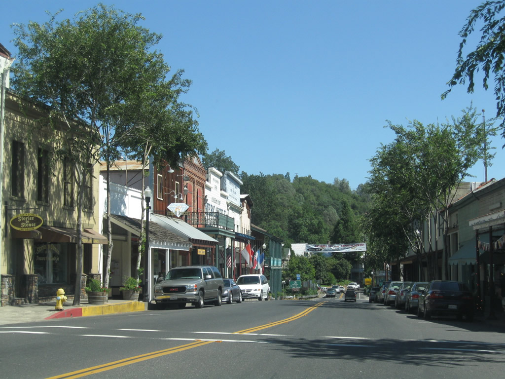
SR 49 (Main Street) advances south toward Downtown Angels Camp.
07/18/09
SR 49 runs alongside Utica Park between the intersections with Bret Harte Drive in Angels Camp.
07/18/09
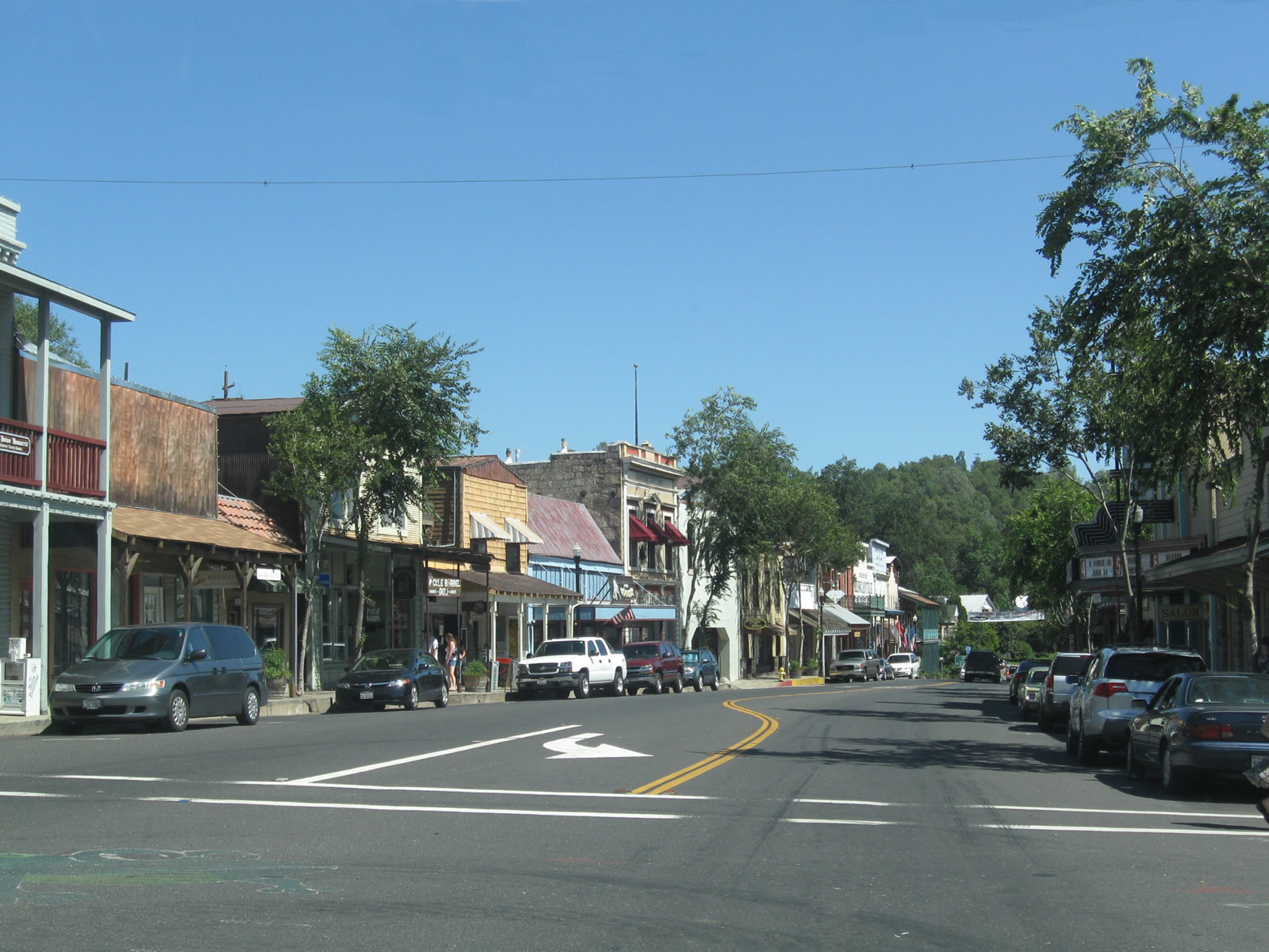
Southbound SR 49 (Main Street) at Downtown Angels Camp. Located at the corner of Raspberry Lane, is the Calaveras Visitor Center. Angels Camp is home of the Jumping Frog.
07/18/09
Approaching Birds Way along Main Street south in Downtown Angels Camp.
07/18/09
Prior to 2009, SR 4 and SR 49 overlapped 1.5 miles south through Angels Camp to Vallecito Road at Finnigan Lane. The intersection here includes an imprint of the jumping frog.
07/18/09
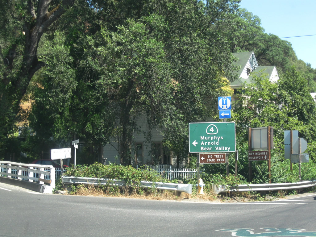
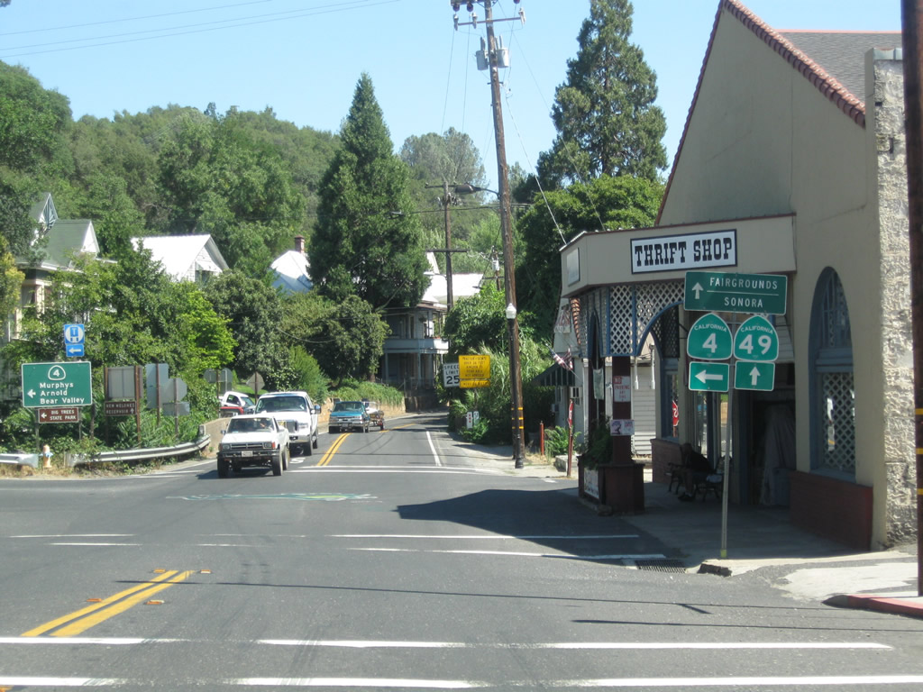
Signage for SR 4 remains along South Main Street for Vallecito Road (old SR 4) east to SR 4 for Arnold and Bear Valley.
07/18/09
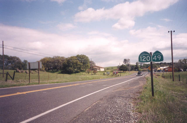
Confirming markers formerly posted at the merge of SR 49 south and SR 120 east in Chinese Camp. This assembly was removed by 2007.
2002
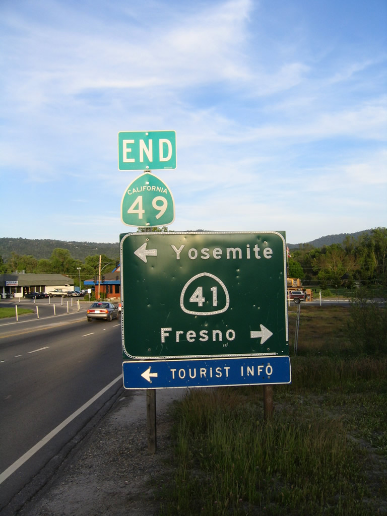
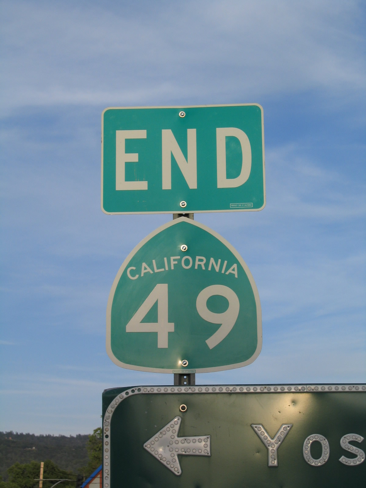
California State Route 49 concludes to the south at SR 41 in the unincorporated community of Oakhurst. SR 41 leads north from Fresno to Yosemite National Park.
05/13/05
References:
- "Dorsey Drive interchange opens." The Union (Nevada County, CA), November 11, 2014.
- "Dorsey Drive Interchange named 2014 Outstanding Construction Project of the Year." The Union (Nevada County, CA), February 28, 2015.
Photo Credits:
- Andy Field: 12/28/04, 05/13/05, 07/18/09
- Trevor Carrier: 2002
Connect with:
Page Updated Tuesday March 19, 2019.