
State Route 99 North - Delhi to Modesto
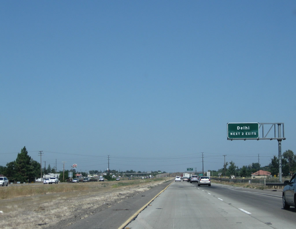
The next two exits along California 99 north serve the unincorporated community of Delhi in Merced County: Exit 205, South Avenue and Exit 207, Shanks Road.
07/31/11
The unincorporated community of Delhi had a population of 10,755 as of the 2010 Census.
07/31/11
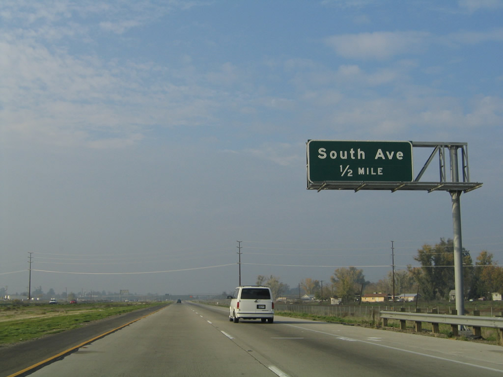
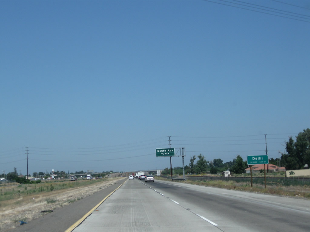
The next exit along California 99 north is Exit 205, South Avenue (one-half mile). Most of the community of Delhi lies west of the freeway.
11/25/04
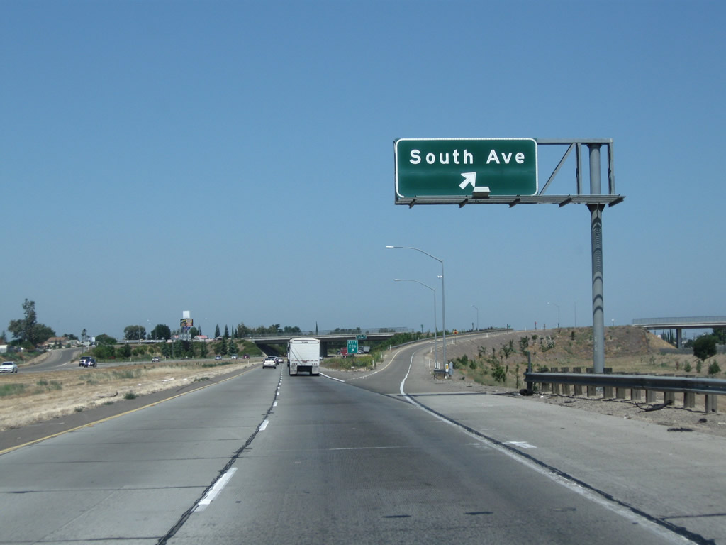
Northbound California 99 meets Exit 205, South Avenue. There are no signs indicating that this is a business route, but a connection to old U.S. 99 into the community of Delhi may be reached via South Avenue.
07/31/11

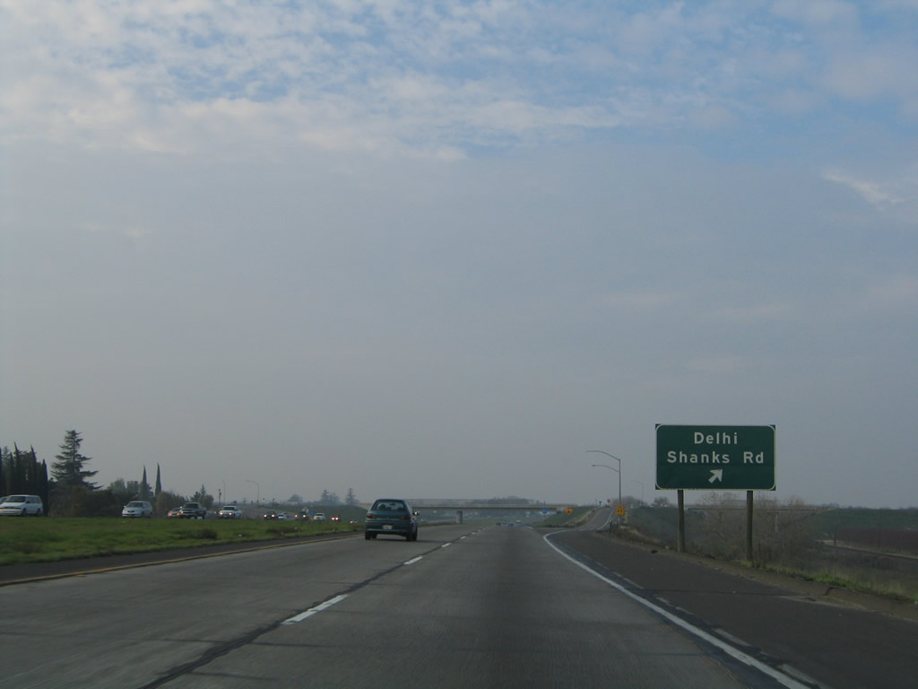
The next exit along California 99 north is Exit 207, Shanks Road (three-quarters mile). This sign is mounted on the South Avenue overpass.
11/25/04
Northbound California 99 meets Exit 207, Shanks Road. Use Shanks Road southwest into Delhi. We are now about midway between Livingston and the next city of consequence, Turlock.
11/25/04
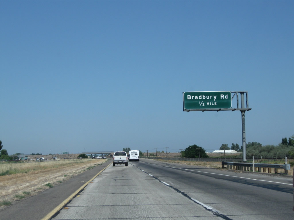
The next exit along northbound is Exit 208, Bradbury Road. As recently as the mid-1990s, this interchange was an at-grade intersection.
07/31/11

Northbound California 99 meets Exit 208, Bradbury Road. Bradbury Road leads east-west, with westbound entering Stanislaus County near its junction with California 165. Heading east, it connects to Merced County Route J-7 (Santa Fe Drive).
07/31/11
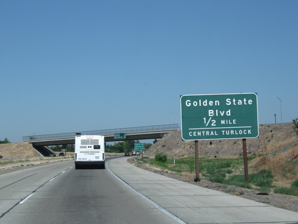
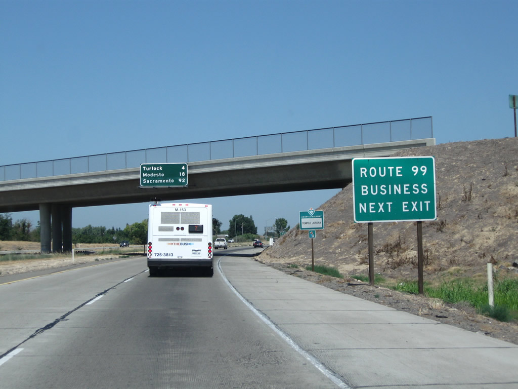
The next exit along California 99 (Golden State Highway) north is Exit 209, California 99 Business (Golden State Boulevard) north into the city of Turlock (0.50 mile). Along a route laden with business routes, many are poorly or unsigned from California 99. The Turlock business loop, which serves the city of Turlock (located in Stanislaus County) begins at Exit 209 and is well-signed (by California standards) from northbound California 99. The loop follows aptly named Golden State Boulevard.
07/31/11
California 99 Business follows Golden State Boulevard for approximately eight miles, from Exit 209 north to Exit 217, Taylor Road.
07/31/11
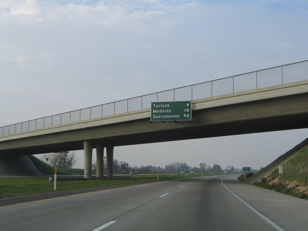
Passing under Bradbury Road, this mileage sign provides the distance to Turlock (four miles), Modesto (18 miles), and Sacramento (92 miles).
11/25/04
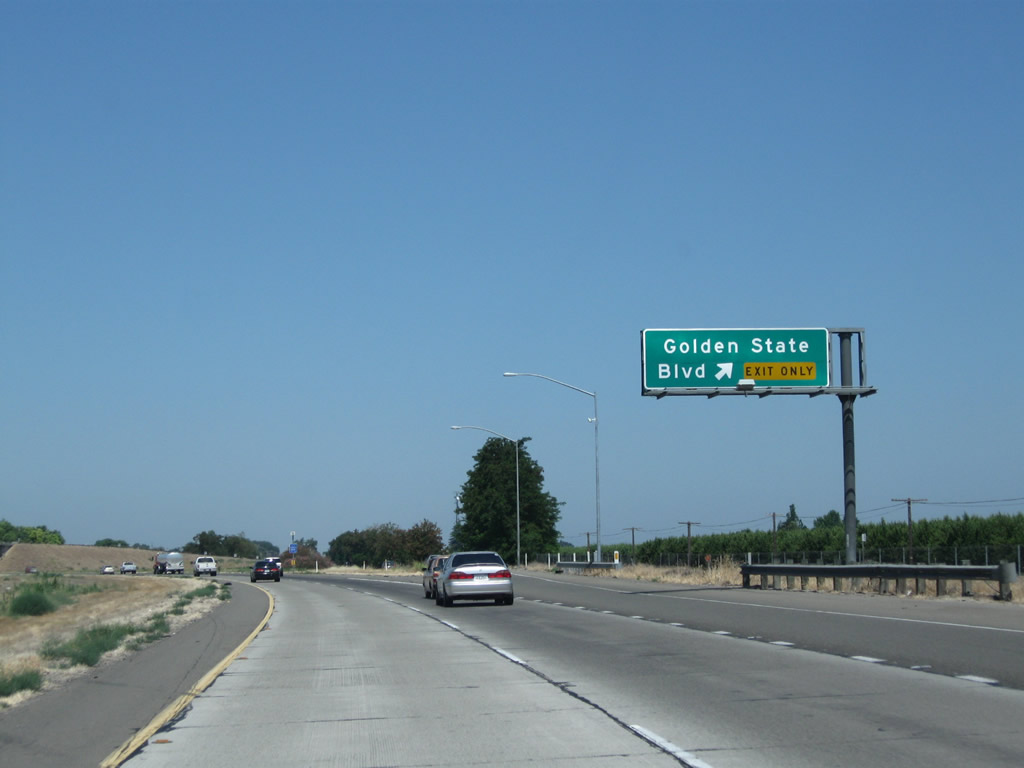
Northbound California 99 reaches Exit 209, California 99 Business (Golden State Boulevard) north to Turlock. The southern end of this business loop is reminiscent of the south end of the Bakersfield business route at the far southern end of Union Avenue.
07/31/11
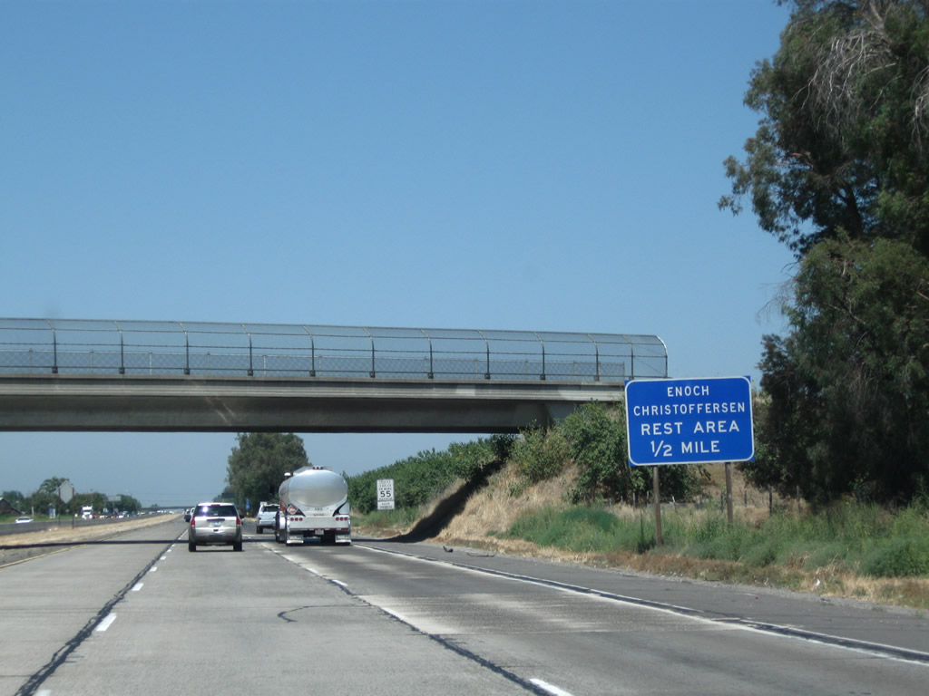
The next exit along California 99 (Golden State Highway) north is Exit 210, Enoch Christoffersen Safety Rest Area (one-half mile). Facilities include restrooms, pet walking area, parking, and related facilities. Shortly after this sign and before the rest area, California 99 will leave Merced County and enter Stanislaus County.
07/31/11
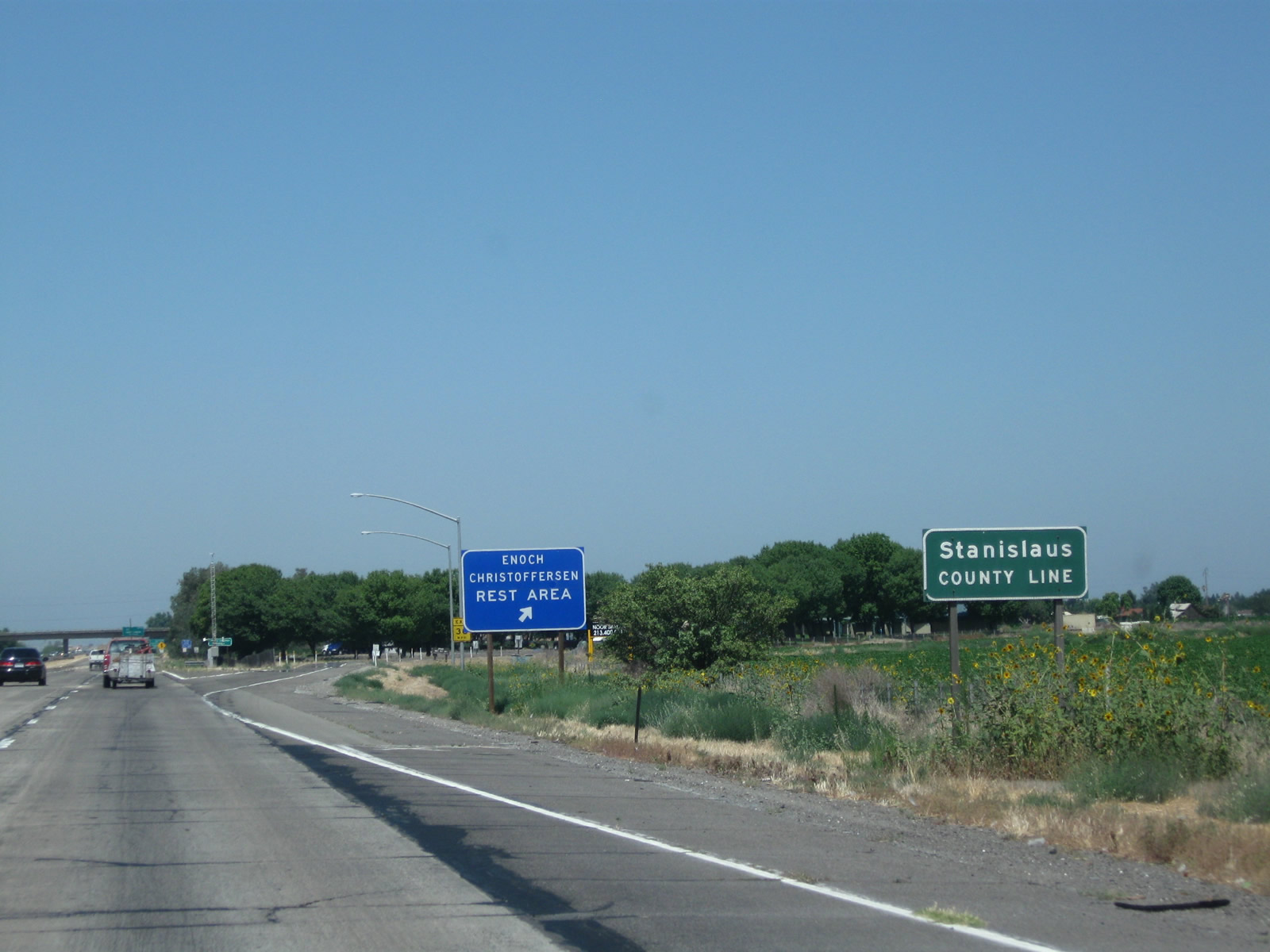
Northbound California 99 (Golden State Highway) enters Stanislaus County and reaches Exit 210, Enoch Christoffersen Safety Rest Area, which include restrooms, pet walking area, parking, and related facilities.
07/31/11
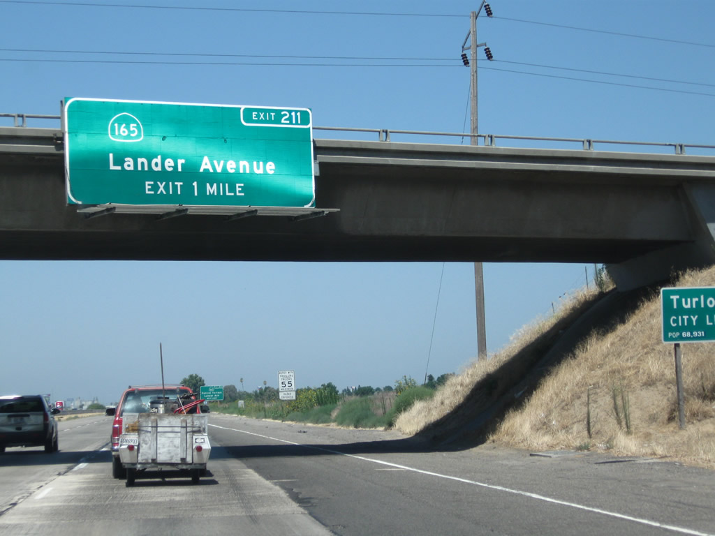
The next exit along California 99 north is Exit 211, California 165 (Lander Avenue) south and Stanislaus County Route J-14 (Lander Avenue) north into Turlock. CR J-14 travels north to meet California 99 Business in downtown Turlock, while California 165 heads south toward Los Banos and a junction with Interstate 5 at the Los Banos exit some nine miles south of the city. While California 99 passes through town after town, Interstate 5 avoids nearly all of them between Wheeler Ridge and Tracy.
07/31/11

California 165 travels south from this interchange through Hilmar and Los Banos to meet Interstate 5 at Exit 391.
07/31/11

CR J-14 is a fairly long, north-south county route that spans both Stanislaus and San Joaquin Counties. It follows Lander Avenue into downtown Turlock, then proceeds north via Geer Road to California 132, Albers Road to Oakdale, Yosemite Avenue through Oakdale (with a brief overlap via California 120), Twenty-six Mile Road (past Woodward Reservoir), Sonora Road (to Eugene), Milton Road (past California 4 to Milton and Jenny Lind), and Jenny Lind Road (ending at California 26 near Rancho Calaveras).
07/31/11
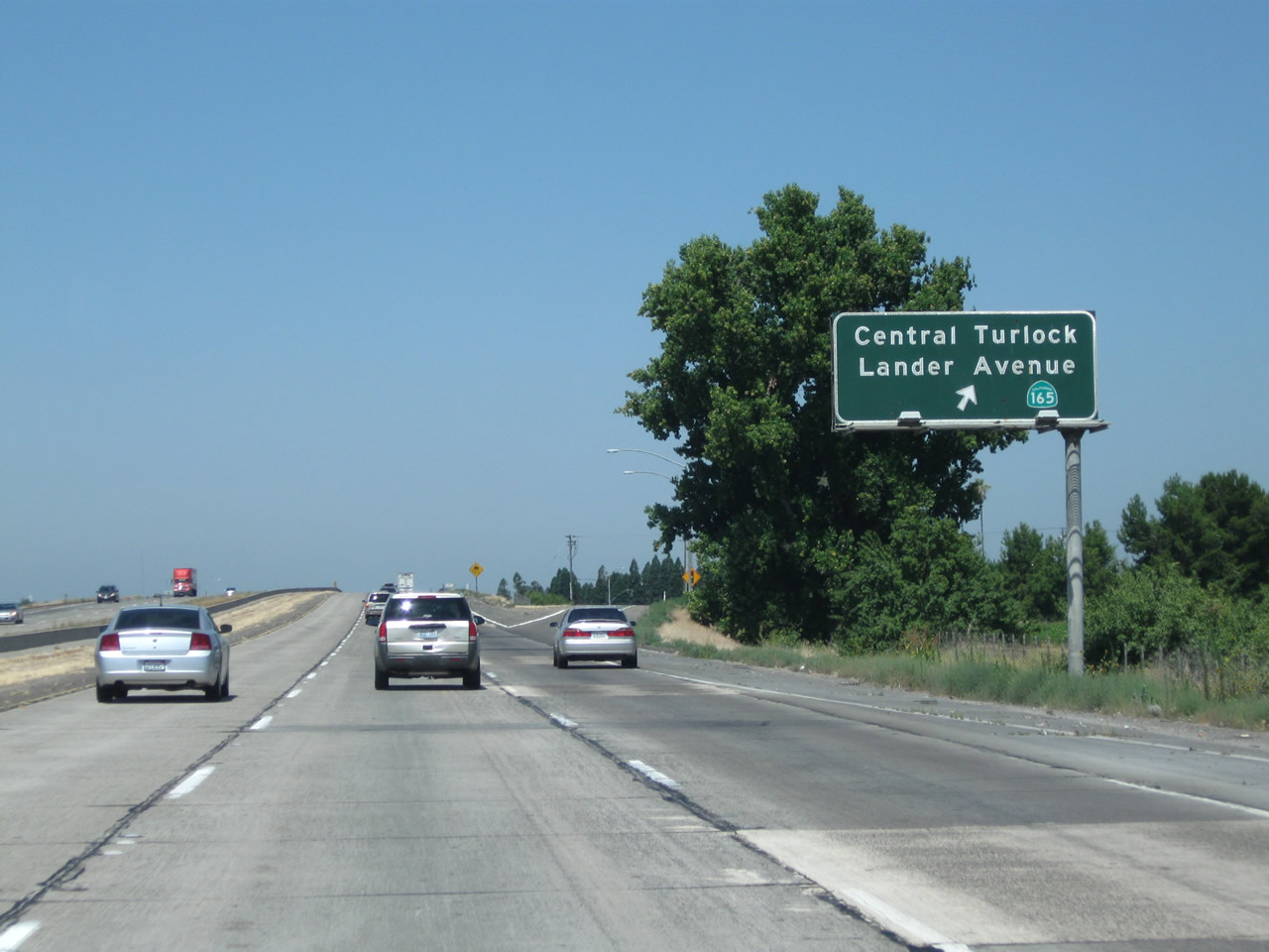
Northbound California 99 meets Exit 211, California 165 south and Lander Avenue. Turlock, the second largest city in Stanislaus County, had a population of 68,549 as of the 2010 Census and incorporated on February 15, 1908.
07/31/11
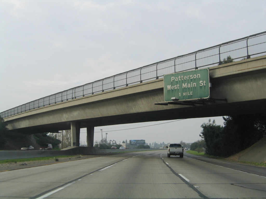
One mile south of Exit 213 with Stanislaus County Route J-17 (West Main Street) on SR 99 north. CR J-17 is an east-west county road that begins at Interstate 5 near Patterson and extends east via Sperry Avenue, SR 33, Las Palmas Avenue, West Main Street, West Avenue, Olive Street, Golden State Boulevard, East Avenue, Oakdale Road and Turlock Road to end at SR 59. Cities along CR J-17 include Patterson and Turlock.
11/25/04
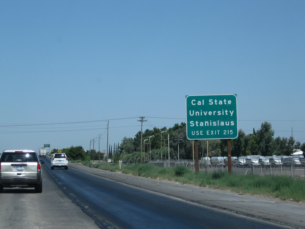
To California State University at Stanislaus, use Exit 215, Monte Vista Avenue. Photo taken 07/31/11
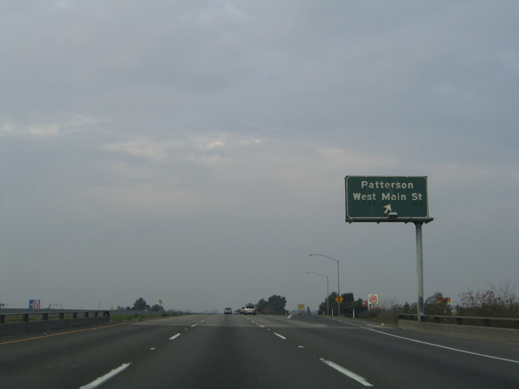
Northbound California 99 meets Exit 213, Stanislaus County Route J-17 (West Main Street). Stanislaus County Route J-17 leads west to meet California 33 in Patterson and Interstate 5 west of Patterson.
11/25/04
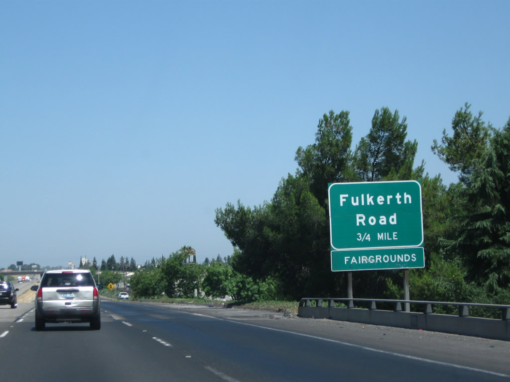
The next exit along California 99 north is Exit 214, Fulkreth Road (0.75 mile). This reflective sign was placed as early as 2003, if not earlier.
07/31/11
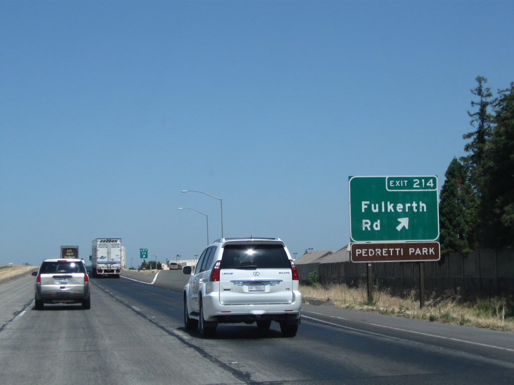
Northbound California 99 meets Exit 214, Fulkreth Road. Use Fulkreth Road east into Turlock; at California 99 Business (Golden State Boulevard), it changes into Hawkeye Avenue.
07/31/11
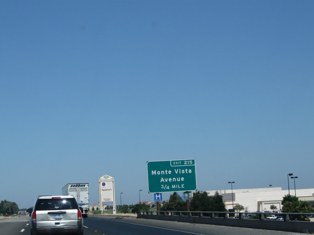
The next exit along California 99 is Exit 215, Monte Vista Avenue (0.75 mile). This east-west street travels east into Turlock en route to California State University at Stanislaus and west to Washington Road.
07/31/11
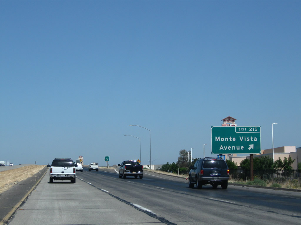
Northbound California 99 meets Exit 215, Monte Vista Avenue. Use Monte Vista Avenue east to California State University at Stanislaus.
07/31/11

The next exit along California 99 is Exit 217, Taylor Road (0.75 mile). Note the increased development that occurred here between 2004 and 2011.
07/31/11
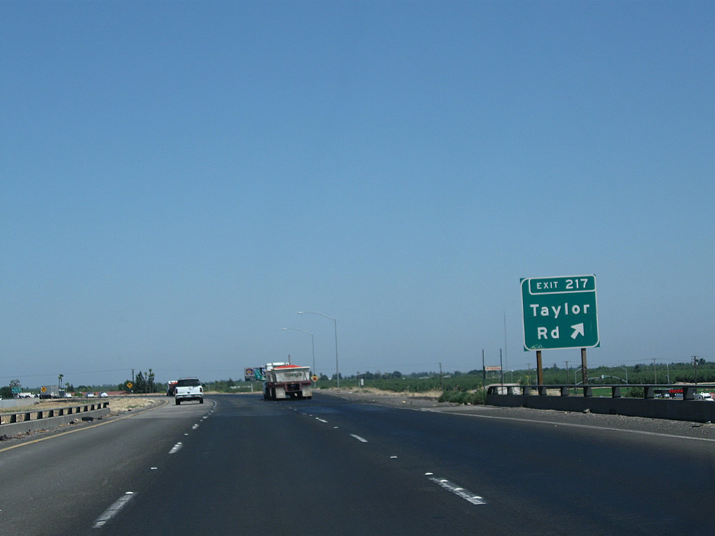
Northbound California 99 meets Exit 217, Taylor Road.
07/31/11

The next exit along California 99 is Exit 218, Keyes Road (0.75 mile).
07/31/11
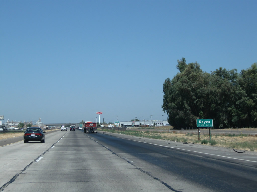
Use Exit 218 to the unincorporated community of Keyes, which had a population of 5,601 as of the 2010 Census.
07/31/11
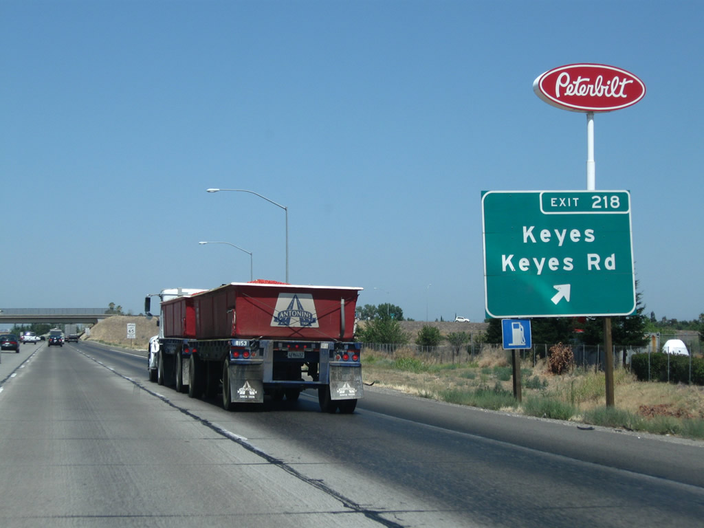
Northbound California 99 meets Exit 218, Keyes Road.
07/31/11

This mileage sign along California 99 north provides the distance to Ceres (three miles), Modesto (seven miles), and Sacramento (86 miles).
11/25/04
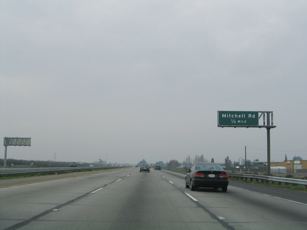
The next exit along California 99 north is Exit 220, Mitchell Road (0.50 mile).
11/25/04
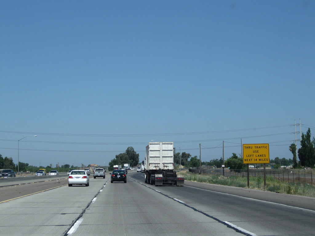
Through traffic is advised to use the left lanes of California 99 north for the next 14 miles as we approach the cities of Ceres and Modesto.
07/31/11

Northbound California 99 meets Exit 220, Mitchell Road. Mitchell Road bisects California 99 between Keyes and Ceres, and it runs north-south through Stanislaus County. North of the Tuolumne River, Mitchell Road connects with Oakdale Road east of Modesto.
11/25/04
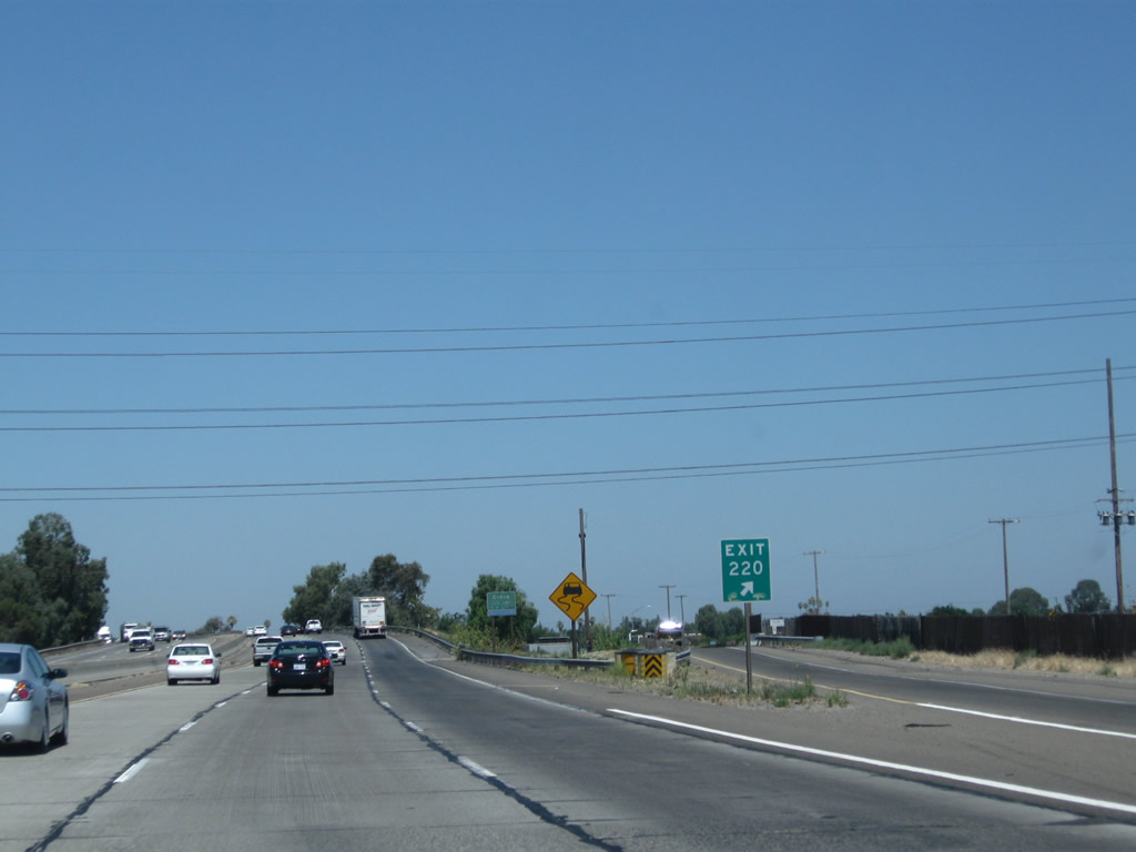
An exit number is posted at the gore point.
07/31/11

Shortly after the Mitchell Road off-ramp, California 99 enters the city of Ceres "Together We Achieve", which had a population of 45,417 as of the 2010 Census and was incorporated on February 25, 1918.
07/31/11
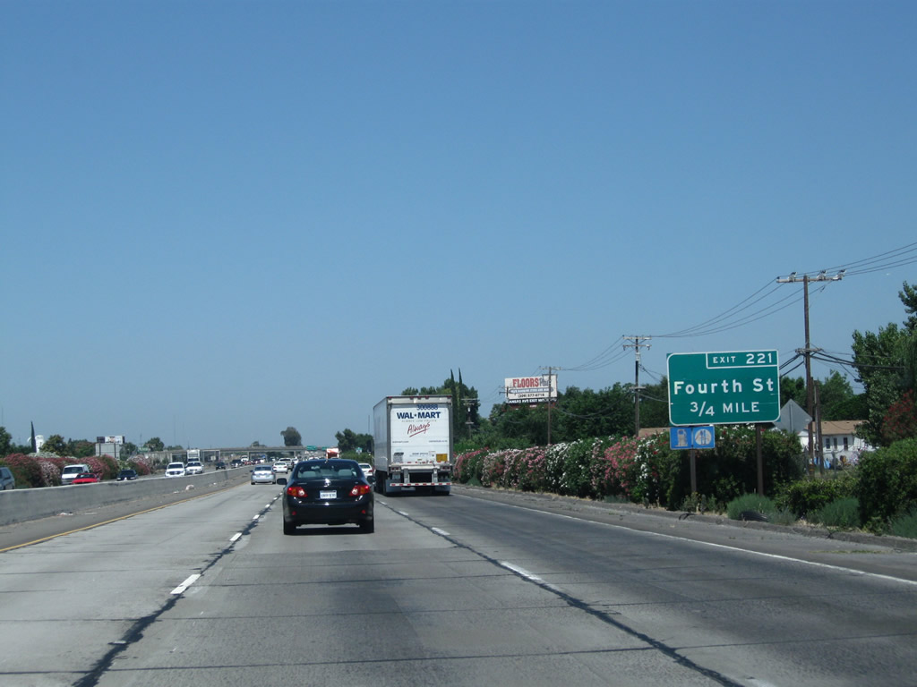
The next exit along northbound is Exit 221, Fourth Street north into downtown Ceres. Fourth Street runs north-south parallel to Mitchell Road, but it does not extend across the Tuolumne River to the north.
07/31/11
Northbound California 99 reaches Exit 221, Fourth Street. The next exit along northbound is Exit 222, Whitmore Avenue.
07/31/11
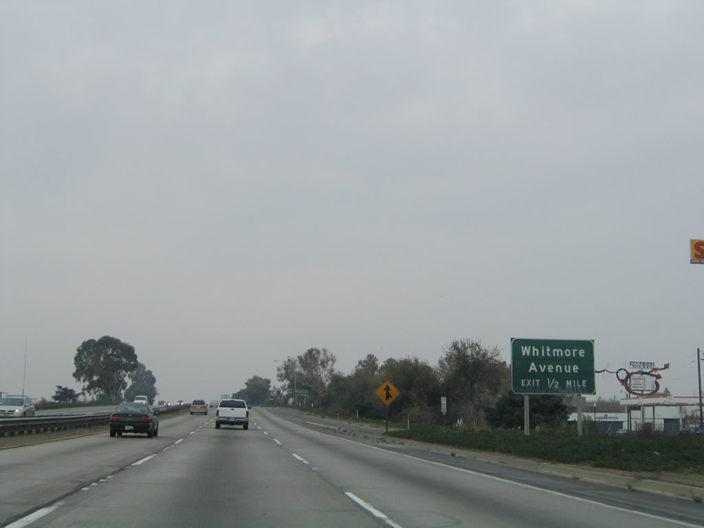
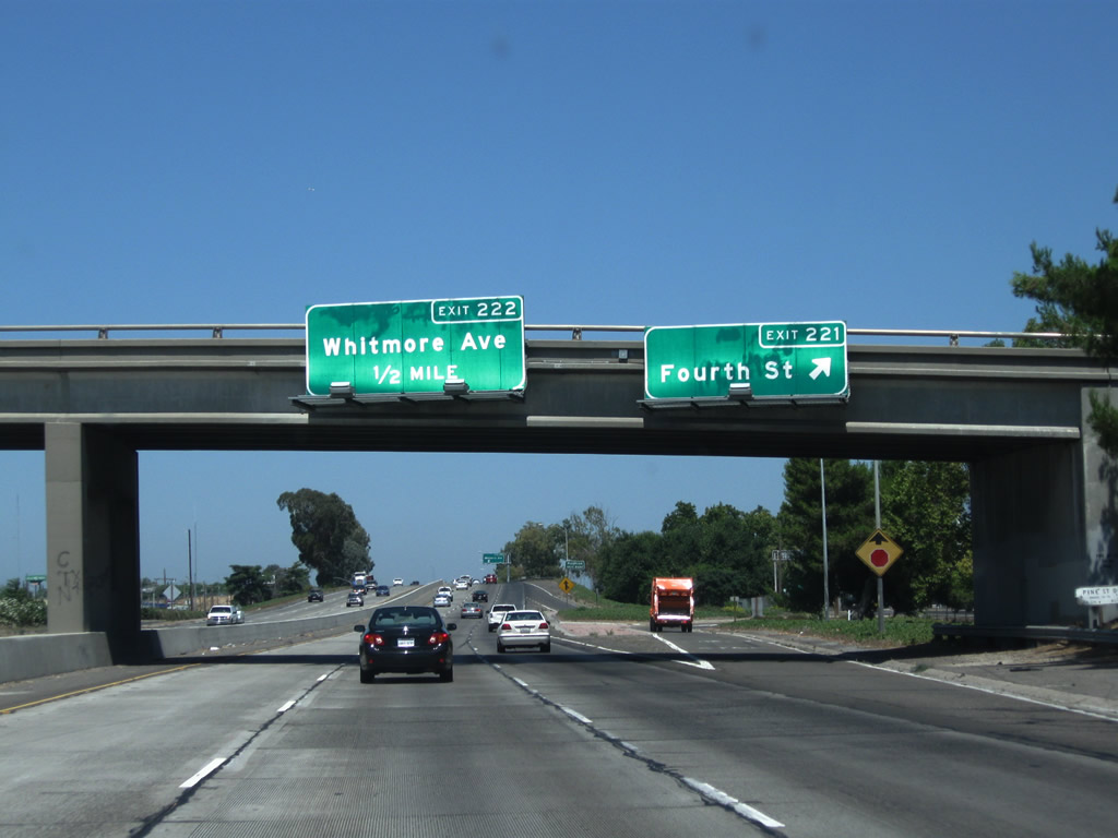
The next exit along California 99 north is Exit 222, Whitmore Avenue. A major east-west arterial, Whitmore Avenue connects with Carpenter Road in the west and Stanislaus County Route J-9 (Hickman Road) in the east. Paralleling the Tuolumne River, it serves the community of Hughson. Exit 222 connects northbound with Whitmore Avenue.
11/25/04
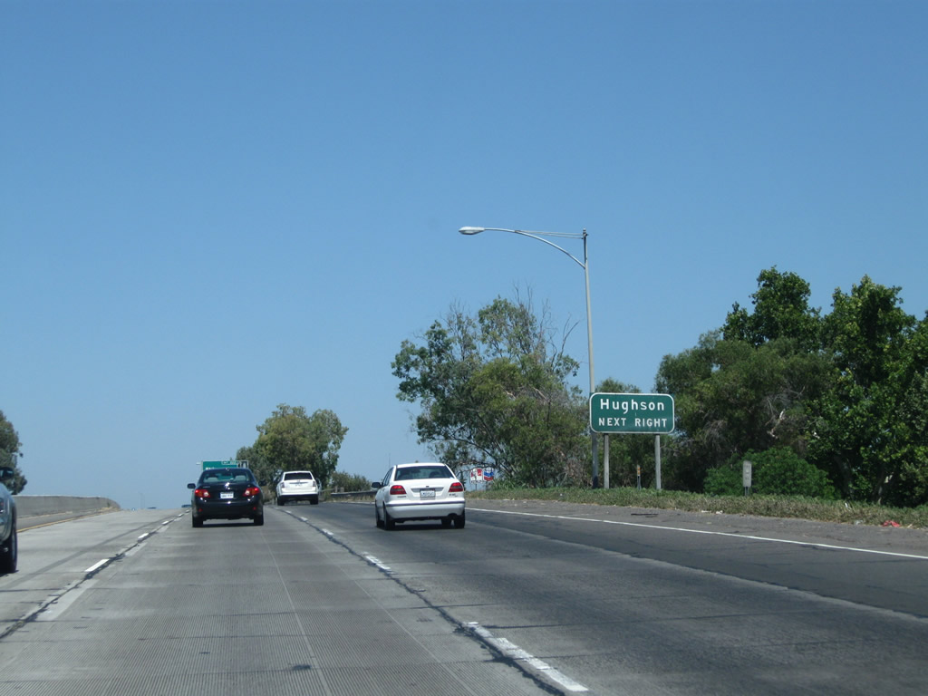
Use Whitmore Avenue east to Hughson.
07/31/11
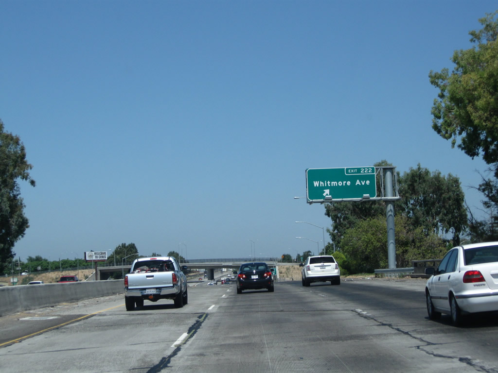
Northbound California 99 reaches Exit 222, Whitmore Avenue. This sign was replaced between 2004 and 2011.
07/31/11
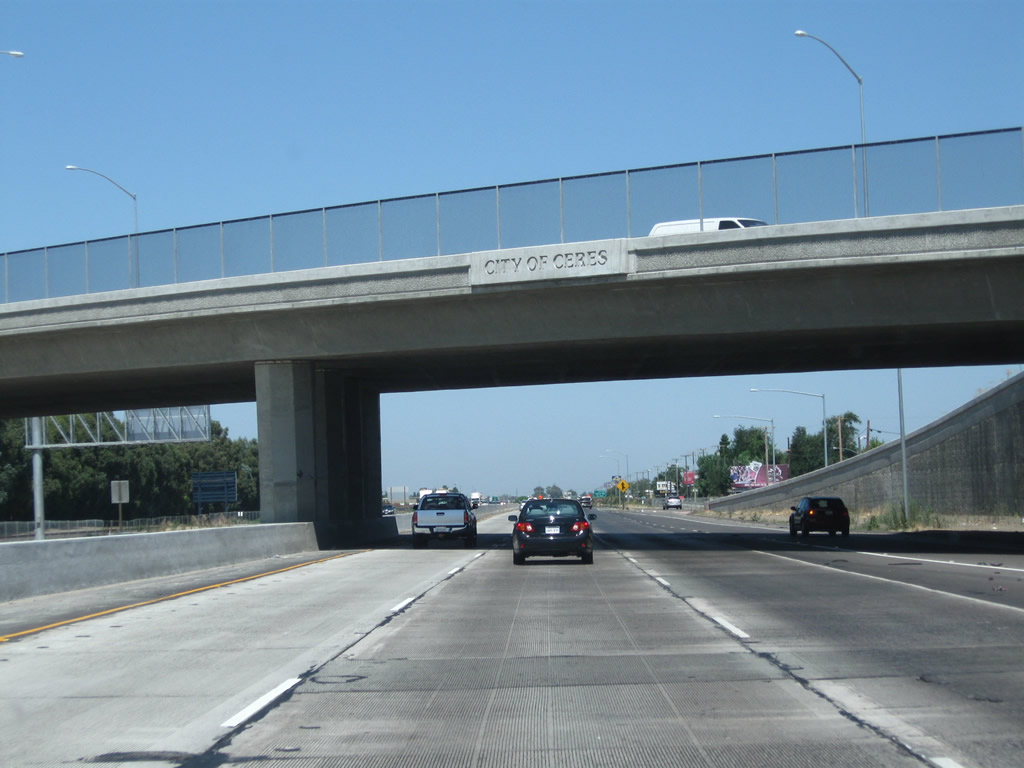
"City of Ceres" is engraved into the overpass that carries Whitmore Avenue over California 99.
07/31/11
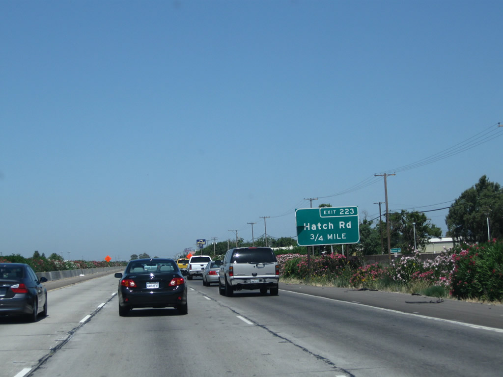
The next two exits along California 99 north are Exit 223A, Hatch Road east and Exit 223B, Hatch Road west. Parallel to Whitmore Avenue, it is the last major east-west arterial before the freeway crosses the Tuolumne River. Only a few north-south roads span the river in the vicinity of Modesto, including California 99, California 99 Business (Ninth Street), Mitchell Road and Stanislaus County Route J-7 (Santa Fe Avenue).
07/31/11
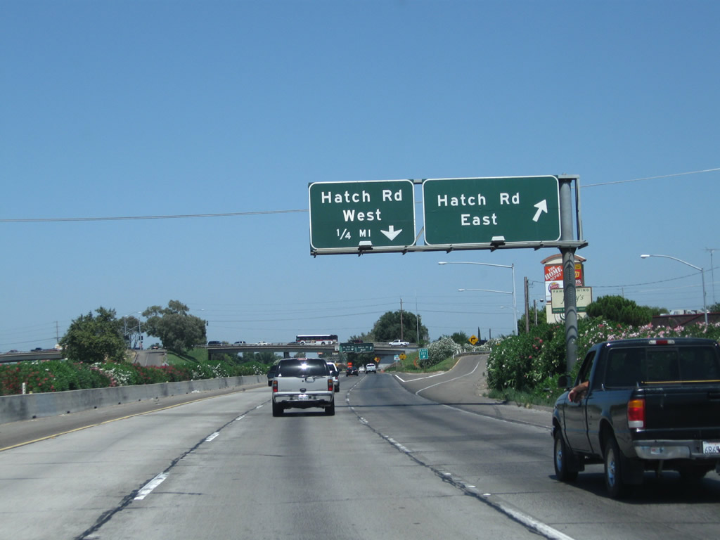
Northbound California 99 reaches Exit 223A, Hatch Road east. The second exit is Exit 223B, Hatch Road west.
07/31/11
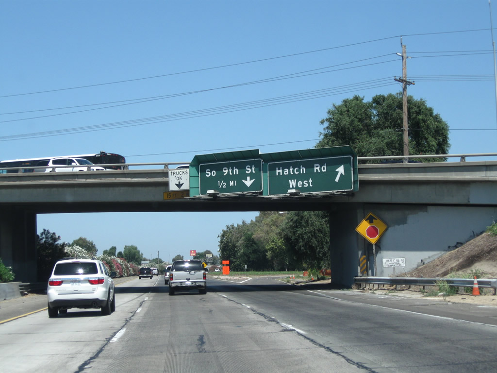
Immediately thereafter, northbound California 99 reaches Exit 223B, Hatch Road west. Hatch Road only extends a few miles west of here, before culminating at Crows Landing Road. The next exit is Exit 223C, California 99 Business (Ninth Street) north.
08/15/03
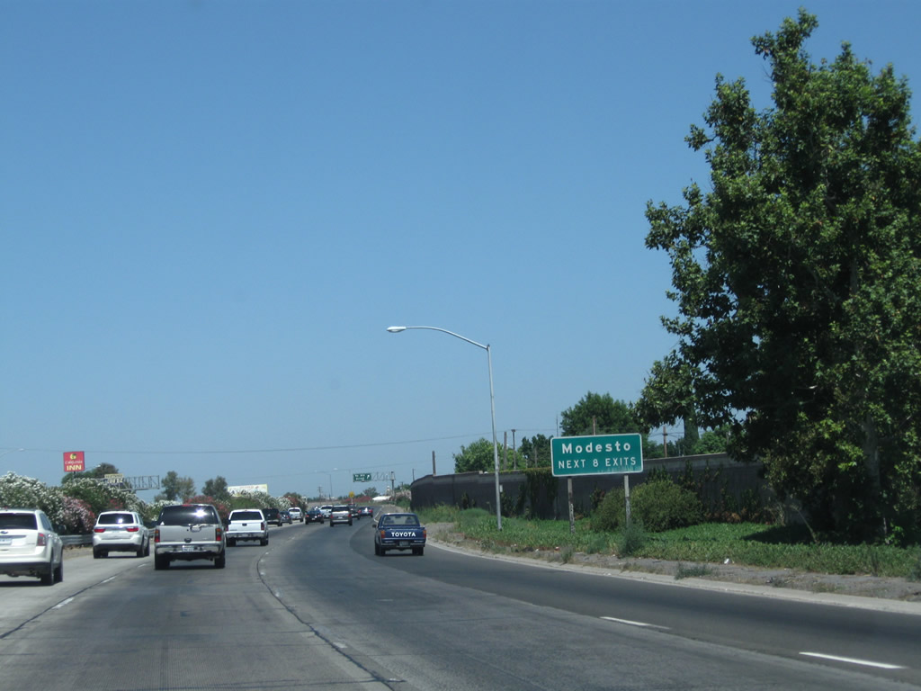
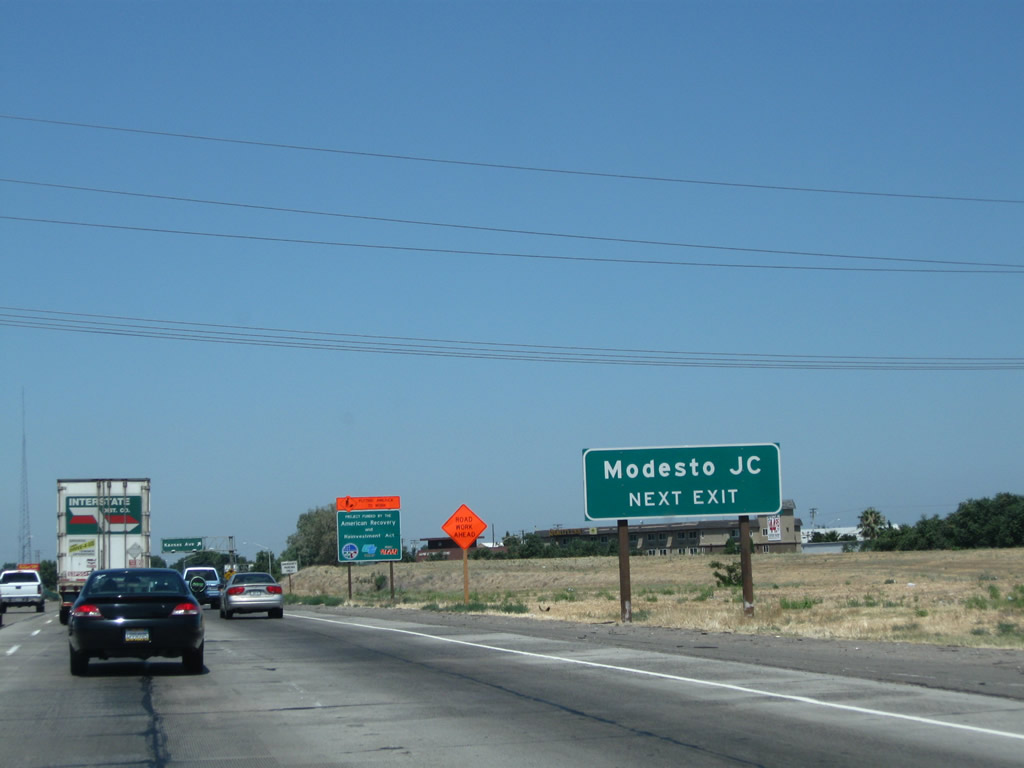
The succeeding eight exits of California 99 north all serve the city of Modesto.
07/31/11
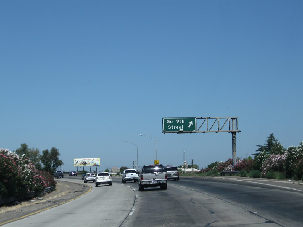
Northbound California 99 reaches Exit 223C, California 99 Business (Ninth Street) north. Like the business route in Turlock, California 99 Business follows Historic U.S. 99 through the city center of Modesto via South Ninth Street. The business route is unsigned from the mainline freeway along northbound, and may be signed sporadically along the city streets it follows through town. Modesto used to be a quiet farming town at the foot of the Sierra Nevada Mountains within the giant, agricultural Central Valley. But as population has exploded in the Valley, Modesto has grown into a regional commercial, agricultural, and industrial center. In addition, some people live here and commute to the San Francisco Bay Area via California 120 and Interstate 205 or via California 132 and Interstate 580. This makes from some early morning and late evening congestion along these routes.
07/31/11

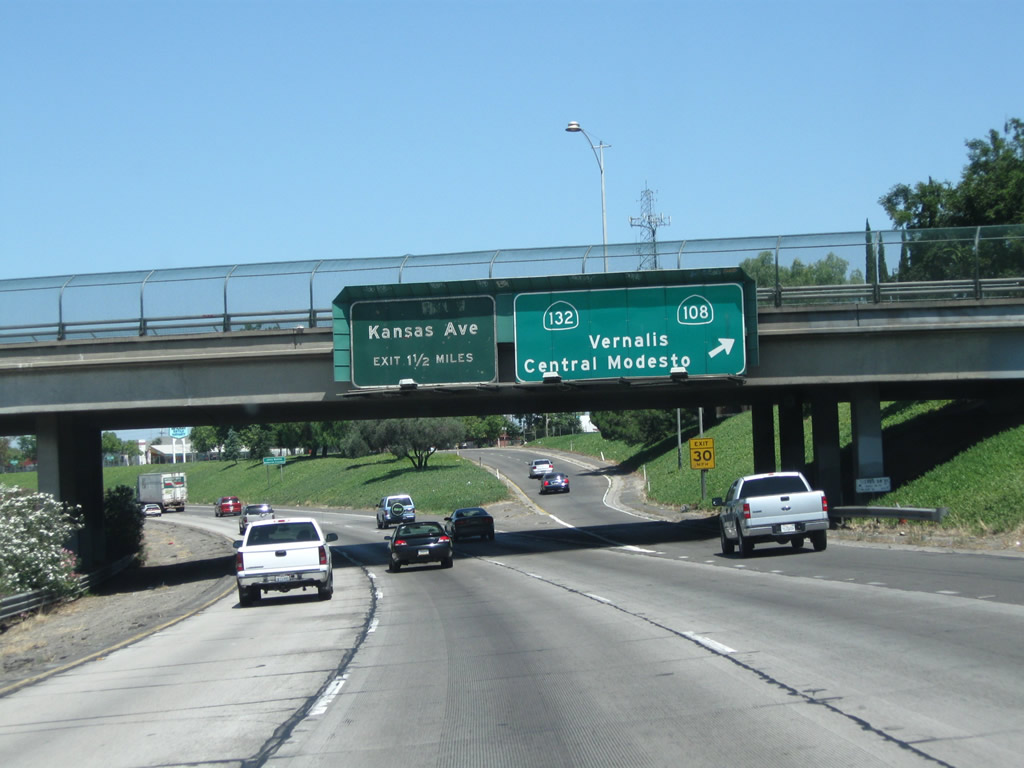
The next exit along California 99 north is Exit 225A, Crows Landing Road (0.50 mile). Crows Landing Road roughly parallels the proposed southwesterly extension of California 108. It travels south and then west across the San Joaquin River, meeting Interstate 5 near Crows Landing. There are no current plans to extend California 108 southwest via Crows Landing Road, but the extension remains in the legislative definition for California 108.
07/31/11

There are two signs consecutive that indicate the exit ramp for Crows Landing Road as in this and the previous photo. Crows Landing Road also leads northeast into Modesto, connecting with the business route (South Ninth Street).
07/31/11

Northbound California 99 reaches Exit 225A, Crows Landing Road. The next exit along California 99 north is Exit 225B, Tuolumne Boulevard and B Street.
07/31/11
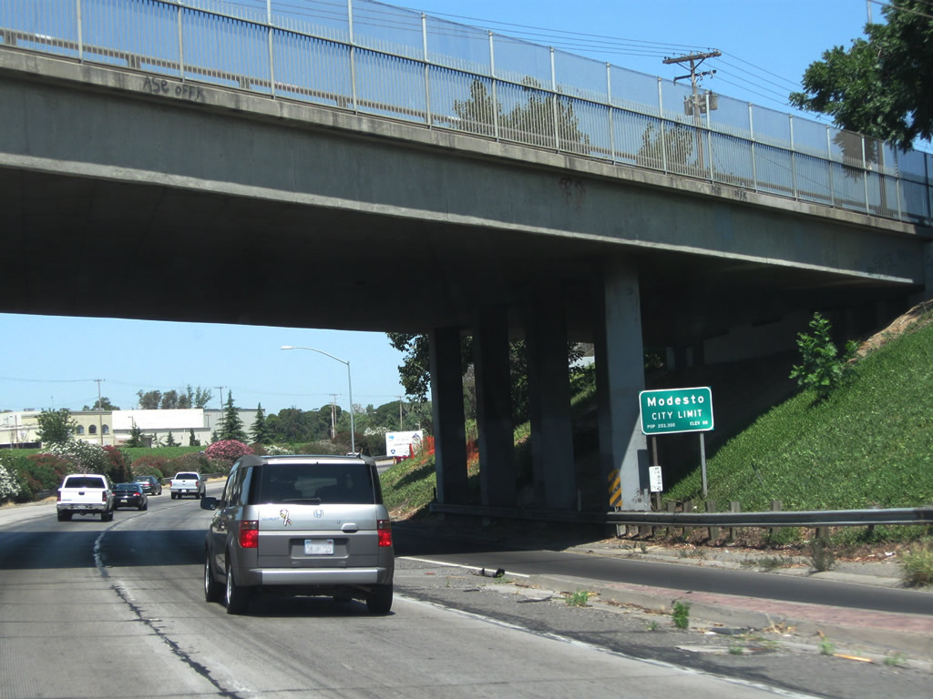
California 99 enters the city of Modesto, the seat of Stanislaus County. Modesto ("Water Wealth Contentment Health") had a population of 201,165 as of the 2010 Census and was incorporated on August 6, 1884.
07/31/11
The next two exits along California 99 north are Exit 225B, Tuolumne Boulevard and B Street and Exit 226, California 108 east and California 132. Since the latter (Exit 226) is a more significant exit, more signage is provided in advance of it than Exit 225B. This sign was placed around 1999 or 2000, one of the first reflective signs to placed around Modesto. Had this sign been installed in the mid-2000s, then it would have contained an exit number.
07/31/11

Tuolumne Boulevard travels west from this intersection, while B Street travels northeast from here.
07/31/11
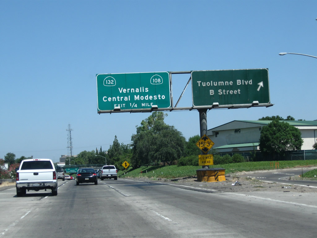
Northbound California 99 reaches Exit 225B, Tuolumne Boulevard and B Street.
07/31/11
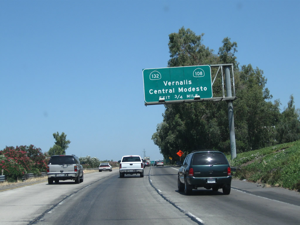
The next exit along California 99 north is Exit 226, Sixth Street to California 108 and California 132. Upon departing at this off-ramp, California 99 threads between two frontage roads. Sixth Street travels northbound only on the east side of the freeway, while Fifth Street travels southbound on the west side of the freeway. So this off-ramp connects directly onto northbound Sixth Street, which in turn travels several blocks until meeting California 108 and California 132 at L Street. California 108 will depart Modesto in a northeasterly direction, connecting with California 120 in Oakdale and meeting California 49 (Gold Country Highway) in Sonora. During the summer months, when the Sonora Pass is open, California 108 passes over the Sierra Nevada at an elevation of 9,643 feet before meeting U.S. 395 northwest of Bridgeport and south of Walker, Coleville, and Topaz. California 132, meanwhile, remains within the Central Valley, extending west to meet Interstate 5 and Interstate 580 and east to reach California 49 in Coulterville, with an extension via Merced County J-20 (J-132) to join California 120 en route to Yosemite National Park.
07/31/11
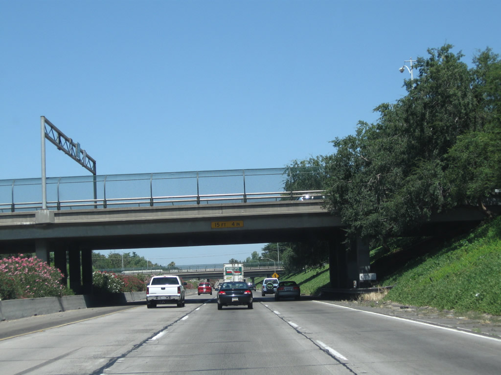
California 99 will run below grade as it passes through downtown Modesto. The freeway passes under a series of streets (G Street, H Street, I Street, K Street, and L Street). The western terminus of California 108 sits at the L Street overpass; the proposed extension southwest via Crows Landing Road to Interstate 5 has not yet been constructed.
07/31/11
Leaving downtown, the next exit along California 99 north is Exit 227, Kansas Avenue. Use Kansas Avenue east to Modesto Junior College.
07/31/11

Northbound California 99 reaches Exit 227, Kansas Avenue. This interchange serves the northern part of downtown Modesto parallel to California 132. The proposed California 132 expressway would meet California 99 just south of the current Kansas Avenue interchange. The expressway would link directly with Needham Street to the east of here, and a new alignment would carry California 132 west out of the urban area and merge into the current route of California 132 (Modesto Bee, 2011) (Caltrans, n.d.).
07/31/11

The next exit along northbound California 99 is Exit 229, Carpenter Road and Briggsmore Avenue to California 99 Business (Ninth Street) south. We have left the core of Modesto and are now in the suburban periphery.
11/25/04

California 99 north approaches Exit 229, Carpenter Road and Briggsmore Avenue to California 99 Business (Ninth Street) south.
11/25/04
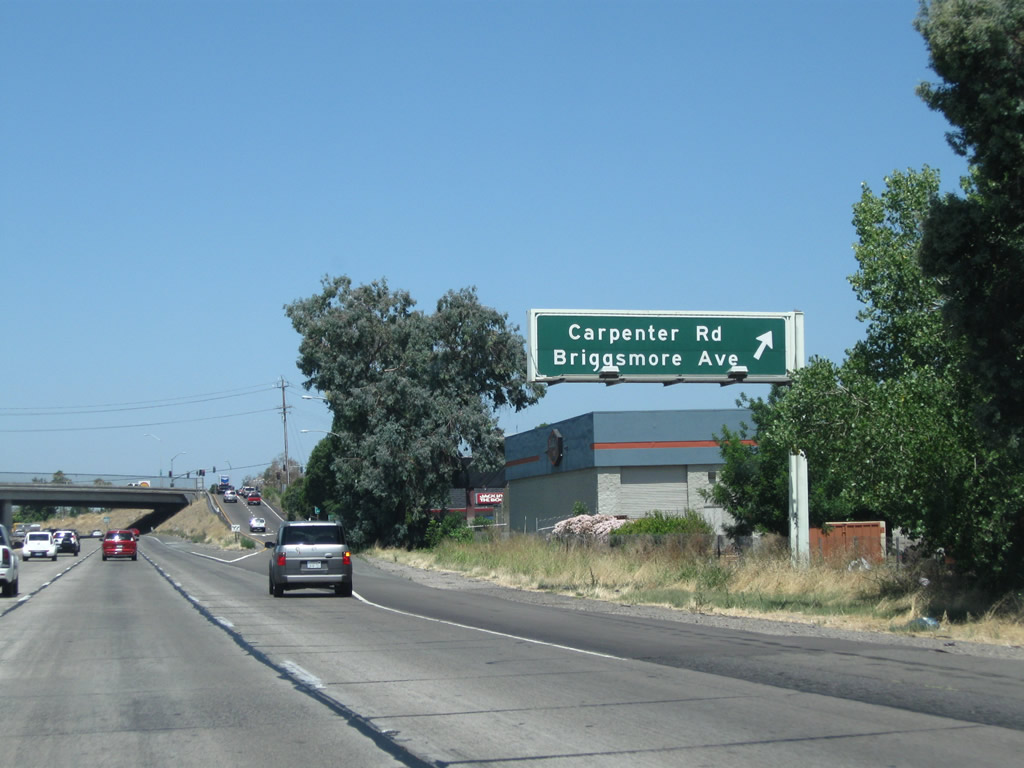
Northbound California 99 meets Exit 229, Carpenter Road and Briggsmore Avenue to California 99 Business (Ninth Street) south in northwestern Modesto.
07/31/11
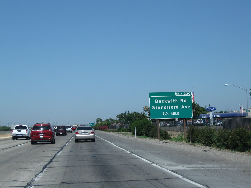
The next exit along California 99 north is Exit 230, Beckwith Road and Standiford Avenue (0.75 mile).
07/31/11
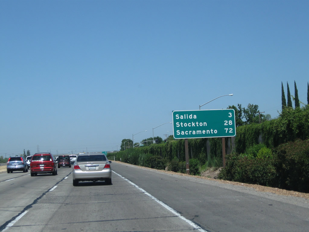
This mileage sign along California 99 north provides the distance to Salida (three miles), Stockton (28 miles), and Sacramento (72 miles).
07/31/11
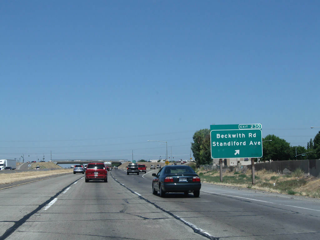
Northbound California 99 meets Exit 230, Beckwith Road / Standiford Avenue. This exit features a large shopping mall and plenty of services.
07/31/11
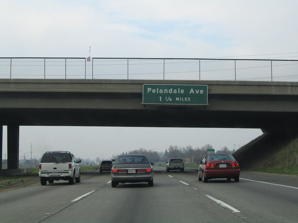
The next exit along California 99 north is Exit 232, Pelandale Avenue (1.25 miles).
11/25/04

Pelandale Avenue is the first of two interchanges to serve the unincorporated community of Salida. Use Pelandale Avenue west to Salida Boulevard, an expressway which parallels California 99 on the west side of the freeway and is an old alignment of U.S. 99.
11/25/04

Northbound California 99 reaches Exit 232, Pelandale Avenue in Salida.
07/31/11
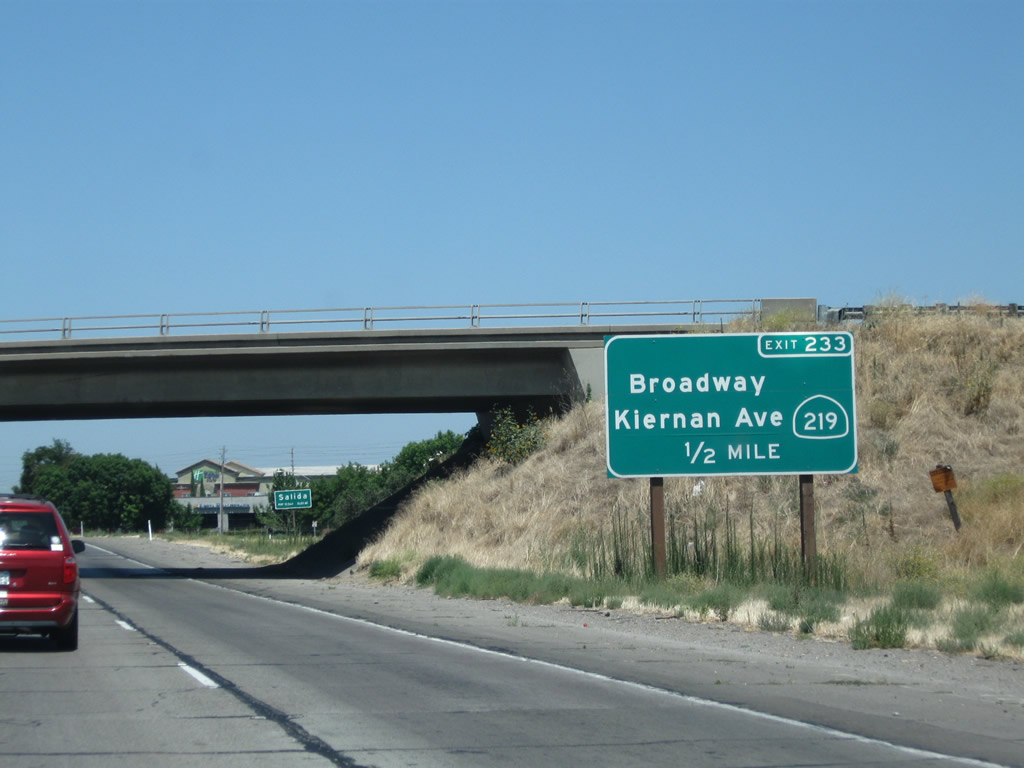
The next exit along California 99 north is Exit 233, California 219 (Kiernan Road) east to California 108 en route to Oakdale and Sonora. This interchange also services Broadway, which travels west into the community of Salida.
07/31/11
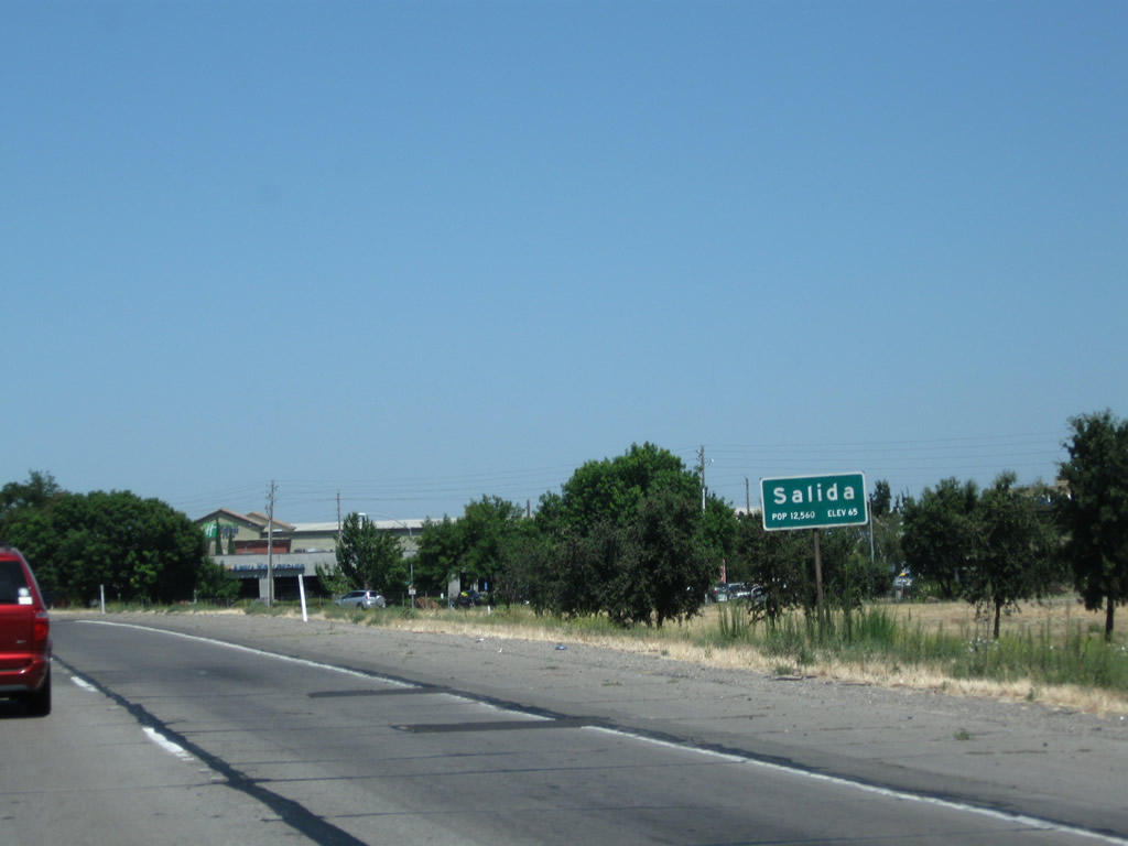
California 99 enters the community of Salida.
07/31/11
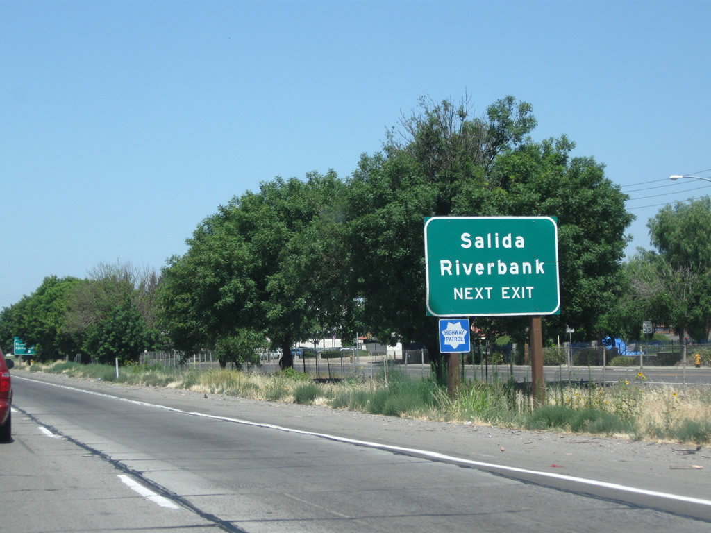
Use Broadway west into Salida or California 219 (Kiernan Road) east to Riverbank. California 219 is a fairly short state route that connects California 99 with California 108, allowing motorists en route to Riverbank, Oakdale, and Sonora to avoid passing through downtown Modesto.
07/31/11
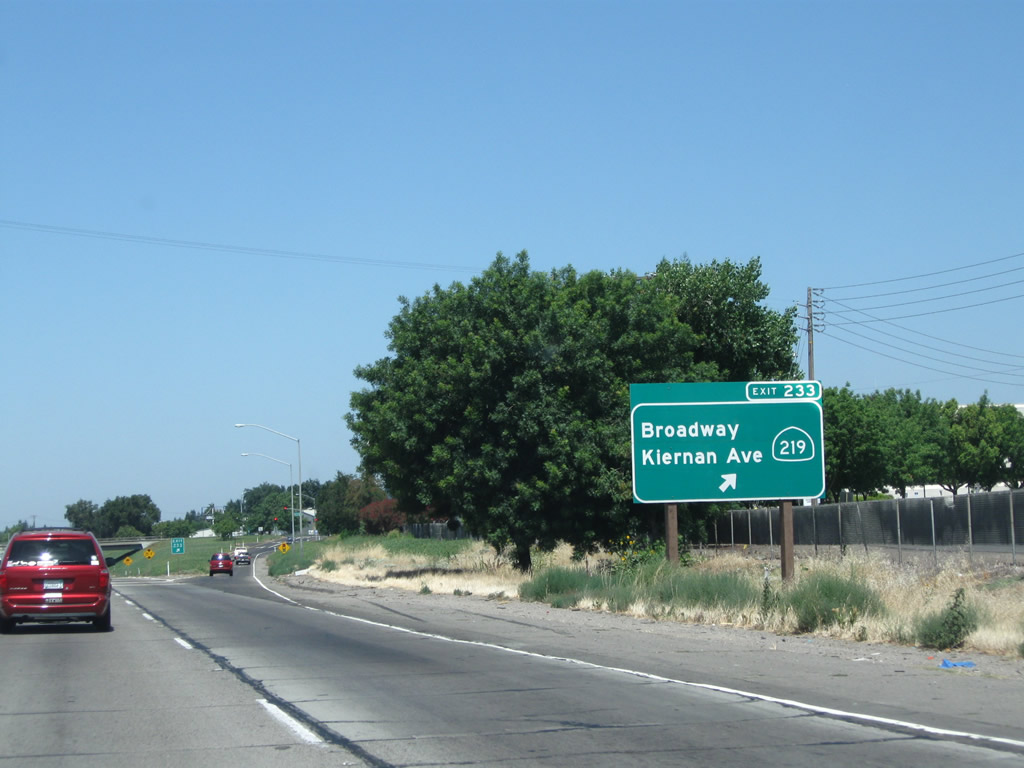
Northbound California 99 meets Exit 233, east California 219 (Kiernan Road) to McHenry and West Broadway to Salida.
07/31/11

The next exit along California 99 north is Exit 234, Hammett Road. Use Hammett Road south to Beckwith Road northwest of Modesto.
07/31/11

Northbound California 99 meets Exit 234, Hammett Road. This is the last exit in Stanislaus County; California 99 next enters San Joaquin County and the populous Stockton area.
08/15/03
Passing under the Hammett Road overpass, the next exit along California 99 north is Exit 236, Main Street to the city of Ripon in San Joaquin County.
07/31/11

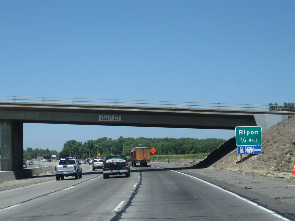
The next three exits along California 99 north all serve the city of Ripon: Exit 236, Main Street; Exit 237A, Milgeo Avenue; and Exit 237B, San Joaquin County J-5 (Jack Tone Road). After this sign, California 99 will cross the Stanislaus River into San Joaquin County and the city of Ripon.
07/31/11
References:
Modesto town hall meeting set for Highway 132 project. (2011, November 29). Modesto Bee.
California Department of Transportation (Caltrans). (n.d.). State Route 132 West Project (Modesto) Retrieved from http://www.dot.ca.gov/dist10/environmental/projects/sr132west/index.html
Photo Credits:
- Andy Field: 08/15/03, 11/25/04, 07/31/11
Connect with:
Page Updated Sunday March 11, 2012.