
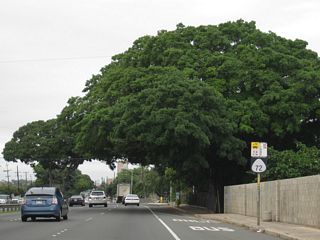
Route 72

Route 72 loops around the southeastern side of Oahu along an 18.43 mile course from the east end of Interstate H1 (Lunalilo Freeway) to Route 61 (Kalaniana'ole Highway / Kailua Road) at Maunawili. Route 72 continues Kalaniana'ole Highway southeast from Route 61 to Waimānalo Beach along Waimānalo Bay. Running along the Pacific Ocean, Route 72 encircles the southeastern extent of the Koolau Range to Makapu'u Head, where Kalaniana'ole Highway turns south.
Kalaniana'ole Highway angles southwest along Kaiwi Channel to Koko Crater and Hanauma Bay. Route 72 turns west from there to Hawai'i Kai, where the highway expands to a four lane boulevard. The remainder of Route 72 west into Honolulu is urban as Kalaniana'ole Highway runs along the north side of Maunalua Bay to Niu Valley, 'Aina Haina and I-H1 at Wai'alae.
Hawaii Route 72 Guides
Historically Route 72 continued west across Honolulu, taking the initial stretch of the Lunalilo Freeway completed by Moiliili in Honolulu. Route 72 followed Waialae Avenue east from there to Waialae and the couplet of Lunalilo Street west and Kinau Street east between Ke'eamoku Street and Vineyard Boulevard.
Route 72 followed Vineyard Boulevard (Route 98) northwest to Route 63 (Kalihi Street), where the next section of the Lunalilo Freeway was constructed westward to Middle Street. Route 72 continued along Moanalua Road northwest to Fort Shafter and Aiea.
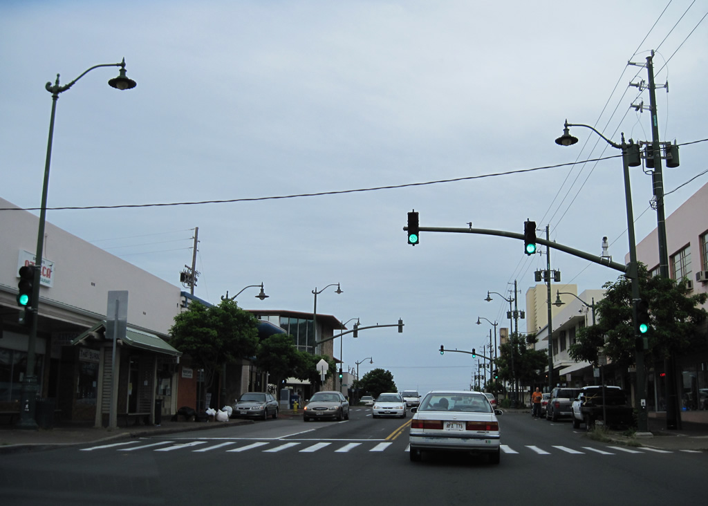
Waialae Avenue emerges from under the Interstate H1 viaduct and continues westward along the former alignment of Route 72 by Kaimuki.
01/18/11
Koko Head Avenue connects Waialae Avenue (old Route 72) with 12th Avenue south toward Diamond Head. 12th Avenue became discontinuous by the original construction of Interstate H1.
01/18/11
11th Avenue provides access to Interstate H1 (Lunalilo Freeway) westbound from Waialae Avenue.
01/18/11
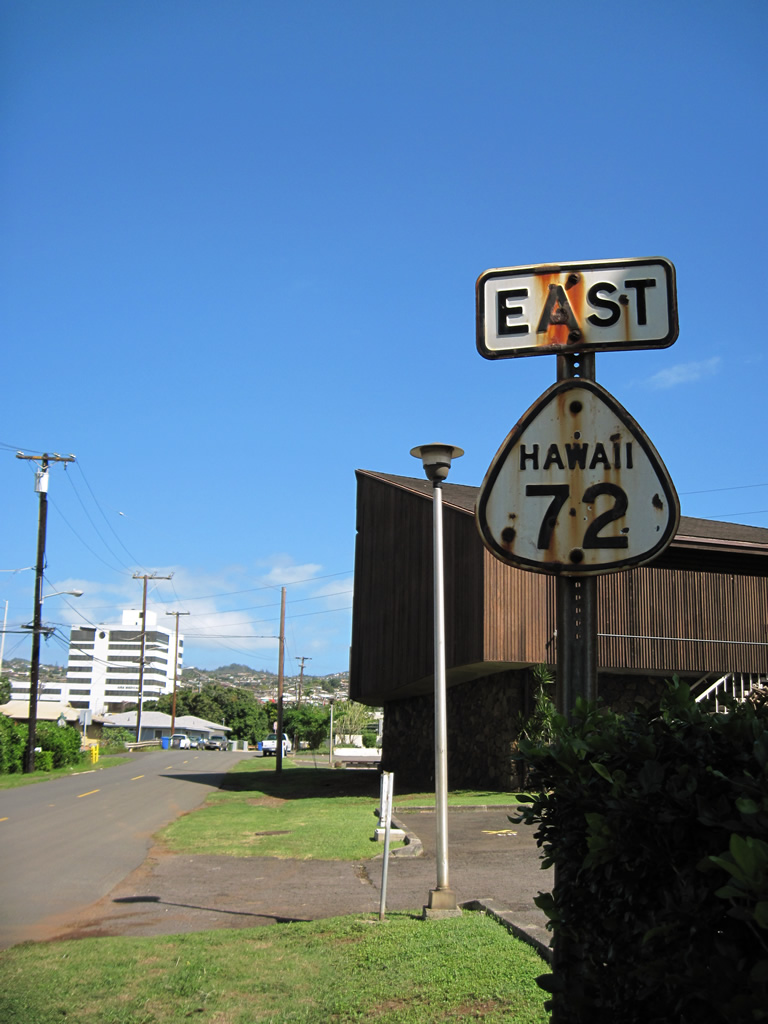
Dating from 1956, an original Route 72 marker posted on Waialae Avenue eastbound at 17th Avenue.
01/18/11
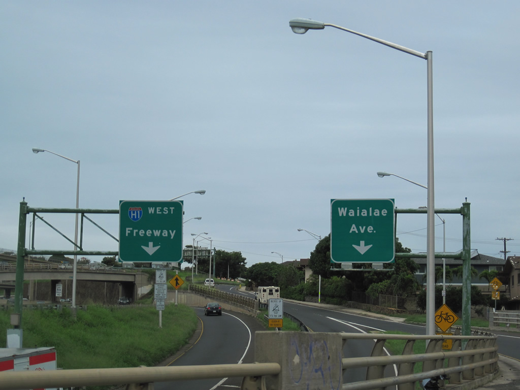
Waialae Avenue (former Route 72) splits with an entrance ramp to Interstate H1 east to Kalanianaole Highway as the street lowers into the Waialae Business District below the Lunalilo Freeway viaduct.
01/18/11
Laulima Street represents a former alignment of Route 72 in the Aiea area. The residential roadway connects Moanalua Road west with Moanalua Road. A cutout from 1956 was once posted along the former state route.
01/18/11
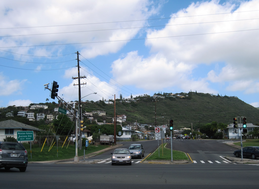
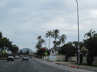
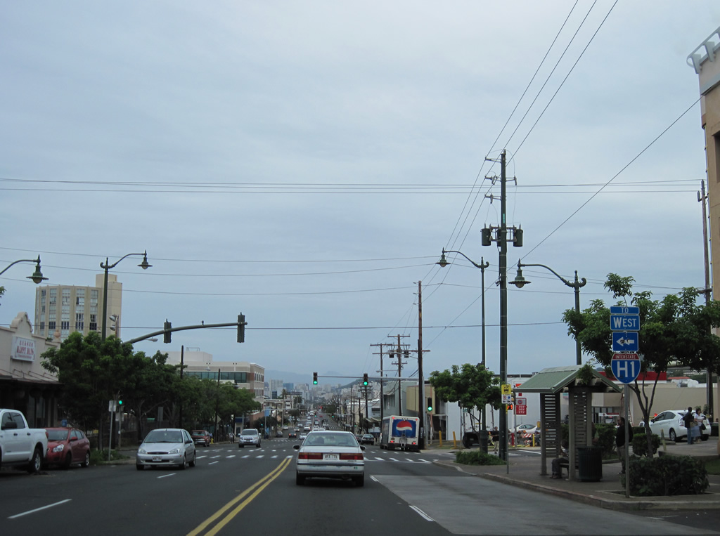
Waikui Street northbound meets Route 72 (Kalanianaole Highway) opposite from Ainakoa Avenue in this scene east of Waialae. Route 72 transitions into Interstate H1 just west of this intersection. Ainakoa Avenue connects with Halekoa Drive to residences on the hillside to the north.
01/17/11
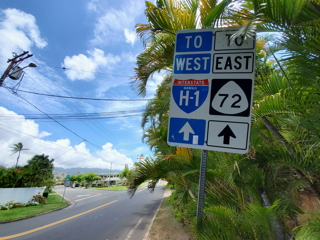
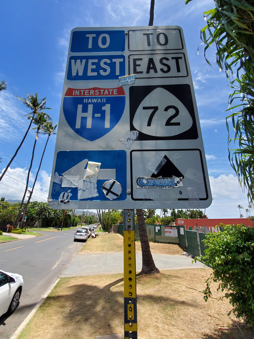
Trailblazers for I-H1 and Route 72 east posted at Kahala Avenue east at Elepaio Street north in the Kahala neighborhood in Honolulu.
08/16/19
Hunakai Street (Route 7843) heads 1.45 miles north from Kahala Avenue to I-H1/Route 72 east by Kahala Mall and Kilauea Avenue.
08/16/19
Photo Credits:
- Alex Nitzman: 01/17/11, 01/18/11
- Andy Field: 08/16/19
Connect with:
Page Updated Sunday January 21, 2024.