
Interstate 5 South - Blaine to Bellingham
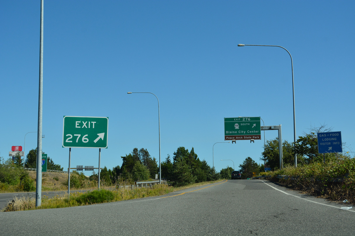
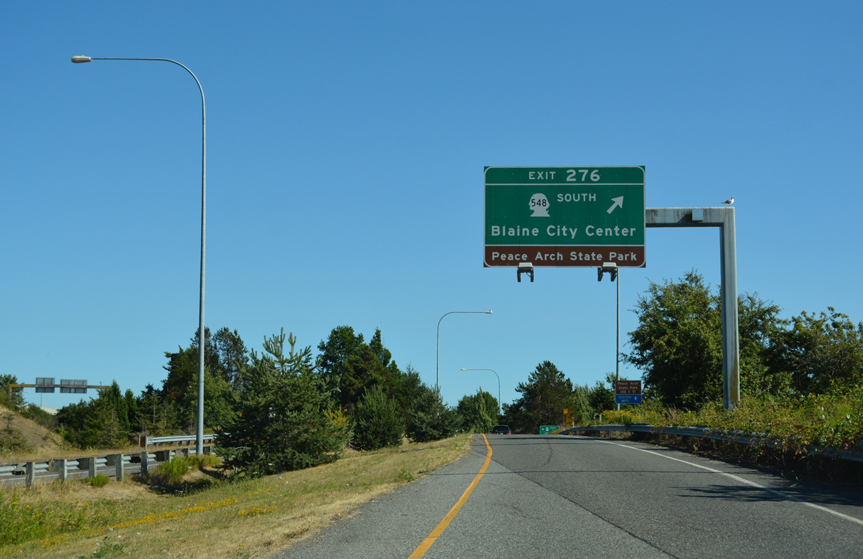
Leaving the customs and immigration station, traffic separates for the southbound beginning of Interstate 5 and Exit 276 to SR 548 (Peace Portal Drive) and the Blaine city center.
07/19/23
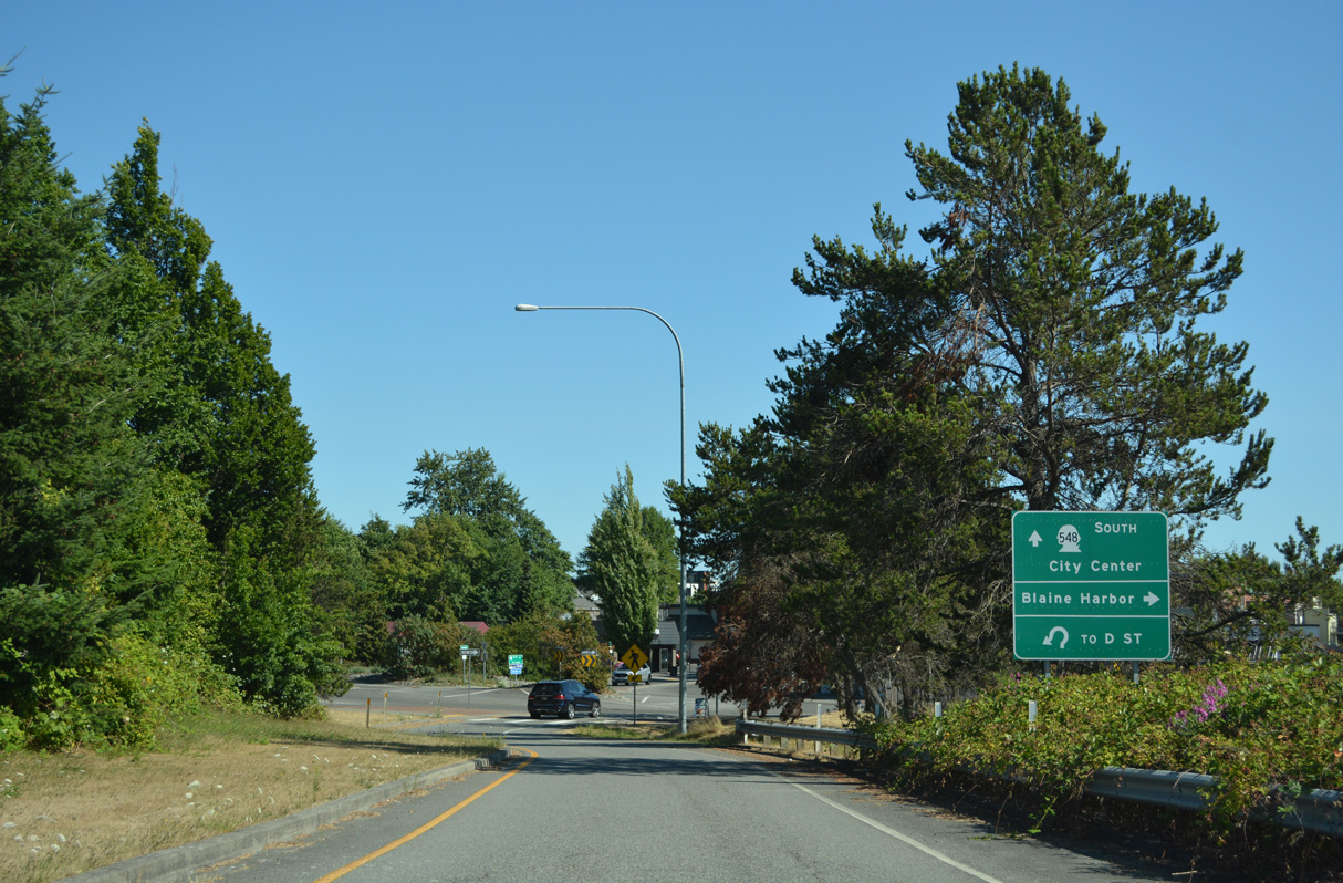
The north end of SR 548 ties into a roundabout with D Street east and 2nd Street north to Peace Arch State Park.
07/19/23
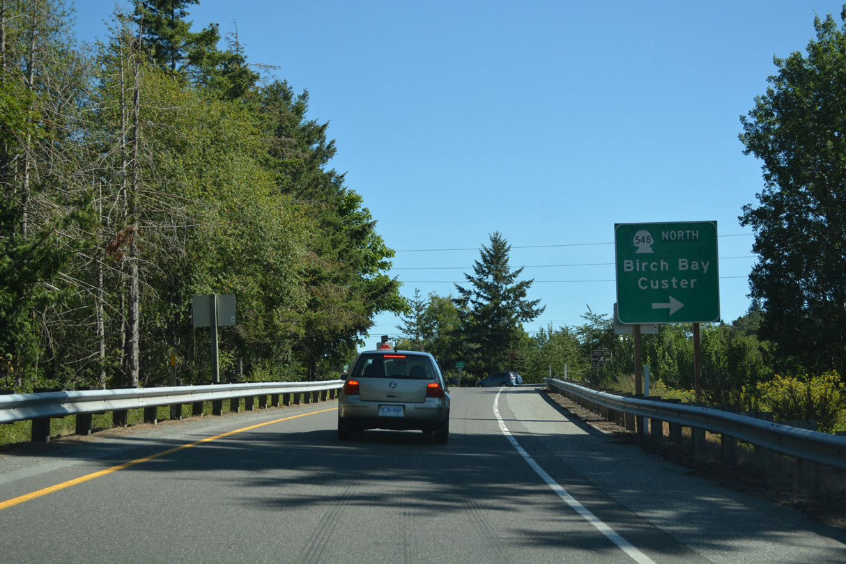
Marine Drive east from Blaine Harbor feeds into the western roundabout at the dumbbell interchange (Exit 276) with SR 548 (Peace Portal Drive). SR 548 comprises a 13.85 mile long loop south through Blaine to Birch Bay and east back to Interstate 5 at Exit 266.
07/19/23
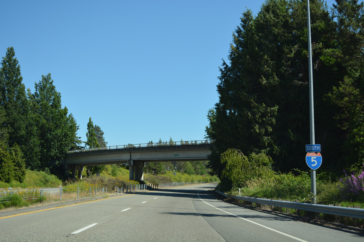
The first southbound shield for the 1,381 mile long route of Interstate 5 between Blaine and San Ysidro, California precedes the H Street overpass.
07/19/23
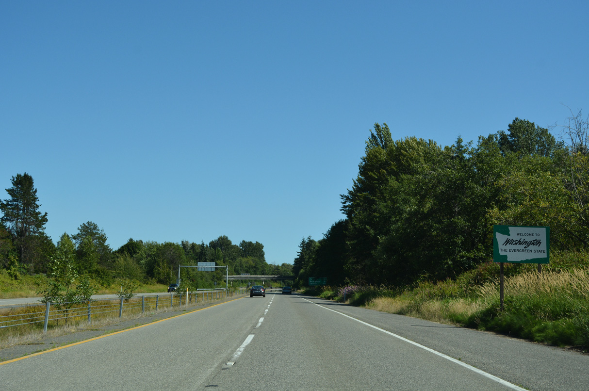
The Washington welcome sign for Interstate 5 southbound stands between H Street and Mitchell Avenue.
07/19/23
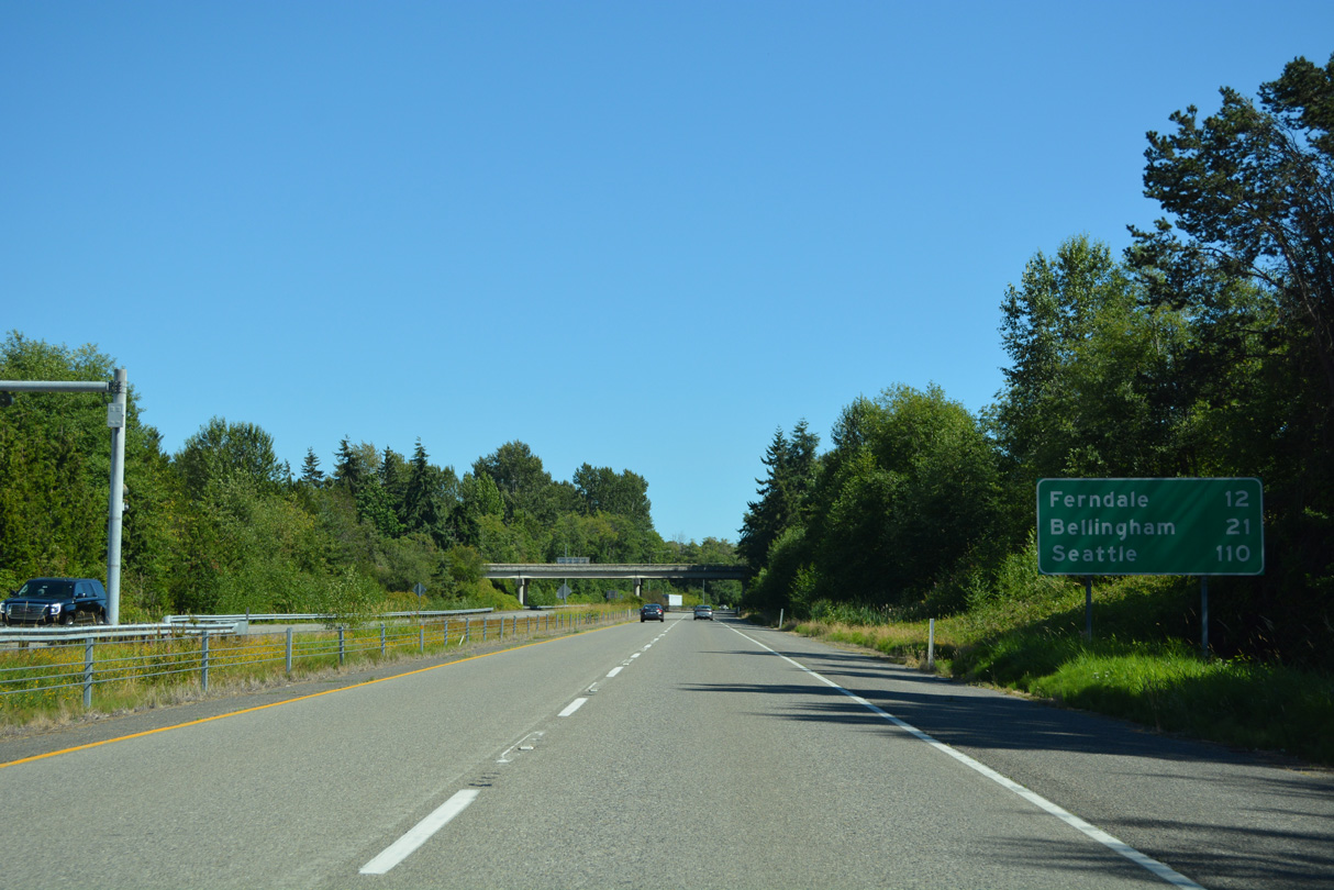
Ferndale is the next city along Interstate 5 south of Blaine. Bellingham, the Whatcom County seat, follows in 21 miles. Seattle is 110 miles away.
07/19/23
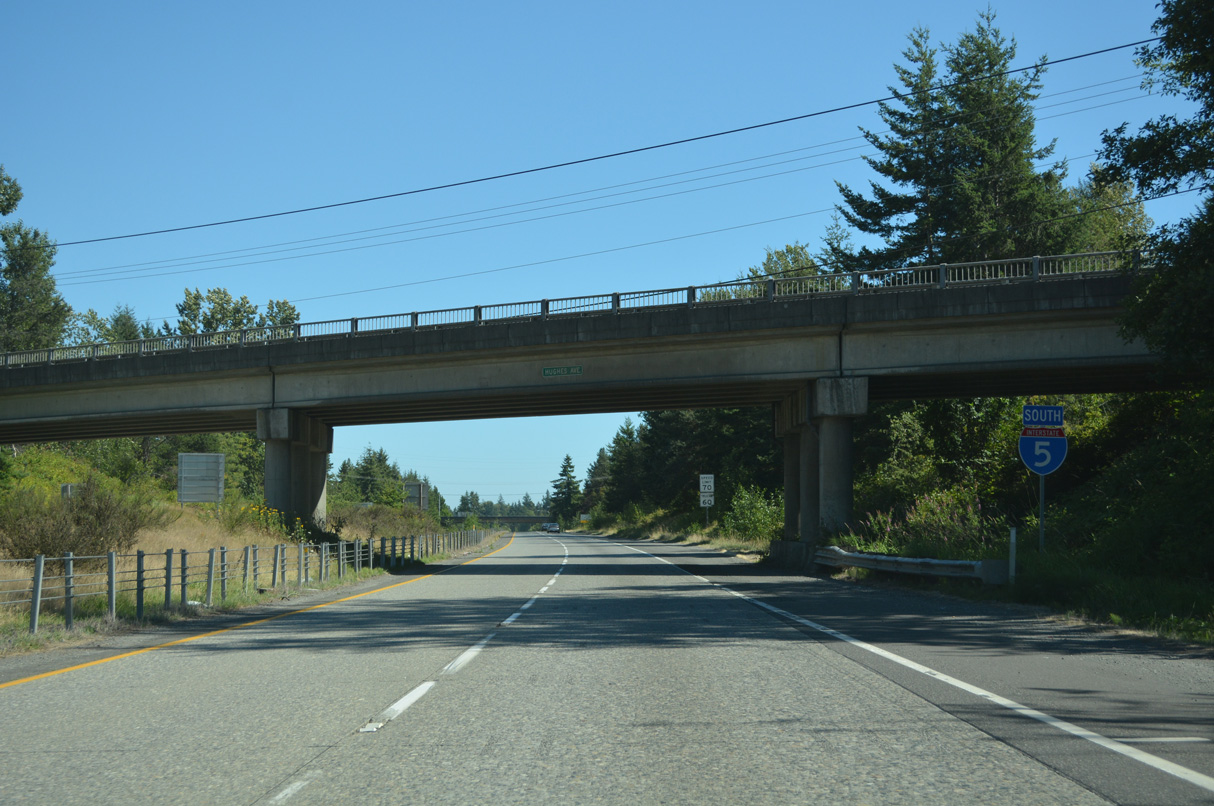
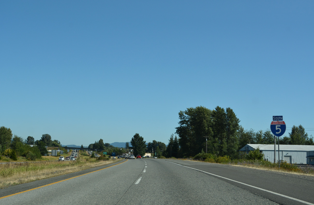
SR 543 heads 1.09 miles south from the B.C. Highway 15 port of entry to a wye international with Interstate 5 south. This confirming marker follows at Hughes Avenue.
07/19/23
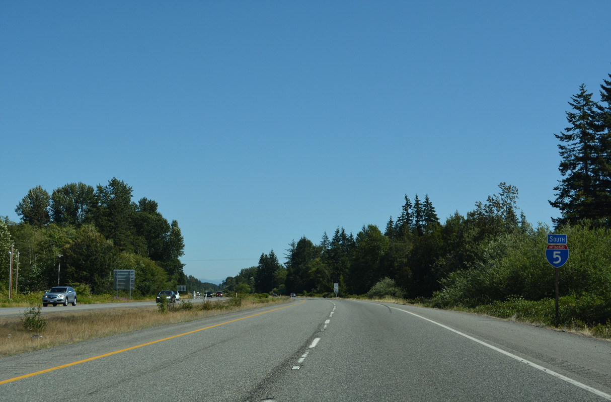
A second wye interchange links Peace Portal Drive (historic U.S. 99) near the separation with SR 548 (Bell Road) in south Blaine to Interstate 5 south ahead of Dakota Creek and the third reassurance shield.
07/19/23
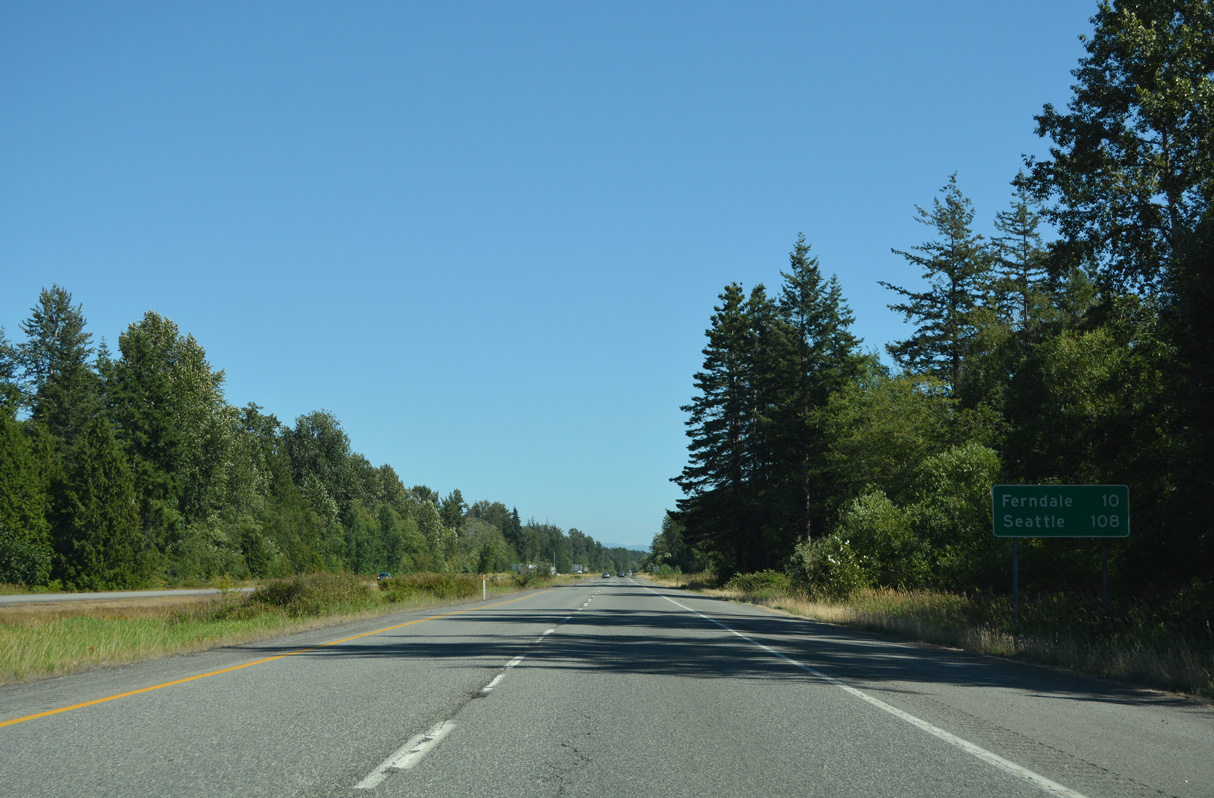
Ferndale follows in ten miles; Seattle is 98 miles further.
07/19/23
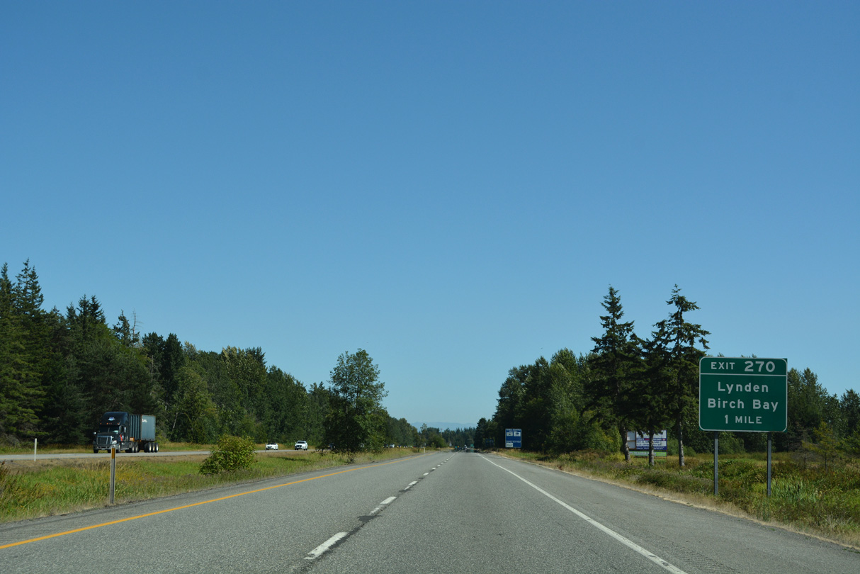
Rural Interstate 5 angles southeast from Blaine to Exit 270 with Birch Bay-Lynden Road. Birch Bay-Lynden Road connects the freeway with Birch Bay to the west and Lynden to the east.
07/19/23
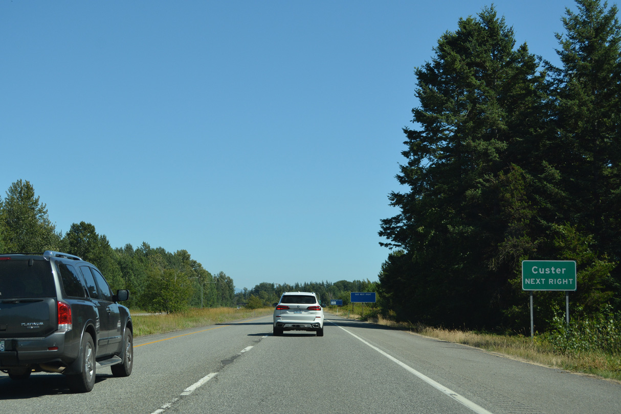
Portal Way (Old U.S. 99) parallels I-5 nearby from Blaine southeast to the community of Custer and Ferndale to the southeast.
07/19/23
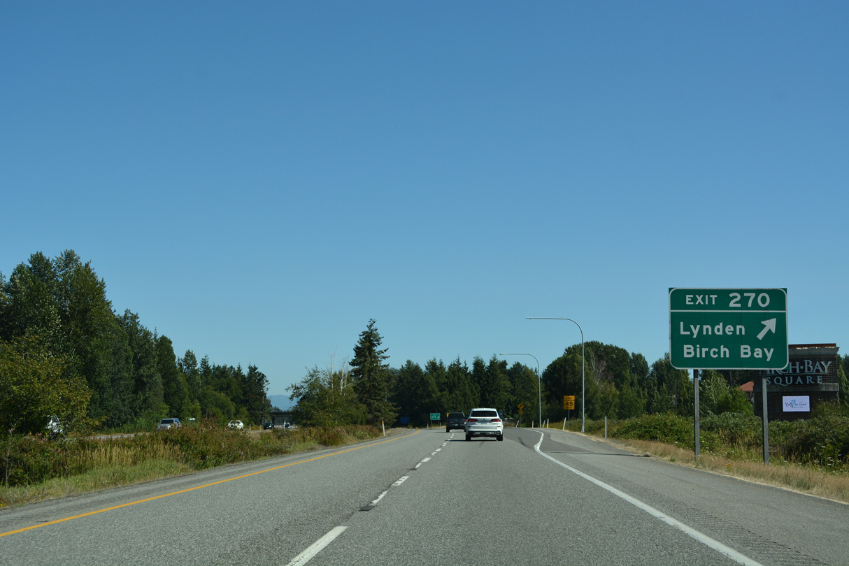
The diamond interchange (Exit 270) with Birch Bay-Lynden Road is next to Birth Bay Square shopping center.
07/19/23
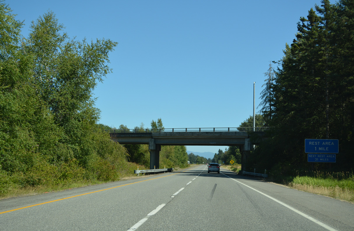
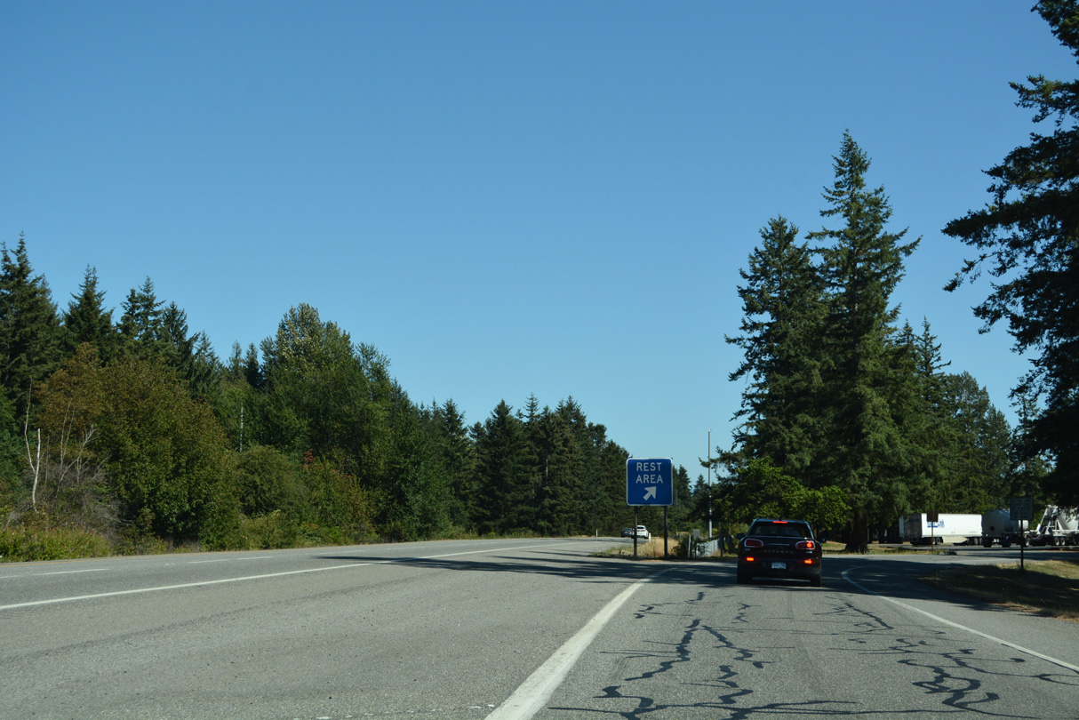
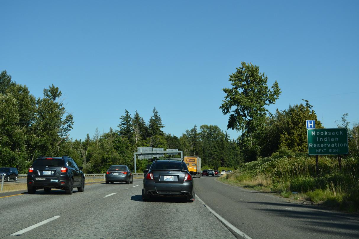
The Custer Rest Areas line both roadways of Interstate 5 near the community of Custer.
07/19/23
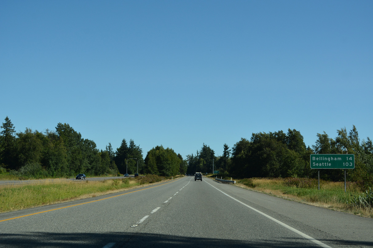
Leaving the rest area facility, Interstate 5 continues 14 miles to Bellingham and 103 miles to Seattle.
07/19/23
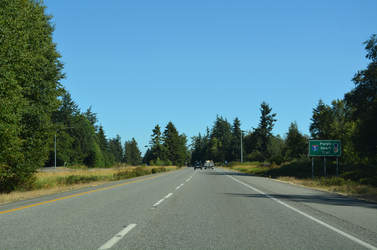
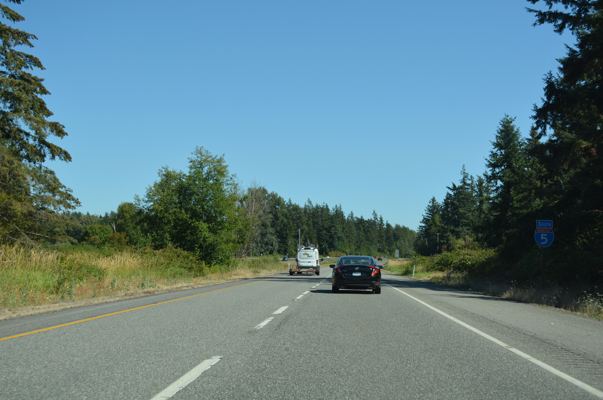
Interstate 5 in Washington is part of the Purple Heart Trail memorial highway system.
07/19/23
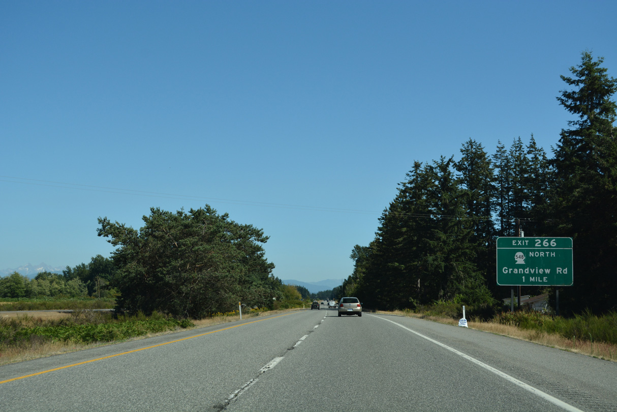
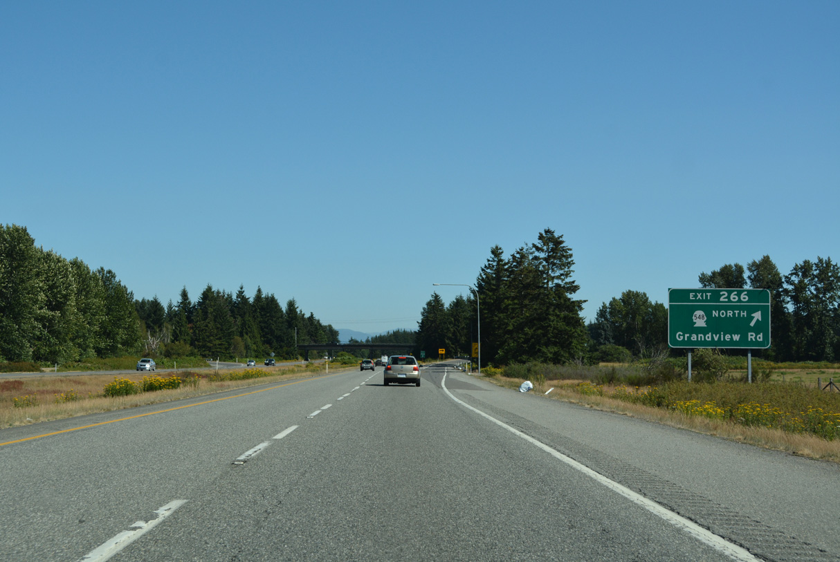
SR 548 follows Blaine Road south from Birch Bay to a roundabout with Grandview Road. SR 548 follows Grandview Road 5.9 miles east to Interstate 5 at Exit 266.
07/19/23
Grandview Road extends west from SR 548 to Jackson Road north for Birch Bay State Park. Eastward from Exit 266, Grandview Road leads into a rural residential area at Dahlberg Road.
07/19/23
SR 548 (Grandview Road) intersects Portal Way (Old U.S. 99) north to Custer a quarter mile to the west of Exit 266.
07/19/23
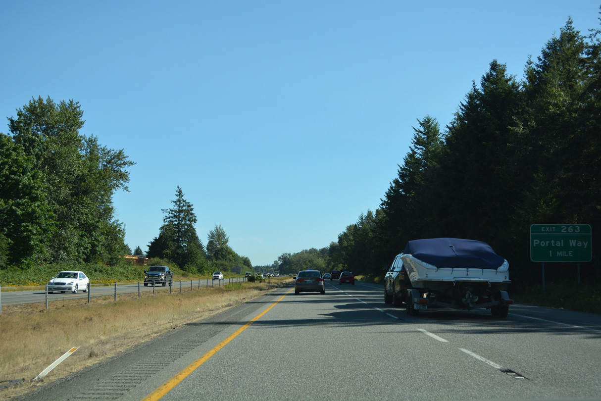
Exit 263 is the second of three interchanges along Interstate 5 south in the city of Ferndale. Portal Way (Historic U.S. 99) shifts to the east of I-5 and then returns to the freeway at a parclo interchange north of the city center.
07/19/23
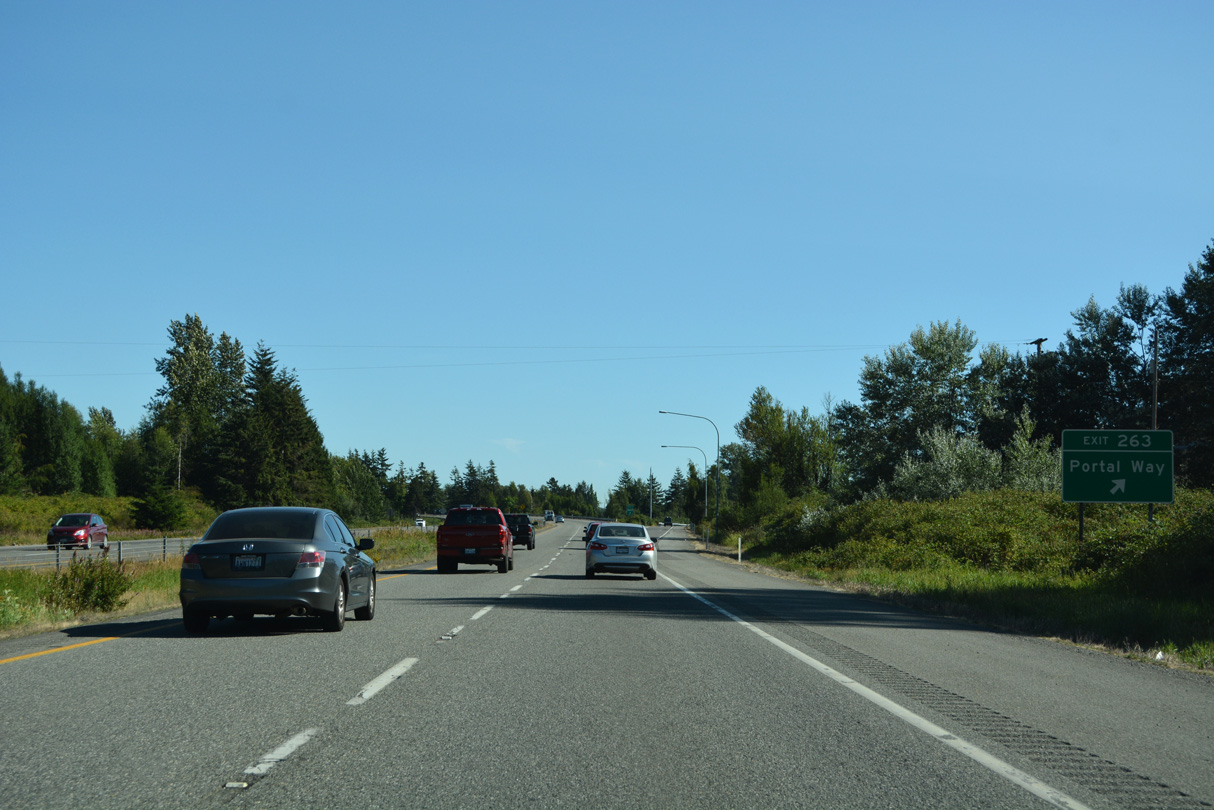
Portal Way ties into a roundabout with the ramps at Exit 263, Thornton Street and 2nd Avenue. 2nd Avenue, Washington Street and 3rd Avenues connect Interstate 5 with Historic Downtown Ferndale.
07/19/23
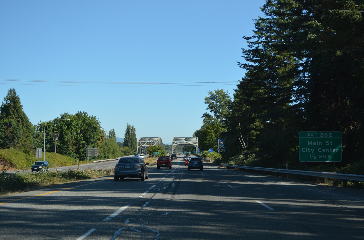
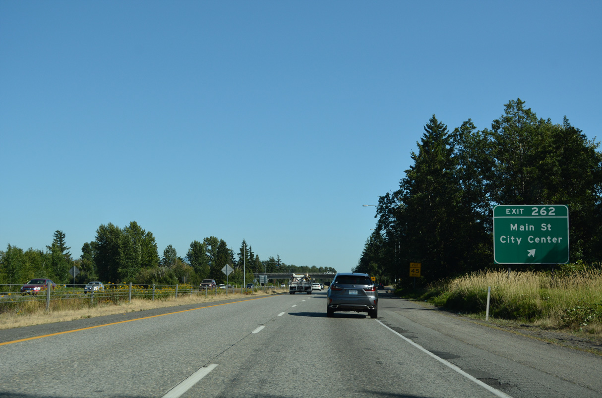
Main Street crosses the Nooksack River east from the Ferndale city center to a parclo interchange (Exit 262) with Interstate 5.
07/19/23
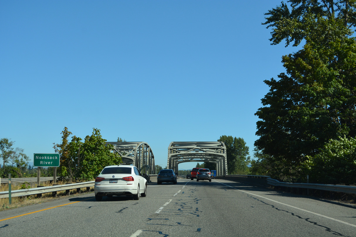
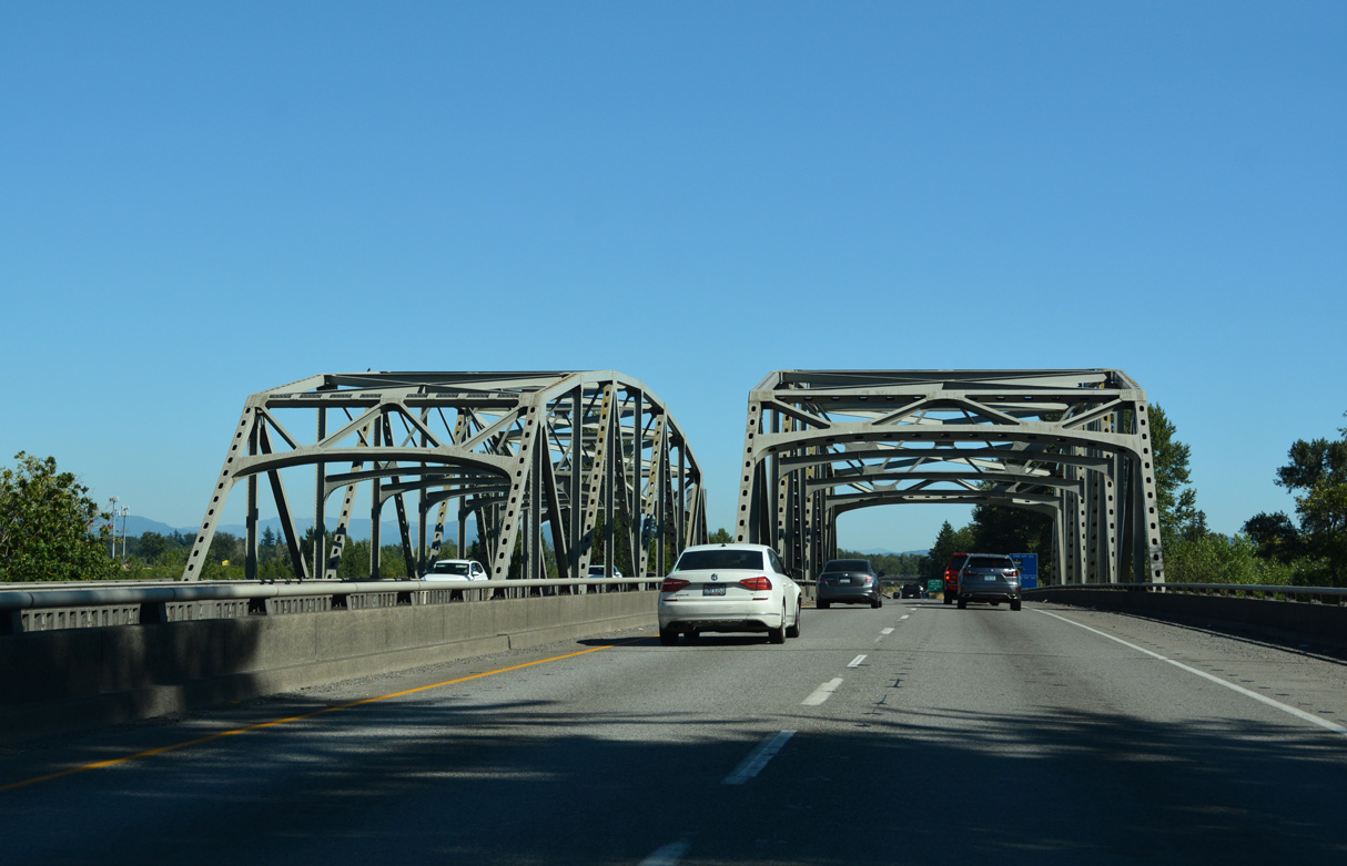
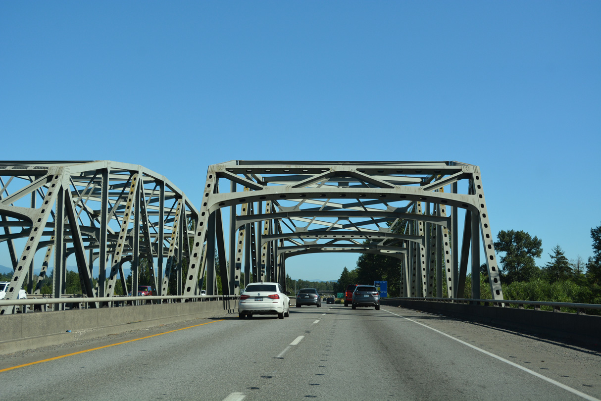
Interstate 5 spans the Nooksack River across a pair of steel through truss bridges.
07/19/23
The southbound span across the Nooksack River opened in 1971 as part of Interstate 5. The northbound bridge opened in 1955 as a part of U.S. 99 (Pacific Highway).
07/19/23
West from Ferndale, Main Street becomes Mountain View Road to Mountain View and Lake Terrell. East from Exit 262, Main Street becomes Axton Road en route to Barrett Lake and SR 539 near Laurel.
07/19/23
Continuing south from Exit 262, Interstate 5 gains frontage roads (La Bounty Drive north / Barrett Road south) to the Smith Road overpass.
07/19/23
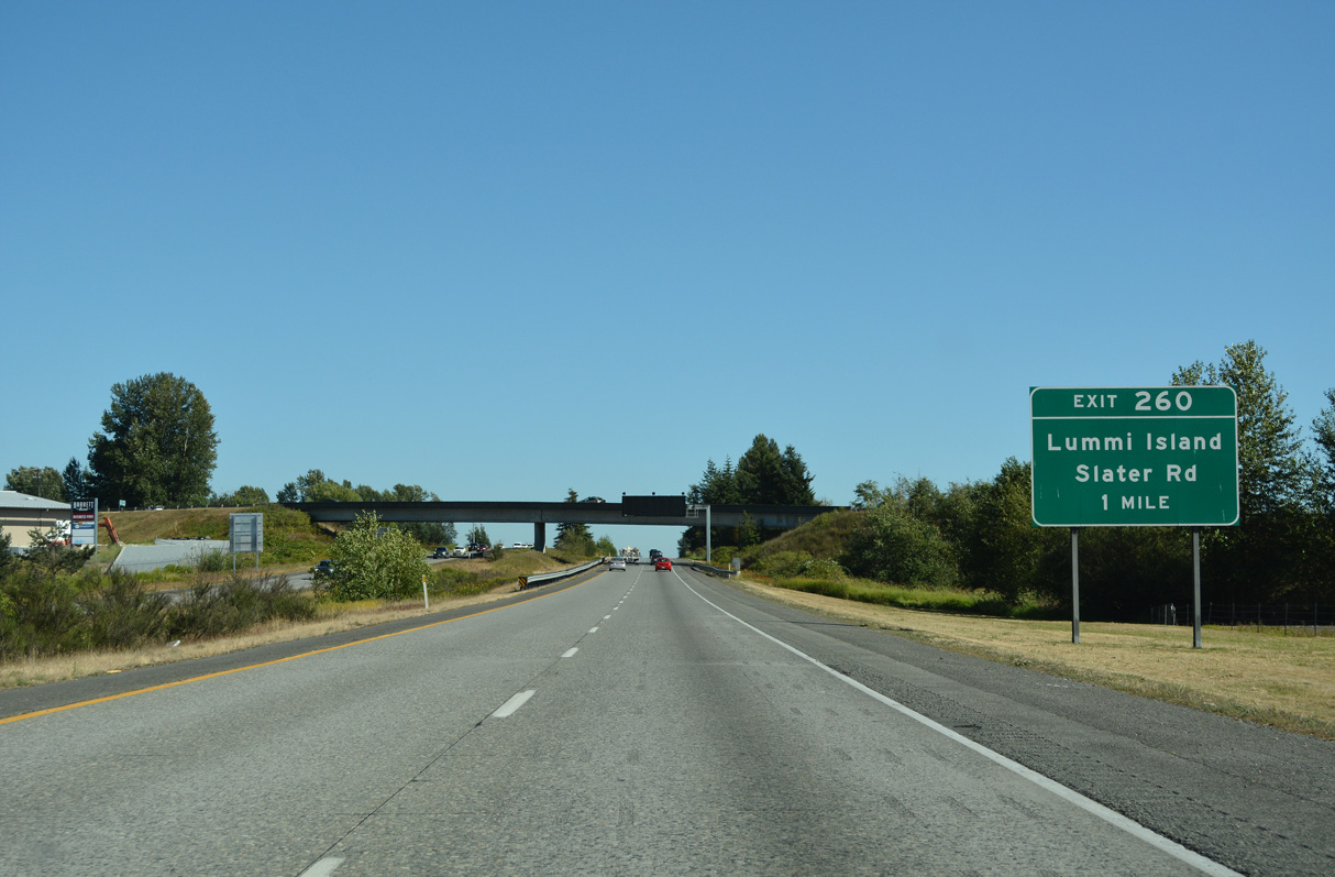
Slater Road crosses paths with Interstate 5 at Exit 260, one mile south of Smith Road. Pacific Highway (Old U.S. 99) parallels the freeway to the east,
07/19/23
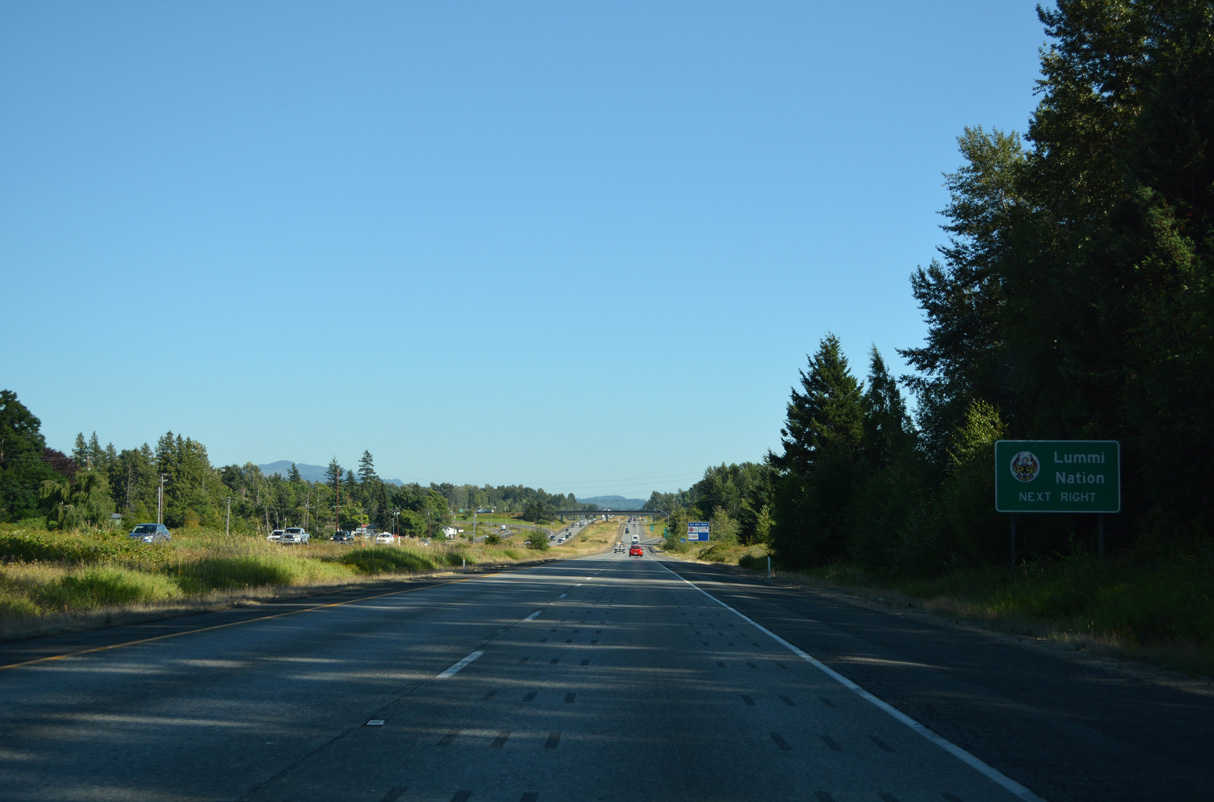
Slater Road travels west to Haxton Way south for the Lummi Indian Reservation and ferry to Lummi Island.
07/19/23
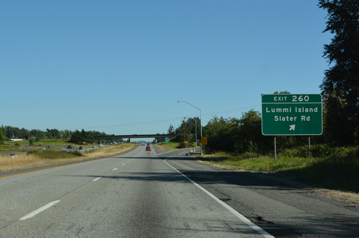
Exit 260 departs Interstate 5 south for Slater Road. Slater Road extends 0.8 miles east from the dumbbell interchange to Northwest Drive.
07/19/23
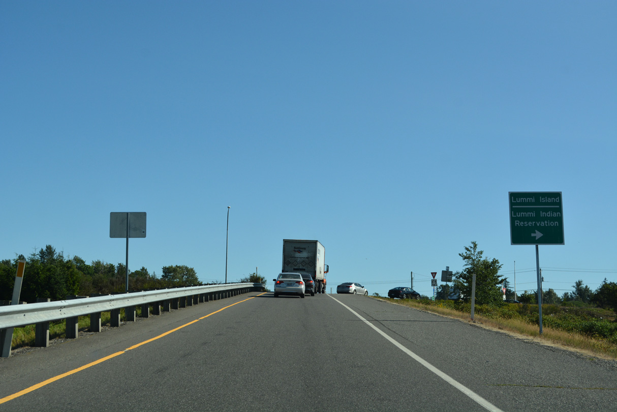
Slater Road west to Haxton Way and the Lummi Indian Reservation was formerly Washington State Route 540.
07/19/23
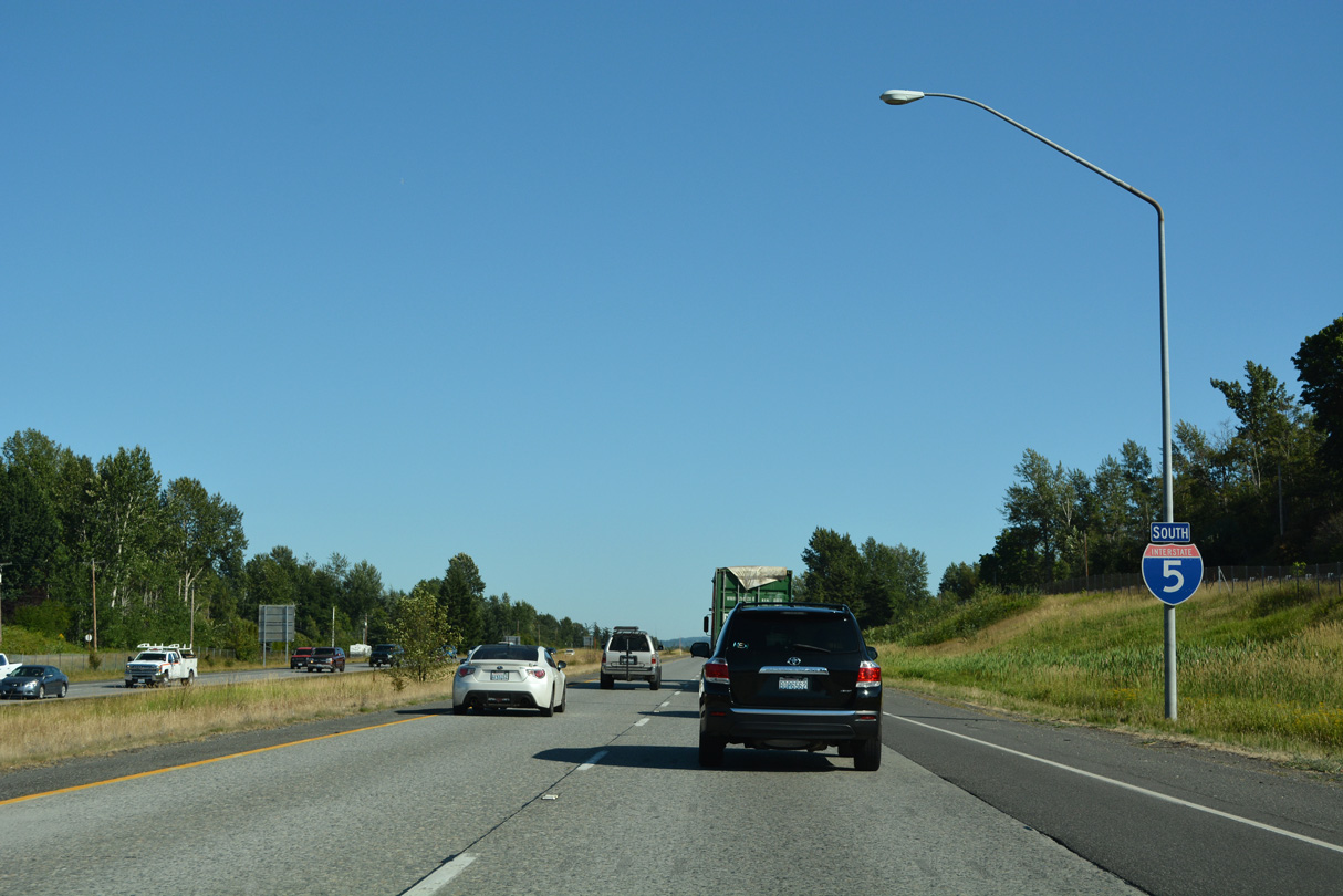
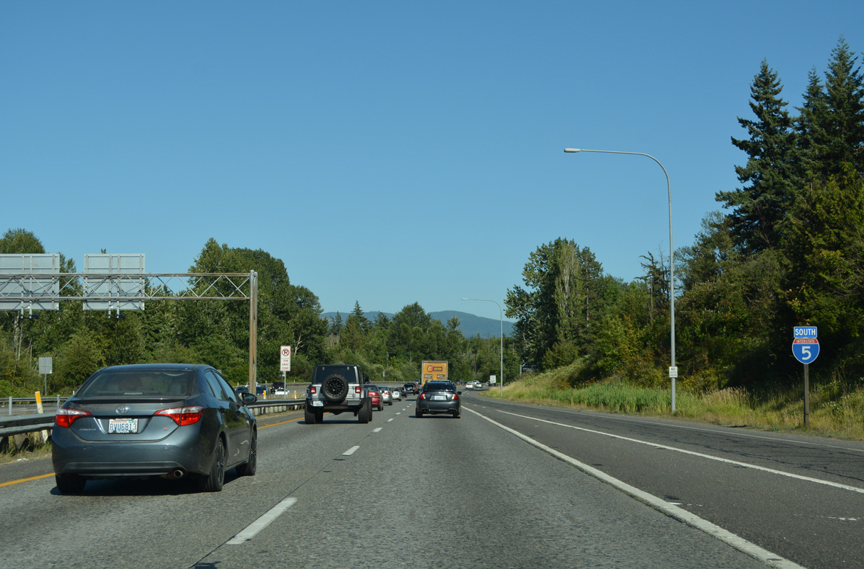
Advancing south into the city of Bellingham, the speed limit along Interstat 5 lowers to 60 m.p.h.
07/19/23
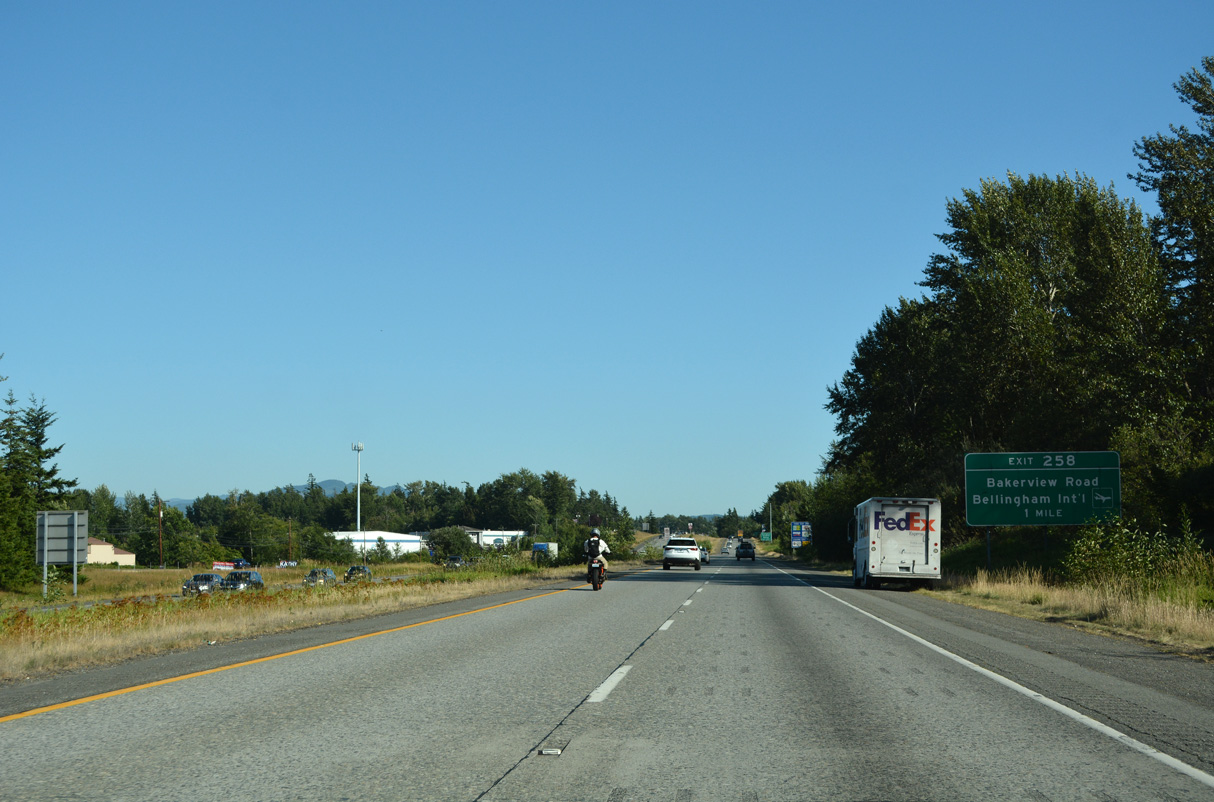
Interstate 5 passes just east of Bellingham International Airport (BLI) through northwestern reaches of Bellingham. Exit 258 provides access to the airport via Bakerview Road west to Airport Drive in one mile.
07/19/23
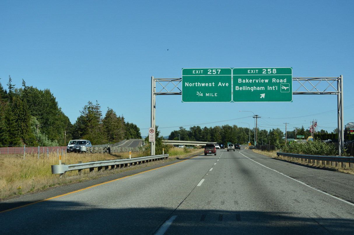
Maplewood Avenue (Old U.S. 99) branches south from I-5 at wye interchange (Exit 258) for Bakerview Road. Bakerview Road becomes Airport Drive at Bennett Drive nearby and leads east to SR 539 (Meridian Street) near Whatcom Community College. Maplewood Avenue leads southeast to Northwest Avenue.
07/19/23
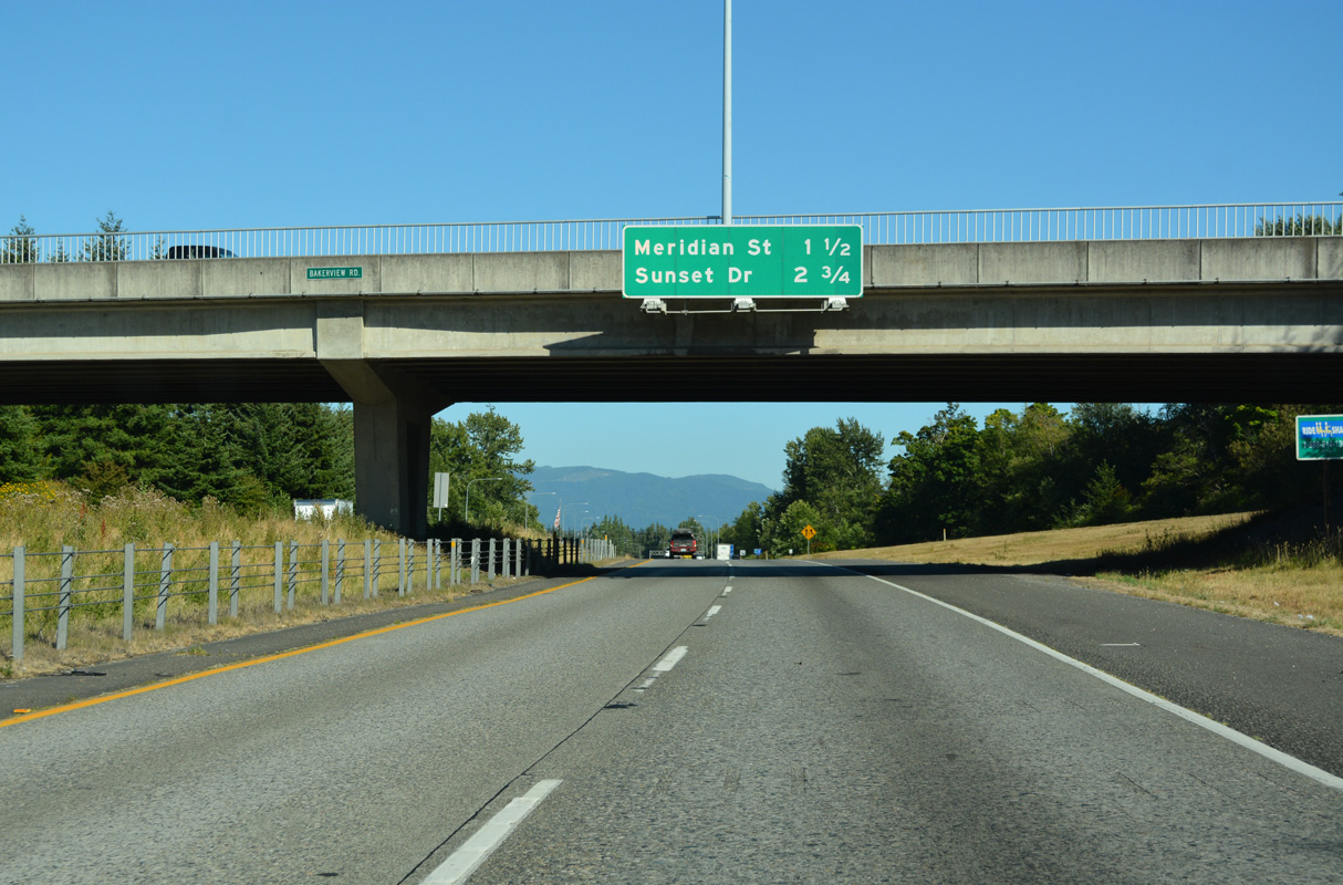
Interstate 5 turns eastward to Exit 256 for SR 539 (Meridian Street). Omitted from this distance sign is Northwest Avenue, the next of the seven Bellingham exits.
07/19/23
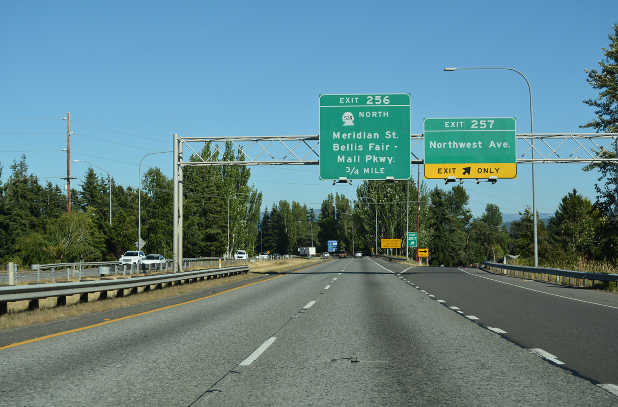
Northwest Avenue continues Northwest Drive into Bellingham from Barrett Lake east of Ferndale. The street is part of Historic U.S. 99 from Maplewood Avenue to Elm Avenue in central Bellingham.
07/19/23
SR 539 runs 15.18 miles south from British Columbia Highway 13 to Lynden, Laurel and Interstate 5 by Bellis Fair Mall. Meridian Street continues south to Cornwall Park and Broadway in Bellingham.
07/19/23
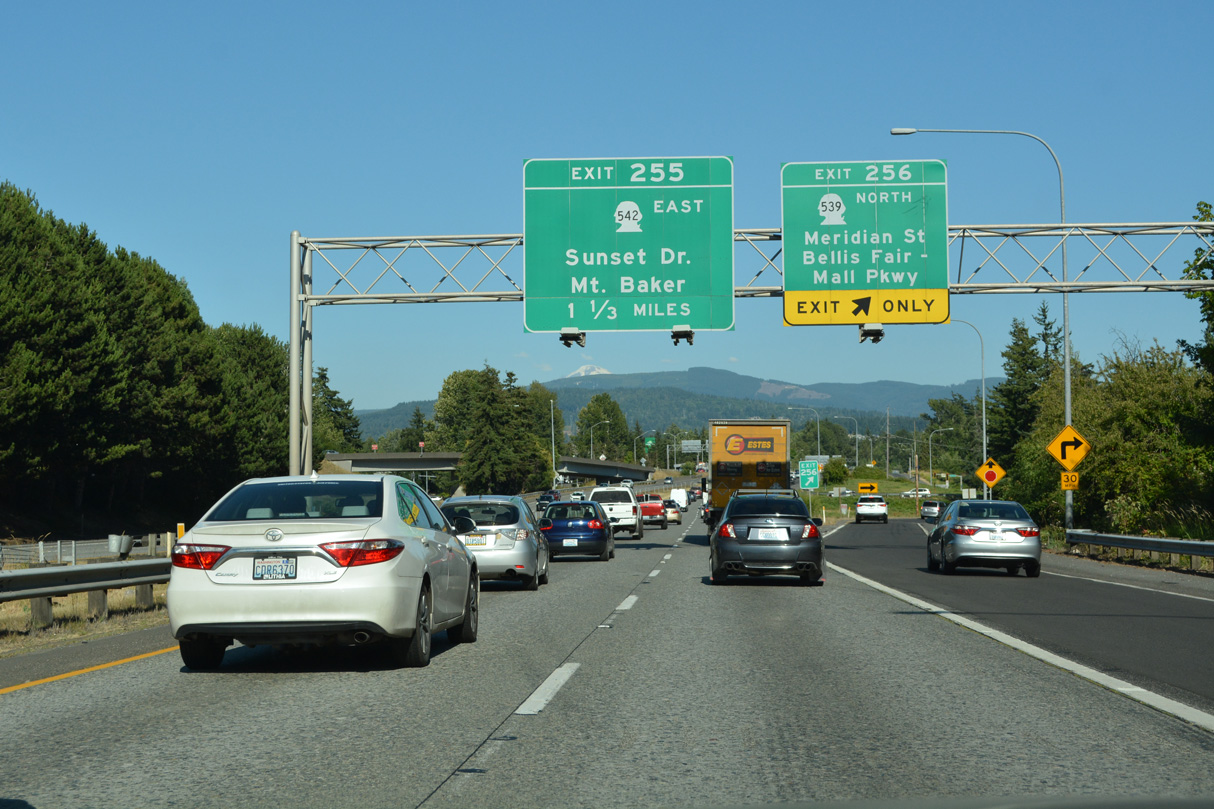
Interstate 5 curves southeast to a parclo interchange (Exit 255) with SR 542 (Sunset Drive).
07/19/23
Beginning at Interstate 5, SR 542 travels 9.98 miles east to SR 9 at Nugents Corner, west of the Nooksack Indian Reservation.
07/19/23
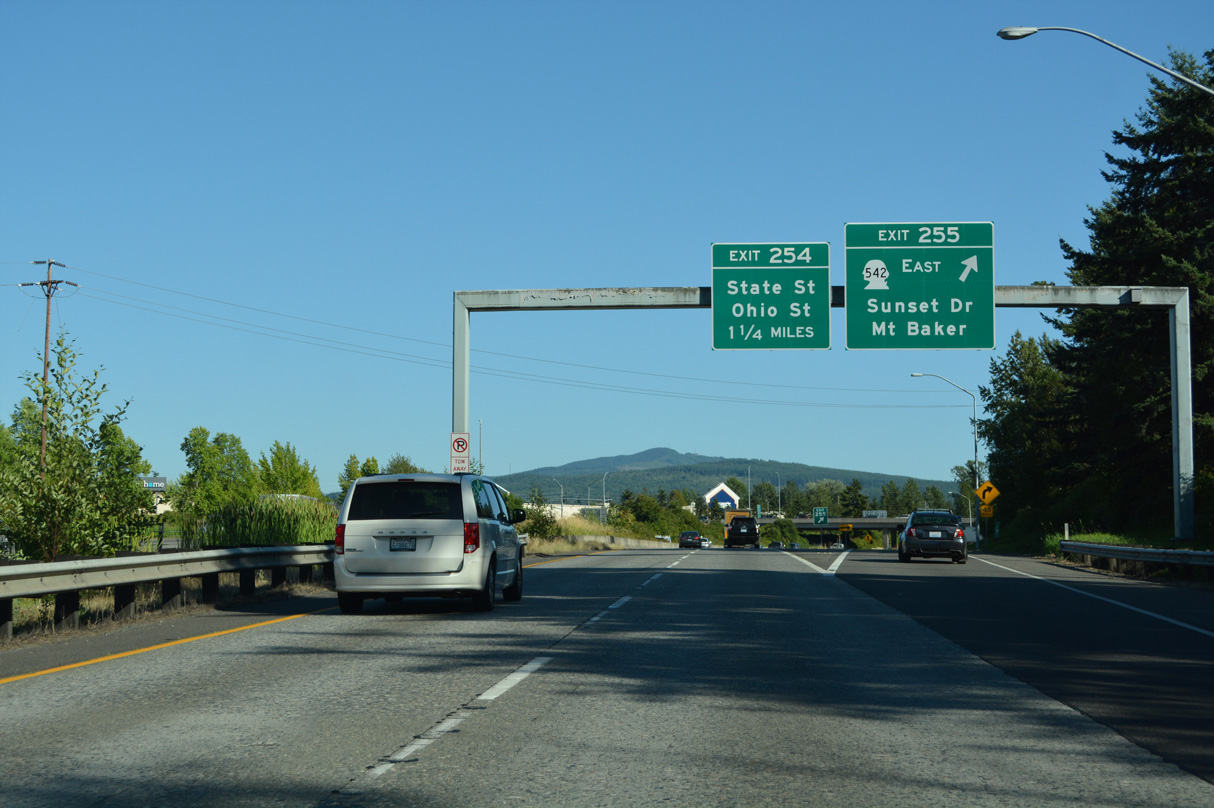
Exit 255 leaves Interstate 5 south for SR 542 east and Sunset Drive west to Illinois Street, Broadway and Bellingham Bay. SR 542 overall travels 57.29 miles between Bellingham and the Mount Baker Ski Area.
07/19/23
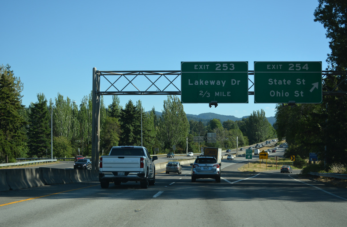
Interstate 5 crosses the Bellingham residential street grid from Memorial Park south to the folded diamond interchange (Exit 254) with Ohio and Iowa Streets. State Street angles southwest from Iowa Street to Downtown Bellingham.
07/19/23
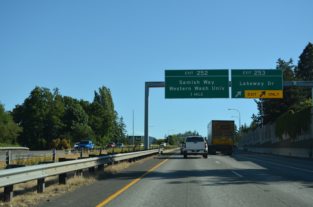
Exit 253 links I-5 southbound with Lakeway Drive west to Holly Street and the Bellingham city center. Lakeway Drive east heads to Whatcom Falls Park and the Lake Whatcom area.
07/19/23
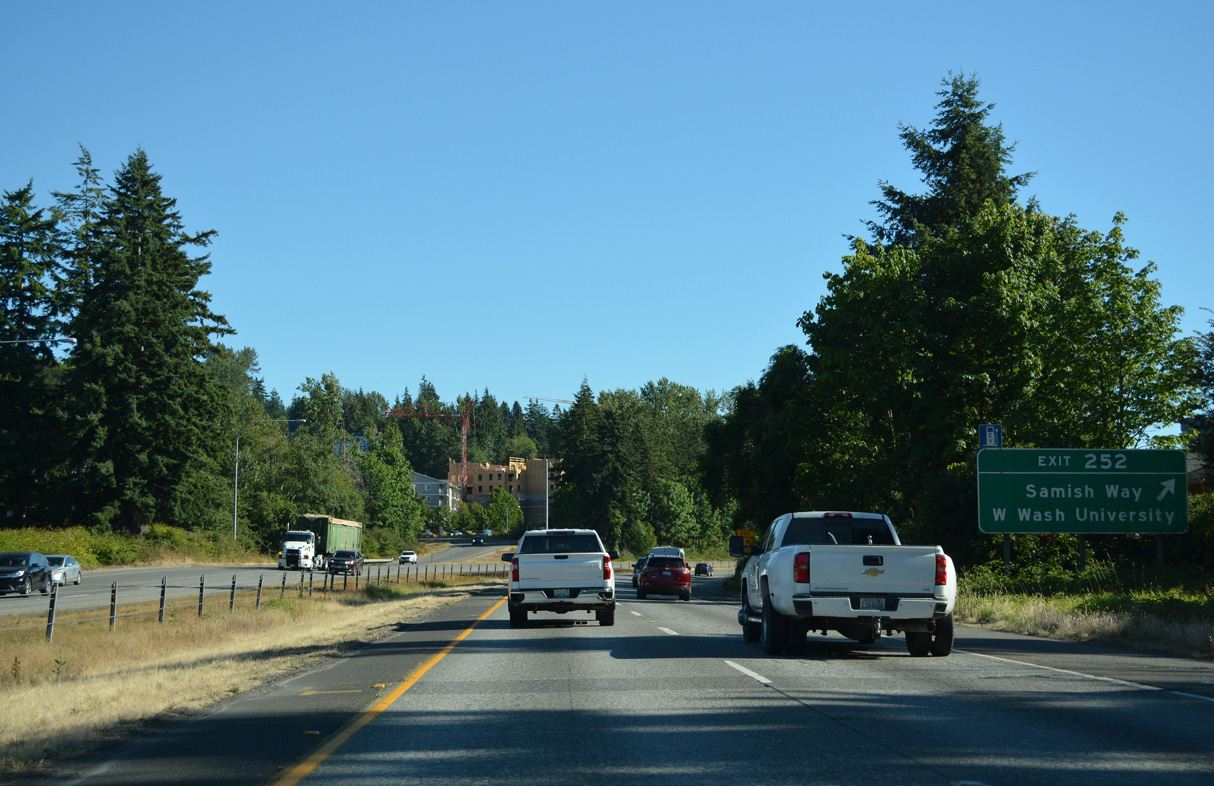
Old U.S. 99 follows Samish Way south from Maple Street to a split diamond interchange (Exit 252) with I-5 at 36th and Lincoln Streets. Samish Way continues south from Exit 252 to Happy Valley and east to Lake Padden. Bill McDonald Parkway stems west from Samish Way nearby to Western Washington University.
07/19/23
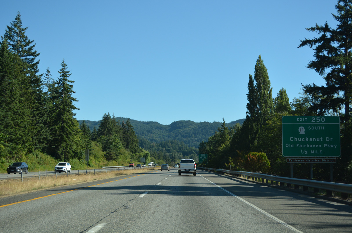
The final Bellingham exit is the diamond interchange joining Interstate 5 with SR 11 (Old Fairhaven Parkway) near Happy Valley. SR 11 comprises a 21.30 mile long loop west from I-5 to Burlington.
07/19/23
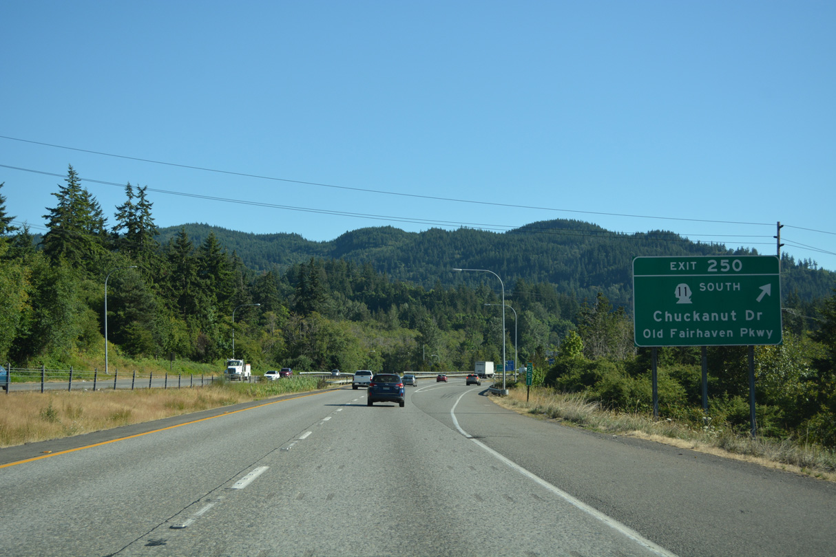
SR 11 travels west along Old Fairhaven Parkway to Chuckanut Drive (former U.S. 99 Alternate) south on the ascent to Chuckanut Village and Larrabee State Park along Chuckanut Bay. Connelly Avenue ties into Exit 250 from 36th Street to the east.
07/19/23

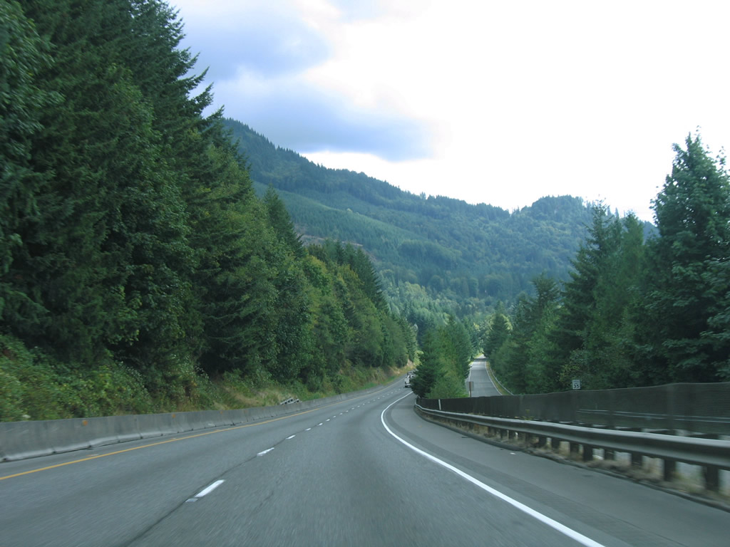
Traveling between Lake Padden and Chuckanut Mountain, Interstate 5 curves eastward into a valley fed by Chuckanut Creek
07/19/23

Interstate 5 travels 23 miles south from Bellingham to Mount Vernon and 56 miles to Everett.
07/19/23

Heading east, the freeway runs between Lake Padden Park and Lake Samish Drive. Interstate 5 between Bellingham and the Skagit County line is the most mountainous within the state of Washington.
08/30/06

Lookout Mountain rises to the east of Interstate 5 and Samish Lake.
08/30/06

Samish Way leaves the Padden Lake area and meets Interstate 5 again at Exit 246 across from N Lake Samish Drive.
07/19/23

N Lake Samish Drive parallels Interstate 5 south from Exit 246 to Lake Samish. It forms the northwest quadrant of a loop road encircling the lake.
07/19/23
Interstate 5 south and adjacent E Lake Samish Drive (Old U.S. 99) travel between Lake Samish and adjacent Lookout Mountain in this scene.
08/30/06
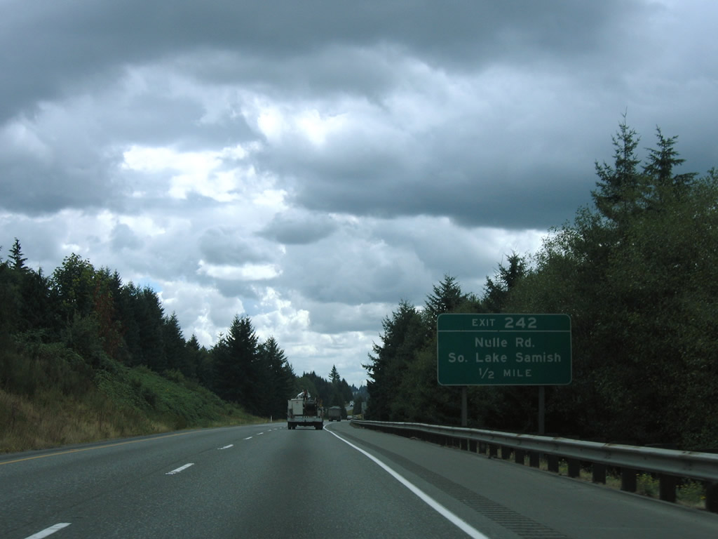
Nulle Road connects Interstate 5 with East and West Lake Samish Drives northward to Lake Samish via Exit 242.
08/30/06
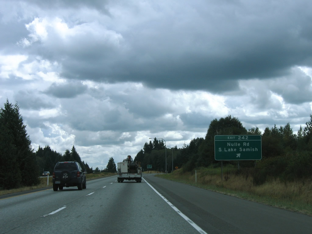
Nulle Road links with Pacific Highway (Old U.S. 99) to the east of Exit 250 and Summerland Road north and Lake Samish Road south into Skagit County to the west from Interstate 5.
08/30/06
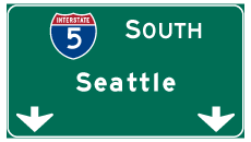

Photo Credits:
- Brent Ivy: 07/19/23
- AARoads: 08/30/06
Connect with:
Page Updated Saturday September 06, 2025.