
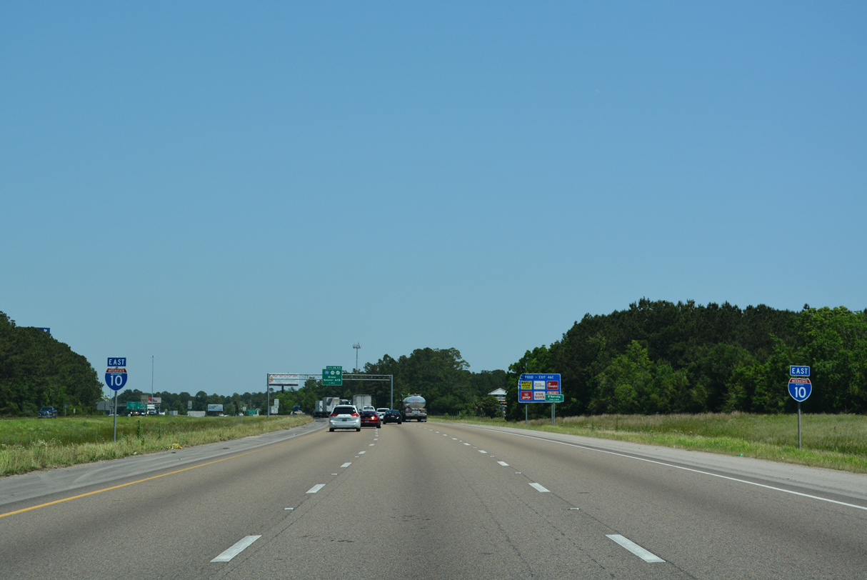
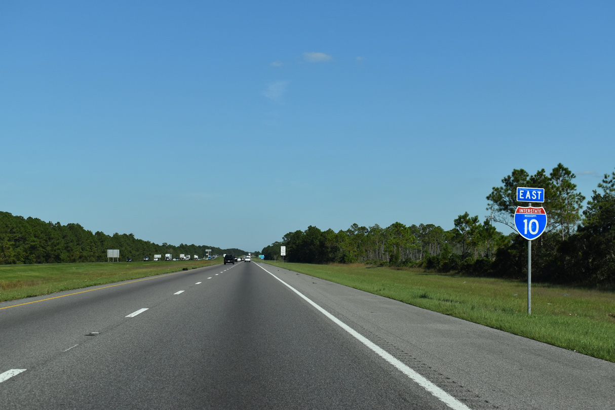
Interstate 10 East - Biloxi to Alabama

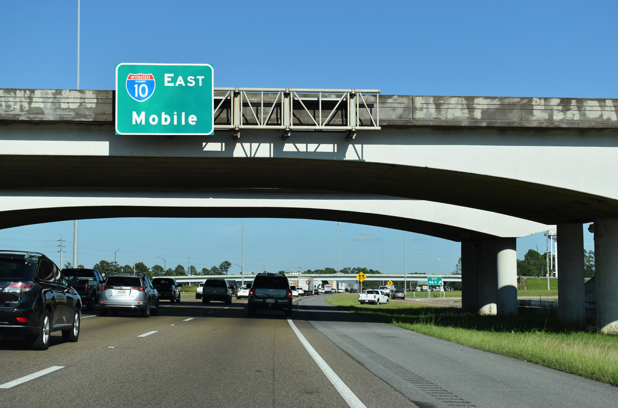
 East
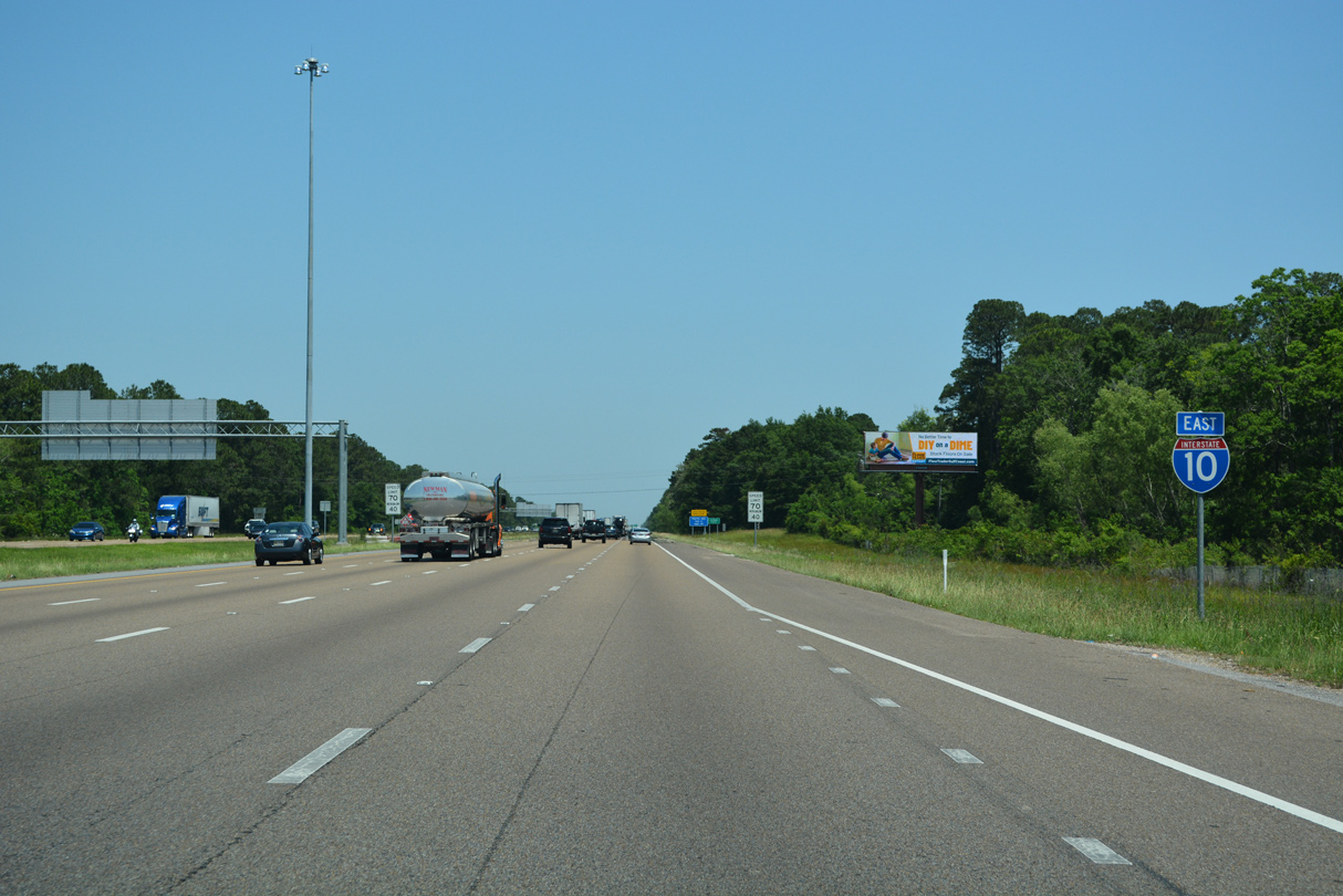
East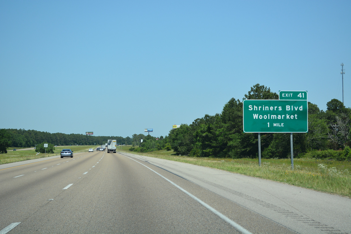
The first of two exits along I-10 in the city of Biloxi connects with Shriners Boulevard and the former south end of MS 67. MS 67 was relocated east onto a new four lane corridor on January 16, 2009. Together with MS 15, MS 67 joins Biloxi with U.S. 49 northwest of Traditions.
05/11/22
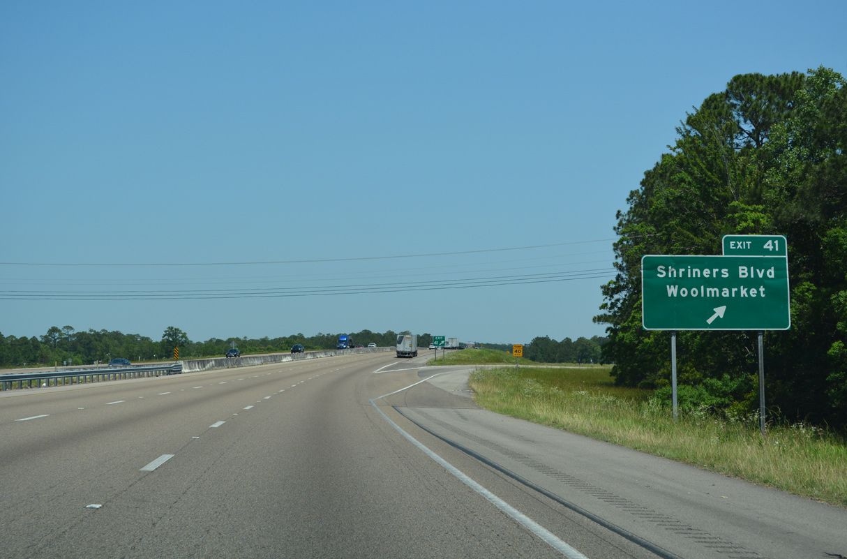
Following a period of public comment and the recommendation of the Biloxi Planning Commission, Biloxi City Council passed a resolution in 2011 renaming Old MS 67 as Shriners Boulevard. Shriners Boulevard replaced Old MS 67 from Oaklawn Road north past Woolmarket to Old Highway 67 (an even older alignment).
05/11/22
Interstate 10 east spans Parker Creek ahead of these confirming markers.
05/11/22
Linking the city of Long Beach with Interstate 10, Beatline Road north becomes County Farm Road at Jones Mill.
05/11/22
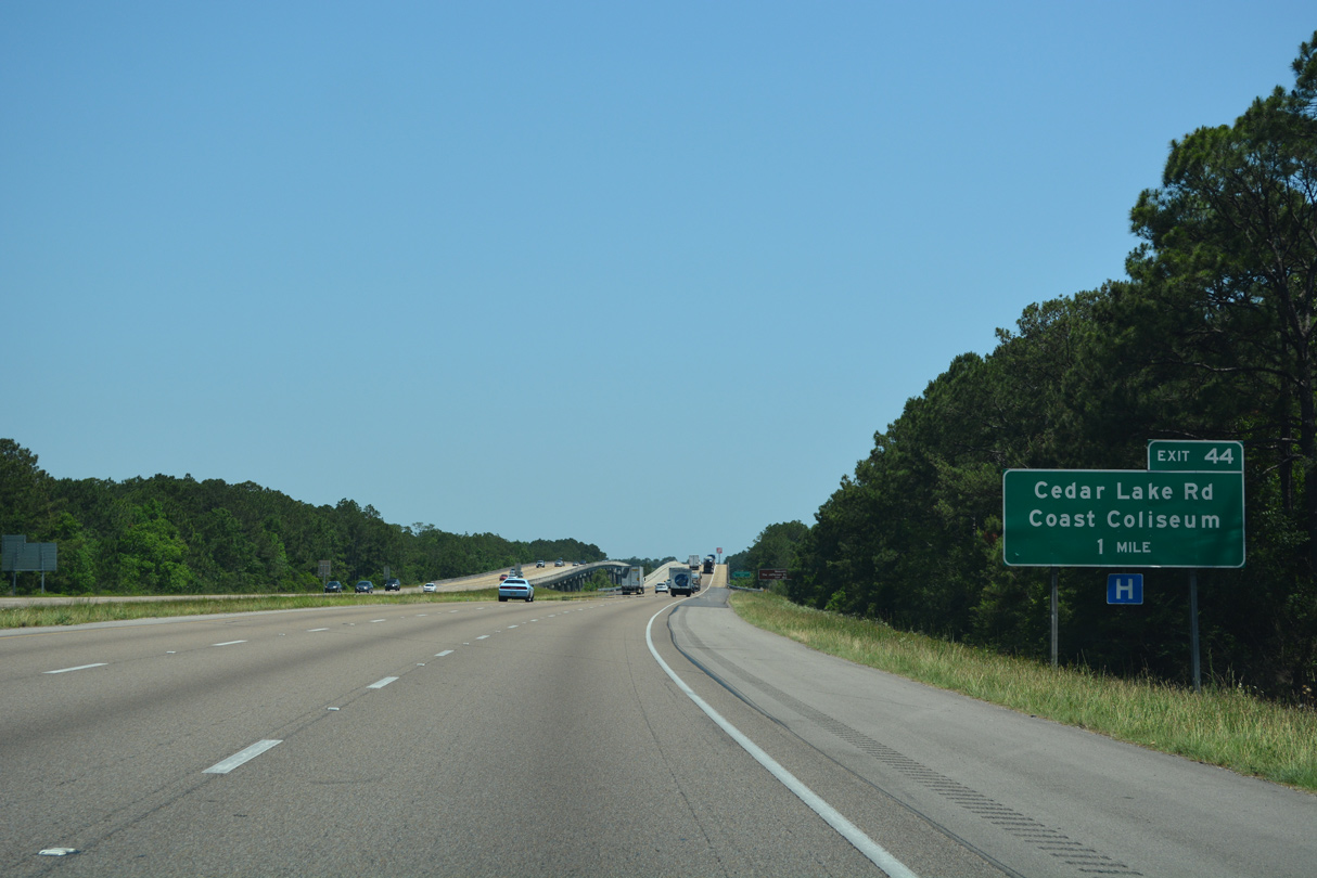
Cedar Lake Road leads north from Exit 44 to Cedar Lake and south to Popp's Ferry Road west toward Mississippi Coast Coliseum. The sports and entertainment venue lies along U.S. 90 (Beach Boulevard) at Beauvoir Road in west Biloxi.
05/11/22
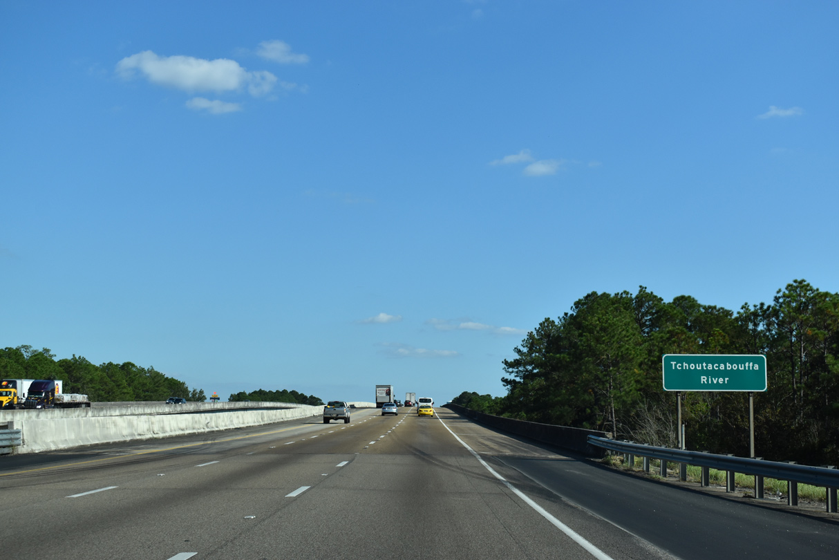
Interstate 10 spans the Tchoutacabouffa River ahead of the diamond interchange (Exit 44) with Cedar Lake Road.
10/08/21
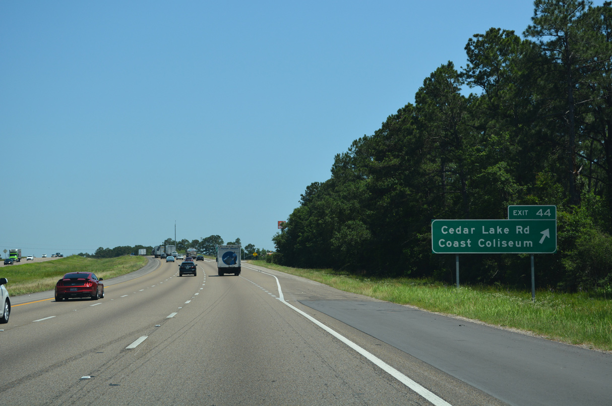
Cedar Lake Road crosses the Tchoutacabouffa River north 1.99 miles to Old Highway 67 and Hudson-Krohn Road at Cedar Lake. Points of interest for Exit 44 include Beauvoir, the retirement home of Confederate President Jefferson Davis. Beauvoir is next to Mississippi Coast Coliseum.
05/11/22
Canal Road expands to four lanes leading into the diamond interchange with Interstate 10 at Exit 31.
05/09/15
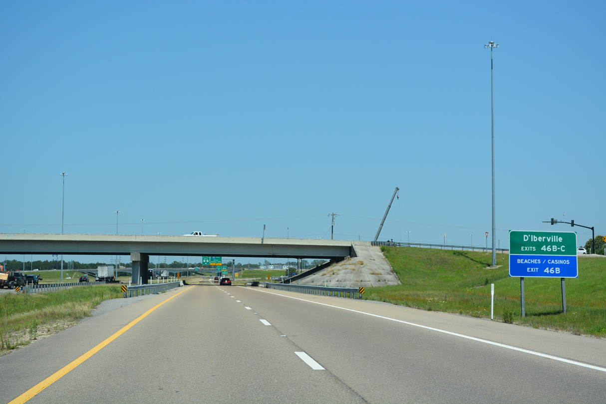
Interstate 10 wholly enters the city of D'Iberville eastbound at Gay Road.
05/11/22

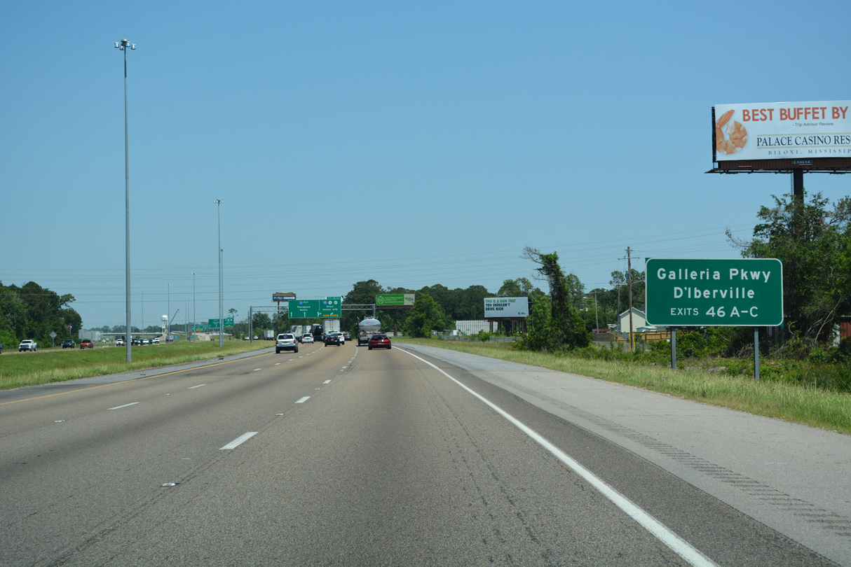
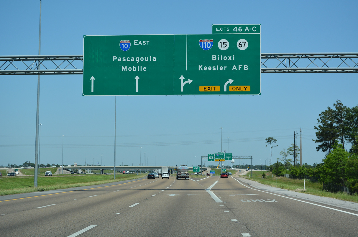
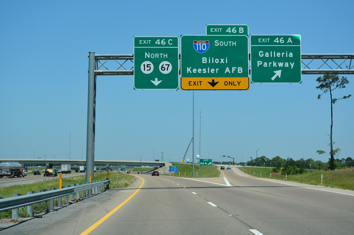
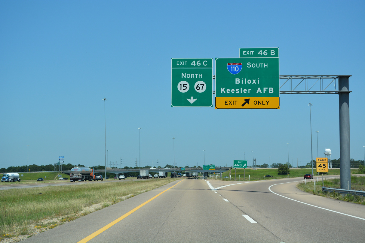
Opened to traffic on January 21, 2015, a collector distributor roadway (Exit 46) separates from eastbound I-10 in one mile for Galleria Parkway, Interstate 110 south and MS 15/67 north.
05/11/22
The diverging diamond interchange at Exit 46 A links I-10 with Galleria Parkway to adjacent retail areas in D'Iberville. The exchange opened on June 2, 2015.
05/11/22
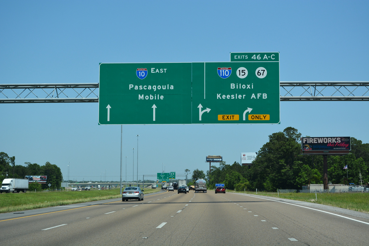
Interstate 110 constitutes a 4.16 mile long spur to Downtown Biloxi and U.S. 90 (Beach Boulevard) along Mississippi Sound.
05/11/22
I-110 spans the Back Bay of Biloxi south from D'Iberville ahead of the first four exits in Biloxi. Division Street links I-110 with Keesler Air Force Base 0.48 miles to the west.
05/11/22
Galleria Parkway angles southeast to Popp's Ferry Road and northwest to Promenade Parkway at Old Highway 67. The adjacent Promenade retail complex opened in 2009.
05/11/22
The D'Iberville city limits extend north along the Tchoutacabouffa River and Lamey Bridge Road east of the trumpet interchange with MS 15/67 separate northbound. That exchange was completed in 2009.
05/11/22
Prior to January 16, 2009, MS 15 overlapped with I-110 south to U.S. 90 (Beach Boulevard) in Biloxi. MS 15 originally followed Central Avenue in D'Iberville and Caillavet Street in Biloxi.
05/11/22
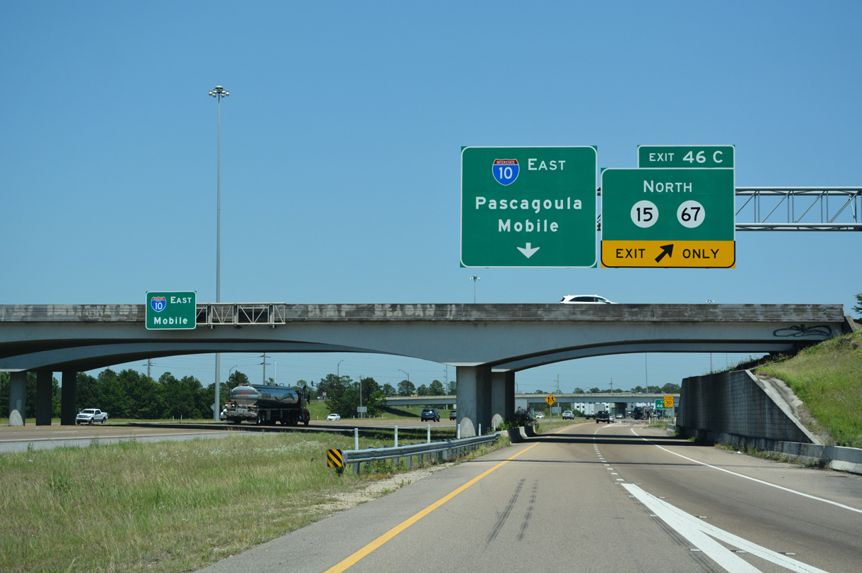
Commencing north from the cloverleaf interchange joining I-10/110, MS 15/67 overlap 2.31 miles. MS 15 branches north from MS 67 to DeSoto National Forest and MS 26 at Moore Crossing while MS 67 leads 18.26 miles northwest along an expressway to U.S. 49 at Saucier.
05/11/22
The loop ramp at Exit 46 C formerly departed from the I-10 mainline for MS 15/67 north ahead of Sangani Boulevard and Promenade Parkway. A grade separated intersection was constructed there between March 2012 and November 2013.
10/08/21
Entrance ramps from Lamey Bridge Road and I-110 north join Interstate 10 eastbound ahead of this confirming marker.
05/11/22
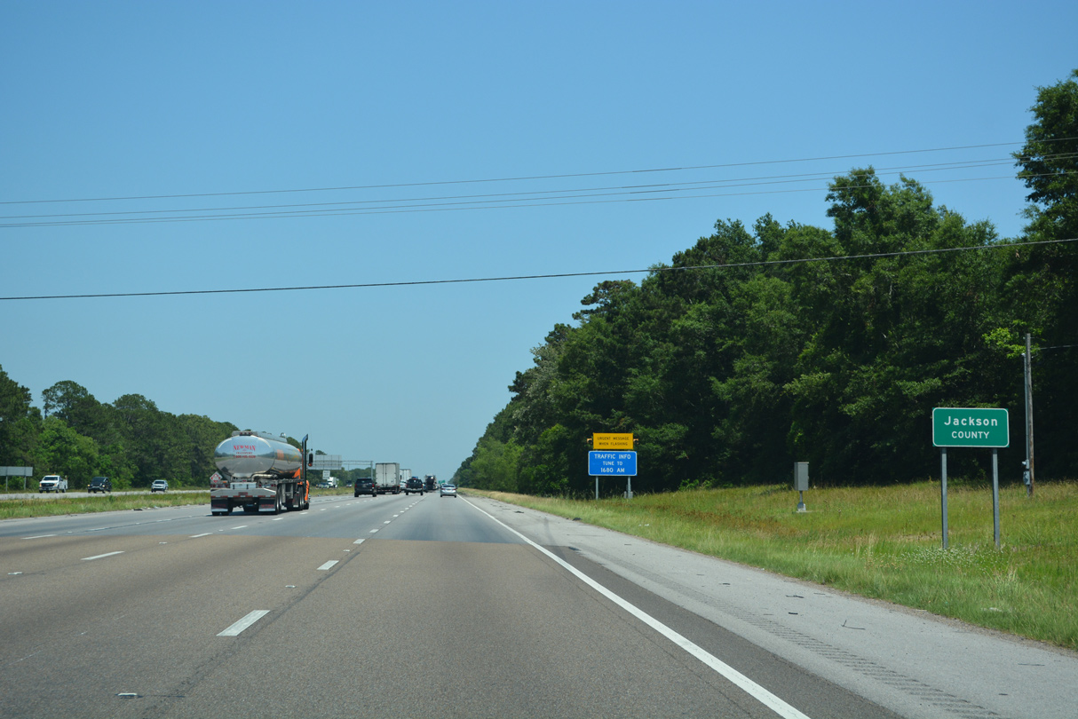
Interstate 10 enters Jackson County east by Gorenflo Road. Founded in 1812, the county is named after U.S. President Andrew Jackson. The 2020 census recorded 143,252 residents.
05/11/22

Cedar Lake Road expands to a five lane boulevard south into the diamond interchange (Exit 44) with Interstate 10 in north Biloxi.
11/20/15
Widening of Interstate 10 east from I-110 to the diamond interchange at Exit 50 occurred in 2004-05.
05/11/22
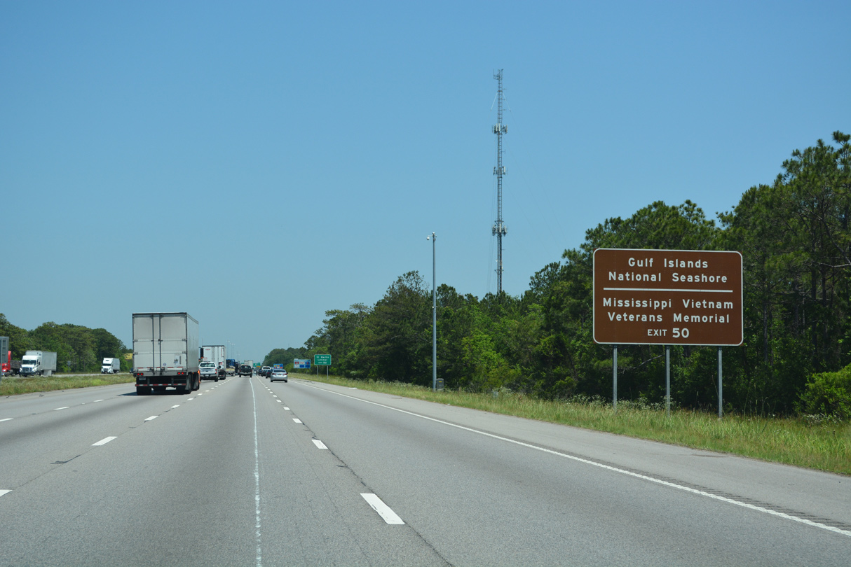
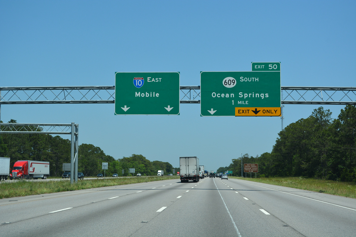
MS 609 (Washington Avenue) south 2.80 miles to U.S. 90 (Bienville Boulevard) east leads toward the Davis Bayou Area of Gulf Islands National Seashore and Mississippi Vietnam Veterans Memorial.
05/11/22

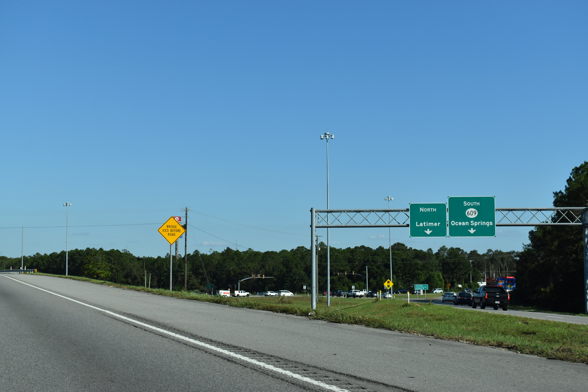
Interstate 10 was expanded to six lanes over MS 609 at St. Martin by 2012. Tucker Road extends 3.32 miles north to Old Biloxi Road at the census designated place of Latmier.
05/11/22
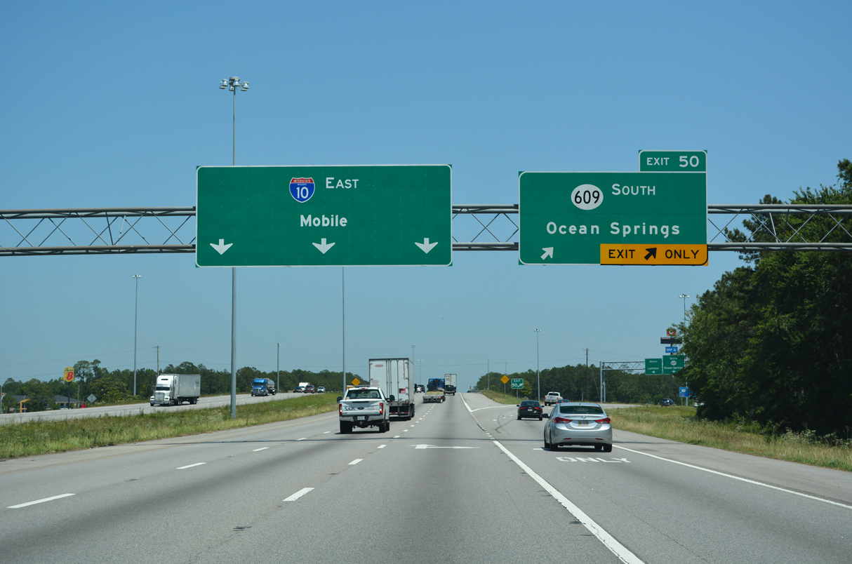
MS 609 comprises a four to six lane arterial south across Old Fort Bayou into the city of Ocean Springs. Exit 50 was expanded as part of construction widening I-10.
05/11/22
Old Biloxi Road 17.55 miles north from Bayou Costapia to Larue and Vestry Road through De Soto National Forest is inventoried by MDOT as a continuation of MS 609.
10/08/21
A two year, $50 million project expanded Interstate 10 to six lanes from MS 609 / Exit 50 to MS 57 / Exit 57. Work was completed in March 2018.2
10/08/21
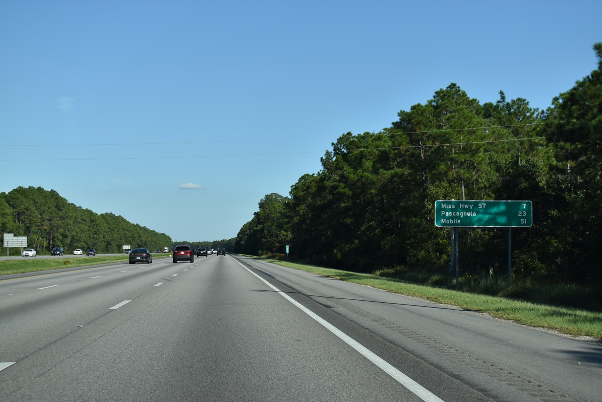
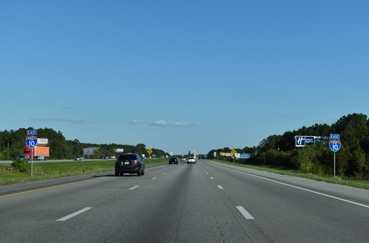
I-10 east to MS 613 south leads to Pascagoula in 23 miles. However Gautier Vancleave Road south to U.S. 90 east is three miles shorter to the Jackson County seat.
10/08/21
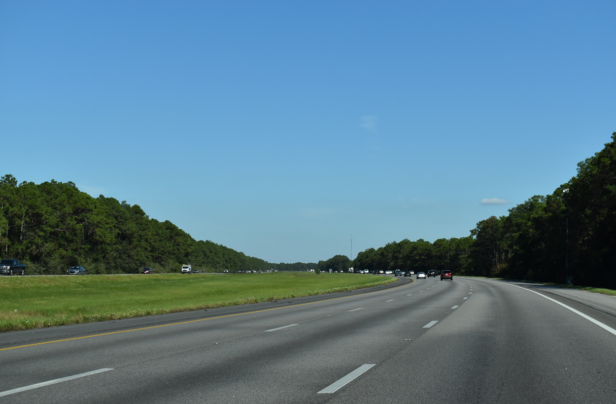
Interstate 10 shifts northward and expands with a wide median along the south side of Mississippi Sandhill Crane National Wildlife Refuge.
10/08/21
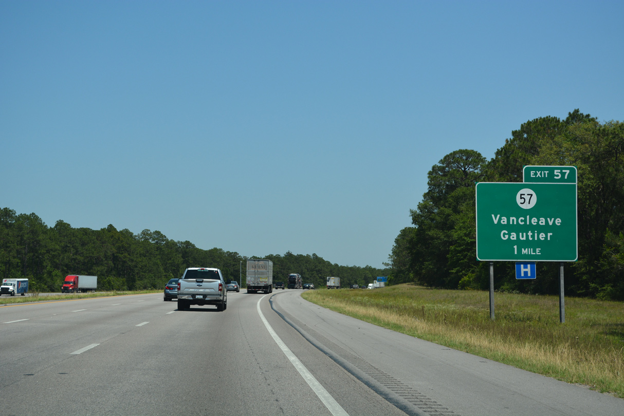
Exit 57 is one of several numbering anomalies along the Interstate system where the Exit number and route number coincide. MS 57 runs for 97.61 miles from U.S. 90 at Fountainebleau to U.S. 45 at State Line.
05/11/22
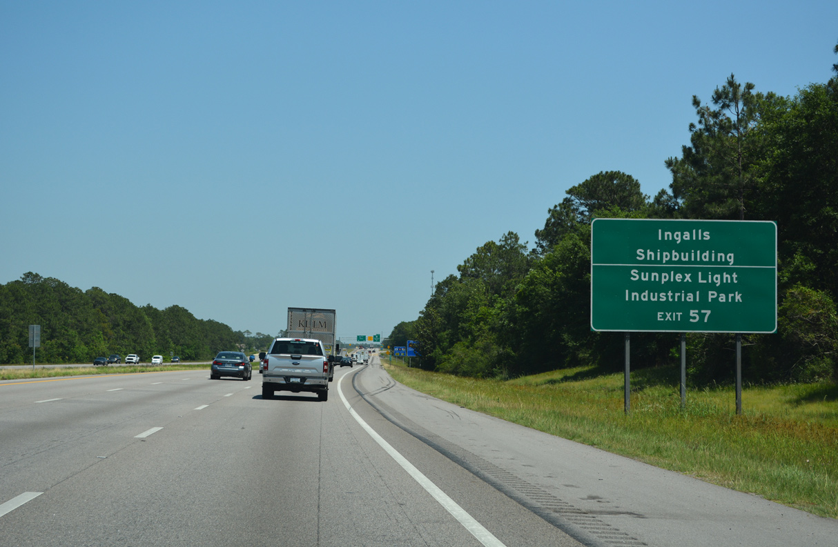
Points of interest for Exit 57 include Naval Station Pascagoula, Ingalls Shipbuilding and Sunplex Light Industrial Park.
05/11/22
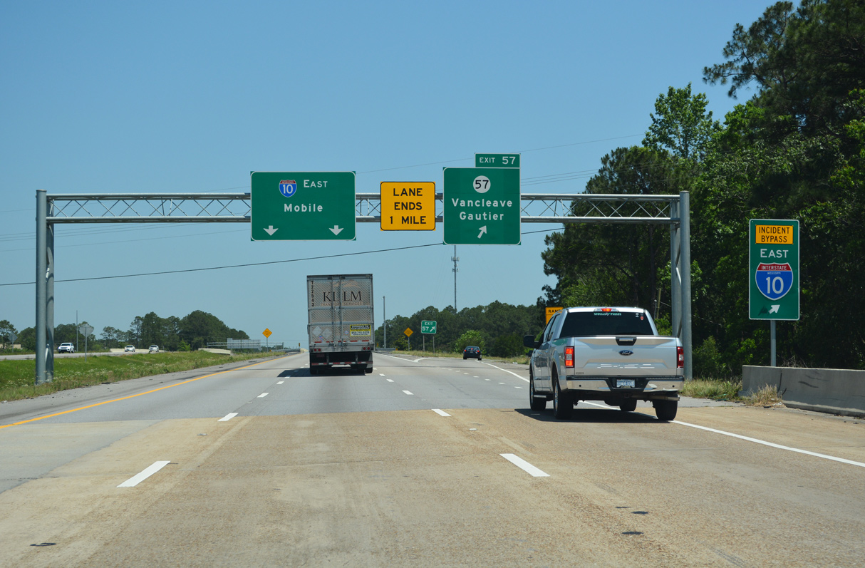
Crossing Old Fort Bayou, Interstate 10 enters the diamond interchange (Exit 57) with MS 57.
05/11/22
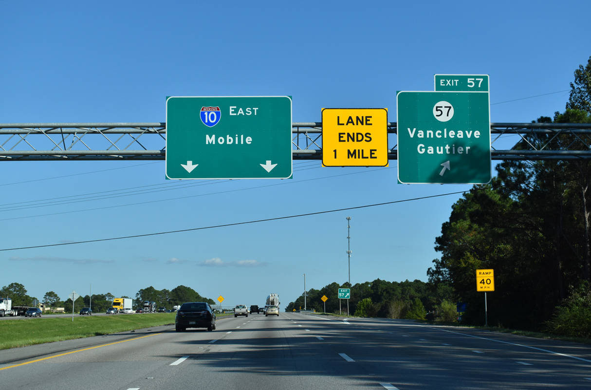
MS 57 heads 2.69 miles south from Exit 57 along the Gautier city line to U.S. 90.
10/08/21
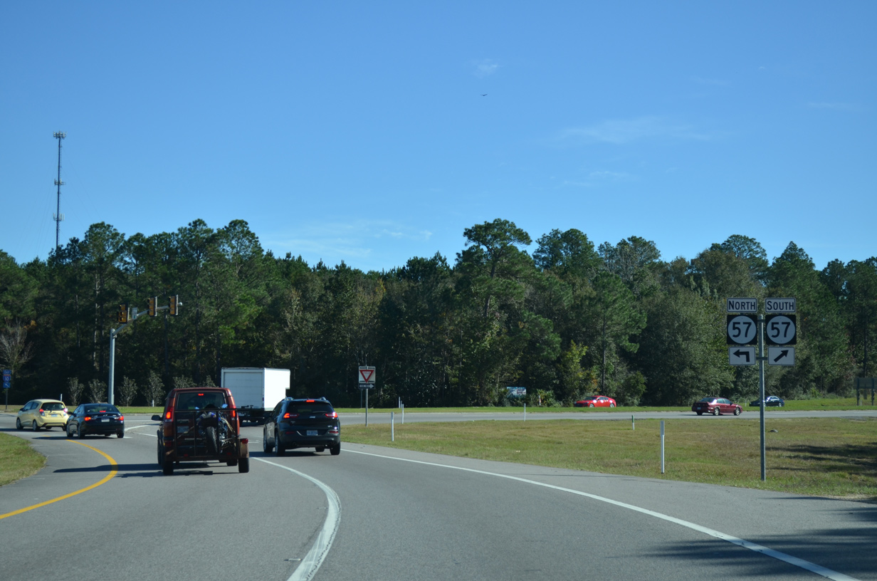
Northward from Interstate 10, MS 57 follows a lightly traveled route 50.71 miles to Vancleave, Benndale and McLain.
11/20/15
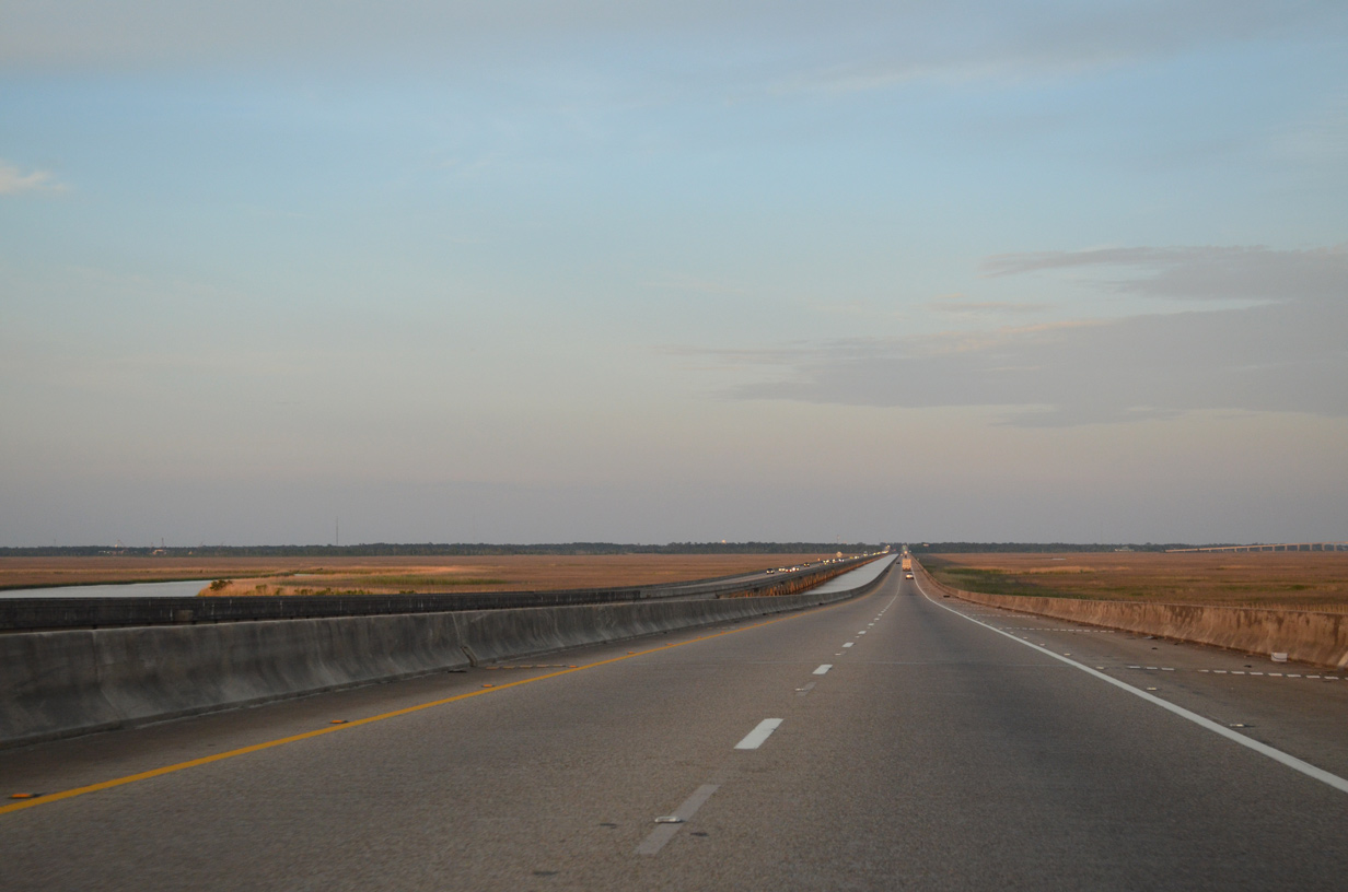
The remainder of Interstate 10 east in Mississippi is just four lanes.
10/08/21

The bulk of the Gautier city limits lie south of Exit 61 along Pascagoula Bay and Mississippi Sound. Interstate 10 meets Alabama State Route 163 (Dauphin Island Parkway) within the city of Mobile in 41 miles.
05/11/22
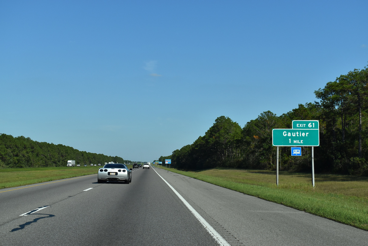
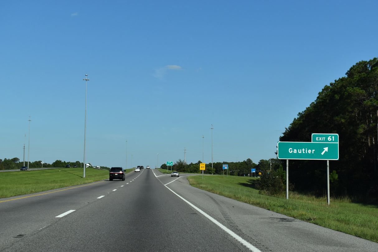
A rural diamond interchange (Exit 61) links Interstate 10 with Gautier-Vancleave Road in one mile.
10/08/21
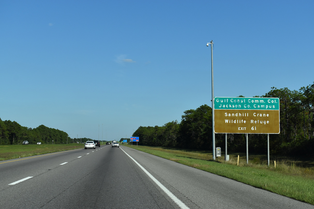
Interstate 10 traverses areas of Mississippi Sandhill Crane National Wildlife Refuge for two miles east between the Gautier city limits.
10/08/21
Gautier-Vancleave Road expands to four lanes south 3.38 miles from Exit 61 to U.S. 90. U.S. 90 east from Gautier continues across the West Pascagoula River onto the Martin Luther King, Jr. Causeway. The causeway leads to an eight lane high-level bridge over the East Pascagoula River by Downtown Pascagoula.
10/08/21
A frontage road lines the north side of Interstate 10 between Exit 61 and Martin Bluff Road. The freeway remains within Mississippi Sandhill Crane National Wildlife Refuge along this stretch.
10/08/21
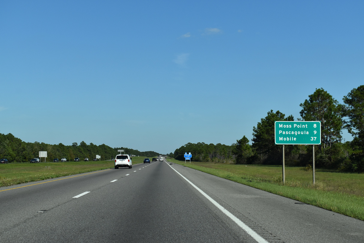
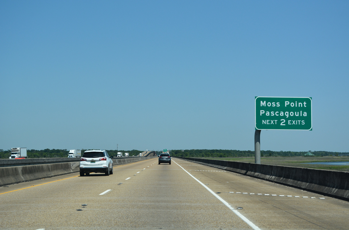
The succeeding two exits serve the cities of Moss Point and Pascagoula in southern Jackson County.
10/08/21
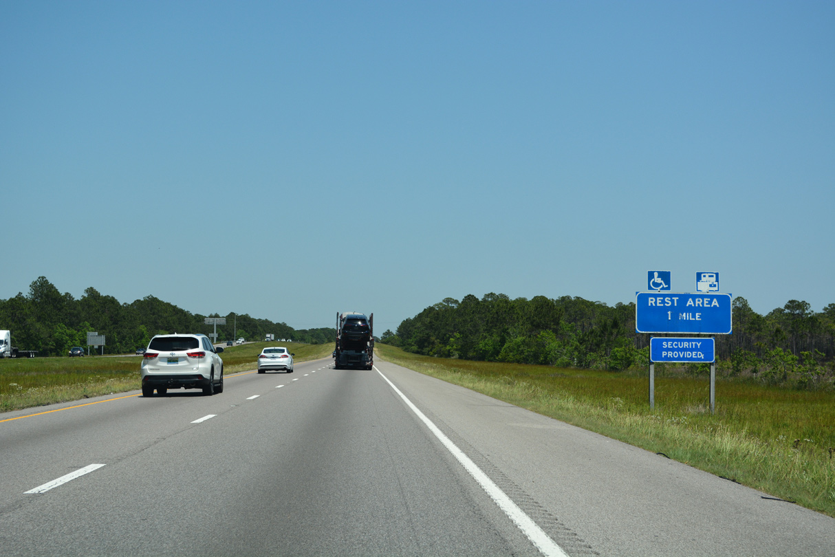
The second rest area along Interstate 10 eastbound in Mississippi lies south of Farragut Lake.
05/11/22
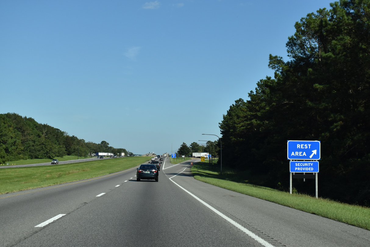
The rest area east of Martin Bluff Road overlooks the West Pascagoula River.
10/08/21
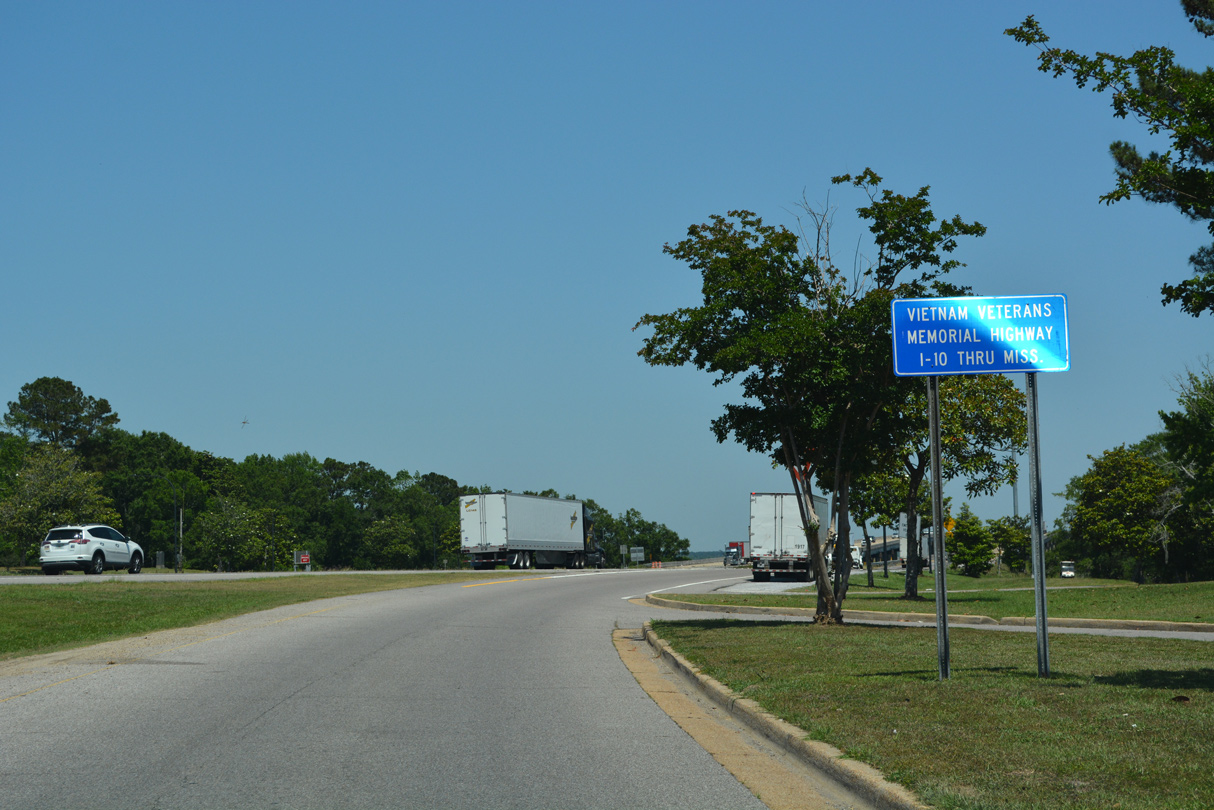
Interstate 10 in Mississippi is the Vietnam Veterans Memorial Highway.
05/11/22
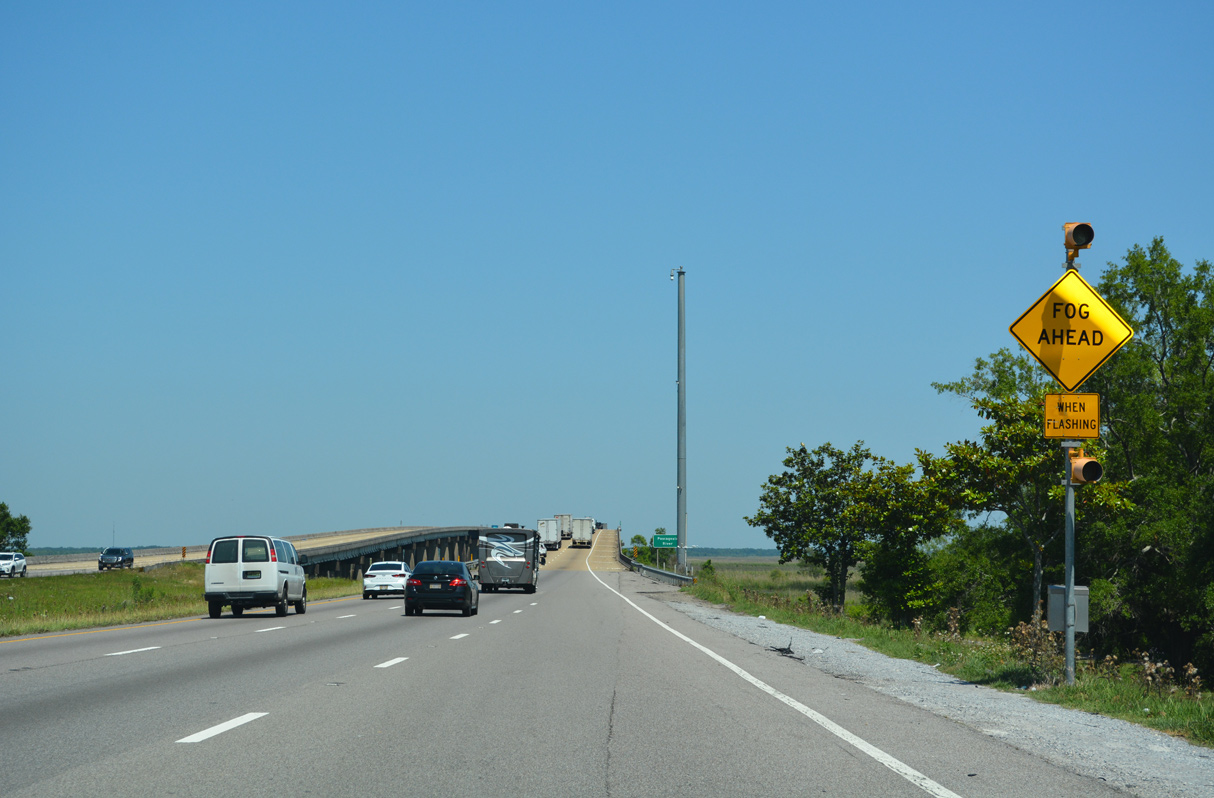
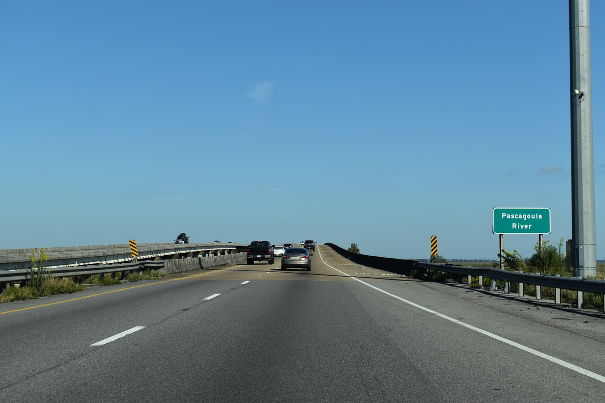
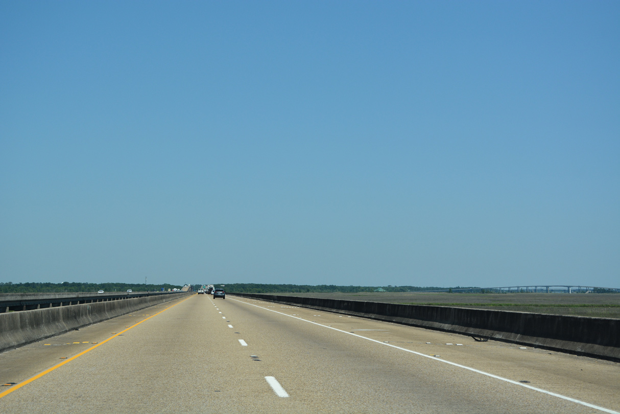
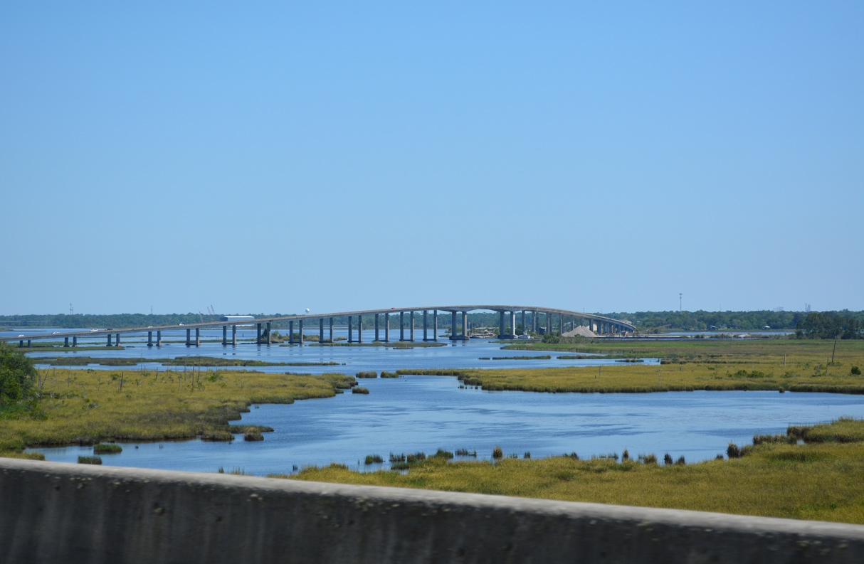
The 4.16 miles along I-10 between the rest area and Exit 68 cross the Pascagoula Rivers and associated wetlands prone to fog.
05/11/22
Interstate 10 rises above the West Pascagoula River at the start of a viaduct system extending east across Creole and Crooked Bayous to Moss Point.
10/08/21
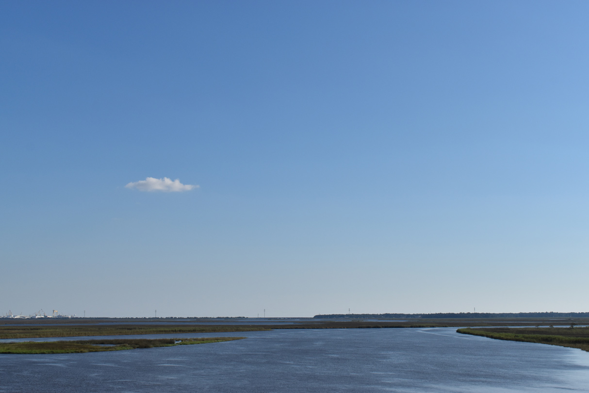
The West Pascagoula River flows south past Gautier into Pascagoula Bay.
10/08/21
The four mile long viaduct system spanning the West and East Pascagoula Rivers is notorious for speeders.
05/09/15
A small section of the eastbound viaduct along I-10 was damaged during Hurricane Katrina when strong winds pushed a barge into the span, causing a portion of the bridge deck to shift. The crossing reopened to traffic on October 2, 2005 following a 20 day long repair job.
05/11/22
Pascagoula lies along U.S. 90 and Mississippi Sound. Moss Point spreading to the north along the East Pascagoula and Escatawpa Rivers. As both rivers provide a natural inland port, the two cities are known for the ship building industry.
05/11/22
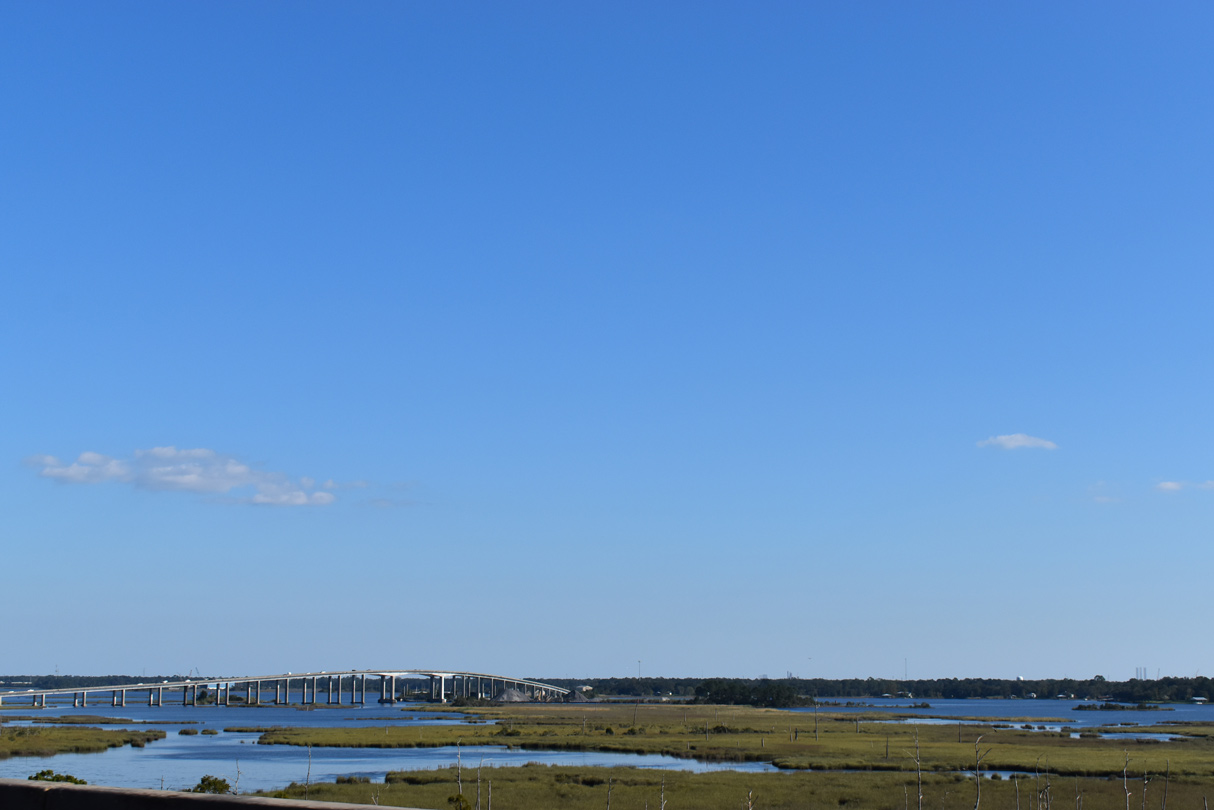
Marshland spreads to the southeast of Interstate 10 from Crooked Bayou to Beardslee Lake in Moss Point. Part of MS 613, the Jack G. Hanson Memorial Bridge crosses the Escatawpa River in the distance.
10/08/21
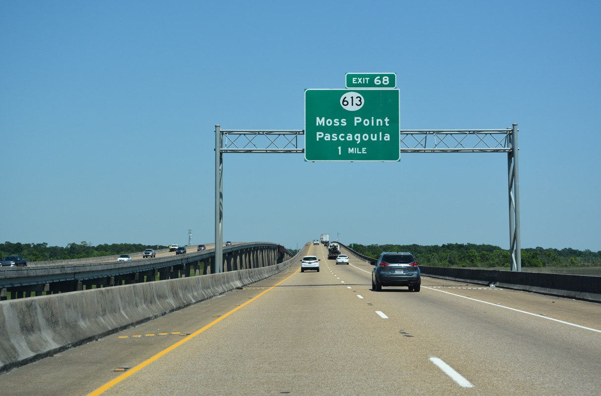
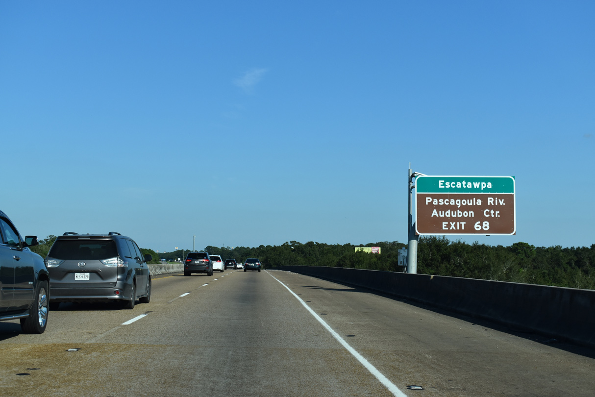
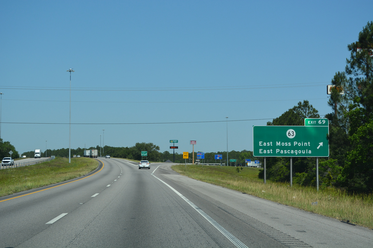
I-10 ascends over the East Pascagoula River at the Moss Point city line, one mile ahead of Exit 68 to MS 613. MS 613 angles 1.88 miles northeast on Telephone Road from U.S. 90 in Pascagoula onto Main Street through Moss Point.
05/11/22
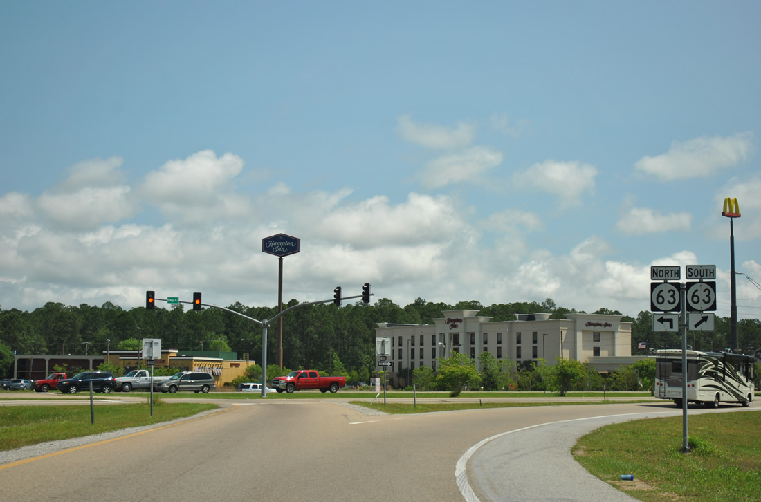
Two high level bridges span the Escatawpa River between northern and southern Moss Point. Beyond MS 613 north of Moss Point City Hall, the high rise along MS 63 leads southeast toward Kreole.
05/11/22
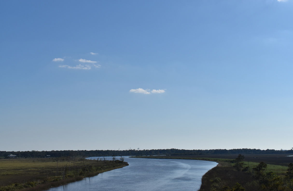
The East Pascagoula River flows west around Moss Point from Beardslee Lake and Griffin Point to Lake Catch-em-all.
10/08/21
MS 613 parallels nearby MS 63 northward to Escatawpa en route to the rural community of Hurley and the George County seat of Lucedale.
10/08/21
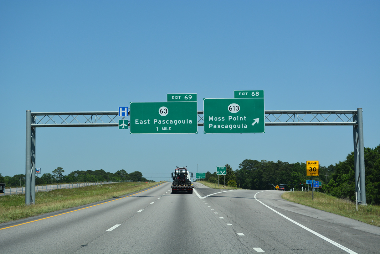
I-10 enter the diamond interchange (Exit 68) with MS 613 just beyond Frank Griffin Road and the viaduct over the Pascagoula River. MS 613 travels 46.65 miles overall from U.S. 90 (Denny Avenue) near Downtown Pascagoula to MS 198 in Lucedale.
05/11/22
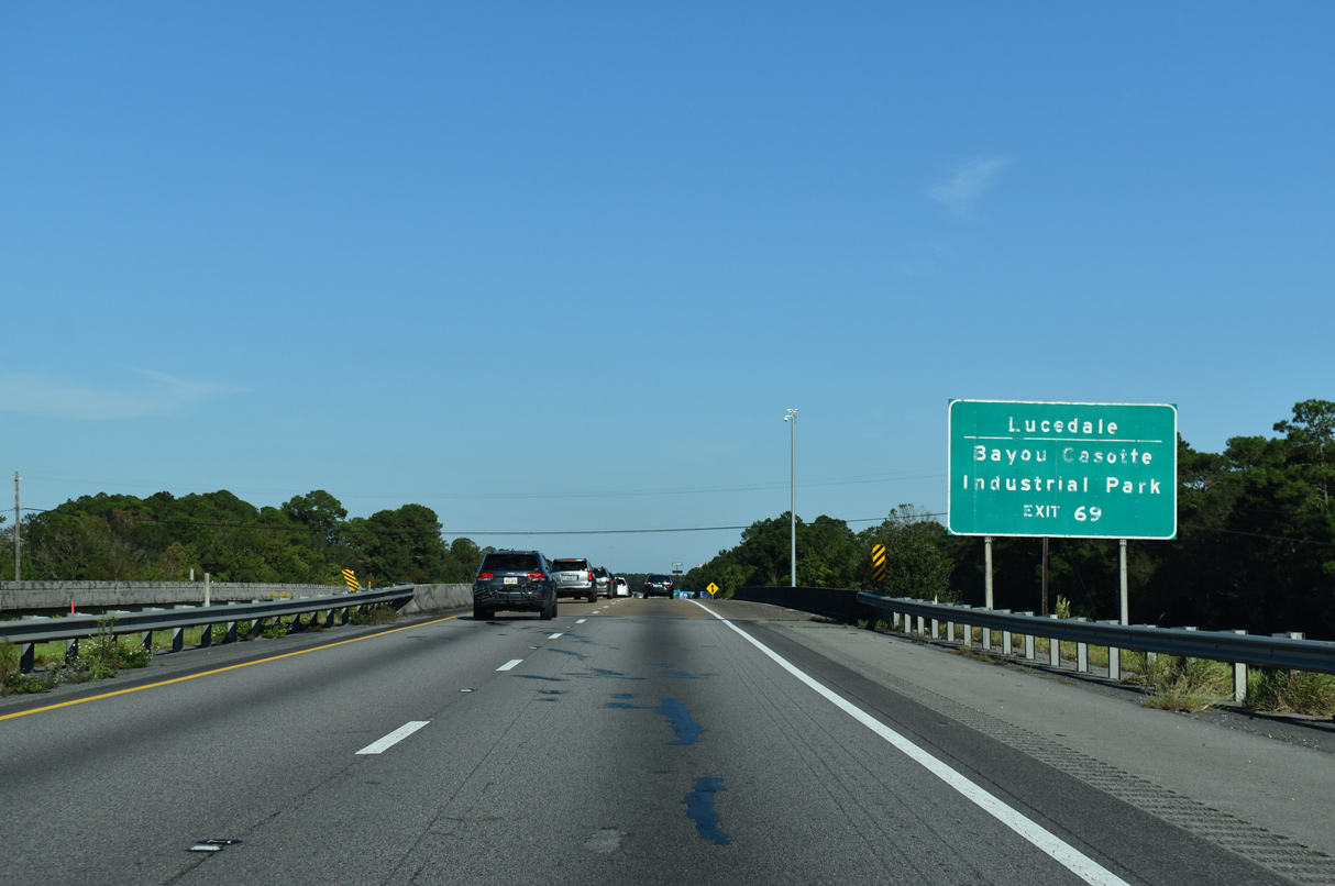
MS 63 comprises a four lane highway north to U.S. 98 outside the city of Lucedale. The south end of MS 63 ties into U.S. 90 across from the north end of MS 611 and Bayou Casotte Industrial Park.
10/08/21
MS 63 travels 54.62 miles north from Moss Point to MS 57 near Leakesville, mostly along an expressway completed in 2011. MS 57 extends the expressway to U.S. 45 at State Line.
05/11/22
Measuring 112.78 miles overall, MS 63 joins the Gulf Coast with MS 184 at Wayneboro.
04/05/12
Eastbound reassurance marker posted at the Mississippi Export Railroad under crossing.
10/08/21
Interstate 10 continues six miles east to the last exit in Mississippi. SR 163 (Dauphin Island Parkway) in Mobile, Alabama is 29 miles away.
10/08/21
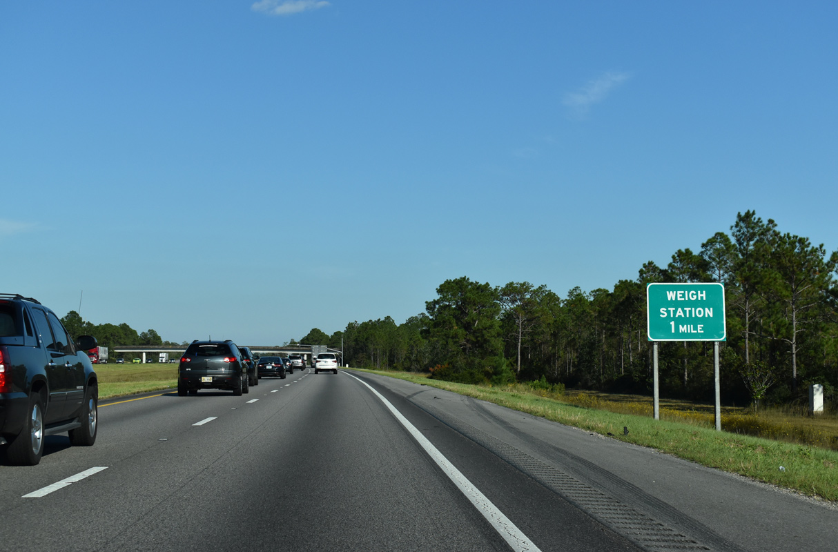
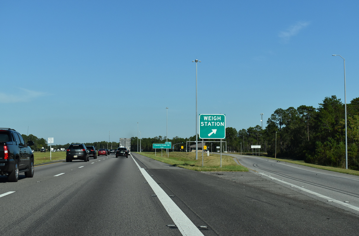
Pollock Ferry Road spans Interstate 10 within one mile of an eastbound weigh station.
10/08/21
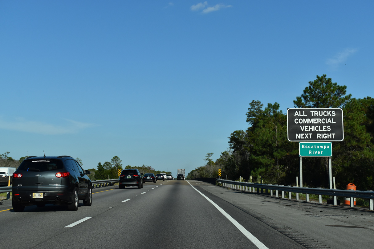
The Escatawpa River flows 129 miles south from Alabama into the Pascagoula River at Moss Point.
10/08/21
A 0.6 mile long viaduct system spans the Escatawpa River and wetlands associated with Grand Bay National Wildlife Refuge.
04/05/12
The Mississippi Welcome Center lines the westbound roadway opposite the eastbound weigh station. There are no weigh stations in Alabama; the next on I-10 is located just across the Florida state line.
10/08/21

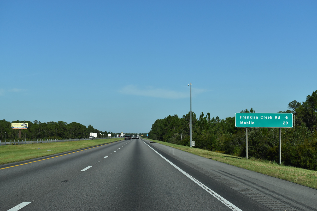
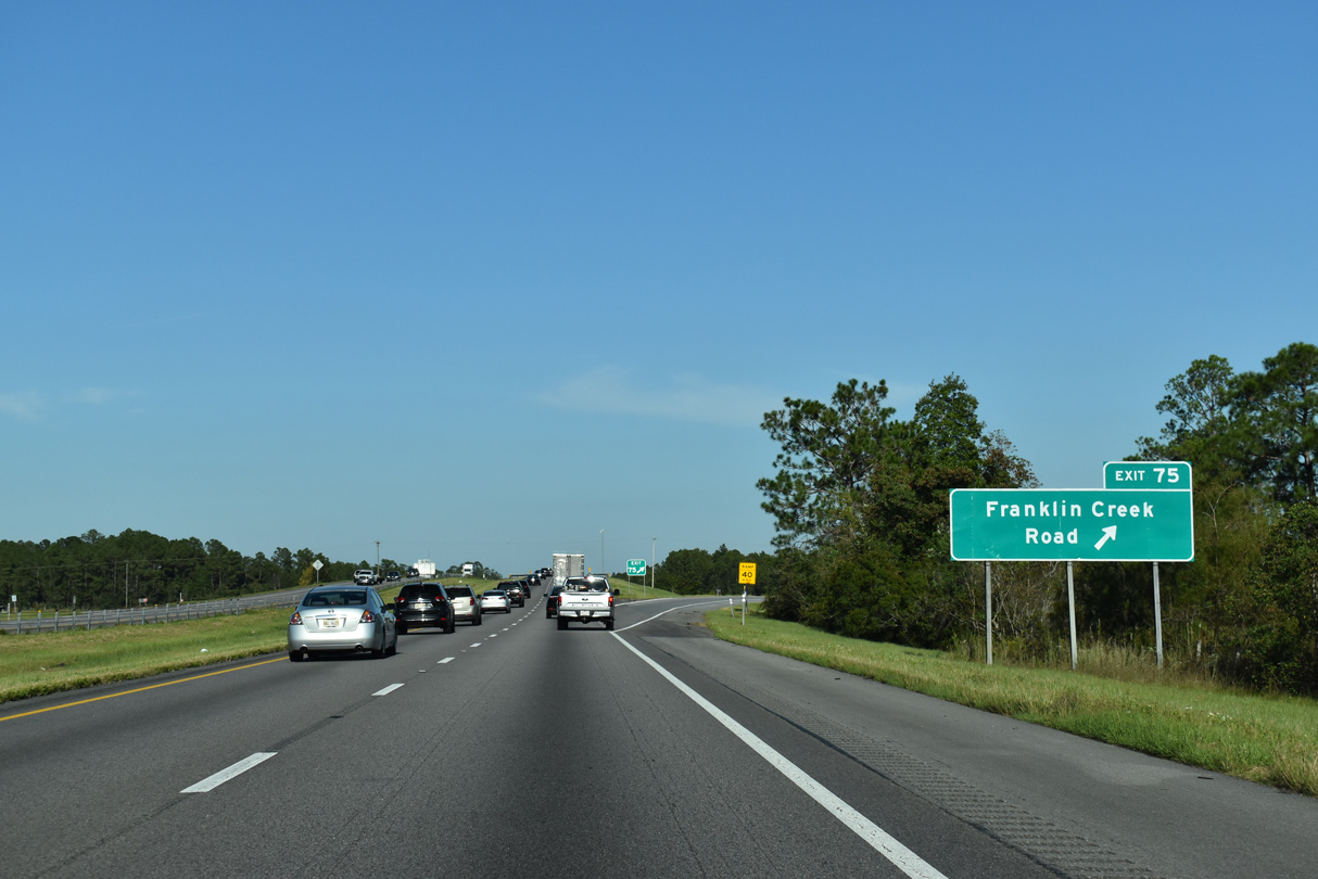
The diamond interchange at Exit 75 connects I-10 with the Franklin Creek community to the north via Independence and Forts Lake Roads. With four lanes, Franklin Creek Road south ties into parallel U.S. 90 in 0.51 miles.
10/08/21
Forts Lake and Valley Forge Road provide a through route from Independence Road to Old Pascagoula Road (Mobile County Route 28) at Cloverdale, Alabama.
10/08/21
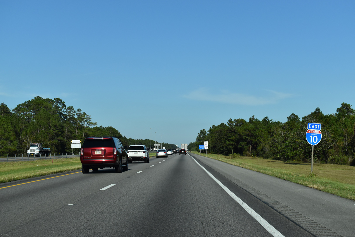
I-10 advances 0.96 miles from the Franklin Creek Road entrance ramp to the Alabama state line. U.S. 90 travels nearby before turning east toward Grand Bay.
10/08/21
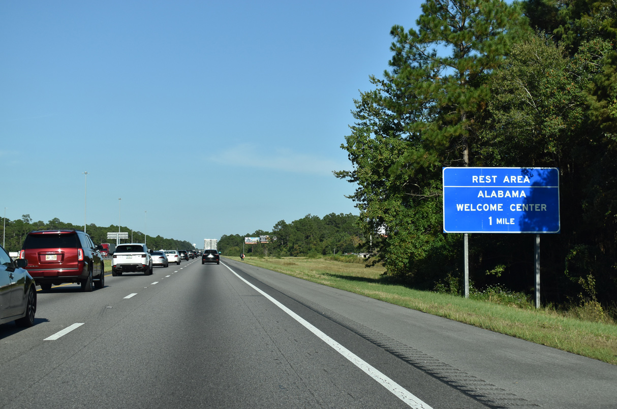
The Alabama Welcome Center on Interstate 10 lies within one mile of the state line east of Franklin Creek.
10/08/21
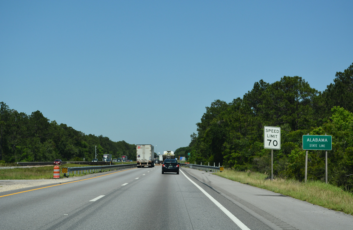
An entrance ramp formerly linked adjacent U.S. 90 with Interstate 10 east at the Alabama state line. This was removed when Mississippi completed the freeway in Jackson County.
05/11/22

References:
- Jackson County, Mississippi. Wikipedia.
- "Construction on I-10 in Jackson County nearly complete." https://www.wlox.com/story/37669483 /construction-on-i-10-in-jackson-county-nearly-complete/ WLOX-TV (Biloxi, MS) March 7, 2018.
Photo Credits:
- ABRoads: 10/08/21, 05/11/22
- Alex Nitzman: 04/05/12, 05/09/15, 11/20/15
Connect with:
Page Updated Monday July 03, 2023.