
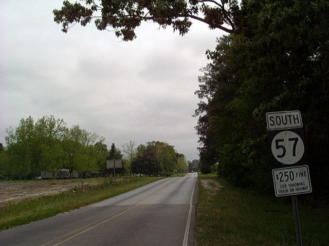
Highway 57

Traveling 98.4 miles from U.S. 90 by Ocean Springs to U.S. 45 at State Line, Highway 57 is one of three routes connecting Jackson County with interior areas of southeastern Mississippi. The state highway traverses portions of Pascagoula River State Wildlife Management Area and De Soto National Forest along a lightly traveled route north from Vancleave to the rural town of McLain. Turning east, MS 57 overlaps with U.S. 98 across the Leaf River before separating en route to the Greene County seat of Leakesville.
MS 63 combines with MS 57 southeast over the Chickawawhay River to a four lane corridor extending north from Moss Point and Lucedale to State Line. MS 63 follows the highway south while MS 57 takes it north. The state highway converges with U.S. 45 at a wye interchange south of Waynesboro.
Historically, the alignment of MS 57 was designated as MS 59, and what is MS 15 to the west from D'Iberville northward was the original MS 57. The state highway was also realigned with the completion of the four lane highway east of Leakesville.
$212.6 million in construction got underway in Spring 2023 to widen a nine mile long stretch of Highway 57 from Interstate 10 north to Vancleave. Work through 2027 includes building a new alignment bypassing Vancleave, from Gautier-Vancleave Road to the Lake O'Pines area.3
 North
North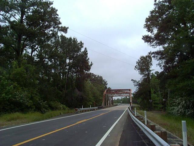
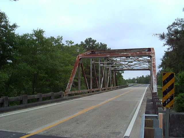
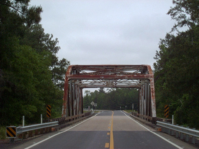
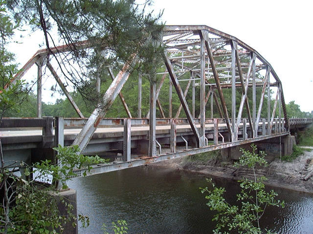
Mississippi 57 previously crossed Red Creek on a 242 foot long through truss bridge built in 1959.1
04/25/02
The Red Creek bridge along MS 57 was severely damaged when a truck carrying construction equipment collided with the span. Closed in September 2017, a $7.7 million contract was awarded for a replacement bridge. The new span was completed in August 2019.2
04/25/02
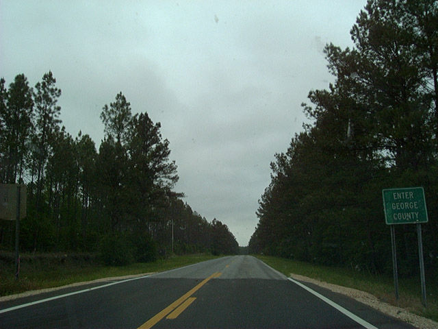
Highway 57 crosses the George County line north of Red Creek alongside Pascagoula River State Wildlife Management Area.
04/25/02
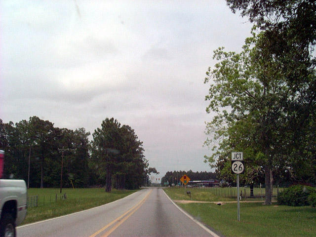
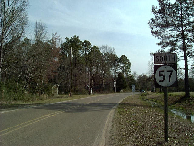
MS 57 intersects MS 26 at a traffic light, 33.8 miles north of Interstate 10 at Benndale.
04/25/02
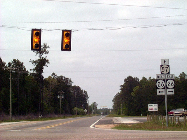
As equally a rural highway as MS 57, MS 26 connects the county seats of Wiggins to the west and Lucedale to the east.
04/25/02
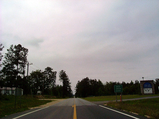
Entering southwest Greene County north of Advent on MS 57 north in DeSoto National Forest.
04/25/02
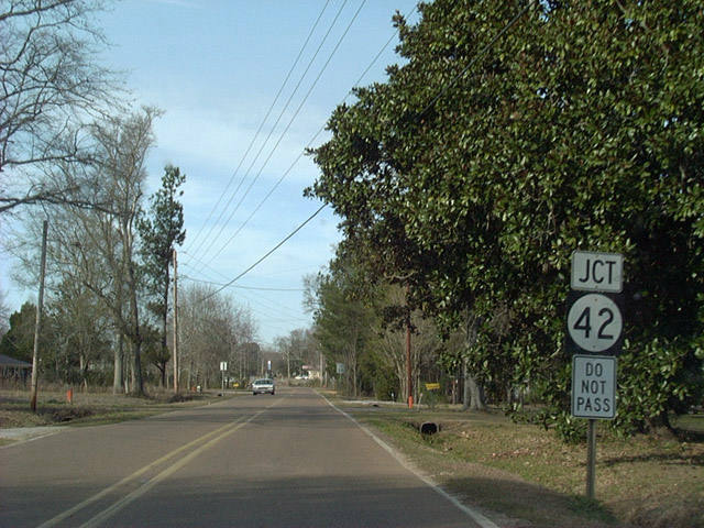
MS 57 formerly traveled along Main Street north toward MS 42 (St. Peter Street) in the town of State Line. State maintenance ended just north of St. Paul Street prior to relocation of MS 57 east onto the expressway bypass in 2007.
02/10/02
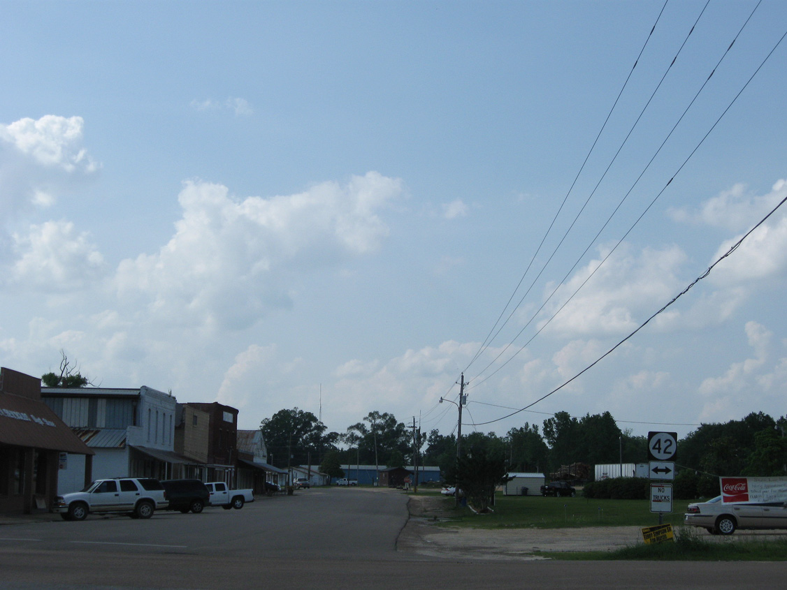
Main Street extends north 5.7 miles from MS 42 (St. Peter Street) to U.S. 45. MS 42 connects with the State Line bypass at a diamond interchange nearby.
05/09/09
South
The previous start of MS 57 southbound was located south of St. Charles Street in the town of State Line. With the expressway for MS 57 opened to the east, the remainder of Main Street south of MS 42 was turned over to local control.
05/09/09
Prior to the realignment in 2007, the lone reassurance marker for MS 57 southbound between MS 42 and MS 63 outside Leakesville was this assembly posted along Main Street in the town of State Line.
02/10/02
Confirming marker posted south of MS 26 at Benndale.
08/21/01
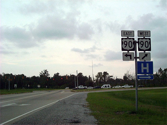
MS 57 south concludes at U.S. 90 and Old 57 Road along the eastern city limits of Ocean Springs.
08/20/01
References:
- Baughn, J. (n.d.). Red Creek MS 57 Bridge Bridgehunter.com. http://bridgehunter.com/ms/jackson/310005703002030/
- "Construction of Hwy. 57 bridge over Red Creek underway." gulflive.com (Mississippi Press), January 18, 2019.
- "MDOT projects move forward in southeast Mississippi." https://mdot.ms.gov/portal/news_release_view/1401 MDOT news release. April 5, 2023.
Photo Credits:
- Alex Nitzman: 08/20/01, 08/21/01, 02/10/02, 04/25/02
- ABRoads: 05/09/09
Connect with:
Page Updated Friday March 22, 2019.