
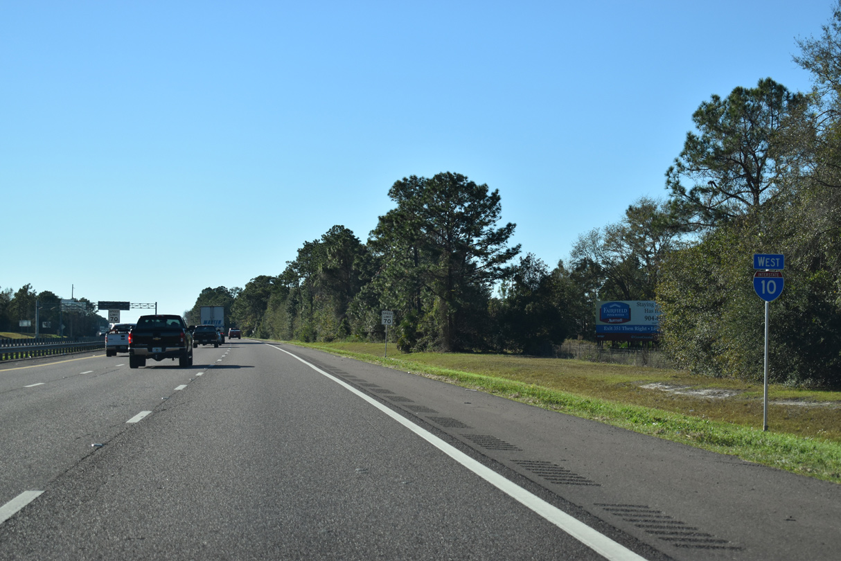
Interstate 10 West - Jacksonville
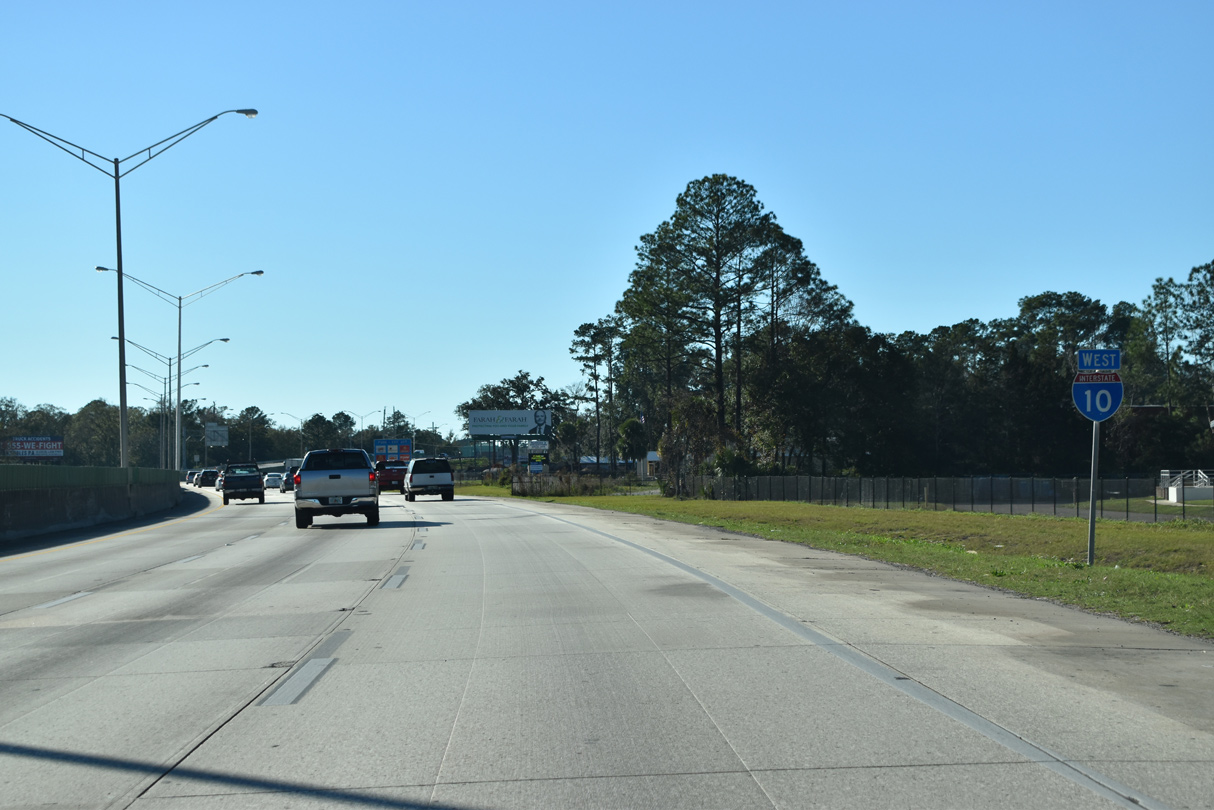
 West
West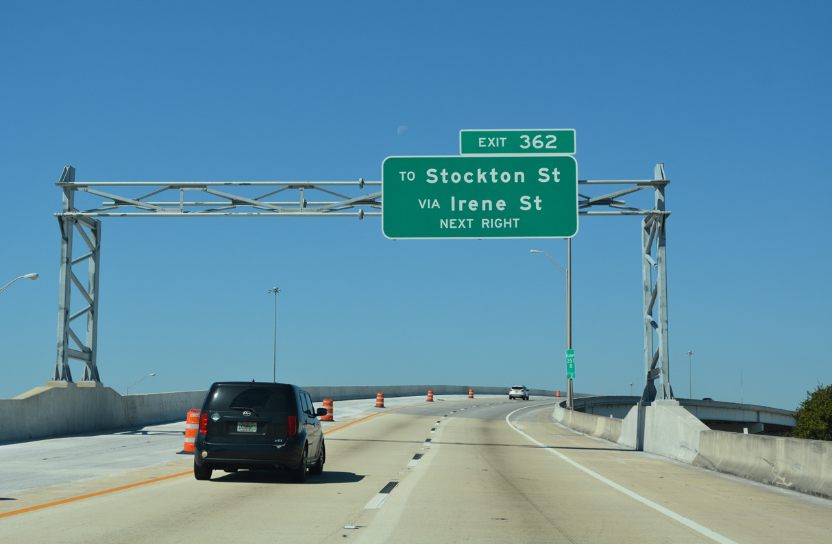
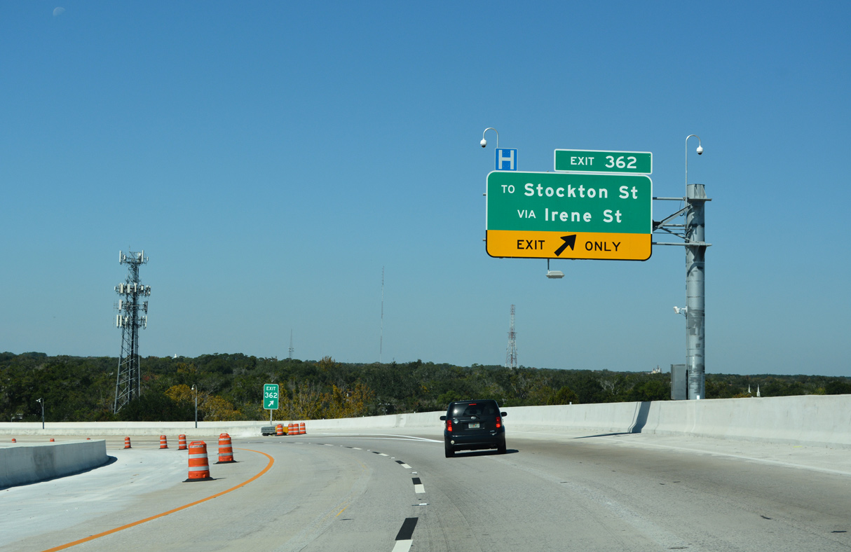
Construction from May 5, 2017 to Spring 2021 Fall 2022 expands the ramp from I-95 north to I-10 west with an additional lane and adds a separate flyover for Exit 362 to Stockton Street.
10/16/22

Downtown Jacksonville spreads to the northeast along the St. Johns River beyond the Brooklyn neighborhood.
06/16/16
A folded diamond interchange joins Interstate 10 with Stockton Street at the Mixon Town and Riverside neighborhoods to the immediate west of I-95.
10/16/22
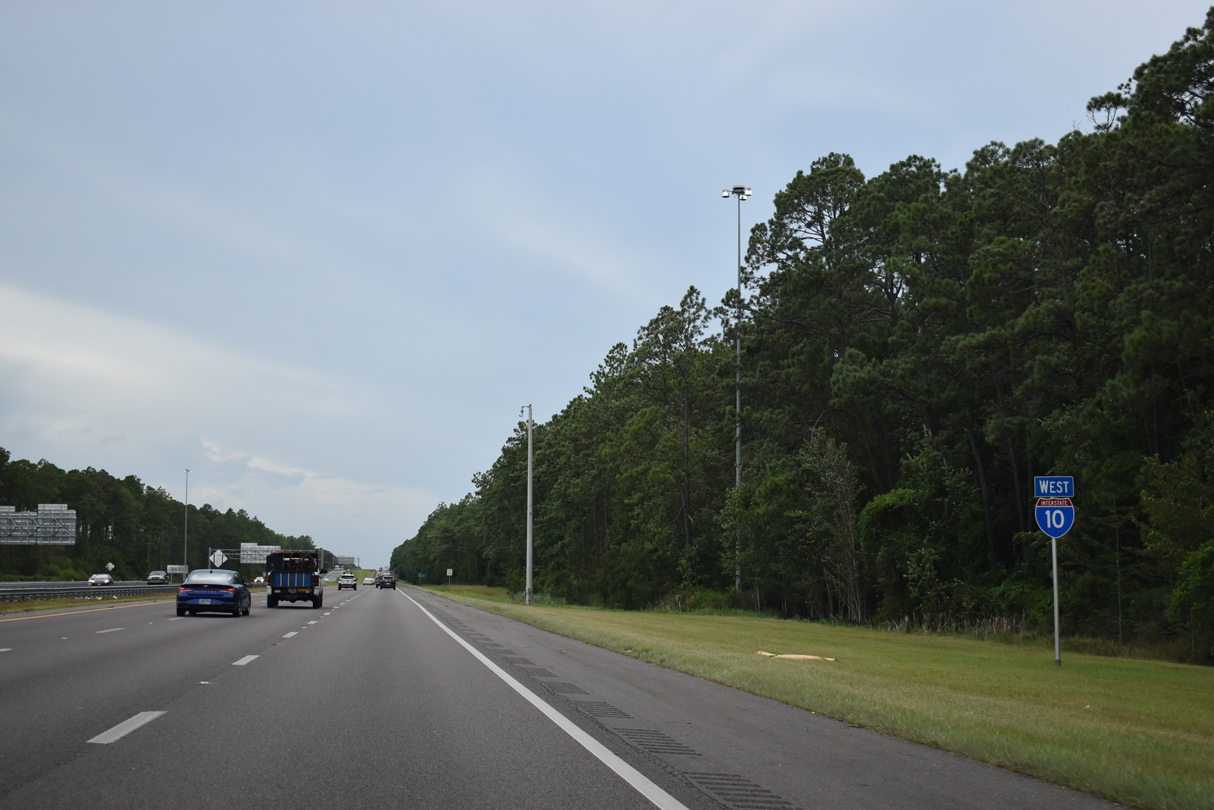
 West
West  South
South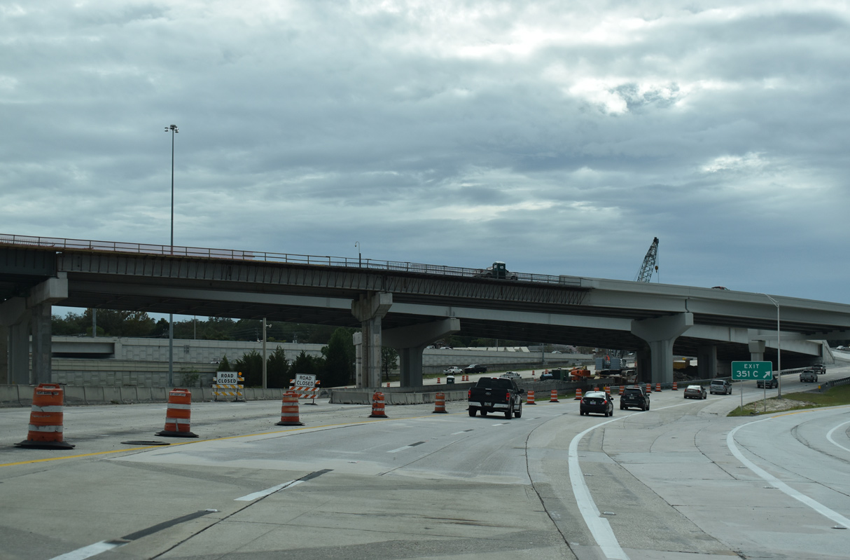
The $126 million project expanding the Big I interchange realigned the exit ramp to Stockton Street from I-95 south to I-10 west to reduce weaving traffic.
12/04/20
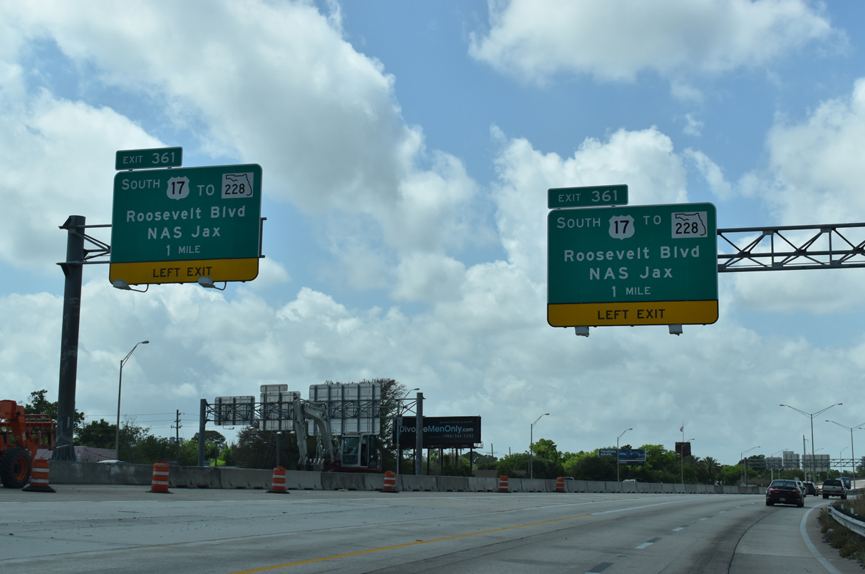
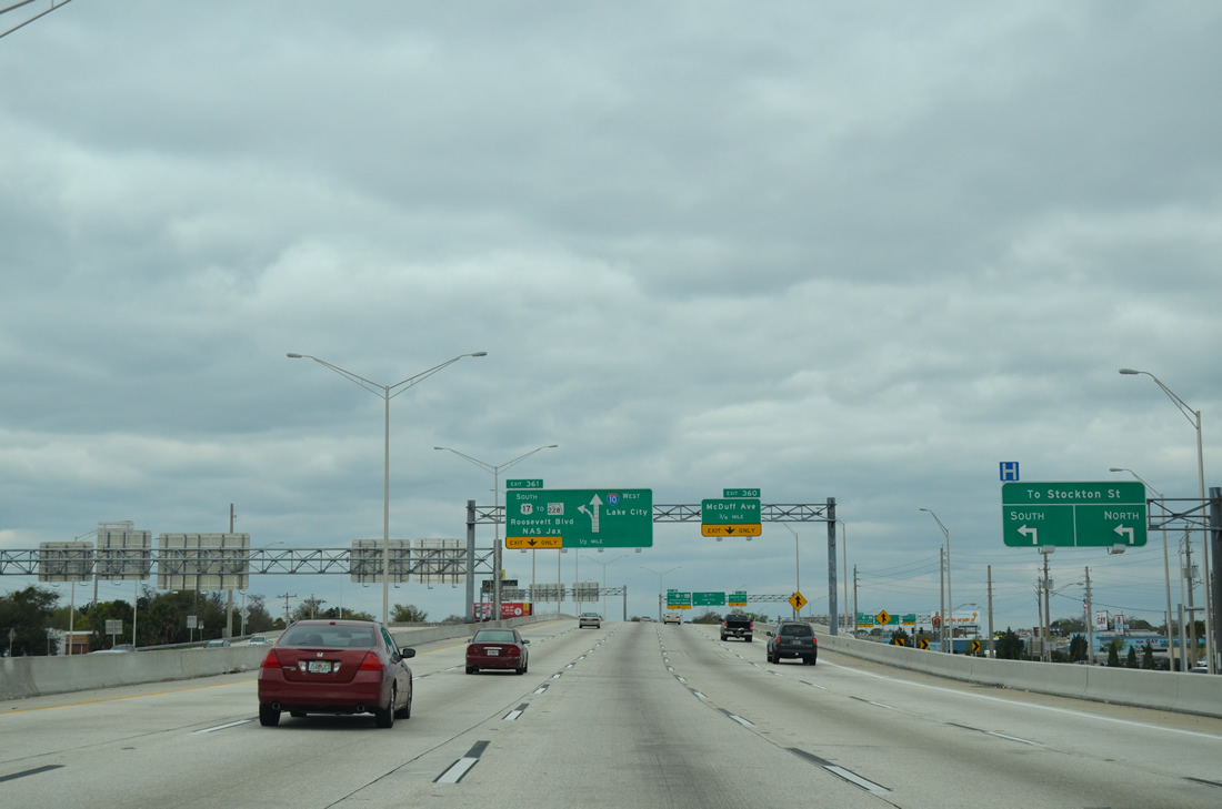
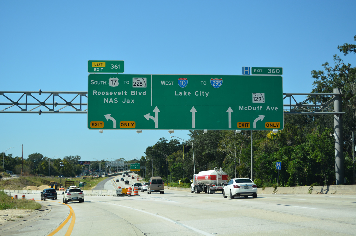
U.S. 17/SR 228 overlap with I-10 west 0.86 miles to a wye interchange (Exit 361) with the Roosevelt Expressway south. The two routes were realigned away from Brooklyn and Riverside onto I-10/95 in 2006.
03/26/20
Exit 351C/362 ties into Irene Street one block east of Stockton Street. Stockton Street leads south from an industrial area at U.S. 90 (Beaver Street) and Robinson's Addition to SR 211 (Riverside Avenue) in the Riverside community.
03/03/13

U.S. 17/SR 228 branch 0.84 miles south from Left Exit 361 to SR 129 (McDuff Avenue) at Riverside. SR 228 dog legs north alongside SR 129 to Post Street west into the Murray Hill neighborhood while U.S. 17 follows Roosevelt Boulevard south to Avondale.
03/26/20
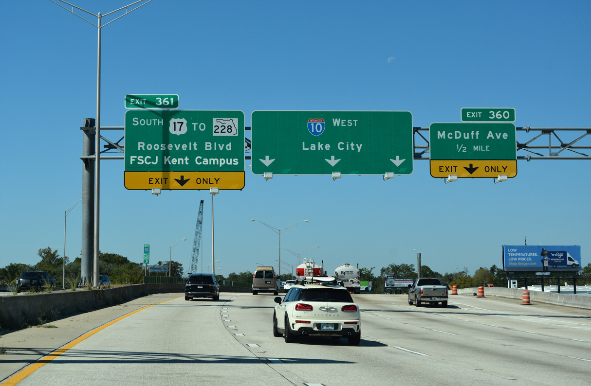
Greenouts added for Exit 361 in 2010 replaced NAS Jax with FSCJ (Florida State College at Jacksonville) Kent Campus. U.S. 17 (Roosevelt Boulevard) travels 7.7 miles south to Naval Air Station Jacksonville.
10/16/22
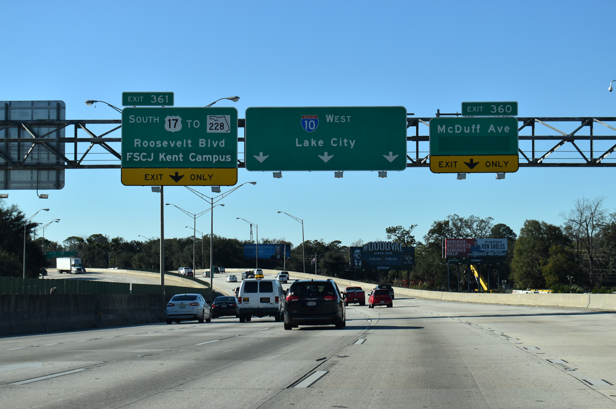
I-10 navigates through an S-curve from Stockton Street across the CSX Railroad / AMTRAK corridor ahead of the split with U.S. 17 south / SR 228 west and diamond interchange (Exit 360) with SR 129 (McDuff Avenue).
01/05/19
U.S. 17 (Roosevelt Boulevard) extends south to Lakeshore, Ortega and Venetia in Jacksonville and to Orange Park. SR 228 (Post Street) leads west from Murray Hill to Hillcrest, Normandy and ultimately U.S. 301 at Maxville in southwest Duval County.
10/16/22
West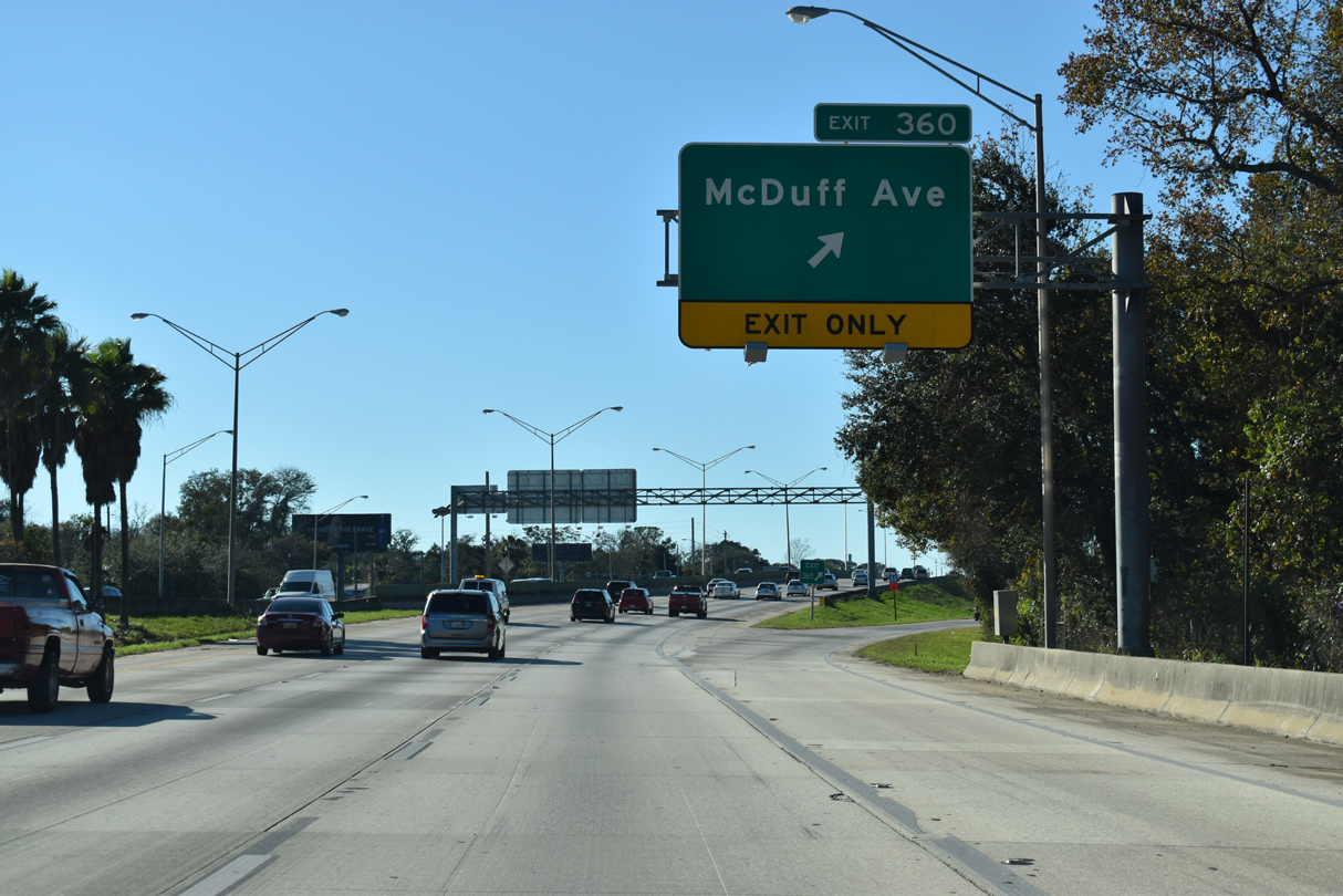
McDuff Avenue leads north from Waller Street at Exit 360 through the Lackawanna neighborhood to Woodstock and 5th Street where the Jacksonville Kennel Club was located. SR 129 lines McDuff Avenue south 0.73 miles to U.S. 17 (Roosevelt Boulevard).
01/05/19
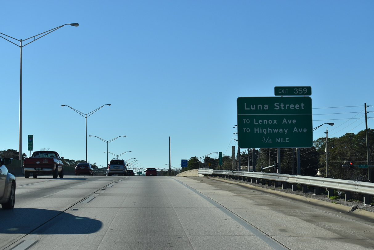
Advancing west from McDuff Avenue, I-10 meets Luna Street at a half diamond interchange (Exit 359). Luna Street stems south from parallel Lenox Avenue / Highway Avenue west to Edgewood Avenue.
01/05/19
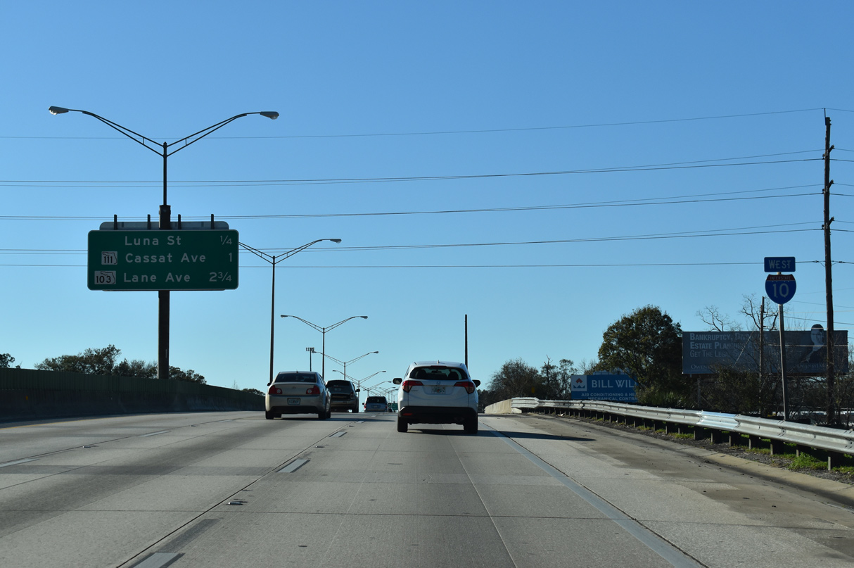
Interstate 10 runs between the Lackawanna and Murray Hill neighborhoods west to Exit 358 with SR 111 (Cassat Avenue).
01/05/19
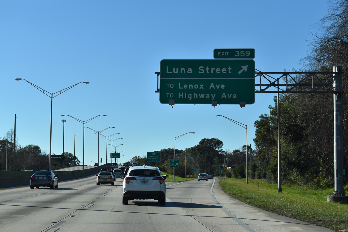
South from adjacent Lenox Avenue, Luna Street is a residential street into Murray Hill. Edgewood Avenue angles northwest from Avondale along the St. Johns River to become a part of SR 111 north of I-10 and Cassat Avenue.
01/05/19
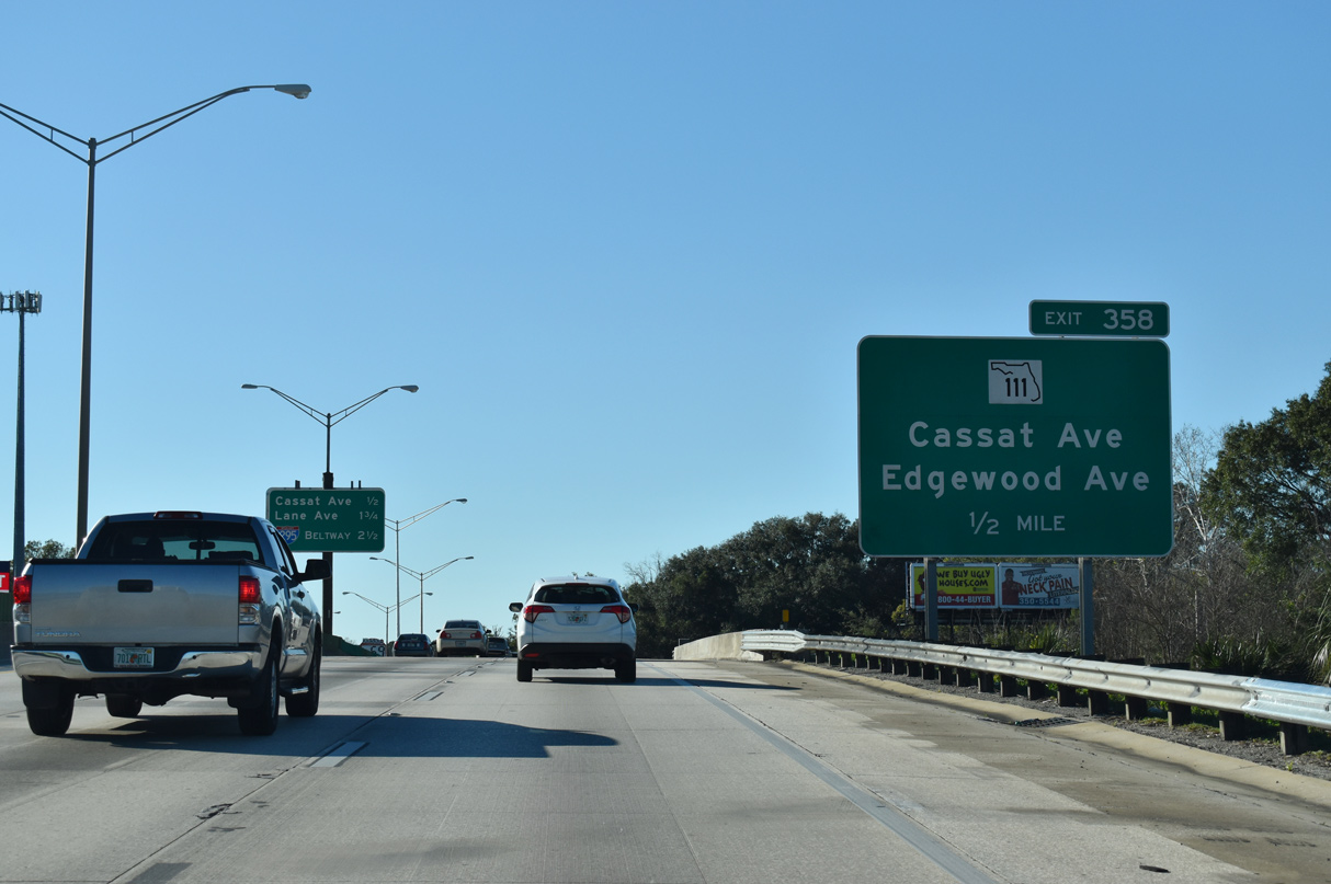
Interstate 10 shifts southwest across Edgewood Avenue to the diamond interchange with SR 111 (Cassat Avenue) at Exit 358.
01/05/19
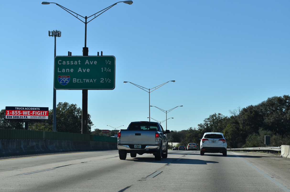
Interstate 10 continues two miles west from SR 111 between the Commonwealth and Normandy Village communities to the West Beltway of I-295.
01/05/19
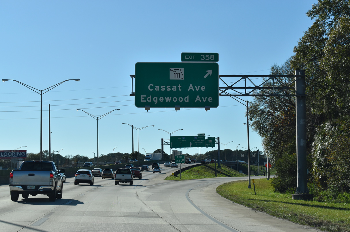
Previous guide signs for Exit 358 omitted Edgewood Avenue, the name of SR 111 north from Cassat Avenue to Paxon, Magnolia Gardens and I-95 at Lake Forrest.
01/05/19
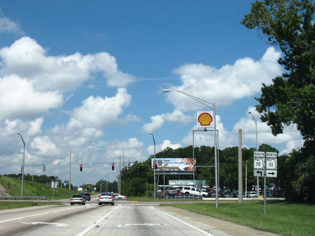
SR 111 encircles central Jacksonville for 11.88 miles between SR 21 (Blanding Boulevard) at Lakeshore and U.S. 17 at Panama Park.
06/14/08
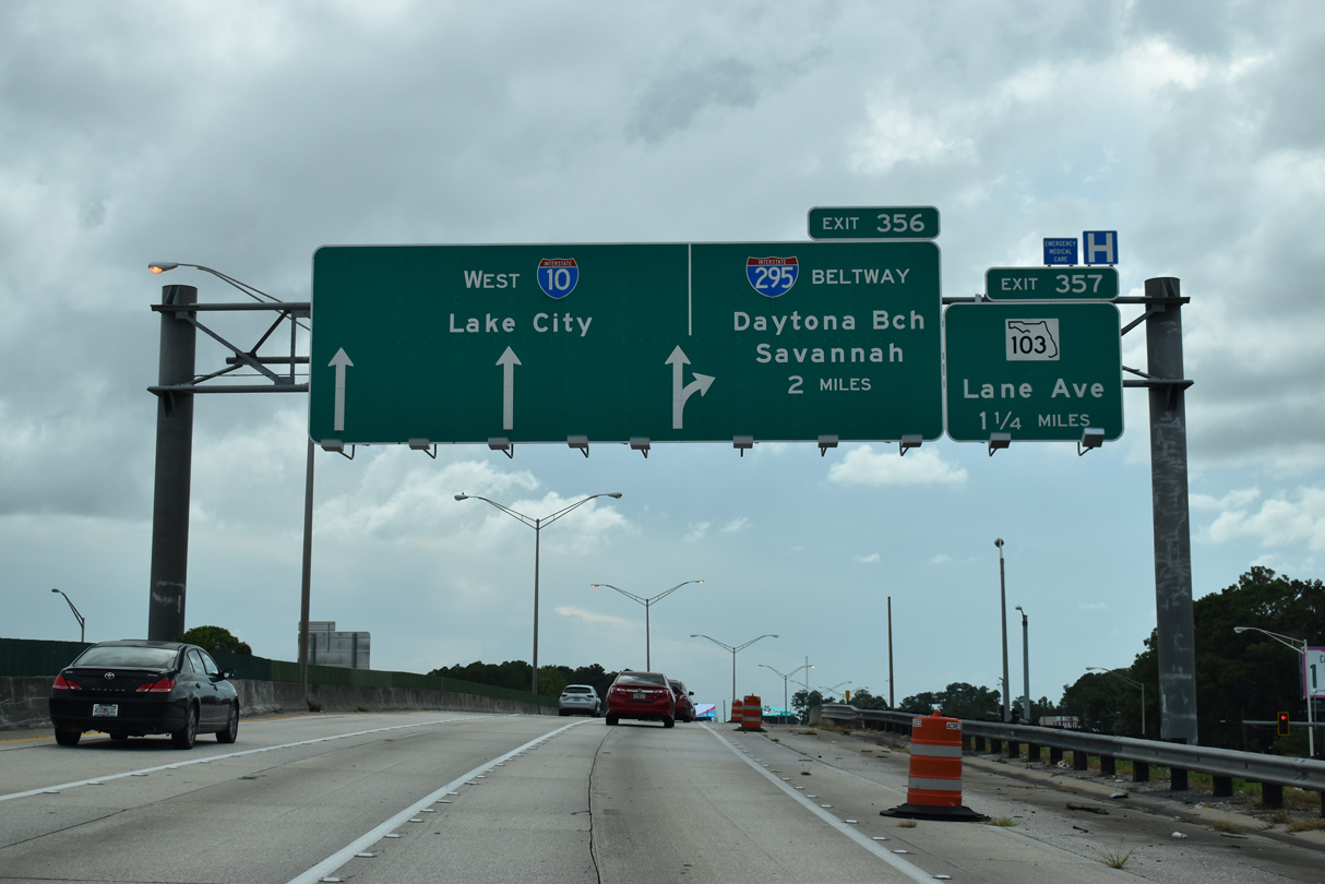
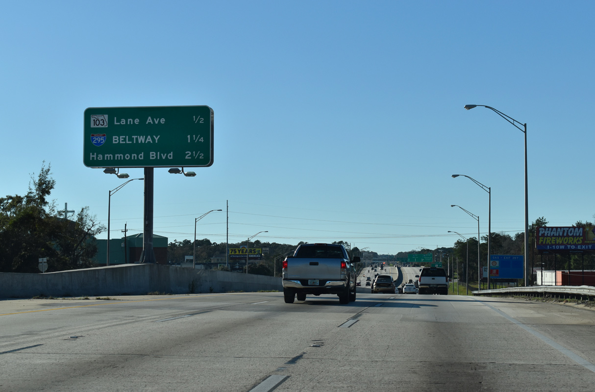
I-10 passes between the Edgewood and Normandy neighborhoods 1.25 miles west to the diamond interchange (Exit 357) with Lane Avenue (SR 103 south) and two miles to Interstate 295.
08/28/21
Westbound I-10 navigates through an S-curve from Beautyrest Avenue to Ellis Road.
01/05/19
Forthcoming Lane Avenue (SR 103) comprises an urban boulevard between Cedar Hills and 5th Street in Commonwealth.
01/05/19

SR 103 follows Lane Avenue 3.17 miles south to SR 208 (Wilson Boulevard) at Hyde Park and north to parallel U.S. 90 (Beaver Street) at an industrial area in Commonwealth.
01/05/19
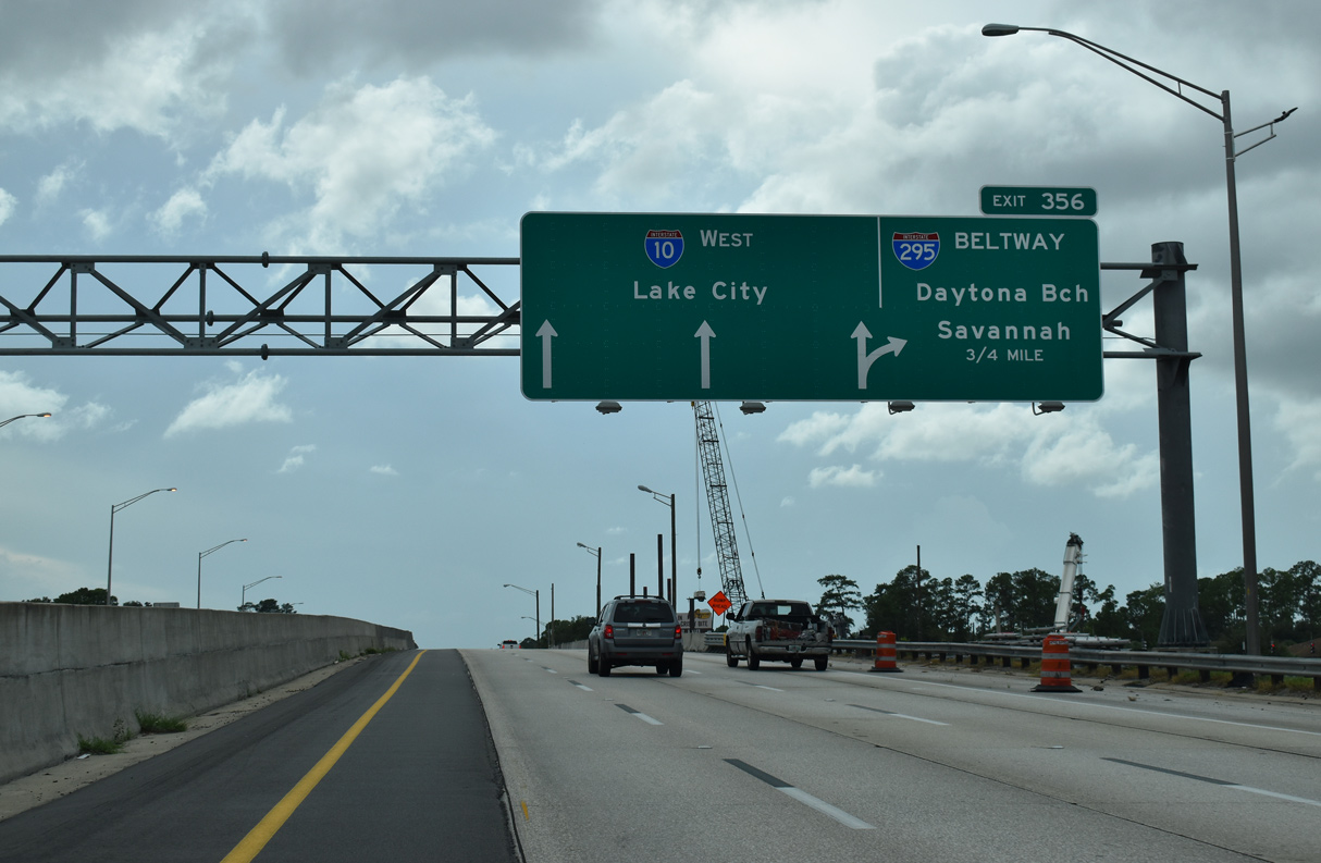
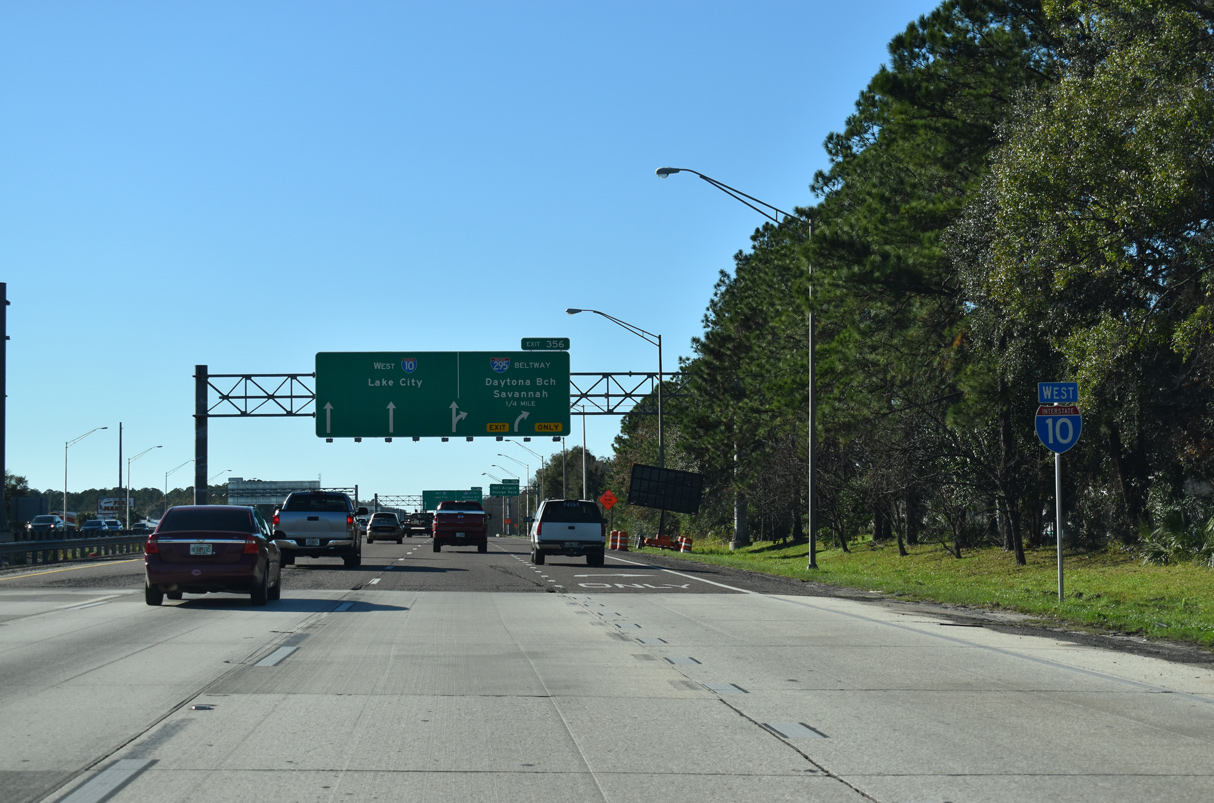
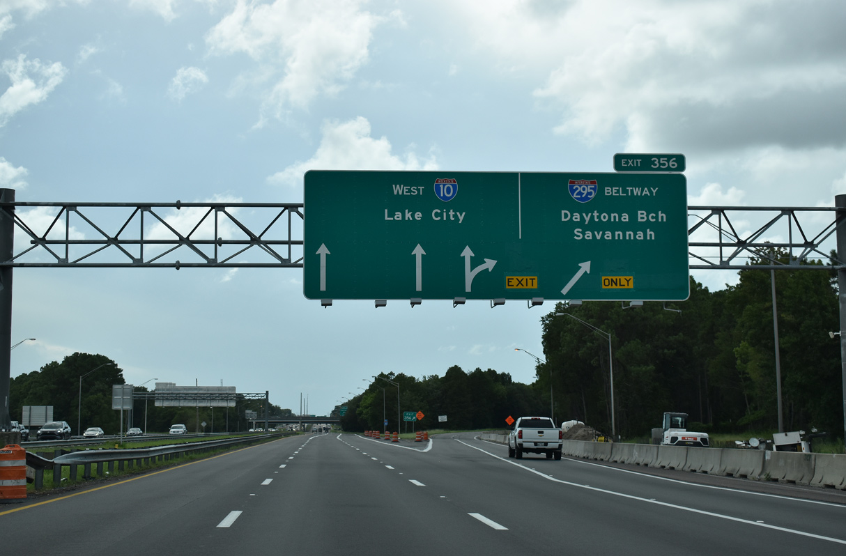
The directional cloverleaf interchange (Exit 356) with Interstate 295 lies 0.75 miles west of SR 103 (Lane Avenue). APL overheads for the West Beltway were posted along I-10 after 2011.
08/28/21
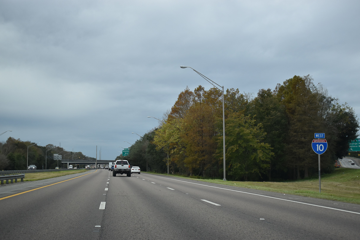
Interstate 10 expands to eight lanes between Lane Avenue and Exit 356. Construction underway from Summer 2020 to 2024 widens the remainder of I-10 between I-95 and I-295 in Jacksonville to at least eight lanes.
01/05/19
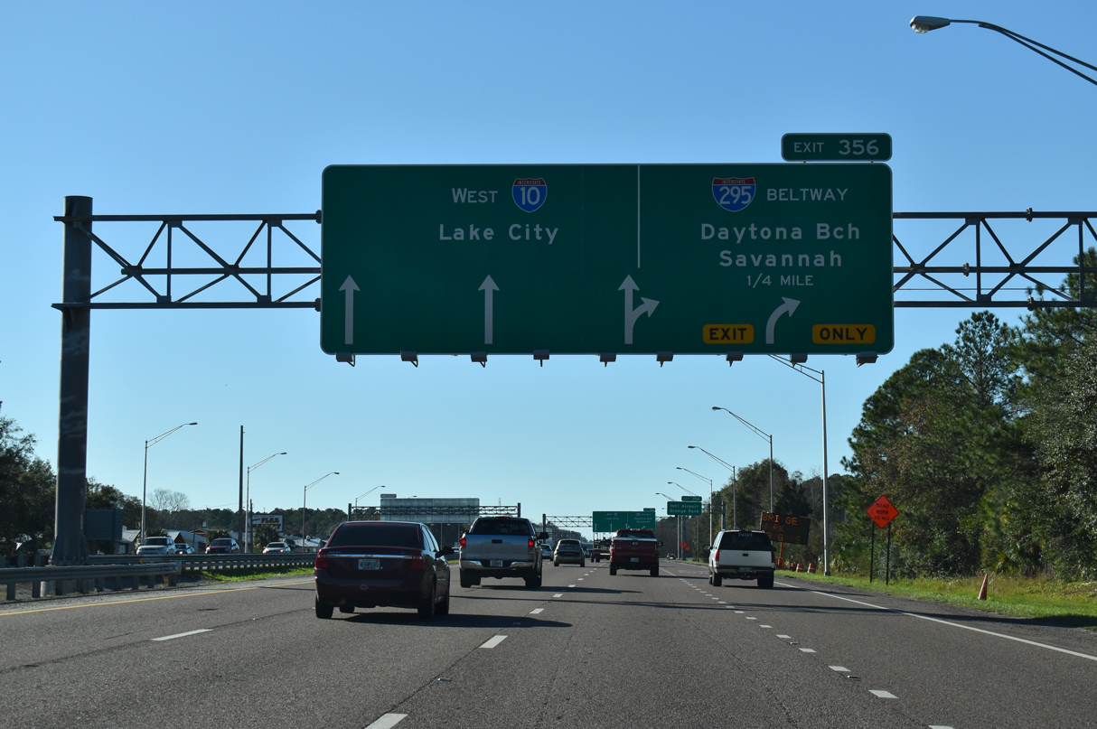
Control points for the West Beltway reference Savannah, Georgia for I-95 north and Daytona Beach for I-95 south. Previously St. Augustine was the southbound destination for I-295.
01/05/19
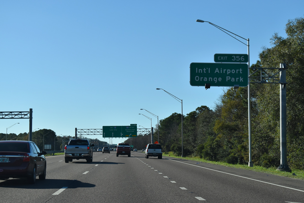
The West Beltway of Interstate 295 leads north to Jacksonville International Airport (JAX) at Exit 33 (SR 243) and south to the Clay County city of Orange Park (Exits 12 and 10).
01/05/19
I-295 travels southeast to the Buckman Bridge crossing the St. Johns River from Orange Park to Mandarin and South Side Jacksonville. I-295 arcs northeast from I-10 at Marietta to Oceanway and southeast to the Dames Point Bridge.
08/28/21
West Interstate 10 shield posted beyond the Exit 356 gore point near Normandy Village in Jacksonville..
12/04/20
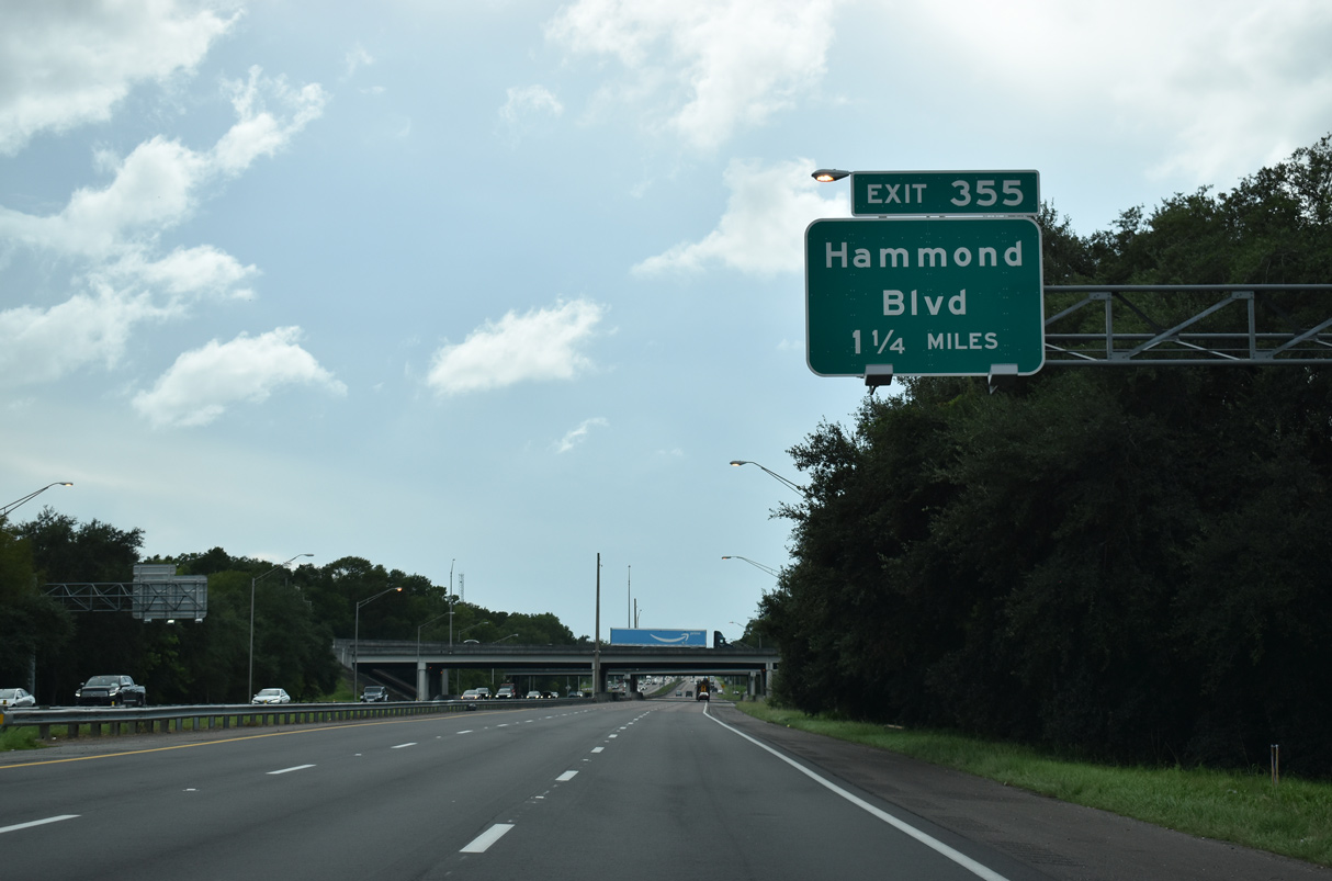
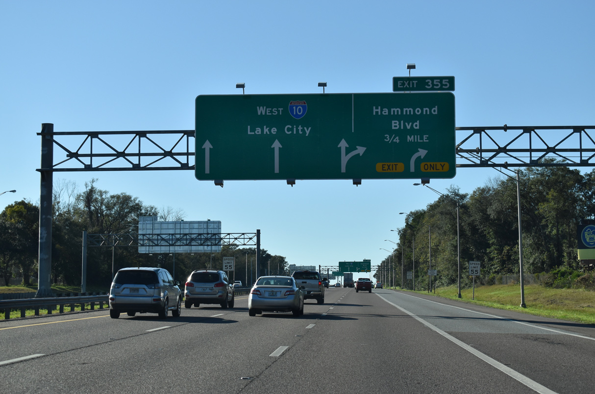
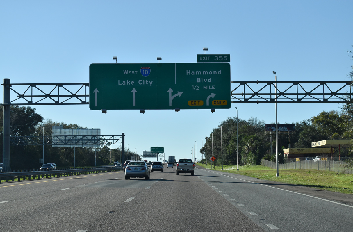
A $17.93 million project underway from October 14, 2013 to June 8, 2016 replaced the original ramps with Devoe and Lakeland Streets at the Marietta community with a new parclo interchange (Exit 355) 0.8 miles to the west at Hammond Boulevard.2
08/28/21
Hammond Boulevard constitutes a four lane boulevard north from Exit 355 to Devoe Street and south to Lenox Avenue.
01/05/19
Interstate 10 was expanded to six overall lanes from I-295 west to SR 23 (Cecil Commerce Parkway) during a $60.6 million project from early 2010 to early 2012.1 Work added a fourth westbound lane to the previous exit ramp to Greeland Avenue and the Marietta street grid.
01/05/19
An interchange sequence sign lists the last three Jacksonville suburban exits beyond the Cahoon Road underpass. Cahoon Road parallels Hammond Boulevard to the east between SR 228 (Normandy Boulevard) and U.S. 90.
08/28/21
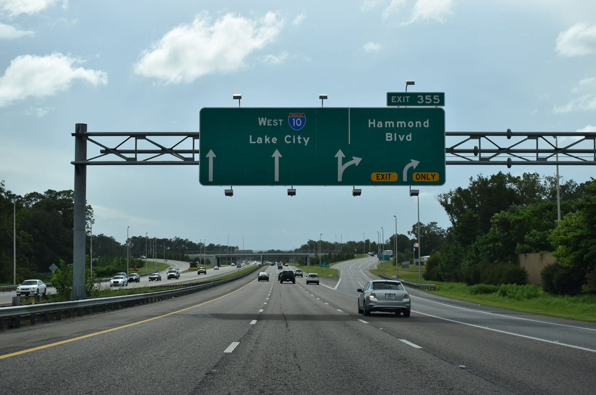
Two lanes part ways at Exit 355 for Hammond Boulevard north to Marietta and south Rolling Hills, Crystal Springs and Normandy Estates in Jacksonville.
08/28/21
Construction of the exchange with Hammond Boulevard expanded the road to four lanes. Devoe Street overtakes Hammond Boulevard north to U.S. 90 at the Marietta Forrest subdivision.
06/16/16
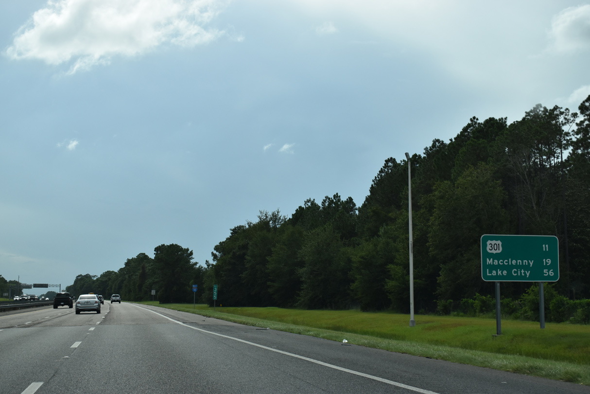
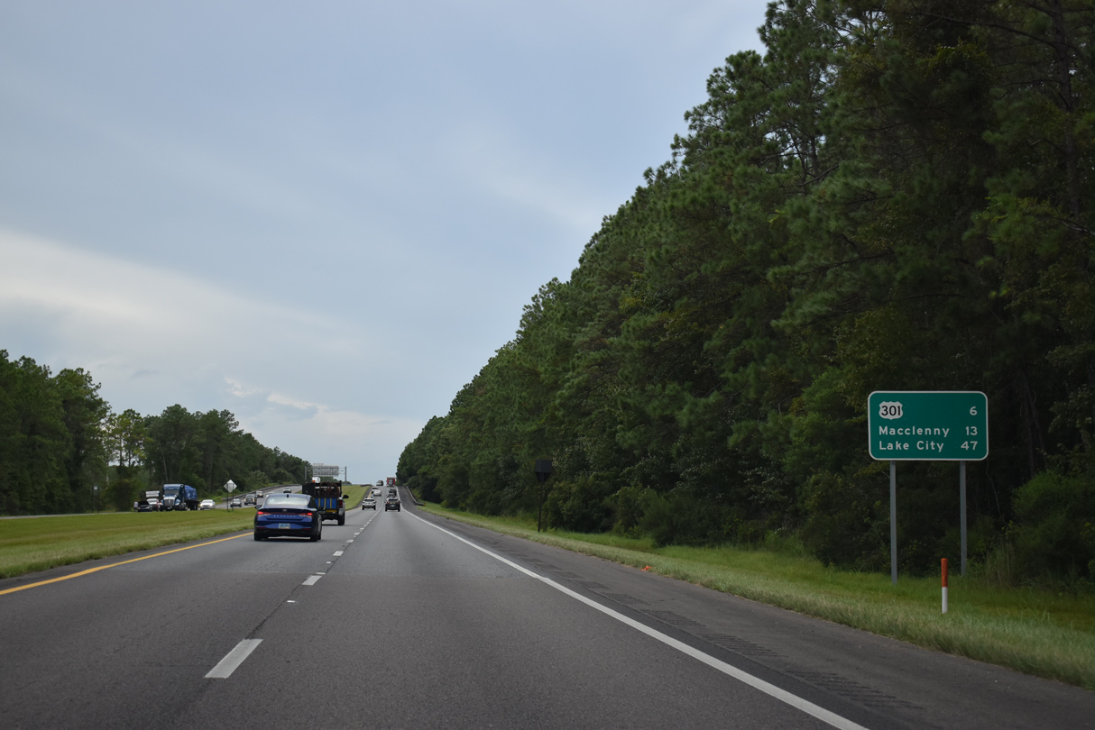
The first distance sign posted along Interstate 10 west stands 11 miles ahead of U.S. 301 to Baldwin. Macclenny in Baker County follows in another eight miles and Lake City appears at 56 miles out.
08/28/21
Confirming marker posted after the entrance ramp from Hammond Boulevard.
01/05/19
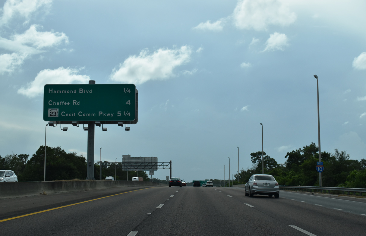
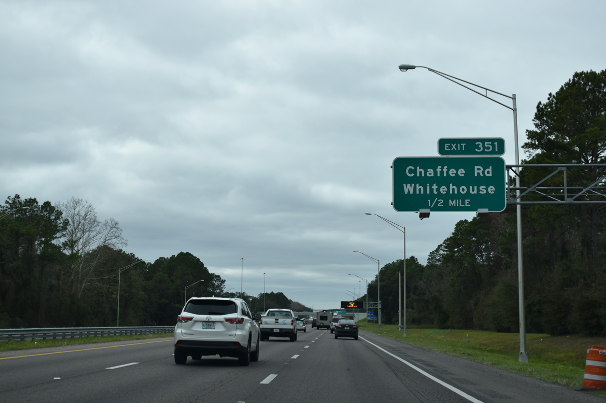
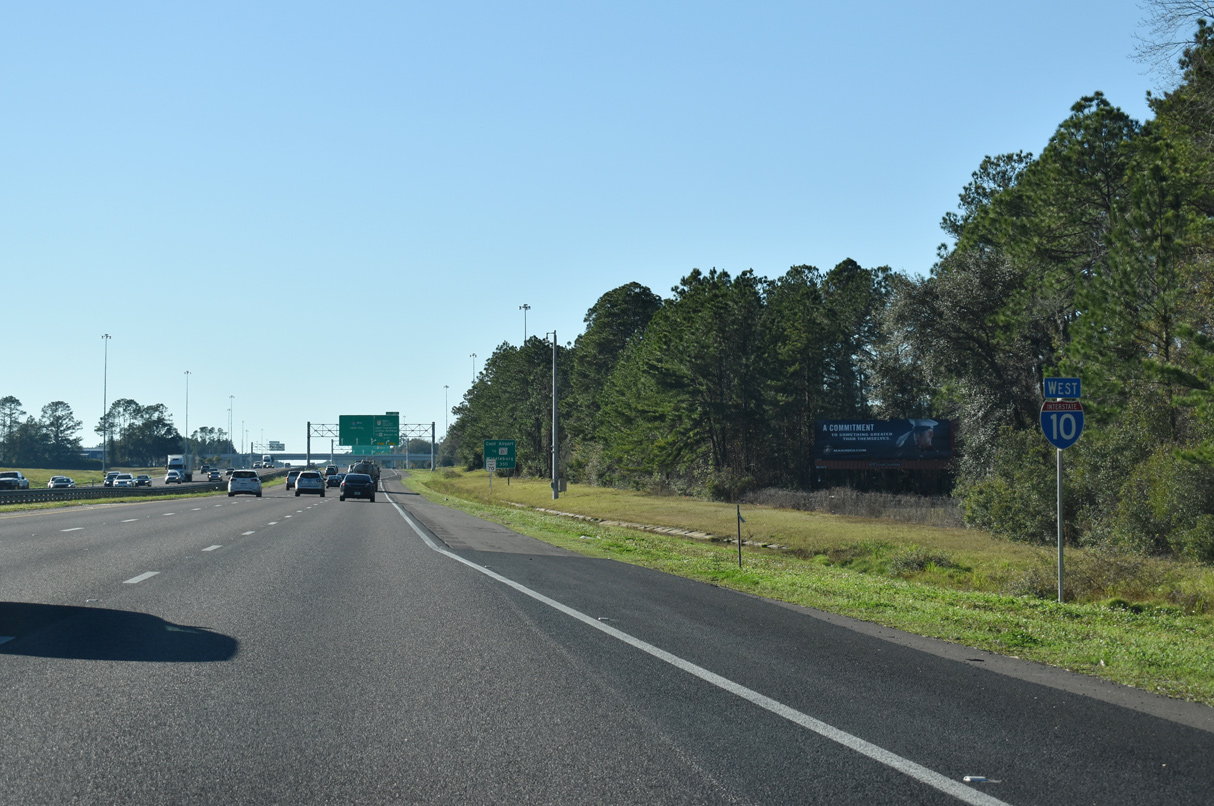
West to Exit 351 with Chaffee Road, Interstate 10 separates industrialized areas along U.S. 90 (Beaver Street) at Whitehouse to the north from residential areas in Crystal Springs to the south.
08/28/21
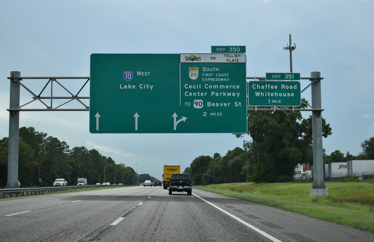
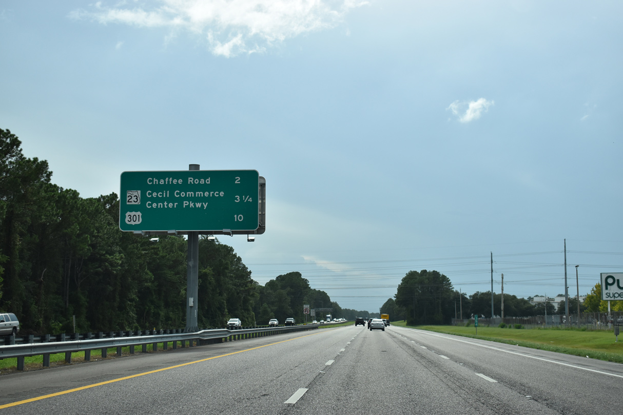
A parclo B2 interchange (Exit 351) joins I-10 west with Chaffee Road (CR 115C) in one mile. Exit 350 follows with SR 23 (First Coast Expressway). SR 23 south along Cecil Commerce Center Parkway opened to traffic on October 1, 2009.
08/28/21
Chaffee Road extends north from I-10 and Whitehouse to Prichard Road, an arterial loop northeast to Cisco Gardens.
01/20/19
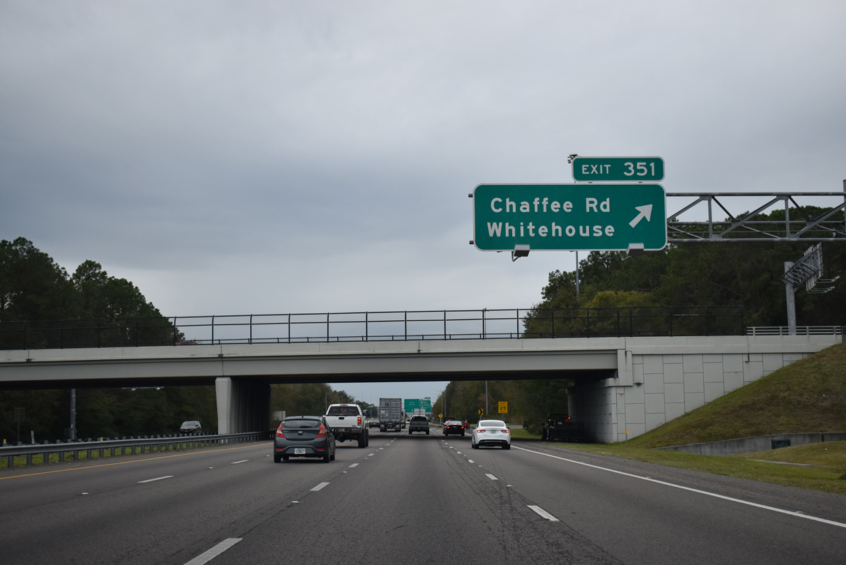
2010-12 widening of Interstate 10 at Exit 351 included replacing the original Chaffee Road overpass. The 17 foot high span opened on October 18, 2010.1
12/04/20
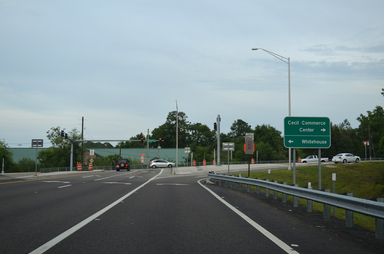
Chaffee Road doubles as unsigned CR 115C for 3.22 miles between SR 228 at Jacksonville Farms/Terrace and U.S. 90 (Beaver Street).
06/16/16
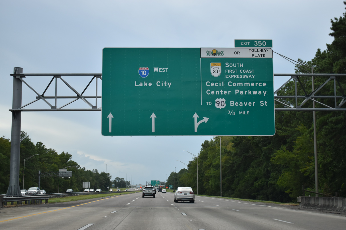
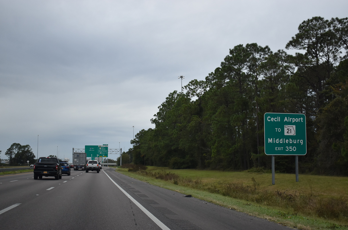
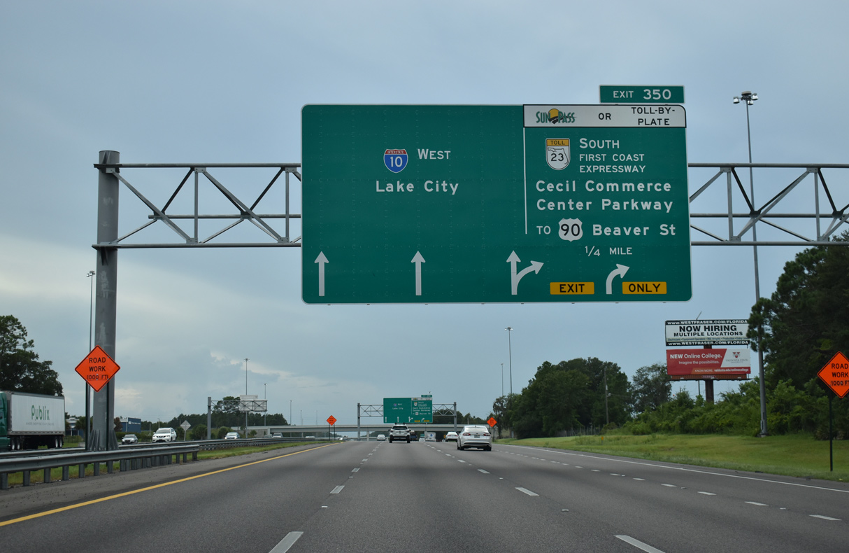
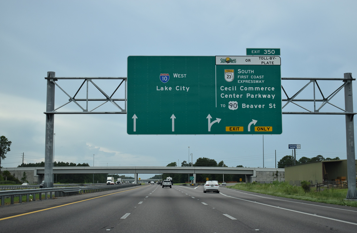
I-10 continues west across McGirts Creek to the cloverleaf interchange (Exit 350) with SR 23 (First Coast Expressway) south. The First Coast Expressway extends 15.1 miles south from Exit 350 to SR 21 (Blanding Boulevard) near Middleburg. When completed, the 46.6 mile long toll road will loop east to I-95 in St. Johns County.
08/28/21
Rest areas formerly lined I-10 westbound where Exit 350 is located and eastbound past the Halsema Road overpass. These closed on September 5, 2006 as part of the $81 million project to construct the Branan Field-Chaffee Expressway between 103rd Street (SR 134) and I-10.3
01/05/19
Operated by the Jacksonville Airport Authority, Cecil Airport (VQQ) is part of Cecil Commerce Center (CCC). CCC was developed at the site of Cecil Field Naval Air Station, which closed as an active military installation in 1999.
12/04/20
A toll free expressway to New World Avenue, Cecil Commerce Center Parkway angles southeast to overtake Chaffee Road at SR 134 (103rd Street) and Jax Heights South.
08/28/21
Construction upgrading SR 23 into the First Coast Expressway southward to Argyle Forest Boulevard cost $77 million and commenced in September 2013. $83 million in work from Argyle Forest Boulevard south to SR 21 (Blanding Boulevard) at Middleburg followed in 2014.4
08/28/21

A $45.8 million project from July 2015 to Fall 2018 expanded Exit 350 with ramps for the extension of SR 23 north to adjacent U.S. 90 (Beaver Street).5
12/04/20
Interstate 10 runs alongside Pope Duval Park and areas of the former Cecil Field Naval Air Station on the ensuing stretch westbound.
08/28/21
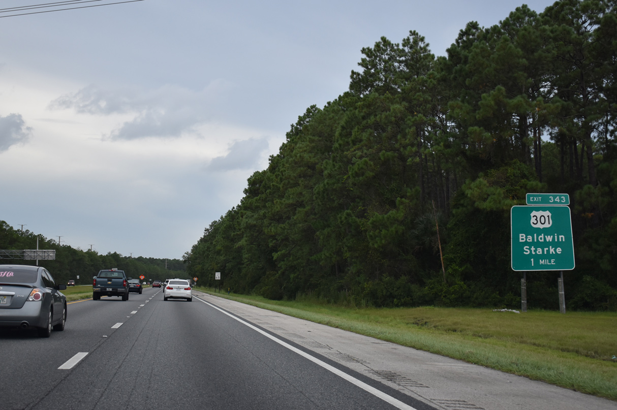
Interstate 10 traverses timberland and wetland areas six miles west to U.S. 301 near the town of Baldwin. A previous sign posted here referenced Macclenny at 13 miles away.
08/28/21
U.S. 301 travels northeast from Baldwin to Callahan, where it joins U.S. 1/23 northwest to Folkston, Georgia.
08/28/21
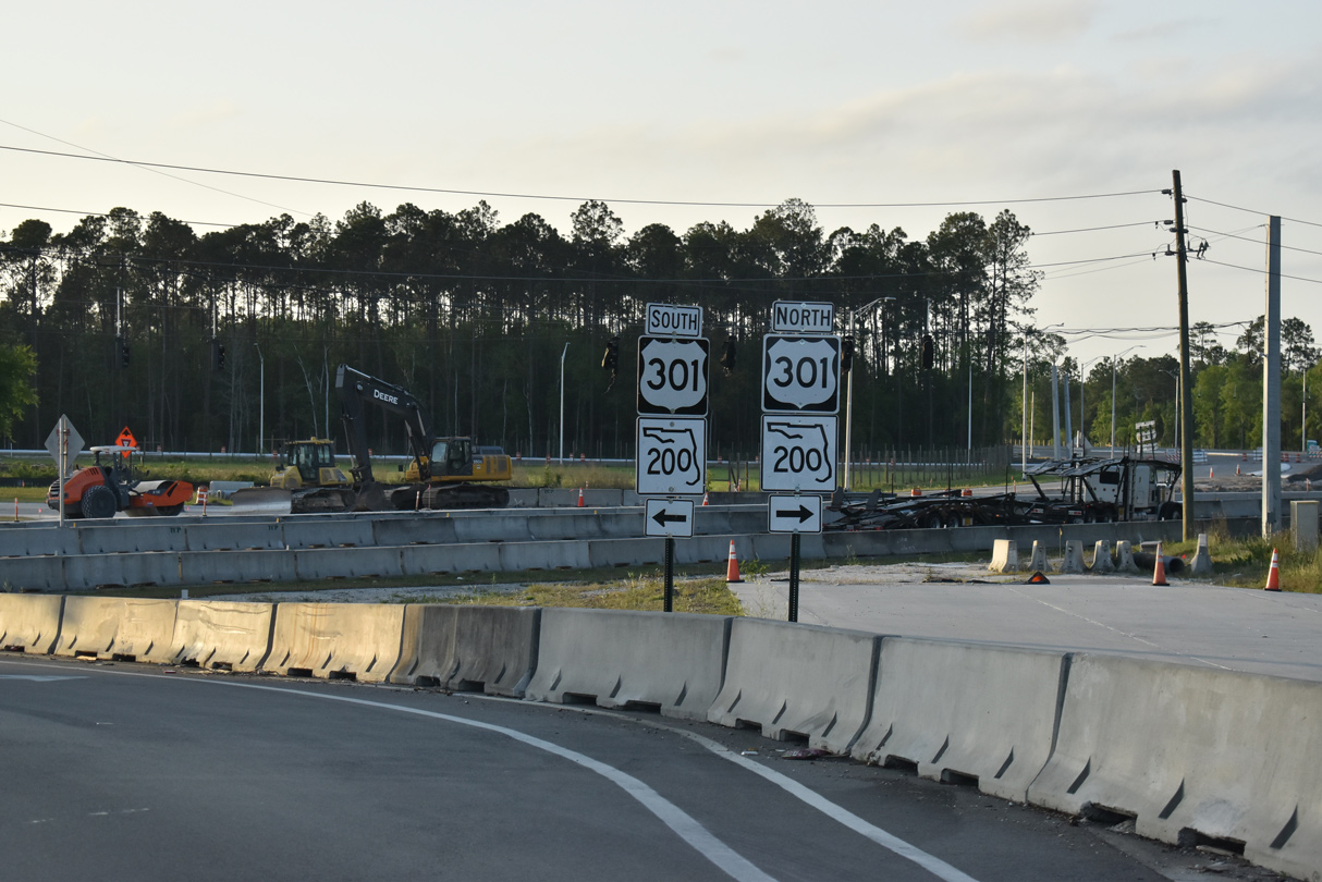
$65 million in road work from February 2016 to Summer 2021 2023 reconfigures Exit 343 for U.S. 301 into a six-ramp parclo interchange.7 Two ramps were built along the east side of the exchange.
08/28/21
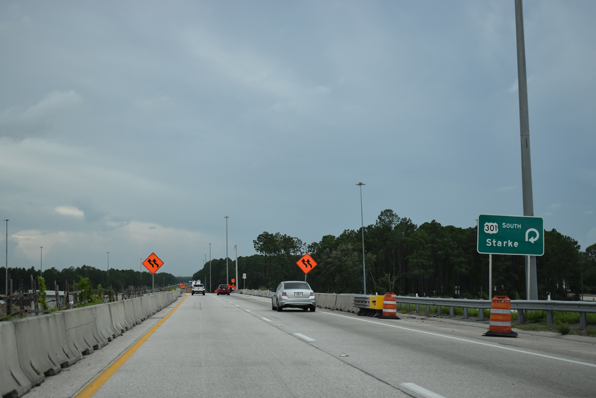
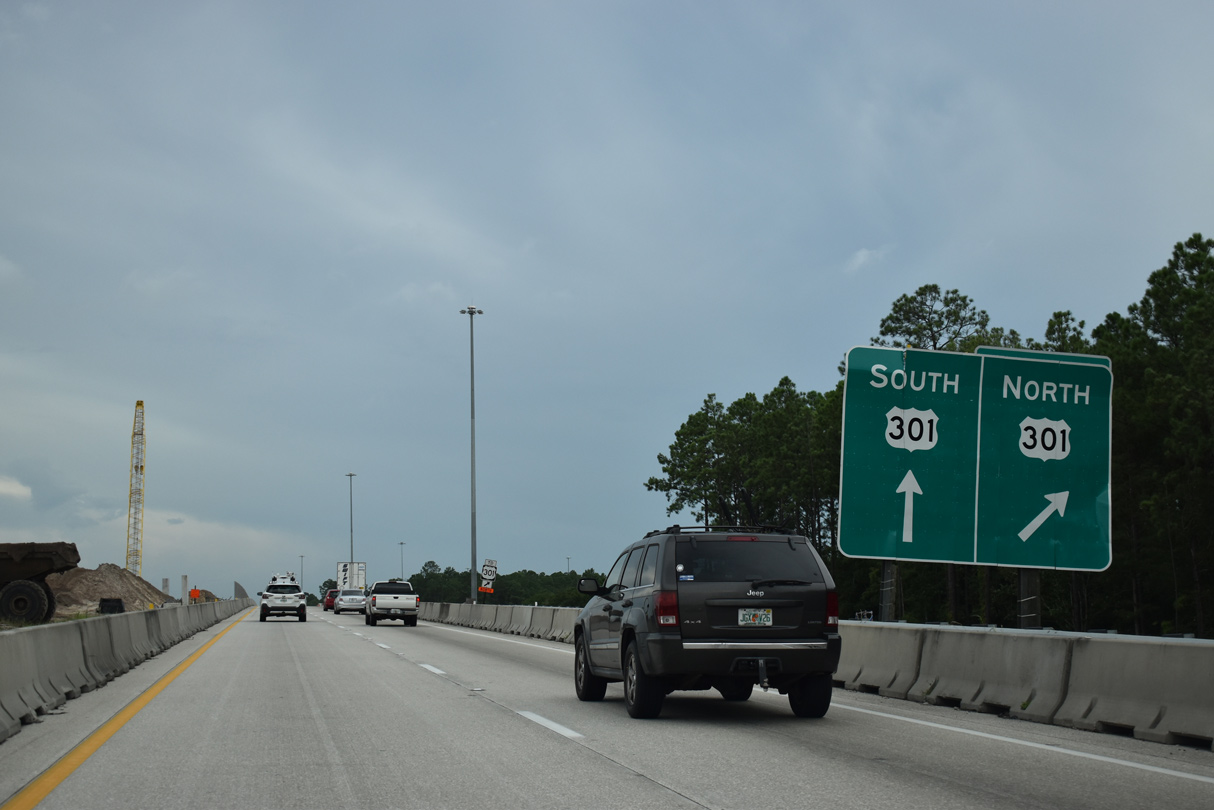
Separate exit ramps link I-10 west with U.S. 301 north to Baldwin and south to Maxville. A CSX Railroad yard and a pair of truck stops are located nearby. U.S. 301 constitutes the main truck route from Jacksonville to the I-75 corridor south from Gainesville and Ocala to Tampa.
08/28/21
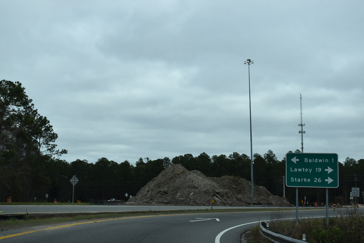
Adjacent road work realigned U.S. 301 north onto a four lane bypass (SR 201) around the town of Baldwin. The Baldwin Bypass opened to traffic September 13, 2020. U.S. 301 travels northeast from Baldwin to Callahan, where it joins U.S. 1/23 northwest to Folkston, Georgia.
03/26/20
U.S. 301 travels 17.7 miles south from I-10 to the Lawtey city center and 21.7 miles to the Starke Truck Bypass.
01/20/19
The final confirming marker for I-10 west in Duval County. The freeway becomes vastly rural en route to Tallahassee. 2012 FDOT traffic counts drop accordingly from 43,700 vpd east of Baldwin to 21,500 vpd ahead of Macclenny.
06/16/16
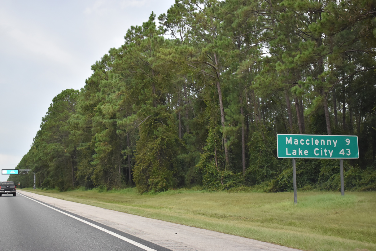
Macclenny, a city of 6,374 (per the 2010 census), is next along I-10 west in nine miles. Lake City, the crossroads with I-75, is 43 miles away.
08/28/21
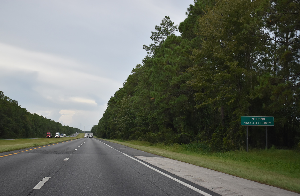
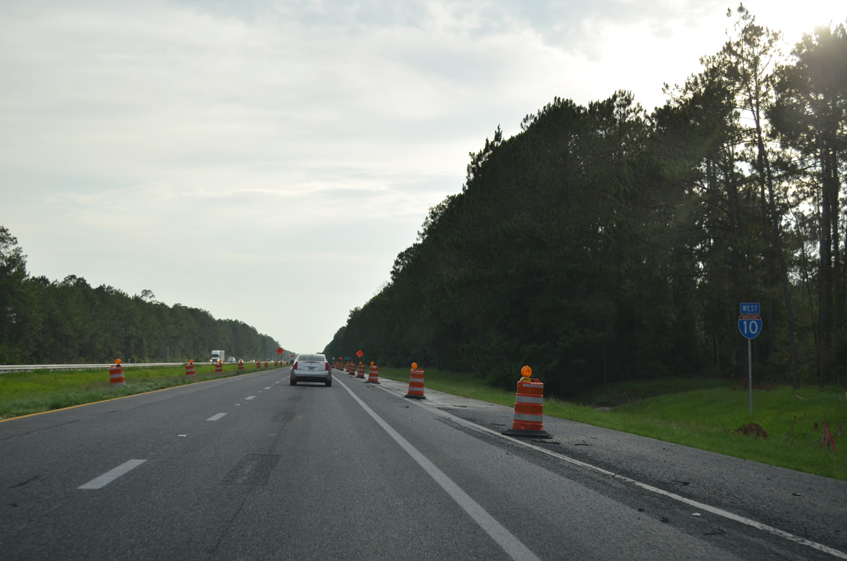
Interstate 10 west crosses the southwestern sliver of Nassau County for 0.71 miles.
08/28/21
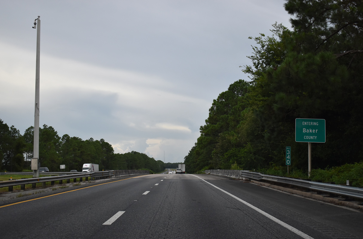
Westbound I-10 enters Baker County over a former Seaboard Coast Line railroad. The freeway runs 25.46 miles across the rural county.
08/28/21


References:
- "Chaffee ramps set to close Monday The state is widening I- 10 and building a new overpass in the project." The Florida Times-Union (Jacksonville), October 10, 2010.
- "I-10 interchange improvements at Marietta to Hammond Boulevard." NorthFloridaRoads (FDOT project web site), http://www.nflroads.com/_layouts/FDOT D2 Northeast Florida Road Construction/ProjectDetails.aspx? pid=60&sid=all.
- "Duval I-10 rest areas shut gates." The Florida Times-Union (Jacksonville), September 5, 2006.
- "Toll road work about to begin Changes in design of Westside highway to be outlined in town meeting." The Florida Times-Union (Jacksonville), September 8, 2013.
- "First Coast Expressway Extension from I-10 to Beaver Street." NorthFloridaRoads (FDOT project web site), http://www.nflroads.com/_layouts/FDOT D2 Northeast Florida Road Construction/ProjectDetails.aspx? pid=331&sid=All.
- I-10 at U.S. 301 Improvements. Florida Department of Transportation (FDOT) project web site.
Photo Credits:
- Alex Nitzman: 06/14/08, 01/05/19, 08/28/21, 10/16/22
- ABRoads: 06/16/16, 03/26/20, 12/04/20
- Brent Ivy: 03/03/13, 01/20/19
Connect with:
Page Updated Friday October 21, 2022.