
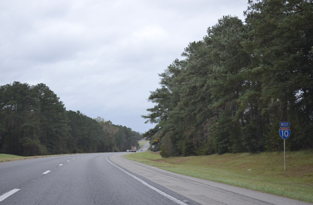
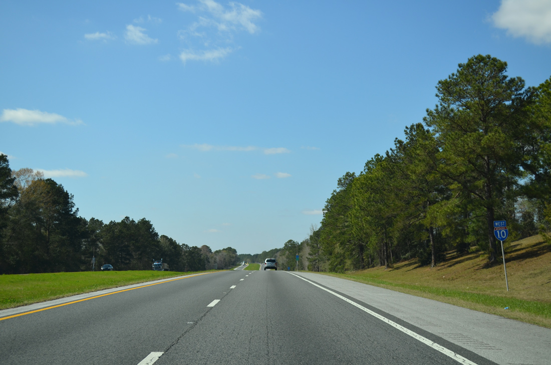
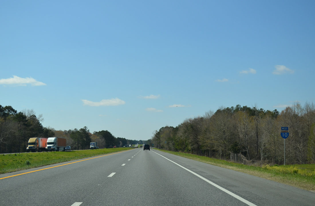
Interstate 10 West - Gadsden / Jackson Counties
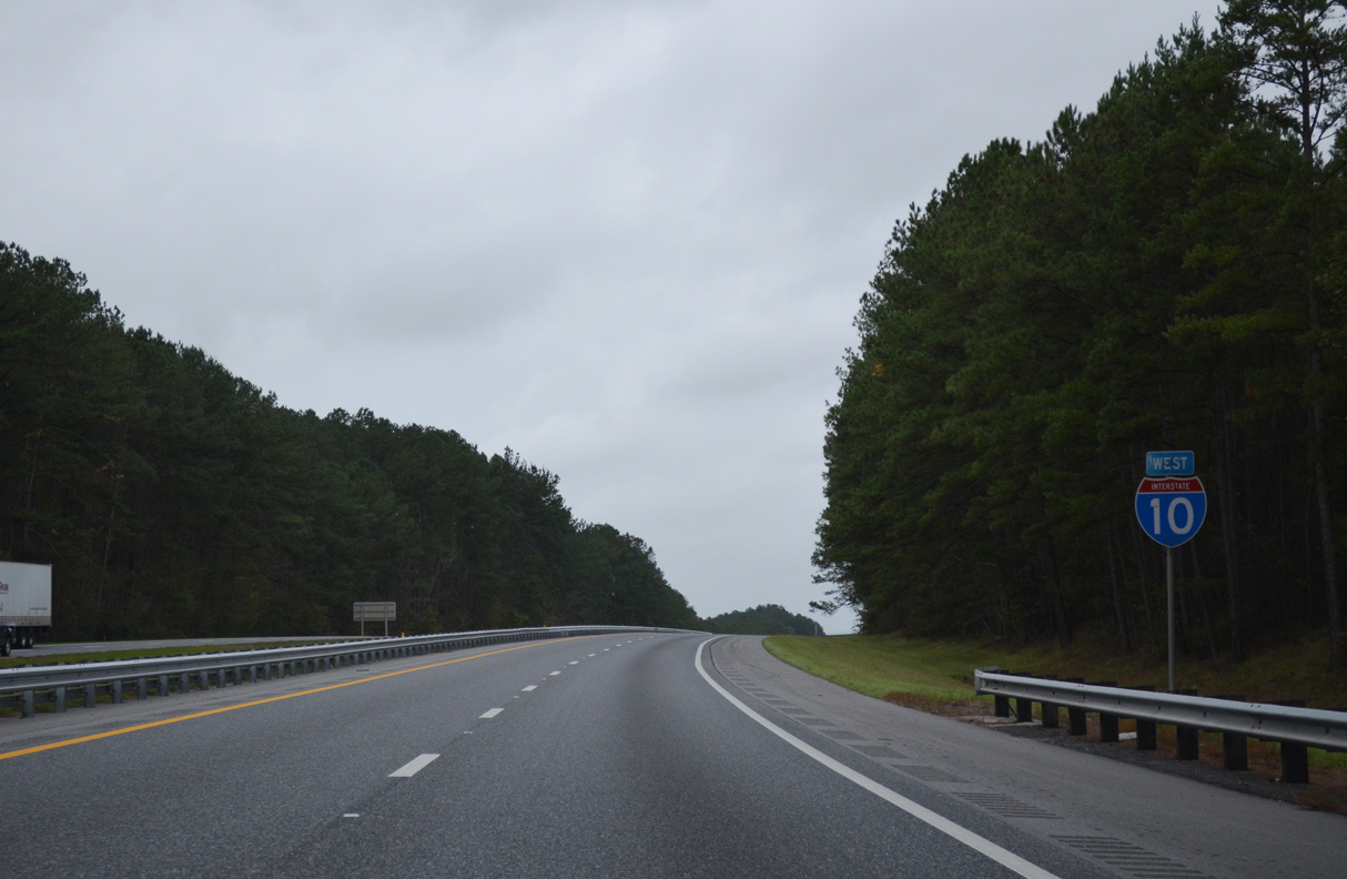
 West
West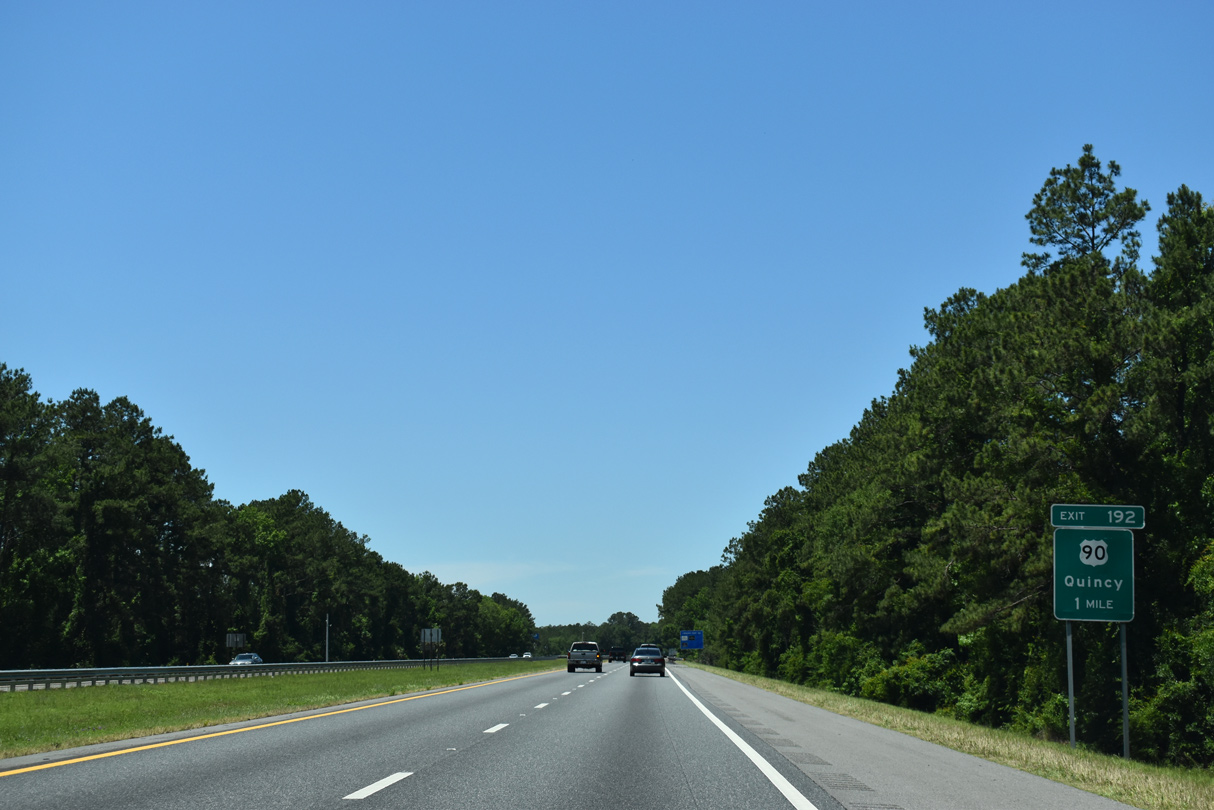
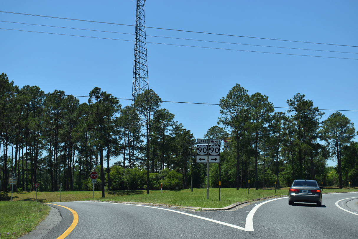
U.S. 90 (Tallahassee Highway) shifts sides with Interstate 10 again at the city of Midway in eastern Gadsden County. U.S. 90 stays north of the freeway to Pensacola.
05/02/20
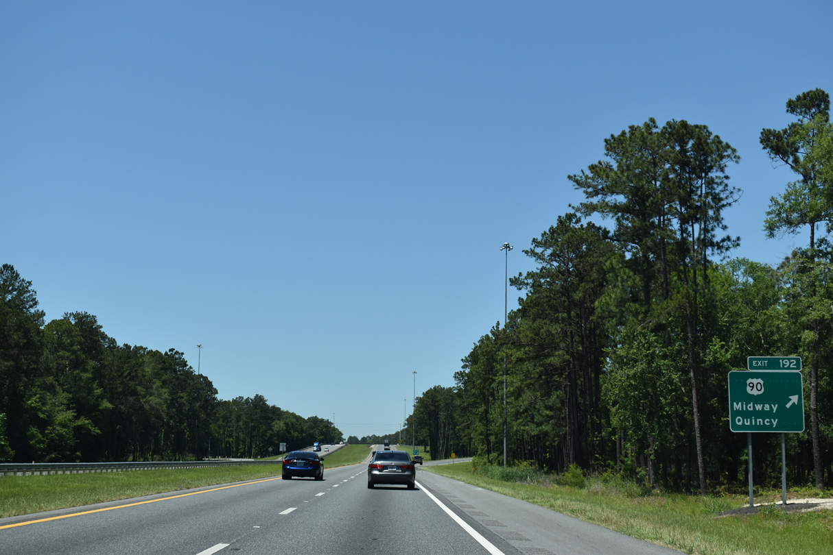
A six-ramp parclo interchange (Exit 192) joins U.S. 90 with Interstate 10 by two truck stops. U.S. 90 travels 4.6 miles east to SR 263 (Capital Circle NW) and 12 miles northwest to Downtown Quincy.
05/02/20

U.S. 90 reaches the Quincy city limits in ten miles at Strong Road and the Quincy Bypass (SR 269). Midway City Hall lies two miles to the west at the intersection with CR 268 (Martin Luther King Boulevard) and CR 159 (Dover Road).
05/02/20

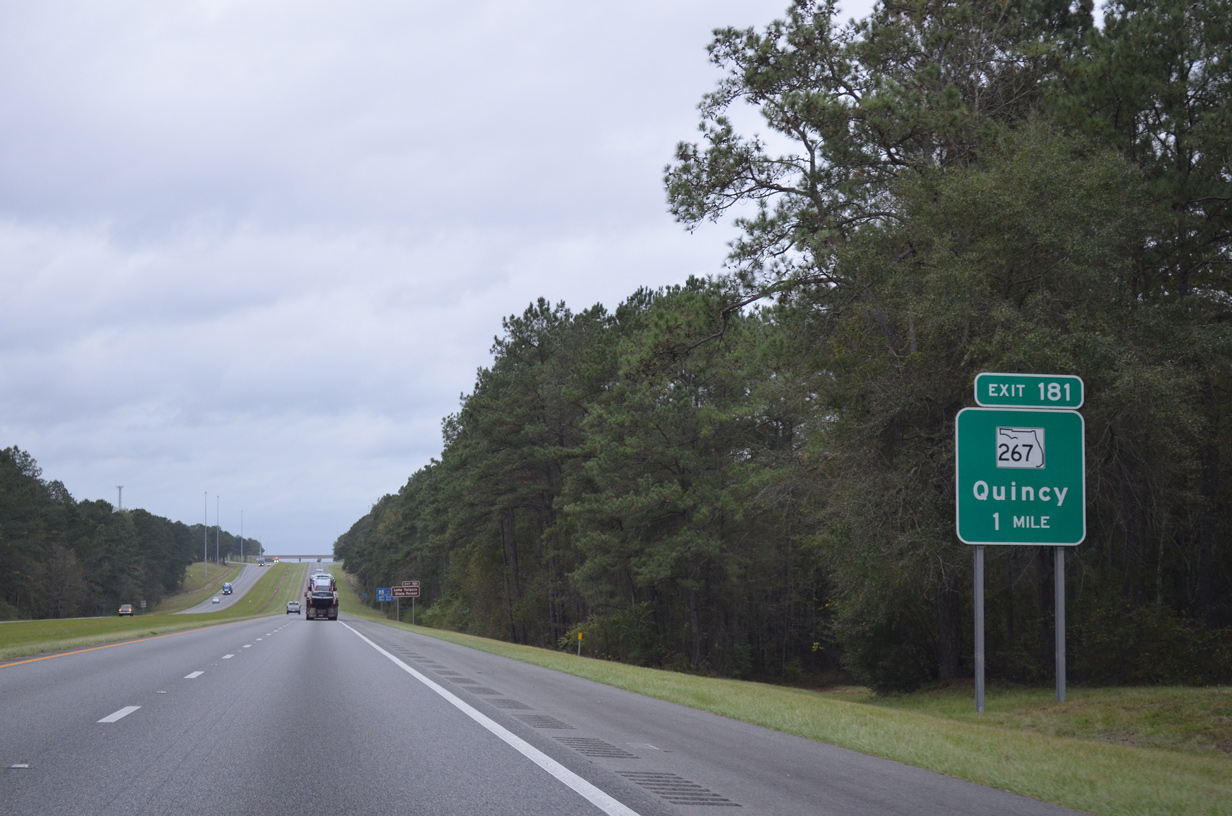
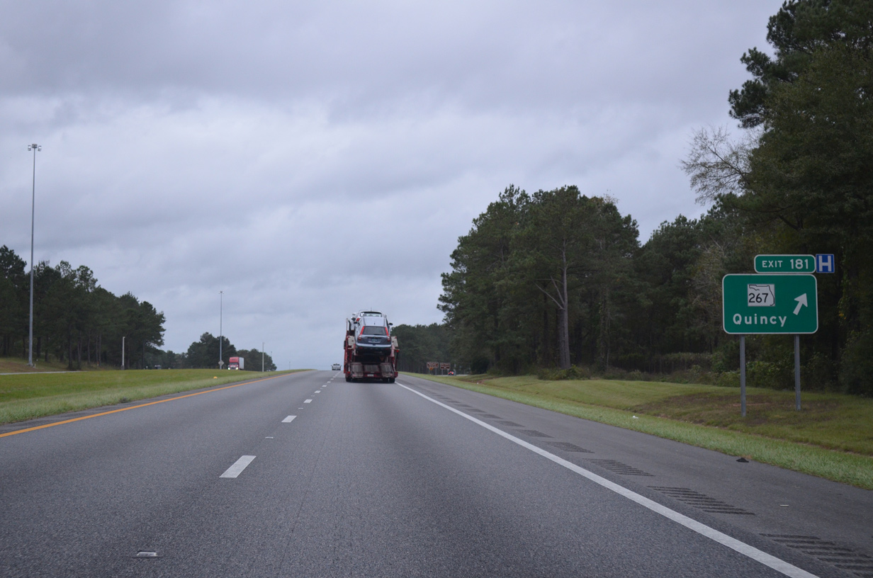
Interstate 10 continues west from Midway nine miles to SR 267 at Exit 181. Midway was incorporated in 1987.
12/05/10

A roadway split lines precedes Monroe Creek in northern reaches of Midway. Suburban development encroaches the south side of the freeway here.
06/02/06
The north branch of SR 267 (Pat Thomas Highway) meets I-10 at a diamond interchange (Exit 181) by Shiloh. SR 267 travels 15.39 miles south from U.S. 90/SR 12 (Jefferson Street) in Quincy to SR 20 in eastern Liberty County.
11/18/15
Exit 181 leaves Interstate 10 west for SR 267 (Pat Thomas Highway). SR 267 continues north from Quincy to Robertsville and the Georgia state line, becoming SR 302 to Faceville.
11/18/15
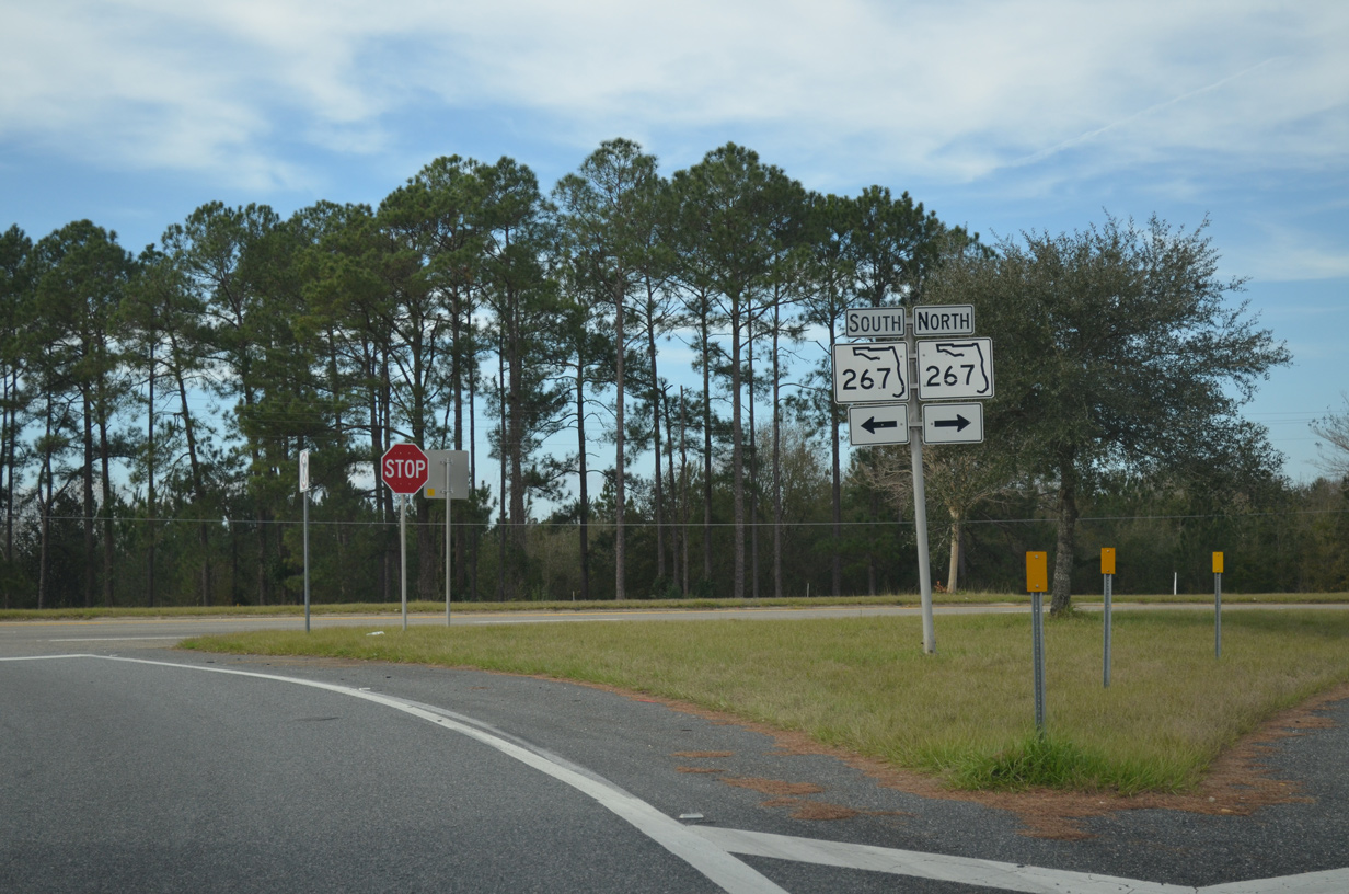
Wetumpka lies 4.5 miles to the southwest of Exit 181 along SR 267 at CR 65B (Old Federal Road).
01/16/16
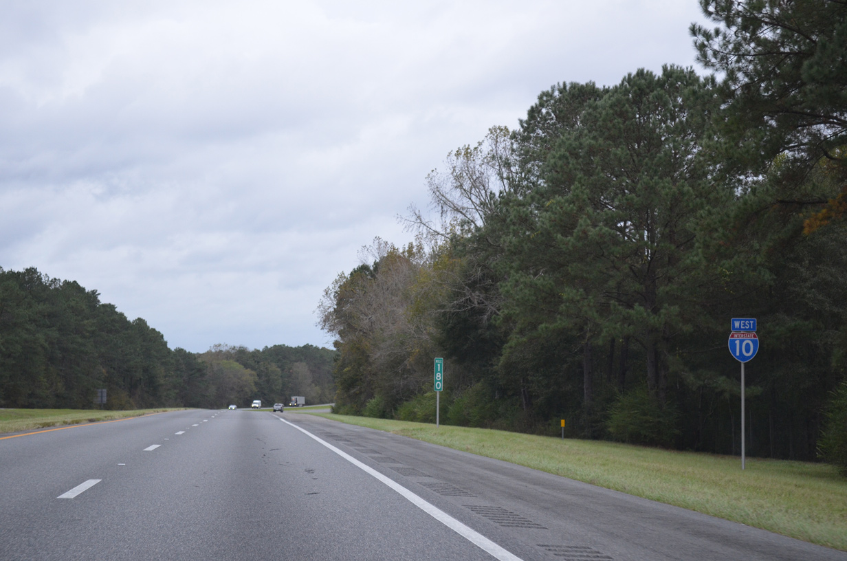
Interstate 10 crosses Cox Creek and Vote Creek westbound beyond mile marker 180.
11/18/15
Interstate 10 continues six miles west to SR 12 near the town of Greensboro.
11/18/15
SR 12/65 branch southwest from U.S. 90 outside Quincy to Hosford Highway near Gretna. SR 65 leads southward to SR 20 at Hosford while SR 12 takes a more westerly course to SR 20 by way of Greensboro and Bristol.
11/18/15
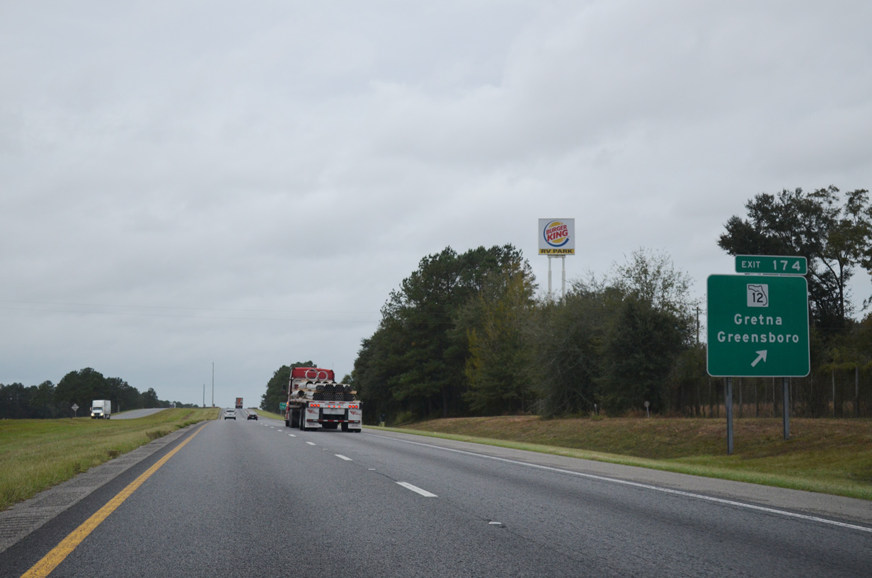
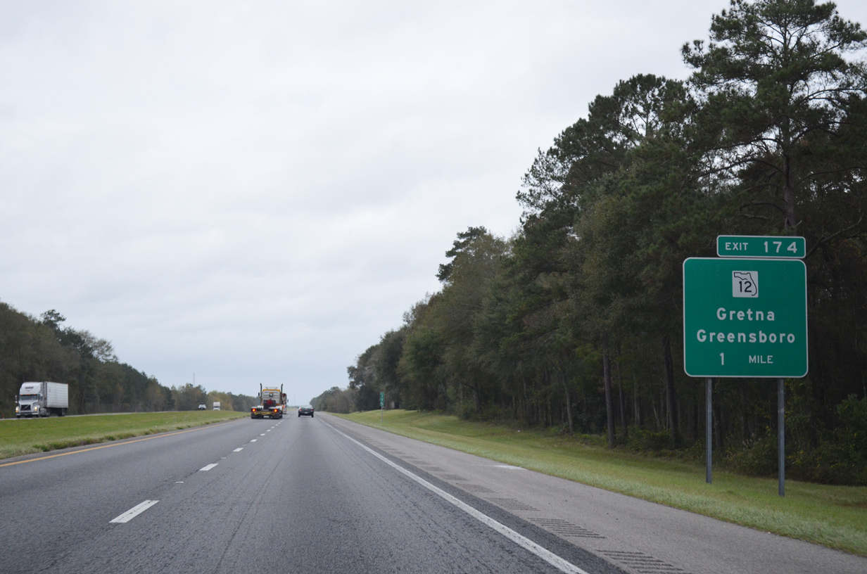
Westbound I-10 at the diamond interchange (Exit 174) with SR 12 (Greensboro Highway). State Road 12 travels 42.06 miles overall between Bristol and U.S. 27 at Havana.
11/18/15
Interstate 10 confirming marker posted between Exit 174 and Telogia Creek.
11/18/15
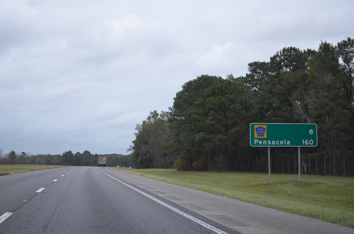
Arcing northwest, Interstate 10 next meets CR 270A (Flat Creek Road) in a hilly area of west Gadsden County.
11/18/15
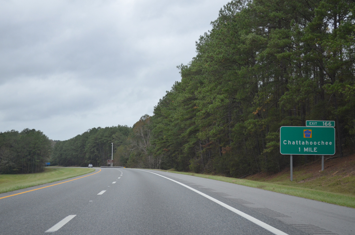
CR 270A (Flat Creek Road) meanders west 10.88 miles from SR 12 (Greensboro Highway) to CR 269 (Bonnie Hill Road), 1.4 miles north of Exit 166. Interests to Lake Seminole are directed onto CR 269 north to Chattahoochee and those bound for Torreya State Park onto CR 269 south and CR 270 west.
11/18/15
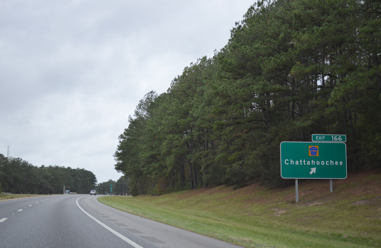
A diamond interchange links I-10 with County Road 270A (Flat Creek Road) at Exit 181. Chattahoochee lies six miles to the north near the Georgia state line.
11/18/15
Interstate 10 parallels Flat Creek leading into the Apalachicola River valley.
11/18/15

County Road 269 crosses over Interstate 10 at the rise west of Exit 166, seven miles east of Exit 158 for County Road 286.
11/18/15
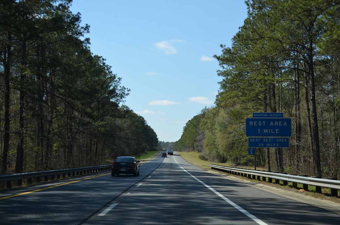
A rest area lies south of the I-10 eastbound roadway near the Apalachicola River. Similar to a service area configuration along the Pennsylvania Turnpike, a trumpet interchange and access road links the westbound roadway with the facility.
03/03/13

Spanning the Apalachicola River, I-10 west enters both Jackson County and Central Time Zone. The Apalachicola River flows south from Lake Seminole and the confluence of the Chattahoochee and Flint Rivers.
03/03/13
10/05/16

A diamond interchange (Exit 158) links Interstate 10 west with CR 286 (Blueberry Drive) to the town of Sneads. CR 271 extends north from Sneads to Haynes and Three Rivers State Park.
03/03/13
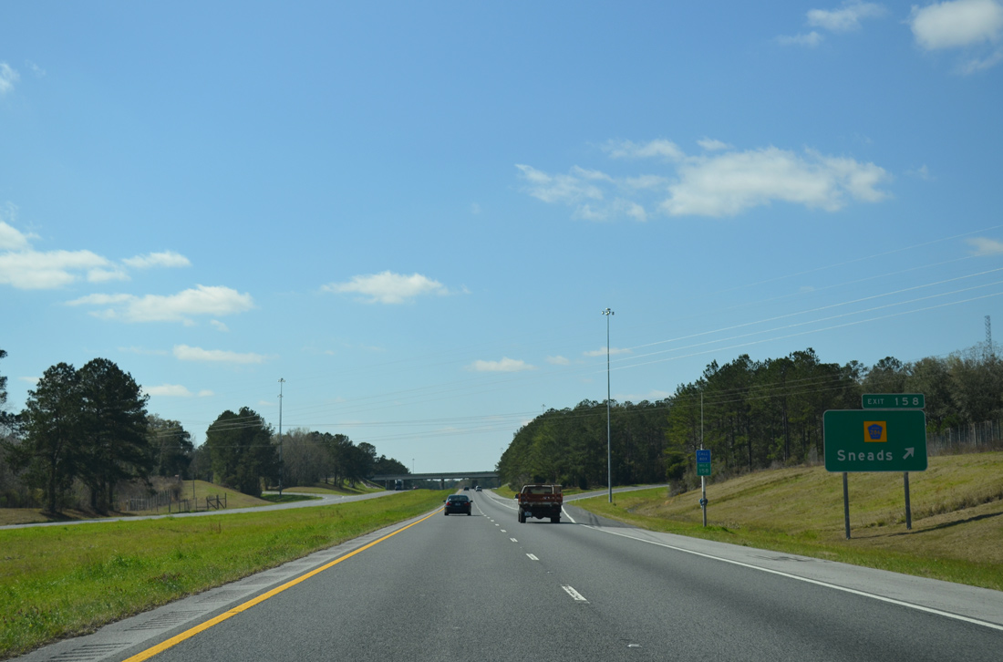
Exit 158 departs for CR 286 (Blueberry Drive). CR 286 heads four miles north to Sneads via Gloster Avenue. South from I-10, CR 286 turns westerly at the Calhoun County line to Ocheesee and SR 69 at CR 274.
03/03/13

Interstate 10 continues five miles west to SR 69 (Exit 152) near Dickson Bay. Pensacola is 146 miles away.
03/03/13

Weigh stations operate in both directions of Interstate 10 near Shady Grove.
03/03/13

One mile ahead of the diamond interchange (Exit 152) with SR 69. This sign was knocked over in 2013.
11/20/14

SR 69 travels 4.7 miles north from Exit 152 to U.S. 90 in the town of Grand Ridge and south 15 miles to SR 71 in Blountstown.
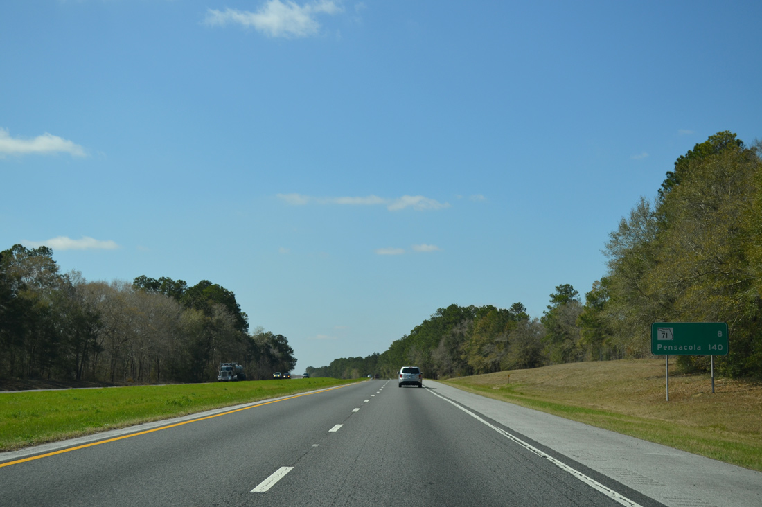
10/05/16
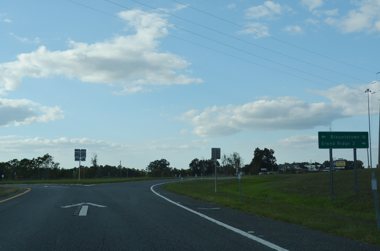
State Road 69 constitutes a 35.23 mile long loop east from SR 71 between Blountstown and Greenwood.
10/05/16
Interstate 10 advances eight miles west from Honey Hill Bay to SR 71 at Exit 142. Pensacola is a two hour drive.
03/03/13
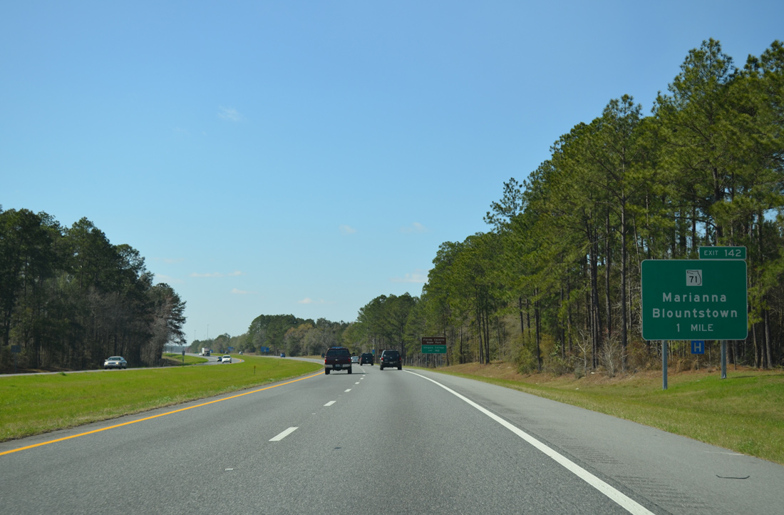
SR 71 travels 22 miles north from Blountstown to the diamond interchange at Exit 142. SR 71 provides one of two routes north to Mariana via a 1.64 mile overlap with U.S. 90 west.
03/03/13

SR 71 connects I-10 with SR 166 (Caverns Road) for both Chipola College and Florida Caverns State Park. South from Blountstown, SR 71 reaches Wewahitchka in 50 miles and Port St. Joe in 74 miles. SR 71 north becomes Alabama State Route 53 en route to Dothan.
03/03/13
Interstate 10 crosses the Chipola River west of State Road 71.
03/03/13
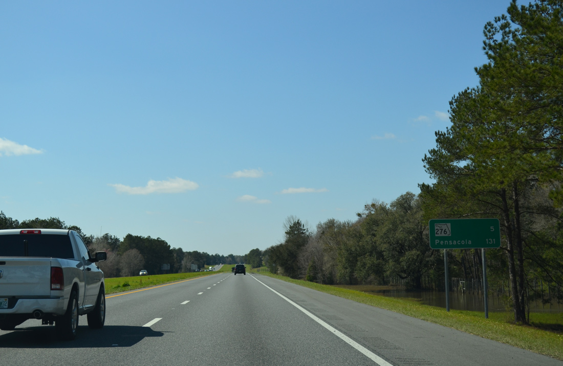
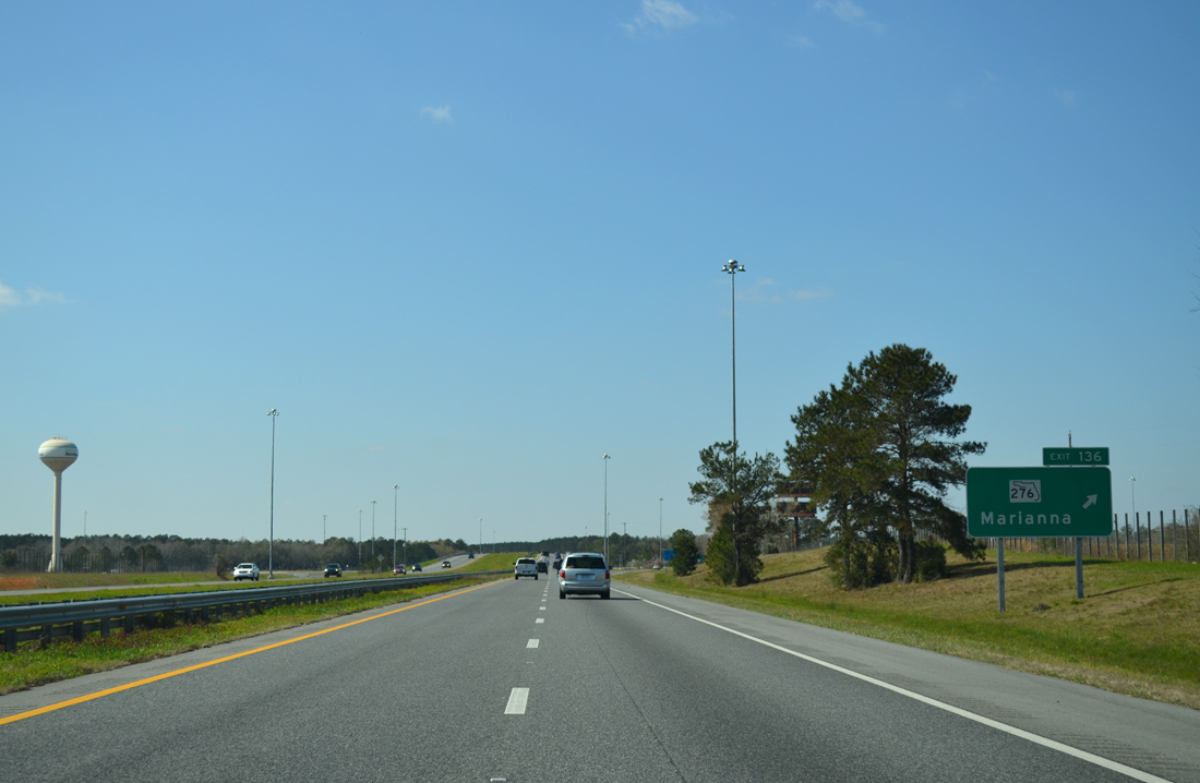
SR 276 and Interstate 10 converge in southwest Marianna at Exit 136 in five miles. Pensacola is another 126 miles to the west.
03/03/13
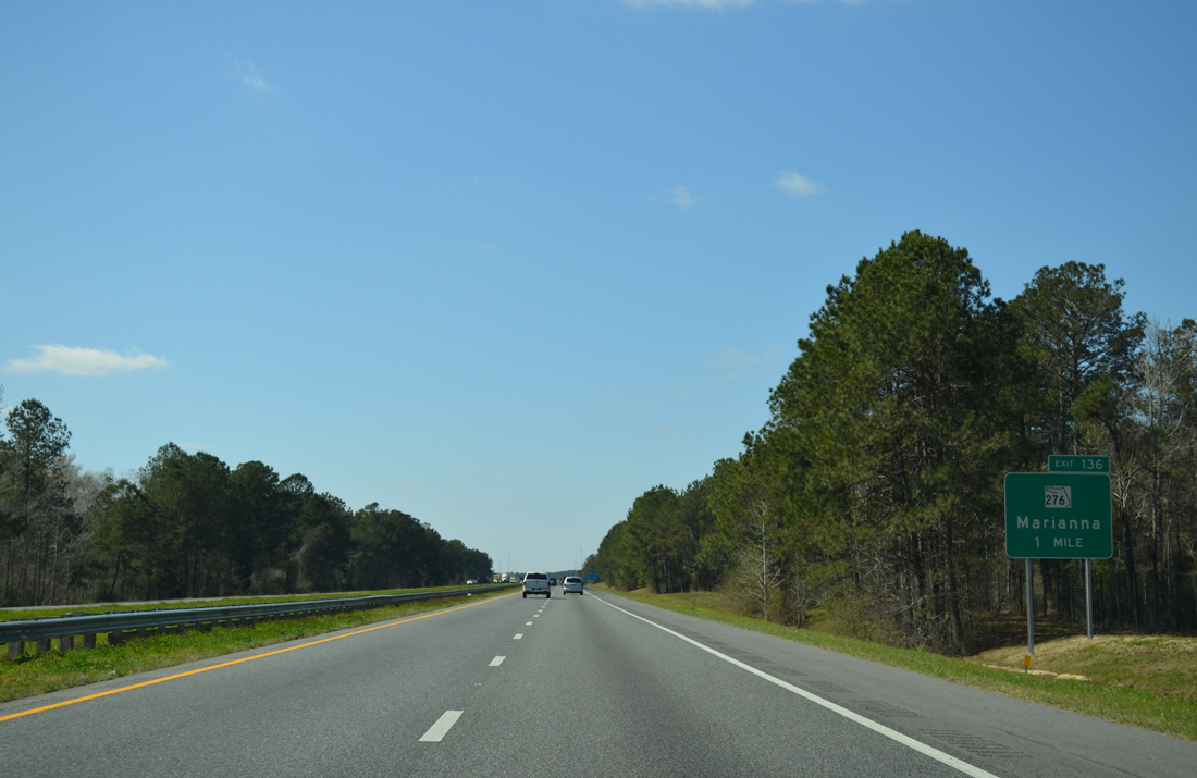
I-10 advances west from SR 73 to the diamond interchange (Exit 136) with SR 276 (Kynesville Road). SR 276 extends 0.7 miles west of I-10 to become CR 276 at CR 167 (Fairview Road). CR 276 continues to Kynesville while CR 167 runs south 17.91 miles to U.S. 231 near Betts.
03/03/13
Leading north into Marianna, SR 276 follows Penn Avenue 2.75 miles to U.S. 90 (Lafayette Street). A second branch of CR 167 emerges along South Street east to link SR 276 with SR 73 (Jefferson Street).
03/03/13
The succeeding exit joins Interstate 10 west with U.S. 231 in seven miles. Pensacola is 126 miles away.
03/03/13
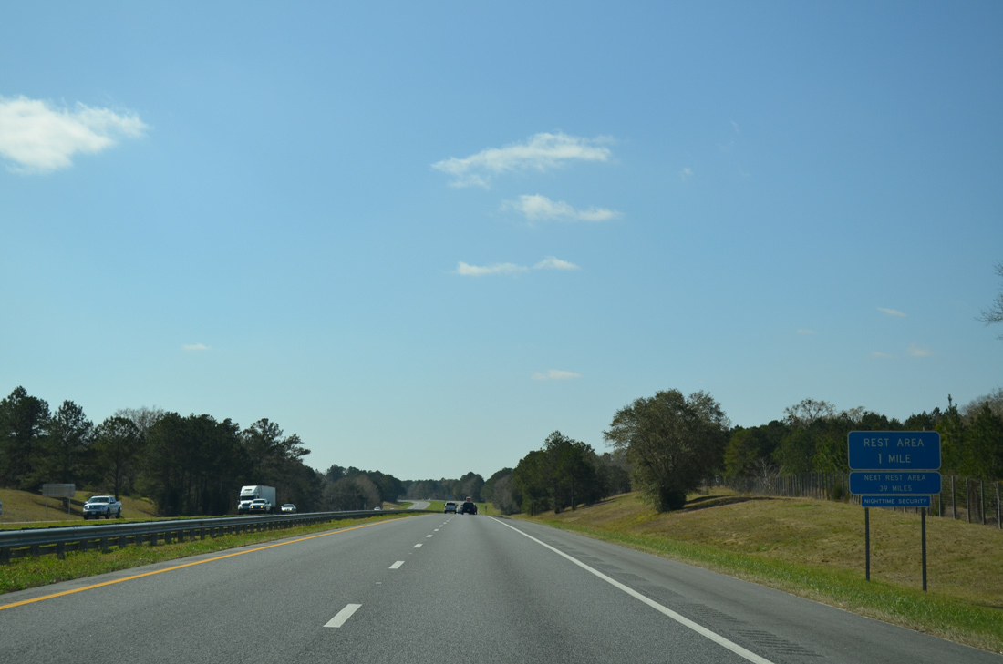
Rest areas line both sides of Interstate 10 in a forested area midway between Exits 136 and 130.
03/03/13
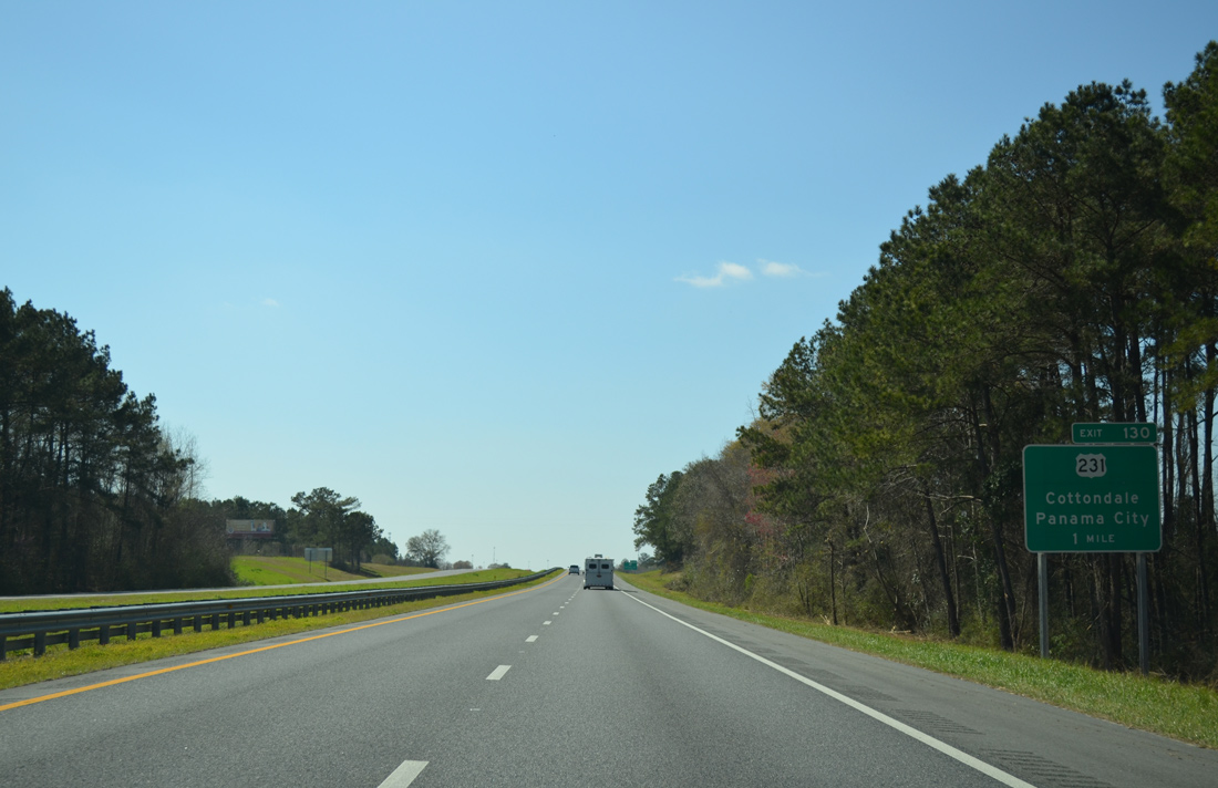
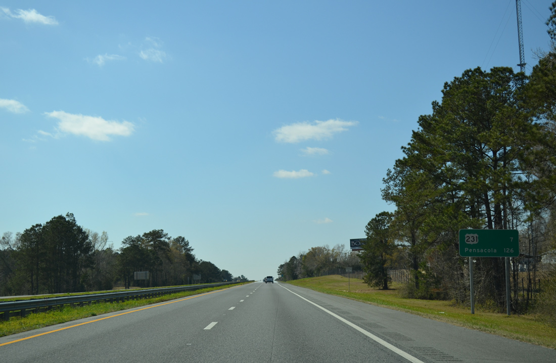
One mile east of the folded diamond interchange (Exit 130) with U.S. 231 along Interstate 10 west. U.S. 231 represents the main corridor to Panama City and Panama City Beach from points east and north.
03/03/13
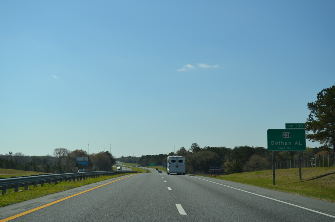
Dothan, Alabama is 32 miles to north along U.S. 231. Several proposals were considered to upgrade the corridor between I-10 and the largest city in southeastern Alabama with a limited access highway, but not moved beyond the planning stage.
03/03/13
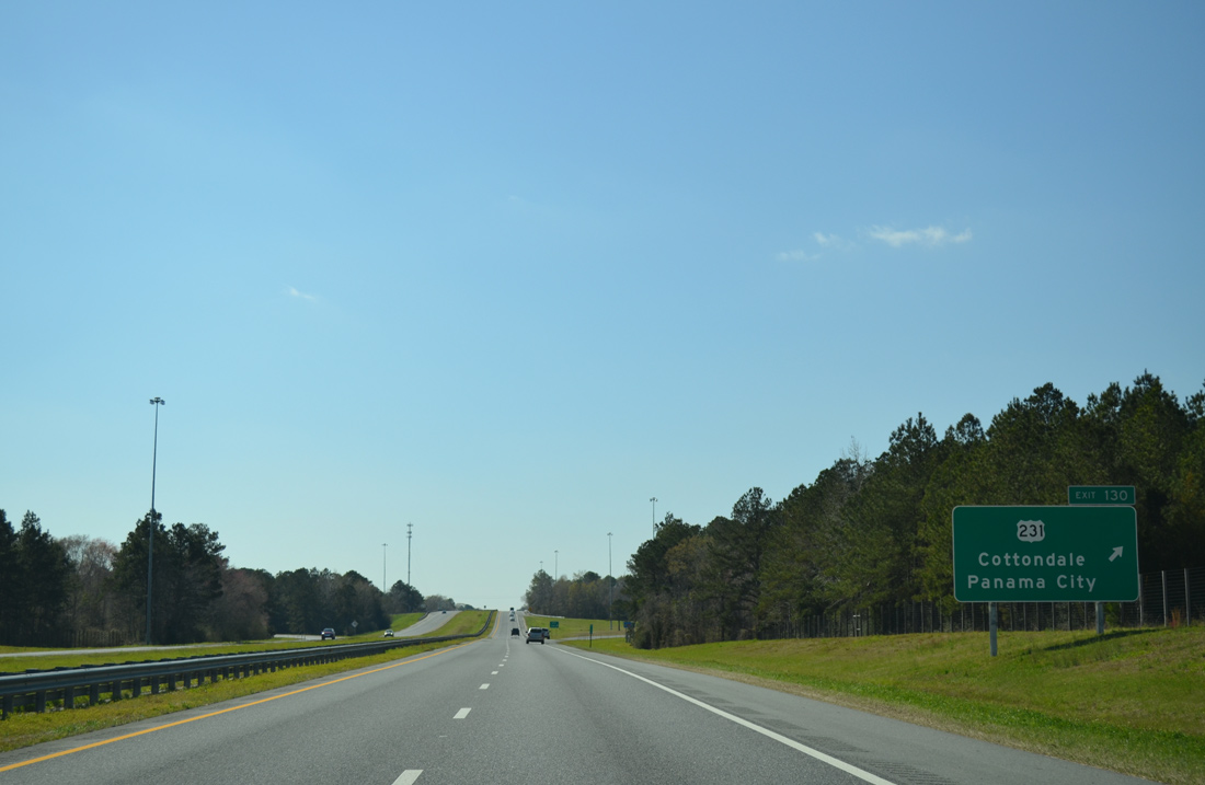
Interstate 10 westbound at Exit 130 to U.S. 231. With the exceptions of through Campbellton, Cottondale and Alford, U.S. 231 in Northwest Florida constitutes a four lane, divided highway with a 65 mile per hour speed limit.
03/03/13
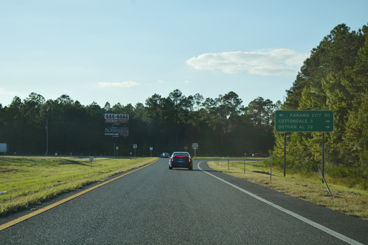
U.S. 231 heads 2.6 miles north to intersect U.S. 90 (Levy Street) in the town of Cottondale. Southward U.S. 231 concludes in 50 miles at U.S. 98 Business in Downtown Panama City.
10/05/16
Interstate 10 crosses over both U.S. 231 and the parallel Bay Lines Railroad ahead of this westbound reassurance marker.
03/03/13
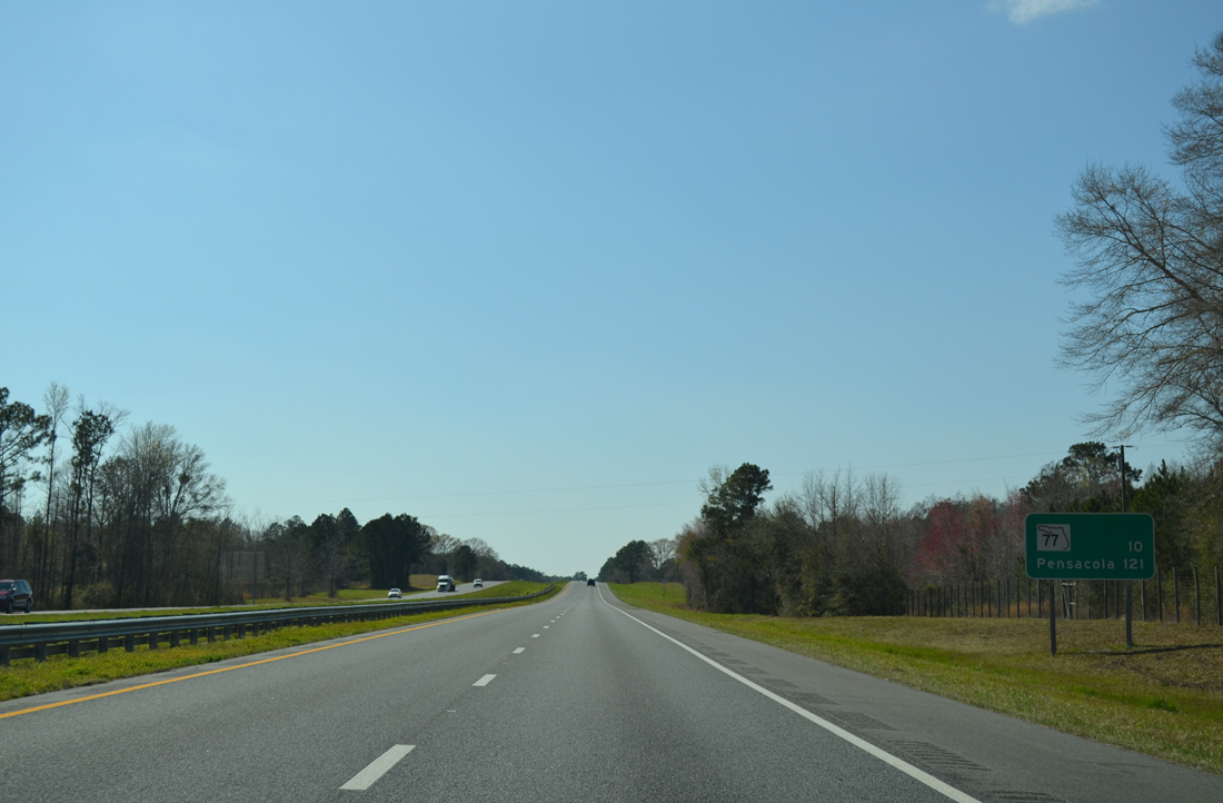
I-10 plies across a number of wetland areas on the ten mile stretch west to SR 77 at Chipley. Sapp Bay spreads to the north while Reed Creek Bay and Three Sisters Pond are to the south.
03/03/13
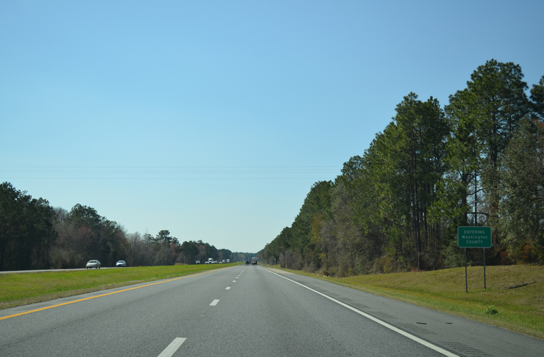
Interstate 10 concludes the 33.26 mile long section in Jackson County and enters Washington County line near Skipper Lake and Peterson Bay.
03/03/13

Photo Credits:
- ABRoads: 12/05/10, 01/16/16, 05/02/20
- Alex Nitzman: 06/02/06, 11/20/14, 11/18/15, 10/05/16
- Brent Ivy: 03/03/13
Connect with:
Page Updated Monday November 30, 2020.