
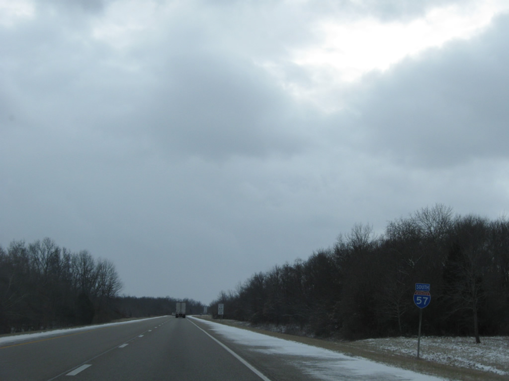
Interstate 57 South - Effingham to Mount Vernon

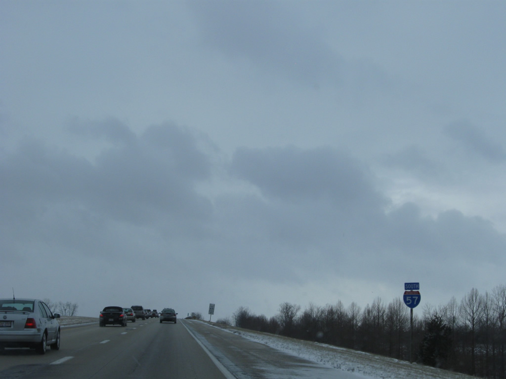
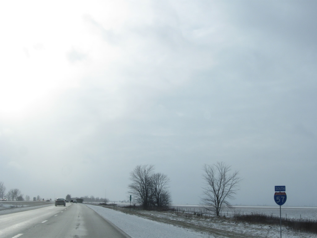
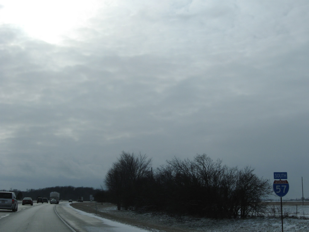
 South
South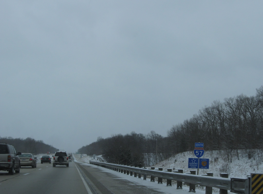
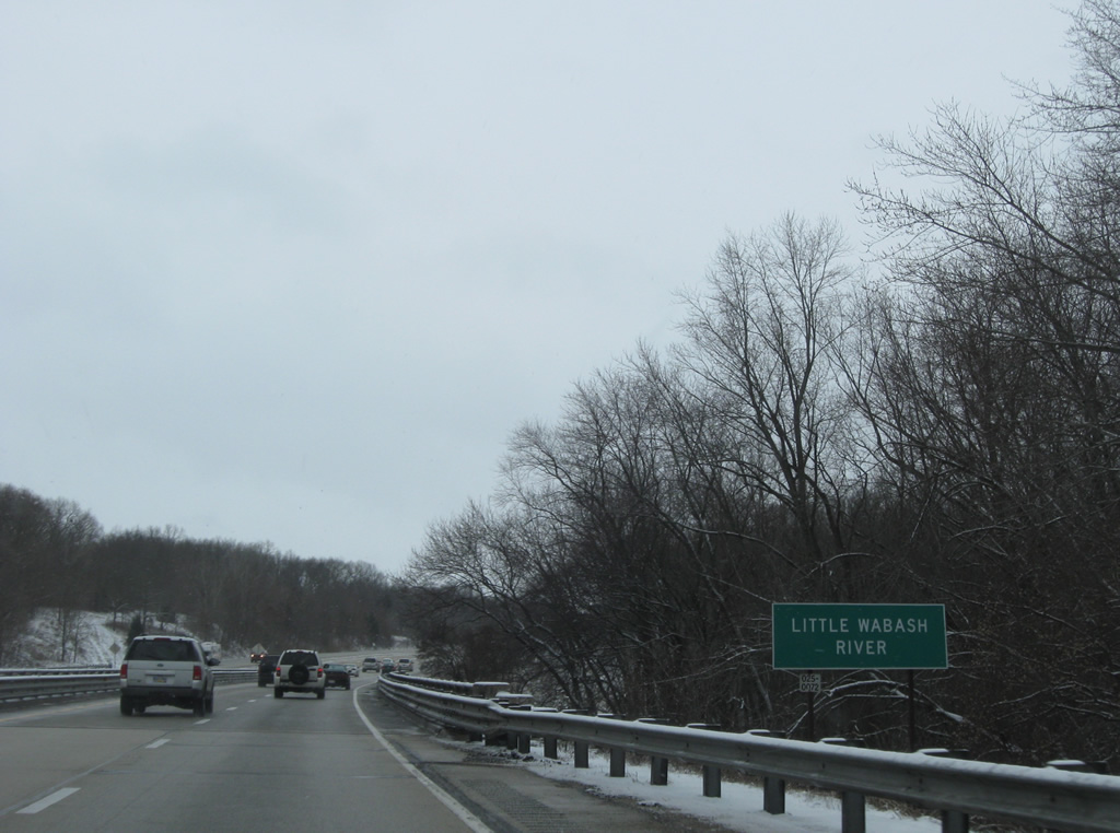
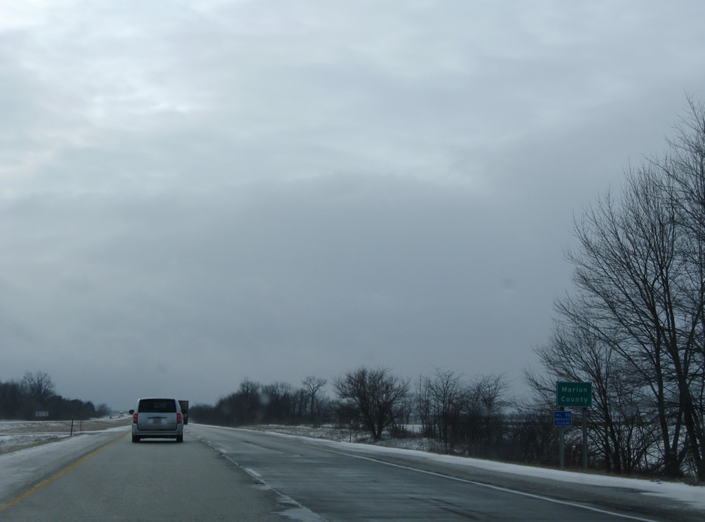
Interstate 57 leads south through a wooded area east of the Little Wabash River and parallel to North 1175th Street.
12/27/09
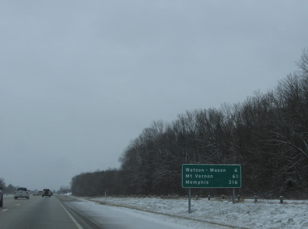
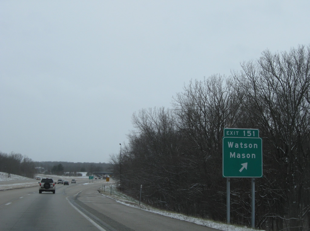
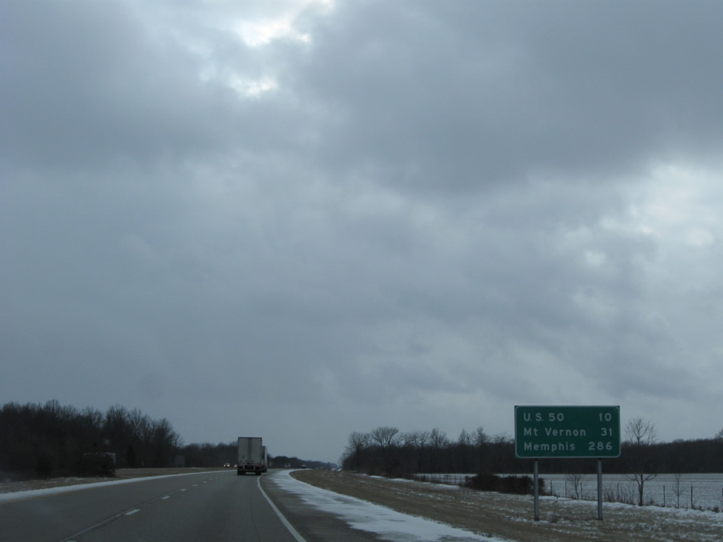
Watson and Mason are villages along IL 37 served by Exit 151 in six miles. Mt. Vernon is an hour away with Memphis still a long ways out at 316 miles.
12/27/09
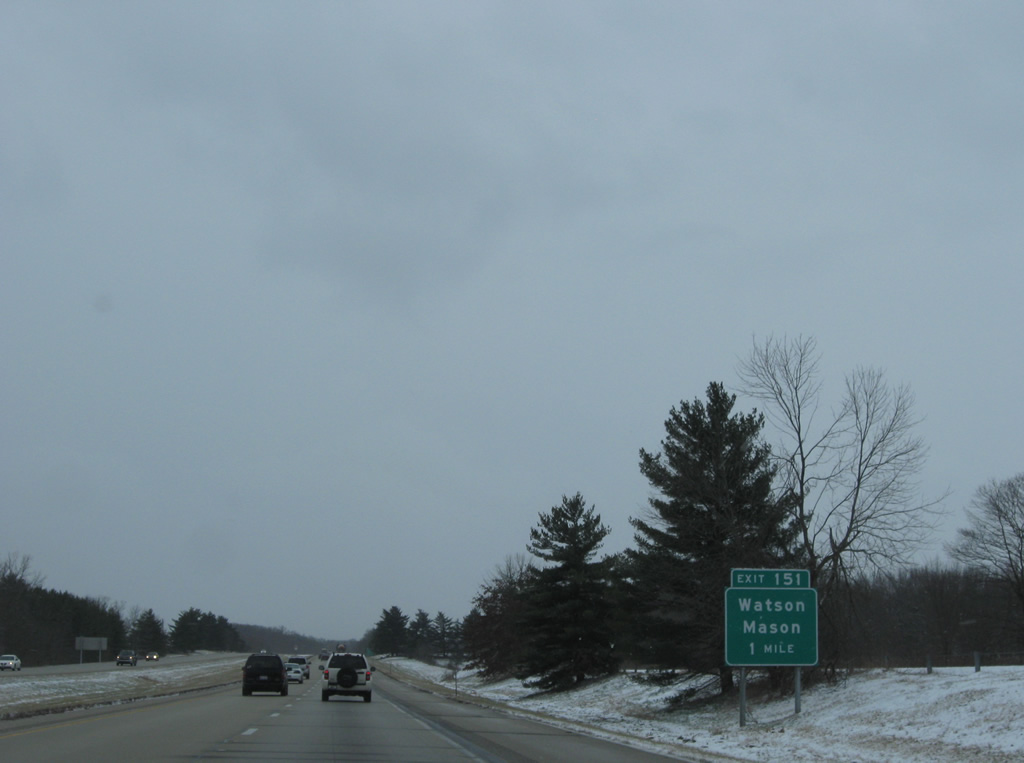
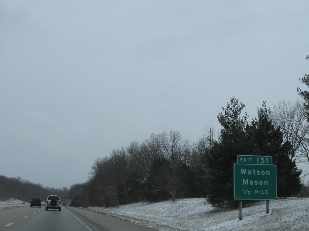
One mile north of the trumpet interchange (Exit 151) and access road to adjacent IL 37.
12/27/09
IL 37 begins at U.S. 45 east of the village of Mason and travels 4.1 miles southwest to the access road to Interstate 57.
12/27/09
IL 37 continues southwest from the Exit 151 access road to the village of Mason. The state route shadows Interstate 57 to Pulleys Mill near the split with Interstate 24 east.
12/27/09

Interstate 57 curves southwesterly and spans the Little Wabash River over bridges built in 1963. The 240 mile tributary of the Wabash River flows south from near Mattoon to New Haven.
12/27/09

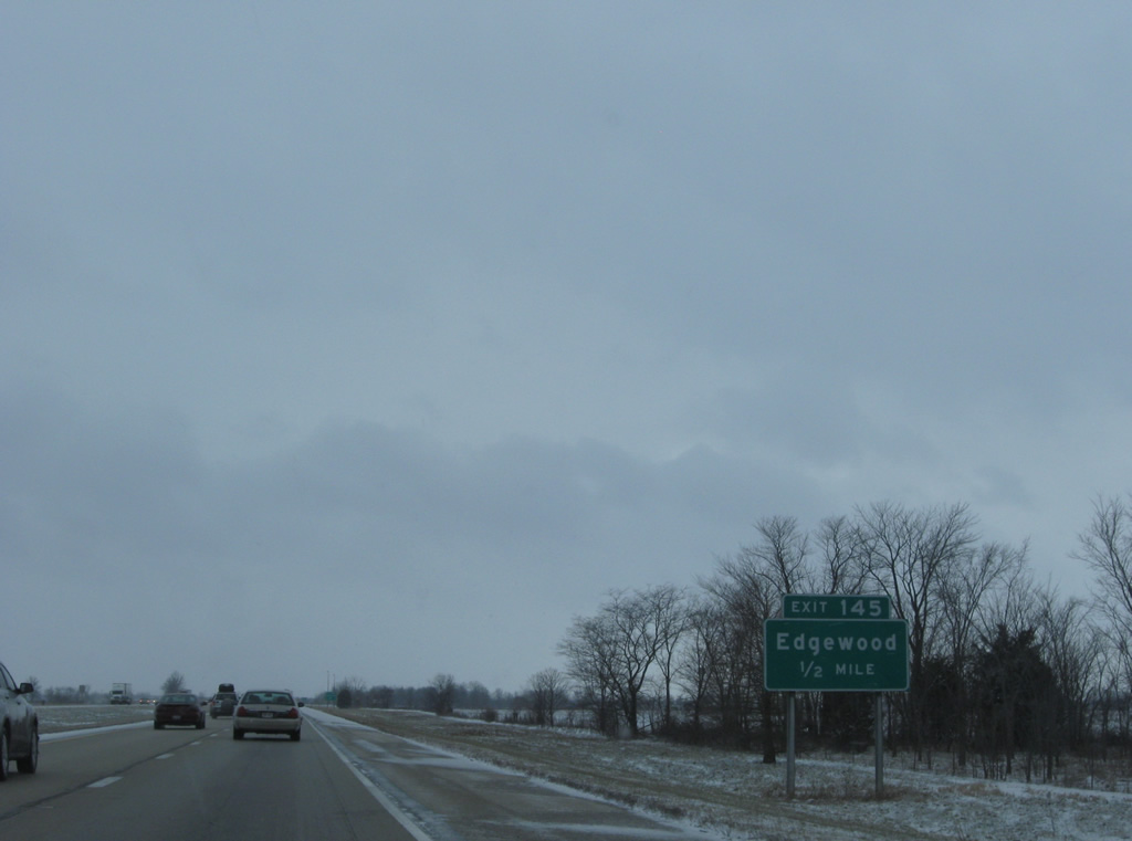
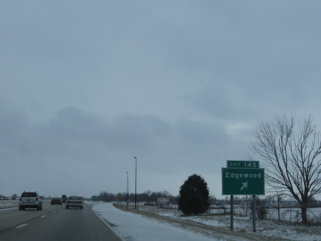
Crossing a swath of wide open farm land, southbound traffic next approaches the diamond interchange (Exit 145) with N 750th Street (County Road 29) near the village of Edgewood.
12/27/09
750th Street becomes Iowa Street in adjacent Edgewood, connecting Interstate 57 with IL 37 in town.
12/27/09
Exit 145 departs Interstate 57 south for County Road 29 and Edgewood. IL 37 exits the village of around 500 for La Clede and Farina.
12/27/09
Reassurance marker for Interstate 57 south posted ahead of the underpass for Broad Street (County Road 27) and an abandoned Baltimore & Ohio Railroad line.
12/27/09
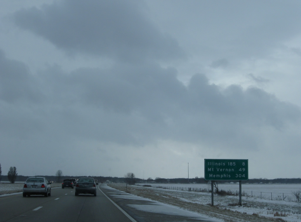
Edgewood is 49 miles north of Mt. Vernon and 304 miles from Memphis via Interstate 55 south.
12/27/09
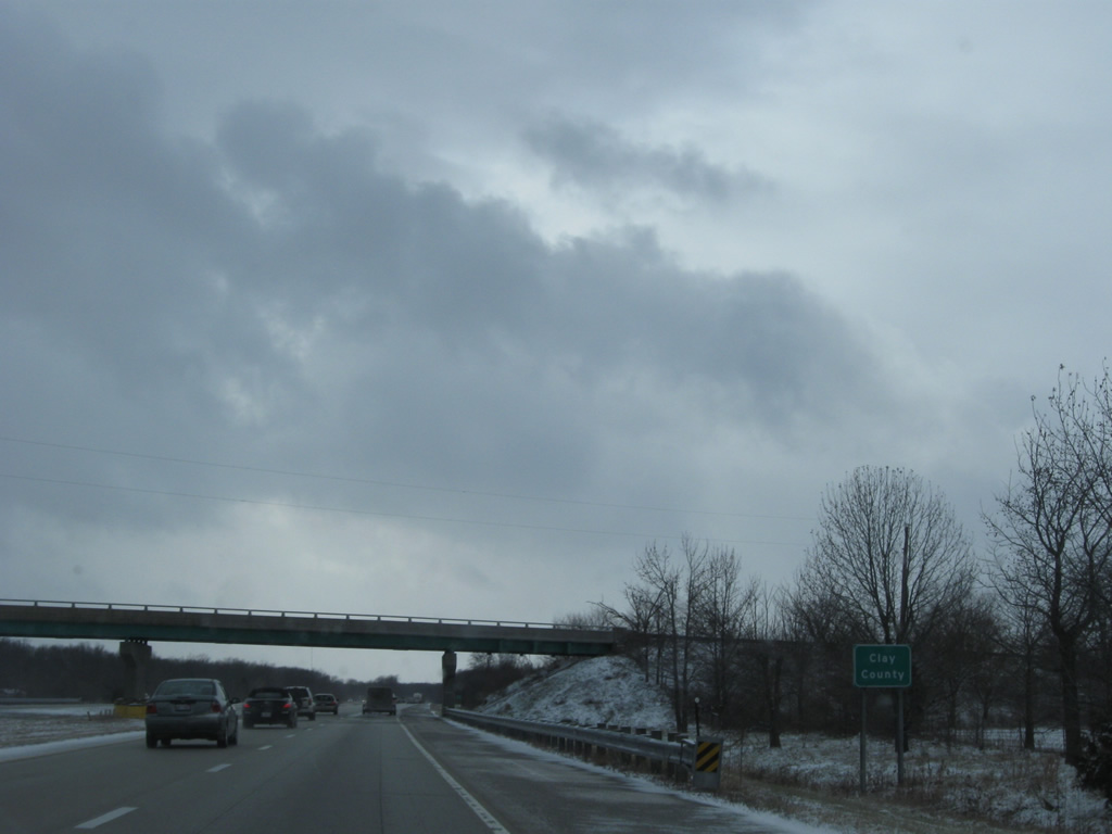
Interstate 57 continues on a southwest diagonal to nip the northwest corner of Clay County at the 1st Avenue / County Road 00 North over crossing.
12/27/09
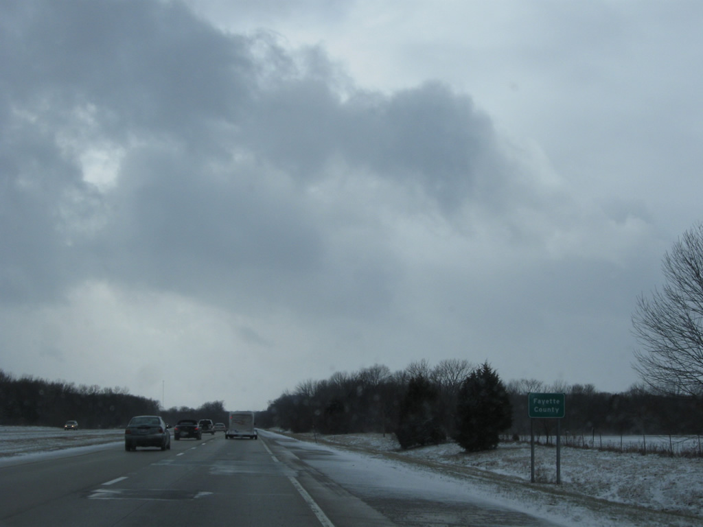
Drivers continue immediately into Fayette County after a 1,000 feet or so in Clay County. A forested roadway split lies ahead as I-57 crosses Dismal Creek.
12/27/09
Farm land opens on the southwest horizon beyond the County Road 2850 East overpass at milepost 140.
12/27/09
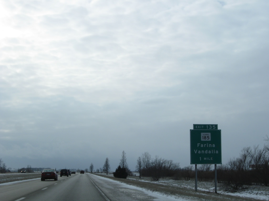
A diamond interchange (Exit 135) joins IL 185 with Interstate 57 at the village of Farina.
12/27/09

One half mile north of Exit 135 for IL 185. IL 185 follows Washington Street southeast from I-57 to end at IL 37 (Chestnut Street) in Farina.
12/27/09
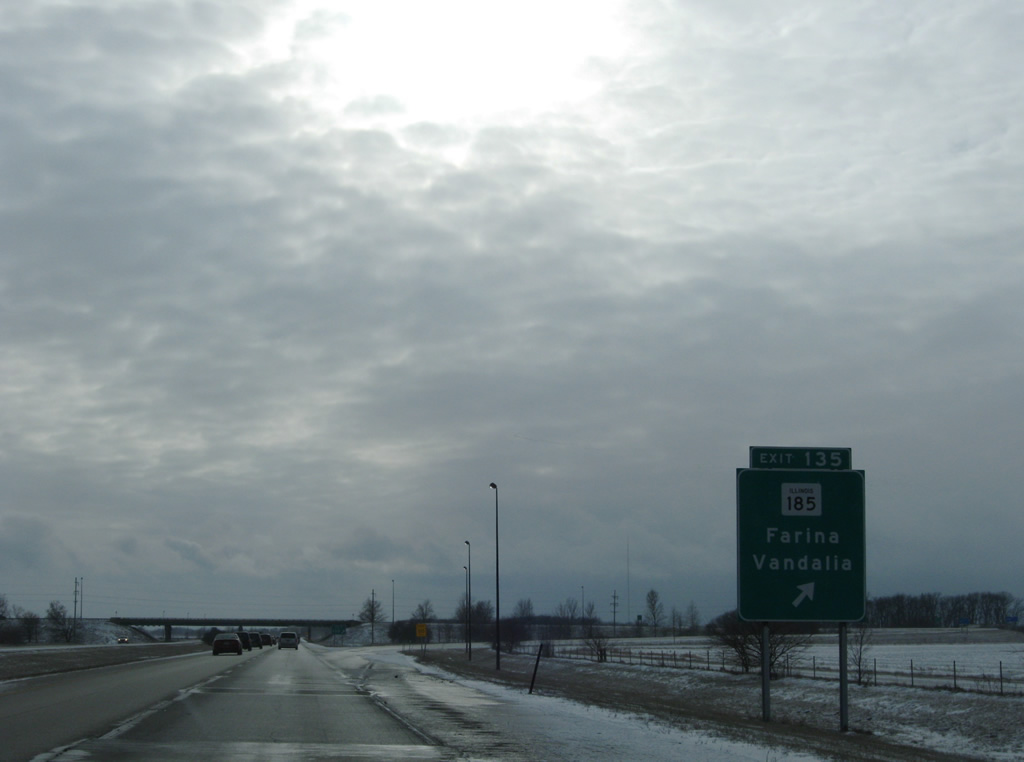
West from Interstate 57, IL 185 reaches St. Peter in six miles and U.S. 40 outside Vandalia in 19 miles. Overall the state route measures 50 miles from Farina to Hillsboro.
12/27/09
Interstate 57 continues southwest parallel to the East Fork of the Kaskaskia River from Farina into Marion County.
12/27/09
Marion County, home to 37,729 as of the 2020 census, was carved from swaths of Jefferson and Fayette Counties in 1823 and named for Revolutionary War General Francis Marion.2
12/27/09
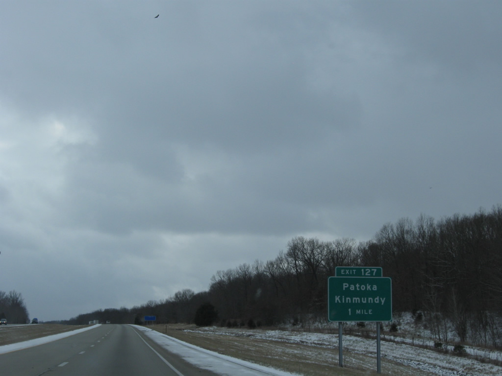
Interstate 57 bypasses the city of Kinmundy to the north ahead of a diamond interchange (Exit 127) for the city of under 1,000 to the southwest.
12/27/09
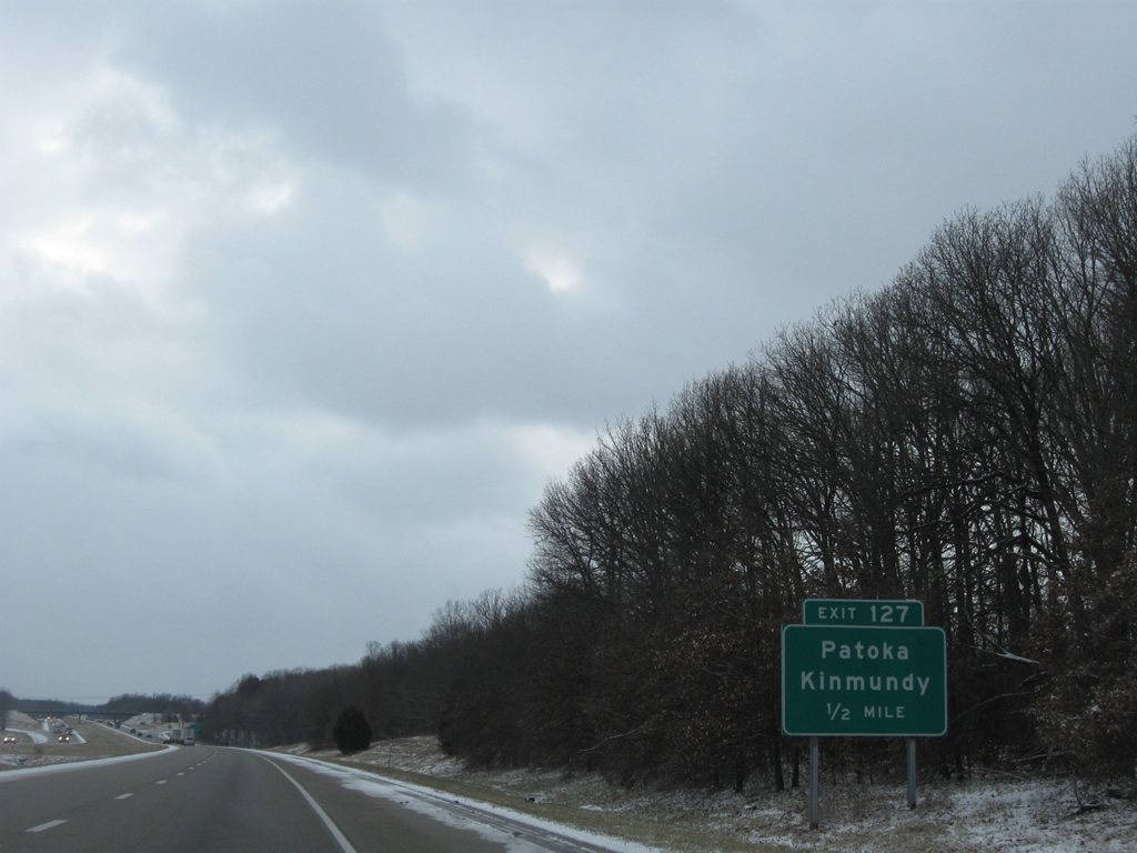
Kinoka Road meets Interstate 57 at Exit 127, 1.75 miles west of IL 37. Kinoka Road stretches eight miles west to intersect U.S. 51 outside the village of Patoka.
12/27/09
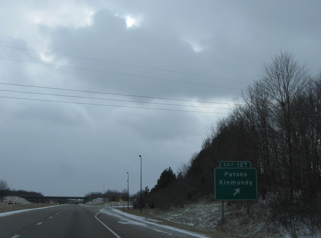
Exit 127 leaves Interstate 57 south for Kinmundy and Patoka. IL 37 continues south from Kinoka Road to Alma.
12/27/09
Another roadway split follows Exit 127 along Interstate 57 south.
12/27/09
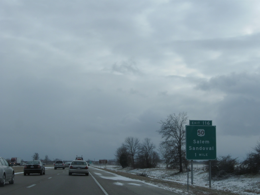
U.S. 50 is displayed in place of Salem, the Marion County seat, on this distance sign 31 miles north of Mt. Vernon.
12/27/09
Interstate 57 turns due south ahead of Davidson Creek, traveling across several more farms on the approach to Salem.
12/27/09
U.S. 50 (Main Street) converges with I-57 at a folded diamond interchange on the west side of Salem. Linking Downtown with I-57 at Exit 116, U.S. 50 provides the main commercial route for Salem.
12/27/09
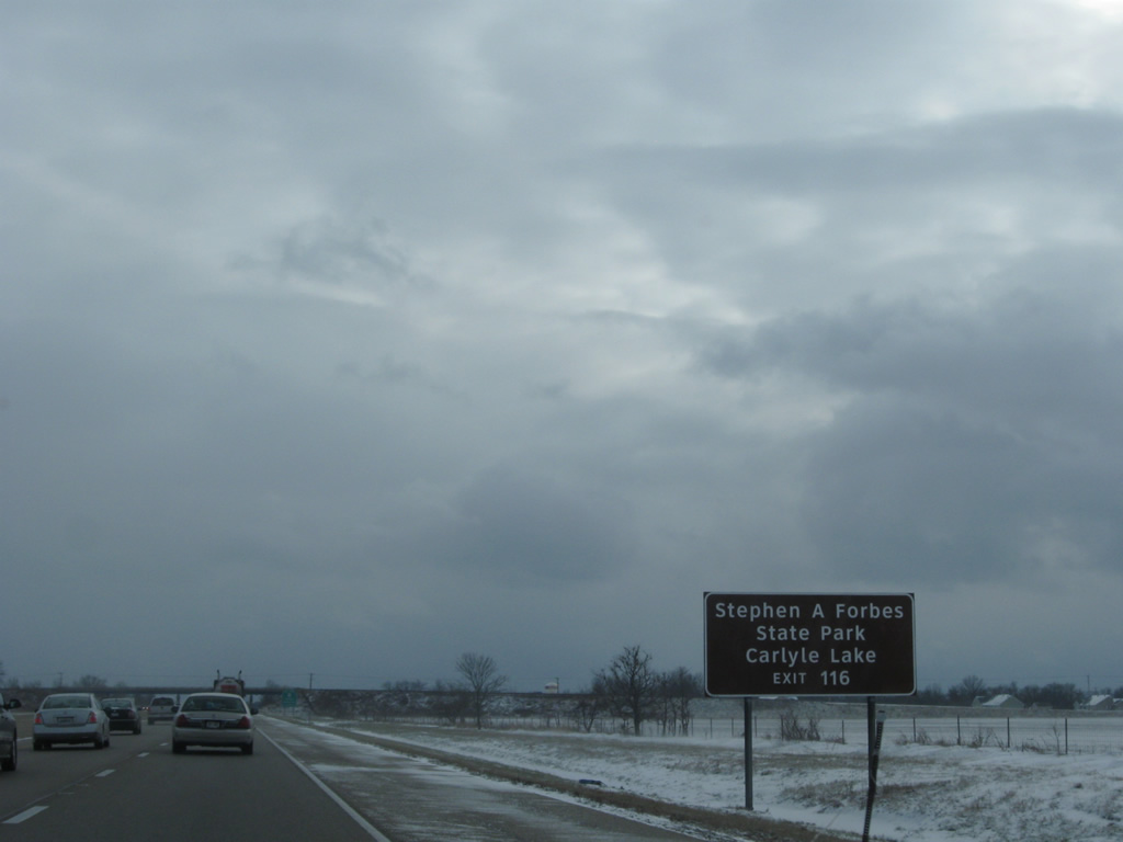
Interests to Carlyle Lake are directed onto U.S. 50 west and those to Stephen A. Forbes State Park along U.S. 50 east from Salem toward Omega.
12/27/09
U.S. 50 travels 183 miles west from Vincennes, Indiana to St. Louis, Missouri in Illinois. The route was once touted as the proposed corridor for Interstate 64 until officials from Evansville lobbied for a more southerly course. A new alignment for the US Highway was built in anticipation of this from Carlyle west to Summerfield.
12/27/09
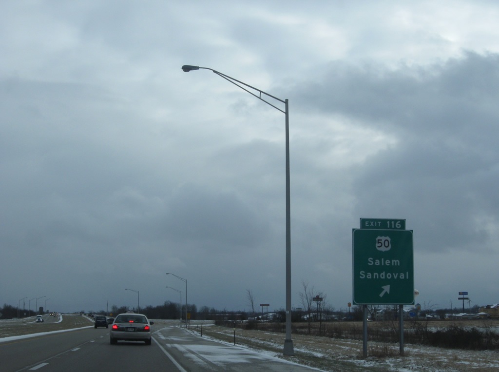
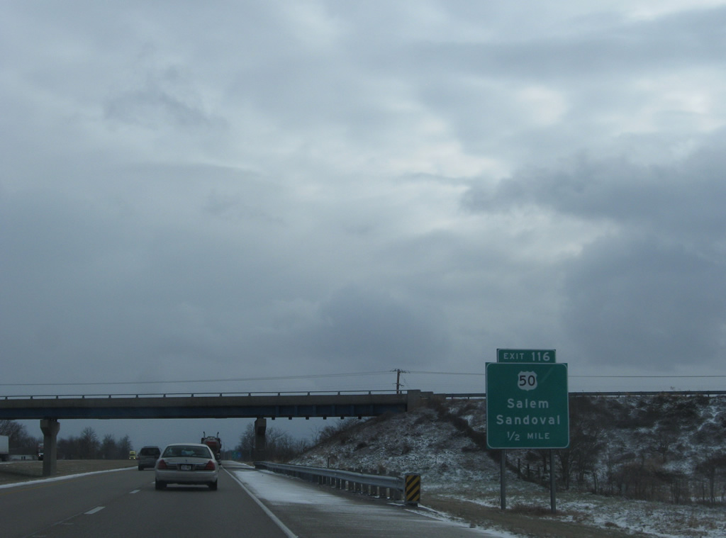
Odin and Sandoval are within a nine mile drive of U.S. 50 west from Exit 116. Eastward, U.S. 50 vacates Salem on a 25 mile drive to Flora and a merge with U.S. 45. U.S. 50 was once a transcontinental route at 3,231 miles from San Francisco to Ocean City, Maryland. The route ends in Sacramento now but still travels an impressive 3,011 miles.
12/27/09
Ramps for Exit 116 orientate on the north side of U.S. 50 because of the nearby CSX Railroad line that passes under I-57 beyond this shield assembly.
12/27/09
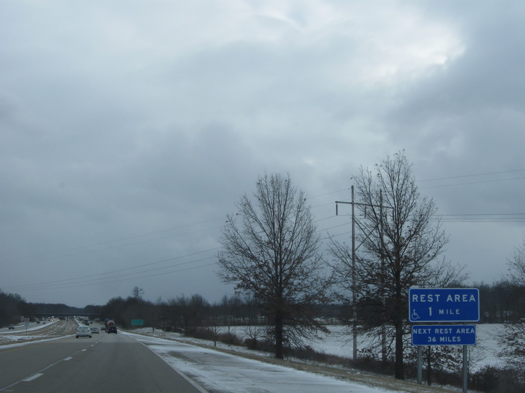
The third to last southbound rest area of Interstate 57 in Illinois follows at a roadway split east of Vermilion Creek.
12/27/09
Two exits remain before Interstate 57 south enters Mt. Vernon in 20 miles. Memphis is now 275 miles away.
12/27/09

The entrance to the southbound rest area follows the Cross Road / County Road 900 North overpass. A southbound facility is also present beyond the forested median.
12/27/09
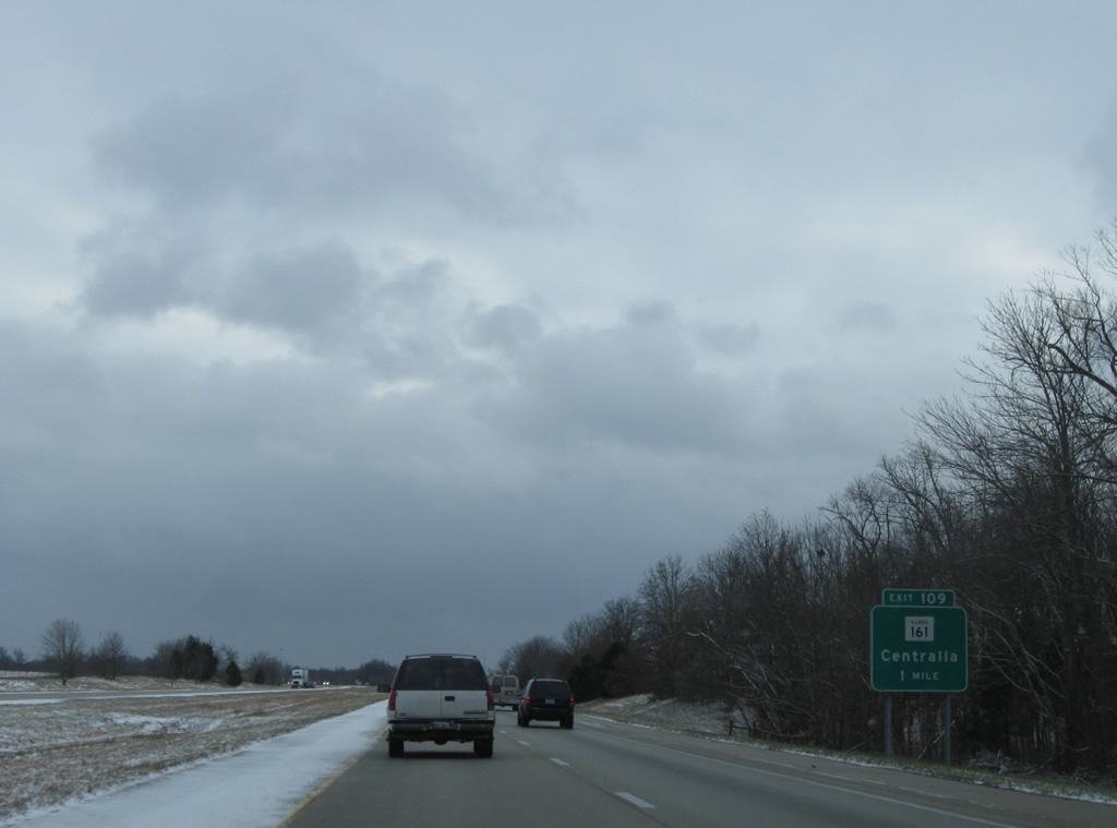
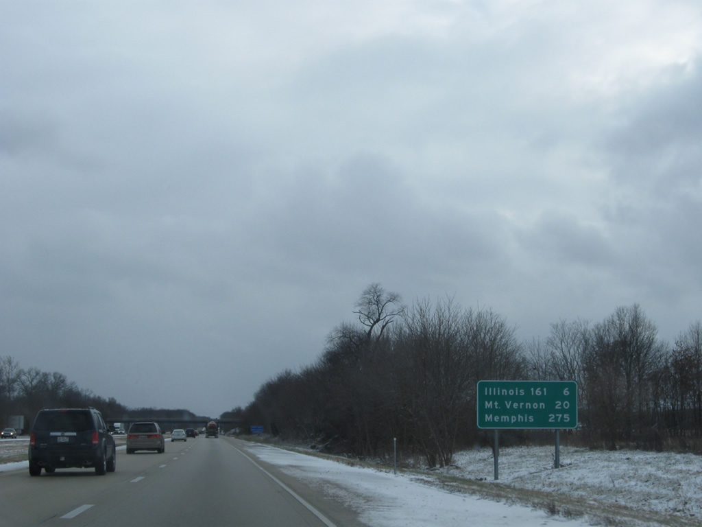
IL 161 meets Interstate 57 at a diamond interchange (Exit 109) which is the final Marion County exit.
12/27/09
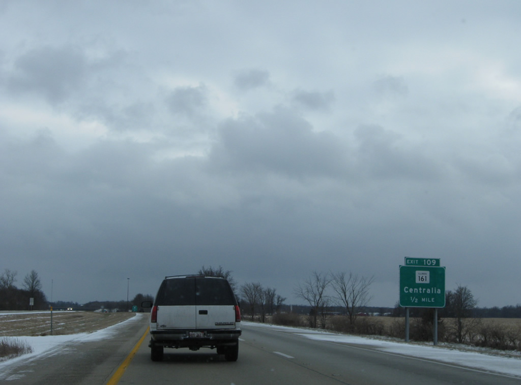
One half mile north of the IL 161 (McCord Street) to Centralia. IL 161 ends 1.2 miles east at IL 137 near Carter and Kell.
12/27/09
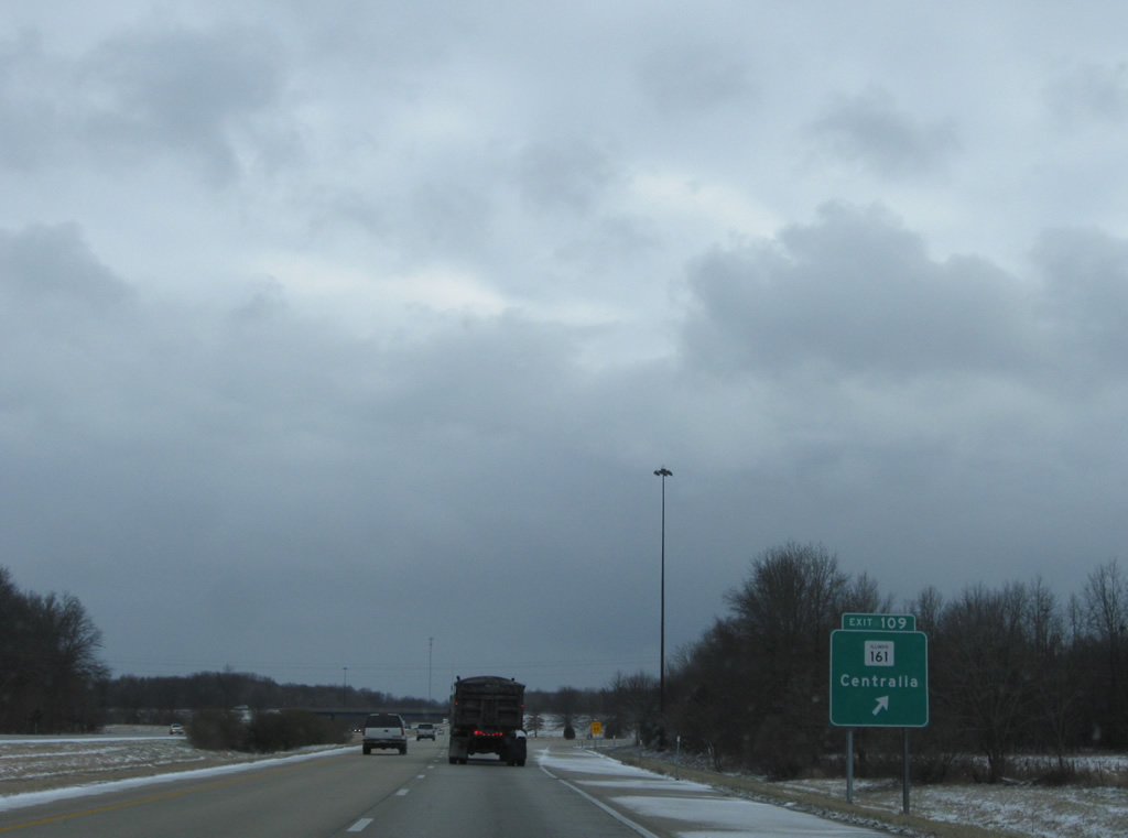
A 59 mile route, IL 161 travels nine miles west to Centralia and ends at Fairview Heights in the St. Louis suburbs.
12/27/09

Interstate 57 leads south three miles to the Jefferson County line.
12/27/09
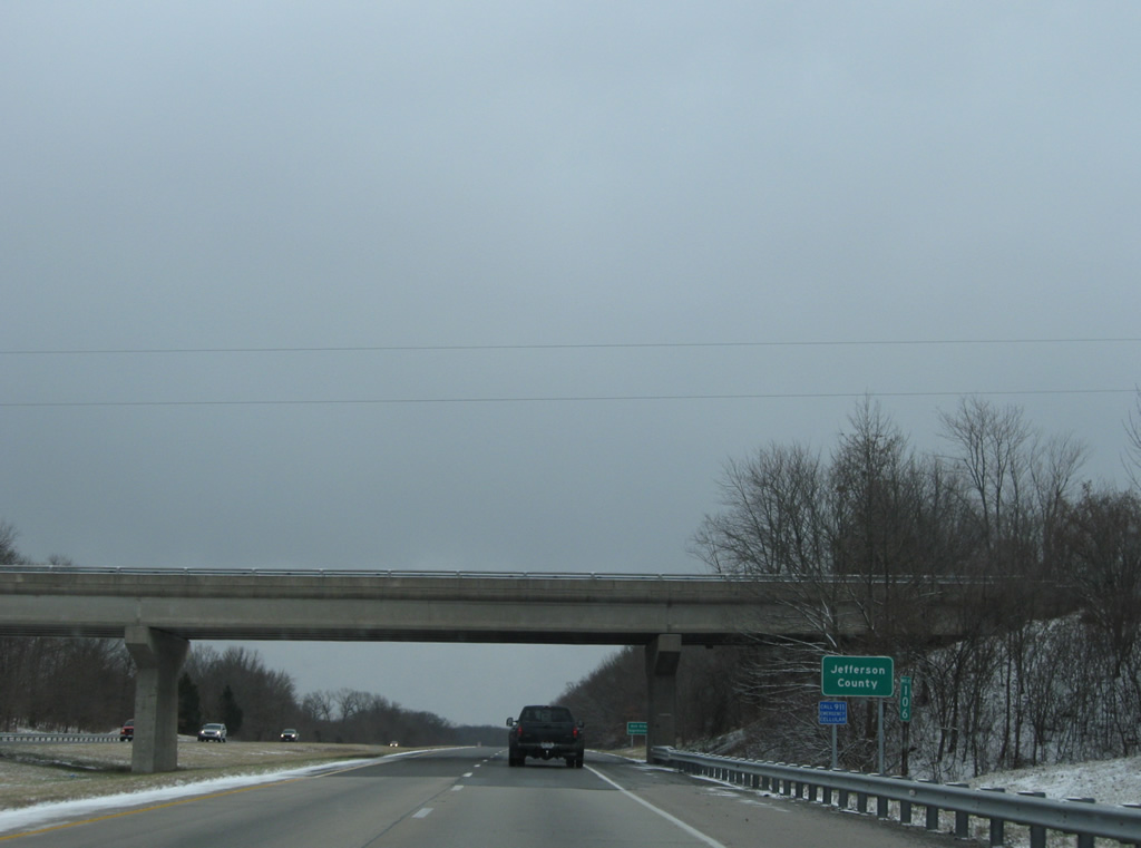
Motorists enter Jefferson County at the Walnut Hill Road over crossing. Created in 1819 from portions of White, Edwards and Franklin Counties, Jefferson County, named for Thomas Jefferson, was home to 37,113 as of the 2020 census.3
12/27/09
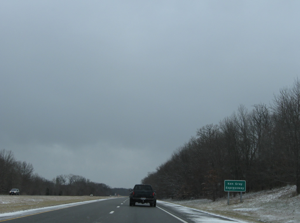
Interstate 57 from milepost 106 south to the Missouri State line is designated the Ken Gray Expressway, an southern Illinois Congressman who in 1956 helped draft the Interstate Highway Act.4
12/27/09

The first of six Jefferson County interchanges joins Interstate 57 with South Street at the village of Dix in one mile.
12/27/09
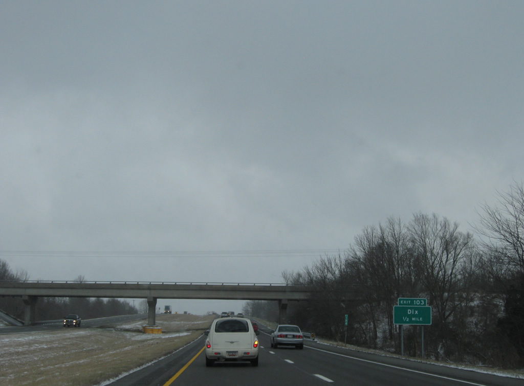
South Street becomes Dix-Irvington Road (County Road 39) west of Exit 103 en route to Irvington and U.S. 51 in Washington County.
12/27/09
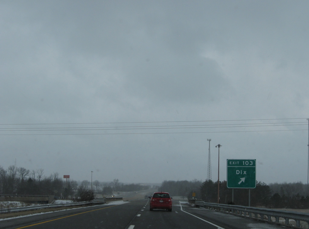
Exit 103 consists of a folded diamond interchange because of the adjacent Norfolk Southern Railroad line. Drivers bound for South Street depart I-57 from the bridge over the railroad. IL 37 follows Main Street nearby and continues nine miles into Mt. Vernon via Salem Road.
12/27/09
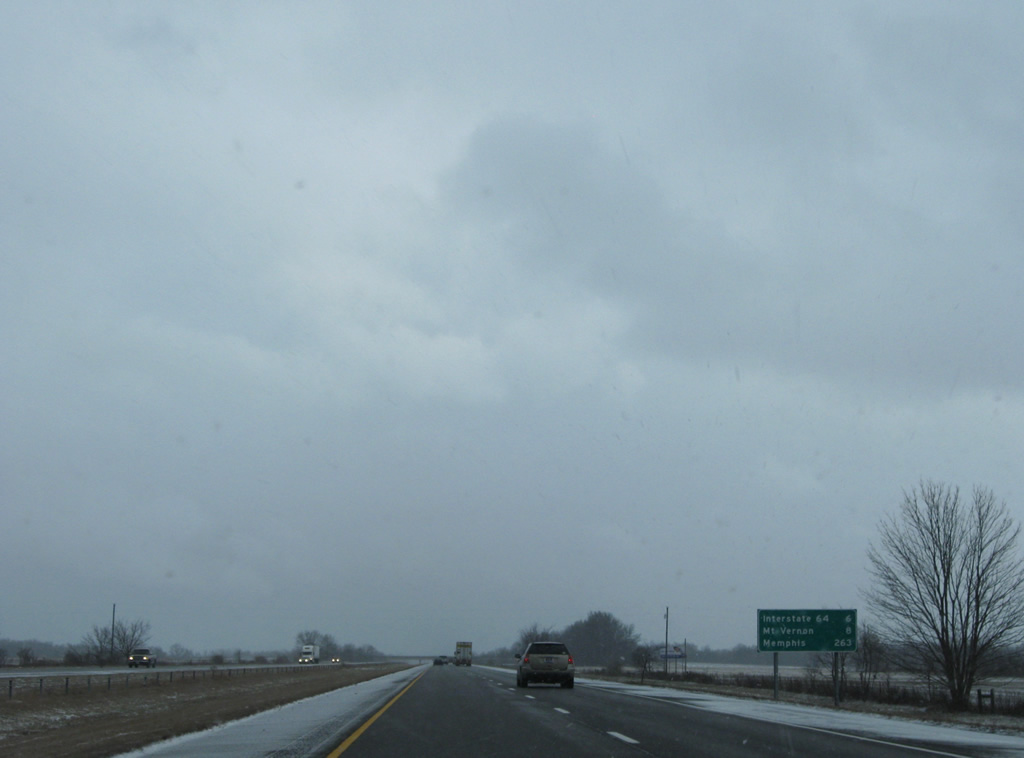
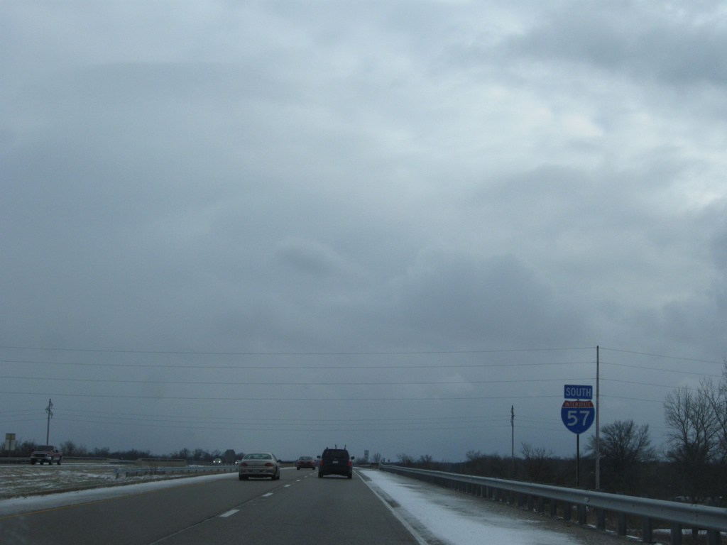
Interstate 57 next combines with I-64 east on the north side of Mt. Vernon in six miles. Memphis is 263 miles to the south via I-57 and I-55 from Sikeston, Missouri.
12/27/09
A pair of roadway separations precede Exit 96 with I-64 west on the seven mile drive south from Dix along Interstate 57.
12/27/09
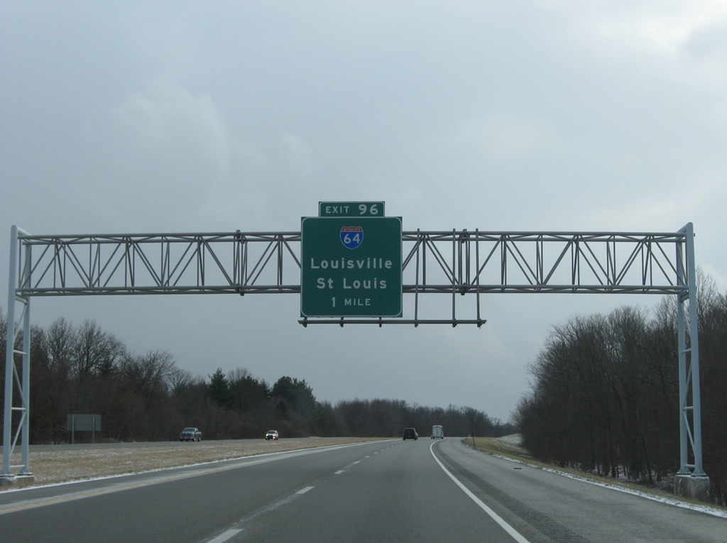
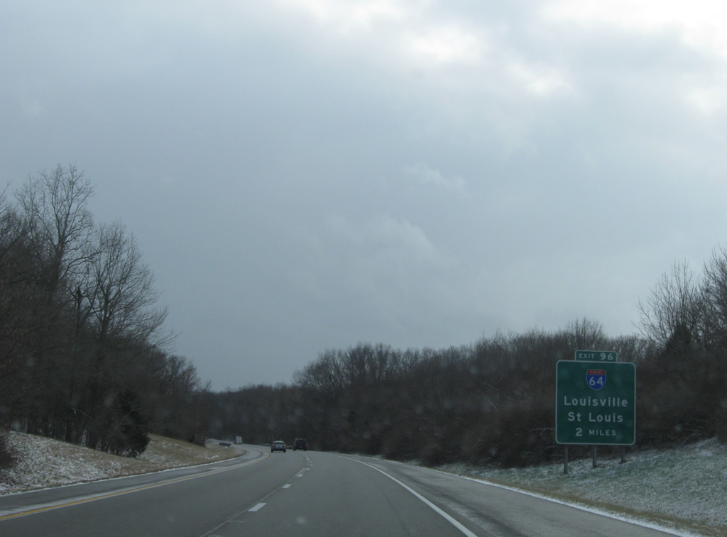
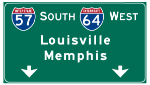
One mile ahead of the three-wye interchange (Exit 96) with I-64 on I-57 south. I-64 stretches 130 miles across southern Illinois, entering the state alongside I-55/U.S. 40 on the Poplar Street Bridge from St. Louis and leaving across the Wabash River at Grayville.
12/27/09
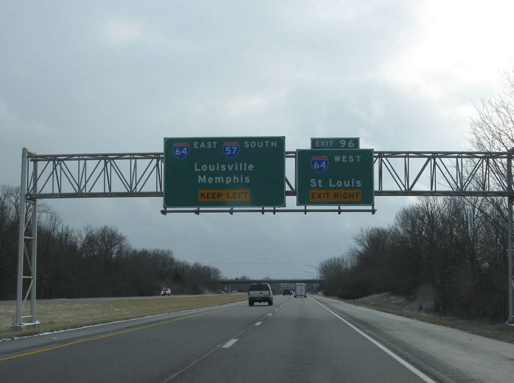
Exit 96 departs I-57 south beyond the Richview Road overpass. I-64 travels a rural route from Mt. Vernon to Shiloh, where the St. Louis suburbs commence.
12/27/09
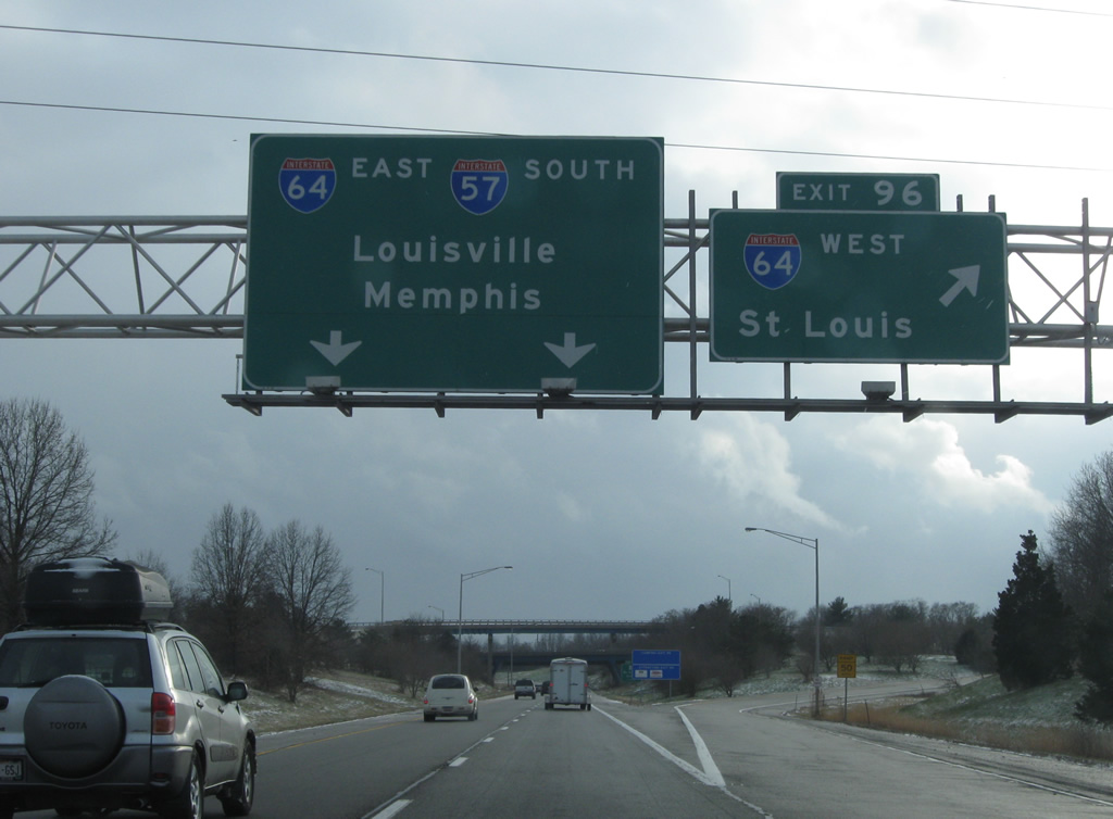
St. Louis lies 74 miles to the west along Interstate 64 from Exit 96. I-64 east joins Interstate 57 south for 4.14 miles through western reaches of Mt. Vernon.
12/27/09
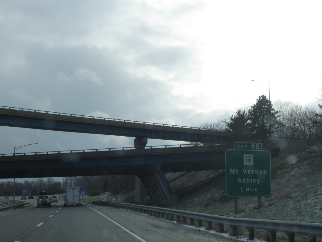
I-57 and I-64 combine one mile ahead of Exit 95 for Illinois Route 15. IL 15 enters Mt. Vernon from Ashley, 13 miles to the west.
12/27/09

References:
- Effingham, Illinois. Wikipedia.
- Marion County, Illinois. Wikipedia.
- Jefferson County, Illinois. Wikipedia.
- "Gov. Blagojevich renames a portion of I-57 "Ken Gray Expressway" to honor long-time Congressman." Office of the Governor Press release, May 8, 2008.
Photo Credits:
- Alex Nitzman: 12/27/09
Connect with:
Page Updated Wednesday April 04, 2012.