
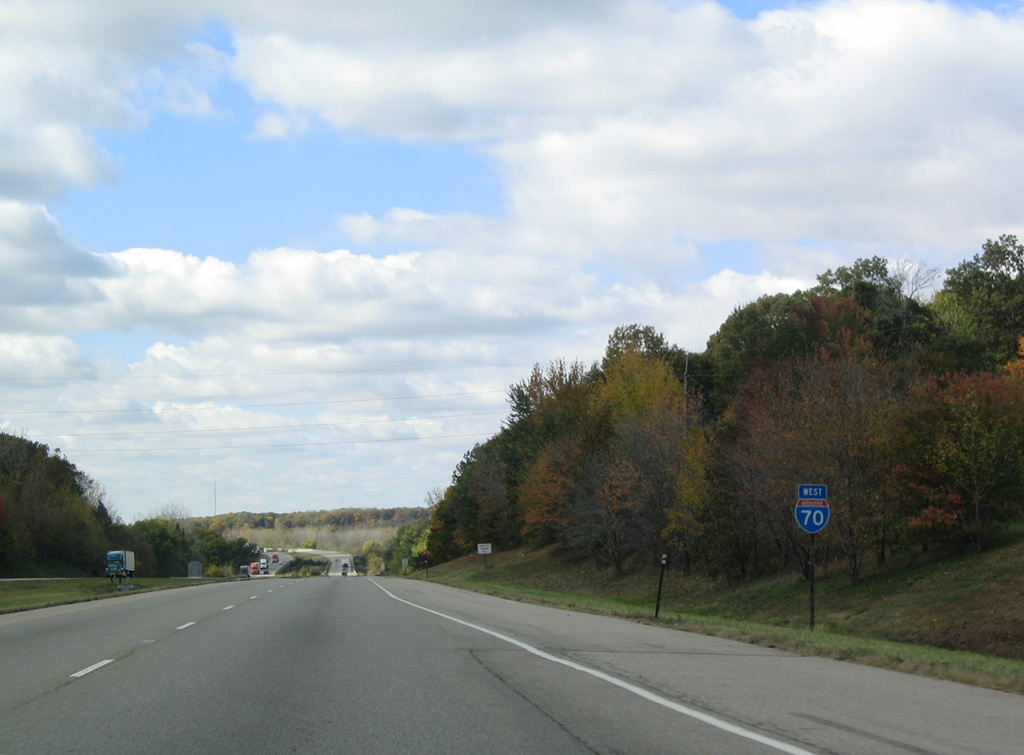
Interstate 70 West - Indiana to Effingham

 West
West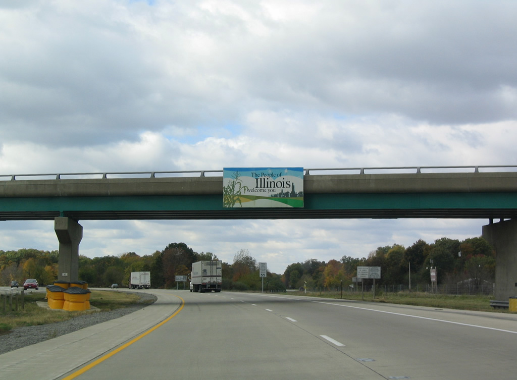
North 2600th Street stems south from Illiana Drive / US-40 Highway over I-70/U.S. 40 west by State Line. Pictured here is a pictorial welcome sign, the version used before the green and white themed "The Land of Lincoln" signs debuted.
10/16/04
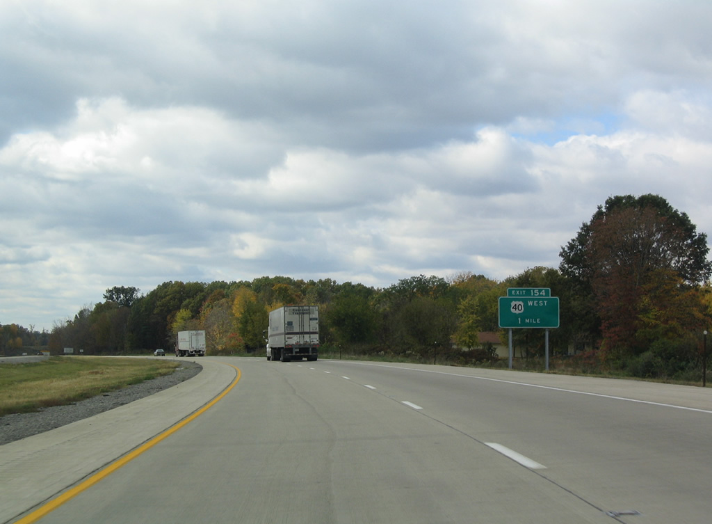
U.S. 40 parts ways with Interstate 70 west at the first Illinois exit in one mile. U.S. 40 rejoins the National Road west through Weaver, Livingston and Marshall.
10/16/04
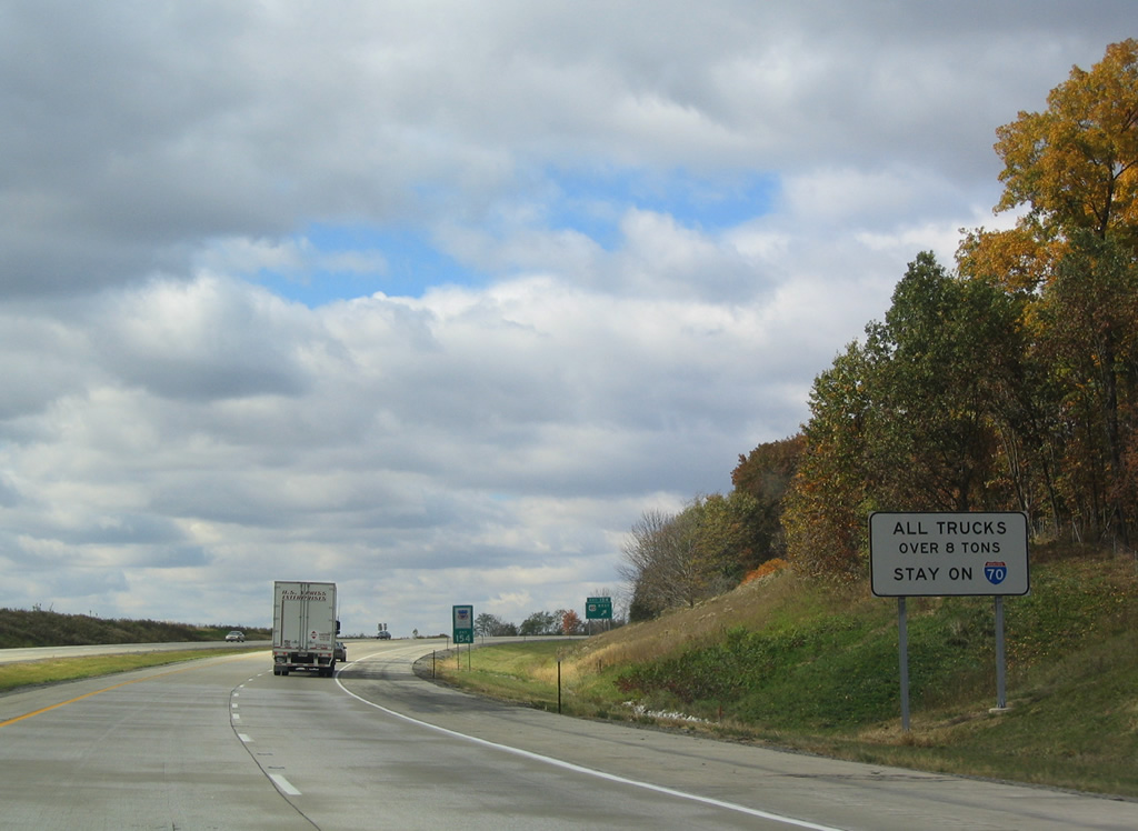
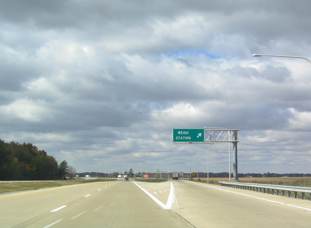
All trucks over eight tons must remain along Interstate 70 west to the weigh station facility beyond Exit 154.
10/16/04
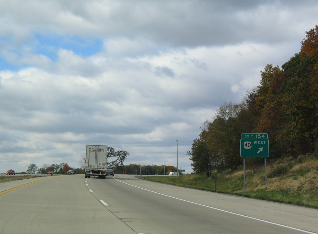
Westbound at the diamond interchange (Exit 154) with the National Road. U.S. 40 stays south of Interstate 70 on a parallel course to Effingham.
10/16/04
West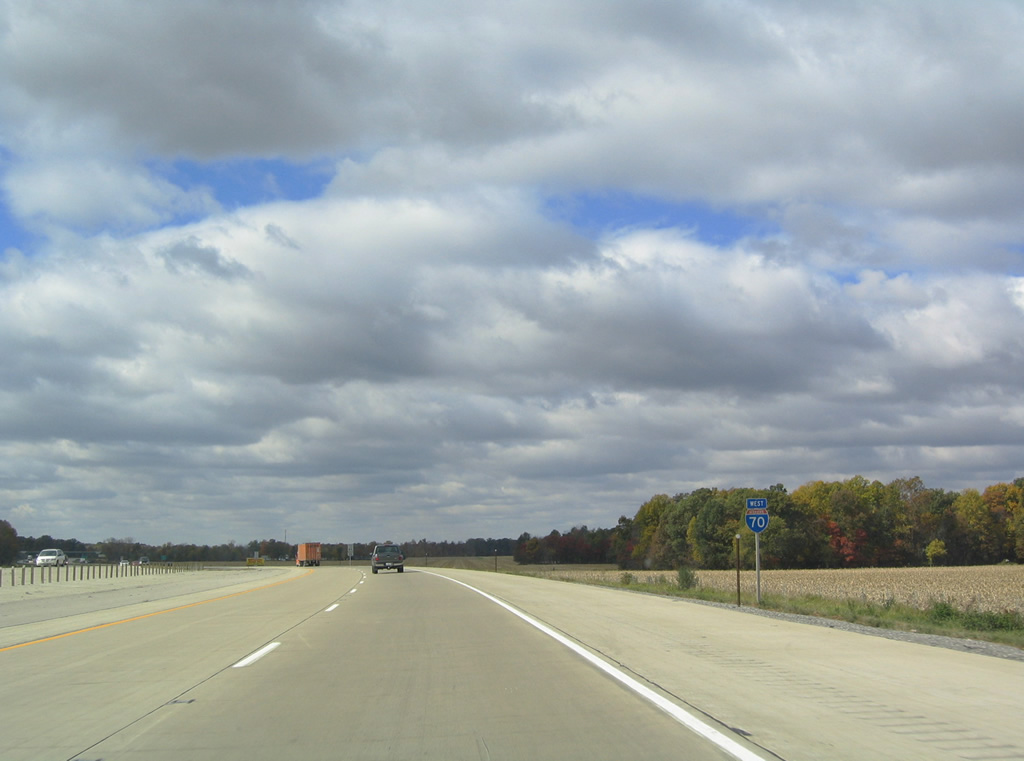
Interstate 70 travels solo for the first time since Exit 11 in Indiana.
10/16/04
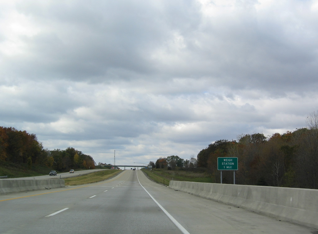
Spanning Crooked Creek, westbound truckers are advised of the impending weigh station west of the North 2250th Street overpass.
10/16/04
Westbound at the weigh station northwest of Weaver. An eastbound facility lies just beyond the Illinois state line.
10/16/04
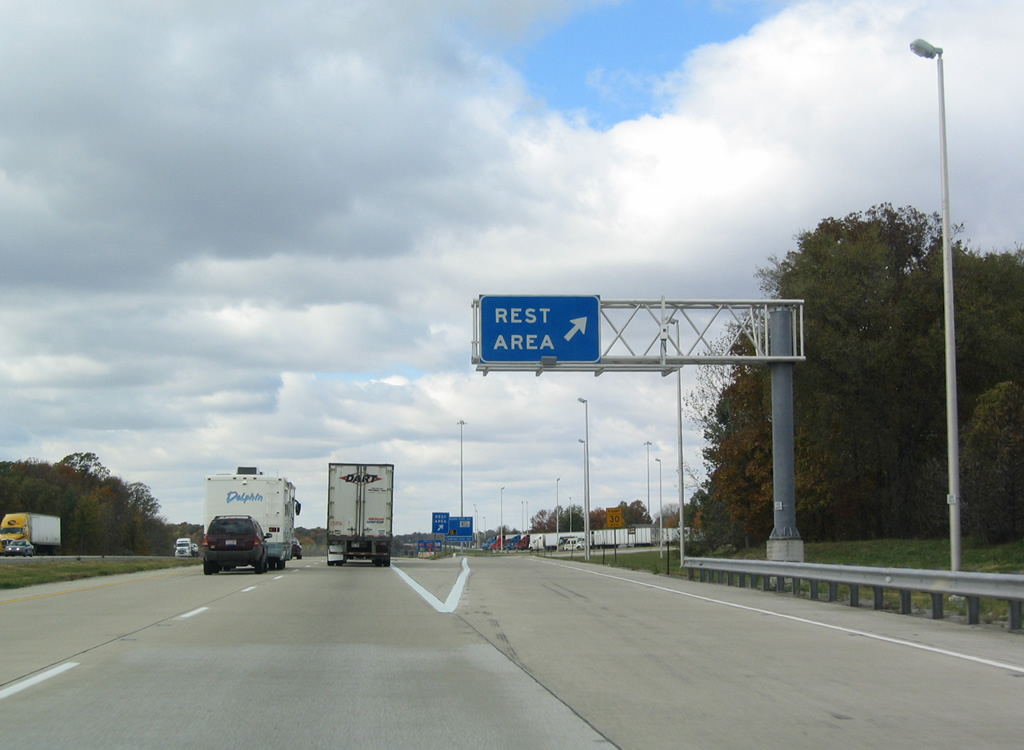
Interstate 70 westbound lowers to cross East Little Creek on the mile preceding the first Illinois rest area. Three rest areas lie along I-70 in the state.
10/16/04
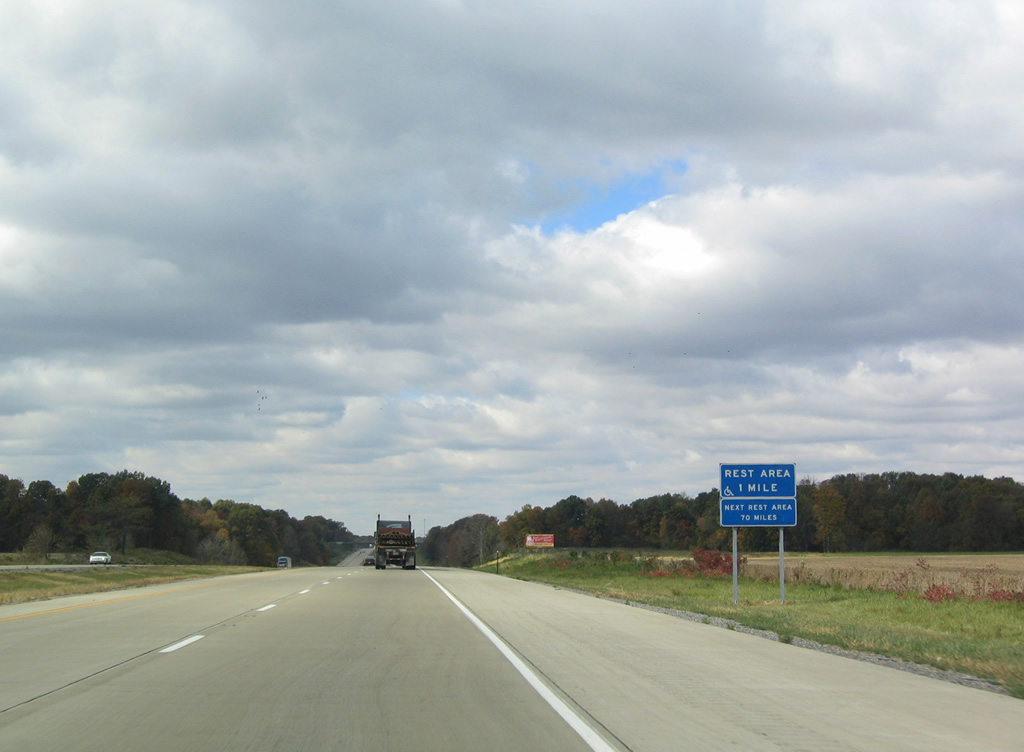
The Livingston area rest area includes a tourist information center for drivers entering Illinois from Indiana.
10/16/04
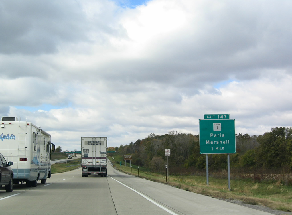
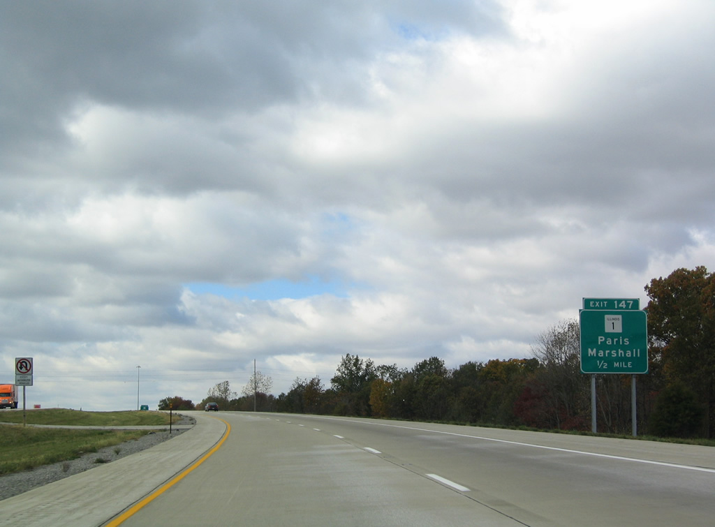
IL 1, a 309 mile state route traveling nearly the height of the state, crosses paths with Interstate 70 on the northern outskirts of Marshall in one mile.
10/16/04
IL 1 follows Michigan Avenue through downtown Marshall en route to Lincoln Trail State Park, Lawrenceville and I-64 at Grayville. Northward the state route continues 13 miles to the Edgar County seat of Paris.
10/16/04

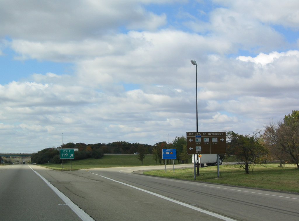
Exit 147 departs Interstate 70 west for IL 1. IL 1 travels a vastly rural route southward to Cave in Rock at the Ohio River and northward to Danville and Chicago.
10/16/04
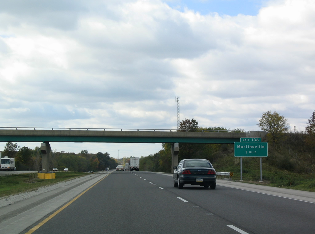
Interstate 70 continues west through a mixture of farm land and forest to the diamond interchange (Exit 136) with Cleone Road north and York Street south.
10/16/04
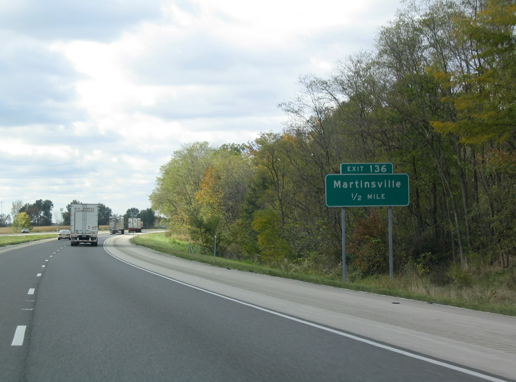
Martinsville, home to around 1,250, lies south of Interstate 70 along York Street. City limits of the municipality stretch northward along Cleone Road to a point beyond I-70.
10/16/04

Exit 136 parts ways to Martinsville and parallel U.S. 40 (National Road). U.S. 40 bypasses Martinsville to the north between Casey and Clark Center. Cleone Road north from Exit 136 continues to the settlement of Cleone and the Edgar County line.
10/16/04
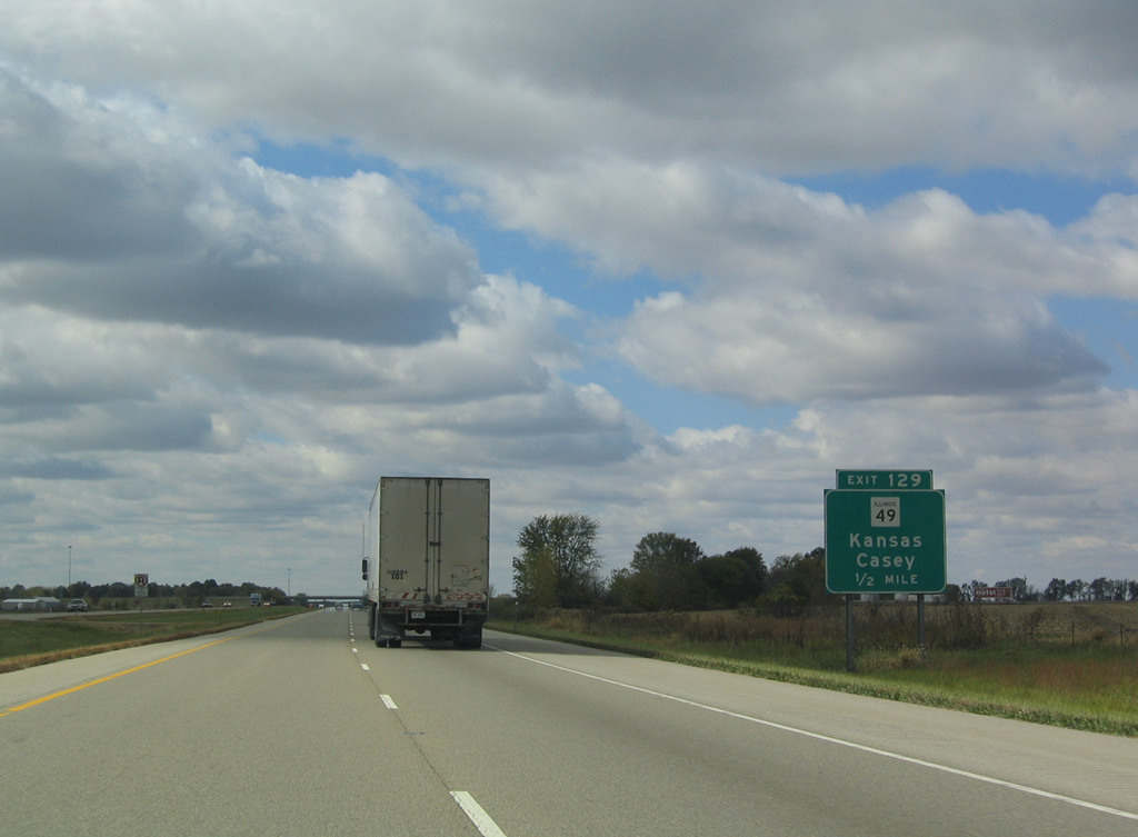
The final Clark County exit is the diamond interchange (Exit 129) joining Interstate 70 with IL 49 just outside Casey.
10/16/04
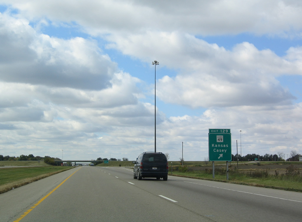
IL 49 stretches 137 miles on a route between Willow Hill and U.S. 45 south of Kankakee. The state route follows Central Avenue into Downtown Casey, 23 miles north of its southern end point.
10/16/04
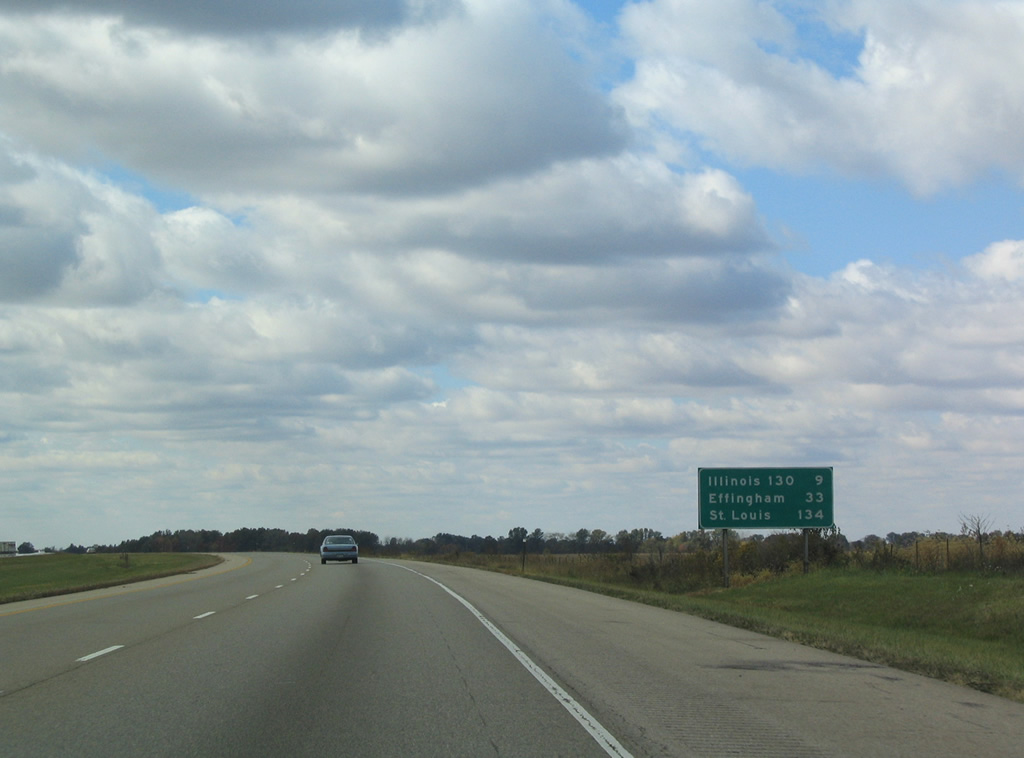
The series of long exit less stretches continues along Interstate 70 west nine miles to IL 130 and 33 miles to Effingham. St. Louis is 134 miles westward.
10/16/04
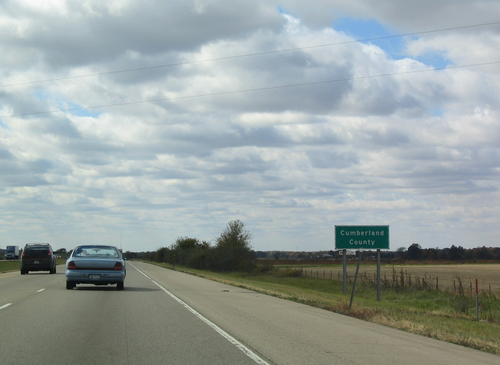
Northwest of Casey, Interstate 70 crosses the Cumberland County line.
10/16/04
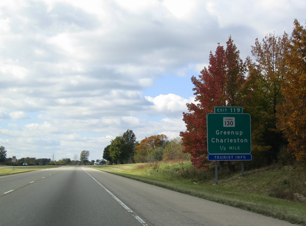
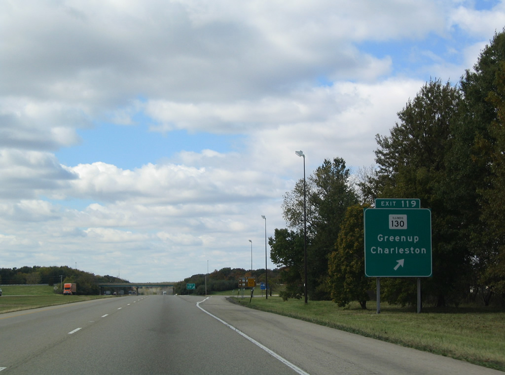
The lone Cumberland County interchange joins Interstate 70 with IL 130 in northern reaches of Greenup. IL 130 joins the village of 1,500 with Charleston, 17 miles to the north.
10/16/04
Meeting the end of IL 121 (Cumberland Street) and U.S. 40 (Historic National Road), IL 130 follows Haughton Highway along the east side of the Greenup street grid. IL 121 stems west from Greenup to Toledo, the Cumberland County seat, and north to Mattoon. IL 130 south from Greenup continues 19 miles to the Jasper County seat of Newton.
10/16/04
IL 130 leads south from Exit 119 to Sam Parr State Park where it combines with IL 33 and north to Fox Ridge State Park. IL 121 west from Greenup connects with local roads north to Lincoln Log Cabin Historic Site ad Moore Home State Memorial.
10/16/04
Interstate 70 leaves Greenup and crosses the Embarras River, a 195 mile long waterway from Champaign County south to the Wabash River at Vincennes.
10/16/04
The longest exit less stretch of I-70 in Illinois concludes at the diamond interchange (Exit 105) with Spring Creek Road.
10/16/04
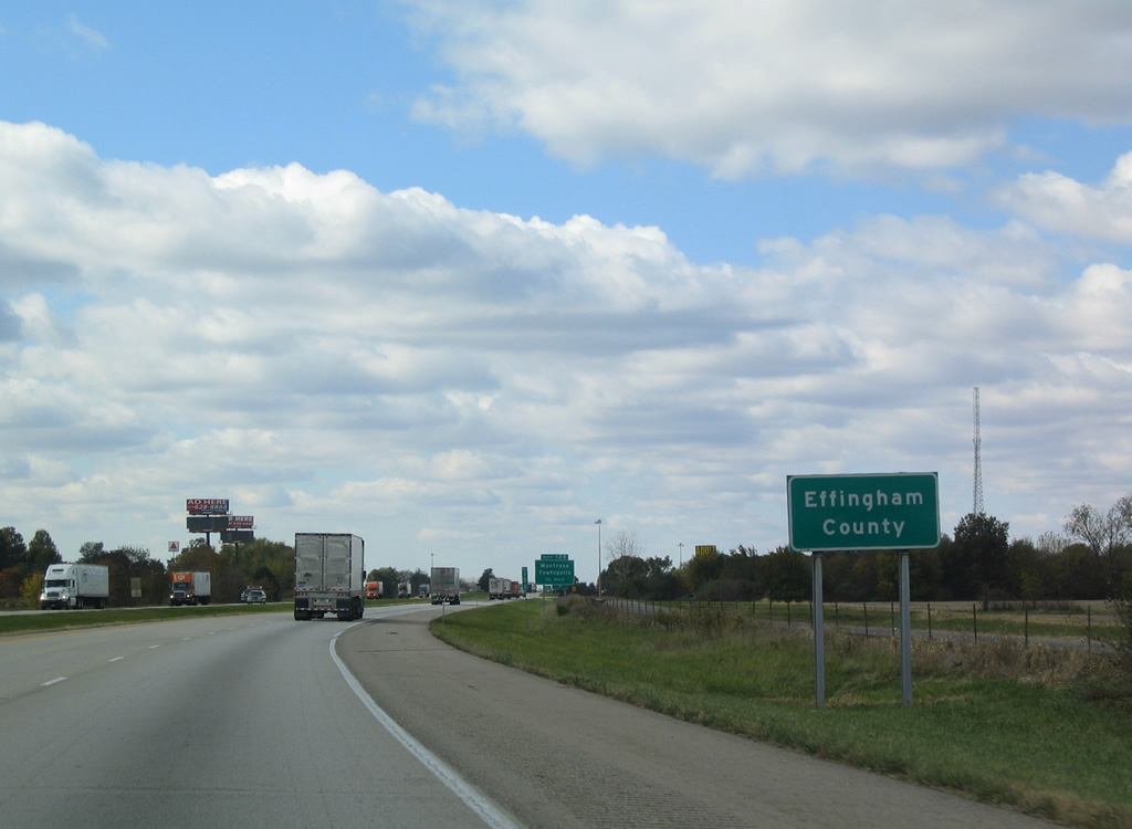
Westbound travelers enter the northeastern corner of Effingham County ahead of Exit 105.
10/16/04
Spring Creek Road leads north from the small village of Montrose to become County Road 500 East in Cumberland County en route to the northward turn taking IL 122 from Toledo to the east.
10/16/04
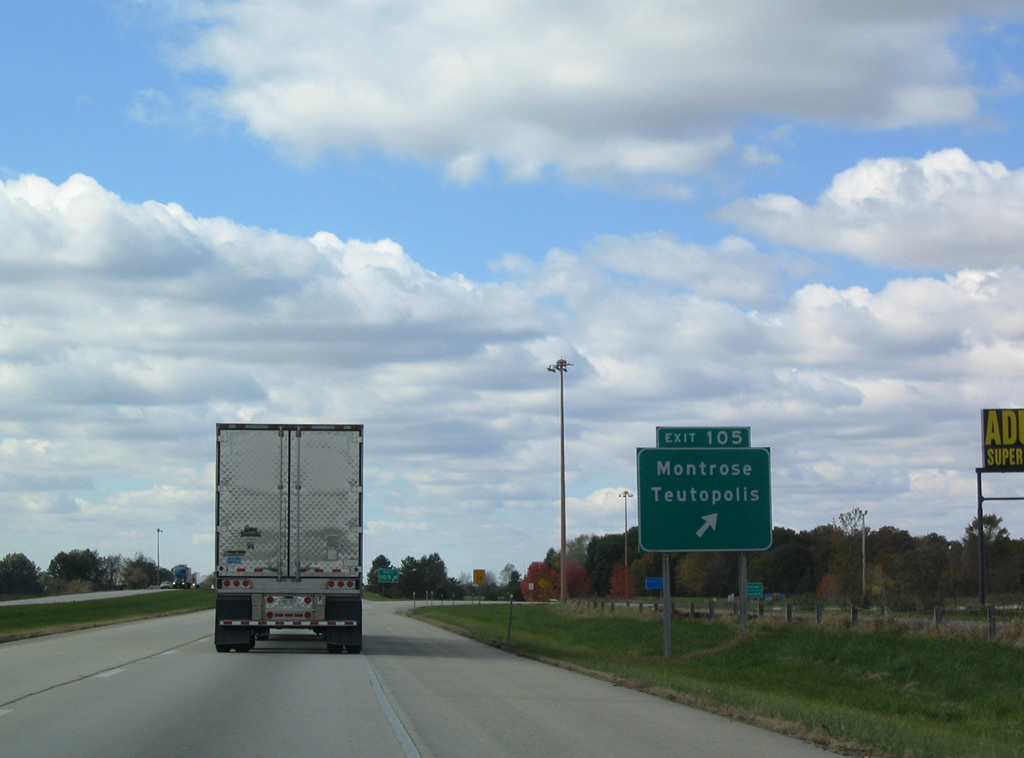
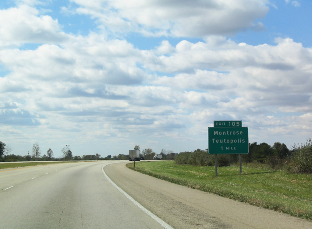
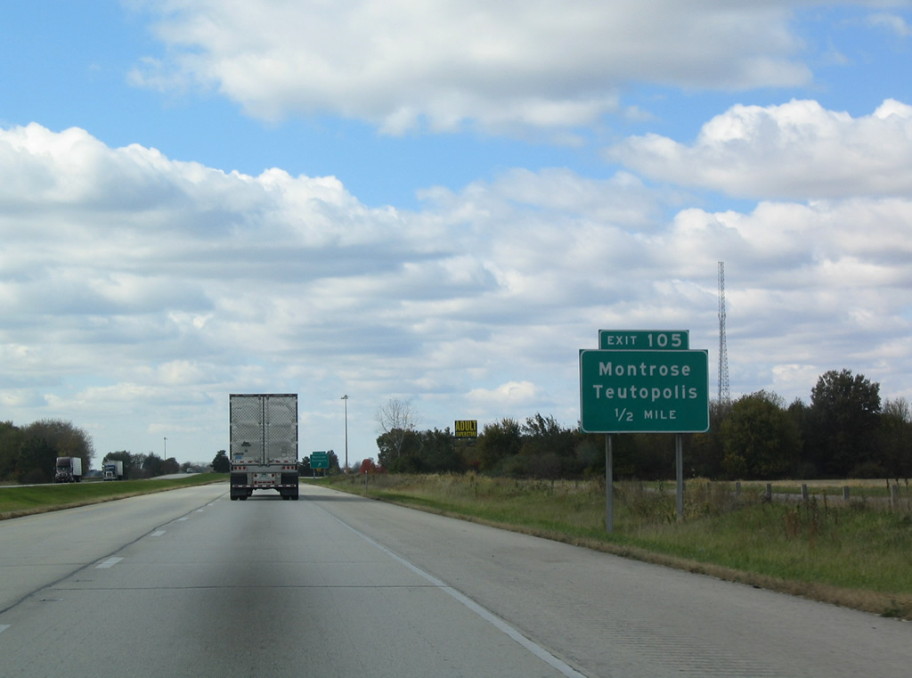
Exit 105 leaves Interstate 70 west at Montrose.
10/16/04
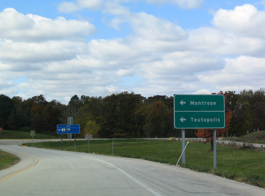
Teutopolis is signed for the Spring Creek Road connection with U.S. 40 (Old National Road) west from Montrose. Spring Creek Road otherwise continues south to Dieterich (IL 33) as North 2300th Street.
10/16/04
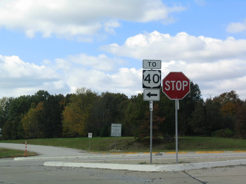
Two residential blocks separate the ramps at Exit 105 from the intersection joining Spring Creek Road and U.S. 40 (National Road). U.S. 40 continues six miles west to Teutopolis, a village of 1,530 (2010 census) just outside Effingham.
10/16/04
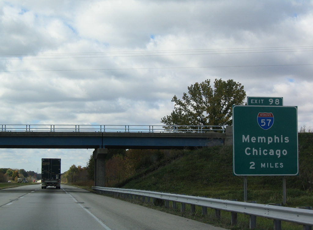
The first sign for the overlap with Interstate 57 at Exit 98 on I-70 west appears north of Teutopolis at the North 1800th Street overpass.
10/16/04
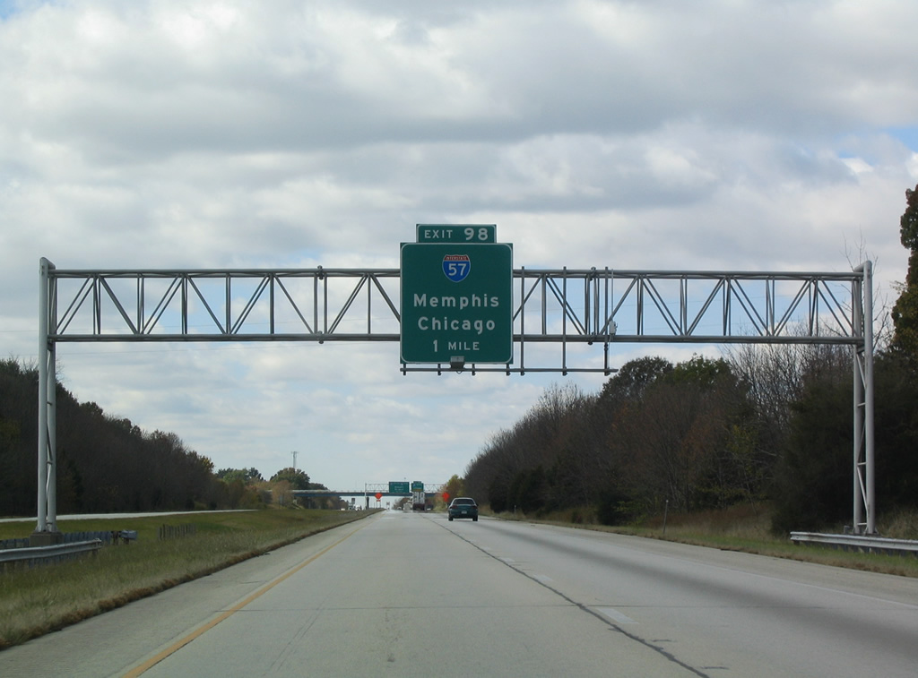
One mile east of the three-wye interchange (Exit 98) with Interstate 57 north. I-57 enters the Effingham area from Mattoon and Champaign to the north. The 357 miles of I-57 in Illinois conclude at I-94 in Chicago.
10/16/04
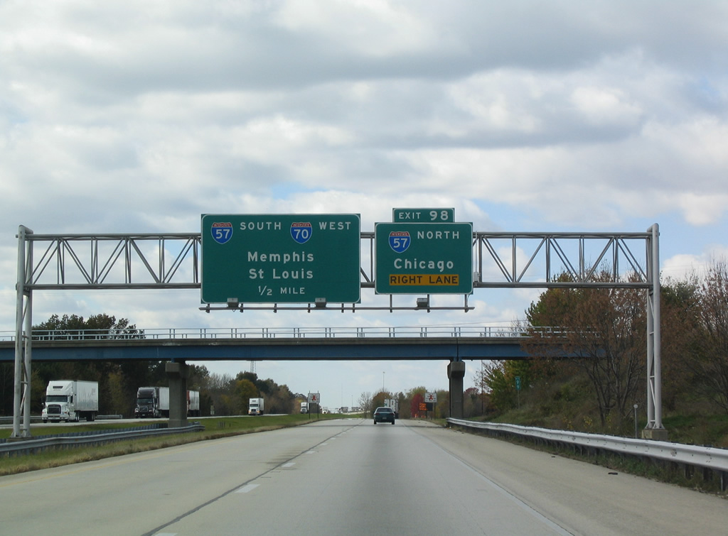
Interstate 57 overall joins Chicago with Sikeston, Missouri as part of a long distance route to Memphis via I-55 south. Within Illinois, the freeway connects Chicago with Kankakee, Champaign, Effingham, Mt. Vernon and Cairo.
10/16/04
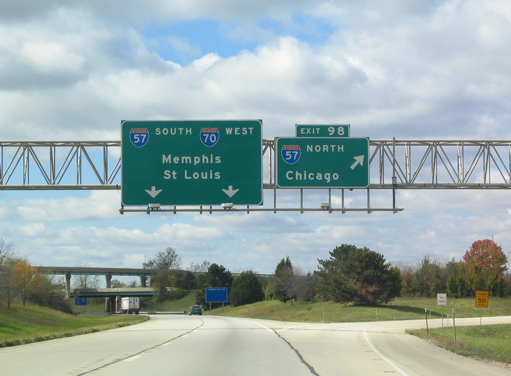
Interstate 57 south coincides with I-70 west for 5.59 miles through the city of Effingham. A 14 mile exit less stretch ensues north from Exit 98 along I-57 to Neoga. I-57 next reaches Mattoon in 21 miles.
10/16/04
The westbound mainline of I-70 passes under the stacked portion of the exchange with I-57. The overlap of I-57/70 through Effingham was completed by 1962.
10/16/04
 South West
References:
- Effingham, Illinois. Wikipedia.
Photo Credits:
- AARoads: 10/16/04
Connect with:
Page Updated Tuesday March 27, 2012.