
Interstate 295 South - Short Pump to Sandston
 South
South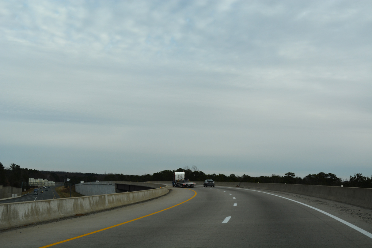
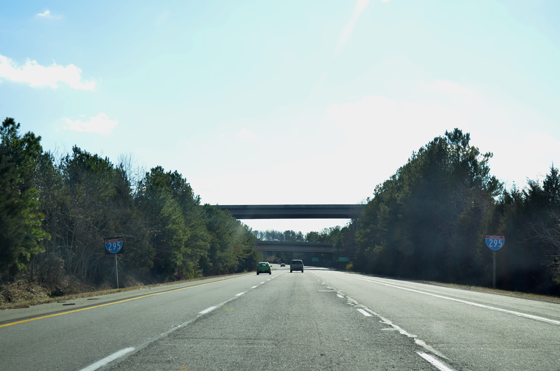
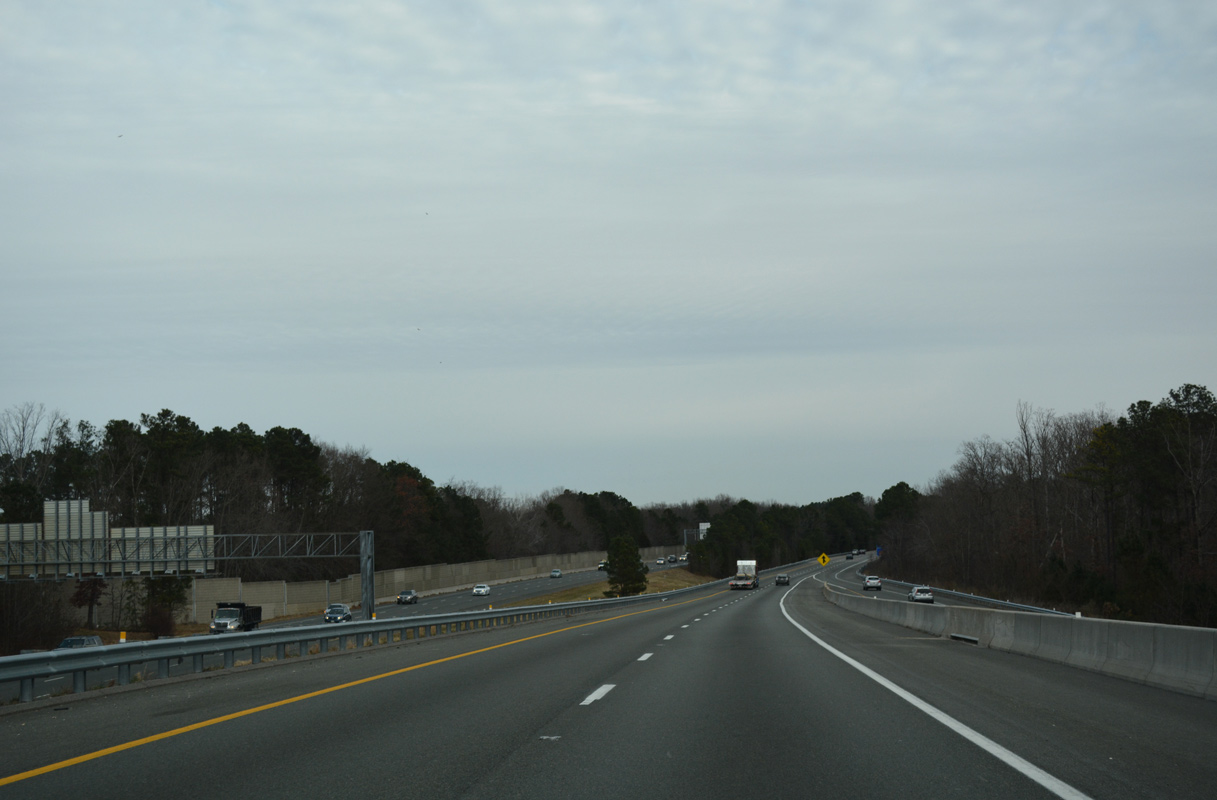
A two lane flyover was constructed from I-64 east to Interstate 295 southbound from 2006 to May 2009. The high speed connection replaced a loop ramp.
12/16/16
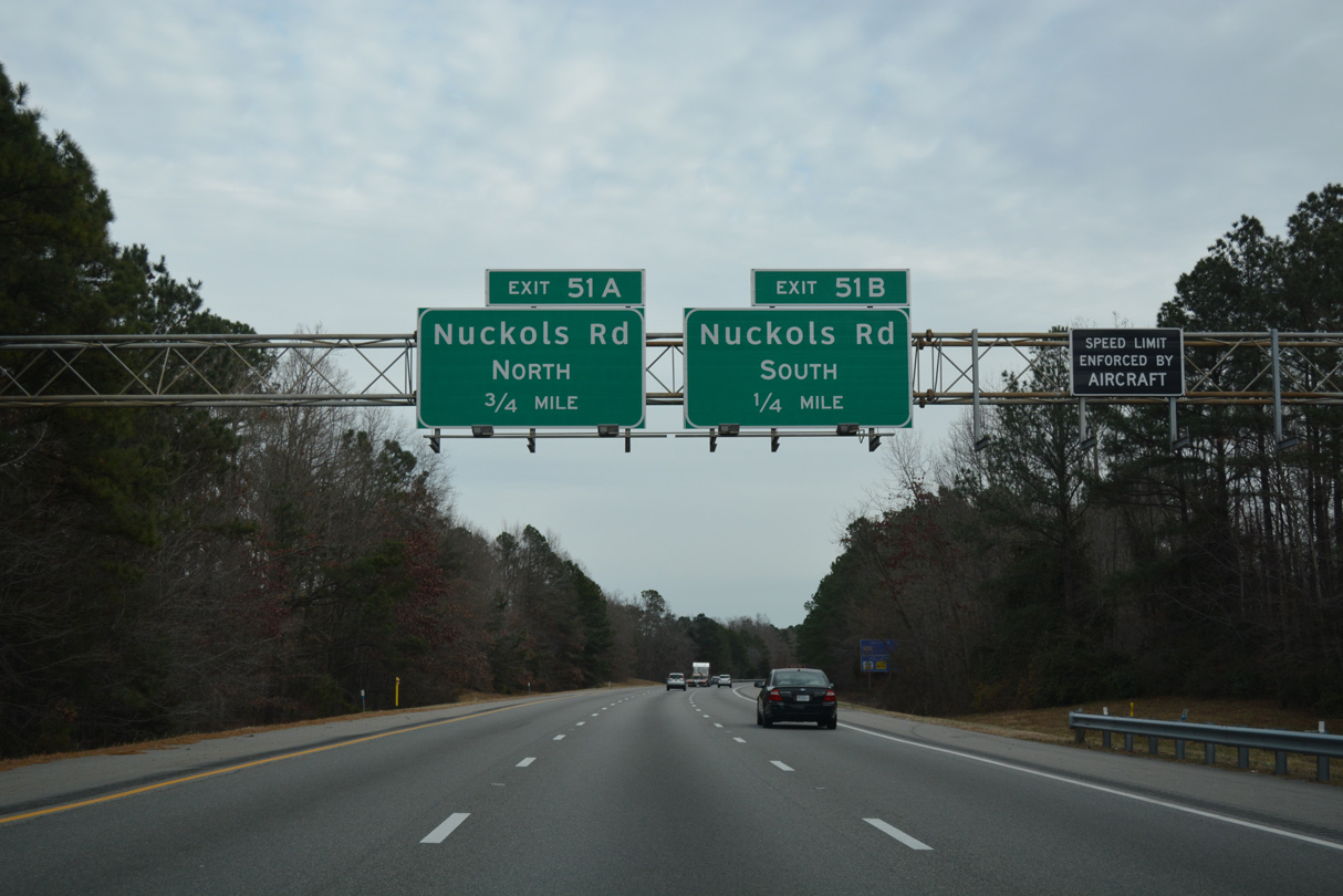
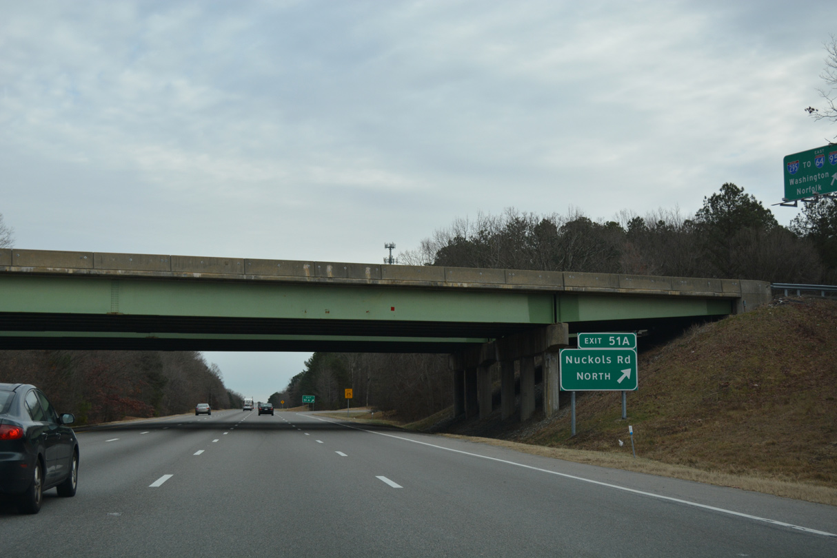
Heading northeast from I-64, Interstate 295 southbound advances to a cloverleaf interchange (Exit 51) with Nuckols Road.
12/16/16
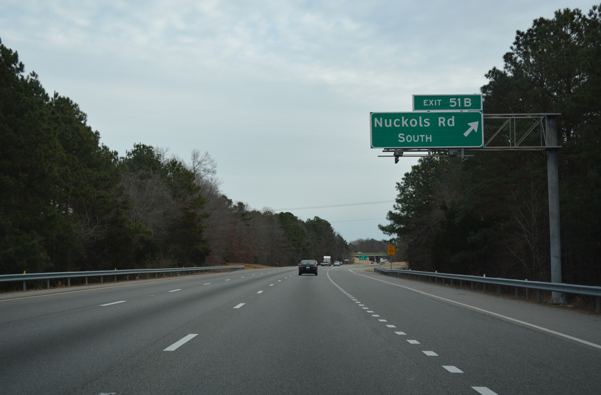
Nuckols Road is a suburban arterial looping east from SR 271 (Pouncey Tract Road) through Wyndham and south to SR 157 (Springfield Road) at Innsbrook.
12/16/16
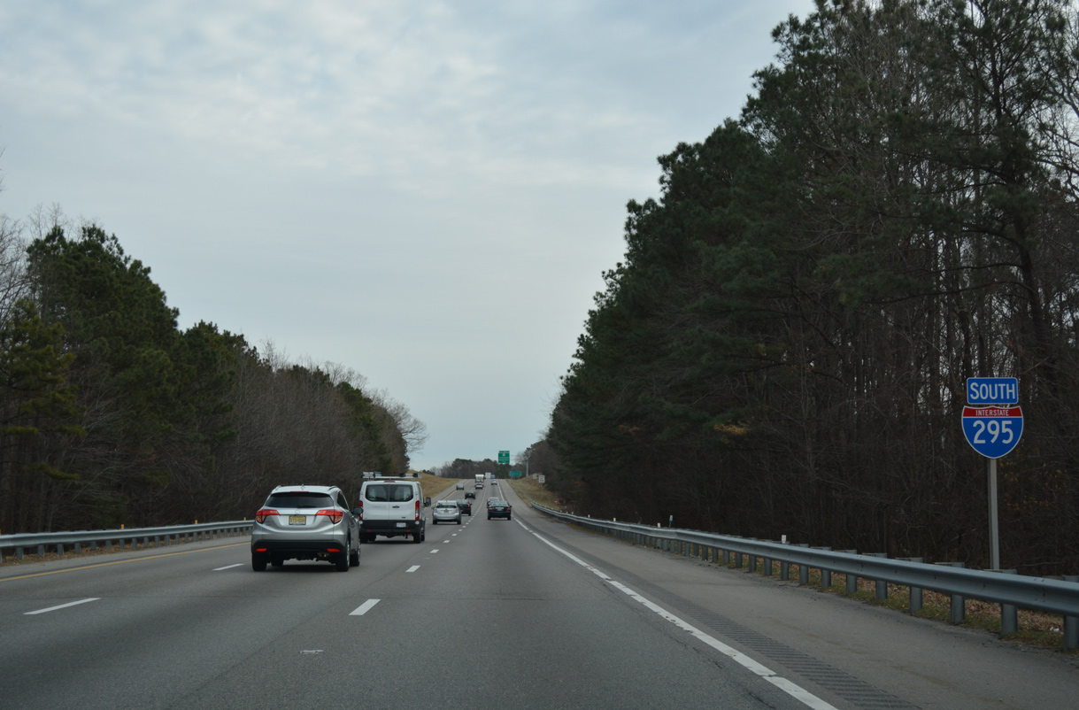
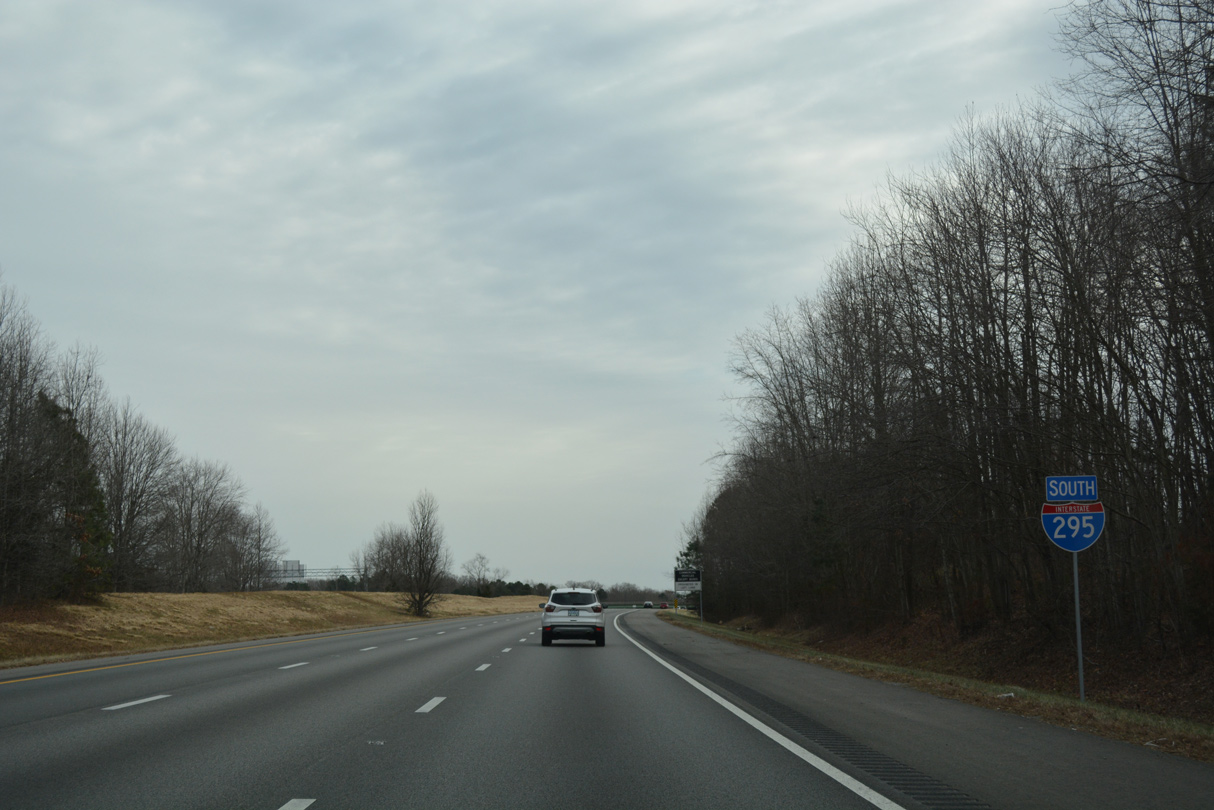
Despite the west to east orientation, cardinal direction banners along I-295 between I-64 and I-95 remain southbound.
12/16/16

The succeeding exit on I-295 southbound is the cloverleaf interchange (Exit 49) with U.S. 33 (Staples Mill Road).
12/16/16
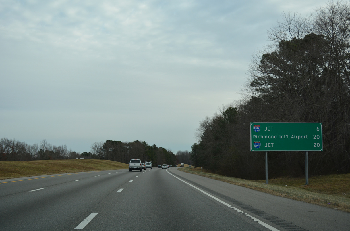
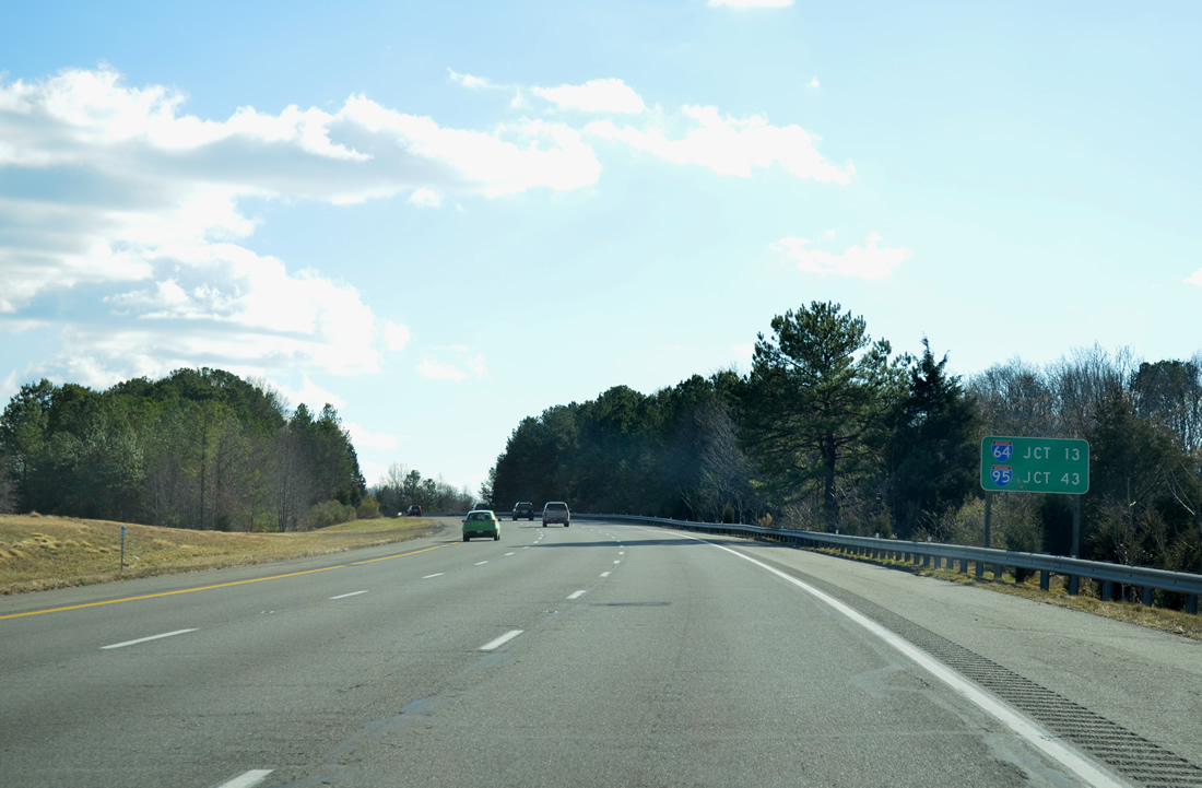
Interstate 295 arcs east six miles to I-95. I-64 follows in another 14 miles.
12/16/16
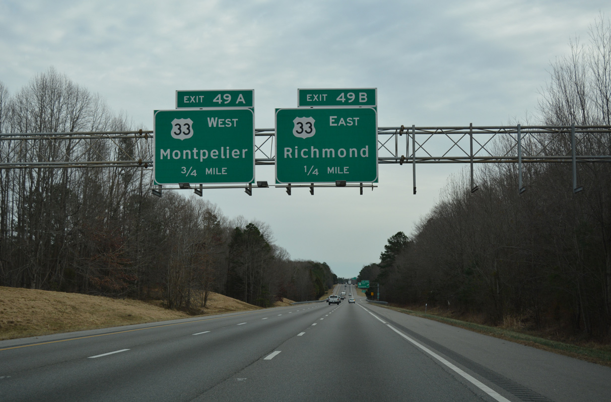
Exit 49 is the first of two interchanges along I-295 for the northern Richmond suburb of Glen Allen.
12/16/16
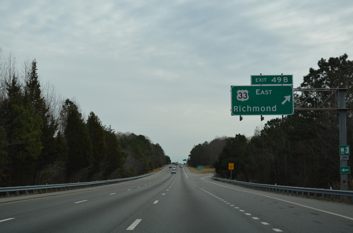
U.S. 33 (Staples Mill Road) leads south from Exit 49B to Laurel, Dumbarton and the city of Richmond.
12/16/16
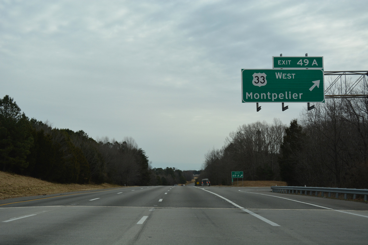
U.S. 33 continues northward from I-295, 13.6 miles to the unincorporated community of Montpelier.
12/16/16
Confirming marker posted between Holladay Branch and the Mill Road overpass.
12/16/16
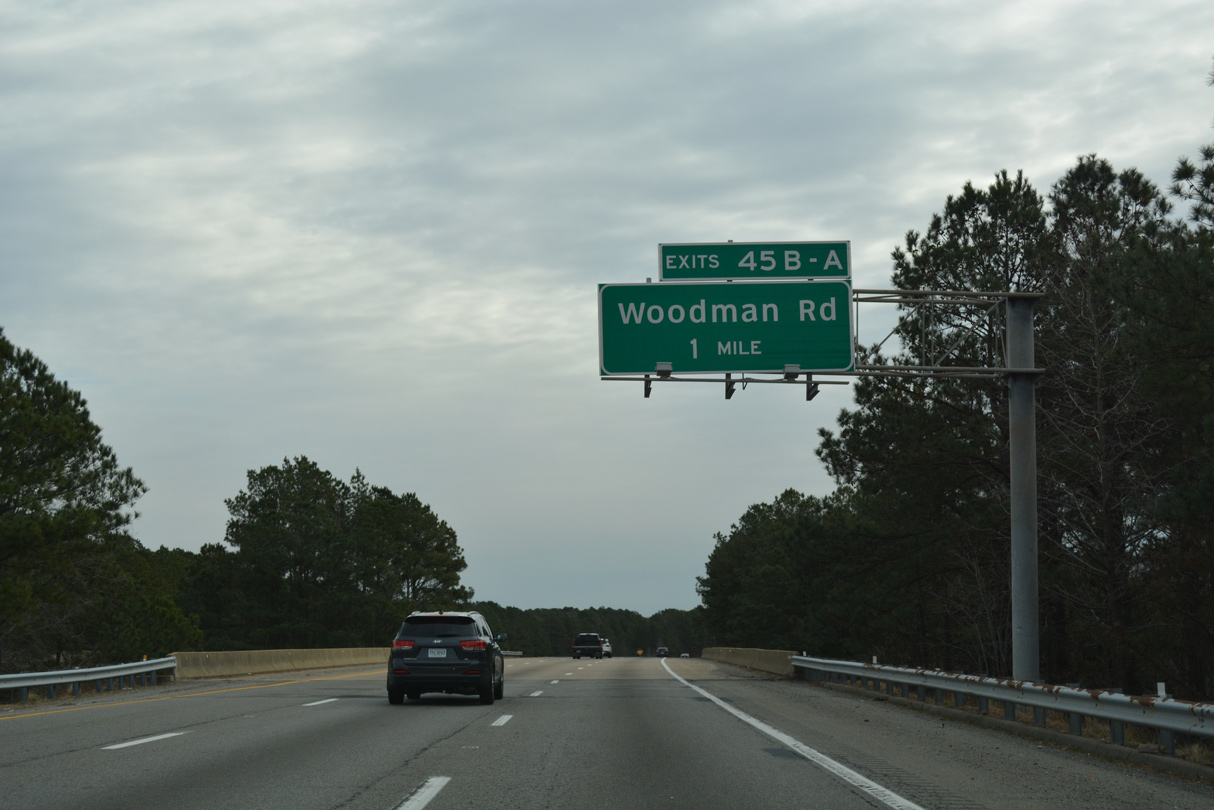
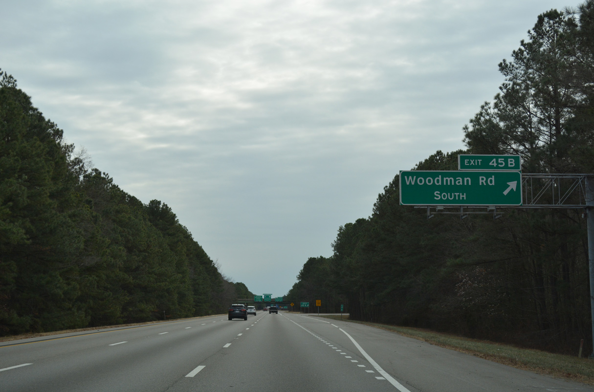
Making a gradual southeasterly turn by RF&P Park, I-295 crosses Old Washington Road and a CSX Railroad line one mile ahead of Woodman Road and Exit 45 in Glen Allen.
12/16/16
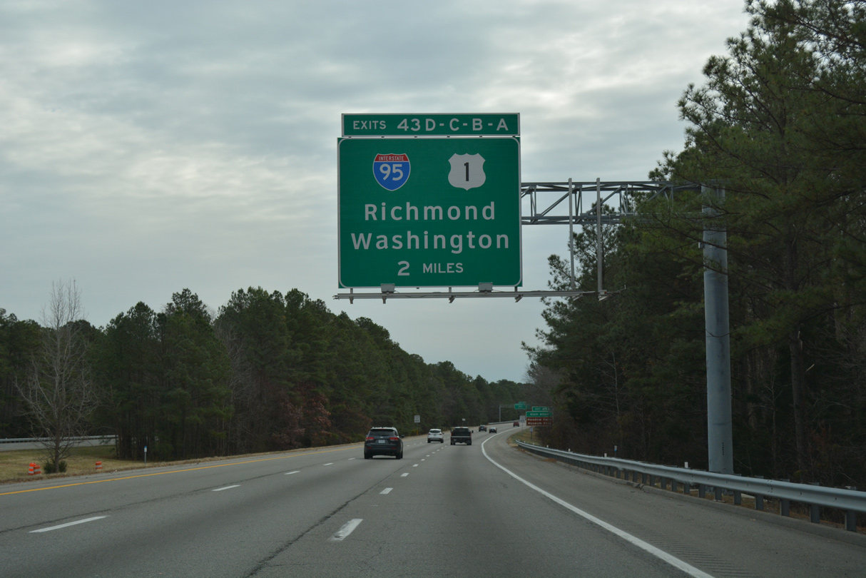
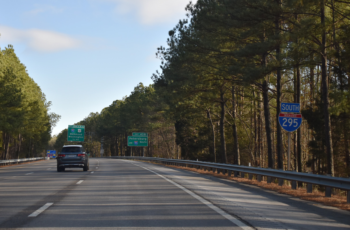
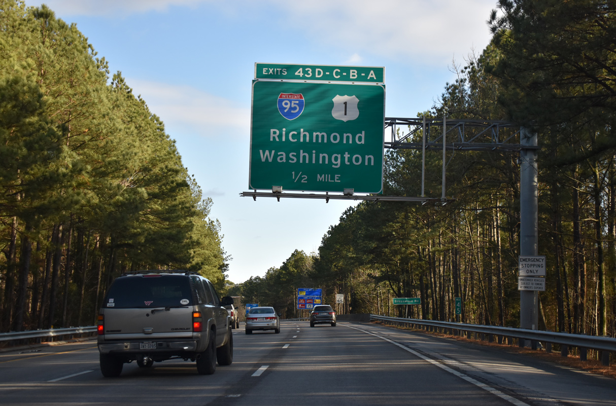
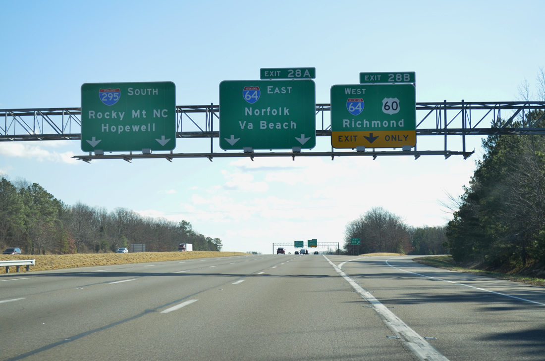
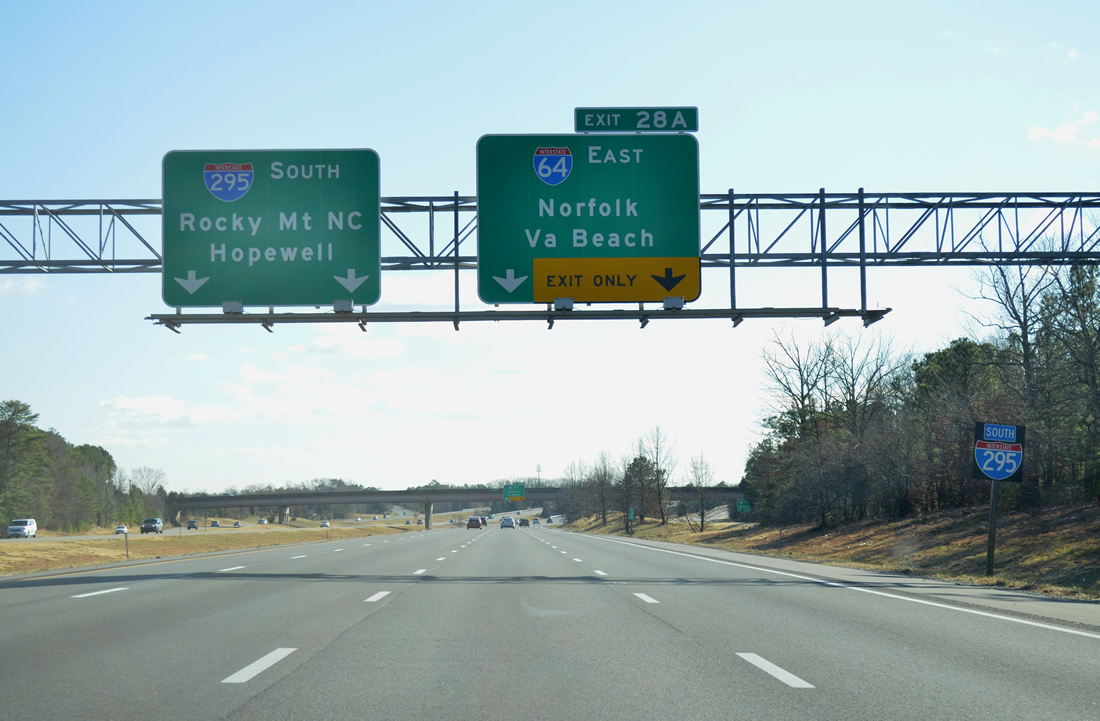
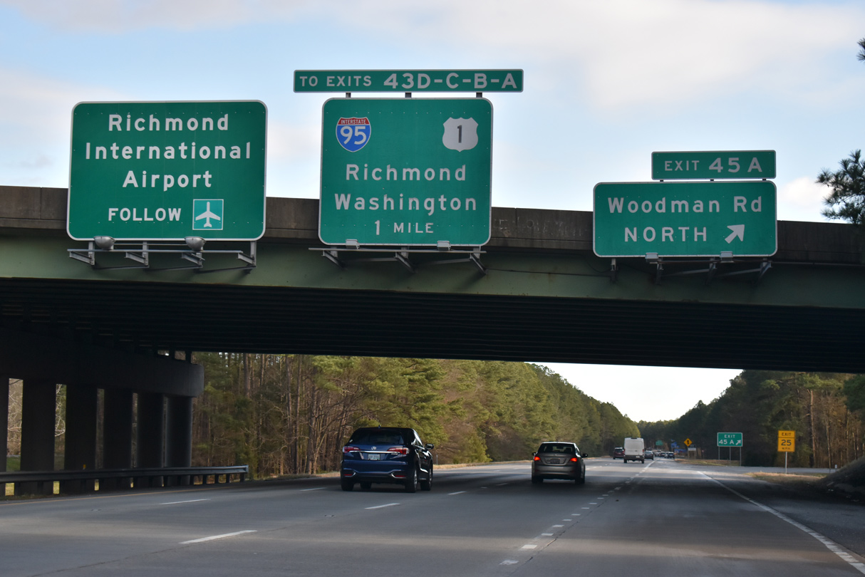
Similar to the traffic pattern for Exit 28 with I-64 and U.S. 60, a lengthy collector distributor roadway system links Interstate 295 with U.S. 1 (Brook Road) and I-95 at Exits 43D-C-B-A.
12/16/16
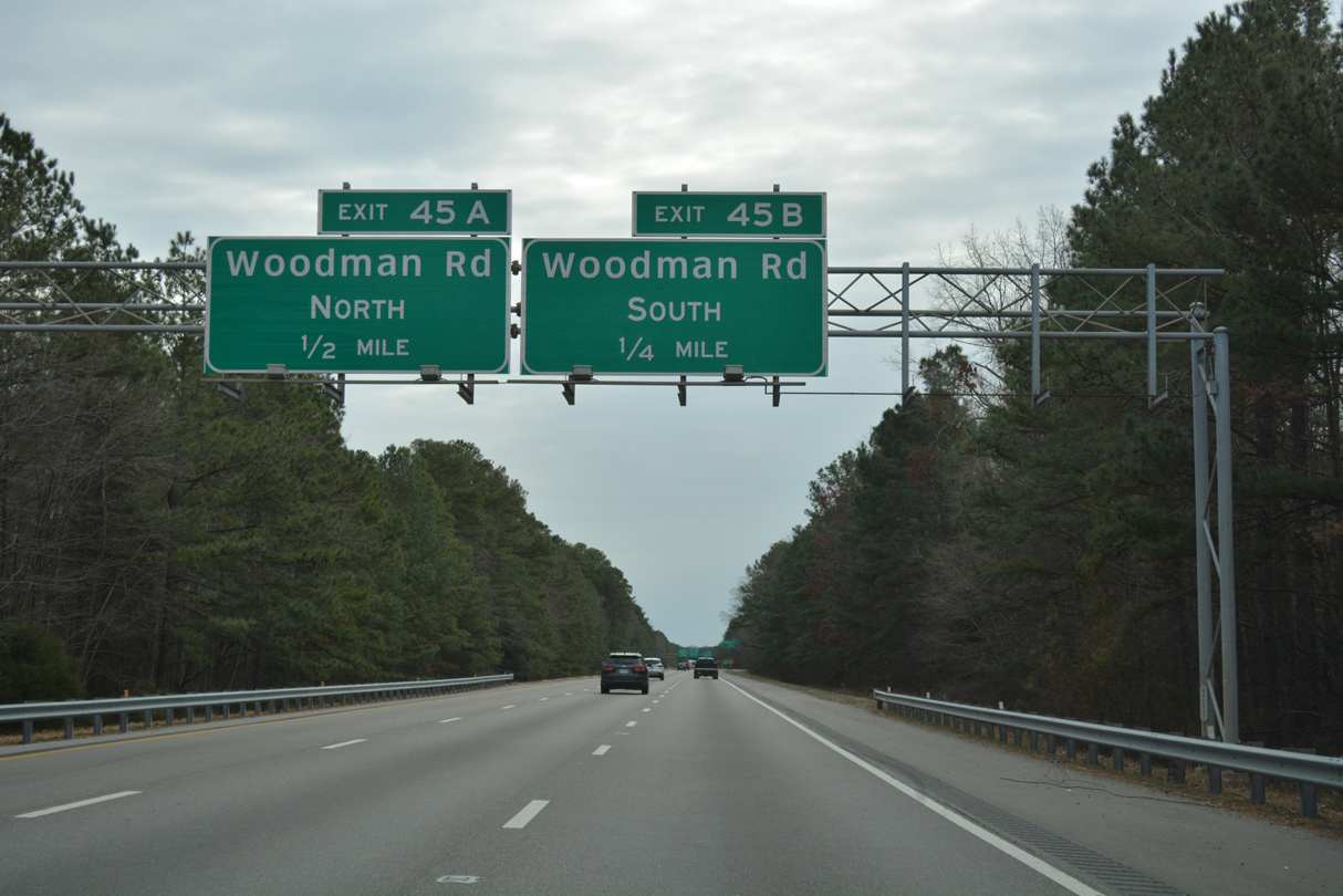
Woodman Road heads northward from SR 356 (Hilliard Road) at Lakeside to SR 73 (Parham Road) at Laurel Park, I-295 and Greenwood Road nearby.
12/16/16
12/17/20
Greenwood Road passes under I-295 beyond this confirming marker into the Longdale community in Glen Allen.
12/17/20

Petersburg is 33 miles south via I-95 and 41 miles via I-295 and SR 36 through Fort Lee.
12/17/20
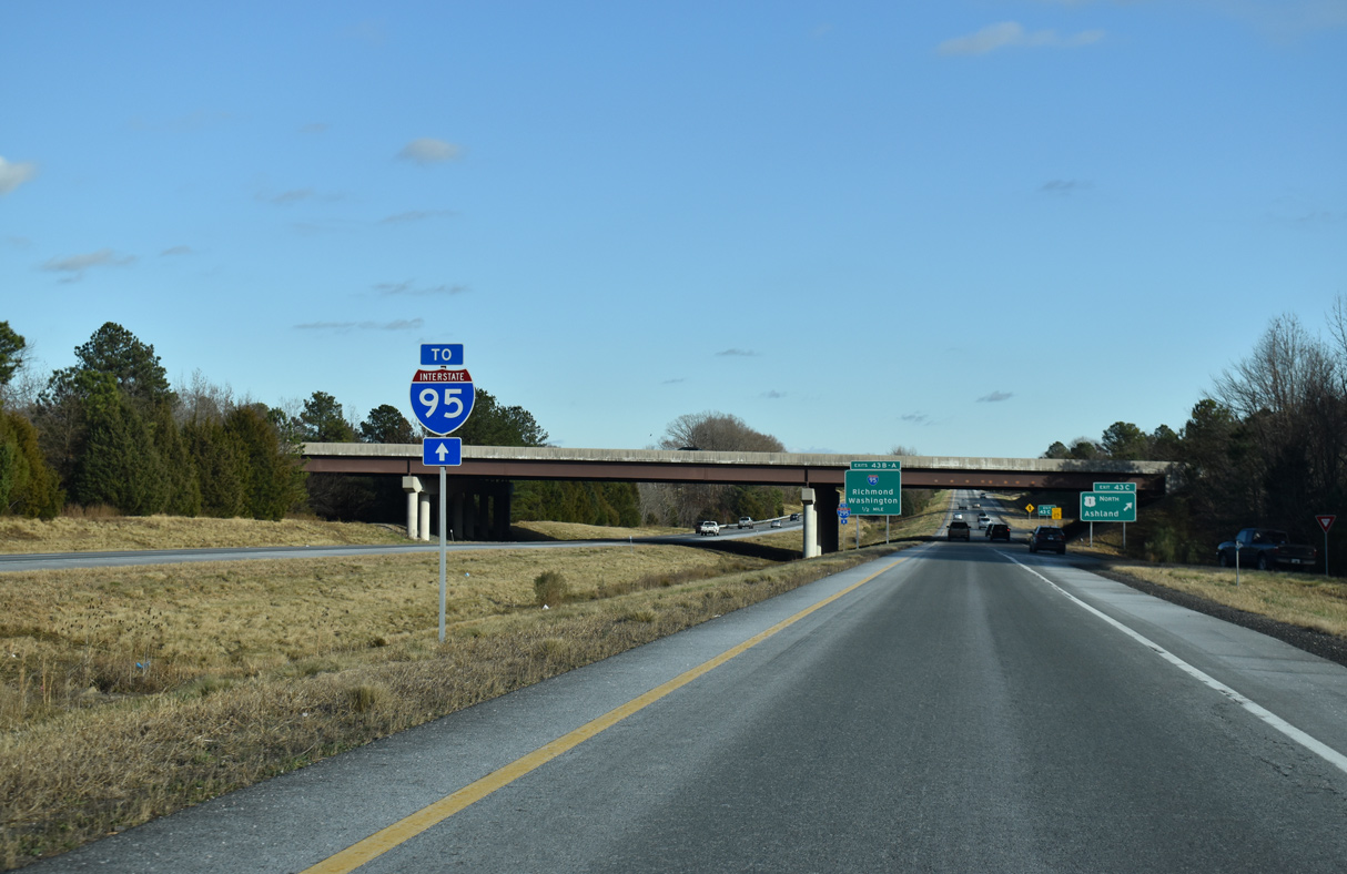
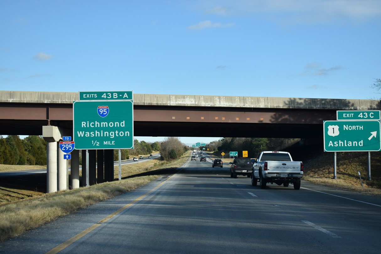
Back to back cloverleaf interchanges join the c/d roadways at Exit 43 with U.S. 1 (Brook Road) at Glen Allen and Interstate 95.
12/17/20
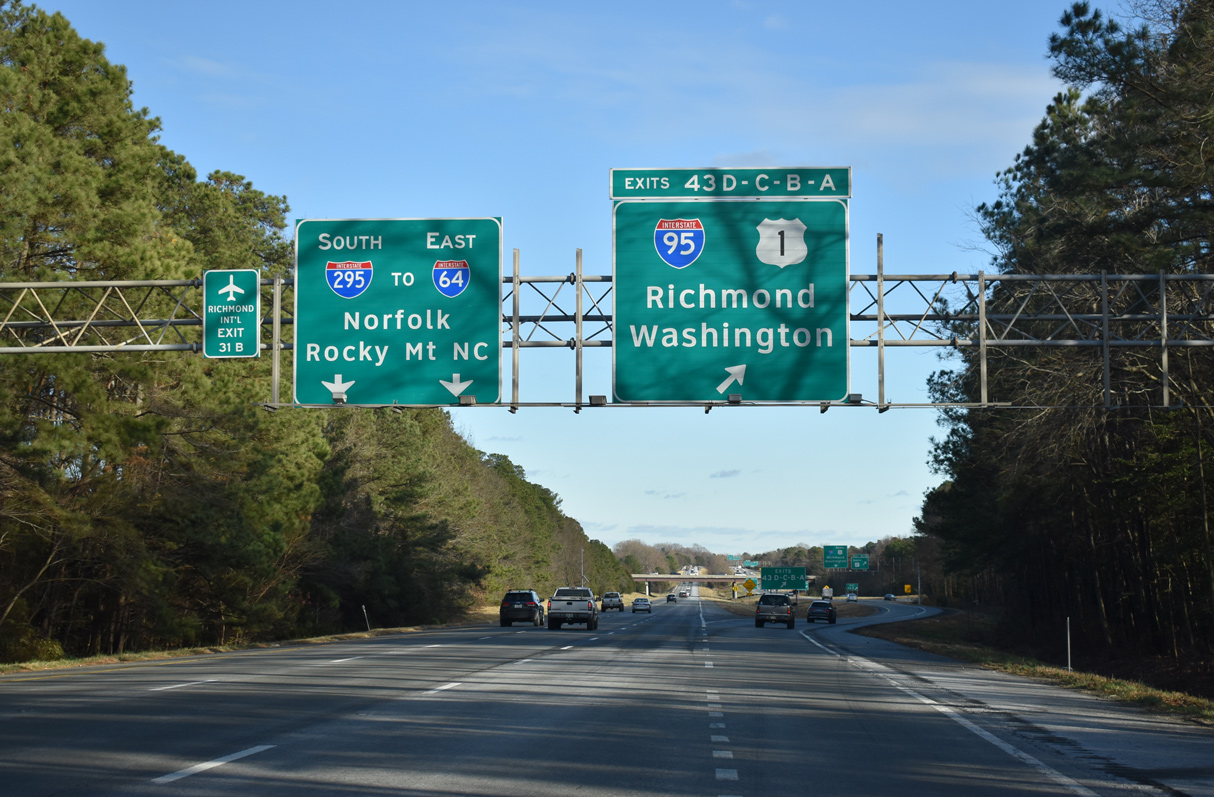
The c/d roadway for Exits 43D-C-B-A Exit 43 separates from Interstate 295 southbound with a single lane. U.S. 1 (Brook Road) parallels I-95 locally between Ashland and Richmond.
12/17/20
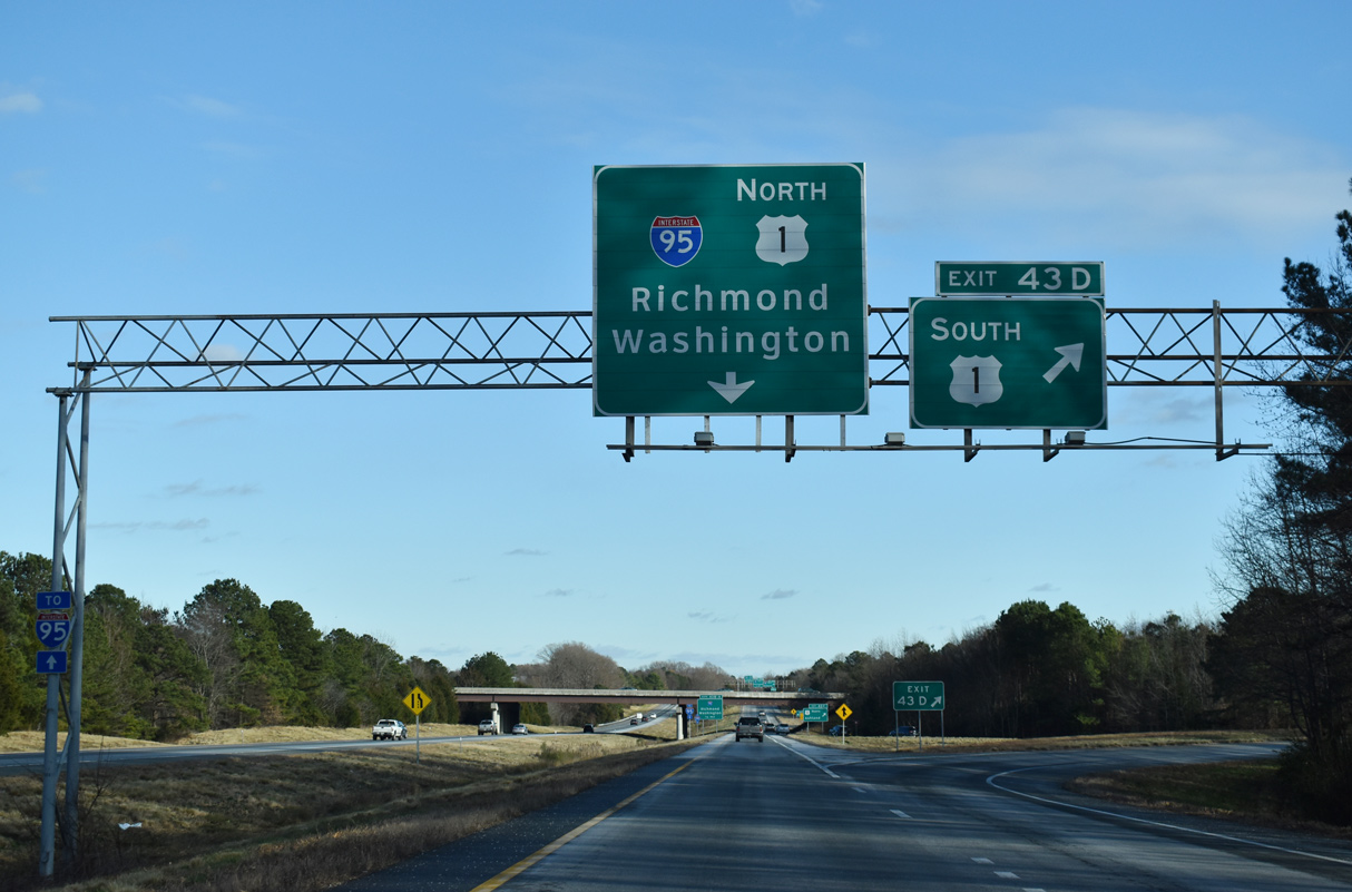
Exit 43D departs for U.S. 1 (Brook Road) south toward Lakeside and Richmond.
12/17/20
Exit 43C follows onto U.S. 1 north to a commercialized stretch anchored by Virginia Center Commons Mall.
12/17/20
I-95 and U.S. 1 north both pass through the town of Ashland within the next seven miles.
12/17/20
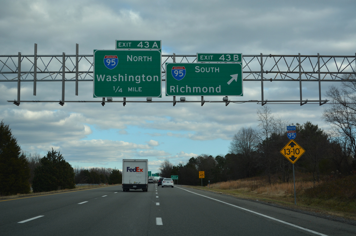
Interstate 95 follows a winding course south into Richmond, where it overlaps with I-64 for 3.1 miles to the north side of Downtown.
12/16/22

I-95 travels 46 miles north from the cloverleaf interchange with I-295 to Fredericksburg and 86 miles to the Springfield Interchange with I-395 and the Capital Beltway (Interstate 495).
12/16/22
A sweeping three lane ramp joins Interstate 95 south with I-295. A pair of shields for I-295 stand along the connector ahead of the Virginia Center Parkway overpass.
12/30/12
Distance sign showing the I-295 connections with I-64 east (13 miles) and I-95 south (43 miles) on the ramp from southbound Interstate 95.
12/30/12
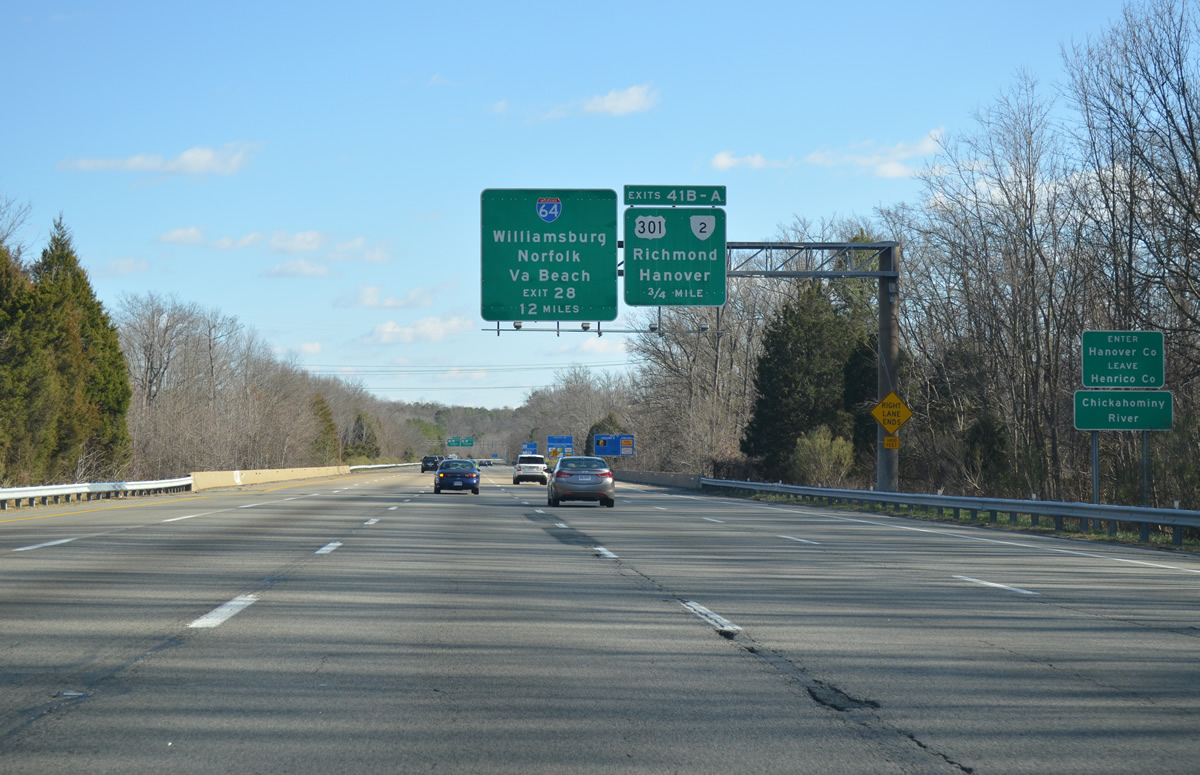
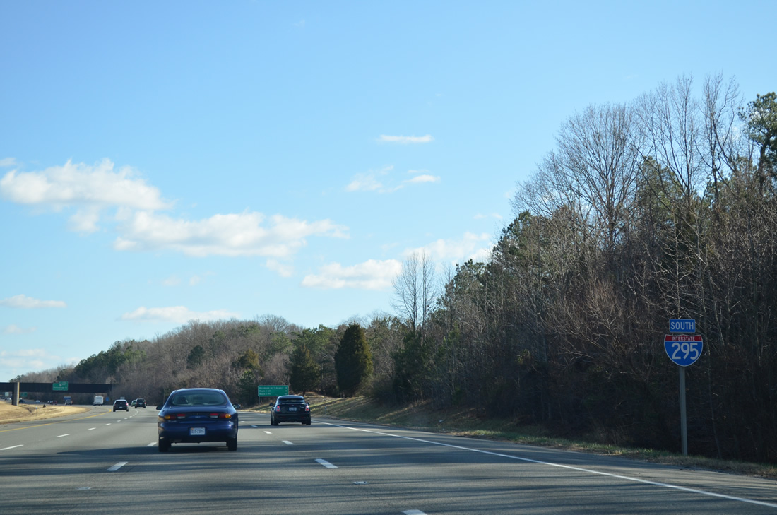
Traffic from Interstate 95 merges onto I-295 southbound at the Chickahominy River and Hanover County line. The ensuing exit is the cloverleaf interchange with U.S. 301/SR 2 (Chamberlayne Road).
12/30/12
U.S. 301/SR 2 overlap between the city of Richmond and Bowling Green. The two travel 12 miles northward to SR 54 and the Hanover County seat by the same name. Chamberlayne Road leads southward two miles to I-95 at Exit 82.
12/30/12
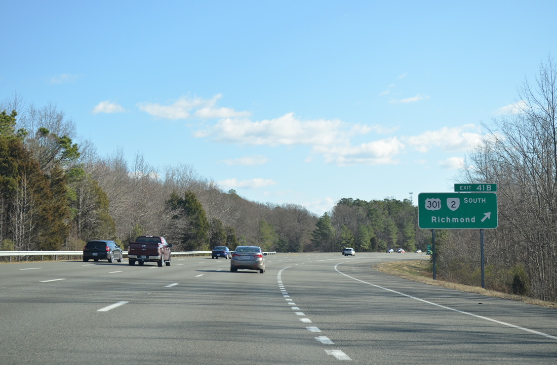
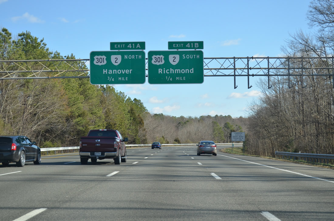
Exit 41B leaves I-295 south for U.S. 301/SR 2 (Chamberlayne Road) southbound to Chamberlayne and Richmond.
12/30/12
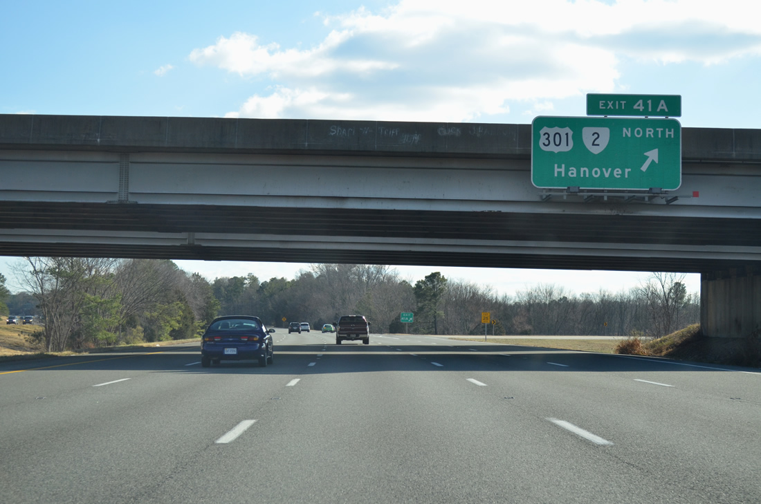
Exit 41A follows onto U.S. 301/SR 2 (Chamberlayne Road) north ahead of the nearby community of Atlee.
12/30/12
Confirming marker posted after the entrance ramp from U.S. 301/SR 2 north.
12/30/12
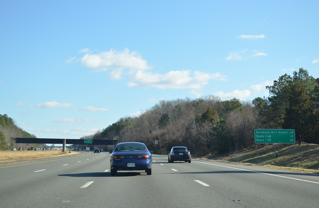
The exchange with Interstate 64 for Richmond International Airport (RIC) lies ten miles south of U.S. 301/SR 2.
12/30/12

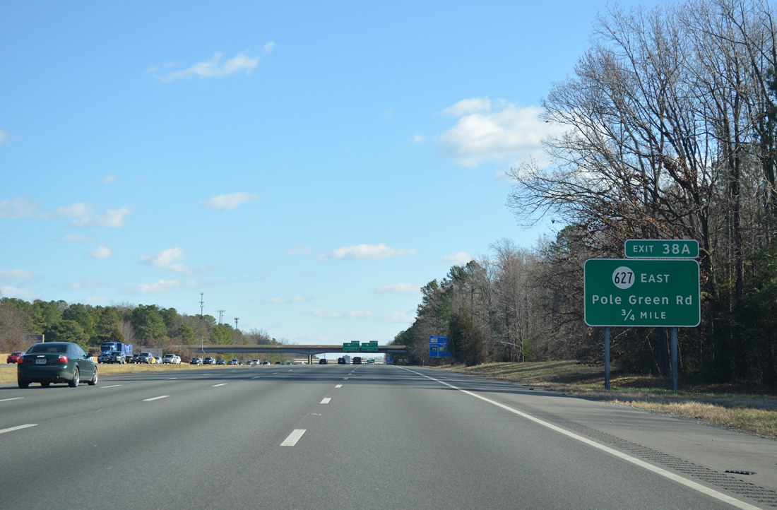
One mile northwest of the cloverleaf interchange (Exit 38) with SR 627 (Meadowbridge Road). Meadowbridge Road runs between Ellerson and Pole Green Road.
12/30/12
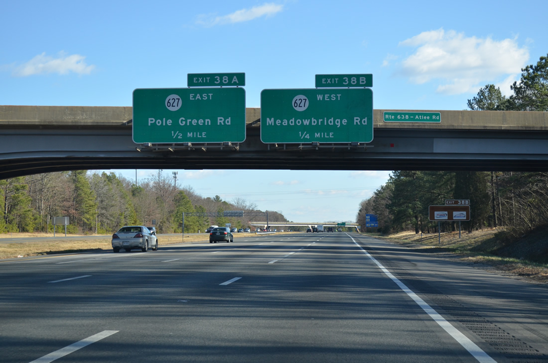
One quarter mile from Exit 38B at the SR 638 (Atlee Road) over crossing. SR 627 follows Pole Green Road from Exit 38A to U.S. 360 east of Newmans.
12/30/12
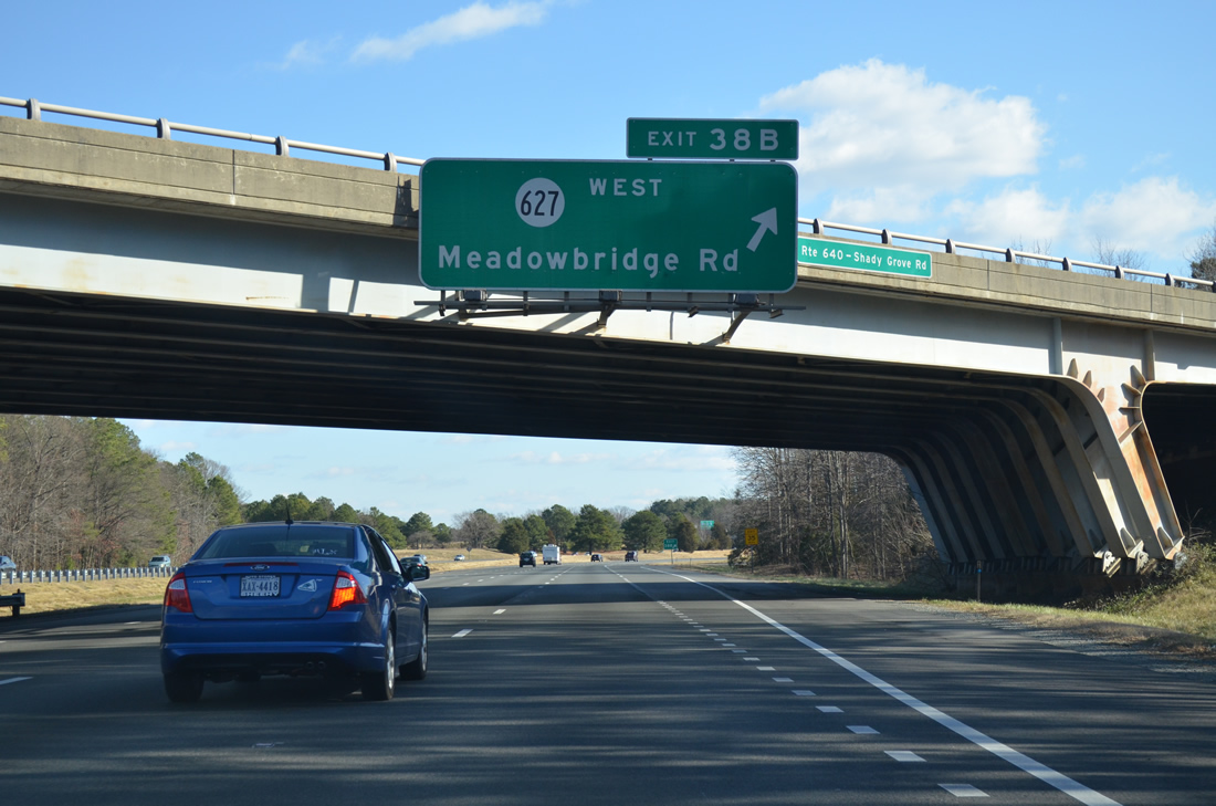
Shady Grove Road passes over Interstate 295 south at Exit 38B to SR 627 (Meadowbridge Road) west to Ellerson and Richmond.
12/30/12
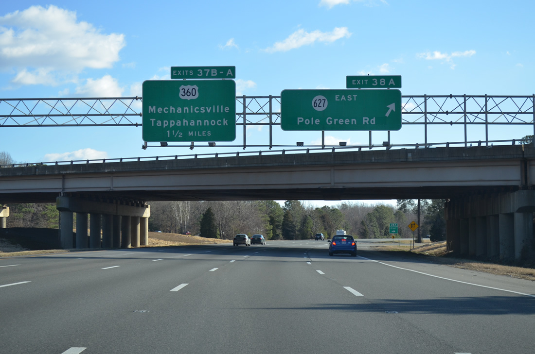
Exit 38A loops onto SR 627 (Pole Green Road) east, 1.5 miles ahead of the cloverleaf interchange with U.S. 360 (Mechanicsville Turnpike).
12/30/12
Interstate 295 turns more to the south toward Mechanicsville.
12/30/12
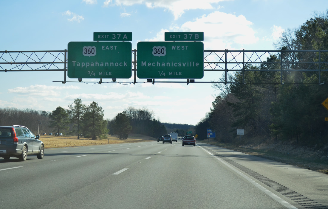
Interstate 295 meets U.S. 360 (Mechanicsville Turnpike) near Mechanicsville at Exits 37B/A. U.S. 360 vacates the city of Richmond northeast to Mechanicsville, I-295 and Newmans.
12/30/12
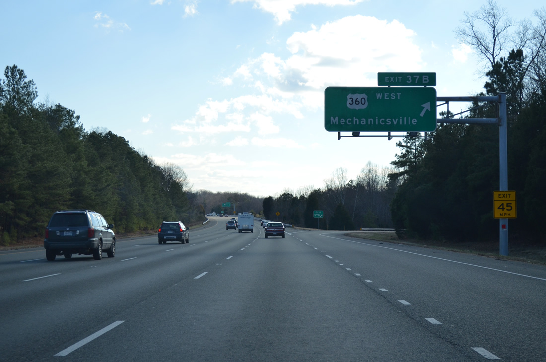
West from Exit 37B, U.S. 360 splits with U.S. 360 Business north into Mechanicsville nearby.
12/30/12
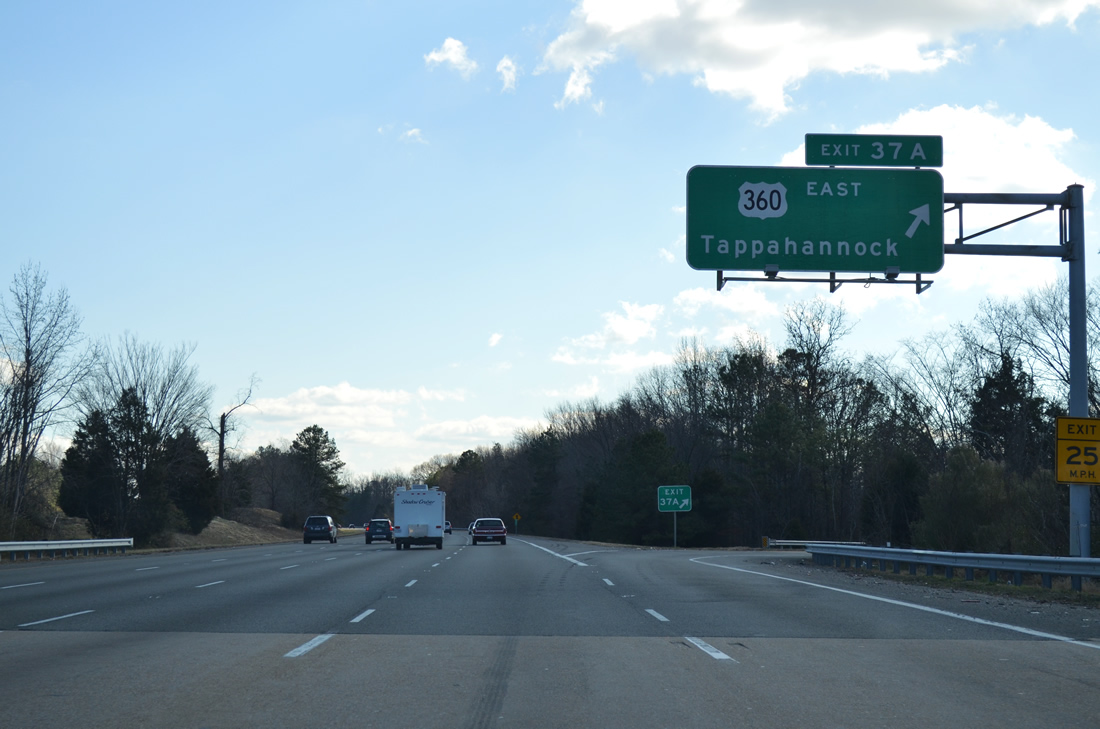
40 miles to the north from Exit 37A, U.S. 360 overlaps with U.S. 17 through Tappahannock. Newmans lies 2.8 miles to the east.
12/30/12
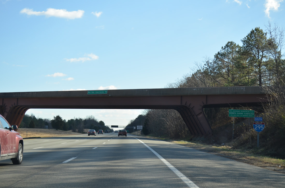
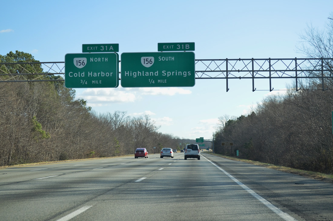
SR 156 branches south from U.S. 360 at Mechanicsville and spans Interstate 295 by this confirming marker en route to Old Cold Harbor.
12/30/12
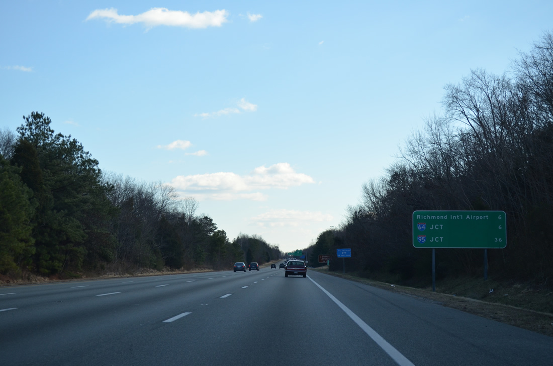
Six miles remain along I-295 south to the exchange with I-64 and Richmond International Airport (RIC). The Richmond / Petersburg bypass ends in 36 miles.
12/30/12
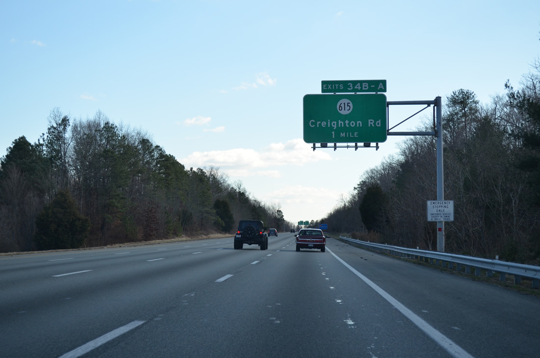
SR 615 (Creighton Road) crosses paths with Interstate 295 south at a cloverleaf interchange (Exit 34) near Richmond National Battlefield Park.
12/30/12
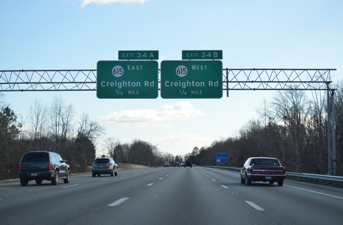
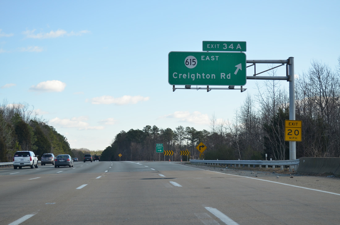
Exit 34B connects with SR 615 (Creighton Road) west to Laburnum Avenue around the city of Richmond.
12/30/12
Heading northeast, SR 615 leads to SR 156 (Cold Harbor Road) and Walnut Grove Road. Interests to the Cold Harbor Battlefield & Cemetery of Richmond National Park are directed onto SR 156 east from Creighton Road.
12/30/12
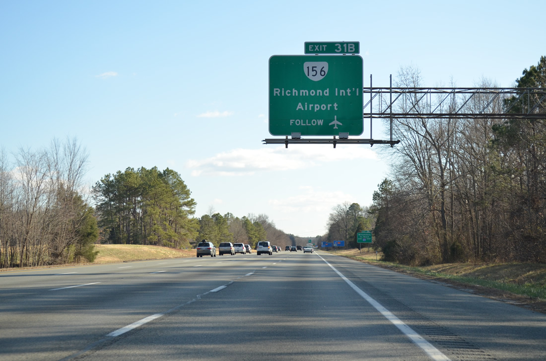
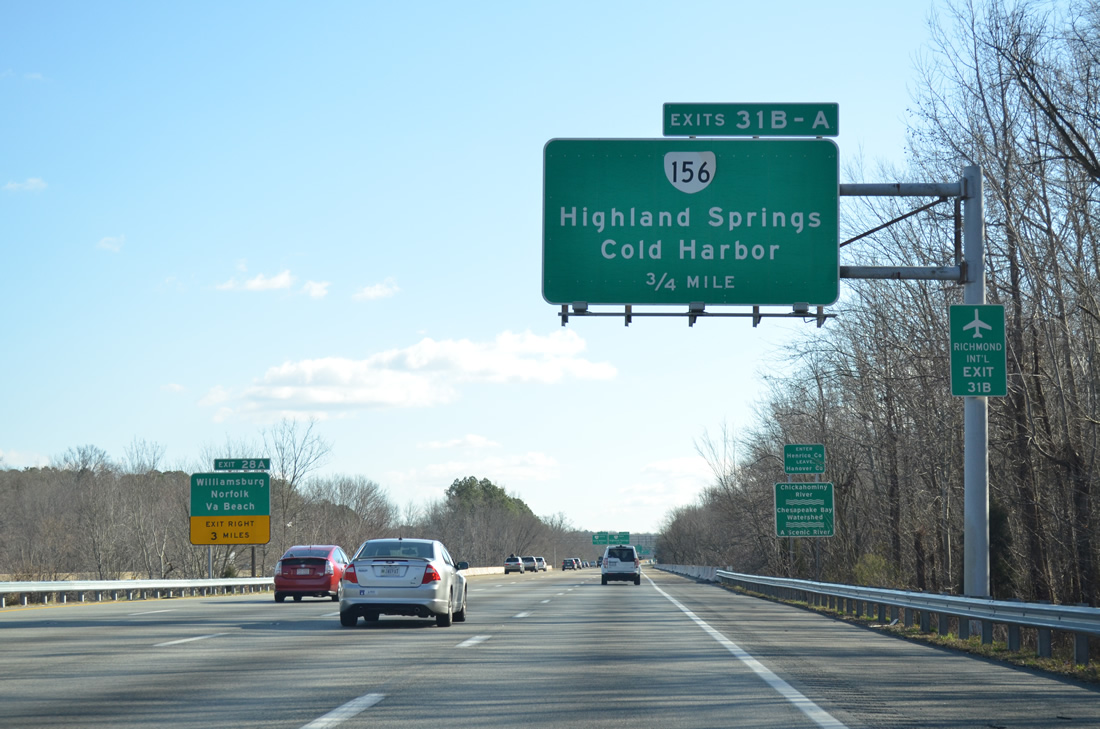
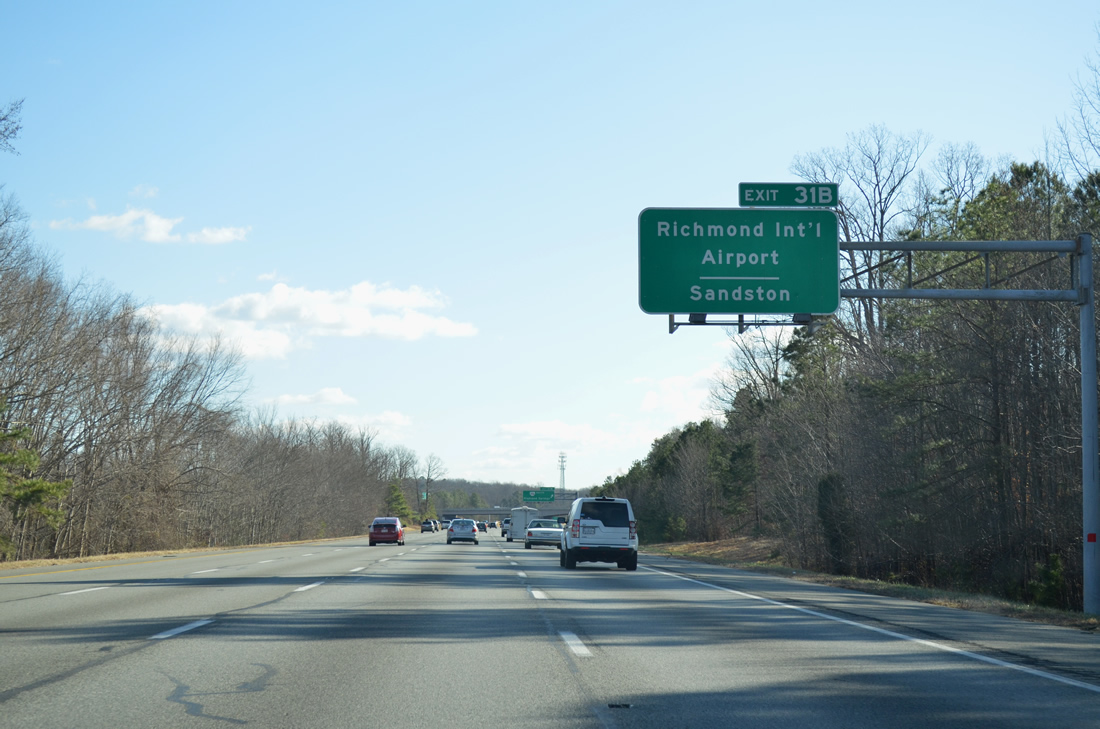
The succeeding exit from I-295 south is the cloverleaf interchange with SR 156 (Airport Drive). Airport Drive connects the freeway with Richmond International Airport (RIC).
12/30/12
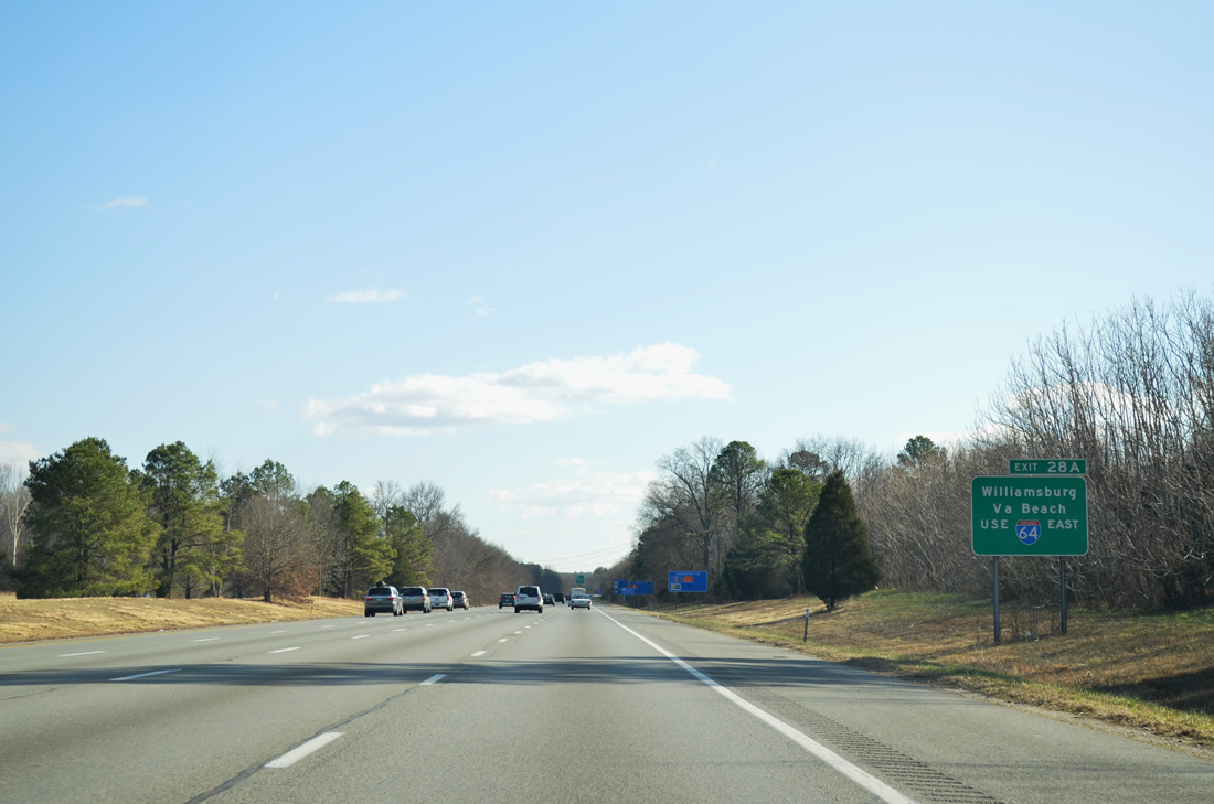
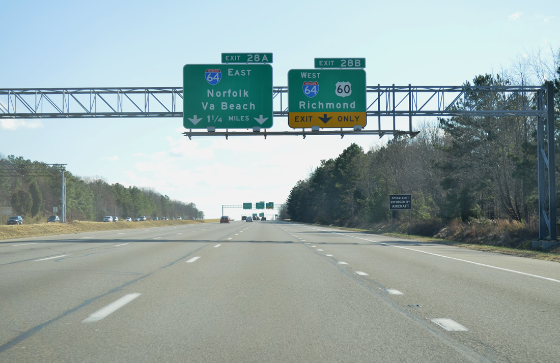
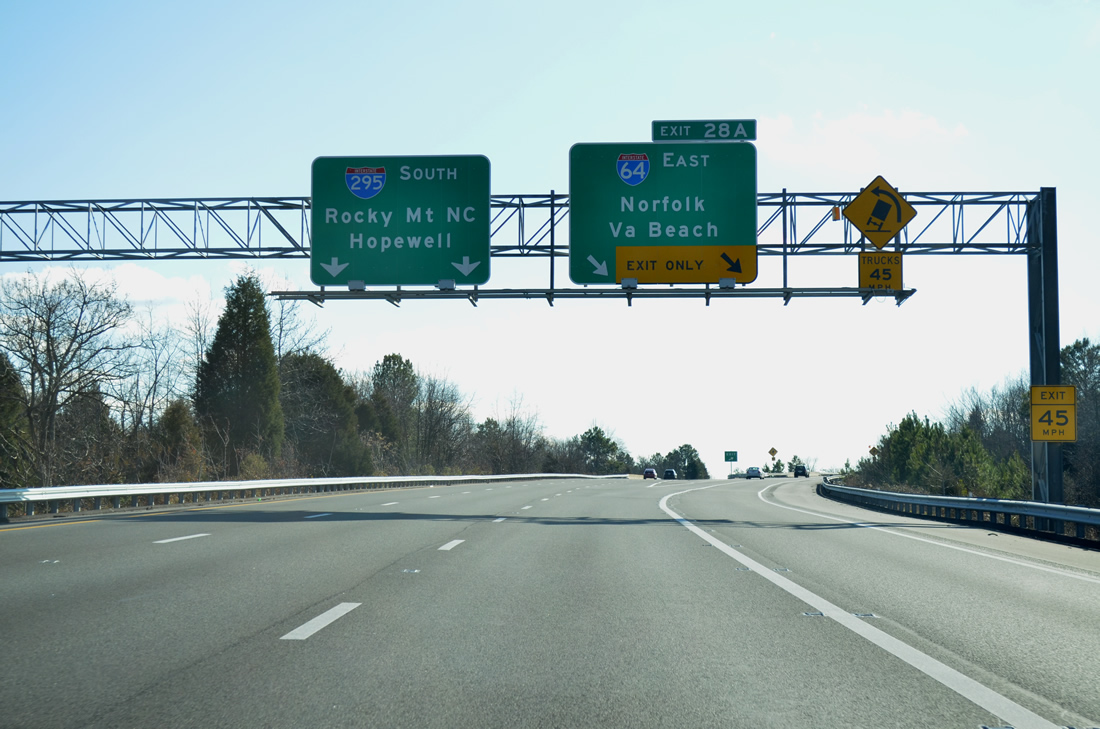
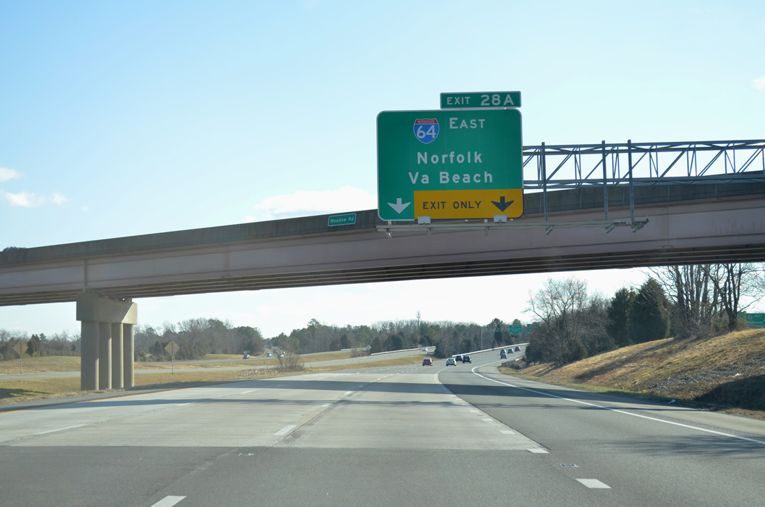
Forthcoming Interstate 64 travels southeast to Williamsburg and Virginia Beach from Exit 28A.
12/30/12
Interchange sequence sign posted above the southbound lanes for SR 156 (Exit 31), I-64 west / U.S. 60 (Exit 28B) and I-64 east (Exit 28A).
12/30/12
SR 156 (Airport Drive) converges with I-295 east of Highland Springs. The state route loops from U.S. 60 at Richmond International Airport (RIC) northward to Old Cold Harbor before turning west along Cold Harbor Road to Mechanicsville.
12/30/12

Interstate 295 southbound crosses the Chickahominy River into Henrico County.
12/30/12
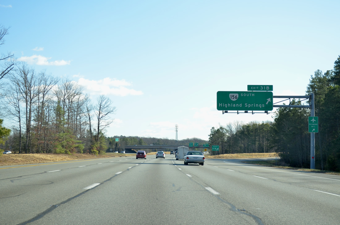
SR 156 follows Airport Drive southwest from I-295 to SR 33 (Nine Mile Road) and I-64 at Highland Springs. Airport Drive continues south of U.S. 60 to RIC Airport and Pocahontas Parkway. The extension to SR 895 was completed on January 14, 2011.
12/30/12
SR 156 combines with U.S. 60 east from Airport Drive to Sandston, Seven Pines and Interstate 295 again at Exit 28.
12/30/12
SR 156 travels 57.41 miles overall between U.S. 360 Business at Mechanicsville and SR 35 at Templeton.
12/30/12
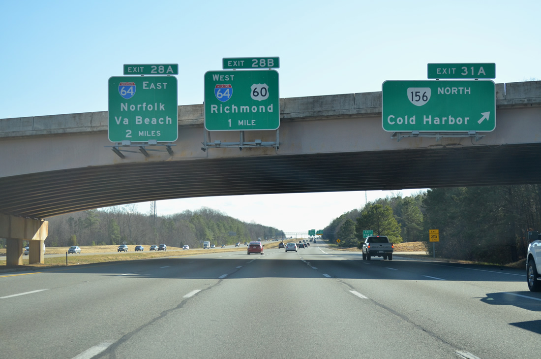
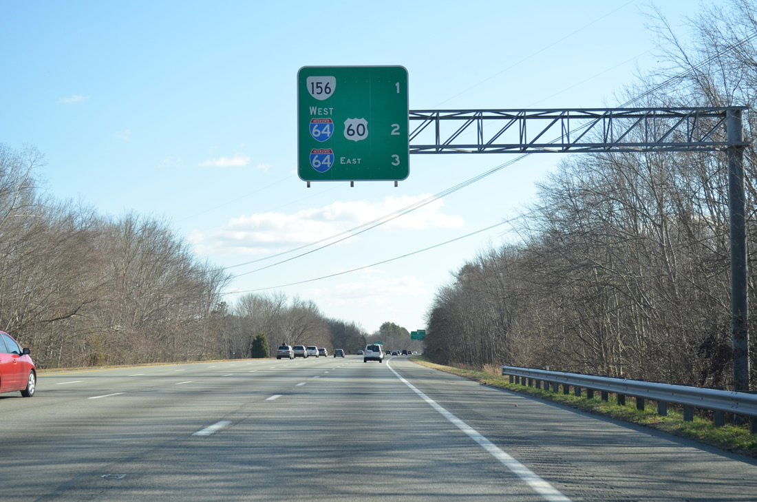
Exit 31A loops onto SR 156 (Cold Harbor Road) north one mile ahead of the collector distributor roadway (Exit 28) for Interstate 64 west and U.S. 60.
12/30/12
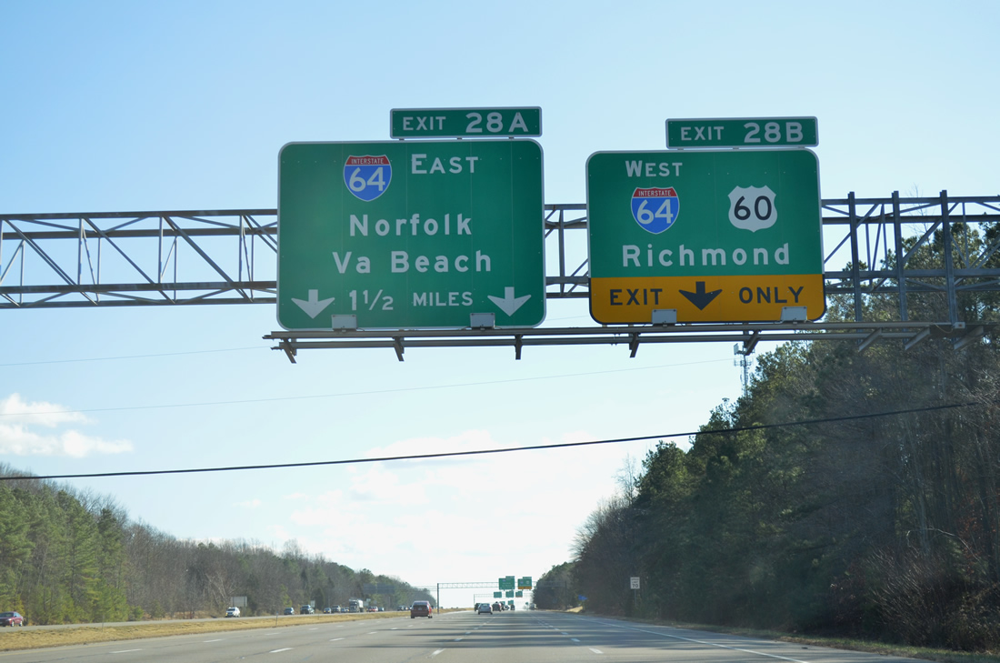
Traffic partitions with a single lane for the c/d roadway (Exit 28B) to I-64 west and U.S. 60 (Williamsburg Road) and a two lane flyover (Exit 28A) for Interstate 64 east to Hampton Roads.
12/30/12
Interstate 64 travels nearly 300 miles across Virginia, from the West Virginia state line west of Covington to Chesapeake in Hampton Roads.
12/30/12
Exit 28B connects I-295 south with Interstate 64 west to Richmond and U.S. 60 (Williamsburg Road) between Sandston and Providence Forge.
12/30/12
Construction in 2000-01 added a the two lane flyover (Exit 28A) from I-295 south to I-64 east. Improving regional travel between Washington and Hampton Roads, the $13.4 million ramp opened to traffic in June 2001.1
12/30/12
Interstate 64 enters Newport News 47 miles southeast from I-295 and Norfolk in 72 miles.
12/30/12
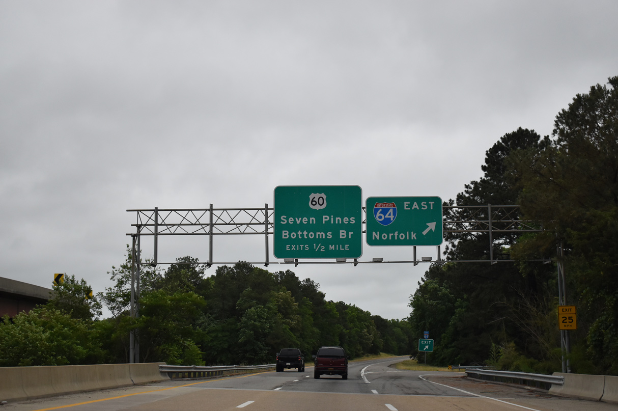
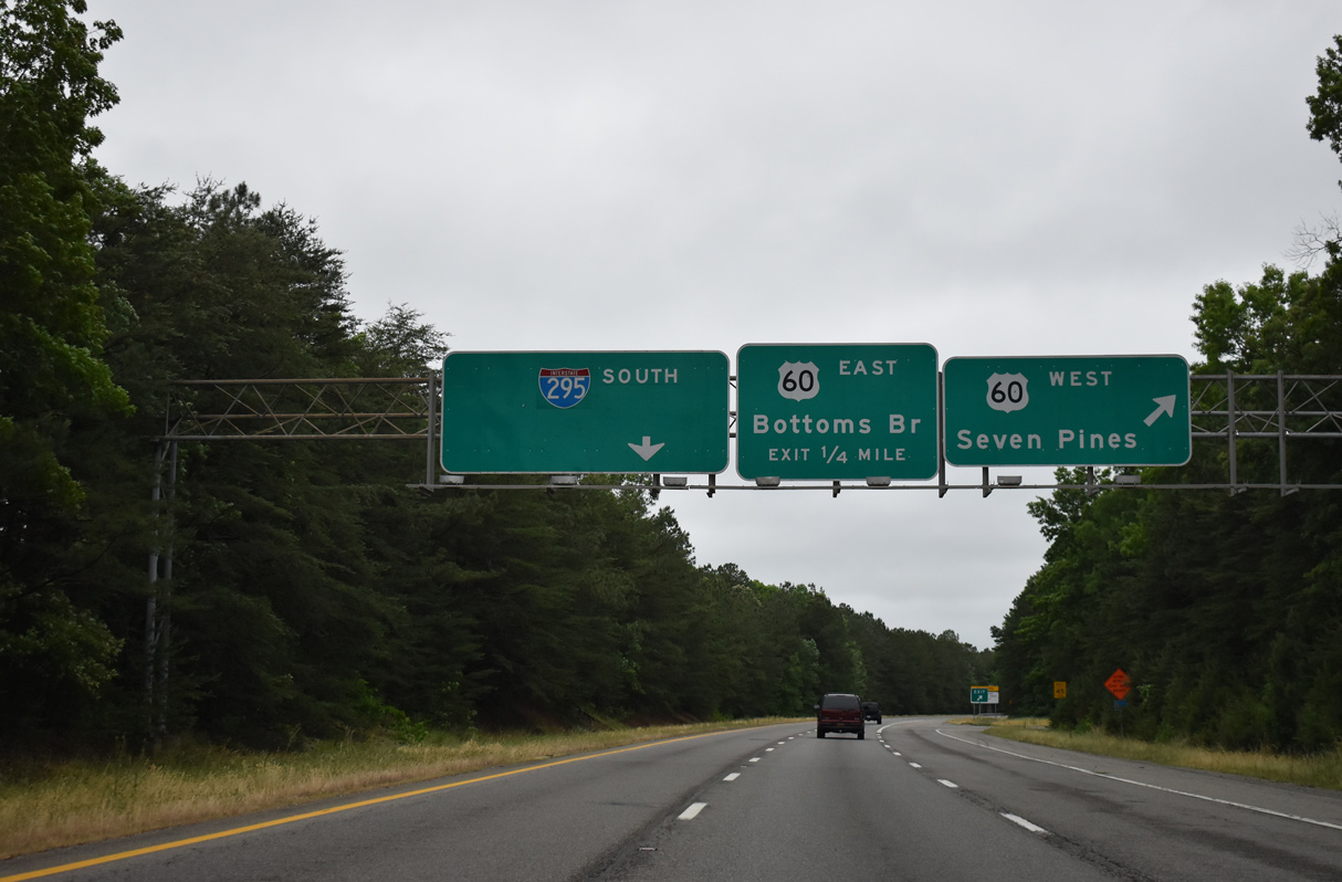
Interstate 64 and parallel U.S. 60/SR 33 run east to Bottoms Bridge in New Kent County.
05/29/21
Unmarked from I-295, SR 33 overlaps with U.S. 60 west 1.6 miles to Sandston. SR 156 combines with U.S. 60, 3.1 miles to Airport Drive at Richmond International Airport (RIC).
05/29/21
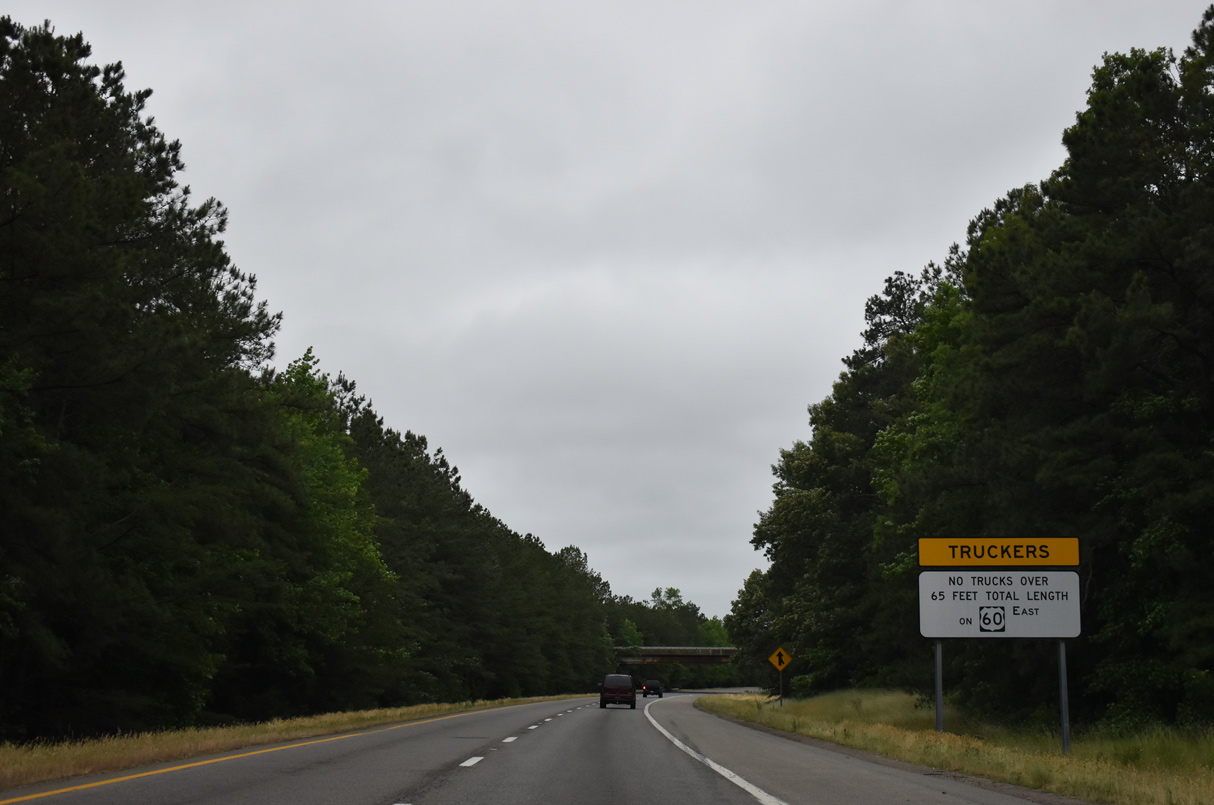
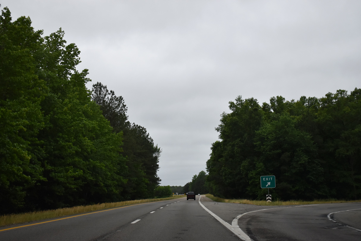
U.S. 60/SR 33 continue 4.7 miles east from I-295 to Bottoms Bridge. The rural course east into New Kent County includes a truck restriction.
05/29/21

References:
- Kozel, Scott. Interstate 295 in Virginia.
Photo Credits:
- Alex Nitzman: 12/16/16, 12/17/20, 12/16/22
- AARoads: 12/30/12
- Brent Ivy: 05/29/21
Connect with:
Page Updated Monday February 20, 2023.