
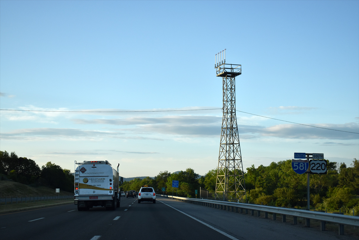
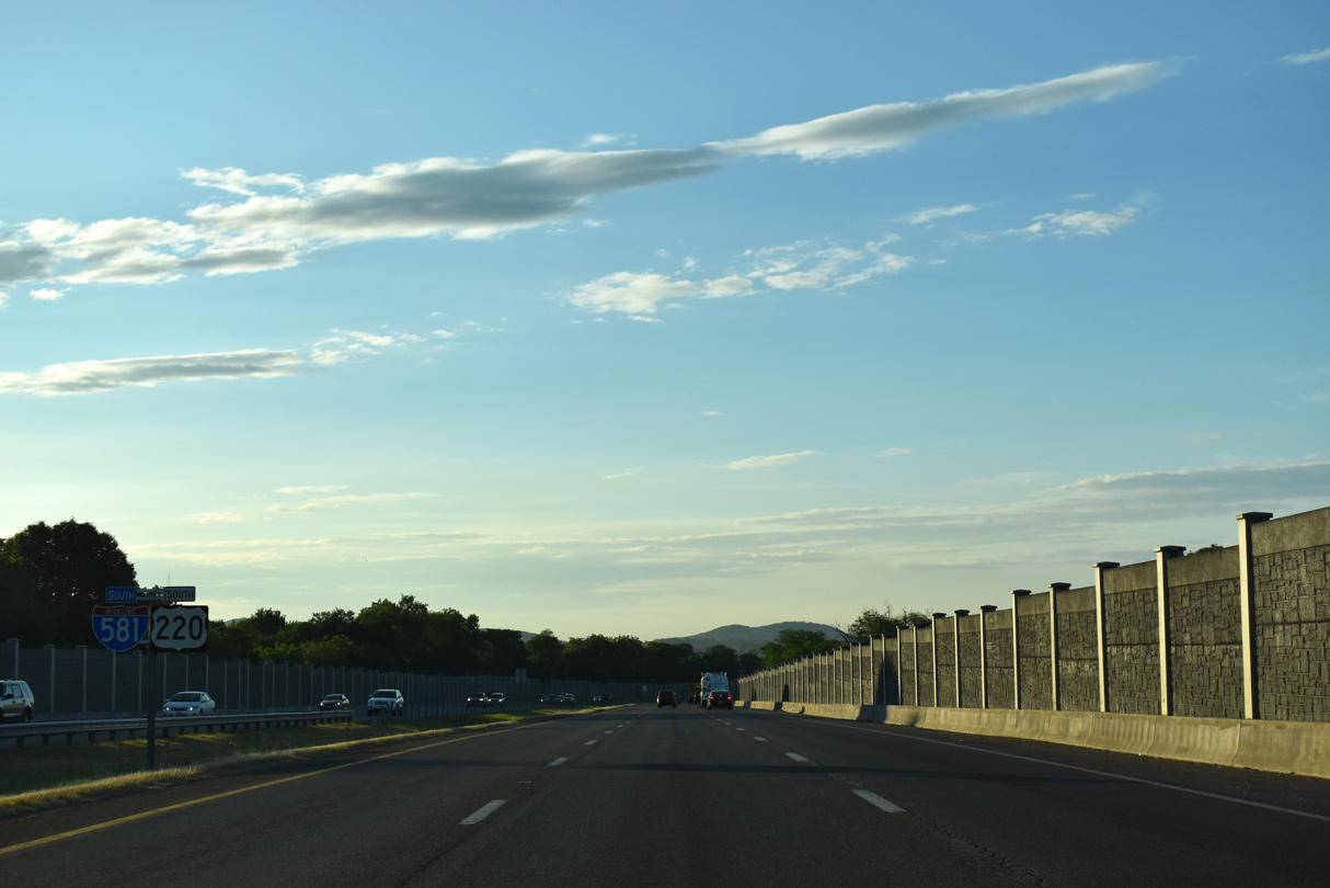
I-581/U.S. 220 South


 South
South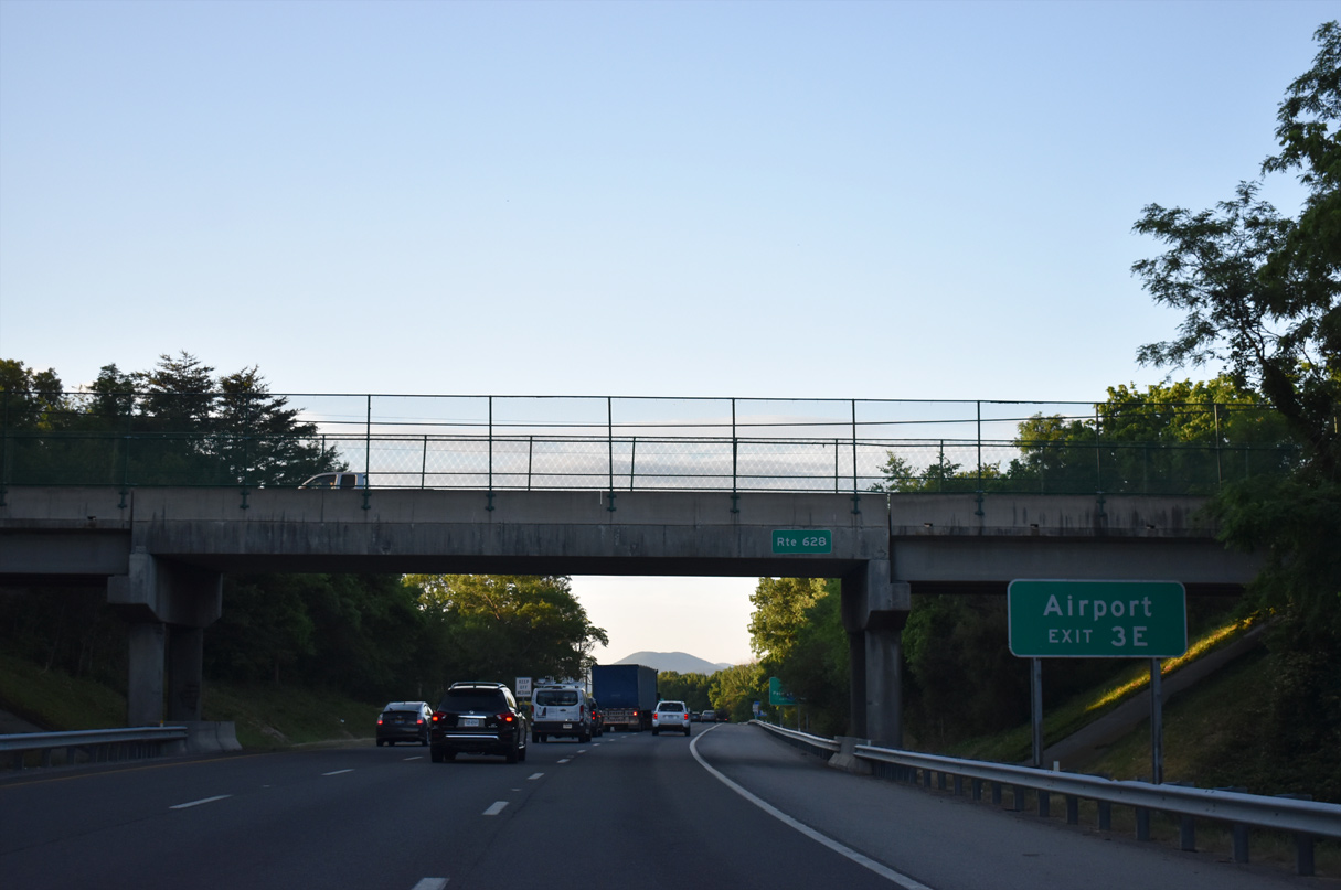
U.S. 220 south combines with I-581 from I-81 south ahead of the Wood Haven Road (SR 628) overpass. Roanoke-Blacksburg Regional Airport (ROA) lies east between the succeeding two interchanges.
05/27/21
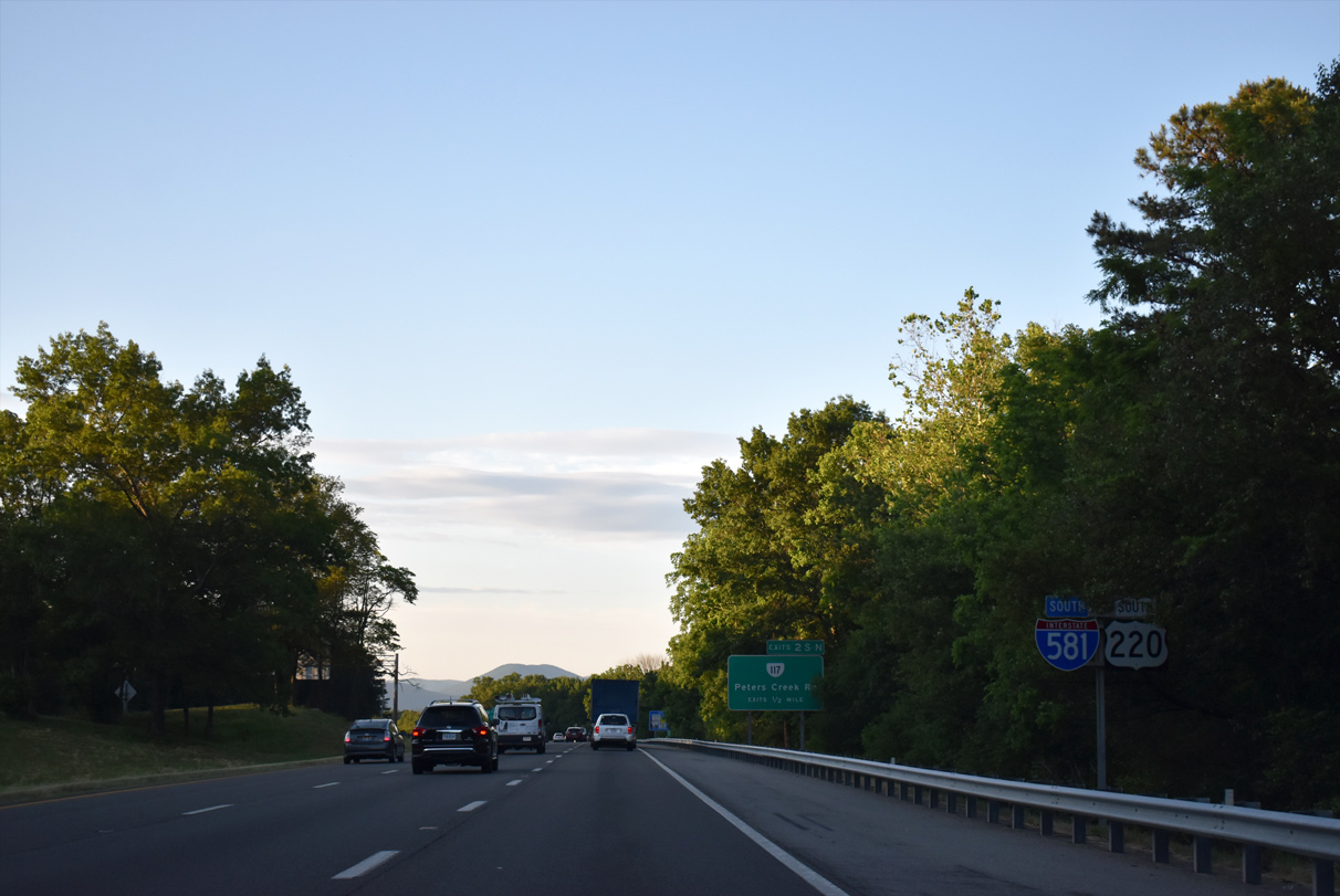
I-581/U.S. 220 enter the independent city of Roanoke south from Kingston at SR 117 (Peters Creek Road).
05/27/21
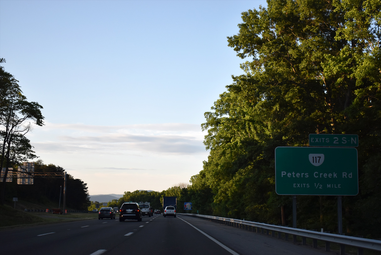
A cloverleaf interchange joins I-581/U.S. 220 with SR 117 (Peters Creek Road) at Exits 2S/N.
05/27/21

SR 117 (Peters Creek Road) arcs 4.78 miles southwest from Exit 2W to Medley, U.S. 460/11 ALT (Melrose Avenue) at Washington Heights in Roanoke and U.S. 11 (Brandon Avenue) at Westland.
05/27/21
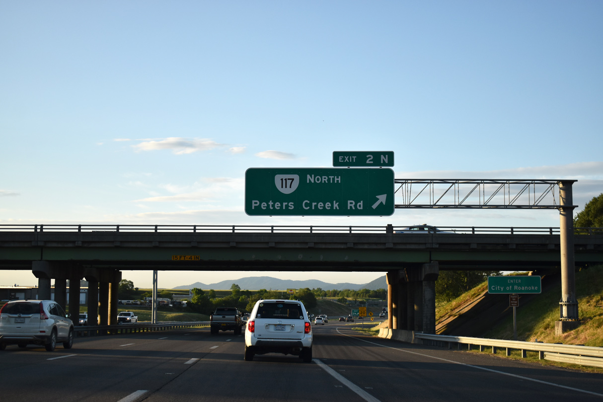
SR 117 (Peters Creek Road) continues northeast from Exit 2N to U.S. 11 (Williamson Road) at Hollins. SR 117 is 7.21 miles long.
05/27/21
Runway lighting appears along I-81/U.S. 220 south as the freeway passes by Roanoke-Blacksburg Regional Airport (ROA).
05/27/21
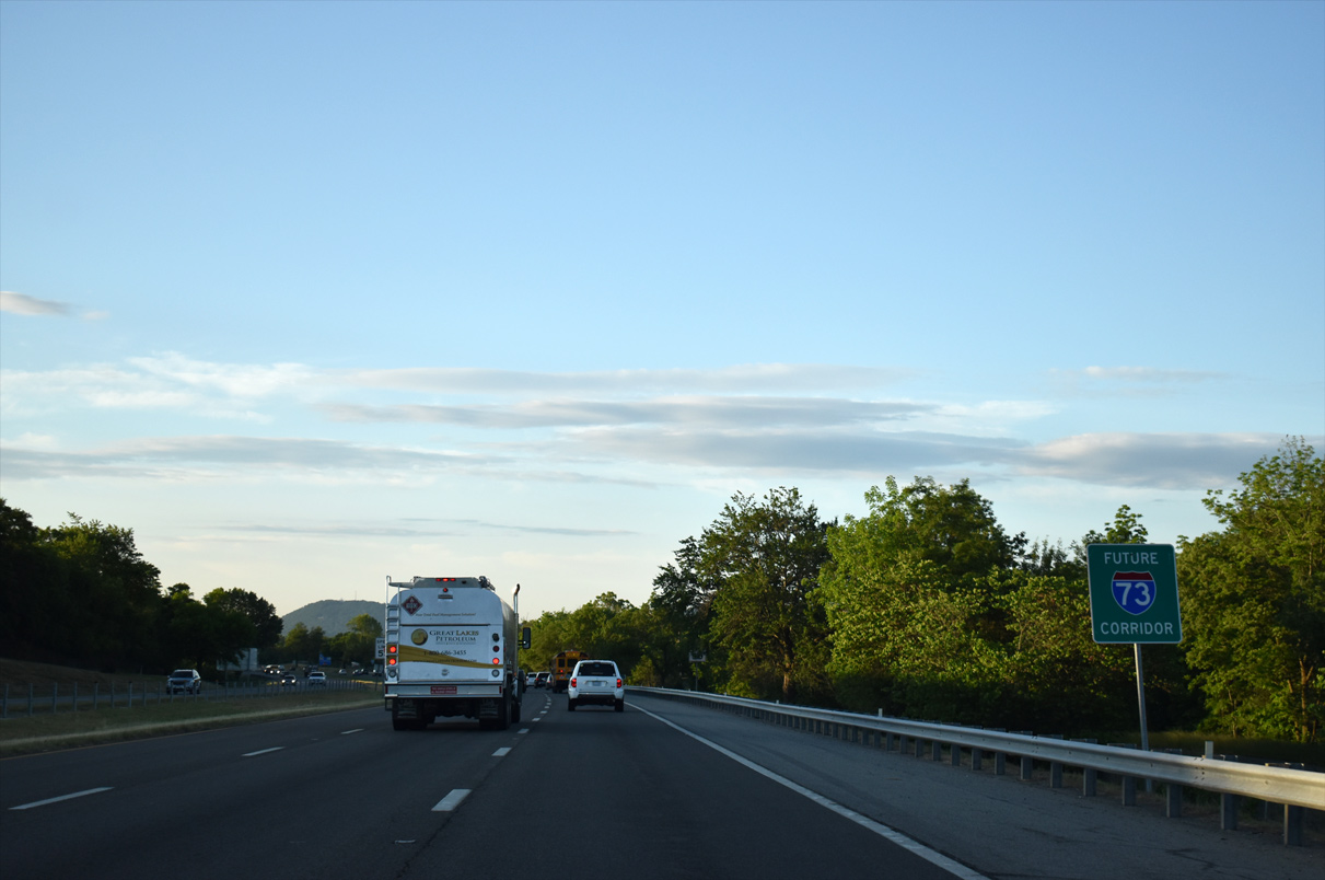
I-581/U.S. 220 double as a future alignment of I-73, which extends north from Greensboro, North Carolina.
05/27/21
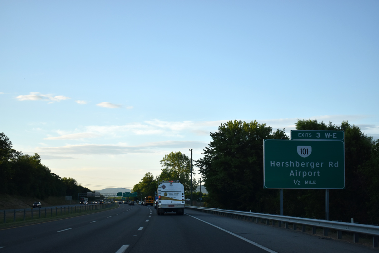
SR 101 (Hershberger Road) east to Aviation Drive north links I-581/U.S. 220 with the passenger terminal at Roanoke-Blacksburg Regional Airport (ROA).
05/27/21
SR 101 (Hershberger Road) is a 3.17 mile long arterial leading west to SR 117 (Peters Creek Road) near the Washington Heights neighborhood and east to U.S. 11 (Williamson Boulevard).
05/27/21
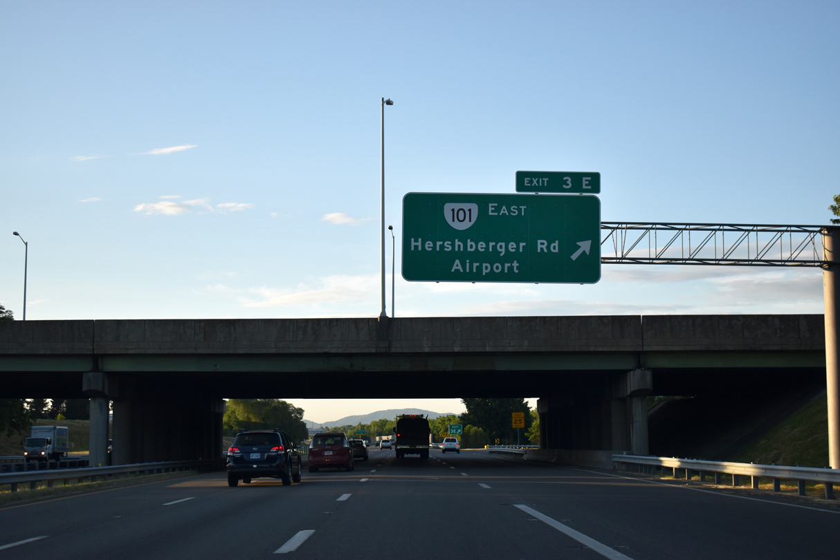
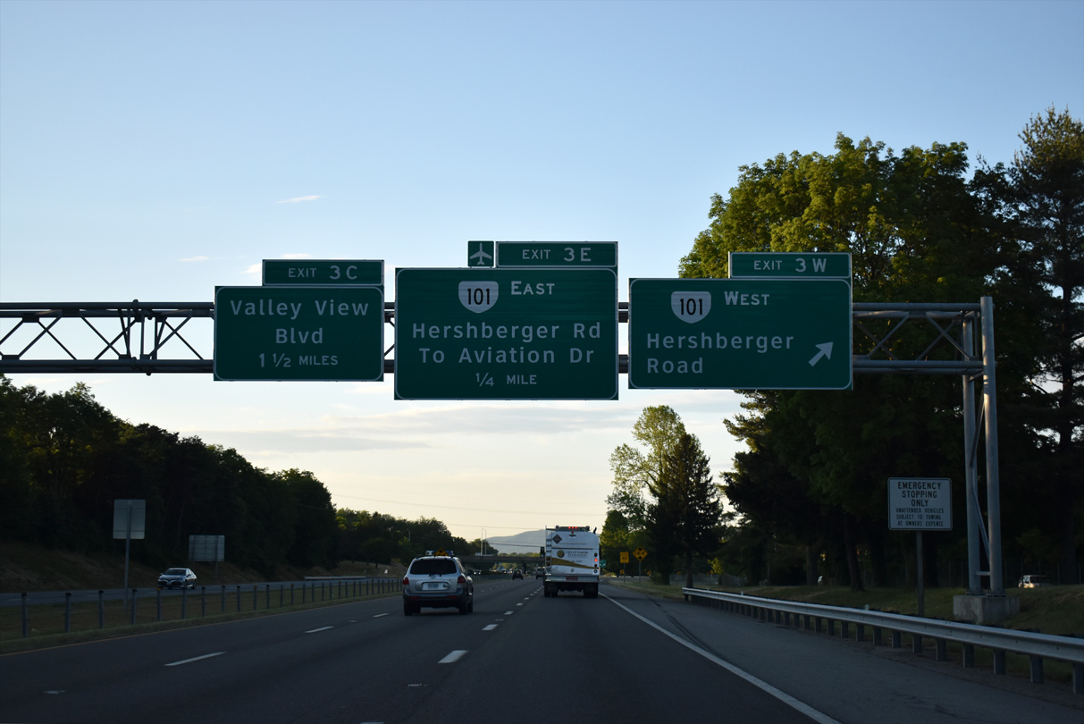
SR 101 (Hershberger Road) east from Exit 3E to the exchange with Aviation Drive north and Valley View Boulevard NW south is a controlled access expressway.
05/27/21
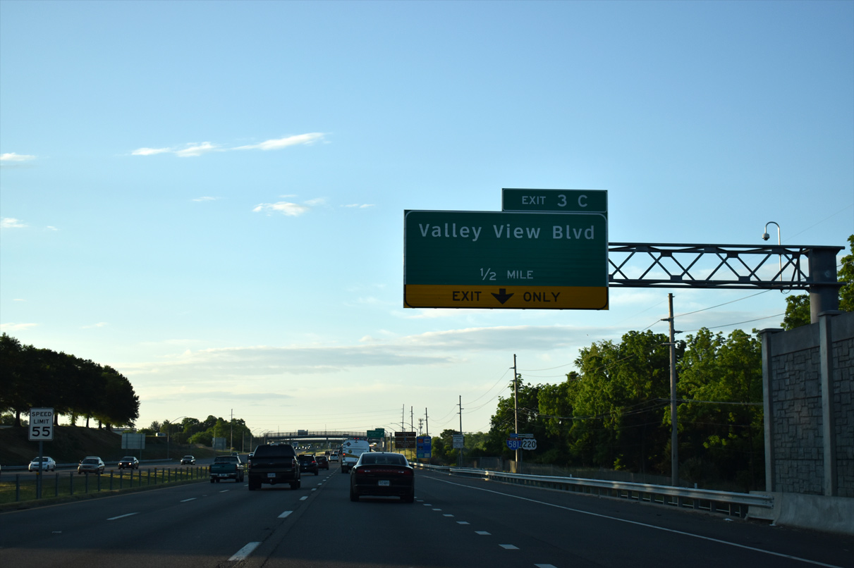
I-581/U.S. 220 advances south between Valley View Mall and the Fairland subdivision to a diverging diamond interchange (Exit 3C) with Valley View Boulevard NW.
05/27/21
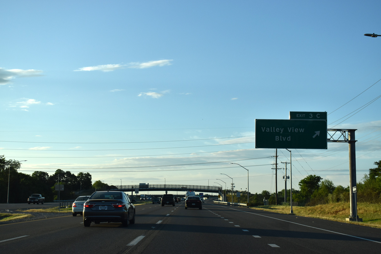
The DDI with Valley View Boulevard NW was constructed from 2014 to 2016 midway between SR 101 (Hershberger Road) and U.S. 460 (Orange Avenue).
05/27/21
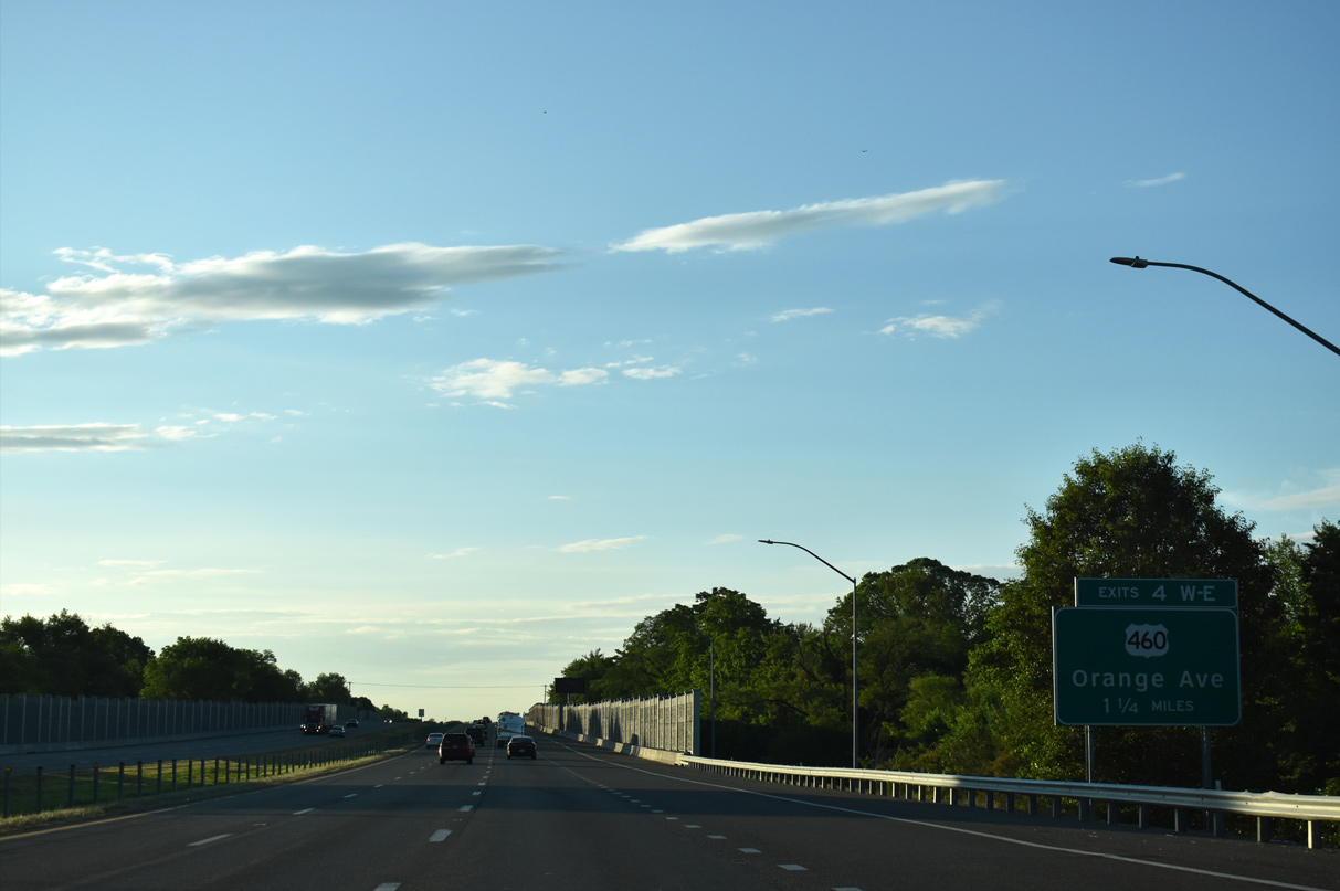
Construction in 2016 added sound walls along I-581/U.S. 220 south from Exit 3C and across the 10th Street NW overpass by the Meadowland neighborhood. A cloverleaf interchange (Exit 4) with U.S. 460/11 ALT and SR 116 (Orange Avenue) follows.
05/27/21
Curving southward by the Lincoln Park neighborhood, Liberty Road spans I-581/U.S. 220 south across a low clearance overpass (10 feet 11 inches) on the ensuing stretch.
05/27/21
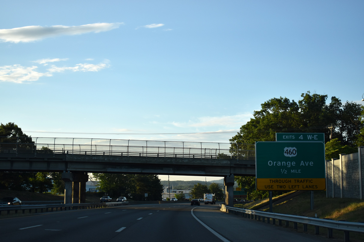
Liberty Road passes over I-581/U.S. 220 one half mile ahead of U.S. 460. Berglund Center (formerly Roanoke Civic Center) is located along U.S. 460 (Orange Avenue) between the freeway and U.S. 11 (Williamson Road).
05/27/21
U.S. 460 (Orange Avenue) combines with U.S. 11 ALT, U.S. 220 Business and SR 116 south to adjacent U.S. 11/221 (Williamson Road). U.S. 460/221 overlap east from Roanoke to Bedford.
05/27/21
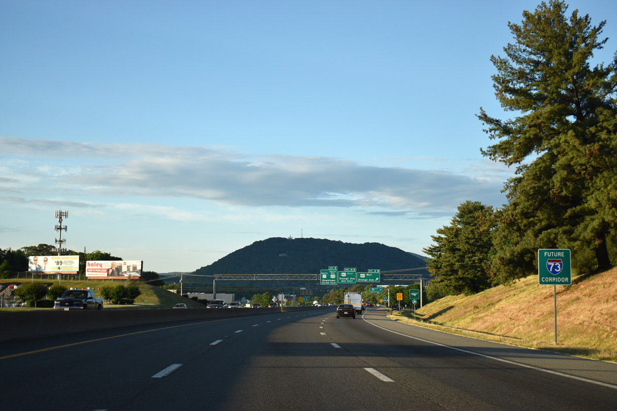
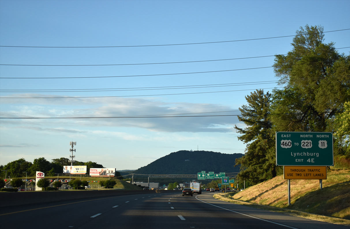
A second future I-73 assembly stands ahead of Exit 4W to U.S. 460 west.
05/27/21
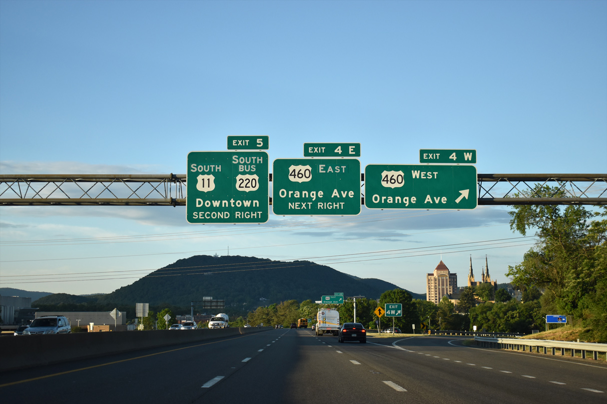
U.S. 460 (Orange Avenue) west overlaps with SR 116 north to Lafayette Boulevard at the Melrose-Rugby neighborhood. U.S. 11 ALT accompanies U.S. 460 west 5.07 miles to SR 419 (Electric Road) in the city of Salem.
05/27/21

A loop ramp leaves Interstate 581 south for U.S. 460 (Orange Avenue) east to Berglund Center and Lynchburg.
05/27/21

U.S. 11-221-220 Business/SR 116 (Williamson Road) shift southwest below I-581 at Exit 5 ahead of the Center In The Square in Downtown Roanoke. Exit 5 also connects with Commonwealth Avenue to the Roanoke Conference Center.
05/27/21
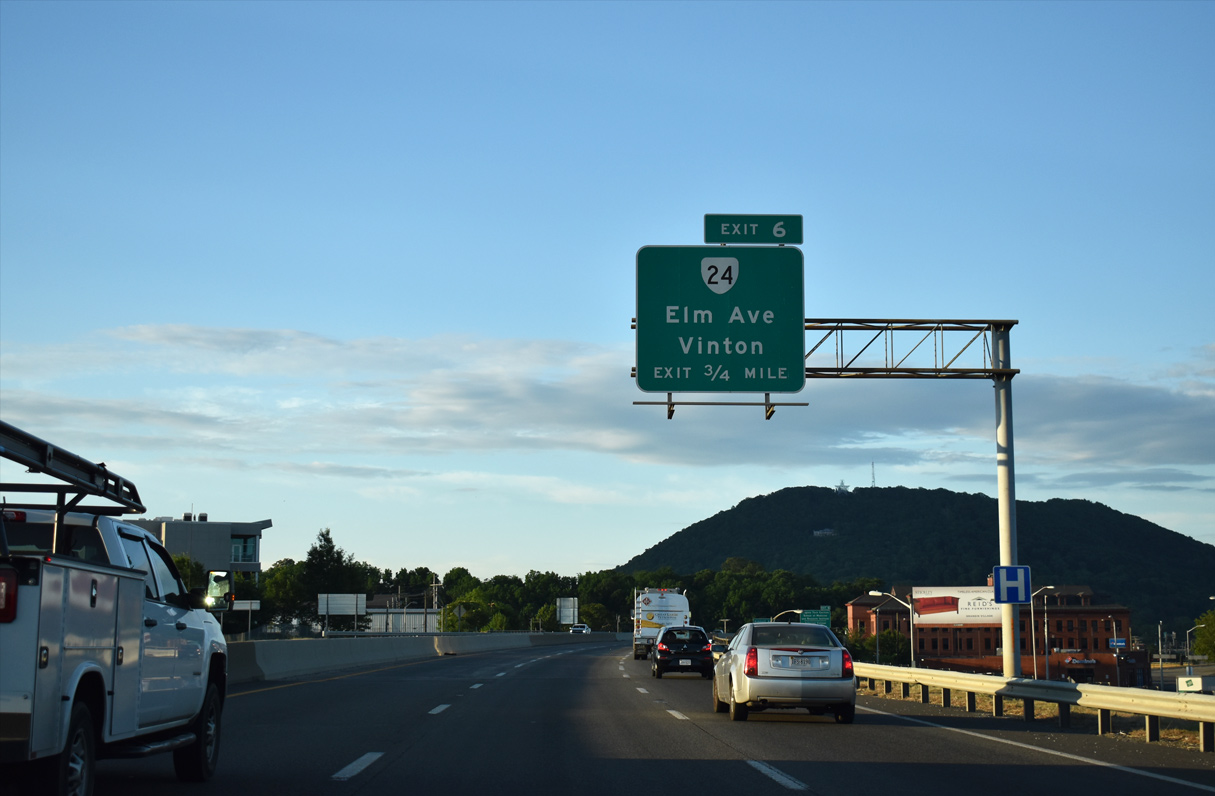
I-581/U.S. 220 elevate onto a viaduct spanning Shenandoah Avenue and the Norfolk Southern Railroad complex south ahead of a diamond interchange (Exit 6) with SR 24 (Elm Avenue). SR 24 stems east from parallel SR 116 (Jefferson Street) to the town of Vinton.
05/27/21
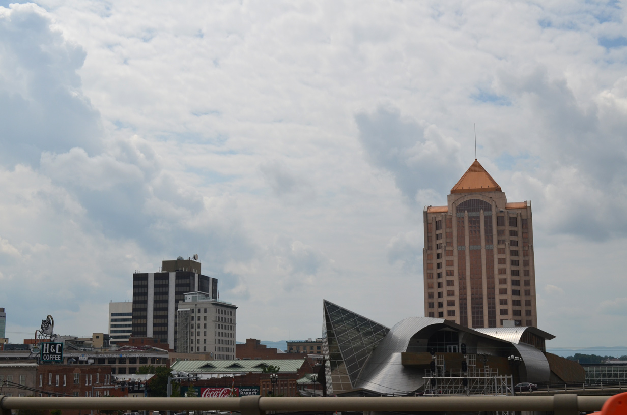
The Taubman Museum of Art and Wells Fargo Tower rise west of parallel U.S. 11-221/SR 116 (Williamson Road) in Downtown Roanoke.
08/06/13
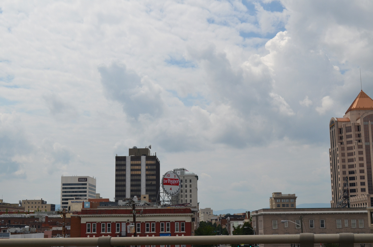
The vintage Dr. Pepper sign sits atop a building at the corner of Campbell Avenue and Williamson Road, where U.S. 11 turns west through Downtown Roanoke from U.S. 221-220 Business and SR 16.
08/06/13
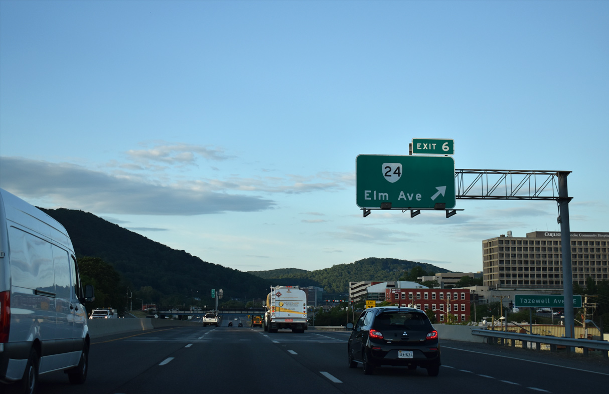
Exit 6 leaves I-581/U.S. 220 south for SR 24 (Elm Avenue) beyond the Tazwell Avenue underpass. U.S. 221 follows Elm Avenue west from U.S. 220 Business (Franklin Road) in Downtown Roanoke to Main Street across the Roanoke River. SR 24 travels 89.57 miles overall from Roanoke to U.S. 60 at Mt. Rush.
05/27/21
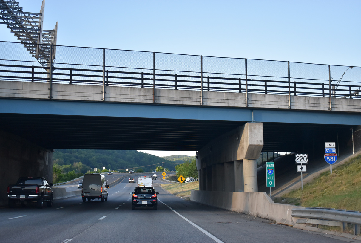
Milepost zero for Interstate 581 is the centerline for SR 24 (Elm Avenue). The freeway extends south along U.S. 220 another 3.7 miles to SR 419 (Electric Road) at Cave Spring.
05/27/21

Photo Credits:
- Brent Ivy: 05/27/21
- AARoads: 08/06/13
Connect with:
Page Updated Sunday June 06, 2021.