
Route 215

Located in the western part of the state, North Carolina Route 215 travels north from U.S. 64 near the town of Rosman in Transylvania County to I-40/U.S. 74 in the town of Canton. The 43.99 mile long route initially parallels the French Broad River North Fork from Panther Mountain north onto Tanasee Ridge. NC 215 straddles the upper reaches of Tanasee Ridge from Pinhook Gap to the Pisgah Ridge.
Meeting Blue Ridge Parkway at Beech Gap, NC 215 (Lake Logan Road) descends into a valley between Mount Hardy and Little Sam Knob. The state route runs alongside the West Fork of the Pigeon River to Lake Logan in the Great Balsam Mountains. Continuing northward, NC 215 (Love Joy Road) joins U.S. 276 west from the south end of NC 110 (Pisgah Drive) to Poindexter Road at Bethel.
NC 215 runs to the west of the Pigeon River while NC 110 parallels it to the east. Both routes head north to the town of Canton. NC 215 dog legs west alongside U.S. 19/23 (Park Street) to Blackwell Drive, which extends the route north to Fibreville and I-40 near Buckeye Cove.
NC 215 (Blackwell Drive) crosses the Piegon River at SR 1643 (Fiberville Road) and Champion Drive in the town of Canton. NC 215 extends north to Interstate 40 and U.S. 74.
09/12/04
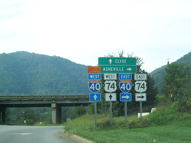
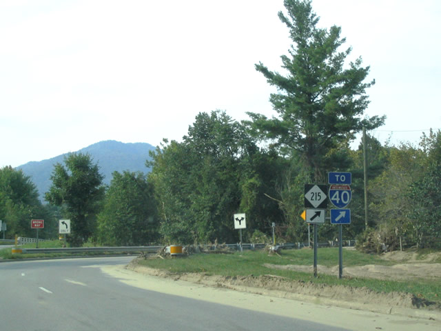
NC 215 concludes northbound at a diamond interchange (Exit 31) with Interstate 40/U.S. 74 opposite SR 1582 (Buckeye Cove Road).
09/12/04
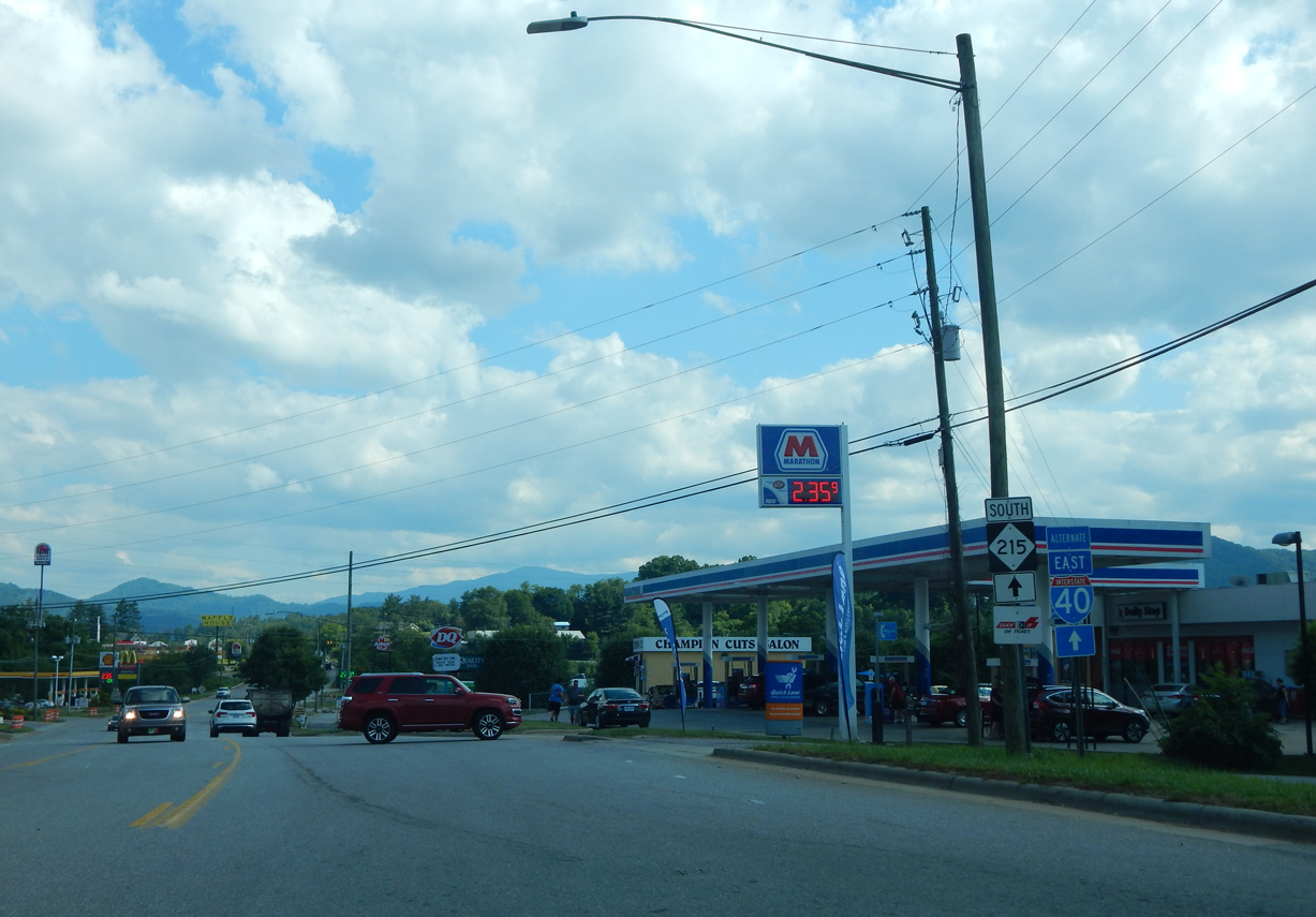
The first confirming marker for NC 215 south stands along Champion Drive beyond the diamond interchange (Exit 31) with I-40 and SR 1582 (Buckeye Cove Road).
06/10/17
Photo Credits:
- Carter Buchanan: 09/12/04, 06/10/17
Connect with:
Page Updated Thursday May 13, 2021.