
U.S. 17 South / U.S. 92 West - Sanford to Fern Park

 South
South  West
West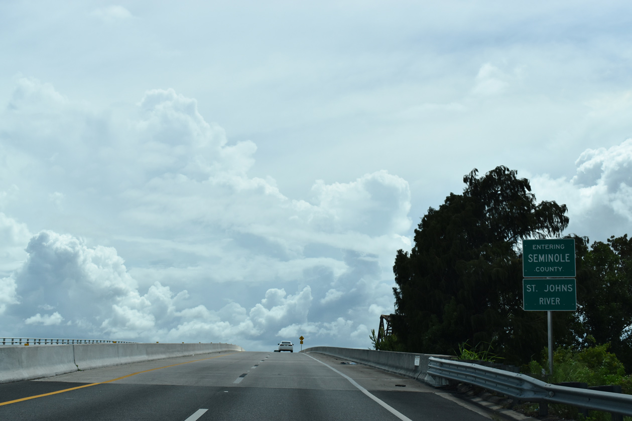
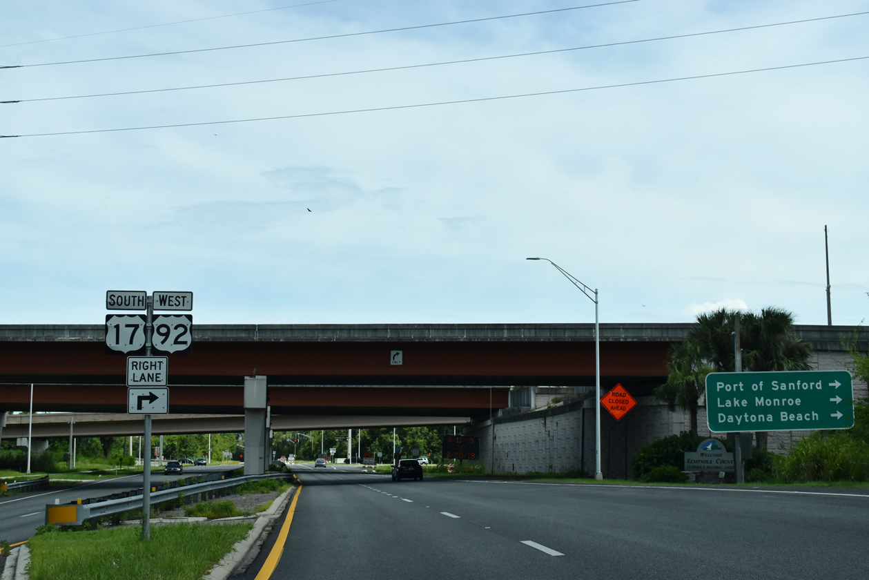
U.S. 17/92 span the St. Johns River and Seminole County line south from Valdez in DeBary to Lake Monroe.
09/02/19
The C.A. "Bill" Benedict Bridge opened in 1994. The fixed, high level bridge replaced an adjacent two lane truss bridge. A portion of the old span was retained for use as a fishing pier at Lake Monroe Wayside Park.
02/29/08
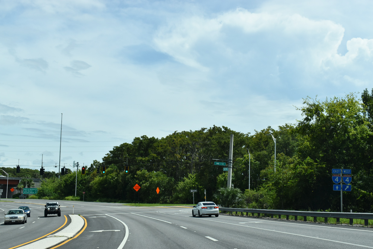
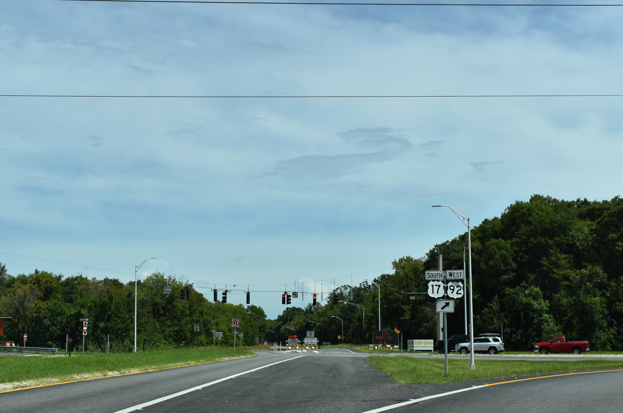
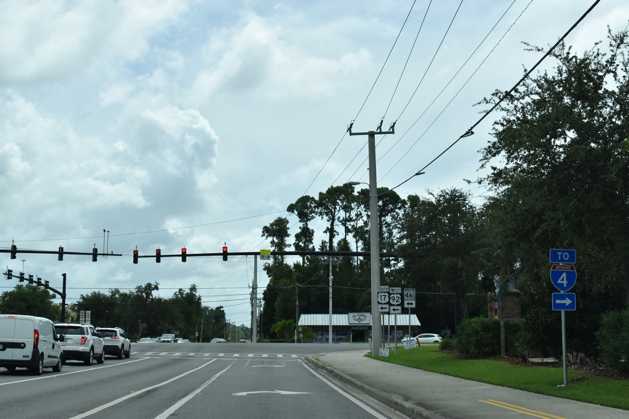
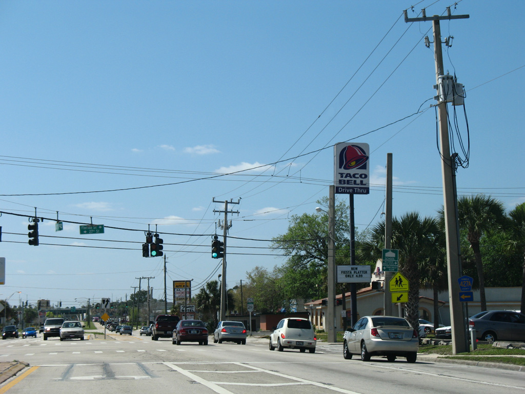
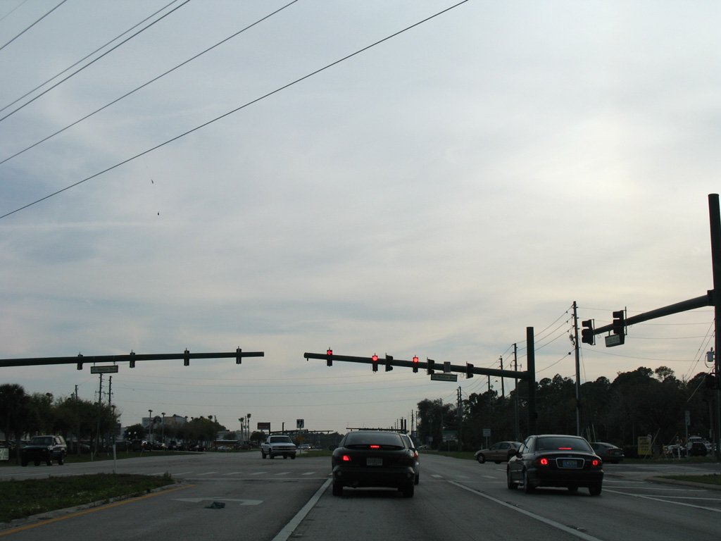
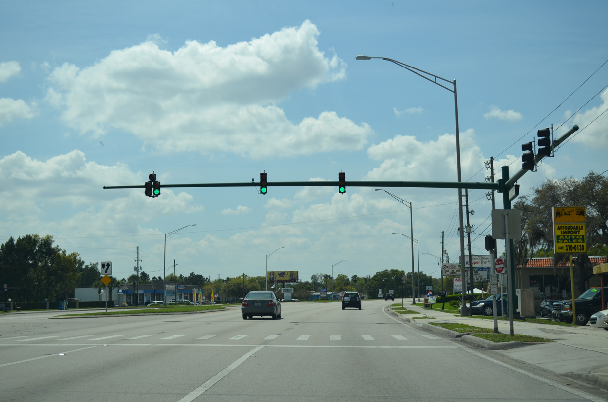
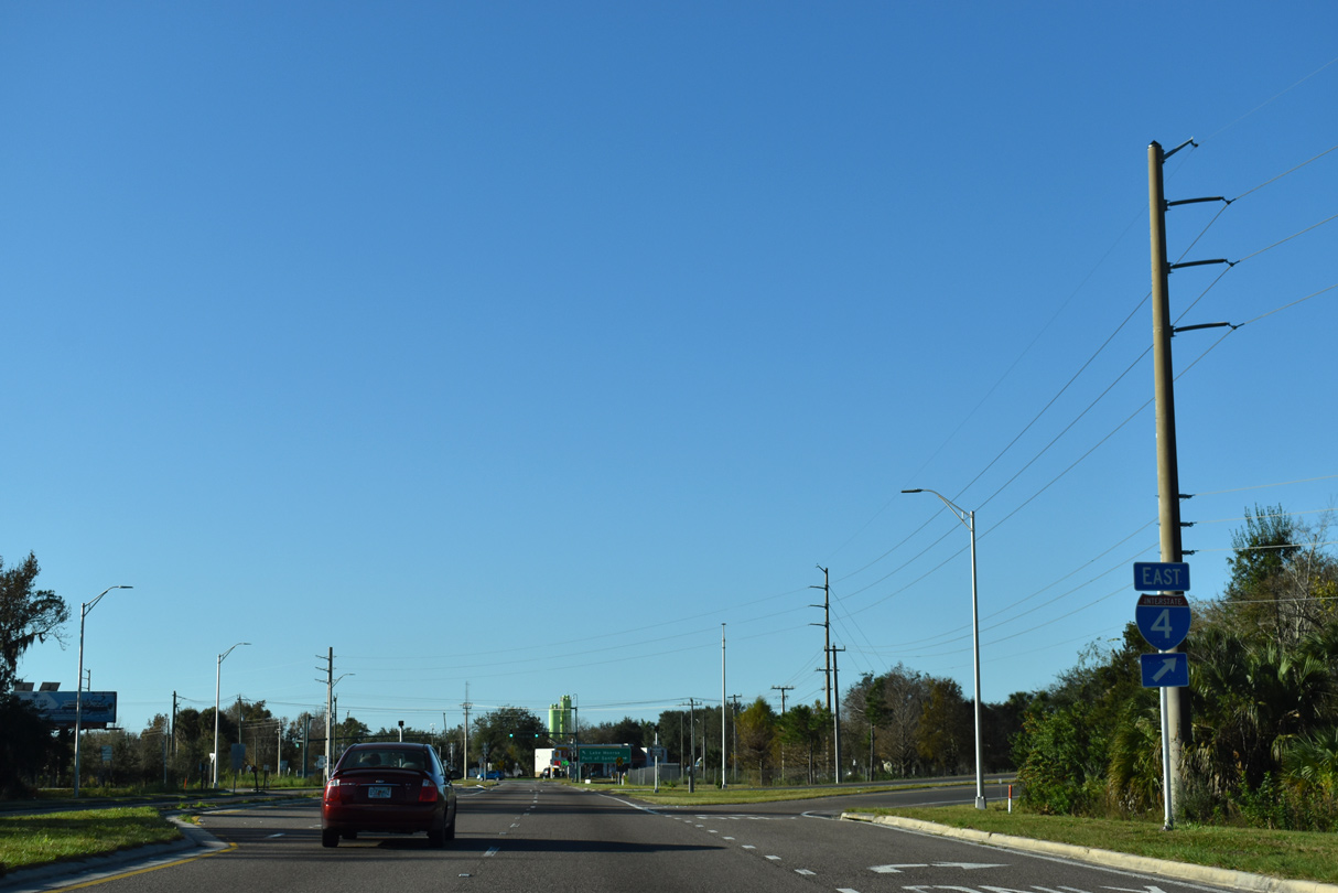
U.S. 17/92 curve southeast from the St. Johns River directly into a parclo interchange with Interstate 4. I-4 travels southward to Lake Mary, Maitland, and Orlando.
09/02/19
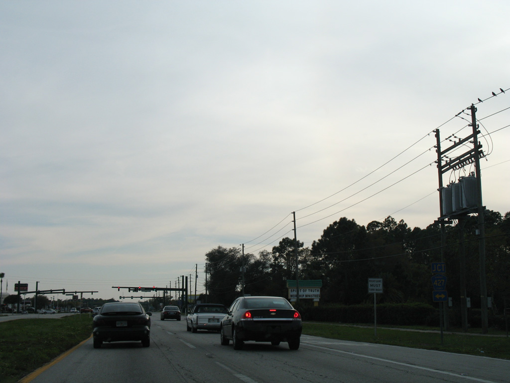
U.S. 17/92 pass under I-4 ahead of the turn onto Monroe Road. Prior to 2018, U.S. 17/92 continued east along Seminole Boulevard directly toward Downtown Sanford.
09/02/19
Seminole Boulevard was relinquished from state maintenance following the realignment of U.S. 17/92 south on Monroe Road and east alongside SR 46. The two lane roadway straddles the south shore of Lake Monroe east to Central Florida Zoo.
09/02/19
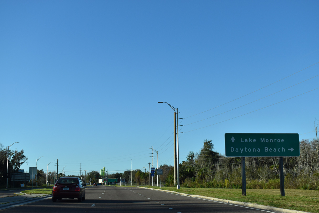
Monroe Road was formerly a part of CR 15 south from I-4 to SR 46 at Upsala Road. The four lane arterial connects with a loop ramp for Interstate 4 eastbound to Orange City, Deltona and Daytona Beach.
01/08/22
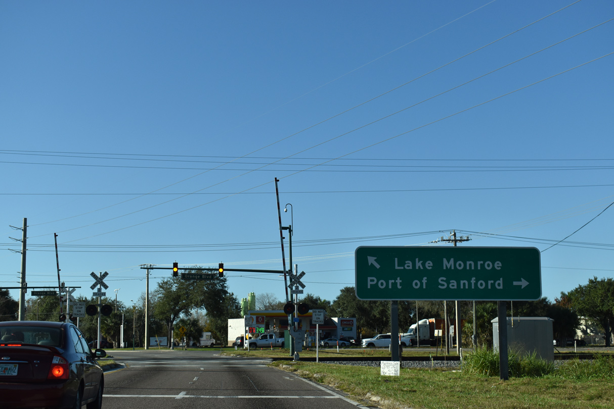
U.S. 17/92 (Monroe Road) cross a CSX Railroad line leading into the intersection with Orange Boulevard west. Orange Boulevard (unsigned CR 431) arcs southwest to Heathrow.
01/08/22
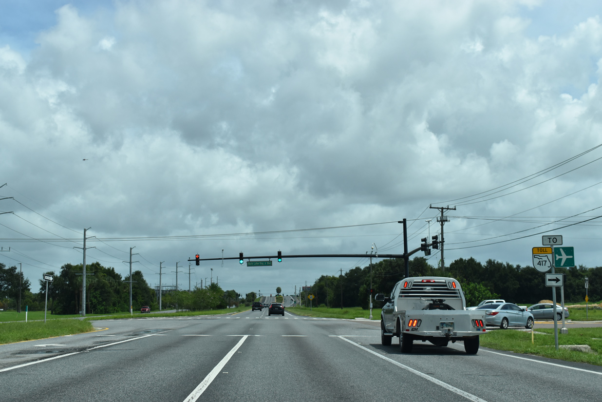
Monroe Road transitions into a five lane boulevard on the 1.1 mile drive south from Orange Boulevard to SR 46 (West 1st Street). SR 46 runs along the Sanford city line west 0.8 miles to Interstate 4.
09/02/19
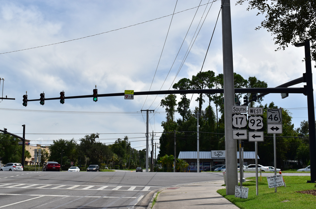
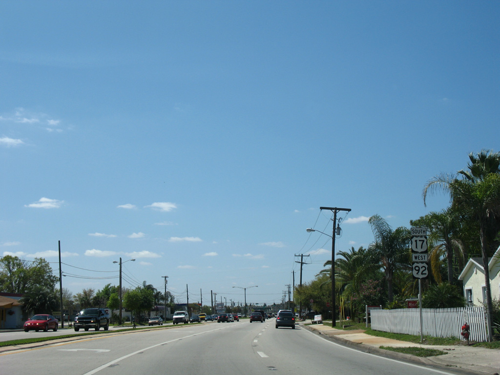
U.S. 17/92 intersect SR 46 opposite County Road 15 along Upsala Road. CR 15 extends 6.52 miles south from Monroe Road to Lake Mary and CR 427 (Ronald Reagan Boulevard) near Longwood.
09/02/19
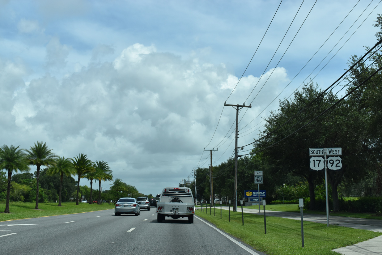
U.S. 17/92 combine with SR 46 three miles east to French Avenue outside Downtown Sanford. SR 46 joins Sanford with Wekiva Parkway west to Lake County.
09/02/19
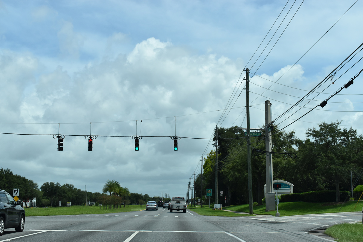
U.S. 17/92 and SR 46 proceed east to intersect Central Park Drive at Sanford Central Park.
09/02/19
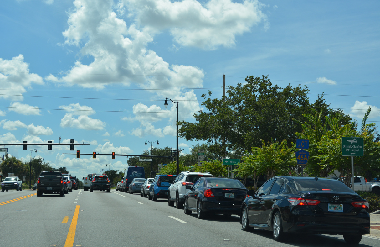
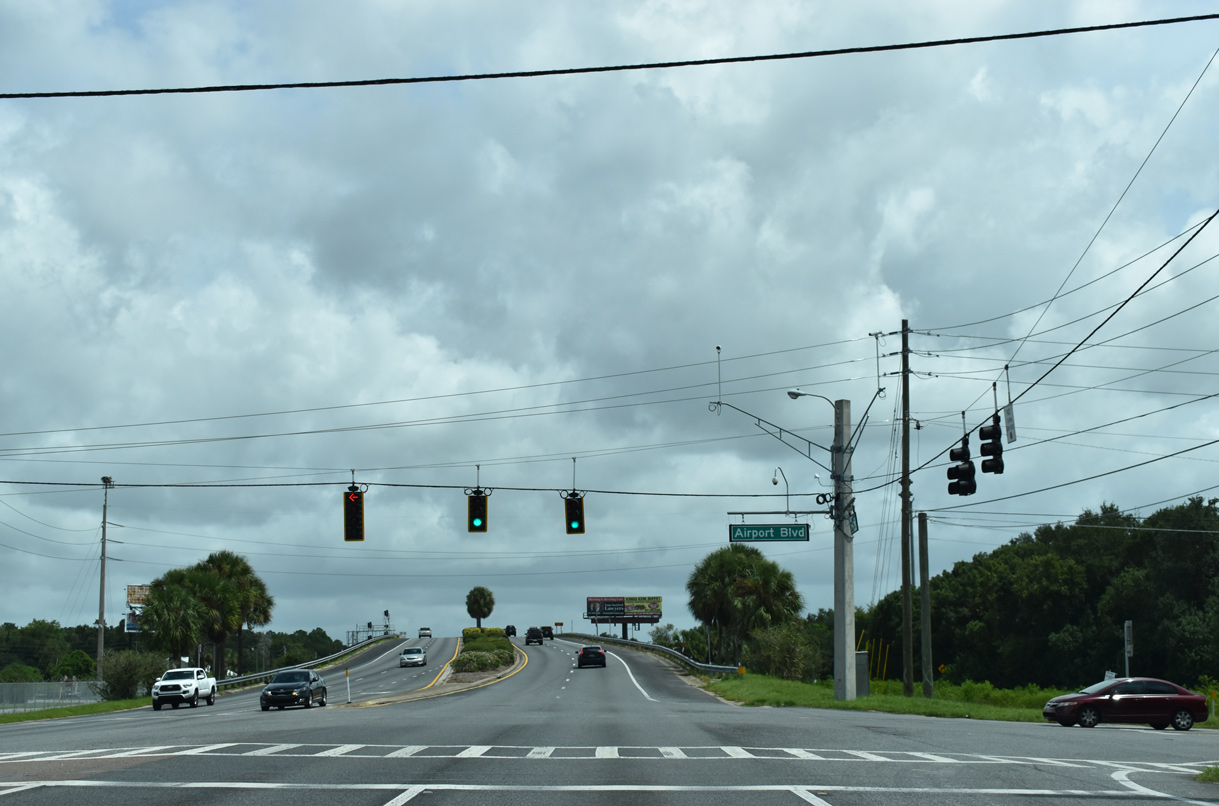
Martin Luther King, Jr. Boulevard heads south from U.S. 17/92 and SR 46 to Airport Boulevard within the city of Sanford.
09/02/19
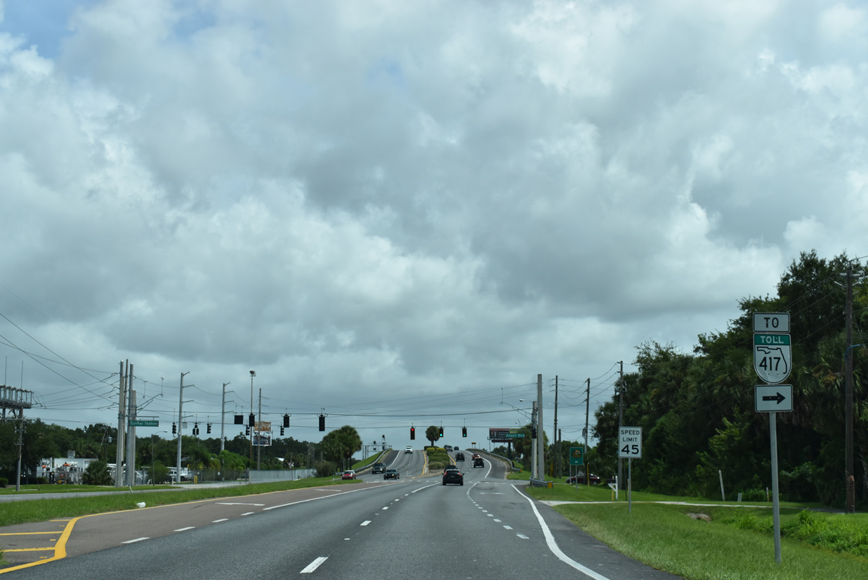
Airport Boulevard (unsigned CR 425) stems south from U.S. 17-92/SR 46, paralleling to MLK Boulevard to a point north of H.E. Thomas, Jr. Parkway (CR 46A).
09/02/19
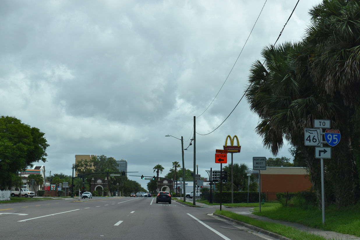
U.S. 17/92 and SR 46 turn south from 1st Street along French Avenue for 1.75 miles to 25th Street. SR 46 joins Sanford and Seminole County with Interstate 95 near Mims.
09/02/19

French Avenue (old U.S. 17/92) extends north by Downtown Sanford to Seminole Boulevard, which runs along the south shore of Lake Monroe back to I-4.
09/02/19
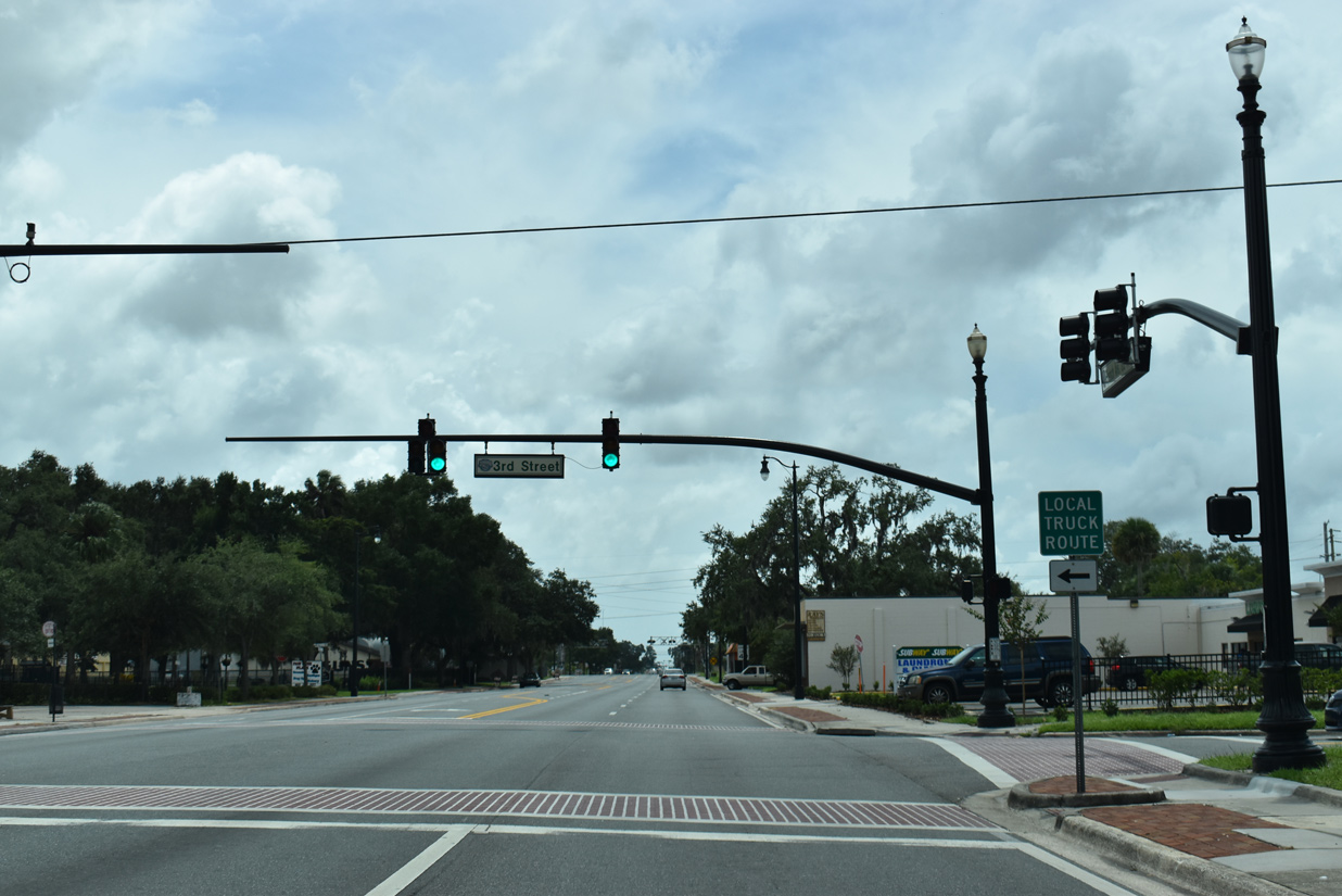
French Avenue southbound at 3rd Street in Sanford.
09/02/19
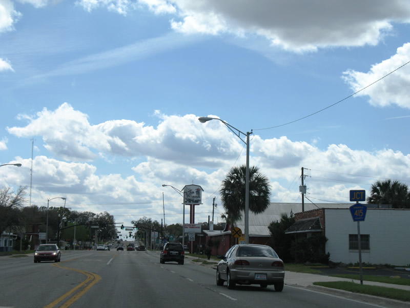
Seminole County Road 415 shield posted ahead of the U.S. 17-92 (French Avenue) intersection with 13th Street.
02/29/08
CR 415 heads east along 13th Street eight blocks to a short dog leg along Sanford Avenue north to Celery Avenue east. The county road provides an alternate route to SR 415 across the St. Johns River into Volusia County. Heavy truck traffic is restricted along the 3.67 mile long route.
02/29/08
15th Street stems east from U.S. 17/92 (French Avenue) south beyond the Sanford Florida State Farmers Market at Sanford Town Square shopping center.
09/12/22
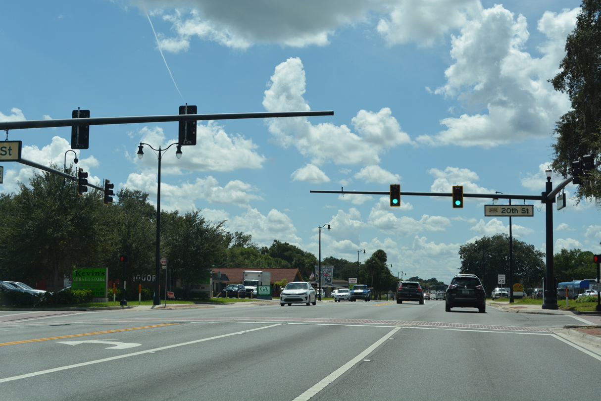
20th Street crosses U.S. 17-92 (French Avenue) at the succeeding traffic light southbound. 20th Street west becomes Country Club Drive en route to Airport Boulevard (CR 425).
09/12/22
SR 46 resumes an eastward course along the north side of Orlando Sanford International Airport (SBD) to Midway. SR 46 joins Sanford with Geneva and Mims in Brevard County. 25th Street west continues as CR 46A to become H.E. Thomas, Jr. Parkway en route to north Lake Mary and Heathrow.
09/12/22
South West 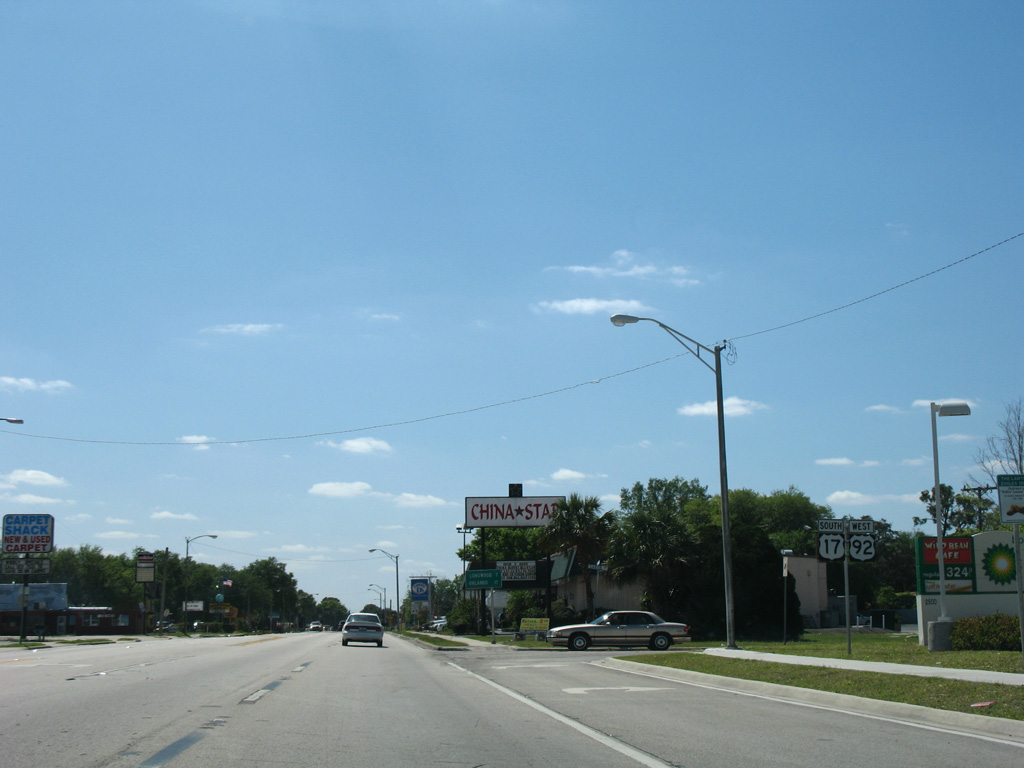
U.S. 17/92 advance south from CR 46A / SR 46 (25th Street) another third of a mile before shifting westward from Park Drive.
03/21/08

Downtown Orlando lies another 17 miles to the south via U.S. 17/92.
03/21/08
Park Drive ties into U.S. 17/92 at a wye intersection. The arterial expands with a raised grass median as it turns westward by Lake Jennie.
03/21/08
Reassurance markers posted along U.S. 17/92 south at Hiawatha Avenue. French Avenue separates to the east, forming a local street south to Shannon Drive.
03/21/08

27th Street (CR 427A) west and Florida Street east connect with U.S. 17/92 at a commercialized intersection just east of Lake Jennie.
03/21/08
Seminole County Road 427A (27th Street) is a 0.626 mile link between U.S. 17/92 and CR 425 (Sanford Avenue).
03/21/08
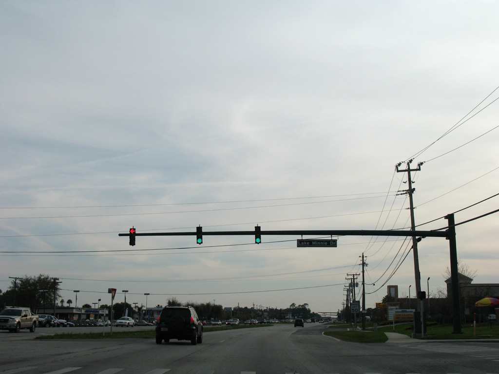
Lake Minnie Drive east and Collins Drive west from the Sunland Estates subdivision come together at this traffic light with U.S. 17/92 south of Lake Minnie.
03/18/08
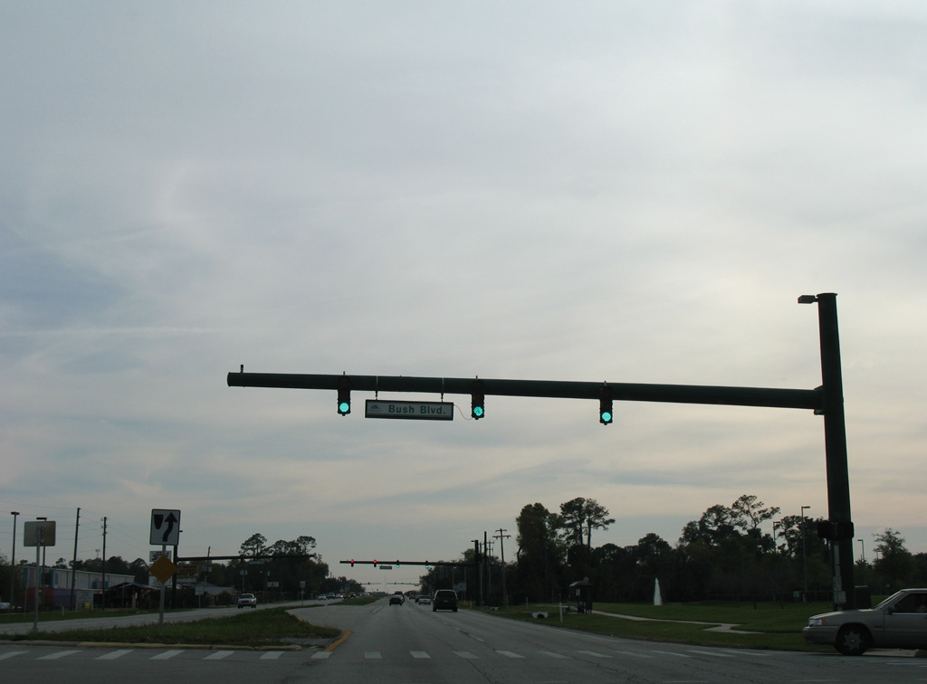
Continuing through southern reaches of Sanford along U.S. 17/92 at Bush Boulevard.
03/18/08
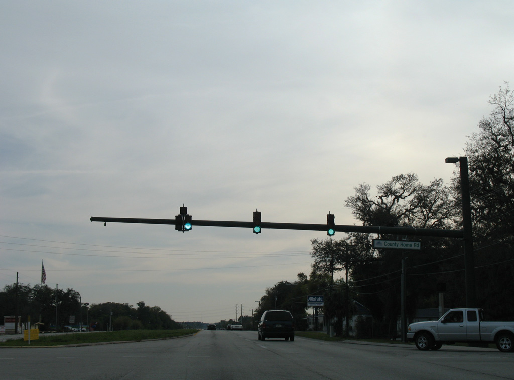
Country Home Road links U.S. 17/92 with adjacent Ronald Reagan Boulevard (CR 427). The signal lies southwest of the site of Flea World. Flea World closed in 2015, with structures razed to make way for the Reagan Center mixed-use development.
03/18/08
Weldon Boulevard leads south from the Sanford/Lake Mary Campus of Seminole State College to U.S. 17/92 at this traffic light.
03/18/08
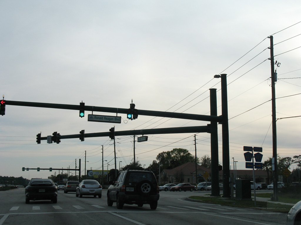
County Road 427 (Ronald Reagan Boulevard) and U.S. 17/92 converge on the southeast side of Lake Mary. Split between two sections from Sanford to Maitland, CR 427 travels 13.81 miles overall and meets U.S. 17/92 again at its south end.
03/18/08
Comprising a four lane landscaped parkway, Ronald Reagan Boulevard (CR 427) arcs southwest around Spring Hammock Preserve to Downtown Longwood.
03/18/08
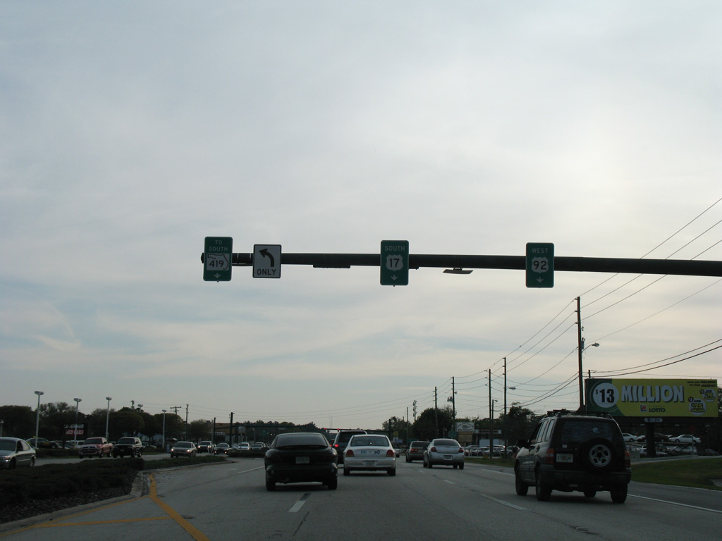
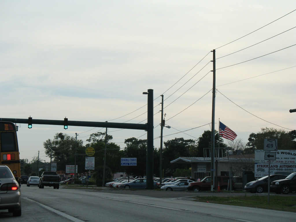
U.S. 17/92 intersect SR 419 to the immediate south of Ronald Reagan Boulevard (CR 427). SR 419 curves southeast through Spring Hammock Preserve to the city of Winter Springs.
03/18/08
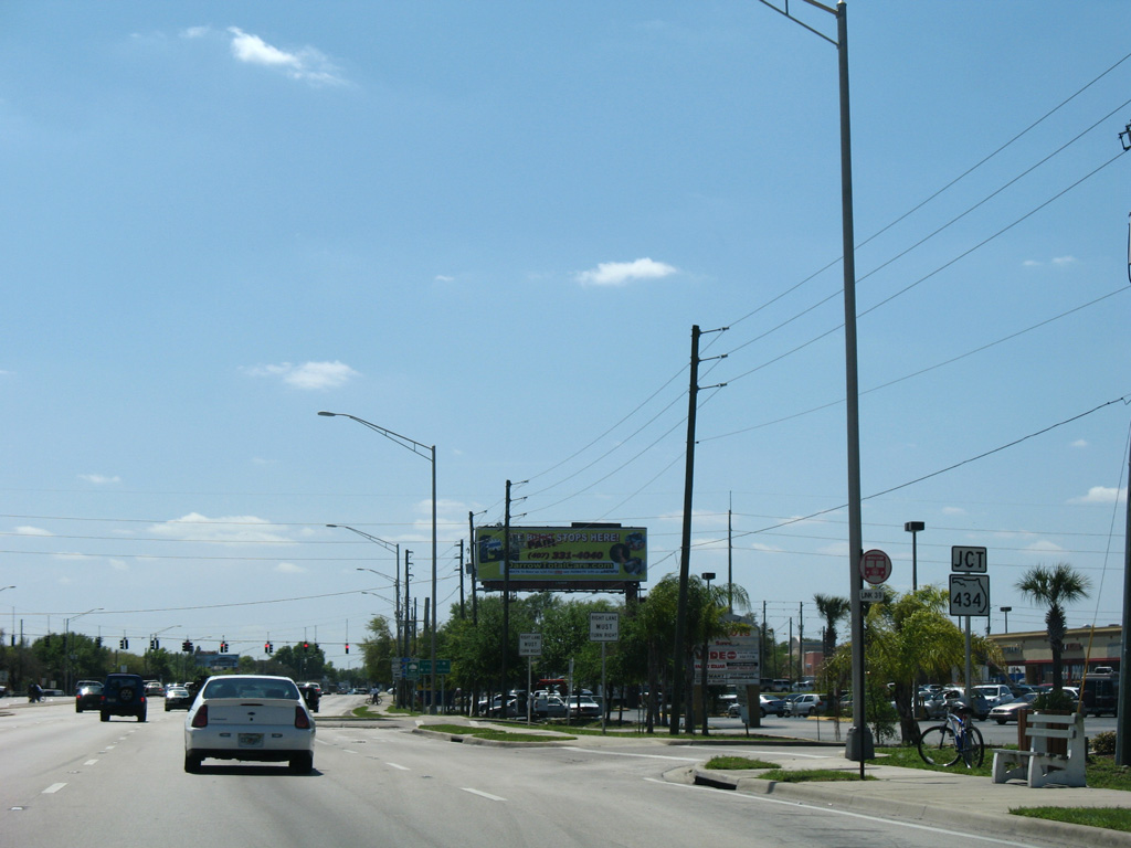
SR 419 combines with SR 434 east of Downtown Winter Springs to the city of Oviedo. The state road totals 9.3 miles from U.S. 17/92 to SR 426 (Broadway Street) and CR 419 in Downtown Oviedo.
03/18/08
Leaving Spring Hammock Preserve, U.S. 17/92 resume with commercial frontage between the cities of Longwood and Winter Springs.
03/21/08
Forthcoming SR 434 crosses U.S. 17/92 west from Downtown Winter Springs en route to the Longwood business district.
03/21/08

SR 434 encircles the Orlando metropolitan area along a 28.5 mile long horseshoe shaped route. Almost entirely with four lanes, the state road heads west through Longwood west to Altamonte Springs and northwest Orlando and east to Oviedo and the University of Central Florida (UCF).
03/21/08
U.S. 17/92 confirming markers posted south of SR 434 at Longwood.
02/25/17
A pair of J-turns precede the succeeding traffic light on U.S. 17/92 south at Laura Street east.
03/22/14
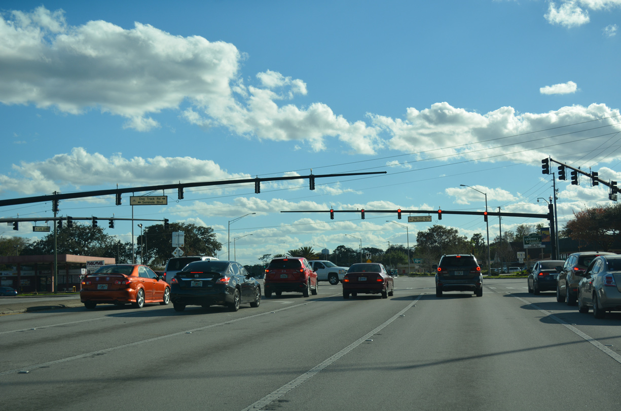
Seminola Boulevard winds northwest through Casselberry to U.S. 17/92 opposite Dog Track Road west to CR 427 (Ronald Reagan Boulevard).
02/25/17
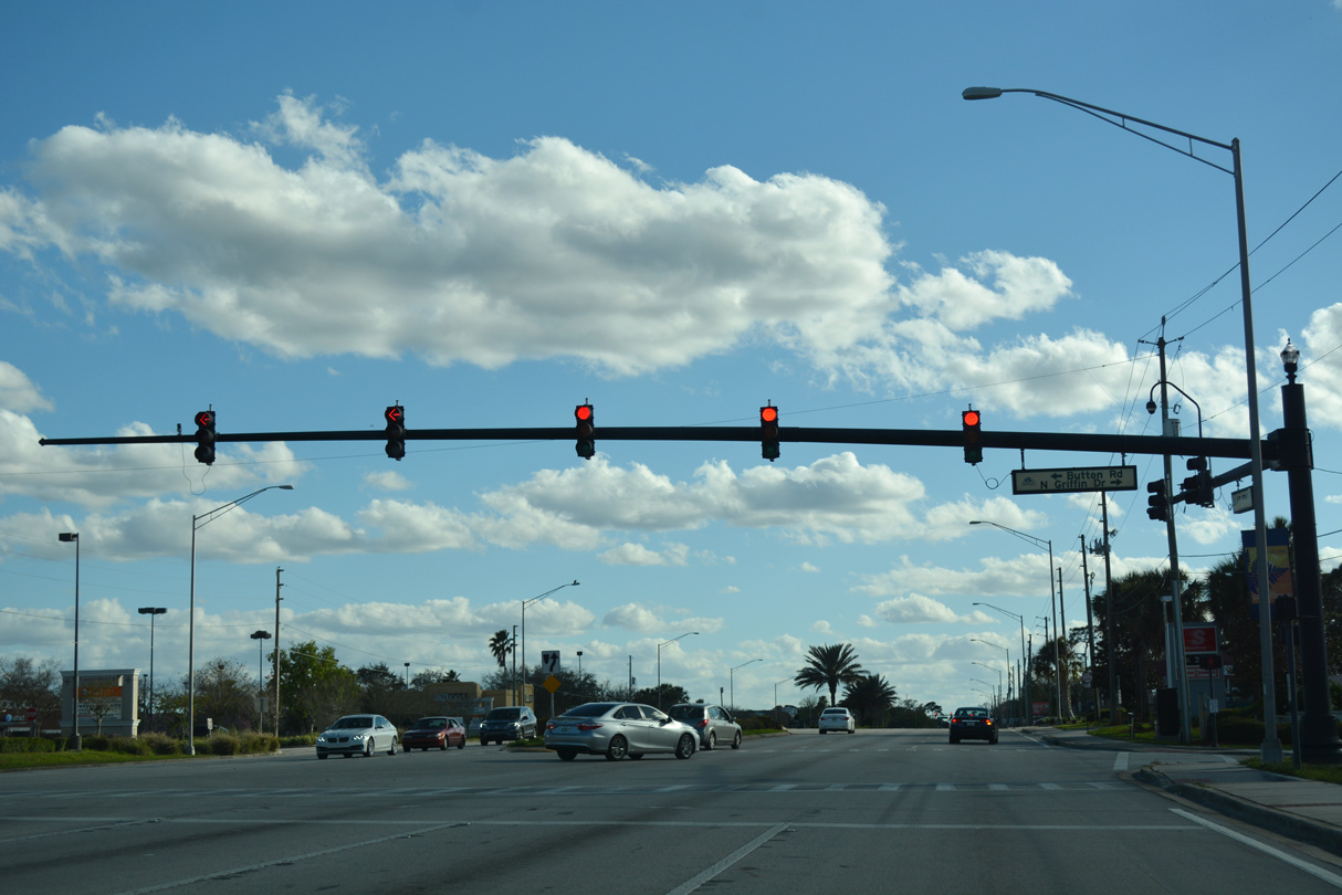
Button Road provides a cutoff to Seminola Boulevard east from U.S. 17/92. Griffin Drive ties into the signalized intersection from neighborhoods north of Lake Griffin.
02/25/17
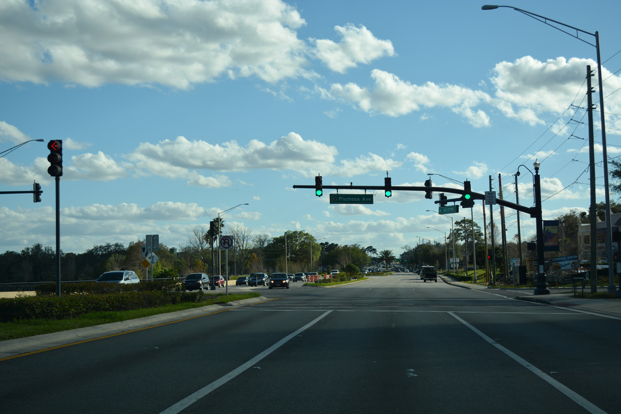
Plumosa Avenue stems west from U.S. 17/92 at Lake Concord to Cypress Way south and a pair of subdivisions in north Casselberry.
02/25/17
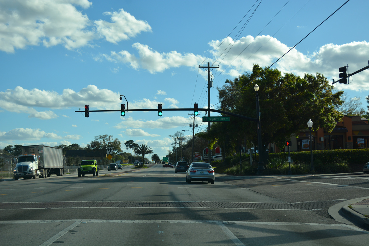
Triplet Lake connects U.S. 17/92 with adjacent retail, Casselberry city hall and the Lake Concord Park mixed use development. Span write signals here were replaced with mast-arm assemblies in 2008.
02/25/17
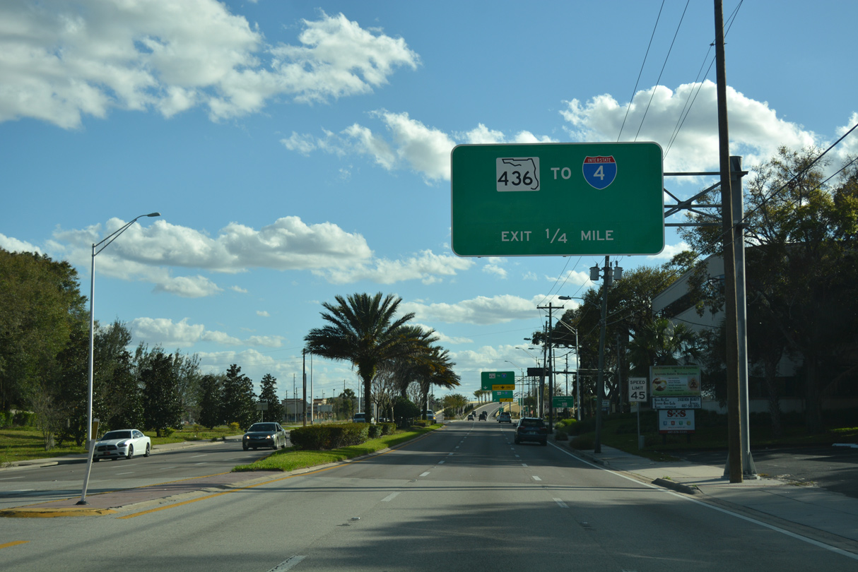
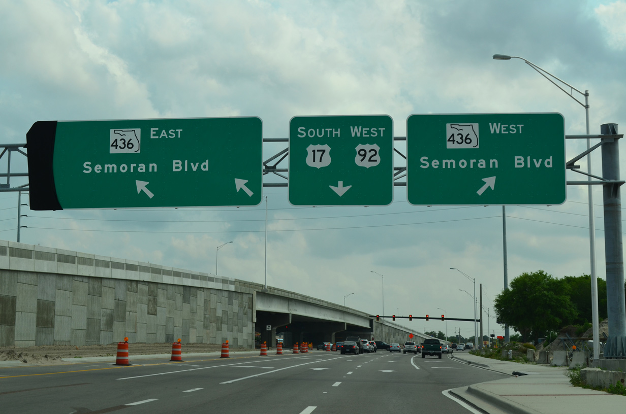
A $21.3 million in construction started during fall 2013 upgraded U.S. 17/92 at SR 436 from an at-grade intersection to a single point interchange. Work also included new bike lanes, sidewalks and frontage roads, and four stormwater ponds. Work on the 0.50 mile project wrapped up in fall 2015.1
02/25/17
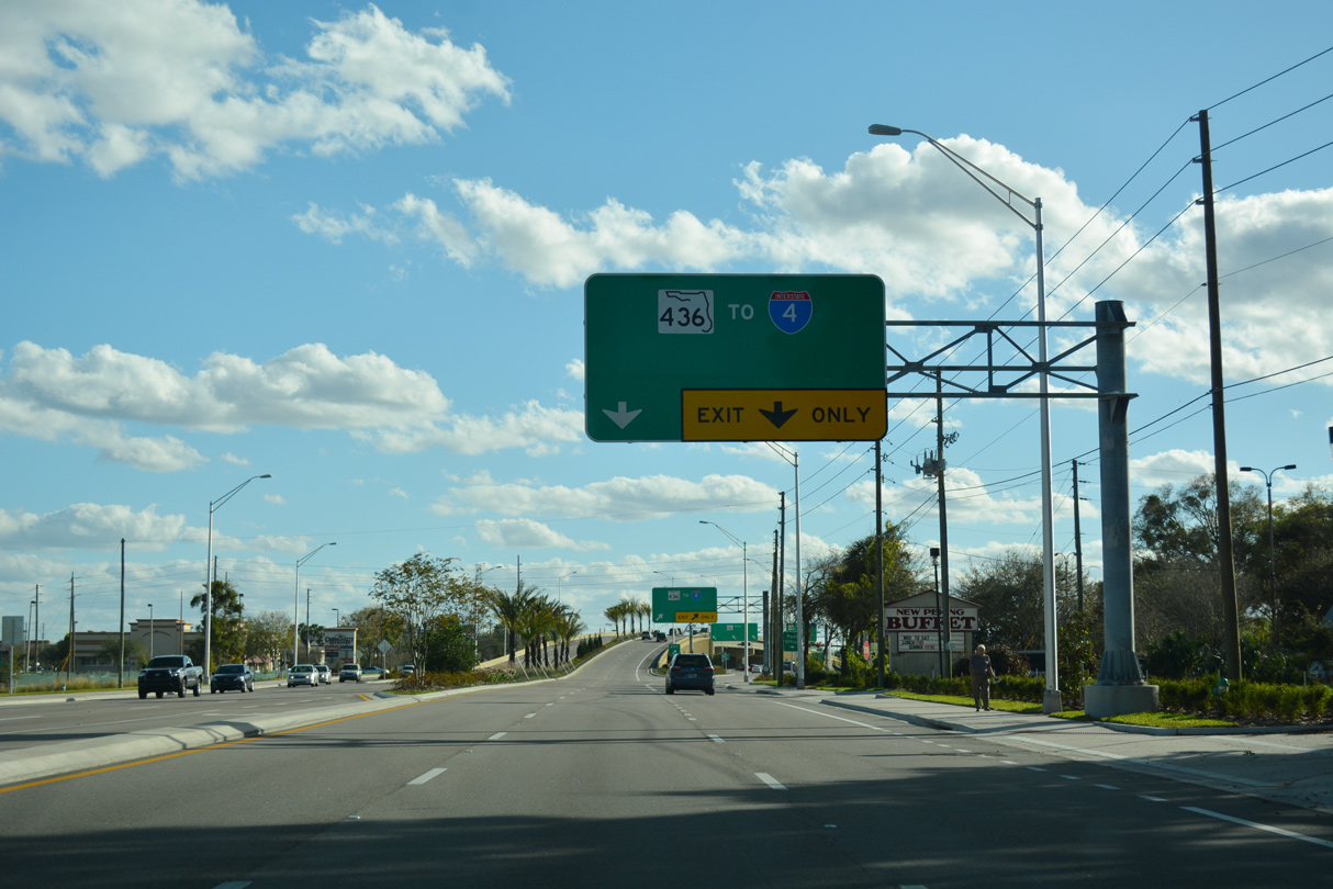
The SPUI joining U.S. 17/92 with SR 436 eliminated traffic lights with Live Oaks Boulevard west and Fernwood Boulevard east. Sign changes made between 2015 and 2017 greened out Semoran Boulevard for SR 436 and added a trailblazer for I-4.
02/25/17
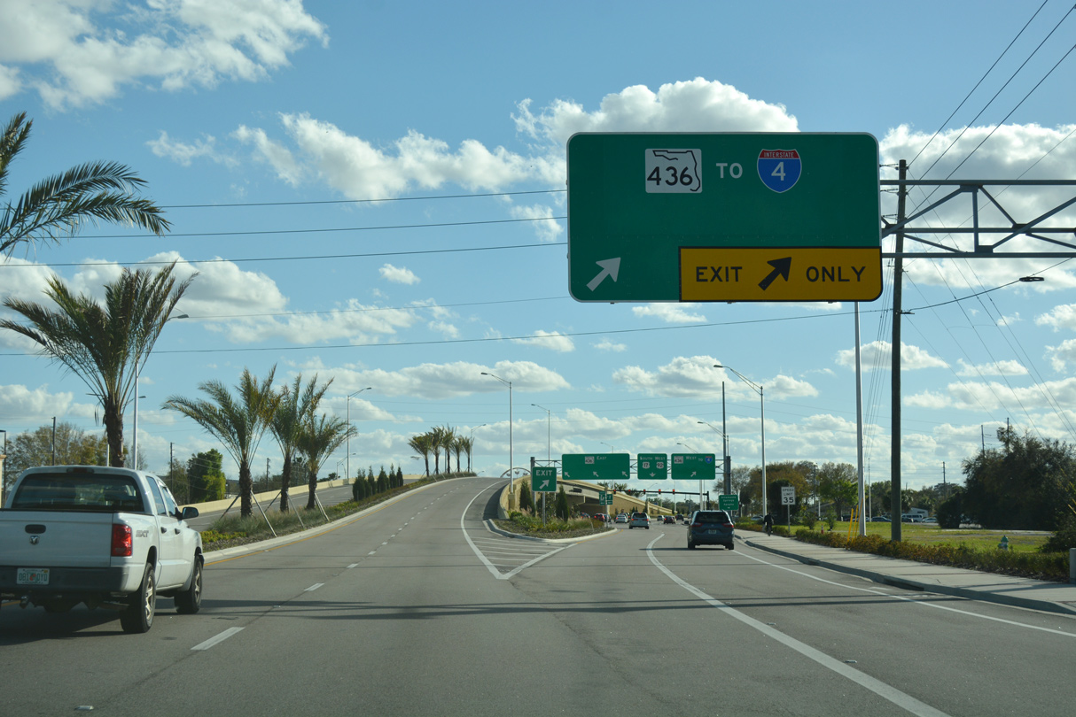
Two lanes continue U.S. 17/92 south over a flyover spanning SR 436 while two depart for the state road west along Altamonte Drive to Altamonte Springs and south along Semoran Boulevard through Casselberry.
02/25/17
A heavily traveled commercial arterial, SR 436 crosses Altamonte Springs west to Altamonte Mall and Interstate 4. The state road extends through Forest City to U.S. 441 (Orange Blossom Trail) at Apopka.
04/26/15
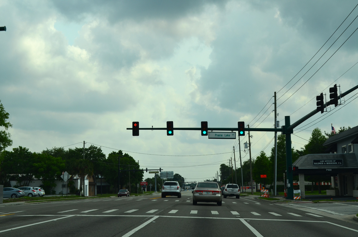
Leaving the Casselberry city limits, U.S. 17/92 south next intersect Prairie Lake Drive west.
04/26/15
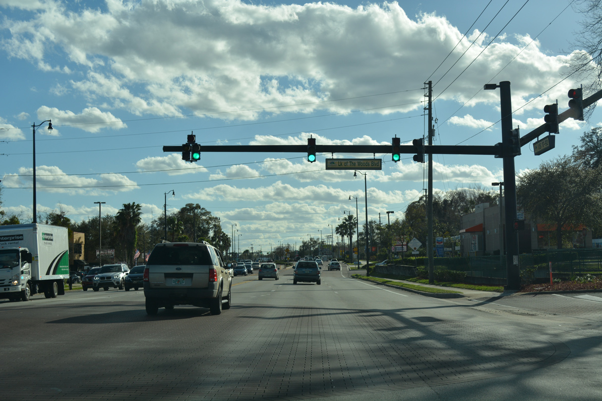
U.S. 17/92 south at Lake of the Woods Boulevard east to the Lake of the Woods town home development and Oxford Road.
02/27/17
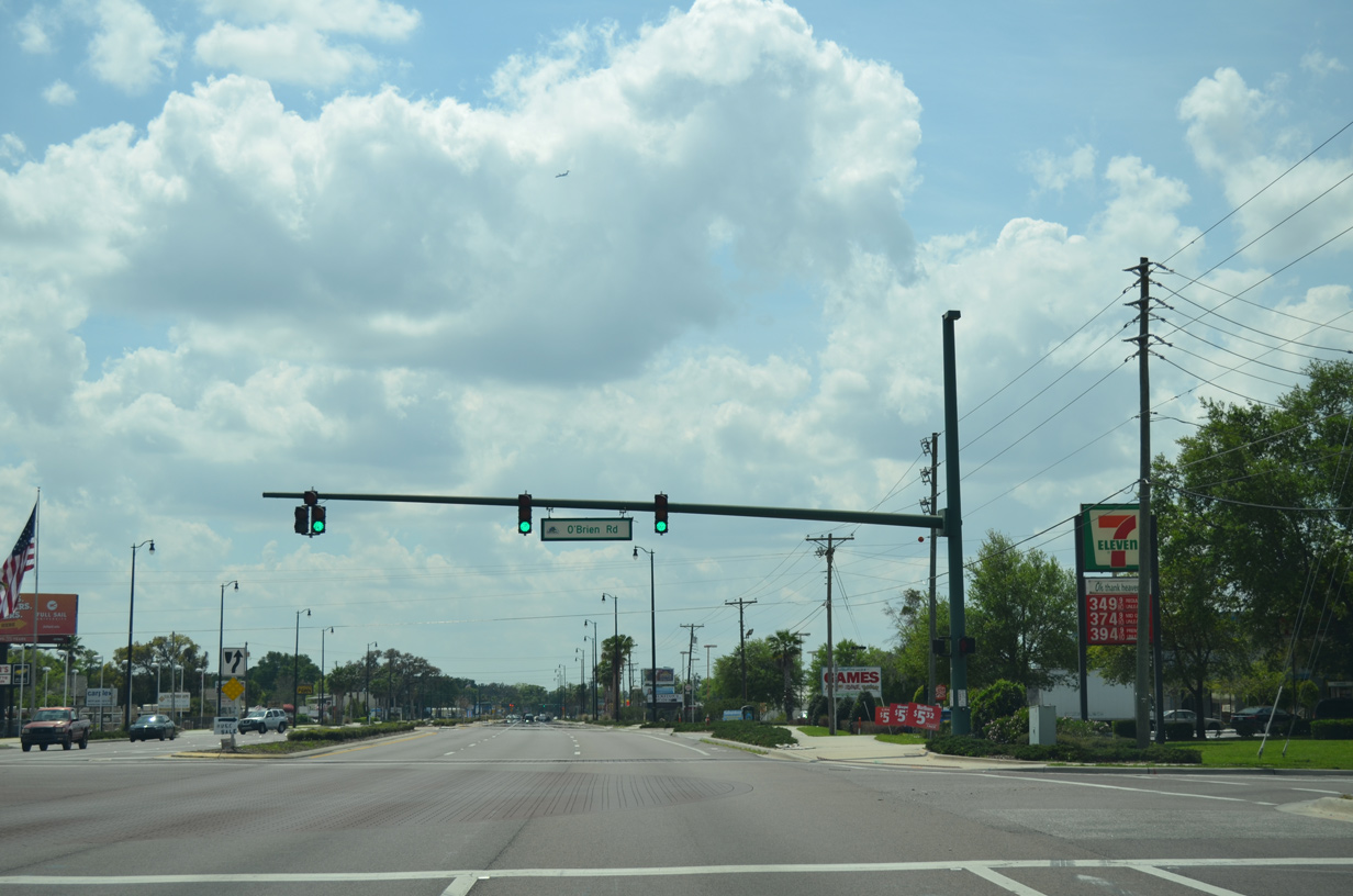
Advancing south through the unincorporated Fern Park community, U.S. 17/92 intersect O'Brien Road west to Spring Lake Road in Altamonte Springs.
03/22/14
The CSX / SunRail bridge spanning U.S. 17/92 (Orlando Avenue) further south at the Maitland and Winter Park city line is a low clearance bridge.
02/27/17
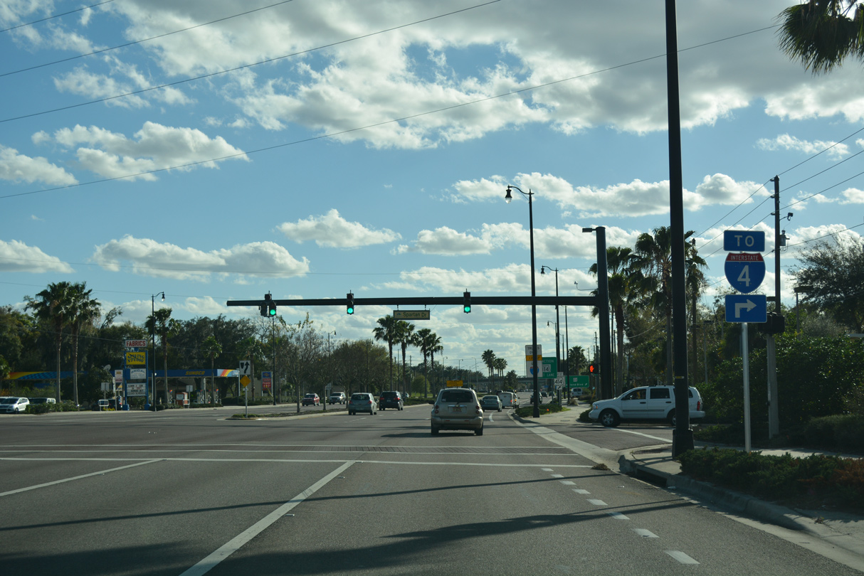
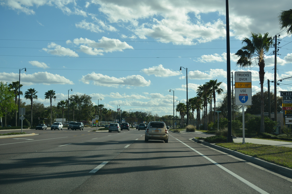
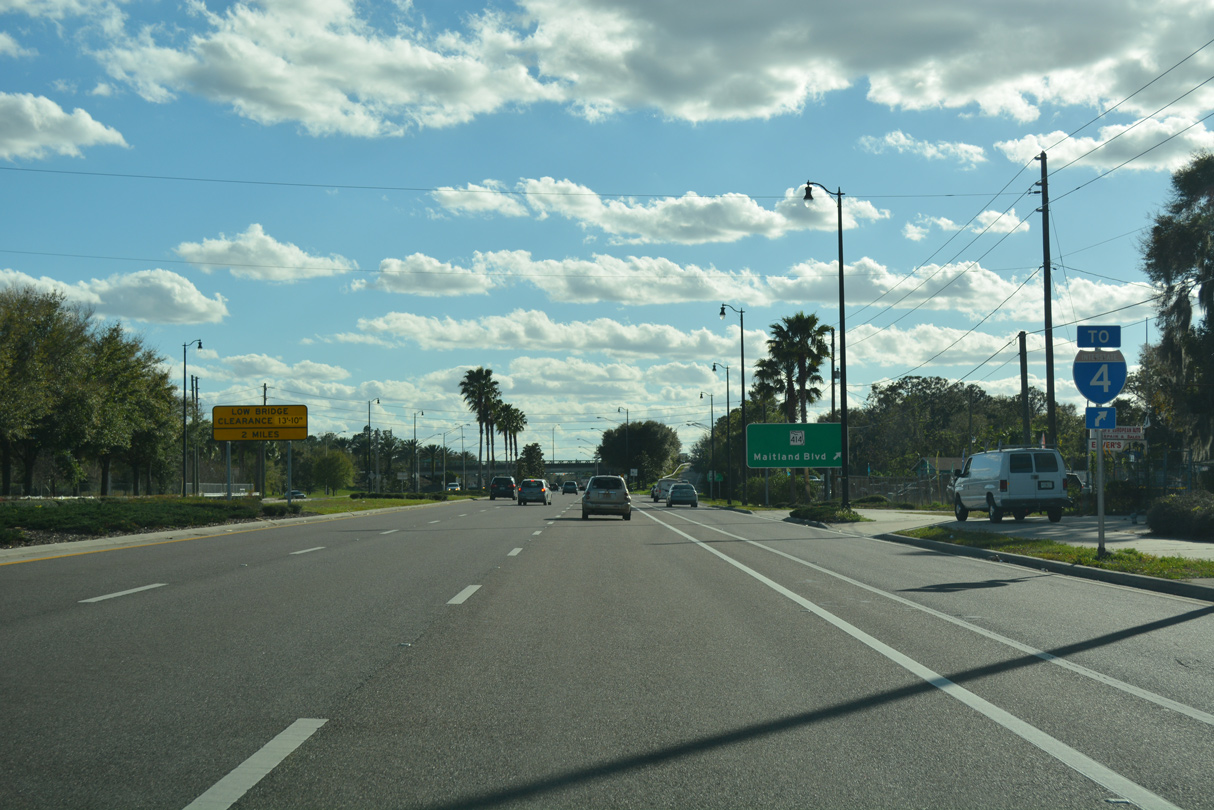
Spartan Drive ties into U.S. 17/92 at this traffic light west of the Lakewood Shores neighborhood off Lake of the Woods. An I-4 trailblazer references the upcoming ramp for SR 414 (Maitland Boulevard) west.
02/27/17
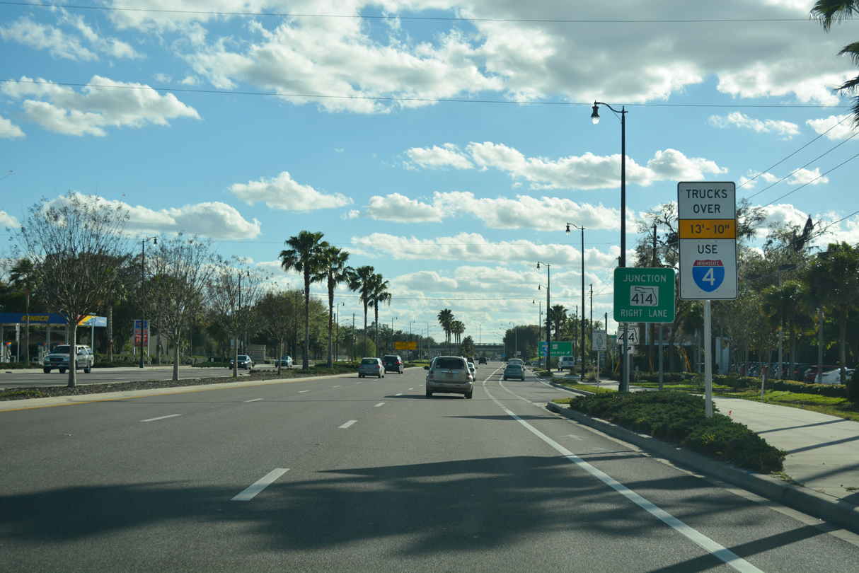
Trucks exceeding 13 foot 10 inches are directed onto SR 414 west to I-4 and SR 423 east to circumvent the Reverend Kenneth C. Crossman (CSX / SunRail) Bridge.
02/27/17
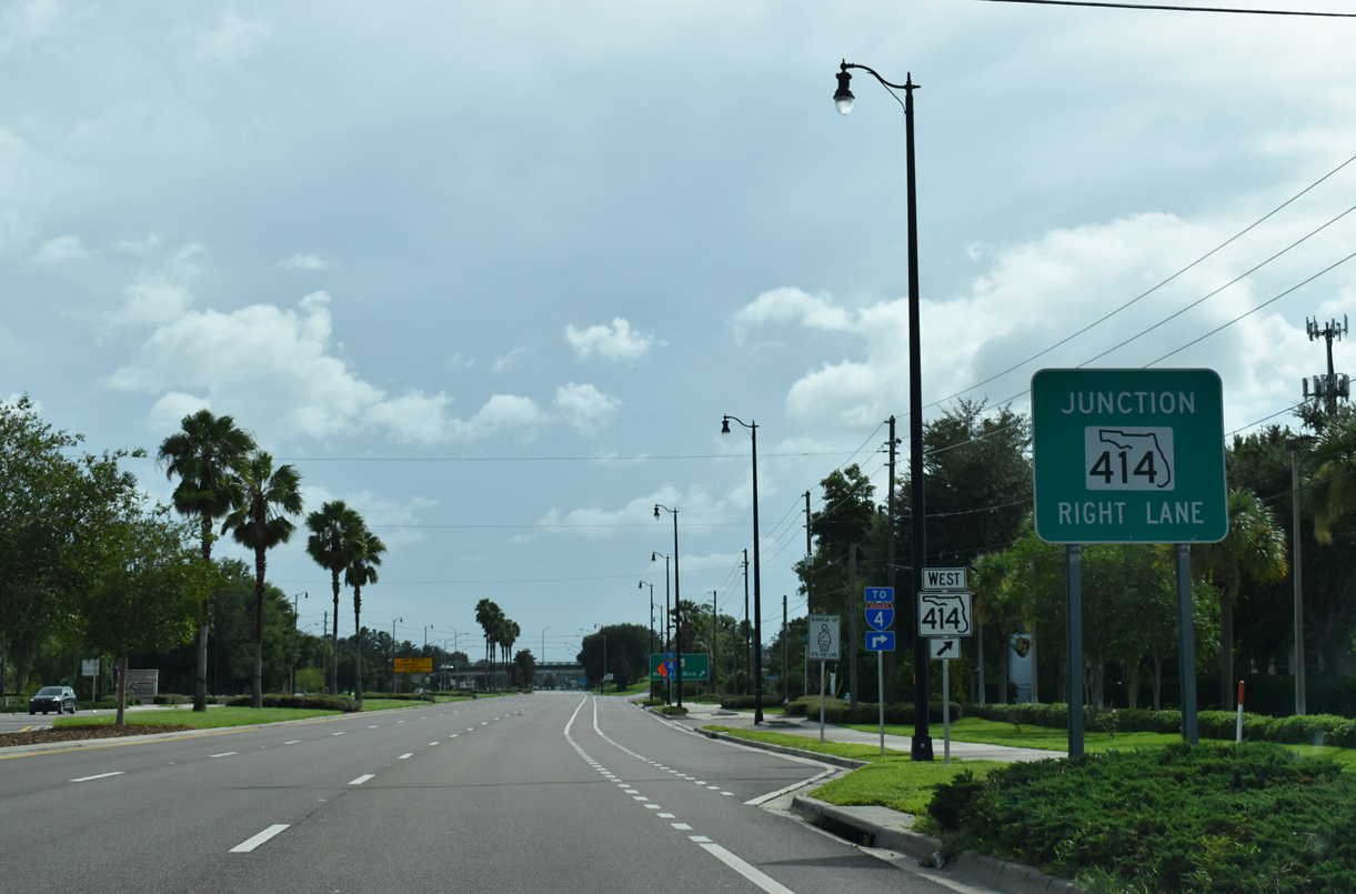
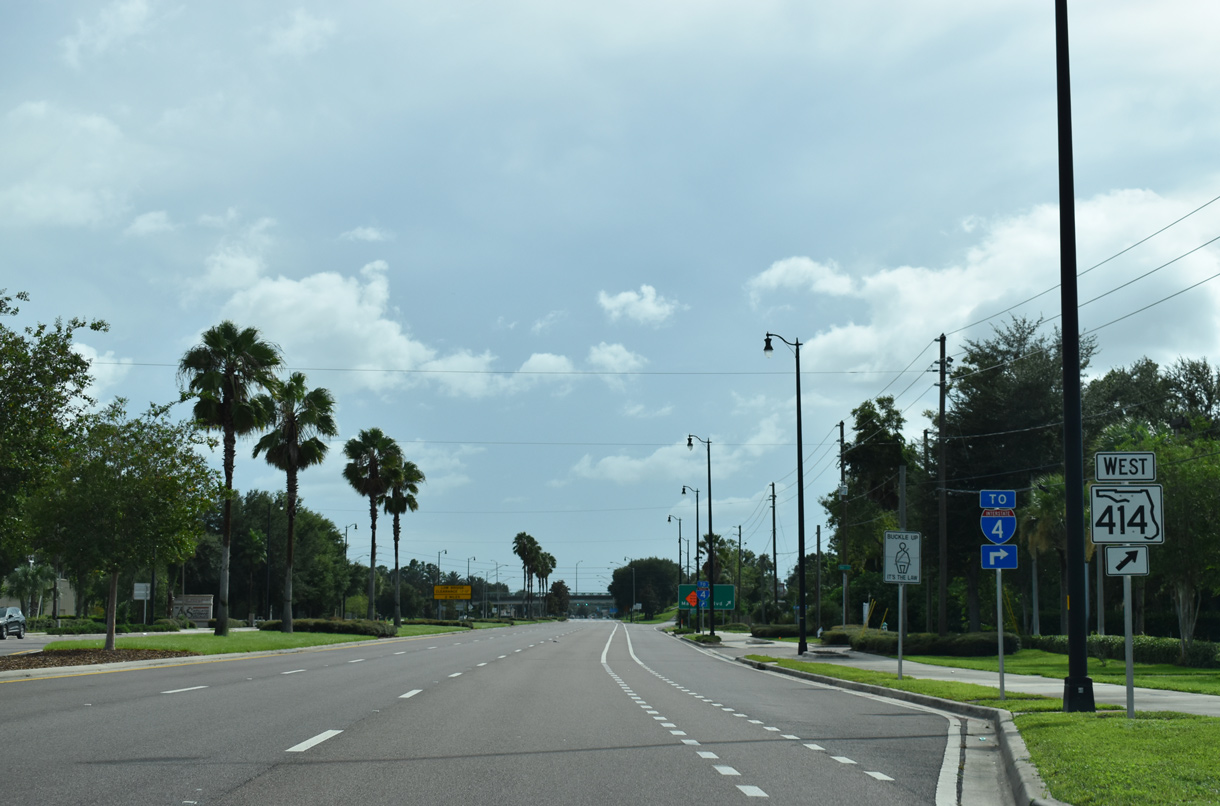
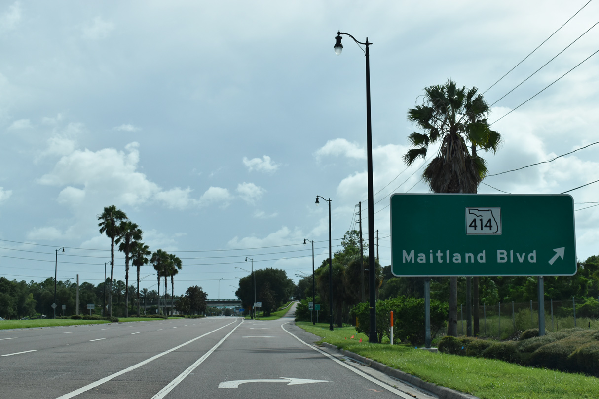
A trumpet interchange joins U.S. 17/92 with SR 414 (Maitland Boulevard). SR 414 commences along an at-grade arterial west 1.6 miles to Interstate 4 in Maitland.
09/02/19
The I-4 Ultimate megaproject upgrades SR 414 (Maitland Boulevard) to expressway standards from the revamped exchange with I-4 west to SR 434.
02/27/17
SR 414 (Maitland Boulevard) straddles the Seminole County line west from Maitland to U.S. 441 (Orange Blossom Trail). West from OBT at Piedmont, SR 414 continues along the tolled John Land Apopka Expressway bypassing Apopka to SR 429 (Western Beltway).
09/02/19
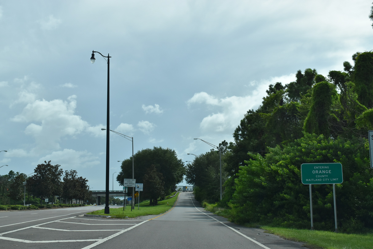
The Orange County line crosses U.S. 17/92 just beyond the gore point for SR 414 (Maitland Boulevard) west.
09/02/19
References:
- SR 15/600 (US 17-92) Interchange at SR 436 404418-1.
http://www.cflroads.com/project/ 404418-1/SR_15_600_US_17-92_Interchange _at_SR_436_Semoran_BoulevardCFLRoads - Florida Department of Transportation (FDOT) District 5 web site.
Photo Credits:
- Brent Ivy: 09/02/19, 01/08/22
- Alex Nitzman: 02/29/08, 03/18/08, 03/21/08, 09/12/22
- ABRoads: 03/22/14, 04/26/15, 02/25/17, 02/27/17
Connect with:
Page Updated Monday November 07, 2022.