
U.S. 20
U.S. 20 crosses southern Idaho along a 402.76 mile long course between Nyssa, Oregon and the southern tip of Montana. Substantial portions of U.S. 20 in the Gem State overlay other routes. This includes U.S. 26 from the Oregon line east to Boise, Interstate 84 from Boise to Mountain Home, and U.S. 26 again from Carey east to Butte County.
U.S. 20 Idaho Guides
East - Boise - 18 photos
West - Island Park to Ashton - 51 photos
West - St. Anthony to Idaho Falls - 54 photos
West - Boise - 20 photos
Heading east from the Oregon border, U.S. 20/26 lead 1.55 miles to U.S. 95. The three routes combine southward for 8.08 miles south to Parma. U.S. 95 continues south to Homedale while U.S. 20/26 angle 12.49 miles southeast to I-84 outside Caldwell.
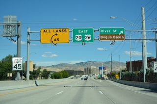
Following a 2.54 mile stretch along Interstate 84 into Caldwell, U.S. 20/26 branch east. Paralleling the Boise River, U.S. 20/26 travel 24.84 miles from I-84 at Exit 29 to Interstate 184 in Boise. U.S. 20/26 continue east into Downtown Boise before turning south along Broadway Avenue back to I-84 at Exit 54.
I-84 and U.S. 20/26 run concurrent for another 40.93 miles between Boise and Exit 95 at Mountain Home. U.S. 20/26 was upgraded to Interstate 80N along this stretch by the early 1960s.
U.S. 26 remains with I-84 southeast to Bliss while U.S. 20 heads northeast around the Mount Bennet Hills to Camas Prairie. Passing north of Magic Reservoir, U.S. 20 parallels the Big Wood River east into Wood River Valley. Beyond the Picabo Hills, U.S. 20 reconnects with U.S. 26 and also U.S. 93 in the city of Carey.
U.S. 20/26/93 overlap 44.22 miles northeast from Carey to Craters of the Moon National Monument and the Butte County seat of Arco. U.S. 93 turns northwest from Arco toward Salmon while U.S. 20/26 remain concurrent another 23.43 miles to Butte City and Ryegrass Flat.
U.S. 26 loops south from U.S. 20 through Blackfoot, returning northward alongside U.S. 91 to Idaho Falls. U.S. 20 generally continues east across Bingham and Bonneville Counties into Idaho Falls near Idaho Falls Regional Airport (IDA). Following Broadway Street, U.S. 20 leads east to Interstate 15 at Exit 118.
Beyond a 0.69 mile overlap with I-15 across the Snake River, U.S. 20 shifts northeast onto a freeway extending 32.3 miles to Ucon, Rigby, Rexburg and Sugar City. U.S. 20 continues along a controlled access expressway to St. Anthony and Chester.
North from the Falls River, U.S. 20 leads to Ashton and onto Big Bend Ridge. Crossing Henrys Lake Flat, U.S. 20 advances northeast into the Henrys Lake Mountains. Crossing Targhee Pass and the Continental Divide, U.S. 20 enters the state of Montana.
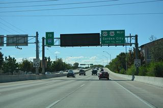
U.S. 20 separates from I-84/U.S. 26-30 east at Mountain Home.
08/09/16
Leading away from the diamond interchange (Exit 95) with I-84/U.S. 26-30 on U.S. 20 in Mountain Home.
08/09/16

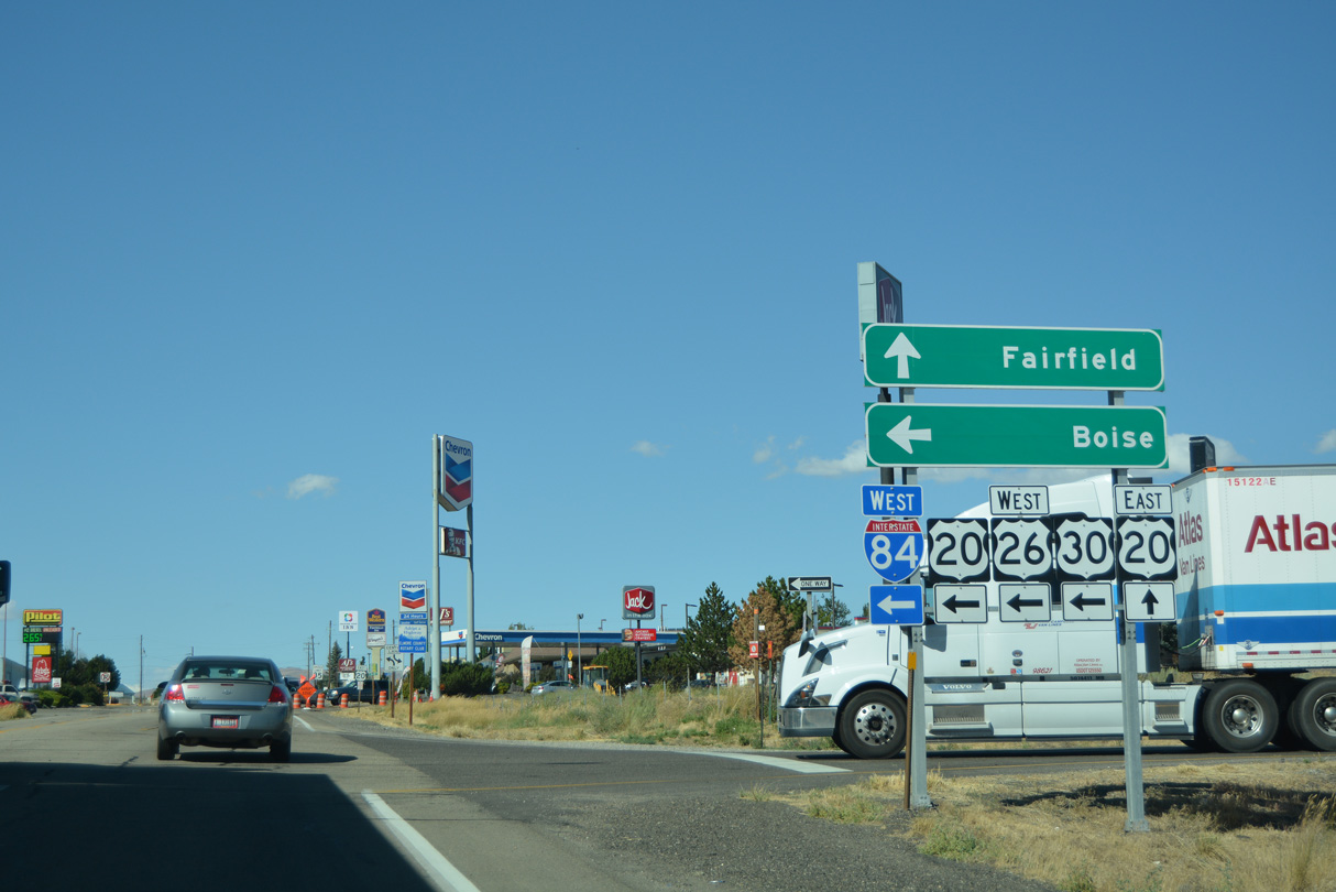
U.S. 20 west combines with I-84/U.S. 26-30 west from Mountain Home to Broadway Avenue in Boise.
08/09/16
Photo Credits:
- ABRoads: 08/09/16
Connect with:
Page Updated Tuesday April 07, 2026.