
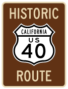
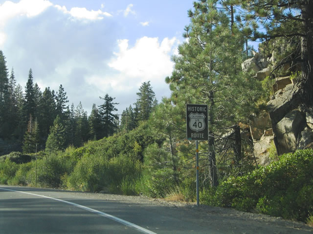
Historic U.S. 40
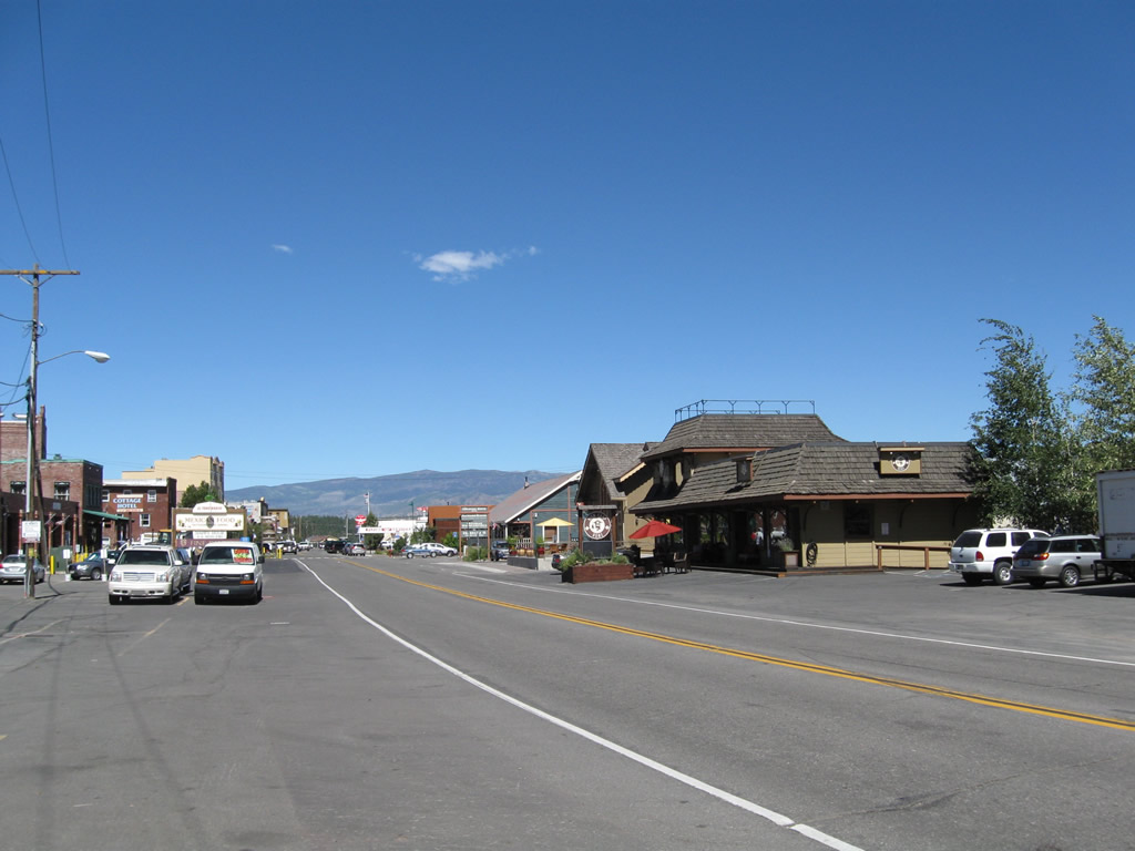
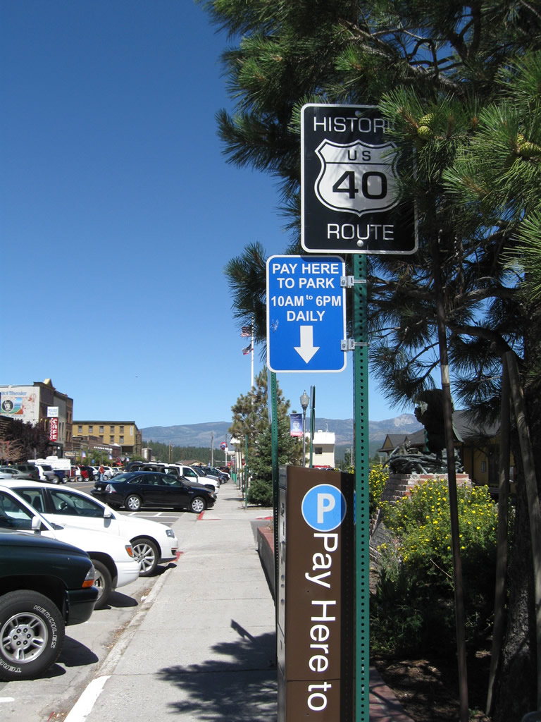
Historic U.S. 40 follows Donner Pass Road through Downtown Truckee. This view looks east along the historic route toward the intersection with Bridge Street (Brockway Road / formerly SR 267 before it was relocated east of Downtown). - 07/21/2009
Having been truncated east to I-80 at Silver Creek Junction, Utah, U.S. 40 is a former transcontinental route from San Francisco east to Atlantic City, New Jersey. U.S. 40 no longer exists as an official route in California, Nevada and western Utah. Within the Golden State, U.S. 40 was mostly replaced by Interstate 80 between Downtown San Francisco and the state line near Verdi, Nevada. Some old alignments of historic U.S. 40 remain in the state highway system (such as California State Route 123 and Business Loop I-80 in Sacramento). Many sections of the original route (and later realignments) remain intact and in some cases carry Historic U.S. 40 signs. The U.S. highway was truncated from San Francisco to the California-Nevada state line in 1964 (signs were removed starting in 1966). The rest of U.S. 40 that overlapped Interstate 80 between Reno and Park City, Utah was decommissioned in 1975.
Business Loop I-80 - Truckee
Prior to 1993, the former route of U.S. 40 through the town of Truckee was designated as Business Loop I-80. The business route followed Donner Pass Road between Exits 184 and 188. No evidence of the business loop remains in Truckee, as a roadway expansion and pavement replacement project in the early 2000s resulted in the removal of the last "Route 80 Business" sign along Interstate 80 westbound.
Naming
In addition to local street names, portions of U.S. 40 carried two principal highway designations in California: Lincoln Highway and Victory Highway.
Lincoln Highway: The Lincoln Highway in California (U.S. 40 and U.S. 50) was established in 1913 as the first transcontinental highway in the United States. U.S. 50 carried the Lincoln Highway designation from Oakland to Sacramento (via today's I-580, I-205, and SR 99) and took the southern route over the Sierra Nevada via Echo Pass. U.S. 40's segment of Lincoln Highway was shorter in the Golden State, including the route from San Francisco to Oakland and also the Lincoln highway's northern Sierra Nevada branch between Sacramento and Reno via Donner Pass.
Proceeding east across Nevada, the Lincoln Highway follows U.S. 50 from Fallon to Ely, then takes U.S. 93 Alternate north to Wendover, where it rejoins I-80 and U.S. 40 east to Salt Lake City and Silver Creek Junction. While U.S. 40 turns southeast at Silver Creek Junction toward Denver, today's Interstate 80 (previously U.S. 189/U.S. 530 and U.S. 30S) carries the Lincoln Highway east to Granger, Wyoming. From there U.S. 30 generally follows the Lincoln Highway from Granger east to Philadelphia, and U.S. 130 and U.S. 1 take the Lincoln Highway northeast to its eastern terminus in New York City.
Victory Highway: U.S. 40 also followed the Victory Highway from San Francisco east toward Utah and points east. The section of U.S. 40 between Sacramento and Reno was known as the "Big Bend Route" of the Lincoln Highway and is also called the Victory Highway. This auto trail was established in 1921 and was designed to connect San Francisco and New York City via an alternate route instead of the Lincoln Highway. At the California-Nevada state line was an eagle monument that dedicated the Victory Highway "to California-s sons and daughters who served their country in the World War 1917-1918 and to the memory of those who gave the last full measure of devotion." This plaque was relocated in 1960 to Downtown Truckee, and it sits in the parking lot at the train depot that now serves as an official California Welcome Center and tourist information center. Most of the route west of St. Louis followed U.S. 40; the Victory Highway was especially notable for the alternative to the U.S. 50 (Lincoln Highway) across northern Nevada.
U.S. 40 Alternate
U.S. 40 used to have a long alternate route in Northern California that extended into Reno, Nevada. In 1964, U.S. 40 Alternate between Sacramento and Reno was also eliminated. This all-weather route followed portions of SR 113 (former U.S. 99E), SR 99, SR 20 and SR 70 (former SR 24) between 1954 and 1964. U.S. 40 Alternate used to pass through Yuba City, Oroville, Quincy and Portola (via the Feather River Canyon) en route to Hallelujah Junction. Longer than the main route of U.S. 40, U.S. 40 Alternate provided a lower elevation course through the Sierra Nevada instead of the higher route via the narrow and steep Donner Pass summit.
Good references for U.S. 40 are Historic U.S. Highways in California: U.S. 40 (Casey Cooper) and Route 40.Net (Frank Brusca).
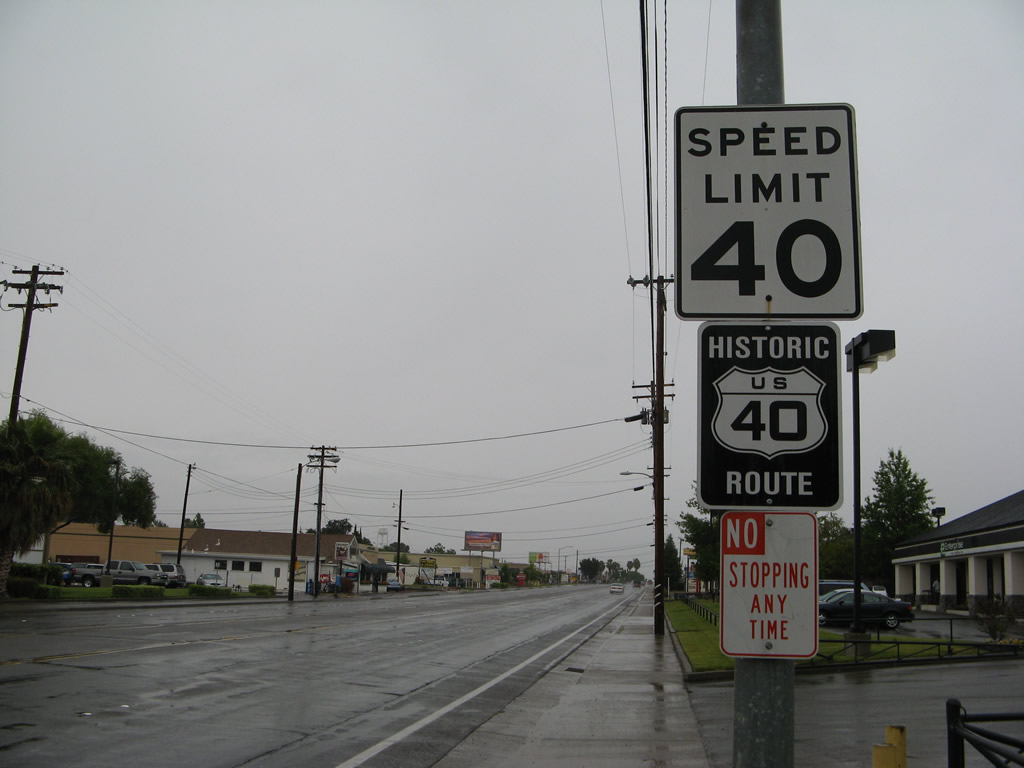
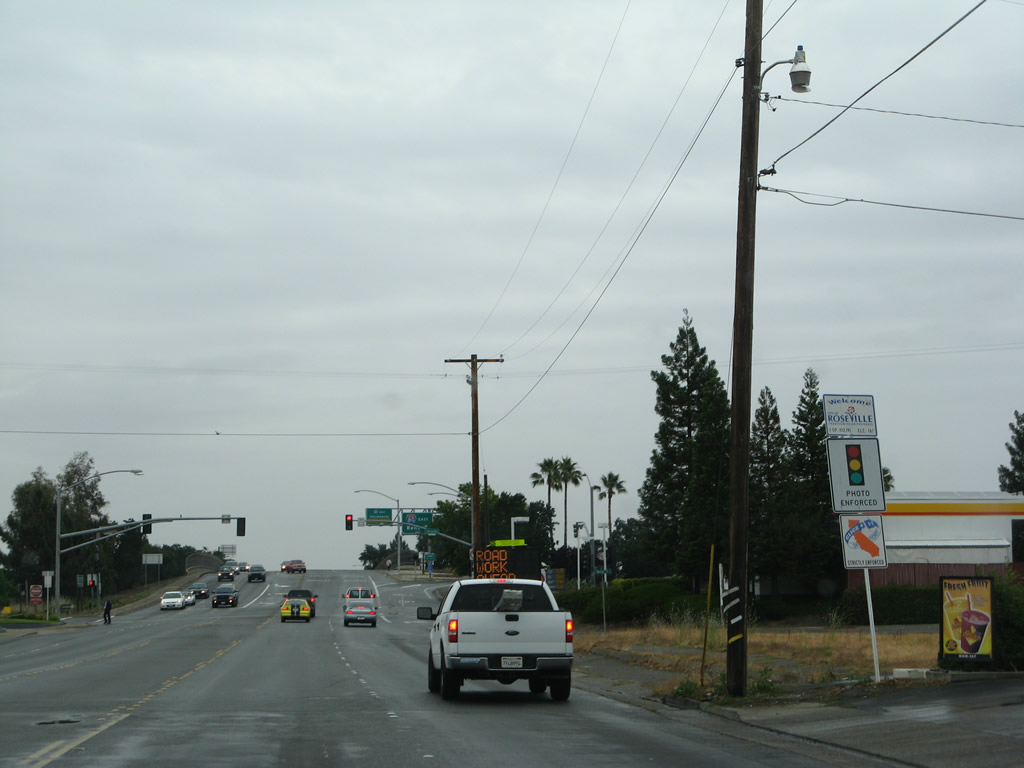
This Historic U.S. 40 route marker is posted along Auburn Boulevard east after Myrtle Avenue. These historic markers are posted fairly regularly along Auburn Boulevard between Carmichael and Roseville. U.S. 40 parallels I-80 northeast of Sacramento, but stays south of the freeway between Exit 95 (I-80/U.S. 50 Split) and Exit 102 between Citrus Heights and Roseville. Businesses line much of this stretch of Historic U.S. 40.
05/24/08
Another Historic U.S. 40 shield is posted between Madison Avenue and Hemlock Street. Generally, the historic route is well signed along Auburn Boulevard through unincorporated Sacramento County, Citrus Heights and Roseville.
05/24/08

Beyond Manzanita Avenue, eastbound Historic U.S. 40-99E (Lincoln Highway) enters the city of Citrus Heights, which was incorporated on January 1, 1997, and had a population of 83,301 as of the 2010 Census.
05/24/08
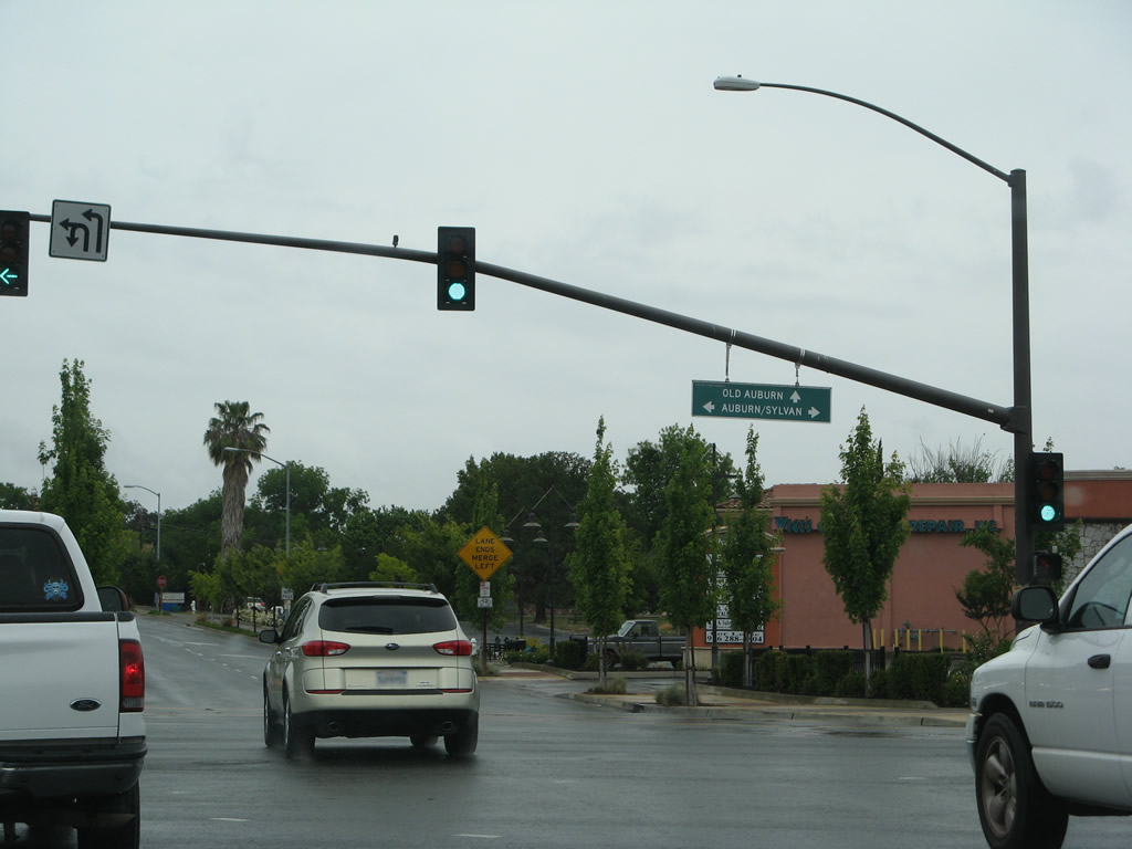
Historic U.S. 40-99E (Auburn Boulevard) in Citrus Heights turns north toward Downtown Roseville at Old Auburn Road east and Sylvan Road south.
05/24/08
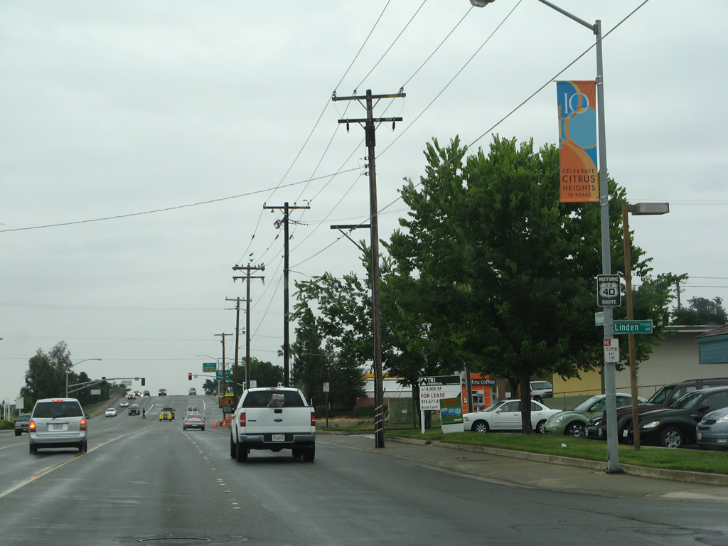
Historic U.S. 40 (Auburn Boulevard) eastbound at Linden Avenue, ahead of the interchange with Interstate 80.
05/24/08
Historic U.S. 40/99E (Auburn Boulevard) enter the city of Roseville from Citrus Heights. Roseville had a population of 118,788 as of the 2010 Census and was incorporated on April 10, 1909.
05/24/08
A parclo interchange joins Historic U.S. 40 with I-80 at Exit 102.
05/24/08
Auburn Boulevard changes to Riverside Avenue north of the exchange with Interstate 80.
05/24/08
Riverside Avenue advances north along a five lane boulevard toward Darling Way.
05/24/08
Historic U.S. 40 route marker posted after Darling Way along Riverside Avenue.
05/24/08
Approaching Cherry Street, Historic U.S. 40-99E (Riverside Avenue) narrows to just two lanes.
05/24/08
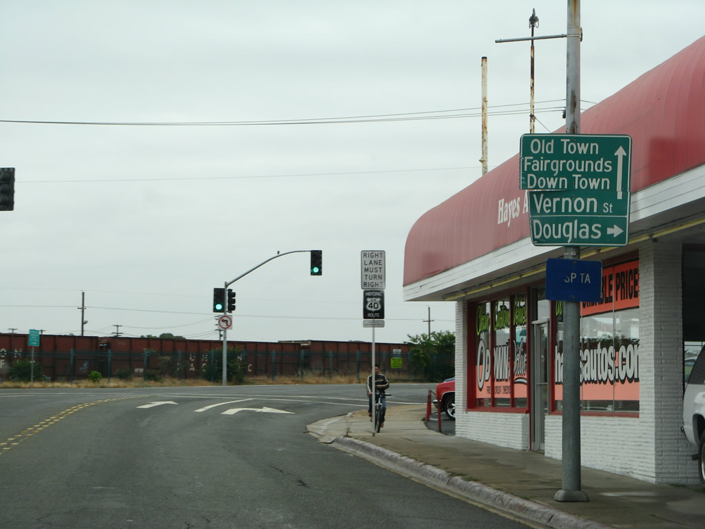
Old U.S. 40 transitions onto Vernon Street from Riverside Avenue at the intersection with Douglas Boulevard. Douglas Boulevard leads east to Interstate 80 at Exit 103.
05/24/08
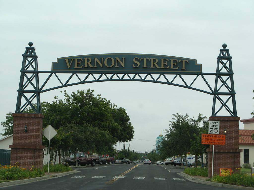
Historic U.S. 40-99E enters historic Downtown Roseville at a decorative arch spanning Vernon Street by Pratt Street.
05/24/08
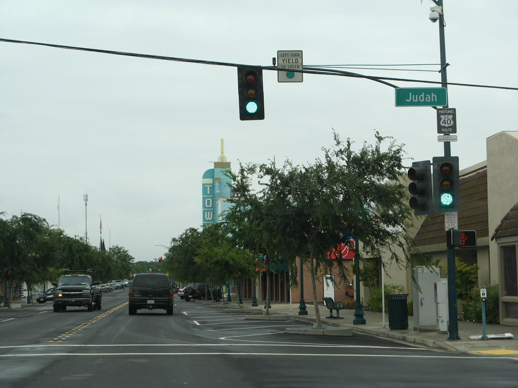
Continuing through the central business district of Roseville, Historic U.S. 40-99E (Vernon Street) meets Judah Street.
05/24/08
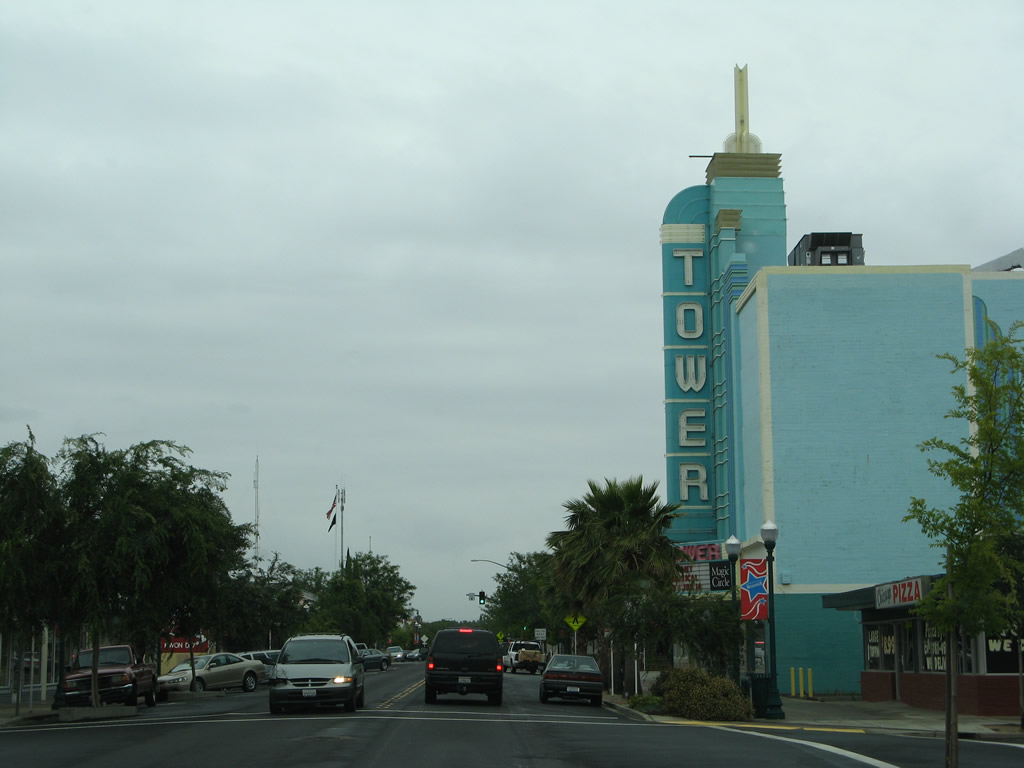
Tower Theater is located at the corner of Vernon and Taylor Streets in Downtown Roseville.
05/24/08
The historic routes of U.S. 40/99E divide at Grant Street. U.S. 99E looped south along Grant and Oak Streets to Washington Boulevard north through a subway under Vernon Street and the adjacent railroad lines.
05/24/08
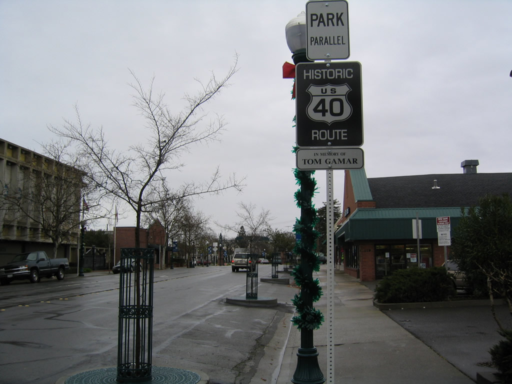
Historic U.S. 40 remains east along Vernon Street from Grant Street in Downtown Roseville.
12/28/04

A second steel arch in Downtown Roseville spans Vernon Street near Jefferson Street.
12/28/04

Historic U.S. 40 / Lincoln Highway markers posted along Lincoln Way east at Russell Road in Auburn.
05/10/04
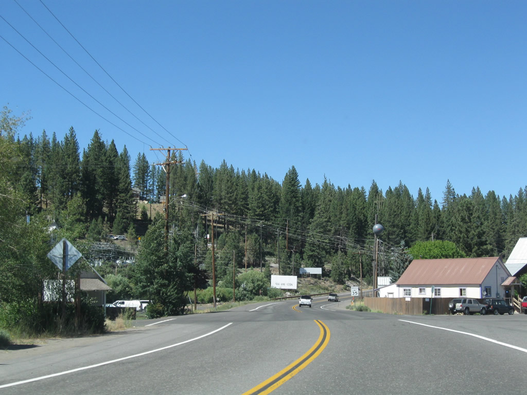
Beyond Donner Pass in the Sierra Nevada, Historic U.S. 40 follows Donner Pass Road through the town of Truckee. Truckee sits at an elevation of 5,817 feet and was incorporated on March 23, 1993.
07/21/09
Historic U.S. 40 (Donner Pass Road) shifts southeast to meet Interstate 80 at Exit 186 en route to Downtown Truckee.
07/21/09
The partial exchange at Exit 186 includes only a westbound entrance ramp for Interstate 80 to Sacramento and San Francisco.
07/21/09
A SR 267 trailblazer stands along Donner Pass Road below I-80.
07/21/09
Historic U.S. 40 (Donner Pass Road) enters a roundabout with McIver Crossing just after I-80 (Exit 186). McIver Crossing links with W River Street beyond the Union Pacific Railroad overpass.
07/21/09
The roundabout with McIver Crossing was constructed in 1998. This was the first of several added in Truckee, including two at the exchange joining I-80 with SR 89 (dedicated on December 21, 2005) and another east of Downtown on Donner Pass Road at SR 89/267.1
07/21/09

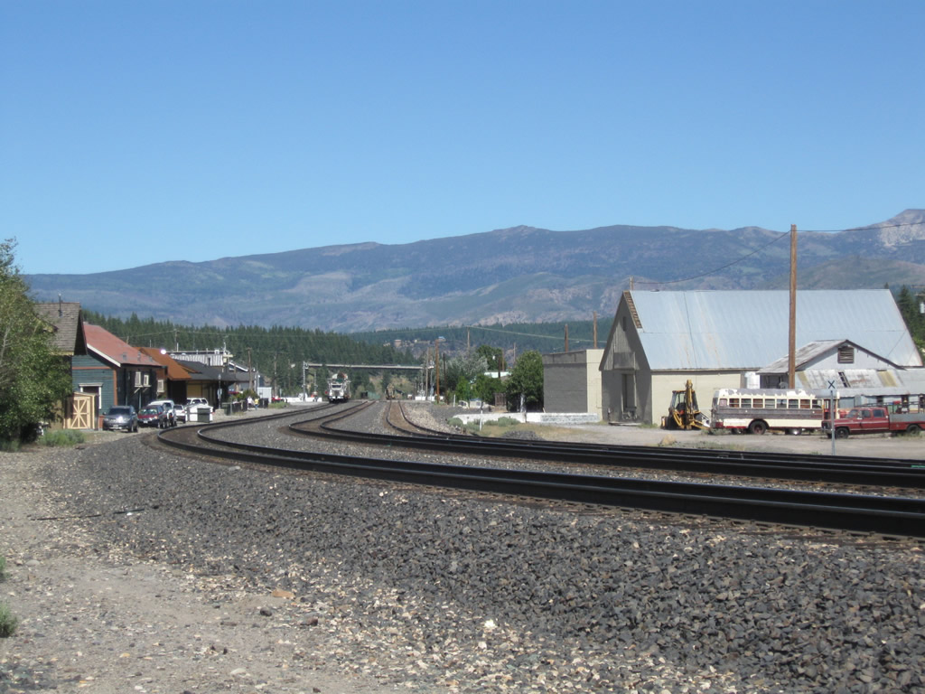
Traversing the Sierra Nevada into Nevada, the adjacent UP Railroad expands to three sets of tracks through Downtown Truckee.
07/21/09
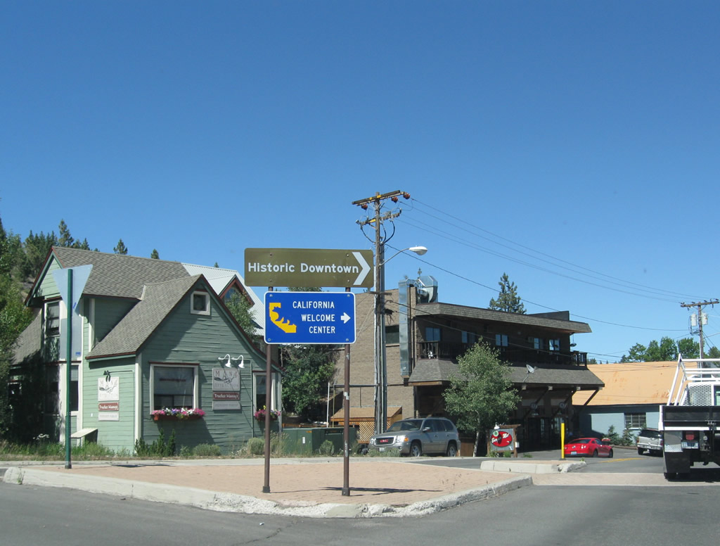
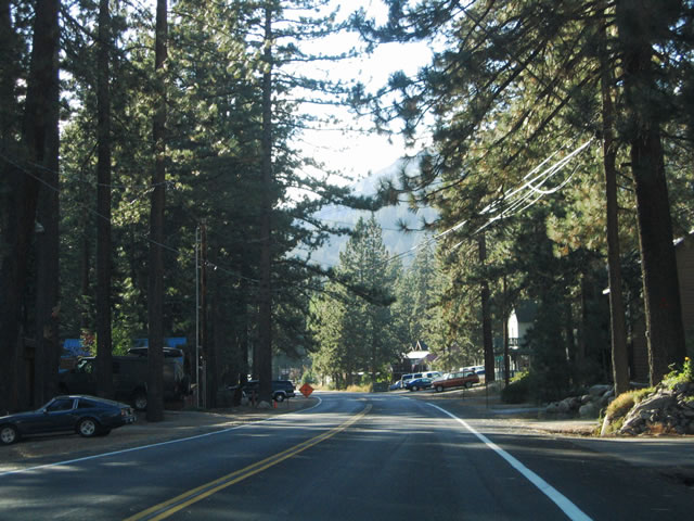
Historic U.S. 40 (Donner Pass Road) continues east from McIver Crossing to a California Welcome Center in Downtown Truckee.
07/21/09
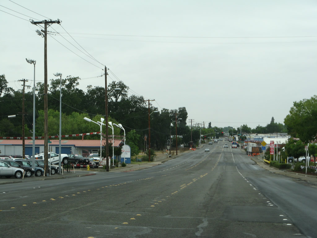
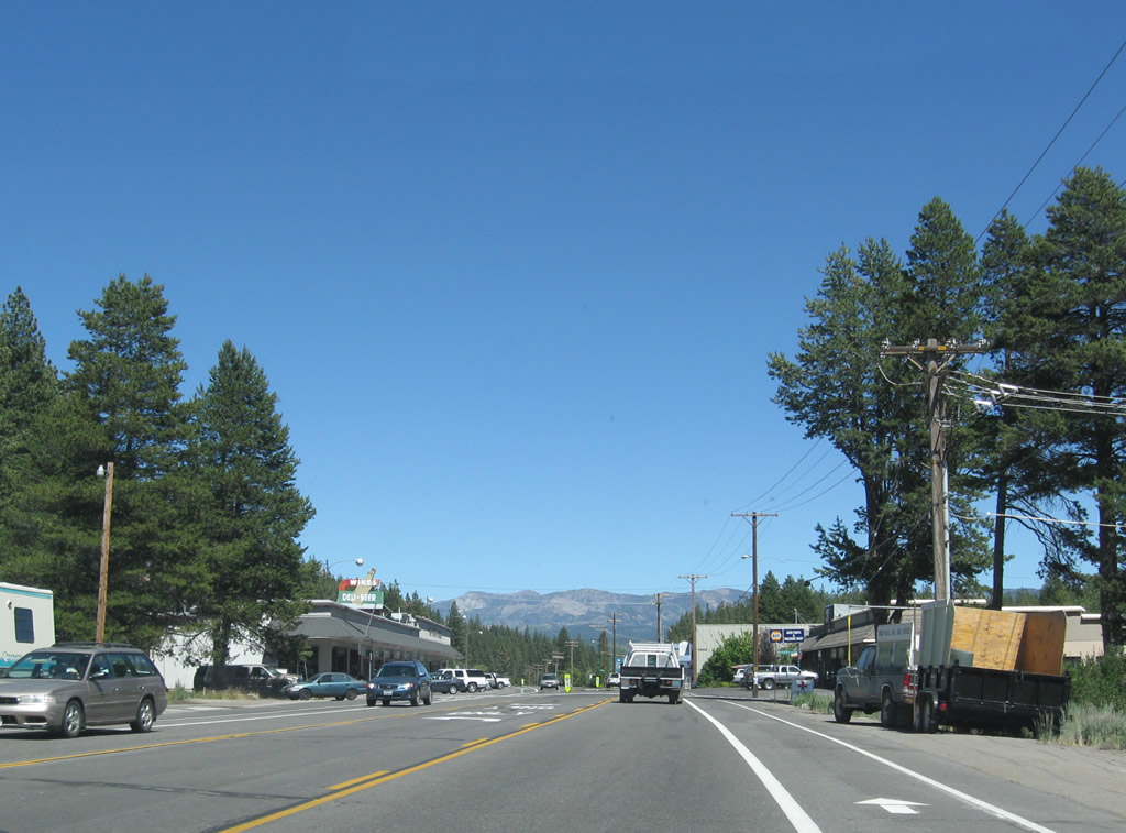
A variety of stores and restaurants line Historic U.S. 40 along Donner Pass Road through Downtown Truckee. Donner Pass Road here was also formerly Business Loop I-80 and SR 89.
07/21/09
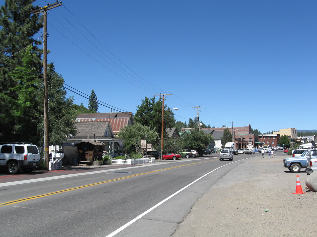
The Union Pacific Railroad parallels Historic U.S. 40 and River Street through the Truckee business district.
07/21/09
Donner Pass Road east at Spring Street. This section of Historic U.S. 40 was redesigned with on-street parking and wide sidewalks.
07/21/09
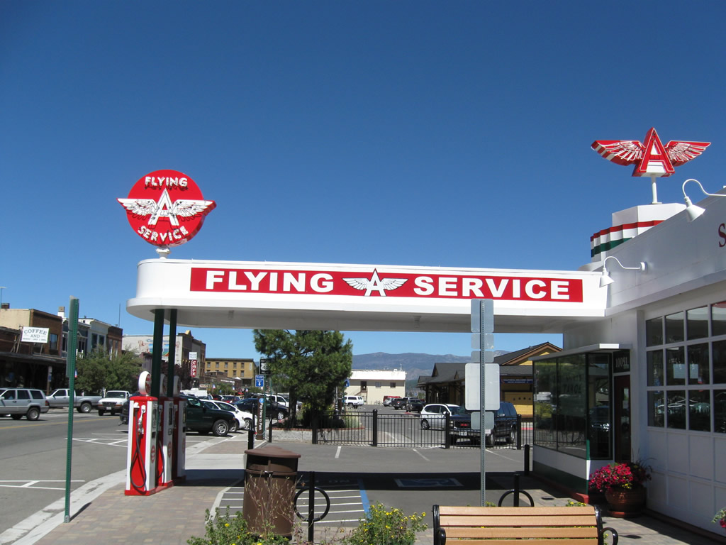
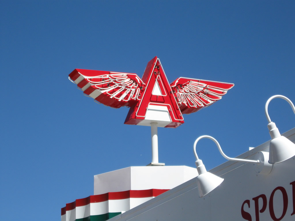
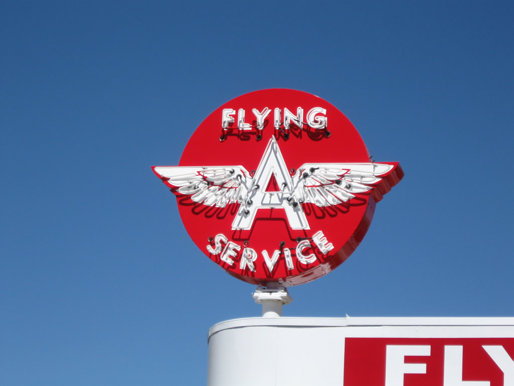
A restored marquee and entrance for a Flying A service station is a part of a business located at Donner Pass Road and Spring Street in Downtown Truckee.
07/21/09
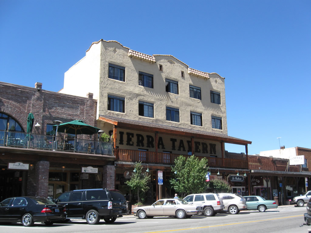
Sierra Tavern is one of several historic buildings along Donner Pass Road in Downtown Truckee.
07/21/09
A Historic U.S. 40 marker was posted ahead of the California Welcome Center prior to 2012.
07/21/09
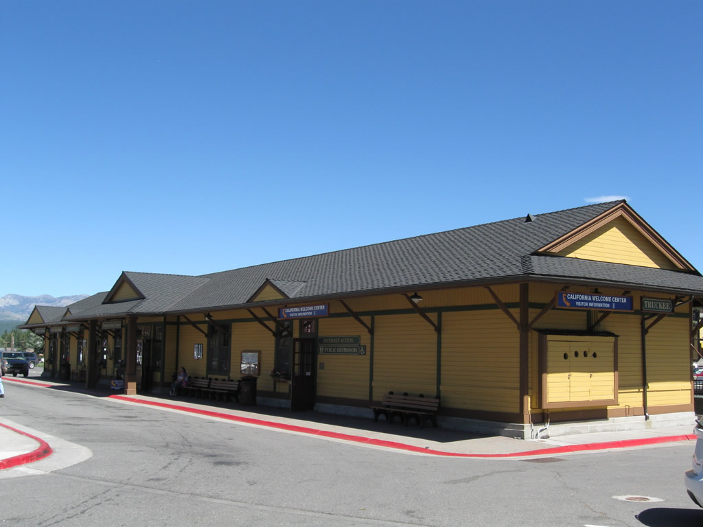
The Truckee train depot was restored and serves as an official California Welcome Center and tourist information center.
07/21/09
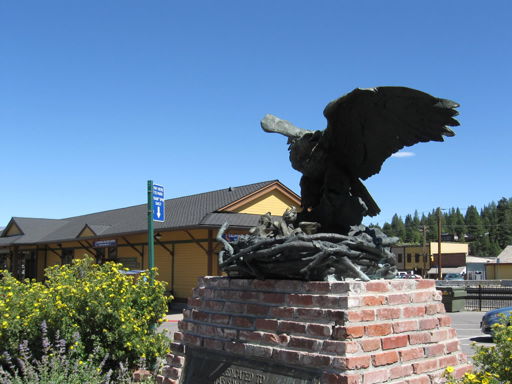
The eagle monument for the Victory Highway was relocated from the California/Nevada state line to the Truckee train depot parking lot in 1960.
07/21/09
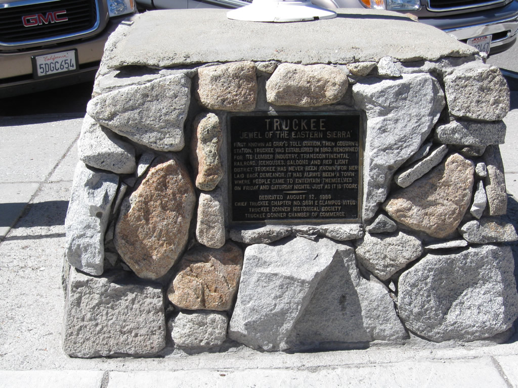
Labeled the "Jewel of the Eastern Sierra," this plaque is placed near the train depot in honor of the town of Truckee.
07/21/09
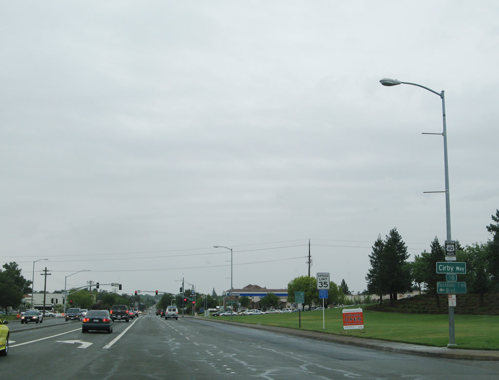
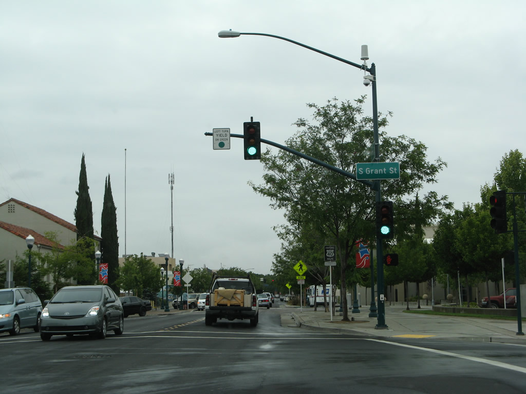
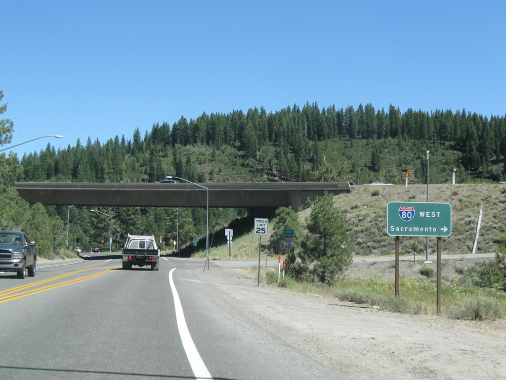
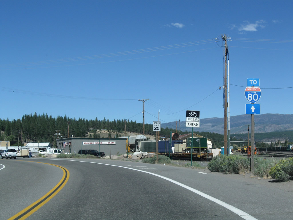
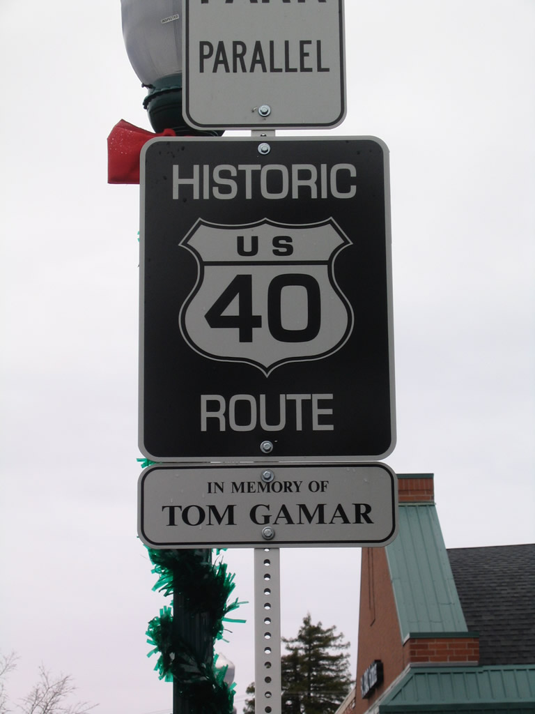
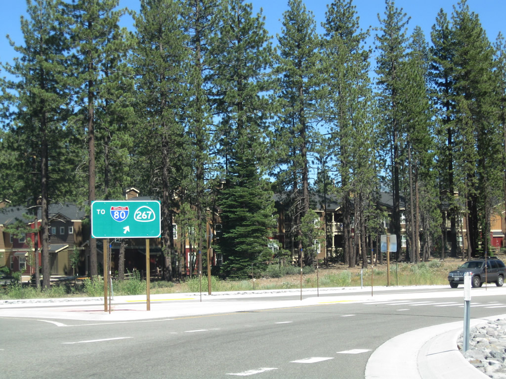
Historic U.S. 40 (Donner Pass Road) east at Bridge Street. SR 267 previously ran south along Bridge Street and Brockway Road as part of a route southeast to Kings Beach on Lake Tahoe and Incline Village, Nevada.
07/21/09
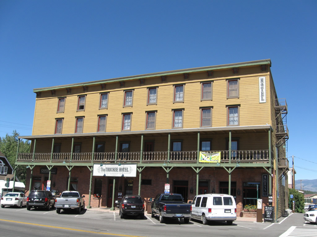
The Truckee Hotel is located at the intersection between Historic U.S. 40 (Donner Pass Road) and Bridge Street (former SR 267).
07/21/09
Construction completed in October 2018 removed the curve along Donner Pass Road. Part of the Truckee Railyard development, Donner Pass Road was realigned east to Truckee Way, a connector linking with a roundabout at Church Street.
07/21/09
Completed in 2018, a roundabout replaced the intersection along Donner Pass Road with Church Street pictured here.
07/21/09

Donner Pass Road crosses Trout Creek east ahead of Keiser Avenue.
07/21/09
Representing the former alignment of U.S. 40 to Polaris, Glenshire Drive branches east from Donner Pass Road.
07/21/09
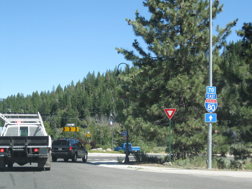
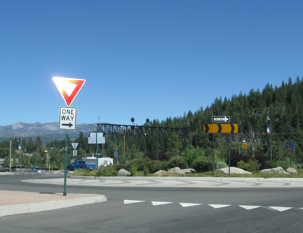
Donner Pass Road continues north to a roundabout at Jibboom Street and a half diamond interchange (Exit 188A) with Interstate 80 west.
07/21/09
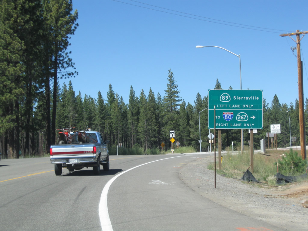
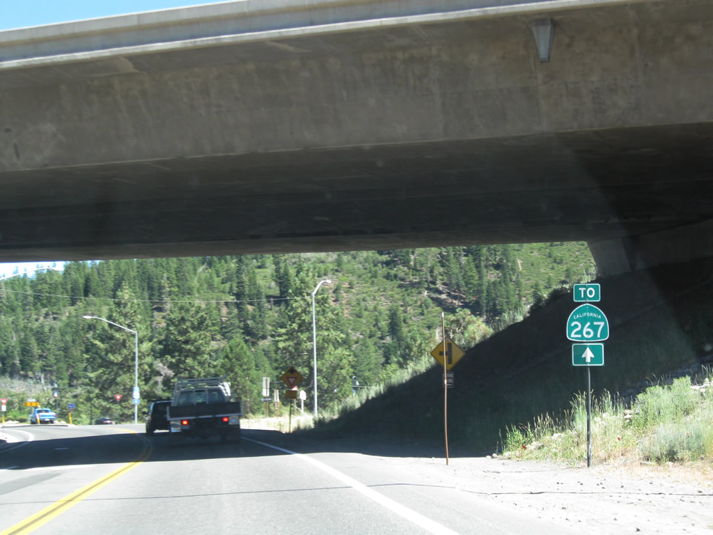
Donner Pass Road curves east from I-80 to roundabouts with Pioneer Trail and SR 89. SR 89 leads north to Sierraville and south to an adjacent exchange with I-80 and SR 267.
07/21/09
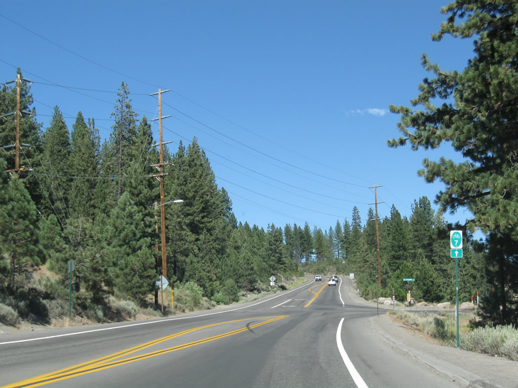
Historic U.S. 40 follows Donner Pass Road through the town of Truckee to Donner Lake. Branching south from I-80 at Exit 184, Donner Pass Road continues to Donner Lake.
09/09/05
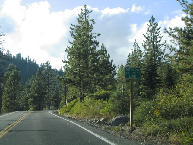
Historic U.S. 40 runs west along the north shore of Donner Lake to the Nevada County line.
09/09/05
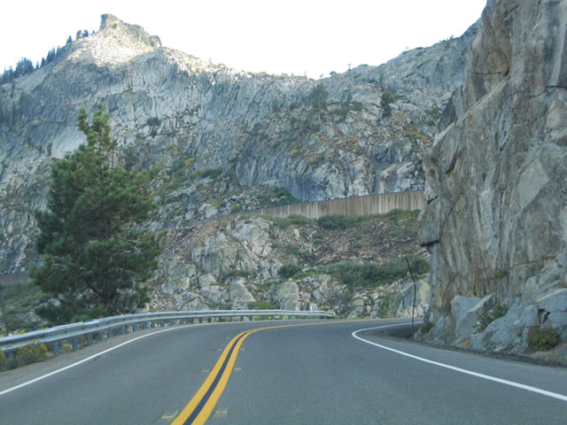
Once into Nevada County, Historic U.S. 40 (Donner Pass Road) begins a steep climb from 6,300 feet in elevation at Donner Lake to 7,239 feet at toward Donner Pass.
09/09/05
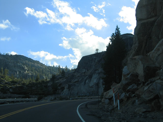
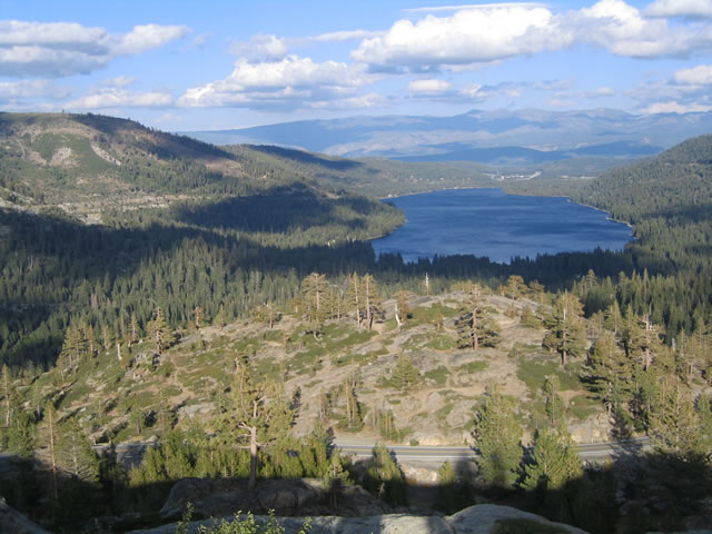
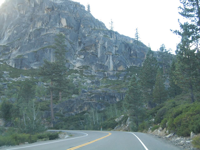
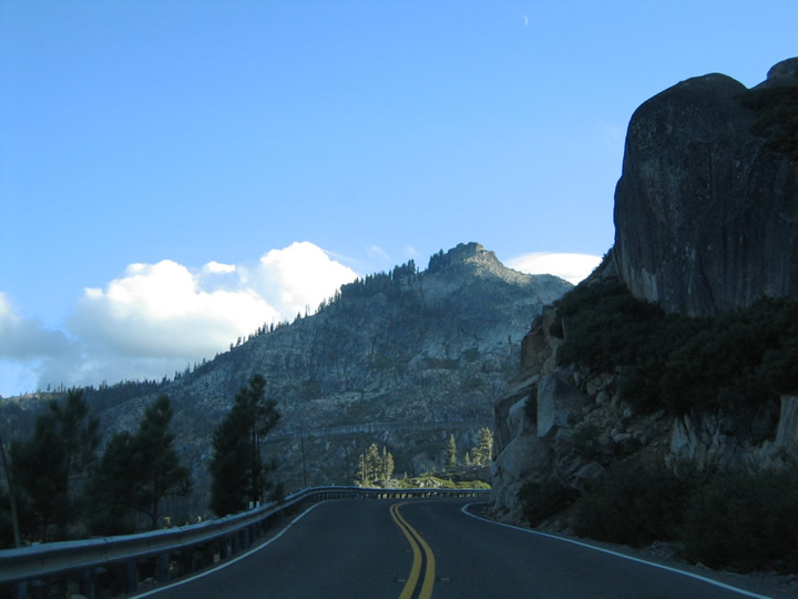
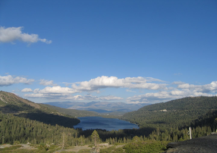
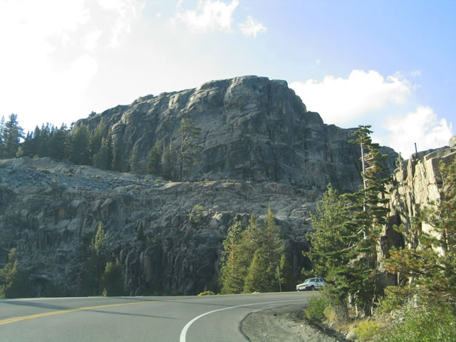
Advancing westward on the rise toward Donner Summit. A pull-off midway towards the summit provides a spectacular view of Donner Lake and the Sierra Nevada north of Lake Tahoe.
09/09/05
Looking back toward the northeast at the cut made for Interstate 80 along a nearby hillside.
09/09/05
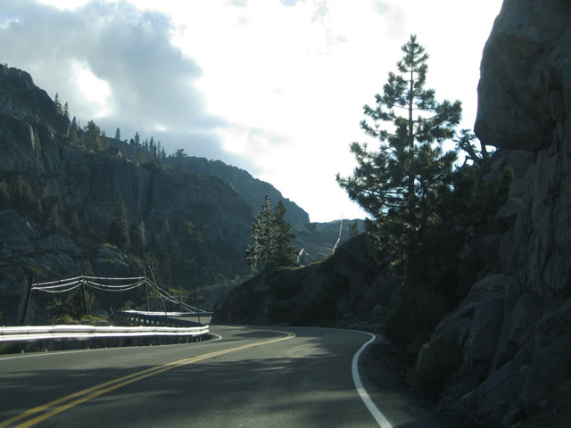
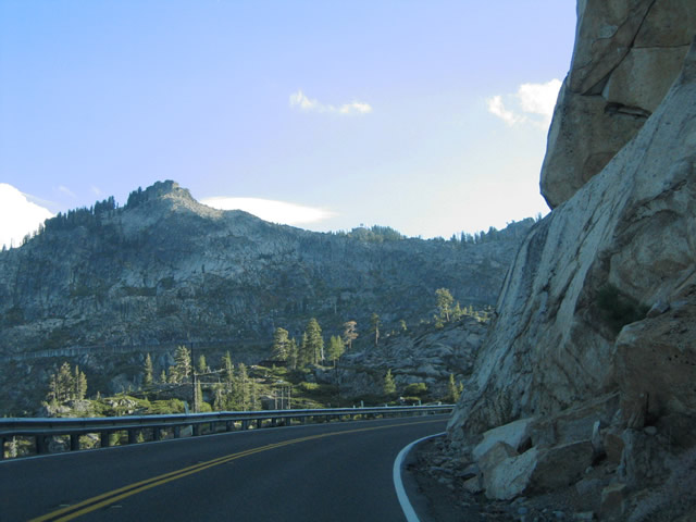
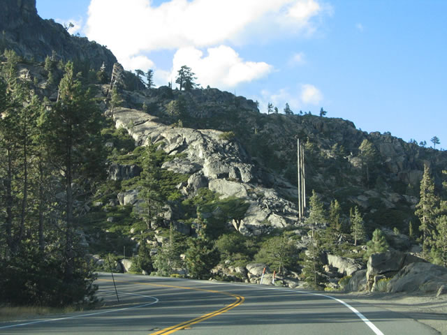
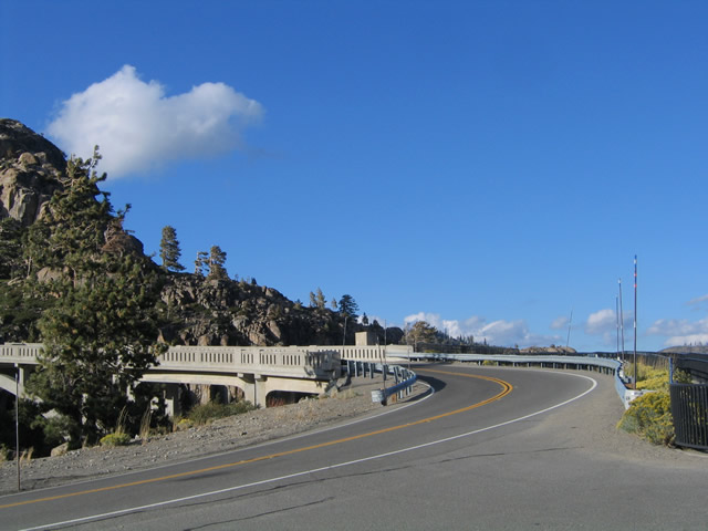
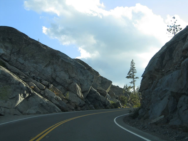
Historic U.S. 40 navigates through a number of S-curves to McGlashan Point and the Donner Summit Bridge.
09/09/05
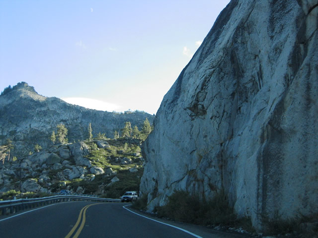
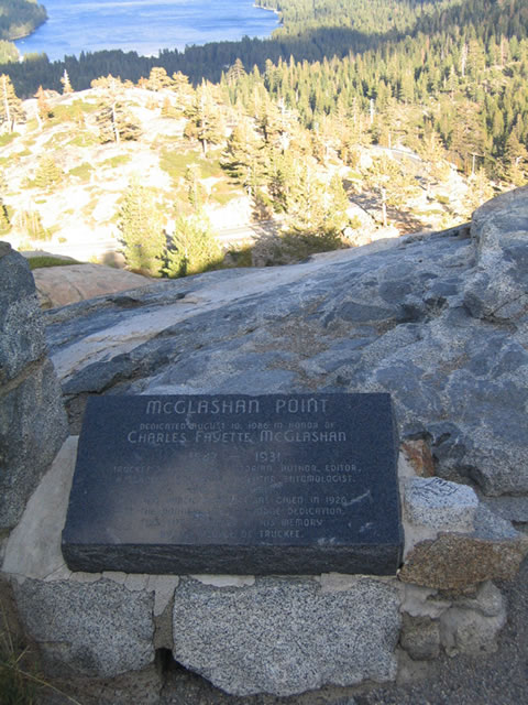
Donner Summit Road westbound at McGlashan Point and the Donner Lake Overlook.
09/09/05
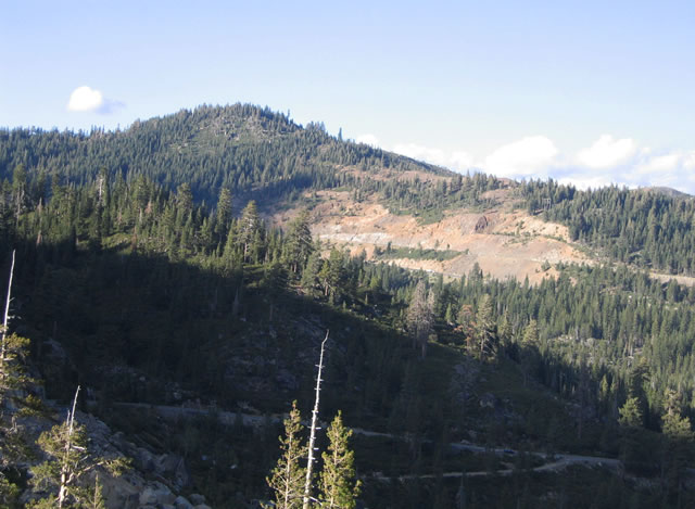
Known as McGlashan Point, the Donner Lake Overlook provides fantastic views of Donner Lake and areas west of Truckee.
09/09/05
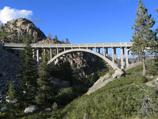
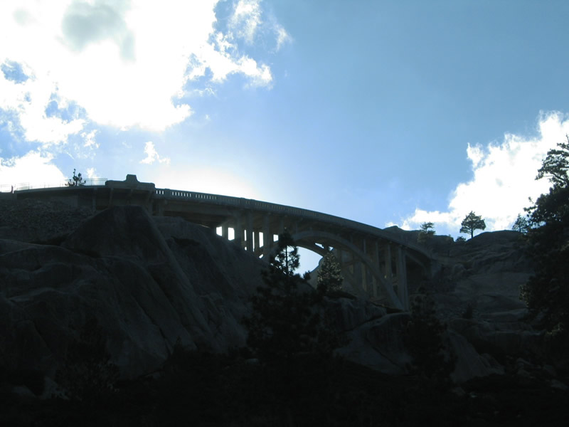
The Donner Summit Bridge at McGlashan Point is a concrete arch bridge dating from 1925.
09/09/05
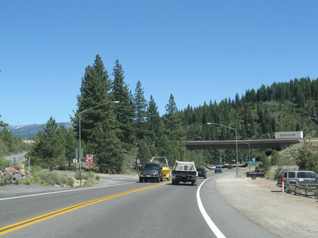
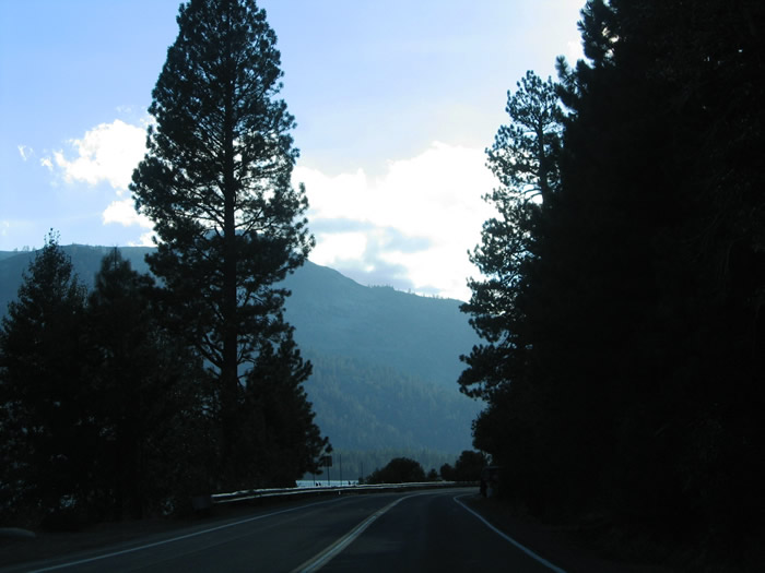
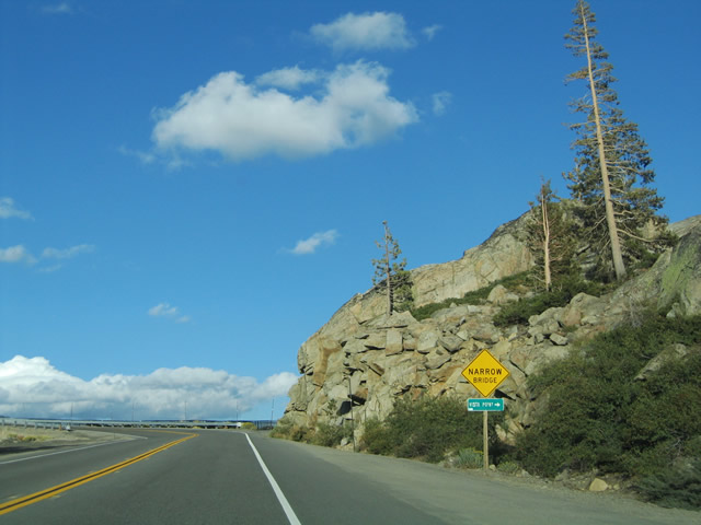
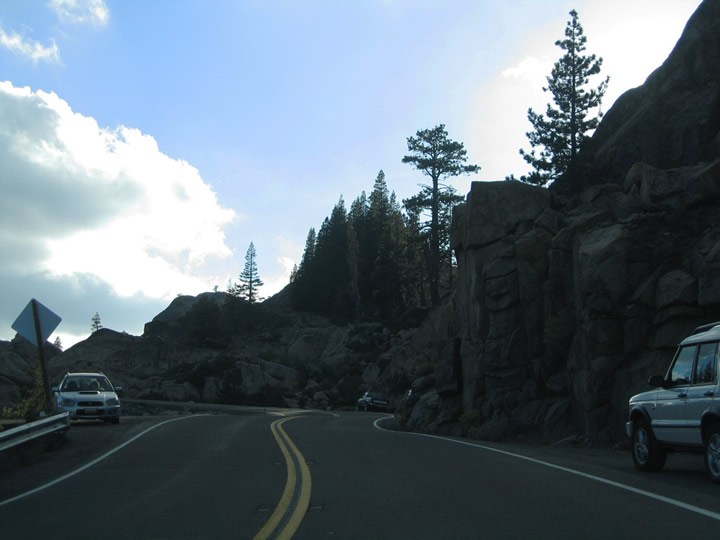
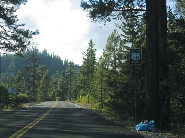
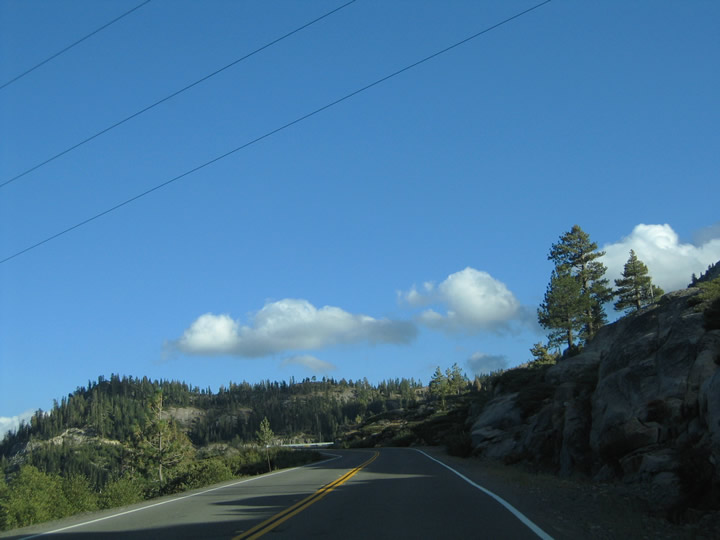
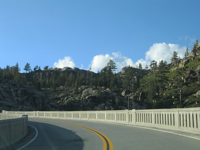
Continuing from Donner Pass, Historic U.S. 40 (Donner Pass Road) winds westward to the unincorporated communities of Norden and Soda Springs.
09/09/05
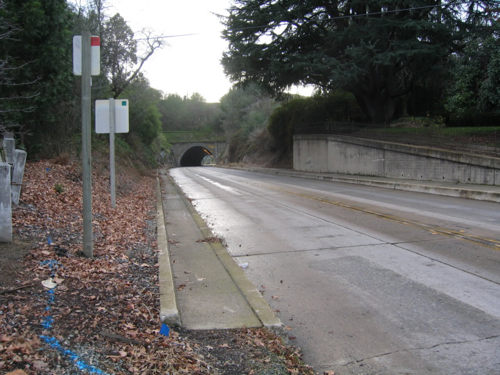
Historic U.S. 40 extends west from SR 193 along Taylor Road through this tunnel near Newcastle.
12/27/04
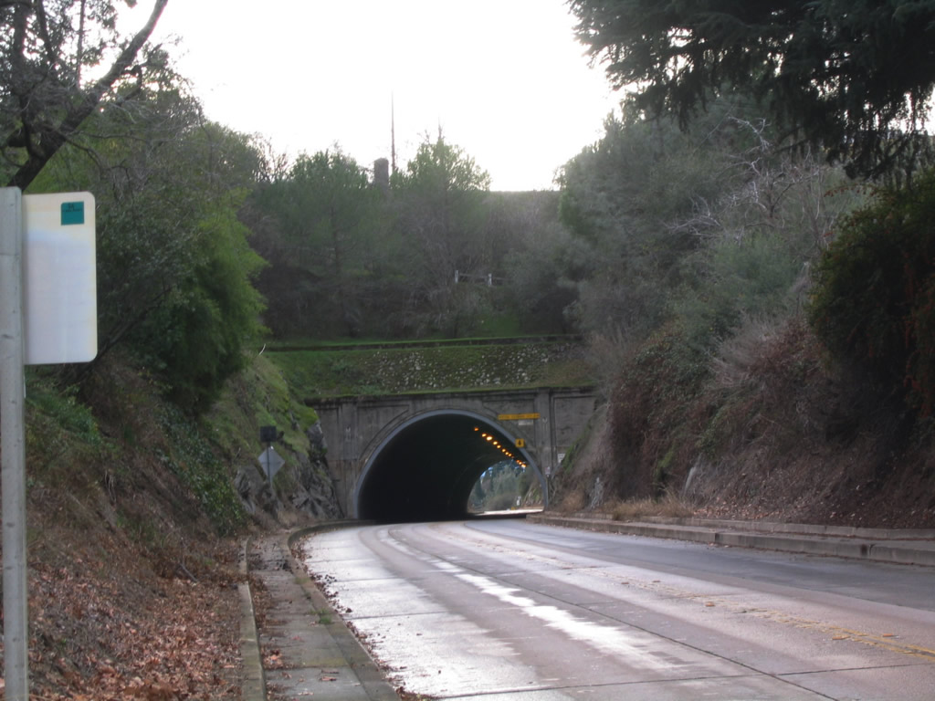
The two lane tunnel leads Taylor Road (old U.S. 40) southwest from Newcastle to the community of Penryn.
12/27/04
References:
- "Two roundabouts down, more to come." Sierra Sun (Truckee, CA), December 23, 2005.
Photo Credits:
- Andy Field: 12/27/04, 12/28/04, 05/24/08, 07/21/09
- jxh: 05/10/04
- AARoads: 09/09/05
Connect with:
Page Updated Saturday January 30, 2021.