
U.S. 89
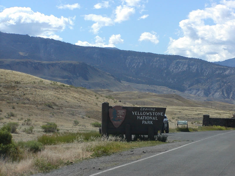
U.S. 89 in Montana originates at Gardiner and the north entrance to Yellowstone National Park. Following the Yellowstone River, U.S. 89 heads north into Paradise Valley. Passing east of Canyon Mountain, U.S. 89 continues into the Park County seat of Livingston.
U.S. 89 combines with I-90/U.S. 191 from mile marker 53 in Livingston east 7.48 miles to Exit 340. Turning northwestward parallel to the Shields River, U.S. 89 continues to Clyde Park and Wilsall. North into Meagher County, U.S. 89 combines with U.S. 12 for 11.79 miles to White Sulphur Springs.
U.S. 89 Montana Guides
South - St. Mary to Browning - 37 photos
Beyond the overlap with U.S. 12, U.S. 89 traverses the Little Belt Mountains, crossing Kings Hill Pass at the Cascade County line. U.S. 89 joins U.S. 87 and MT 3/200 northwest from Armington Junction 22.64 miles to the couplet of 14th/15th Street S in Great Falls. U.S. 87 branches north from there while U.S. 89/MT 3-200 continue west to overlaps with Business Loop I-15 and I-315 to Interstate 15.
MT 3 ends with I-315/Business Loop I-15 while U.S. 89/MT 200 join Interstate 15 northwest 11.54 miles to Vaughn. U.S. 89/MT 200 run 7.97 miles west from I-15 to their separation near Sun River. U.S. 89 advances northwest to Fairfield and the north by Freezeout Lake to the north end of U.S. 287 at Choteau.
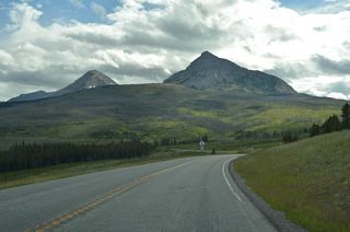
Within Glacier County, U.S. 89 travels northwest to Browning, overlapping with U.S. 2 for 3.83 miles. U.S. 89 continues west from Browning to MT 49 at Kiowa. MT 49 heads south to East Glacier Park while U.S. 89 parallels the eastern boundary of Glacier National Park north to St. Mary, where Going to the Sun Road from Glacier National Park ends.
North from St. Mary, U.S. 89 runs along the east side of Lower St. Mary Lake to Babb. The north end connects with Alberta Highway 2 to Cardston.
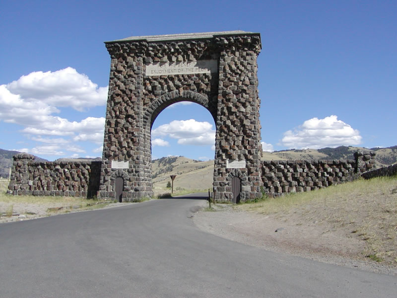
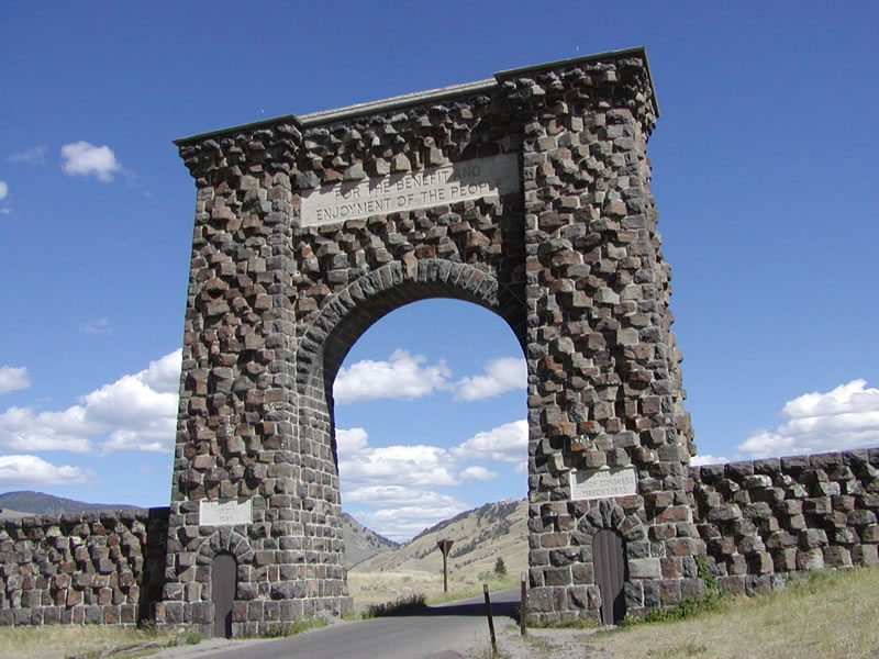
Built in the spring of 1903, the Roosevelt Arch was constructed to provide a dramatic northern entrance into Yellowstone National Park in Gardiner, Montana. This arch still stands today, with the motto "For the Benefit and Enjoyment of the People" inscribed in it. U.S. 89 no longer passes under the arch, since the archway is too narrow to accommodate two-way traffic. This is the view looking south, toward the entrance into Yellowstone.
07/17/05
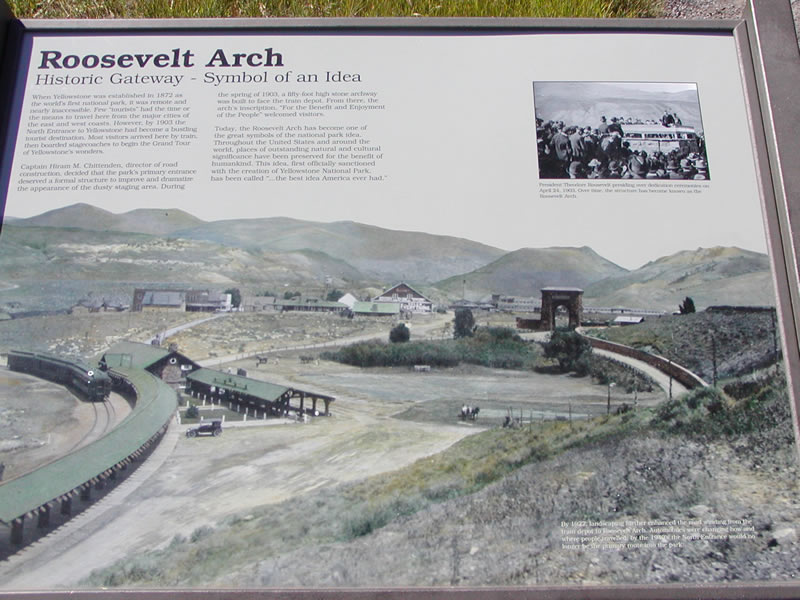
This historical marker explains the history of the Roosevelt Arch and what it came to mean for those coming to visit America's first national park. Note the use of rail to transport travelers to the park, as compared to the use of the automobile today.
07/17/05
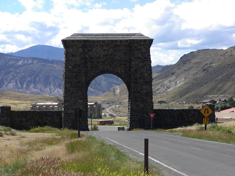
Looking north at the arch toward Montana.
07/17/05
Photo Credits:
- Casey Cooper: 07/17/05
Connect with:
Page Updated Monday February 02, 2026.