
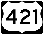
U.S. 421
U.S. 421 crosses Southwestern Virginia 68.98 miles west from Bristol to the Tennessee Valley Divide north of Stone Mountain. The majority of U.S. 421 within the Old Dominion overlaps with other routes.
U.S. 421 Virginia Guides
U.S. 58/421 East - Gate City to Bristol - 29 photos
Within Bristol, U.S. 421 enters the state alongside U.S. 11E/19 (Commonwealth Avenue) north for 0.58 miles to U.S. 11W (Euclid Avenue). U.S. 11W/421 combine southwest 1.12 miles back to the state line, where U.S. 421 shifts onto Gate City Highway. U.S. 421 continues 1.20 miles along Gate City Highway to I-81, where U.S. 58 joins the highway west to U.S. 23 at Gate City.
Prior to 2011, U.S. 421 in Bristol followed a circuitous route north from Anderson Street in Tennessee to U.S. 11E/19 along Commonwealth Avenue in Virginia. Approved by the American Association of State Highway and Transportation Officials (AASHTO) on May 2, 2011, U.S. 421 was relocated off Martin Luther King, Jr. Boulevard north, Cumberland Street west, Piedmont Avenue south and Goode Street west to meet U.S. 11/19 (Volunteer Parkway) directly from Anderson Street. Good, Piedmont and Cumberland remain a part of U.S. 11-19 Truck, which follow MLK Boulevard northeast to Moore Street.
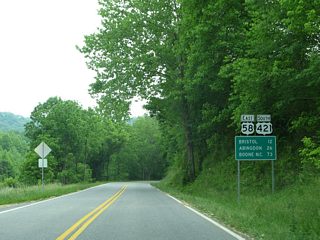
U.S. 23 joins U.S. 58/421 west from Gate City to Clinchport and Duffield. U.S. 58/421 continue across Powell Mountain to Stickleyville in Lee County. The two part ways north of Wallen Ridge at Dot. The remaining 13.11 miles of U.S. 421 head north to Woodway and Pennington Gap and west from Stone Creek to the Kentucky state line.


 North
North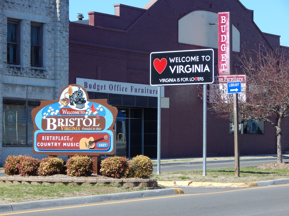
U.S. 11E/19/421 enter Bristol, Virginia along Commonwealth Avenue north from Volunteer Parkway at State Street. The ensuing intersection is with Goode Street (U.S. 11-19 Truck) east.
03/05/17
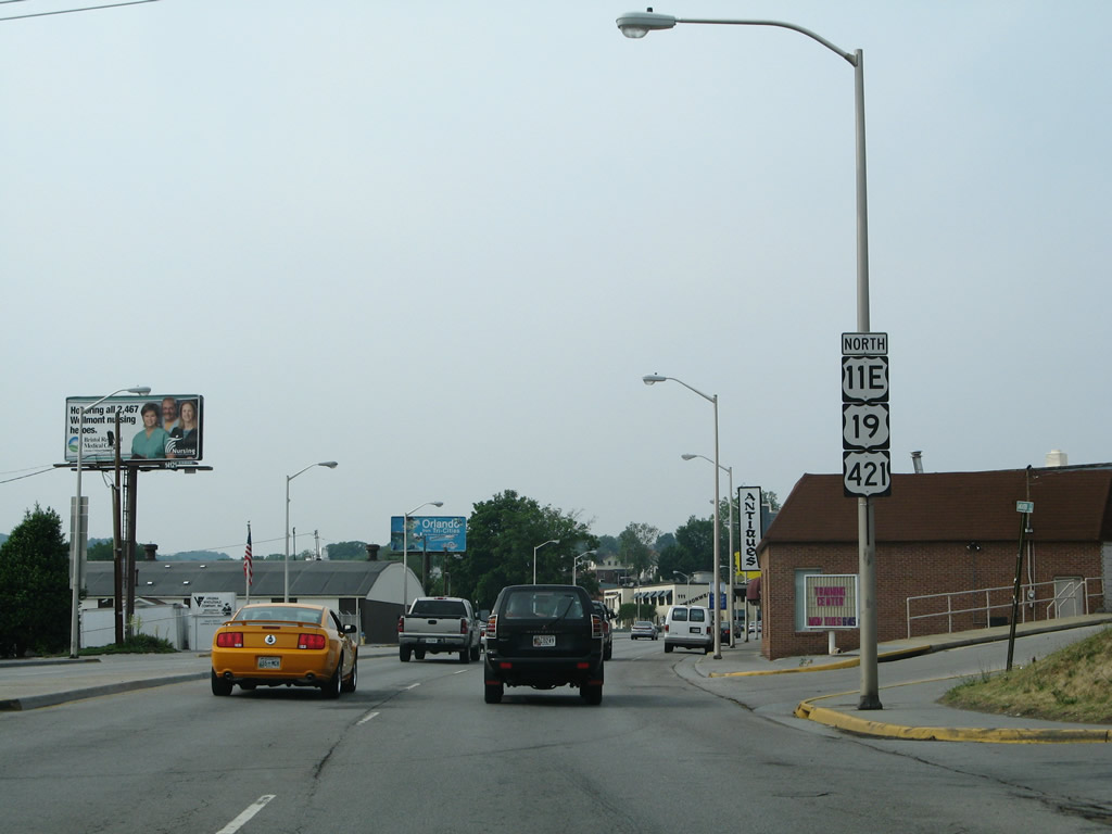
Reassurance shields for U.S. 11E-19-421 posted north of Goode Street. A number of industrial businesses line the west side of Commonwealth Avenue adjacent to a Norfolk Southern Railroad spur.
05/31/07
Unsigned SR 381 continues 0.63 miles north along Commonwealth Avenue from U.S. 11W/421 and U.S. 11/19 on Euclid Avenue to become Interstate 381 at Keys Street. SR 381 shields along Commonwealth Avenue were removed by May 2007.
05/31/07
North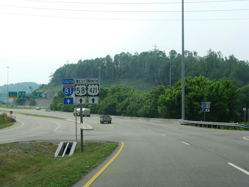
U.S. 421 (Gate City Highway) curves west from Island Road in Bristol to a parclo interchange with I-81/U.S. 58.
05/31/07
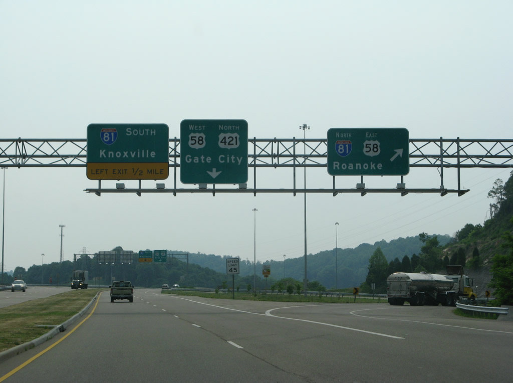
I-81/U.S. 58 combine east from U.S 421 to Exit 19 at Abingdon. I-81 continues northeast from there to Wytheville and Roanoke.
05/31/07
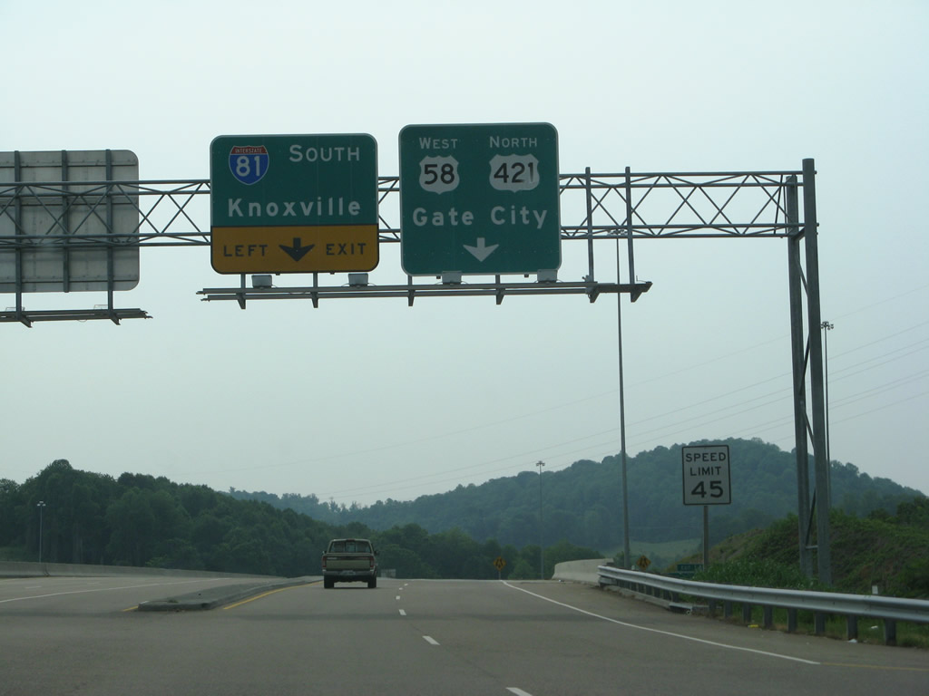
Spanning I-81, U.S. 421 (Gate City Highway) advances west to the left turn for Interstate 81 south toward Kingsport and Knoxville.
05/31/07
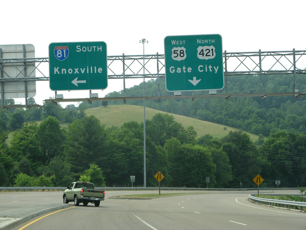
U.S. 58 combines with U.S. 421 (Gate City Highway) north from I-81 to Rich Valley en route to Hiltons and Weber City. I-81 crosses into Bristol, Tennessee 0.65 miles to the southwest and reaches I-40 in 80 miles.
05/31/07
South
U.S. 421 (Gate City Highway) continues 1.01 miles southeast from I-81/U.S. 58 to U.S. 11W (Euclid Avenue) and State Street in the city of Bristol.
05/31/07
Traffic signals formerly operated along U.S. 421 (Gate City Highway) south at Osborne Street across from Bristol Mall. The mall closed in 2017.
05/31/07
 North South
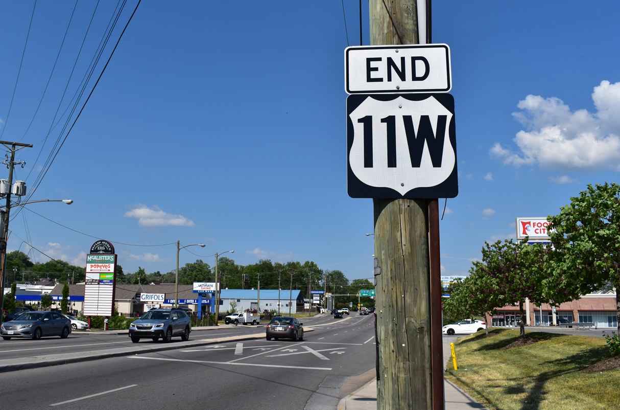
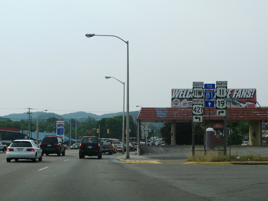
An end shield for U.S. 11W appears at the intersection with Bob Morrison Boulevard, just ahead of the U.S. 421 southward turn onto U.S. 11E/19 (Commonwealth Avenue).
05/26/21
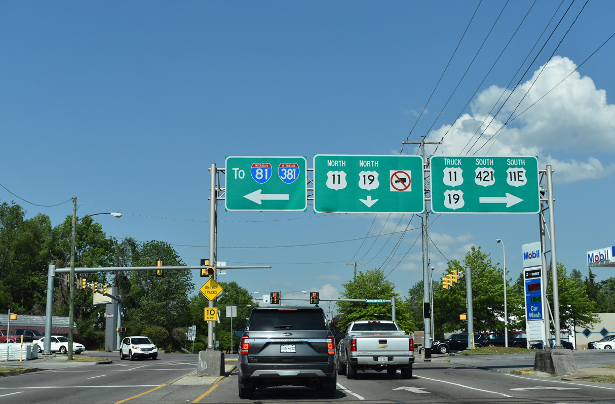
U.S. 11 resumes north from U.S. 11E/W alongside U.S. 19 on Euclid Avenue. U.S. 11-19 Truck accompany U.S. 11E/19/421 (Commonwealth Avenue) south to Goode Street. SR 381/I-381 lead 2.02 miles northeast to I-81/U.S. 58.
05/26/21
South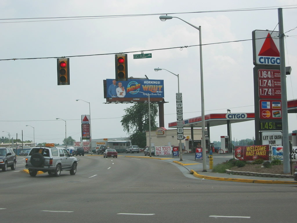
U.S. 19/421 combine with U.S. 11E/SR 381 south on Commonwealth Avenue 0.58 miles to the Tennessee state line.
08/24/03
Photo Credits:
- Carter Buchanan: 03/05/17
- Andy Field, Carter Buchanan: 05/31/07
- Brent Ivy: 05/26/21
- Alex Nitzman, Justin Cozart: 08/24/03
Connect with:
Page Updated Monday August 09, 2021.