
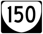
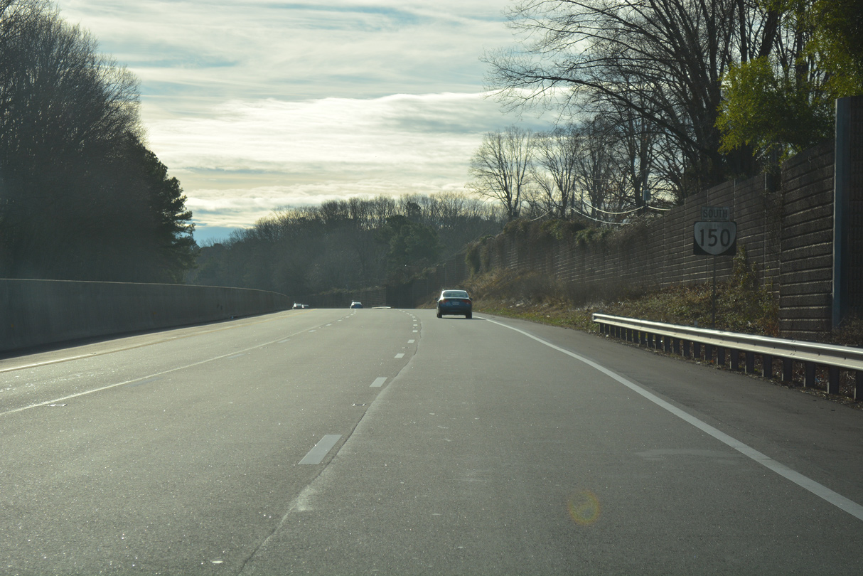
Virginia Route 150 South
Parham Road transitions into SR 150 (Chippenham Parkway) south at a grade separated intersection with Parham Road. River Road forms part of a Virginia Scenic Byway west to SR 6 in Goochland County. Heading east, River Road overtakes SR 147 from Huguenot Road in 2.34 miles en route to Cary Street in Richmond.
05/29/08
Advancing south, SR 150 parallels a transmission line corridor across the James River. The bridge is named after Edward E. Willey, a State Senator from 1952 to 1986.4
05/29/08
SR 150 enters the independent city of Richmond over the south banks of the James River on the Wiley Bridge.
05/29/08
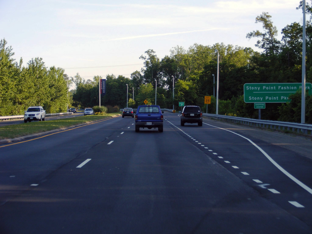
Just beyond the Willey Bridge are right in right out (RIRO) ramps for Stony Point Parkway at Stony Point Fashion Park mall.
05/29/08
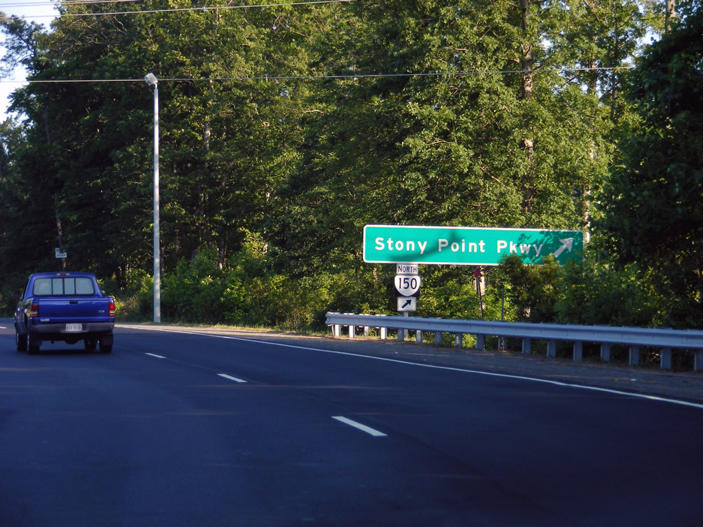
Stony Point Parkway encircles Stony Point Fashion Park mall south to a parclo interchange with SR 150 (Chippenham Parkway).
05/29/08
Continuing east from Stony Point Parkway, SR 150 passes through Lewis G. Larus Park.
05/29/08
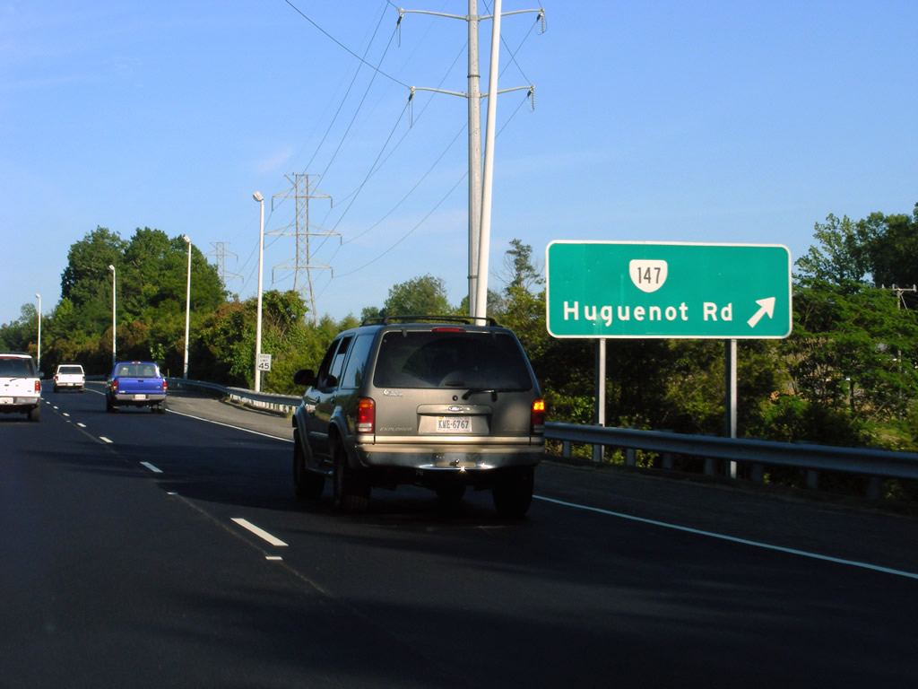
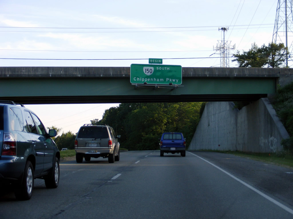
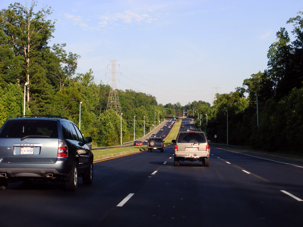
SR 147 (Huguenot Road) converges with SR 150 (Chippenham Parkway) at a six-ramp parclo interchange at Oxford in Richmond. SR 147 runs west to Bon Air, Wayland and Westchester and northeast across the James River to River Road. Overall SR 147 measures 13.13 miles in length between U.S. 60 at Midlothian and Richmond.
05/29/08
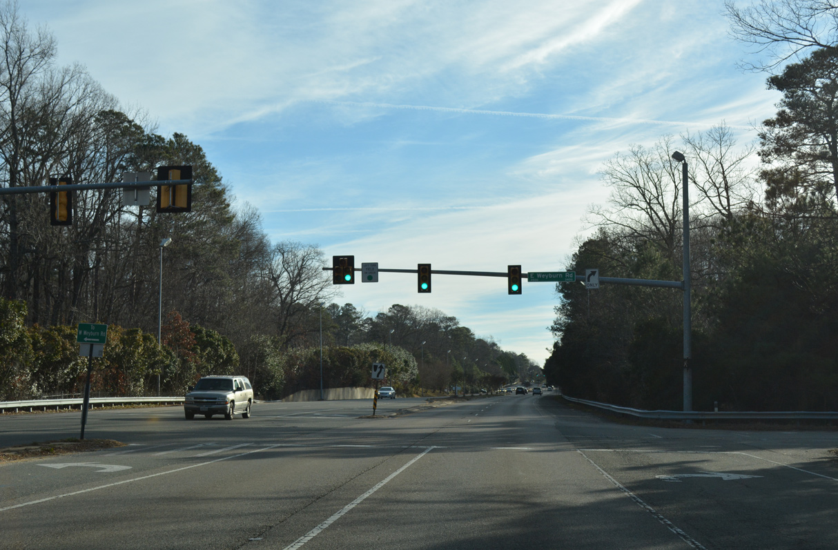
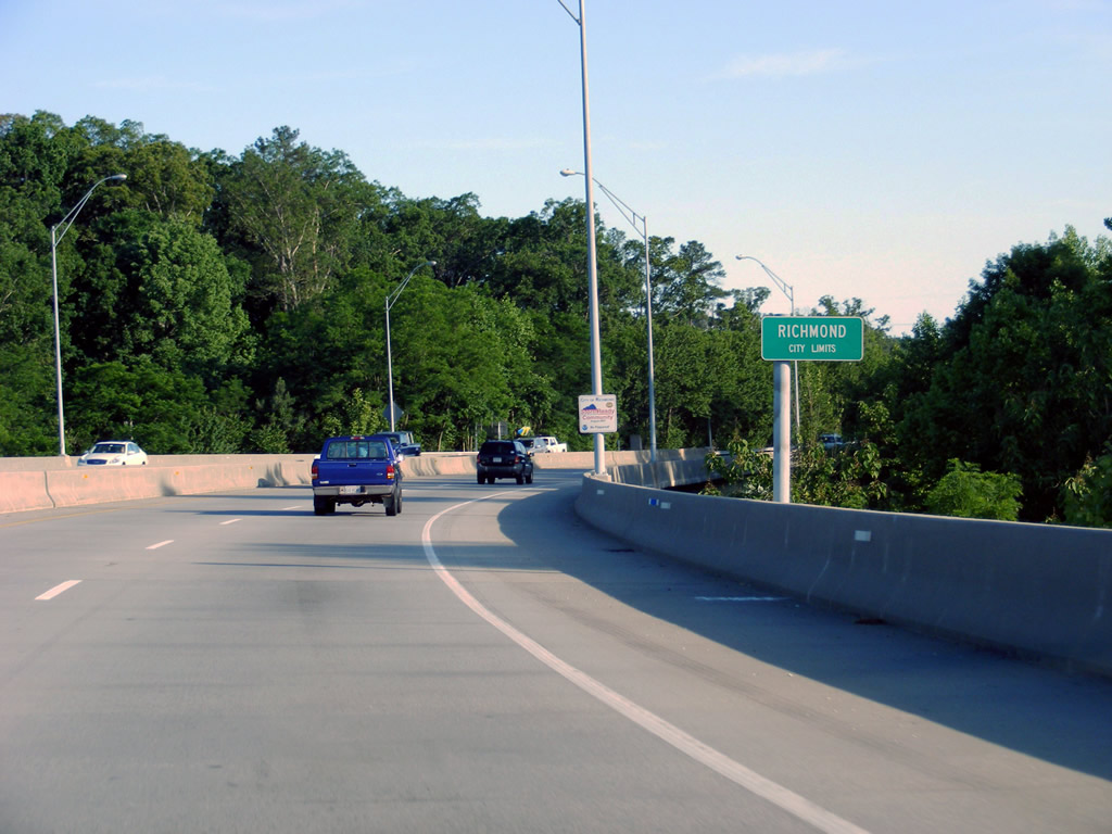
Chippenham Parkway transitions to an at-grade arterial with a series of signalized intersections through the Oxford area in Richmond.
01/01/17
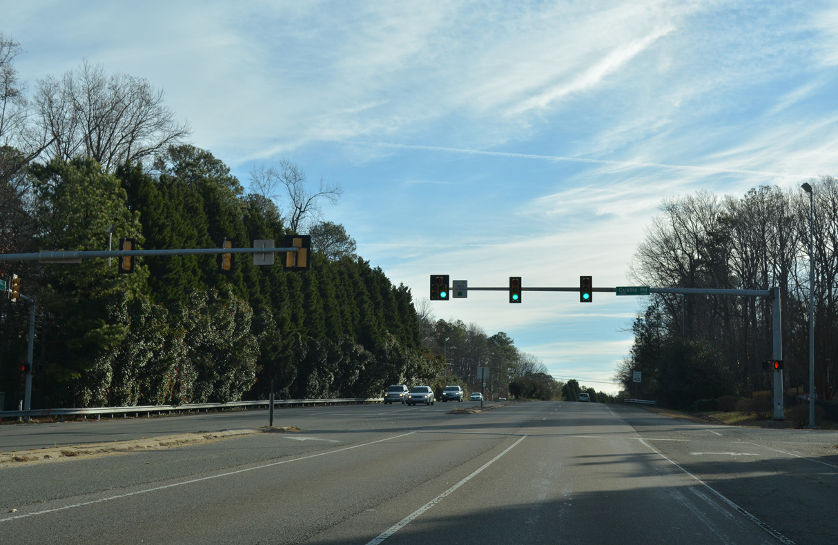
Custis Road intersects SR 150 (Chippenham Parkway) by the Stratford Hills and Cherokee Hills neighborhoods.
01/01/17
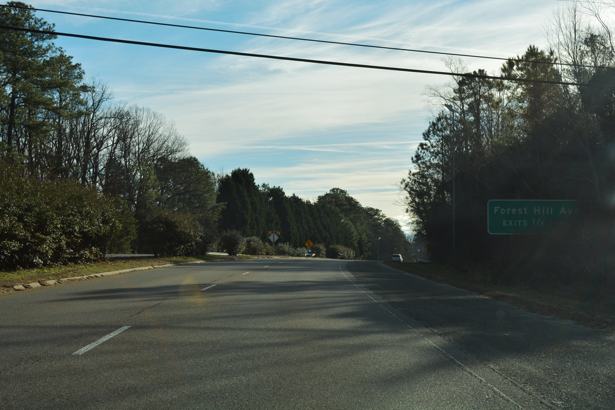
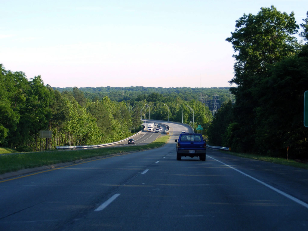
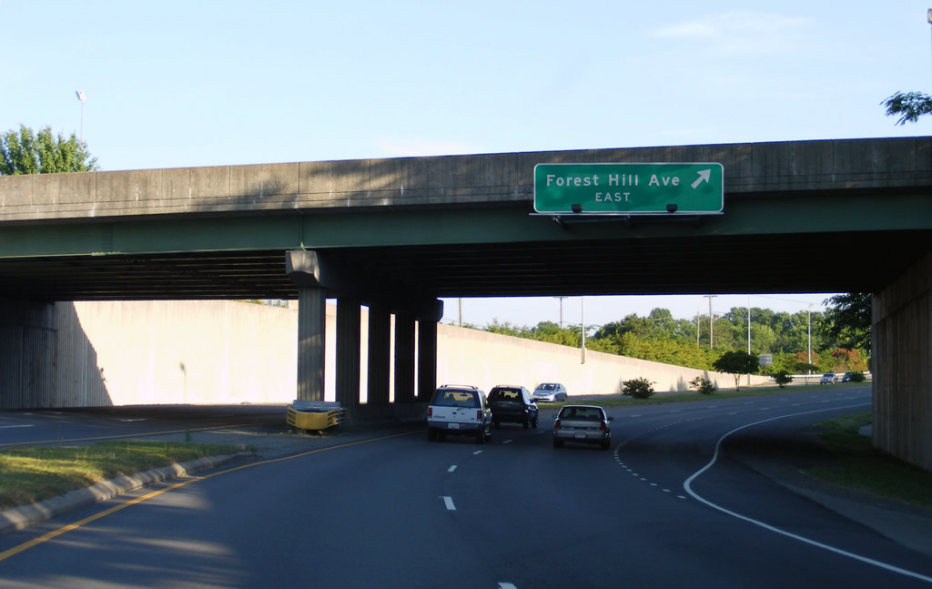
Curving southward, SR 150 upgrades to an expressway at a six-ramp parclo interchange with Forest Hill Avenue by Chippenham Forest Square shopping center. Forest Hill Avenue leads 1.11 miles west to the Richmond city line, where it becomes SR 683, 1.05 miles to SR 147 (Huguenot Road) at Bon Air.
01/01/17
Forest Hill Avenue continues 3.49 miles east from SR 150 across Richmond to SR 76 (Powhite Parkway), Westover Hills, Forest Hills and U.S. 60 at Forest Hill Park.
05/29/08
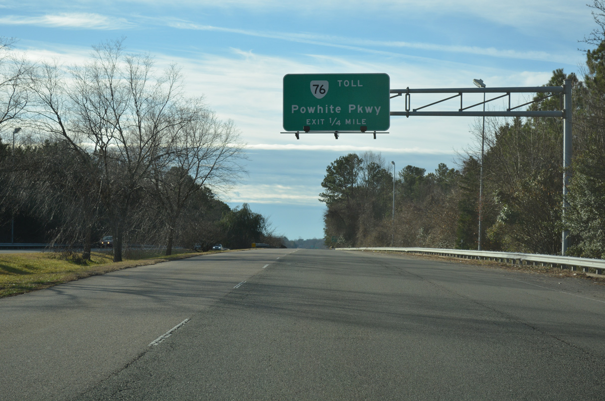
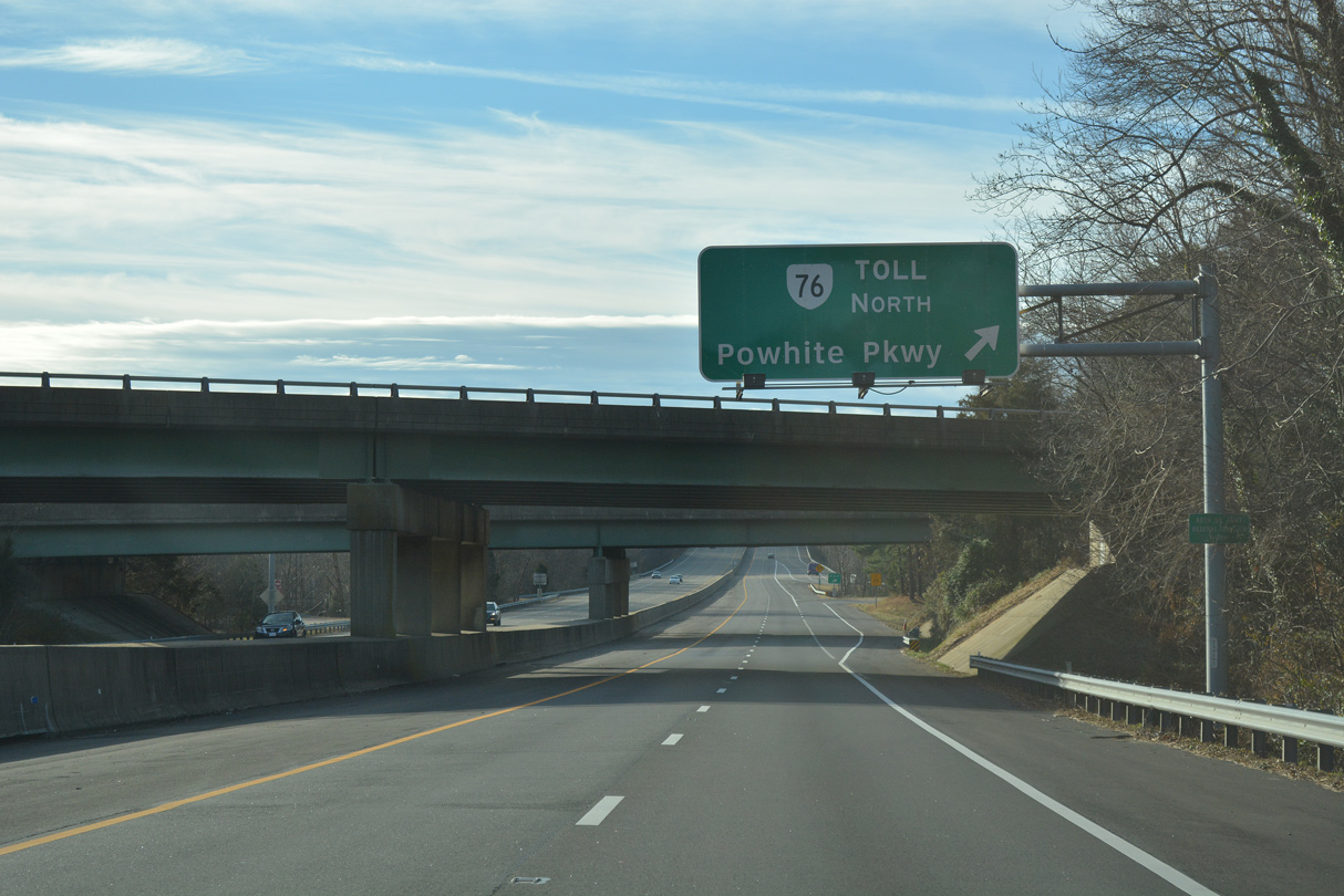
SR 76 (Powhite Parkway) meets SR 150 (Chippenham Parkway) at a directional cloverleaf interchange next. The exchange represents the former west end of the toll road.
01/01/17
SR 150 (Chippenham Parkway) straddles the Richmond / Chesterfield County line south of a Norfolk Southern Railroad preceding the exits for SR 76.
01/01/17
Traffic bound for the Virginia Interstate System is directed onto SR 76 (Powhite Parkway) north.
01/01/17
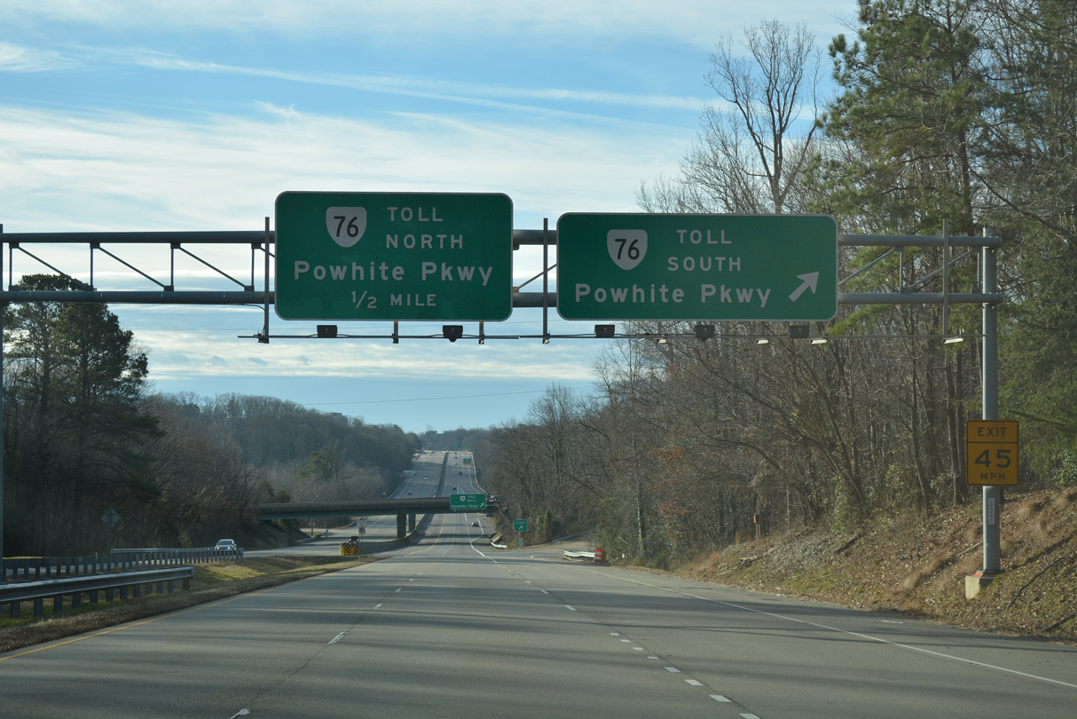
Powhite Parkway links the Chesterfield County suburbs and SR 288 with Downtown Richmond via SR 195 (Downtown Expressway). SR 76 extends 9.46 miles southwest from SR 150.
01/01/17
SR 76 (Powhite Parkway) runs 3.43 miles northeast to Interstate 195 (Belt Line Expressway) at Carytown in Richmond.
01/01/17
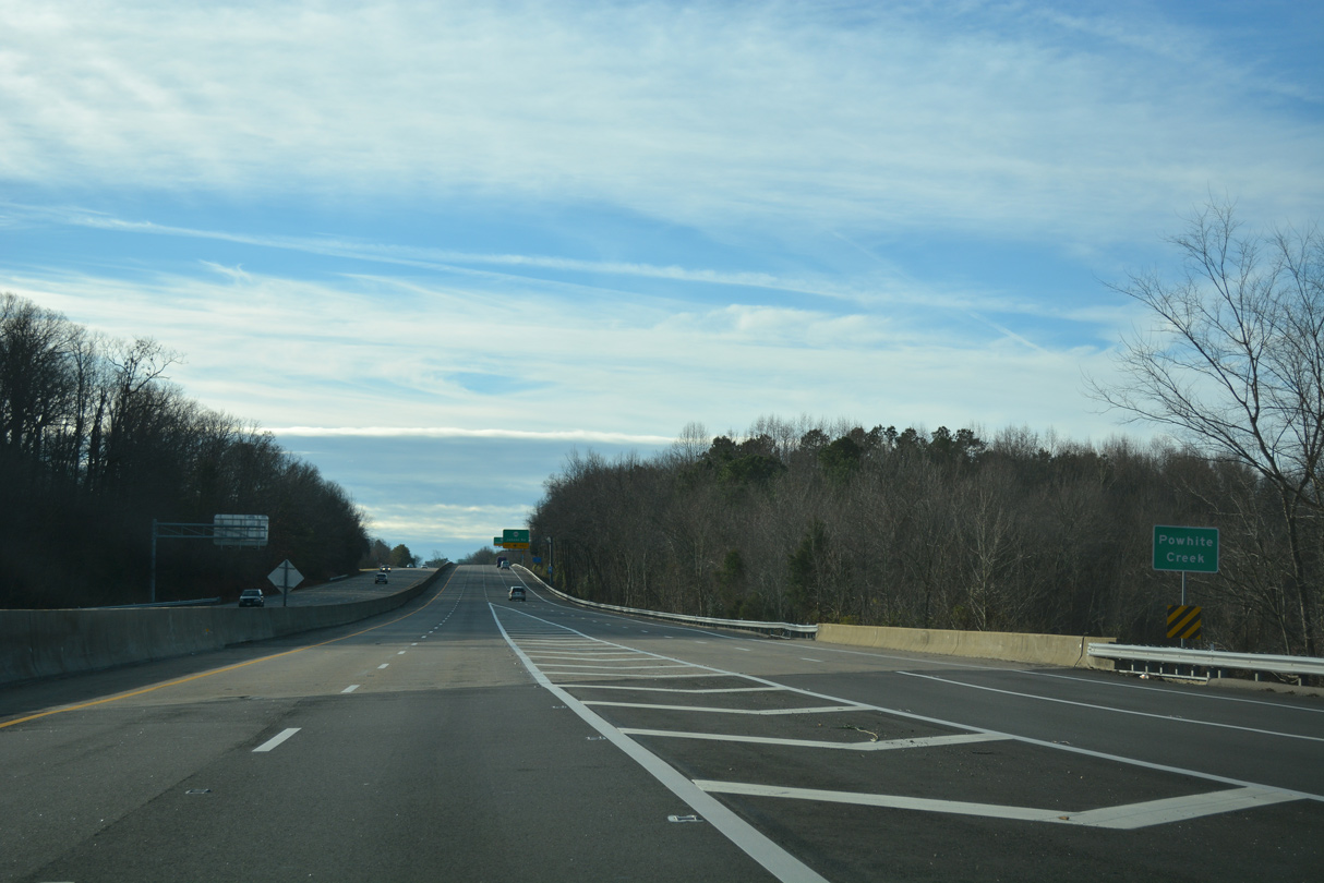
Chippenham Parkway crosses Powhite Creek south of the exchange with SR 76 by Powhite Park.
01/01/17
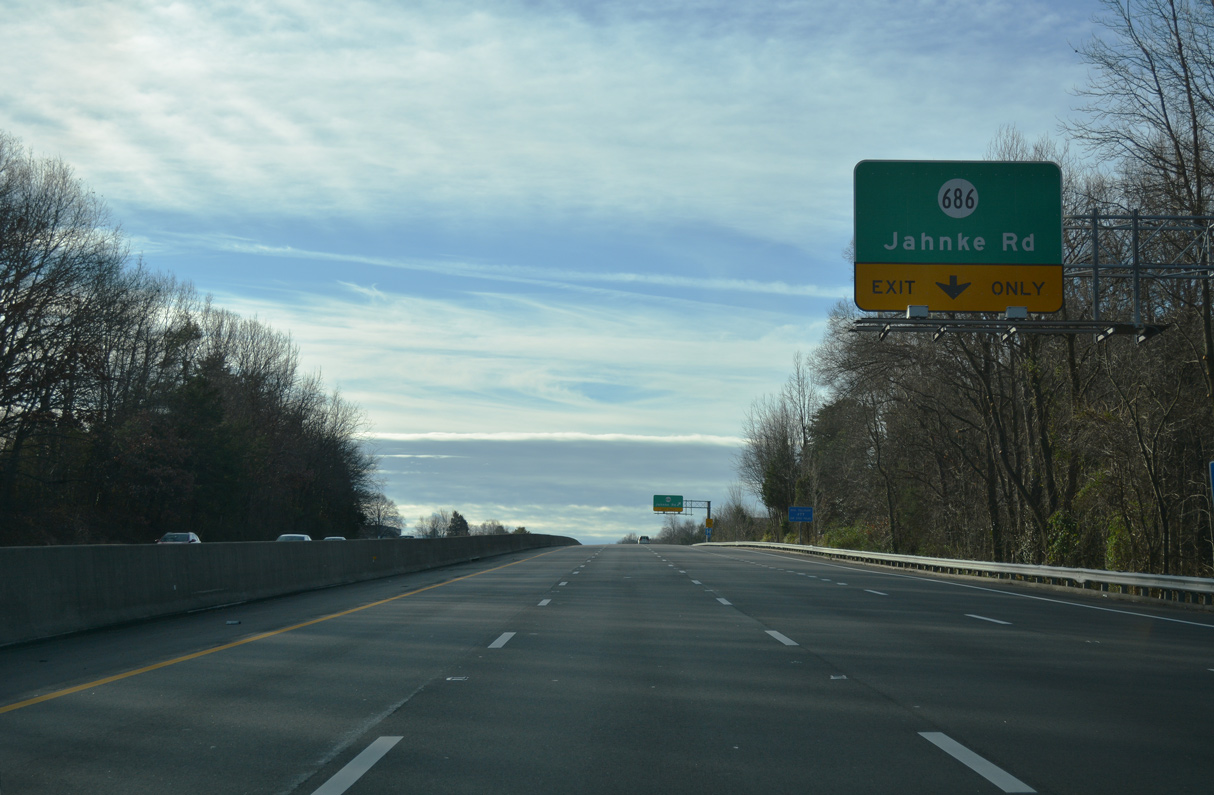
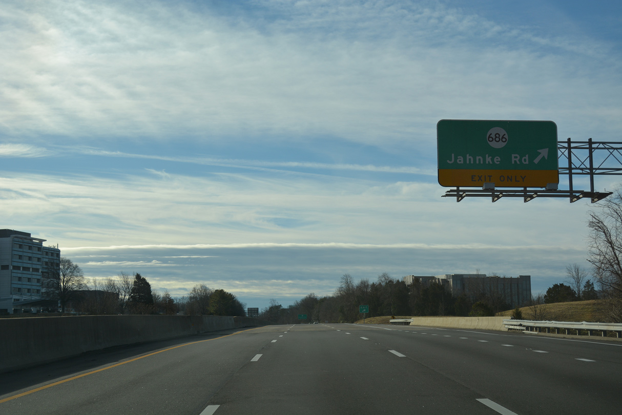
A parclo interchange joins Chippenham Parkway with SR 686 (Jahnke Road).
01/01/17
Jahnke Road winds eastward to Forest Hill Avenue at Westover Hills and as SR 686 west 1.93 miles to SR 76 (Powhite Parkway) and SR 678 (Buford Road).
01/01/17
Auxiliary lanes open in both directions of SR 160 between SR 686 (Jahnke Road) and U.S. 60 (Midlothian Turnpike).
01/01/17
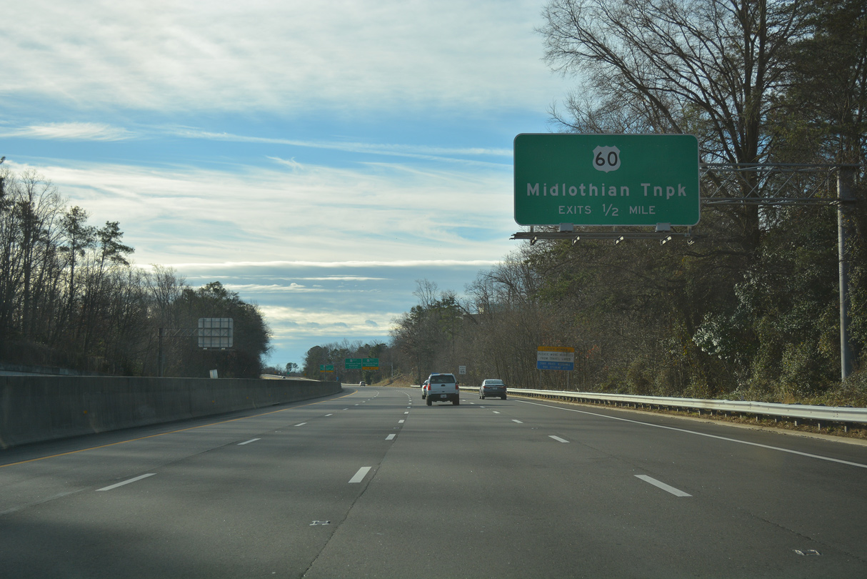
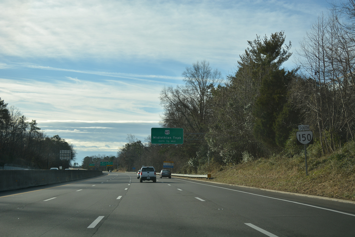
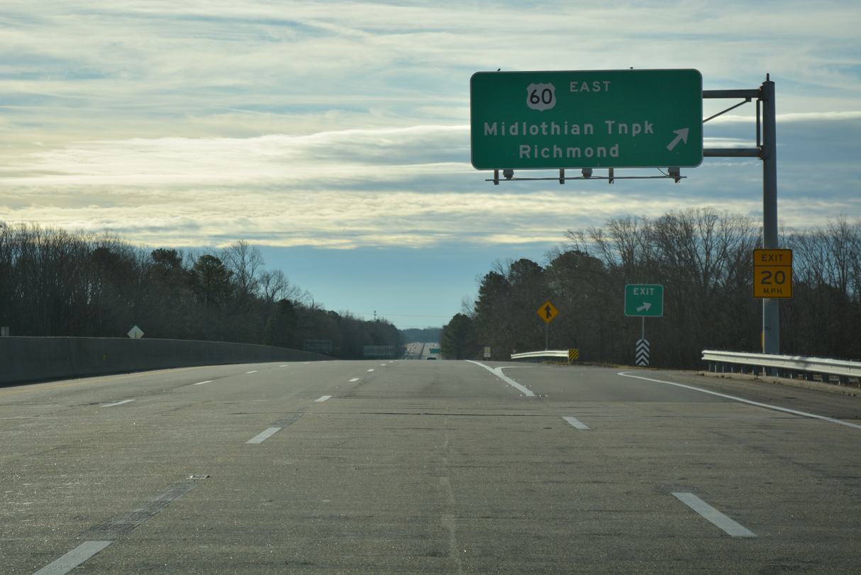
SR 150 and U.S. 60 converge at a cloverleaf interchange adjacent to the Spring Rock Green and Stonebridge retail centers.
01/01/17
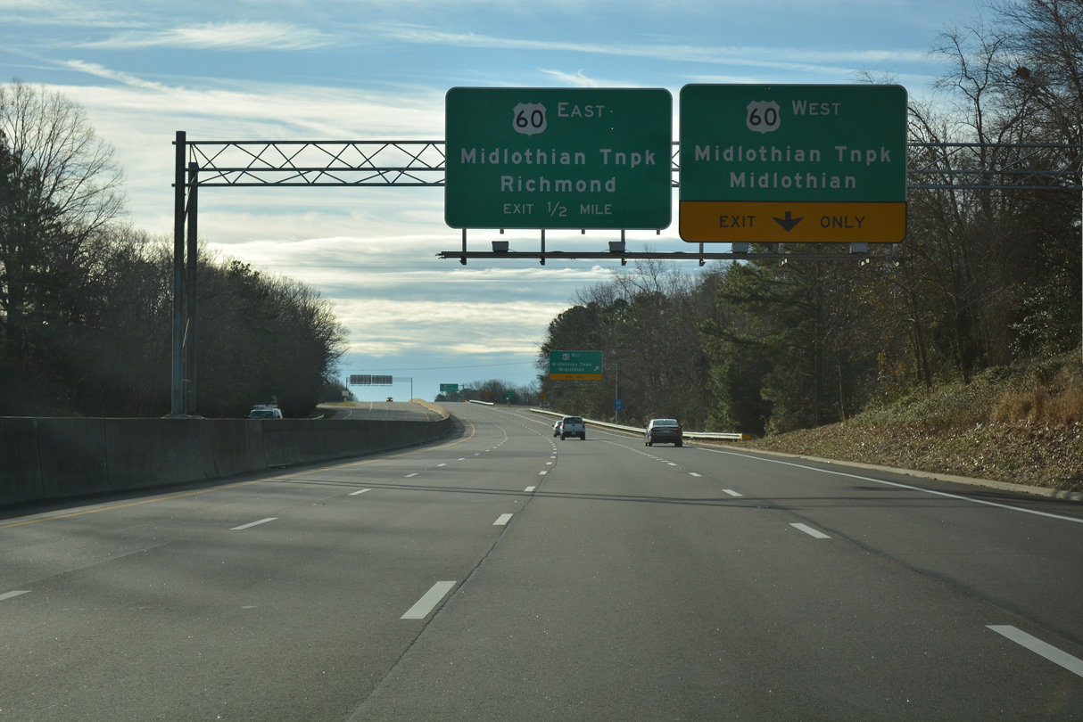
U.S. 60 joins the Richmond area with Powhatan to the west and Richmond International Airport (RIC) to the east. Locally U.S. 60 is a commuter route between Midlothian, Bon Air and other western suburbs and south Richmond.
01/01/17
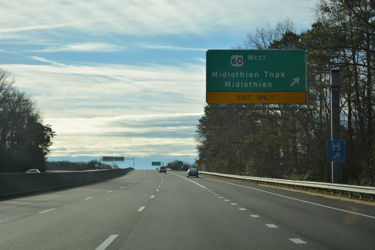
U.S. 60 (Midlothian Turnpike) constitutes a heavily developed commercial arterial west to Midlothian and east to SR 161 (Belt Boulevard) in Richmond.
01/01/17
U.S. 60 east follows Midlothian Turnpike to Roanoke street north, Forest Hill Avenue east and Semmes Avenue toward Downtown Richmond. U.S. 60 travels 304 miles overall across Virginia from the Appalachian Mountains to Rudee Inlet in Virginia Beach.
01/01/17
U.S. 360 (Hull Street Road) meets SR 150 (Chippenham Parkway) next at a six-ramp parclo interchange.
01/01/17
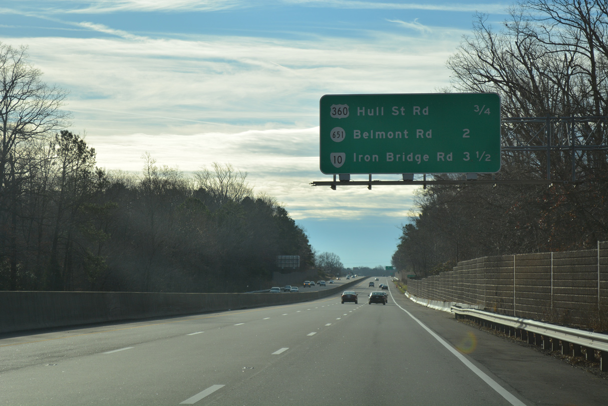
The exchange joining SR 150 with U.S. 360 (Hull Street Road) was constructed from 1985 to 1987. U.S. 360 serves far reaching suburbs west toward Swift Creek Reservoir.
01/01/17
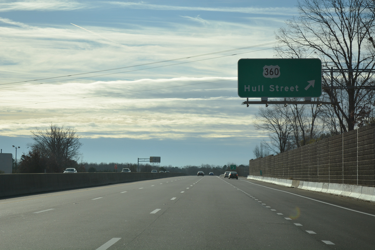
The exit for U.S. 360 (Hull Street Road) west to Falling Creek Farms and other suburban areas, and Hull Street northeast toward Downtown Richmond departs SR 150 south.
01/01/17
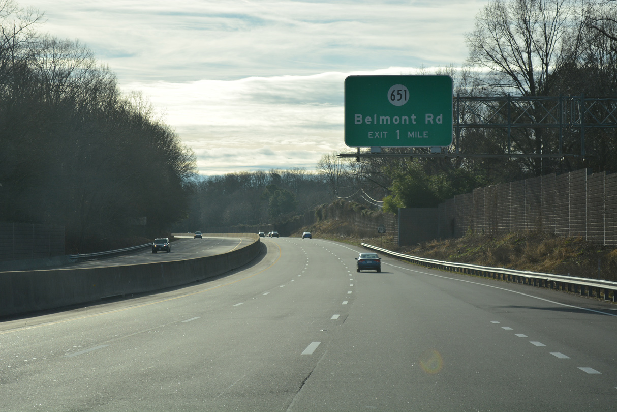
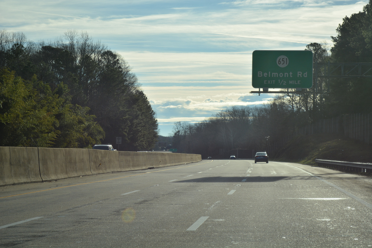
SR 651 (Belmont Road) meets SR 150 (Chippenham Parkway) at a parclo interchange just beyond the Richmond city line.
01/01/17
Belmont Road stems south from Walmsley Boulevard to SR 150 across Pocoshock Creek. SR 651 continues along Belmont Road south 6.03 miles through suburban areas to SR 604 (Courthouse Road) near the beltway along SR 288.
01/01/17
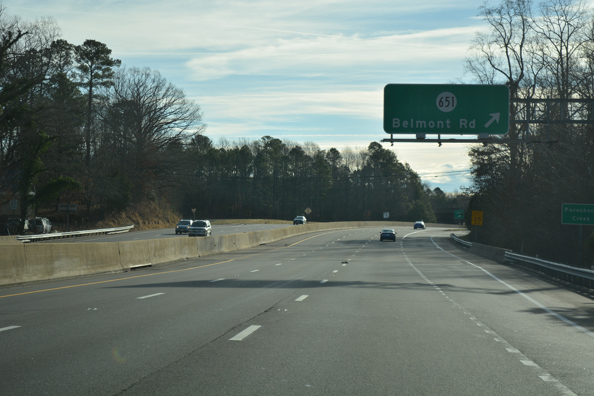
The exit for SR 651 (Belmont Road) to Wilkinson Terrace, Jessup Farm Acres and Land O' Pines separates from SR 150 south at Pocoshock Creek.
01/01/17
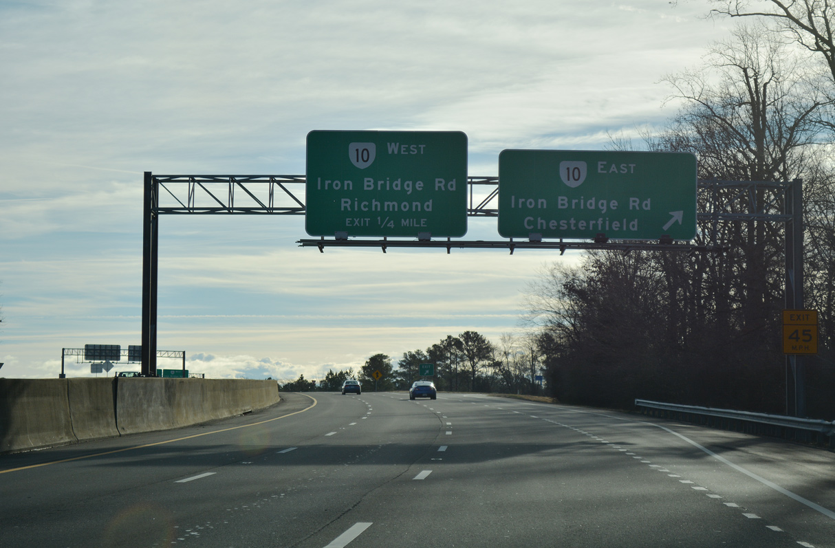
A cloverleaf interchange links SR 150 (Chippenham Parkway) and SR 10 (Iron Bridge Road) south of Falling Creek Reservoir.
01/01/17
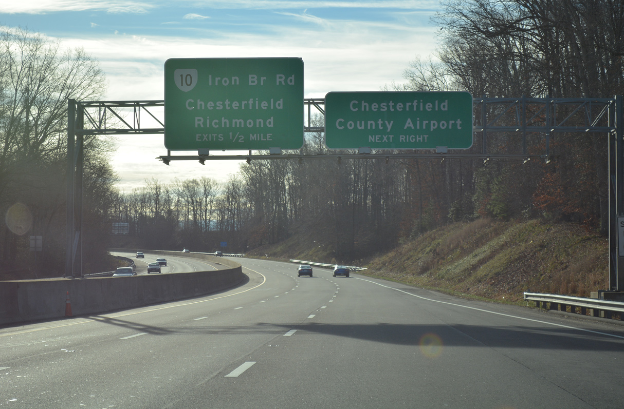
SR 10 (Iron Bridge Road) provides a direct route south to Chesterfield County Airport (FCI) ahead of SR 288 near Chesterfield.
01/01/17
Originating from U.S. 360 in Richmond, SR 10 (Iron Bridge Road) loops southwest to Chesterfield, and then east to Chester. SR 10 continues along a 91.32 mile course to Hopewell, Smithfield and ultimately Suffolk.
01/01/17
Westbound SR 10 (Iron Bridge Road) continues north from SR 150 through south Richmond to U.S. 360 (Hull Street Road) along Broad Rock Boulevard.
01/01/17
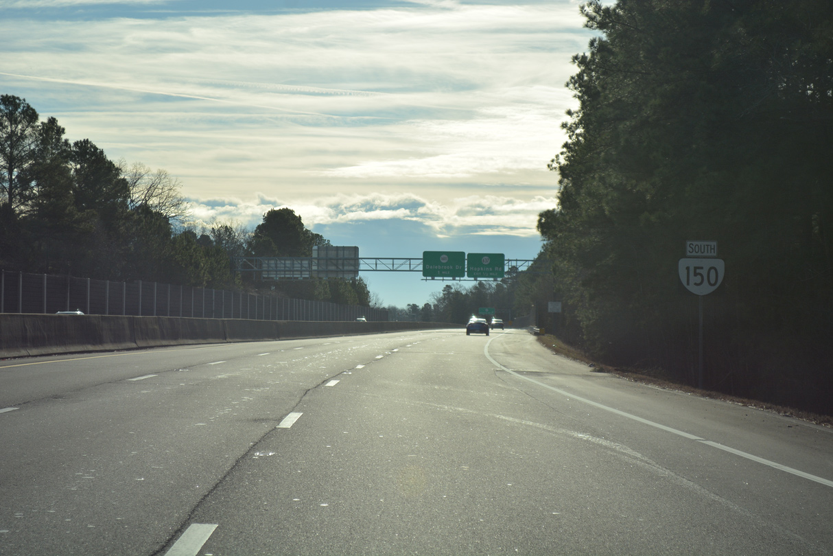
Reassurance shield posted for SR 150 south between SR 10 and Hopkins Road.
01/01/17
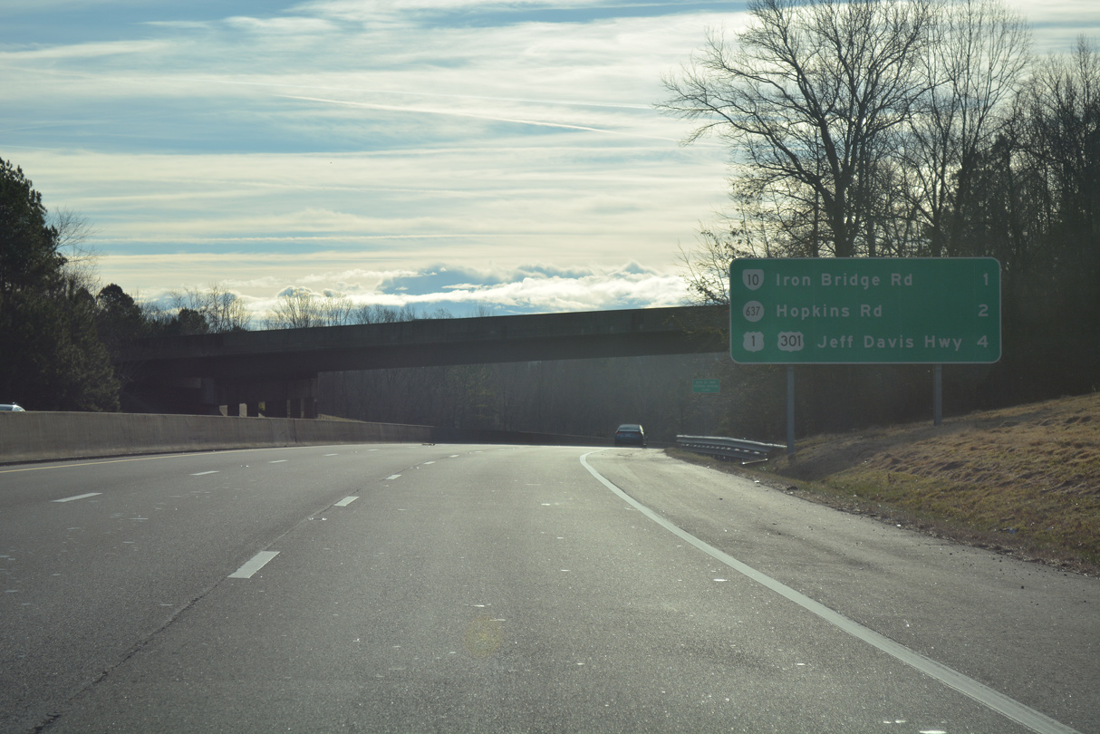
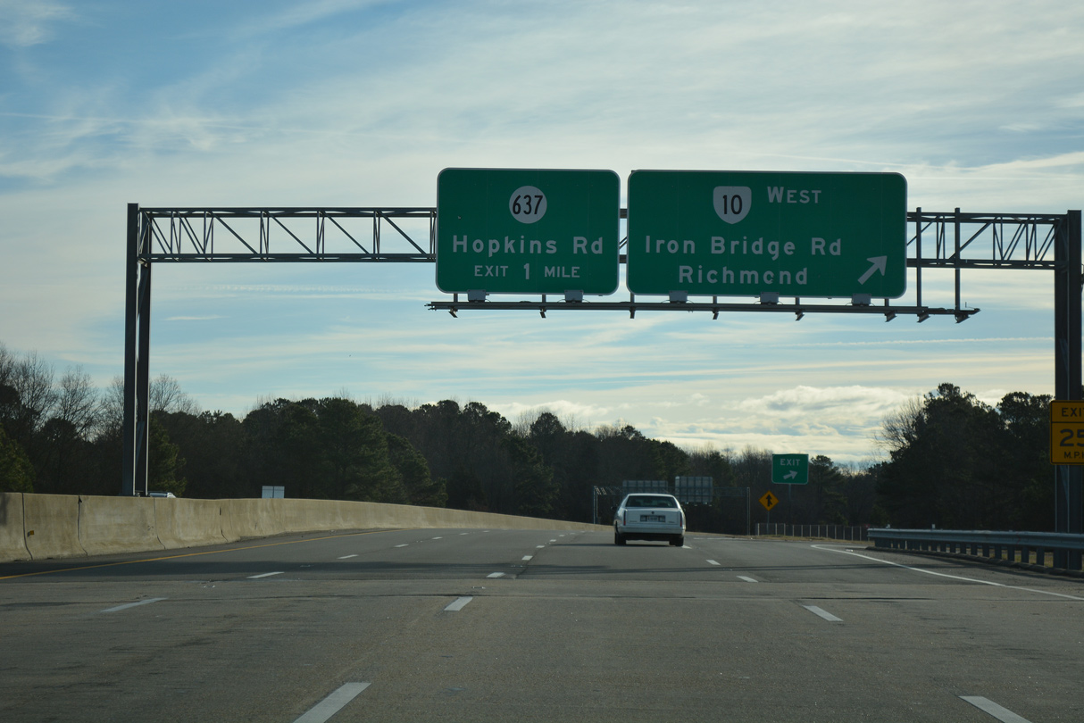
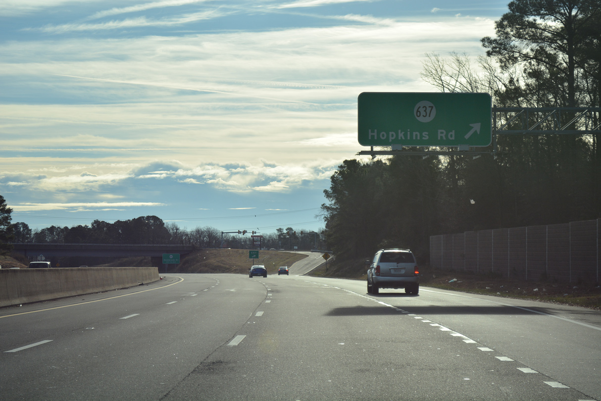
SR 150 advances southeast a half mile to a diamond interchange with SR 637 (Hopkins Road).
01/01/17
Hopkins Road meanders north through Richmond to U.S. 1/301 (Jefferson Davis Highway) and south to Beulah and SR 145 at Centralia.
01/01/17
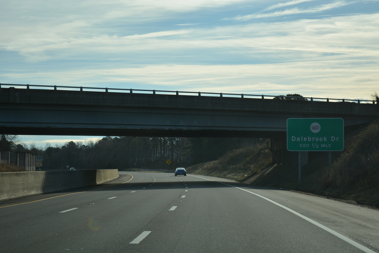
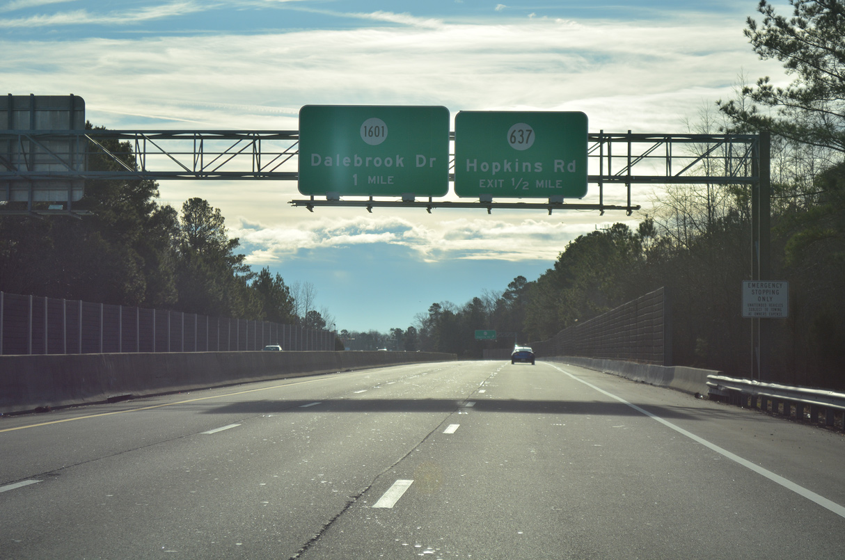
Right in right out (RIRO) ramps connect SR 150 south with SR 1601 (Dalebrook Drive) by the Meadowbrook community.
01/01/17
SR 1601 (Dalebrook Drive) arcs southeast 0.66 miles through a residential area to Beulah Road. Parallel Meadowdale Boulevard ties into the major collector from Meadowdale Shopping Center and Hopkins Road to the west.
01/01/17

Sound walls line both sides of Chippenham Parkway through the Bensley area. This confirming marker appears after the entrance ramp from Dalebrook Drive north.
01/01/17
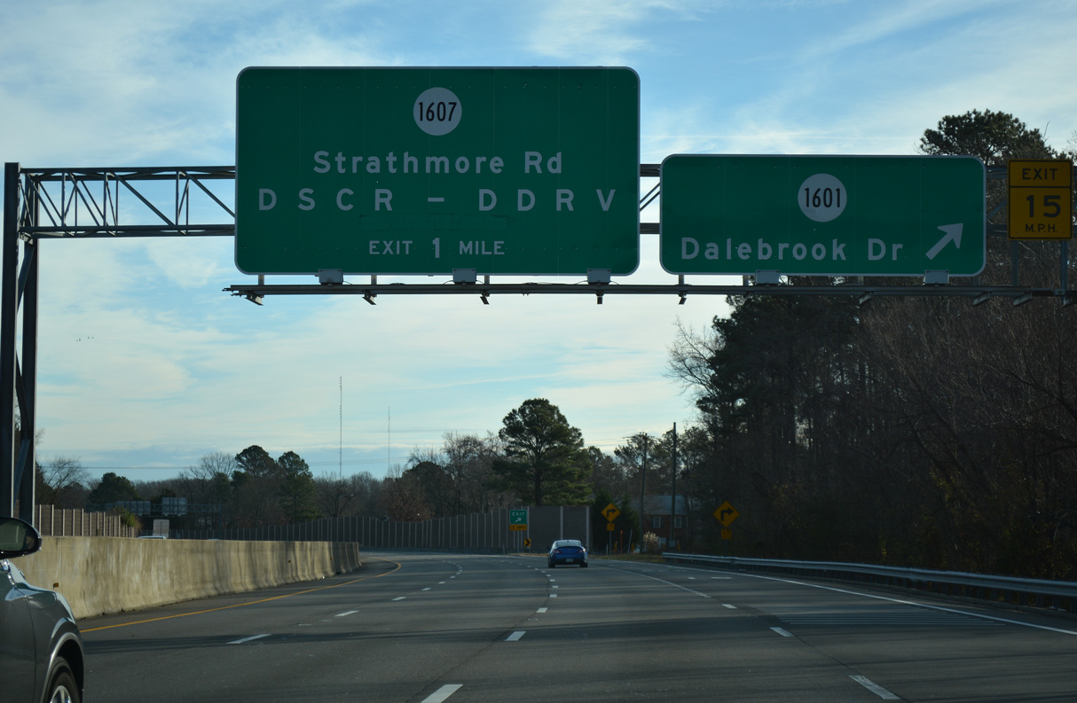
A folded diamond interchange joins SR 150 with Strathmore Road (SR 1607) after a CSX Railroad underpass.
01/01/17
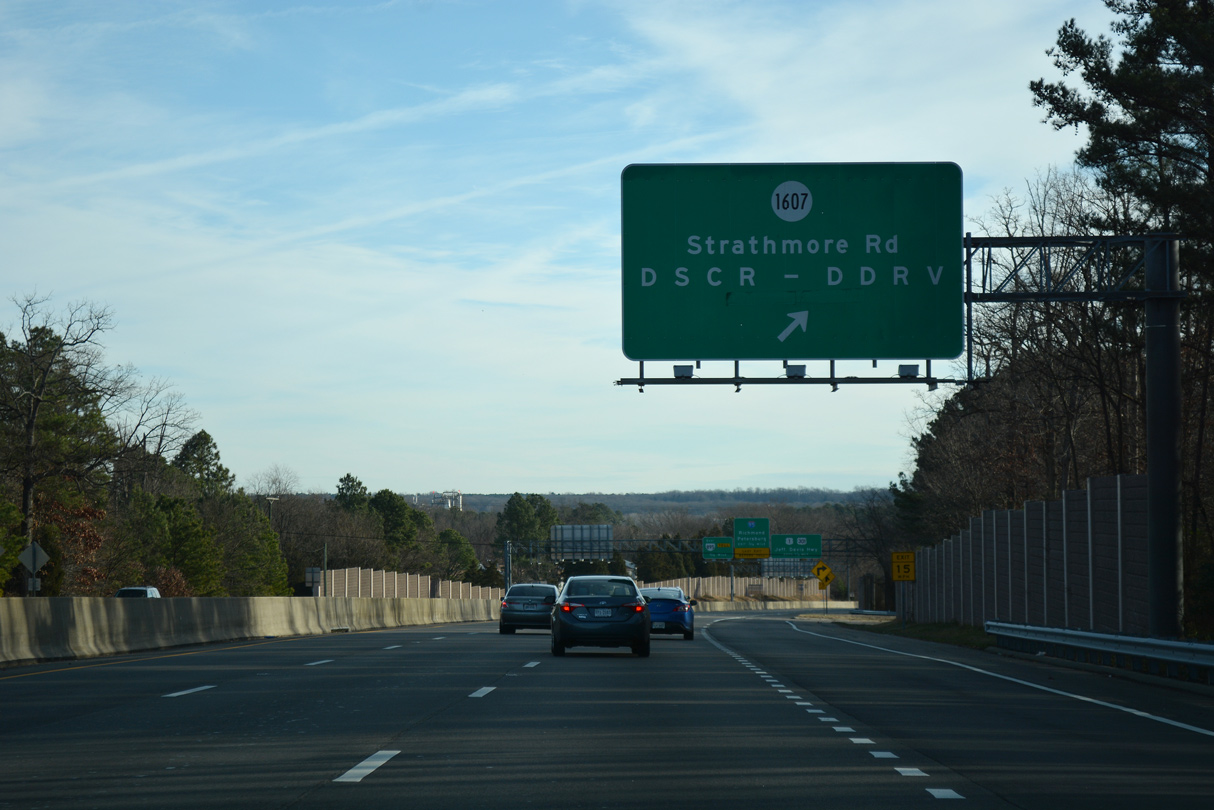
Strathmore Road connects Chippenham Parkway with Defense Supply Center Richmond (DSCR) and Defense Depot Richmond Virginia (DDRV) to the south.
01/01/17

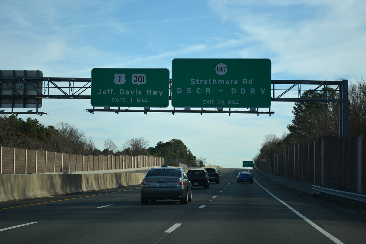
U.S. 1/301 (Jefferson Davis Highway) crosses paths with SR 150 at a cloverleaf interchange midway between Bensley and the Richmond city line.
01/01/17
U.S. 1/301 (Jefferson Davis Highway) overlap southward from SR 150 to Colonial Heights and Downtown Petersburg.
01/01/17
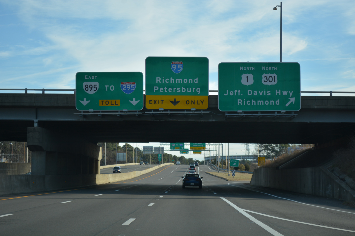
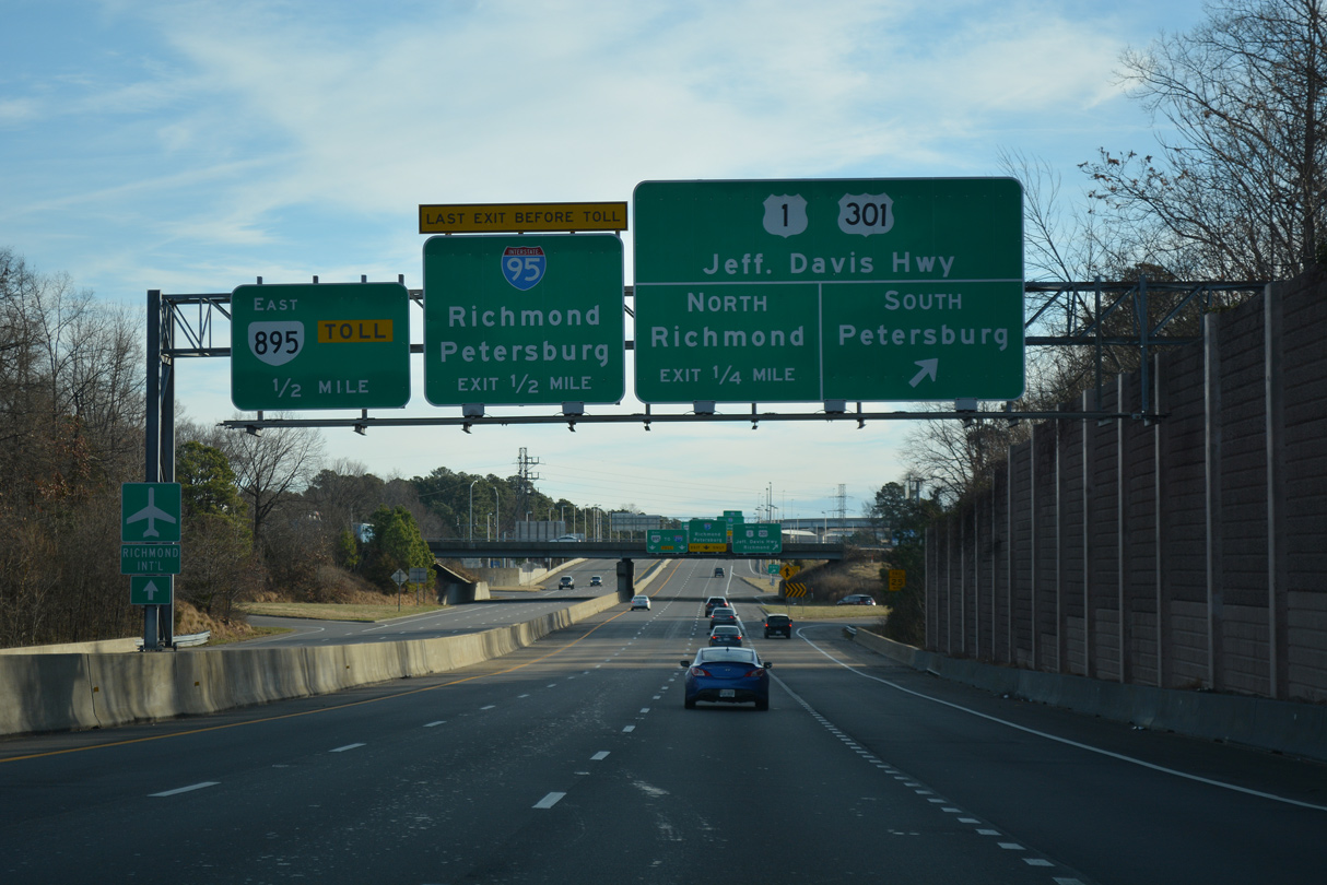
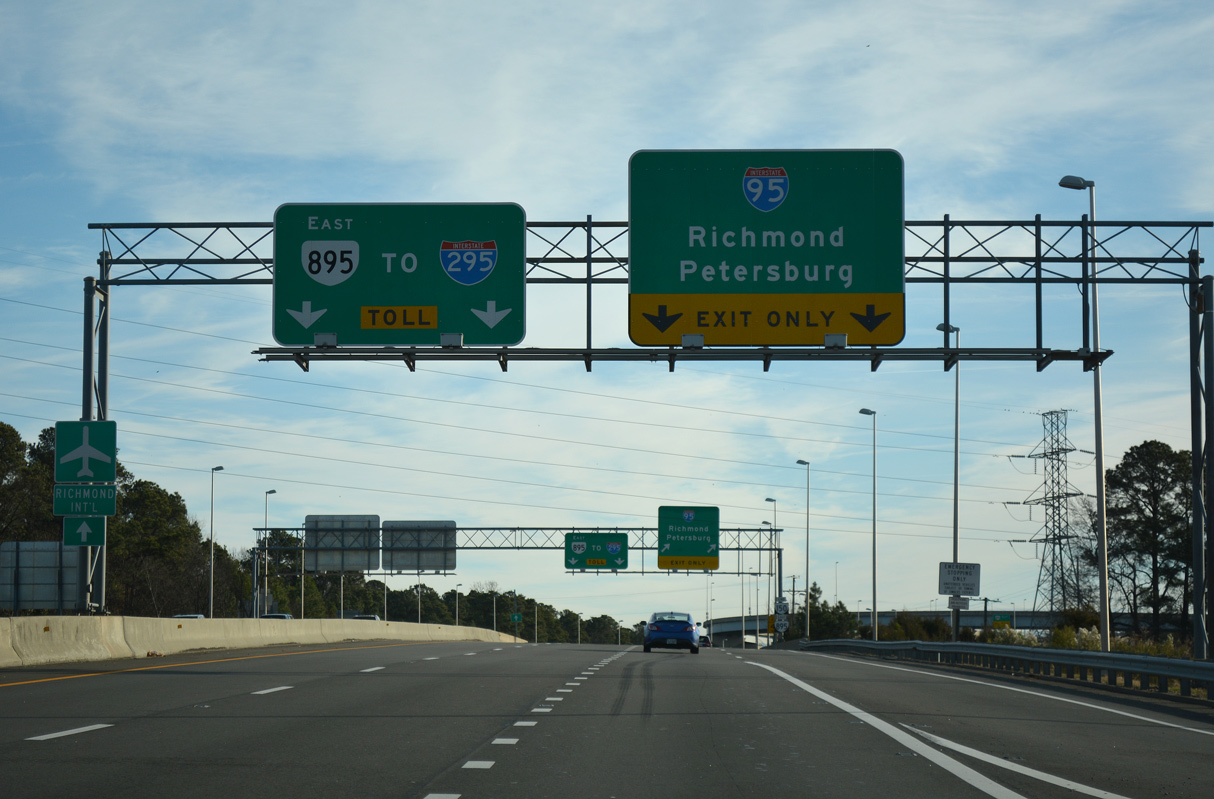
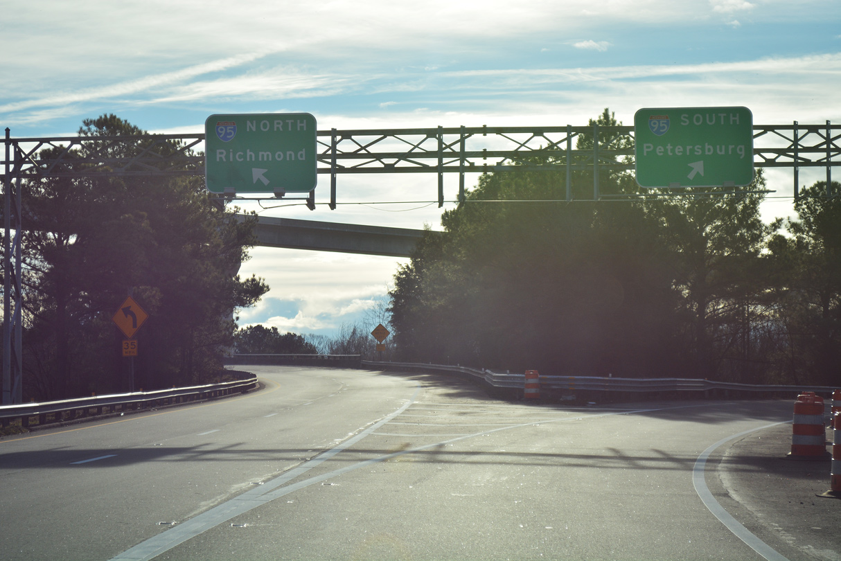
U.S. 1/301 follow Jefferson Davis Highway north to Cowardin Avenue and the Robert E. Lee Memorial Bridge to Oregon Hill in Richmond. SR 150 transitions into SR 895 (Pocahontas Parkway) east at the systems interchange with I-95.
01/01/17
All traffic to I-95 departs SR 150 (Chippenham Parkway) south in unison. I-95 (Richmond-Petersburg Turnpike) constitutes a six lane freeway between Downtown Richmond and Petersburg.
01/01/17
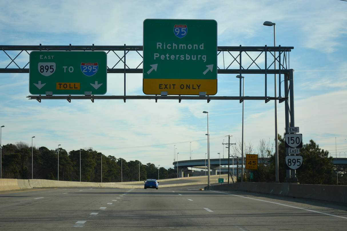
SR 150 (Chippenham Parkway) ends and SR 895 begins as a toll road leading east to Richmond International Airport (RIC) and Interstate 295.
01/01/17
SR 895 rises onto the Vietnam Veterans Memorial Bridge across the James River east from the exchange with Interstate 95.
01/01/17
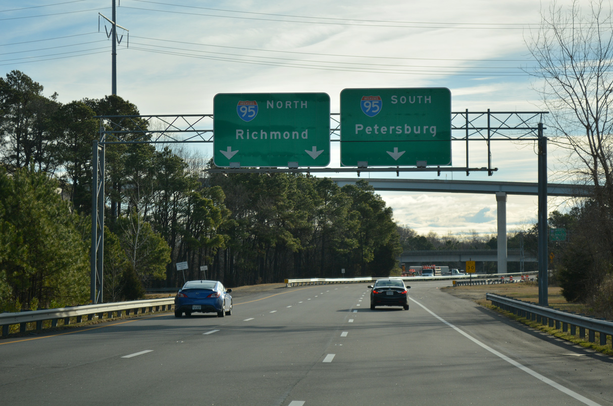
I-95 parallels the James River north into the city of Richmond. Beyond the state capitol, I-95 travels to Fredericksburg and Washington, DC.
01/01/17
South from SR 150, I-95 advances 4.9 miles to SR 288 and 15.9 miles to the split with Interstate 85 in Petersburg.
01/01/17
The exit ramp from SR 150 south to I-95 north lines up below the high flyover linking SR 895 west with the Richmond-Petersburg Turnpike northbound.
05/29/08
Photo Credits:
- Will Weaver: 05/29/08
- Alex Nitzman: 01/01/17
Connect with:
Page Updated Thursday August 12, 2021.