Interstate 390 South - Monroe County
05/08/05 & 07/02/05 photos taken by Alex Nitzman.
| Interstate 390 South | |
|---|---|
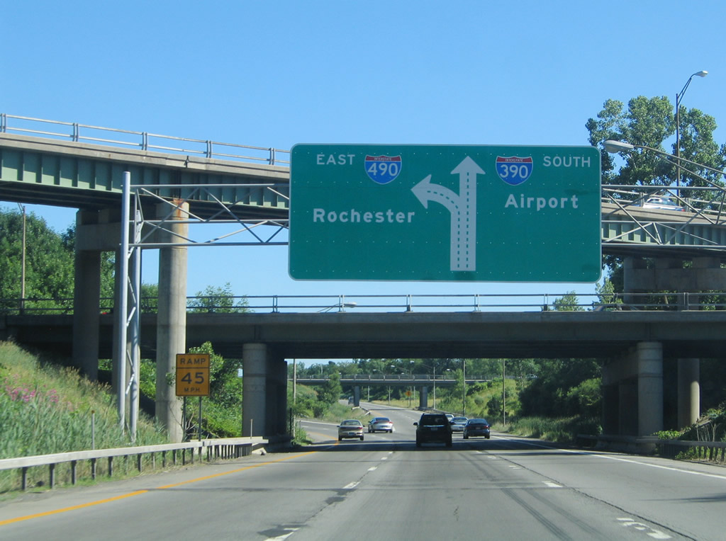 |
Interstate 390 splits with the Exit 20A off-ramp to Interstate 490 east. Interstate 490 continues into downtown Rochester. Photo taken 07/02/05. |
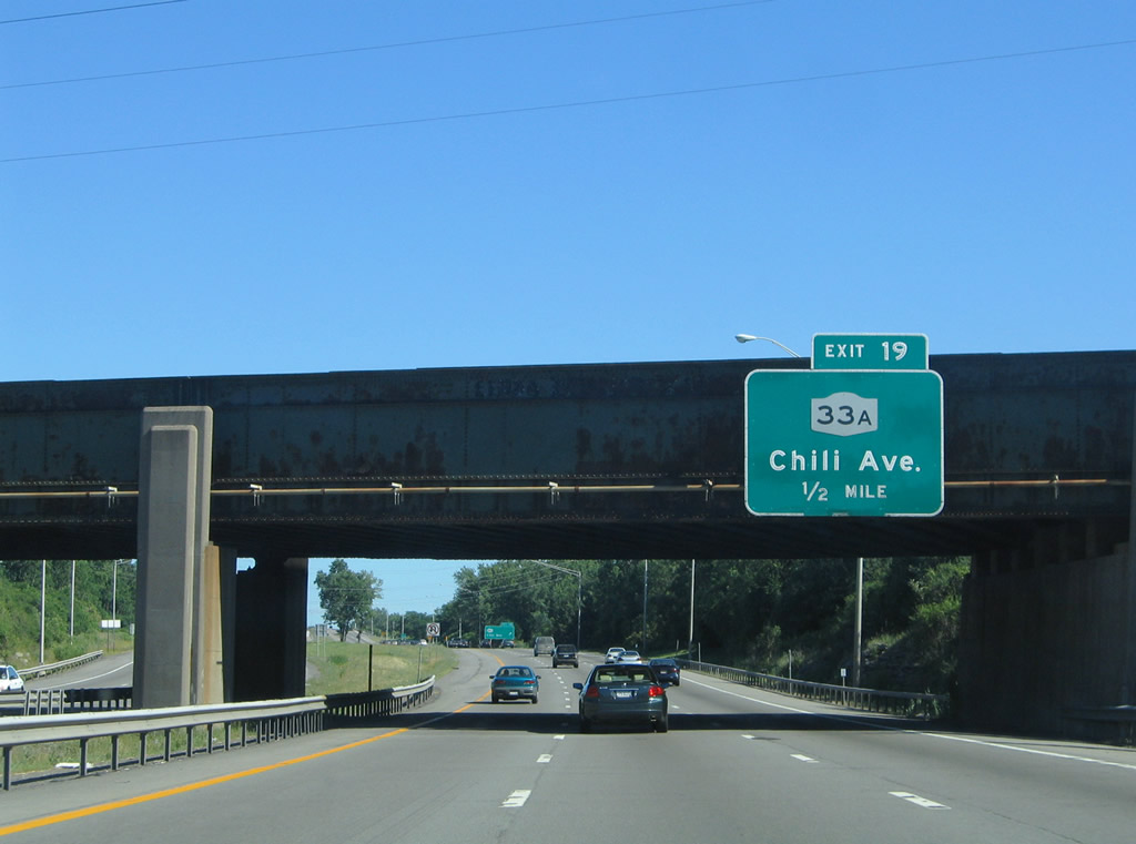 |
Attached to the CSX Railroad overpass is the one-half mile guide sign for New York 33A (Chili Avenue). New York 33A travels 17.15 miles between ends at New York 33 between Bergen and Rochester. Photo taken 07/02/05. |
 |
Exit 19 consists of a folded diamond interchange with New York 33A (Chili Avenue). New York 33A heats west to New York 204 and Chili and east to New York 33 (West Main Street). Photo taken 07/02/05. |
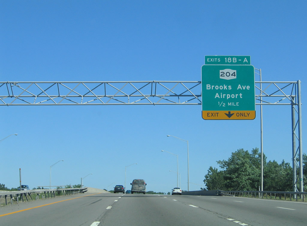 |
New York 204 heads east along Brooks Avenue from a brief overlap with New York 33A on Chili Avenue to interchange with Interstate 390 at Exits 18B/A. Photo taken 07/02/05. |
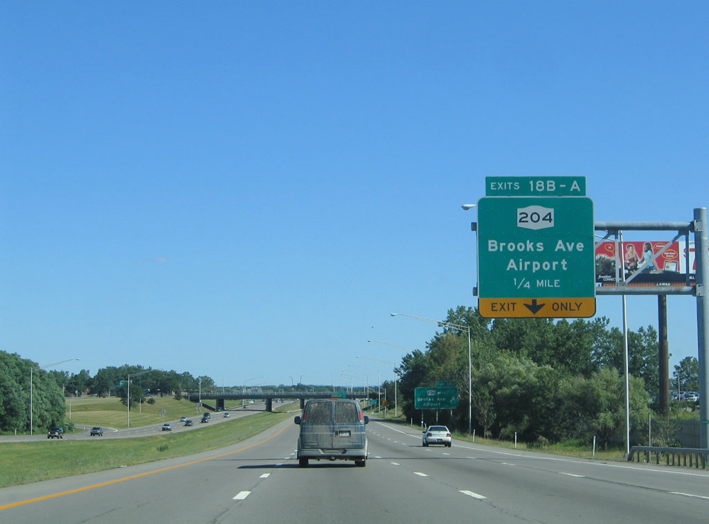 |
New York 204 begins at Interstate 390 and ends as the Airport Expressway spur to Interstate 490. The state route totals just 3.46 miles. Photo taken 07/02/05. |
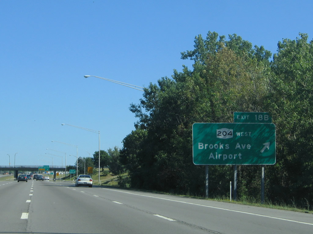 |
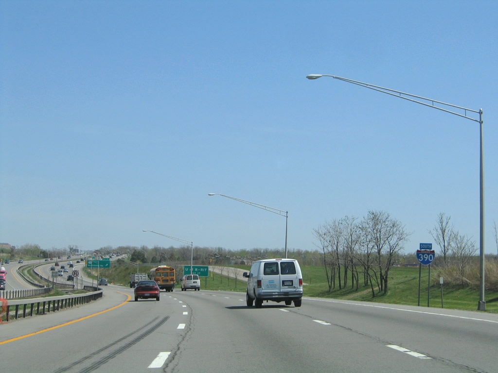
Interests to Greater Rochester International Airport should use Brooks Avenue west to its ramps for the airport terminal. Historically, New York 204 represented a planned freeway linking Interstates 390 and 490. Only the Airport Expressway spur from Interstate 490 Exit 6 was constructed due to community opposition. Photo taken 07/02/05. |
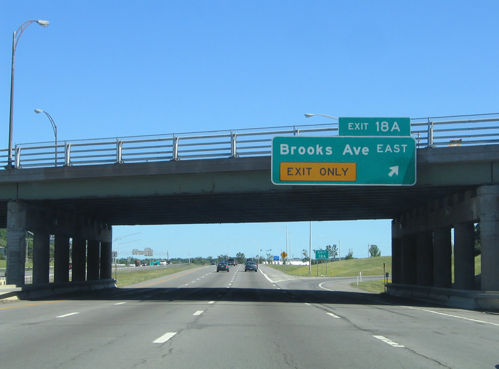 |
A loop ramp carries drivers onto Brooks Avenue east to New York 383 at the intersection of Genesee Street and Plymouth Avenue. Photo taken 07/02/05. |
 |
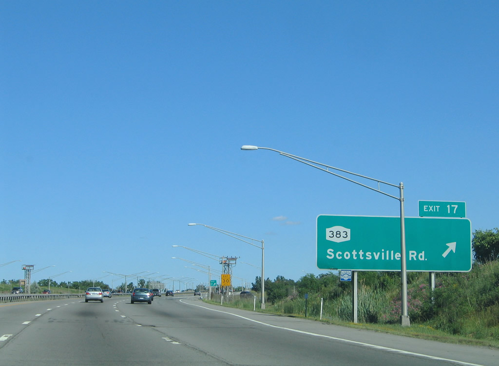
New York 383 travels south from New York 33 (West Main Street) and downtown Rochester to a folded diamond interchange with Interstate 390 (Exit 17). Photo taken 05/10/05. |
 |
East Airport Road parallels the southbound side of Interstate 390 from the terminal to New York 383 (Scottsville Road). Interests to the University of Rochester should use New York 383 east to Elmwood Avenue and those to Rochester Institute of Technology should use Scottsville Road south to New York 252 east. Photo taken 05/10/05. |
 |
Interstate 390 enters the town of Chili between the airport and Genesee River, where Exit 17 resides. New York 383 follows Scottsville Road southwest from Genesee Street in the city to south Chili and Wheatland. The state route travels 18.98 miles south to New York 36 at Mumford. Photo taken 07/02/05. |
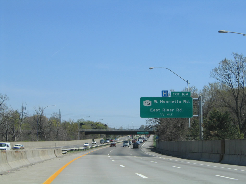 |
Interstate 390 spans the Genesee River into Genesee Valley Park on the half mile approach to New York 15 (West Henrietta Road). Photo taken 05/10/05. |
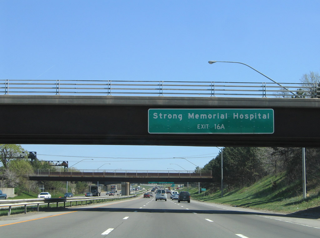 |
Exit 16 serves both Strong Memorial and Monroe Community Hospitals in south Rochester. This overhead is attached to the Moore Drive overpass. Photo taken 05/10/05. |
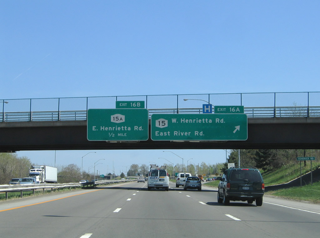 |
A half diamond interchange joins Interstate 390 south with New York 15 (West Henrietta Road). New York 15 travels Mt. Hope Avenue north to its terminus in downtown Rochester and West Henrietta Road south to Marketplace Mall and Henrietta. East River Road ties into New York 15 from Genesee Valley Park to briefly become a frontage road of the freeway though to New York 15A (East Henrietta Road). Photo taken 05/10/05. |
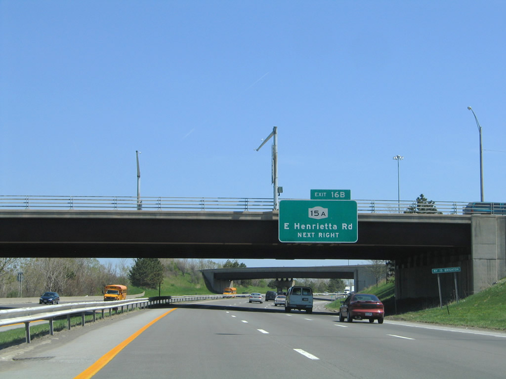 |
Exit 16B joins East River Road ahead of its end at New York 15A (East Henrietta Road). New York 15A follows East Henrietta Road north to its end at Mt. Hope Avenue nearby and south to Monroe Community College and Exit 14 of Interstate 390. Photo taken 05/10/05. |
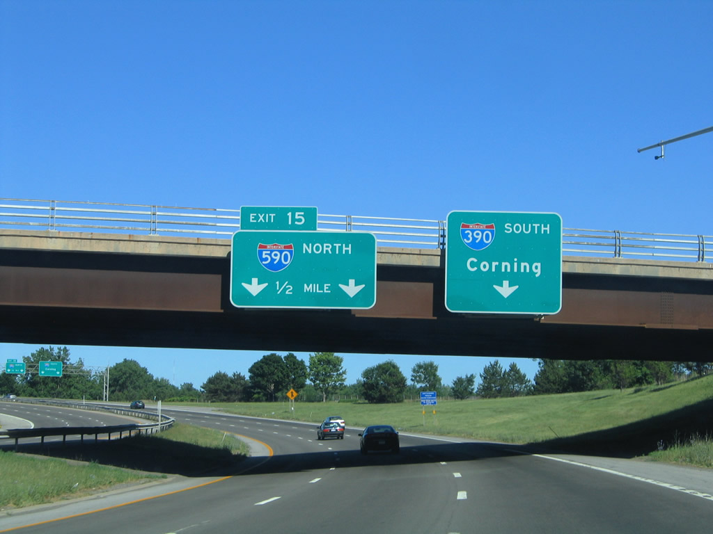 |
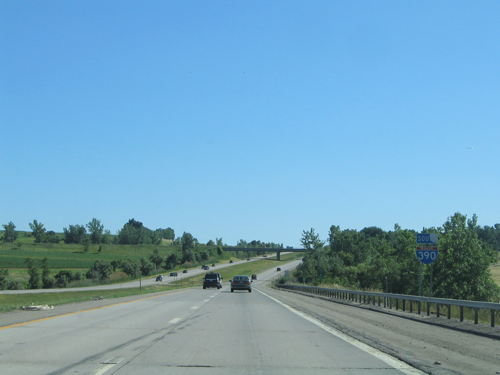
Interstate 390 enters the tri-level stack interchange with Interstate 590 just east of the Exit 16B diamond interchange. Interstate 590 continues the Rochester Outer Loop northeast to Interstate 490 and the Seabreeze Expressway. Photo taken 07/02/05. |
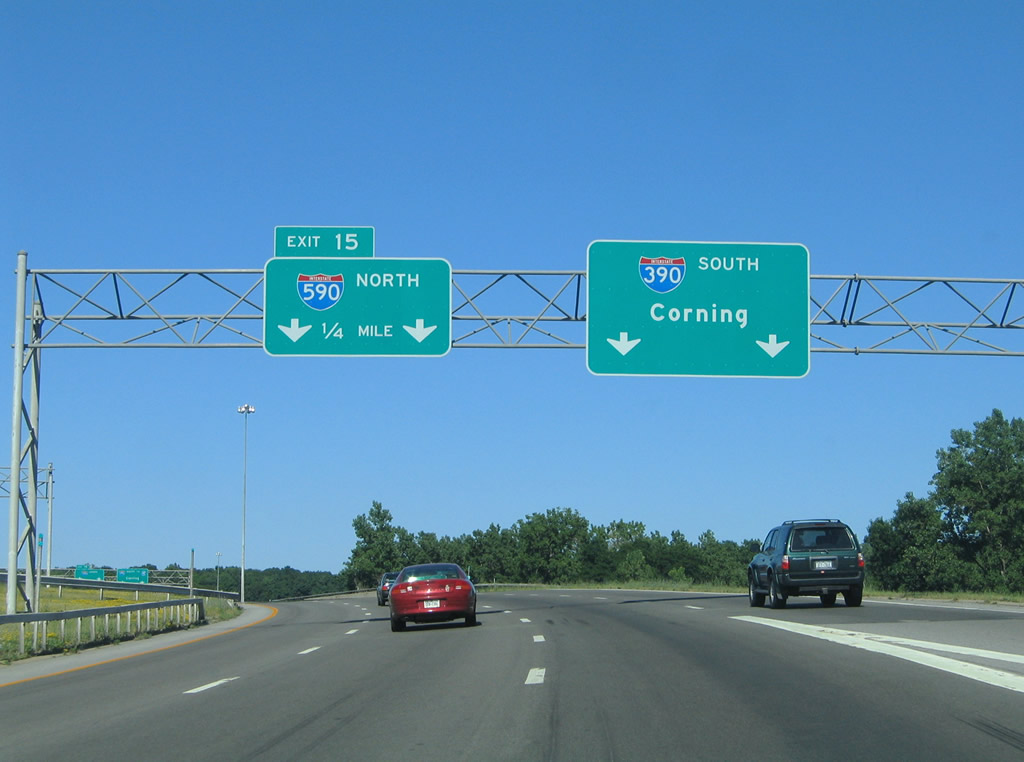 |
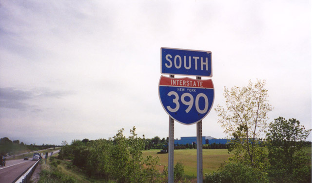
Interstate 390 turns southward from Interstate 590 and the Outer Loop through Henrietta to Geneseo, Dansville, and Interstate 86 northwest of Corning. Interstate 590 meanwhile wraps around the Brighton community. Photo taken 07/02/05. |
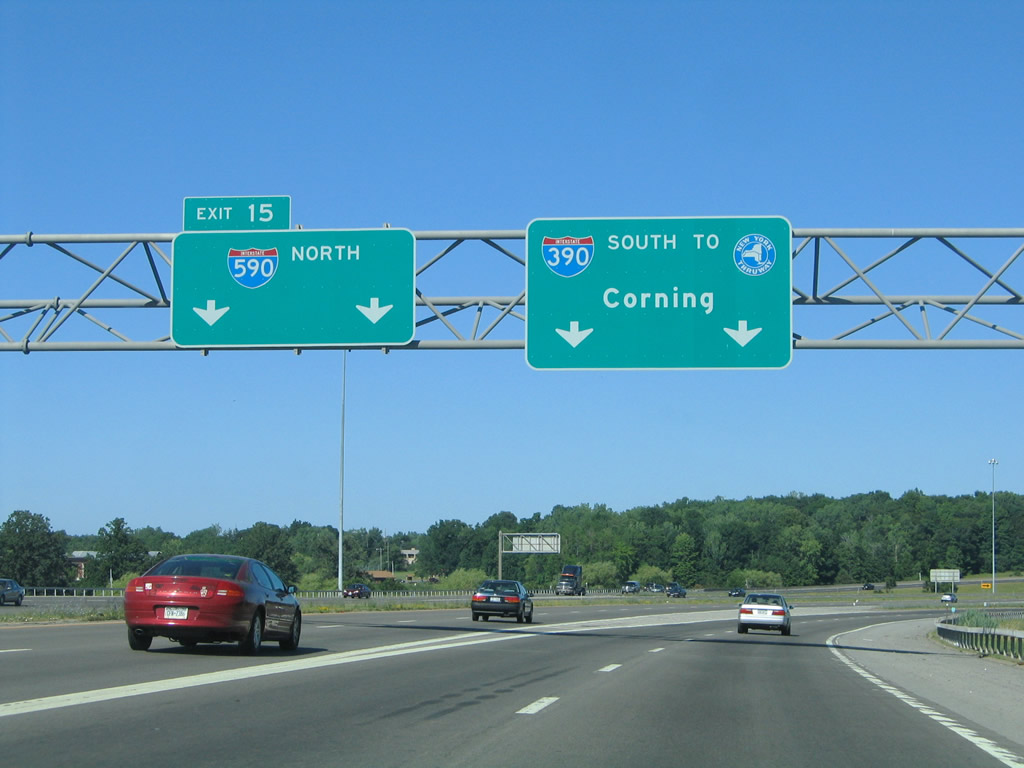 |
Exit 15 continues the Outer Loop east as Interstate 390 turns south. Had the Genesee Expressway been built as envisioned, Interstate 390 would have entered the interchange from the north. Interstate 590 travels 5.31 miles north to the Can of Worms interchange with Interstate 490 and New York 590 north. Photo taken 07/02/05. |
 |
Turning south from Brighton, Interstate 390 carries eight overall lanes between the Outer Loop and Exits 14A/B. Photo taken 07/02/05. |
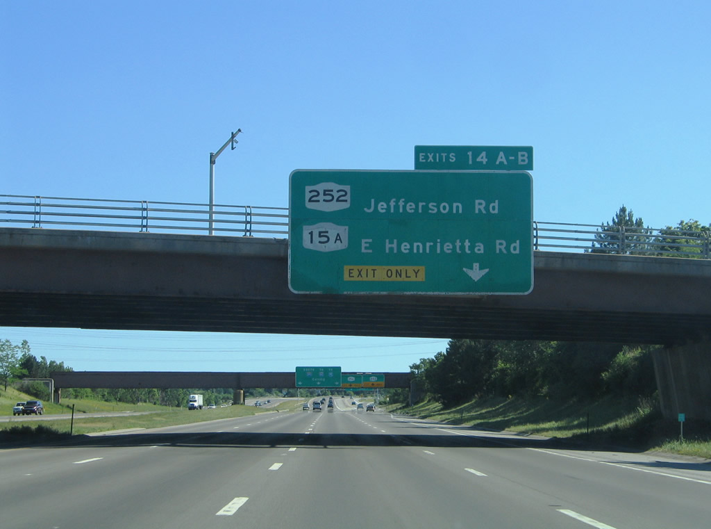 |
A split-diamond interchange joins Interstate 390 south with New York 252 (Jefferson Road) and New York 15A (East Henrietta Road) in Henrietta. New York 252 is an east-west route totaling 12.95 miles between New York 33A in Chili to New York 64 & 96 at Pittsford. Photo taken 07/02/05. |
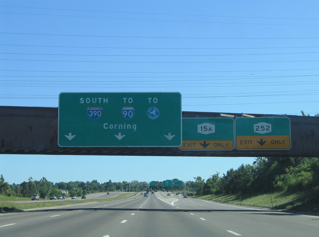 |
A two-lane distributor roadway departs the southbound freeway for New York 252 (Jefferson Road) and New York 15A (East Henrietta Road). New York 252 heads west to Marketplace Mall at New York 15 and east to New York 65 and Pittsford. Photo taken 07/02/05. |
 |
A look at the Exit 14A/B ramp partition on Interstate 390 south. New York 15A continues from Henrietta south to Lima and Springwater on an 35.19-mile route. Photo taken 07/02/05. |
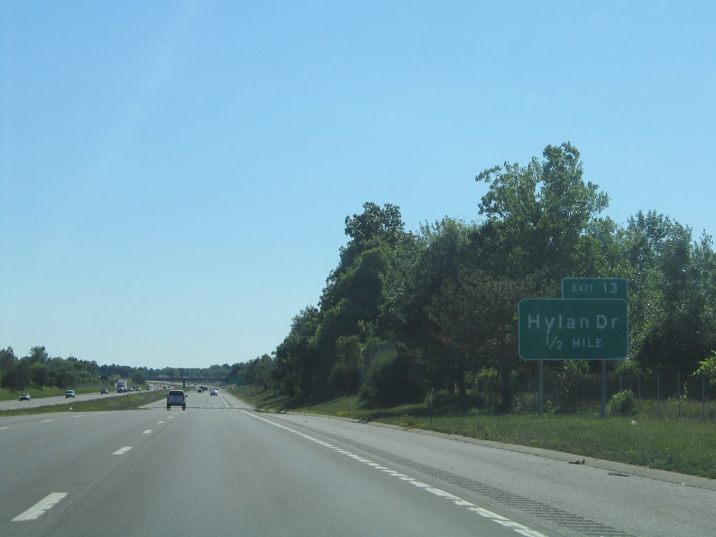 |
Next along Interstate 390 south is the diamond interchange (Exit 13) with Hylan Drive. Photo taken 07/02/05. |
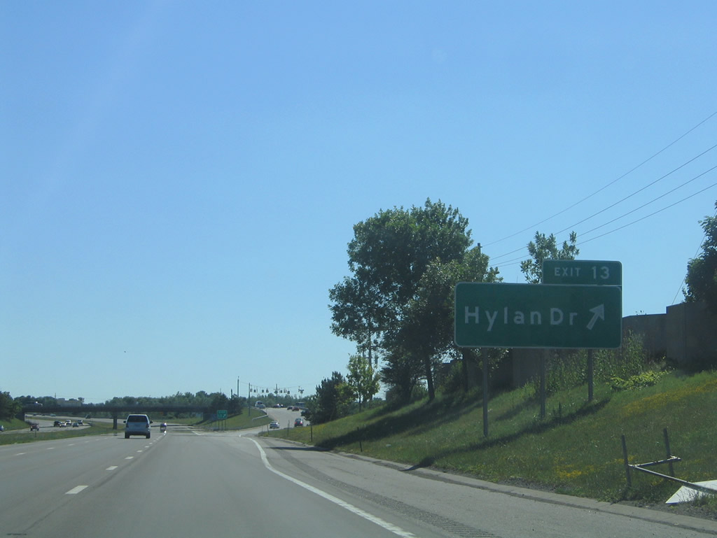 |
Hylan Drive heads north to Marketplace Mall and New York 252 and south to residential areas by Calkins Road (Monroe County 39). Photo taken 07/02/05. |
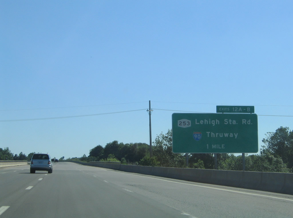 |
Passing over Hylan Drive, one mile north of the Exits 12A/B diamond and trumpet interchange combination for New York 253 (Lehigh Station Road) and Interstate 90 (New York Thruway). Photo taken 07/02/05. |
 |
A rare state-named shield posted on the Interstate 390 southbound mainline ahead of the Calkins Road overpass. Photo taken 07/02/05. |
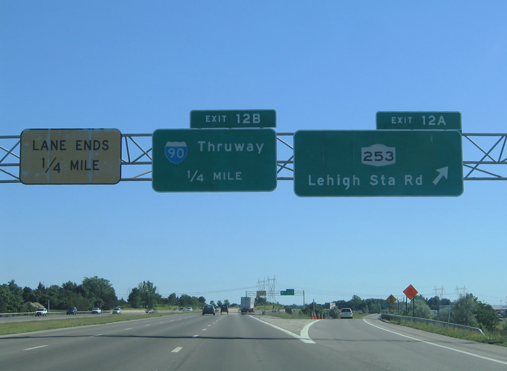 |
Exit 12A departs independent of Exit 12B for New York 253 (Lehigh Station Road), unlike Exit 12 in the northbound direction. New York 253 travels east-west between New York 65 at Mendon and New York 383 in Scottsville. Photo taken 07/02/05. |
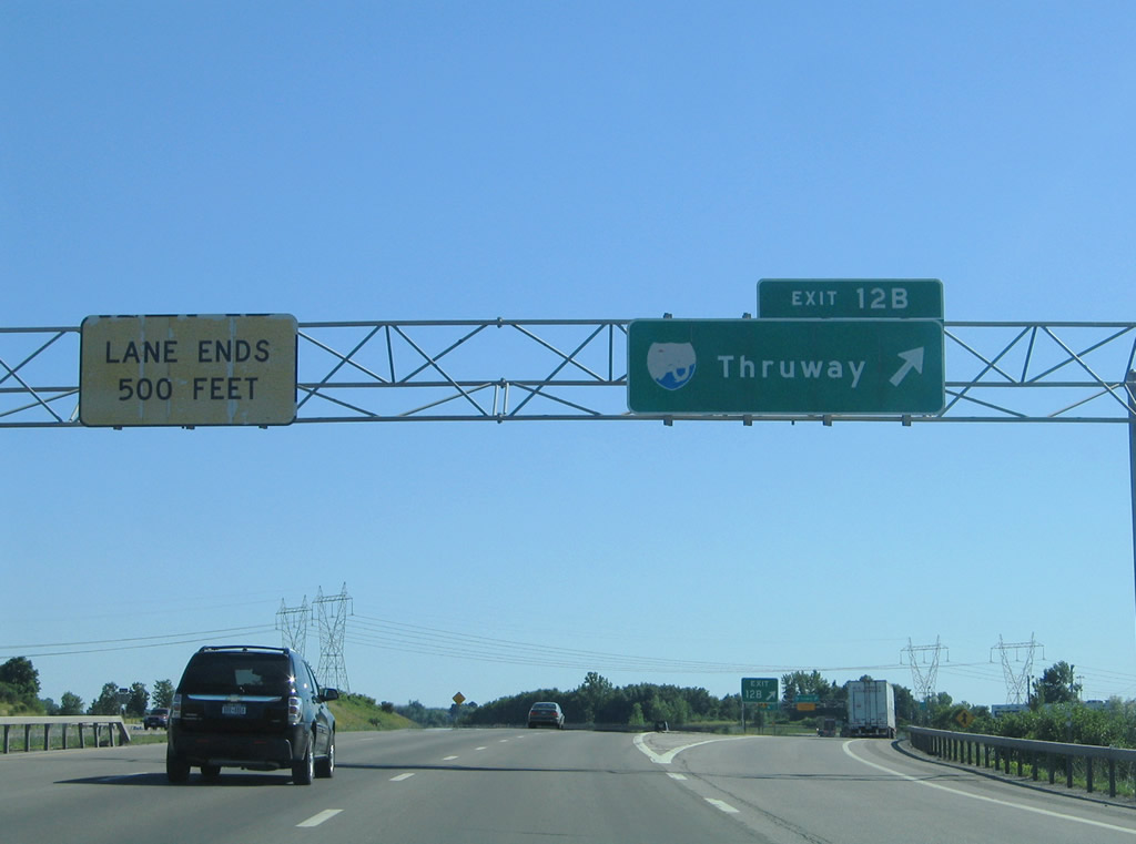 |
All traffic to Interstate 90 (New York Thruway) leaves via Exit 12B for the Exit 46 toll plaza and trumpet interchange. The Thruway heads west to Buffalo and Erie, Pennsylvania and east to Syracuse and Albany. Photo taken 07/02/05. |
 |
Drivers from New York 253 join a collector/distributor roadway southbound from Exit 12B. Motorists may either depart for Interstate 90 or continue south to Geneseo. Interstate 90's next interchanges in both directions join it with Interstate 490's respective termini. Photo taken 07/02/05. |
 |
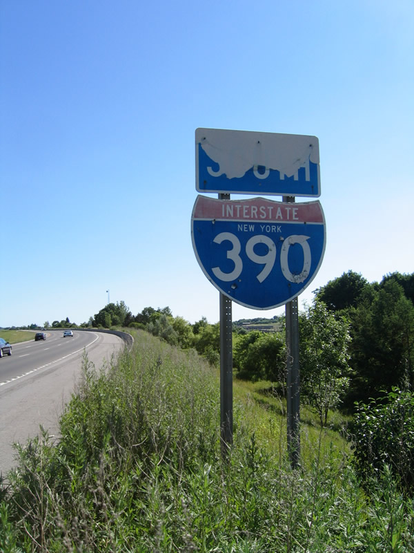
Interstate 390 New York shield posted after the interchange with Interstate 90 (Exit 12) at West Henrietta. There were four state-named shields remaining along Interstate 390 southbound between Interstate 590 and the town of Avon in 2000 and three remaining by 2005. This particular shield was replaced with the one pictured in the next photobox. Photo taken 05/28/00. |
 |
Leaving the Thruway area, Interstate 390 transitions into a four-lane rural freeway through southern Monroe County. Photo taken 07/02/05. |
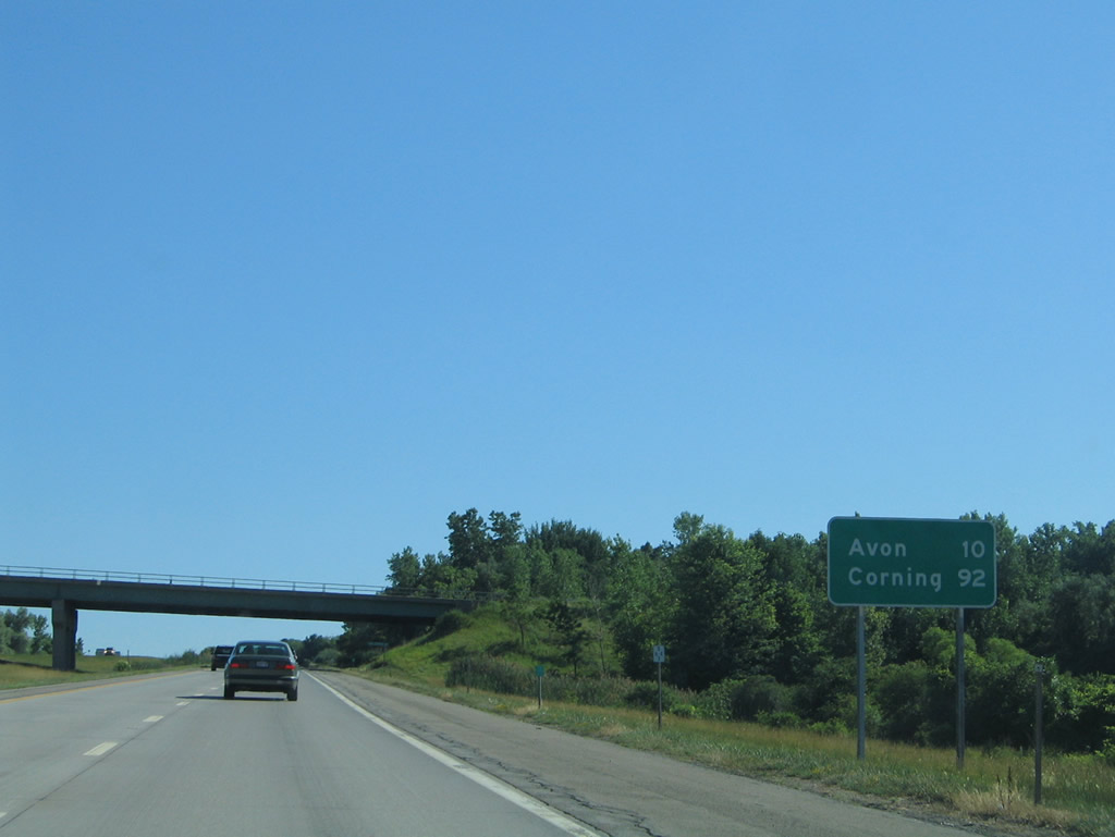 |
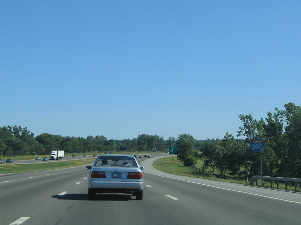
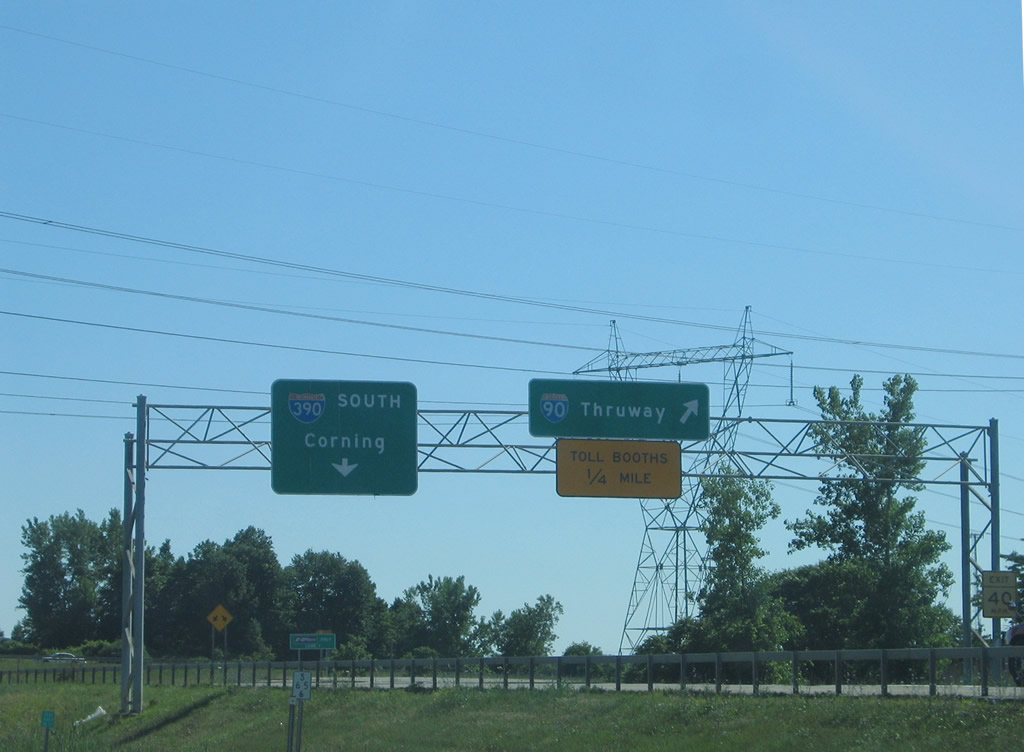
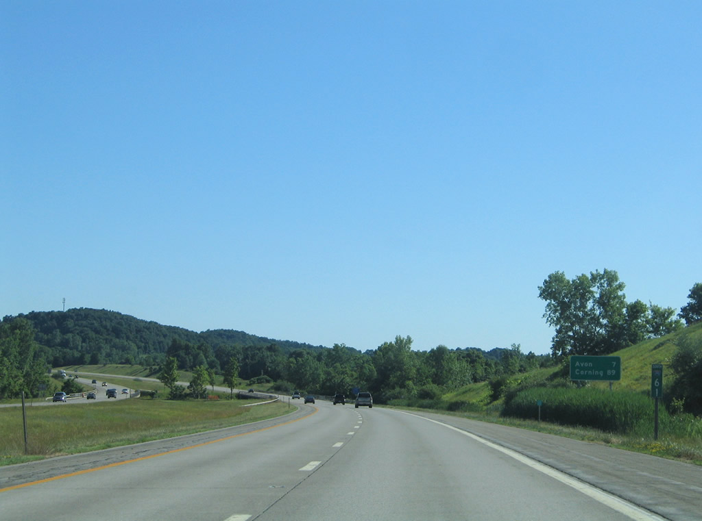
Avon, the first Livingston County interchange, lies ten miles ahead. Corning is a 92-mile drive via Interstate 86 & New York 17 east from the south end of Interstate 390. Photo taken 07/02/05. |
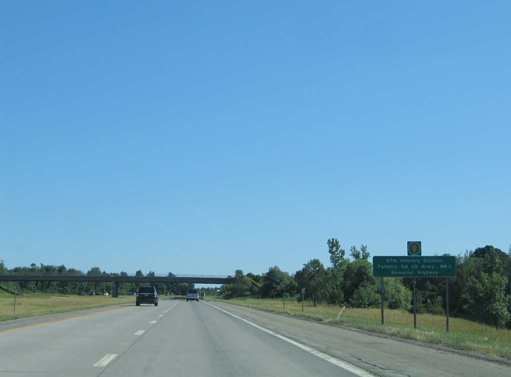 |
Interstate 390 is designated the 87th Infantry Division, Patton's 3rd US Army - WW II, Memorial Highway between Interstate 90 and Avon. Photo taken 07/02/05. |
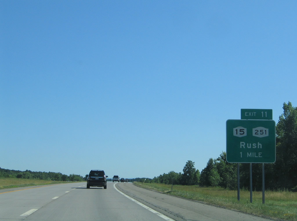 |
Exiting Henrietta for the town of Rush, Interstate 390 continues one mile to the split-diamond interchange (Exit 11) with New York 15 (West Henrietta Road) and 252 (Scottsville-Rush Road). Photo taken 07/02/05. |
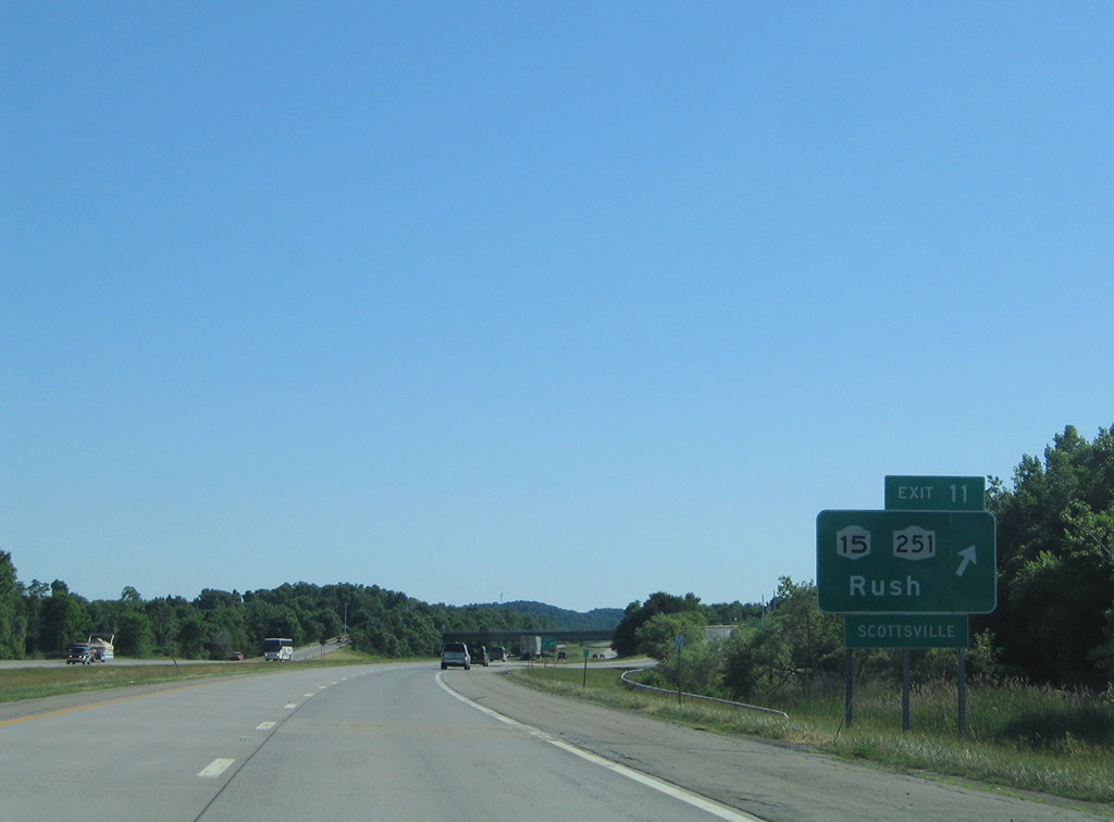 |
New York 15 (West Henrietta Road) passes from the west to east side of Interstate 390 on a parallel alignment. New York 251 travels west to its end at Scottsvlle and east to New York 96 at Victor. Photo taken 07/02/05. |
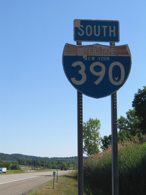 |
A second remaining state-named shield for Interstate 390 was posted on the southbound freeway in Monroe County. Photo taken 07/02/05. |
 |
Continuing south, Interstate 390 spans Honeoye Creek on the seven mile drive to Avon. Photo taken 07/02/05. |
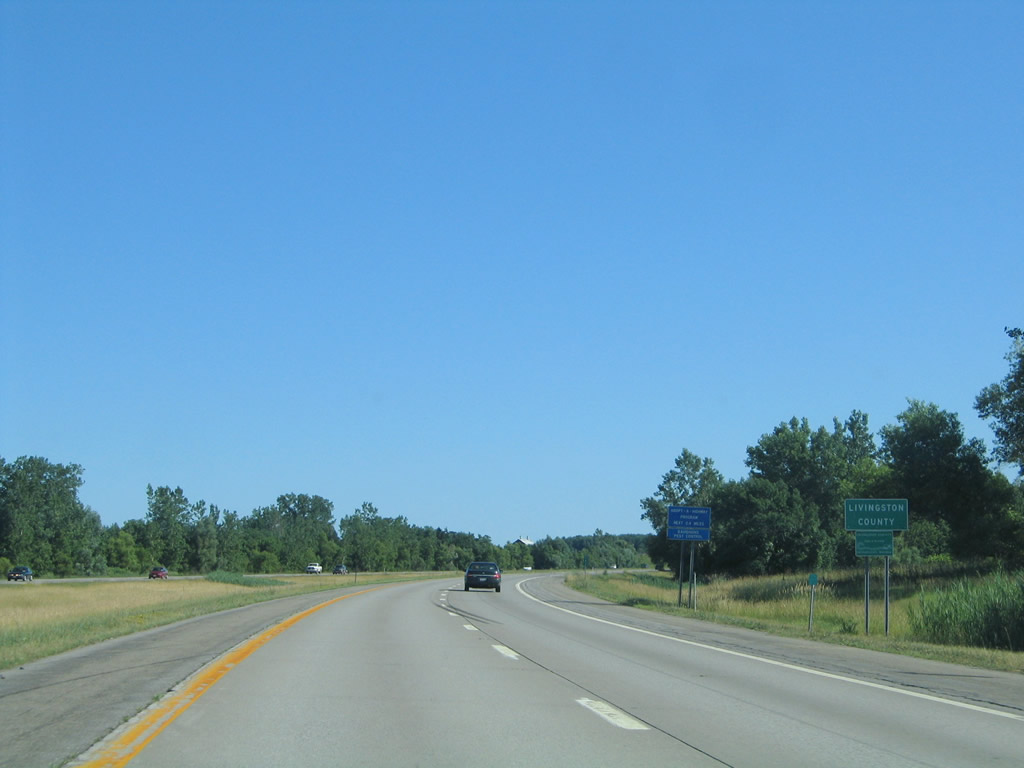 |
Departing Monroe County for Livingston County after 19.07 miles of freeway. Photo taken 07/02/05. |
 |
 |
Page Updated August 24, 2009.
|
About Contact Glossary |
In The News Interstate Guide |
Social Media:
 |
|
© 2000-25 AARoads.com | All Rights Reserved | Privacy Policy / Terms of Use
|
||