Interstate 490 Eastbound - I-90 to Downtown
| Interstate 490 East | |
|---|---|
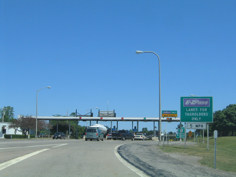 |
Drivers from the New York Thruway converge ahead of the Exit 47 toll plaza for the eastbound beginning of Interstate 490. The freeway commences in a rural area north of Le Roy and south of Bergen. Photo taken 07/02/05. |
 |
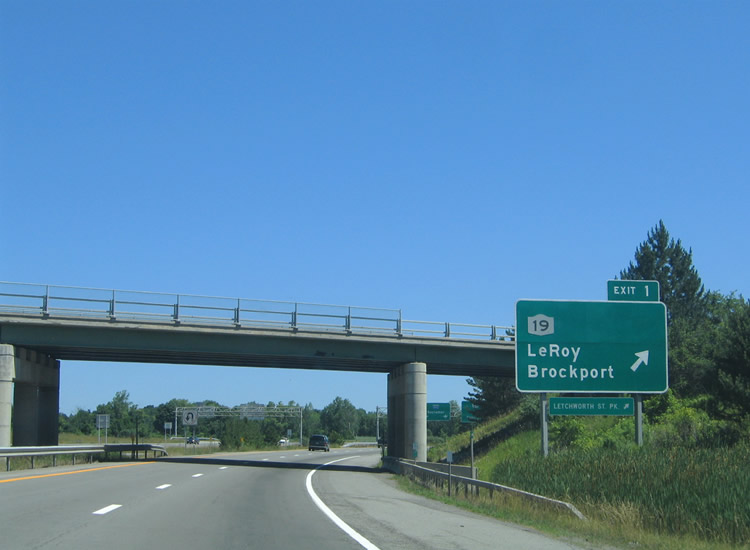
Exit 1 quickly departs the fledgling Interstate 490 east for New York 19 (Lake Road). A trumpet interchange ties the freeway with the adjacent New York 19 to the west and Vallance Road to the east. New York 19 enters the scene from Le Roy, four miles to the south. The state route continues north parallel to Interstate 490 to Stone Church and Bergen, before veering northward to Brockport. Drivers destined for Genesee Country Village should use New York 19 south to Fort Hill. Photo taken 07/02/05. |
 |
Interstate 490 east passes under the connector road joining the freeway with New York 19 (Lake Road) and Vallance Road. Vallance Road stems east from the interchange 3.6 miles to Beulah and Malloch Roads near Beulah. Lake Road meanwhile carries New York 19 north 12 miles to Brockport. The state route southbound in conjunction with New York 63 and New York 36 serves Letchworth State Park. Photo taken 07/02/05. |
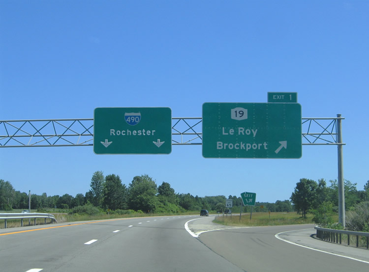 |
A third sign directs motorists onto the Exit 1 loop ramp for New York 19 (Lake Road) and Vallance Road east. New York 19 intersects New York 5 to the south at Le Roy and New York 33 to the north outside of Bergen. Photo taken 07/02/05. |
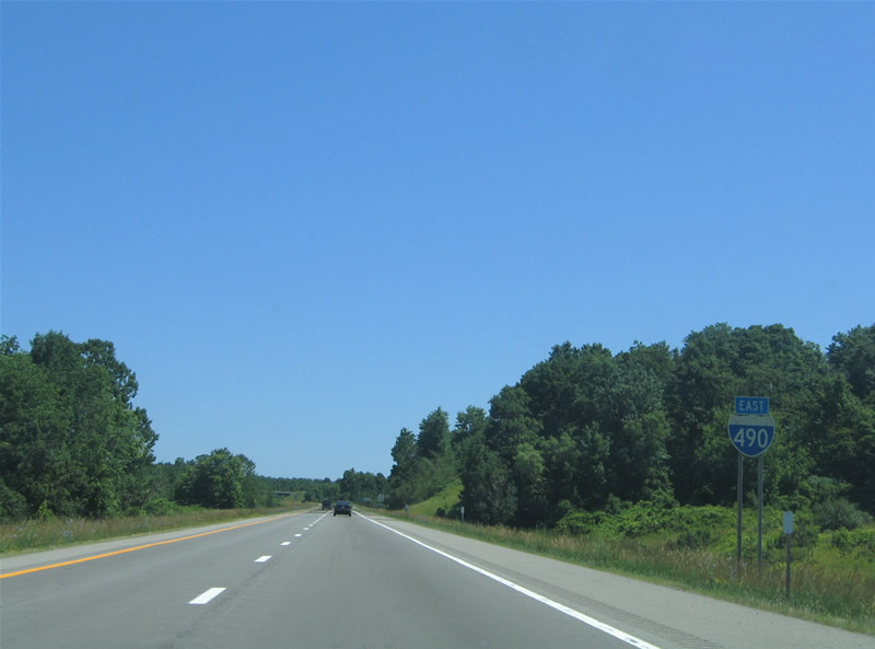 |
The first Interstate 490 eastbound reassurance sign, posted as the freeway leaves Exit 1. The north and southbound carriageway split for a period between New York 19 and Exit 2. Photo taken 07/02/05. |
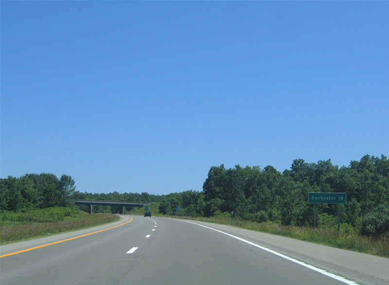 |
Rochester mileage sign situated along Interstate 490 eastbound after the first reassurance shield. The distance is to the Rochester central business district. Bovee Road passes over the freeway in the background. Photo taken 07/02/05. |
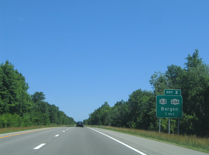 |
A six-ramp parclo interchange (Exit 2) joins I-490 with NY 33A (Chili Riga Center Road) at the Village of Bergen. New York 33A splits from New York 33 just west of Interstate 490. New York 33 travels through the outskirts of Bergen westward to Batavia while New York 19 serves the village center. Photo taken 07/02/05. |
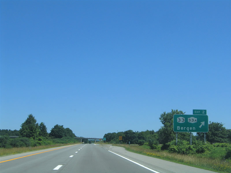 |
Exit 2 departs Interstate 490 east for New York 33A (Chili Riga Center Road) to New York 33. New York 33A acts as an alternate route to New York 33 east from Bergen to the city of Rochester. New York 33 stays north of Interstate 490 through Bergen, Churchville, North Chili, and Gates Center. New York 33A meanwhile stays south of the freeway through Riga, West Chili, Chili Center, and Tressmar. Photo taken 07/02/05. |
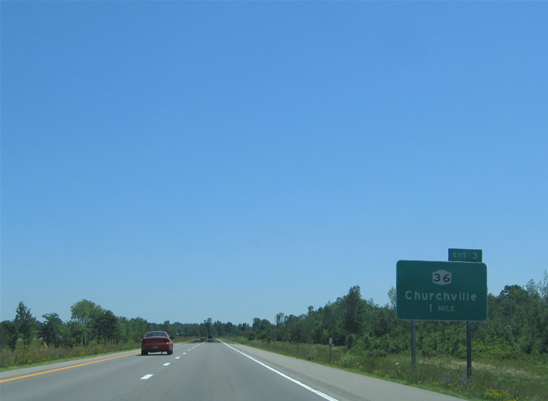 |
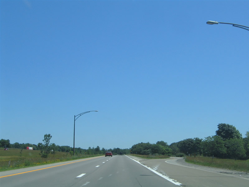
Interstate 490 curves eastward toward Chili Center beyond New York 33A and Bergen. New York 36 (Churchville Riga Road) meets the freeway near the community of Churchville at Exit 3. The north-south highway travels almost the length of New York from the Pennsylvania state line to New York 31 by Northhampton Park. Photo taken 07/02/05. |
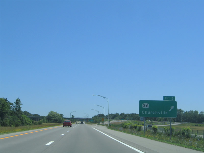 |
Interstate 490 gains frontage roads briefly (Sanford Road North and South) ahead of the Exit 3 diamond interchange with New York 36 (Churchville Riga Road). New York 36 follows Main Street north through Churchville to New York 33 (Buffalo Road) and Churchville County Park. To the south, New York 36 heads 1.6 miles to New York 33A at Riga. Photo taken 07/02/05. |
 |
 |
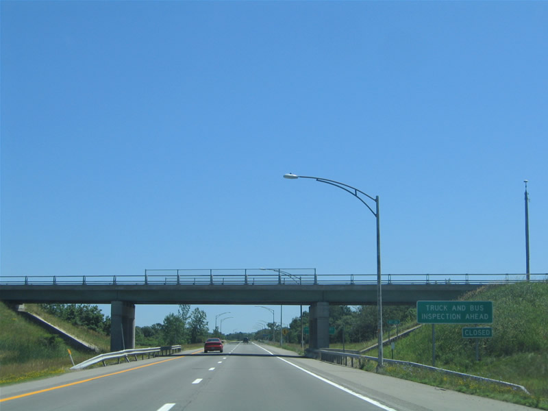
A truck inspection station (weigh station) lies along Interstate 490 eastbound after the New York 36 interchange (Exit 3). Photos taken 07/02/05. |
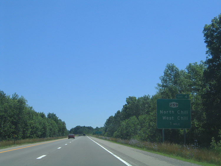 |
New York 259 travels 17 miles between New York 33A (Chili Avenue) and the Lake Ontario State Parkway. Locally the state route joins the communities of West Chili to North Chili at New York 33 (Buffalo Road). Photo taken 07/02/05. |
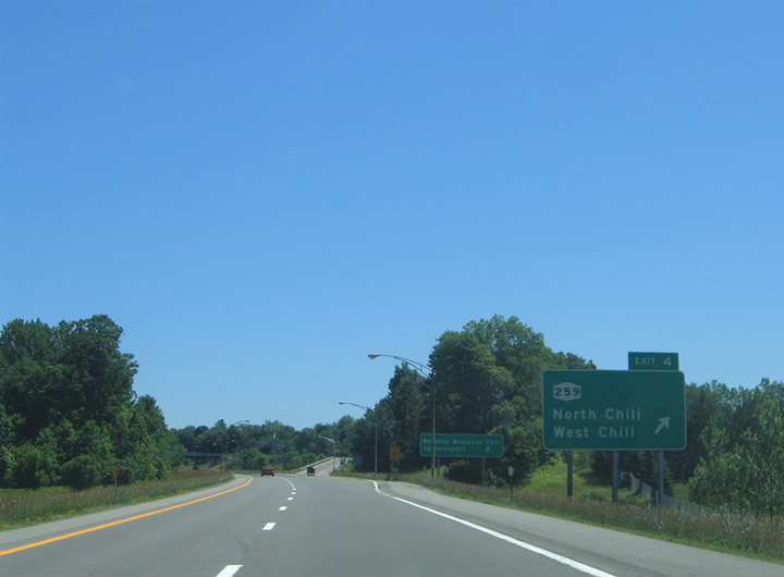 |
Eastbound at the Exit 4 diamond interchange with New York 259 (Union Street). New York 259 ends nearby at the intersection of New York 33A (Chili Avenue), with Union Street continuing south to Black Creek Park and South Chili. The state route travels north 1.75 miles to North Chili and six miles to Spencerport. Use New York 259 north to North Chili for Roberts Wesleyan College. Photo taken 07/02/05. |
 |
Interstate 490 curves northeastward toward Chili Center and Gates. The two carriageways remain separated by foliage. Photo taken 07/02/05. |
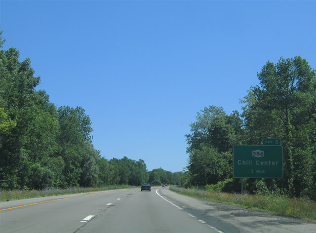 |
New York 386 (Chili Center Coldwater Road) meets Interstate 490 at the Exit 5 diamond interchange at Chili Center. The state route ends one mile to the south at New York 33A (Chili Avenue) and New York 252A (Paul Road). Photo taken 07/02/05. |
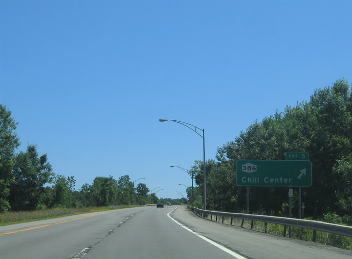 |
Drivers bound for New York 386 (Chili Center Coldwater Road) depart Interstate 490 eastbound at Exit 5. New York 386 continues north of the freeway to Westside Drive and Coldwater Road and New York 33 (Buffalo Road) near the Rochester Technology Park. Photo taken 07/02/05. |
 |
A state-named shield with an arial style font resides along Interstate 490 east after Exit 6. Westside Drive passes over the freeway in the distance. Photo taken 07/02/05. |
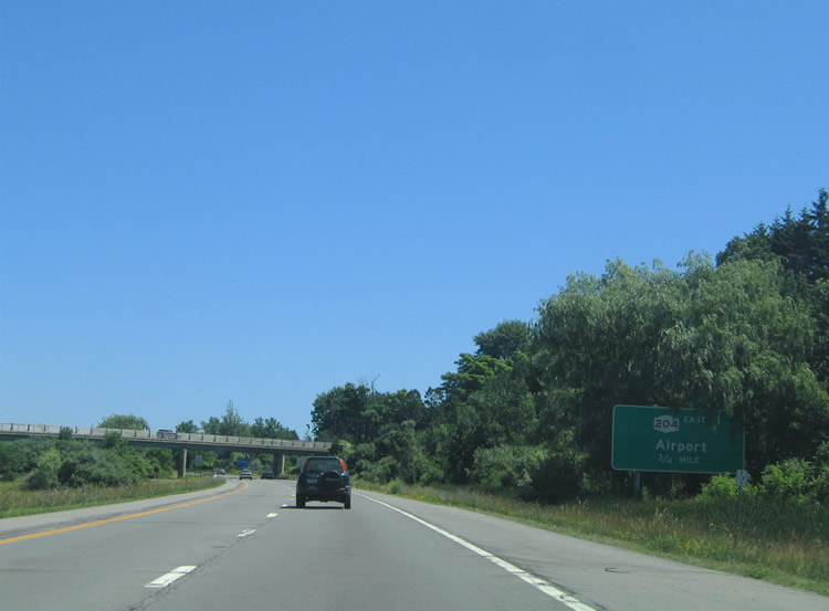 |
0.75 miles west of the trumpet interchange (Exit 6) with New York 204 (Airport Expressway). The Airport Expressway carries New York 204 a short distance from Interstate 490 to New York 33A (Chili Avenue) at Tressmar. The freeway prematurely ends at Chili Avenue as it was intended on continuing east to Rochester International Airport. The state route does in fact head there along surface streets. Photo taken 07/02/05. |
 |
Interstate 490 eastbound at the Exit 6 ramp departure to New York 204 (Airport Expressway) east. New York 204 follows the freeway to New York 33A (Chili Avenue), joins Chili Avenue east to Brooks Avenue, and follows Brooks Avenue east to the airport terminal and its end at New York 383 (Plymouth Avenue) in southwest Rochester. The unconstructed Airport Expressway was to join Interstate 490 with the airport terminal. Photo taken 07/02/05. |
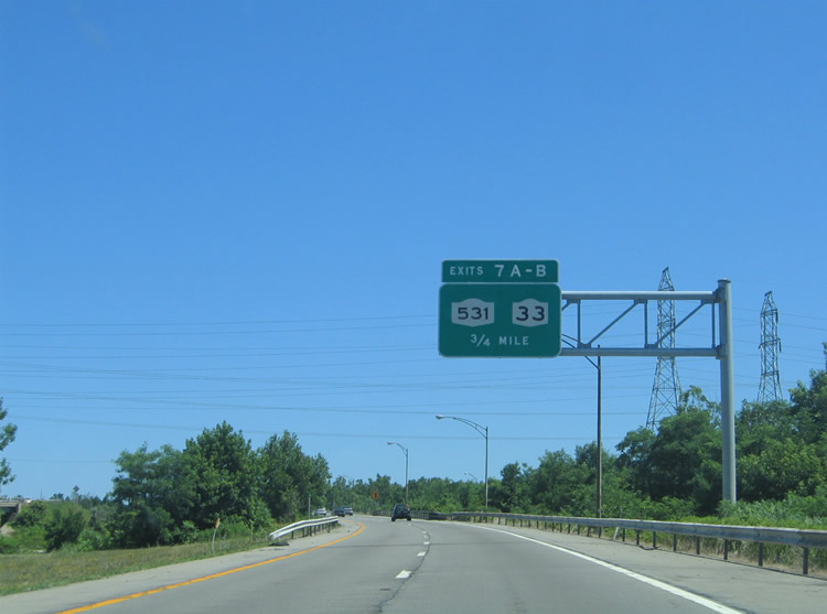 |
Interstate 490 heads north to its junctions with New York 33 (Buffalo Road) and New York 531 west (Spencerport Expressway). New York 33 follows Buffalo Road east from North Chili to Gates Center and west Rochester. New York 531 comprises the Spencerport Expressway west to the Rochester Technology Park, Spencerport, and Brockport. Photo taken 07/02/05. |
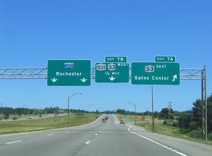 |
Exit 7A leaves Interstate 490 east for New York 33 (Buffalo Road) east into Gates Center. Buffalo Road serves an industrial area between the freeway and Howard Road. The state route continues east into Rochester via West Avenue and West Main Street. A full-cloverleaf interchange joins New York 33 with Interstate 490 at Exits 7A/B. Photo taken 07/02/05. |
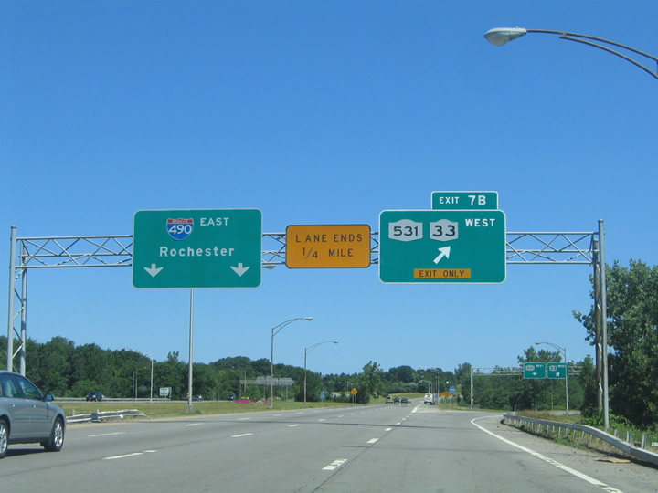 |
Exit 7B serves the movements to both New York 33 (Buffalo Road) west to the Rochester Technology Park and Coldwater and New York 531 (Spencerport Expressway) west to Spencerport and Brockport. Interstate 490 continues north to its merge with New York 531 east. Photo taken 07/02/05. |
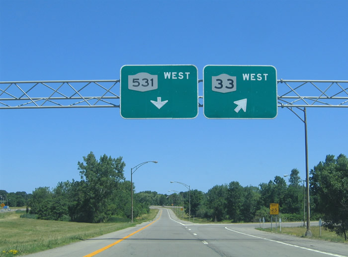 |
Exit 7B partitions into a loop ramp for New York 33 (Buffalo Road) west and a directional ramp to New York 531 (Spencerport Expressway) west. The Spencerport Expressway originally ended quickly at New York 386 (Elmgrove Road) until 1994. The freeway saw extension west to Spencerport (New York 259) and New York 36 and 31 outside of Brockport at that time. Photo taken 07/02/05. |
 |
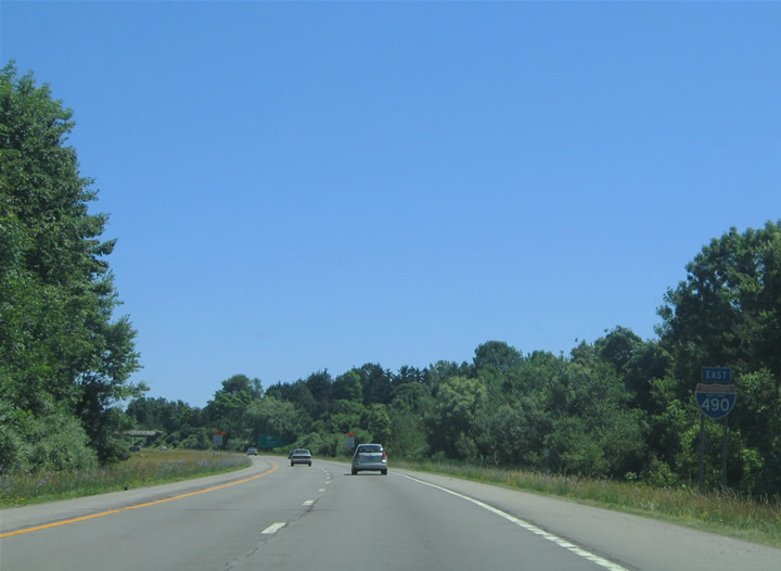
Motorists from New York 531 (Spencerport Expressway) east join Interstate 490 east from the left at an unstacked directional interchange. Interstate 490 expands to three eastbound lanes with the addition of the Spencerport Expressway traffic. Photo taken 05/10/05. |
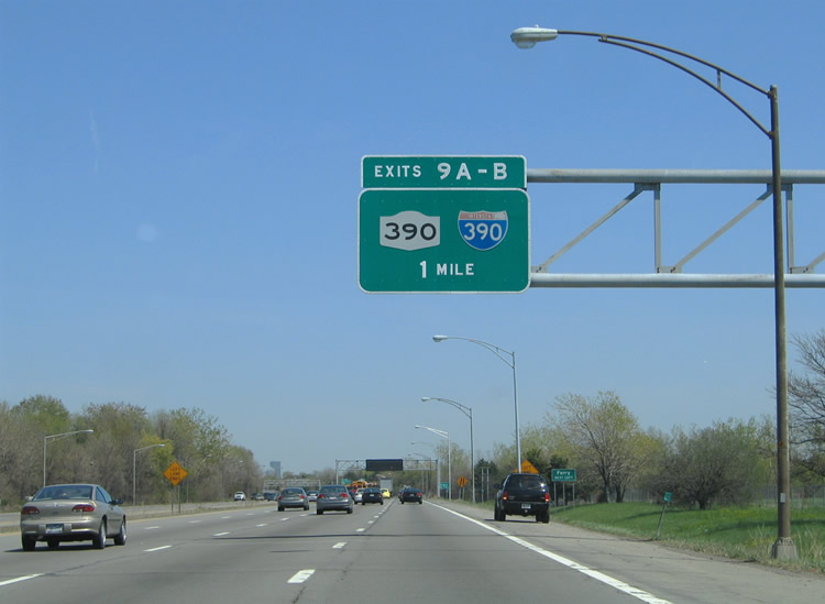 |
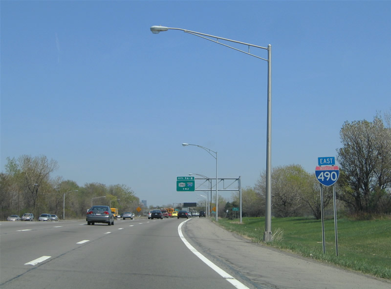
Interstate 490 converges with I-390/NY 390 at Exits 9A/B. Interstate 390 follows the Outer Loop freeway east from Interstate 490 to Interstate 590. New York 390 spurs northward to Greece and the Lake Ontario State Parkway. A small guide sign in the distance directed motorists to the Toronto Rochester Ferry. The ferry service between the two cities lasted just two years before funding issues curtailed the service. The ferry officially ended its run on January 10, 2006 when Rochester Mayor Robert Duffy deemed it too much of a risk financially.2 Photo taken 05/10/05. |
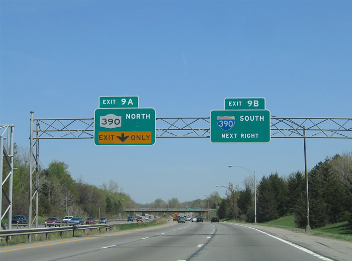 |
Approaching the tri-level directional interchange with Interstate 390 & New York 390 on Interstate 490 east. The interchange features left-hand entrance and exit ramps and is symmetrical with stacks over the Interstate 390 and New York 390 mainlines. Exit 9A departs as a left-hand ramp onto New York 390 north. New York 390 continues the Interstate 390 freeway to the Lake Ontario State Parkway near O'Neil Point. The freeway serves the suburb of Greece and the Kodak Distribution Center. Photo taken 05/10/05. |
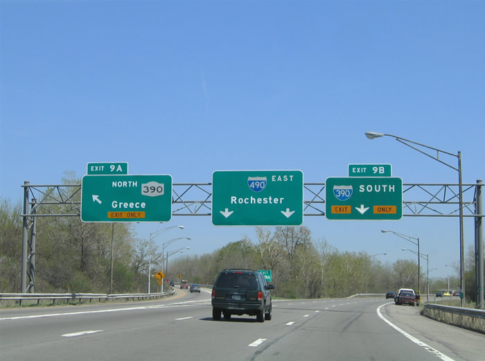 |
Exit 9A leaves Interstate 490 east for New York 390 north. The exit joins the freeway ahead of the New York 31 (Lyell Avenue) interchange, but there is no access from Exit 9A. Instead the next northbound off-ramp departs for Lexington Avenue east to Lee Road and Mt. Read Boulevard. The freeway ends eight miles to the north at the Lake Ontario State Parkway. The parkway provides a controlled access highway along Lake Ontario from the Charlotte section of Rochester to Hamlin Beach. Photo taken 05/10/05. |
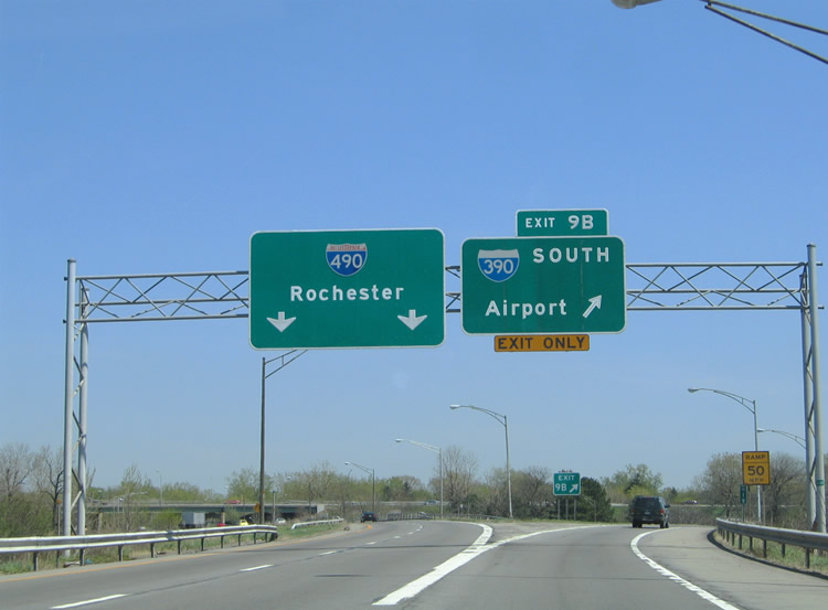 |
Exit 9B provides a short ramp onto Interstate 390 (Outer Loop freeway) south to Rochester International Airport, southwest Rochester, and the south suburbs of Henrietta. The Outer Loop freeway provides a bypass of downtown Rochester along the outskirts of the Rochester city limits. Interstate 590 continues the Outer Loop freeway back to Interstate 490 at Brighton. Interstate 390 otherwise leaves greater Rochester for Rush, Avon, Geneseo, Dansville, and I-86/NY 17 (Southern Tier Expressway). Photo taken 05/10/05. |
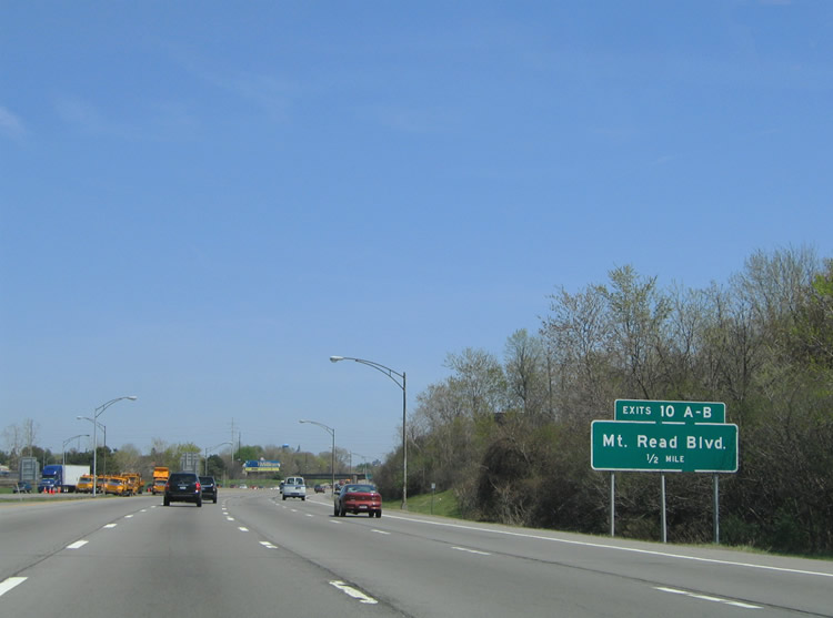 |
Interstate 490 enters the city of Rochester and approaches the six-ramp parclo interchange with Mt. Read Boulevard (Exits 10A/B). Mt. Read Boulevard constitutes a north-south arterial between New York 33 (Buffalo Road) and New York 18 (Latta Road). Photo taken 05/10/05. |
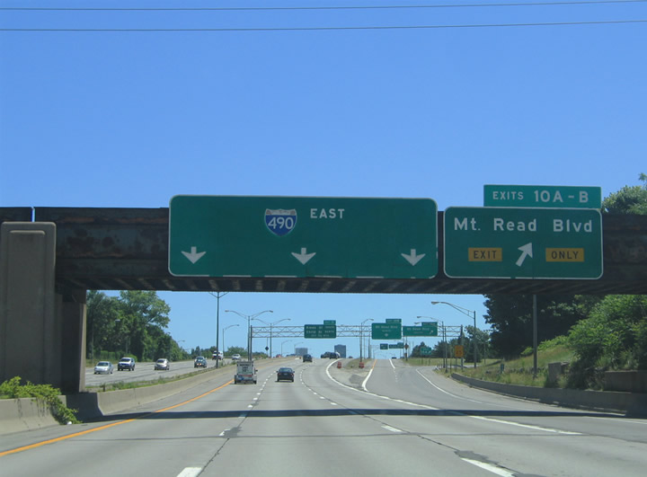 |
A collector/distributor roadway facilitates the movements between Interstate 490 and Mt. Read Boulevard at Exits 10A/B. Mt. Read Boulevard serves the Kodak Distribution Center to the north along an expressway section of highway between Lexington Avenue and New York 104 (Ridge Road). Photo taken 07/02/05. |
 |
Exit 10A departs the Interstate 490 eastbound c/d roadway for Mt. Read Boulevard south to New York 33 (Buffalo Road). New York 33 enters the city from Gates Center and Interstate 390 along Buffalo Road. Buffalo Road carries the state route to West Avenue and Lincoln Park. Photo taken 05/10/05. |
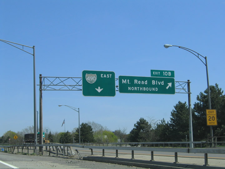 |
Button copy signs adorn the Exit 10B sign bridge on the Interstate 490 eastbound c/d roadway. Mt. Read Boulevard northbound serves industrial areas of west Rochester between New York 31 (Lyell Avenue) and Ridge Road. Interchanges exist along the arterial at Ridgeway Avenue and New York 104 (former U.S. 104). Photo taken 05/10/05. |
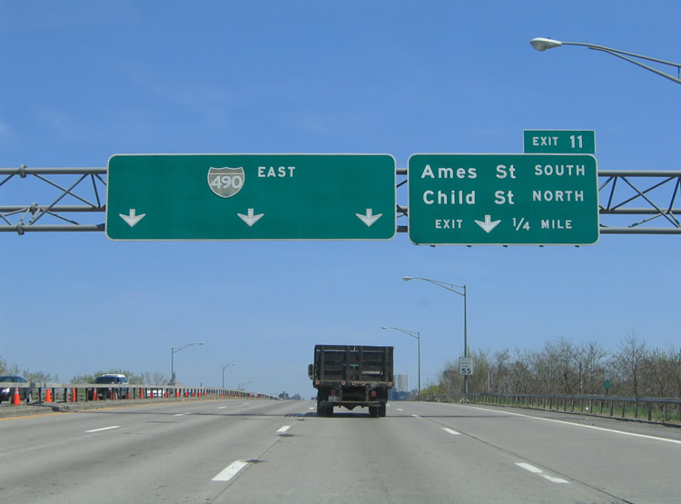 |
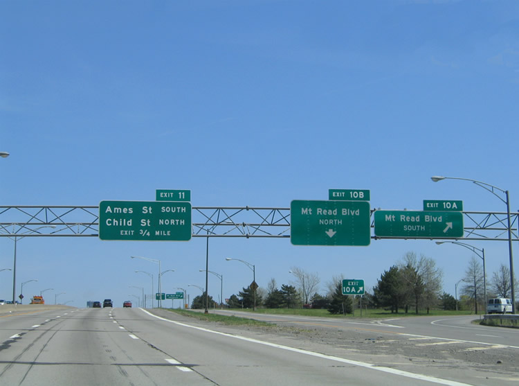
Interstate 490 passes over Glide Street ahead of the Exit 11 split-diamond interchange with Ames and Child Streets. Ames Street travels north-south between New York 33 (West Avenue) and Masseth Street. Child Street parallels Ames Street two blocks to the east between Danforth Street and New York 31 (Lyell Avenue). Photo taken 05/10/05. |
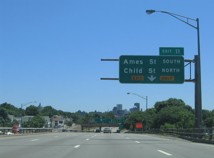 |
The right-hand lane defaults onto Exit 11 for Wilder Street east at Ames Street. Interstate 490 passes over a railroad line ahead of the interchange with Ames and Child Streets. Exit 11 serves the Lincoln Park and Otis communities of west central Rochester. Photo taken 07/02/05. |
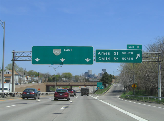 |
Interstate 490 dips below grade at the Ames Street over crossing and Exit 11. Ames Street travels south one half mile to New York 33 (West Avenue) at Appleton Street. New York 33 merges with New York 33A (Chili Avenue) nearby to form West Main Street. Child Street north travels 0.6 miles from Wilder Street (eastbound frontage road) to New York 31 (Lyell Avenue). New York 31 turns southeast along Broad Street two blocks east of Child Street toward downtown. Photo taken 05/10/05. |
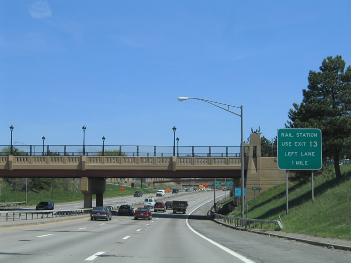 |
Overpasses along Interstate 490 were modernized in the mid 2000s as part of an overall rehabilitation project for the freeway west of downtown Rochester. Interests to the AMTRAK station at downtown should use Exit 13 (Inner Loop) to North Clinton Avenue. Photo taken 05/10/05. |
 |
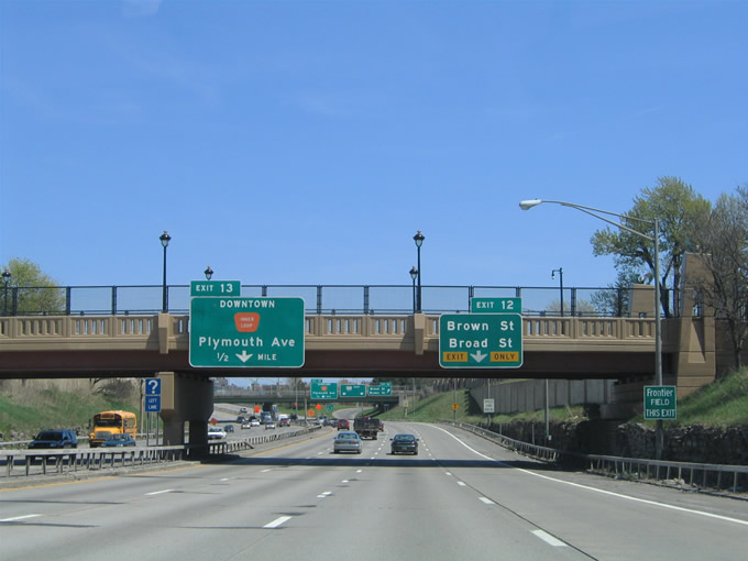
Attached to the Child Street overpass are a pair of overheads for the Exit 12 and 13 off-ramps serving the Rochester central business district. Exit 13 joins the freeway with the Inner Loop, a limited access highway encircling downtown to the west, north, and east. Exit 12 provides an off-ramp onto adjacent Allen Street for its intersections with Brown Street and New York 31 (Broad Street). Photo taken 05/10/05. |
 |
A button copy overhead directs motorists onto Interstate 490 east from Wilder Street east of Child Street high above the six-lane freeway. Photo taken 05/10/05. |
 |
Continuing east along Interstate 490 at the Saxton Street overpass. The right-hand lane defaults onto the Exit 12 off-ramp to Brown Avenue and New York 31 (Broad Street). Brown Street travels northeast from New York 33 (West Main Street) at St. Marys Hospital to Broad Street at the freeway. Broad Street heads southeast from Lyell Avenue to the intersection of West Main and Ford Streets, the eastern terminus of New York 33. Photo taken 05/10/05. |
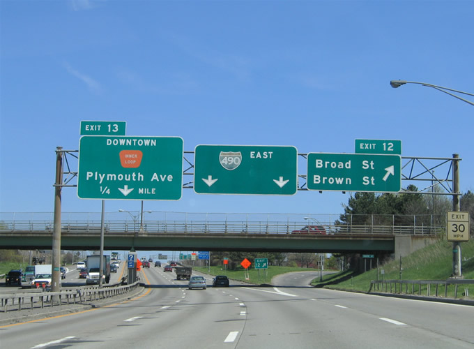 |
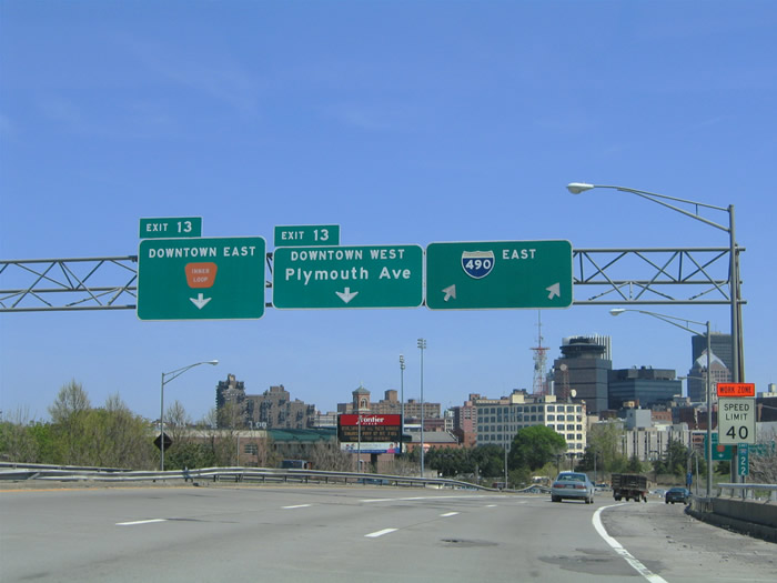
Exit 12 leaves Interstate 490 east at the Grape Street overpass. Allen Street comprises an eastbound frontage street between the off-ramp and the intersection of Broad and Platt Streets. New York 31 follows Broad Street east into downtown, meeting Interstate 490 again at Exit 18 via Monroe Avenue. Exit 13 meanwhile provides a two pronged ramp for not only the Inner Loop freeway east, but also the continuation of Allen Street east to Plymouth Avenue. Photo taken 05/10/05. |
 |
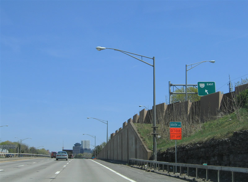
Interstate 490 makes its final approach to downtown over Brown, Broad, and Platt Streets. The central business district skyline rises into view on the curve ahead of the Exit 13 split with the Inner Loop freeway east. Interstate 490 comprises the southern one third of the Inner Loop between Exits 13 and 15. Photo taken 05/10/05. |
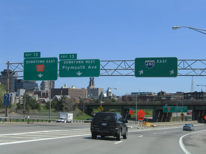 |
Ramps for the Inner Loop freeway east and Allen Street east to Plymouth Avenue depart Interstate 490 east adjacent to Frontier Field, home of the AAA Rochester Red Wings. Plymouth Avenue travels north from New York 383 (Exchange Boulevard) at the Genesee River to Frontier Field, Lyell Avenue, and Bloss Street near Edgerton Park. Photo taken 05/10/05. |
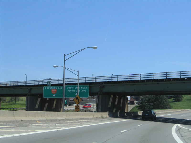 |
The New York Central Railroad passes over Interstate 490 east at the Exit 13 partition into ramps for Plymouth Avenue and the Inner Loop Freeway east. The Inner Loop Freeway consists of a four-lane below-grade freeway east of the Genesee River around downtown. The highway provides several off-ramps with the main surface streets leading in and out of the central business district. Orange Inner Loop trailblazers are found along the mainline and on streets leading to the various freeway on-ramps. Photo taken 05/10/05. |
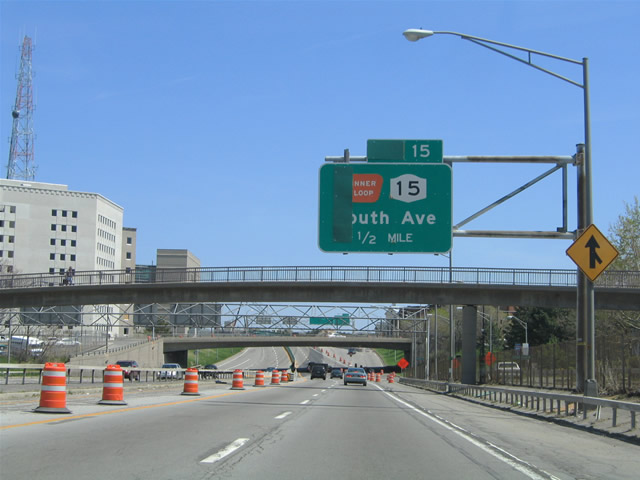 |
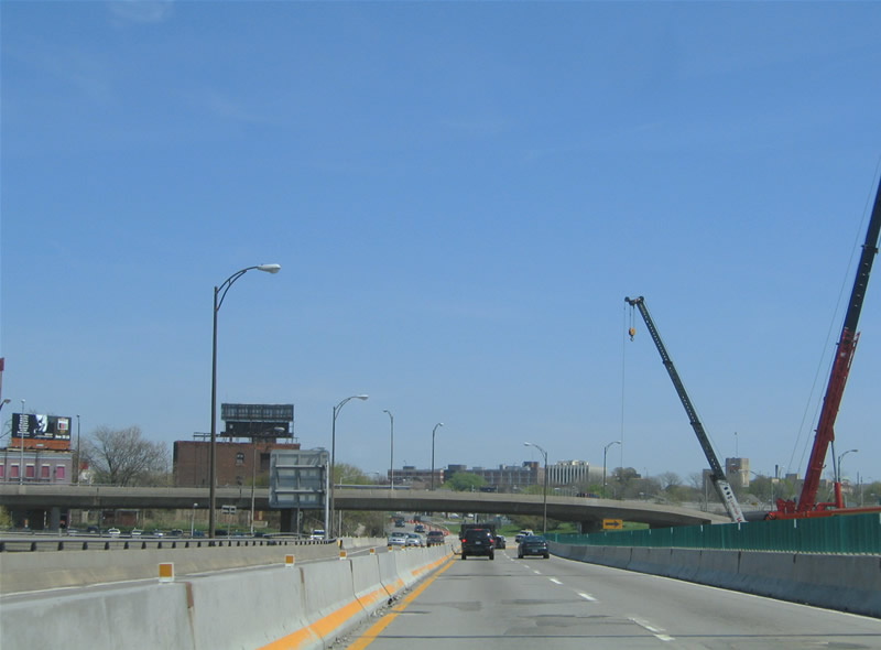
Interstate 490 follows the southwestern extent of the Inner Loop between West Main Street and New York 15 (South Avenue). Exit 15 represents the continuation of the Inner Loop freeway eastbound to Monroe Avenue (New York 31), East Avenue (New York 96), and East Main Street. Photo taken 05/10/05. |
 |
The Troup-Howell Bridge project was underway from Spring 2004 onward. The road work replaces the old concrete and steel Interstate 490 bridge over the Genesee River with a signature arch bridge. The project involved the temporary closure of the Exit 15 ramps to the Inner Loop freeway east and New York 15 (South Avenue). Photo taken 07/02/05. |
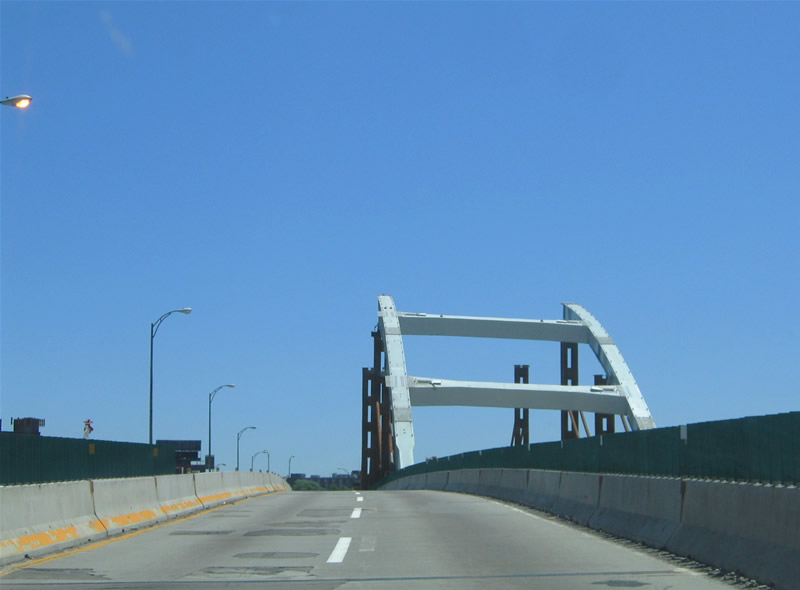 |
The beginnings of the new Troup-Howell Bridge rise adjacent to the Interstate 490 original Genesee River Bridge. The signature span will be complete by Spring 2007 at a cost of $37 million. Photo taken 07/02/05. |
 |
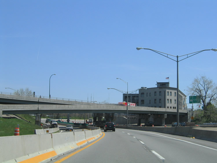
The directional interchange between the Inner Loop, New York 15 (South Avenue) and Interstate 490 includes provisions for the unconstructed Genesee Expressway (Interstate 390). Had Interstate 390 been built as envisioned, the north-south freeway would have ended at Interstate 490 and the Inner Loop at their ramps with New York 15 (South & Clinton Avenues). The project was shelved due to community opposition, but not before a ramp was built for the Genesee Expressway southbound. That ramp was shifted to provide a second entry point to Interstate 490 east from New York 15 (South Avenue) south. Photo taken 05/10/05. |
 |
Bridges carry the ramp from the Inner Loop west to Interstate 490 east and New York 15 (Clinton Avenue) north over Interstate 490 in this scene. New York 15 travels north along Mt. Hope Avenue through south Rochester to a one-way street couplet of Clinton and South Avenues. The state route represents former U.S. 15, and it ends at New York 31 (Broad and Court Streets) three blocks north of Interstate 490. Photo taken 05/10/05. |
 |
 |
Sources:
- Democrat & Chronicle: Fast Ferry.
http://www.democratandchronicle.com/ apps/pbcs.dll/section?Category=SPECIALS02
Page Updated July 23, 2006.
|
About Contact Glossary |
In The News Interstate Guide |
Social Media:
 |
|
© 2000-25 AARoads.com | All Rights Reserved | Privacy Policy / Terms of Use
|
||