
Regional Navigation
U.S. Highway 2
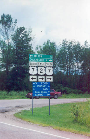
Beginning just west of the Vermont state line at Rouses Point, New York, U.S. 2 totals 151.6 miles across the Green Mountain State. The US route enters Vermont across the Rouses Point Bridge across the Richelieu River before dropping south through the Lake Champlain Islands to the Sand Bar Bridge east to Milton. Southward through Colchester, U.S. 2 combines with U.S. 7 into the city of Burlington, with the pair splitting for respective routes into South Burlington.
U.S. 2 continues east parallel to the Interstate 89 corridor through Williston, Richmond and Waterbury before branching away from the freeway at Montpelier. Within the capital city, a short business loop serves Downtown as U.S. 2 hugs the south banks of the Winooksi River through to East Montpelier. Remaining rural, U.S. 2 winds northeast to Plainfield, Marshfield and Danville before dropping into St. Johnsbury for a brief overlap with U.S. 5.
East from St. Johnsbury, U.S. 2 follows the Moose River to Concord. Winding east from North Concord, the remainder of the US route winds east to Miles Pond, Luneburg and an exit of the state across the Connecticut River to Lancaster, New Hampshire.
| U.S. 2 East | |||||||||||||||
|---|---|---|---|---|---|---|---|---|---|---|---|---|---|---|---|
Eastbound U.S. 2 adjacent to the Interstate 89 (Exit 17) interchange. U.S. 2 joins U.S. 7 at this intersection south of Milton. The two highways share pavement southward through Colchester and Winooski before splitting in Downtown Burlington. Photo taken 07/23/00.
| 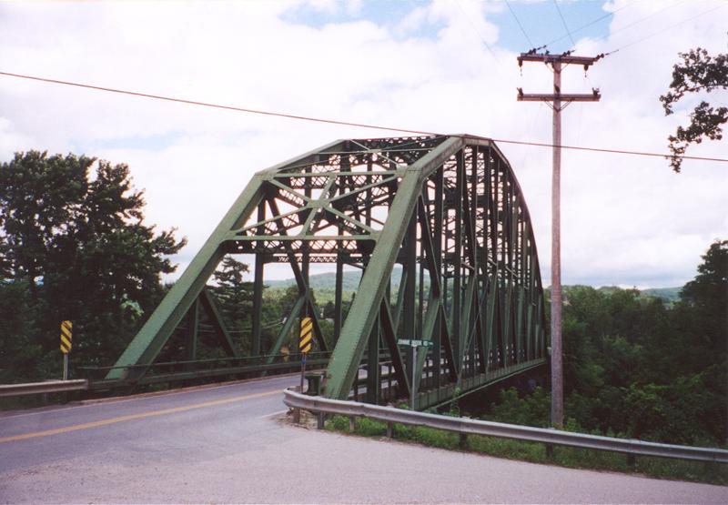
U.S. 2 Truss Bridge over Winooski River near Vermont 117 (#2). Photo taken 07/23/00.
| 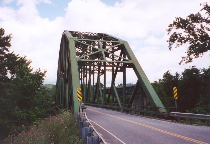
U.S. 2 Truss Bridge over Winooski River near Vermont 117 (#3). Interstate 89 can been seen to the right of the span. Photo taken 07/23/00.
| 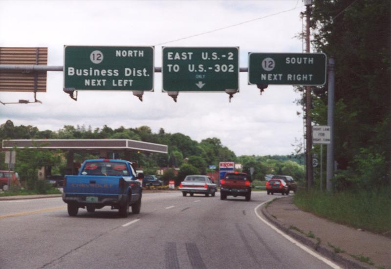
Eastbound U.S. 2 approaching Vermont 12 and West Business Loop U.S. 2 (not signed here). These signs are all non-reflectorized and contain button copy lettering. Photo taken 07/23/00.
| 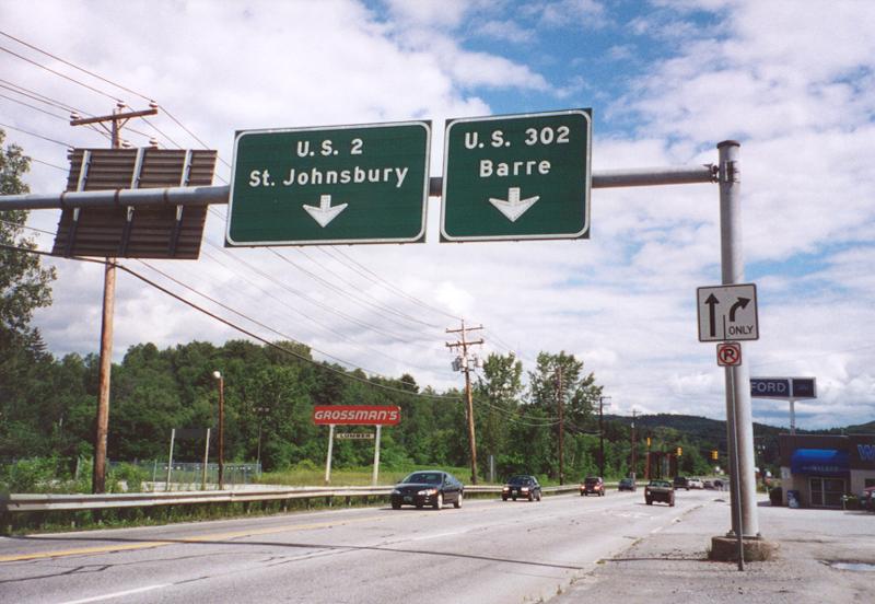
Text button copy overheads on eastbound at the western terminus of U.S. 302. U.S. 302 connects Montpelier with the city of Barre, before it heads to the Granite State. Photo taken 07/23/00.
| 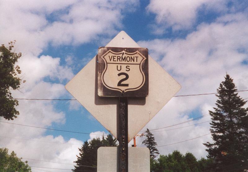
Old U.S. 2 shield in Marshfield (on the left side of the road, facing eastbound traffic on the backside of a regulatory sign). Older signage still remains in many Vermont towns and villages. This is because authority for signing highways is relegated to each town and village throughout the state, independent of the state. Photo taken 07/23/00.
| 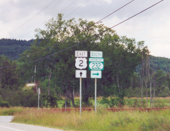
Eastbound U.S. 2 at Junction Southbound Vermont 232 near Marshfield. Photo taken 07/23/00.
| 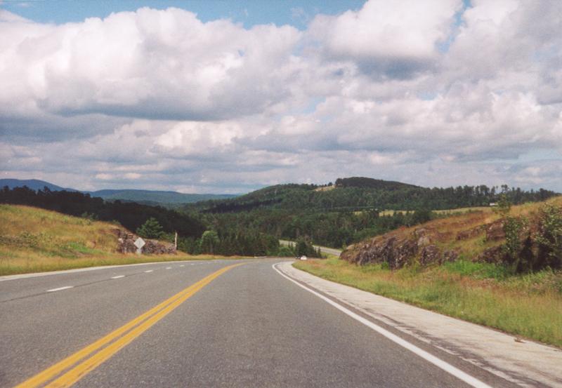
U.S. 2 Scene eastbound, between West Danville and St. Johnsbury. Photo taken 07/23/00.
| | |||||||
Button copy signage on eastbound U.S. 2 approaching the junction with Interstate 91 at St. Johnsberry. The unsually curved number nine is standard on older Vermont Interstate shields. Photo taken 07/23/00.
| 
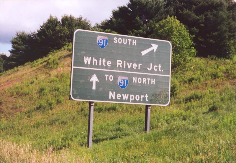
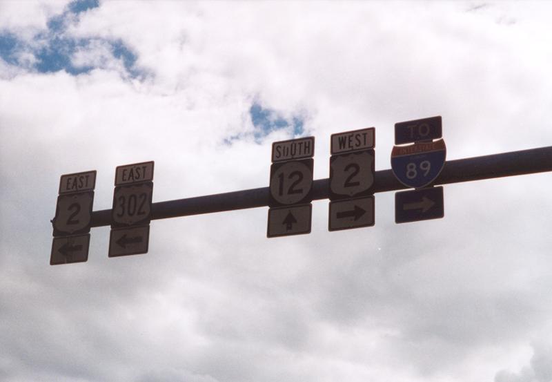
Eastbound at the southbound Interstate 91 ramp with associated Interstate 91/93 Vermont shields. Photo taken 07/23/00.
| 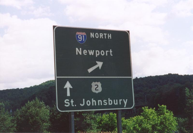
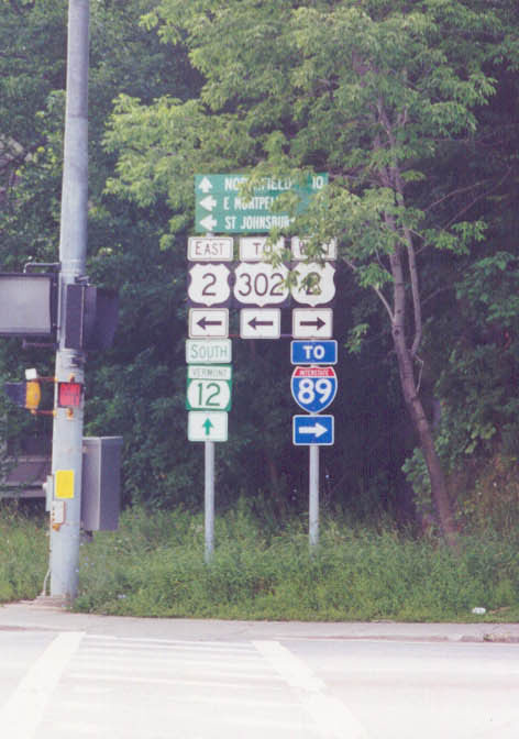
Button copy guide sign on eastbound approaching the northbound Interstate 91 ramp. U.S. 2 actually turns to the south and parallels Interstate 91 for a spell, before resuming an eastward orientation towards St. Johnsberry. Photo taken 07/23/00.
| 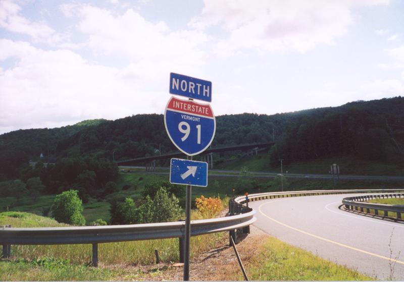
Interstate 91 Vermont Shield for the northbound ramp from U.S. 2 eastbound. The bridge in the background is the Vermont 2B overpass for Interstate 91. Photo taken 07/23/00.
| 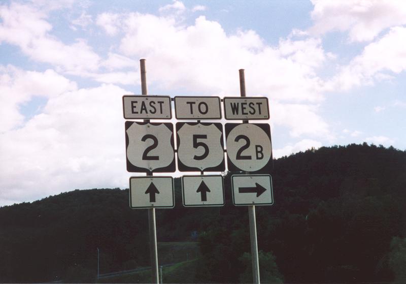
Signage for the eastern terminus of Vermont 2B, just to the south of the Interstate 91 interchange. Photo taken 07/23/00.
| 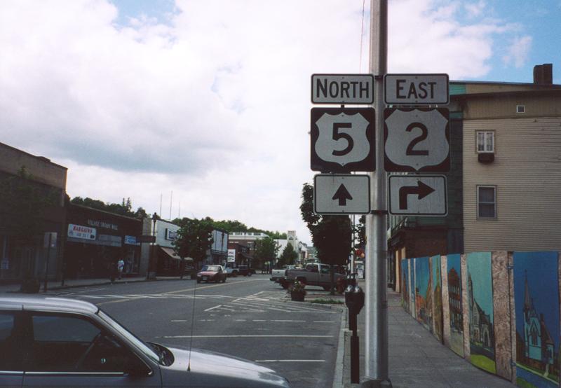
Eastbound U.S. 2/northbound U.S. 5 on a short duplex in downtown St. Johnsberry. U.S. 2 turns to the east at the upcoming intersection. Photo taken 07/23/00.
| U.S. 2 West
| 
Signage on westbound U.S. 2/southbound Alternate U.S. 5 at the split of their duplex. Photo taken 07/23/00.
| | |||||||
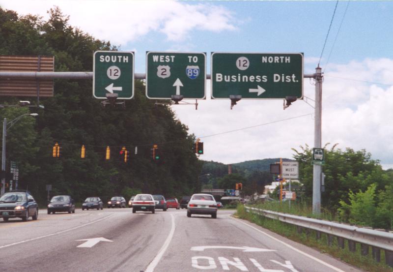
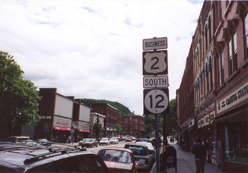
Westbound U.S. 2 approaching Vermont 12 and West Business Loop U.S. 2 (again not signed). One has to wonder if the space allocation to the left of the Vermont 12 shield was intended for Business U.S. 2. Photo taken 07/23/00.
| 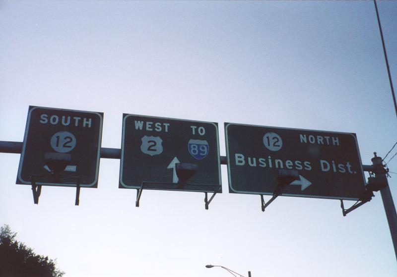
West U.S. 2 at Junction Vermont Route 12 (close-up). Taken a few hours after the above photograph was shot. Photo taken 07/23/00.
| 
Interstate 89 sign bridge on westbound U.S. 2 at Exit 14 in South Burlington. Photo taken July of 1995.
| 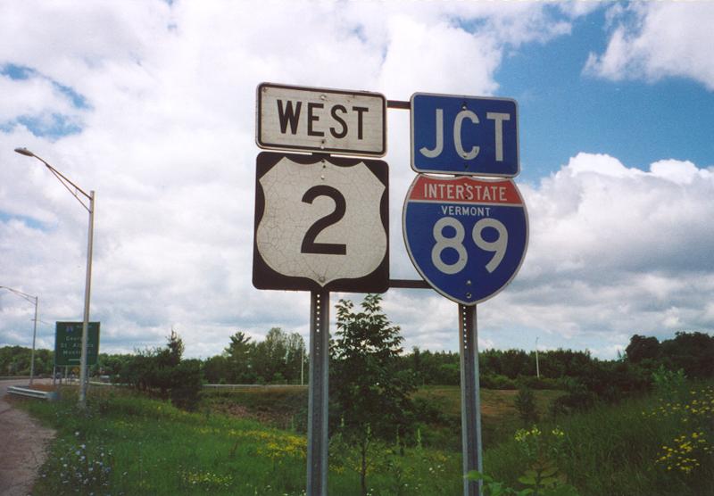
West U.S. 2 and Interstate 89 shields assembly at Exit 17. Photo taken 07/23/00.
| 
Interstate 89 guide sign on westbound U.S. 2 at the Lake Champlain Islands interchange (Exit 17). Georgia is located at Exit 18, with St. Albans at Exit 19. Photo taken 07/23/00.
| U.S. 2 scenes |
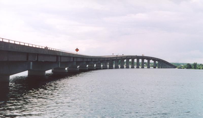
U.S. 2 bridge from Rouses Point, New York to near Alburg, Vermont. Photo taken from a frontage road on the northbound side of the eastern approach. This is the northern reaches of Lake Champlain in Grand Isle County. Photo taken 07/23/00.
| 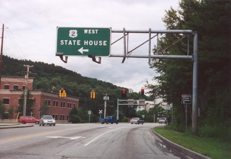
Memorial Drive eastbound at U.S. 2. Memorial Drive links Interstate 89 at Exit 8 with U.S. 2 and Montpelier. U.S. 2 enters from downtown Montpelier to the left, proceeding along Memorial Drive eastward to Berlin Street. The sign on this installation still retains button copy lettering. Photo taken 07/23/00.
| Business U.S. 2 - Montpelier
| 
Signage for the turn eastbound from State Street to southbound with Vermont 12 on Northfield Street. Photo taken 07/23/00.
| 
Downtown Montpelier along north Vermont 12 and west Business U.S. 2. A fire station is just out of view, and is the reason for the emergency signals. Photo taken 07/23/00.
| 
Closer view of the above depicted shield assembly. The shield assembly points towards the impending split of Business U.S. 2 and Vermont 12. Business U.S. 2 turns left and follows State Street towards its terminus. Meanwhile Vermont 12 continues north out of the city along Elm Street. Photo taken 07/23/00.
| 
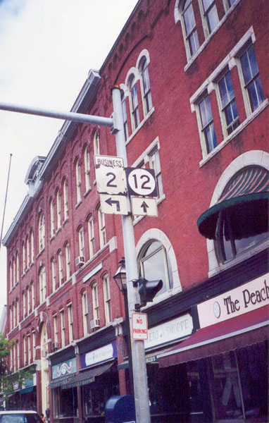
East Business U.S. 2 and south Vermont 12 reassurance shields in downtown. The terminus of Business U.S. 2 is located just ahead. Photo taken 07/23/00.
| 
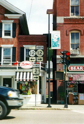
South Business U.S. 2/Vermont Route 12 at U.S. 2. This intersection marks the eastern terminus of Business U.S. 2. There is no signage on U.S. 2 indicating that Business U.S. 2 exists at this intersection. Photo taken 07/23/00.
| 
Overhead shields at the same intersection in the above photograph. Note the signage pointing to U.S. 302, which has its western terminus a few miles east of here. An older "Virginia" state name style shield is in place. Photo taken 07/23/00.
| | ||||||||||||||
Page Updated March 4, 2002.
|
About Contact Glossary |
In The News Interstate Guide |
Social Media:
 |
|
© 2000-25 AARoads.com | All Rights Reserved | Privacy Policy / Terms of Use
|
||