
The journey northward took place on a warm November day interspersed with blue and milky skies. We opted for a non-Interstate routing from High Springs northward through Lake City, Homerville, Jessup, and Hinesville, Georgia. That allowed us to see some new roadways, garner a few more counties (we do that obsessive thing too!), and check out a few U.S. highway ends for Dale Sanderson’s U.S. Highway Ends
I won’t bore you with the detailed routing and rather will focus on some of the roadworthy highlights along the drive.
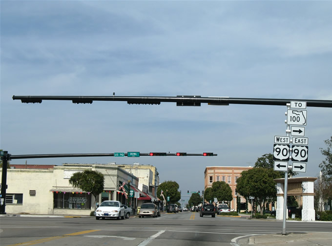
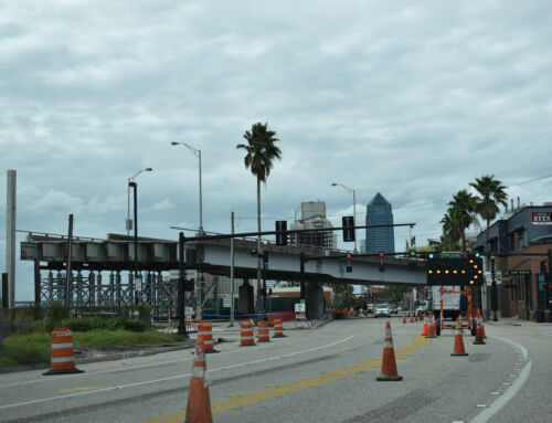
U.S. 441 (Marion Street) north at U.S. 90 (Duval Street) in Lake City.
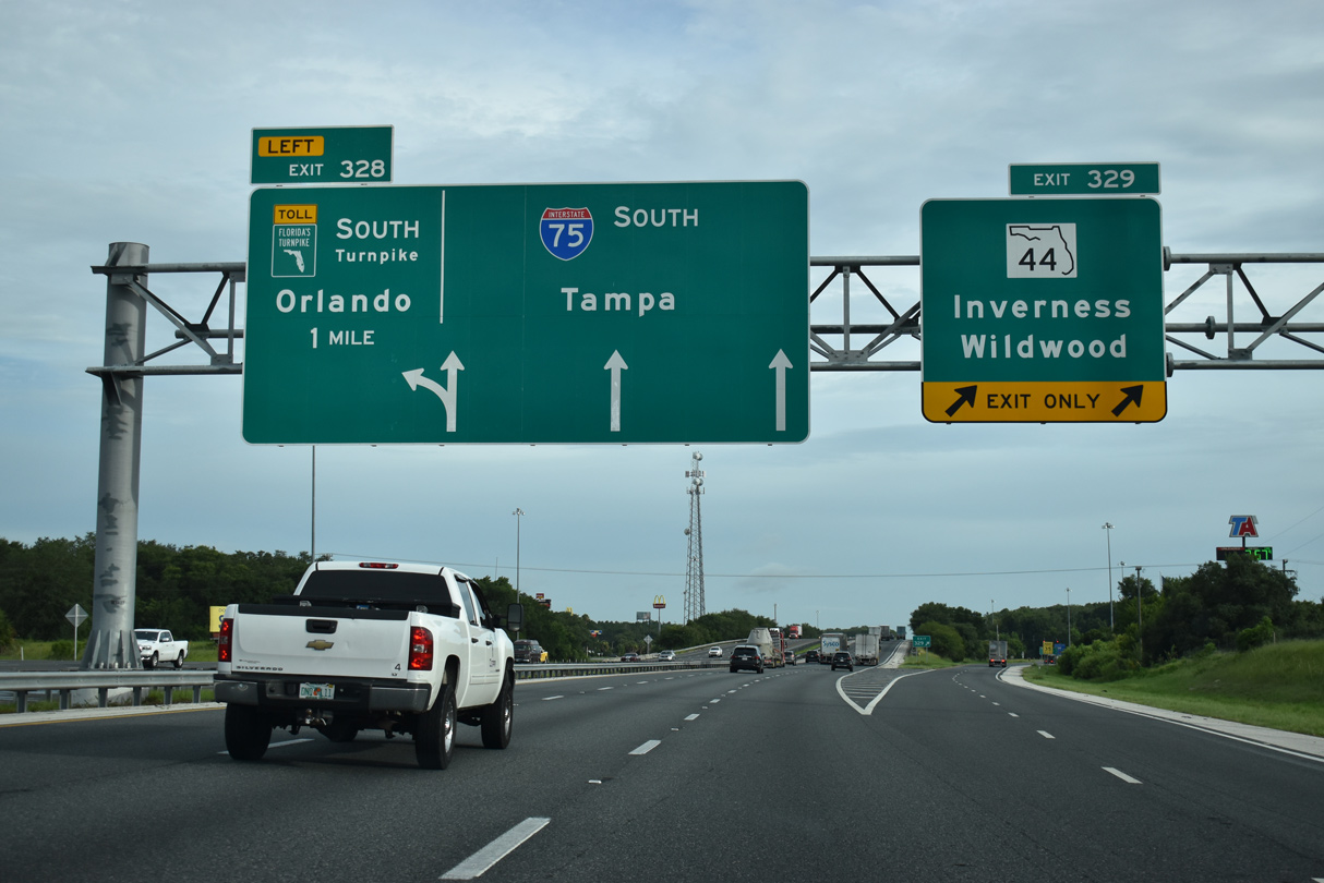
Lake City lies near the cross roads of Interstate 10 and 75 in north Florida. The town is the control point of Interstate 10 west from Jacksonville and east from Tallahassee. You may not think much of it by its presence on the map, but its surprisingly sprawly, especially along U.S. 90 east of Interstate 75 and U.S. 41/441 heading south of town. Downtown meanwhile retains some charm, echoing Lake City’s history as a smaller town no doubt. Pictured here is
I’ve always been intrigued by long state roads in hard to reach areas (North Carolina 12 to Corolla comes to mind), and one such that fits the build is Georgia 177 in south Georgia. Georgia 177 constitutes a fairly long spur from U.S. 84 near Fargo to Stephen C. Foster State Park within Okefenokee Swamp. While we did not have the chance to drive all the way up it, we did check out the beginning.
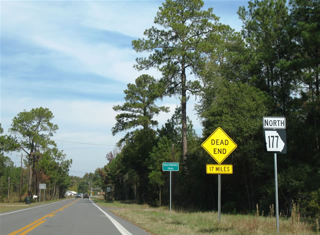
Georgia 177 northbound begins.
A convoluted drive along counties lines later, we arrive at the town of Alma, the seat of Bacon County. When I used to watch The Weather Channel in the 1980s from Savannah, Alma was one of the regional observation points on the Local Forecast. I only mention this because Alma almost always had “NO REPORT”. Not that that has anything to do with roads, but it’s just an observation I remember from childhood.

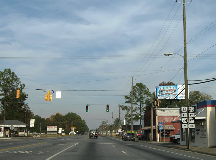
Here we look at downtown and a set of old 30″ Eagle signals at 12th Street at Georgia 4 Alternate (Dixon Street). Georgia 32, the main east-west drag through town, veers two blocks south from 12th Street on a bypass alignment of the central business district.
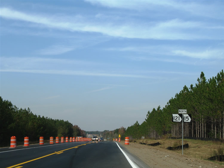
Georgia 15 & 121 northbound at the Big Saltilla Creek Overflow channel (Appling/Pierce County line) during a relocation project to build a new roadway and a new series of bridges.
Georgia 32 carried us east from Alma to Georgia 15 & 121 at Bristol. Georgia 121 is part of a multi-state-route (MSR) traveling between U.S. 19 & 98 near Inglis, Florida and U.S. 21 Business at Rock Hill, South Carolina. Additionally in Georgia, Georgia 121 obtains the designation of the Woodpecker Trail, complete with graphical trailblazers along the road.
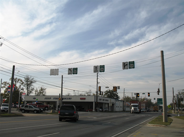
U.S. 341 north at U.S. 84 in Jessup, Georgia.
A pit stop in central Jessup during what otherwise is peak hours at the junction of U.S. 341 and U.S. 84. U.S. 84 and 341 cross paths in the heart of town while U.S. 25 & 301 follow a bypass routing to the east. U.S. 25 & 341 join forces on their southward drive to their respective ends in Brunswick, while U.S. 301 continues south to the Brantley County seat of Nahunta (U.S. 82)…
Heading out of Jessup, U.S. 84 combines with U.S. 25 & 301 for the northeastern journey to Ludowici and Long County.
Ludowici, a historical speed trap, represents the split of U.S. 84 east from U.S. 25 & 301 north. U.S. 25 and 301 remain paired all the way to Statesboro while U.S. 84 continues east to Hinesville, Fort Stewart, and its Liberty County end at Interstate 95. Georgia 57 meanwhile enters the scene from Townsend to the southeast.
Somewhat later in the day, we opted to loop into Savannah via Georgia 204, Veterans Parkway, Interstate 516, Interstate 16, and U.S. 17 across the Talmadge Bridge. Traffic woes virtually paralyzed Georgia 204 westbound at both Interstate 95 and the King George Boulevard intersection west of Veterans Parkway. Growth of the Bryan County town of Richmond Hill as a bedroom community undoubtedly is putting pressure on Abercorn Street Extension (Georgia 204) as a commuter route. To augment some of these woes, GADOT is considering an interchange at King George Boulevard and widening to eight overall lanes of Georgia 204 through South Side Savannah!
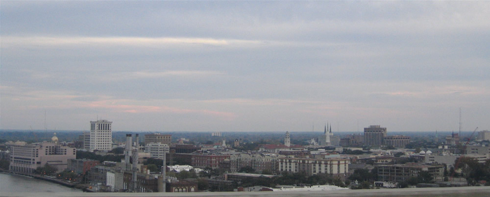
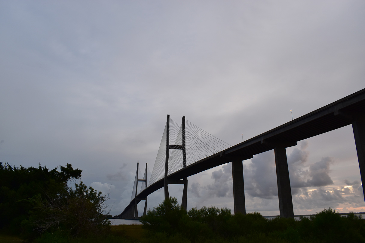
Meanwhile north in Savannah itself, here’s the view of downtown and the famous Savannah River from the Talmadge Bridge to the west.
The Talmadge Bridge lowers onto Hutchinson Island midway between the Savannah Front and Back Rivers. The Back River overall represents the state boundary between Georgia and South Carolina. North of the majestic cable-stayed bridge over the Front River is a substandard two-lane concrete viaduct carrying U.S. 17 into swampy Jasper County, S.C. There is virtually nothing along the drive from the Peach State north to Hardeeville, except for a few nude bars and such. Intertwining between the pron and interchange with Interstate 95 is South Carolina 170 Alternate and South Carolina 170 south and north. The Alternate route loops east to Levy from U.S. 17 to South Carolina 170 southeast of Hardeeville. It was originally South Carolina 170 itself. When U.S. 17 Alternate became the U.S. 17 mainline, old U.S. 17 became the new South Carolina 170. New South Carolina 170 follows the Houlihan Bridge north from Port Wentworth, Georgia to a wye interchange with U.S. 17 near Limehouse.
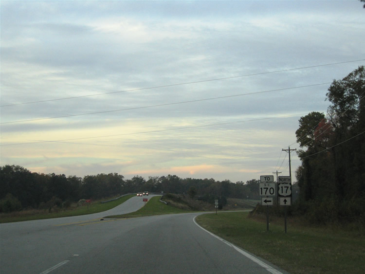
A short access road provides access onto South Carolina 170 south from U.S. 17 north here. Further north, South Carolina 170 splits from U.S. 17 en route to U.S. 278 west of Hilton Head Island and U.S. 21 at Burton.
Once in Hardeeville, we remained on U.S. 17 on its parallel alignment to Interstate 95 northward to Ridgeland. At Ridgeland, U.S. 17 merges onto Interstate 95, leading one to think that old U.S. 17 was perhaps build over or was discontinuous. However after looking at aerial images, the old alignment is fully in tact, even with four-lane sections, on its parallel alignment northward to the U.S. 17 split with Interstate 95 near Yemassee.

