
A trip that JeffS and I took to Death Valley this previous weekend. We rented a big old truck, and in strict accordance with our rental car policy, we did not under any circumstances drive on any dirt roads looking for old highway signs. Jeff even brought a metal detector – just in case we could dig something up.
Were we successful in finding old signs? Let’s find out!
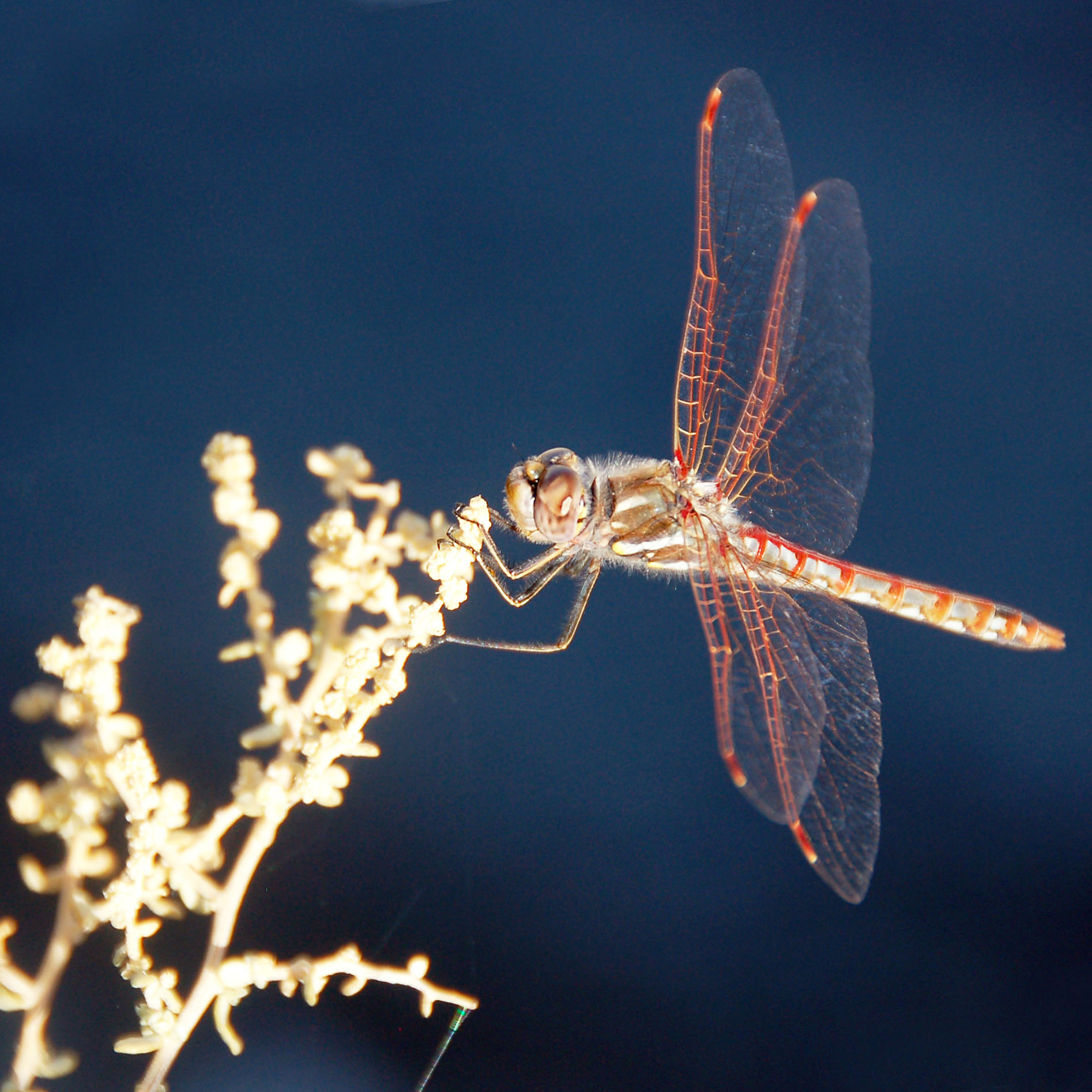
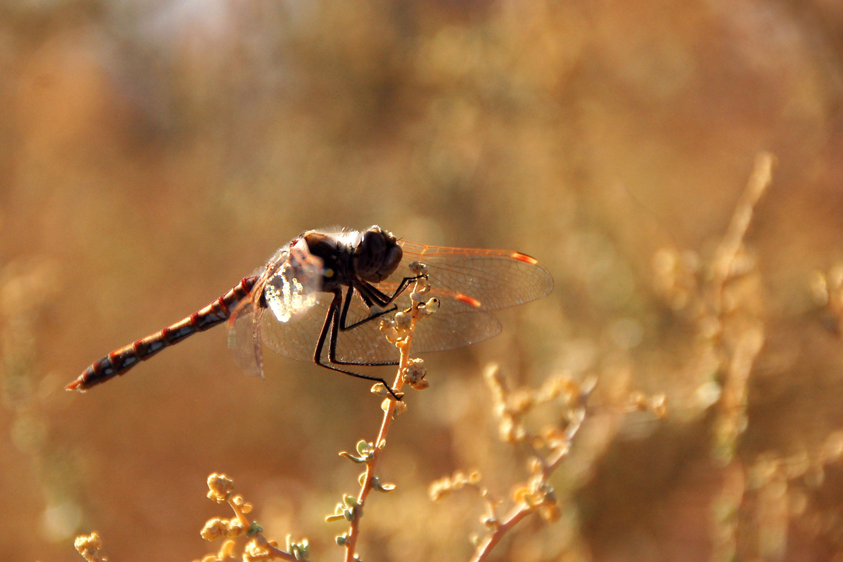
Be sure to check out the large version of this picture. The dragonfly cooperatively held still for a good minute or so, and therefore I took over 100 pictures. This one is the sharpest!
Every once in a while, I can shoot a picture into the sun and get it to come out!
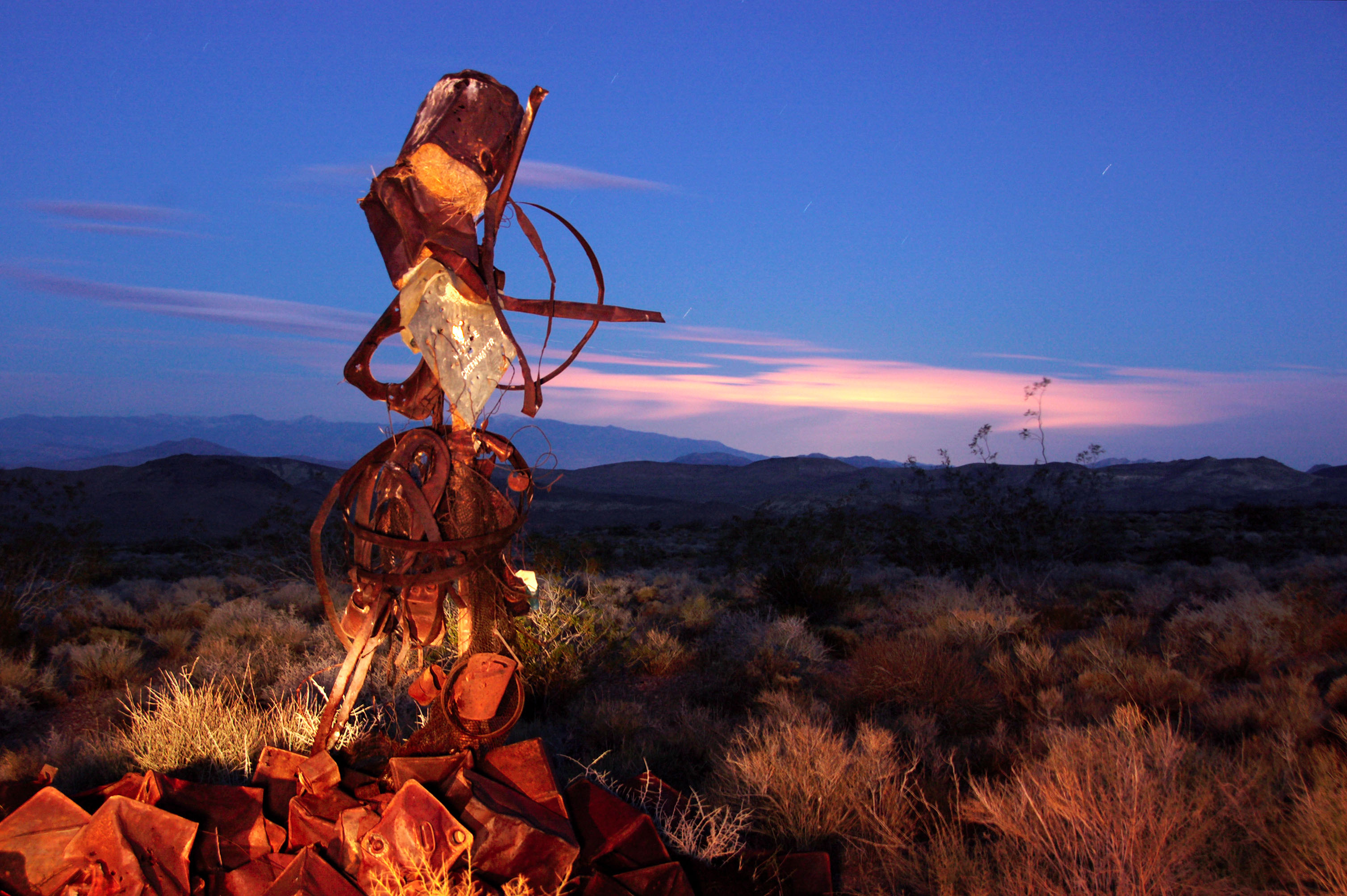
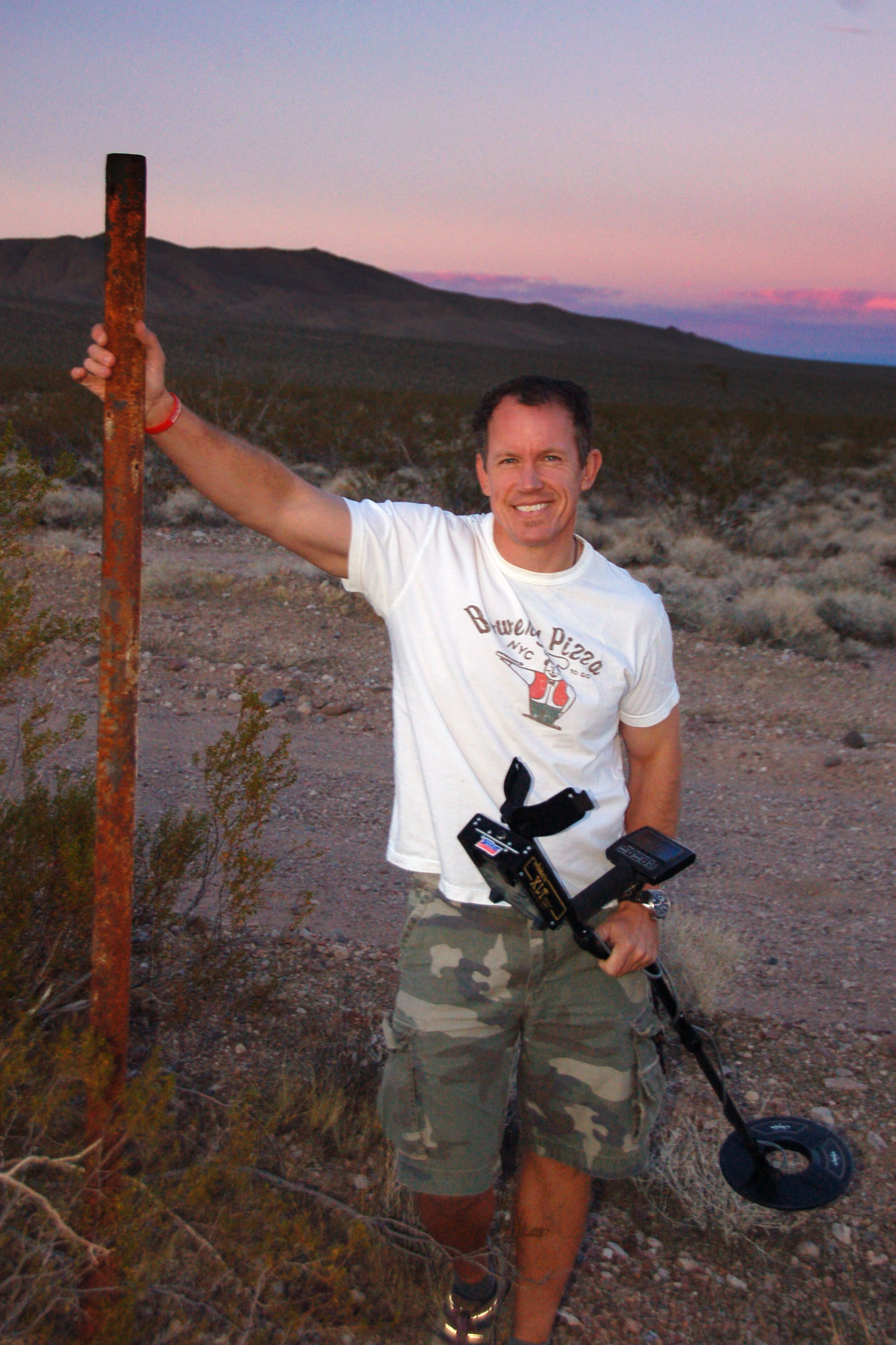
The last diamond sign. The Auto Club of Southern California put up these markers from 1906 to 1929, and this one has not been stolen simply because it is barely recognizable as anything more than an 18×18 inch pane of steel. Surrounding it are various empty gas cans and other artifacts.
We got to the sign well past dark. This is about a three-minute exposure under a quarter moon. The cloud illumination is provided by the city of Las Vegas; the foreground lighting is thanks to a flashlight.
Classic porcelain signage on the 91 freeway. Looking for a few old signs in the Los Angeles area before picking up Jeff at the airport.
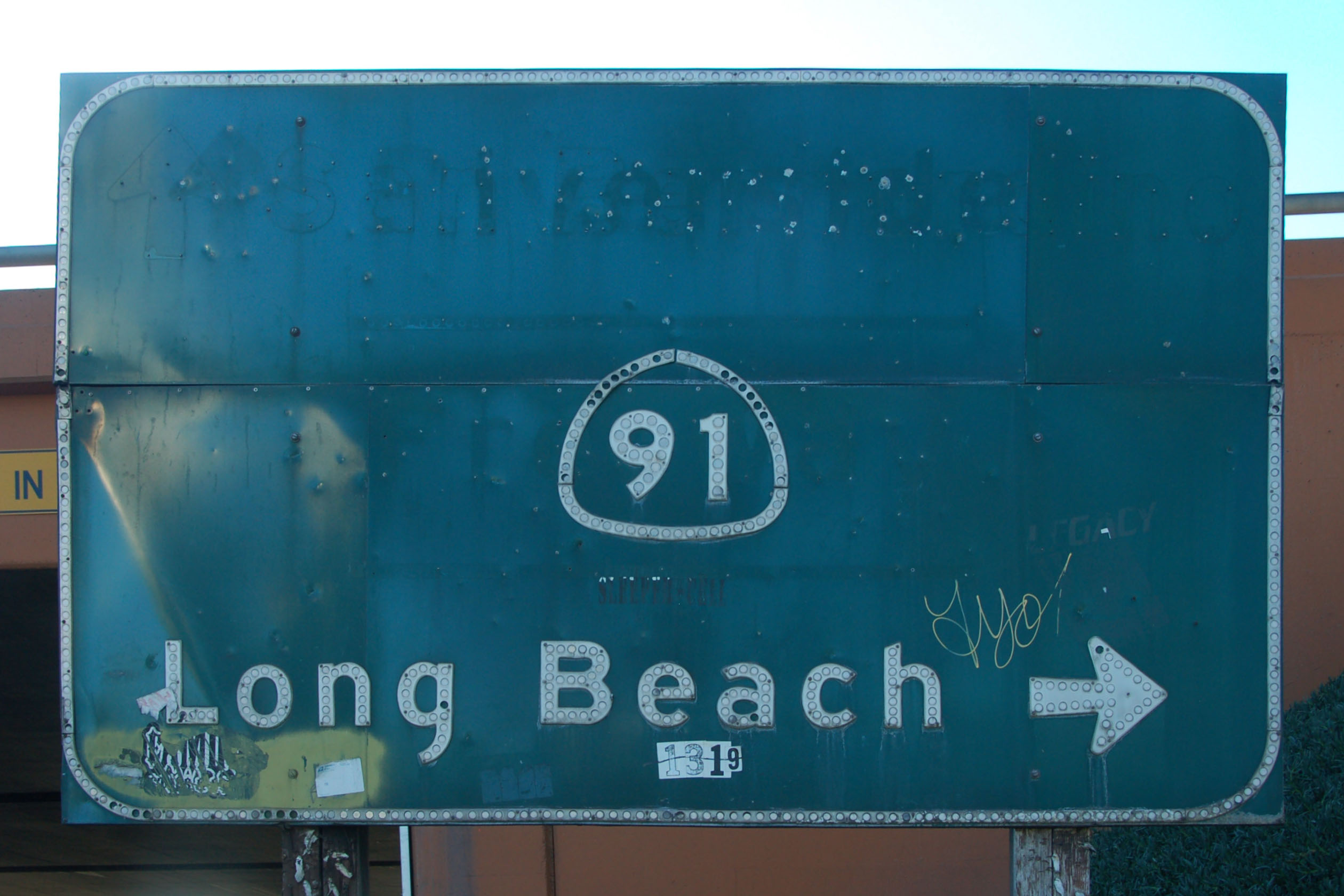
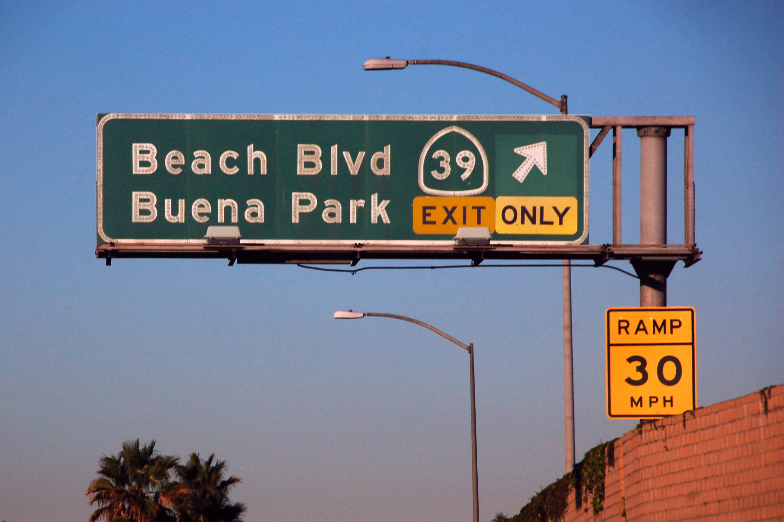
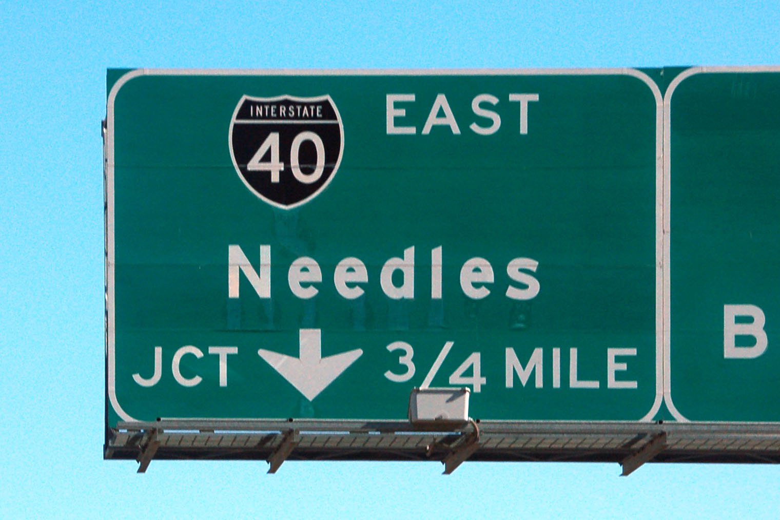
What a horrible photo of this classic sign. This, from 1959, is the oldest known example of button copy signage in California: individual letters, numbers and symbols are made out of aluminum, have reflectors inserted, and then the whole element is riveted onto the green background. The sign originally had “Freeway” instead of the 91 shield (referring to a US-91 freeway!) and also the top destination was first “Riverside” and then “San Bernardino” when the freeway was extended.
Incidentally, 91 no longer goes to Long Beach – Artesia is the correct destination. US-91 went to Long Beach, back in the day.
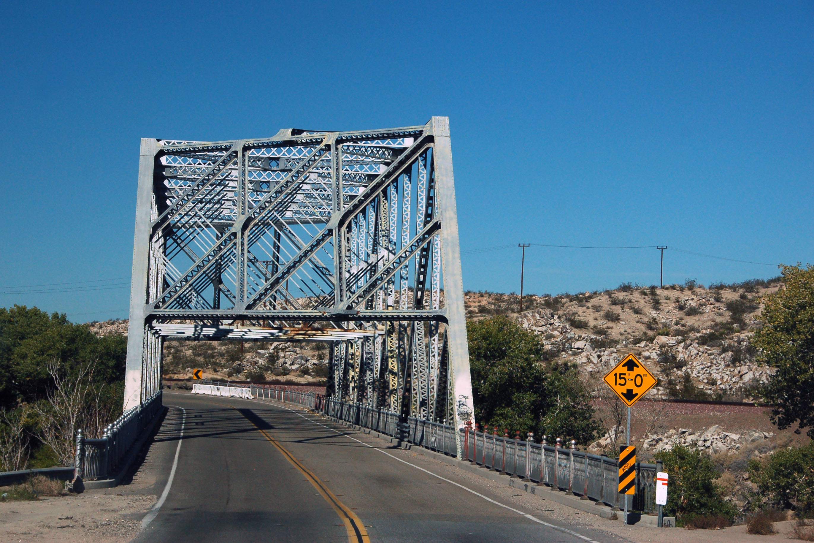
The classic truss bridge on old US-66 in Victorville.
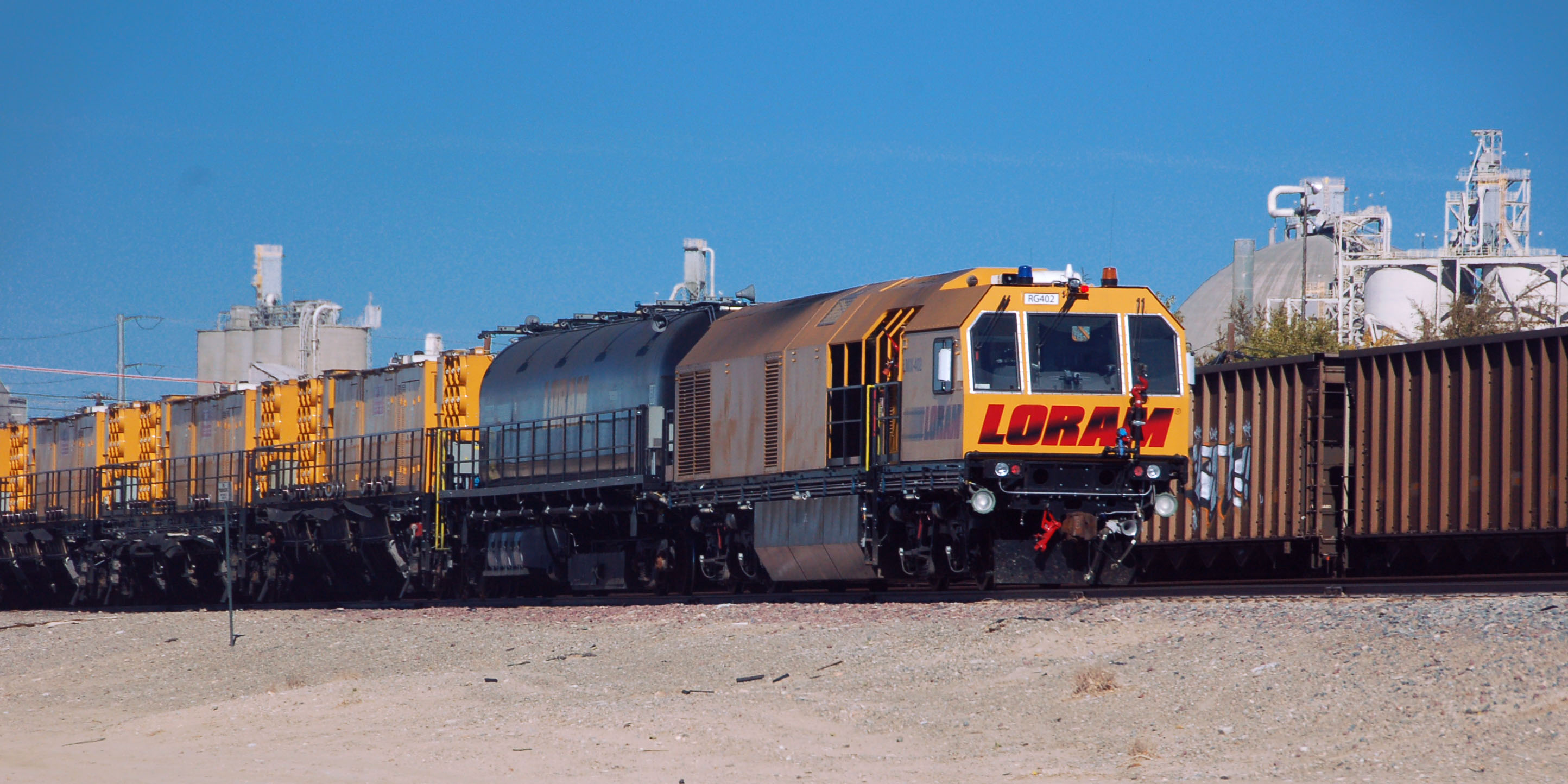
This is a maintenance engine. It travels around the country, repairing tracks.
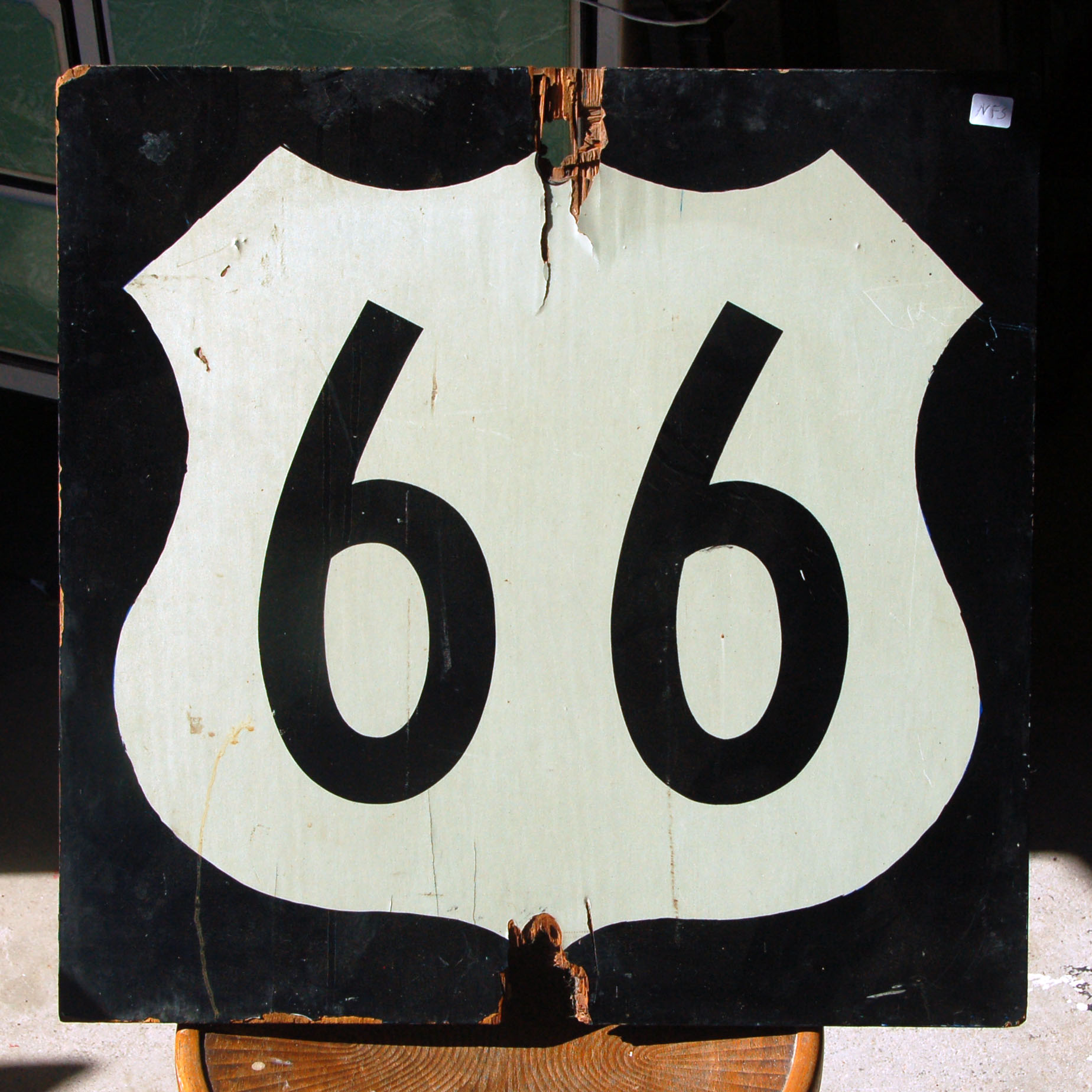
This 66 sign is from 1964, and was posted in Kingman, Arizona. It is in an antique shop in Victorville.
Antique-store cat.
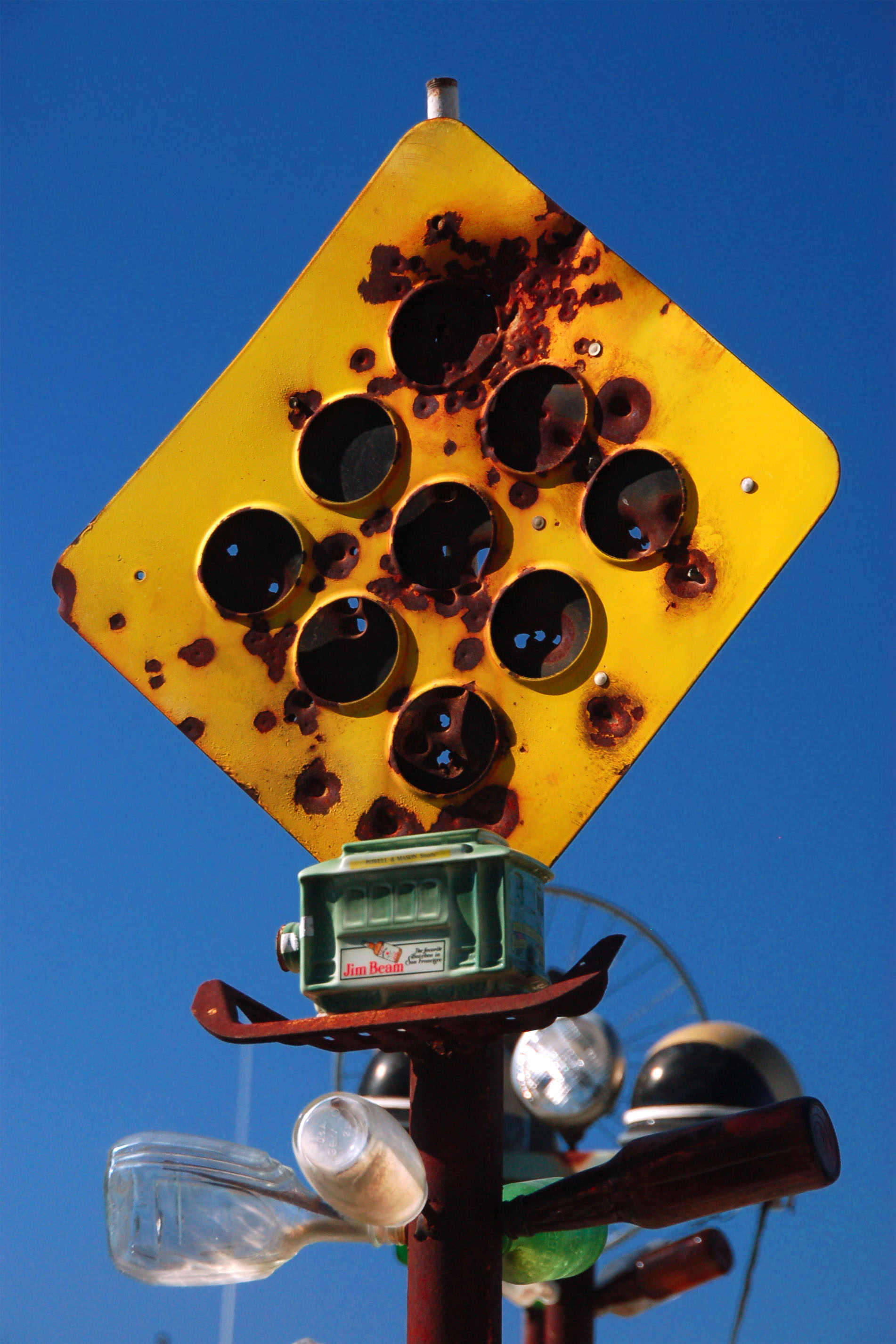
Elmer’s Bottle Farm. Oro Grande, on old 66.
A black interstate shield?? Your explanation is as good as mine.
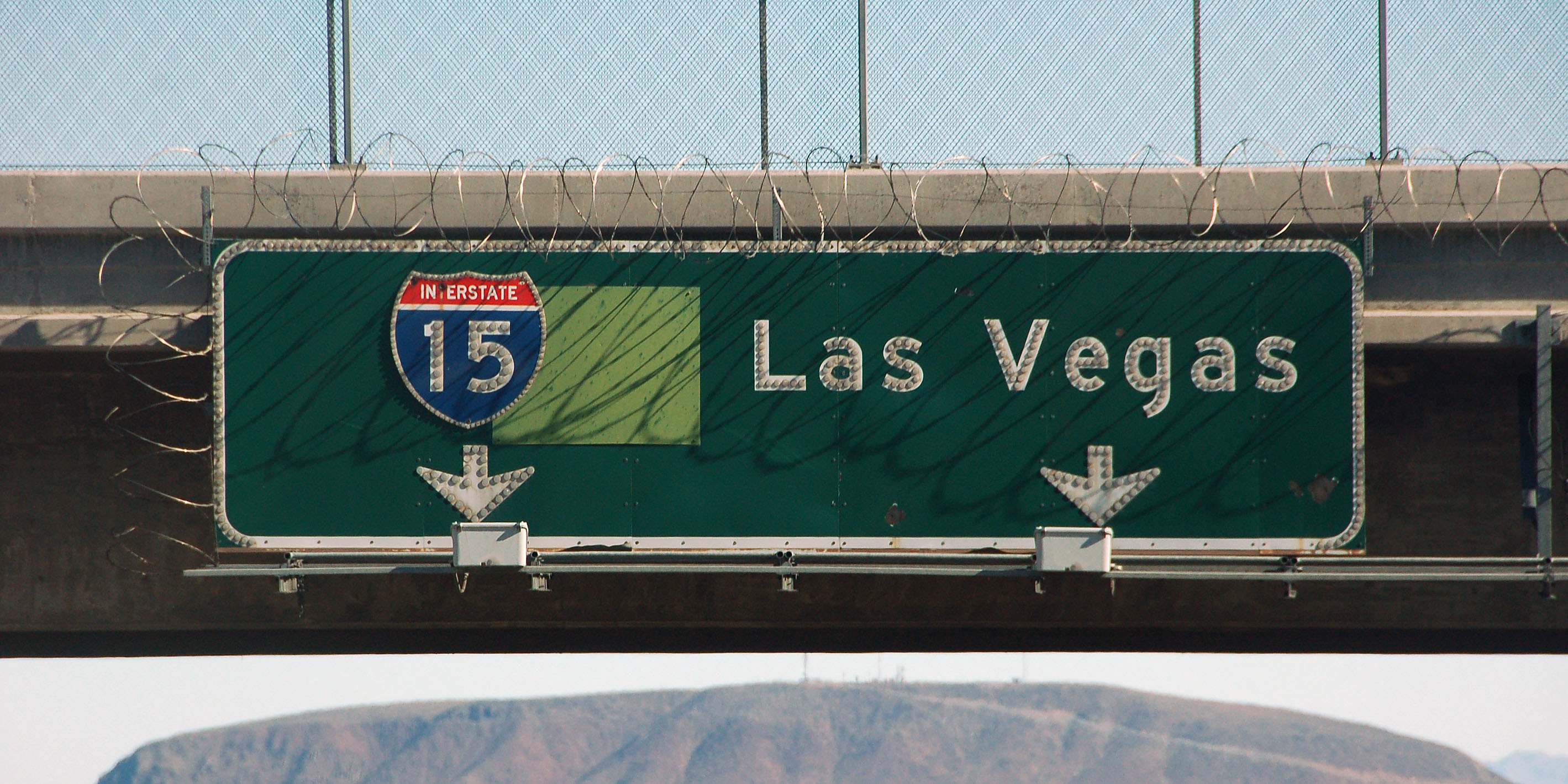
This classic 1960 sign survives at the junction of I-15 and I-40. Under the patch is a US-91 shield.
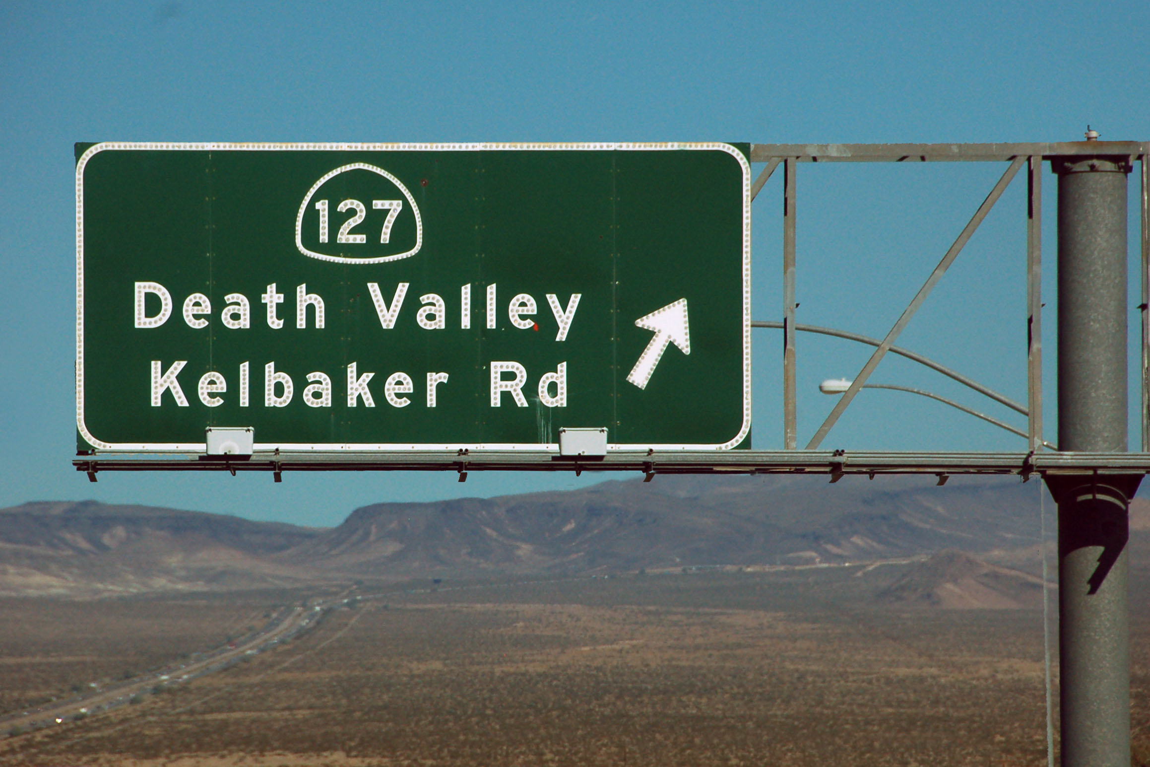
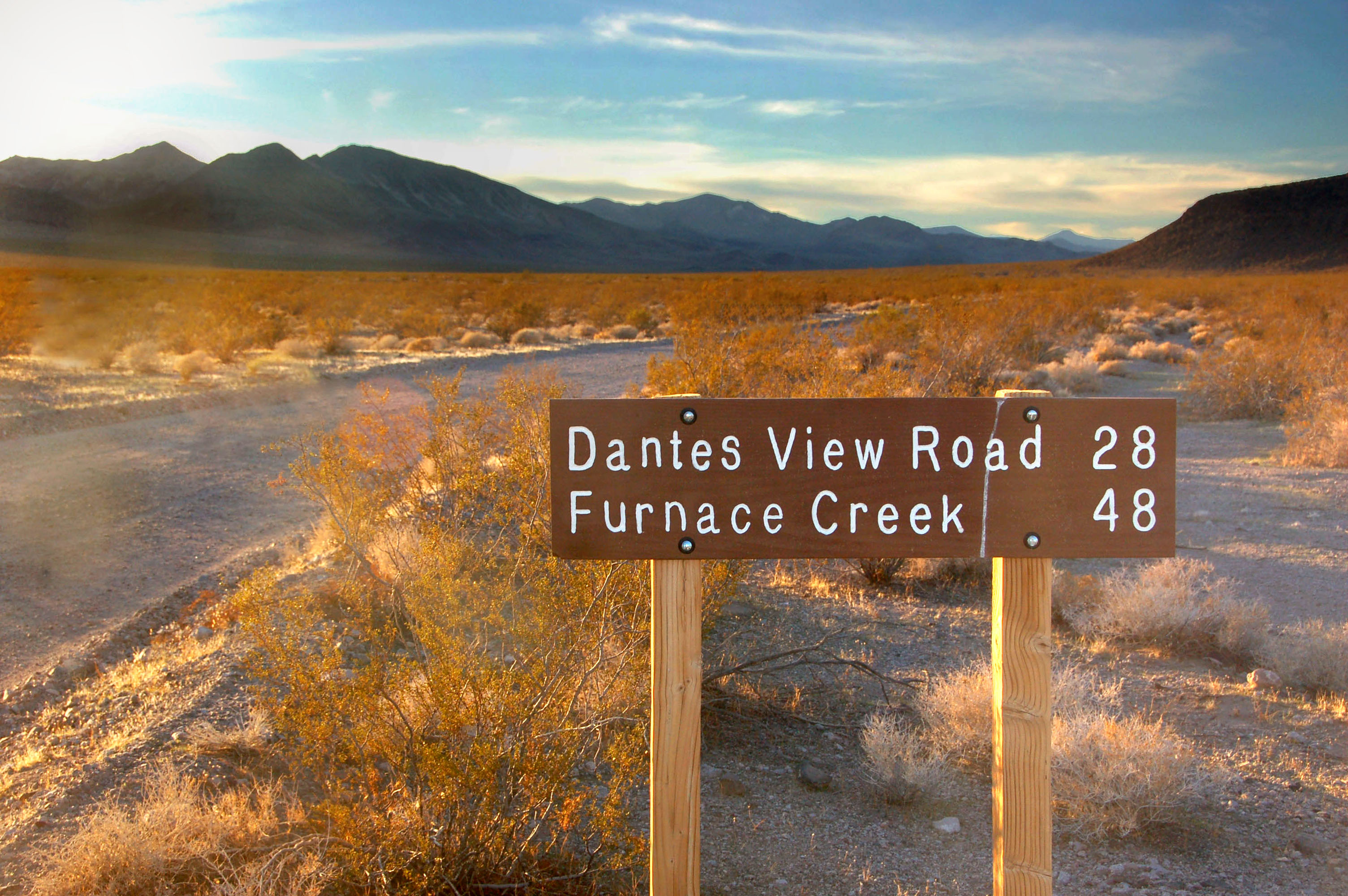
At Baker, we turn north off the 15 freeway.
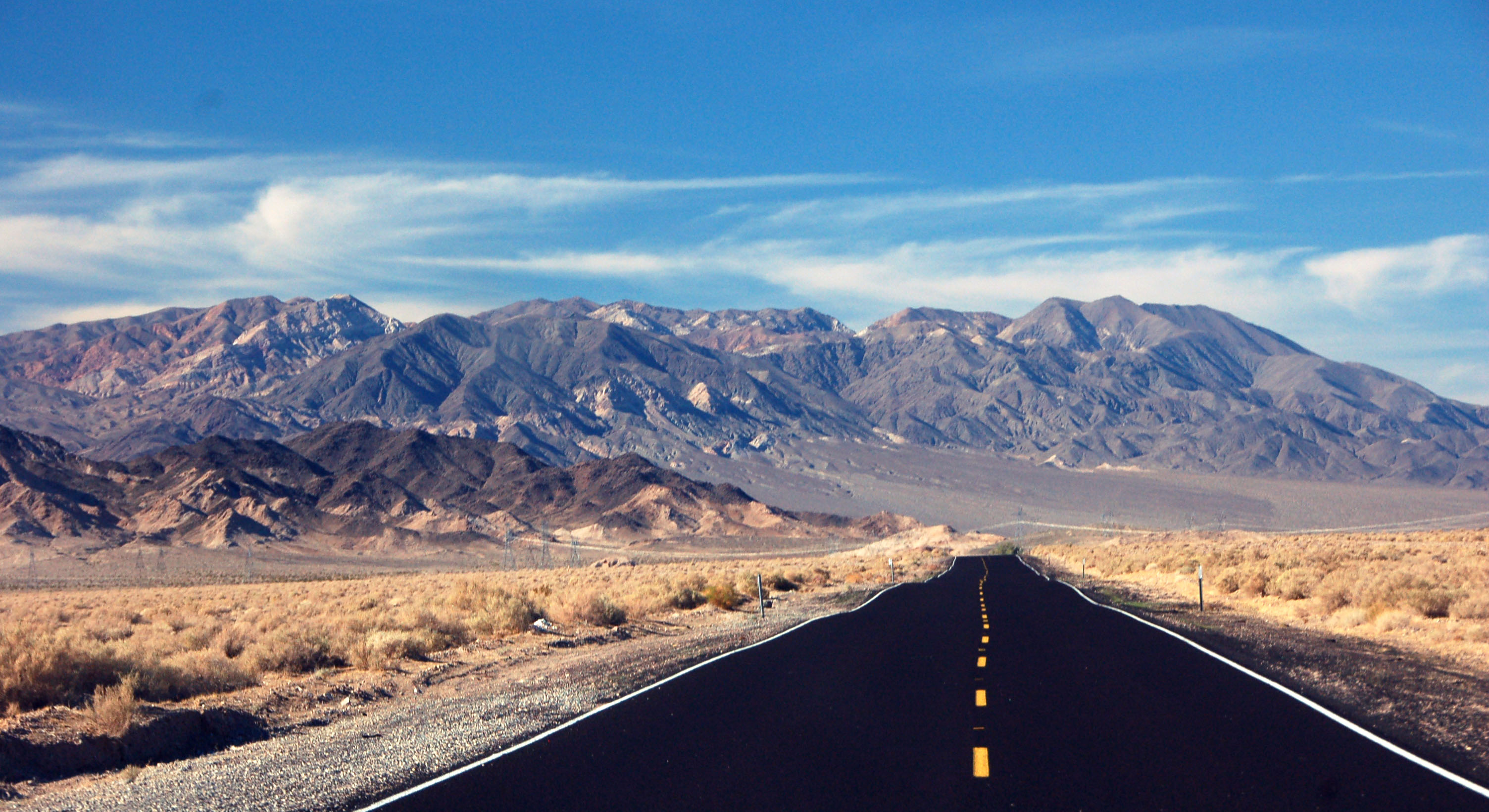
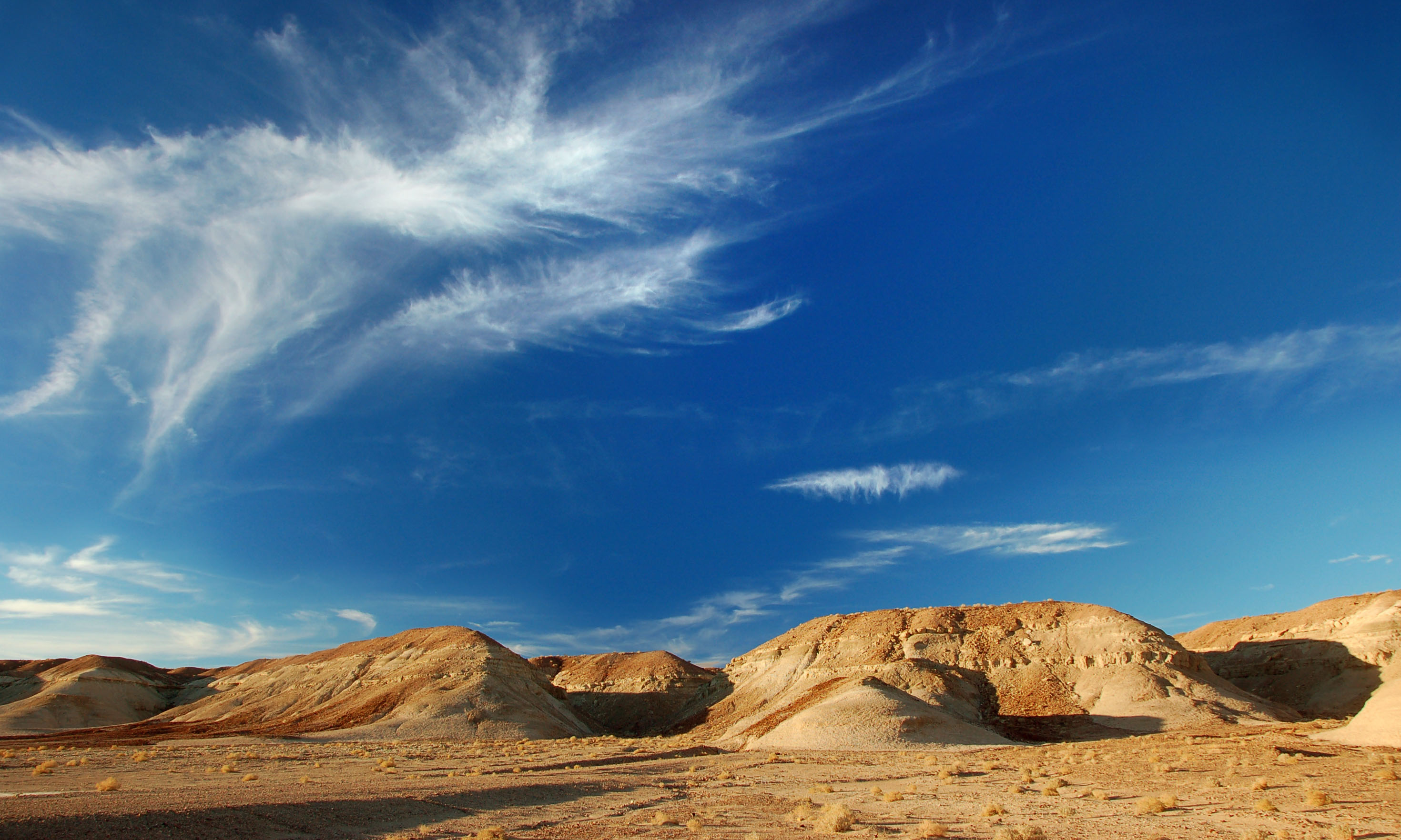
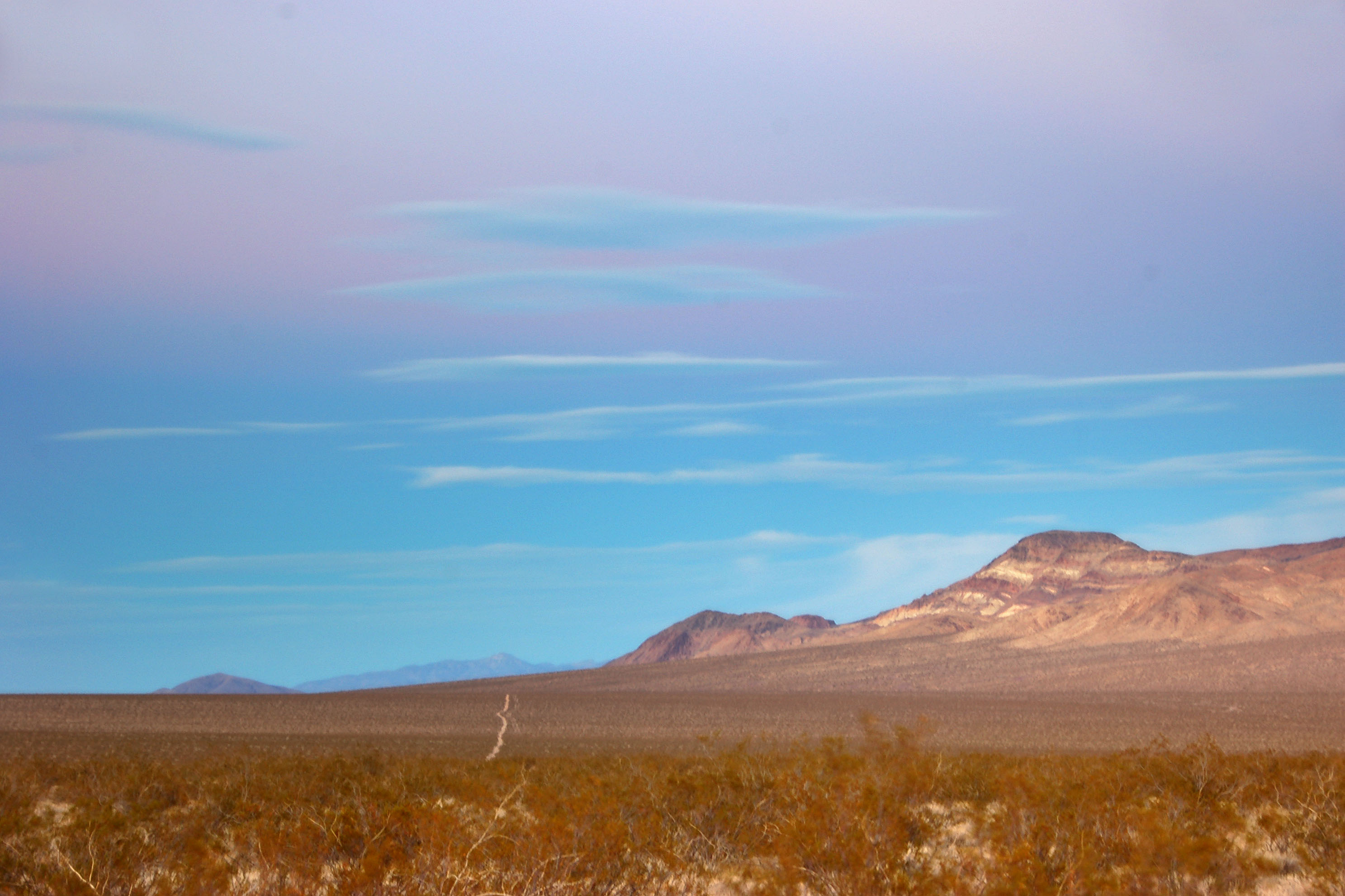
Approaching the sorts of landscapes that Death Valley is known for.
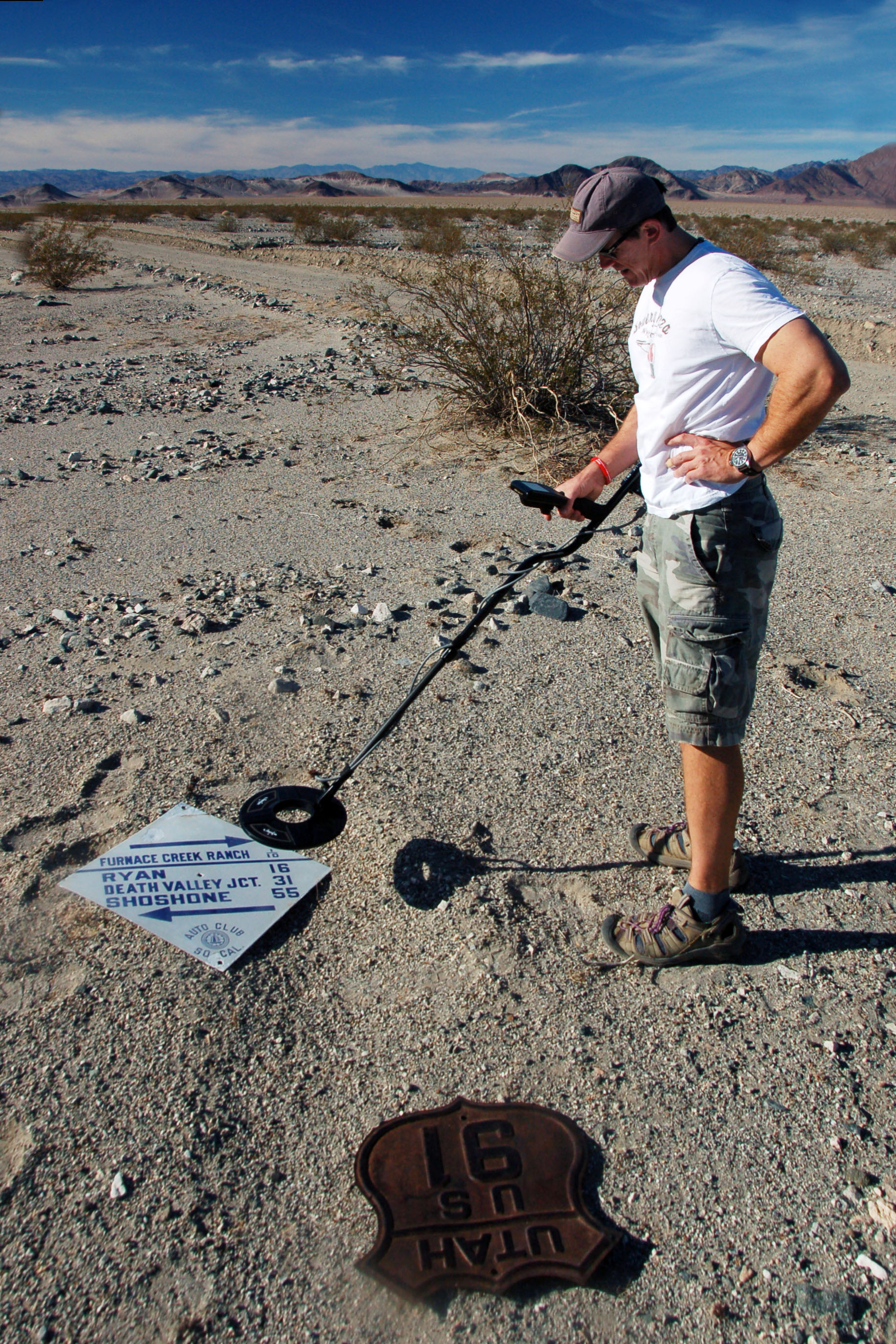
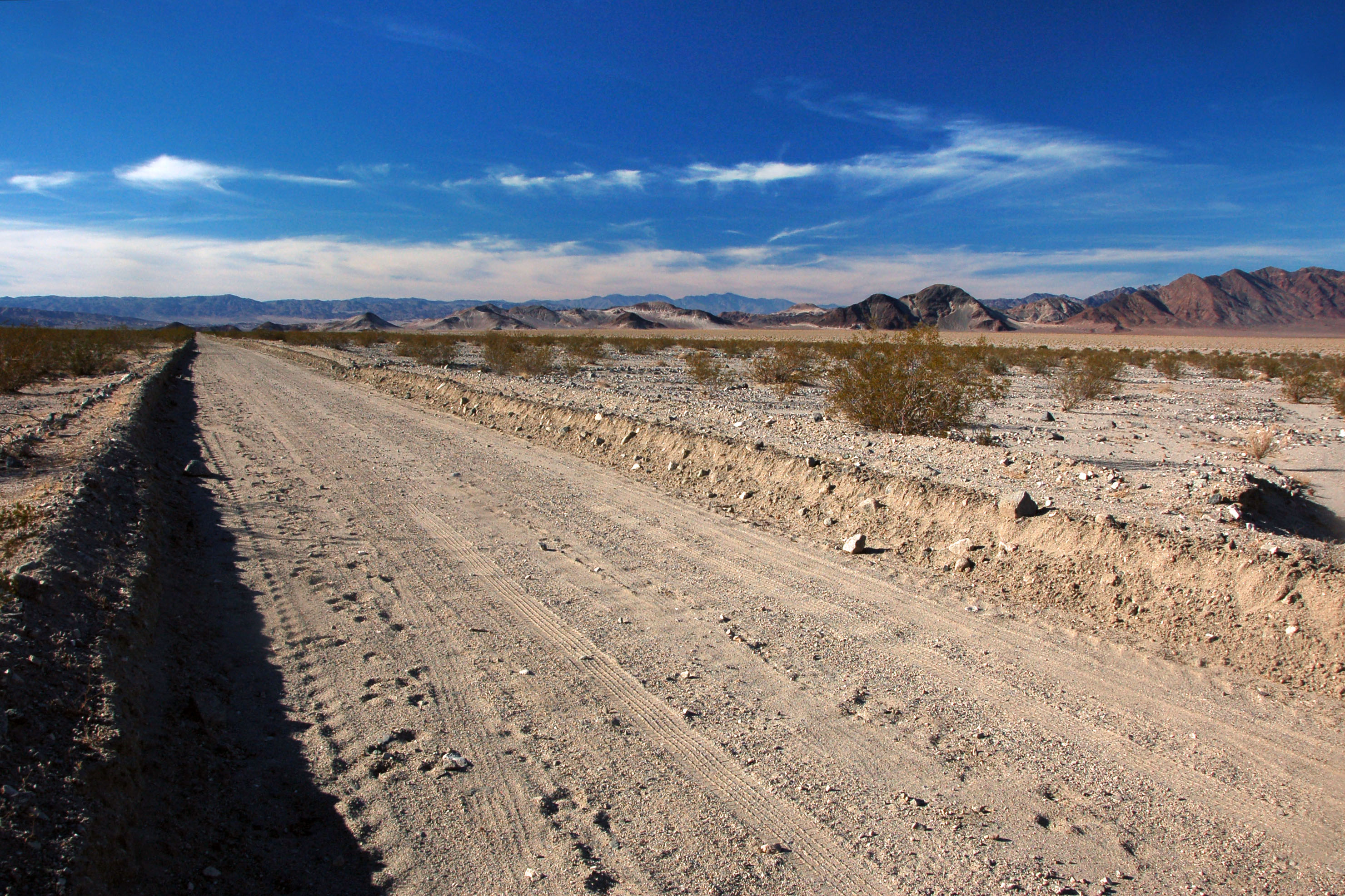
Testing out the metal detector on some control signs.
Deep shadows at three in the afternoon. Death Valley in November.
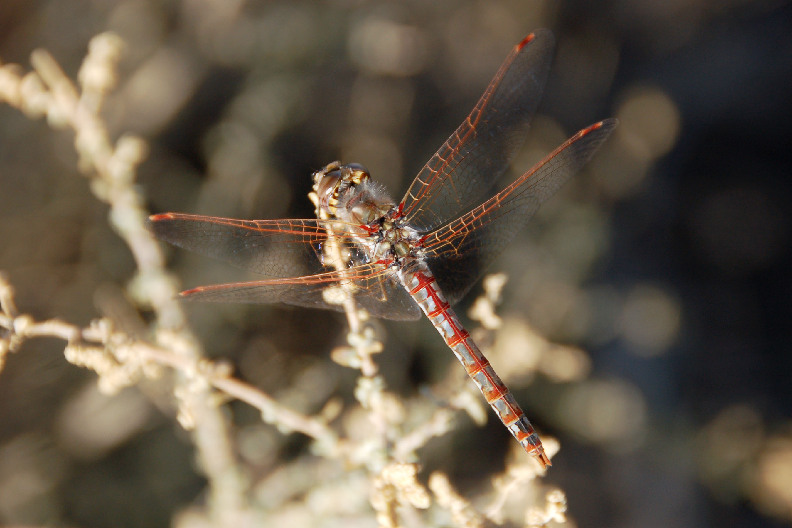
Same dragonfly. Different angle.
One last one.
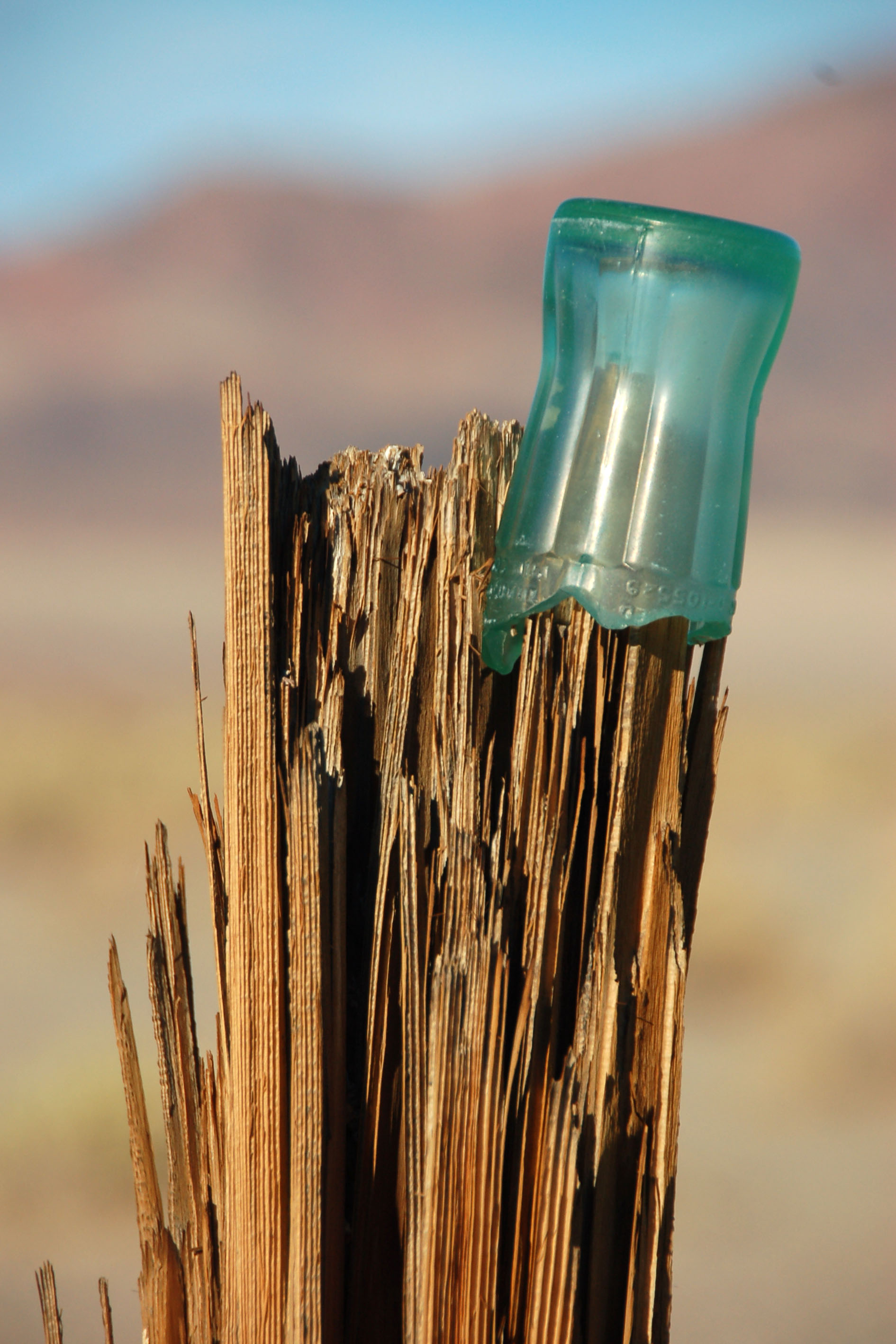
We found this half of a coke bottle on top of the fencepost. One marking on it potentially identifies it as being from 1948. In any case, it is old enough for the glass to have turned green.
This section of the world – near the Old Spanish Trail turnoff on highway 127 – always reminds me of the Badlands in South Dakota. The Old Spanish Trail, incidentally, is so venerable that it was bypassed by 1906 or so with the Arrowhead Highway as the main route between Salt Lake City and Los Angeles.
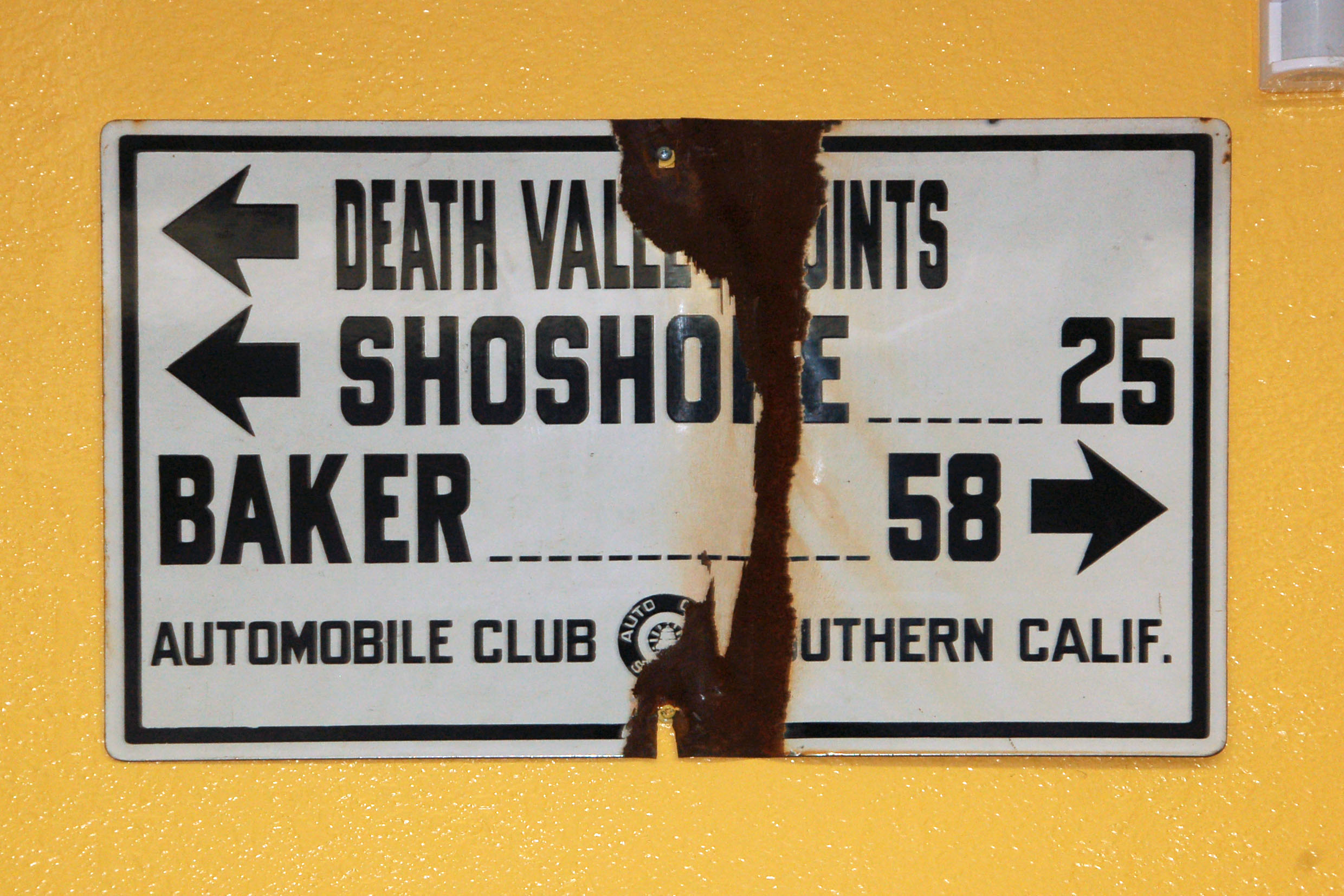
At the gas station in Shoshone is this 1929-1933 sign…
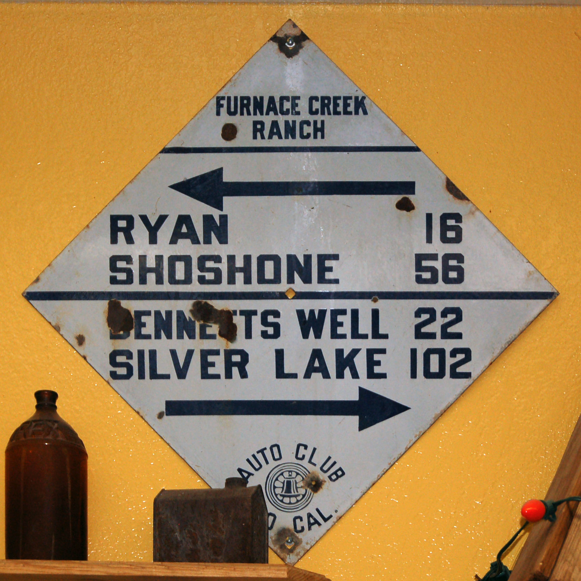
… and this 1922-1928 style.
An old post! This post was once painted white, with a black base, and held three 1929-style white rectangles. It is at a T-junction between two very old trails in the park.
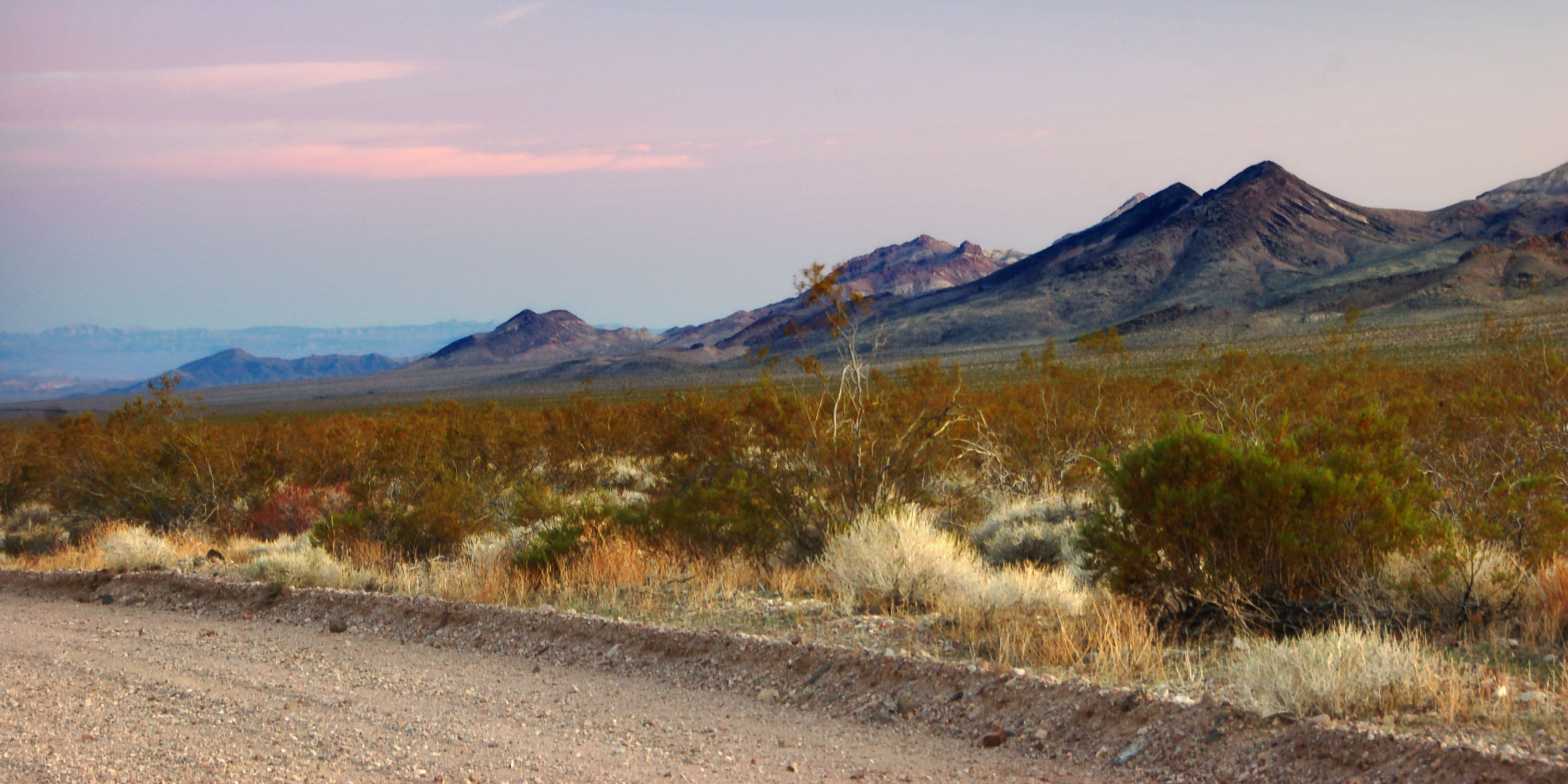
Why yes, it is starting to get dark.
Just after sunset. An old trail heads east.


fantastic pictures. i hope you guys had a good time. looks like you were bored to tears. i have stayed in DV 5 times, once after the incredible rains when there was a Lake Badwater. jb
when were these rains? it rained on me once, in March of 2008, but it wasn’t incredible – just the remnant of a snowstorm in the Owens Valley that slightly trickled south.
that time, I came in on the Death Valley Road from the north, and it was snowing within park boundaries, but I was still up at several thousand feet.
One possible explanation for the black interstate sign: I’ve seen a few signs in Utah along I-70 where the retroreflective coating has fallen off from exposure to the sun, leaving only the base, which was black. The letters are attached to the surface of the sign and remain. This seems like an odd thing to happen to a California sign new enough to not have the porcelain steel.
I have seen some green signs in Apple Valley on CA-18 that have had the green deteriorate to black, similar to the signs in Utah … but in this case, oddly, it is the red and the blue that have vanished. Same Caltrans district, and likely same shop that the signs came out of (overheads in Barstow and pole-mounted signs in Apple Valley) so I wonder why, on the overhead, it wasn’t the green that went first.
Diamond shapede guide signs were posted by ACSC as late as 1930. The Greenwater sign (if that’s the same one i think it is) was still fairly intact and legible in the 1960s.
I would imagine a few diamonds were posted after the official conversion to white rectangles in February, 1929.
there were many diamond signs that were around and quite legible in the 60s. Somewhere I once saw a photo taken in about 1990 of a diamond sign in Death Valley that was in nearly perfect condition. I wish I had saved the photo.
Yes there were some of the older signs still posted into the ’60s and beyond, mostly in remote areas, numbers dwindling, but many if not most had been removed by either Park or ACSC personnel, if I’m not mistaken, and buried – I’ve heard of (and you’ve probably heard of) at least two sizeable caches of buried ACSC diamond guide signs uncovered in the ’50s and ’60s. I think there may have been a tiny bit of friction between the Park leadership and the ACSC about signage, with the Park promoting and ultimately prevailing with their larger wooden signs featuring the routed out characters – numbers and letters. There are exceptions of course depending on the Park leadership philosophy – retaining the Bennett’s Landmark signs for example.
I have heard of one cache for sure – the source of almost all of the signs we have now that point to Death Valley Junction, including the diamond sign that Jeff is standing next to.
there was also the cache found in Riverside County that came to market just a few months ago.
Also the Kernville cache of 1988, the Rosamond cache of c1990, and the L.A. airport runway cache c 1960s.
Another high desert area cache c 1960 yielded some badly damaged guide signs with Ballarat on the legend from what I’ve heard, as well as “Bungalow City.” (the original name for Stovepipe Wells).
I have never seen a Bungalow City sign.
LA airport runway – what did that reveal? maybe some elusive downtown LA stuff? I’m surprised so little of that survives – did no one bother to scale a pole with a pair of bolt cutters and take down a PASADENA or SUNSET BLVD sign back in the day??
shemp, what’s your email – I’ll send you some pictures of the more interesting guide signs I’ve managed to accumulate photos of over the years!
(jake@aaroads.com)
Thank You for your kind indulgence, my esteemed fellow road researcher. At the moment I’m perfectly content viewing this fabulous site, counting bighorn sheep as well as amazing skylit roadmarker backdrops, and looking at some wonderful signs especially the Midland Trail items from your and Devon’s collections.
10-4!
glad you’re liking the site! :) sometime though I must pick your brain for all this Road Intelligence you keep hinting at.
if you’re in my neck of the woods (read: west of the Rockies) then the next time I’m passing through we can discuss old road signs over a burger and/or a beer!
btw Shemp the Escalon gas and oil bash is March 11-12 (Fri-Sat) – there are always some road signs that show up to be seen! Well worth going.
It’s ashame that when you got to the airport the TSA probibly stopped you from meeting Jef at the gate. See my web site.
“change” airport security? I’d rather get rid of it entirely.