
Day five of our Midwest/Great Plains trip took us from a start in West Fargo southward along the I-29 corridor to the Council Bluffs, Iowa and Omaha, Nebraska area. A cloudy and drizzly morning appeared to be setting the stage for another murky day, but as it progressed, the clouds finally lifted resulting in a great day to explore some roads.
Construction is underway along Business Loop I-94 & U.S. 10 (Main Avenue) between Morrison Street and Interstate 94 and by the Red River Valley Fairgrounds. The two-year NDDOT project expands Main Avenue to a five-lane arterial while removing the adjacent frontage roads, replaces the Sheyenne River Bridge and upgrades the water main and sanitary sewer infrastructure. Work runs through November 2016.
Taking Business Loop I-94 & U.S. 10 (Main Avenue) westbound toward their trumpet interchange with I-94. U.S. 10 concludes its 565 mile route here. It once stretched 2,246 miles all the way to Seattle.
Growth of the Fargo area between our last visit in 2007 and 2015 included rapid development of rural areas to the south of Interstate 94 and west of Interstate 29. A new interchange was built to accommodate new areas of construction at 9th Street Southeast and Veterans Boulevard. Opened on October 1, 2009, the parclo will serve a new $494 million, 11-story Fargo medical center, scheduled to commence operations in 2017. http://www.prairiebizmag.com/event/article/id/20198/
Additional work along Interstate 94 added auxiliary lanes from 45th Street east to Interstate 29.
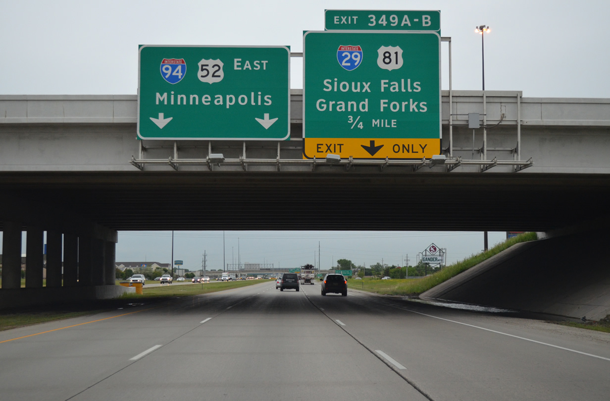
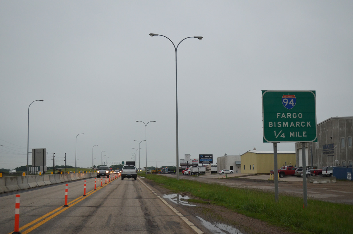
Interstate 94 & U.S. 52 approach the cloverstack interchange with Interstate 29 & U.S. 81 in Fargo.

What may be the only flyover ramp in North Dakota shuttles motorists from I-29 south onto I-94 east in Fargo. This ramp was constructed in 2003-04.
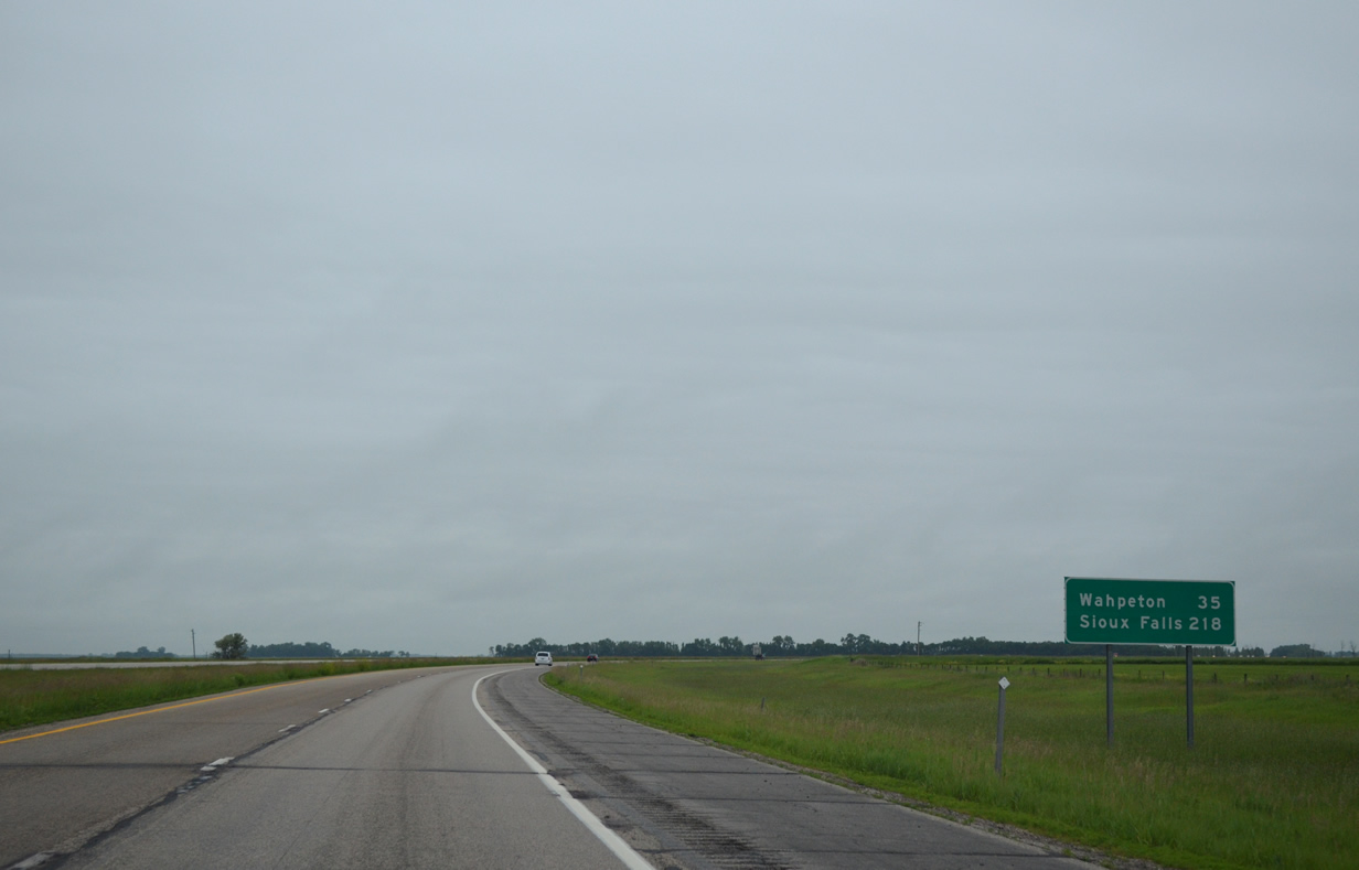
Sioux Falls debuts on mileage signs at 218 miles out along Interstate 29 south ahead of the Christine exit.

All signs from Exits 23B/A southward to the South Dakota state line along I-29 use Clearview font.
Once the freeway reaches the Mount Rushmore State, the first in a series of snow closure signs appears.
South Dakota increased the statewide maximum speed limit along Interstate highways from 75 to 80 Miles Per Hour on April 1, 2015. Long sight lines and low traffic counts allow for higher speeds. But those speeds come with a significant reduction in gas mileage, as we pulled into a gas station off U.S. 12 near Summit on just fumes!

Speed Limit 80 sign posted on the I-29 southbound stretch ahead of the Peever interchange (Exit 224).
The friendly staff at the South Dakota welcome center told us that Iowa law enforcement was frequently nabbing motorists who “kept their cruise controls set at 80 MPH” from South Dakota. Not sure where that would be, as I-29 reduces to a photo enforced 65 MPH speed limit through Iowa City due to ongoing construction.

A glimpse of sun along Interstate 29 & U.S. 81 south after the SD 20 interchange. Watertown and Brookings are the main cities between Fargo and Sioux Falls along the freeway.

Now south of Watertown, overcast skies persisted for us along the I-29 southeast swing through Deuel County. This wide open scene preceded the Brant interchange (Exit 157).
The city of Brookings is home to South Dakota State University and a sparsely signed Business Spur for I-29. We departed Interstate 29 at Exit 132 for U.S. 14 (6th Street) west and drove it to Medary Avenue and observed zero shields for the business route. A cursory look on GSV at Main Avenue, the former alignment of U.S. 77 to the south, revealed no signs posted as of 2013 either.
Our listing on the Interstate Business Route Guide, and as corroborated by the Unofficial South Dakota Highways Page, indicates that the Brookings business route for I-29 was previously considered a loop using U.S. 14, old U.S. 77 and 217th Street back to I-29 at Exit 127. Guide signs however posted in both directions at Exit 127 omit business route markers.

Business Spur I-29 is acknowledged on both guide signs along I-29 south for the U.S. 14 exit in Brookings. Shields are not posted on the respective off-ramps however.
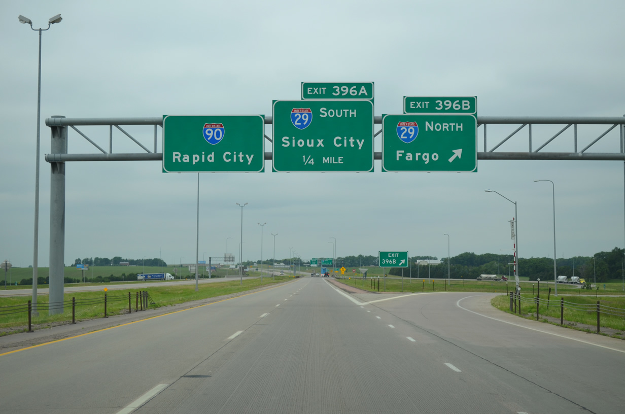
Interstates 90 and 29 come together presently at a full cloverleaf interchange northwest of Sioux Falls.
Long range plans call for an upgrade to this exchange, with construction of a cloverstack as one of the possibilities.
Just west of I-29 along I-90, a new folded diamond interchange was constructed to service expansion of the Sioux Falls area along Marion Road and South Dakota 38 (60th Street North). The new exit included the addition of an auxiliary lane in each direction between Marion Road and I-29. The interchange opened on November 20, 2010.
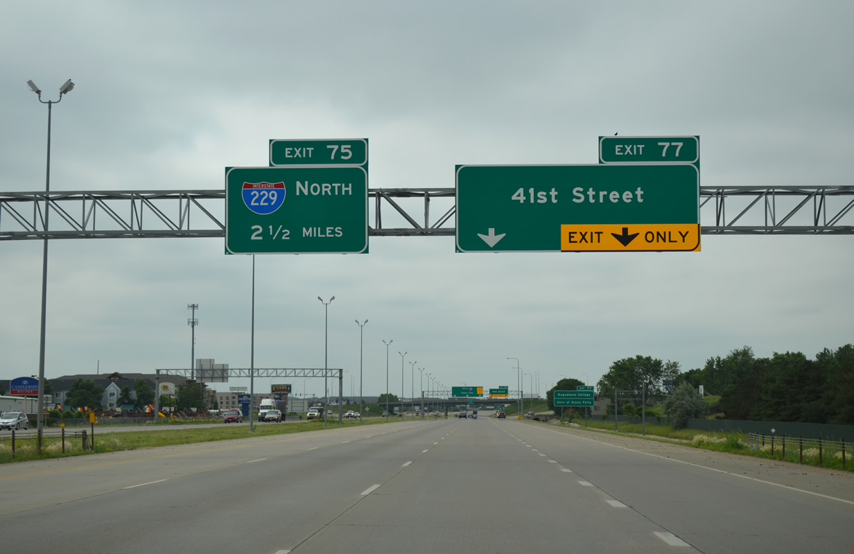
Interstate 29 transitions into an urban freeway south of I-90 through the west side of Sioux Falls. The addition of auxiliary lanes, such as here ahead of Exit 77, expands the freeway to as much as eight lanes in width.
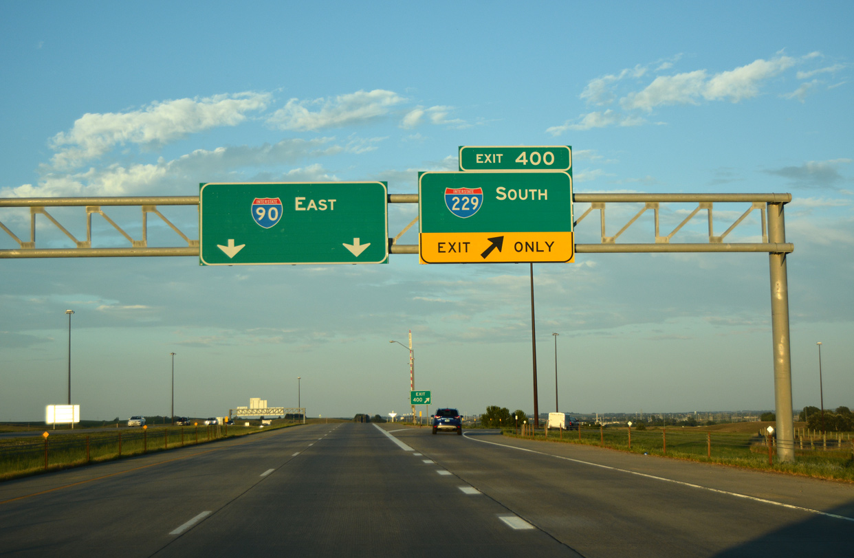
Construction underway at the trumpet interchange between Interstates 29 and 229 includes the addition of auxiliary lanes for I-29 between the Tea Interchange (Exit 73) and a point north of 57th Street. Additional elements to the work replace the I-29 overpasses above I-229 and smooth the curvature of the loop ramp from I-29 south (Exit 75) to I-229 north. Associated work through 2016 adds an overpass for 85th Street across I-29 to the south of I-229.
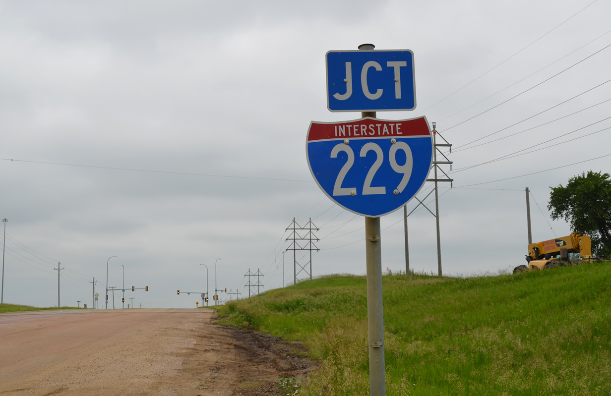
The last known state-named shield for Interstate 229 in South Dakota, previously posted along Benson Road west, bit the dust by 2011. This is the replacement.
Some sign changes were made at the north end of Interstate 229 by 2011. Bridge mounted signs at the East 60th Street overpass were removed and a new sign bridge installed in their place. The new panels acknowledge Minnehaha County 125 for the first time. CR 125 stems north from the freeway end toward the community of Renner.
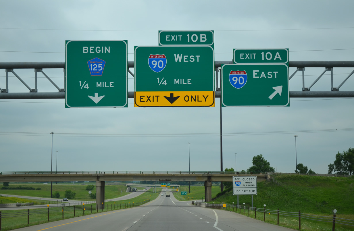
Interstate 229 approaches the half-cloverleaf interchange with I-90 and CR 125.
Adjacent work finished by November 2013 along I-90 reconfigured the diamond interchange with Cliff Avenue (SD 115) into a single point urban interchange (SPUI). This included the addition of auxiliary lanes between SD 115 and I-229, which resulted in sign changes at Exit 400 as well.
Traveling south through the city, Business Spur I-90 (sometimes signed as Downtown Spur) couples with South Dakota 115 along a dog-leg route on Cliff Avenue, Benson Road and Minnesota Avenue to the city center. The routes are locally maintained and as such, are not signed consistently.
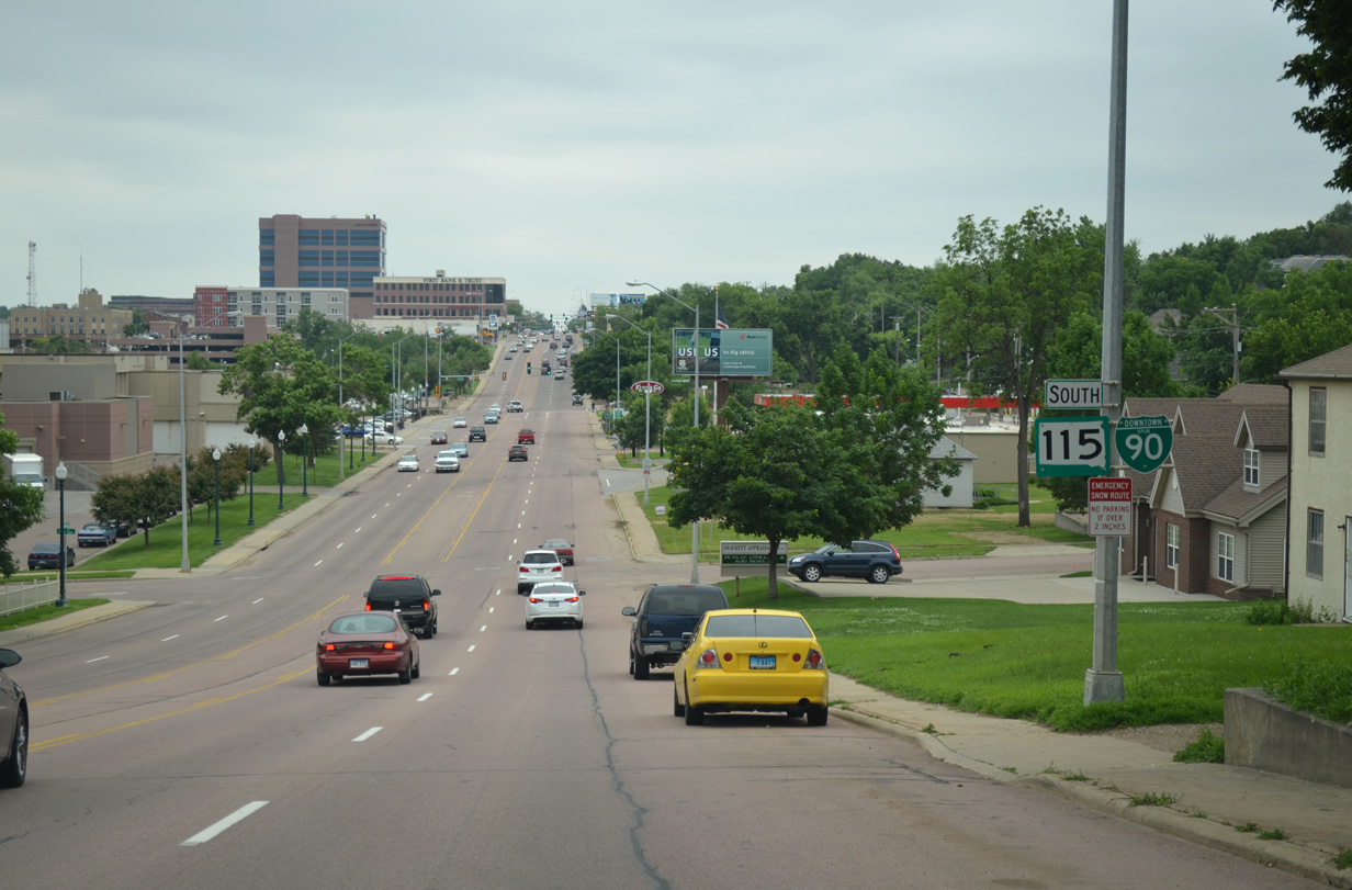
A reassurance shield assembly for Downtown Spur I-90 & South Dakota 115 appears along Minnesota Avenue at 3rd Street.
The Business routes for I-29 and I-229 are also locally maintained, as is South Dakota 42. This aspect may lead to all eventually being dropped altogether, as some signs for SD-42 are now affixed with TO banners and sign postings for SD 115 are now fairly consistent.

An end shield appears along Minnesota Avenue southbound at the diamond interchange with Interstate 229. Very few 3di-Interstates have business routes. I-196 in Michigan and I-376 in Pennsylvania are two others with business routes.
Unlike the Business Spur for I-29 at Brookings, the Business Loop at Elk Point is well signed. The 2.7-mile route overlays former U.S. 77 through the small city.

Approaching the business district of Elk Point along Business Loop I-29 (Main Street) south. Elk Point doubles as a bedroom community for Sioux City, Iowa.
A 11-year long improvement project is midway through completion along Interstate 29 through Sioux City, Iowa. Construction constitutes expanding the freeway to six overall lanes and modernizing a number of interchanges. Outside of resurfacing projects in 1970 and 2002, the 1961-built freeway has remained in its original form.
The bulk of the work remaining pertains to Segment 2 through the Downtown vicinity. Construction redesigns the diamond interchange at Hamilton Boulevard (Exit 149) and consolidates Exits 147B/A into a split-diamond interchange with Virginia Street and Floyd Boulevard.

Concrete barriers shunt all southbound traffic into a single lane over the northbound lanes as a new carriageway is built adjacent to the Missouri River.
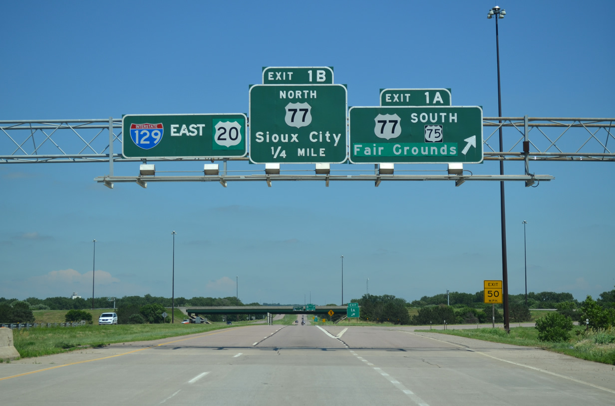
Segment 1 focuses on I-29 south through the interchanges with Interstate 129 & U.S. 20-U.S. 75 and Singing Hills Boulevard. Work is nearing completion.

As part of the I-29 Improvement Project, new signs were erected for I-129. These eliminated all but one of the old text based “I-129” signs that we wrote about in 2007.
The same resigning along I-29 at I-129 included some changes on Interstate 129 and U.S. 20 & 75. Gone now is the former end shield, which was the only stand alone shield for I-129 posted in Iowa.
Shifting to the Nebraska side of the Missouri River, some signs for I-129 date back to the original construction of the freeway, complete with button copy lettering on non-reflective backgrounds.
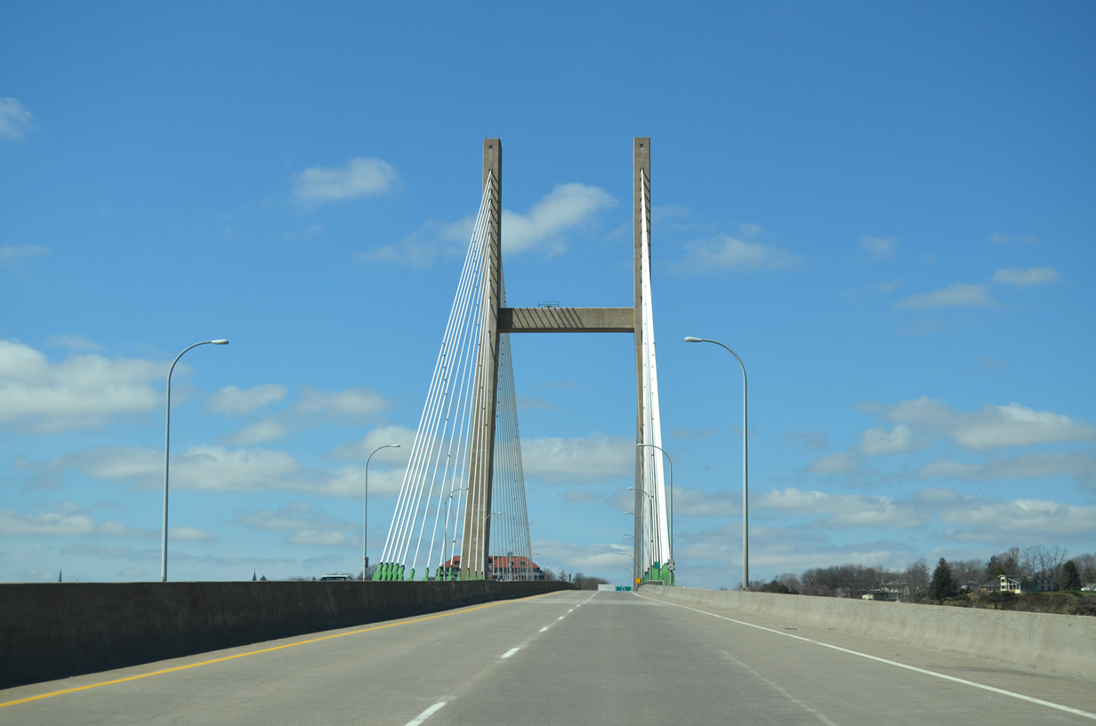
We spurred west along Iowa 175 from I-29 near Onawa to Decatur, Nebraska. Crossing the Missouri River along the route is the 1955-opened Burt County Missouri River Bridge, a continuous truss span connecting IA 175 with Nebraska 51. The two-lane span was tolled at a rate of $1.00 for passenger cars until December 1, 2013. During that time, bridge maintenance was turned over from the Burt County Bridge Commission to the states of Iowa and Nebraska.

Approaching the shuttered toll booth for the Burt County Missouri River Bridge along Nebraska 51 (Broadway) east.
The booth was slated for demolition, but plans are in the works to relocate and preserve it.
Interstate 680 spurs from I-29 across a series of hills rising east of the Missouri River flood plain. The route is part of an Iowa Byway.
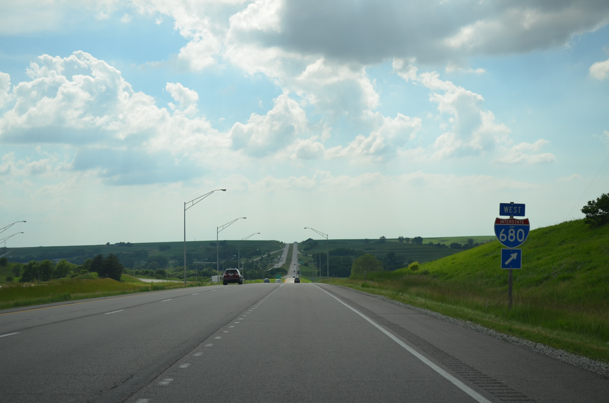
Interstate 680 bee lines west from a tri-level stack interchange (Exit 21) with I-80 to I-29 at Loveland.
I-680 was numbered as I-80N until 1973. It forms part of a northern bypass of Council Bluffs and Omaha.
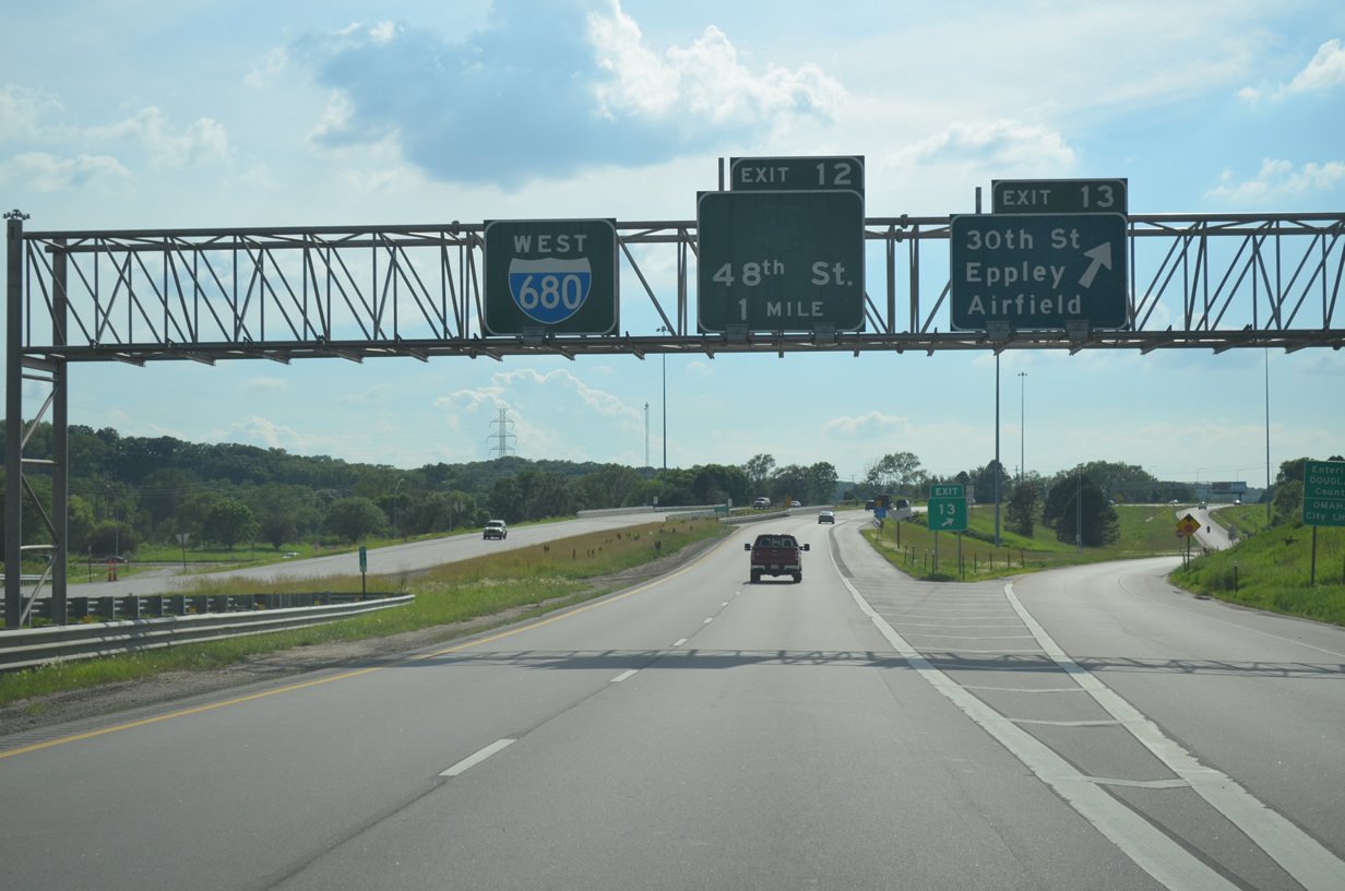
Crossing into Nebraska, Interstate 680 sees a number of non-reflective guide signs still in use.
We concluded our drive on Day 5 visiting our friend Matt in Omaha. Matt has been a long time supporter of AARoads, once hosting a portion of the site on his TWC Classics web site, and at other times offering invaluable assistance to scripting the PHP code for our highway guides.
Day 6 takes us around Omaha/Council Bluffs and south to St. Joseph and Kansas City.


