
Photos from Kansas, Colorado, and Oklahoma (and the single point in which they intersect) from September, 2009 – and some New Mexico, and a really, really small quantity of Texas.
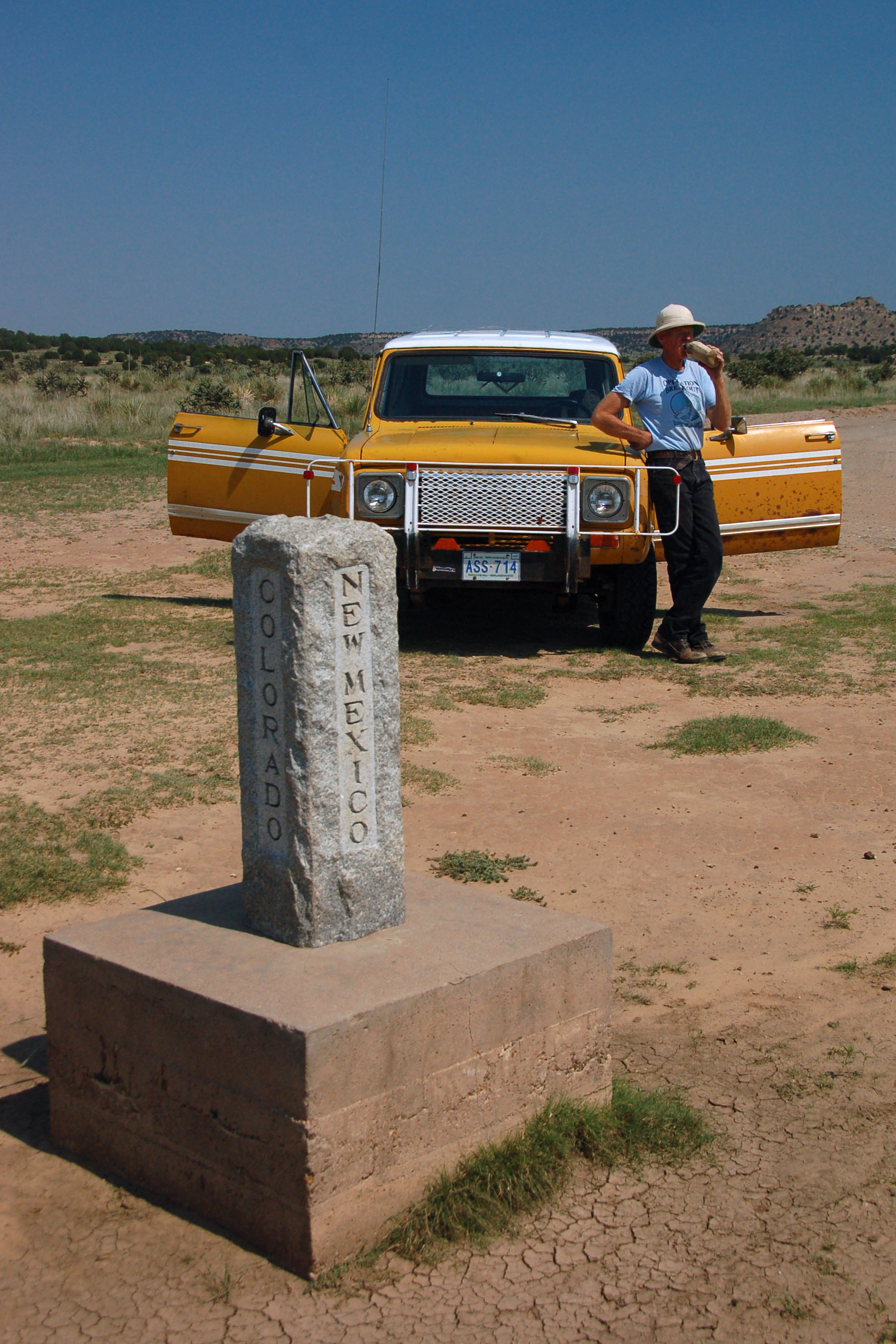
This is the New Mexico/Colorado/Oklahoma triple point. Dale takes this opportunity to breathe some refreshing Oklahoma air, and drink some water he has brought with him from New Mexico – and park in two states at the same time.
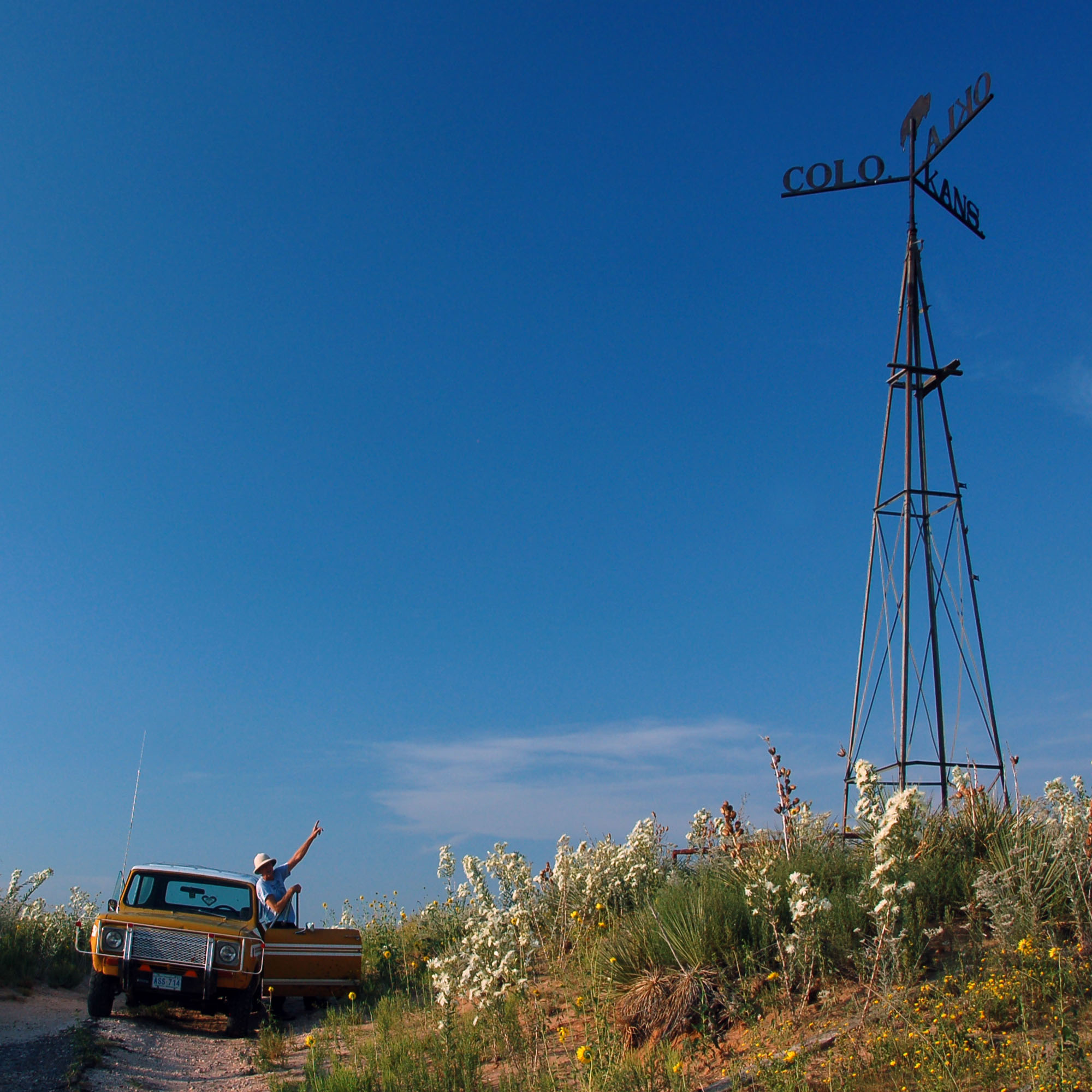
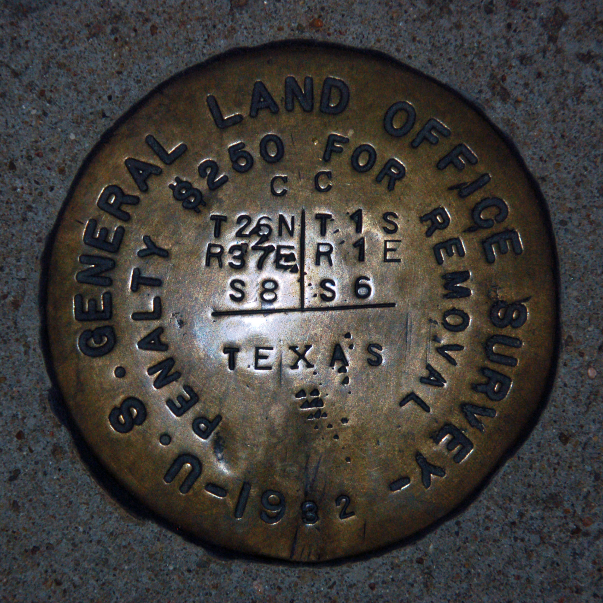
Dale parks the car squarely in a single state, and looks up at the Kansas/Colorado/Oklahoma marker that is visible from miles away – a good thing, because the dirt roads that one takes to get to it are somewhat labyrinthine.

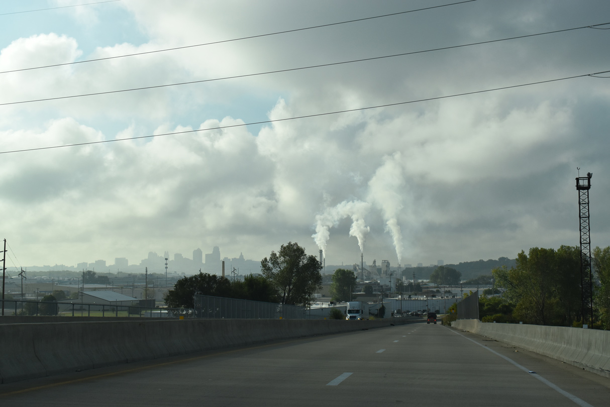
The Oklahoma panhandle is known for the occasional thunderstorm.
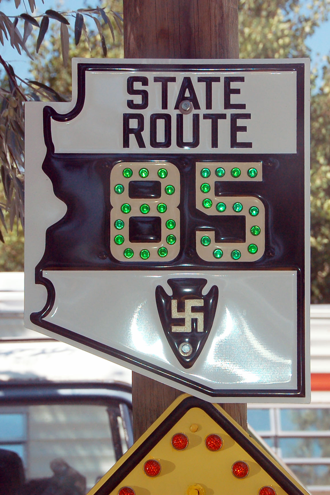
One of Dale’s excellent Arizona state route 85 signs. That is a Navajo good-luck symbol – pay no attention to what they were doing with it in Europe a couple years after this sign style debuted in 1927. (And yes, you can have one of your own!)

That is one heavily loaded bee.

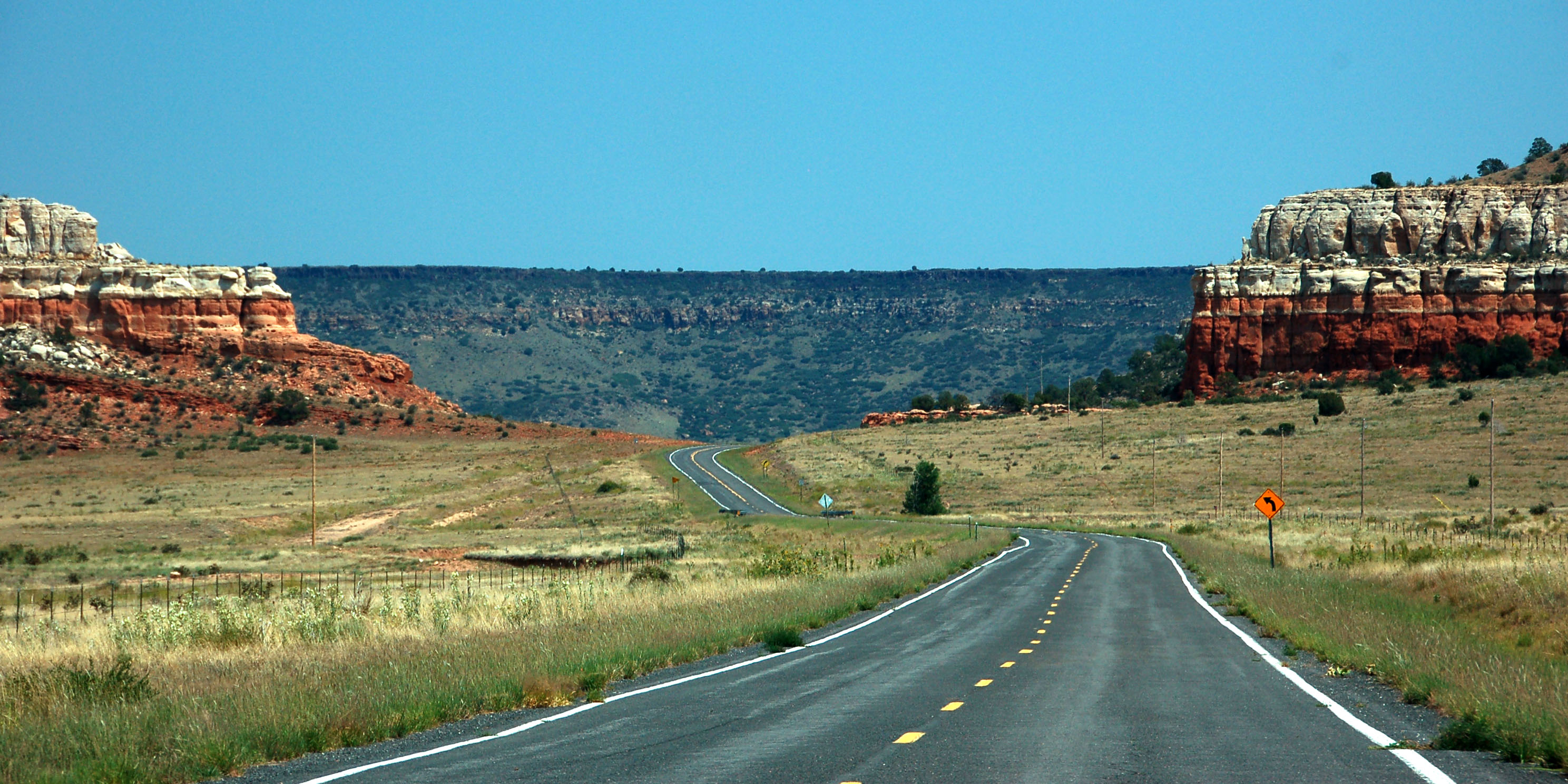
Old US-64 heads east towards Oklahoma. Several sections of 64 have been reduced to dirt road, including two several-mile ones that sandwich a seemingly random 100 foot long paved segment.

The area is filled with strange, demented beasts. Actually, this one is cute. Wait, what I am saying – oh no, the savage carnivores have eaten my brain!
Here, the road is paved – and there are no terrifying creatures to be seen anywhere.

Welcome to Cleaver Country.
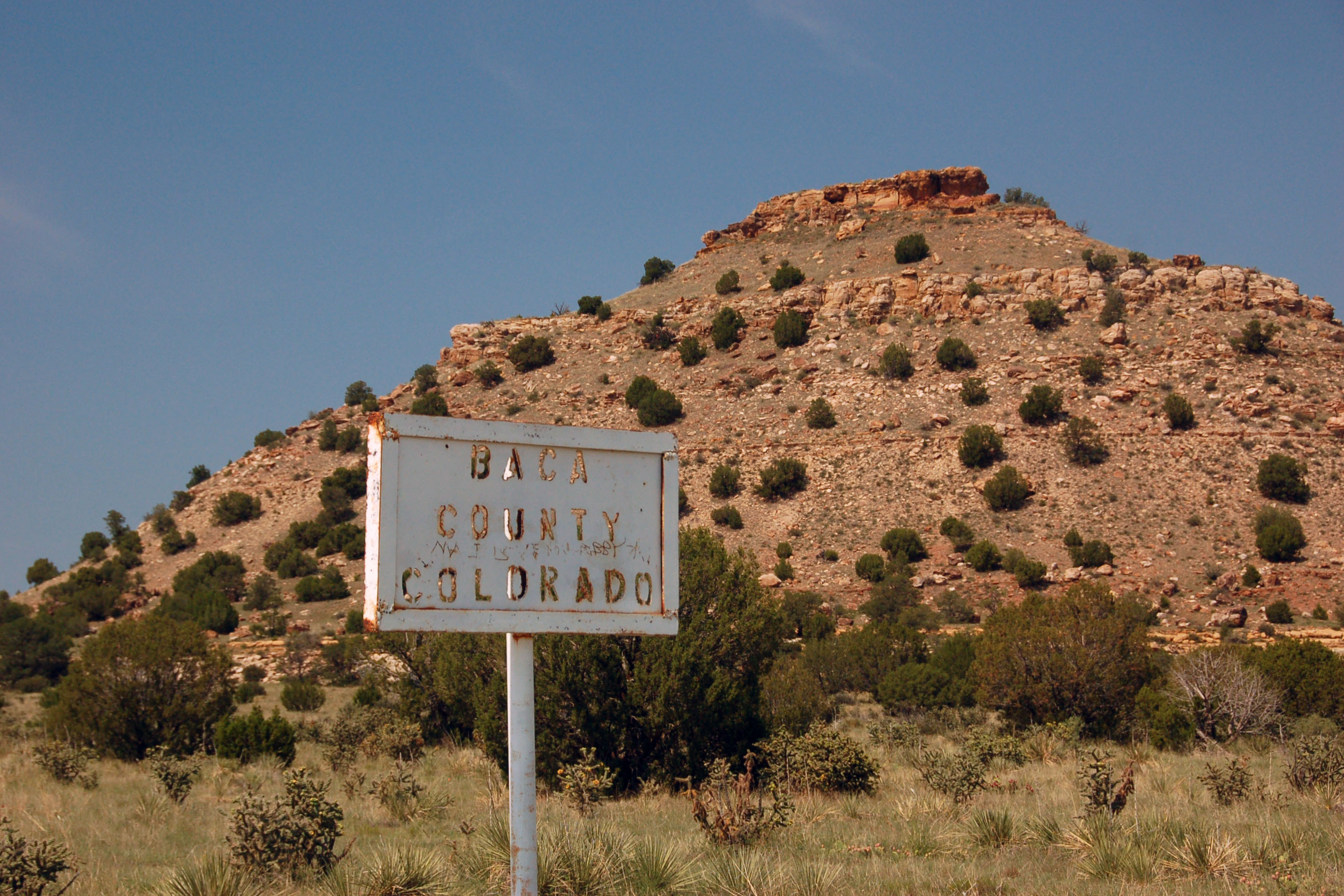
This sign, several feet from the triple-point marker, may very well go back to the 1910s. It has the individual letters cut out of the steel with a blowtorch.
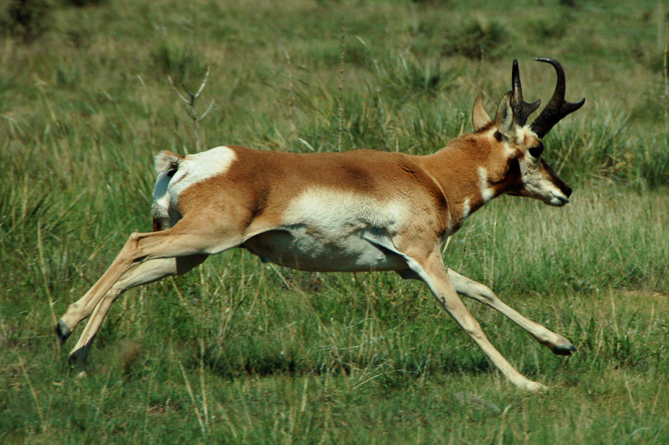
We rustle up an antelope.
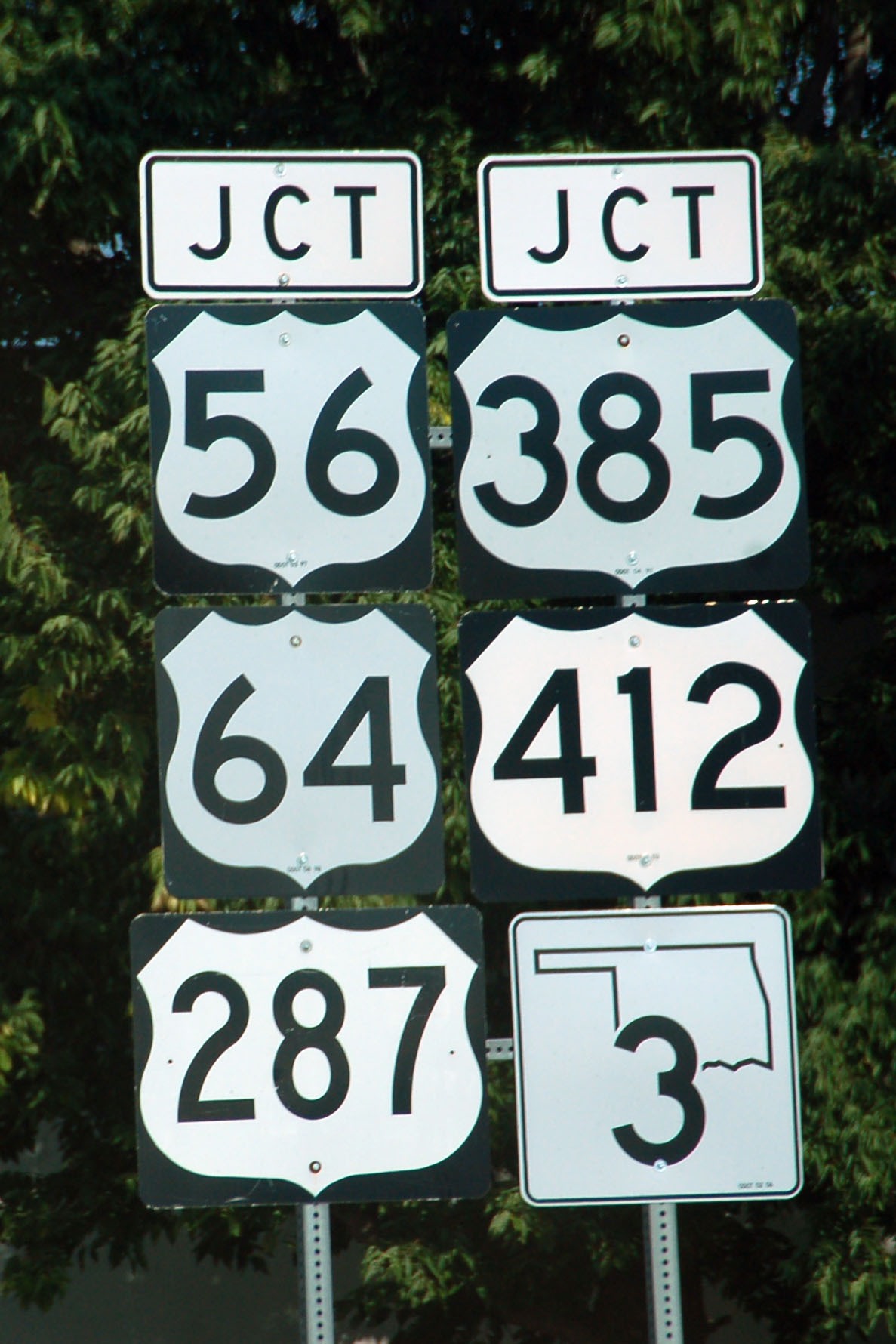
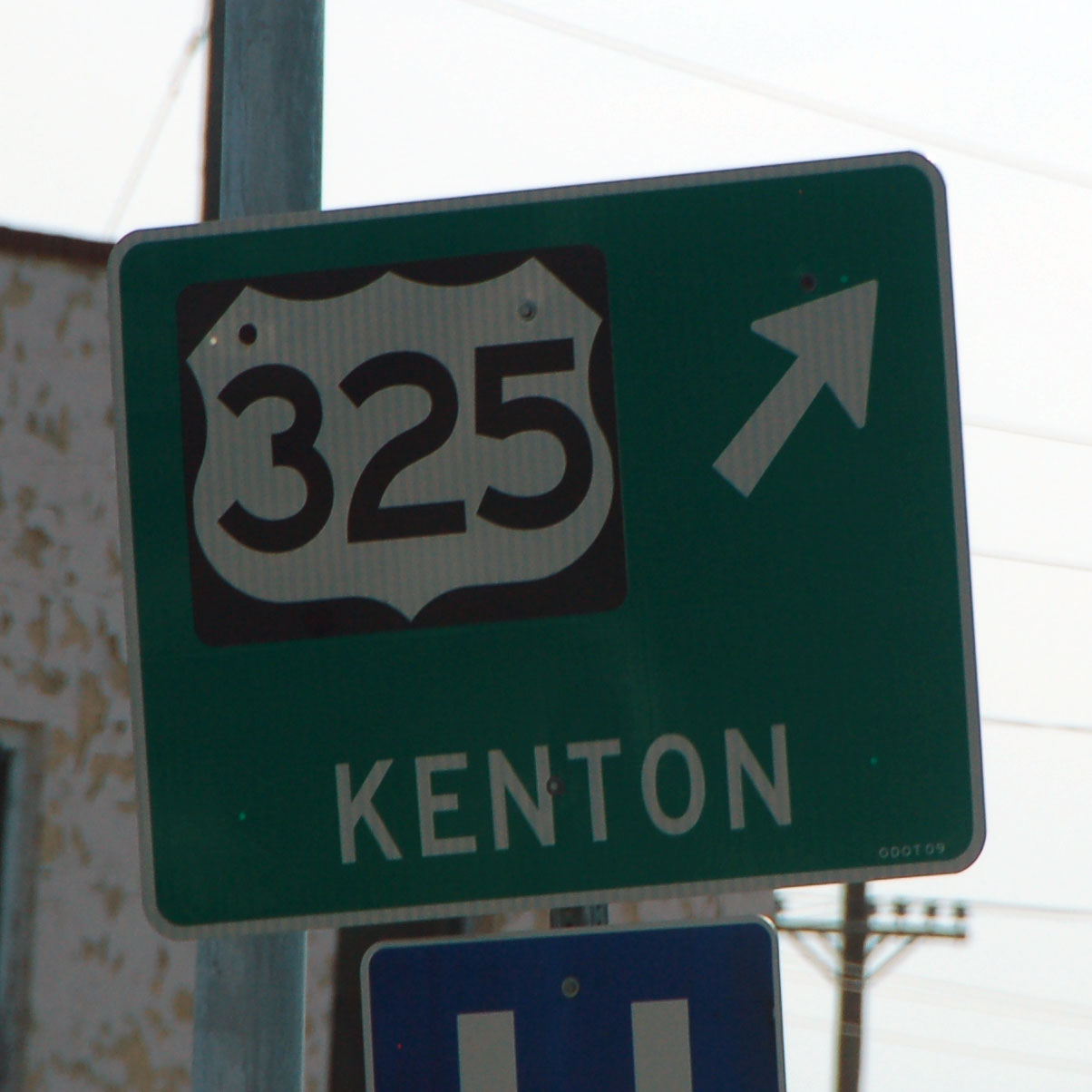
We arrive in Boise City, home of this six-way (!) multiplex. And yes, the routes are multiplexed, and not just intersecting – all the way around the traffic circle surrounding the courthouse, you are on all six routes in one direction or the other. Too bad 325 doesn’t continue because, hey, that would be a seven-way multiplex.
Oops. Yes, it was once a U. S. route, but not quite with that number.

This is indeed a white guide sign. And it is brand new. It replaces a … different white guide sign that is from 2006. The entire roundabout is filled with white guide signs.

There is one green sign – located on the inside of the circle.

The Santa Fe Trail was divided into many branches, with the hope that at least one was serviceable during any weather event. This is the Cimarron River branch, and follows US-56.

The foreground flower is in Oklahoma. The background ones are in Kansas.

Dale is in precisely one state here: Colorado. He never quite made it directly under the marker.

Will we get caught in a thunderstorm at sunset? (Nope, we miss it by a few miles.)
This all that’s been placed to note the triple point between New Mexico, Oklahoma, and Texas. Texas gets identified by name – the other two are only plots of land.
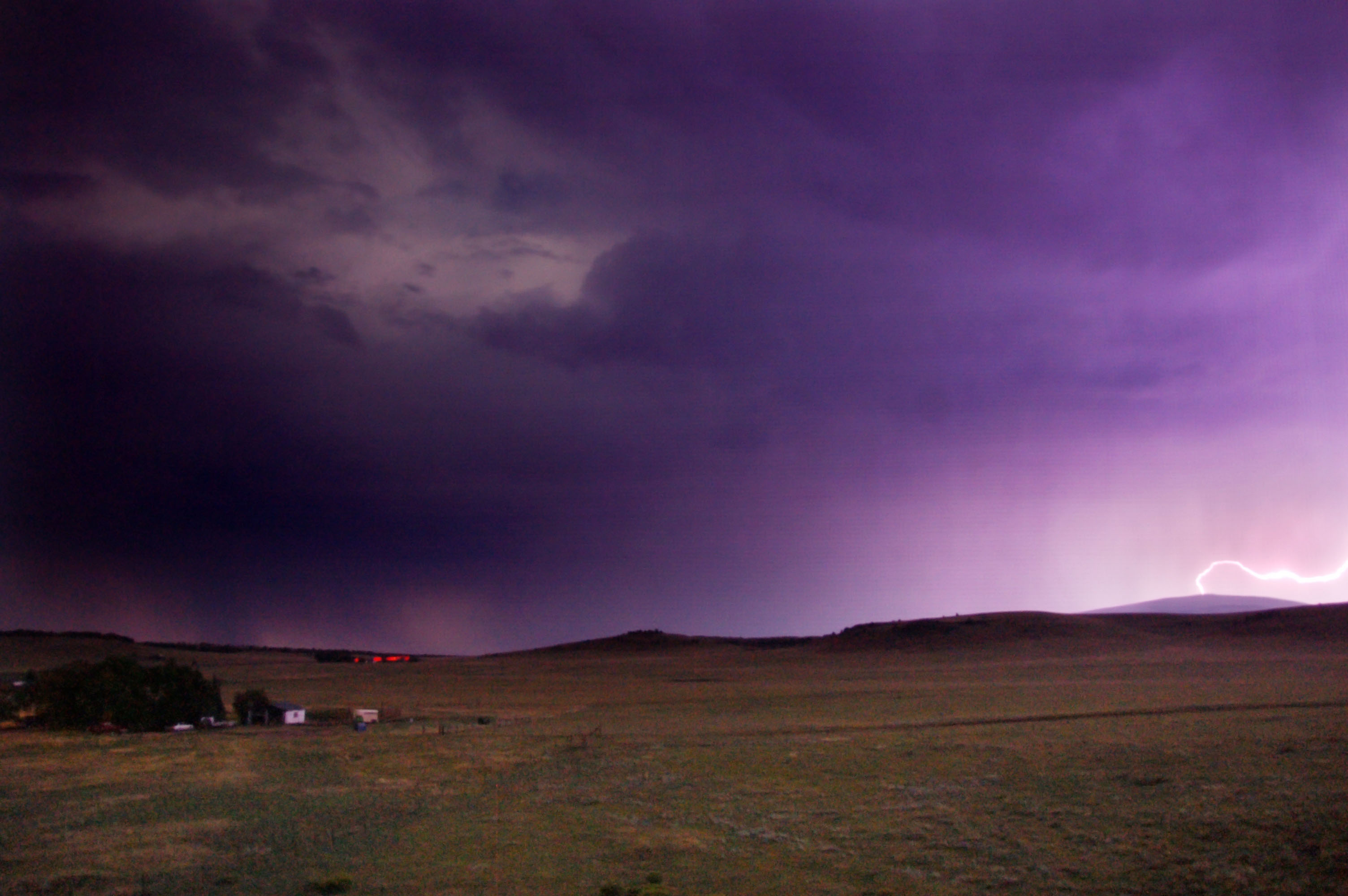
Finally, we arrive at home… and so does the lightning. Here it is striking one of the television towers on top of Sierra Grande – this was before I realized that in order to attempt to catch a lightning bolt, I should aim the camera at the highest point of land between here and … Mount Kilimanjaro. (Seriously, in that general direction, that is the next point that is higher.)


Nice!
Dale & Beverly, what great adventures you two have, someday we’ll have to meet in the middle and head off on one together. Take care.
Dale, I love ya like a brother, but Beverly has to be a saint ta put up with ya! LOL
Cool trip!
thanks everyone :) it was Dale, Dan and I on this trip – Beverley stayed home and stayed sane!
I love the pictures of the triple points! Do you know if there is a list anywhere of which triple points have markers and which don’t?
The only one I’ve been to myself is MO/IL/KY. The actual triple point is of course underwater – IL has a little park but I didn’t notice any marker of any sort.
I pass within a few miles of IN/OH/MI every couple years and have always been tempted to go check it out, but it’s generally night time and/or snowy and/or there’s a non-road-geek in the car.
I’m also near IN/OH/KY every so often but it’s also in a river, and there’s not really much in the way of road access. Plus there’s a nuclear plant right there, so I’ve not exactly been inclined to go snooping around.
hmm, I have no idea if there is such a list.
I love to travel.
I also love thunderstorms
I’ve been to Four Corners and was disappointed. 3 Corners looks like better views, no waiting lines and you don’t have to pay the natives to park!
What a long strange trip its been…. Dale will you be my tour guide on one of your awesome adventures???!!! Thank you for sharing…. LOVE IT!!!!!!!!
Great pictures!! I wasnt aware of that triple pt monument, I have to check that out soon.
I’m getting ready to do the Oklahoma panhandle trip to Kenton for the first time and these pix really gave me a good idea of what to expect. Great pix! thanks!
Have you attempted Madrid Bend, KY…the only totally land-detached part of any state? Look on the Kentucky map way, WAY west on the Mississippi River. That little loop of land surrounded by the state of Missouri is actually part of Kentucky, as noted. It’s at the western end of the properly-surveyed Purchase Region KY-TN border. From the Tennessee River east, a surveyor’s error in 1790 while preparing Kentucky’s statehood borders (1792) gave North Carolina (parent of Tennessee) about 1,250 square miles of what should have been Kentucky land…that’s why the TN-KY border is not straight.