
Started the day in west Omaha on U.S. 275 and U.S. 6 (West Dodge Road) and quickly departed for Minneapolis by way of Sioux City, Sioux Falls, Worthington, Albert Lea, and Faribault to the Twin Cities.
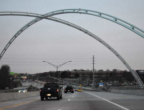
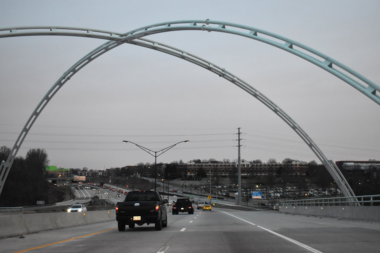
As written about in a previous post, the West Dodge Road freeway is now wholly complete between U.S. 275 and Interstate 680. The final portion of this project are the twin viaducts carrying U.S. 6 high above the original West Dodge Road between 132nd Street and Interstate 680. The elevated roadways are dubbed the U.S. 6 Express Lanes while the original West Dodge Road continues below as an at-grade facility, serving movements to 120th Street, 114th Street, and the Old Mill area.
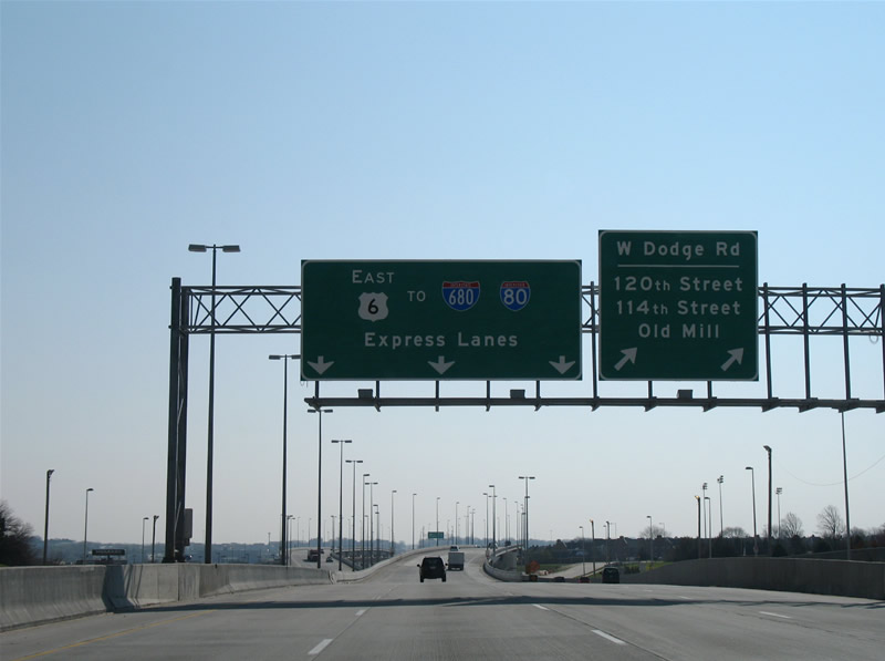
U.S. 6 splits with West Dodge Road for a pair of six-lane viaducts west of the 120th Street intersection. Before construction of the elevated roadways, West Dodge Road met 120th Street at a diamond interchange. That interchange was removed and replaced with an at-grade intersection.
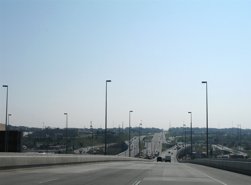
Soaring above West Dodge Road within the vicinity of Old Mill. A folded-diamond interchange remains in use between the original West Dodge Road below and 108th Street. U.S. 6 travels uninterrupted above into the directional-cloverleaf interchange with Interstate 680. U.S. 6 transitions back into a surface arterial east of the Westroads Mall interchange.
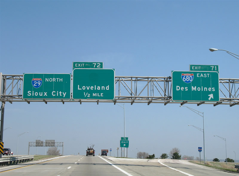
Interstate 29 and 680 join for ten miles between Crescent and Loveland in western Iowa.
Interstate 680 provides a more direct route to north Omaha from Iowa and points east. The route was originally planned as Interstate 280 and 80N. Since there was already an Interstate 280 at Quad Cities, Interstate 280 later became Interstate 680. Exit 72 serves a decommissioned Iowa state highway. The state of Iowa decommissioned a series of state highways in 2003. For the list, see Jason Hancock’s Iowa Highways Page.
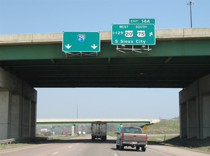
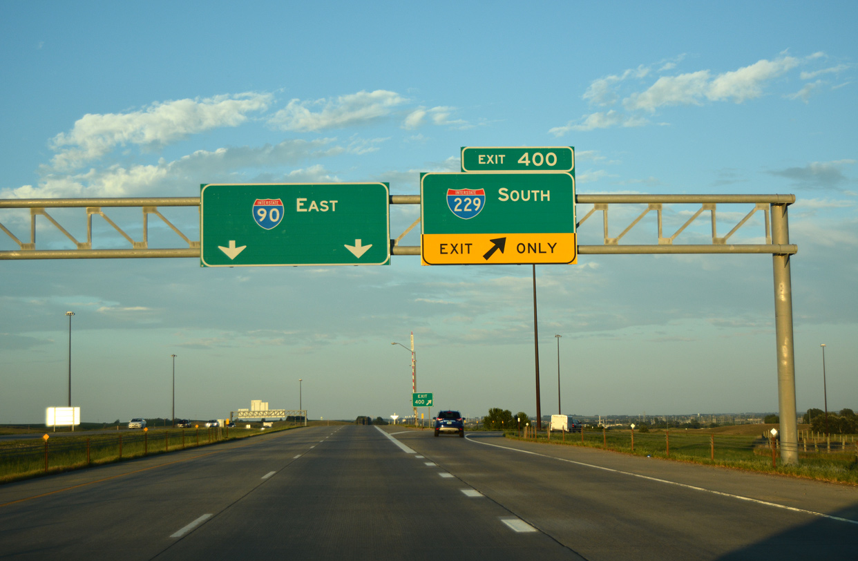
All signs along Interstate 29 northbound still display “I-129” in text at the Exit 144 interchange with Interstate 129, U.S. 20, and U.S. 75.
Interstate 129 forms a short Interstate highway leading west from I-29 to the U.S. 75 merge with U.S. 77 in South Sioux City, Nebraska. Signs along I-29 southbound properly display Interstate 129 shields. The only other instance that we can recollect where and Interstate is written out in text was at the Interstate 26 eastbound split with Interstate 126 in Columbia, South Carolina.
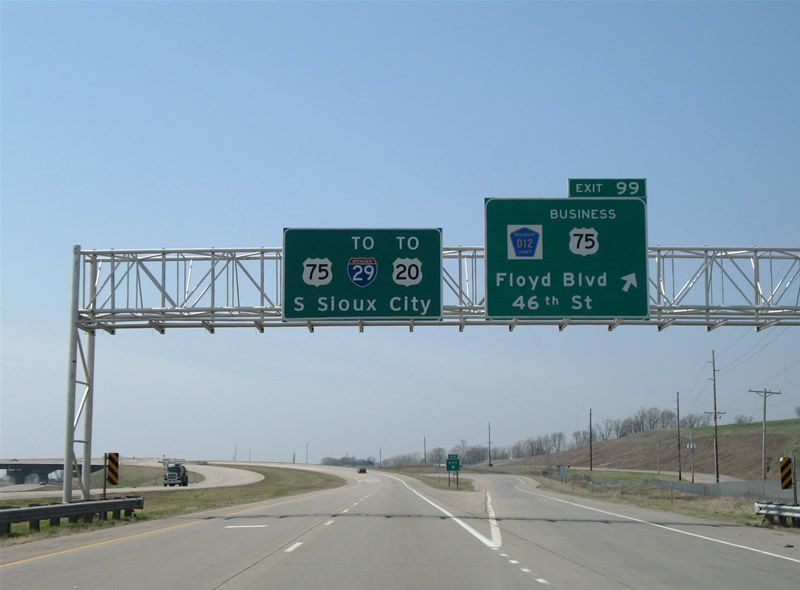
U.S. 75 southbound leaves its original alignment at Sioux City for a freeway bypass to the east and south. Pictured here is the southbound beginning of the freeway and split with U.S. 75 Business at Exit 99.
Despite what may just be rumors of a Sioux City beltway (also referred to in the roadgeek circles as Interstate 429), no provisions could be found at the north end of the U.S. 75 freeway for a westward extension to Interstate 29 in South Dakota. Instead U.S. 75, and later U.S. 20, travel a rural to suburban freeway over rolling hills east of the city, meeting Interstate 29 at Interstate 129 opposite the Missouri River. U.S. 20 follows the freeway and overtakes the exit numbering convention from Gordon Drive (Exit 4) southwest to Nebraska.
Further north at Sioux Falls, South Dakota, Interstates 29 and 90 converge with Interstate 229 providing an urban loop east of downtown. All three freeways have Business routes into the urban core, but what is different about these than others, is that they are mostly are signed as “Downtown Loop” and “Downtown Spur”.
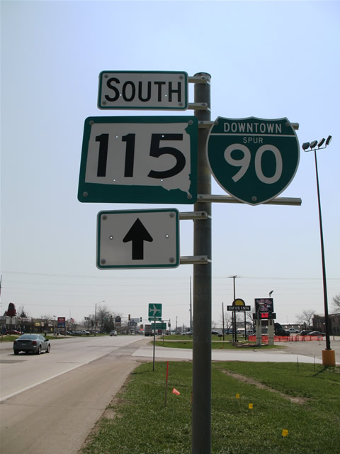
Pictured here is the southbound beginning of Downtown Spur I-90 and its cosigning with South Dakota 115. The Business route follows Cliff Avenue southward from Interstate 90 Exit 399 to 10th Street (Downtown Loop I-229 & South Dakota 42).
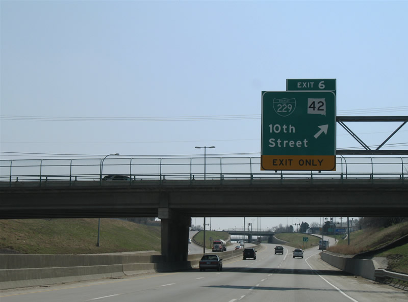
Interstate 229 drops below grade on the approach to Exit 6 with Business Spur I-229 & South Dakota 42. The loop serves interests to downtown from its business loop and commuting interests to Interstate 29 and 90.
South Dakota DOT is studying the concept of constructing a second loop for the Sioux Falls area further east and south than Interstate 229. Dubbed South Dakota 100 or the Sioux Falls Eastside Corridor, the expressway would travel east from Interstate 29 near Tea (Exit 73), curve northeast to South Dakota 11 at 57th Street, and than northward to Interstate 90 at Exit 402. The project web site touts the road as a limited access highway, but in fact only two of the intersections are planned as full interchanges along the highway. A SPUI is planned at the Benson Road extension south of Interstate 90, and SPUI’s may or may not be used at both Interstate 90 and 57th Street. If a SPUI is not built at 57th Street, than a folded-diamond interchange will be used instead.
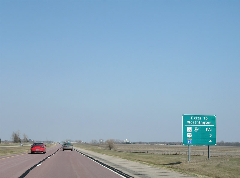
Hitting a few towns along the way such as Worthington, Jackson, and Fairmont, Interstate 90 travels through farm country throughout southwest Minnesota.
The first of three Minnesota Business Loops departs Interstate 90 at Worthington. Following Nobles County 25 (Diagonal Road), Business Loop I-90 travels south into town between Exits 42 and 45, roughly following the original routing of U.S. 16. Minnesota sometimes signs their county highways with white boxes and black text and other times with purple pentagons with white text. A few exceptions occur in the Minneapolis area where standard pentagons with yellow text are used. North Dakota borrows the white box concept along exit signs on Interstate 29 as well.

Older signs still grace the sign bridges along Interstate 90 at Interstate 35 near Albert Lea. The two interstates join one another at a full-cloverleaf northeast of town.
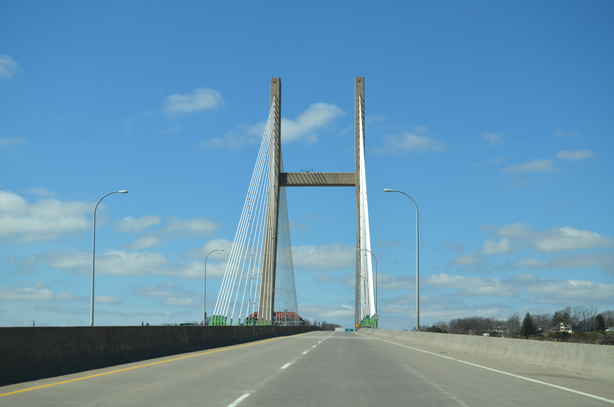
A short distance to the south are the ends of U.S. 65 and U.S. 69 at Albert Lea. The otherwise rural junction of the freeways lies 80 miles south of the Twin Cities metro area, an area I’ll cover extensively in the next series of posts.


Regarding county route markers on guide signs, MnDOT standard for county route pentagon shields is a dark blue pentagon (it may look “purple”, but it’s actually blue) with yellow border/text and white numerals. Any shields you saw that had yellow numerals instead of white were either error shields or older shields from over a decade ago.
Also, I’ve never seen the “white box concept” in North Dakota. Every ND guide sign I’ve seen that includes a county route used the blue pentagon.
Signs for Exit 15 and 2 along Interstate 29 southbound both featured white box shields with “COUNTY” written in them.
I know this blog entry is 4 years old, but I noticed a mistake. “North Dakota 42” should actually be “South Dakota 42”. :)
Indeed! We have corrected this now, thanks.
Albert Lea! Boy, do I remember that place and the overhead green sign. That was in my rearview mirror on December 18, 2003: Dad and I (I was at the wheel) were driving in an S10 from Chicago to Seattle, headed west: we crossed under the Highway 92 overpass and a very heavy south wind caught the truck, spun us completely around on black ice (broad daylight, mostly-clear skies) and we sped backwards off the right shoulder and into a snowdrift pile. No damage to truck, no harm to us, but we were stuck.
I got out a few seconds later to inspect the truck and try to track an escape path when a full semi hit the ice we just hit…and both tractor and load began skidding towards us! I swan-dived into the snowdrift, Dad hit the bench seat flat…the driver regained control and continued. I could’ve driven the S10 out, but Dad insisted on AAA towing.
During the call, a sheriff pulled over to us, checked all and we explained the situation: he helped the AAA get us out and closed down the freeway. We got to AL, bought Bridgestone Blizzaks for the back (at a Goodyear, no less!), 480 pounds of tube-sand at Home Depot and kept going. Not a bad place, even in winter.